evanescent: fleeting, transitory
evanescent wave: a nearfield standing wave, employed for total internal reflection microscopy
For faster browsing, click on the underlined text legend below any of the thumbnail images in the galleries. Use your browser BACK button to return you to the gallery. If you find a picture you like, you can download the image at full original resolution (usually between 10-30 Mpixels; with some panoramas >100 Mpix) by clicking on the thumbnail itself. To save a downloaded image, right click on it and scroll to 'save picture as...'. To use an image as your desktop background, right click and scroll to 'set as background...'.
Visitors are welcome to download images for personal use (e.g. as computer desktop wallpaper). Click HERE to order prints online. Please contact Ian Parker at evanescentlightphotography@gmail.com regarding possible commercial use. Details of copyright, image use and licensing are HERE. |
|
EditRegion3
| |
Click HERE for updates of photos of the UCI
May 23-28 : A visit to Northern California
The Painted Dunes lie below the Cinder Cone. They were formed as the result of falling volcanic ash from the cone that became oxidized to create the colors by falling on the lava flows when they were still hot.
The water level in Shasta Lake was 120 ft below full pool. leaving a wide and deep 'bathtub ring'. Rather ugly in situ, but panoramas abstracting specific sections made for some nice colors and patterns.
May 13-16 : A new location in Arizona and lunar eclipse at Mono Lake
An overnight stop at the Alabama Hills
Mining area near Silver Peak, Nevada
Random flora in the Nevada desert
Emigrant Peak volcanic area, Nevada
A scenic gem that seems to have not yet been discovered by
photographers
Coaldale Nevada: A small community and gas station on highway 6, now a ghost town
Wild horses along highway 6 in Nevada
Benton Hot Springs on highway 120 over the mountains to Mono Lake
Mono Lake - At the South tufa area for the afternoon and lunar eclipse
May 10 : Photos from UCI and Newport Beach - mostly floral
April 30 - May 1 : Badwater Salton Sea Ultramarathon
Click any photo to download a high-resolution image
Links to Race website * results * webcast
|
This remarkable event challenges up to 35 teams of two or three ultrarunners – running together as duos or trios for the duration, NOT in a relay – to tackle an unimaginable traverse of Southern California deserts and mountains. The route covers 81 miles (130km) non-stop from below sea level at the shoreline of the Salton Sea, across, up, and over Anza-Borrego Desert State Park, to the top of Palomar Mountain with a dramatic view of the Pacific Ocean.
|

Ocotillo sunset before the race start
A line-up of four planets (jupiter, venus, mars, saturn) above Salton City
Jupiter and Venus reflected in the Salton Sea
Start line - 6:15 am, 226 ft below sea level
Team photos before the start
Start! Runners cross the beach and ascend a dirt ramp
Miles 0 to 5 - Through Salton City
Miles 7-30: Along highway S22 through the Borrego desert and past the microwave tower. Altitude 510 ft.
Mile 34: Approaching Borrego Springs
Mile 35.2: Checkpoint #2 at Borrego Springs Resort. Altitude 560 ft.
Miles 32-40: Uphill from the Resort to Hellhole Canyon.
Mile 40.5: Checkpoint 3 and start of California Riding and Hiking Trail. Altitude 750 ft.
Mile 44.5: California Riding and Hiking Trail. Altitude 3565 ft.
Ladder-backed woodpecker along the trail.
Mile 45.5: Sunset at the junction of Culp Valley trail with the Riding and Hiking trail
Mile 63: 5:30 am along by Lake Henshaw. Altitude 2820 ft.
Mile 65: Early morning mist over Lake Henshaw. Altitude 2820 ft.
Mile 71: Viewpoint on the East Grade road overlooking Lake Henshaw. Altitude 3199
Miles 71-81: On the East Grade road climbing Mout Palomar
Mile 81: View from the Lodge on Palomar Mountain. Altitude 5665 ft.
Mile 81: Finish Line. Altitude 5665 ft.
March 24 - 28
A trek with Anne along a section of the Great Alleghenny Passage (GAP trail) from Meyersdale to Connellsville,
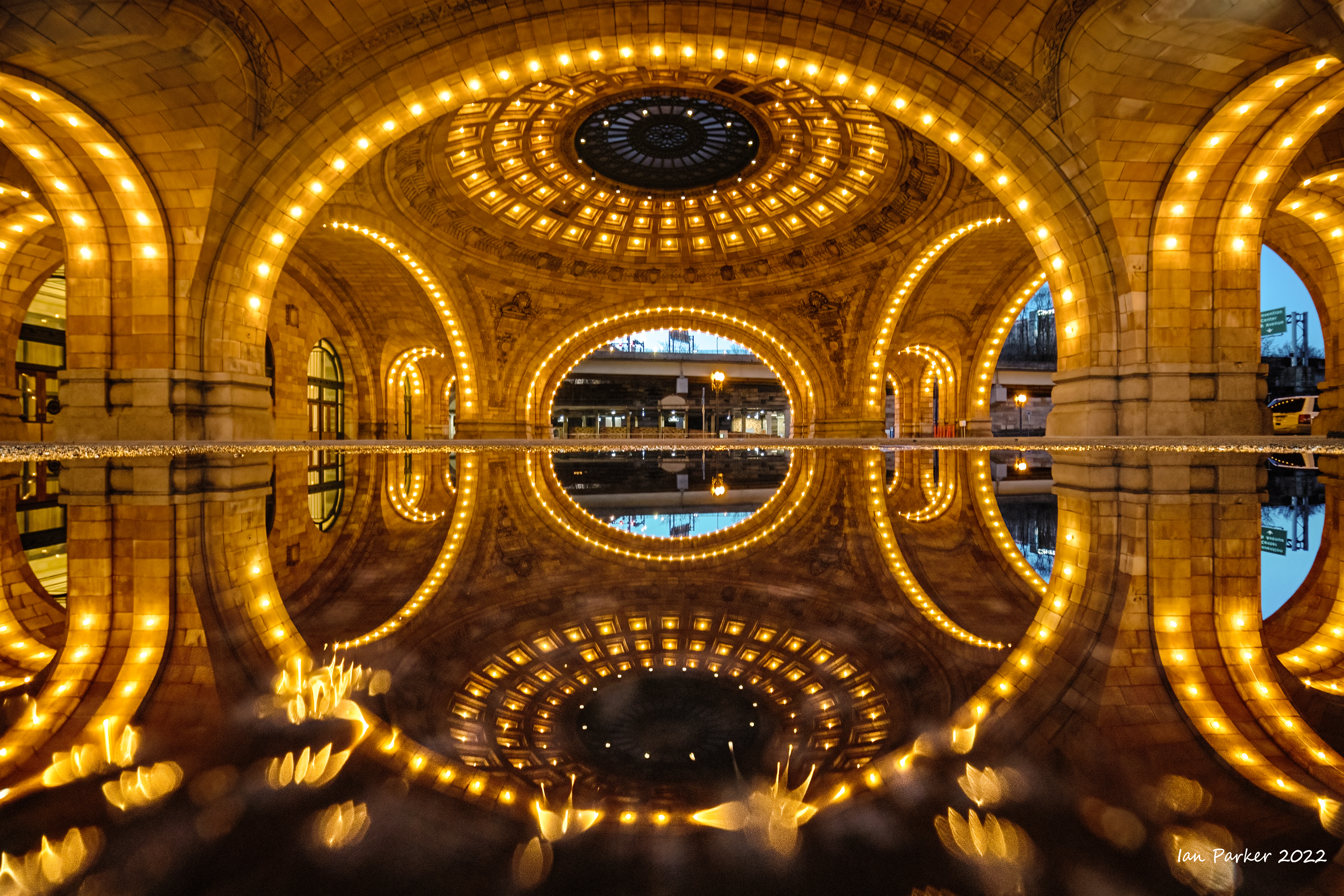
Our journey to the GAP trail began with a flight to Pittsburgh, then an Amtrak train ride to Cumberland from where we would be shuttled -together with a rental bike for Anne - to our starting point at Meyersdale. The train (the Amtrak 'Capitol') was scheduled to leave Pittsburgh at the early hour of 5:30 am; but was announced to be running 4 hours late. Instead of waiting for hours in the austere Amtrak station I took an unexpected opportunity walk with my camera around Pittsburgh.
On the GAP trail from Myersdale to Confluence via Rockwood
Confluence
From Confluence to Ohiopyle in snow
Ohiopyle
Some murals along the GAP trail
March 11-14th
A weekend at the Carrizo Plain - No superbloom this year...
| |
 Target practice on old water tank; Carrizo Plain National Monument
 |
|
March 6th
Birds and cacti in the UCI Ecological Preserve
February 26th
Catching up with miscellaneous photos from and around UCI
February 3-5
KOFA Wildlife Refuge, Arizona
February 2nd
Bombay Beach
On the shores of the Salton Sea, the near-ghost town of Bombay Beach hosts a fascinating collection of art and sculpture that suspends all preconceptions of what a small town is or should be. Bombay Beach Arts & Culture have organized the transformation and creation of pieces of art around the town. Hosting artists in residence, they have achieved a quirky and intriguing collection that is highlighted during the Bombay Beach Biennale, an annual renegade celebration of art, music, and philosophy.
Click HEREfor a Washington Post article on Bombay Beach
On the beach by the Salton Sea
|
|
|
|


