<%@LANGUAGE="JAVASCRIPT" CODEPAGE="1252"%> Evanescent Light : Saline Valley


evanescent
: fleeting, transitory
evanescent wave: a nearfield standing wave, employed for total internal reflection microscopy

For faster browsing, click on the underlined text legend below any of the thumbnail images in the galleries. Use your browser BACK button to return you to the gallery. If you find a picture you like, you can download the image at full original resolution (usually between 10-30 Mpixels; with some panoramas >100 Mpix) by clicking on the thumbnail itself. To save a downloaded image, right click on it and scroll to 'save picture as...'. To use an image as your desktop background, right click and scroll to 'set as background...'.
Visitors are welcome to download images for personal use (e.g. as computer desktop wallpaper). Click HERE to order prints online. Please contact Ian Parker at evanescentlightphotography@gmail.com regarding possible commercial use. Details of copyright, image use and licensing are HERE.

Back to Evanescent Light Homepage

 
CALIFORNIA
Alabama Hills
Anza Borrego
Badwater 135
Big Sur
Bodie
Bristlecone Pines
Bolsa Chica
Bombay Beach
Carrizo Plain
California coast
Death Valley
D.V. Superbloom
Eureka Dunes
High Sierra
Imperial Dunes
Joshua Tree
King's Canyon
Lassen N.P.
Log Cabin mine
Mojave Desert
Mono Lake
Northern CA
Owens Valley
Pacific Redwoods
Point Lobos
Racetrack valley
Saline valley
Salton Sea
Salton Sea Ultra
San Joaquin marsh
Trona Pinnacles
UCI & The OC
Yosemite
508 bike race
 
USA
Anasazi Ruins
Antelope Canyon
Arches Natl. Park
Bisti Badlands
Bosque d'Apache
Bryce
Buffington Pks
Canyn. de Chelly
Canyonlands
Capitol Reef
Cedar Breaks
Chaco Canyon
Comb Ridge
Coyote Buttes S.
Crater Lake
Escalante
Folk School
GAP Trail
Glen Canyon / Lake Powell
Grafton ghost town
Grand Canyon
Hanksville
Kodachrome Basin
KOFA N.W.R.
Little Finland
Maine & Acadia
Monument Valley
Natural Bridges
Nevada
New Mexico
Other Places in S.W. U.S.A.
Oregon Cascades
Oregon Coast
Oregon, Columbia River Gorge
Oregon, Painted Hills
Parashant N.M.
Paria River
Petroglyphs
Pittsburgh
Saguaro N.P.
The Sand Hills
San Raphael Swall
The Wave
Valley of Fire
Valley of the Gods
White Pocket
Yant Flat
Yellowstone
Zion
 
ICELAND
Aurora
Ice
Water
Sea
Land
Sky
Flora & Fauna
Man
 
South & Central America
Belize
Easter Island
Bolivia/Chile, Landscapes
Bolivia/Chile, Wildlife
Bolivia, Salar de Uyuni

Bolivia/Chile, Works of Man

Carretera Austral
Patagonia
Tierra del Fuego
 
EUROPE
England - Canals
England - North
Faroe Islands
France
Lofoten Islands
Scotland - Aberdeenshire
Scotland- Western Isles
Tuscany
 
ASIA
Burma-Lake & River
Burma-Monks
Burma-Pagodas
Burma-Rural
Cambodia
India -Delhi
India -Kumbh Mela
India - Rann of Kutch
India - Varanasi
Laos
Singapore
Vietnam
Hong Kong
 

JAPAN

Red-crowned cranes
Whooper swans
Sea Eagles
Snow Monkeys
Hokkaido Landscapes
Hokkaido wildlife
 
AUSTRALIA
Animals & birds
Uluru
Landscapes & cityscapes
 
NEW ZEALAND
NZ Coast
NZ Mountains
NZ Wildlife
 
SUBANTARCTIC ISLANDS
Campbell Island
Snares Island
Macquarie Island
Auckland Islands
Bounty Islands
Antipodes Islands
Chatham Islands
Pyramid Rock
 
AFRICA
Cape Town
Sossusvlei
Wildlife
Flora
Morocco
Namibia landscapes
Namibia guide
 
FALKLANDS
Bird Island
Carcass Island
Grand Jason
Grave Cove
New Island
Pebble Island
Saunders Island
Sea Lion Island
Steeple Jason
Volunteer Point
West Point Island
 
Sth. GEORGIA
Cape Disappointment
Cooper Bay
Elsehul
Godthull
Gold Harbour
Grytviken
Hercules Bay
Jason Harbour
Larson Harbour
Nordenskold Glacier
Ocean Harbour
Prince Olav Hbr. /Fortuna Bay
Prion Island
Right Whale Bay
Salisbury Plain
St. Andrews Bay
Southern Ocean birds
Skyscapes
Stromness
Twitcher Glacier
 
ARCTIC
Svalbard Birds
Svalbard Flora
Svalbard Land
Svalbard Longyearbyen
Svalbard Polar Bears
Svalbard Wildlife
Greenland - ice
Greenland - land
 
ANTARCTIC PENINSULA
Ice
Land & sky
Wildlife
 
ROSS SEA
Land, sky, ice
Historic Huts
Wildlife
Balleny Islands
 
PANORAMAS
 
THEMATIC
Abstract
Arches & Bridges
Birds
Doorways
Fall Colors
Flowers
Gastronomy
Hoodoos
Ice
Jellyfish
Nightscapes
Other...
Penguins & puffins
Reflections
Roads
Skyscapes
Slot Canyons
Superblooms
Trees
Waterfalls
Wildlife
 
SCREENSAVER DOWNLOADS
 
Parker Lab at UCI
 
Visitors since 2006
EditRegion3
 
Saline amd Panamint Valleys

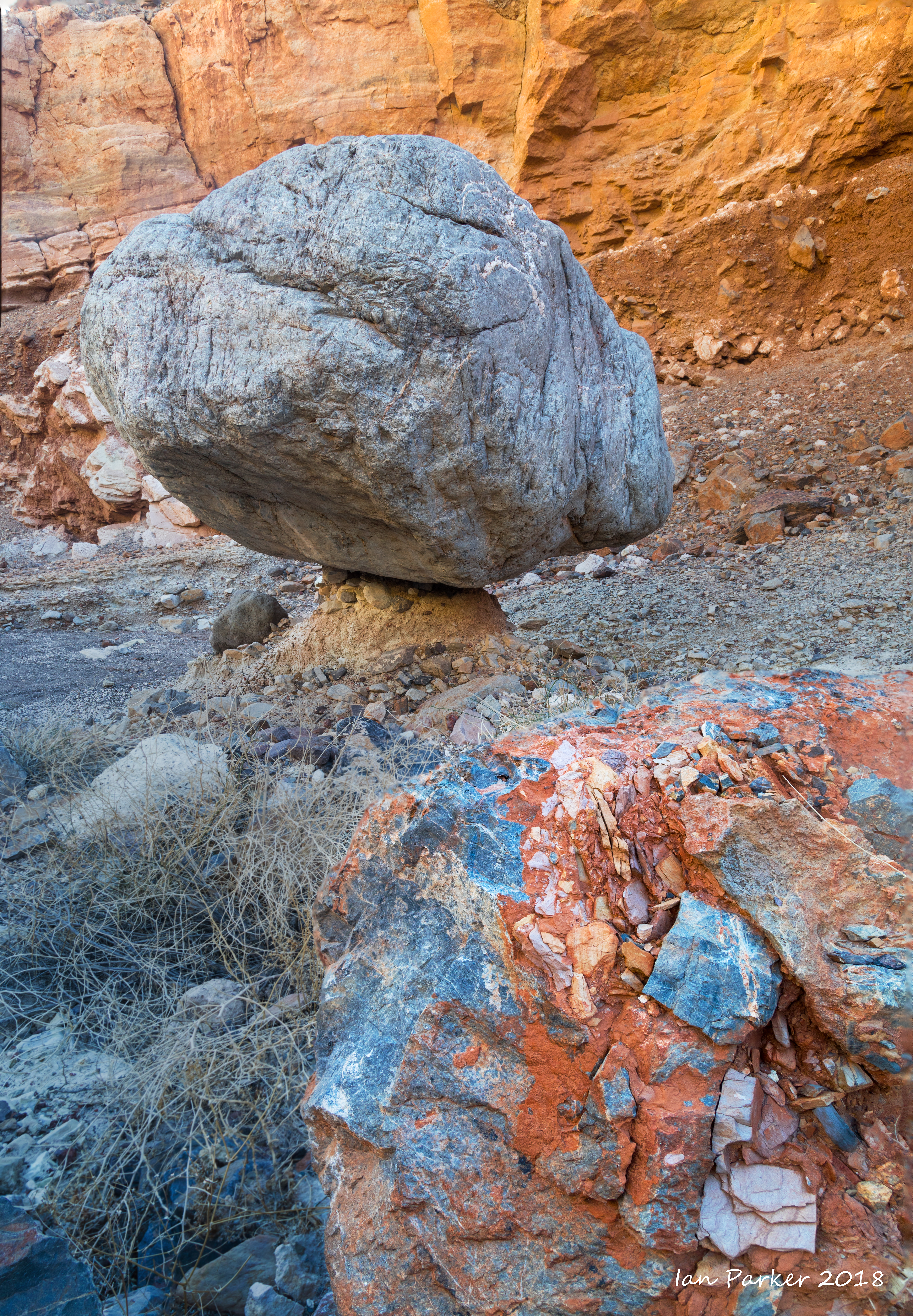
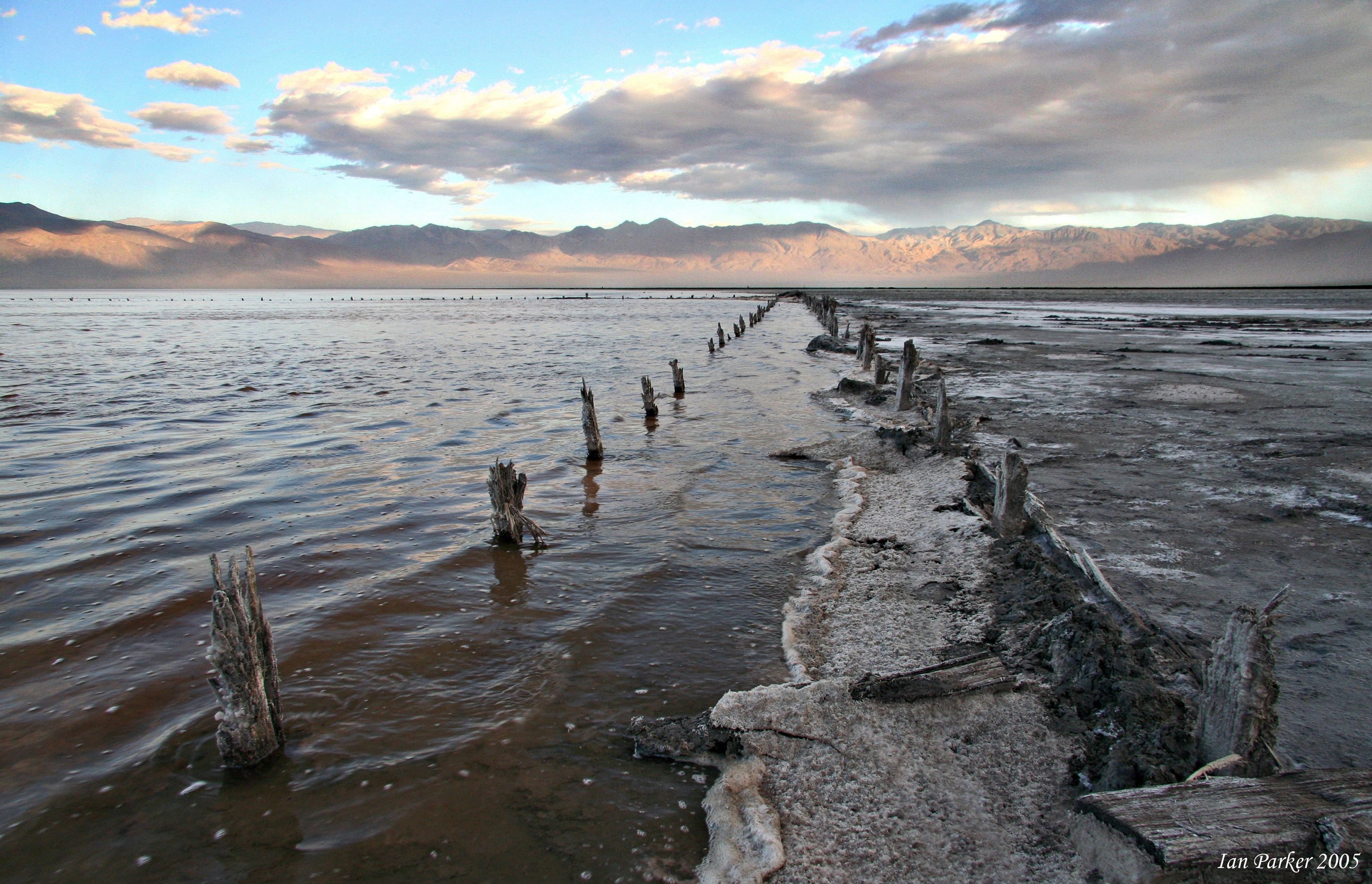
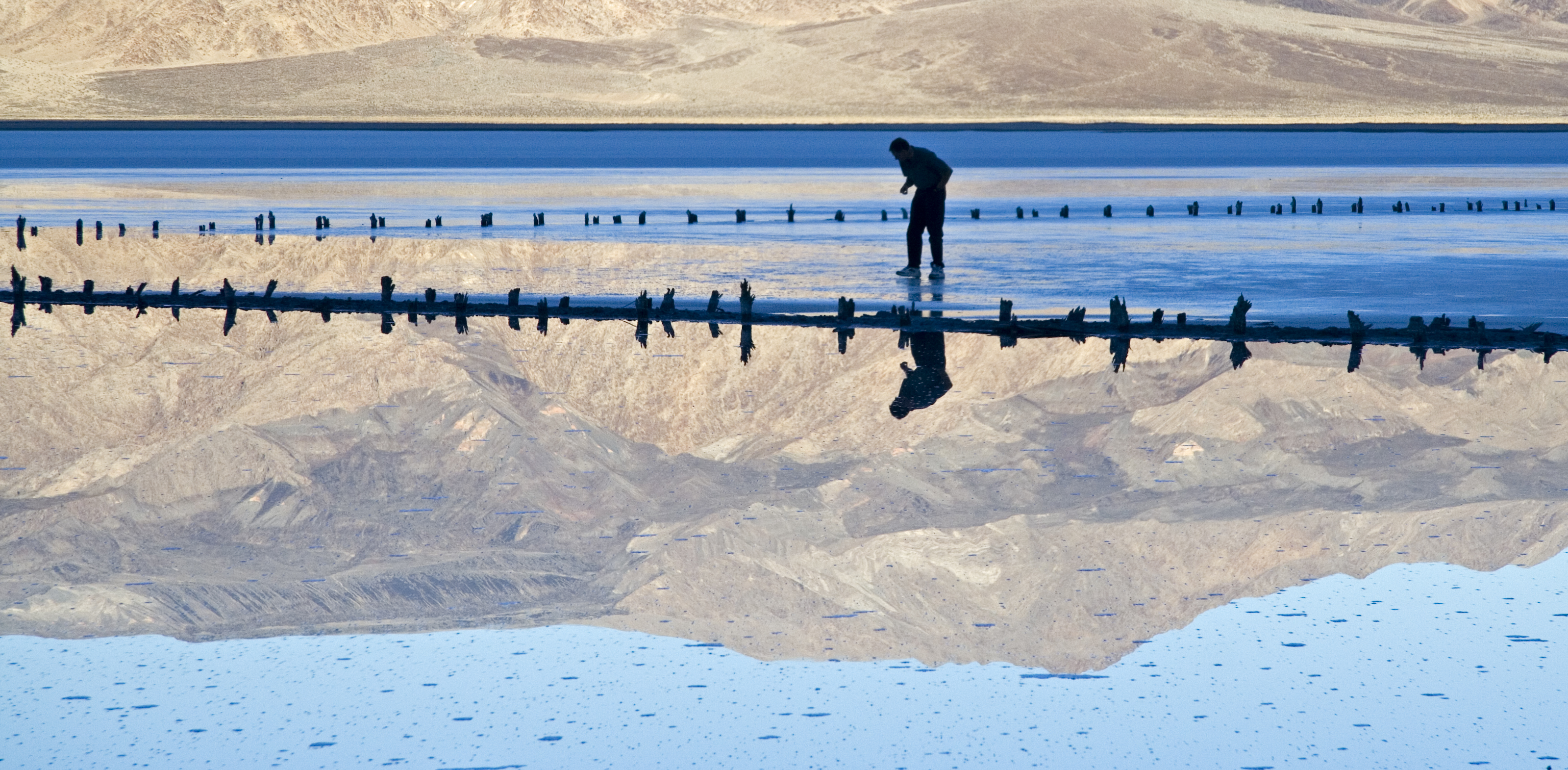
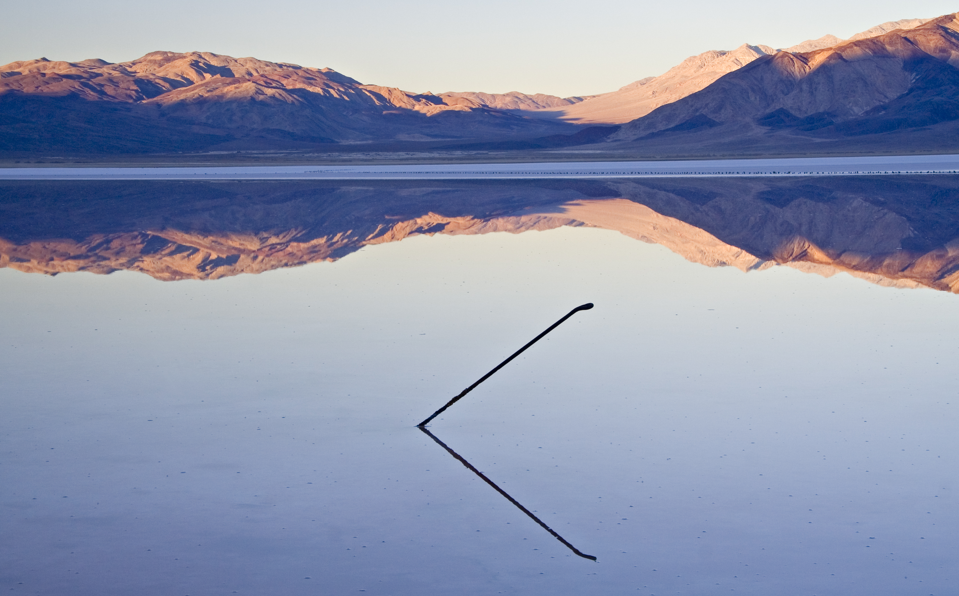
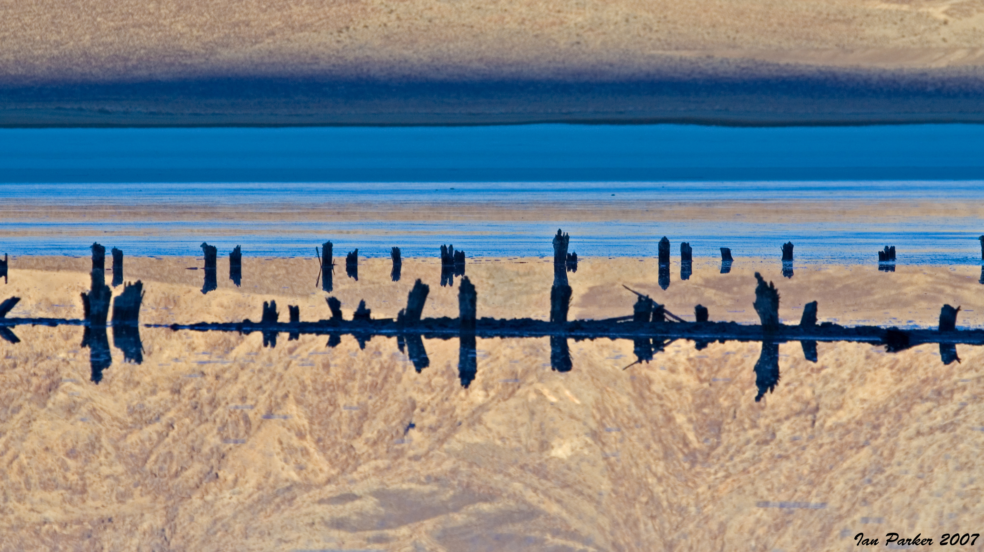
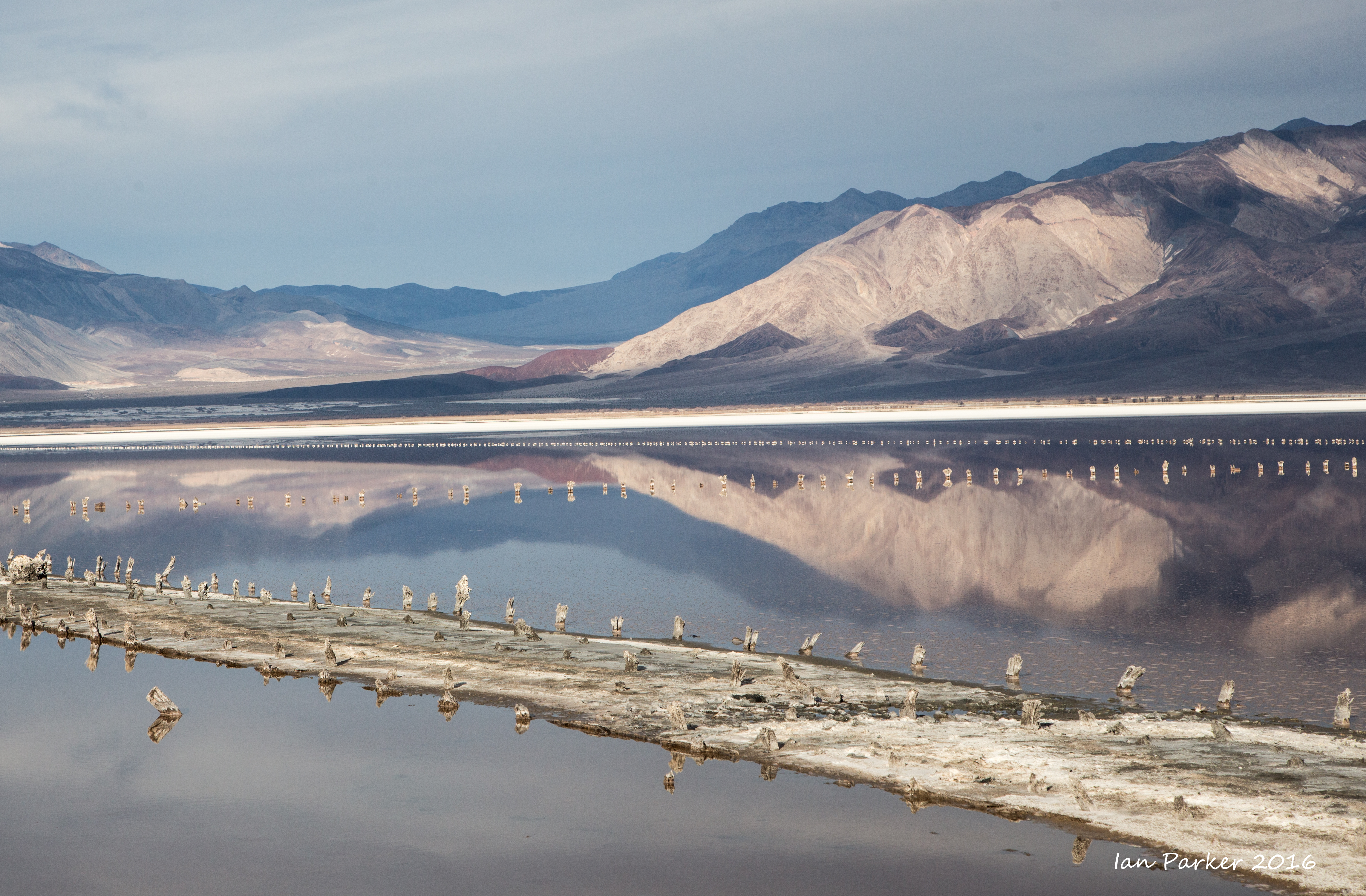
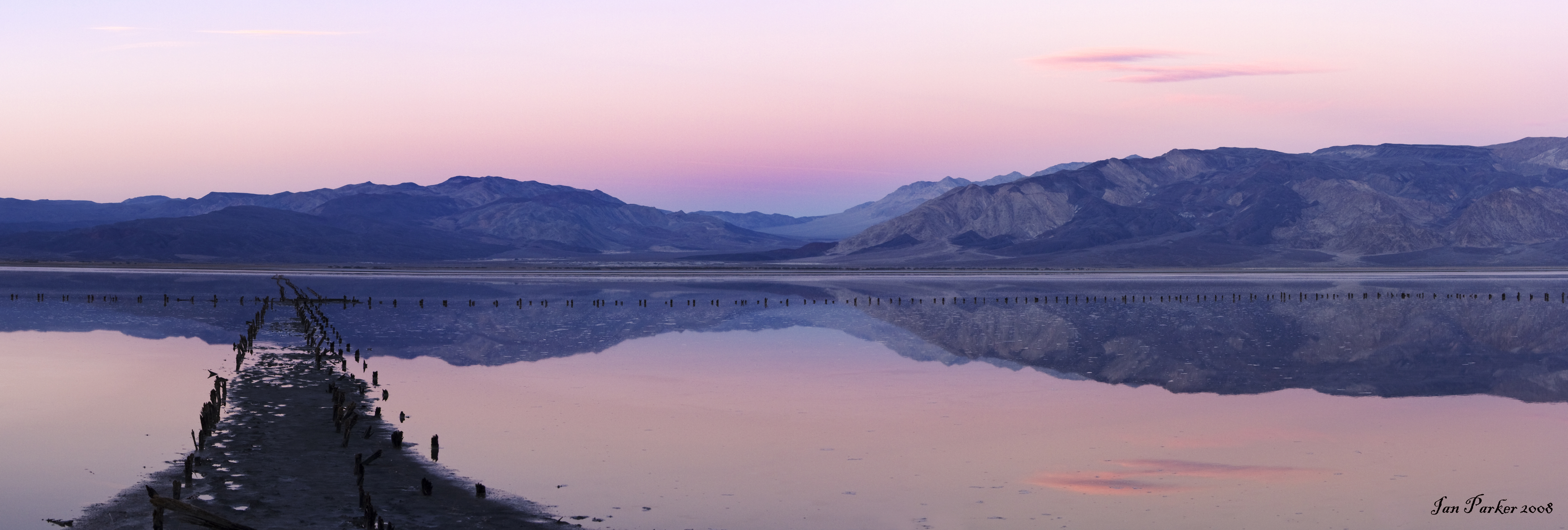
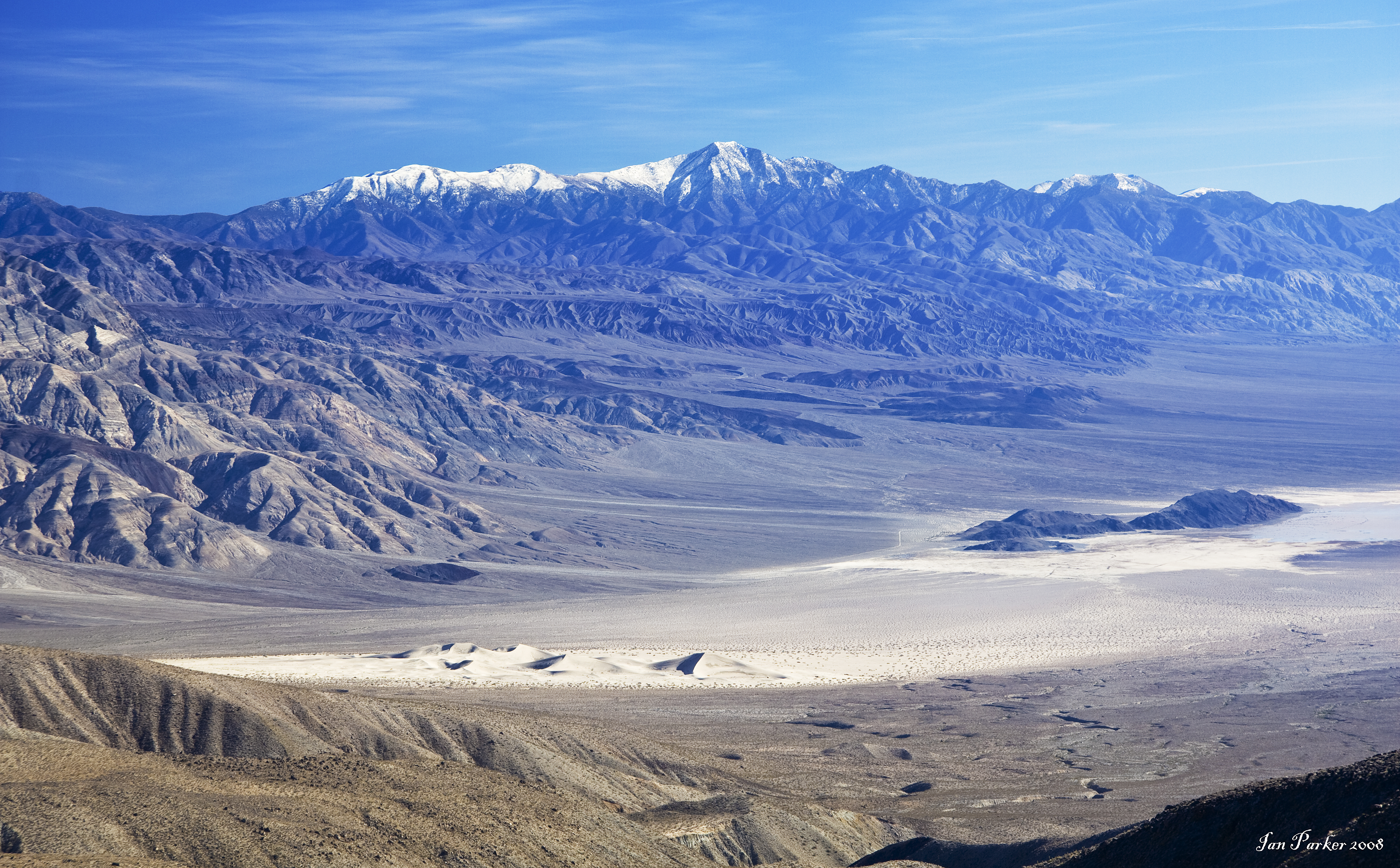
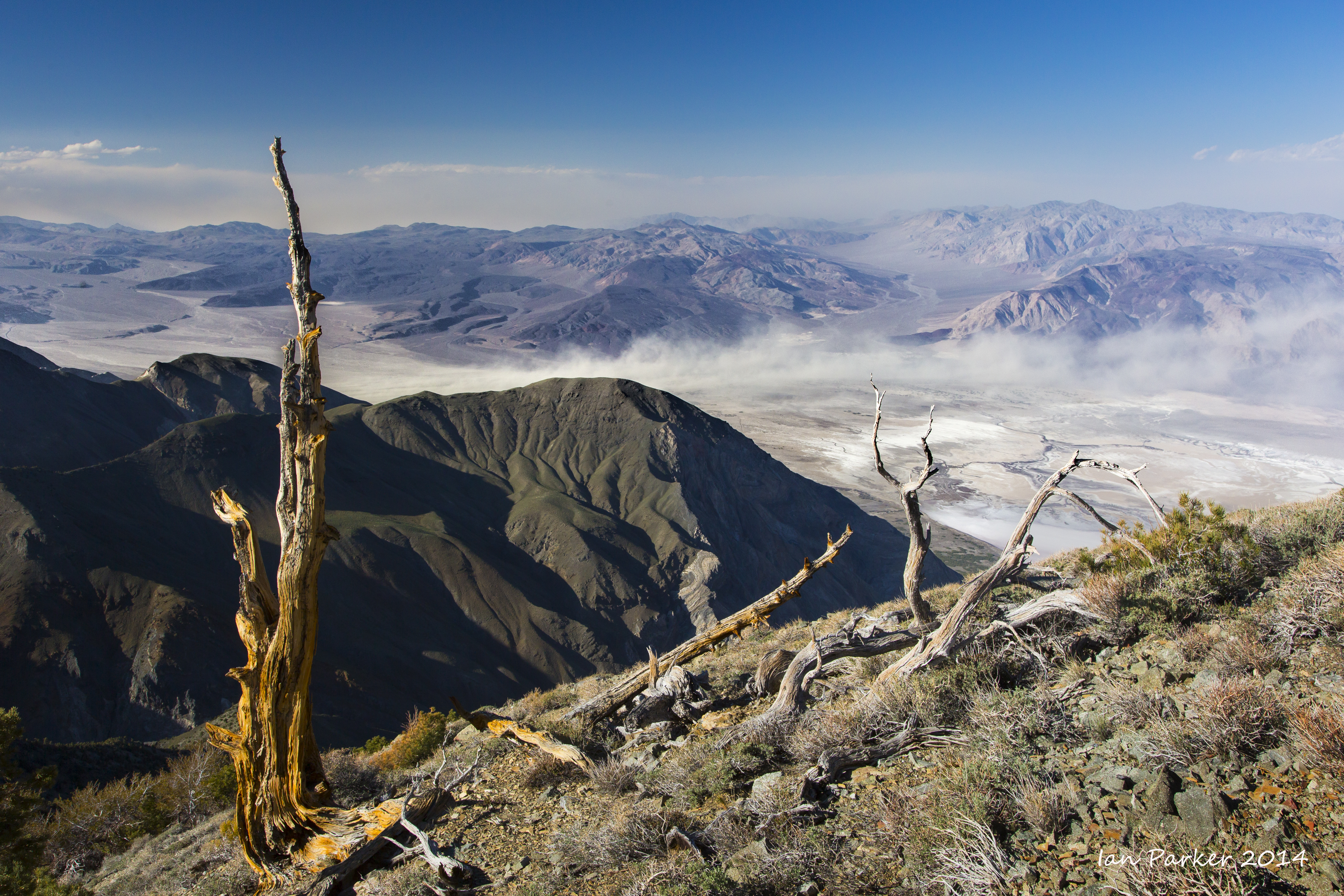
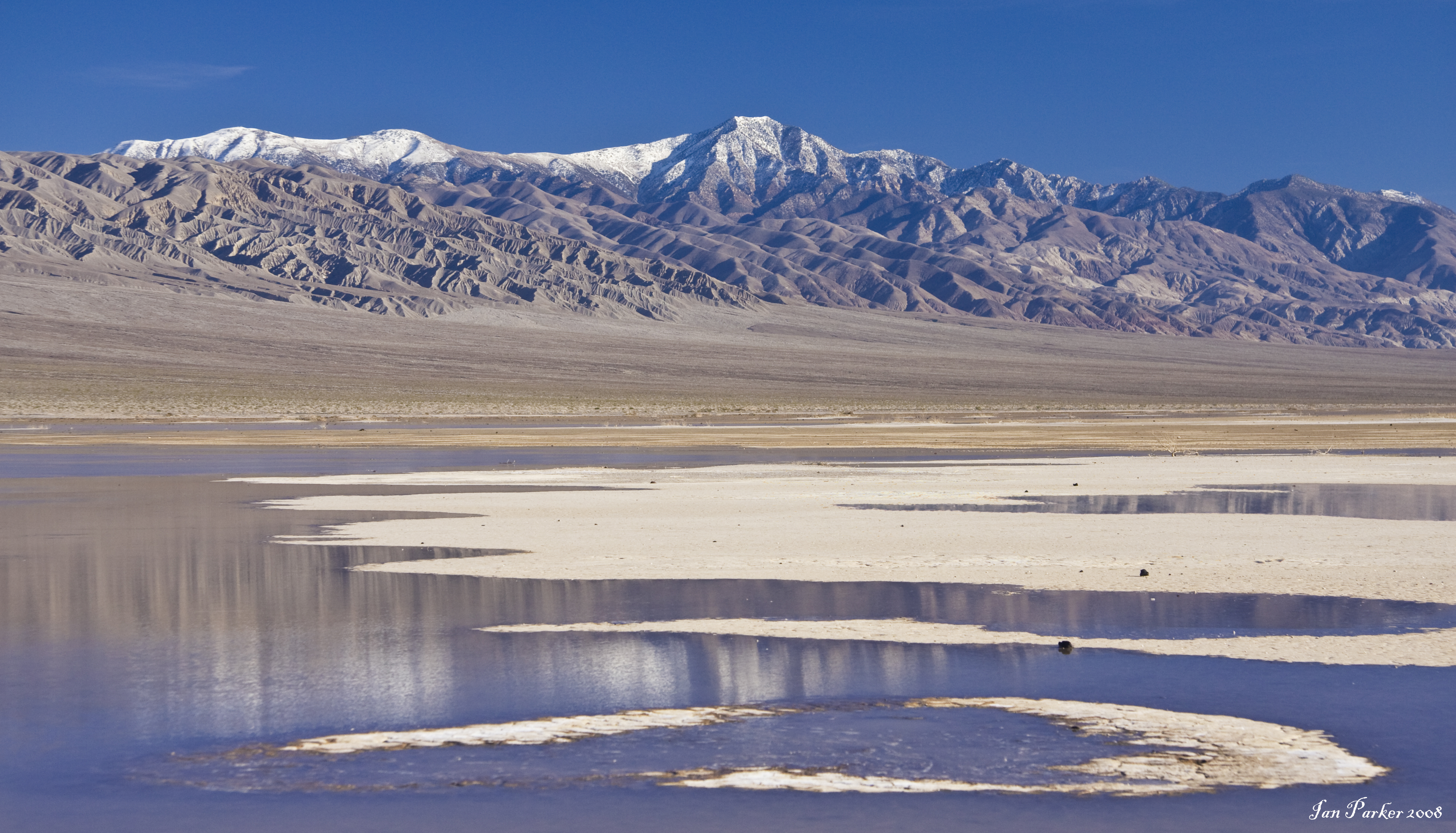
Saline Valley lies in classic ‘basin and range’ country, to the adjacent to Death Valley, and largely within the expanded reach of the National Park. Like neighboring Death Valley and Panamint valleys it stretches almost due North-South, and contains a large dry lake bed (playa). Unusually, however, there is often at least some water in the lake. Saline Valley is infrequently visited, as no paved roads lead to it; but a 70 mile dirt road traverses the length of the valley, and is braved by some coming to bathe in the (clothing optional) hot springs. Even rougher 4WD trails lead into the valley from the East, crossing over Steele pass from Eureka Valley, and descending from Racetrack Valley.

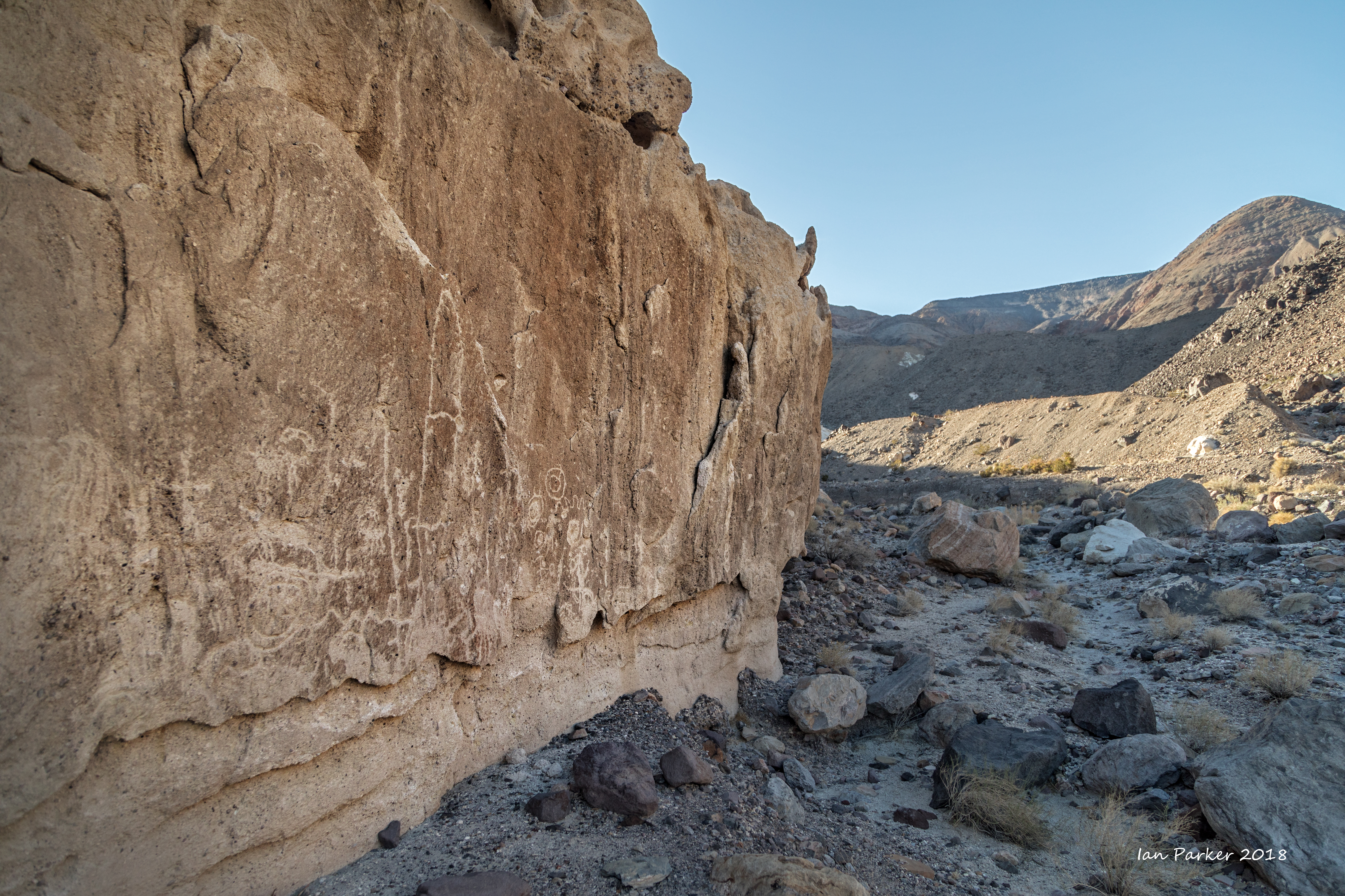
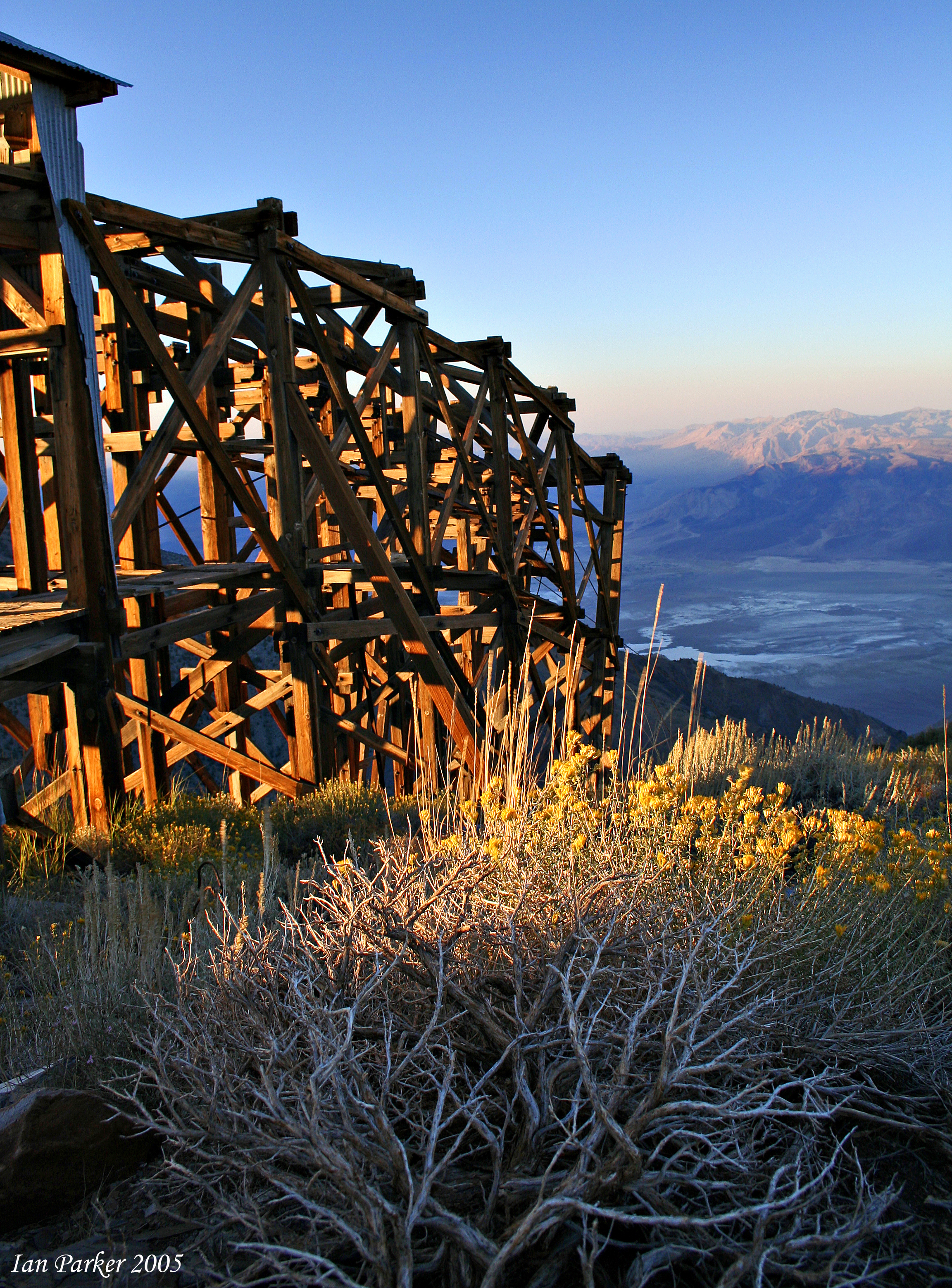
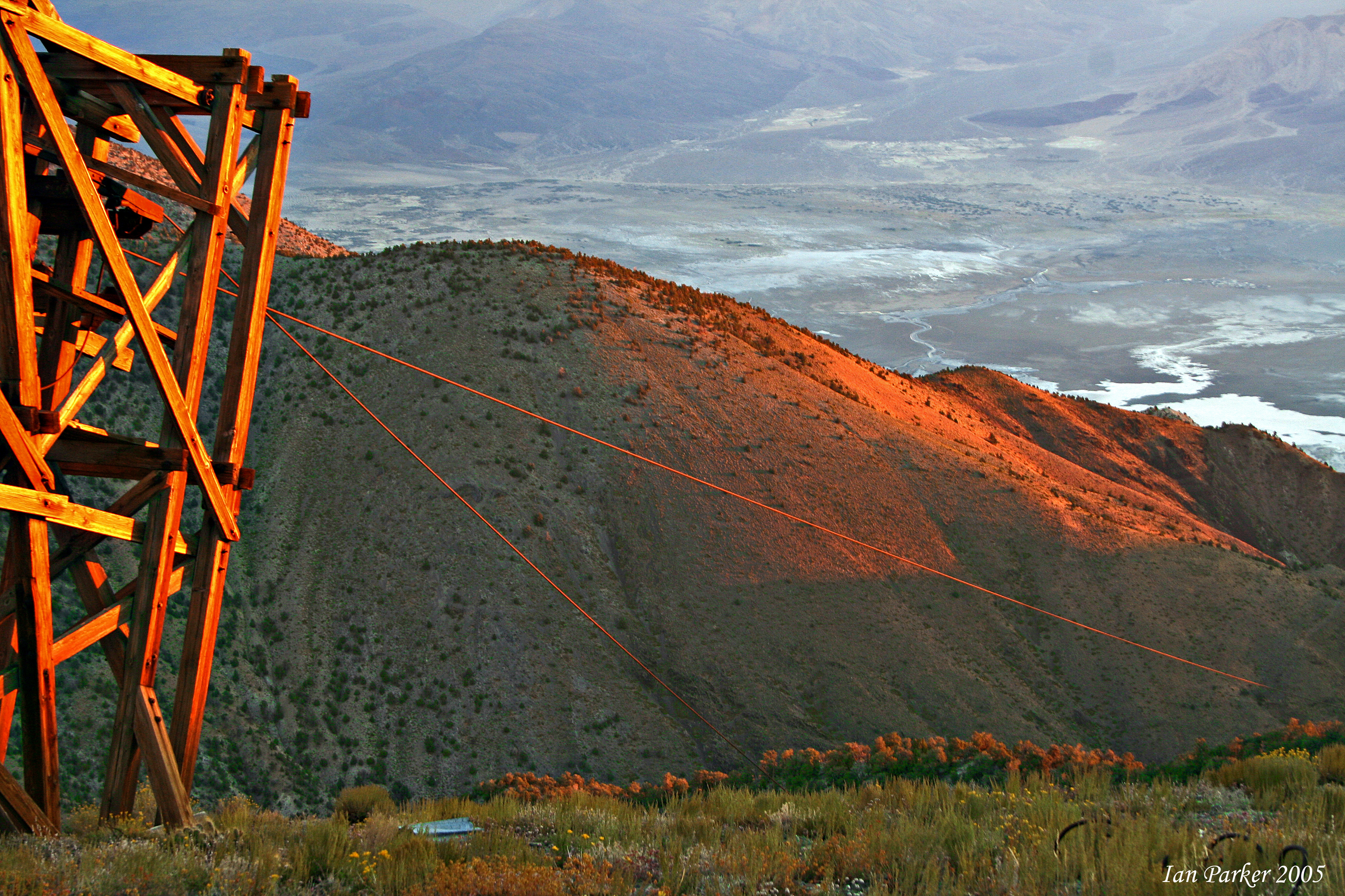
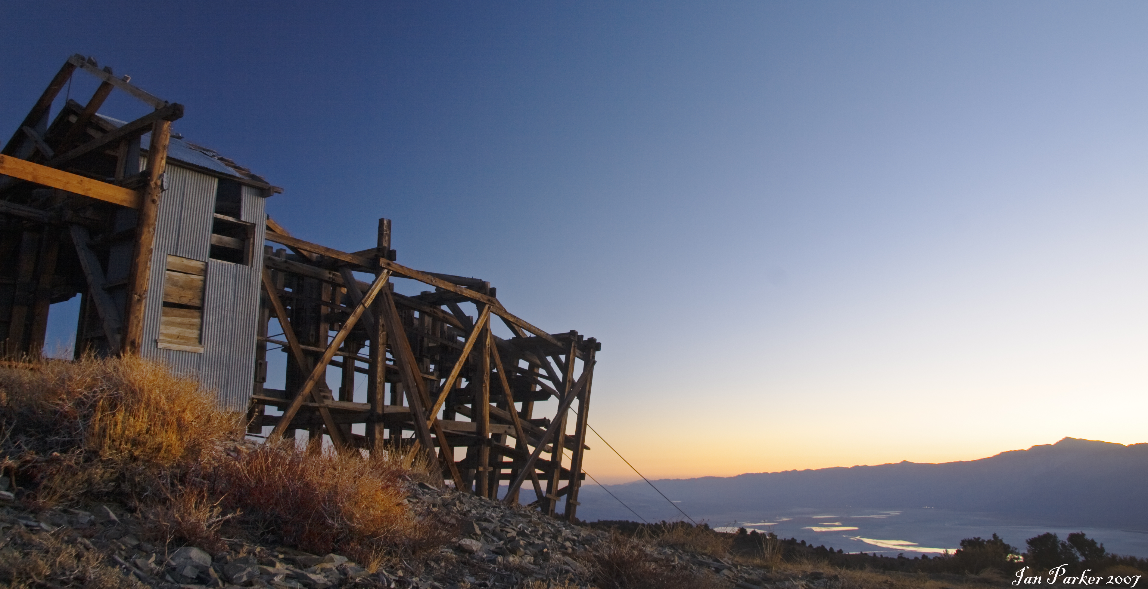
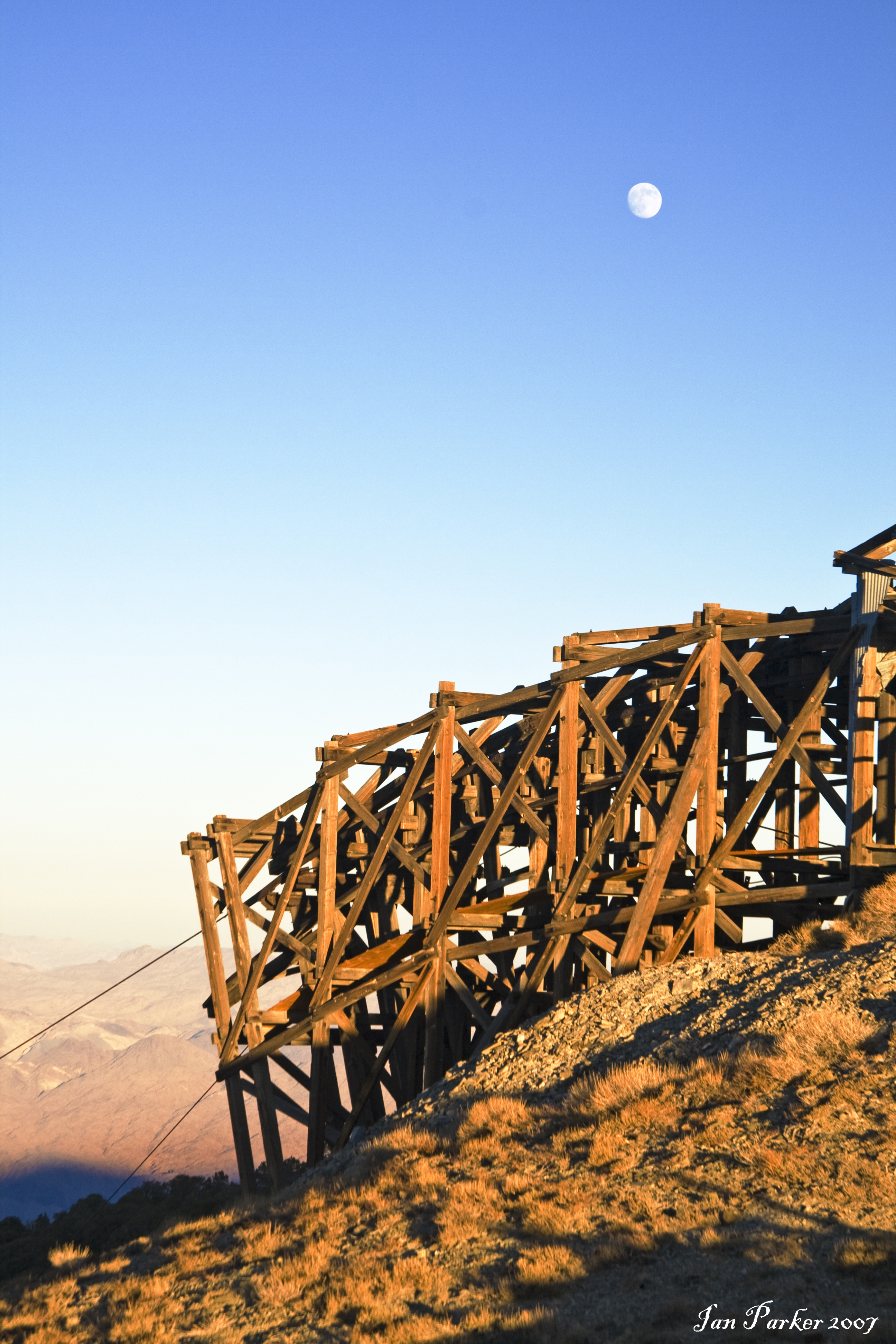
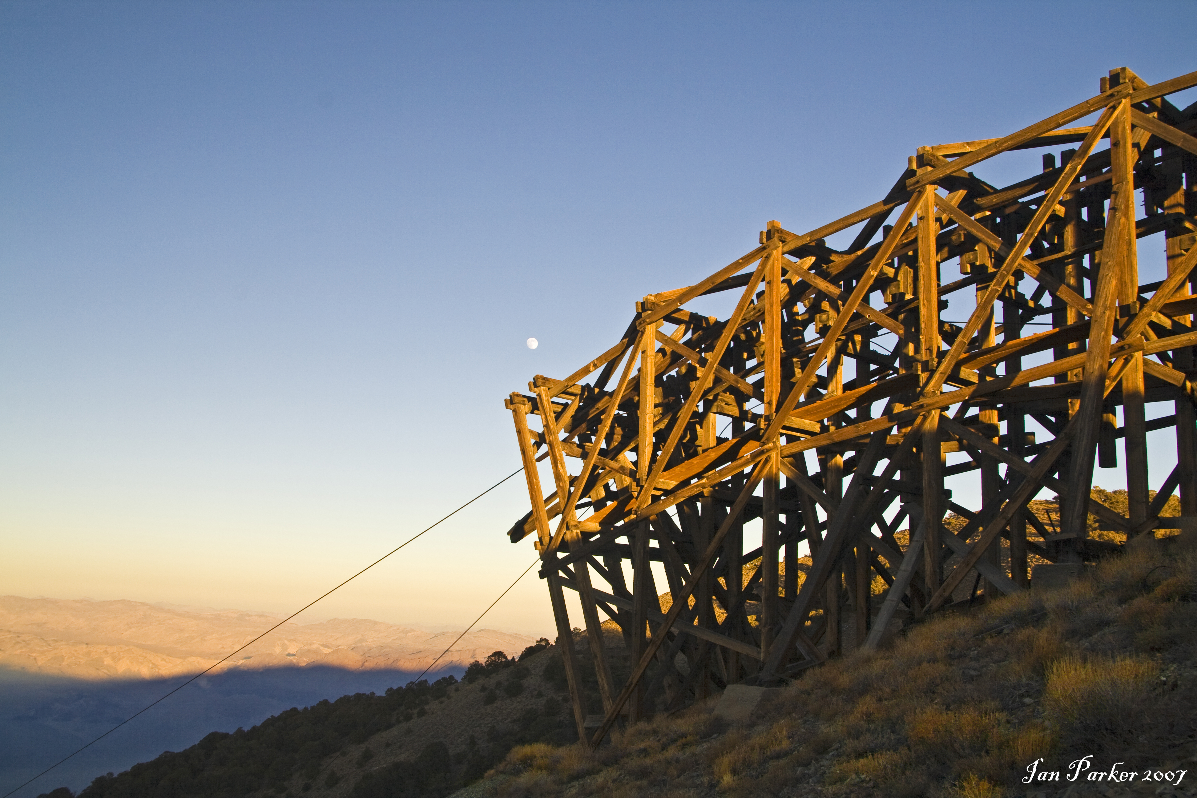
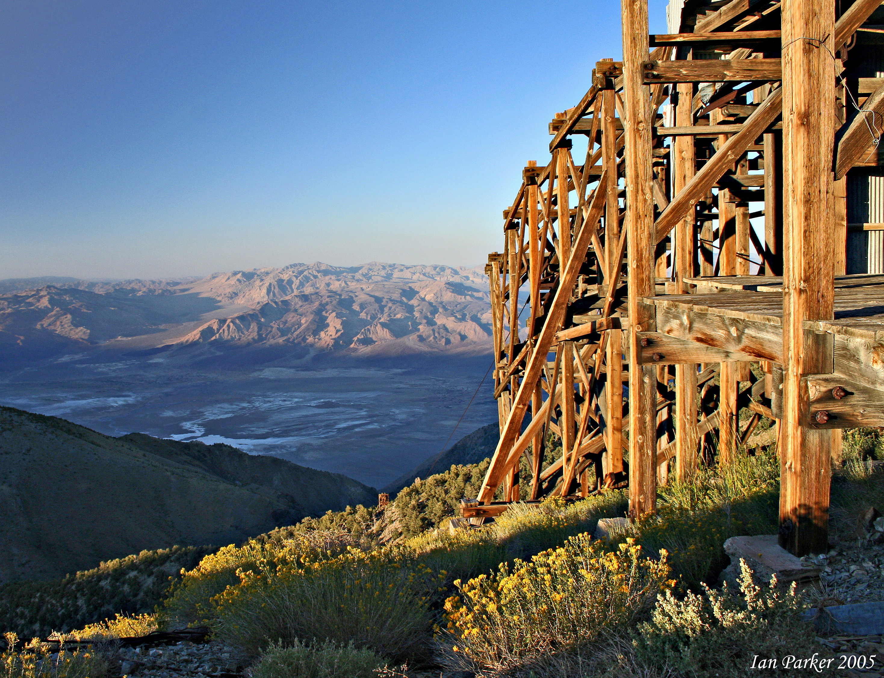
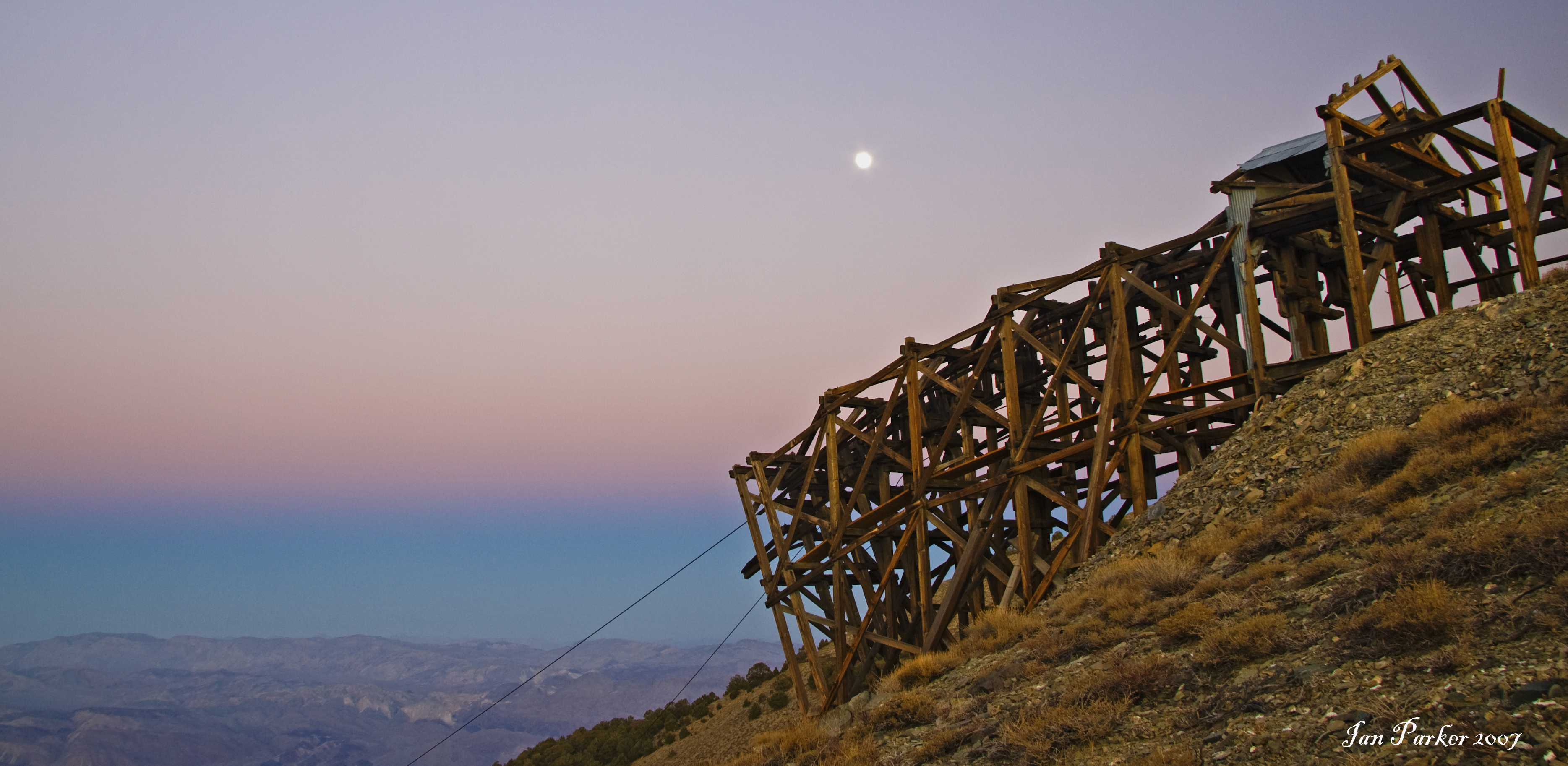
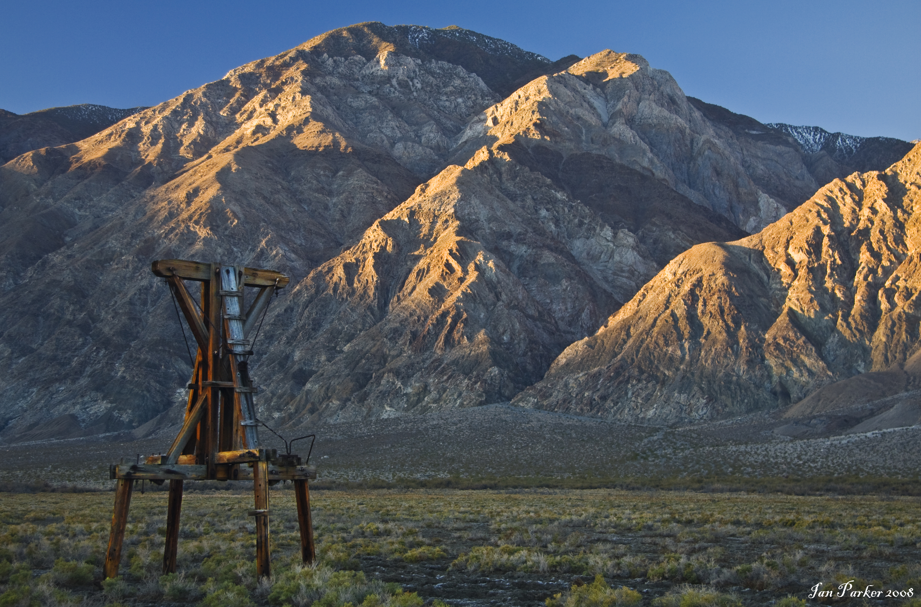
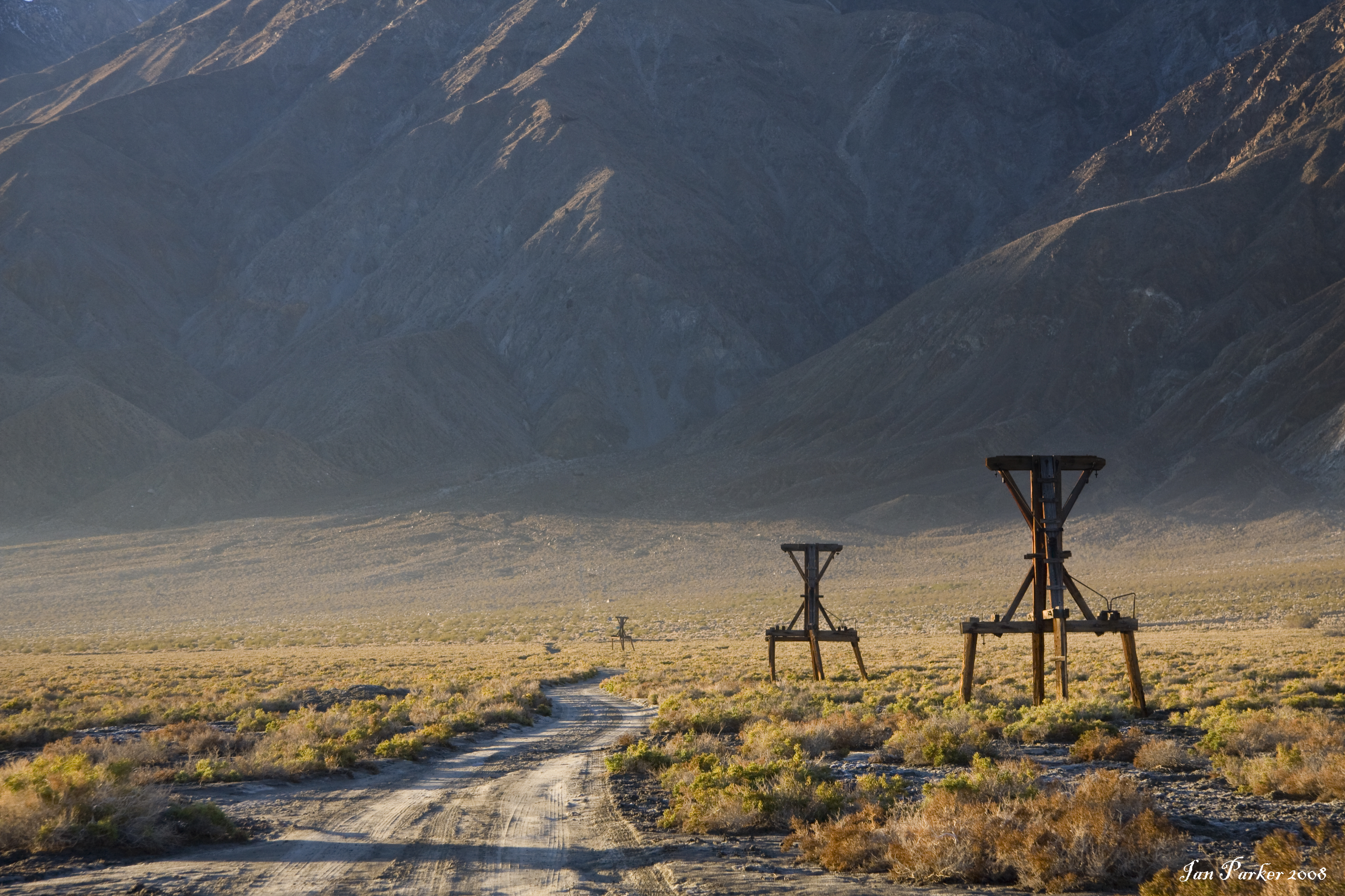
A fascinating feature is the Saline Salt Tram, a cable tramway constructed in 1911 to transport the extremely pure salt found in the lakebed across the Inyo mountains and down to the railroad in Owens valley. The tramway was a remarkable engineering feat, and functioned intermittently (losing money all the time) until 1936. It was the steepest tramway in the United States, rising from 1100 feet in the Saline Valley floor to 8500 feet at the Inyo Crest, then dropping to 3600 feet at Swansea. Despite its National Register status, the Salt Works and tramway have been severely damaged by vandals. Virtually all of the structures within easy access of roads, including both terminals, have been dismantled and carted off by wood gatherers and junk collectors. However, the summit structure on the crest of the Inyos is extremely difficult of access, and remains largely intact, together with the adjacent living quarters for the machinery operators. To visit it requires an exhilarating climb in low-ratio 4WD up the Swansea Grade from highway 190, or an equally scary traverse below the Inyo ridge along a shelf road from Cerro Gordo.

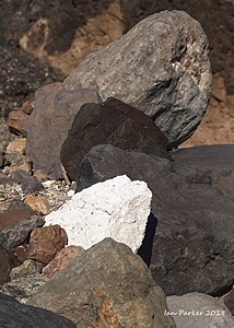
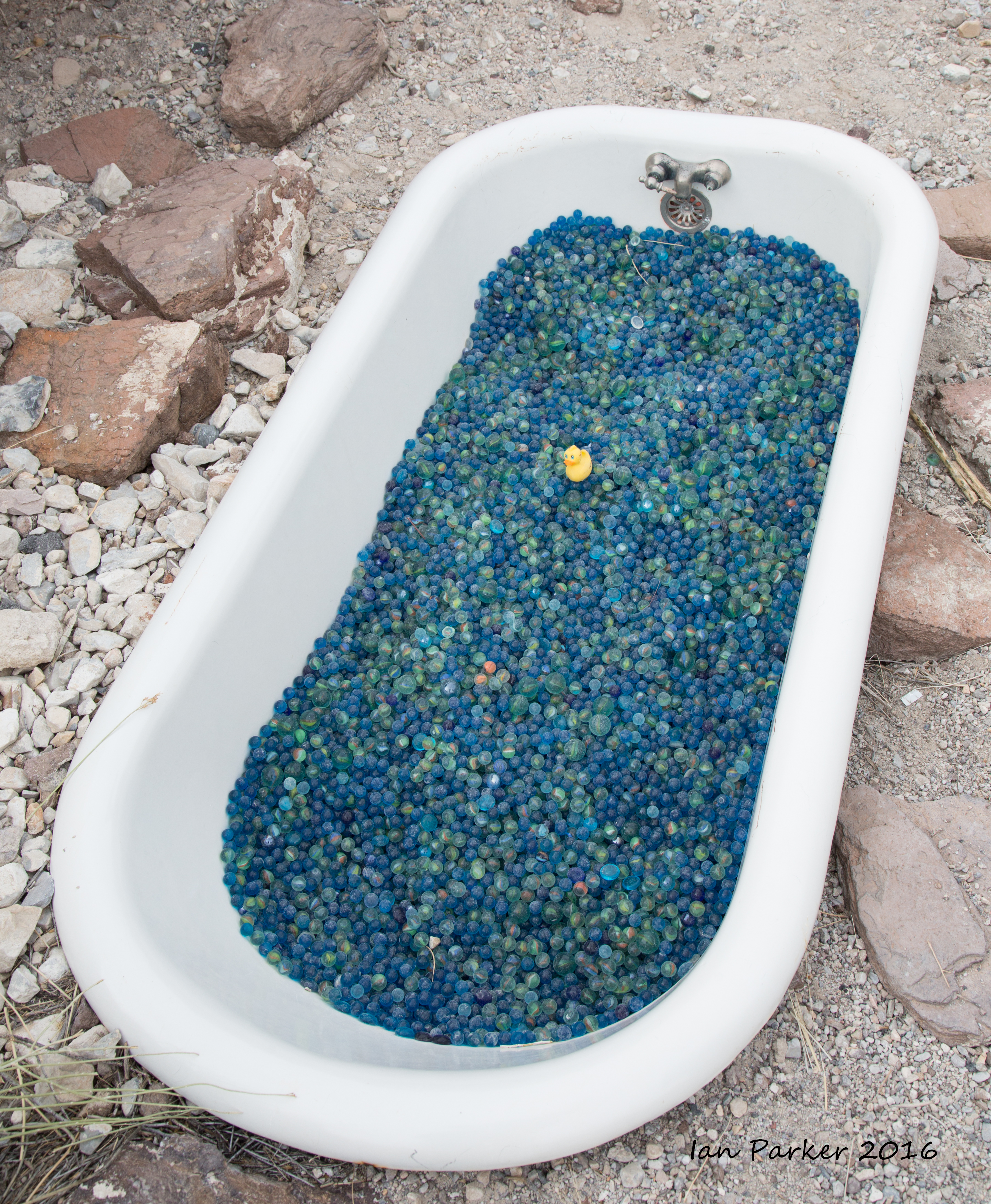
A further curiosity of the area is the marble bath at Steele Pass, which is generally reckoned to be the most remote place in California. Many maps bear the marking ‘Marble Bath’ adjacent to the pass. However, extensive searches by myself, and by others who report their experiences on the web, have never turned up any natural feature that could be described as a marble bath – for example, a rock depression that might collect rainwater. Indeed, there seems to be no marble, or limestone outcrops anywhere near. But, if you look into the shallow canyon leading east immediately after dropping down from the pass toward Saline Valley, you will find an actual cast-iron bathtub filled with blue marbles! Click HERE and HERE to learn more about the story of the 'Marble Bath'.
For several years now we have made it a point to each bring a rubber ducky to populate the bath: but nevertheless the duck census varies over time. On one visit we forgot the ducks, but an emergency visit to the pharmacy in  Lone Pine yeilded a ruber duck bath sponge, from which the duck was liberated after delicate surgery.

Scroll to the bottom of this page for a photographic record of the rubber duck count at the Marble Bath.


A very still, dark and moonless night gave good opportunities for some astrophotography


Panorama of sandstorm in Saline Valley : Click the image to download 40 Mpix stitched panorama


Rubber duck count at the Marble Bath


2005

2008

2009


March 2010

Dec. 2011


Feb 2012

Christmas, 2012

New Year. 2014

October, 2014: A return trip to the Marble Bath

From the Eureka Dunes we threaded through the rocksteps in Dedekera Canyon and on over Steele Pass, bringing a new flock of rubber ducks to the Marble Bath.  We found that many of the indigenous ducks had taken shelter from the sumer sun under a rock alcove, but with the onset of cooler weather  we thought they would prefer to be returned to their marbled aquatic habitat.

We had planned to continue down into Saline Valley and out over South Pass, but were thwarted by a bad washout and so retraced our path back to Big Pine.


January, 2016. On reaching the Marble Bath we found only a sole remaining rubber duck. Given that these birds are flightless, it seems that the large flock that was present the previous year could not have departed of their own volition. We suspect the Park Service may have taken them into protective custody, as a new wilderness sign had been placed near the bath. Anyhow, we were happy to bring new ducks as company for the remaining survivor.

Thanksgiving 2017. Once again we found that the rubber duck population had declined alarmingly. But, we came well supplied with new immigrants, and hope they will do well.


last updated 01/13/2019

IanParker
1146 McGaugh Hall
University of California,
Irvine, CA 92697

Please send enquiries to evanescentlightphotography@gmail.com

BACK TO >
Parkerlab >
Evanescent Light Galleries Home Page