New Additions to the Galleries
|
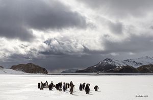
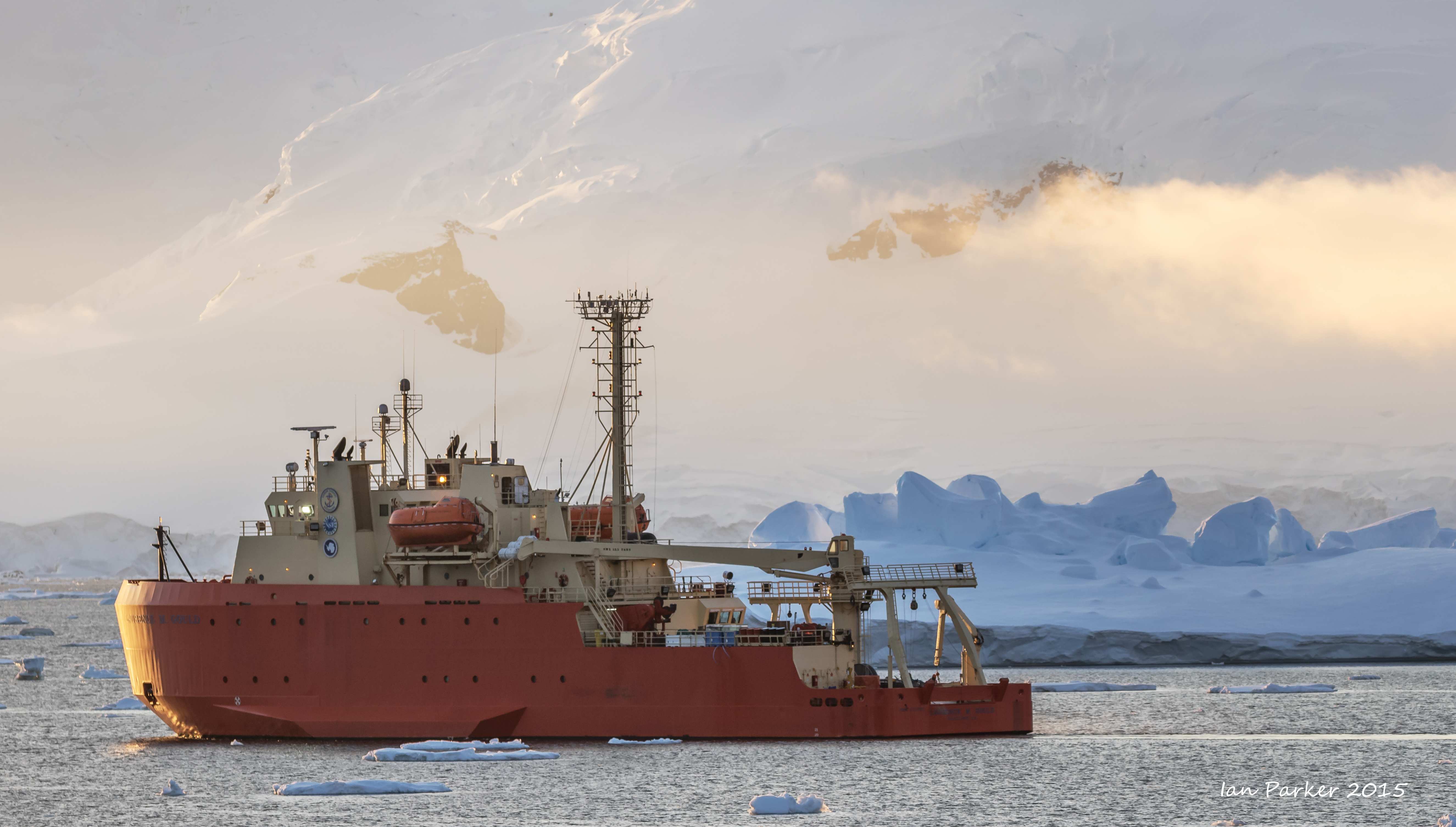
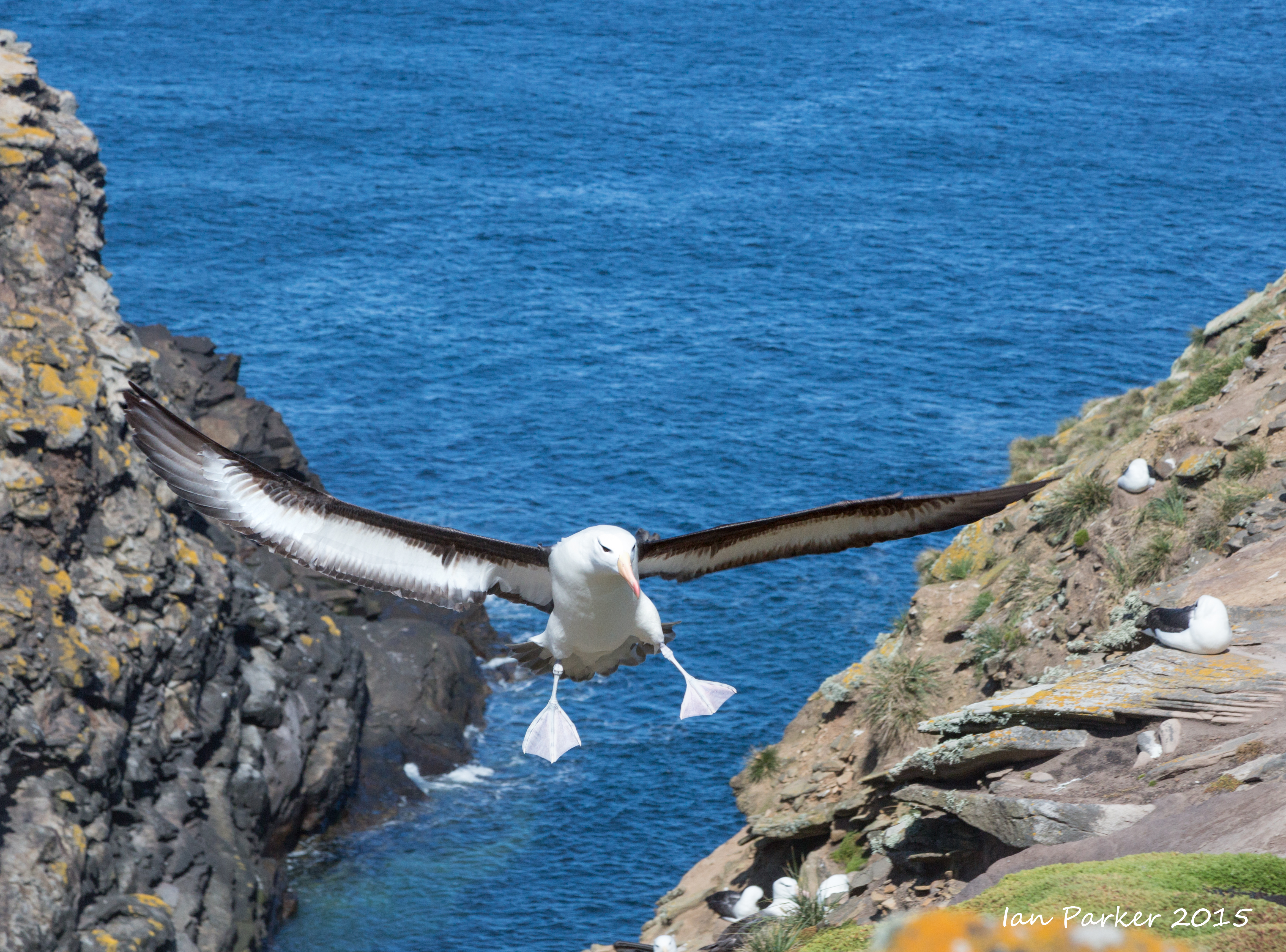
last updated 03/09/2016 - Added new photos from Errera Strait; our best sunset/rise in Antarctica
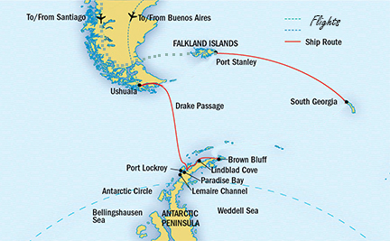
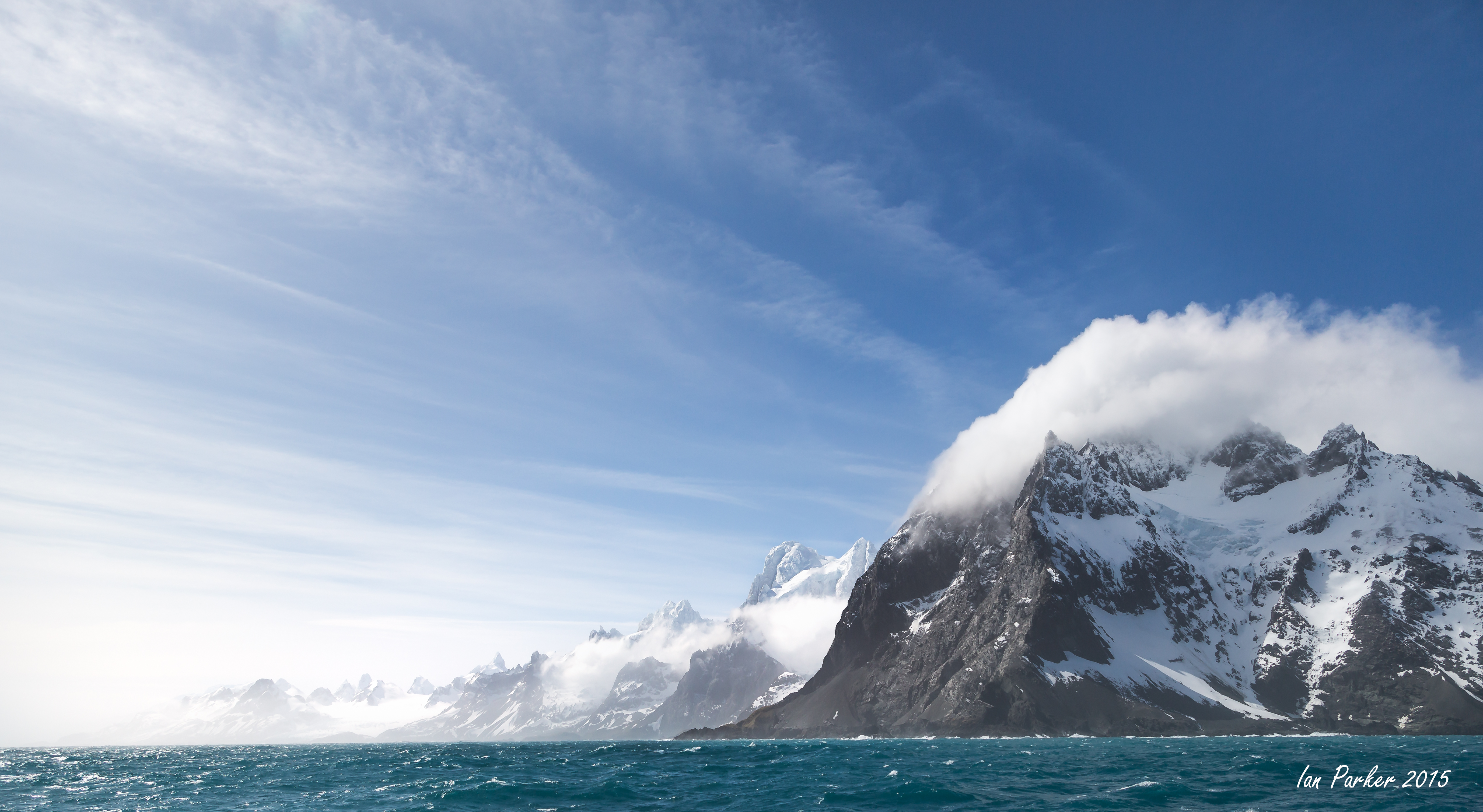
Anne and I returned before Christmas from a two-month, totally immersive experience visiting the Falkland Islands, South Georgia, the South Shetland Islands and the Antarctic Peninsula. I took some 20,000 photos, which will take some time to edit and process. I will be uploading these below in chronological order of our voyage - please keep checking in for new additions.
_______________________________________________________________________________________________
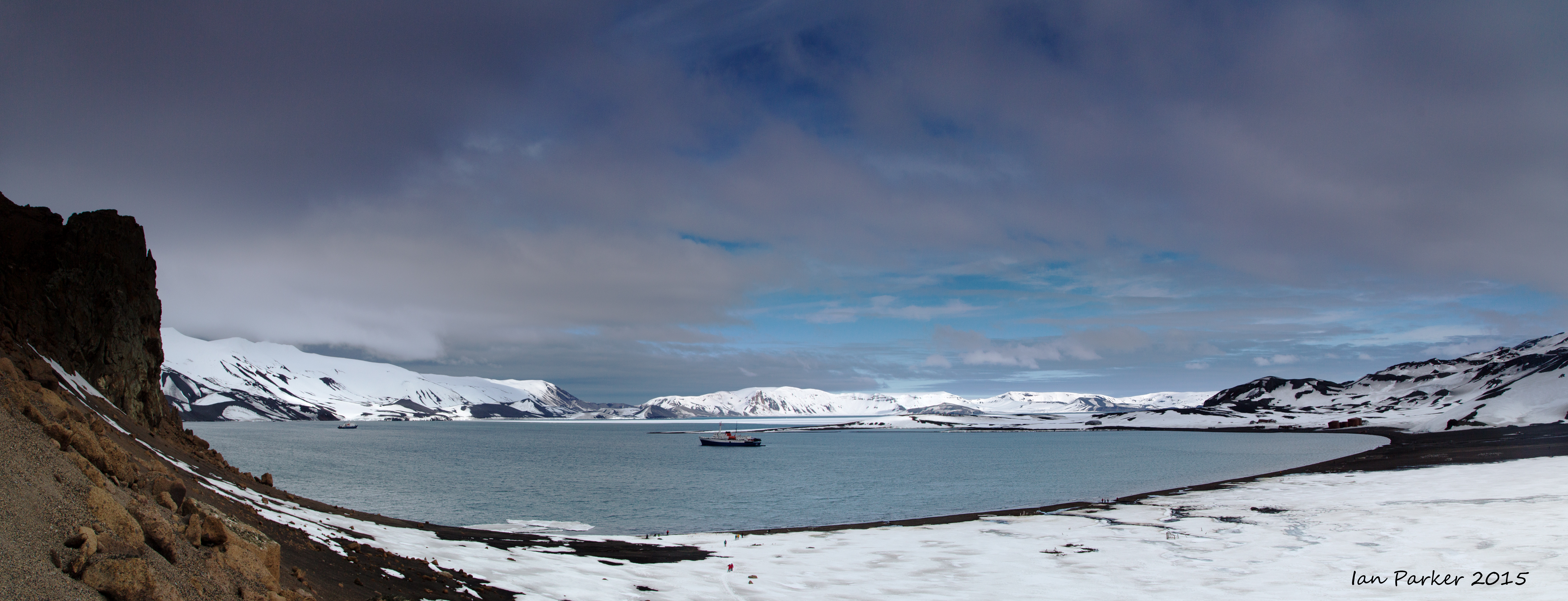
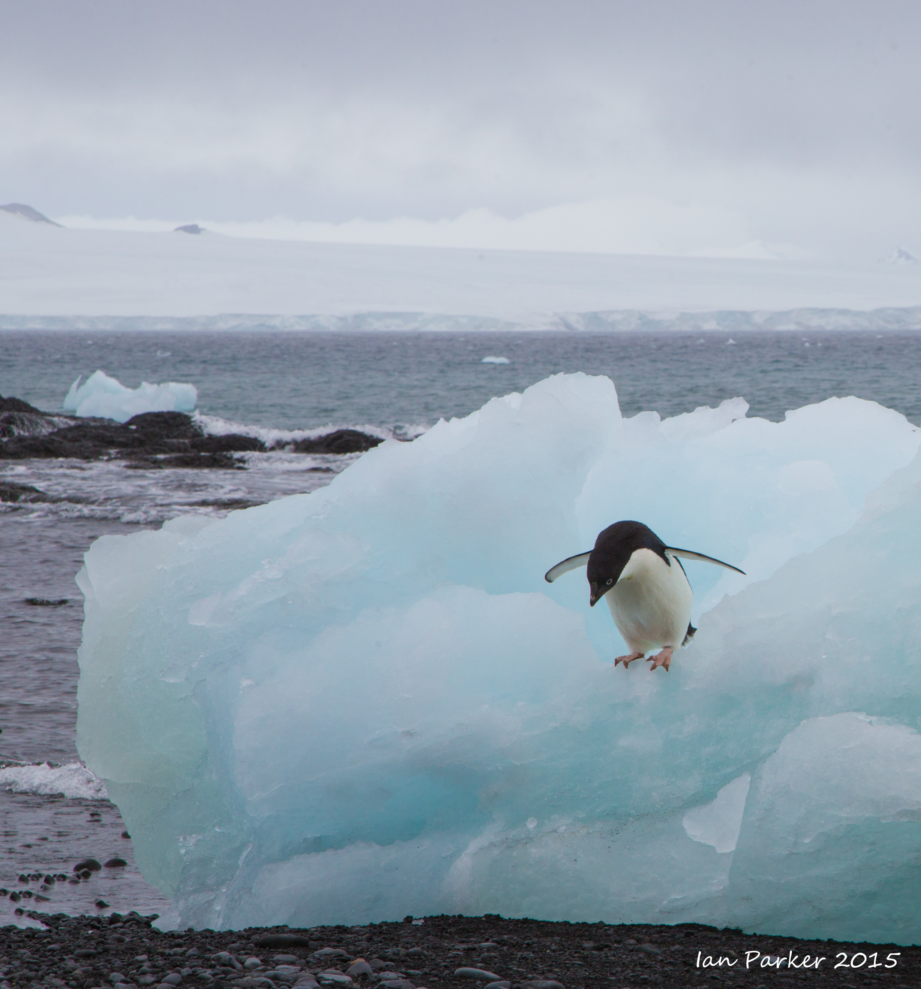
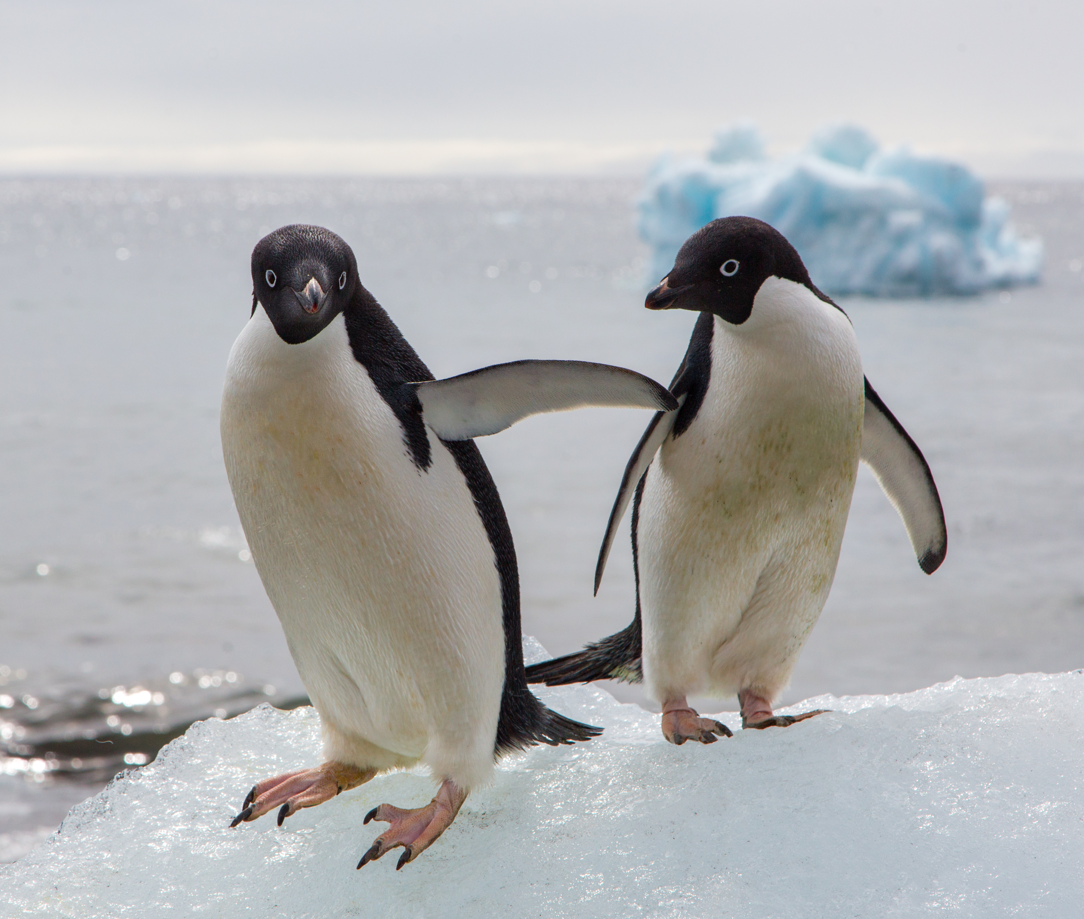
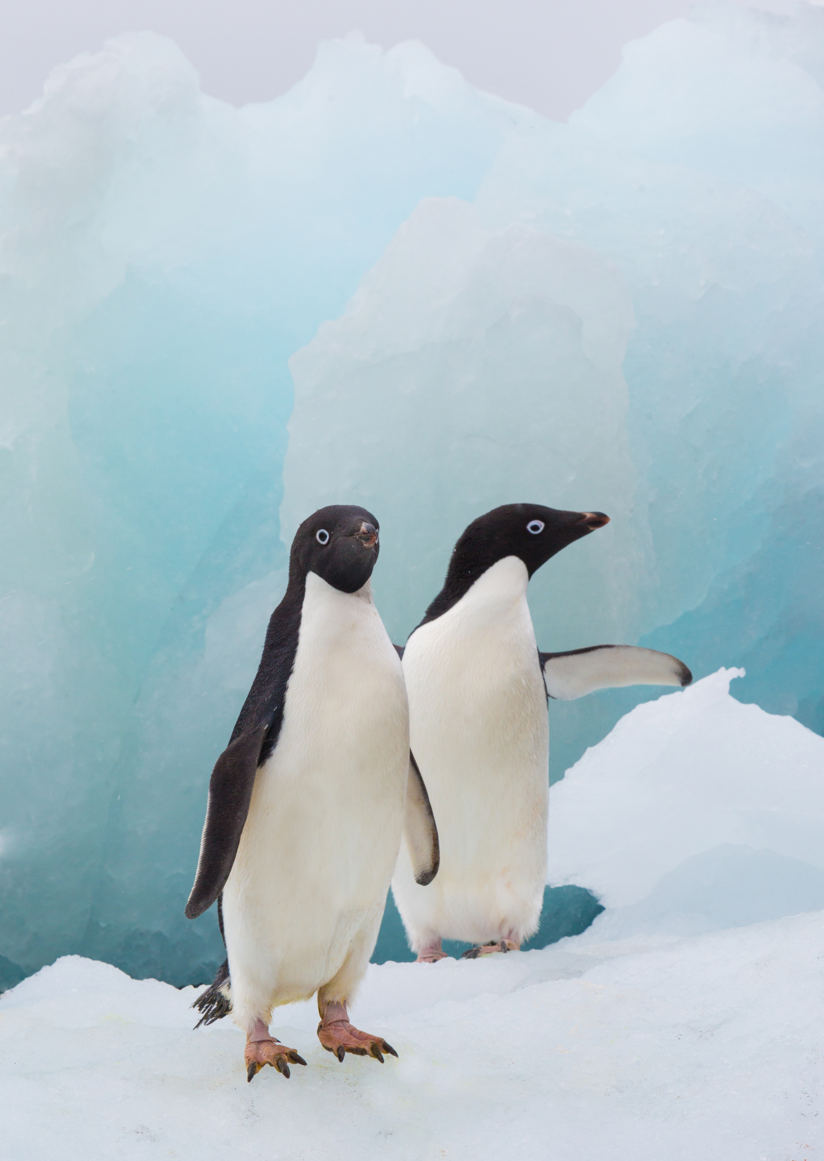
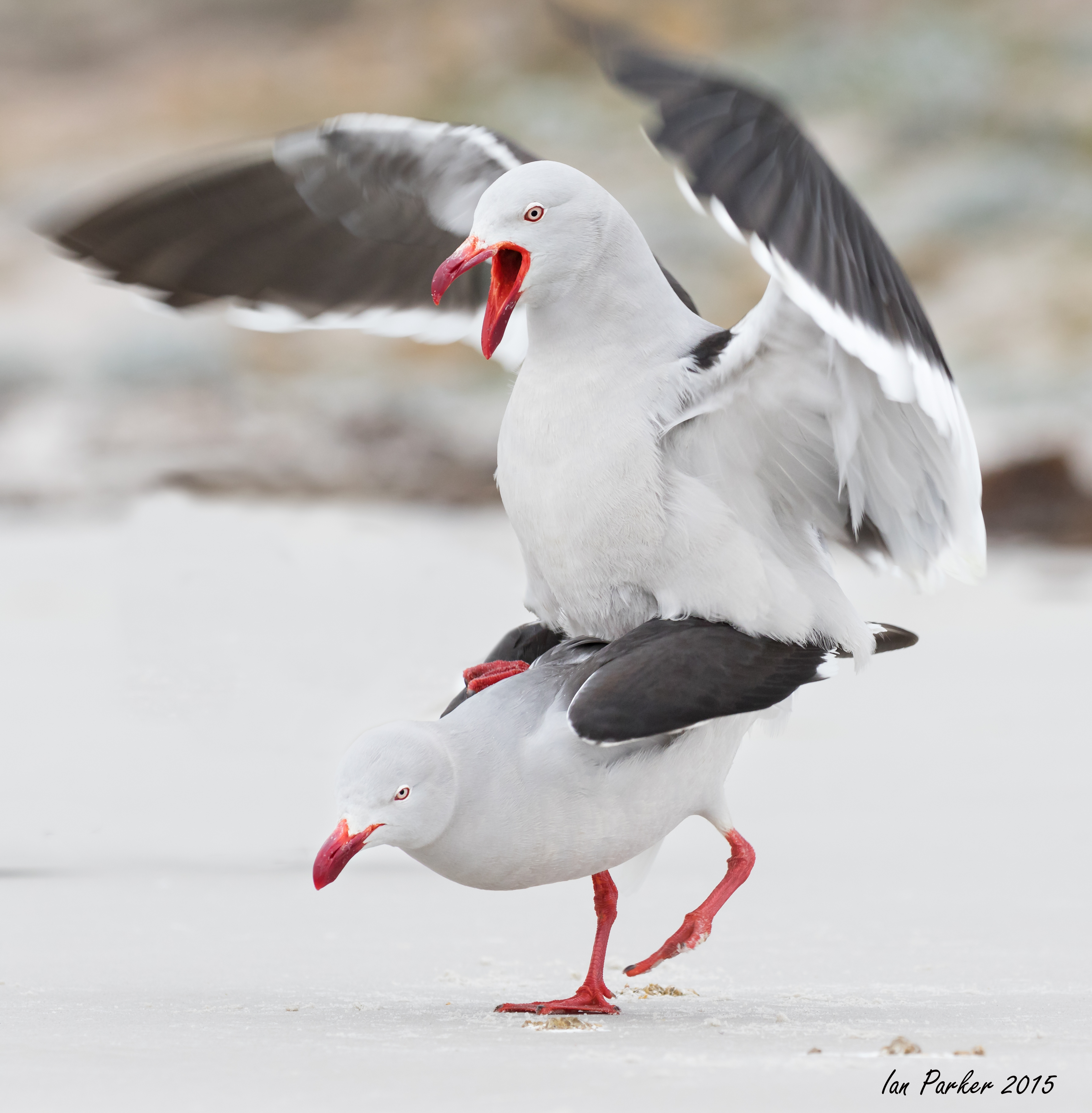
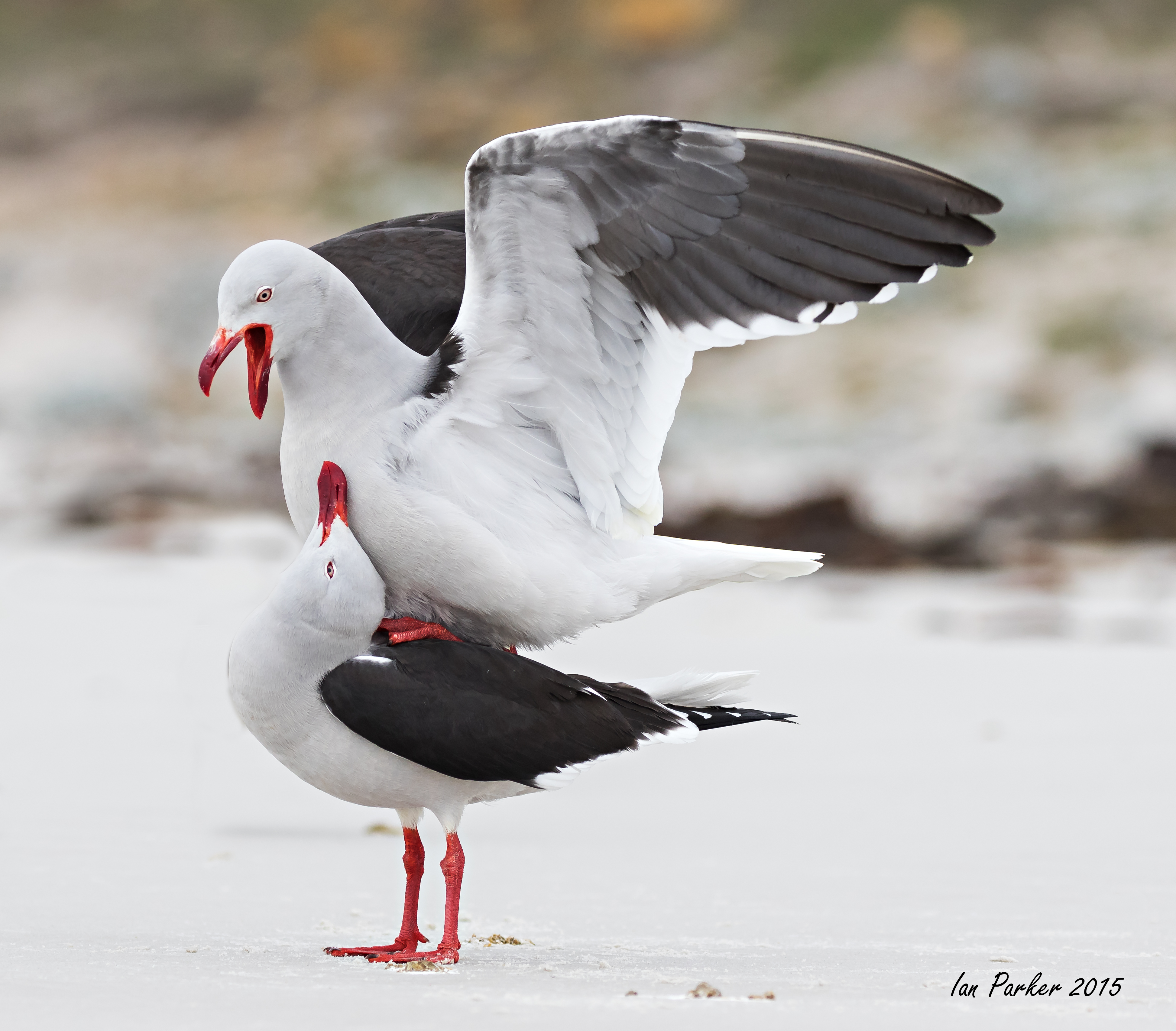
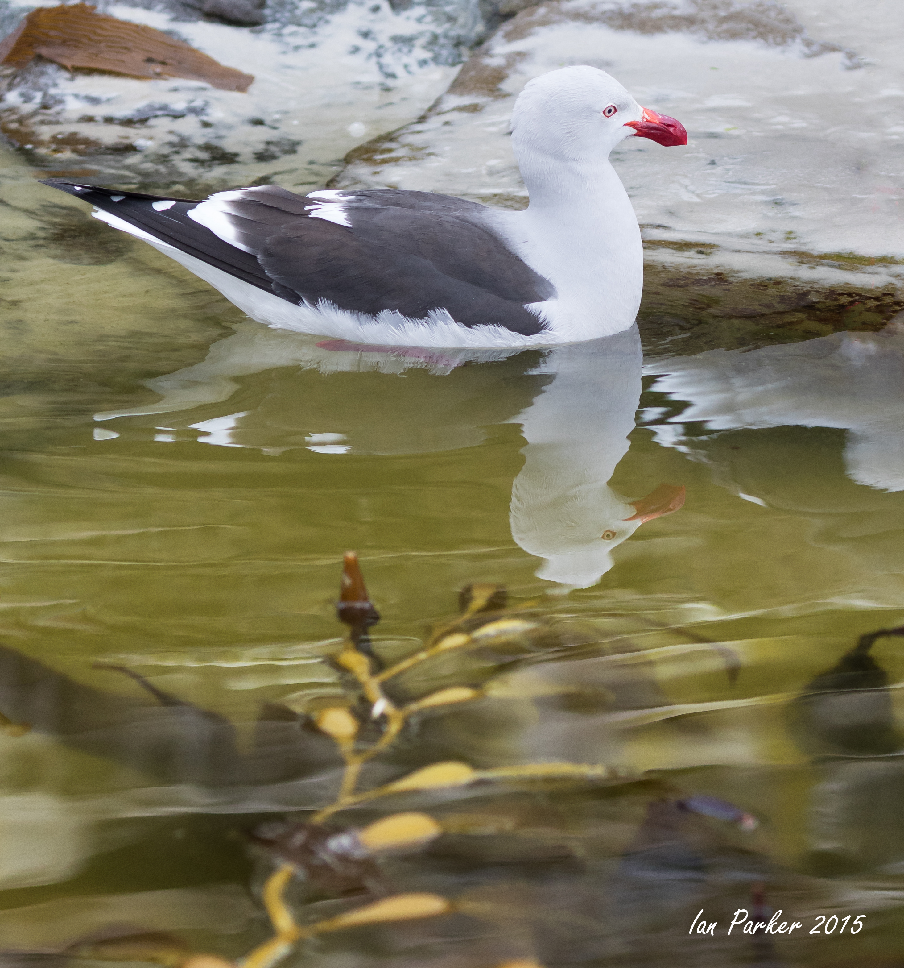
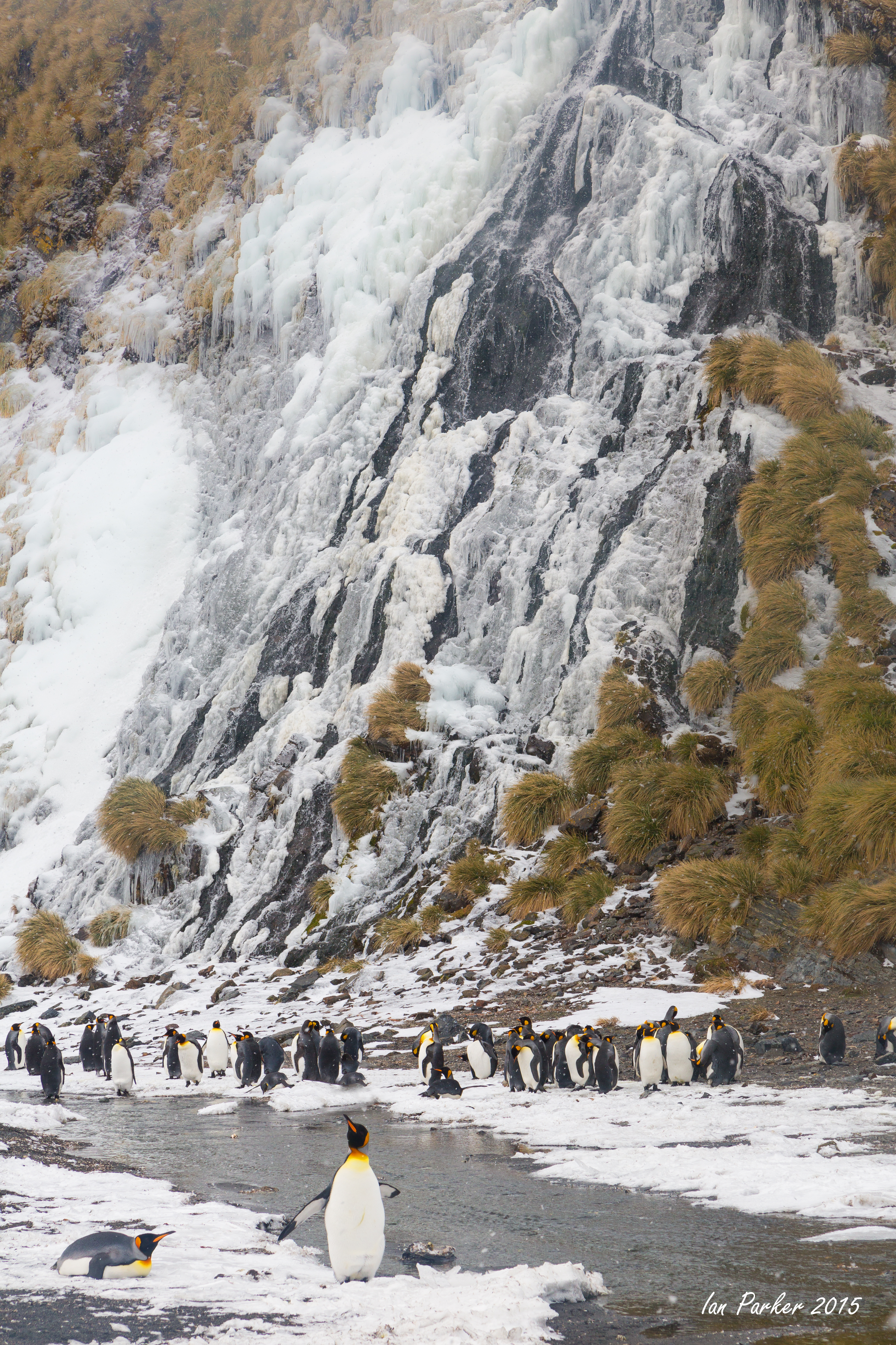
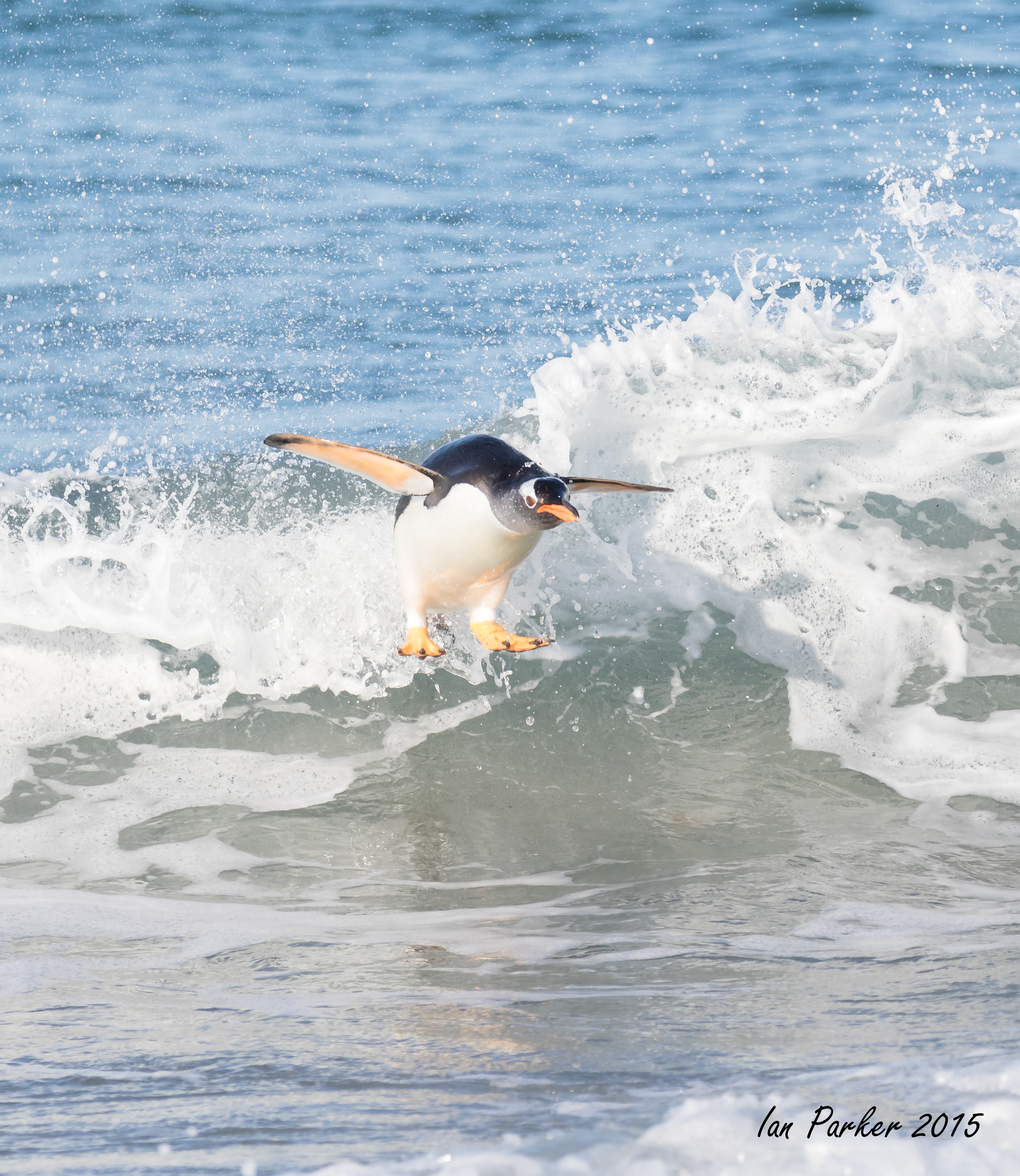
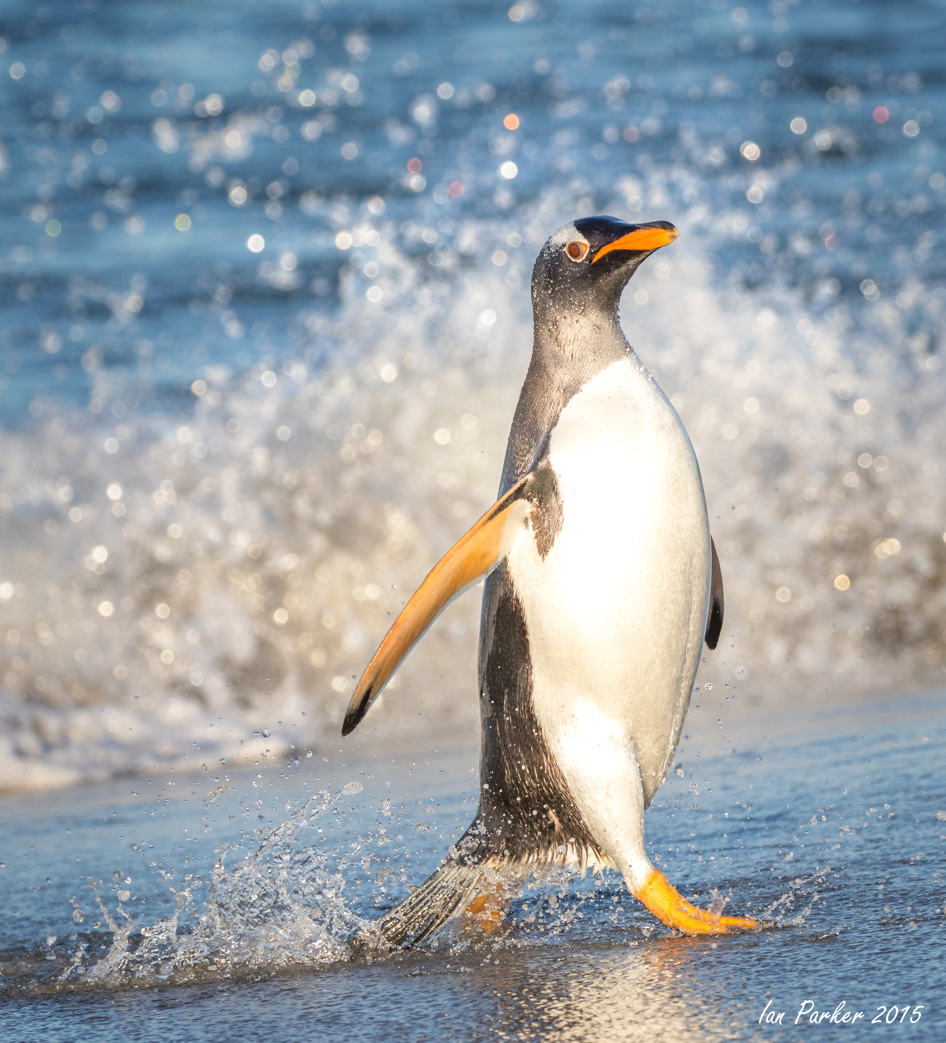
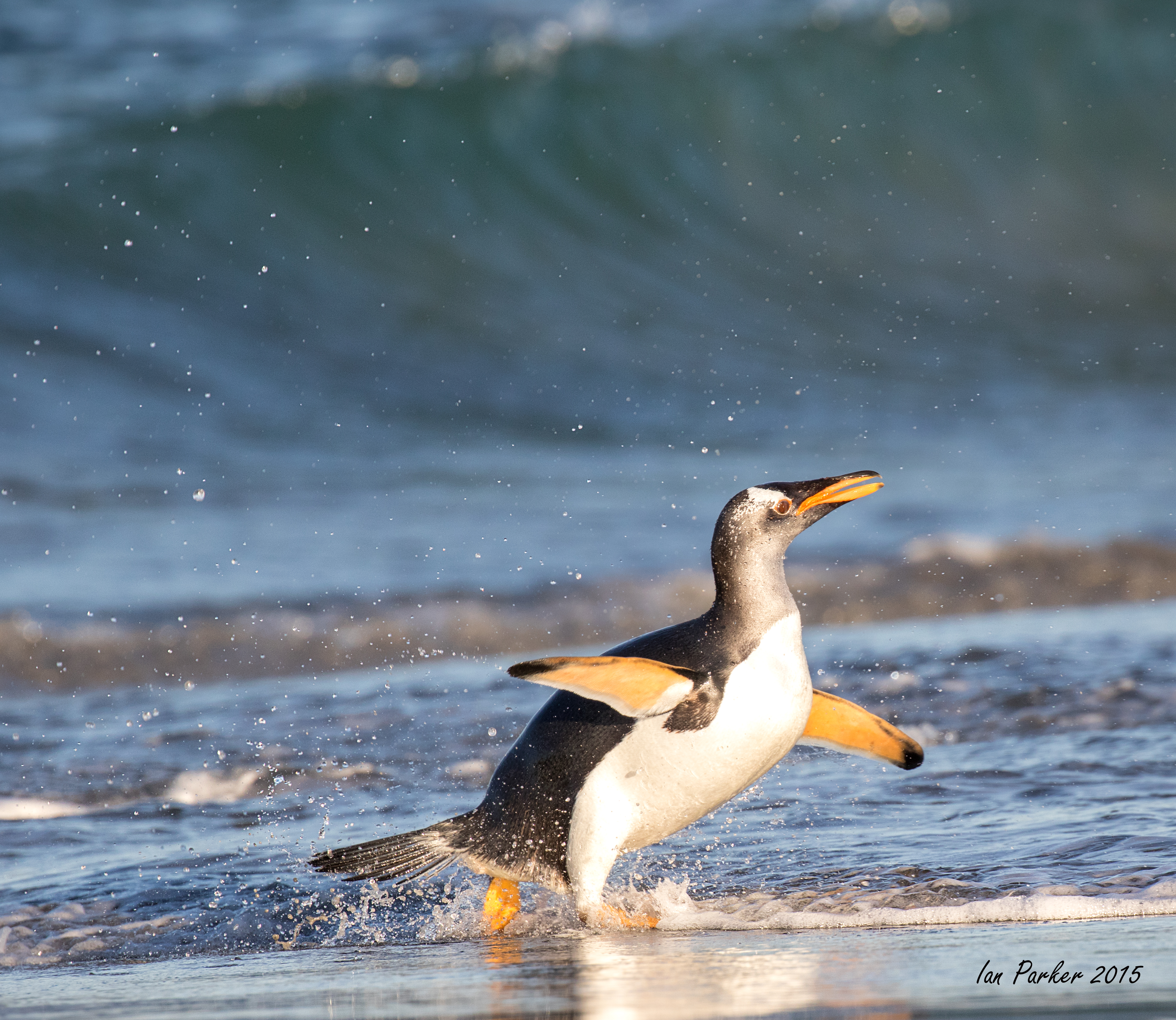
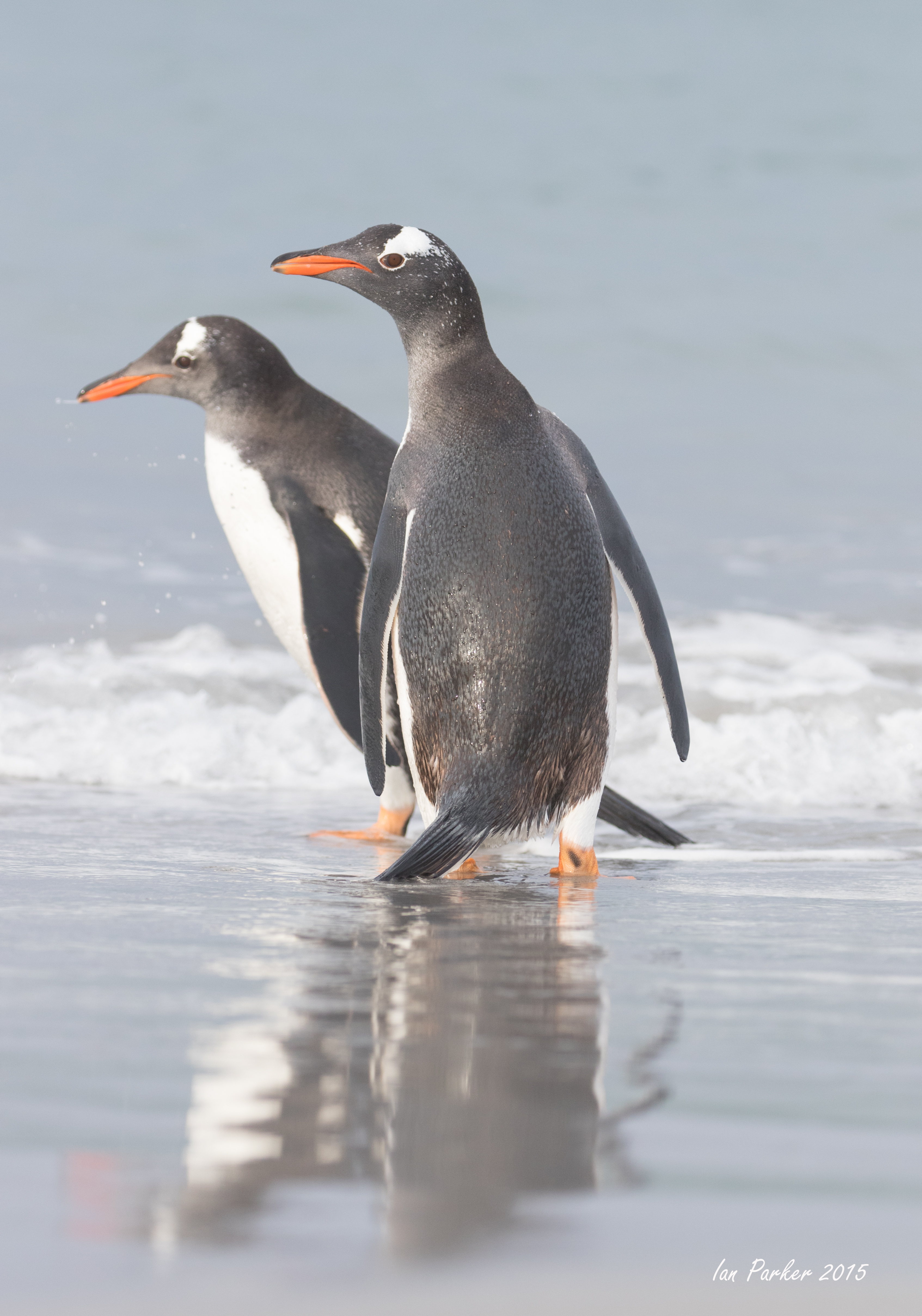
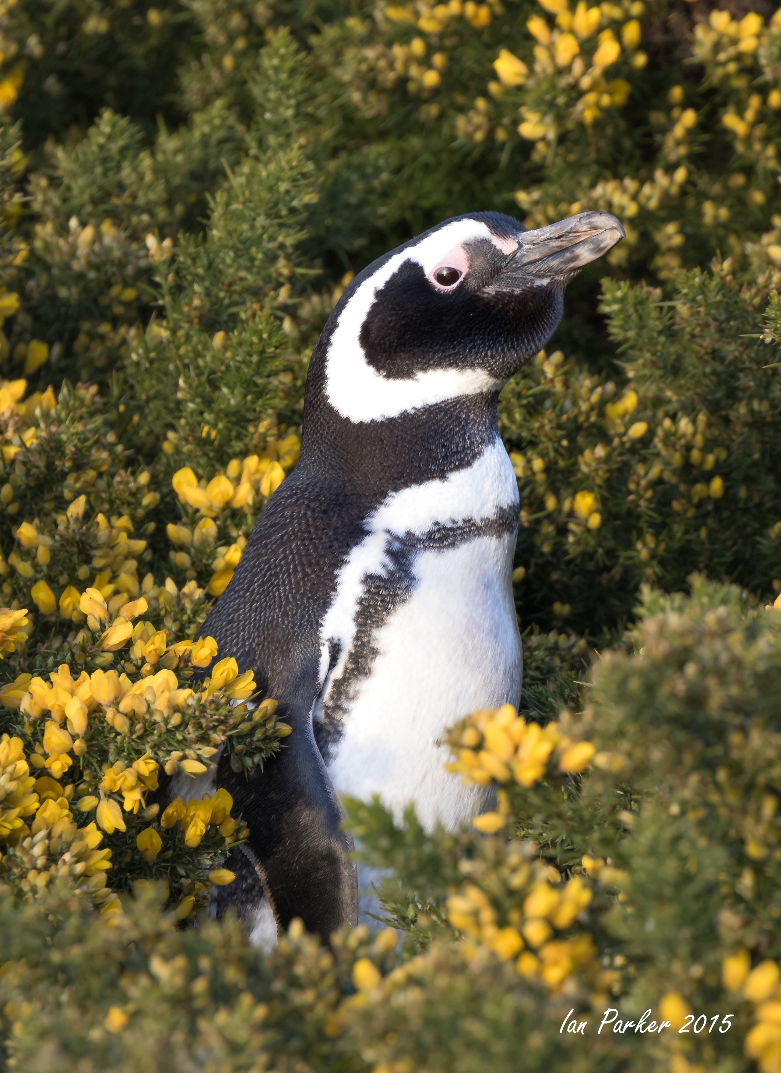
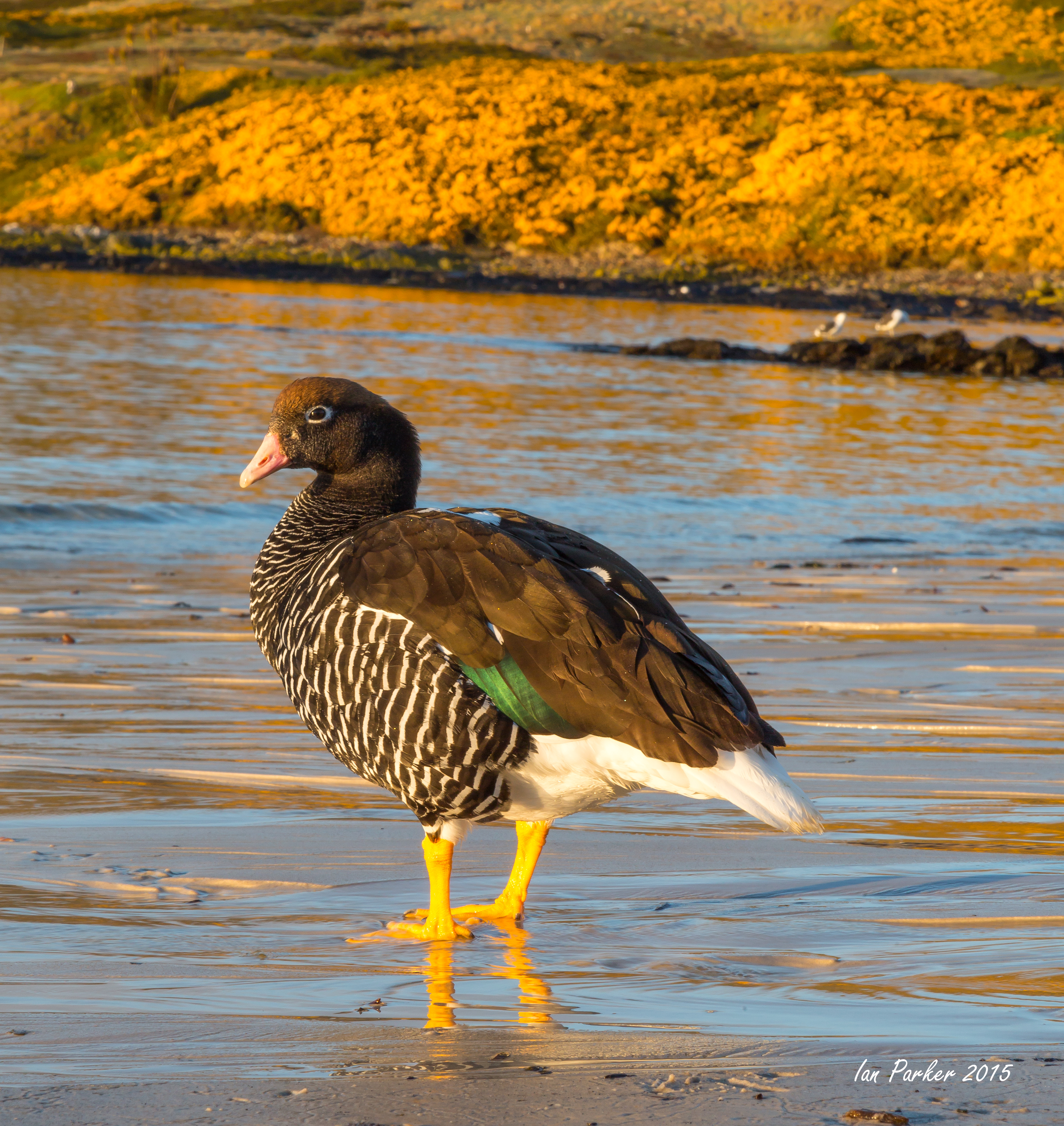
December 15-16 : Deception Island, Half Moon Island and an iceberg with multi-colored grottos
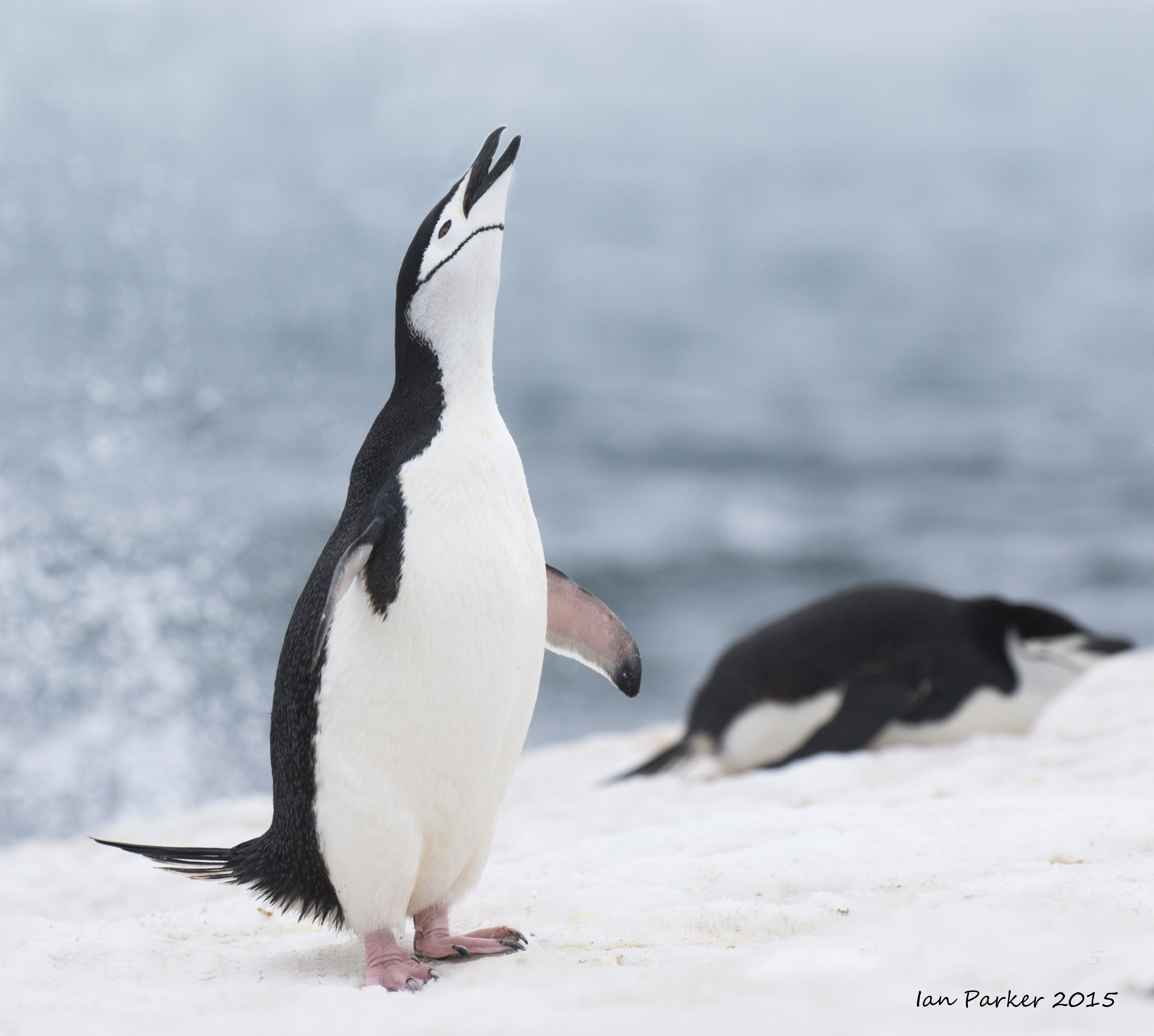
Shortly after dinner we approached volcanic Deception Island. As we neared the caldera’s famous entrance—Neptune’s Bellows—we passed several icebergs with dozens of chinstrap penguins. With Baily Head, one of the largest chinstrap colonies in the South Shetlands just around the corner, the icebergs gave the penguins a resting spot during their feeding time at sea.
The evening could not have been more perfect for our passage through the Bellows. This passage always requires a tricky maneuver of navigational skill as the entrance is rather narrow, with rocks and a sunken ship. With all hands on deck, calm seas and winds, and clear skies overhead, the captain steered the ship flawlessly through the Bellows. Everyone was smiling as we cleared the last of the cliffs and were met by the incredible view of the entire caldera and Whalers Bay.
Our anchorage for the night was around the corner from the old whaling/research station. Fast ice was still present in that part of the bay. The ship was gently placed into the fast ice edge and that is what we used for our anchorage site for the night. It was a perfect place for a restful night, surrounded by the towering walls of the caldera, with a beautiful ice moorage in front of us.
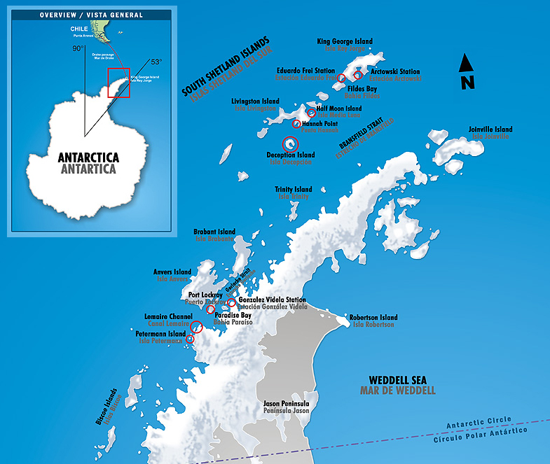
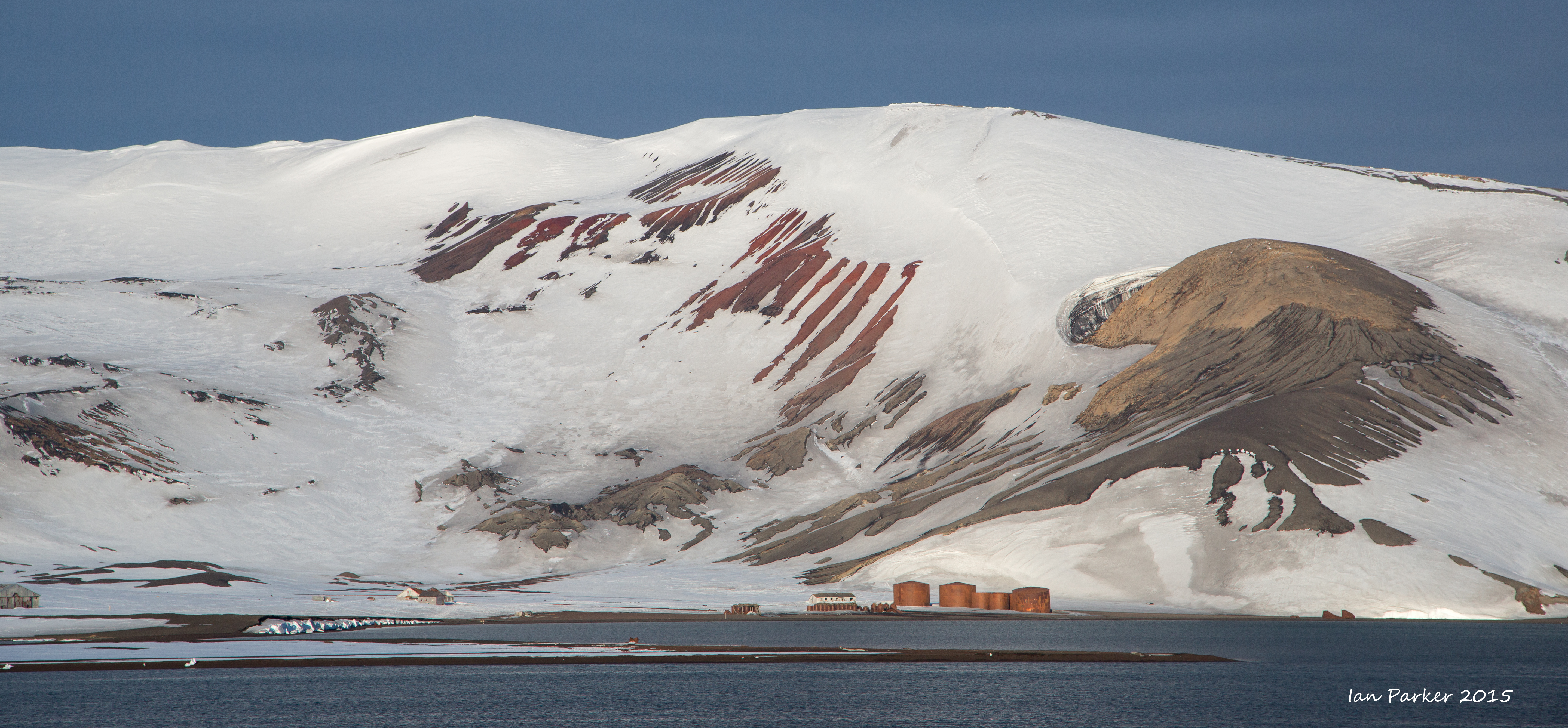
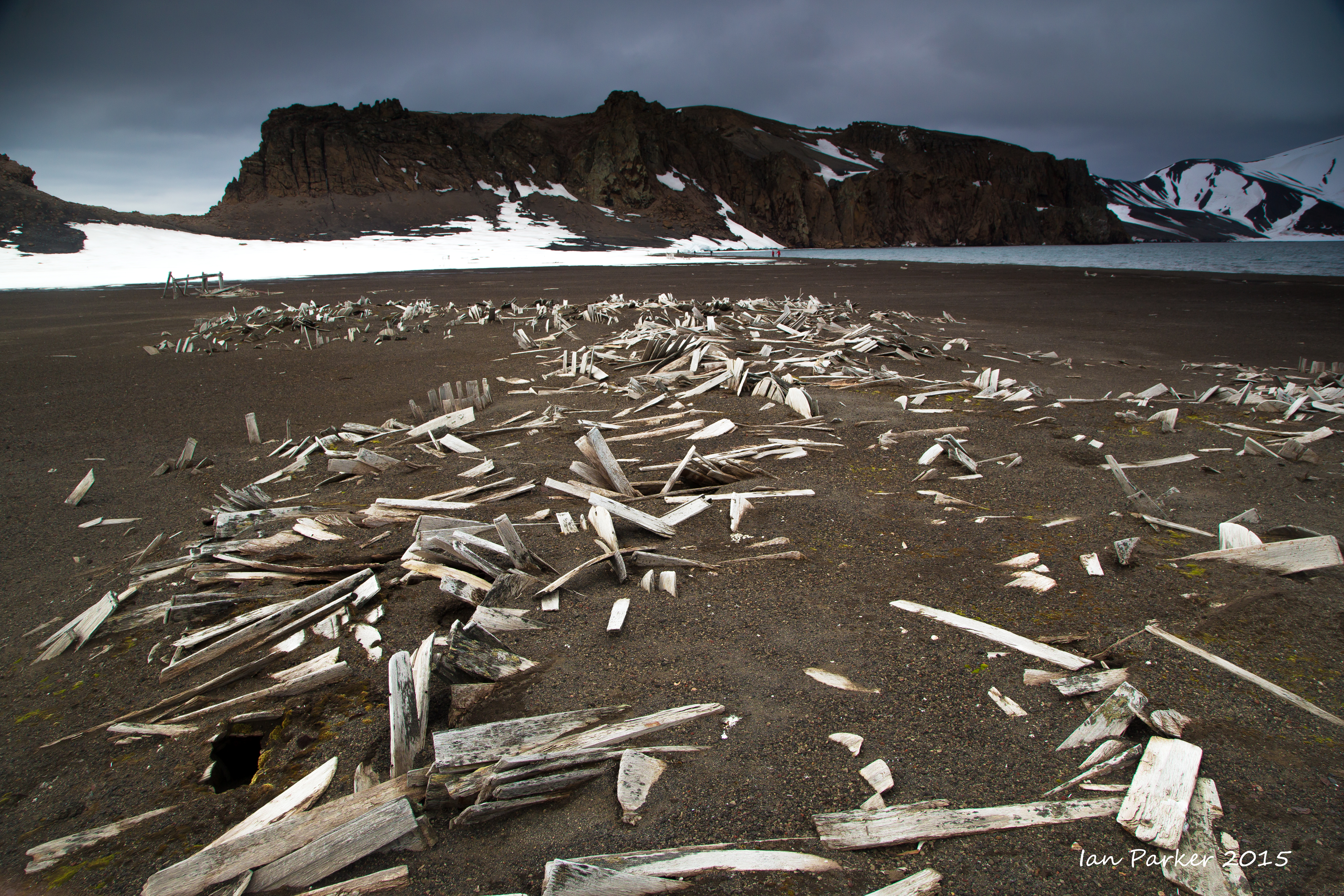
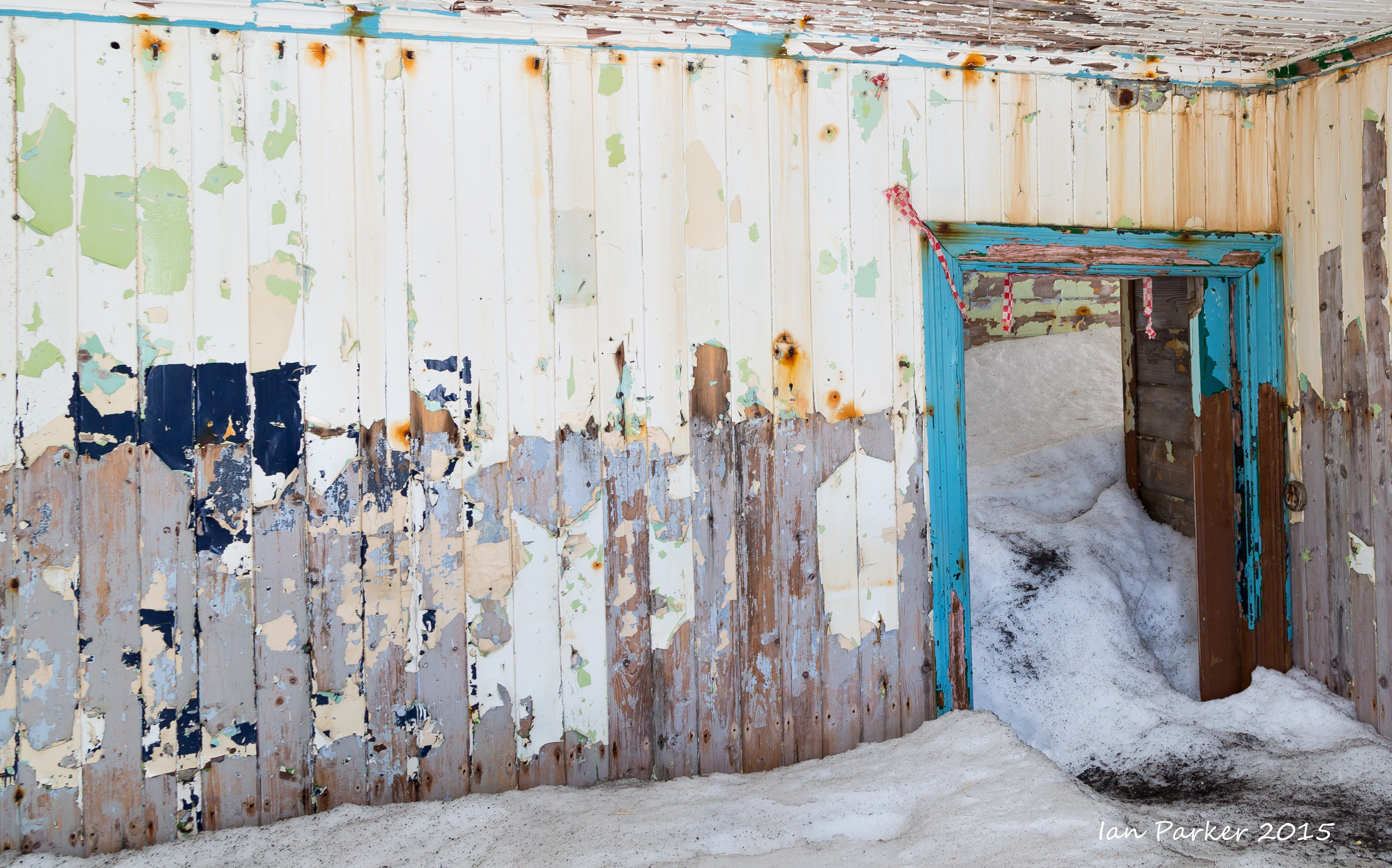
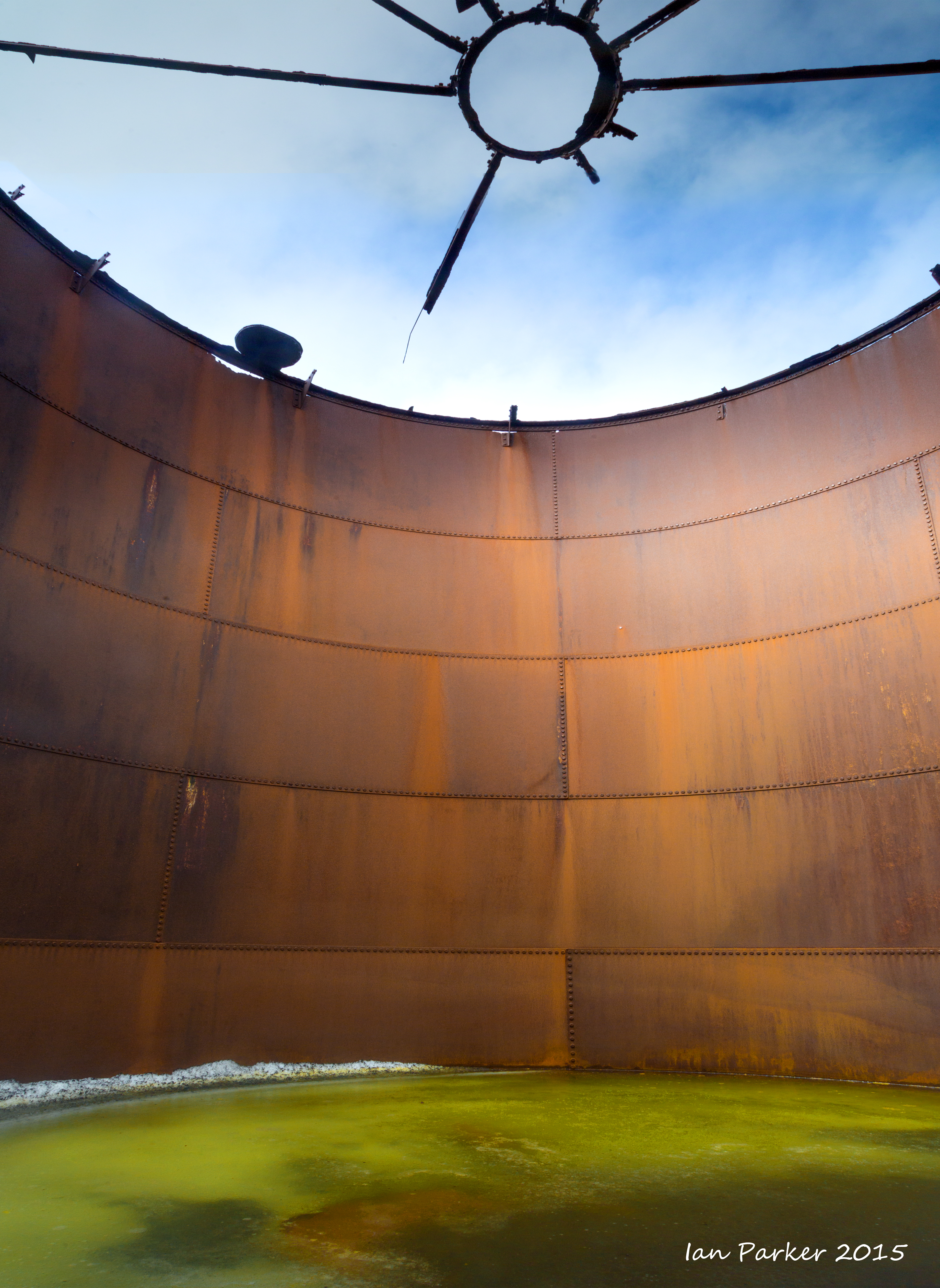
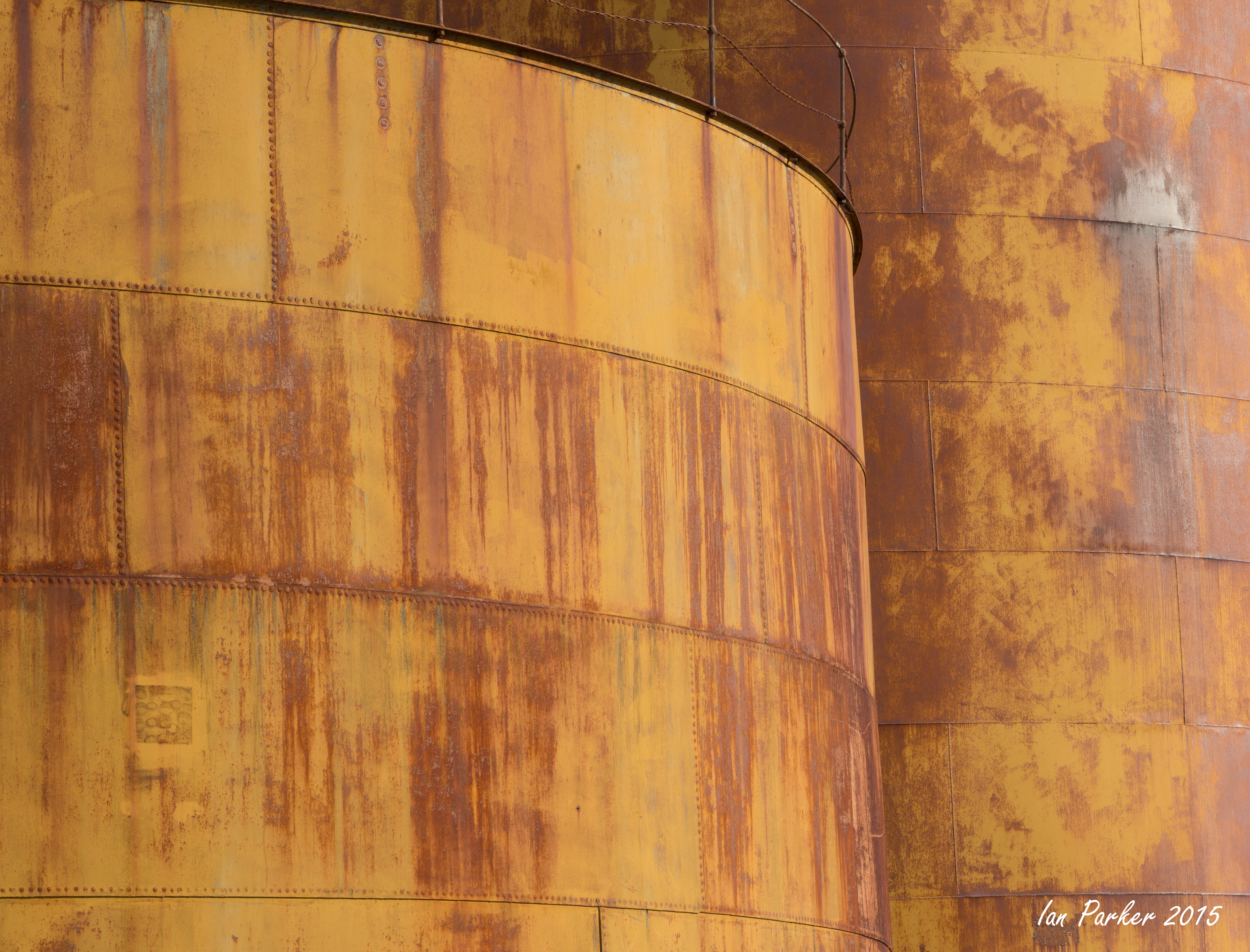
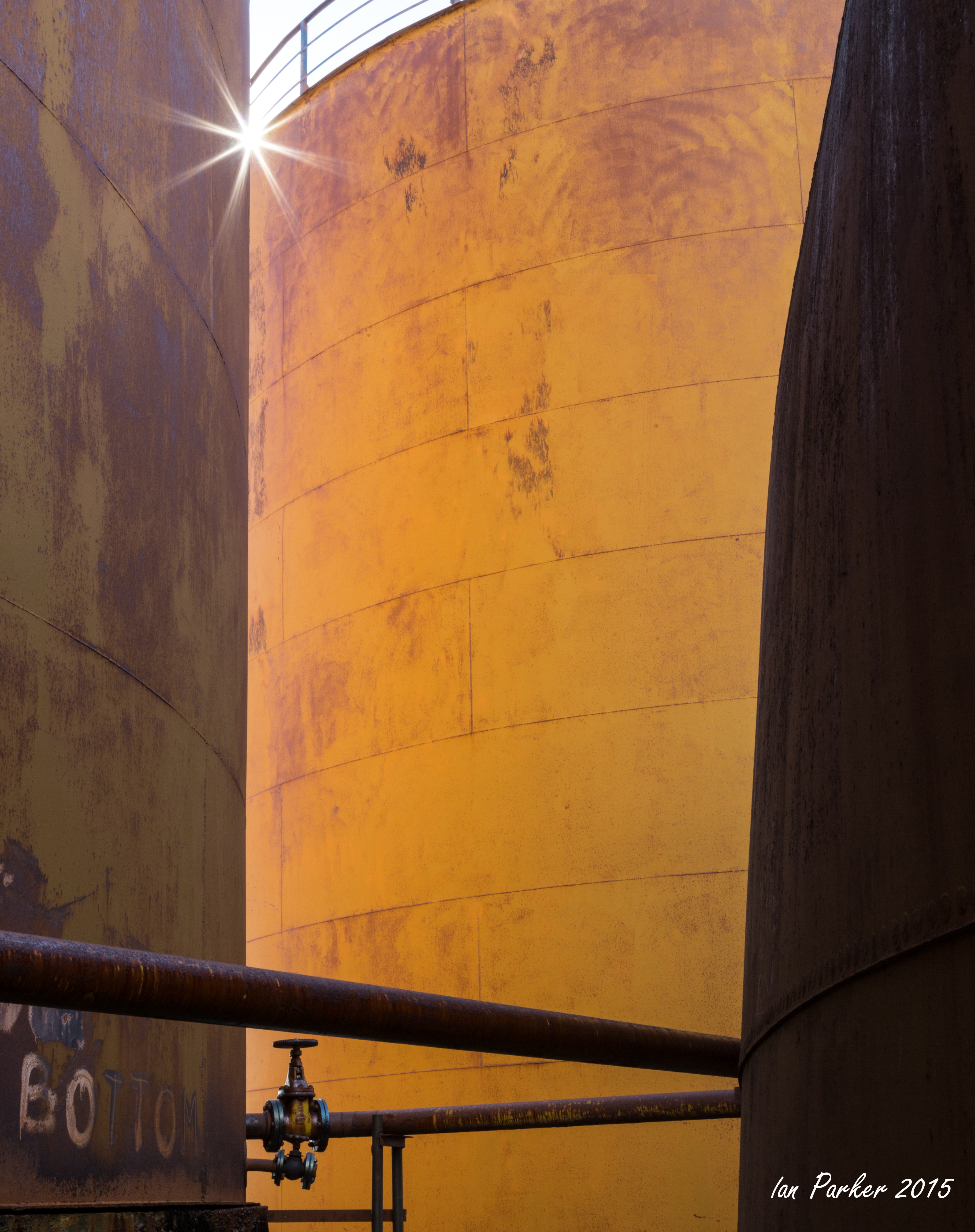
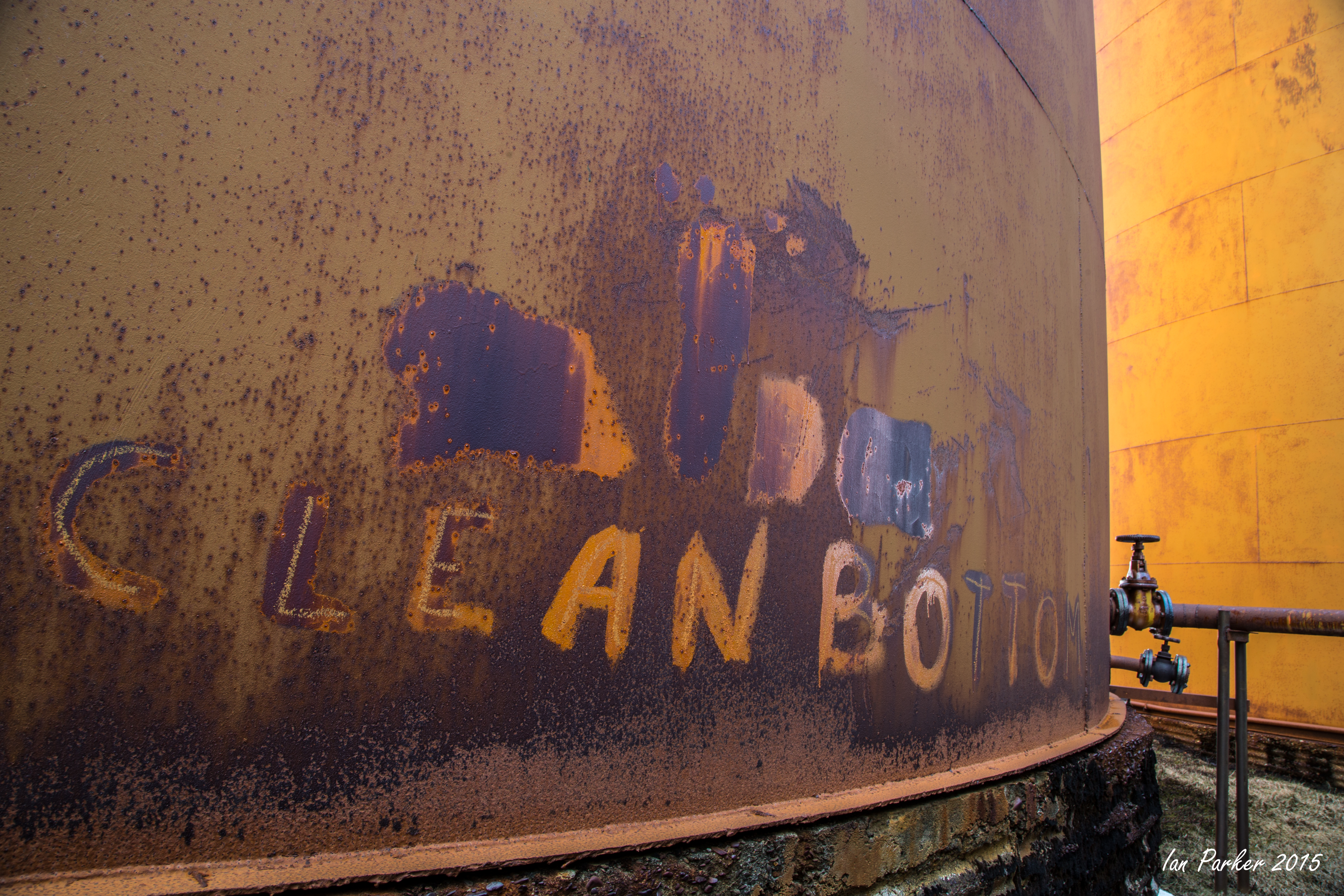
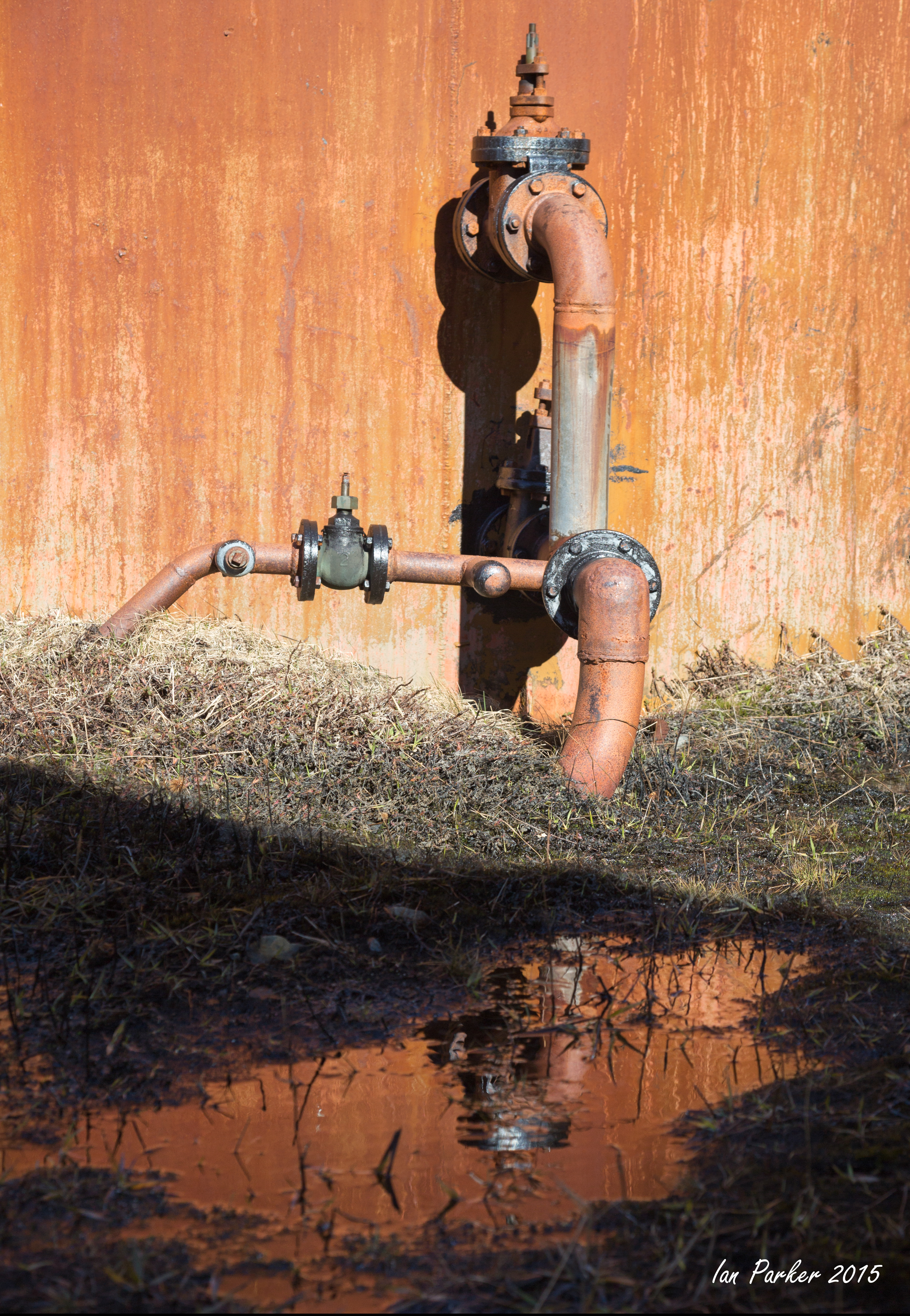
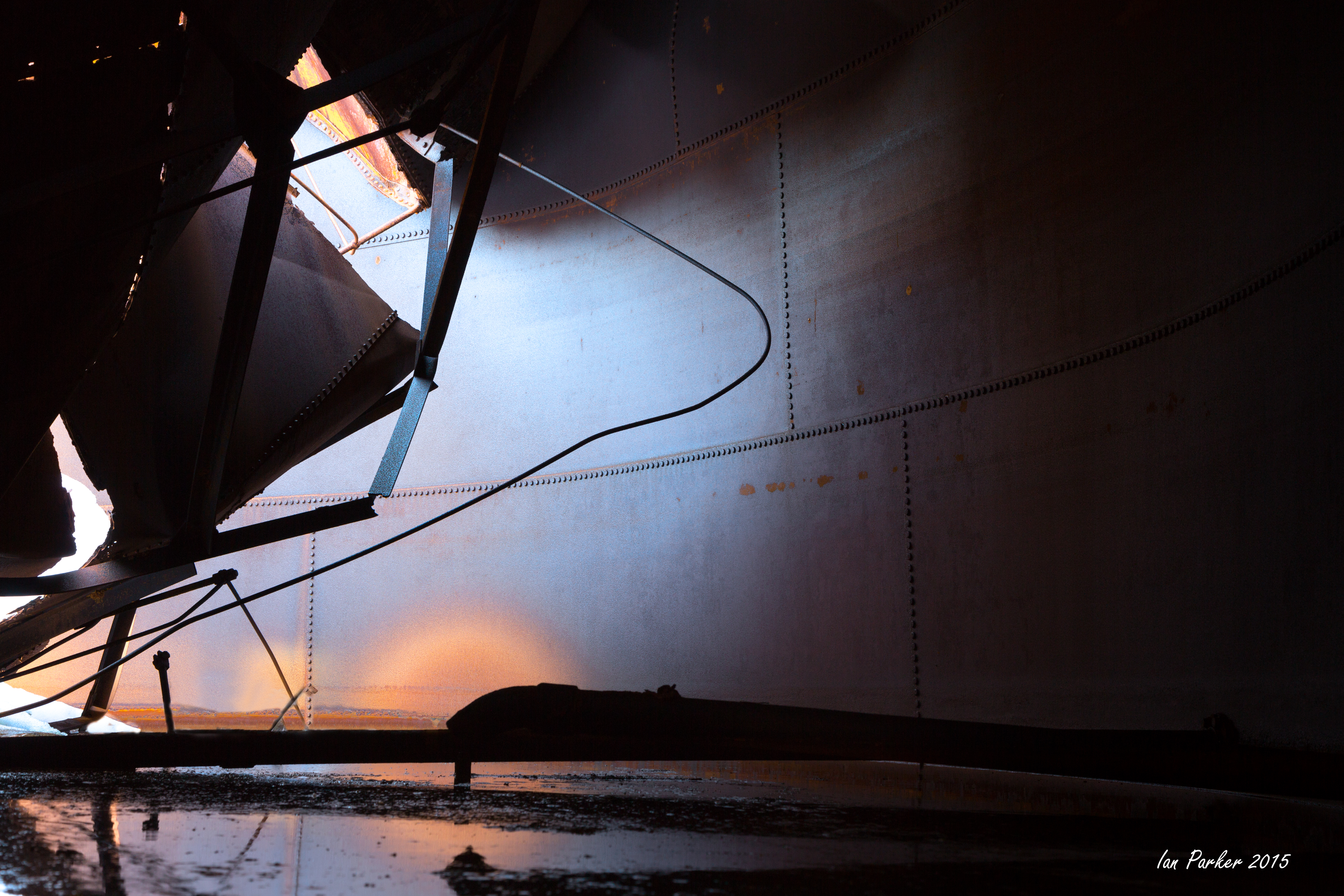
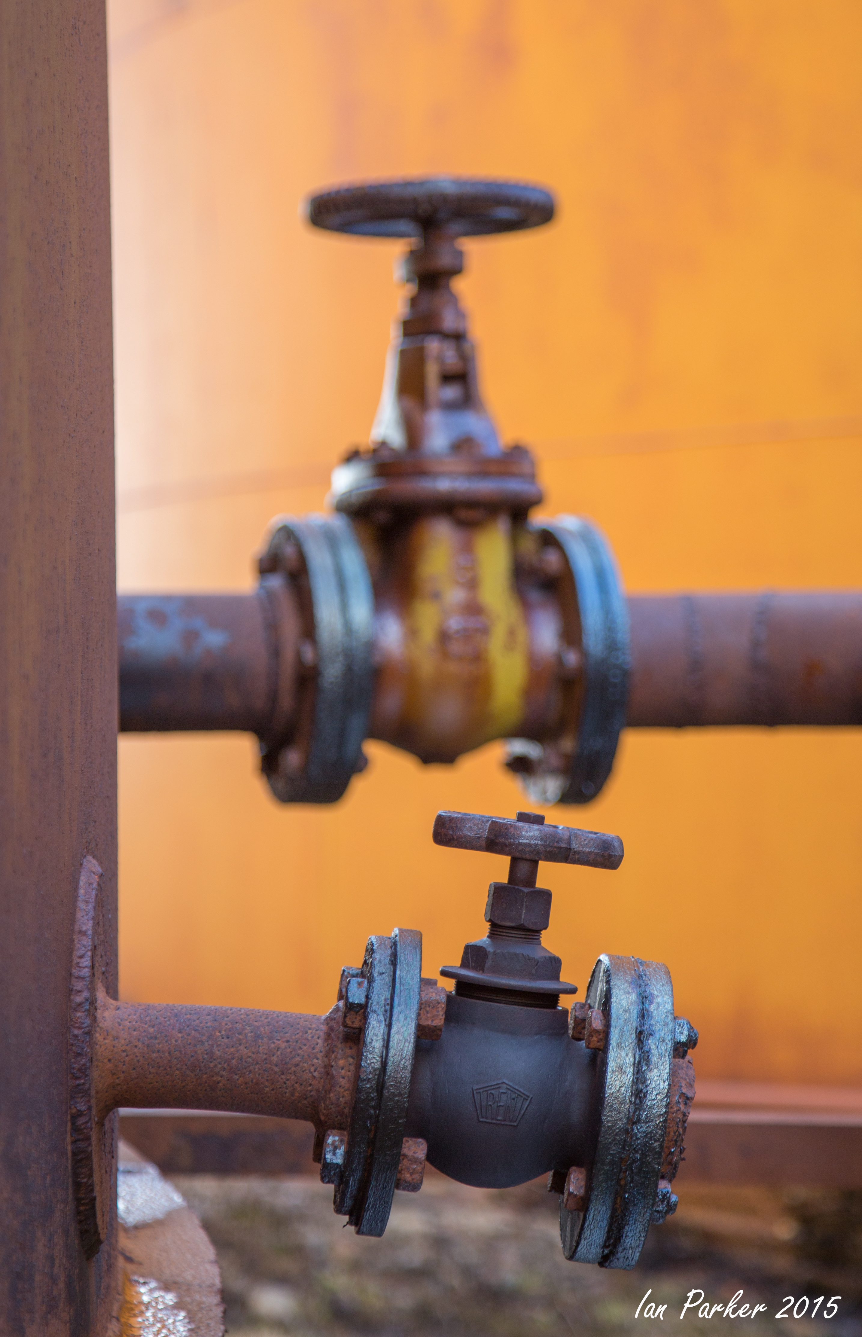
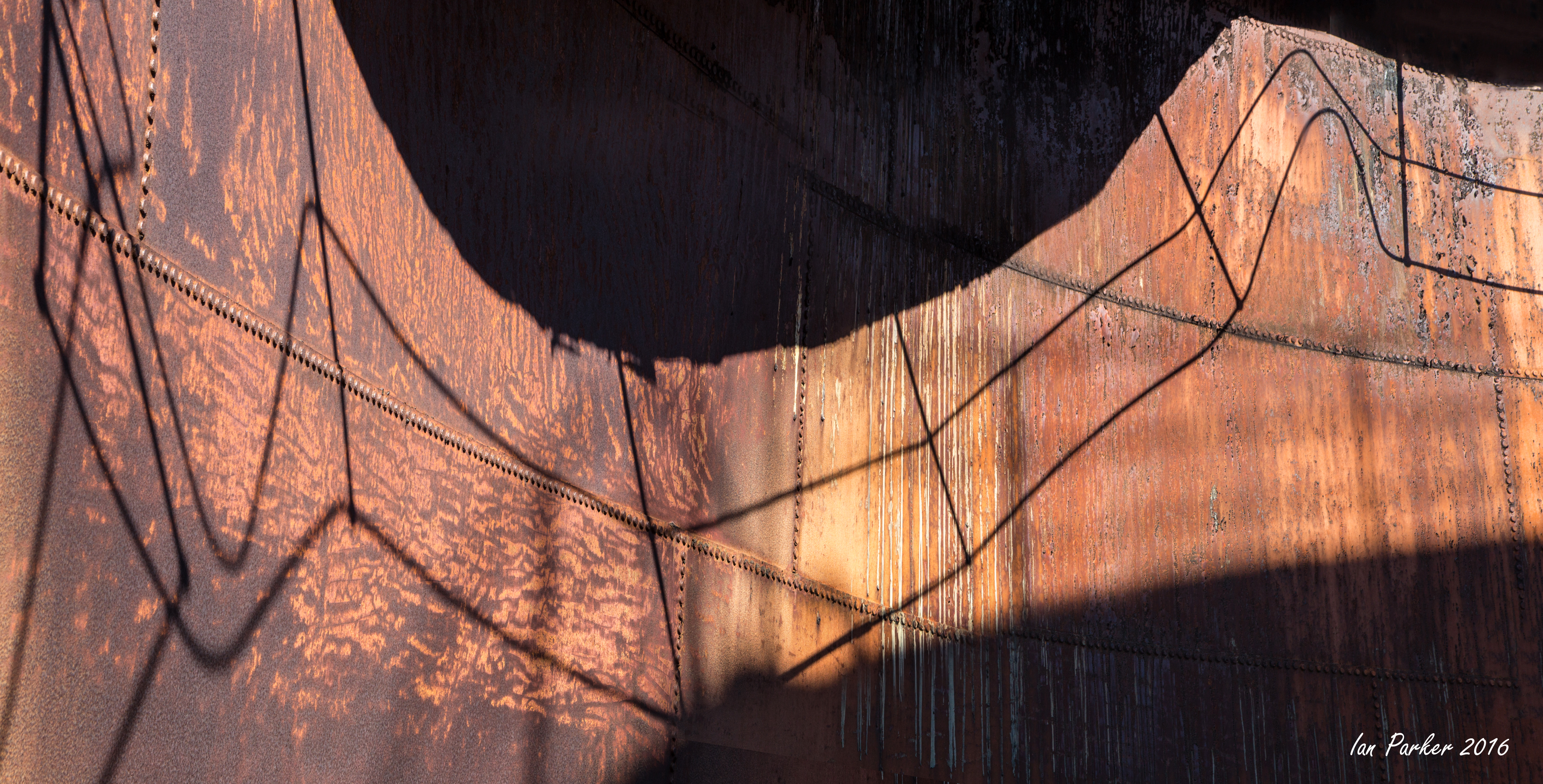
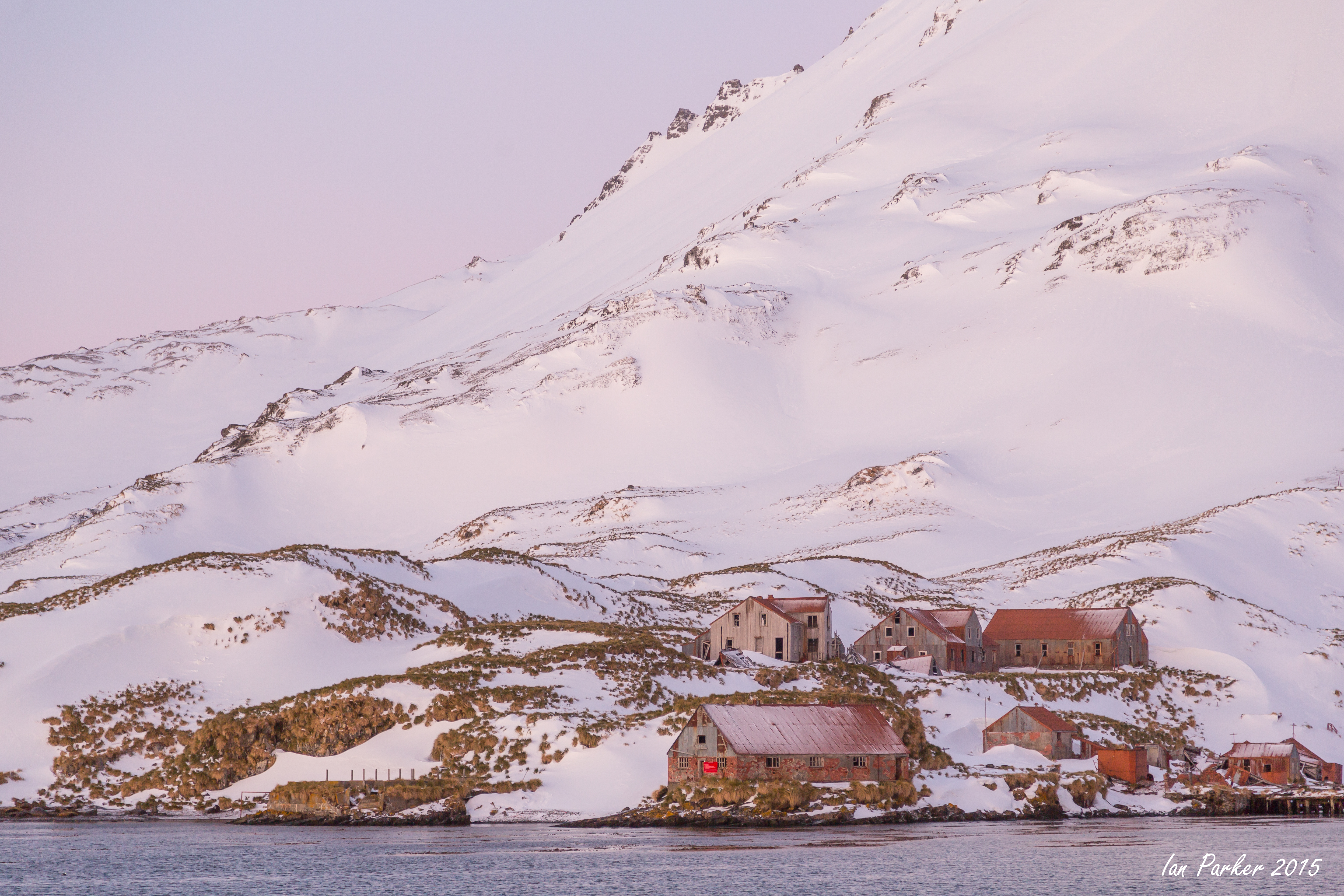
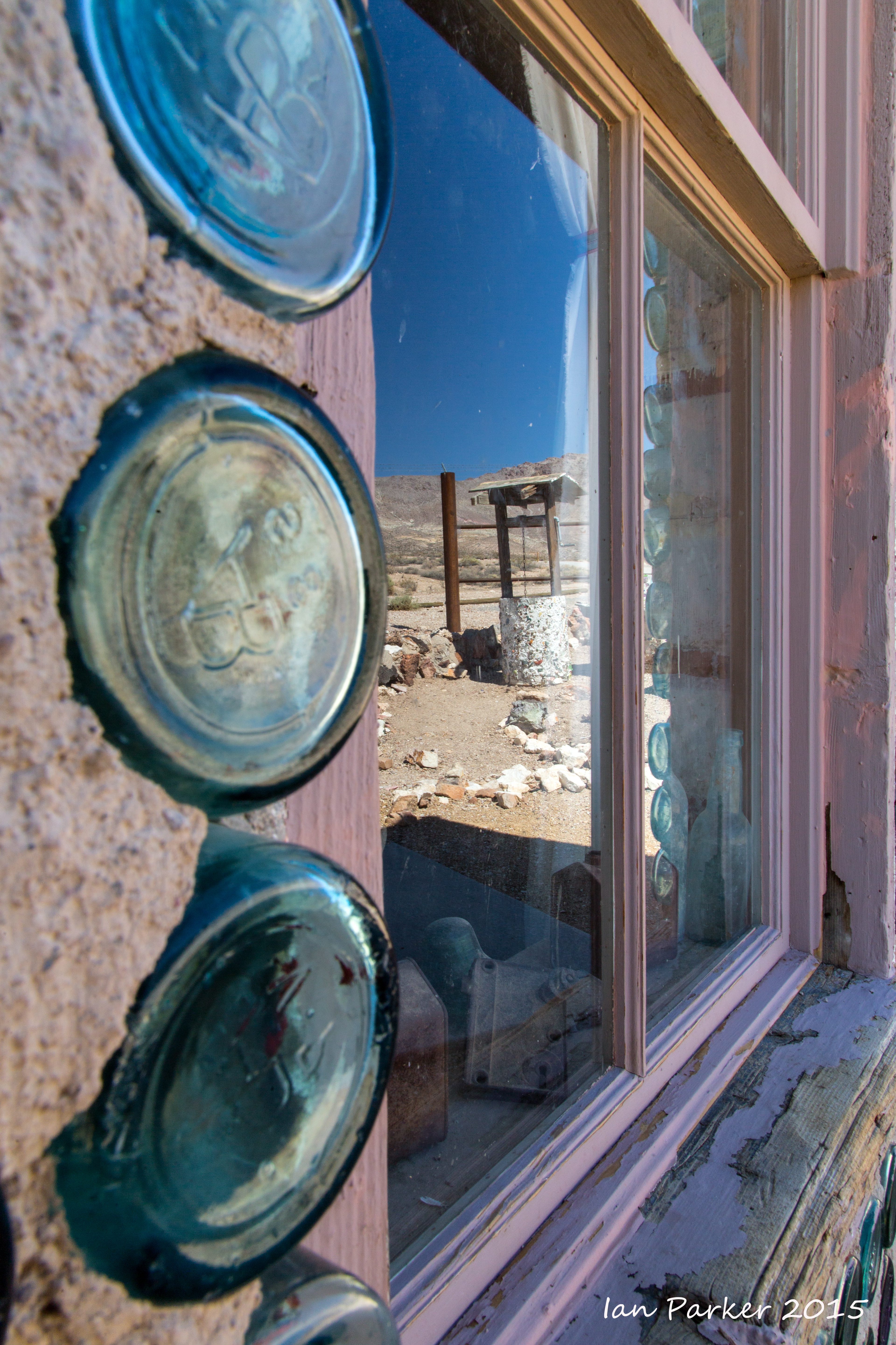
Our first departure was a short Zodiac ride to Whalers Bay on Deception Island, a volcanic island highlighted by its breached caldera where we anchored for the morning. The caldera floor, now a flooded seabed and presently still half-covered in fast ice, stretches six miles in diameter and reaches 585 feet from the sea floor. This sheltered bay was both a whaling station and a small British Antarctic base, called Biscoe House, whose remains slowly deteriorate on the black sand beach.
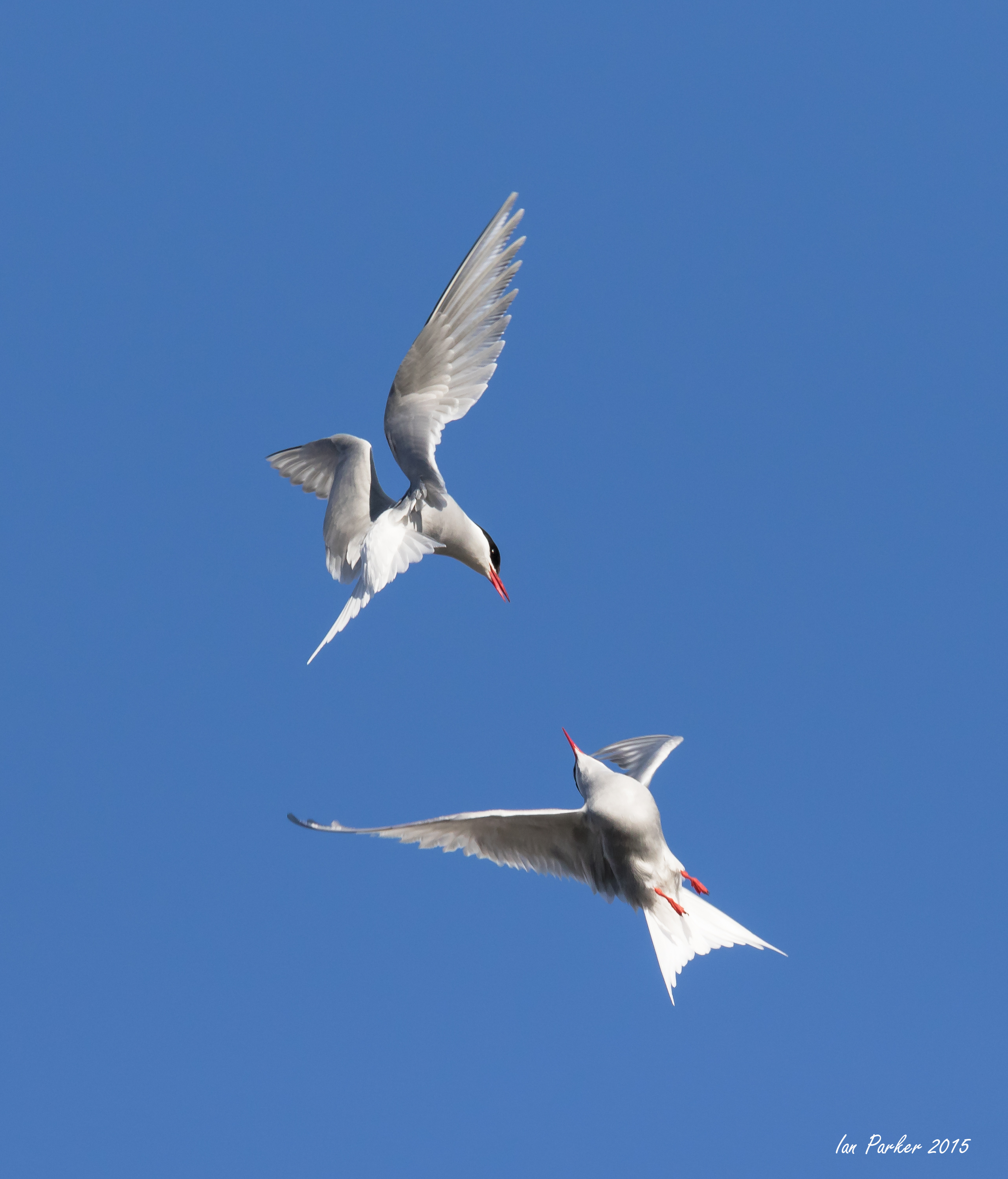
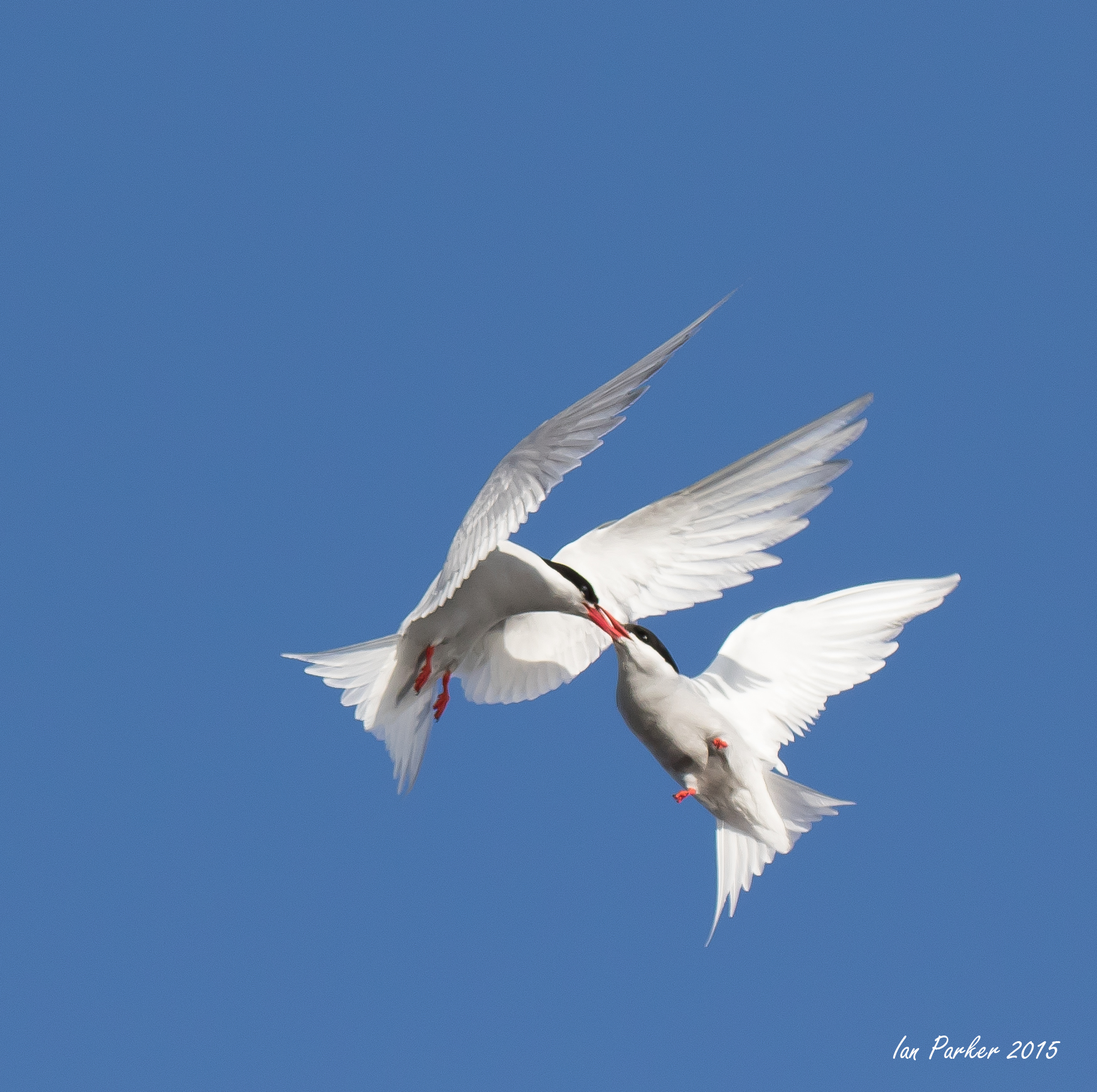
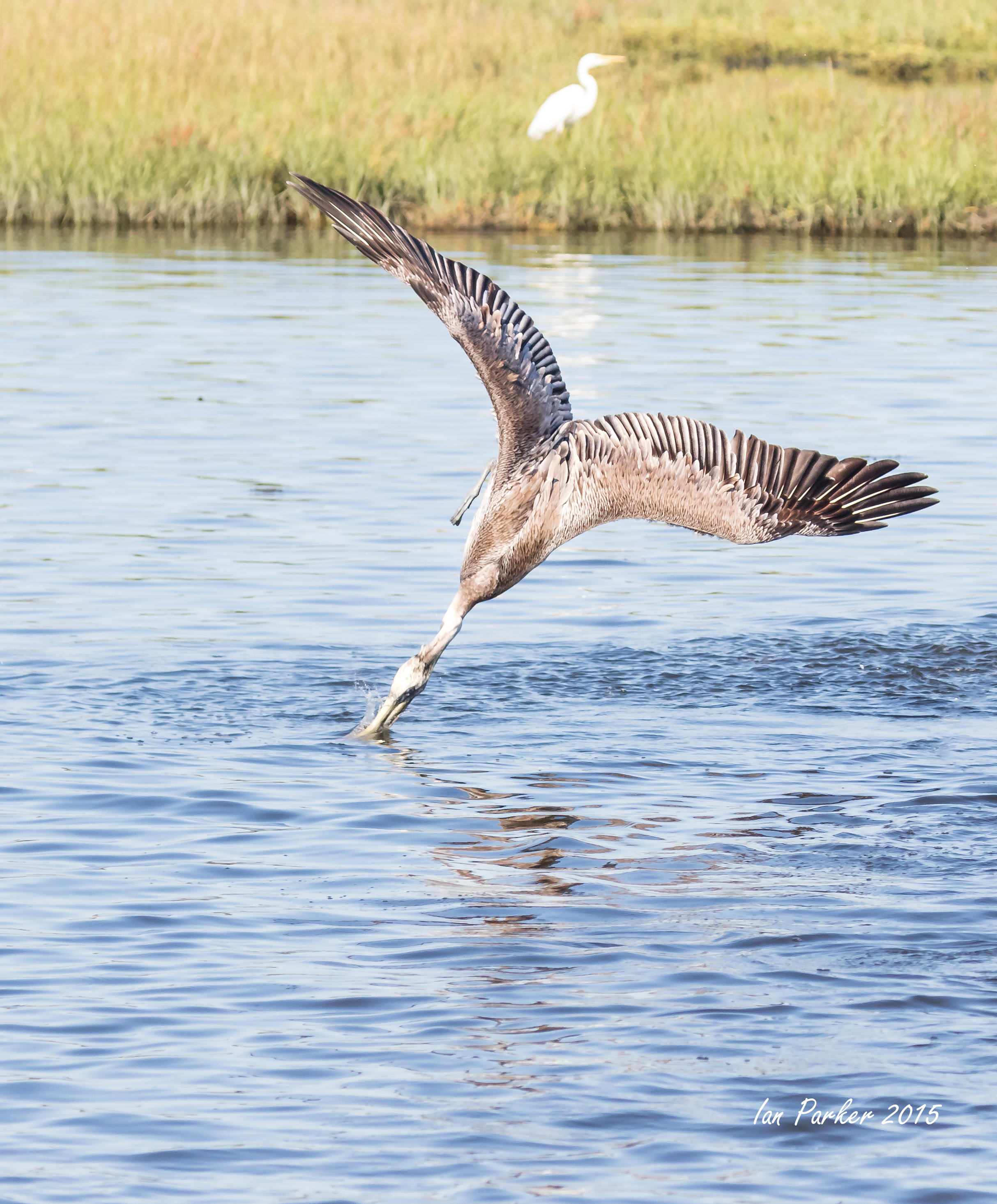
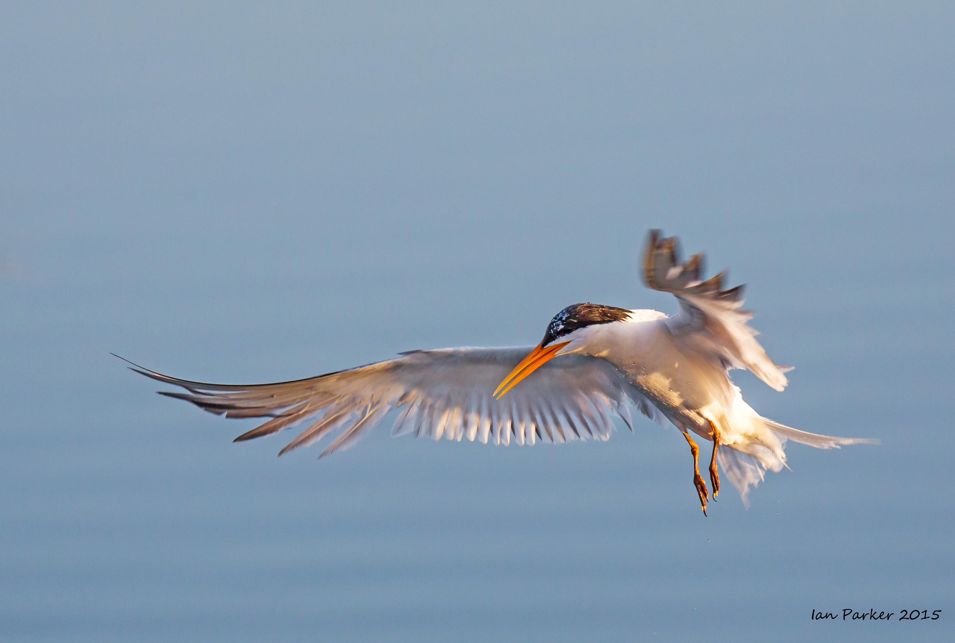
Several large red-rusted silos, resembling an oil refinery, are the most prominent feature of the beach. Indeed, these silos, sitting adjacent to the decrepit, decaying buildings that functioned as meat and blubber processing facilities, acted as fuel storage facilities. All of the structures are in progressive states of ruin, and going inside is forbidden as the crumbling interiors are quite unsafe. However, outside of the buildings and the silos there were numerous photo opportunities of industrial geometric shapes, weathered wood buildings, and more. On the roof tops of some of the shacks kelp gulls nested and, on the gravel bars beyond, Antarctic terns nested and dive-bombed anyone who walked too close to their nest sites. .
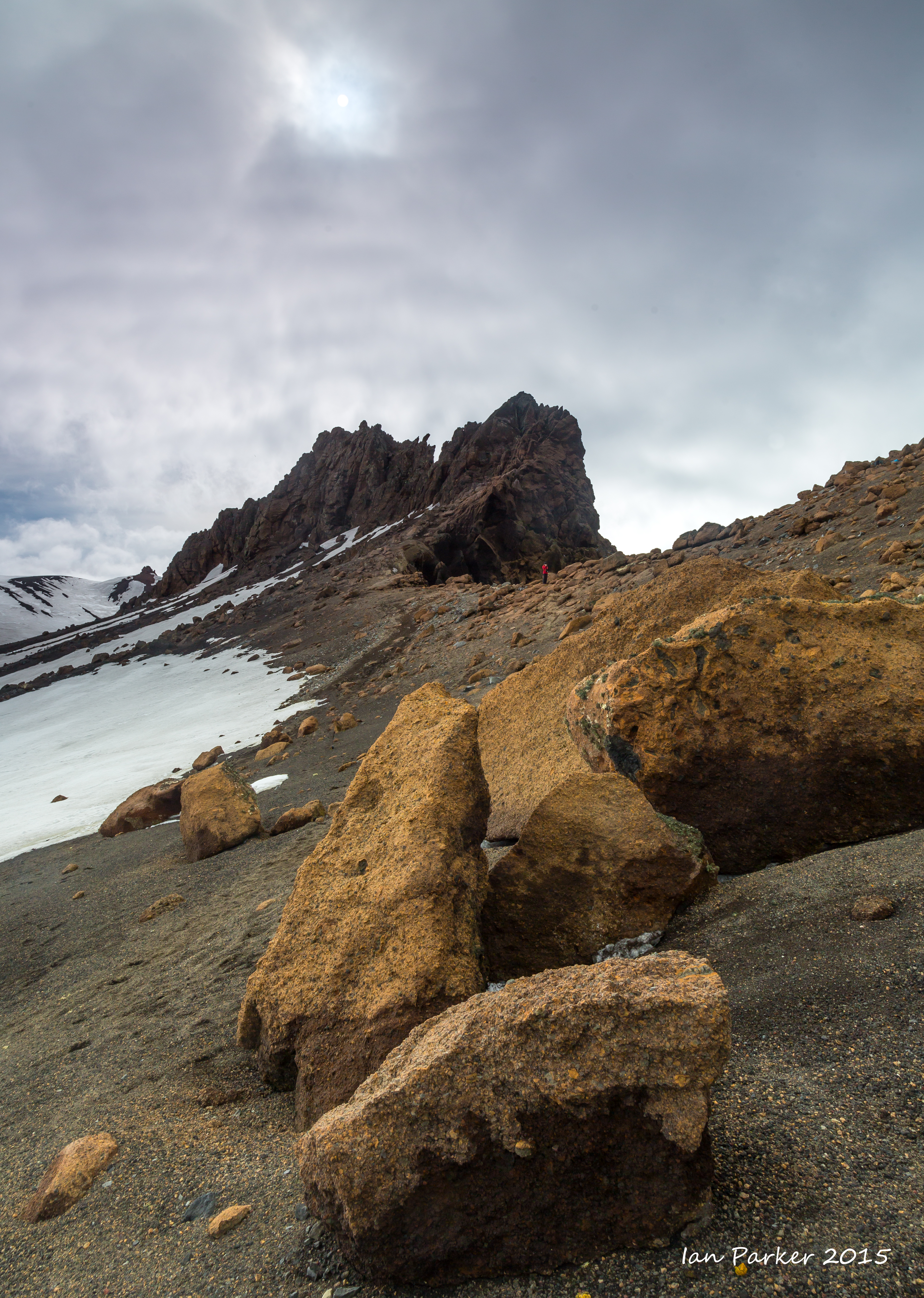
One of the highlights of Whalers Bay is Neptune’s Window, a notch in the steep cliffs looking east into the sea. Several photographers hiked to the rim of the Window and were treated not only to a great view but also, for some, a bit of vertigo, as the cliffs plunge steeply to the sea. Everyone was warned to stay several feet from the edge, as the substrate here was composed of loose conglomerate rock that might, if stepped upon, crumble and collapse.
One of the highlights of Whalers Bay is Neptune’s Window, a notch in the steep cliffs looking east into the sea. Several photographers hiked to the rim of the Window and were treated not only to a great view but also, for some, a bit of vertigo, as the cliffs plunge steeply to the sea. Everyone was warned to stay several feet from the edge, as the substrate here was composed of loose conglomerate rock that might, if stepped upon, crumble and collapse.
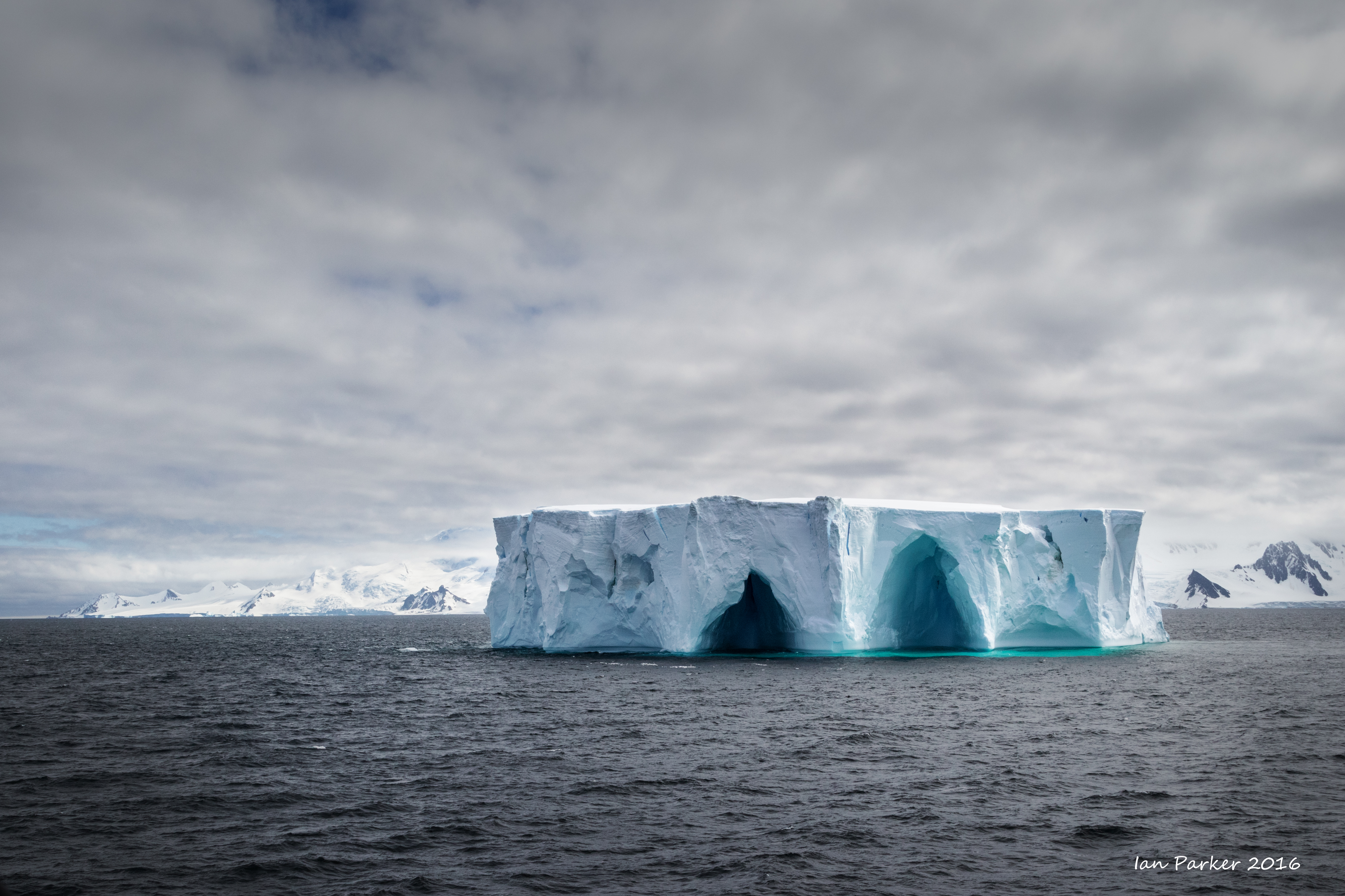
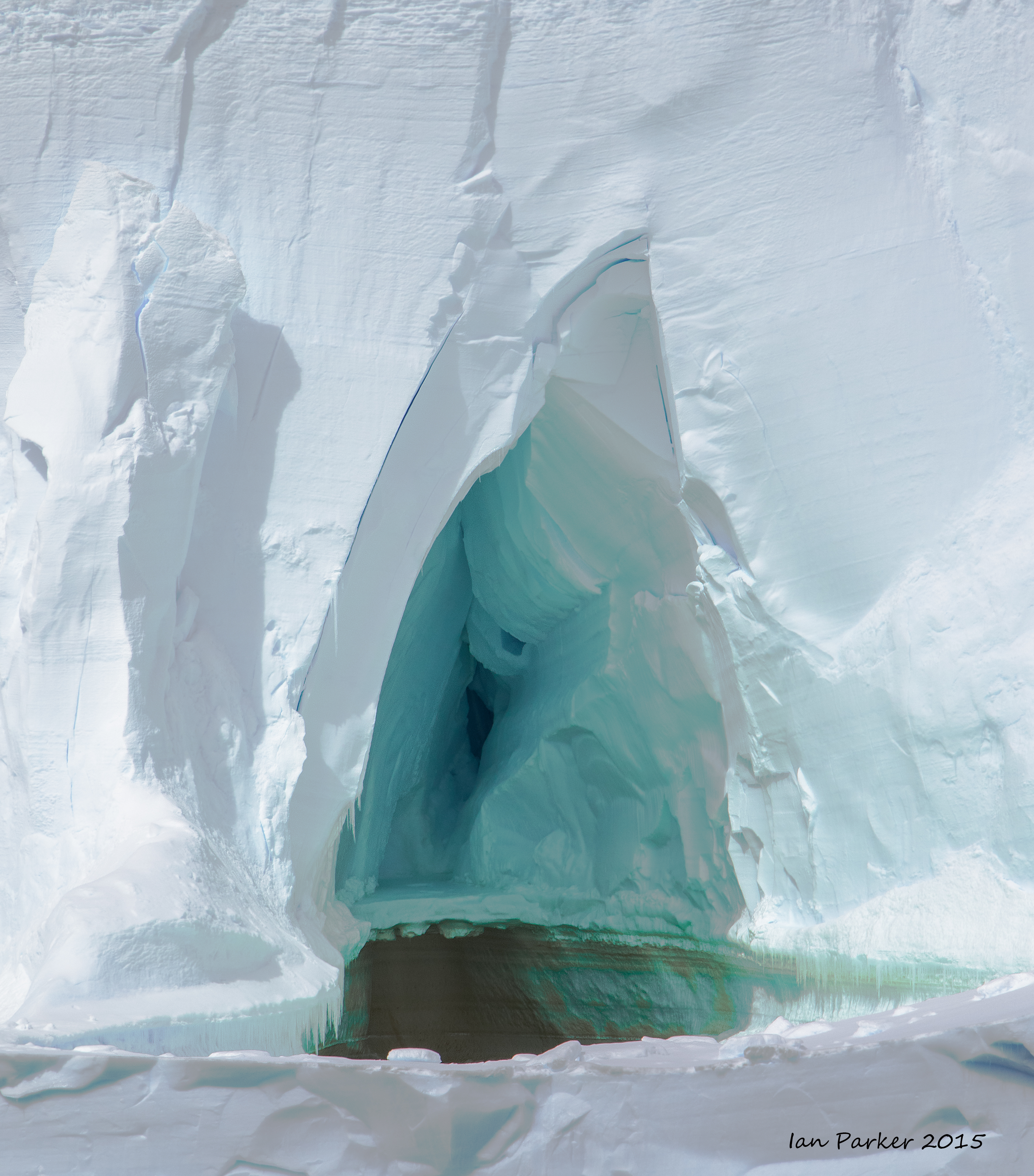
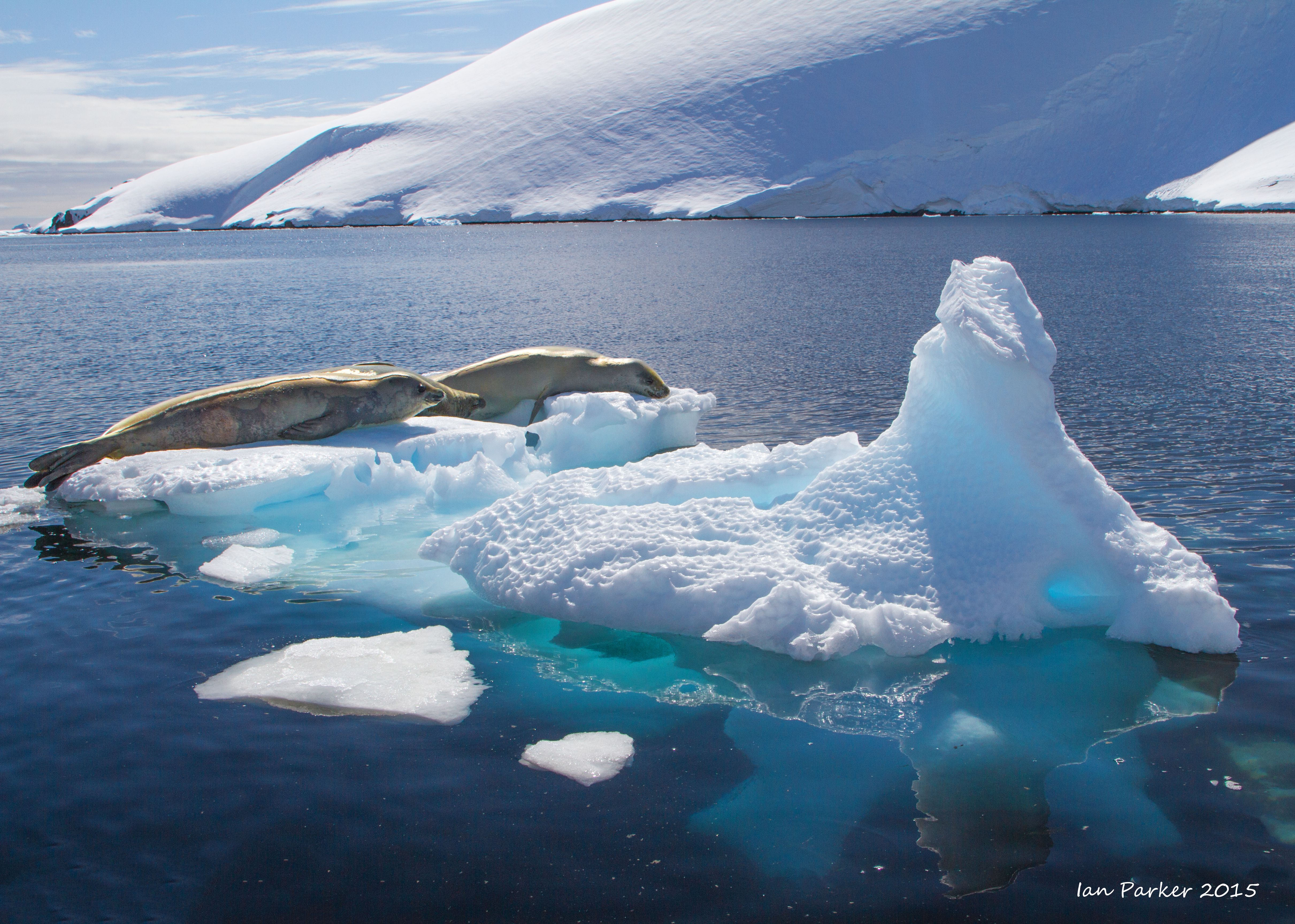
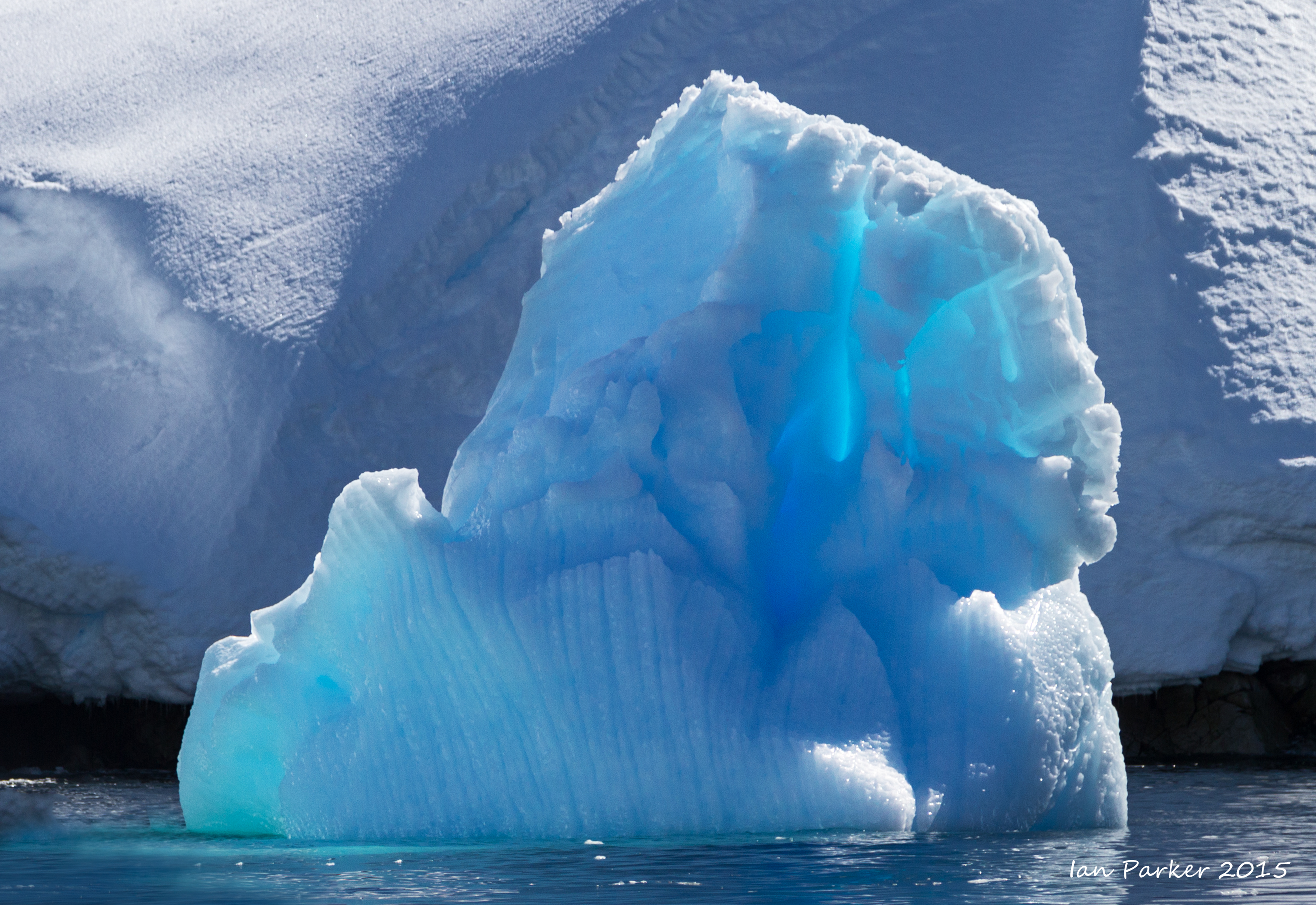
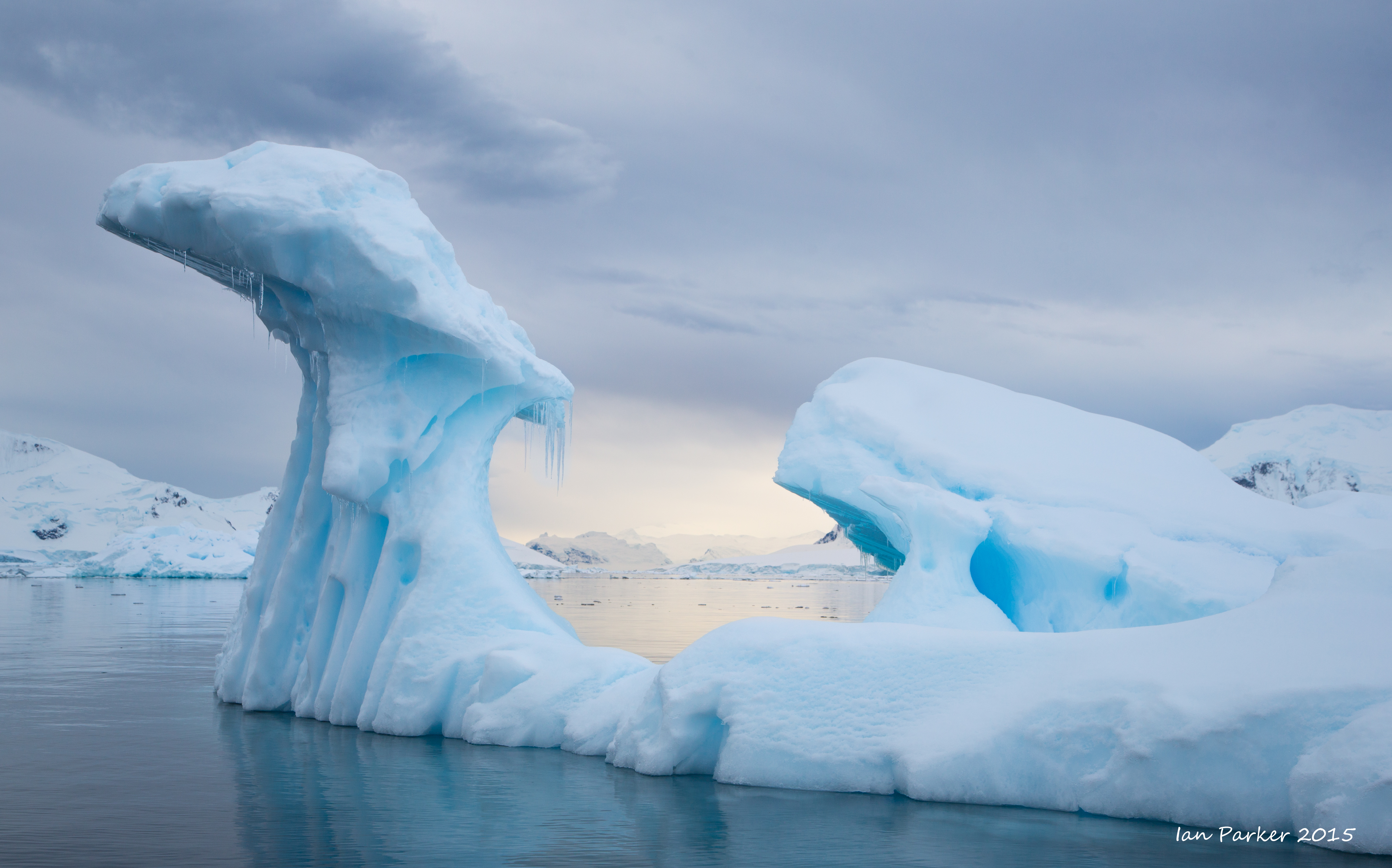
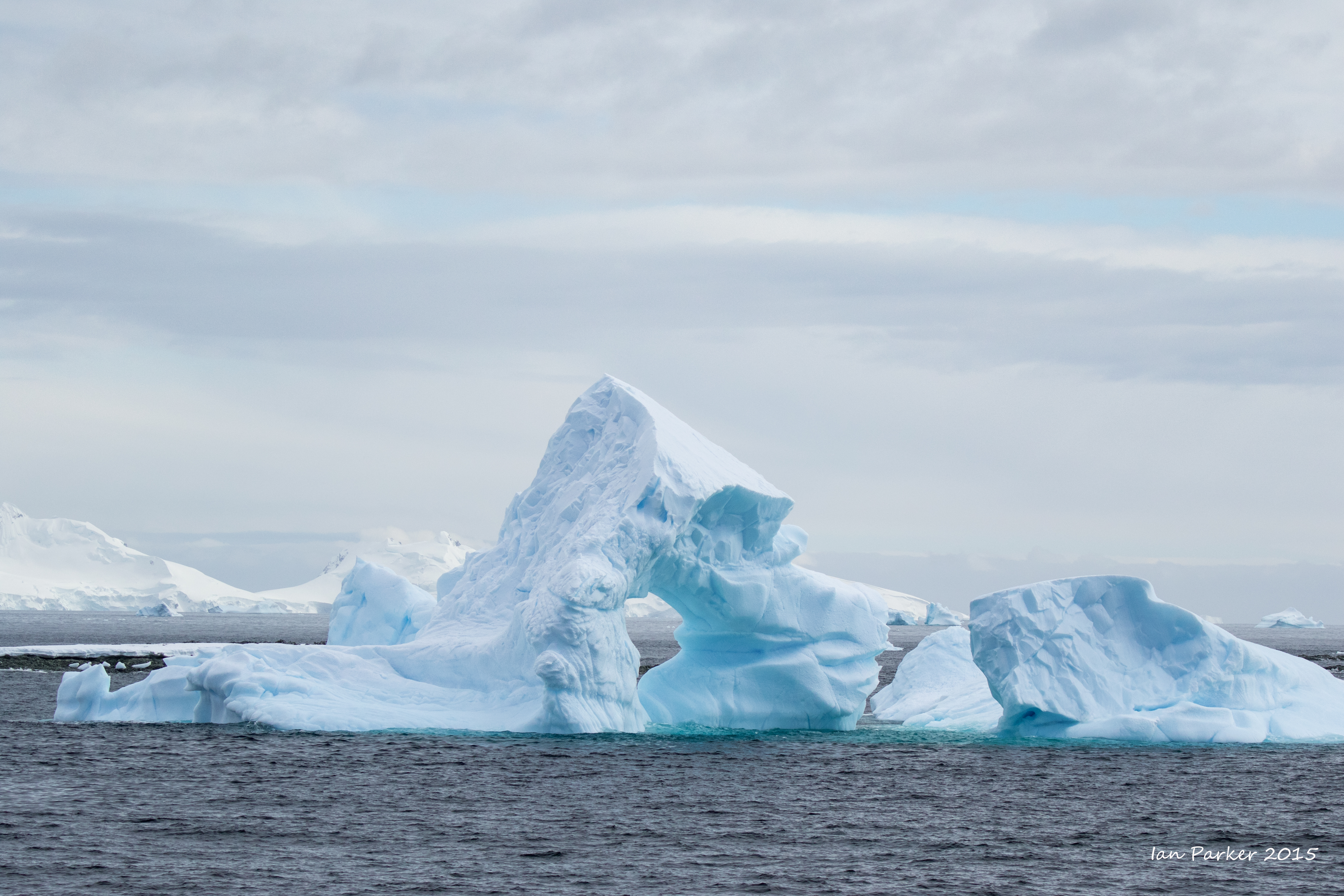
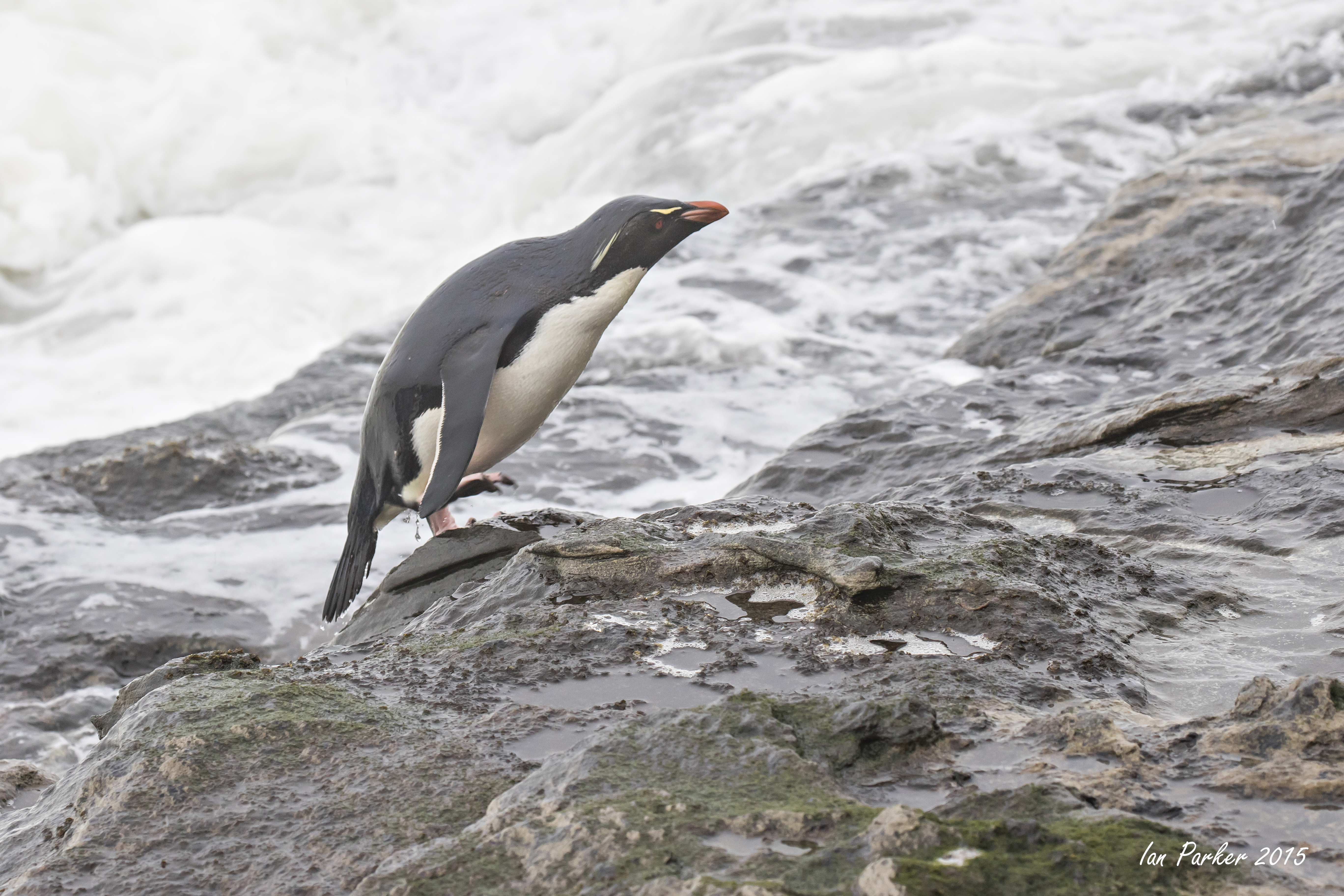
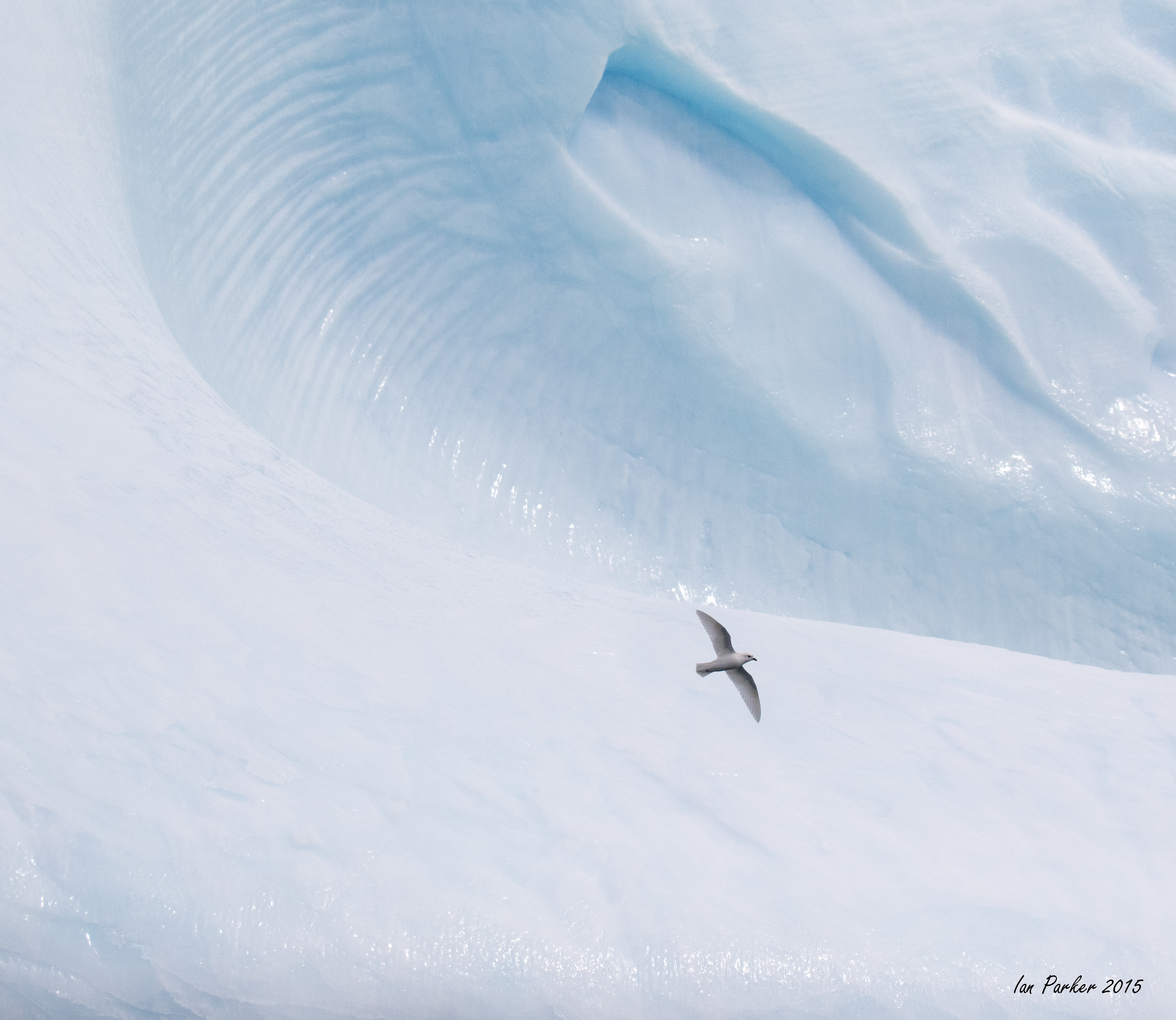
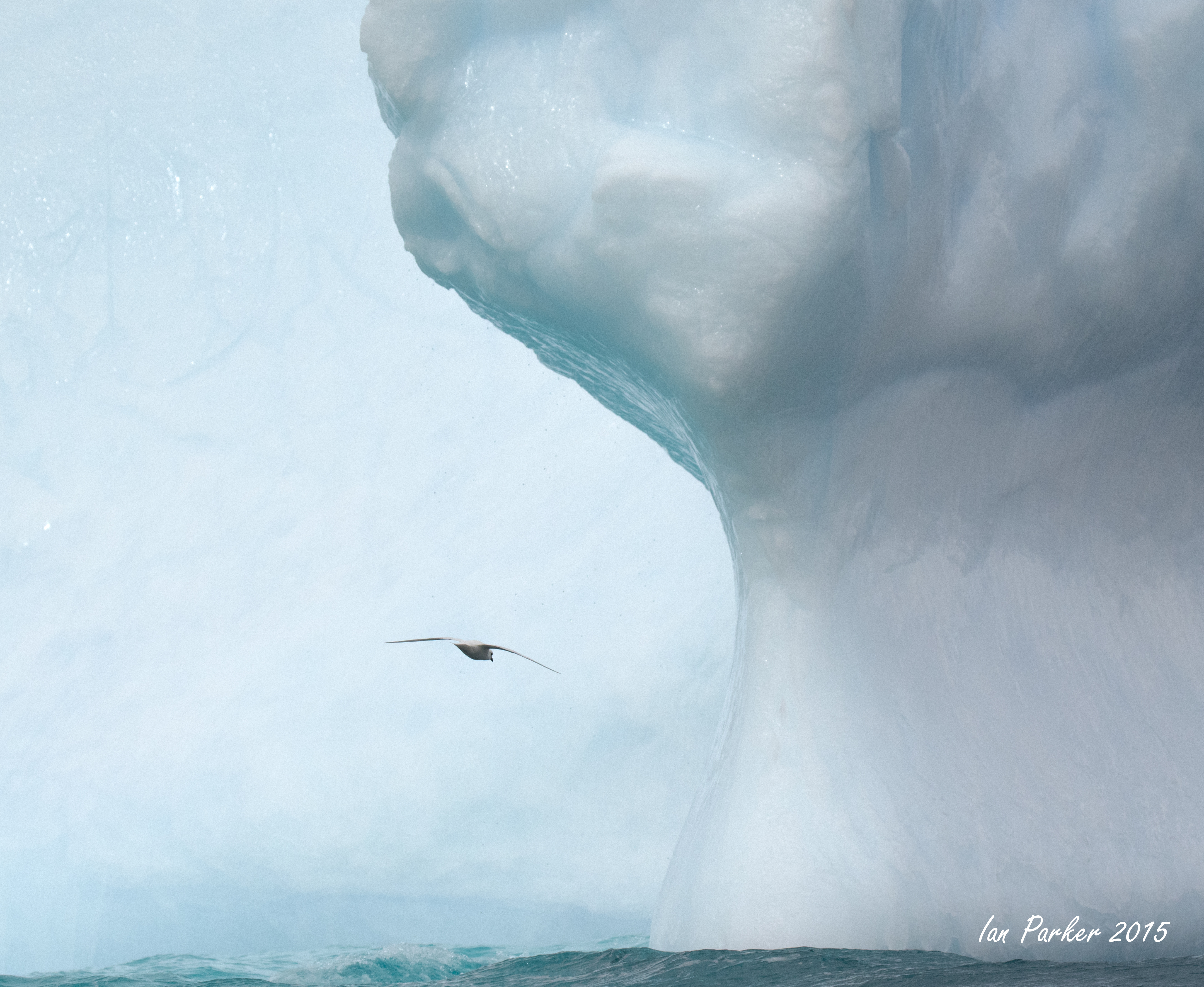
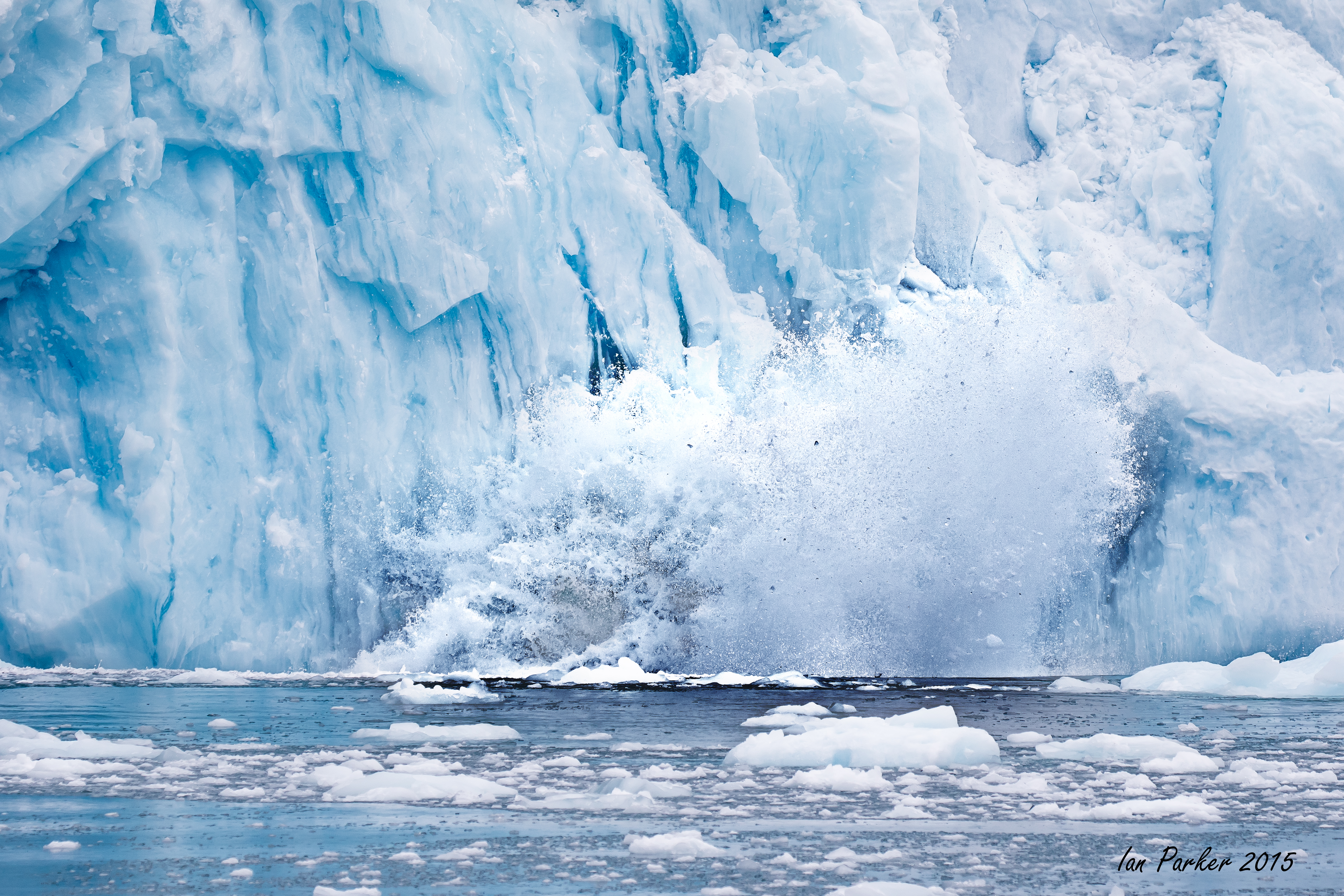
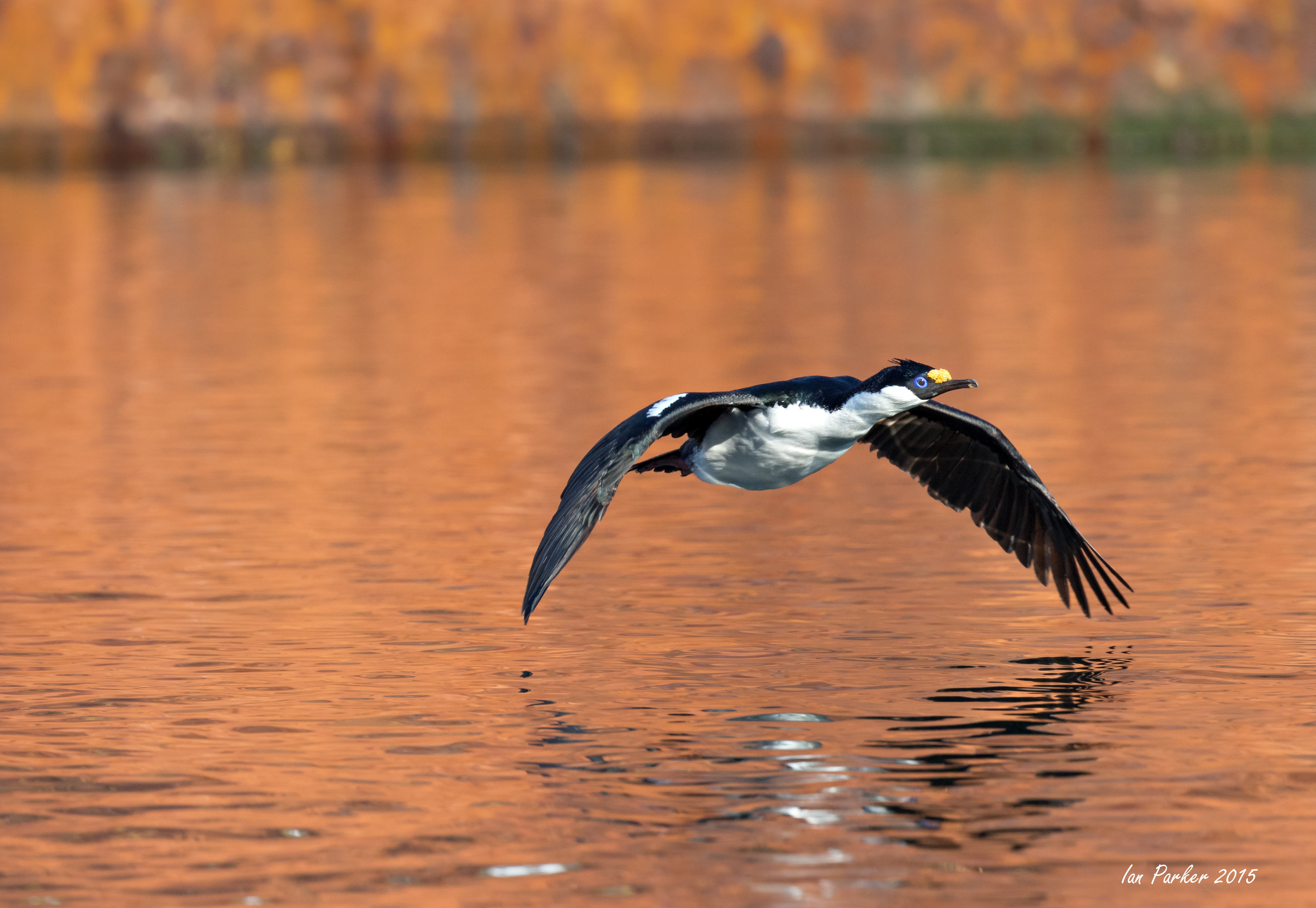
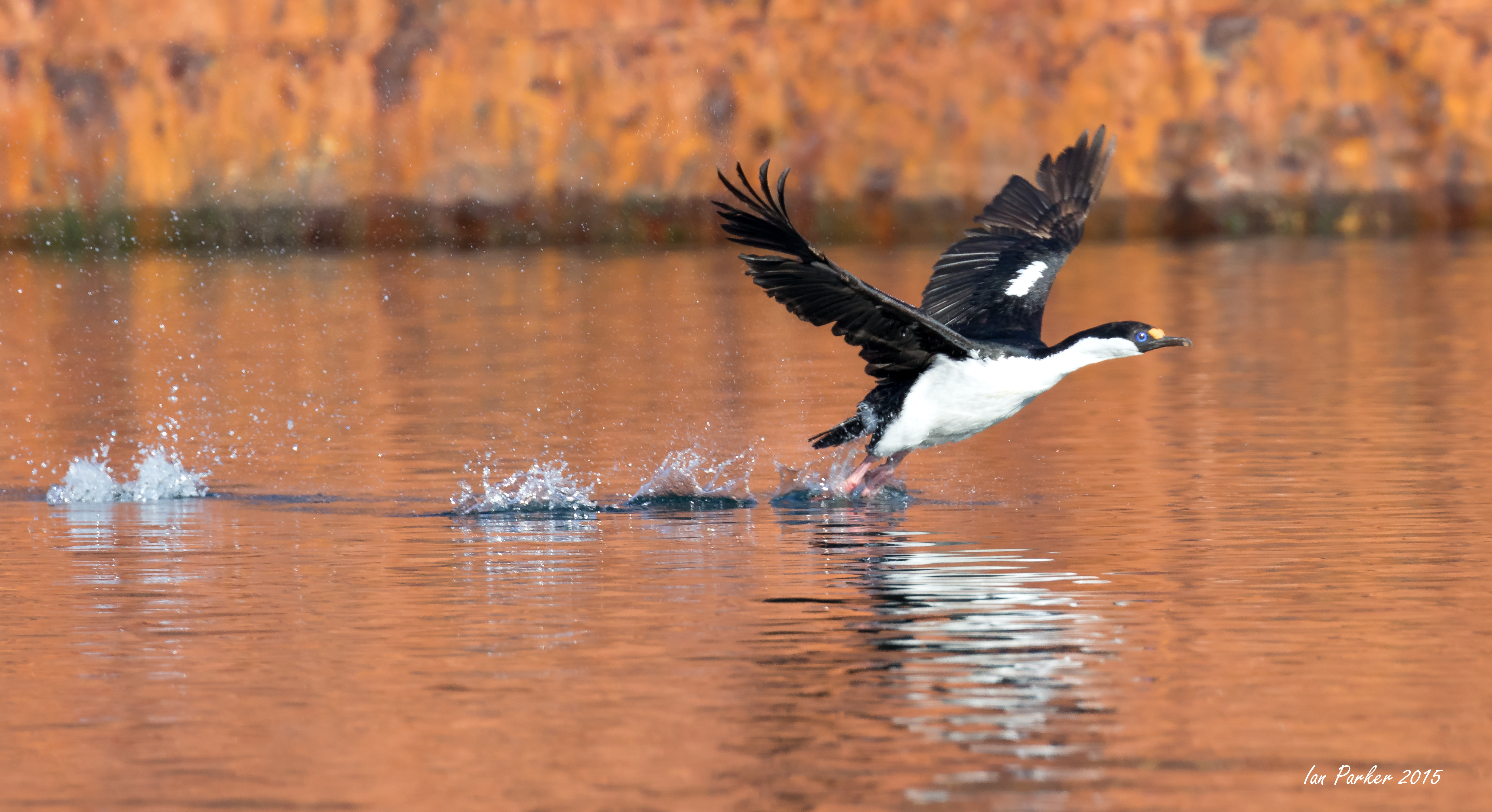
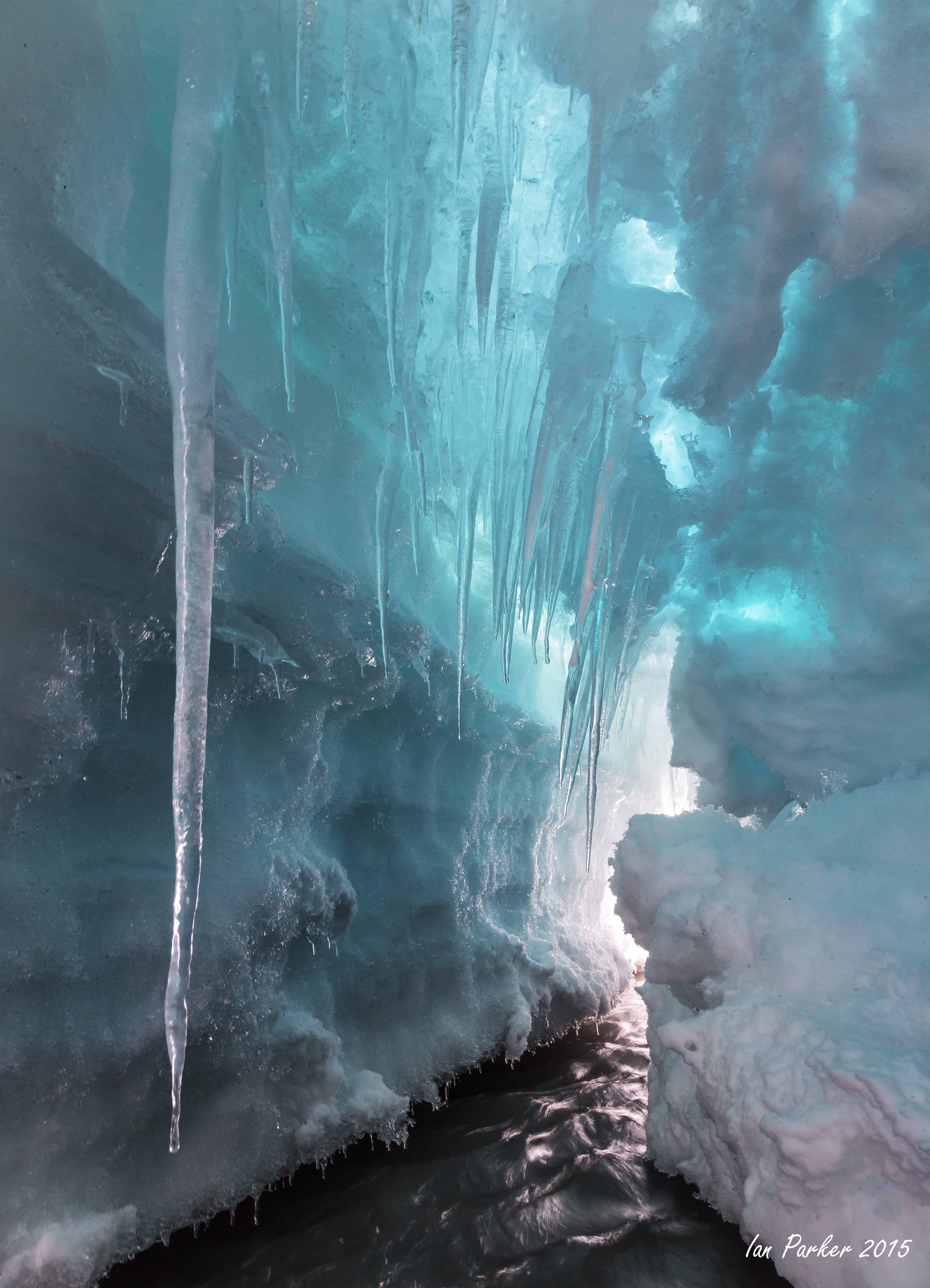
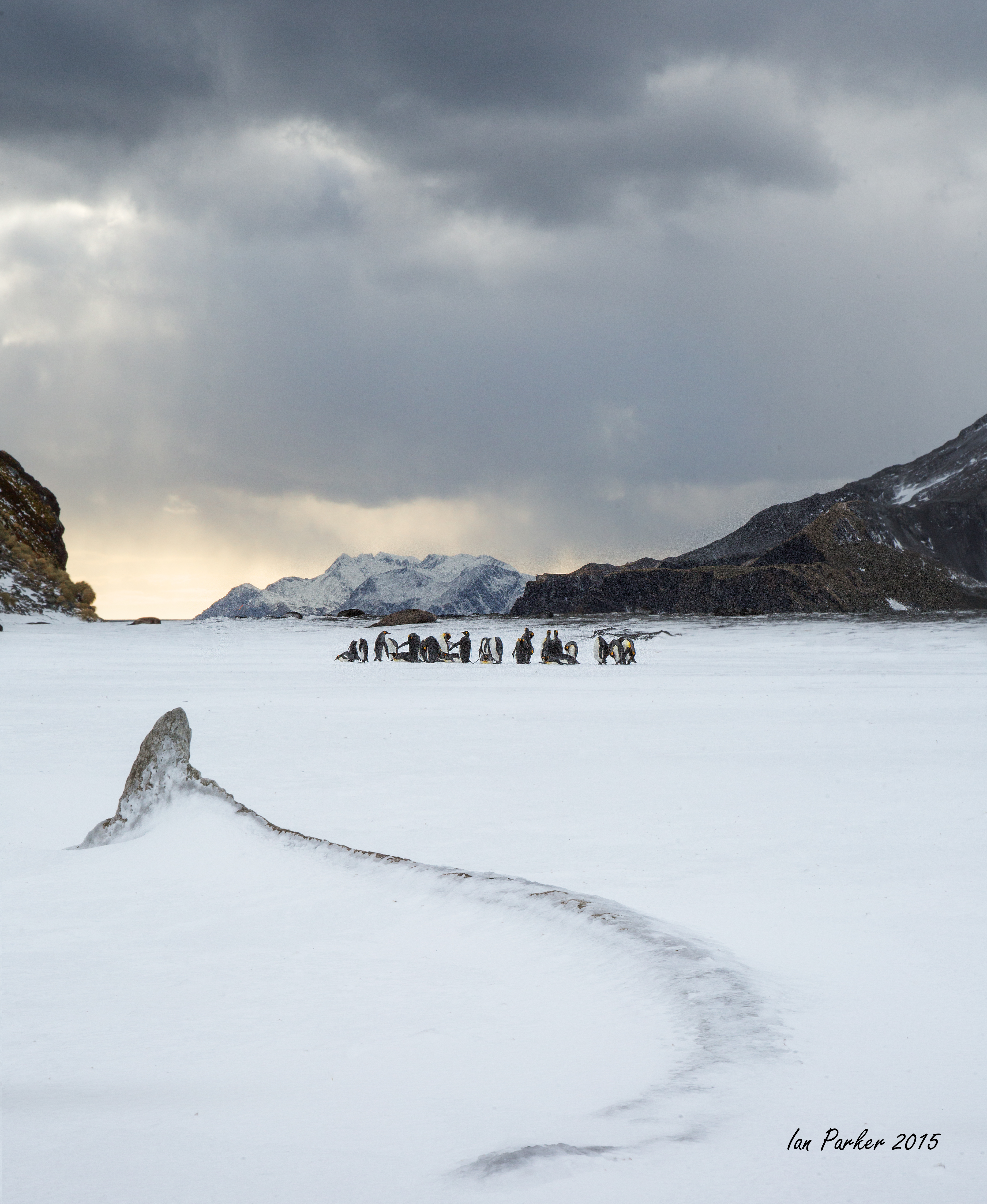
On the voyage from Deception to Half Moon Islands we passed, and circled around a most amazing iceberg with six, distinctively colored grottos.
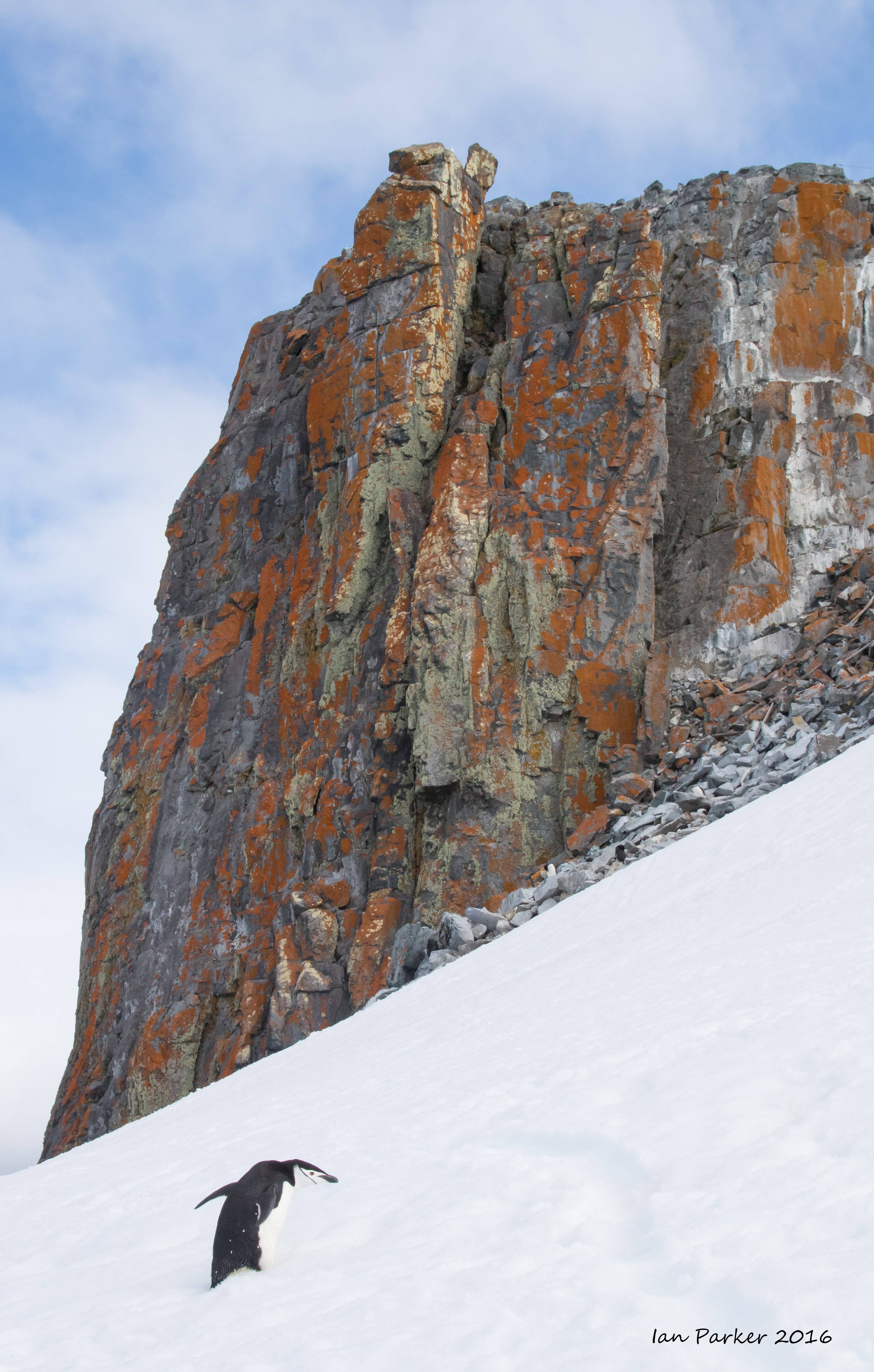
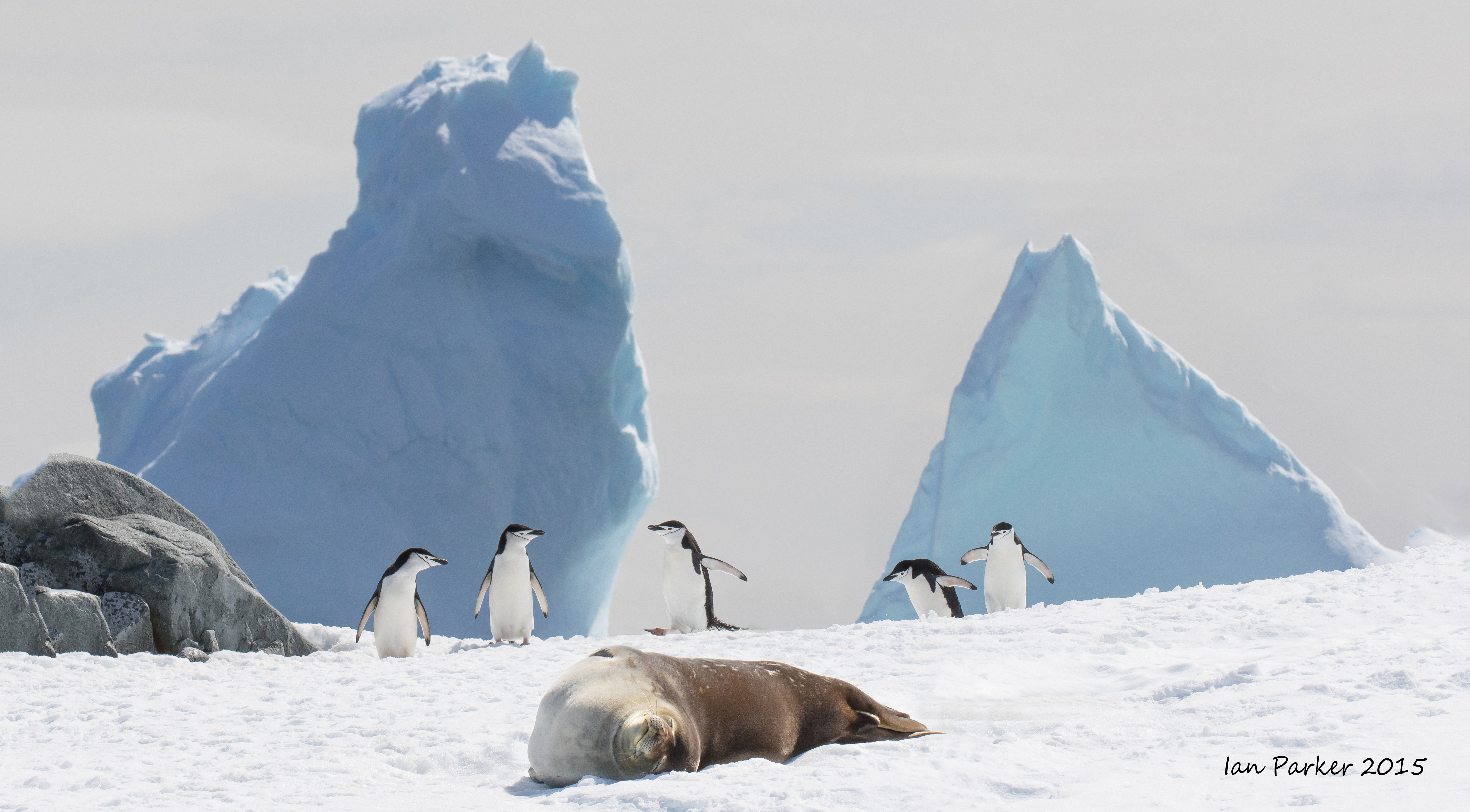
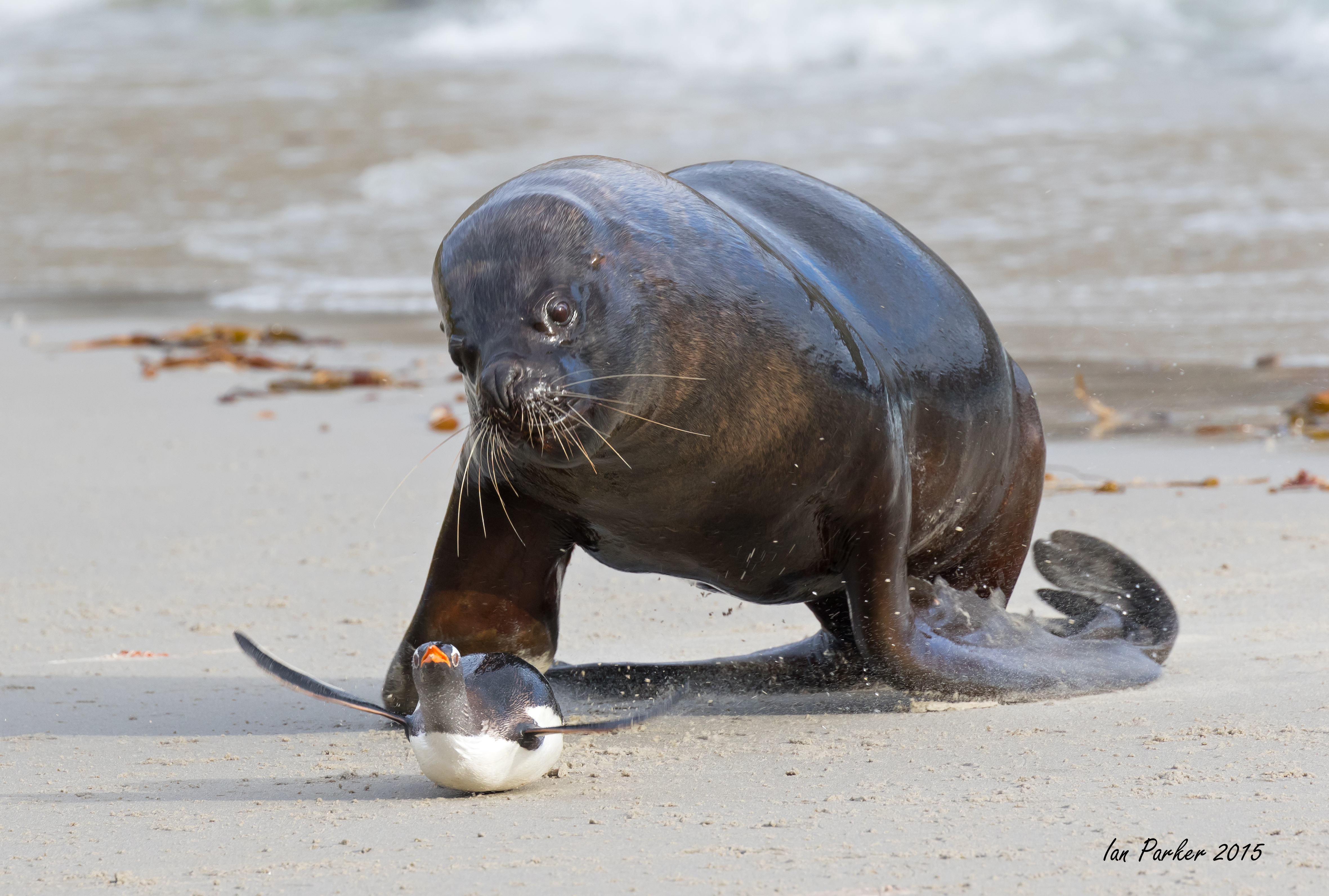
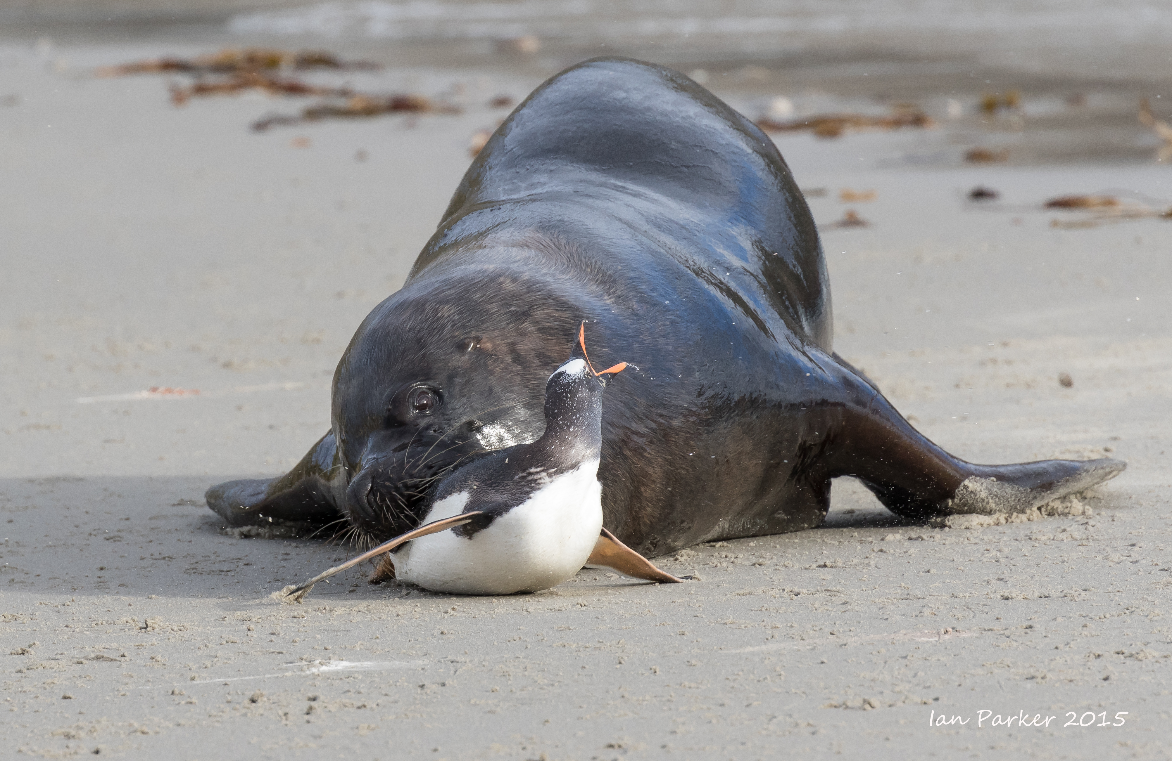
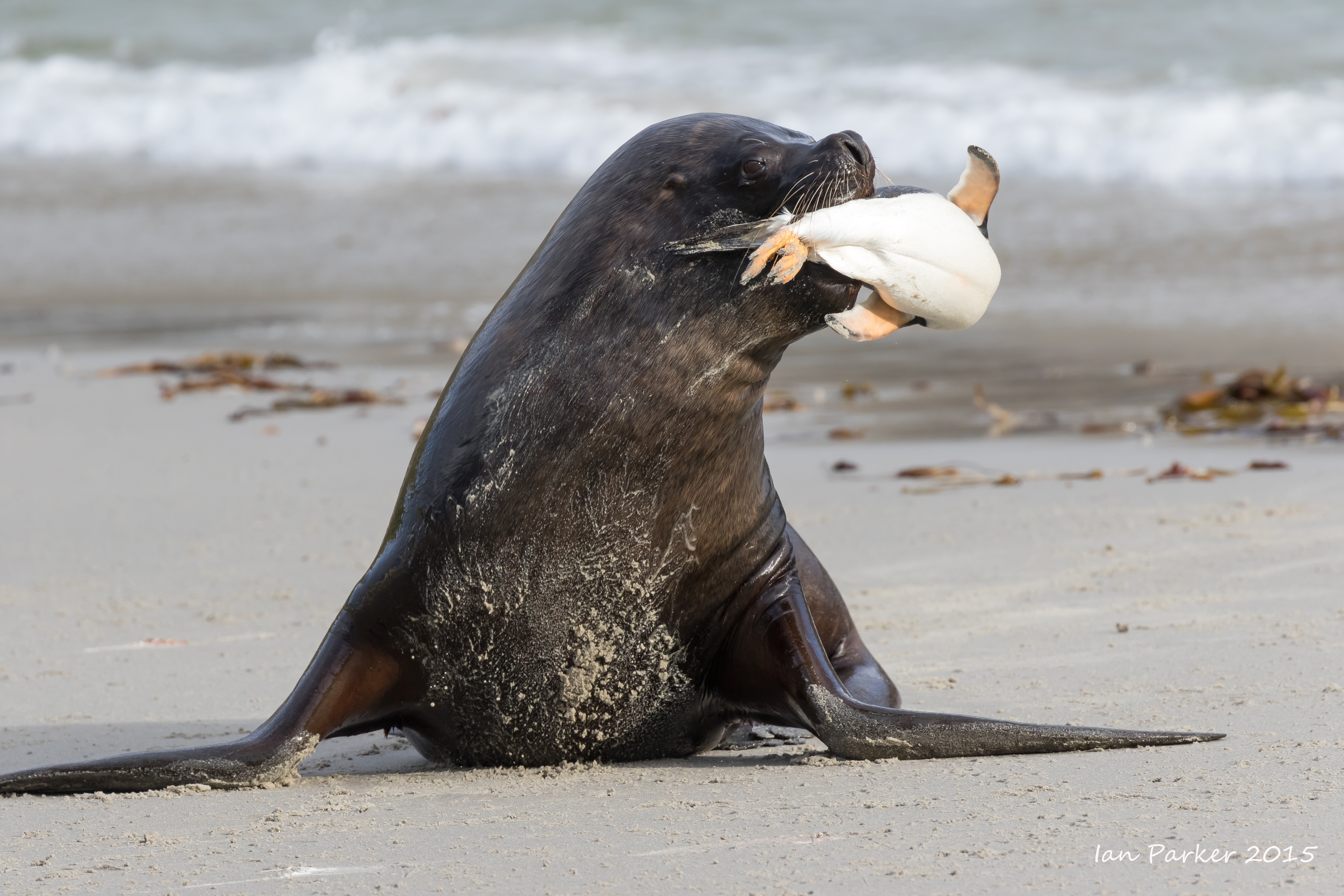
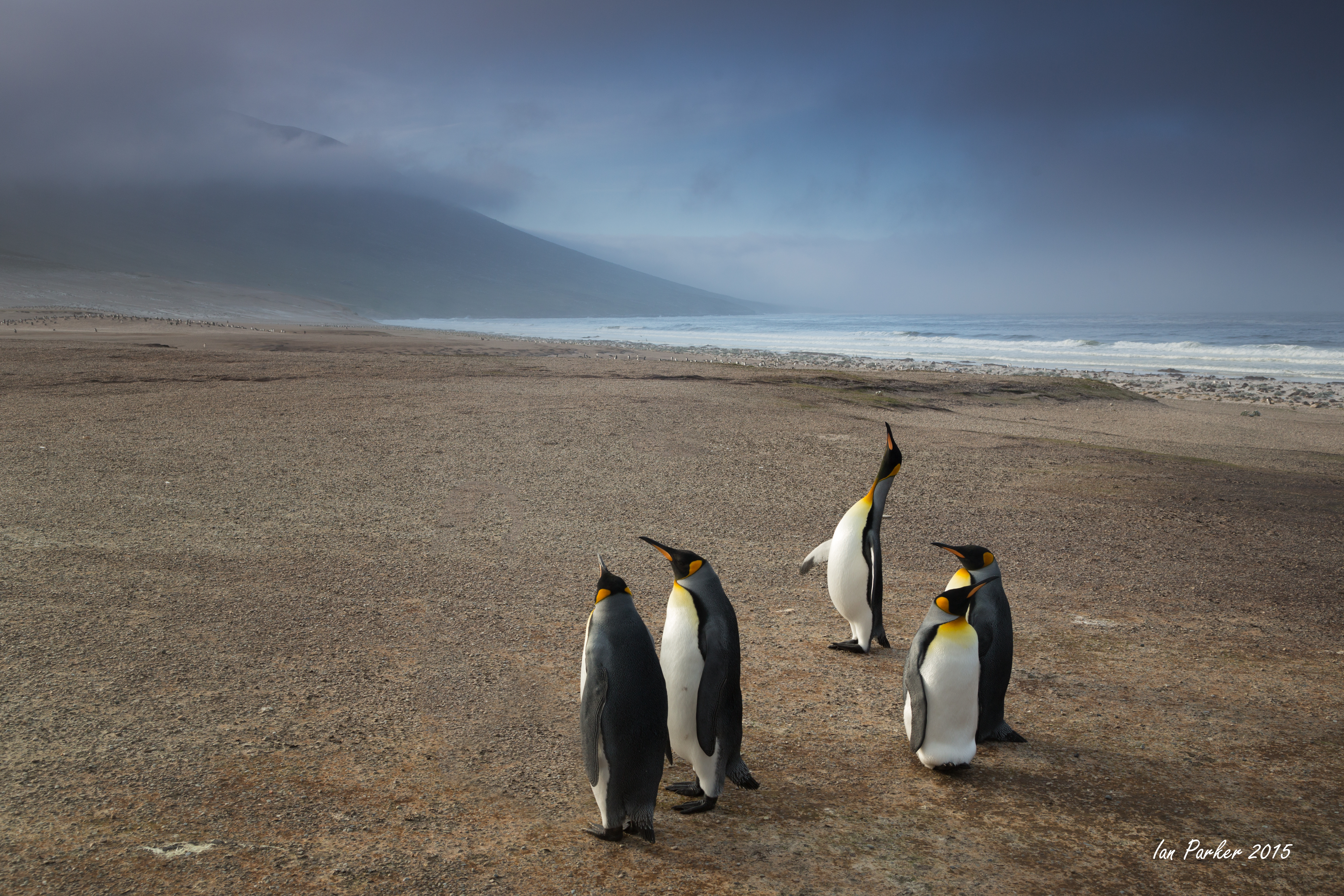
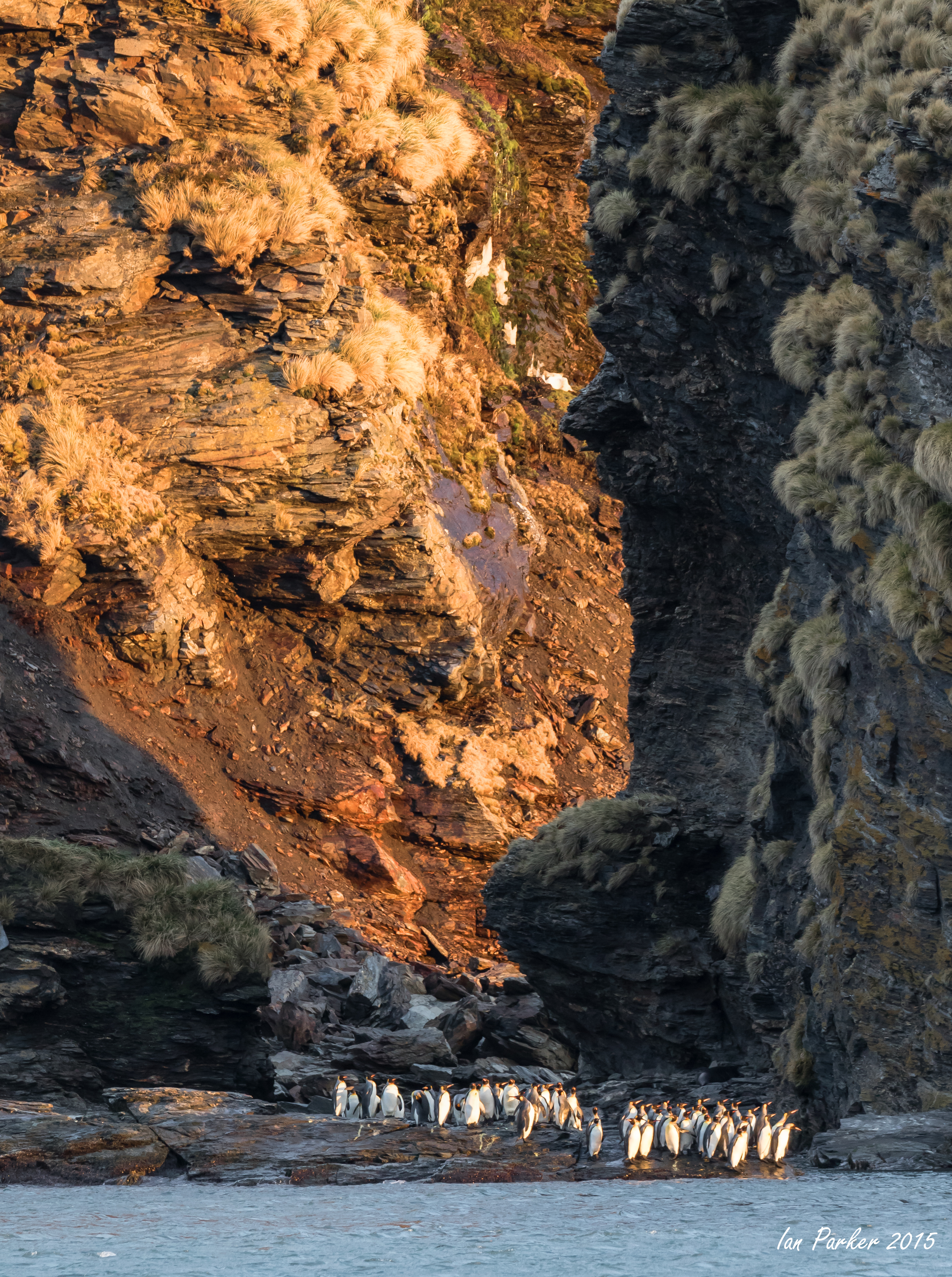
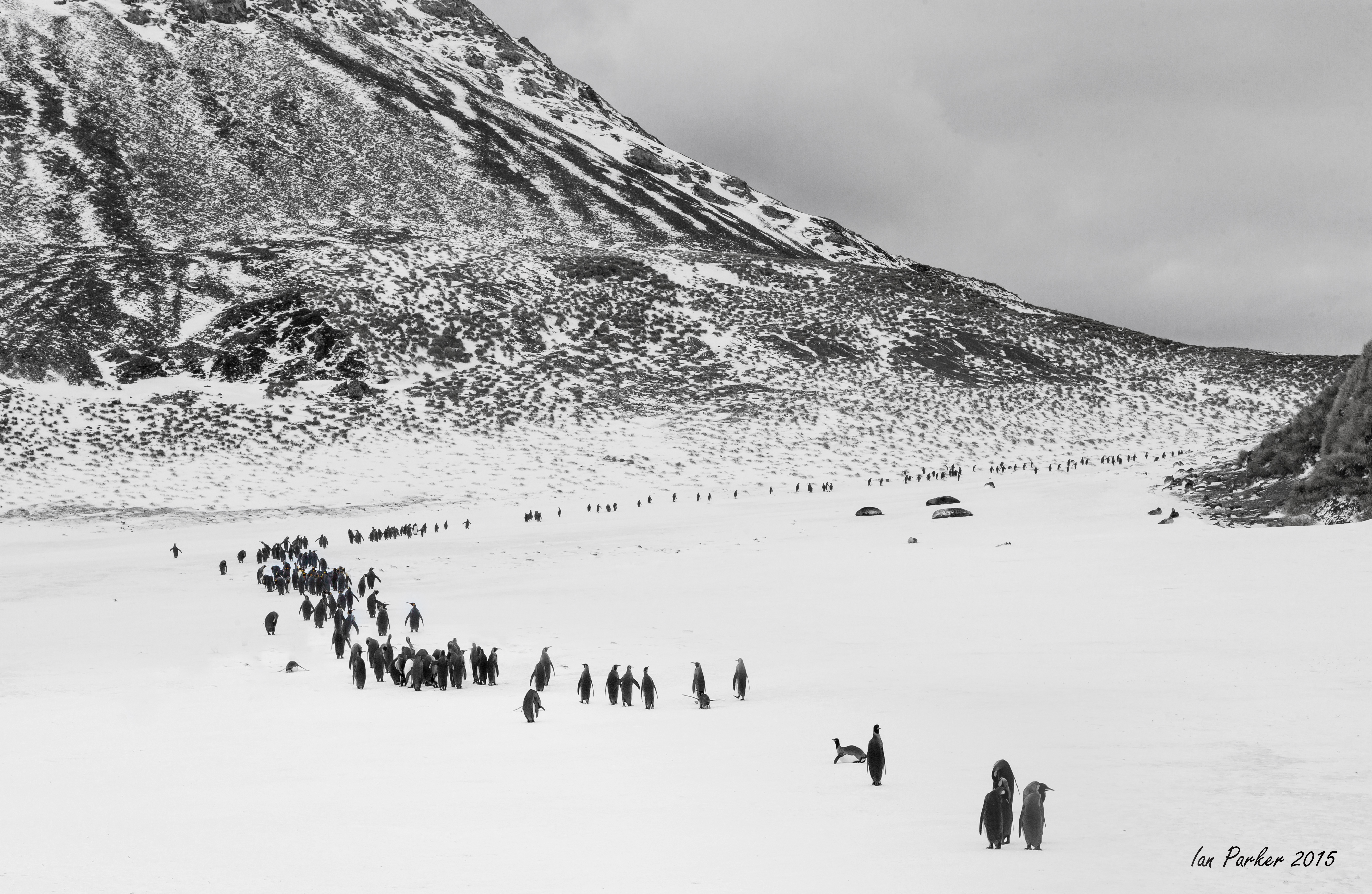
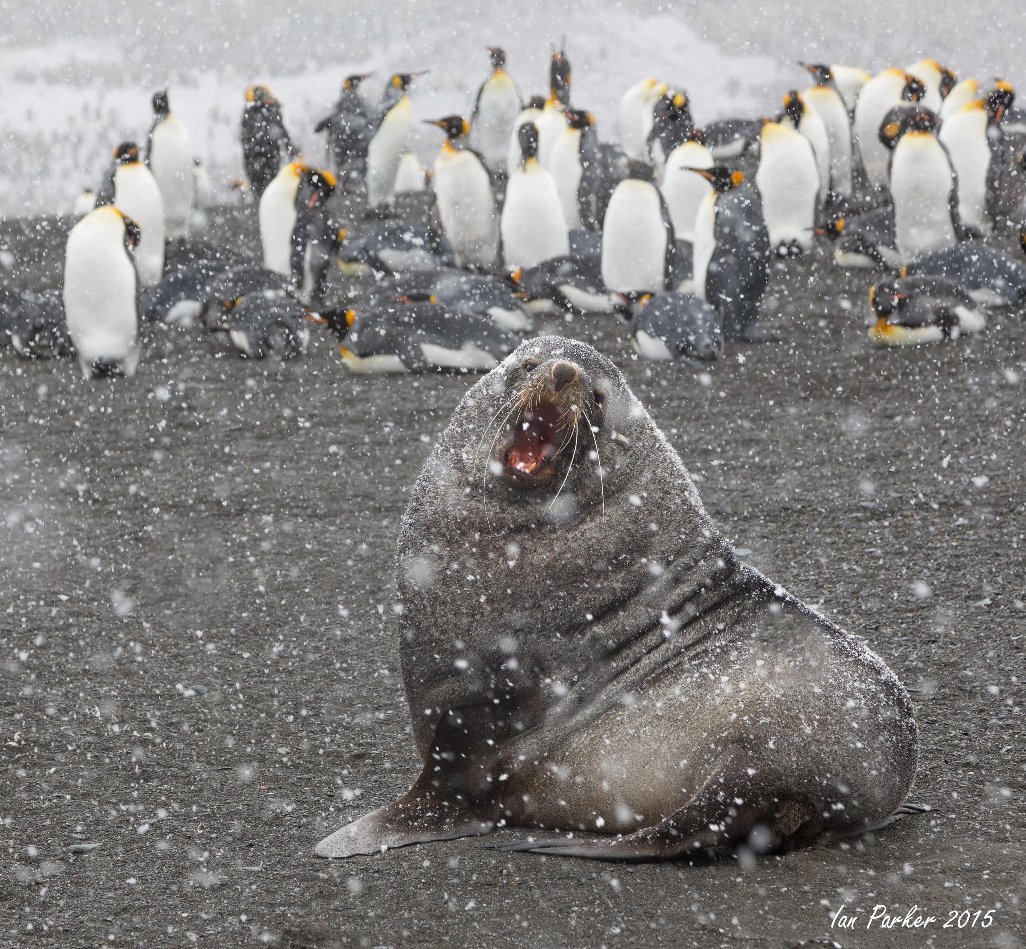
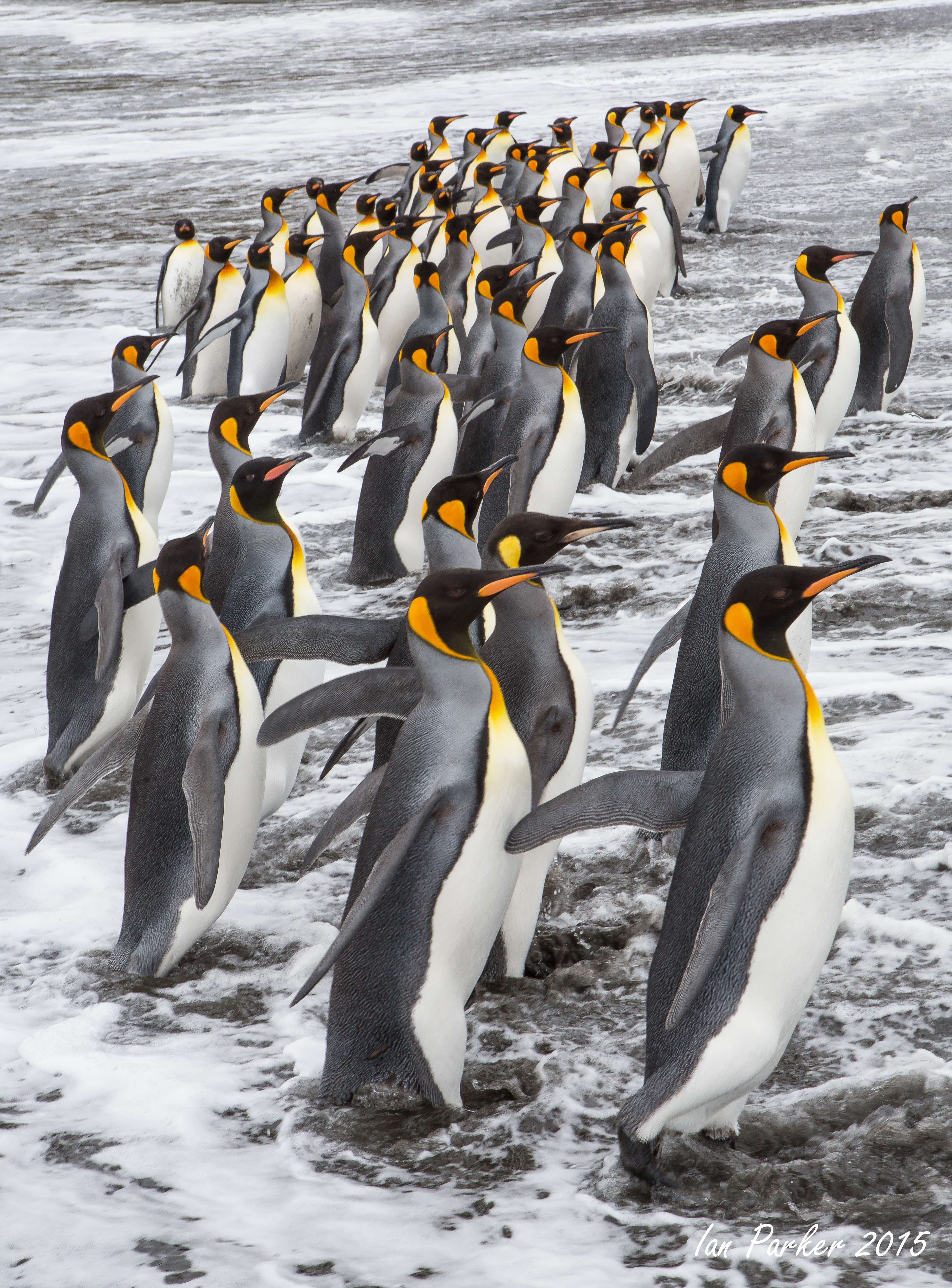
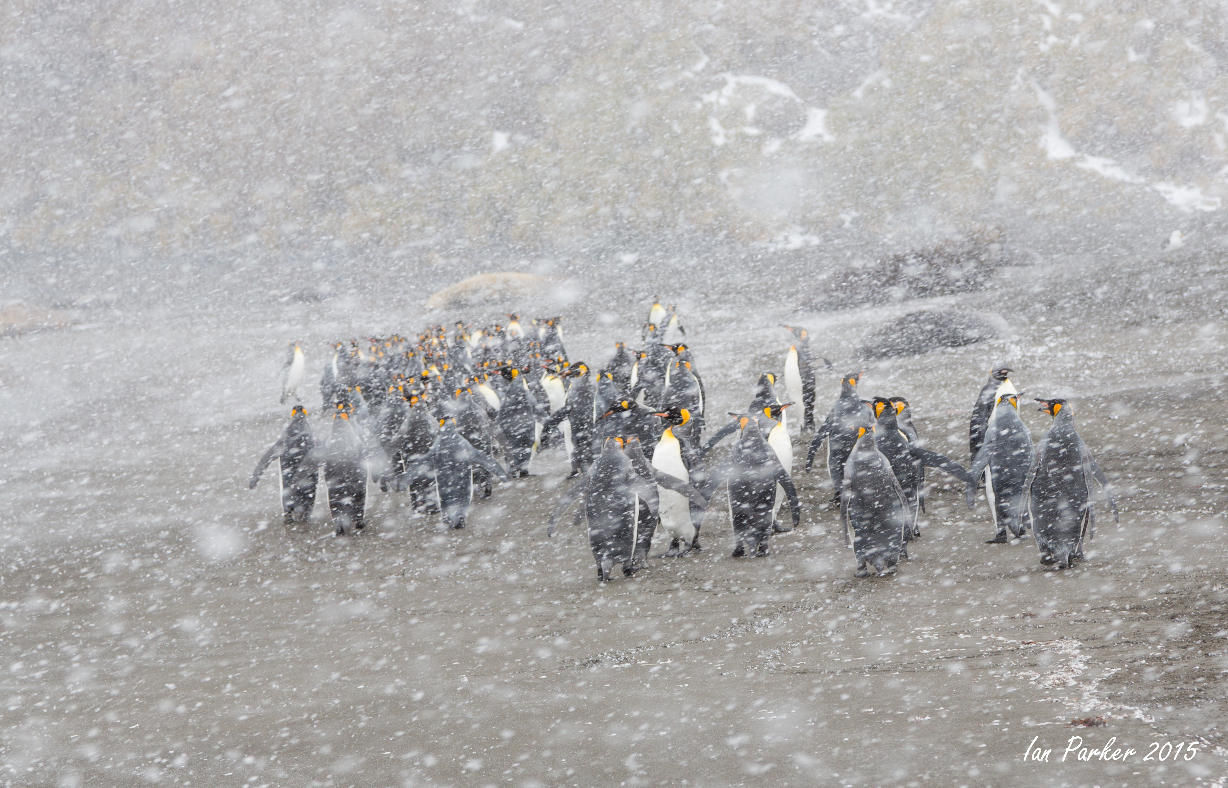
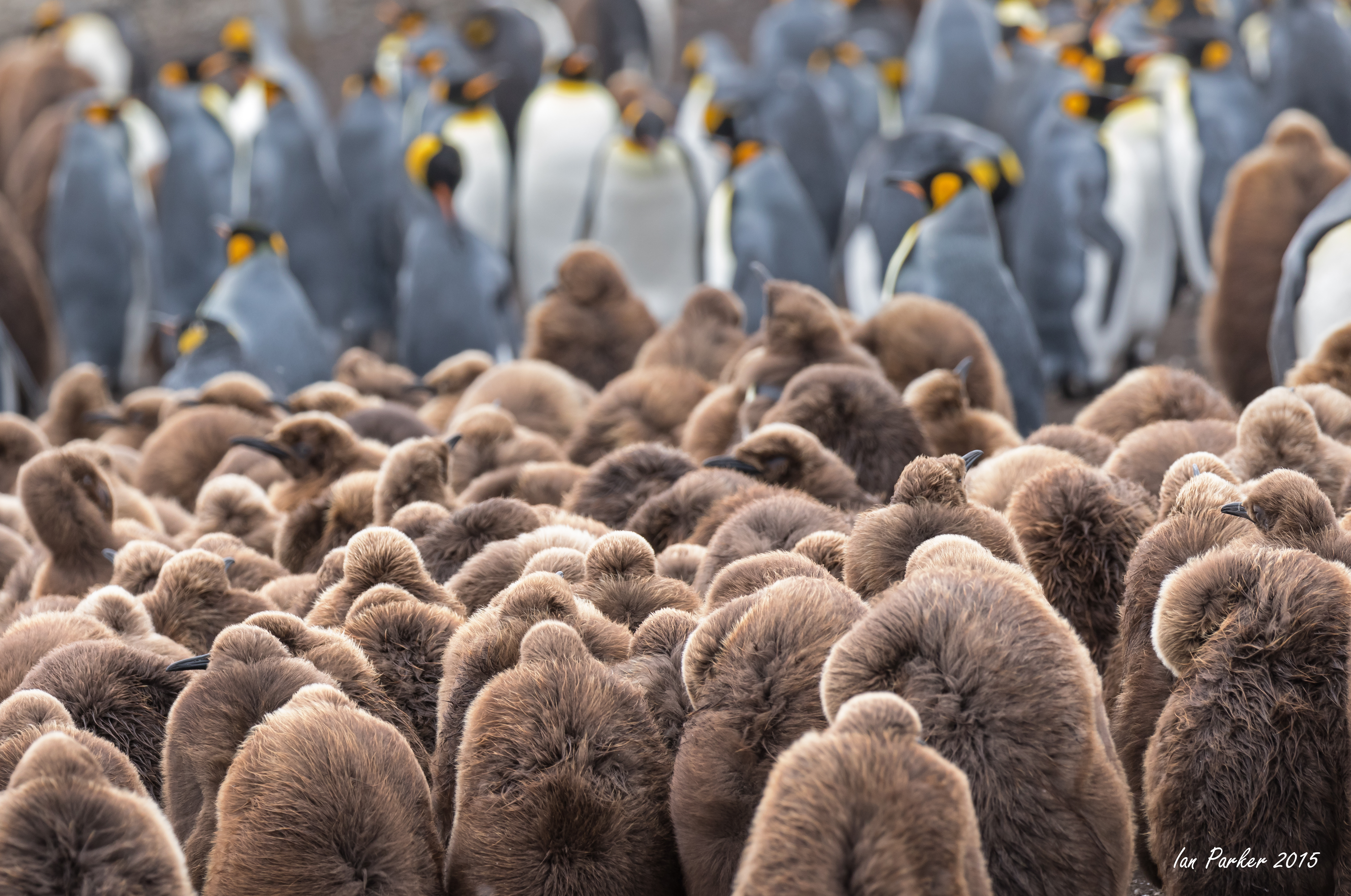
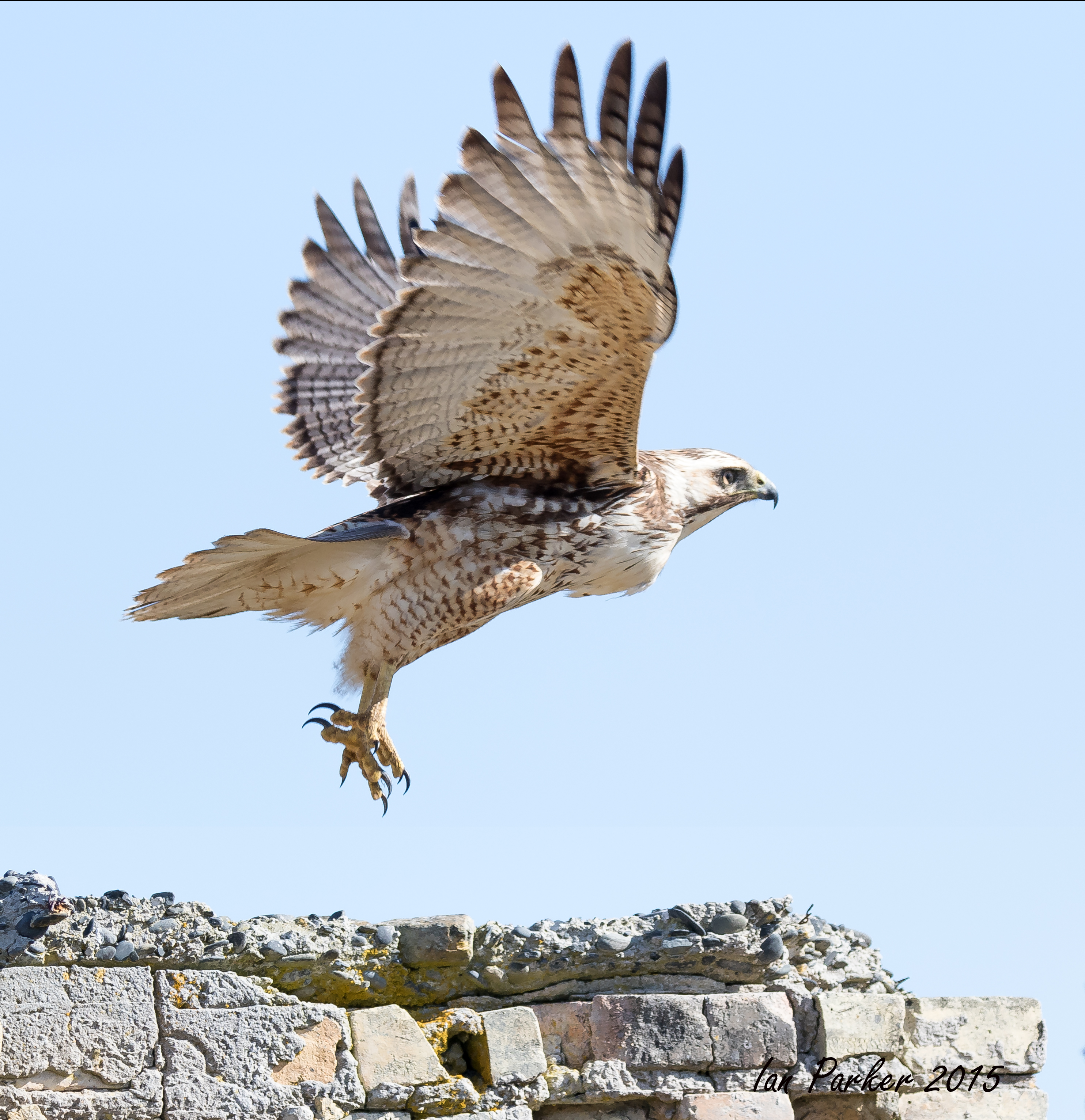
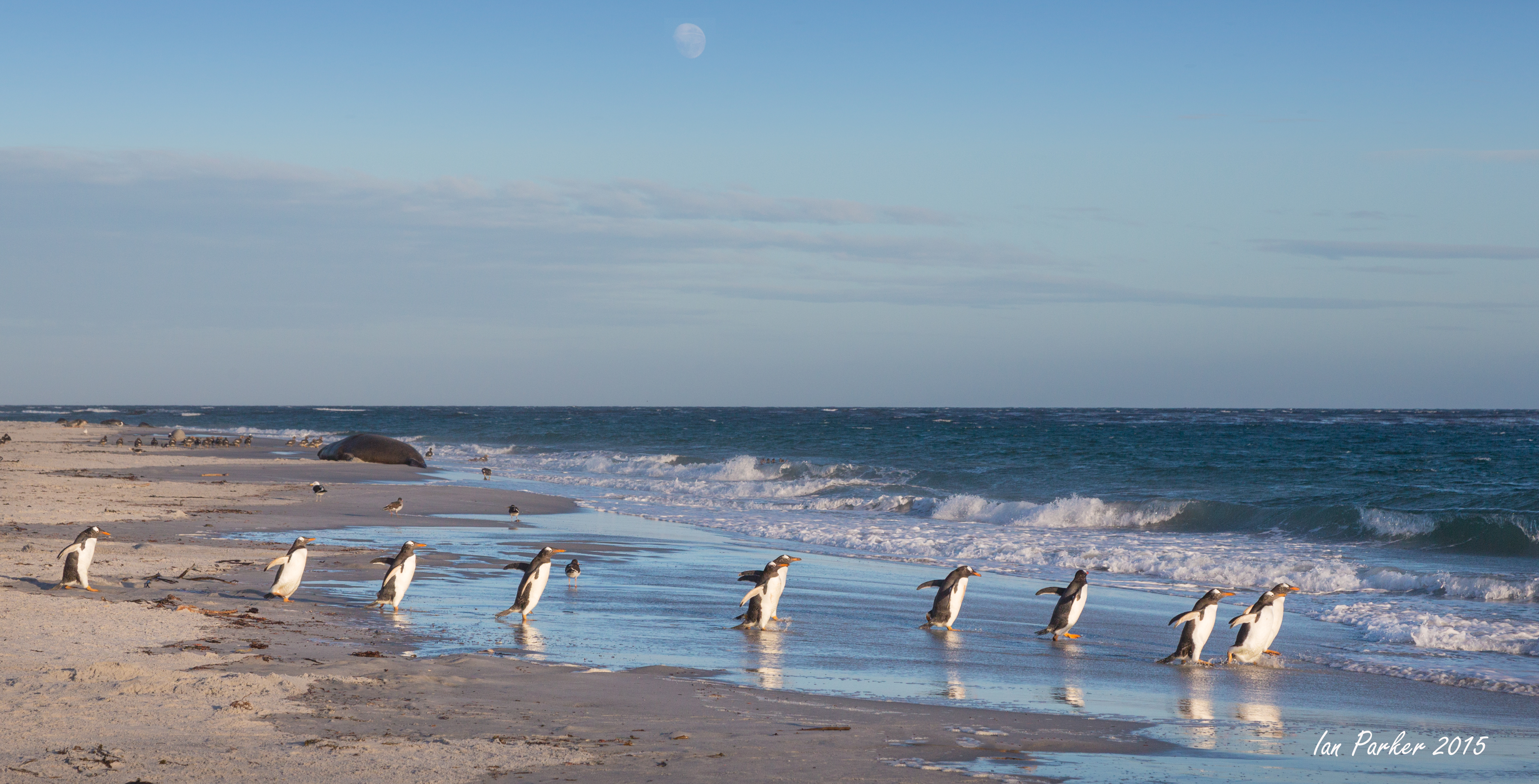
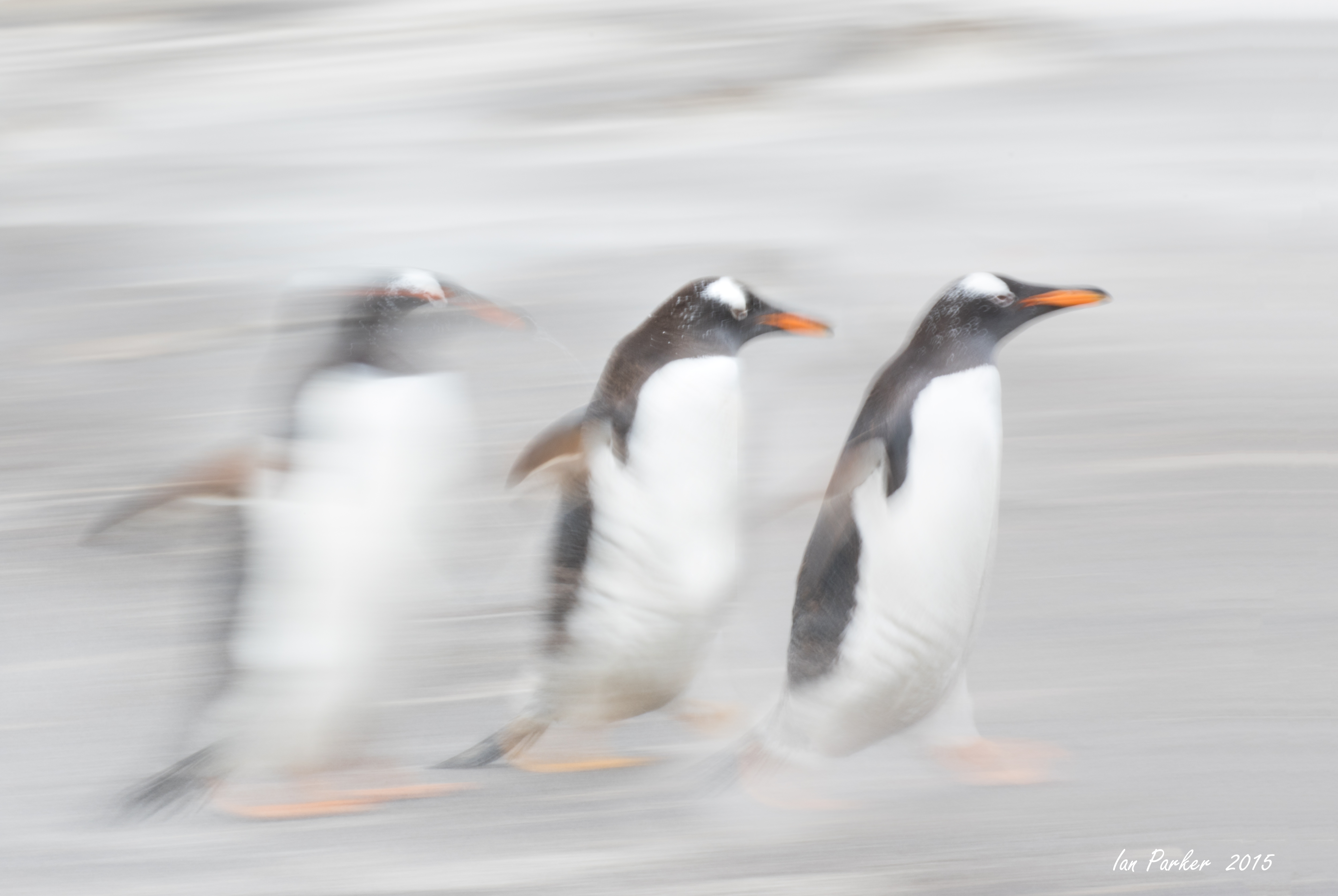
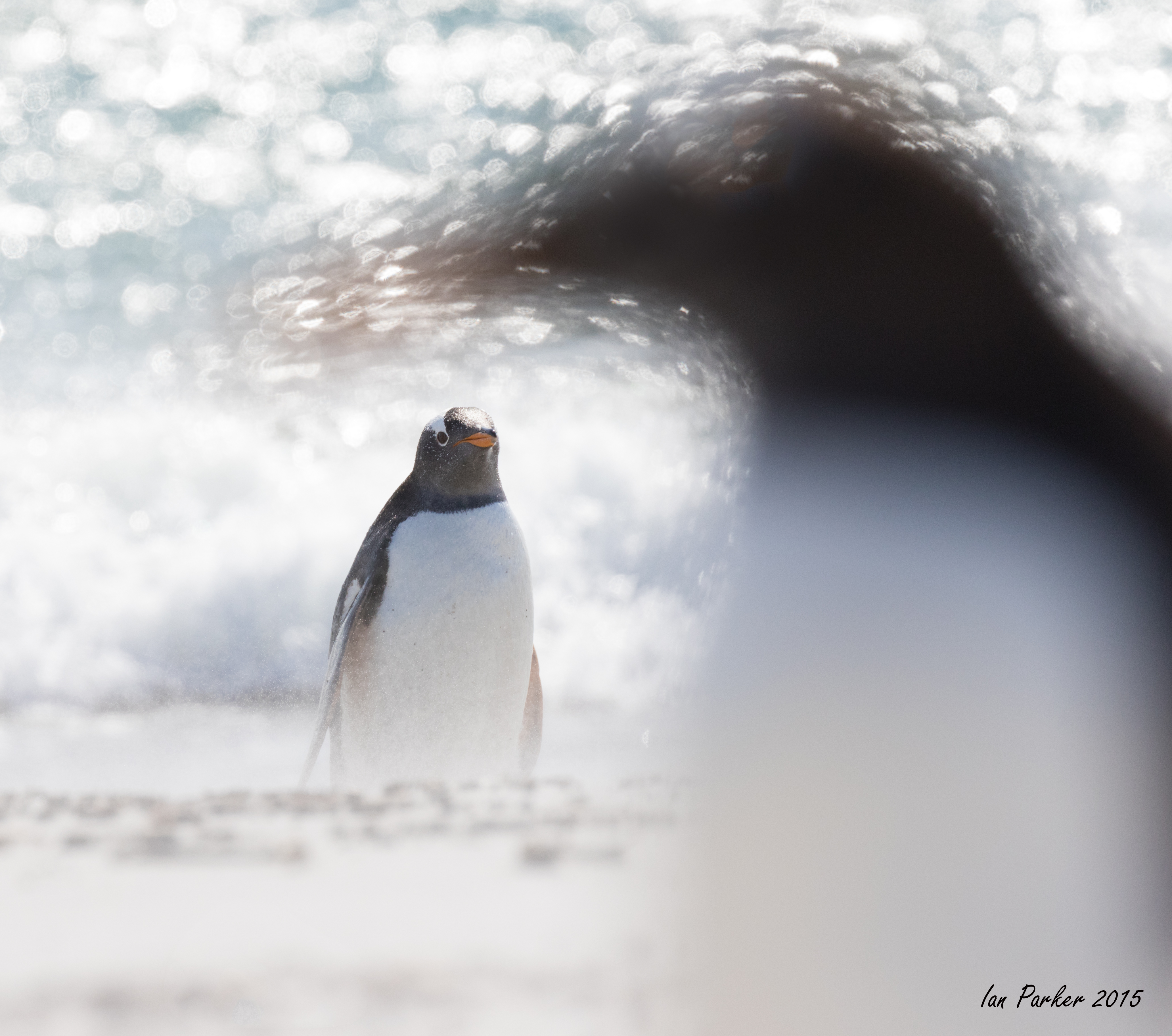
After lunch we embarked on our final landing, and if the trip needed a crescendo—a whopping climatic conclusion—this was surely it. We landed at one of the most beautiful islands we visited—Half Moon Island in the South Shetland Island complex. We were worried that the landing might be difficult, as the cobble beach is short and narrow and its steep snowbanks could make reaching the island a problem. But our worries were for naught, as the seas were so calm that we practically had a dry landing, with participants stepping into ankle-deep water as we went ashore. The snowbank was gently tapered, making the climb up to the chinstrap colony quite easy. At the top of the slight rise, two small colonies of chinstraps formed the foreground for a great vista of the bays surrounding this island. Periodically, skuas flew overhead, looking for an unguarded egg and prompting defensive calls from the penguins below. Three well-traveled penguin highways led to the rookeries. Some were located at the very top of the surrounding cliffs, and from that position a few chinstraps could be seen, head pointed skyward, as they rattled out their "ecstatic display." One had to wonder why a bird would walk that far and that high, but these areas would be the first to become snow free, and offer the first and best nest sites.
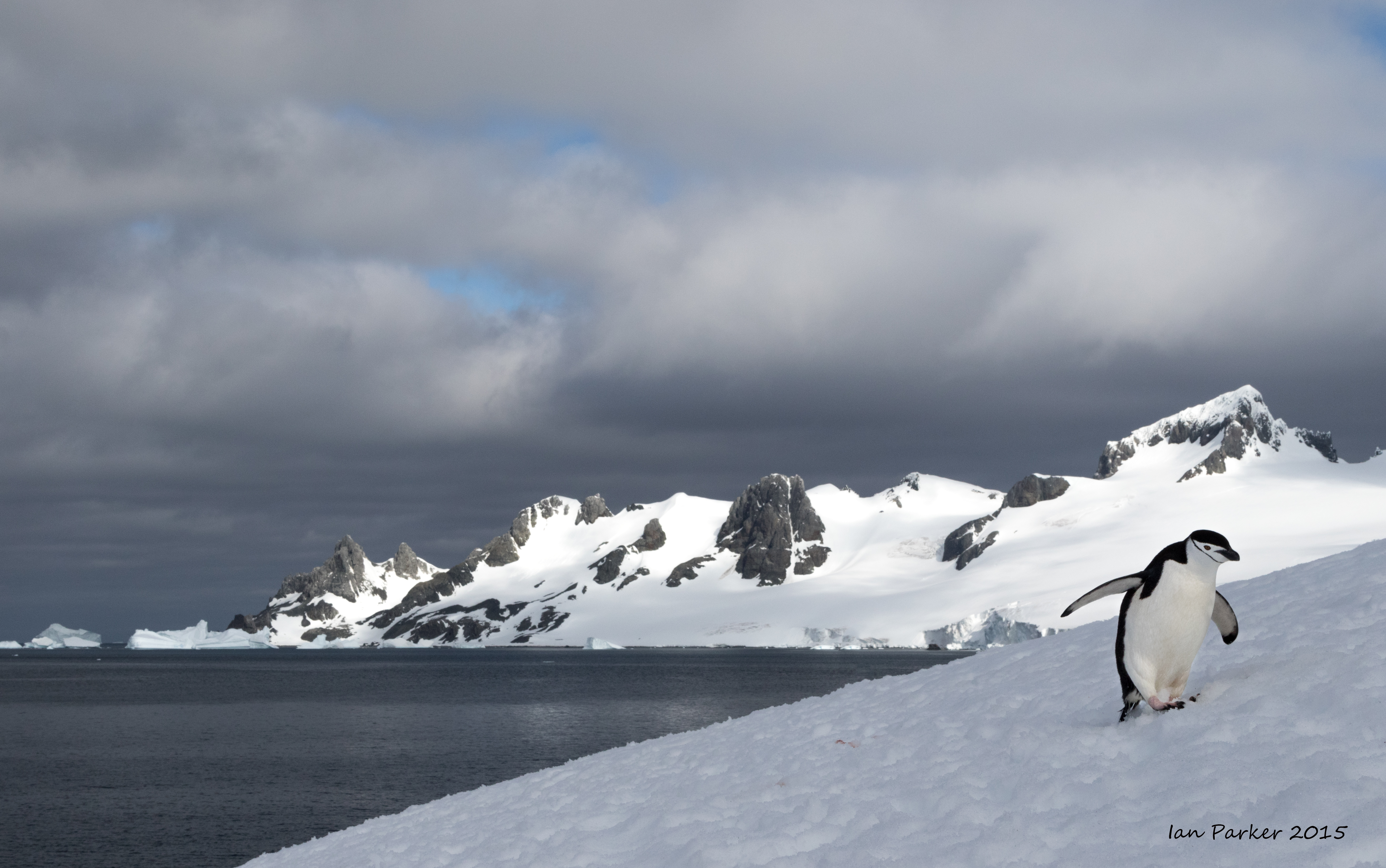
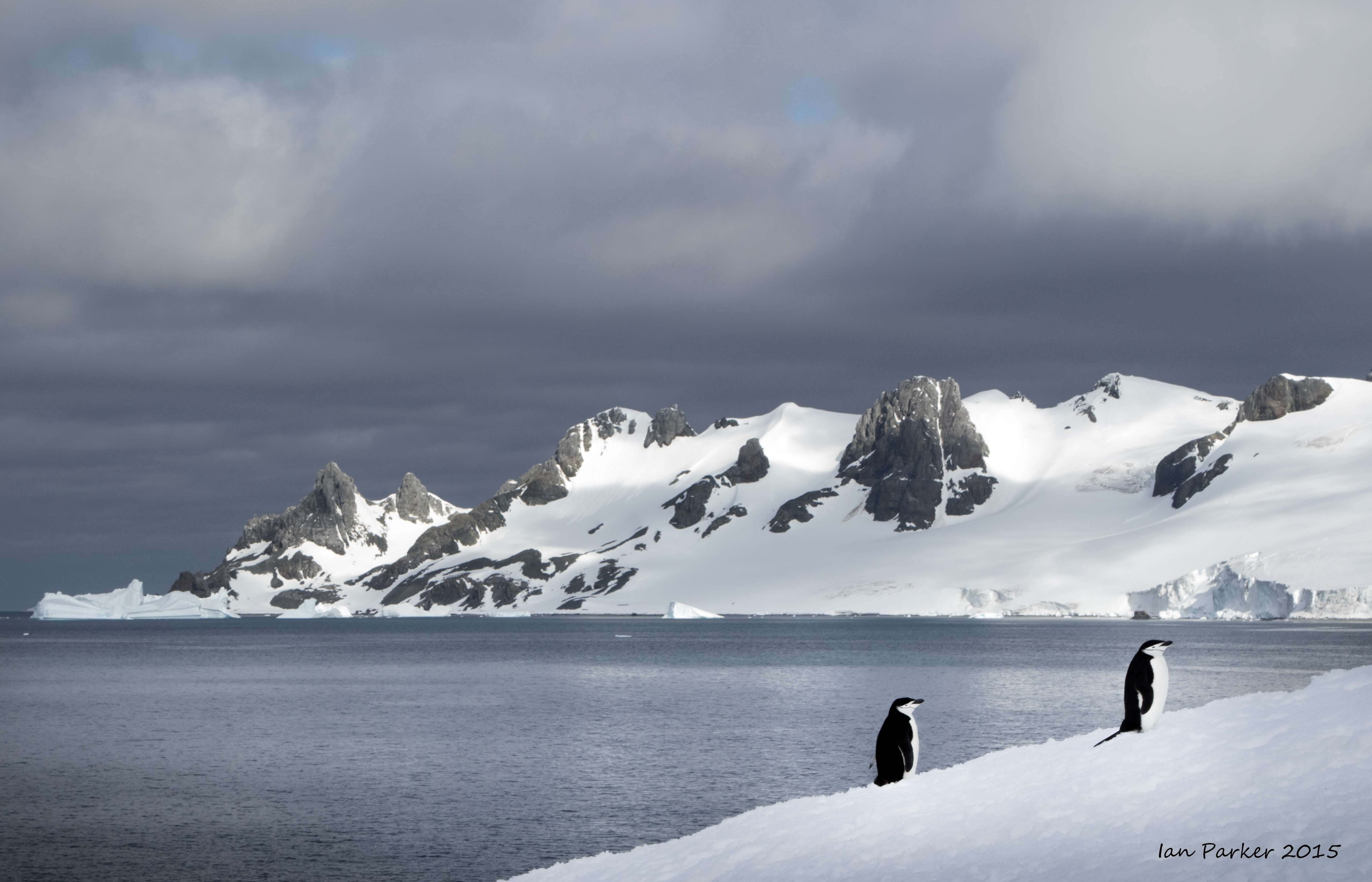
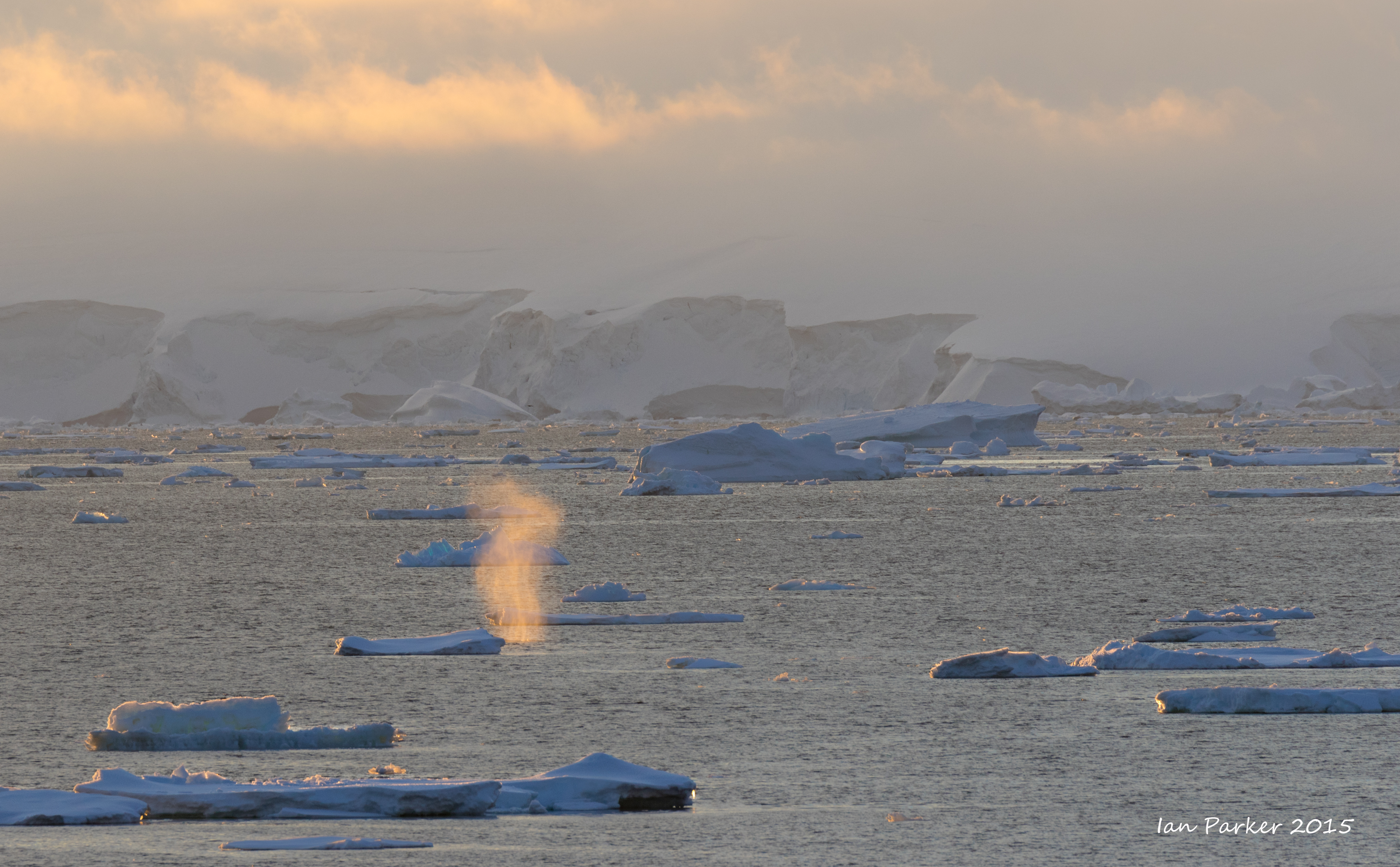
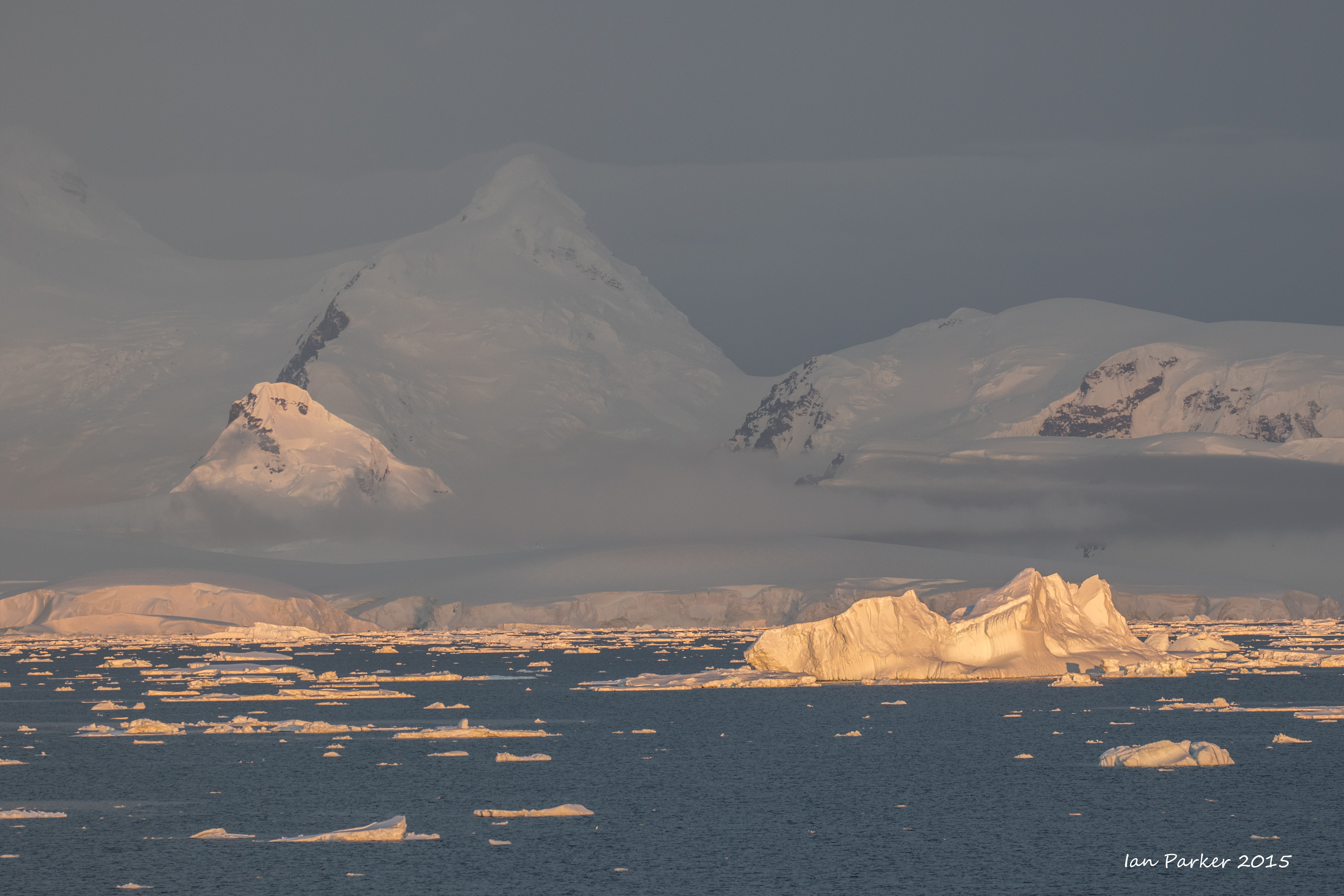
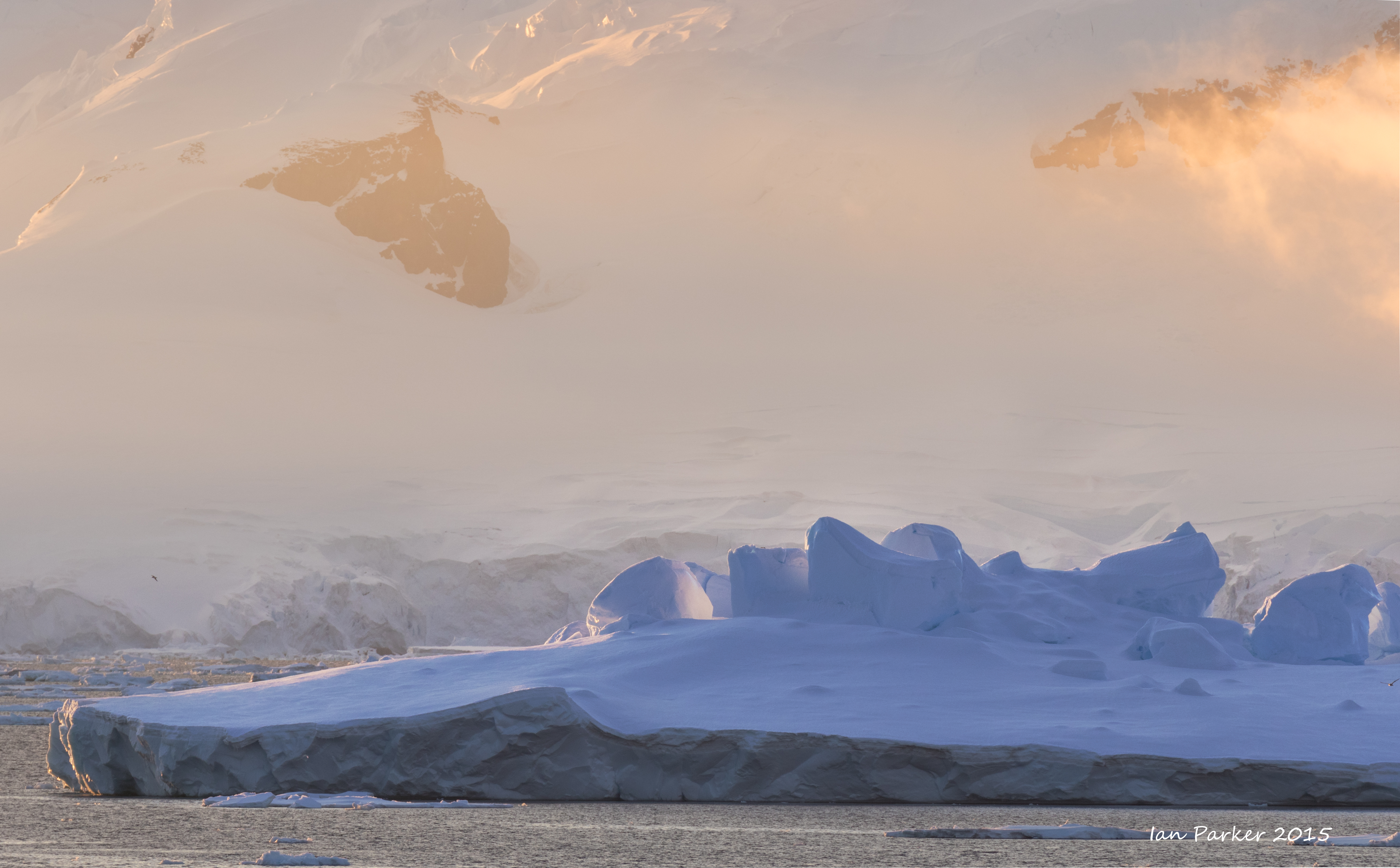
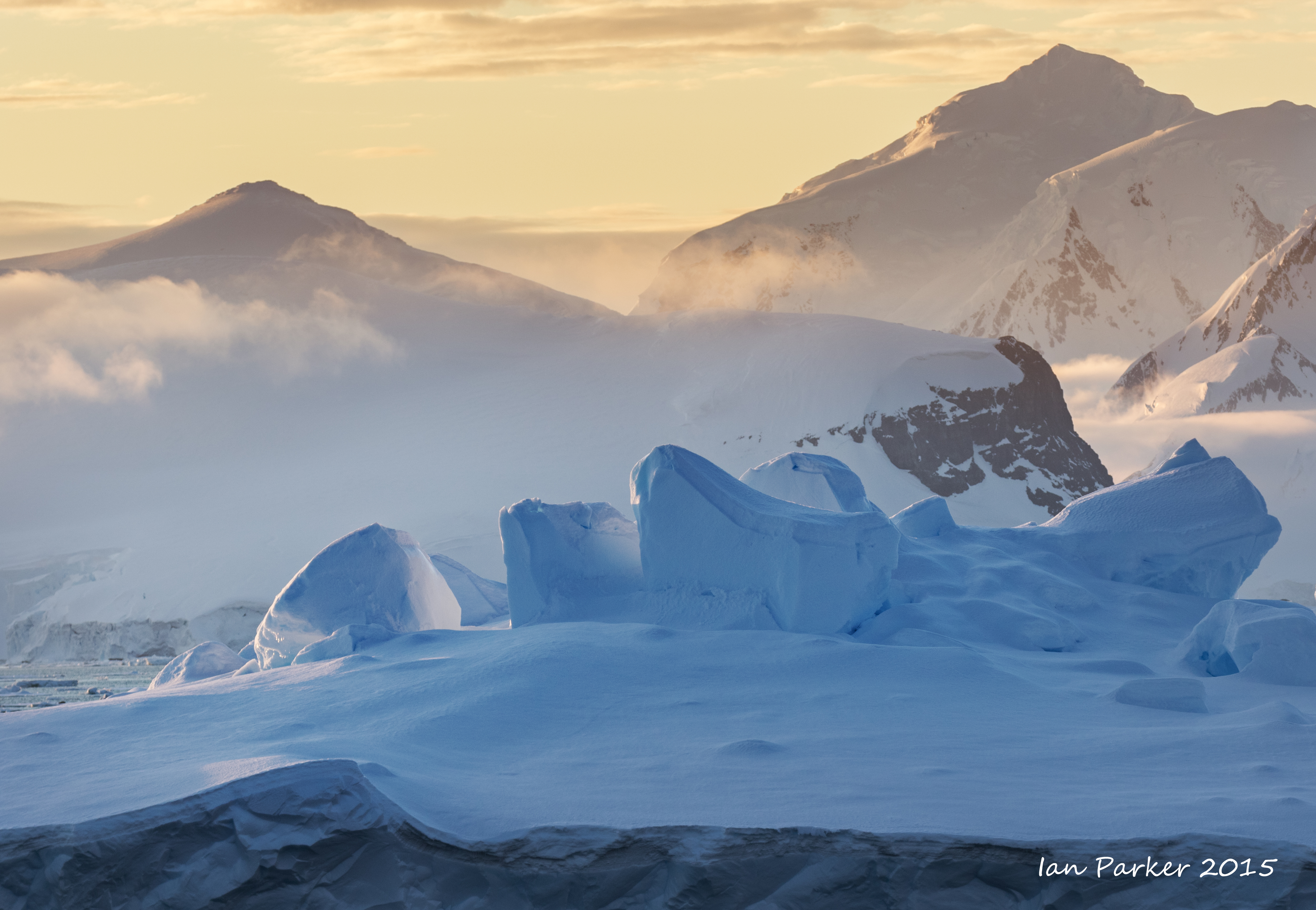
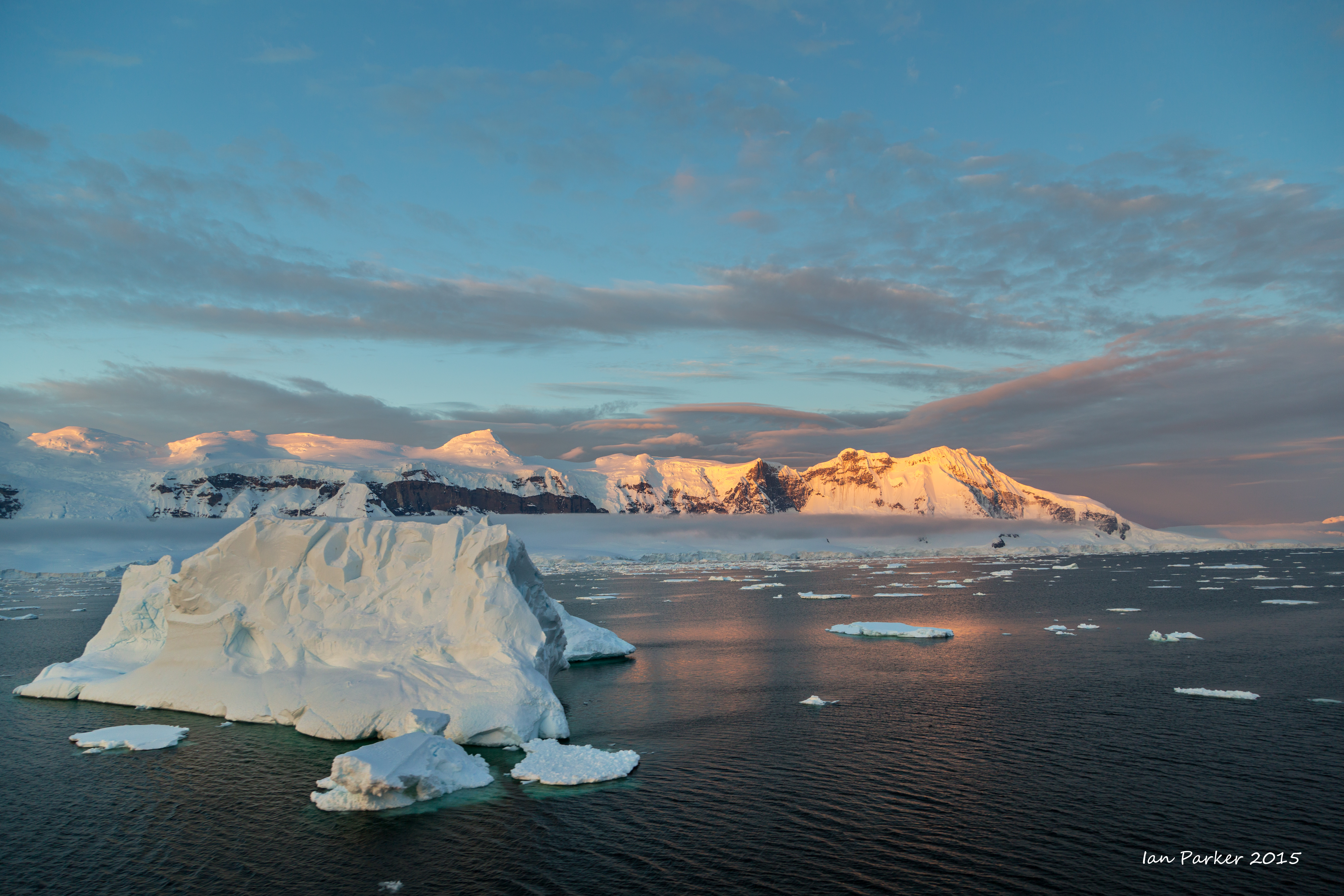
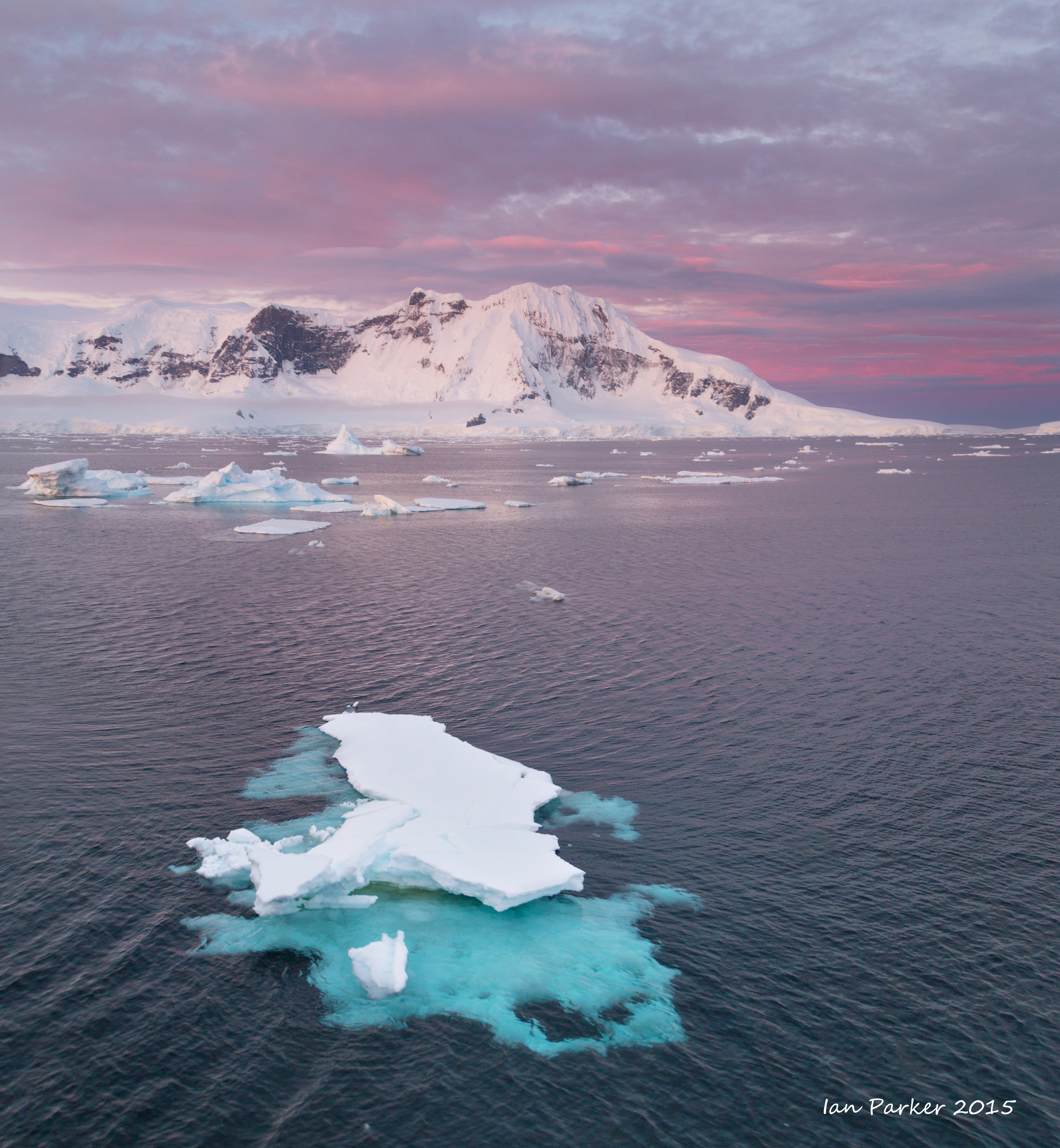
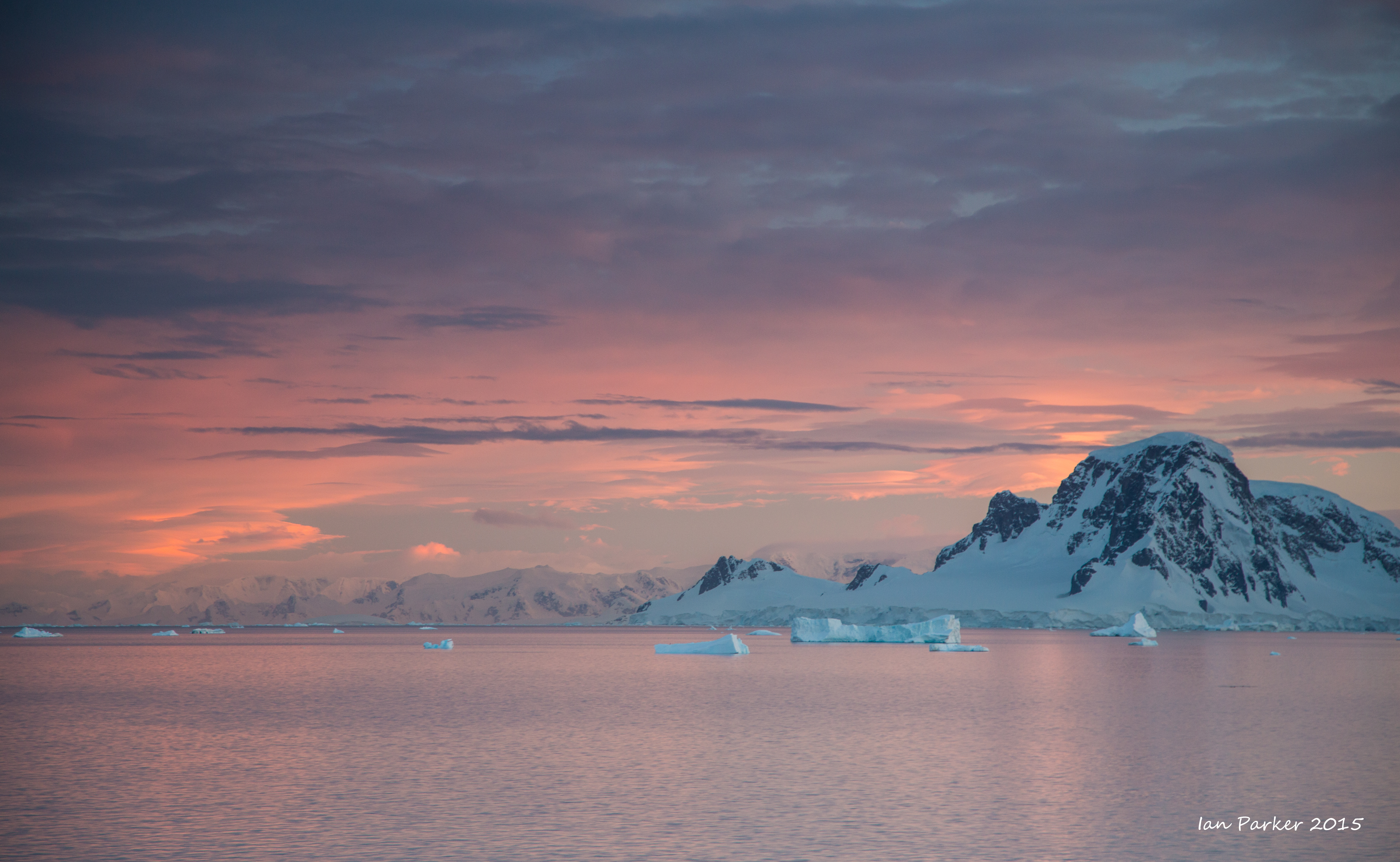
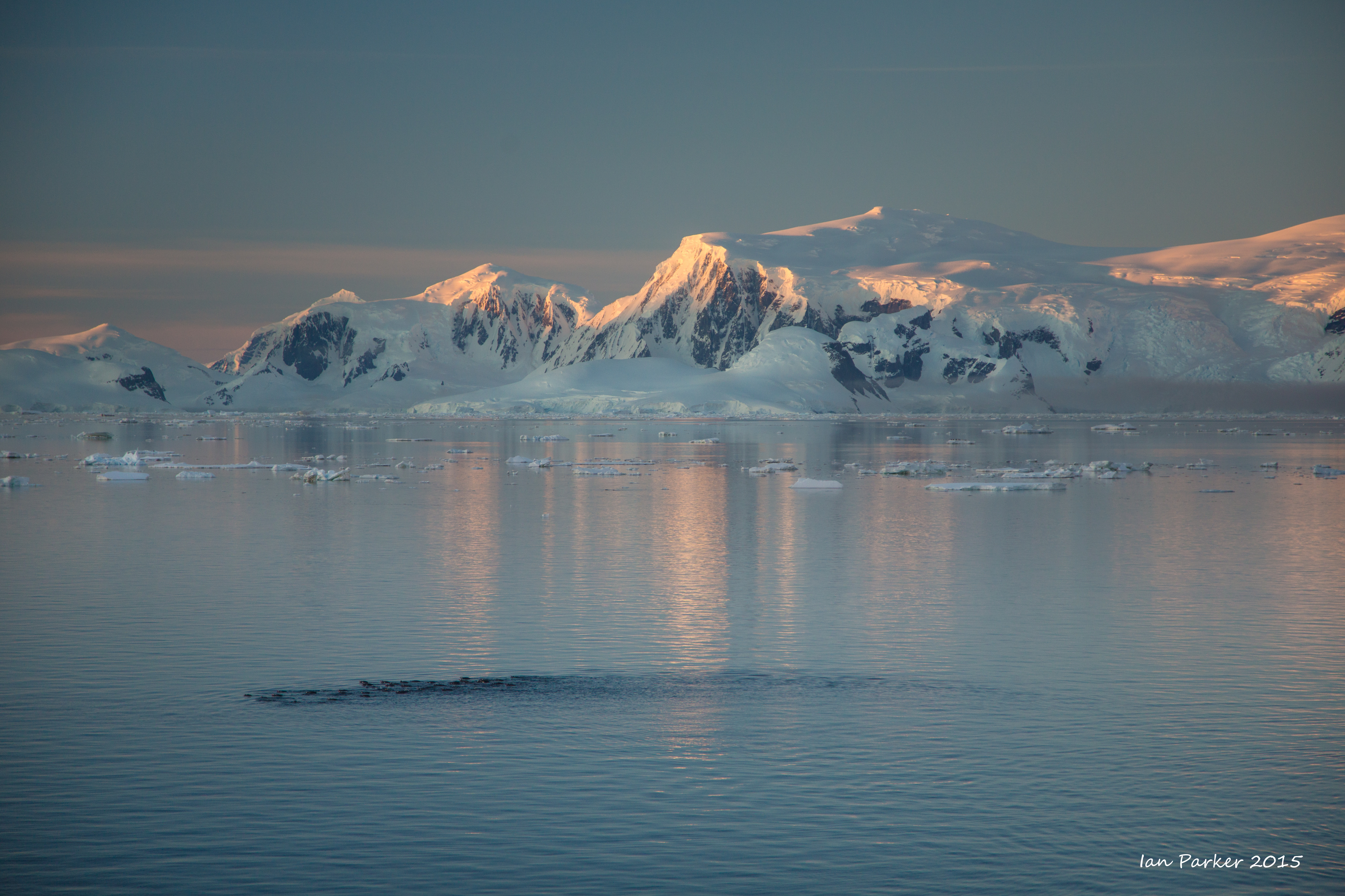
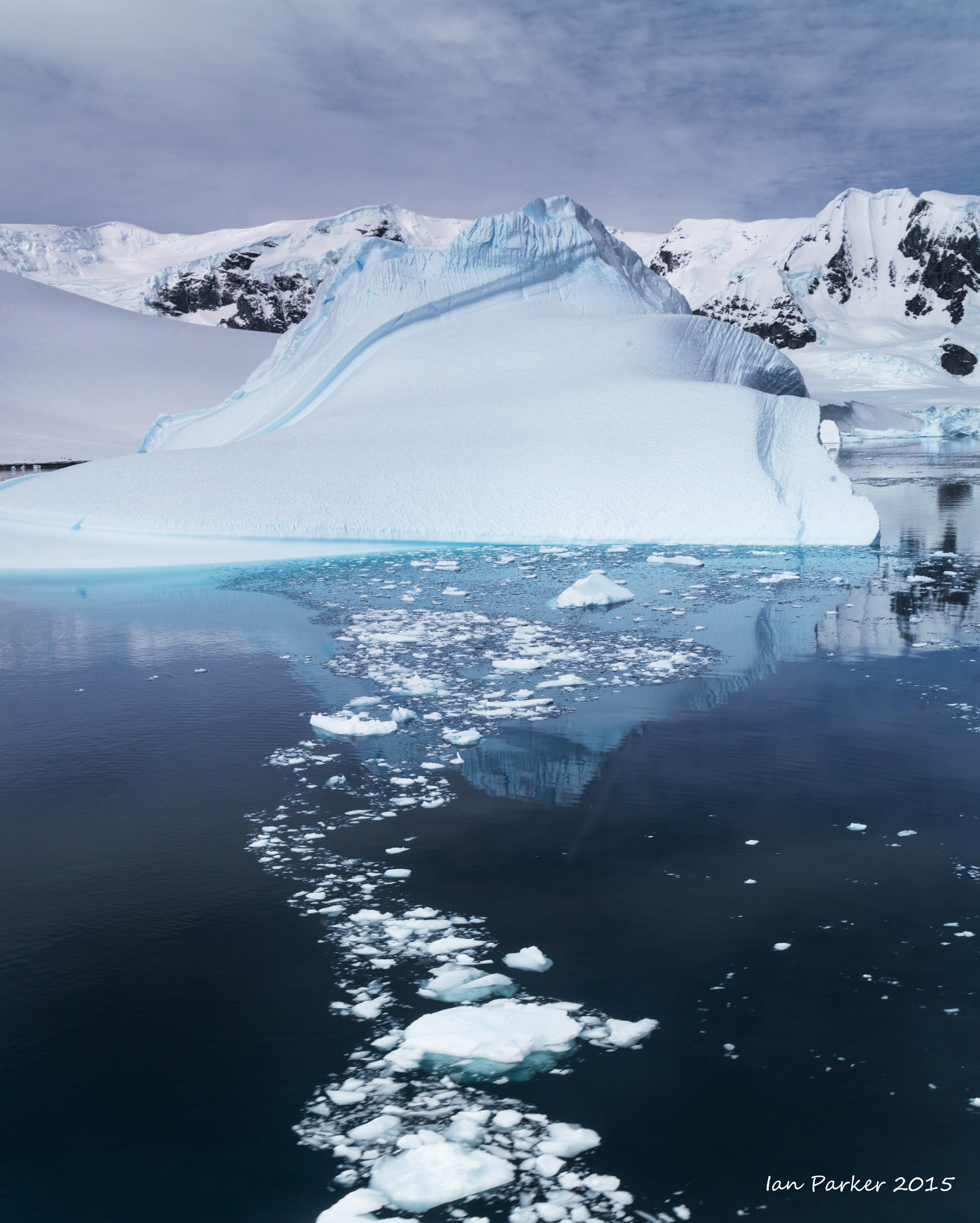
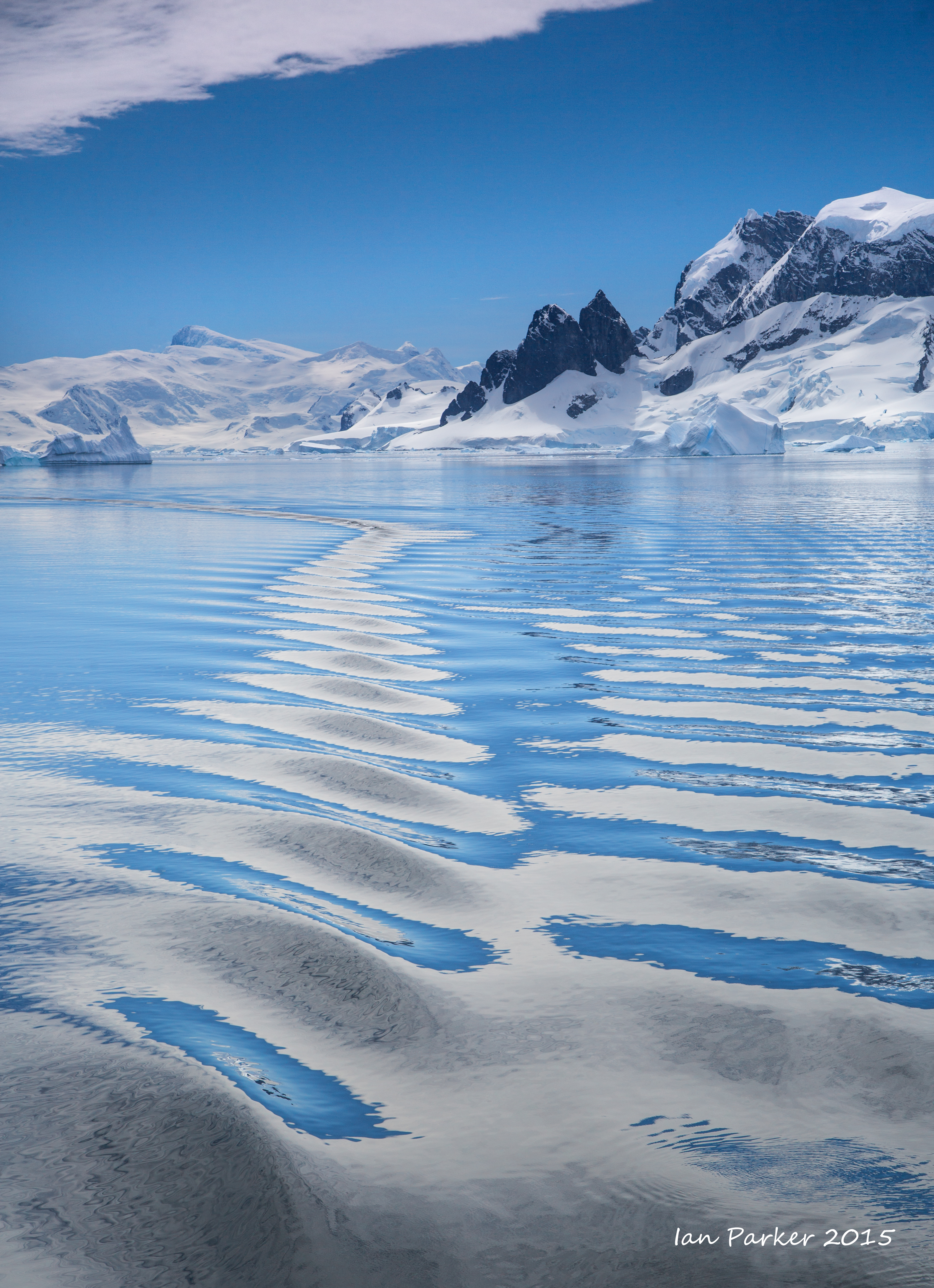
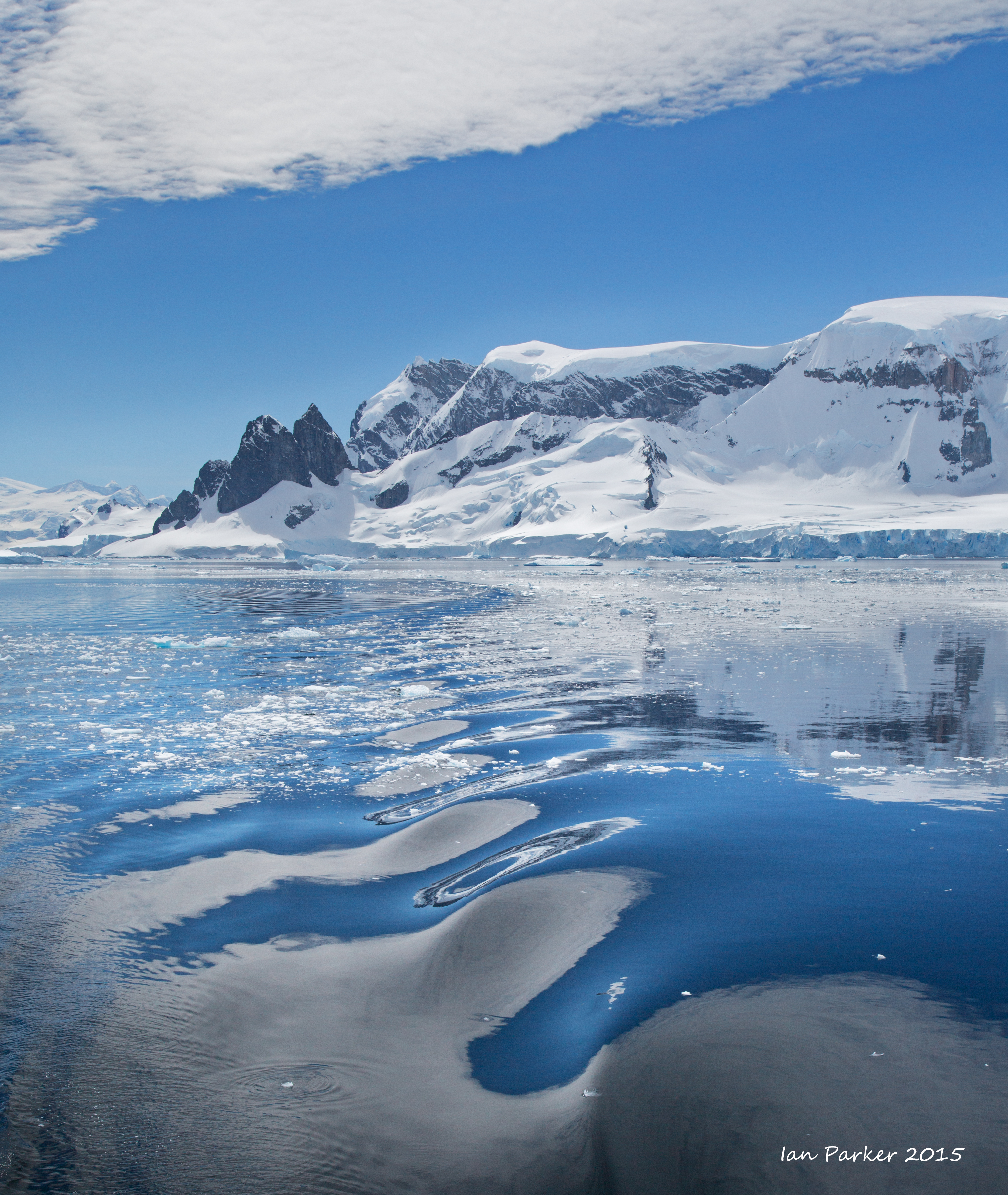
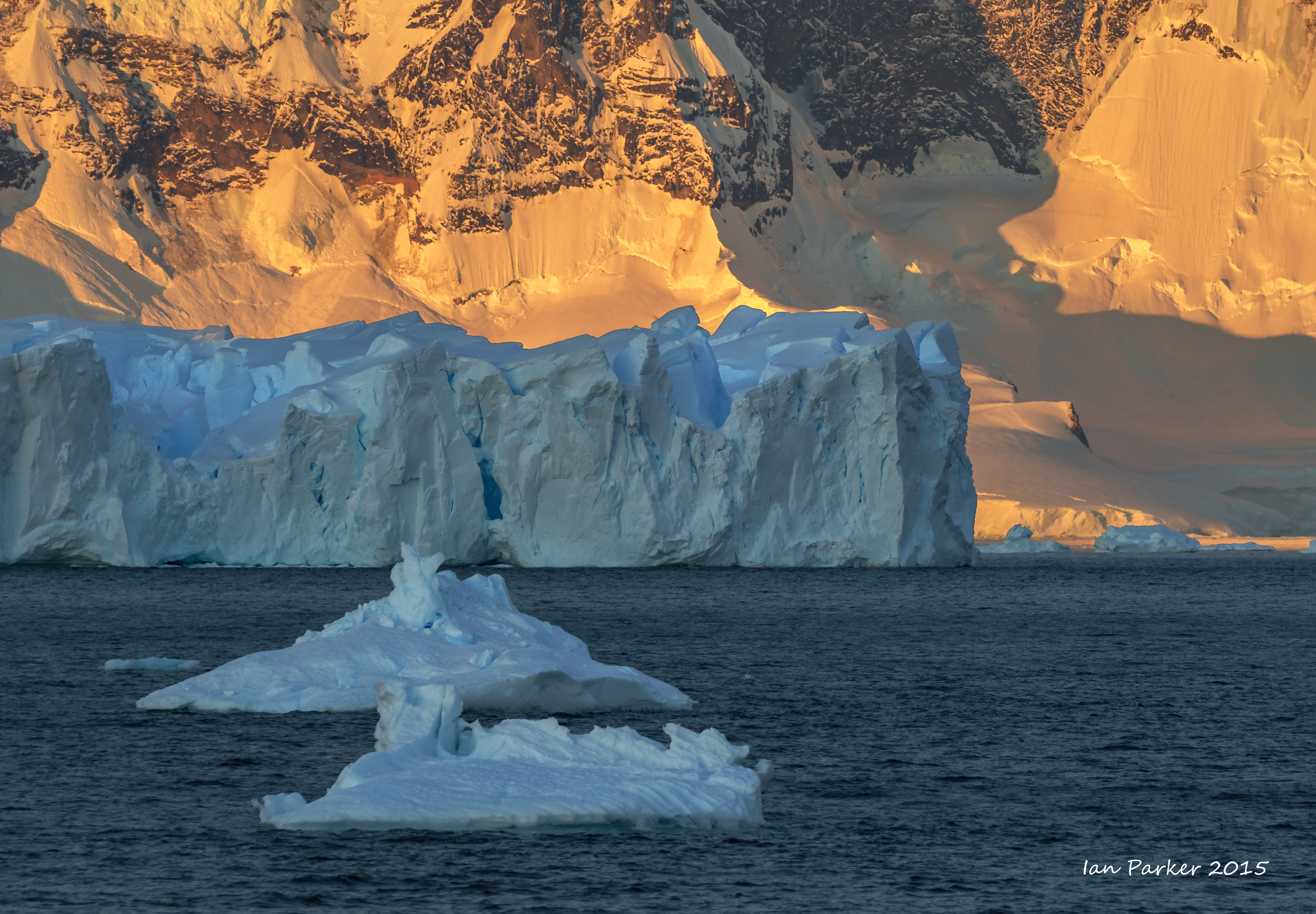
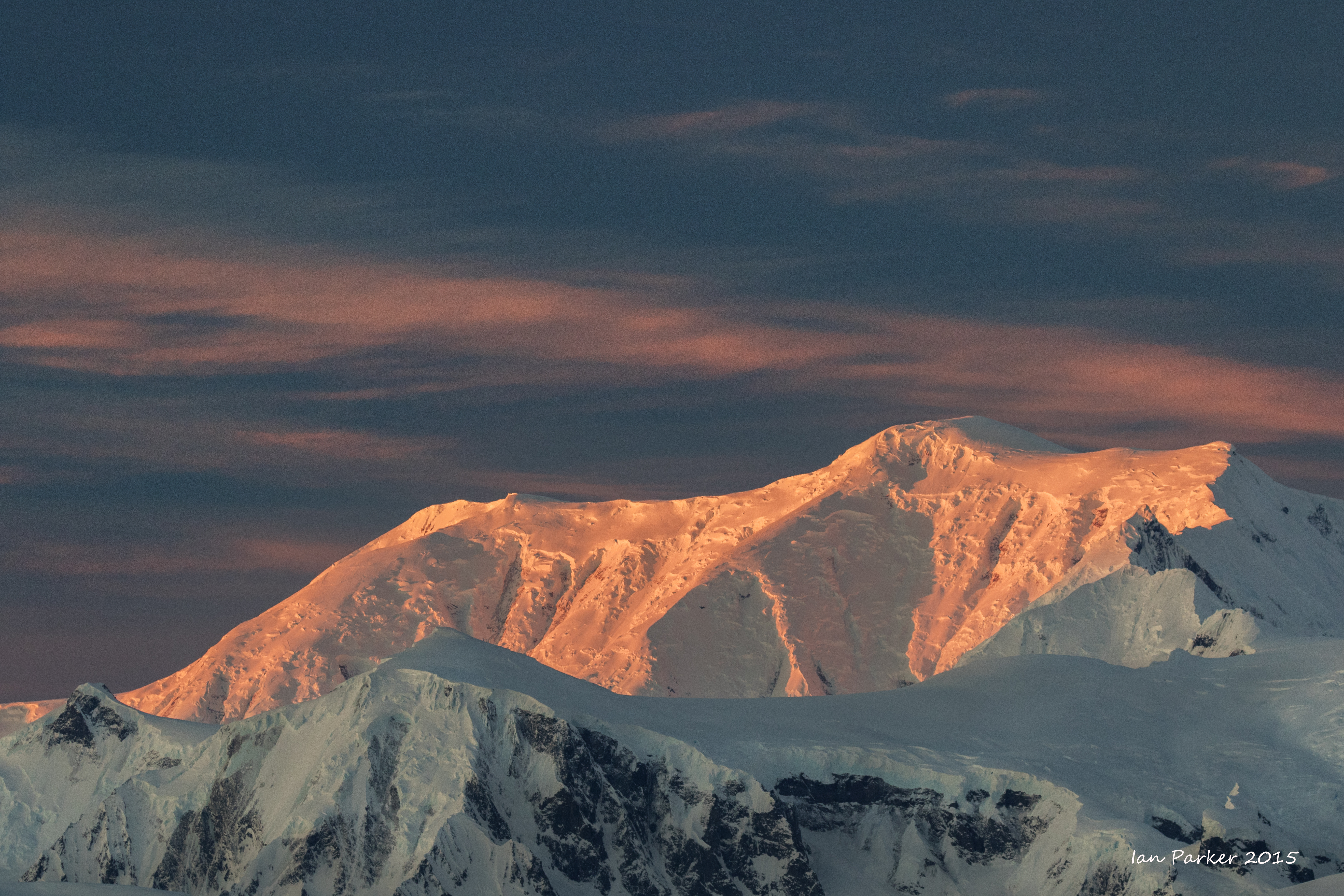
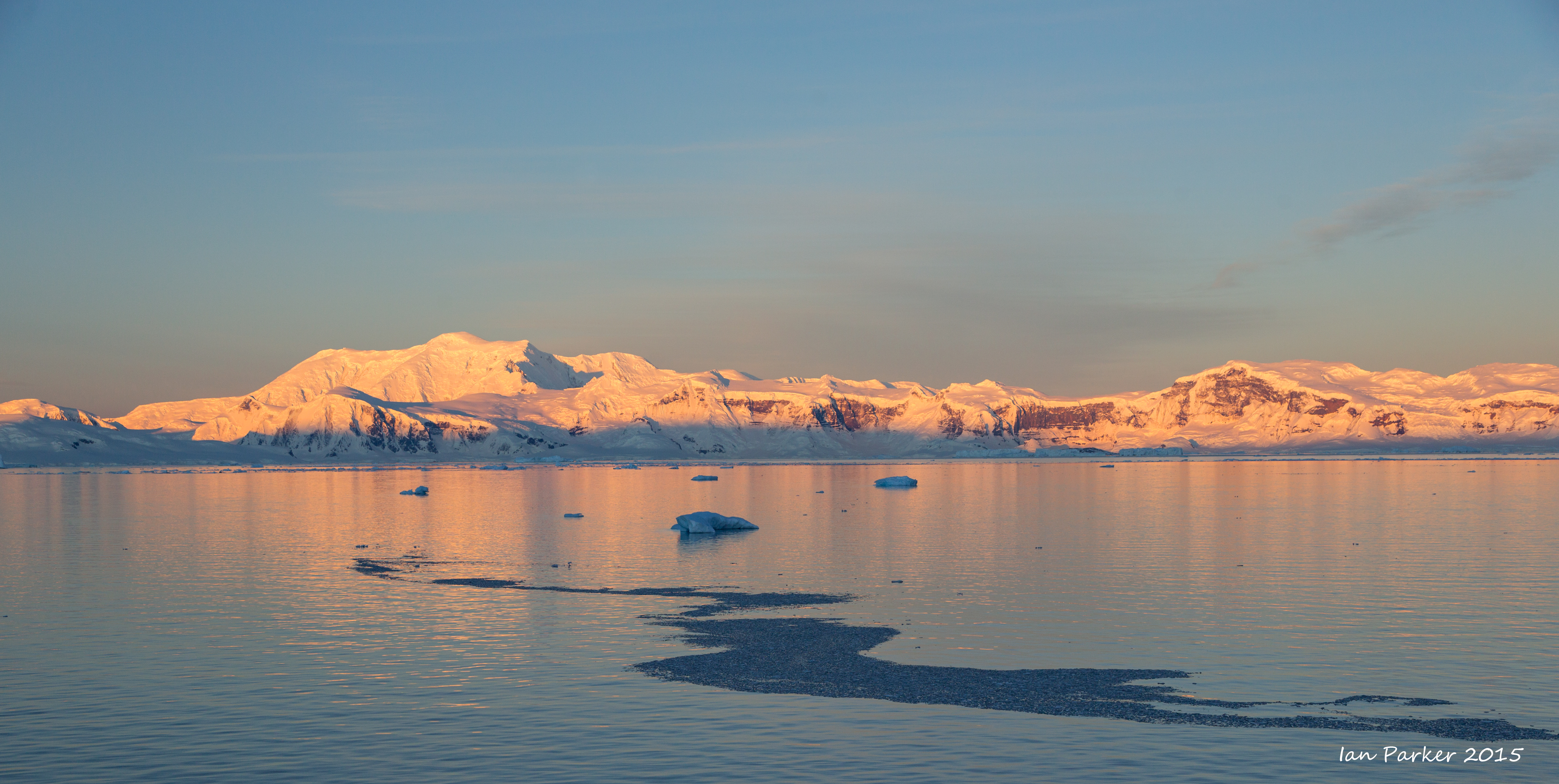
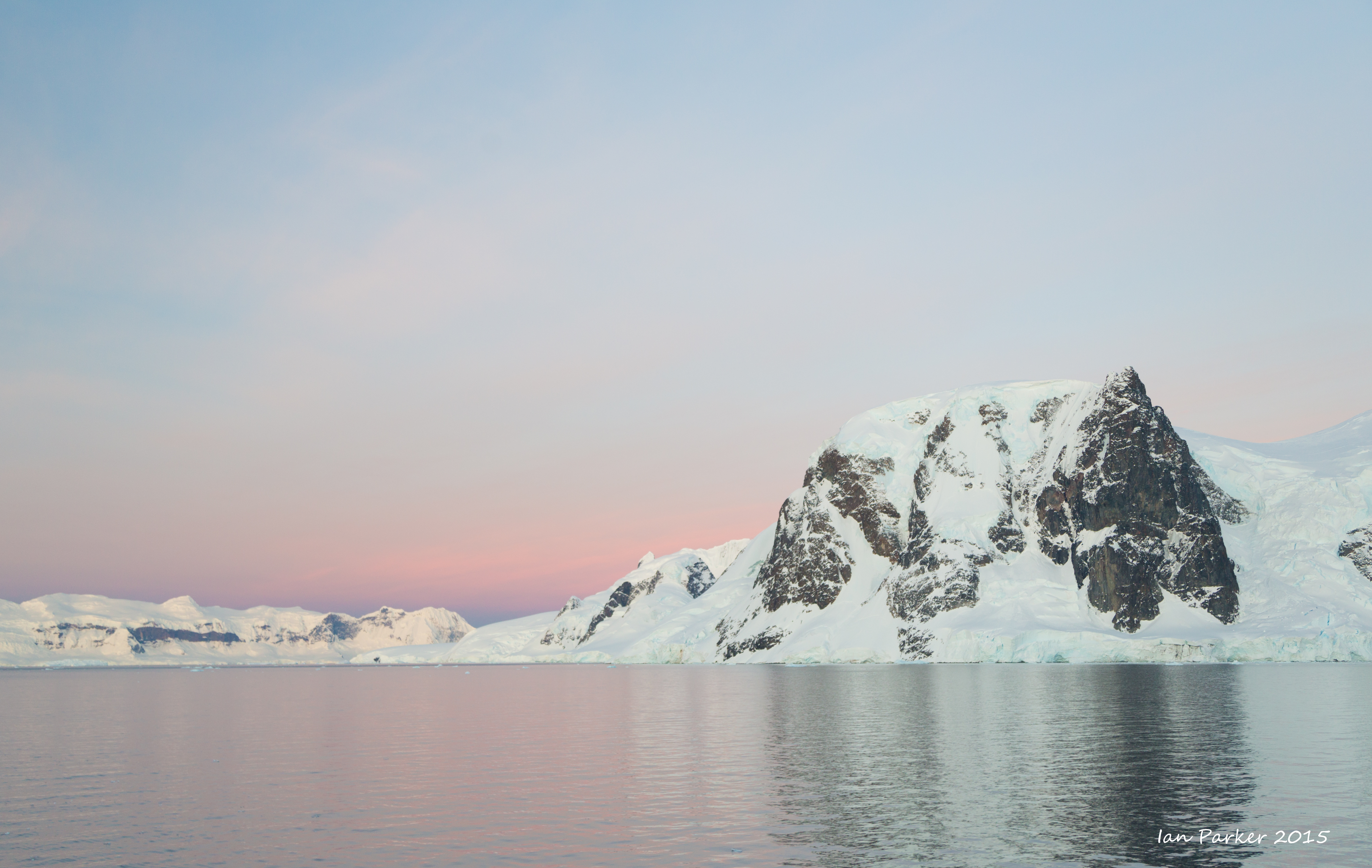
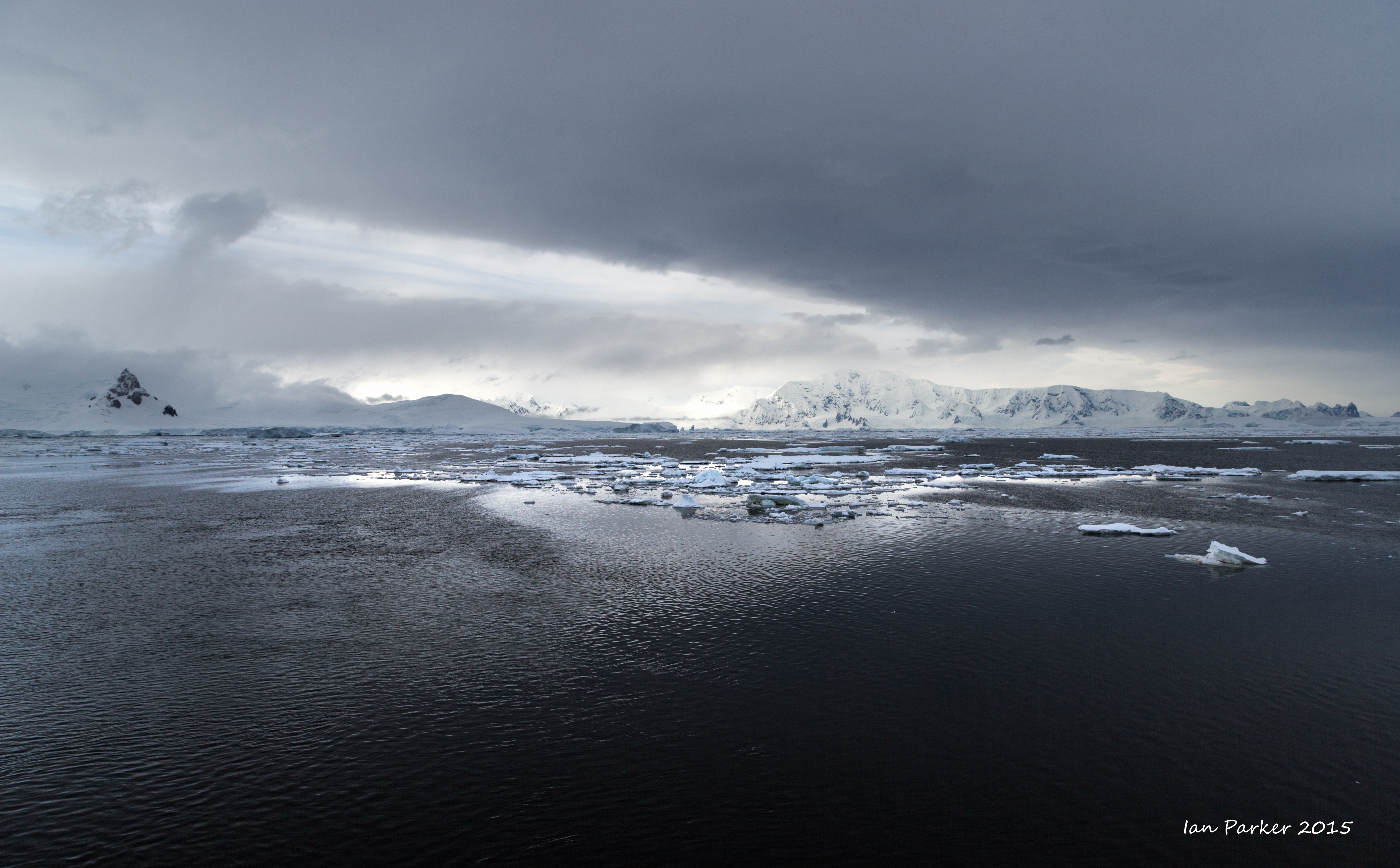
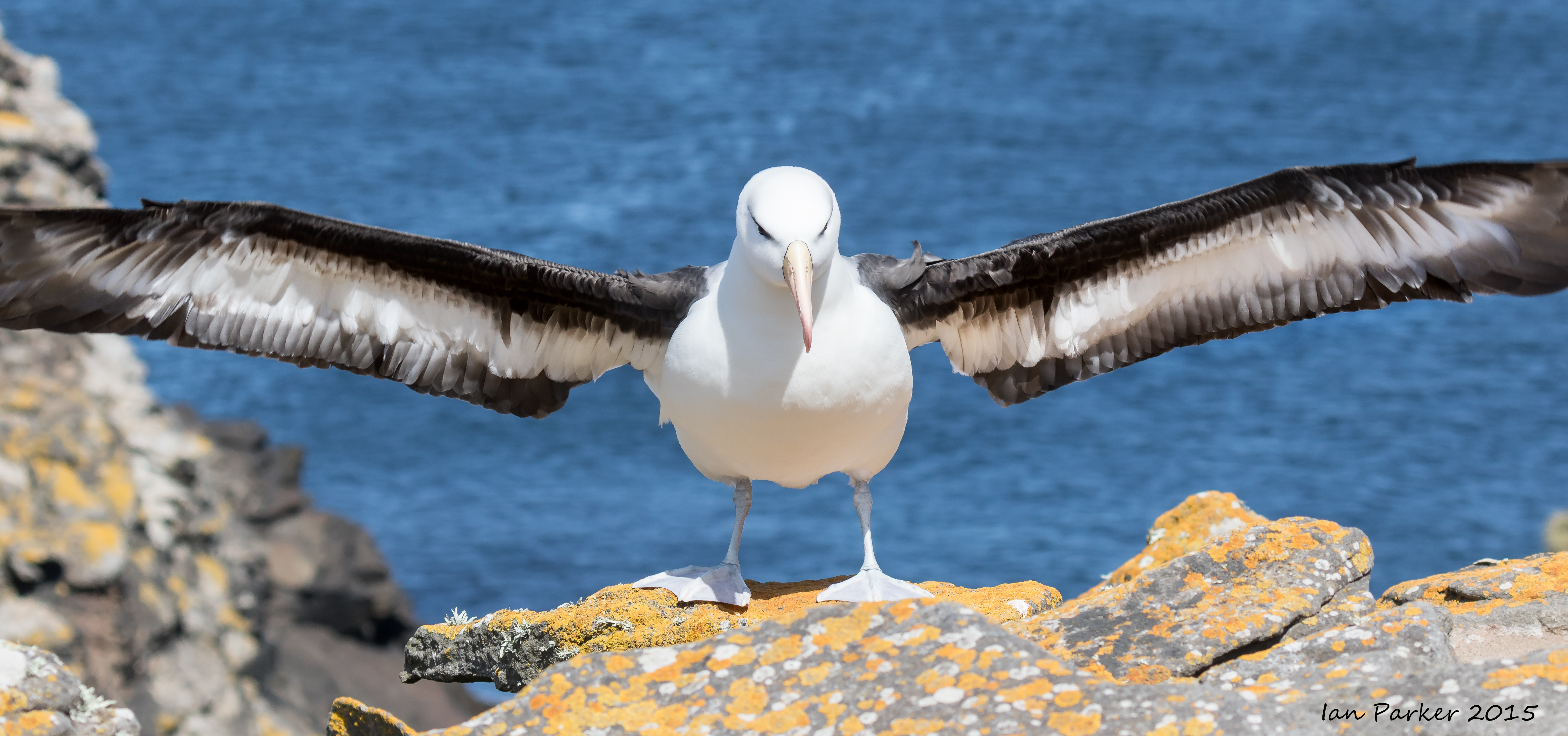
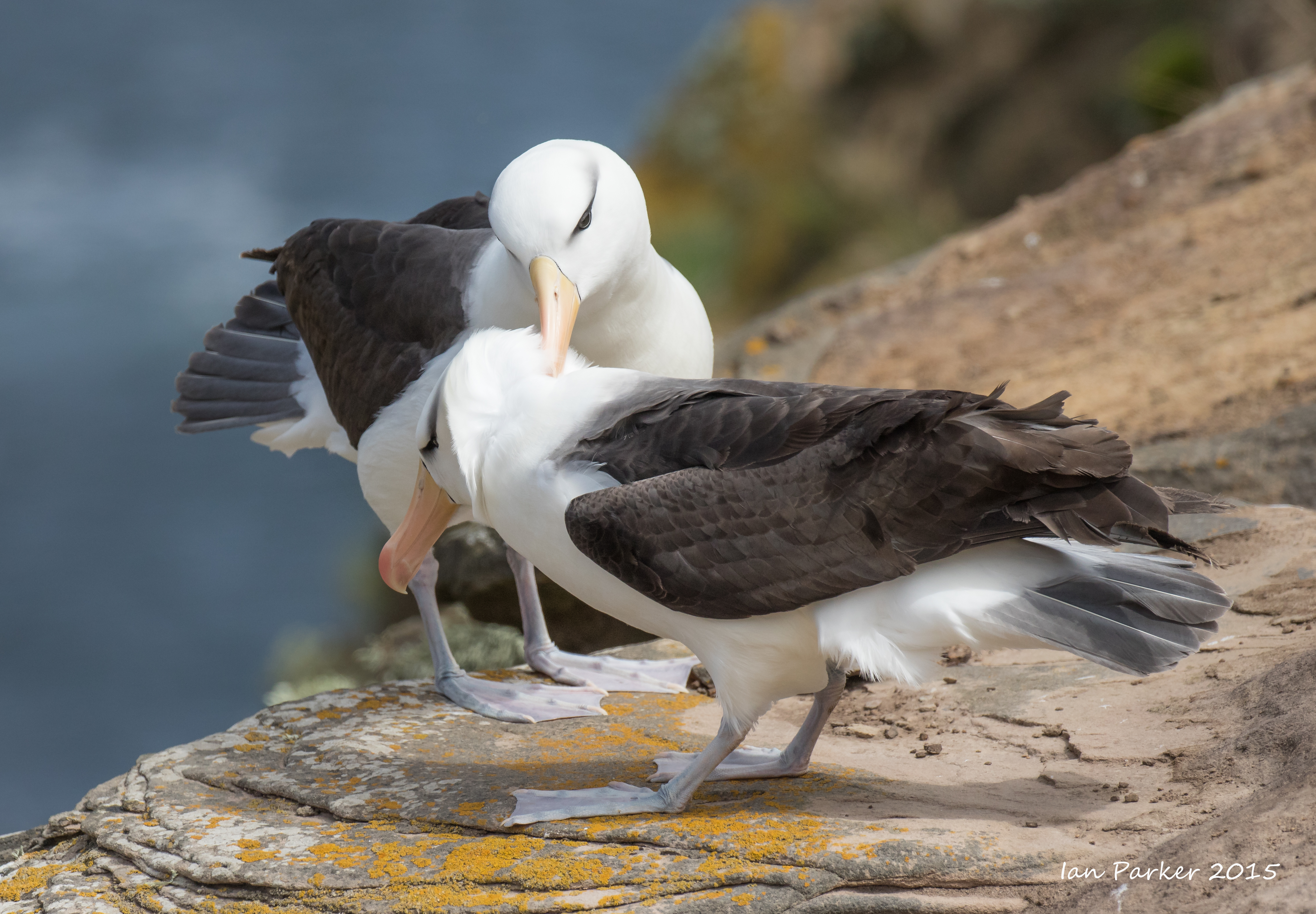
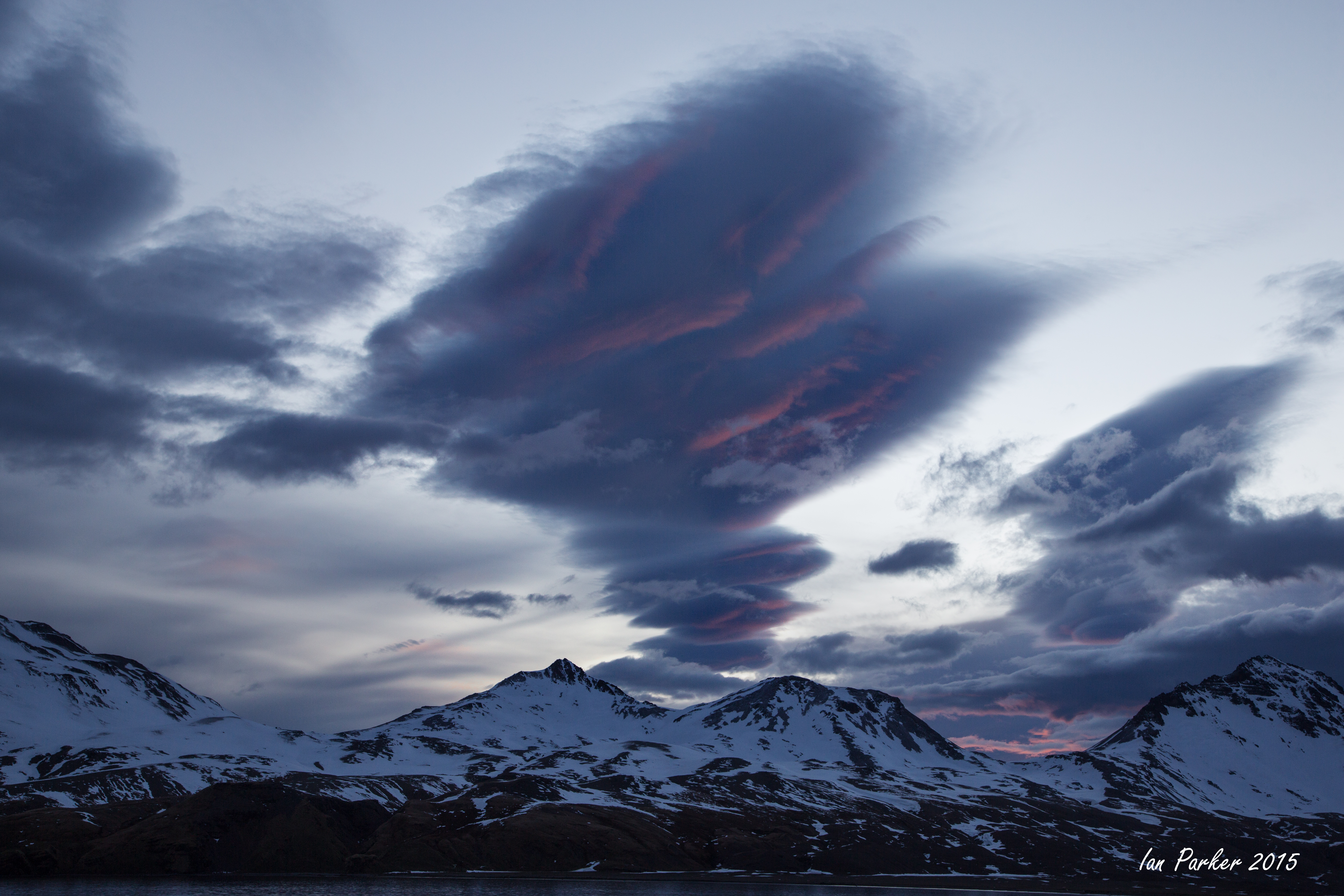
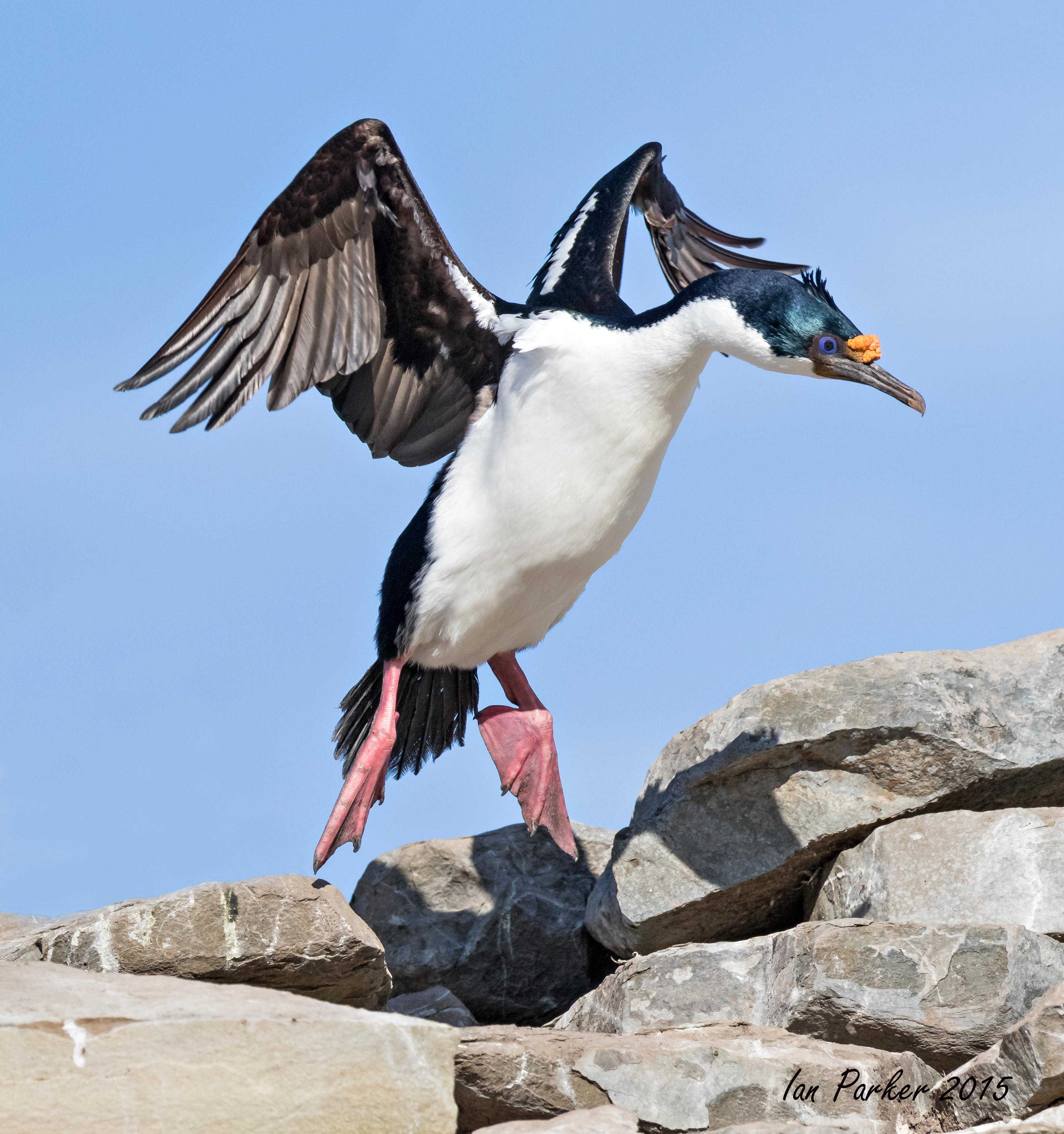
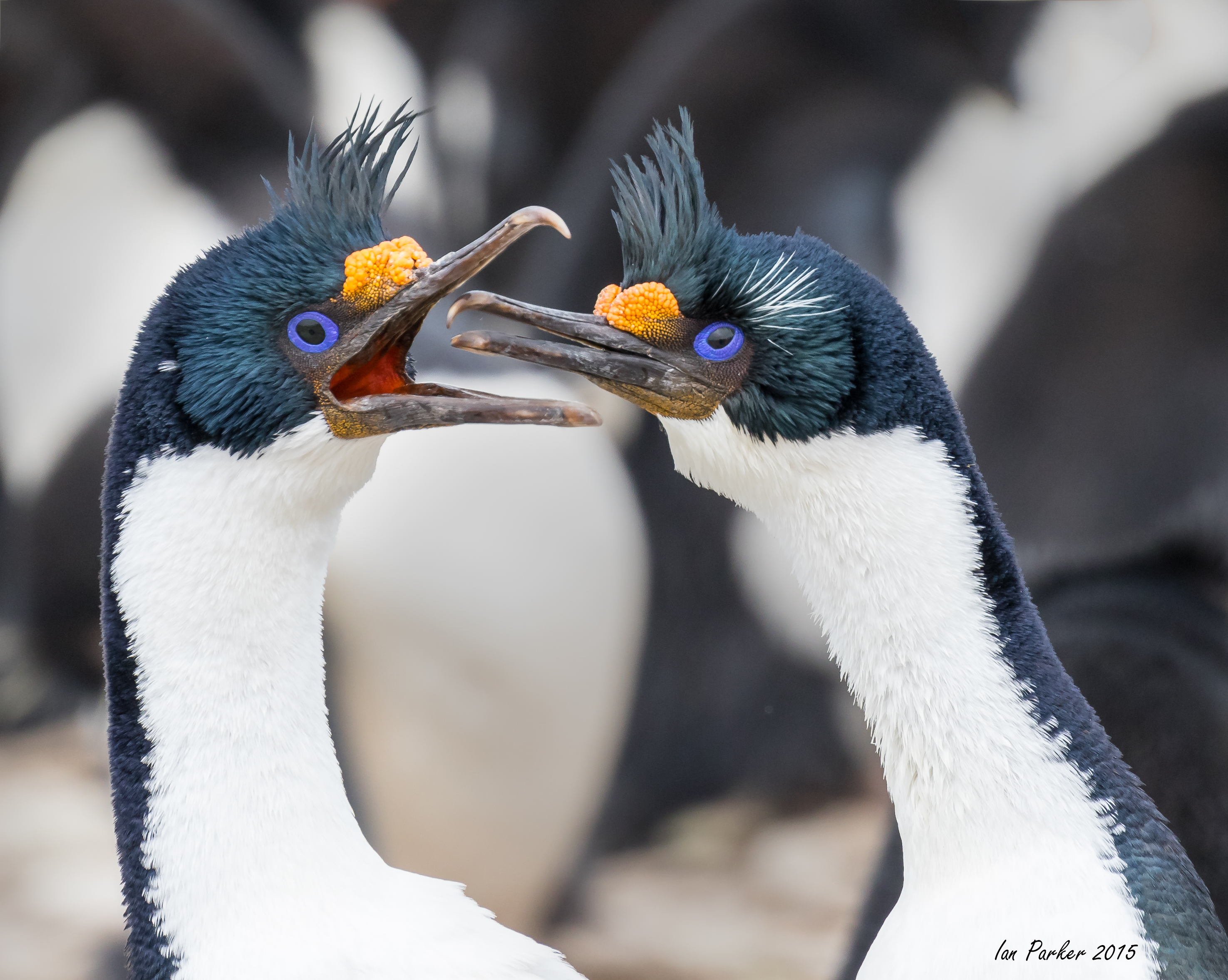
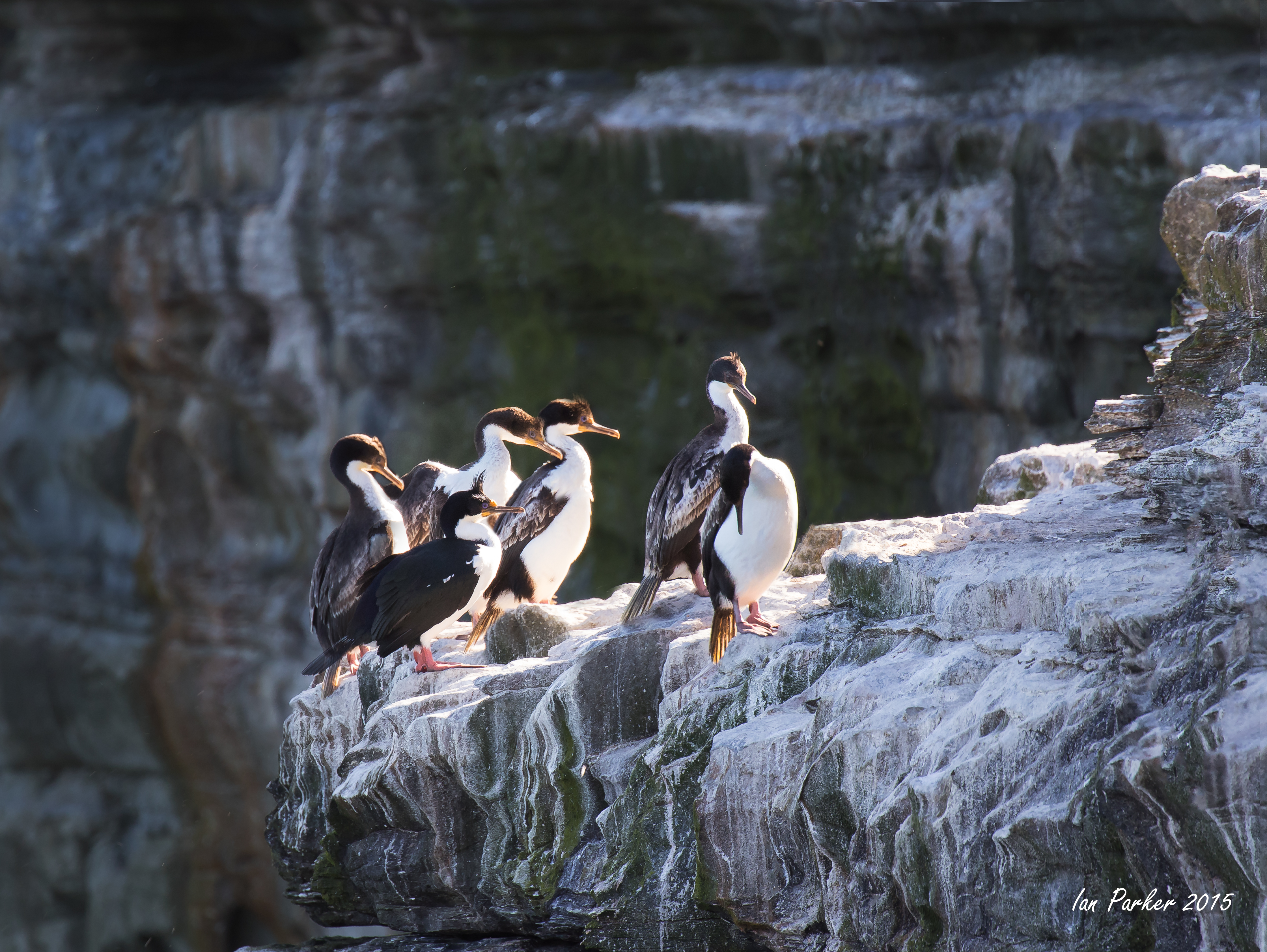
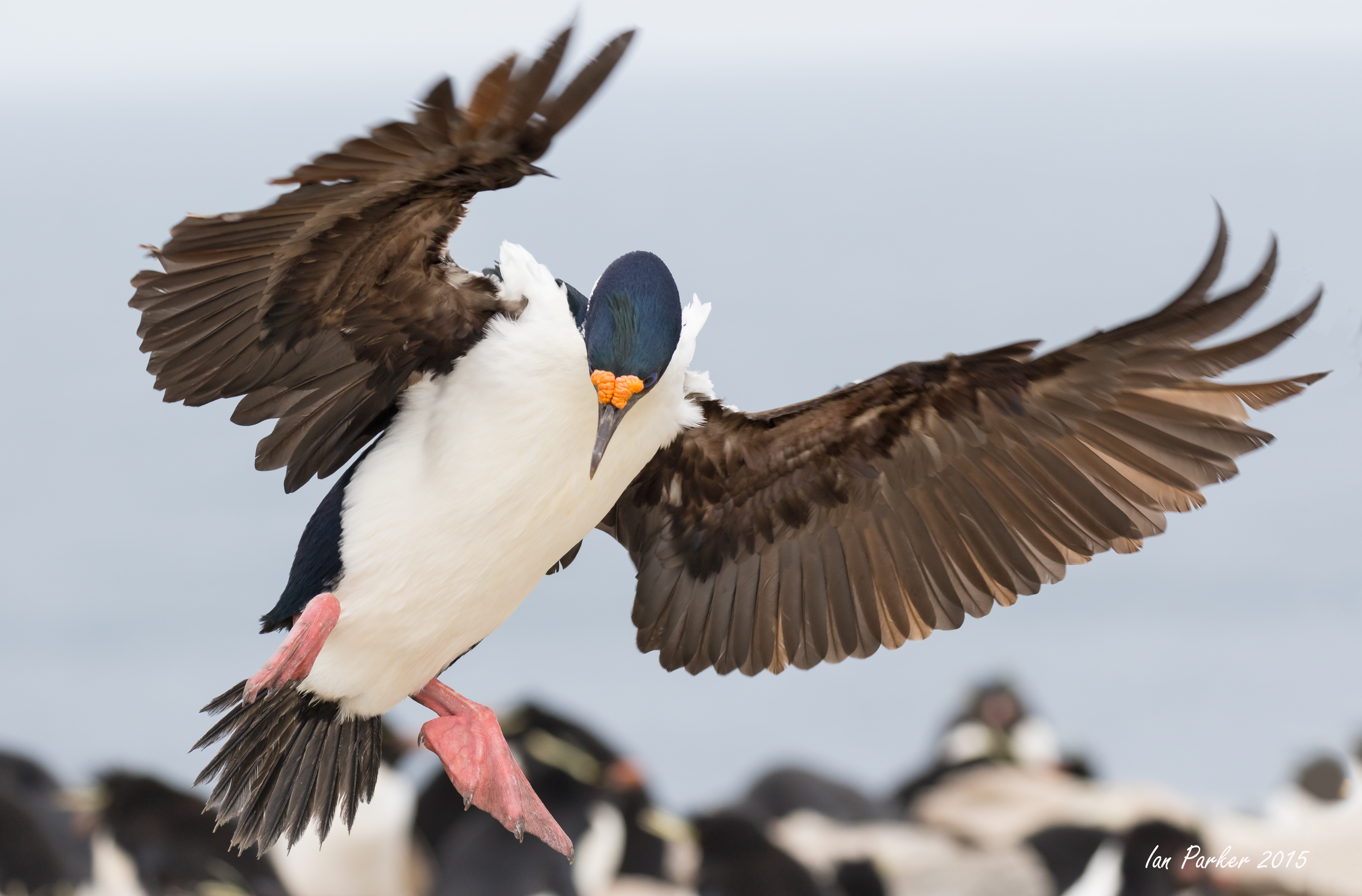
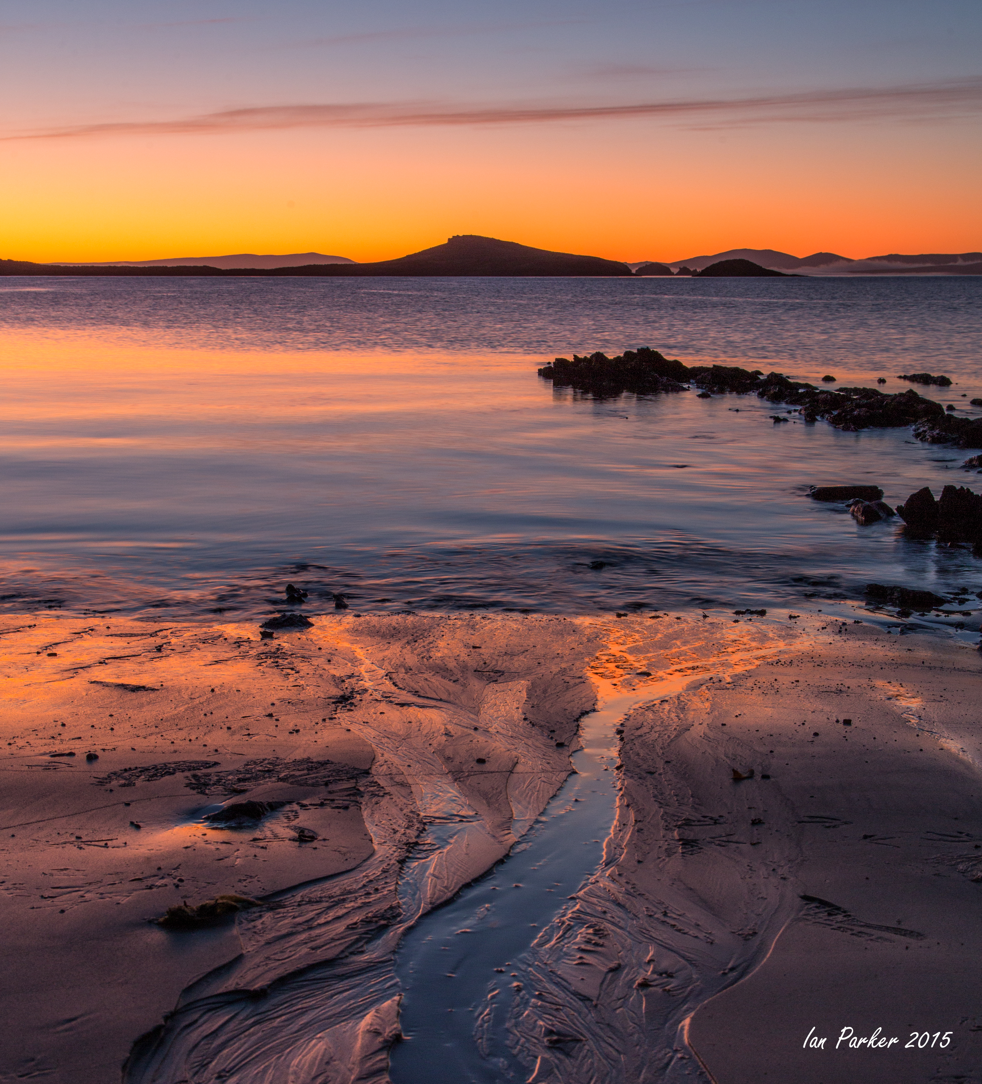
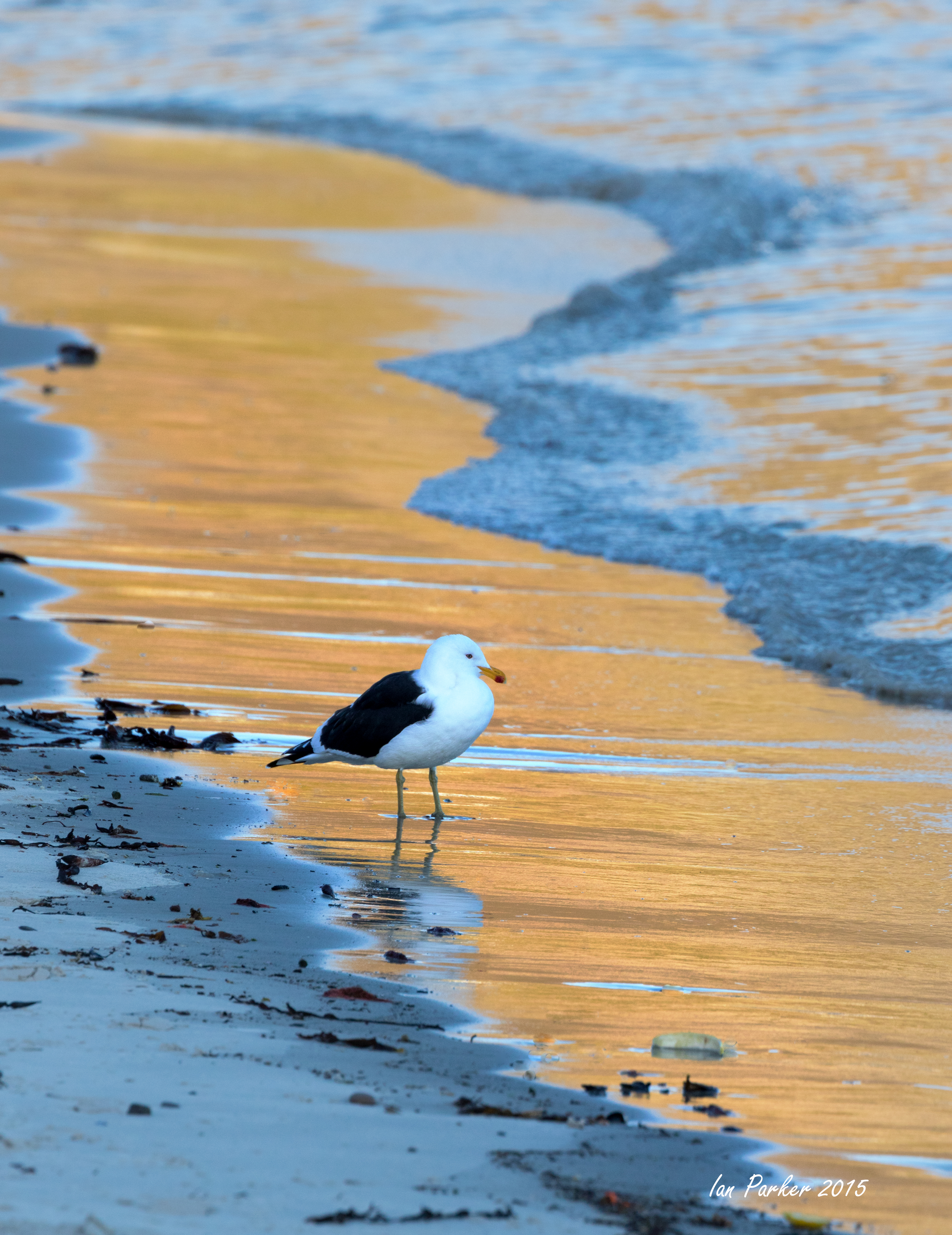
December 14-15 : A remarkable sunset/rise over Errera Channel, and icebergs around Melichor Island
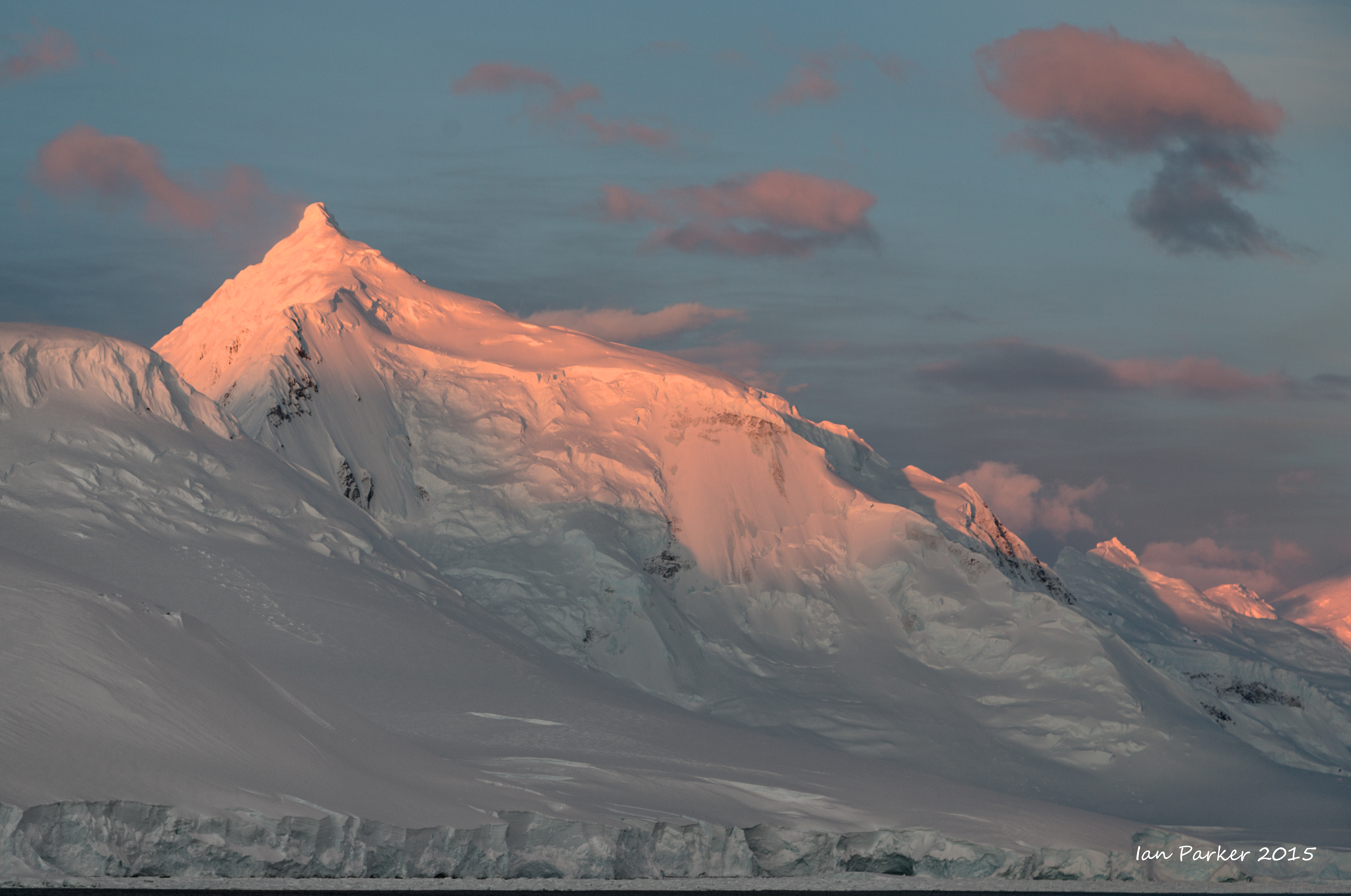
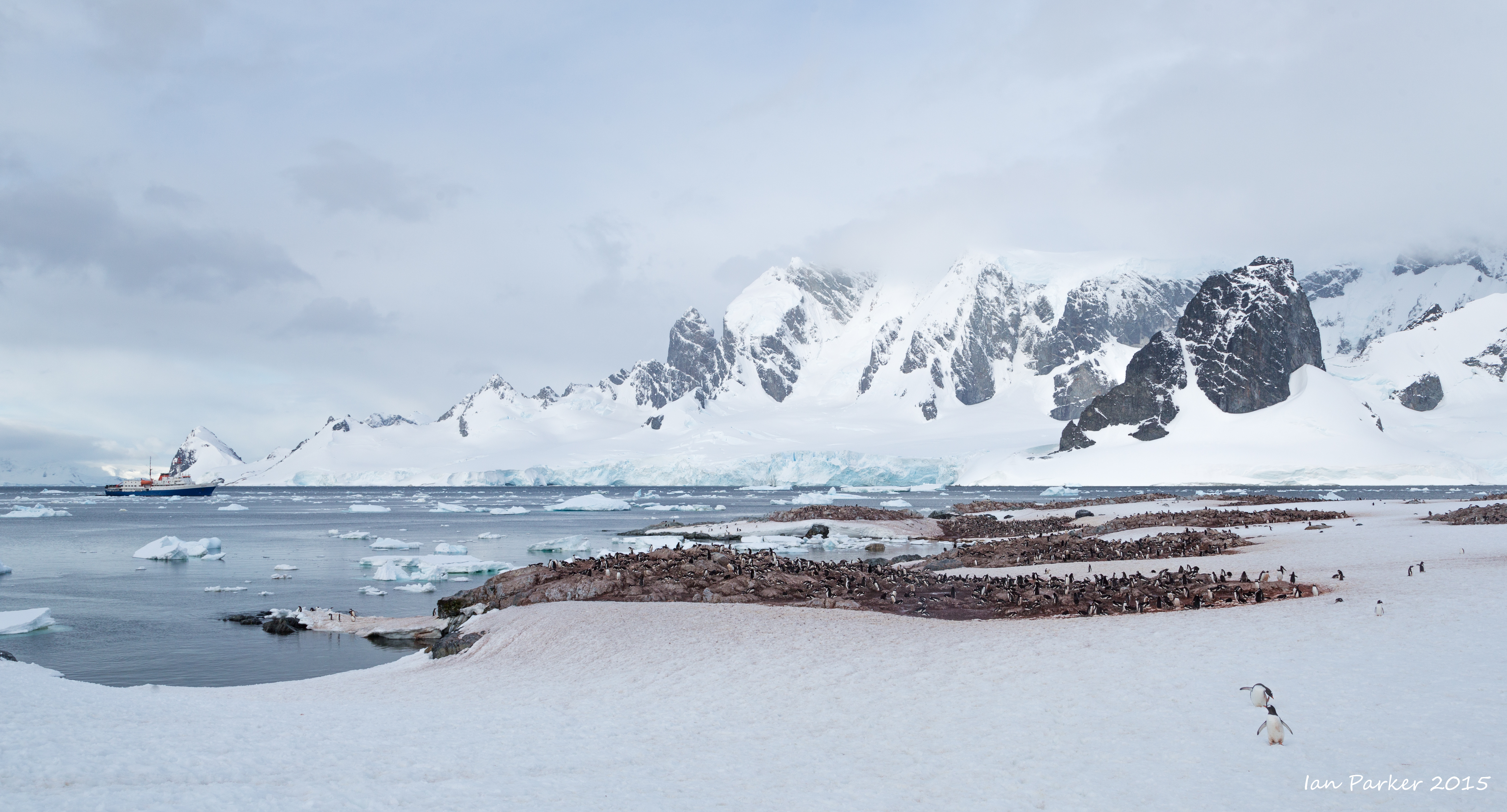
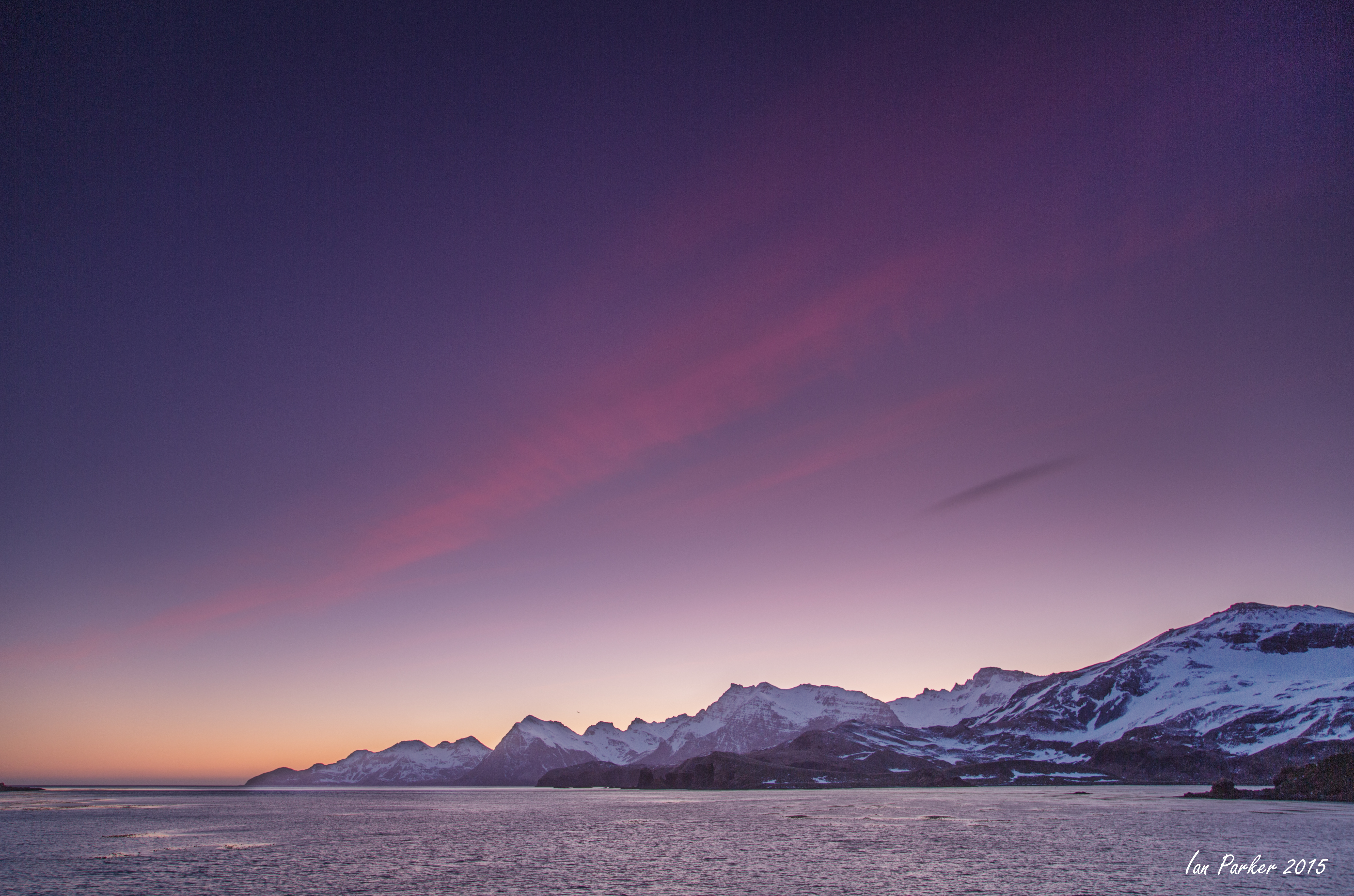
After lunch we cruised around Cuverville Island and into the spectacular Errera Channel capturing the beauty of Antarctica from the comfort of the ship. Canyons and mountains rising up from the narrow channel and icebergs were in close proximity. The majestic scenes filled our viewfinders with the photogenic magic of Antarctica. In the afternoon the winds subsided and we took advantage of clear weather for Zodiac cruises around Andvord Bay. As the evening progressed, the weather improved with clearing skies and sunshine creating dramatic skies and glowing towering icebergs. Zodiacs cruised around tabular icebergs and smaller chunks of ice with arches and stunning blue reflections. After dinner we had one of the best sunsets of the trip and many people stayed up until after midnight to catch the golden glow of sunset.
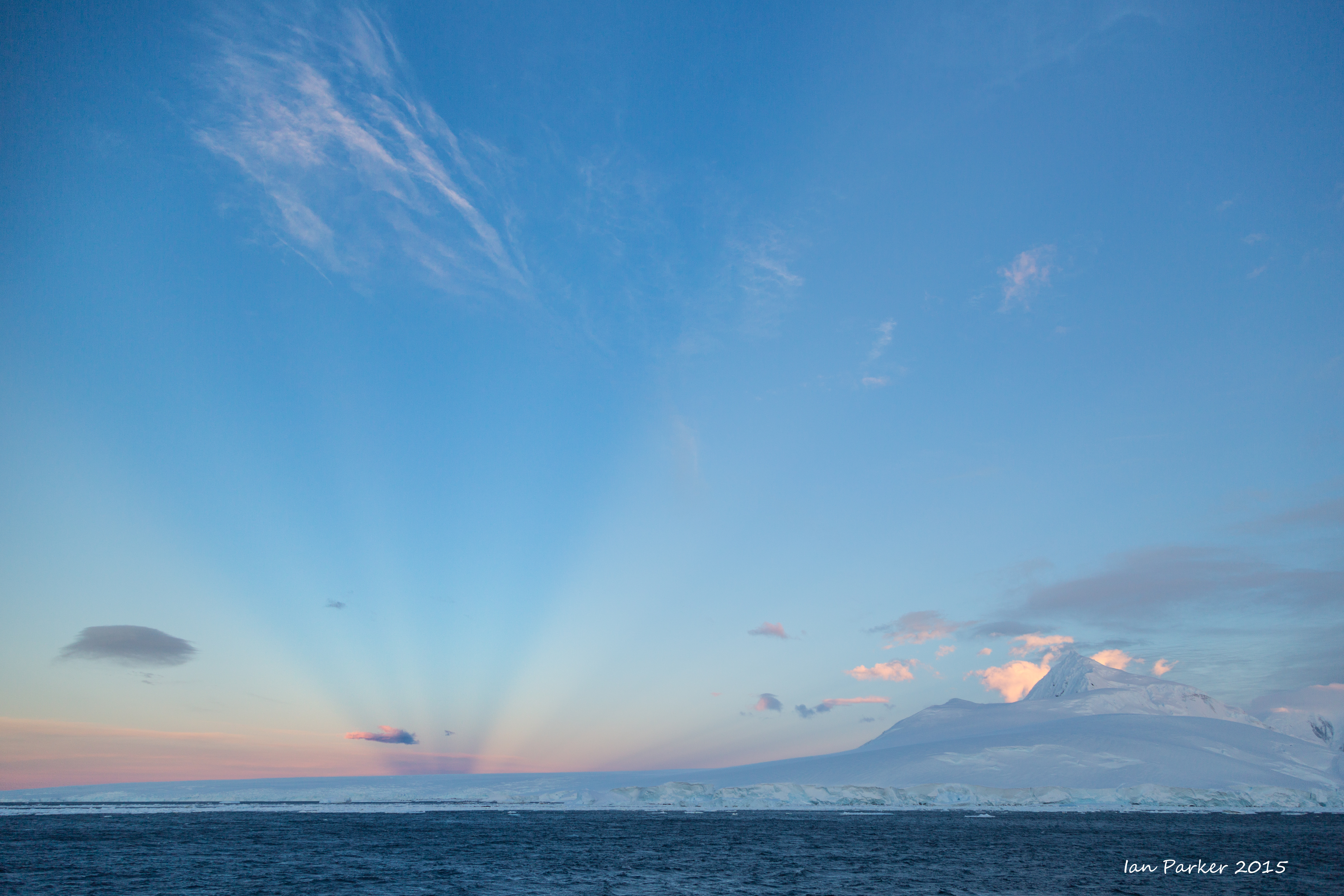
Your scribe is uncertain how many enthusiastic photographers either remained awake after last night’s sunset to witness the sunrise, but the general consensus was that the sunrise was even better than sunset.
I was one. Sunrise followed only a couple of hours after sunset, so I did get a little sleep. Given how brief the interlude was, I was surprised at how different the light appeared. Whereas sunset produced bright colors in the sky and mountains, sunrise gave very pale pastels.
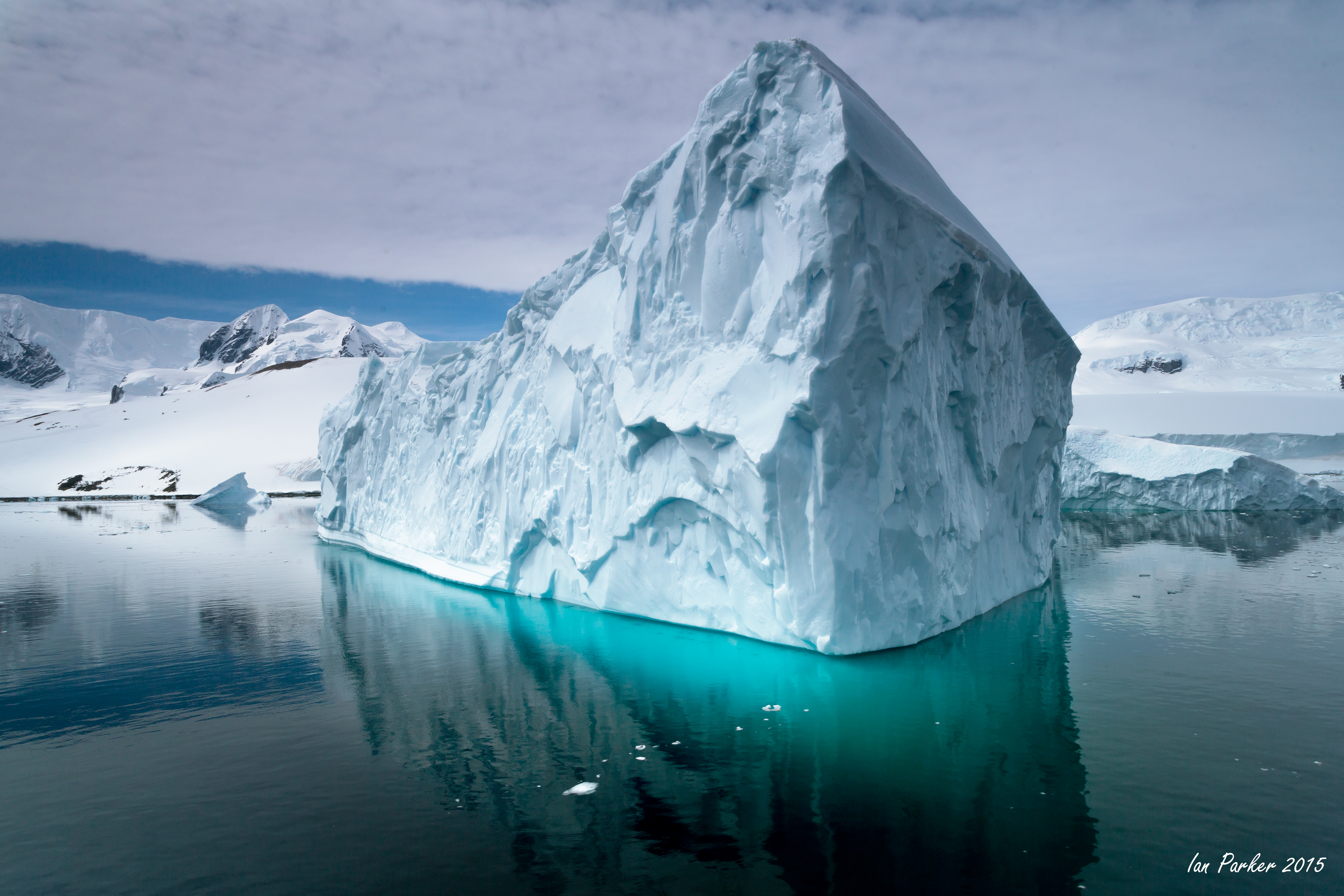
Photos from a Zodiac cruise around Melichor Island later that morning
We had an early breakfast at 0700 and then began Zodiac cruises at 0830. Each cruise was planned for one and a half hours, but we easily could have spent twice that amount of time out on the water, photographing. Everyone started out from the ship and went west around the first or second island. We photographed icebergs that had been sculptured by water, wind and waves. Some of the icebergs had rolled, revealing a photogenic multi-dimpled surface.
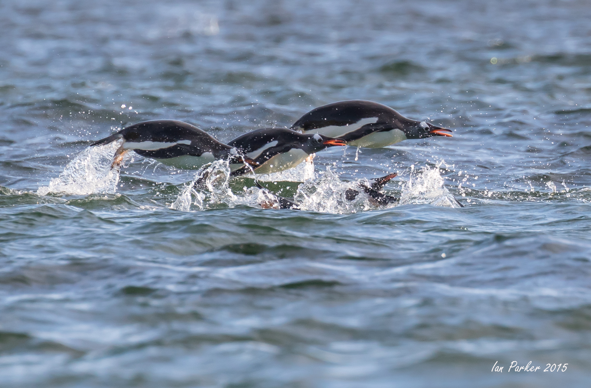
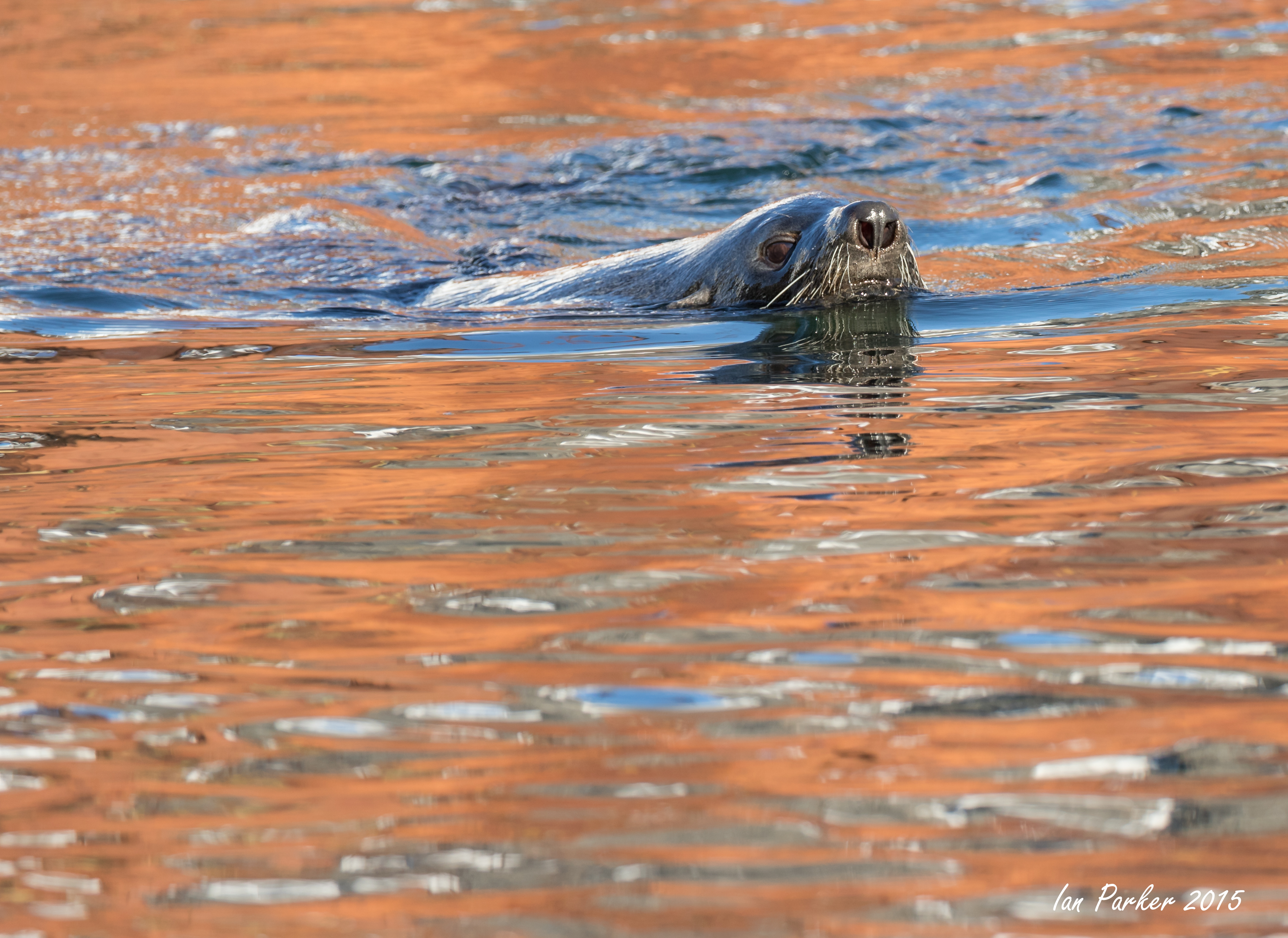
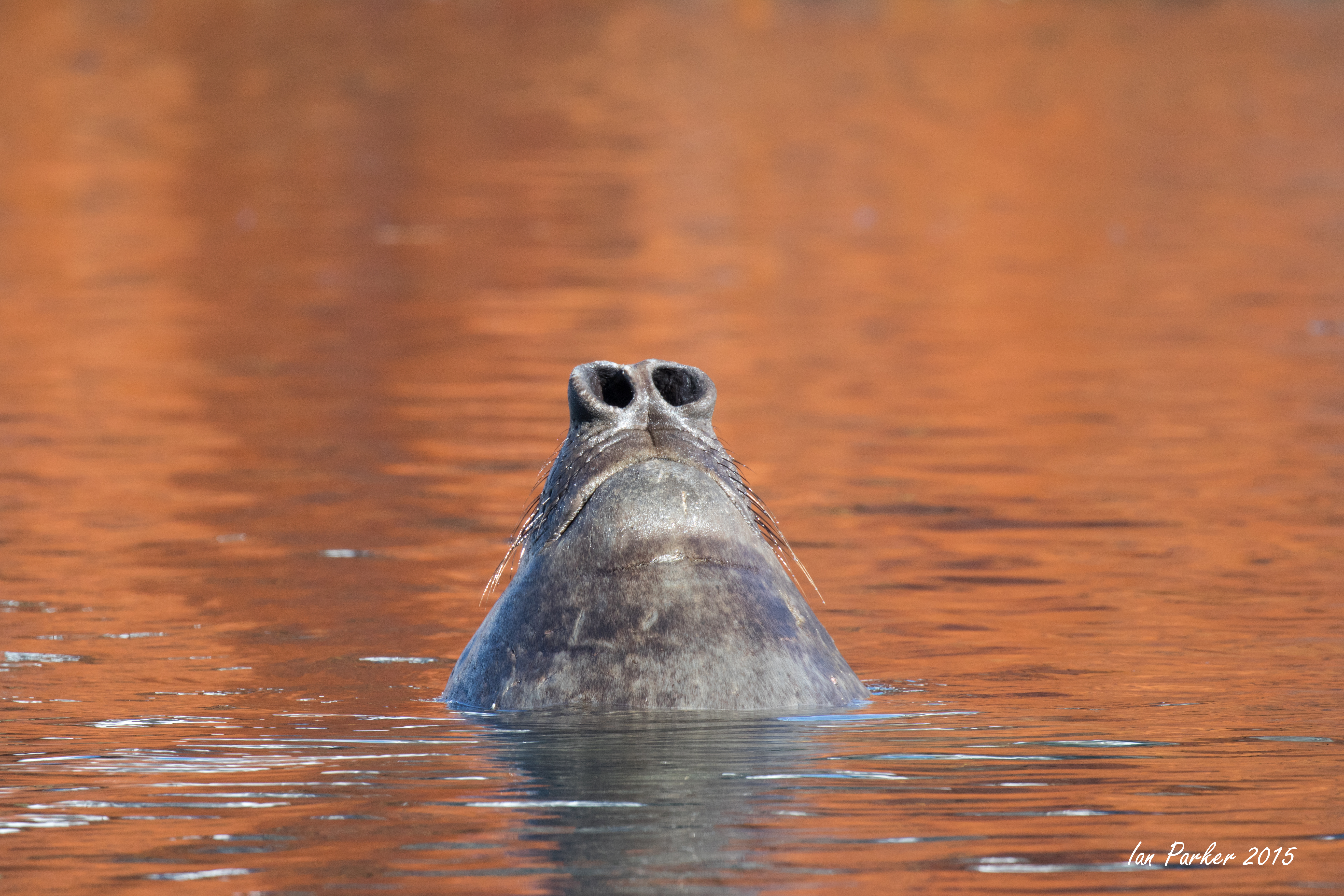
Throughout the morning we encountered different wildlife, including porpoising chinstrap penguins, bathing, feeding and resting gentoo penguins, Antarctic terns and kelp gulls. Several of the Zodiacs found three crabeater seals resting on a small ice floe.
December 13-14 : Andvord Bay
We woke up to partly cloudy skies and the temperature a mild 2°C. We had spent the night in the sheltered Andvord Bay and were treated to tabular icebergs illuminated in golden light by the setting/rising sun. After lunch we cruised around Cuverville Island and into the spectacular Errera Channel capturing the beauty of Antarctica from the comfort of the ship. Canyons and mountains rising up from the narrow channel and icebergs were in close proximity. In the afternoon the winds subsided and we took advantage of clear weather for Zodiac cruises around Andvord Bay. As the evening progressed, the weather improved with clearing skies and sunshine creating dramatic skies and glowing towering icebergs. Zodiacs cruised around tabular icebergs and smaller chunks of ice with arches and stunning blue reflections. After dinner we had one of the best sunsets of the trip and many people stayed up until after midnight to catch the golden glow of sunset.
December 10-12th - Paradise Bay, Dallman Bay, Dorian Bay
Pack ice and bad weather thwarted attempts to land at several locations, so we were ship-bound; but encountered some nice icebergs and light conditions.
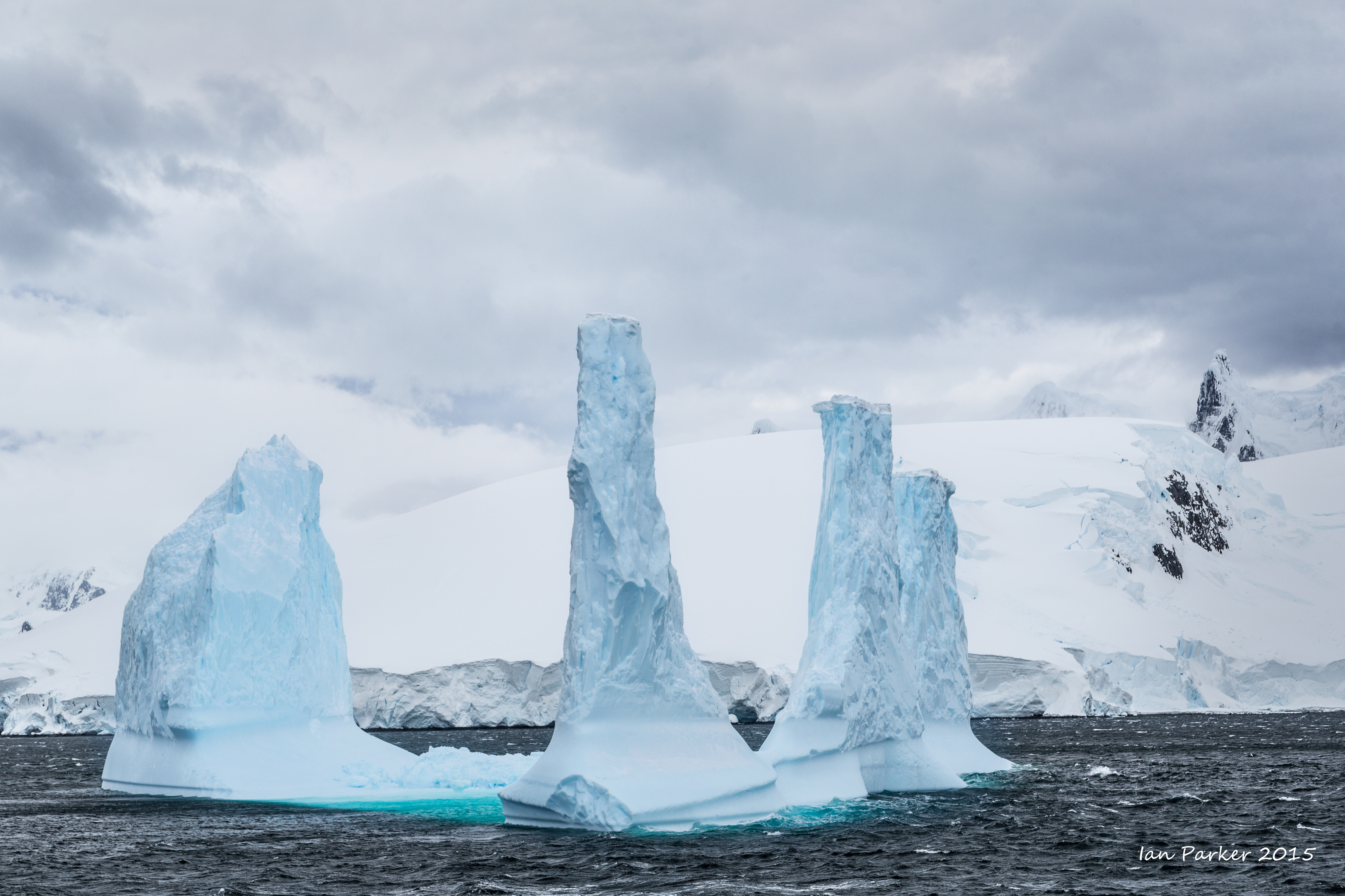
Backtracking through the Gerlache Strait on the Danco Coast side we sailed into Dallmann Bay and found an unusual iceberg with multiple tall Stonehenge-like spires. Almost everyone went out to photograph, only to learn that the wind had not abated at all. Wind? That's far too basic a word; it seemed more like a blast from a hurricane. We searched for places on the ship to tuck into—any place for shelter. As the ship turned to make another pass at the berg, the wind first hit one side of the ship and then the other—causing a mass migration of cameras and people into the sheltering lee of the ship. After about 20 minutes we left the iceberg—all of us rapidly approaching Popsicle status.
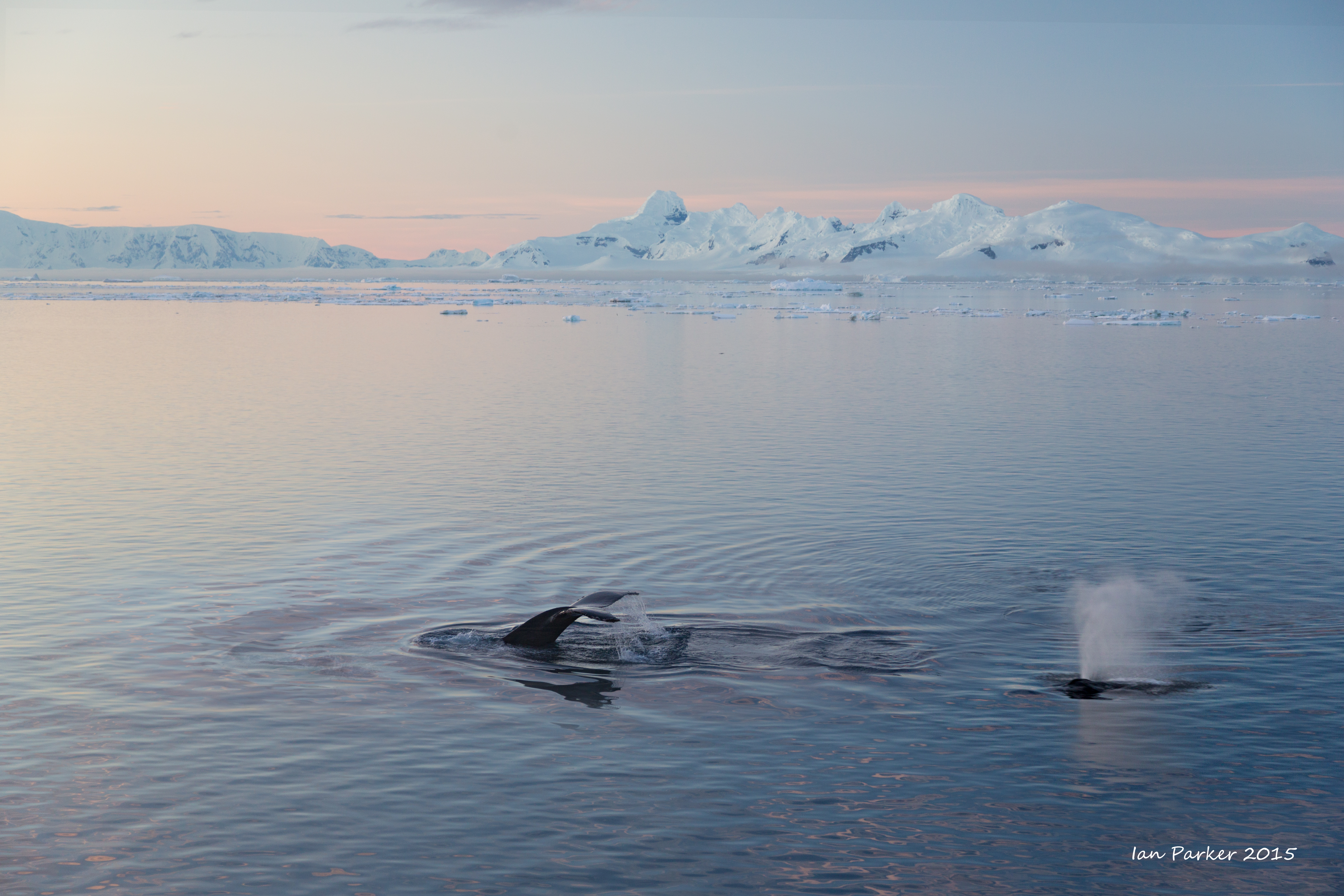
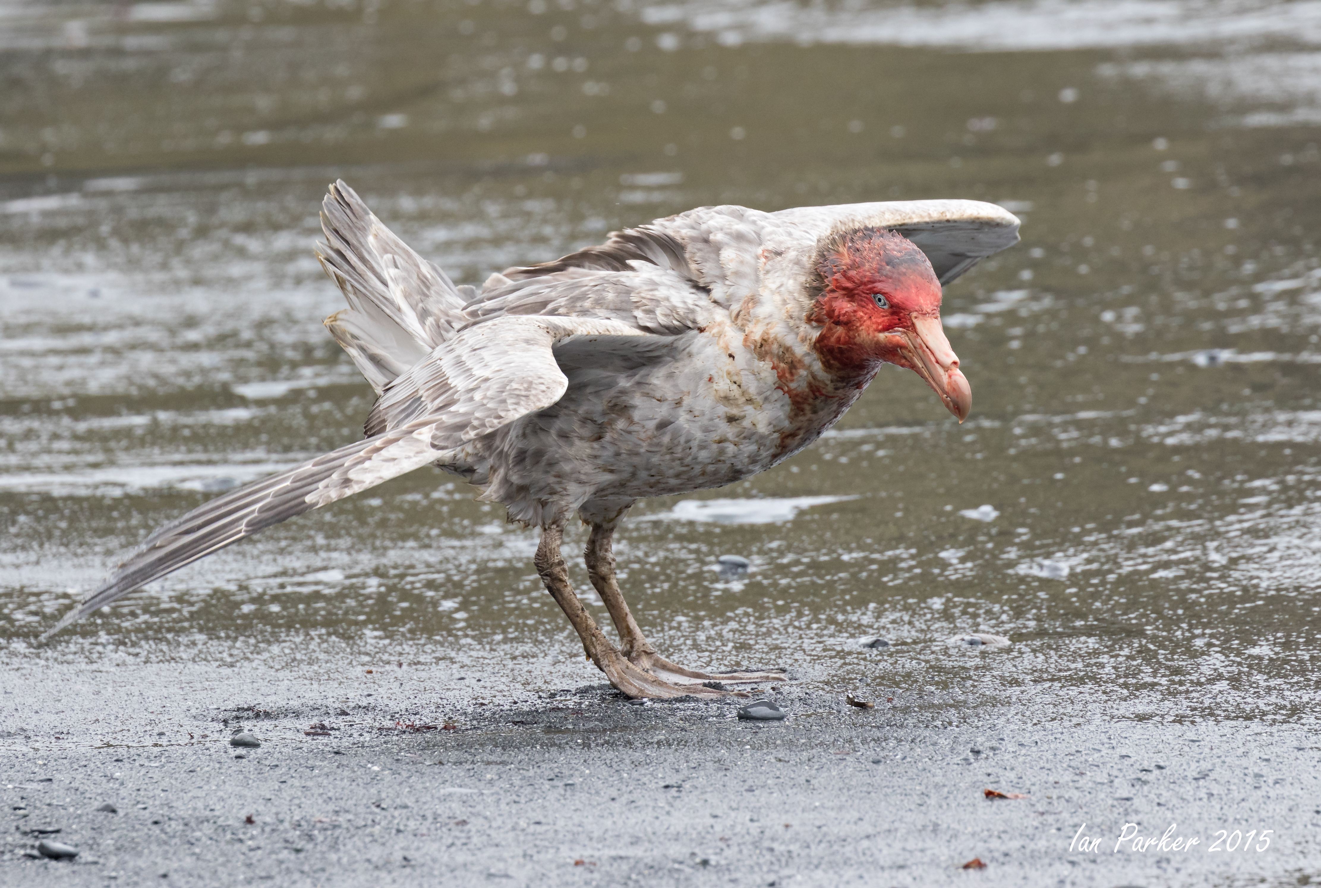
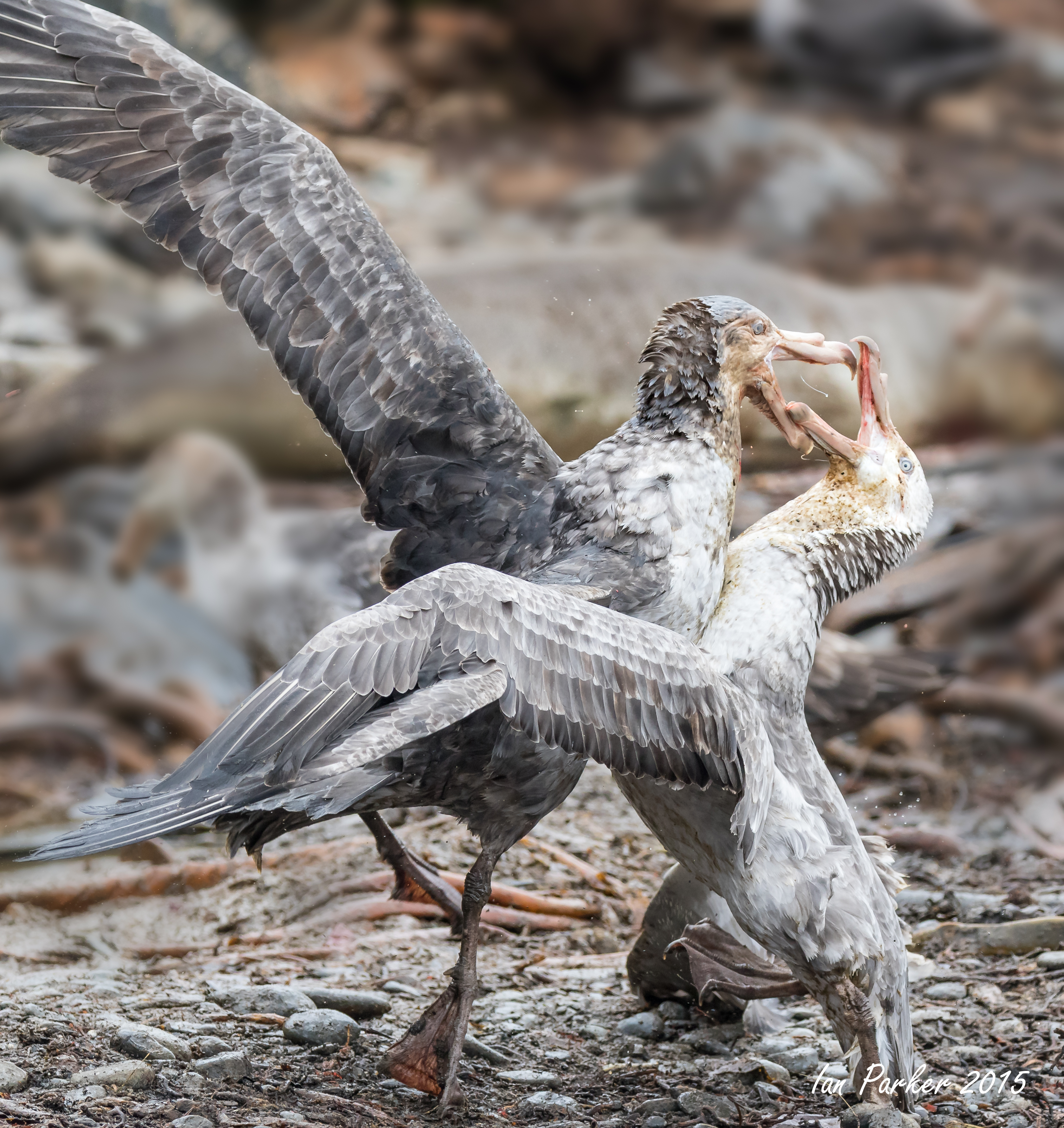
December 9th - Whales
Breakfast began at 0700. But, shortly after sitting down at our tables, we were very fortunate to be interrupted by a number of humpback whales bubble netting and lunge feeding on krill. The captain slowed the ship’s engines until we were left drifting among the leviathans.
Humpback whales spend their winters in warmer waters far nearer to the equator. It is there that they give birth, court and mate. In the summer, they migrate into more polar waters where they dine nearly 24 hours a day on krill or small fish. They can grow to 45 feet in length and weigh 40 tons. Humpbacks belong to the group known as baleen whales. Unlike the toothed whales, such as sperm whales, baleen whales gulp in huge amounts of food-rich water. Their pleated lower jaw/throat expands to many times its original size in the process, similar to the pouch of a pelican. The humpback then closes its mouth, trapping the prey inside, and forces water out through thousands of strands of baleen with its tongue. Once the water has been expelled, the whale swallows its meal. |
|
|
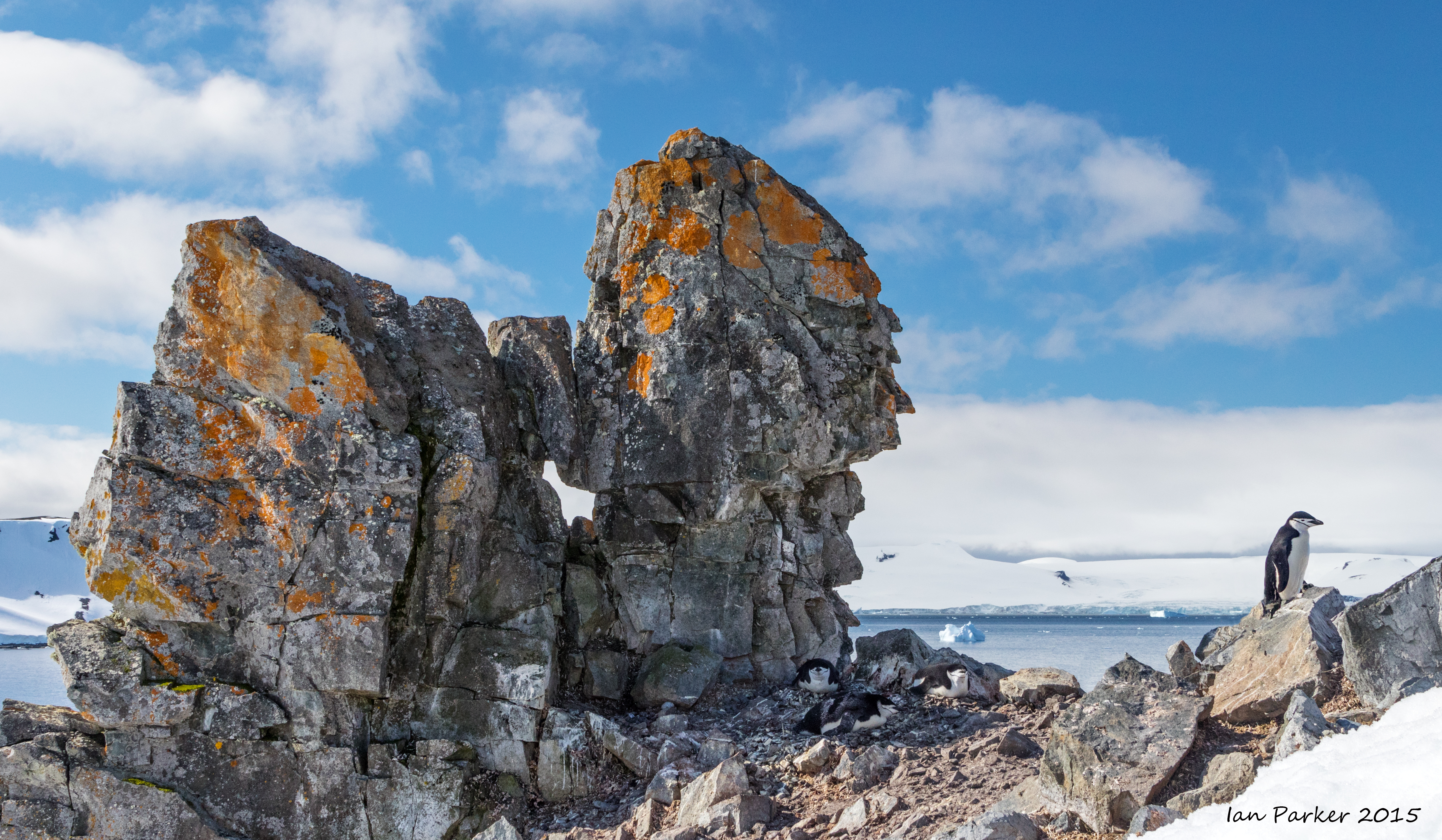
December 9th - Hydrurga Rocks and Cuiverville Island
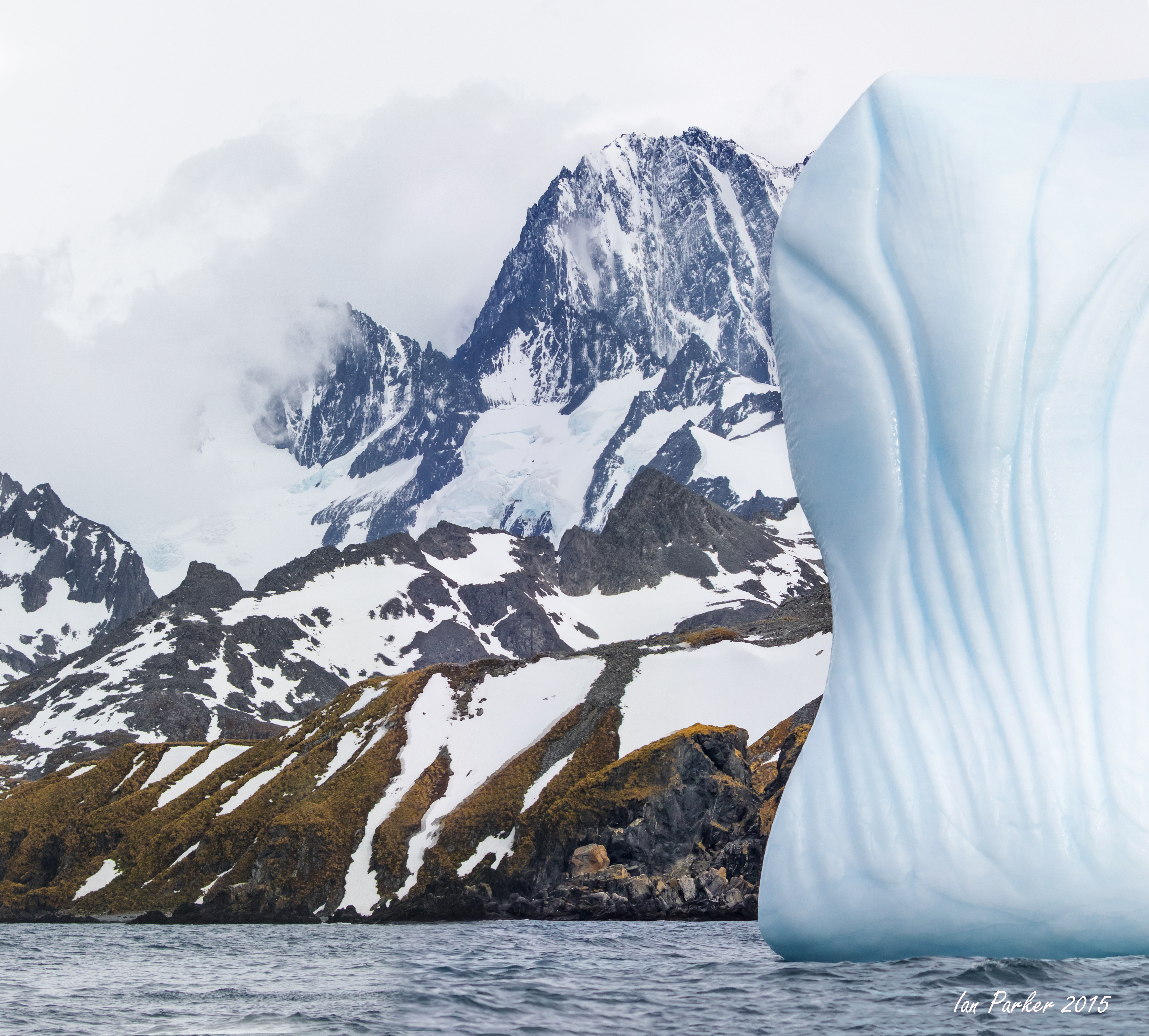
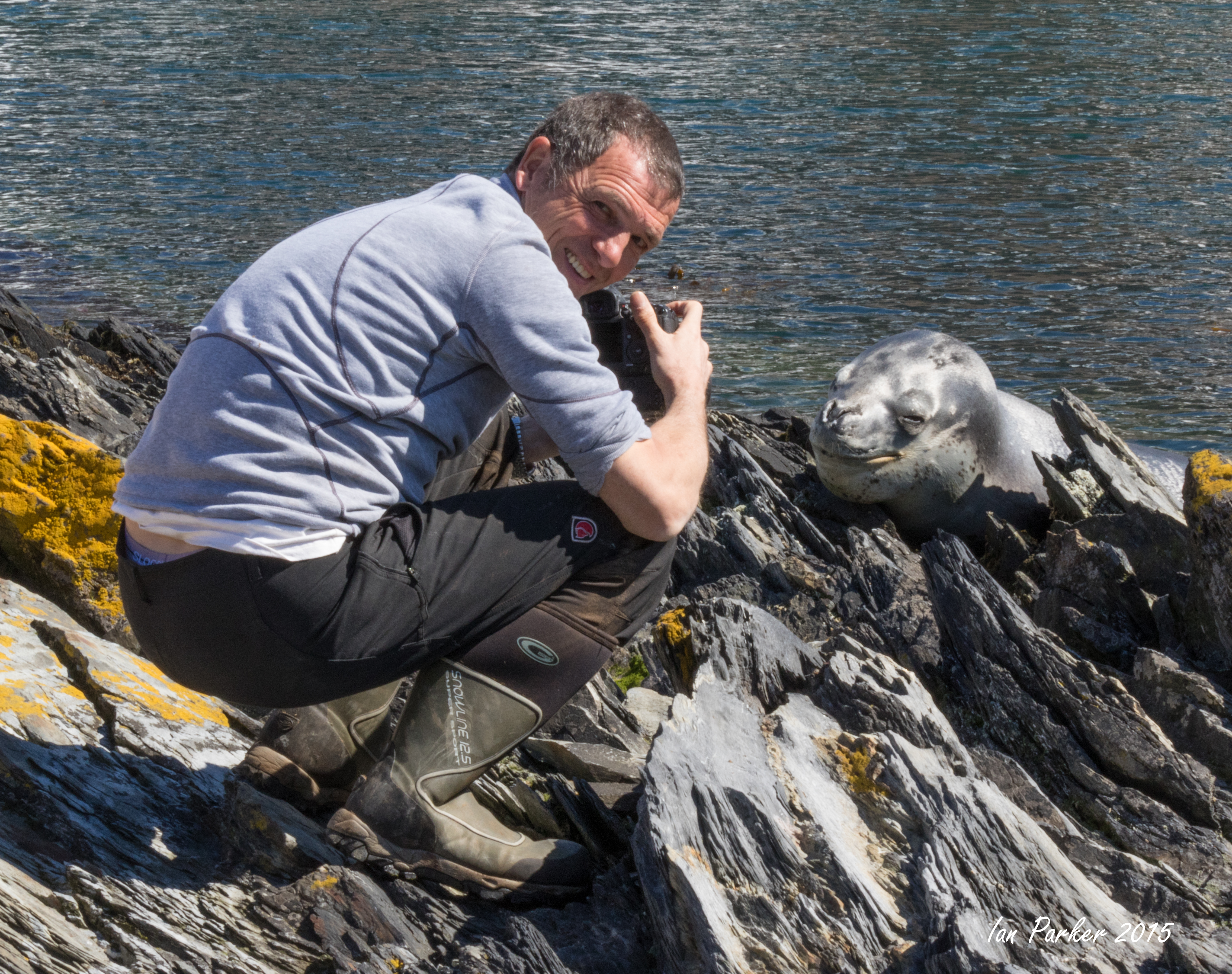
After our two-and-a-half-hour “whale delay," we arrived at Hydrurga Rocks, so named for the leopard seal (Hydrurga leptonyx), at 64°41’S and 62°37’W. It was a beautiful partly cloudy day. The weather was even a bit on the warm side—meaning it was above freezing. Between the ship and shore there was a magnificent grounded iceberg. It had begun "life" as a tabular iceberg and was now a sculptural work of art. Time, the sea and weather had definitely influenced its current condition. Tilted on its side and split down its width, the most interesting part was a beautiful carved archway near the top. Hints of blue were visible throughout. The ocean itself could not stifle its beauty as the iridescent blue that emanated from just below the surface was almost electric.
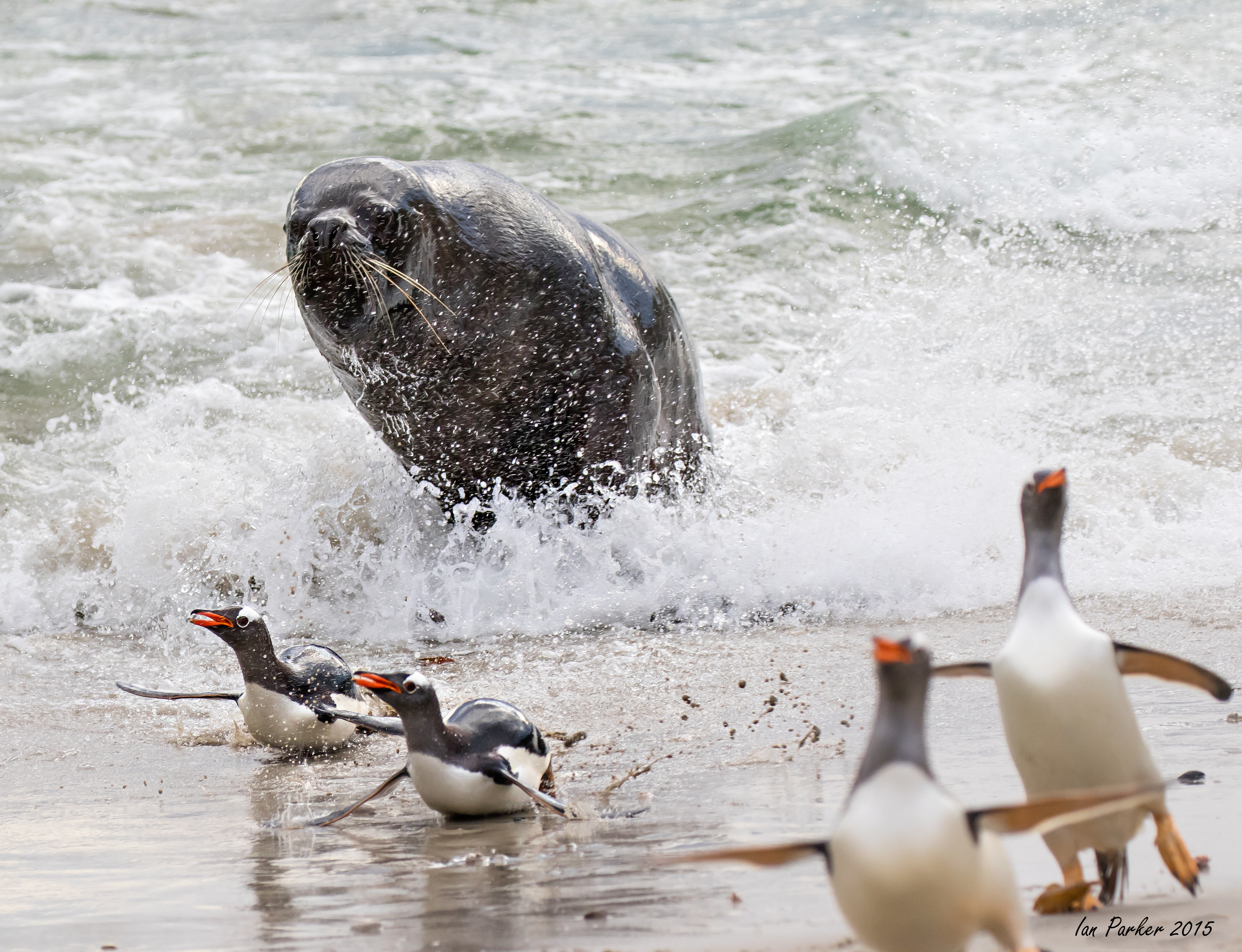
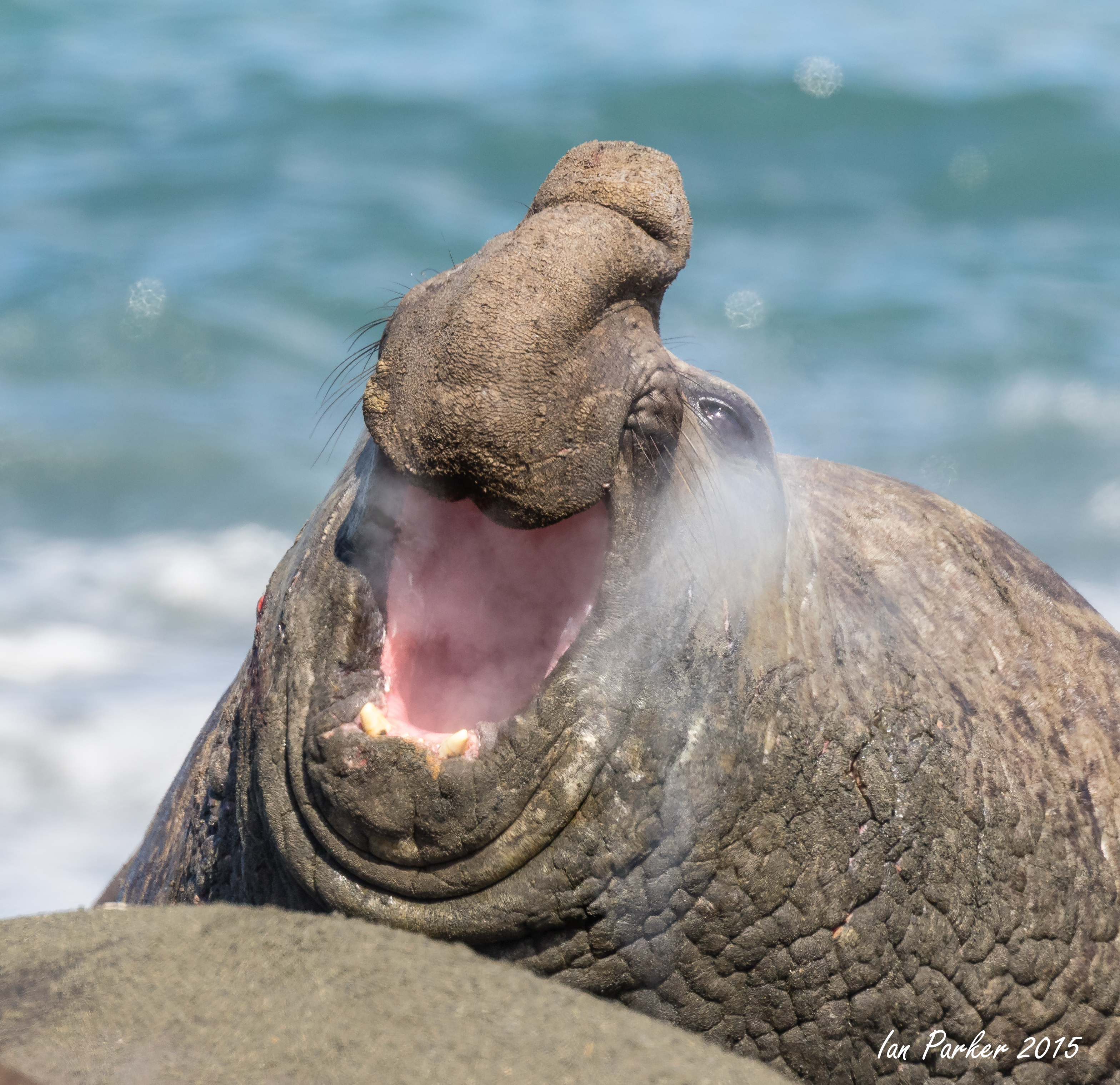
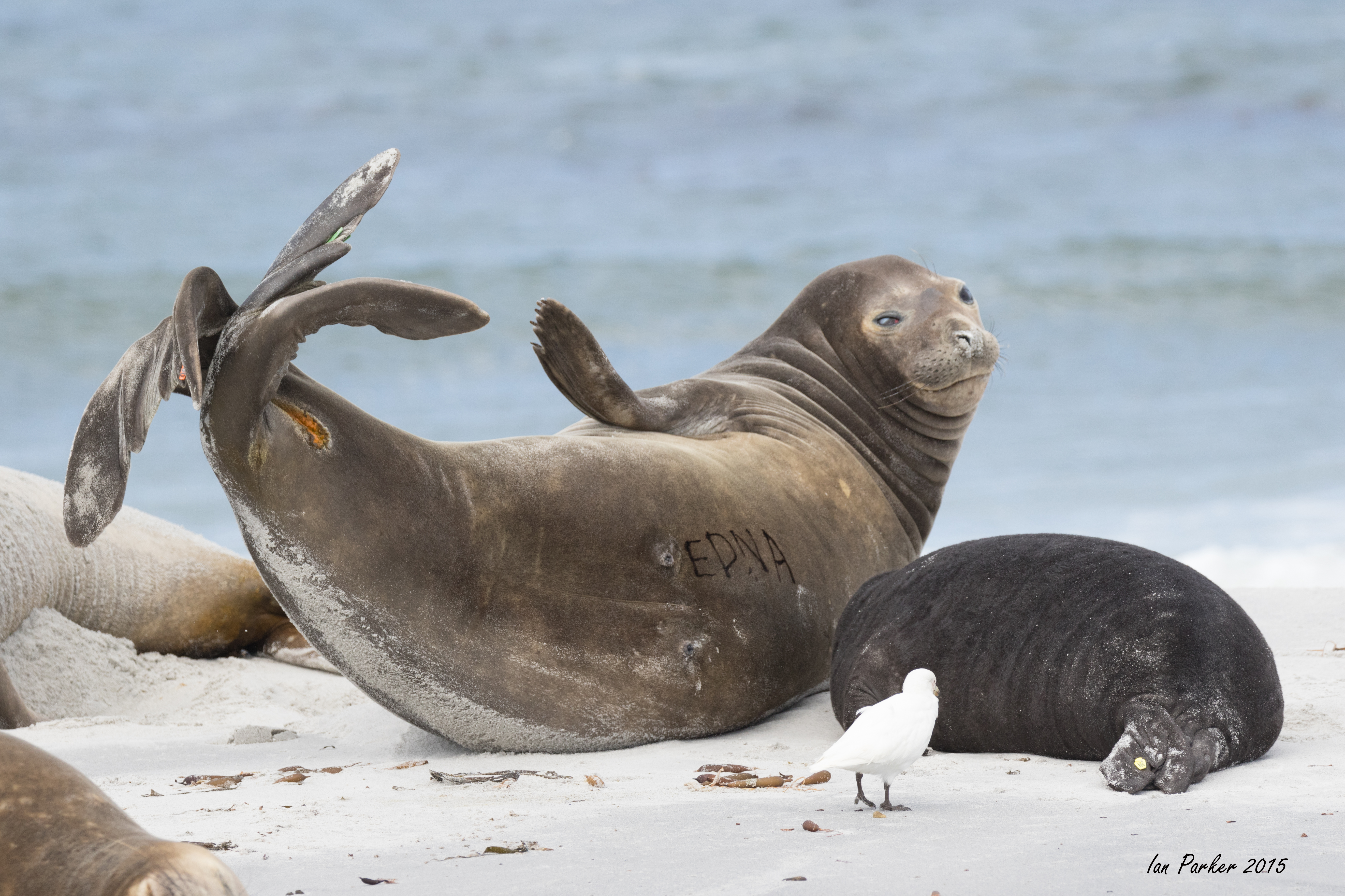
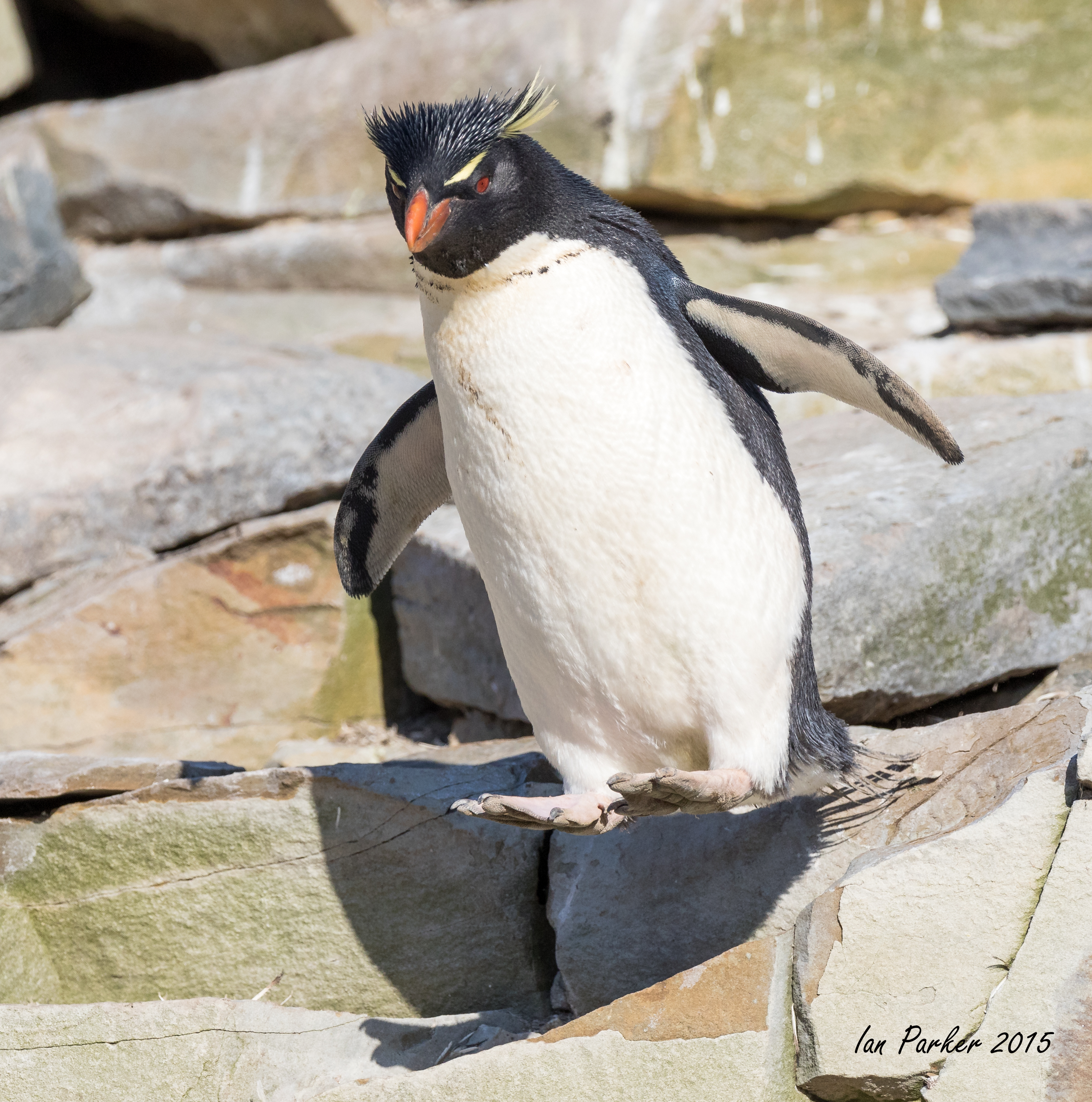
Several Weddell seals and one baby southern elephant seal rested on the nearby snow on our landing beach. The pebbled beach made for easy landings, but quickly yielded to some quite deep snow. This location was a landscape photographer’s dream. Great compositions appeared in every direction. The accommodating mountain range in the background (often obscured by clouds) was a nice touch. But there was something here for the wildlife photographers as well. A noisy colony of chinstrap penguins was up in the rocks. If photographed from below, one could include the clear blue sky in the background of their photographs.
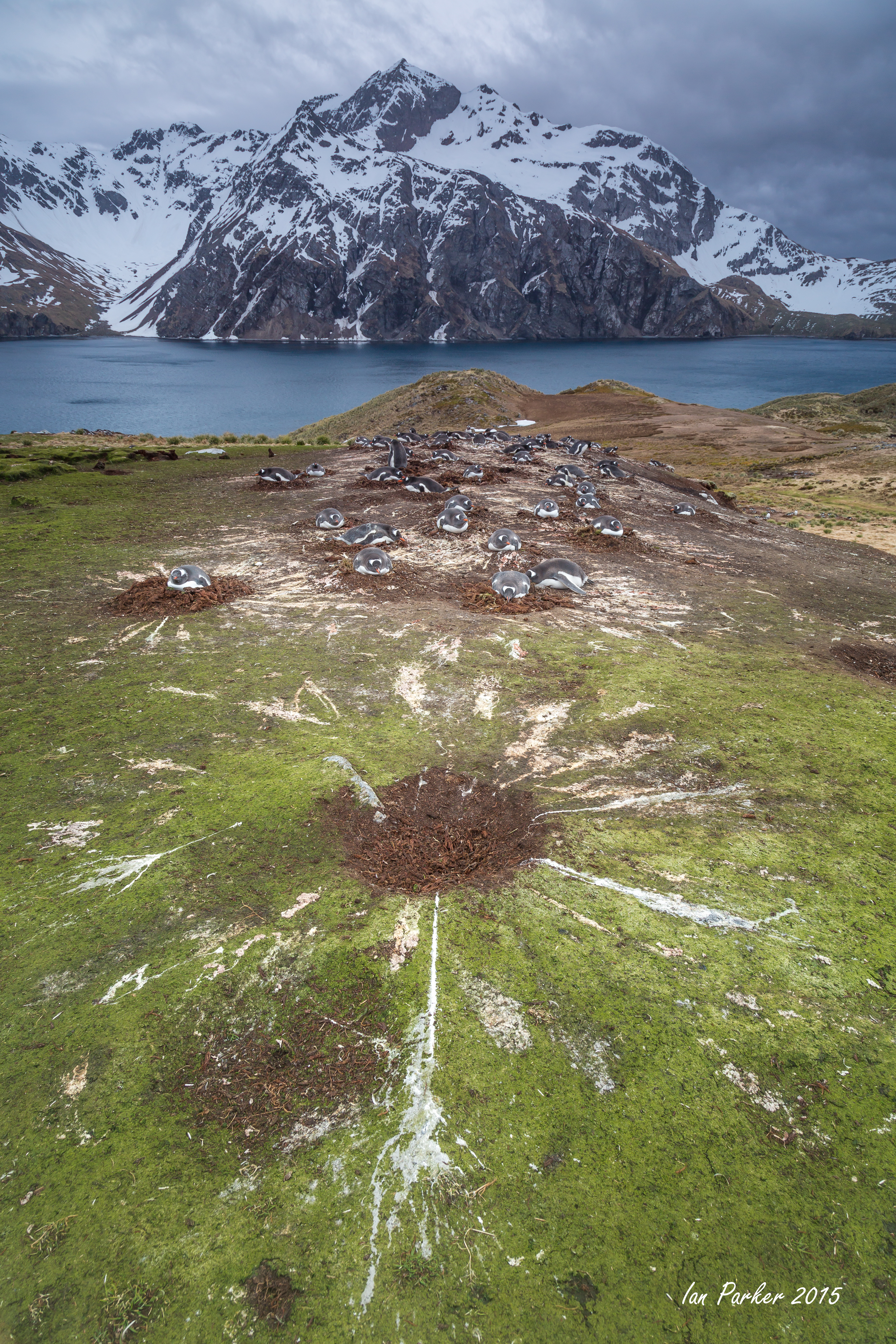
Cuverville Island lies at 64°41’S and 62°38’W. It lies between the Arctowski Peninsula and Rongé Island at the entrance to the Errera Channel. On the way to the very narrow landing beach, the Zodiacs passed by the best icebergs of the trip thus far. They were the best in number, diversity and just plain beauty. This was another scenic photographers’ dream site. But Cuverville was a wonderful place to be a wildlife photographer as well, as there was also a photogenic gentoo penguin colony here.
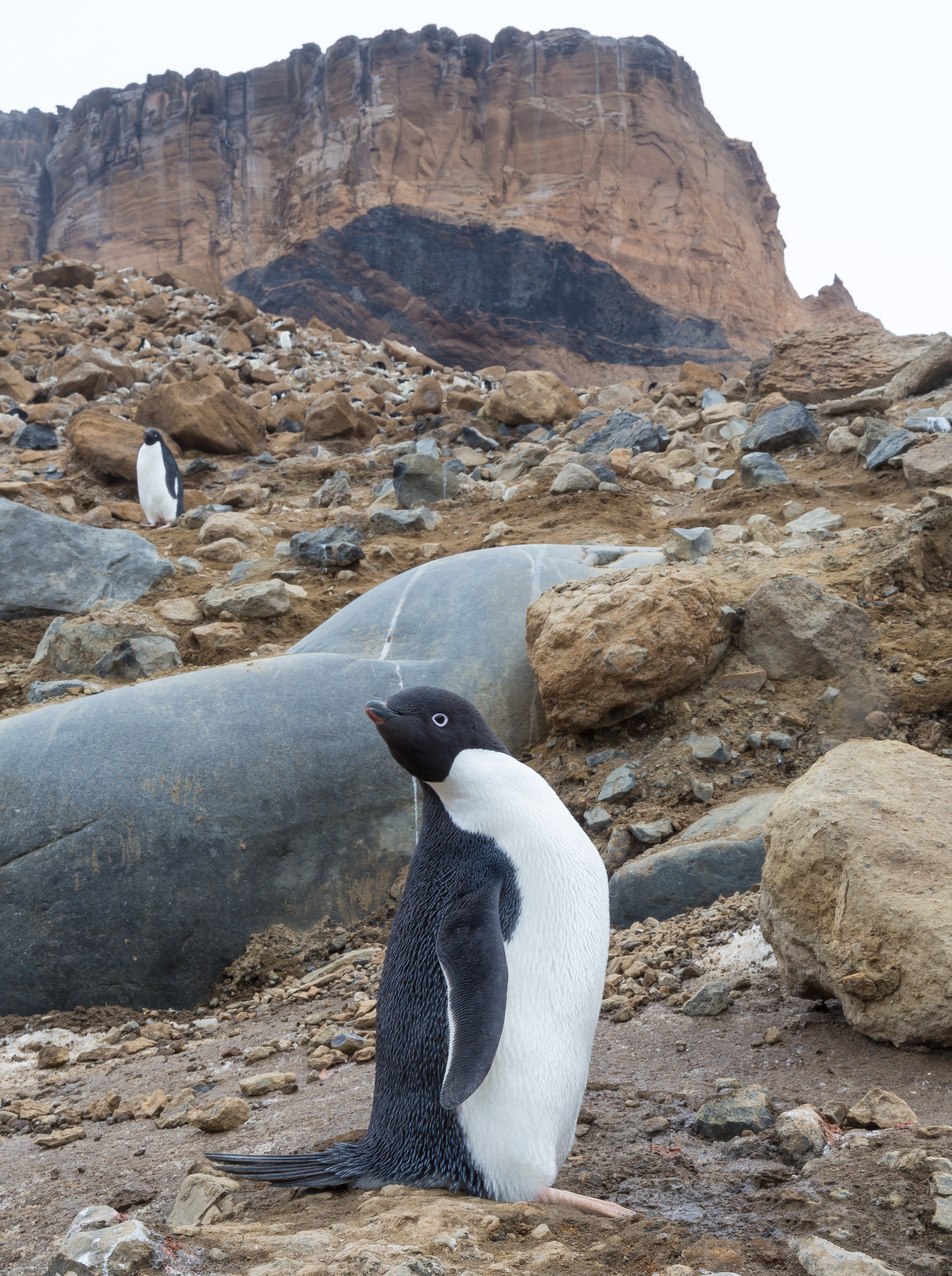
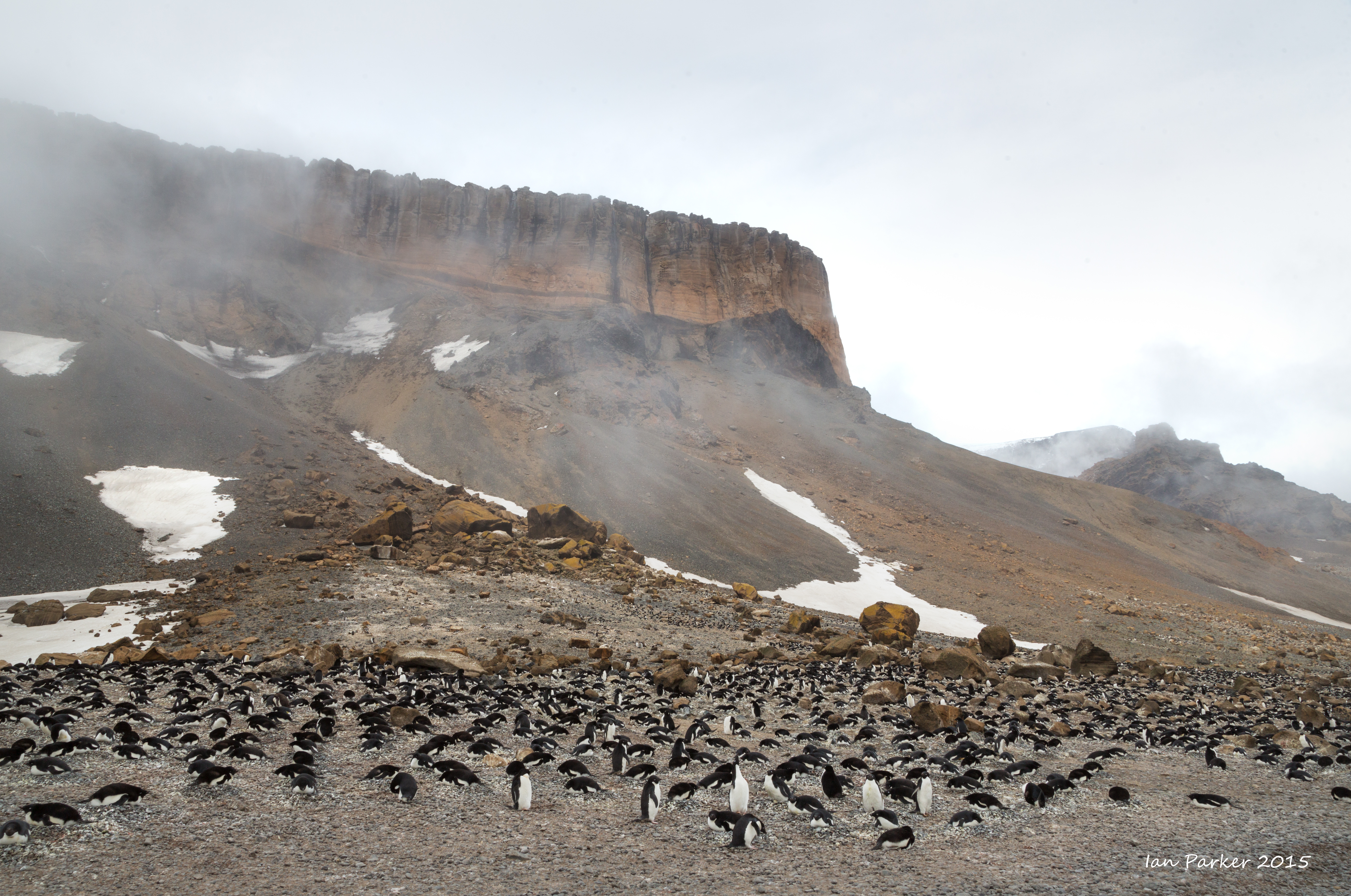
December 8 - Brown Bluff
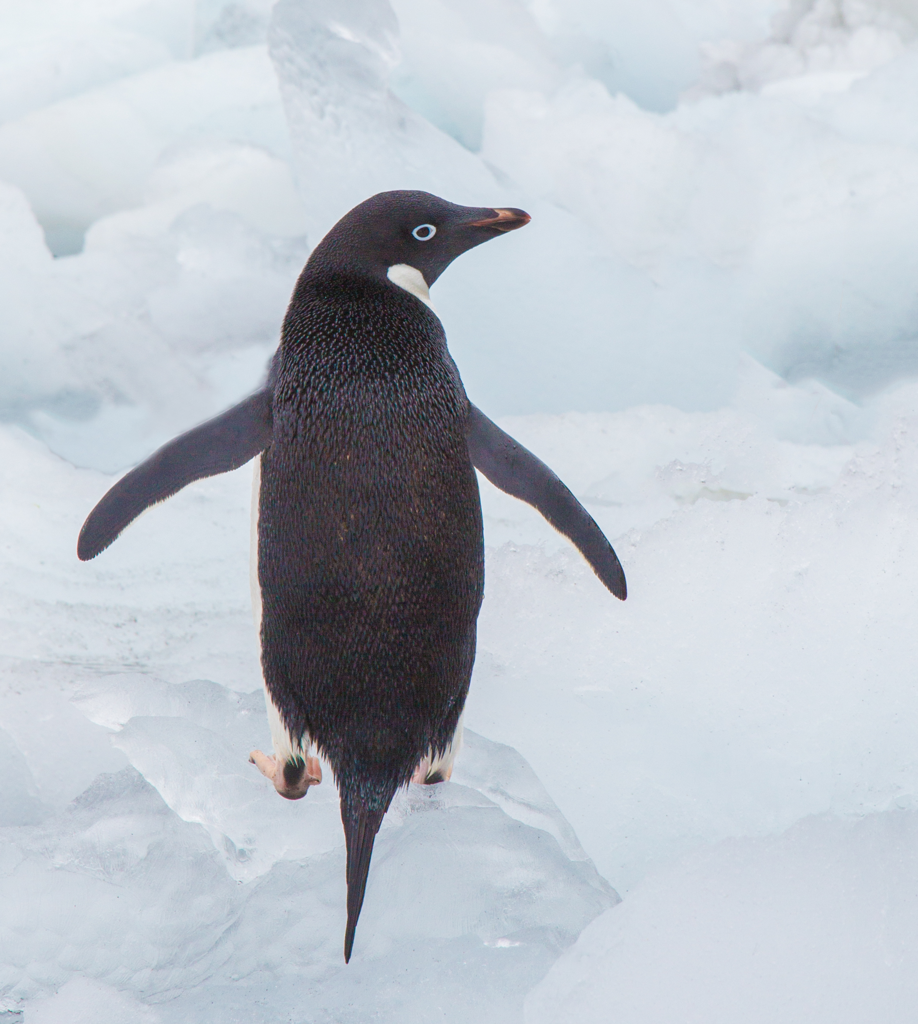
When the morning wake-up call was made at 0630, the Ushuaia was off Hope Bay with 10 knot winds, with no swell or fog. Our goal for the morning was Brown Bluff—a continental landing—and what a landing it turned out to be! We began the landing procedures at 0800 and had no problem with ice blocking our way as we headed to shore. The snow had melted along the beach and up the crumbling slope so there was plenty of easy walking for the group. Gentoo and Adélie penguins were nesting, as well as kelp gulls, pintado petrels, snow petrels, and (probably) skuas, since they were actively patrolling around the nesting colonies. Scattered across the beach and in the shallow water were beautifully-carved ice formations. The Adélie penguins were the hit of the morning with most of the group photographing these adorable cartoon-character creatures. Groups of Adélies congregated on the beach in numbers of up to two dozen before venturing to sea. Some of the penguins used the smaller ice pieces as a playground as they climbed up and down and over the grounded ice.
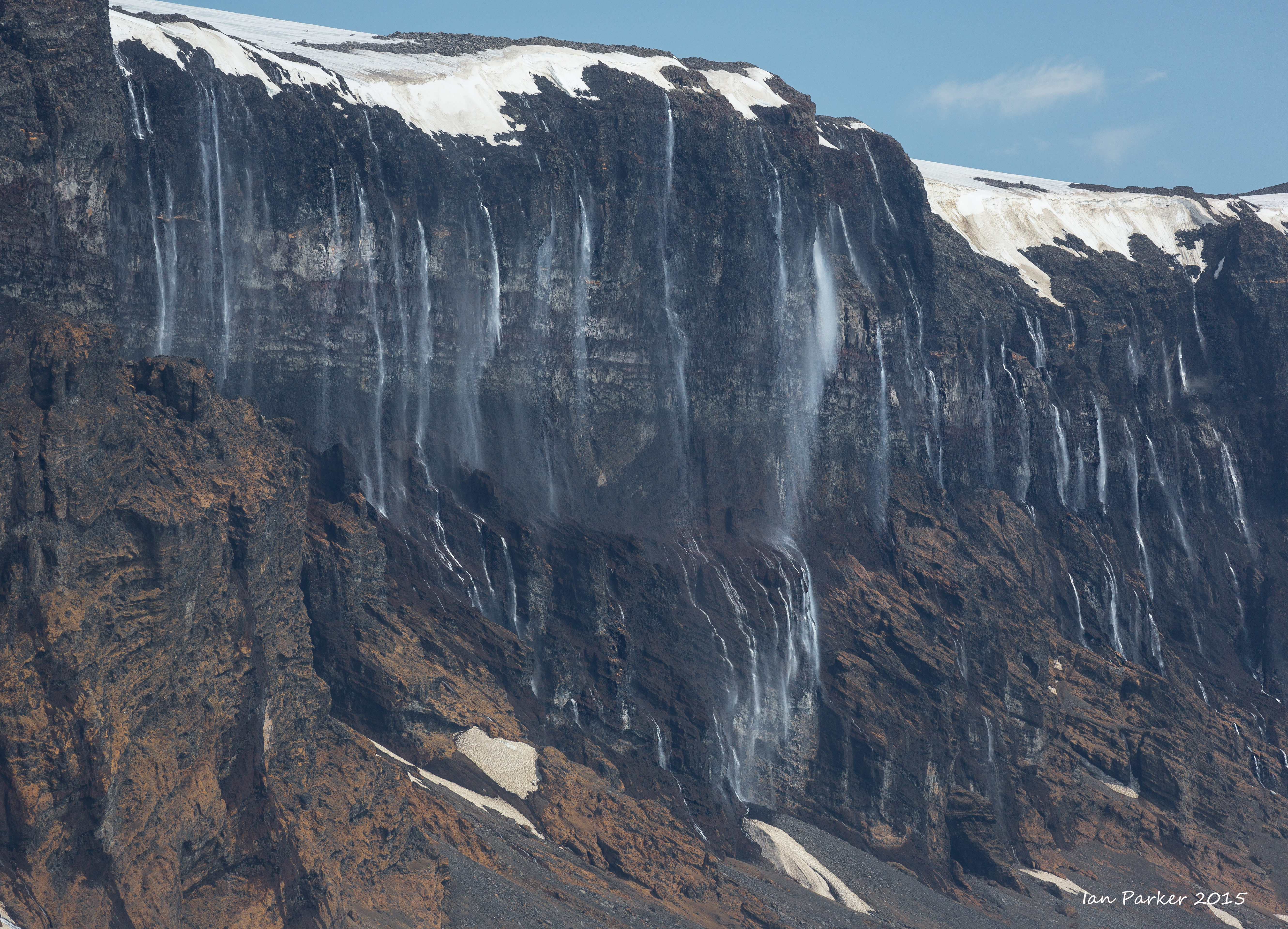
December 7 - Cape Well-Met and tabular icebergs
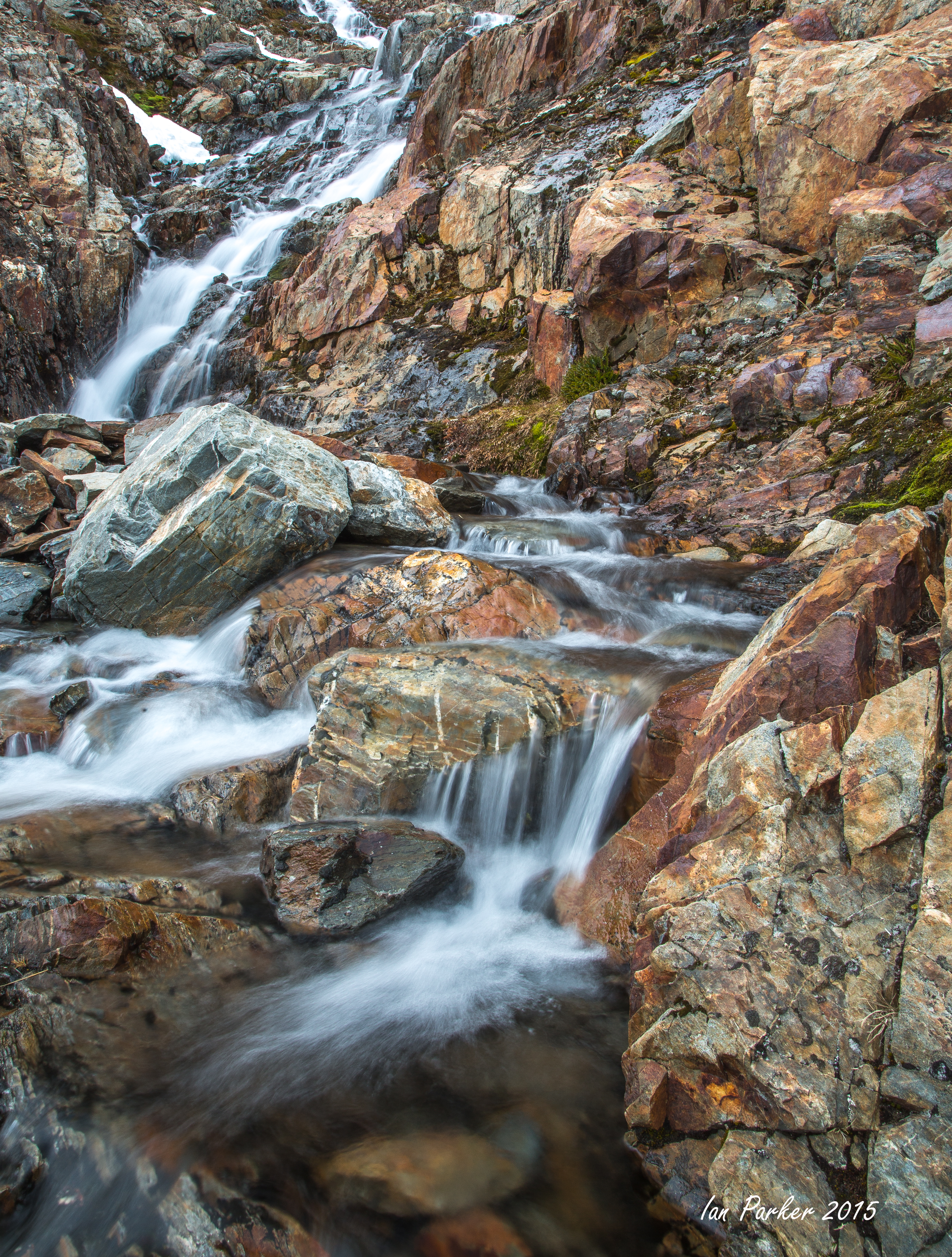
Turning westwards we passed Cape Well-Met with beautifully exposed vertical cliffs of light brown volcaniclastic rocks—volcanic ash which had been deposited in deltas, along with enclosed “bombs” of lava which had been ejected some six million years ago onto the flanks of a local volcano. A series of “angel hair” waterfalls derived from snow patches at the top of the cliff and warmed by the sun decorated the cliffs. Toward the west, one of the valleys was filled with a turbulent cloud formation—which we were to experience later in the day.
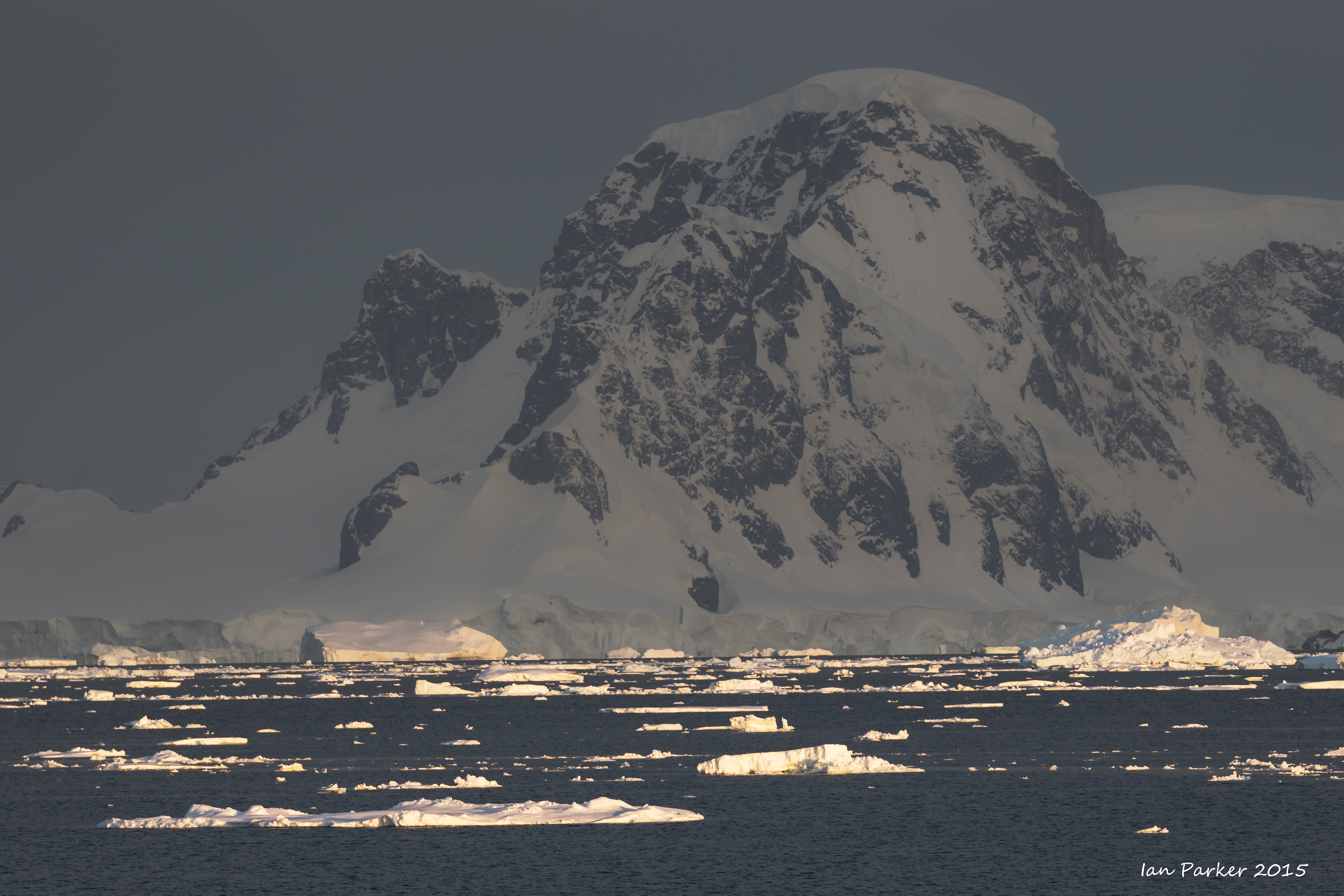
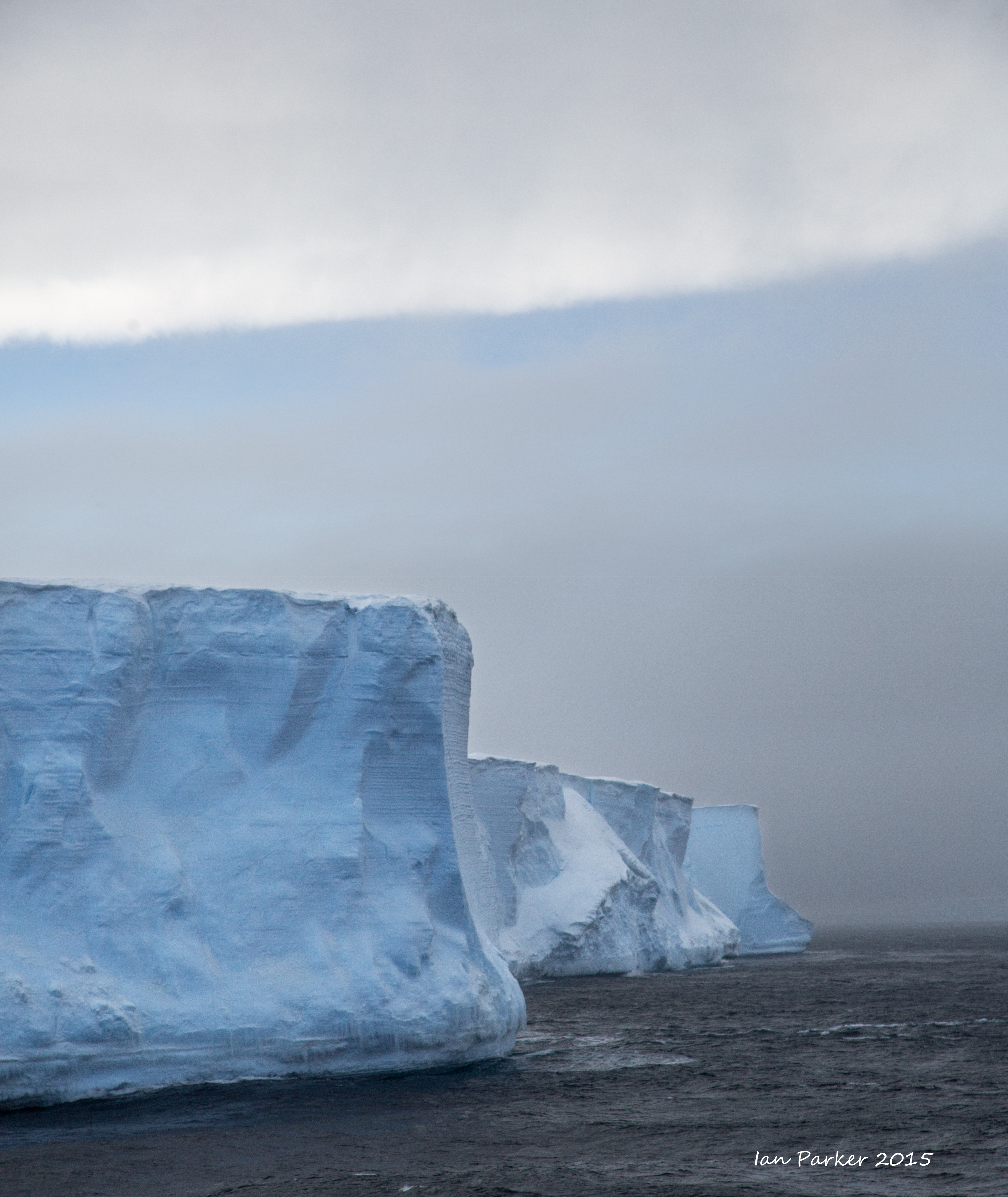
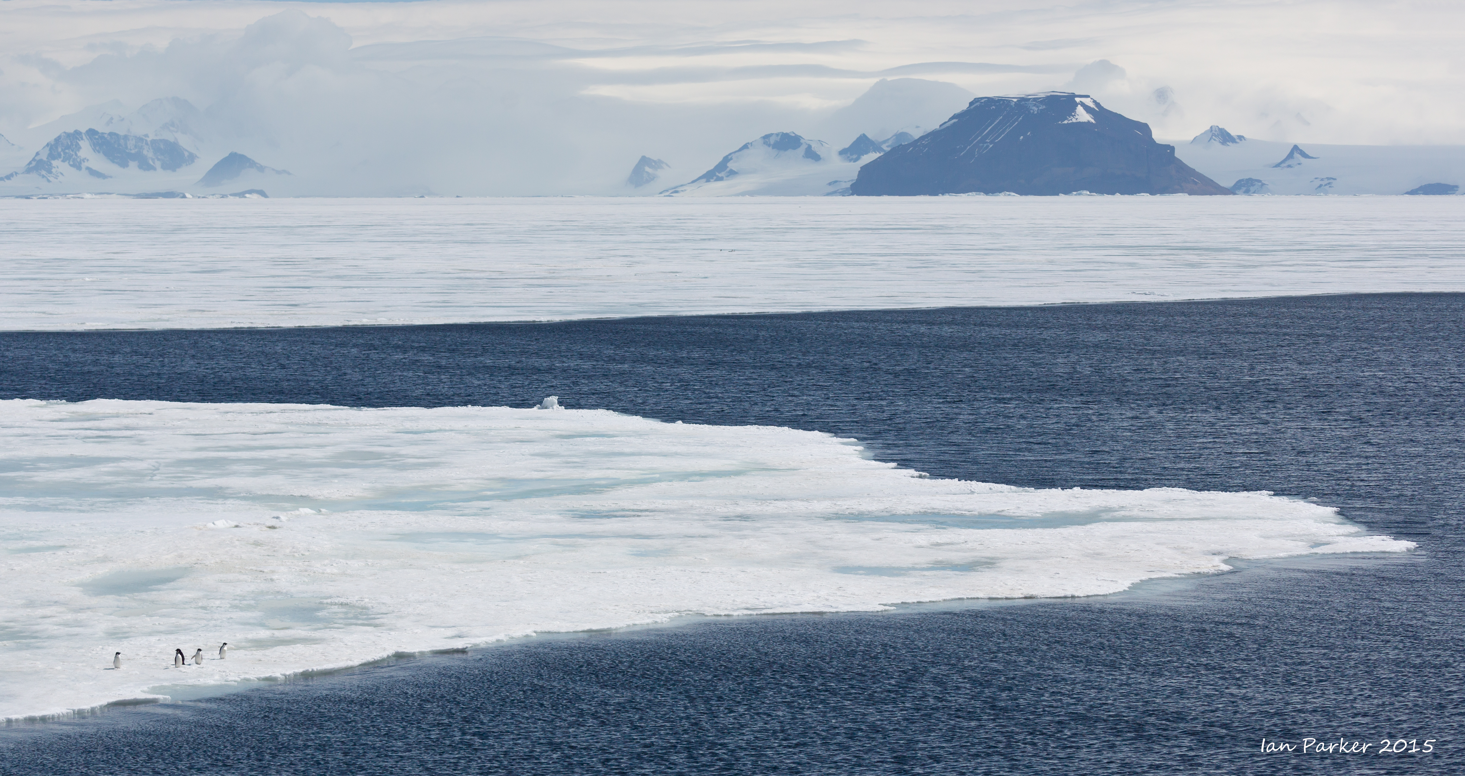
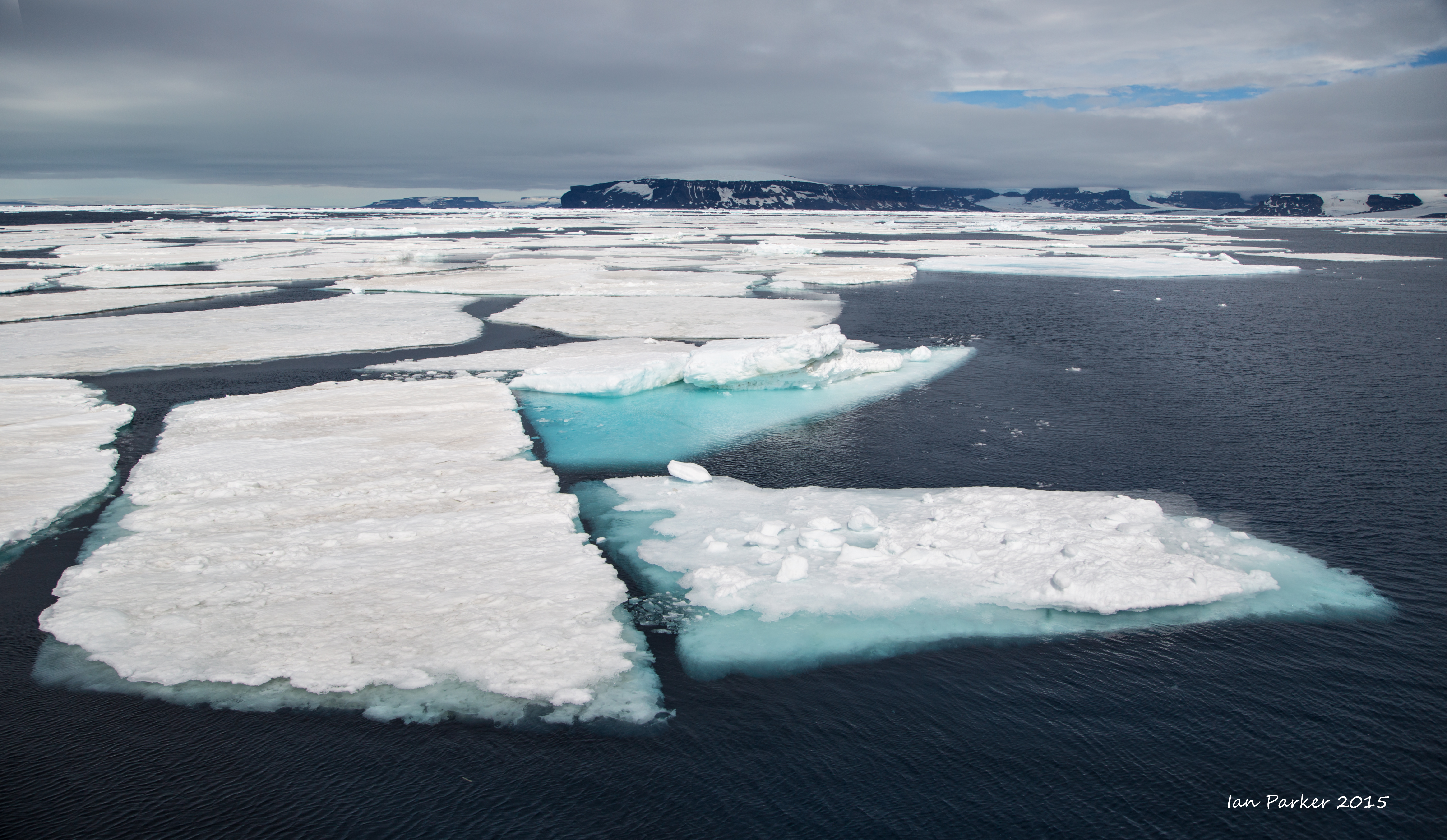
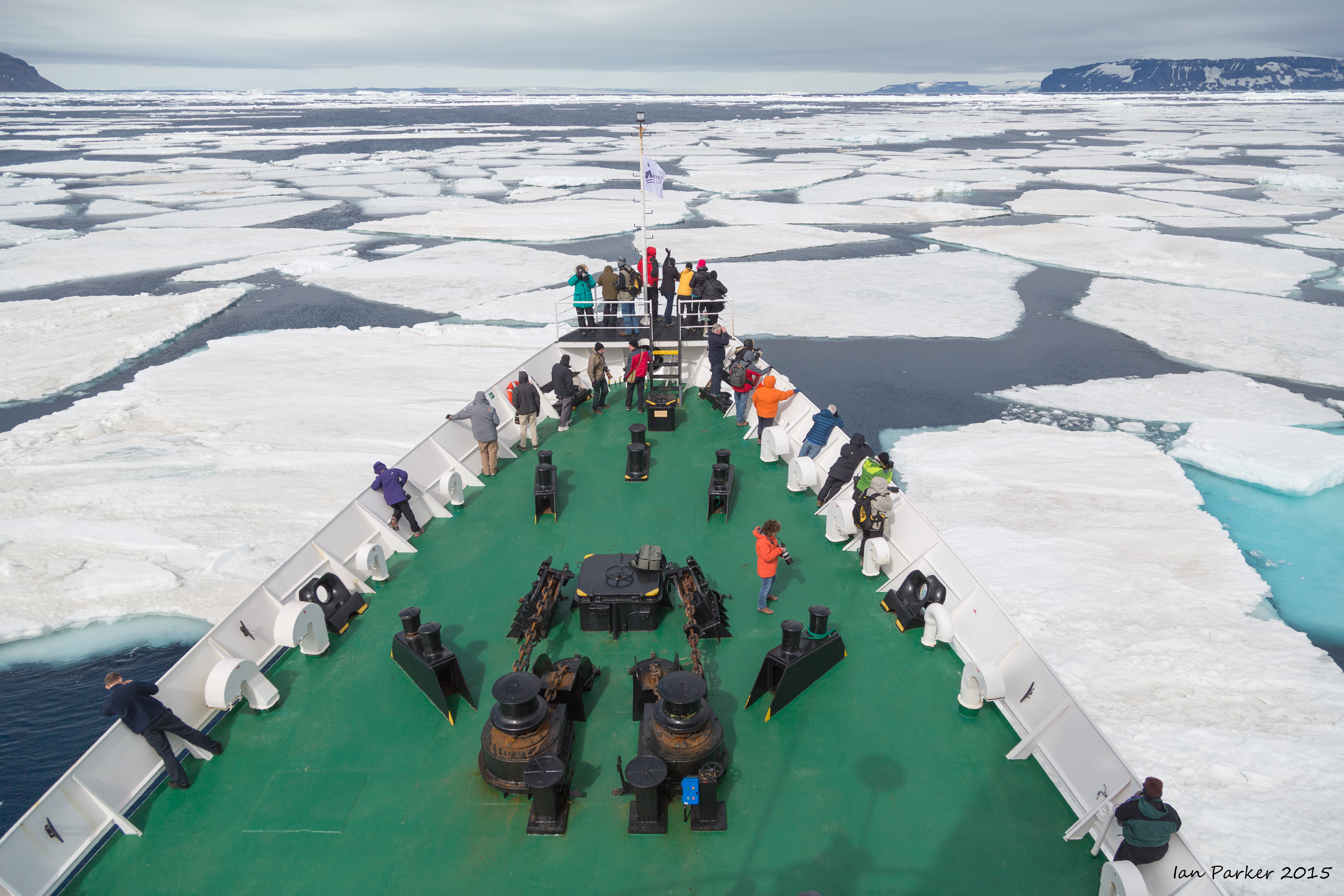
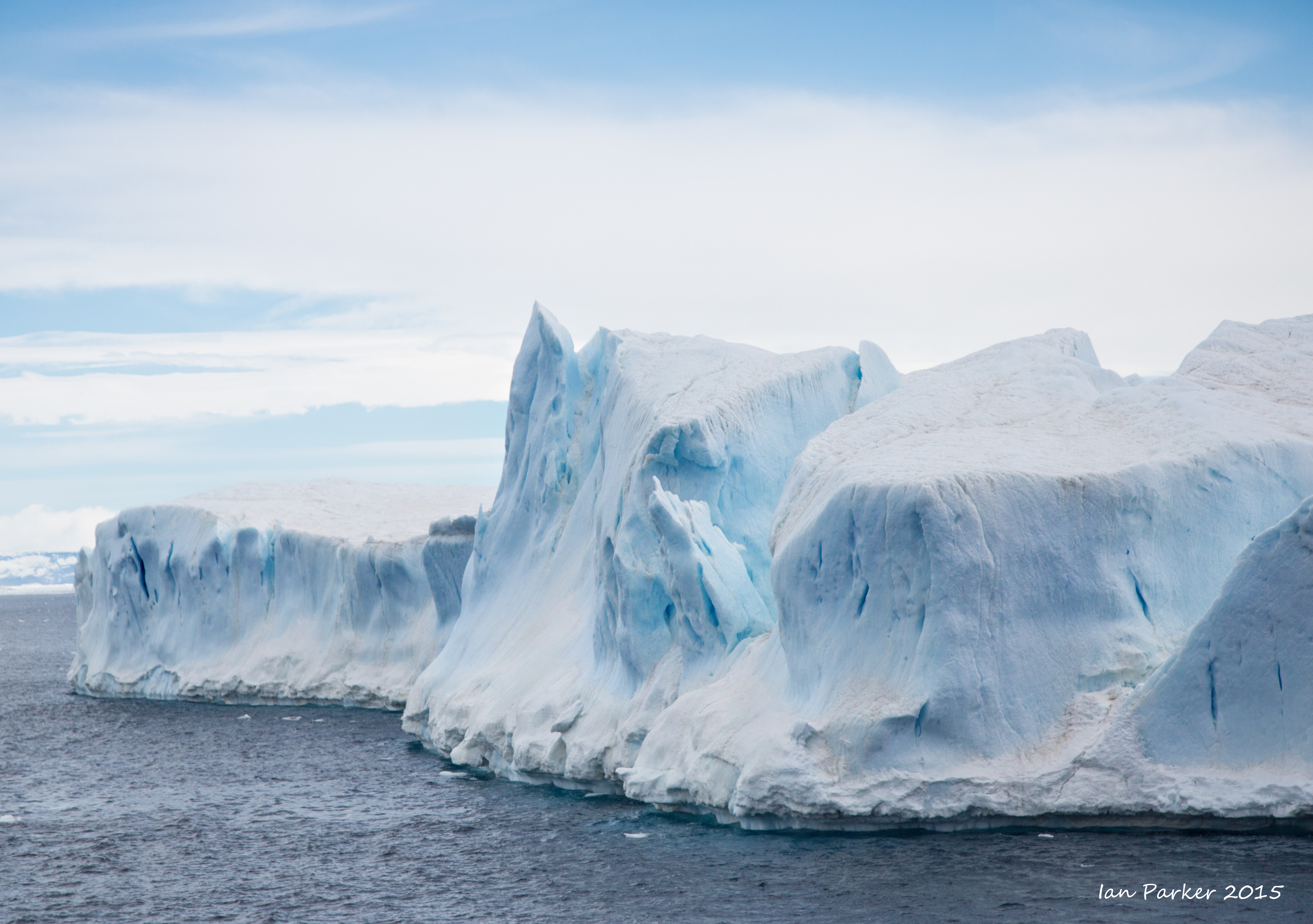
In bright sunshine we proceeded west and reached an impasse in the form of more fast ice. A smooth but rotten expanse of ice, periodically dotted with groups of penguins, stretched toward the Antarctic Peninsula in the distance. The ship nudged gently into the ice, which proved to be very much degraded, around 30‒40 cm (15 in) thick, wet on the surface and easily detached from the parent mass, thereby exhibiting the needle-like crystalline structure on its upturned edge. Thwarted again, we turned northward toward the remnants of a massive iceberg (B15) which had broken off the Ross Ice Shelf on the other side of the continent in 2005 and parts of which had drifted around the continent of Antarctica and were now grounded on the shallower waters of the northern Antarctic Sound.
By the time we reached the massive series of tabular icebergs, the weather had overtaken us, the cloud ceiling was low, and the light was poor, but the stupendous volume of ice was overwhelming. This was difficult to comprehend especially since the icebergs were about 80–90 feet above sea level and resting on the sea bottom some 240 meters (nearly 800 feet) below sea level—an awful lot of ice, all formed from snowflakes falling over 1000 years and melting, now a contributor to sea level rise worldwide.
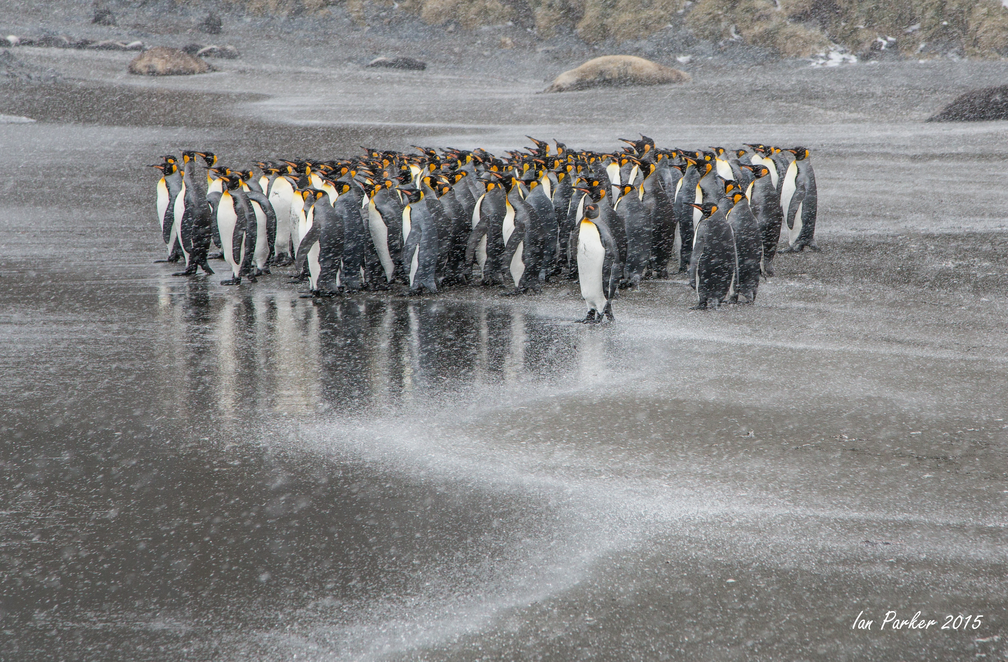
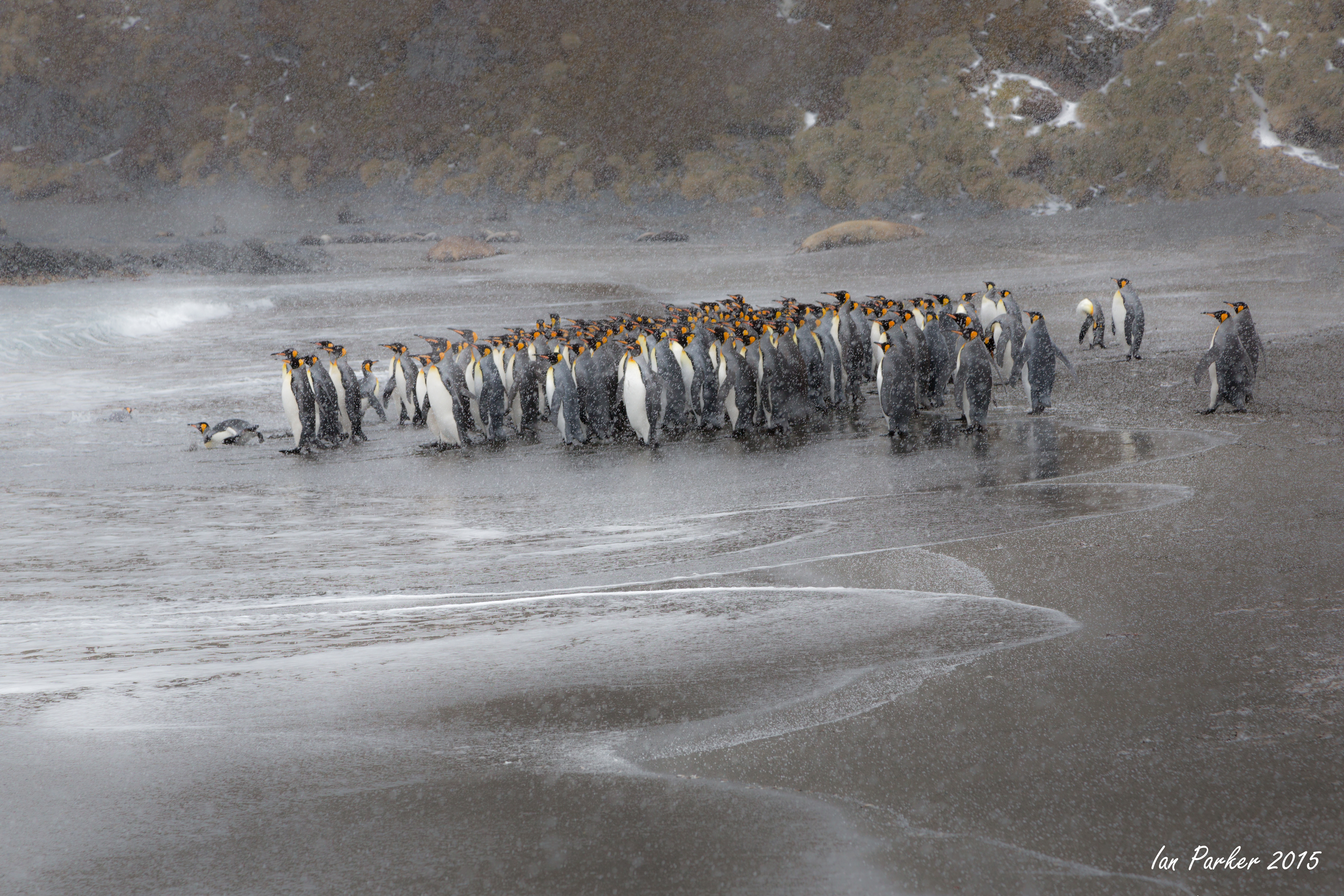
December 6 - Barrientos Island
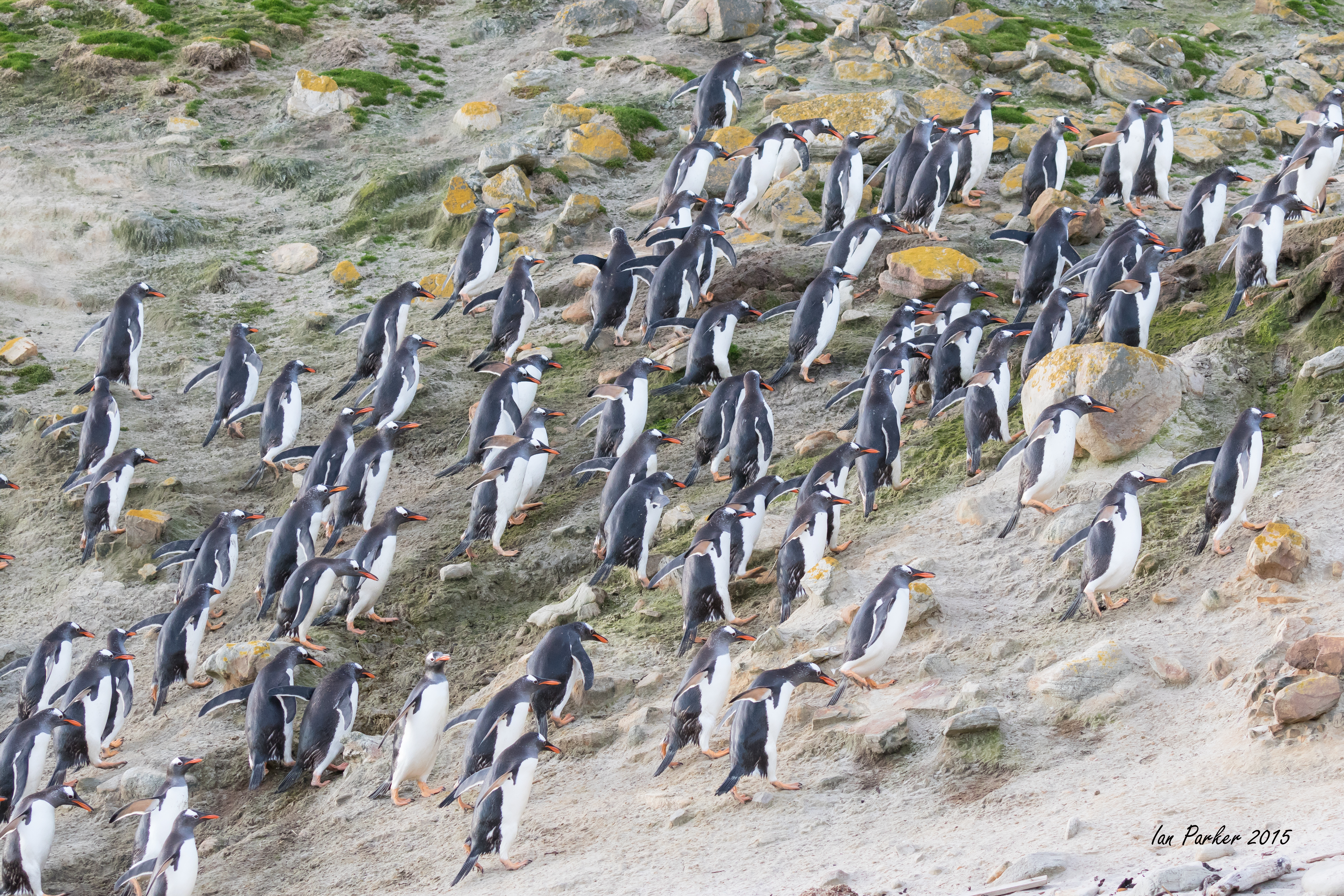
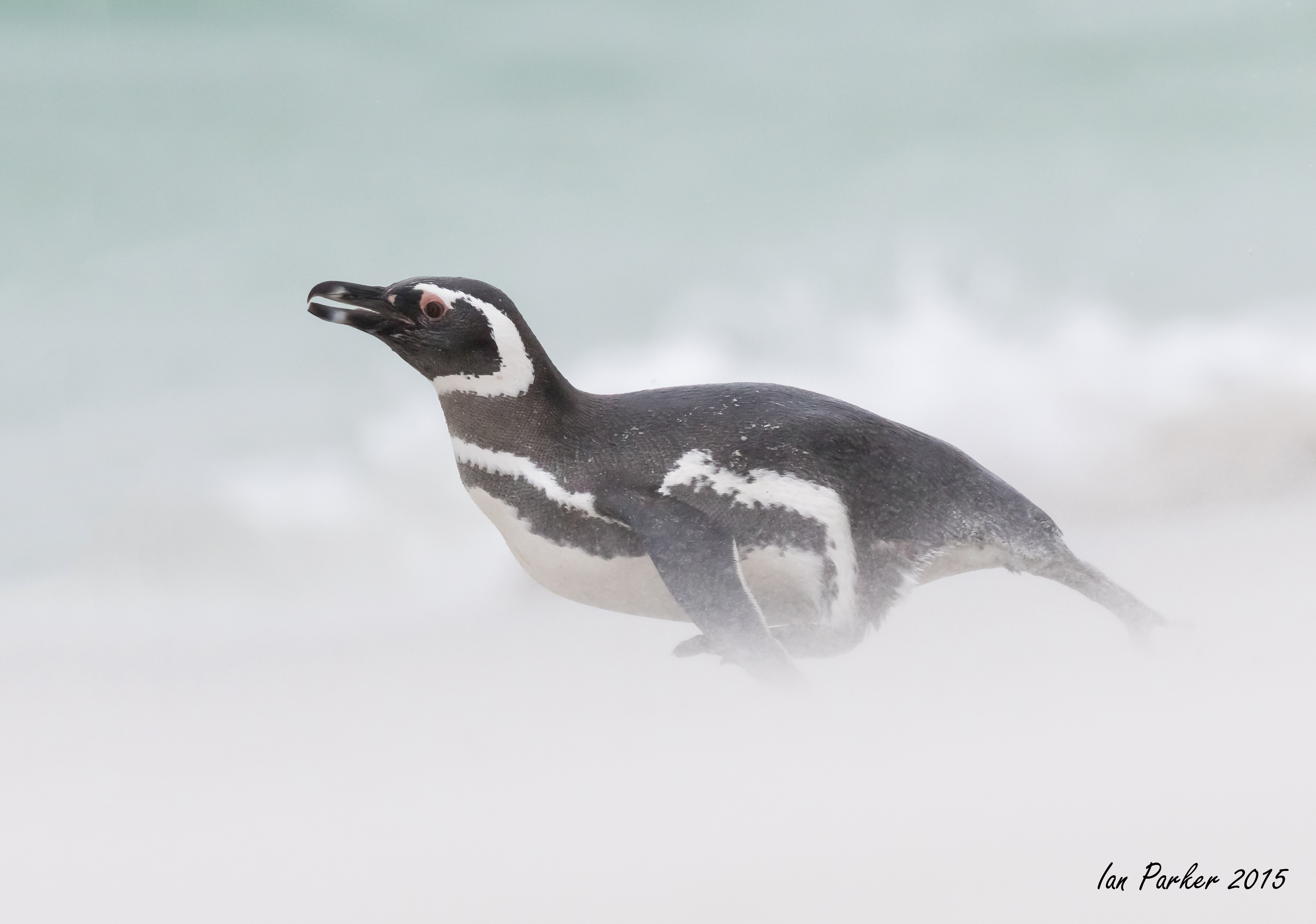
The ship entered the South Shetland Islands via the English Strait and by 1500 the first passengers were landing on Barrientos Island. Barrientos is one of the group of islands called Aitcho—as in ‘H’ and ‘O’—after the British Hydrographic Office surveyed the area between 1925 and 1939. The sky was overcast and within an hour a light rain started. A good number of people, however, braved the exposed side of the island to photograph chinstrap and gentoo penguins. The accumulated snow became increasingly softer and caused some people trouble walking up the slopes. Each patch of penguins was established on a high point of muddy rock with 40 to 120 pairs in each patch. Many very muddy penguins were seen with a few bright white clean birds coming in from the sea and trudging up the snowy slopes on their well-worn penguin highways.
Alltogether not the most inspiring conditions for photography. I packed my camera away soon after the rain started, thinking that photos of muddy penguins weren't worth risking wter damage. After we left the island and started across the Bransfield Strait the light improved and we passed icebergs with penguins landed on them.
______________________________________________________________________________________________________________
December 4-19
The Antarctic Peninsula aboard the Ushuaia with Joe van Os Photo Safaris
(Text in italics is excerpted from the Voyage Log by expedition staff)
______________________________________________________________
November 25/26 - Grave Cove
Visits on two evenings to watch a sea lion chasing (and catching) gentoo penguins landing on the beach. A fine end to our voyage on the Hans Hansson.
After the excitement on the beach, a quiet walk back across the isthsmus under beautiful evening skies
November 26 - West Point Island revisited
November 25 - Carcass Island Revisited
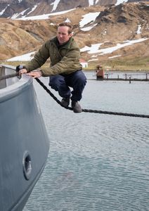
A few photos from a morning re-visit to Carcass Island. We landed by Zodiac on the beach at the left of the photo below. I hiked over the isthmus to lepoard beach, then walked along the land rover track back to the settlement for tea and cakes.
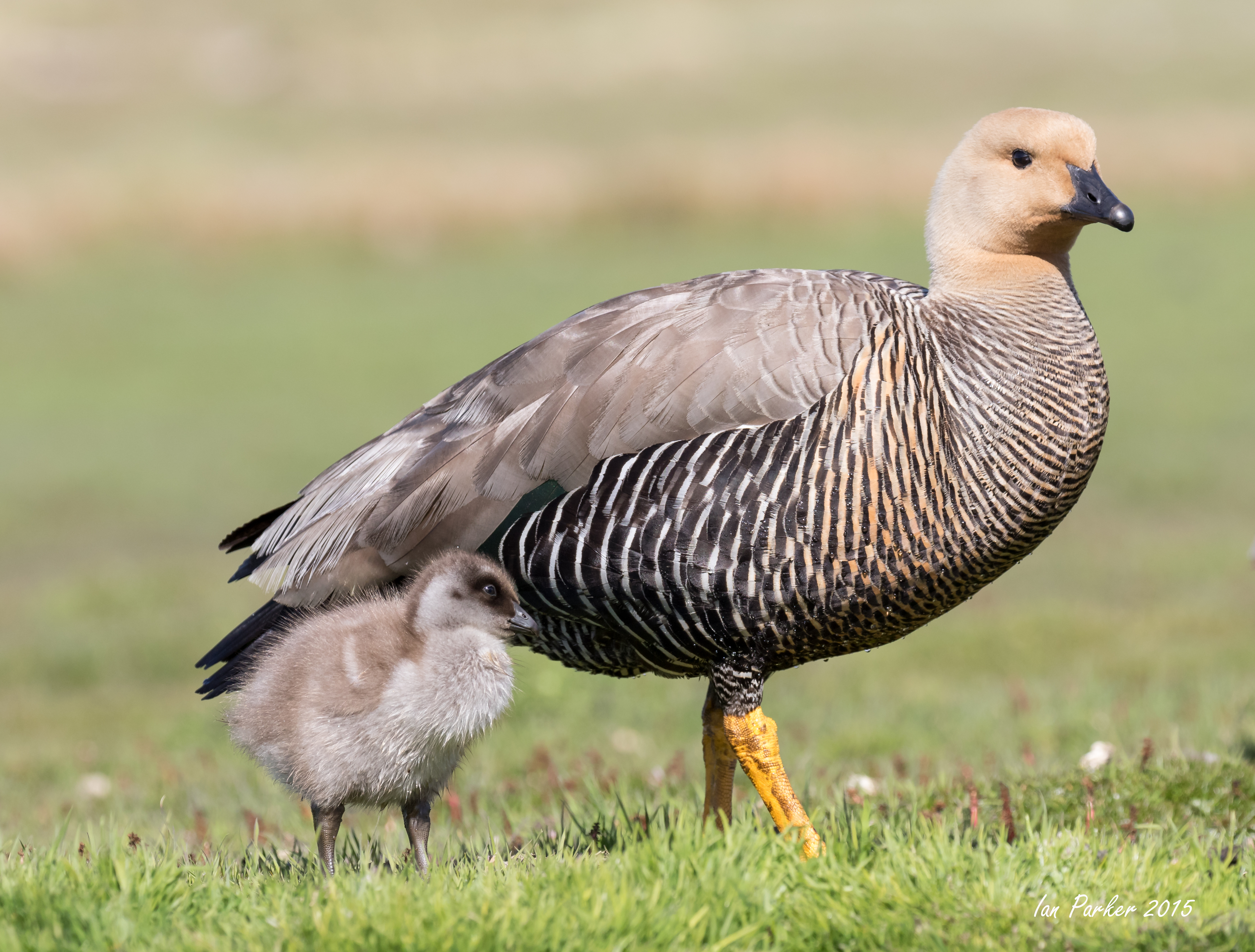
Just a perfect sunny day with penguins and geese on Carcass Island
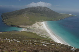
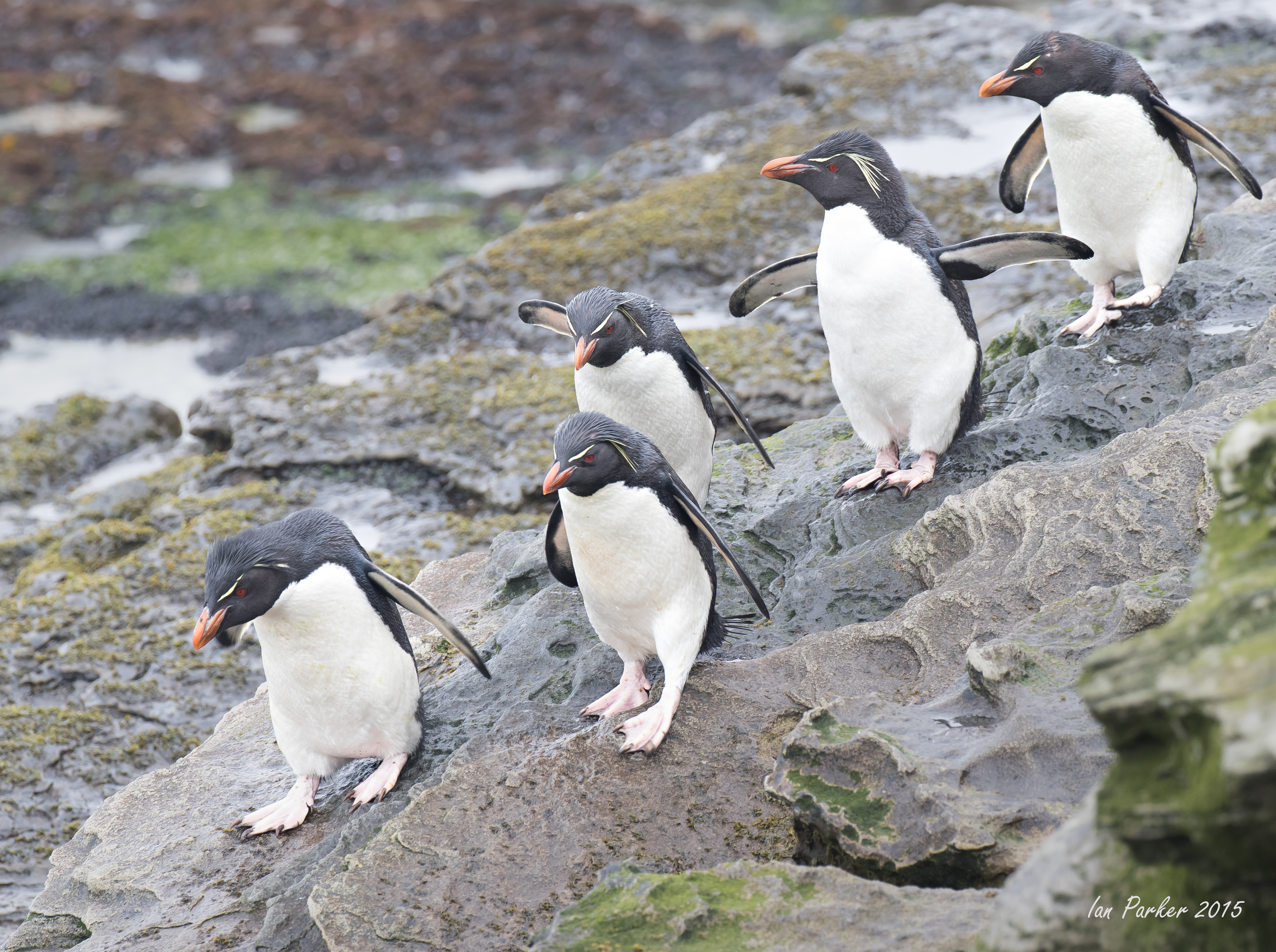
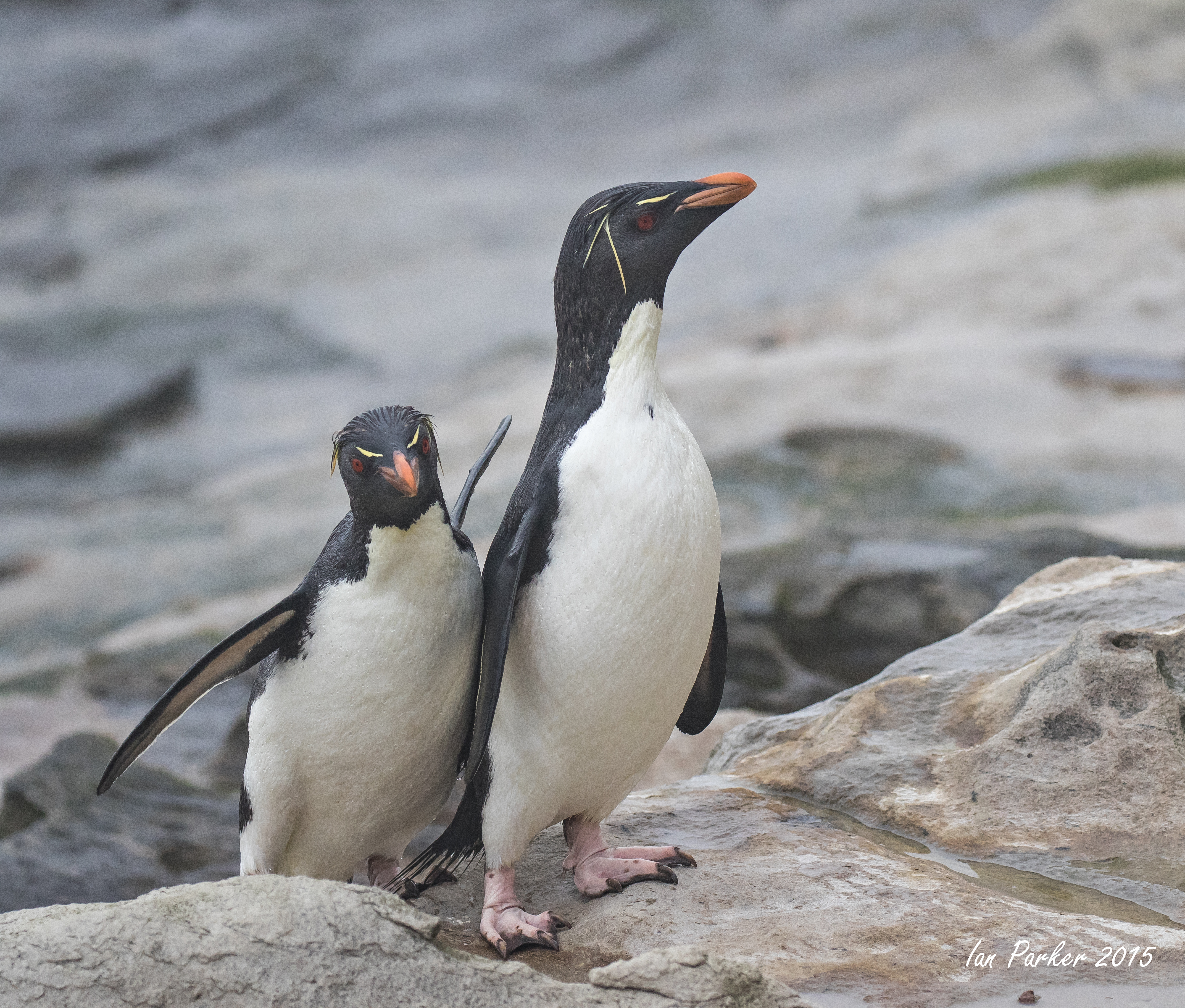
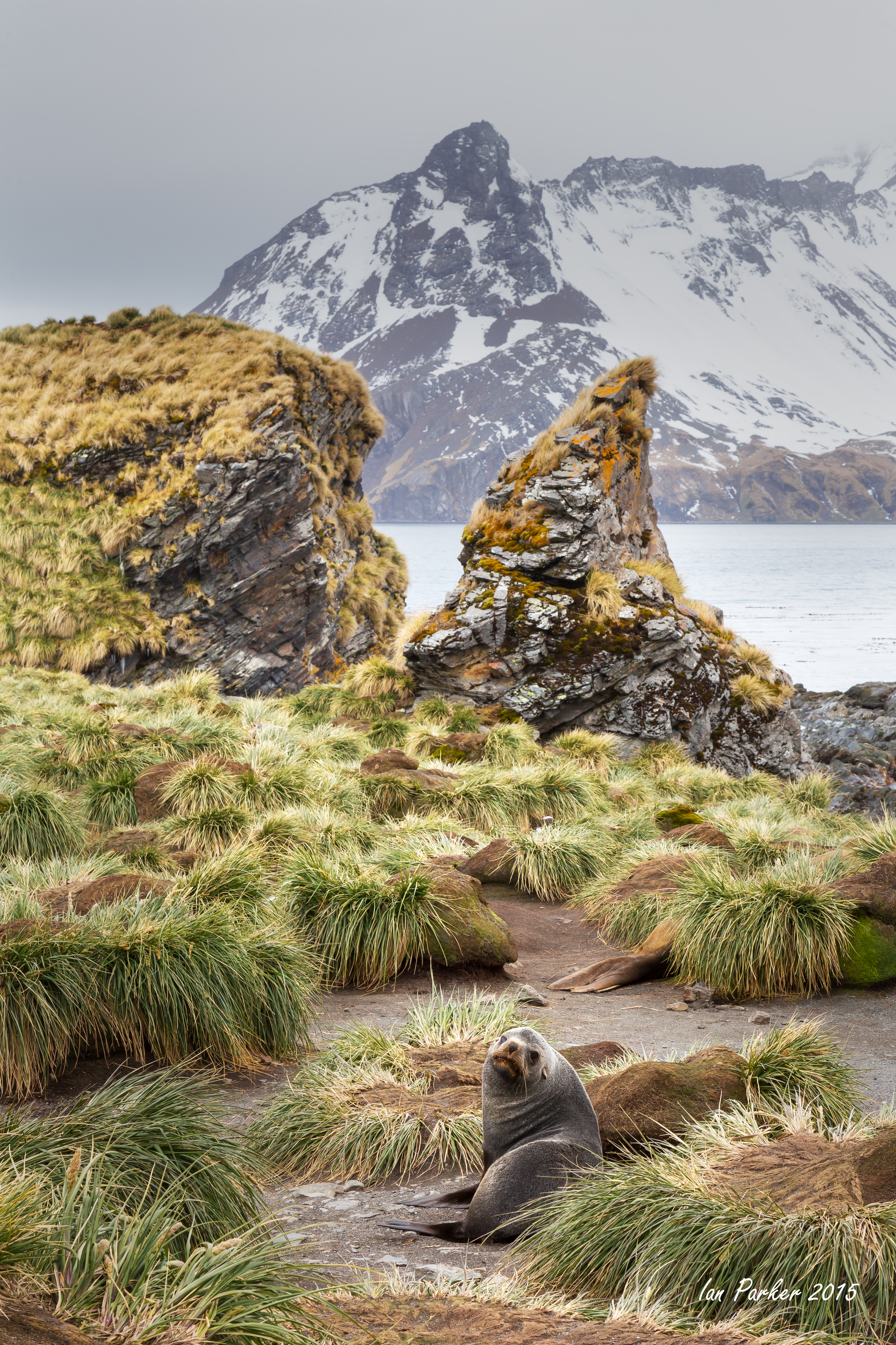
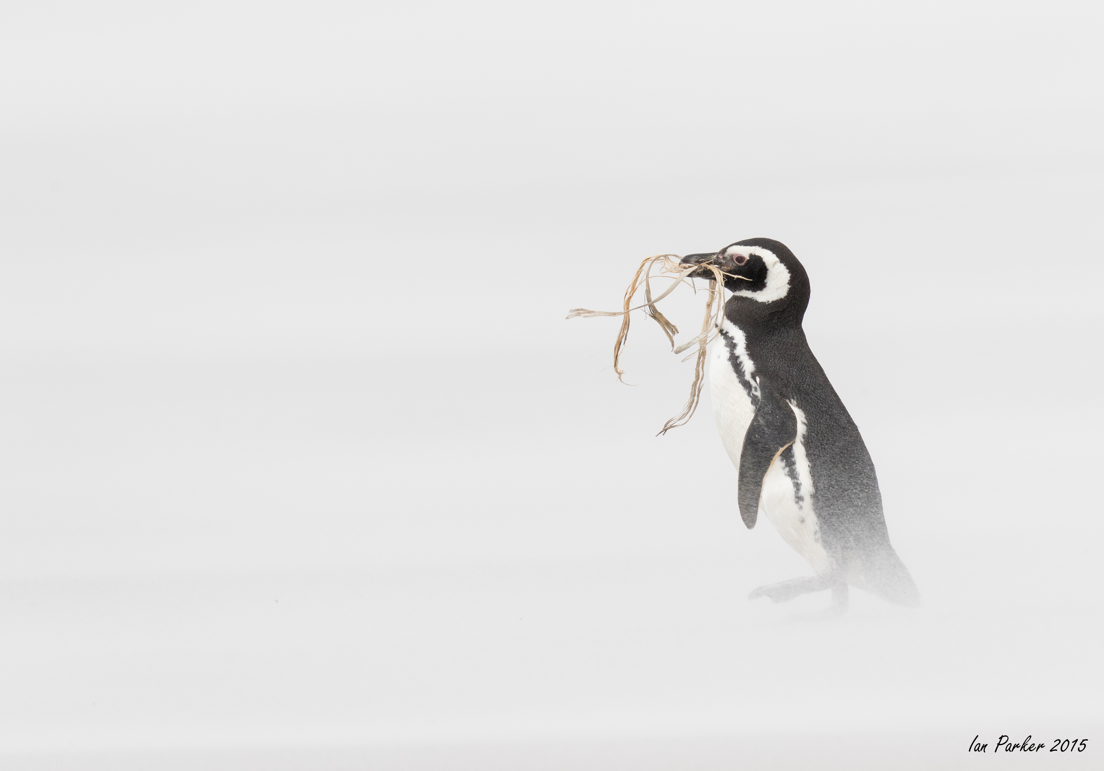
November 24 - The Neck of Saunders Island; our first landing after returning to the Falkland Islands
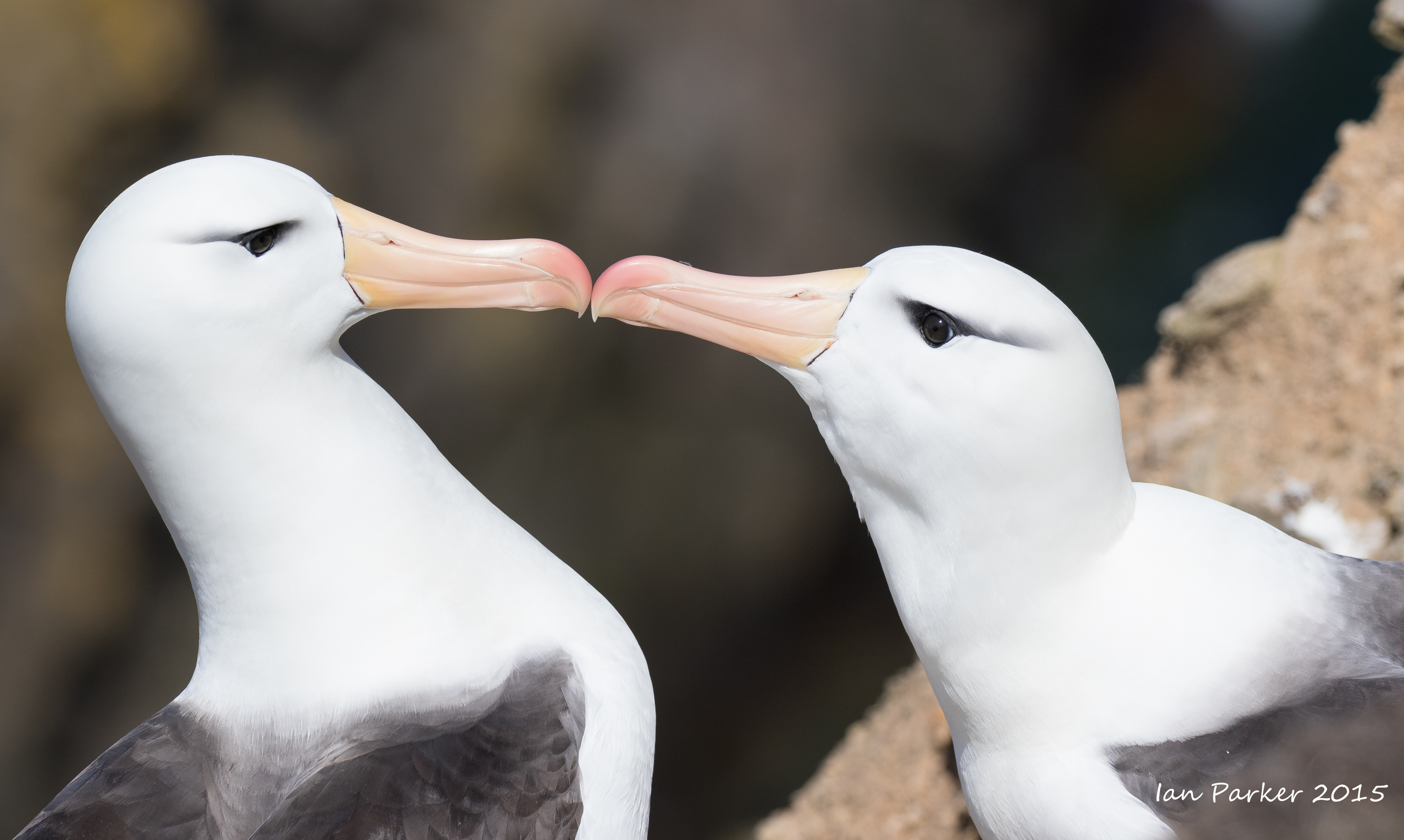
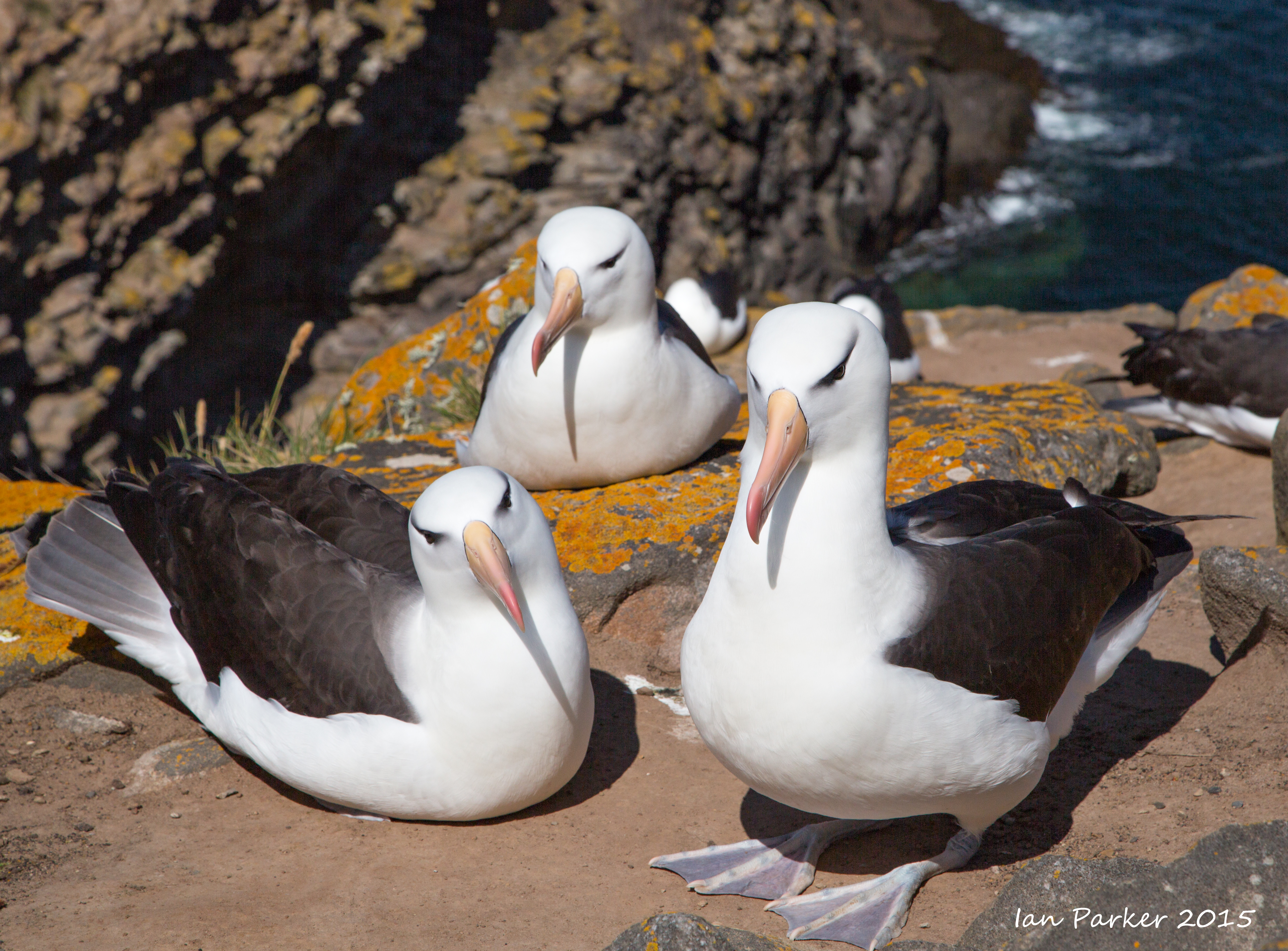
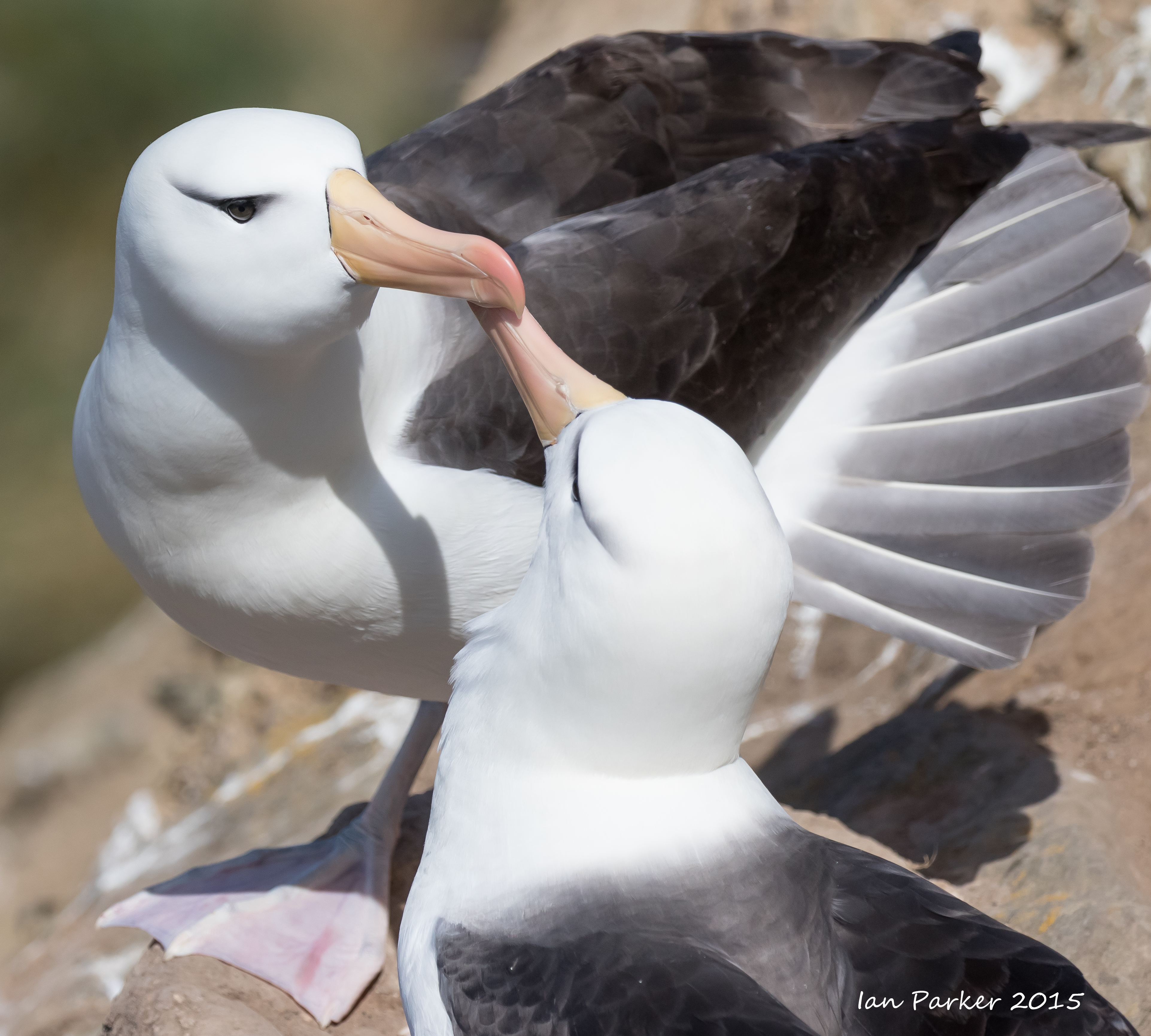
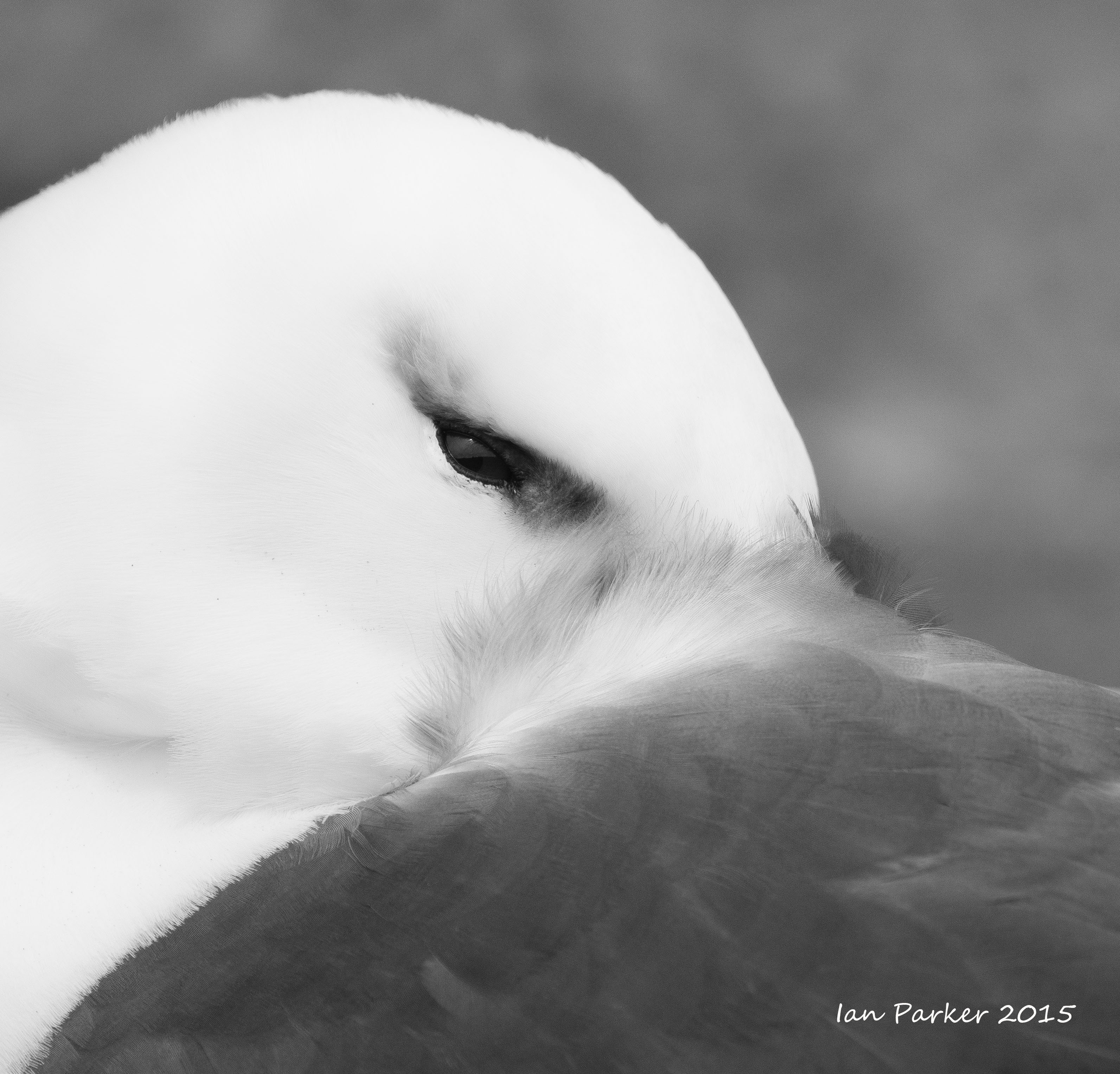
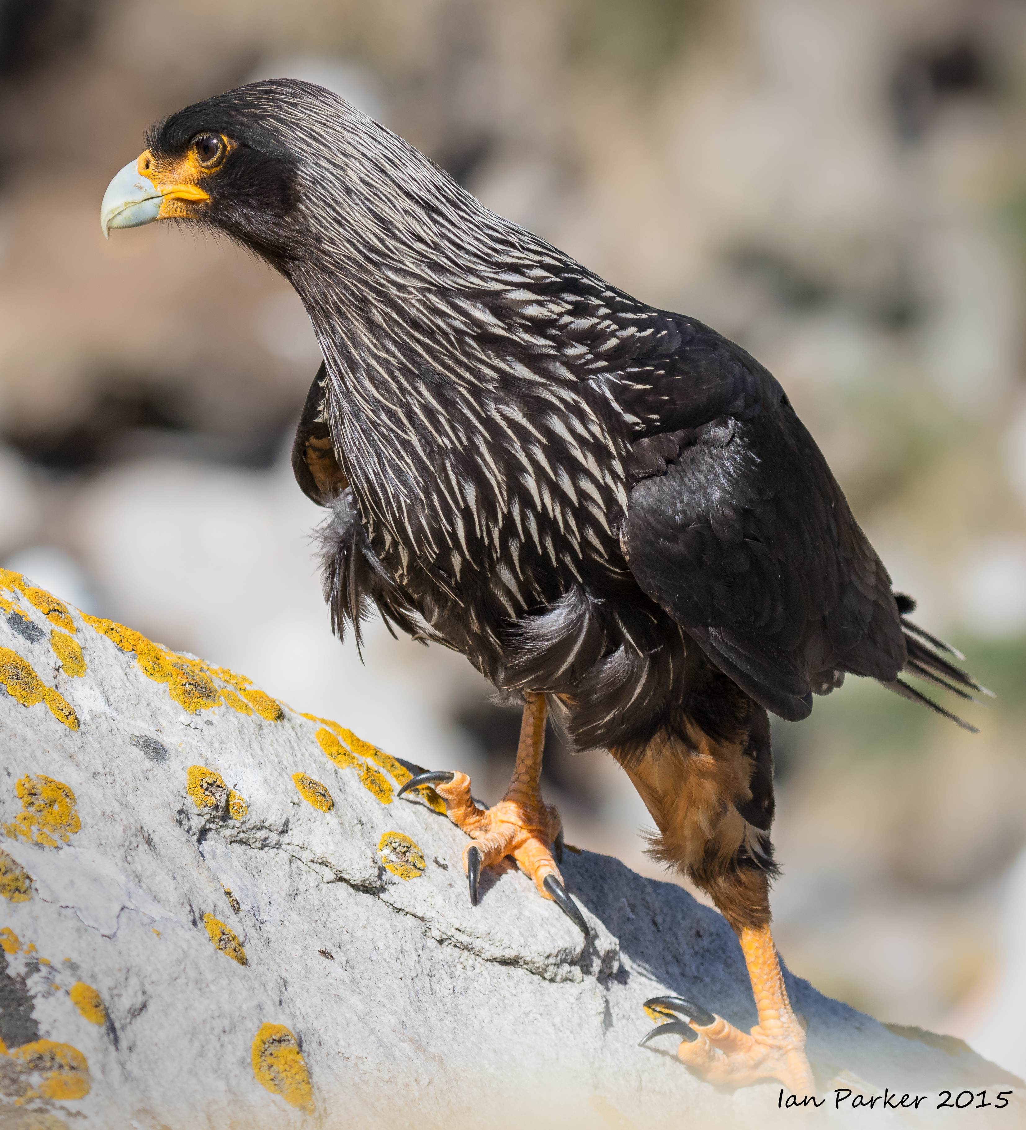
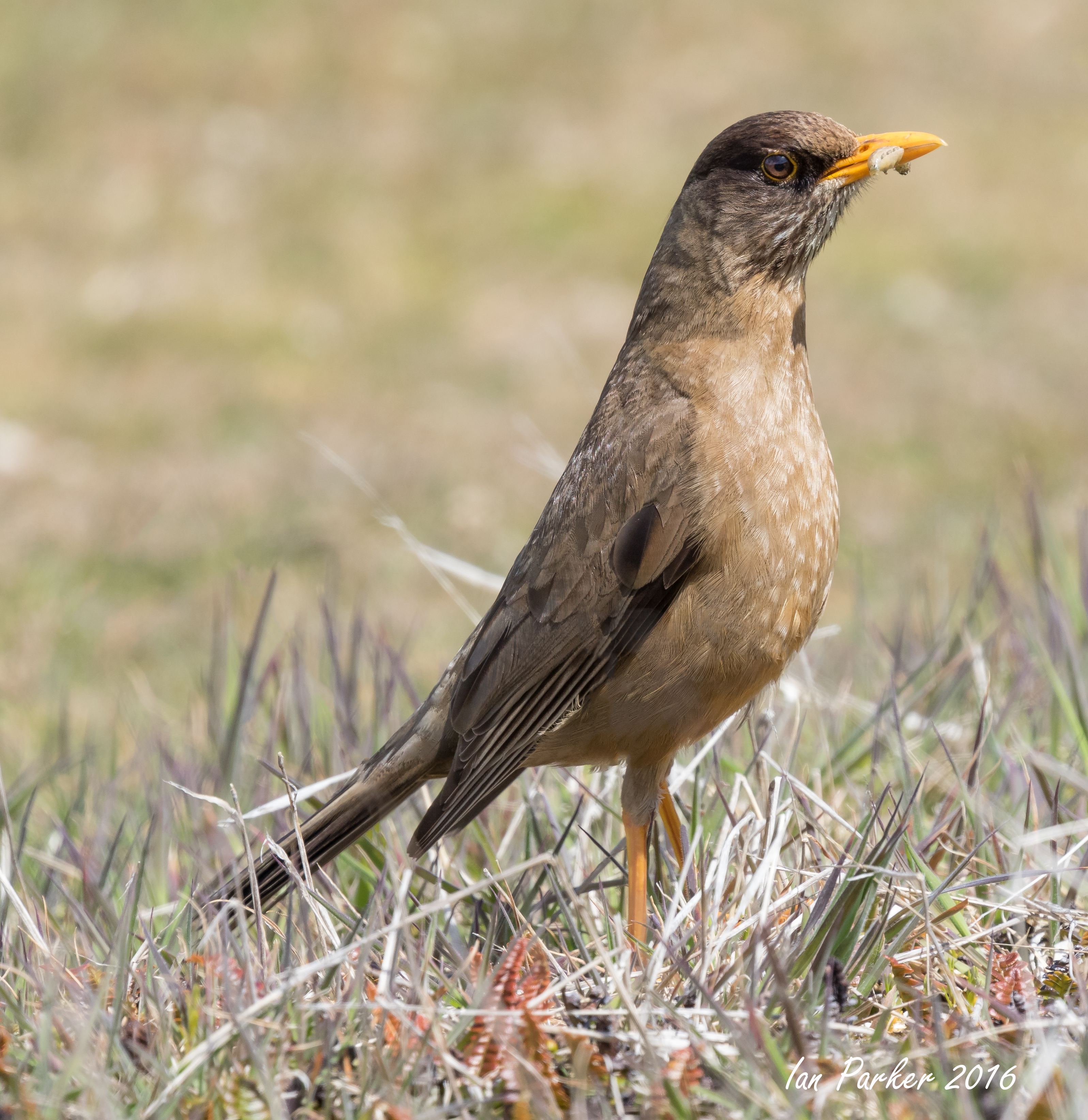
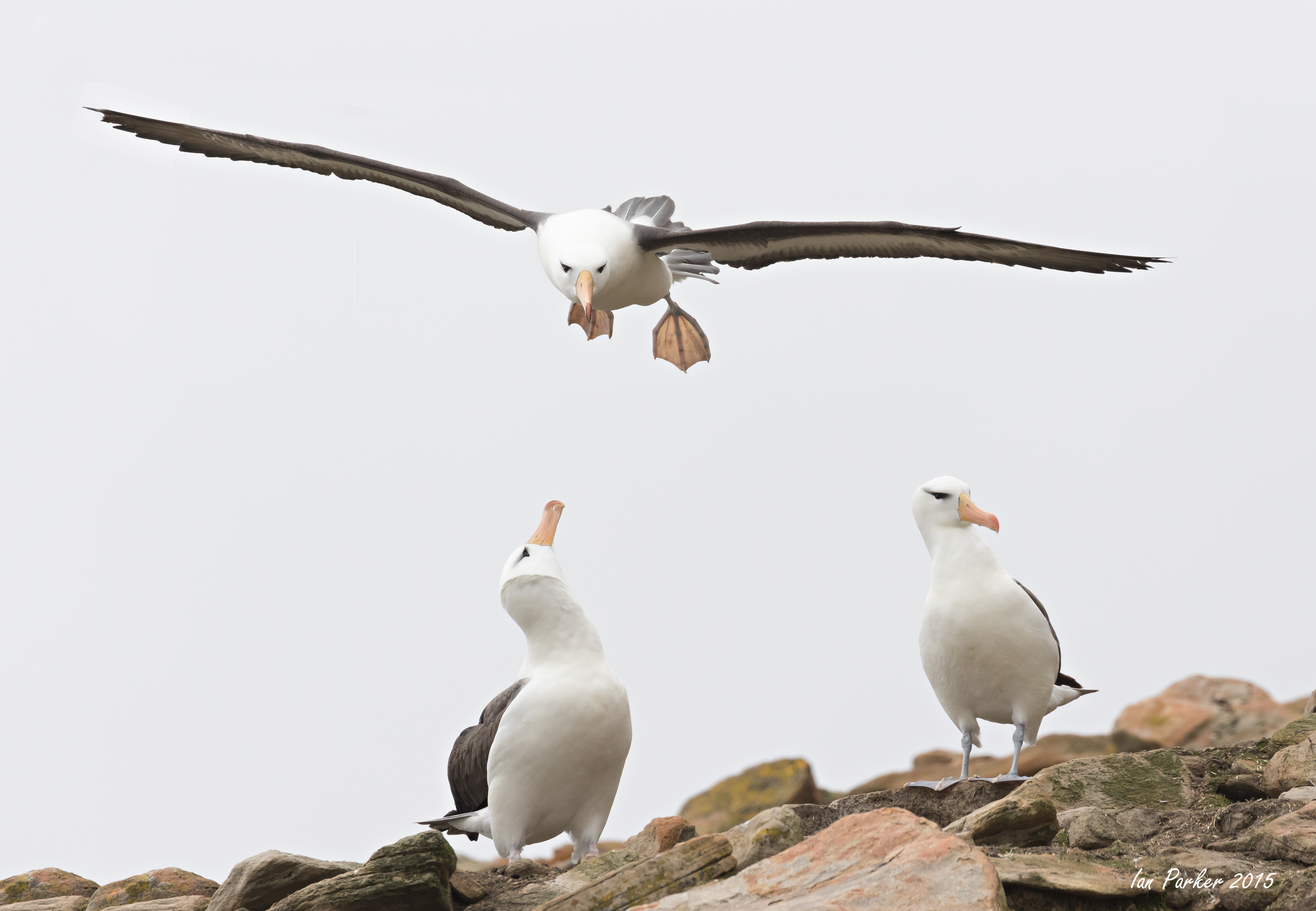
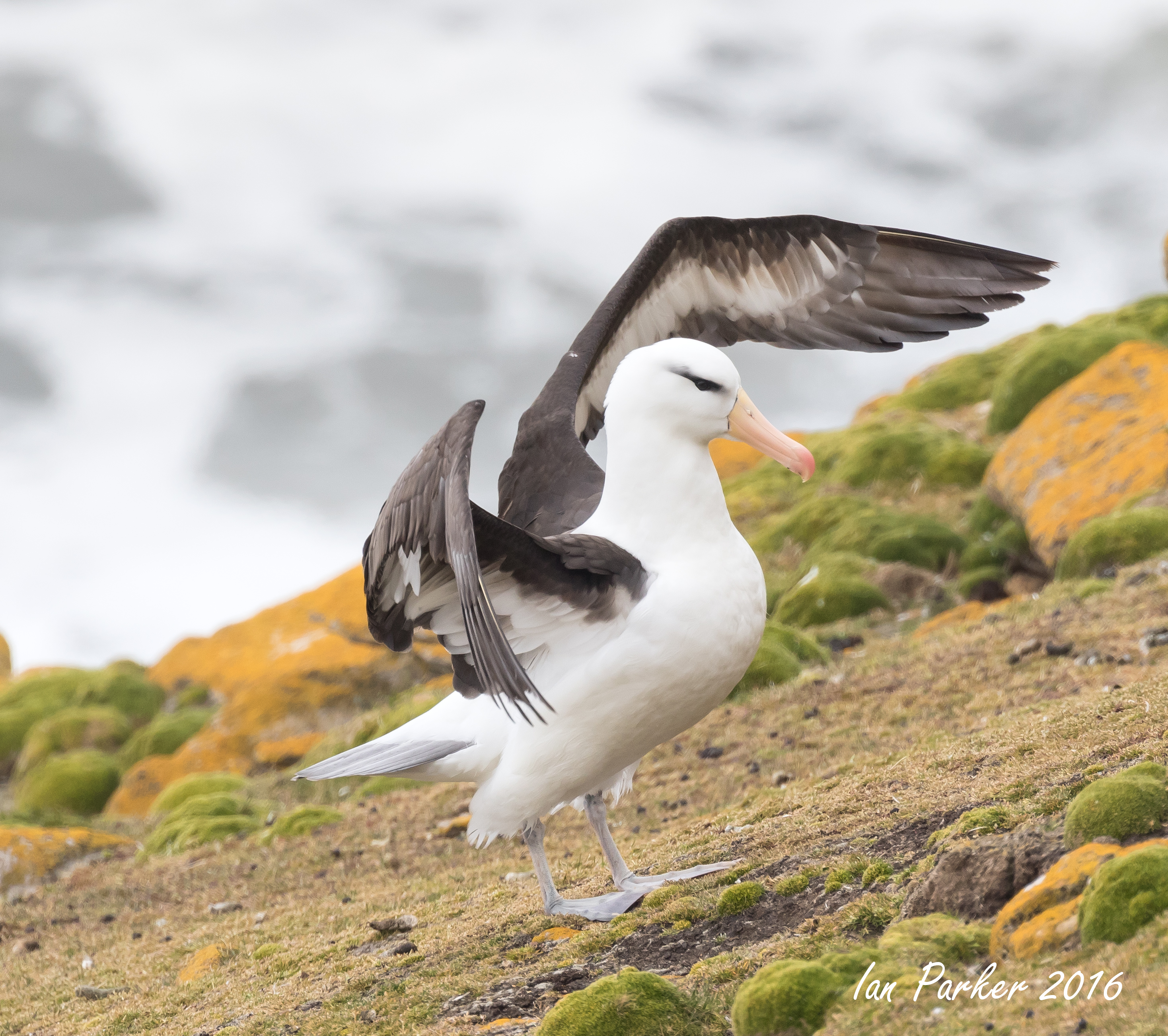
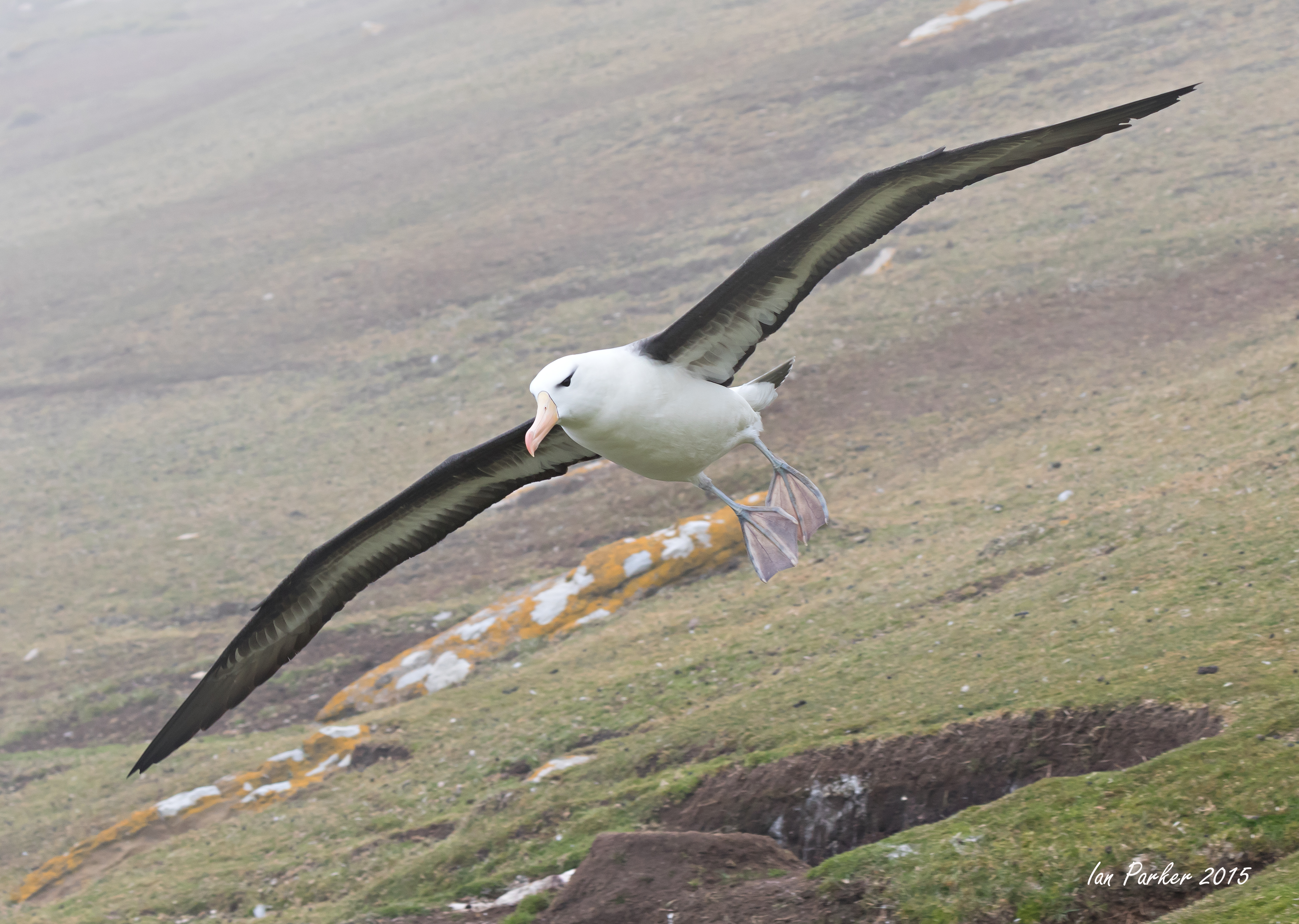
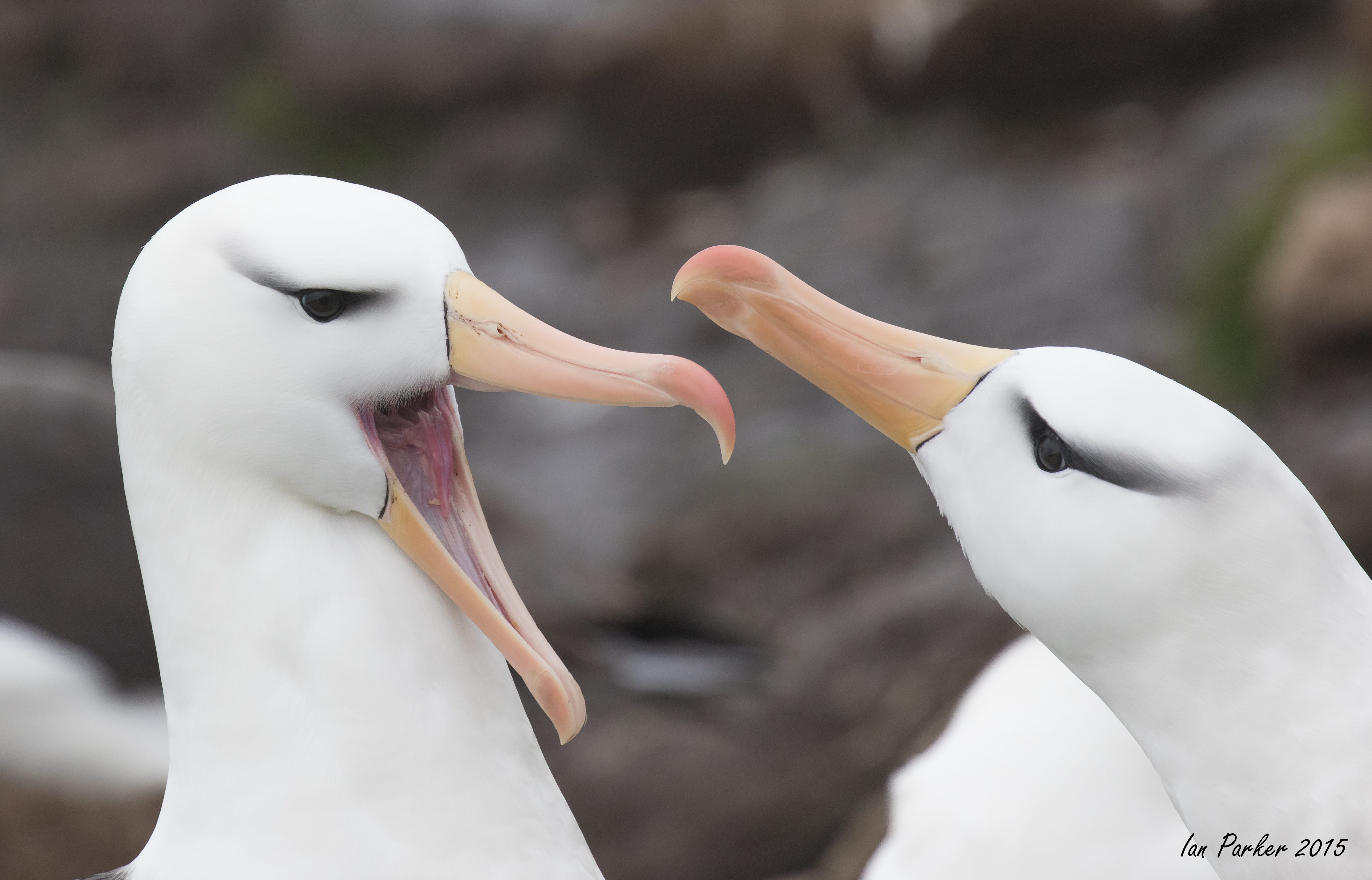
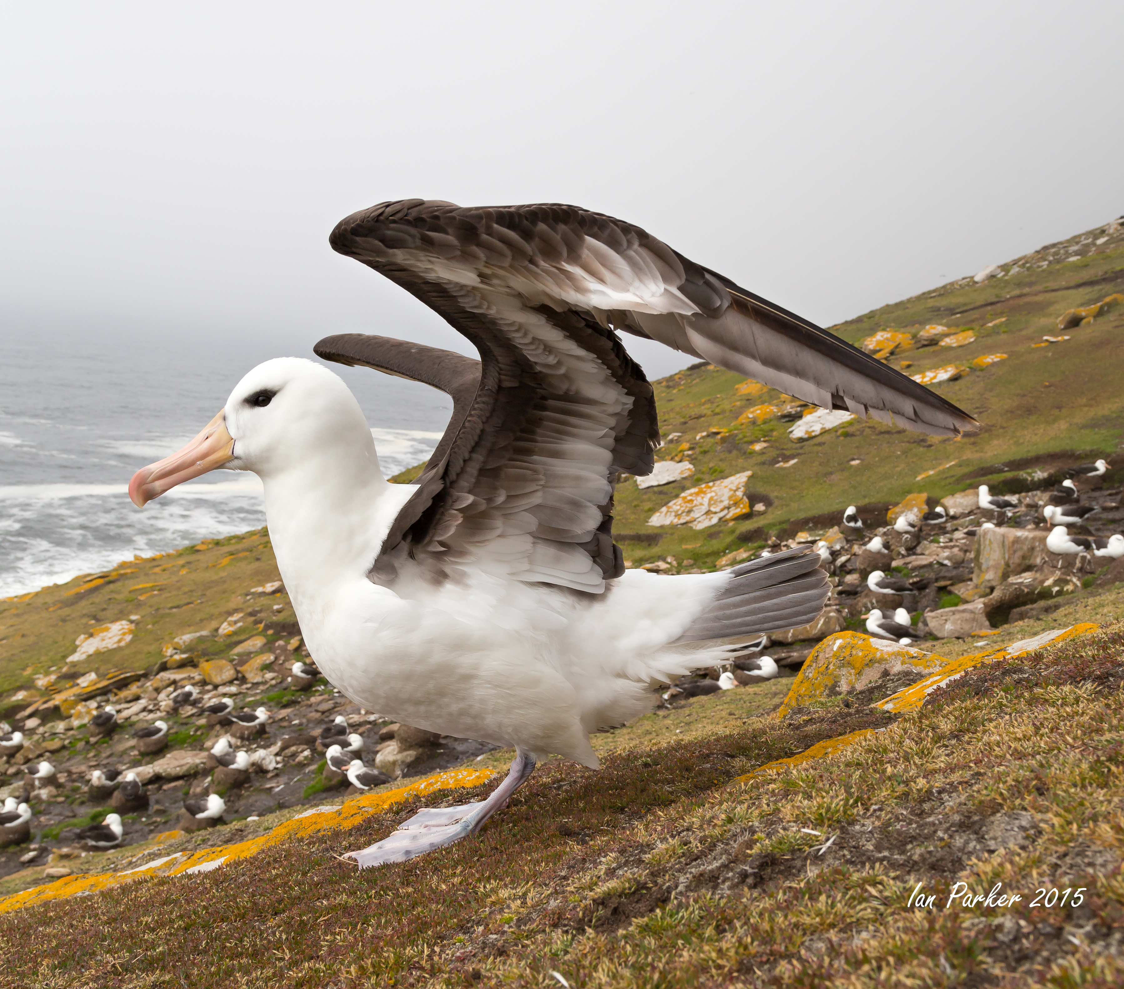
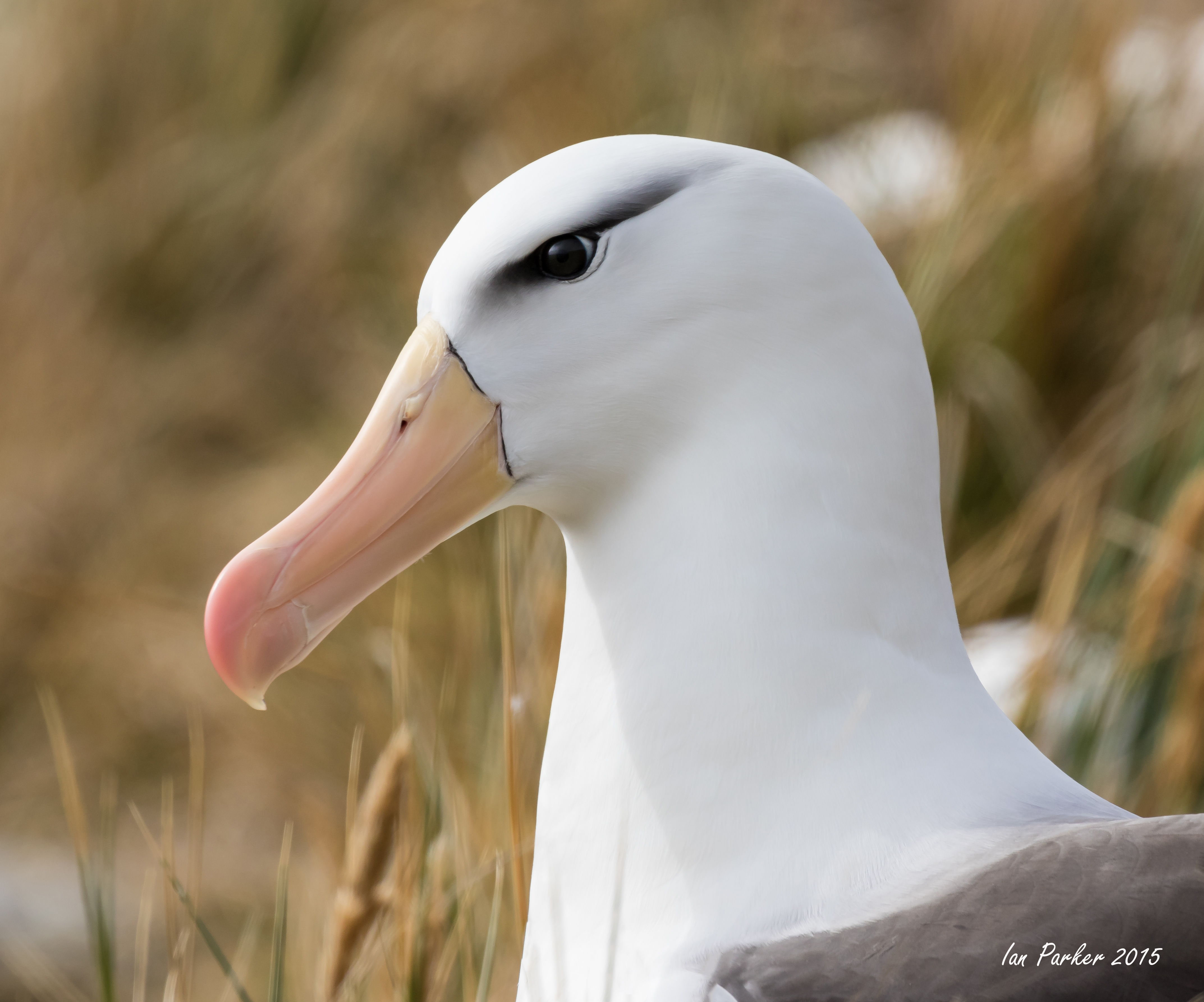
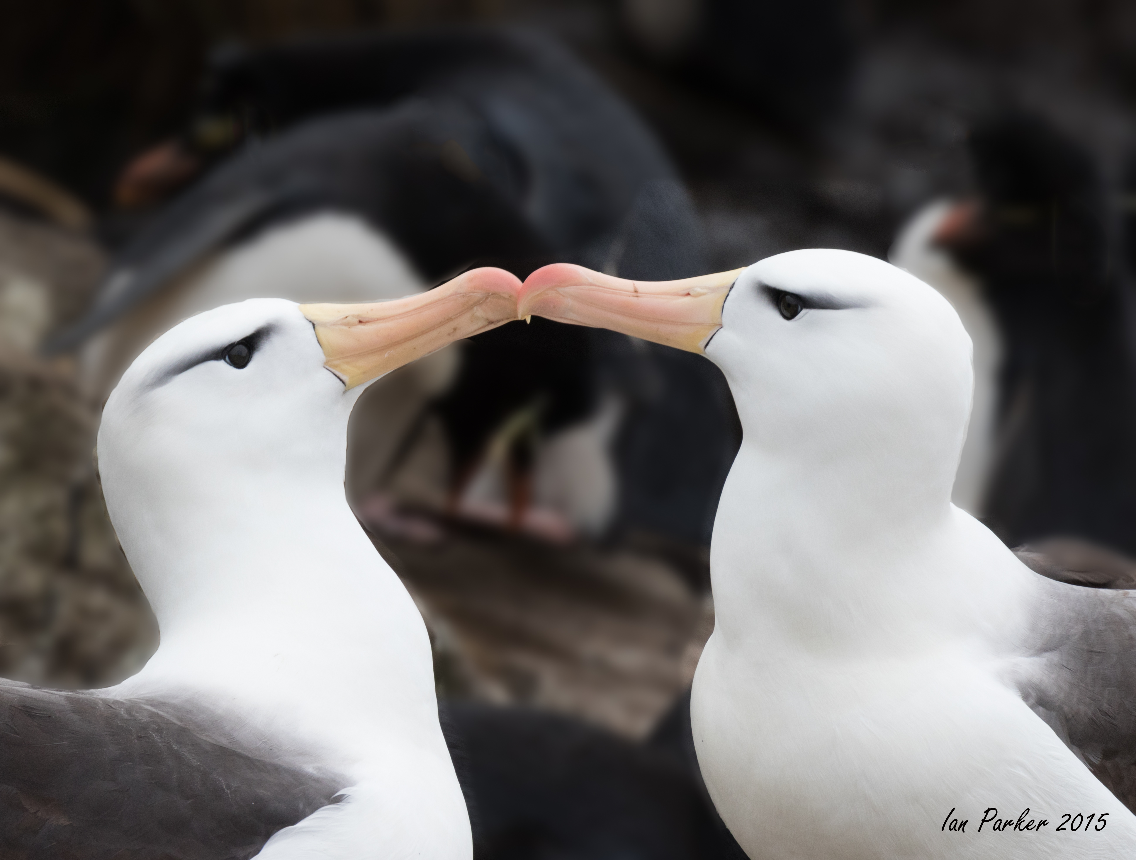
The Neck of Saunders Island is a narrow isthmus, jut a few hundred yards across, separating two sandy beaches. It is an exceptional location for wildlife. There are large nesting colonies of black browed albatross and rockhopper penguins on the steep slopes below the hill at bottom left of the photo; colonies of king penguins on the flat land between the beaches; and many other bird species to be found on the beach. |
|
Albatross
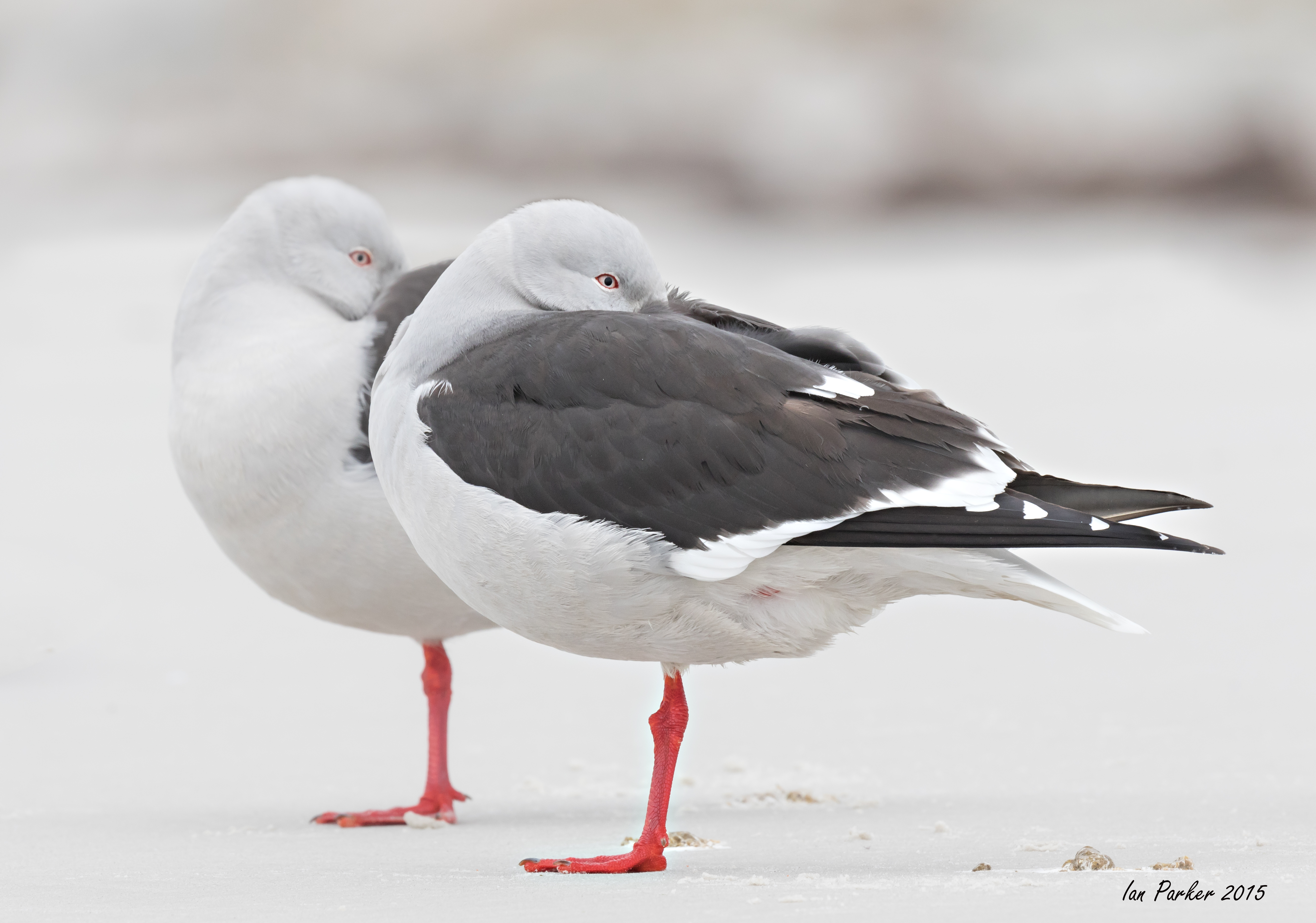
Red-billed gulls
Other birds
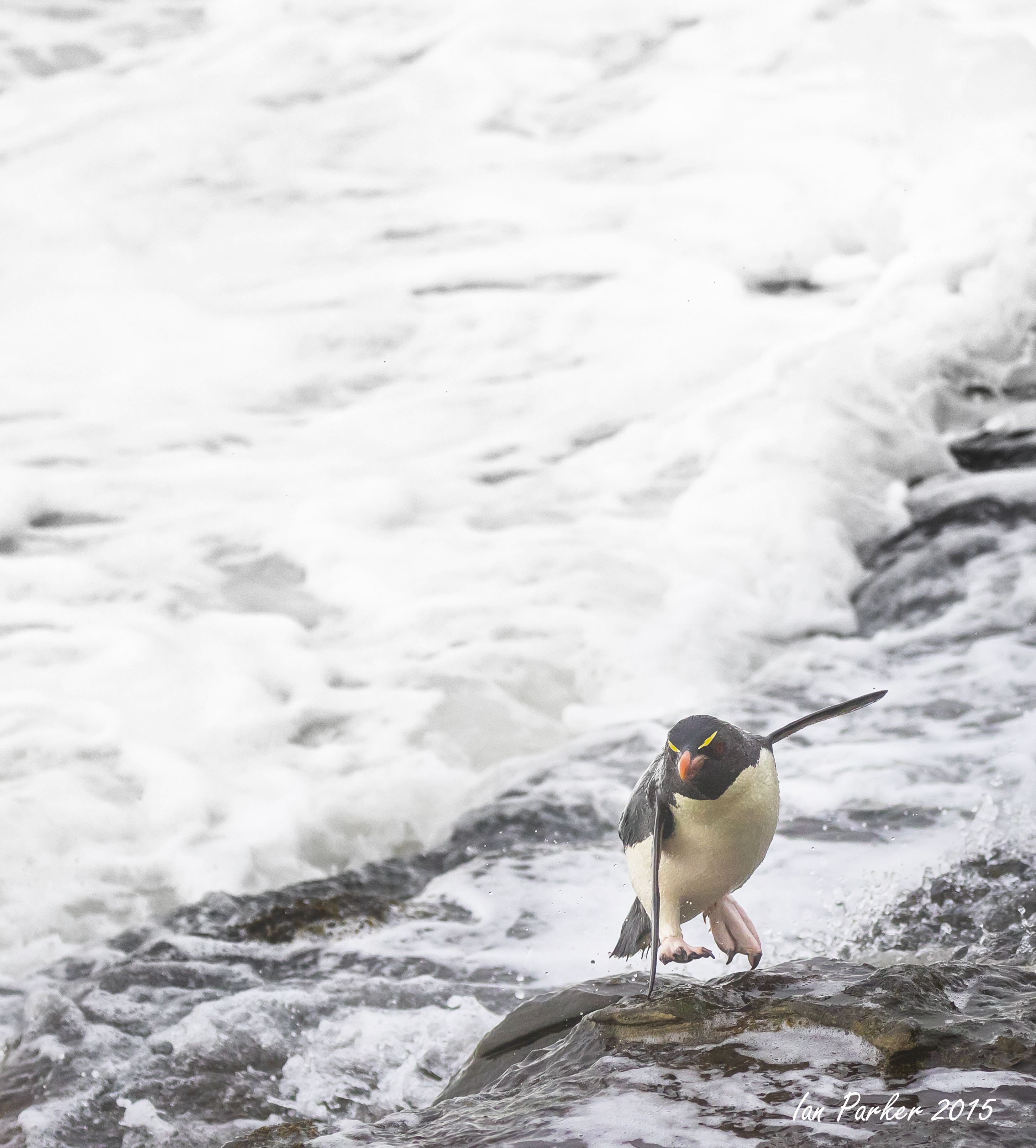
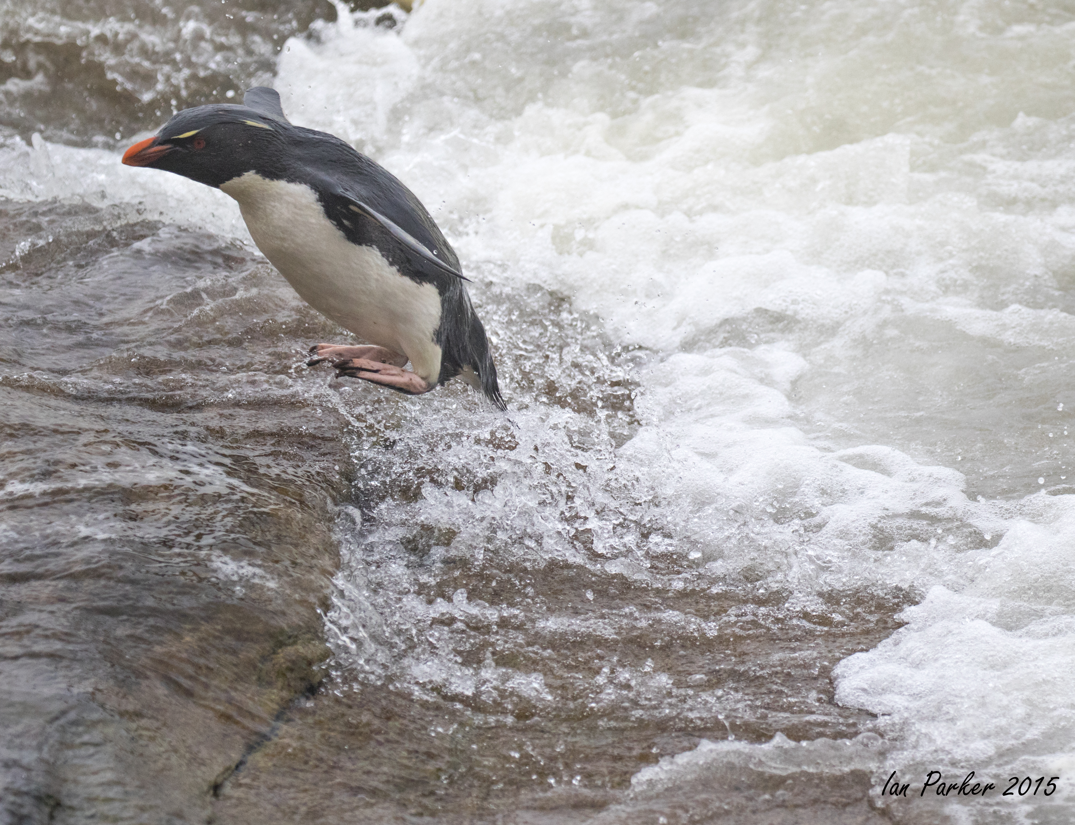
Rockhopper penguins nest high up on the hillside above the Neck, and come ashore through big surf to climb a rocky cliff face before continuing a long way up steep grassy slopes. It is not at all obvious why they approach their nests via the cliff, when they could equally well land on a gentle beach just a few hundred yards away. Watching them trying to get a foothold on the wave-swept rocks is harrowing, as the surf often throws them onto the rock, and then sweeps them back out to sea. Nevertheless they are persistent, seeming not to care about the battering they receive, and eventually gain a toehold to start climbing. Their sharp claws help them climb improbably steep faces, and in several places the passage of countless rockhoppers along their 'highways' has worn grooves in the rock.
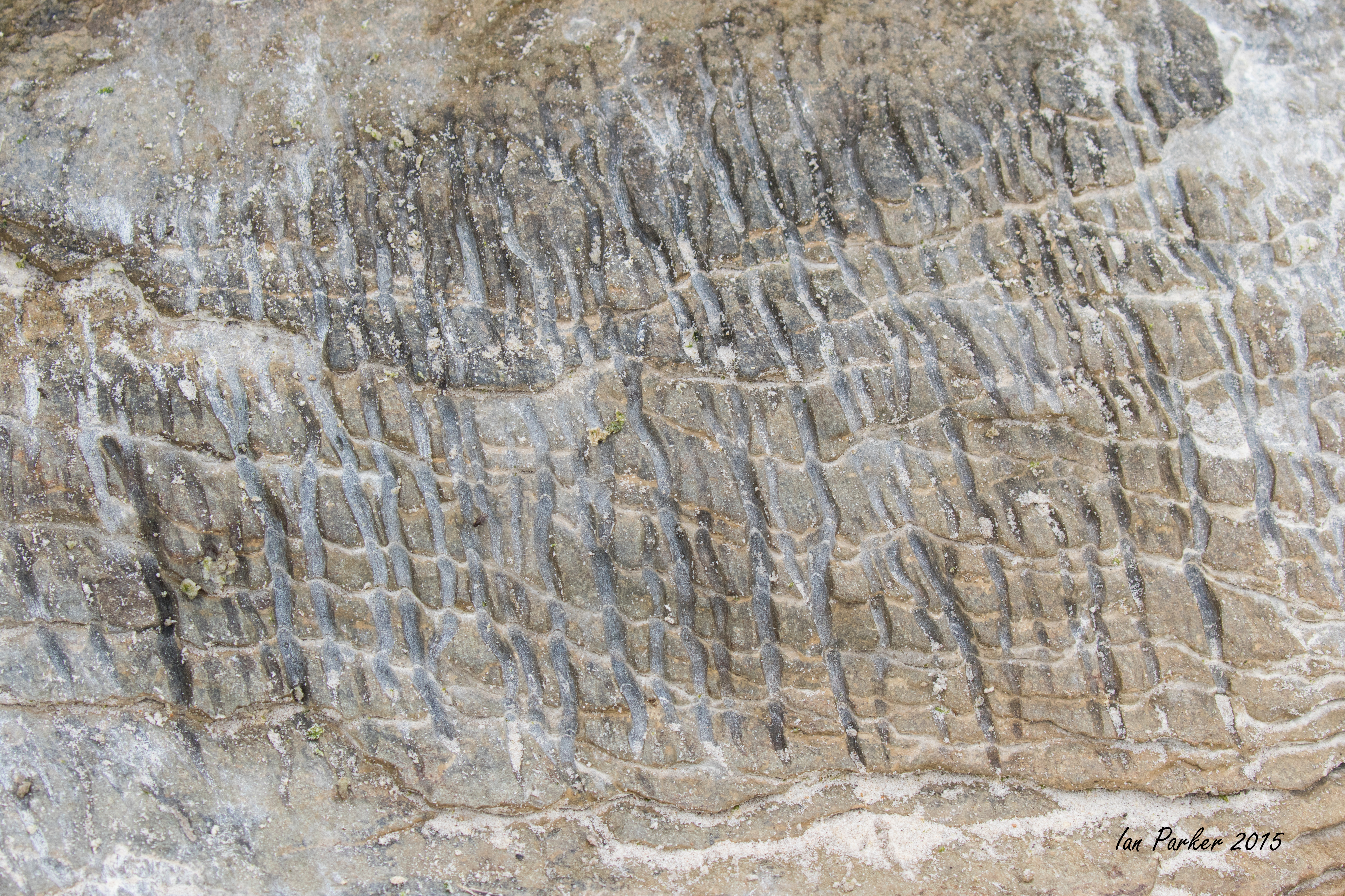
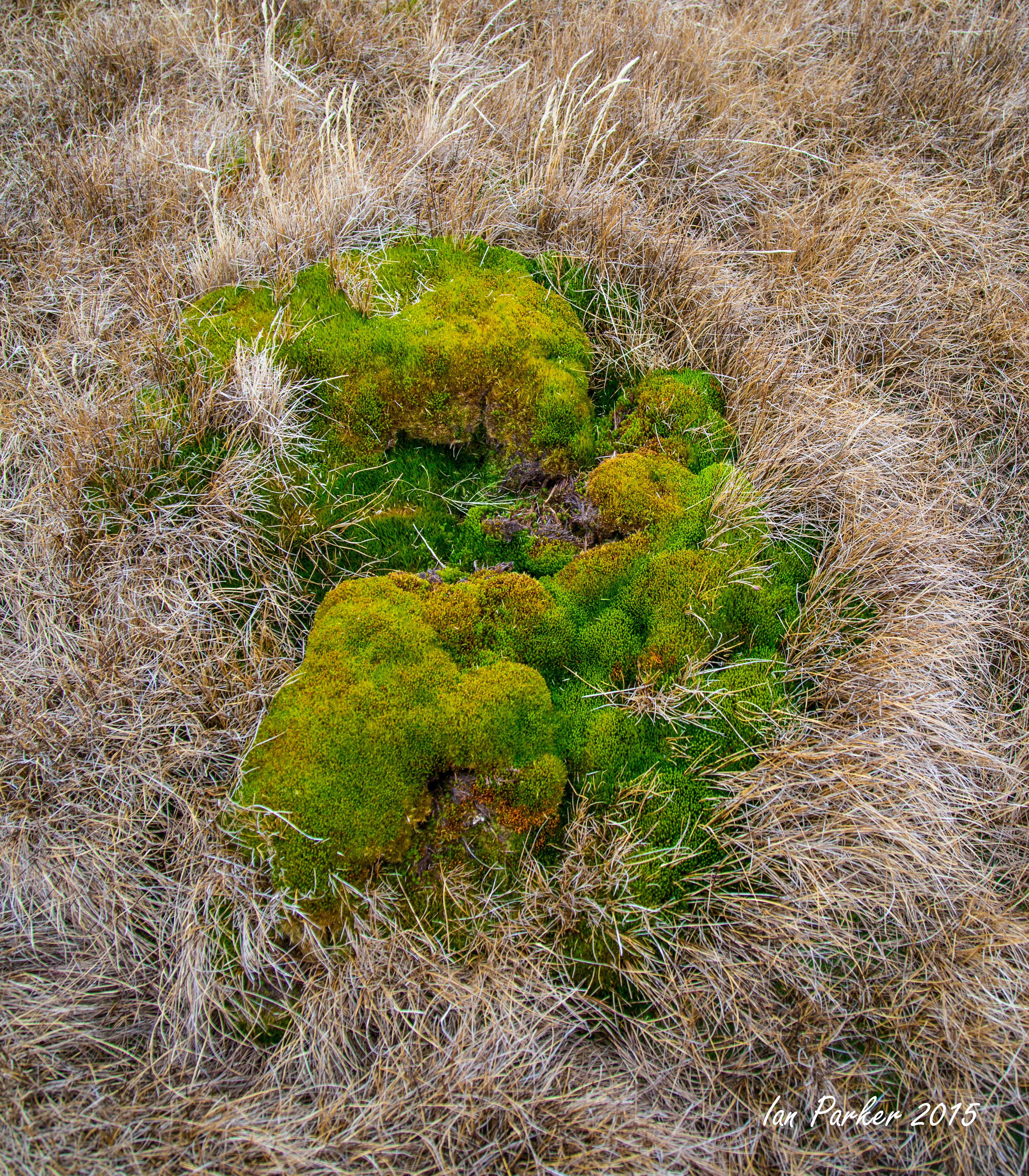
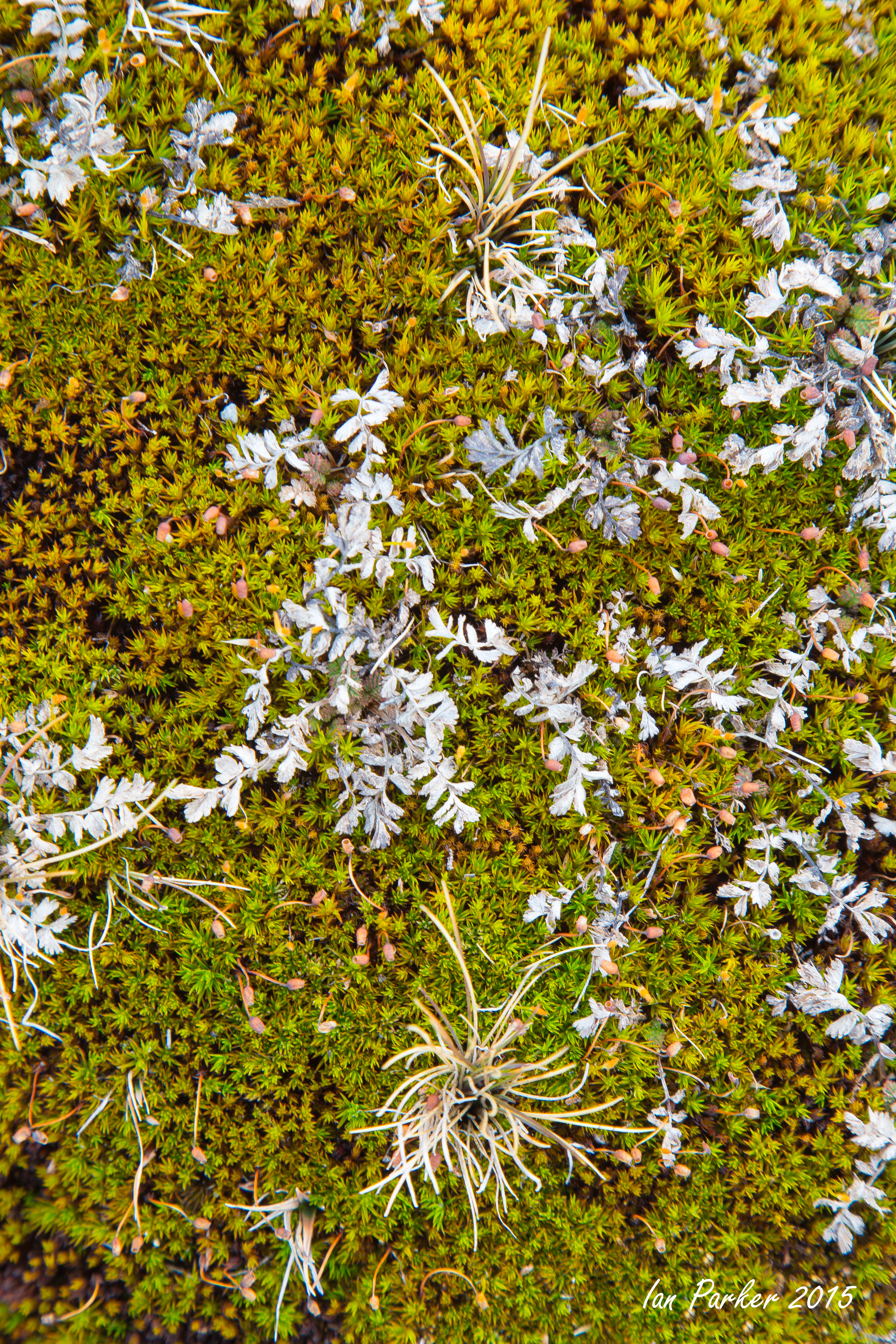
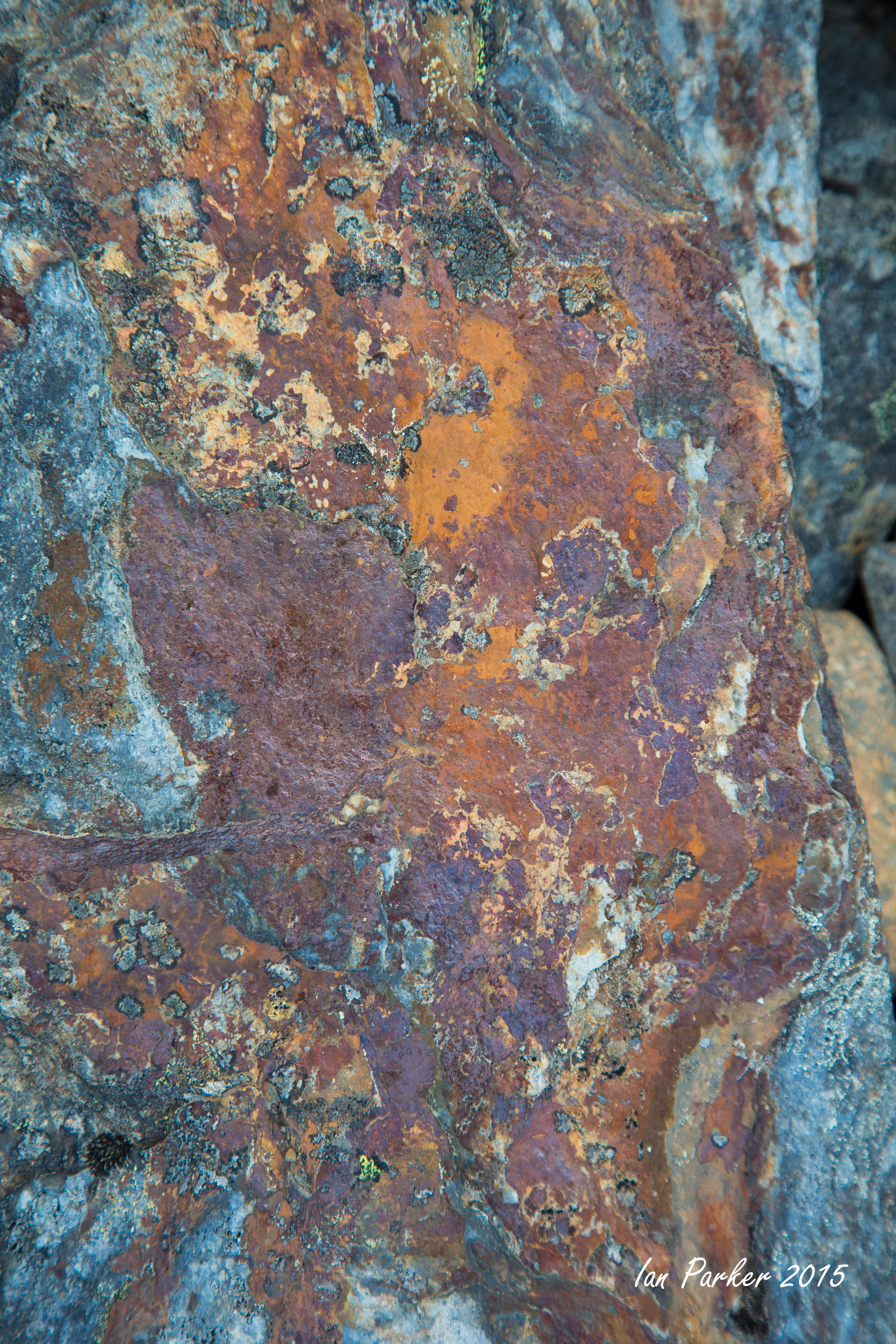
Some colorful rock textures and patterns
King penguins under wonderfully moody evening skies, shortly before we returned to the Hans Hansson
November 18 - Cooper Bay, then an emergency trip back to the Falklands with a quick stop for a medical evaluation at the research station on King Edward Point before leaving South Georgia
After returning around Cape Dissappointment, the southern tip of South Georgia, the plan was that we would retrace our outward voyage along the east coast of the island, revisiting some sites and perhaps landing at some new sites. However, one of our group broke her leg while we were anchored at Cooper bay. This necessitated a rapid return to the Falkland Islands to get her to the closest hospital, with a brief stop at King Edward Point to meet with the medic at the research station.
November 17 - Larsen Harbour and a quick look around Cape Disappointment
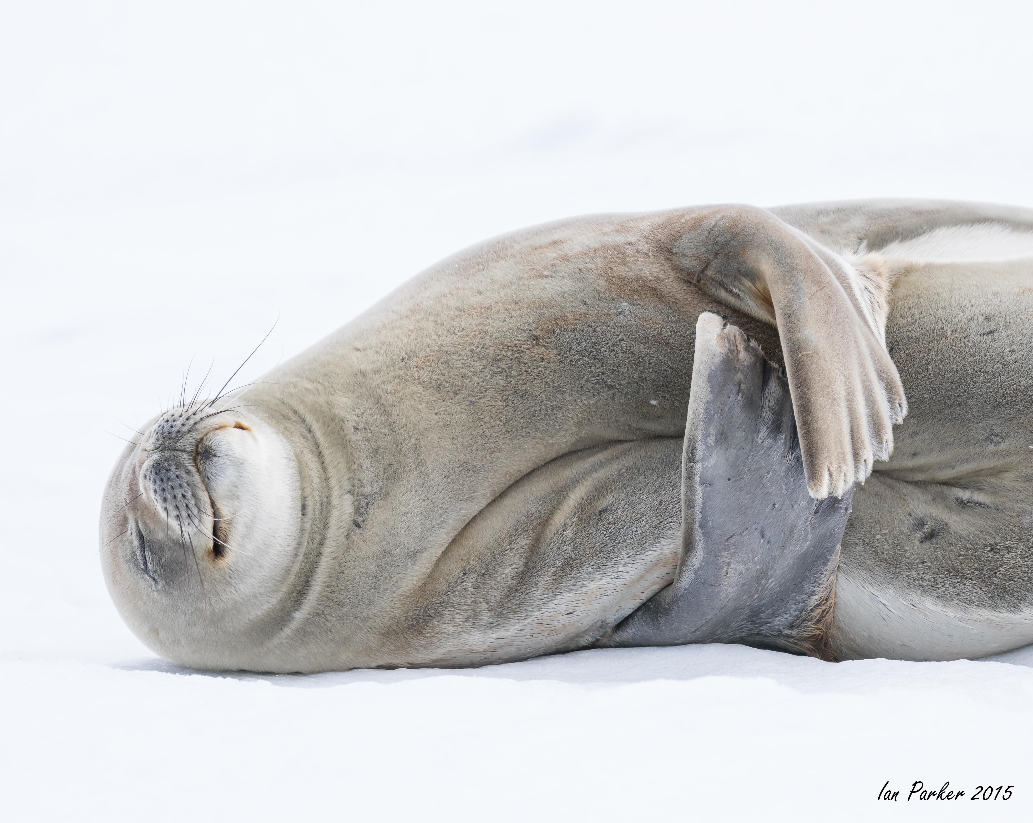
Larsen Harbour is home to a small colony of Weddell seals - the only place where the seals give birth on land, rather than on sea ice.
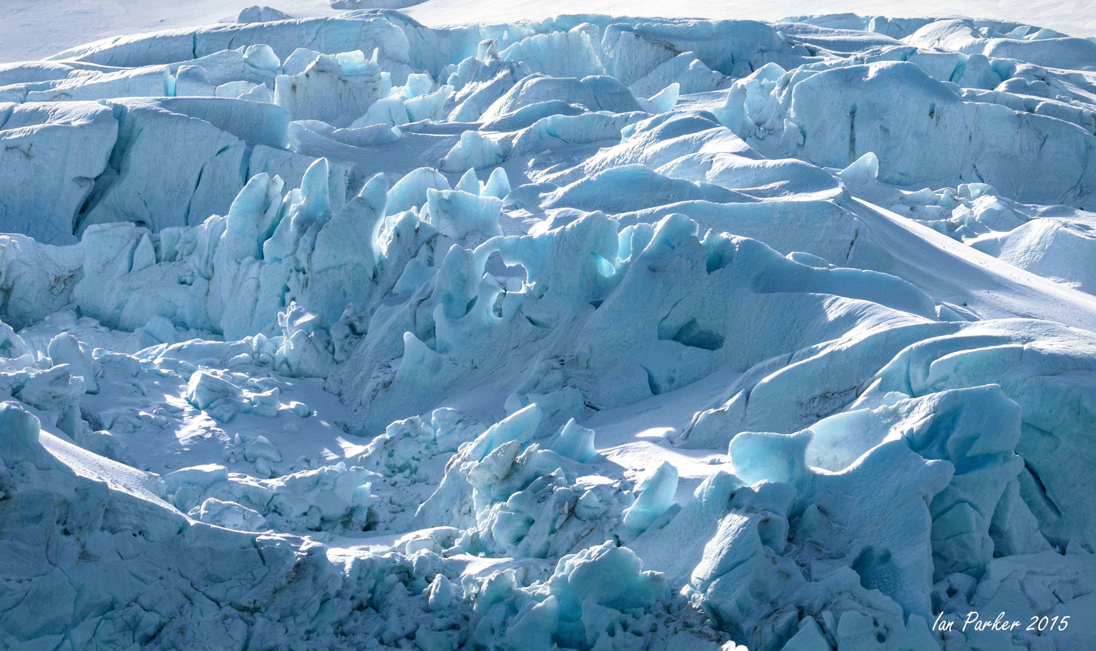
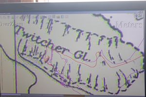
November 16 - Twitcher Glacier
| Twitcher Glacier (54°43′S 35°56′W) is a glacier, 4 miles (6 km) long, which flows east from the Salvesen Range to the east coast of South Georgia, immediately south of Herz Glacier and Iris Bay. The glacier was surveyed in 1951-52 by the SGS. Named by the United Kingdom Antarctic Place-Names Committee for John Montagu, 4th Earl of Sandwich, First Lord of the Admiralty, 1771–82, who was popularly known as "Jemmy Twitcher." [Wikipedia] The glacier showed a slow retreat up until 1988, but the retreat has since accelerated rapidly, likely as a result of Global warming. Dion took us in the Hans Hansson up the fjord to the present glacier face. According to the chart on the computer screen, we sailed about 2 km up the glacier itself! The red trace on the screen plots our GPS positions. |
|
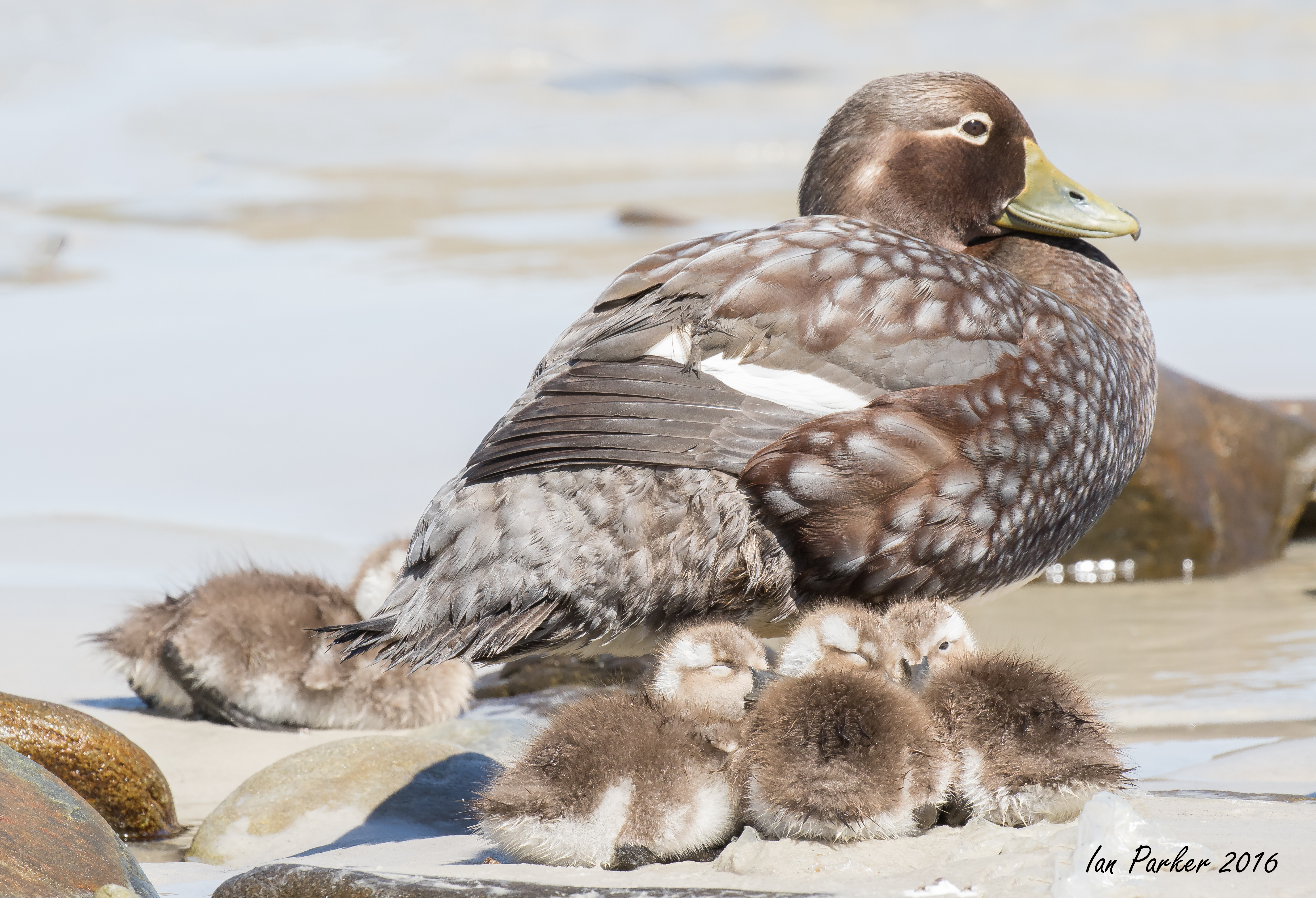
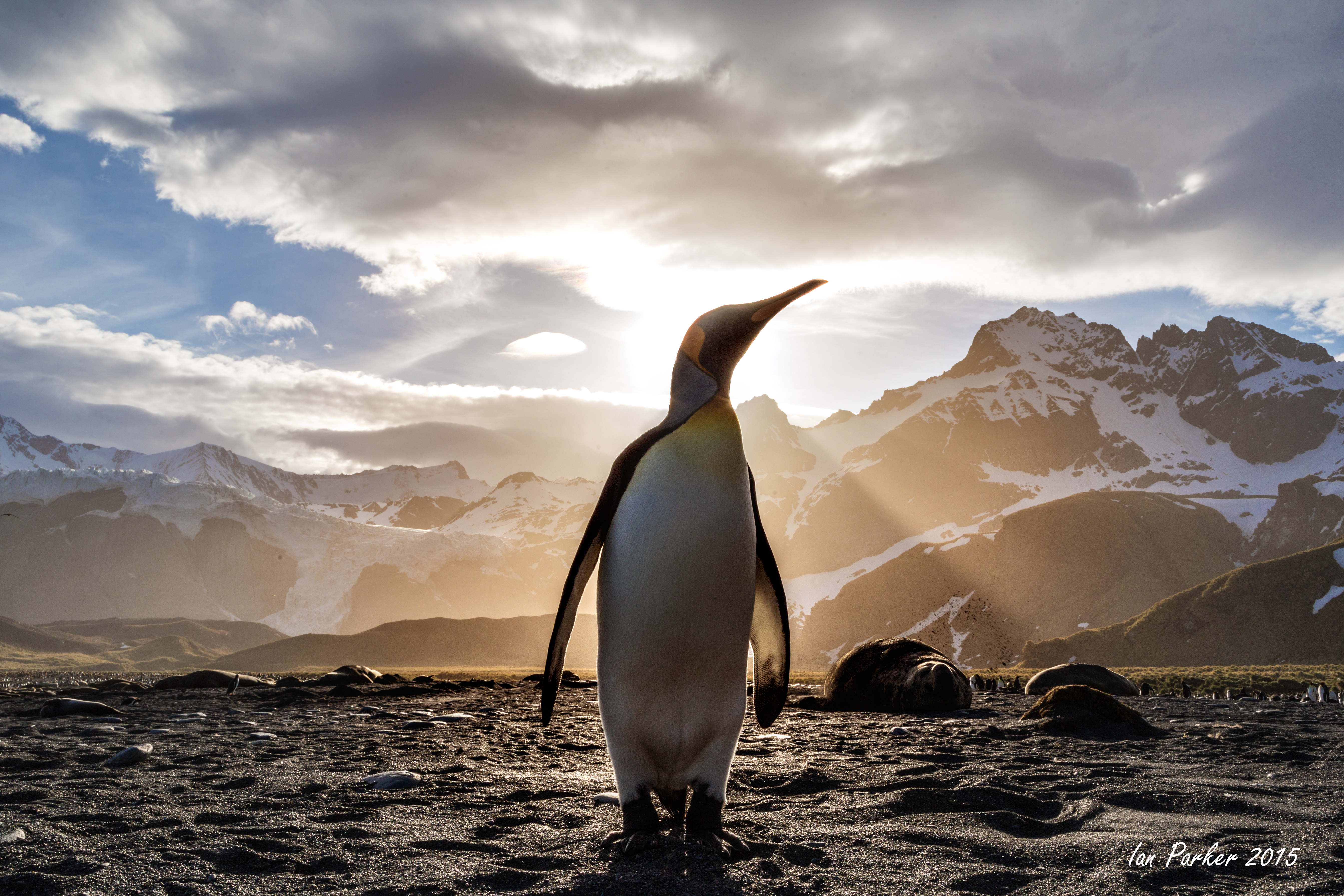
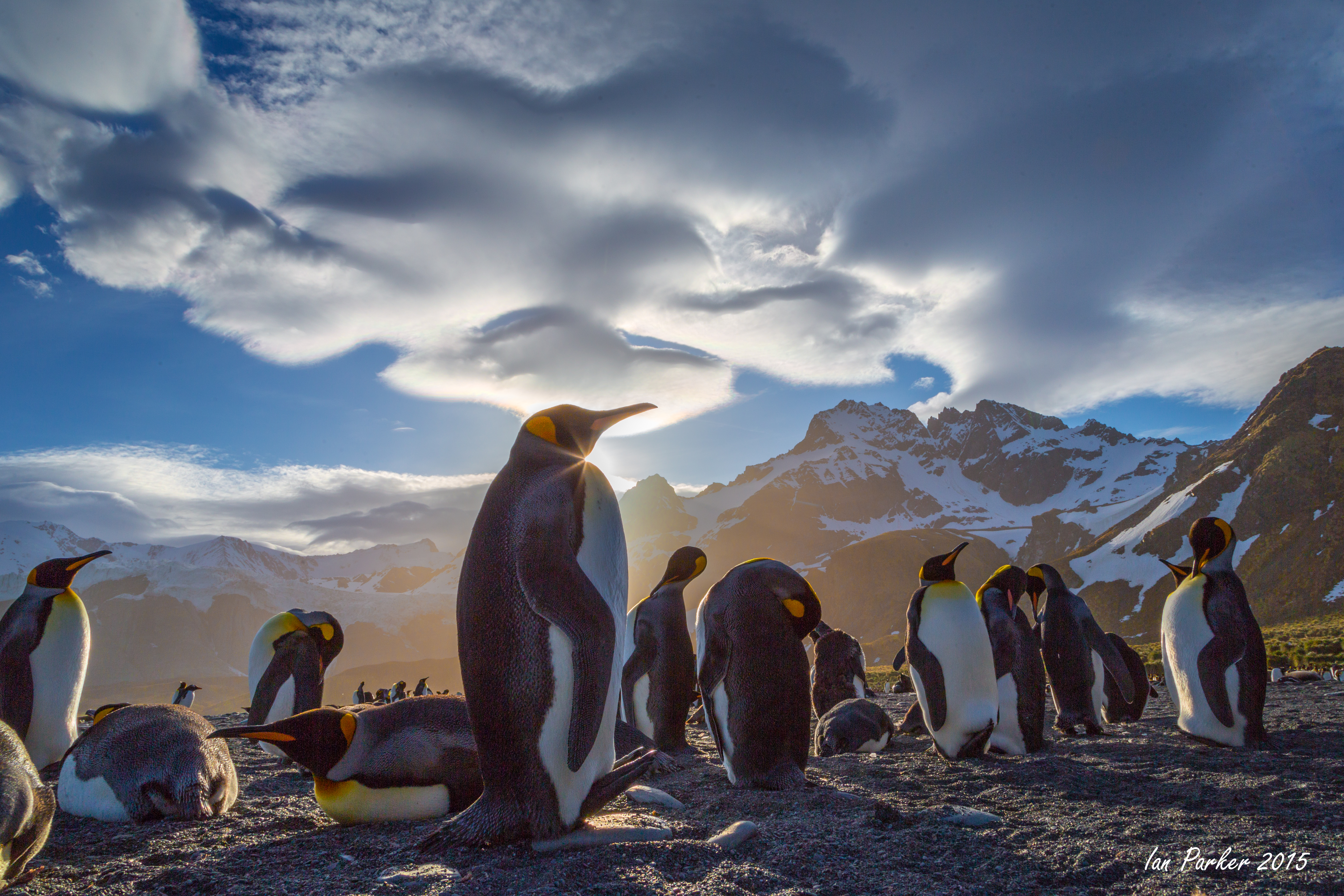
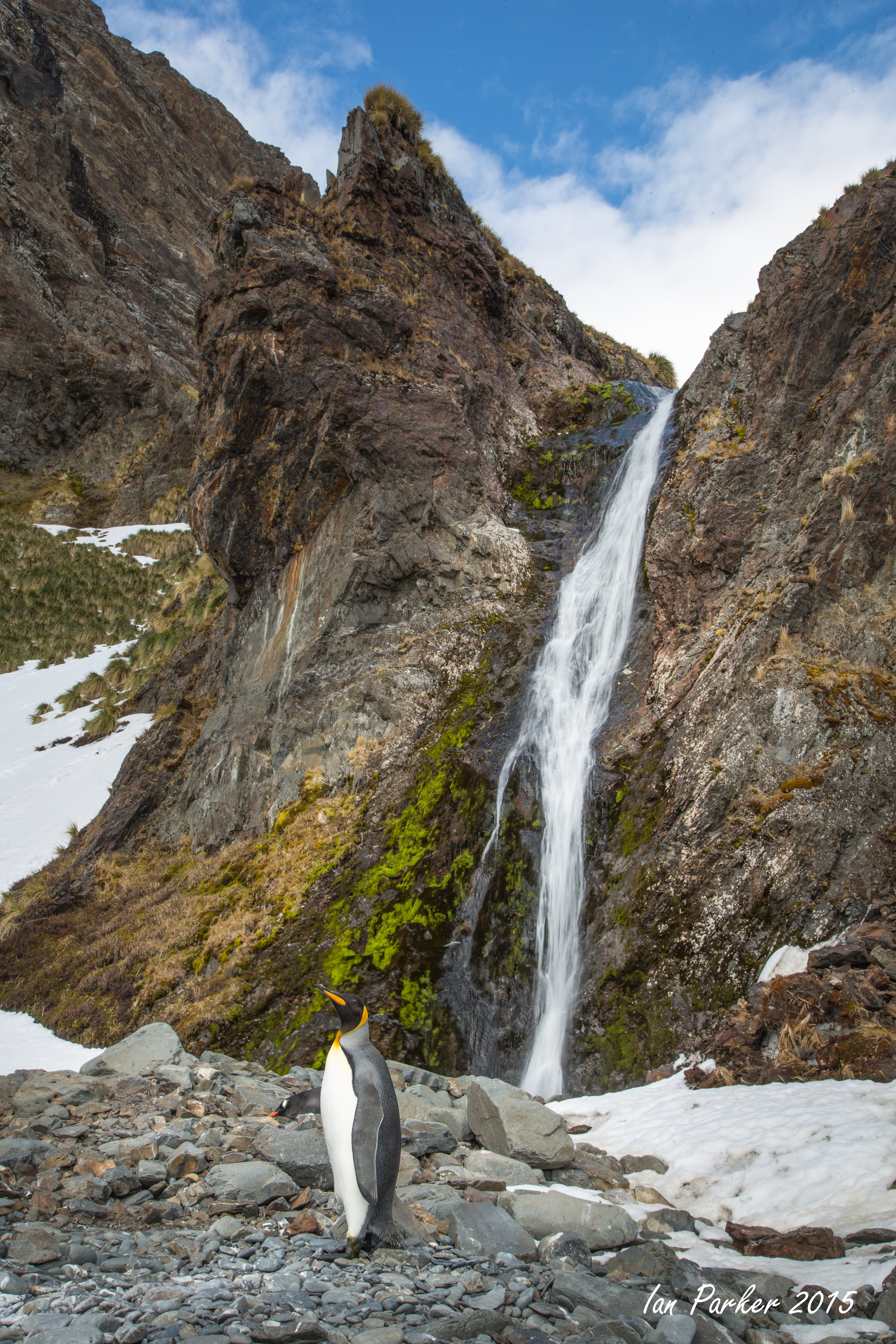
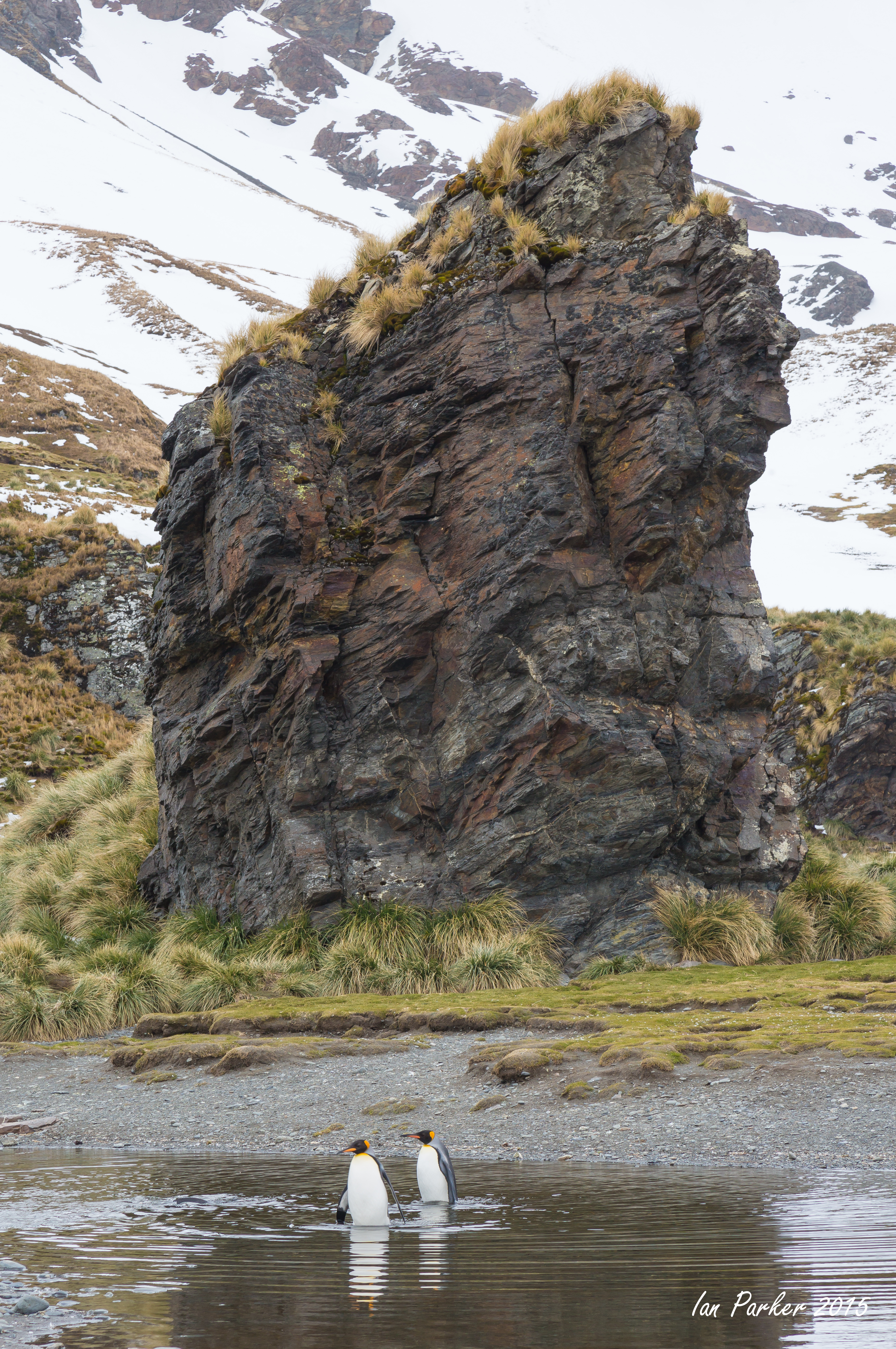
November 15 - Gold Harbour
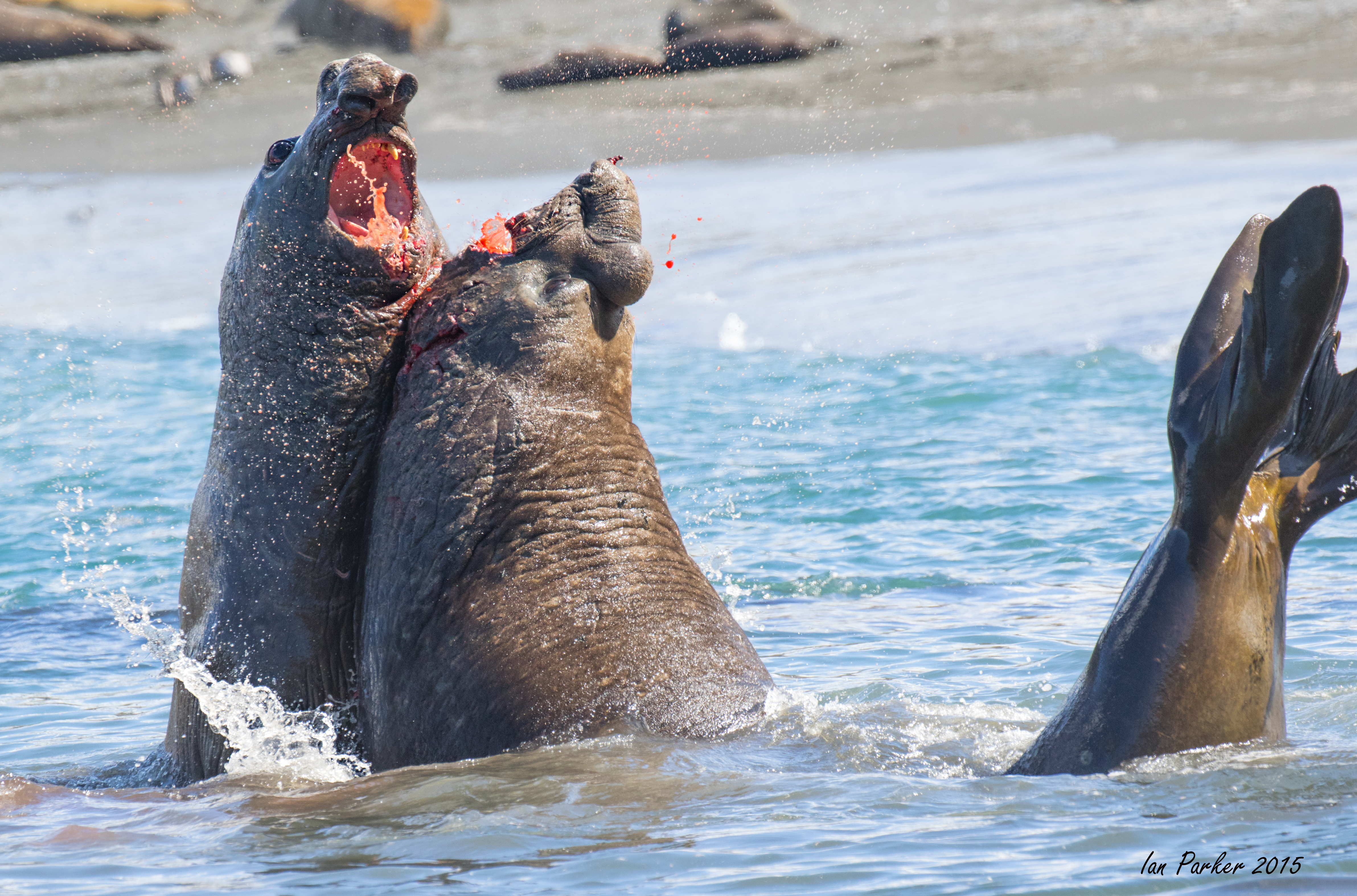
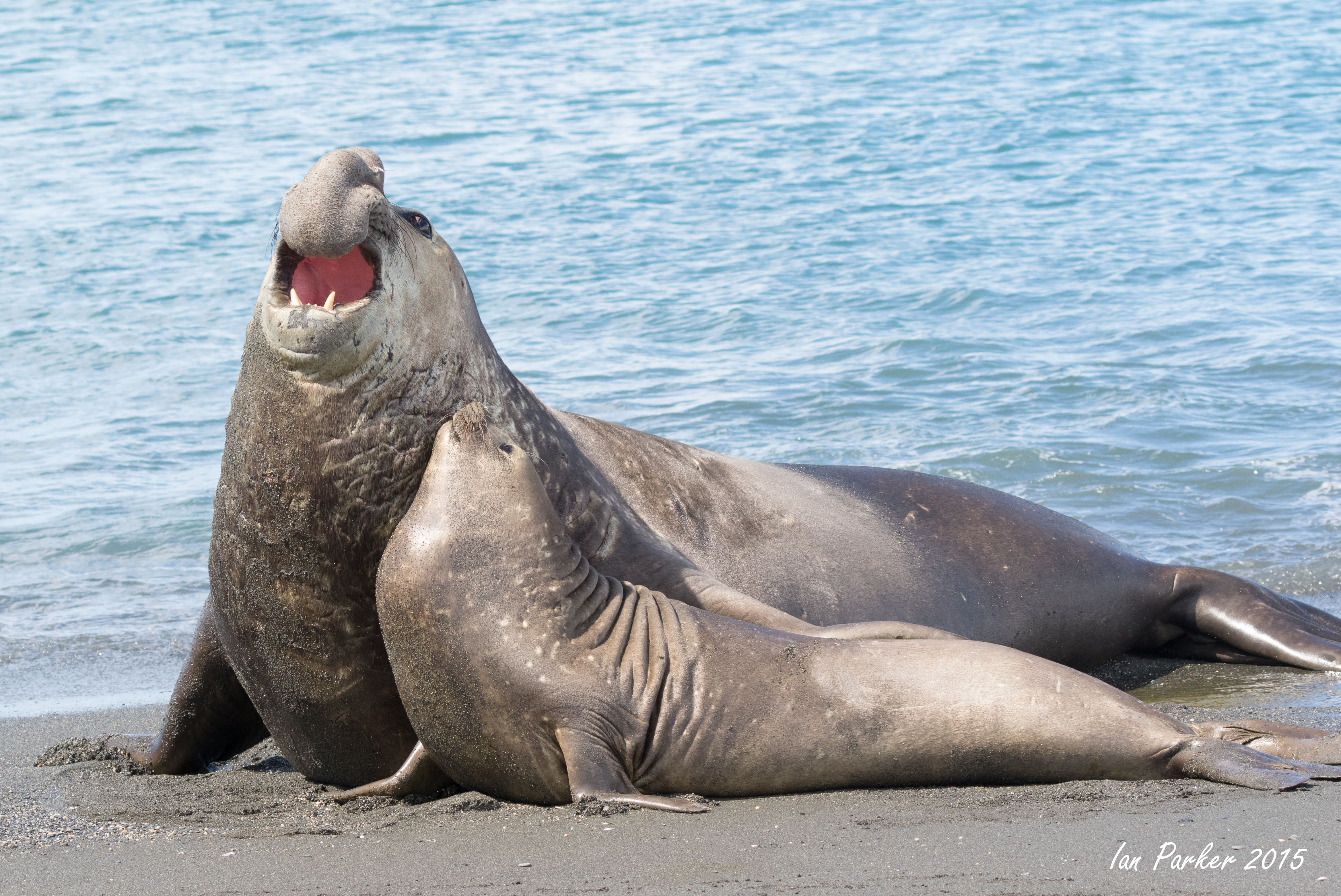
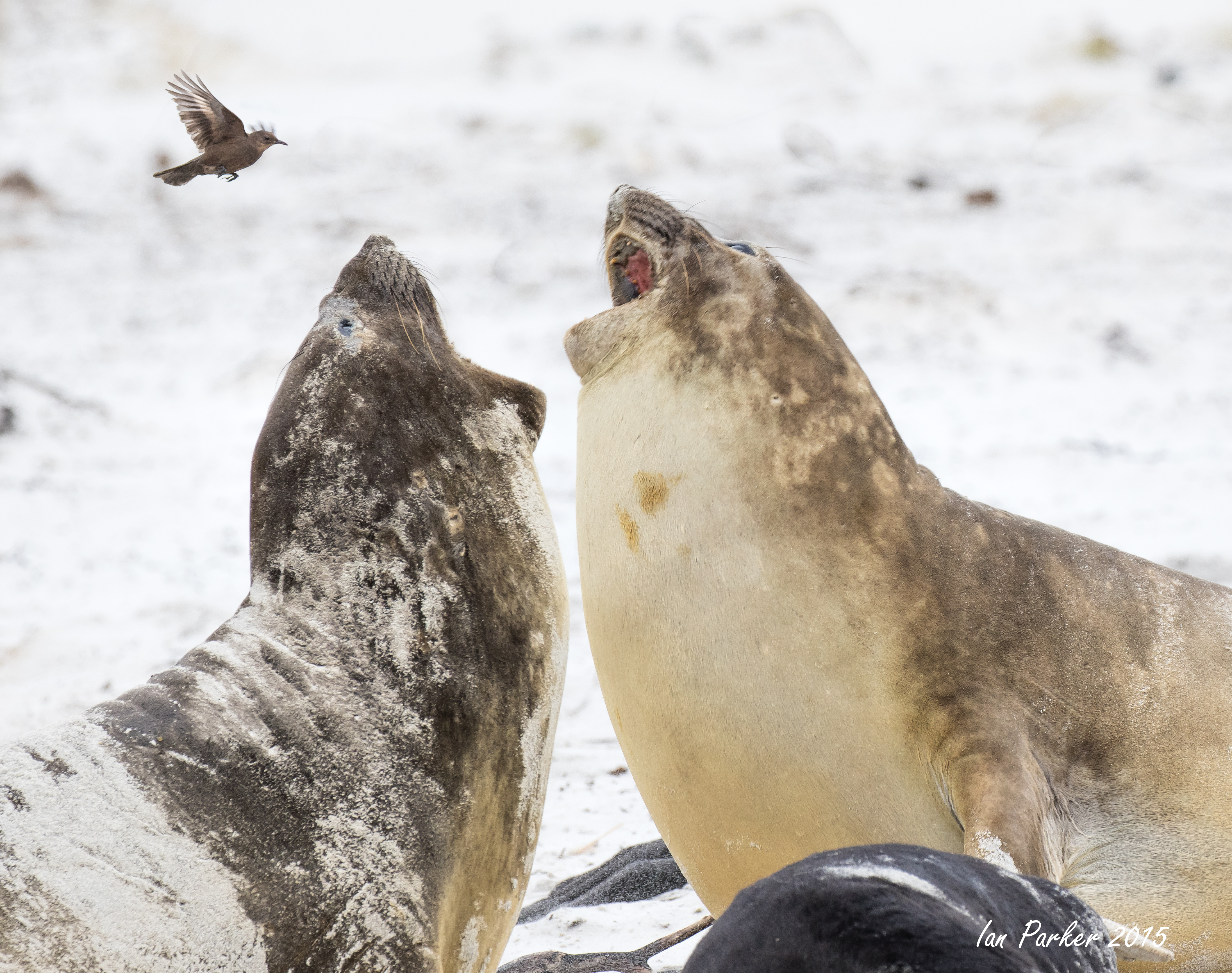
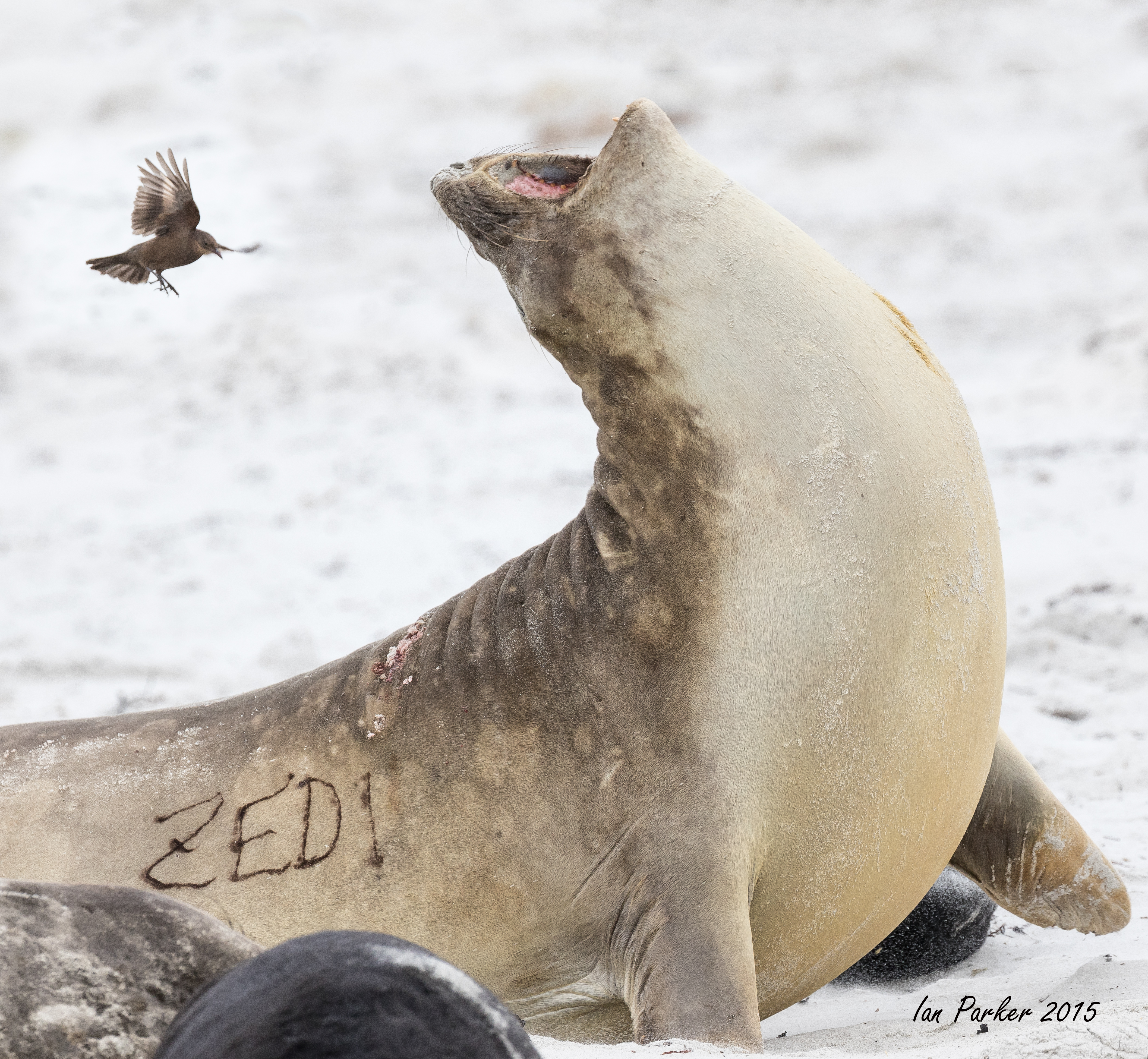
Beach masters, enormous bull elephant seals, are constantly on the lookout to guard their hareem of females from interlopers. A show of strength is usually sufficient to send any challenging bull back into the ocean, but here we witnessed a true battle. Exif data from my photos show that the fight lasted over 7 minutes, with the shedding of much blood.
November 13,14 - Saint Andrews Bay
Annie, with her pediatric neurologist hat on, noticed some penguins on the beach exhibiting movement disorders that looked like ataxia. Movies of ataxic penguin ataxia. Click here to play movies MOVIE1 MOVIE2 MOVIE3
At the northern end of Saint Andrews Bay, penguins must dive from a rock shelf to continue to the beach. Sometimes they manage this elegantly, sometimes not...
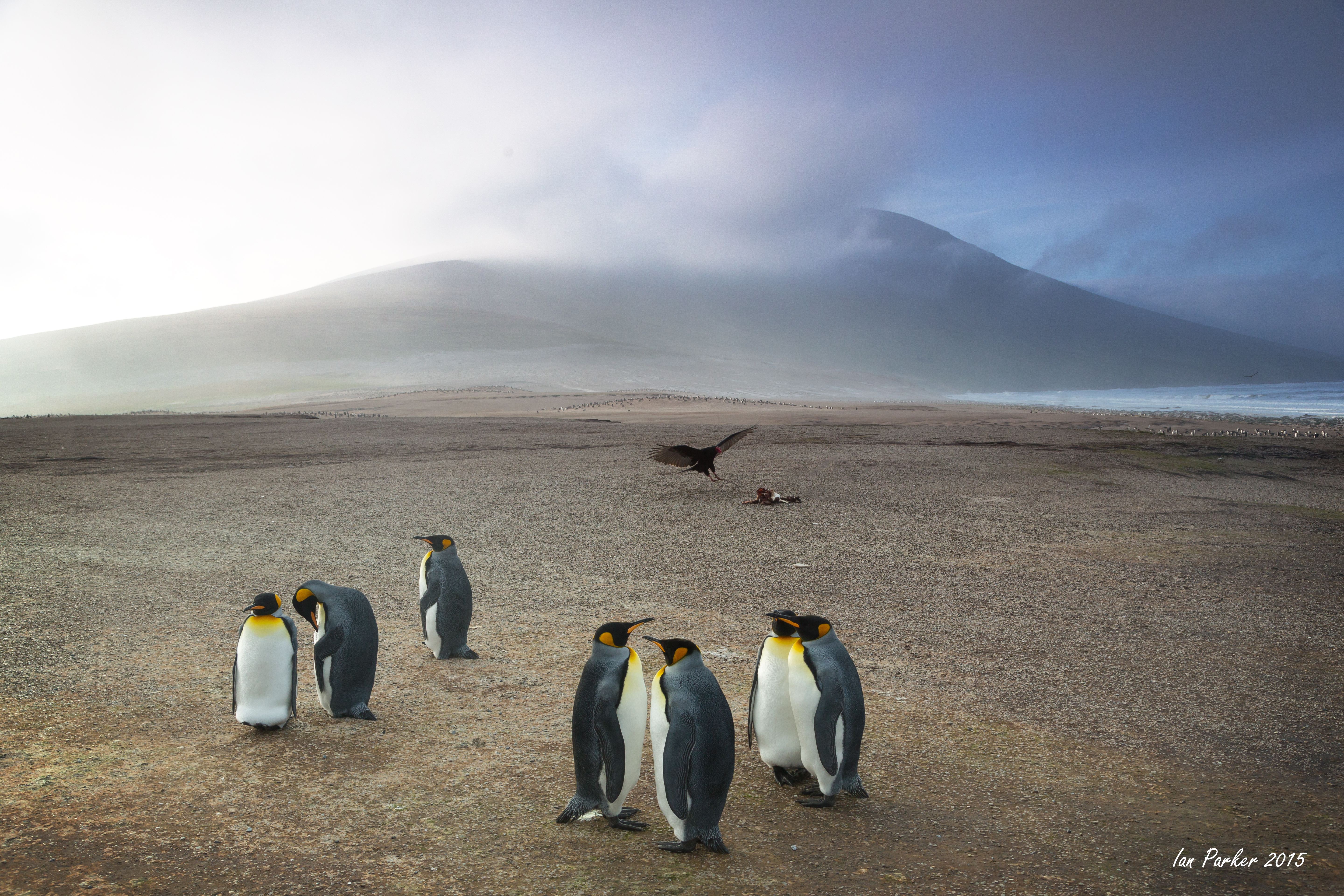
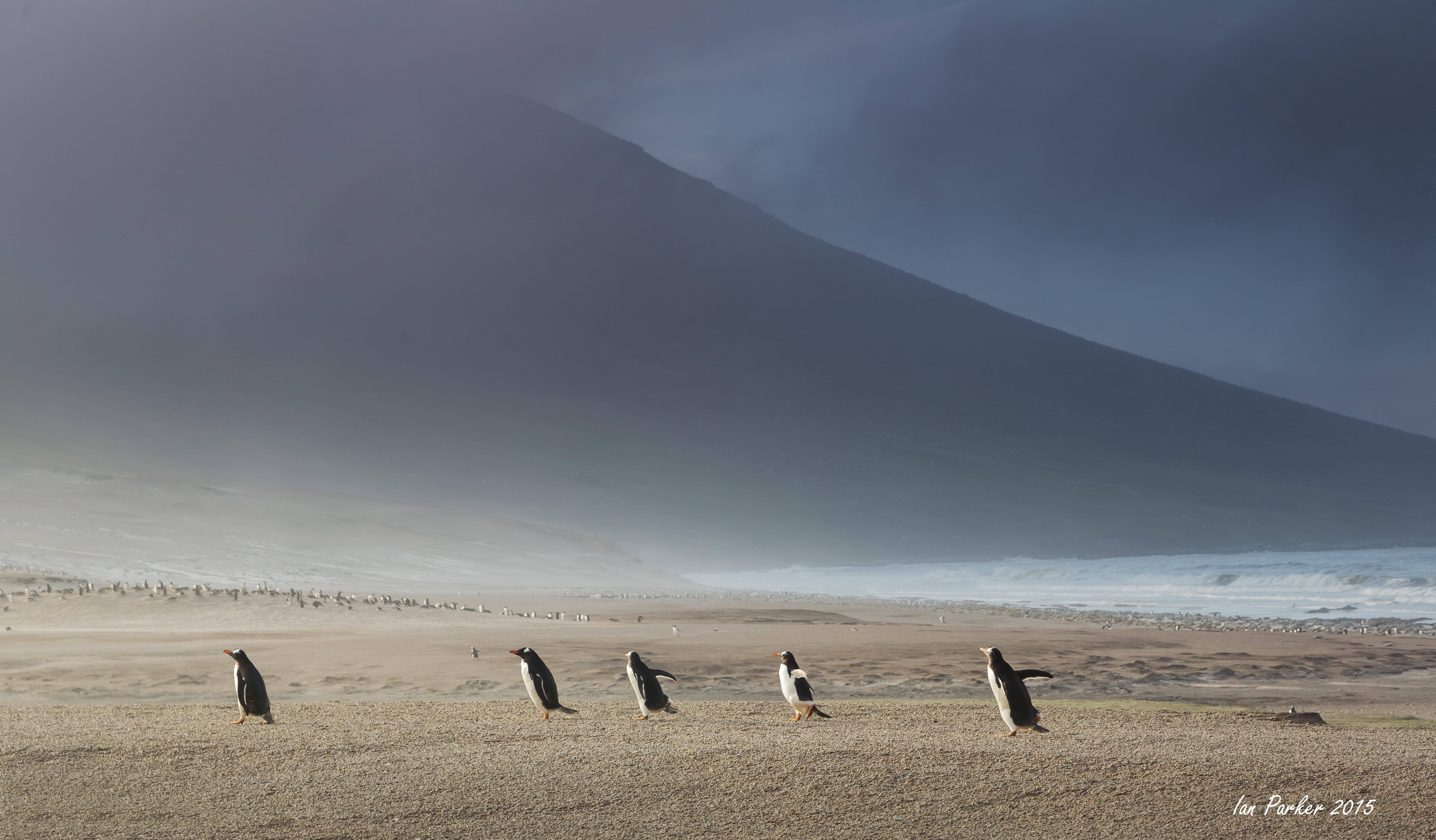
In summer, the beach at St. Andrews bay is said to host the greatest density of mammalian and avian biomass on the planet. I can believe that!
November 12 - Ocean Harbour
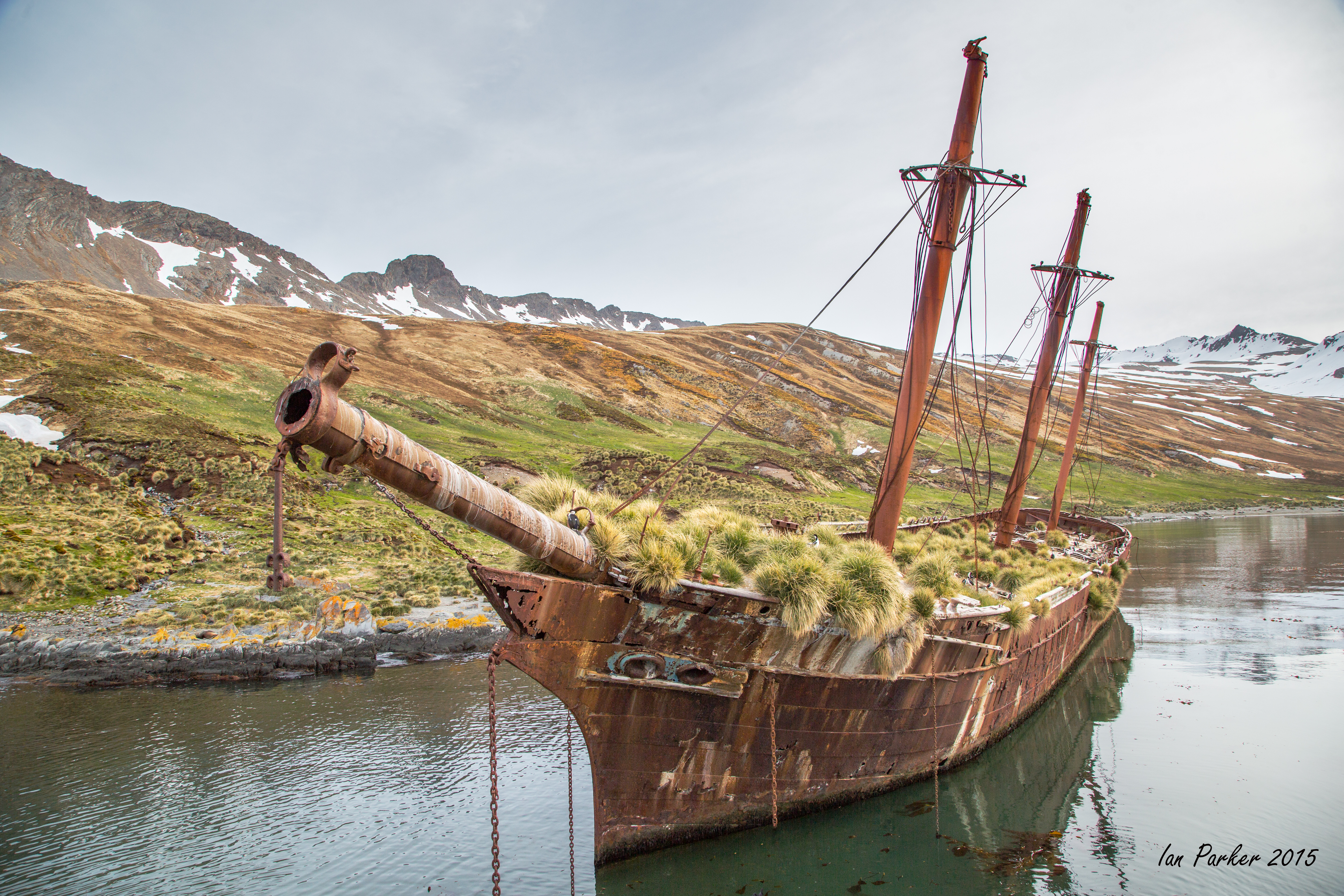
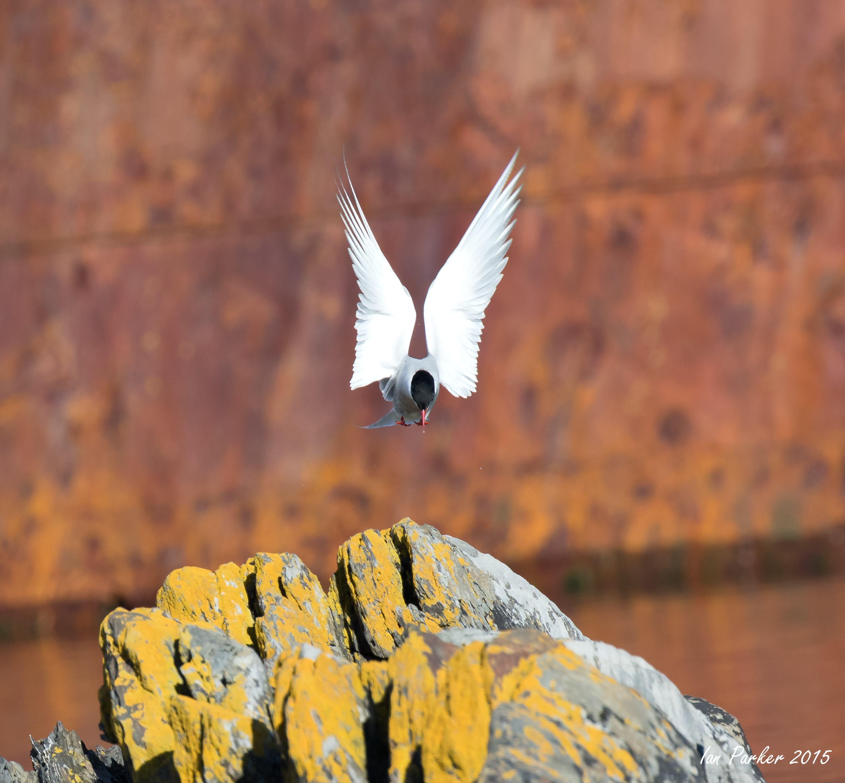
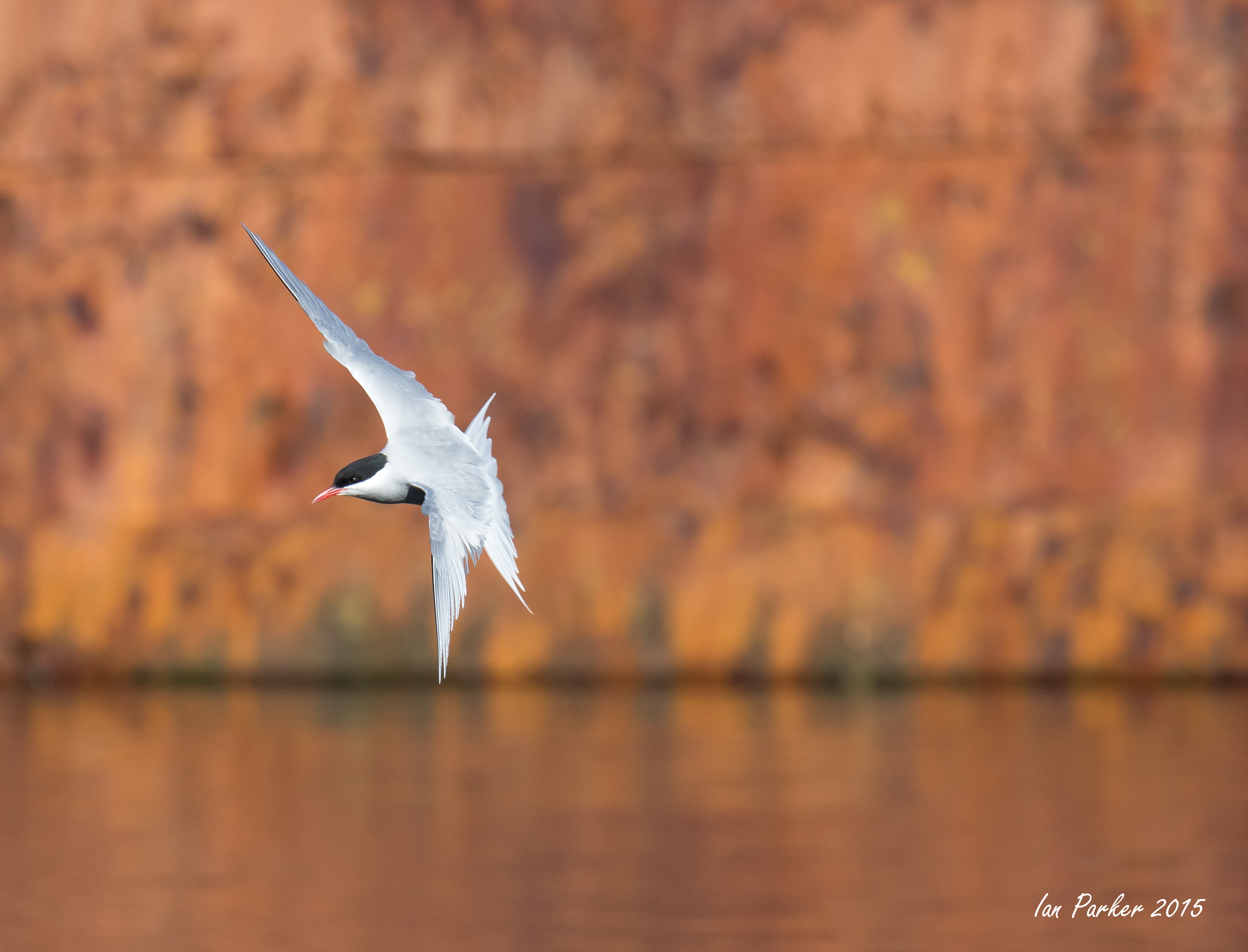
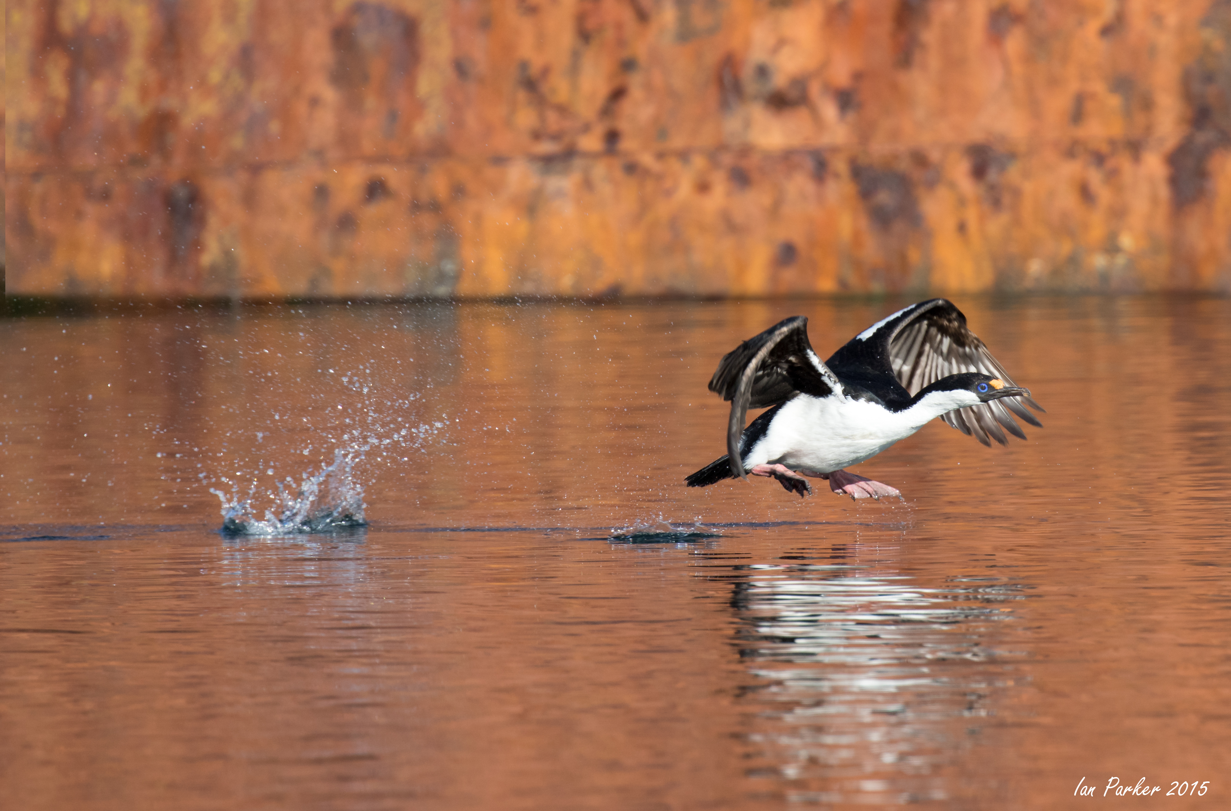
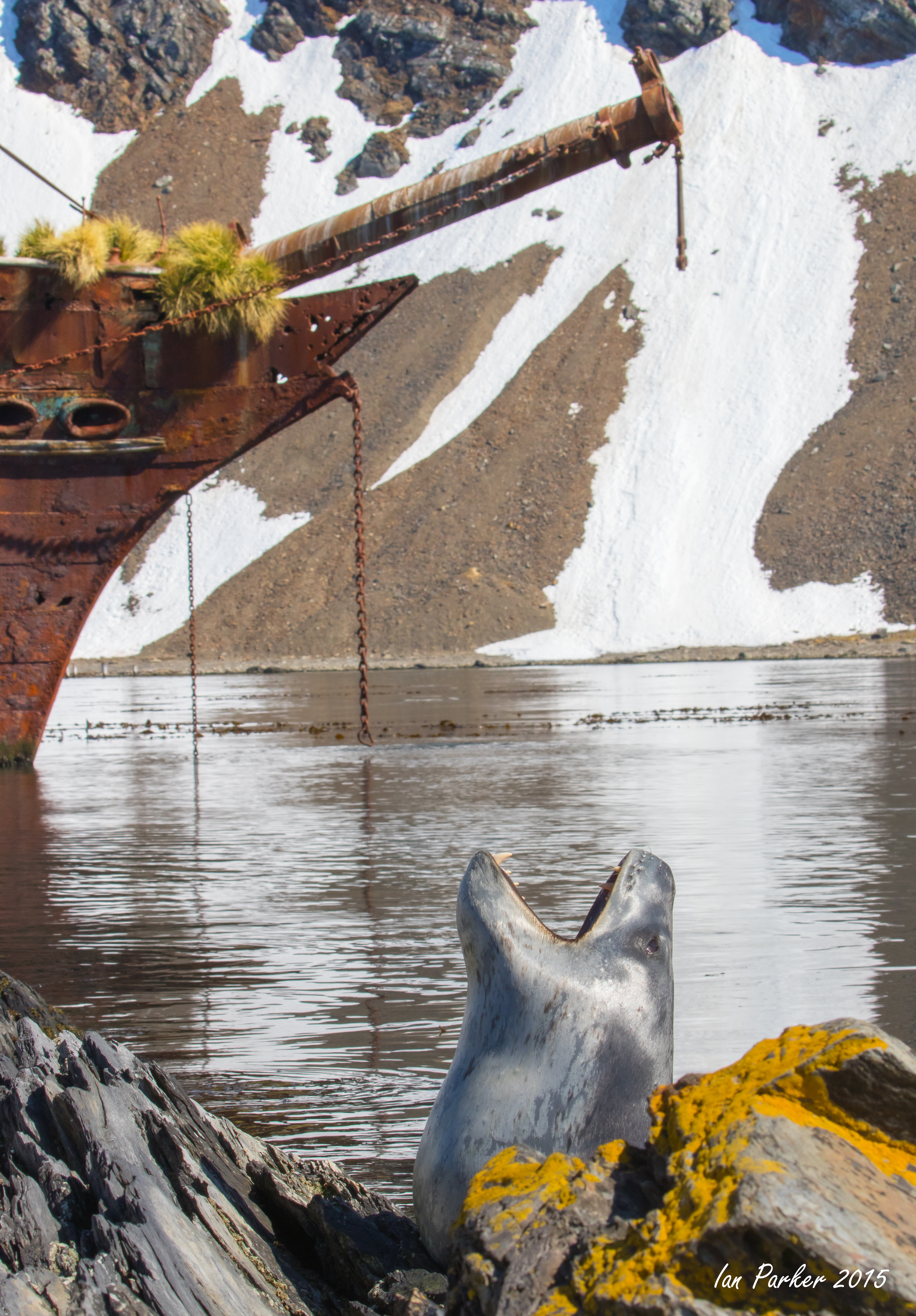
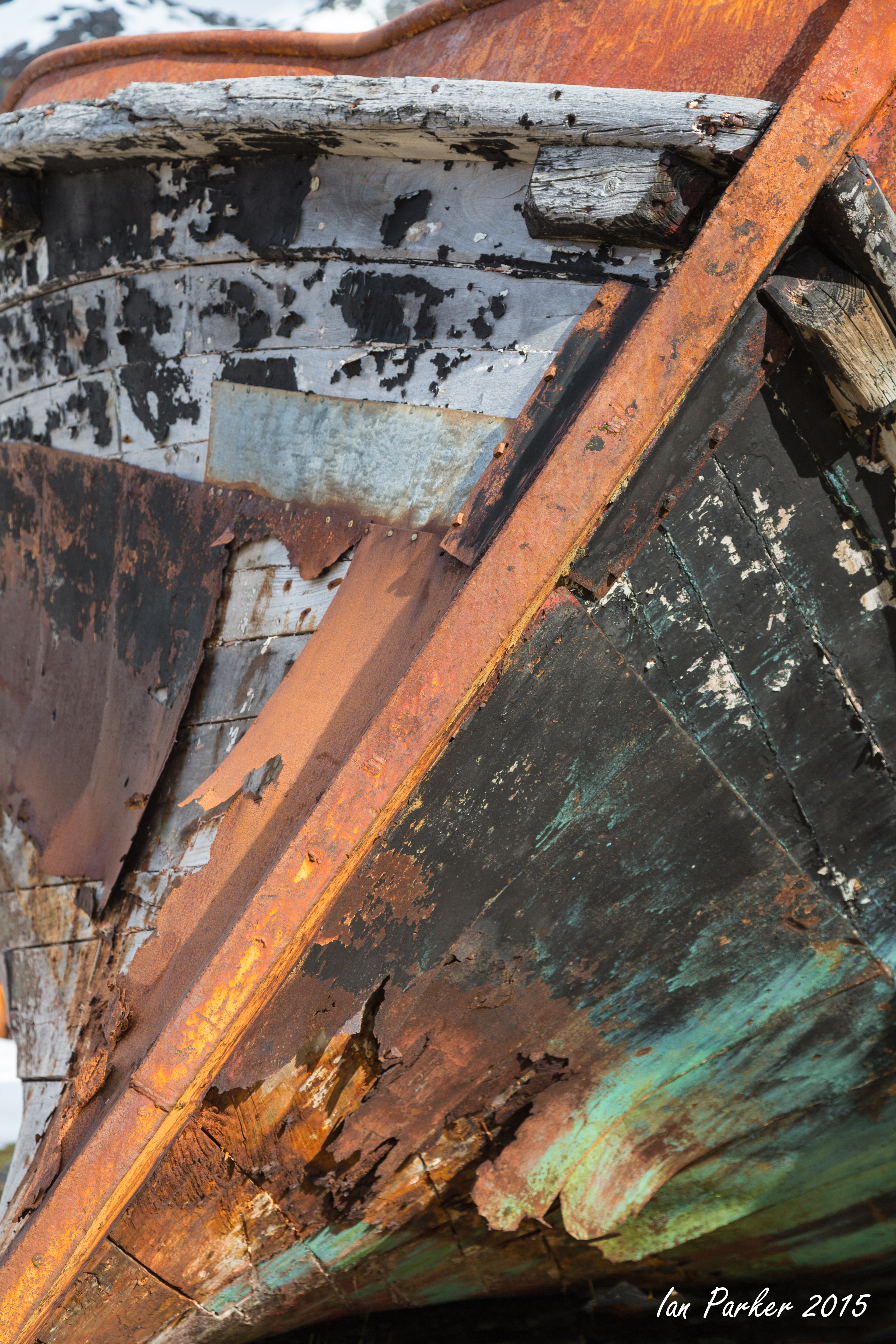
Annie communed with the elephant seal weaners near the landing beach, while I walked across to the wreck of the Bayard. The rusting hull was glowing in the sunlight and it, together with its reflection in the water, made a beautiful red backdrop. I found a comfortable rock on which to rest, and spent several happy hours photographing birds and seals as they flew and swam past.
"The Bayard was a three masted, 67 metre long, 1,028 ton, sailing ship built by T. Vernon and Son, Liverpool for the Hall Line in 1864. In 6 May 1885, Bayard hit an iceberg,while on a voyage from Marseilles to St. Pierre. The ship lost her stern, bowsprit, jib-boom, foremast, topgallantmast and yard, but reached her destination on 23 May, leaking badly.She was later used as a coaling ship for the whaling station in South Georgia. Bayard lost her mooring at the coaling pier in Ocean Harbour during a severe gale on 6 June 1911 and ran aground on the rocks on the southern side of the bay, where she rests there today, as a breeding site for blue-eyed shags." [ Wikipedia]
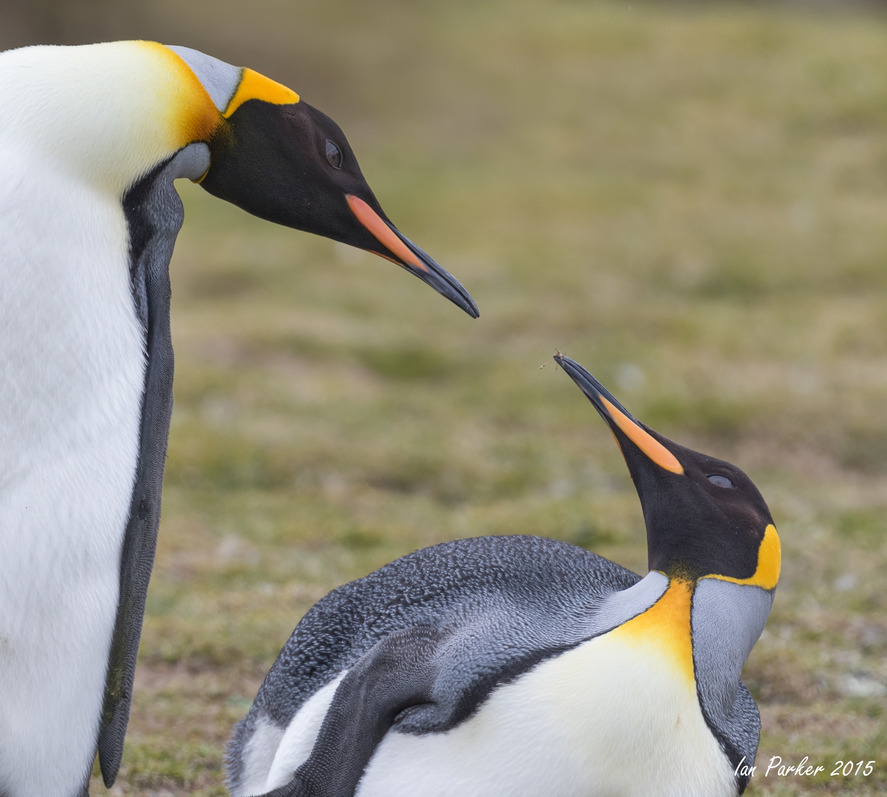
November 11 - Godthull
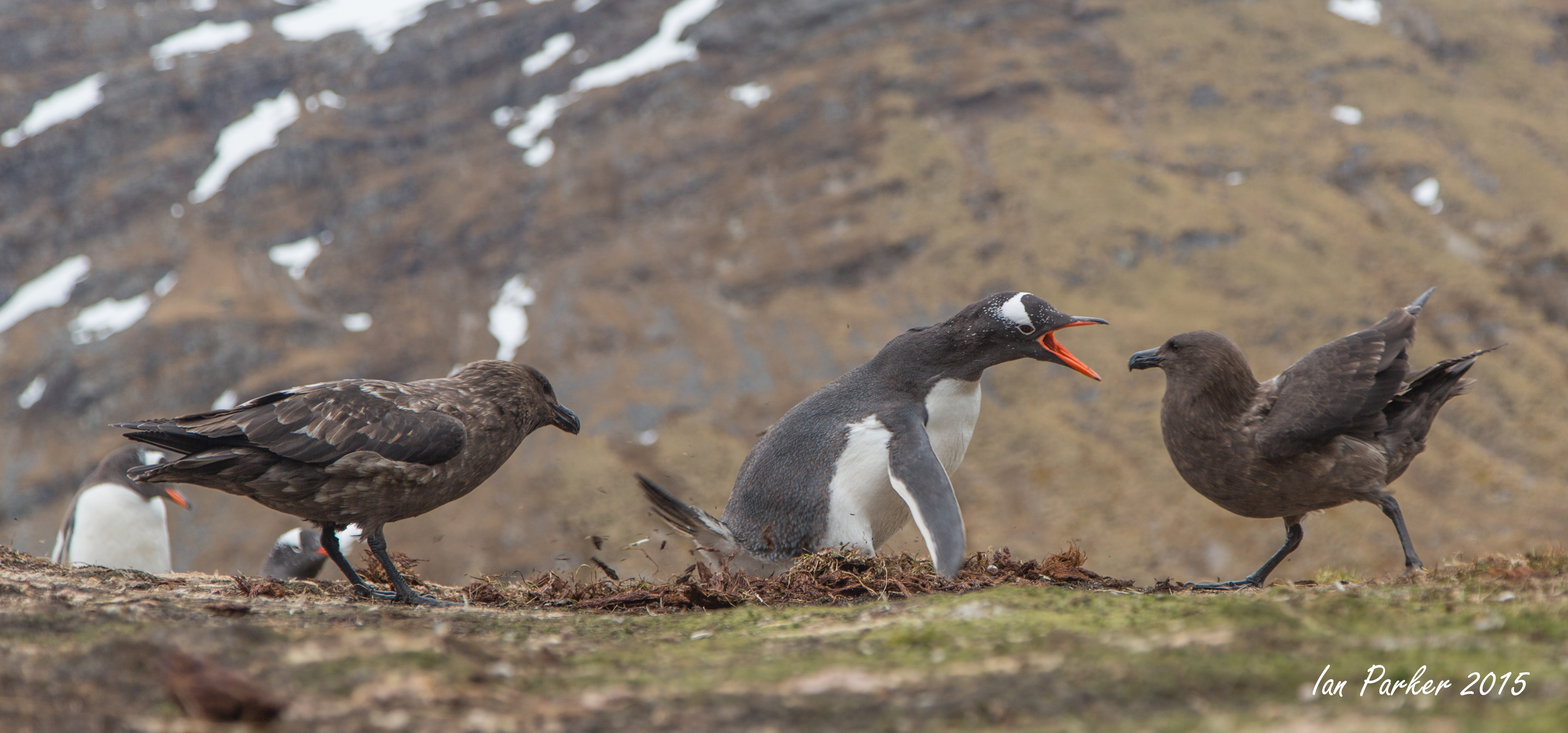
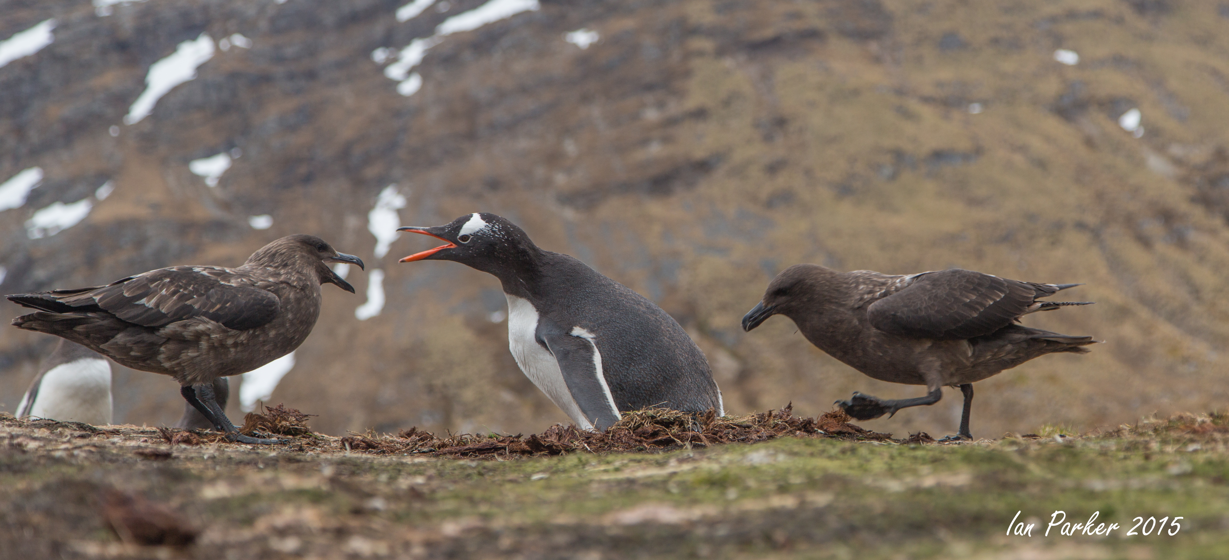
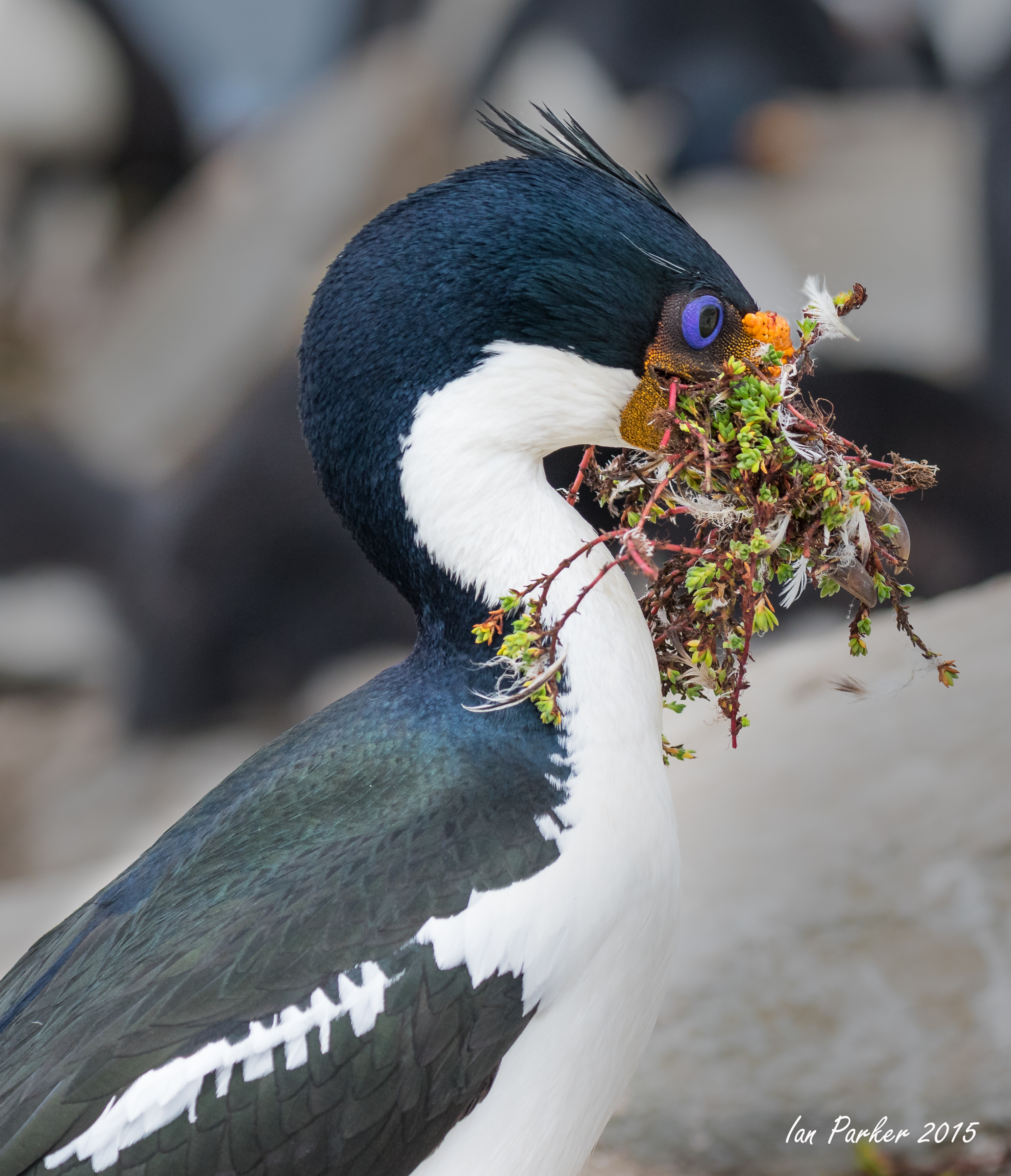
Skuas are very intelligent birds and work together in pairs to steal penguin eggs. One attacks from the front to distract the penguin, while the other tries to scoop out the egg from behind the penguin. The series of photos below were taken over a five minute interval during which a gentoo penguin valliantly tried to protect its lone egg and drive off the skuas, but ultimately failed. The egg is visible, flying off to the right in the final photo, and was shared by both birds.
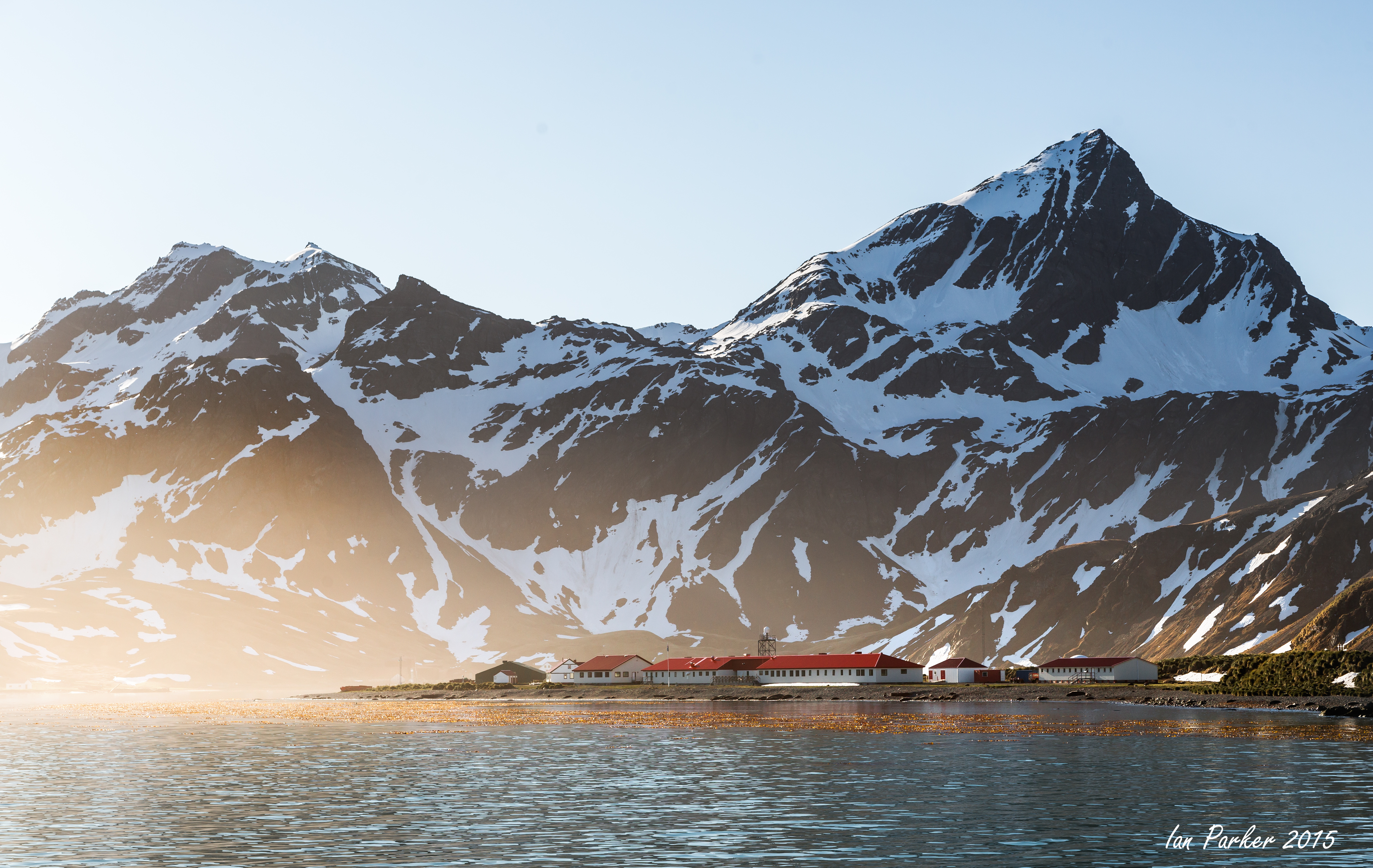
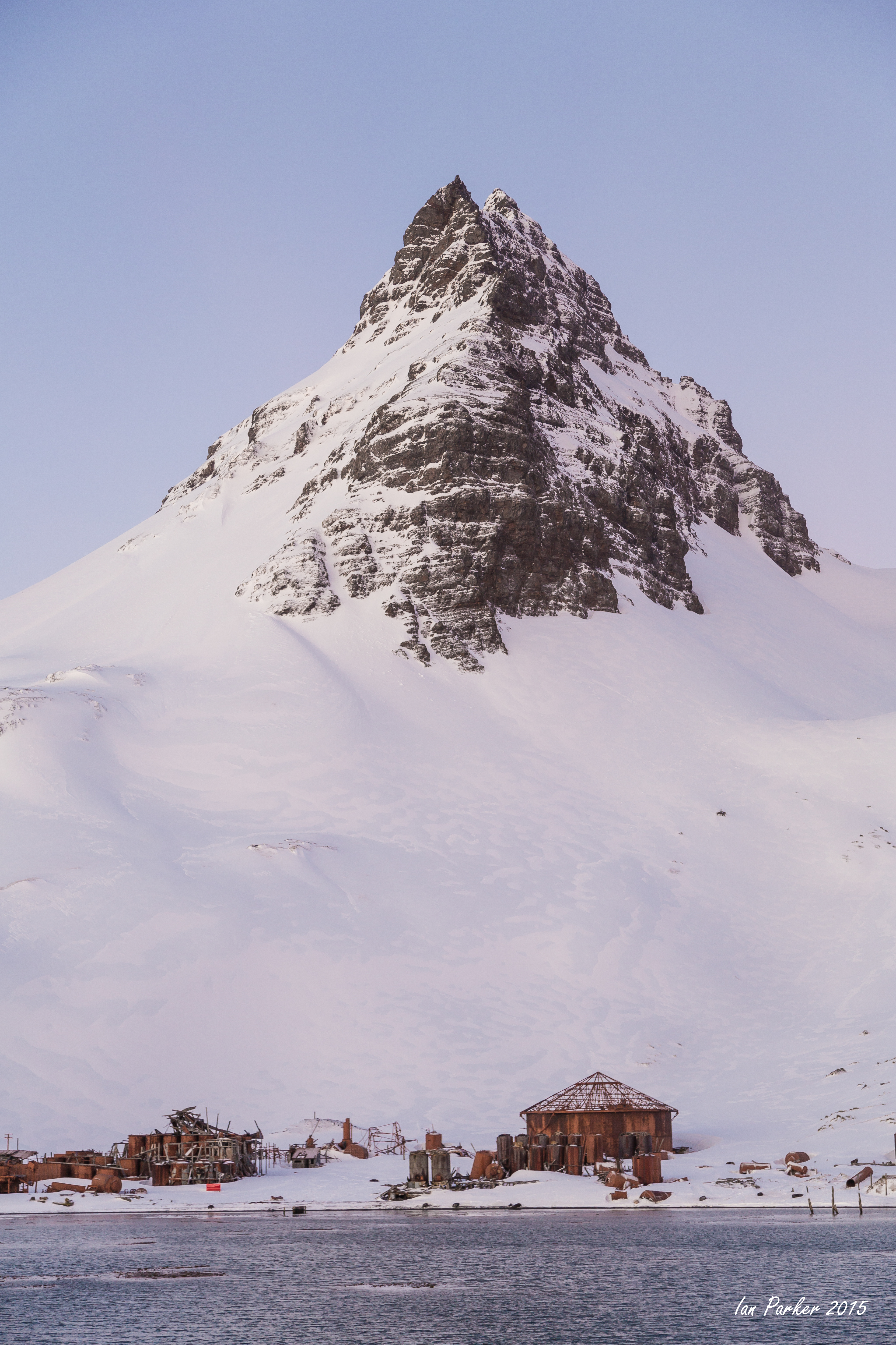
November 11 - Grytviken
Industrial archaeology of the abondoned, but now sanitized whaling station.
On a sunny day the abandoned whale oil tanks take on a glow of reflected light reminiscent of Utah slot canyons.
Some small-scale textures
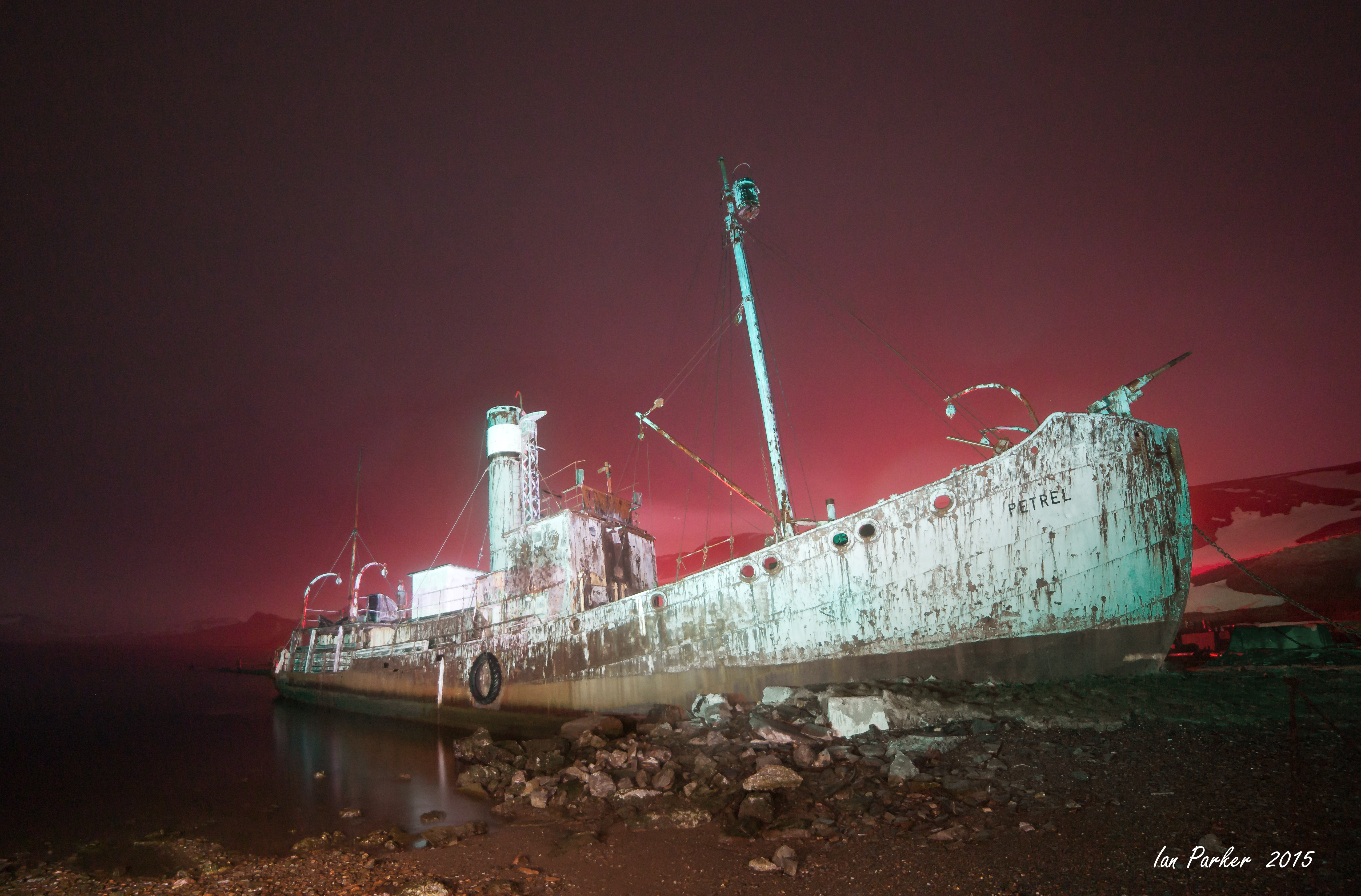
The Petrel.
"The Petrel is the best-preserved whale-catcher at South Georgia. She was built in 1929 at Nylands Verksted in Oslo. She is 244.8 gross tons and 31.1 m (115 feet) long. Petrel was withdrawn from the whaling fleet at Grytviken in 1956 and converted to a sealing vessel the following year. This involved removing her whale-winch and replacing it with an ordinary cargo winch, creating a large cargo hatch (for loading the seal blubber), removing the gun platform and the cat-walk that connected it with the bridge on the starboard side. Petrel was one of the first catchers to be equipped with a cat-walk, which was introduced in 1926. The line-blocks were removed from the mast and a derrick installed. She was capable of 11 knots from her 810 indicated horse-power triple-expansion engine. Her funnel has been re-painted in the Salvesen (Leith Harbour) colours, but when she was operated by Grytviken she had blue and white bands on her funnel." [South Georgia Whaling Museum]. The Petrel was restored and the whale gun replaced by the British garrison stationed in South Georgia after the Falklands war. A 1991 photo (below) shows her afloat with spick paintwork, but she is now grounded and undergoing rapid, if picturesque decay.
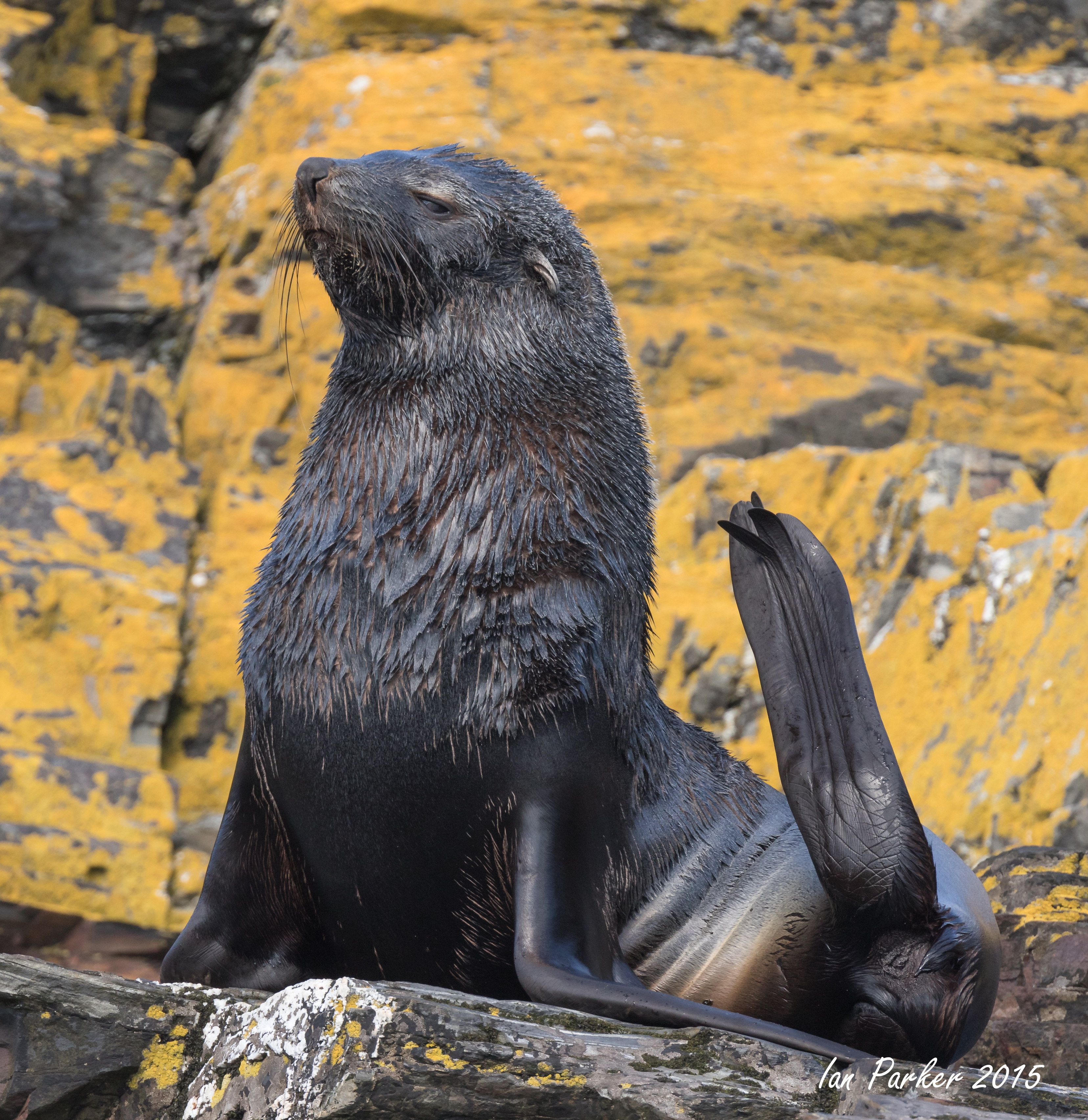
November 10 - Hercules Bay and Leith Harbour
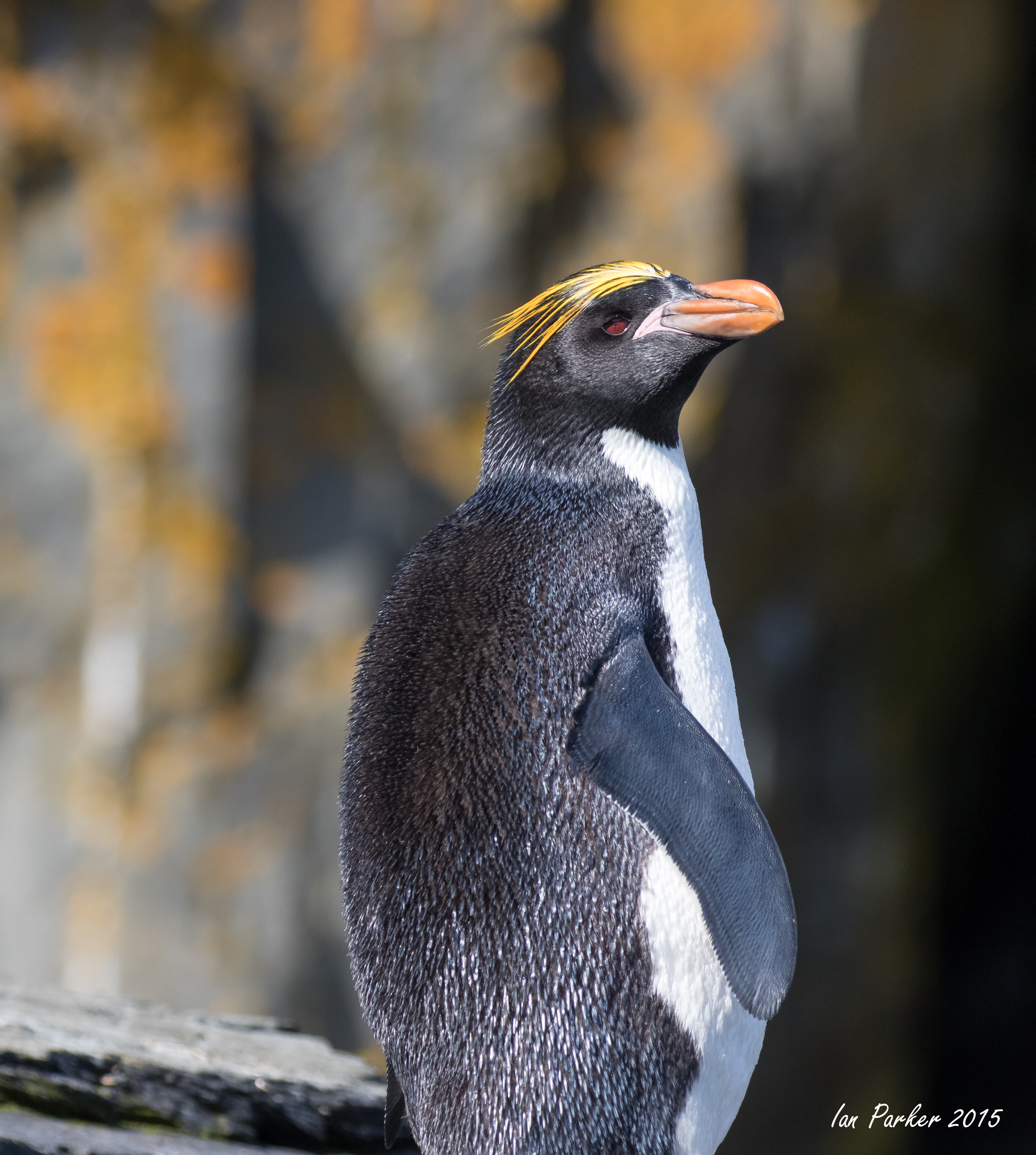
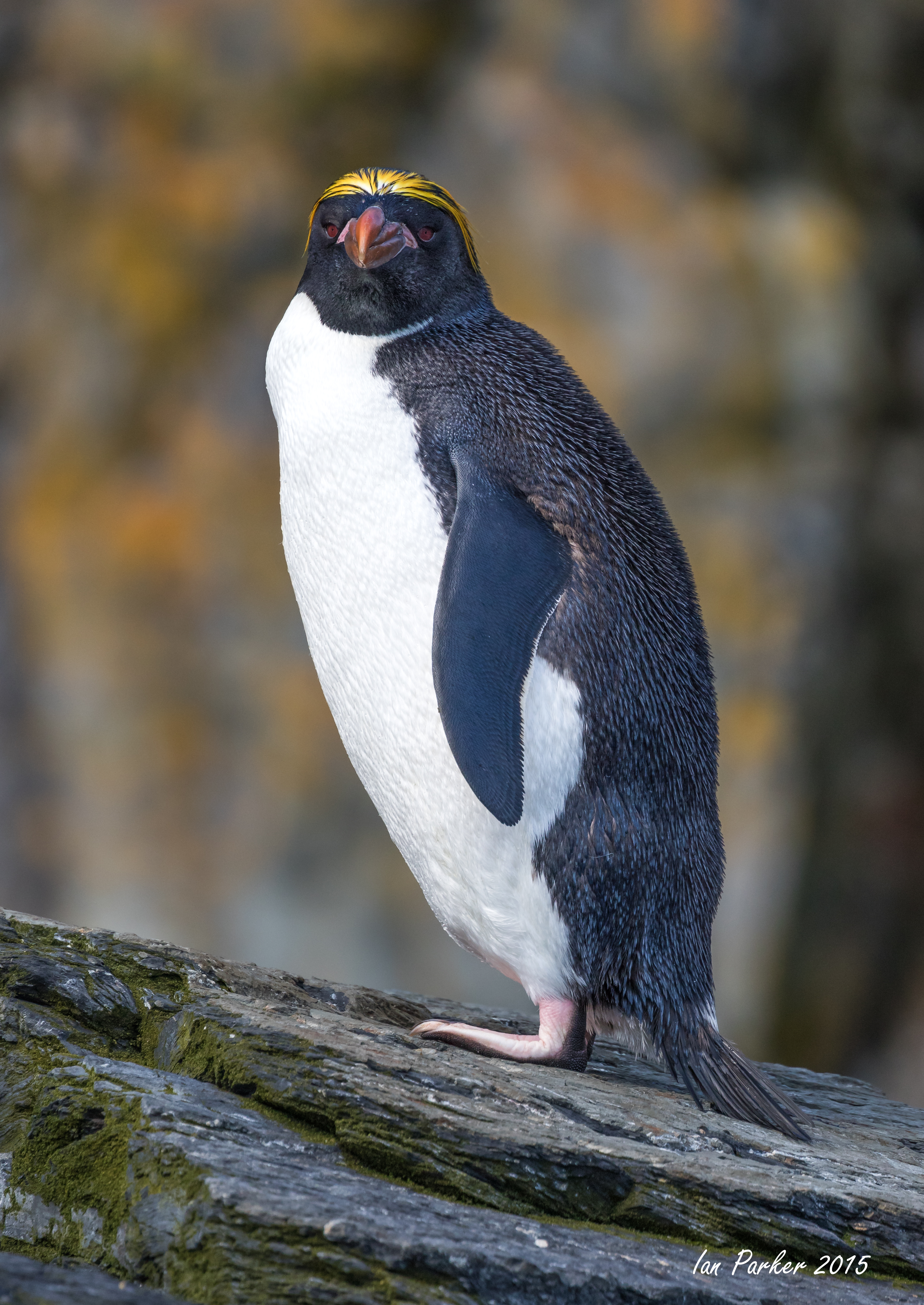
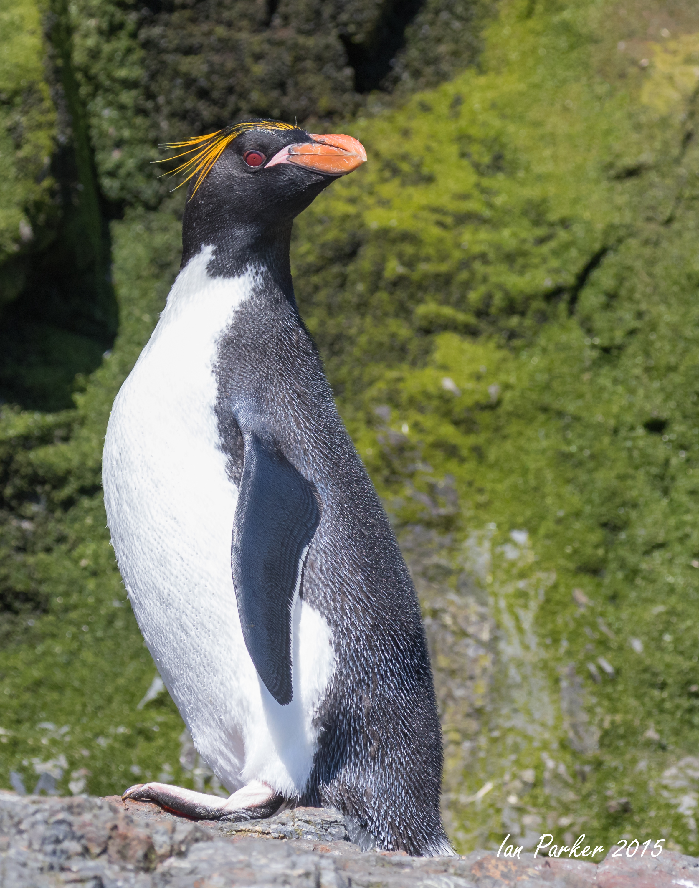
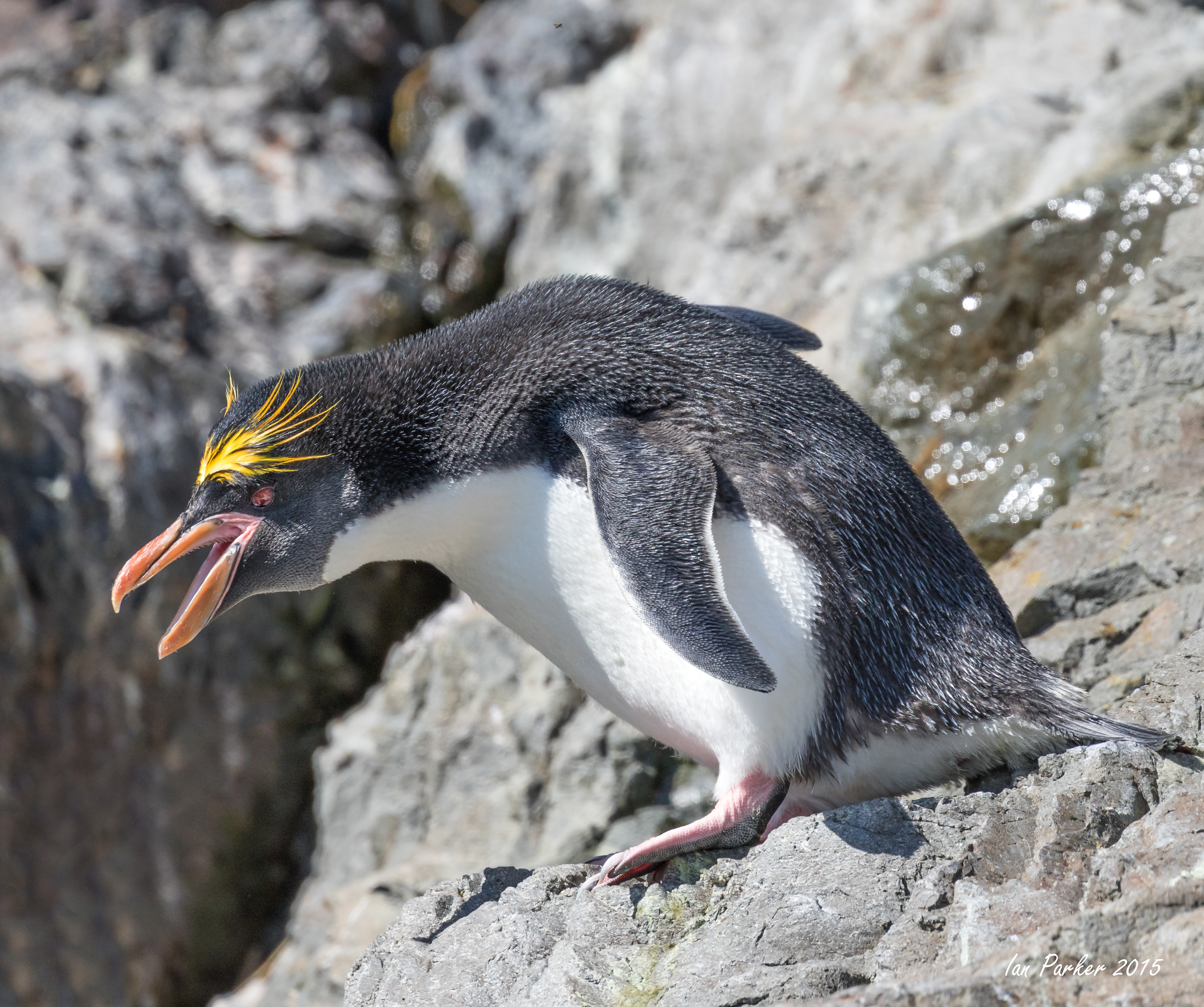
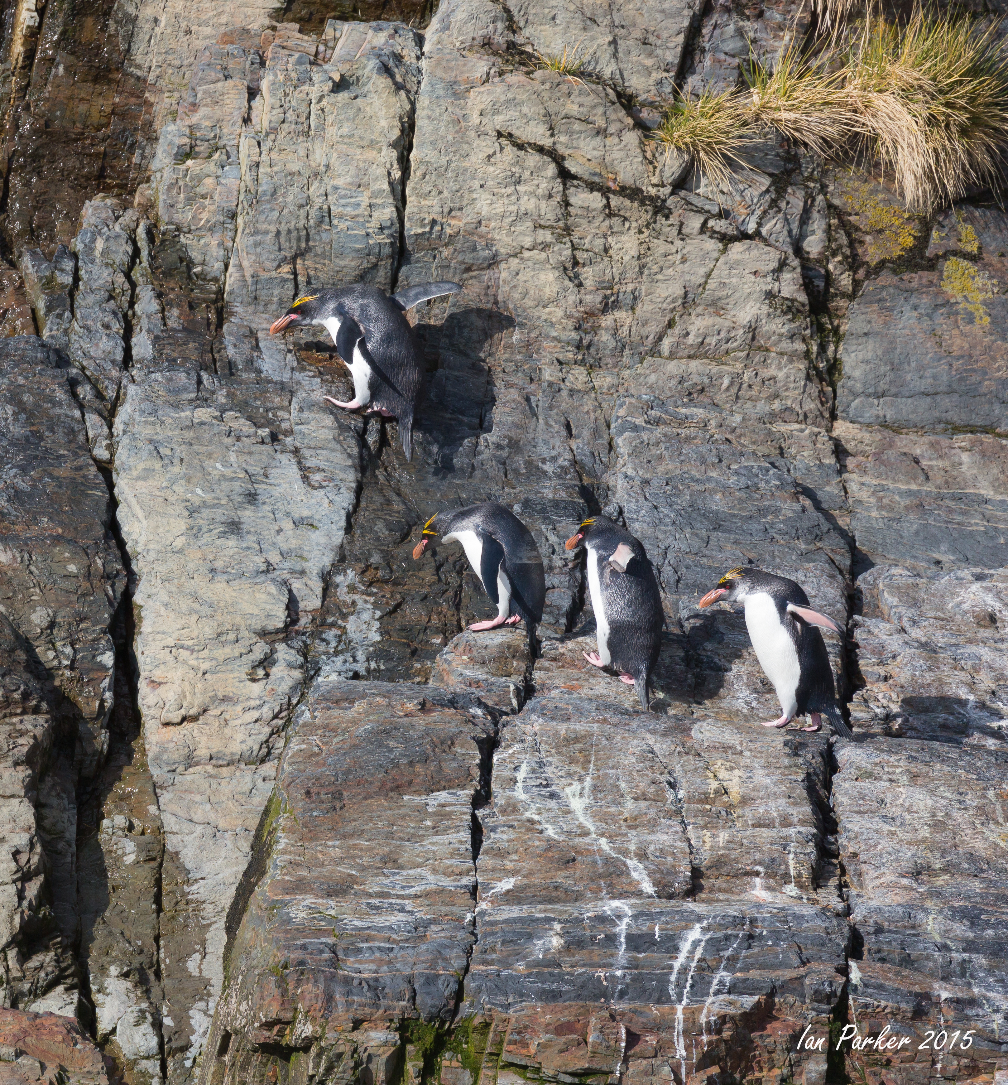
A landing and Zodiac cruise, mostly for macaroni penguins
November 9 - Prince Olav Harbour and Fortuna Bay
This was the first day after we arrived at South Georgia when the weather improved to give good skyskapes.
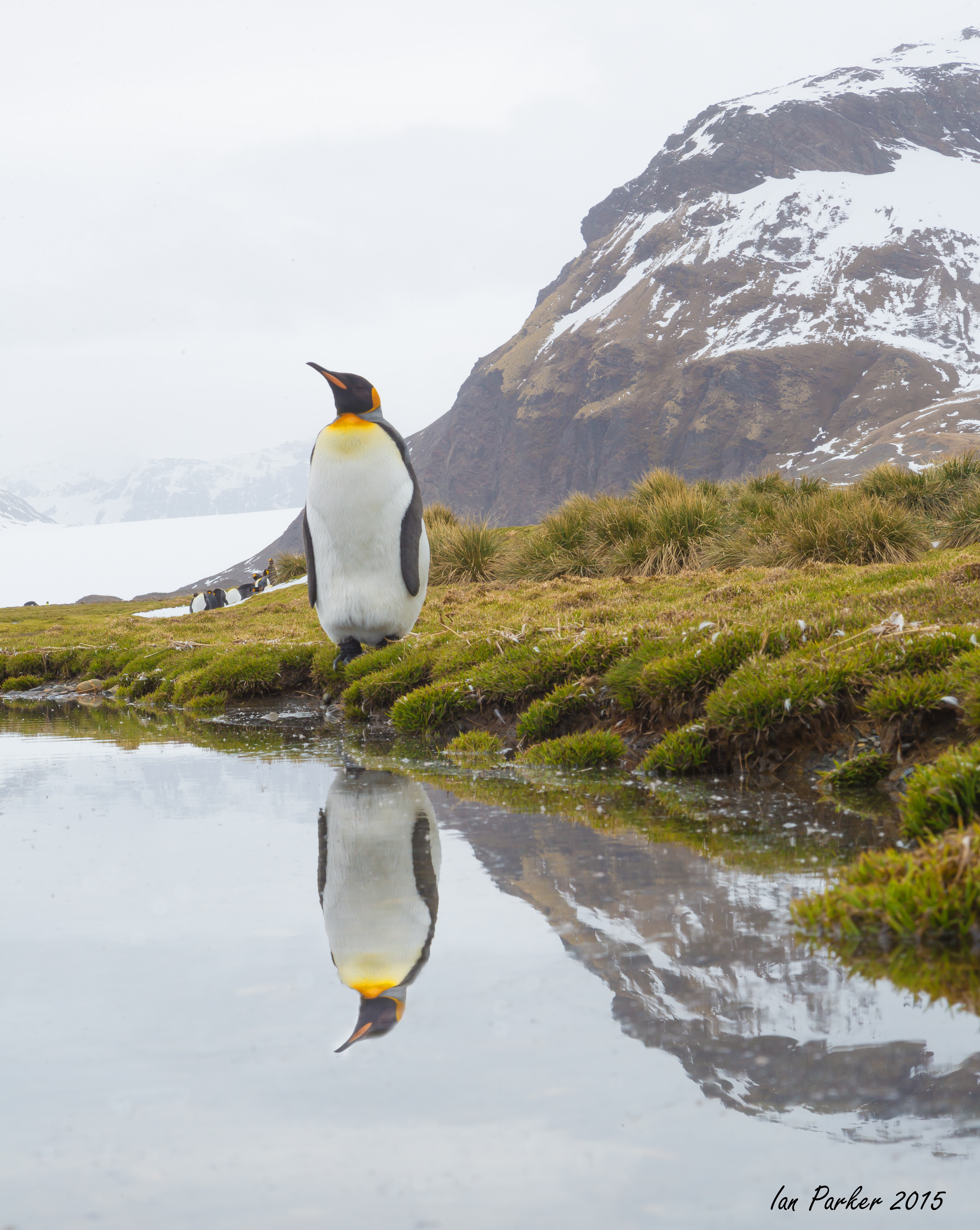
November 8 - Salisbury Plain
The pain was patterned by remaining snow. Strangely, given the seemingly inclement weather, the king penguins arrayed themselves along the snow to cool off through their feet.
November 7 - Prion Island.
Prion Island is a Specially Protected Area owing to its historically rat-free status, and the best place for visitors to view wandering albatross. However, I don't seem to have much luck, and this visit was hampered by strong winds making it difficult to even stand upright. Just a few photos of giant petrels to show...
November 6: Right Whale Bay, our next landing after continuing down the east coast of the island.
|
Penguins lost in the landscape: Right Whale Bay, South Georgia
|
King penguin group on snow: Right Whale Bay, South Georgia |
Penguins on sunlit snow under grey skiesKing penguin: Right Whale Bay, South Georgia
|
|
|
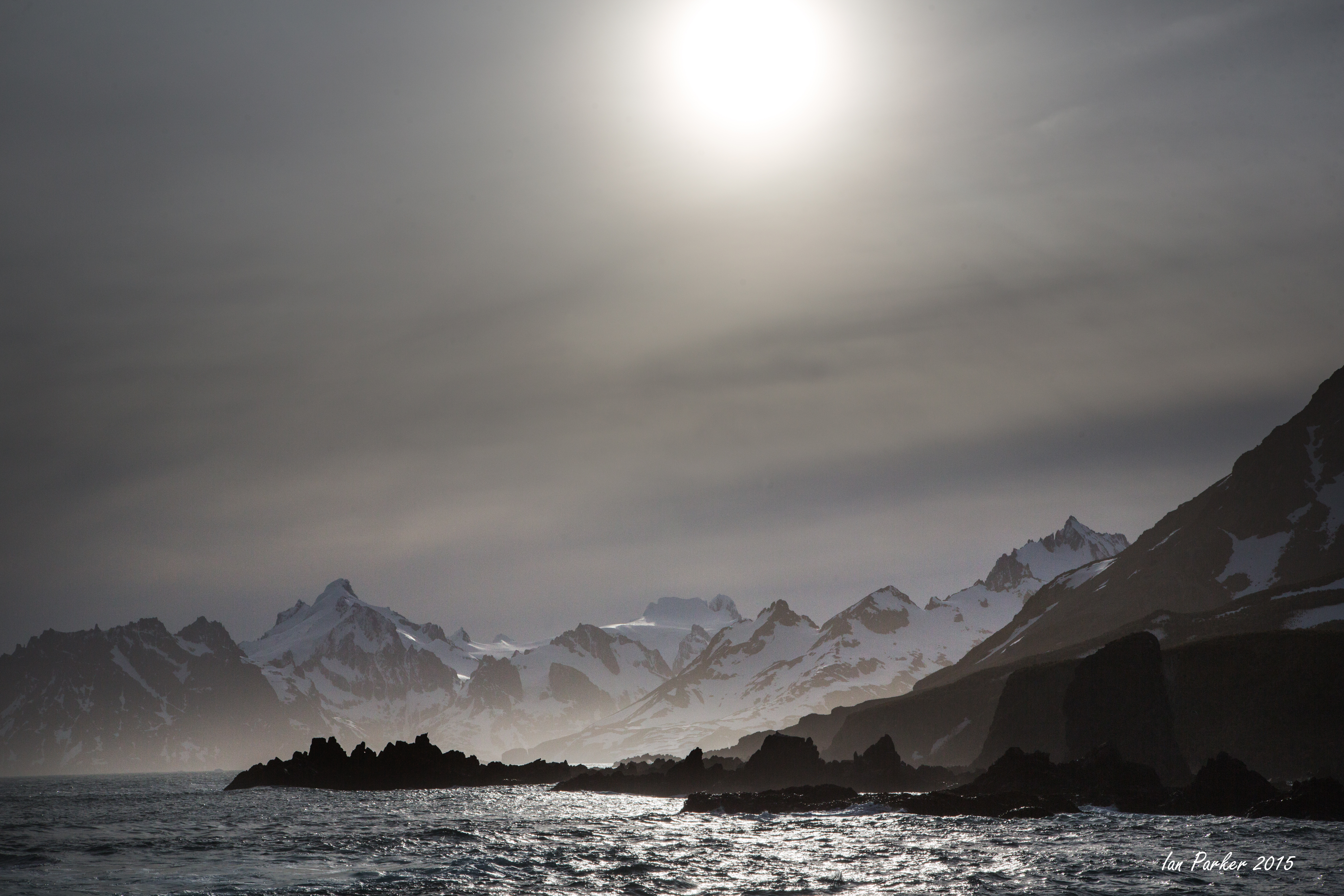
November 5: Elsehull, our first landing on reaching the very north-west tip of South Georgia
I had little luck with the albatross nesting high on the cliffs, but the main action was down on the narrow, fur seal infested beach where giant petrels fought over the carcass of a dead seal.
November 1-4
After returning to Stanley from our land rover trip to Volunteer Point we boarded the MV Hans Hansson and embarked on the 800 mile, 4 day crossing to South Georgia.
November 1-23: South Georgia
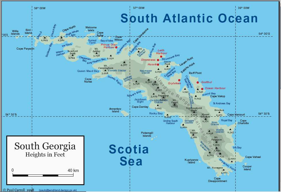
Map of South Georgia.
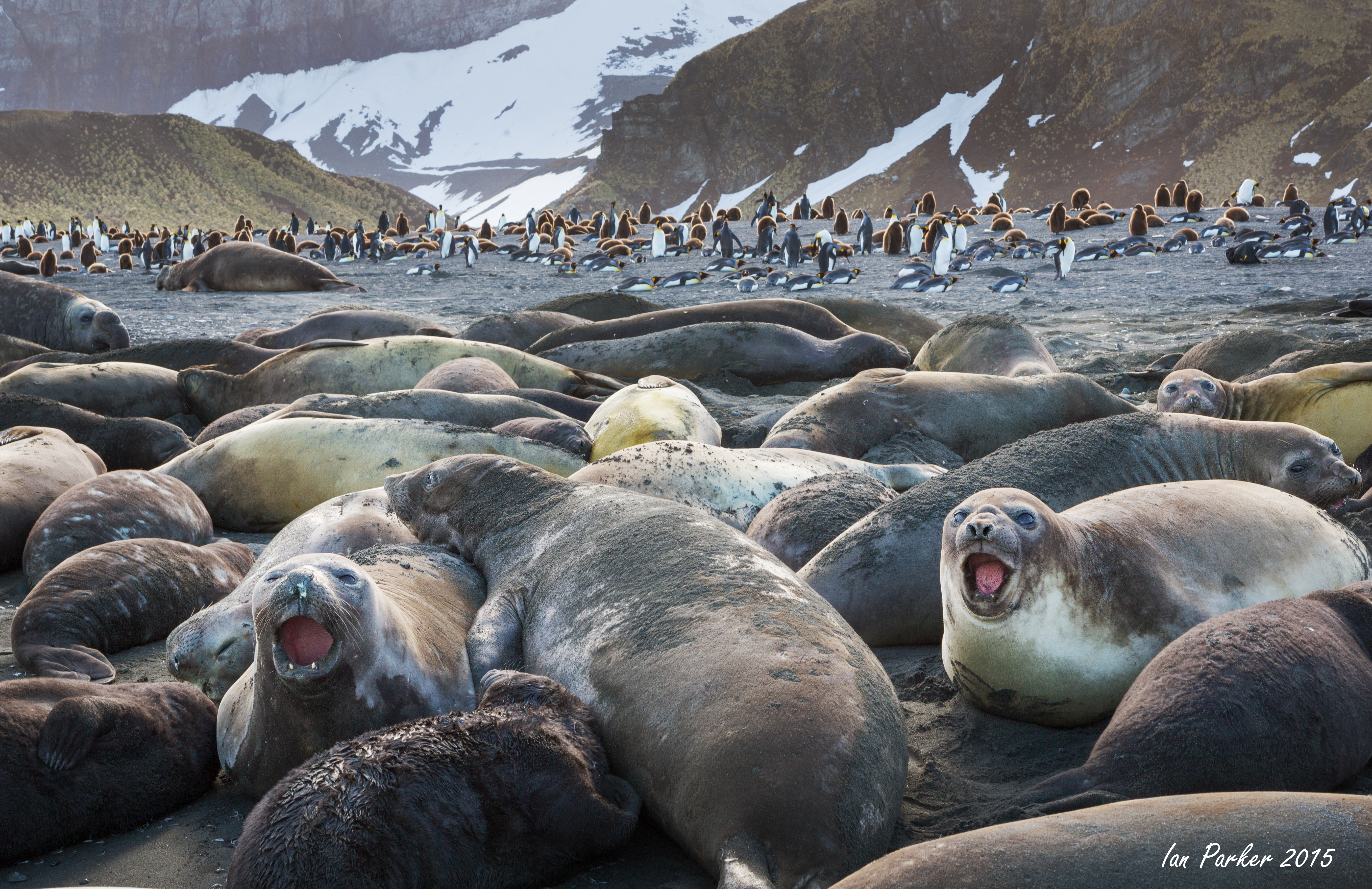
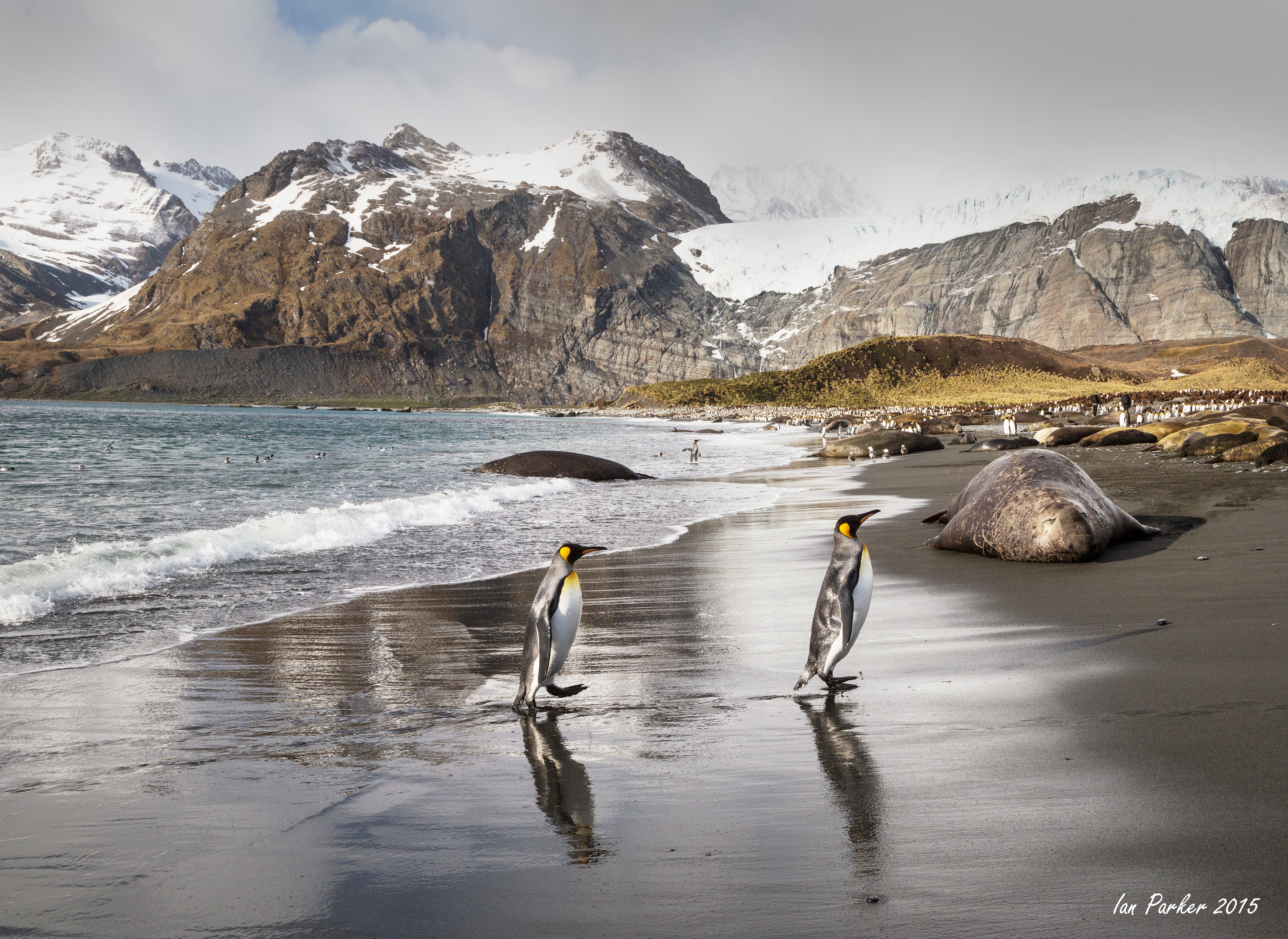
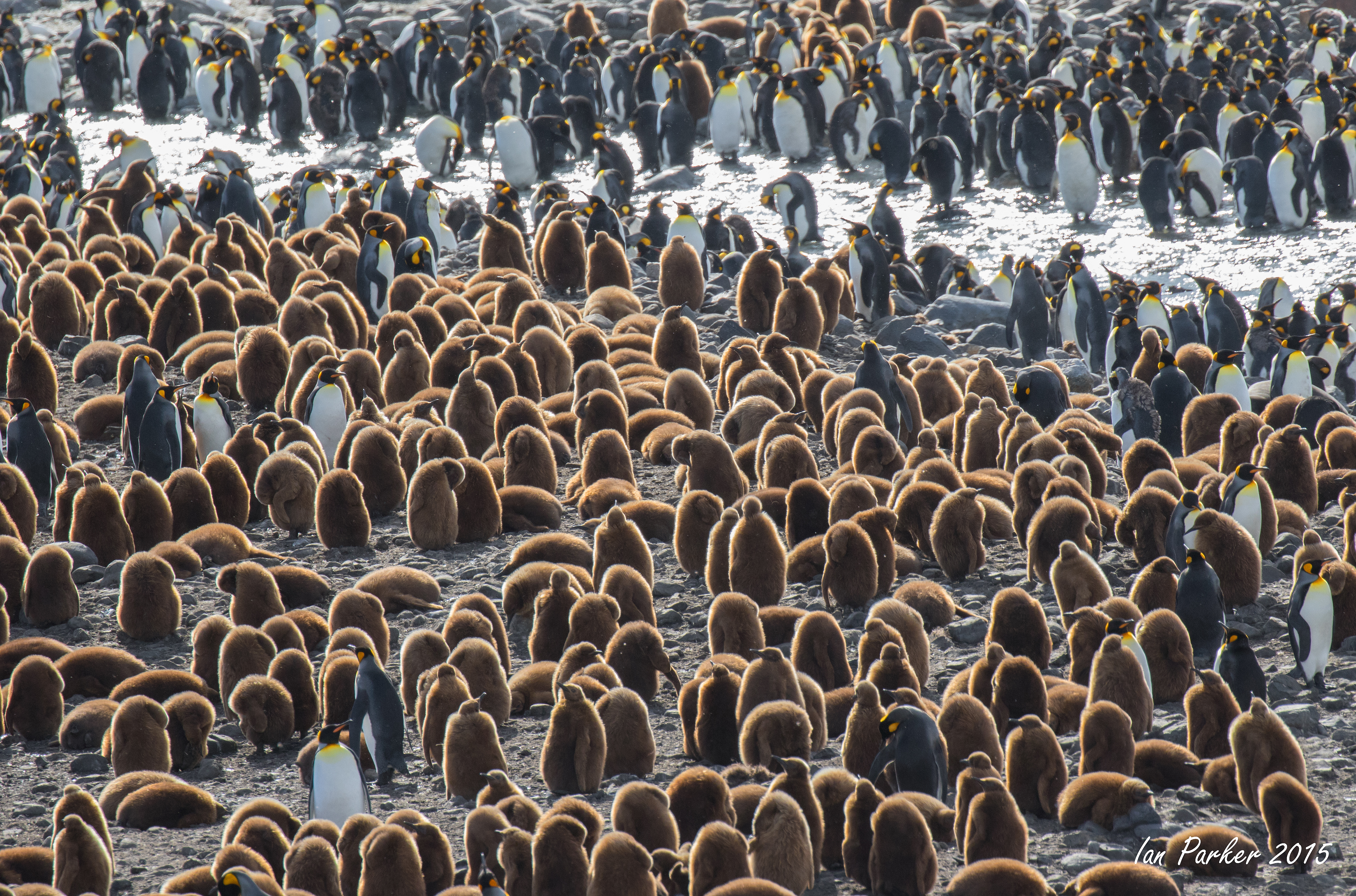
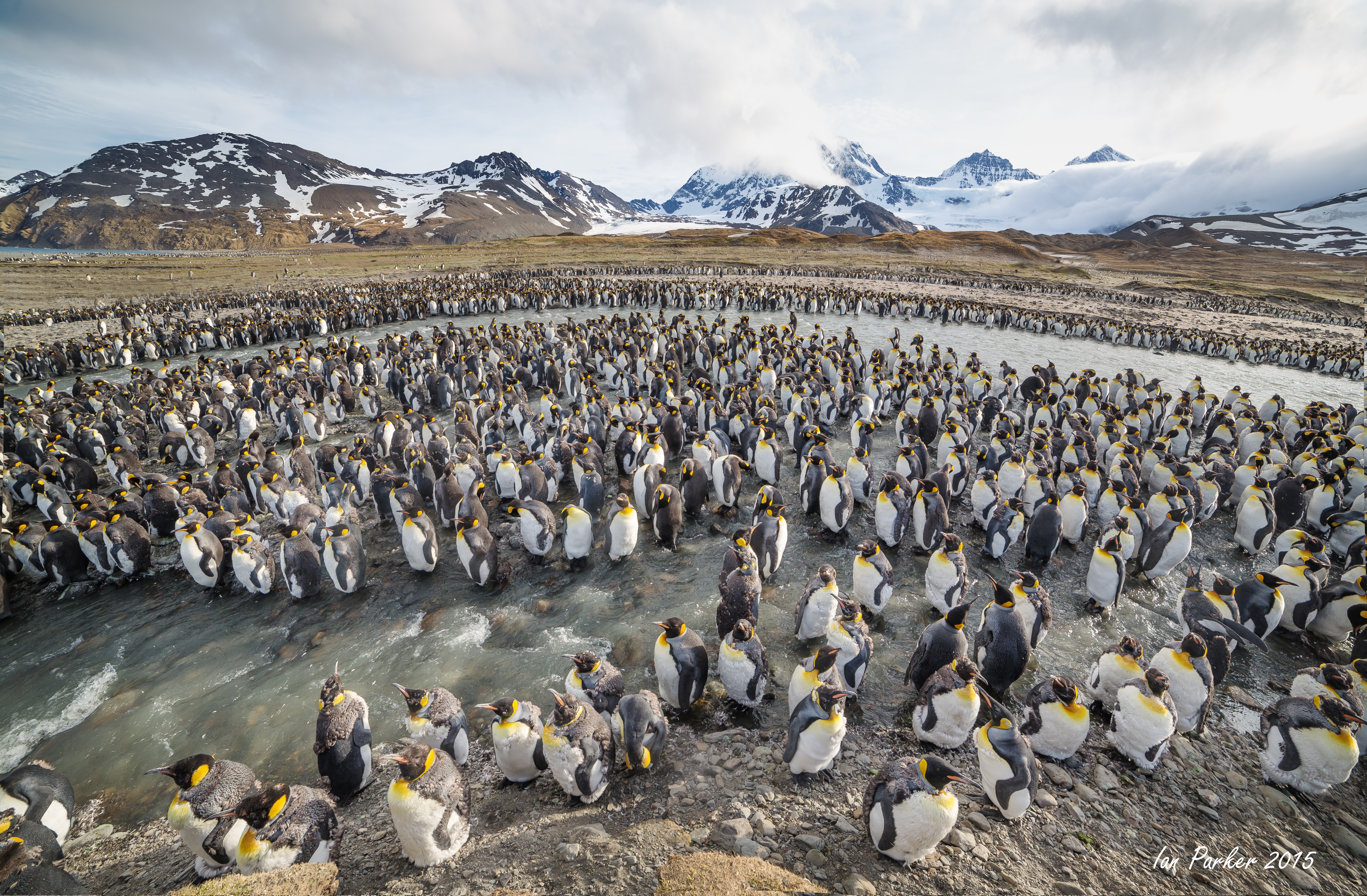
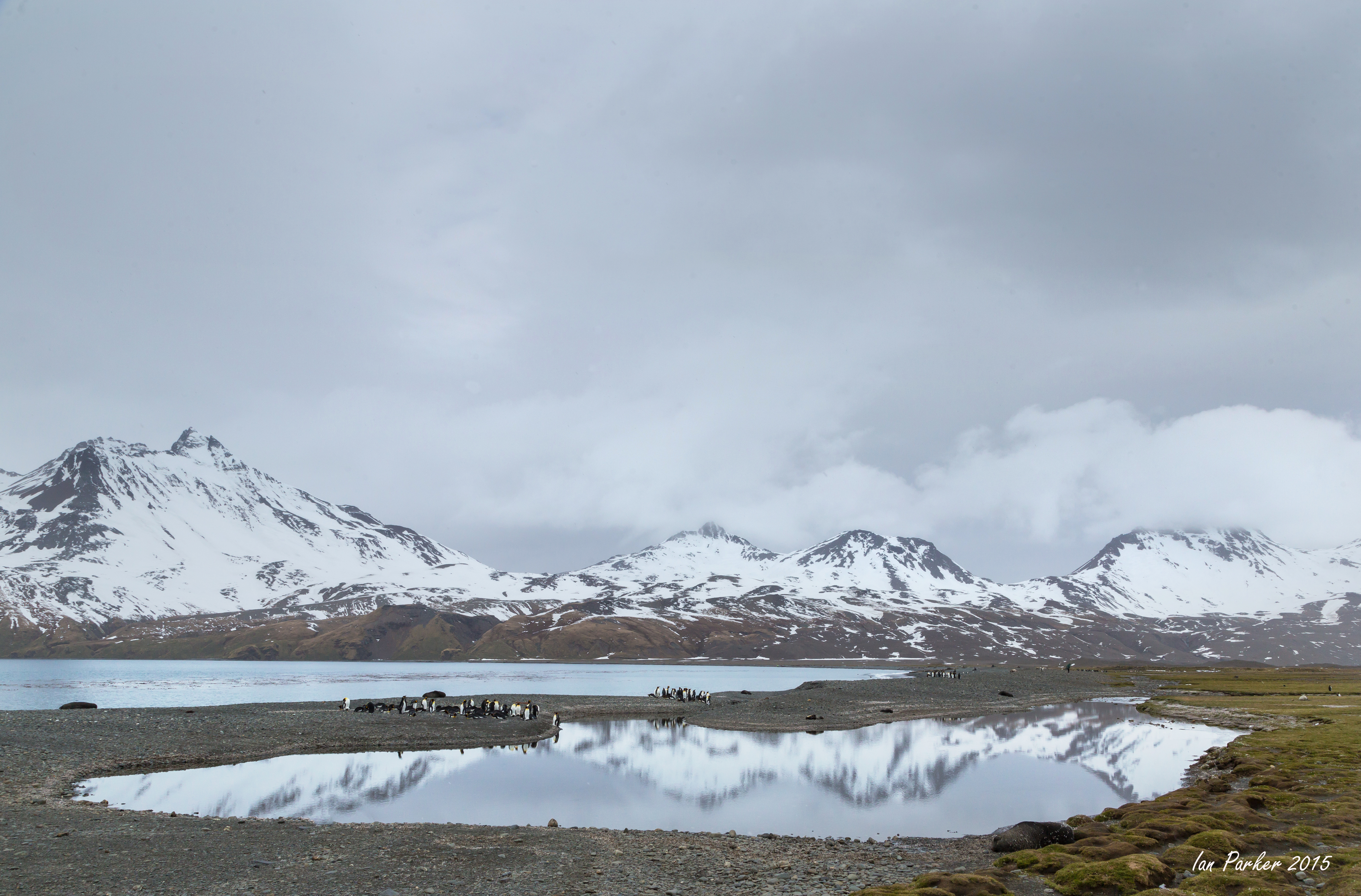
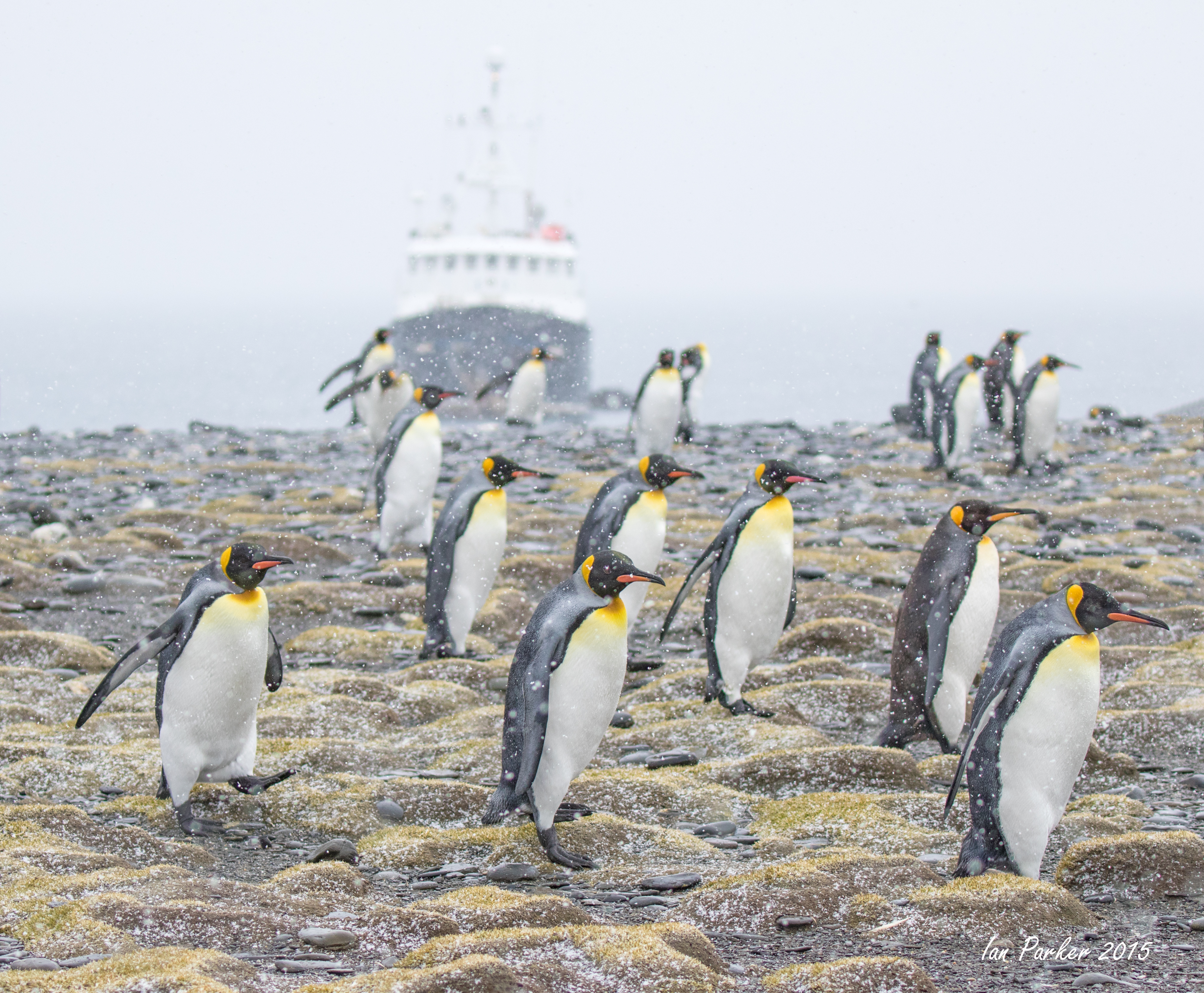
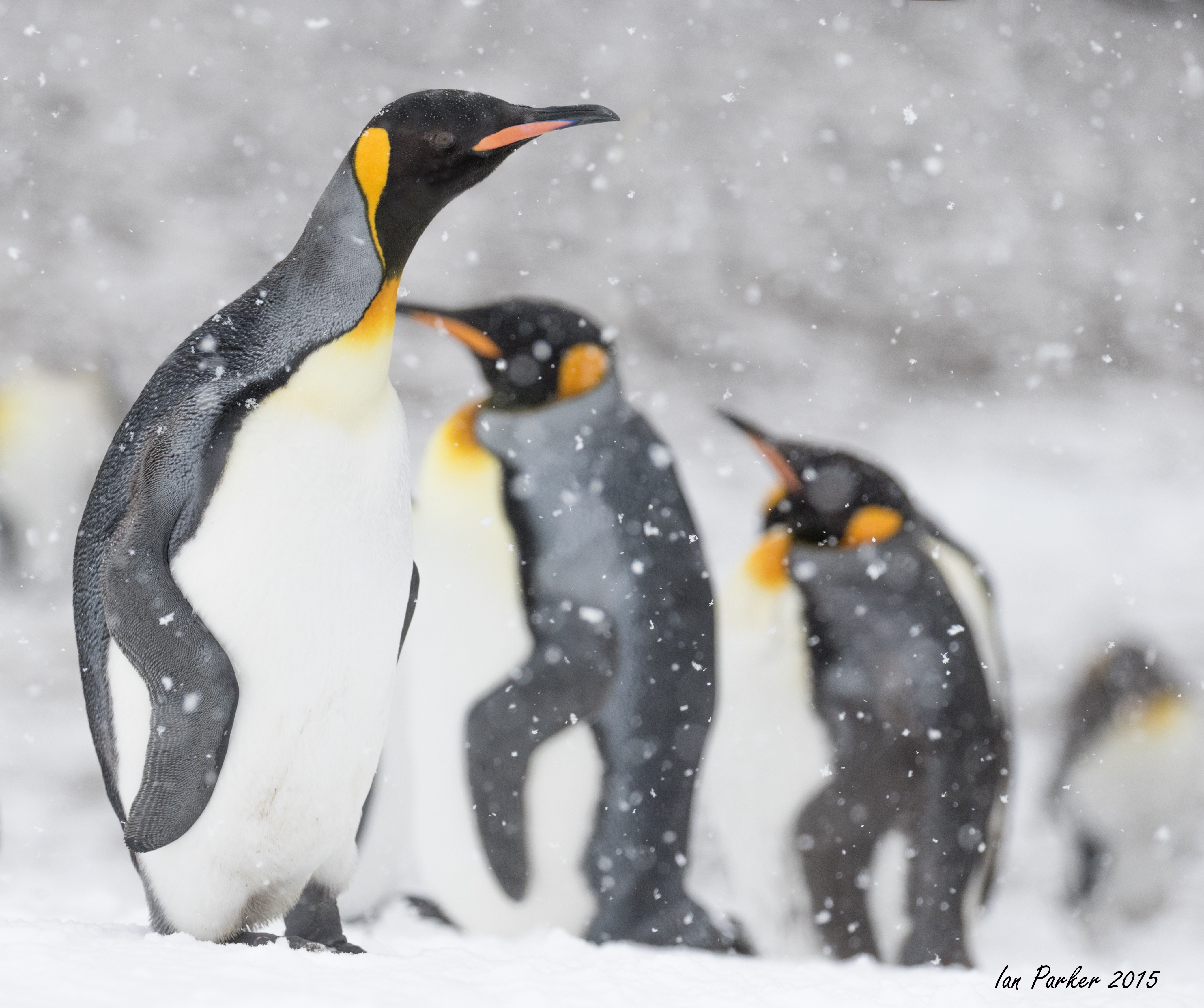
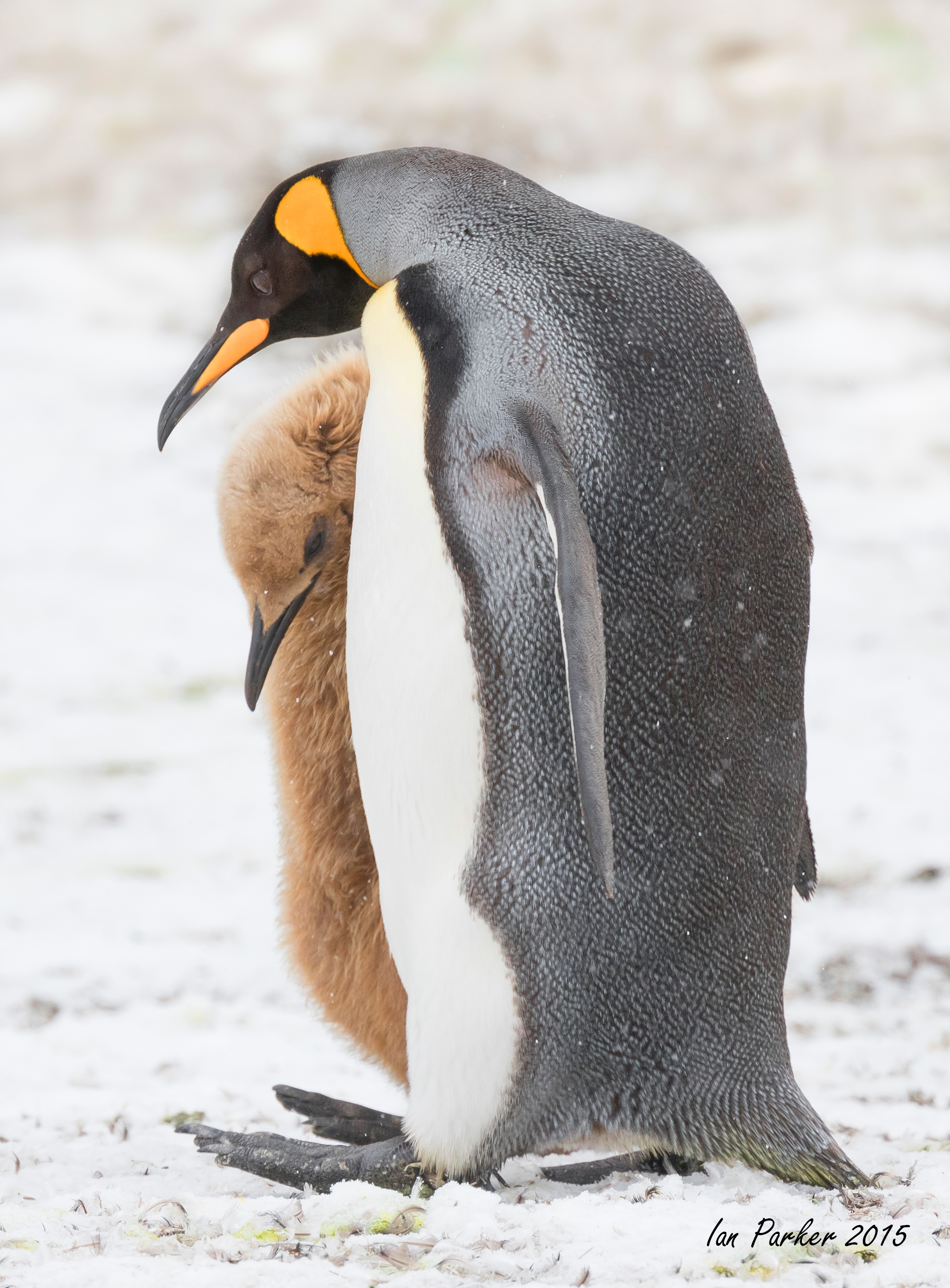
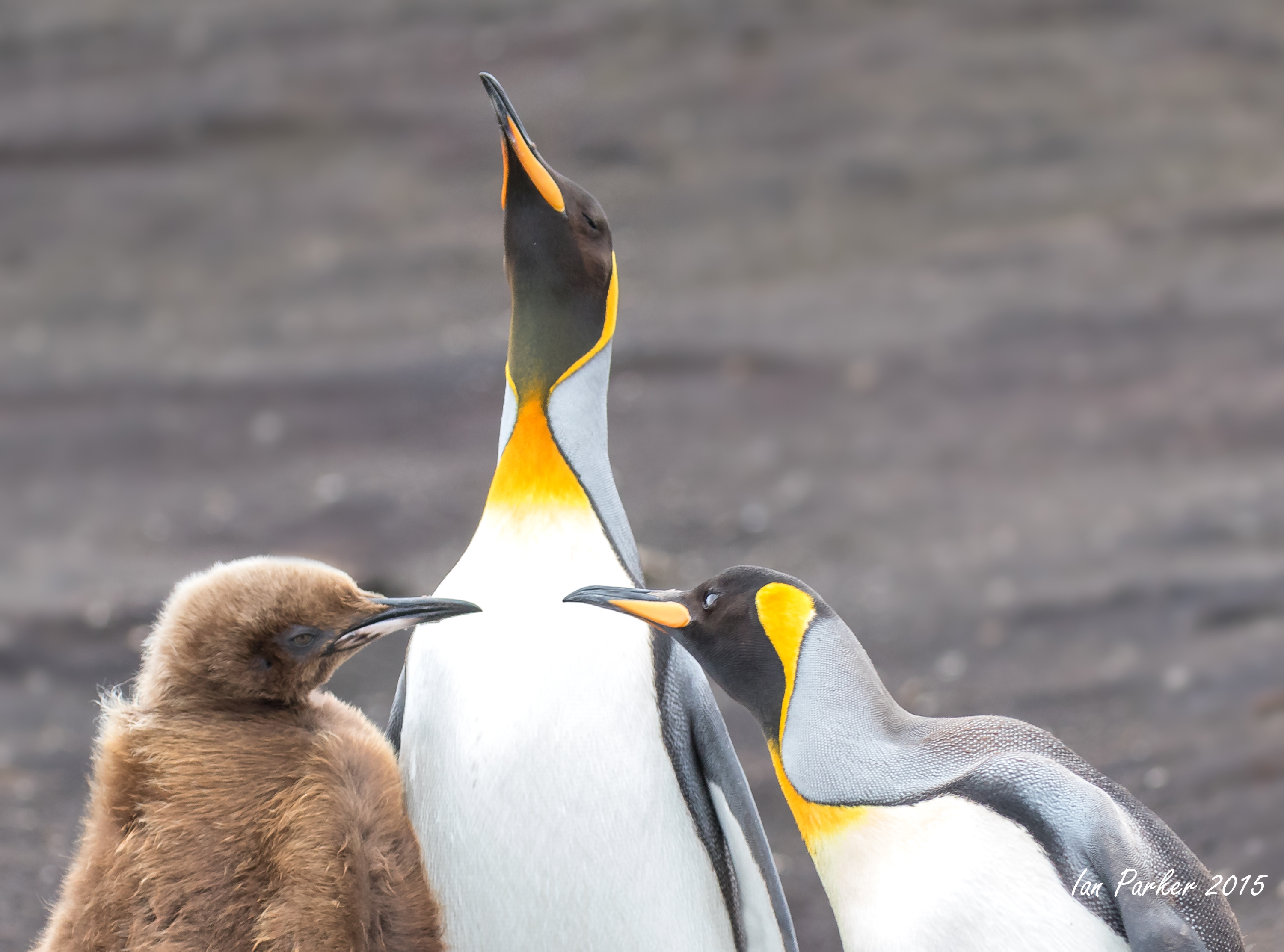
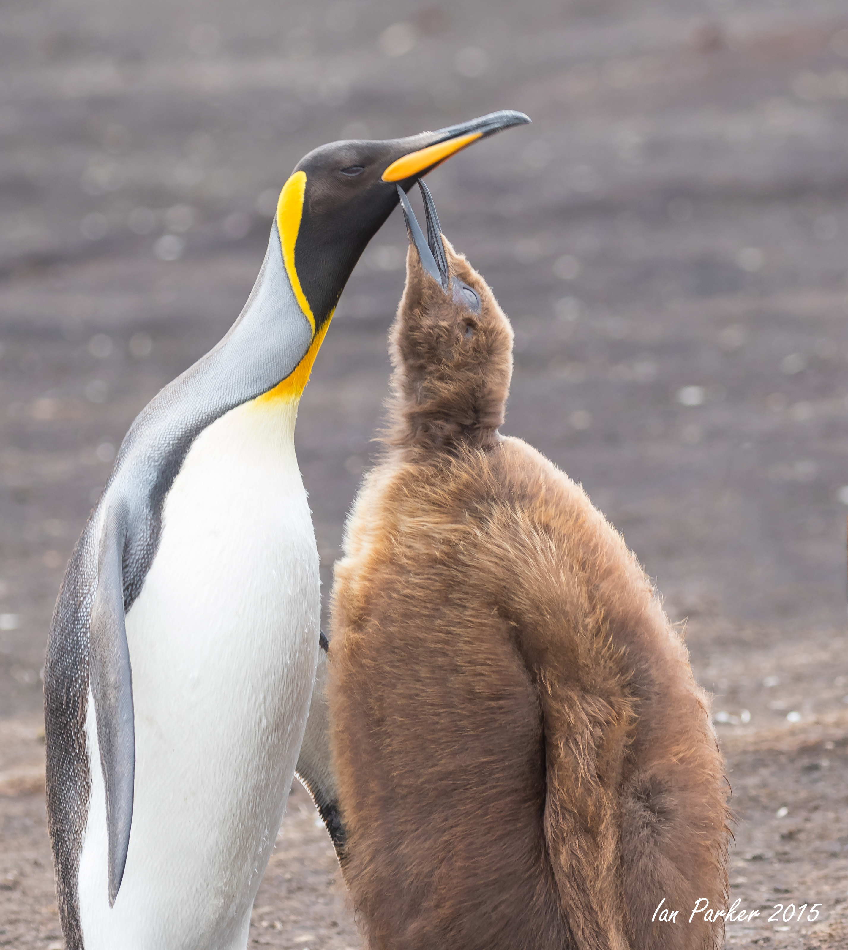
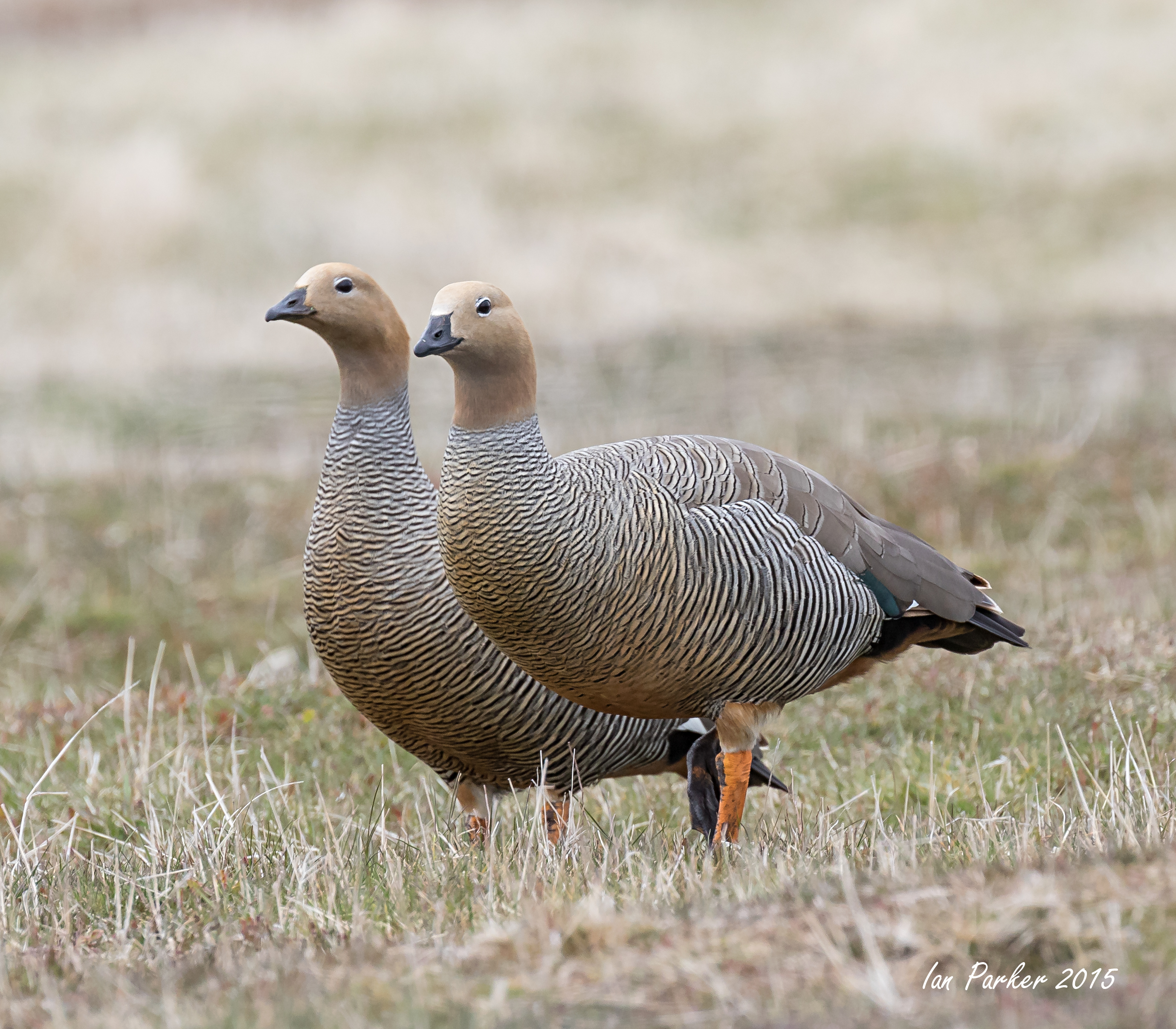
A combination of high mountains and the sea, of the Alps or the Appalachians and Antarctica. It is the destination par excellence for any wilderness enthusiast, with exceptional scenery and amazing wildlife, to experience your favourite sport or activity. South Georgia is extraordinarily rich in wildlife with the worlds largest colonies of Wandering Albatross (2500 pairs), Elephant Seals (350,000), Southern Fur seals (2,800,000), Gentoo Penguins (80,000 pairs) and astonishing concentrations of Macaroni Penguins, Sooty Albatross, King penguins, etc. Wildlife numbers peak during the breeding season from October to February
We first arrived at Elsehull
on the extreme tip of the island. Over the next two weeks we progressively sailed down the north-east coast, eventually rounding Cape Dissapointment for a quick peek of the wild coastline on the other side of the island. The original plan was then to retrace our path, with return visits to some landing sites; but this was curtailed by an accident to one of our passengers, necessitating a fast return to the Falklands.
|
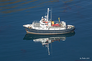
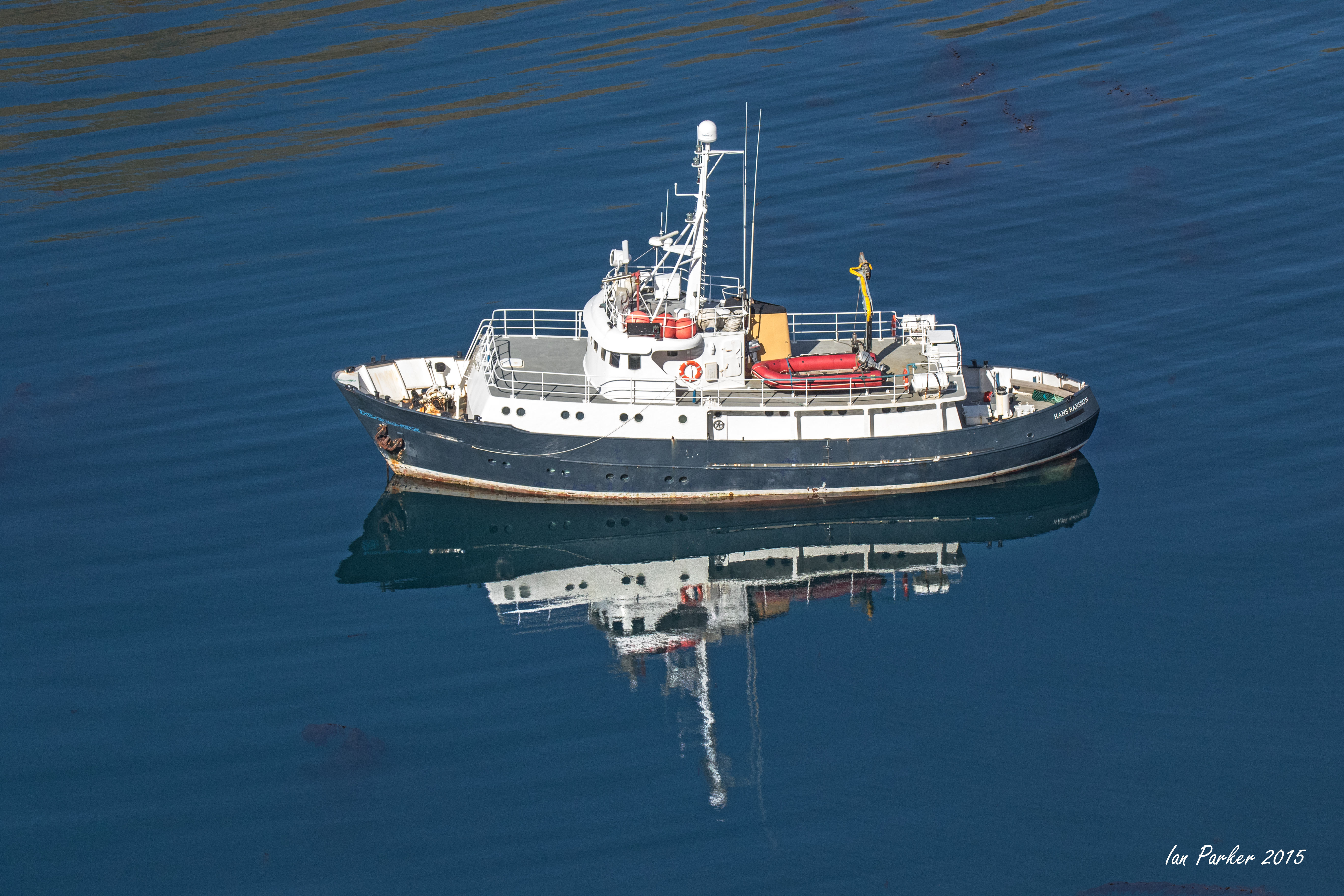
This trip was again organized by Cheesemans Ecology Safaris, and was truly a one-in-a-lifetime opportunity for an extended, intimate visit to South Georgia on the Hans Hansson, a very small boat (12 passenger). Cheesemans have announced that their 2016 trip (on the much larger Sea Spirit) will be their last to South Georgia (book here!).
Hans Hansson was built in Norway in 1960 for the Norwegian Lifeboat Association as the Rescue Cruiser Skomvaer II. For 25 years she operated in the North Sea and Barents Sea assisting 704 vessels and saving 106 lives. In 1986 Skomvaer II was bought by the Swedish Lifeboat Association and completely refitted. Modifications included extra ice strengthening for operation in the Baltic Sea. In 1988 she was re-launched as Hans Hansson and during the following ten years assisted 243 vessels and rescued 55 people.
In 1998 Hans Hansson was decommissioned and sold into private ownership. A major refit in 2005 saw her superstructure extended, systems upgraded and interior renewed to provide comfortable accommodation for twelve passengers and six crew. Her original rescue vessels seakeeping qualities have not been compromised and she is ideally suited for extended voyages in comfort and safety anywhere in the world.
The Hans Hansson is now operated by Golden Fleece Expeditions, skippered by Dion Poncet "one of the most remarkable sailors on the high seas having been born and raised on a yacht in the Southern Ocean. Inevitably, with this background there are few corners of the Antarctic Peninsula, South Georgia and Falkland Islands that Dion does not know. His working knowledge of high latitude charter vessels, coupled with his ability to fix almost anything, makes Dion a valuable addition to any project or expedition." The Hans Hansson has been chartered for many scientific and filming expeditions to Antarctica and the sub-Antarctic islands, including filming of the BBC series Life in the Freezer.
 |
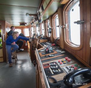
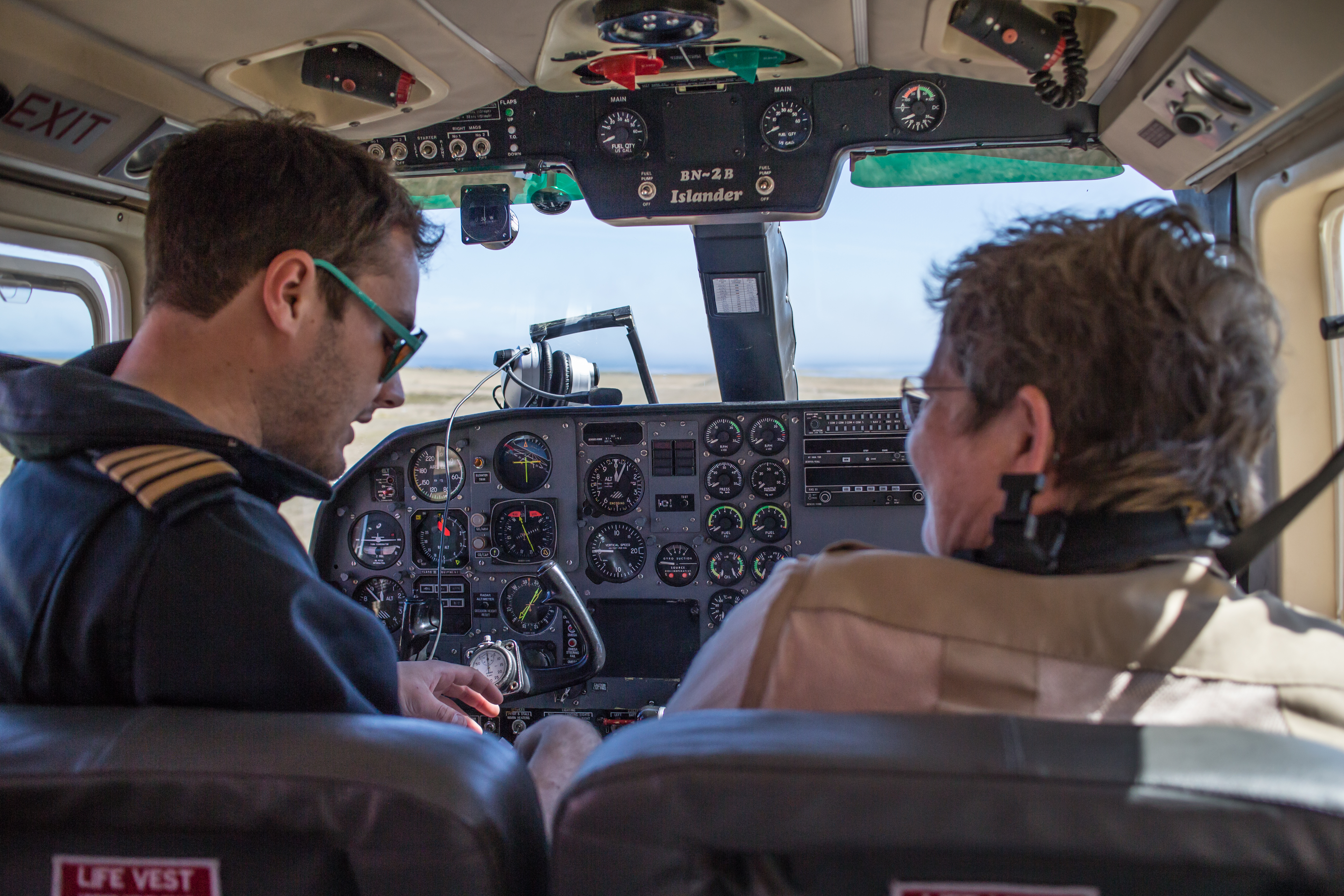
Dion and Juliette in the wheelhouse
Leif mooring at Grytviken
|
October 31. Volunteer Point
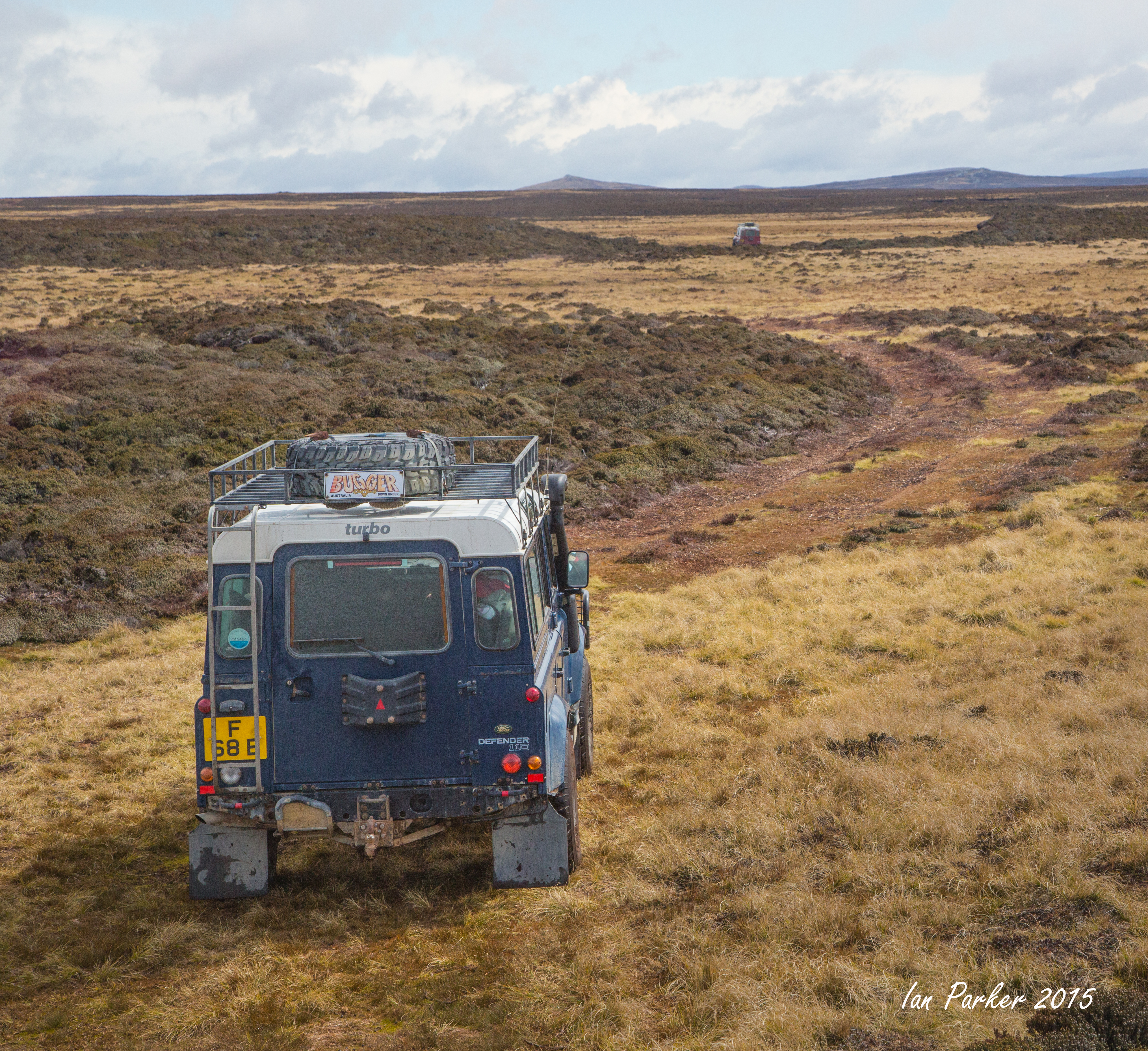
Returning by air from Seal Lion Island, we stayed overnight in the Malvinas hotel in Stanley, then took a day trip to the king penguin colony at Volunteer Point before boarding the Hans Hansson for our voyage to South Georgia. Getting to Volunteer Point is small adventure in itself;
"Access is by road and off-road track, gravel roads to Johnson's Harbour, then 4WD required to reach the Point. Visitors are strongly recommended to hire a guide unless travelling in convoy with experienced off-road drivers. The track has a succession of gates and un-marked paddocks; it is often very boggy, requiring great driving skill and local knowledge, and the journey may take several hours if conditions are poor. " [Falklands Tourist Board]
"Volunteer Point is one of the most popular and important tourist destinations in the Falklands. The site is a cornucopia of bird activity, home to a the largest king penguin colony in the Islands as well as gentoo and Magellanic penguins, waterfowl and other birds. Volunteer Beach itself is a beautiful white sandy beach, approximately 2km long, and is where many of the penguins can be seen entering and leaving the ocean." [Falklands Tourist Board]
Knowing that we would soon be among hundreds of thousands of king penguins in Soth Georgia I was not too excited about the colony at Volunteer Point, but nevertheless found a small group away from the main colony that enabled some isolated close-up shots without much background clutter.
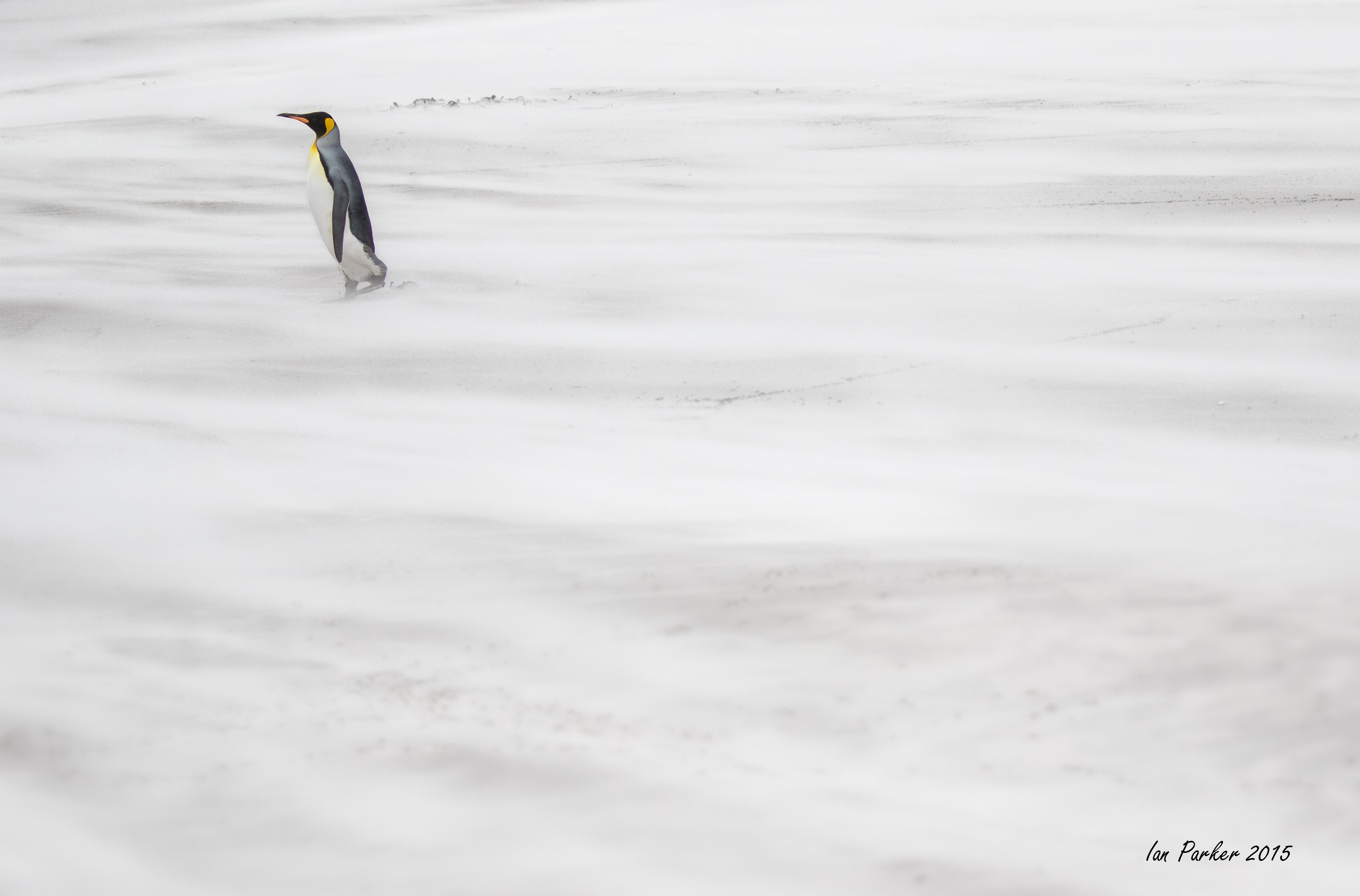
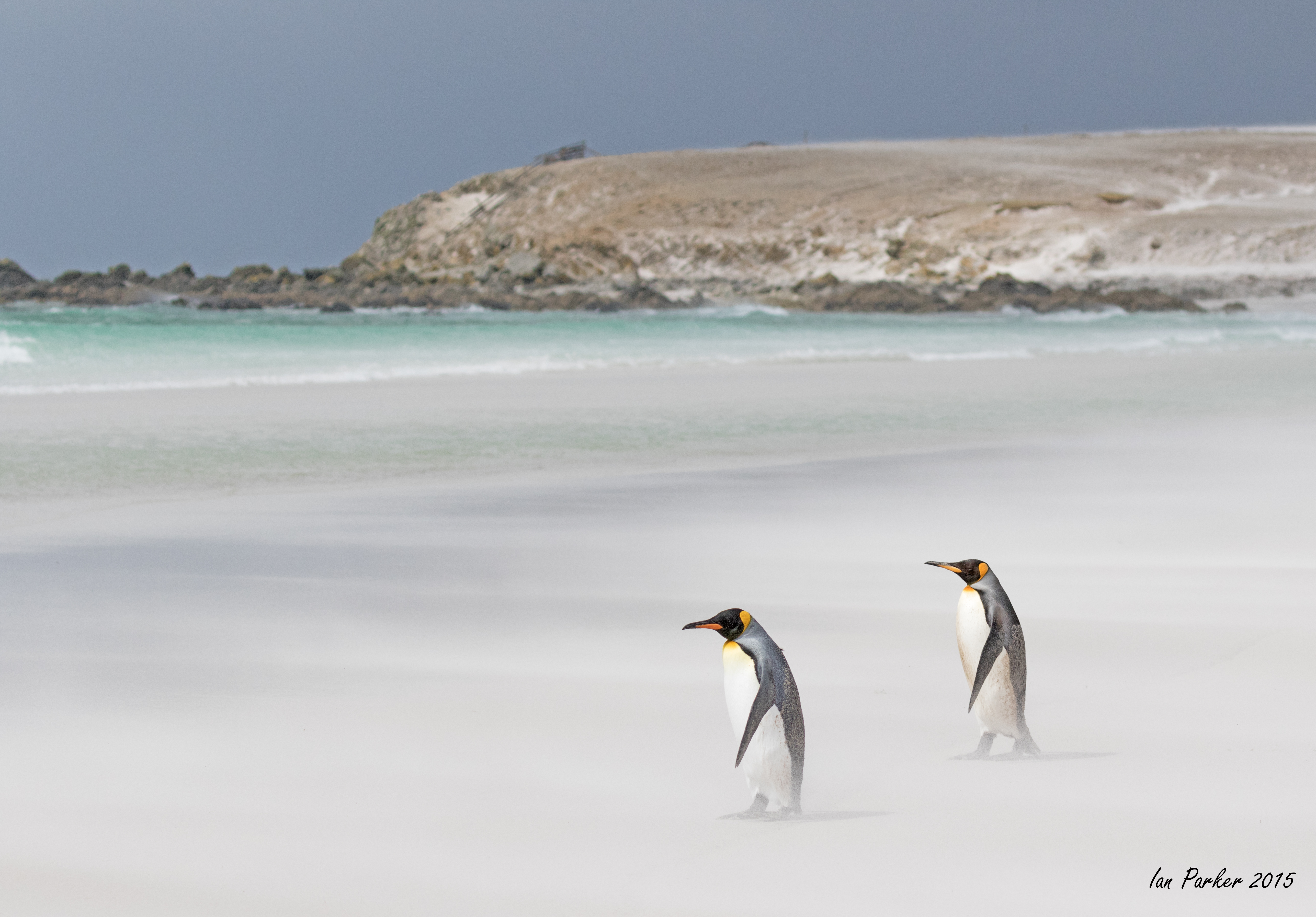
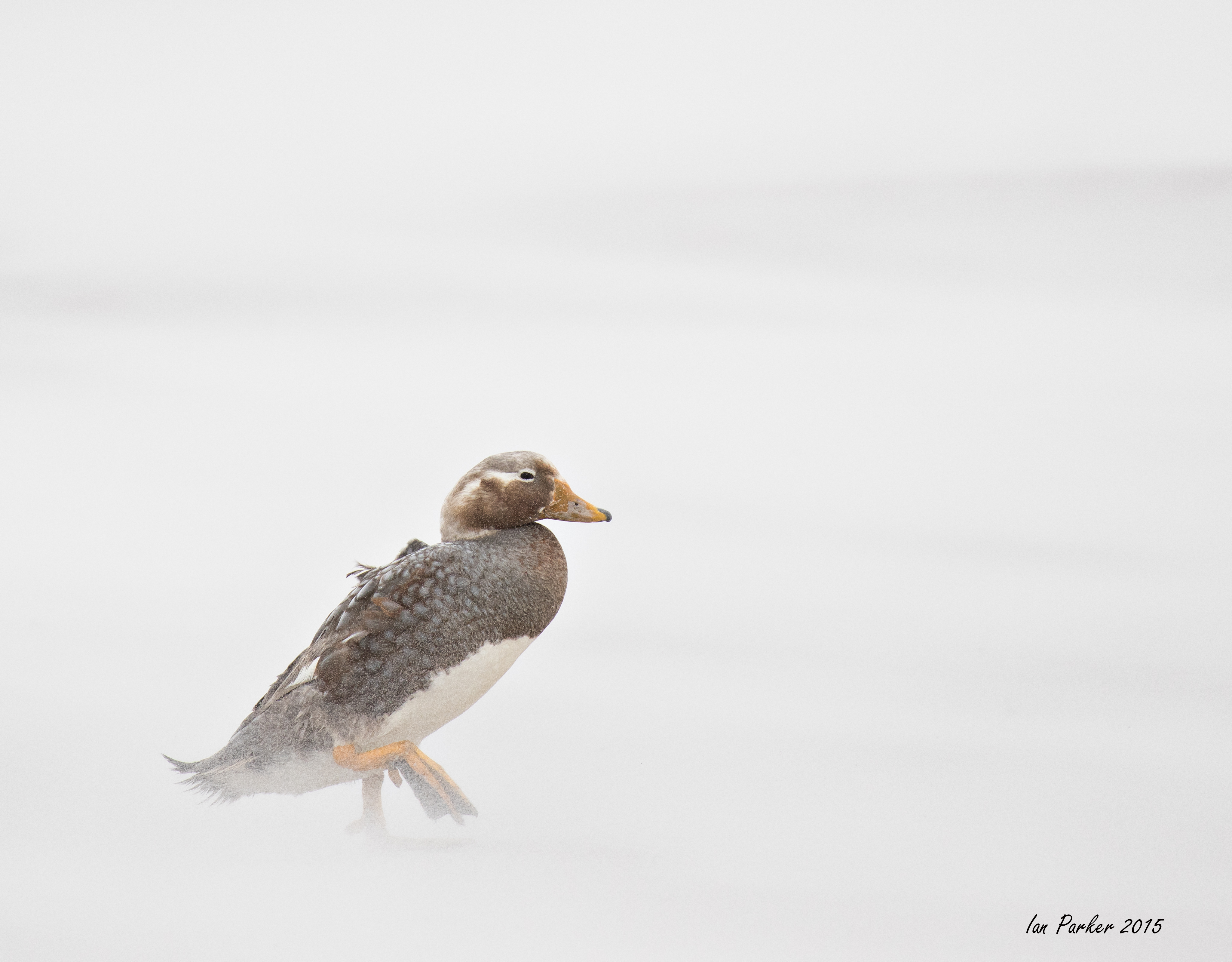
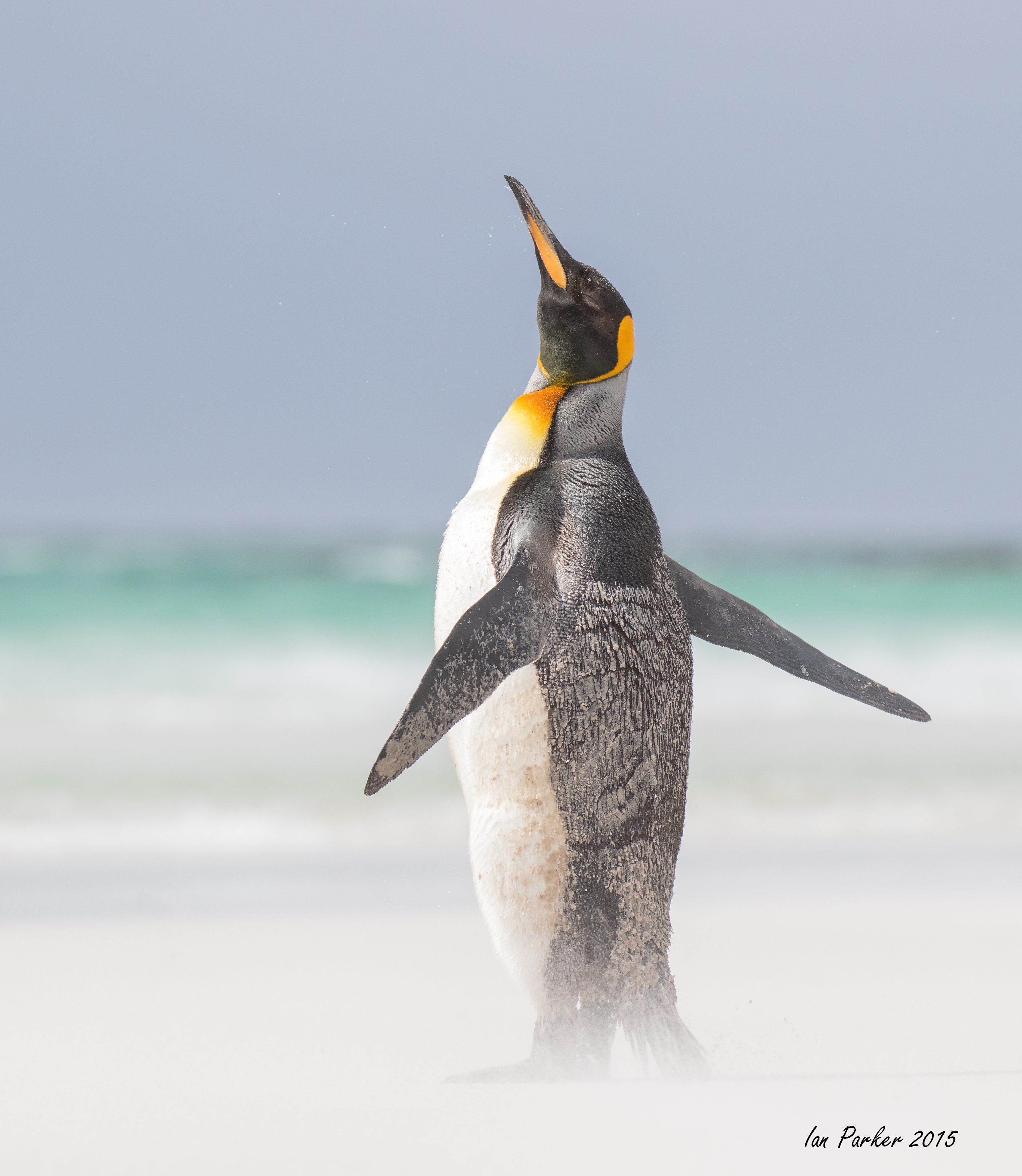
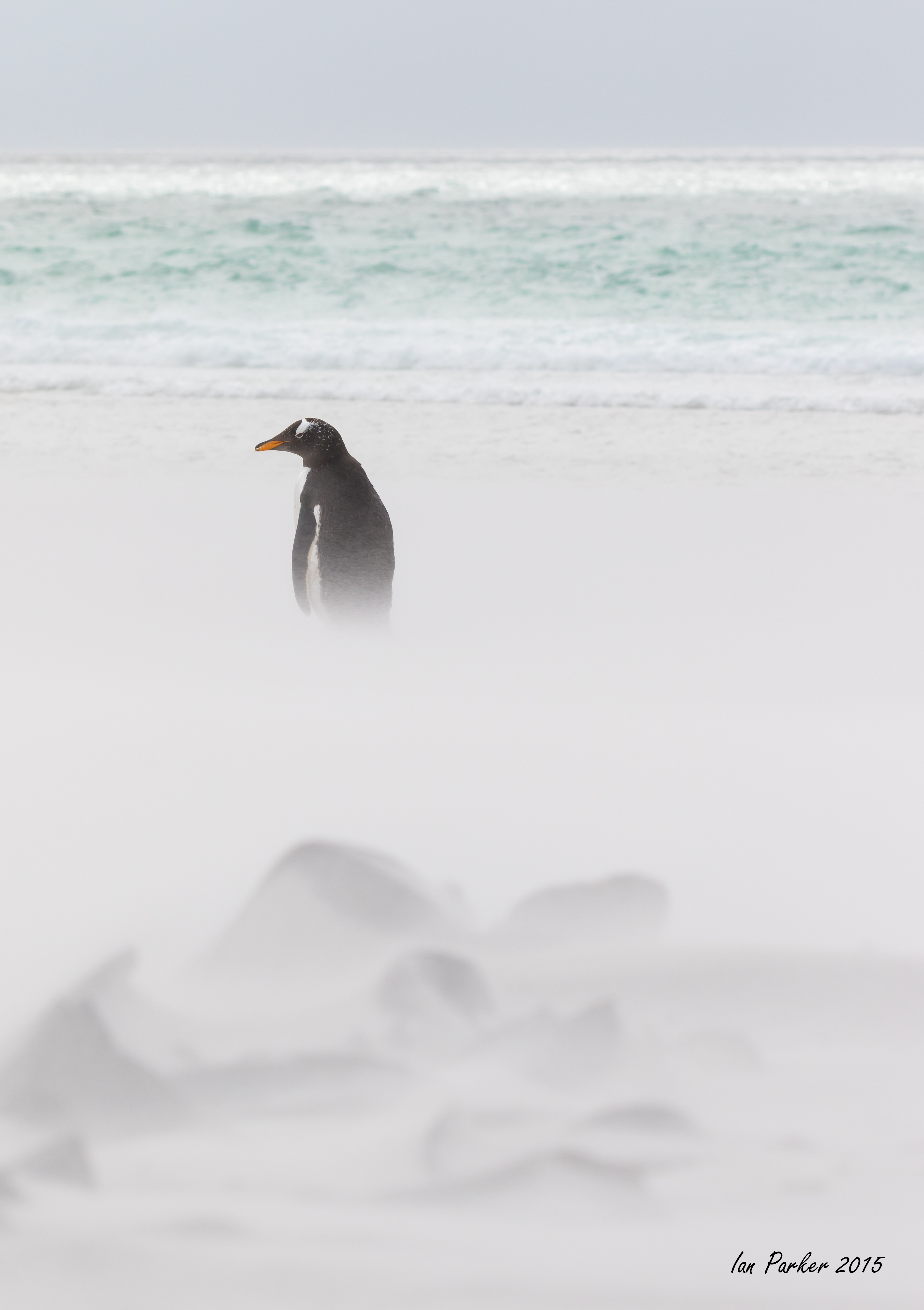
Soon after we arrived a very strong (guessing >50 mph), very cold wind developed. On the dictum that 'bad weather makes good photographs' I headed down to the beach to get abstract shots of penguins in the blowing sand.
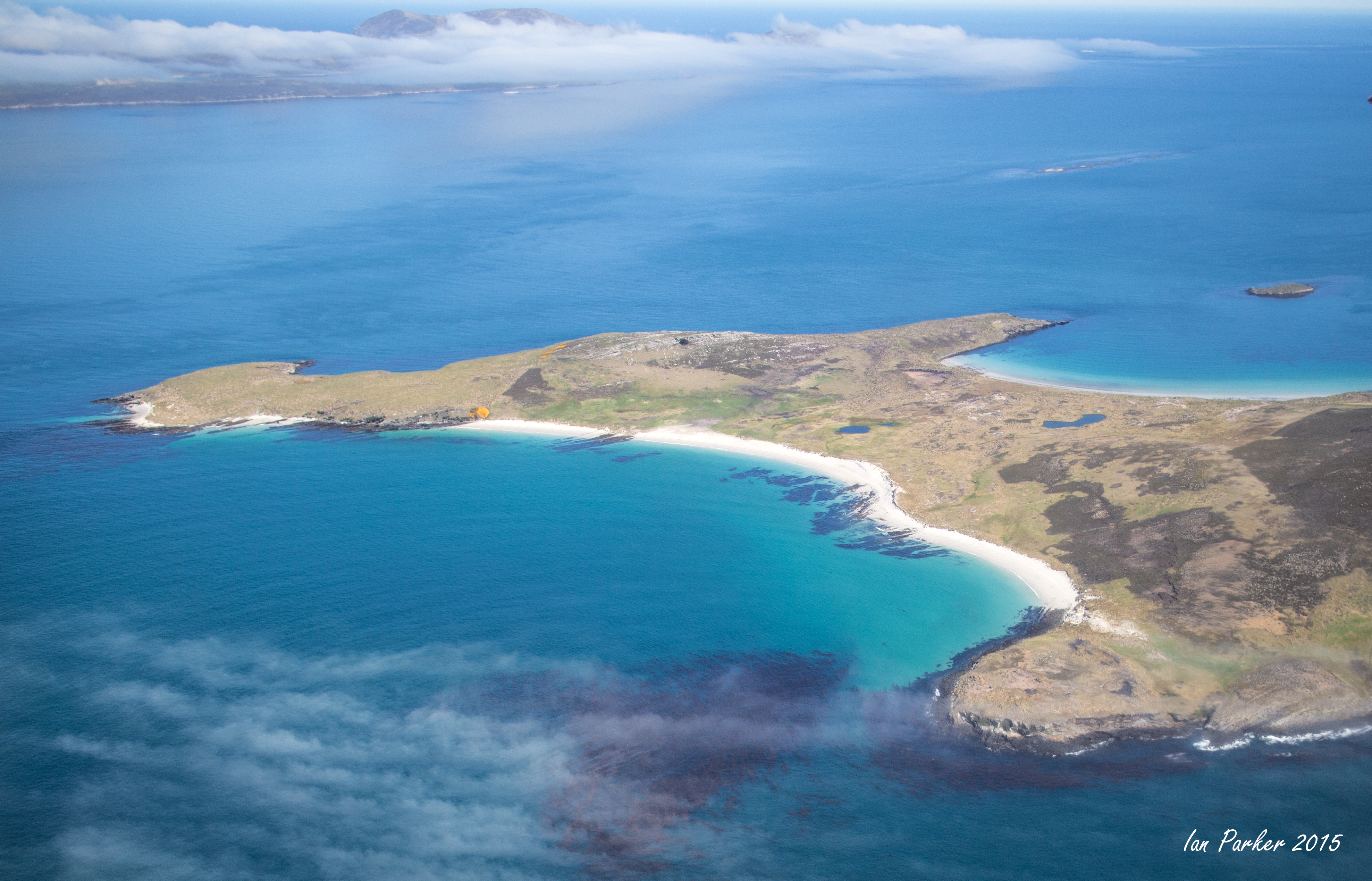
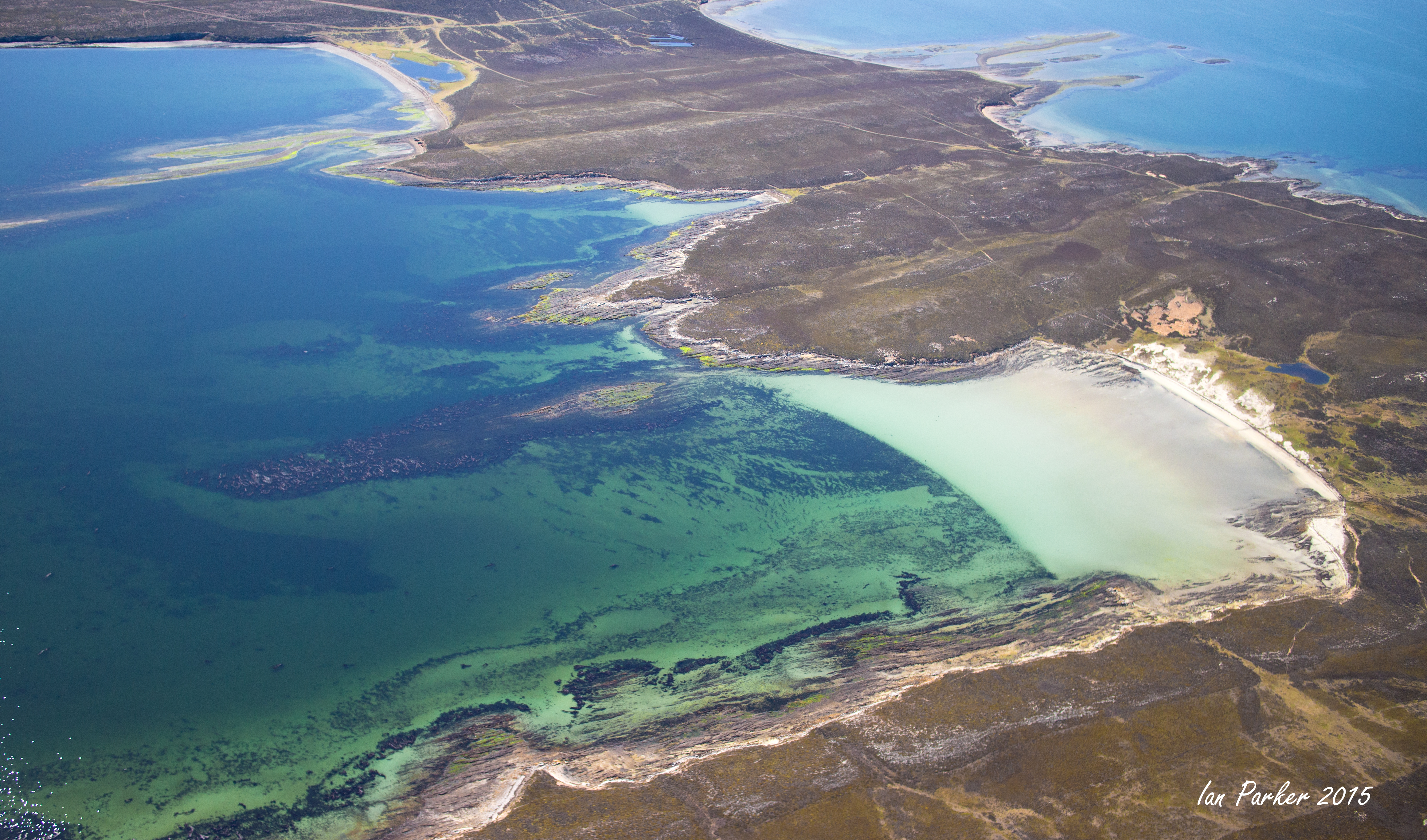
October 27-30. Sea Lion Island
We flew in a 10-seater Islander aircraft of the Falkland Island Government Air Service (FIGAS) across the entire width of the Falklands, departing from Carcass Island in the north west and landing on Sea Lion island at the extreme south east of the Islands.
Aerial views between Carcass Island and West Falkland
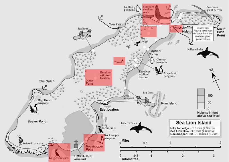
Sea Lion Island map. We stayed at the Lodge. Photography locations are marked in red. |
Our first night on Sea Lion Island coincided with a full moon. Gentoo penguin colonies just a few hundred yards from the Lodge provided an easy opportunity to find out what penguins did after sunset.
The area around Long Pond, an easy walk from the Lodge, was a good place to find birds
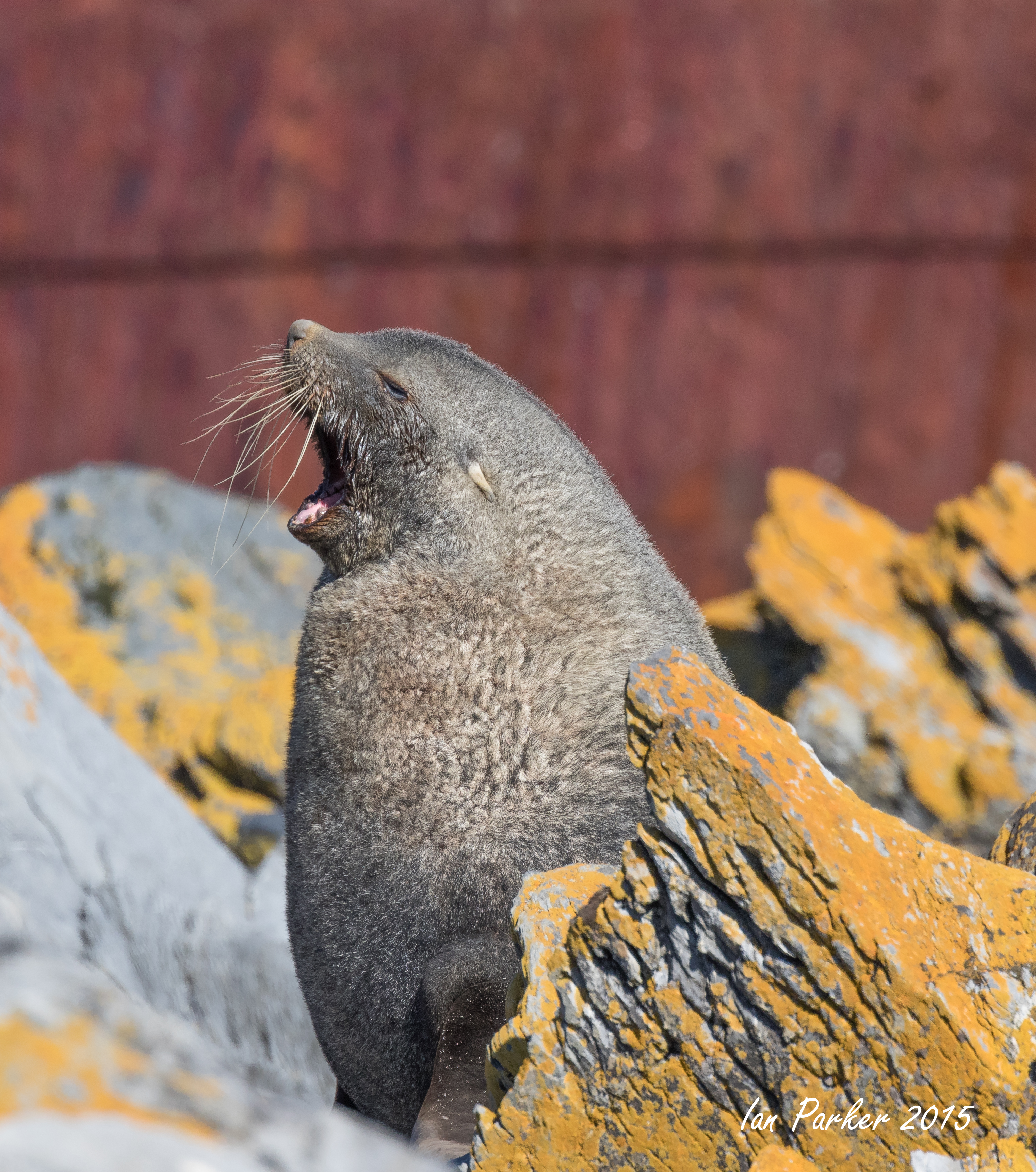
Elephant seals
were abundant at both beaches north of the Lodge. Danish researchers were studying the seals, and had named many individuals.
Tussack birds like to peck at skin wounds, but the seals tend to object.
The beaches are also populated by gentoo and Magellanic penguins, heading to and from the sea from their colonies inland from the sand dunes.
Around 5 o'clock in the evening, large numbers of gentoo penguins began landing on the beach to the north west of the Lodge.
In addition to 'straight' shots of penguins, I tried to create images
abstracting them from their background using motion blur, de-focus or blowing sand
To the south the island rises to high cliffs, where rockhopper penguins make their nests.
The rockhoppers intermingle with nesting blue-eyed shags.
The shags were constantly flying back carrying new nesting materials.
October 24-27. Carcass and Westpoint Islands
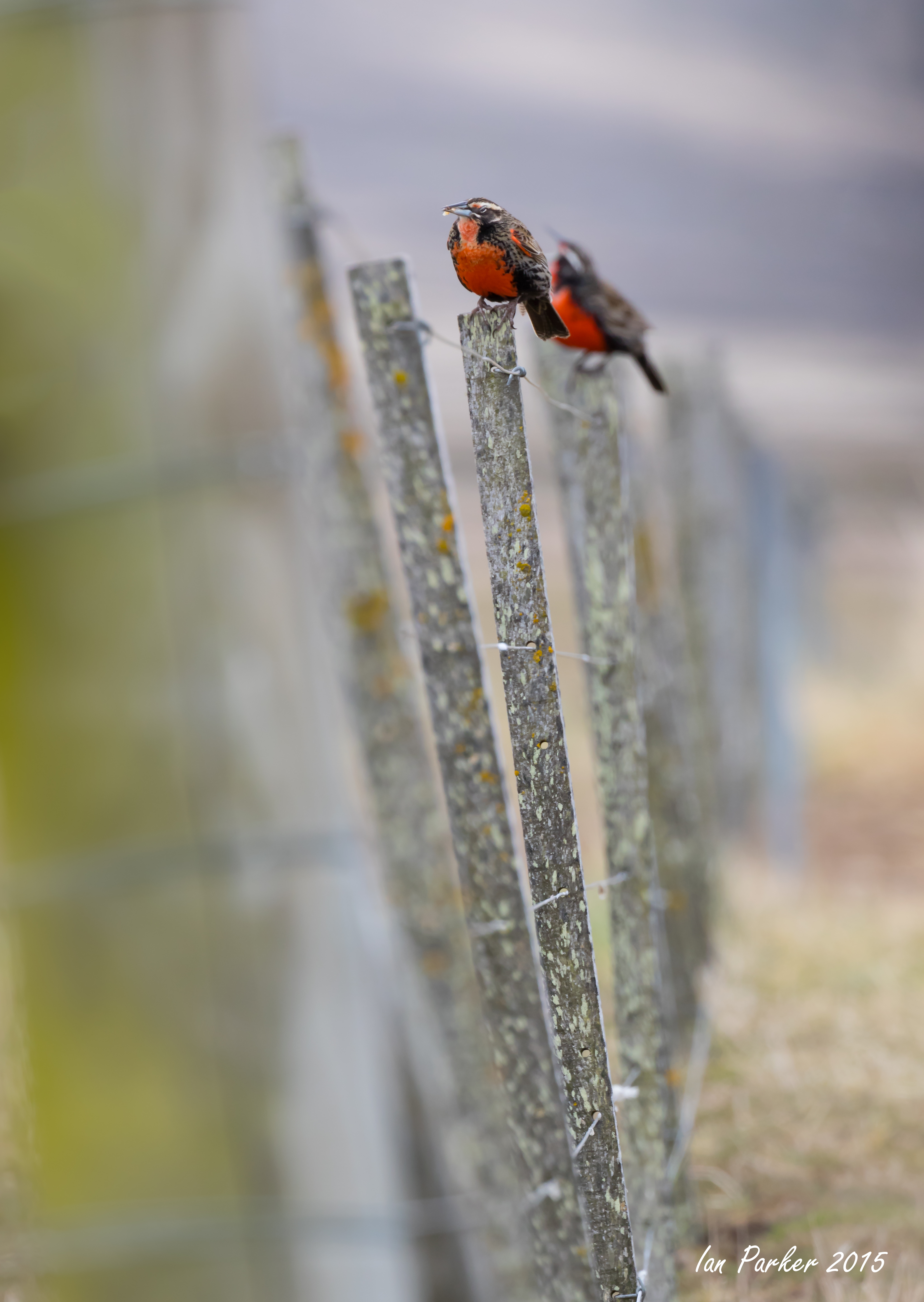
Carcass Island is situated in the north-west of the archipelago. Cat and rat free it is a haven for small bird species including the endemic Cobb’s wren. Straited cara-caras, known locally as "Johnny Rooks" are prevalent and short-eared owls breed in the island's forest. Elephant seals bask on the northern beaches, magellanic penguins reside close to the settlement, gentoo penguins and other marine mammals inhabit the southern end of the island. The scenery is varied with beautiful white sandy beaches, tussac paddocks, rocky hills and clifftops; Carcass Island is a fantastic destination for both walking enthusiasts and those who prefer just a short stroll or drive to a scenic spot. We also visited West Point Island, home to black-browed albatross, reached by boat from Carcass Island. {Falkand Islands Tourist Board}
It was about an hour flight in a small twin-engine 10-seater plane from Stanley. Upon arrival, there are three grass landing strips in a triangular shape to allow planes to land in any wind conditions. Sheltered by trees the original farmhouse now houses the five guest rooms. Rob and Lorraine McGill are the owners of the Island (and have been for 36yrs) and were our hosts, along with their Chilean helpers Roldan and Eva.
Striated caracara ('Johhny rook')
are listed as 'Near Threatened', with only about 500 pairs nesting in the Falklands, but they are very common around the farmhouse on Carcass Island.They are almost entirely fearless of humans and treat their approach with indifference, making it easy to get wide-angle photographs placing the birds within their landscape..
Magellanic penguins nest in burrows among the gorse bushes around the farmhouse
Other birds...
We took a one-day excursion to Westpoint Island aboard the Condor
October 24-31
Our journeys began with a one-week land/air based visit to the Falkland Islands, arranged by Cheesmans Ecology Safaris.
Click HERE if you might wish to join the 2016 tour
Falkland Islands map. We took the once-a-week LAN flight from Santiago to Mount Pleasant air base, and connected with internal flights landing on grass airstrips on the outlying islands. Sites we visited are marked in red. |
October 24-December 21
A two-month, totally immersive experience visiting the Falkland Islands, South Georgia, the South Shetland Islands and the Antarctic Peninsula.
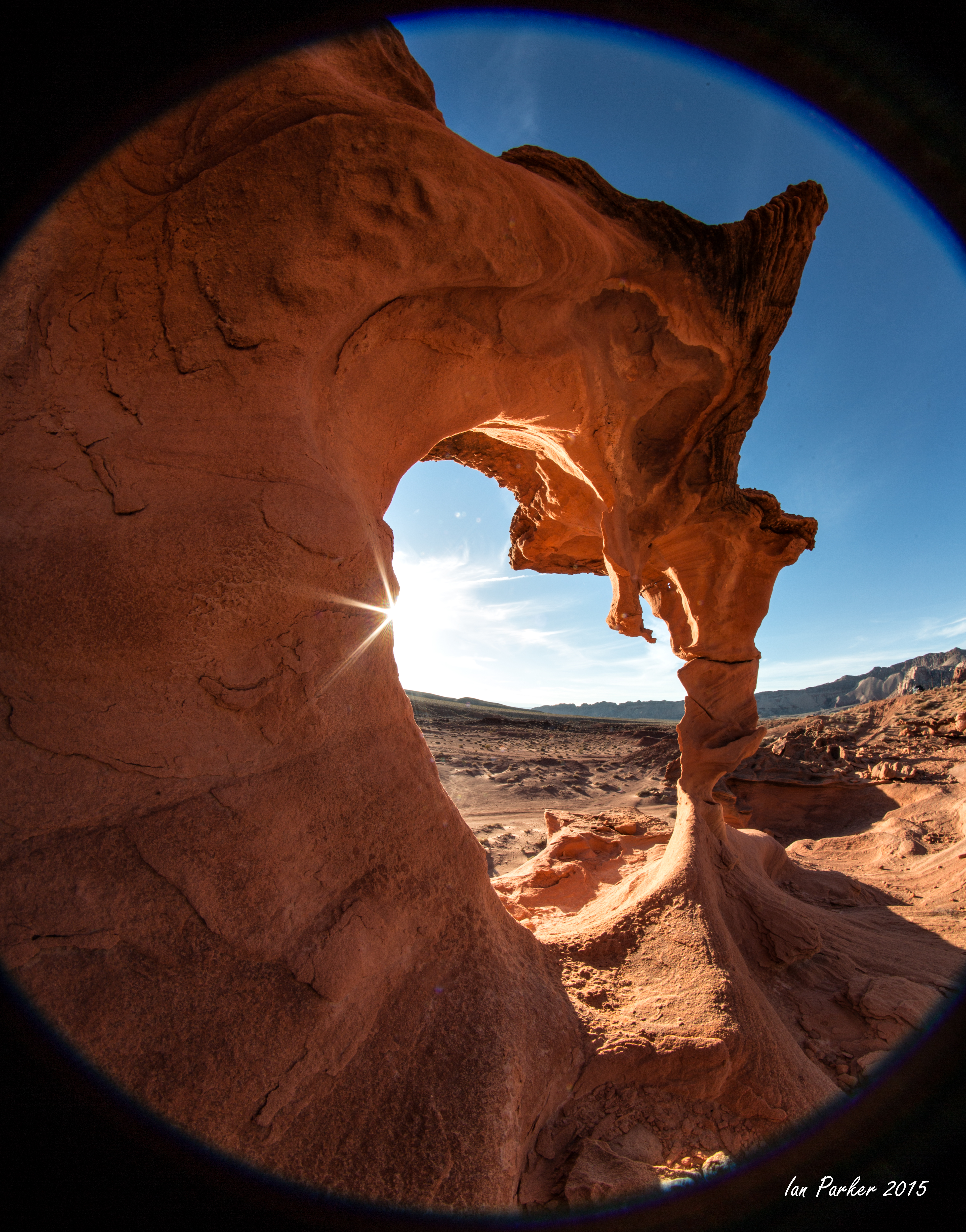
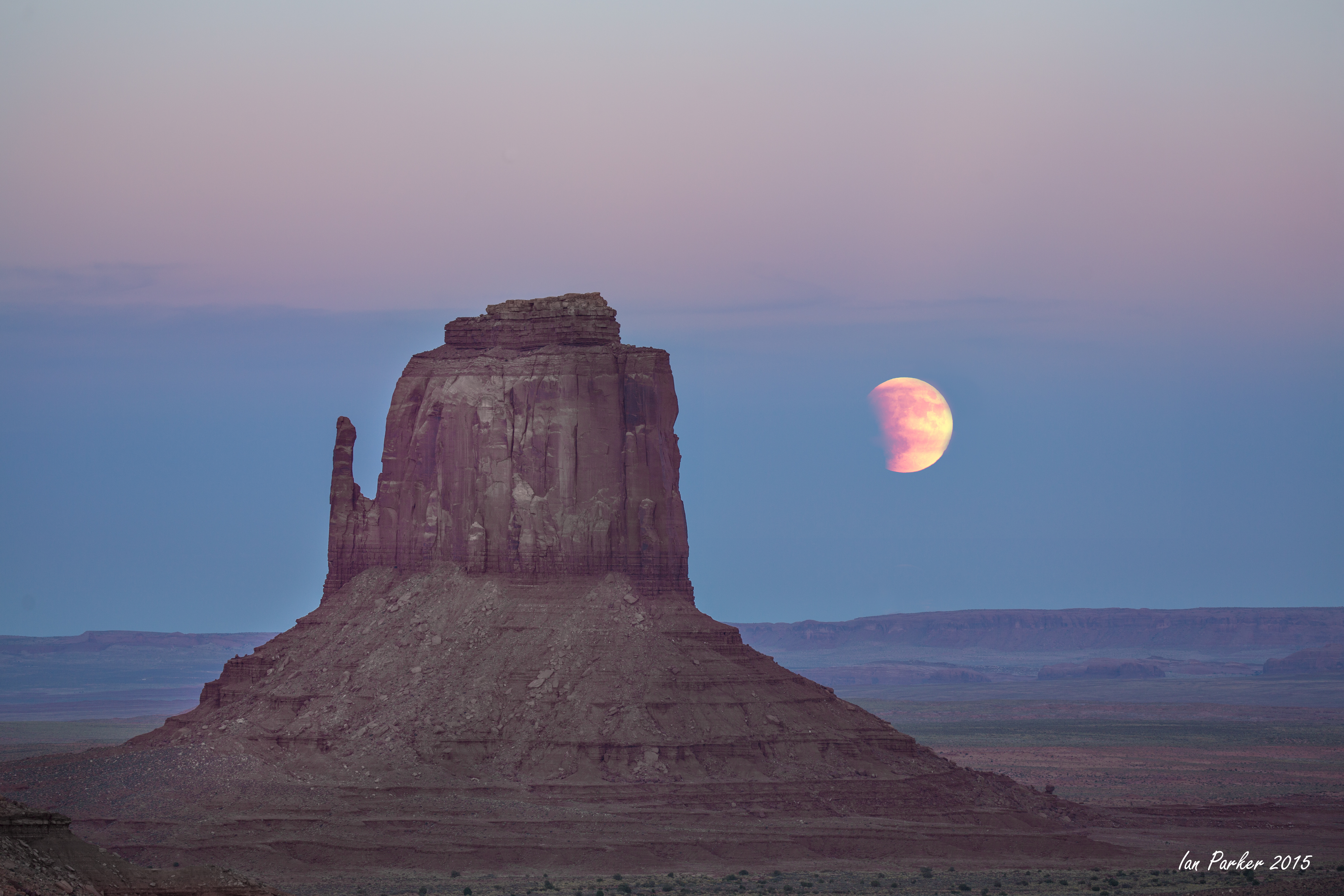
October 3rd. New photos from a week-long trip through Utah to coincide with the last lunar eclipse of the tetrad.
It's a long drive from California to Utah, so I detoured for the night to Little Finland (Hobgoblin's Playground) in Nevada. A fun place to experiment with a new 8mm Rokinon fish-eye lens.
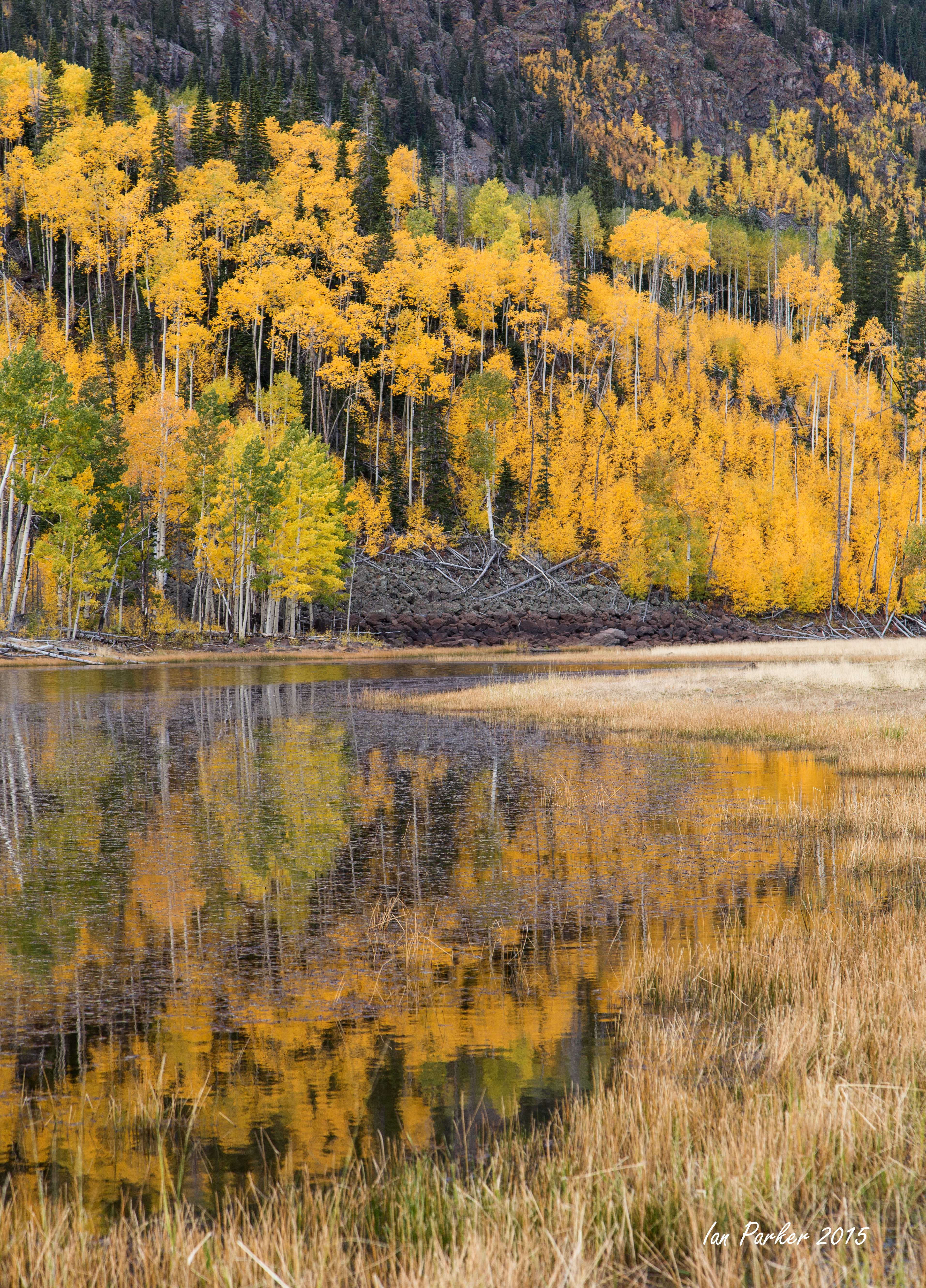
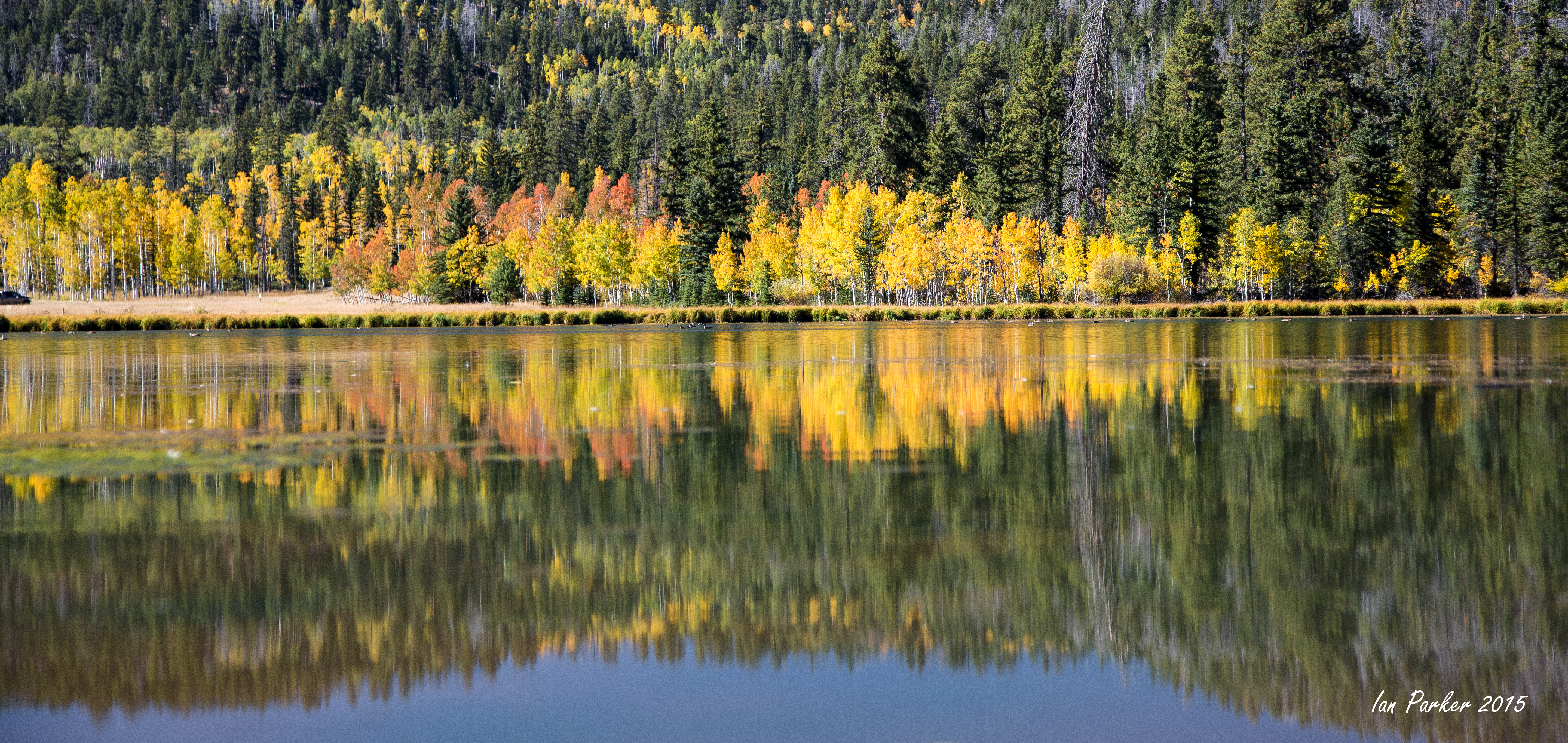
Corssing over the mountains by Cedar Breaks and then over Boulder Mountain, the aspens were in fine color above about 9000 ft elevation.
Back in red-rock country driving through Escalante and Hanksville.
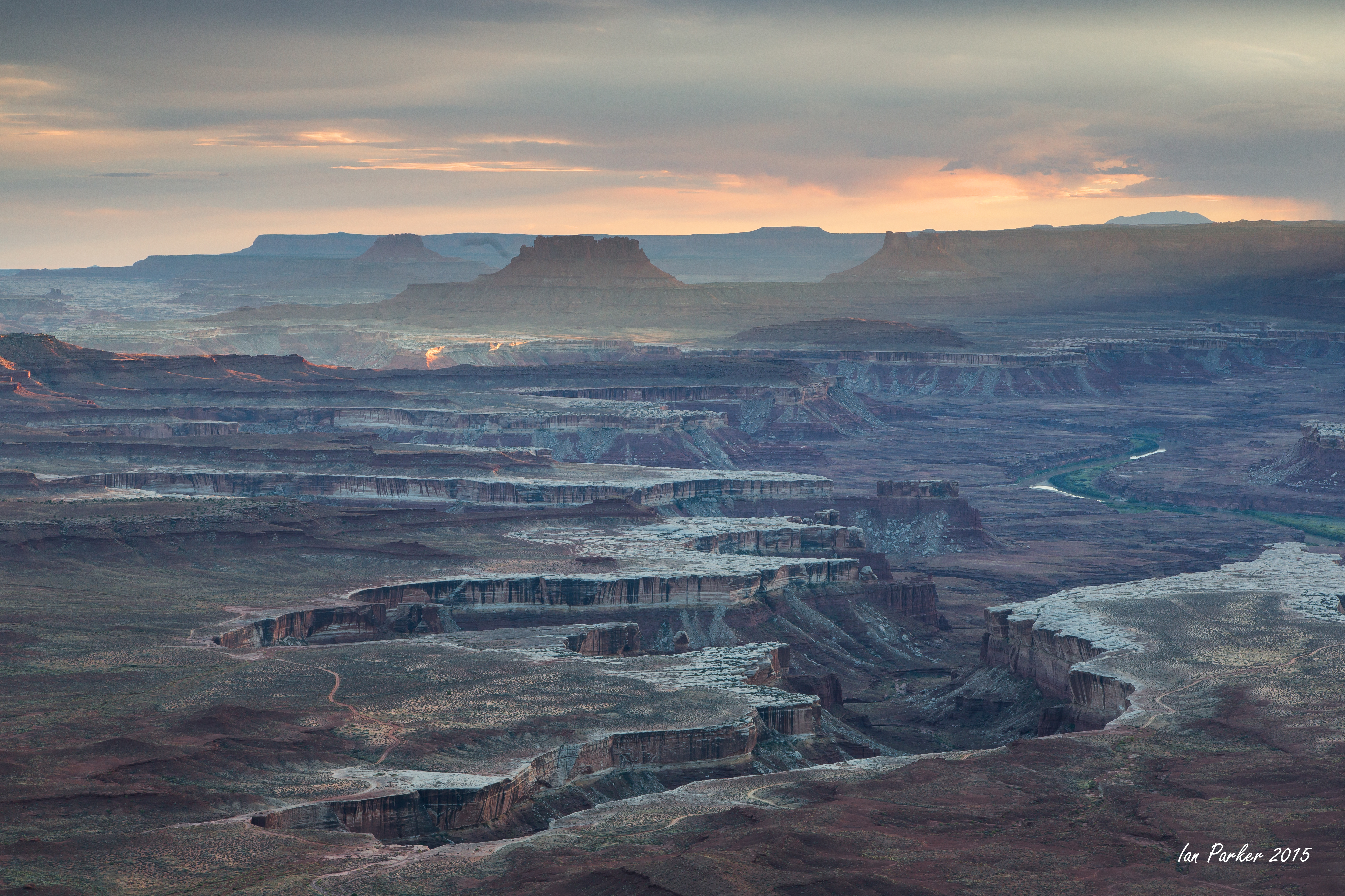
I went up to the Island in the Sky region of Canyonlands intending to try to get a better shot from False Kiva in late afternoon light, but lost the trail where it rims out (despite having followed it with no problems several years ago when the trail was much less defined). Returning to my car, there was just time left to drive to Green River overlook for sunset photos.
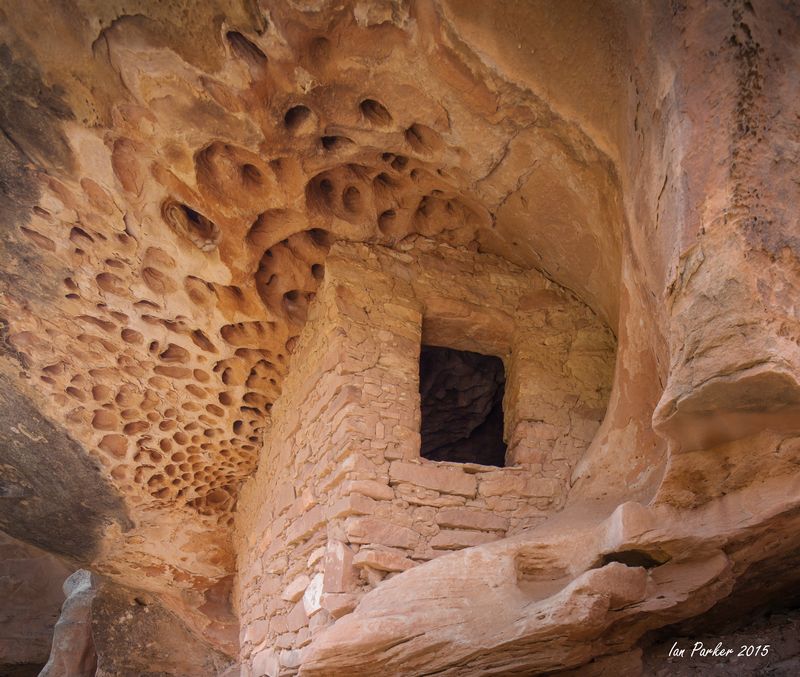
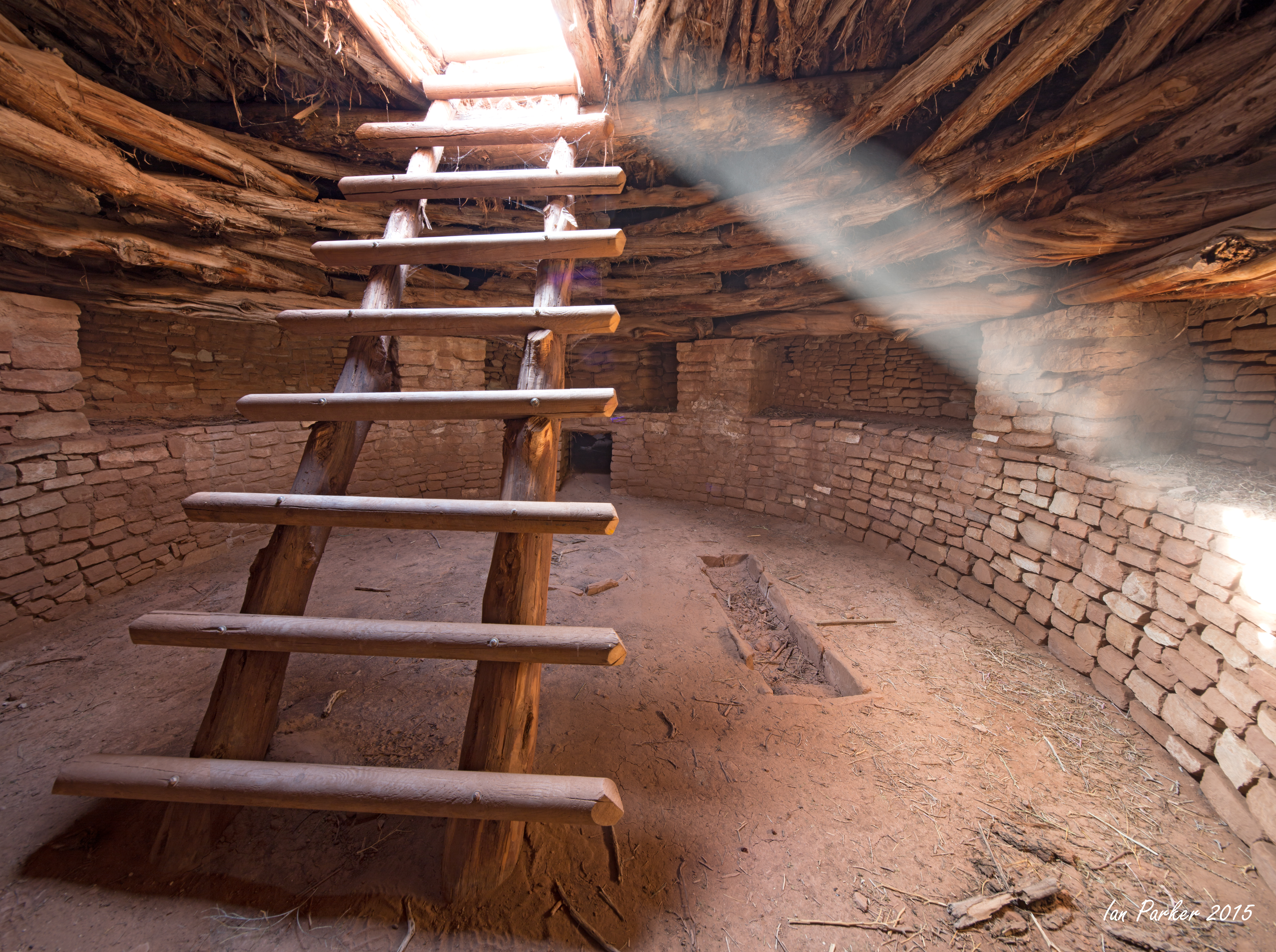
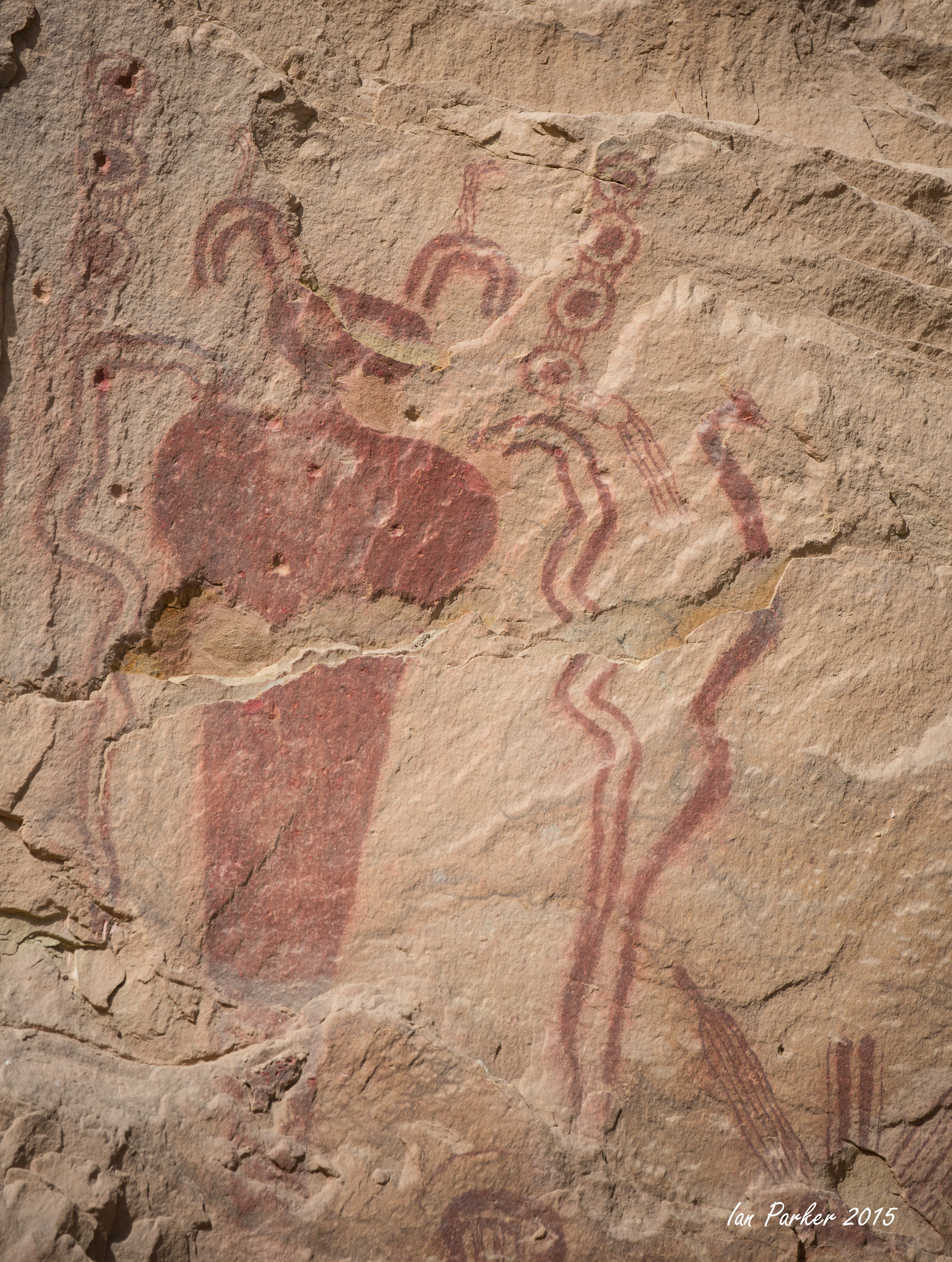
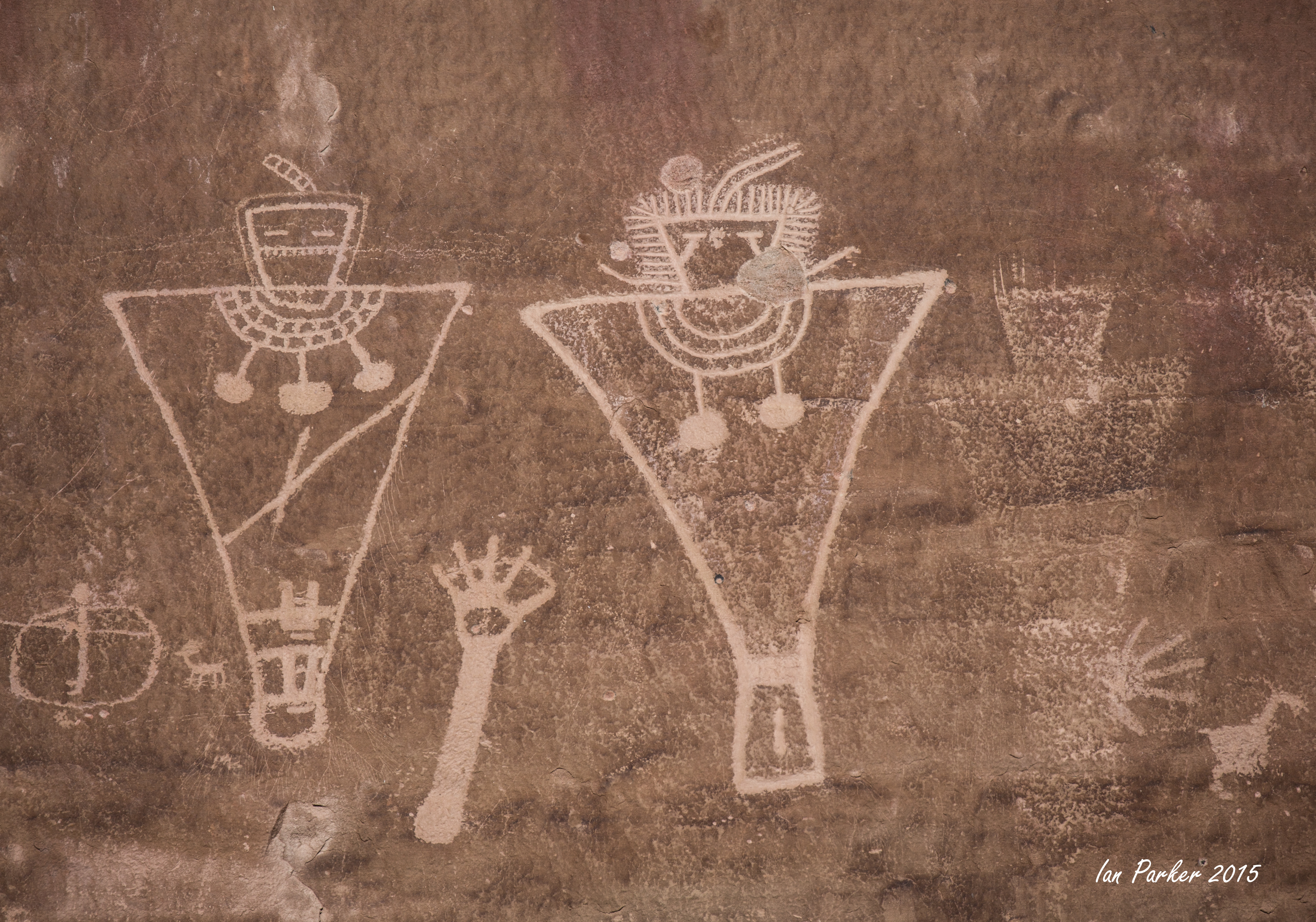
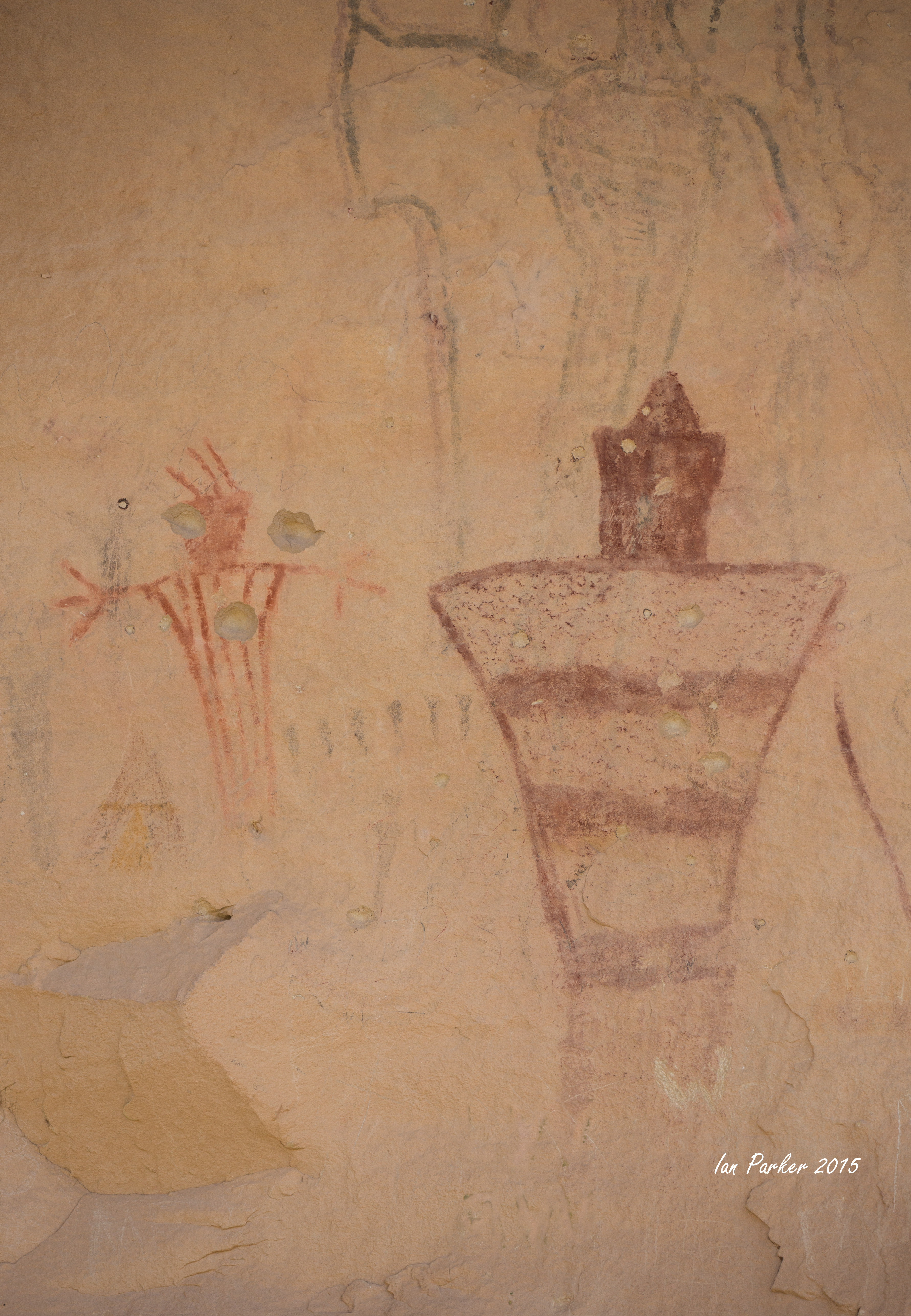
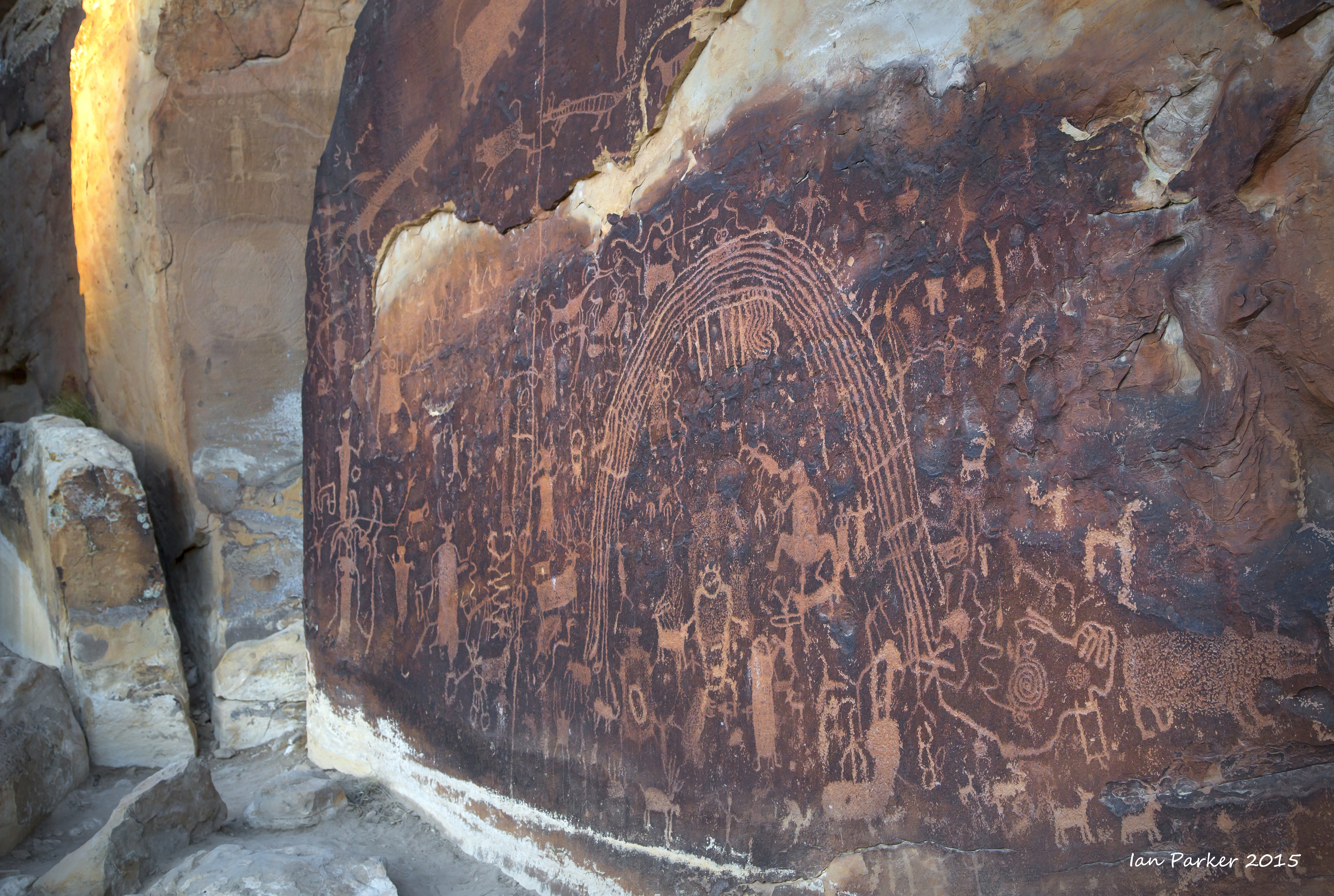
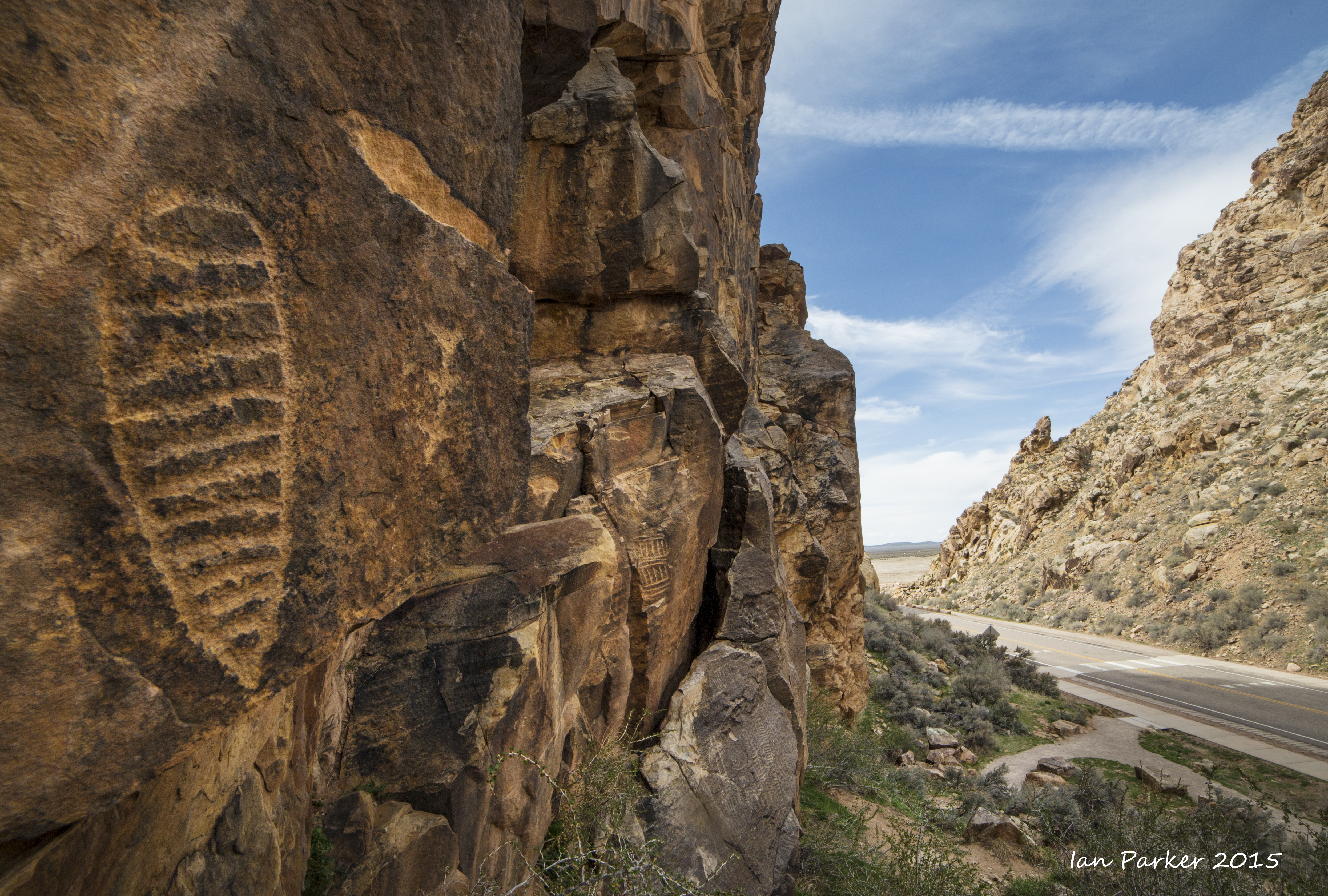
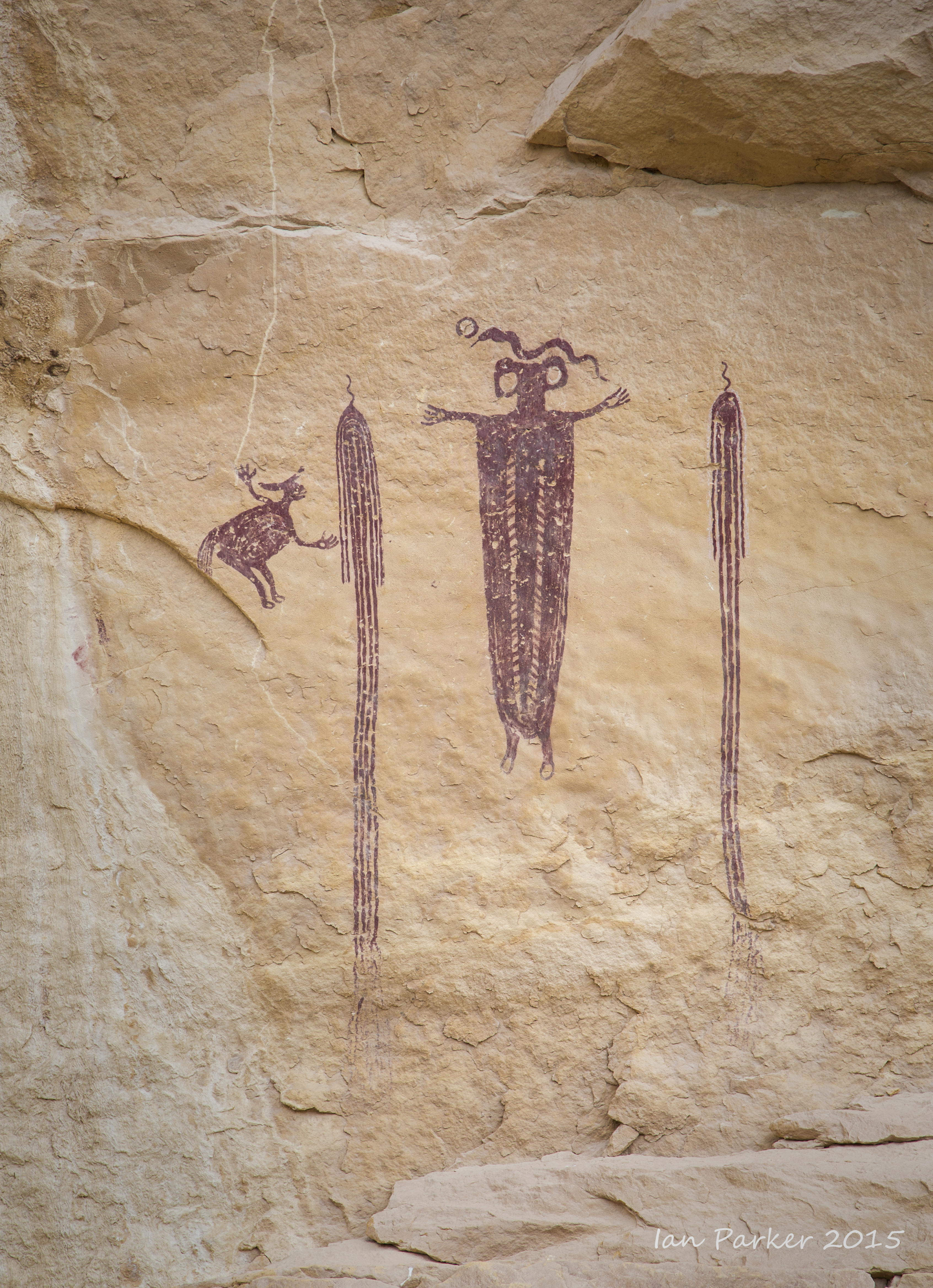
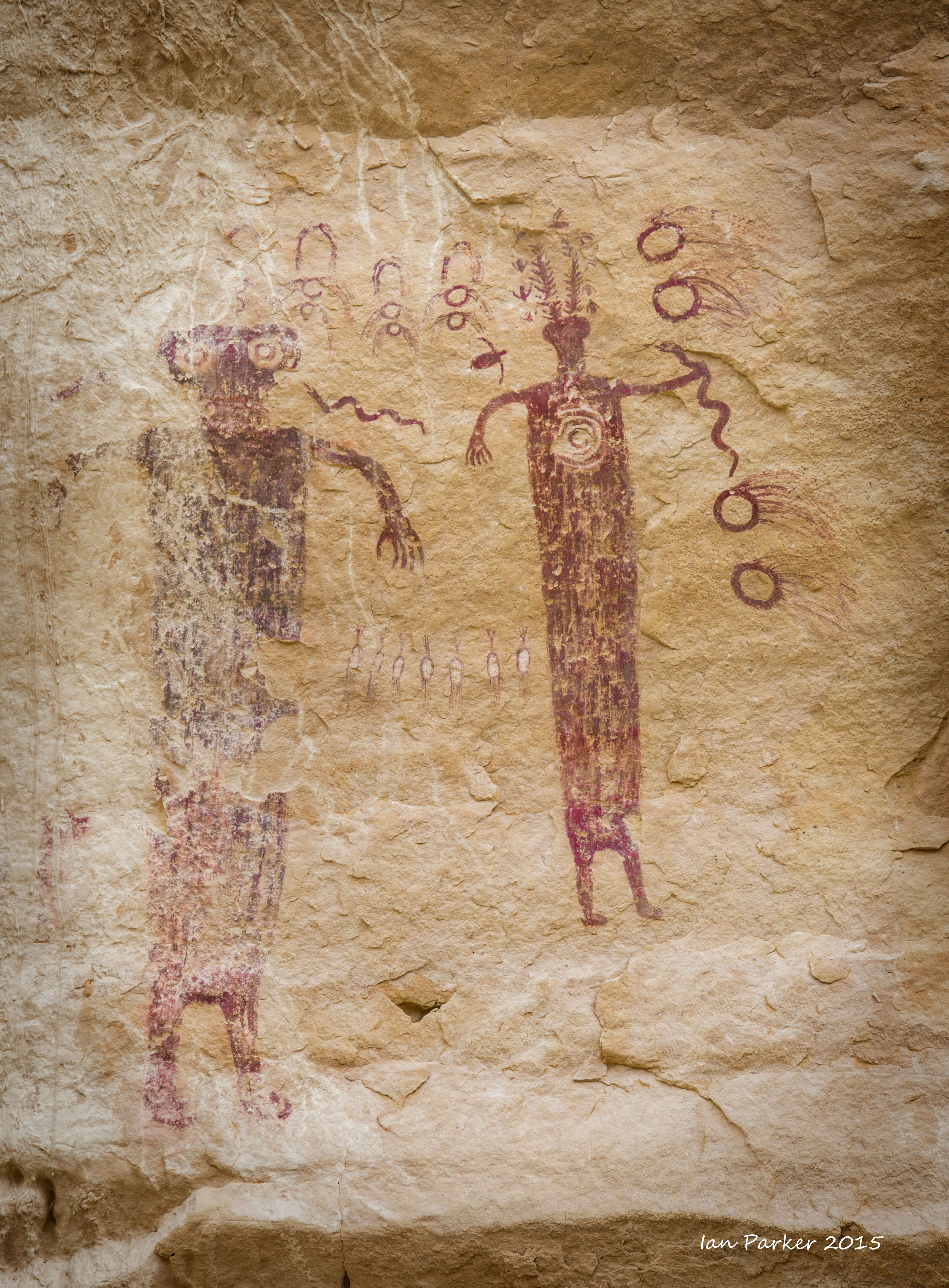
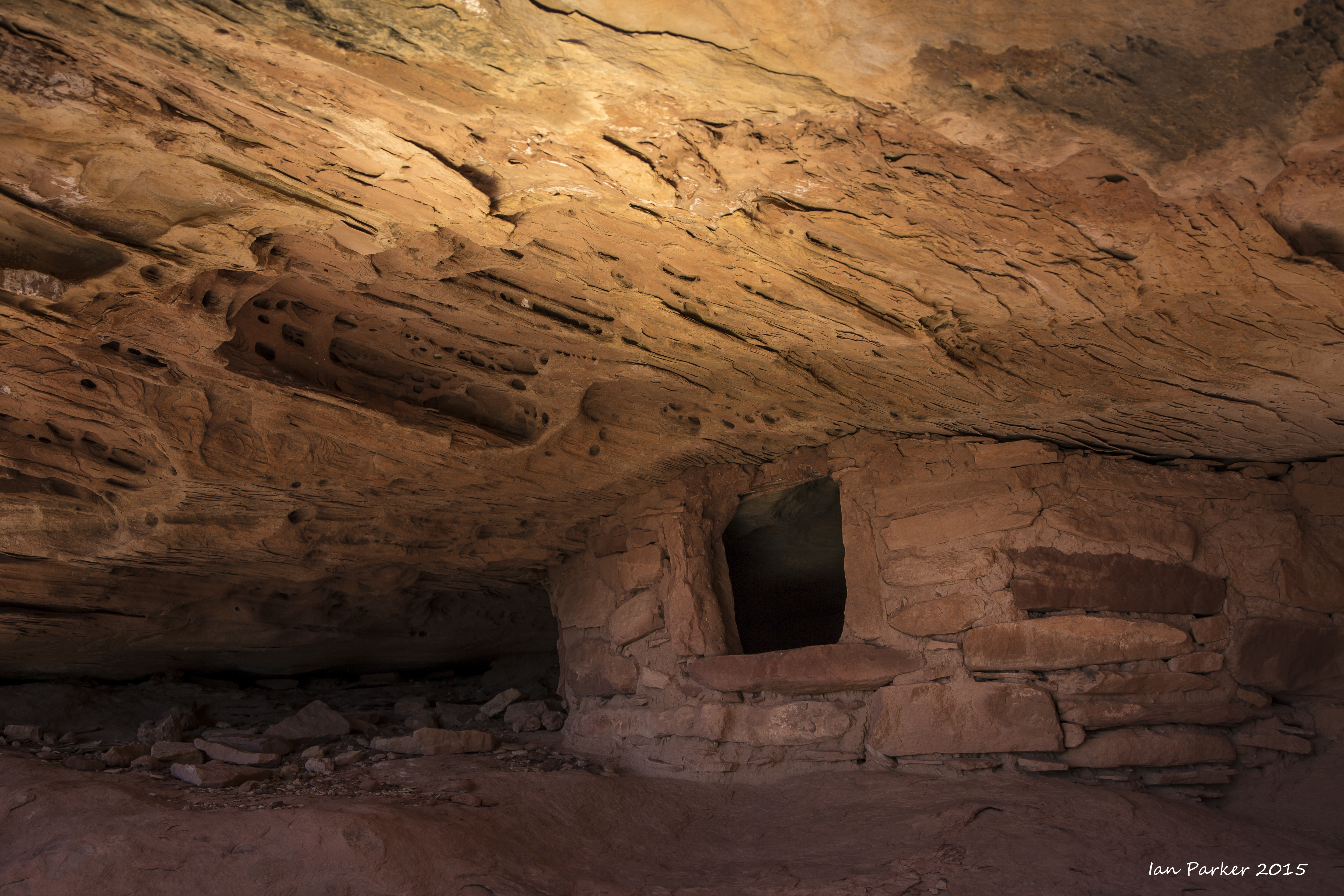
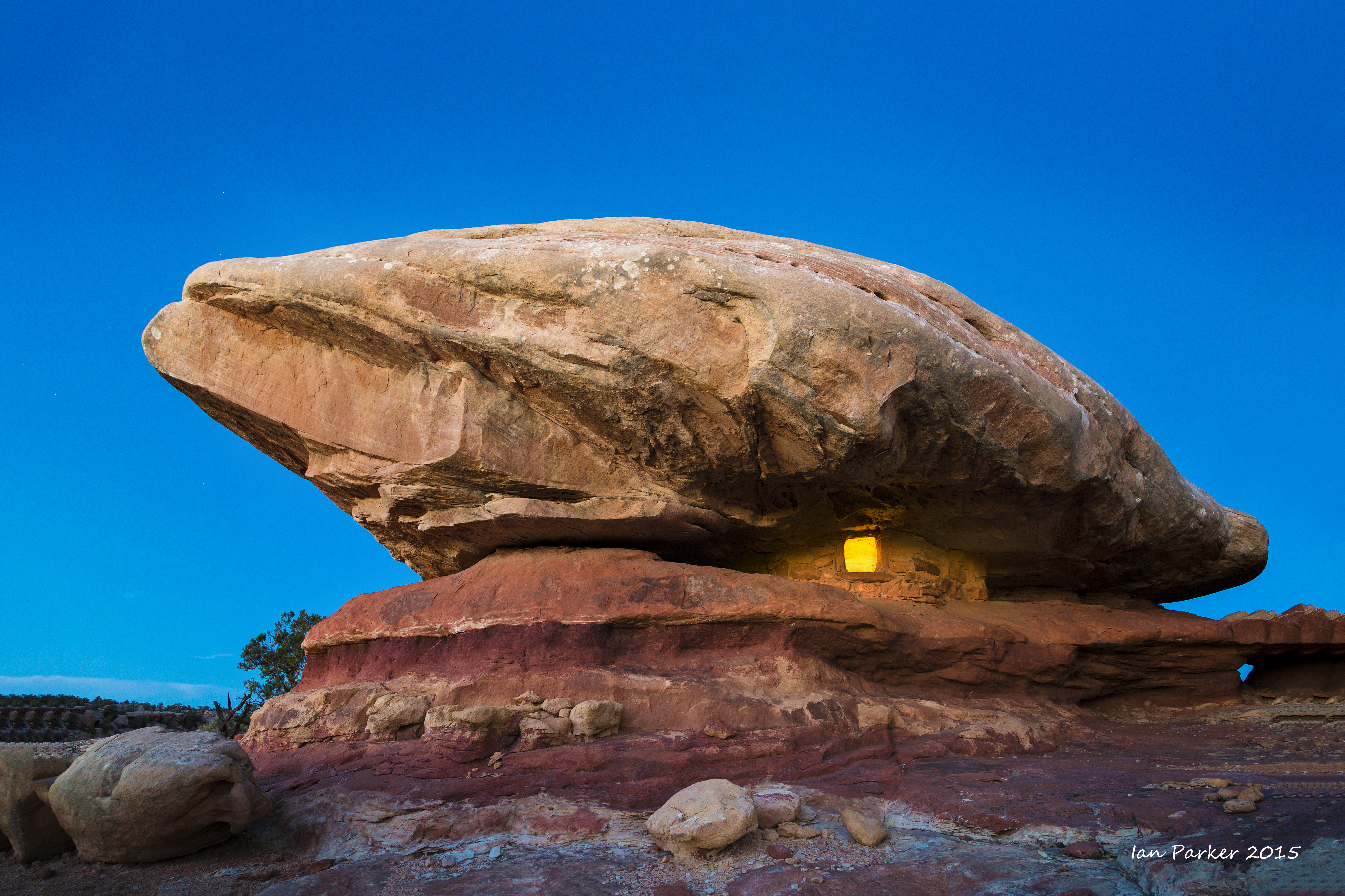
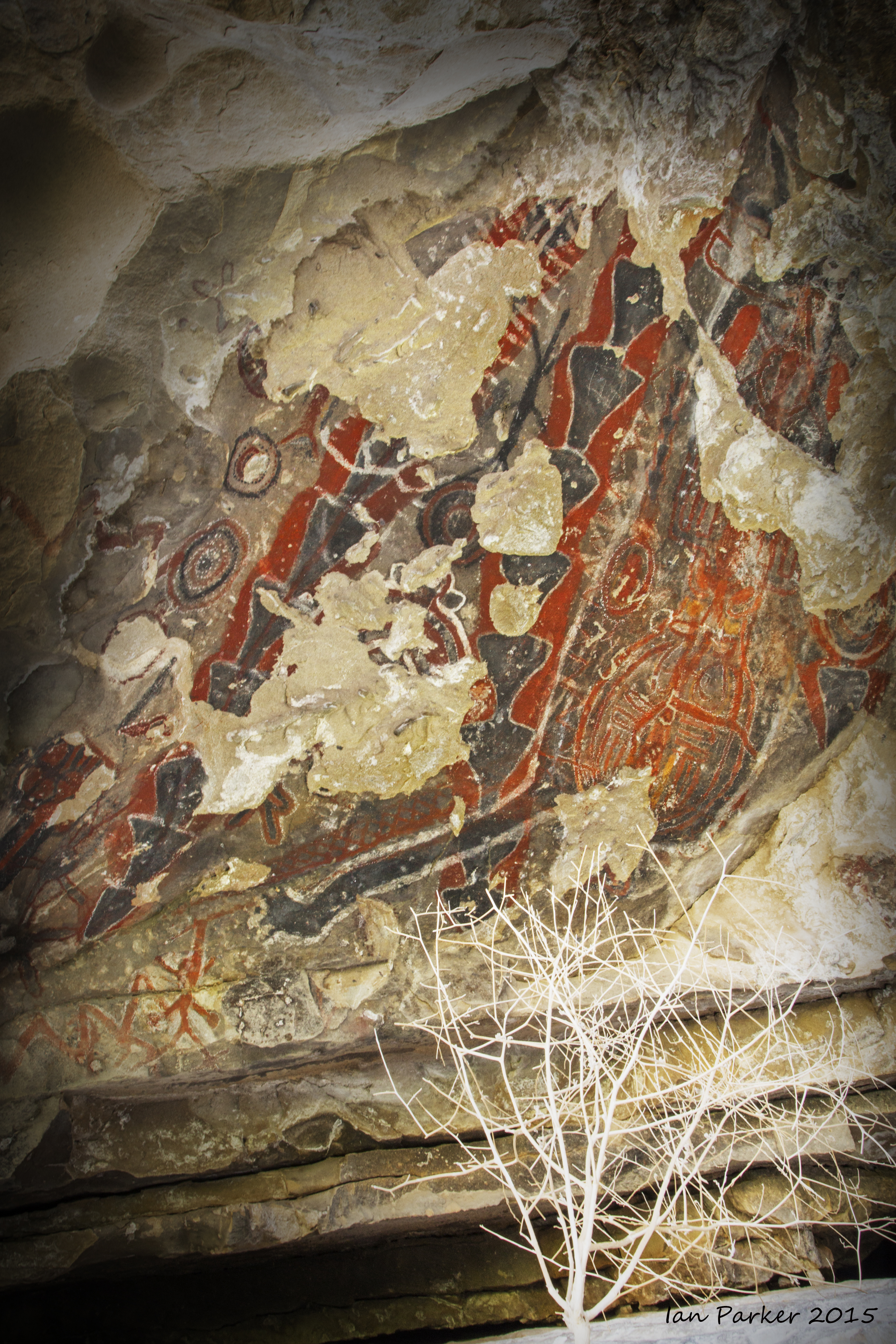
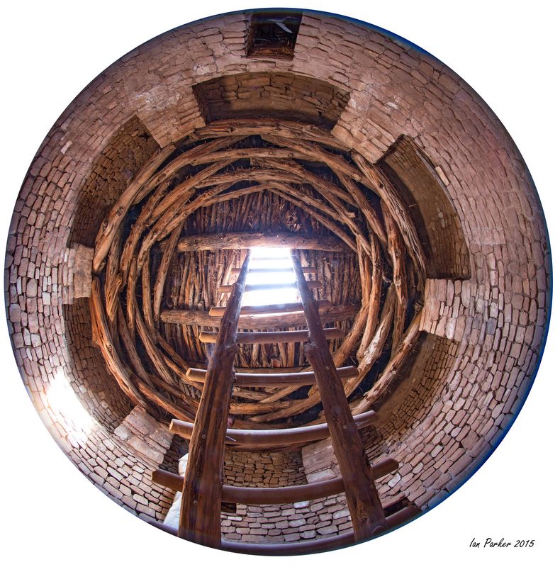
Visiting with the Anasazi.
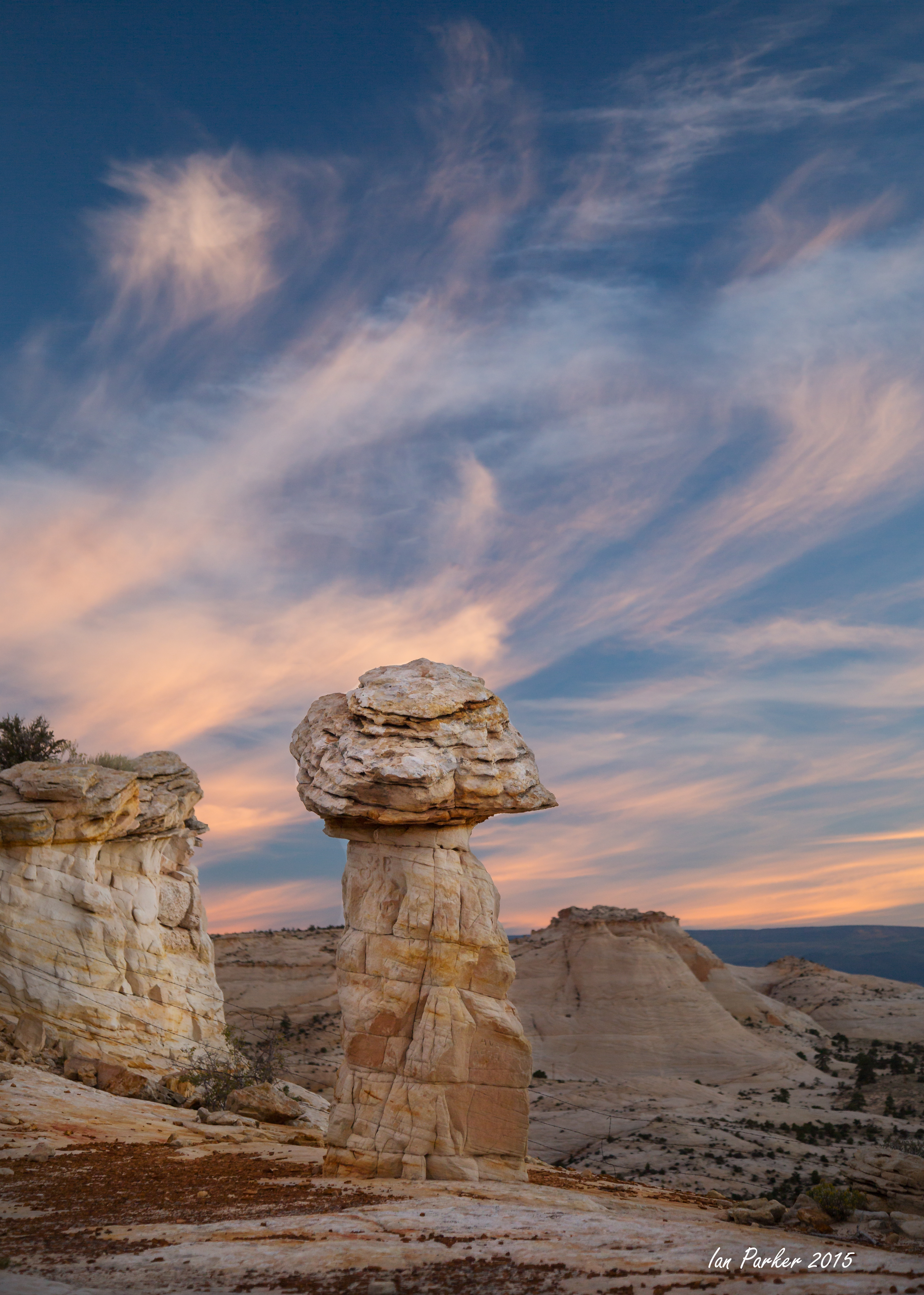
Night and sunrise views of 'tent rocks' in remote Pine Park on the Utah-Nevada border.
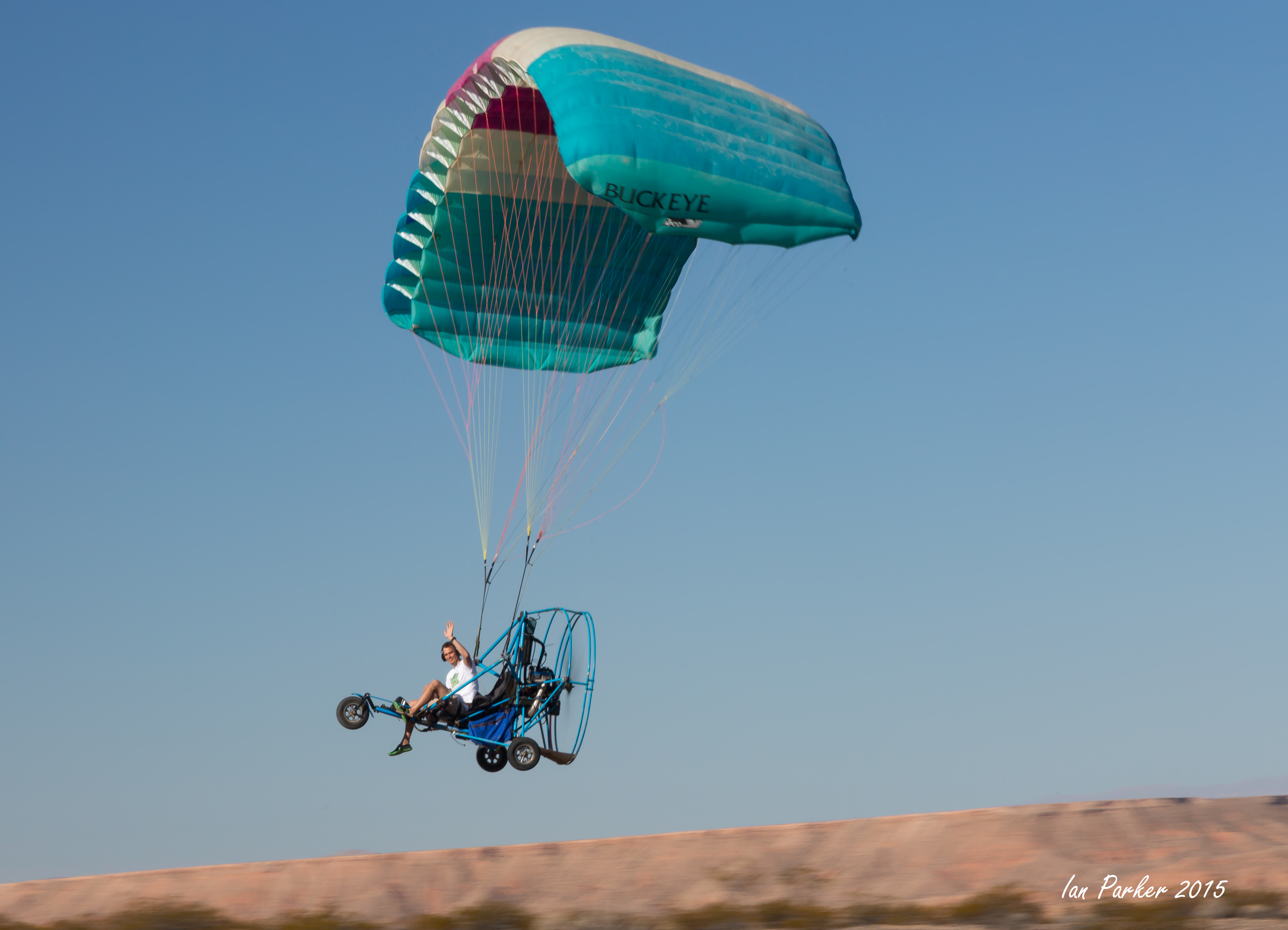
My excuse for this trip - to photograph the lunar eclipse over Monument Valley
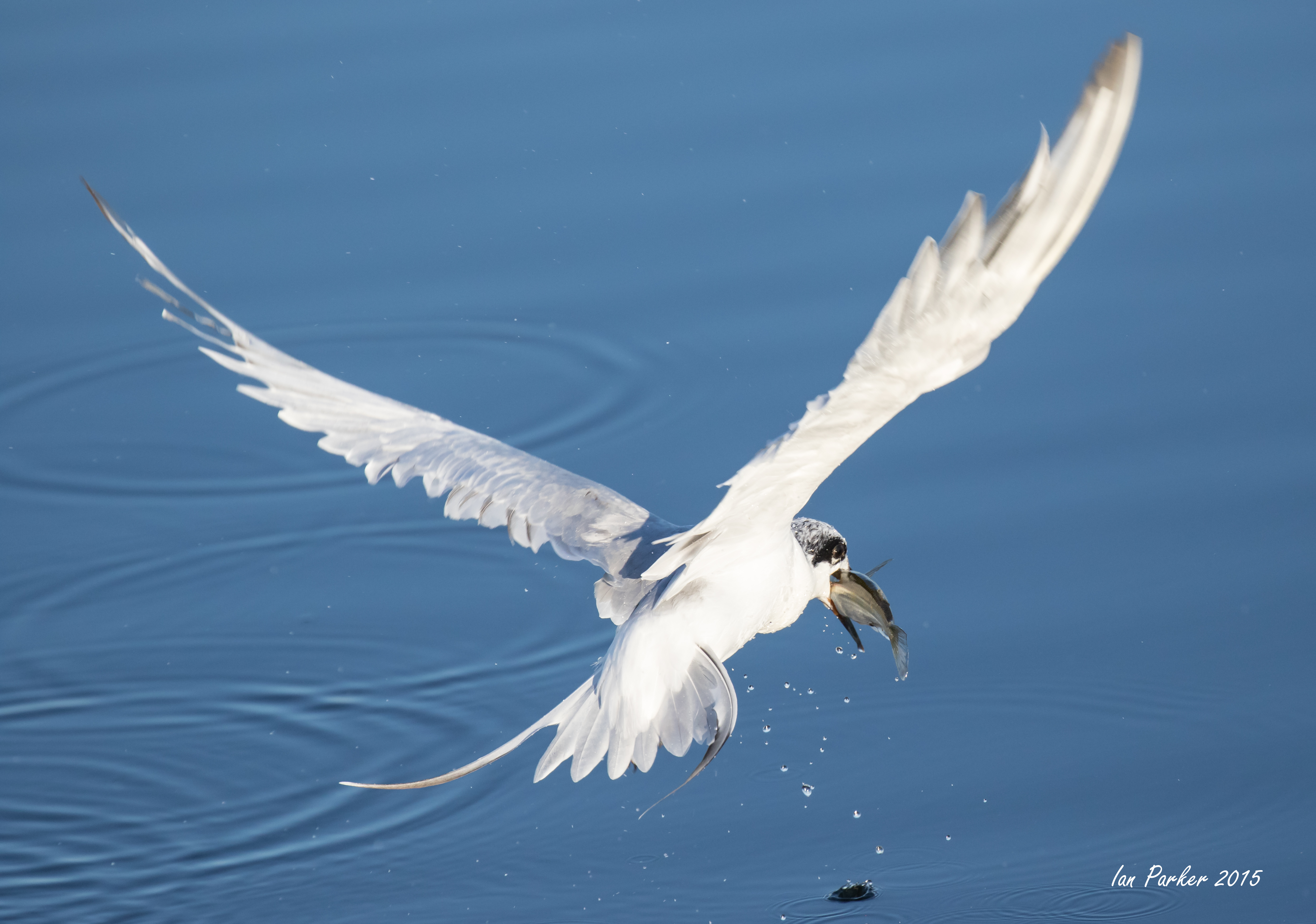
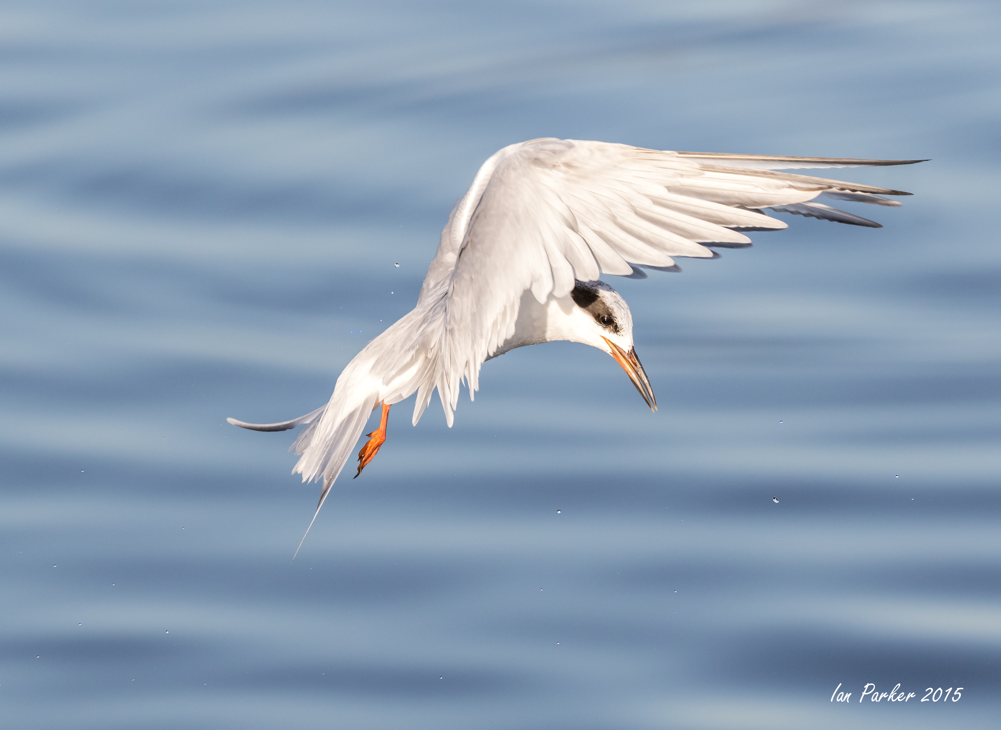
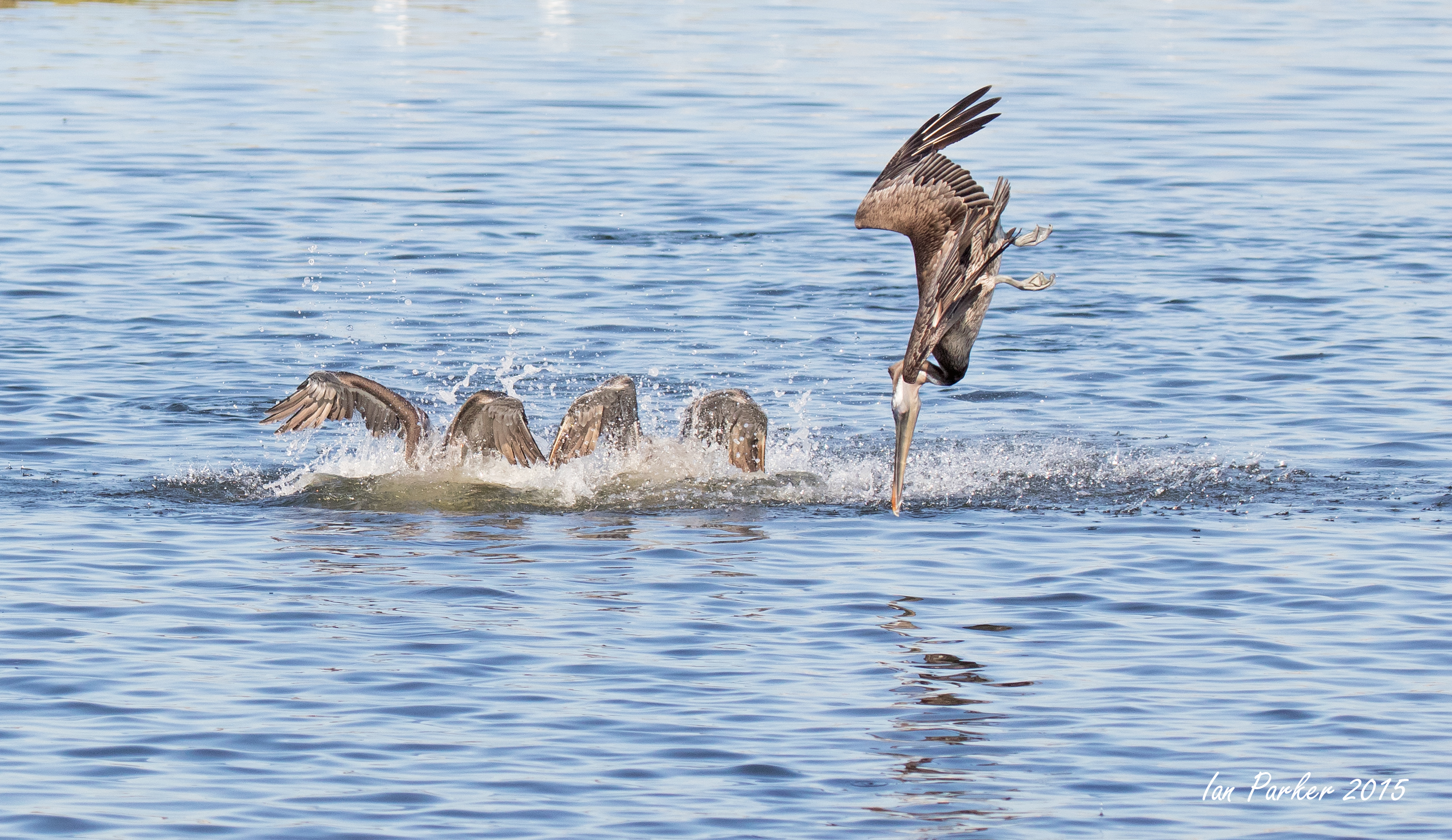
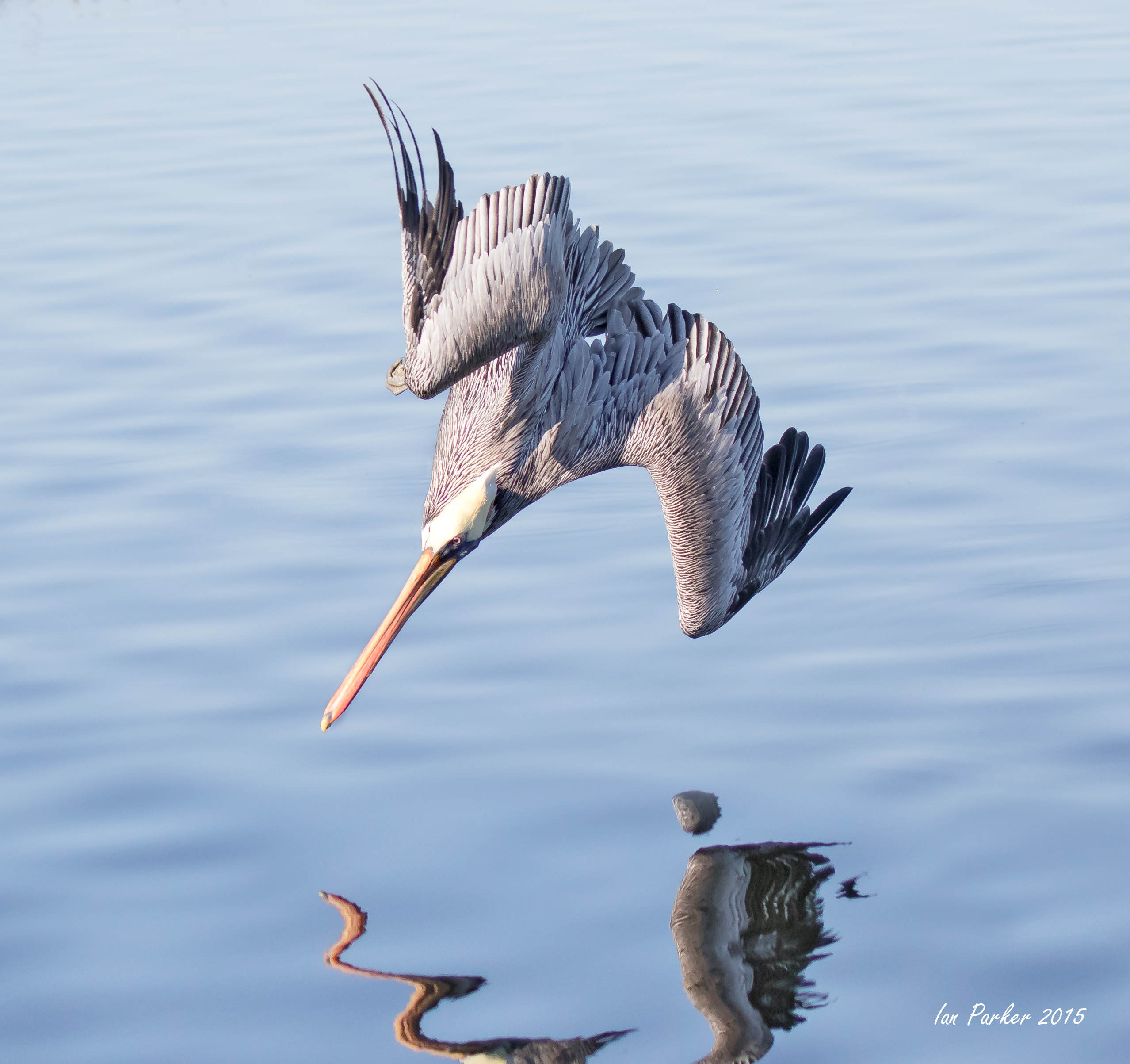
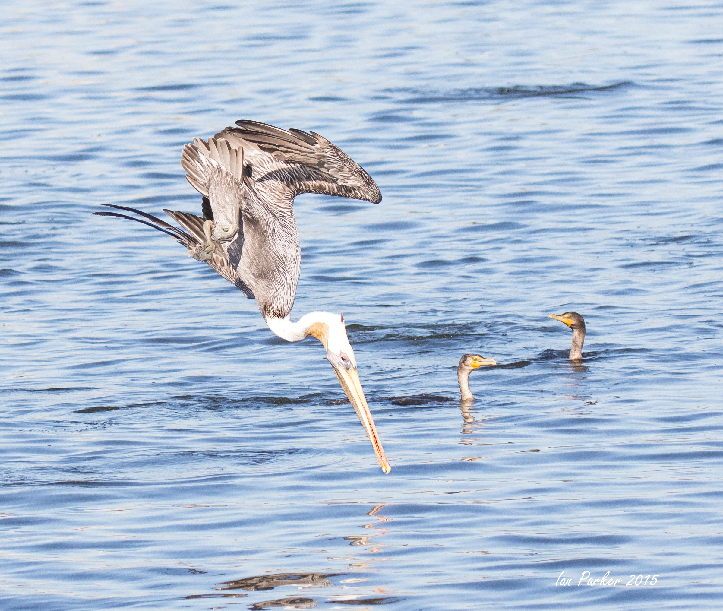
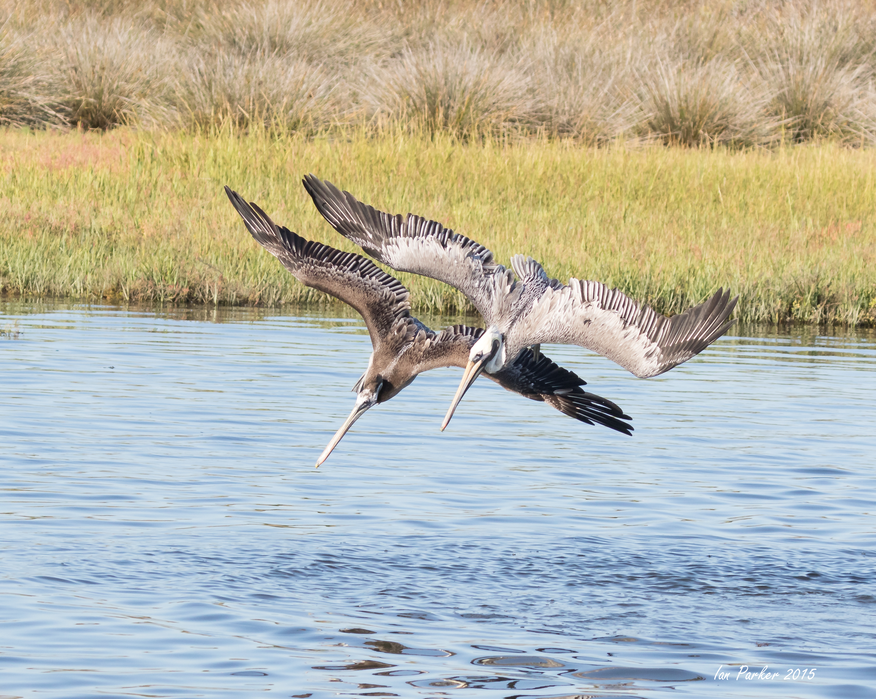
Sept. 20th. A much better morning at Bosa Chica - entertained by a pelican feeding frenzy
A couple of Sunday mornings at Bolsa Chica - not much happening, just a few terns and a solitary pelican
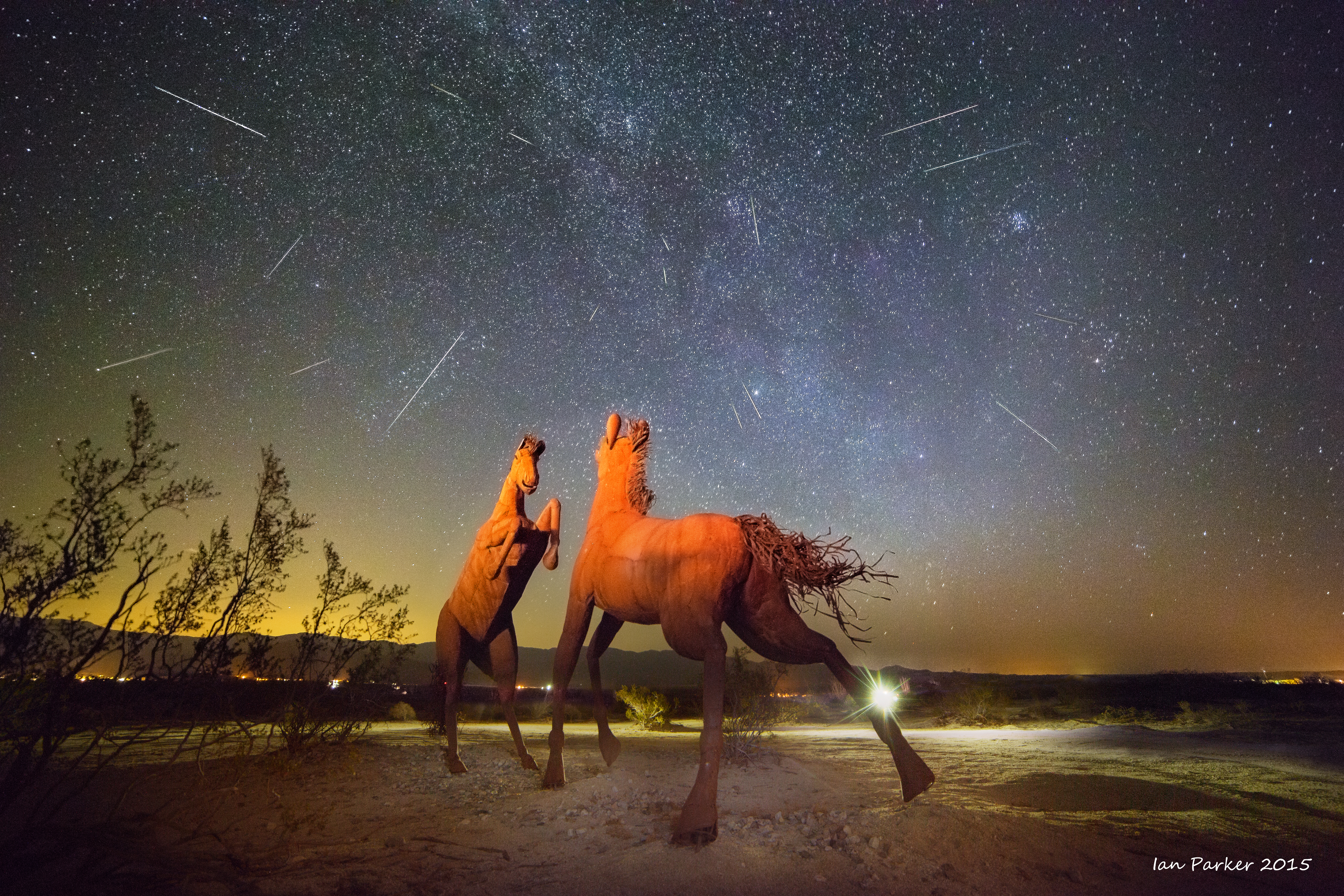
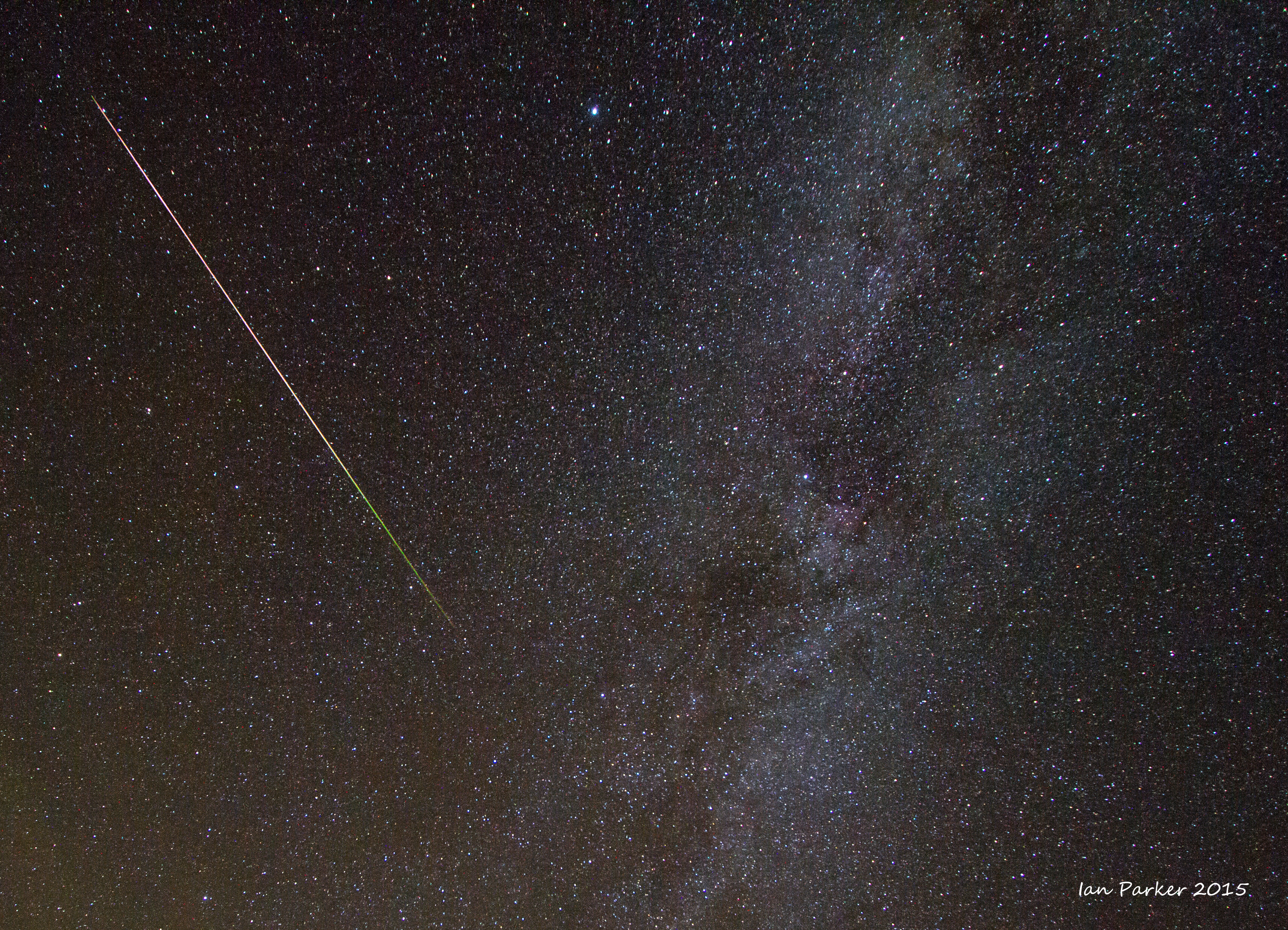
Night of August 12-13; A quick trip to Borrego Springs to find dark skies and interesting foreground to photograph the Perseid meteor shower
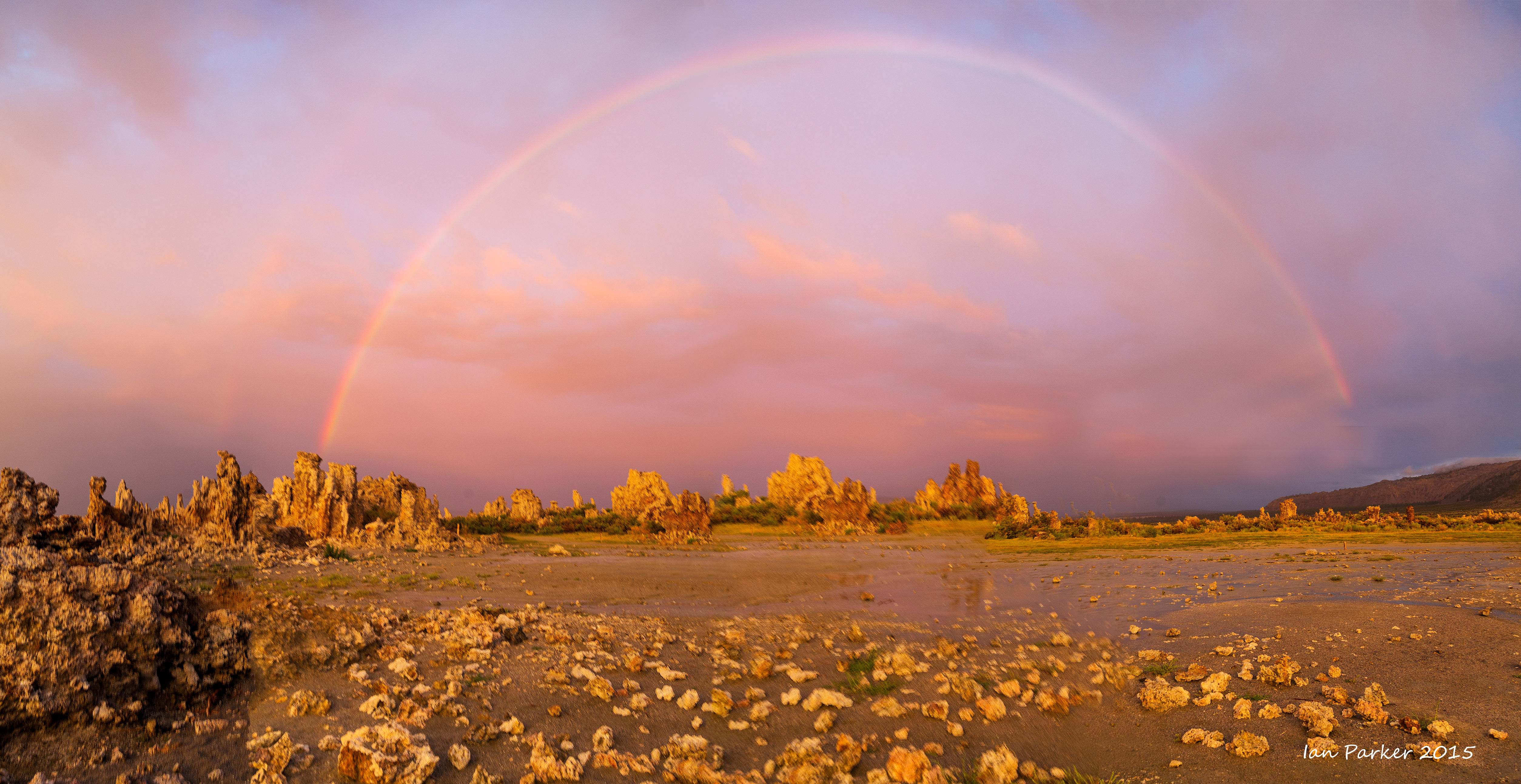
August 1st, 2015; A lightning show, followed by the most incredible sunset at Mono Lake
The morning had started clear, but fluffy white clouds started to develop during the day and by mid afternoon had formed towering thunderheads. I went down to the South Tufa area of Mono Lake to try out my new lightning trigger. I set up the camera on a tripod, pointed it in a direction that looked promising for lightning strikes, and let the trigger do its thing. A rather twitchy device it set off the shutter for the slightest cause - lightning behind the camera, someone walking in front, and often for no apparent reason at all. But it did catch strikes within the frame, and after deleting over a hundred 'failed' shots I was left with six good strikes to assemble into a composite.
I had been carefully noting the intervals between lightning and thunder, and when the strikes seemed to be getting too close I beat a hasty retreat back to the the car. That was a good decision, both for safety and because the sky blackened and the rain became torrential. Soon after the lightning ceased, but the rain continued, with little visibility through the murk. All the other vehicles left the parking lot, but I stayed, re-reading the 'Worst Journey in the World' on my Kindle, and trying to convince myself that there was a faint brightning in the sky to the West and that maybe, just maybe there was a possibility of a sunset if the sun could break through over the mountains...
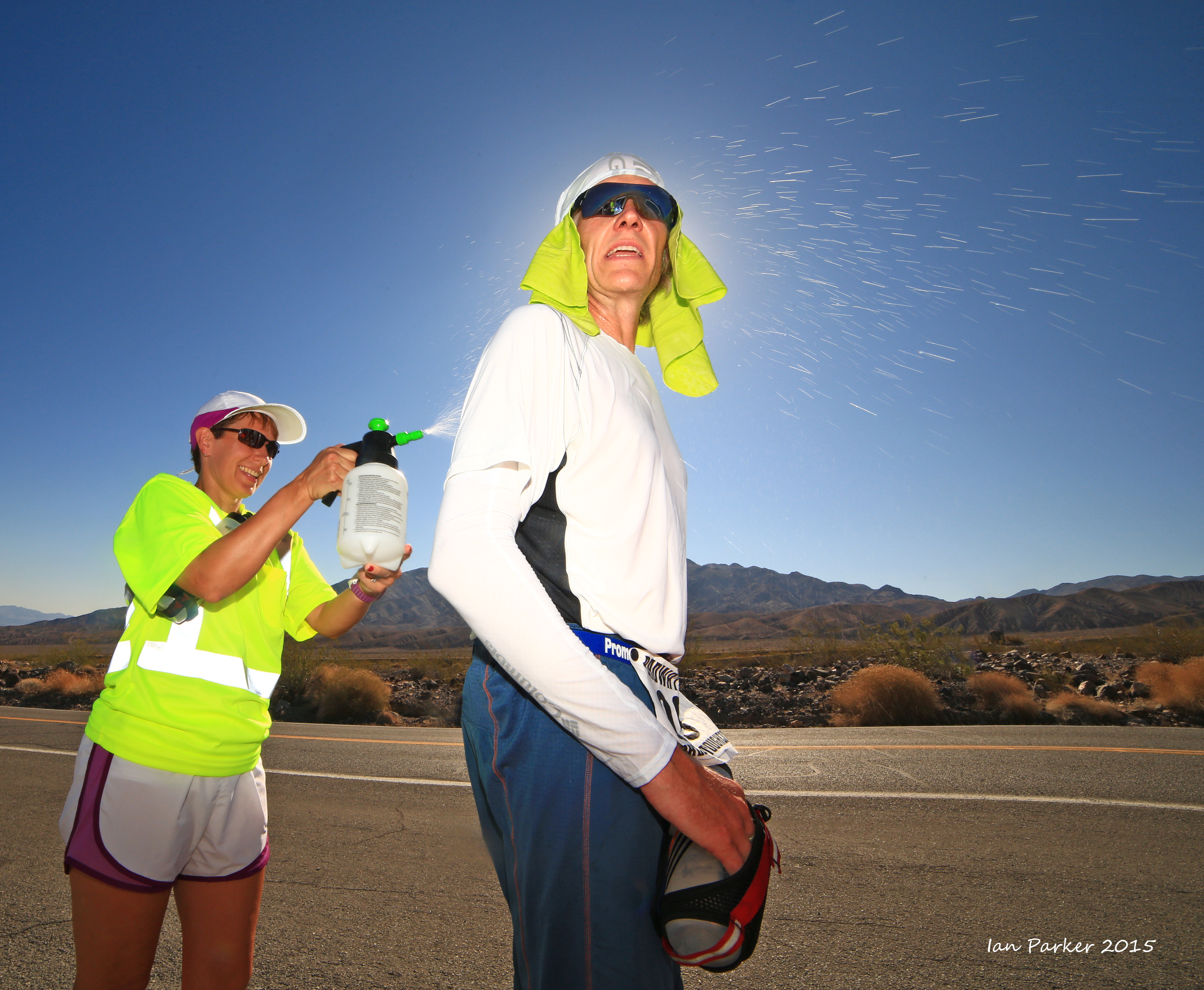
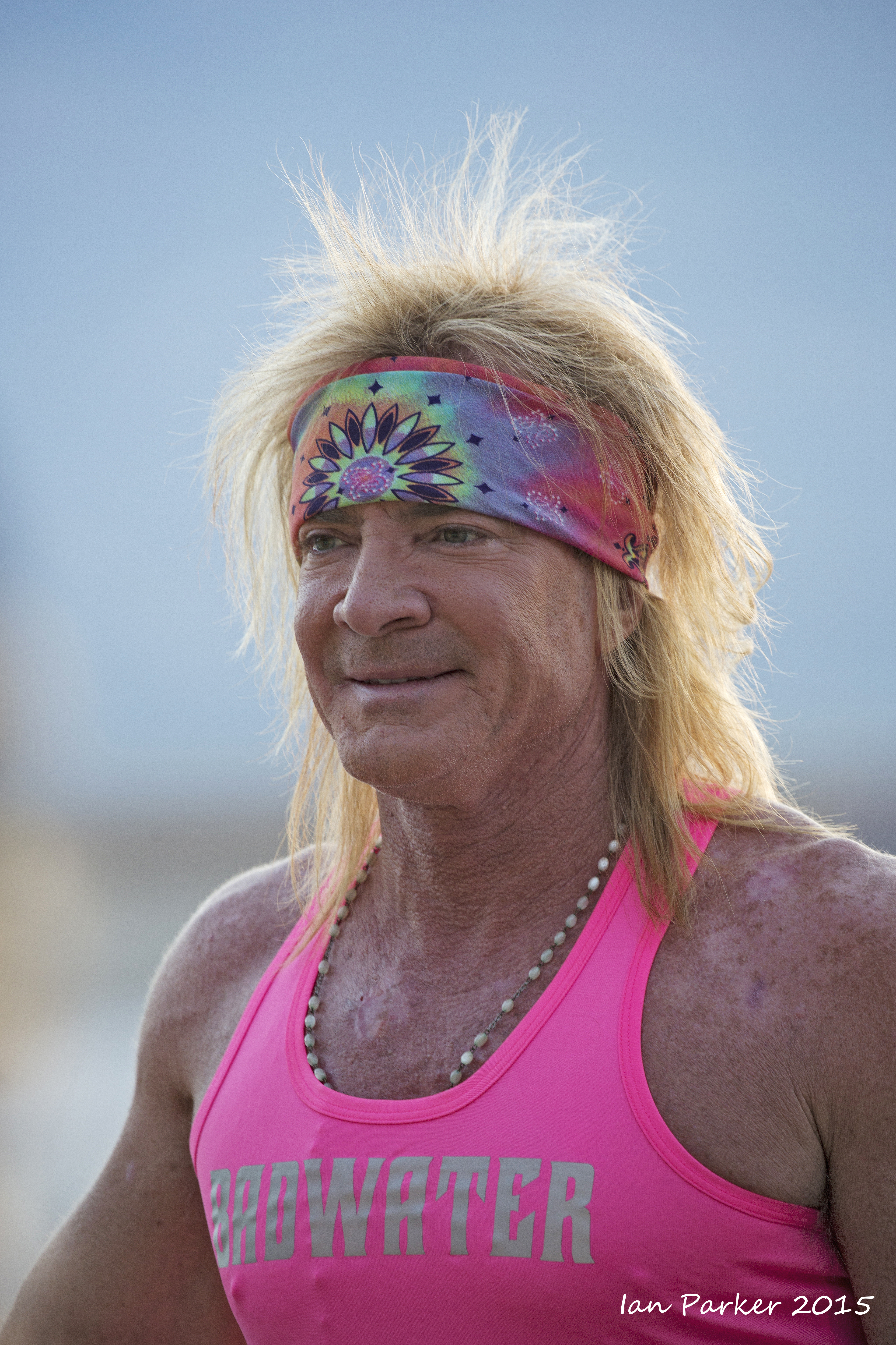
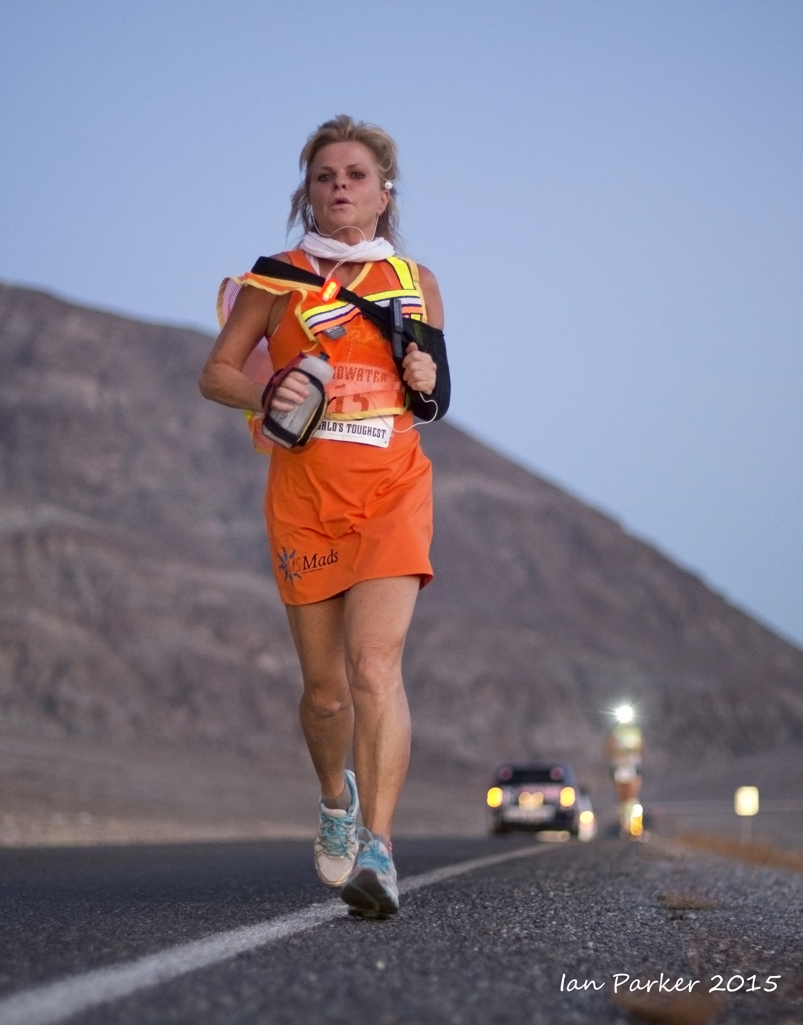
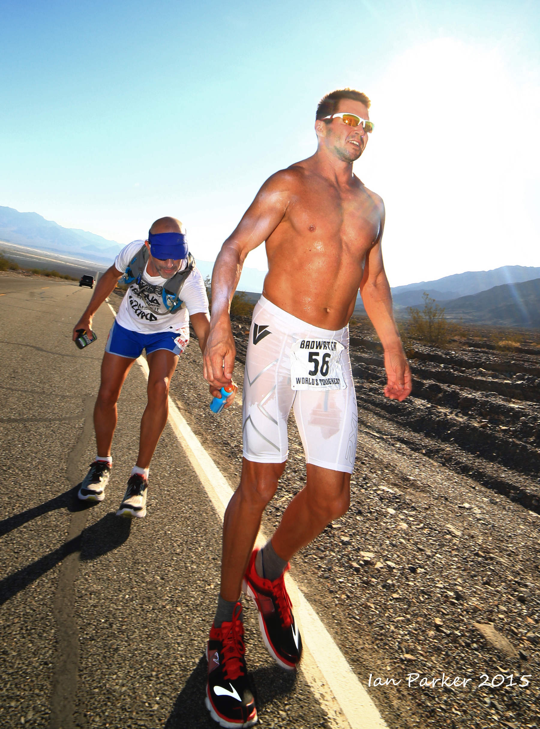
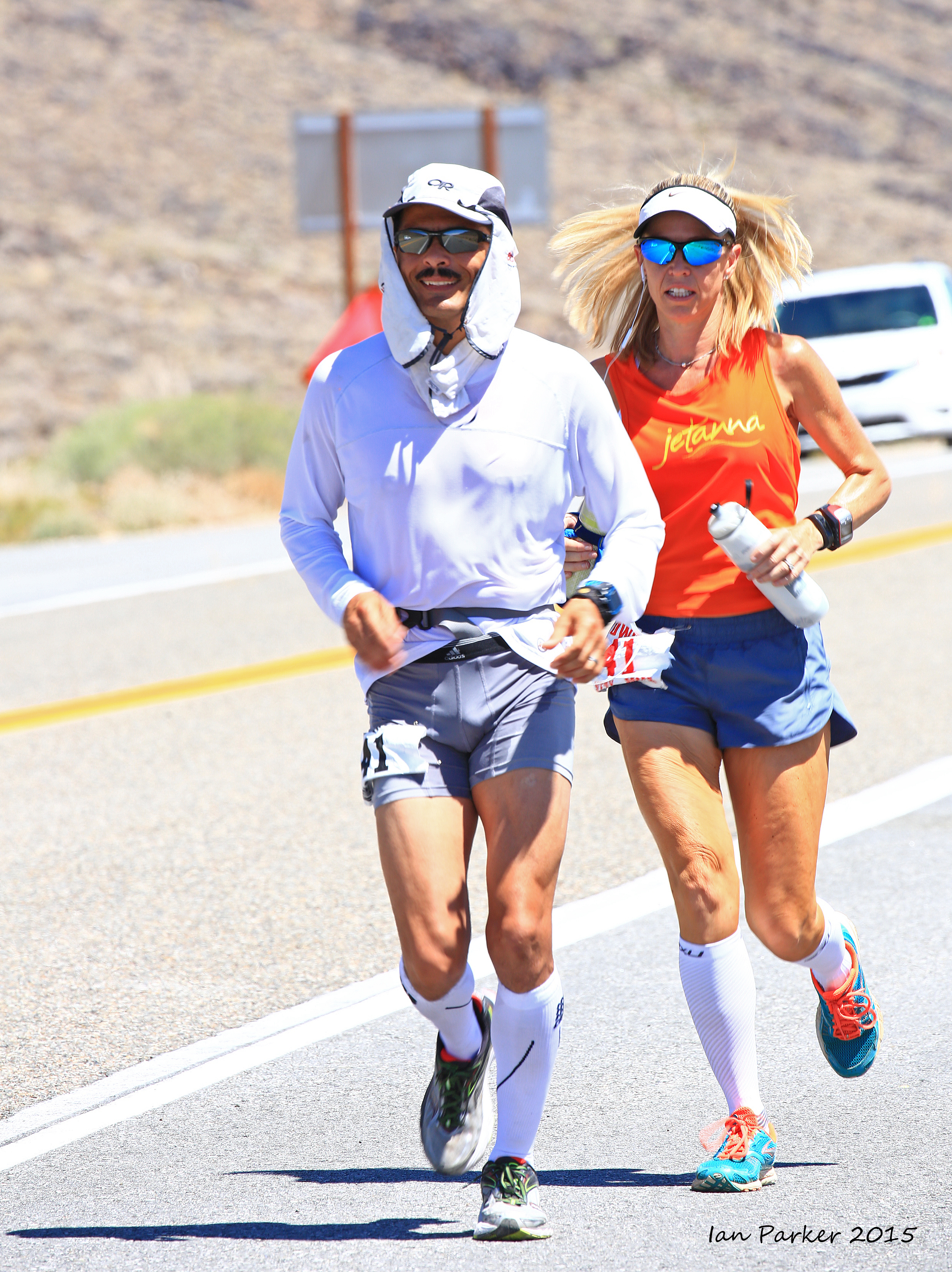
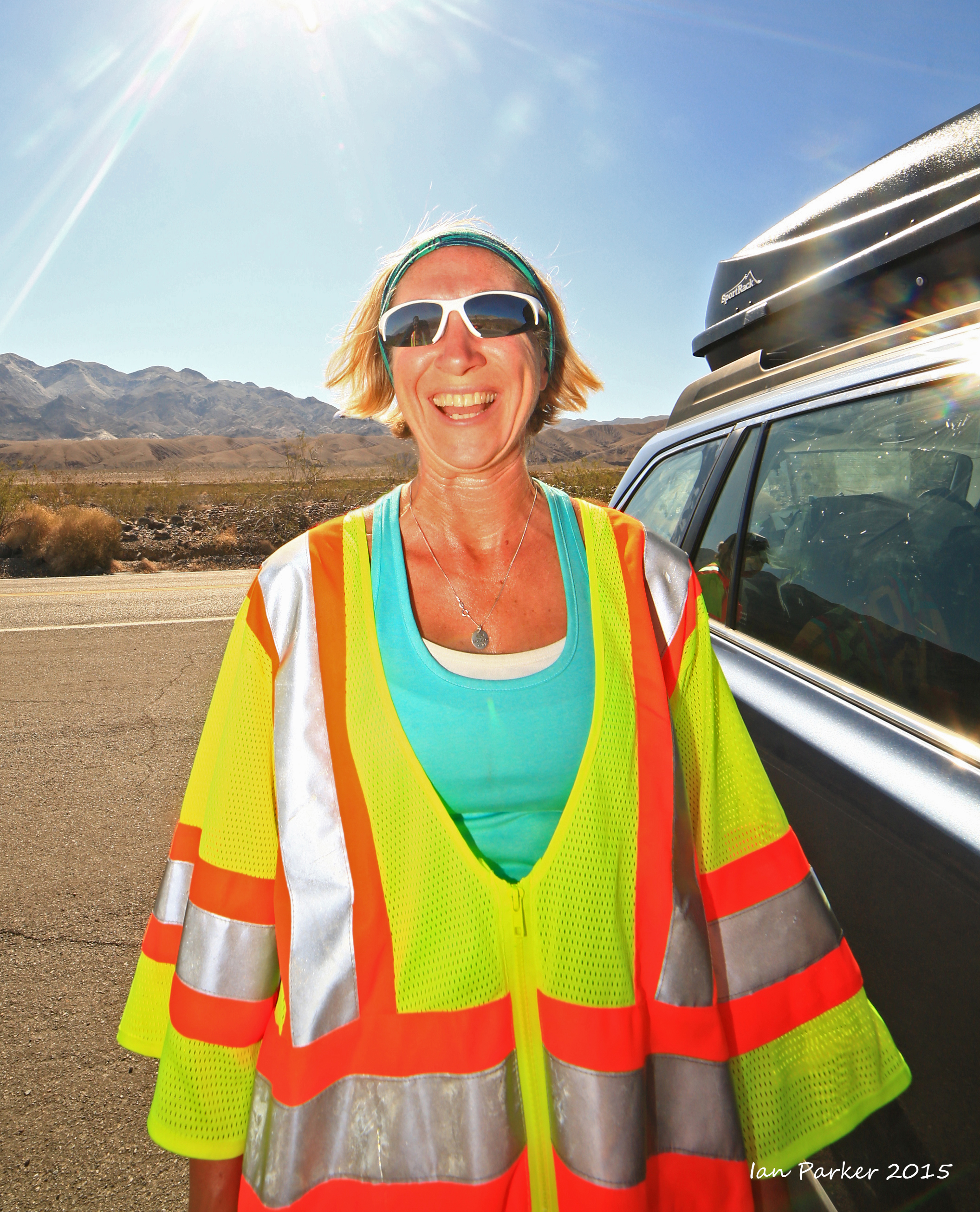
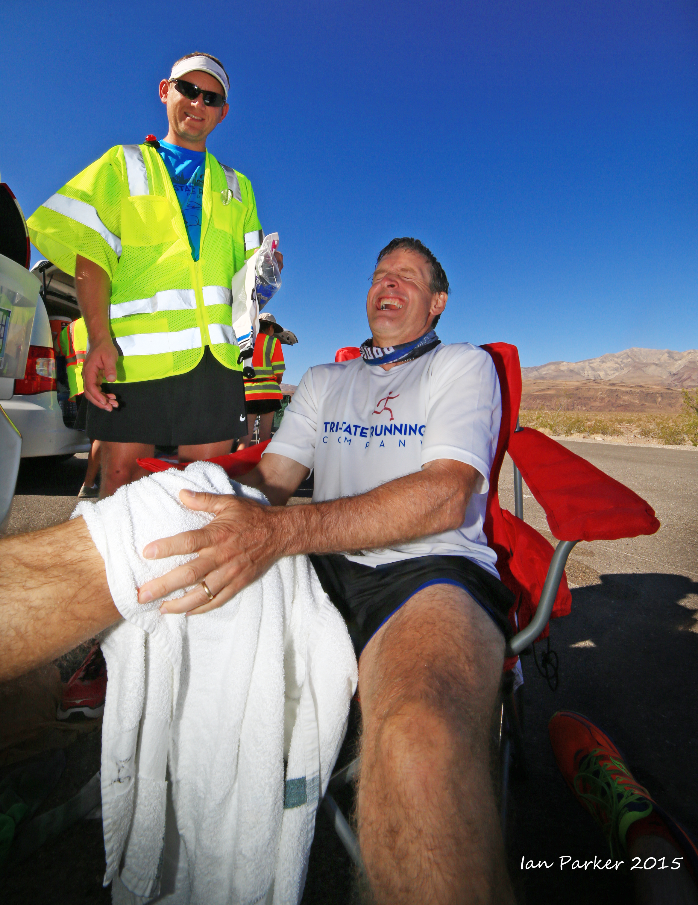
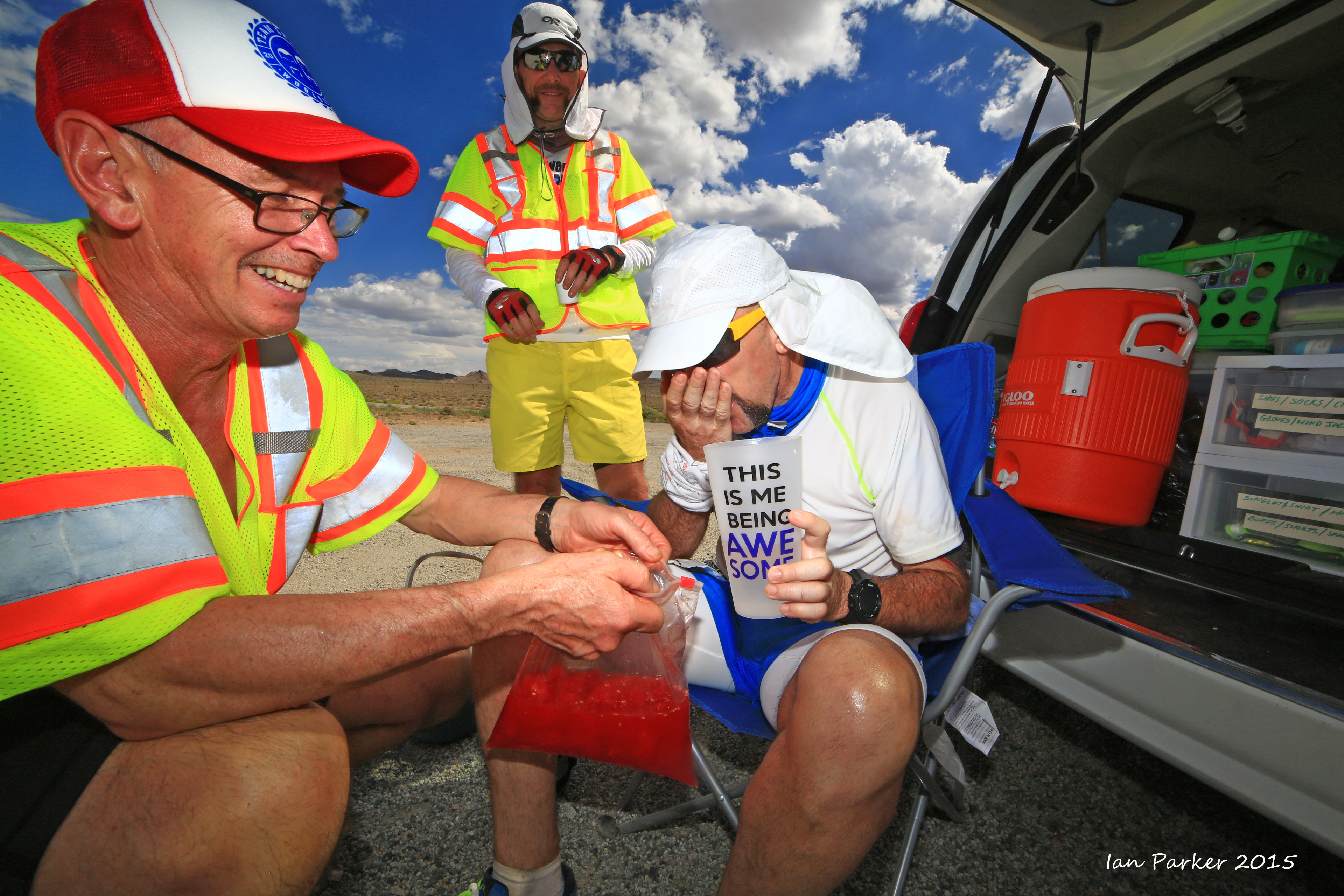
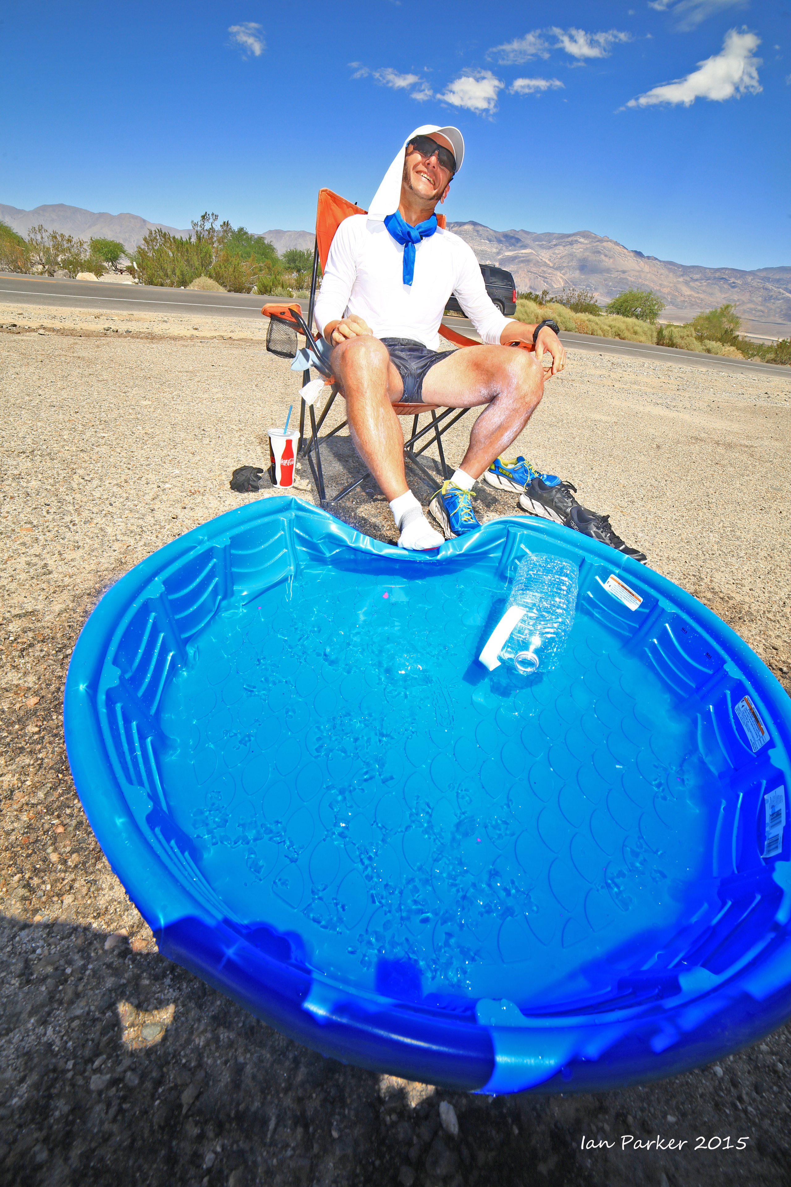
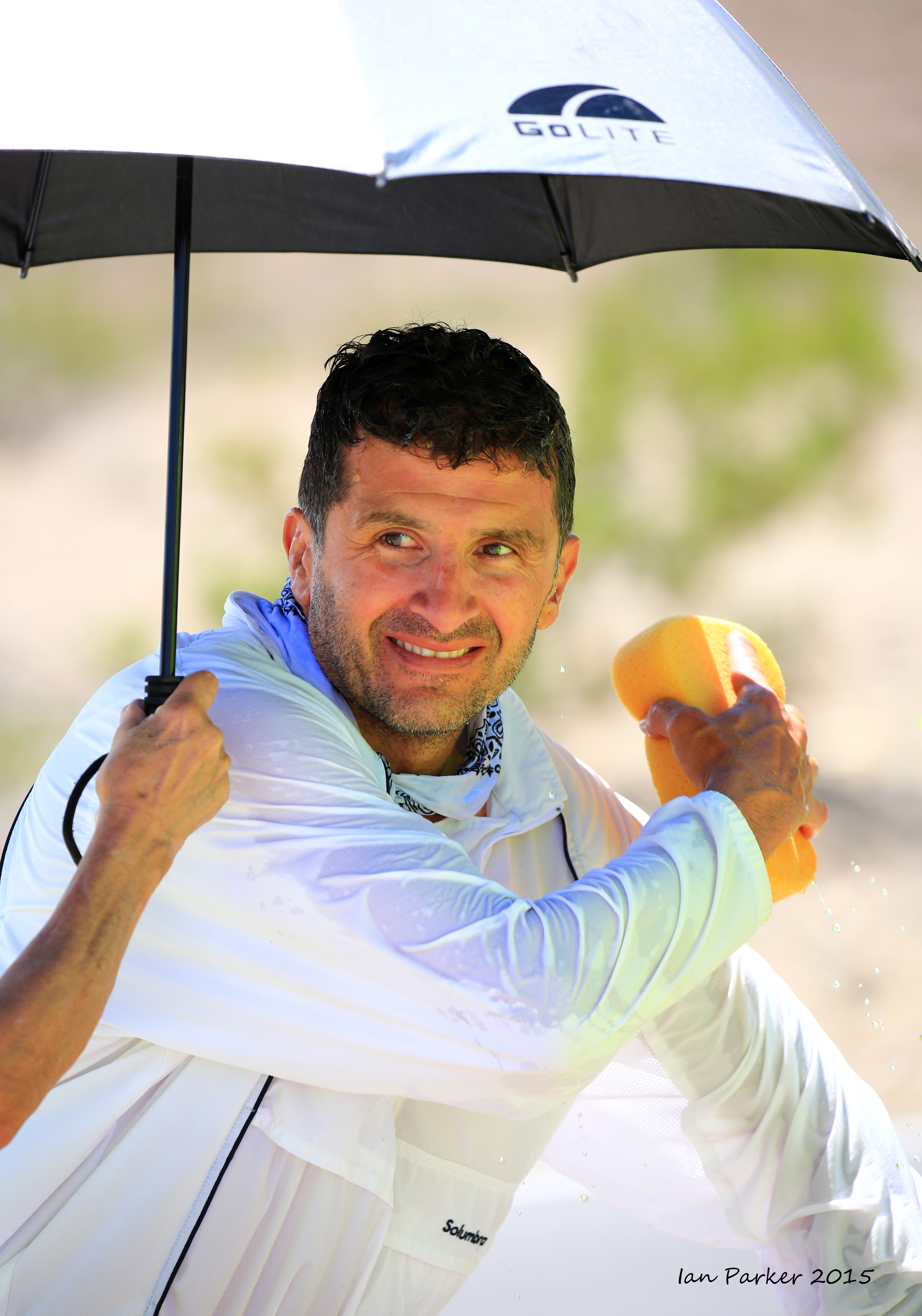
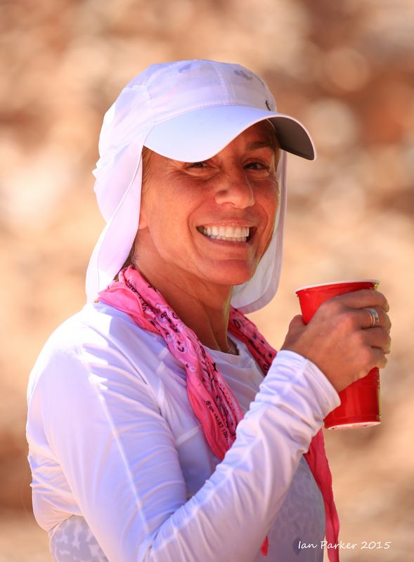
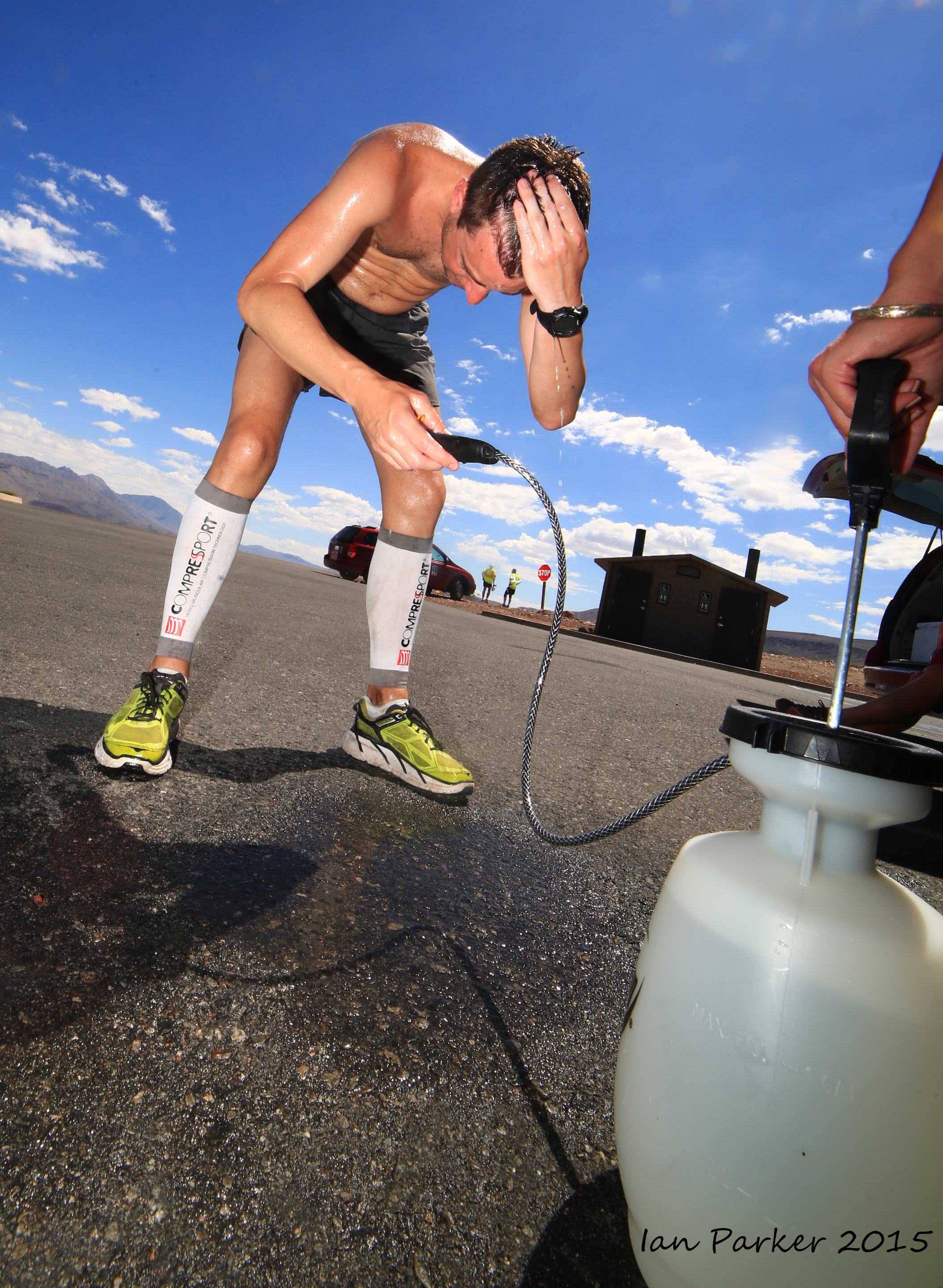
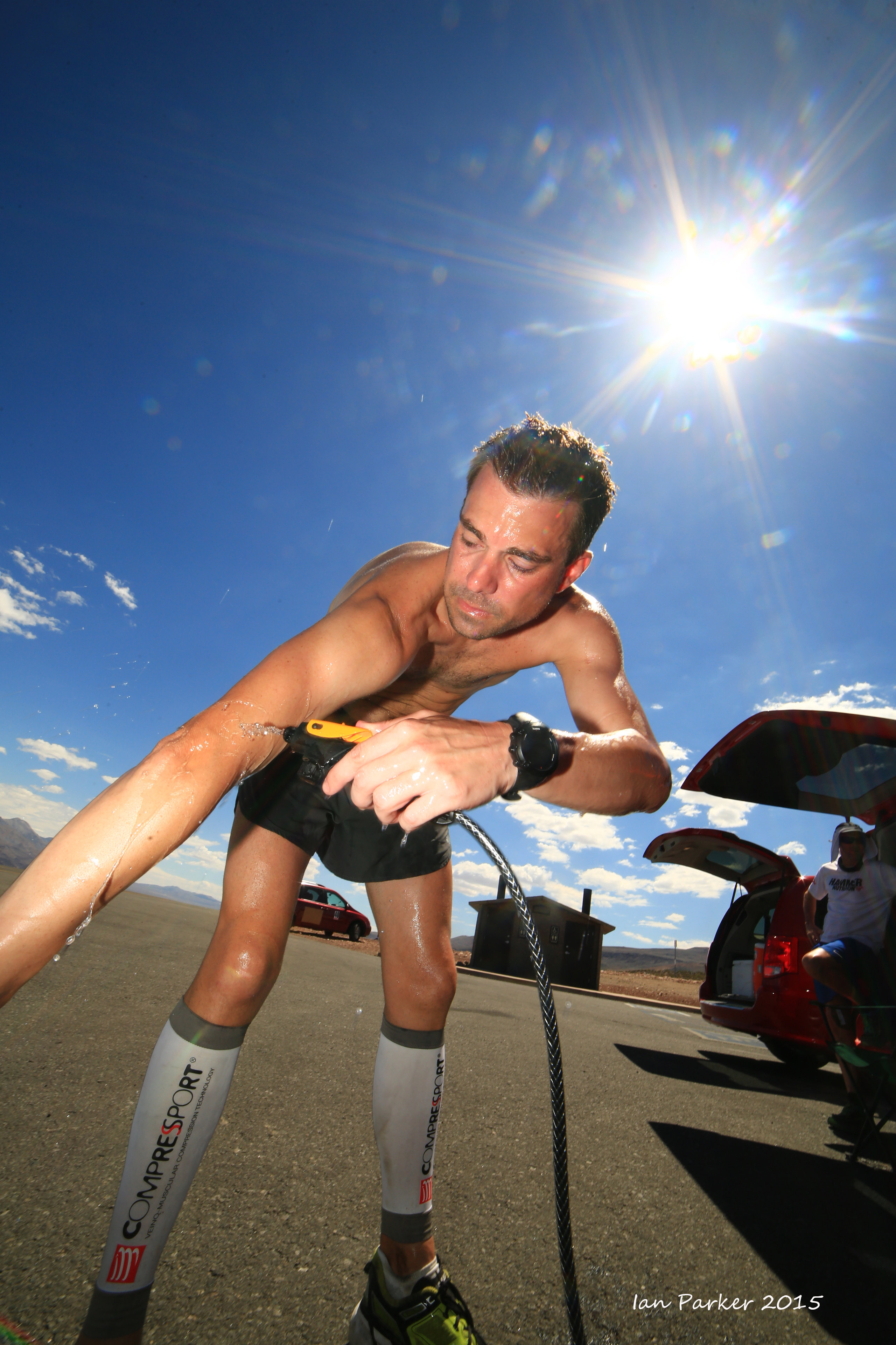
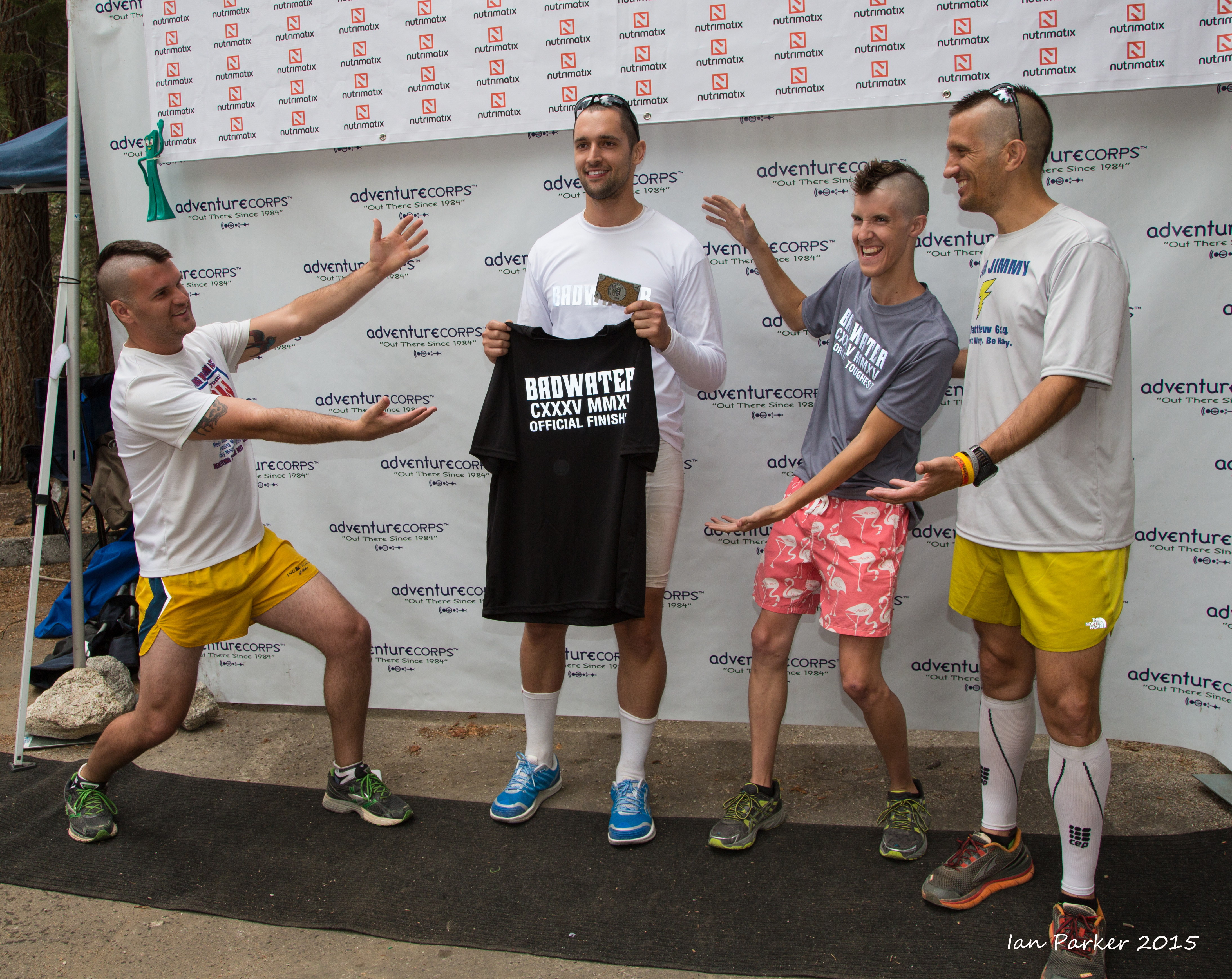
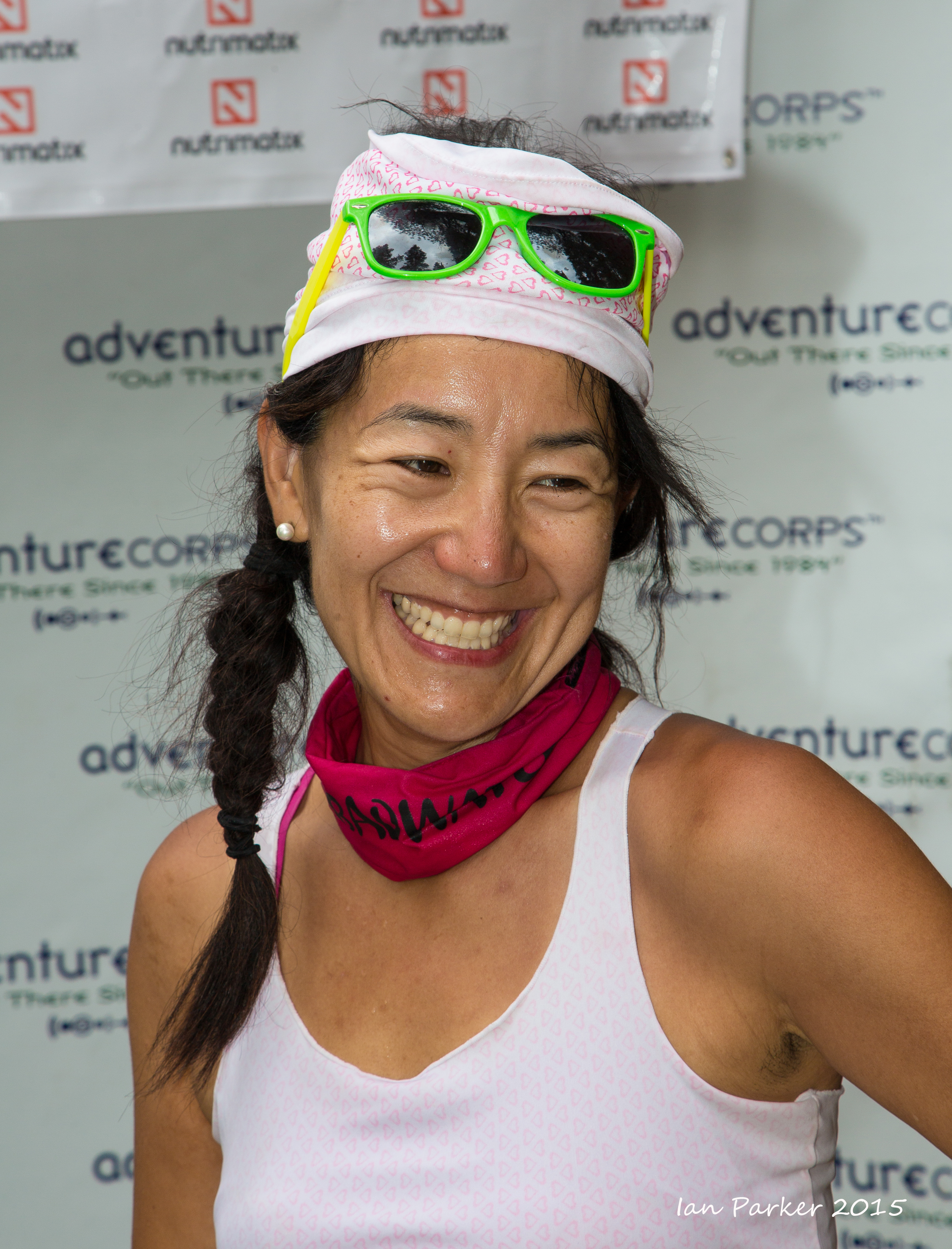
July 28-30, 2015 : Badwater Ultramarathon
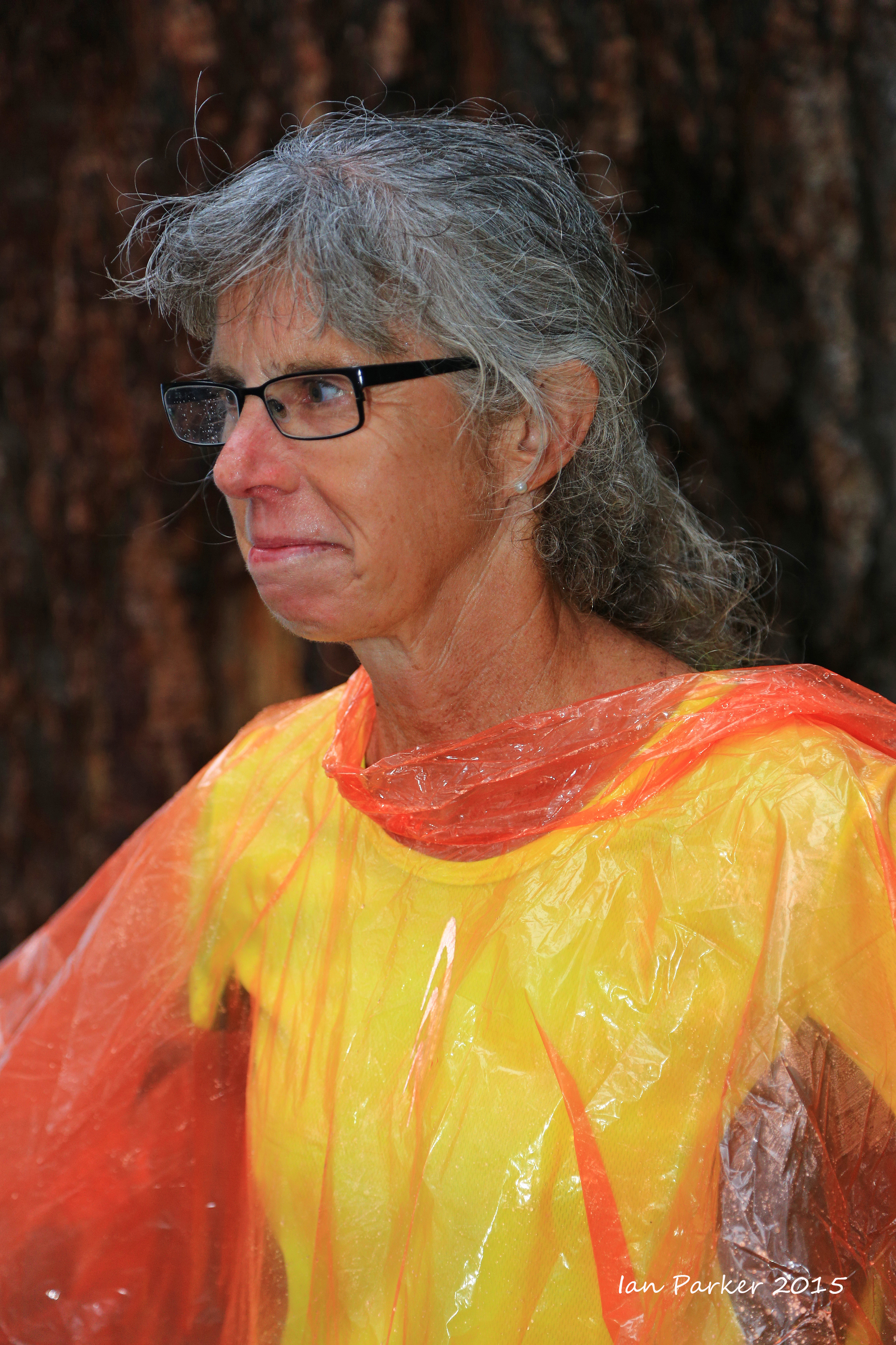
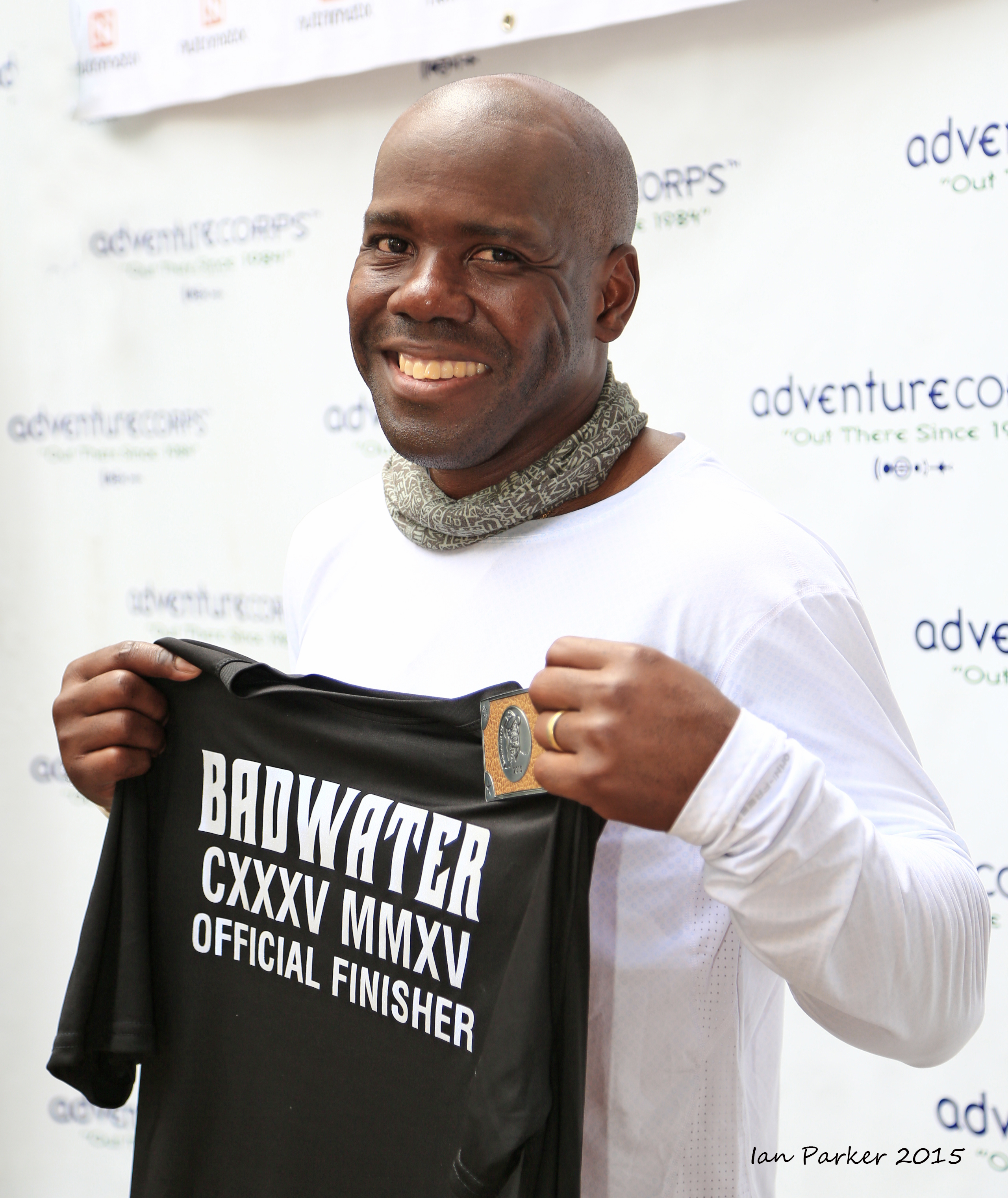
This was my 14th year in a row at the Badwater Ultramarathon, the "World's toughest footrace"; 11 years as a runner or pacer, and the last three helping on the race staff and as a photographer. My initial approach to photographing the race was from the perspective of a landscape photographer, aiming to place the runners in context of the spectacular scenery of Death Valley and the Eastern Sierras. This year I shifted gears, and took on the mindset of a 'street'/portrait photographer, concentrating on the runners and their support crews. I had gained more confidence in this from a photo safari to Burma ("Faces of Burma") where the emphasis was on the photogenic and wonderfully friendly people of that country. Badwater offers much the same opportunity. The photographic challange of capturing the emotions of a group of very special people pushing themselves to the limit in an extreme environment. Moreover, they are friendly, like having their pictures taken, and in any case have all signed waivers permitting the taking and publishing of photos!
The images below are a selection from many hundreds of shots. Click HERE for links to to numerous other photos from the 2015 Badwater Ultramarathon.
Portraits of some 'old-time' veteran Badwater runners
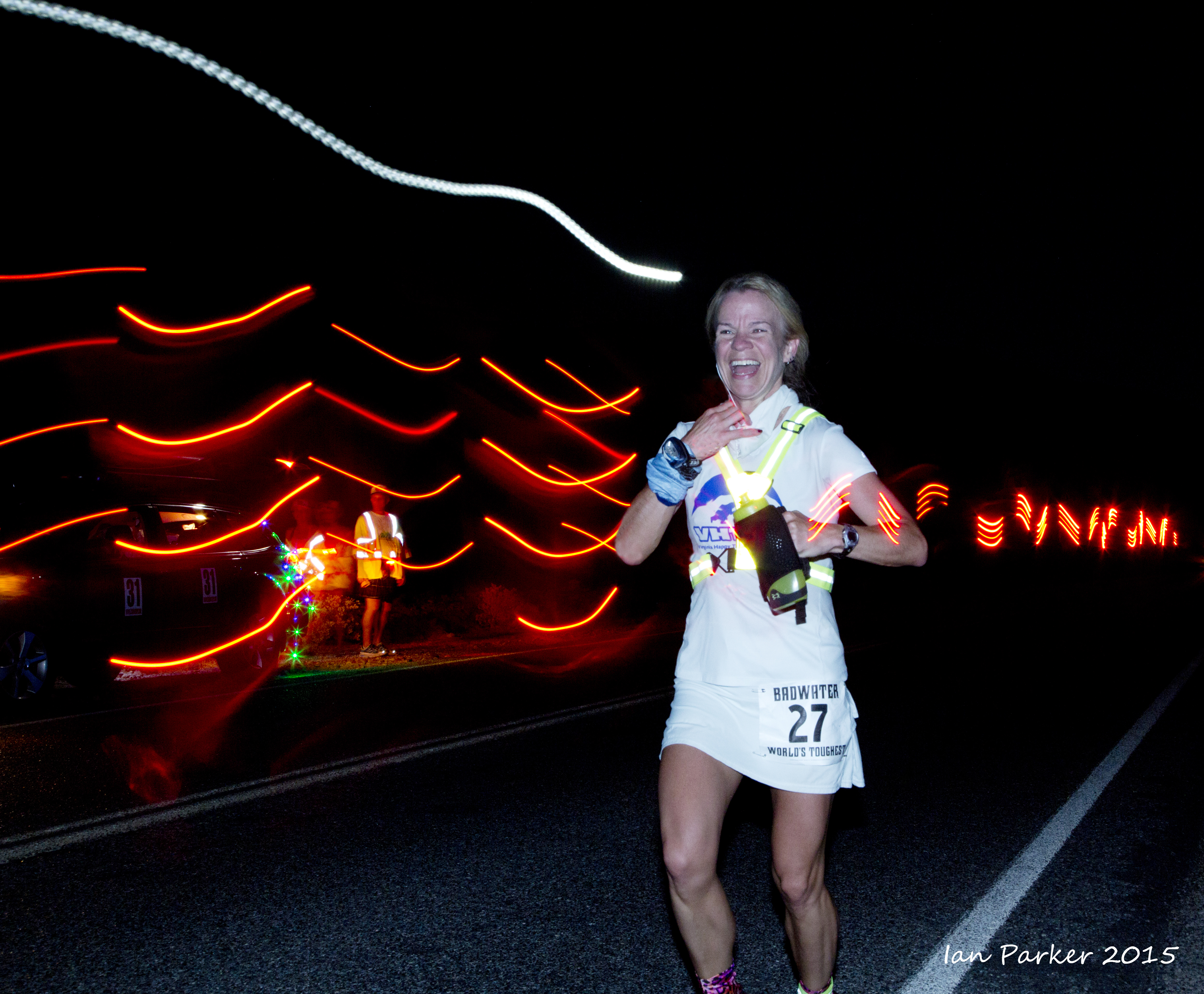
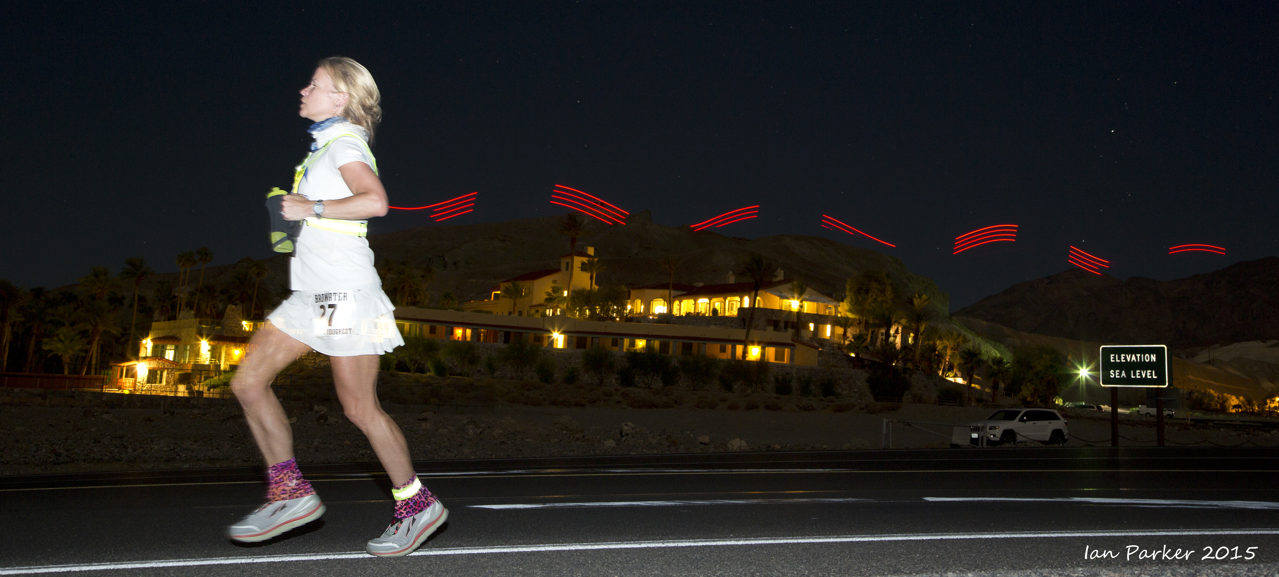
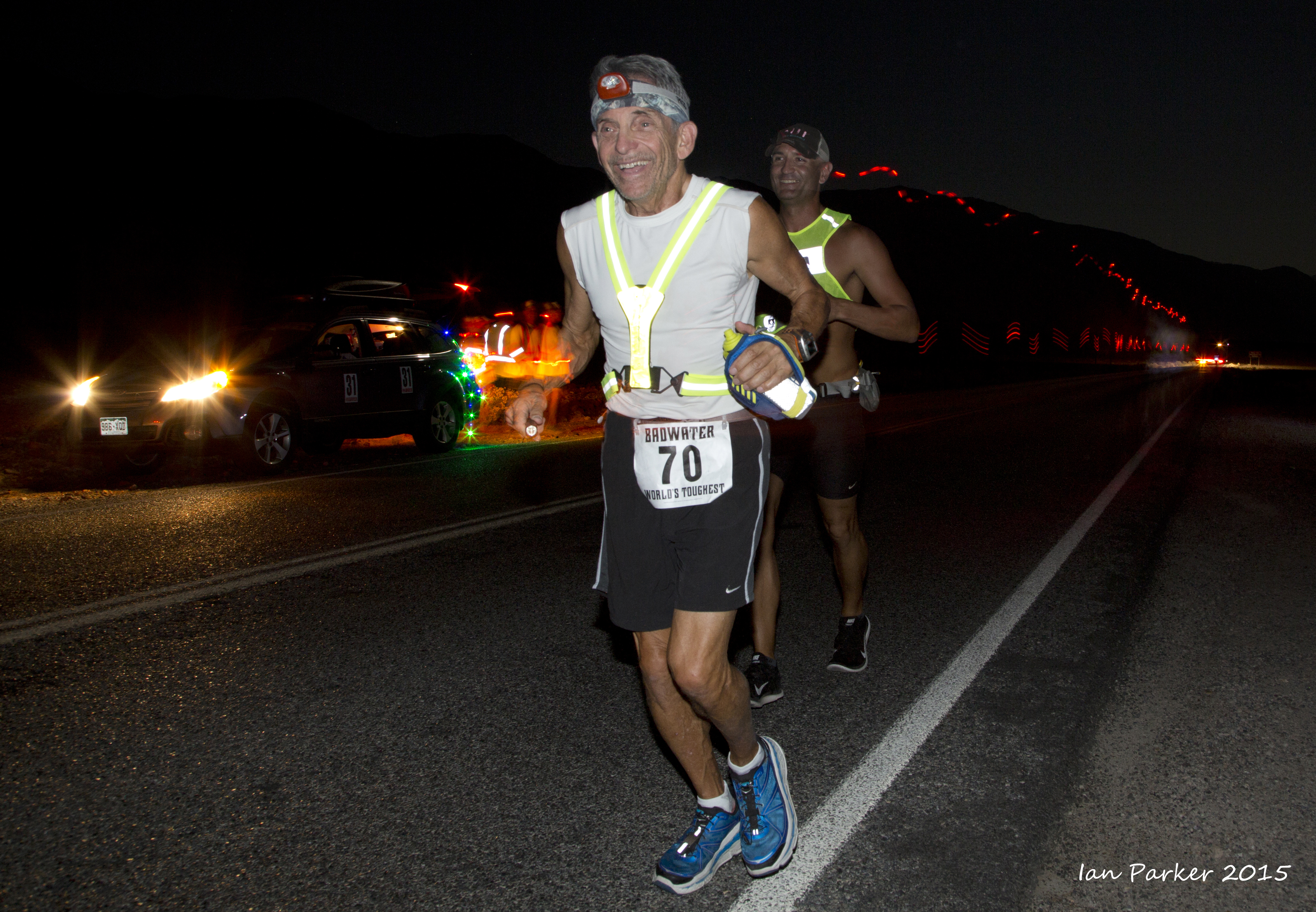
With evening
and night start times this year, most of the running through Death Valley itself was in the dark. I experimented with long exposures to capture the safety lights of the runners, ending with second-curtain flash to expose the runners themselves.
The next day brought full sun,
requiring various measures to mitigate the heat as the runners descended into, and then climbed out of Panamint Valley.
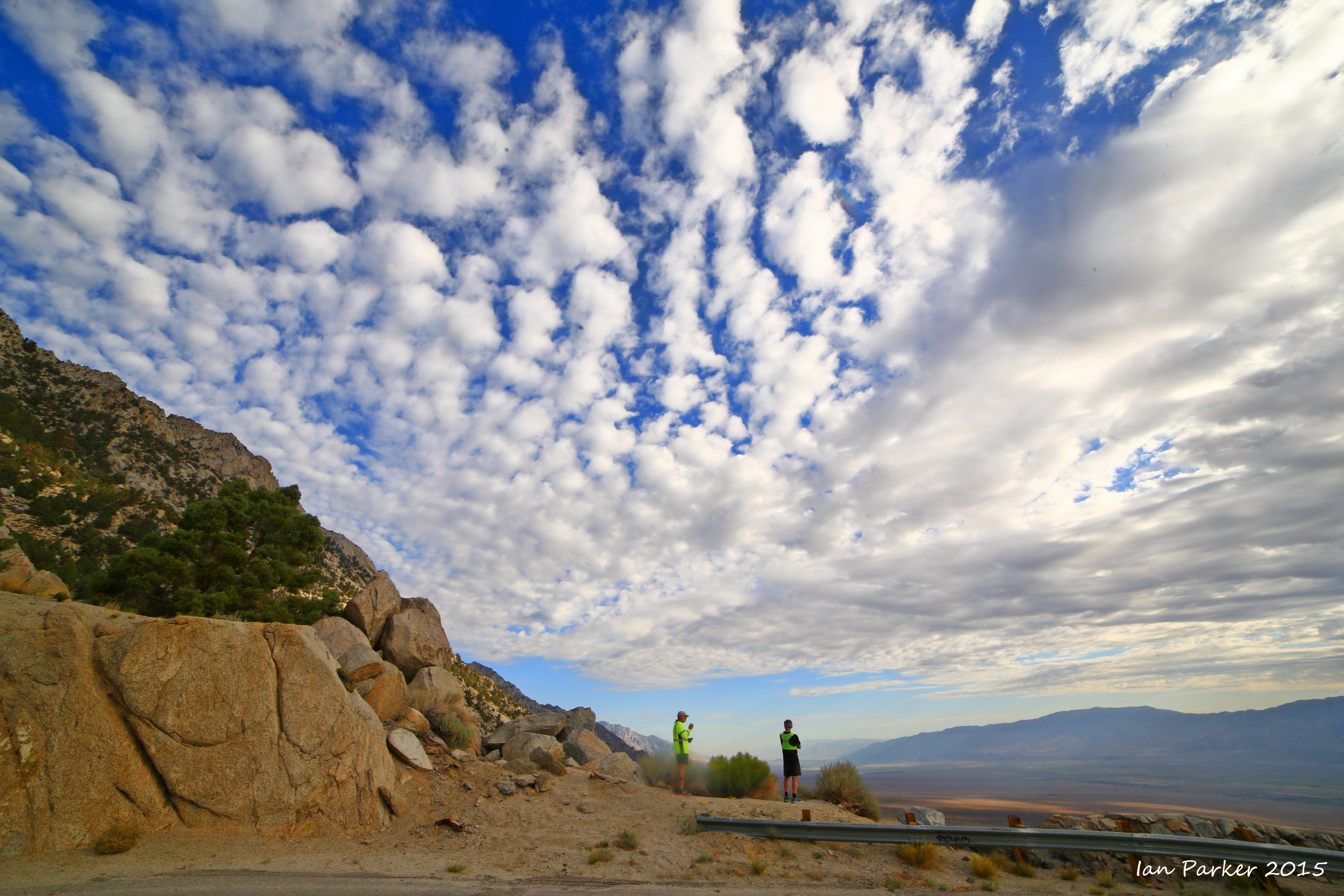
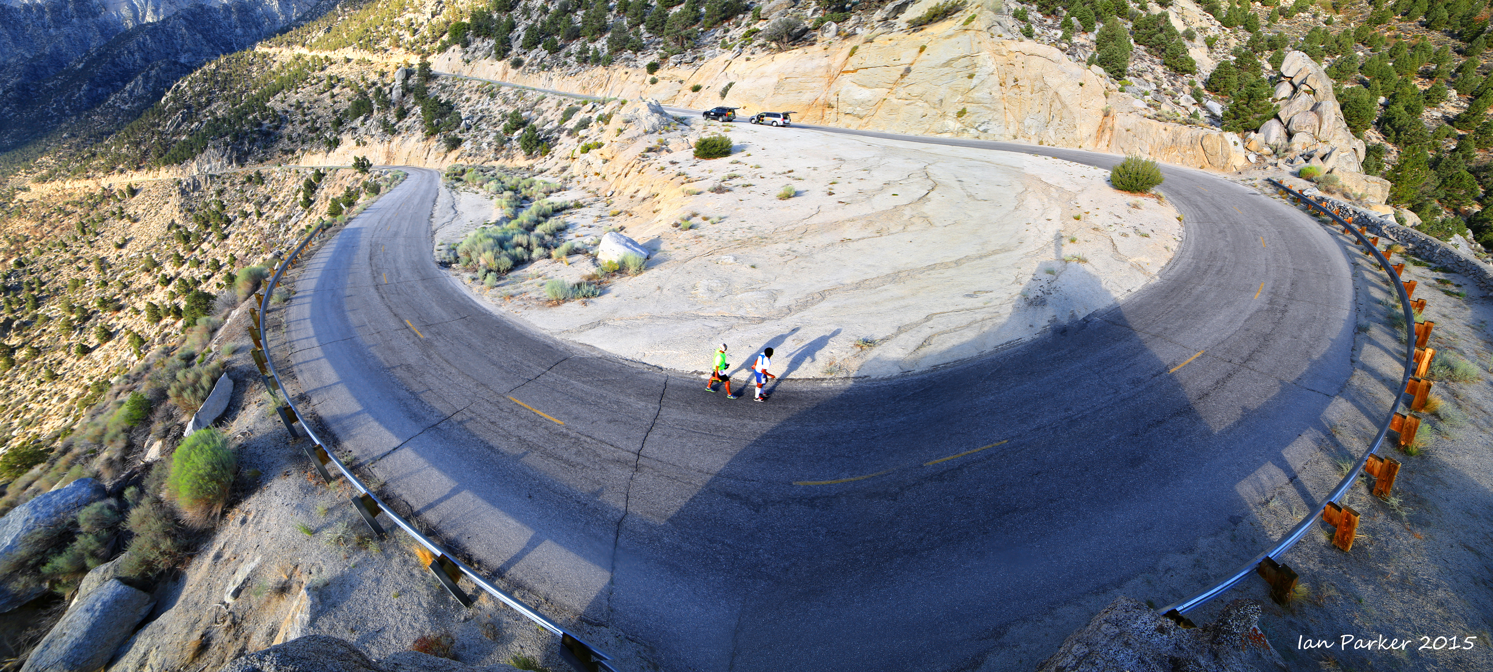
By the second morning many runners were on the last stretch, a 13 mile, 5000ft climb up to Whitney Portal and the finish line.
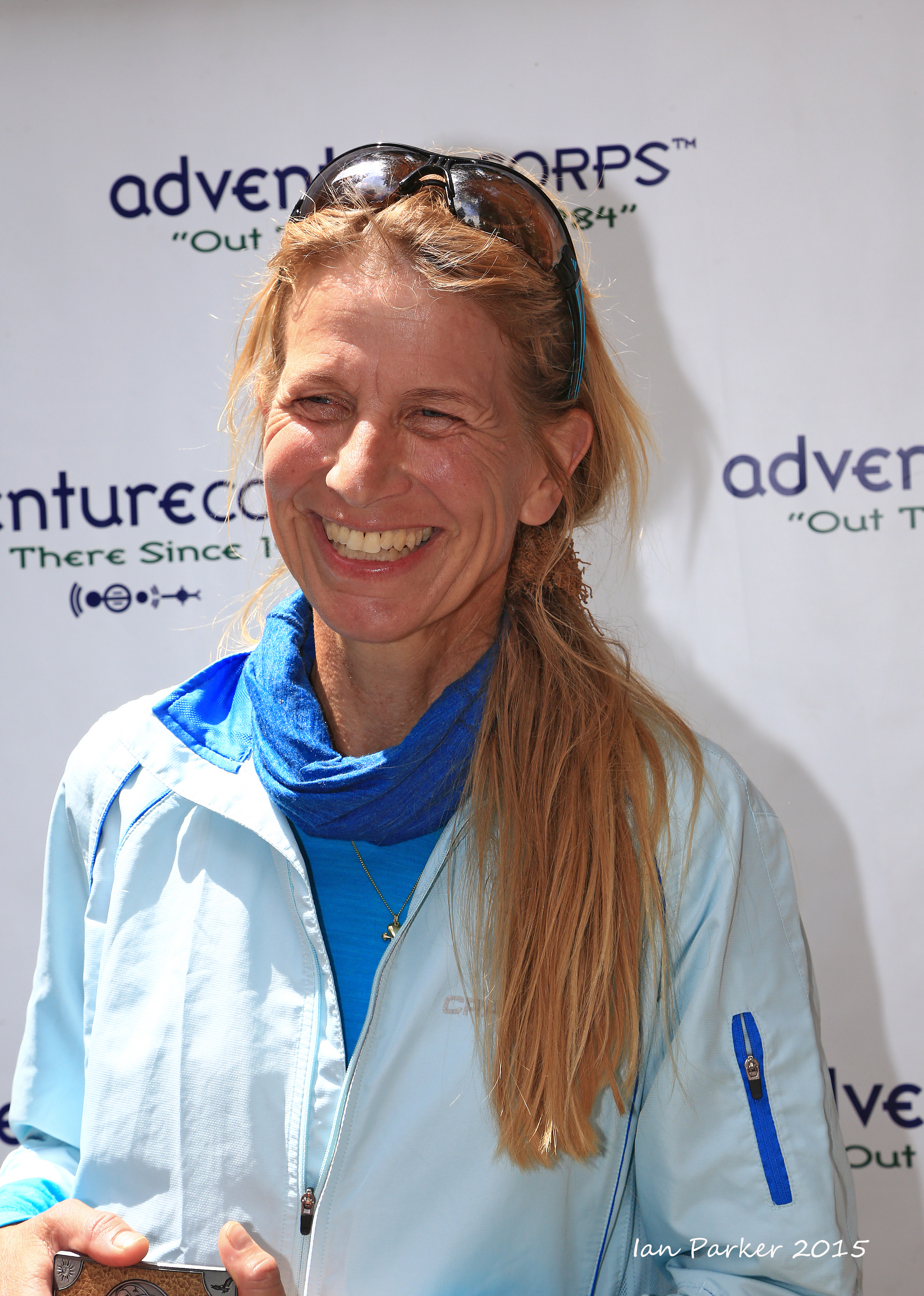
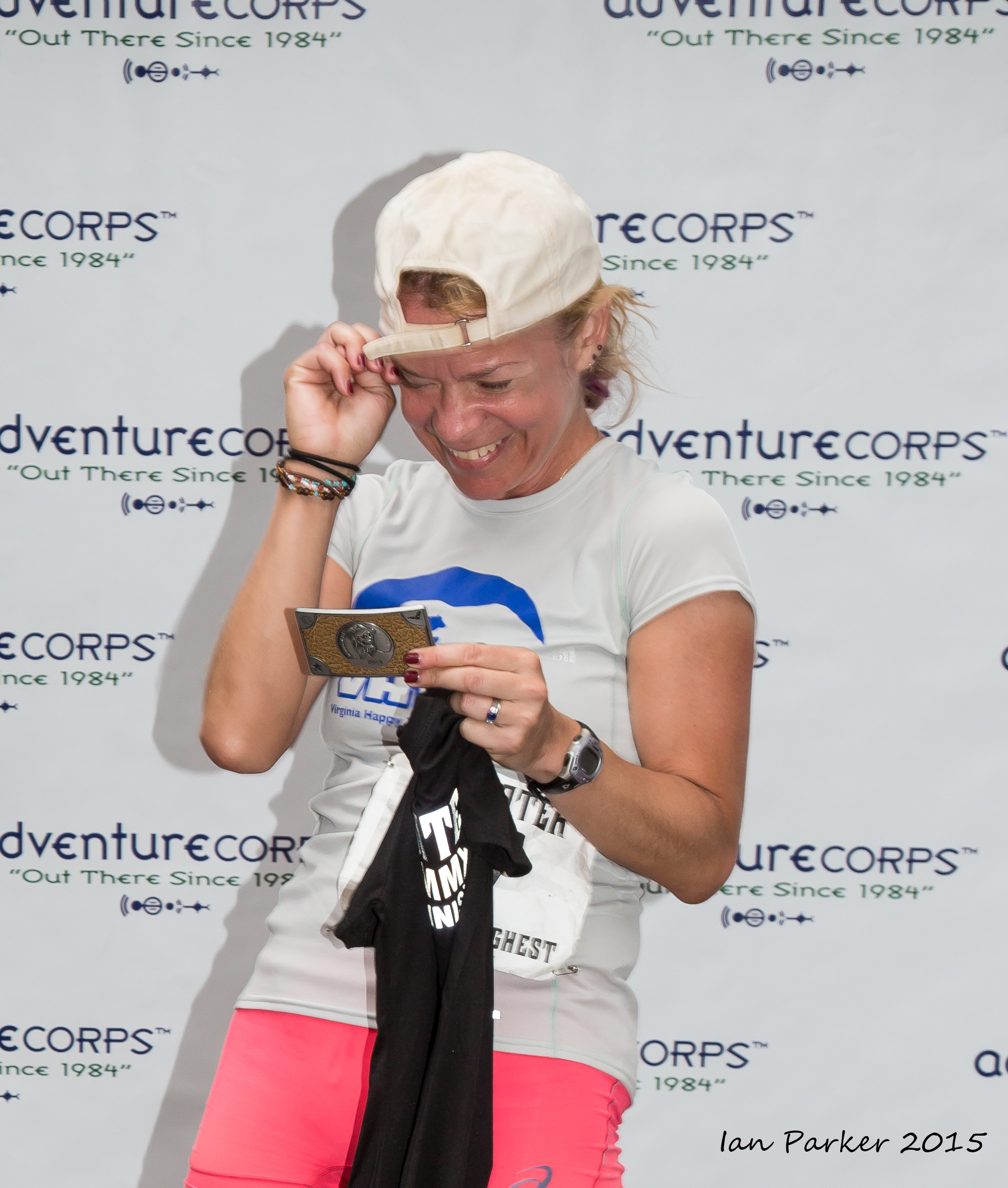
Runner portraits at the finish line - attempts to capture what it feels like to finish the Badwater Ultramarathon!
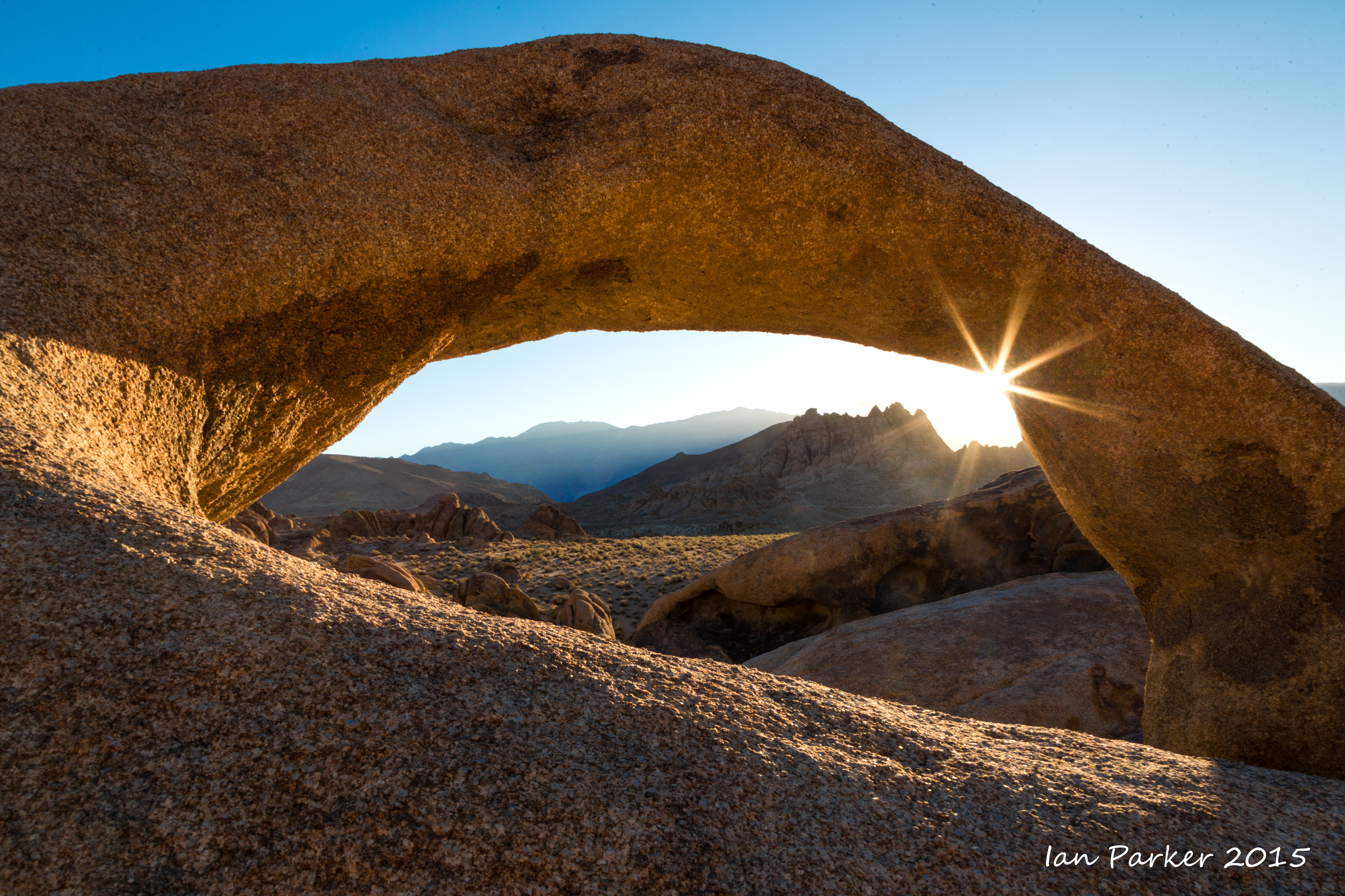
July 26-31; Rhyolite, Bristlecones, Mono Lake and other places along highway 395, sandwiched around photographing the Badwater Ultramarathon
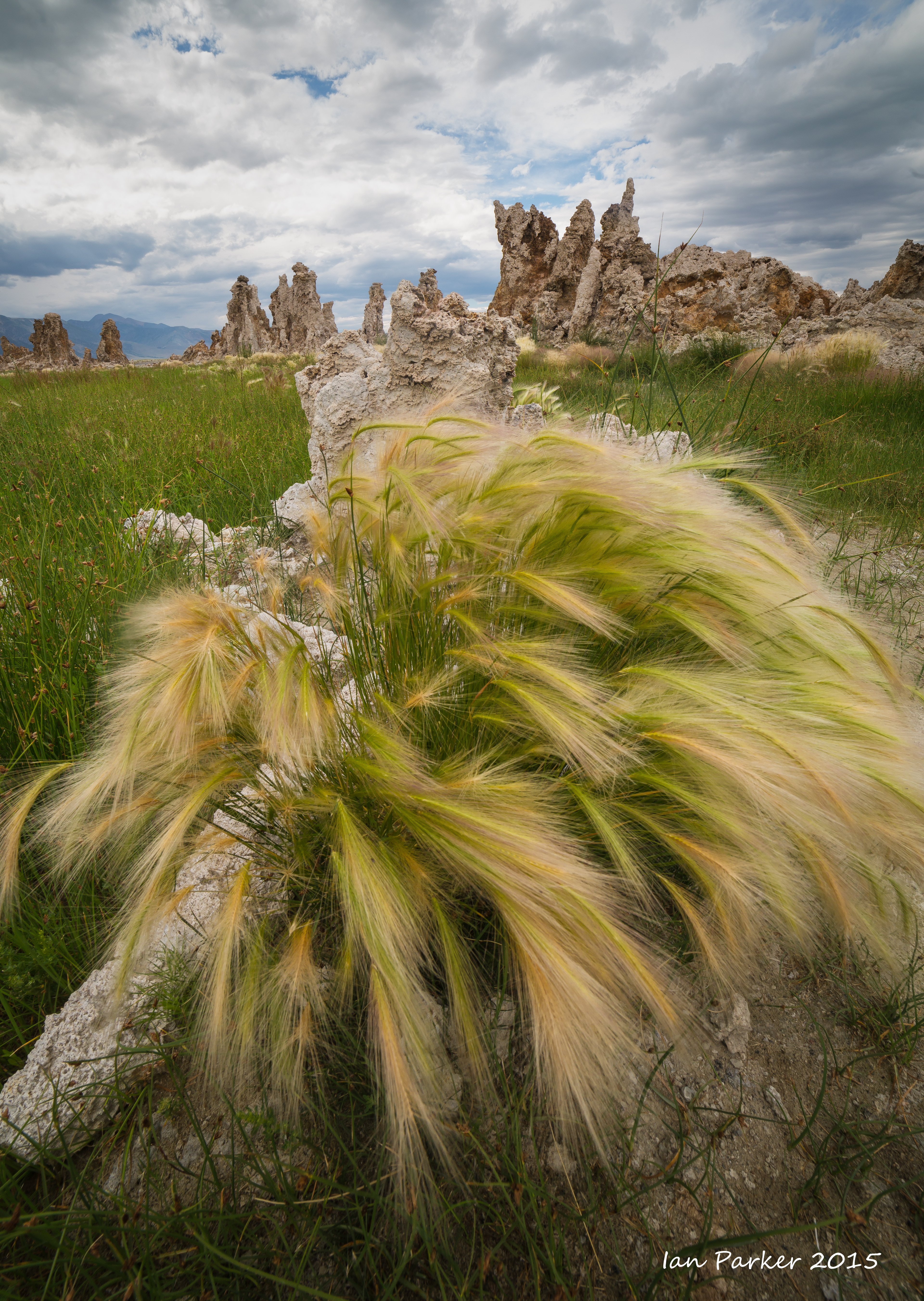
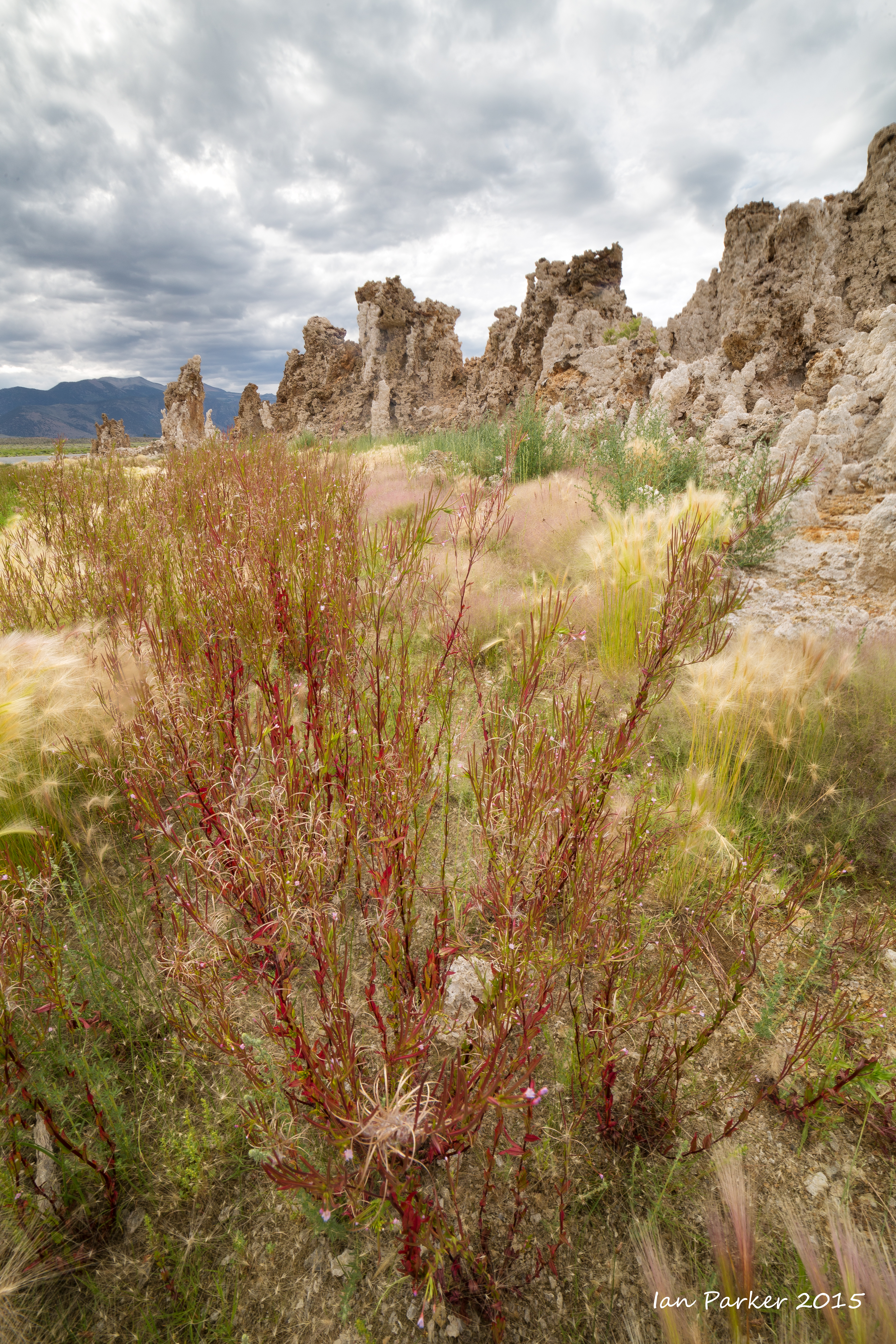
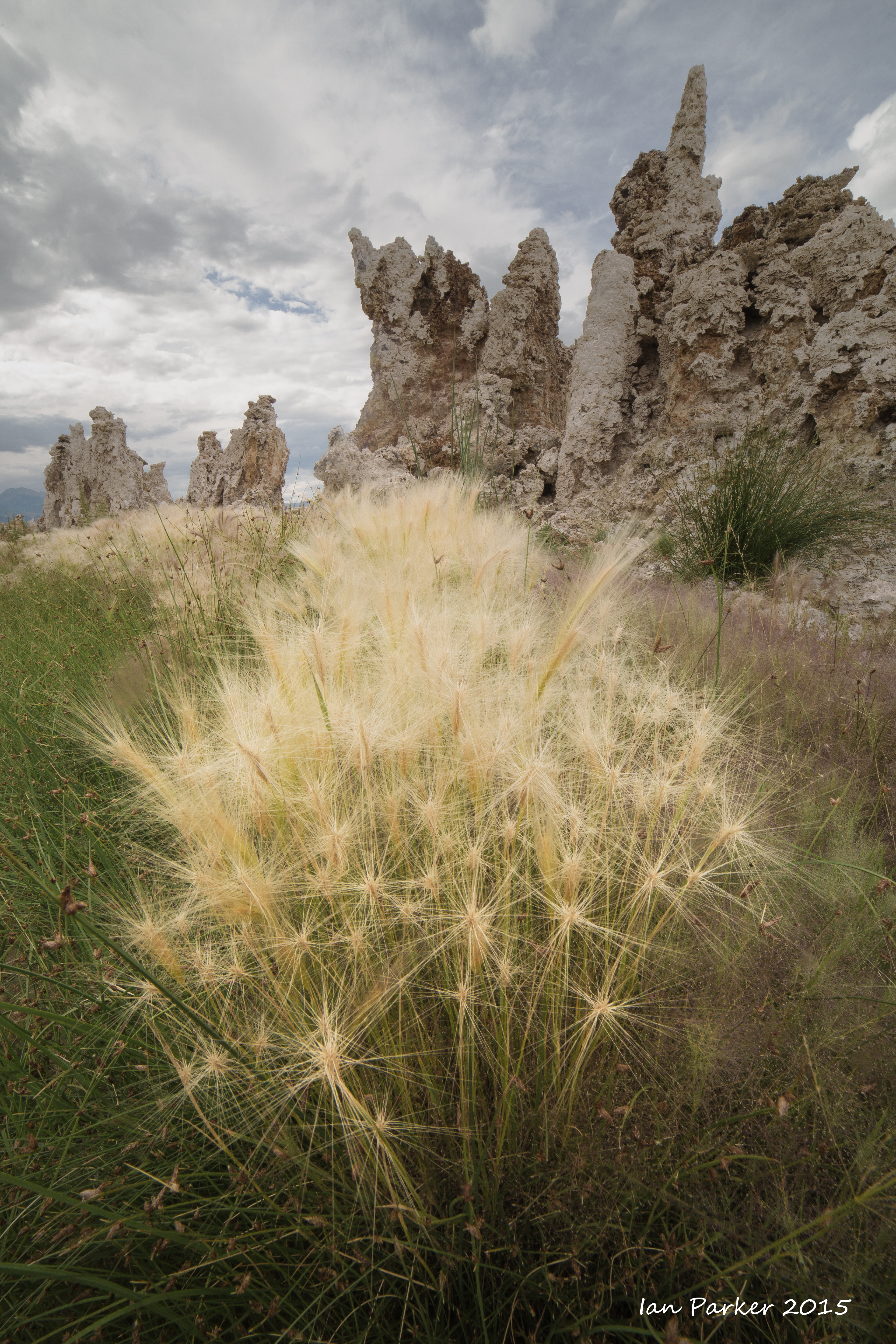
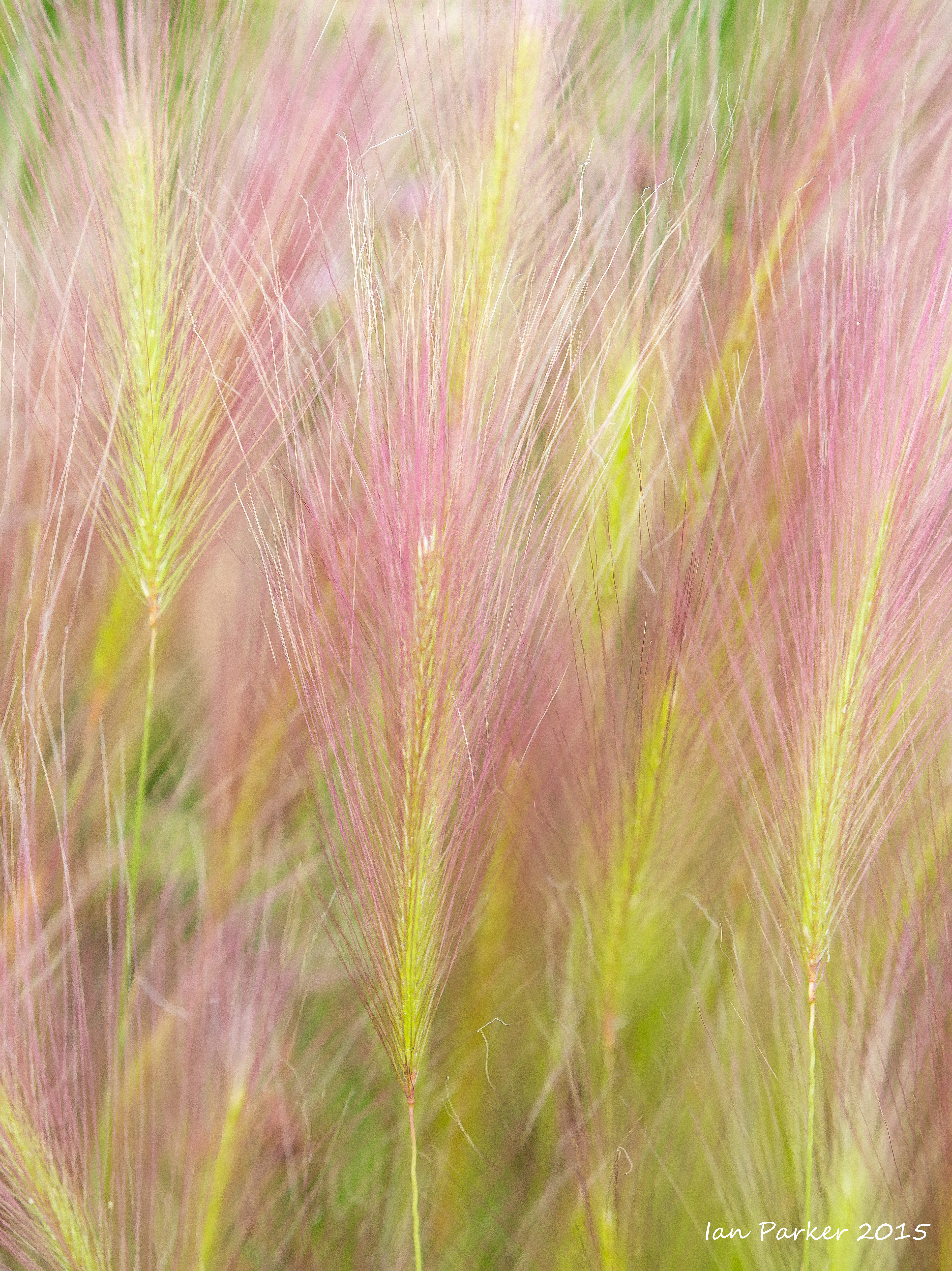
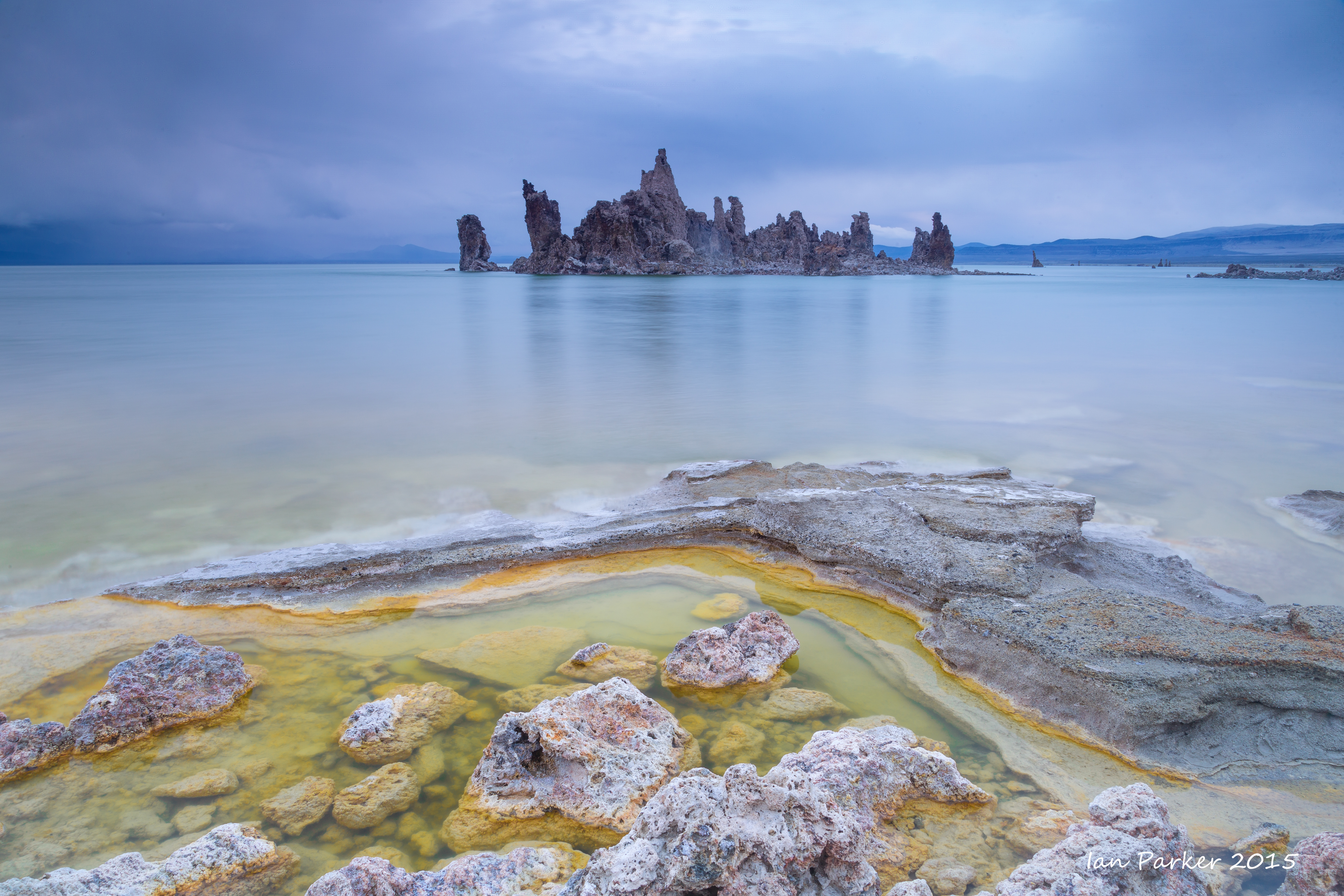
| The water level in Mono Lake is at its lowest level for over 20 years, exposing new areas of lakeshore and tufa formations. Most notably, the extensive tufa to the east of the popular tourist reserve
are now on dry land. I tried last year to wade out to these towers along a muddy isthsmus, but was defeated when my shoes became stuck in the muddy goop. Now, the mud is dried, and has become carpeted by colorful, salt-loving grasses. Few people ever seem to venture to this area, despite relatively easy access, and I was happy to have it to myself for the day, with the grasses pristine and untrampled. |
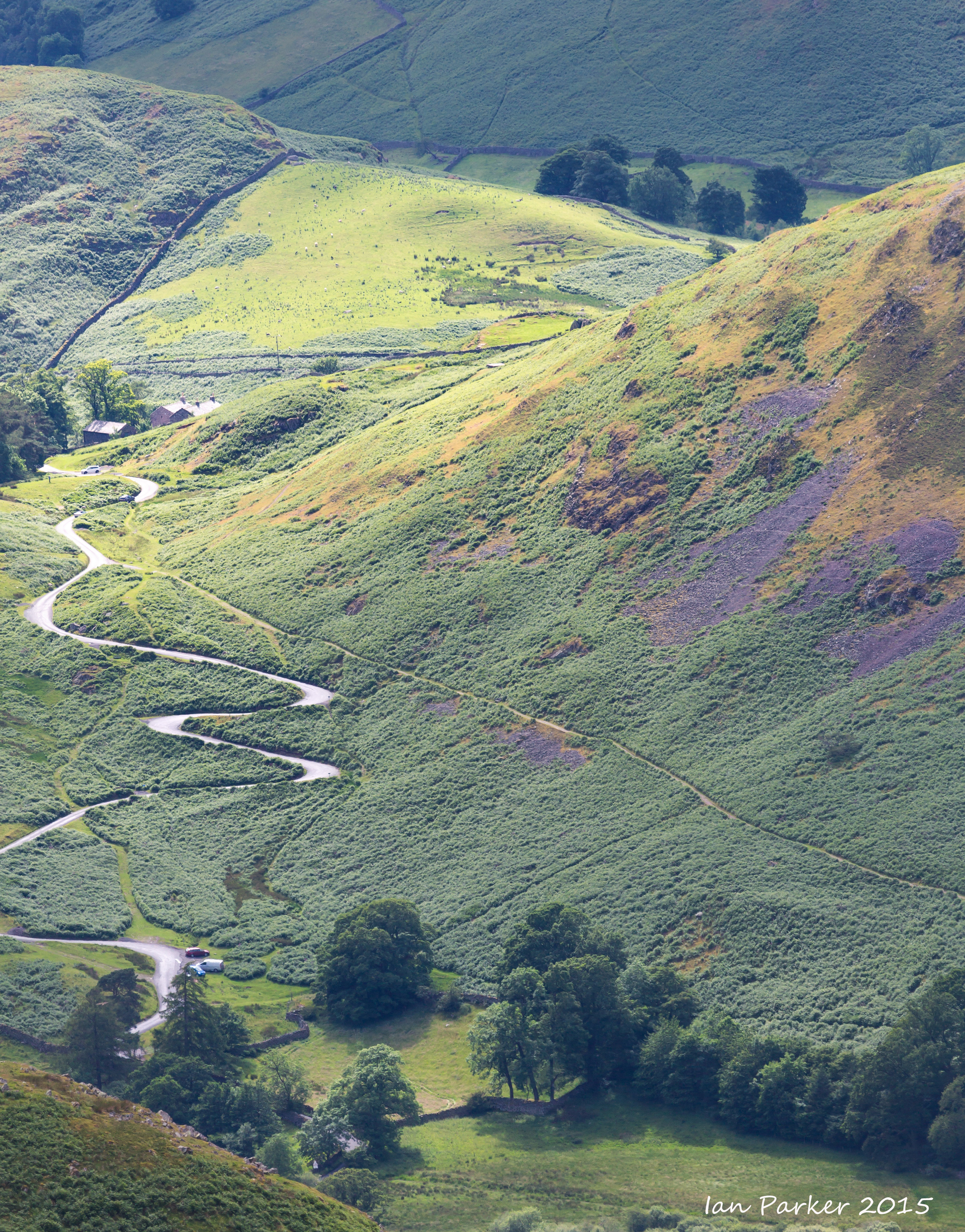
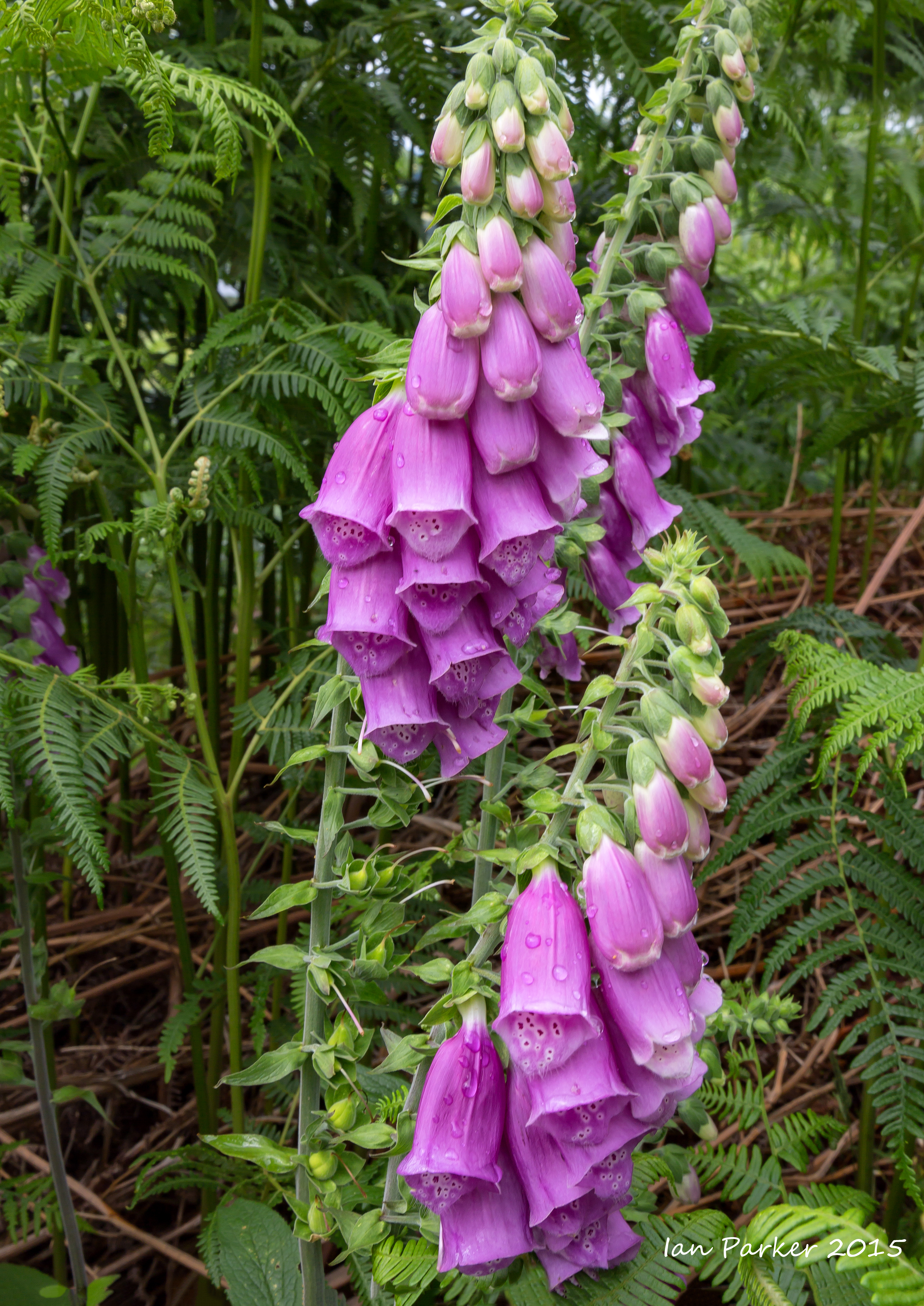
July 5-11, 2015 : A brief visit to the U.K. with only a little time for photography (and the skies were grey and rainy).
A short fell-walk to work up an appetite for dinner at the Sharrow Bay.
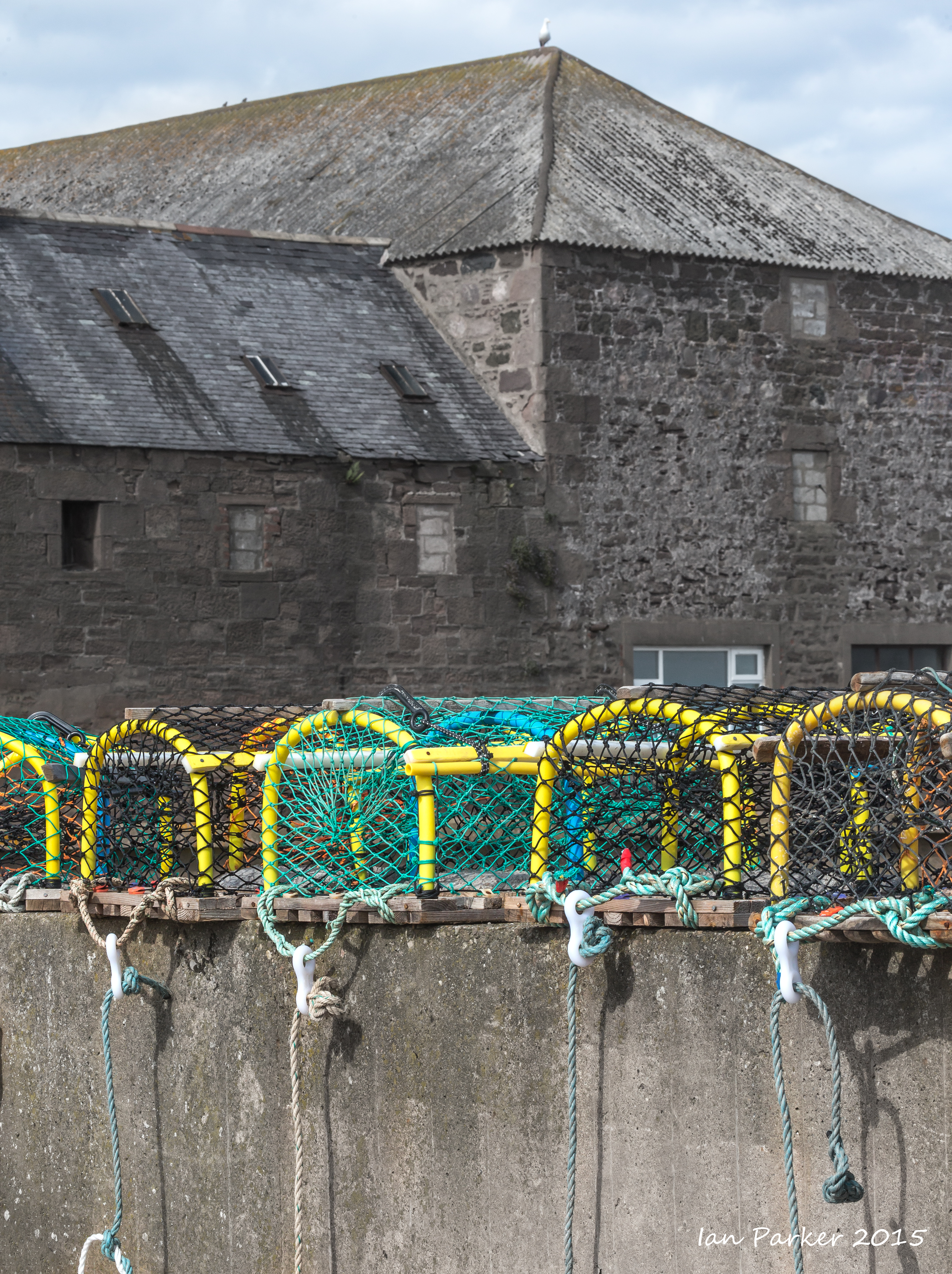
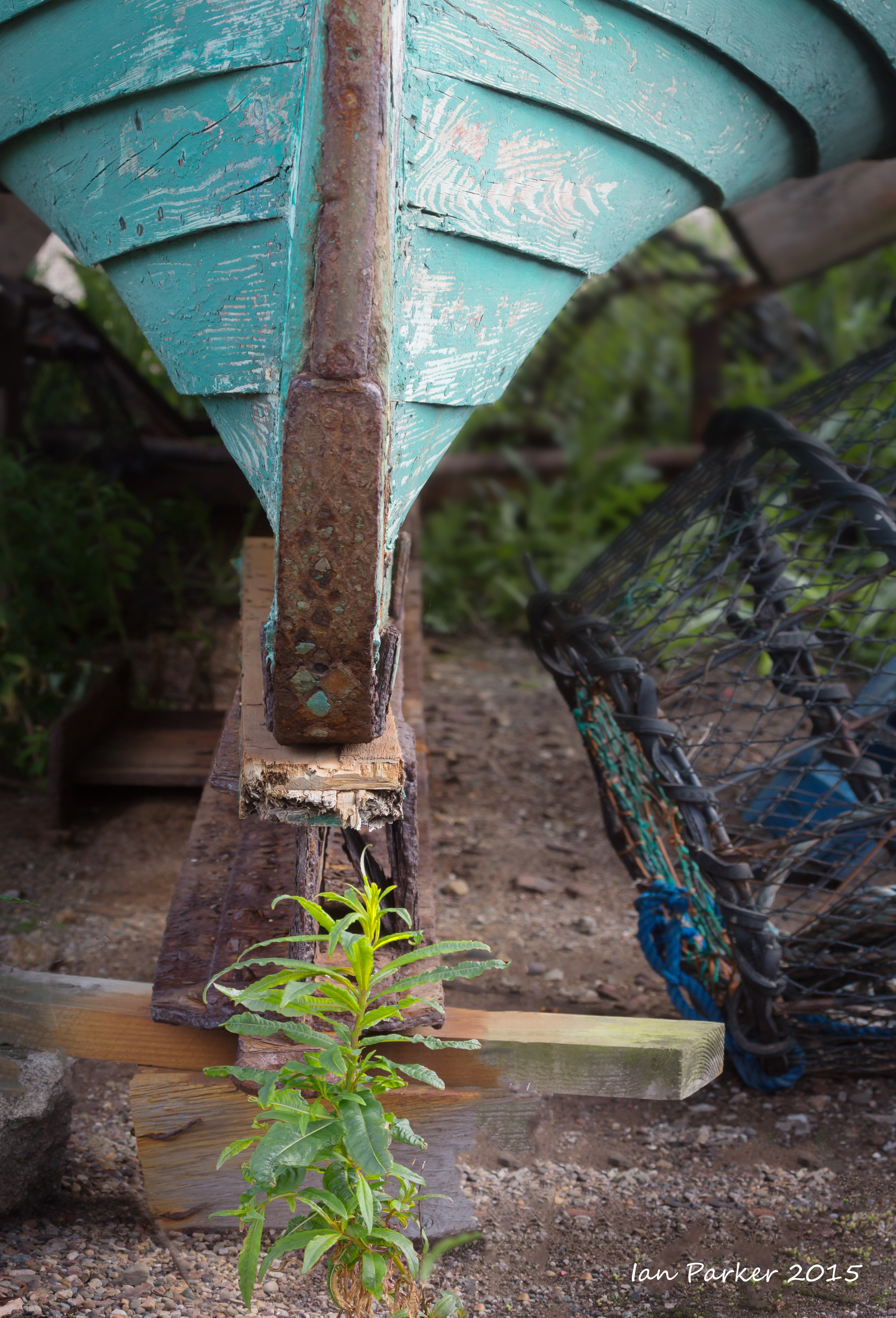
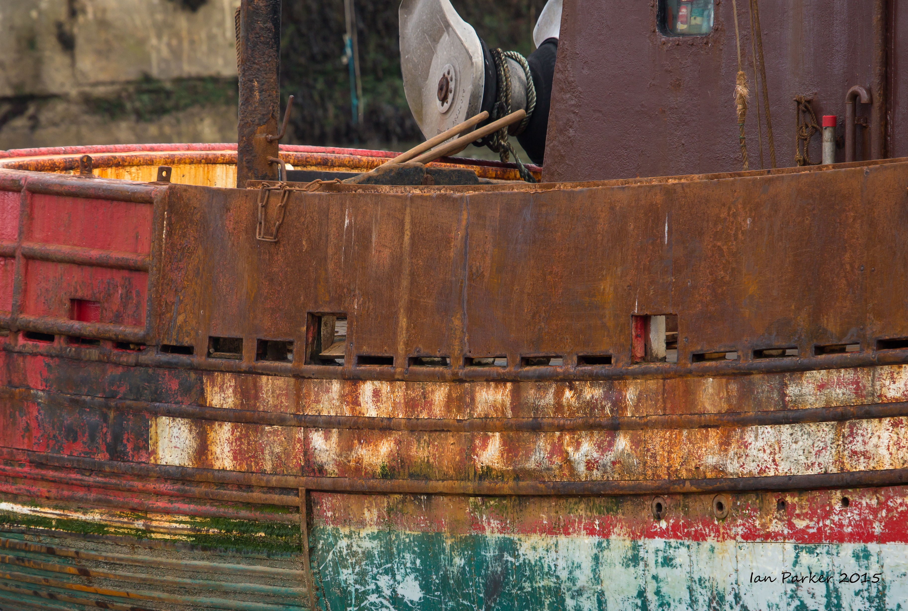
Some vignettes of Gourdon harbour before dinner at Hornblowers restaurant (on the menu, "FISH" and NOT-FISH")
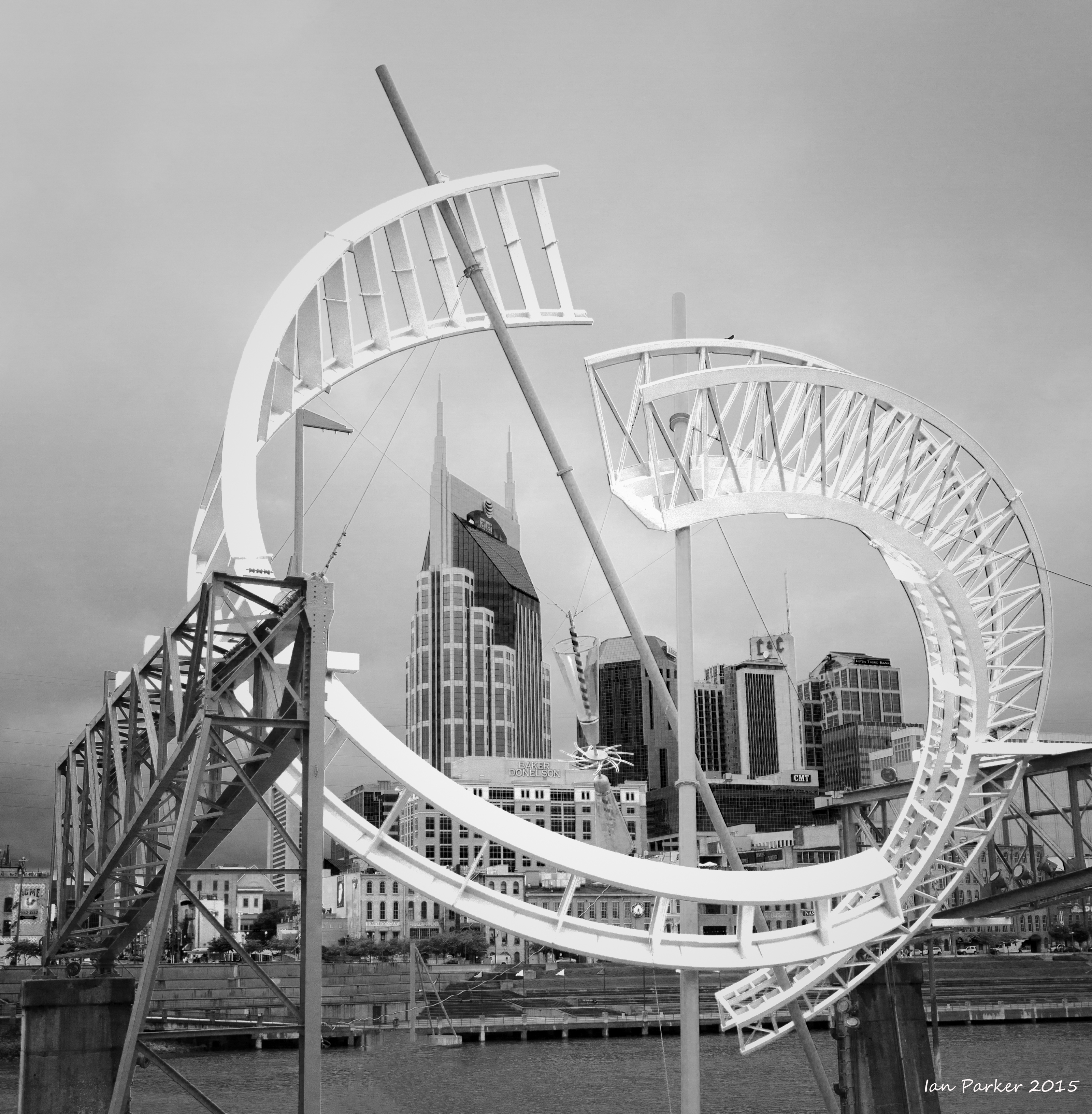
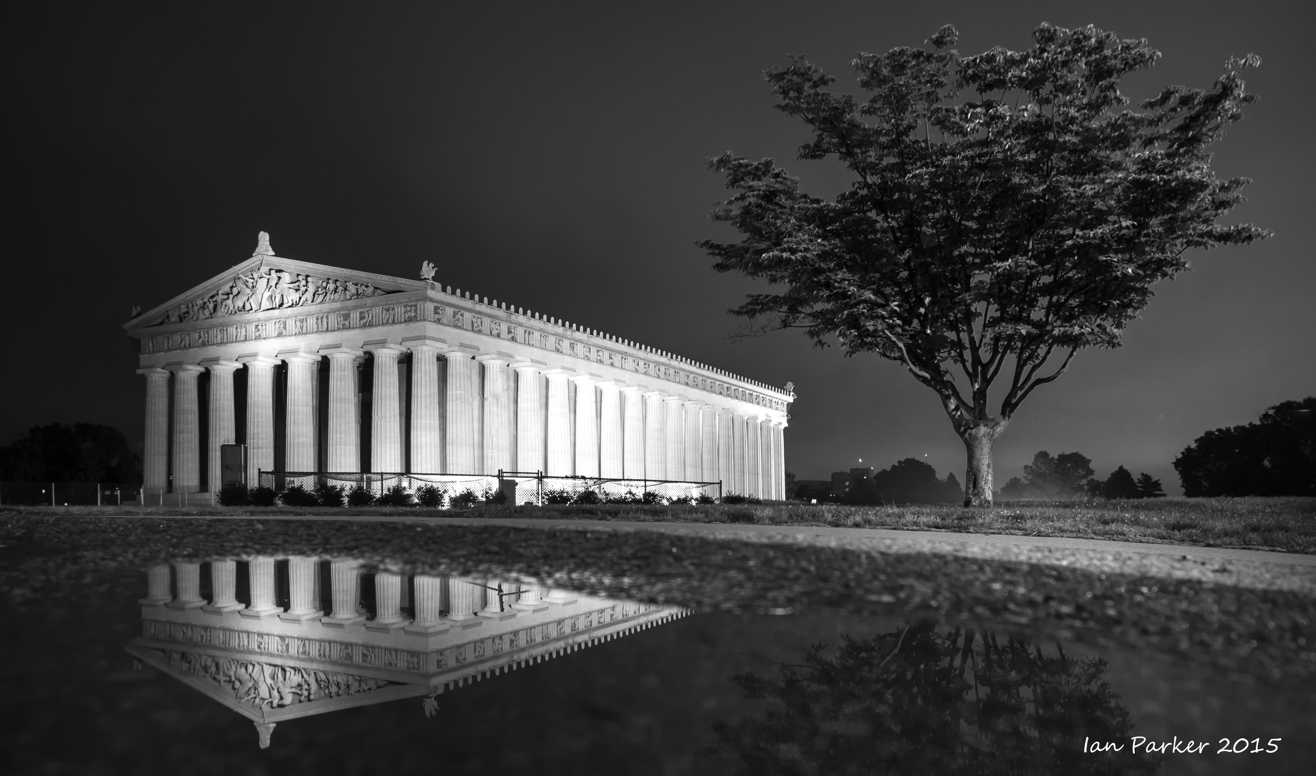
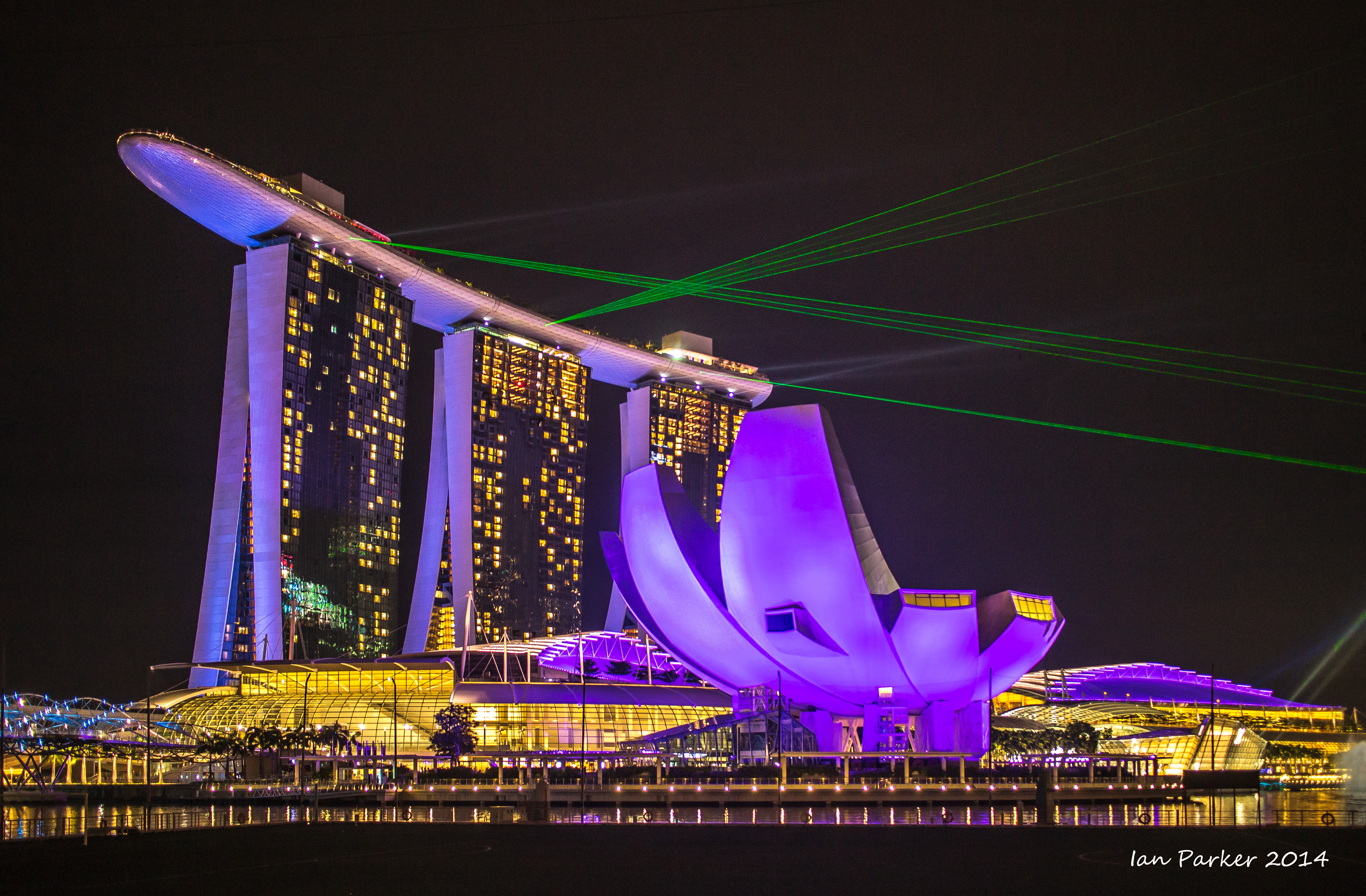
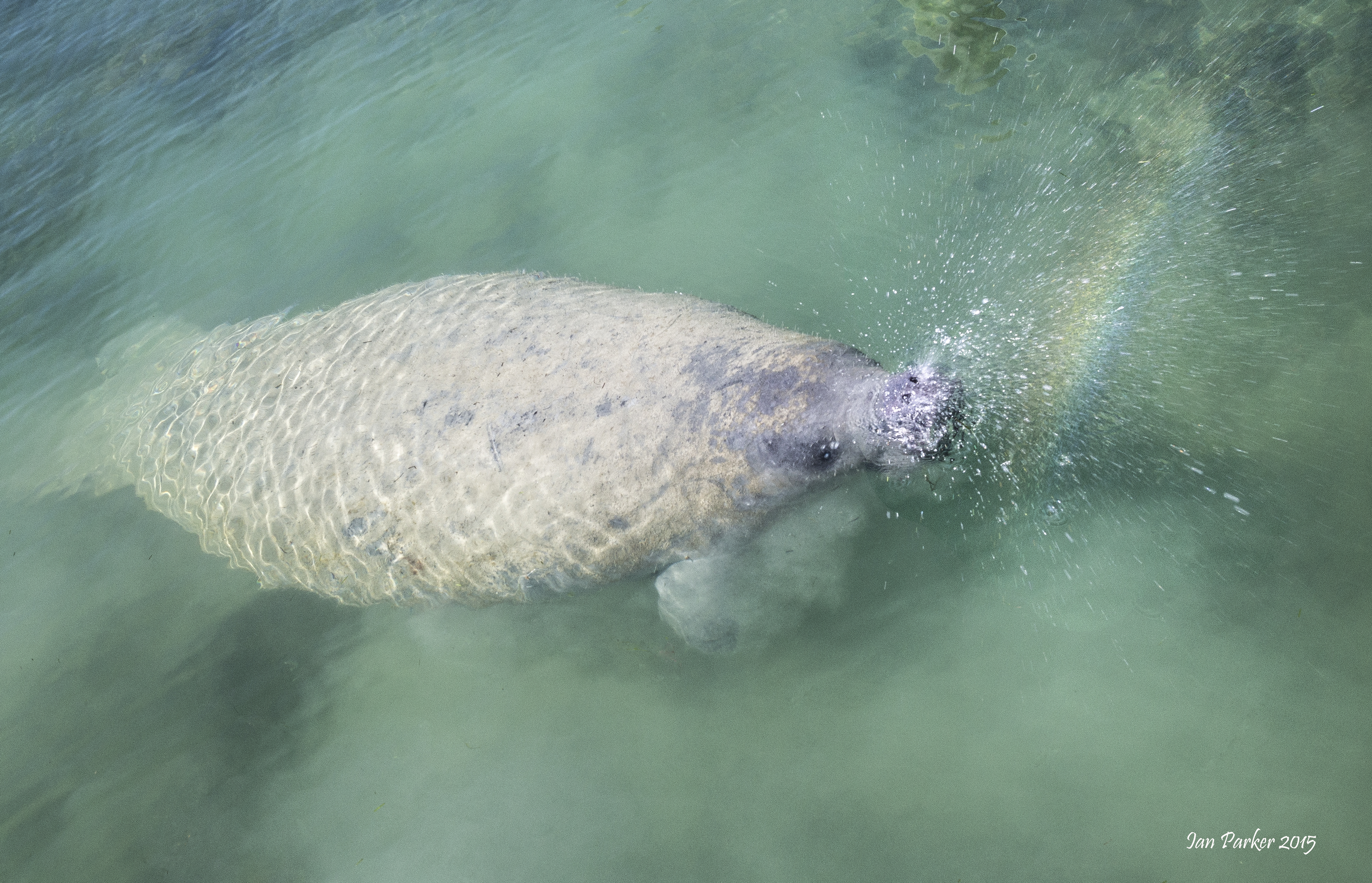
June 6, 2015 : Downloaded and worked on photos on a forgotten-about memory card. Some recent from a conference in Nashville, and some old from Singapore and Florida
May 16-19, 2015: Along the Owen's Valley during unusual weather
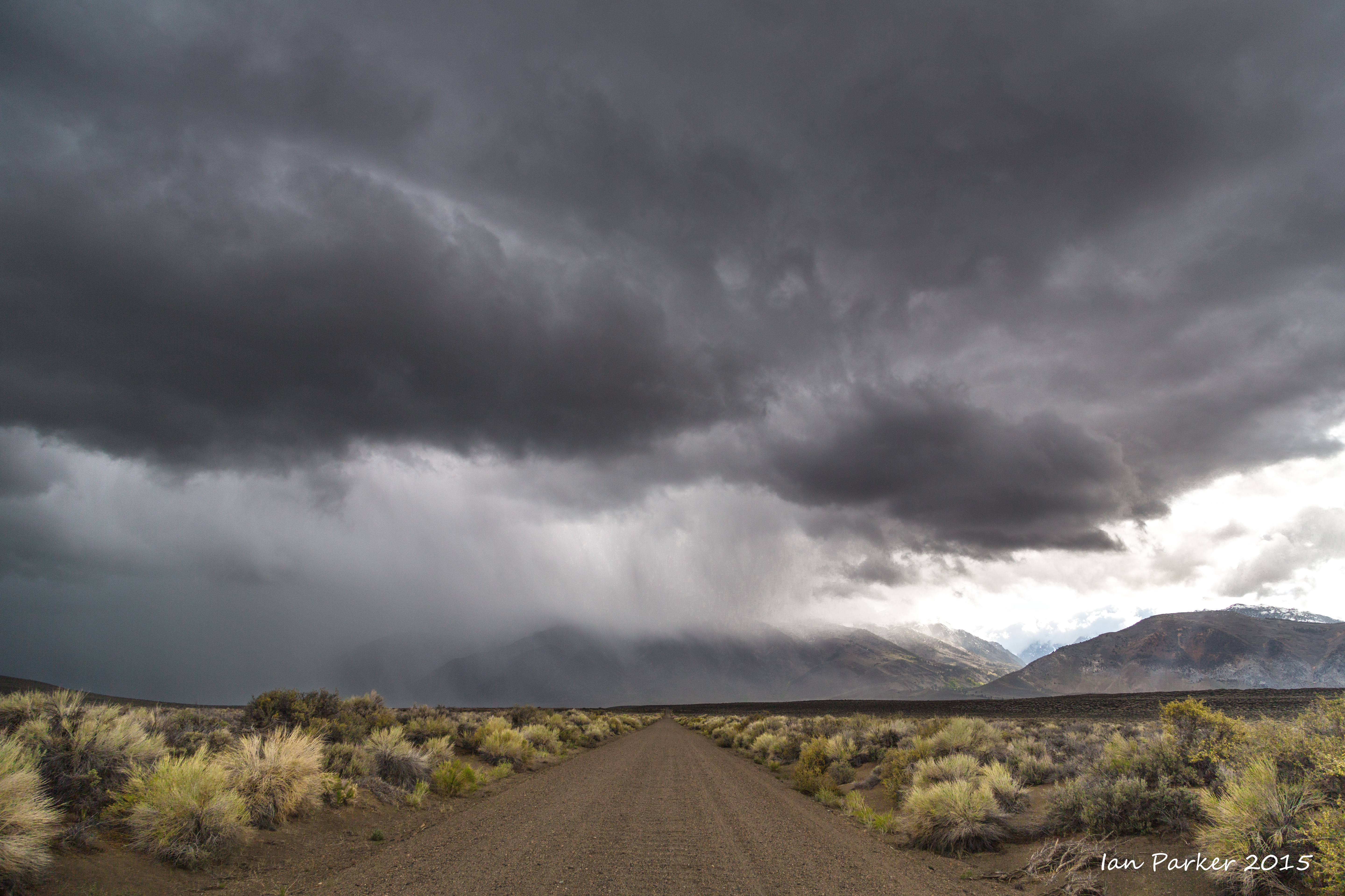
Following a winter of record low rainfall in California, an unusual May storm was forecast for the weekend. That seemed a good excuse for a long weekend traveling along highway 395, with a prospect even of snow at higher elevations.
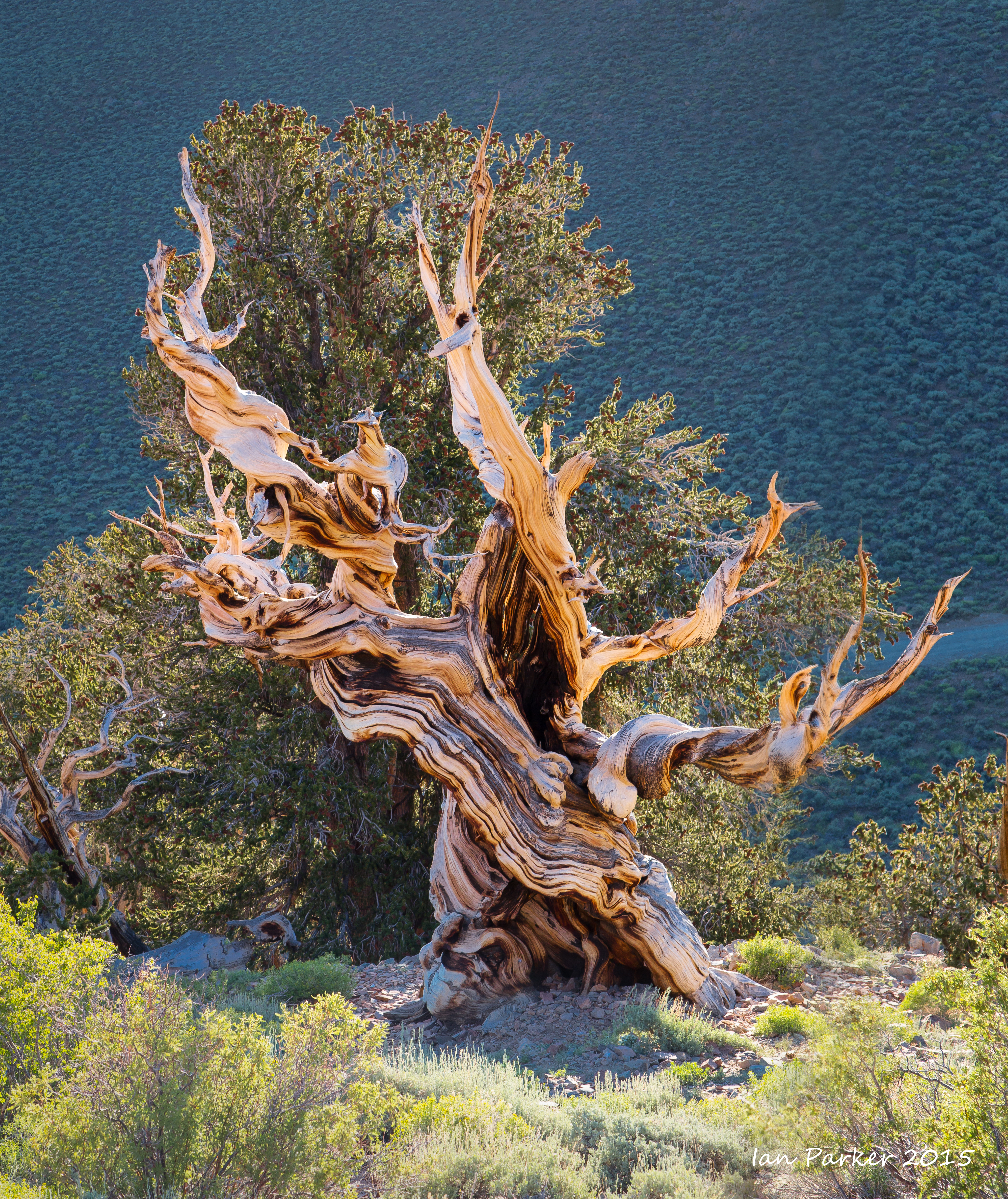
My first destination was the bristlecone pine forest, high in the White Mountains. The dirt road up to Patriarch Grove was muddy but clear until the last mile, where it was blocked by snow on the section contouring the hillside at about 11,000 ft. I hiked in, grateful that I had thought to bring my down jacket, but regretting having no better footwear than running shoes. The Grove is always a peaceful, serene place; but even more so this day. For most of my time there I was alone, and the onset of a gentle, but dense snowfall reduced visibility so that I was isolated in a white landscape punctuated only by the ancient trees. Photography was thus not a matter of landscapes, but instead the soft, diffused light and veiling snowfall enhanced the subtle colors of the weatherd wood and enabled intimate portraits of individual trees without distracting background clutter.
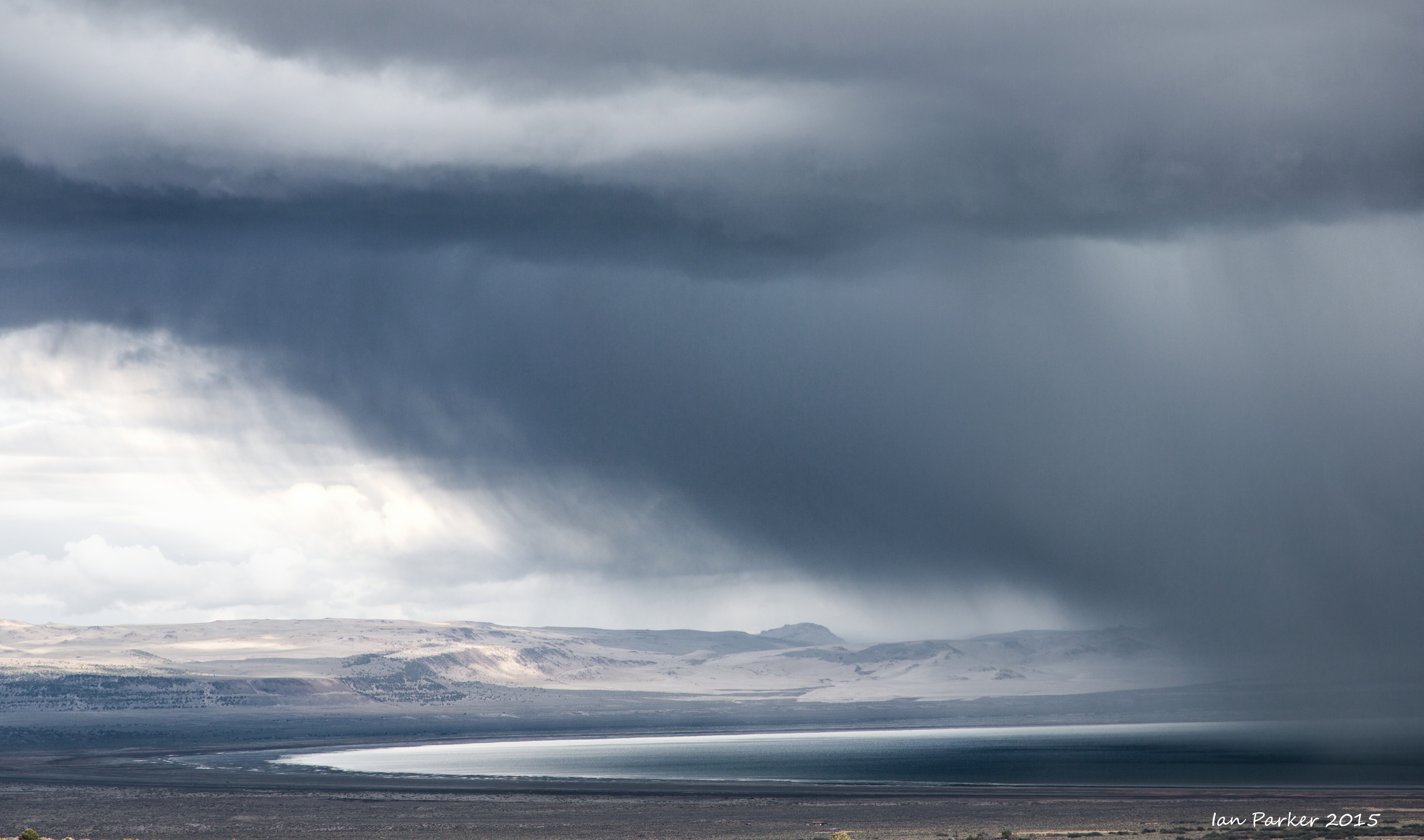
I had thought of staying the night up with the bristlecone pines, but a developing altitude headache and the chance of becoming snowed-in dissuaded me, and I headed down the Silver Canyon road toward thicker air. Driving north along 395 I found some dramatic clouds and rain squalls over Mono Lake.
The water level in Mono Lake is presently at its lowest level for 20 years (6379 ft above sea level), only 7 ft higher than its historic low before the legal settlements curtailed diversion of inflows by LA DWP.
With the miniscule snowpack and continuing drought the water will likely drop further, but an additional fall of only 2 ft will trigger a clause requiring DWP to suspend diversion of all waters flowing into the lake. [See here for a recent discussion.] The low water level unfortunately makes the South Tufa area look rather scruffy, with a wide 'bathtub' ring of wet mud and broken fragments of tufa; but I did find some newly-exposed areas with interesting yellow coloration (algae?) in shallow water overlying tufa shelves.
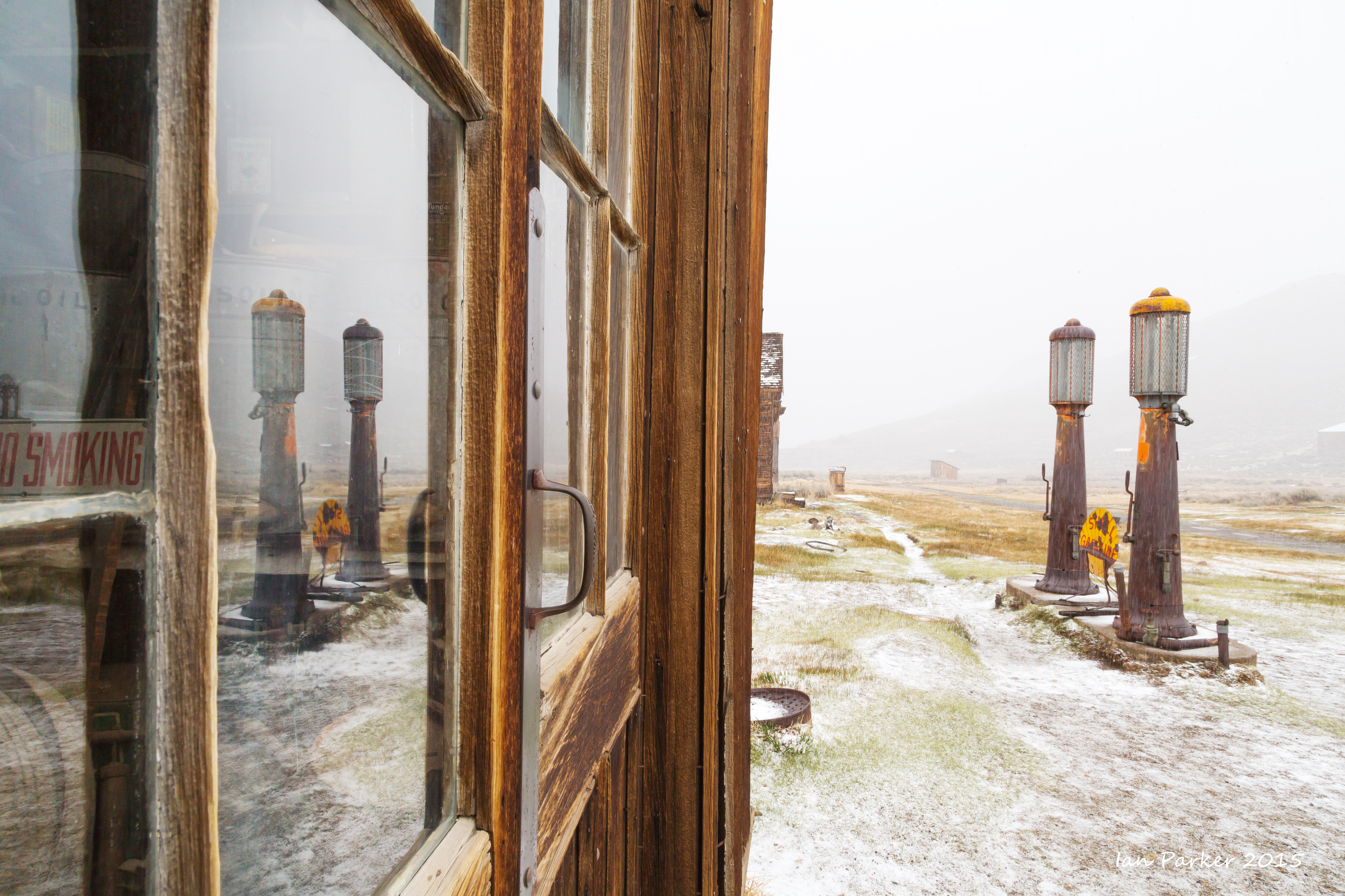
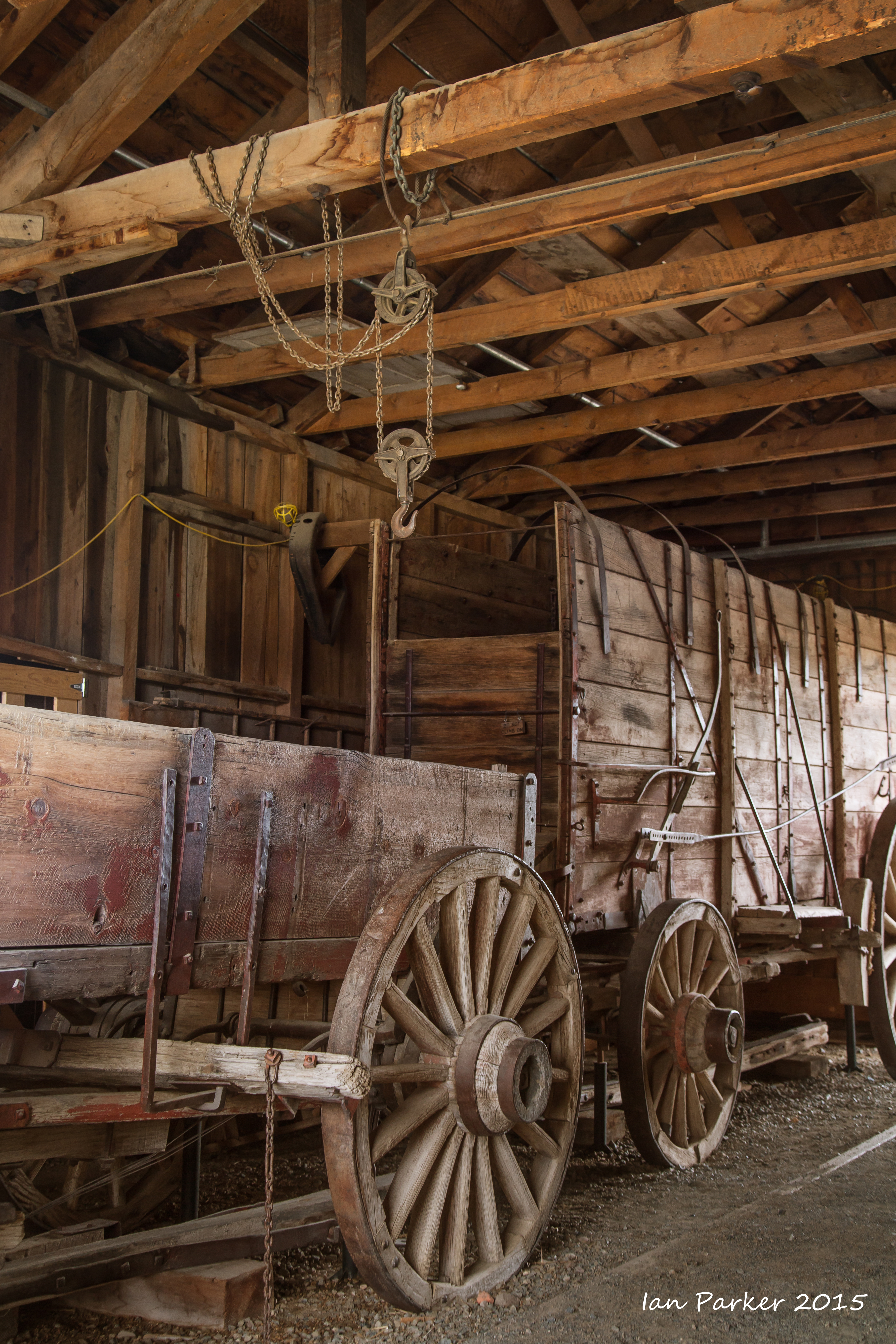
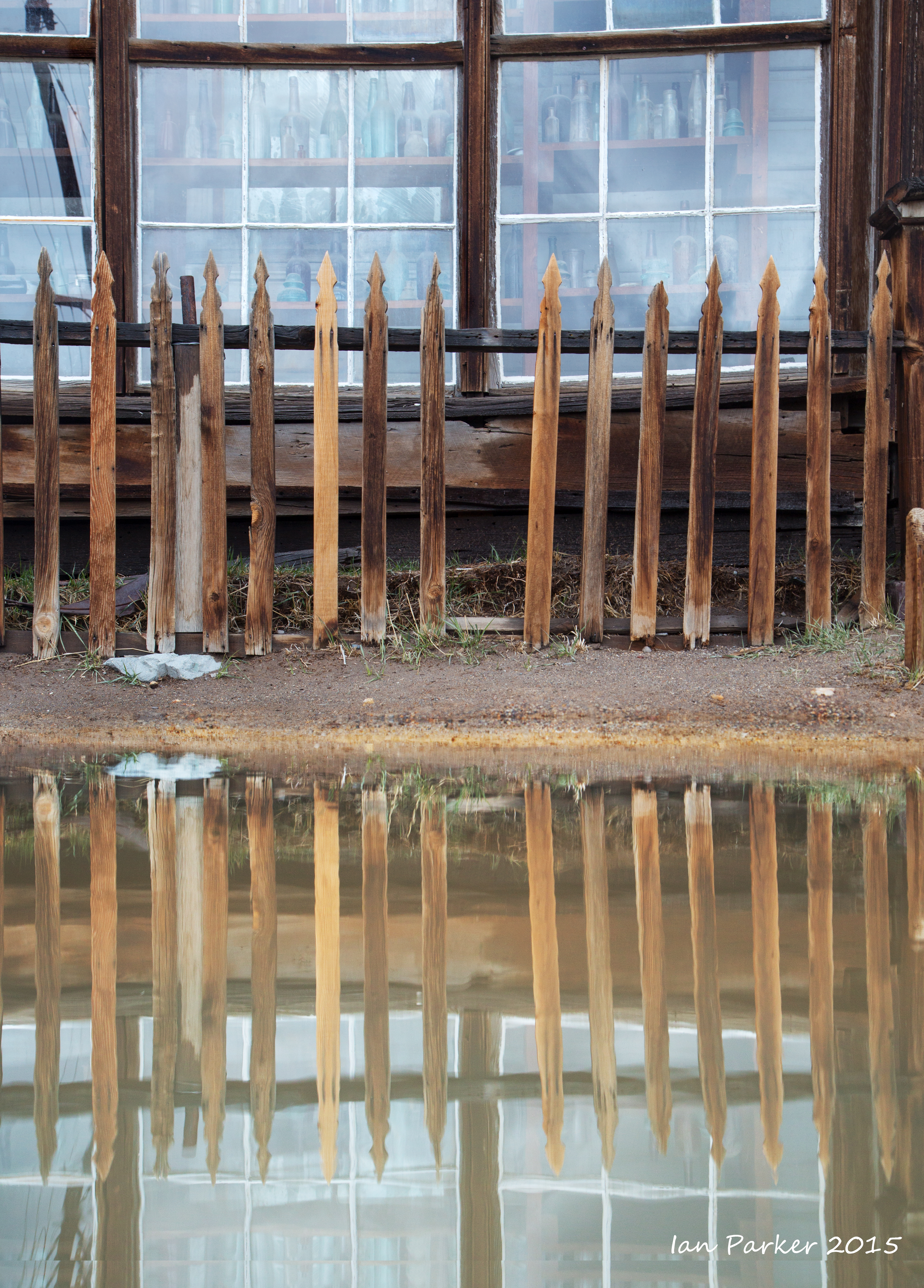
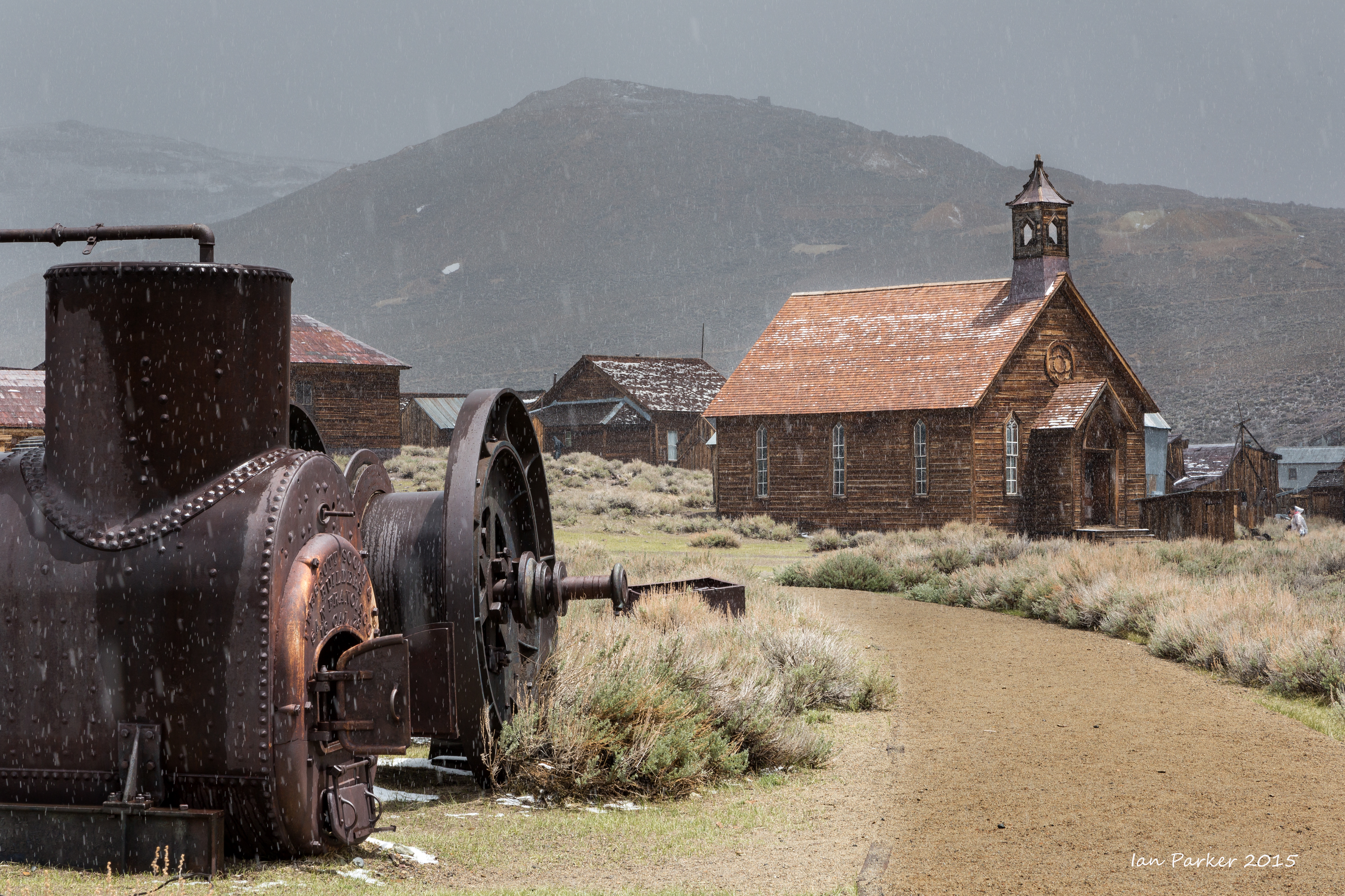
I camped by Mono Lake for a couple of nights, and took a daytime excursion to Bodie ghost town. My previous visits had mostly been in midsummer, when harsh sunlight and surprisingly high temperatures (even at 8000ft elevation) resulted in my enthusiasm for
photography fading rapidly by mid-afternoon. This time was very different; cold, overcast conditions when I arrived, and an intense flurry of fresh snowfall that made for some nice 'Japanese watercolor'-like effects.
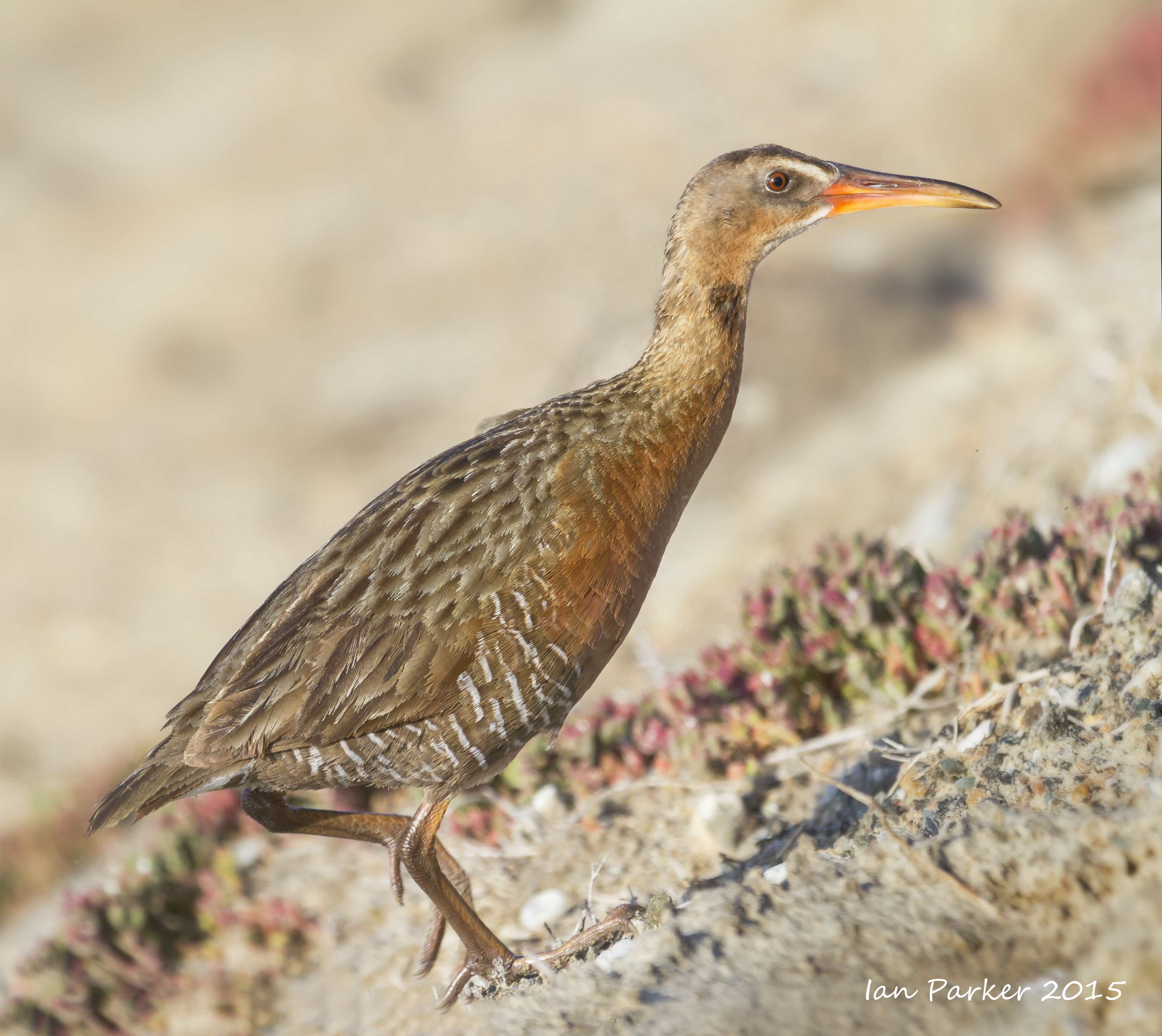
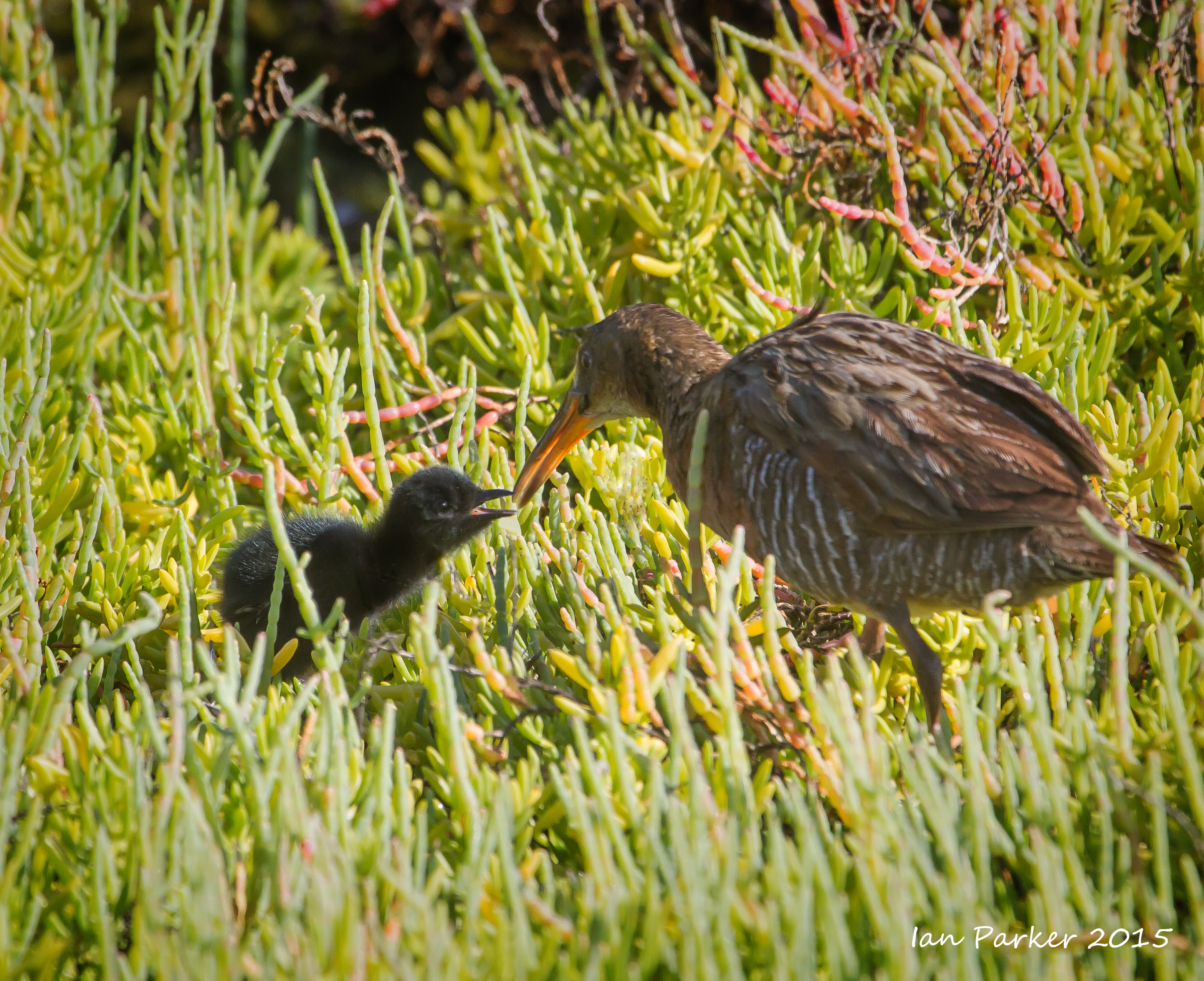
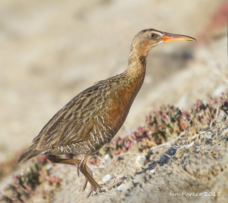
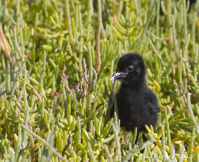
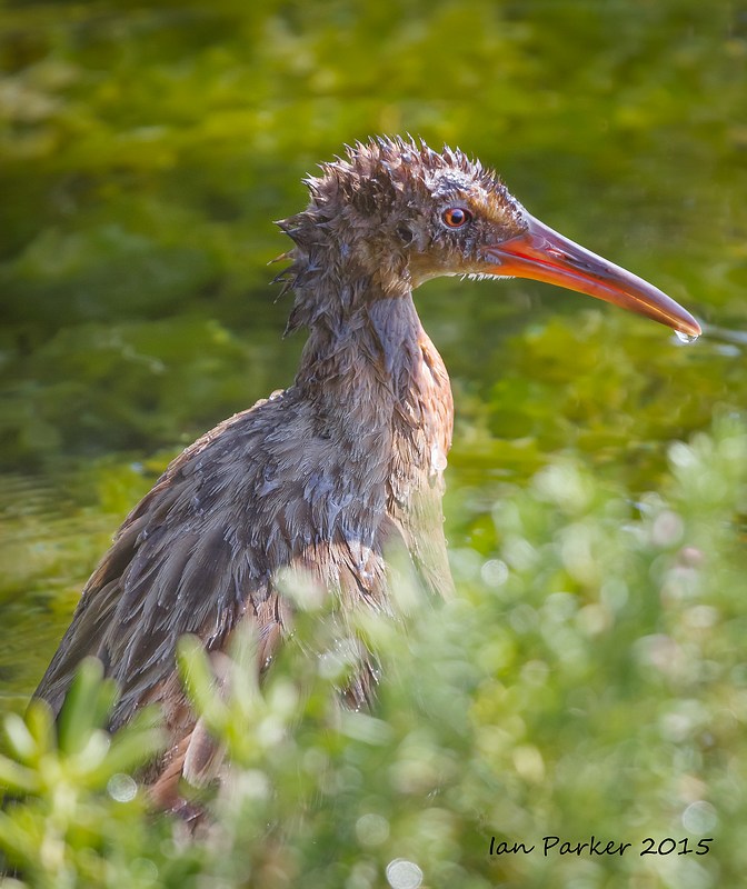
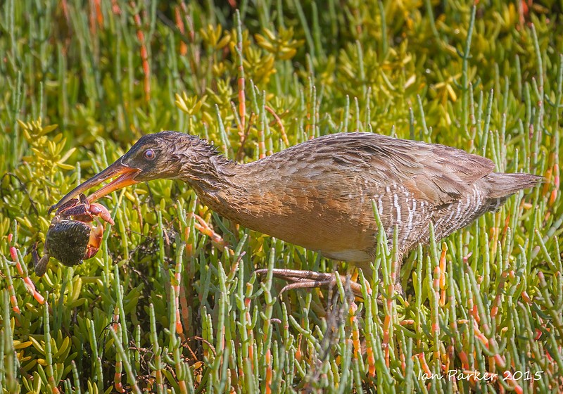
May 10th, 2015 : Endangered light-footed clapper rail family at Bolsa Chica
A breeding pair of light-footed clapper rails have built their nest within convenient telephoto distance of the boardwalk at Bolsa Chica. This is apparently
only
the second year in decades that these elusive birds have been sighted at Bolsa Chica.
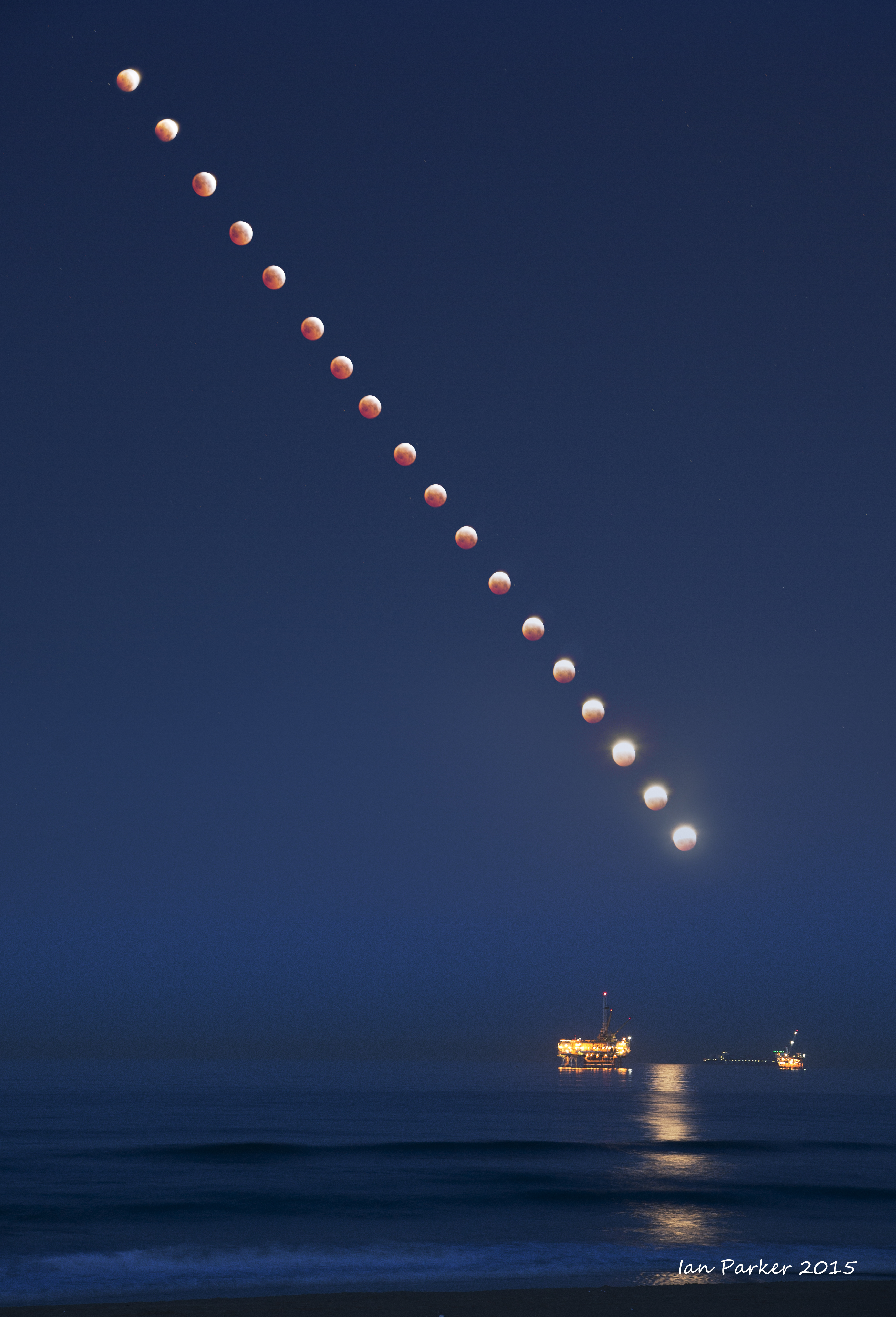
April 4, 2015: Lunar eclipse over the Huntington Beach oil rig
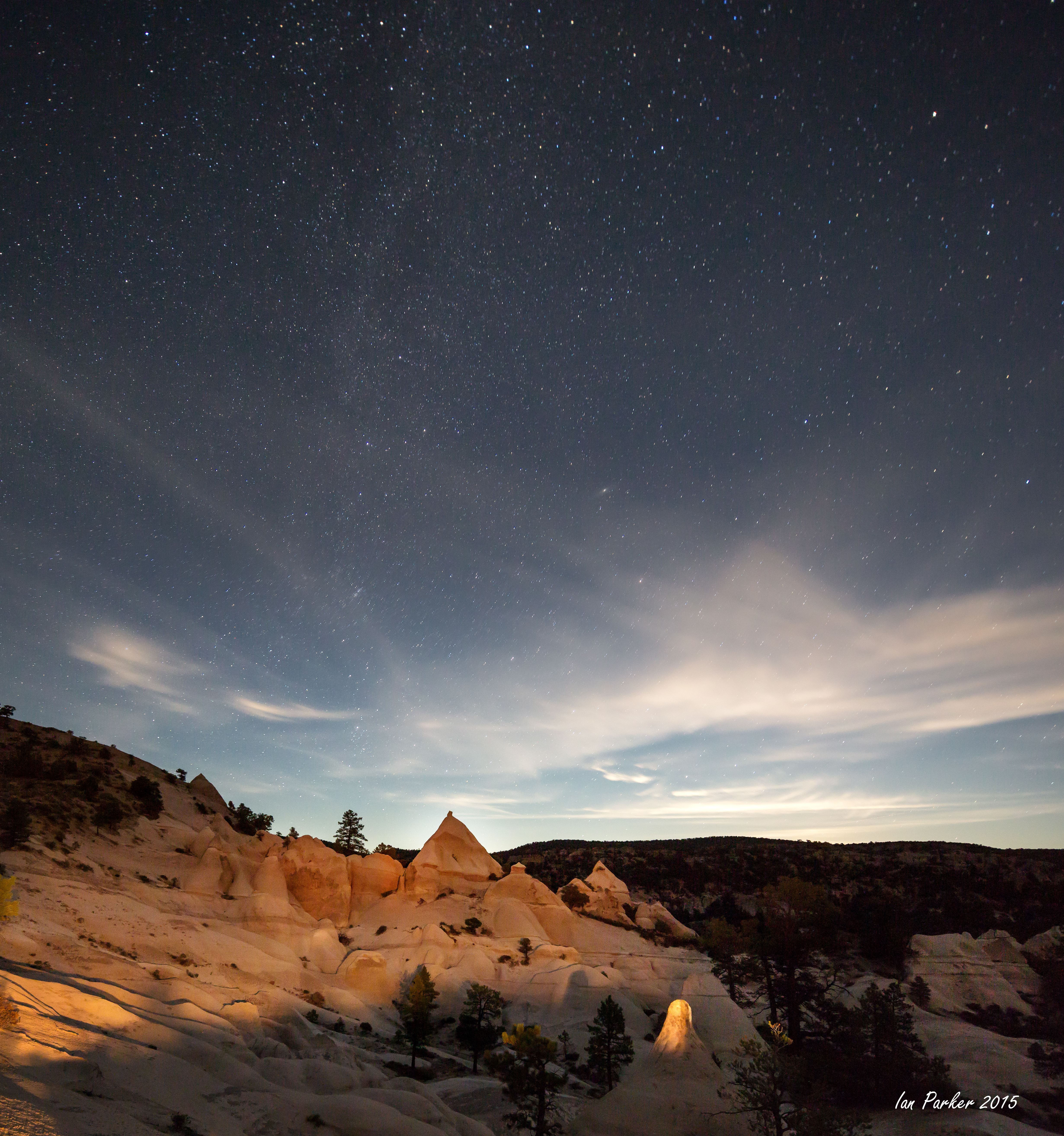
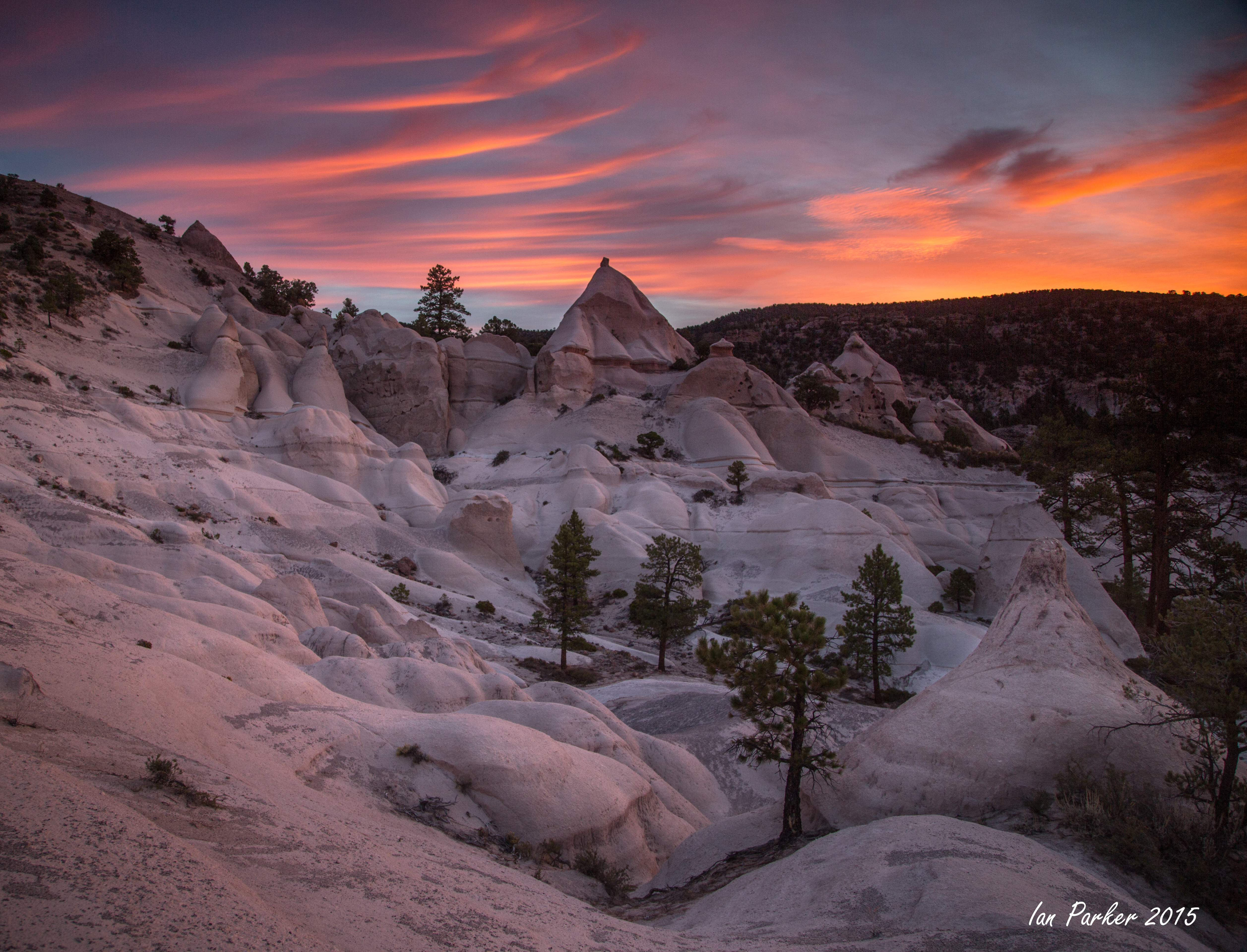
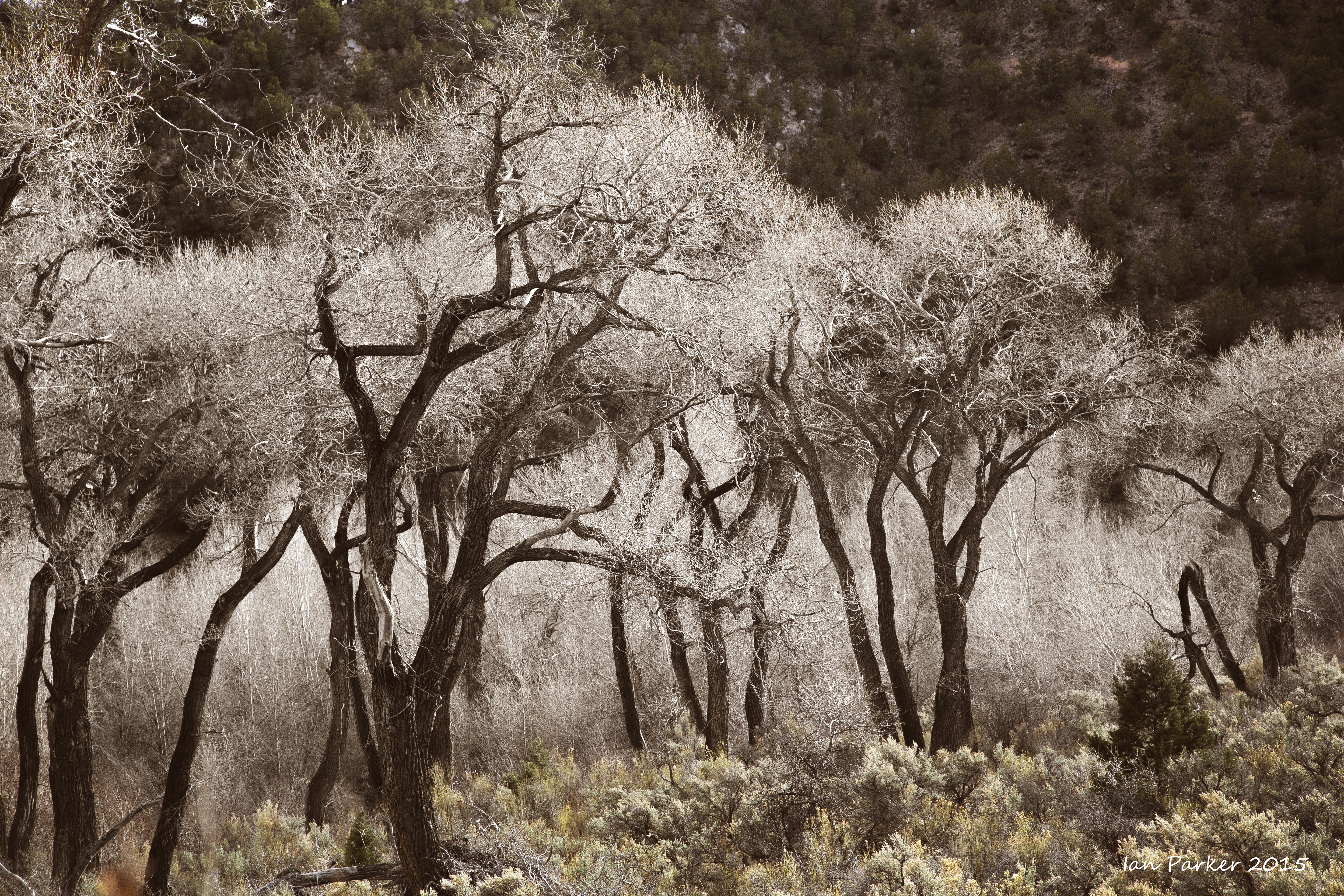
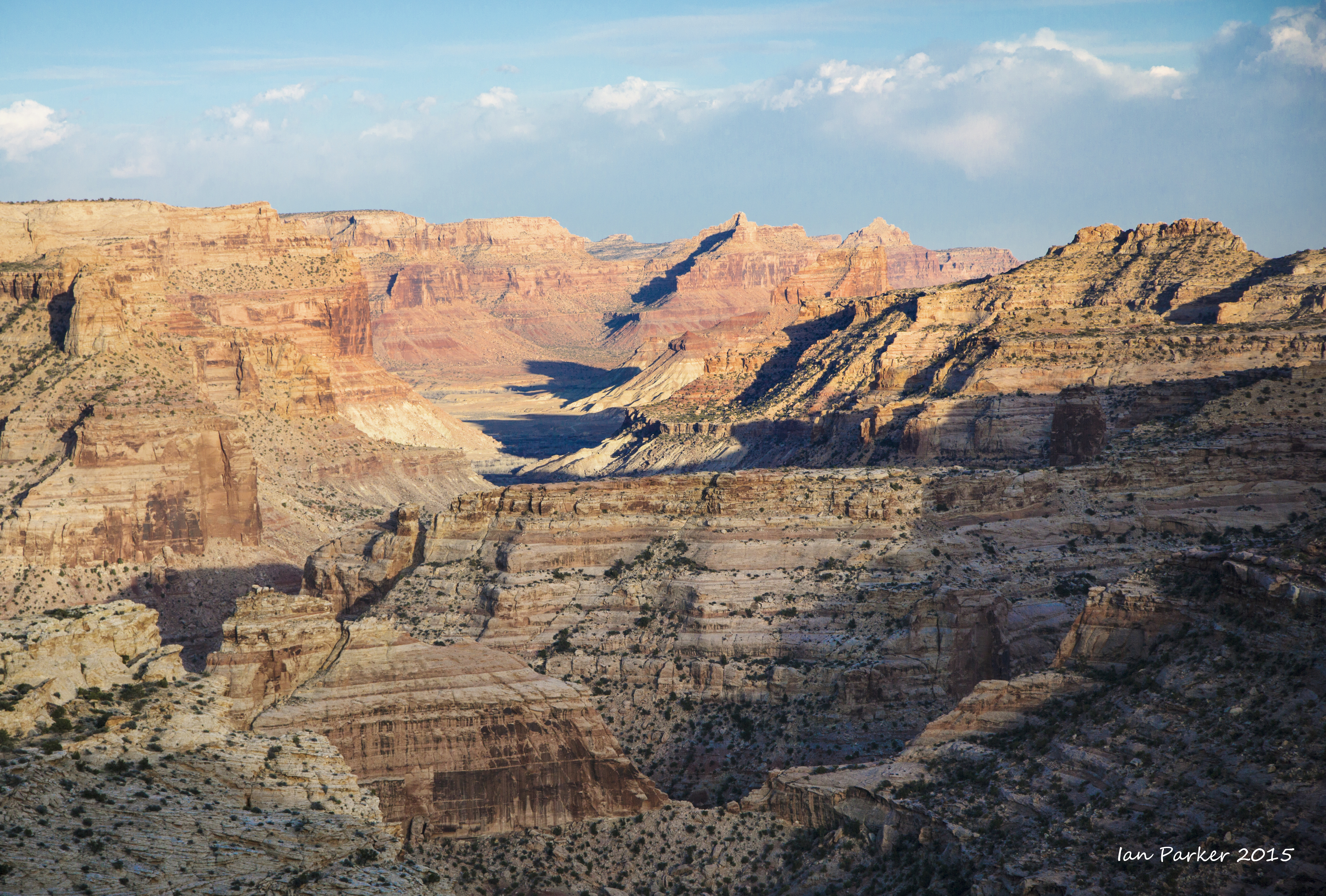
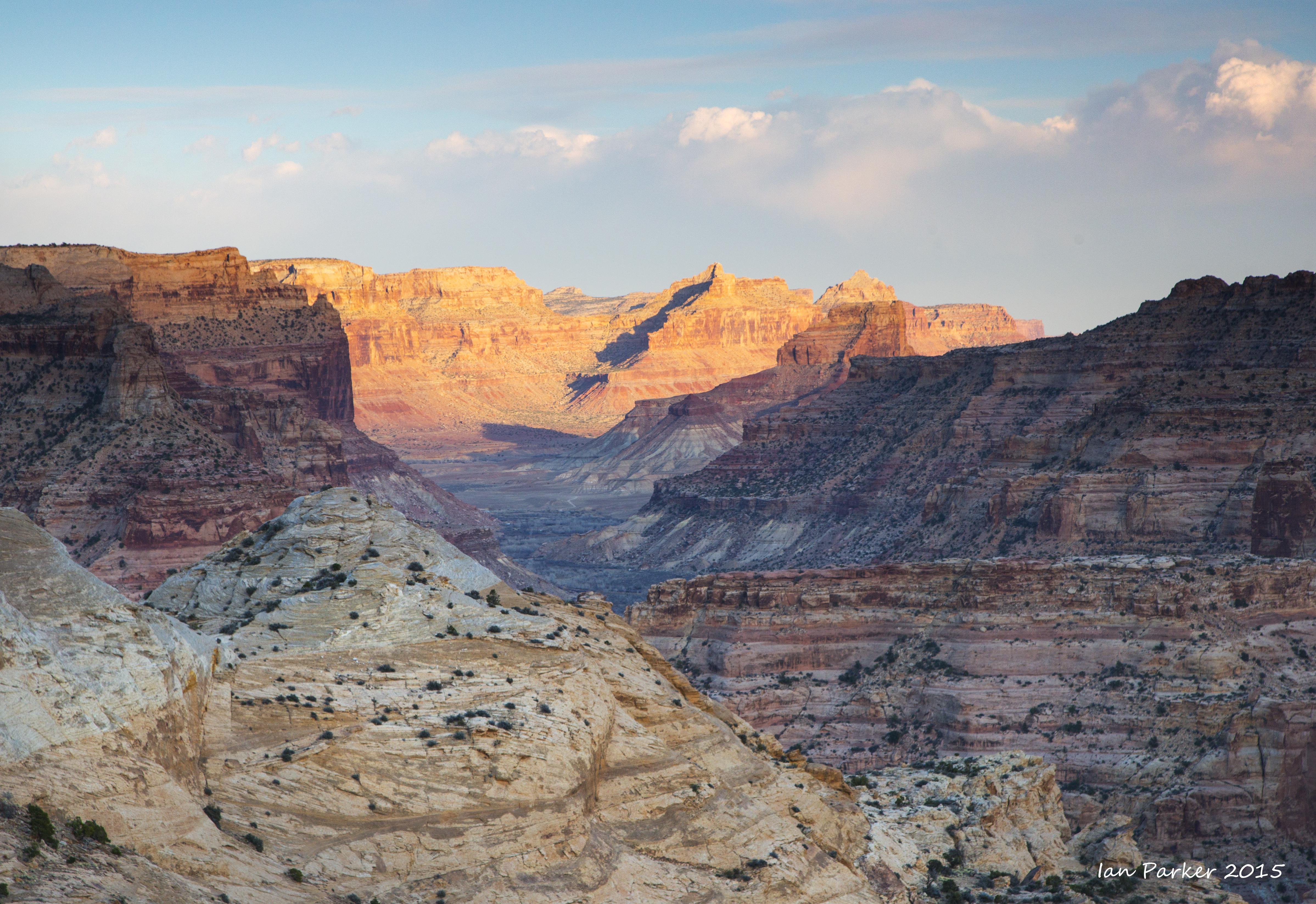
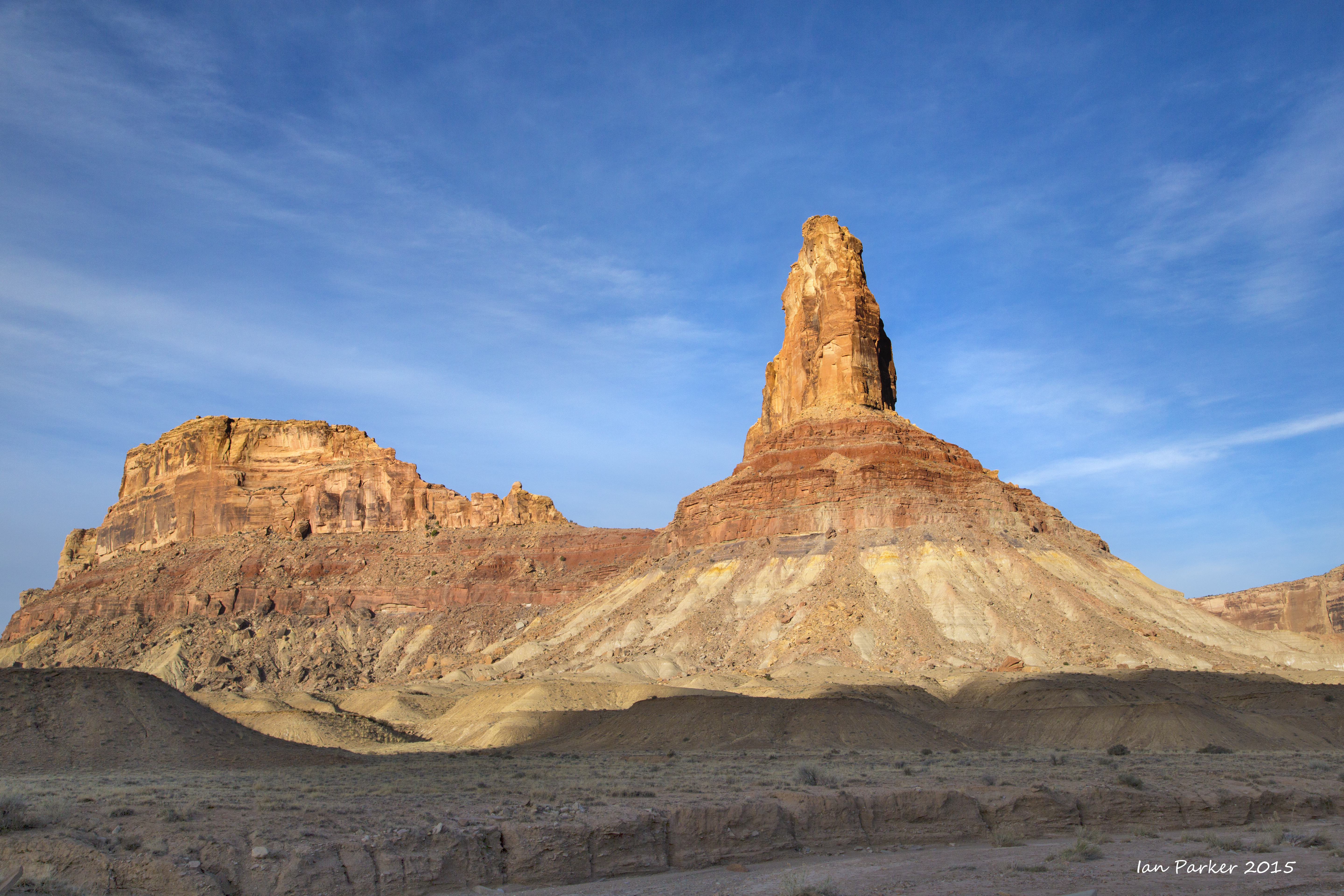
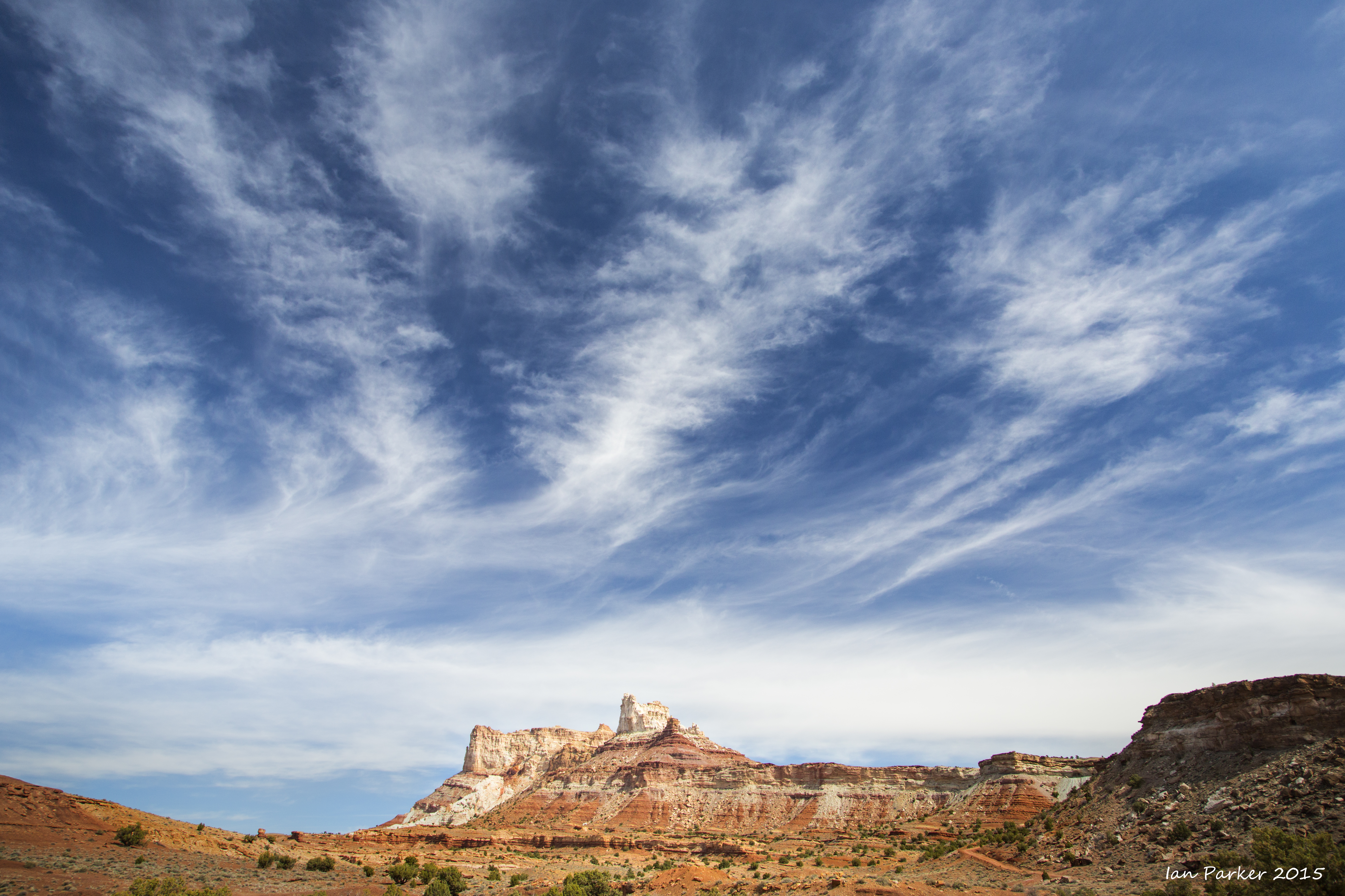
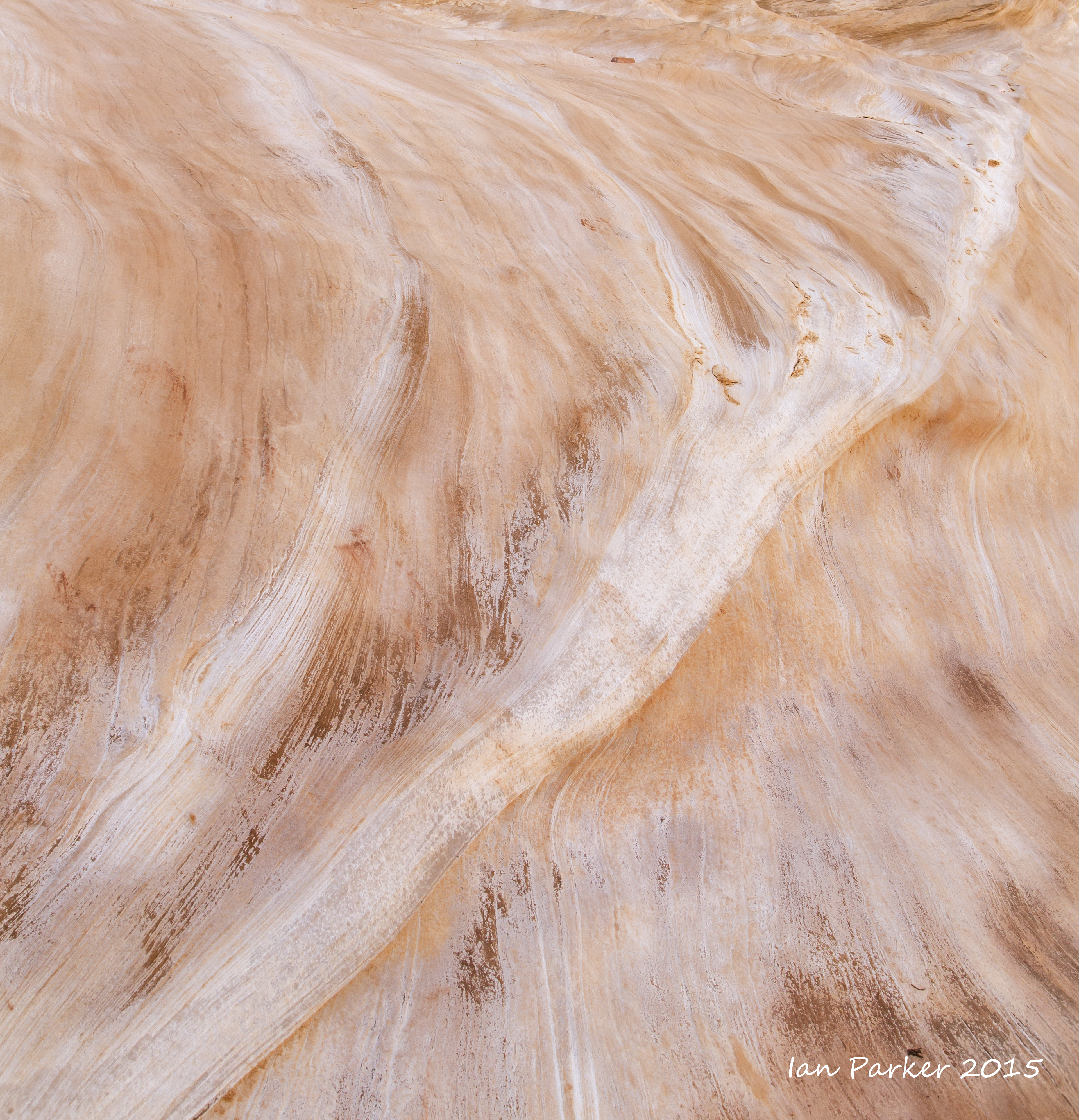
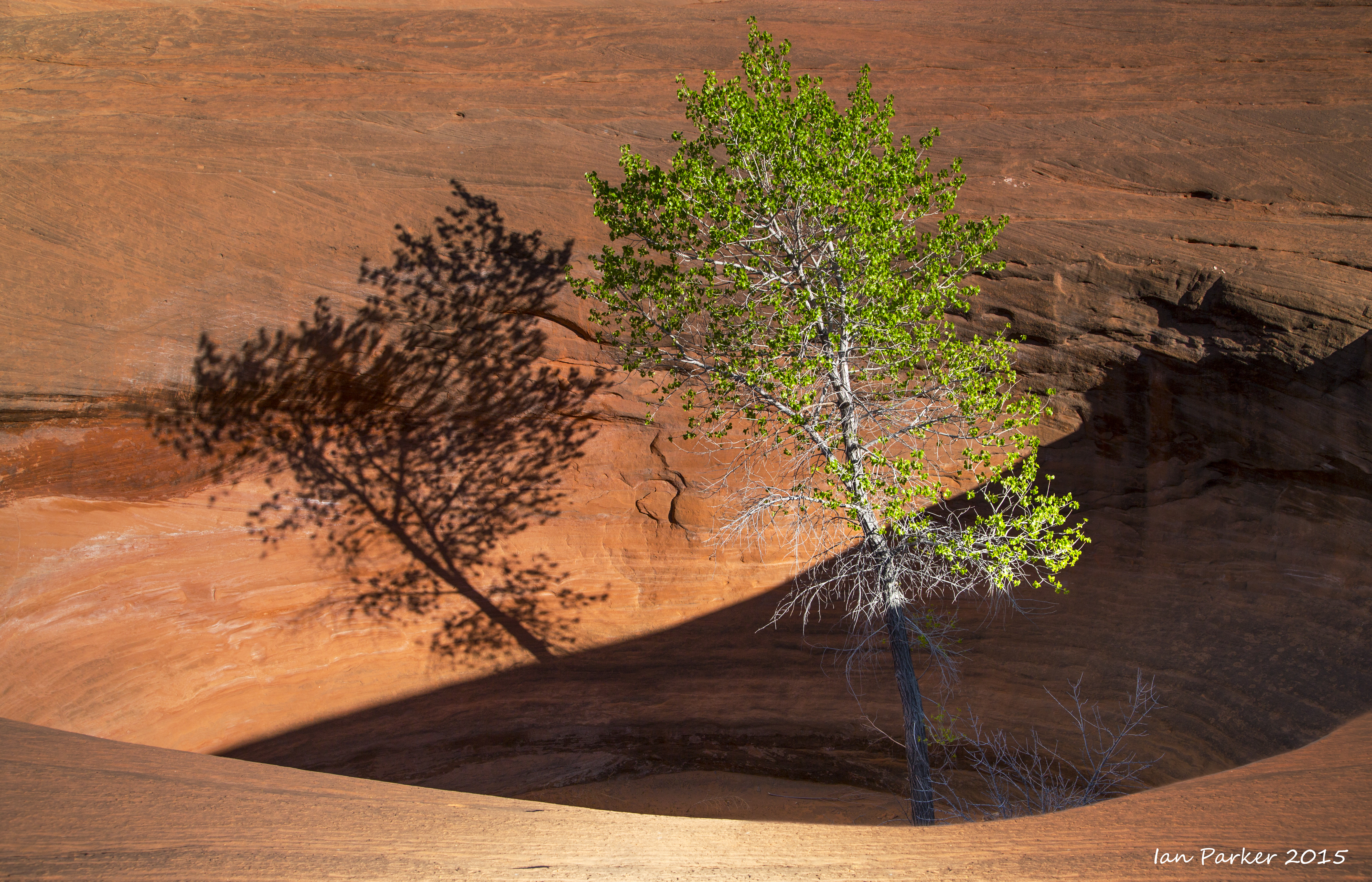
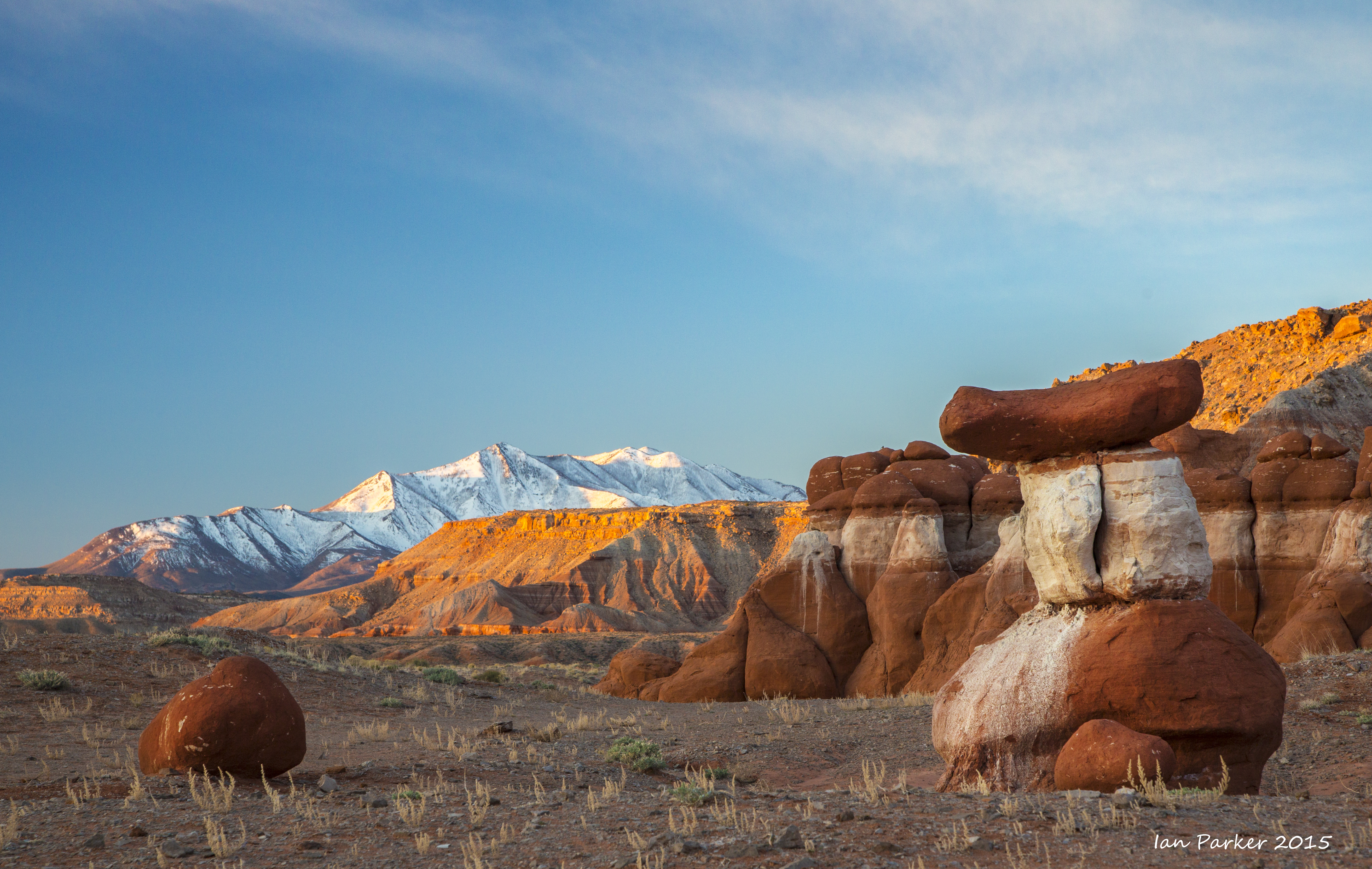
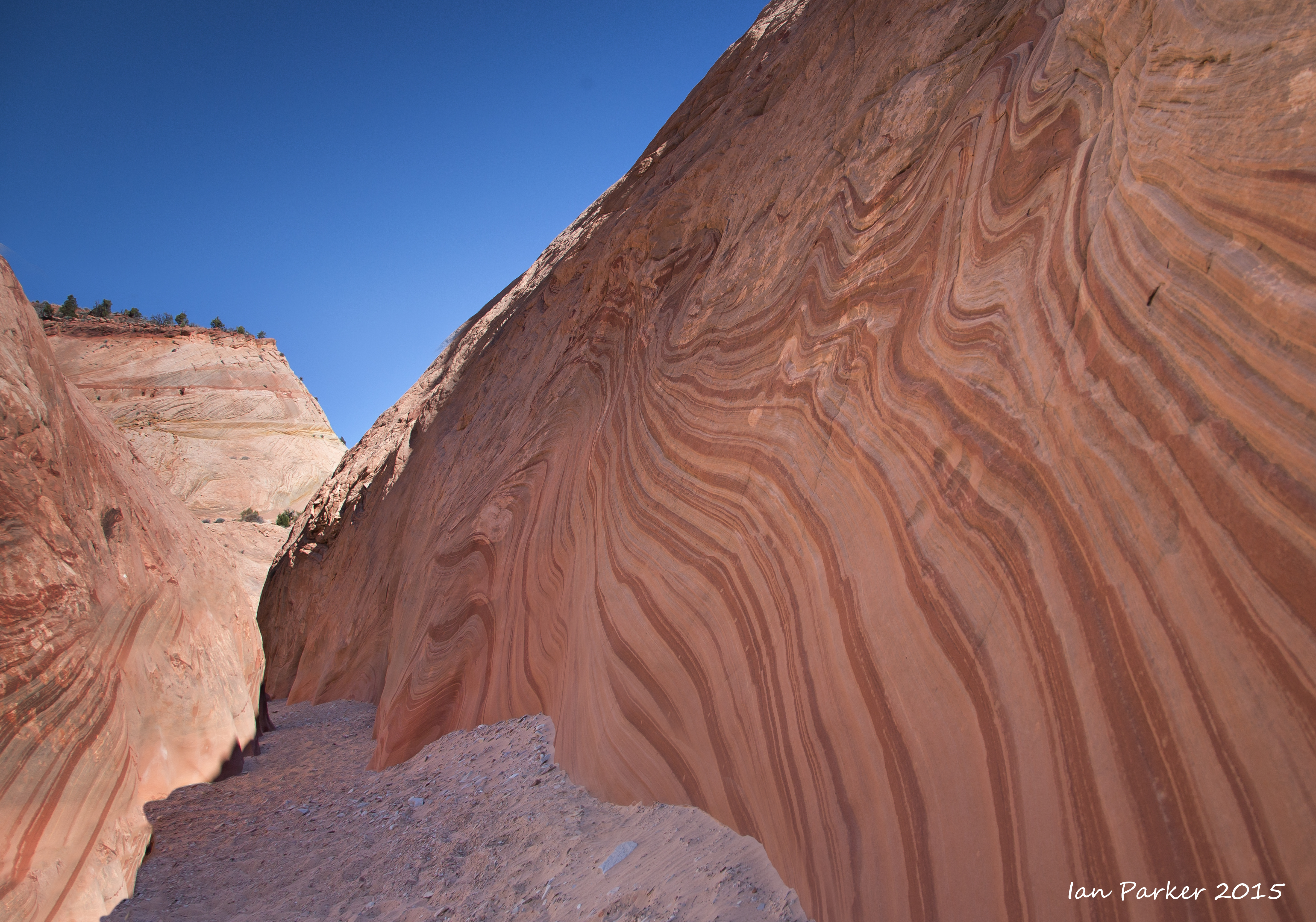
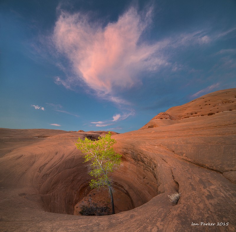
March 21-28. An excursion through Southern Utah
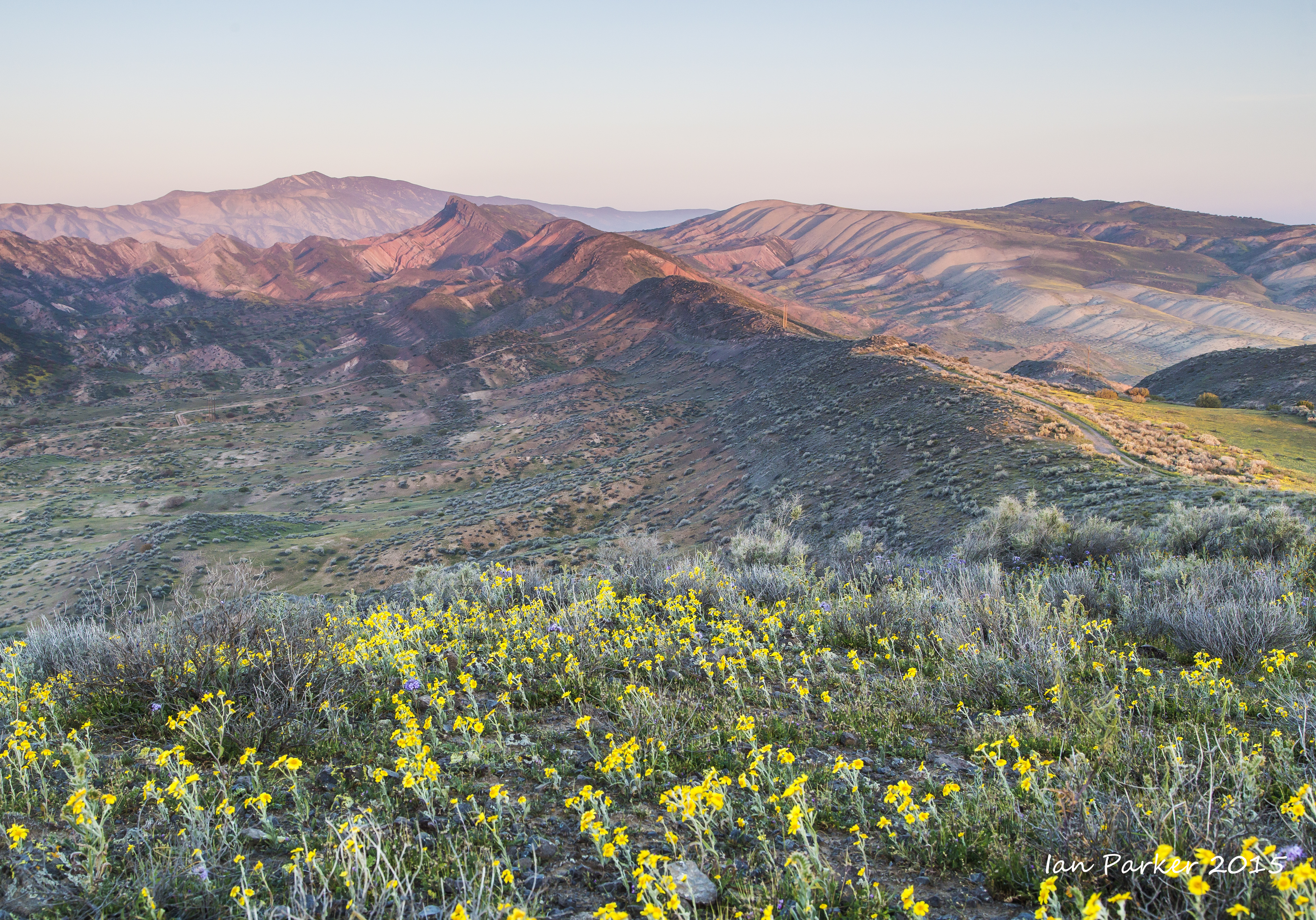
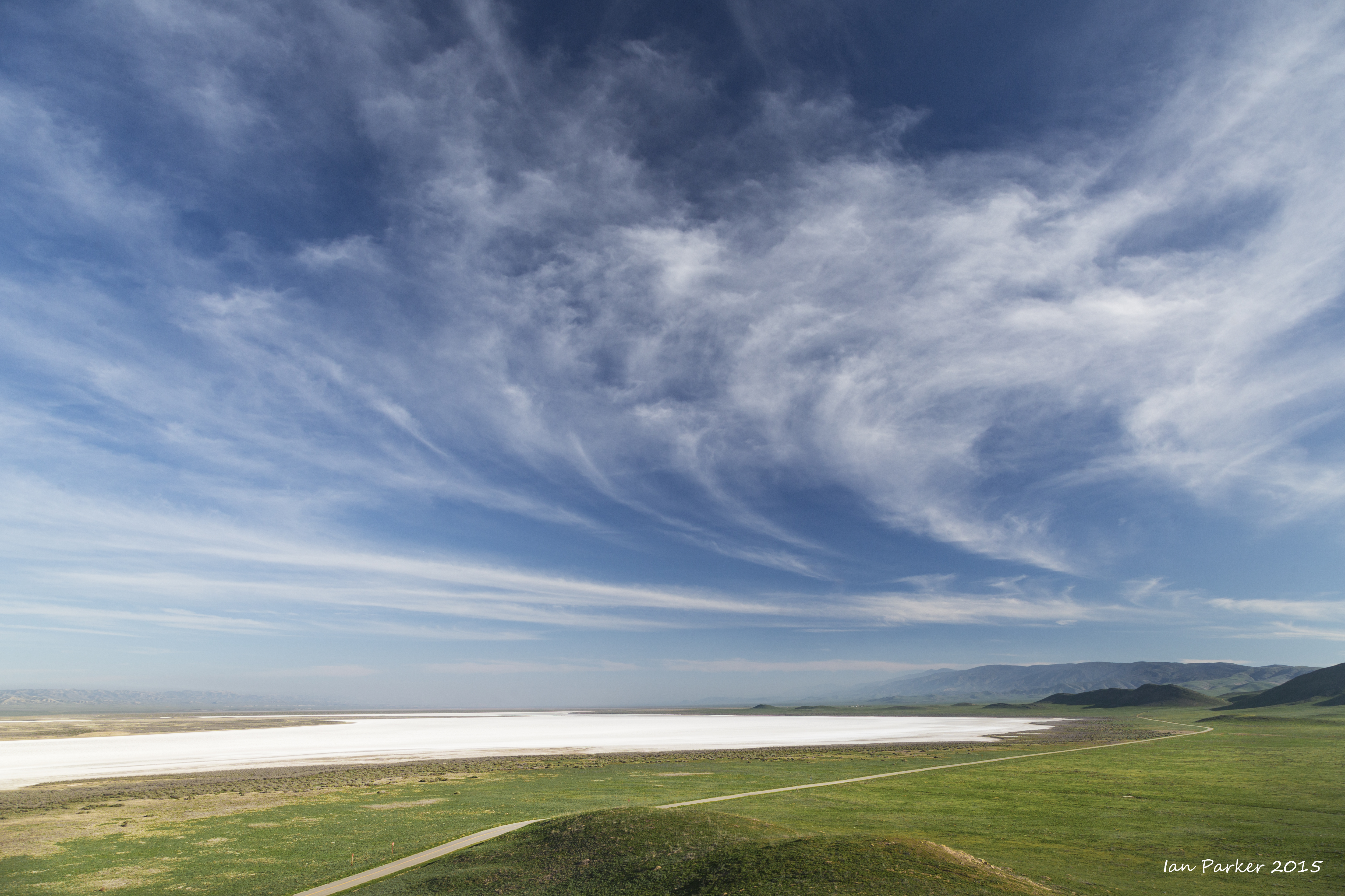
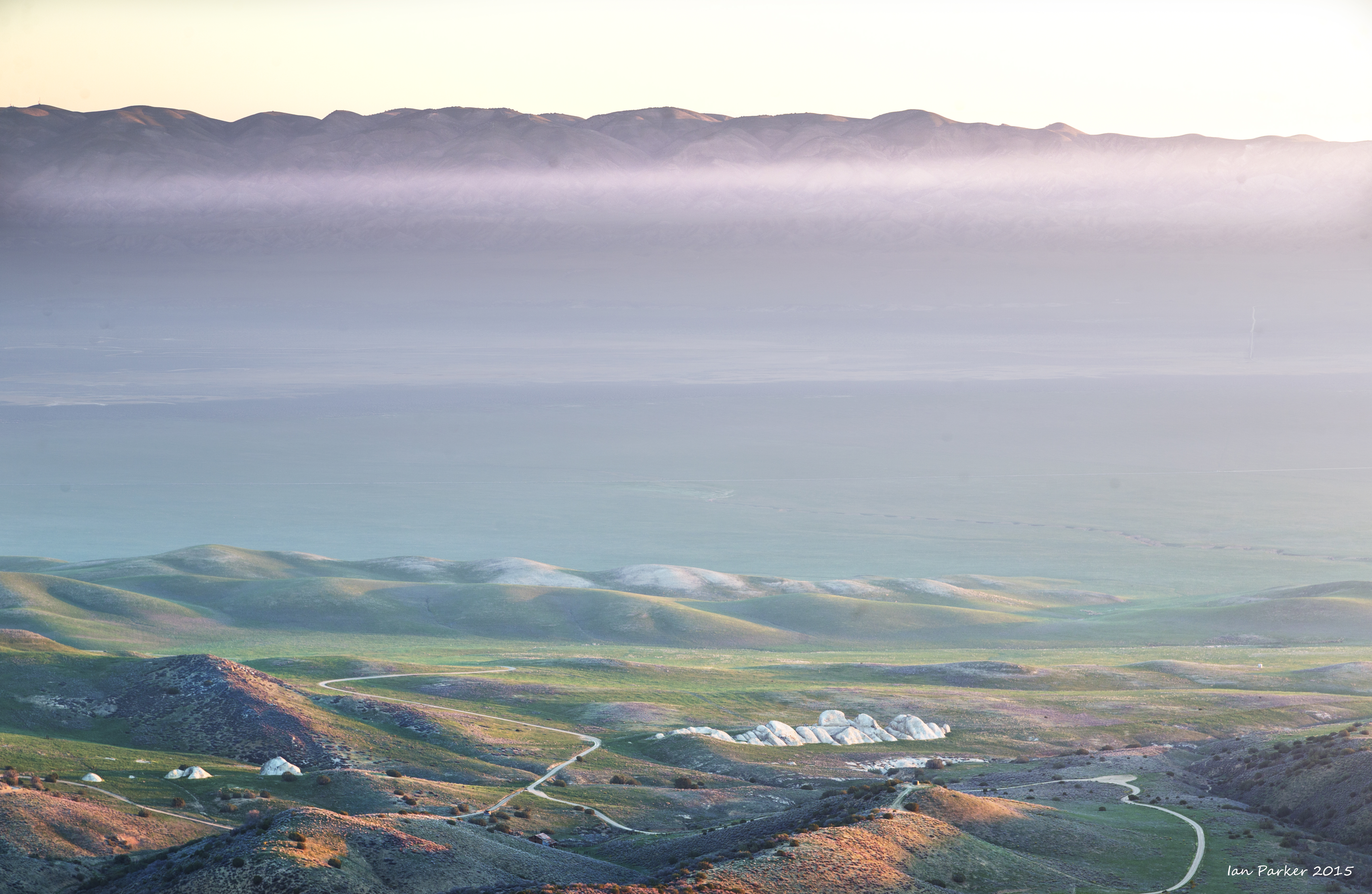
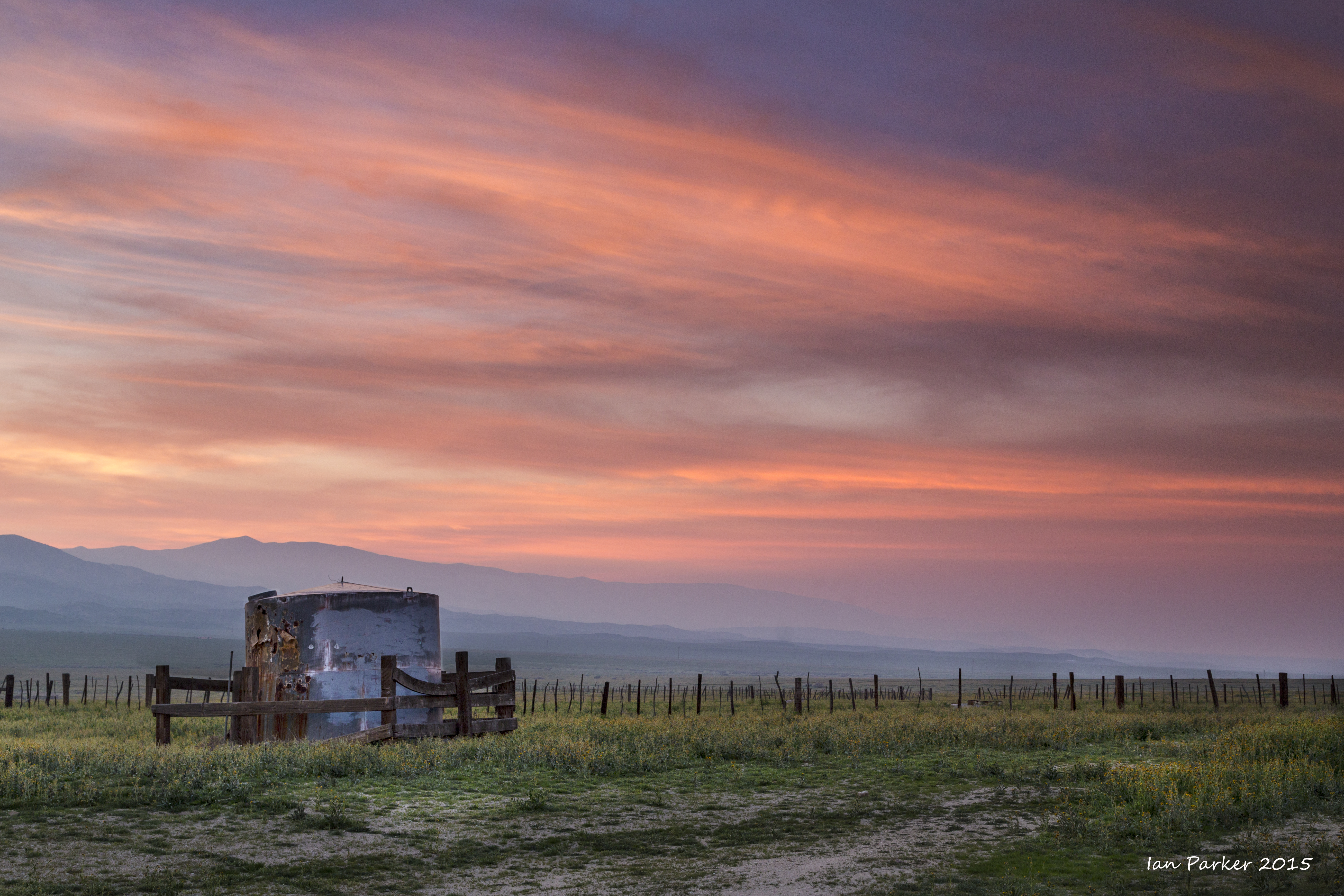
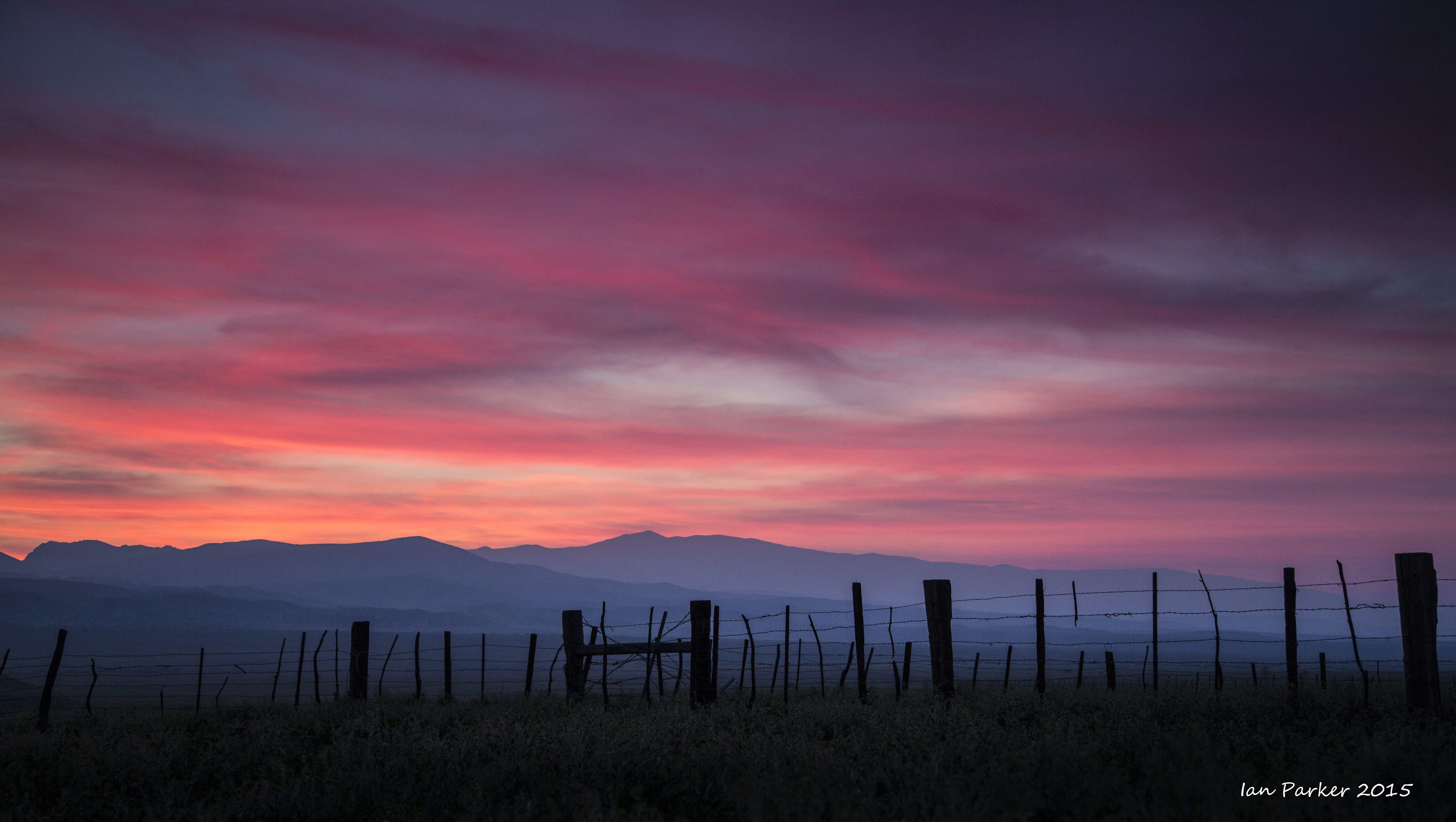
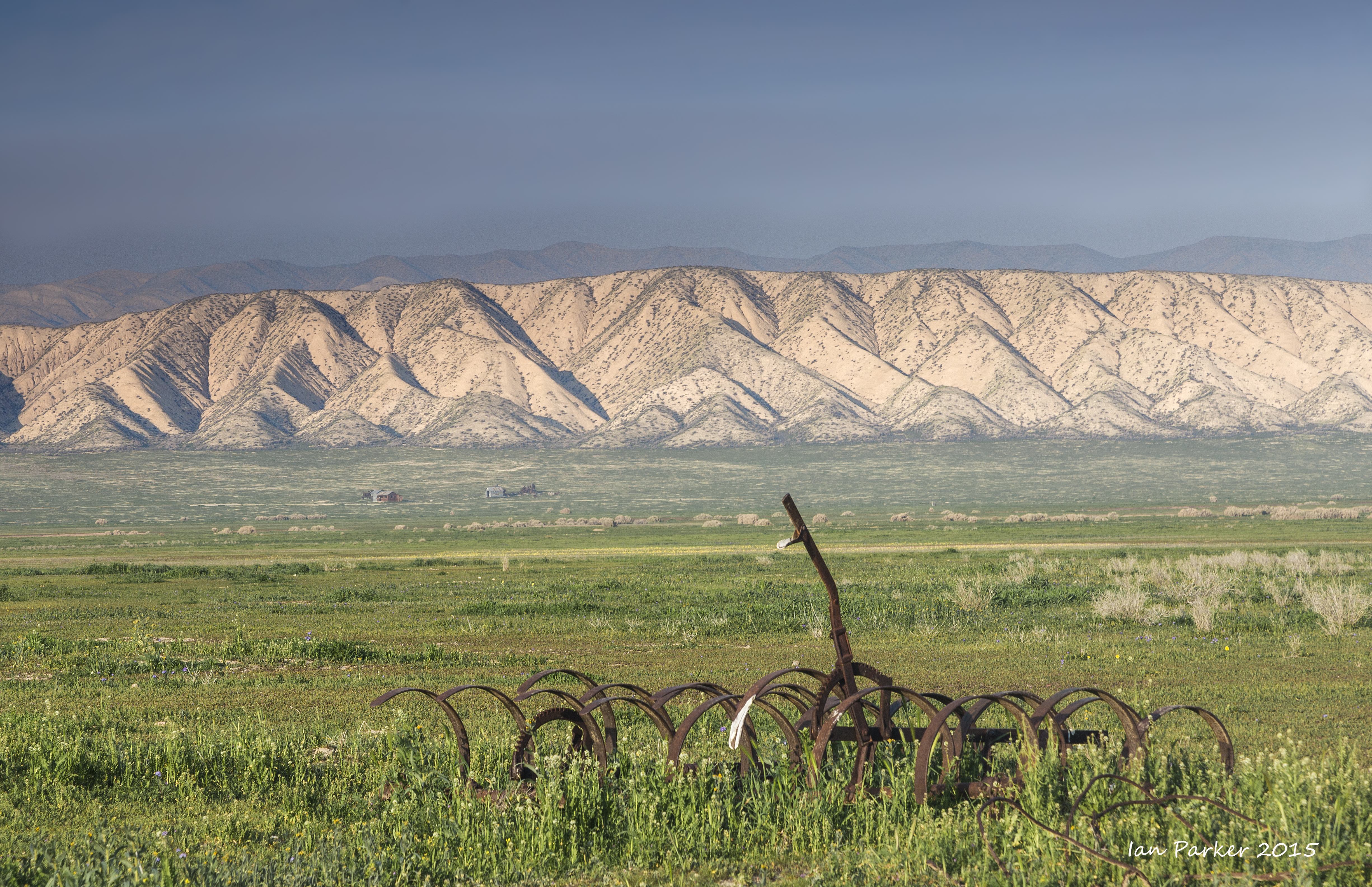
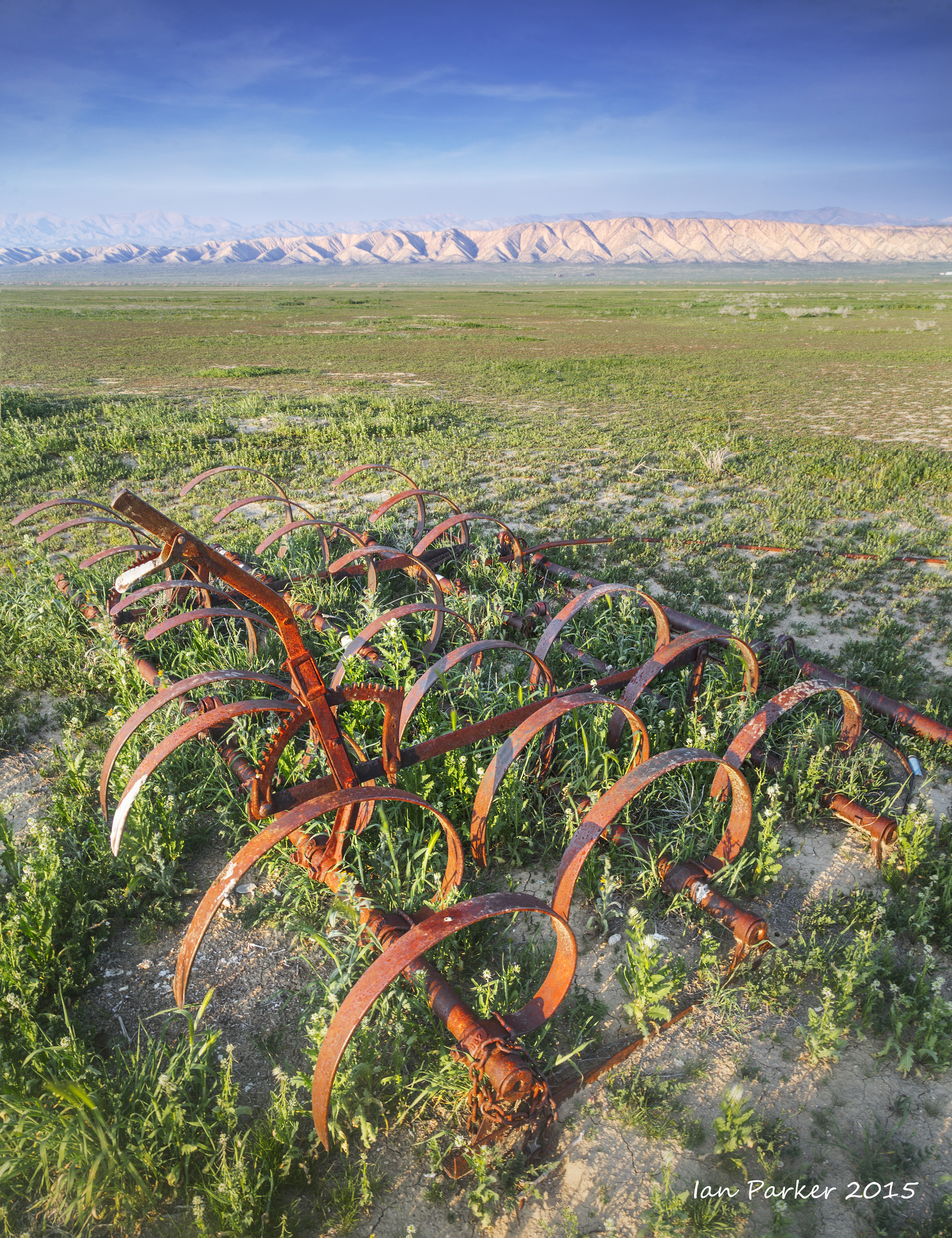
March 7,8. A return visit to Carrizo Plains National Monument for the wildflowers
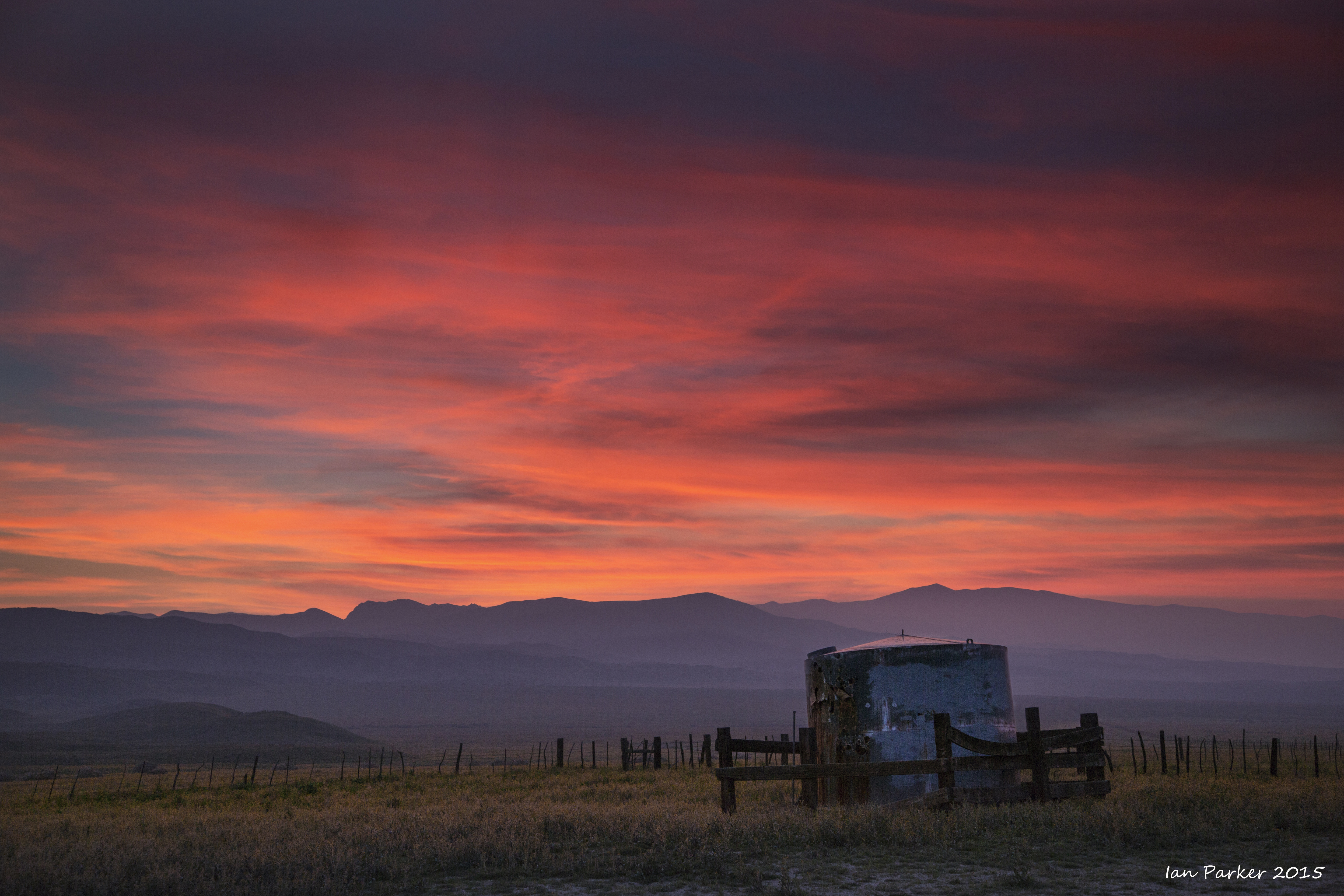
Feb. 14-16. A first visit to Carrizo Plain National Monument
And a not very productive stay at Morro Bay under a dark and gloomy marine layer
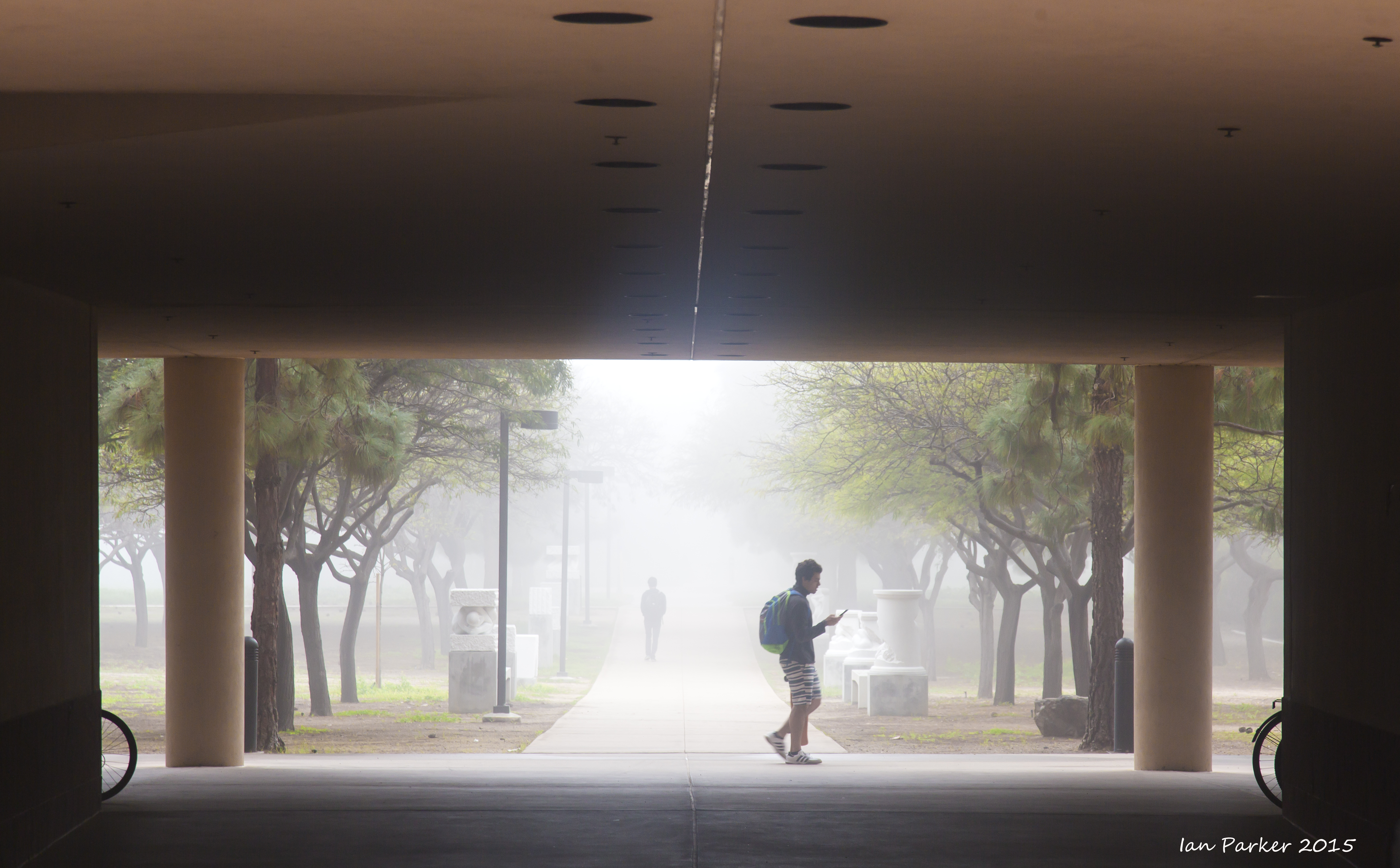
Feb 5, 2015. A misty morning as I walked through the UCI campus to my lab. That doesn't happen very often in Southern California
Jan 25, 2015: A morning visit to Bolsa Chica
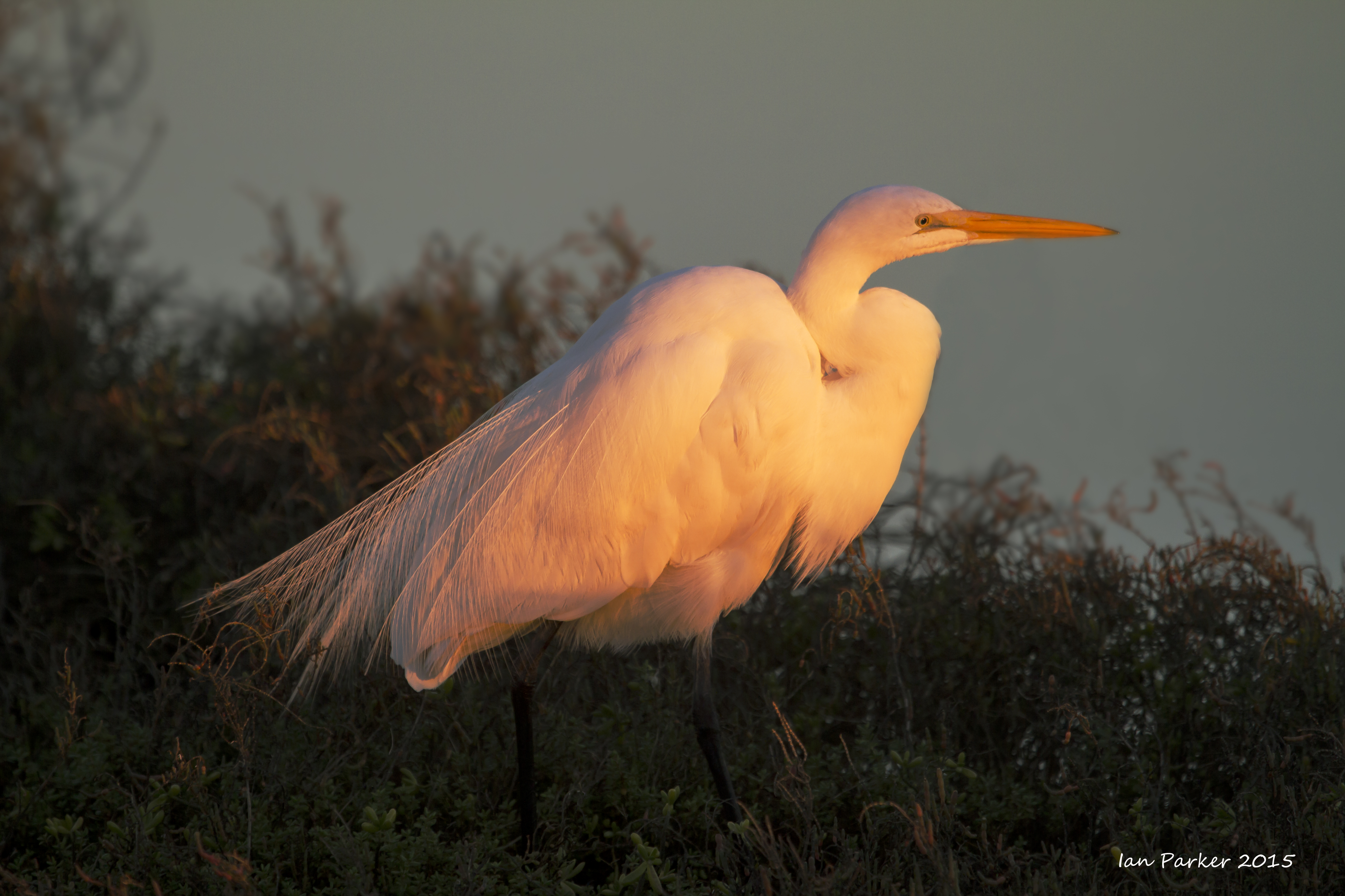
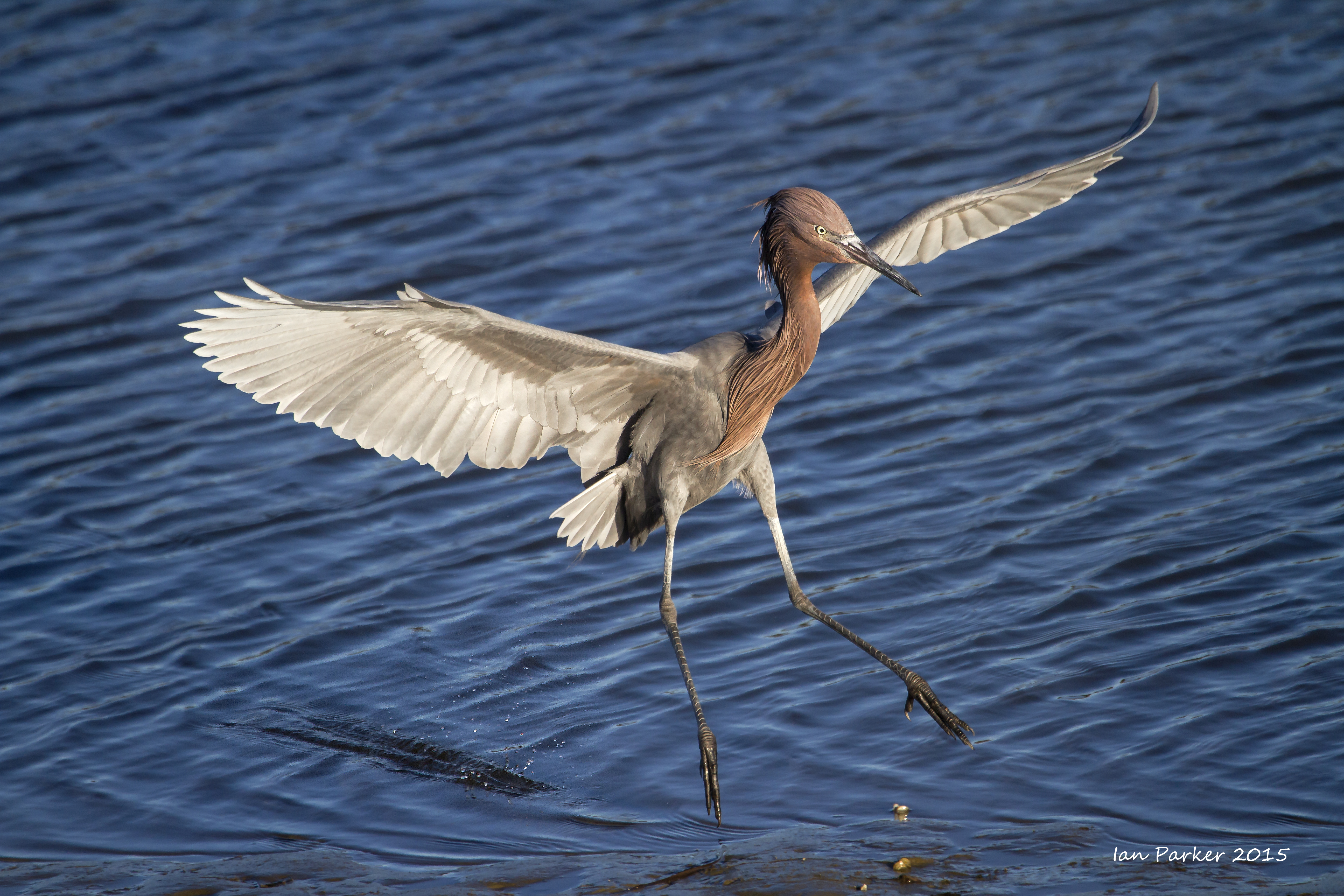
A rather quiet morning for birds, but redeemed when a reddish egret flew in and landed right in front of me.
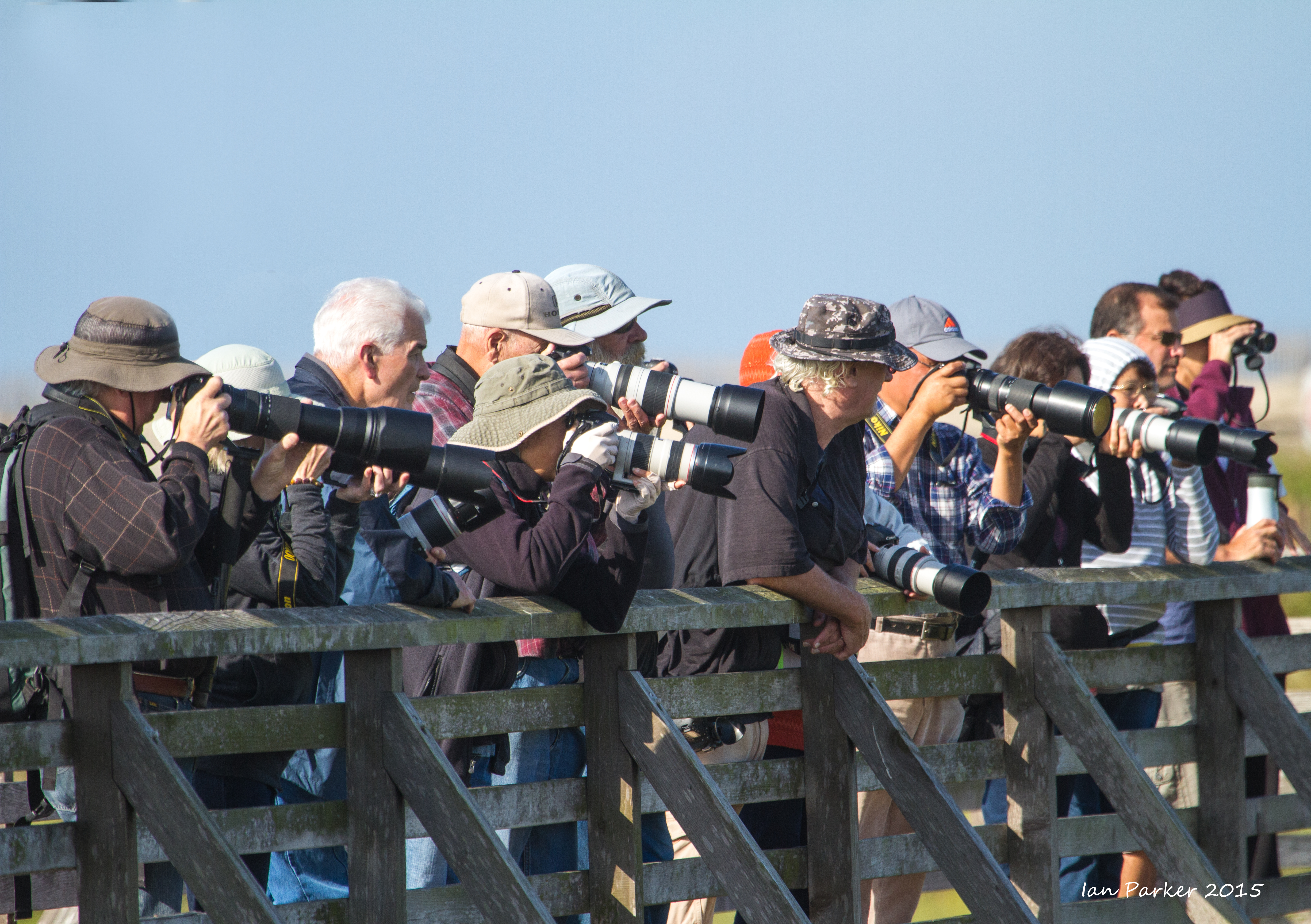
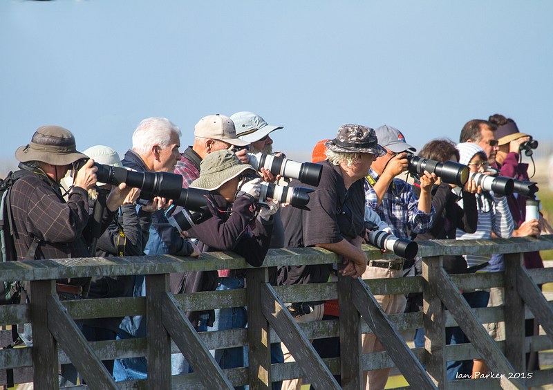
(I have noticed that at on mornings when there are few birds around, there are also few photographers with super-telephoto lenses. Somehow they know in advance that it is not worth coming. I don't know how to predict this; as long as the forecast is for a clear sky and I have the motivation and time to drive down to Huntington beach I will drag myself out of bed and see what I can find. Please send me an e-mail if you know the trick to predict the avian action at Bolsa Chica.
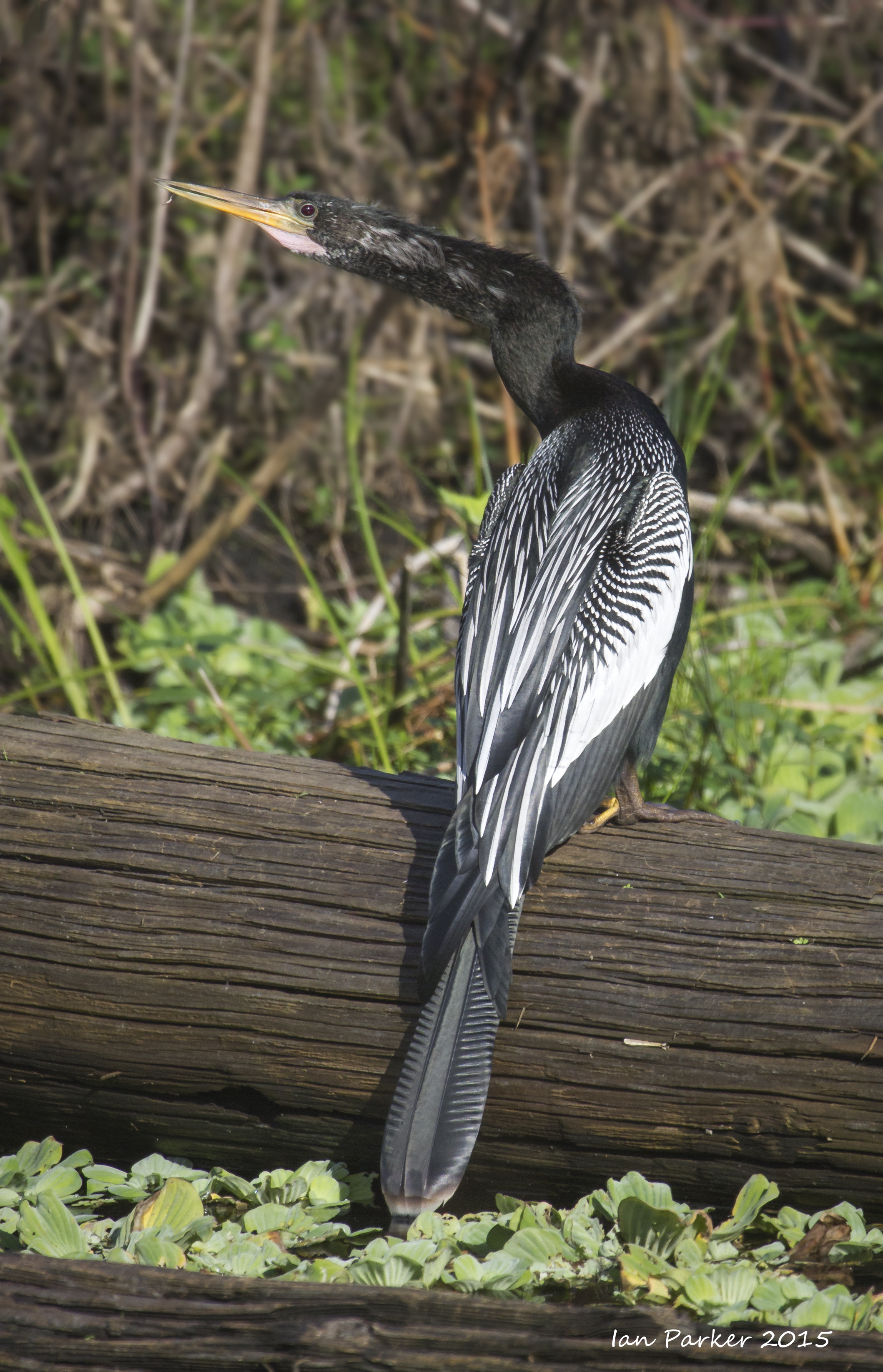
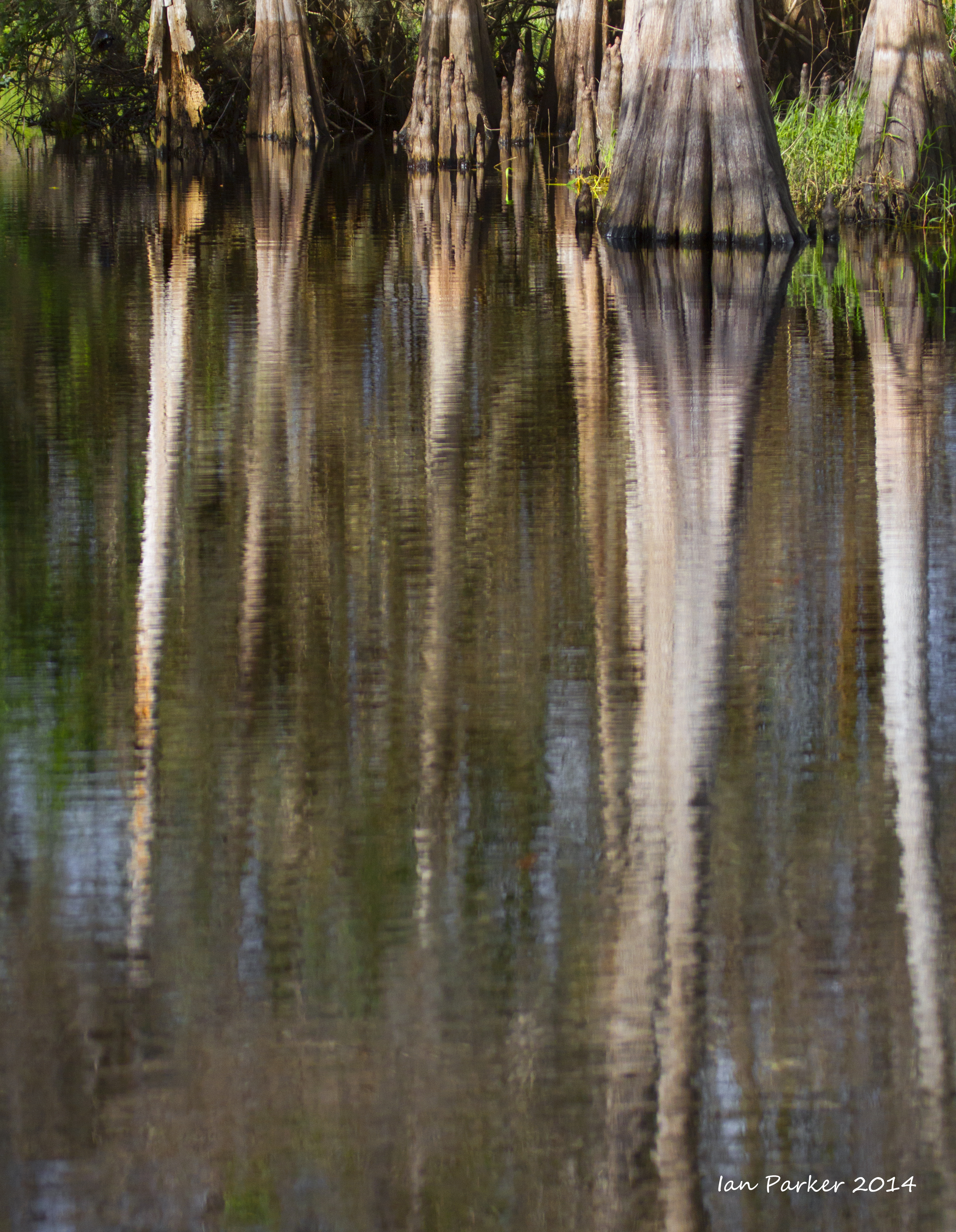
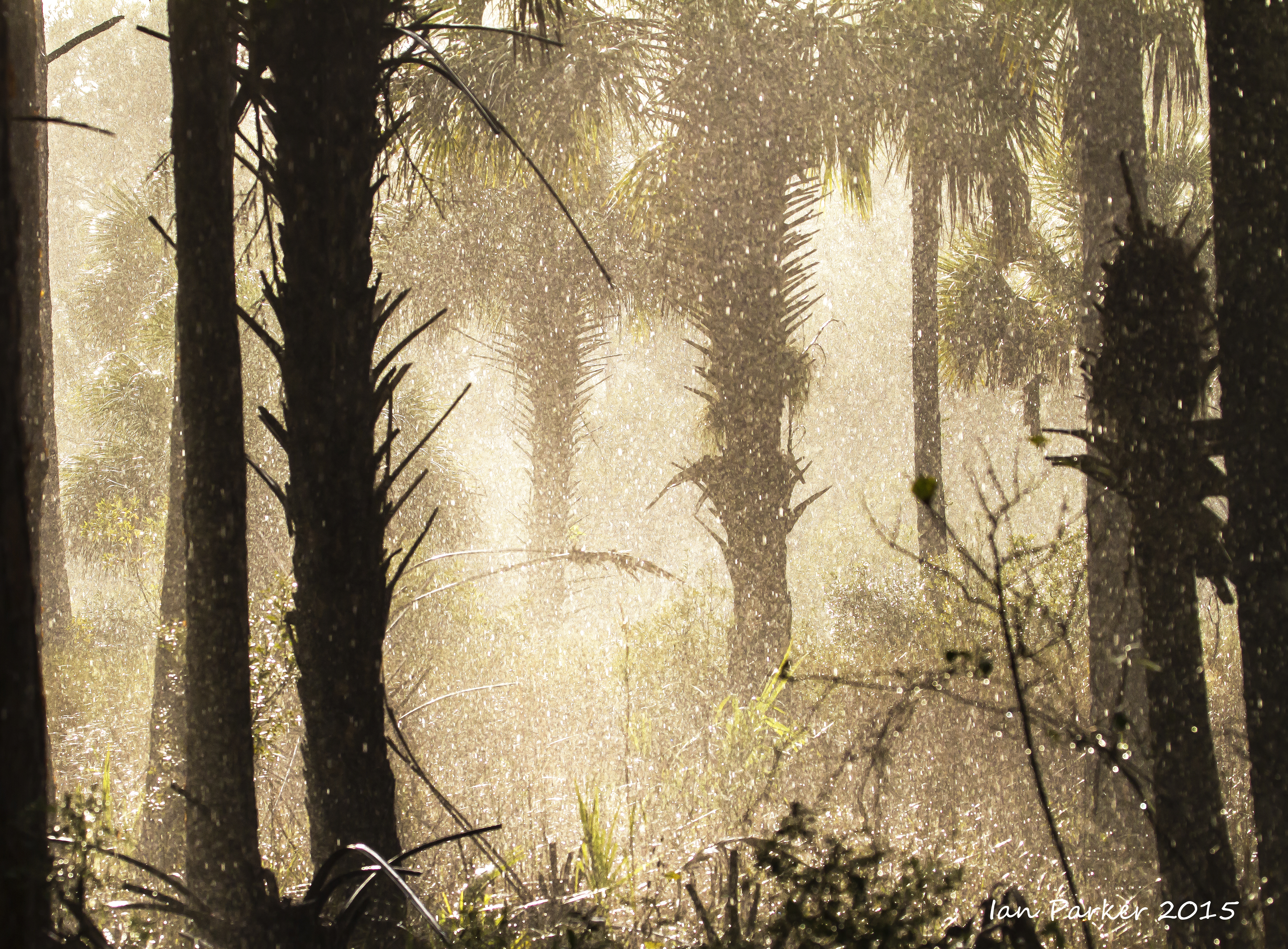
A brief trip over New Year to Florida to visit with Robin and Amanda
Photos from Lone Cabbage fish camp and Tosohatchee Wildlife Area
|


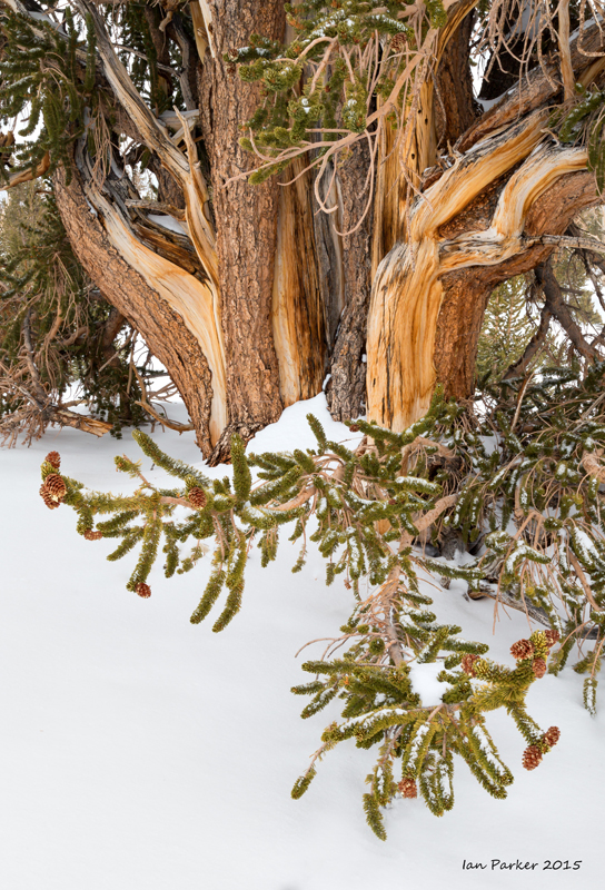 Bristlecone Pine in snow #4
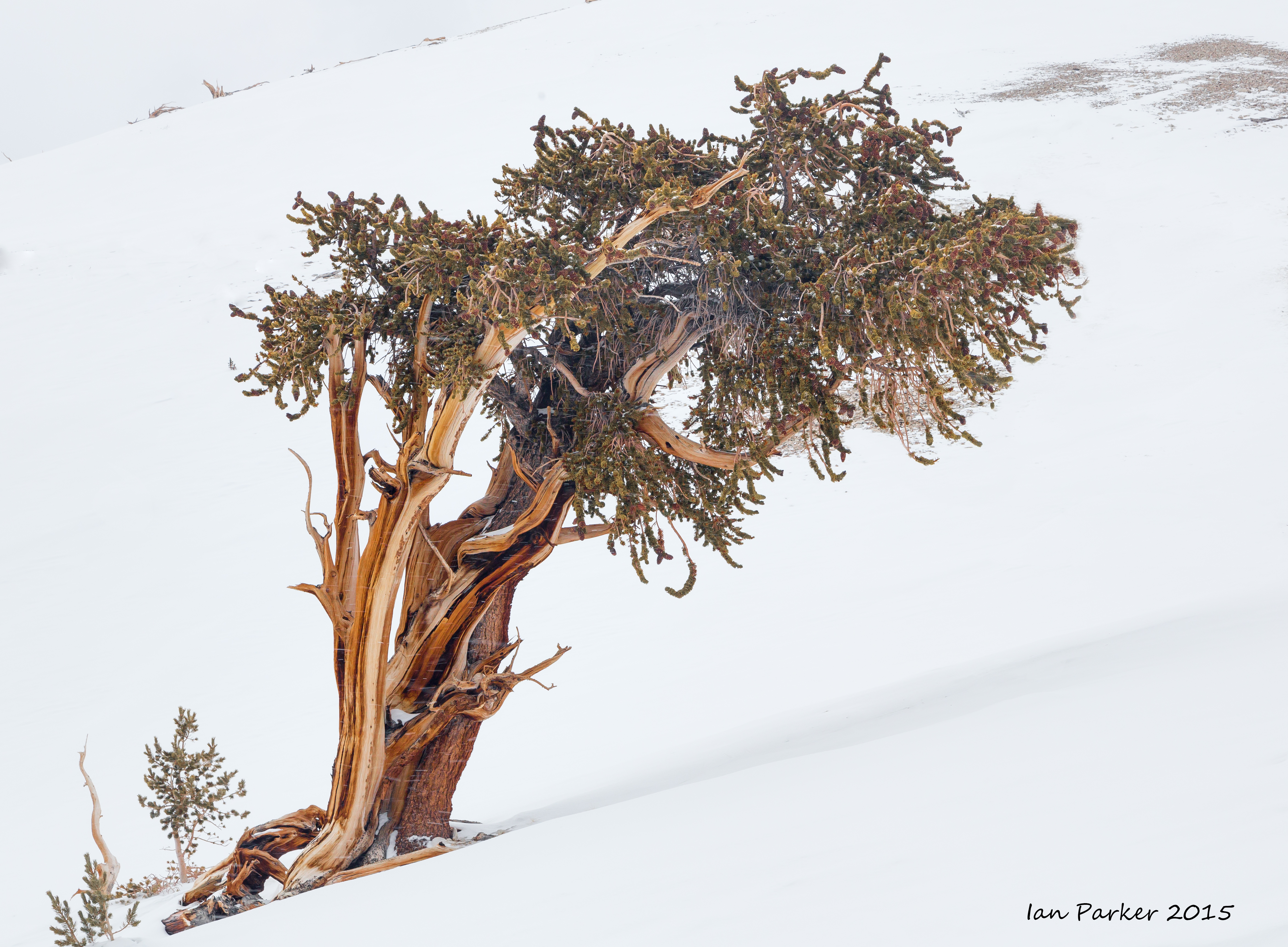


.jpg)