For faster browsing, click on the underlined text legend below any of the thumbnail images in the galleries. Use your browser BACK button to return you to the gallery. If you find a picture you like, you can download the image at full original resolution (mostly between 24-45 Mpixels; with some panoramas >100 Mpix) by clicking on the thumbnail itself. To save a downloaded image, right click on it and scroll to 'save picture as...'. To use an image as your desktop background, right click and scroll to 'set as background...'. Visitors are welcome to download images for personal use (e.g. as computer desktop wallpaper). Click HERE to order prints online. Please contact Ian Parker at evanescentlightphotography@gmail.com regarding possible commercial use.Details of copyright, image use and licensing are HERE.
This trip started in Carrizo Plain. There had been quite a lot of rain over the winter, so we were hoping for a good display of wildflowers, though not anticipating a true superbloom. The reality was a little disappointing, There were some expanses of yellows and some purples, but nothing to compare to the displays of 2023, 2019 and 2017
February 14 - March 5 2026: A trip to the Arctic - Senja and Lofoten Islands, Lapland
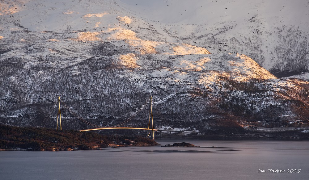
Feb 24 - A stopover in Narvik to break the long journey from Finland to the Lofoten Islands
After an excellend dinner at the Fiskehallen, the sky was clear. I thought the bridge across the Fjord to Narvik would mage a good foreground to photograph aurora.
The Hålogaland suspension bridge, opened in 2018, is the longest bridge in the Arctic (second longest in Norway), and was built to shorten the driving distance around the Rombaks fjord to the north of Norway. The old road along the shore of the fjord now doubles back underneath the bridge, providing just a few clear views between trees and bilboards to capture the bridge against auroral displays to the north.
The ultrawide Laowa
lens I use for aurora photography has an unusual 5-bladed aperture; an odd number that produces sun-stars with 10 spikes. To enhance this effect I stopped down the aperture to f4.
Capturing an aurora when it sweeps high in the sky involves tilting the camera upwards - which strongly distorts the perspective and makes the bridge towers appear to lean in toward each other. But when the aurora was lower to the horizon I could keep the camera level.
The photographs below were taken from the Veterans Memorial commemorating Norwegian and French forces who re-took Narvik from the Germans in WW2. This location provides unobstructed views from the other (western) side of the bridge.
This photo was the kast aurora we saw during our Scandinavian trip in February/March. Our final days in the Lofoten Islands were marked by cloudy skies and more rain than snow.
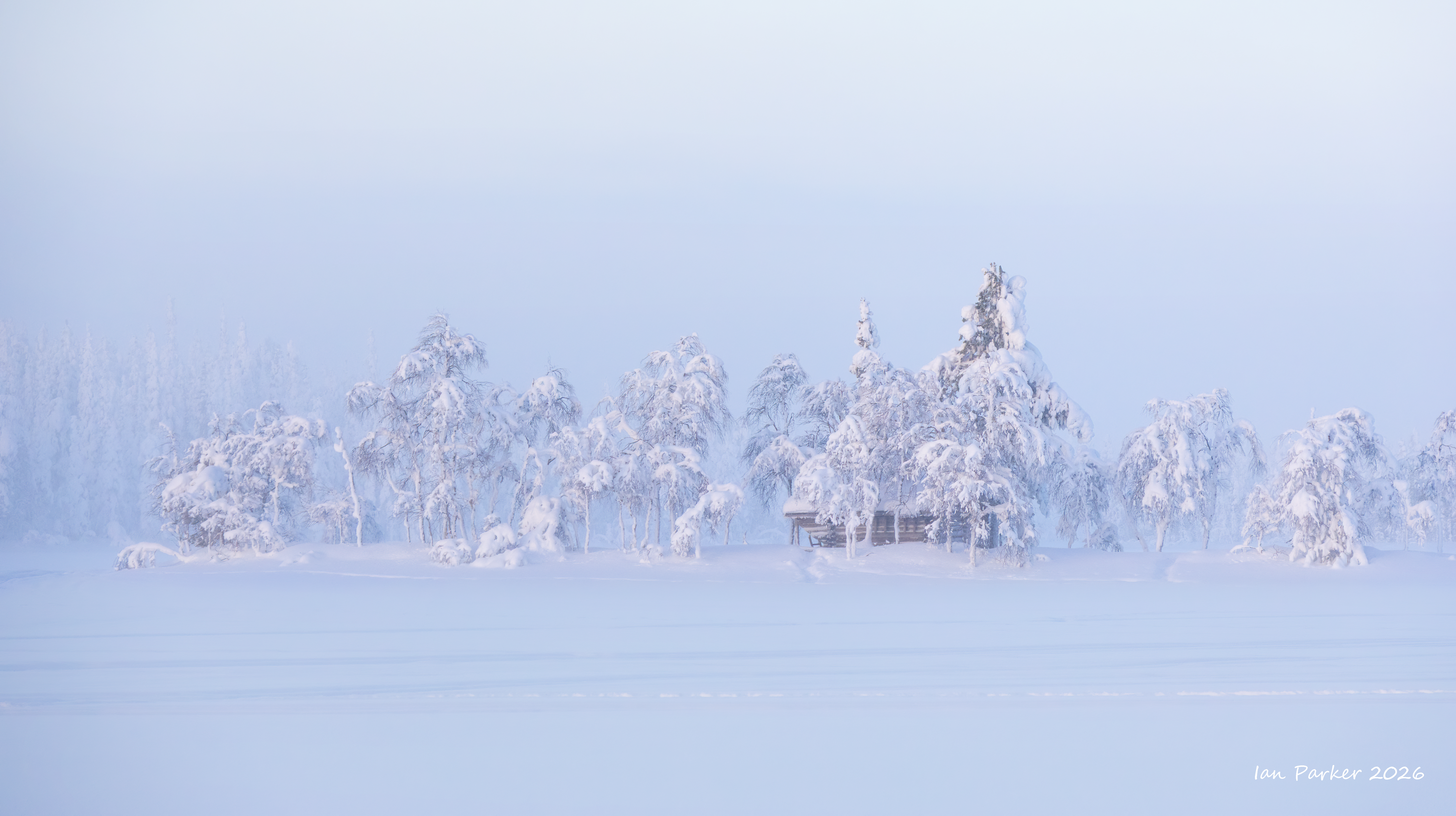
Feb. 22-24 - A detour into Lapland for auroras and frozen snow-covered trees
Evening light over trees and frozen lake at Nivunki Village
Belt of Venus above snow-draped trees; Nivunki Village, Lapland
Belt of Venus against foreground trees; Nivunki Village, Lapland
Changing light and mists on a very cold morning
Blue hour before sunrise - trees and bumps in the snow; Nivunki Village, Lapland
The temperature on our second morning at Ninunki dropped to -29oC (52oF) below freezing. This created a low cloud bank of tiny ice crystals (diamond dust) above the frozen lake, making for some nice atmospheric photography.
First glimpse of the sun over bank of ice ice mist; Nivunki Village, Lapland
There is a delightful Finnish term "Tykky"
for trees completely encased in frozen snow and ice. Tykky (crown snow load) requires specific conditions to form. When the air is humid—such as in foggy conditions— it starts to freeze. The moisture in the air begins to accumulate as frost on surfaces like tree branches, and the layer keeps growing. For the crown snow-load layer to grow, this process must repeat itself multiple times, and there must be no warm periods in between. I think the conditions we had were not a true Tykky but just a regular covering of snow from a storm a few days earlier, which had already started to shed.
We stayed for two nights at Nivunki Village resort, set in a remote area at the edge of a (frozen) lake amid snow covered trees. Beyond the skies and landscapes at Nivunki, highlights of our stay included wonderful dinners featuring Lappish cuisine.
The accomodation at Nivunki is in glass-fronted huts;
looking something of a cross between a hut and a wigwam, but much more luxurious than that description might imply.
A "kill-switch" at the bedside allowed all interior lights to be quenched, but photography was still difficult through the thick, triple-glazed windows. Better to don arctic clothing and brave outside temperatures as low as -29oC.
The skies were clear and the auroras consistently active during our two nights at Nivunki.
Aurora behind snow covered trees; Nivunki Village, LaplandLapland
Although we were there at the time af a nearly full moon, the auroras were bright enough not to be overwhelmed, and the moonlight
illuminated the landscape where trees would otherwise have appeared as dark silhouettes.
Skrolsvik Fort at the southwest tip of Senja was built during World War II by the occupying Germans. After the war, the Norwegian Navy took over the fort, and it became part of the fortifications under the Coastal Artillery . In 1989, the fort was closed down, along with many other forts in the same area. Large parts of the fort are still intact, both with bunkers and prepared/established permanent positions. Notably, the four German 15 cm guns are still intact.
After the closure, the Senjehesten Coastal Defence Museum took over the facilities, and the properties were put up for sale. The site has variously functioned as a campsite, hotel, and museum' but now is open to freely wander in its decaying state. On our visit this year the skies weere clear, but photography was made difficult by a bitingly cold strong wind.
The Bergsbotn viewing platform on Norway's Senja island offers a 44-meter-long platform providing panoramic, dramatic views of the Bergsfjord, surrounding peaks, and the coastal village of Bergsbotn. Situated high above the ocean on a 180-degree turn in the road, it offers sweeping, open vistas of the coastal landscape. We were fortunate this year to have clear skies and active aurora from the viewpoint
When photographing it's a good idea to occasionally turn around and see what might be happening behind you. Looking back from the dramatic aurora arcing over the shark;s teeth mountains I found a more subtle bu colorful display around the radio mast on the hillside above the rocks.
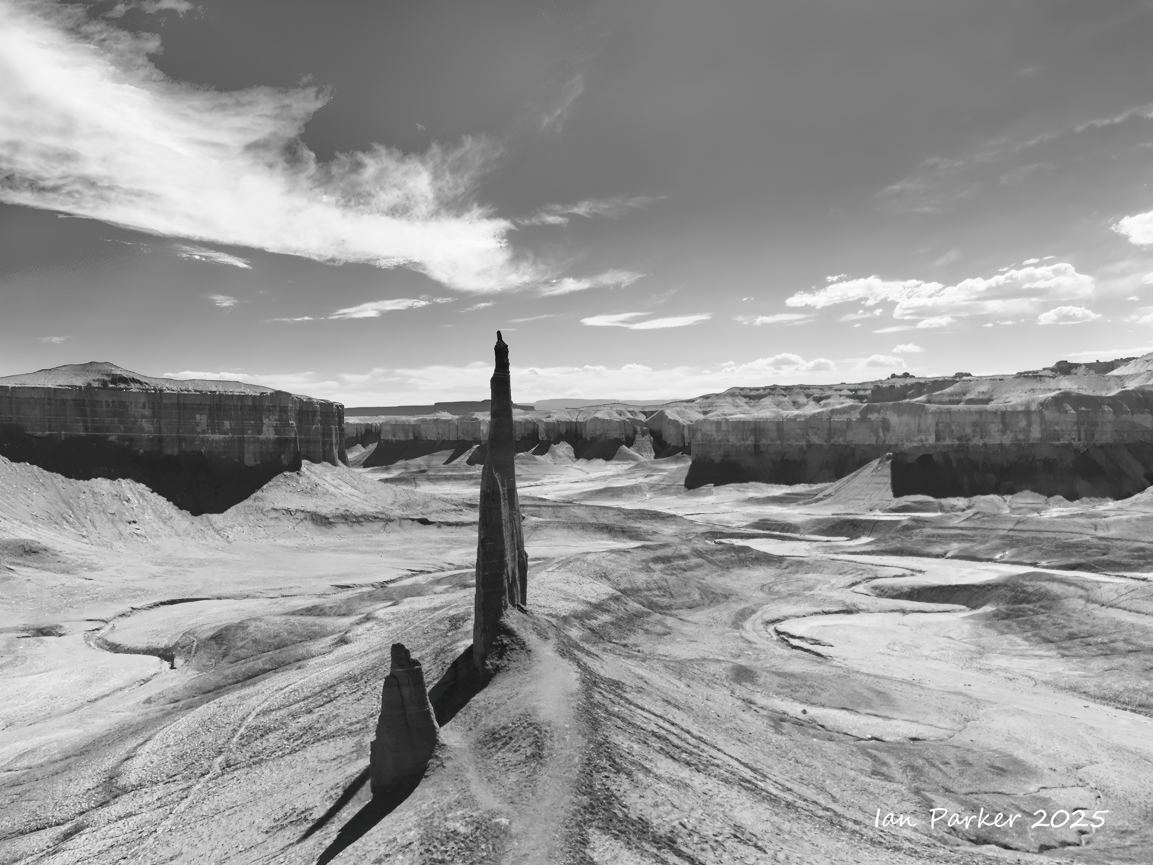
Dec. 22,23: Two nights in Bluff on a trip through Utah
Under the direction of John Taylor, Silas S. Smith and Danish settler Jens Nielson led about 230 Mormons on an expedition to start a farming community in southeastern Utah. After forging about 200 miles (320 kilometers) of their own trail over difficult terrain, the settlers arrived on the site of Bluff in April 1880.[7] (The trail followed went over and down the "Hole in the Rock", which now opens into one of the tributaries of Lake Powell.) The town was named for the bluffs near the town site.[8] The town's population had declined to seventy by 1930[citation needed] but rebounded during a uraniumprospecting boom in the 1950s.[7] With the uranium decline in the 1970s, Bluff again declined and now remains a small town with about 200 residents. [Wikipedia]
Bluff Fort Historic Site commemorates the original pioneer town founded by Mormon missionaries at the end of their expedition to settle the San Juan area in 1880. Featuring recreations of the town, complete with meetinghouse and cabins decked with some original furnishings provided by local families, Bluff Fort offers an interactive historical experience.
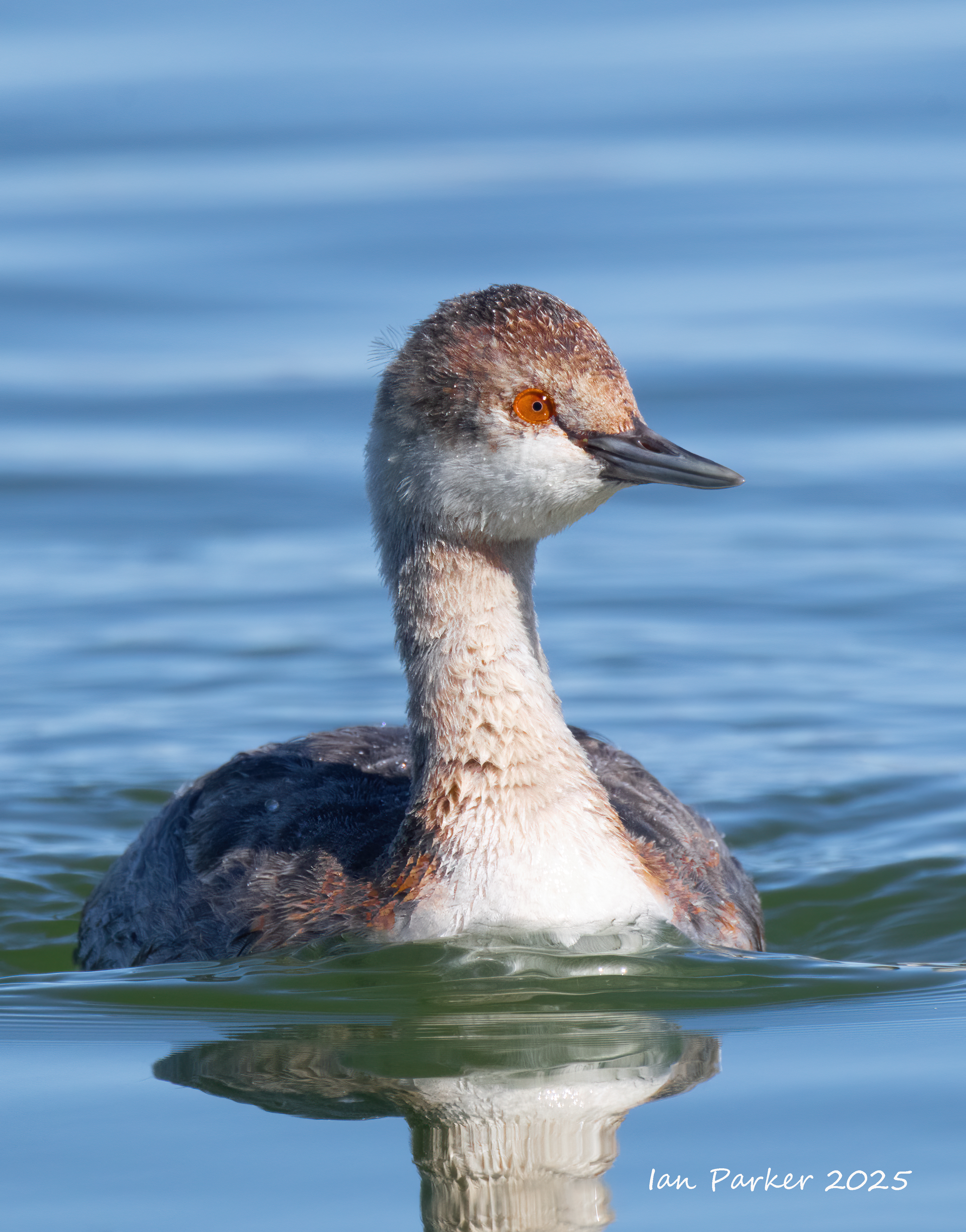
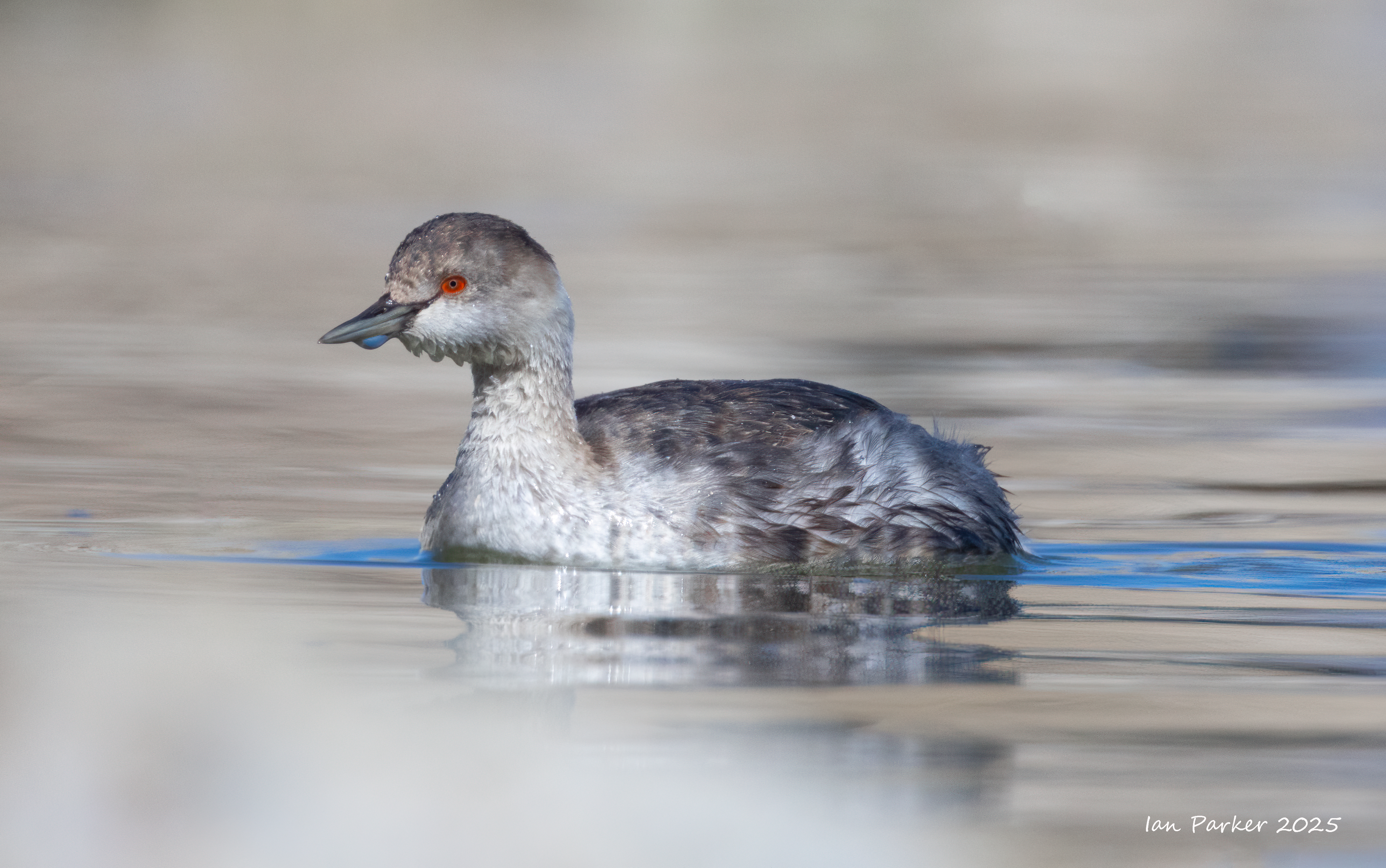
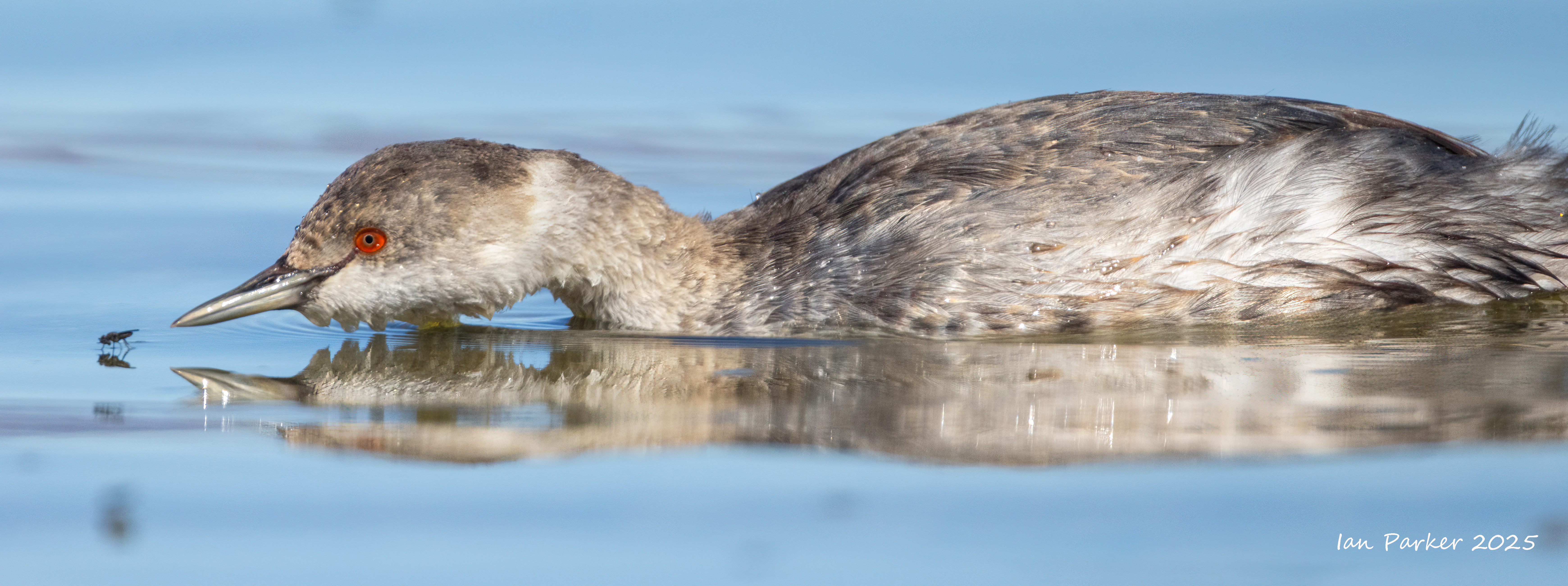
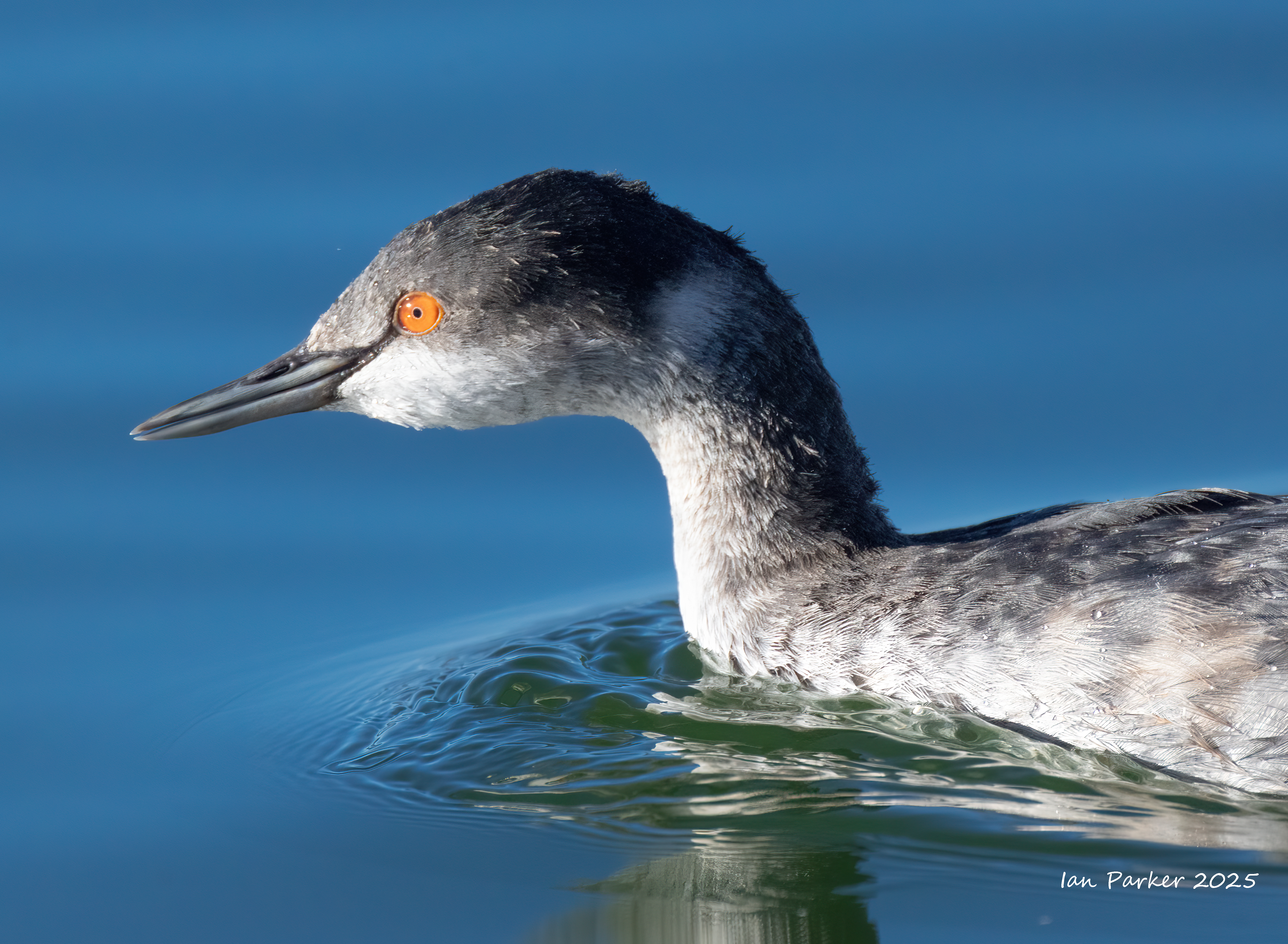
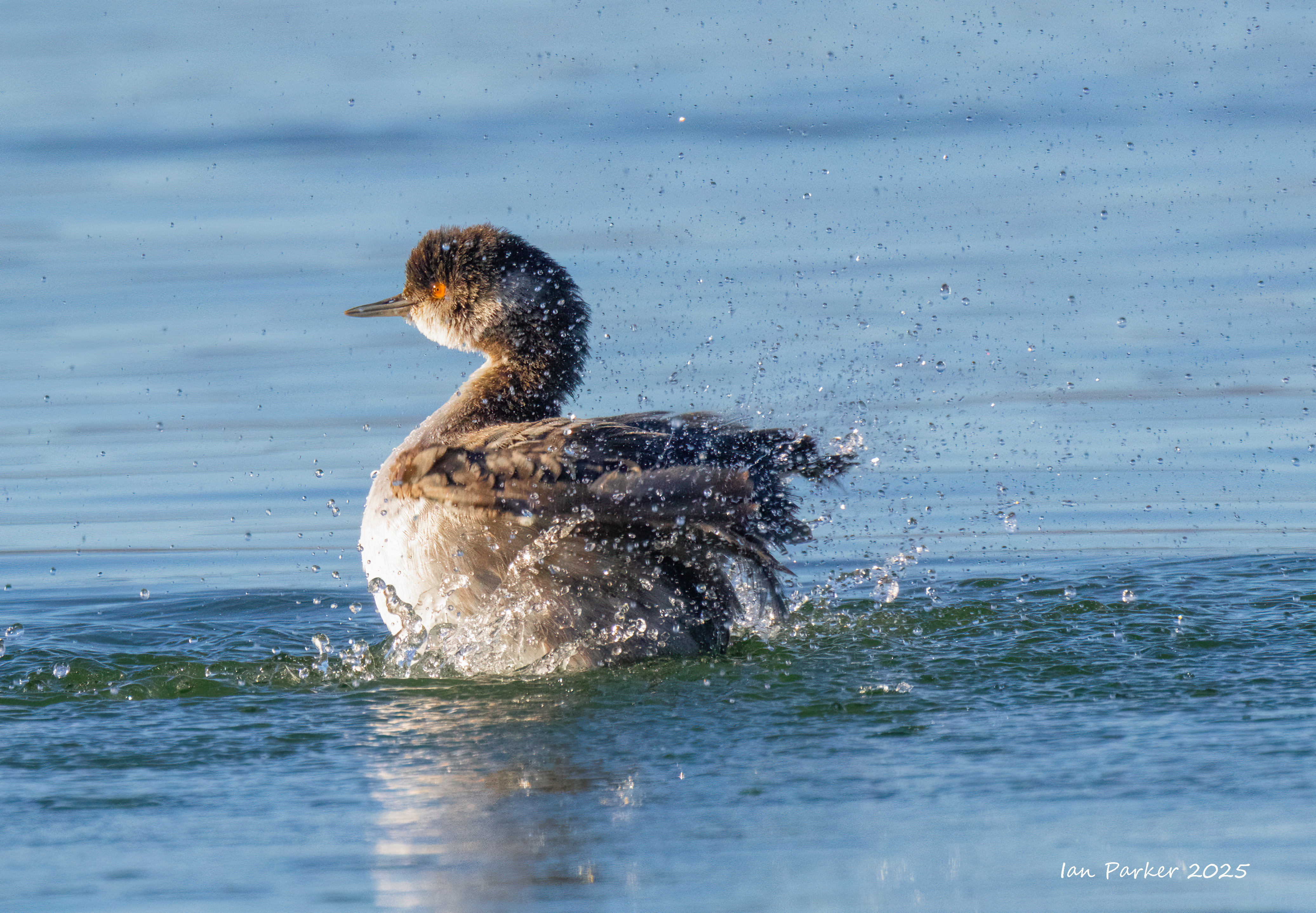
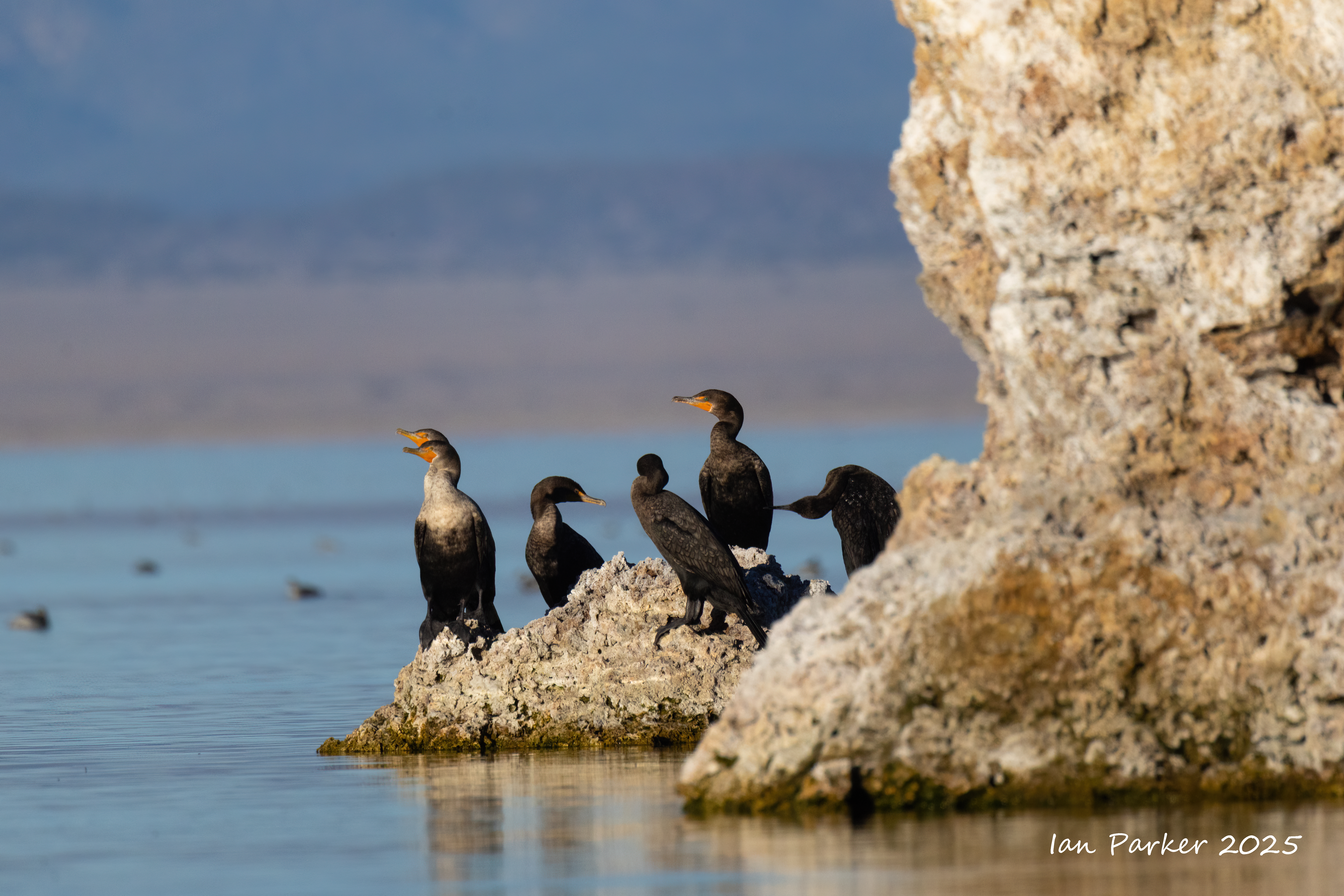
A night by Mono lake for dark sky astrophotography, and an evening and morning by the lakeshore for bird photography.
Mono Lake is a crucial fall staging ground for vast numbers of Eared Grebes,\. They gather by the hundreds of thousands (sometimes millions) to fattun up on brine shrimp and alkali flies from late summer through fall (July-November) before heading south to breeding grounds. Here they more than double their weight, and the sizes of their muscles and organs change. The pectoral (chest) muscles shrink to the point of flightlessness and the digestive organs grow significantly. Before departure for the wintering grounds, the process reverses; the digestive organs shrink back to about one-fourth their peak size, and the heart and pectoral muscles grow quickly to allow for flight.
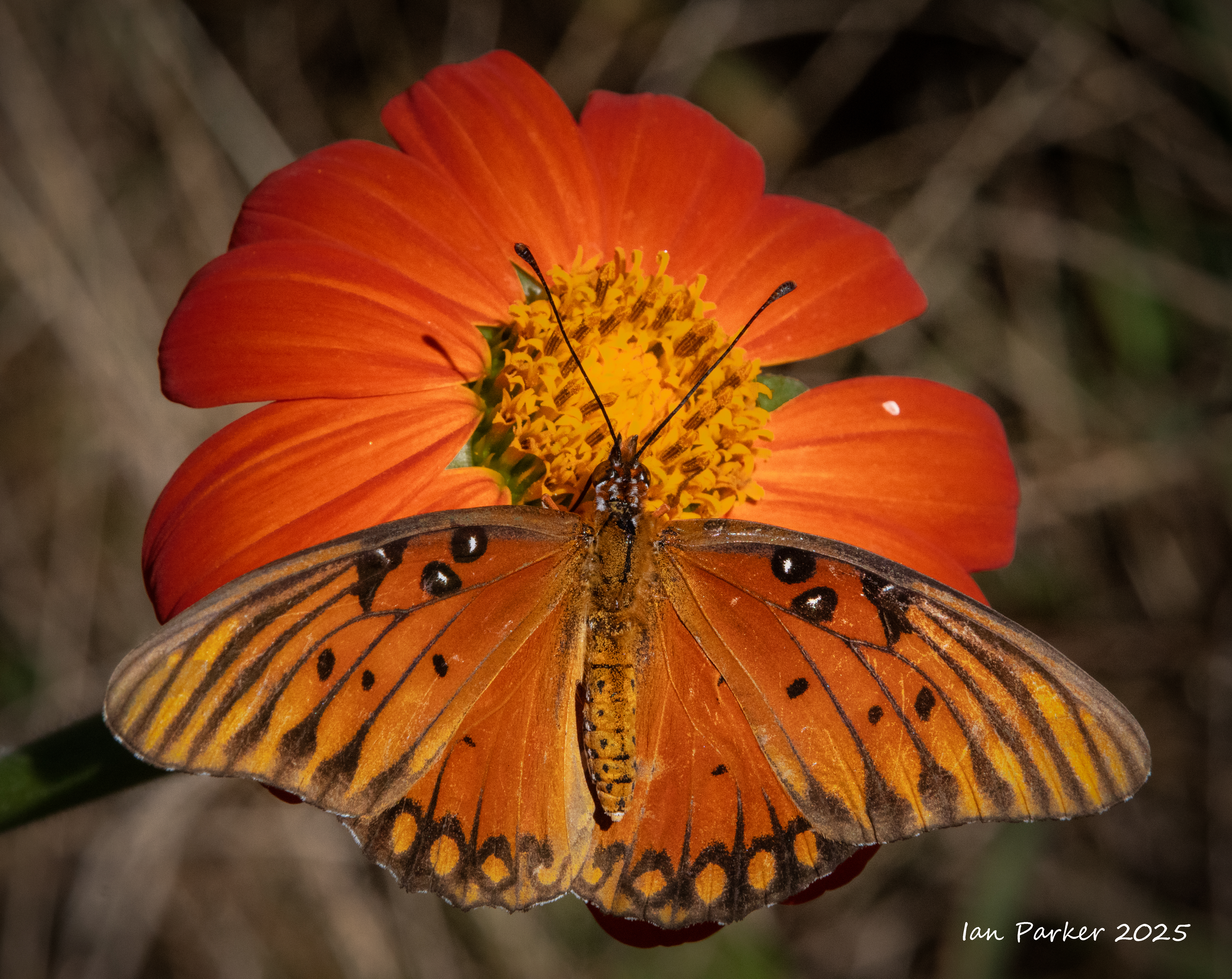
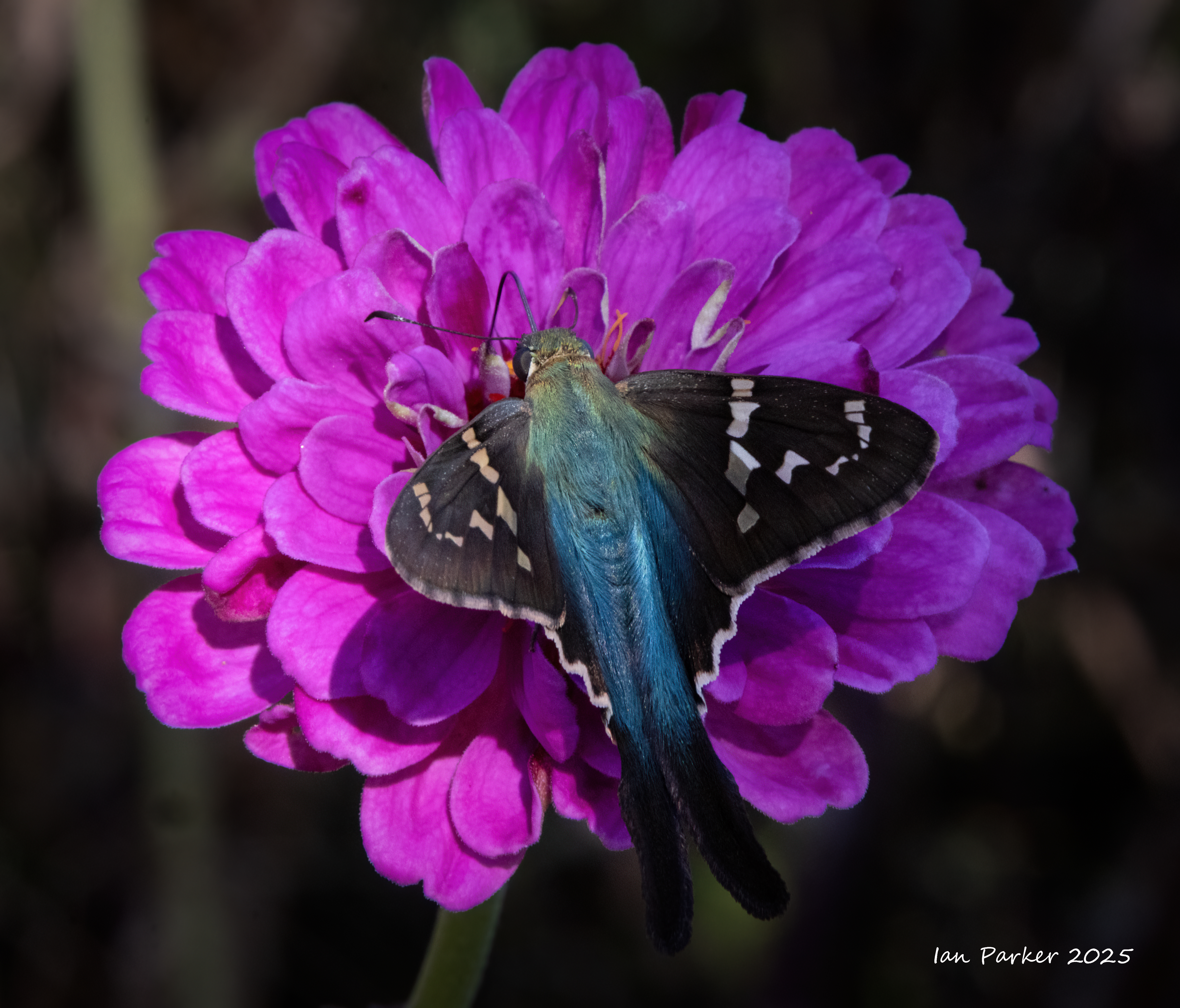
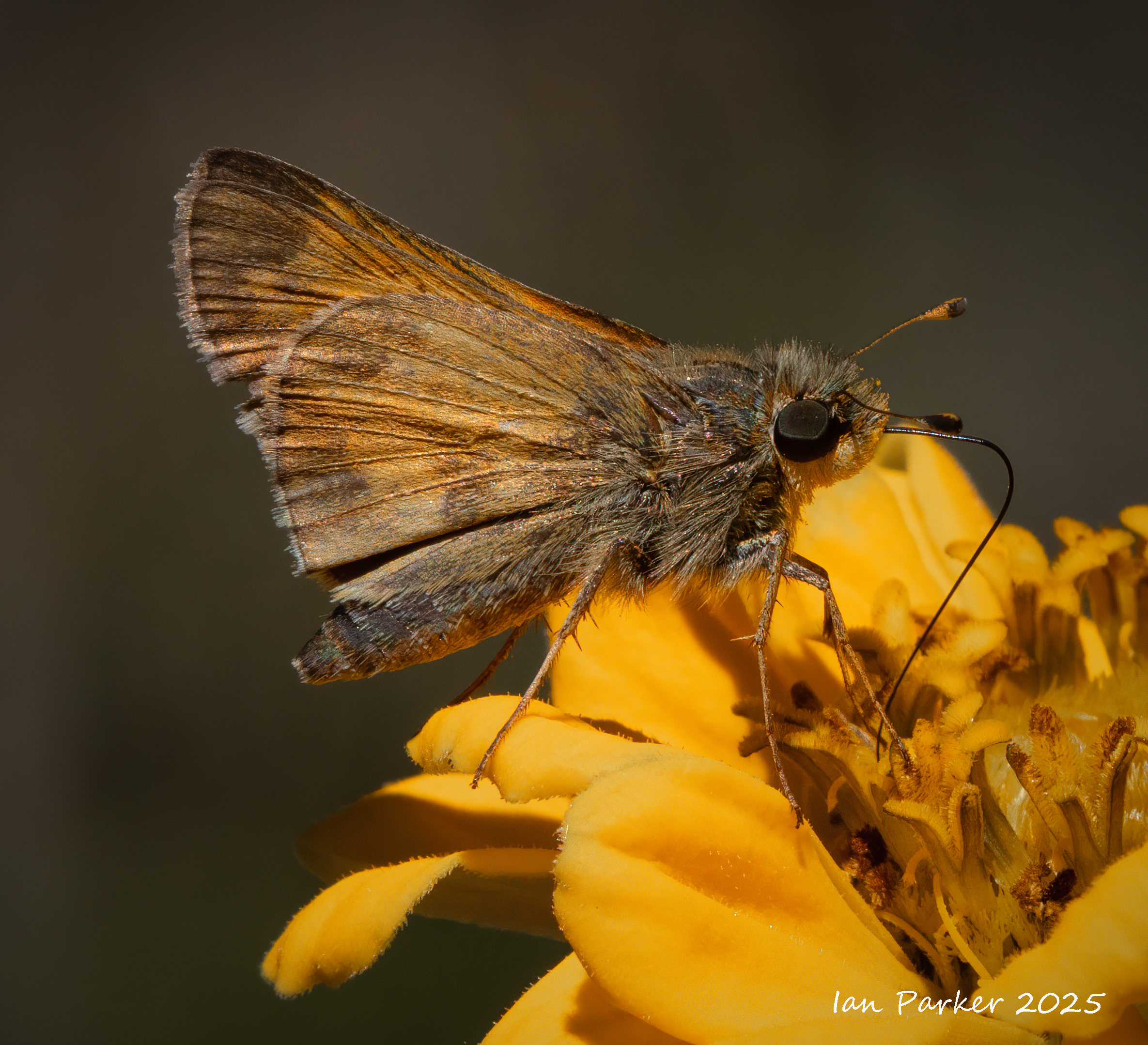
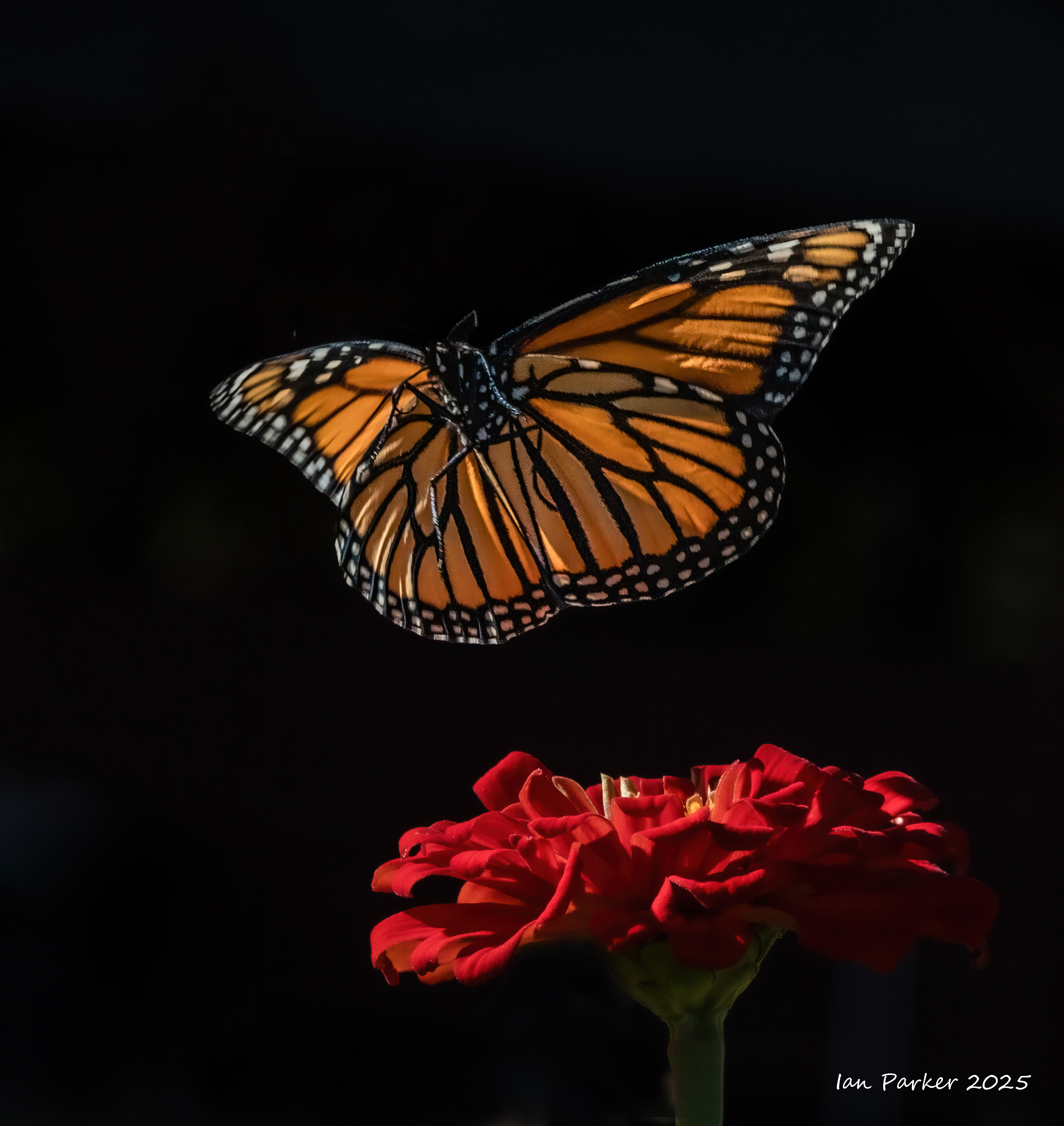
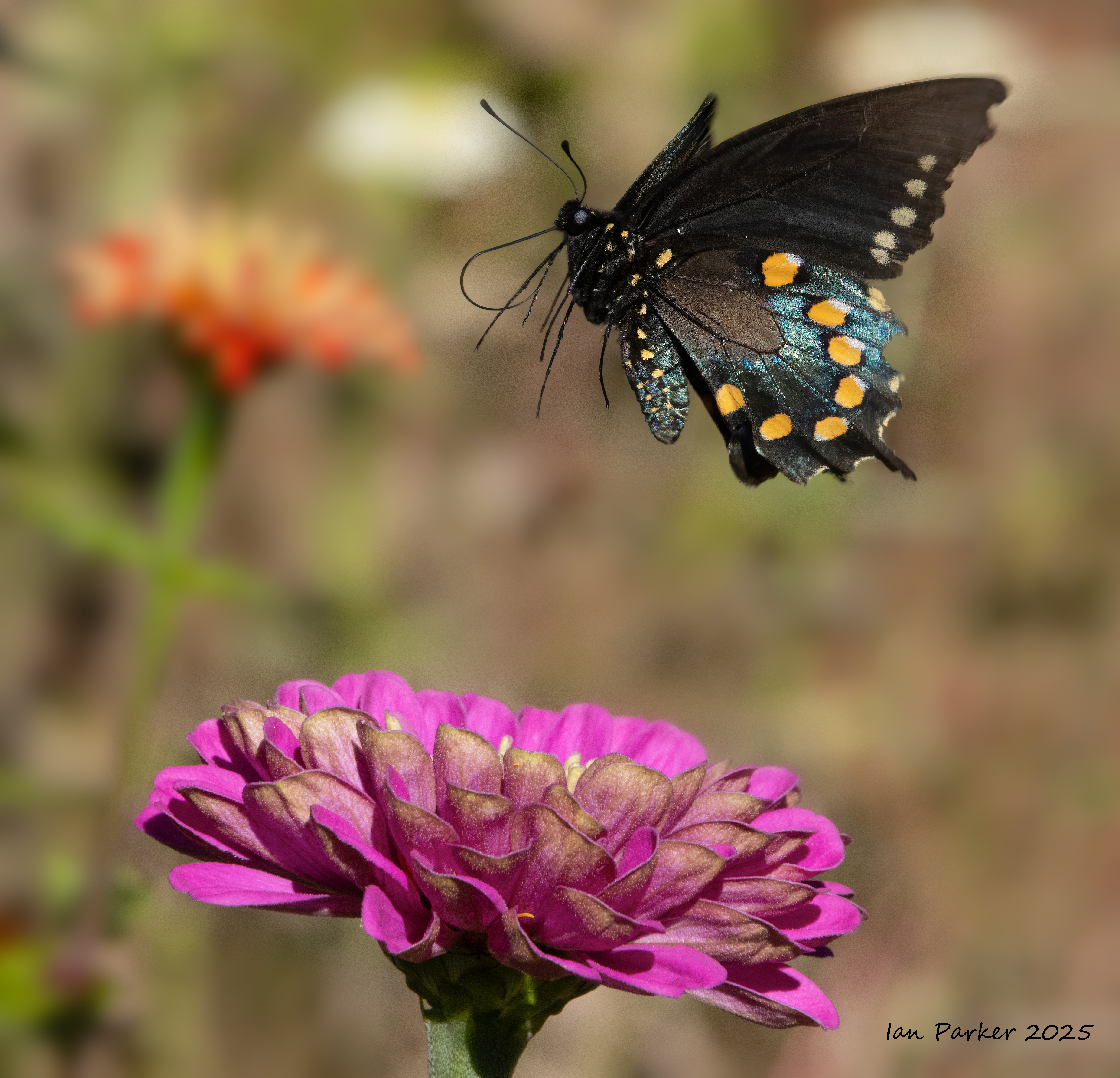
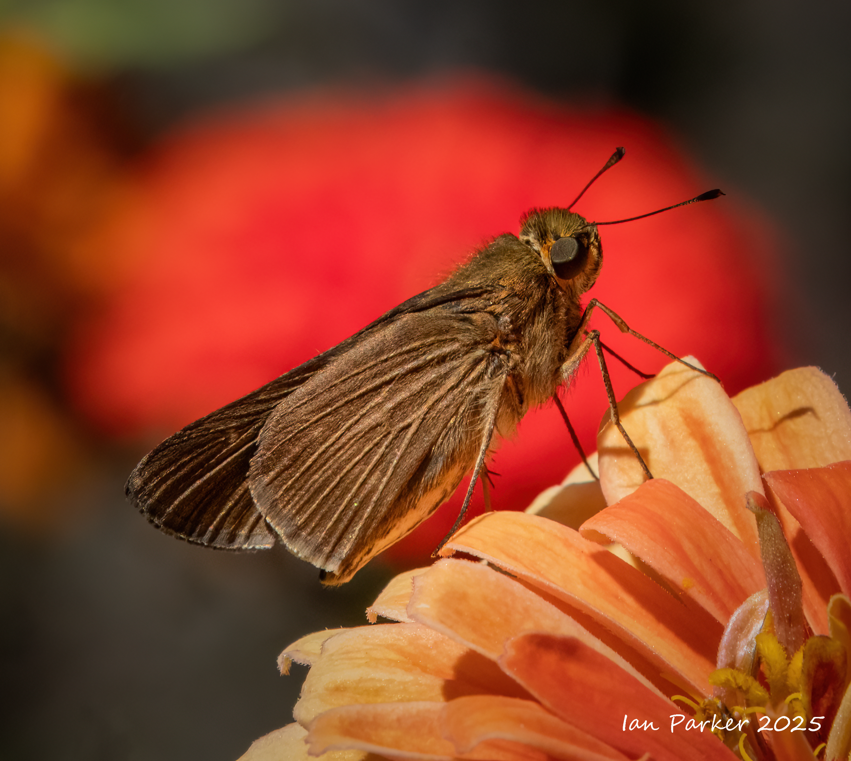
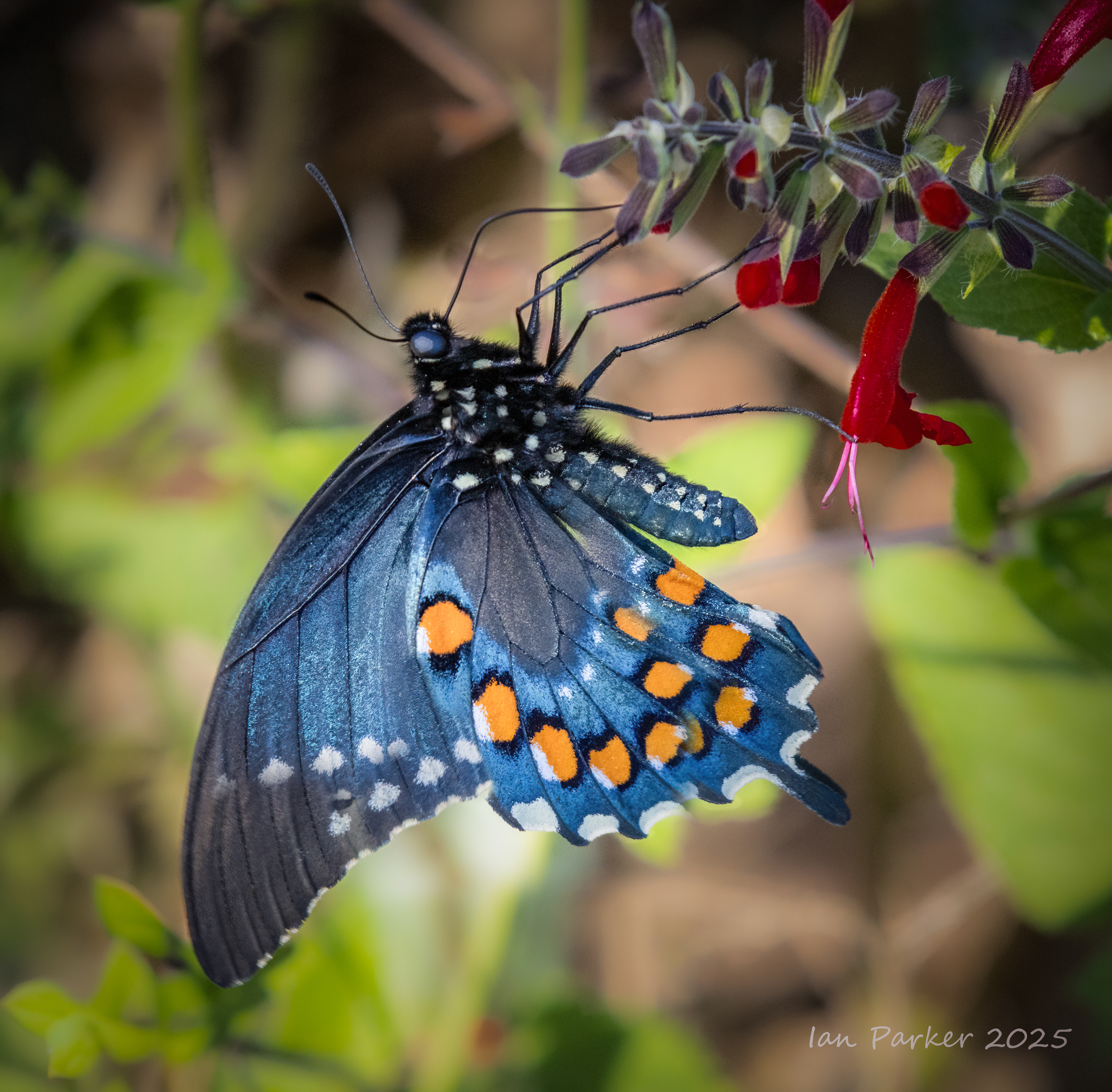
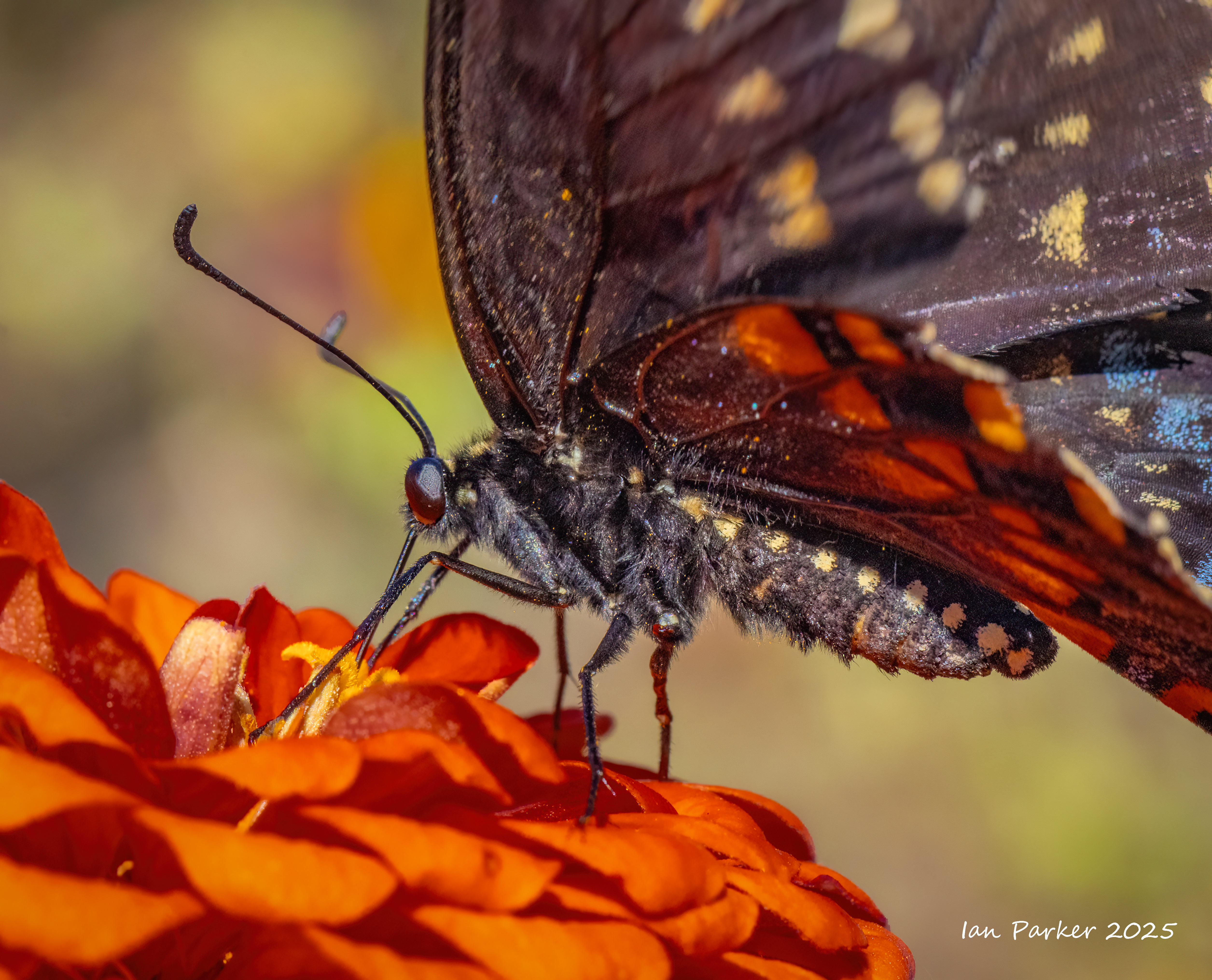
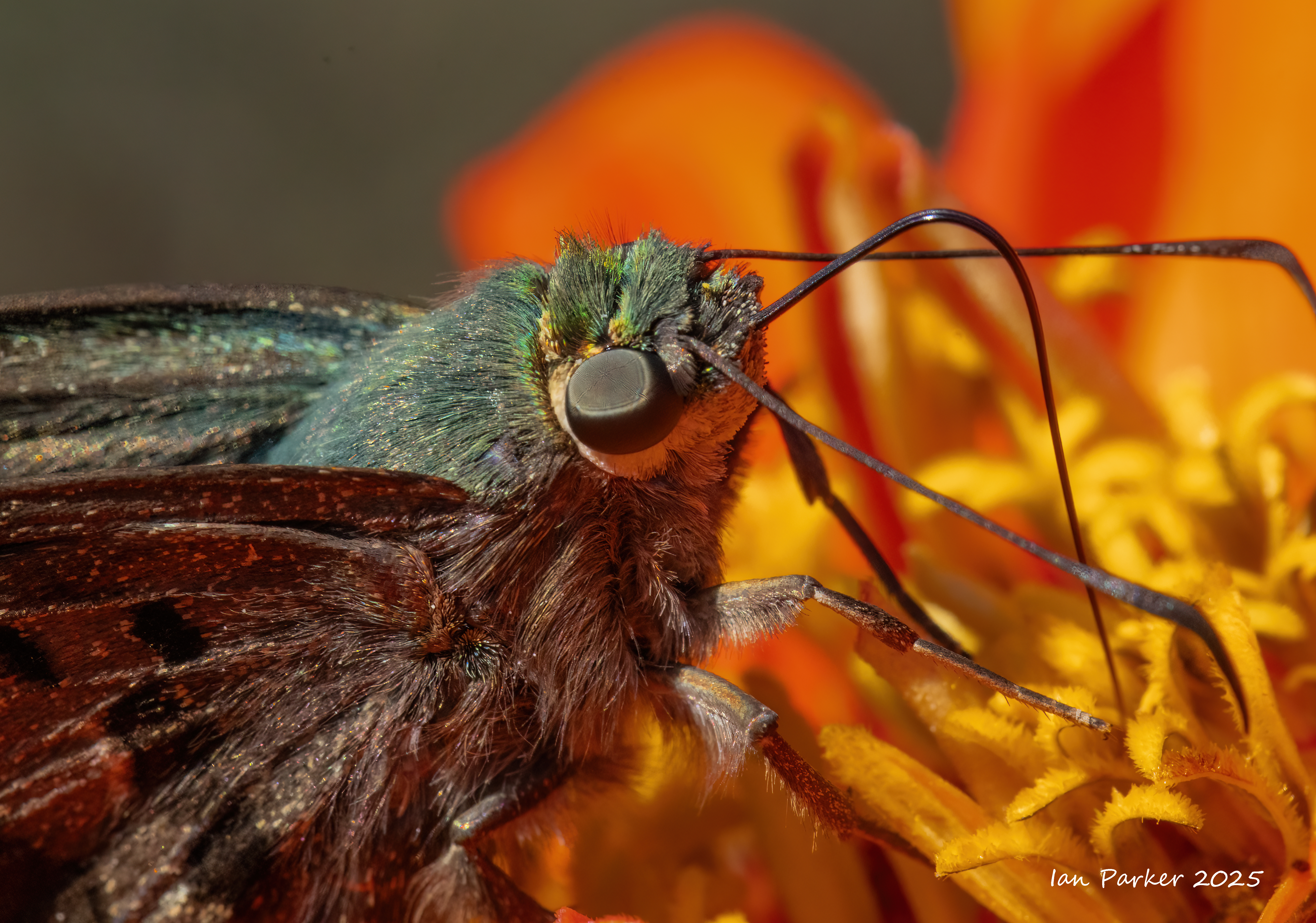
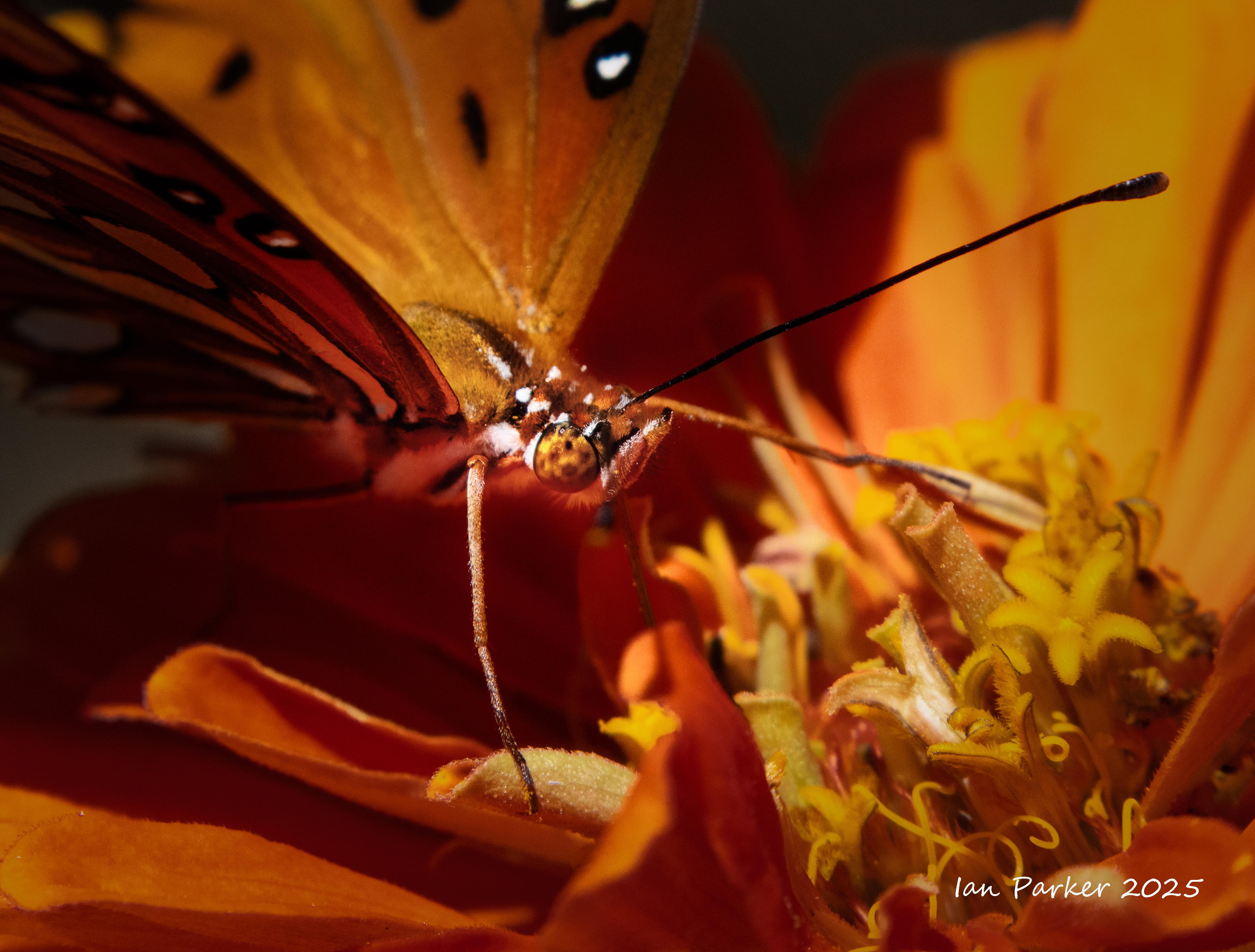
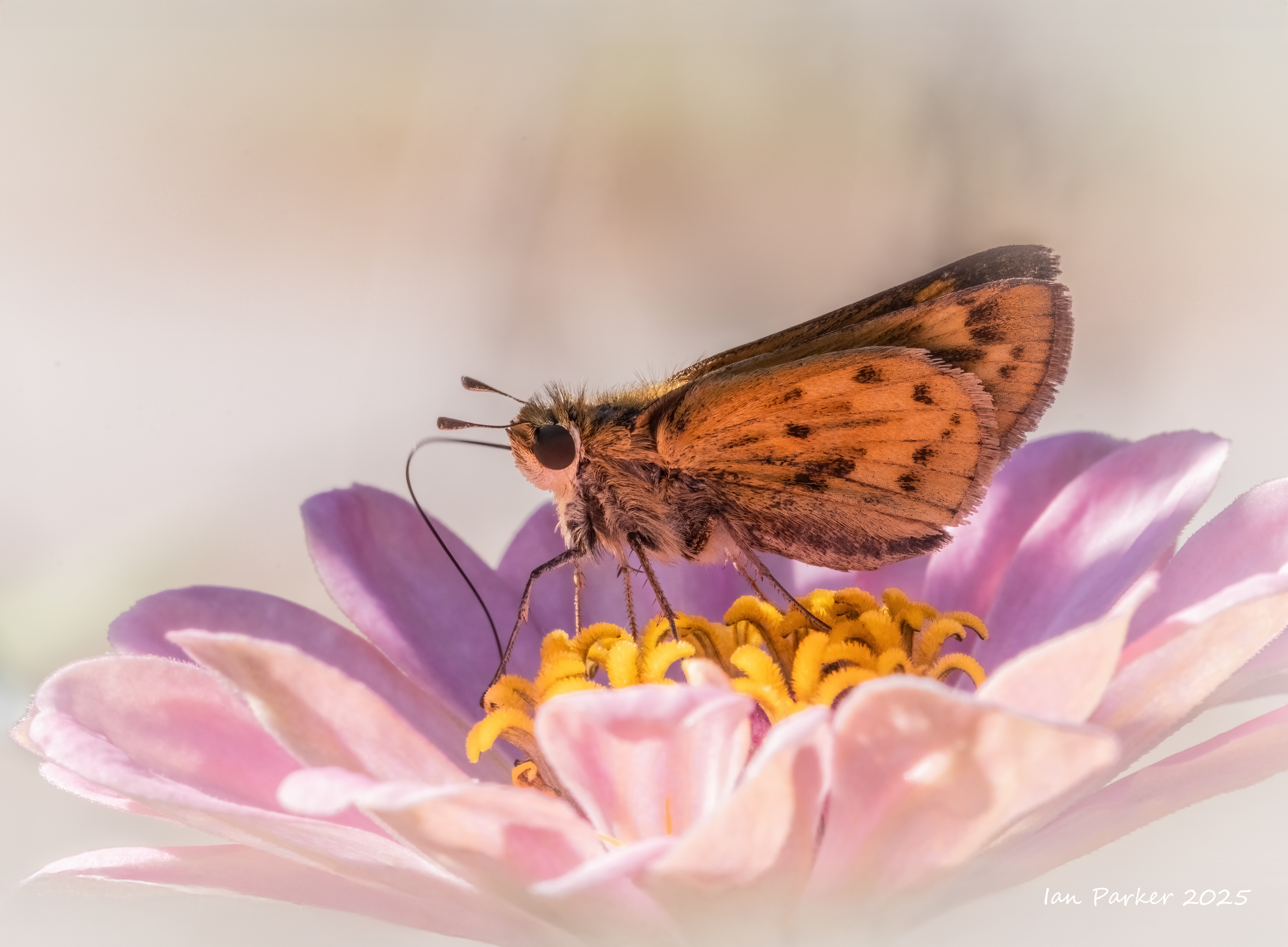
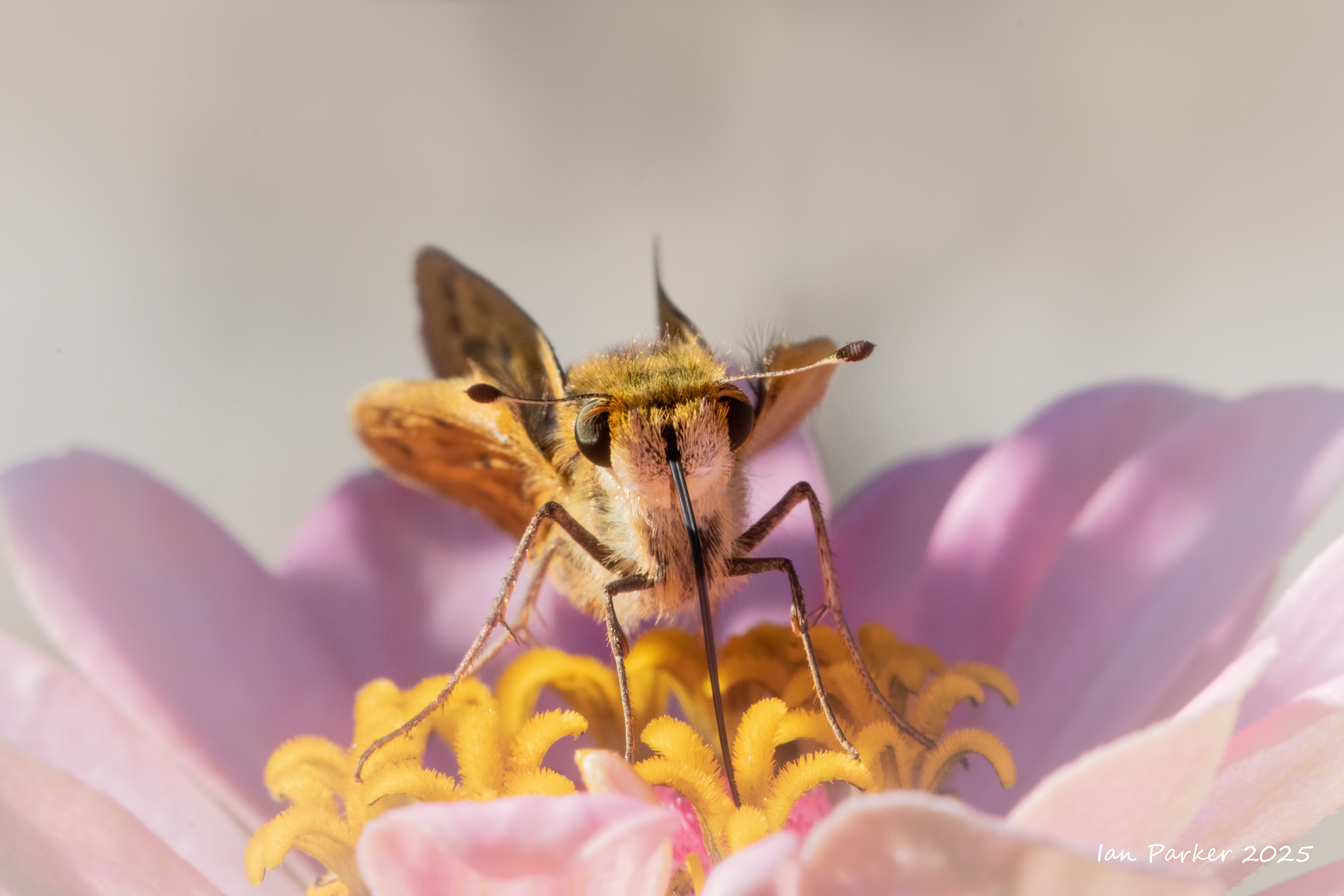
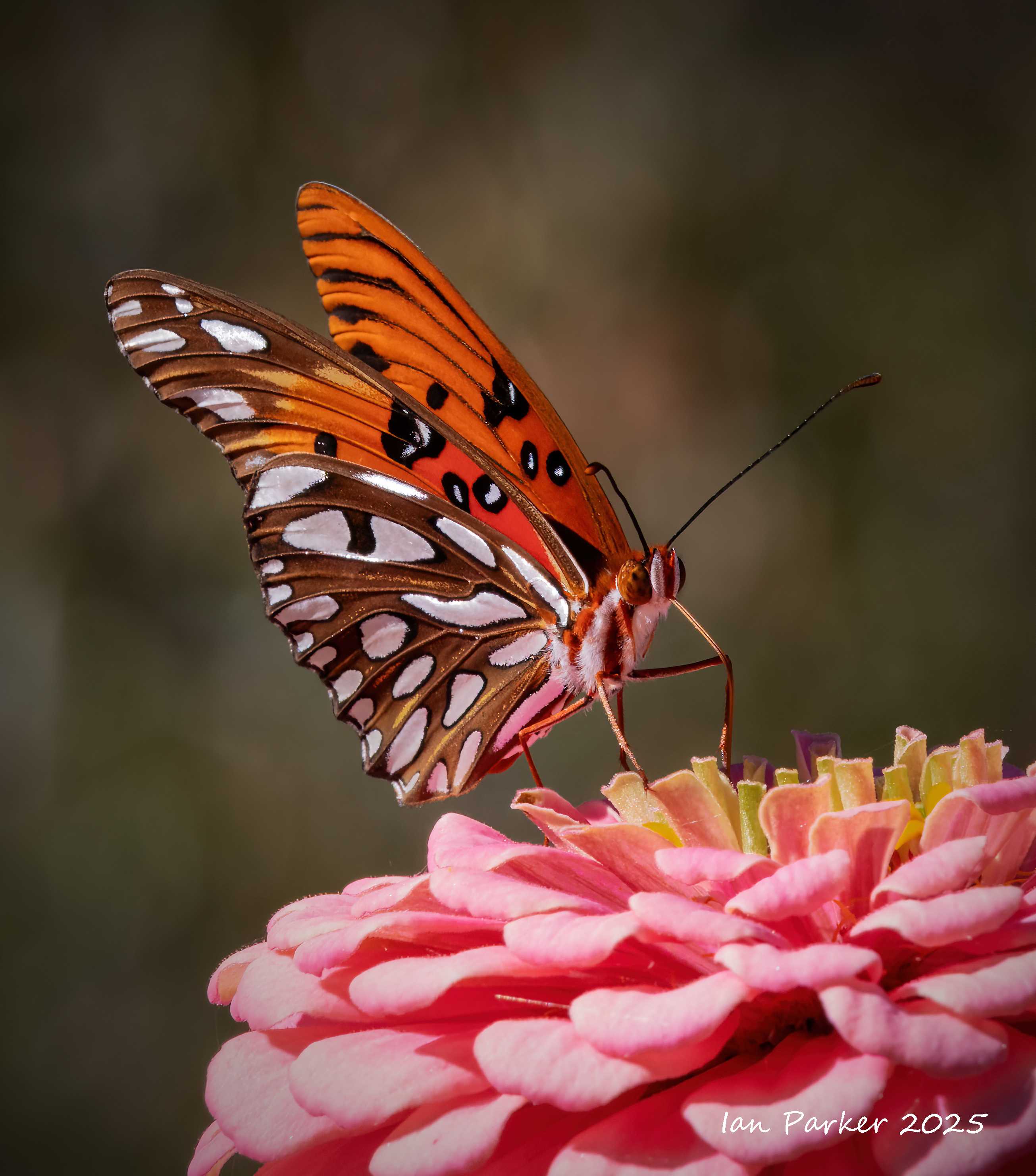
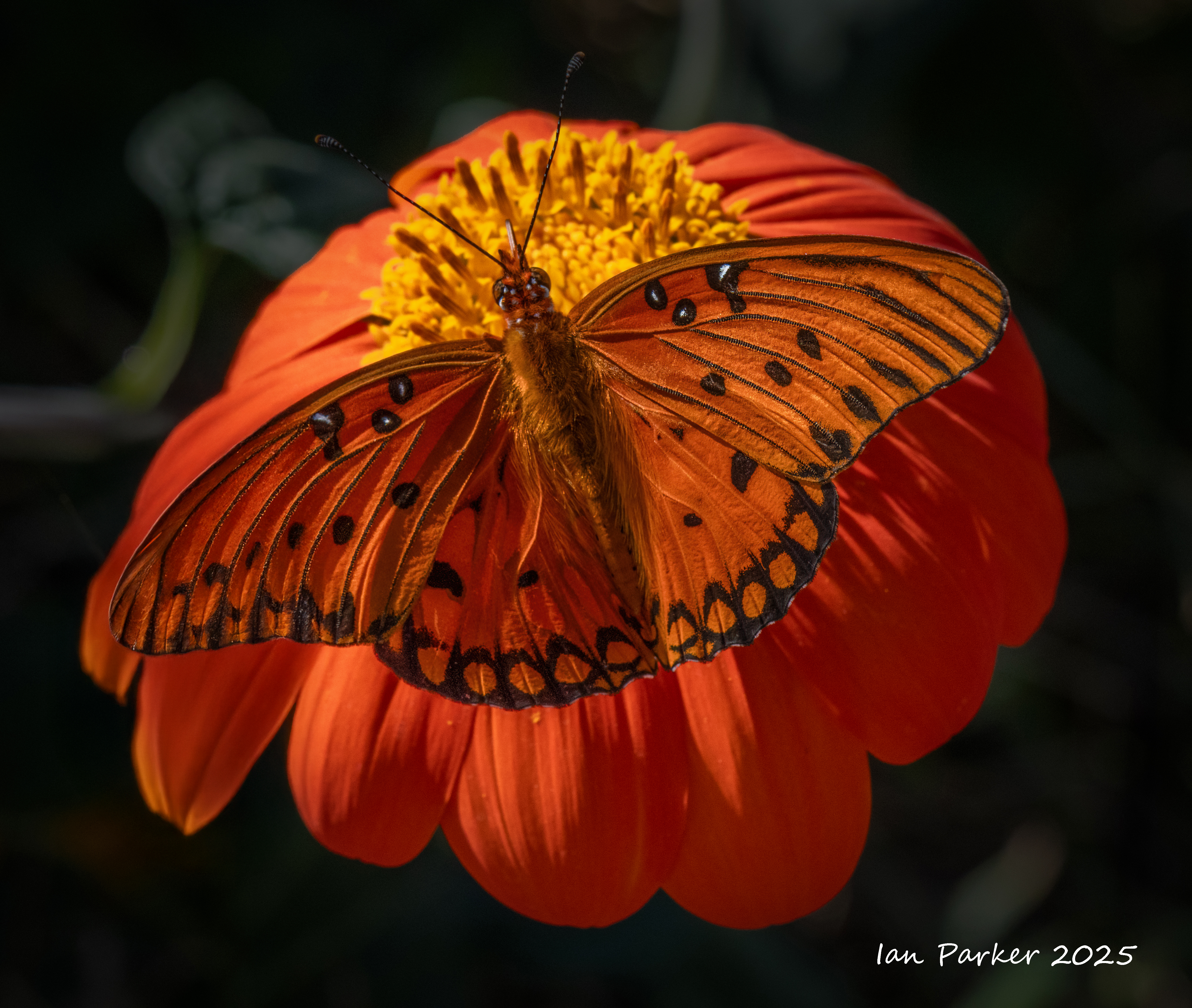
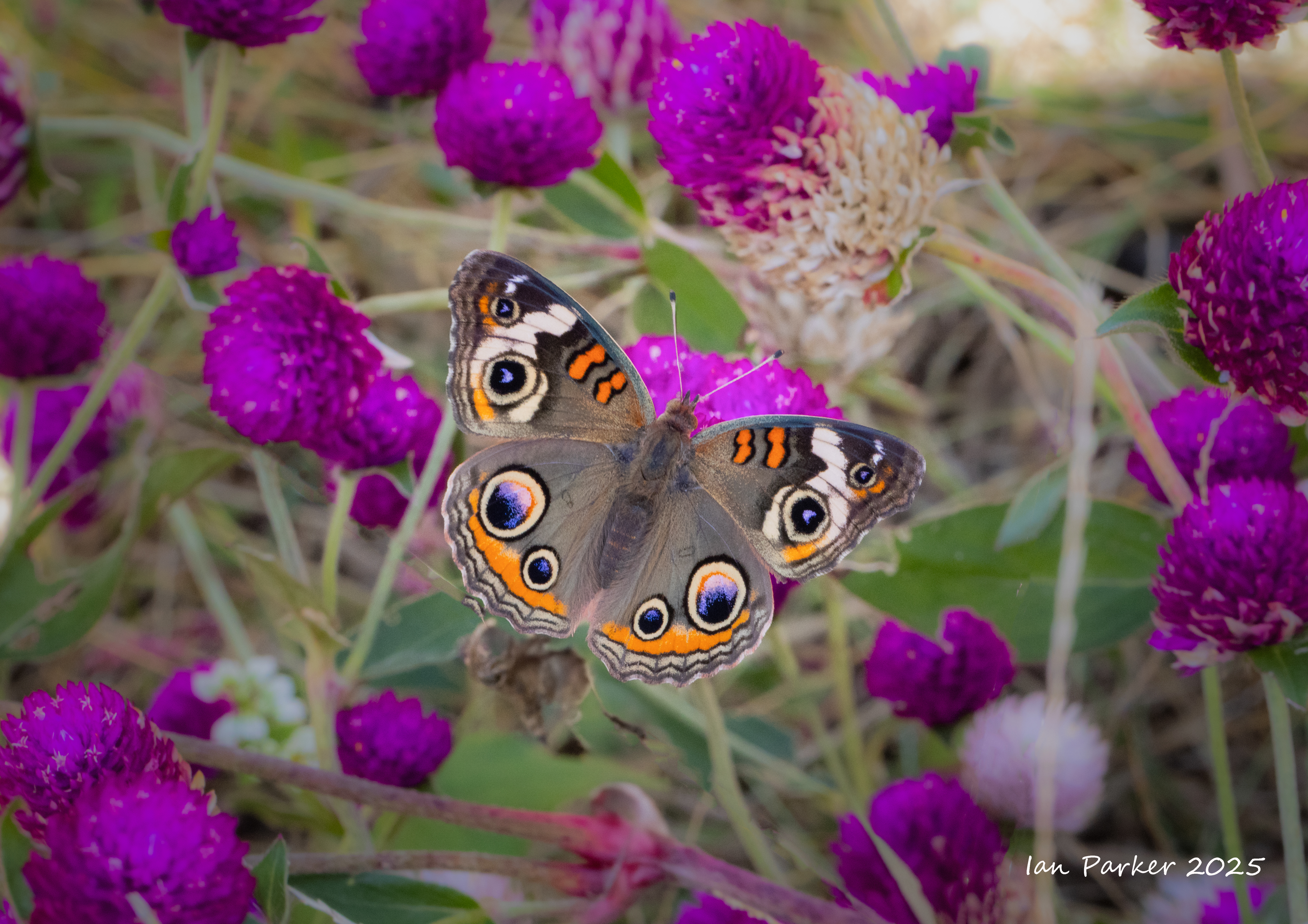
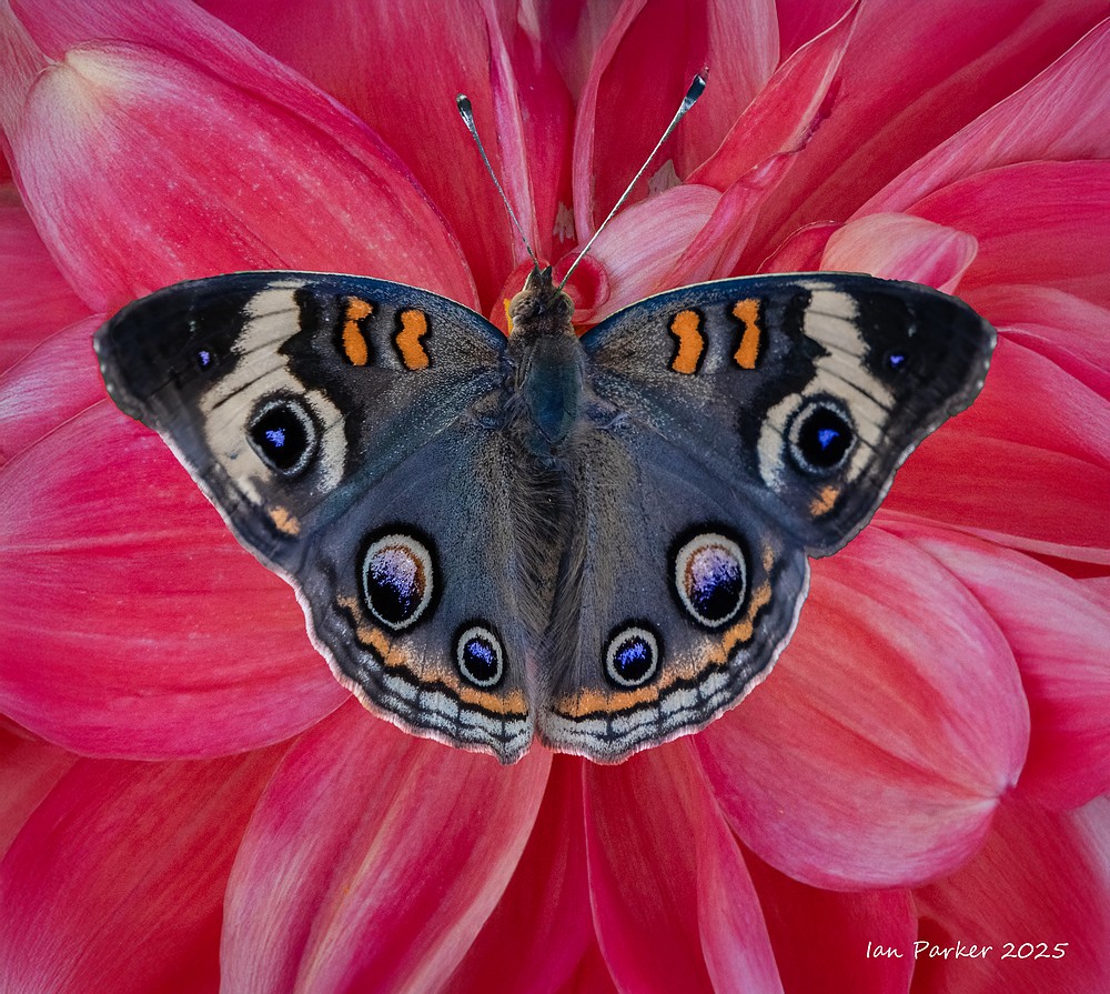
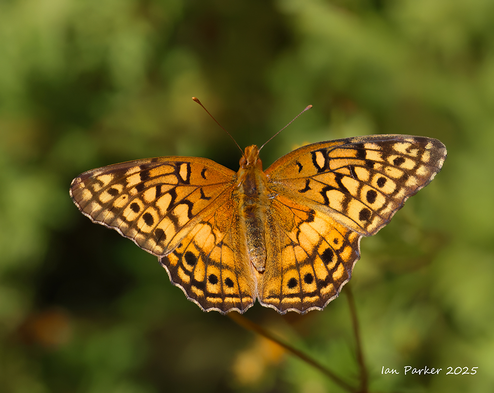
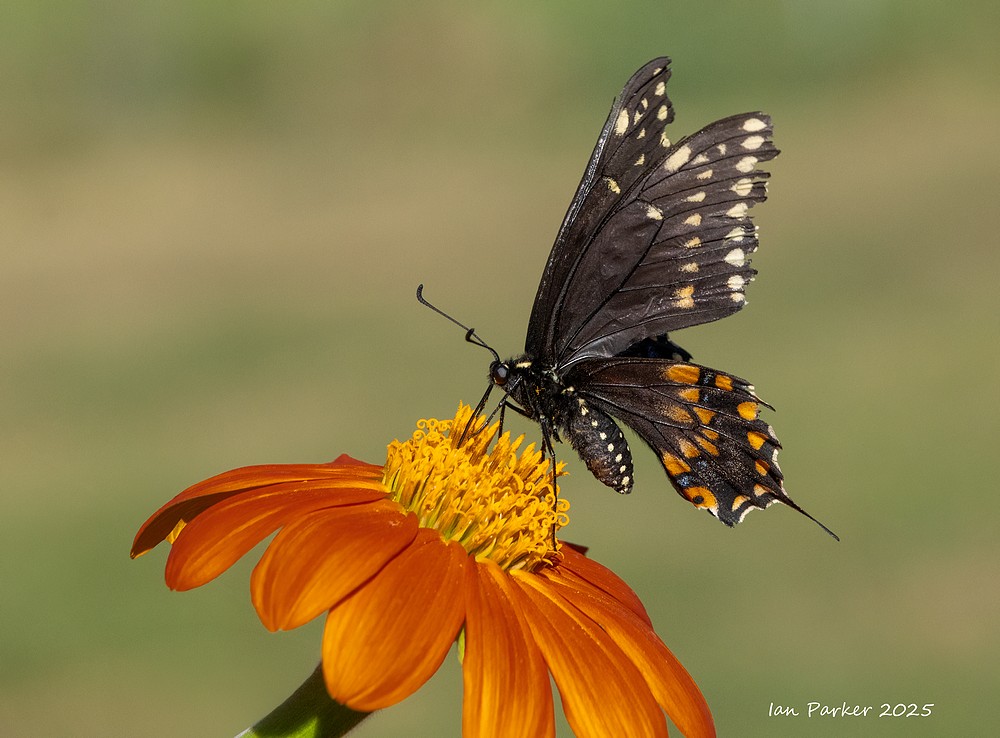
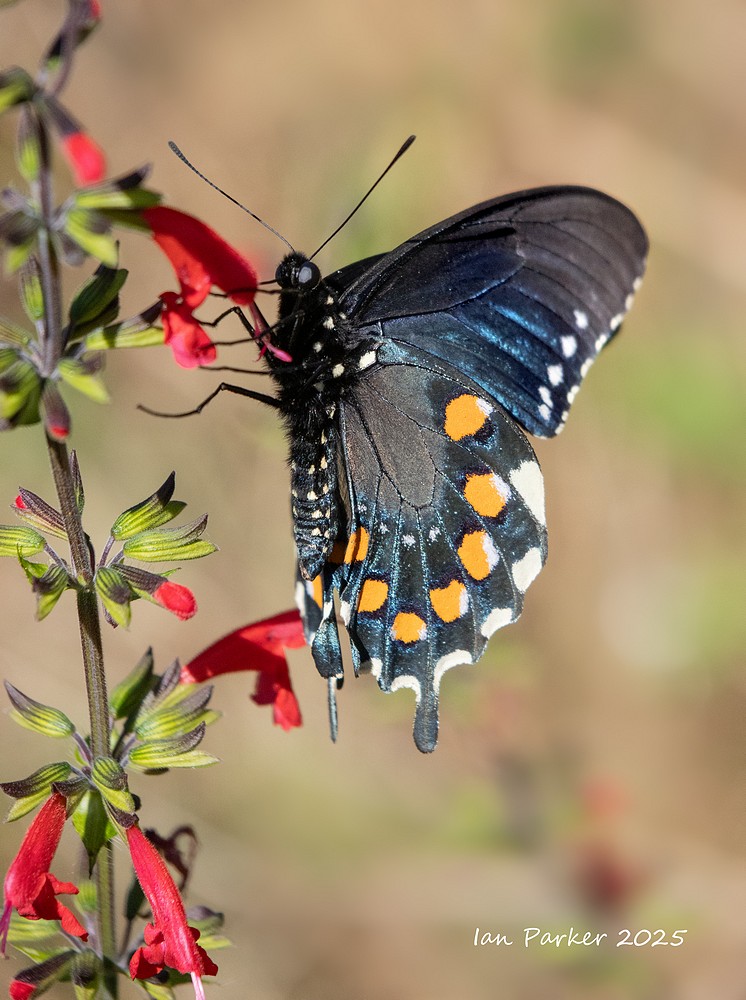
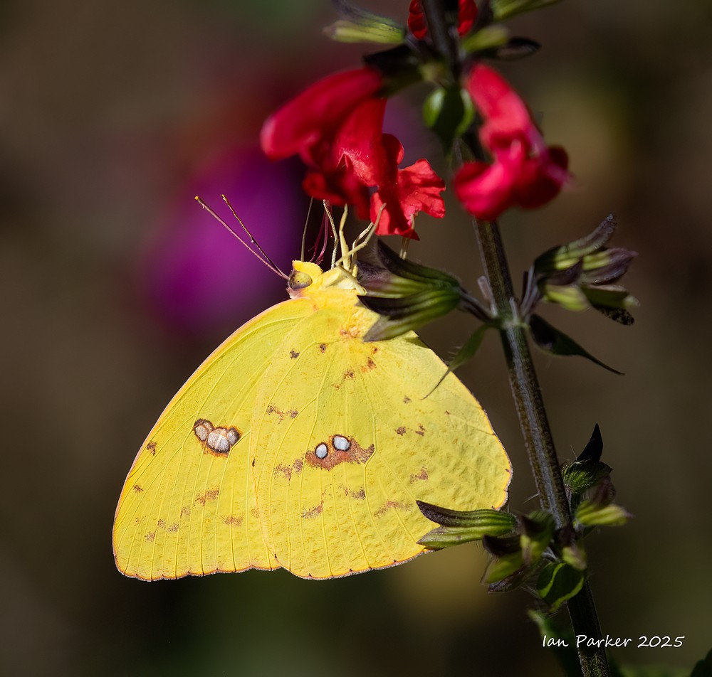
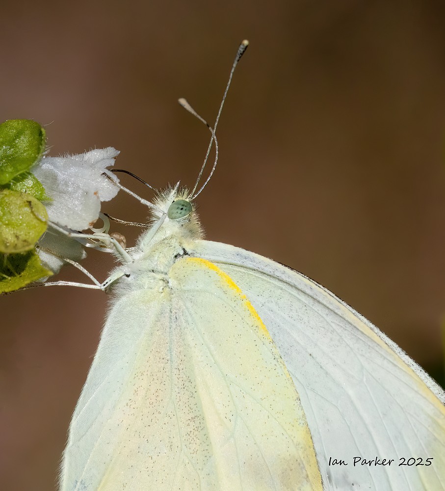
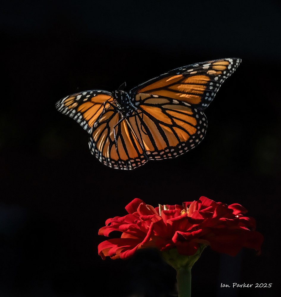
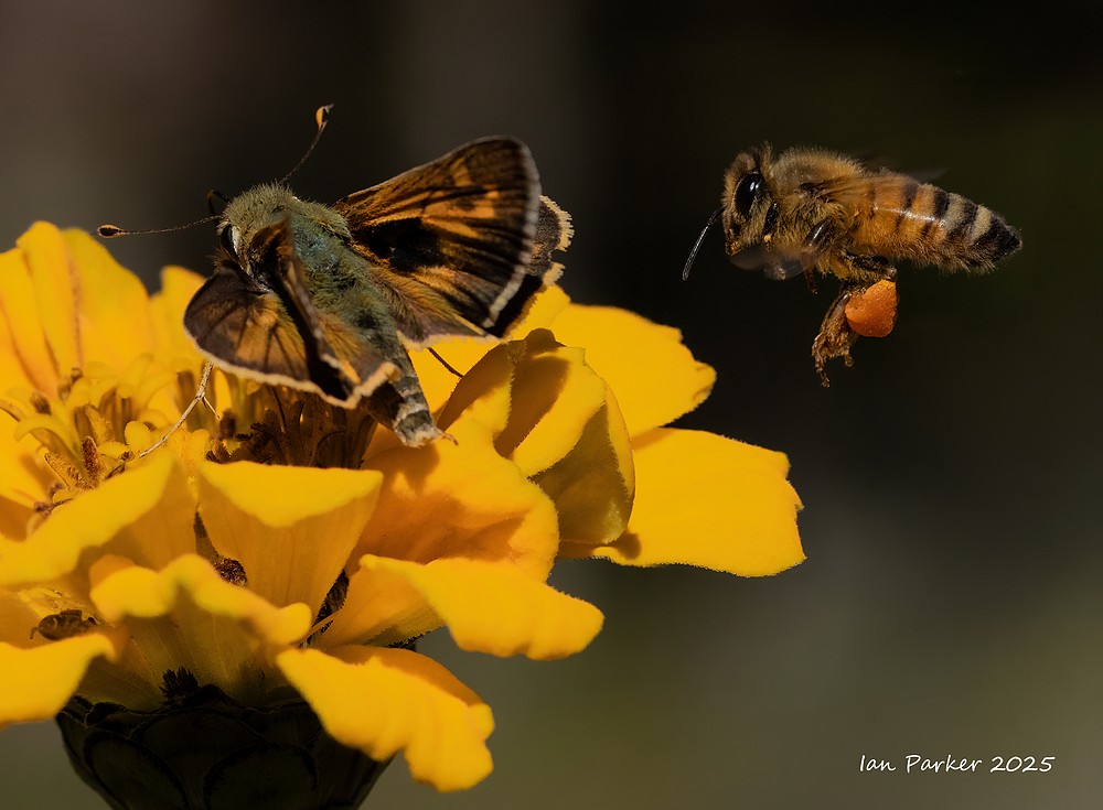
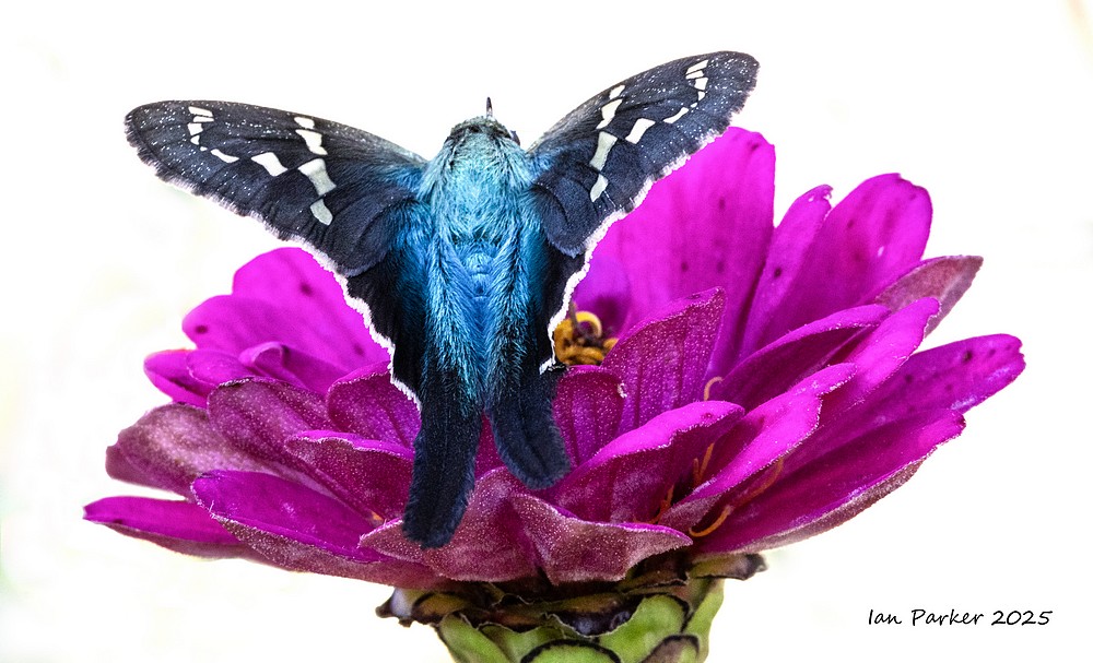
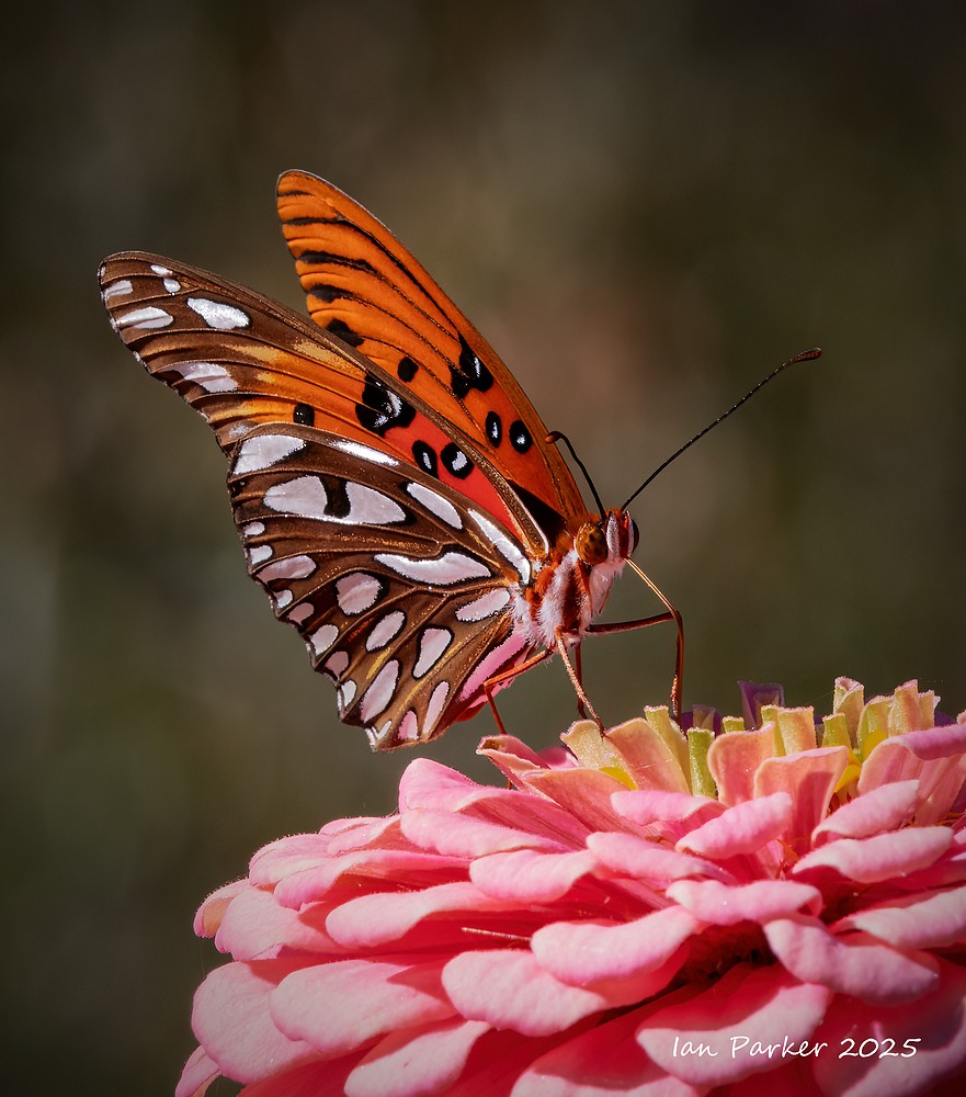
October 12-17: Butterflies at the John C. Campbell Folk School
I had been signed up for a photography class at the Folk School, but this was cancelled. There were no other classes available that appealed to me, so I was looking for my own photographic project that would keep me profitably occupied for the week. Walking past the School gardens I noticed there were many butterflies flitting around the flowers...
Eleven species of butterflies around the Folk School gardens
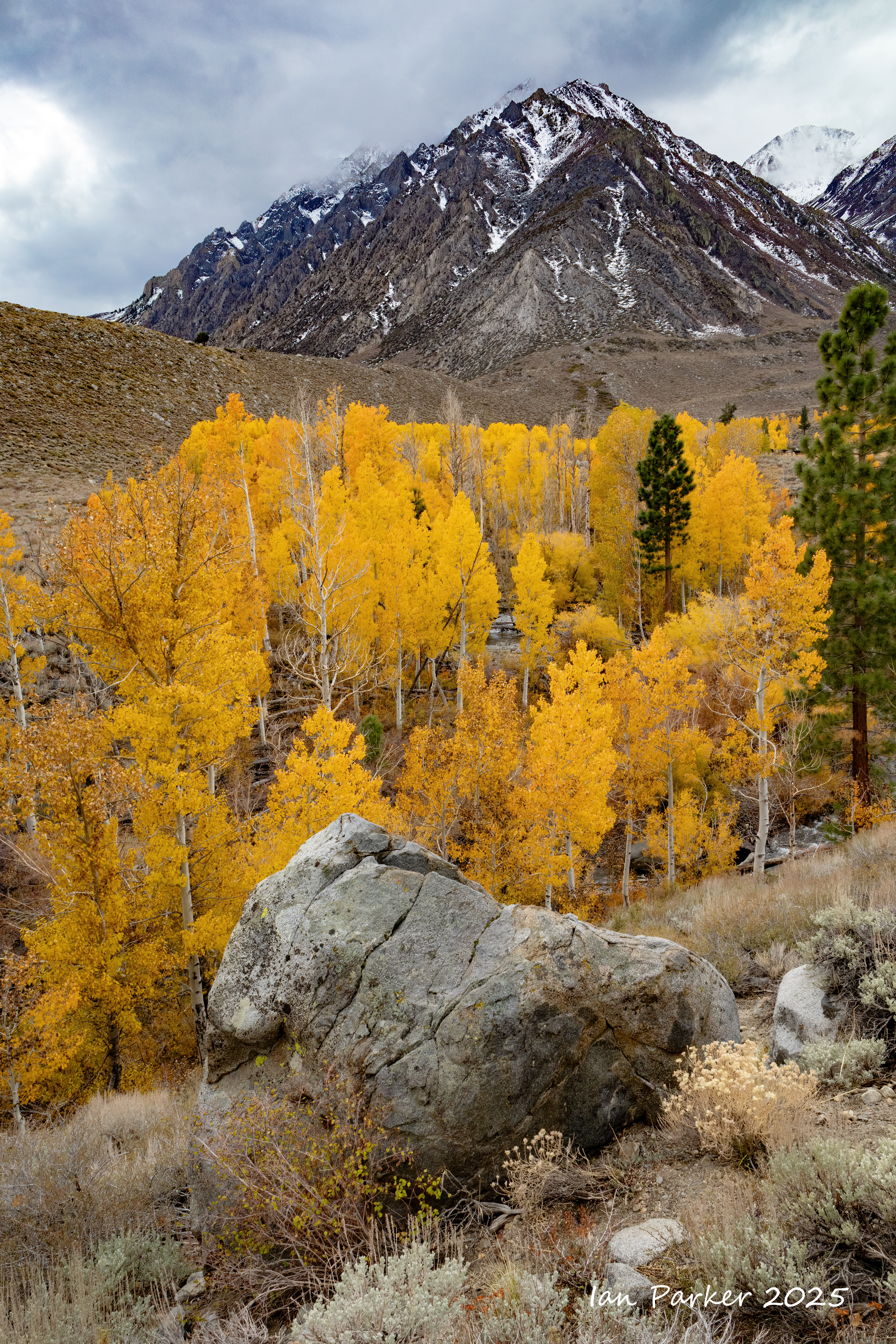
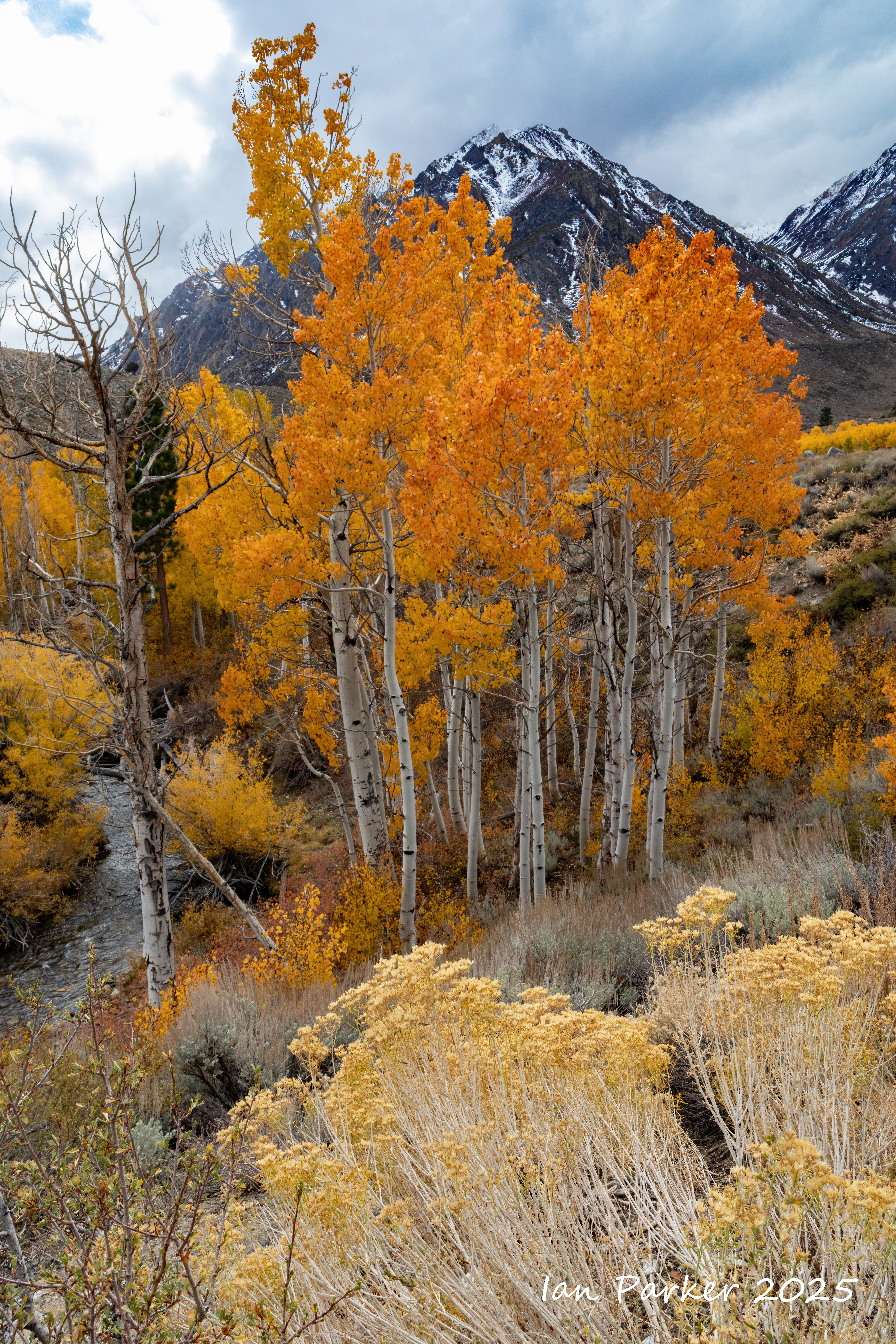
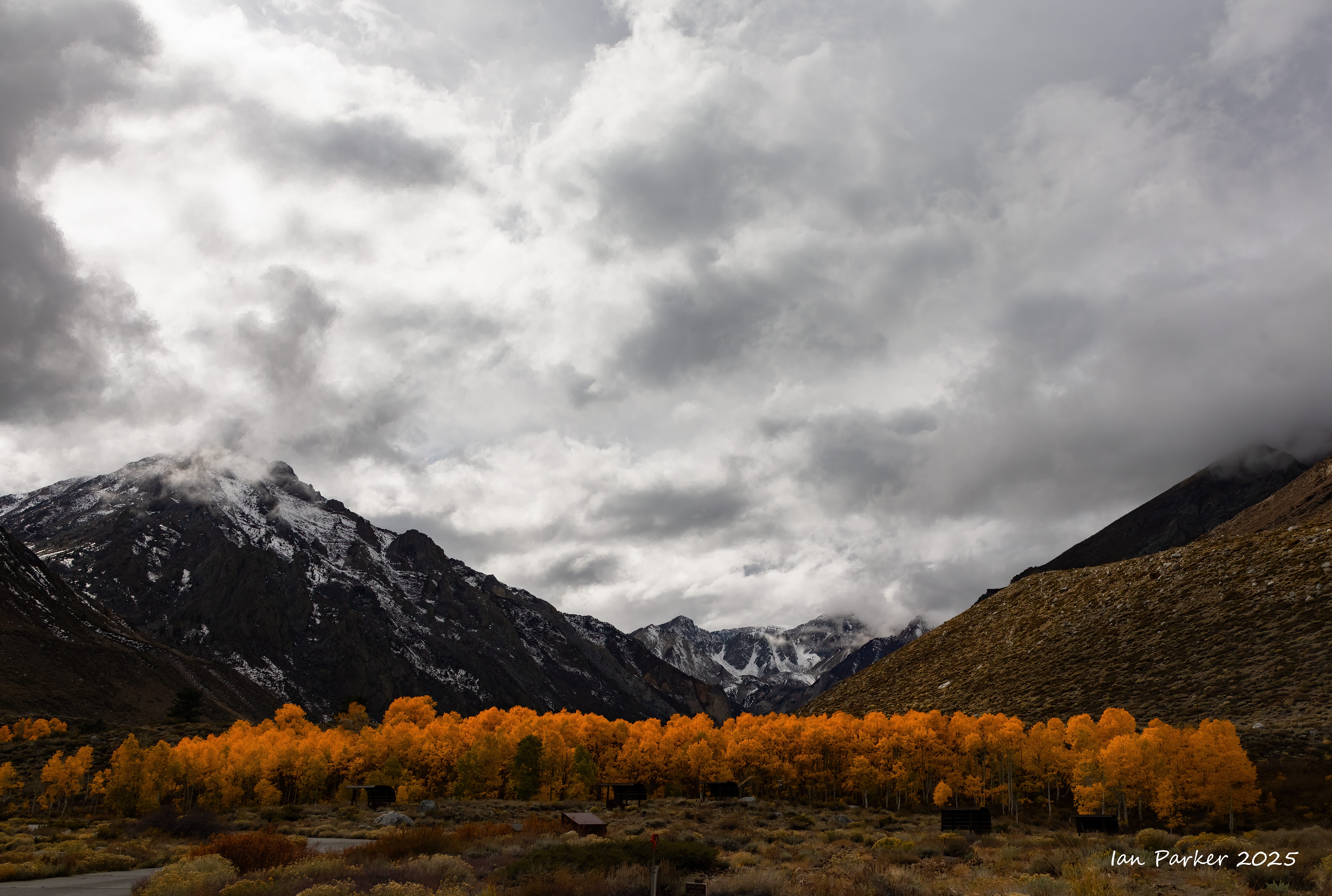
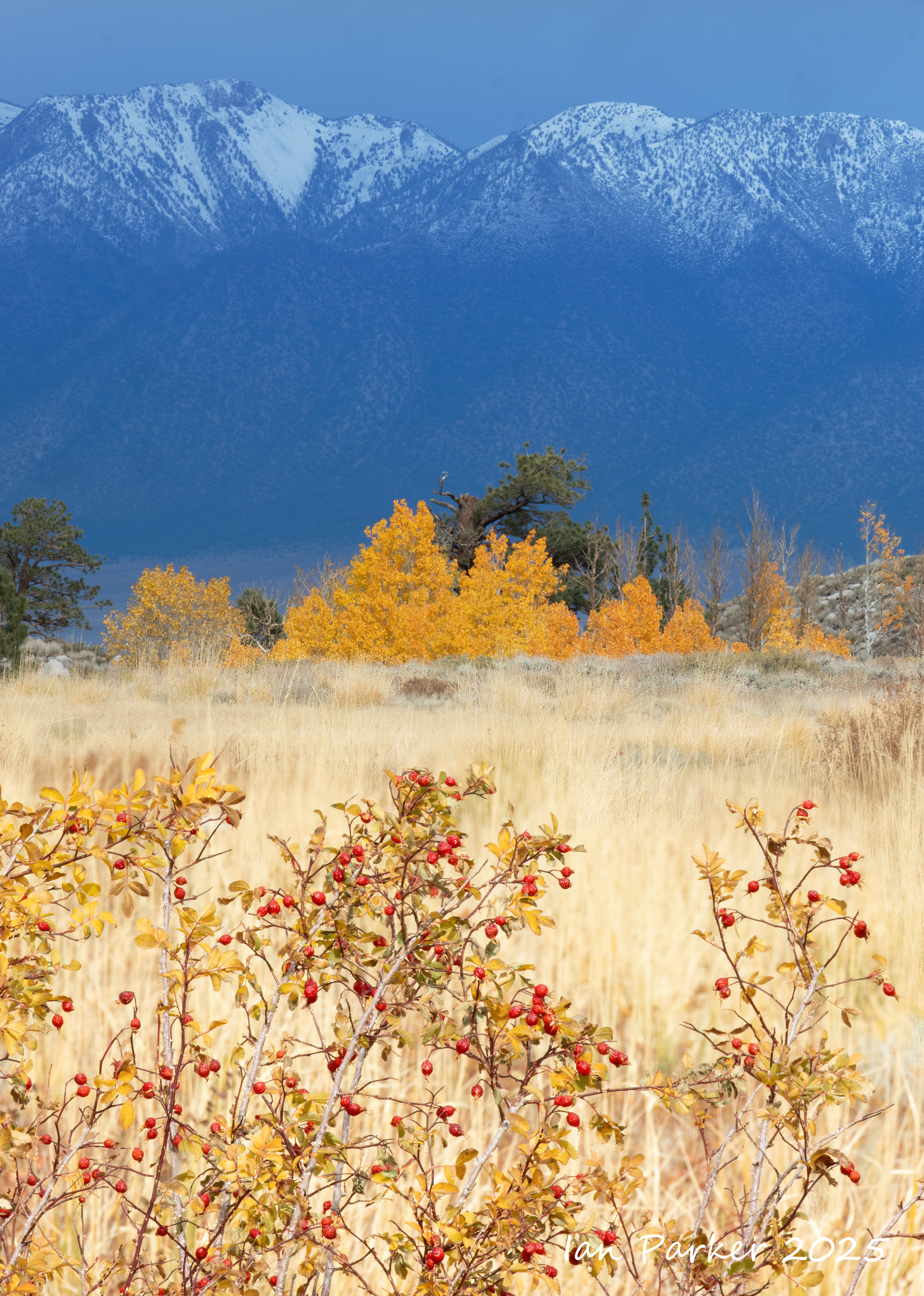
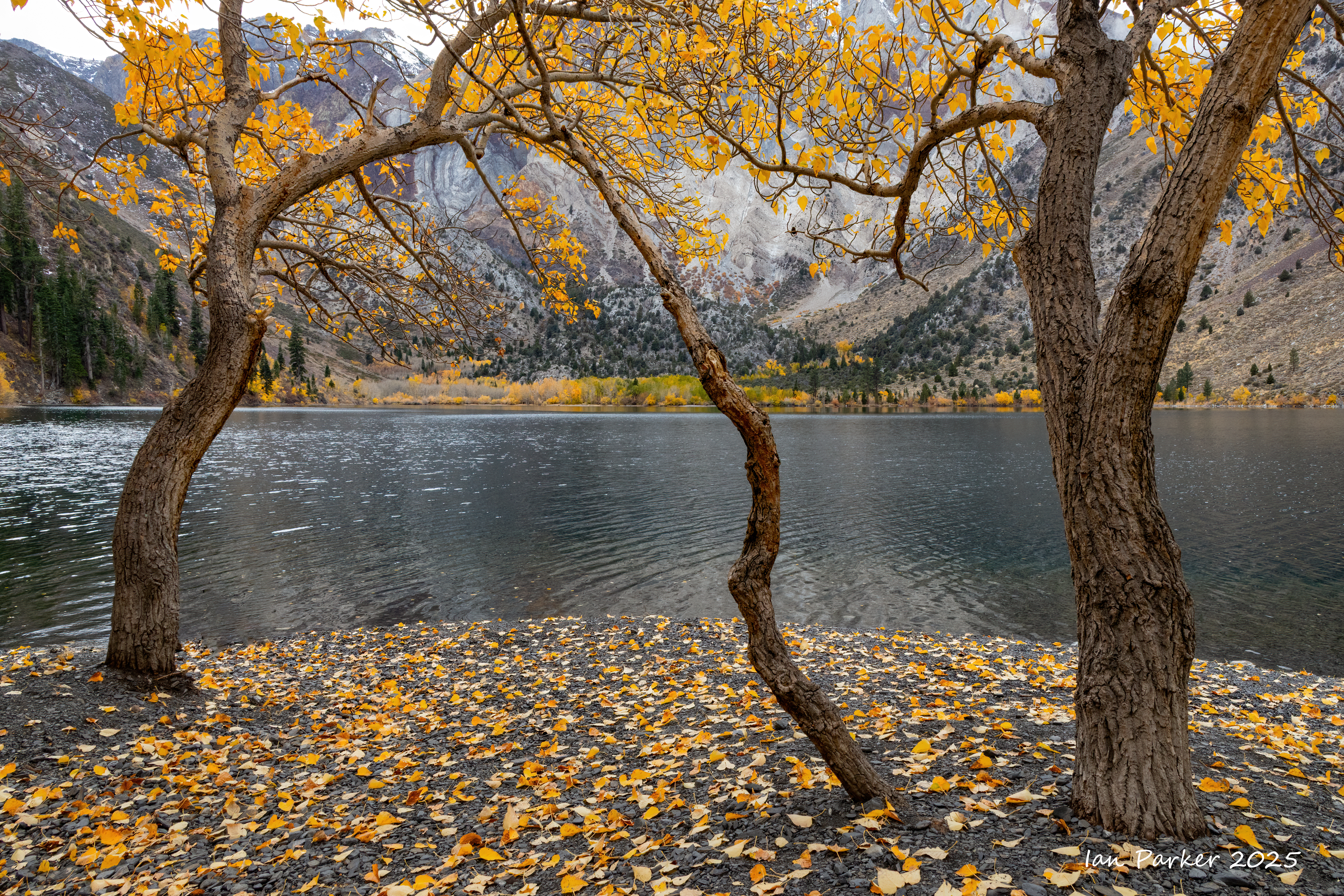
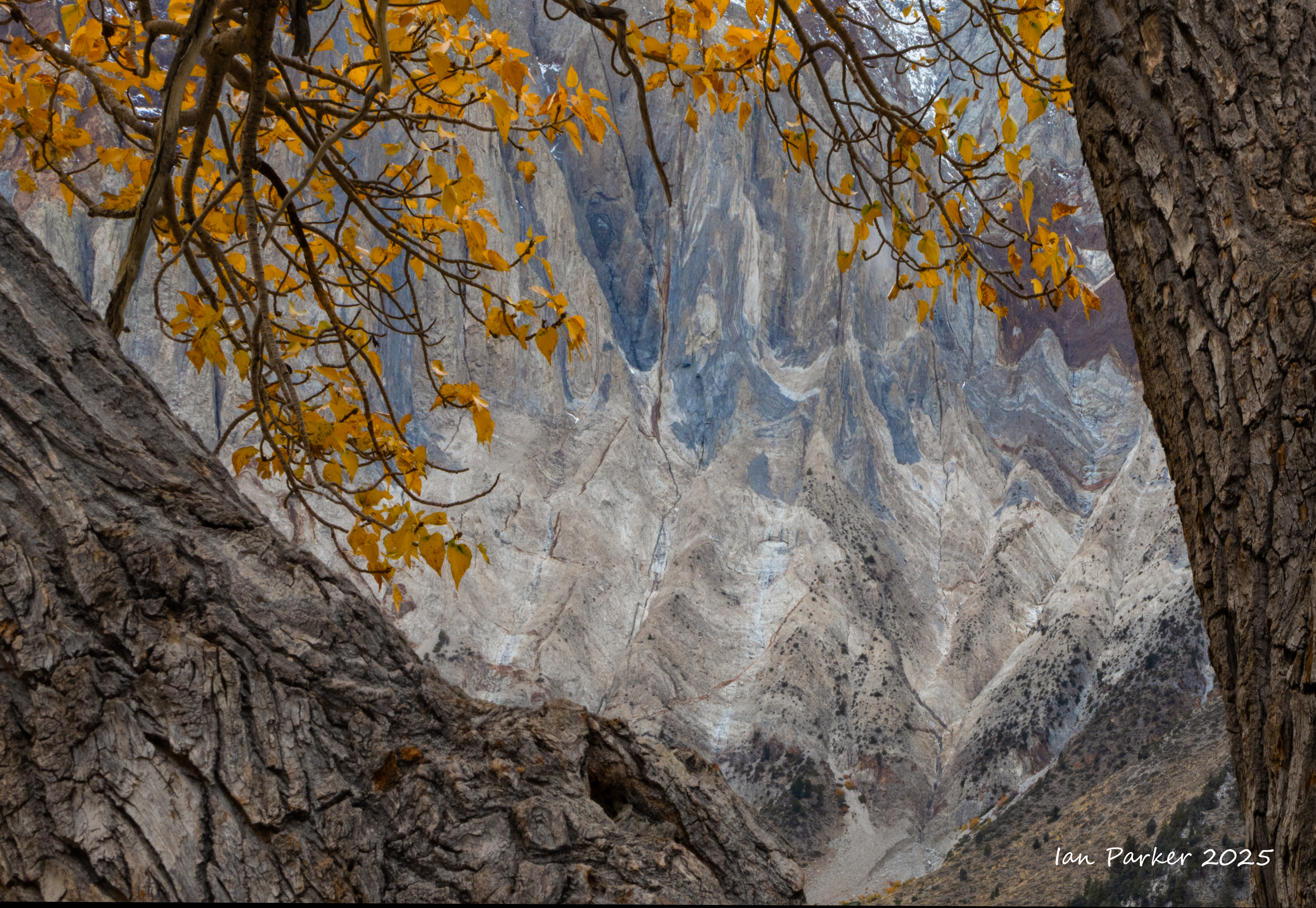
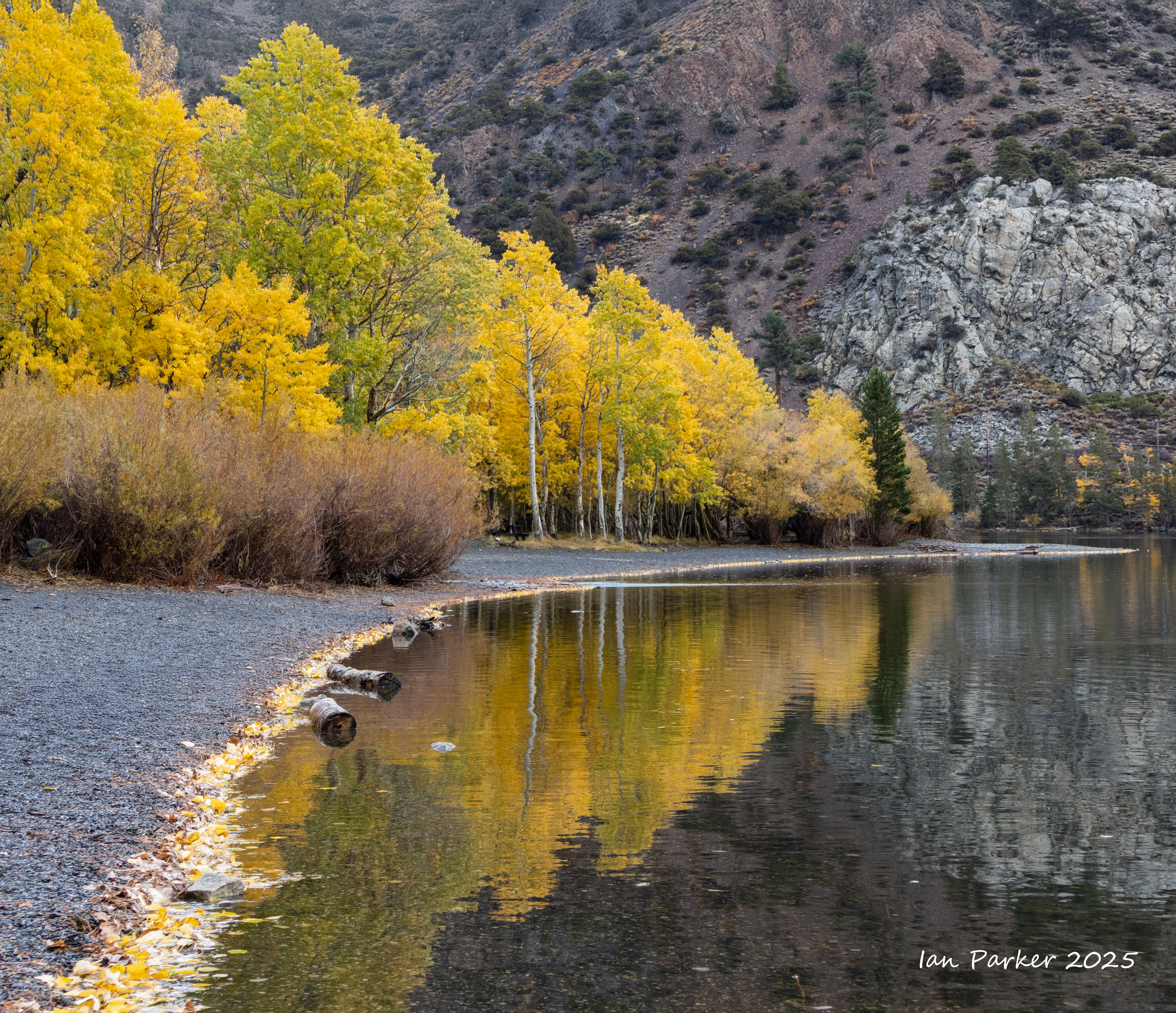
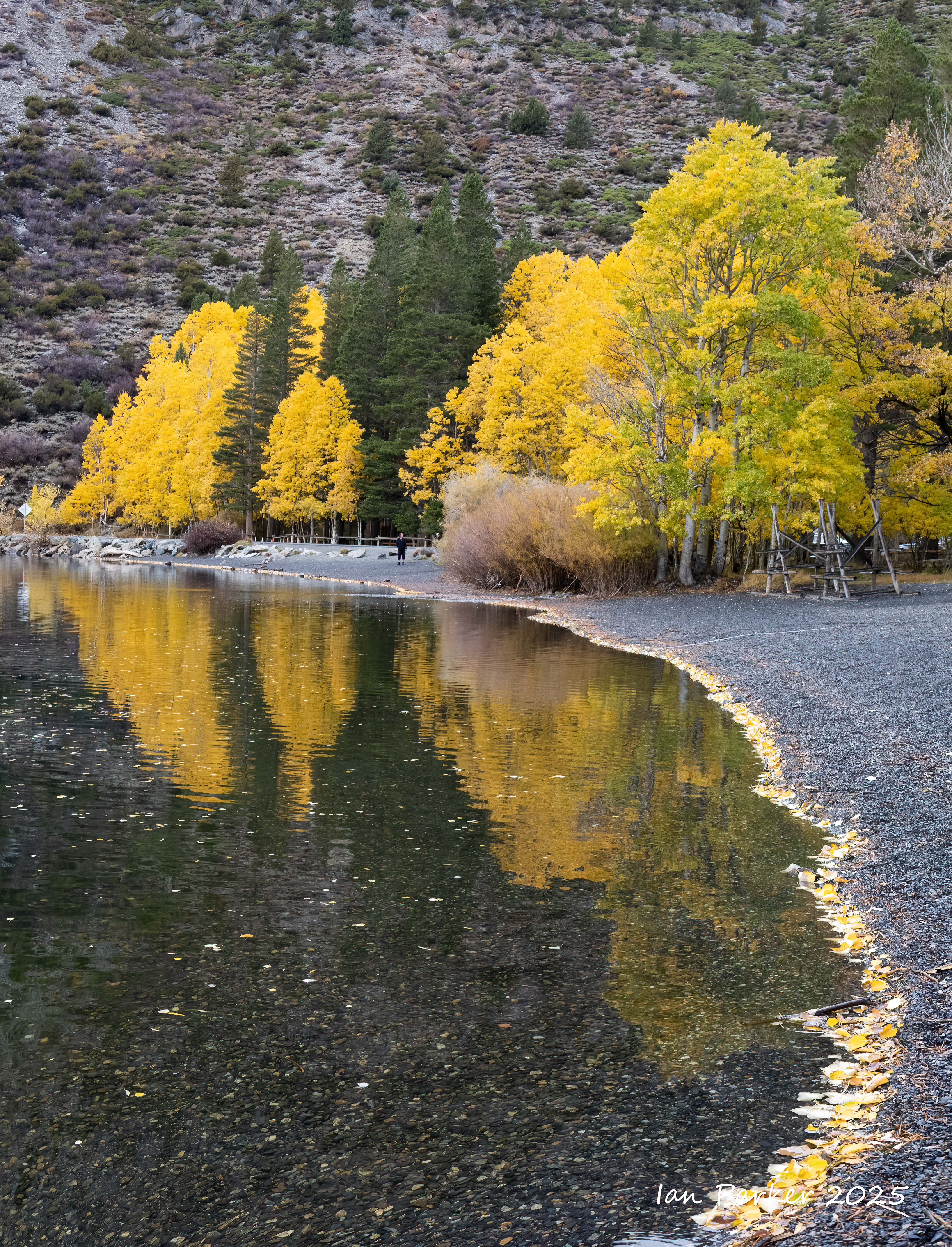
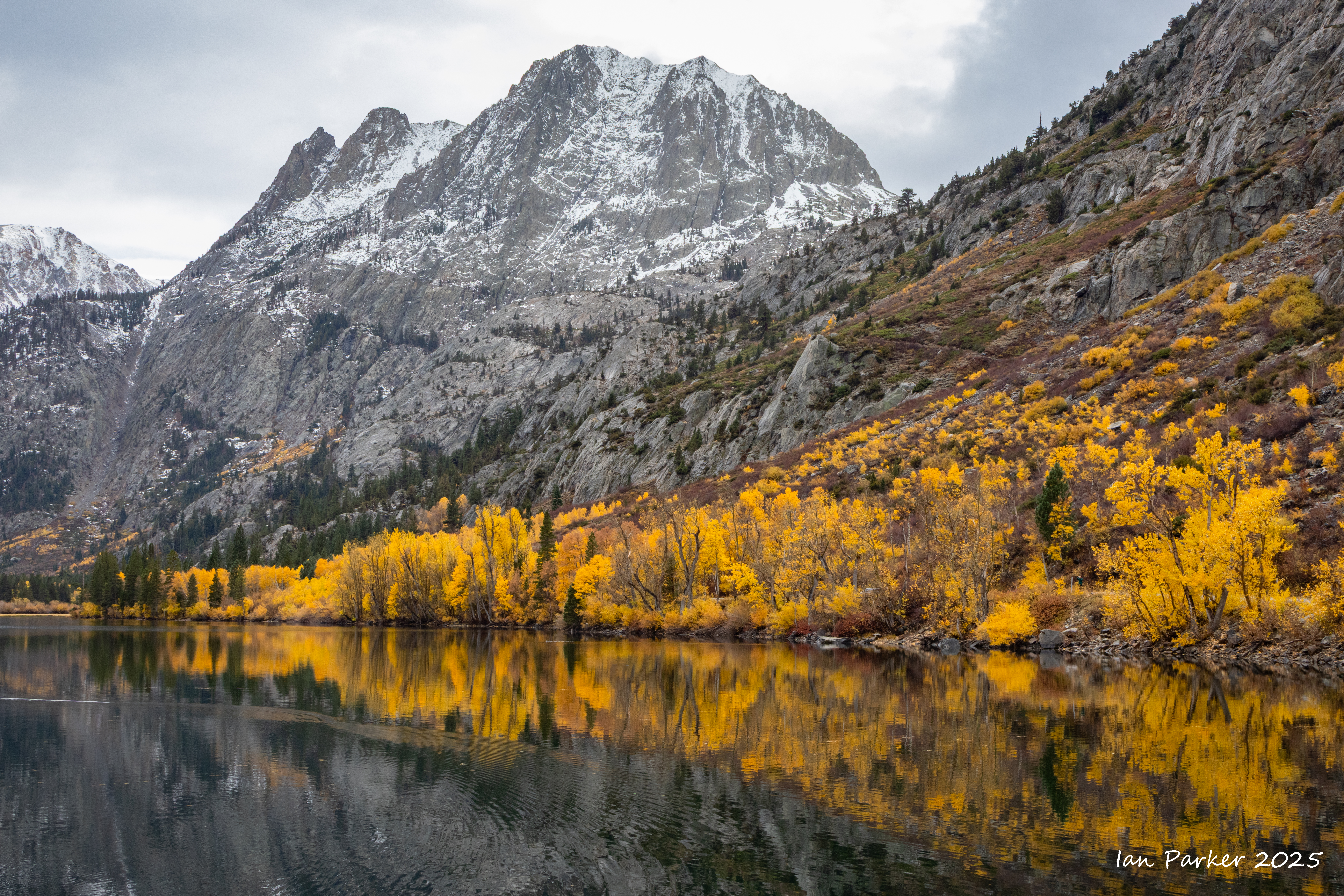
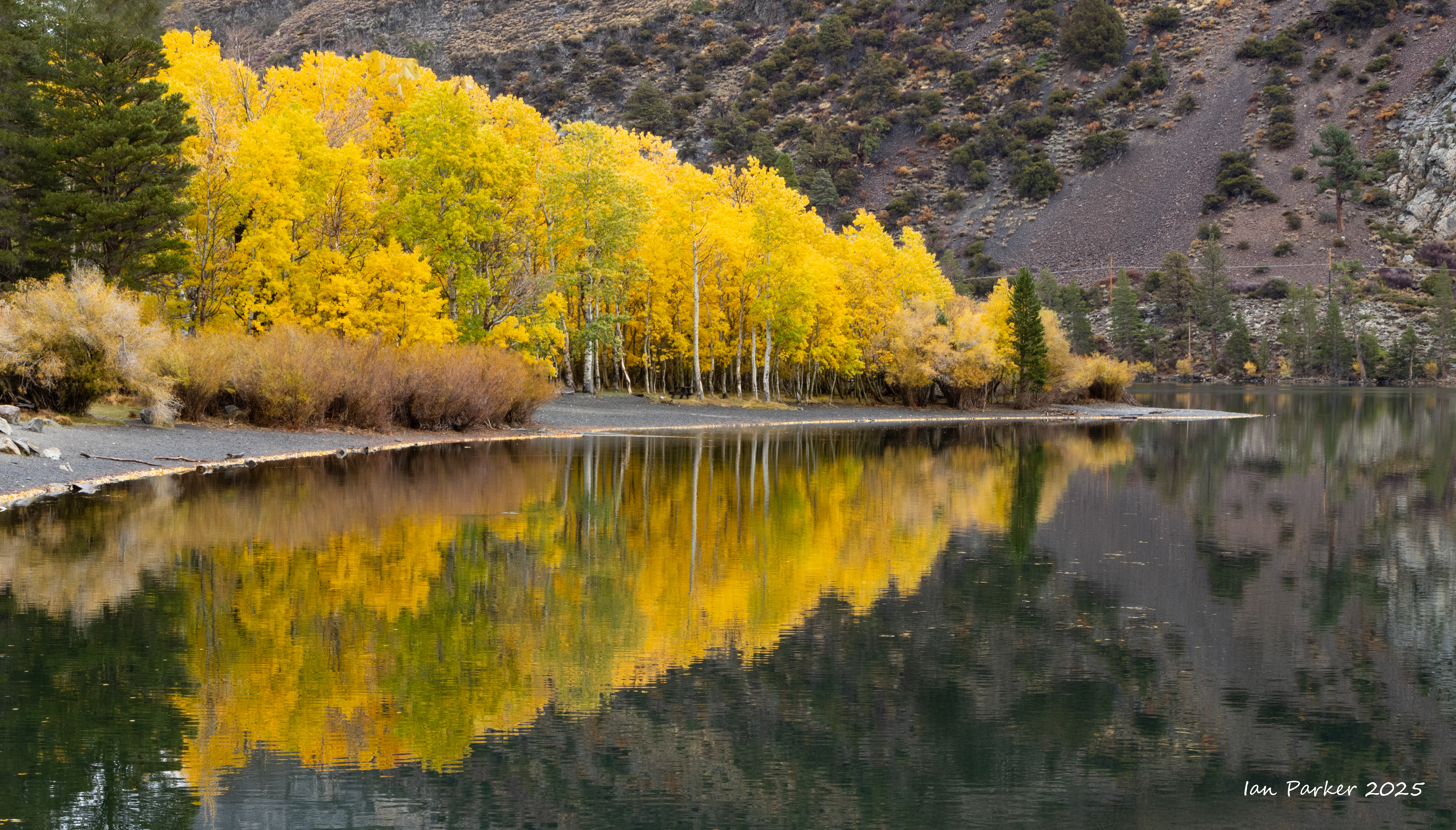
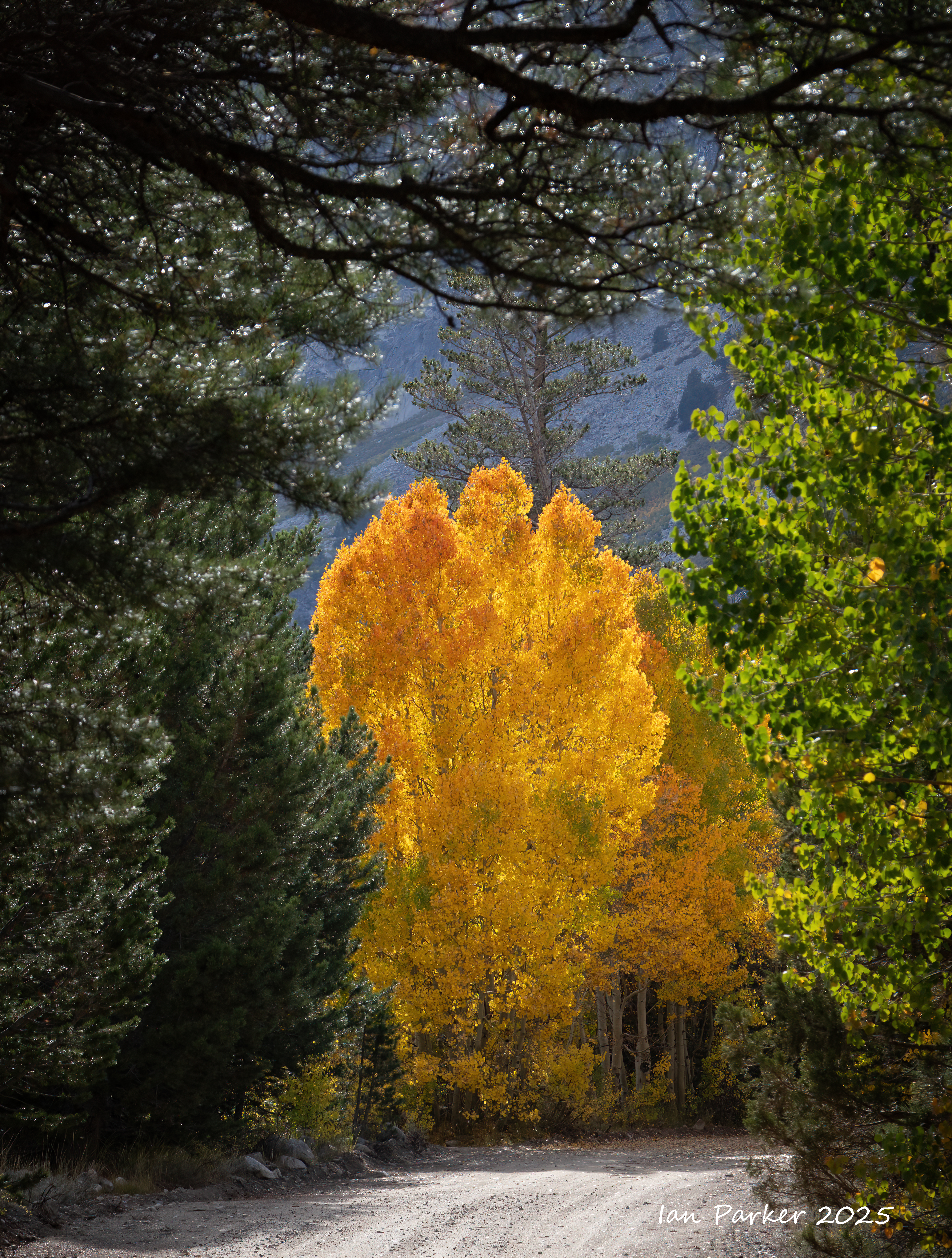
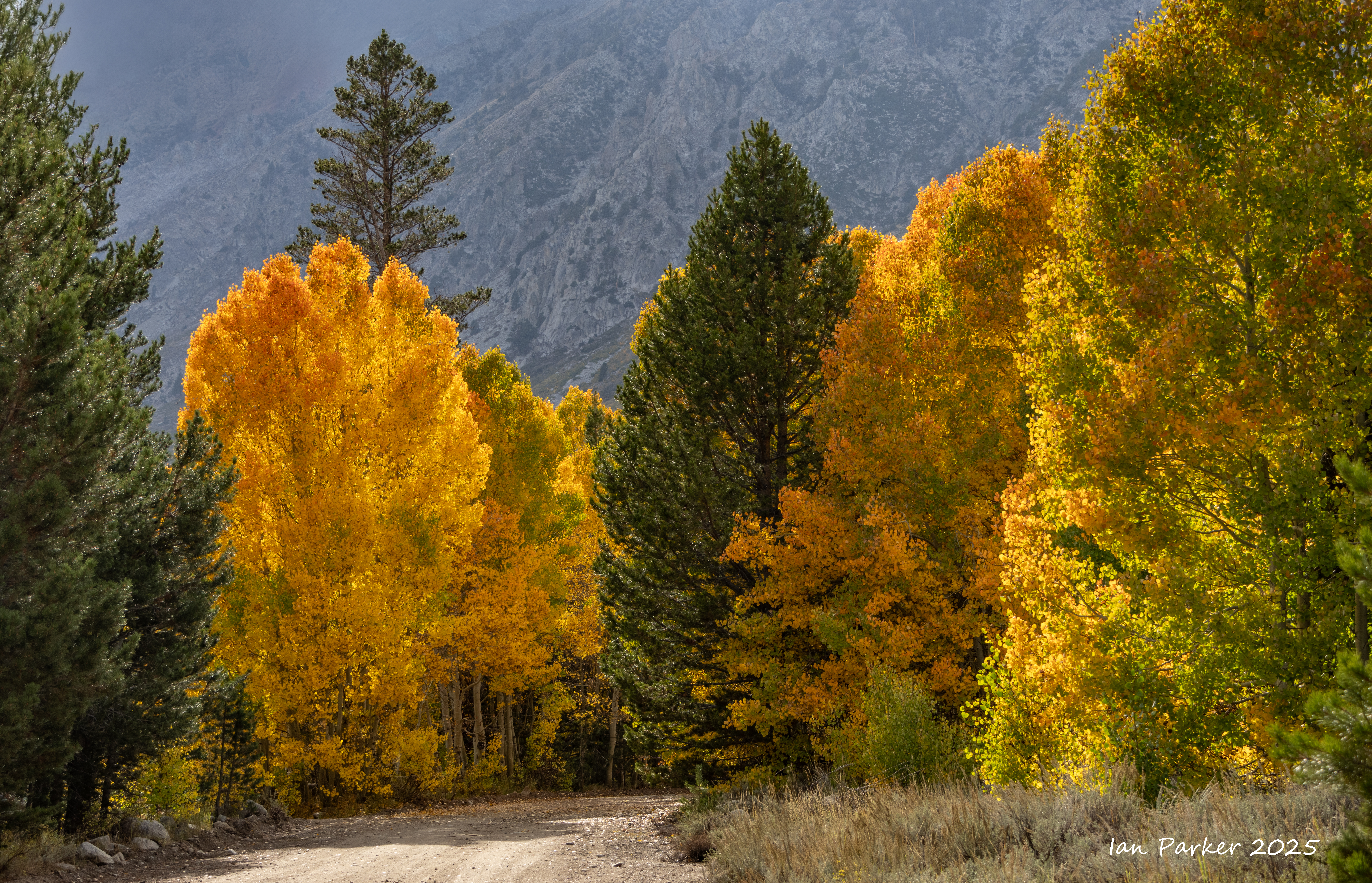
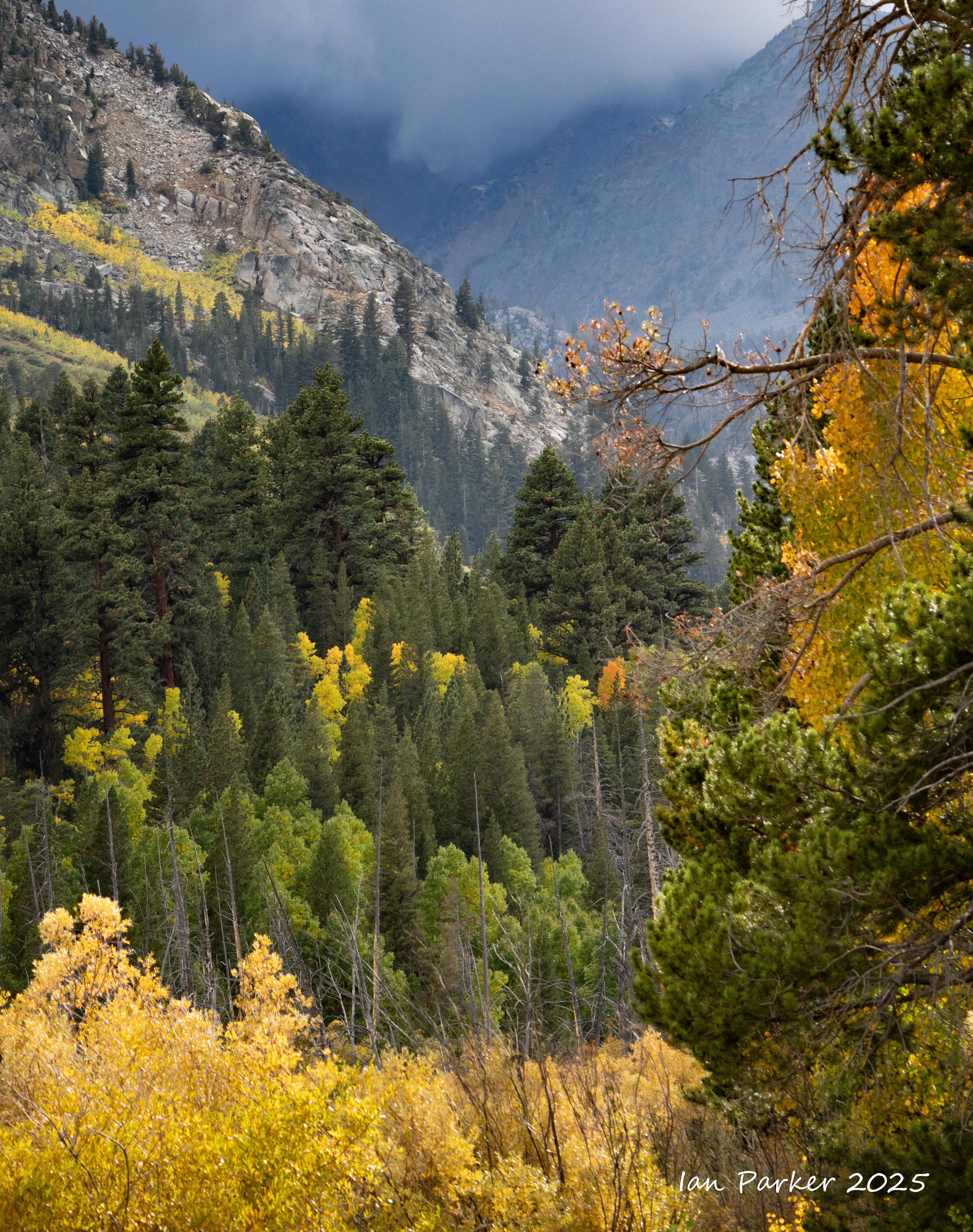
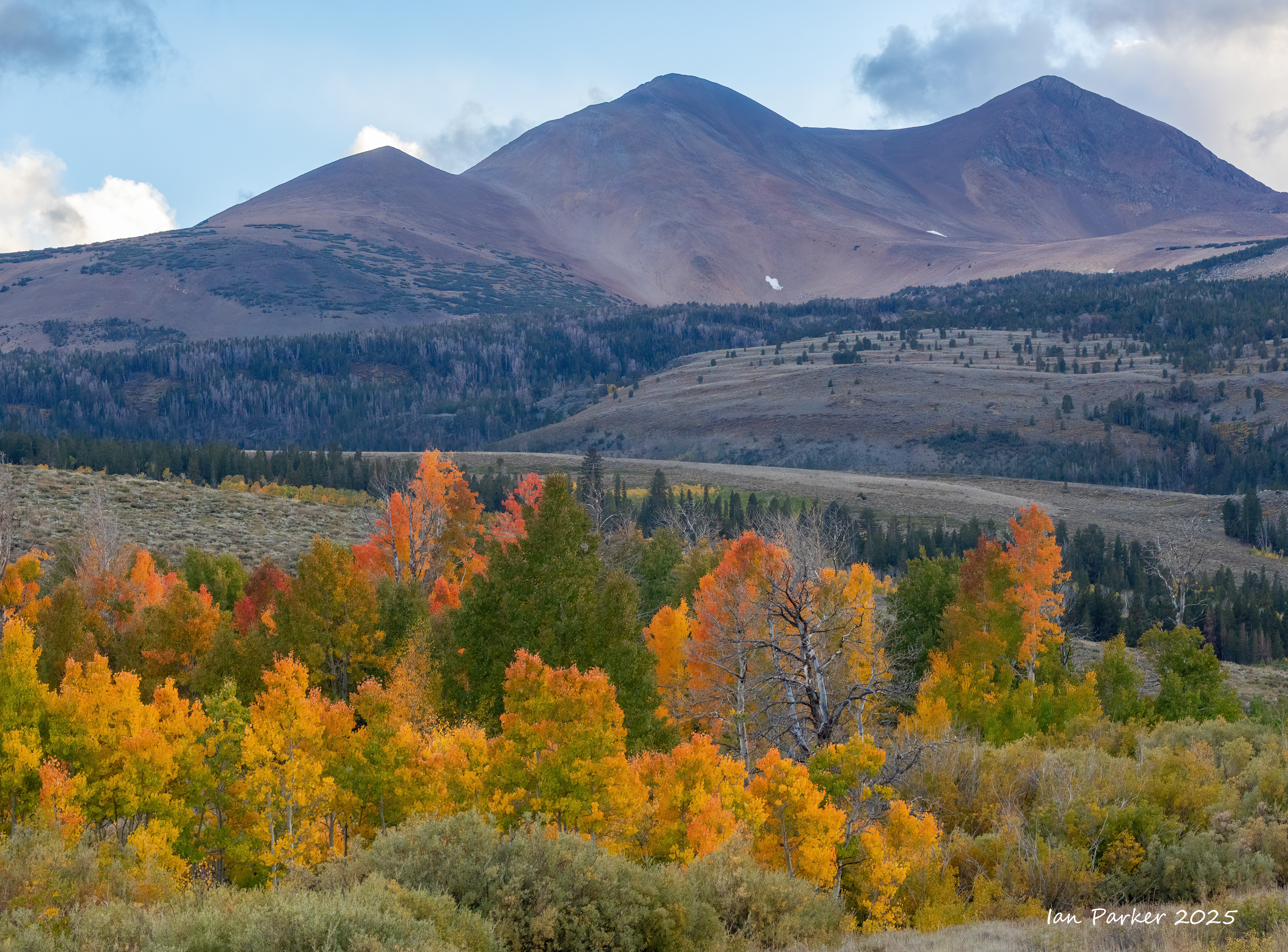
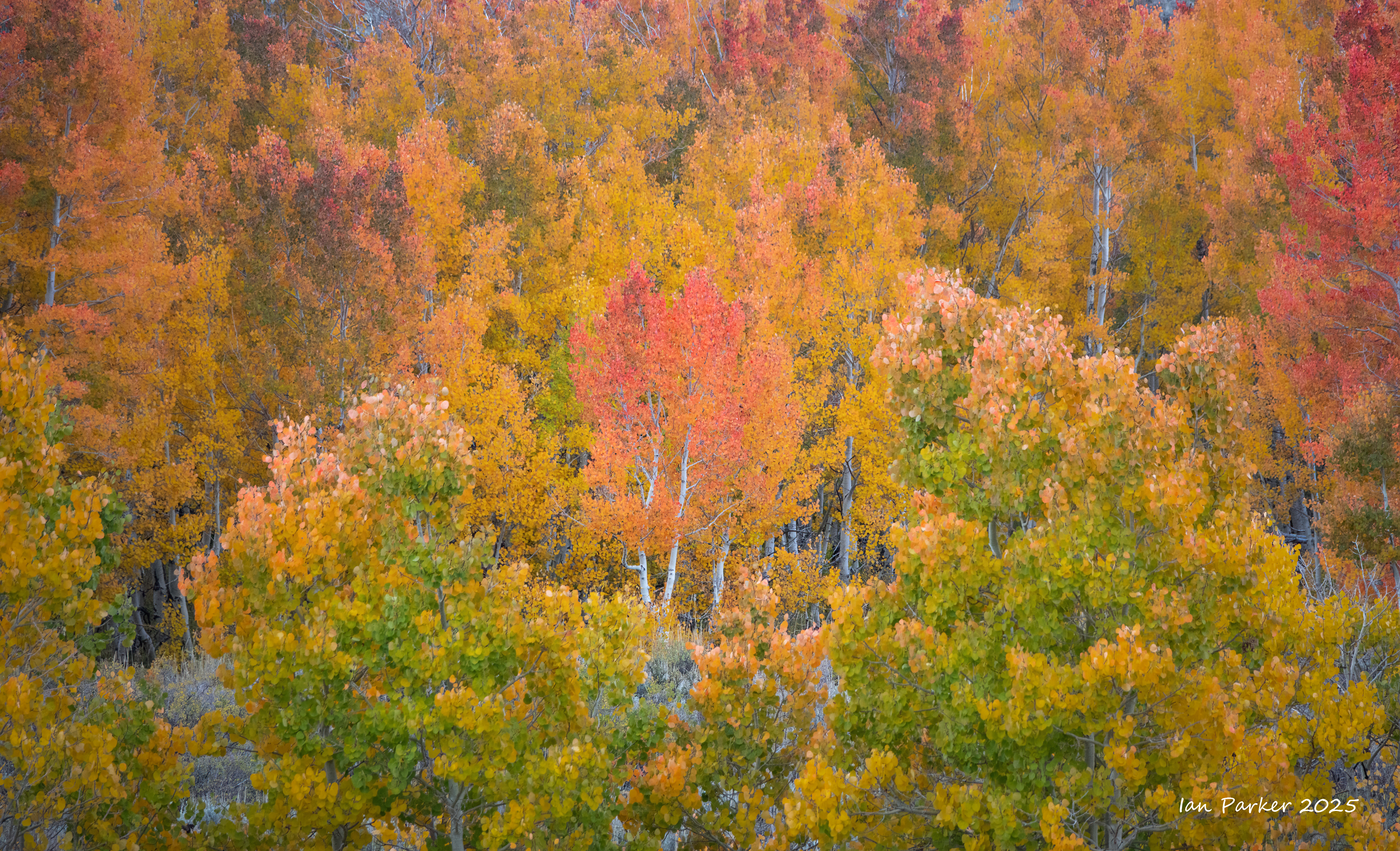
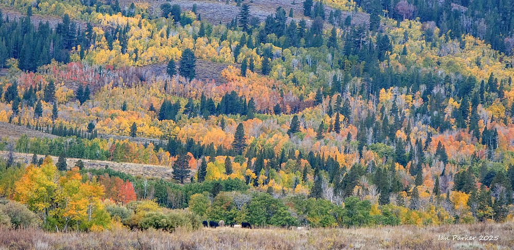
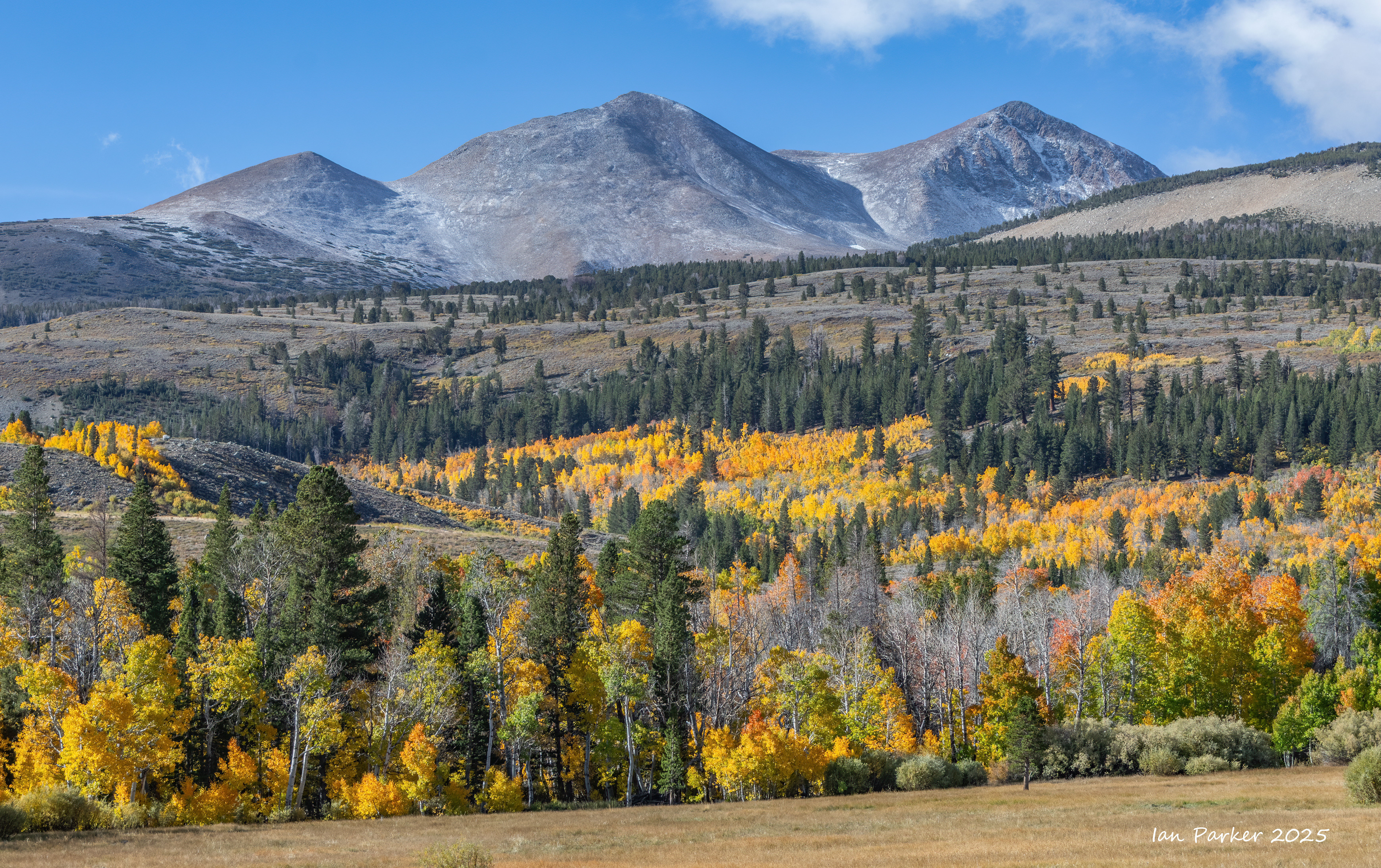
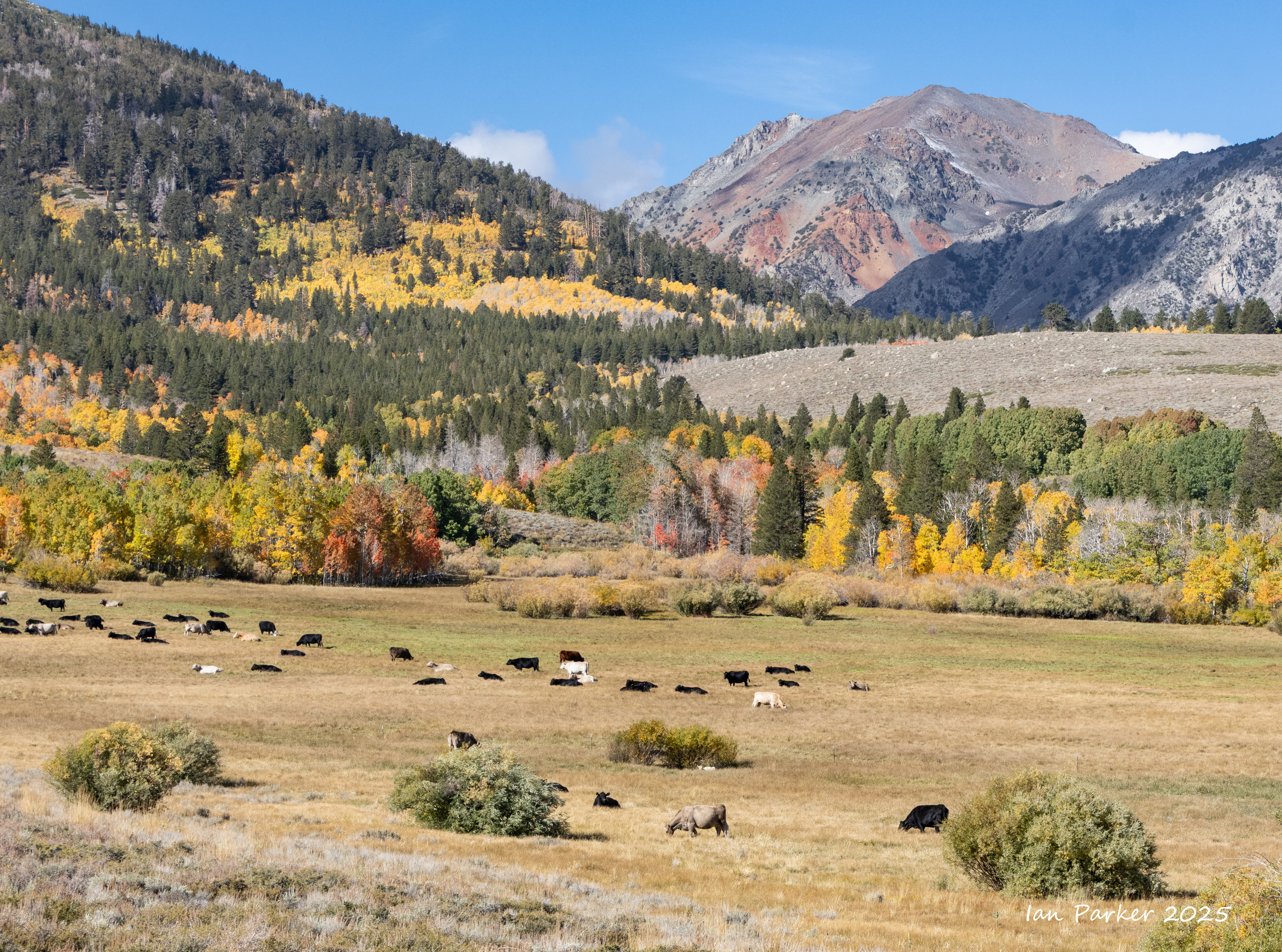
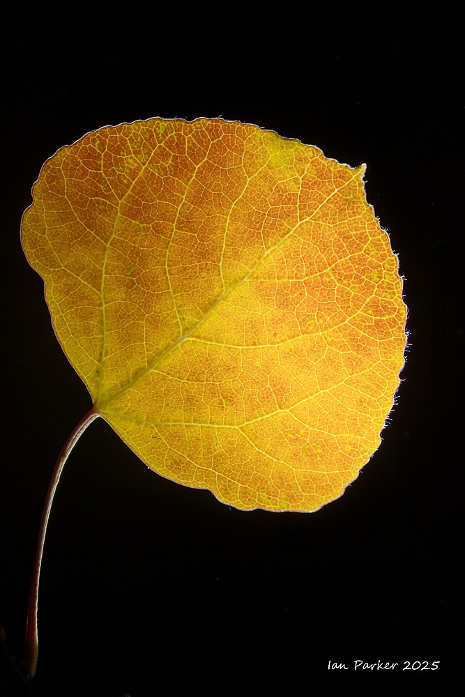
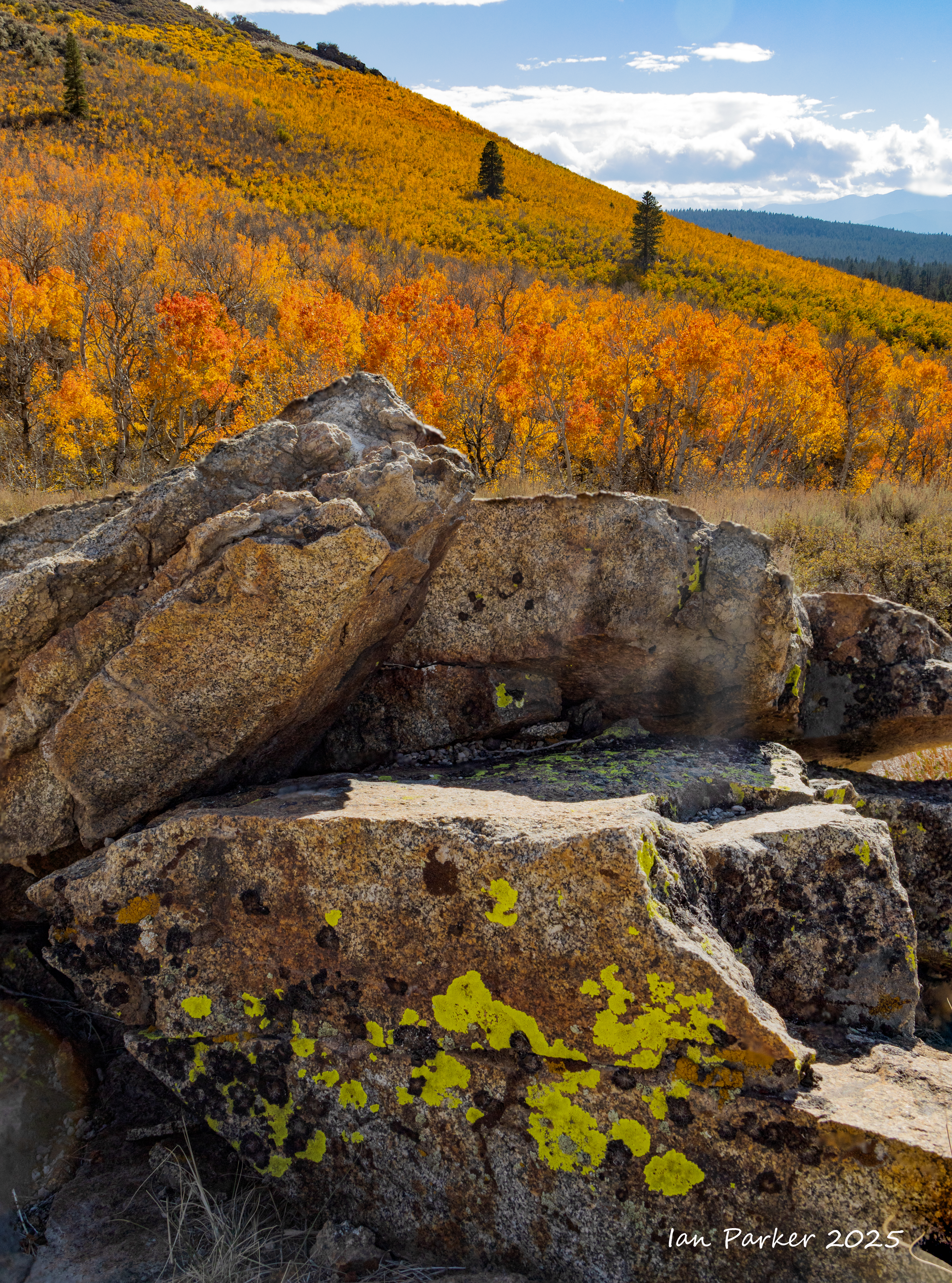
September 23-30; A roundtrip drive along highway 395 to visit family in Redding - with stops outbound and on the return to photograph fall colors in the Eastern Sierras.
On the return journey colors were most prominent at lower elevations.
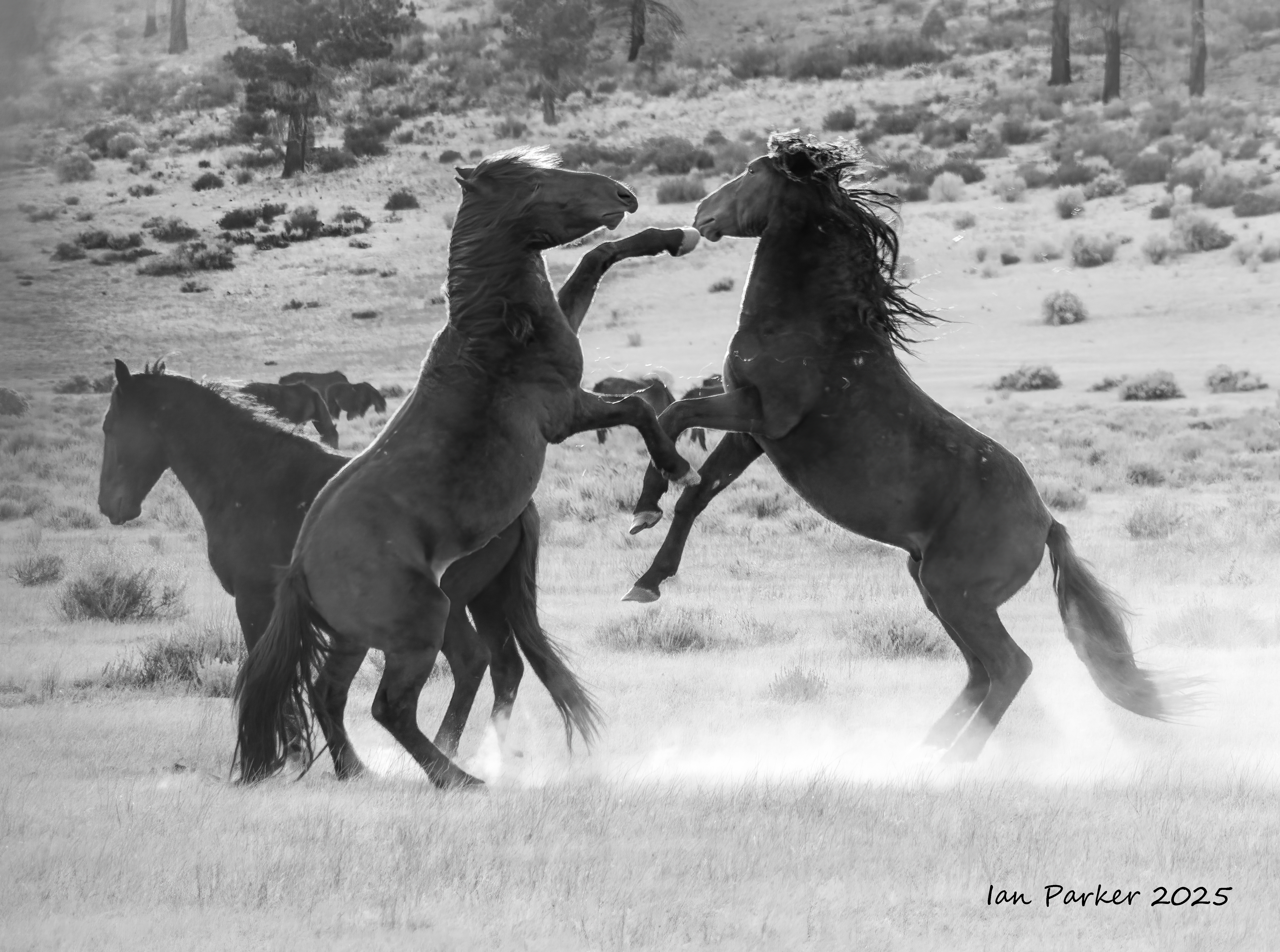
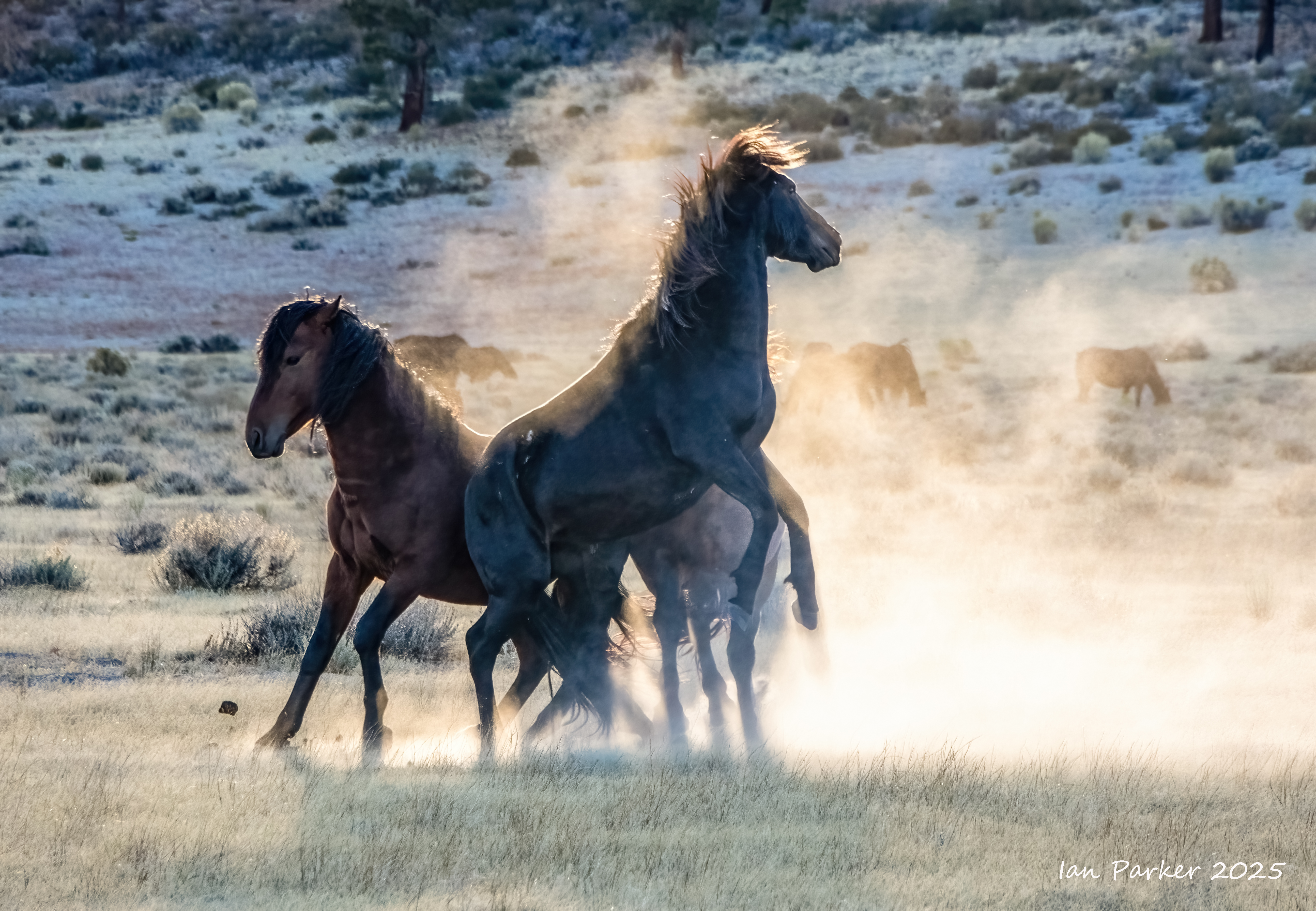
On the outward journey north along highway 395 we camped at Dunderberg Meadows and Mono Lake, with a side-trip up to Sagehen Meadow. An unexpected bonus was encountering a herd of wild mustangs near Mono Lake.
Driving back along highway 120 from Sagehen to Mono Lake we found a group of maybe 50 wild mustangs from the Montgomery Pass herd grazing on a wide meadow.
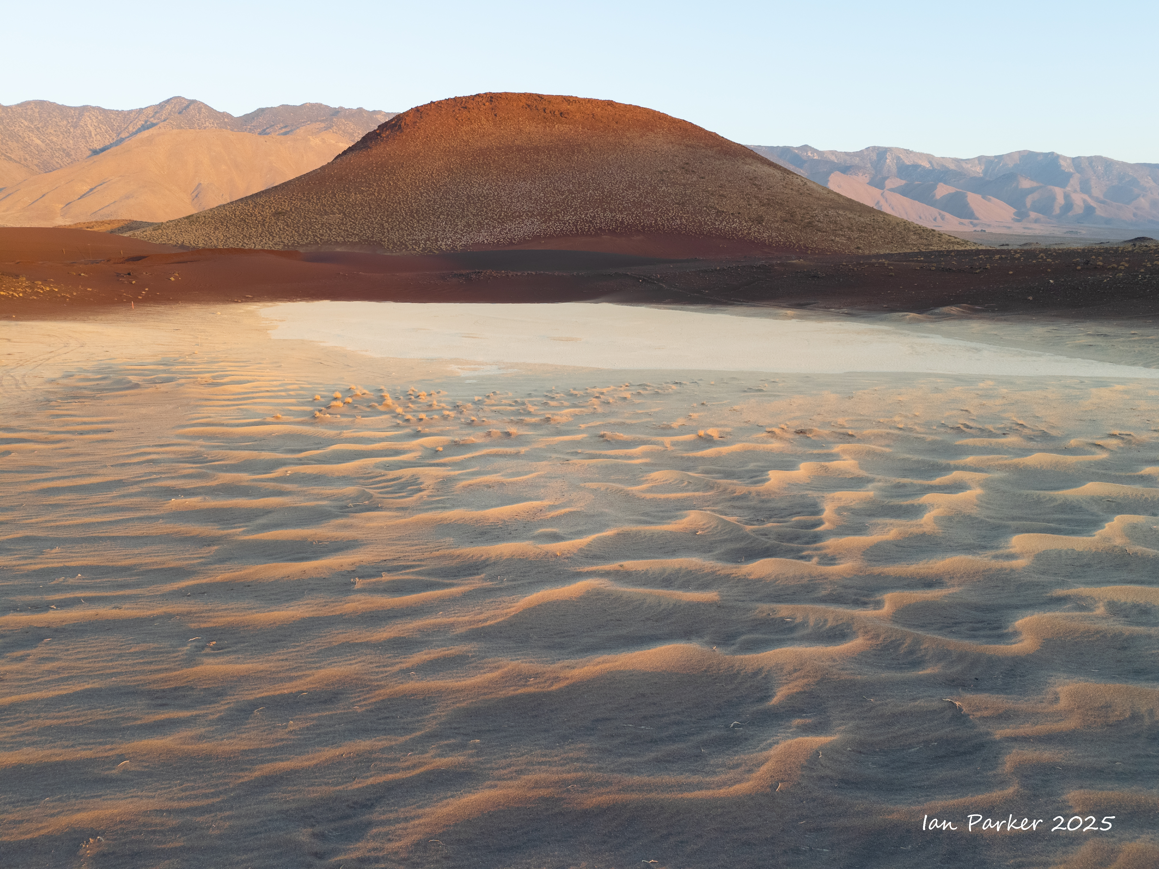
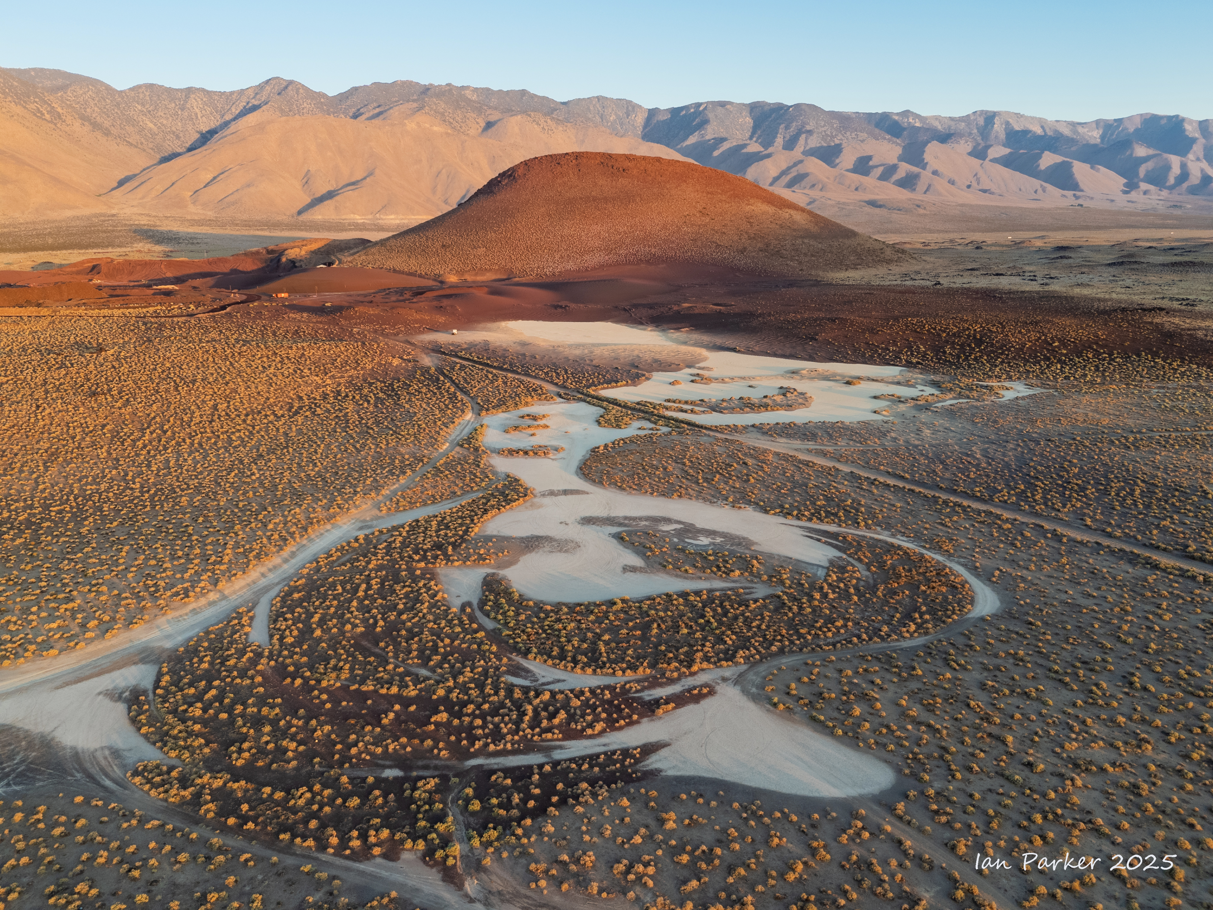
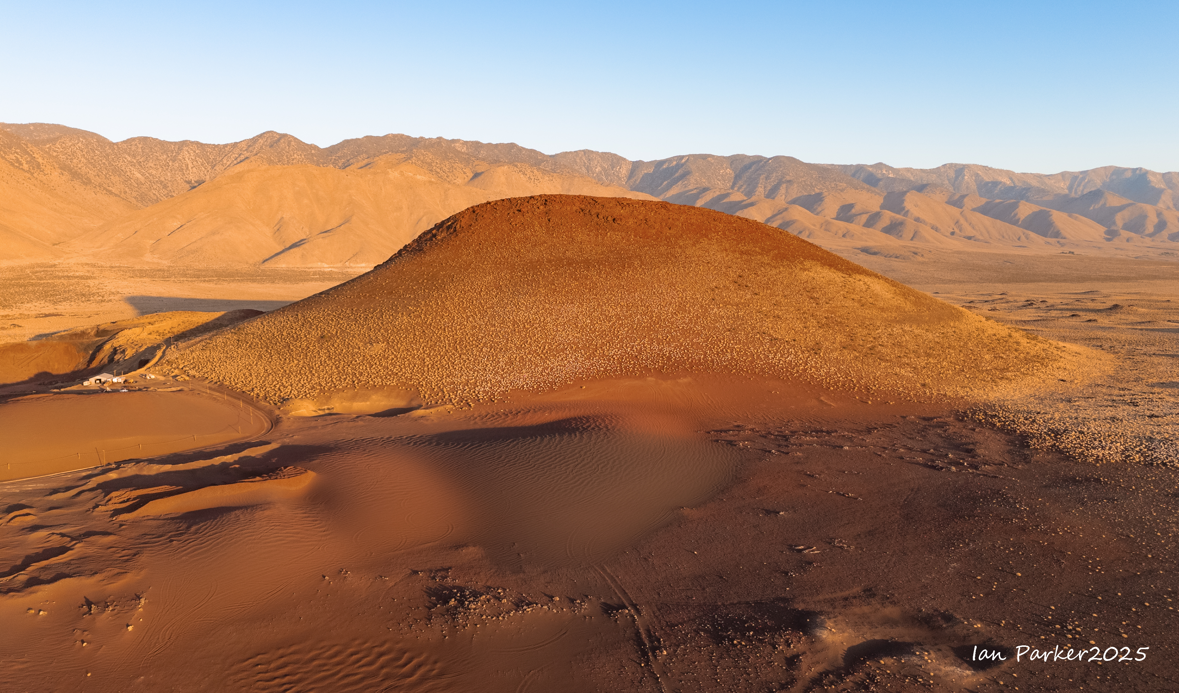
Having acquired a new hobby of astrophotography, Anne and I have been taking regular excursions around the time of the new moon to dark sky locations far from the marine layer that obscures our view of the stars at home. The Mojave desert is a good place for reliable dark and clear skies, but in summer it gets forbiddingly hot once the sun has risen. Thus, we have been venturing further afield to higher and cooler elevations, driving up highway 395 through Owen’s valley toward Mono Lake. For astrophotography this area boasts Bortl1 skies, about as dark as it is possible to find in the lower 48 states. Moreover, the Mono basin holds many interesting locations for daytime landscape photography. One that I had not previously explored is marked by a highway sign a few miles south of Mono Lake pointing to a dirt road leading to Obsidian Dome.
The name “dome” conjures up an image of a rounded, compact dome of obsidian. However, arriving there we foundsomething rather different; tObsidian Dome is actually a 400ft high chaotic mass of volcanic rocks, created by eruptions as recently as 600 years ago, and extending over 5 square miles. The dirt road continues around the perimeter of the dome, where massive blocks of obsidian overhang the steep escarpment, from which large boulders have tumbled down to the forest floor. We parked at a shady clearing between the trees, and I wandered around the base of the dome. At first glance there did not seem to be much photographic promise,
But a closer look among the ankle-twisting jumble of rocks revealed hidden gems...
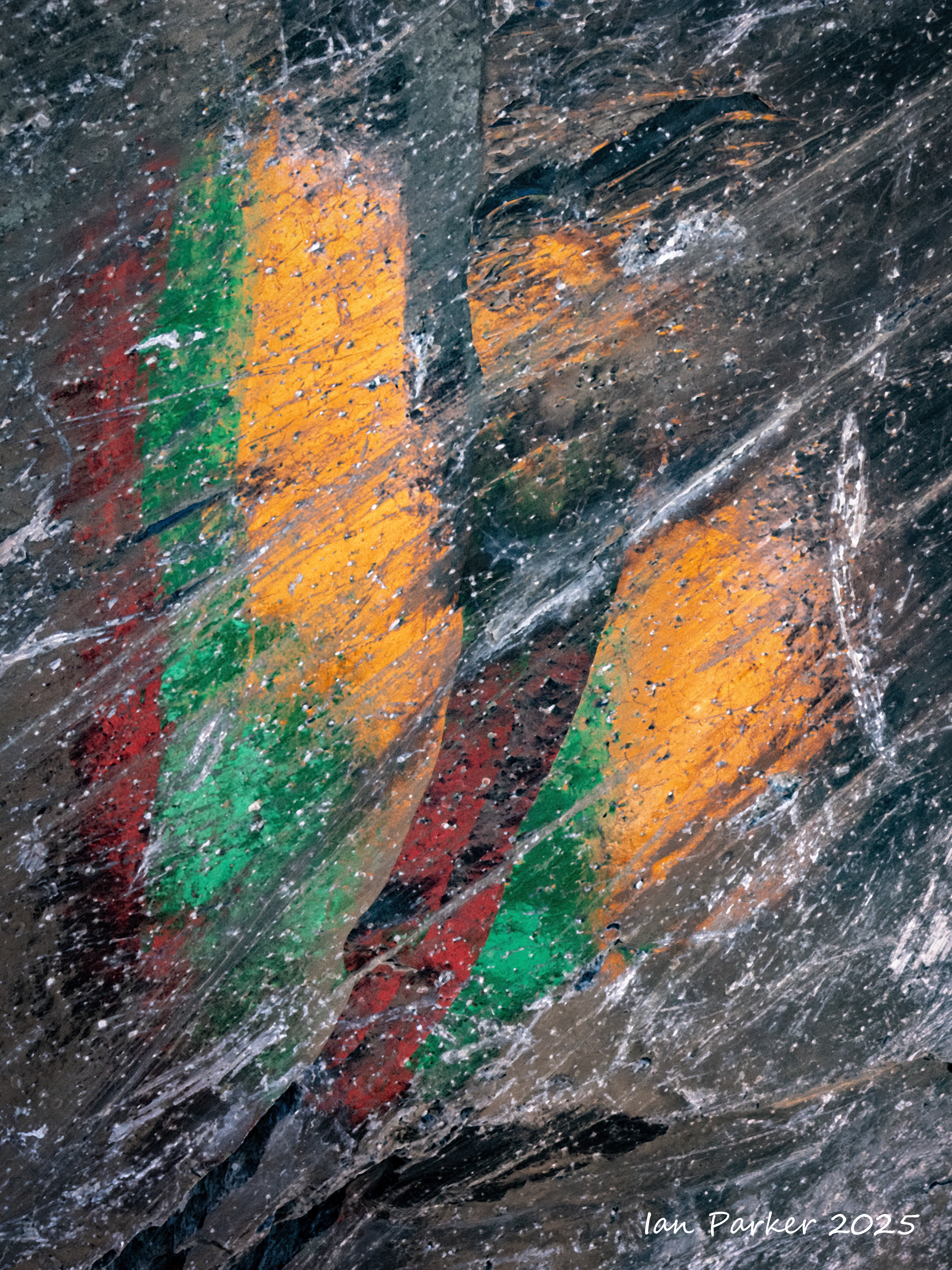
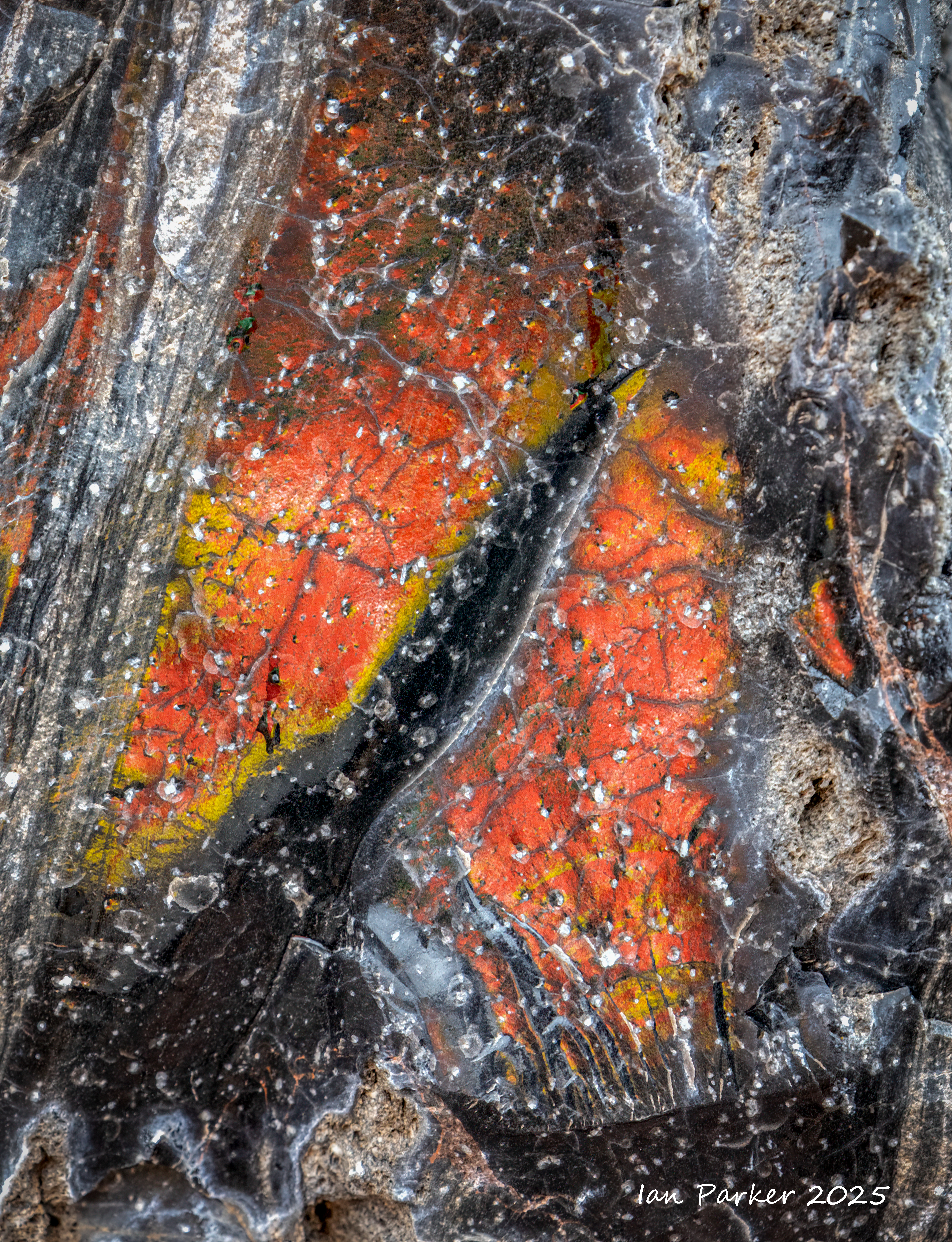
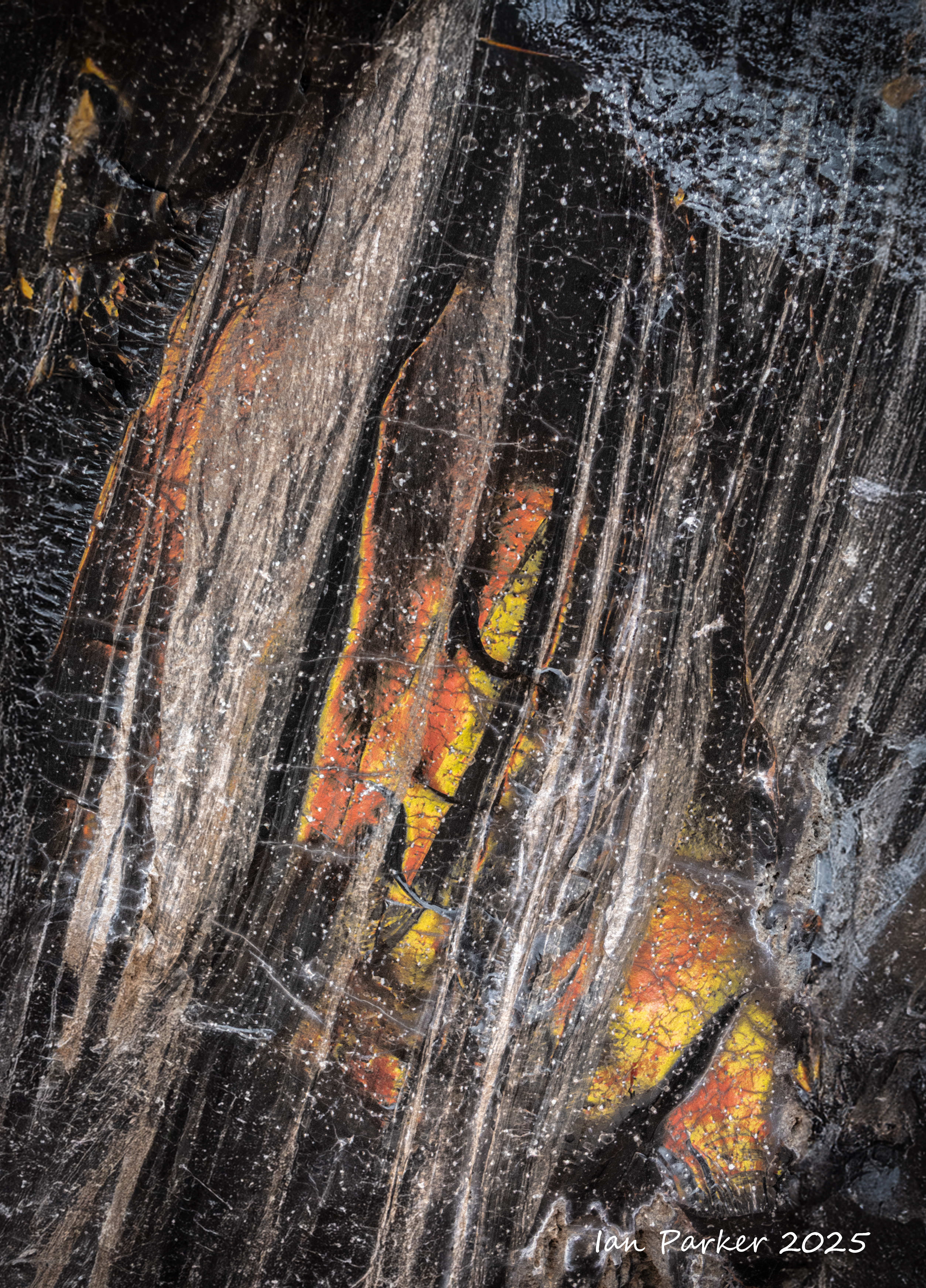
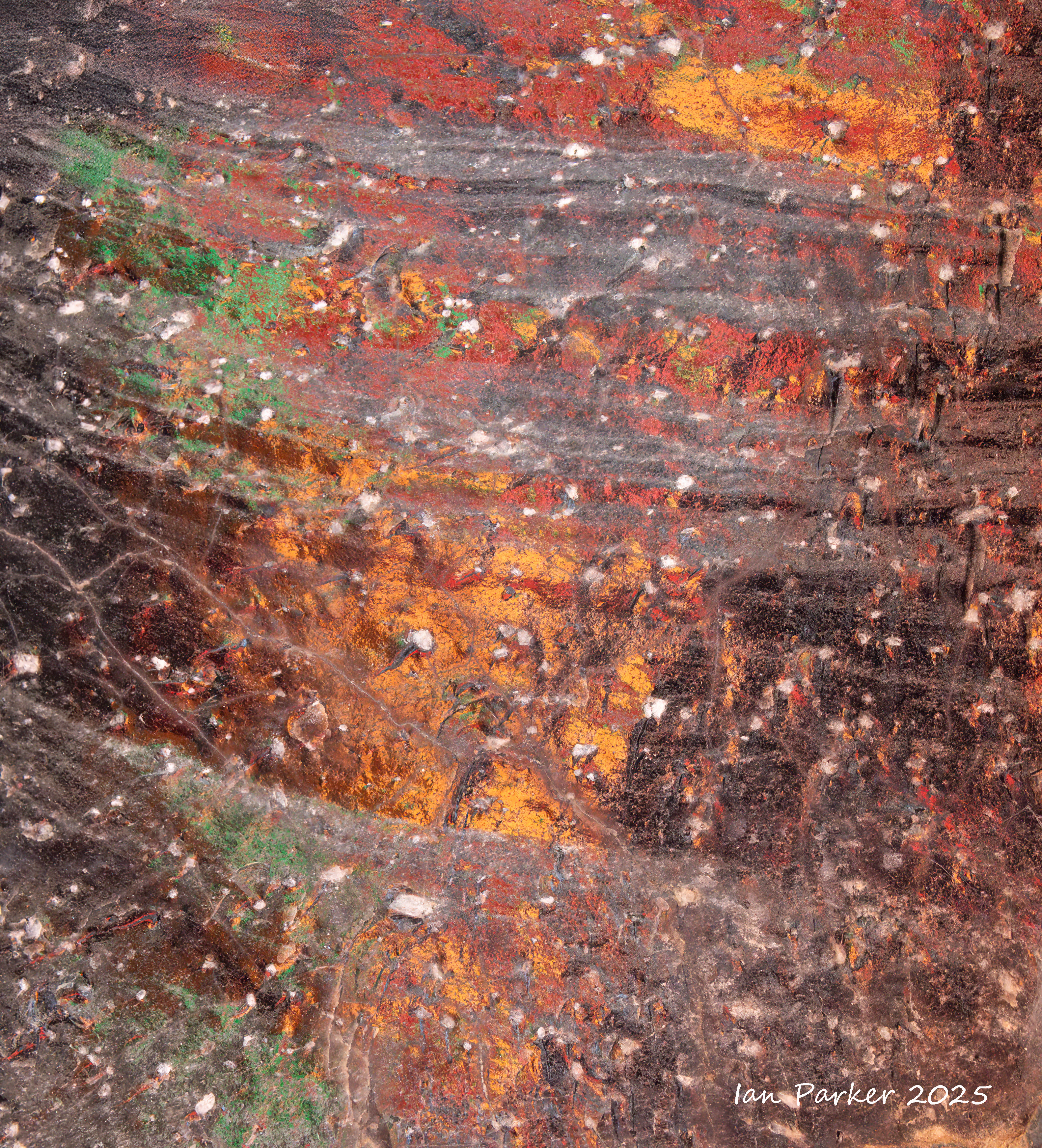
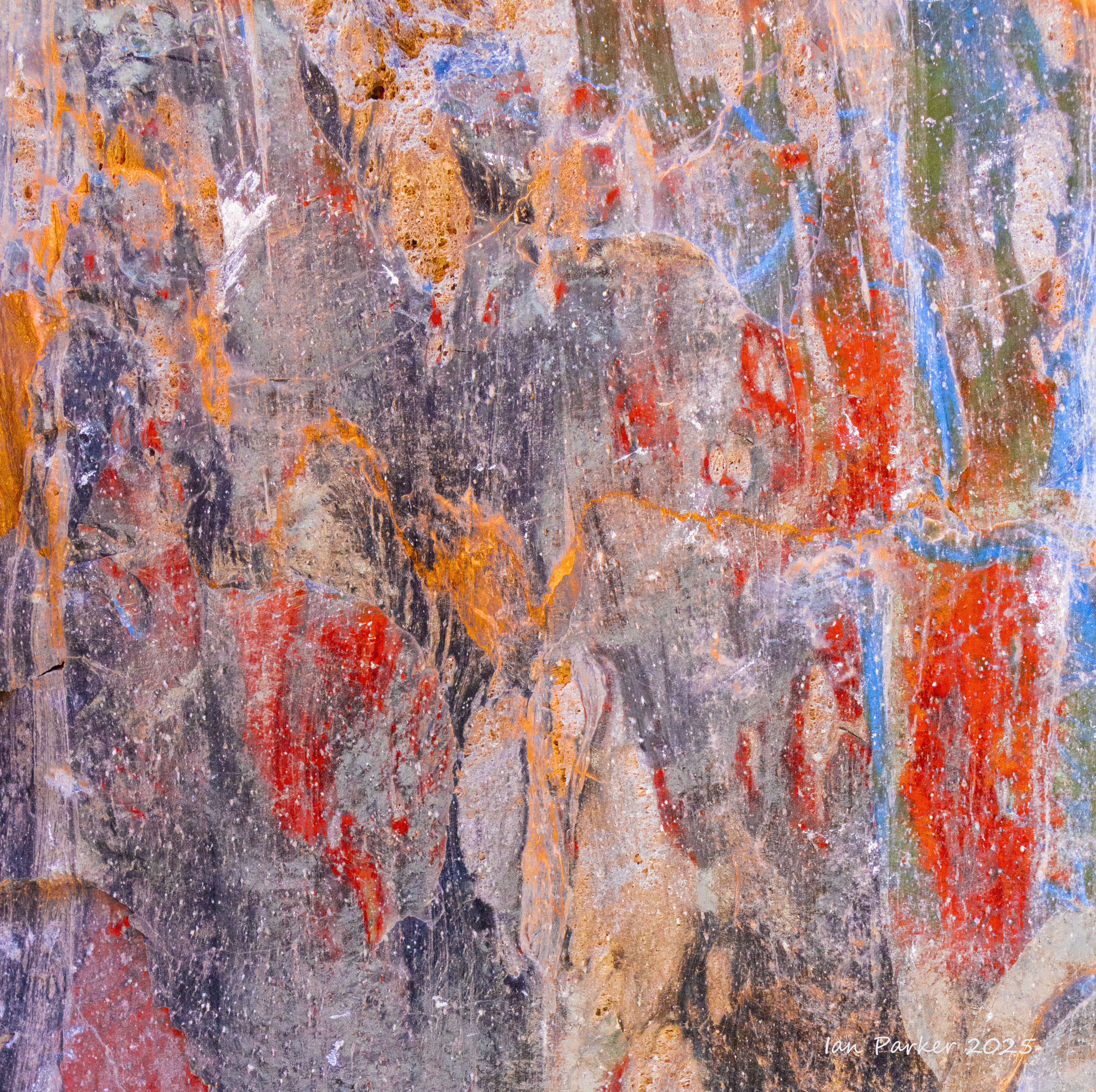
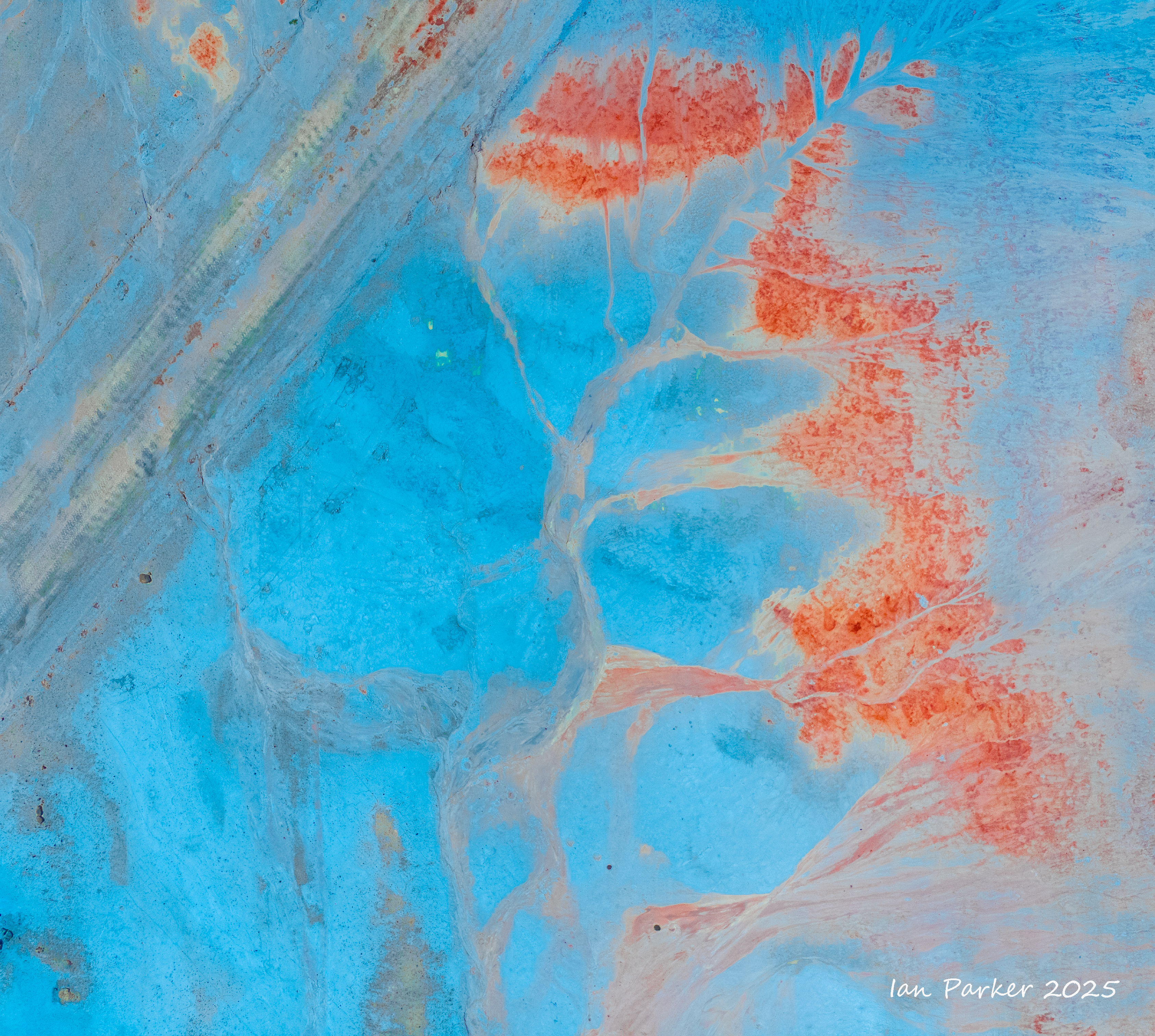
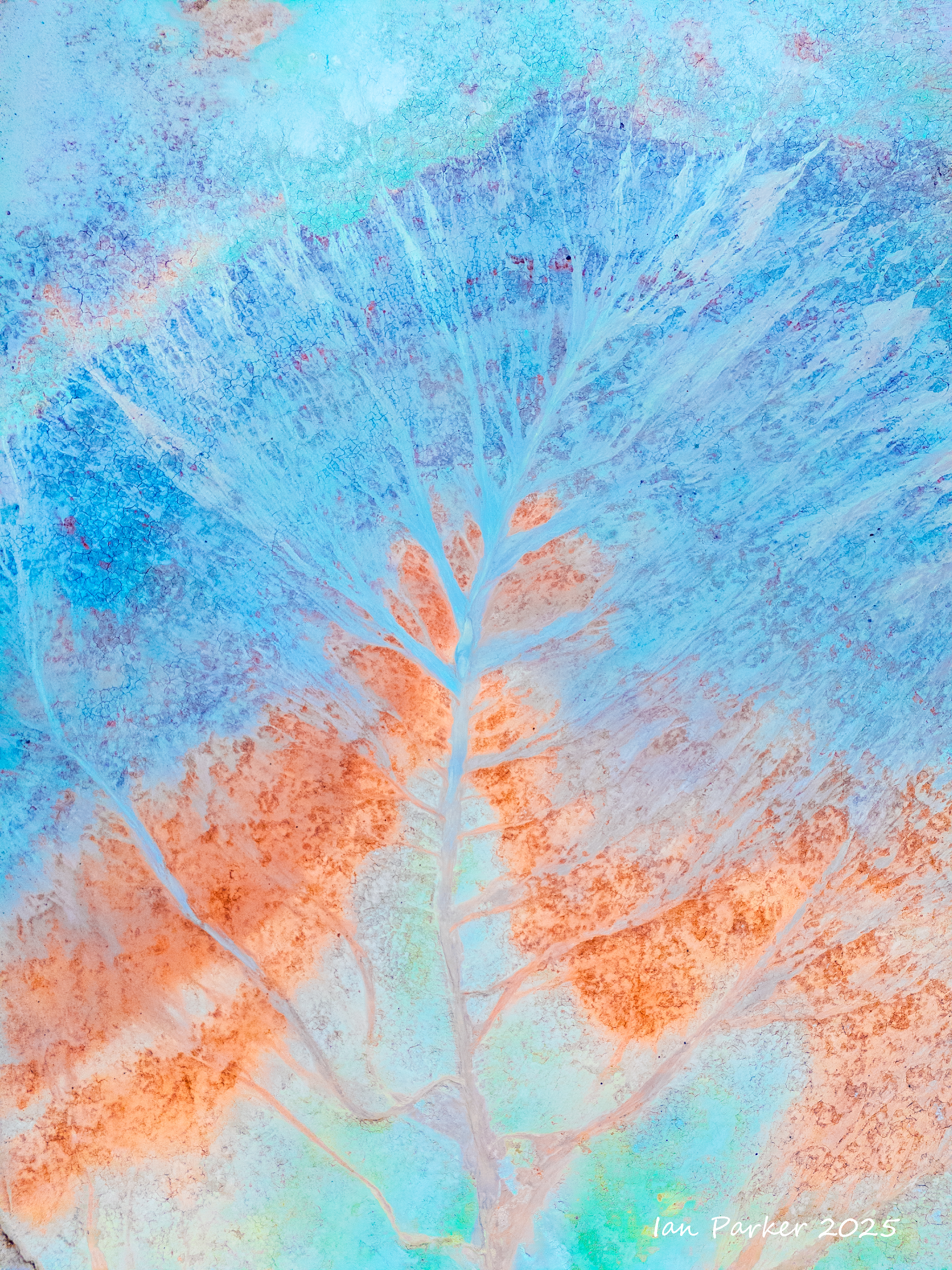
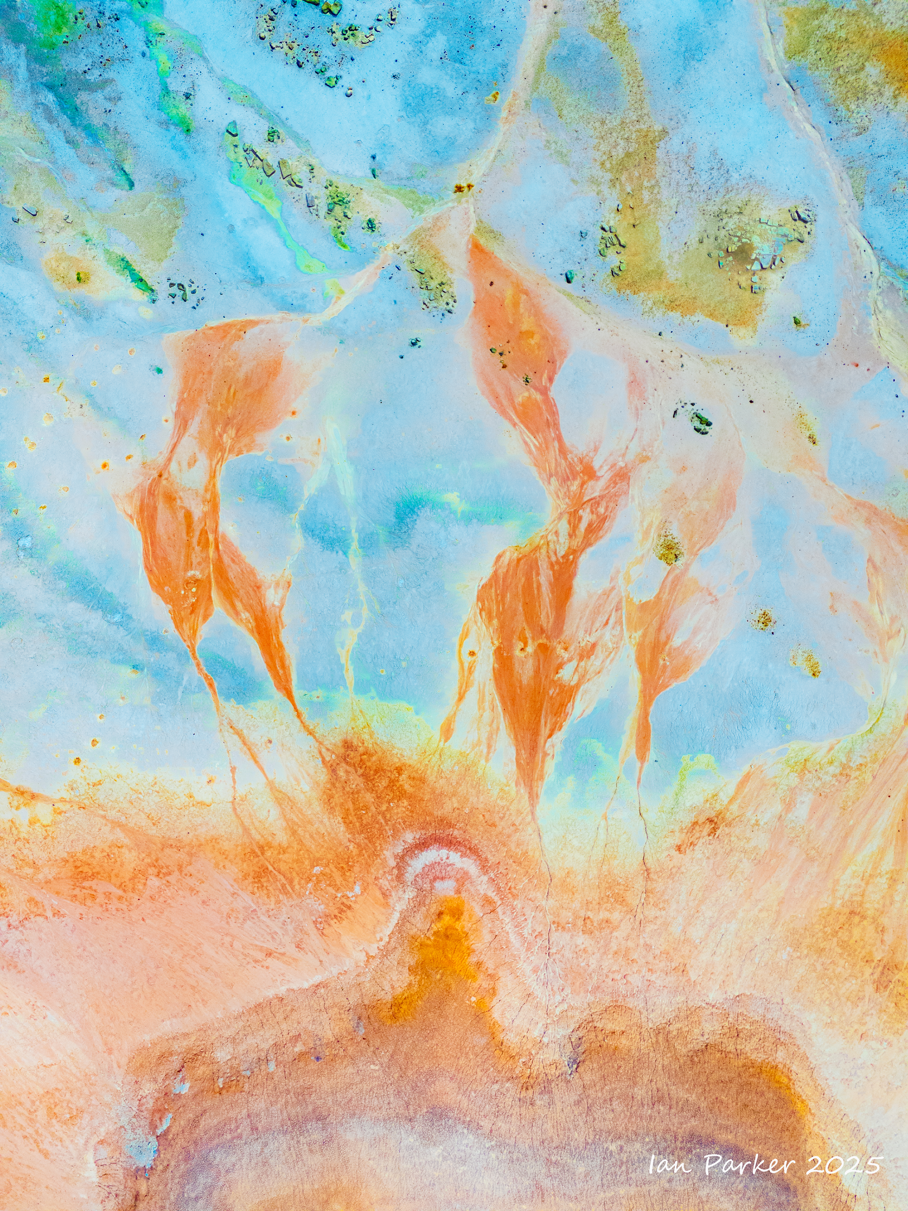
Unlike most rocks that take thousands (or even millions) of years to form, obsidian is created in the blink of a geological eye from lava that cooled so fast that it did not have time to form crystals. It is famous for its jet-black appearance but, despite its dark color, obsidian catches and reflects light in a way that adds depth and intrigue to its appearance. When polished, obsidian achieves a mirror-like finish, and polished obsidian stones (Scrying Mirrors} were used as divination tools by priests and shamans In Mesoamerican cultures for rituals communicating with spirits.
Even in their natural state many of the obsidian boulders at the base of the dome appeared polished and highly reflective, glinting brightly in the sunlight. The sun reflections were too bright and contrasty to photograph, so I crouched down and sought out polished areas on the shaded side of the boulders. There, the obsidian reflected the blue sky in wonderfully varied patterns, determined by the topography the glass surface as it cooled. Unexpectedly, I could also see patches of red interleaved among the blue! Fortuitously, I happened to be wearing a red T shirt that day which, catching the sunlight, threw a bright illumination on the obsidian. The interleaved patterns of red and blue reflections changed kaleidoscopically as I altered my viewpoint, and as I moved to reposition the light source from my T shirt.
The Aztecs believed that the reflections from obsidian mirrors had the power to reveal hidden truths, communicate with the spirit world, and foretell the future. While I don't believe that the images I show here posess such powers, it does seem that I may have stumbled on a unique new niche of abstract photography; Google searches have not pulled up similar images.
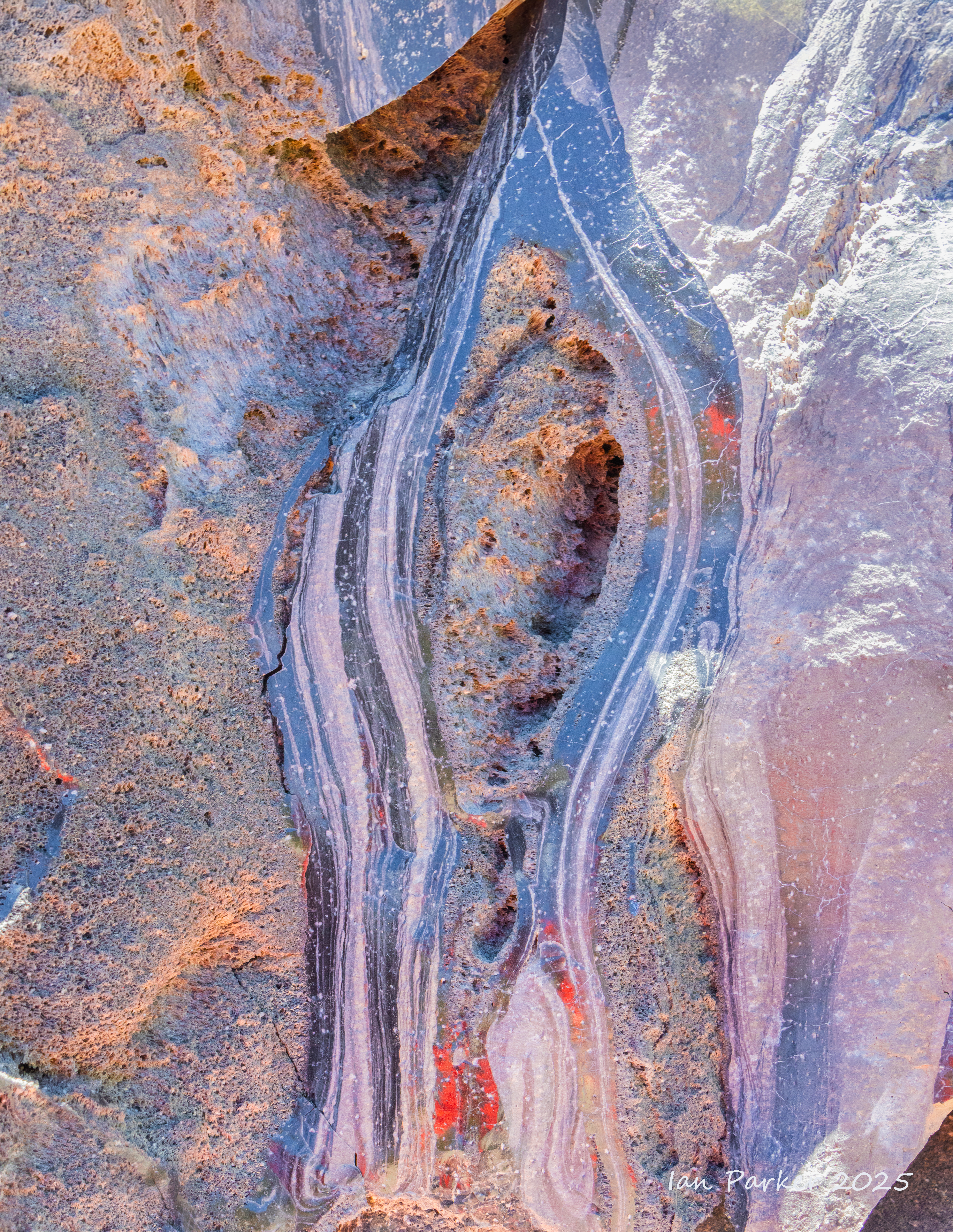
The area around Obsidian Dome has been well picked over by rockhounders, and I was not able to find any small pieces of obsidian among the large, immovable blocks. However, after a strenuous hike to a more remote location at the top of the Mono/Inyo craters I did find a fist-sized chunk of obsidian that evoked some beautiful faceted reflections.
My new interest in astrophotography has taken us to visit dark sky sites, most recently to the area around Mono Lake. Looking for things to do and photograph in the daytime around the lake I discovered an unexpected new interest in things volcanic. Mono Lake is located at the north end of the Mono-Inyo Craters volcanic chain, a 25-mile-long series of volcanoes in eastern California that includes two volcanic islands in the lake, Paoha and Negit, as well as a cinder cone on its shore. This volcanic field is still considered active, and the most recent eruptions in the lake occurred only 400 years ago, forming the islands. The USGS monitors this area for potential future explosive activity.
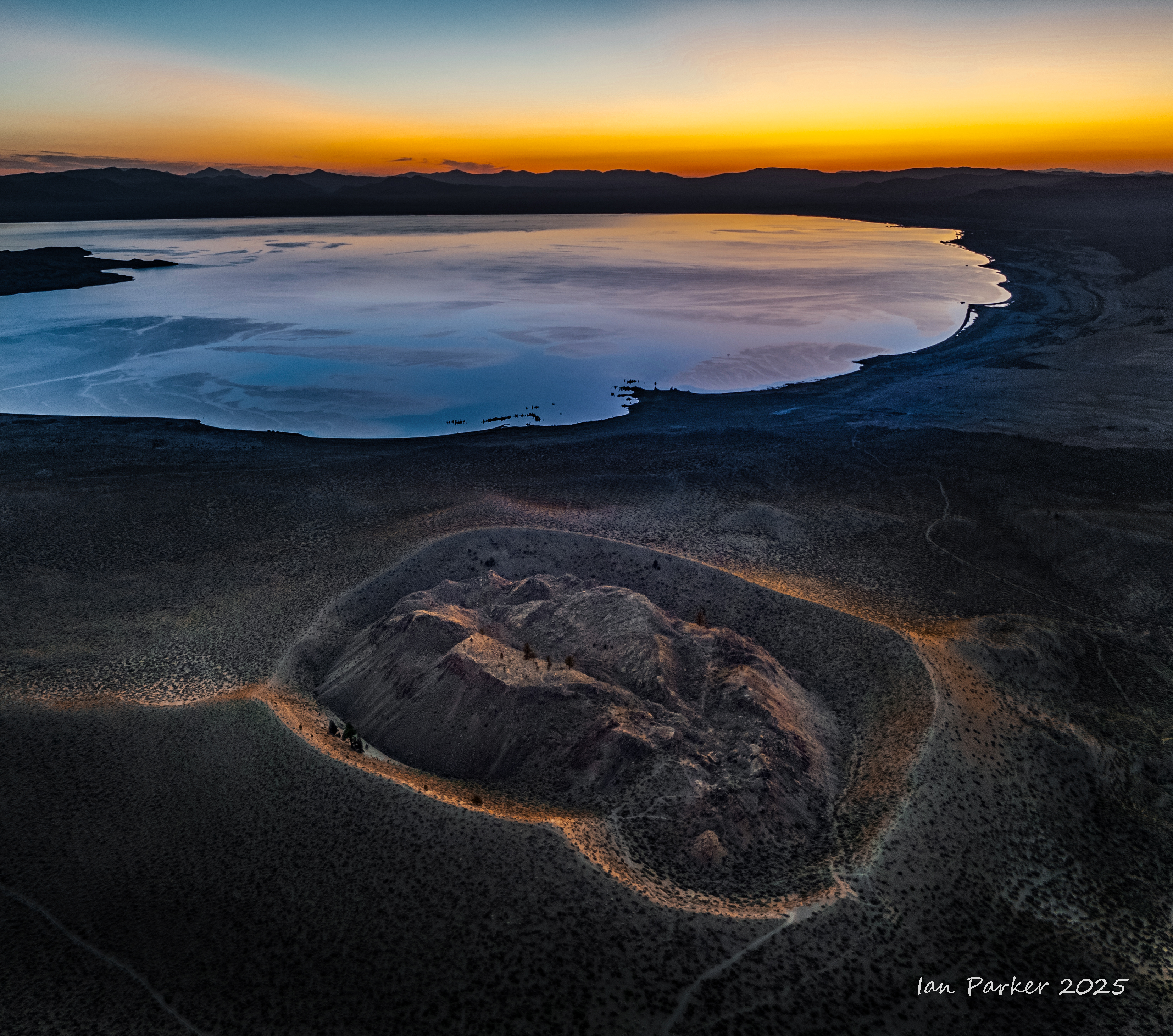
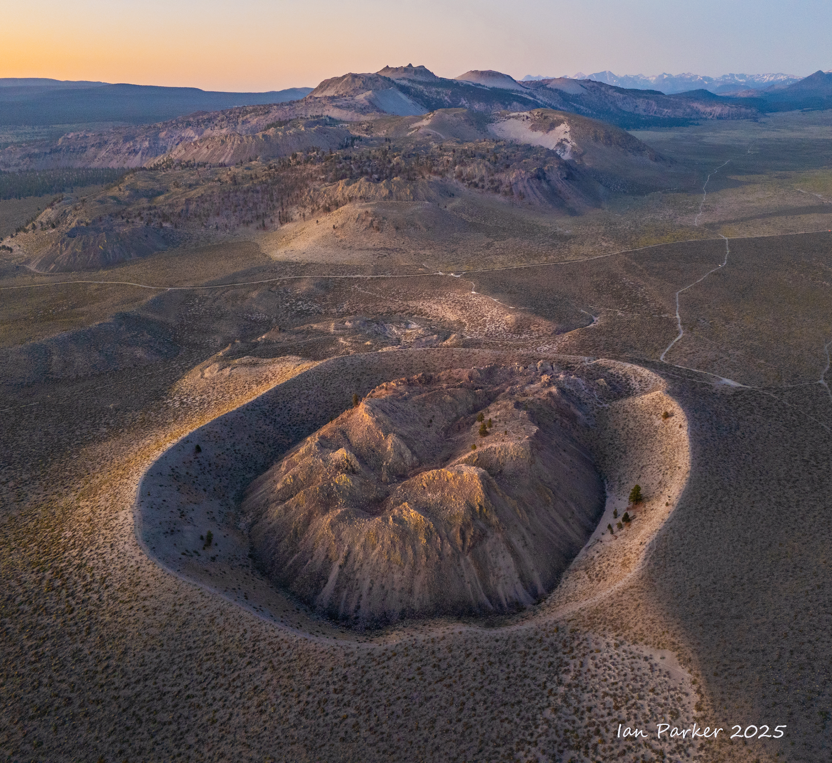
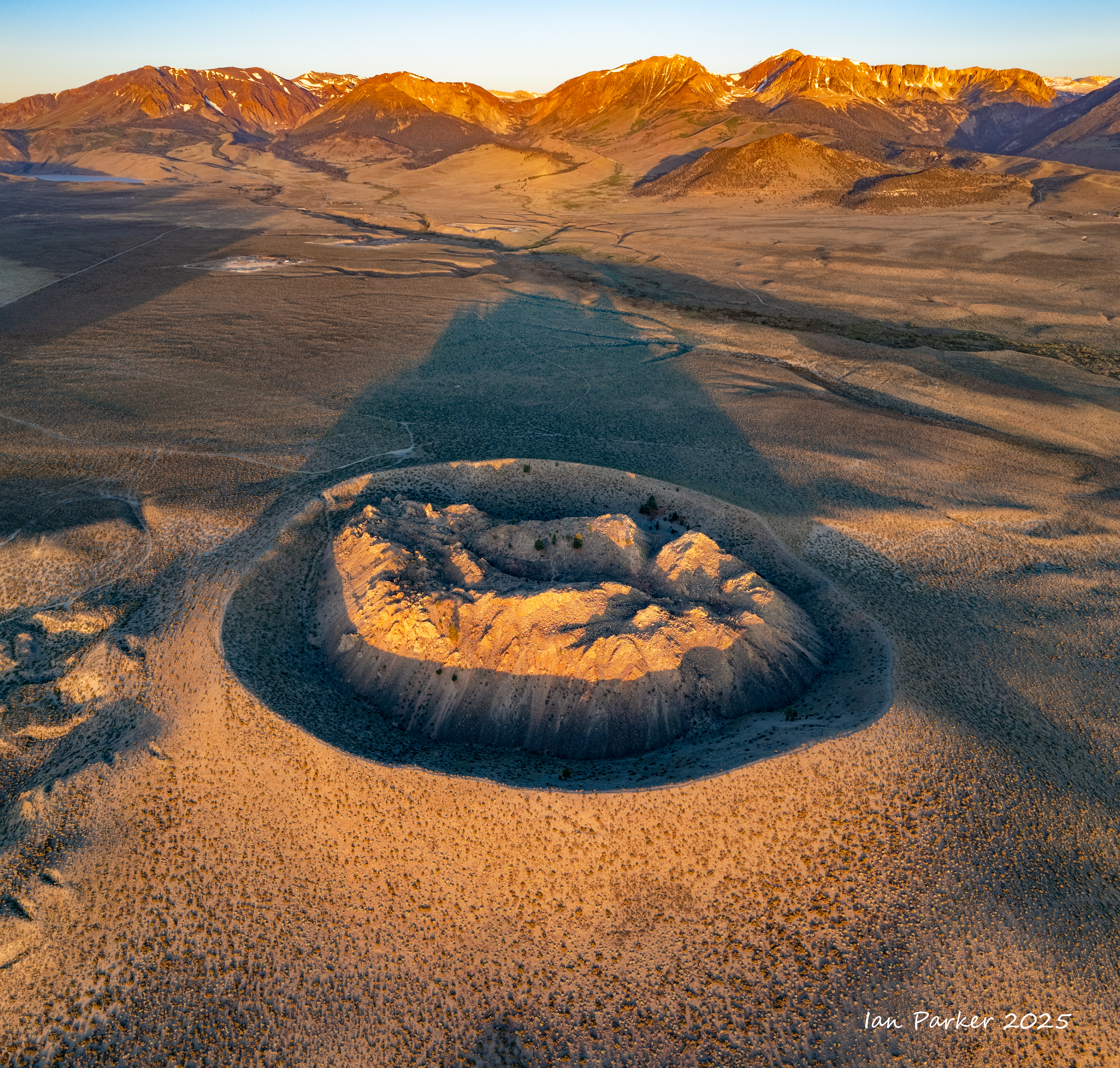
The volcanic areas are rich in obsidian, and in my preceding Photo-of-the-Month I recounted the fun I had photographing colored reflections from the ‘black mirror’ facets on obsidian boulders. For this month’s photo(s) I stepped back to a landscape scale for aerial photography of a volcanic crater. The main chain of Mono-Inyo Craters is too extensive and too jumbled to make a good photographic subject as numerous volcanic eruptions have created a jumble of overlapping craters. But close to the lake there is a single, isolated crater - Panum Crater - which is exhibits an elegantly simple topography with an outer pumice rim and an inner jagged core of obsidian layered with pumice, though it was formed by a surprisingly complex sequence of events…
From Wikipedia: Panum Crater formed about 700 years ago in a sequence of events. The first event was caused by magma rising from deep within the Earth's crust. When this extremely hot, liquid rock made contact with water just below the surface, the water expanded into steam and a large, violent eruption occurred. The material that was thrown into the air by the steam, mainly old lake bottom sediments, was deposited around the new vent in little mounds. So much debris was blown out that a gaping crater was left behind. Once this debris was blown out, a fountain of cinders shot up a great distance into the sky. As this huge amount of ash and pumice began to fall back, it formed a pumice ring, or cinder cone, about the original vent which is still visible today. Following the violent eruptions of the first two phases, the remainder of the thick magma slowly rose to the surface in a series of domes. Each dome began with an outpouring of the viscous, rhyolitic lava which hardened and formed a cap over the vent. As magma continued to push up, the cap (or dome) shattered and fell to the outside of the newly formed dome. This happened so many times that a new mountain was created out of these broken pieces. The mountain continued to build in this manner until the force within the volcano weakened and no more new domes formed. The final one still stands today.
A well-trodden trail gives access into Panum Crater. A steep climb from the parking lot leads up to the rim, from where there are two alternative paths. One circumnavigates the rim, while the other drops down before climbing up to the central, jagged dome. However, neither really gives a good impression of the structure of the crater. You have to mentally piece together views from different sections of the trails to get an appreciation of how it would look from the air.
Well, I had my drone with me on this trip, so I could take an actual aerial view!
An early morning flight around sunrise seemed the best time, both for colorful low angle light that would accentuate the topography and to avoid annoying other visitors. We thus camped out for the night along a dirt road close to the crater. Rising at 4:00 am I hiked in the dark to be at a high point on the dome at first light. The camera on my Mavic 4 mini drone is remarkably sensitive, so I was able to fly well before sunrise, and took my first photos with the drone positioned to the west of the crater, looking across to Mono Lake. An orange glow in the sky heralding the sunrise cast diffuse illumination on the crater, while the lake reflected the blue sky above. In the RAW file from the camera the foreground and crater appeared very dark, so I needed to raise the shadows considerably to create the photo below.
After taking this photo I estimated it would be about a half hour before sunrise, too long to keep the drone in the air without depleting the battery, so I brought it back home, changed to a fresh battery and waited to take off again until a few minutes before sunrise. This time I flew the drone over to the north side of Panum Crater, capturing the photo below while the light was still diffuse just before sunrise, looking across to the chain of the much larger Mono Craters.
Finally, as the sun’s rays first illuminated the crater, I swung the drone around to the east, to align it with the shadow cast toward the Sierra Nevada mountains.
I have made a mental note to come back and shoot this scene in winter, when the Sierras are snow covered, and perhaps when snow may also enhance the topography of the crater.
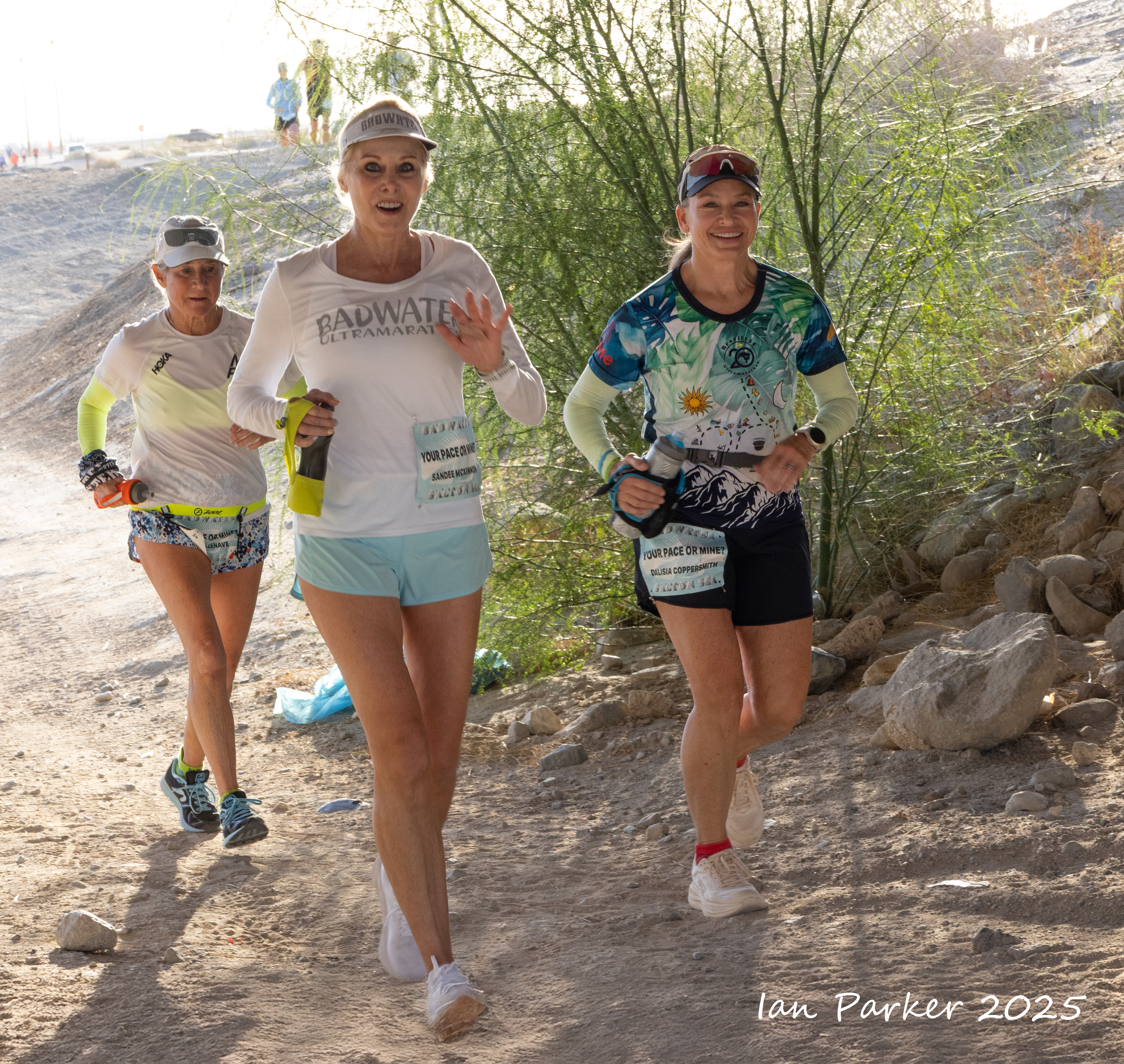
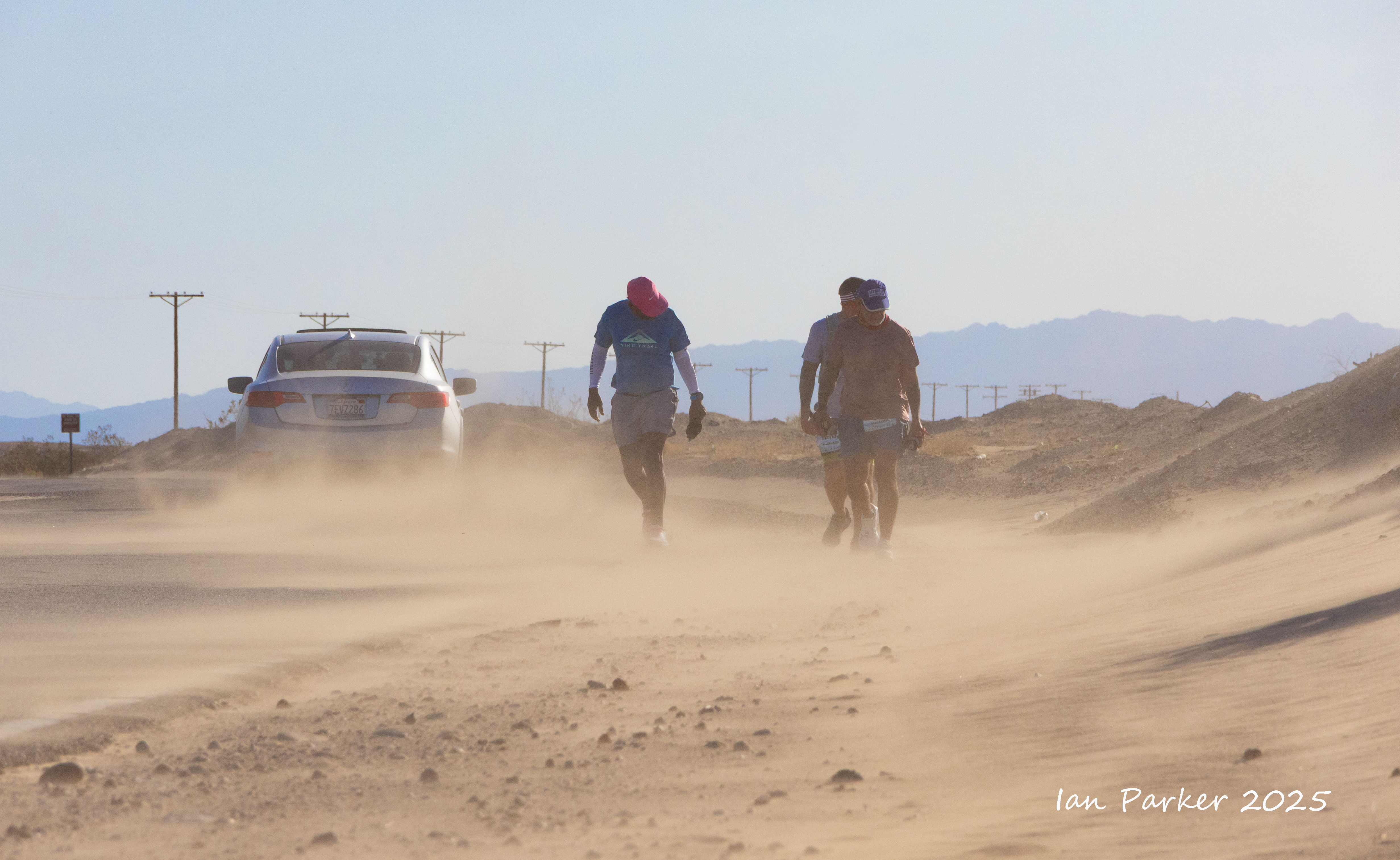
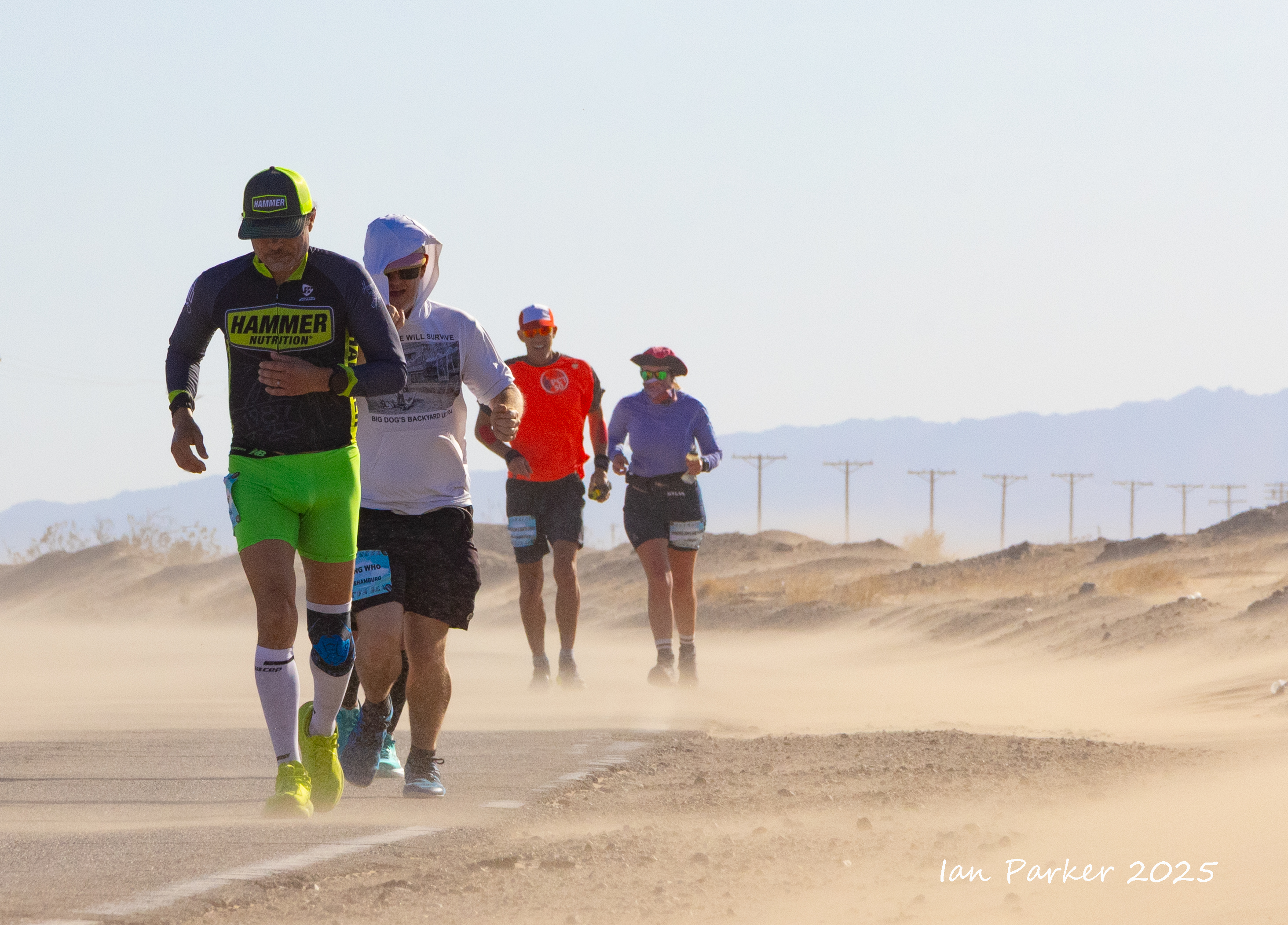
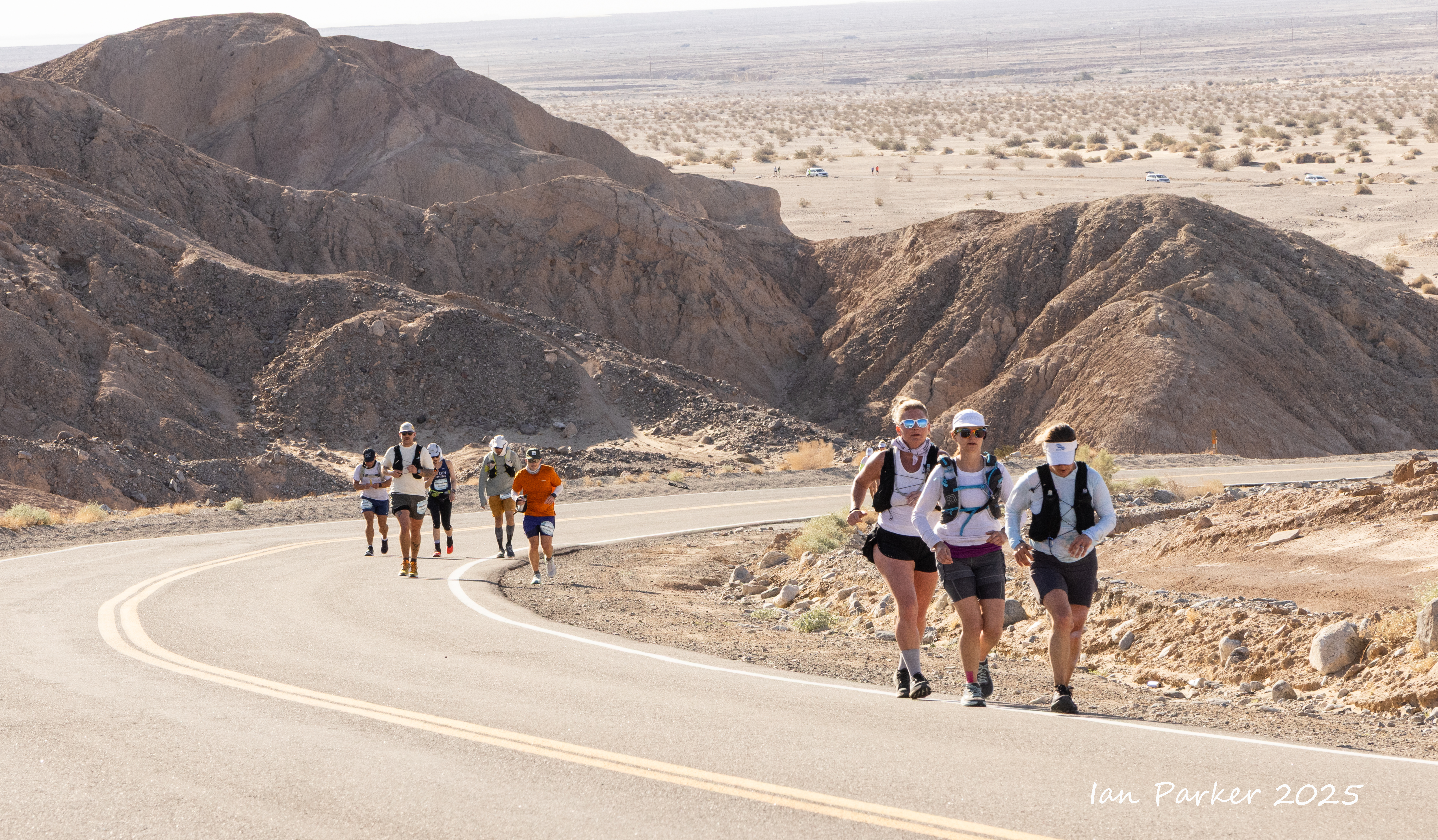
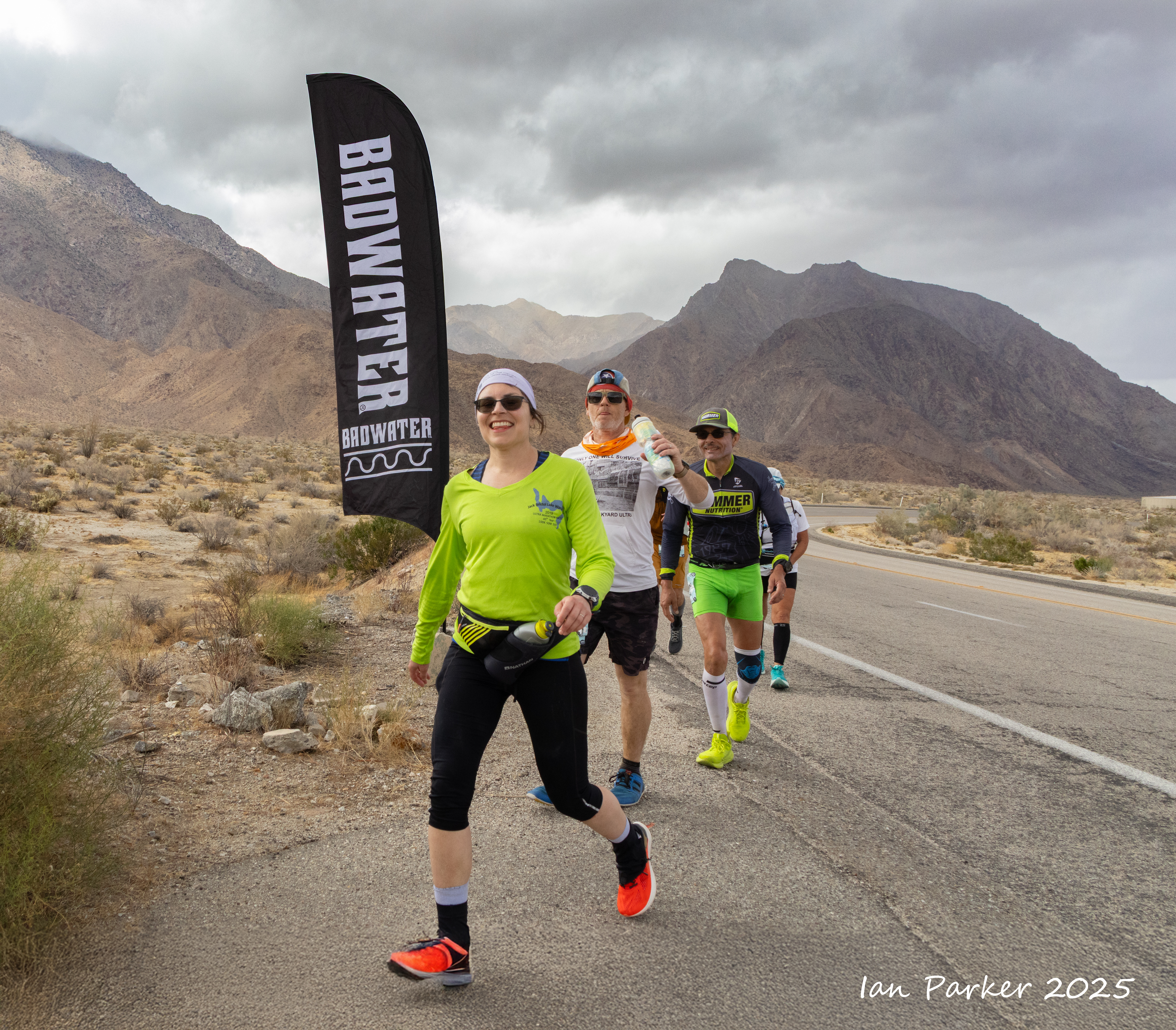
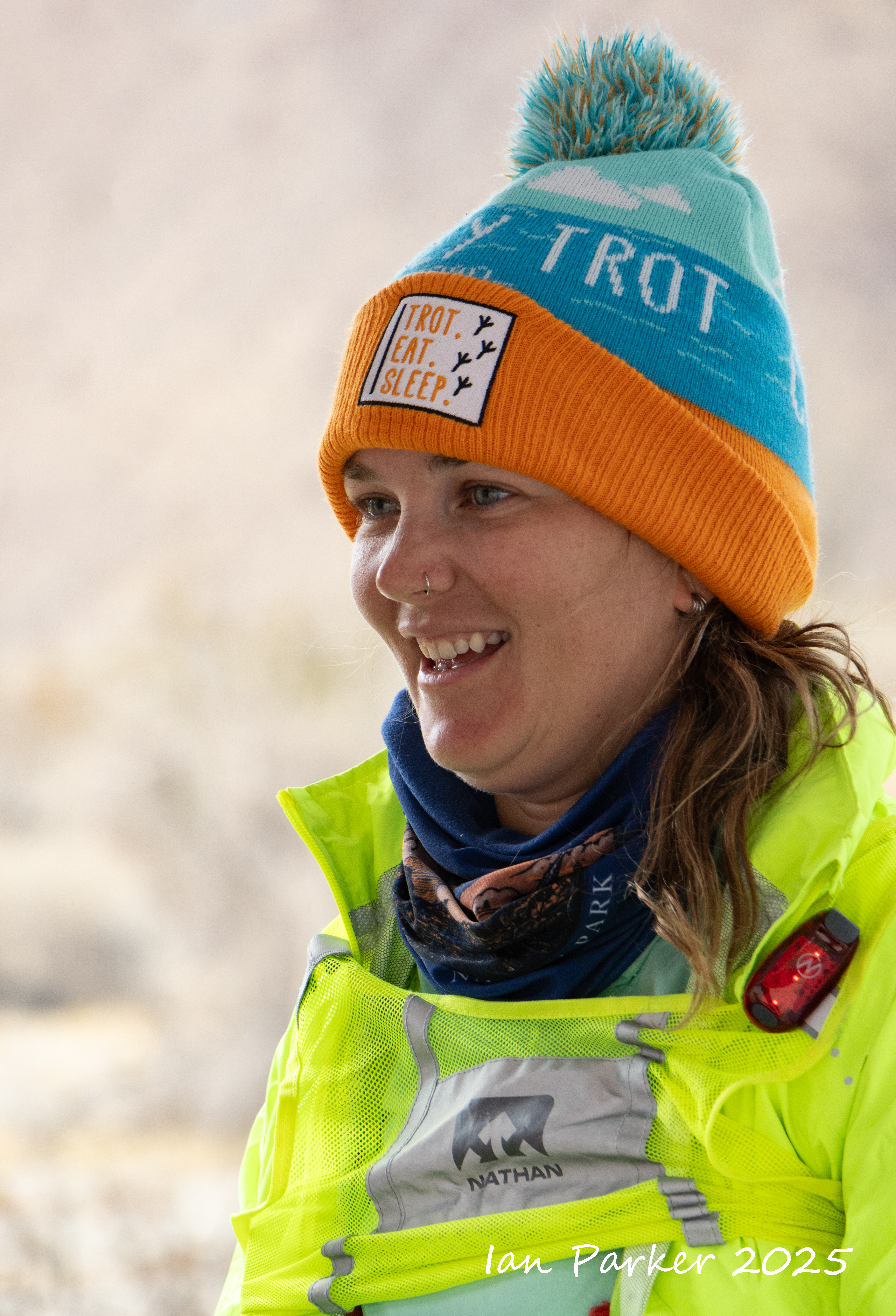
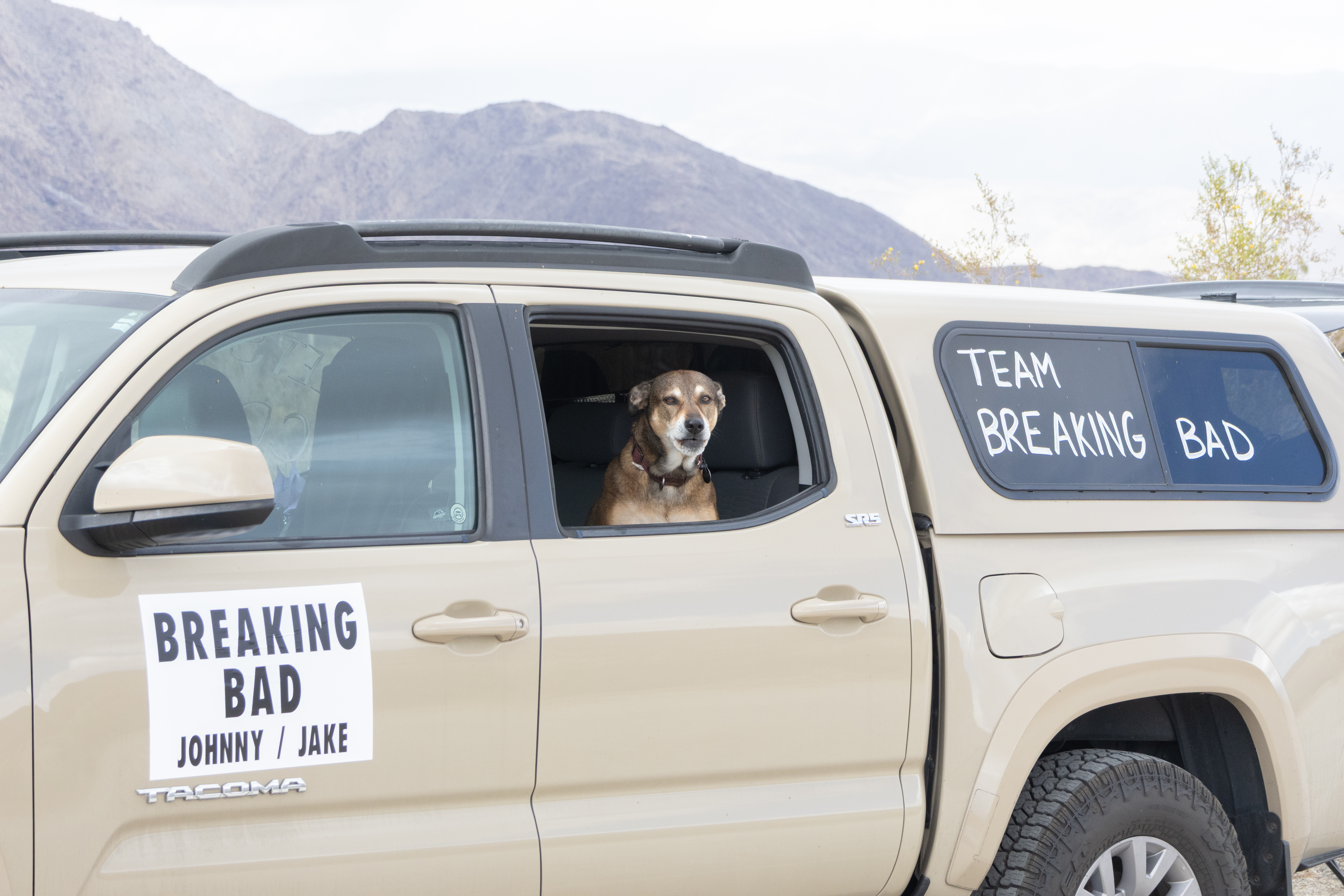
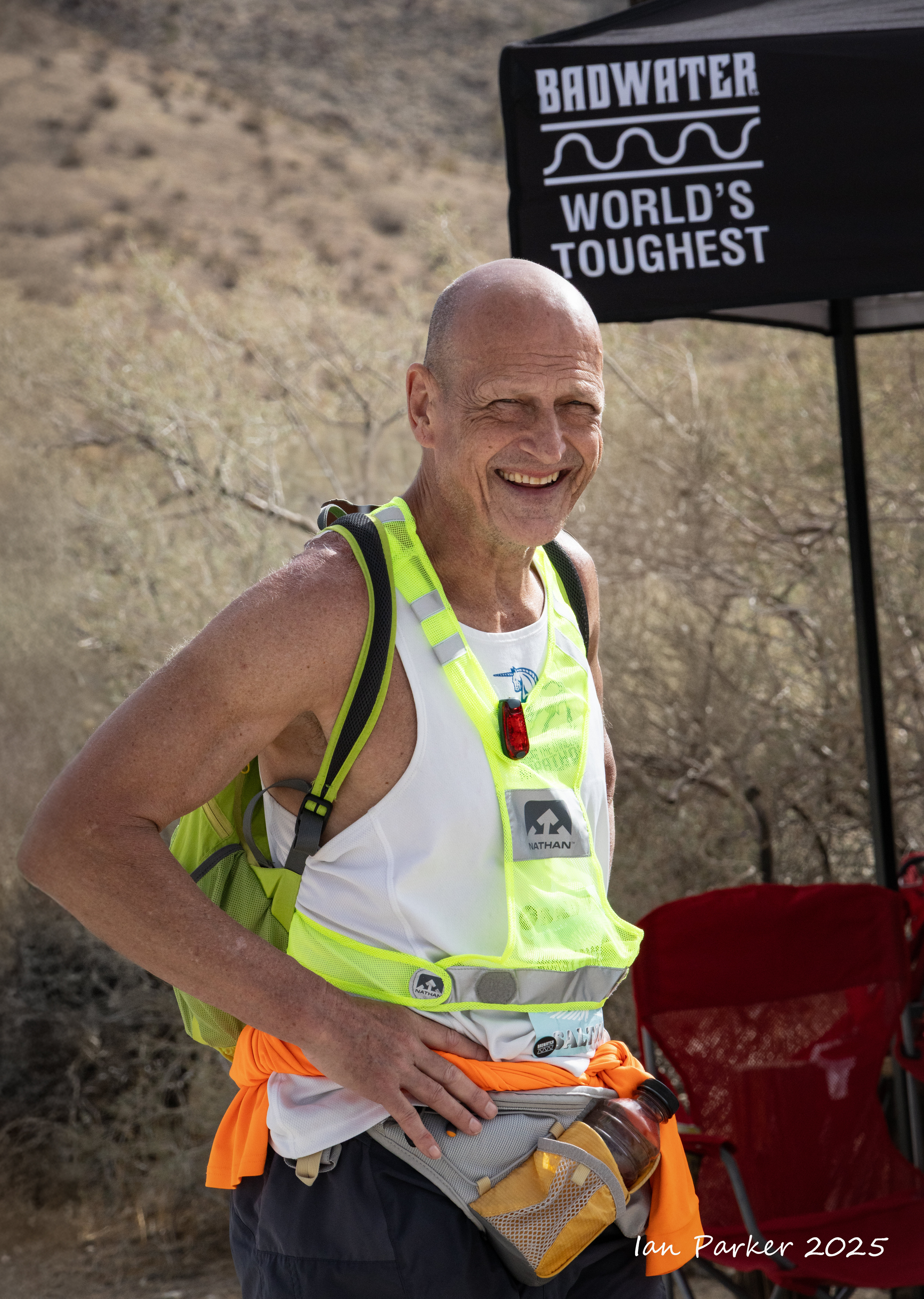
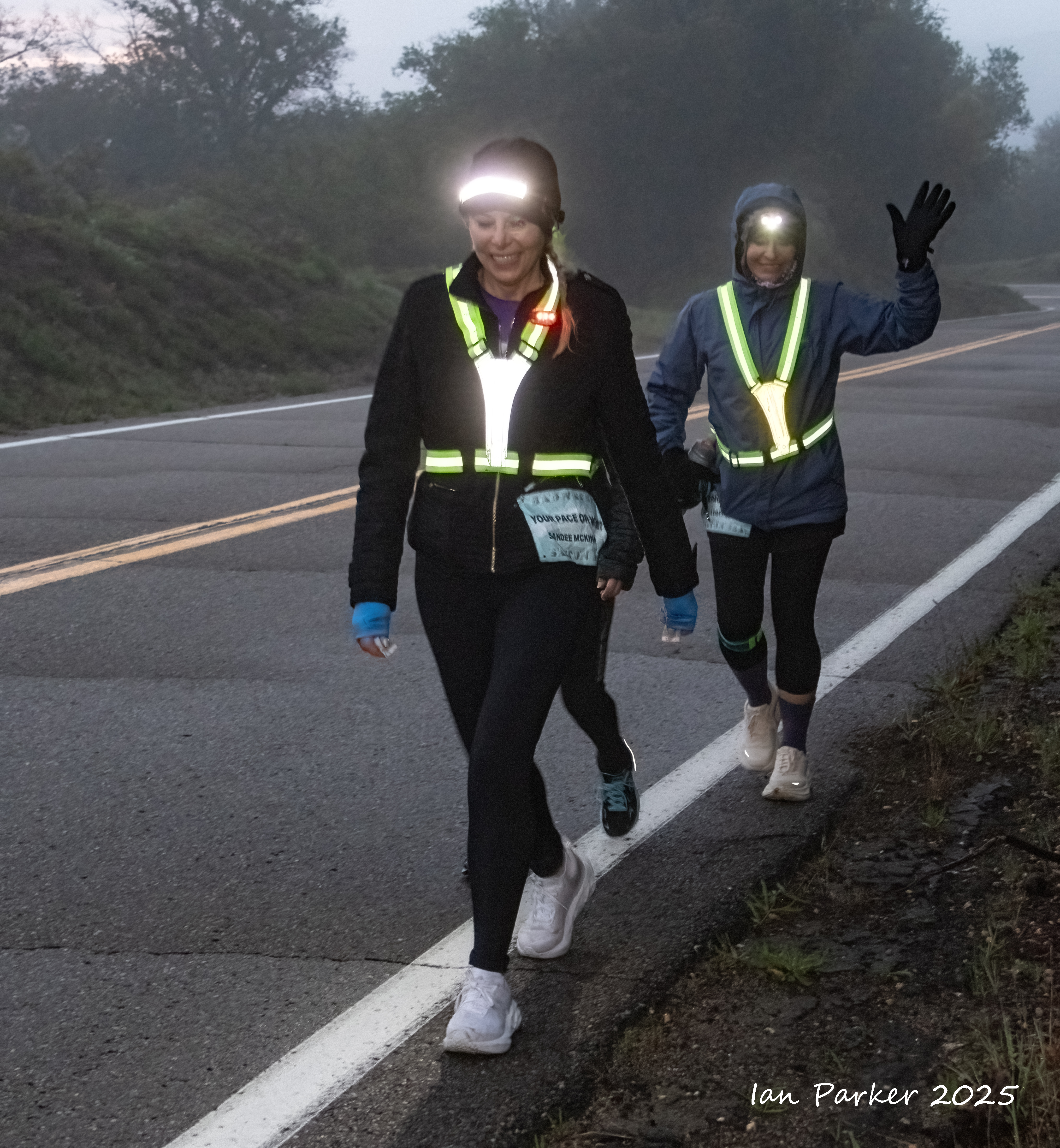
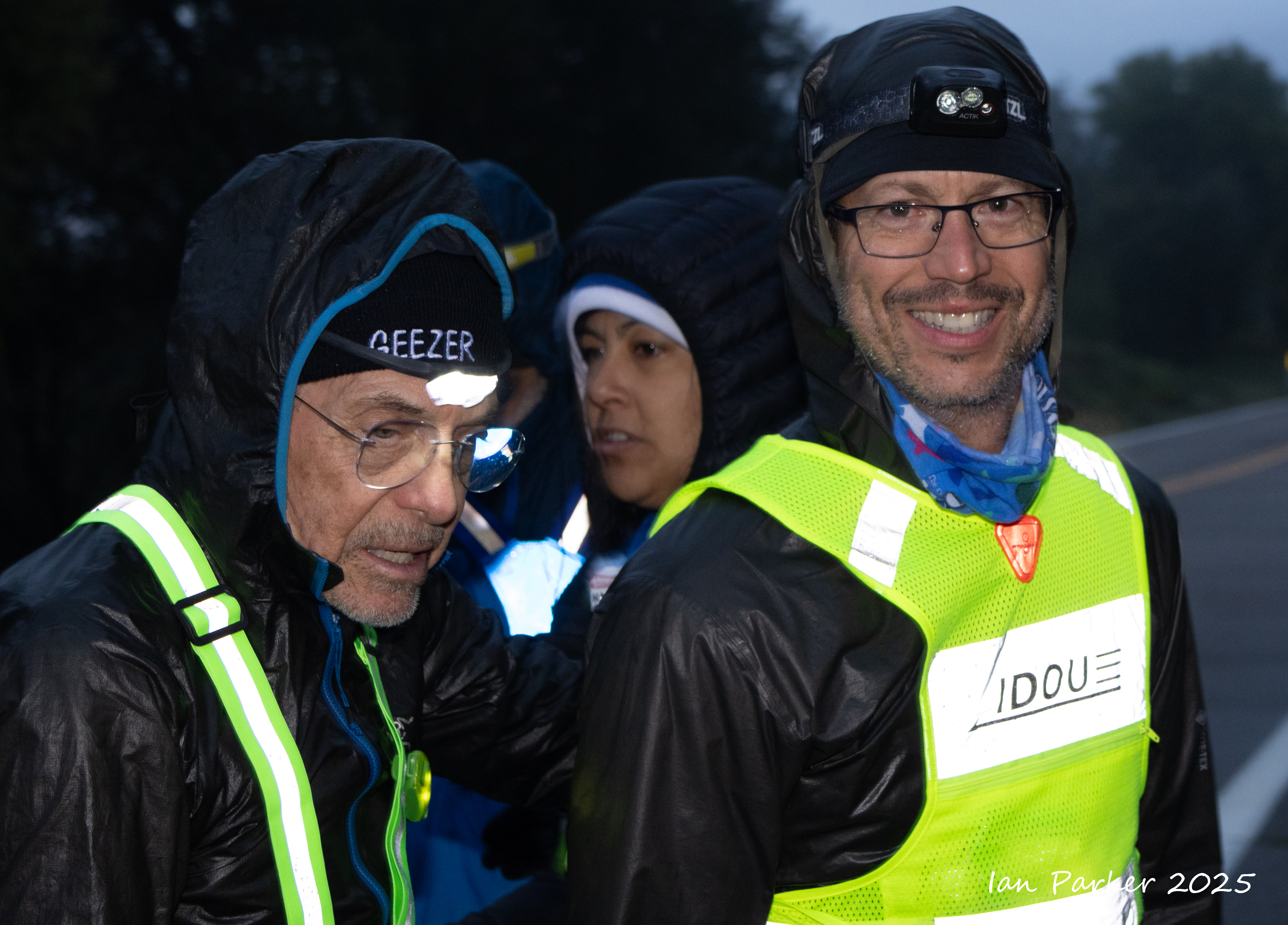
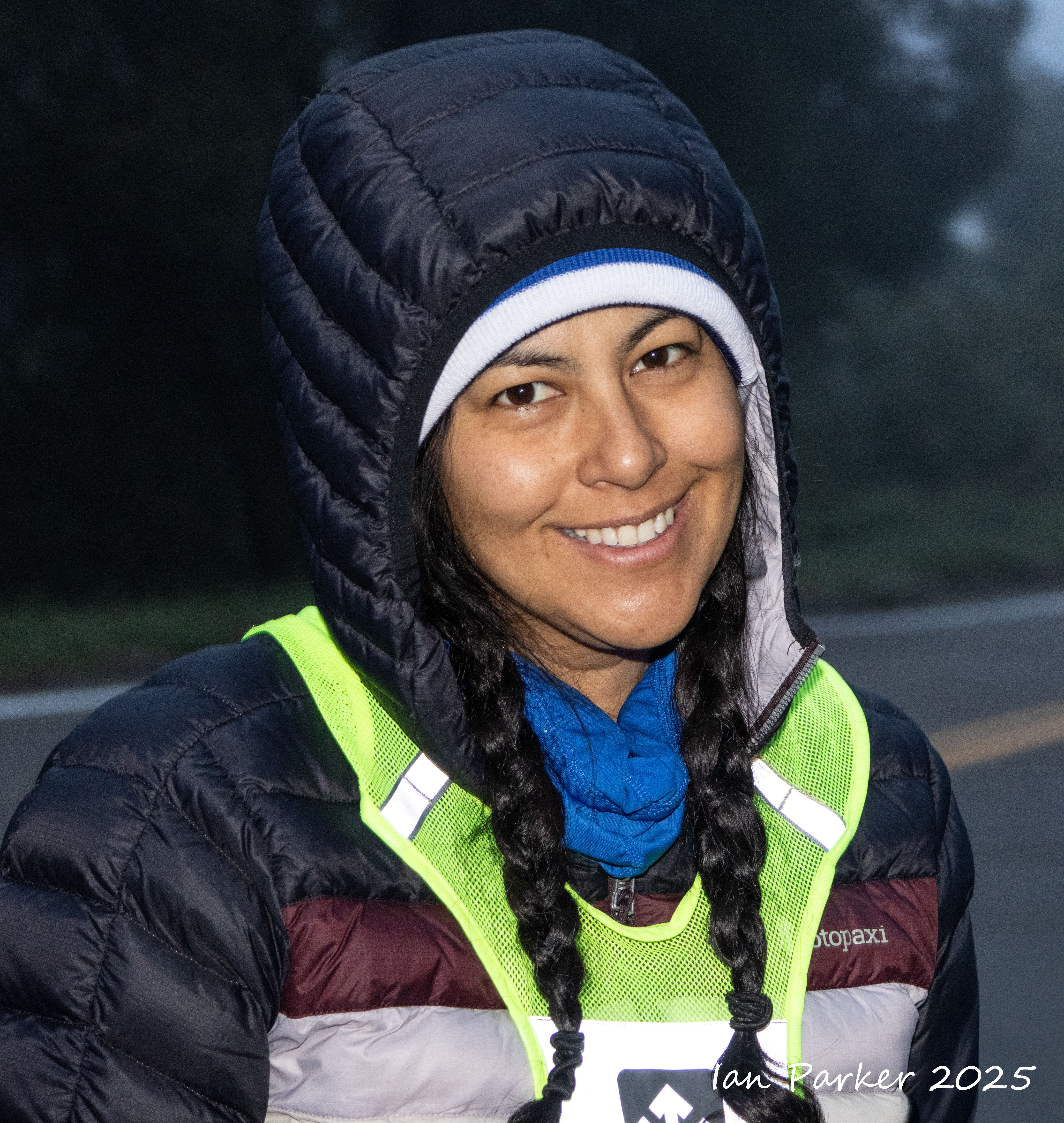
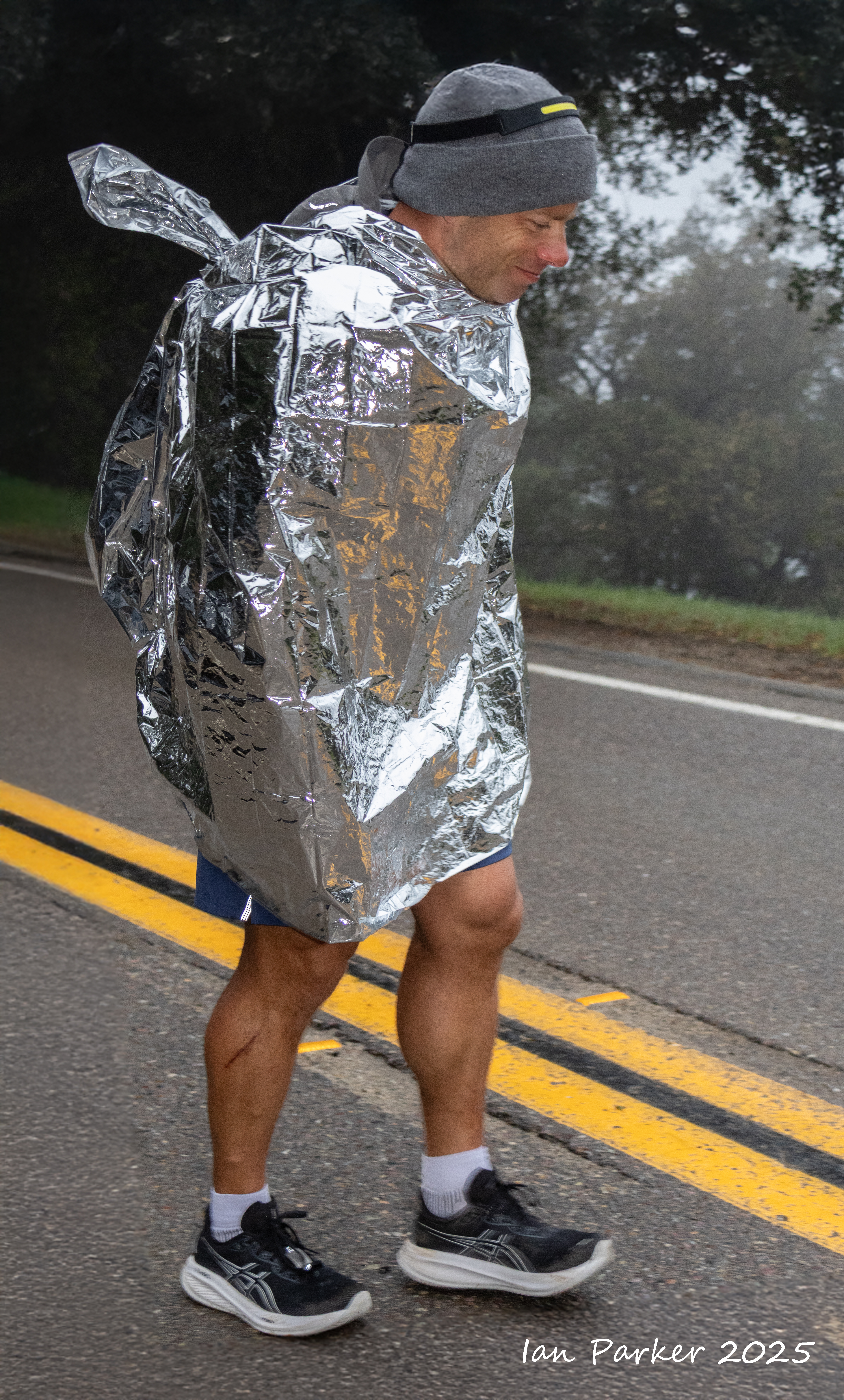
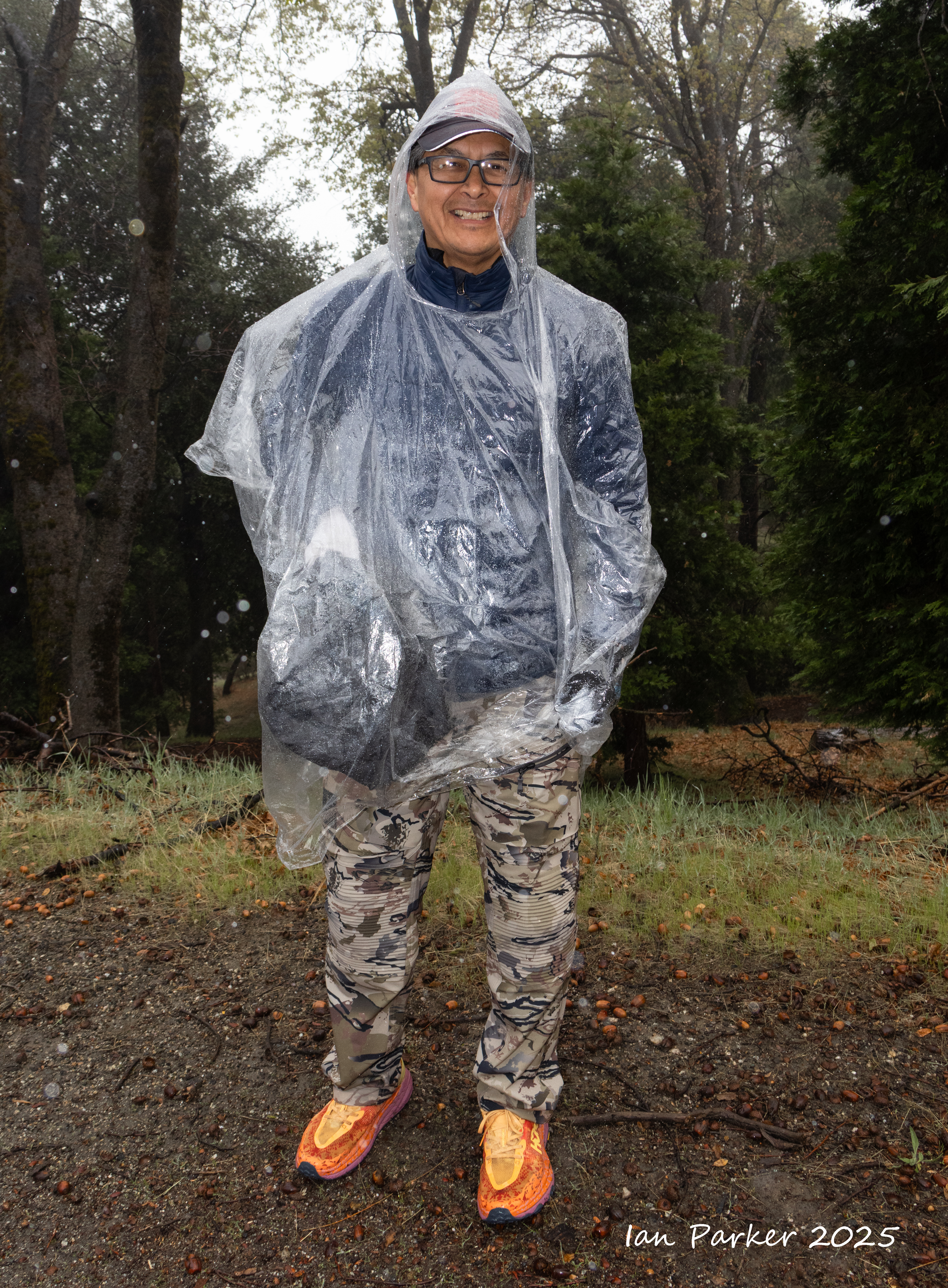
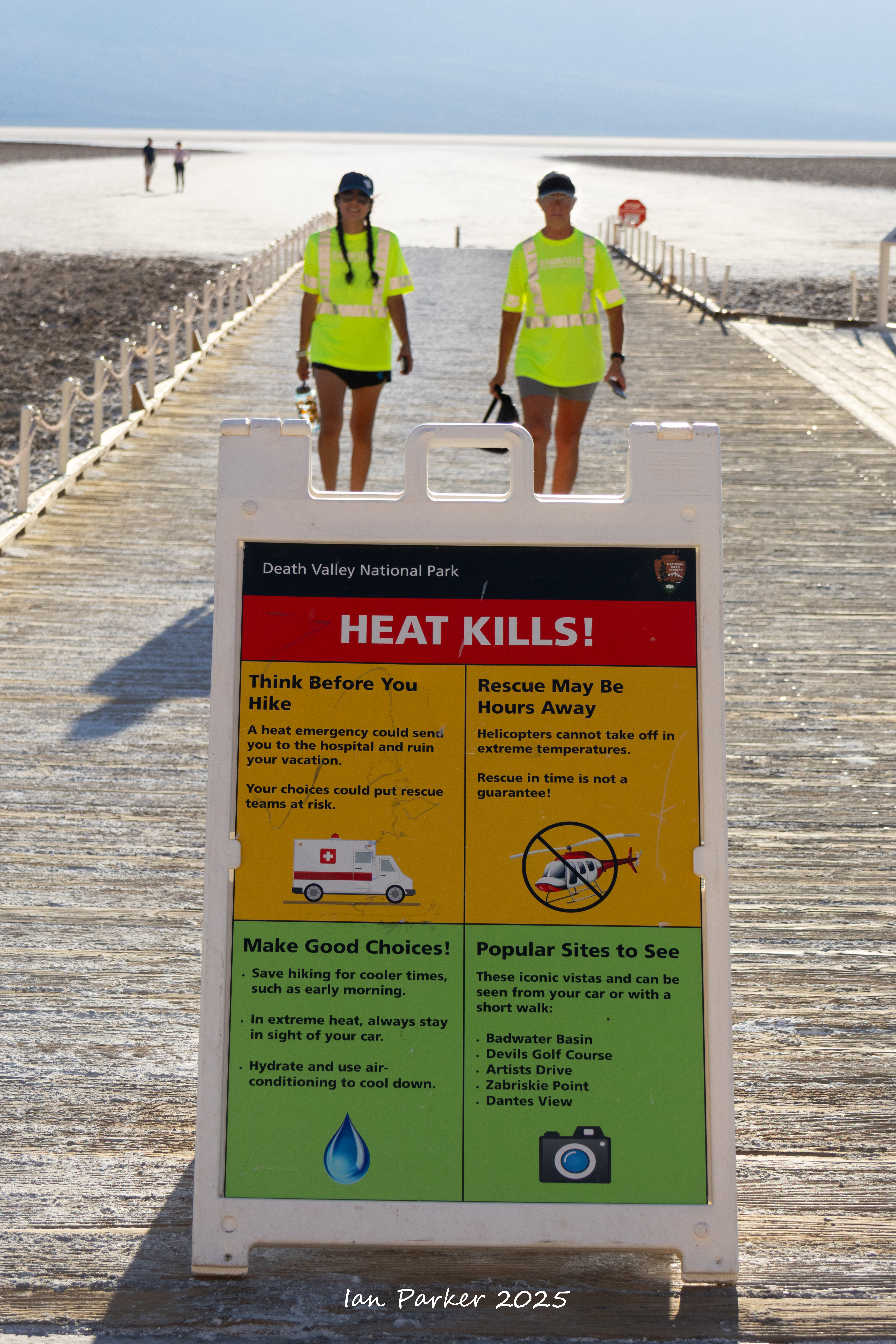
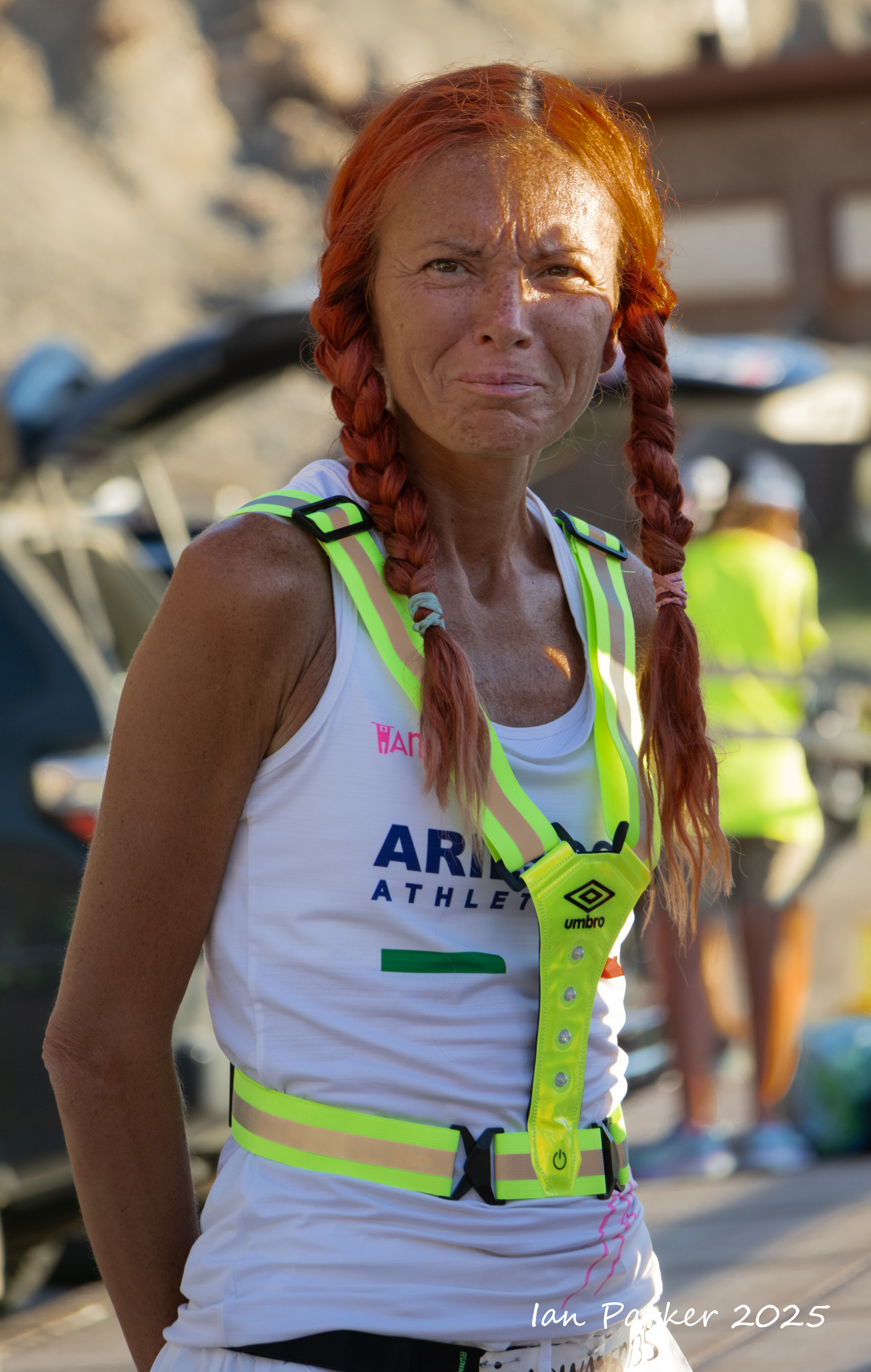
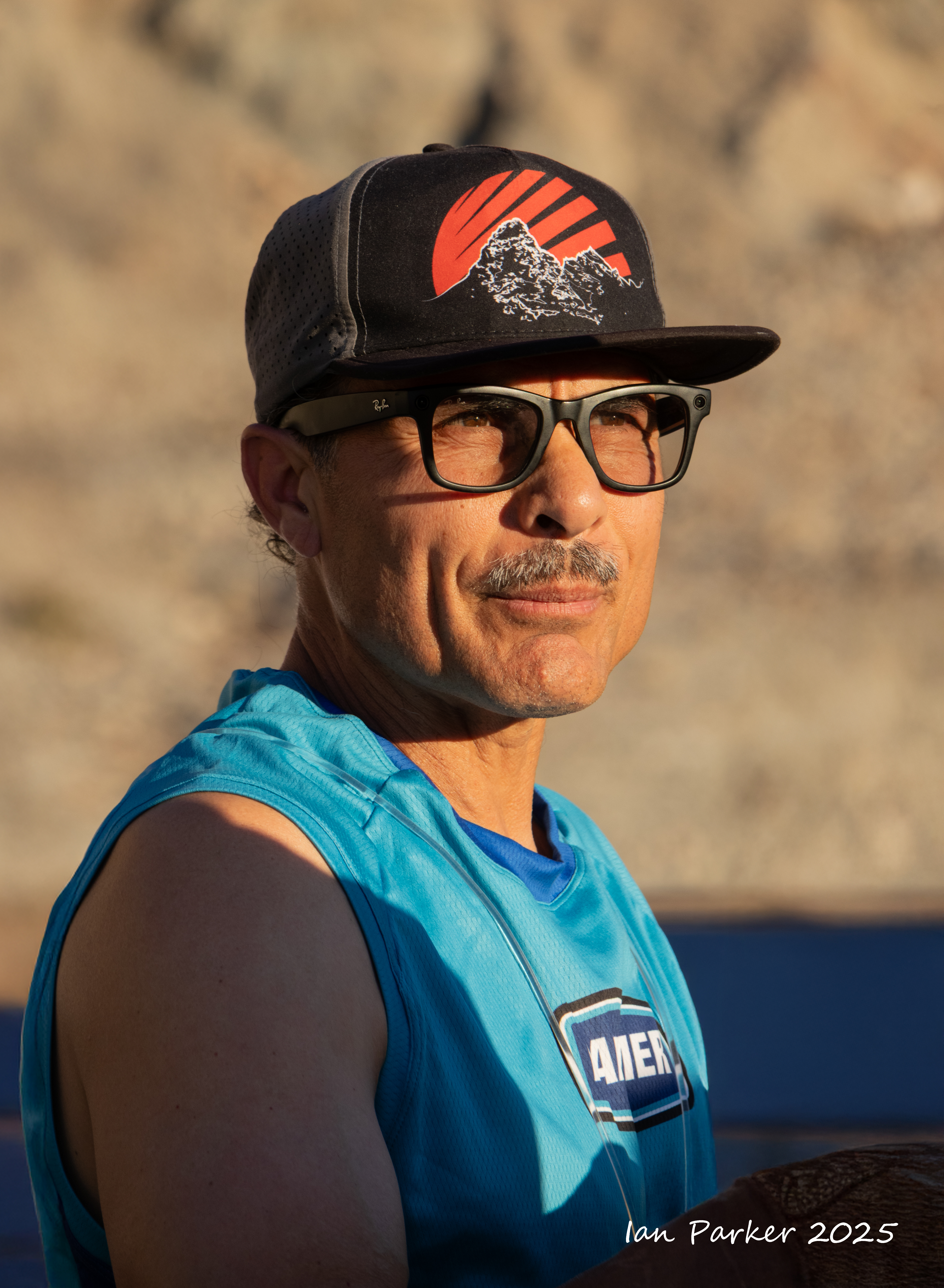
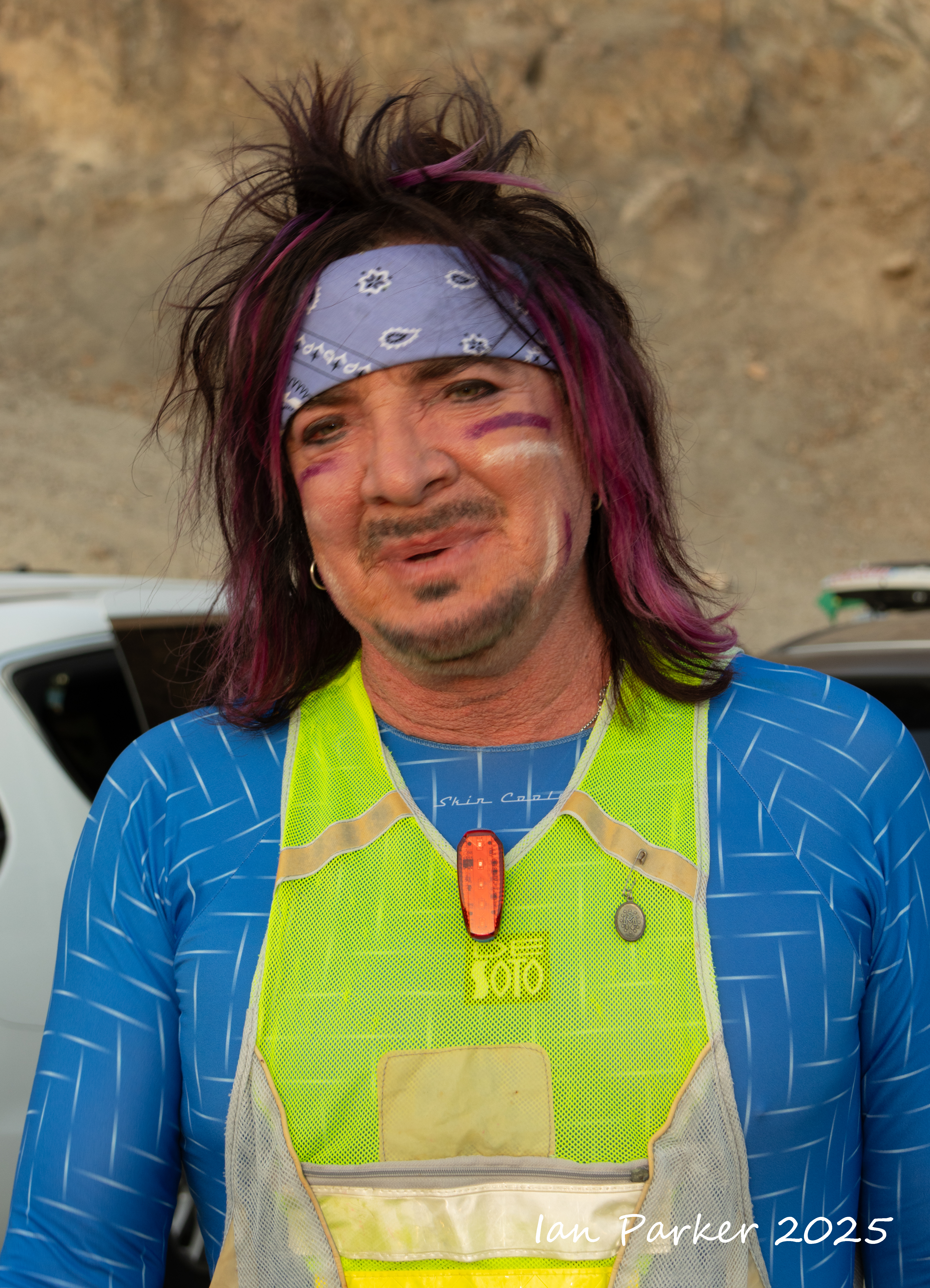
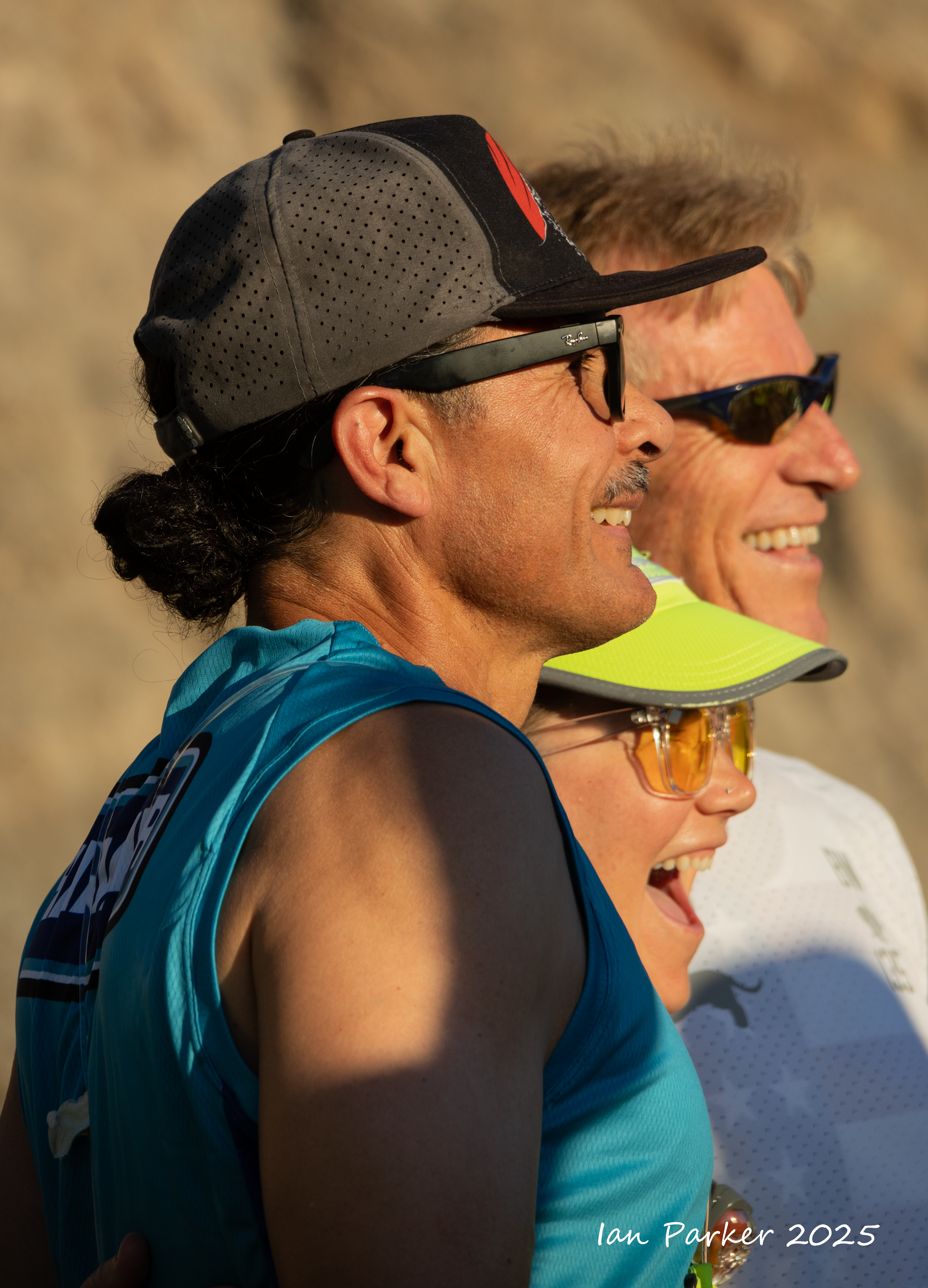
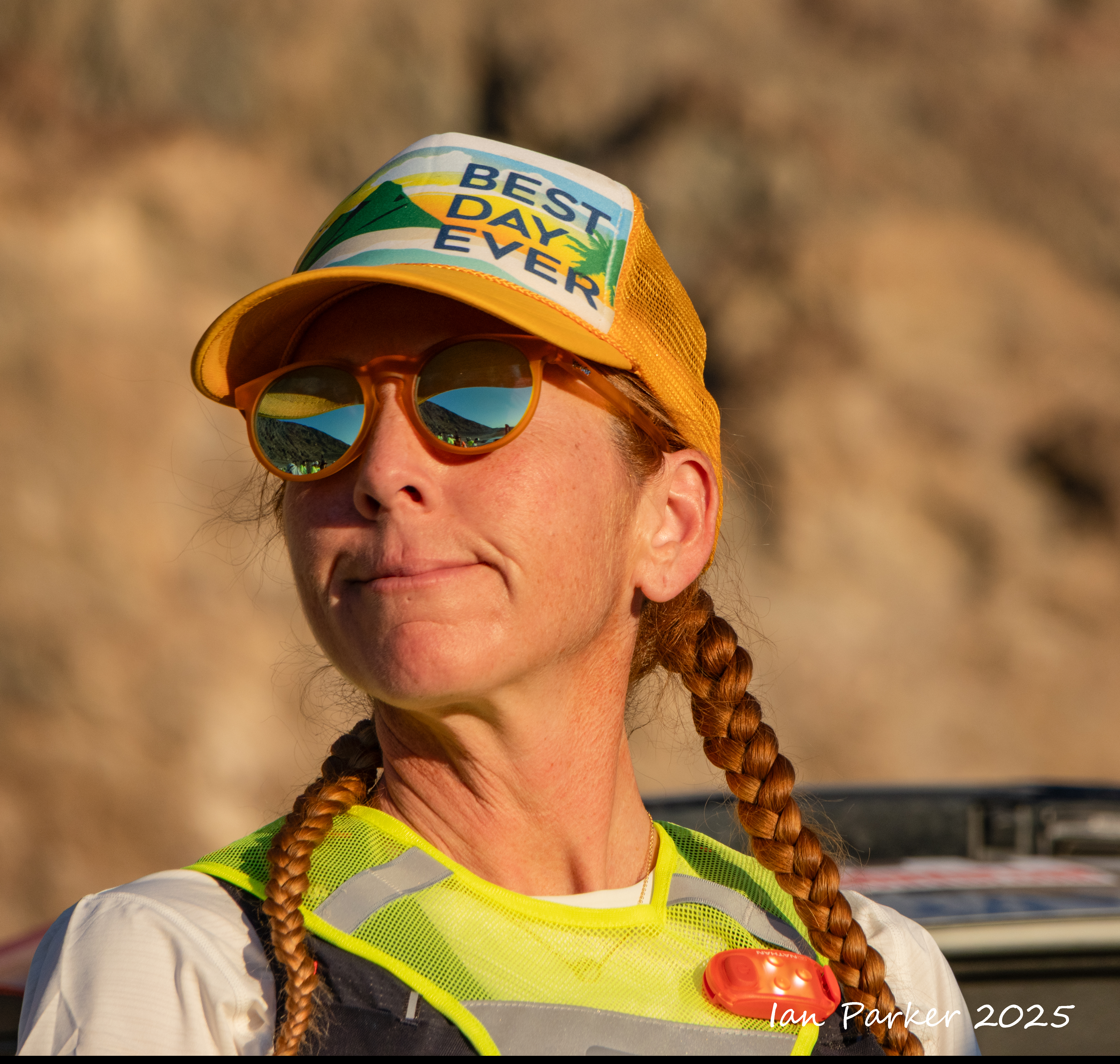
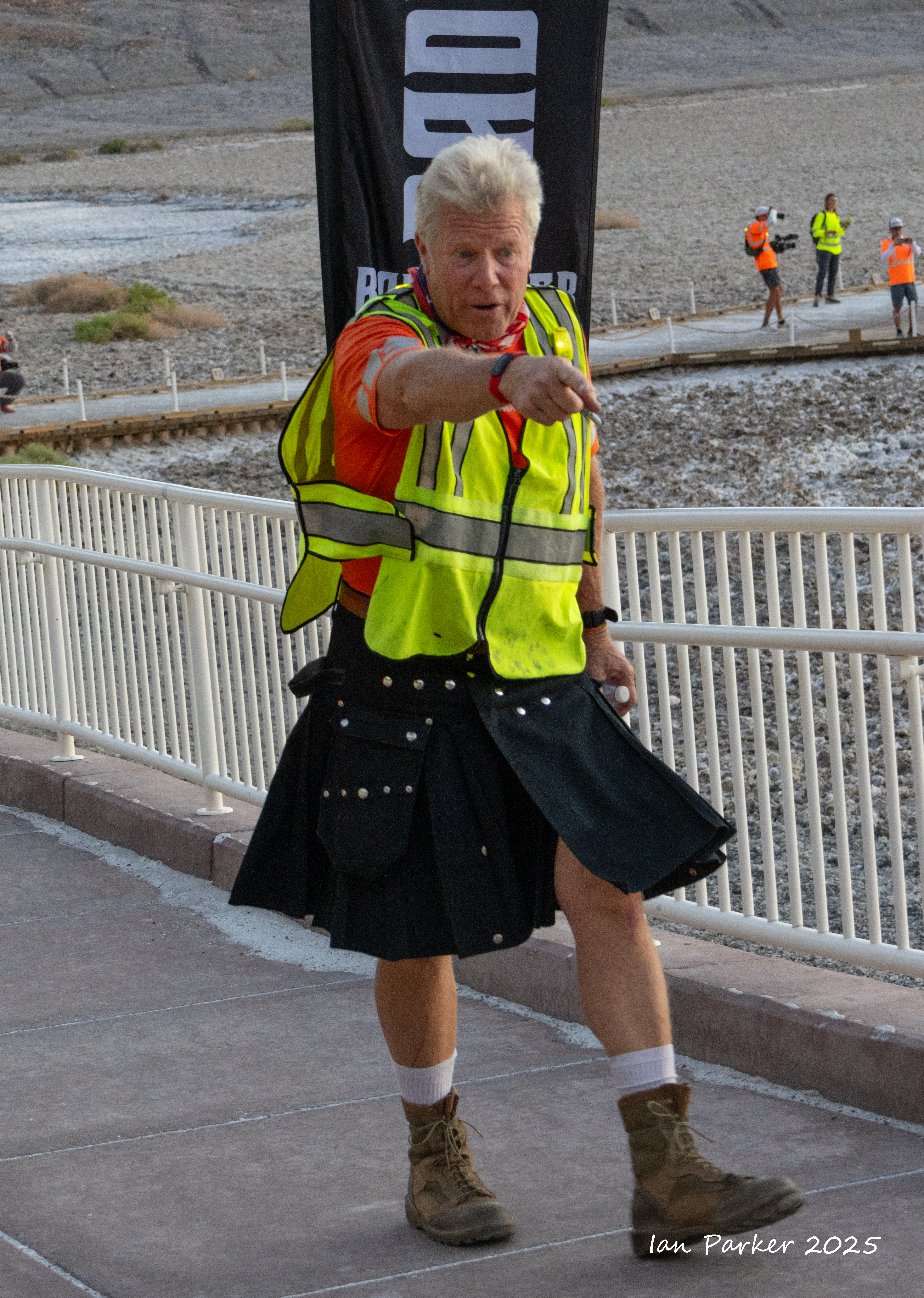
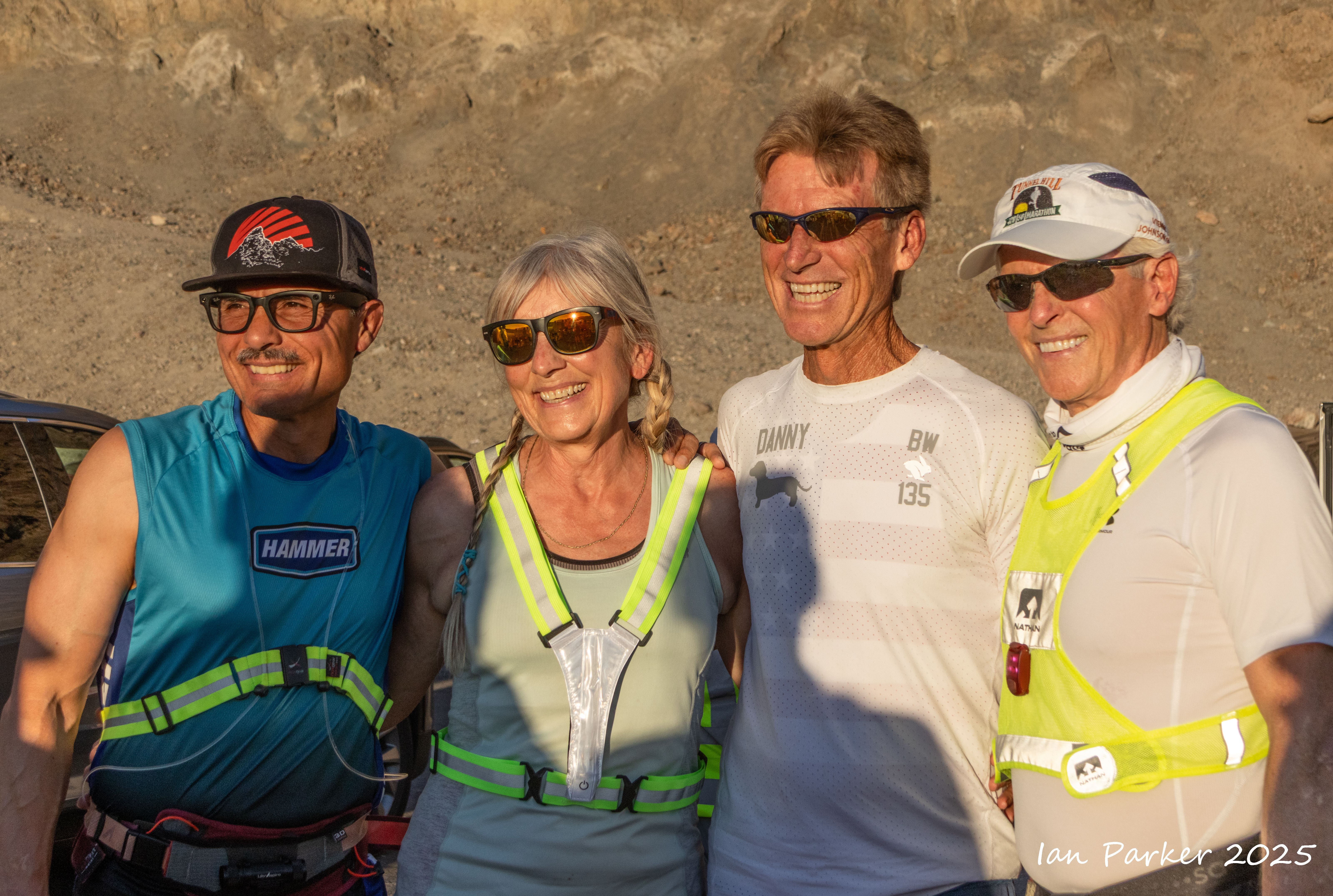
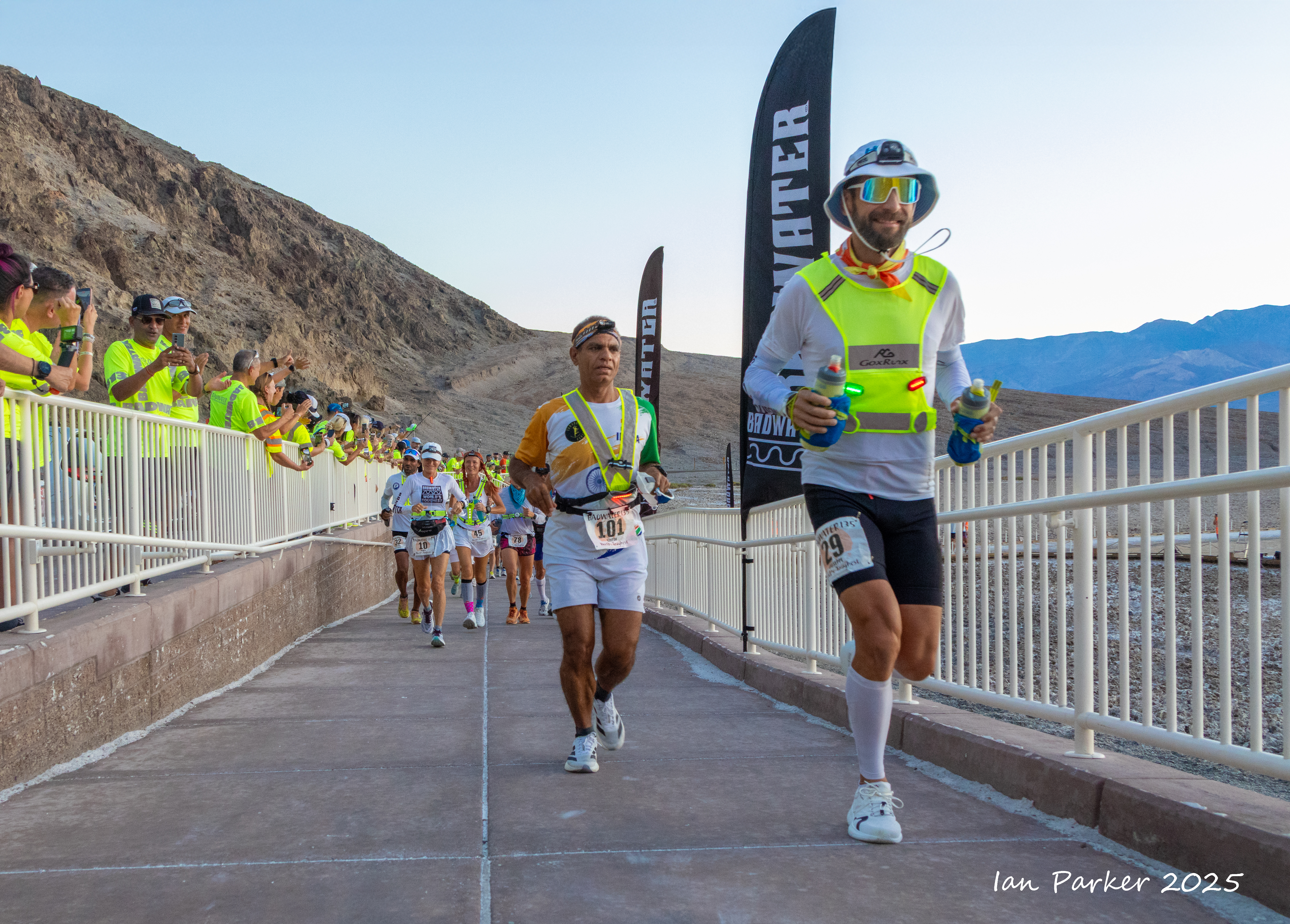
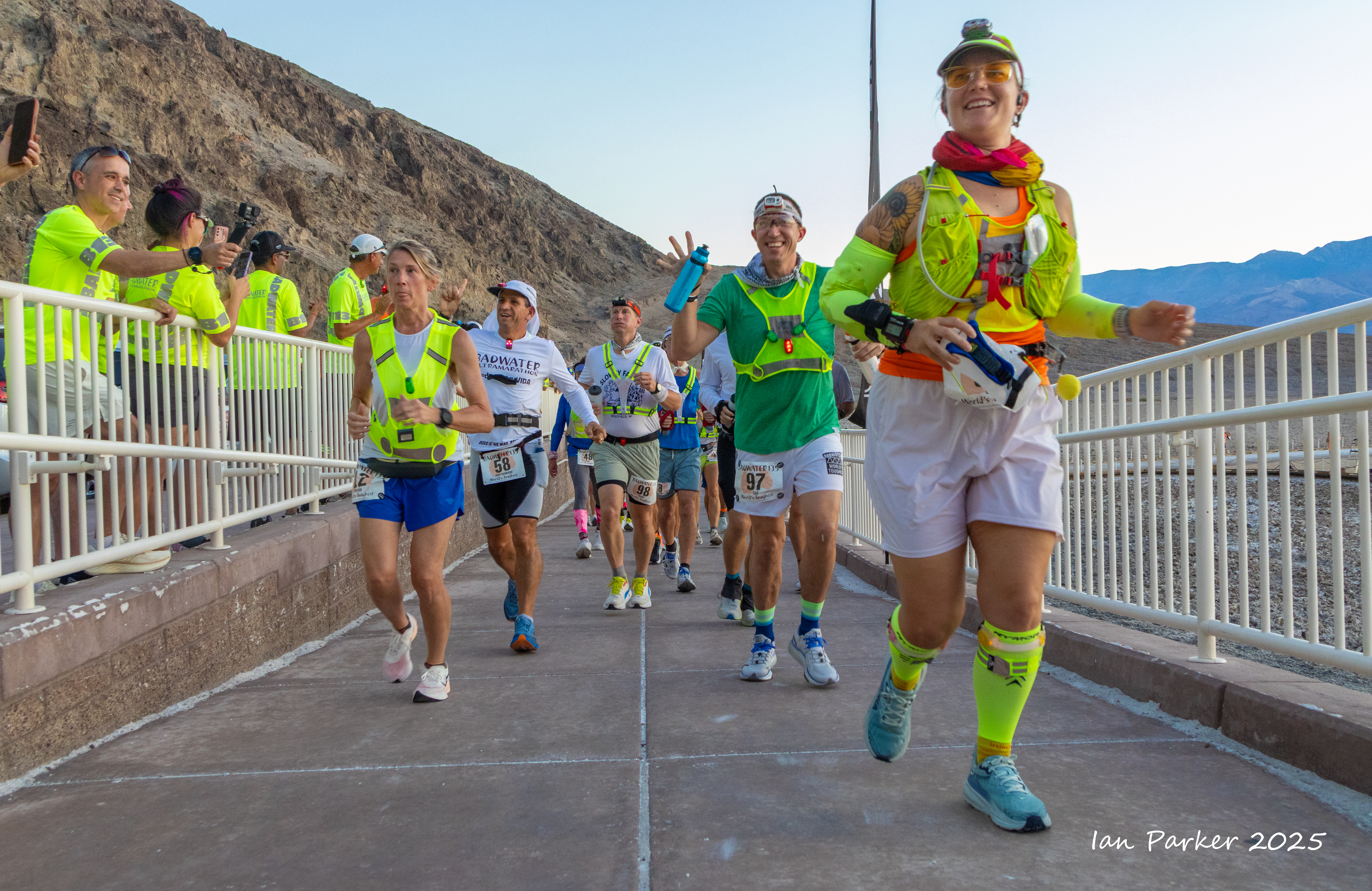
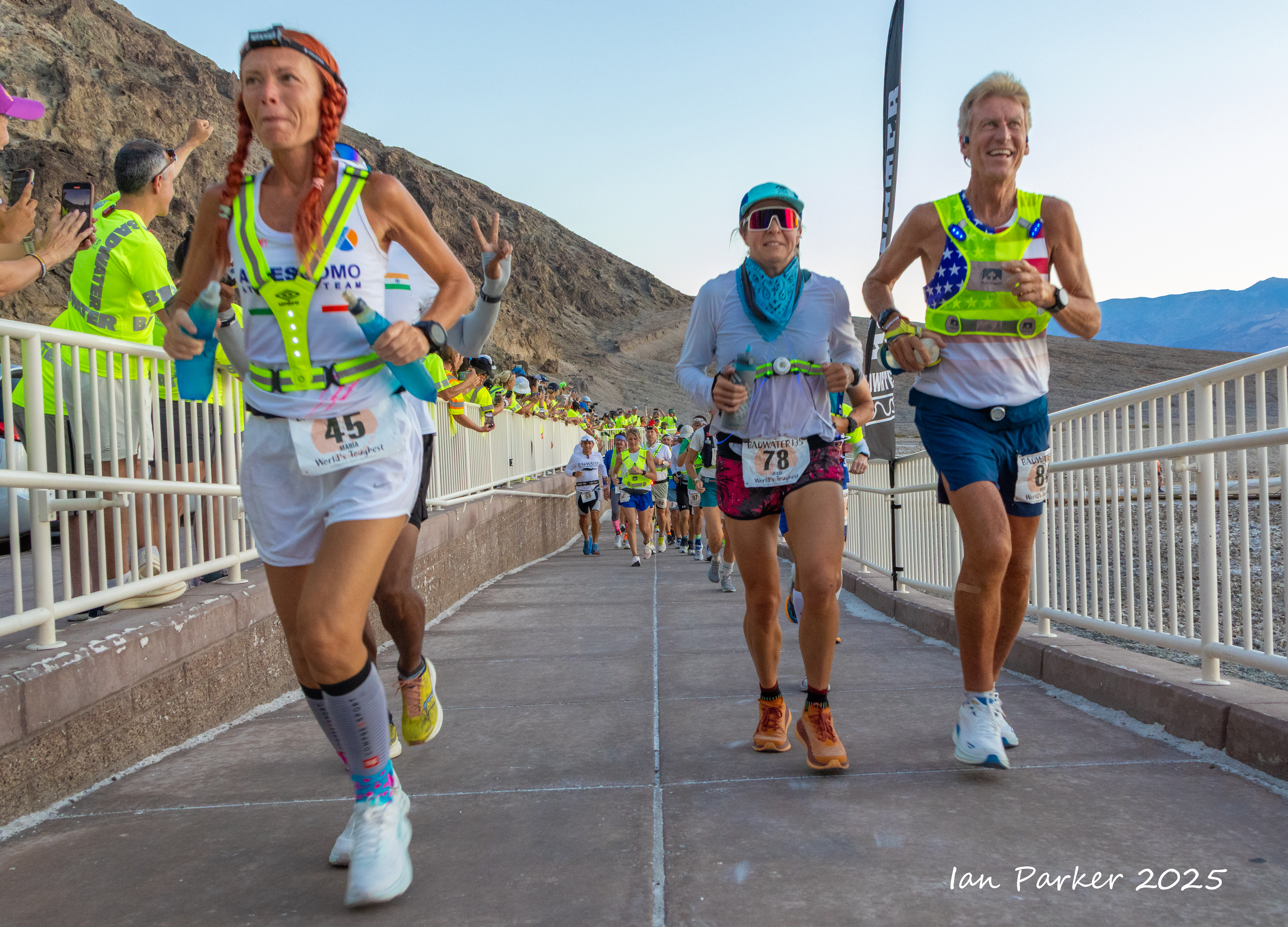
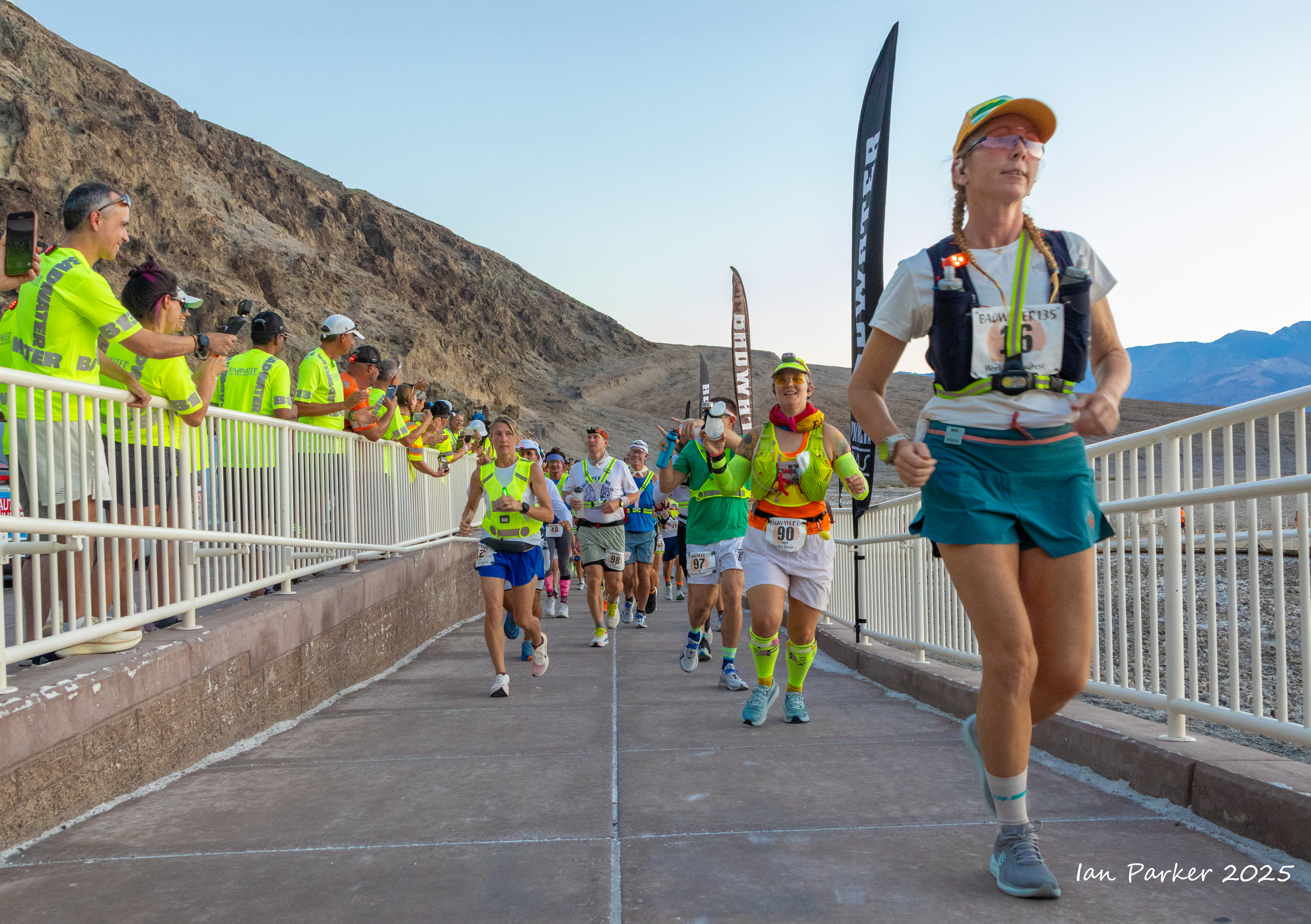
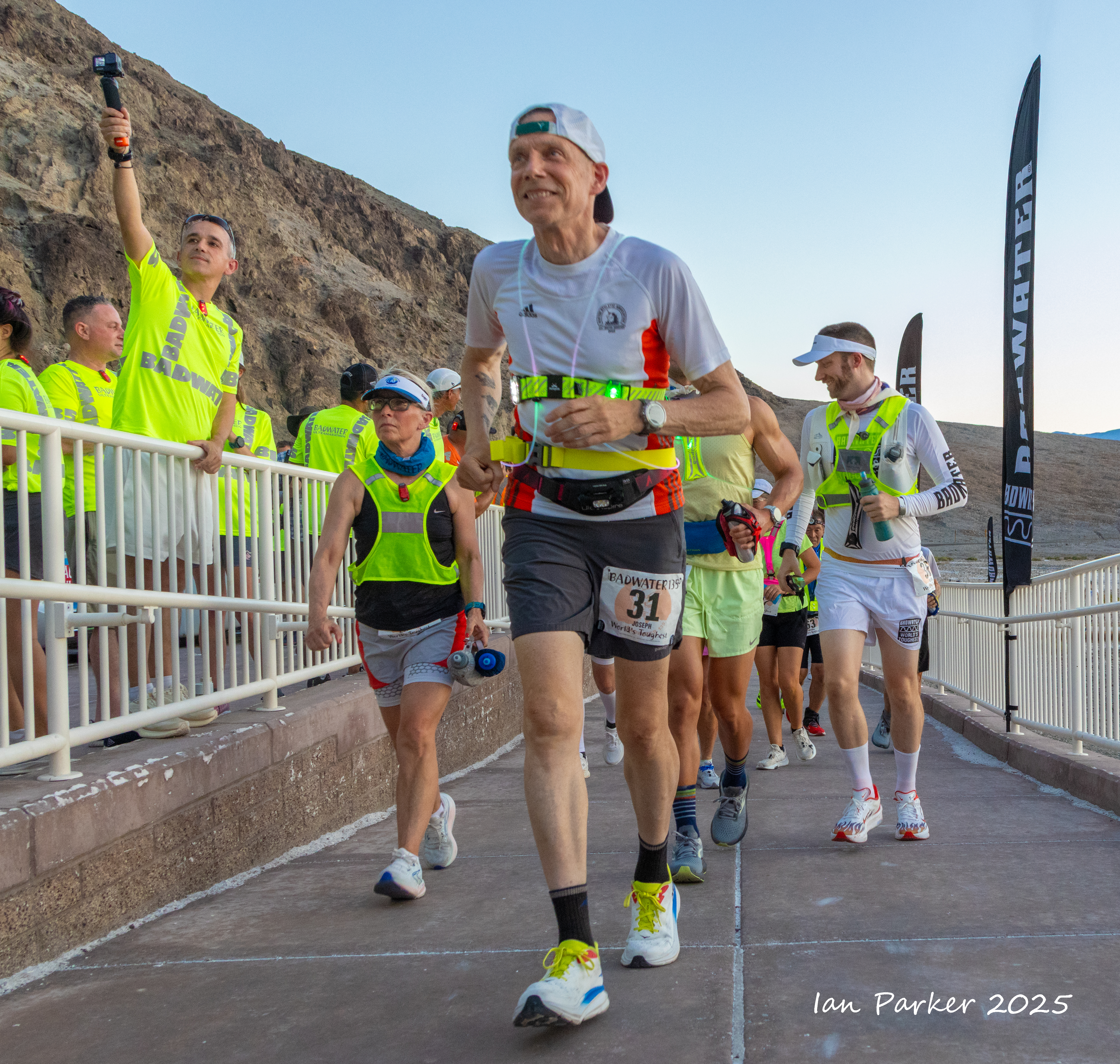
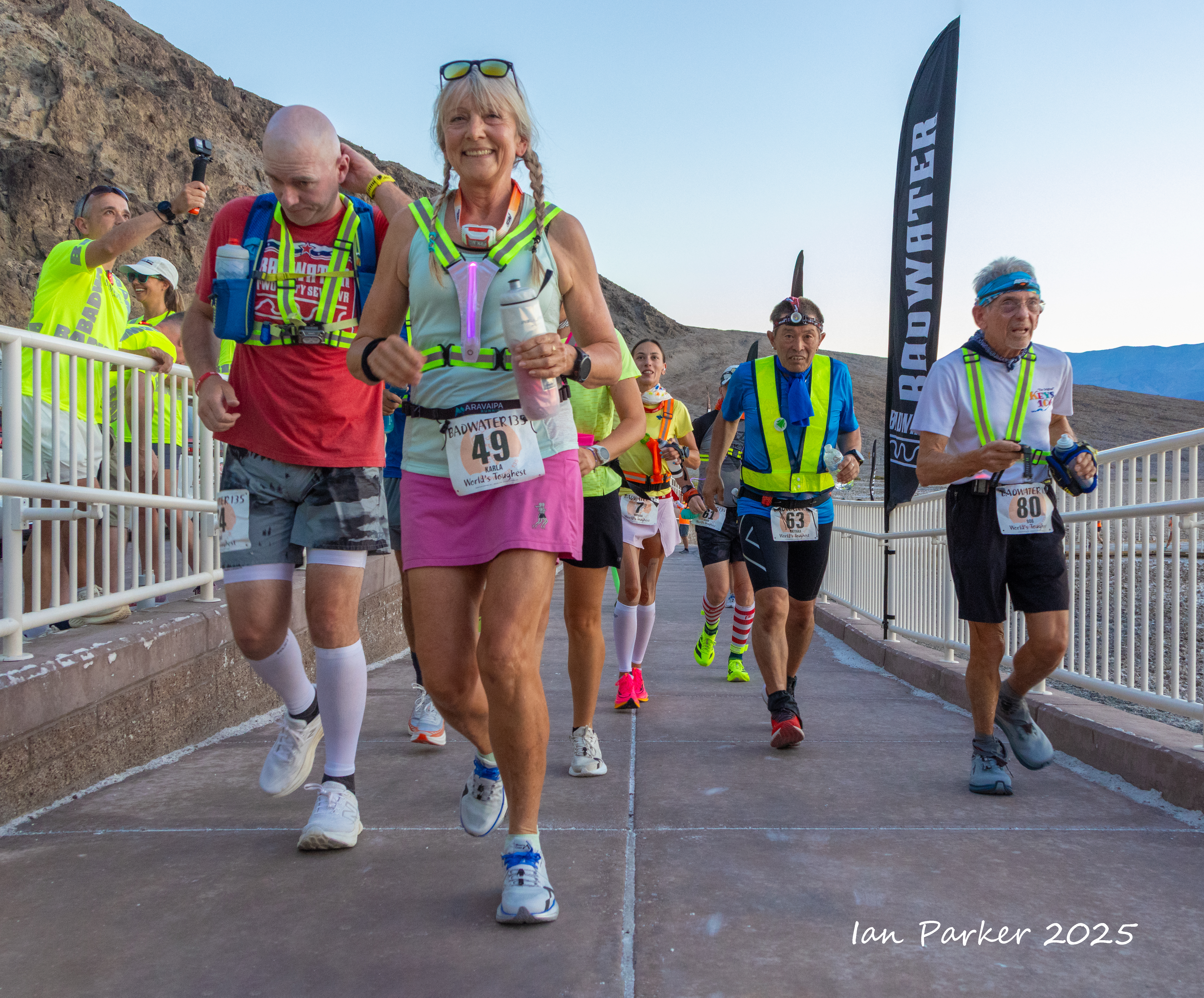
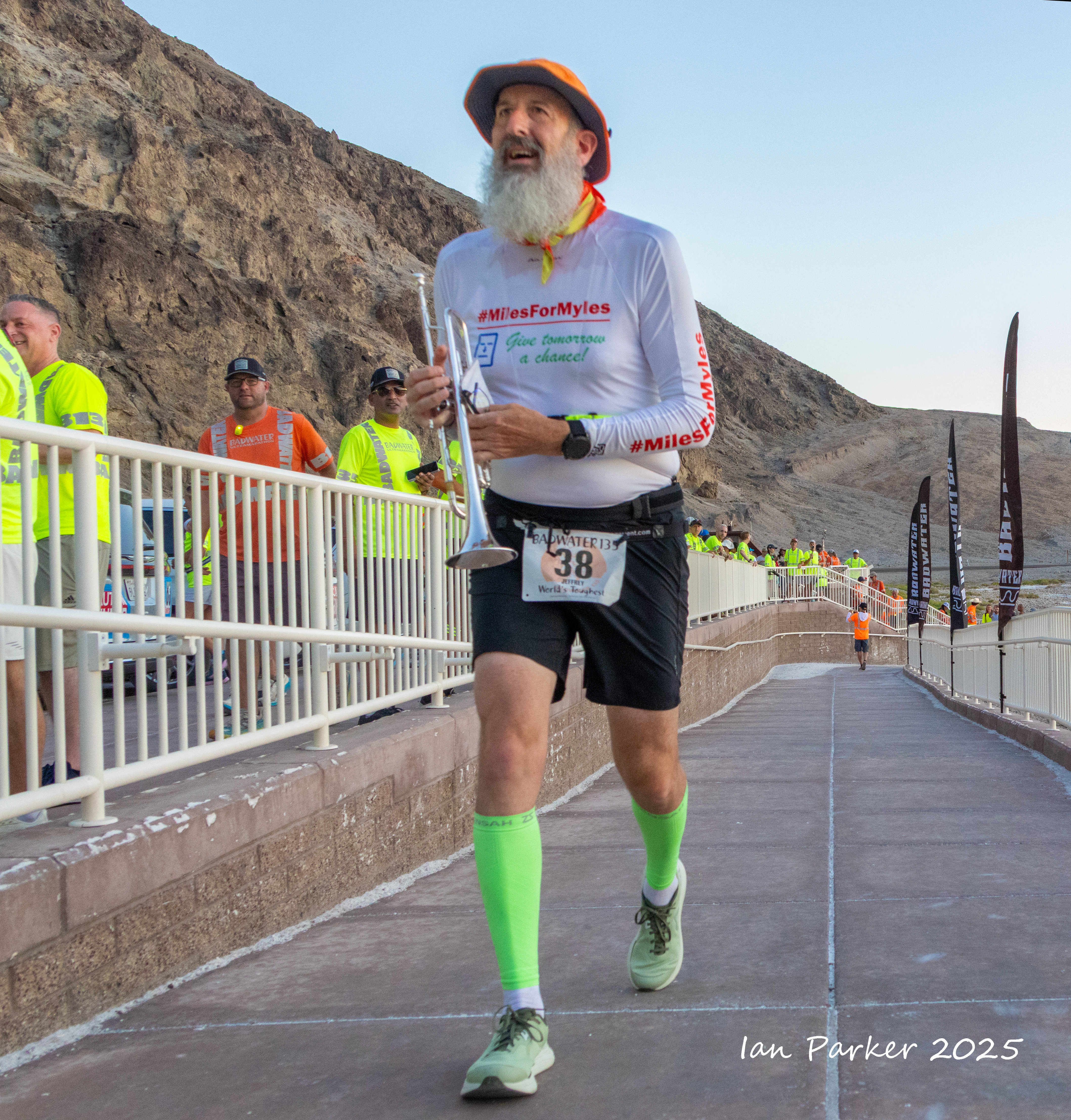
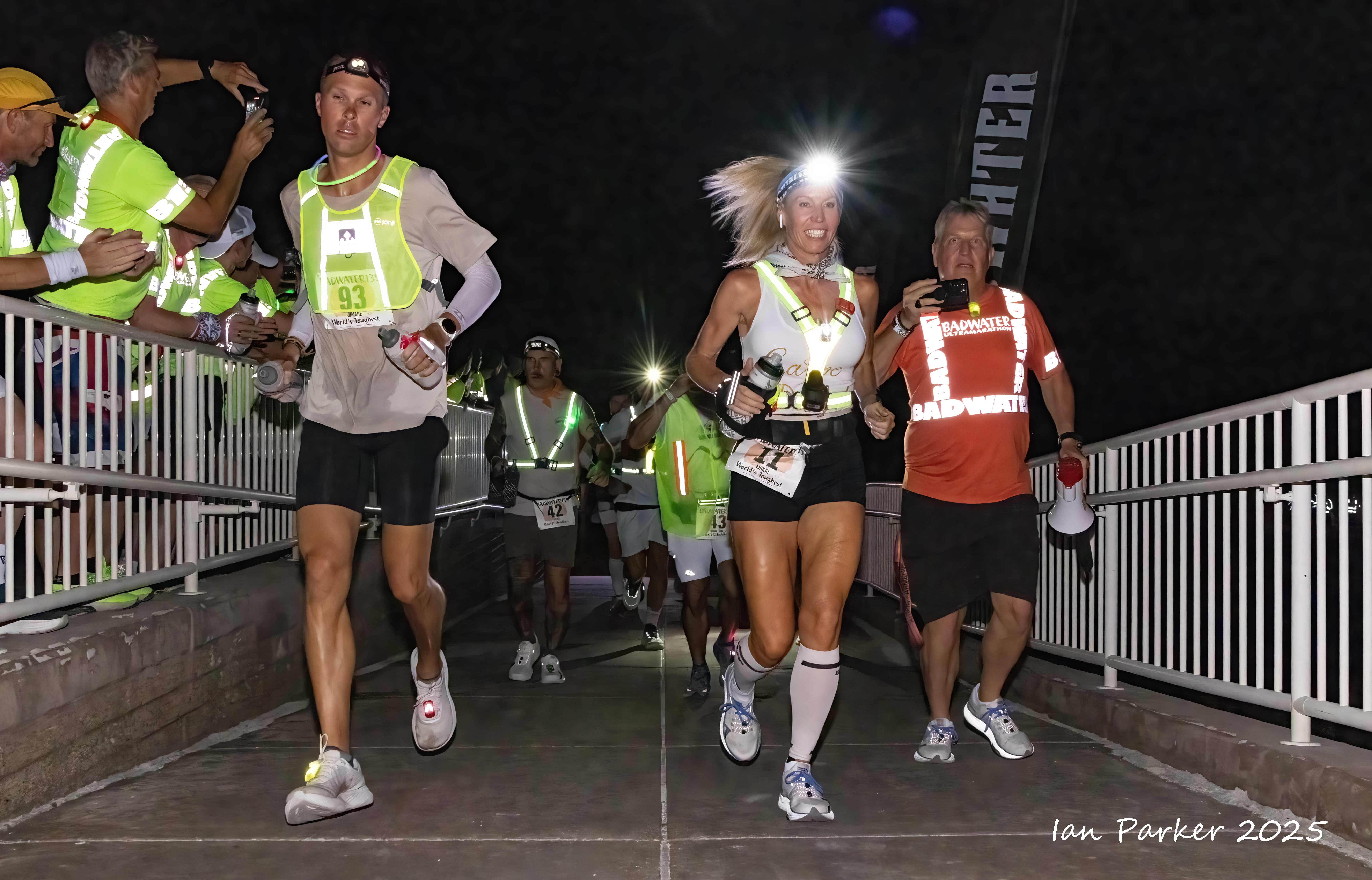
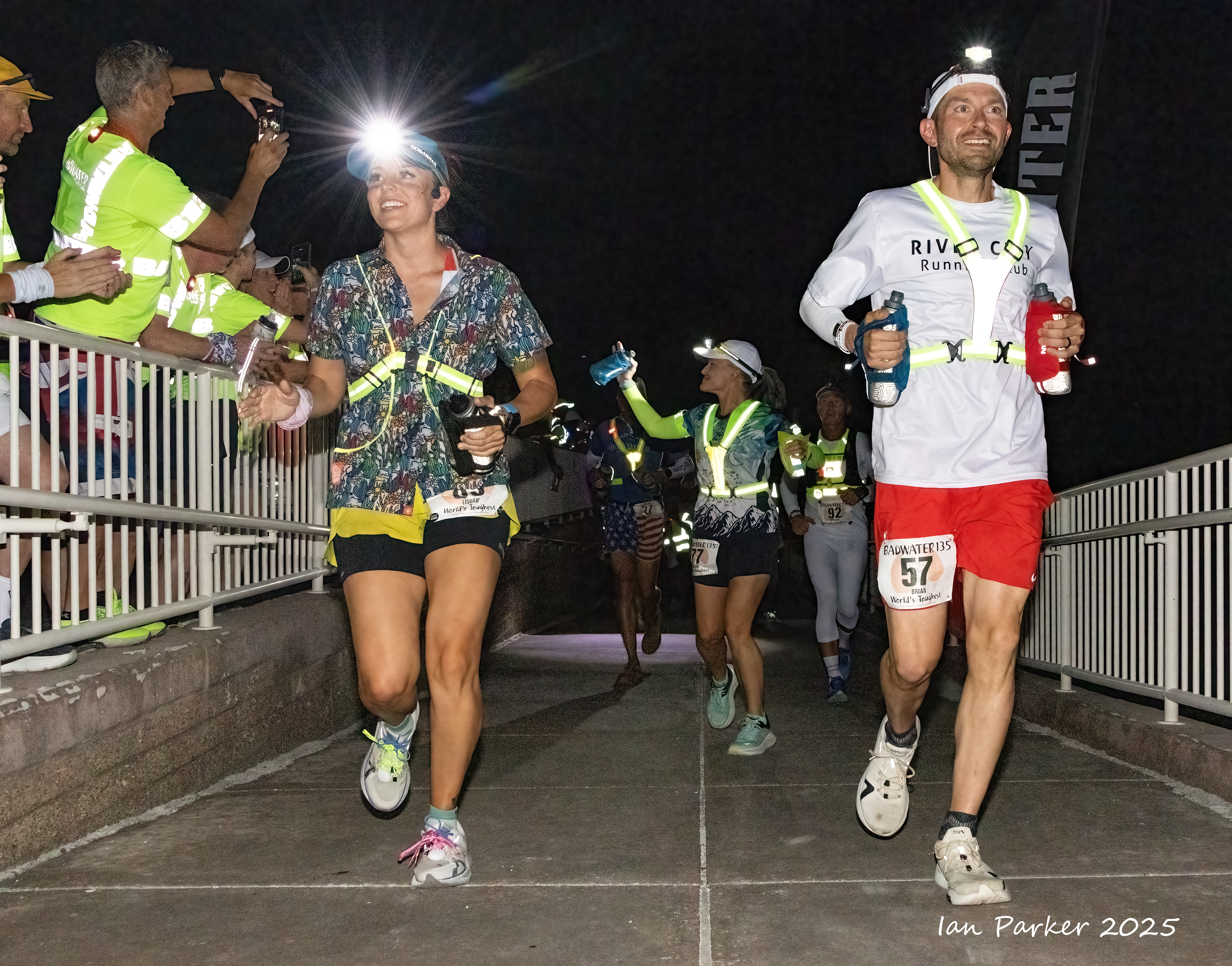
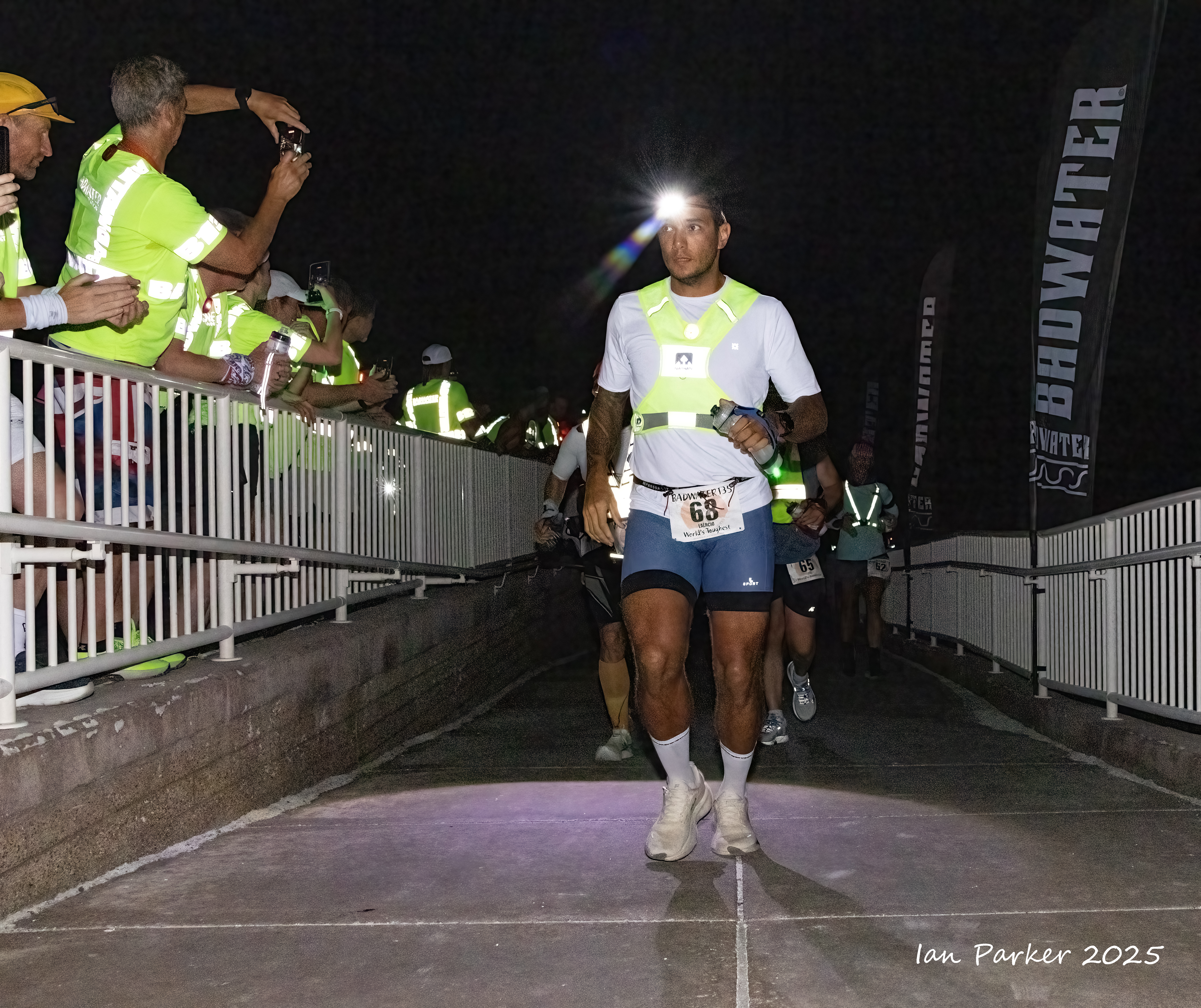
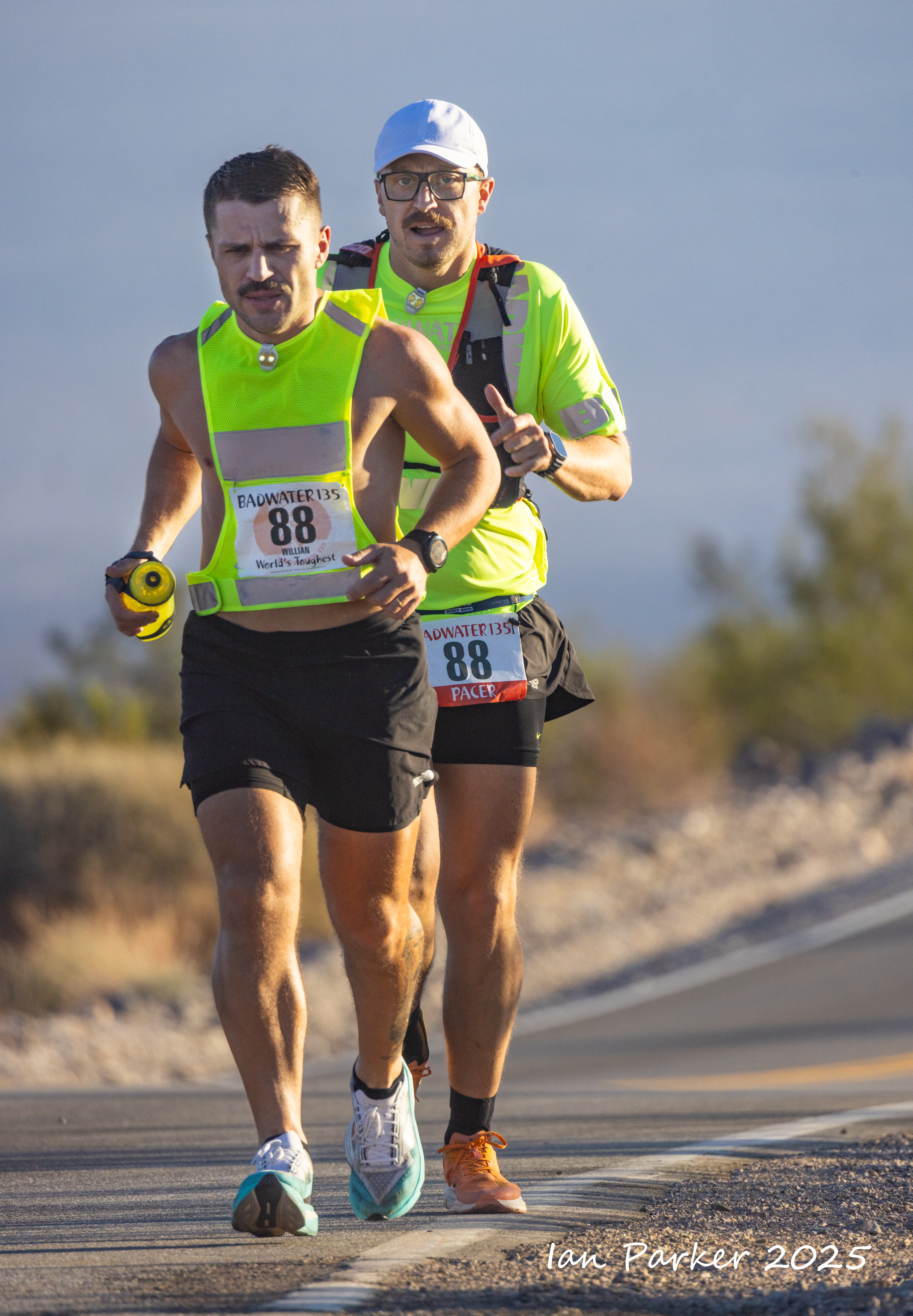
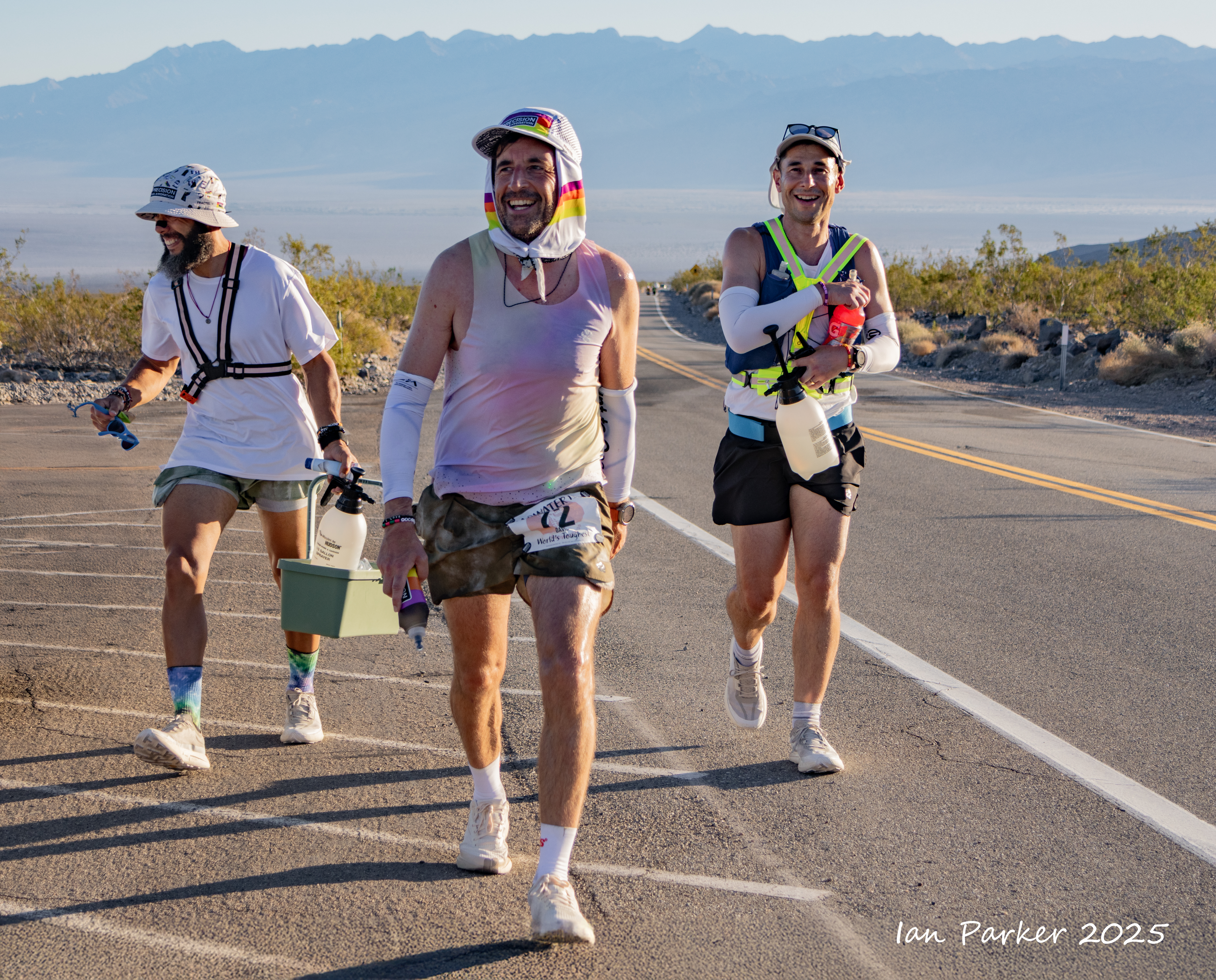
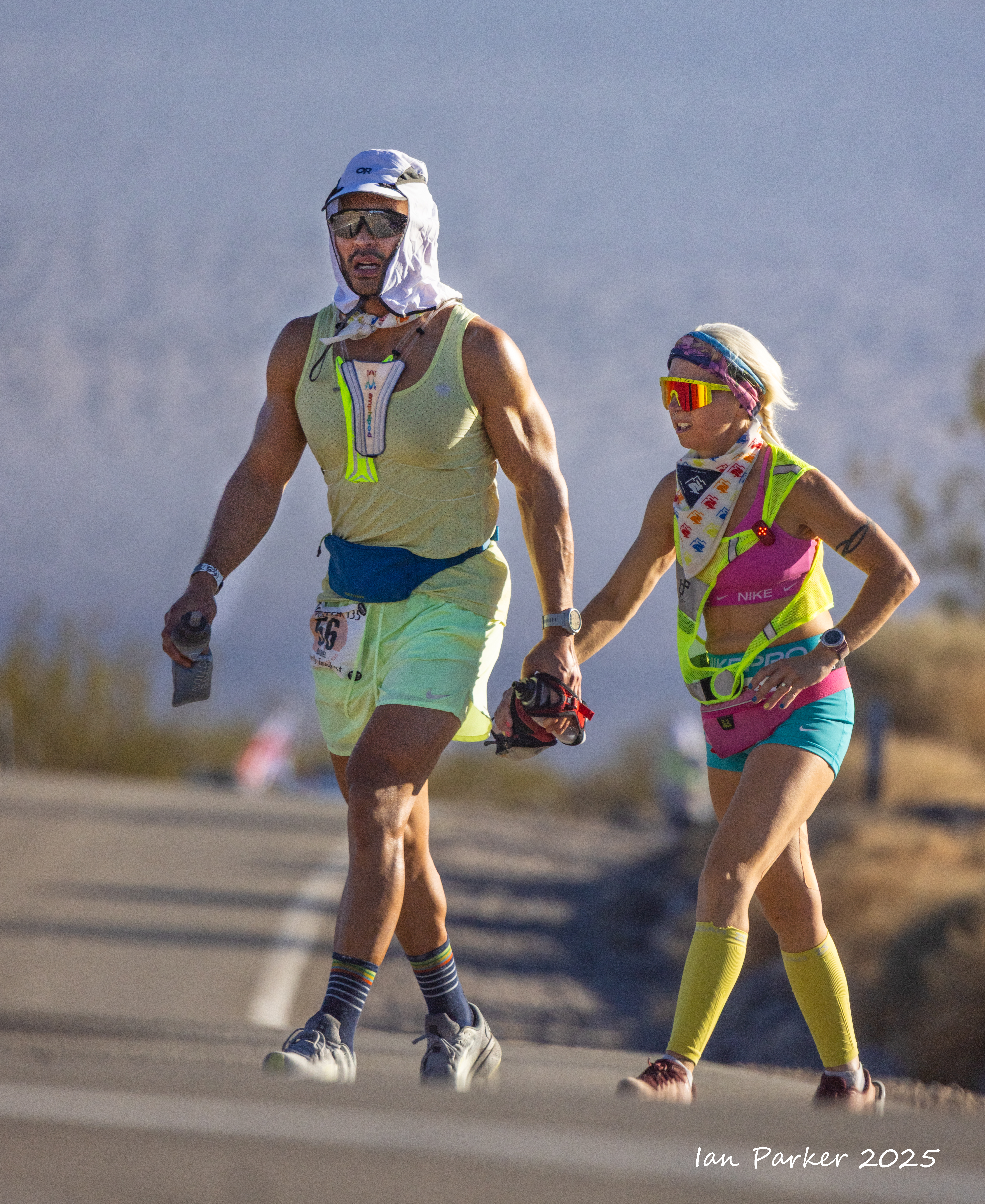
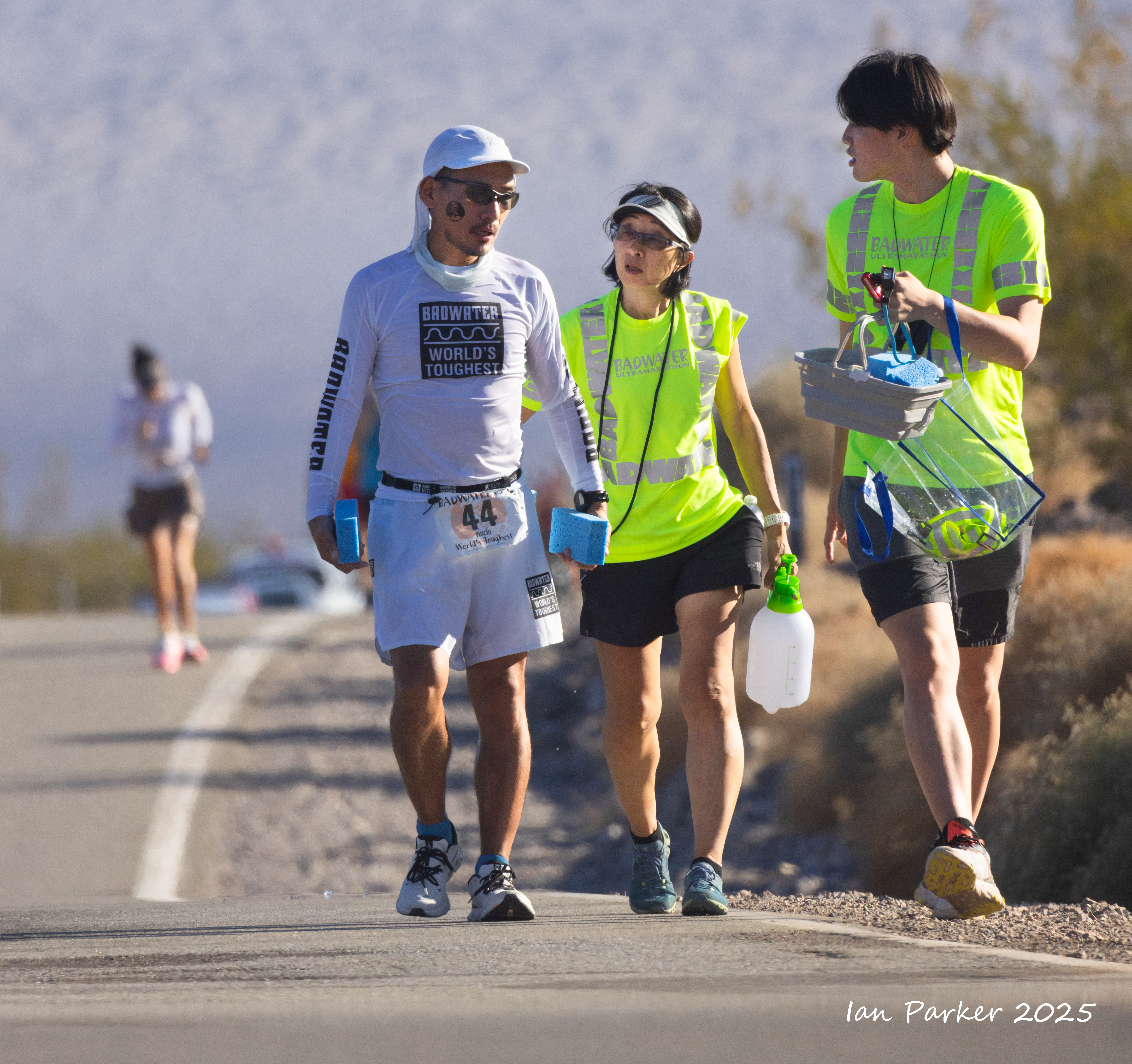
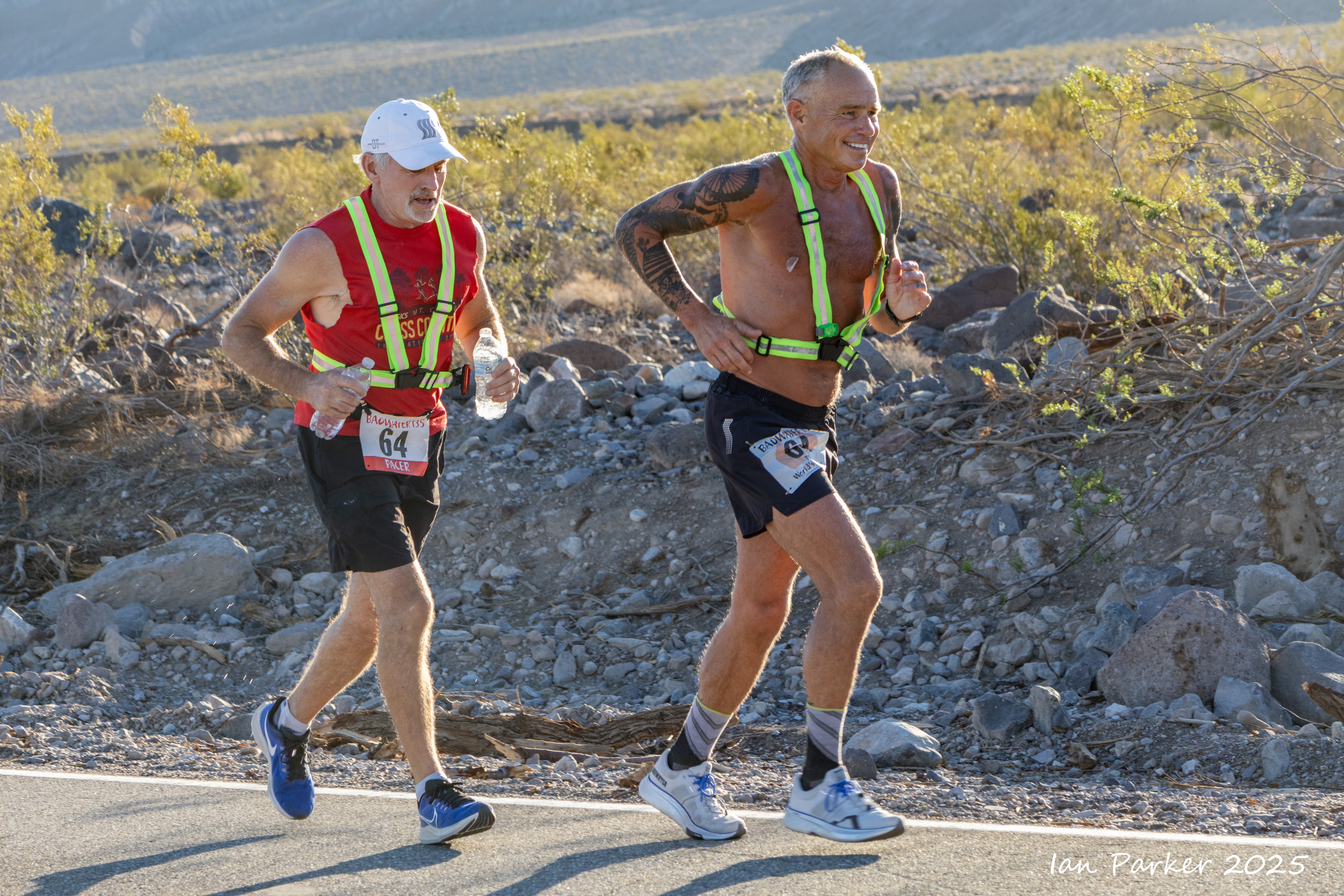
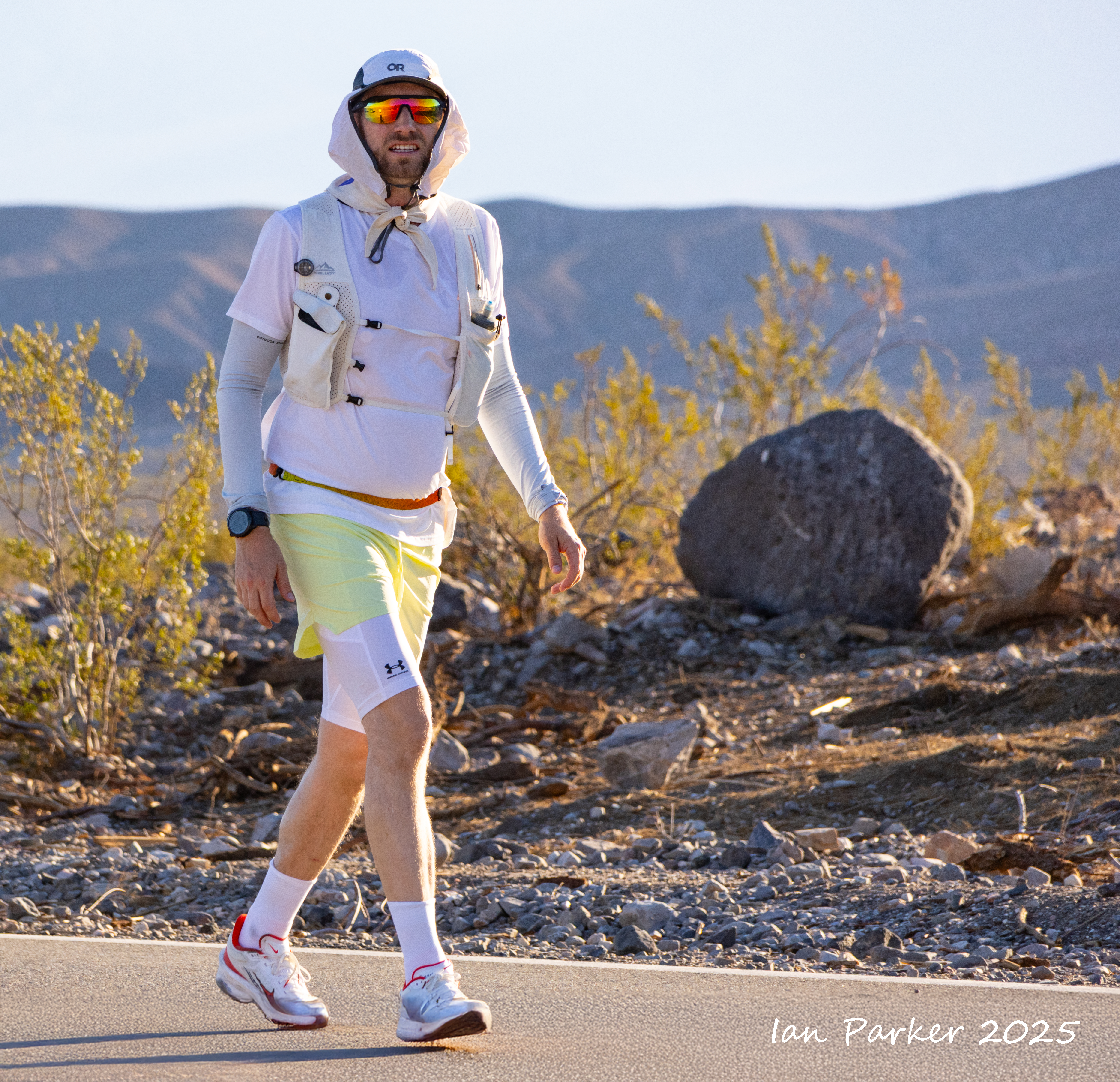
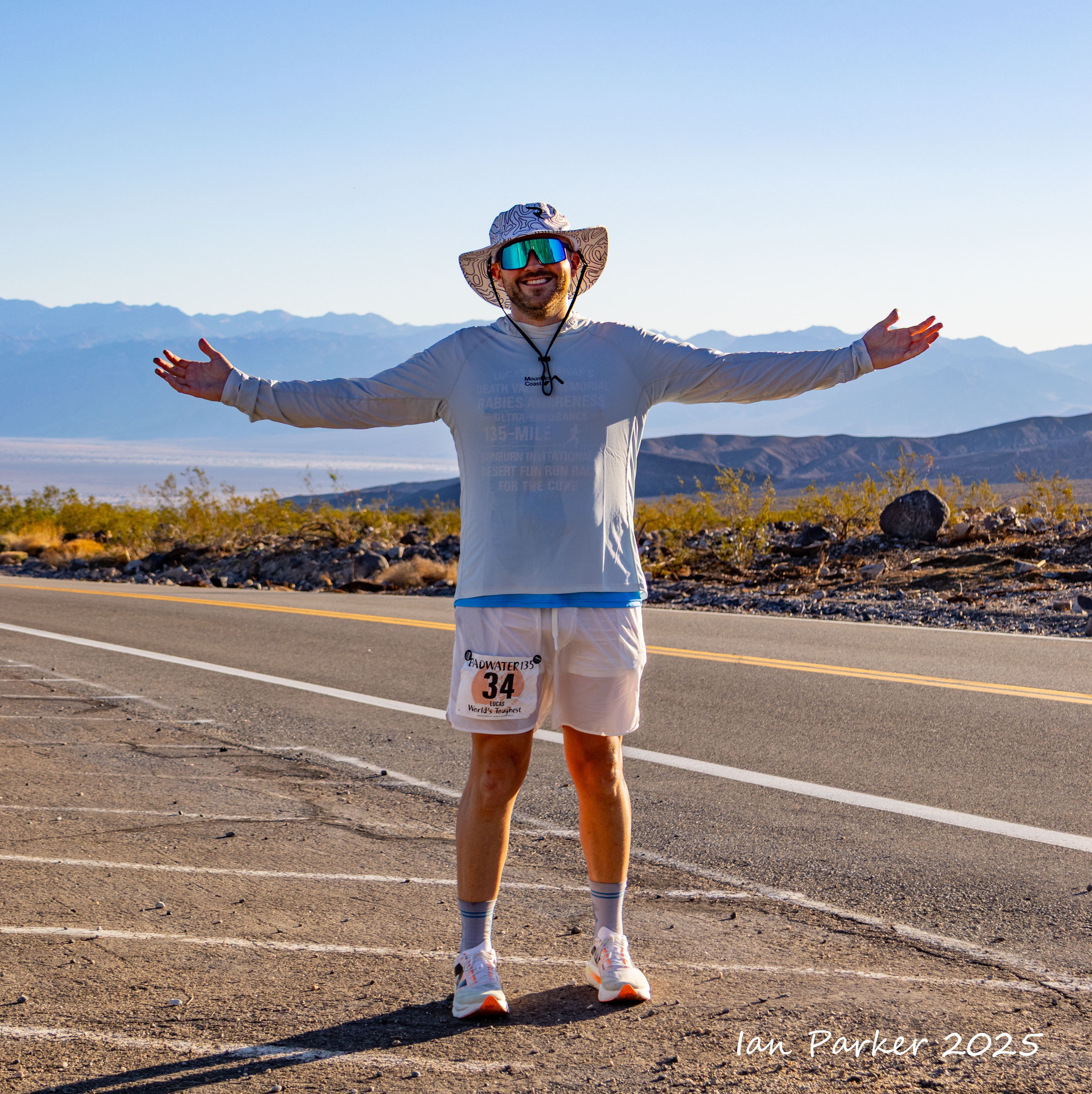
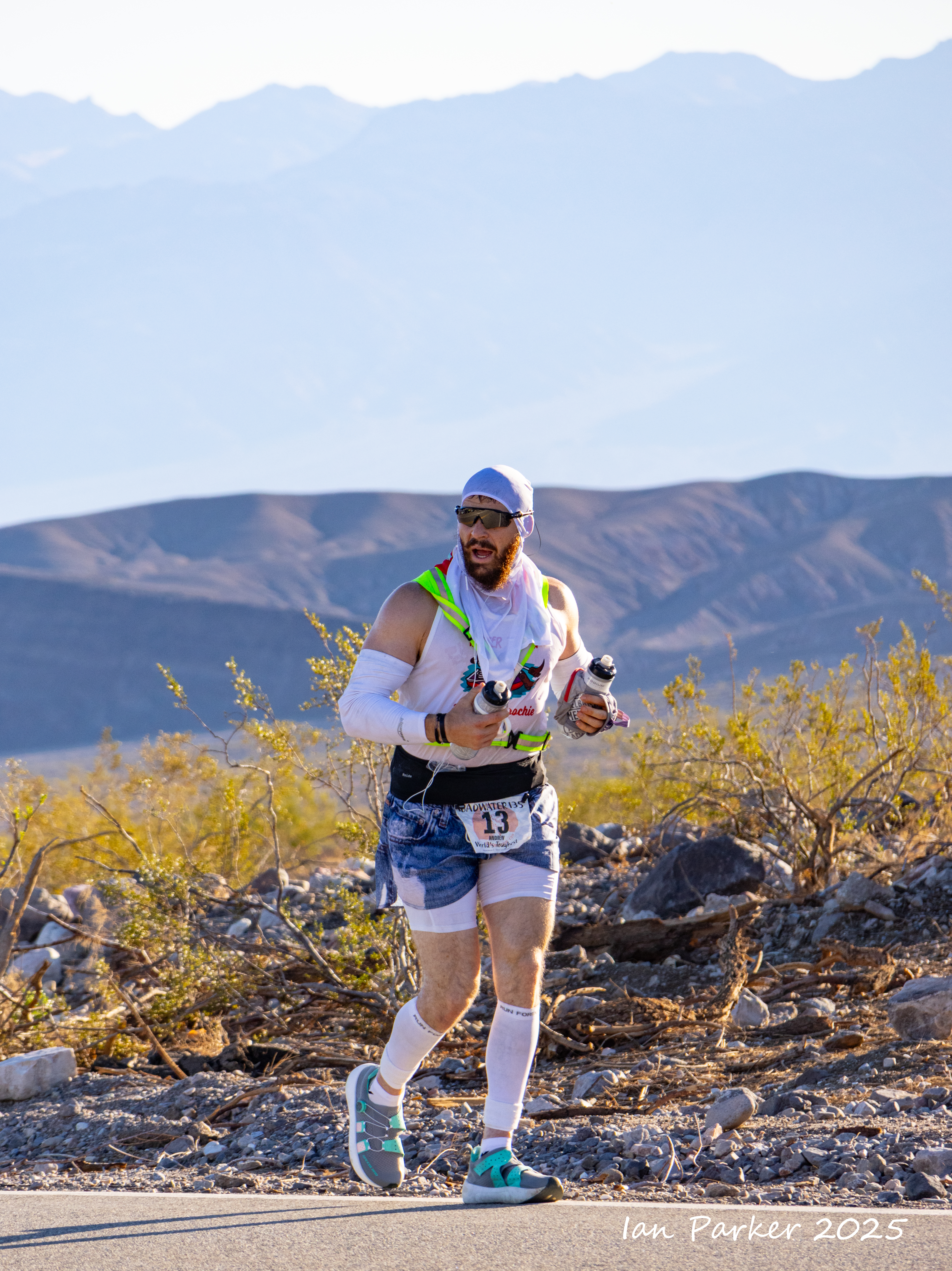
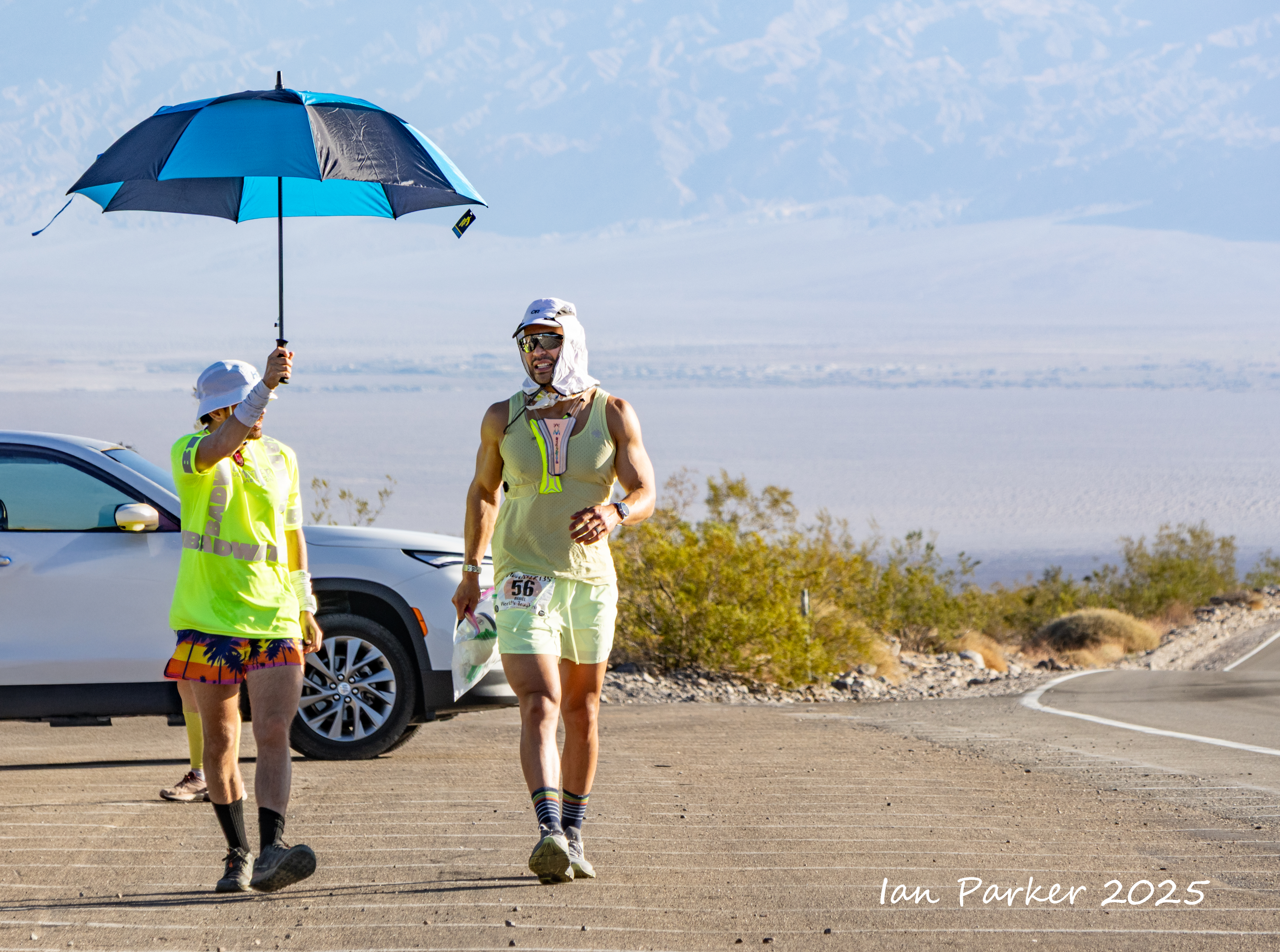
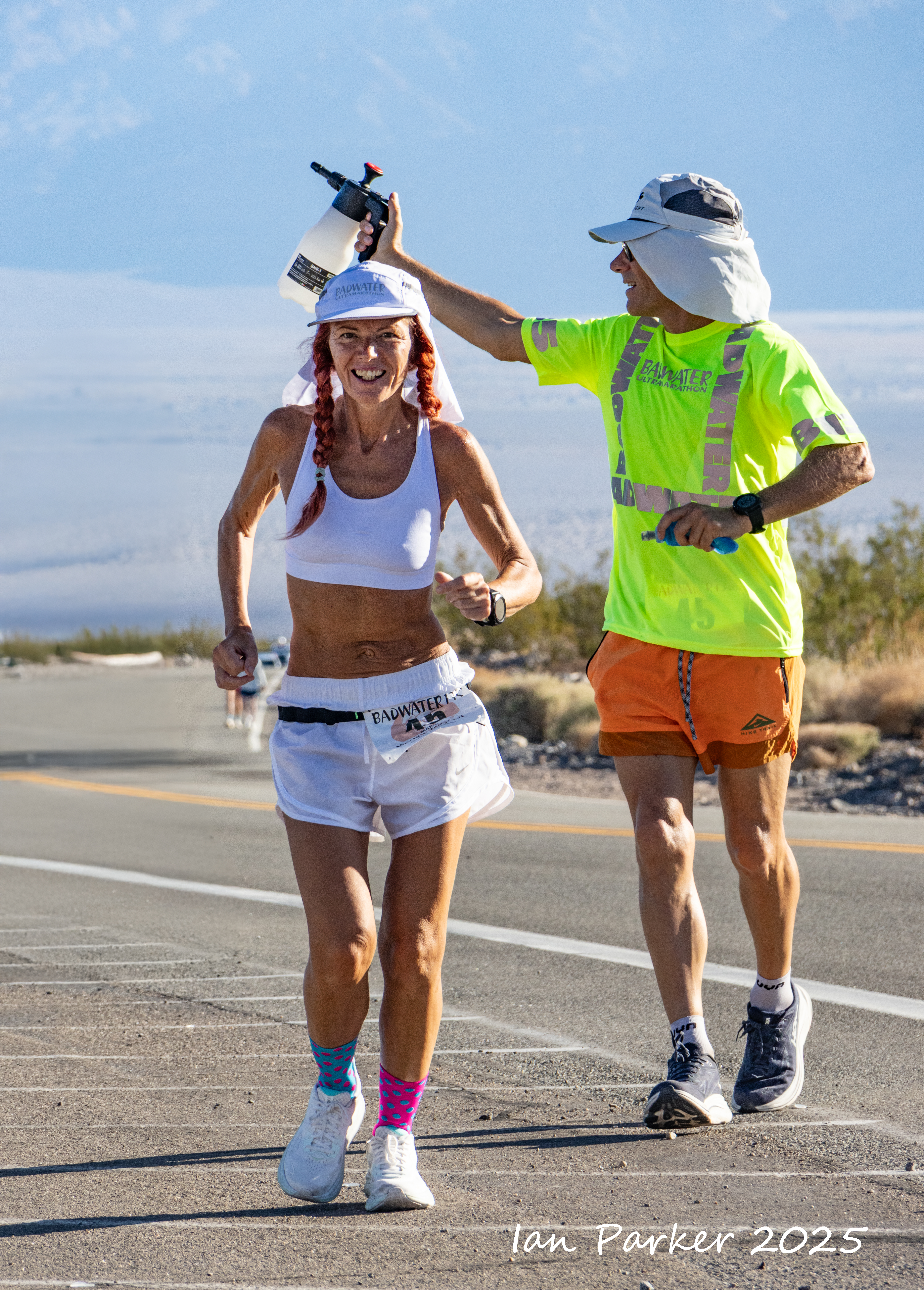
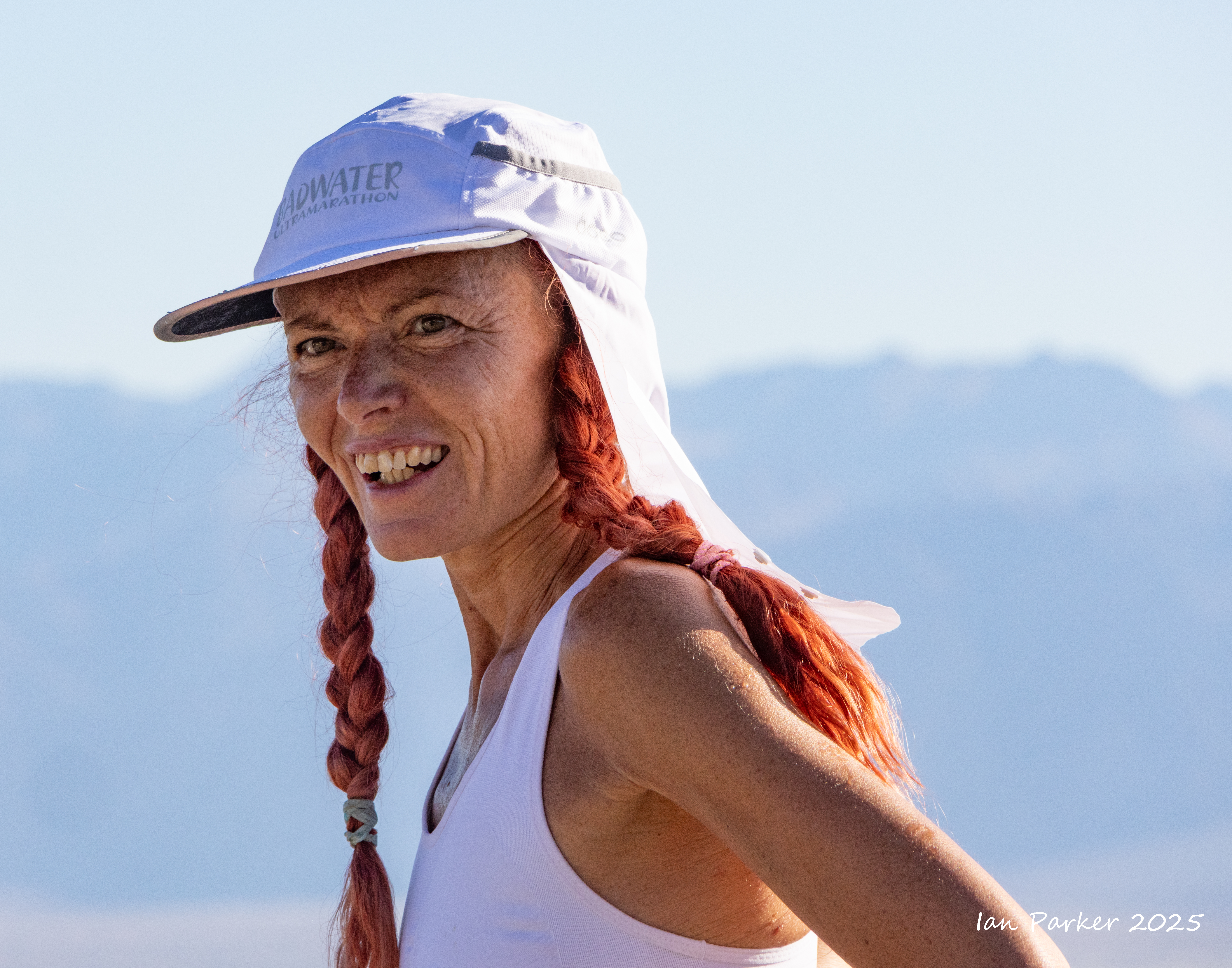
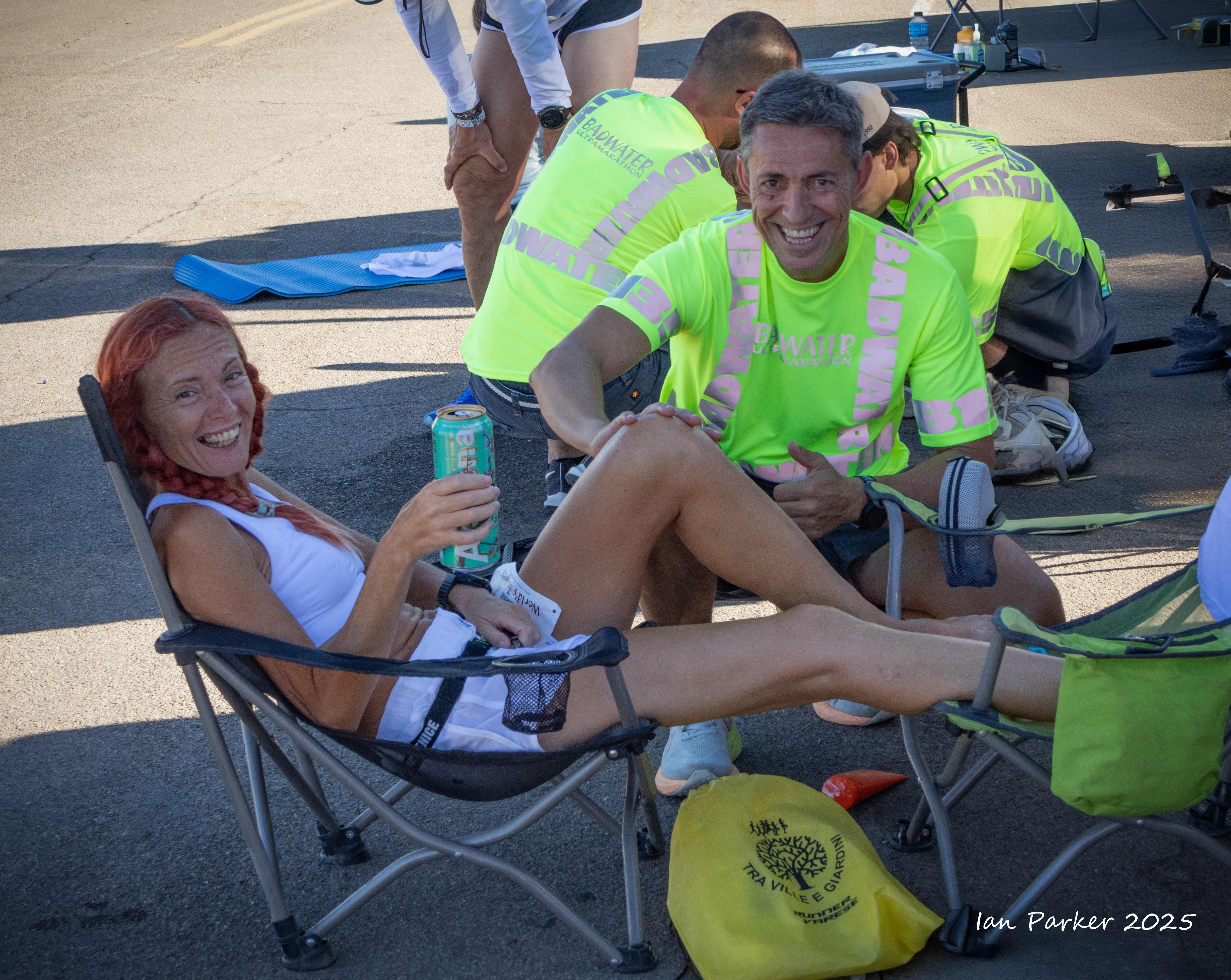
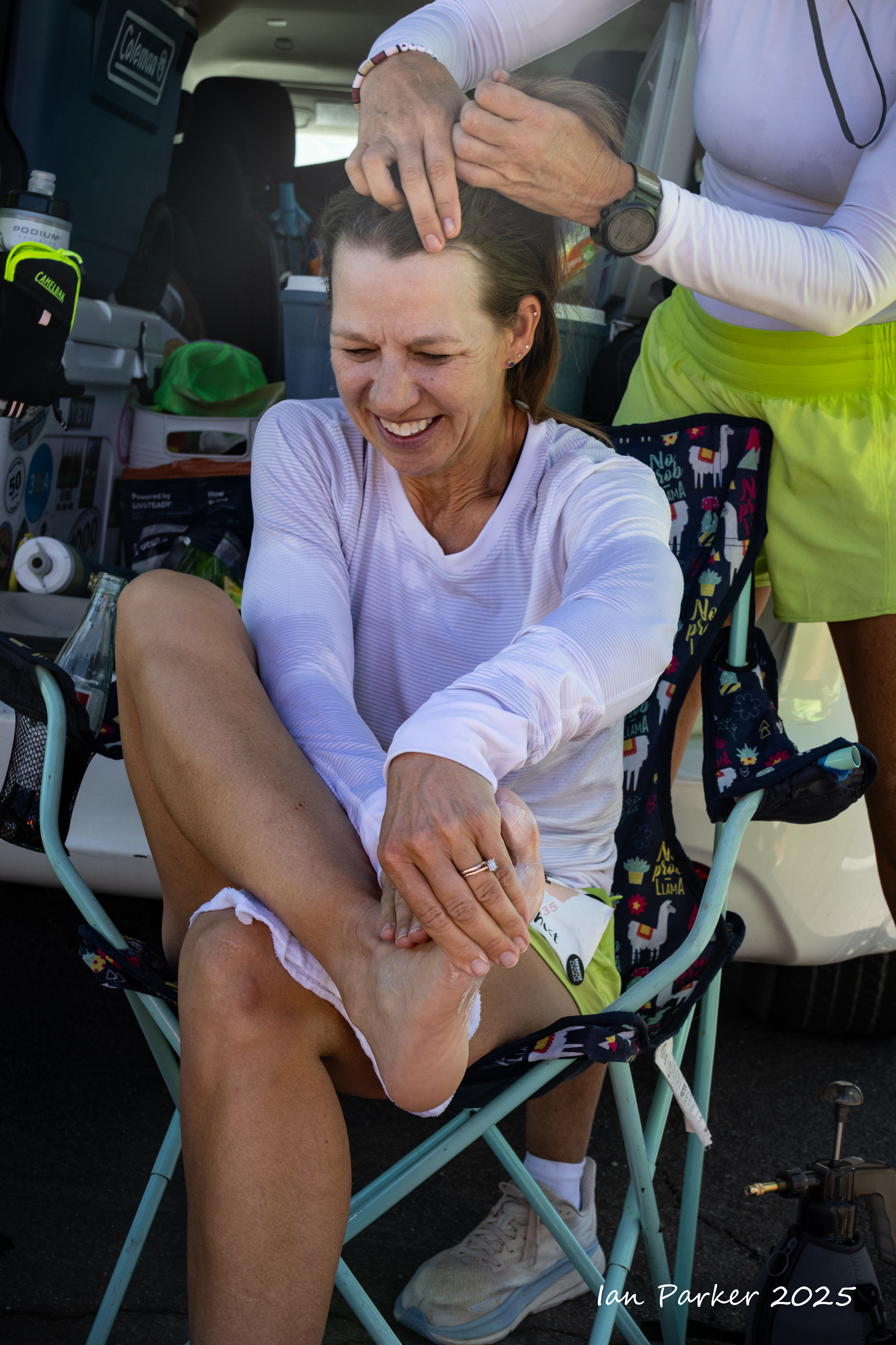
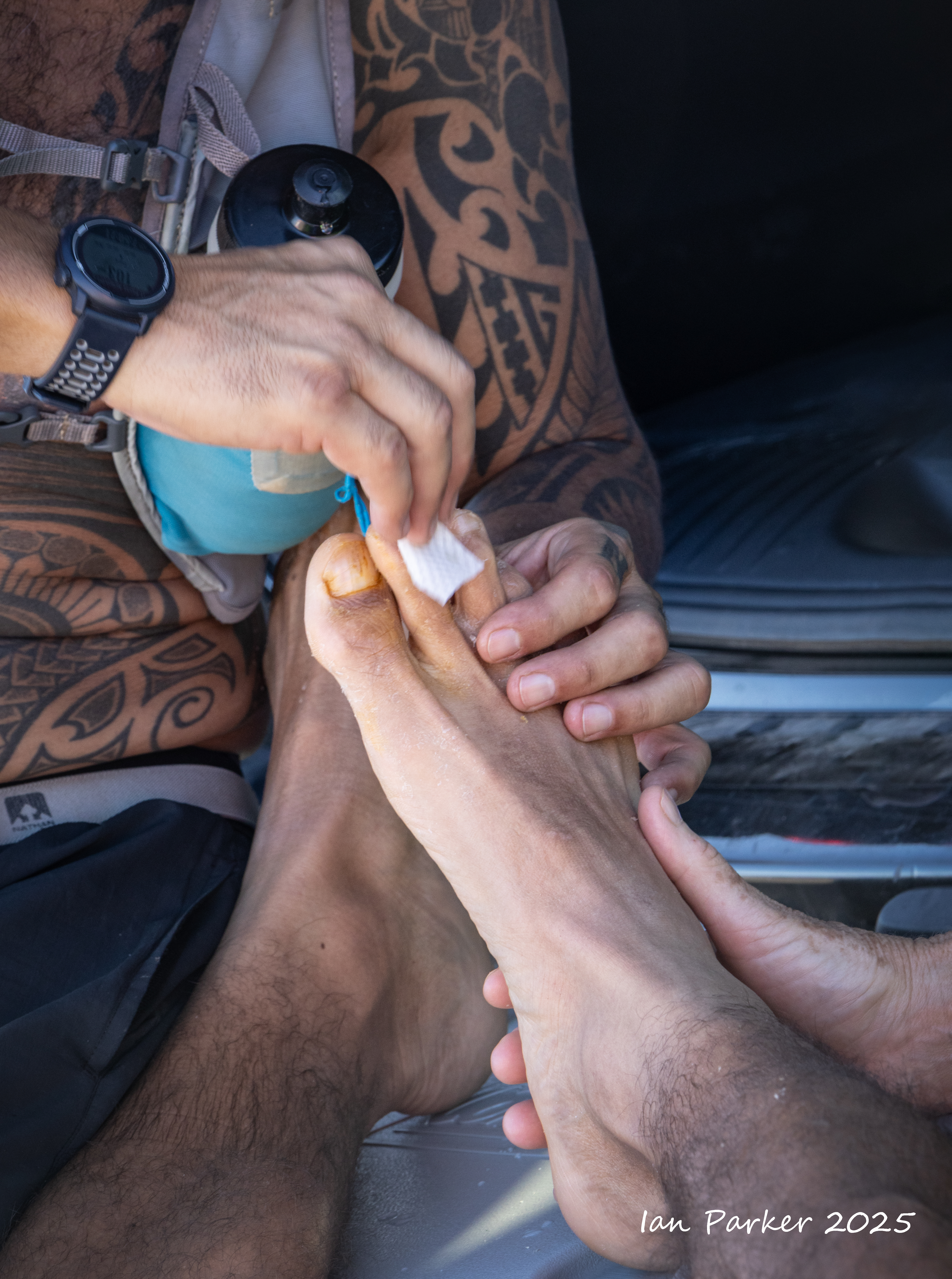
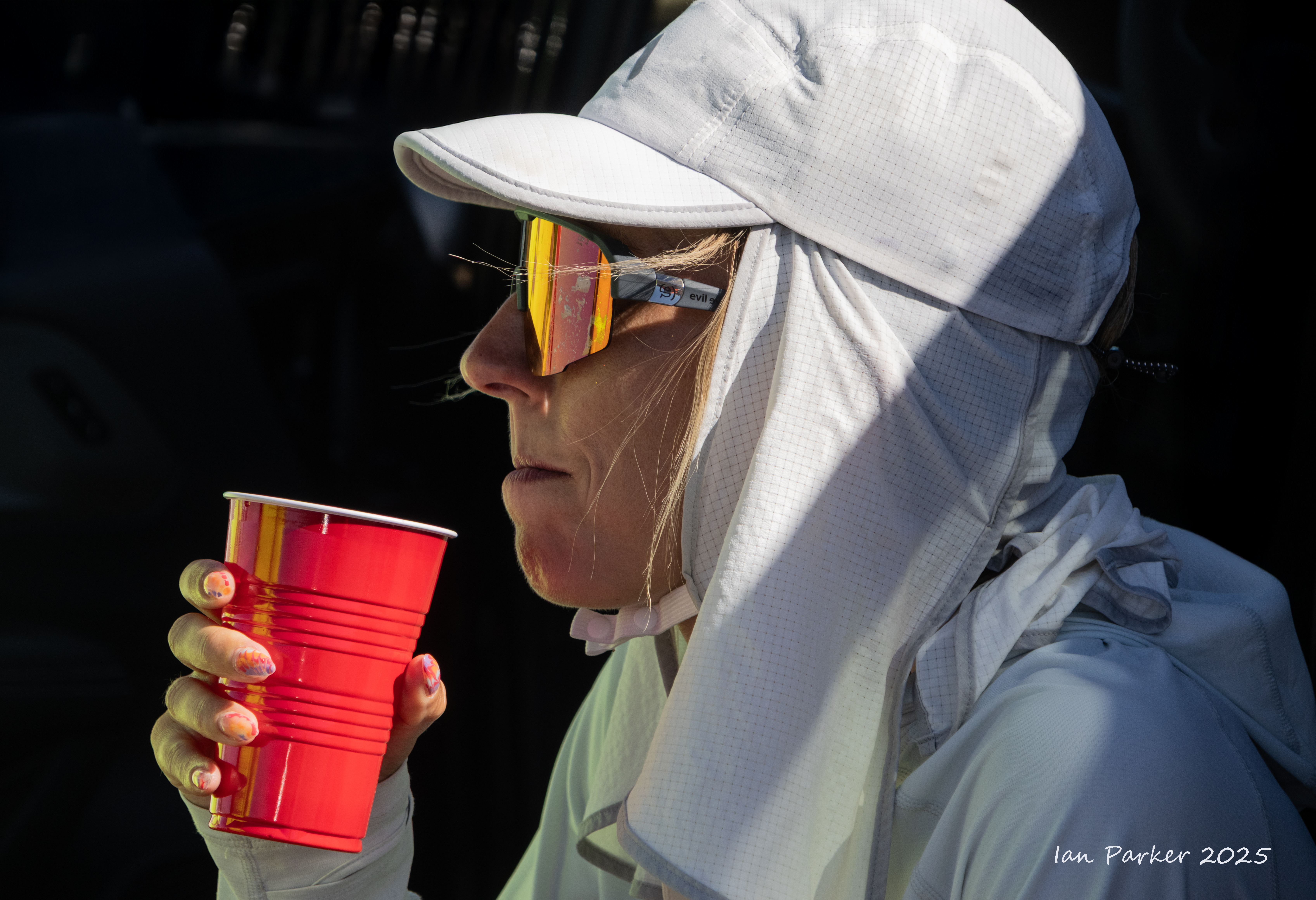
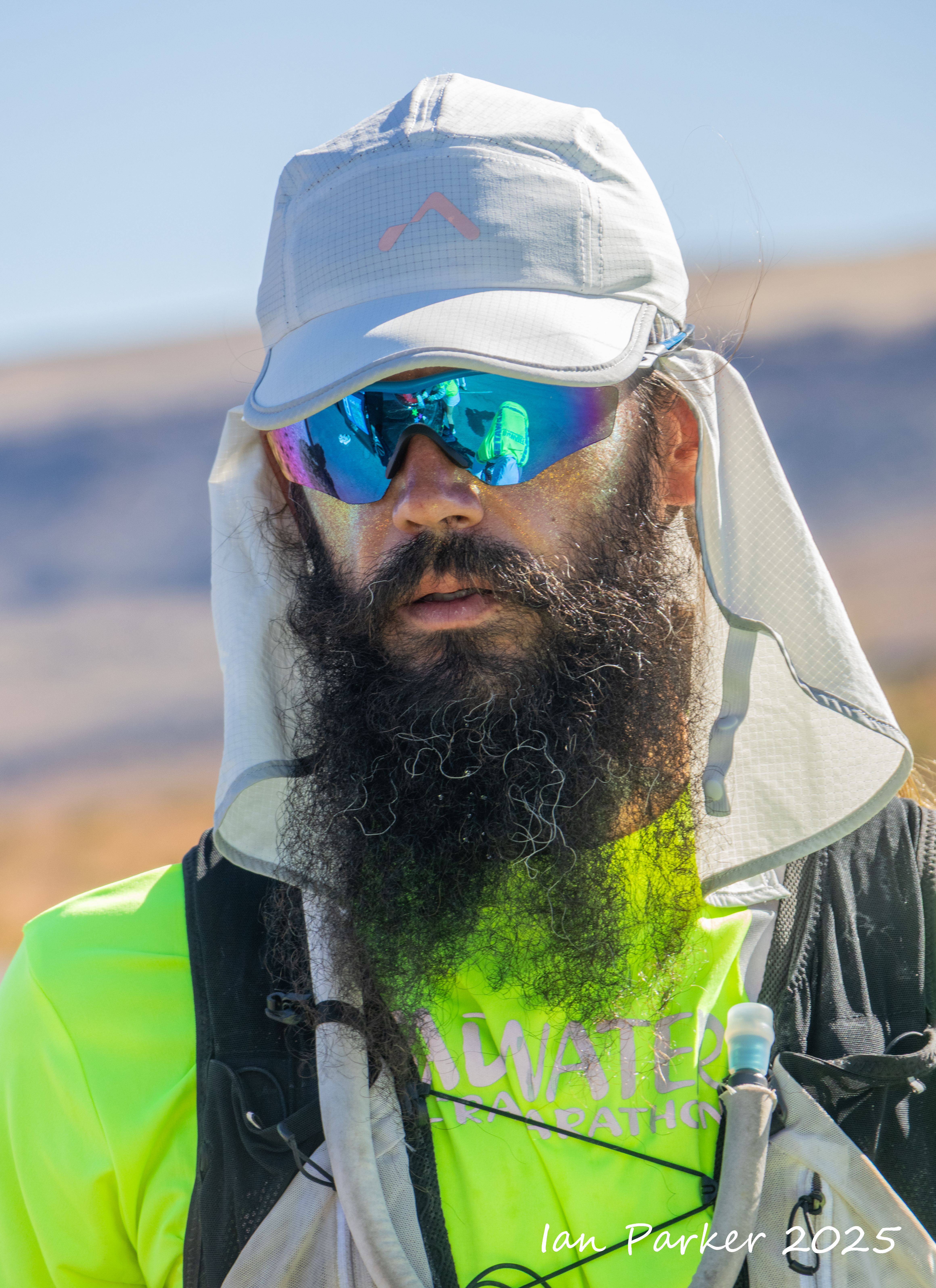
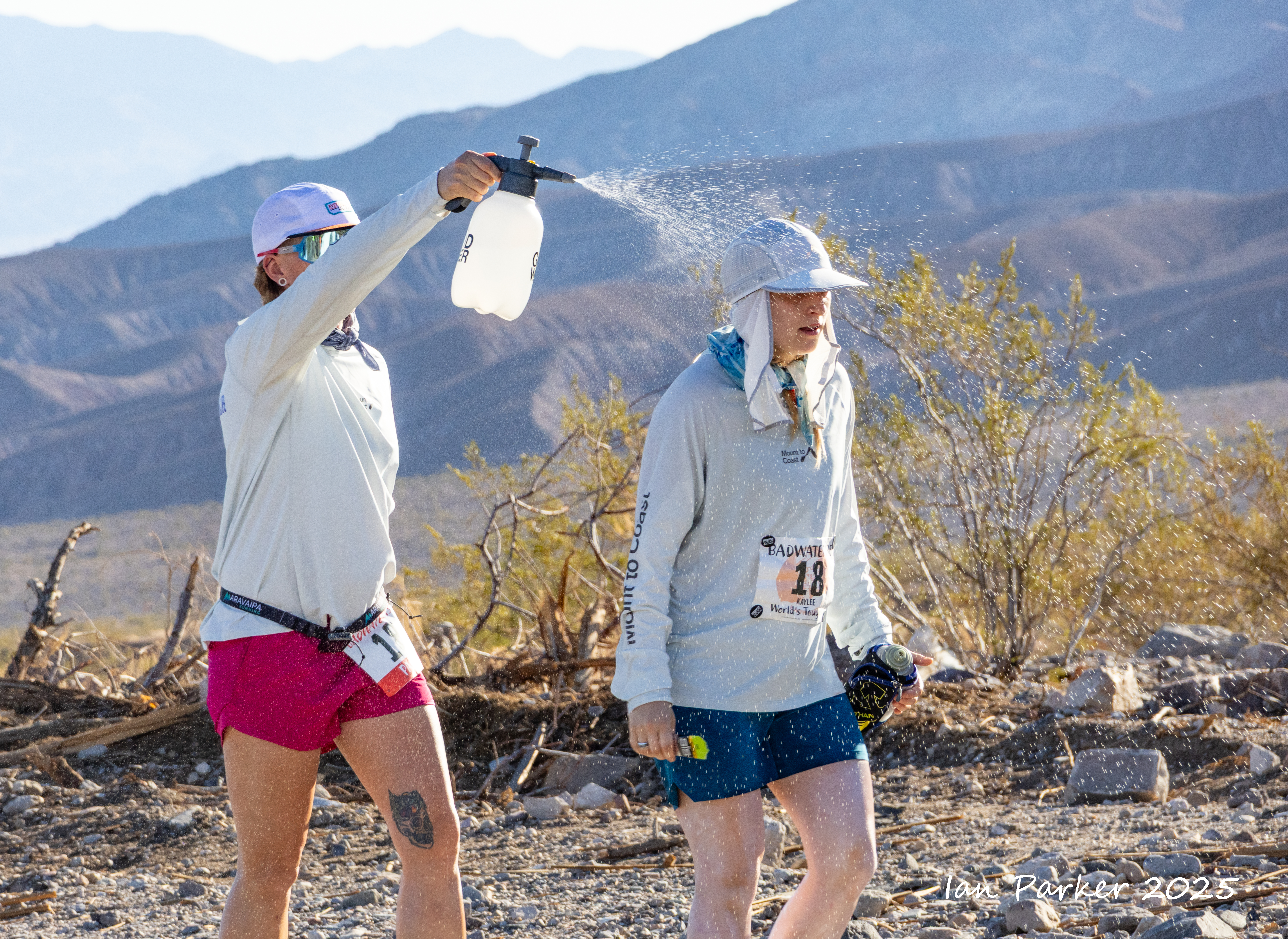
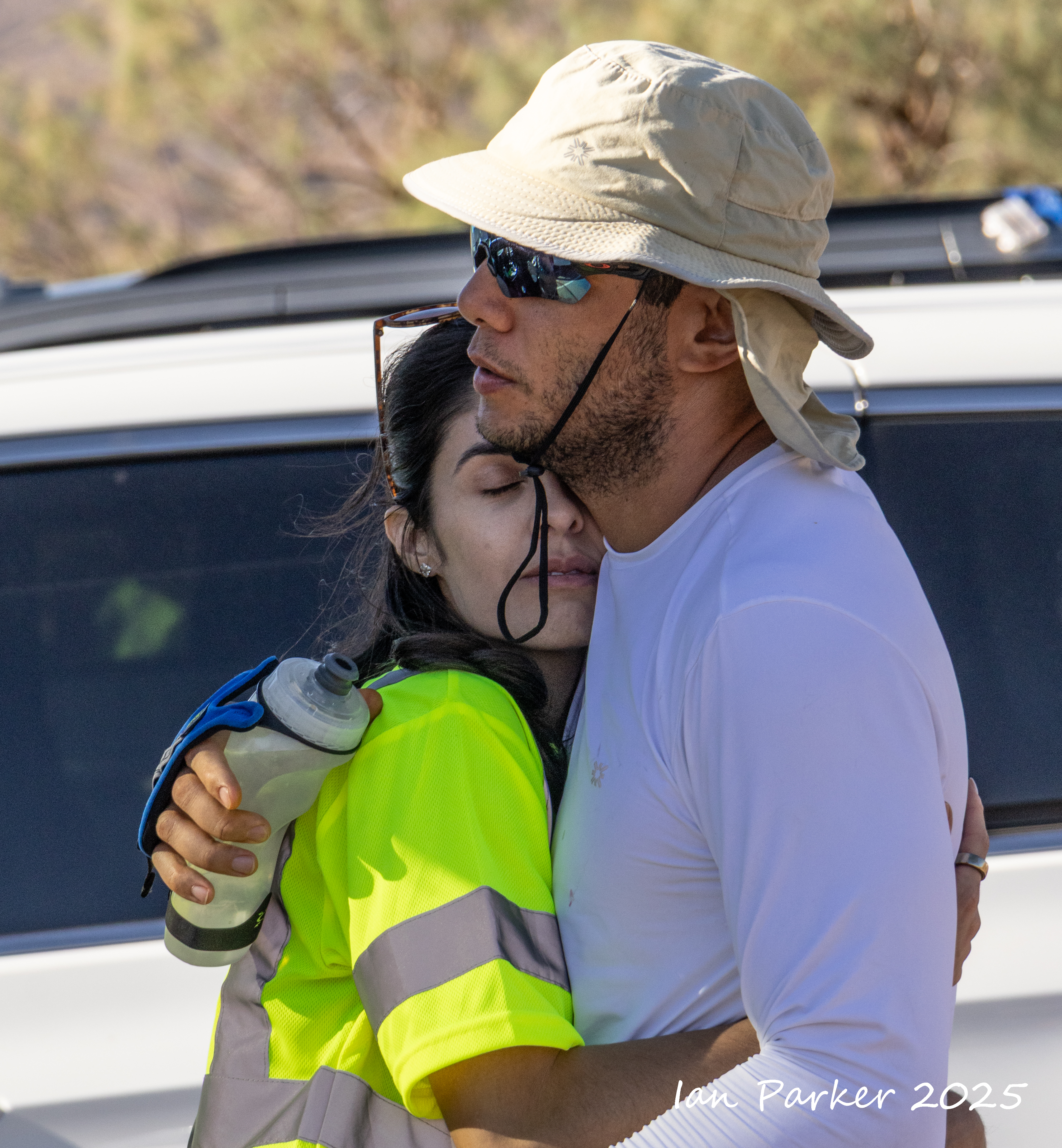
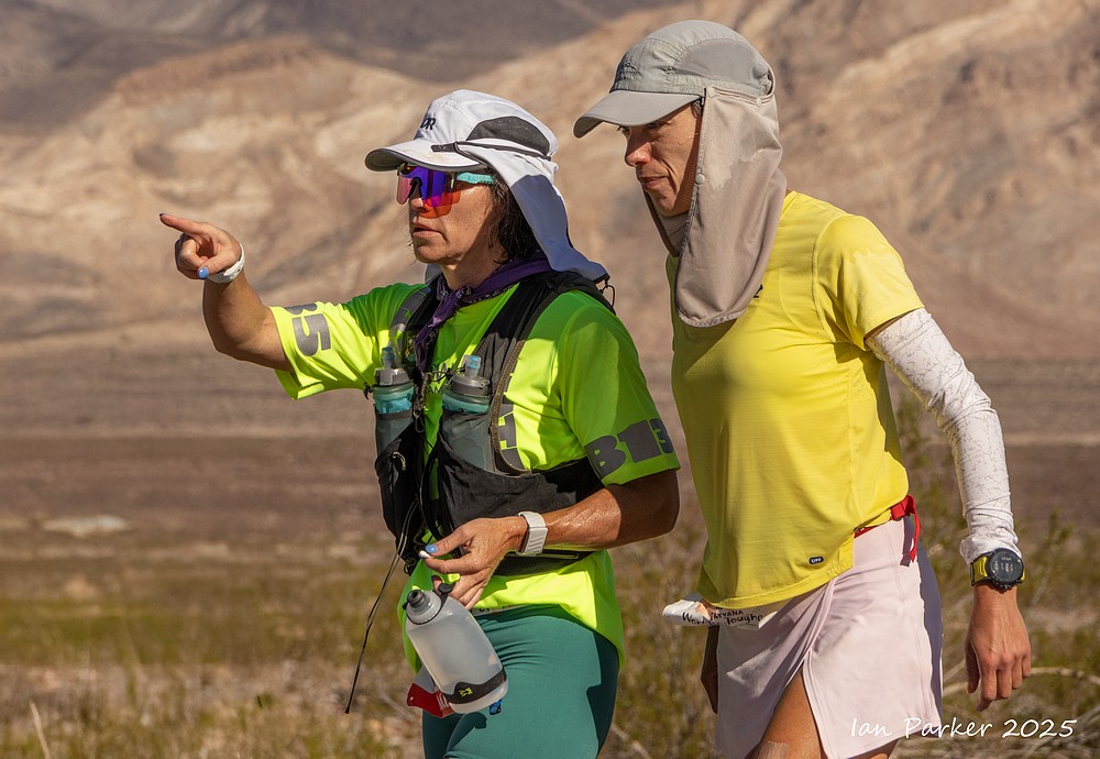
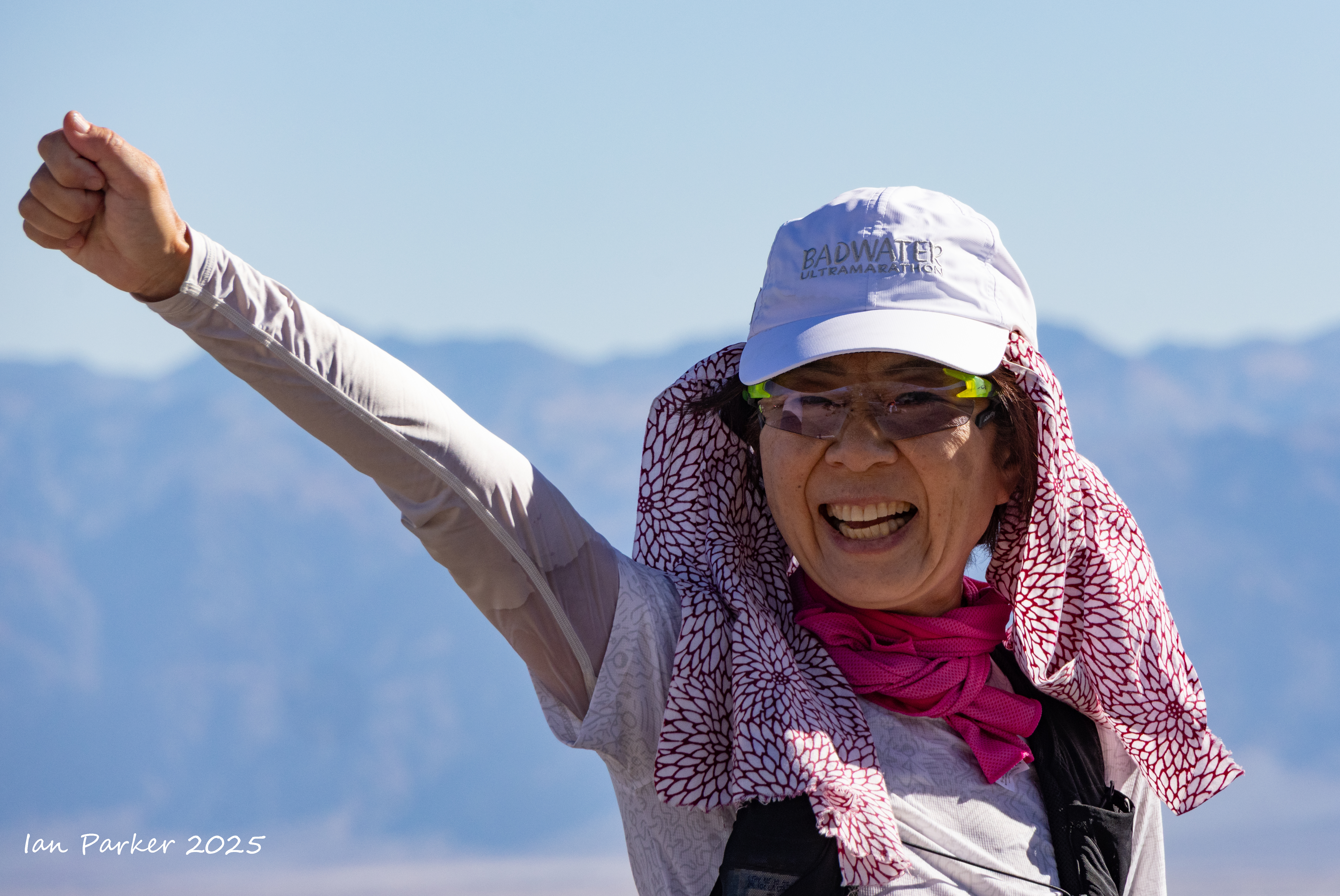
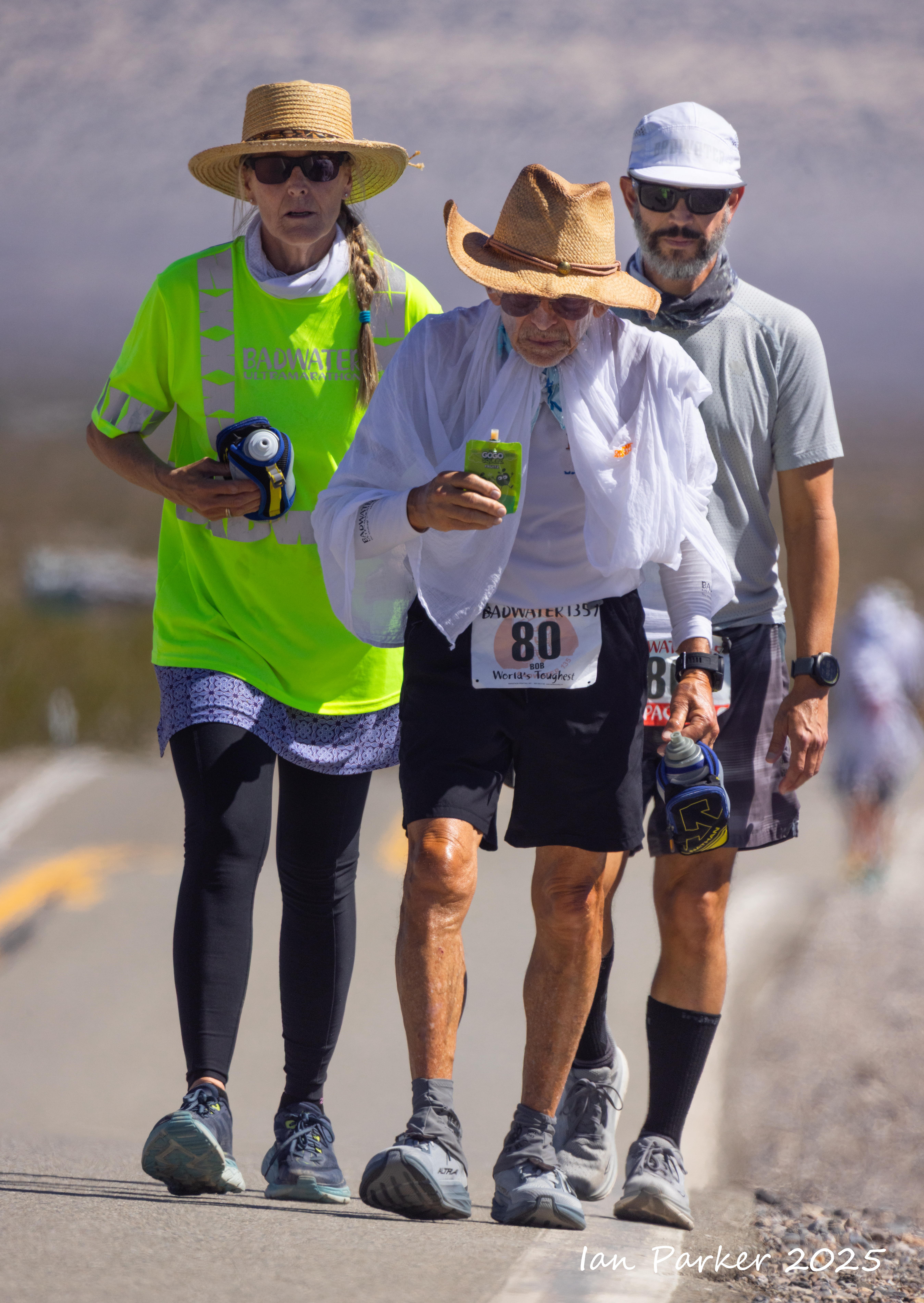
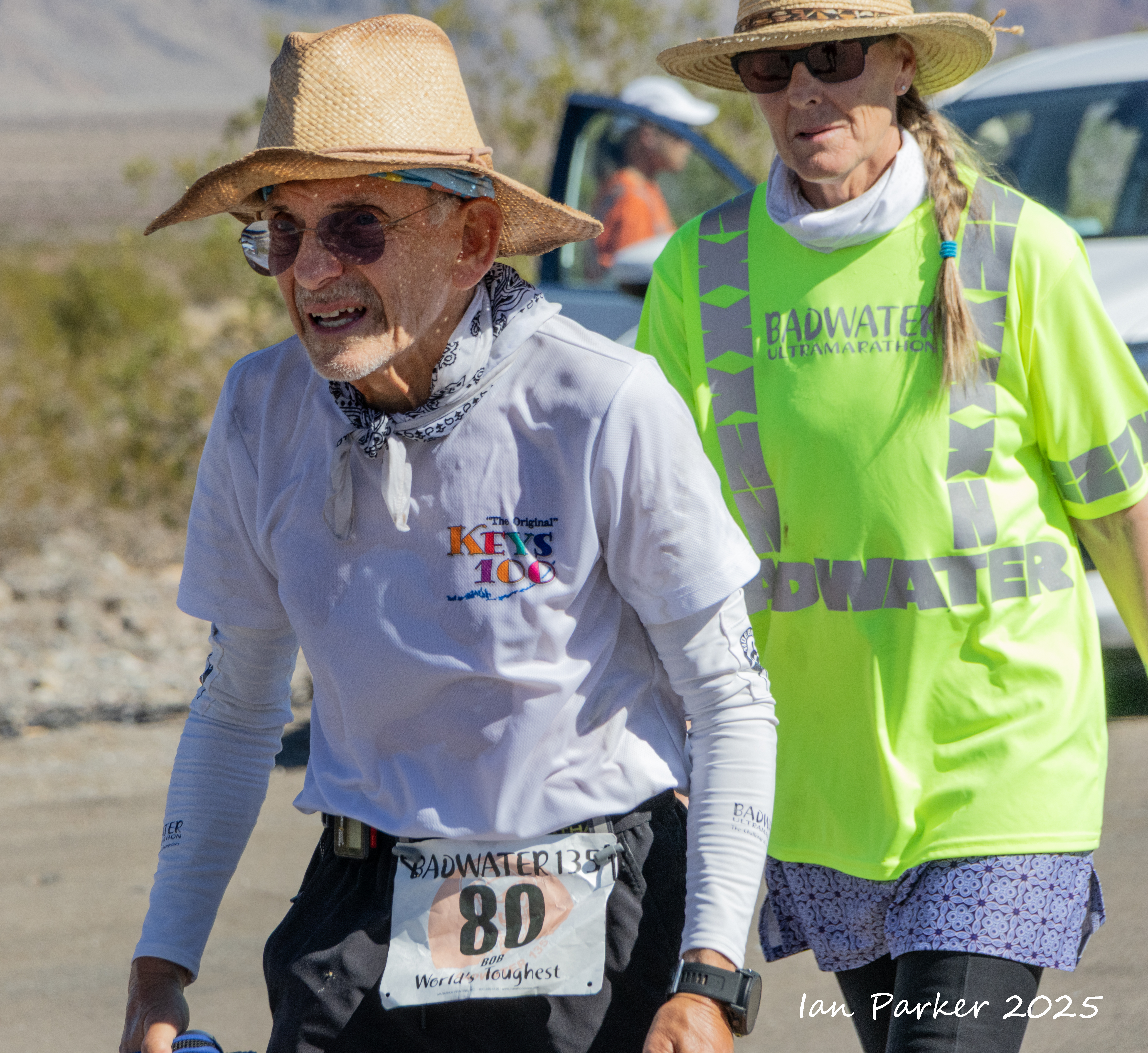
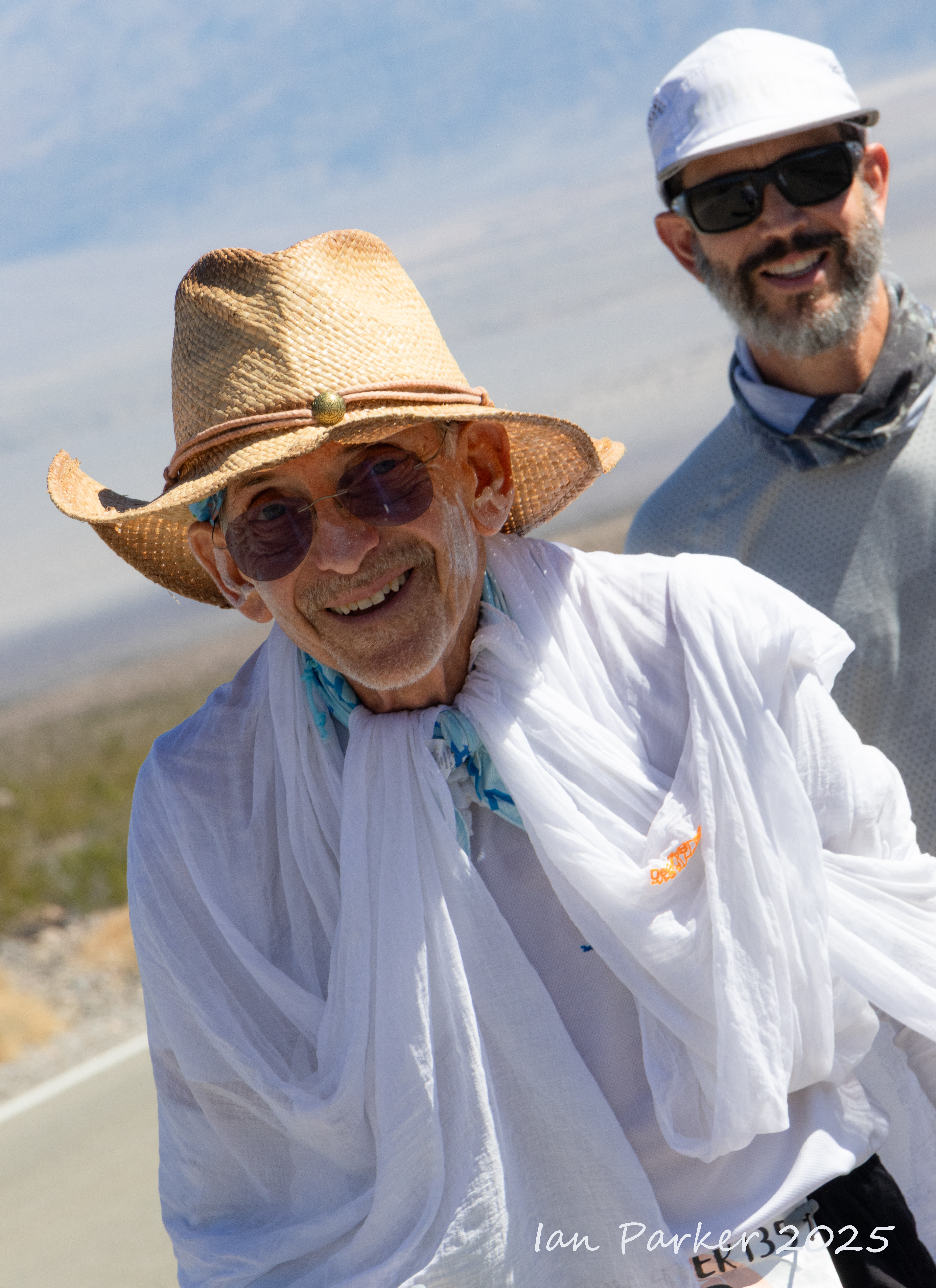
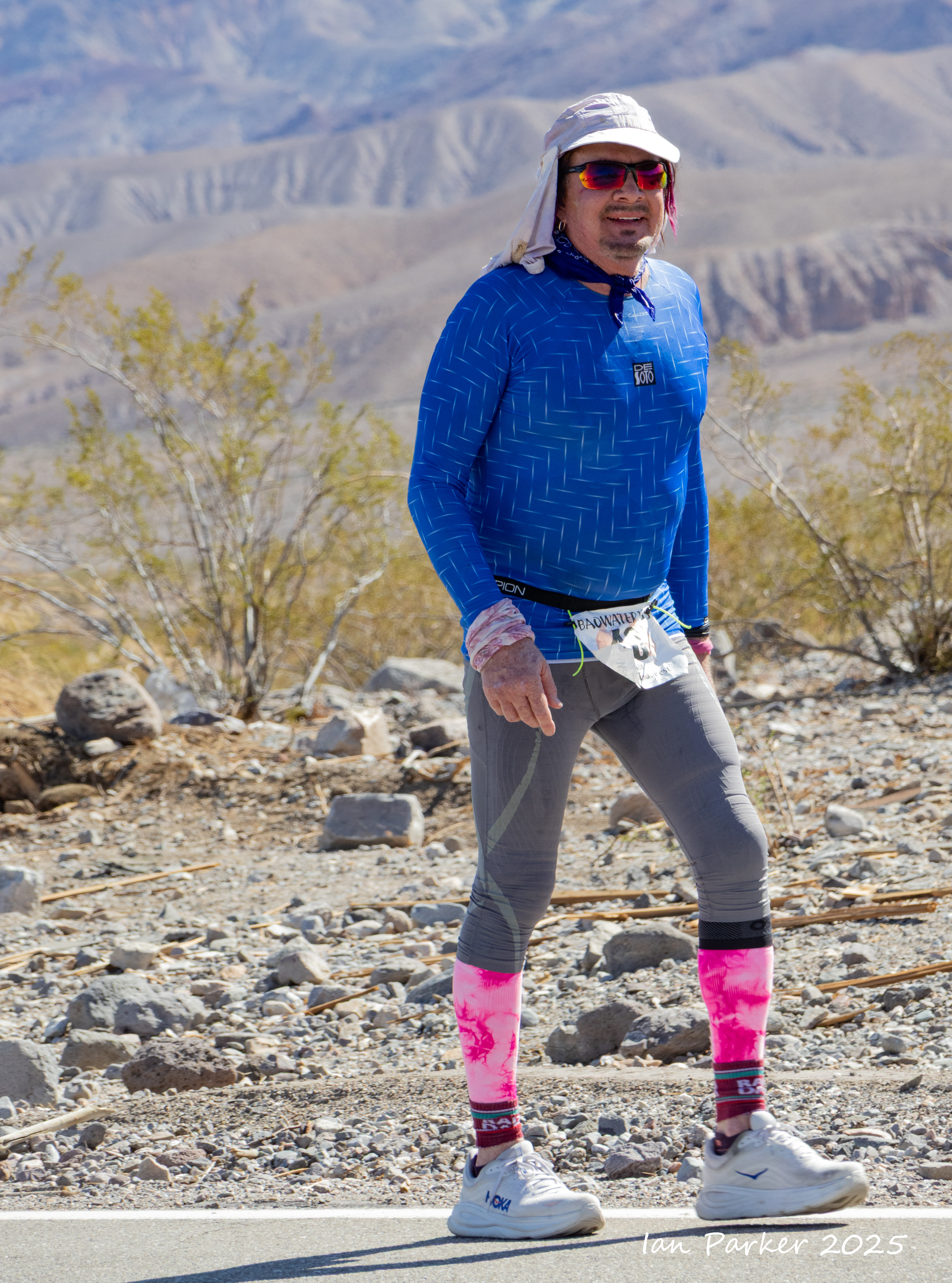
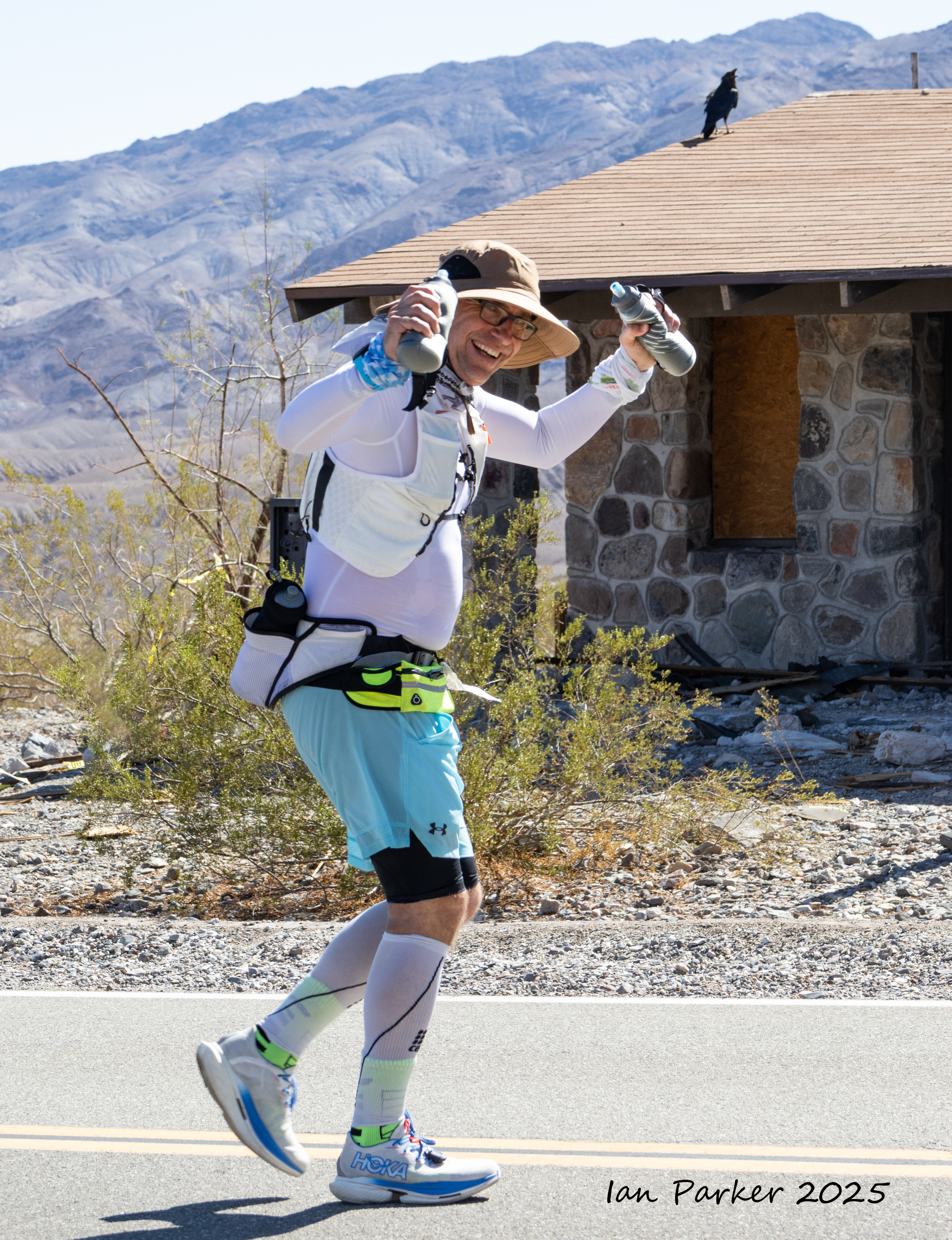
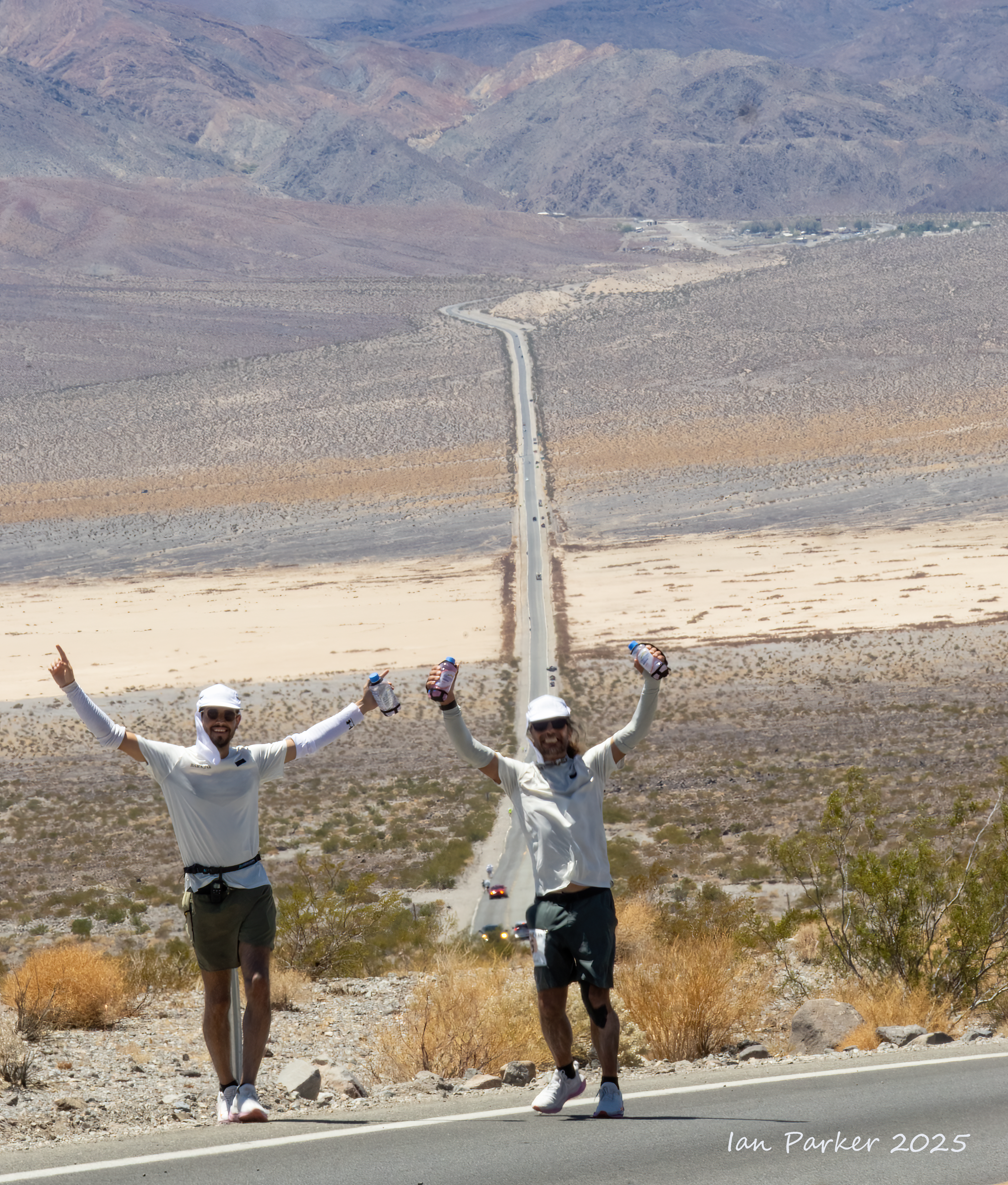
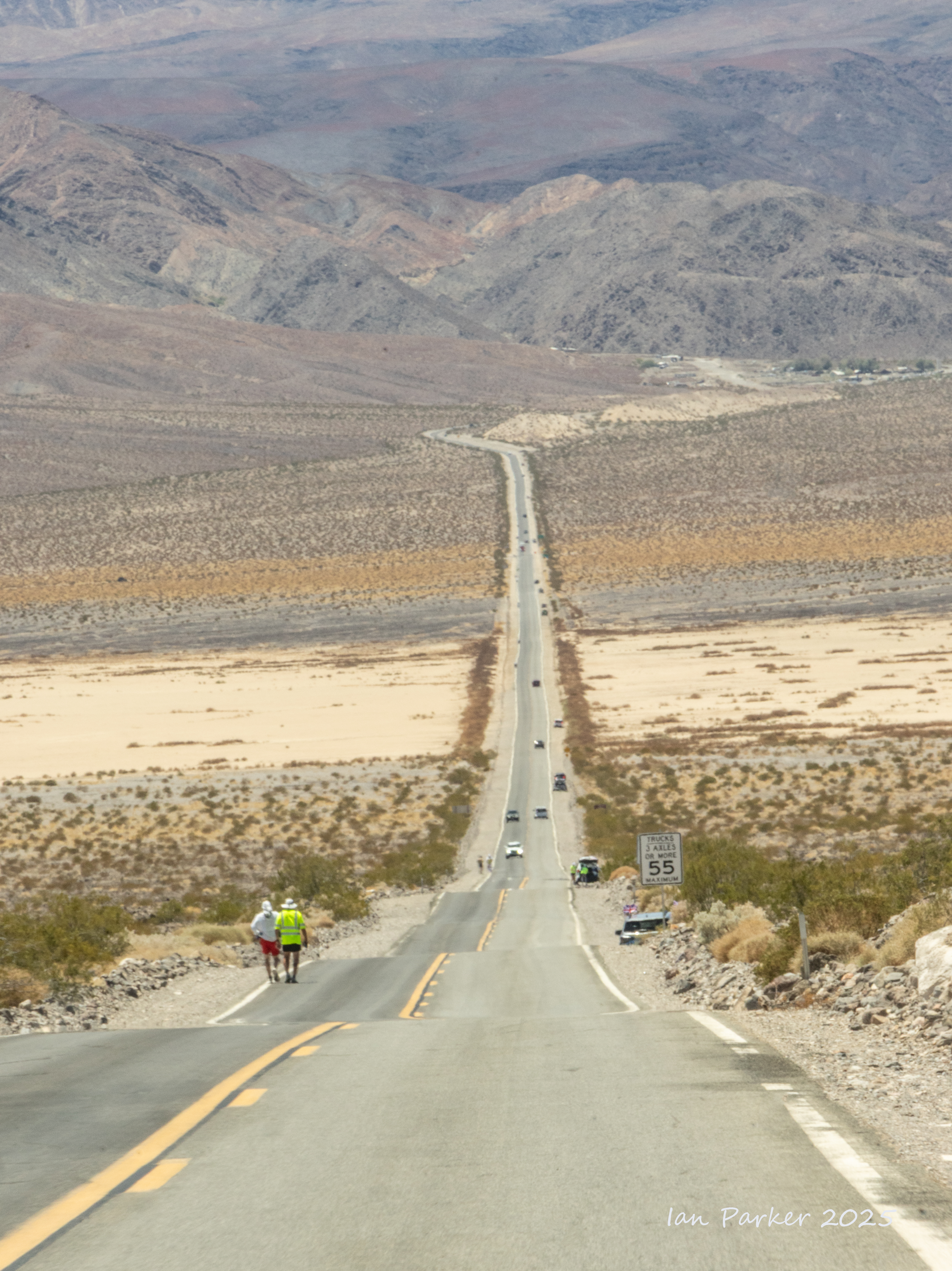
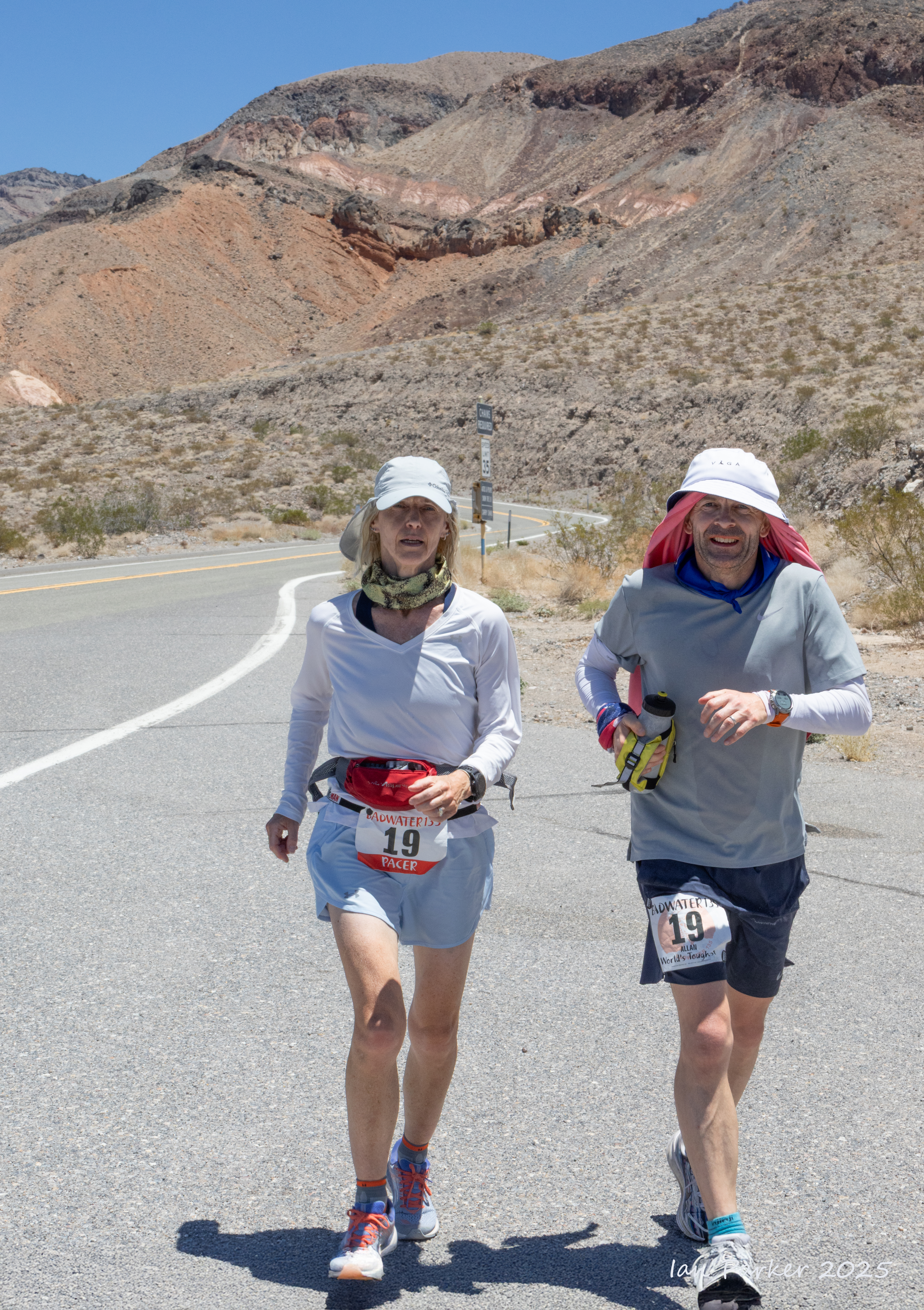
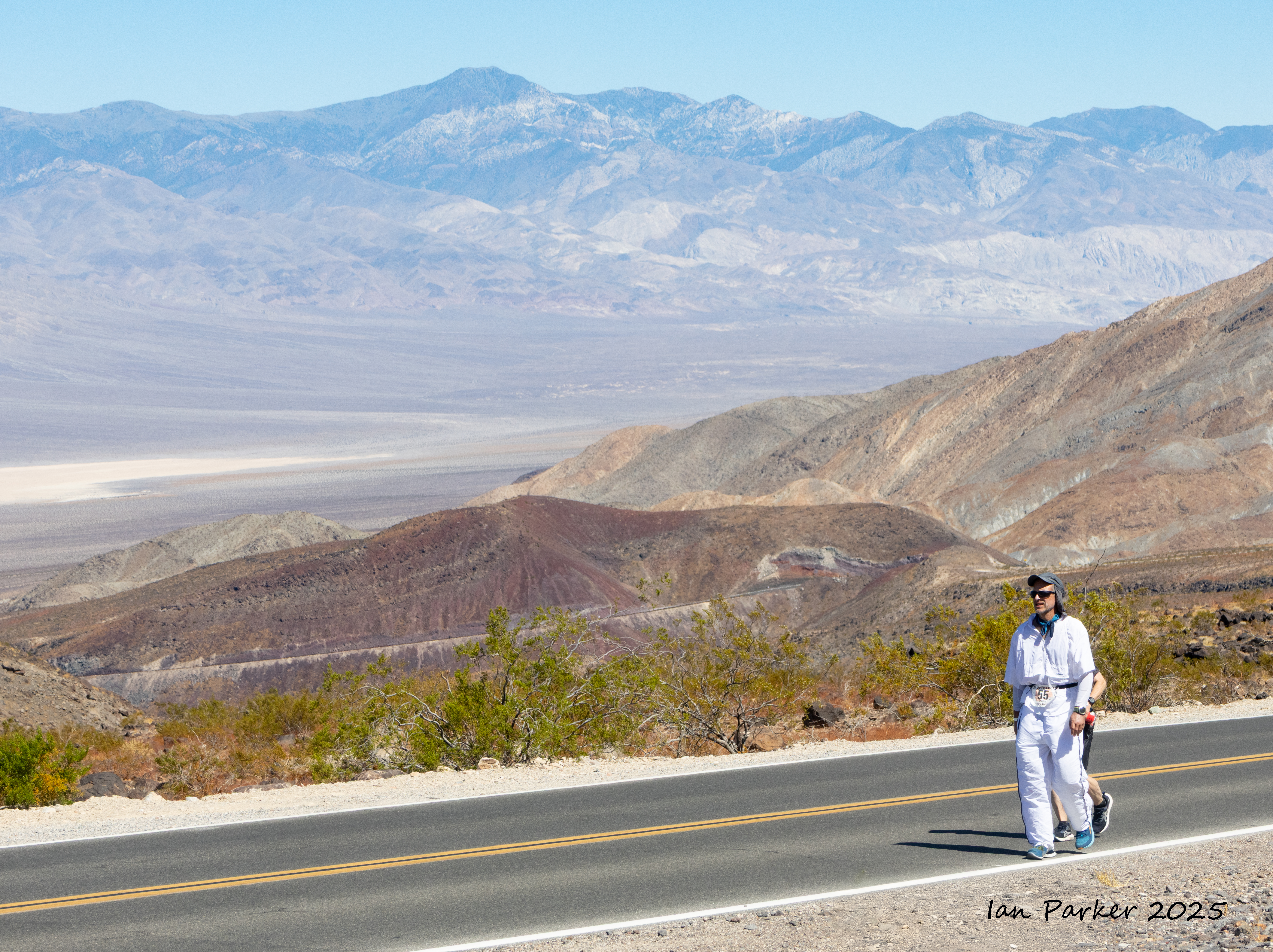
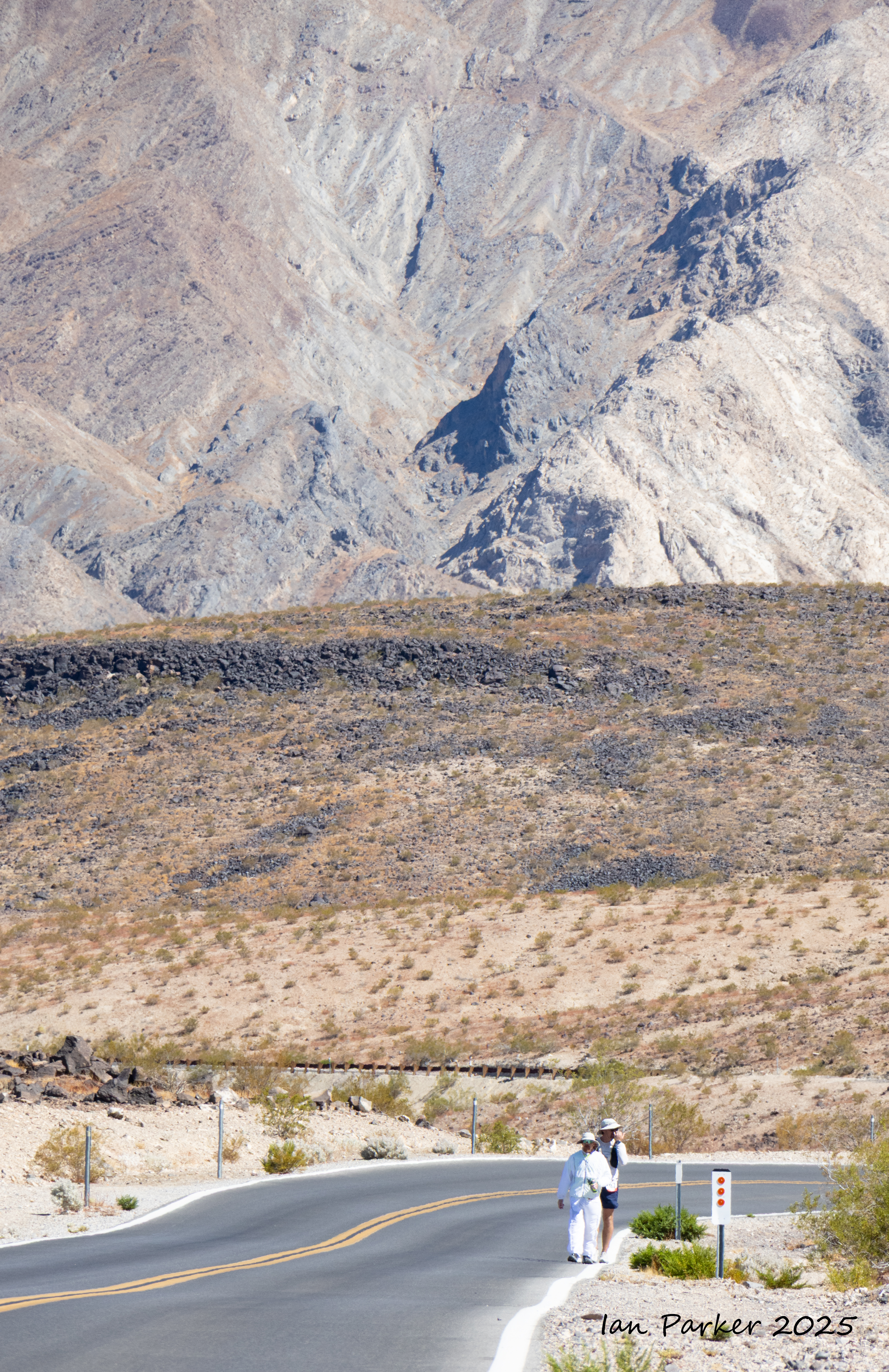
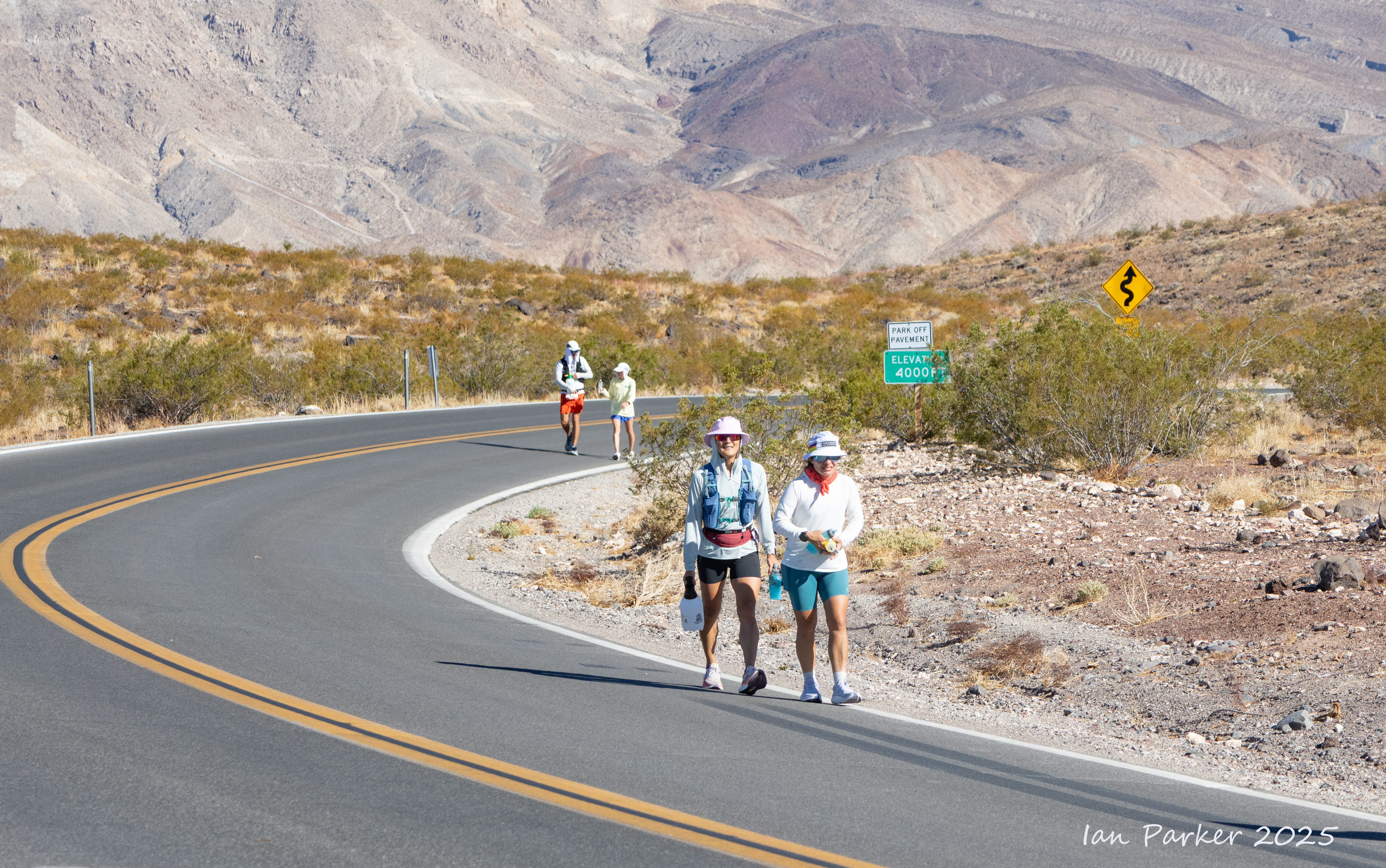
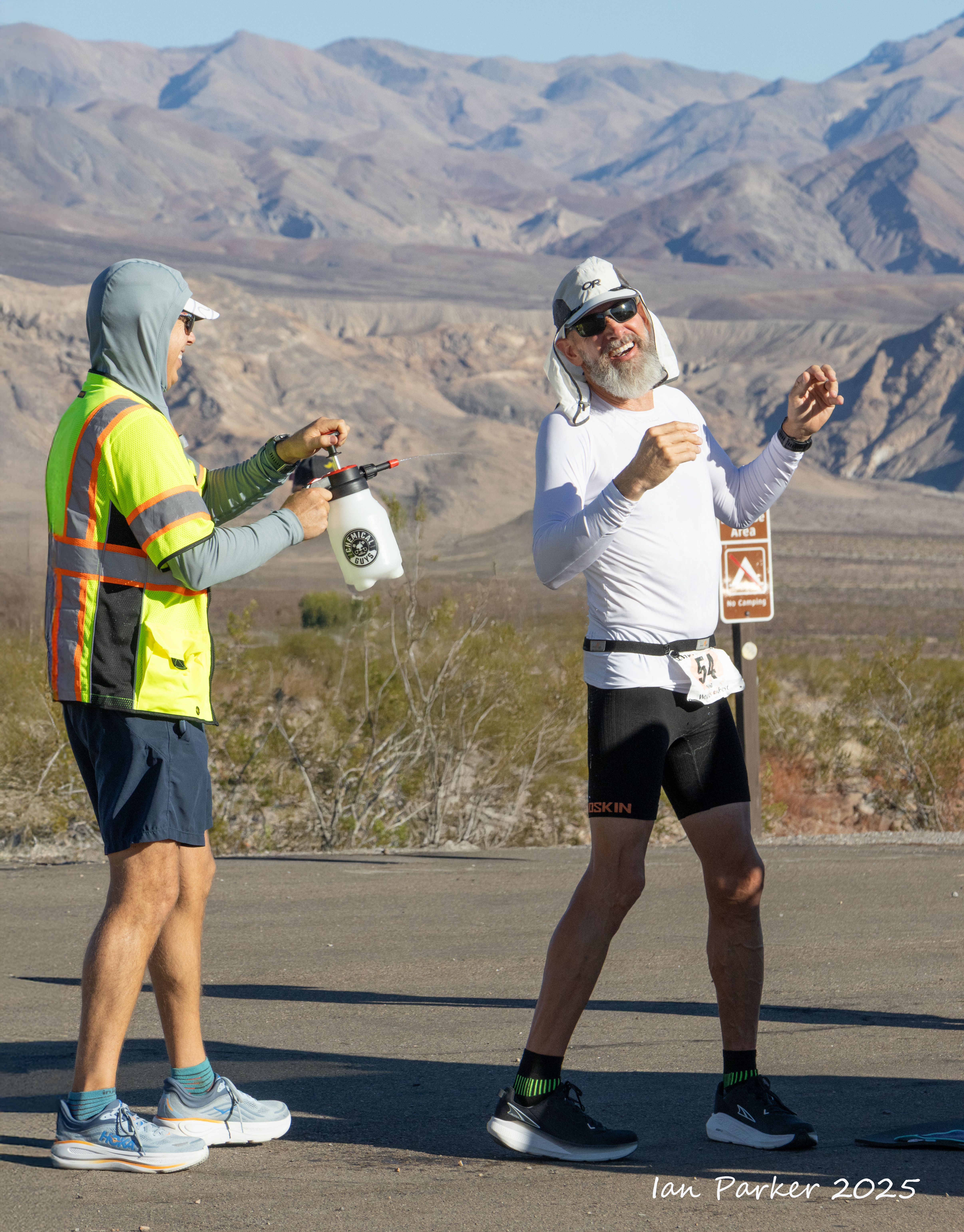
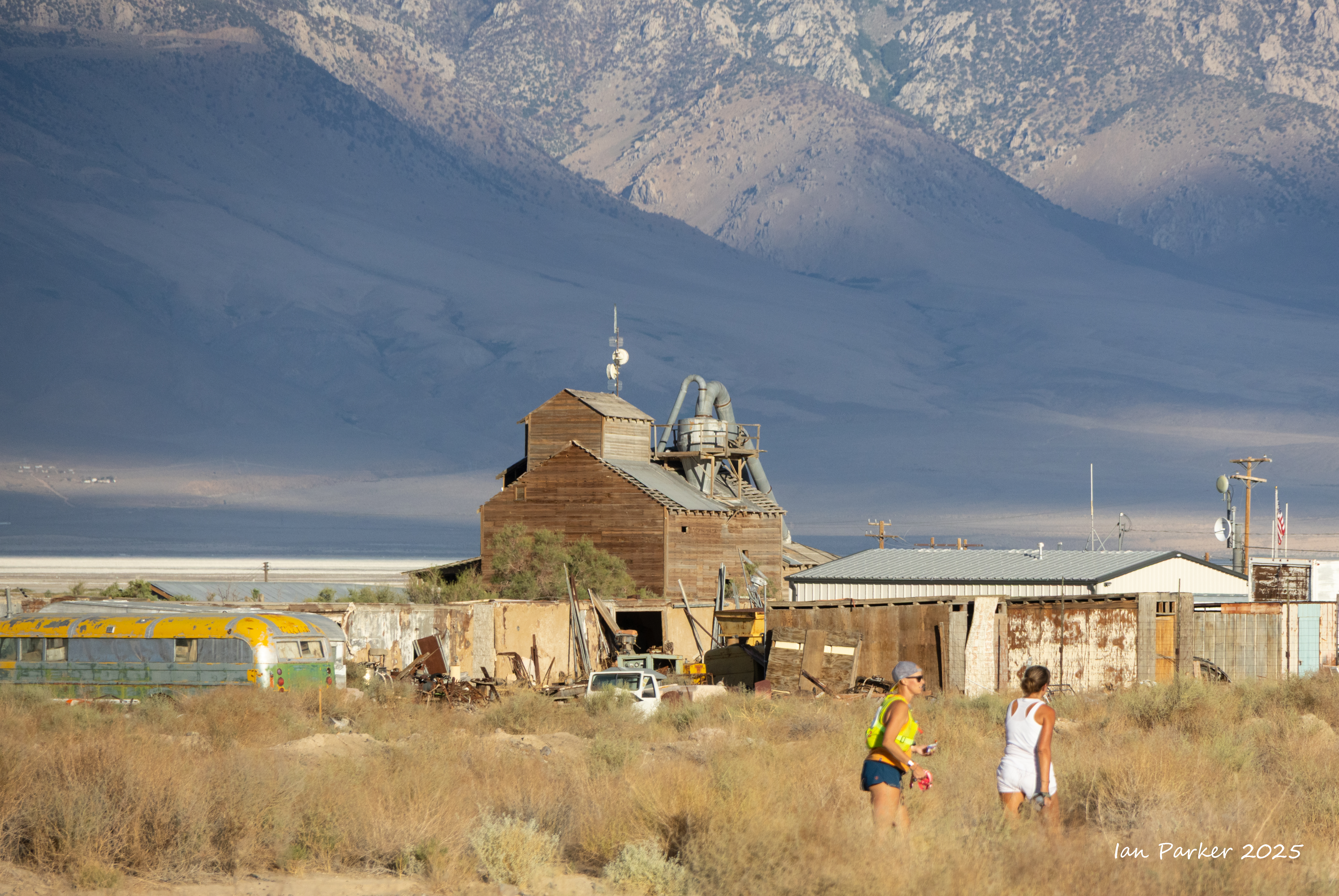
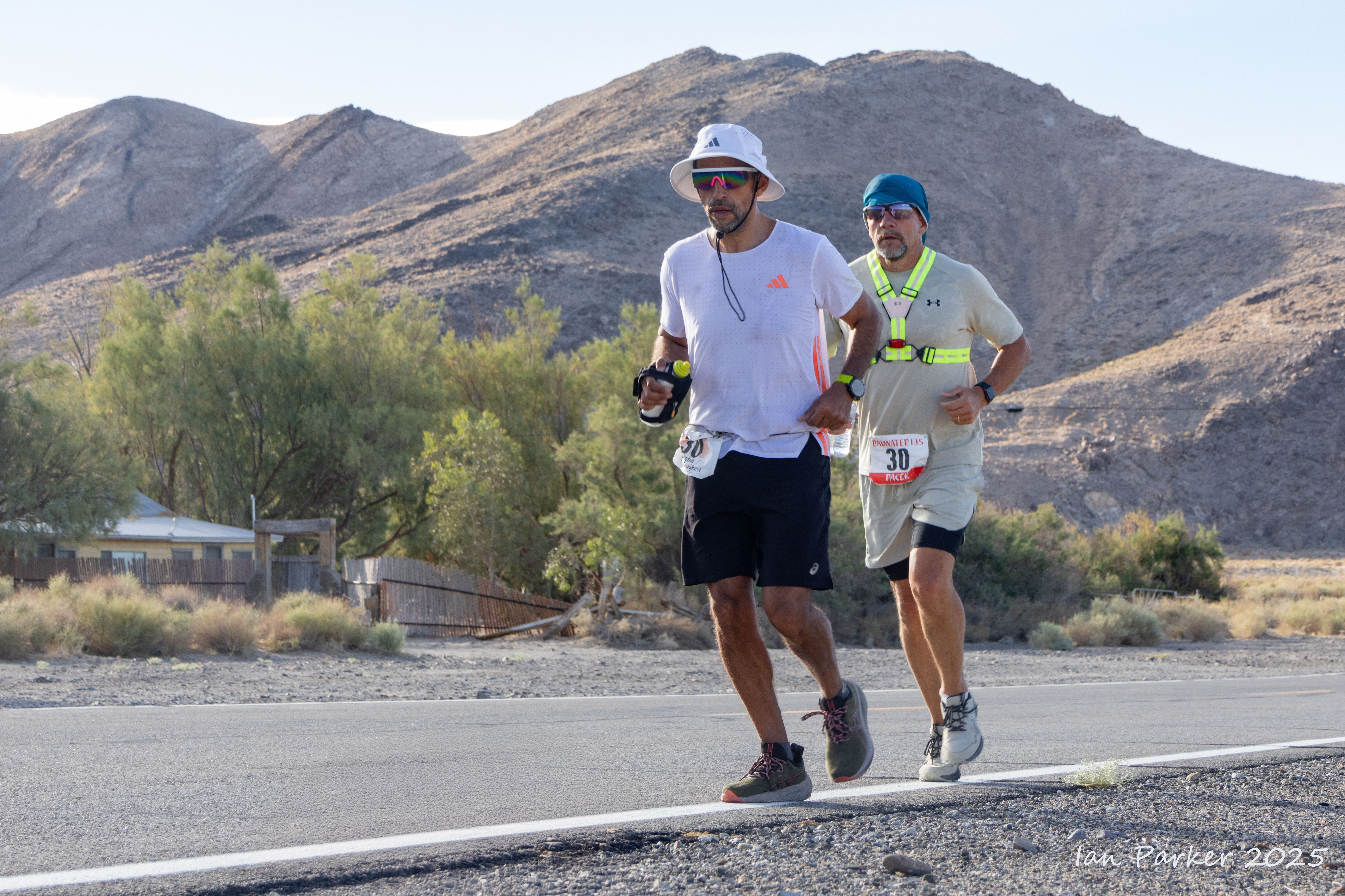
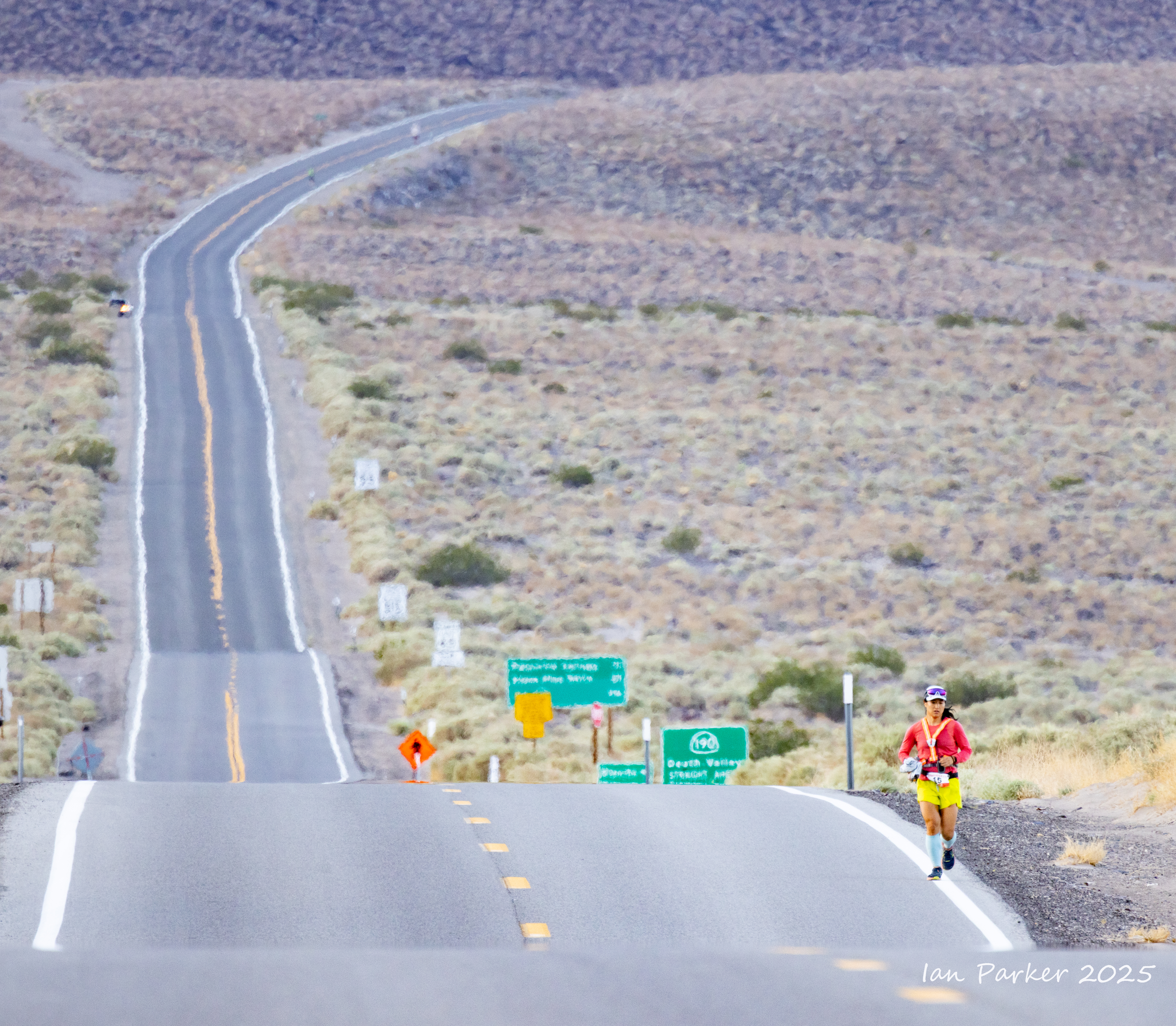
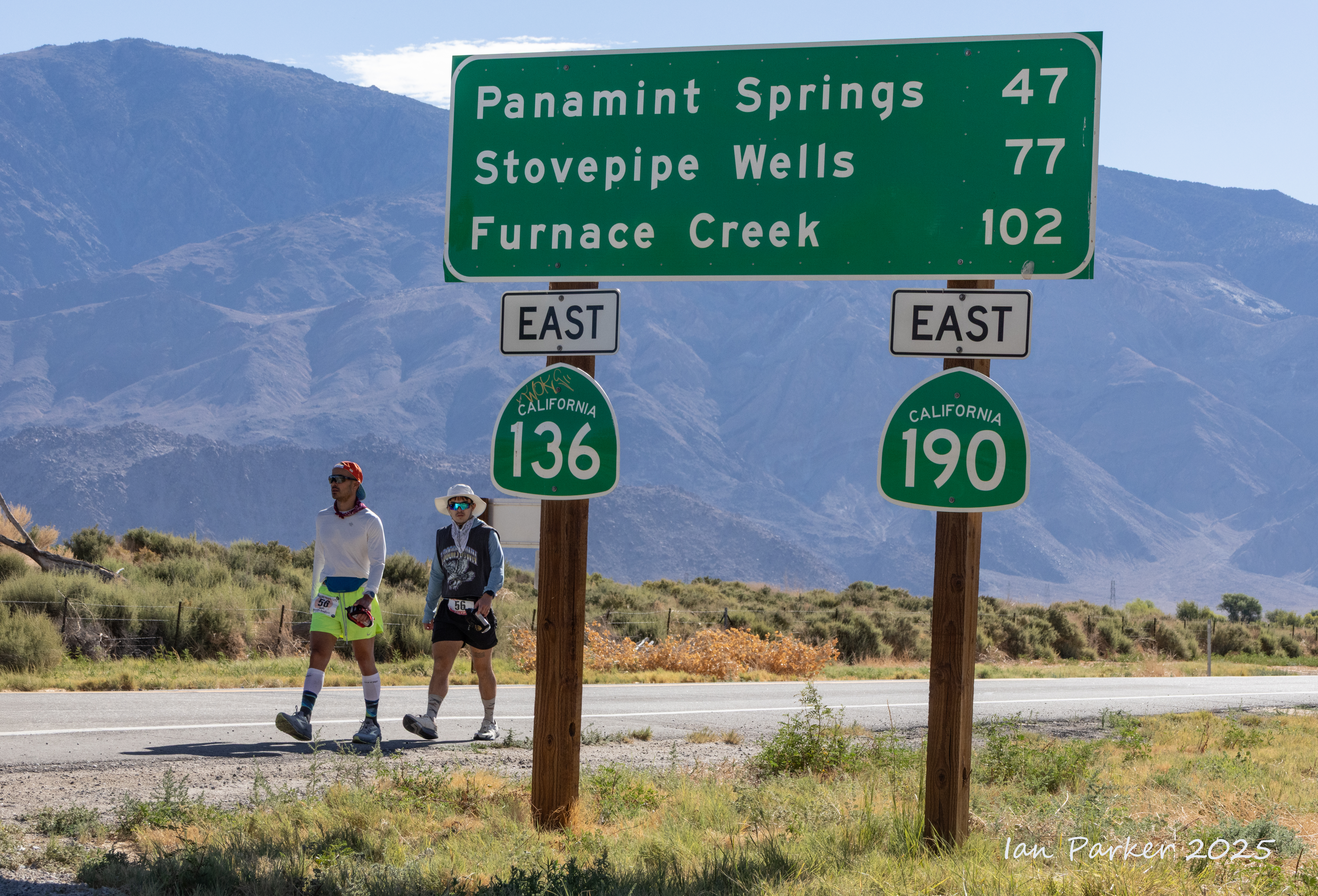
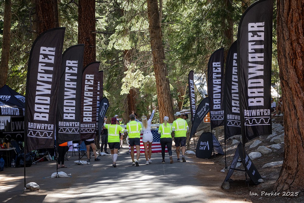
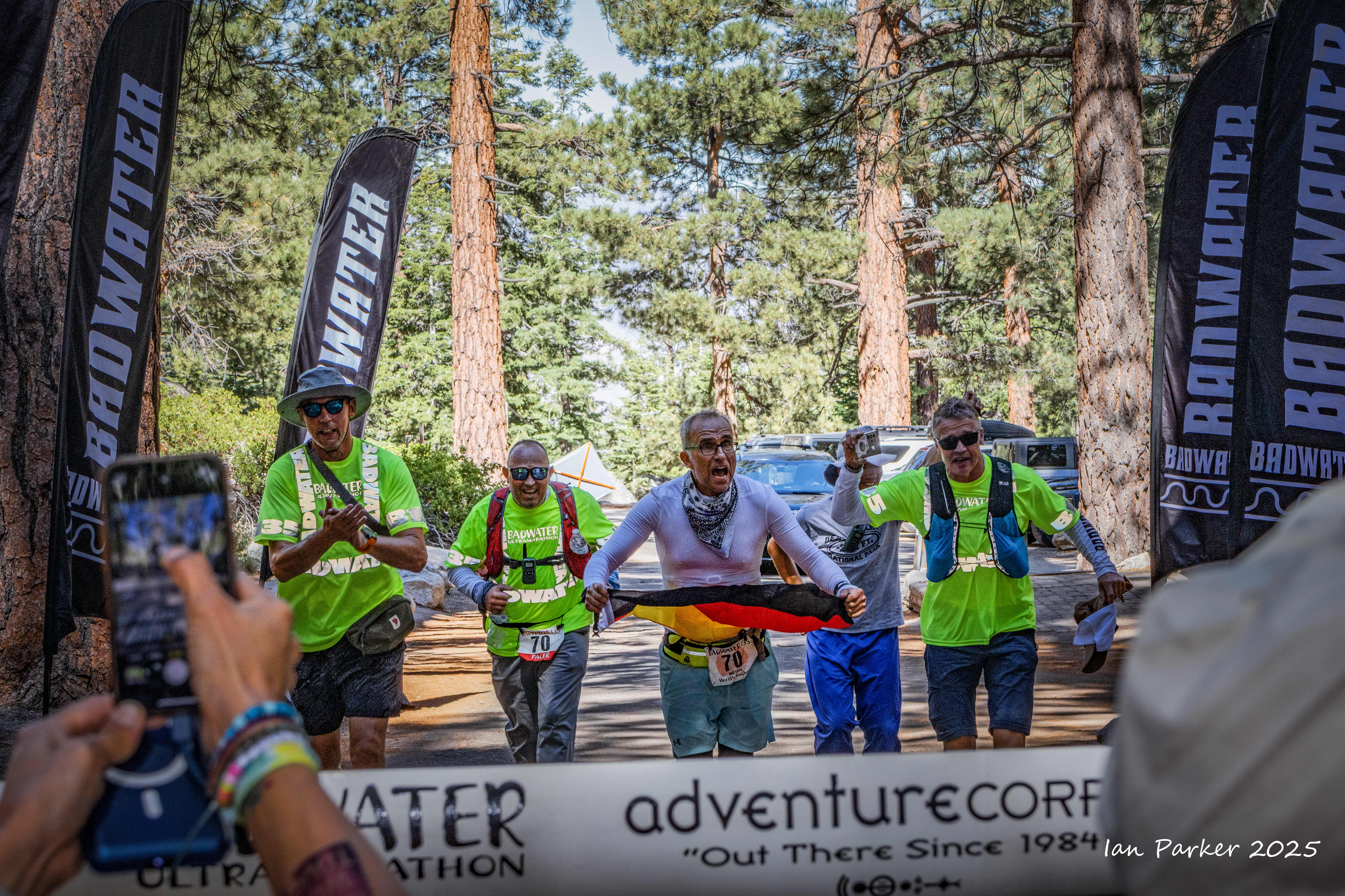
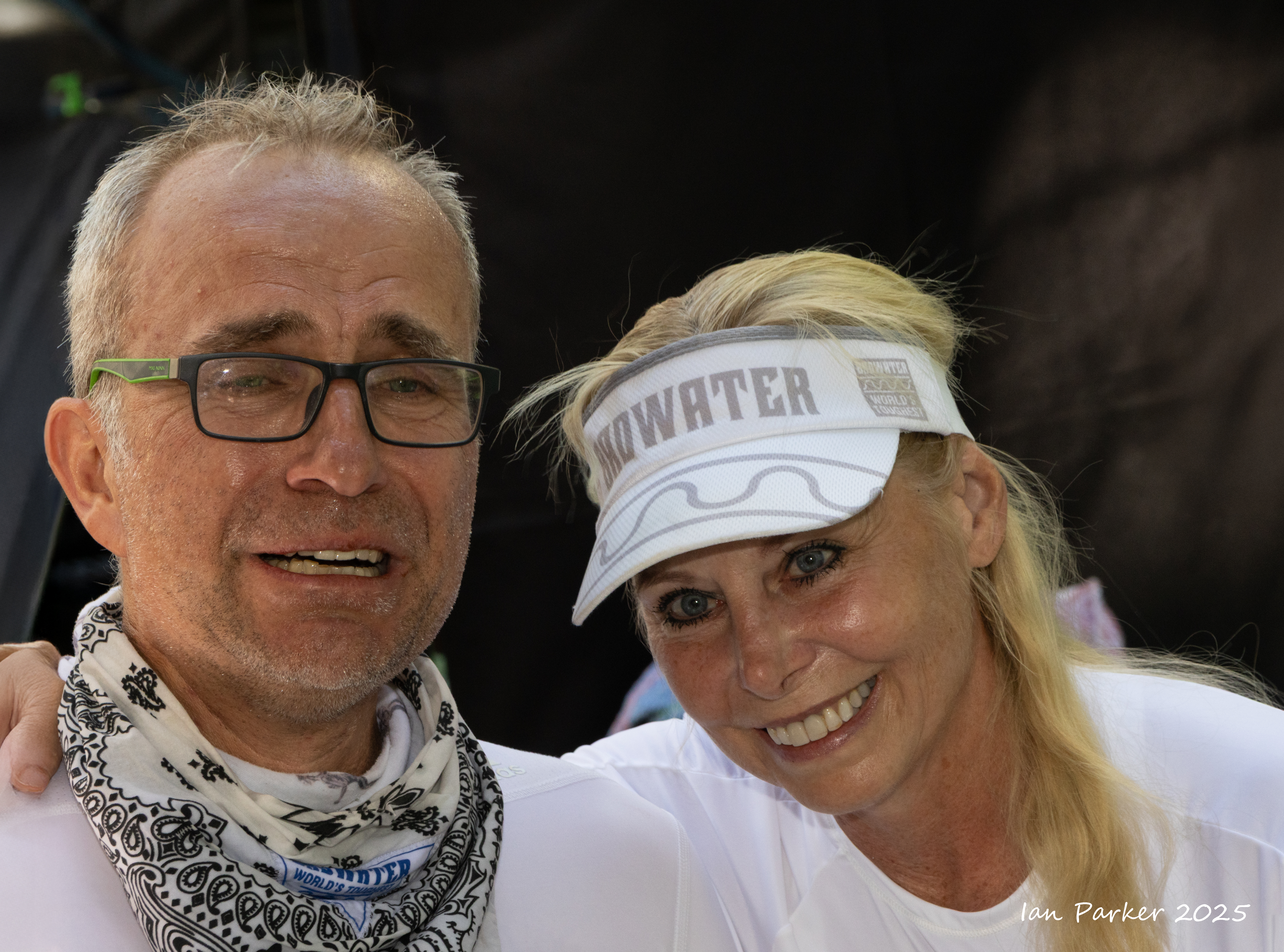
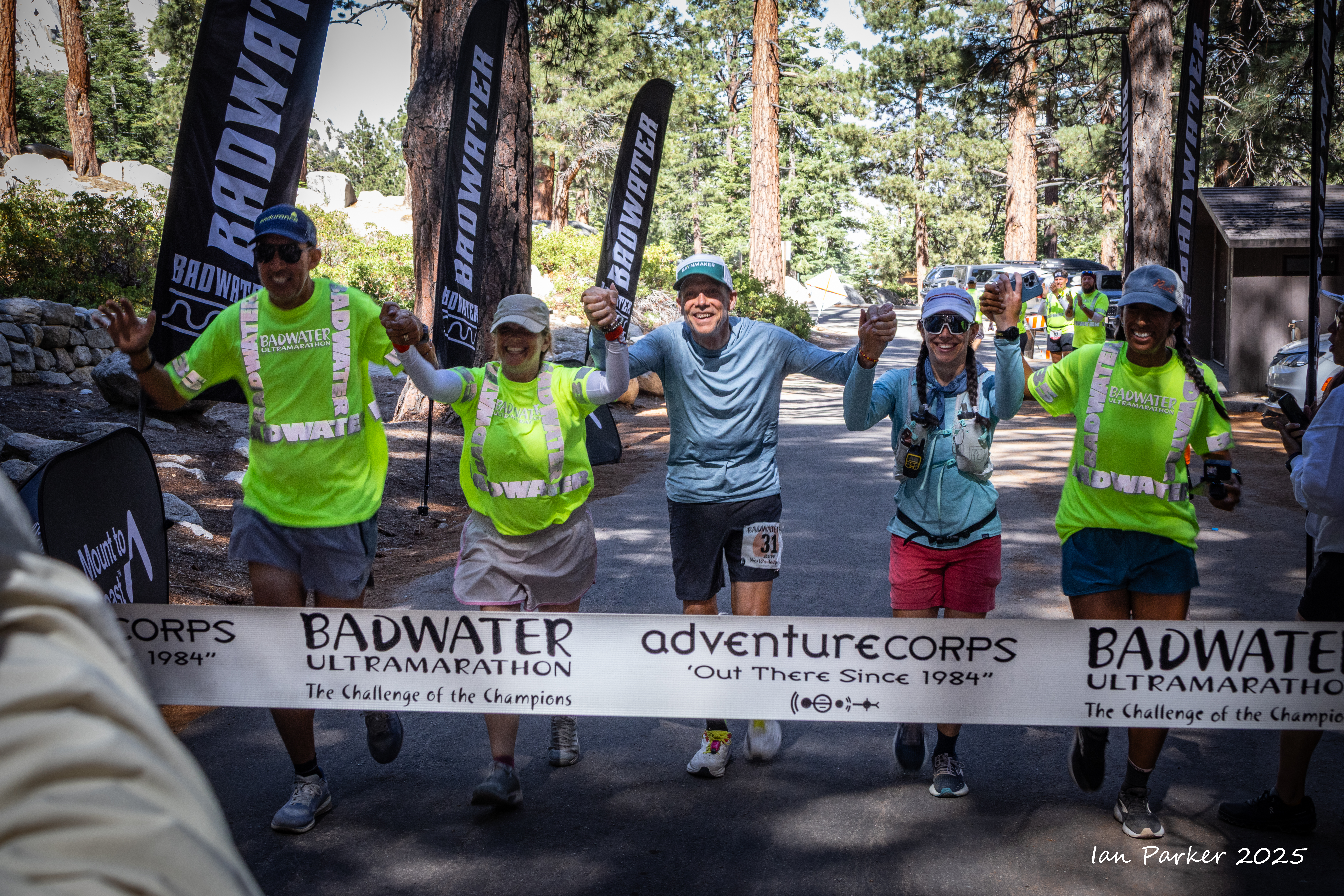
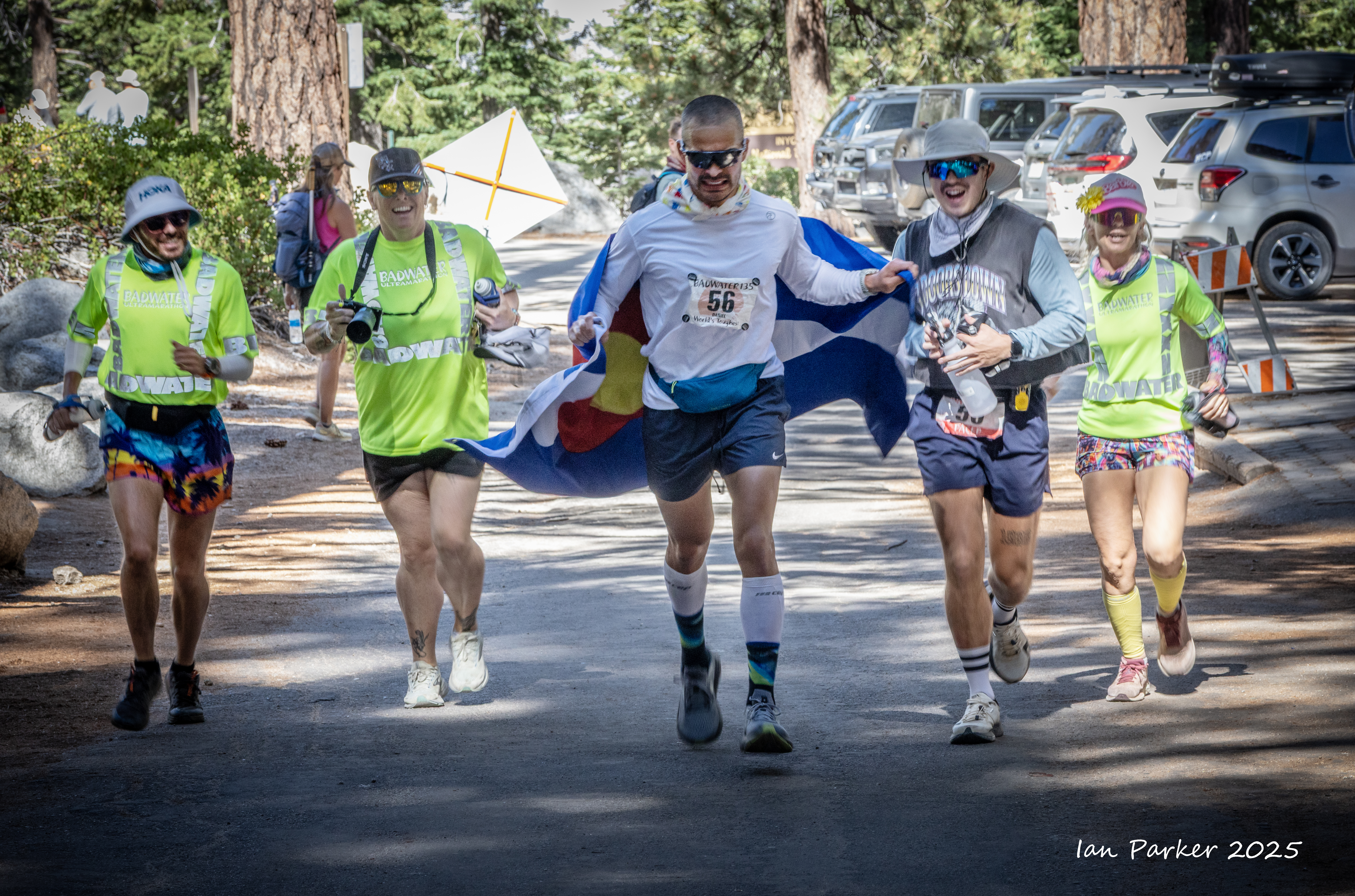
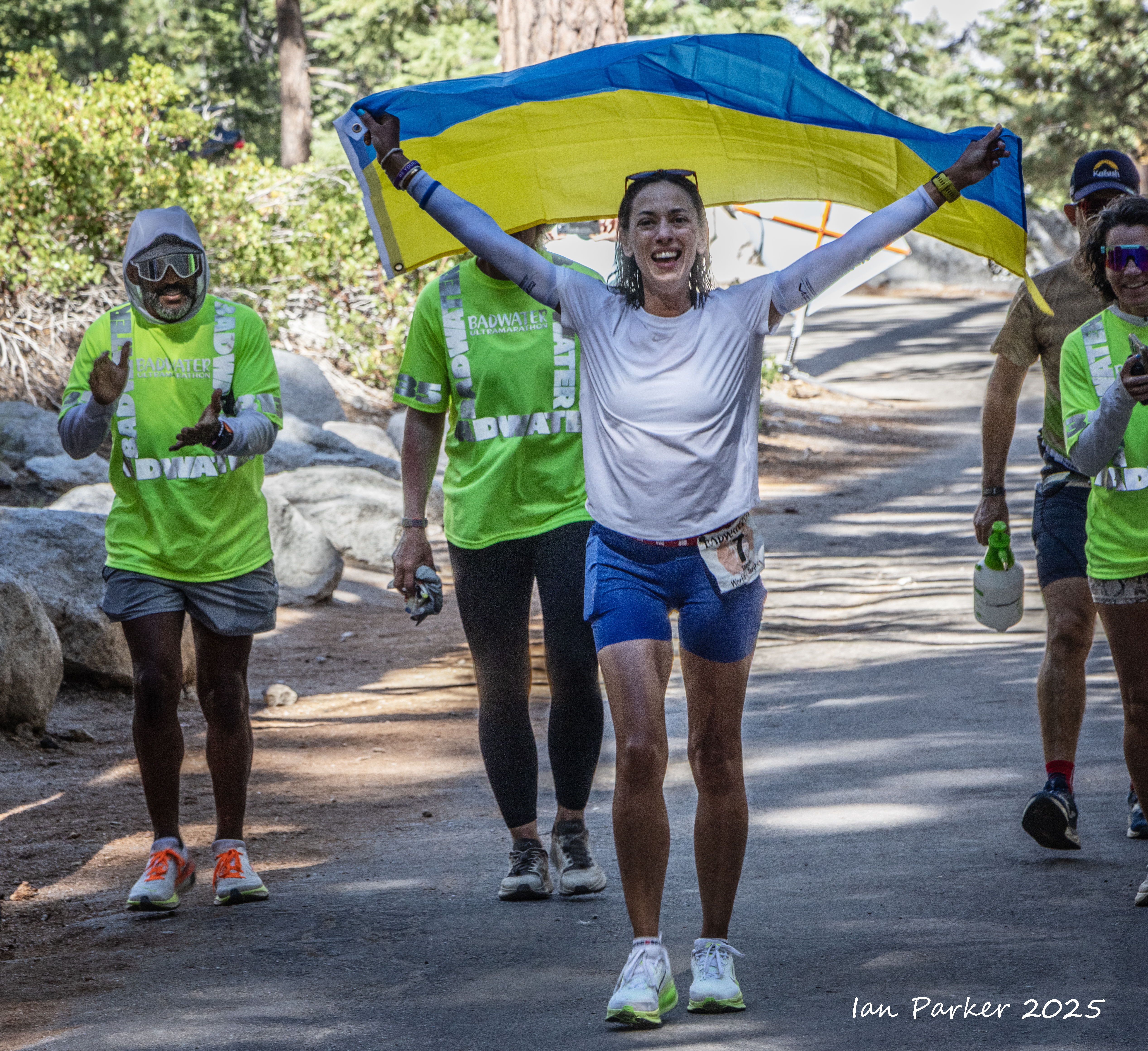
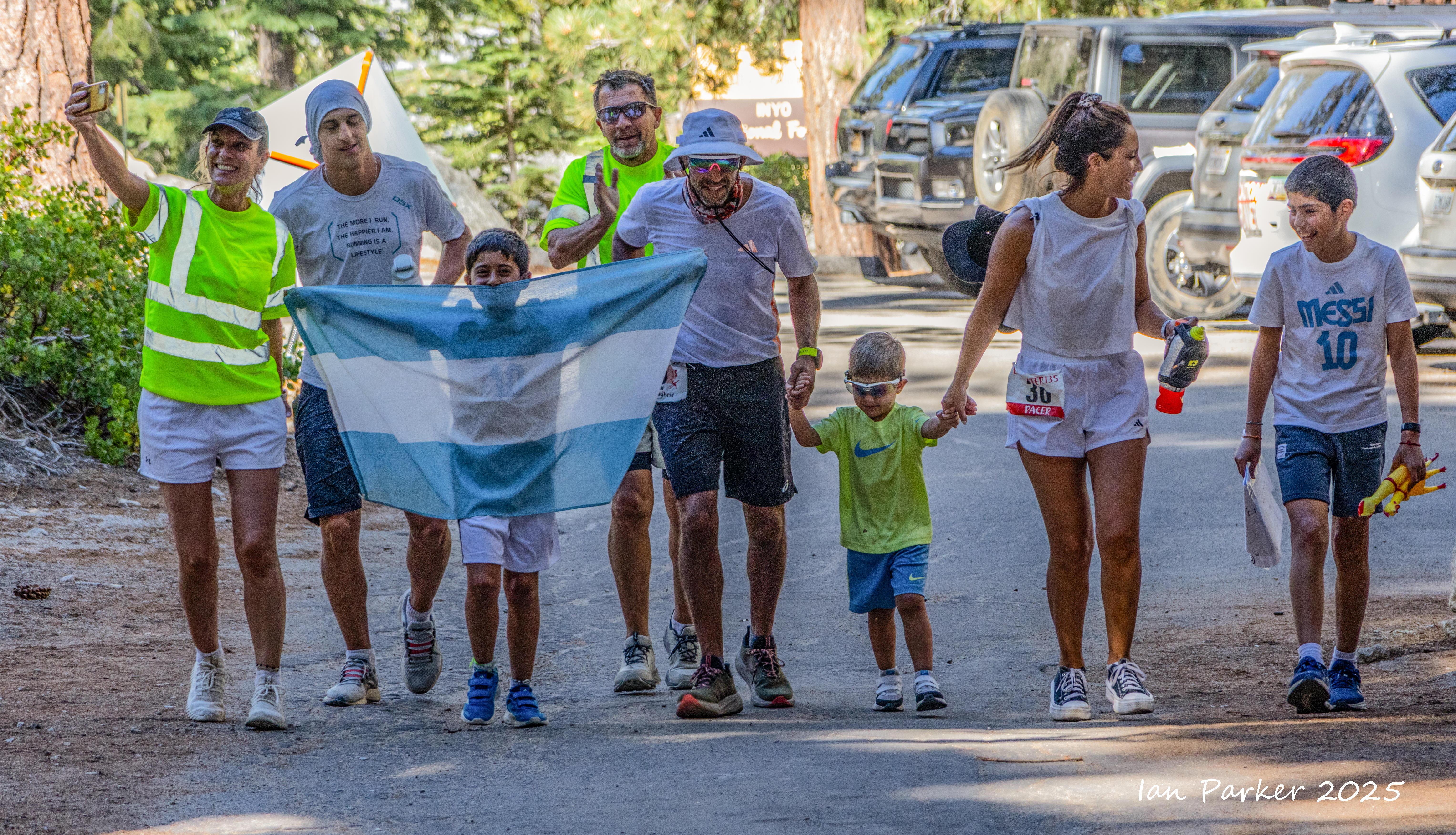
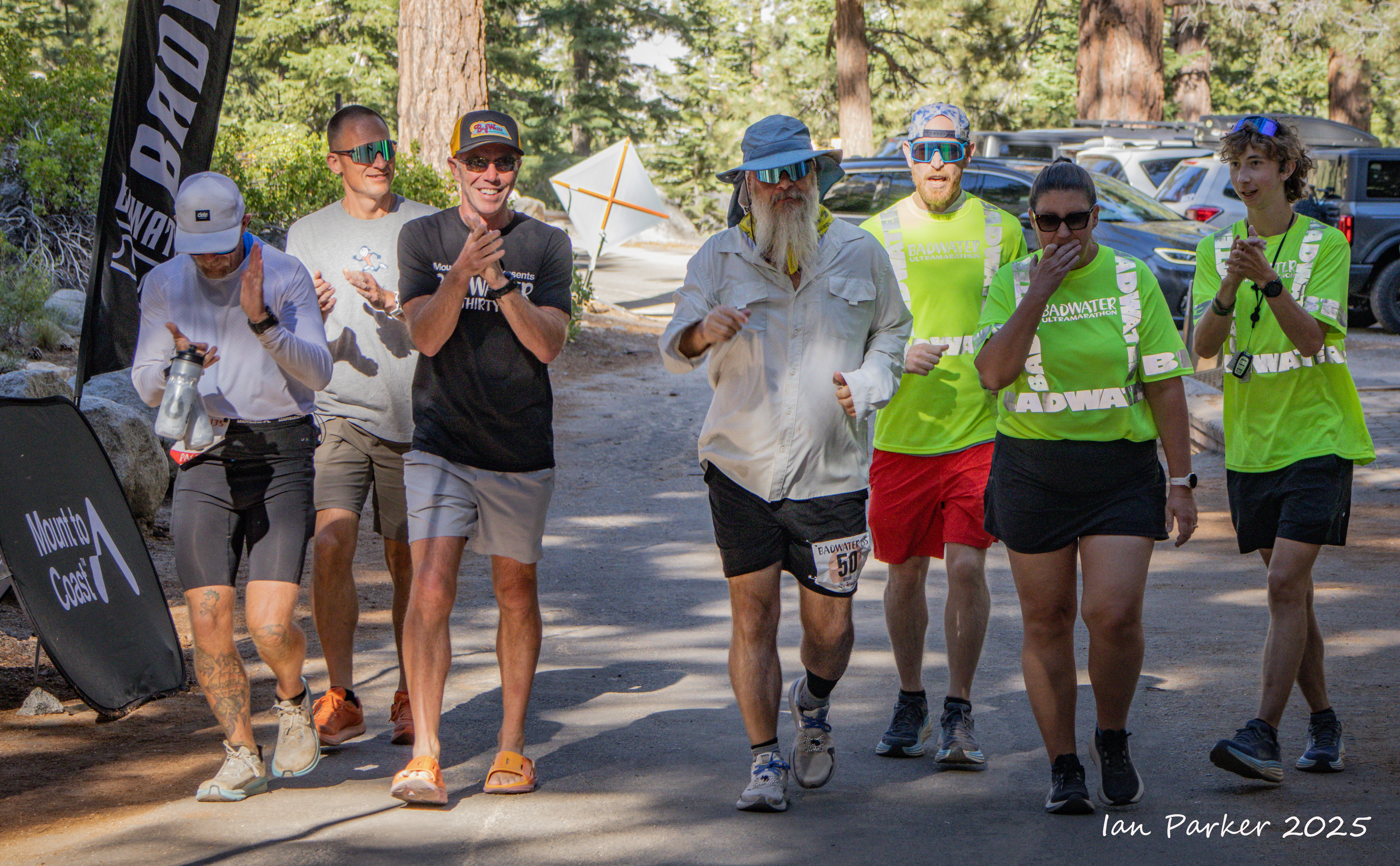
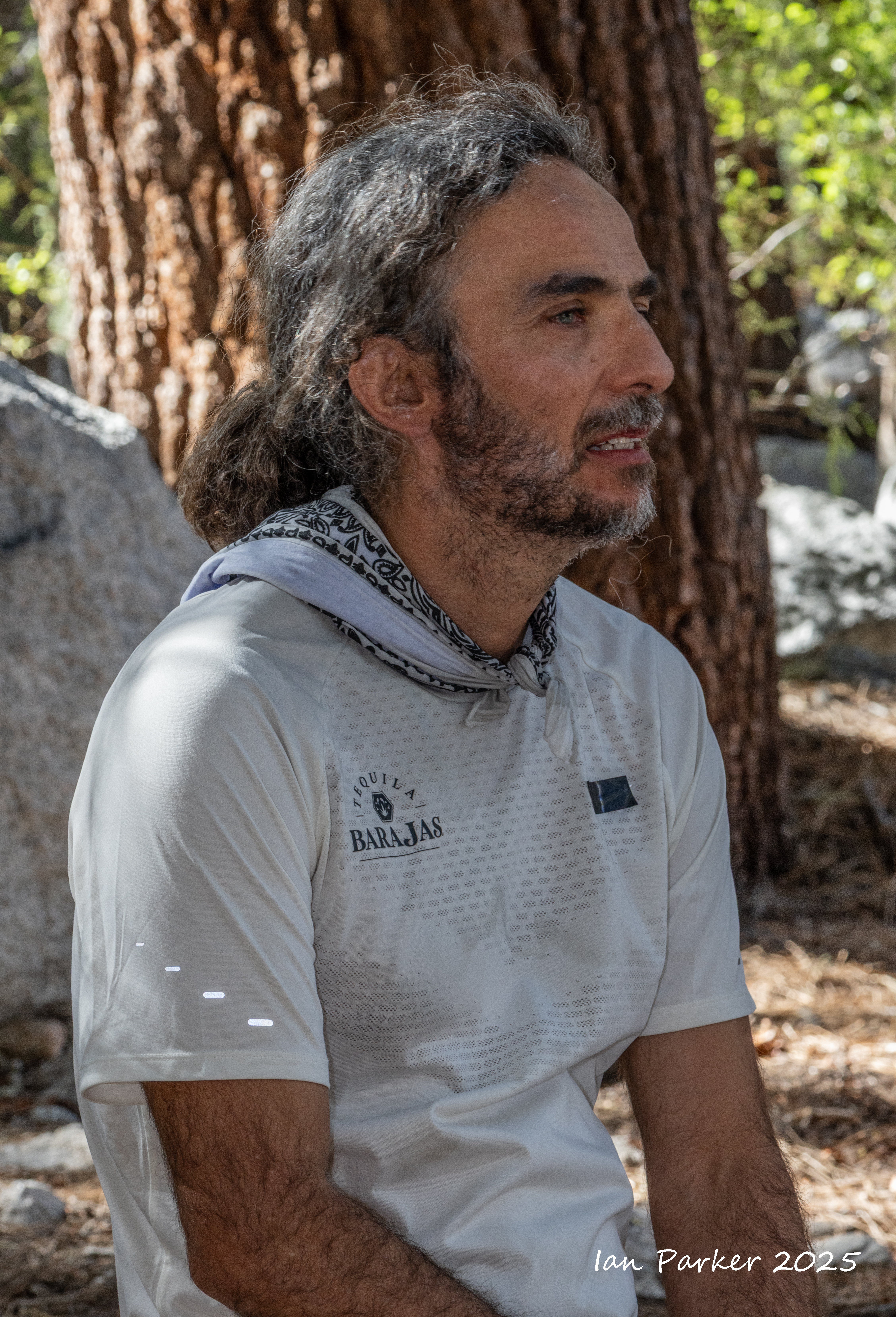
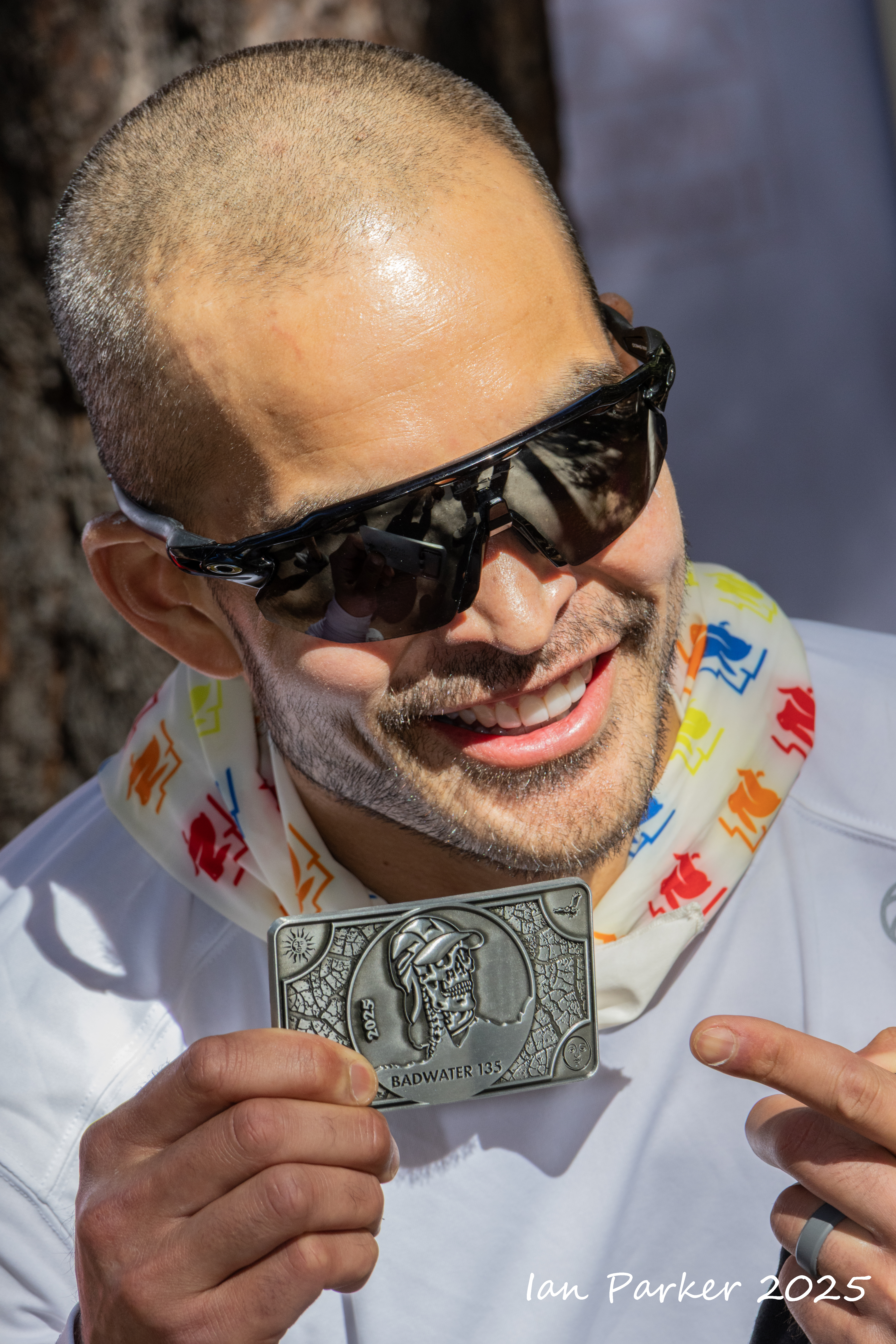
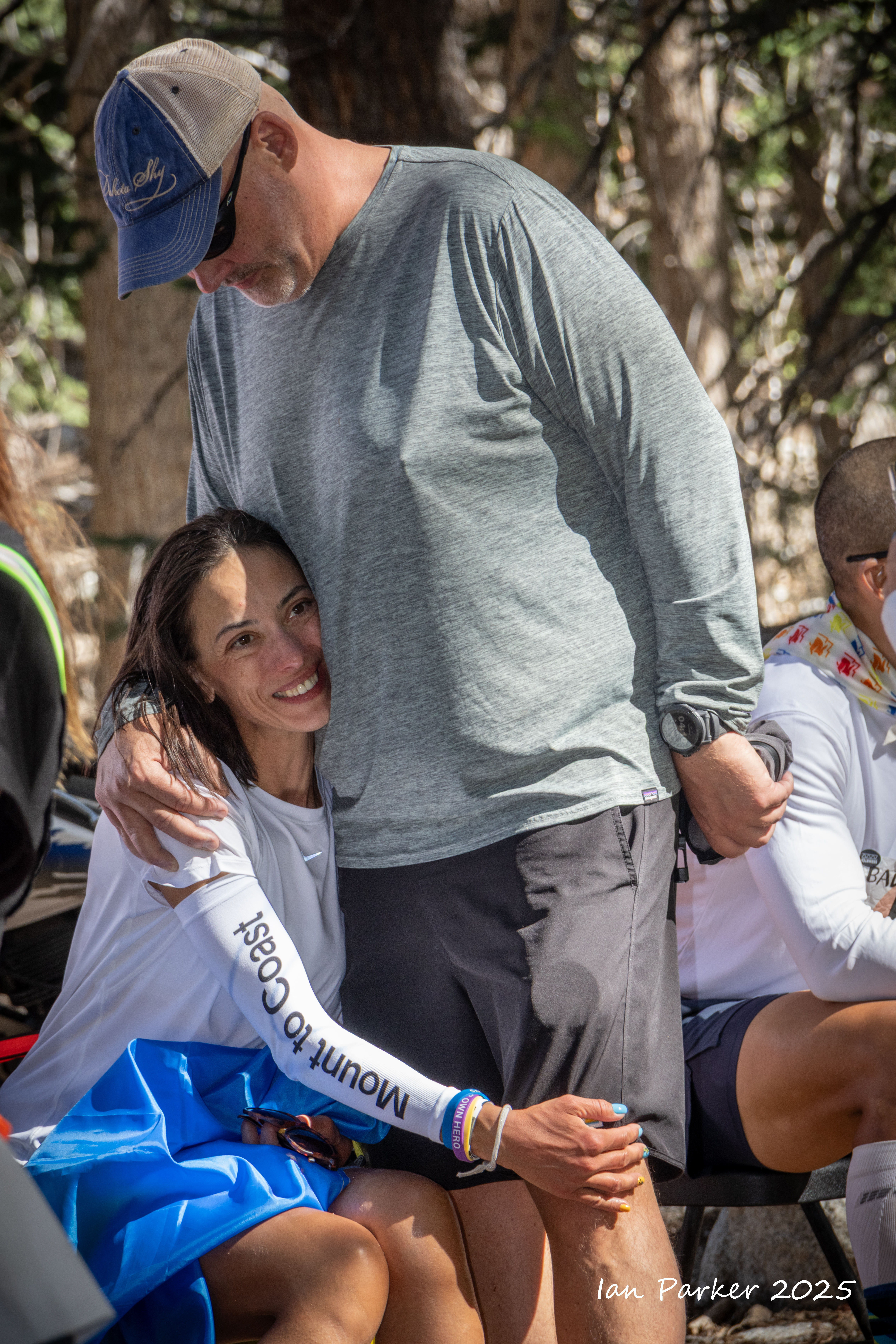
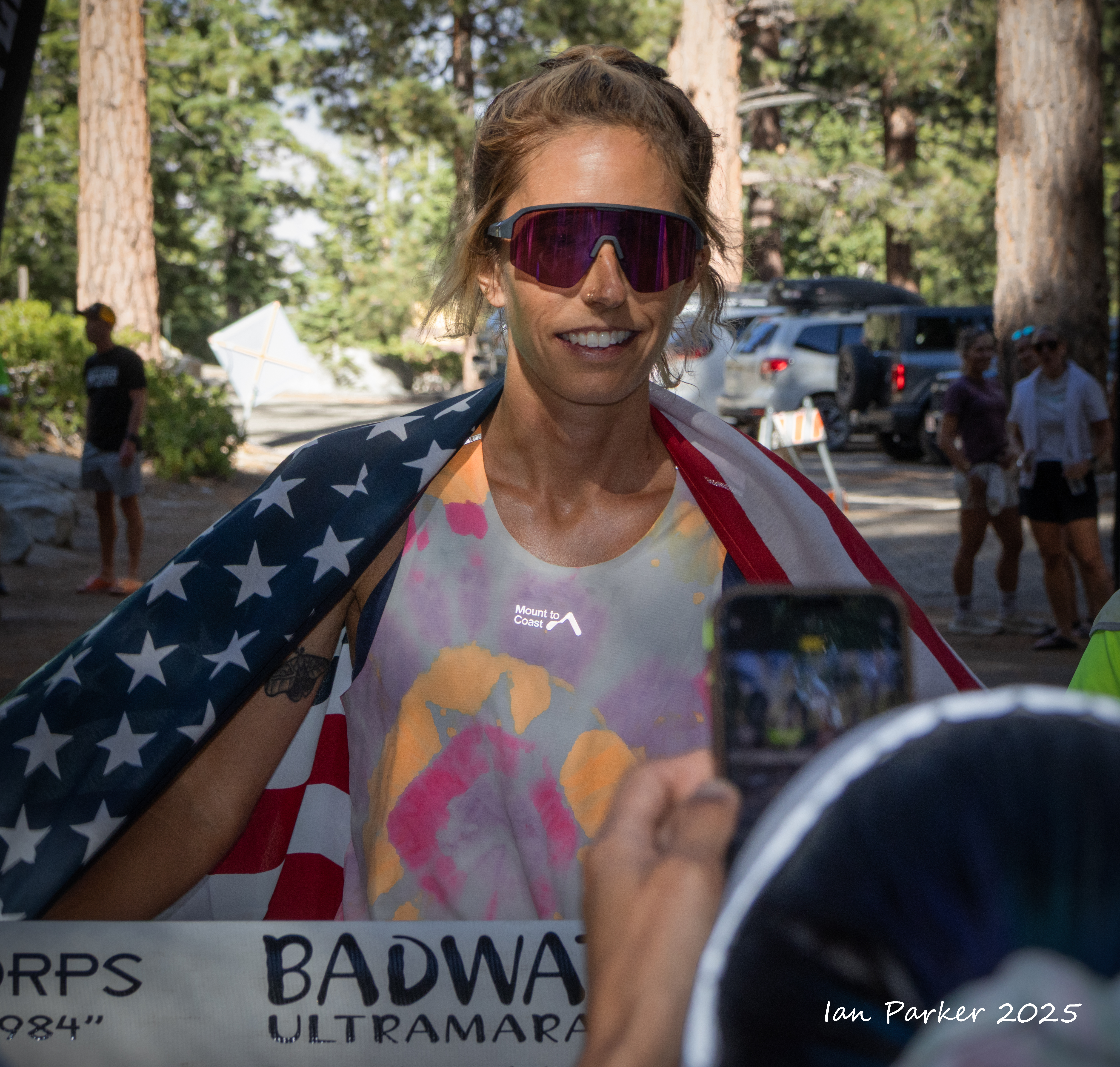
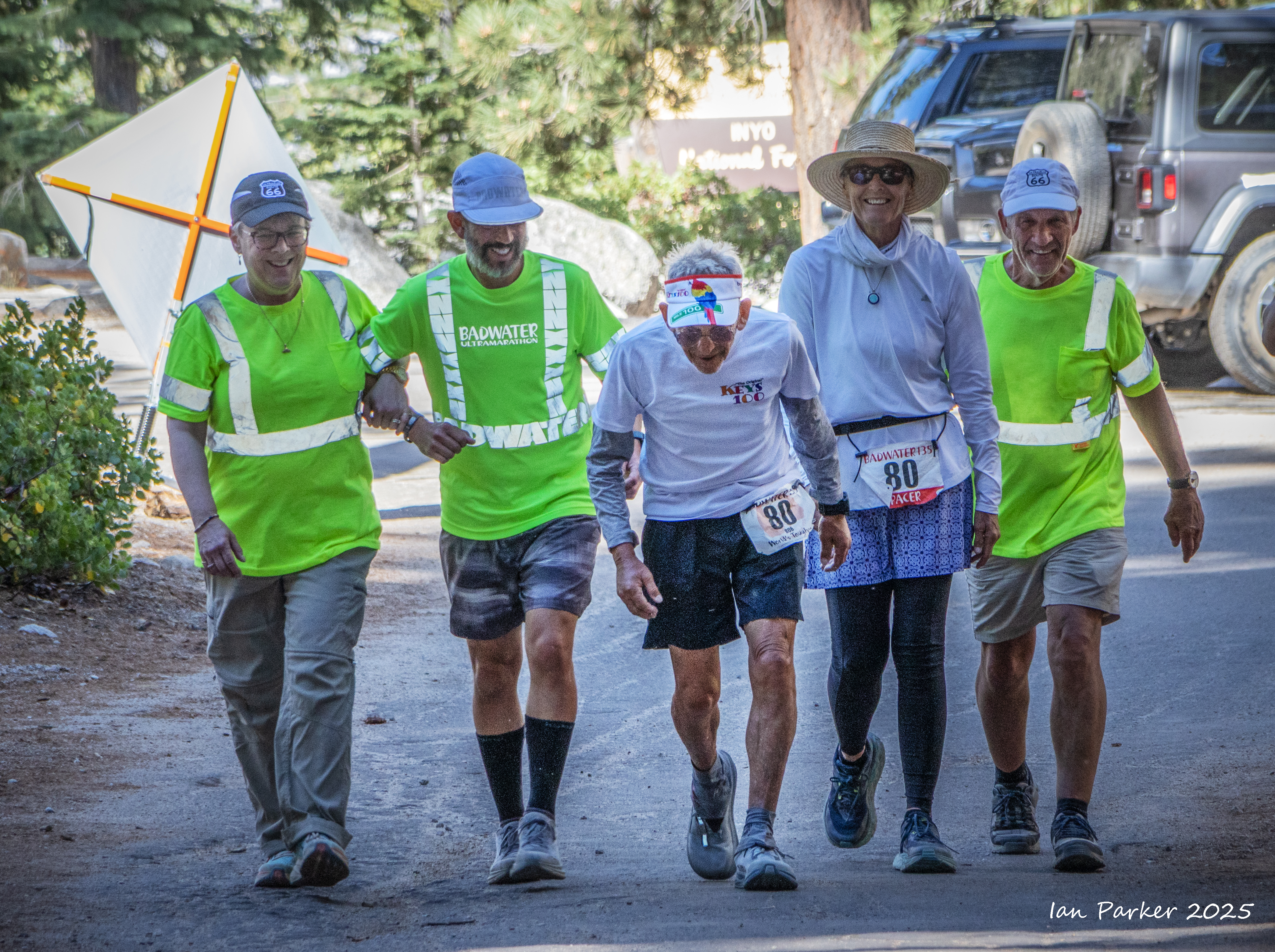
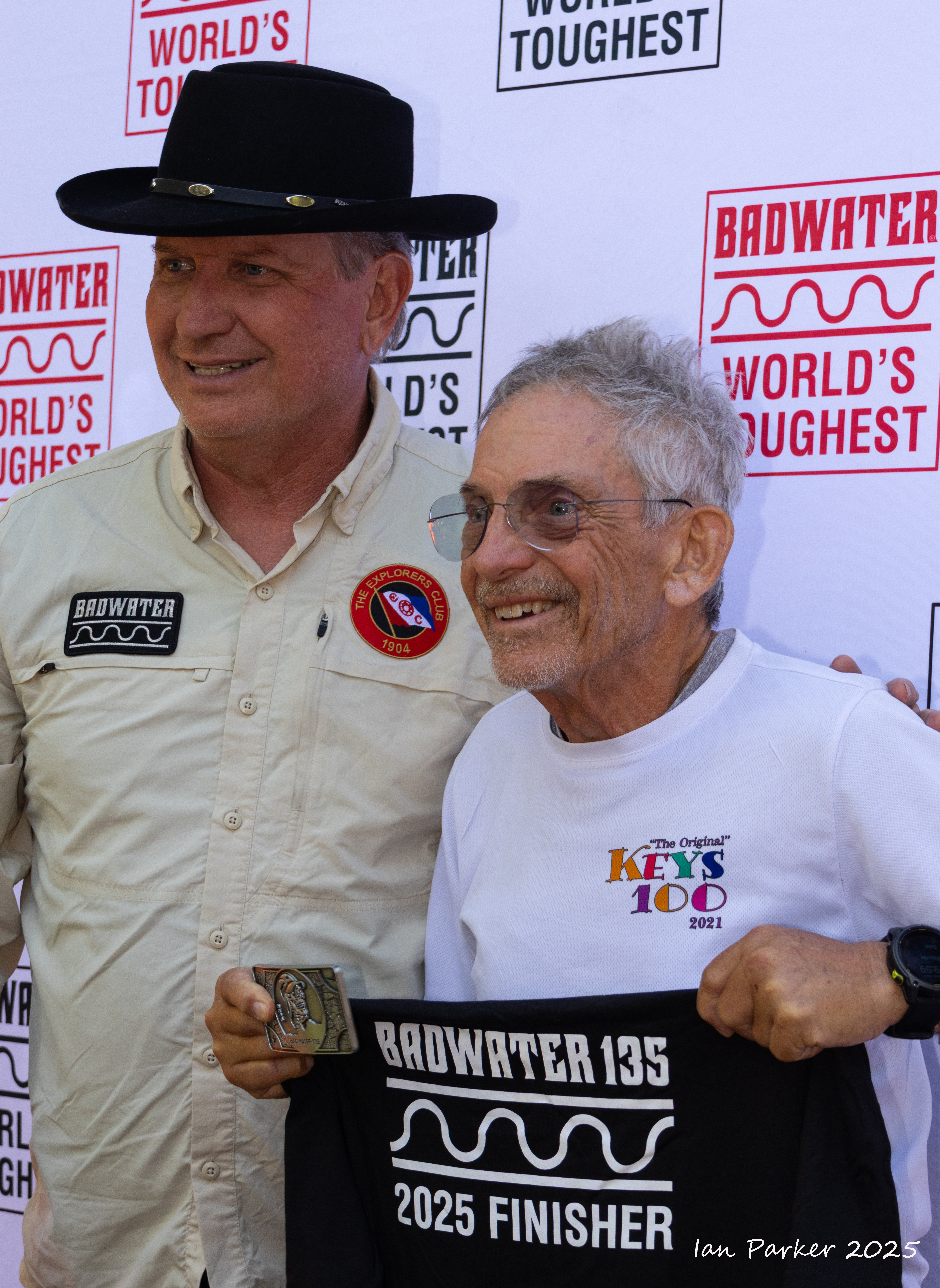
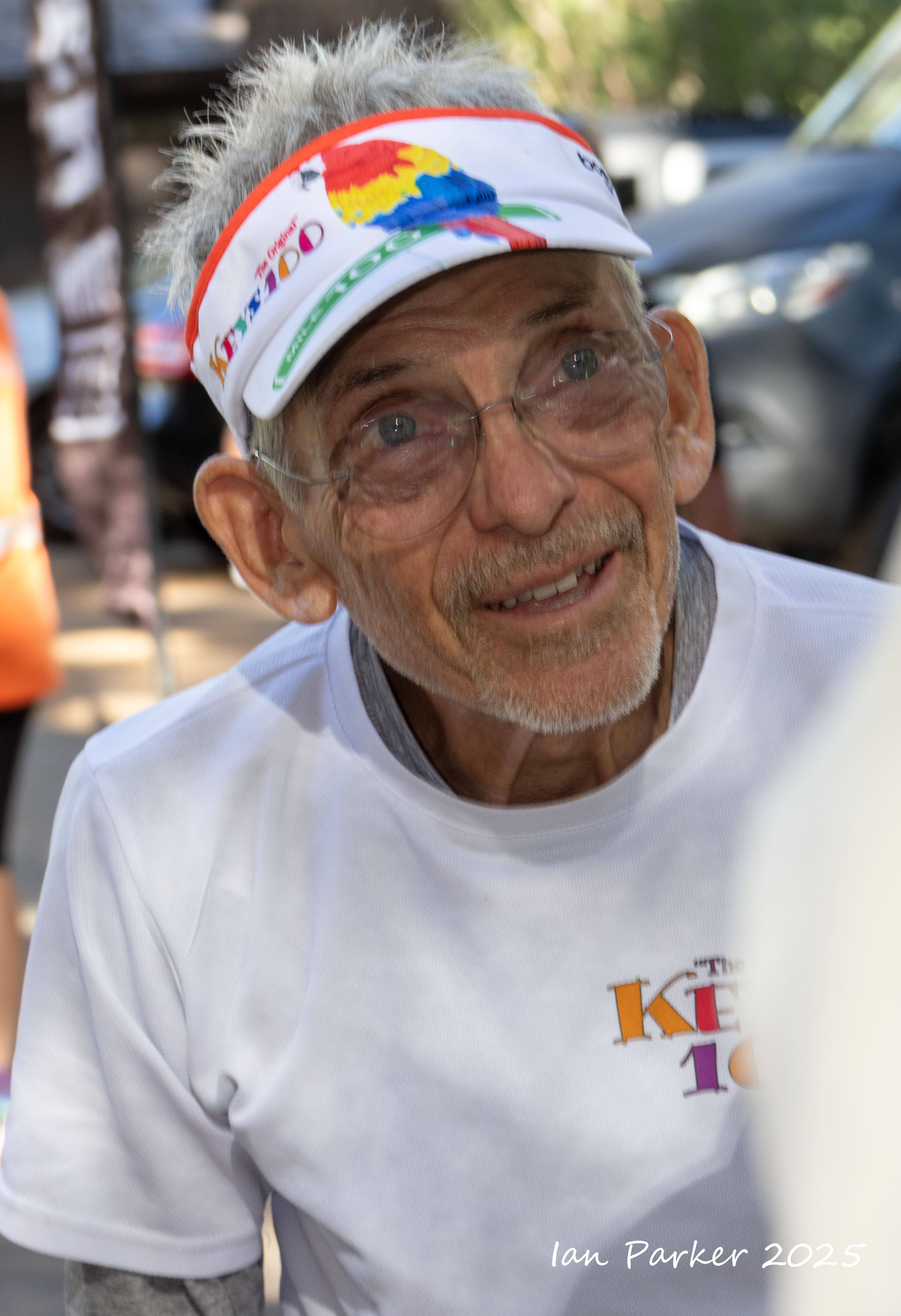
This was my 18th year at the Badwater Ultramarathon, the "World's toughest footrace"; eleven years as a runner or pacer, and six helping on the race staff and as a photographer. My approach the first year I came to photograph the race was from the perspective of a landscape photographer, aiming to place the runners in context of the spectacular scenery of Death Valley and the Eastern Sierras. This year I shifted gears, and also took on the mindset of a 'street'/portrait photographer, concentrating on the runners and their support crews. Badwater offers a photographic challenge of capturing the emotions of a group of very special people pushing themselves to the limit in an extreme environment. Moreover, the runners and their support crews are friendly, like having their pictures taken, and in any case have all signed waivers permitting the taking and publishing of photos!
The images below are a selection from many hundreds of shots. Click HERE for the race website which includes links to many ofther photos and full race results.
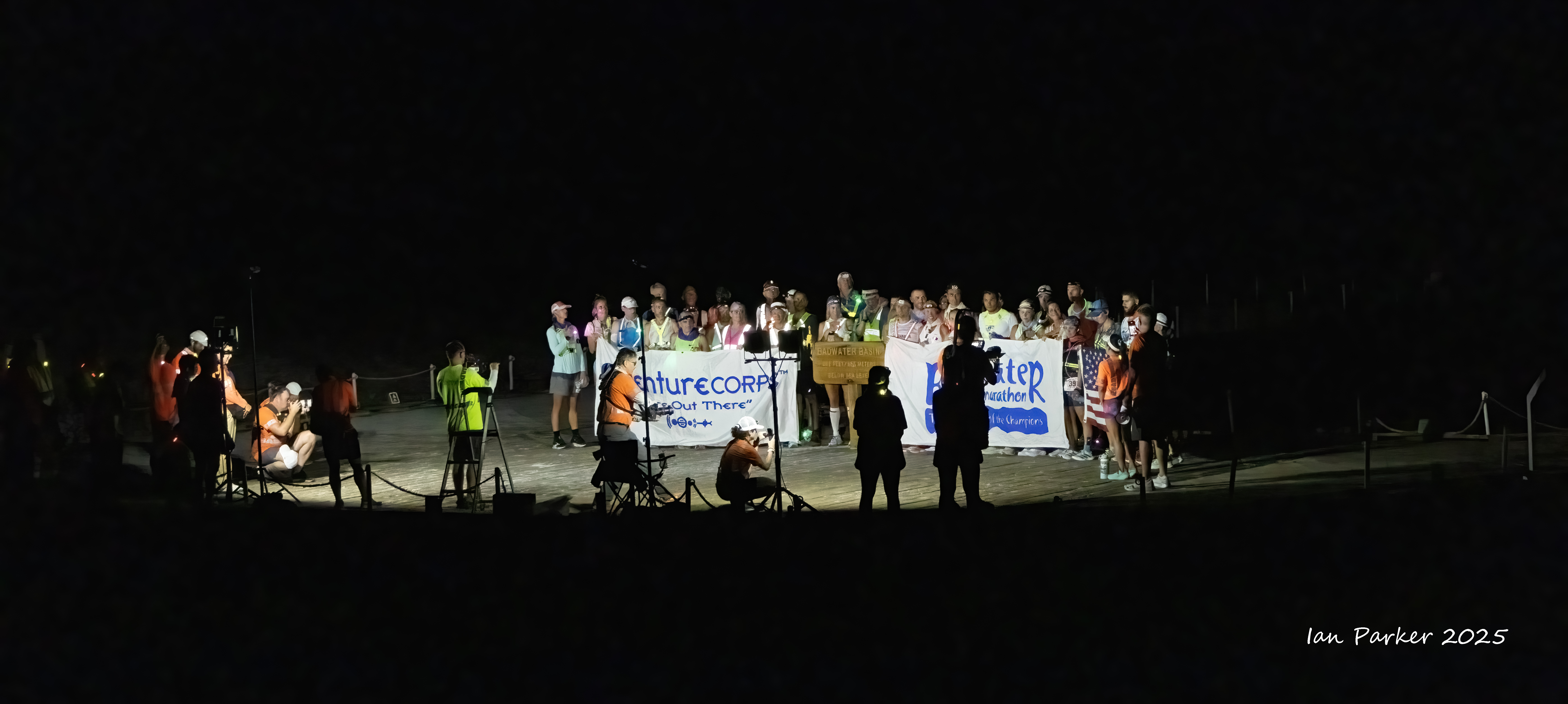
Start line at Badwater Basin for the 8:00pm wave
Start line at Badwater Basin for the 8:00pm wave
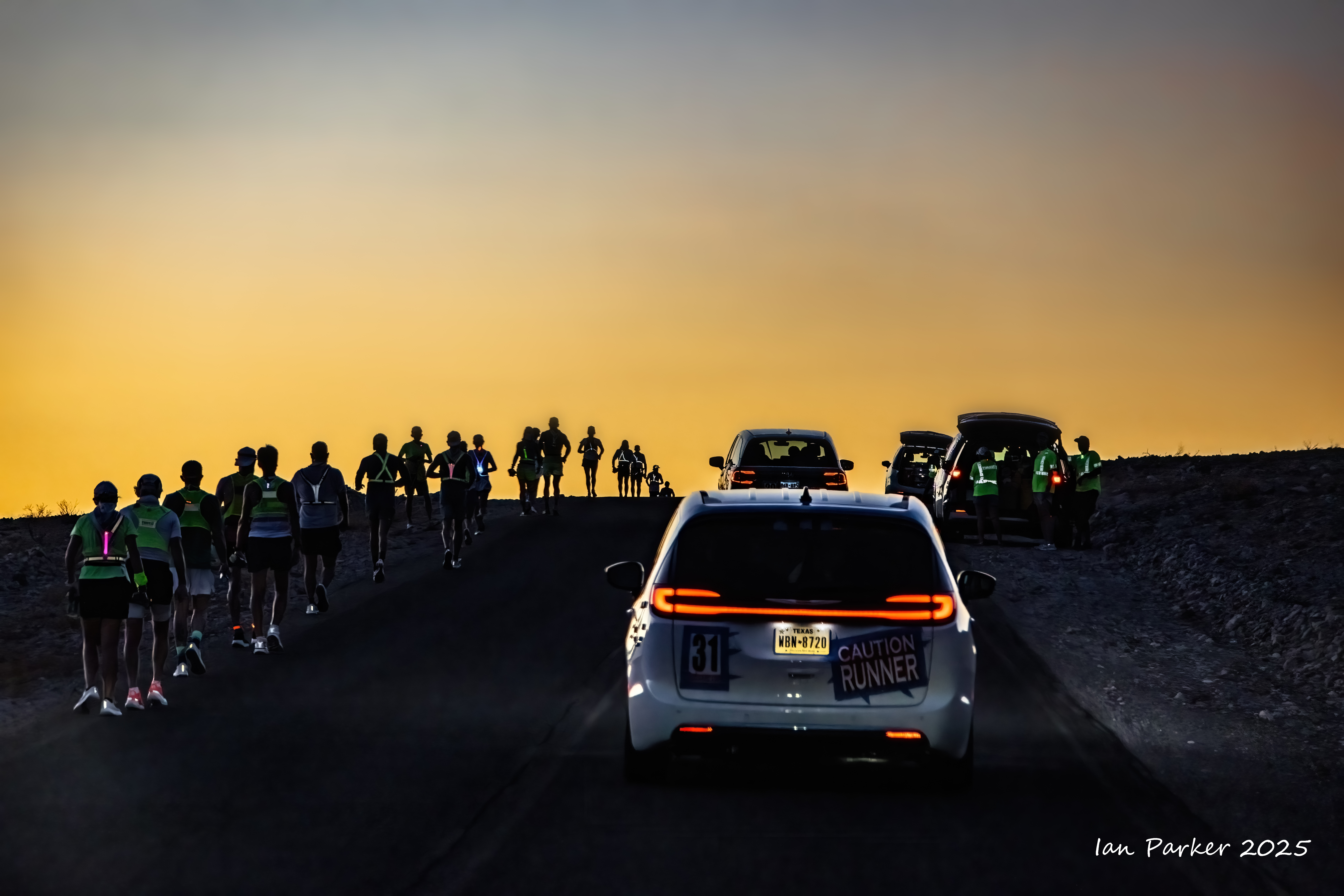
Morning, July 8: Climbing out of Death Valley over Towne Pass
The Oasis at mile 51
Descending Towne Pass into Panamint Valley
The climb out of Panamint Valley up to Father Crowley's Point
Leaving Death Valley National Park
Highway 136 along Owens Lake
Ascending the Portal Road
Finish line at Whitney Portal
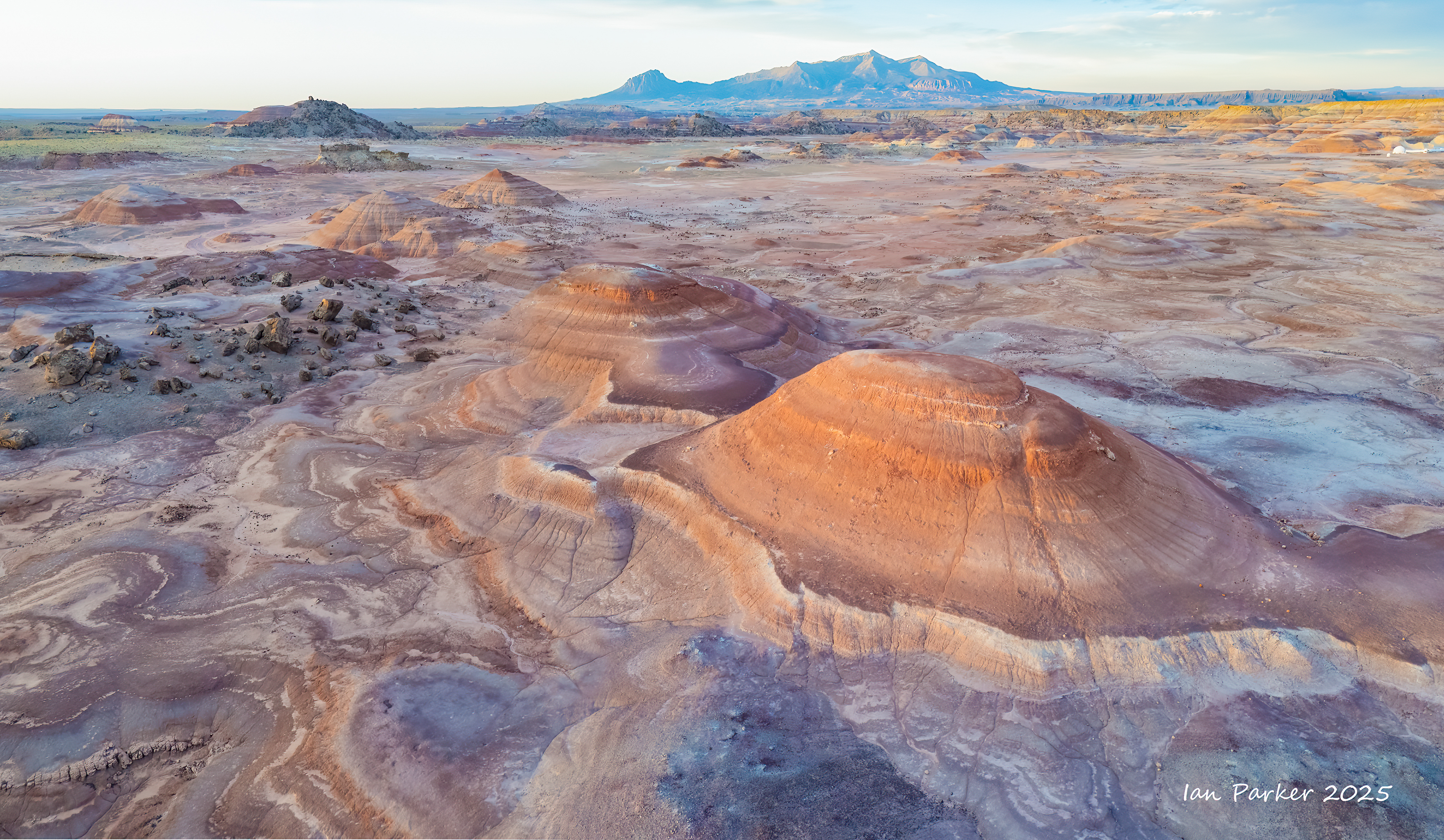
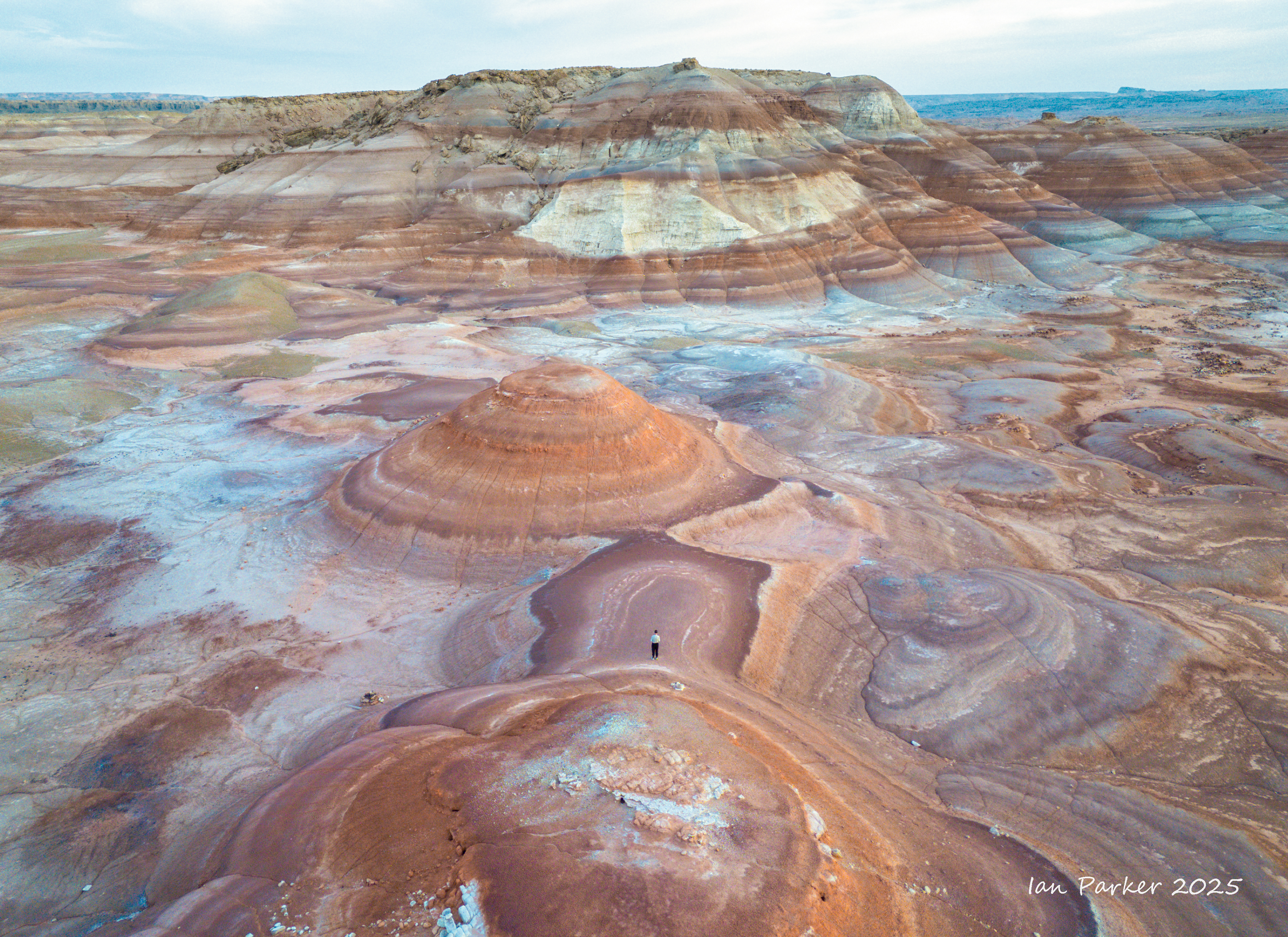
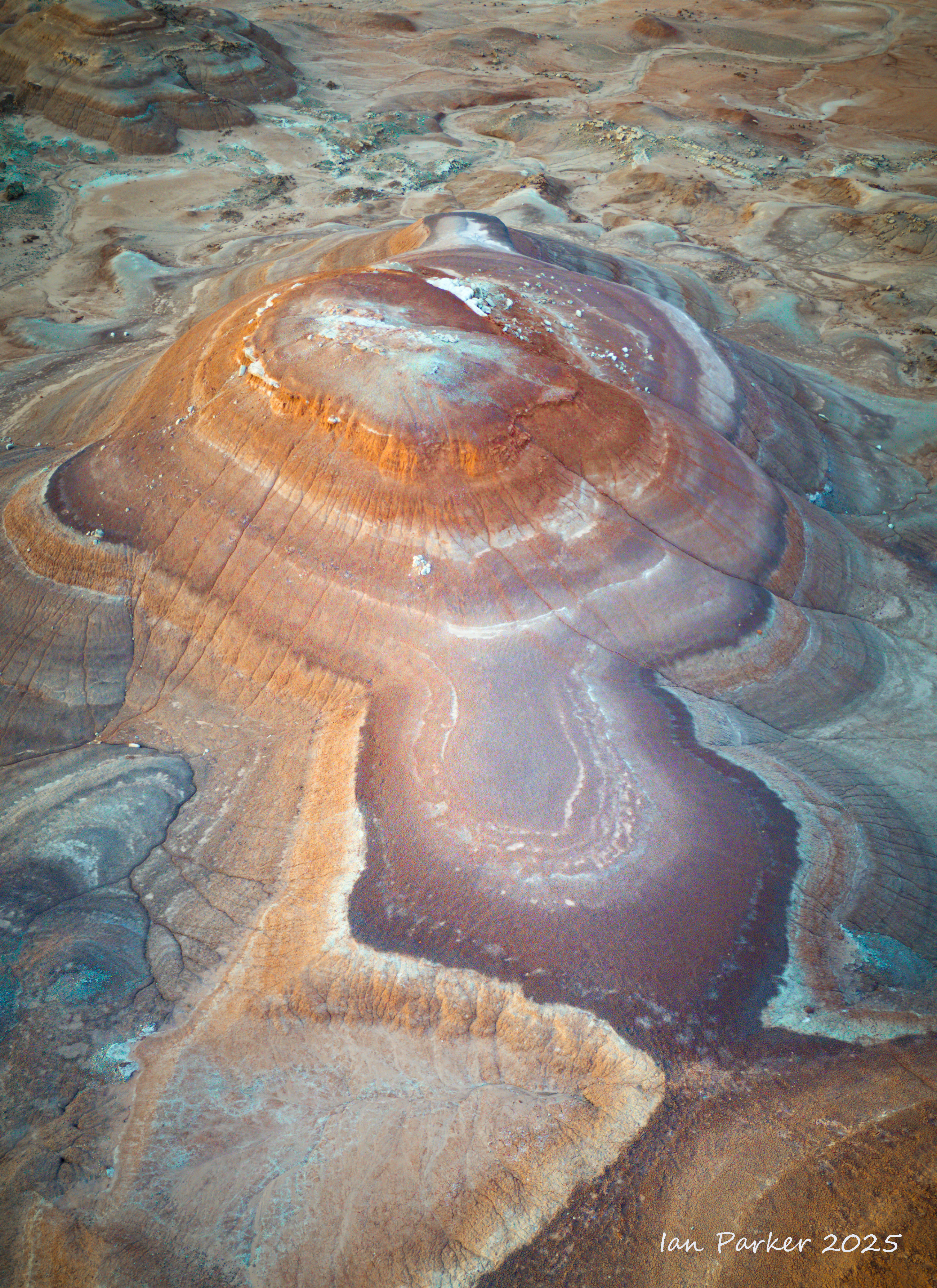
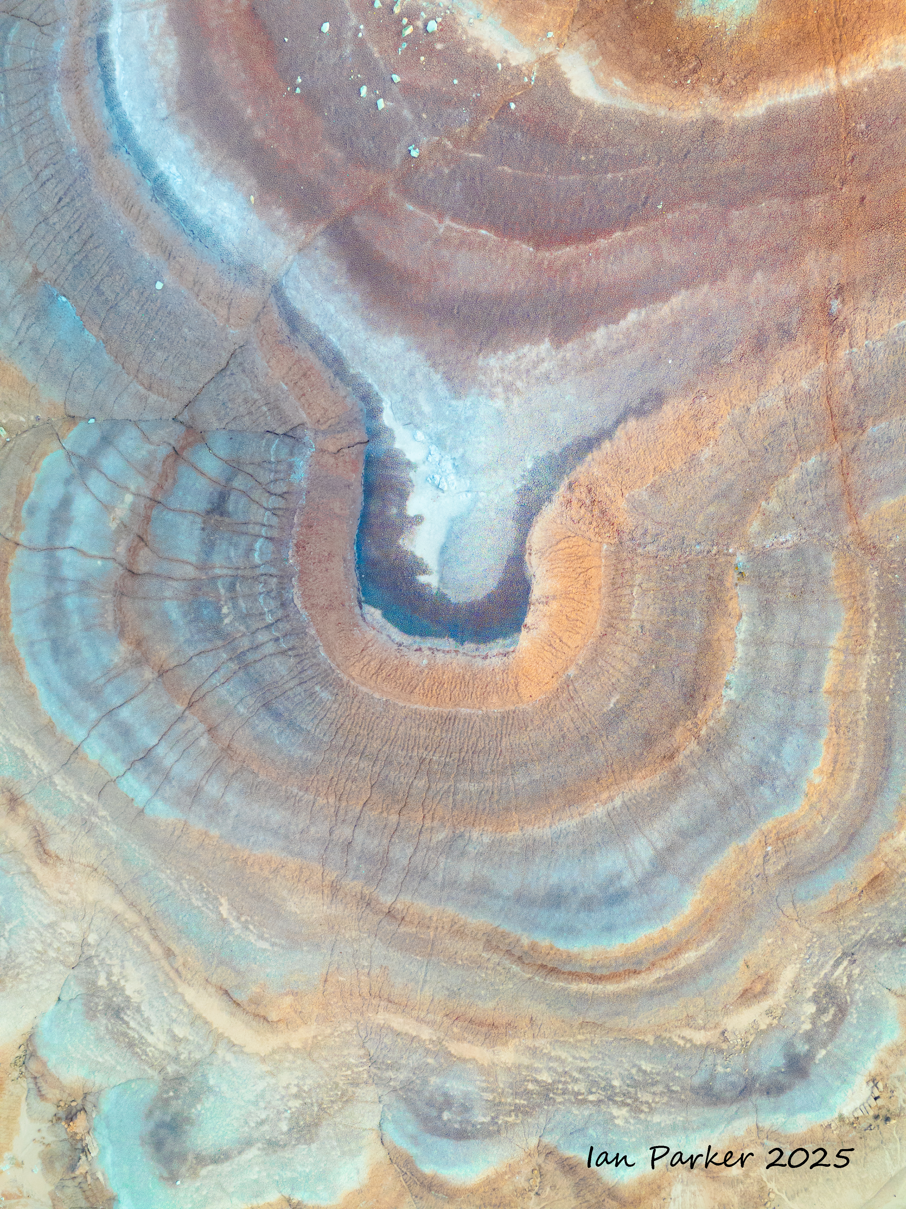
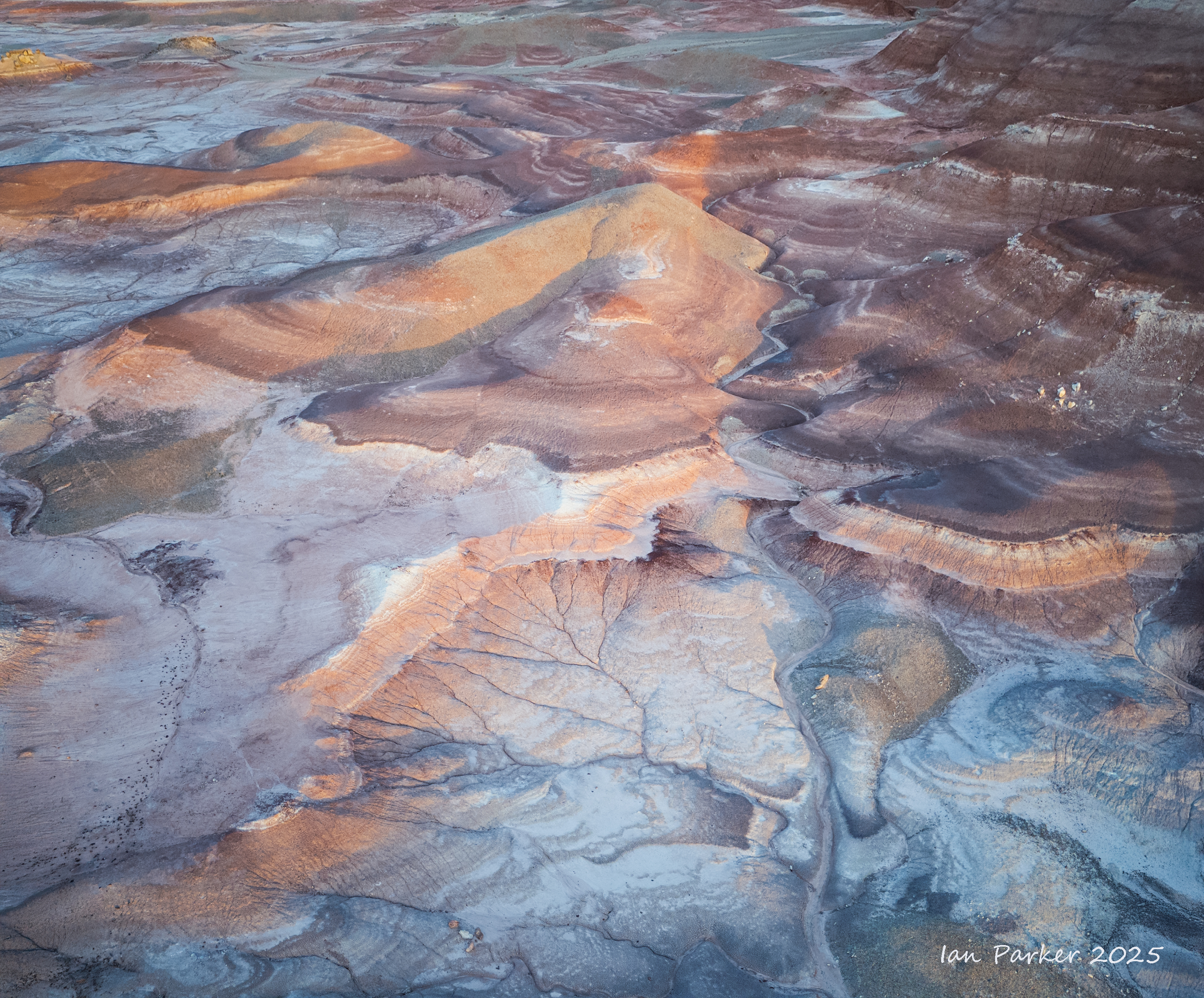
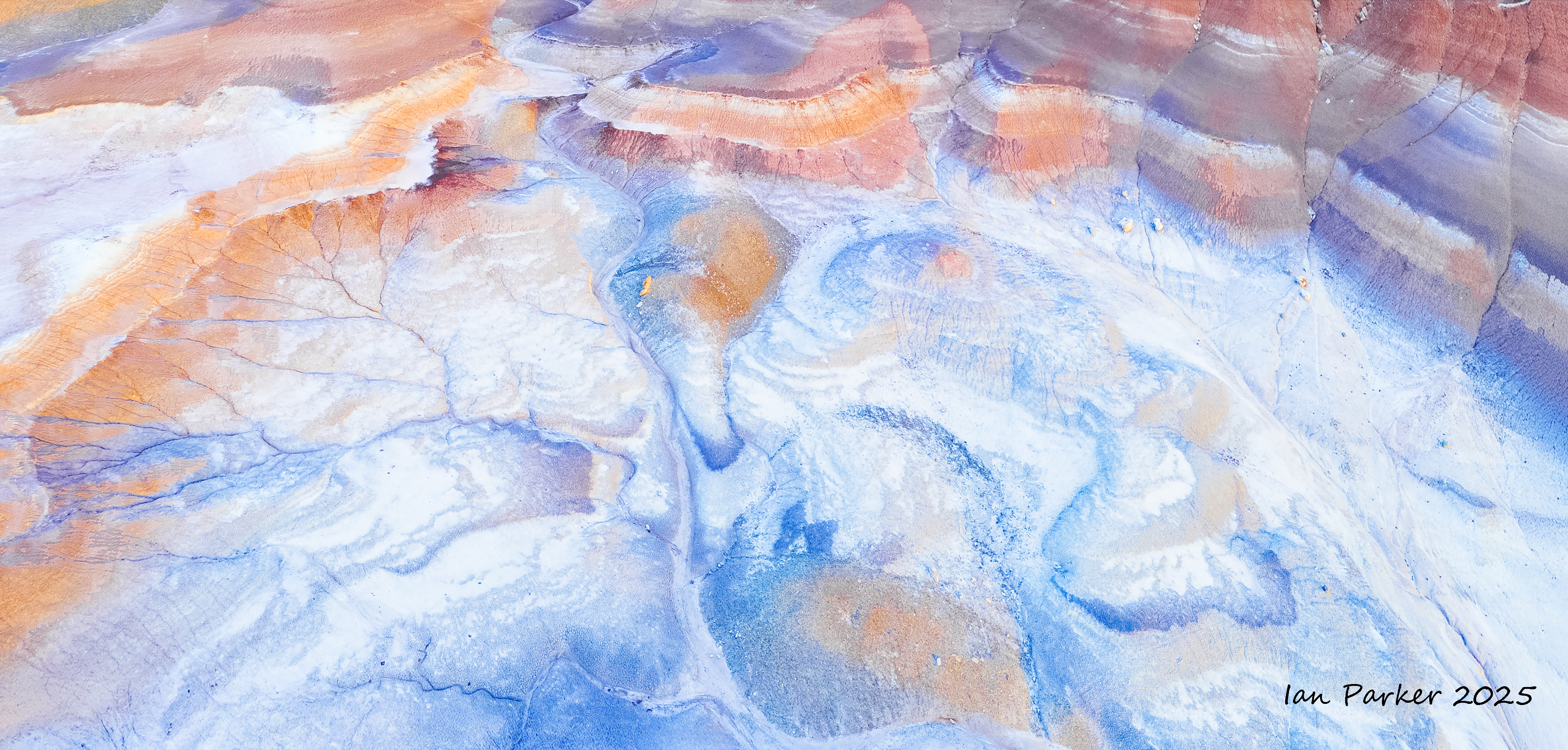
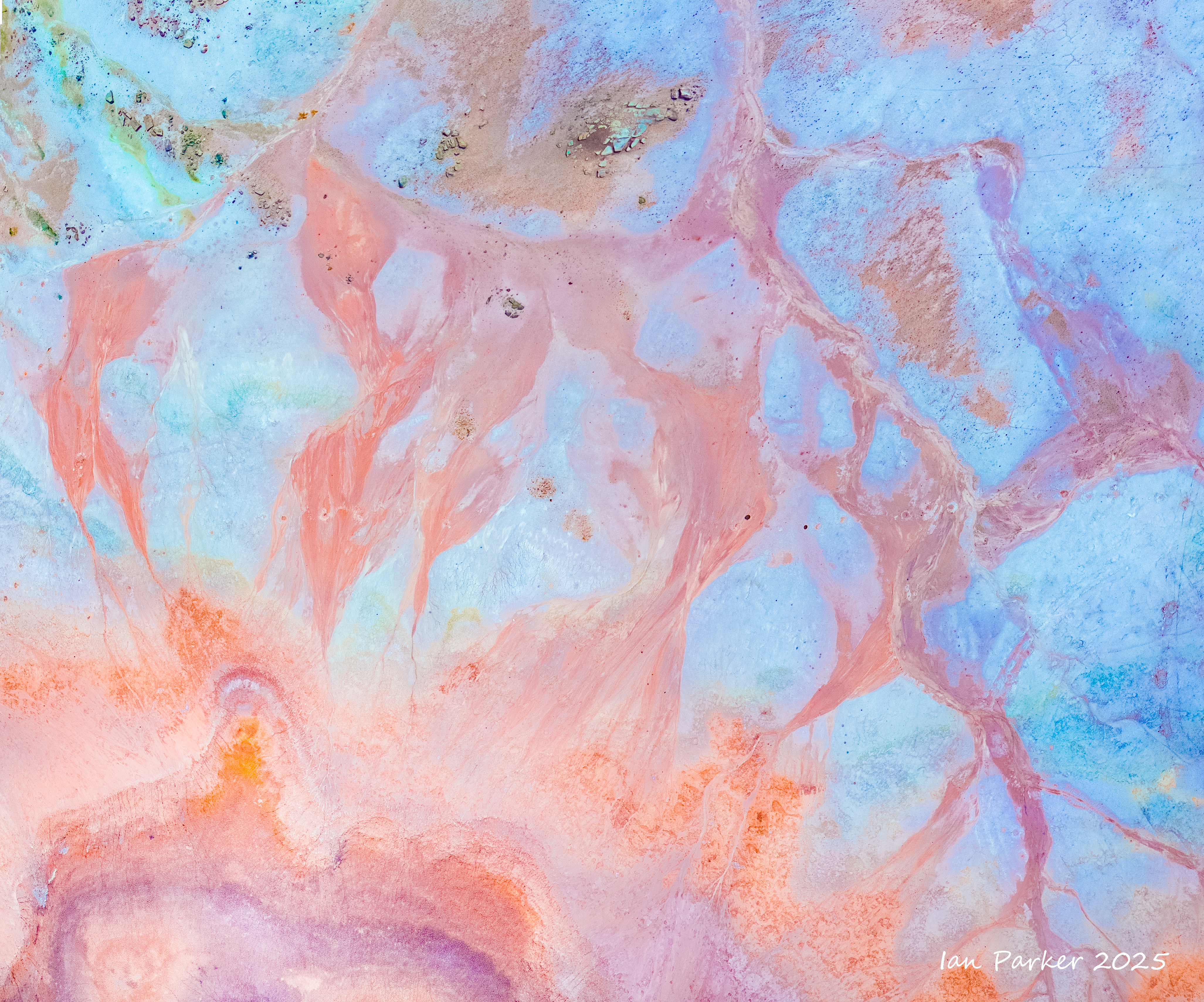
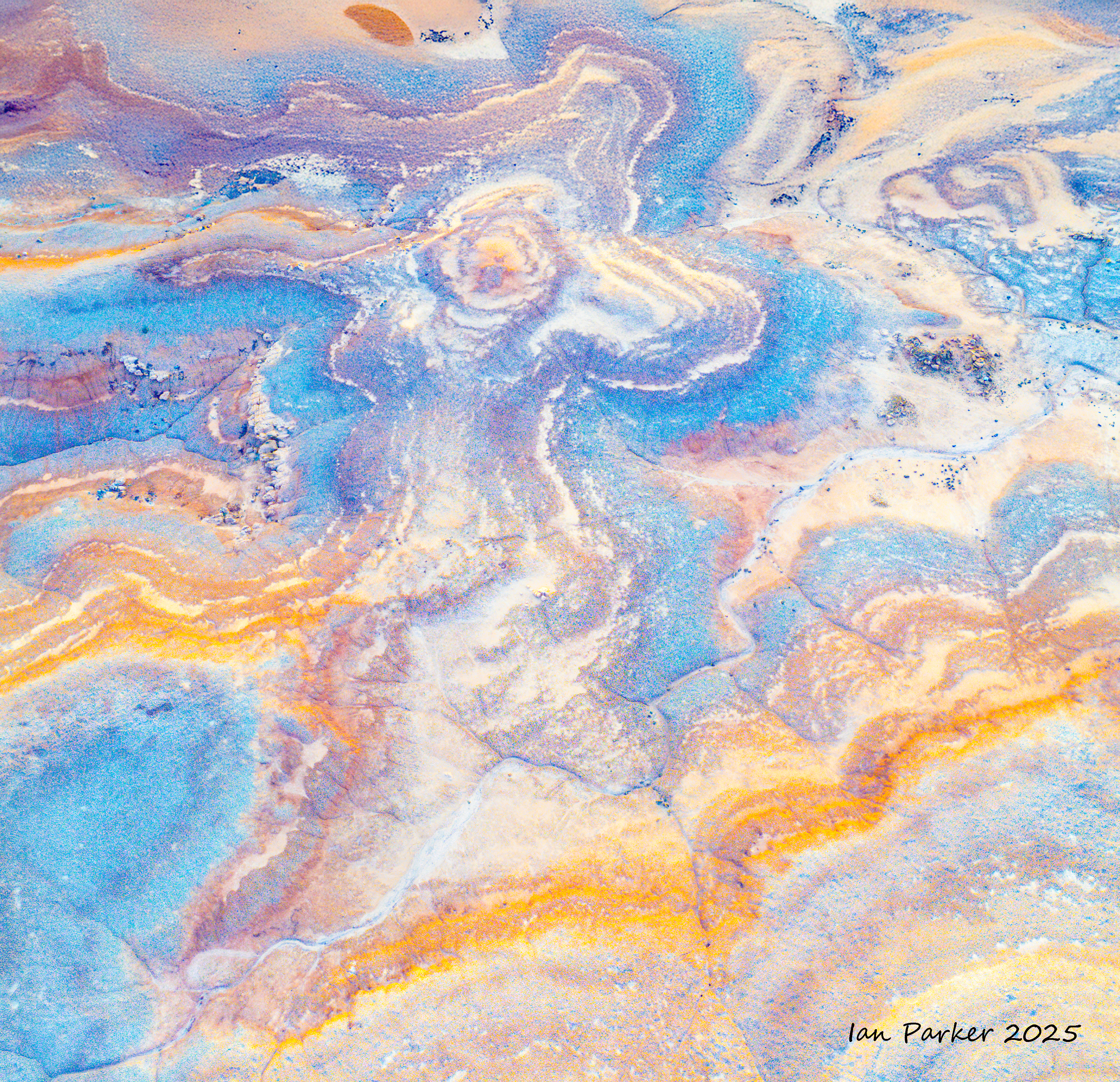
The New Bentonite Hills, Hanksville, Utah - May 23,24
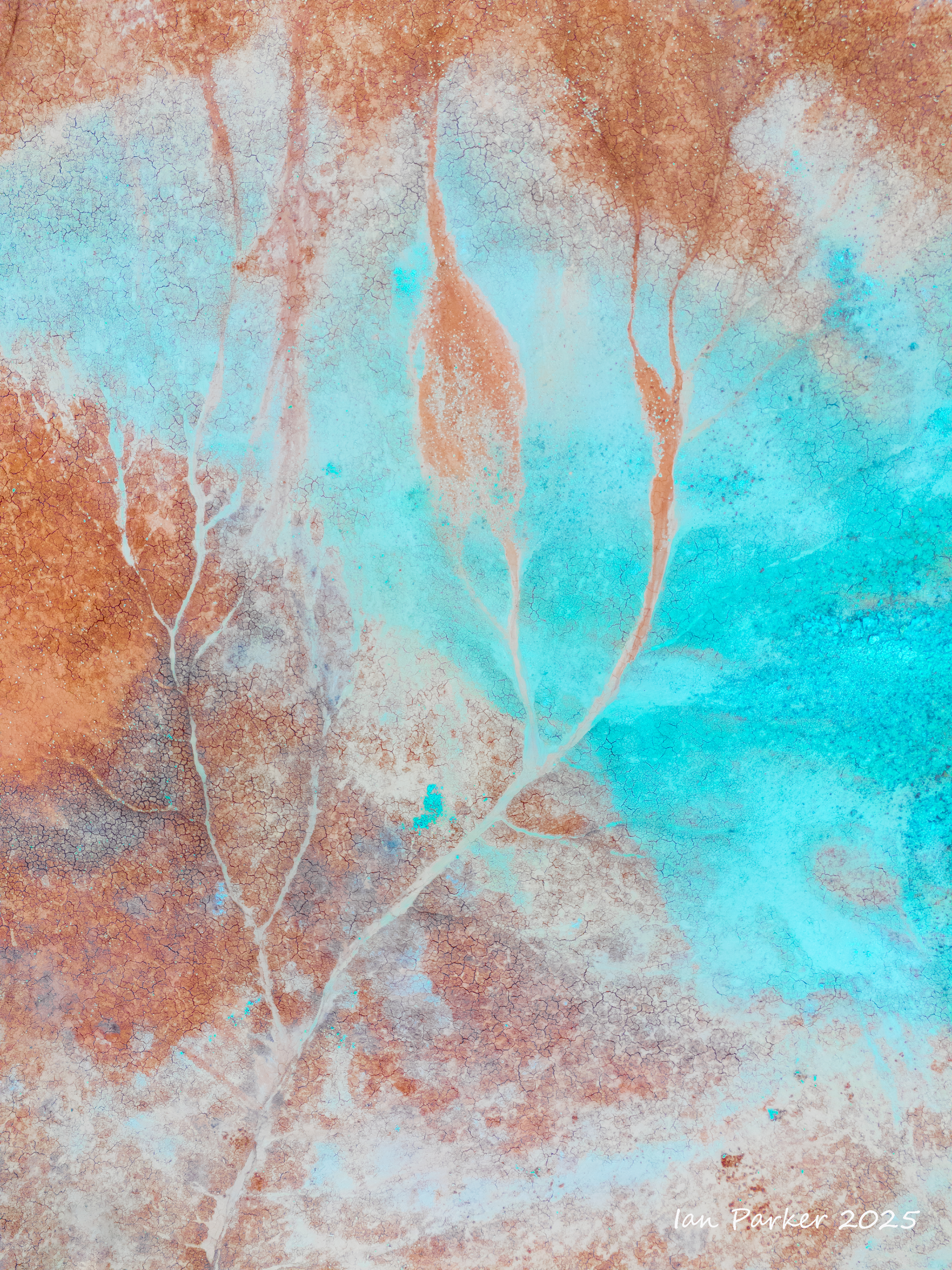
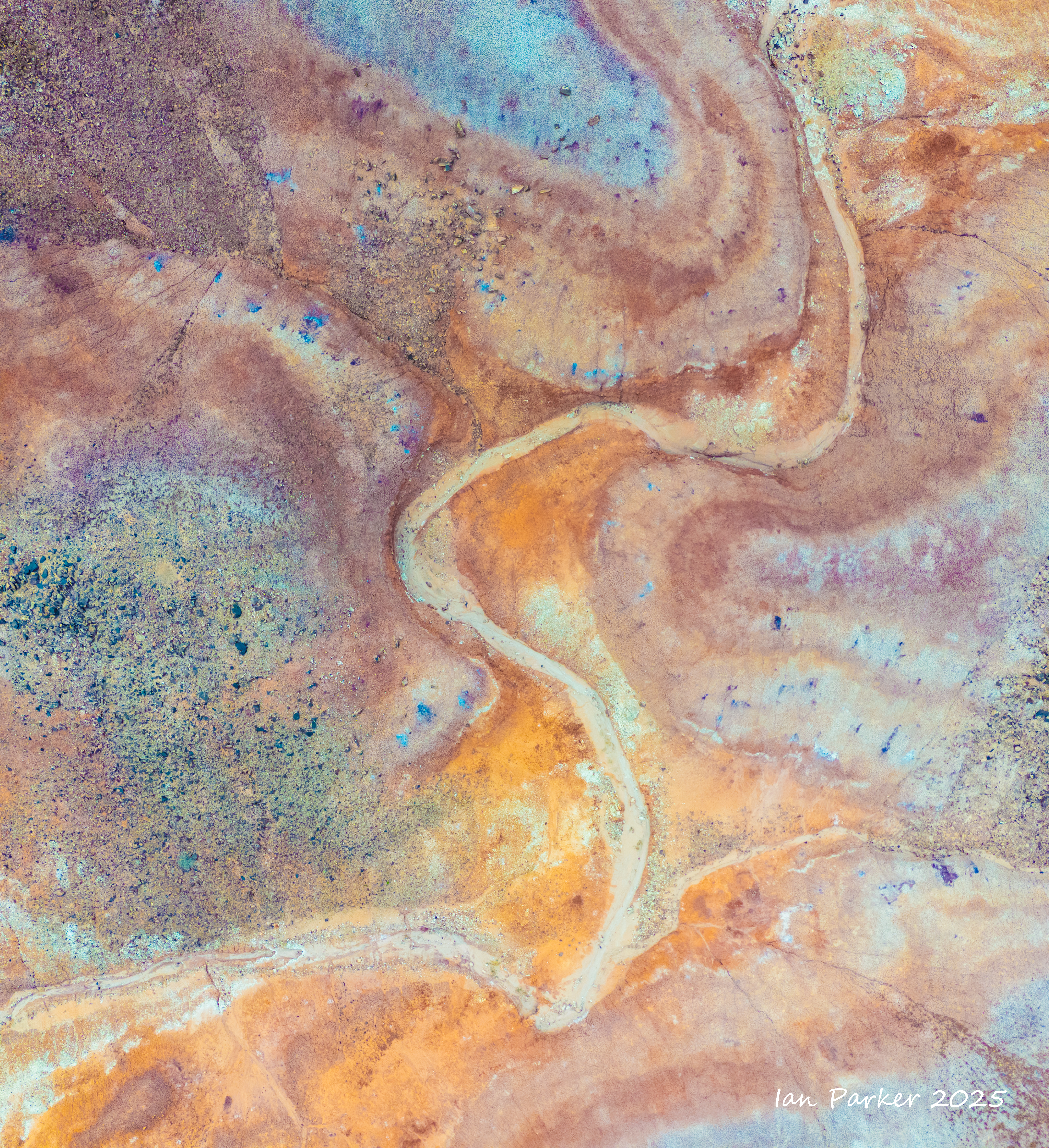
The Bentonite Hills in Utah are a unique geological formations, primarily composed of bentonite clay. This type of clay, known for its exceptional swelling properties and plasticity, gives the hills their distinct appearance and character. Formed from volcanic ash deposits undergoing weathering over millions of years, bentonite clay primarily consists of montmorillonite, along with other minerals like quartz, iron oxides, manganese and feldspar imparting their rich pigments to the soil and rock formations. Due to the diverse mineral composition the Bentonite Hills appear in colors, ranging from shades of red and orange to earthy browns, yellows and sometimes even blue - depending on the lighting and time of the day. The view is otherworldly…like something you might see on Mars Perhaps that’s why they built the Mars Desert Research Station” (MDRS) less than a mile away.
However, arriving in the middle of the day and stepping out of the car it was apparent that regular landscape photography approaches would not do a good job of capturing all this. One problem was that of perspective. The contorted ovals and concentric colored rings of the bentonite domes are not readily apparent from ground level. That had a ready solution, as I had brought my drone and the location is Federal land administered by the BLM (Bureau of Land Management), which allows the use of drones. A second problem was that the colors of the bentonite appeared rather brown and dull in full sunlight. The lighting at dawn and dusk gave an improvement, but I thought there was still more to be extracted.
My photos below thus show the results of applying progressively increasing levels of saturation to my drone shots. These do not depict false colors, or the hallucinations of AI, but reveal natural colors that are actually present, but are normally too subtle to be visible by eye.
The microwave tower (mile 14, checkpoint #1) is a landmark visible for many miles along the course of the race
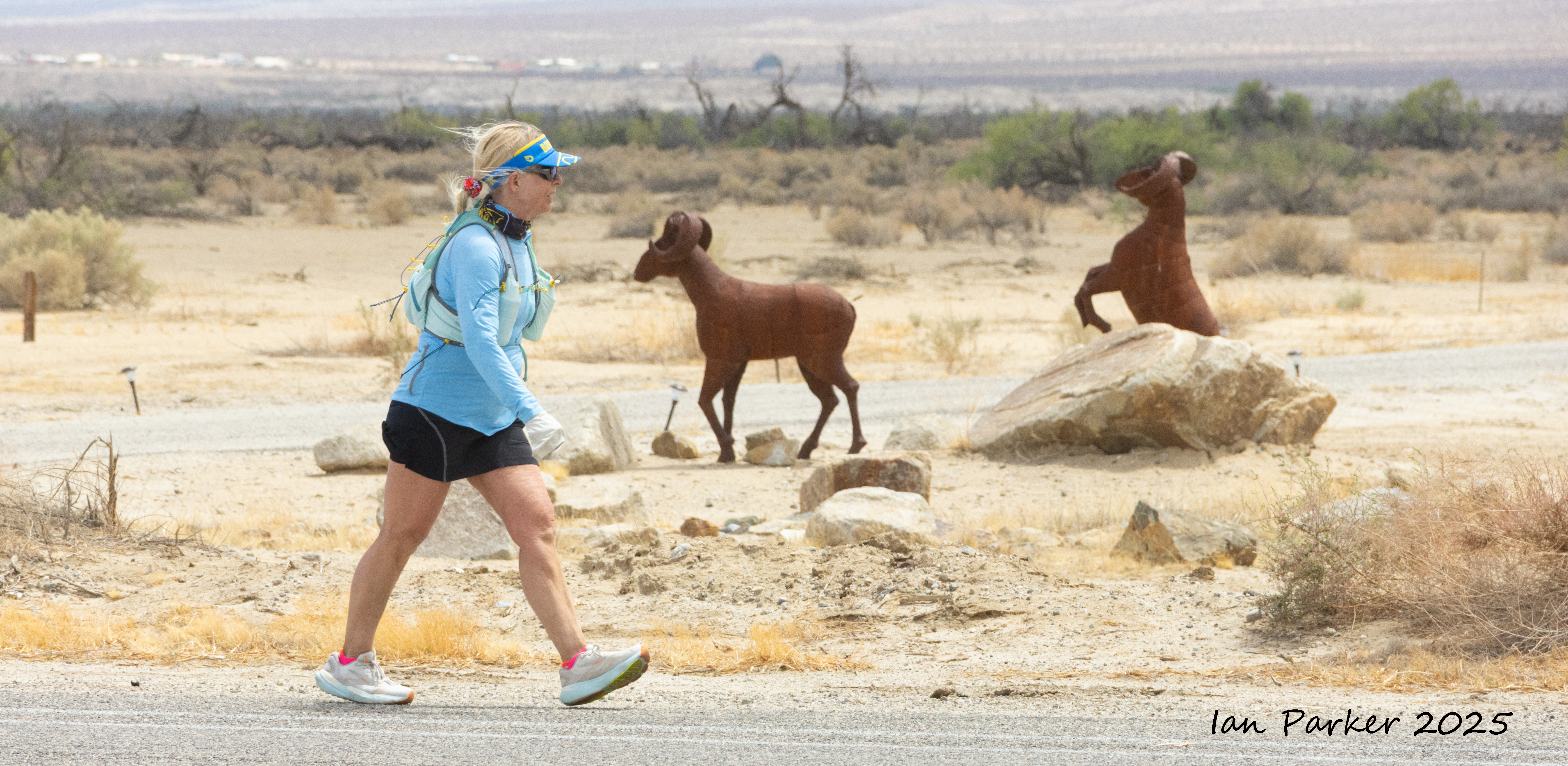
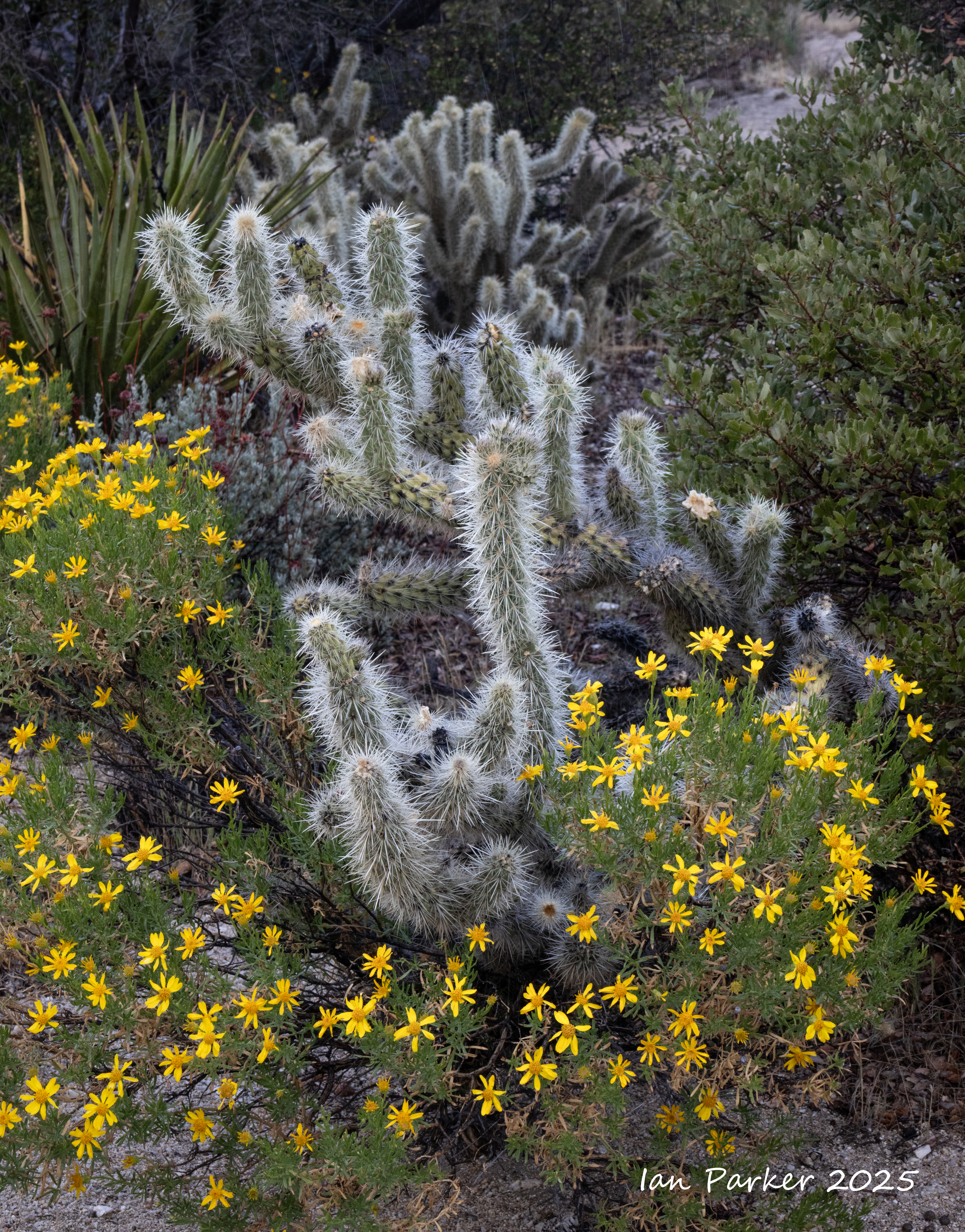
Miles 15-23; Through the desert
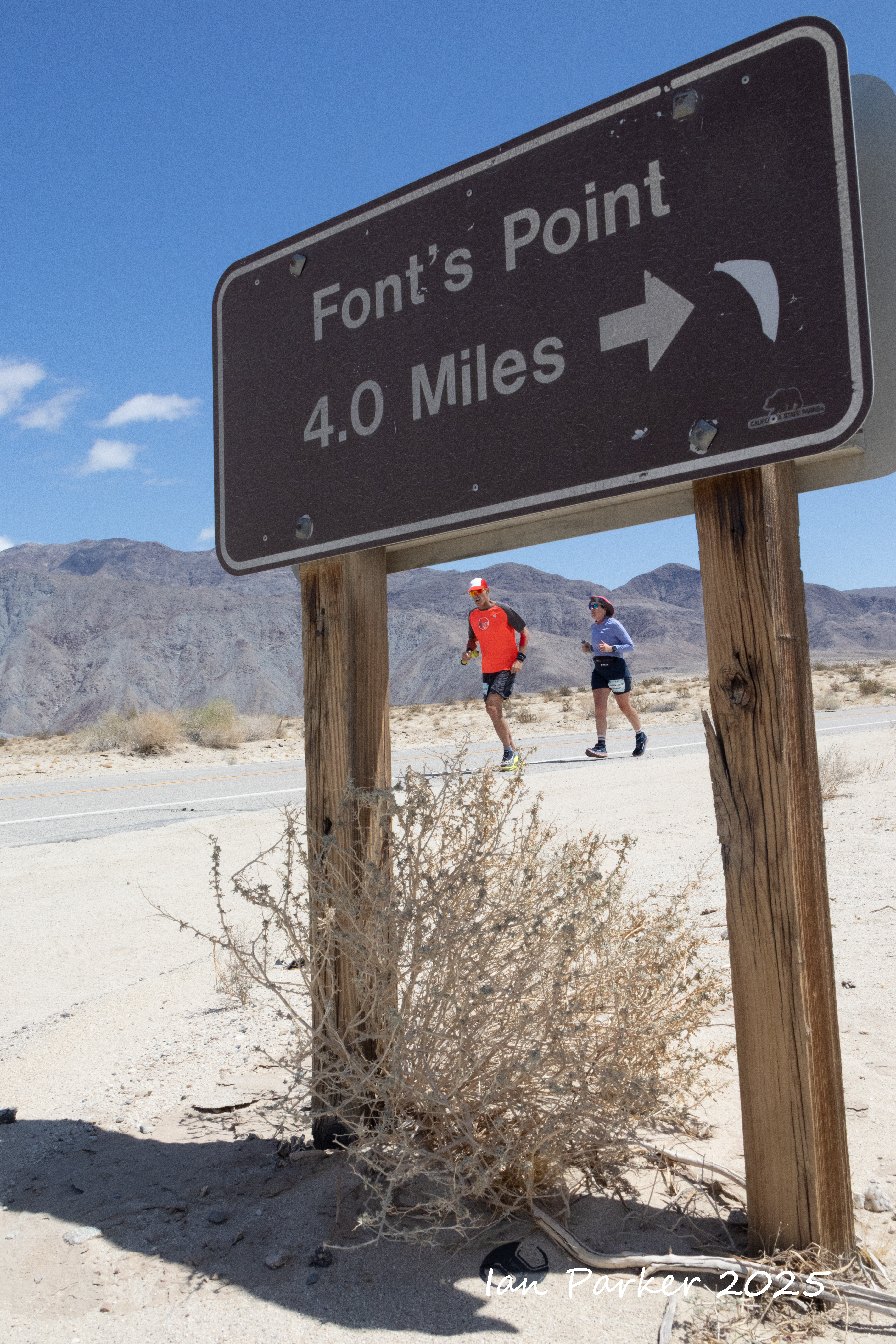
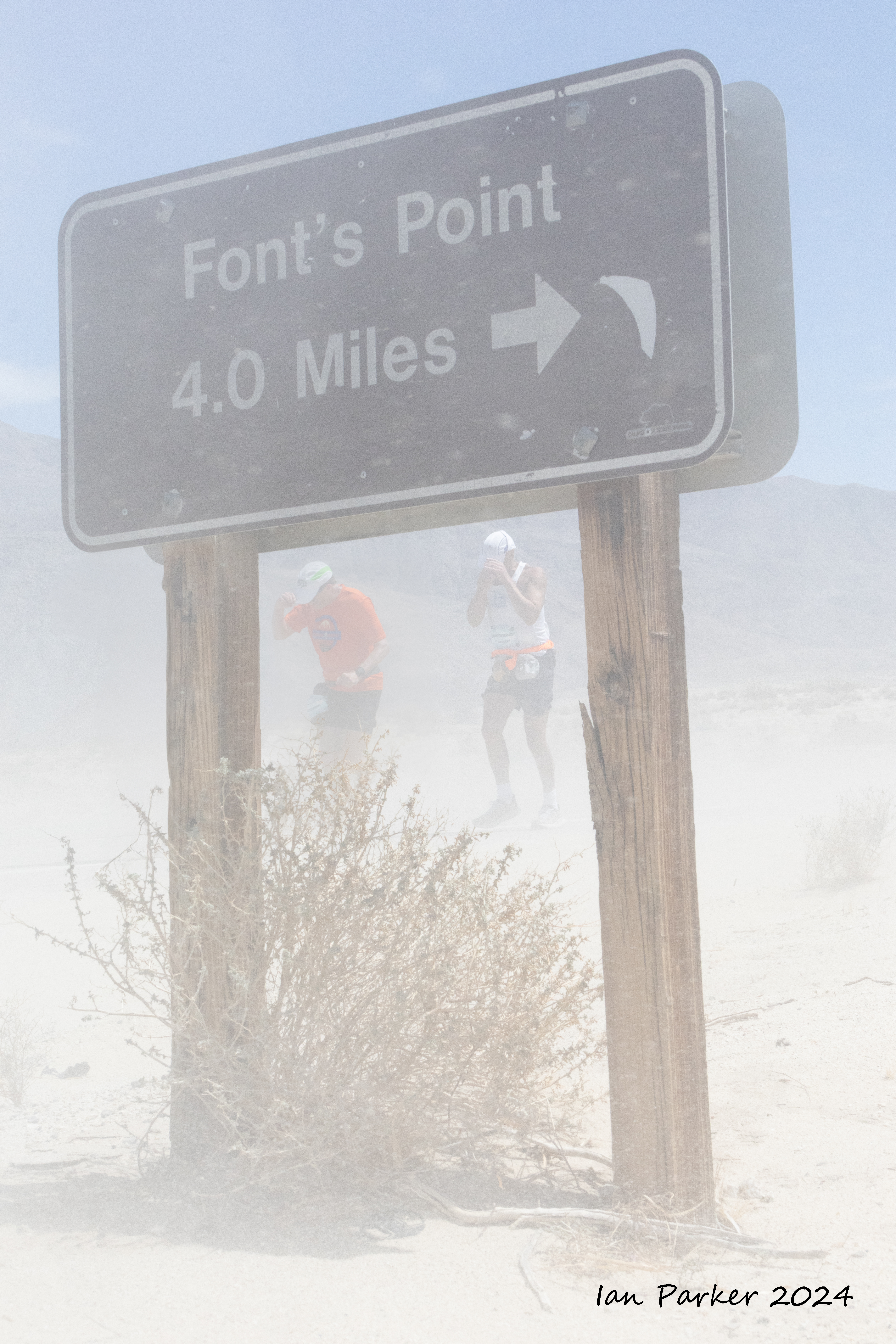
Mile 24; Another sandstorm at the turnoff to Font's Point
Mile 31; Approaching Borrego Springs
Mile 40; Hellhole Canyon - checkpoint #3
Miles 40-41; Setting out on the hiking and riding trail
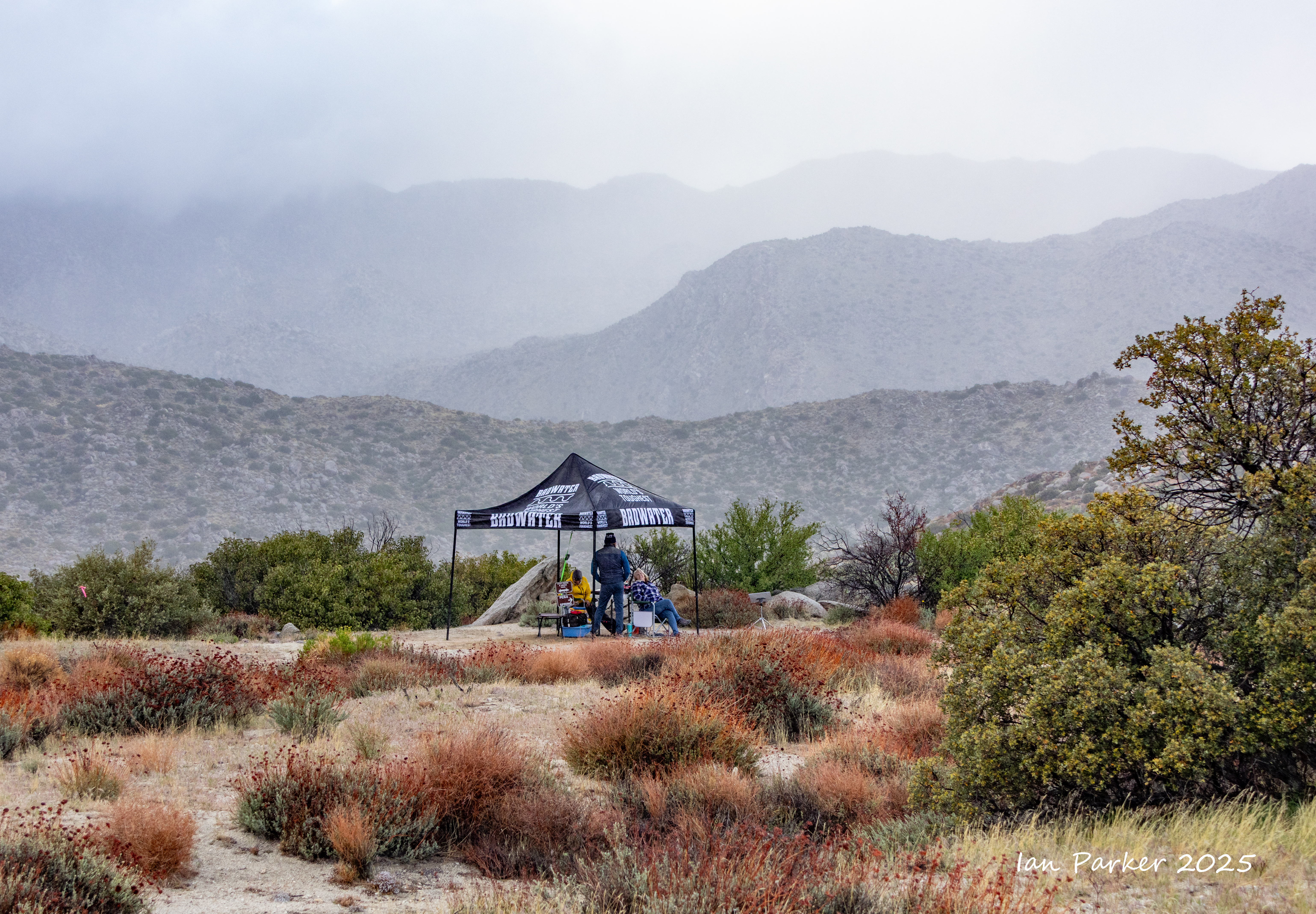
Atmospheric phenomena while we detoured back to camp overnight in the warm, dry desert (while, the runners continued through the night at higher elevations in cold, wet and misty conditions.)
Mile 45; Culp Vally, checkpoint #4
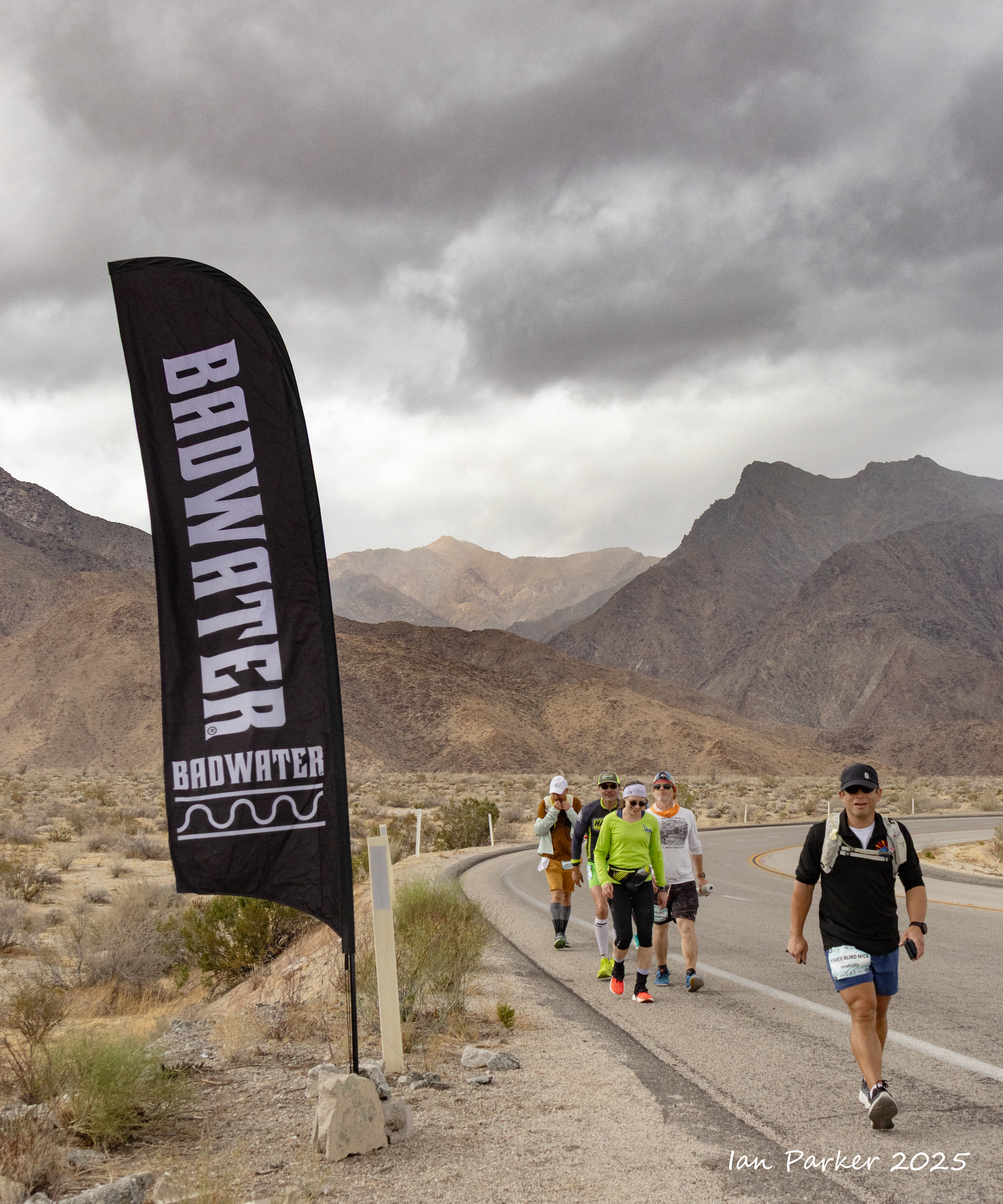
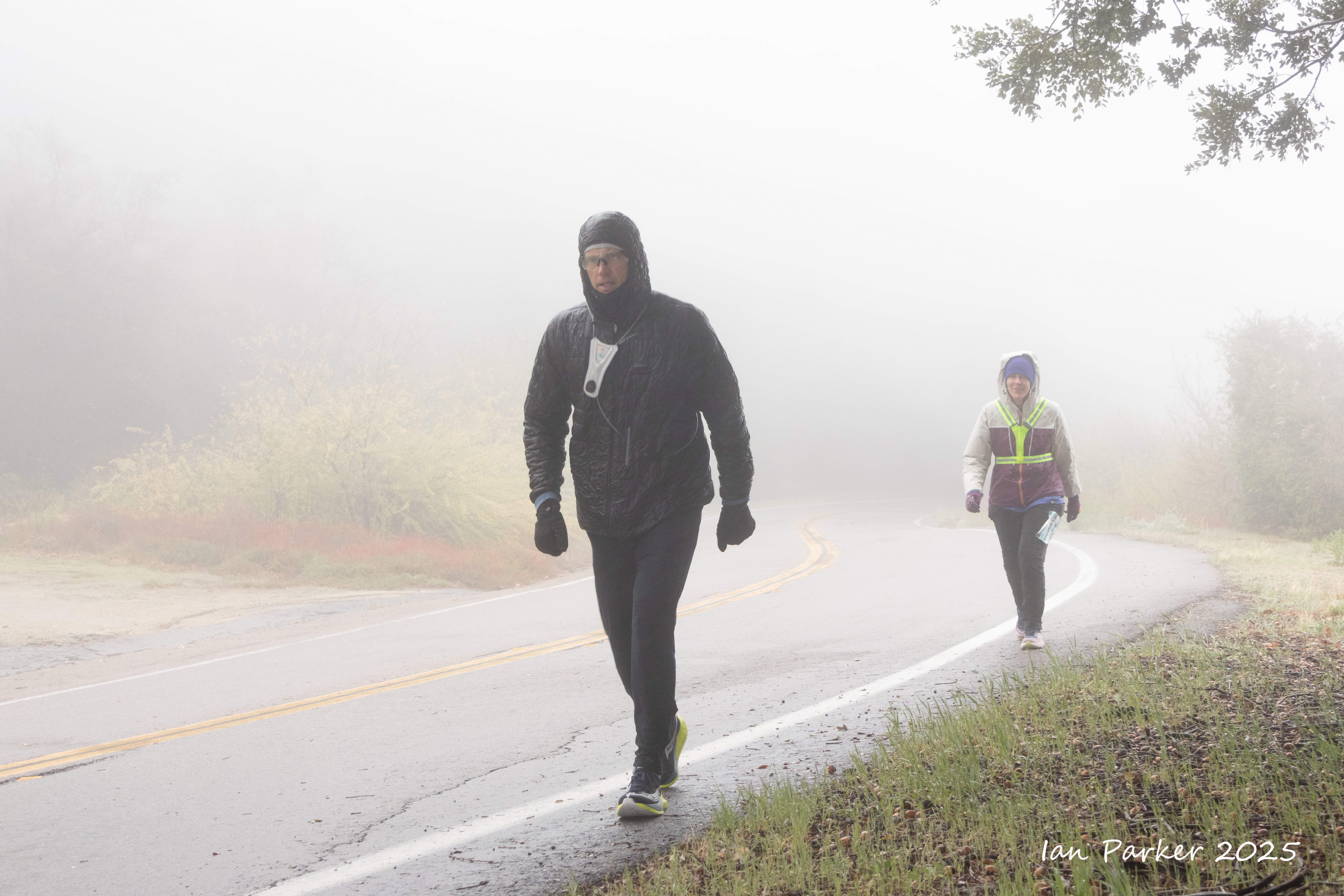
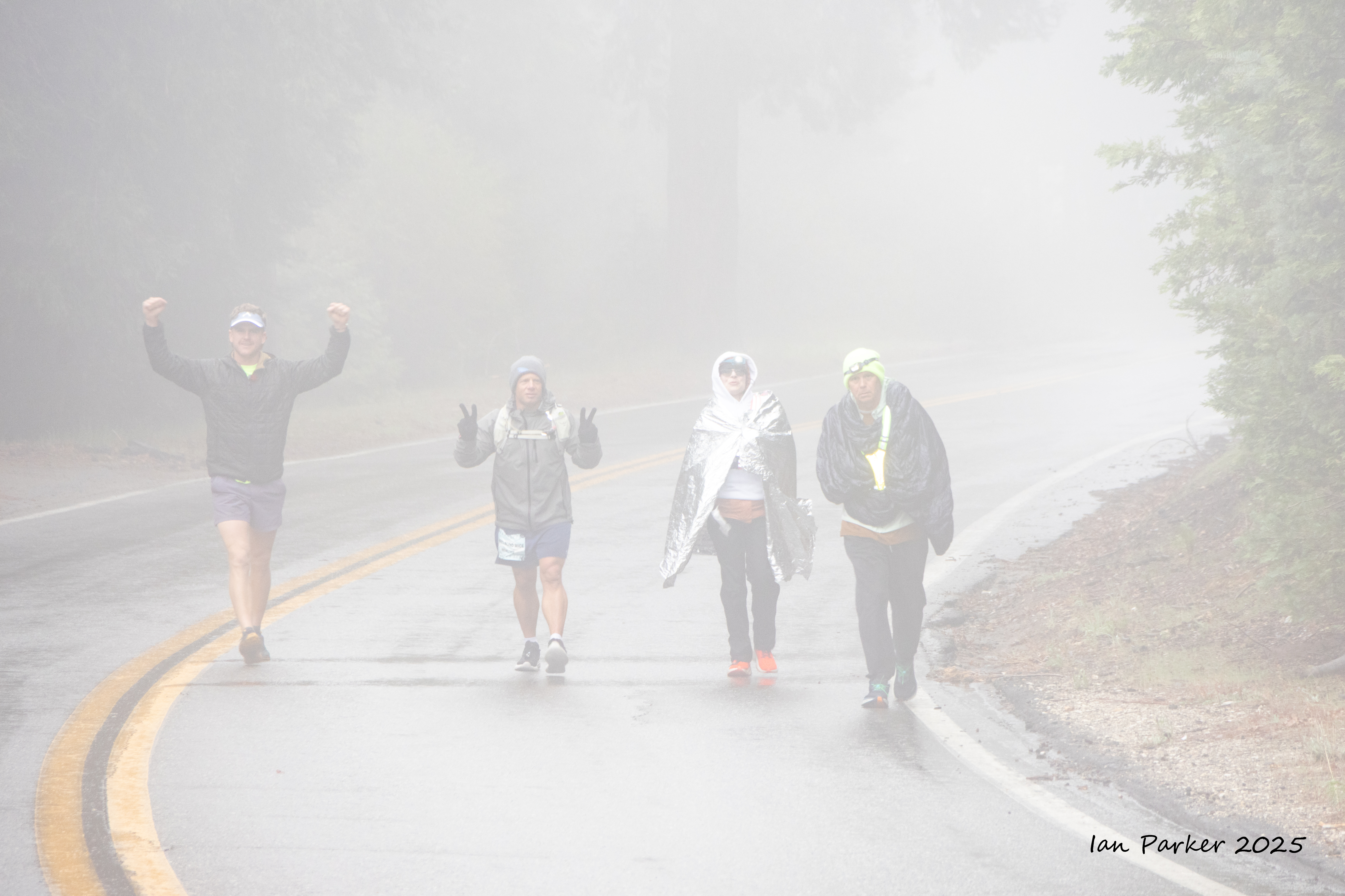
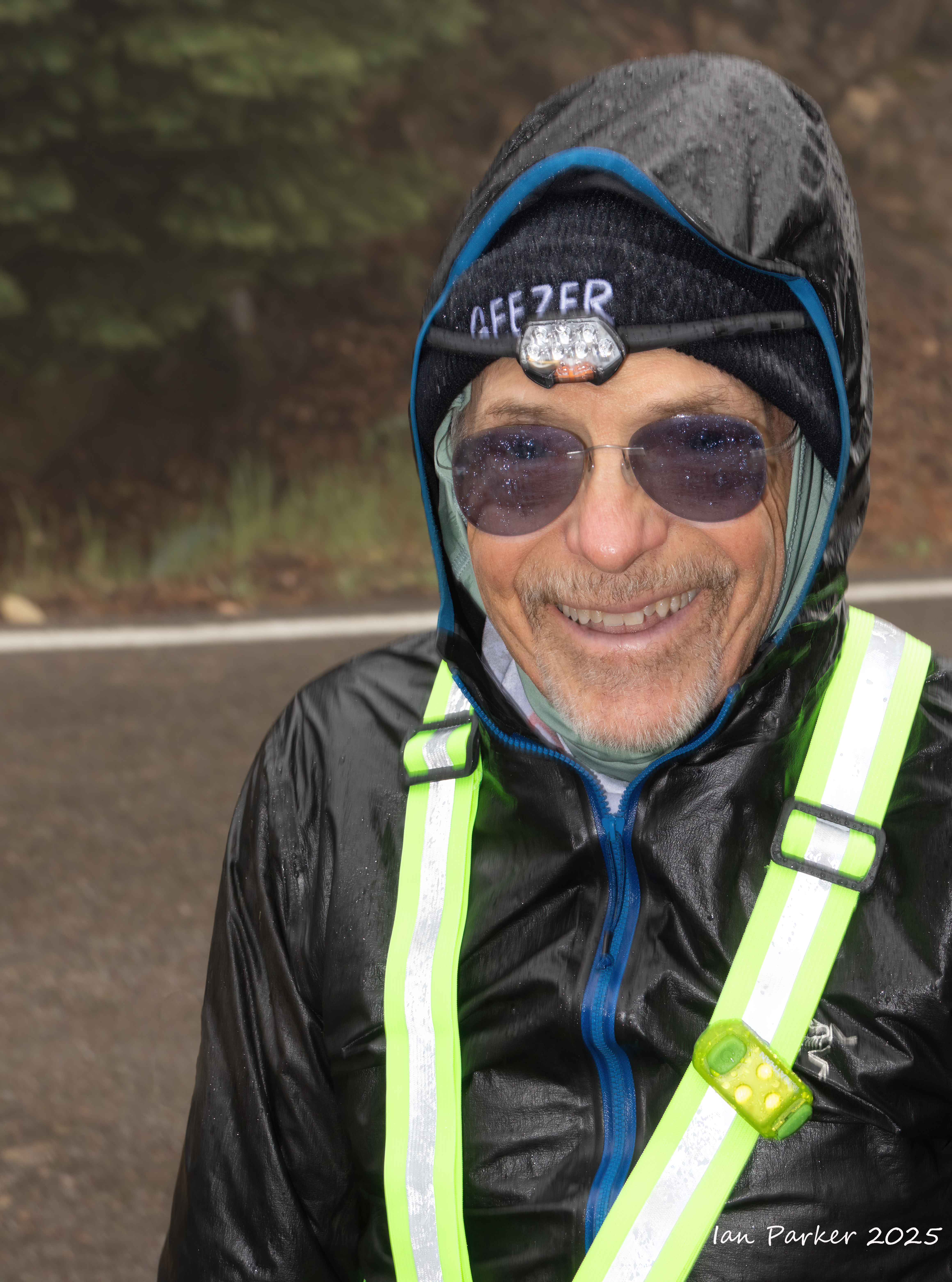
Miles 70-81; Climbing in mist and rain up the East Grade Road to the finish atop Palomar Mountain
Bob Becker - new record oldest finisher at
age 80!
IanParker
1146 McGaugh Hall
University of California,
Irvine, CA 92697
Please send enquiries to evanescentlightphotography@gmail.com


 Belt of Venus above snow-draped trees; Nivunki Village, Lapland


