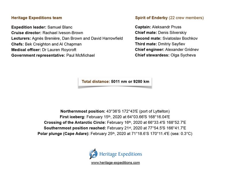
|


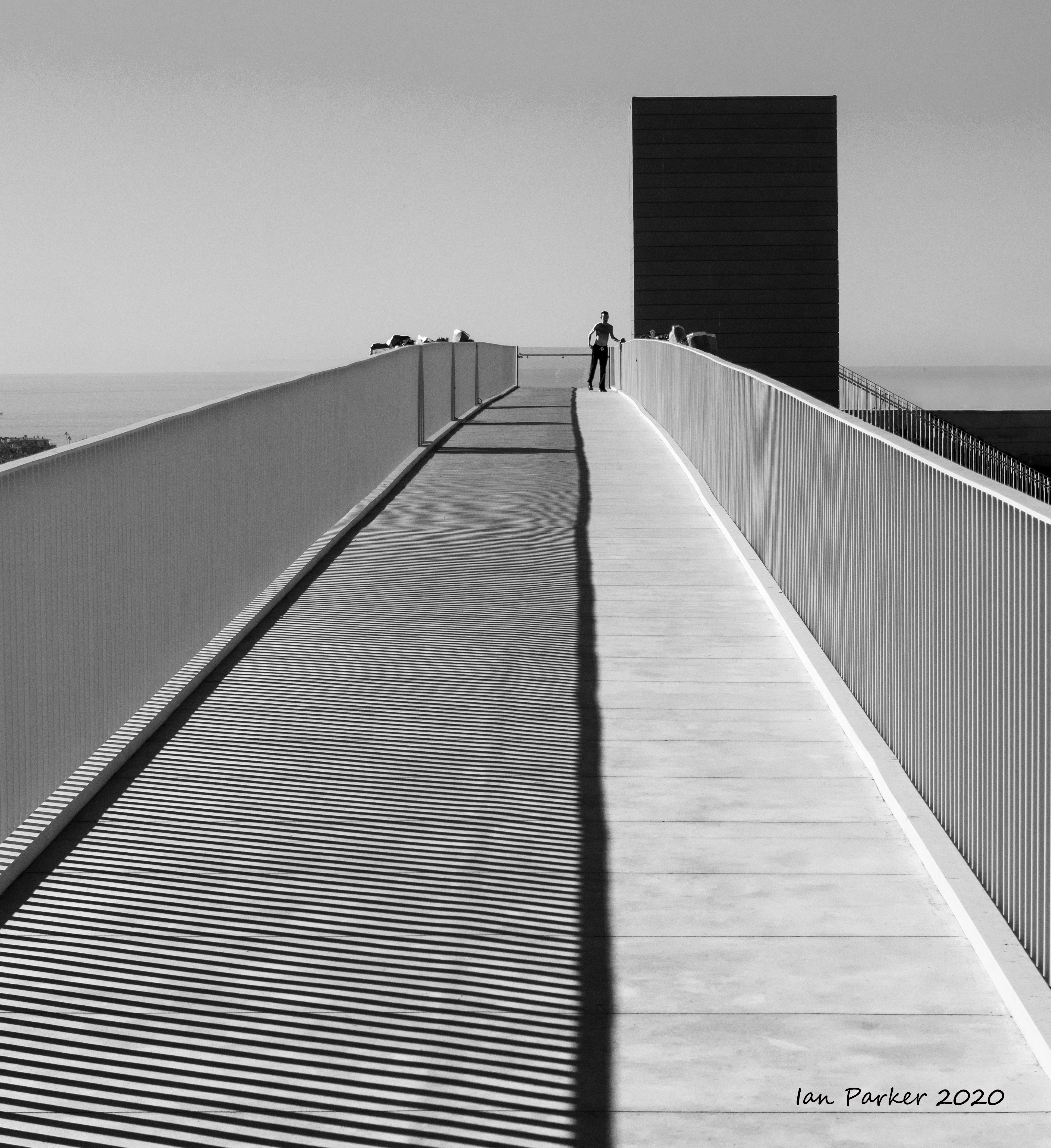


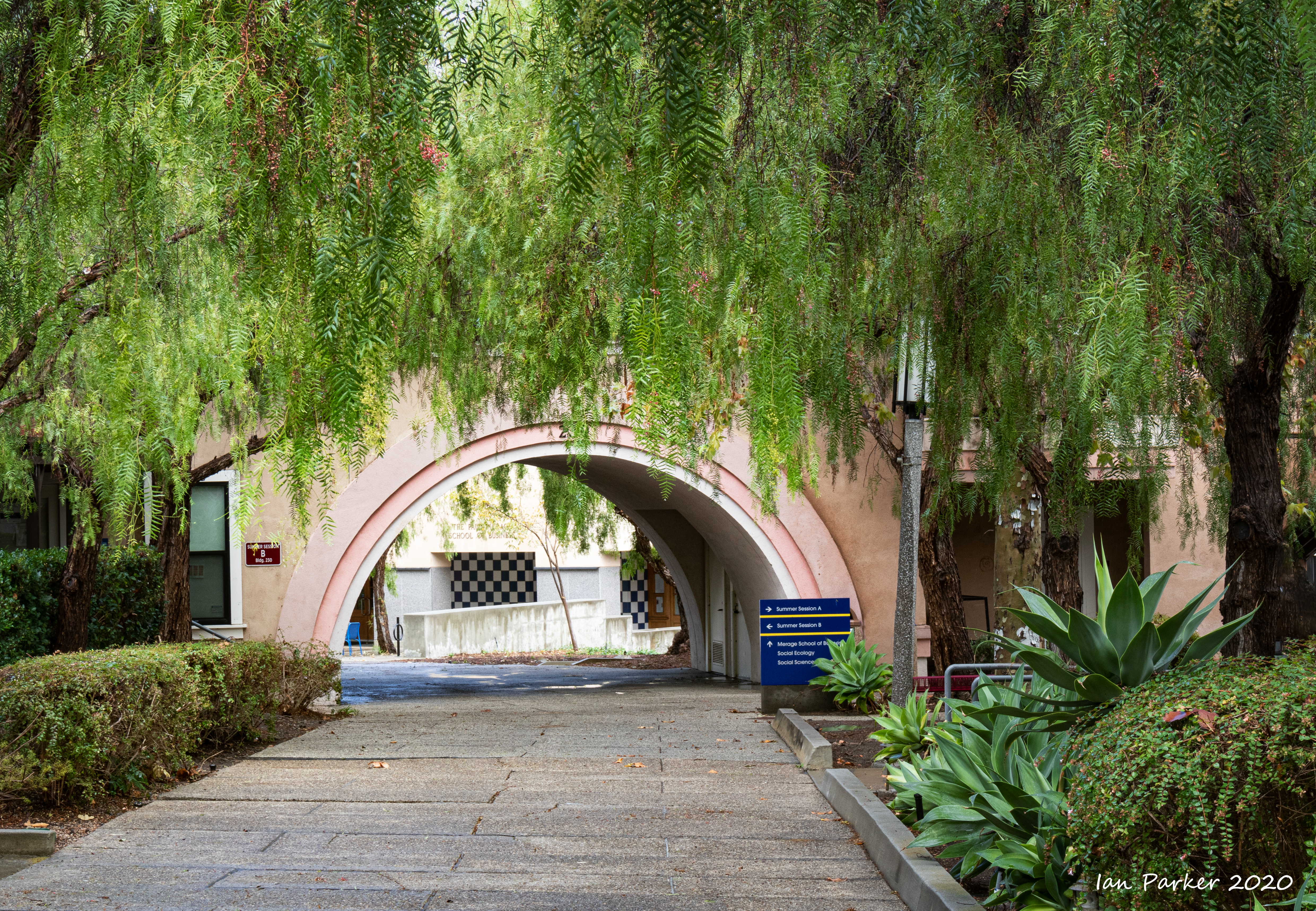
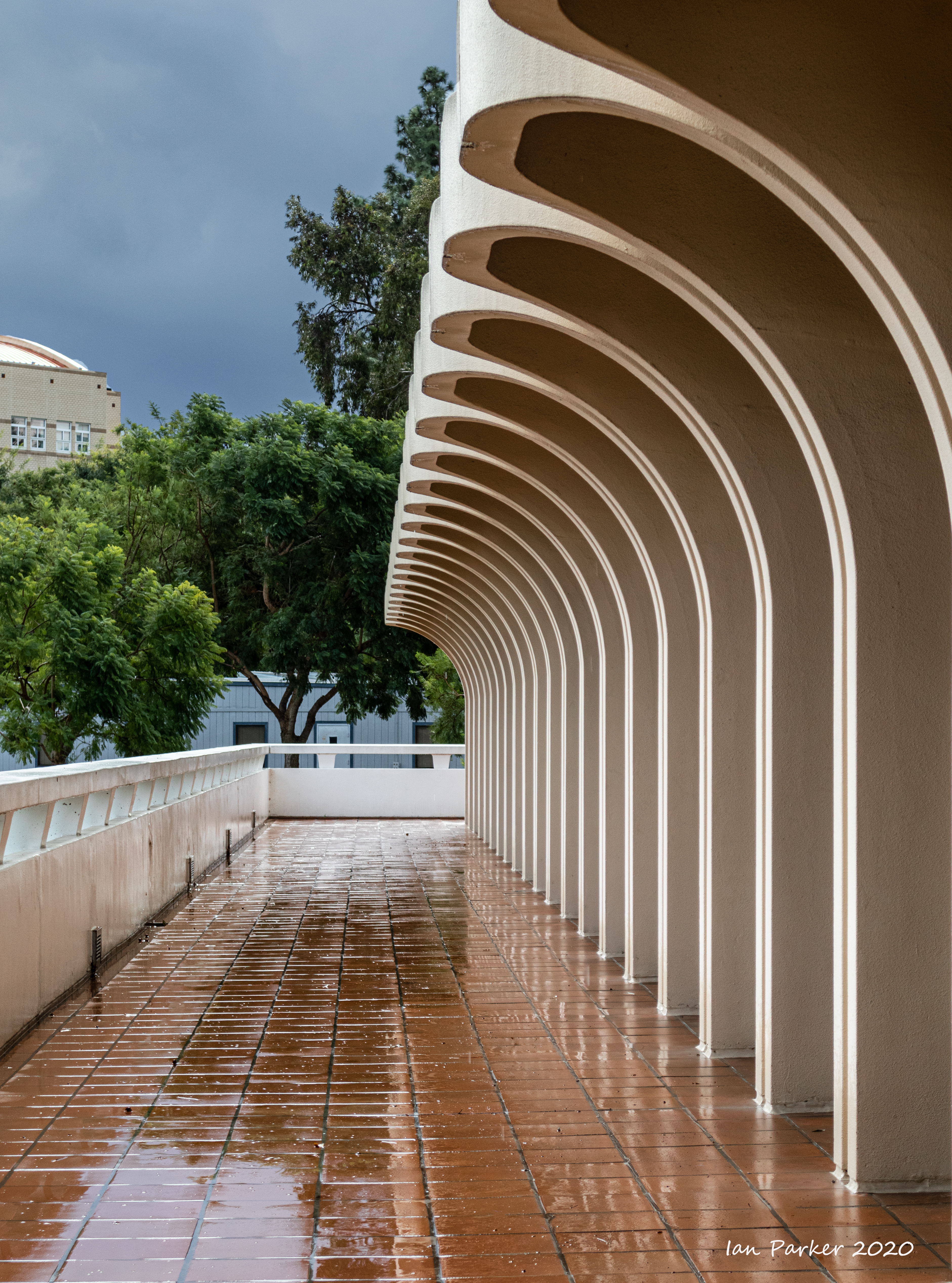
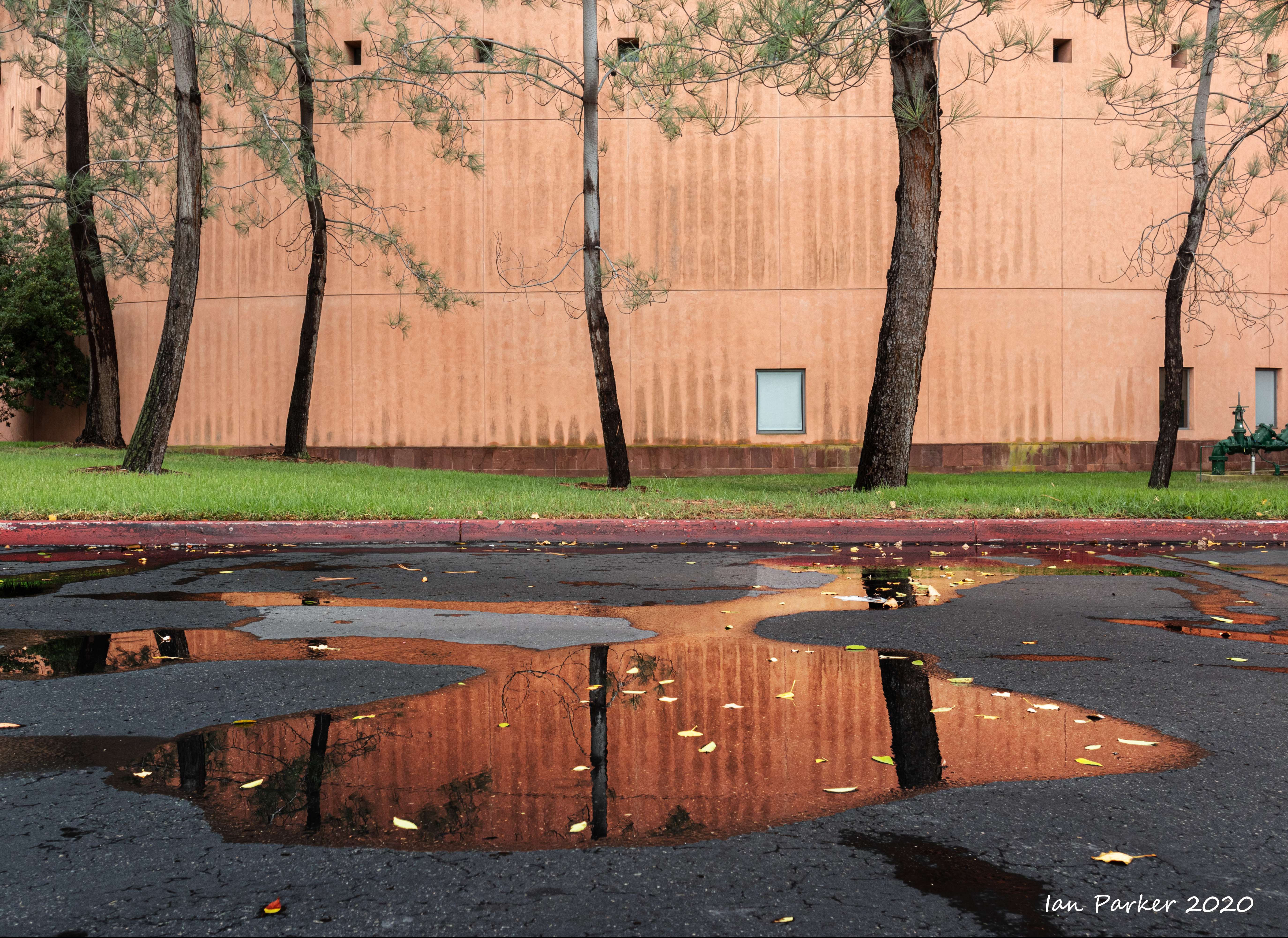
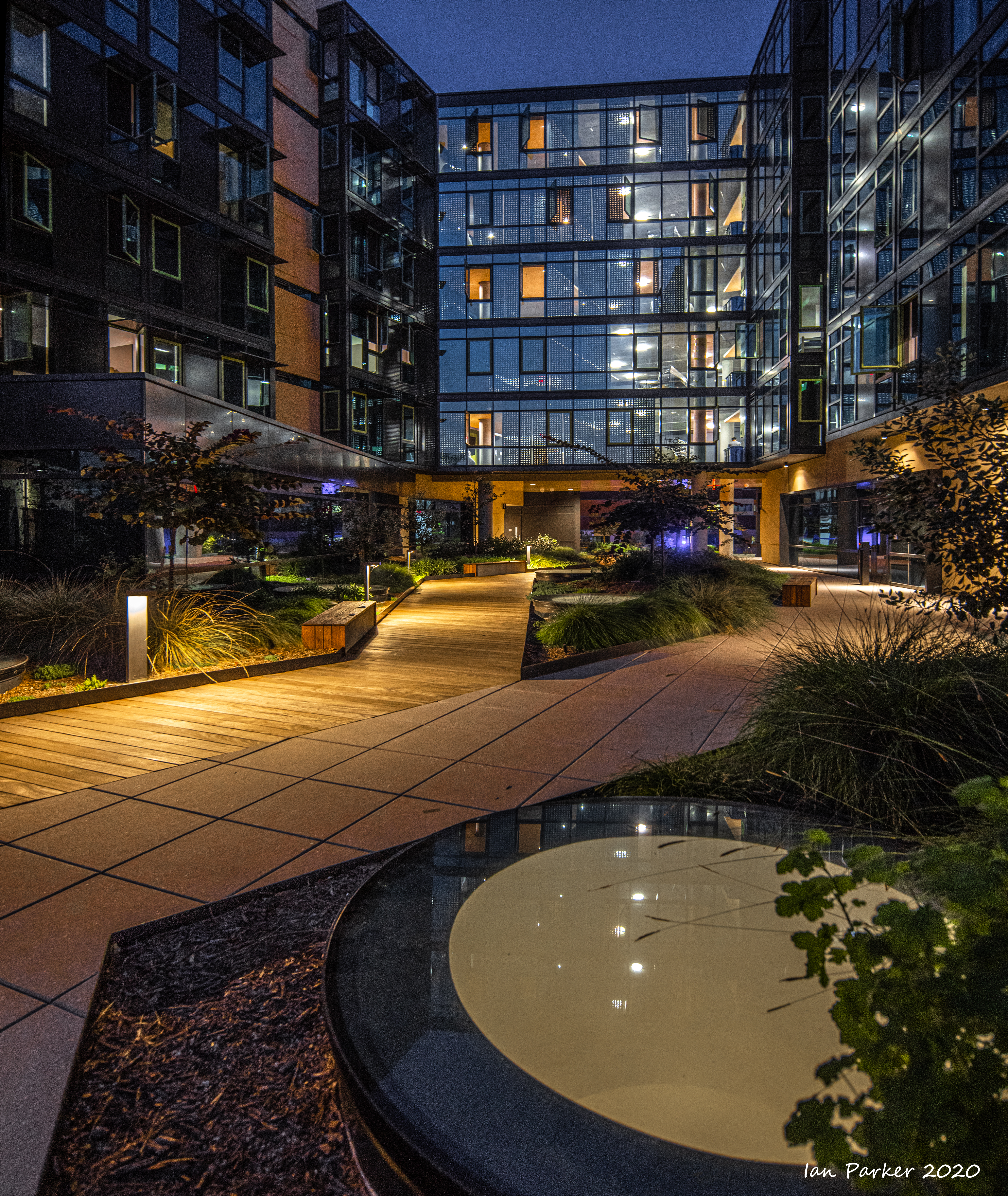
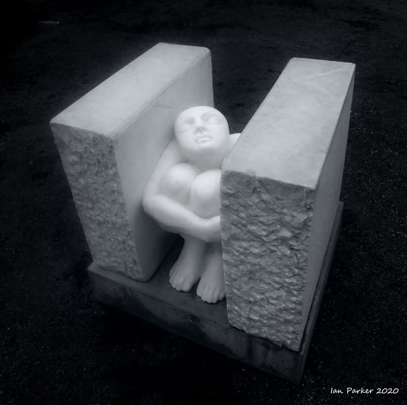
November 9th: UCI on a rainy weekend.


 |
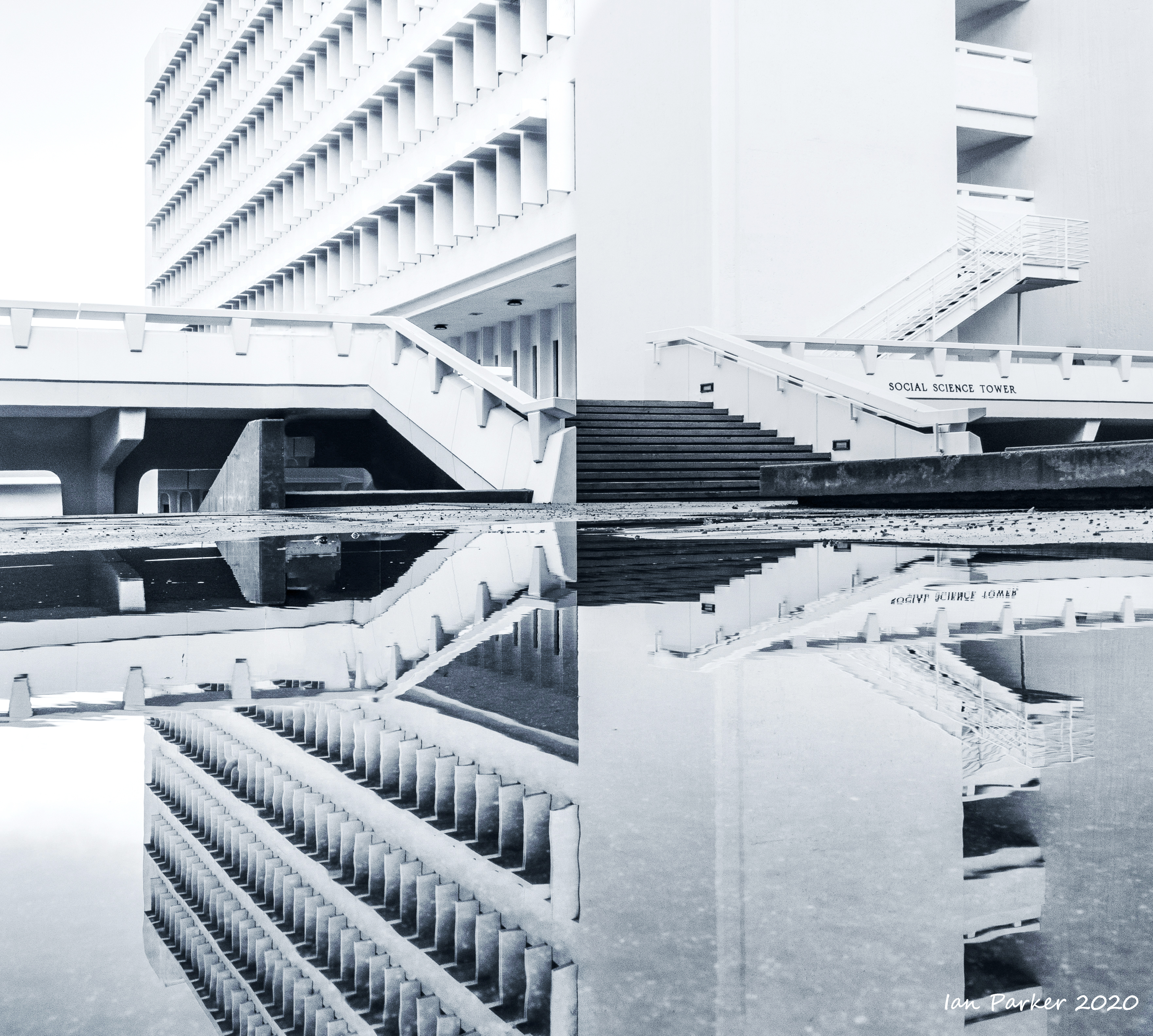
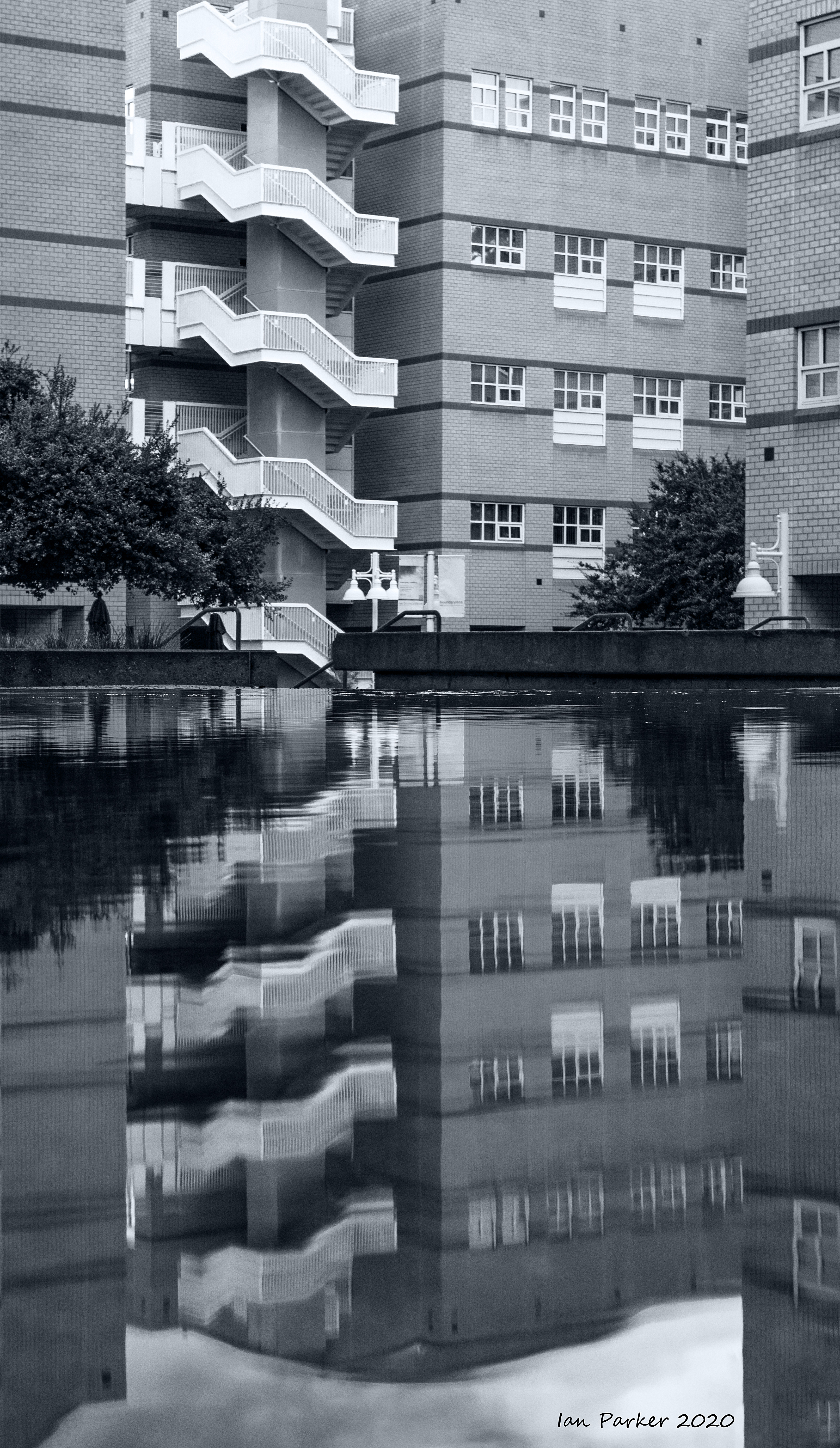
I think the original, 'brutalist' Pereira buildings on the UCI campus photograph better in black and white - an echo of the Planet of the Apes film set.


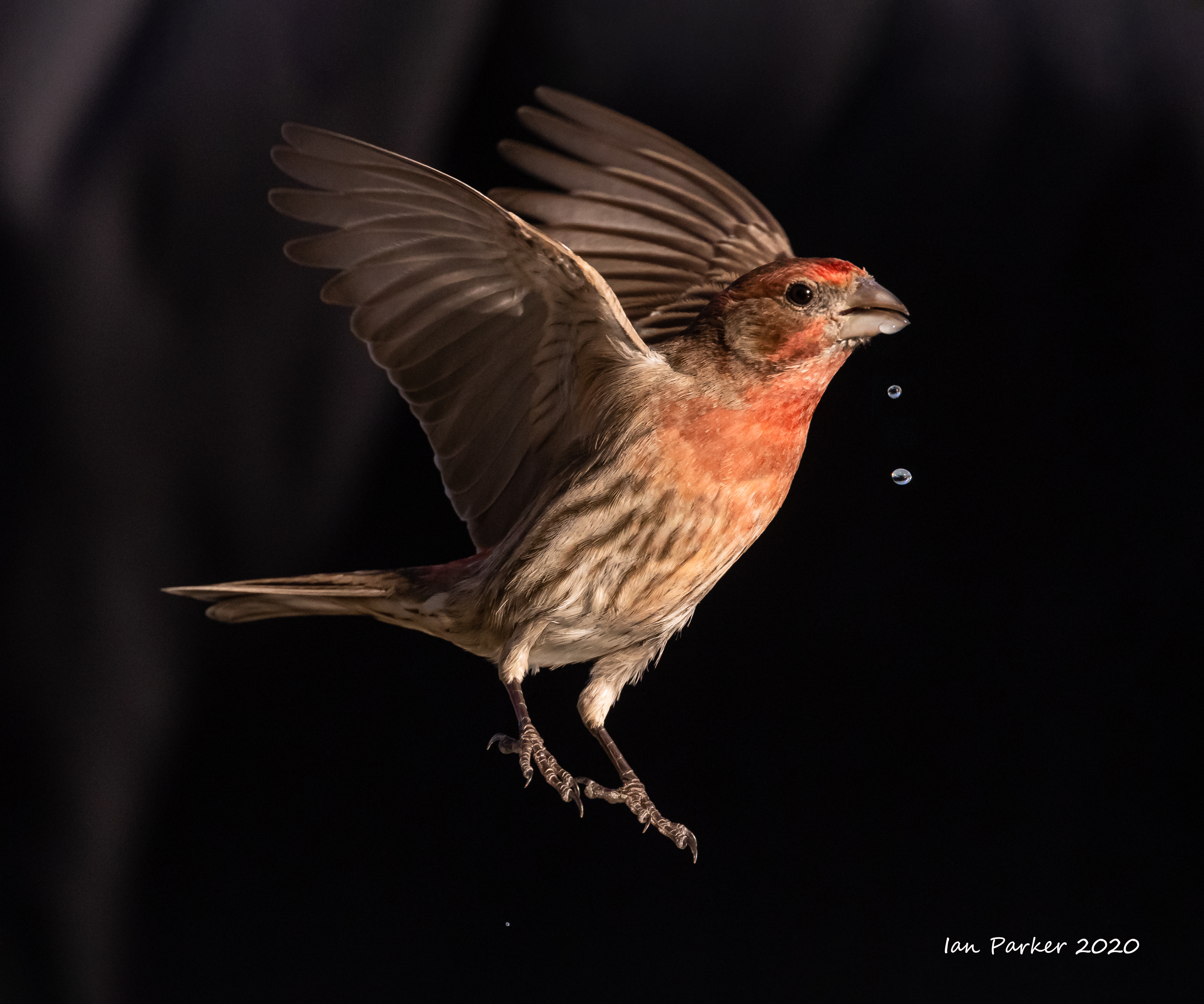
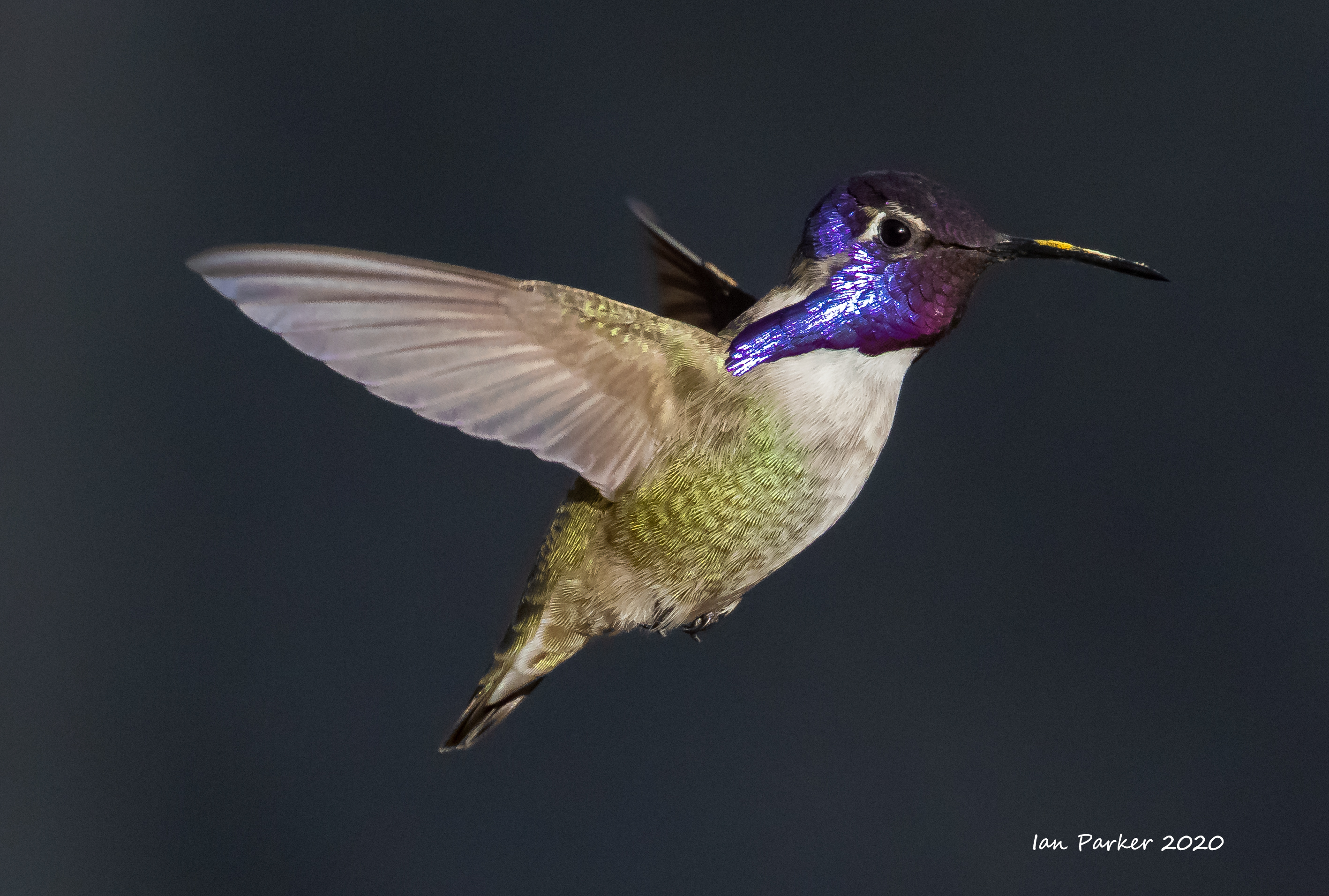
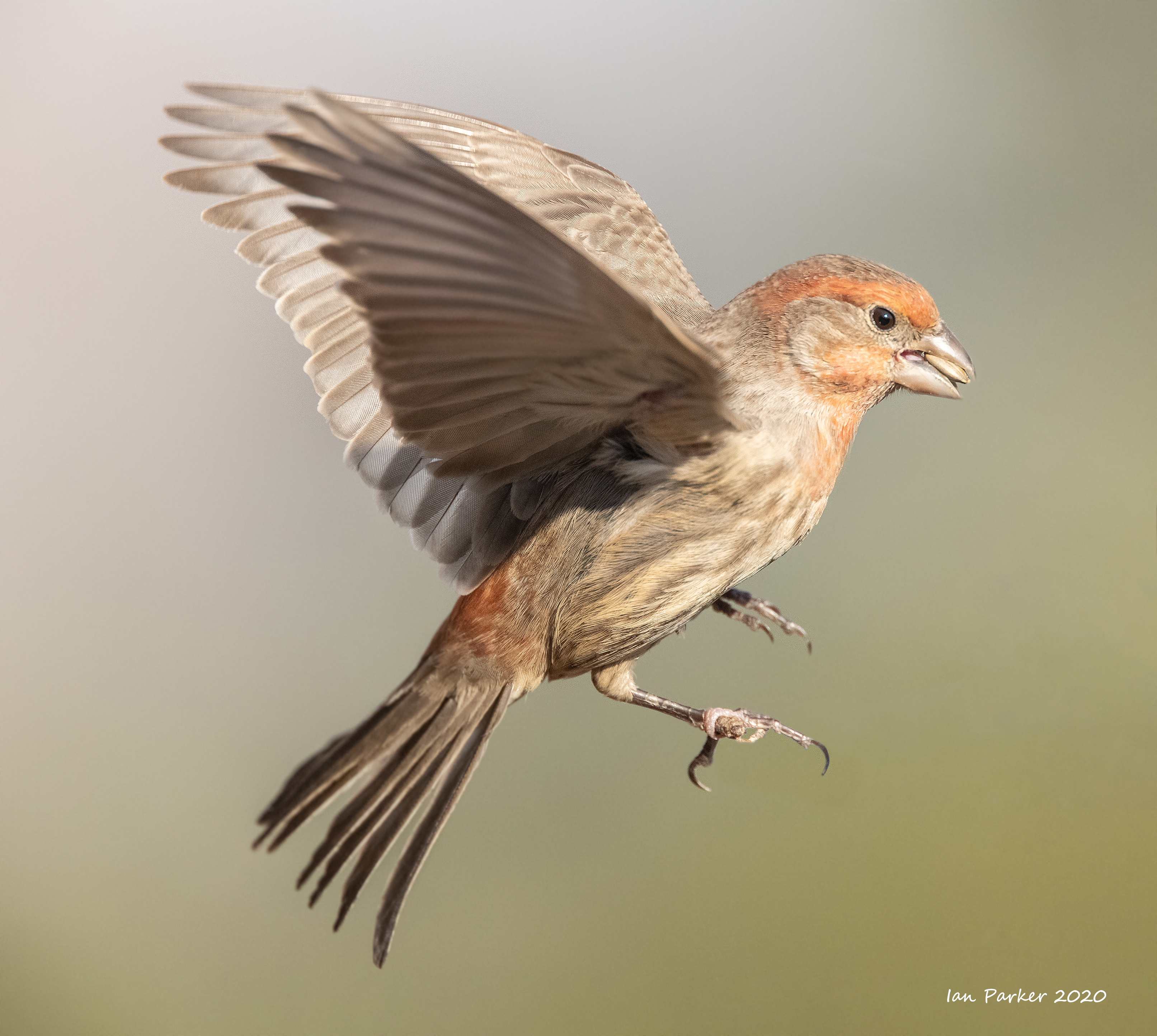
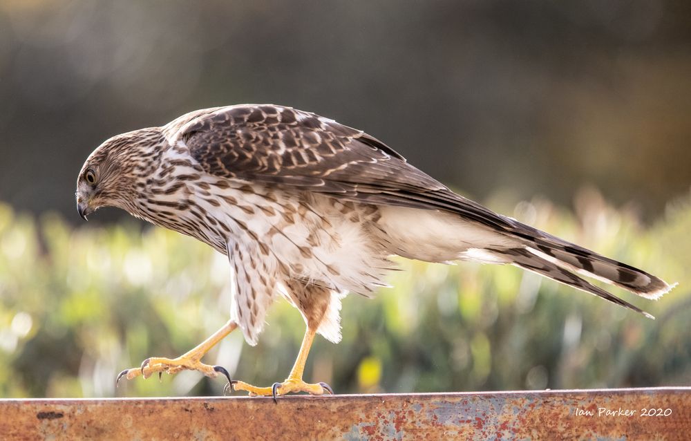
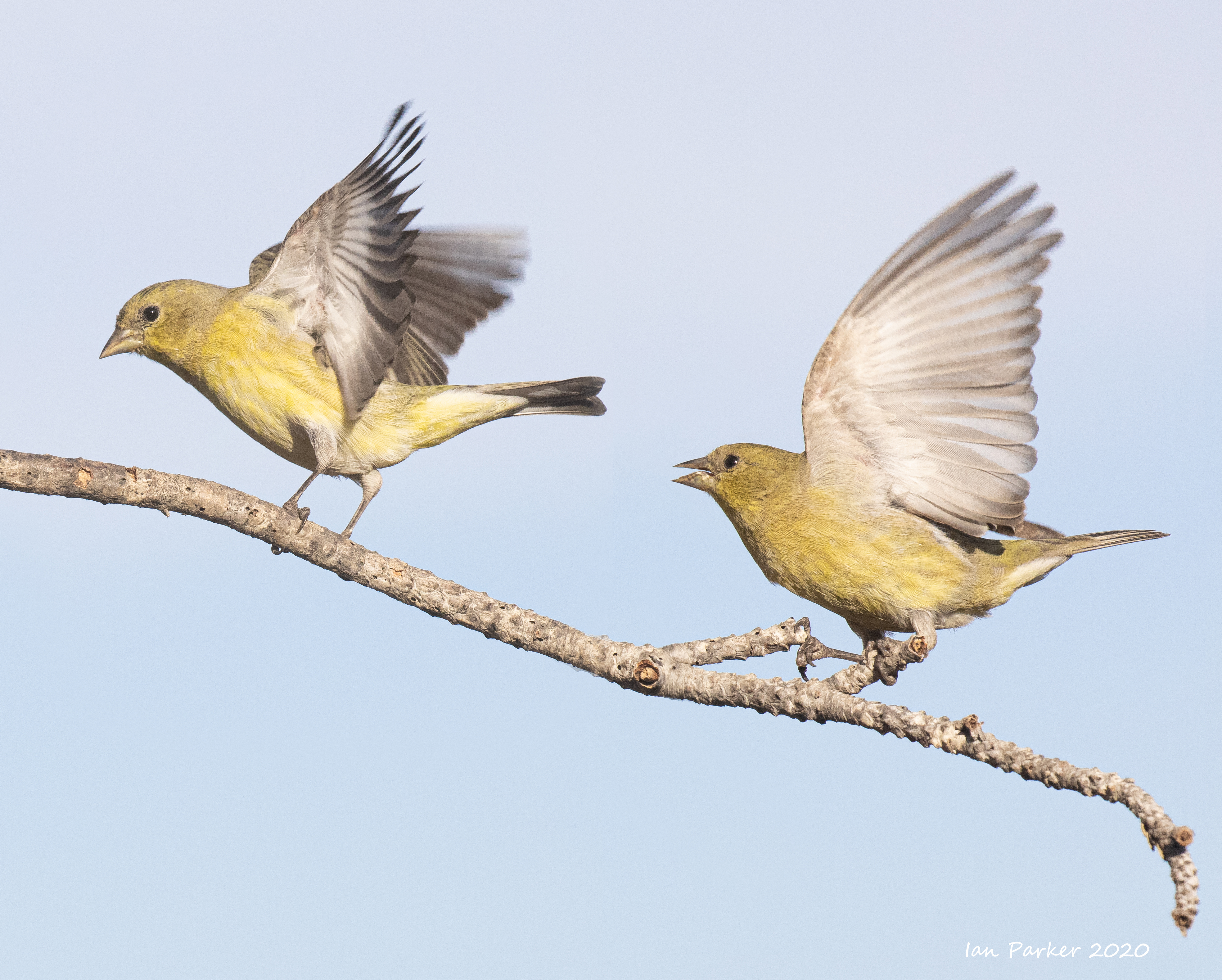
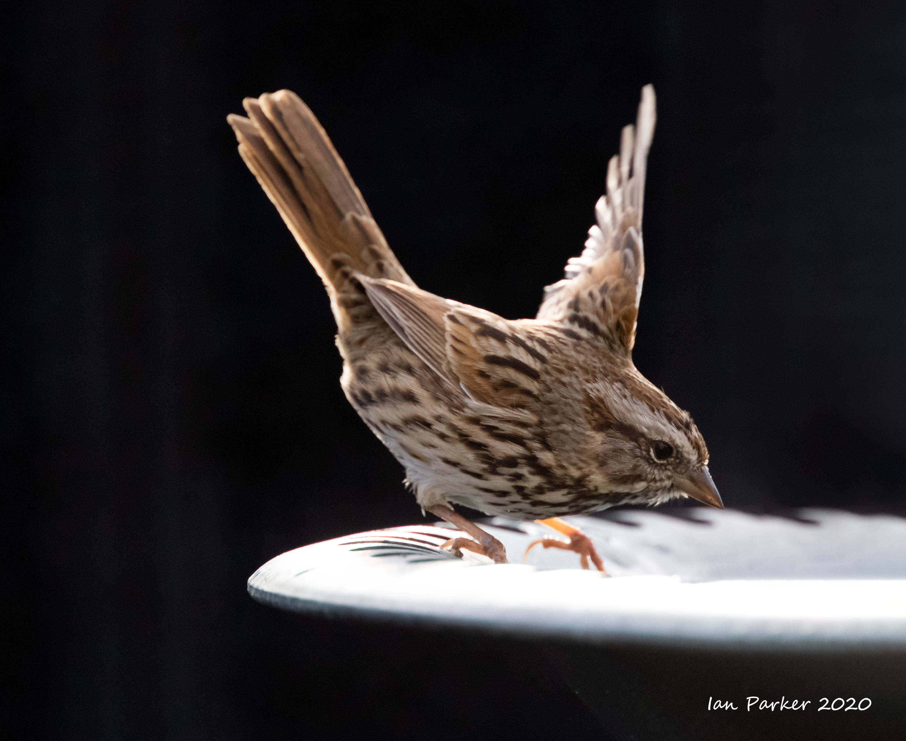
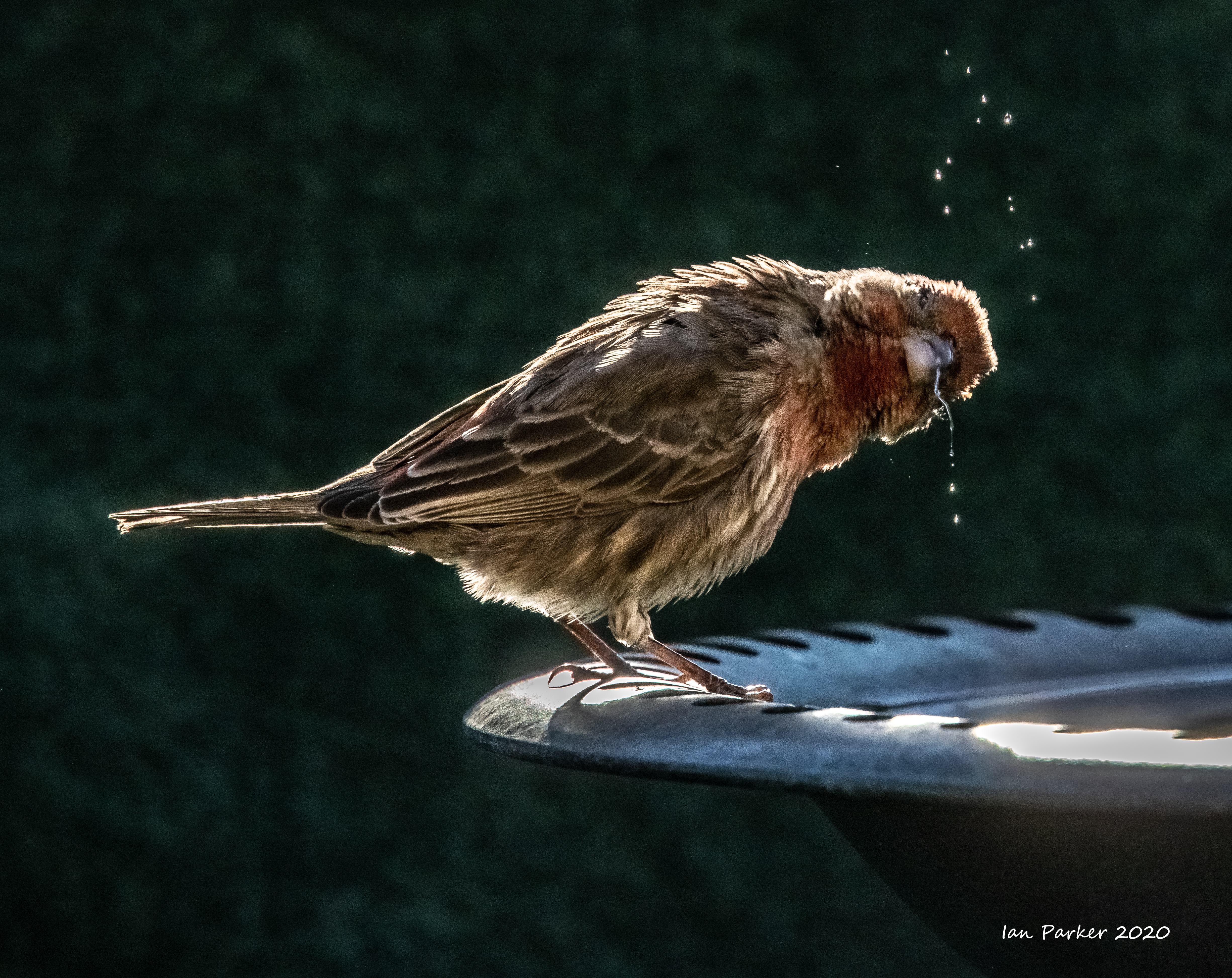
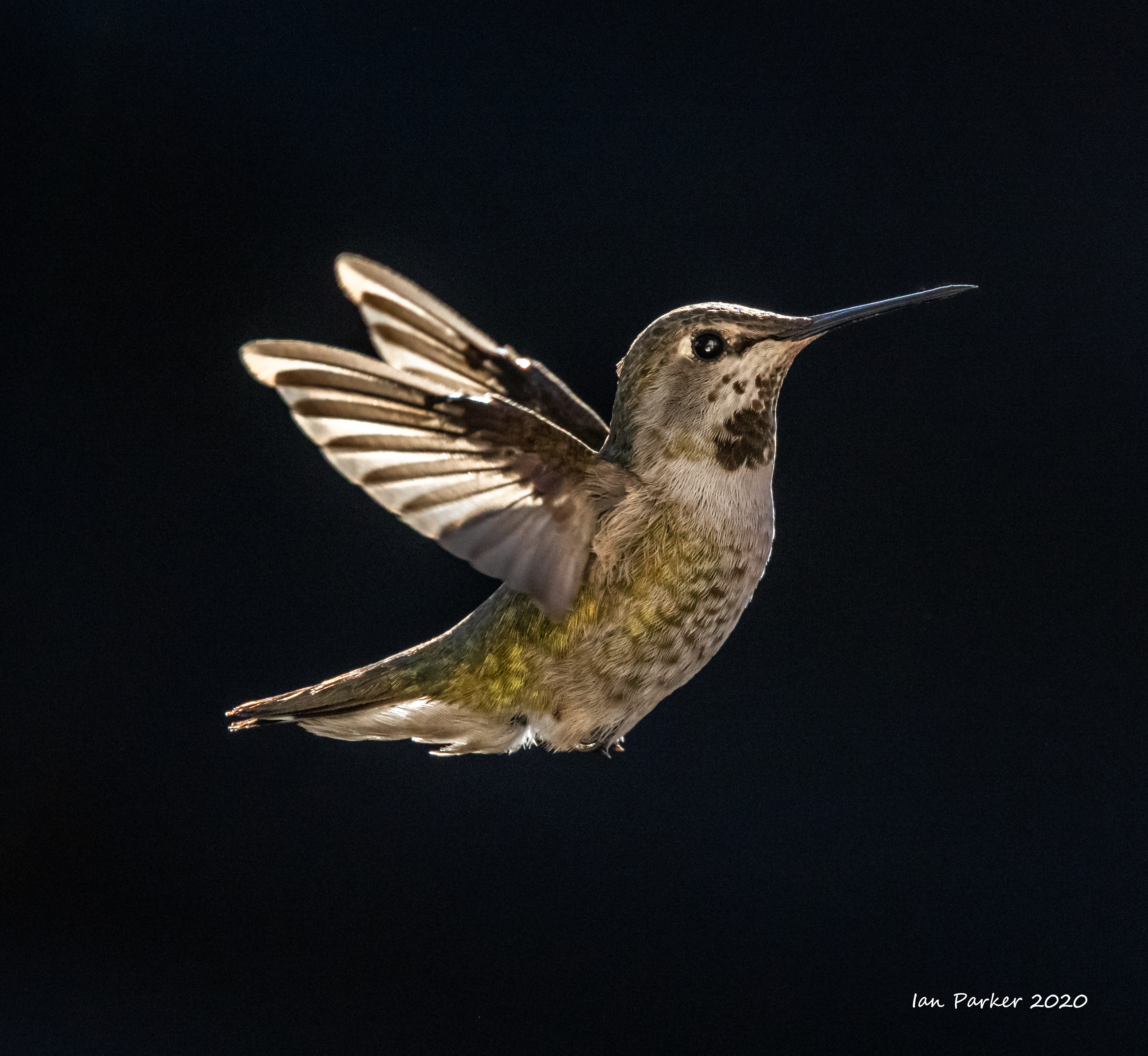
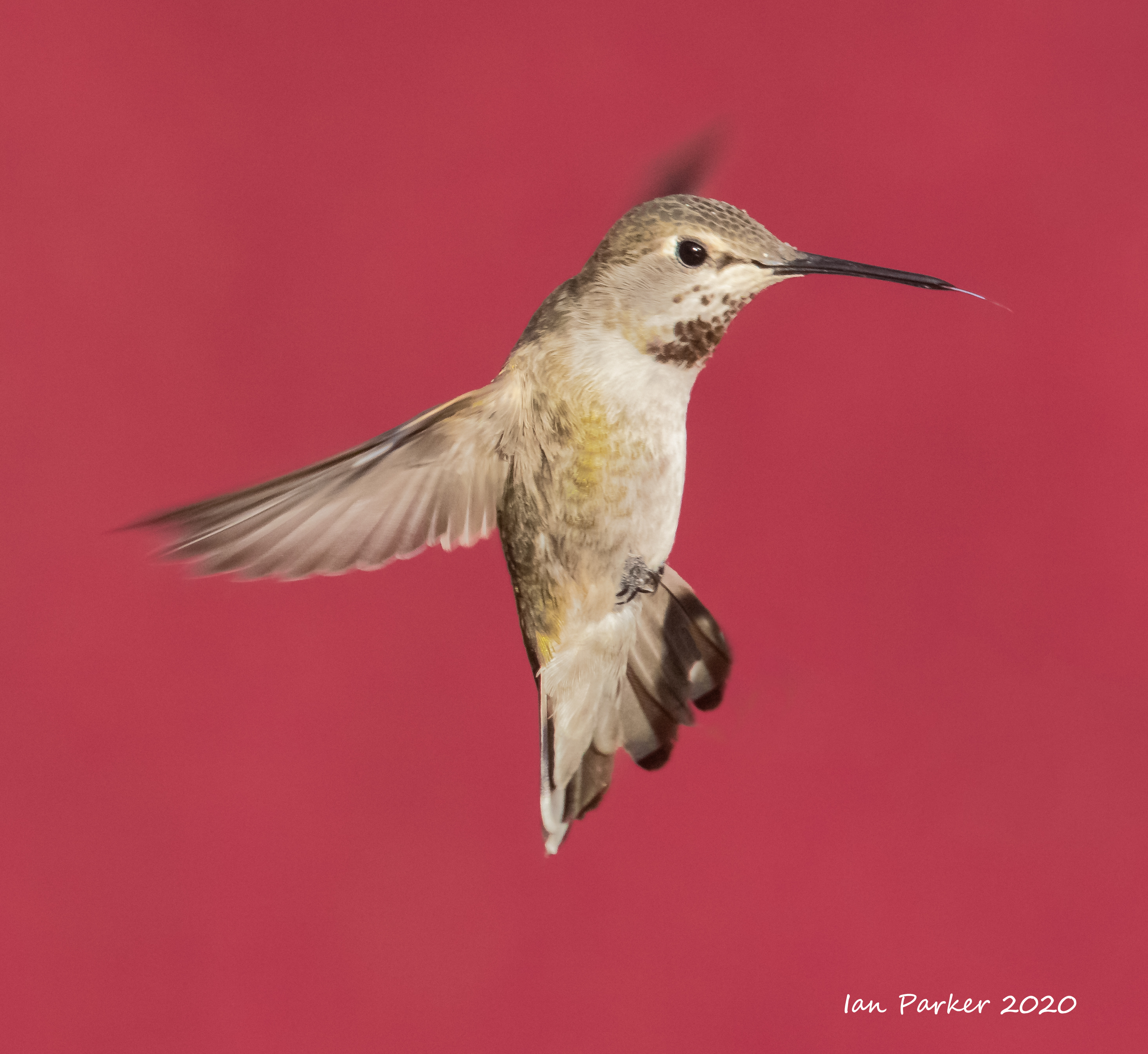
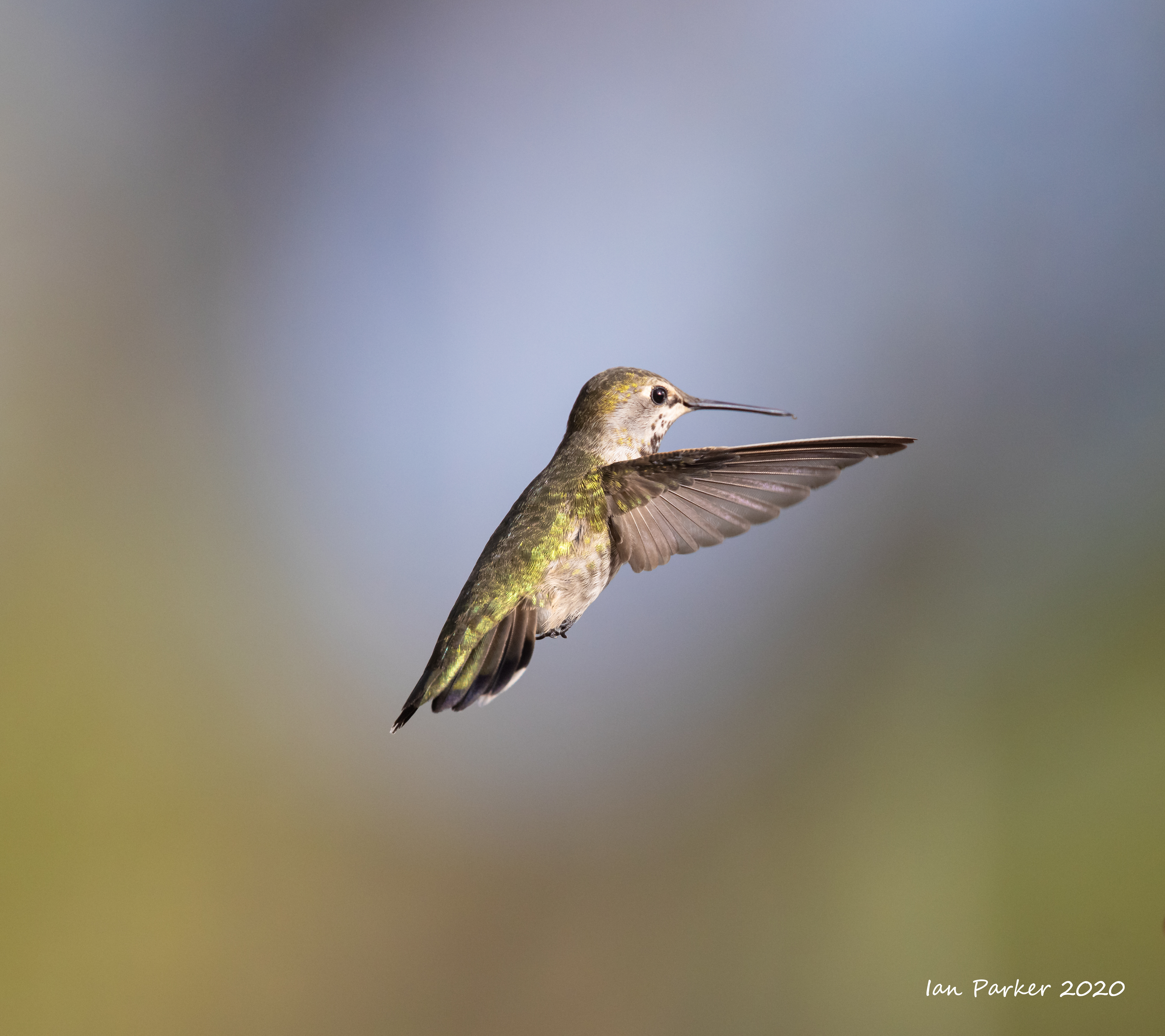
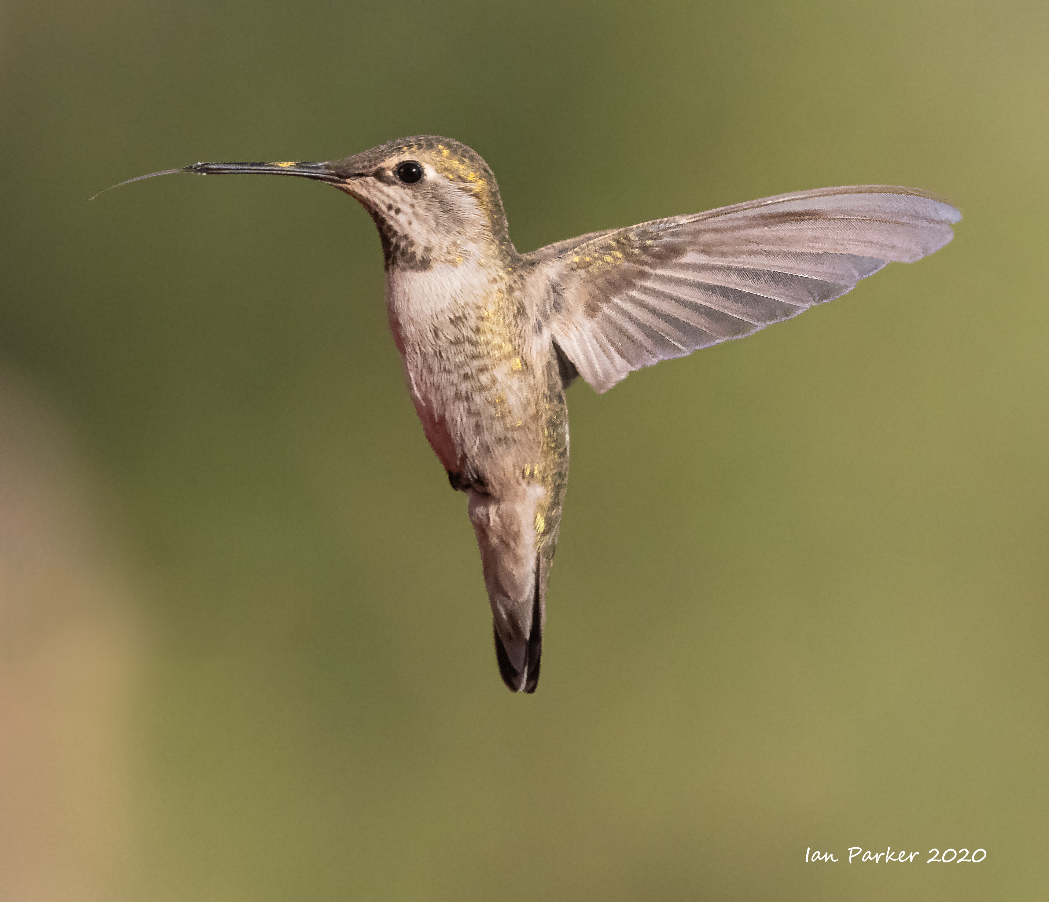
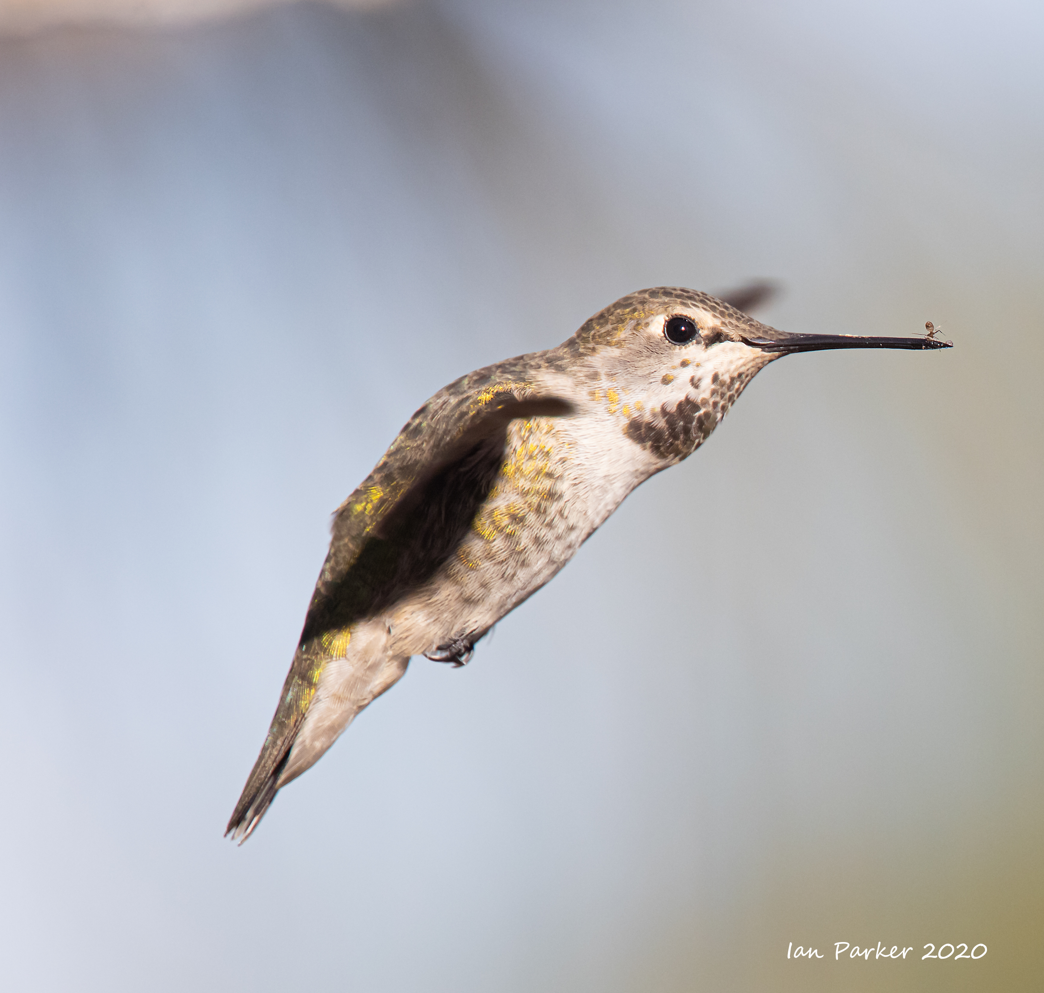
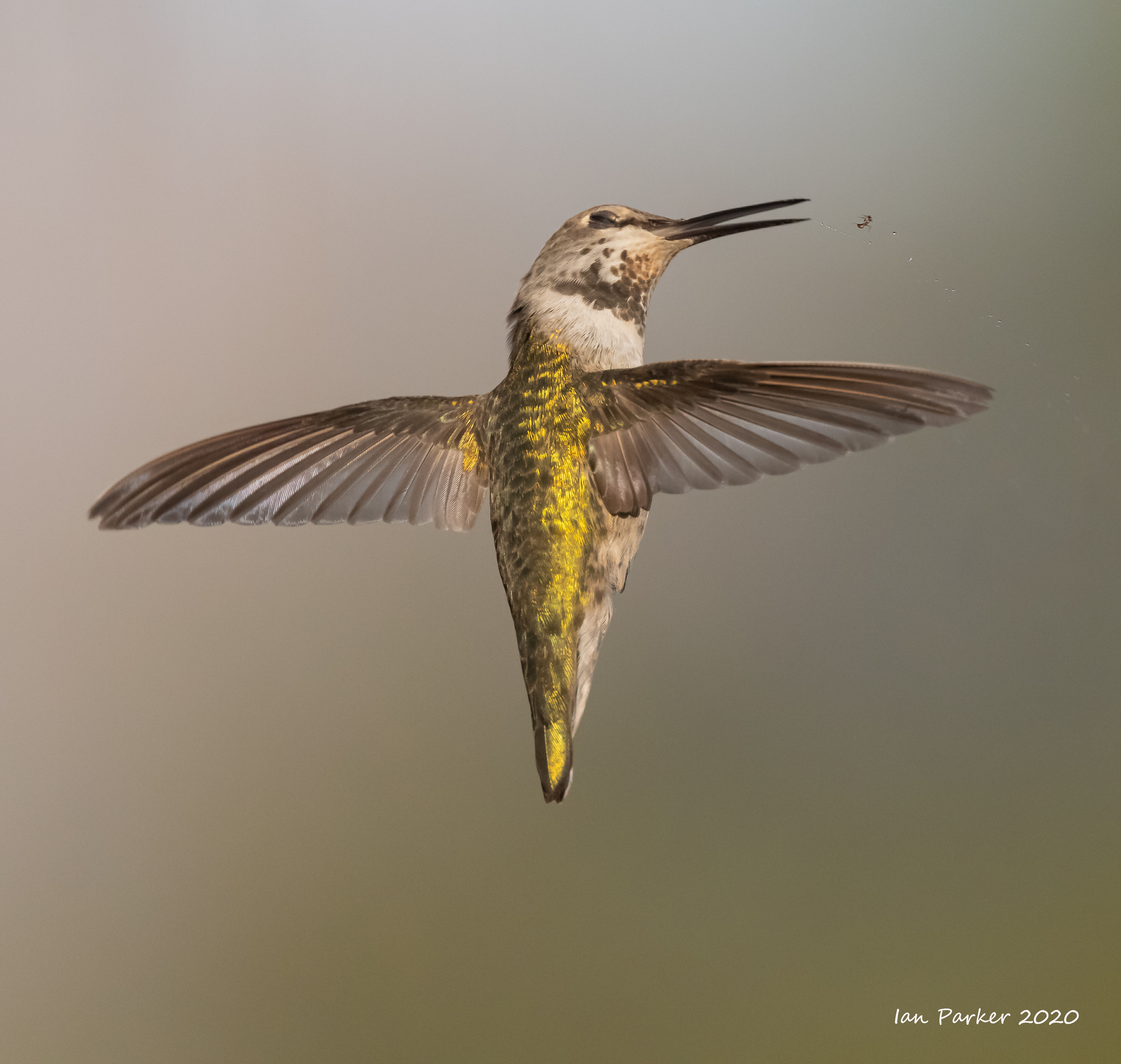
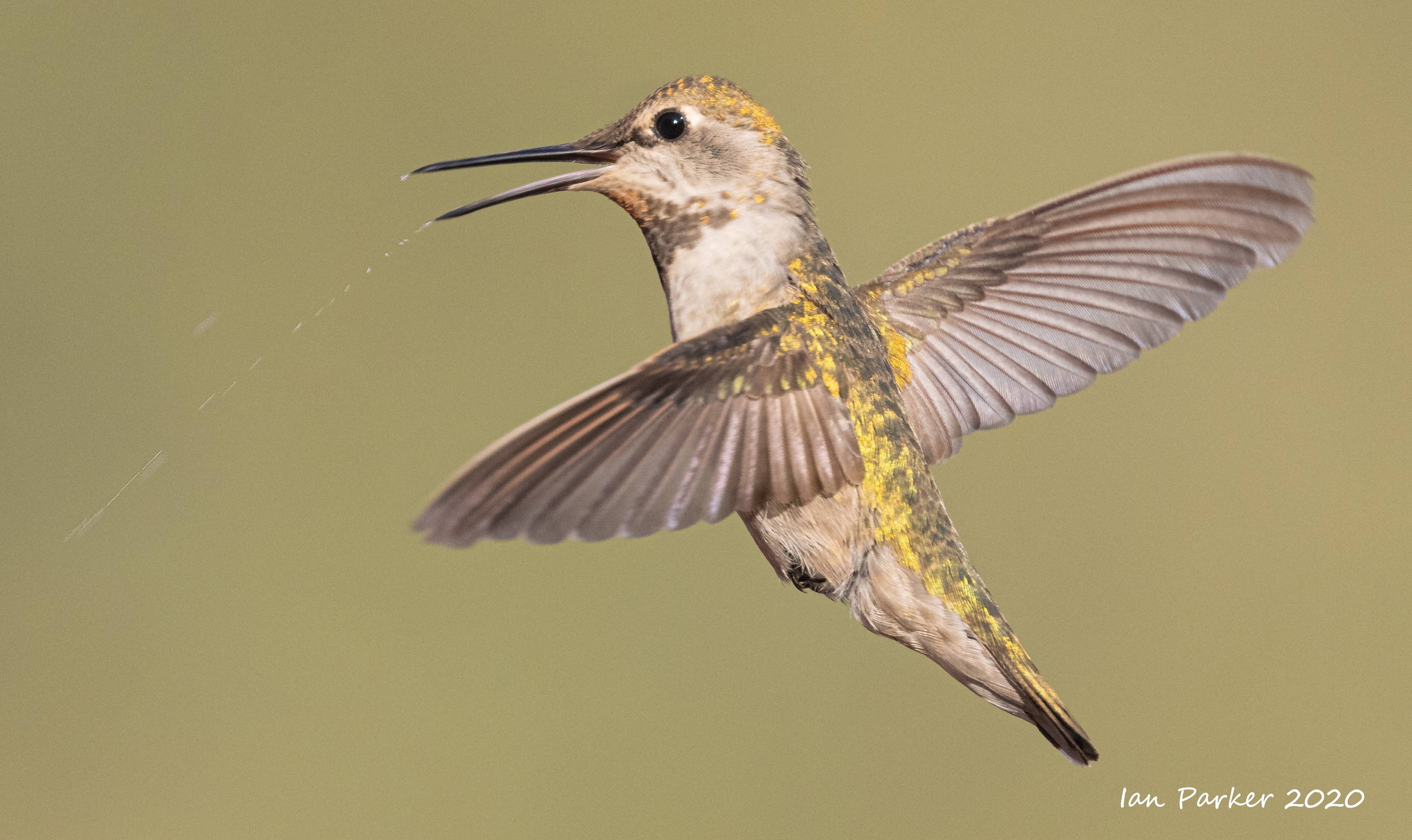
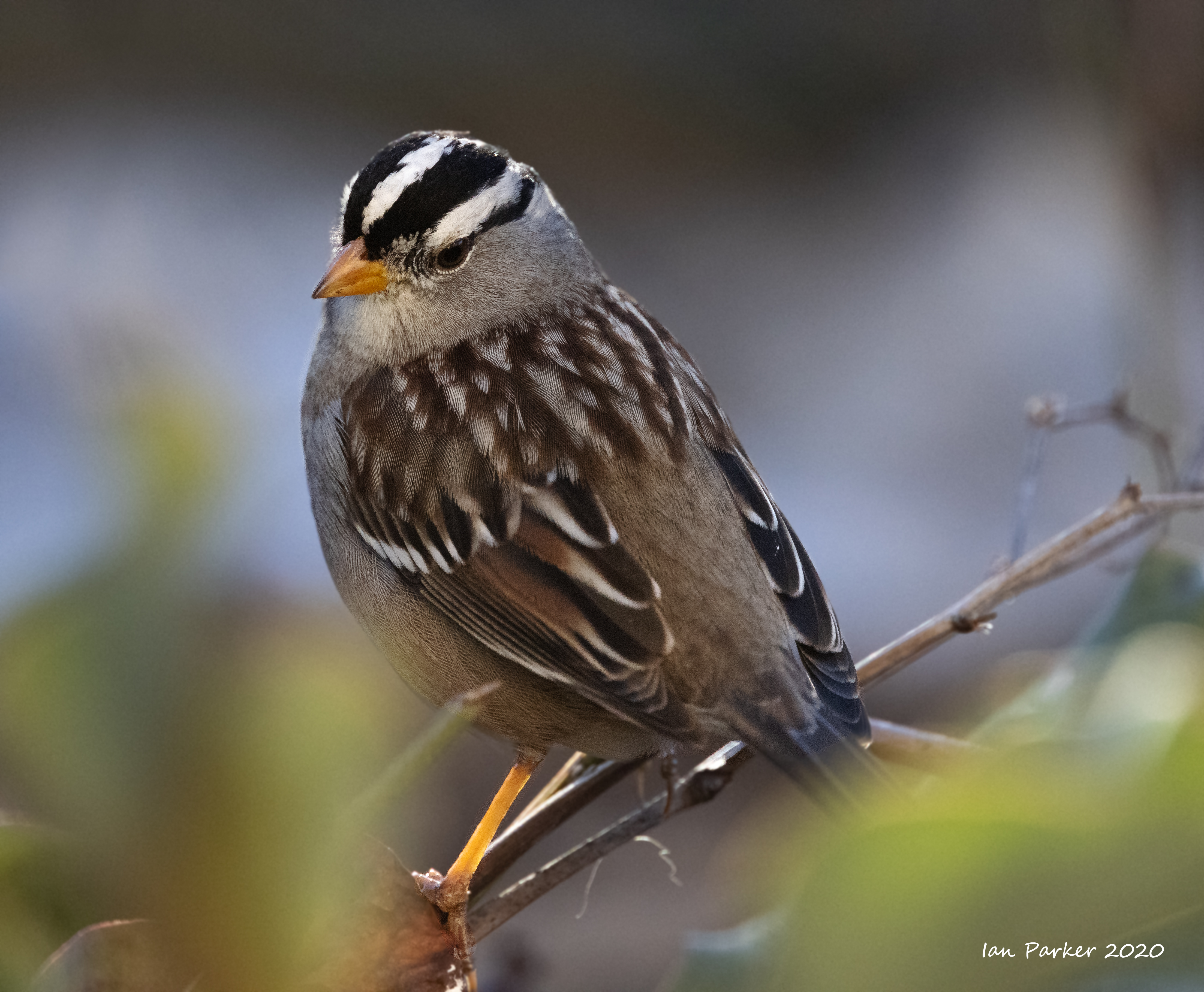
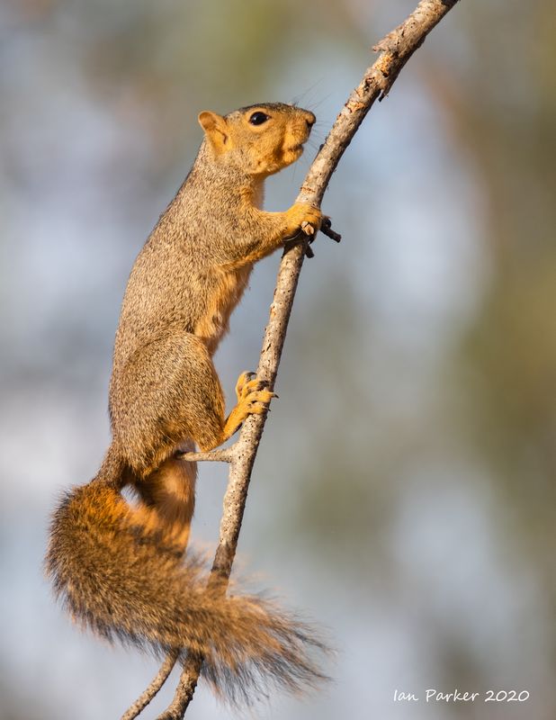
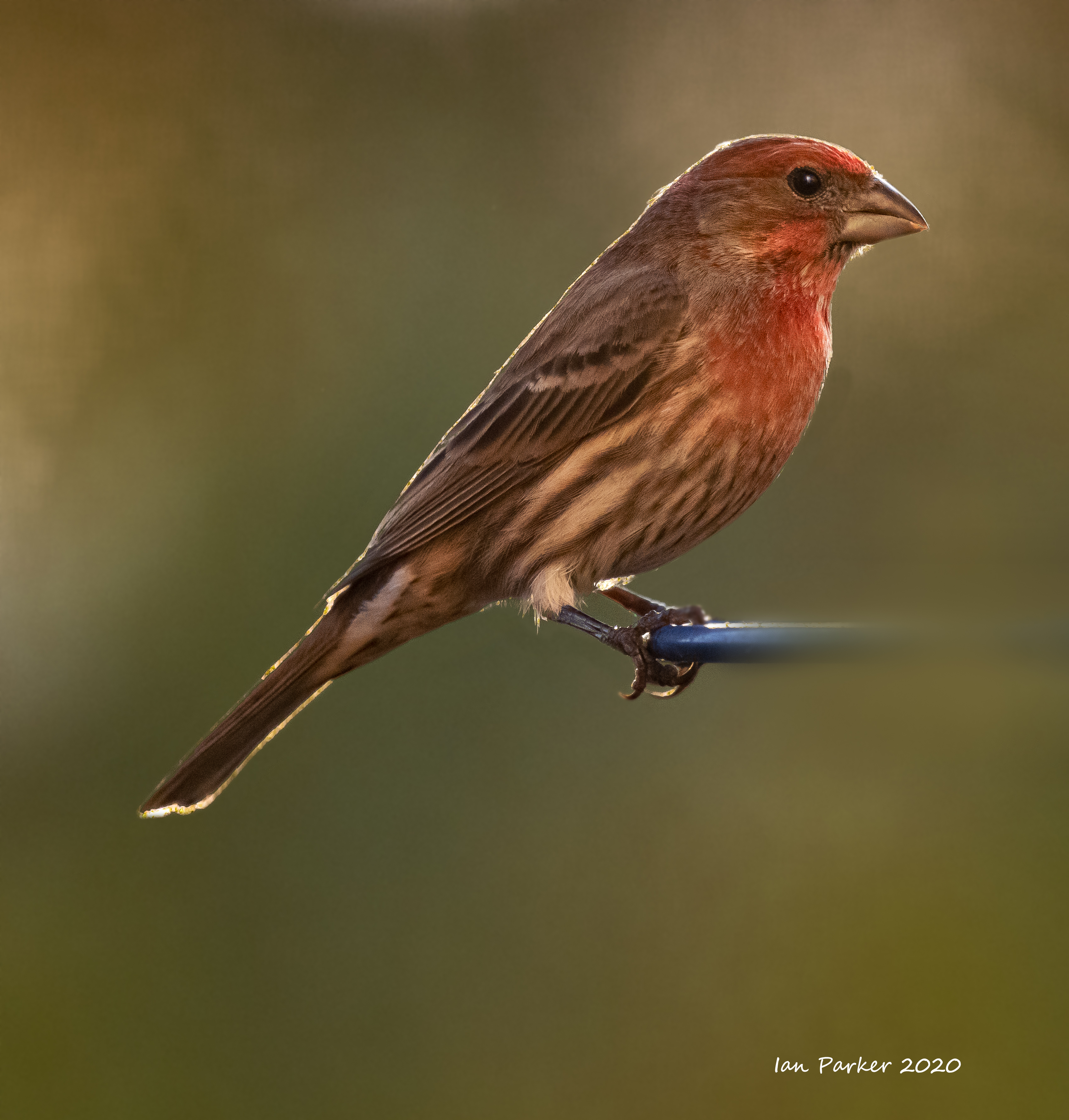
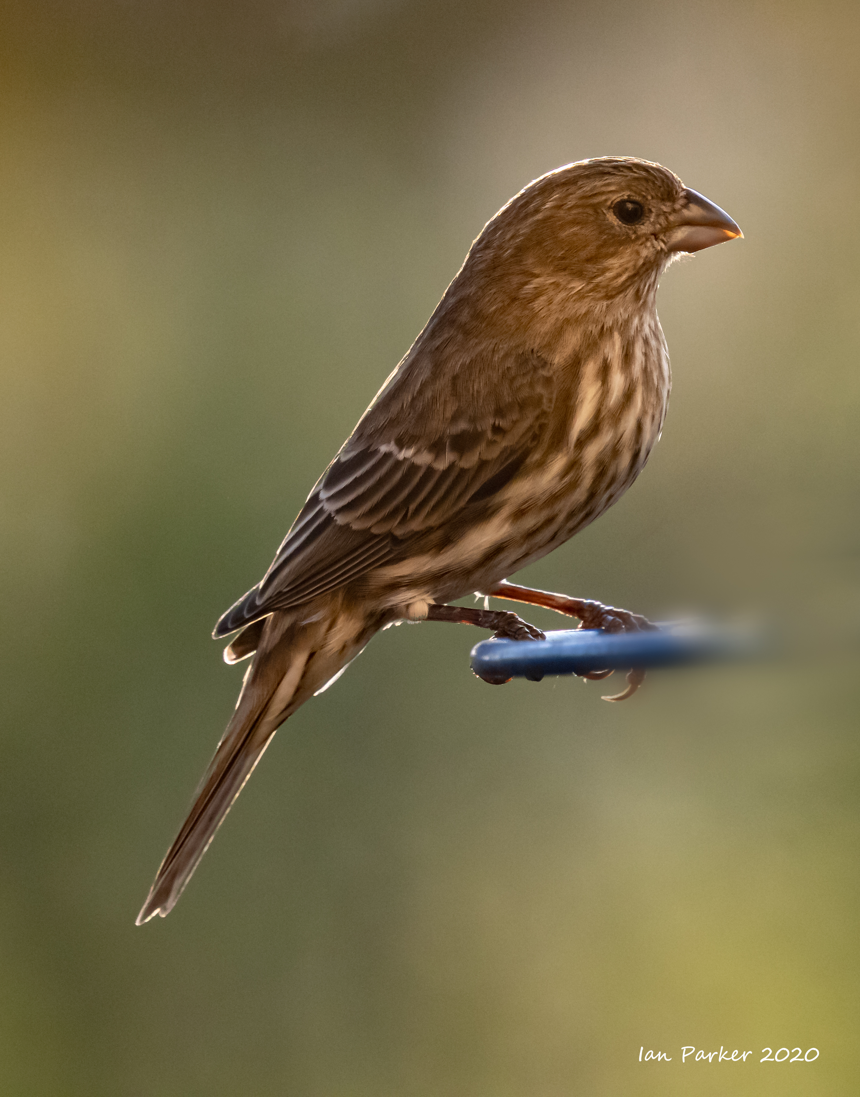
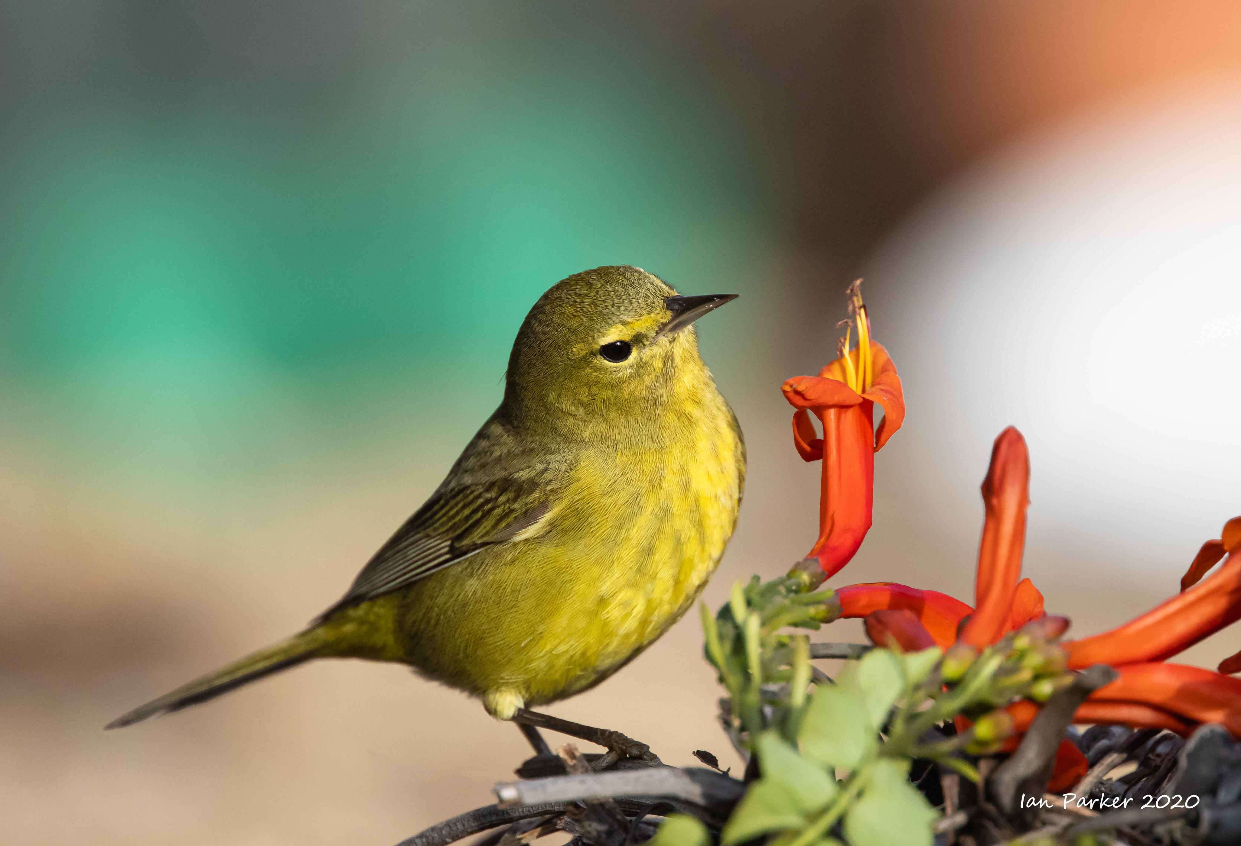
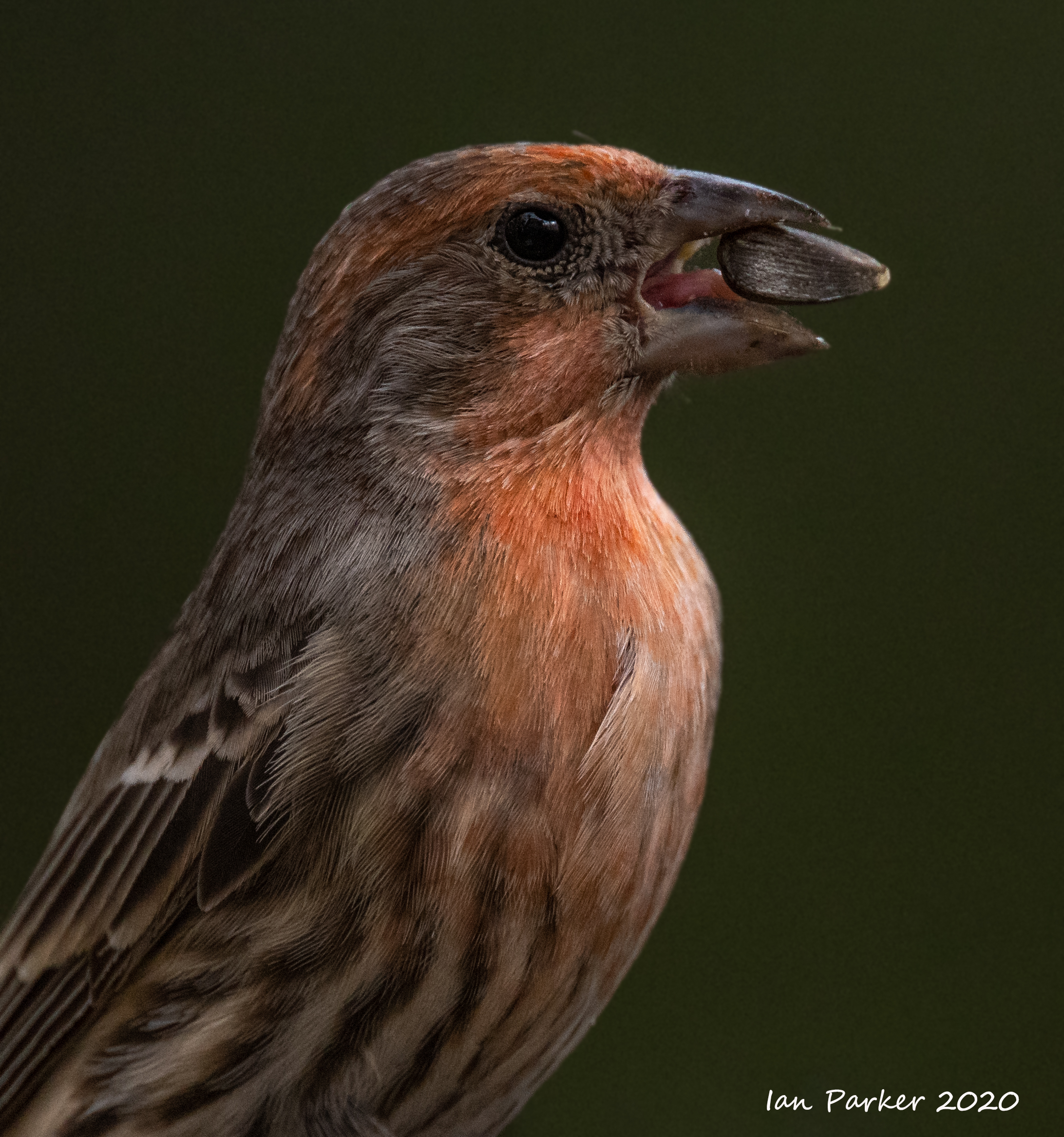
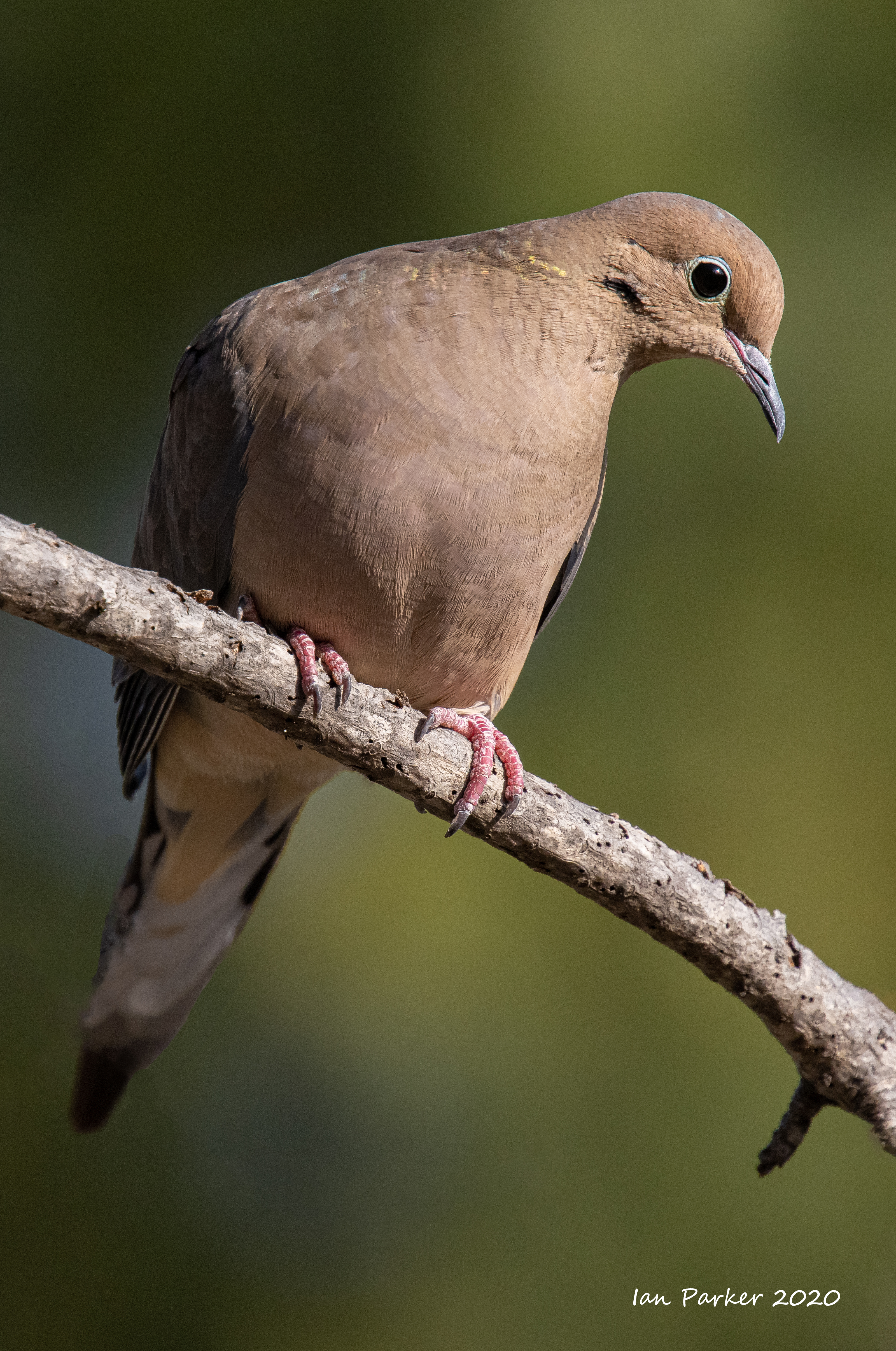
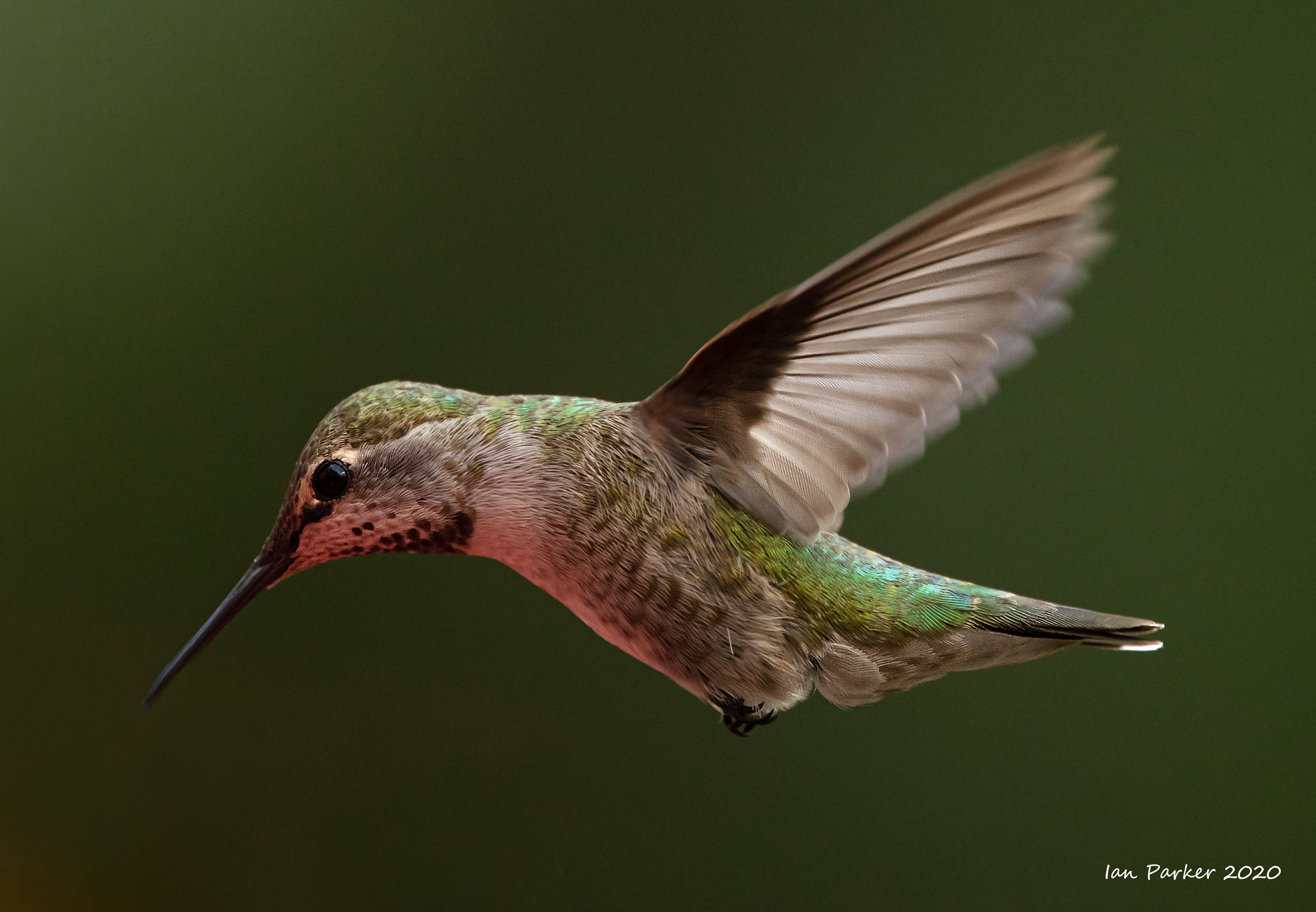
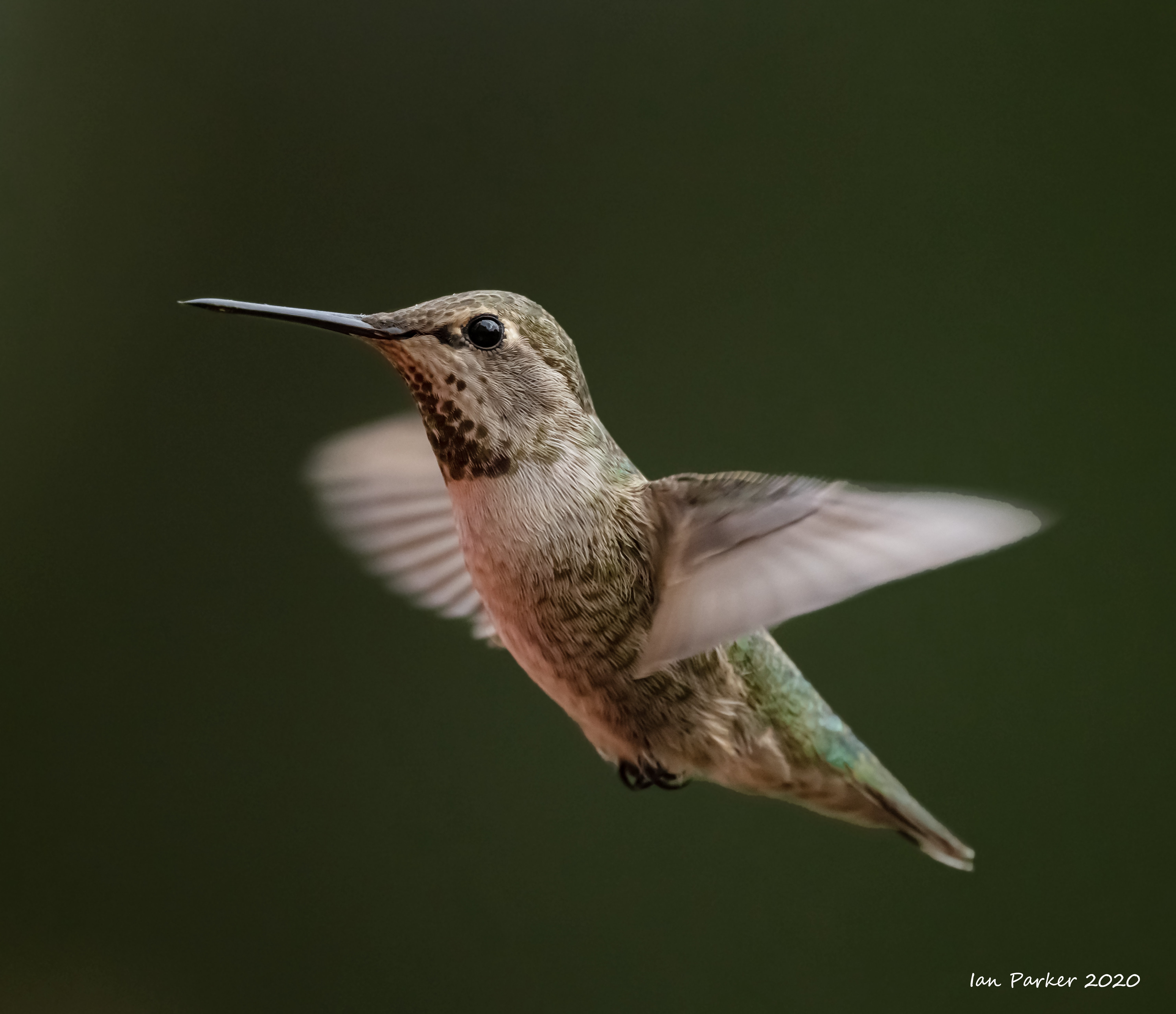
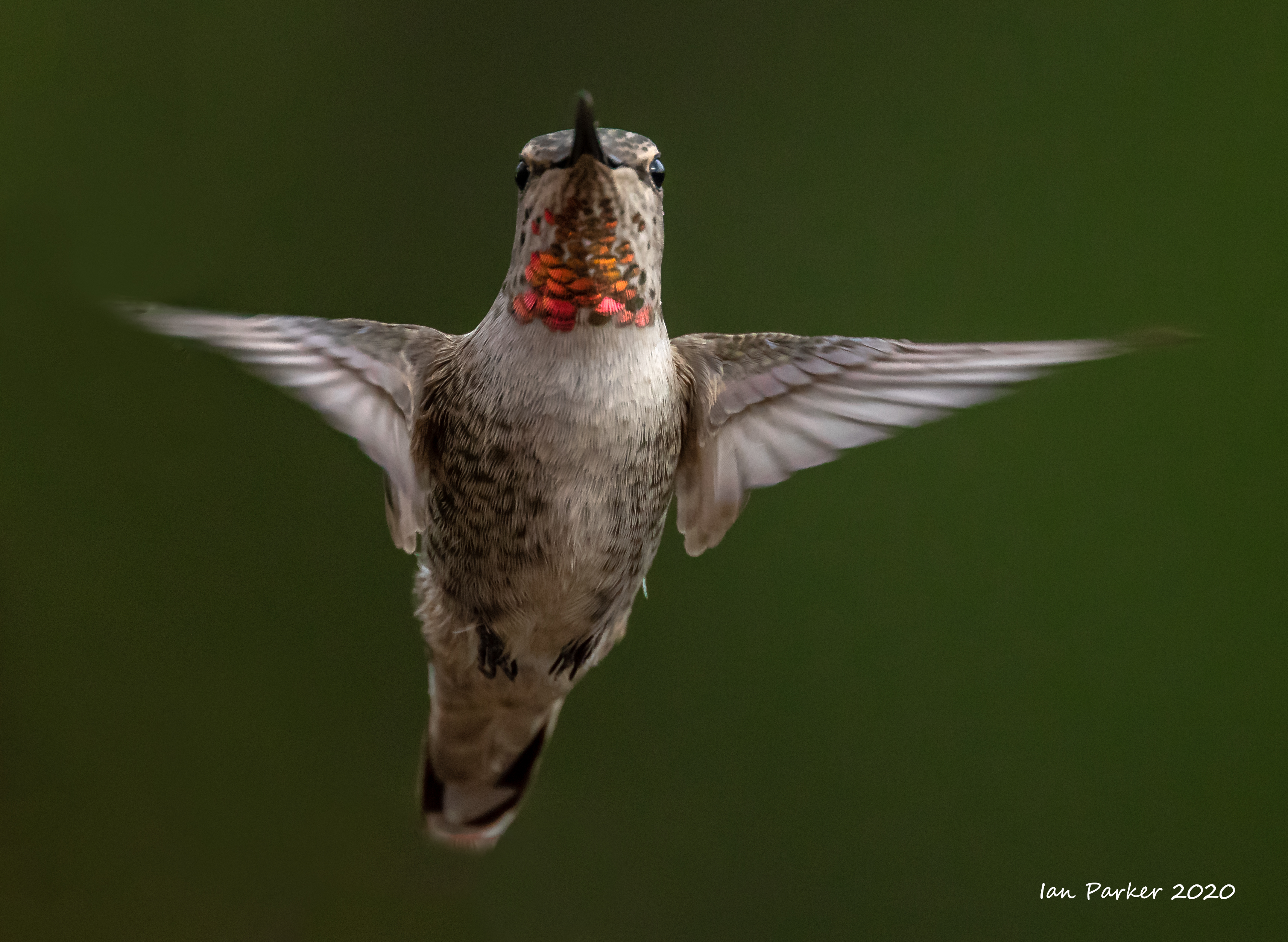
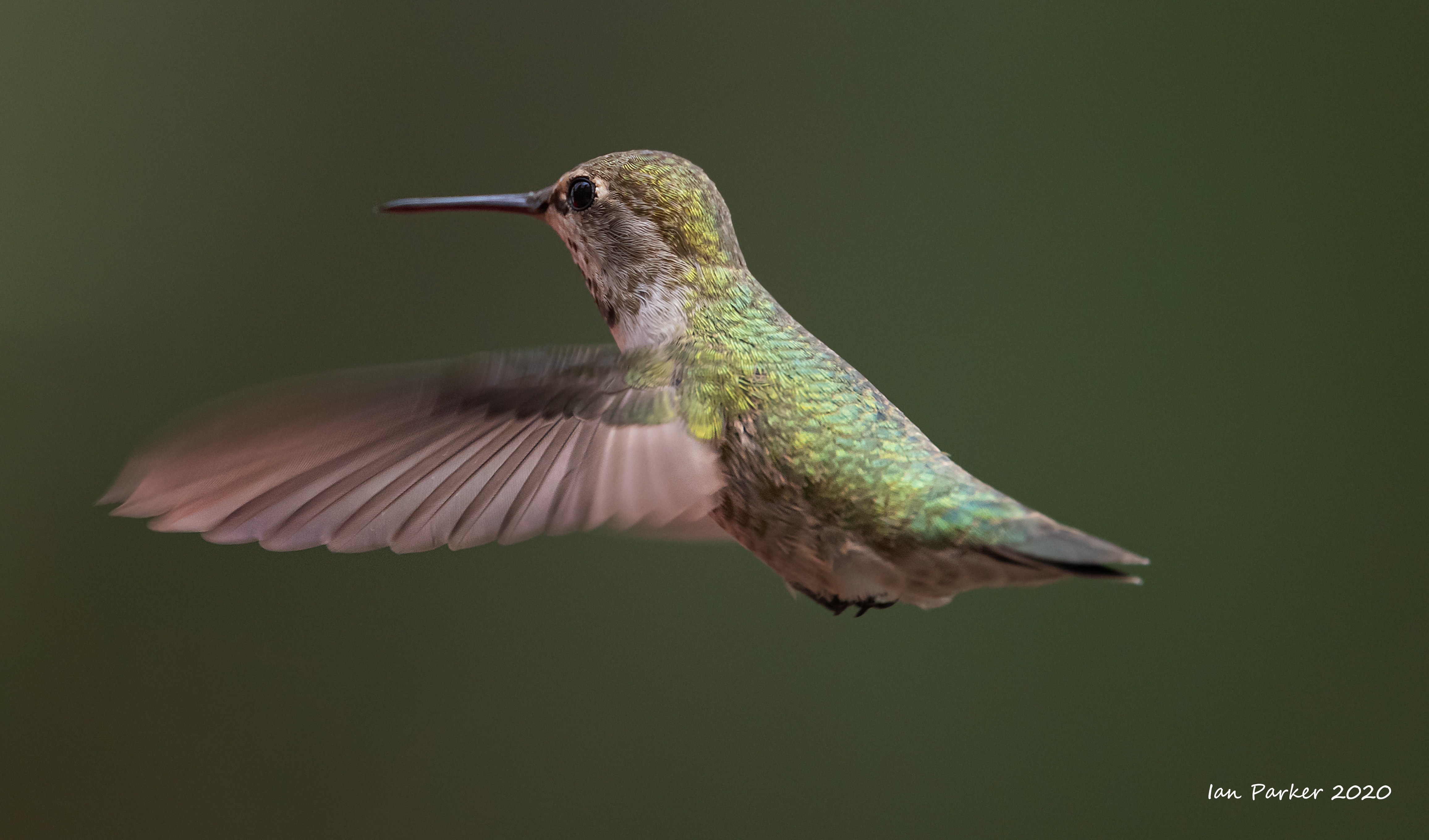
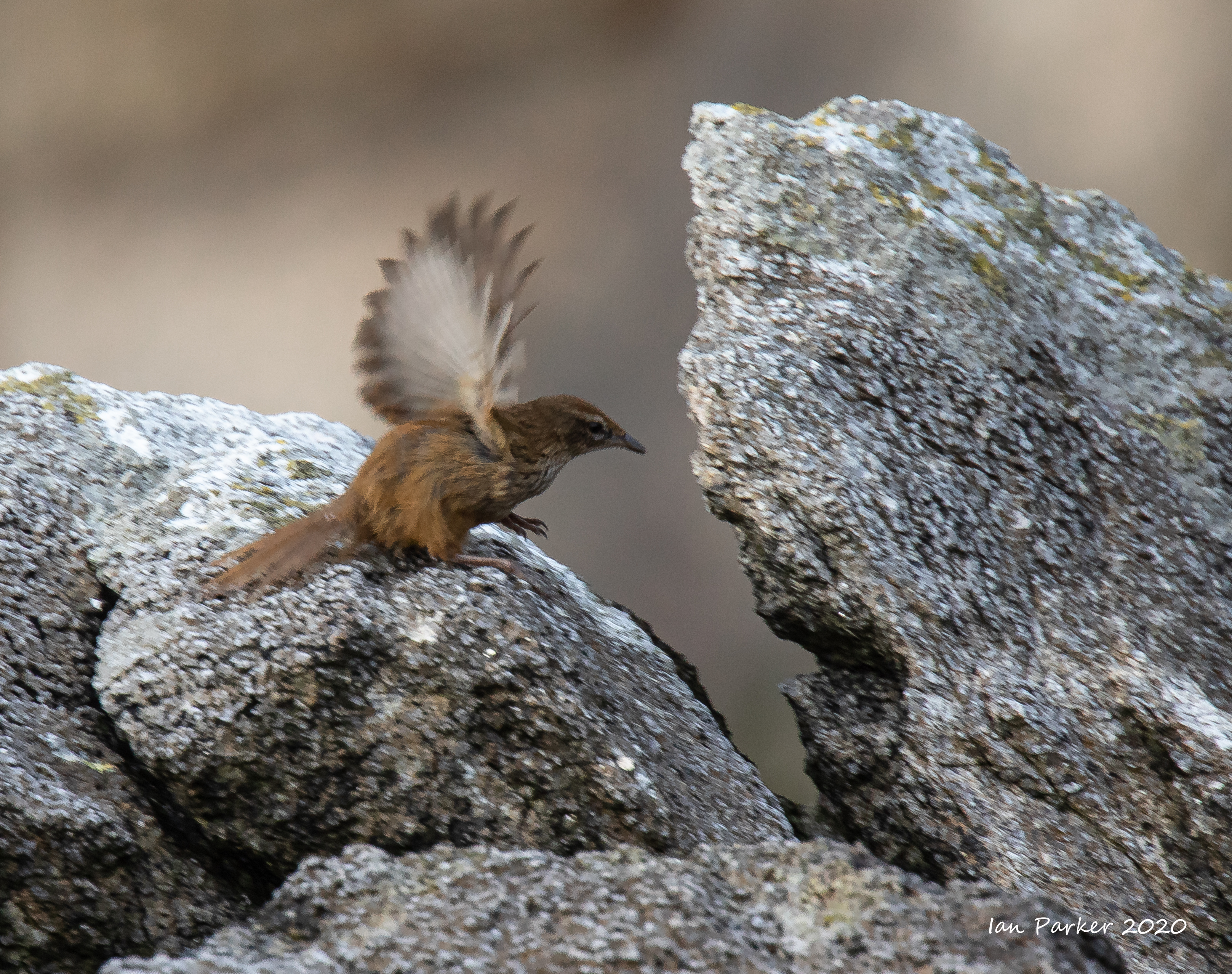
November 7th: Backyard birds
We recently put up a bird seed feeder and a hummingbird feeder in our backyard. I have enjoyed sitting out after lunch photographing the new visitors: good subjects with which to get more familiar with the autofocus fnctions on my new Canon R5, and a relaxing distraction from the US elections. The photos below were taken using a 100-400 zoom or a 400 mm f4 DO lens, both with a 1.4x teleconverter. The 'big white' 400 DO gives an extra stop of light and is maybe a little sharper, but its long minimum focus distance means the birds end up quite small in the frame, even with the teleconverter. The 100-400 lets me get closer, and if I sit still the birds don't seem to mind. The feeders are mounted on an isolated tree branch giving an unobstructed view across to distant trees. In the afternoon the trees are partly in sunlight and partly shaded, giving a choice of green or almost black backgrounds.


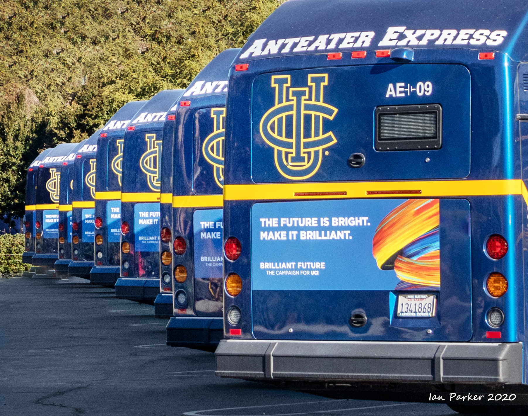
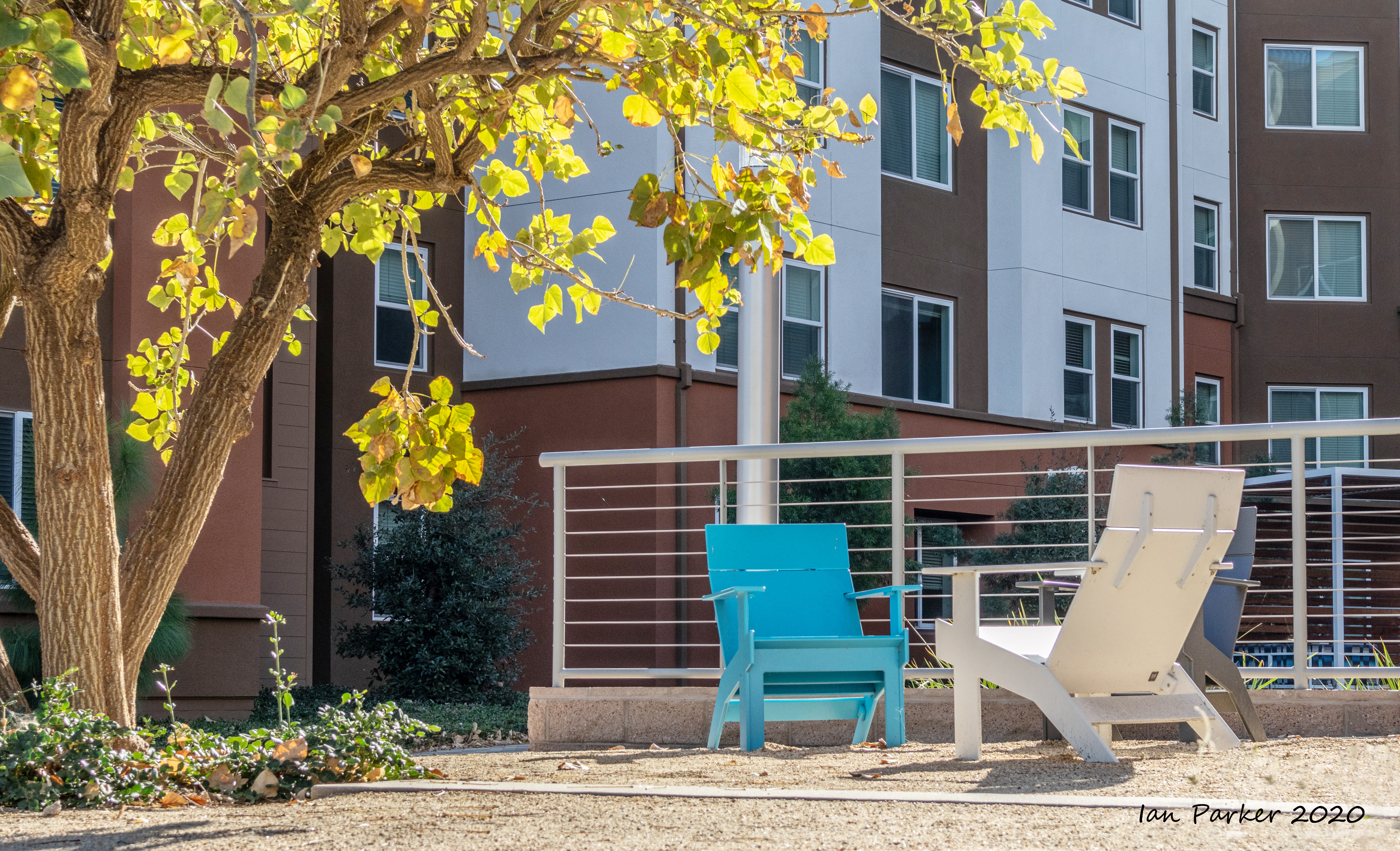
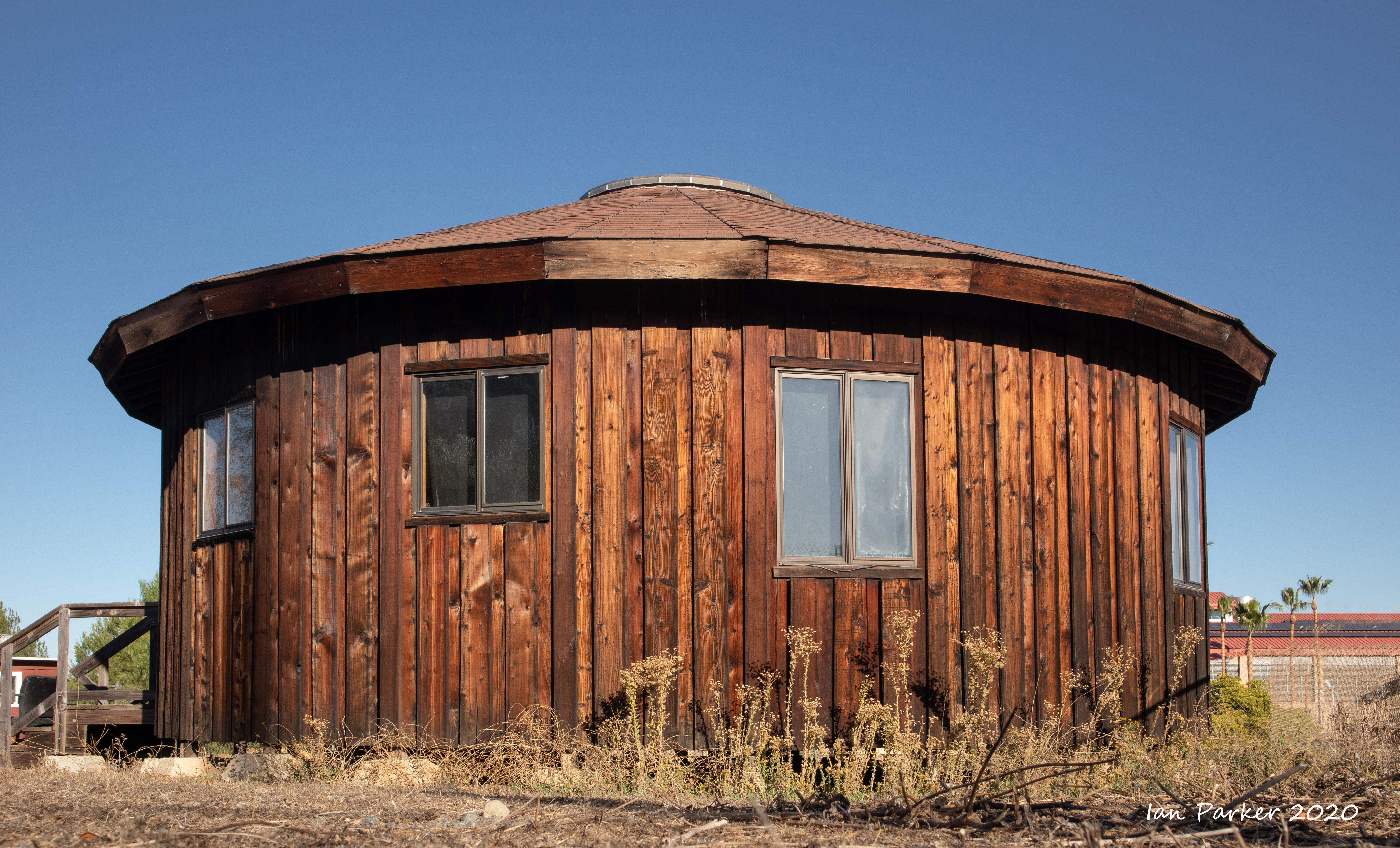
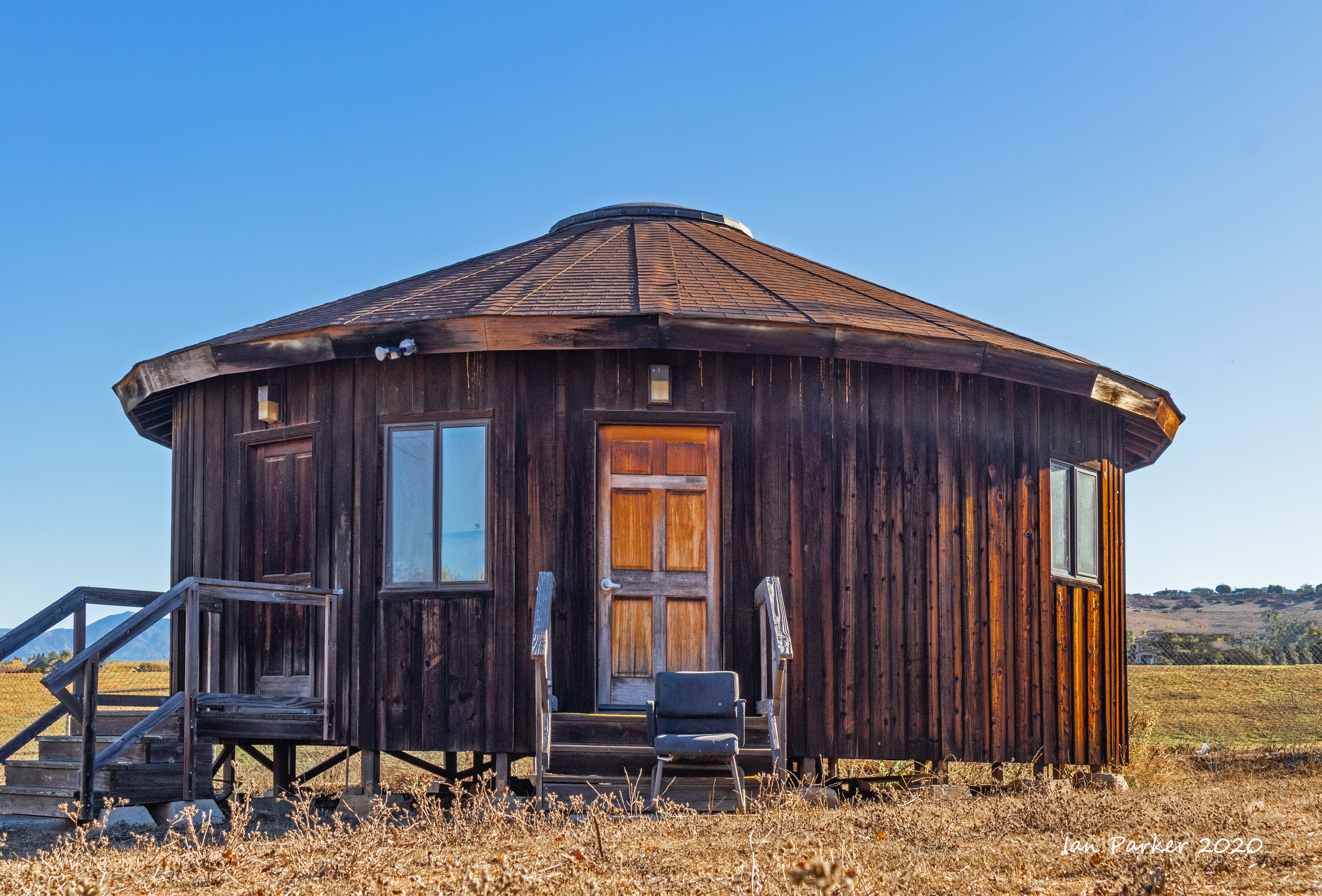
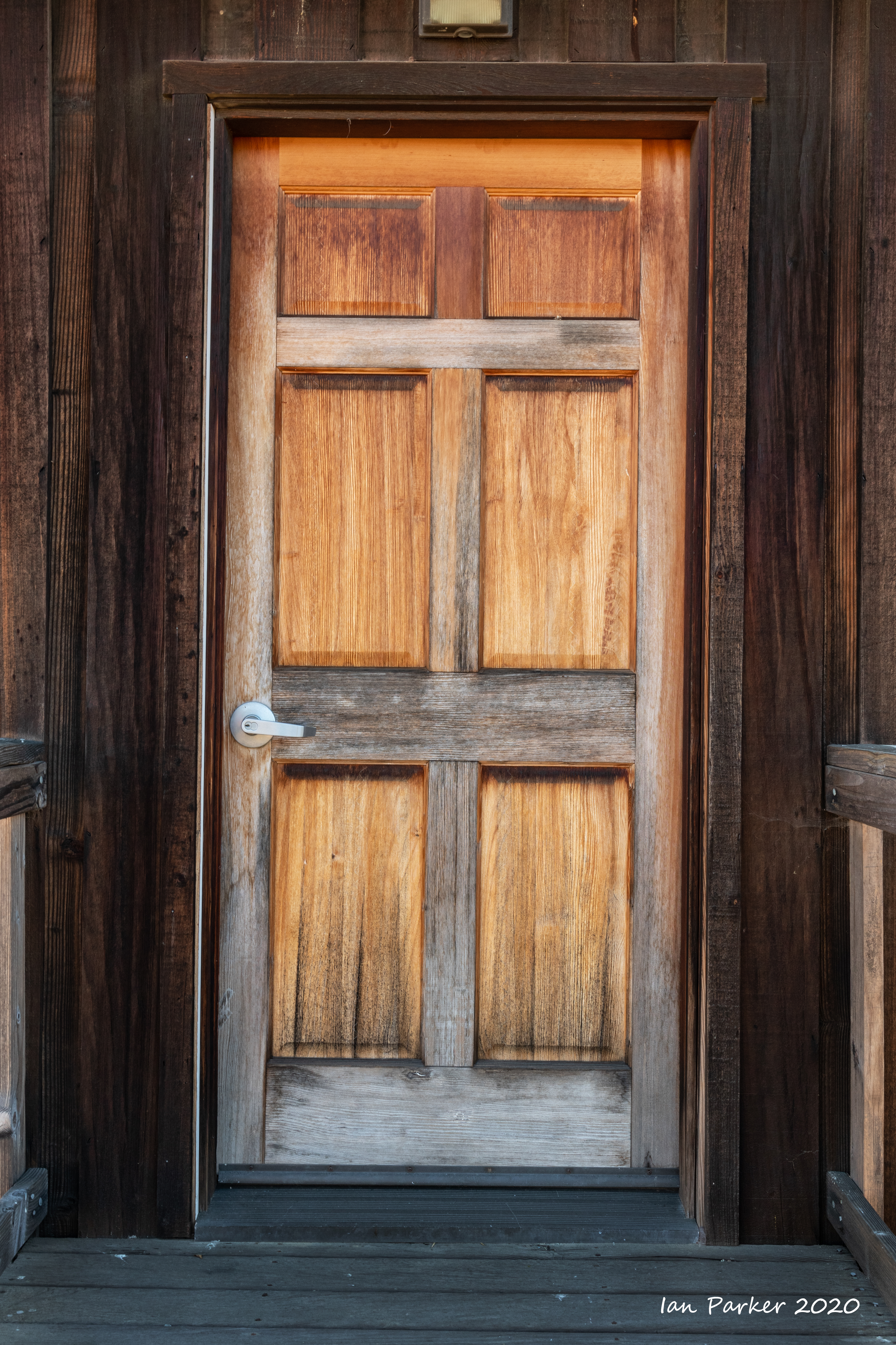
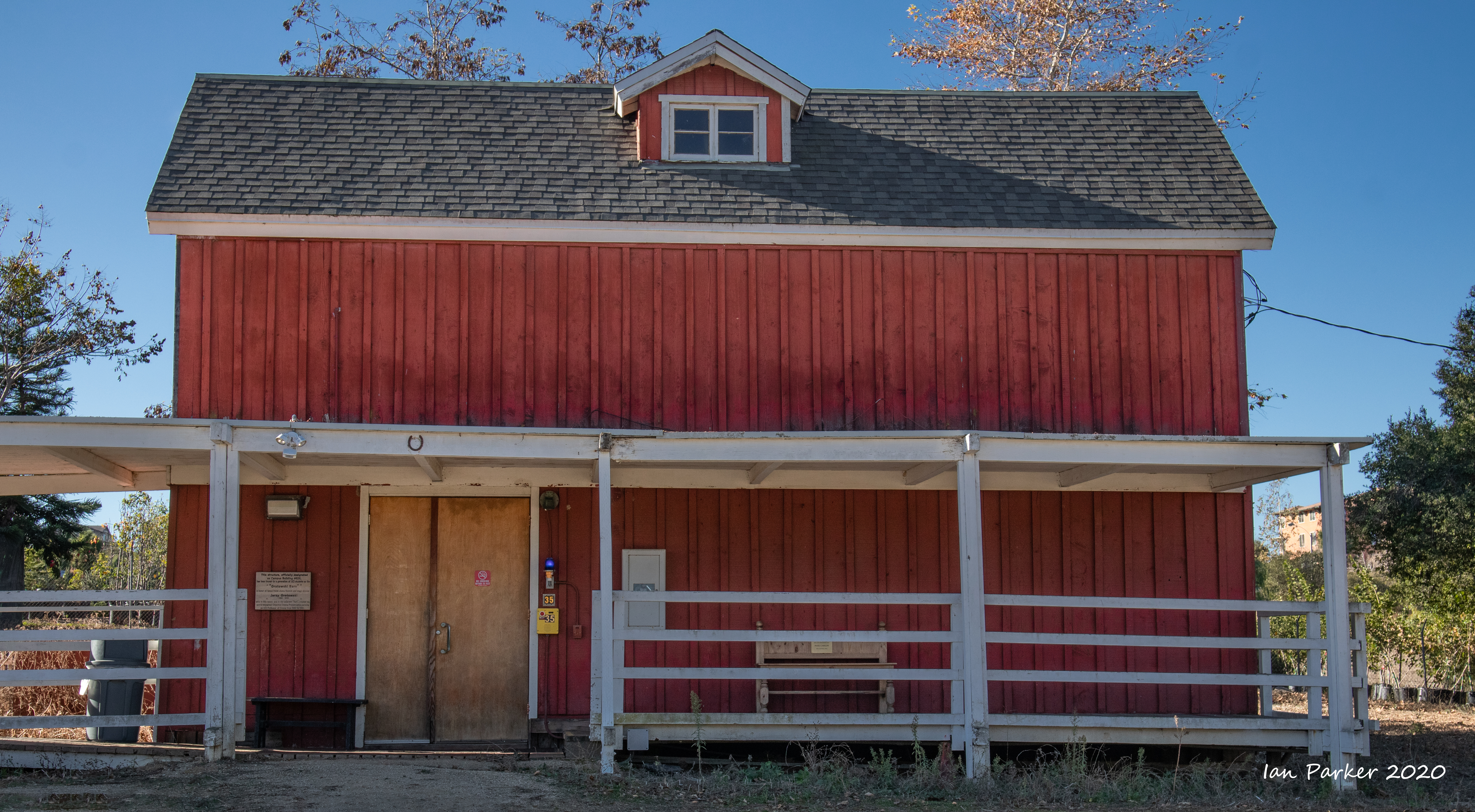
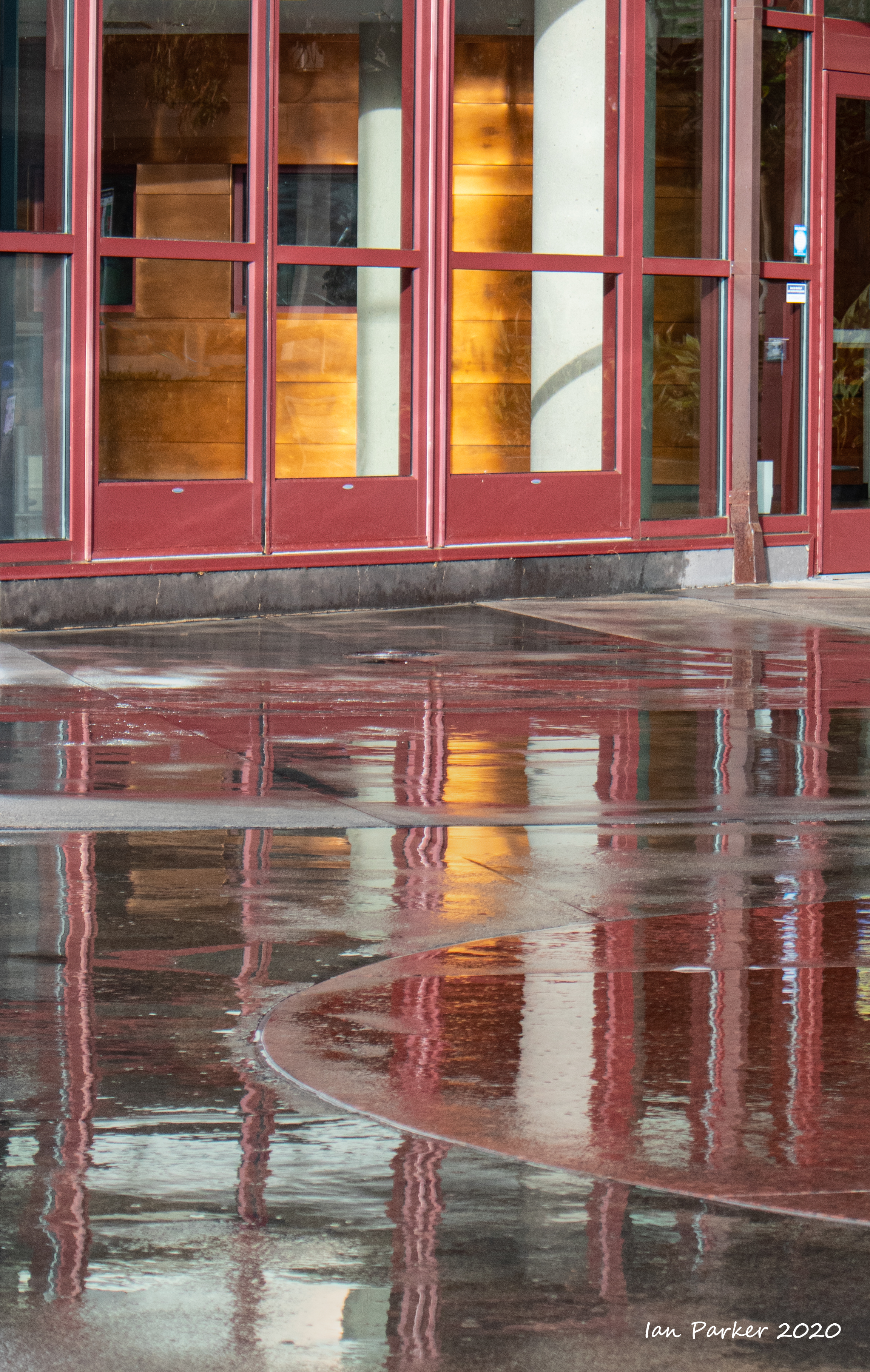
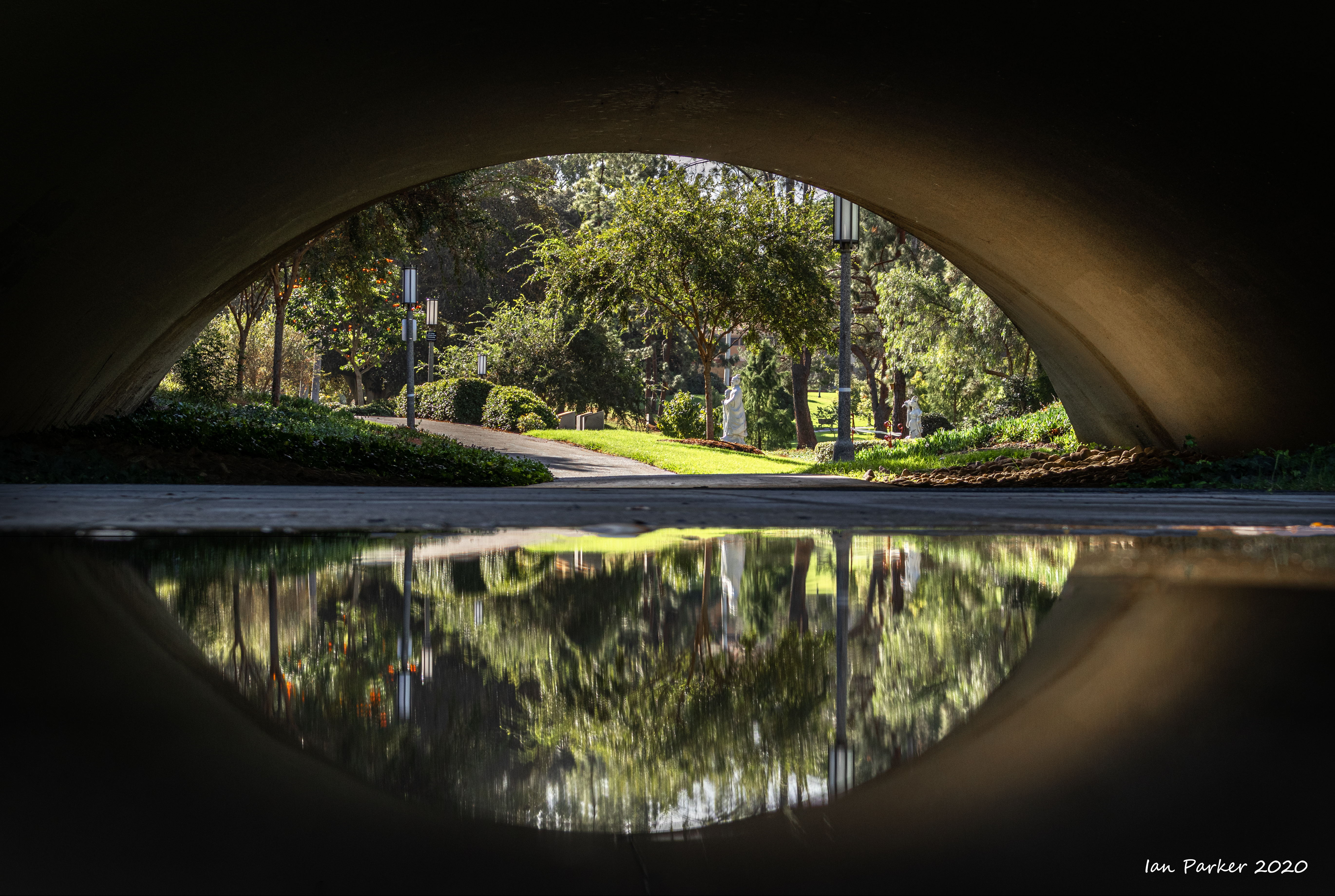
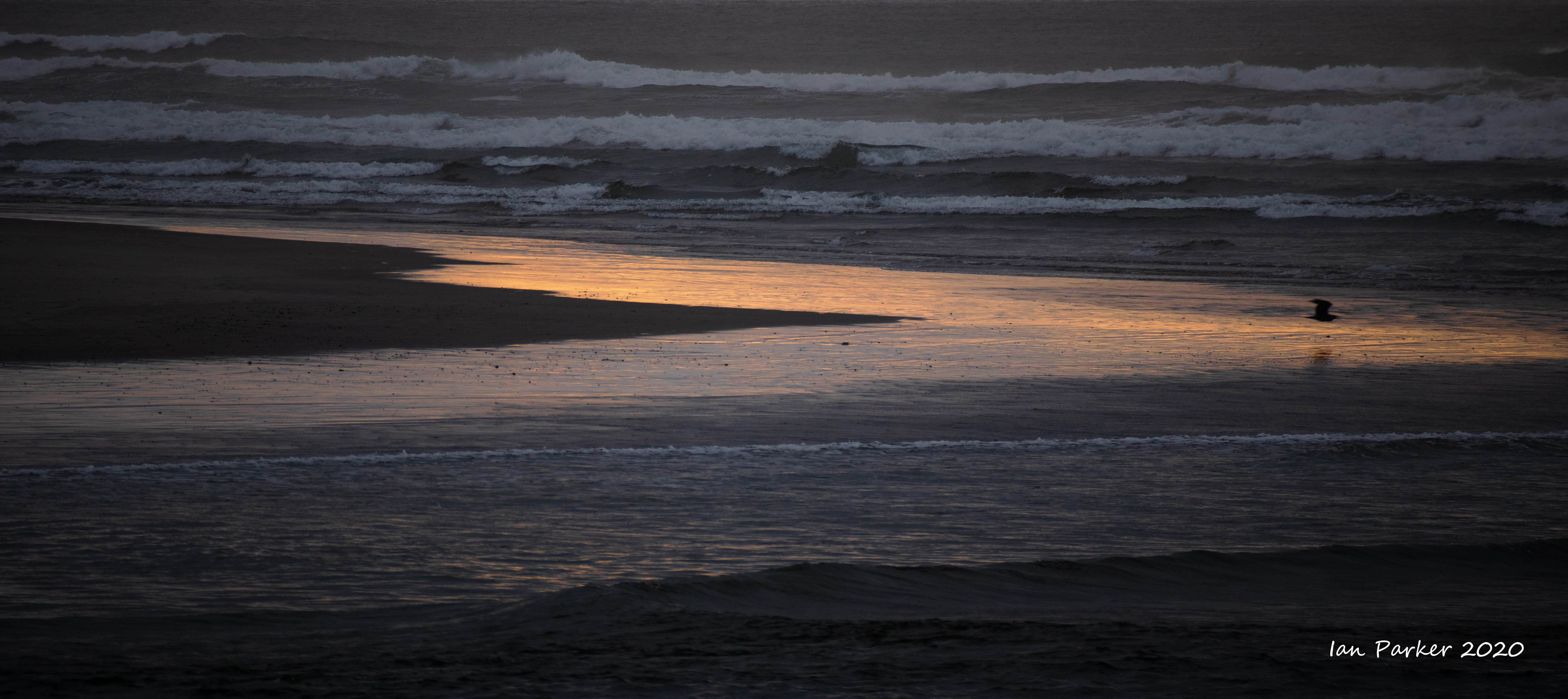
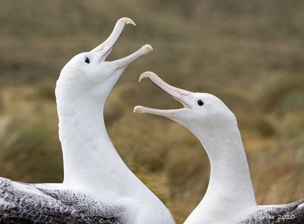
October 31st: Around the UCI campus;
a misty morning and a red sunset.

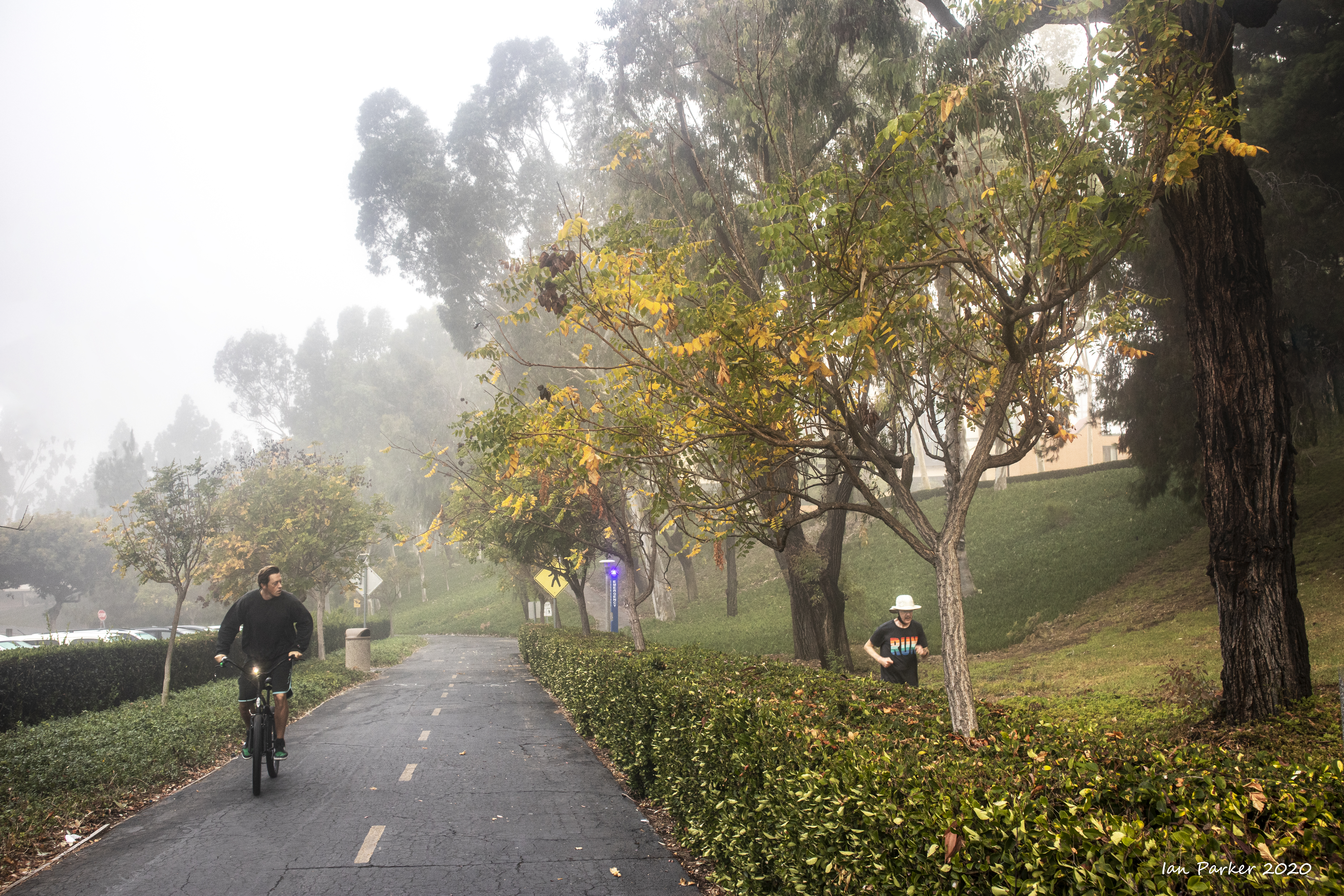


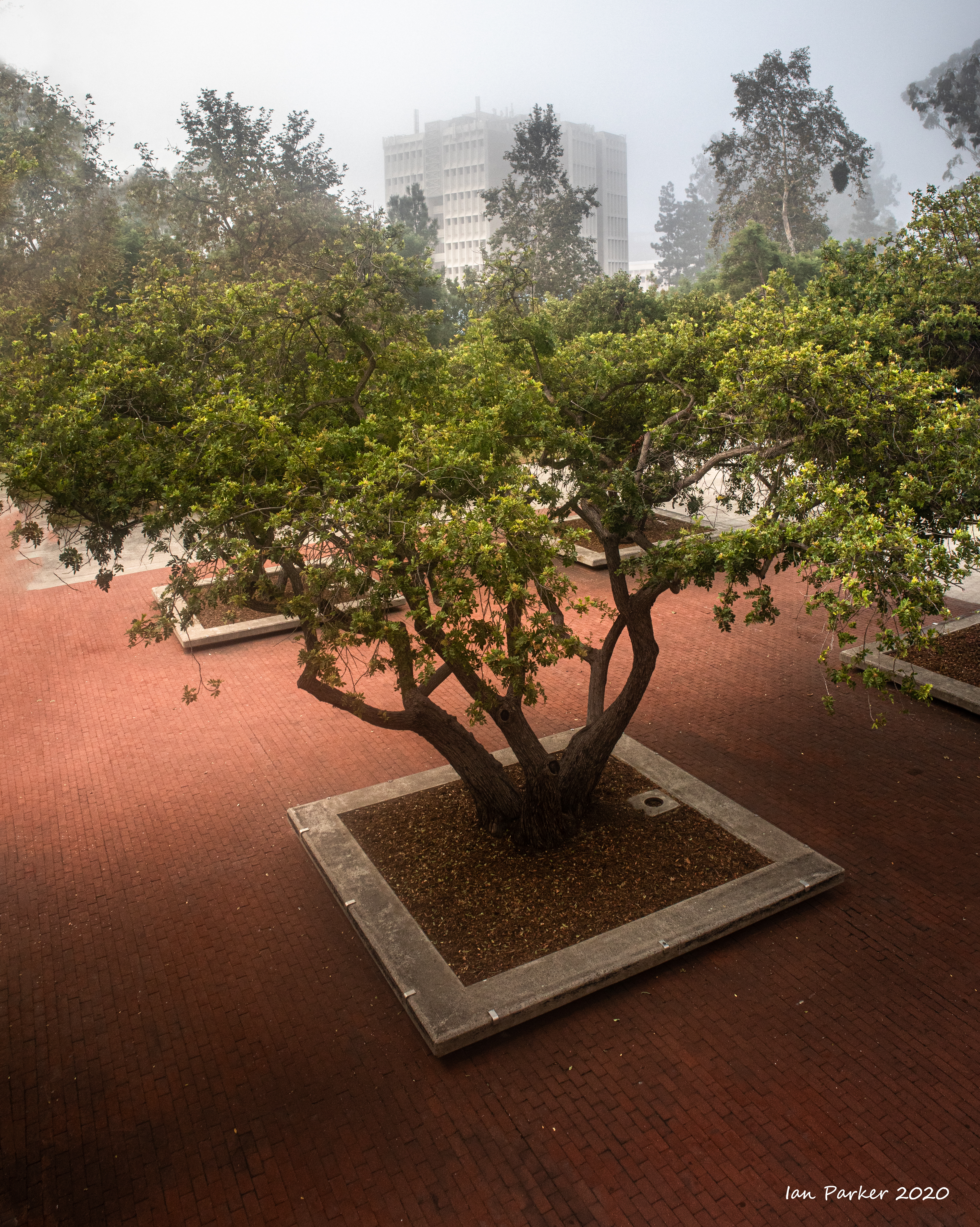
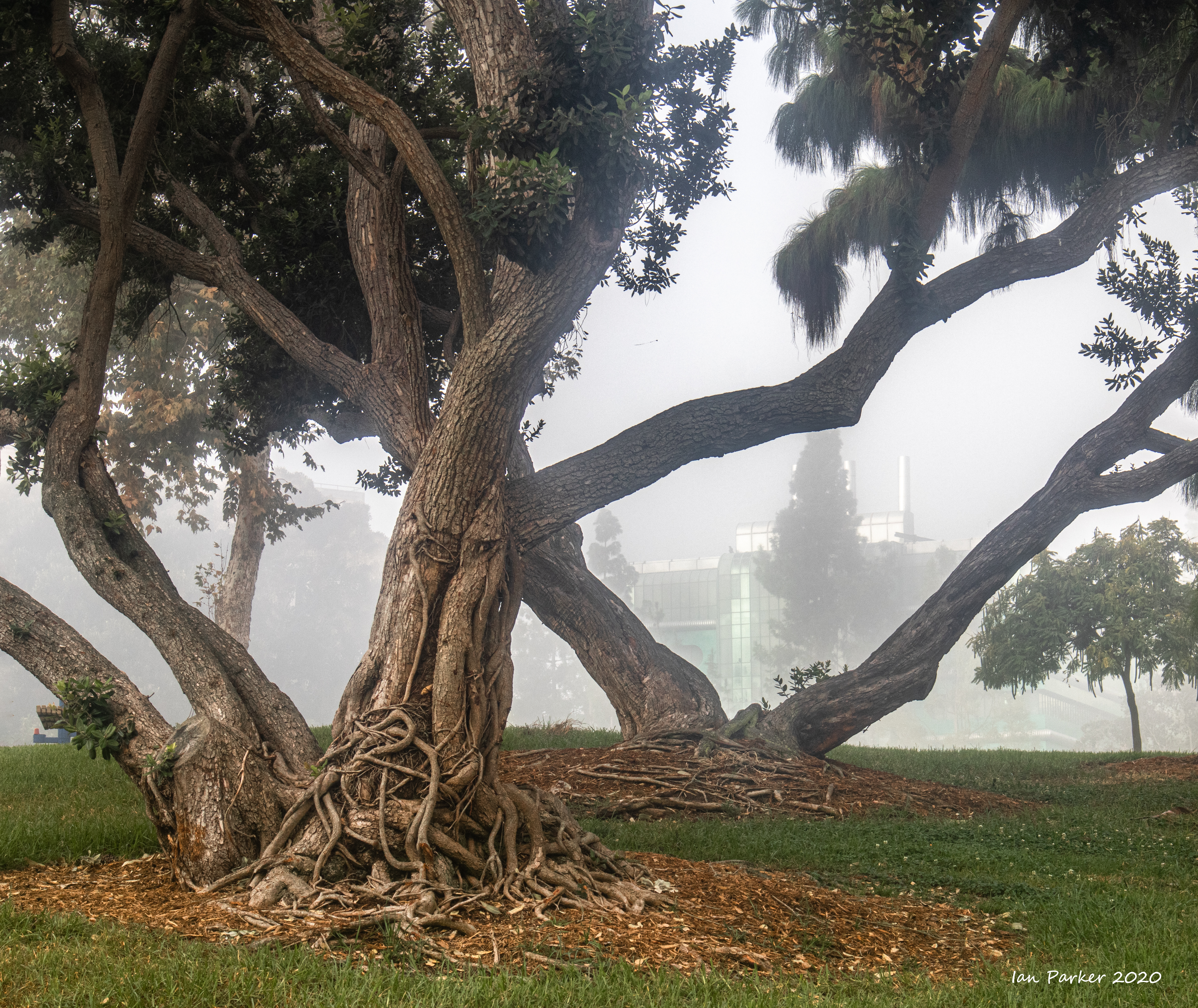


After the mist dissipated in the morning clouds came in for most of the day, but a clearing to the west at sunset gave some nice light.
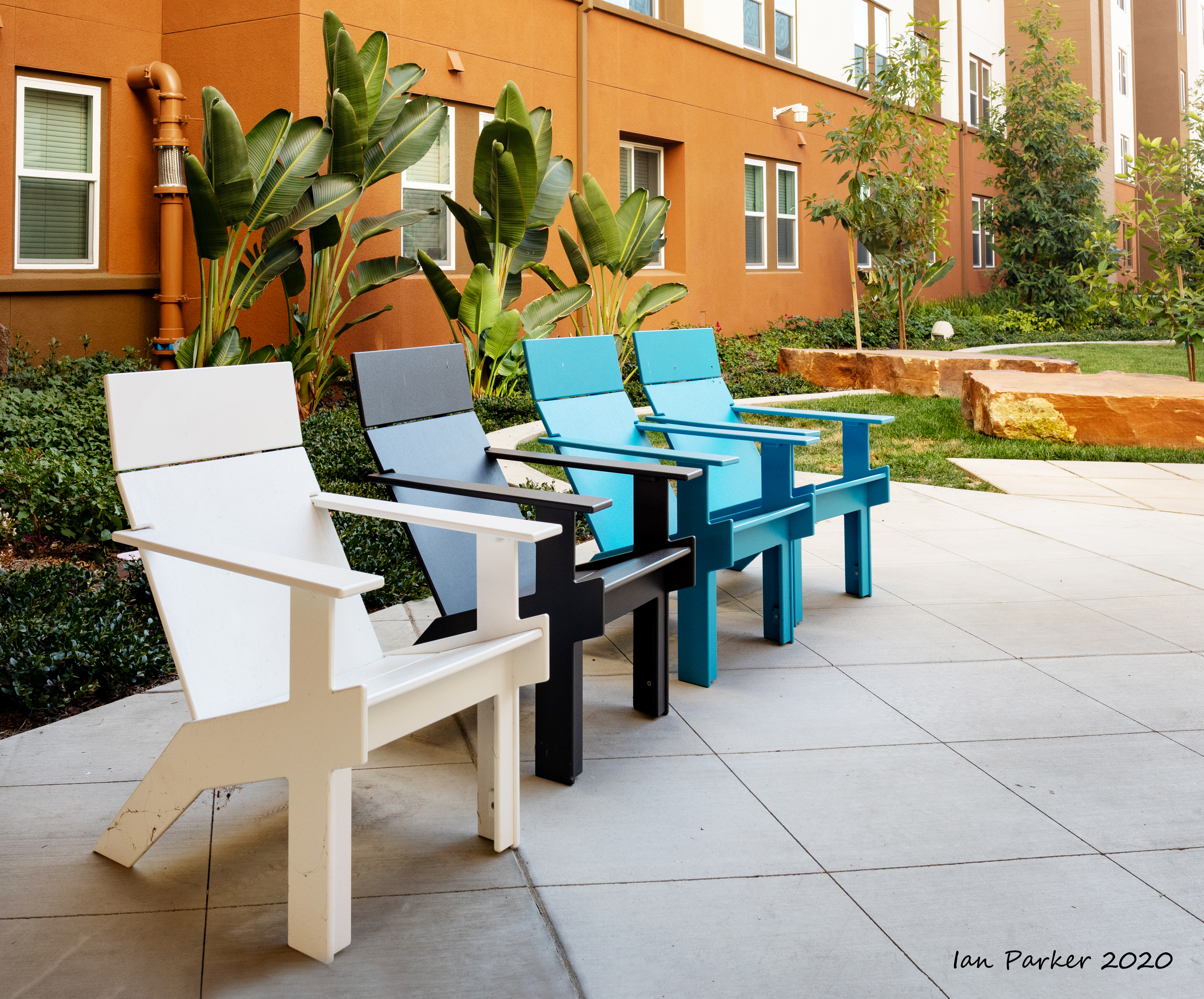
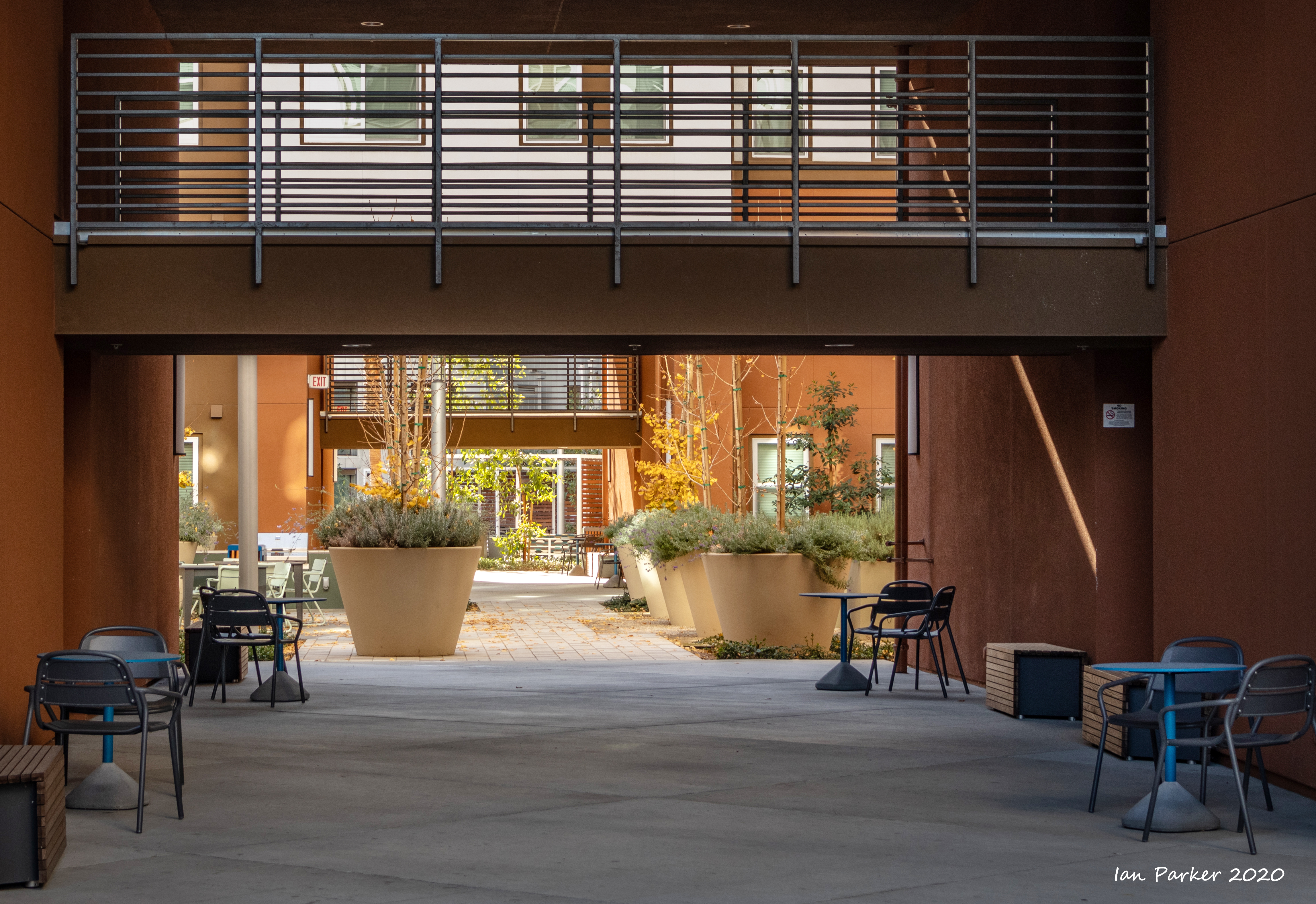
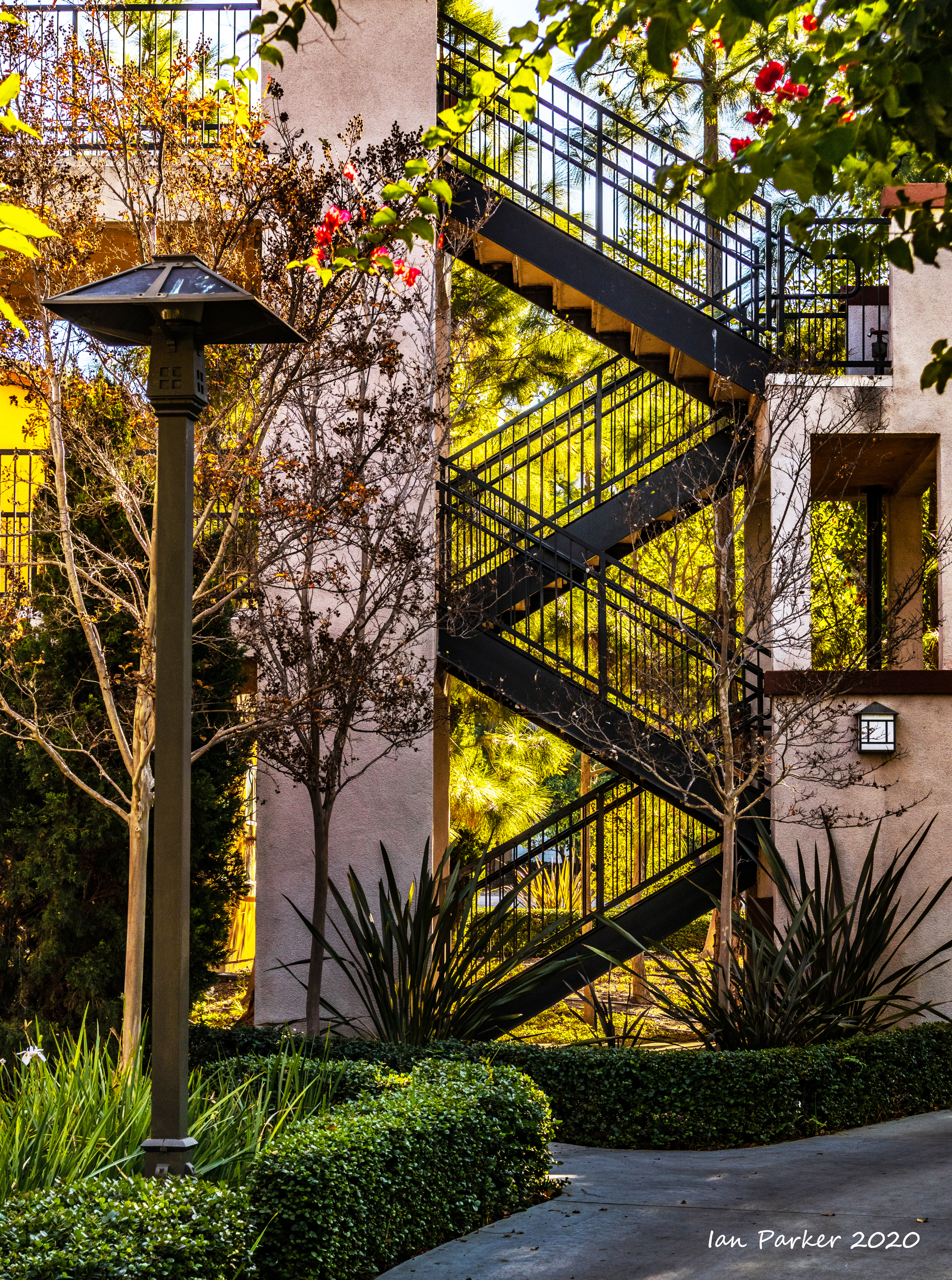
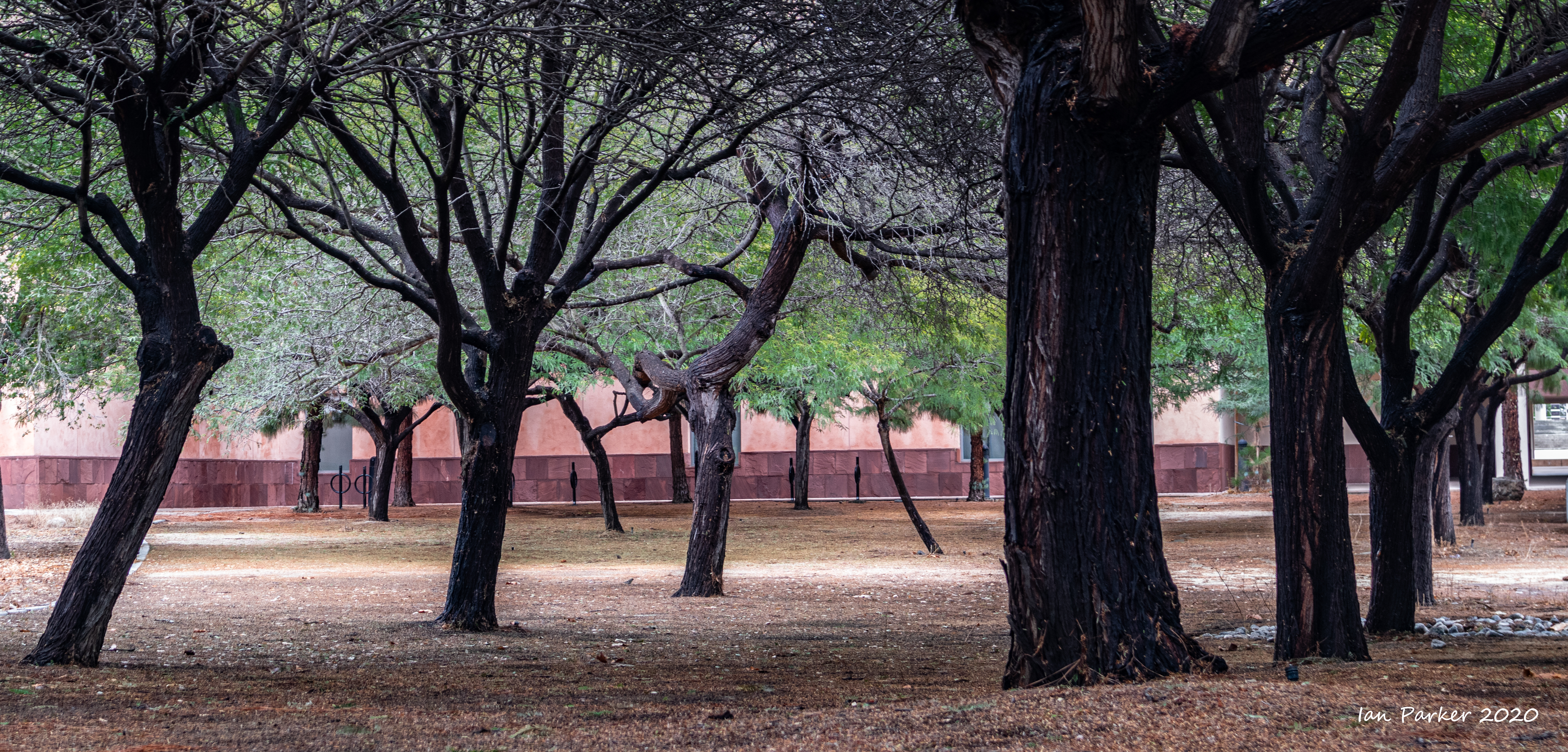
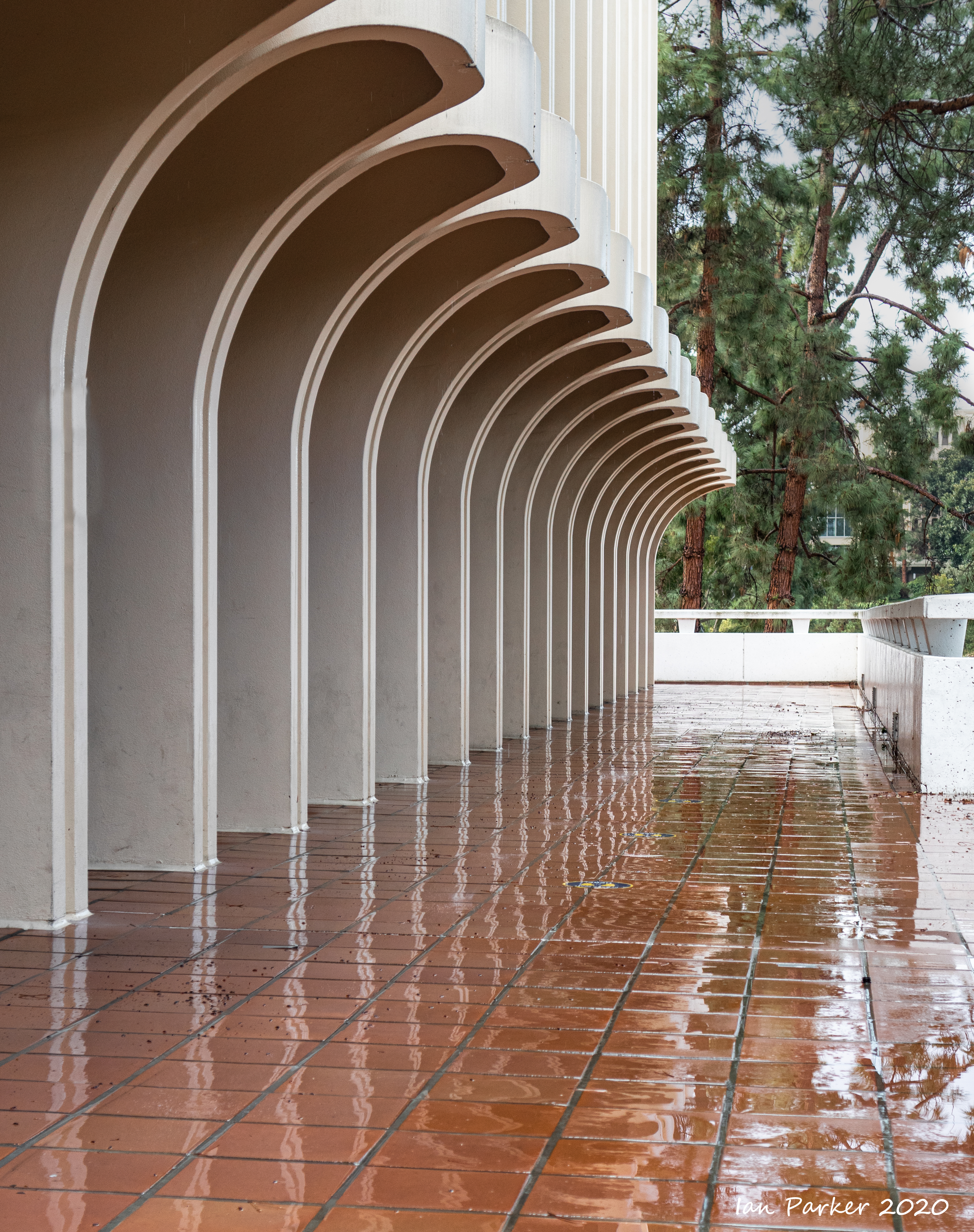
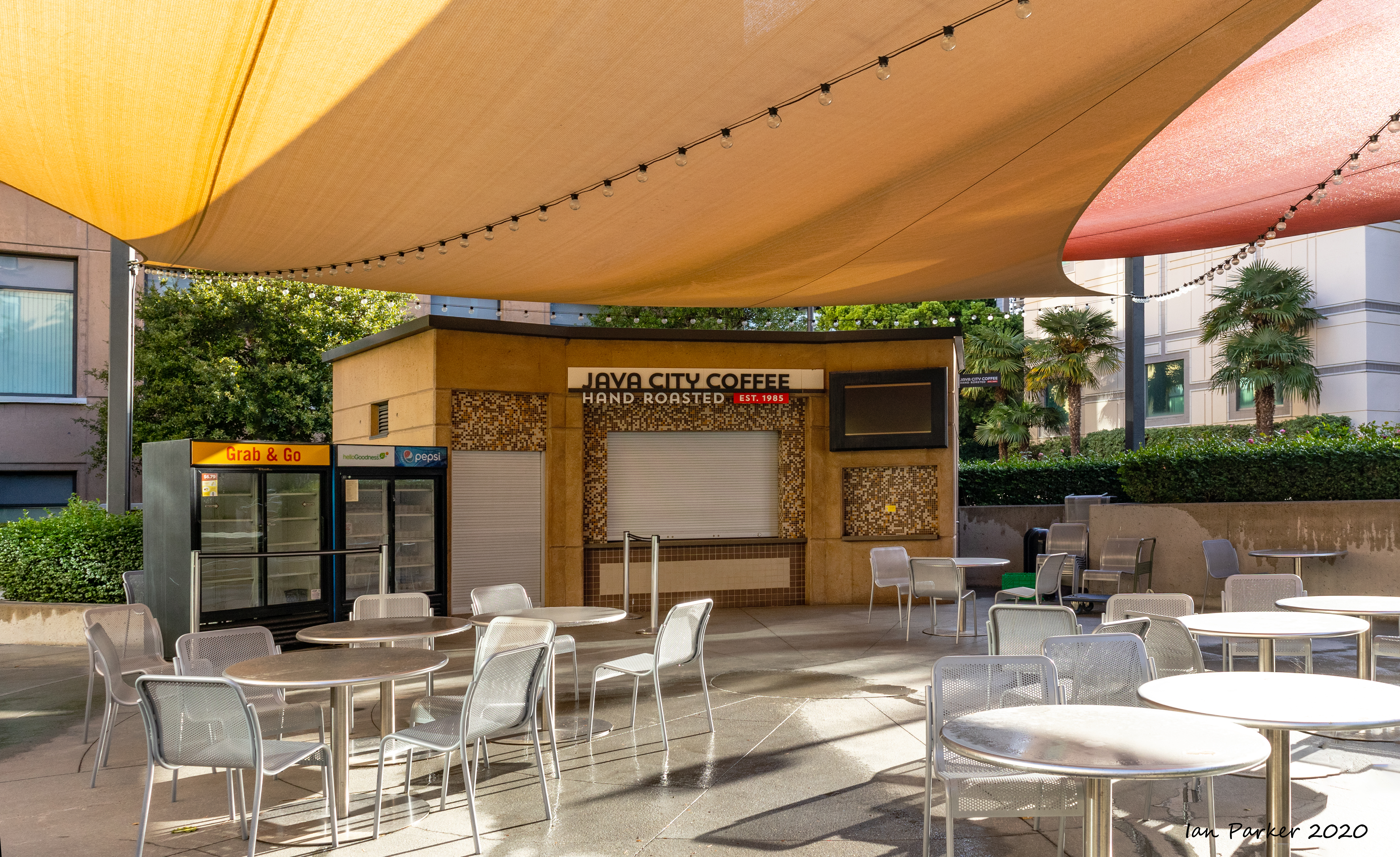
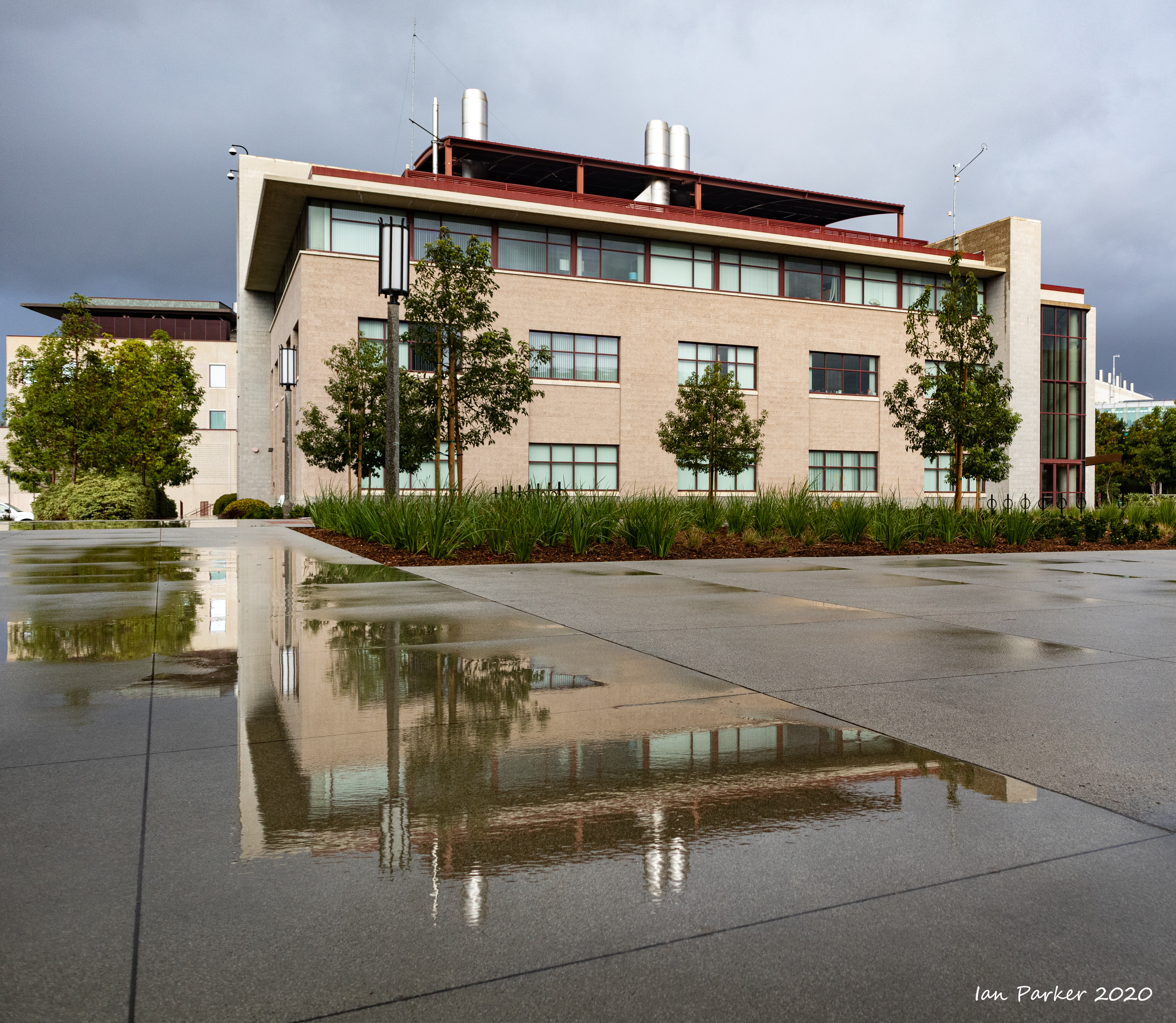
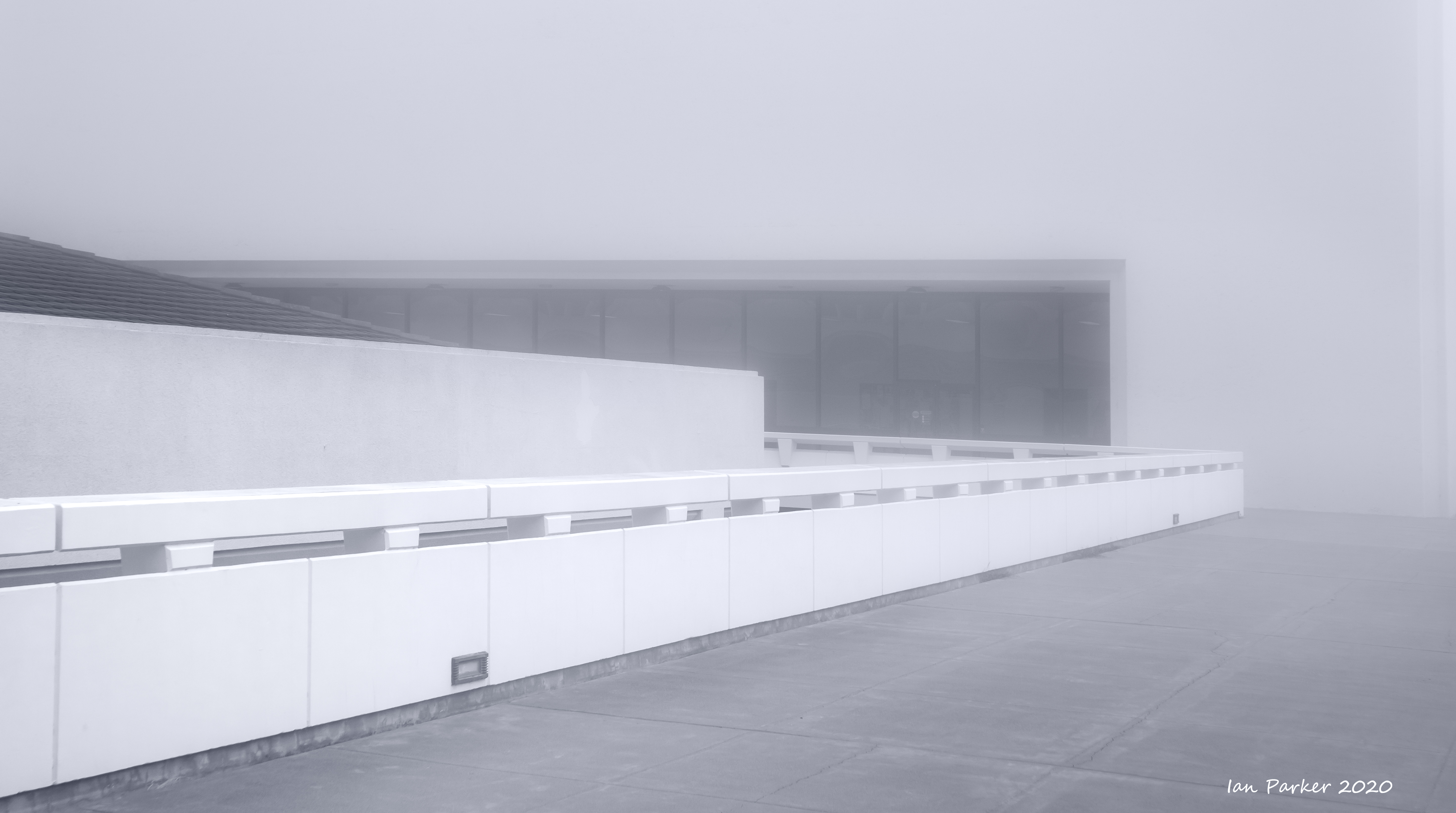
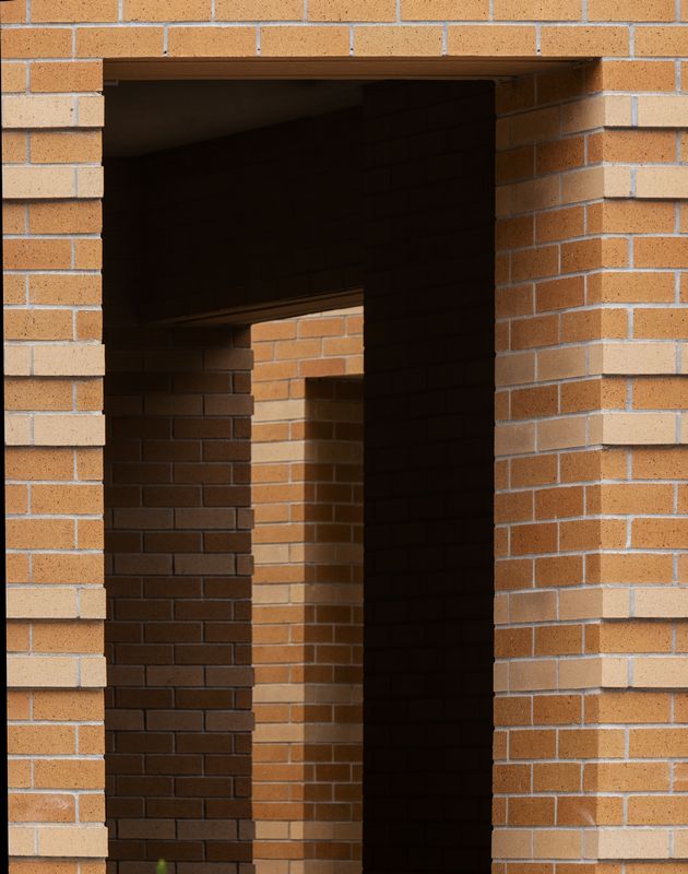
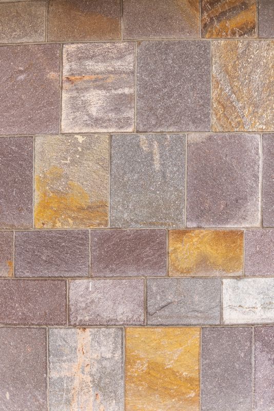
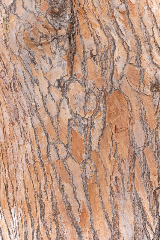
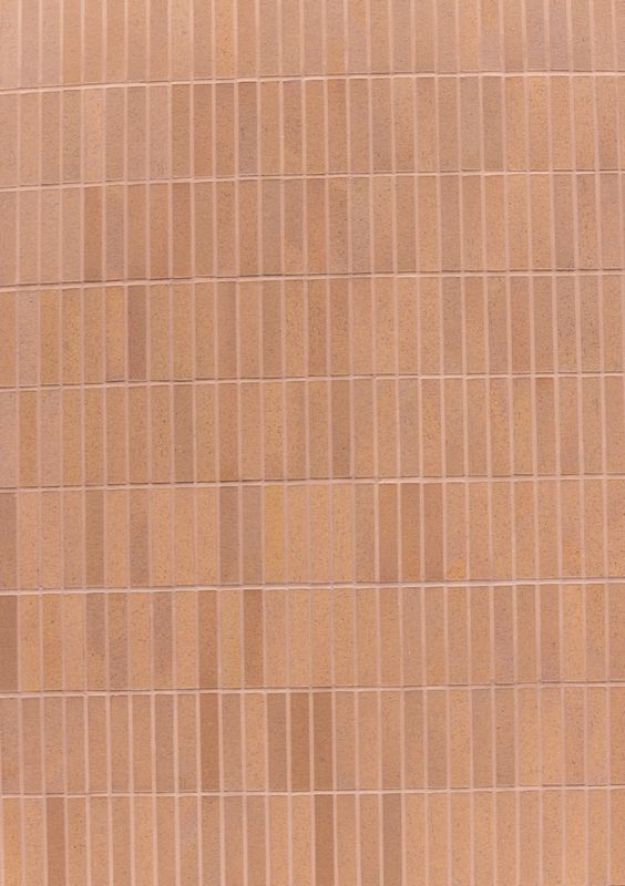
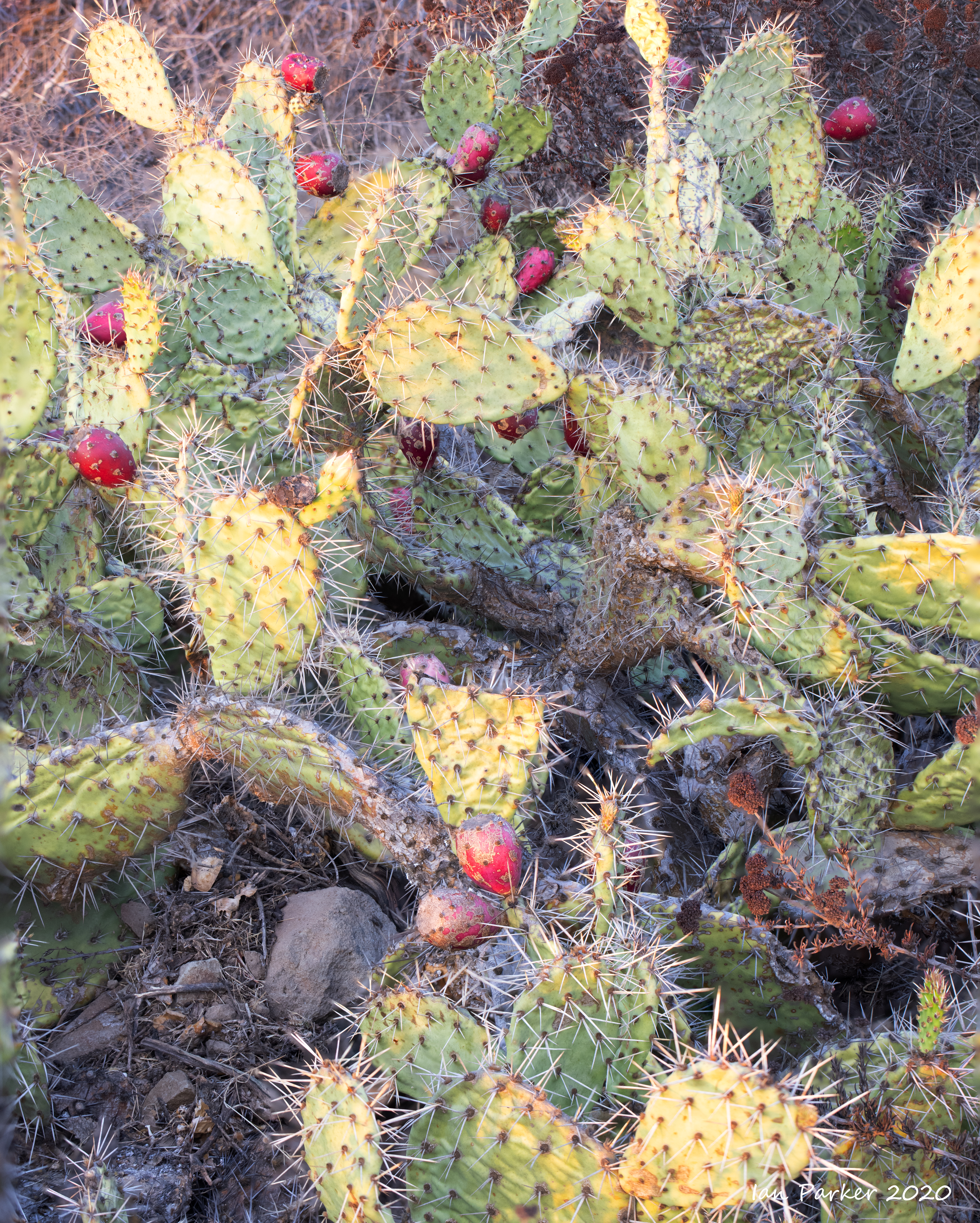
October 14th: Continuing an architectural project to photograph the buildings of UCI


October 14th: Another weekend with a Canon R5 in covid isolation
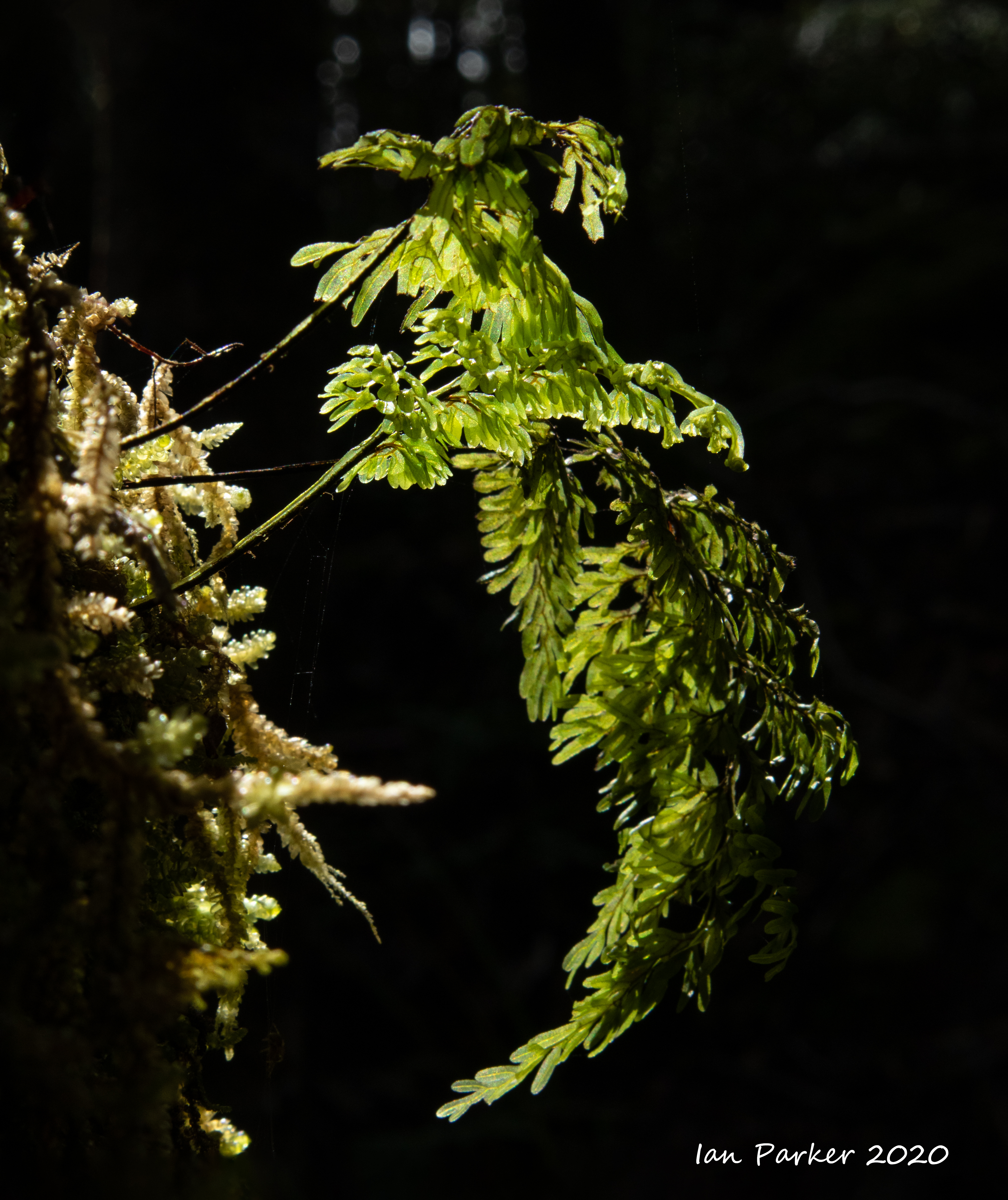
Out again around the UCI campus and Mason Park lake with a 17 mm T/S lens (for architecture), a 100 mm macro (for focus stacked flower shots) and a 100-400mm zoom + 1.4x teleconvertedr (for birds).


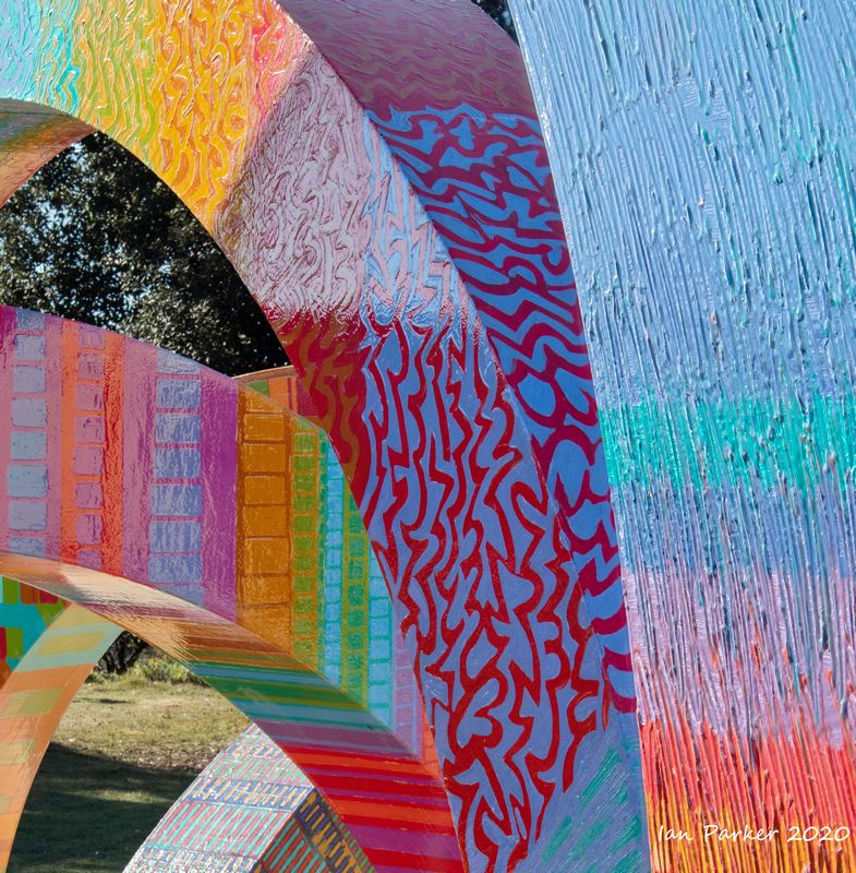
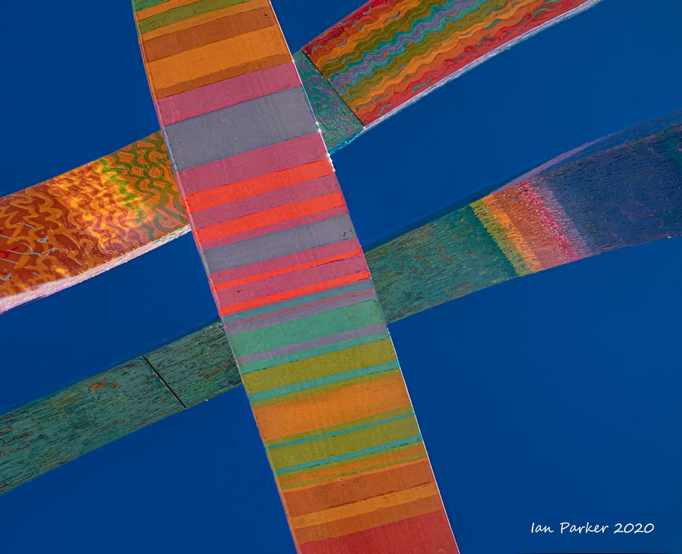
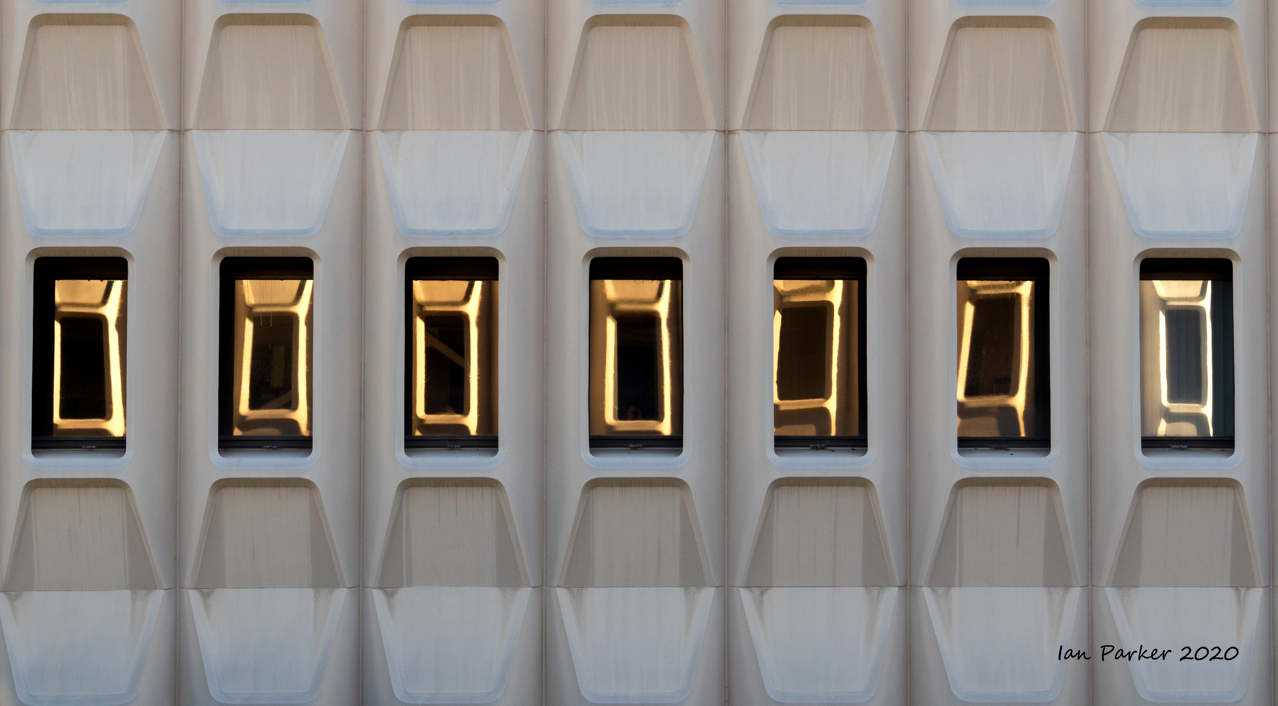
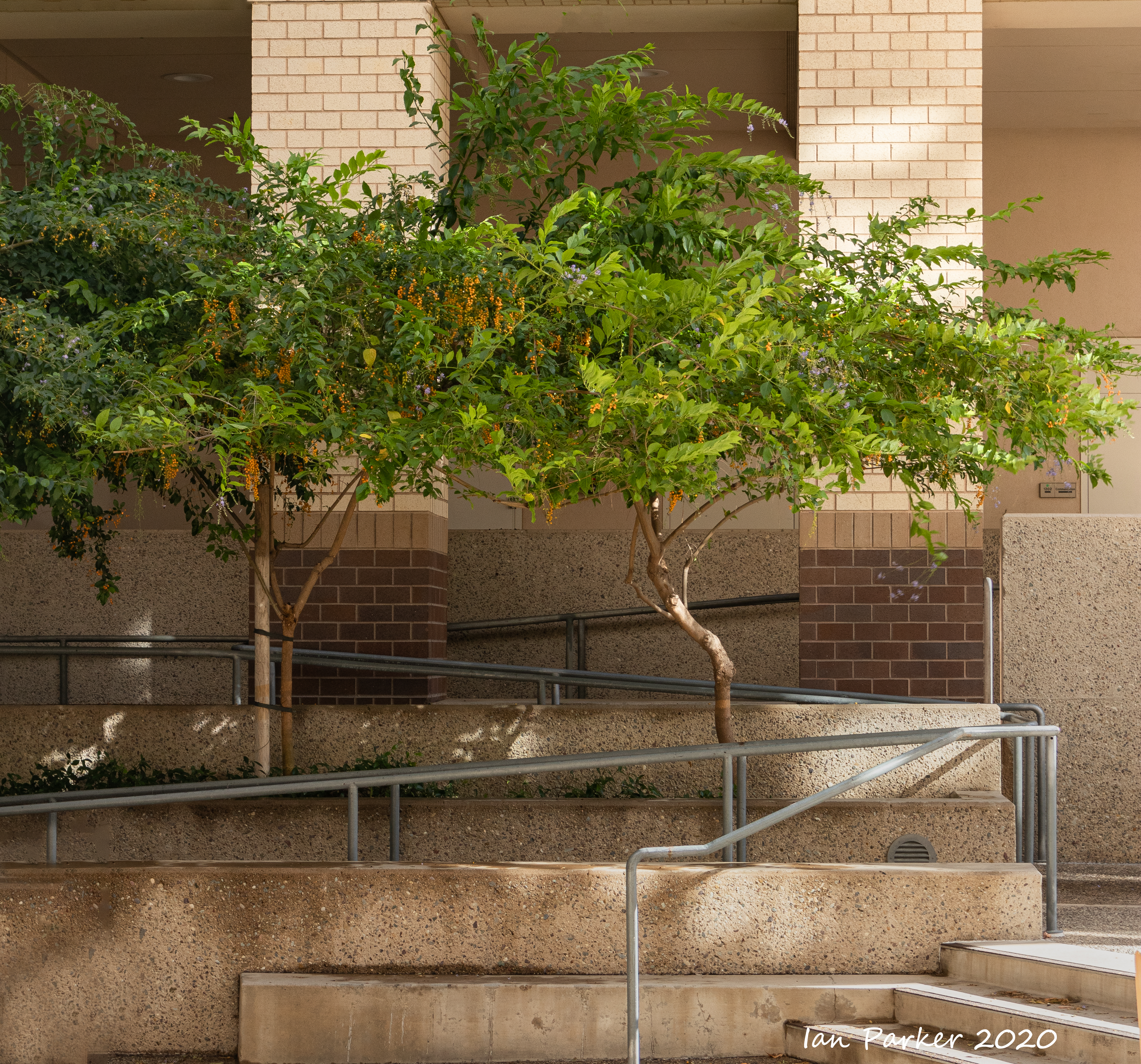
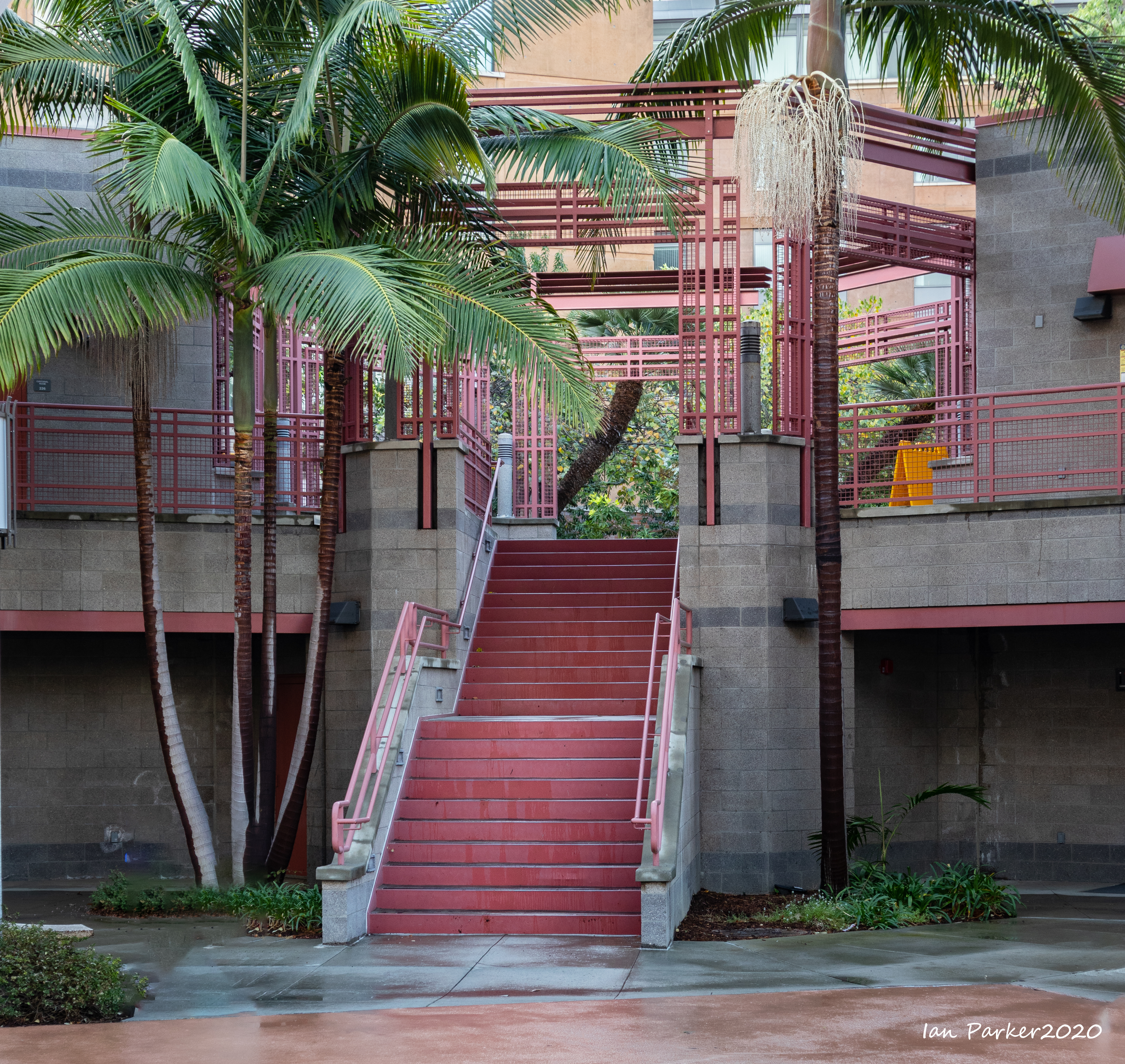
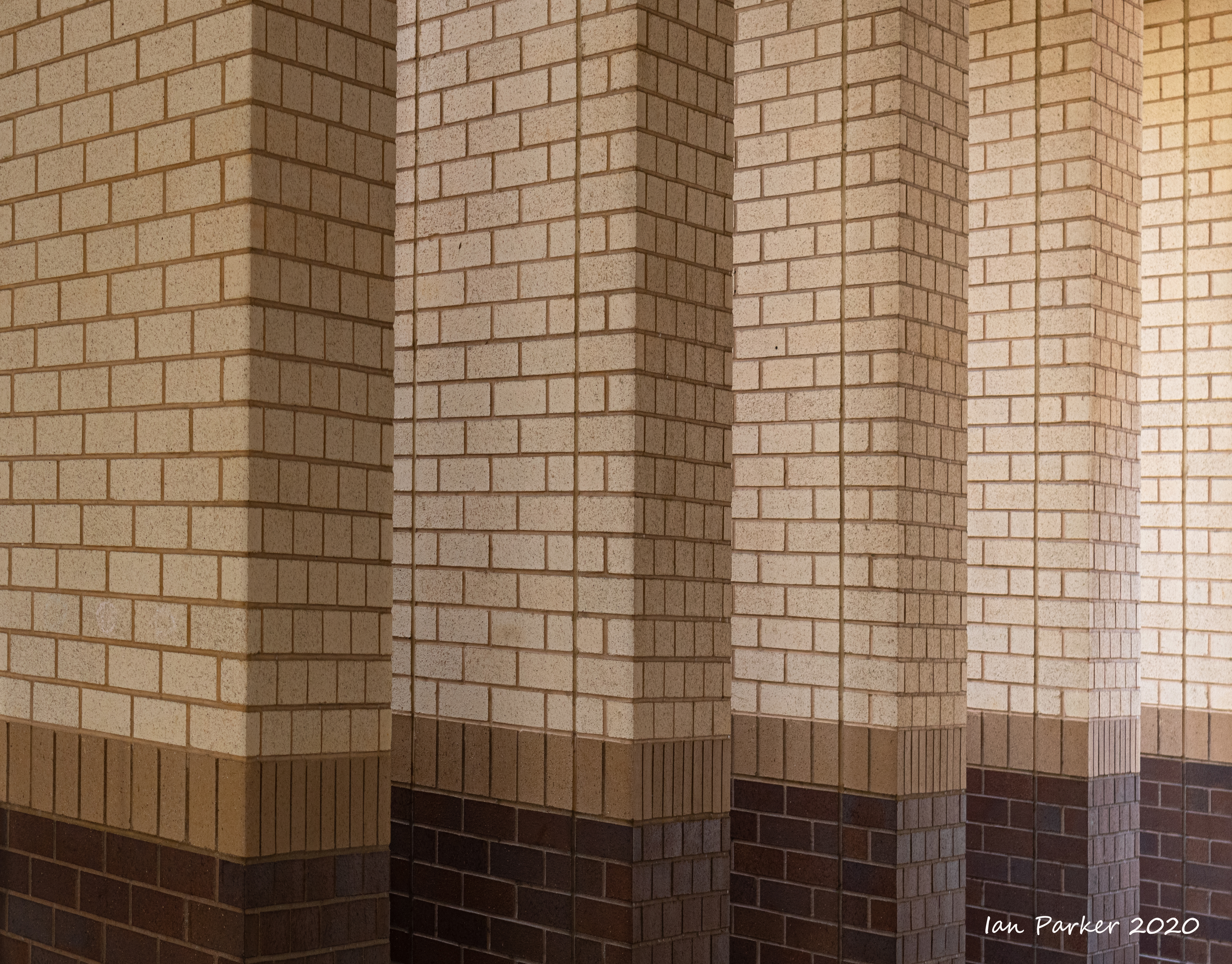
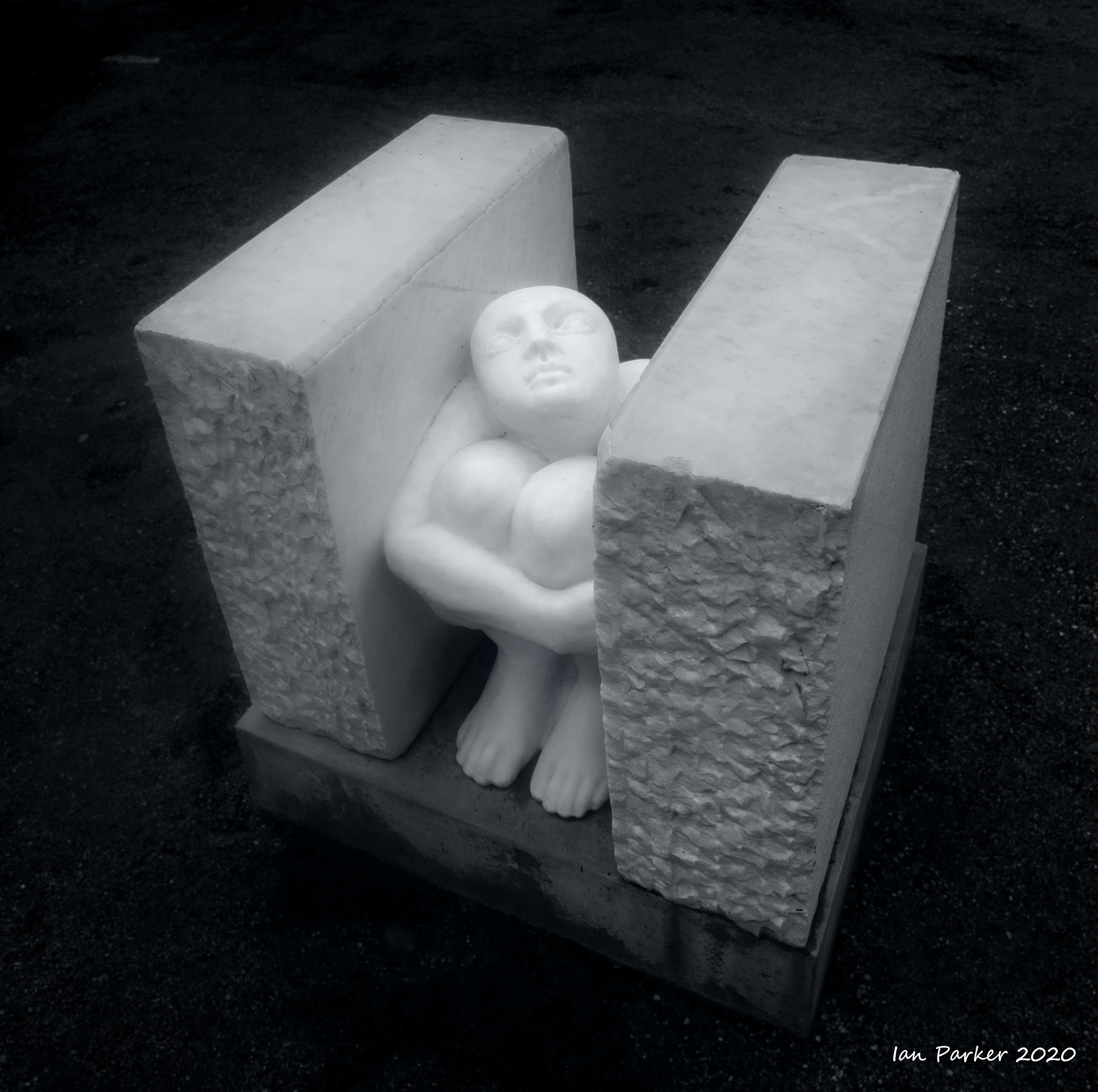
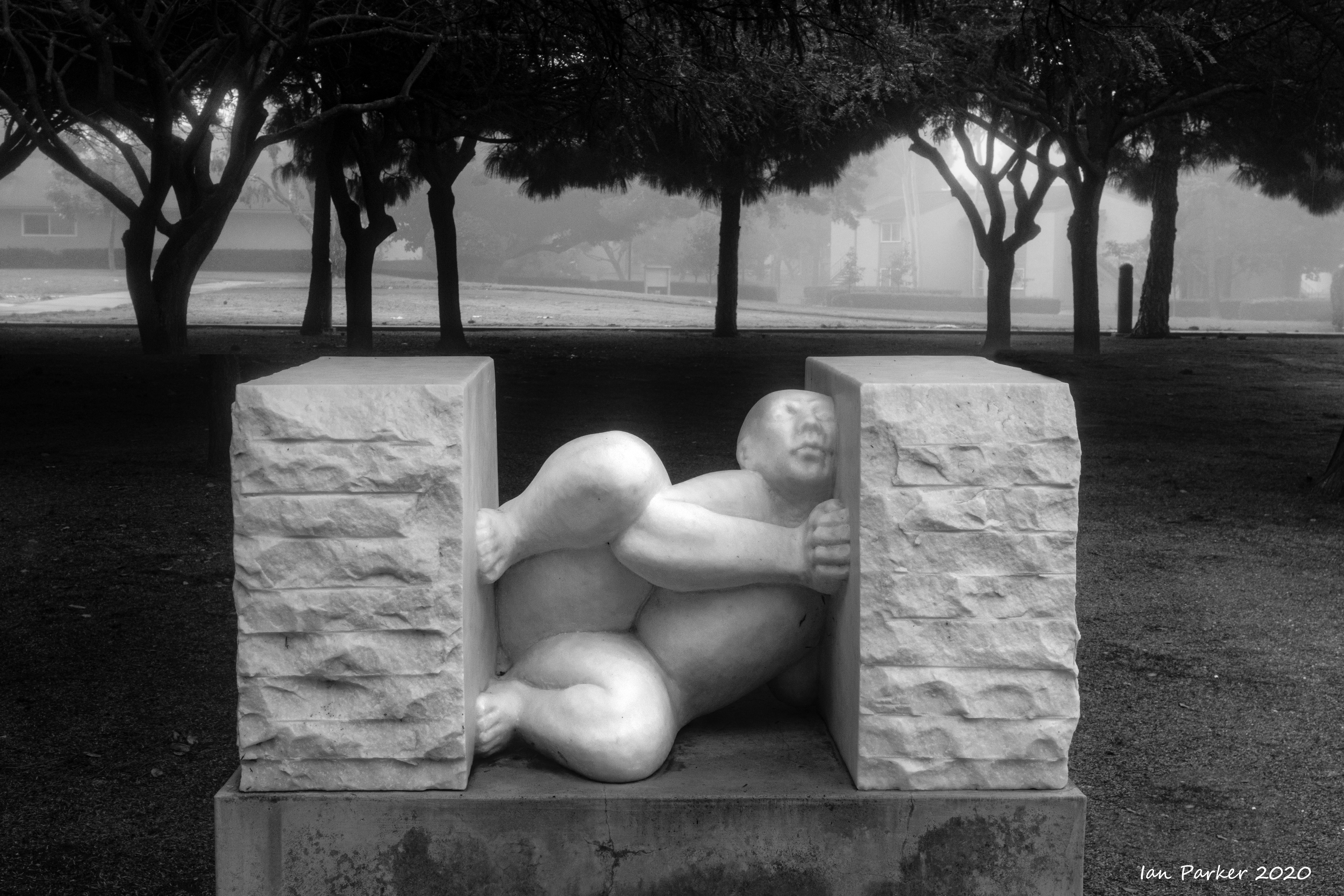
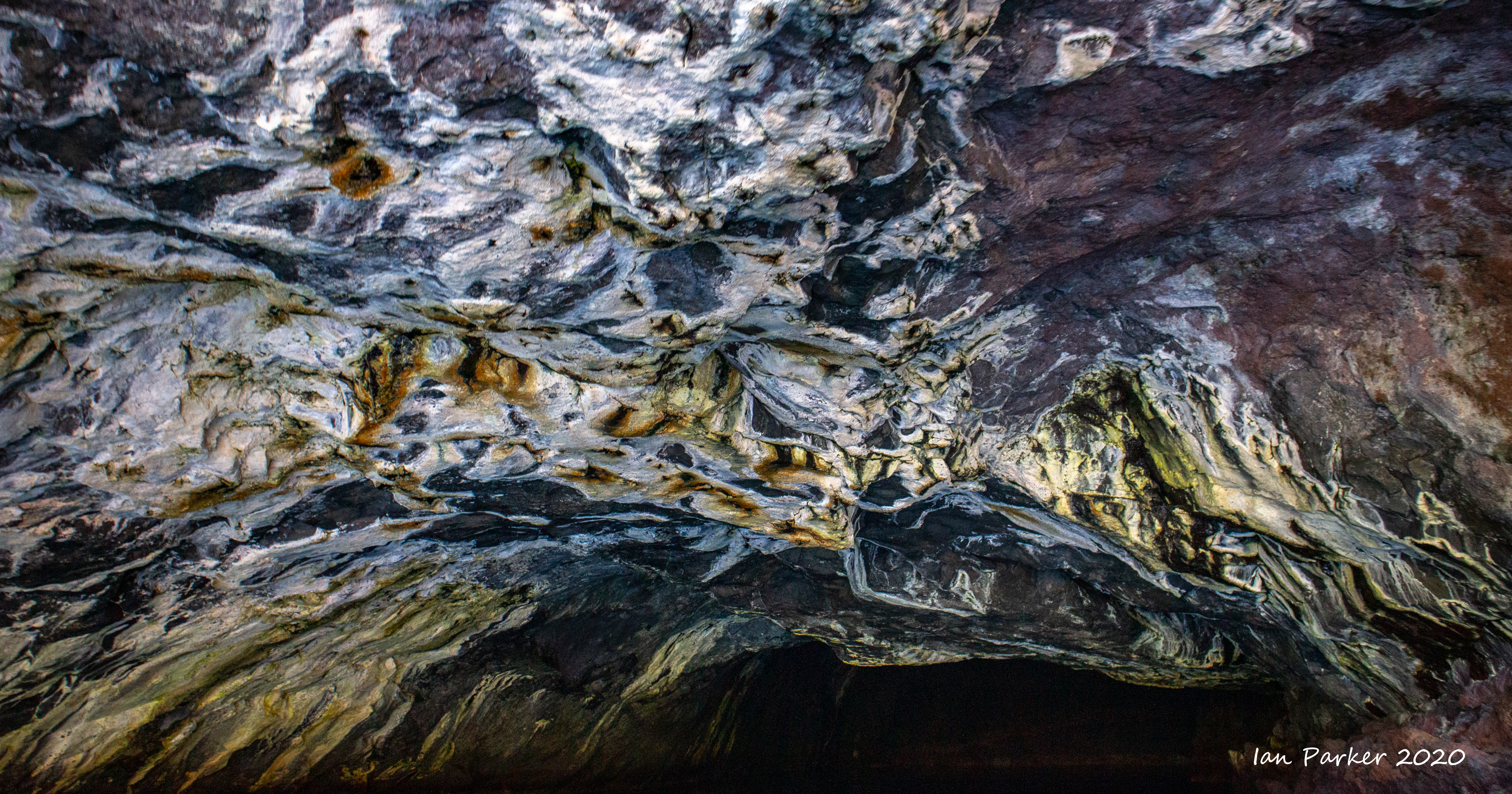
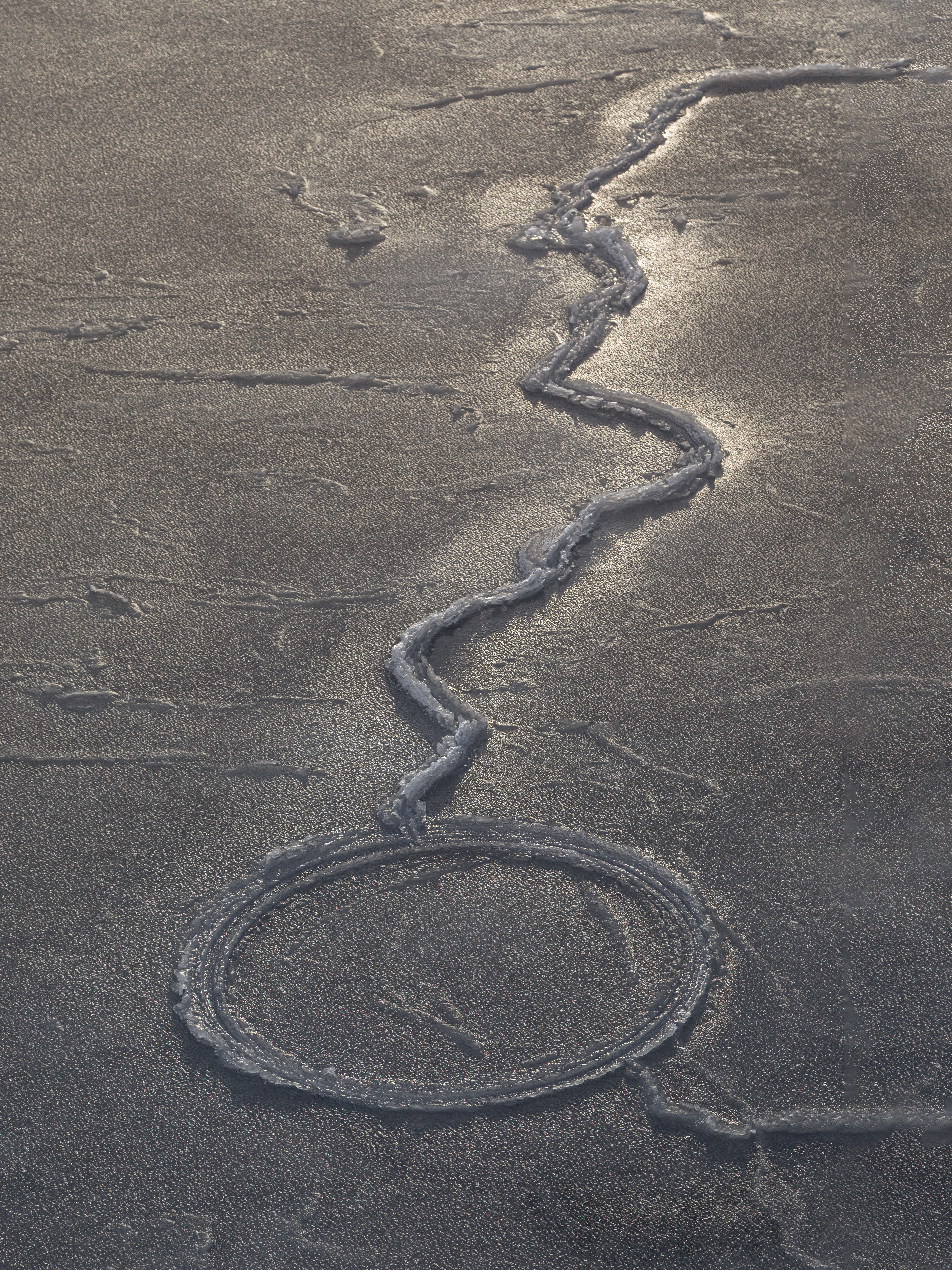
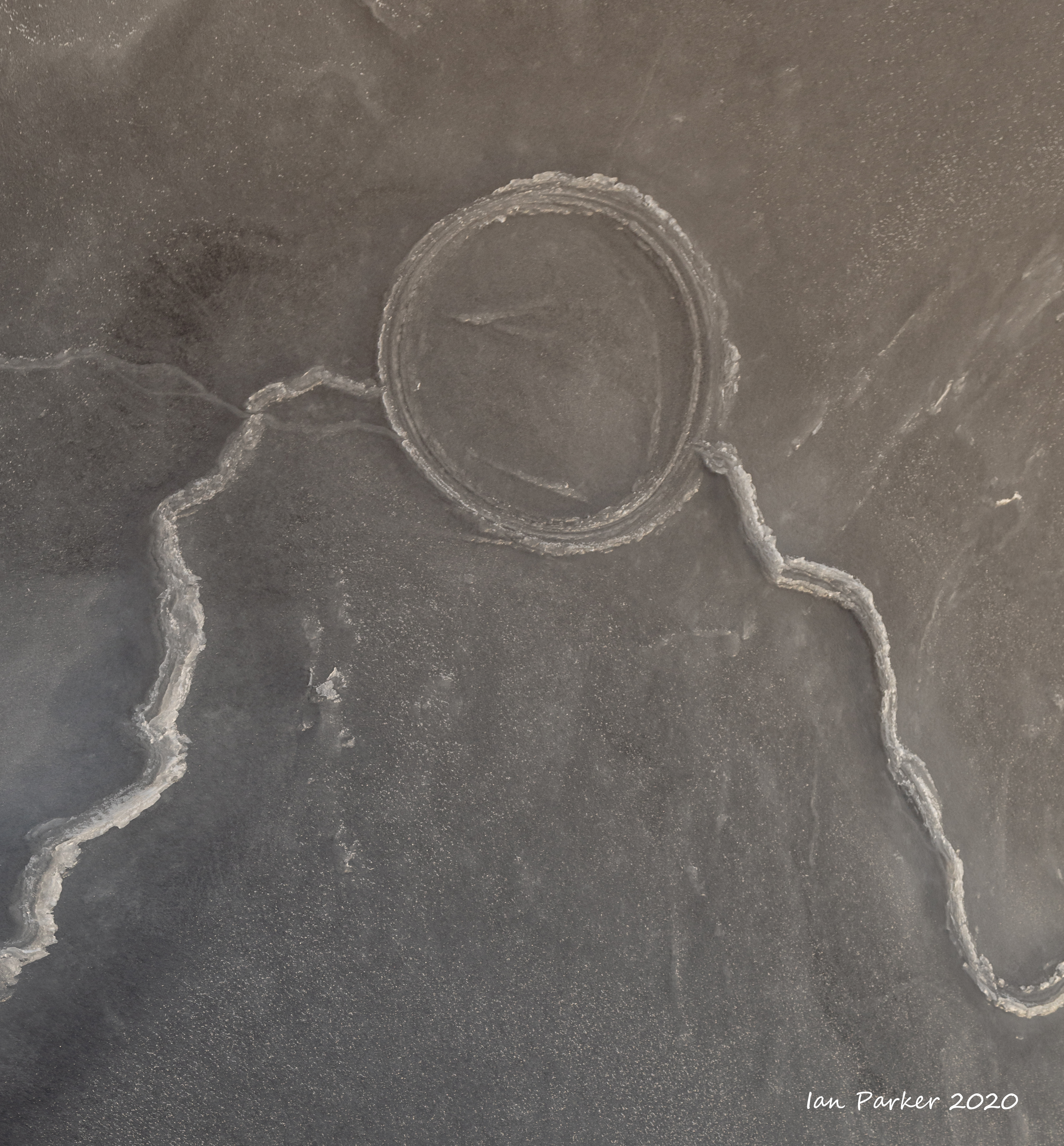
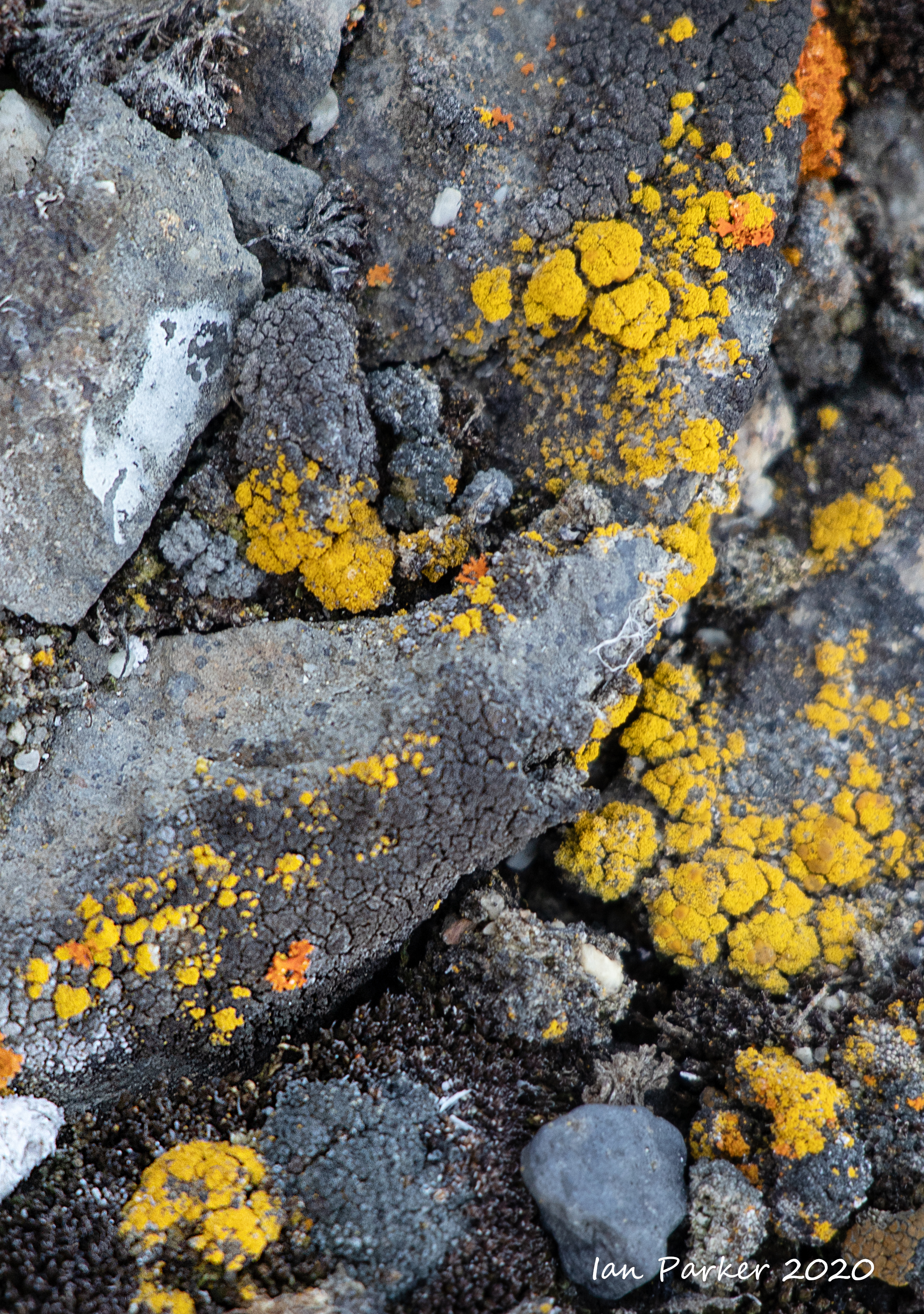
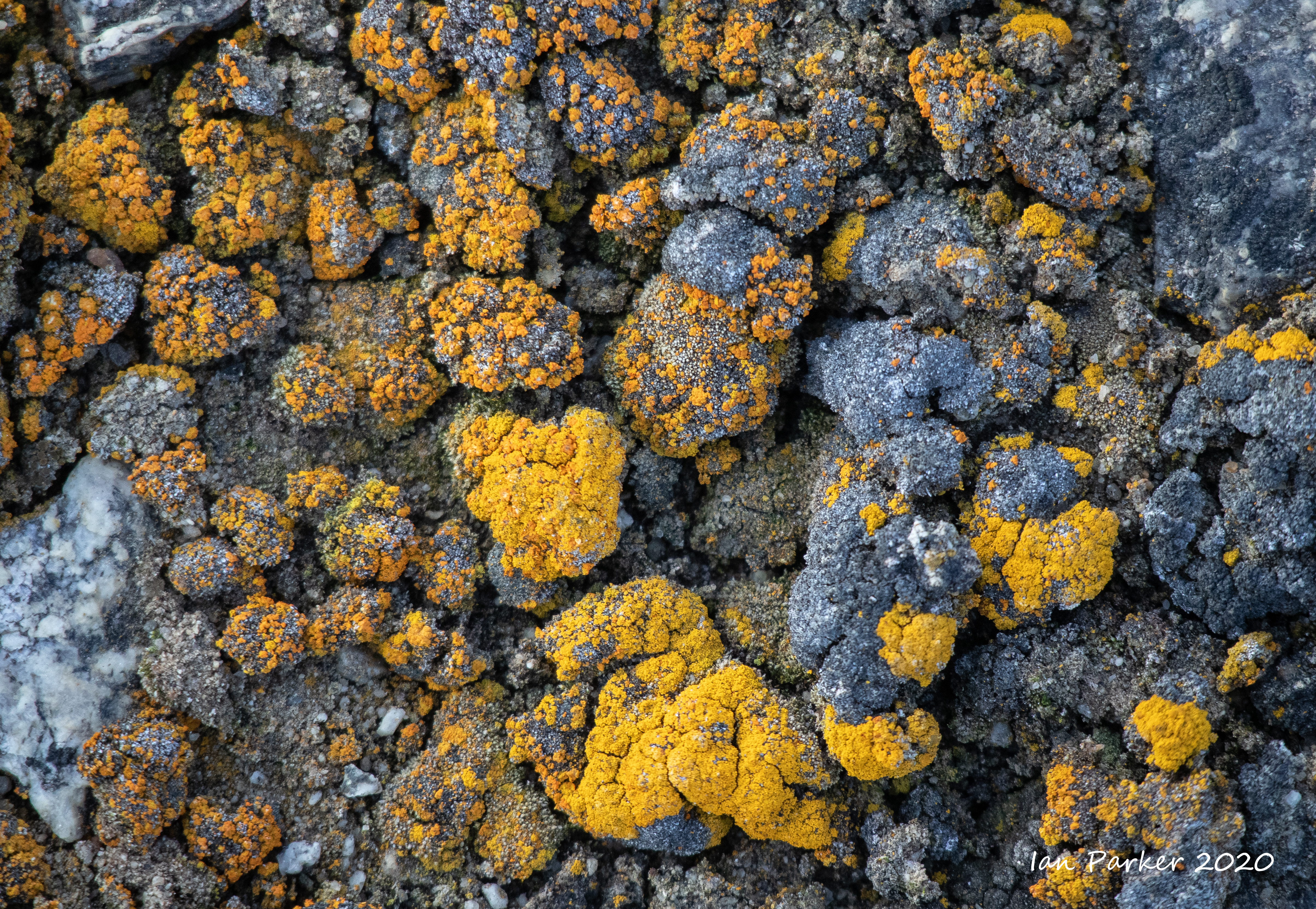
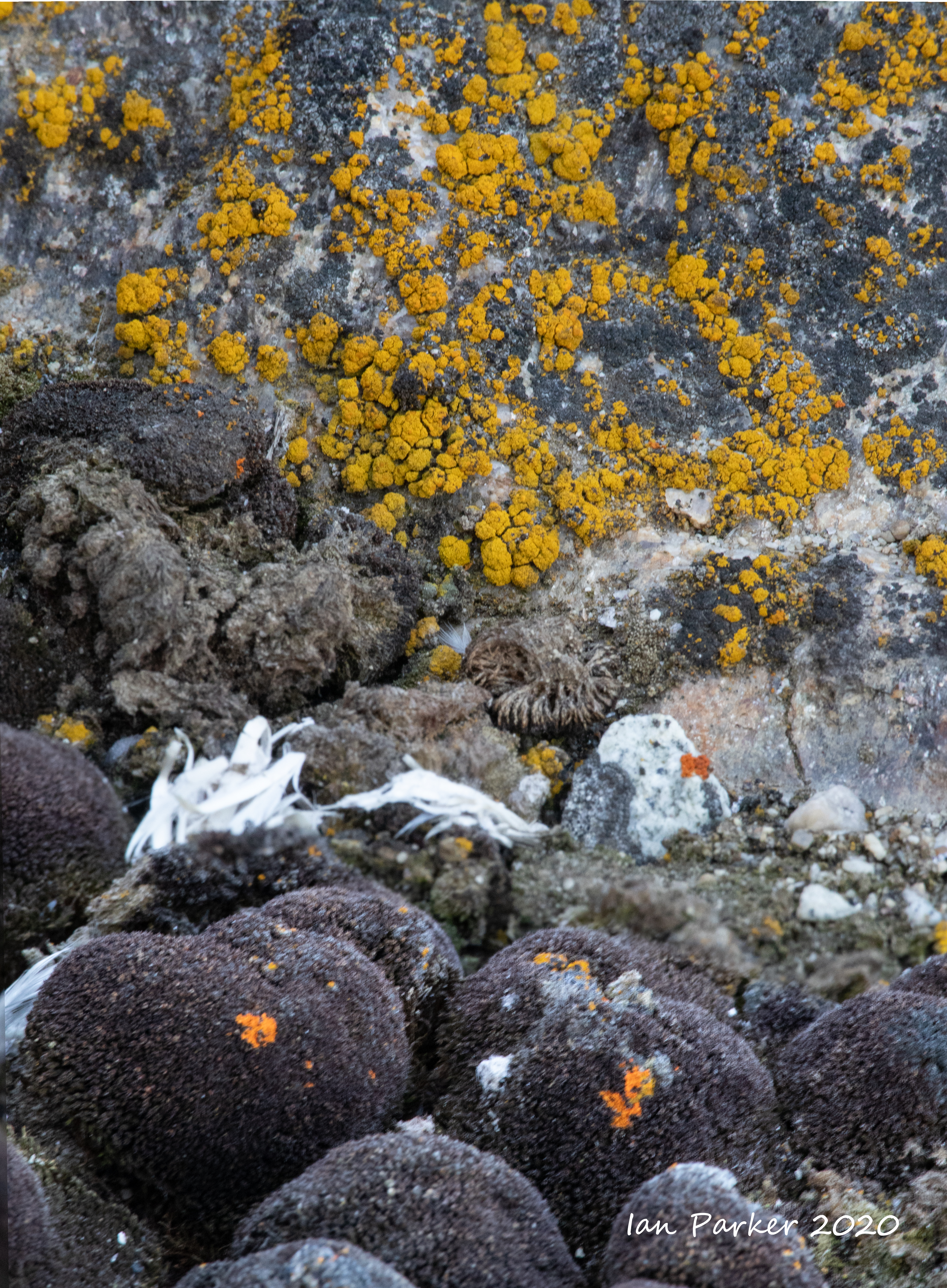
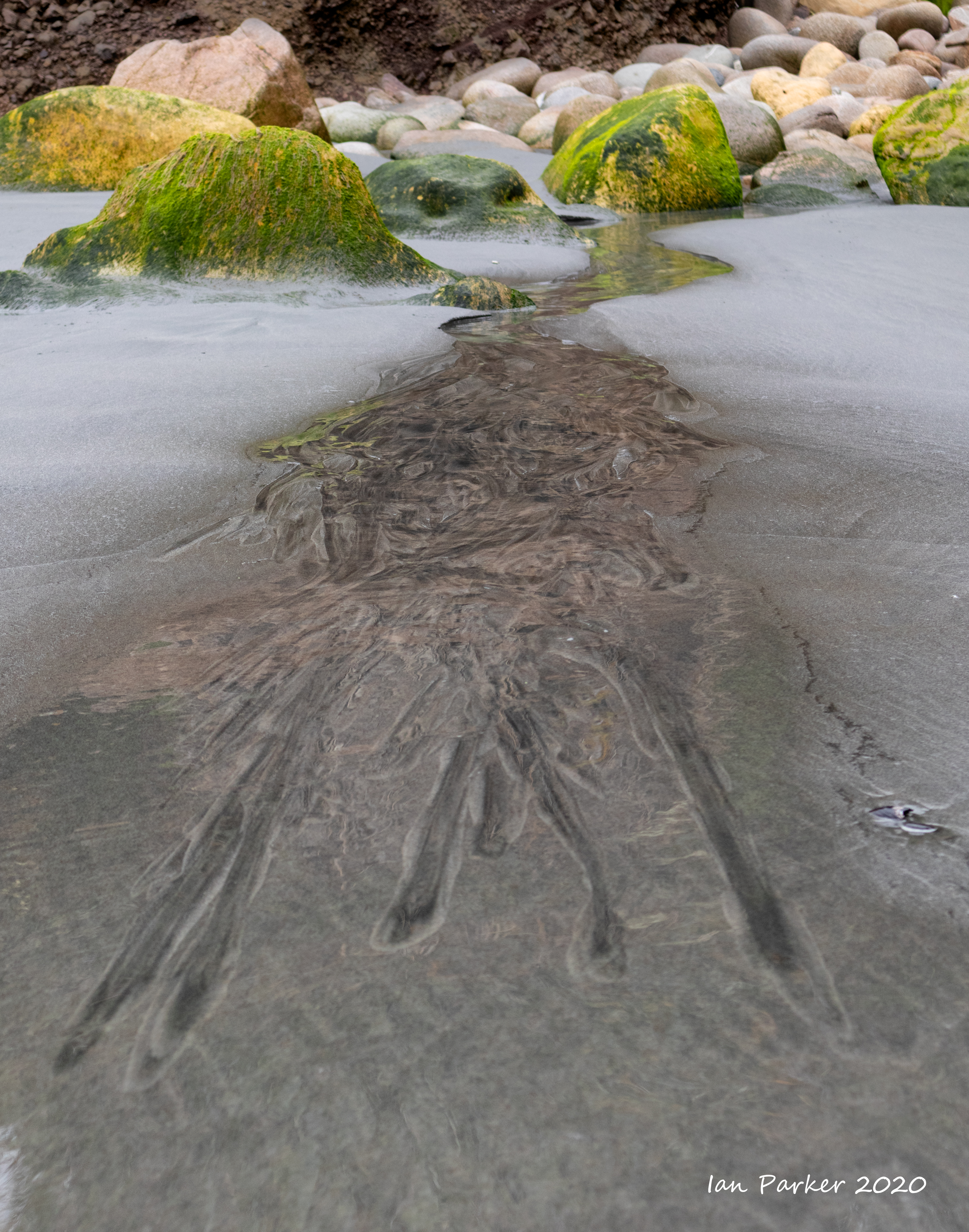
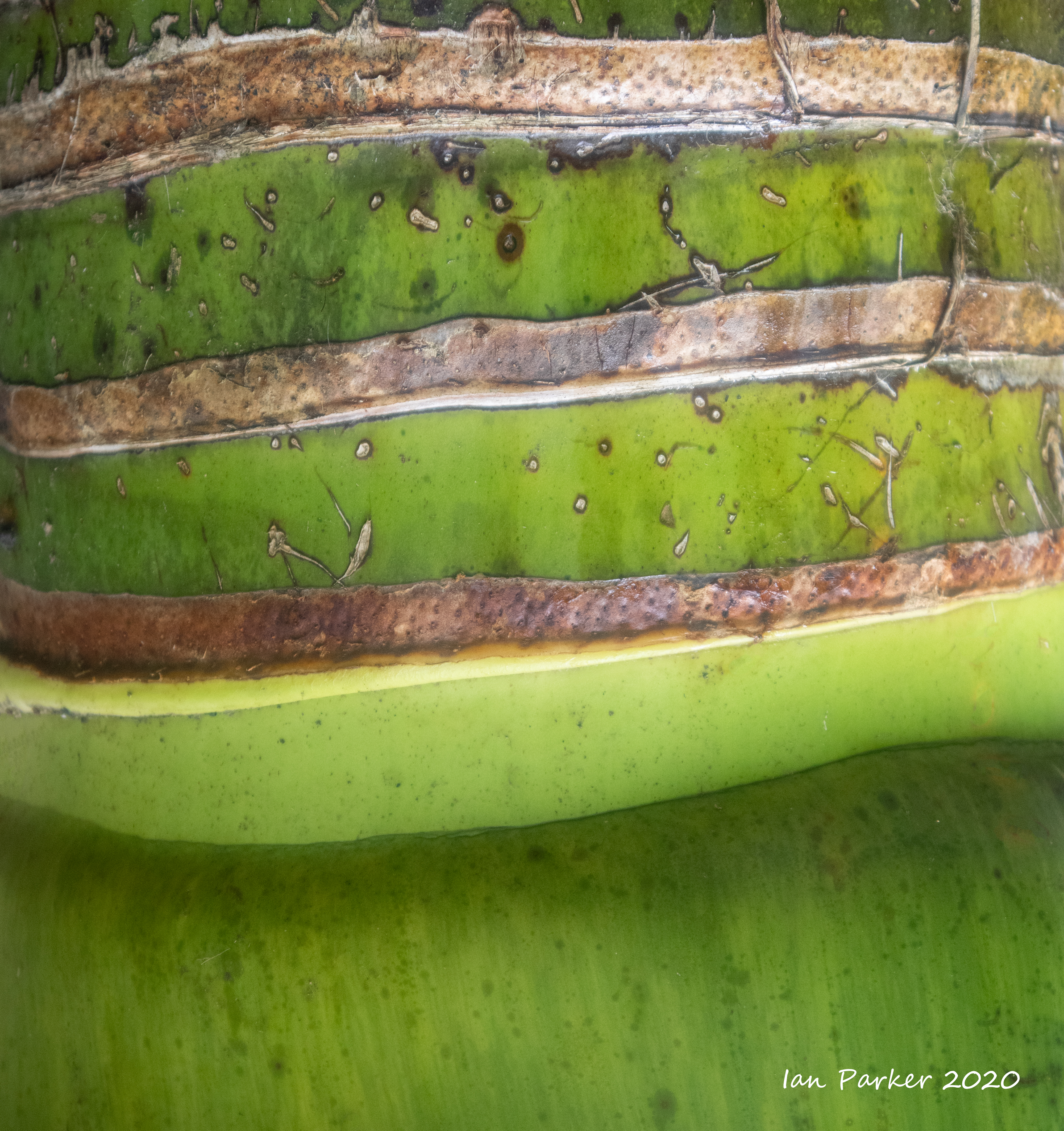
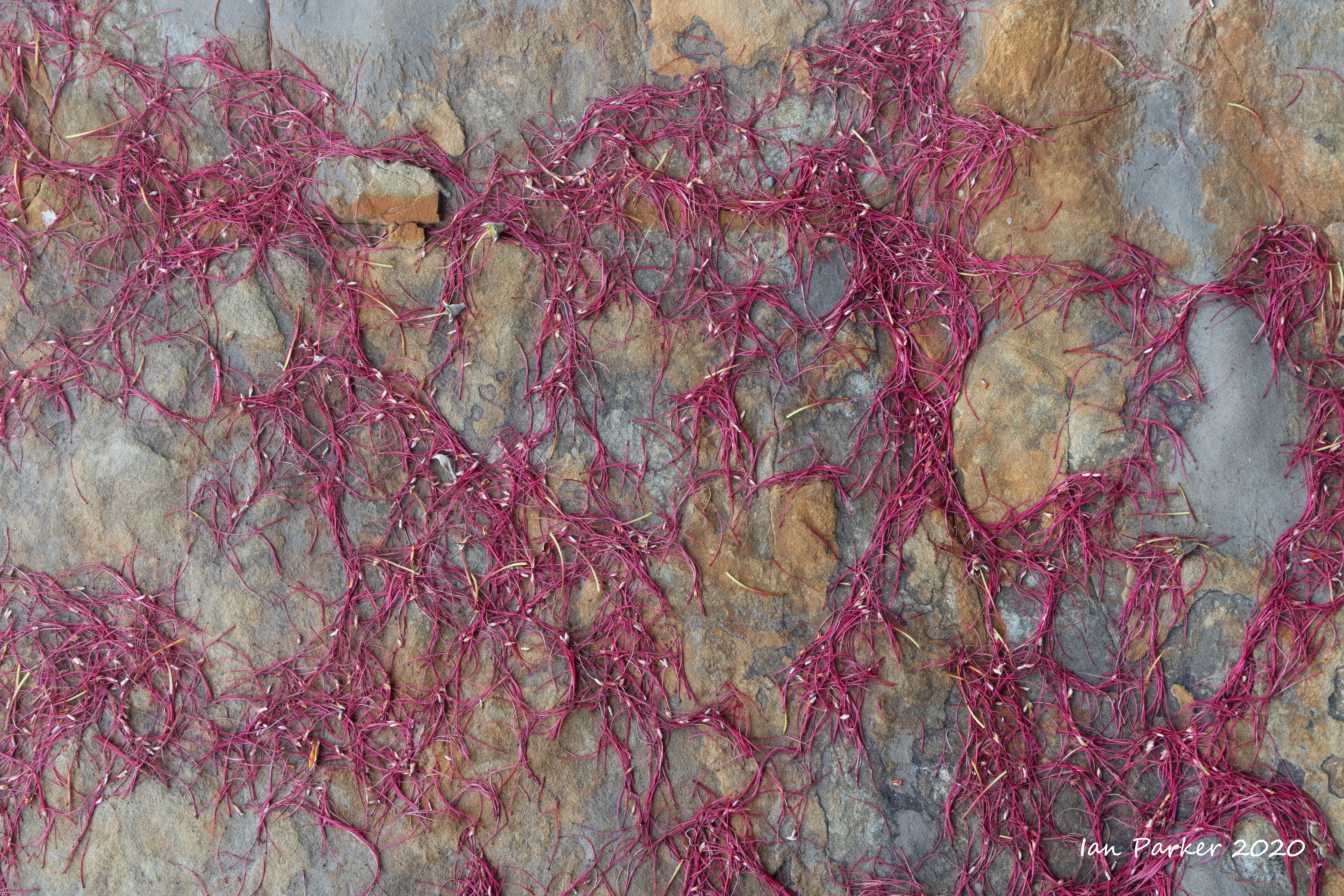
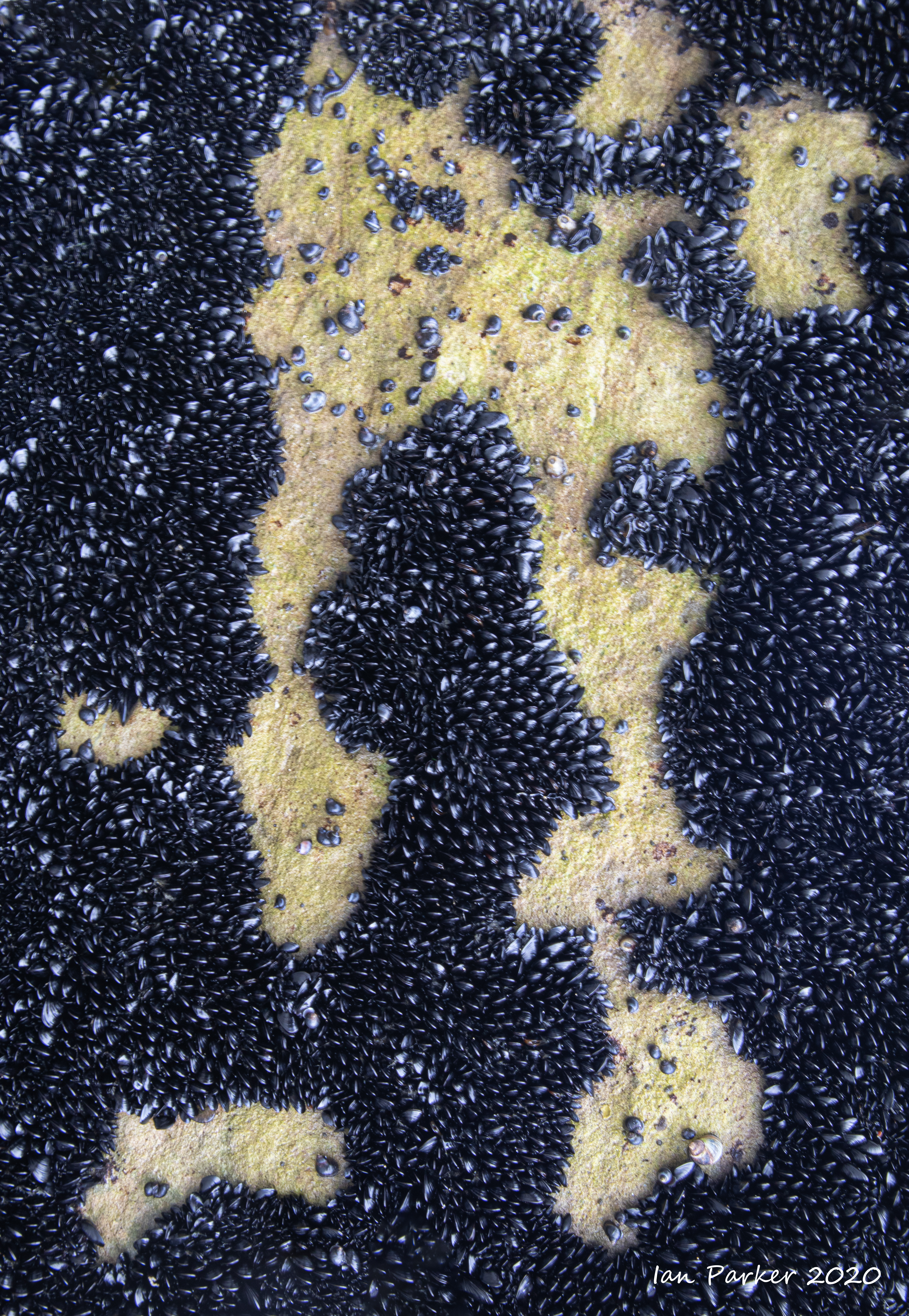
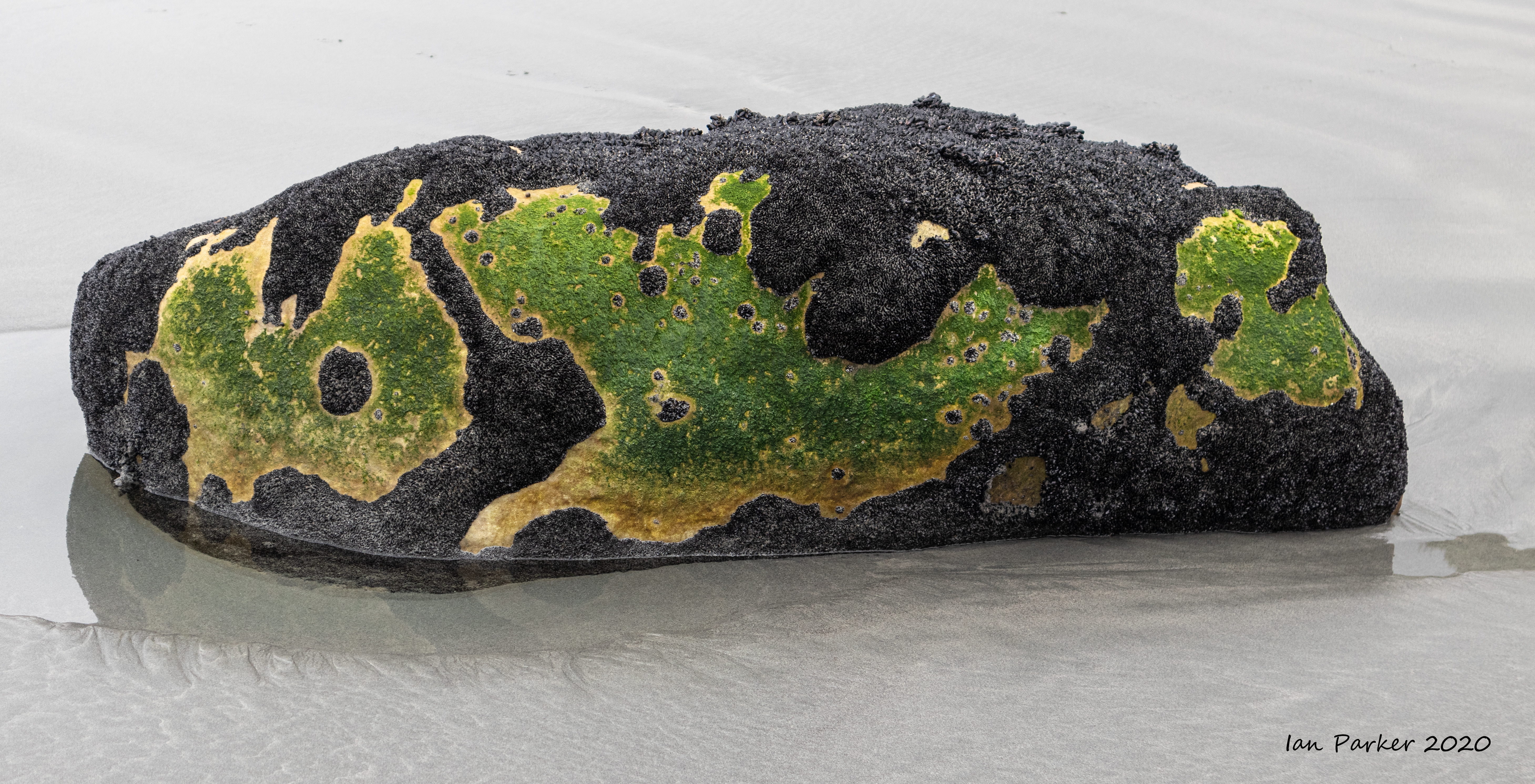
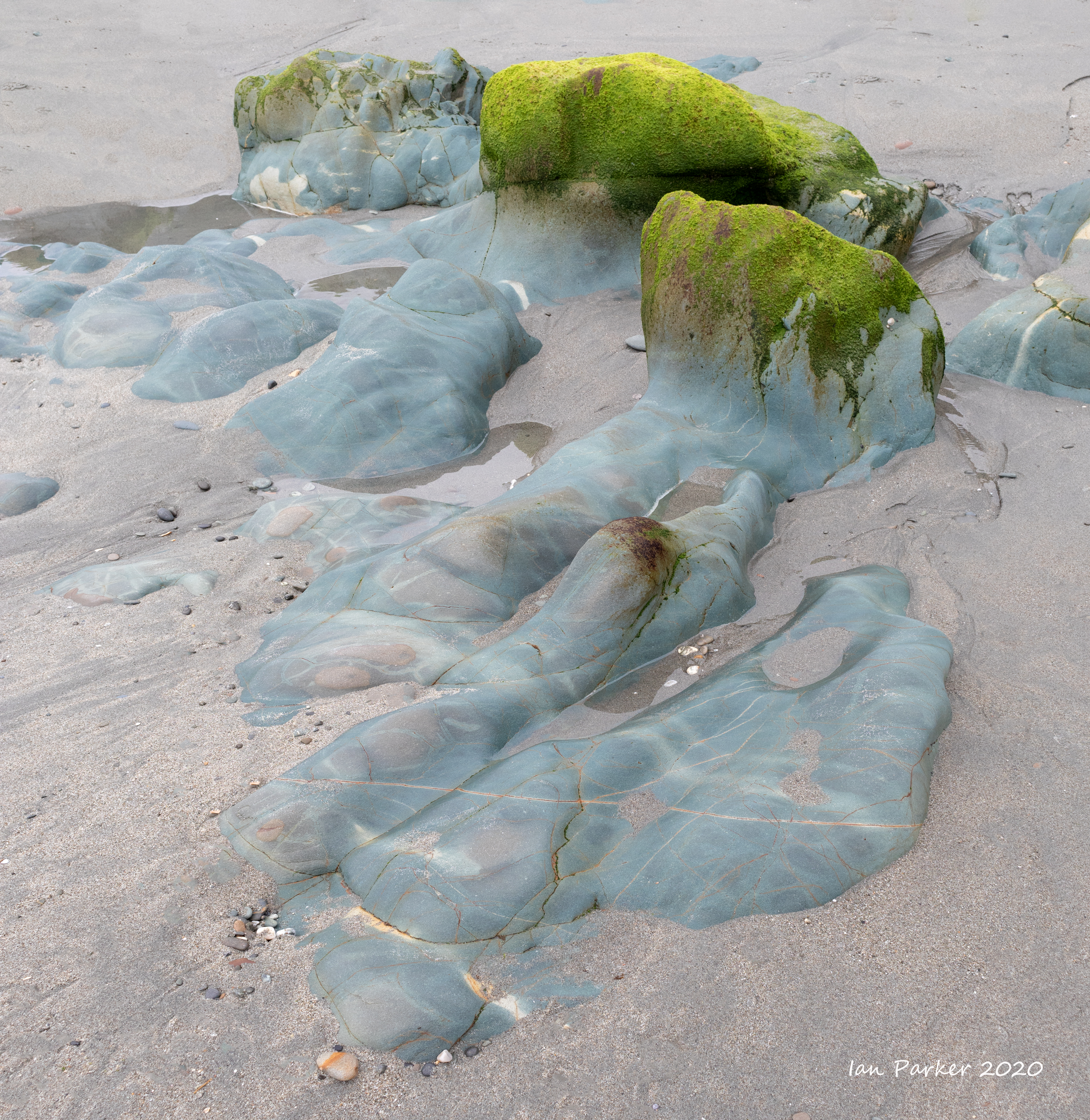
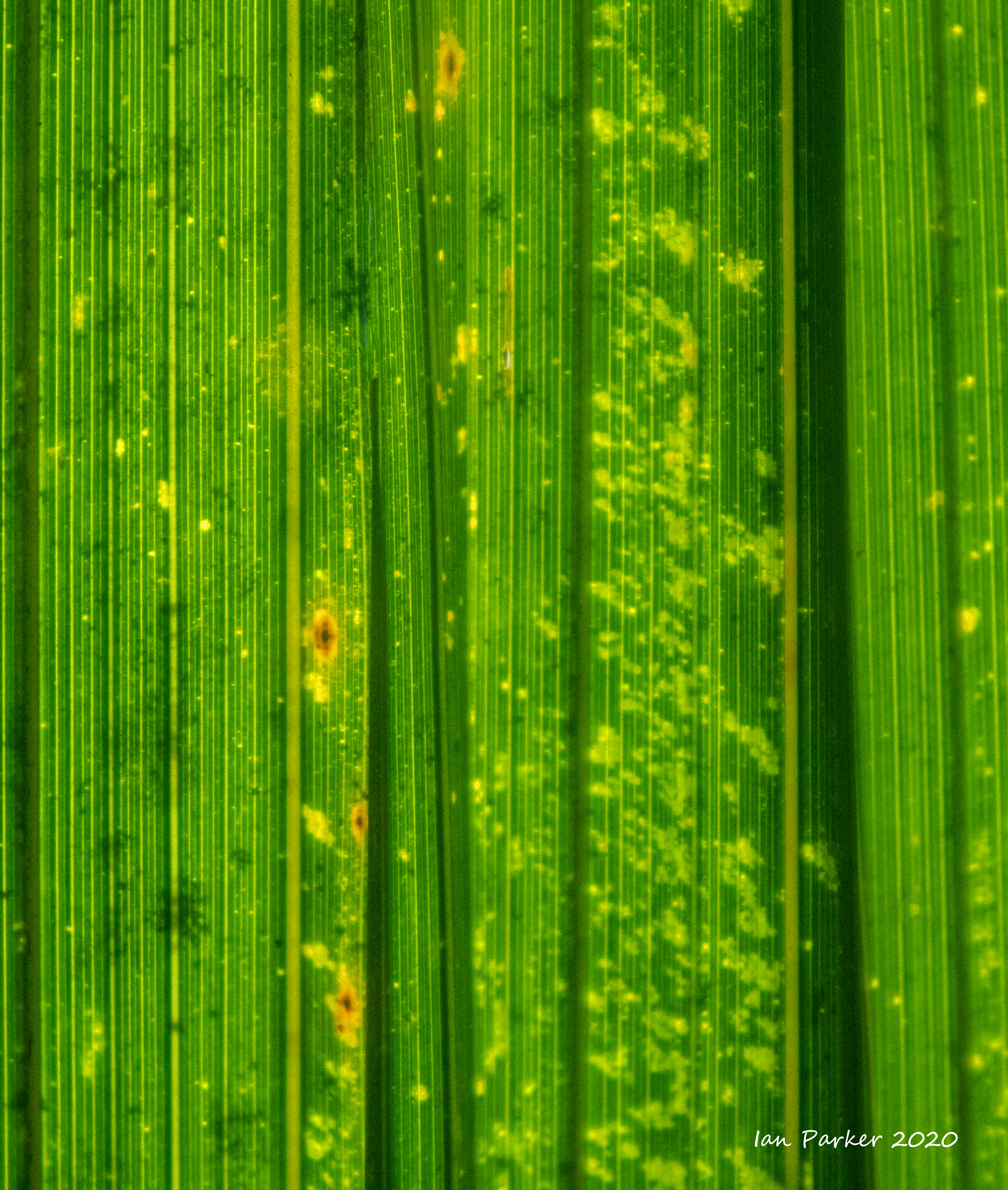
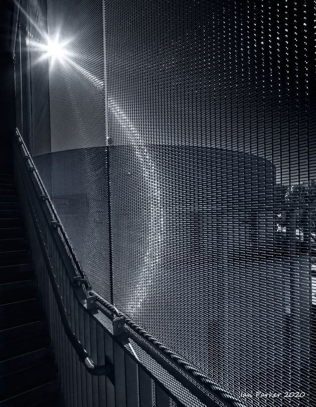
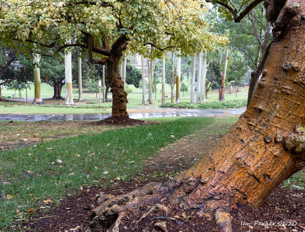
UCI surfaces and textures
 |
 |
 |
 |
 |
 |
 |
 |


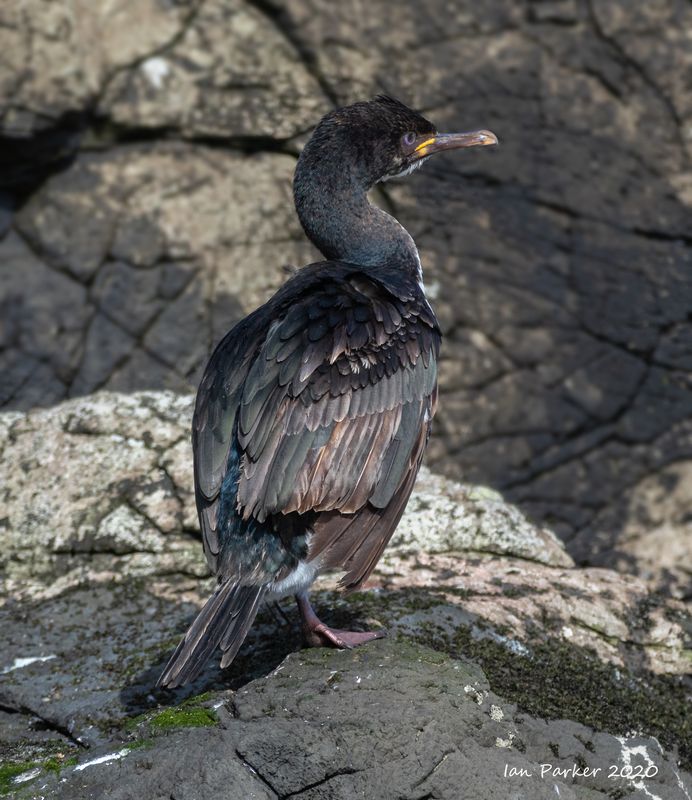
 Cormorant head on green : Mason Park |
October 11th: A few photos from 6 month's of covid home-isolation


My long-awaited new Canon R5 finally arrived last weekend. A few shots below learning its capabilities.
Architectural shots of UCI campus, variously using a 100 mm macro and 17 mm T/S lens on an EF/R adapter.


Trying out the automated focus stack function on the R5. Photos below are focus-stacked compusites of 25 shots, hand-held at ISO 800, processed in Photoshop.


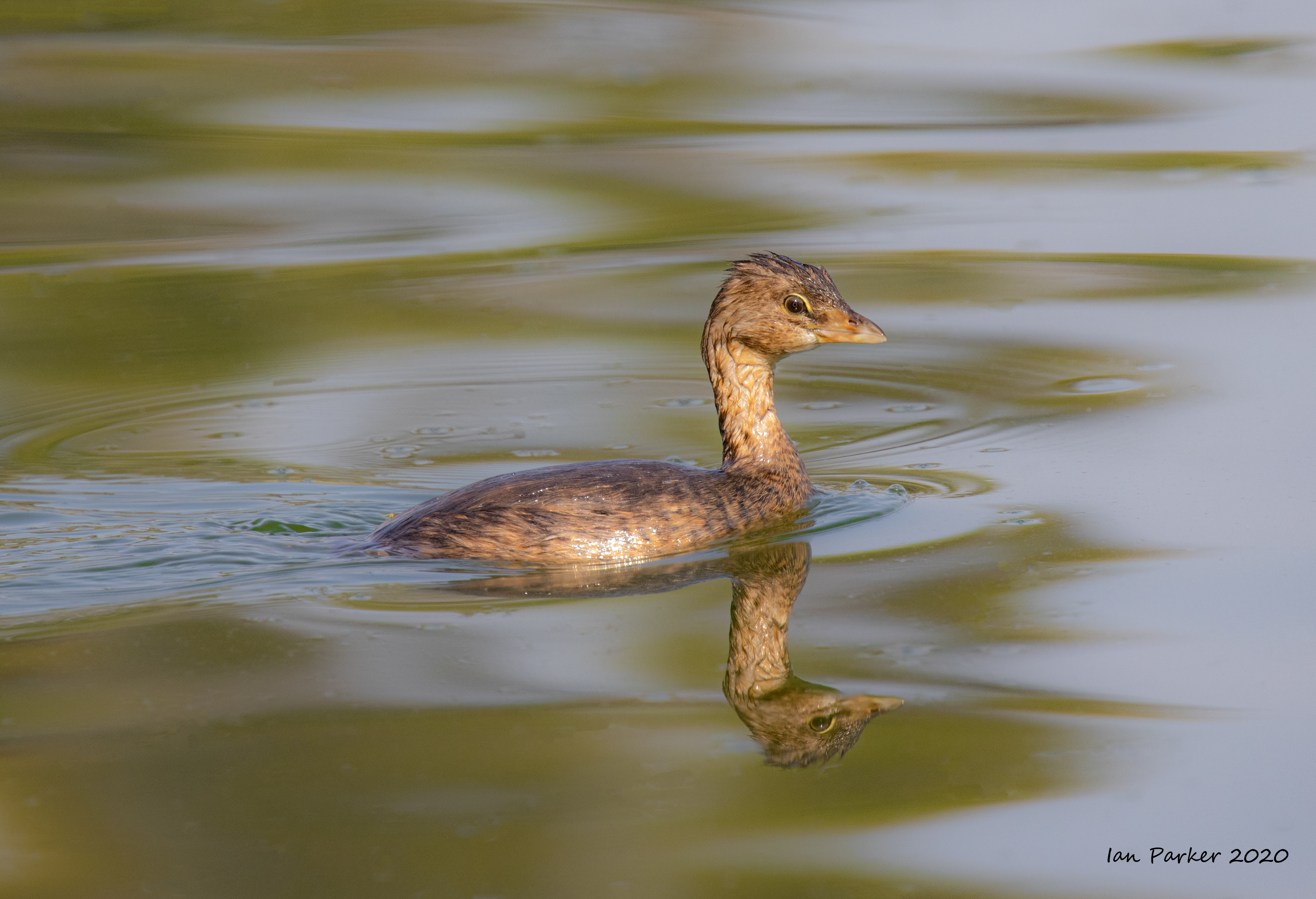
And down to the lake at Mason Park for some birding to test the animal/bird eye-detect
autofocus on the R5. Shots taken with an EF 100-400mm lens + 1.4 teleconverted at IS 800.

 |

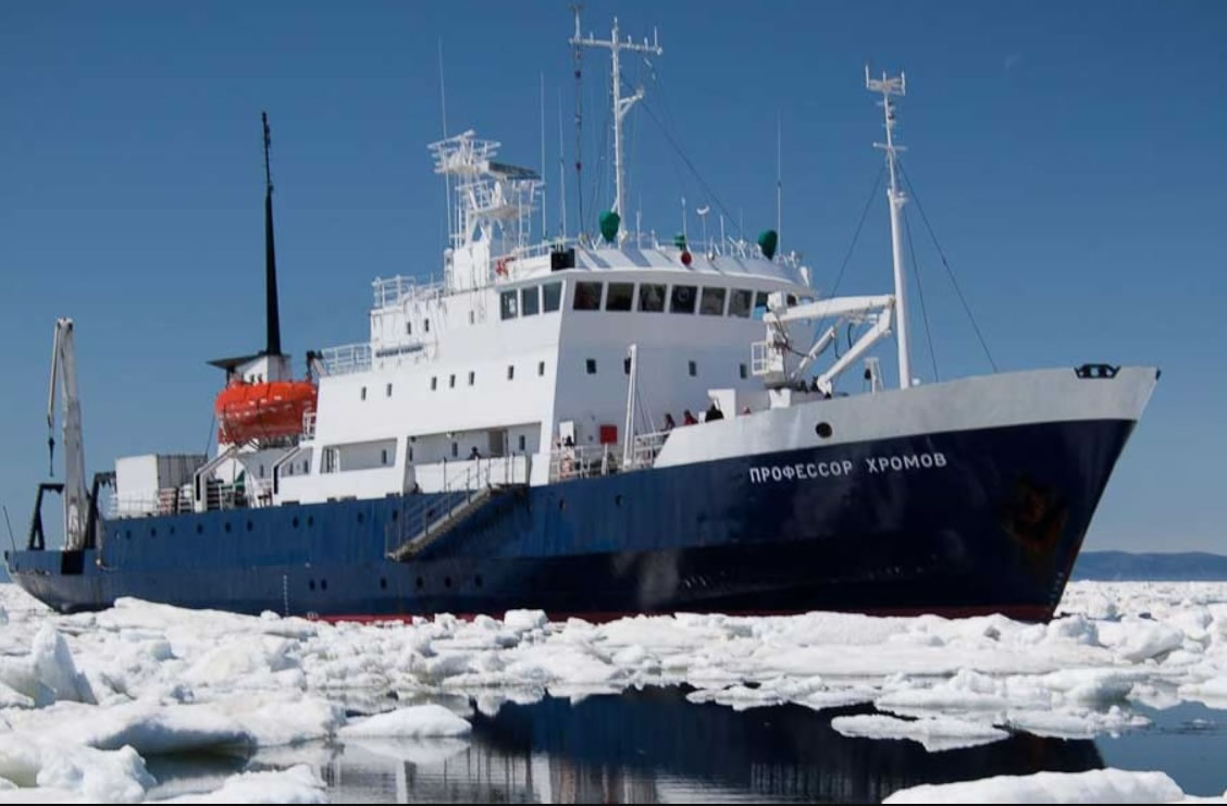
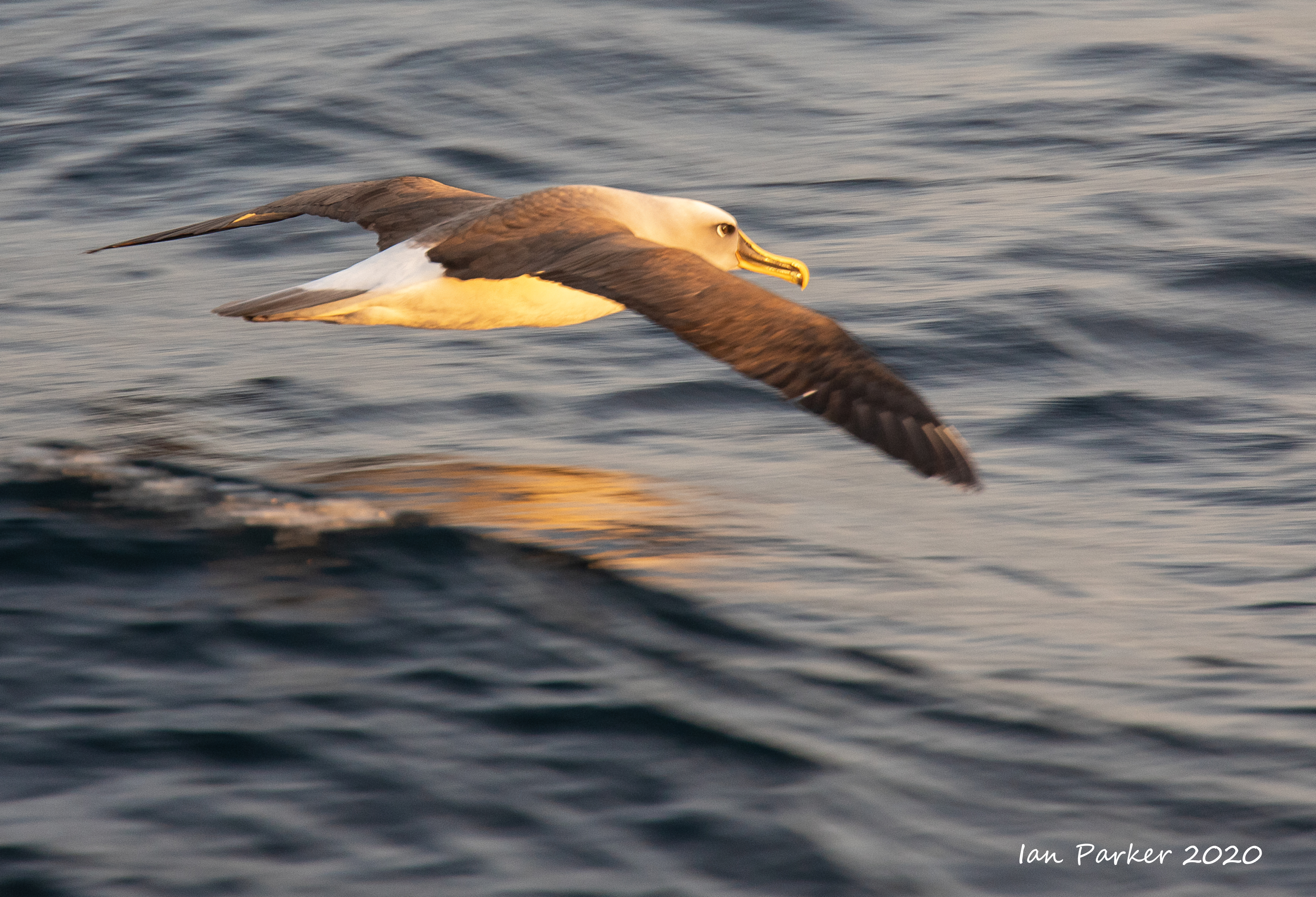
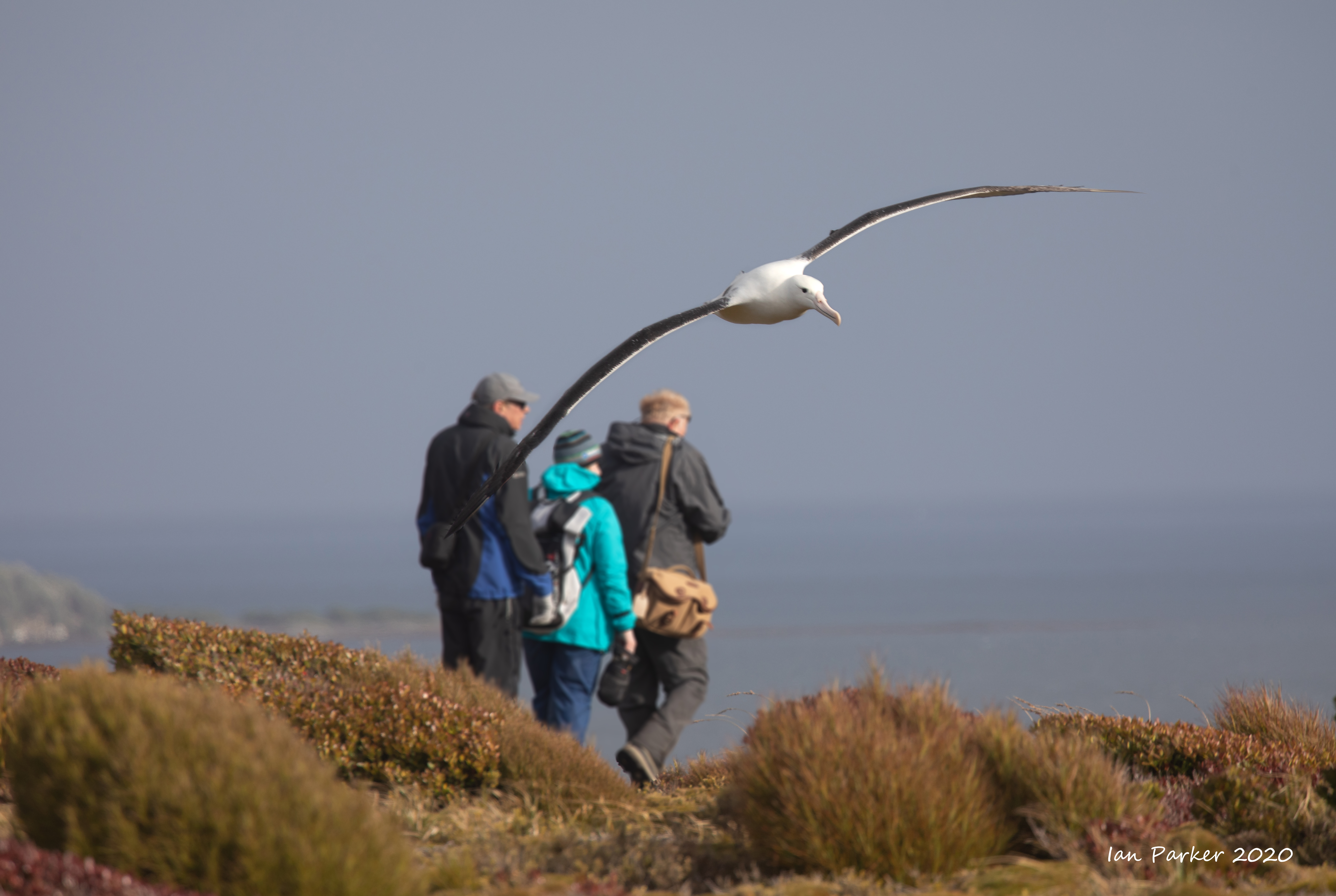
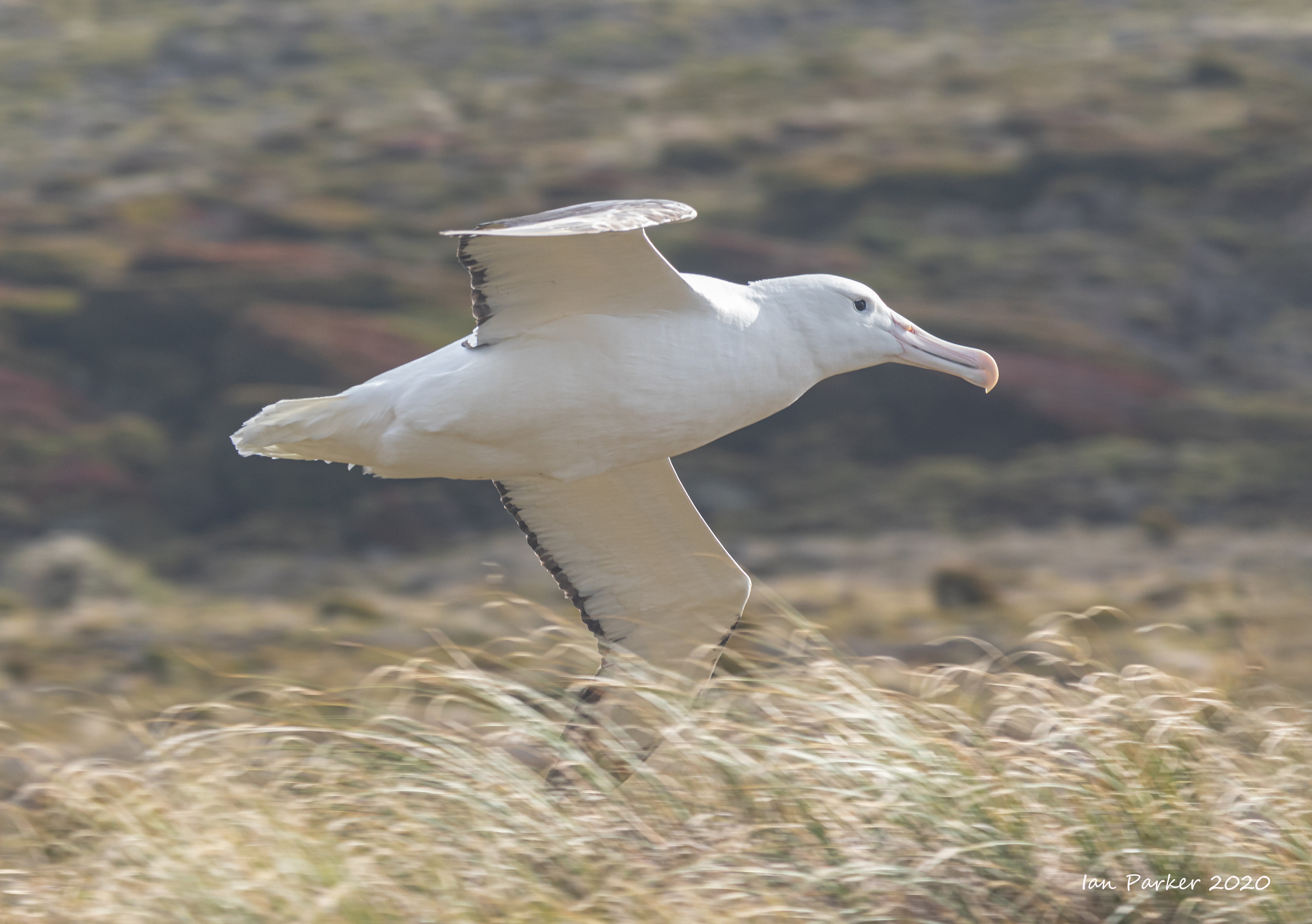
Jan 28- March 8th: A long and wonderful voyage to the remote Ross Sea side of Antarctica, beginning with a week in New Zealand
" It is strange to think that there may be a season in the year when the enterprising tourist steamer may show its passengers the lofty smoke-capped form of Mount Erebus..." [Captain R.F. Scott, Voyage of the Discovery, 1905]
Feb. 8th. We boarded the Spirit of Enderby at Bluff harbour, on the very tip of the Southern Island of New Zealand. Our voyage would take us deep into the Ross Sea - the 'heart of Antarctica' - and for several days we would be on the southernmost ship in the world. The trip was organized by Heritage Expeditions. This is their description of the itinerary, and the reality exceeded our expectations "The Ross Sea region is the last great unspoiled part of the world’s oceans. To date there has only been minimal exploitation, and to enter this region of Antarctica is a privilege, with only a few hundred people able to visit each year. The East Antarctic coastline is some of the most remote in the world and is locked under ice for most of the year. The rest of the time it is buffeted by strong katabatic winds coming off the polar ice cap. Wildlife is abundant during these brief summer months and includes Adélie and Emperor penguins, South Polar Skuas, Snow Petrels, Southern Fulmars and many more species of bird. Both whales and seals abound here at this time and can be found feeding in the rich waters around the ice edge. |
 |
Some links;
Heritage Expeditions TRIP REPORT by David Harrowfield
Heritage Expeditions SPECIES LIST
Heather Wheat's blog describing her experiences on the voyage - http://hwheat8.blogspot.com/
 |
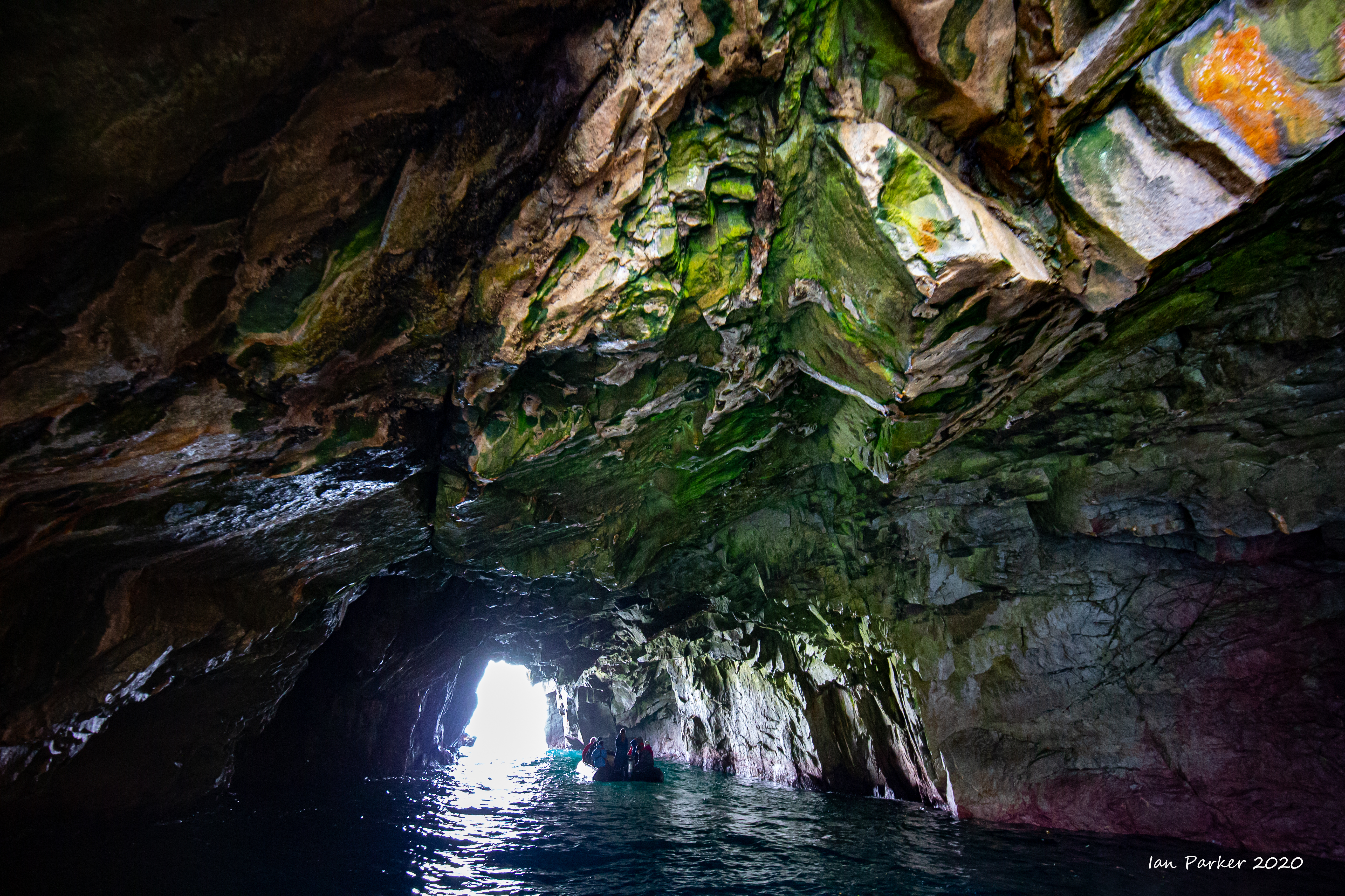
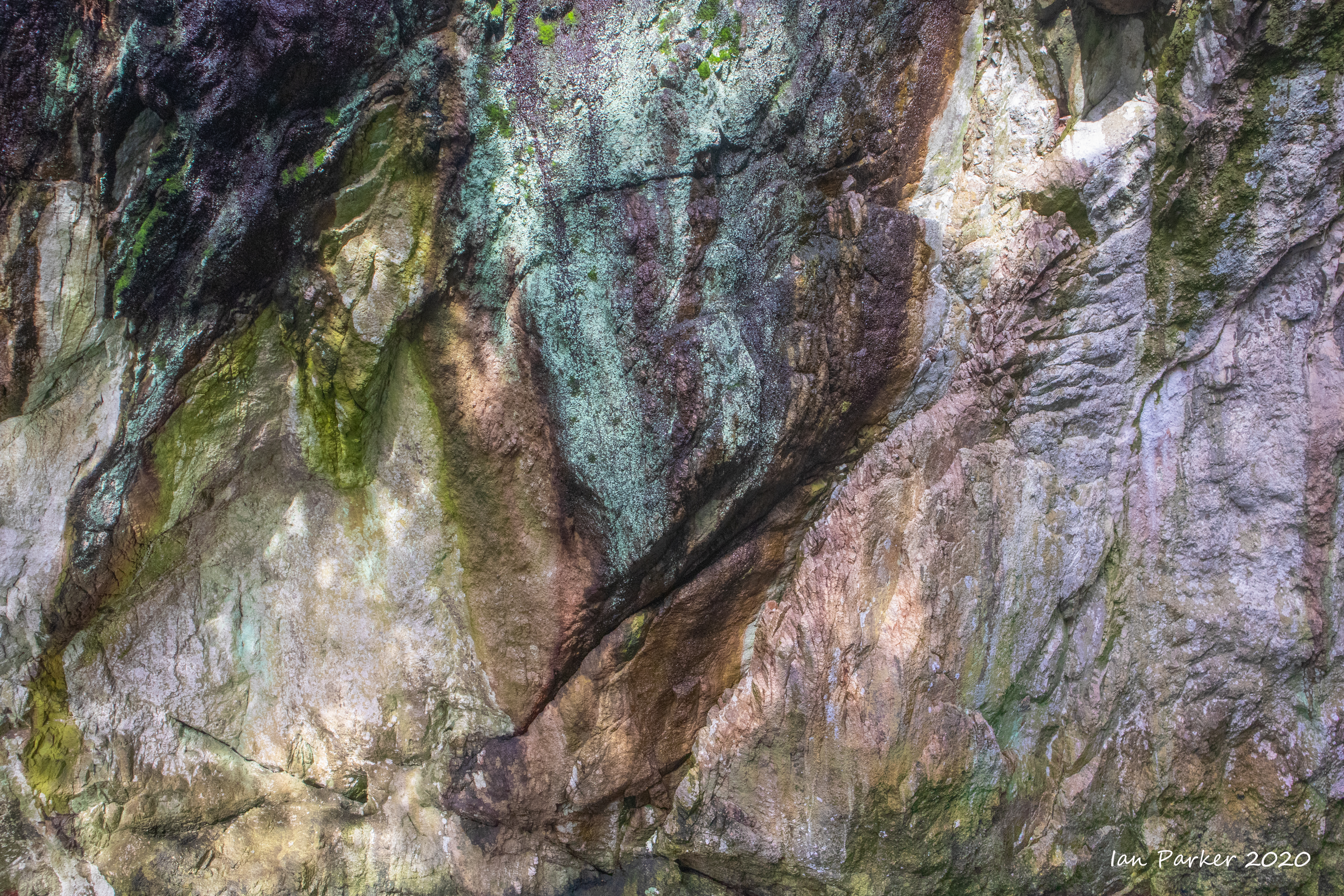
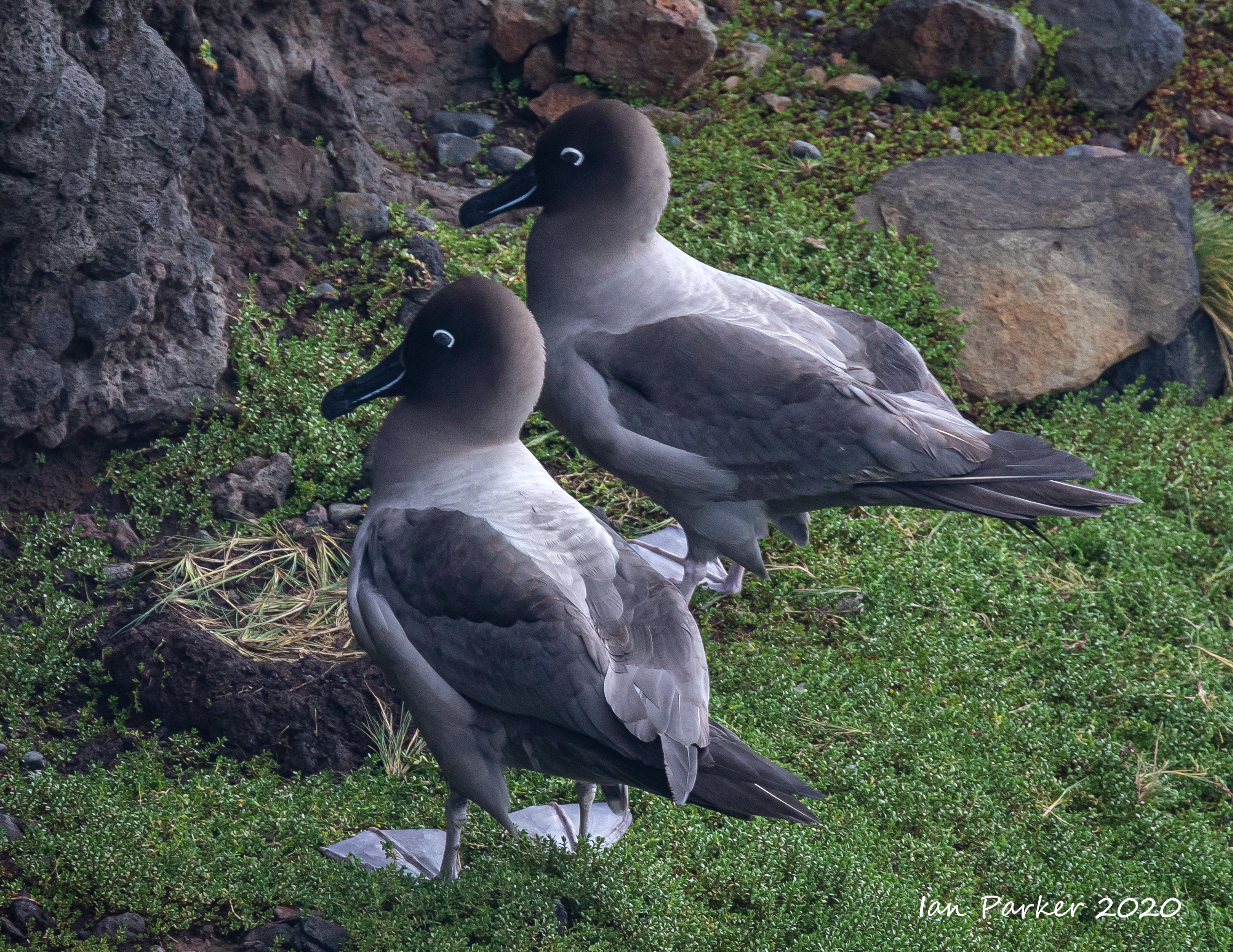
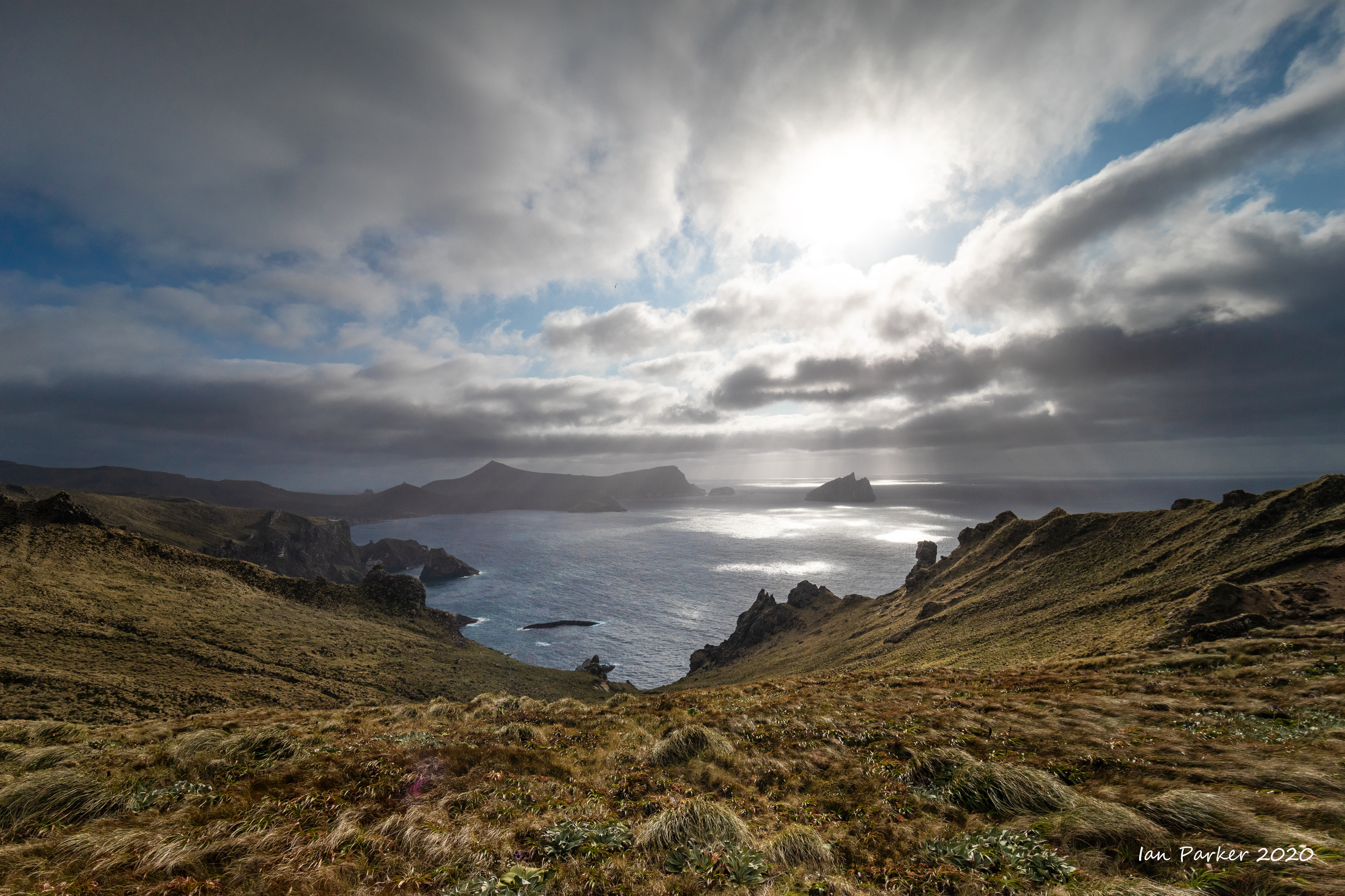
March 6th : Snares Island
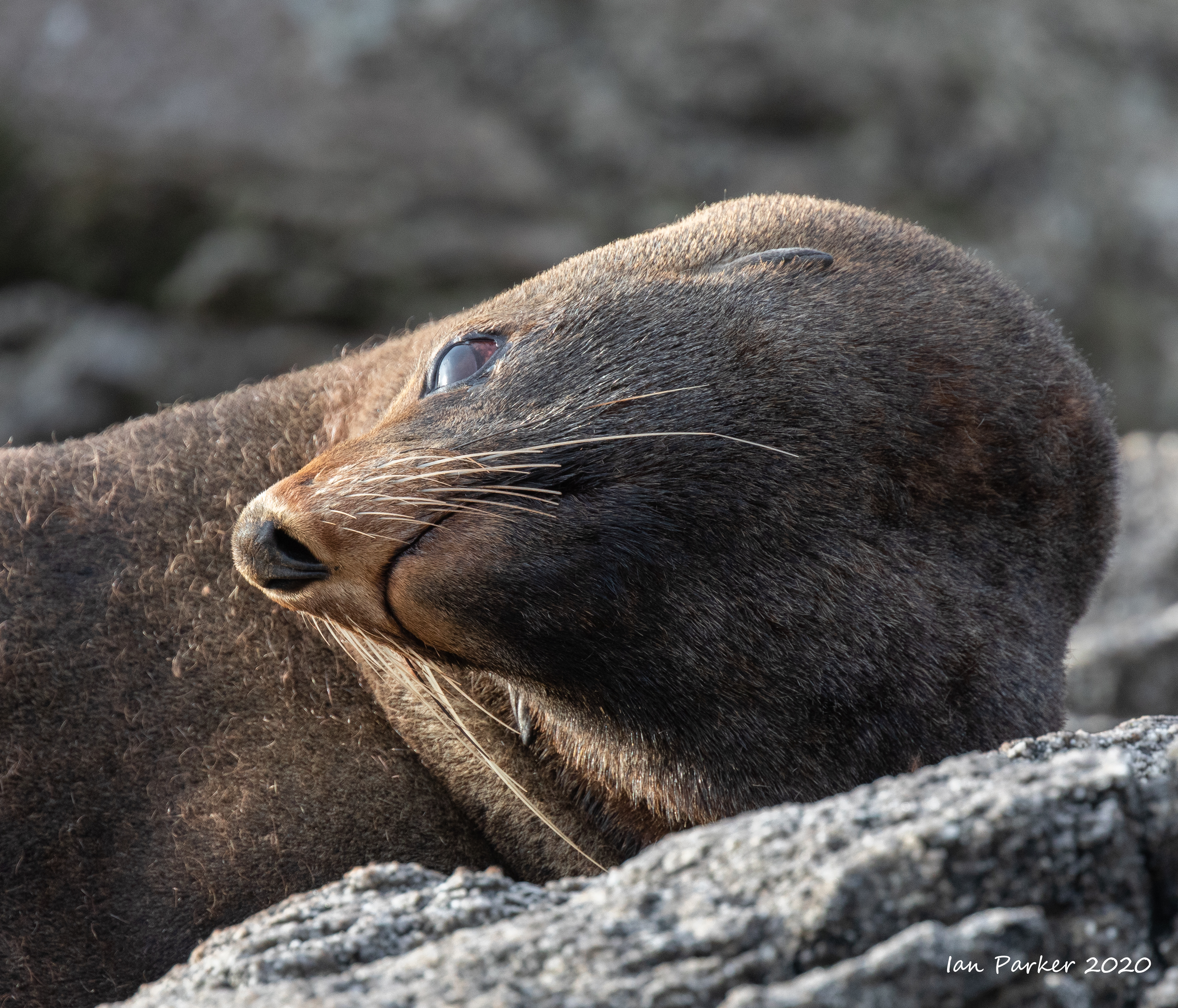
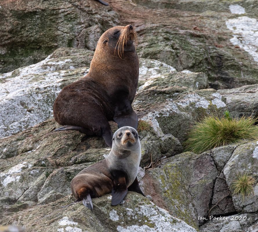
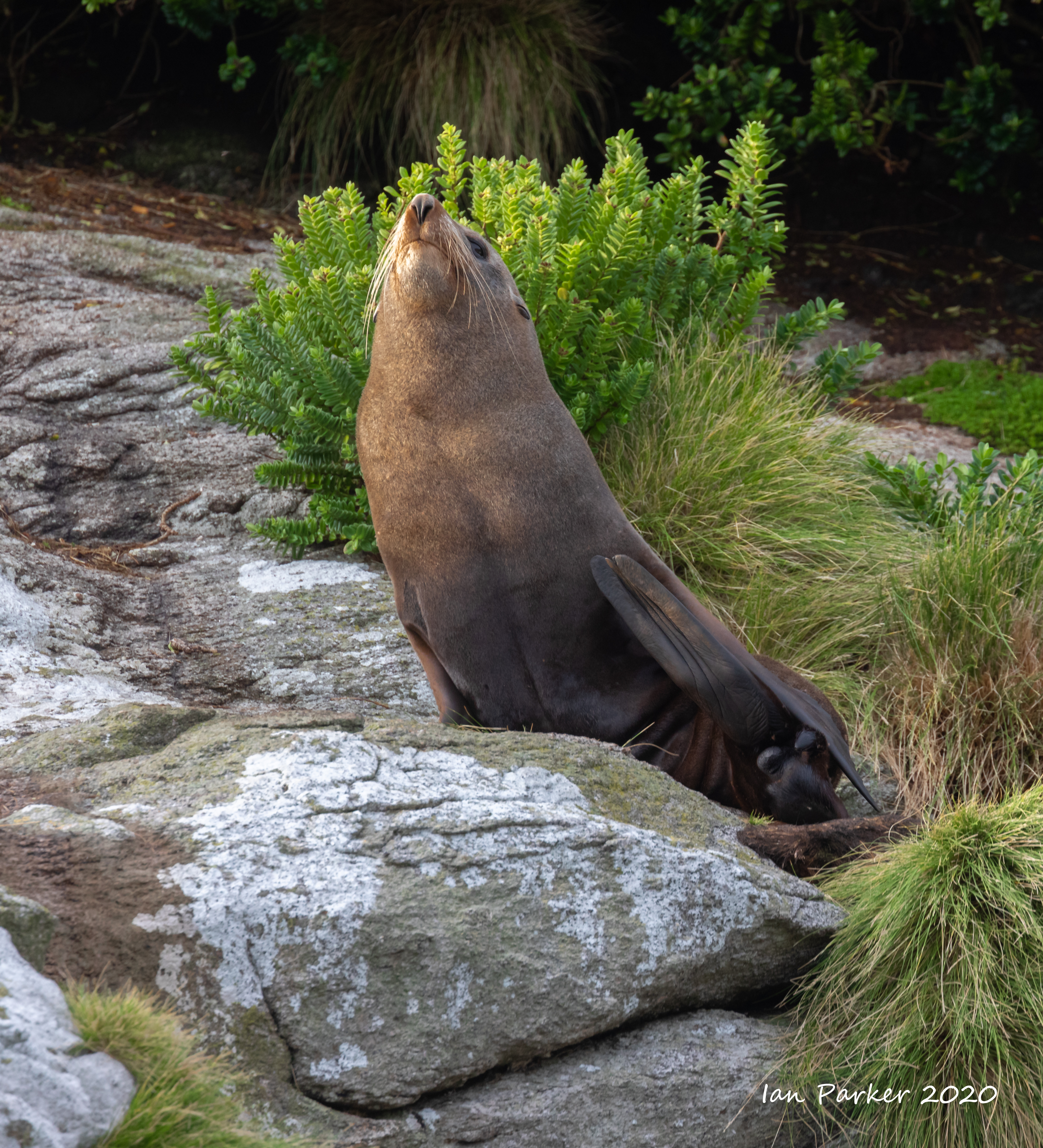
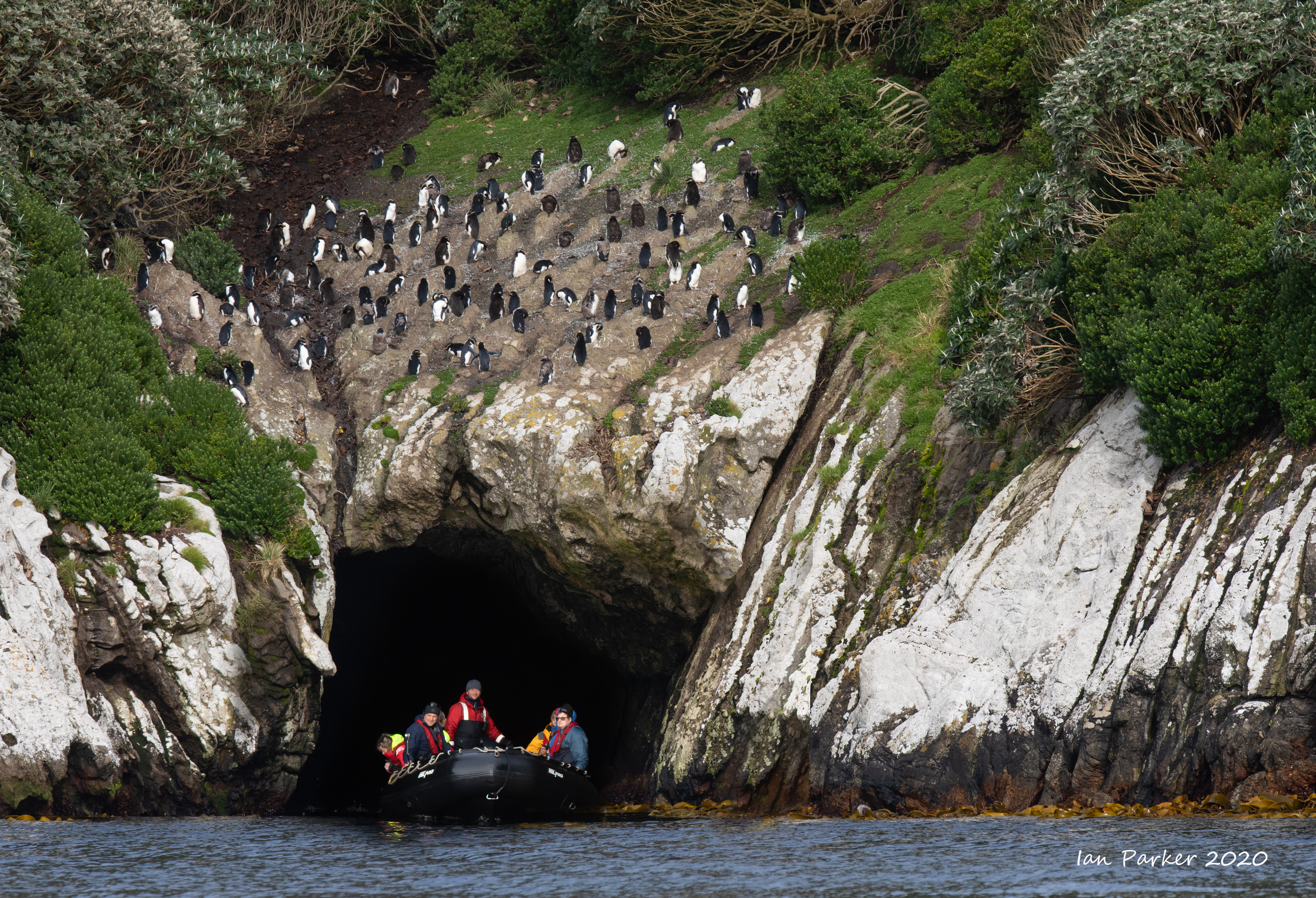
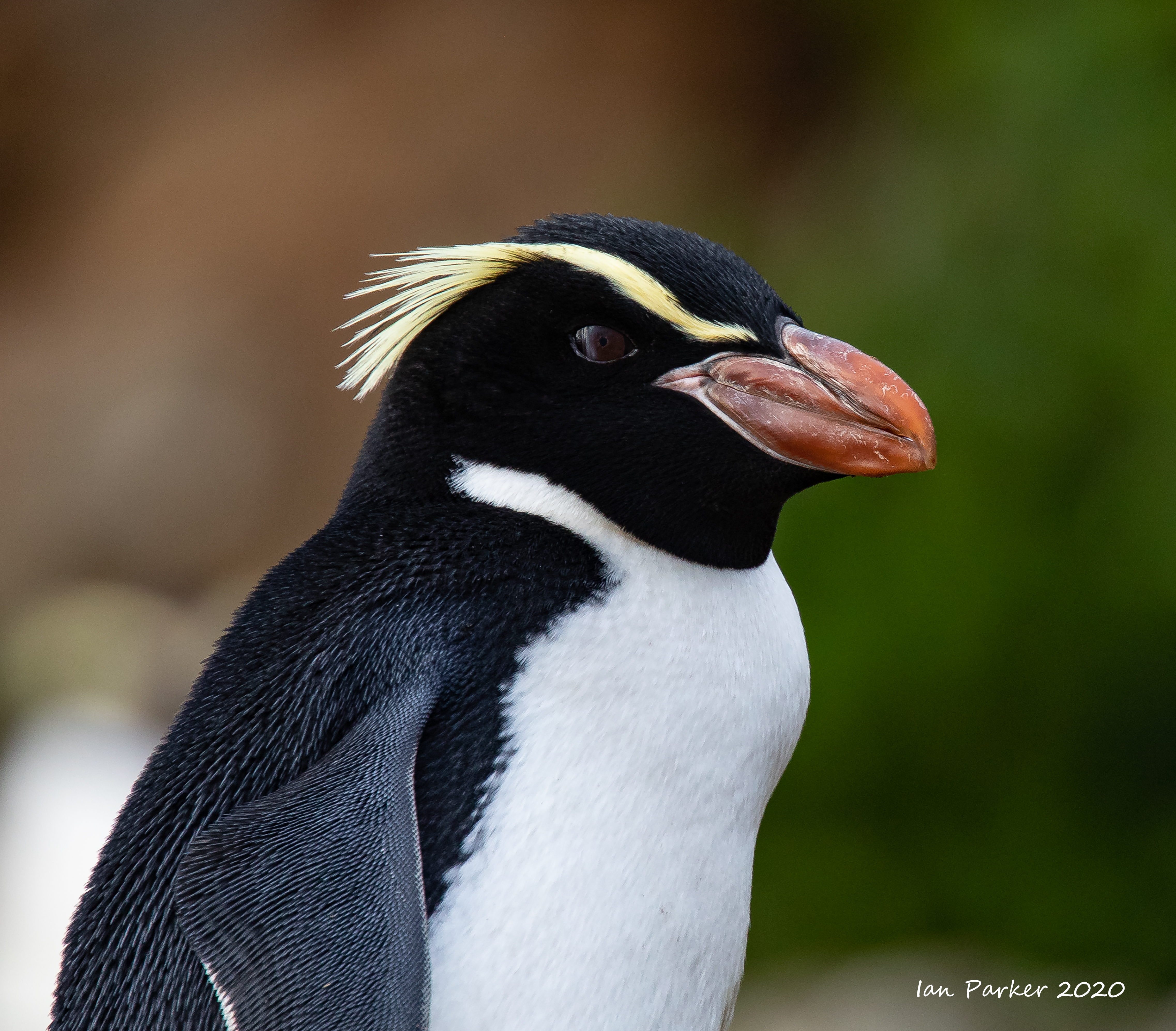
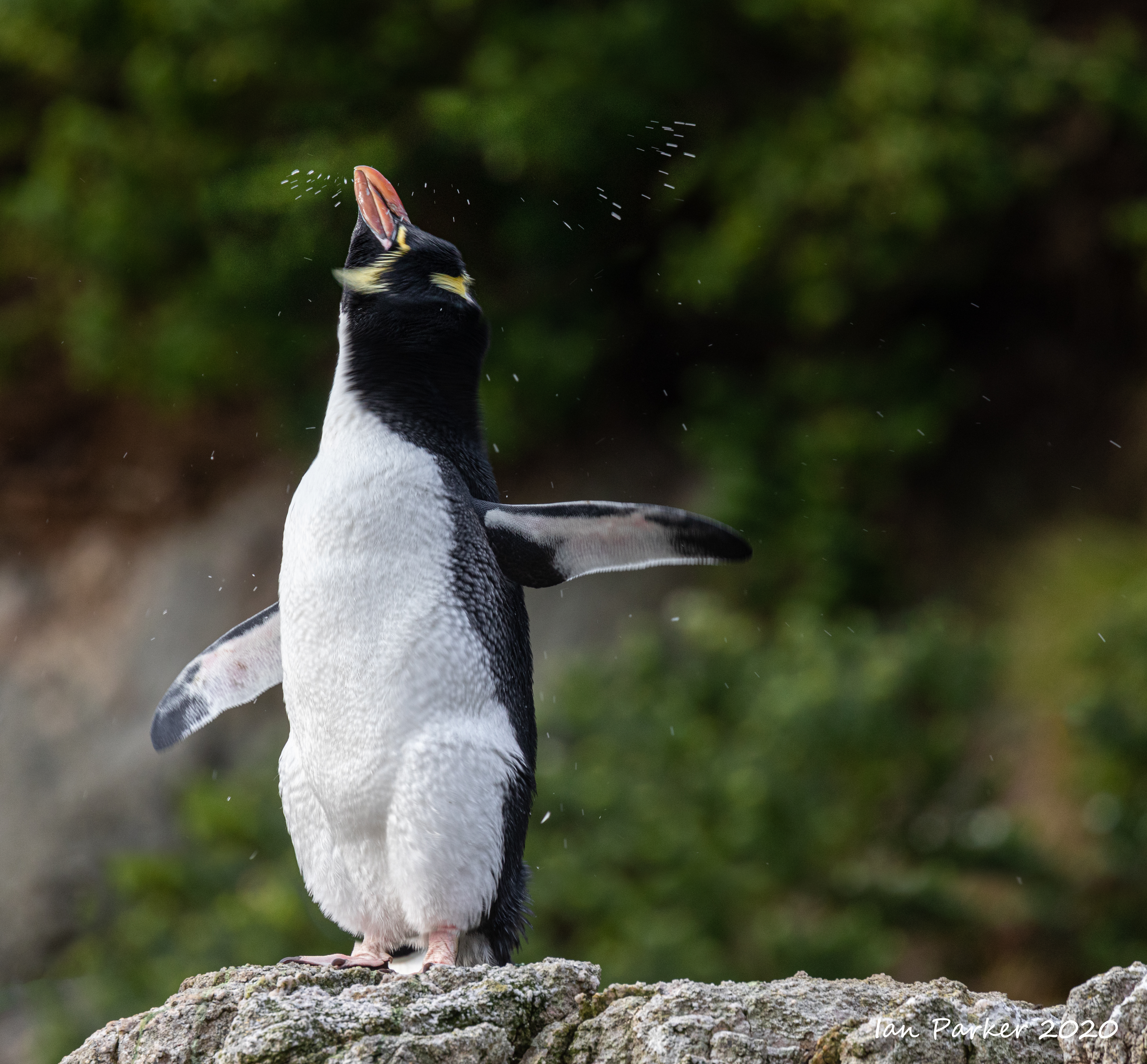
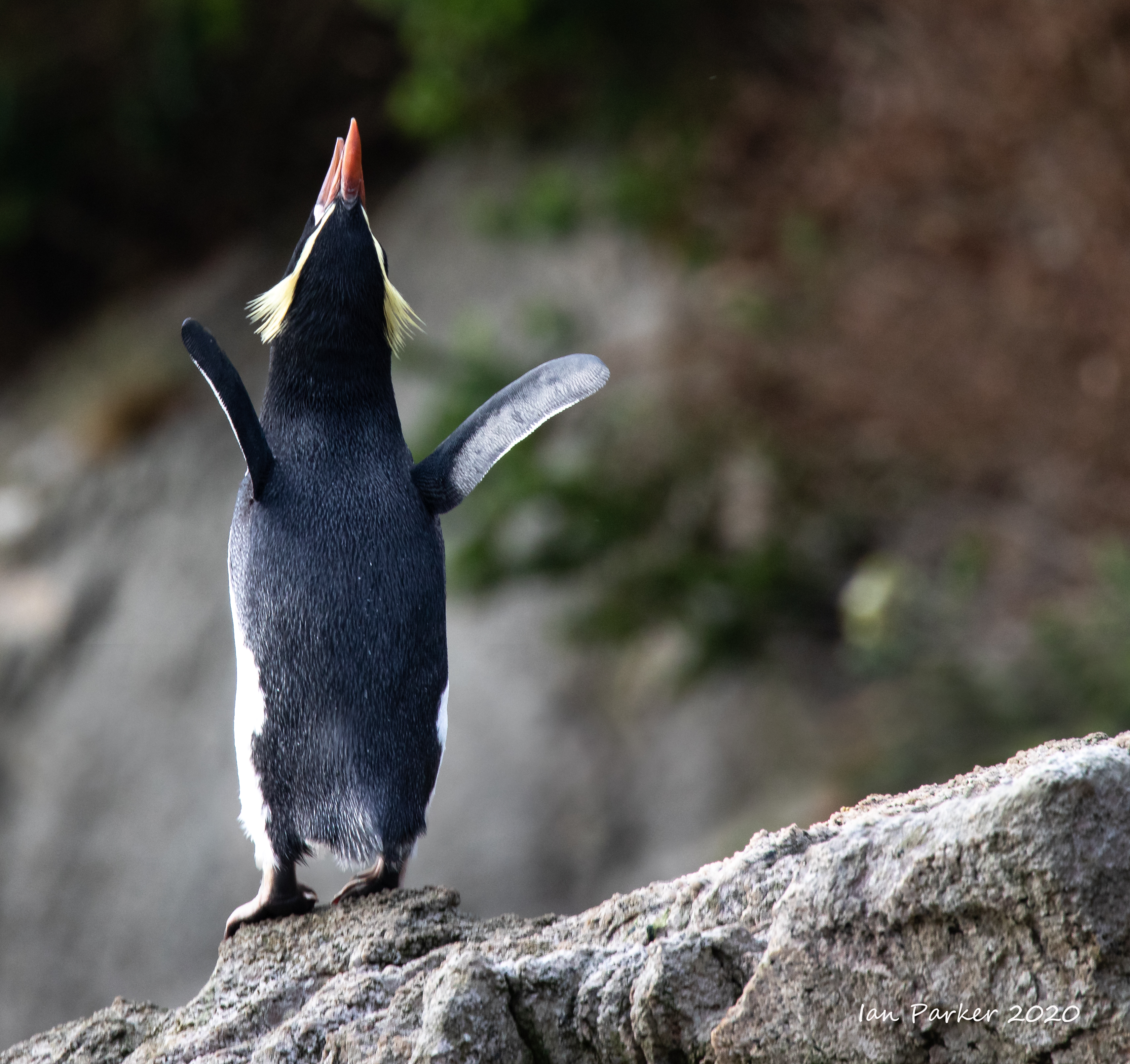
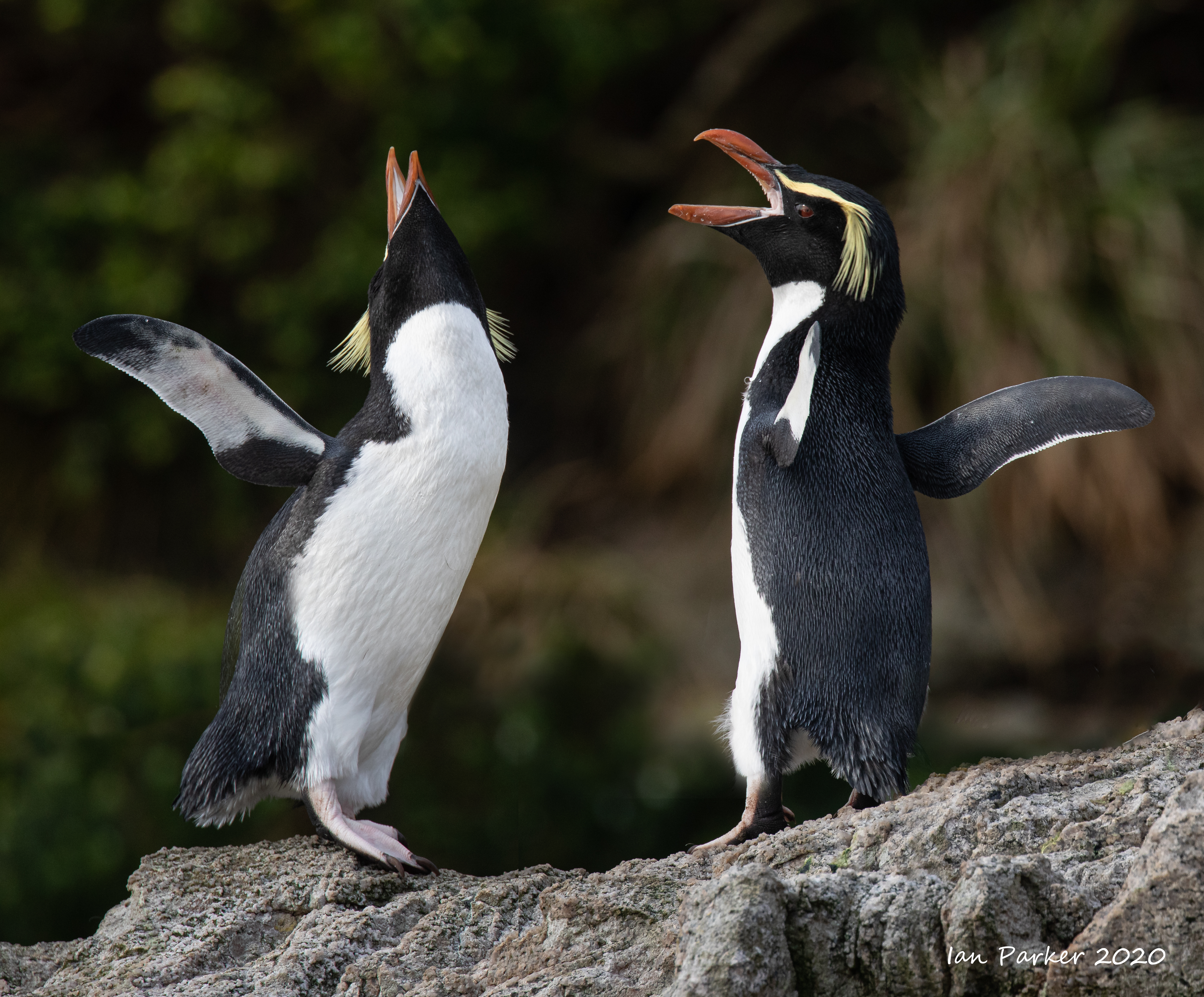
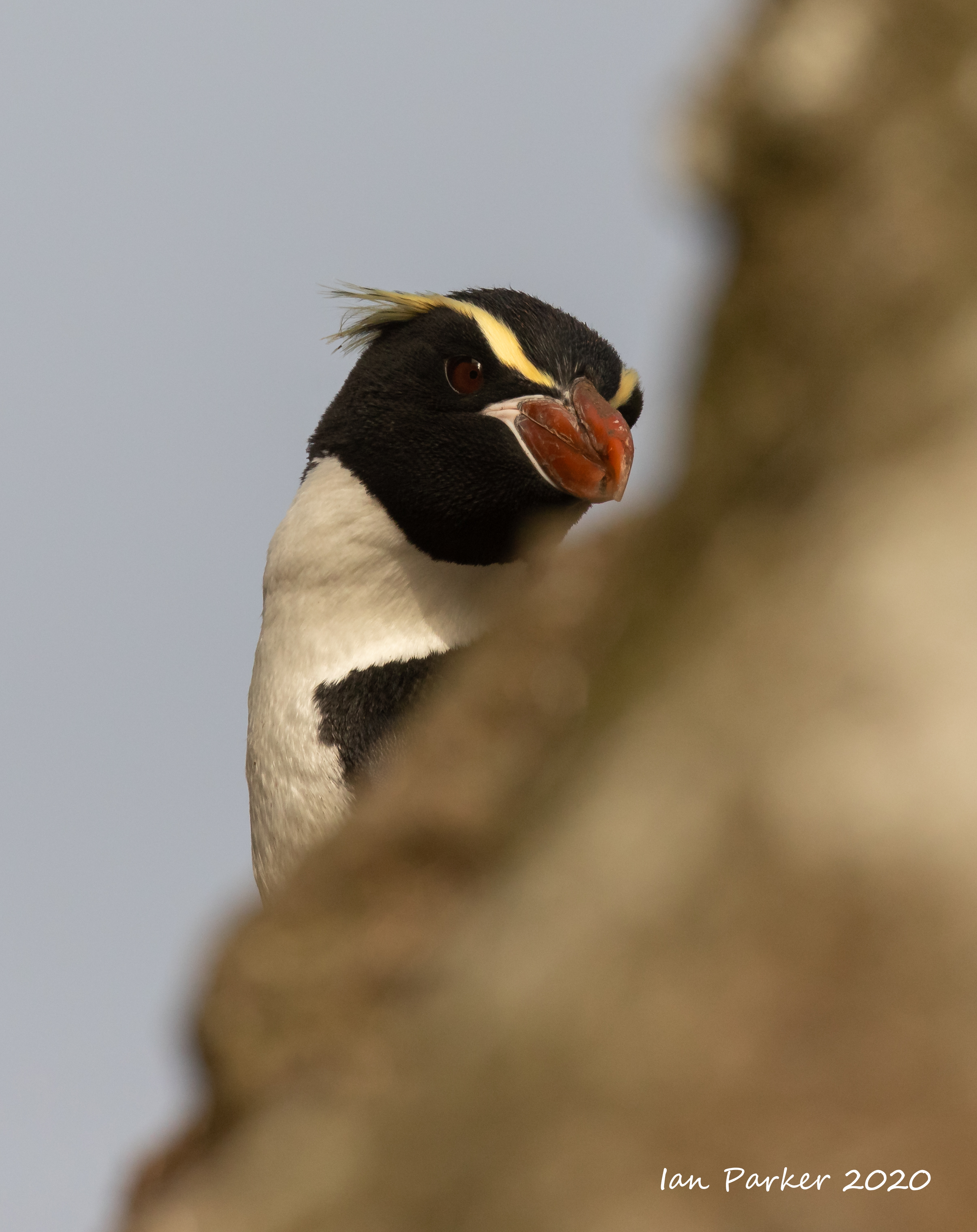
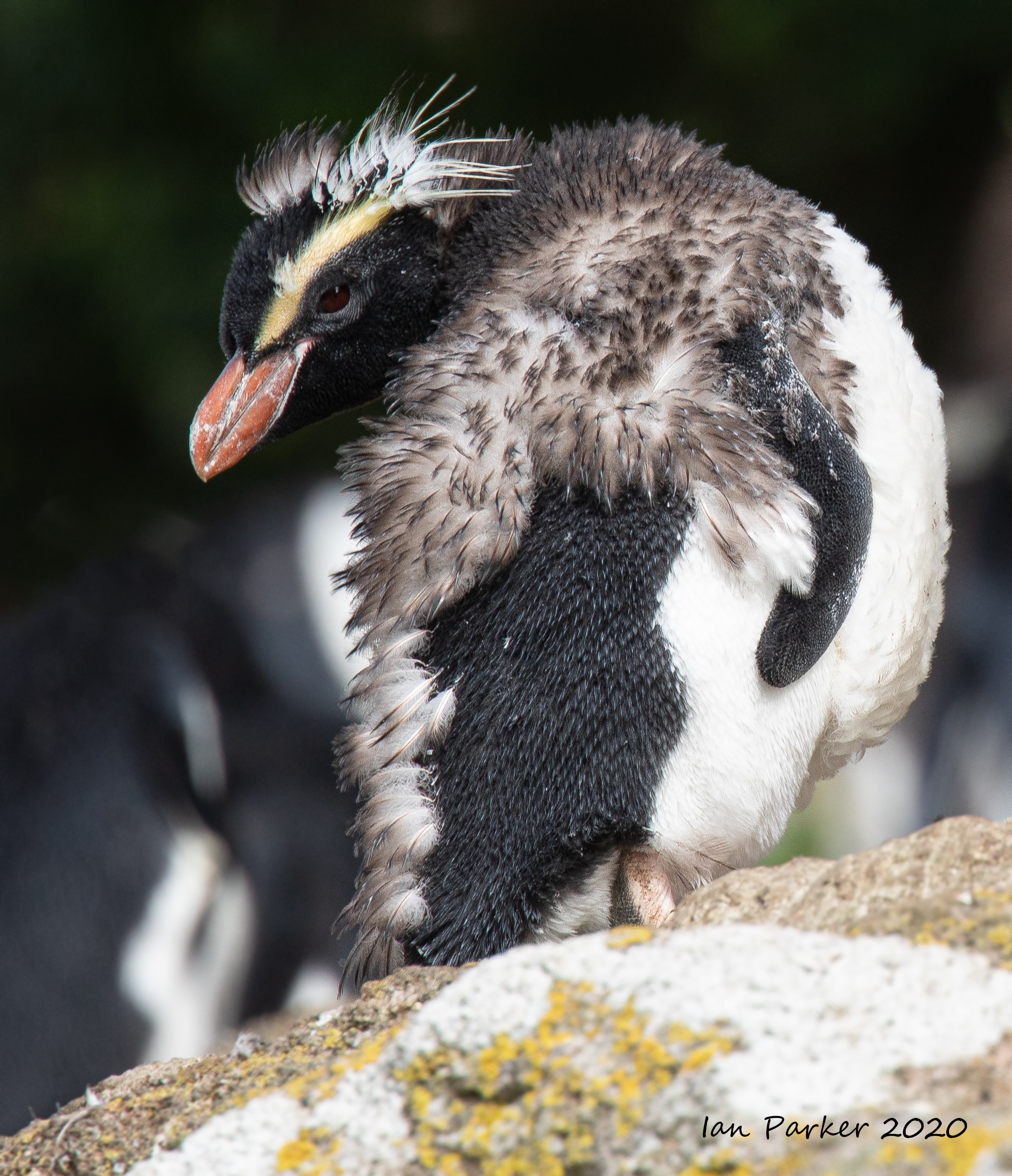
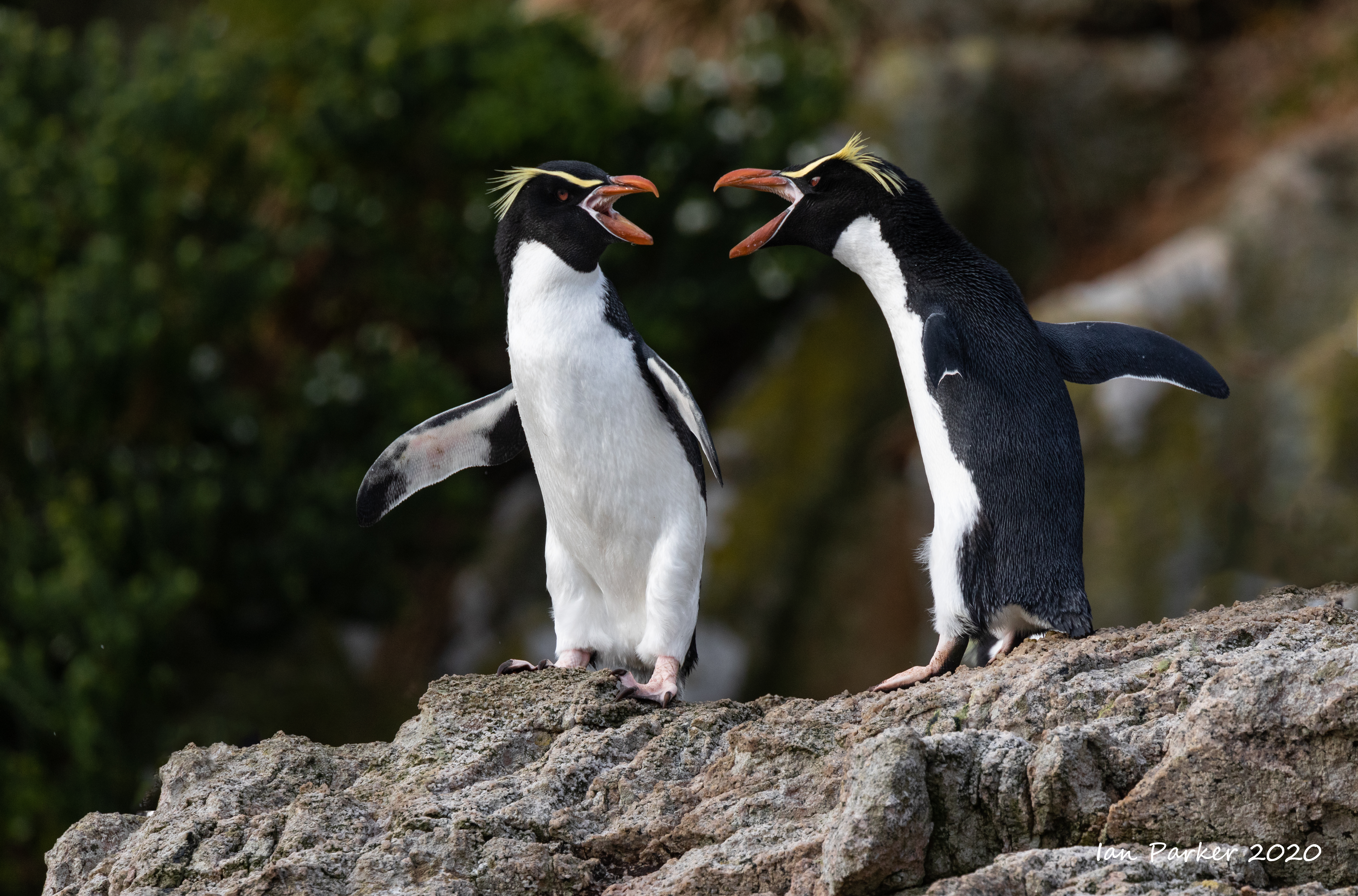
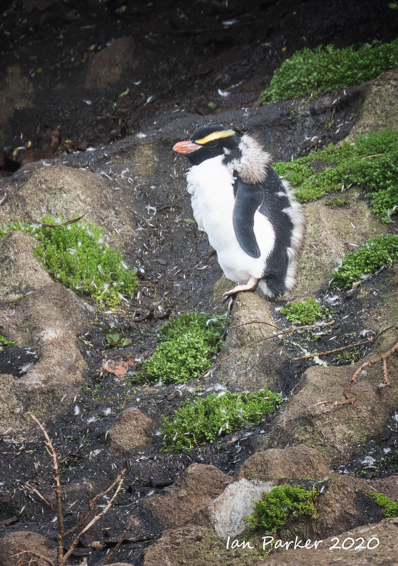
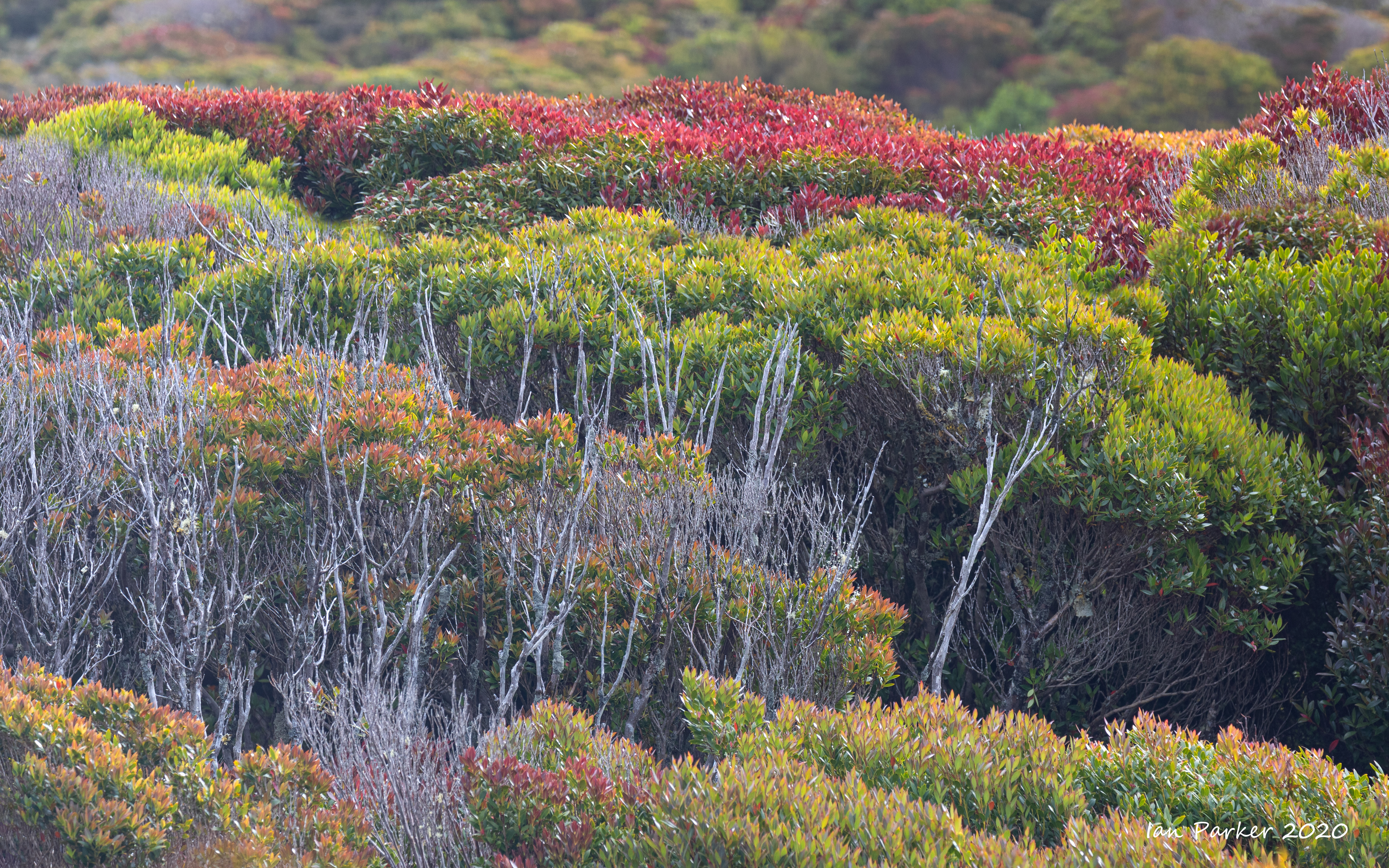
Snares islands lie 105 km south-southwest of Stewart Island, and were originally named simply ‘The Snares’ by Captain George Vancouver when he discovered them in November 1791. Vancouver considered the islands to be a hazard to shipping, hence the sinister name. The two main islands are covered with tree-daisy forest and tussock grassland. As the islands have never had introduced mammals establish, the wildlife is both abundant and approachable. Perhaps the most well-known bird species on the islands is the Snares crested penguin. As its name suggests, it breeds only within the Snares Islands, where it breeds on the two main islands (North East Island and Broughton Island), plus on two islets of the Western Chain, 5 km to the south-west. |
 |


Birds of the Snares Islands - blog by Colin Miskelly


 Erect-crested penguin: Snares Island Not a good photo, and a bedragled, moulting specimen - but our first encounter with this species of penguin. I think it will have to do to add to our lifetime penguin species list, as erect-crested penguins breed only on the Bounty and Antipodesislands which are difficult and expensive to visit. |
March 5th : Auckland Island, Musgrave Inlet


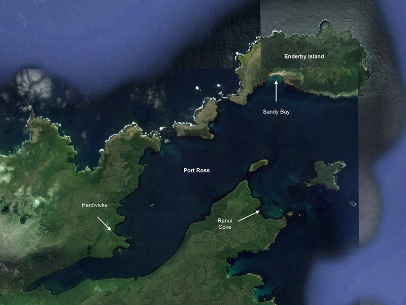
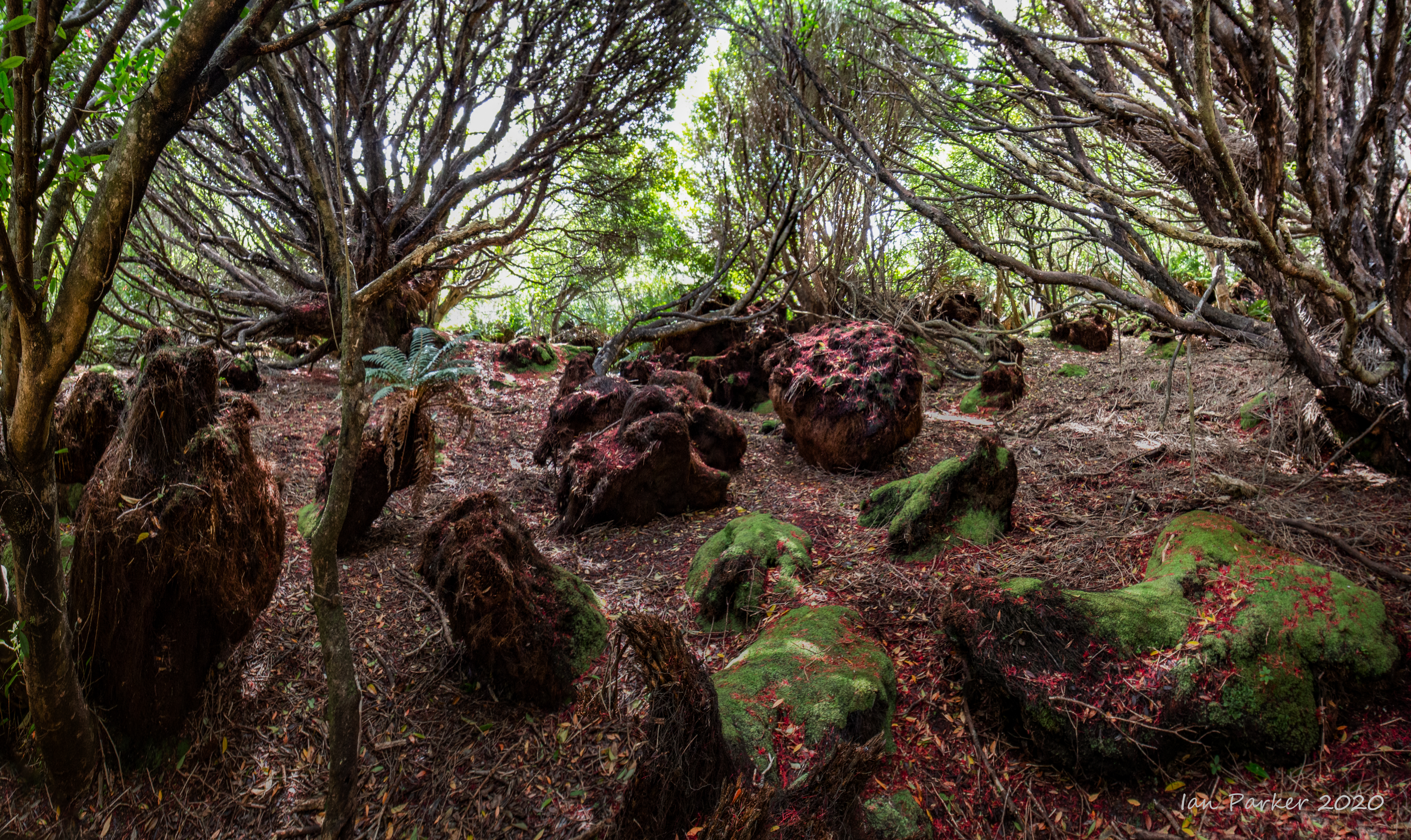
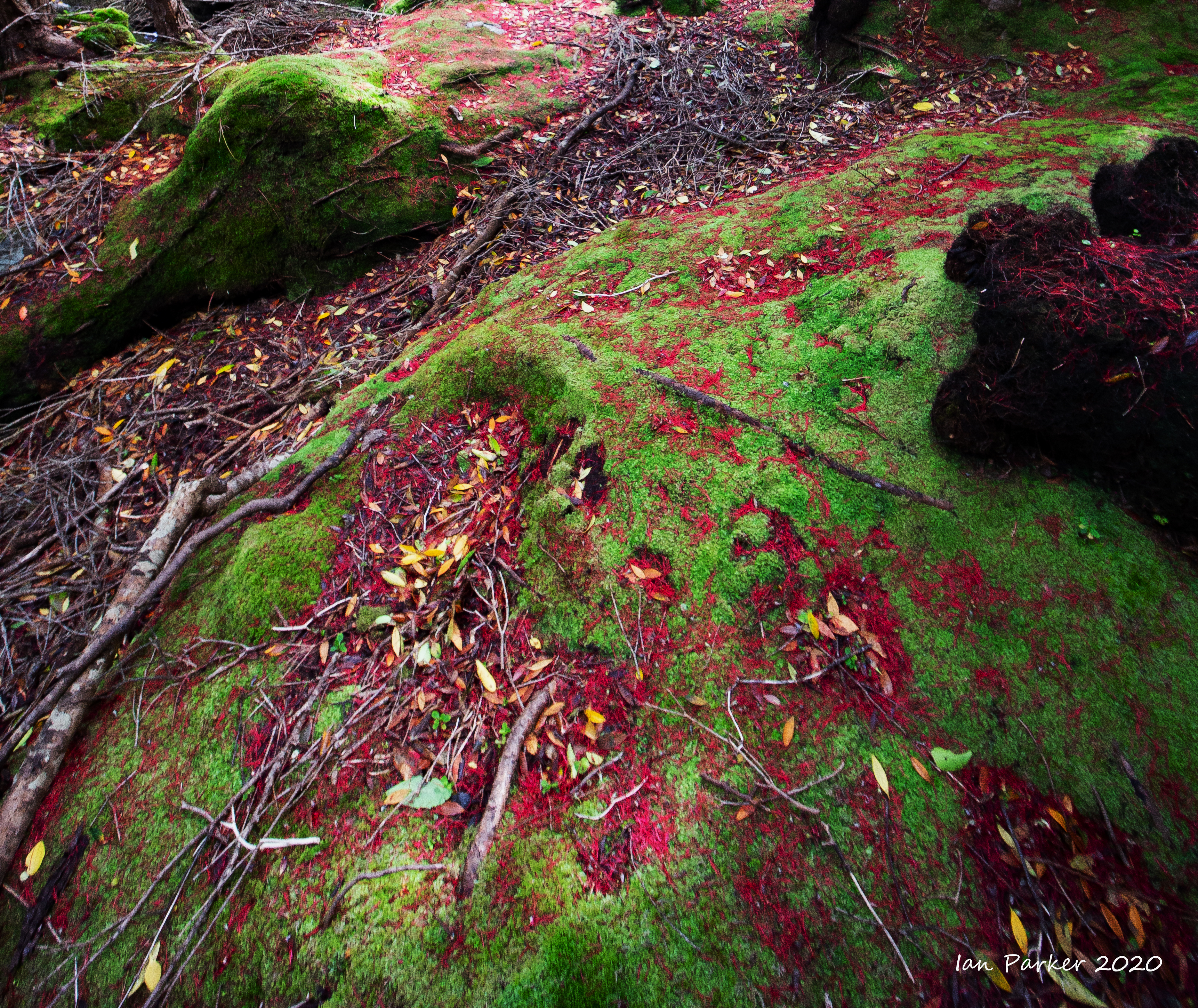
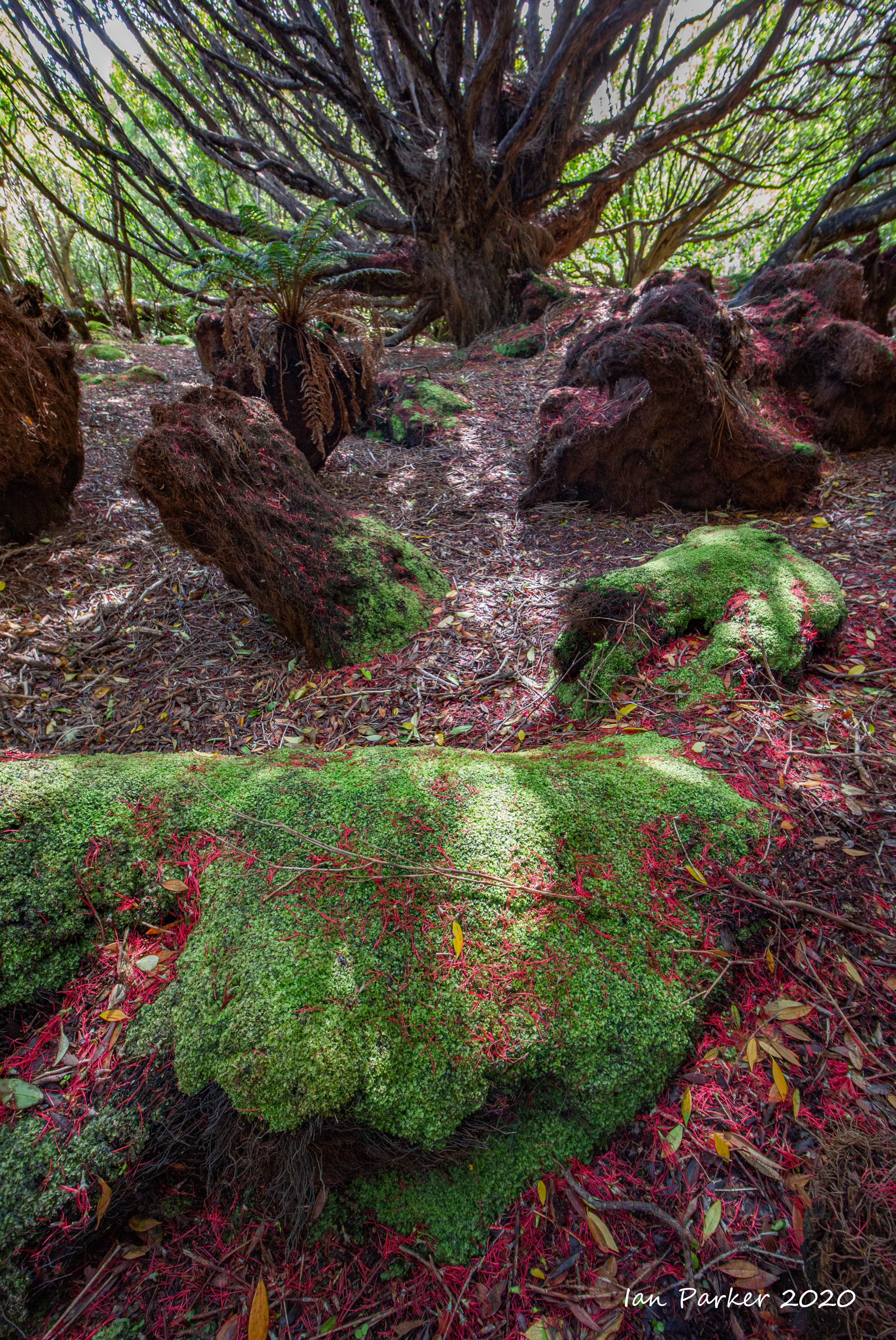
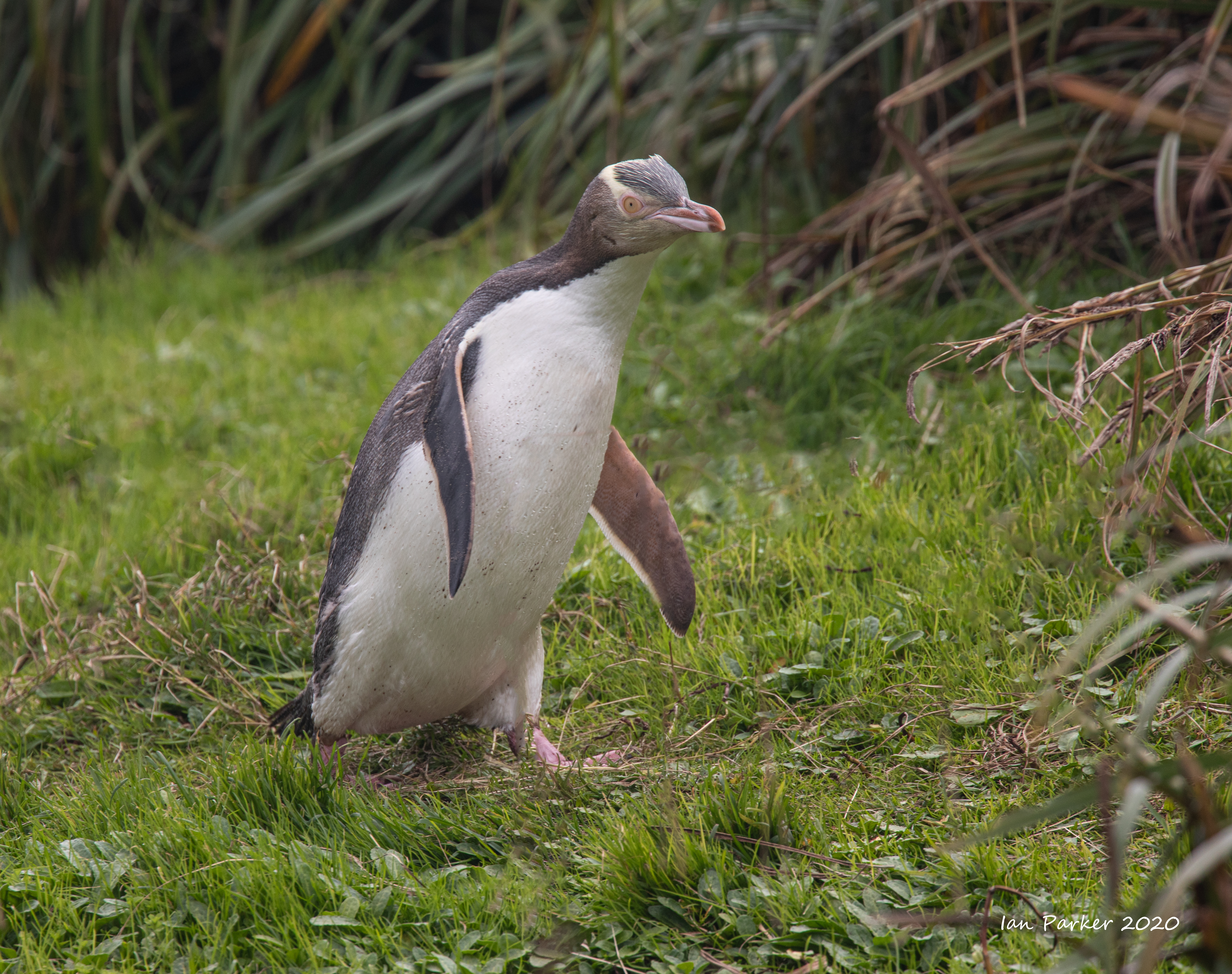
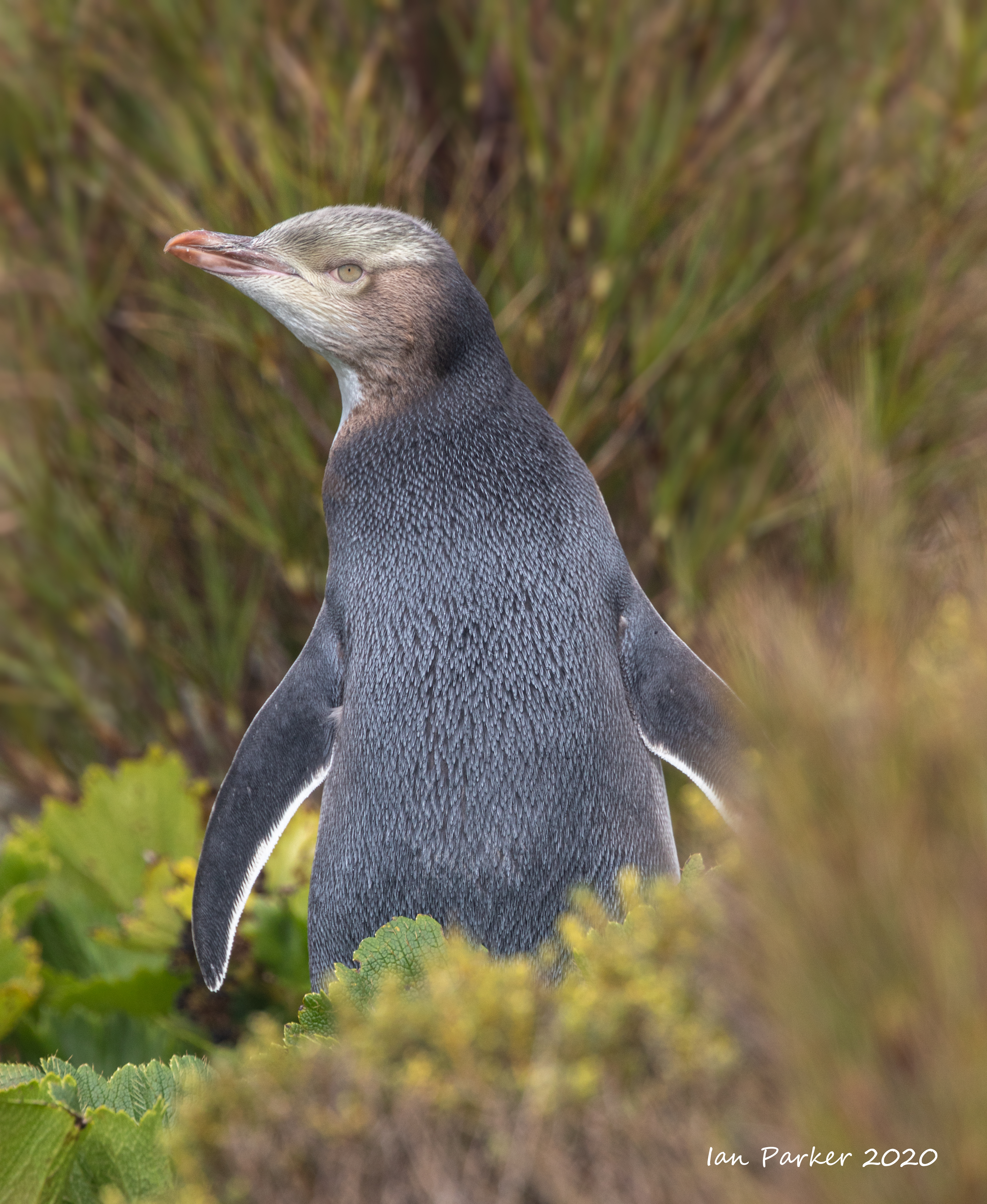
March 4th : Enderby Island, Auckland Islands
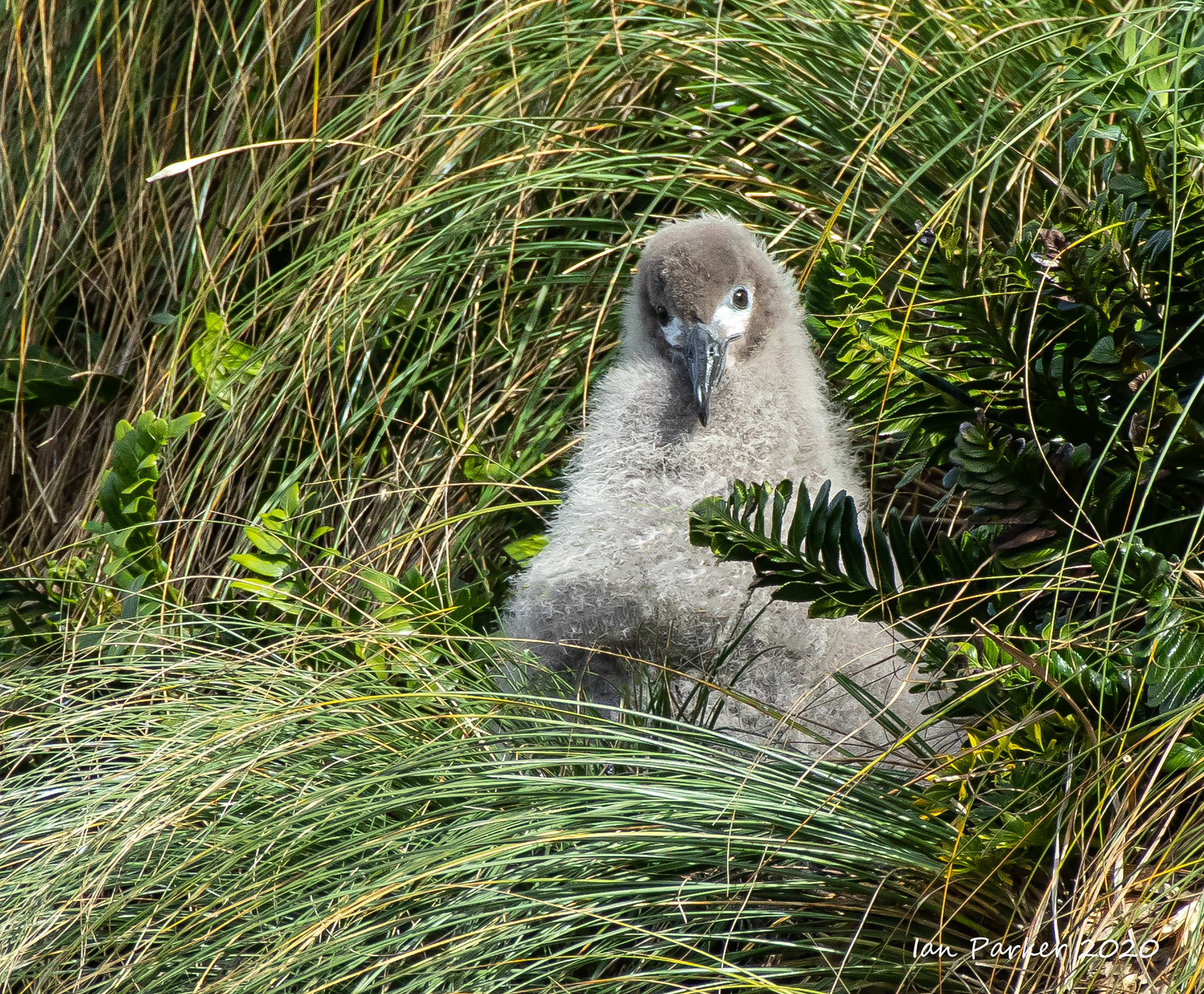
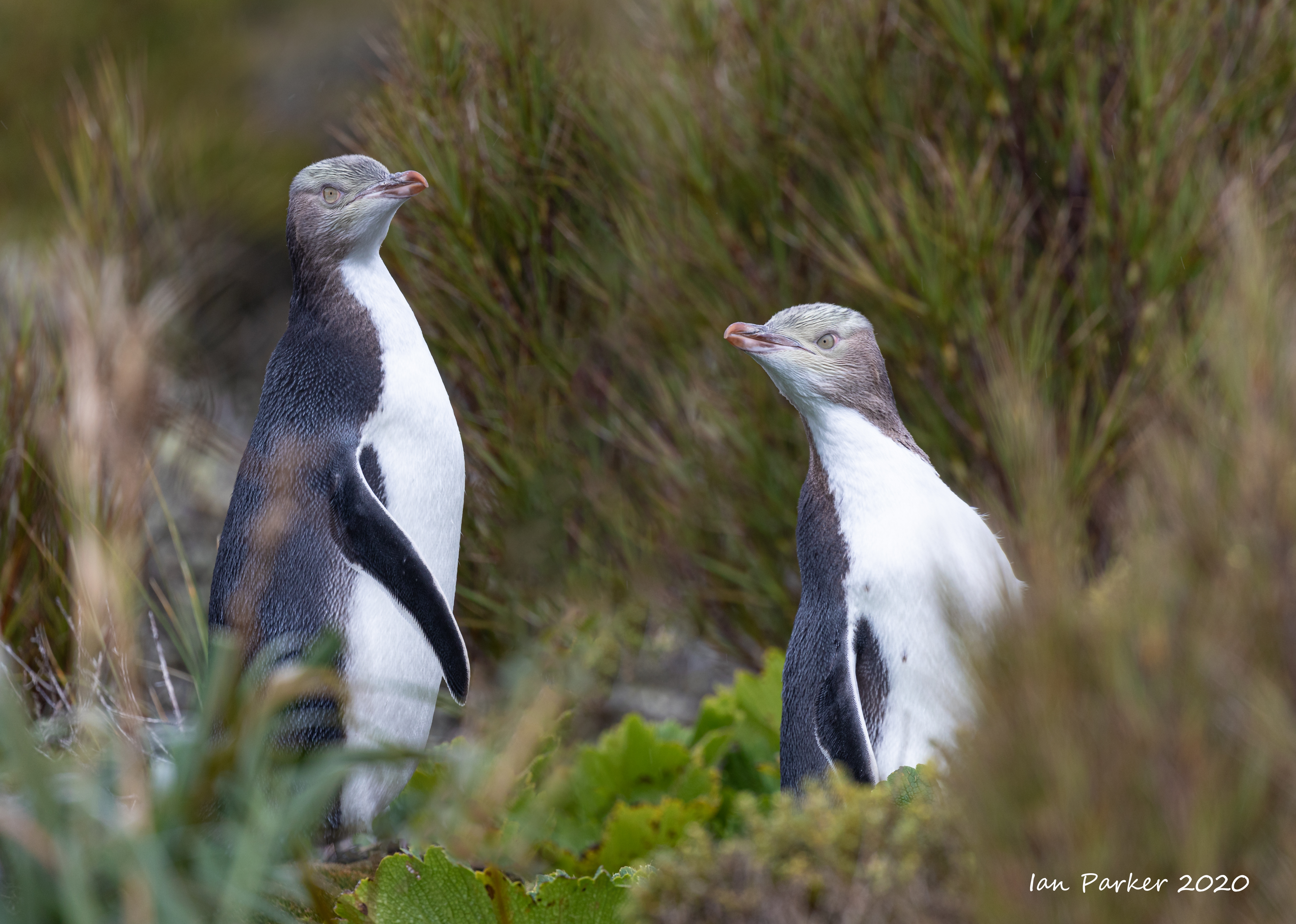
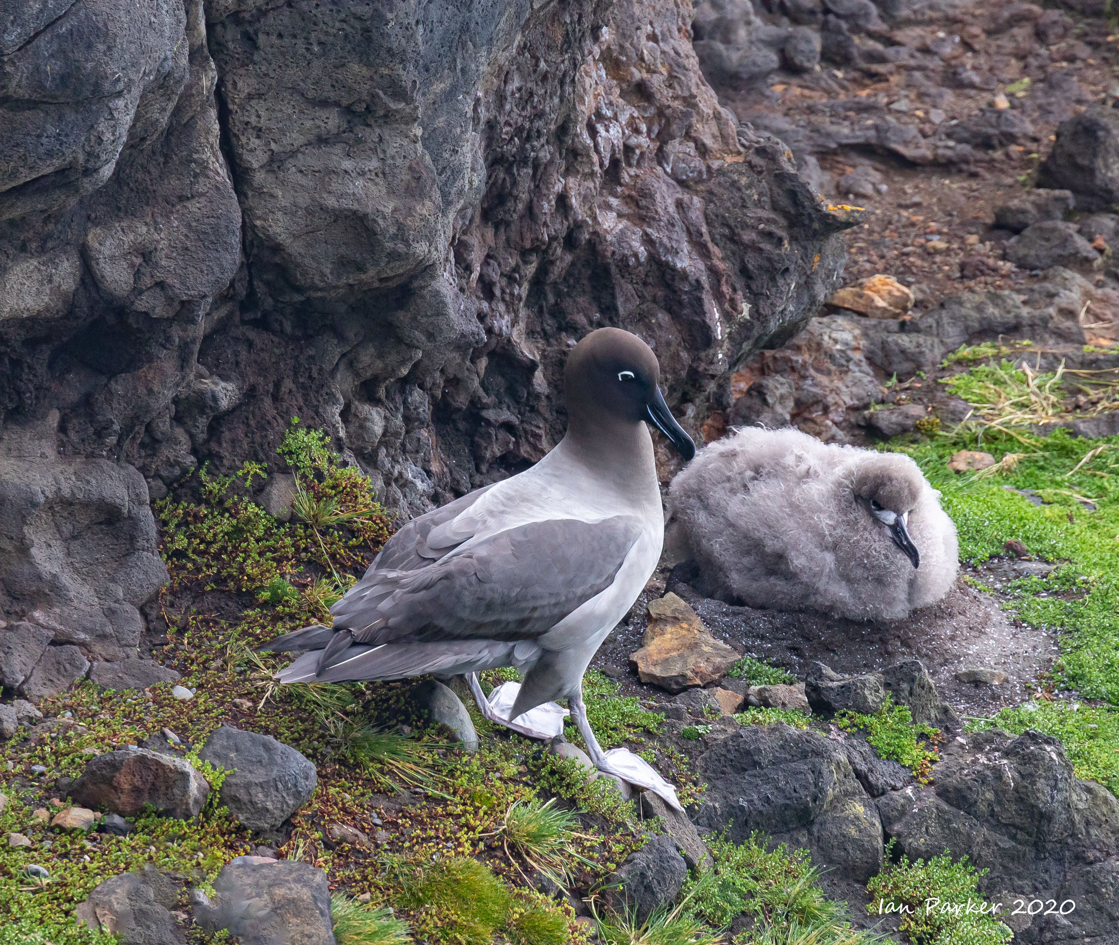
Beginning with a landing at Erebus Cove, Port Ross, we enjoyed exploring the historic cemetery then walking through beautiful Rata forest to view the Victoria Tree. This very old Southern Rata trunk has remnants of an inscription made during the search for castaways. The Spirit of Enderby then relocated to Ranui Cove. Here many of us visited the WWII lookout with its views and inspected the main building of the Ranui 1 Coastwatchers for the Cape Expedition 1942-45. As we left, Bellbirds treated us to a superb morning chorus. In the afternoon, we had a landing and walk across Enderby Island and were rewarded with excellent viewings of Yellow-eyed Penguins/Hoiho, Southern Royal and Light-mantled Sooty Albatrosses |
 |
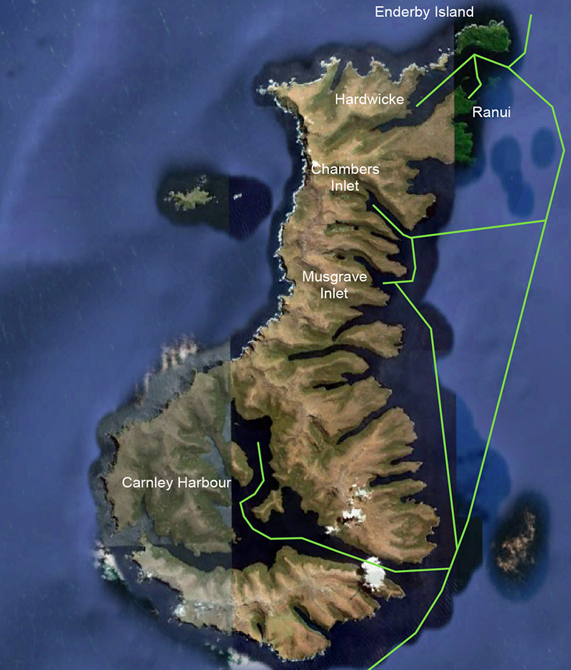 |


 Beach colors: Enderby Island, Auckland Islands |


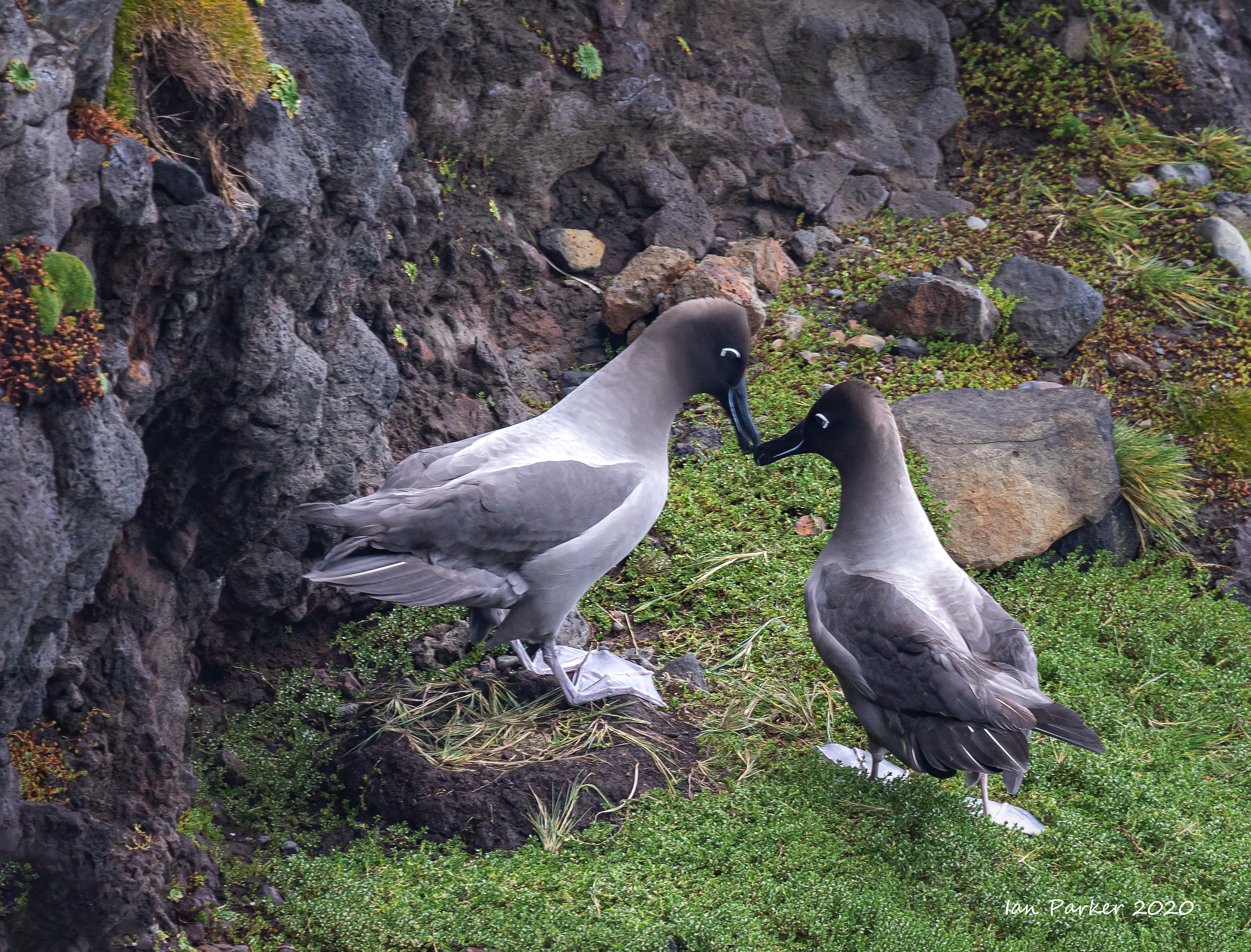
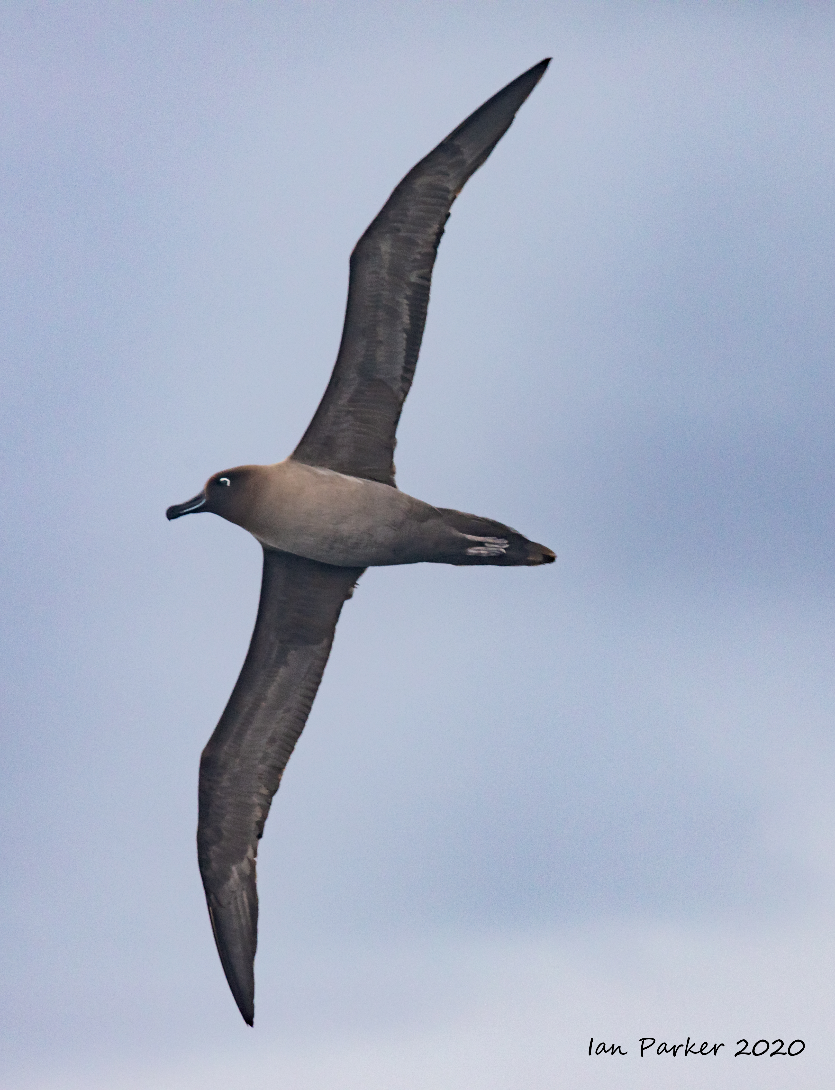
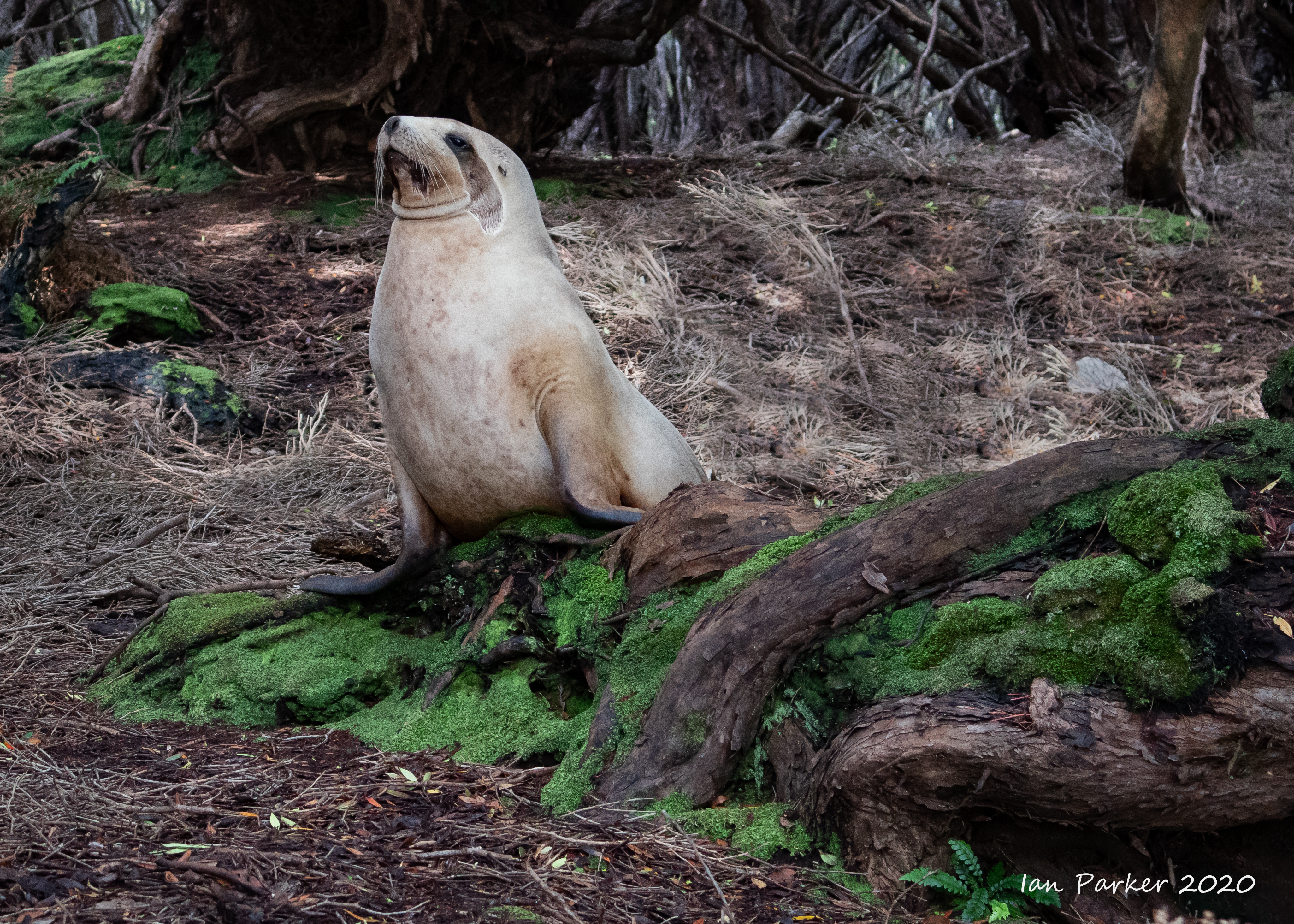

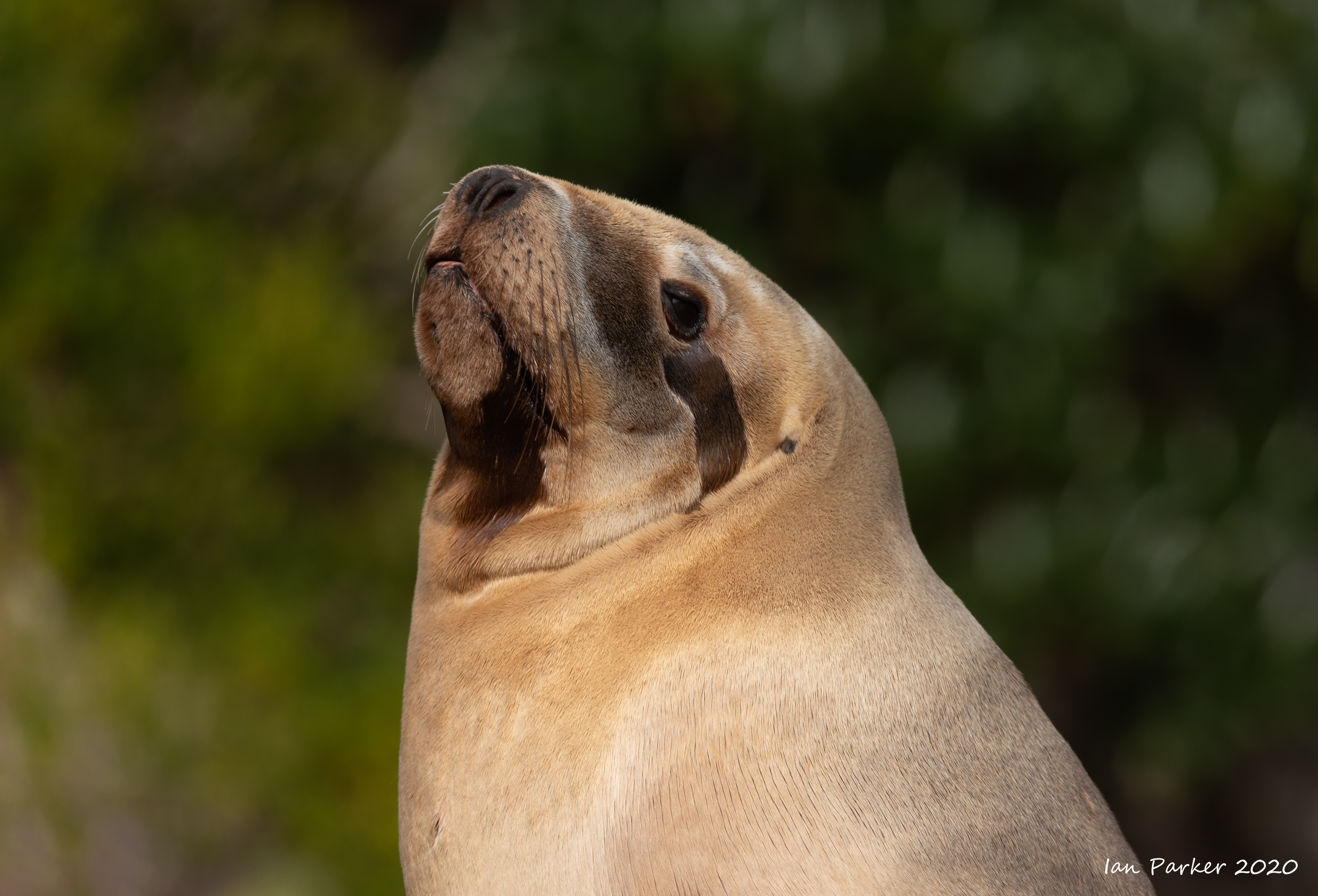
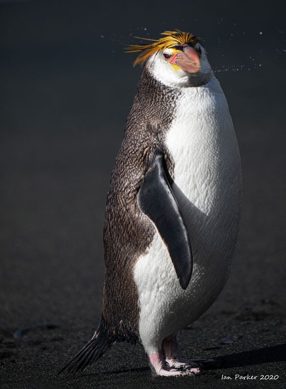
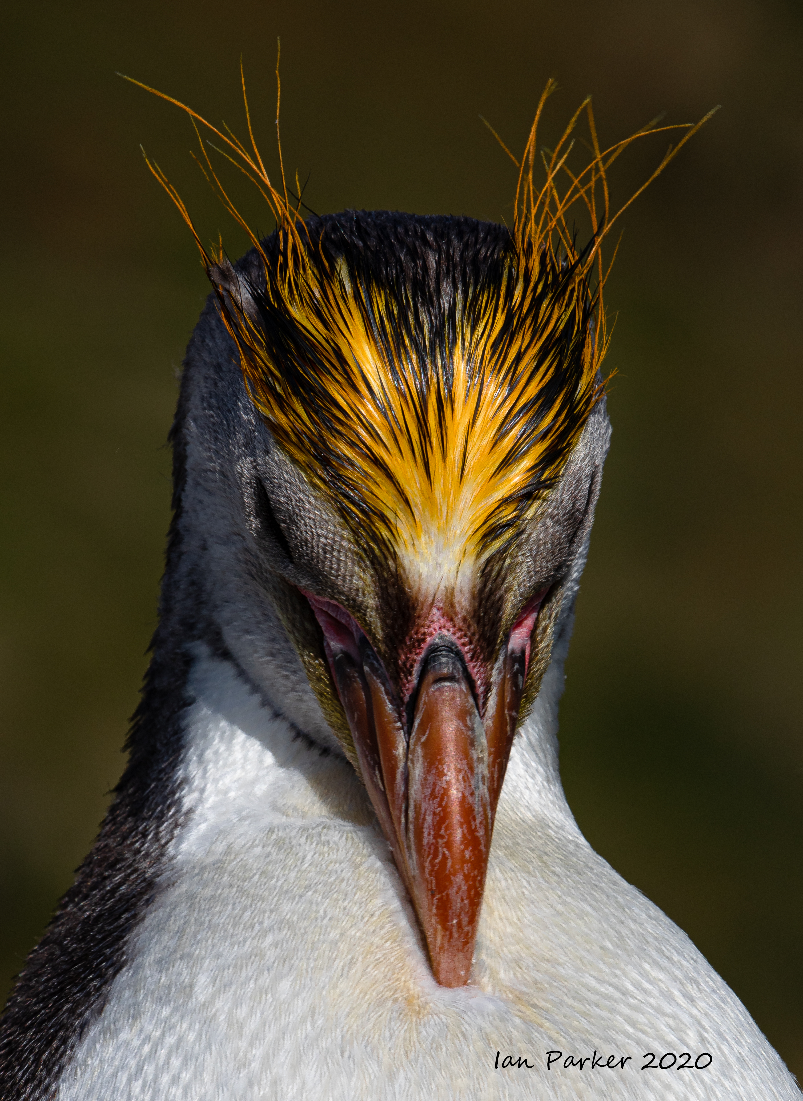
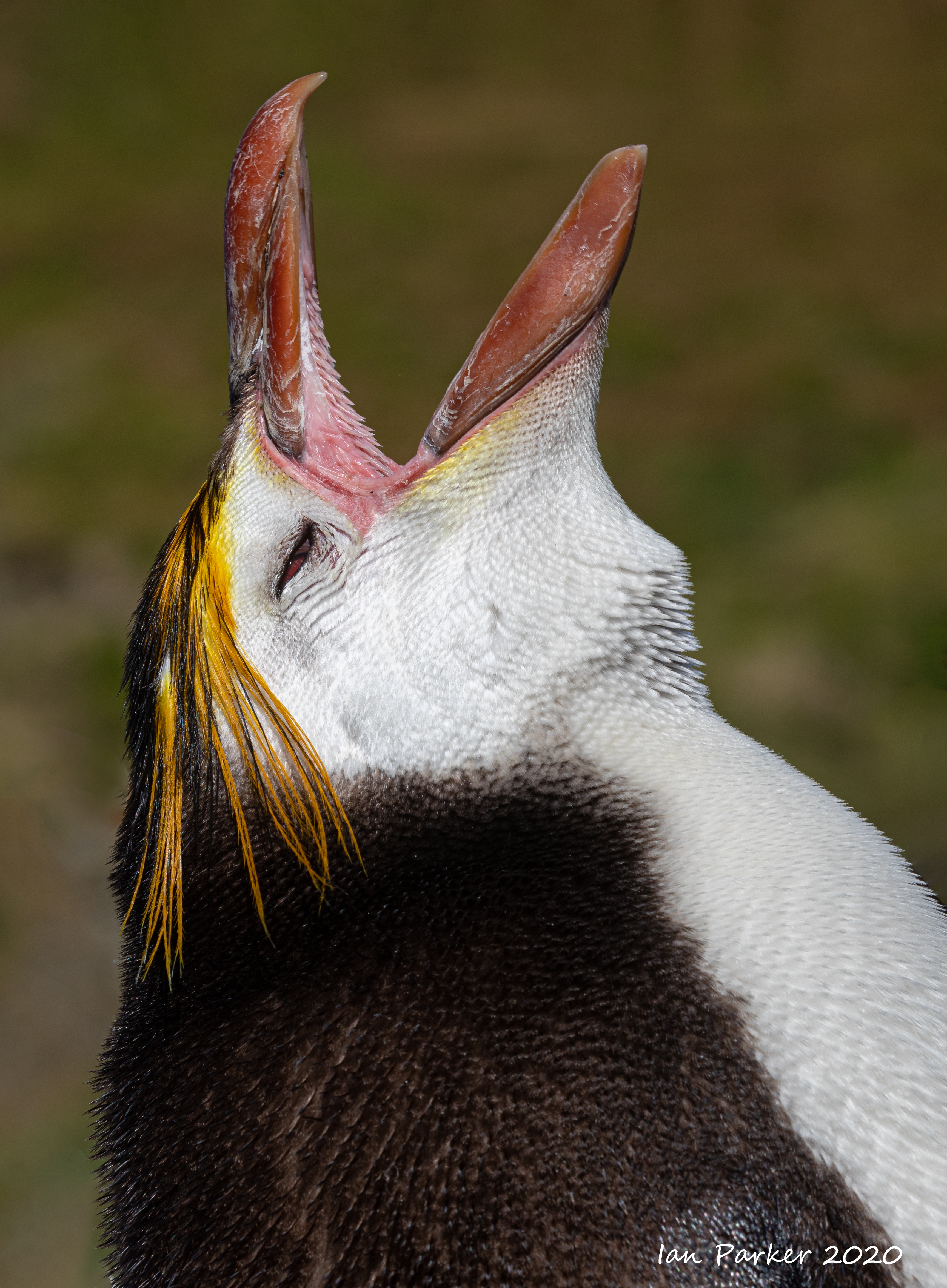
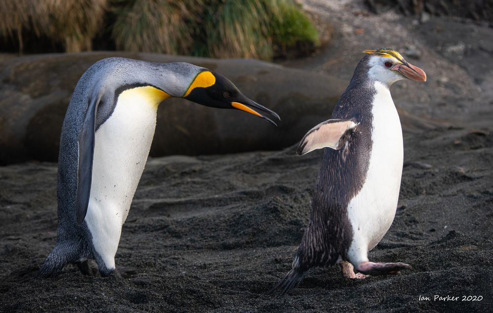
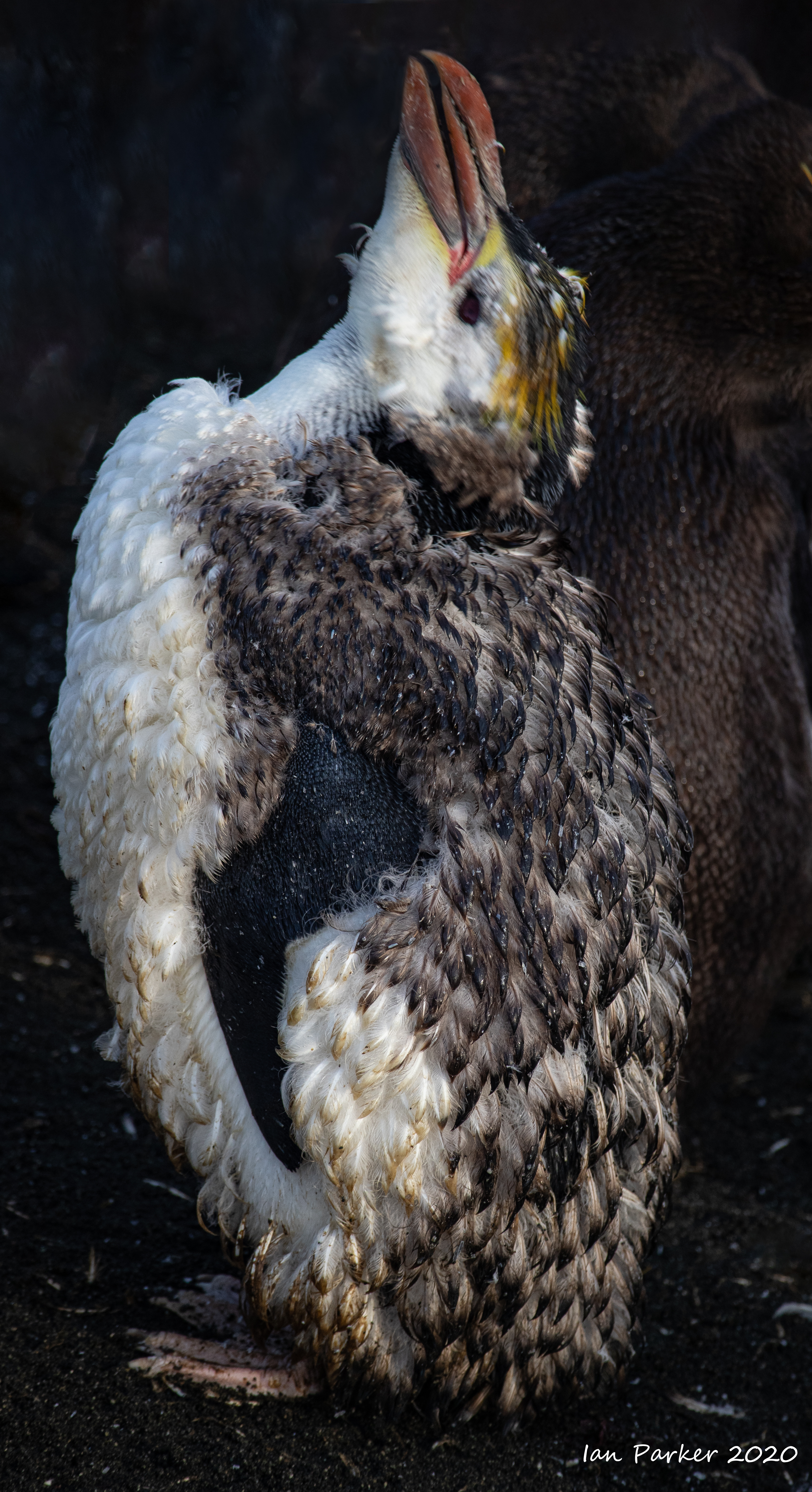
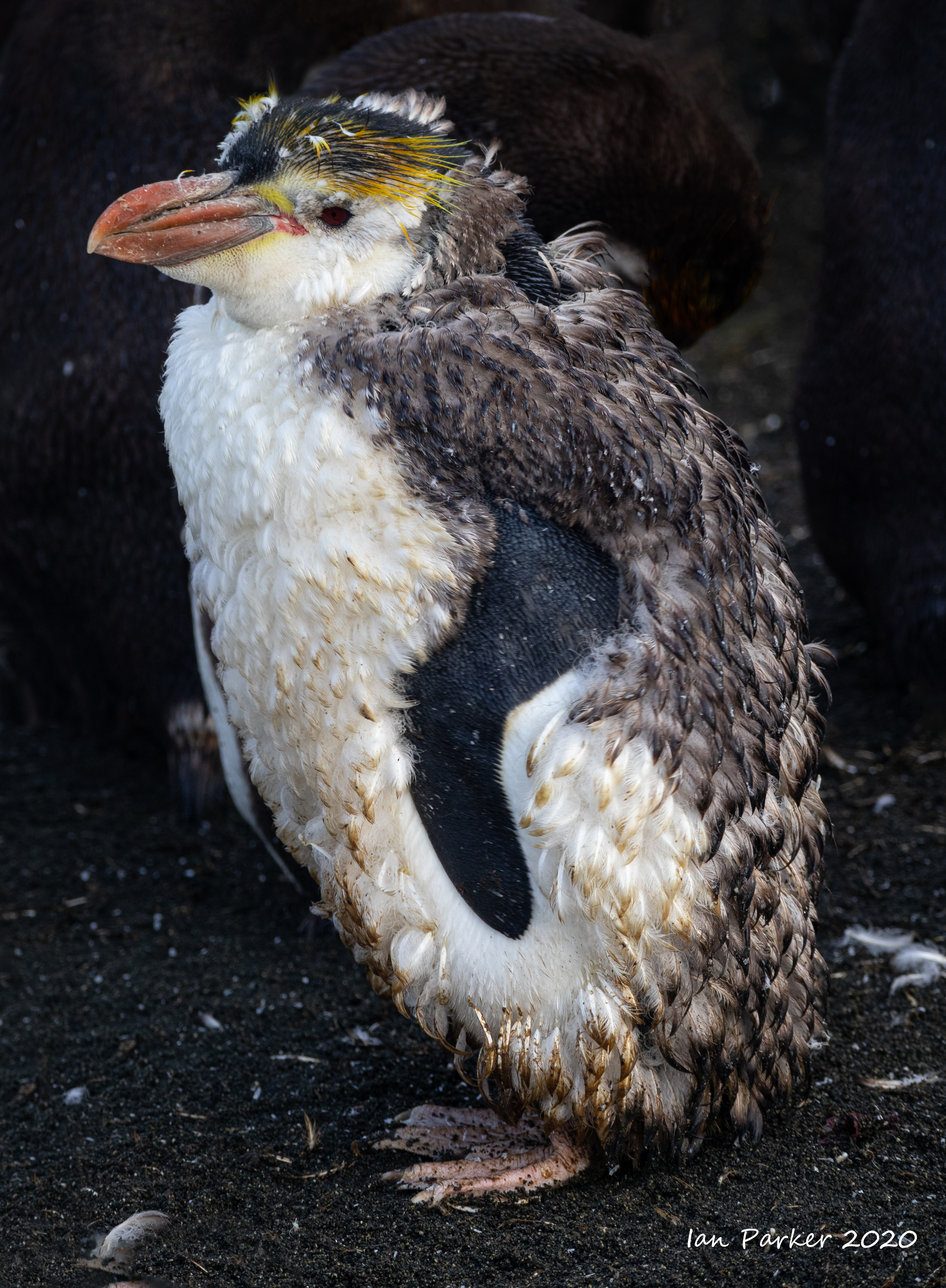
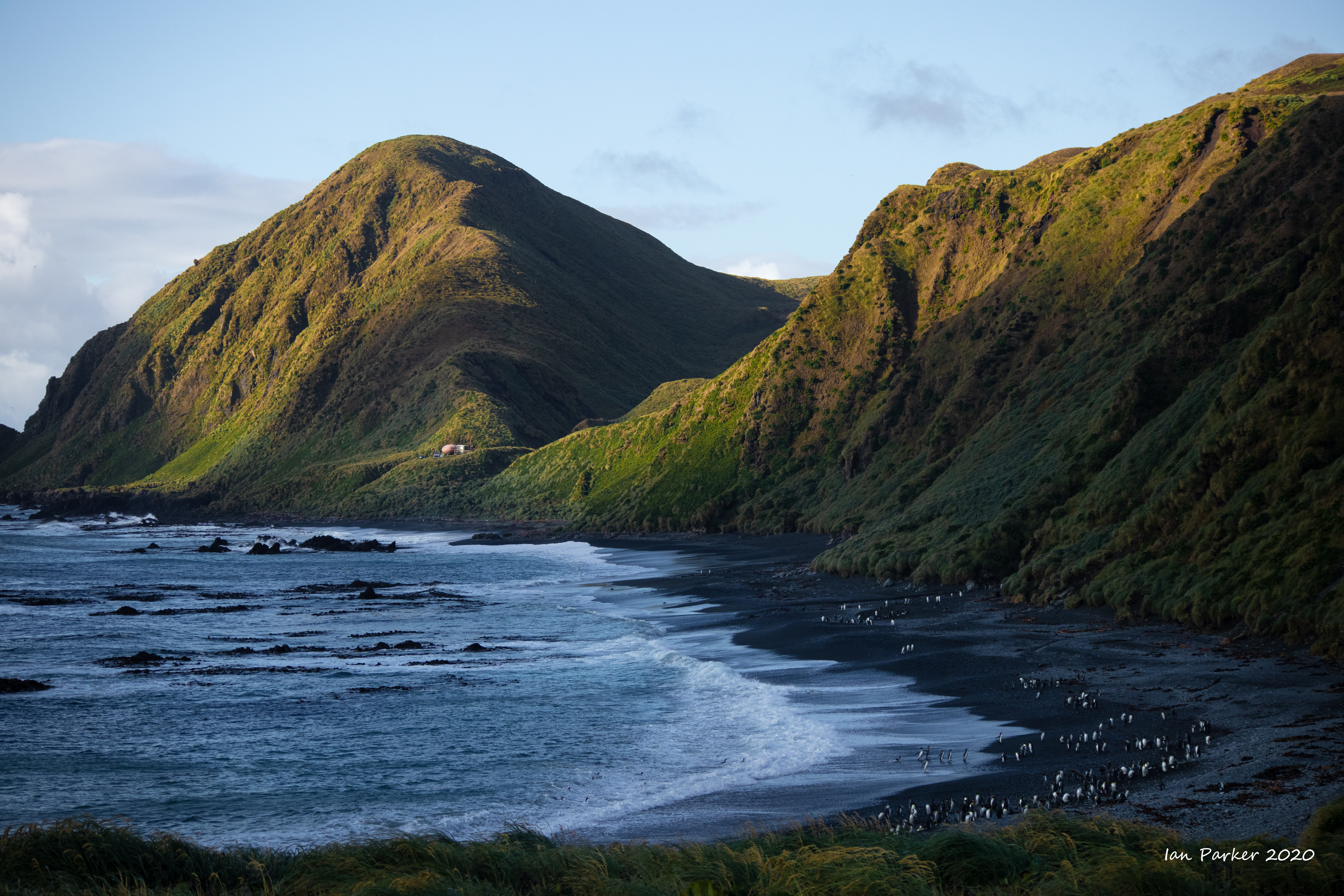
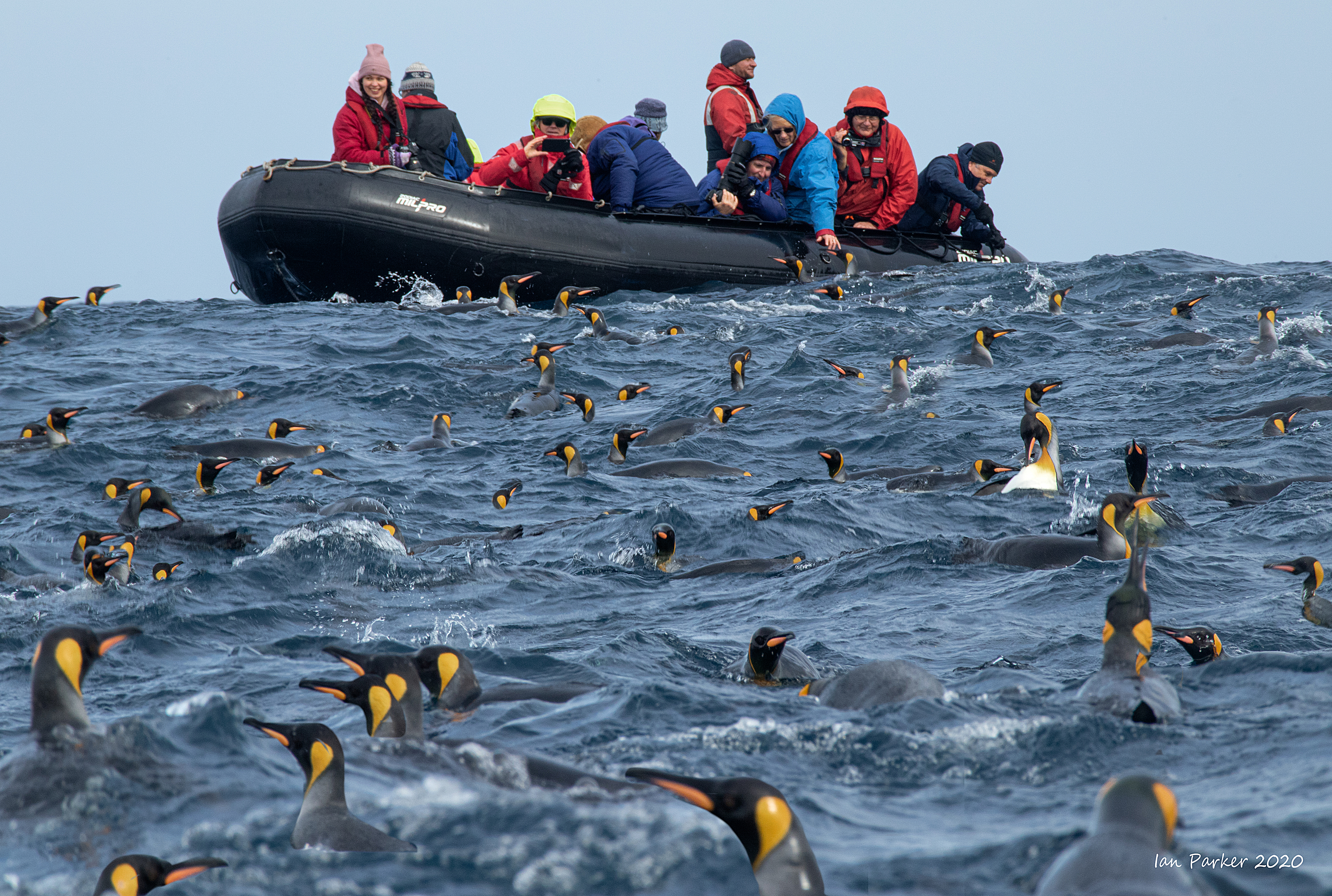
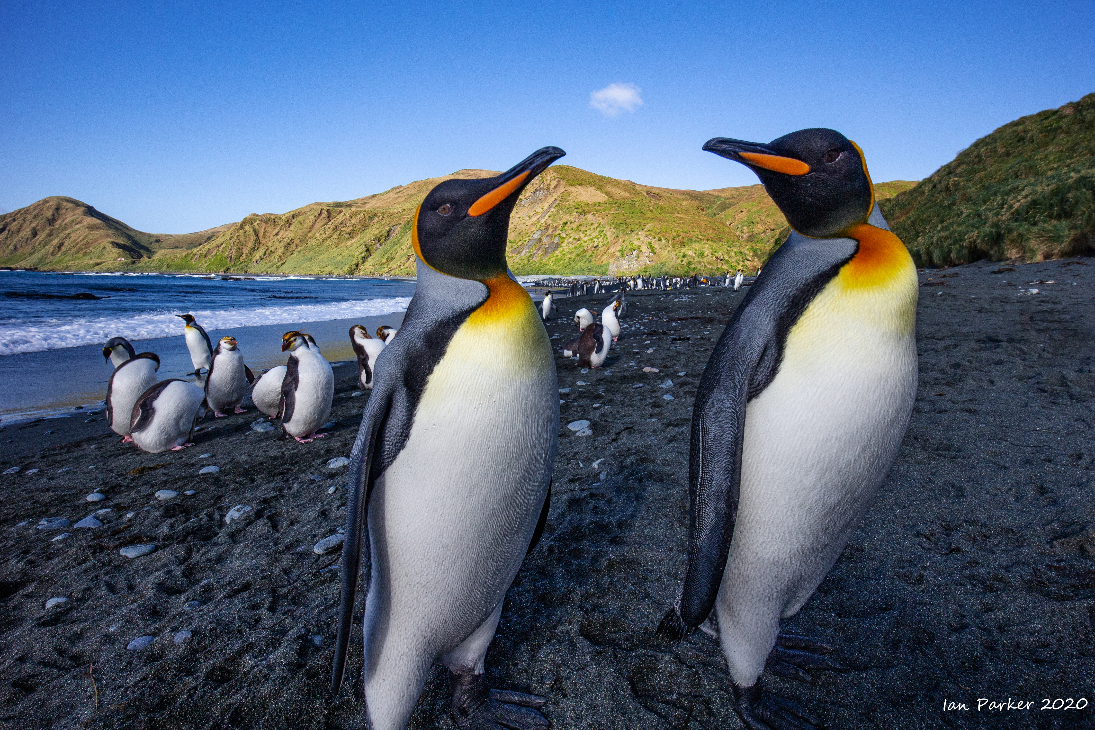
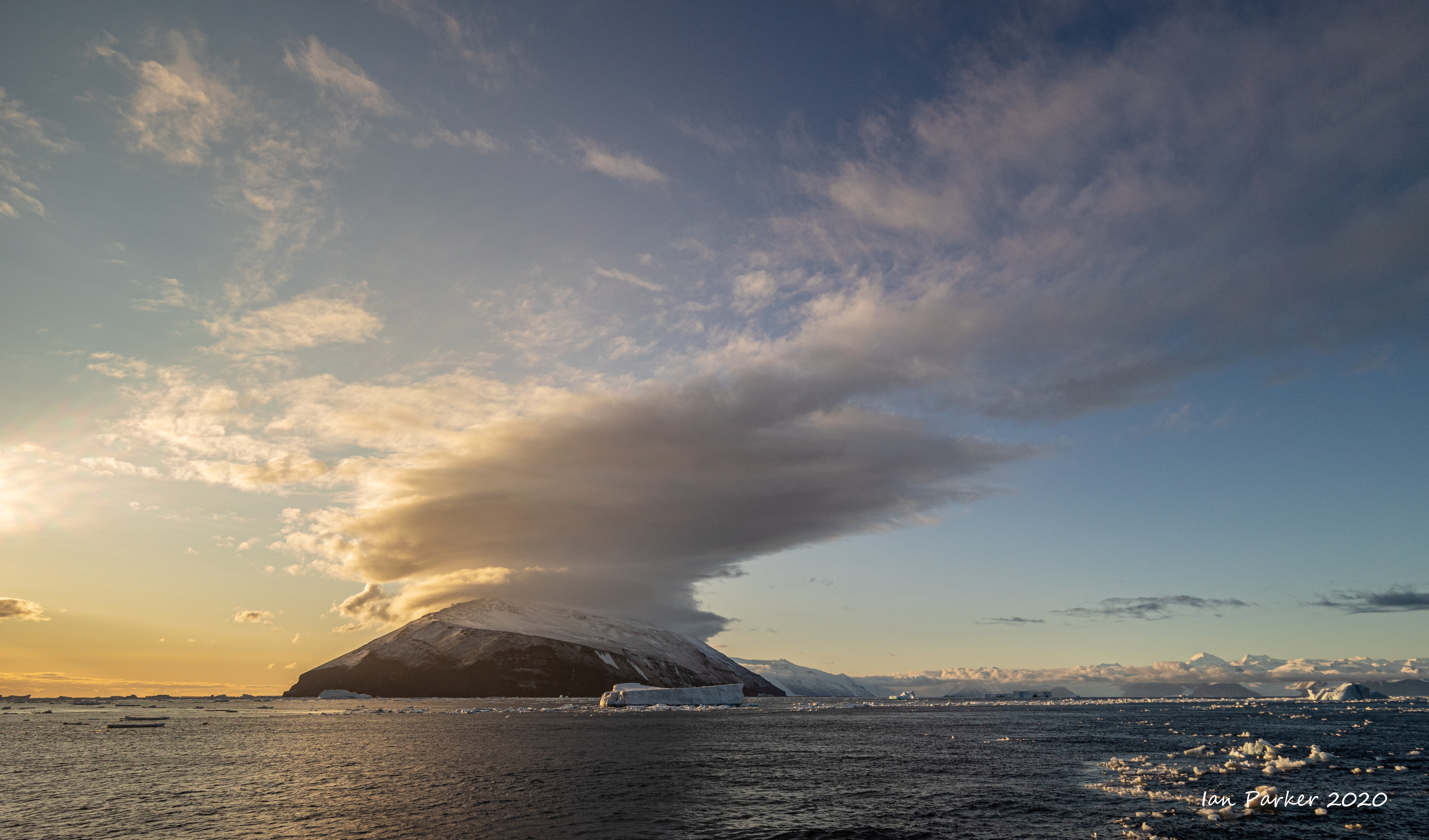
Feb 29-March 1 : Maquarie Island
Leaving the Baleny Islands and crossing north over the Antarctic Circle three days sailing brought us to Australia's Subantarctic wonderland - Macquarie Island.
|
|
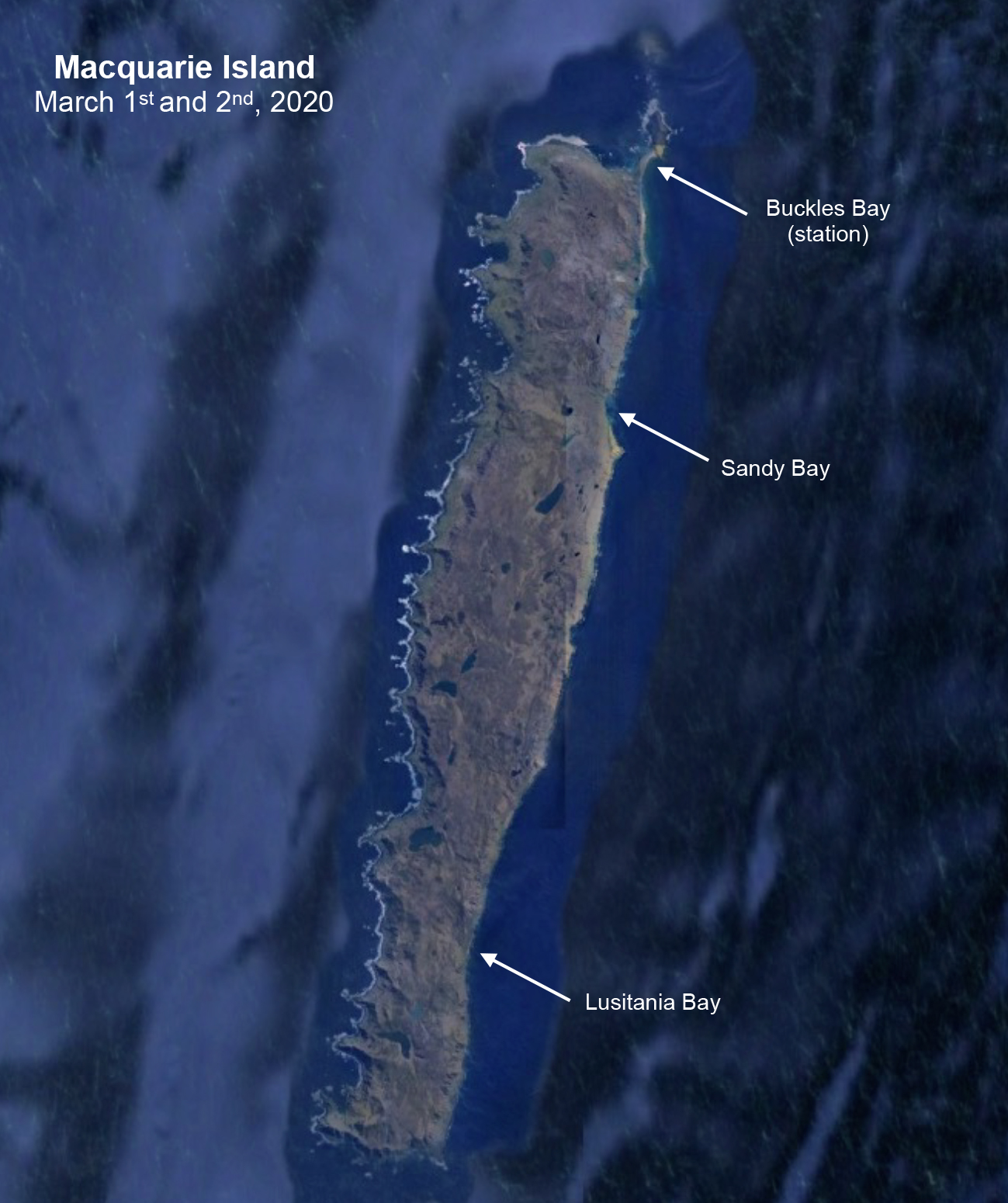 |
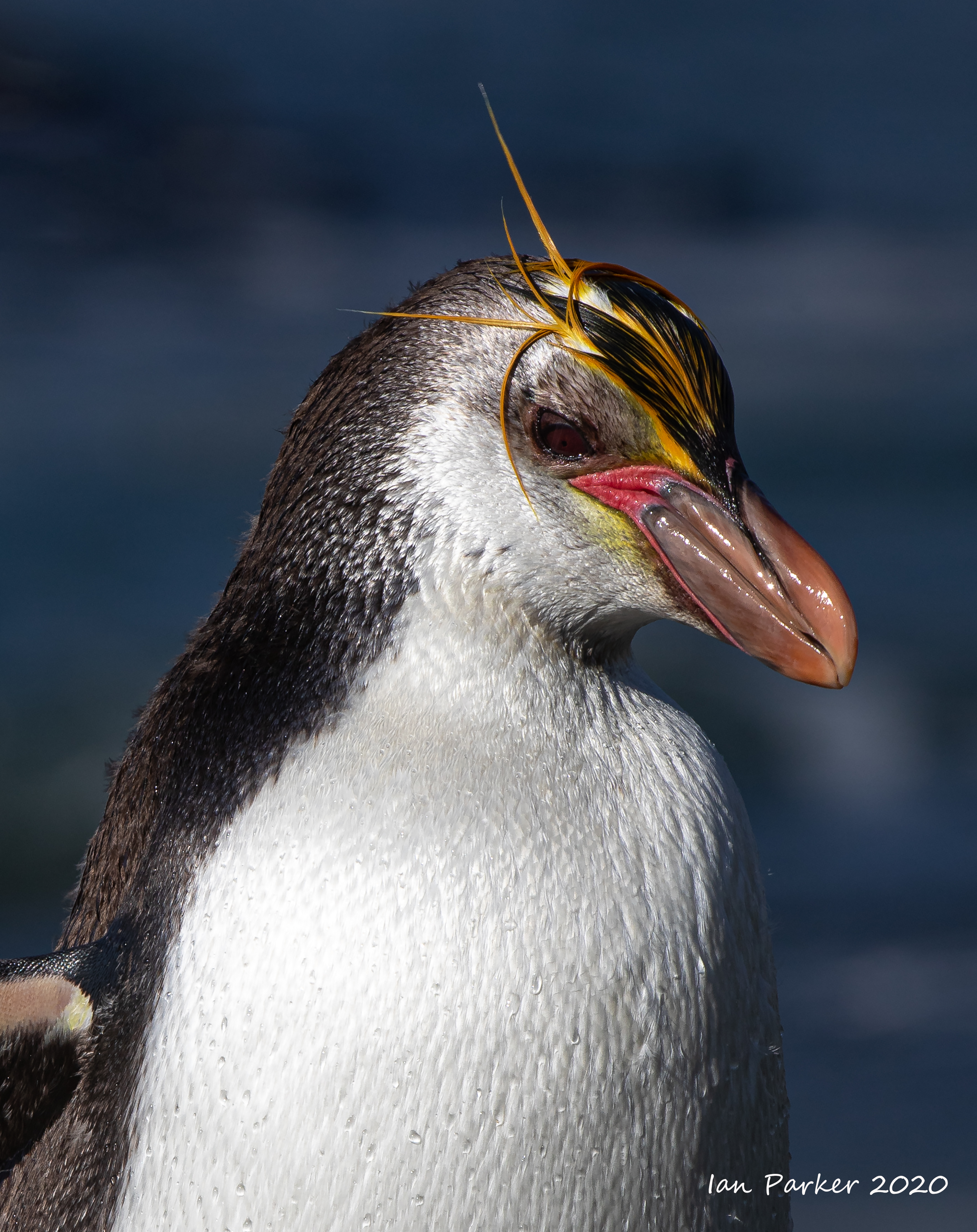
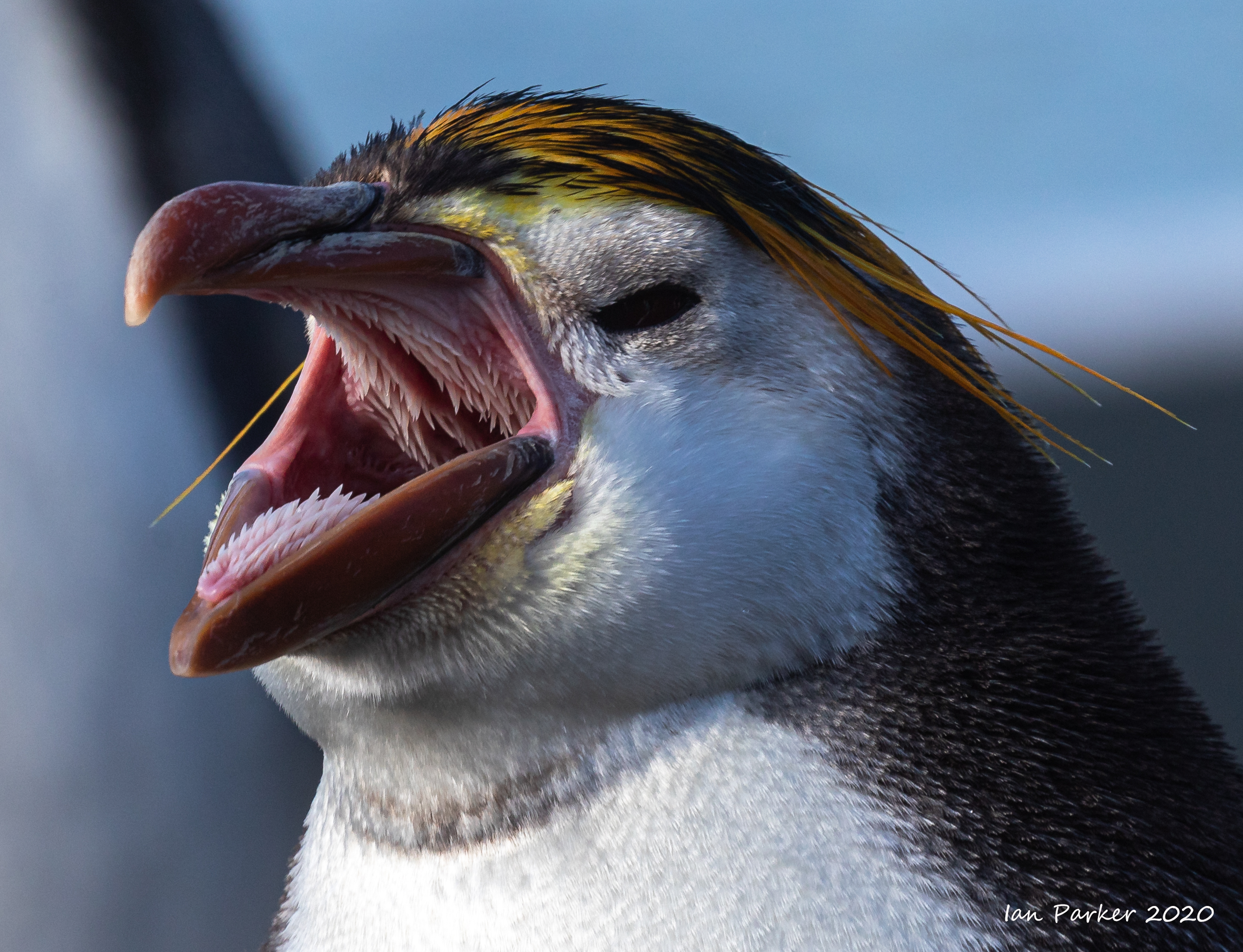
Royal Penguins : Sandy Bay, Macquarie Island
Website with lots of information about royal penguins HERE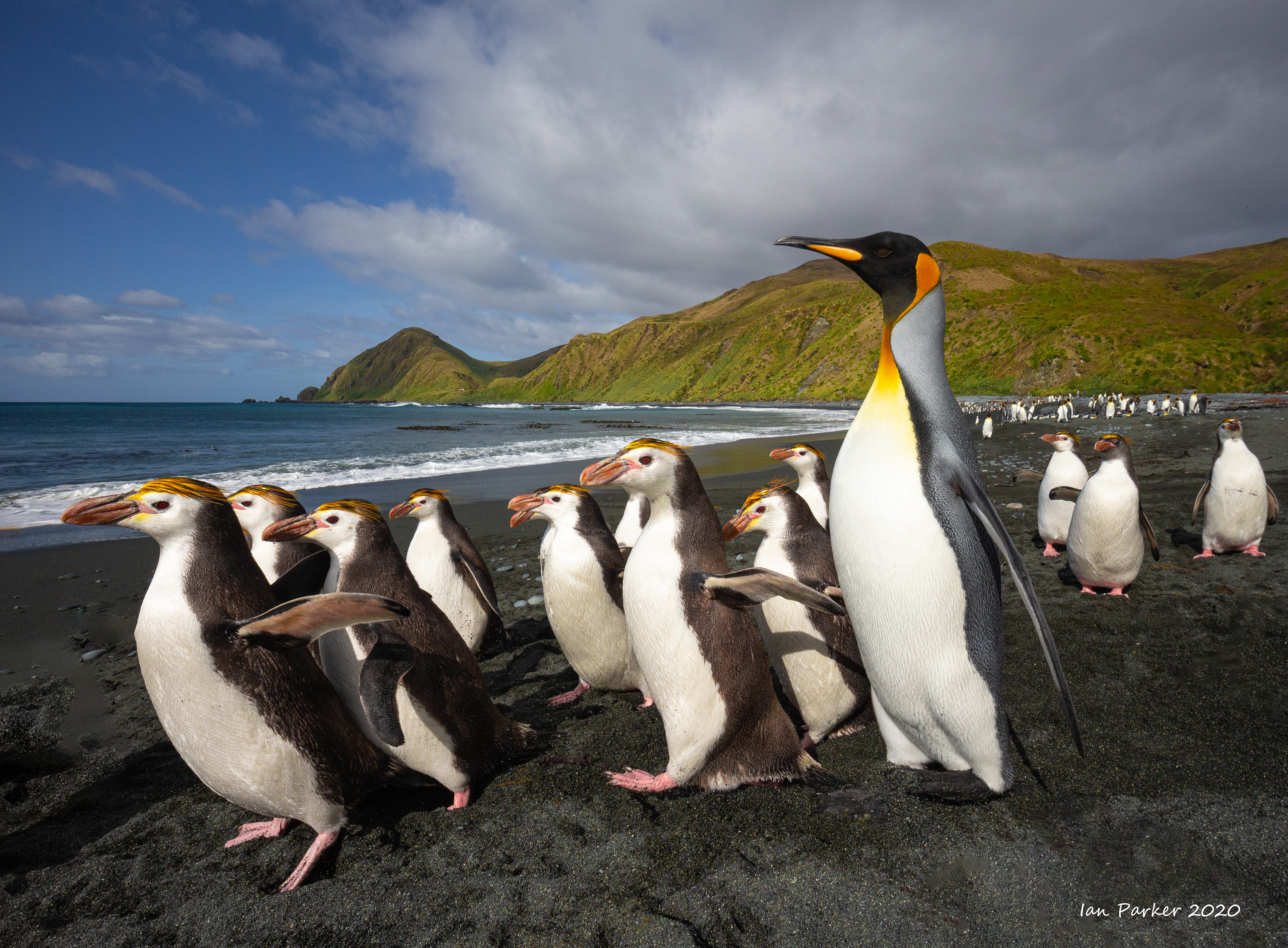


 |
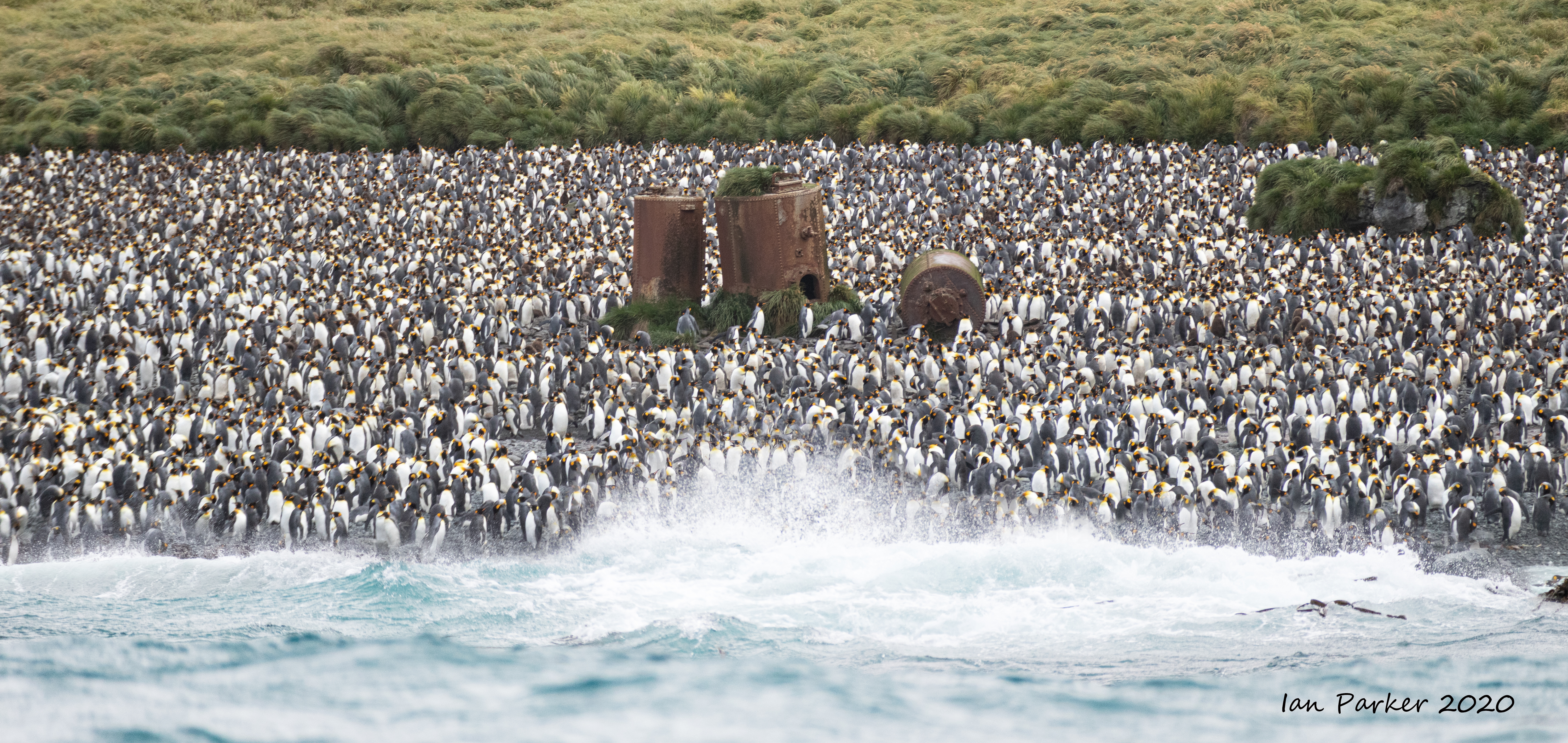
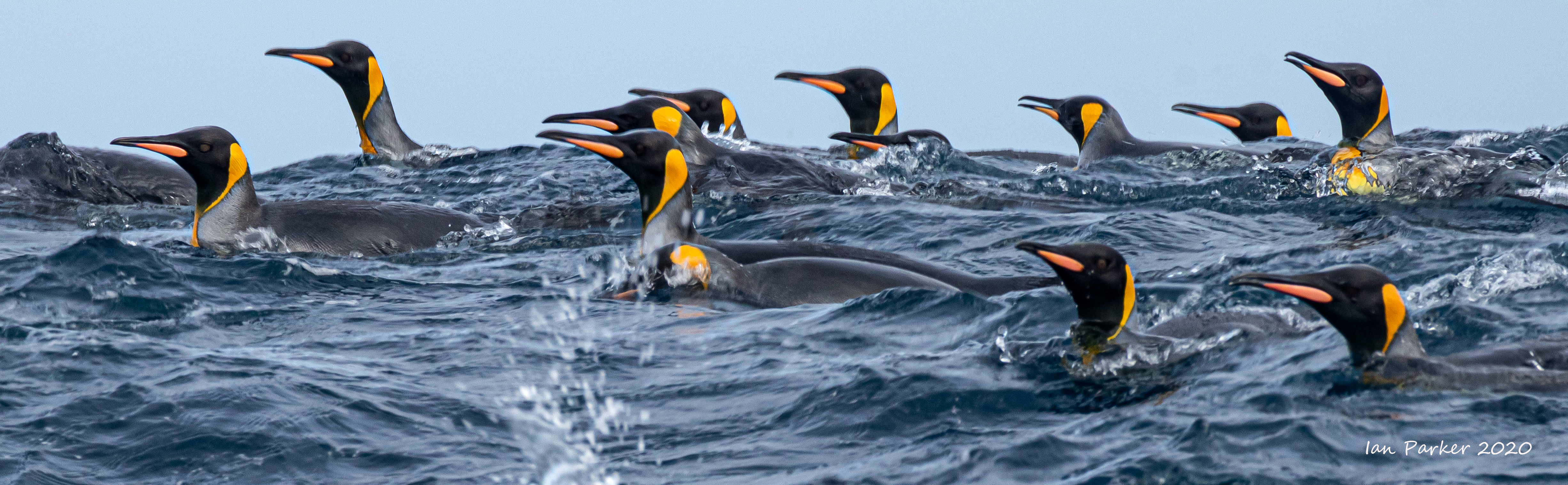
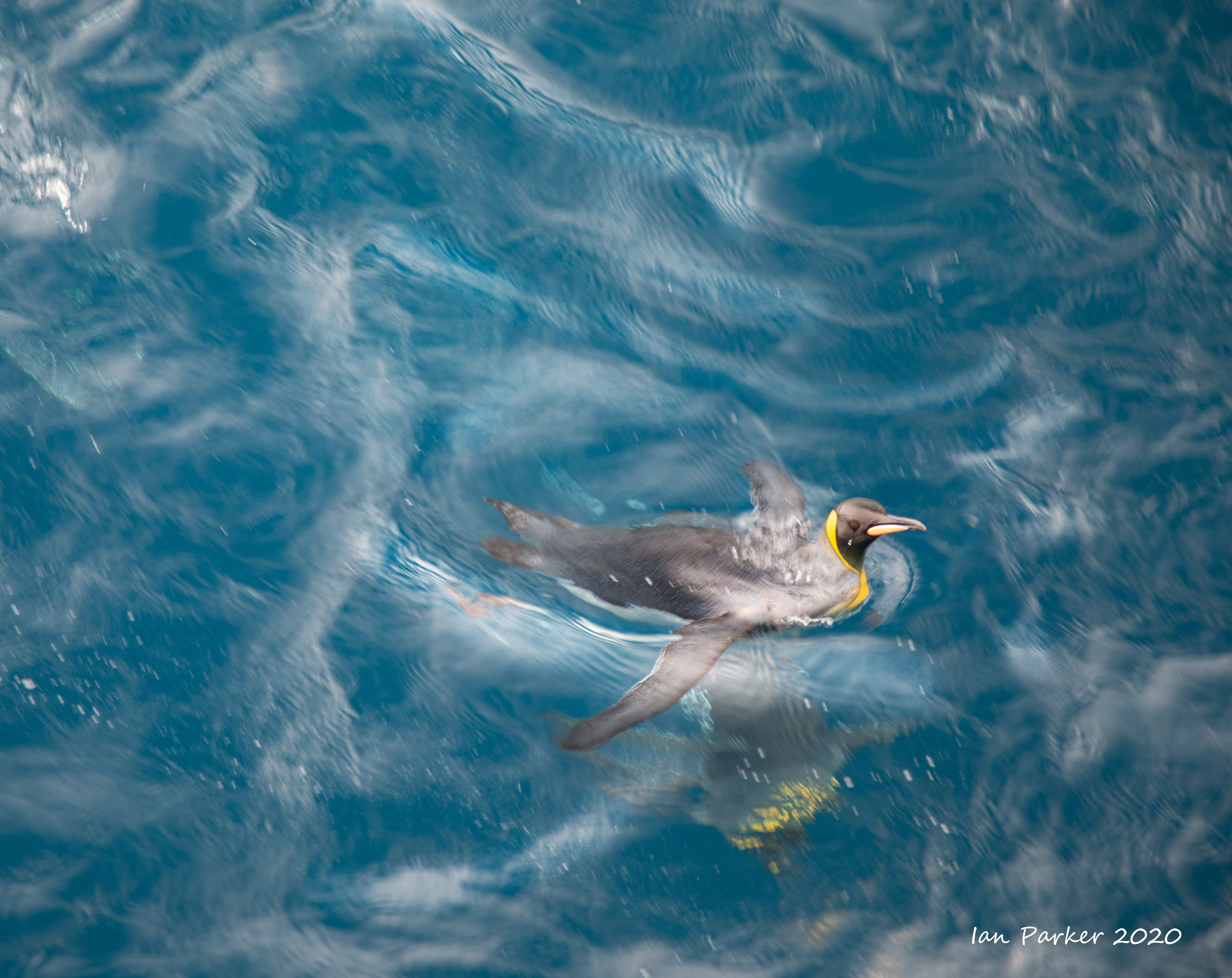
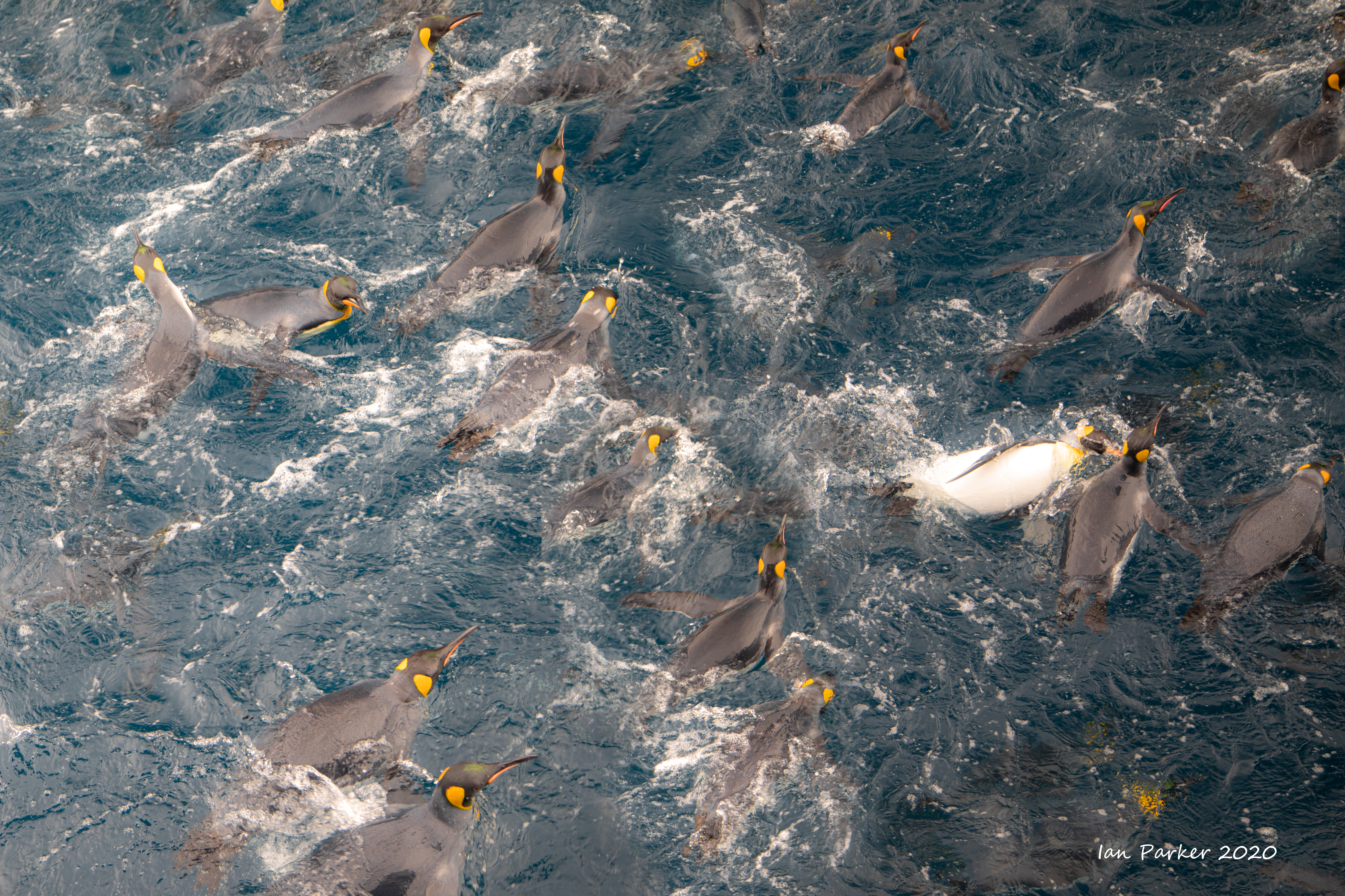
King Penguins : Lusitania Bay, Macquarie Island


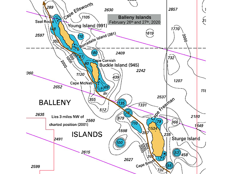
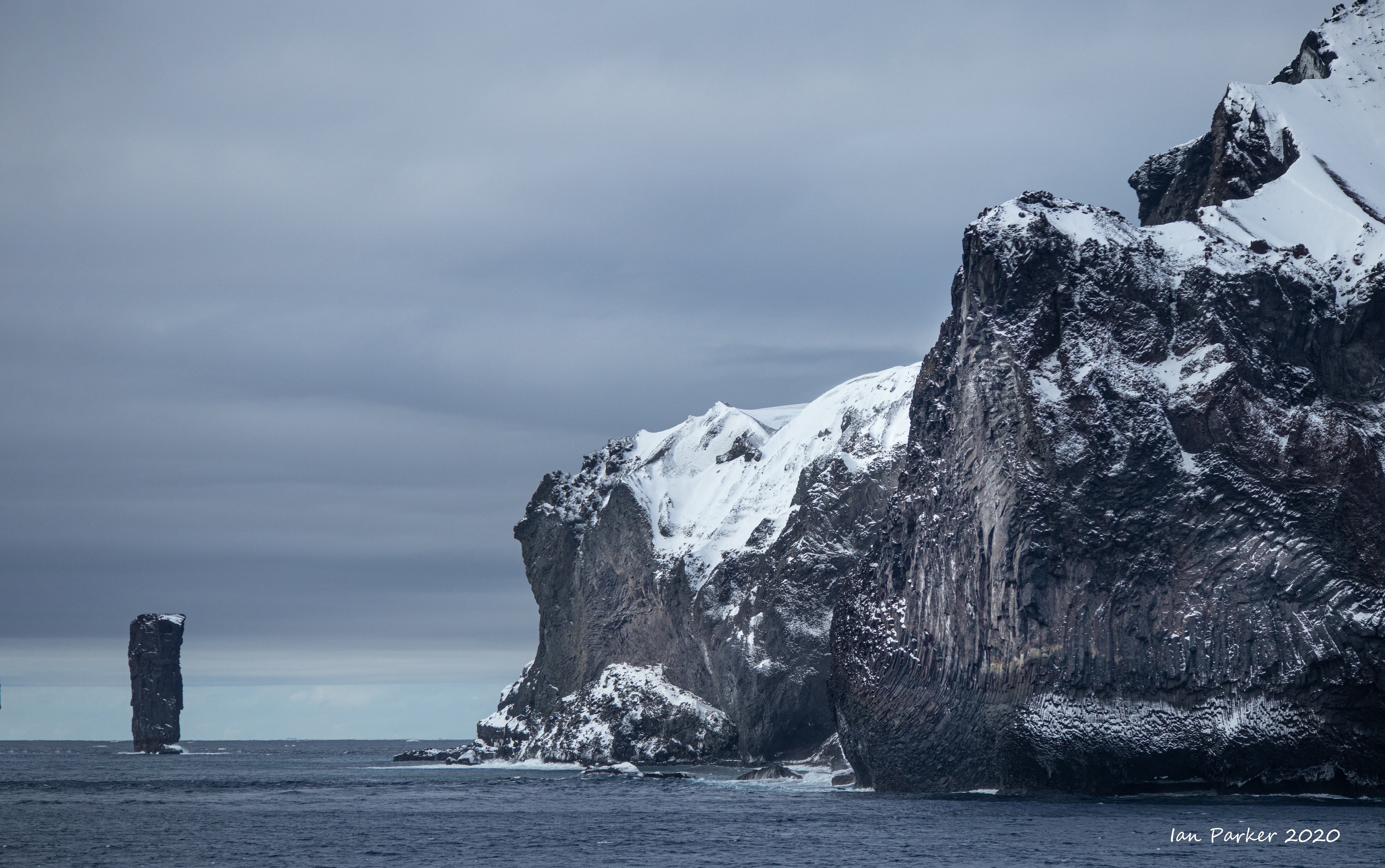
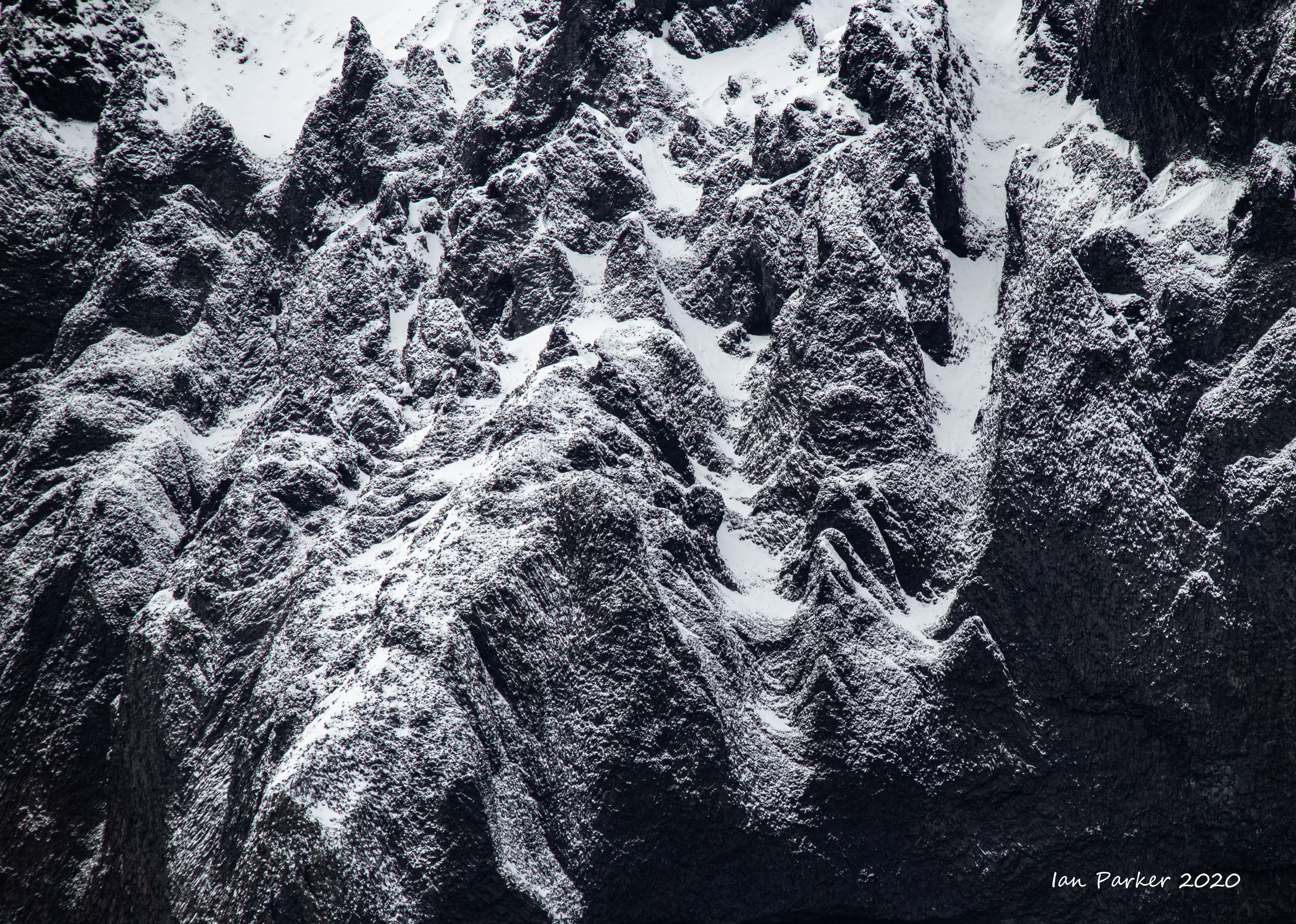
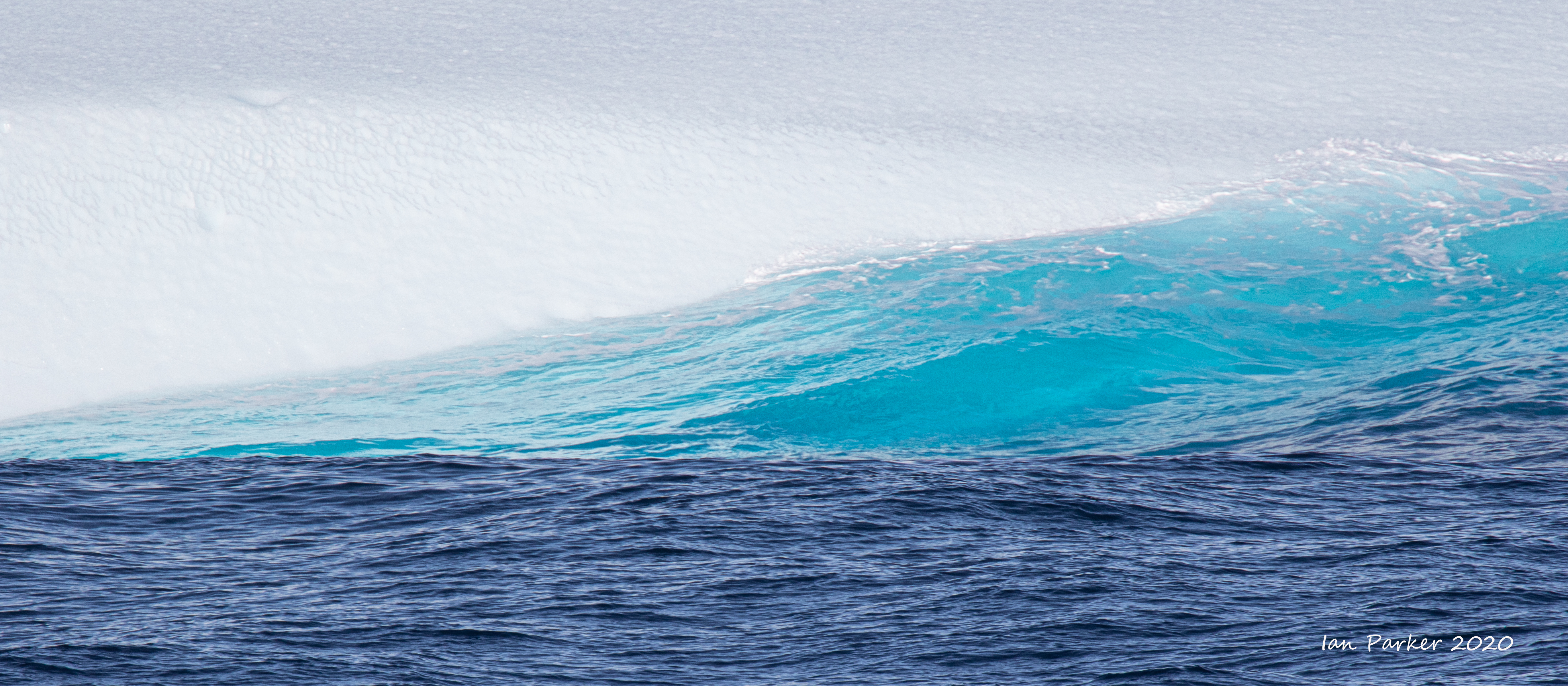
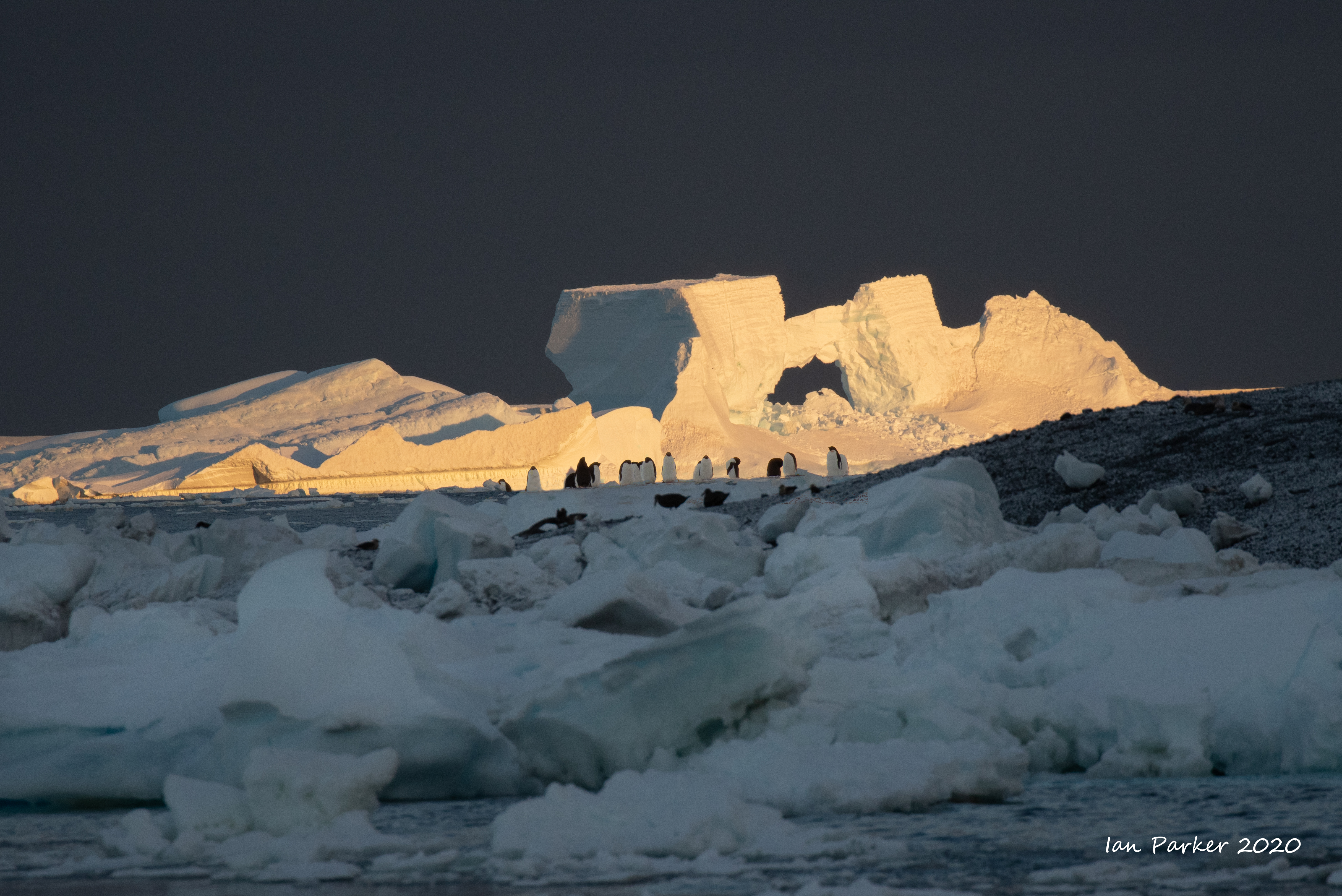
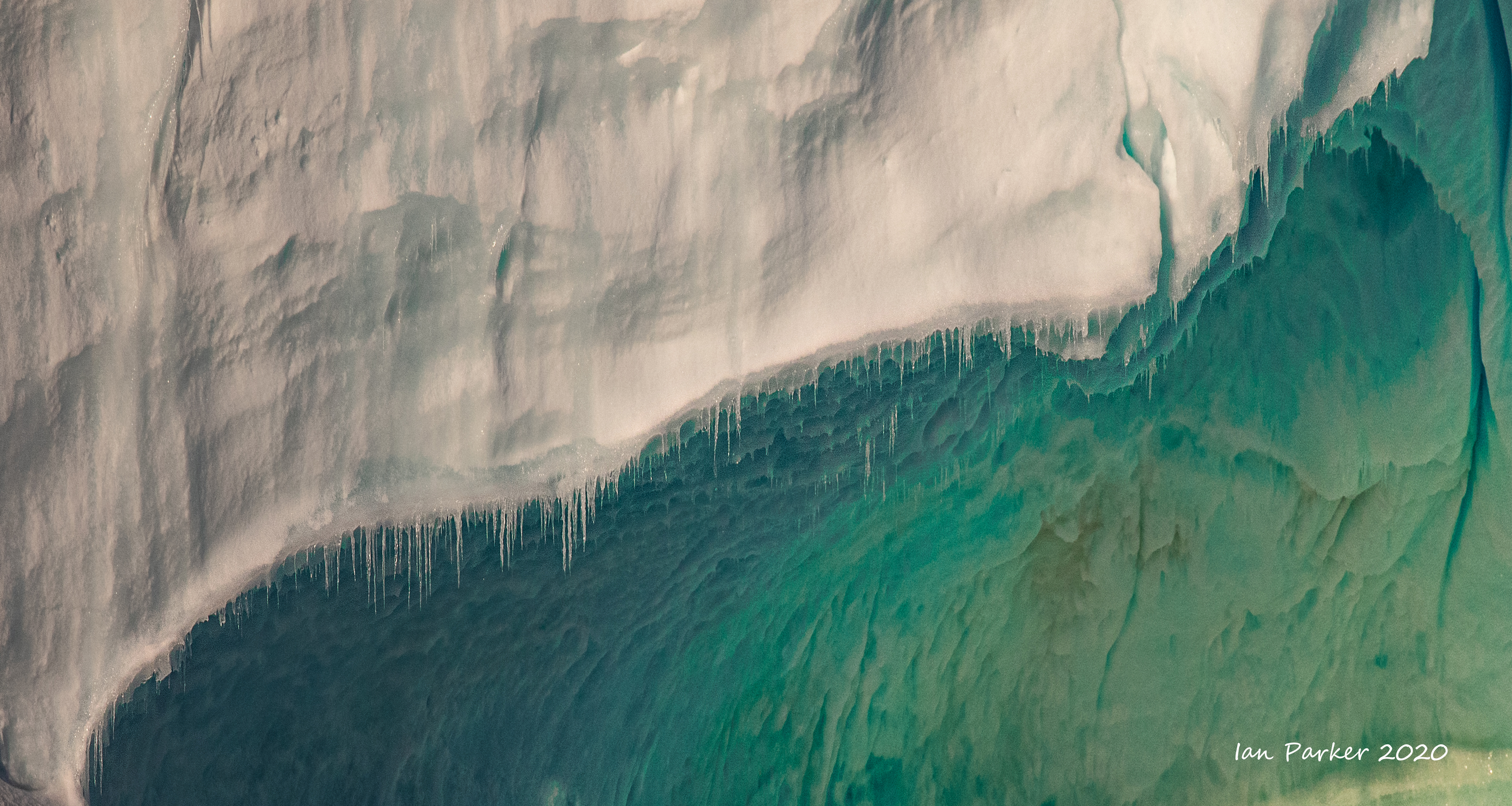
Feb 27 : The Balleny Islands
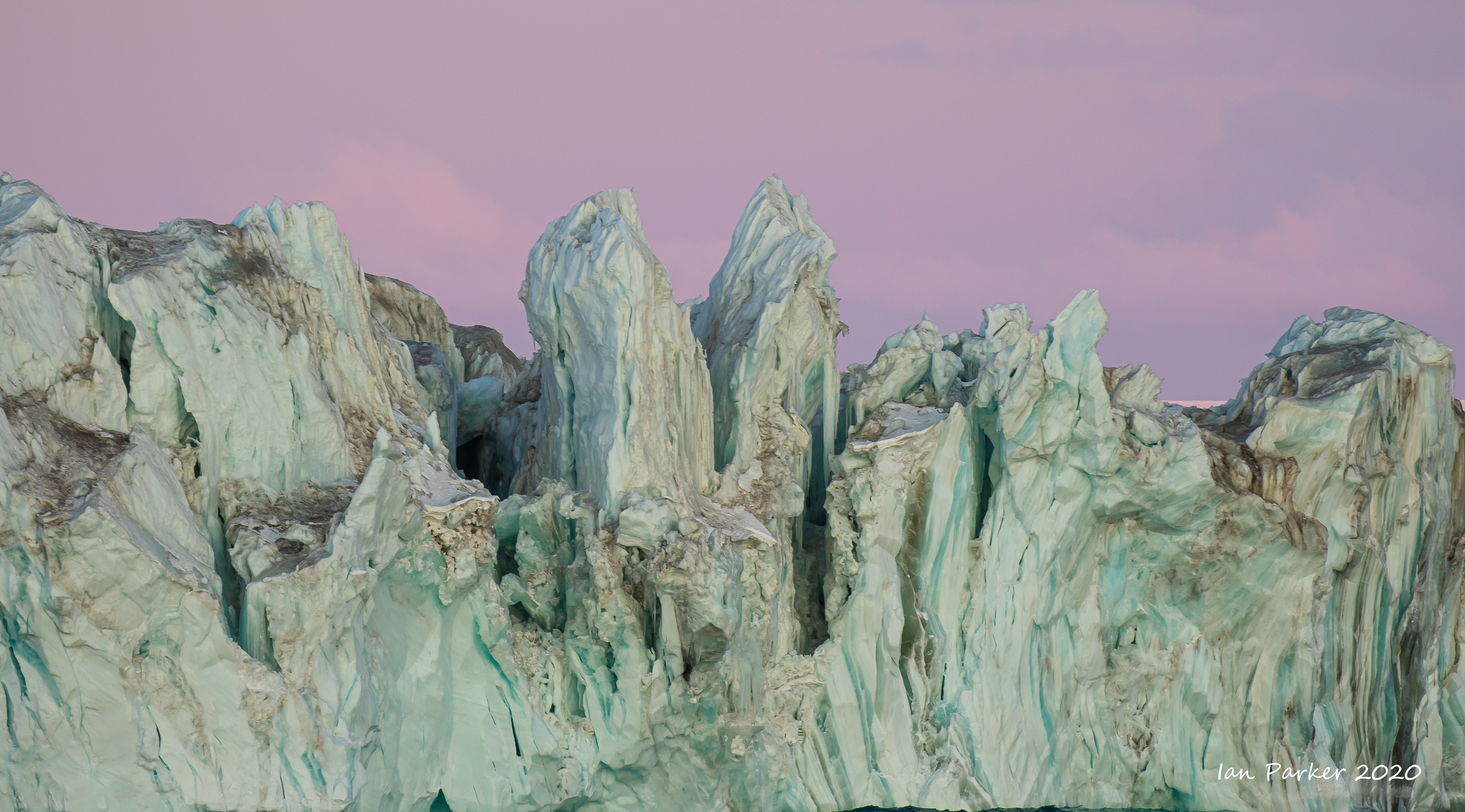
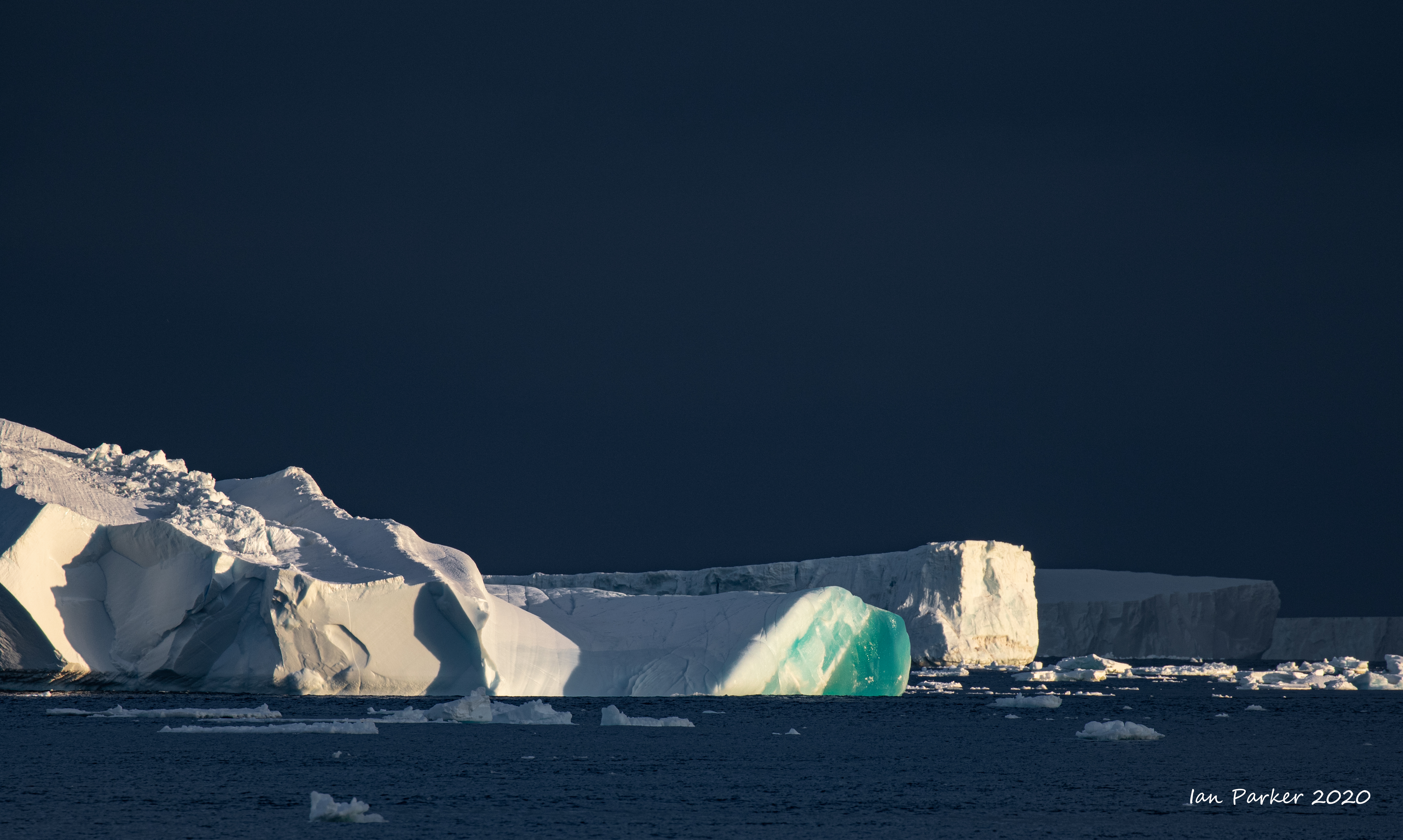
Finally leaving the Antarctic continent we detoured past the Balleny Islands with sheer cliffs of volcanic rock and ice and big dormant volcanoes. At 2100 hours we reached the south end of Buckle Island and its famous The Monolith, a 110-metre pillar of volcanic rock and Sabrina Island, a protected area with Chinstrap Penguins.Various flying birds were seen including numerous Snow Petrels. The coastline is a forbidding one, located below ice caps on each island and where the ocean rapidly descends from the shore to depths of nearly 2,000-metres. |
 |

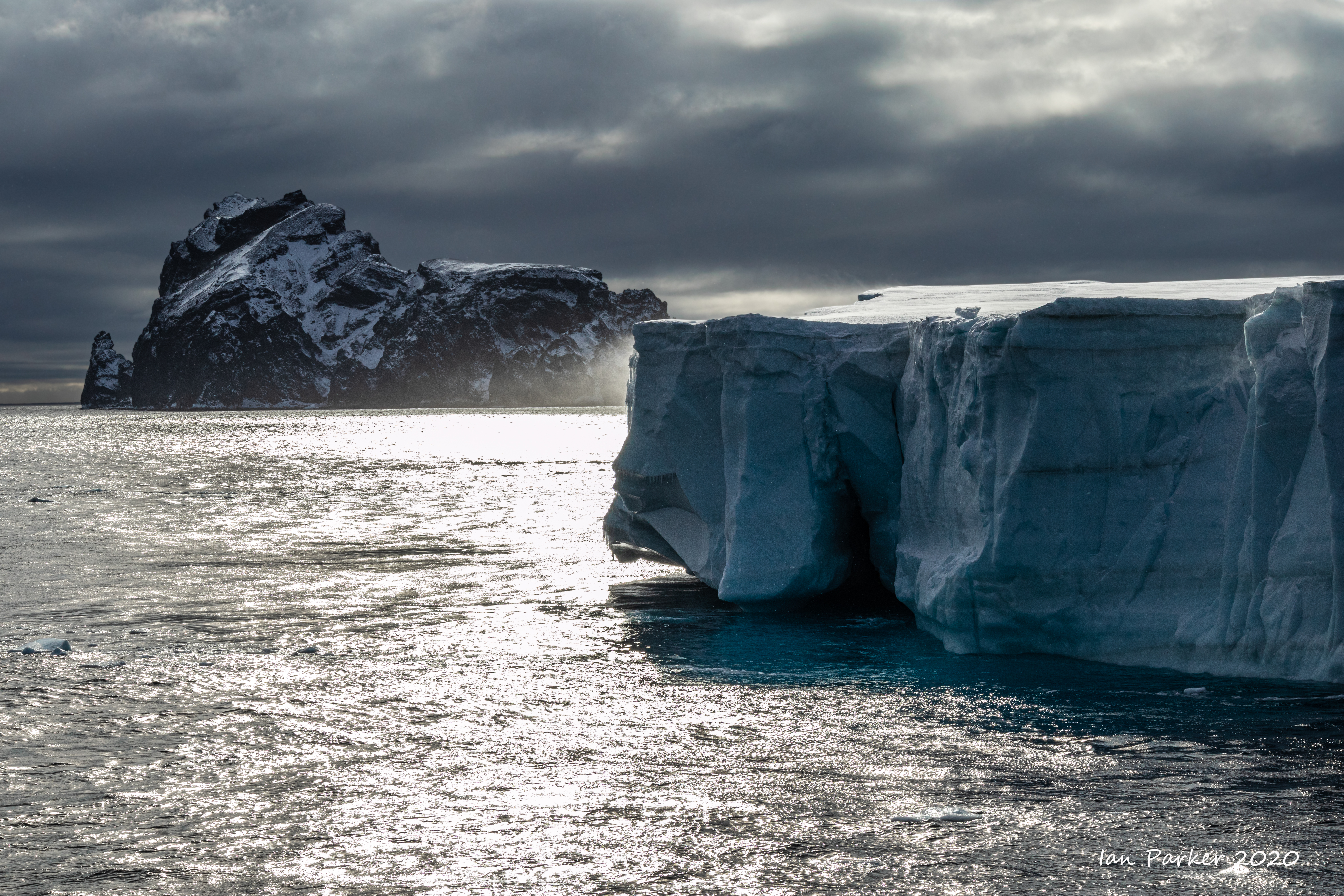
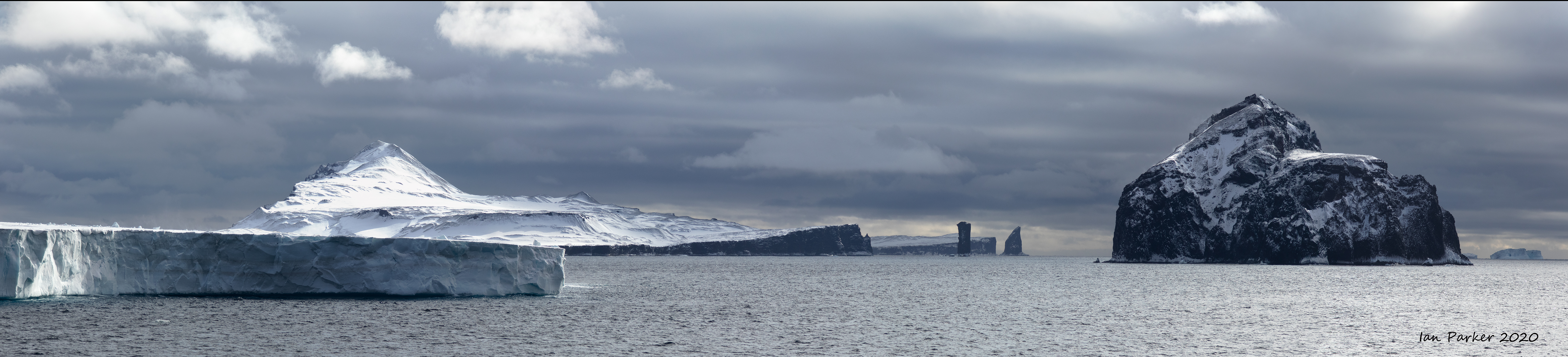
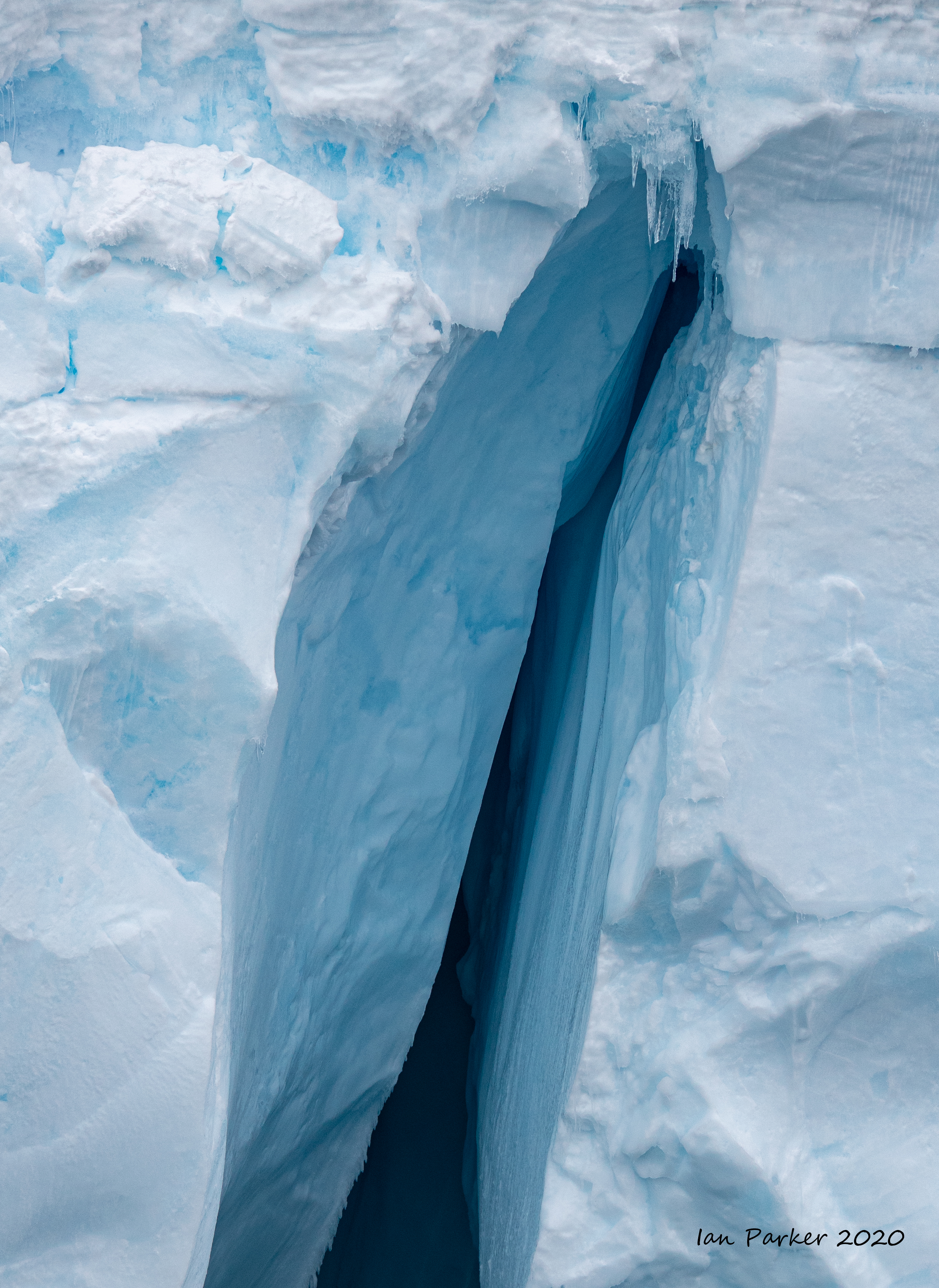
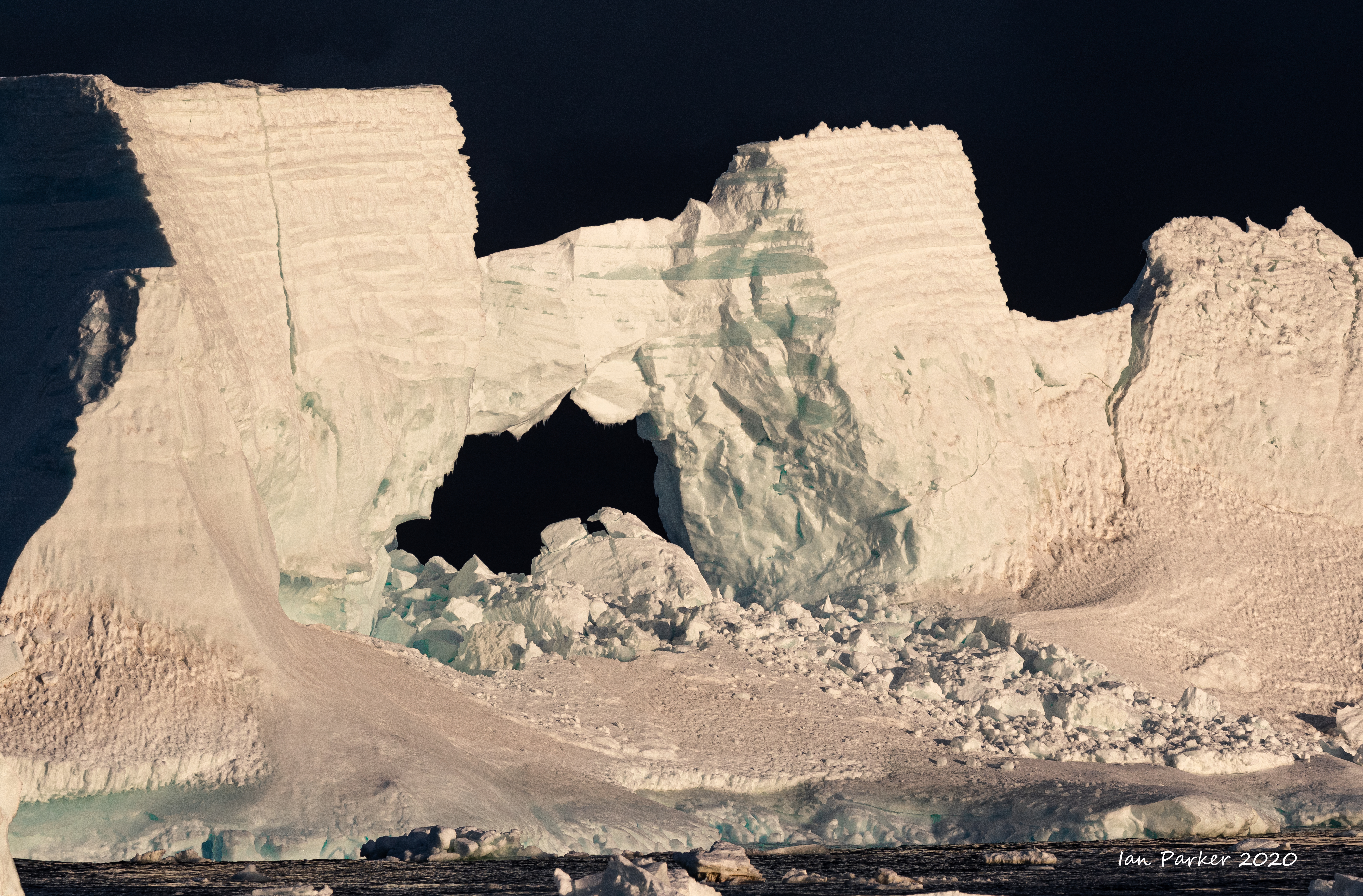
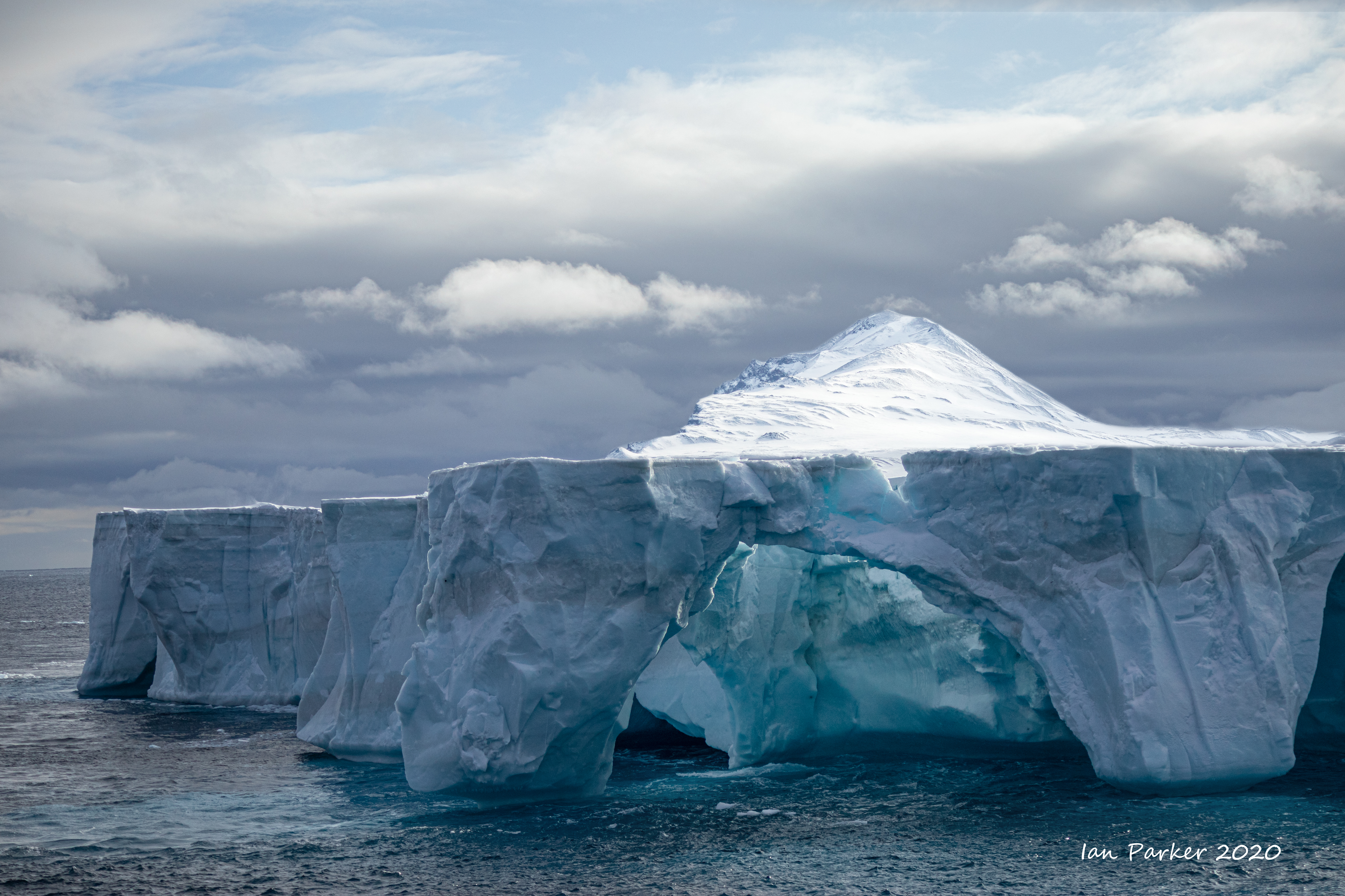 Arch in iceberg; Balleny Islands, Antarctica Arch in iceberg; Balleny Islands, Antarctica |

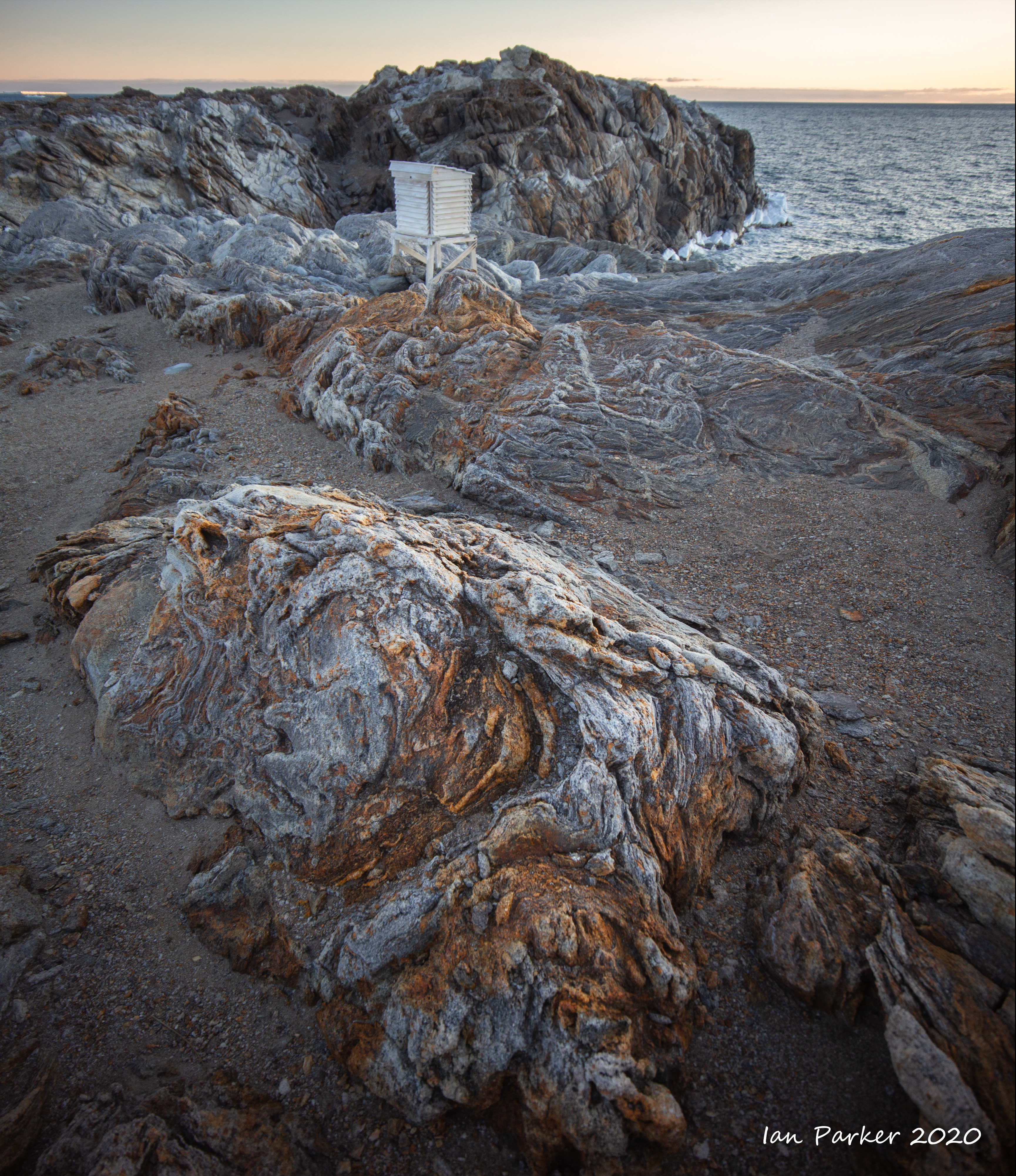
Feb 23-25 : North for a return visit to Cape Adare
| |
We had hoped for a landing to visit Borchgrevink’s hut, but the shoreline was ringed by massive ice blocks with a heavy swell breaking. The first four passengers in line for a Zodiac did make a (brief) visit to the hut, landing precariously in a tiny 'harbor' between the ice. We were next in line, but but after a near swamping of the Zodiac all attempts were called off and the crew onshore rapidly shuttled back to the ship.


 The Ortelius at Cape Adare - the beginning of an ill-fated late season voyage. The Ortelius sailed from New Zealand en route to the Ross Sea, passing us at Cape Adare (the only other vessel we saw) as we returned north. She was able to land passengers on Ross island to visit Scott's Discovery hut, and by helicopter at Taylor Valley,but thereafter the trip went dramatically sour. Heavy seas and bad weather precluded any further landings, while slow progress through unexpectedly dense pack ice made it clear that there was not sufficient time for the intended itinerary visiting the Antarctic peninsula. The Ortelius finally reached Ushuai on March 18th, by which date the port was closed because of the coronavirus and passengers were not allowed to disembark. Onward to Buenos Aries, but Argentina closed the country before the Ortelius could get there. Finally, a "sanitaire corridor“ was arranged at Montivideo to transport passengers from ship to airport, |
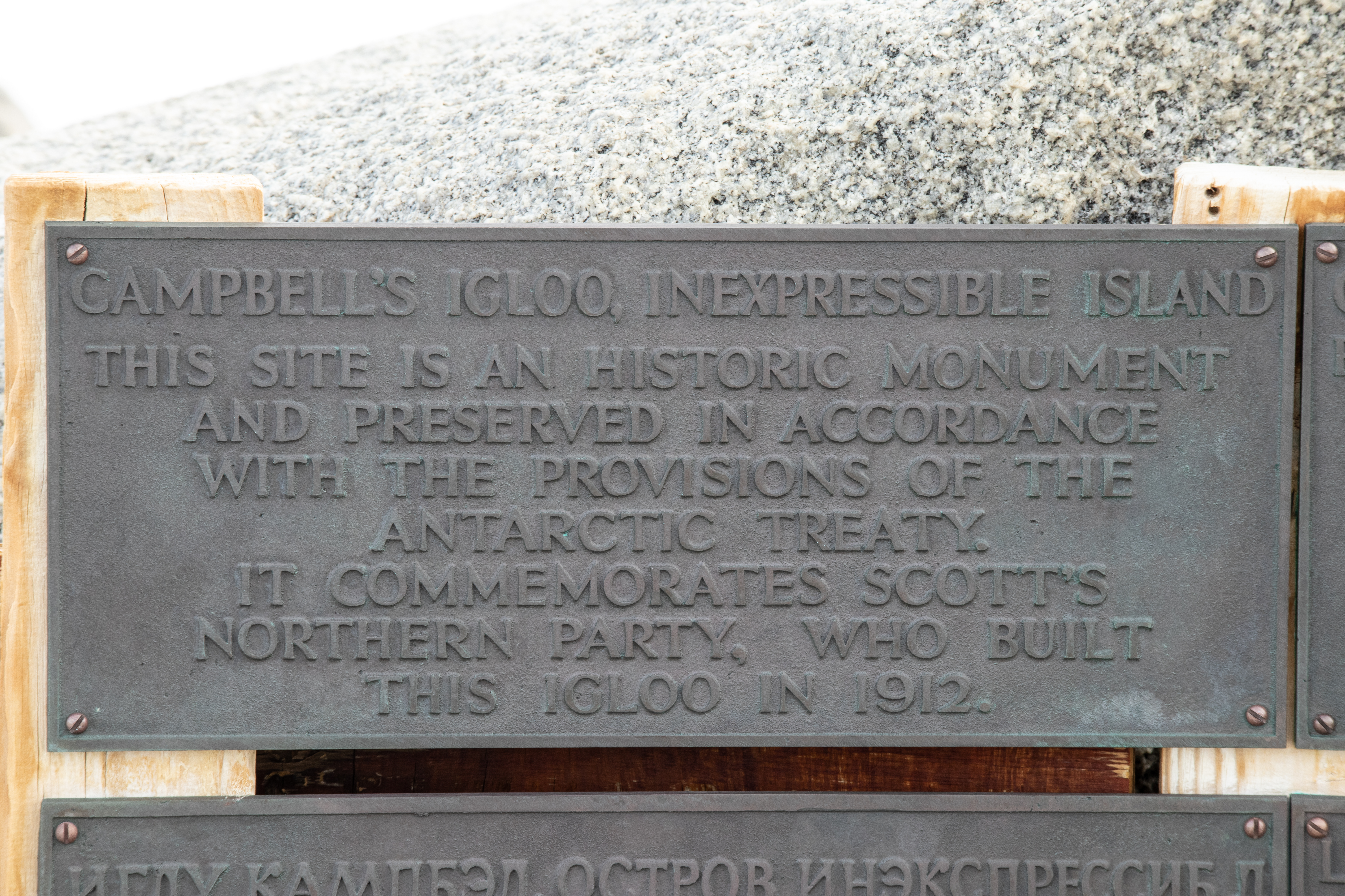
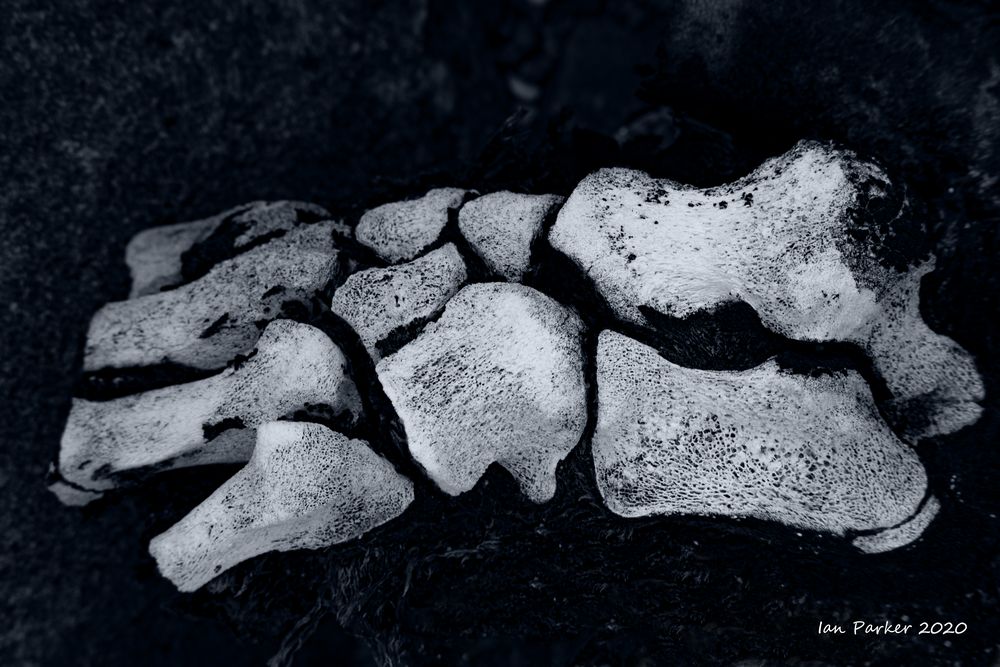
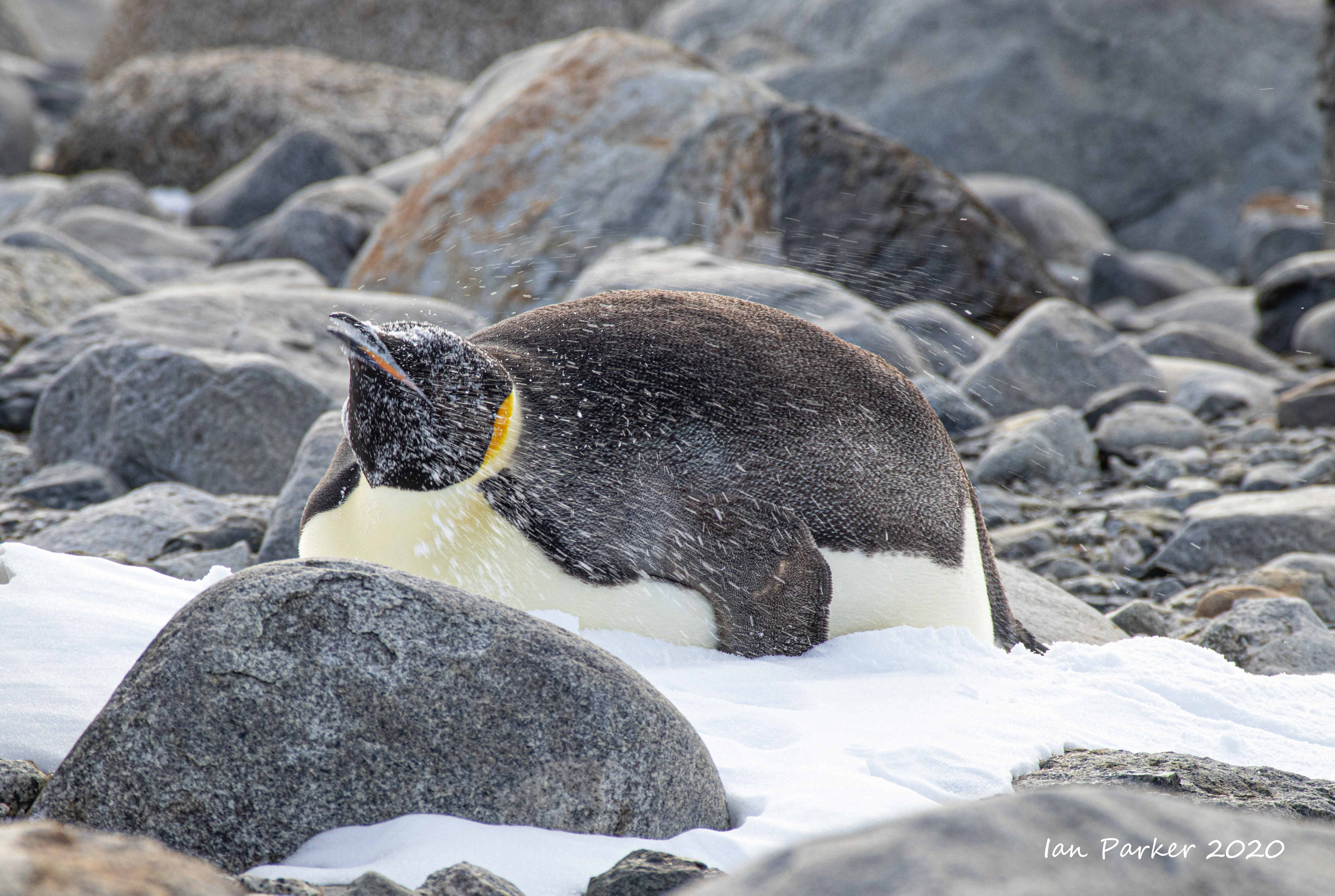
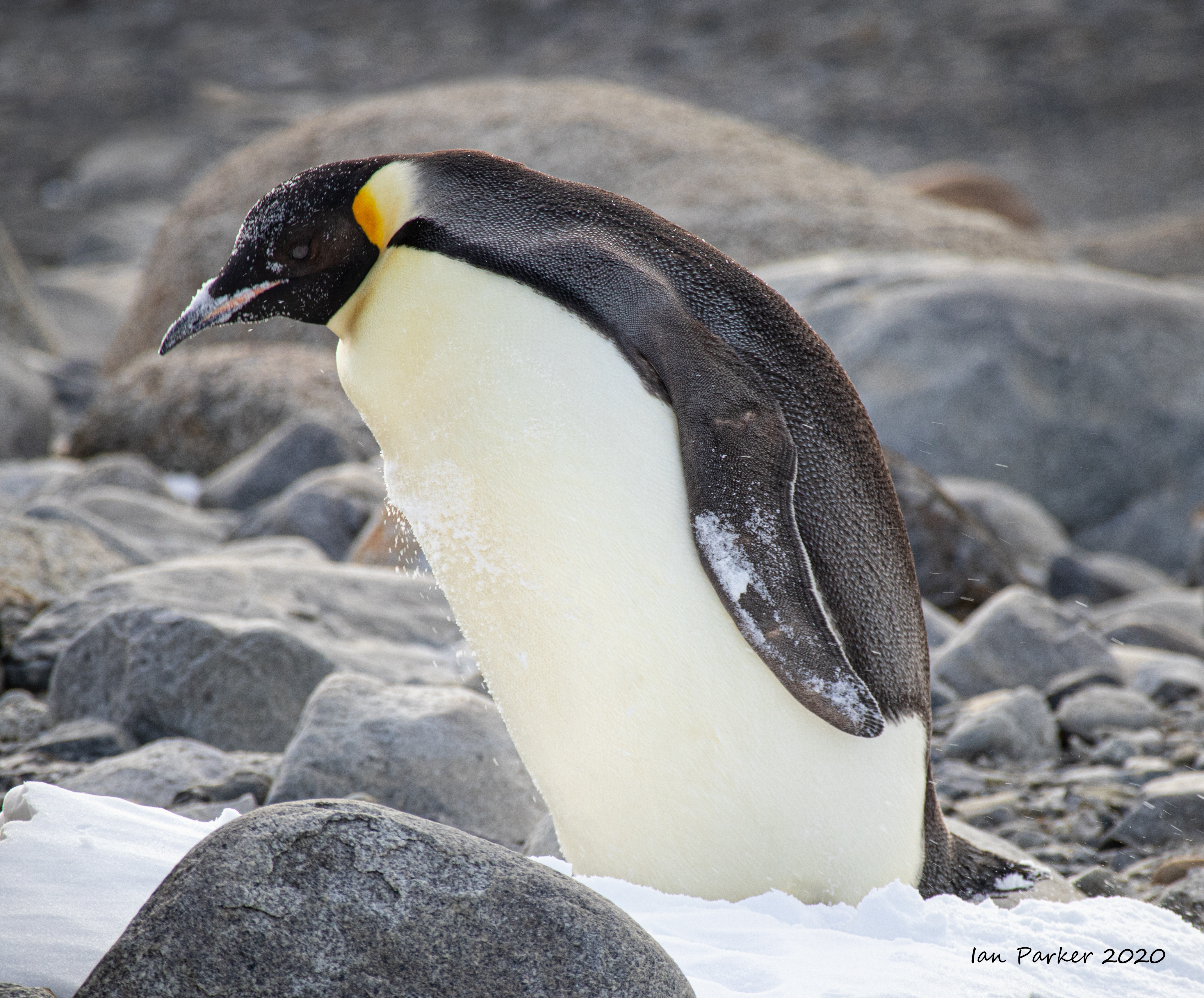
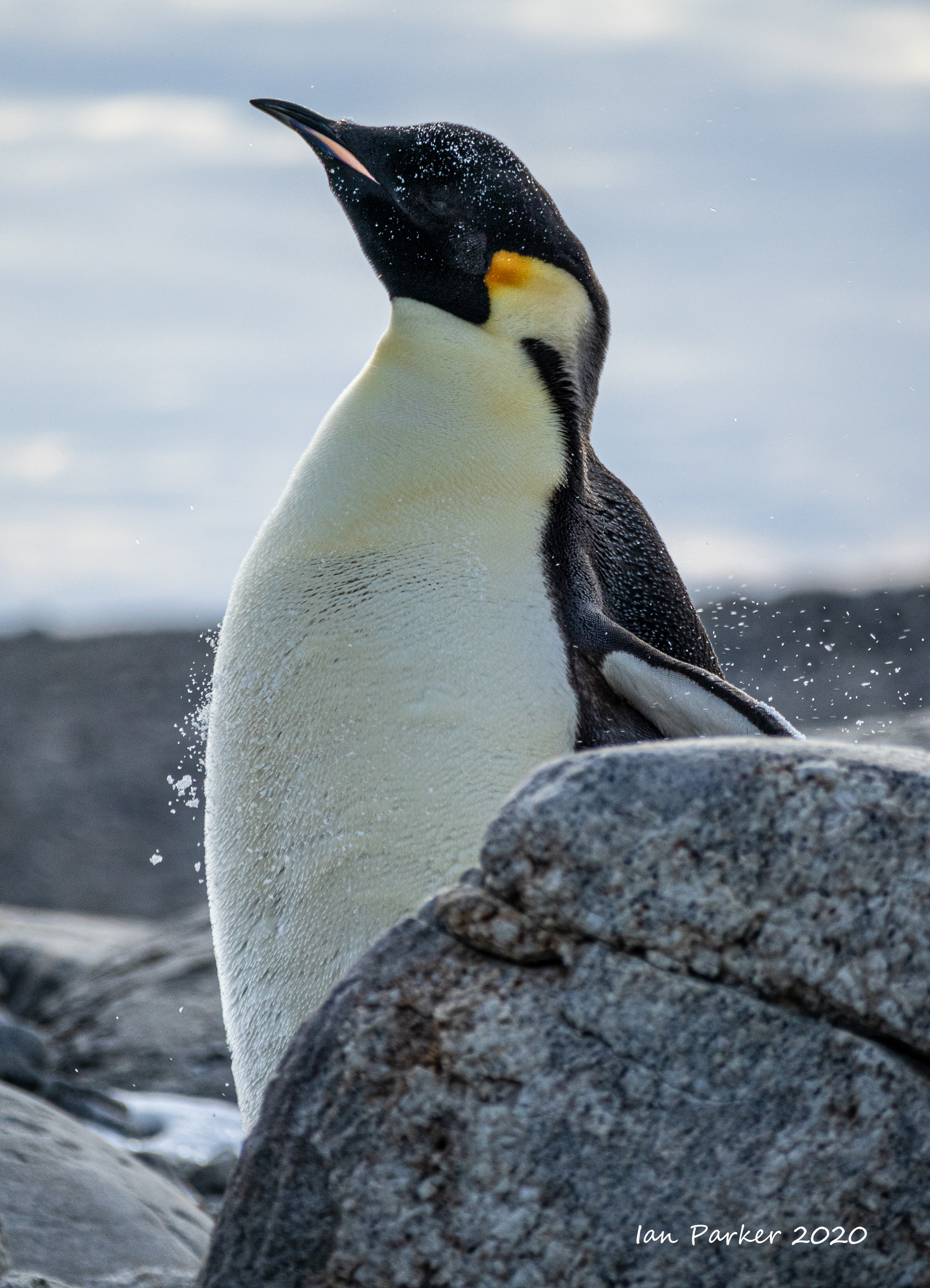
Feb 23 - Inexpressible Island: A close encounter with an Emperor

The site of the snow cave where Victor Campbell's Norther Party were stranded overwinter. As part of Scott's Terra Nova expedition they were dropped at Evans Coves with sledging provisions for six weeks with the intention of completing geological work. After the work was done they were left with rations for about four weeks, as it was not anticipated the ship would have trouble picking them up later in February. But the Terra Nova could not reach them due to heavy pack ice. Unable to connect with their ship, the Northern Party was forced to winter in Antarctica again. In March 1912 they excavated a small ice cave in a snow drift they nicknamed "Inexpressible Island" where they spent the winter in miserable conditions, supplementing their rations by killing scarce seals and penguins for meat. The men started home for Hut Point on September 30, 1912, some two hundred miles down the coast, finally reaching safety on November 5th.
No trace remains of the ice cave, but the site is marked by a plaque and some scattered bones, and is designated A Historic Monument.

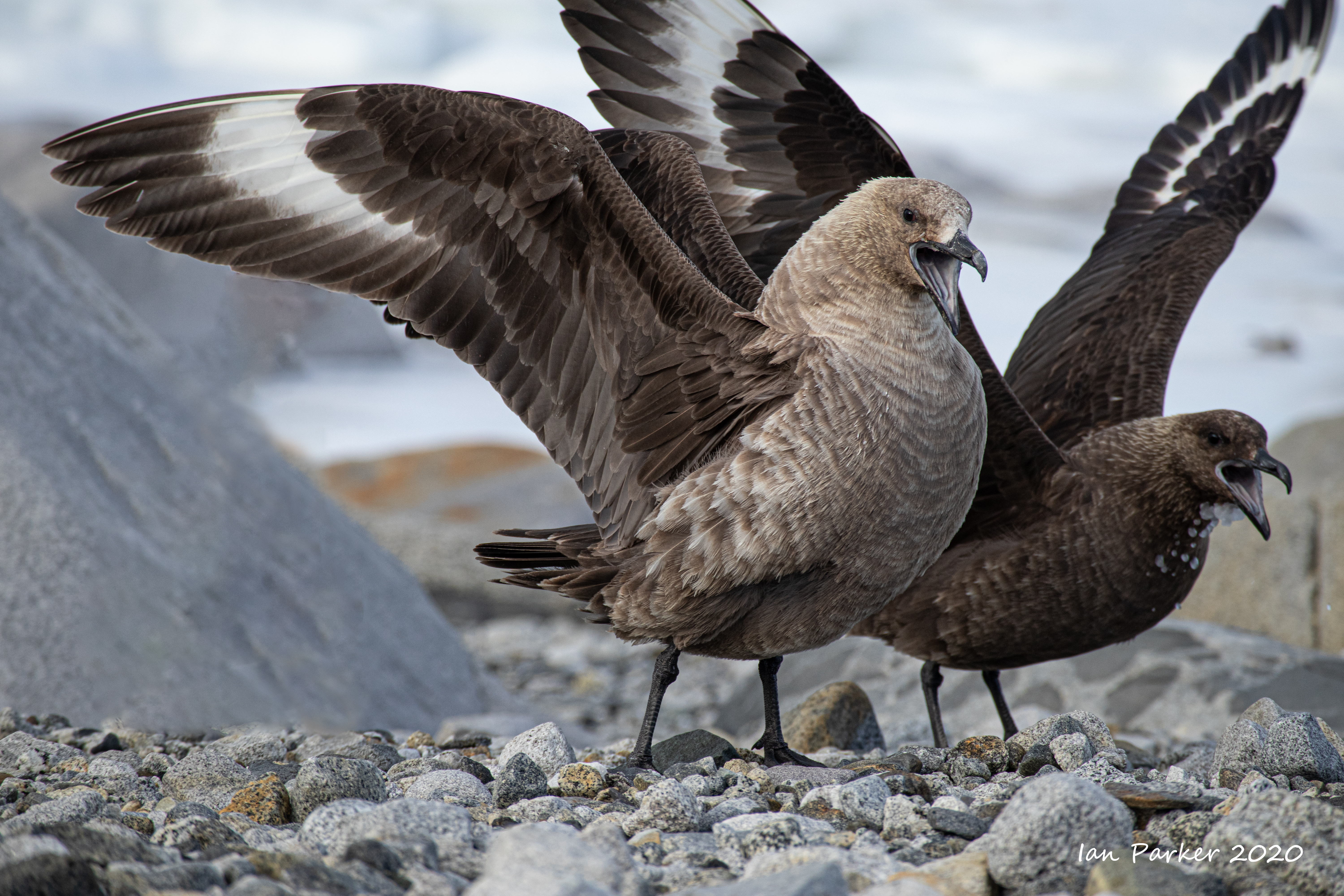
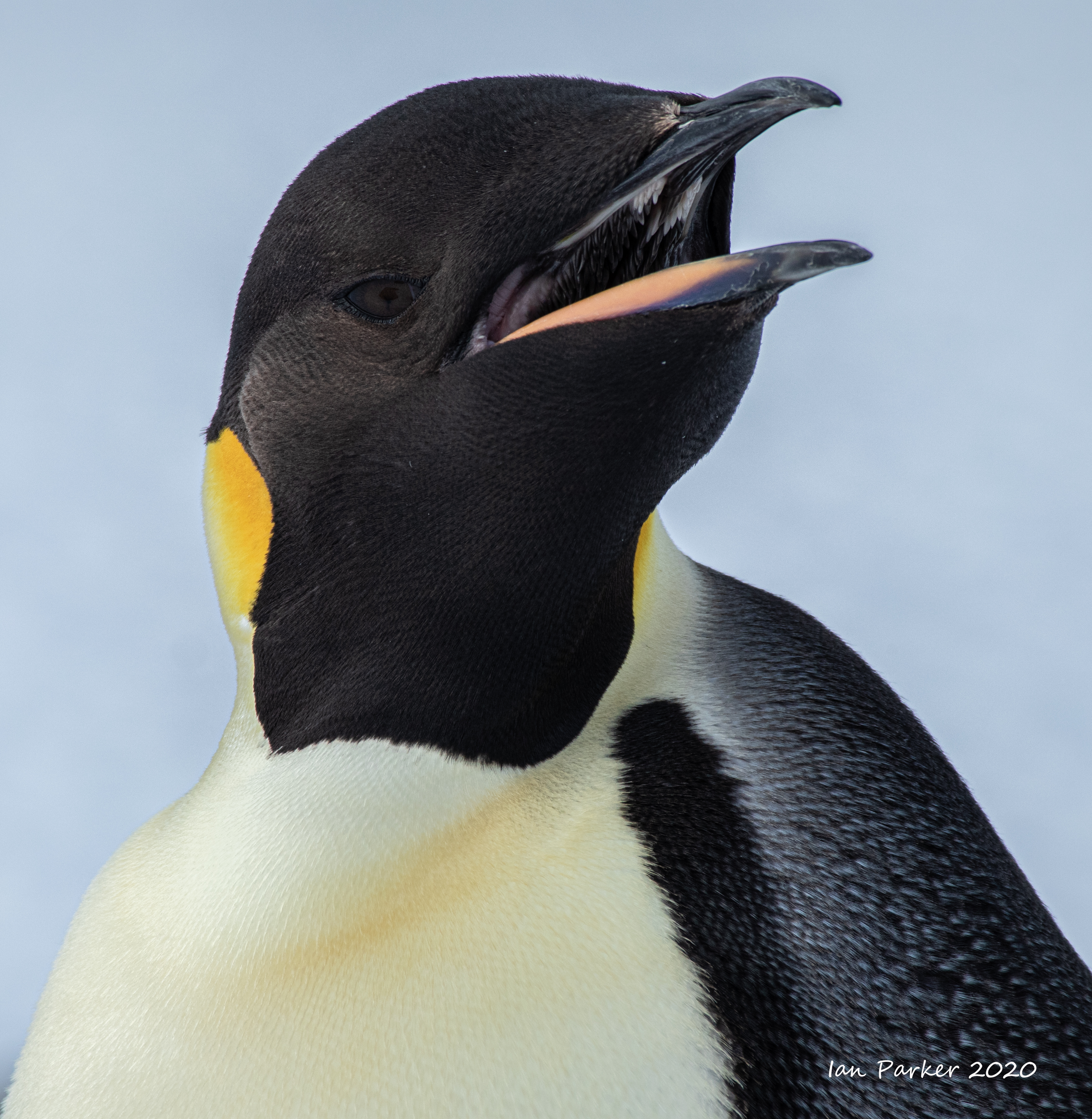
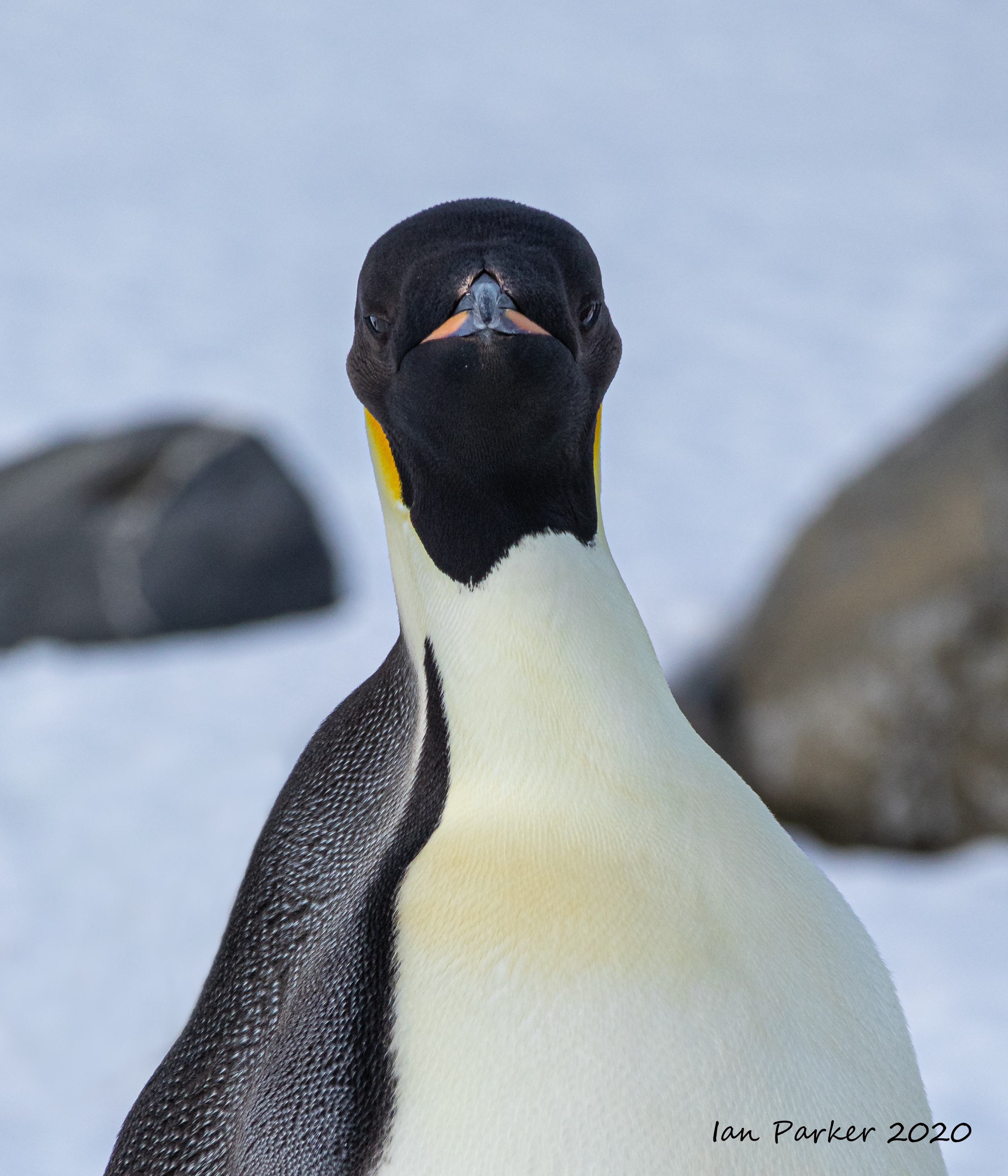
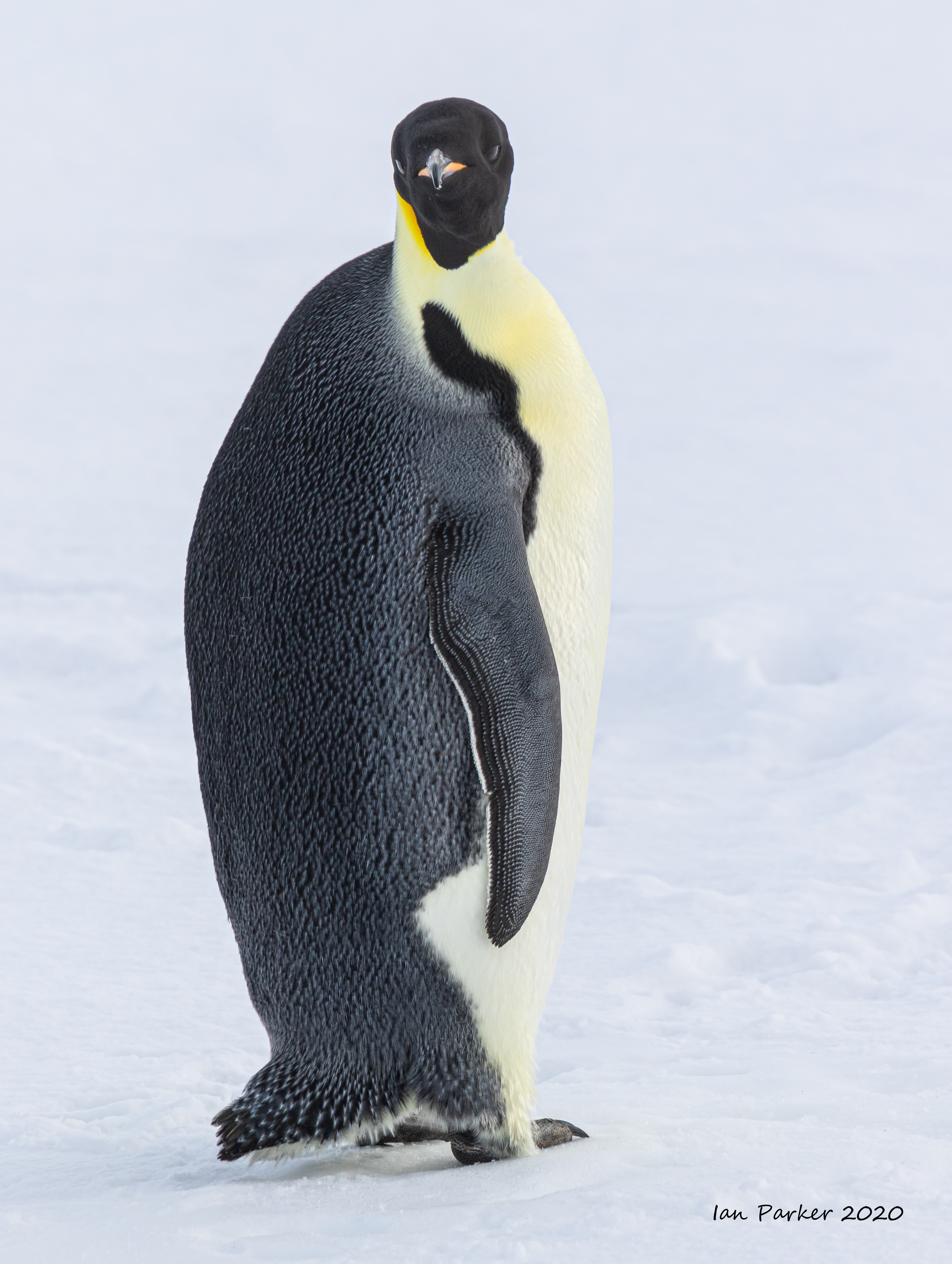
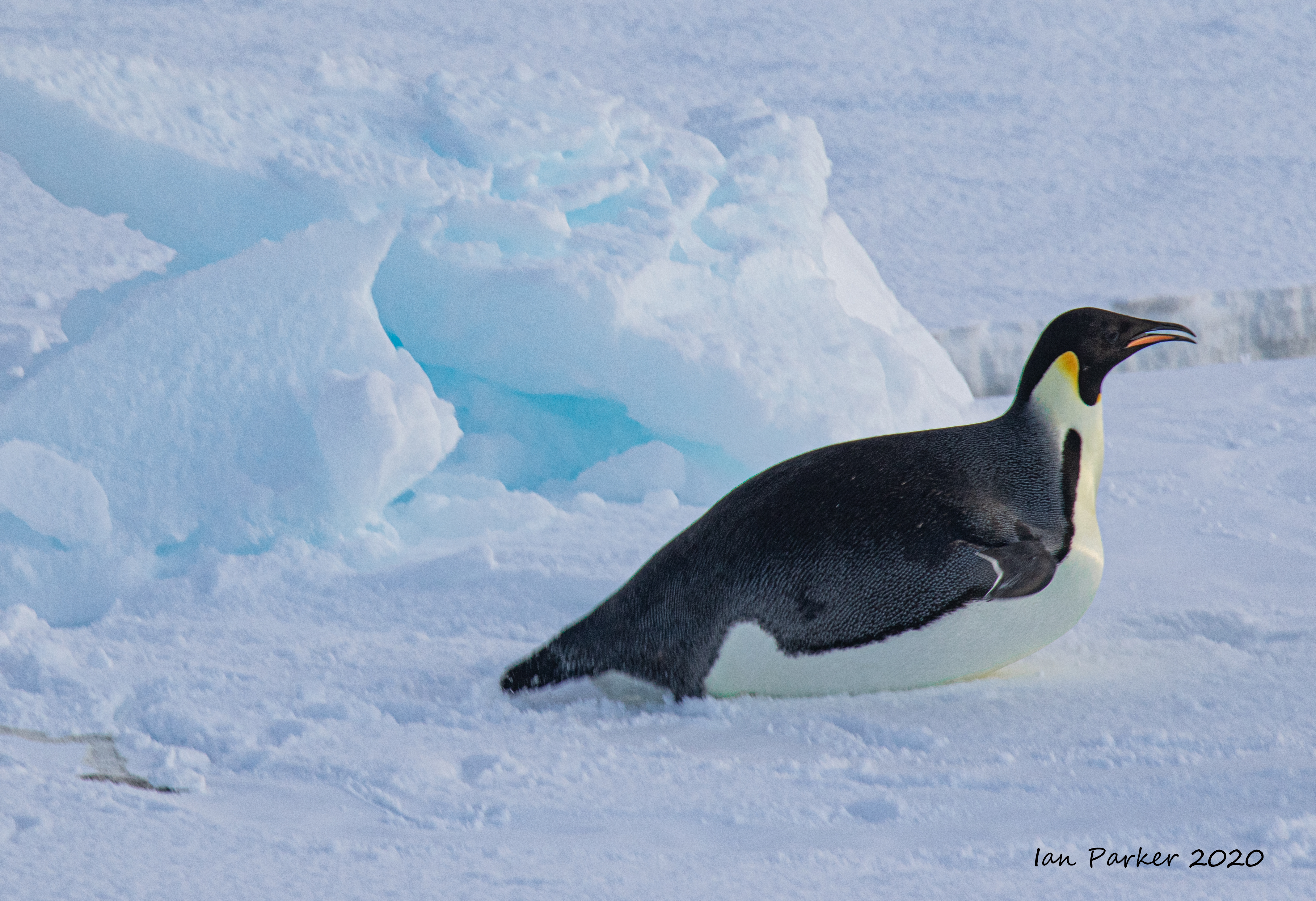
A close encounter with an Emperor
Several of our party spotted an emperor penguin among boulders at the bottom of the snow drift where Campbell's party made their snow cave. It is said that emperors are the only species of bird that is never found on land - but clearly this individual was not aware of this stipulation.
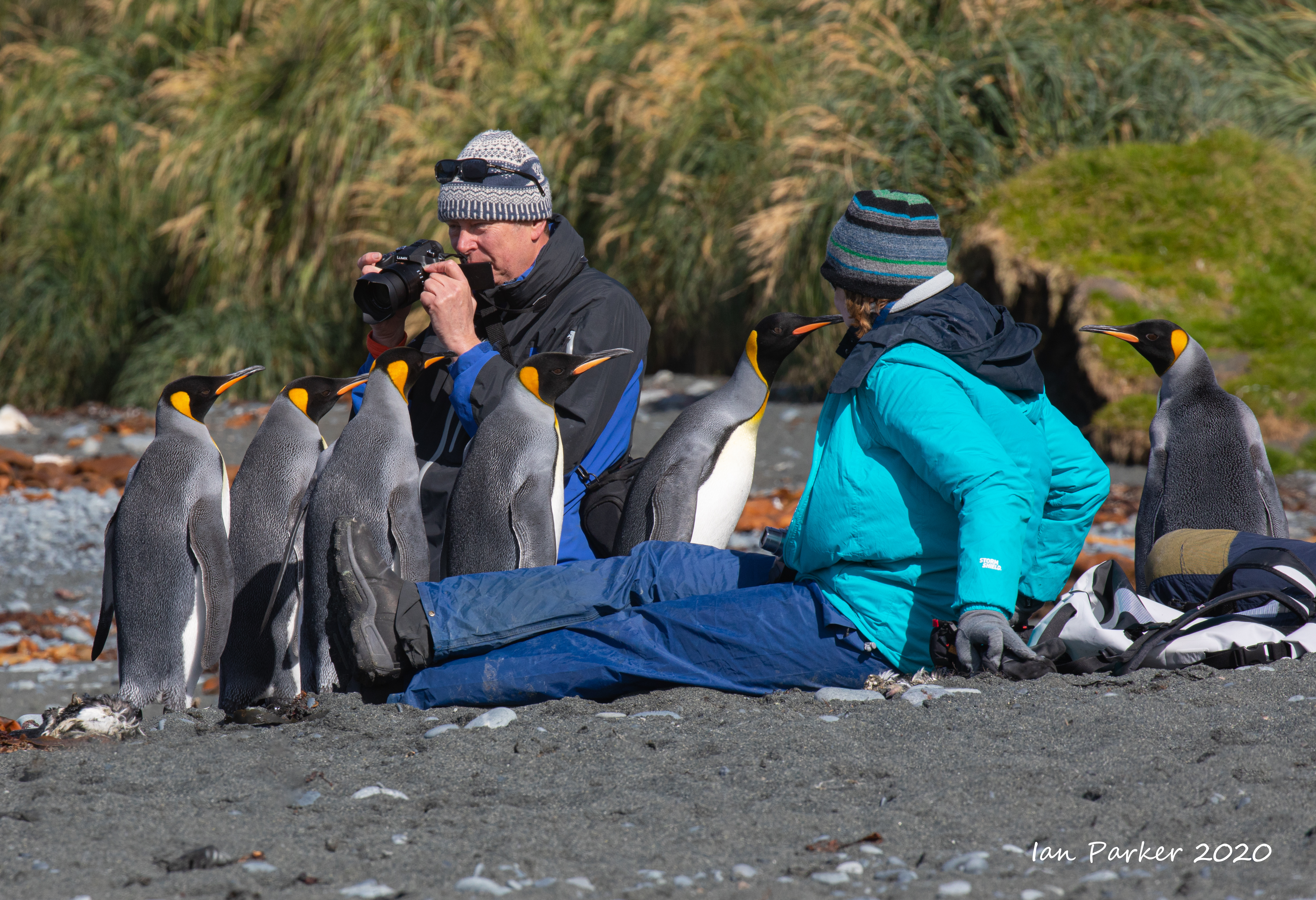
The rule in Antarctica is never to approach closer than 15 feet to wildlife. But if you sit quietly, the wildlife are free to approach as close as they wish. King penguins are very inquisitive, and have often come up to investigate
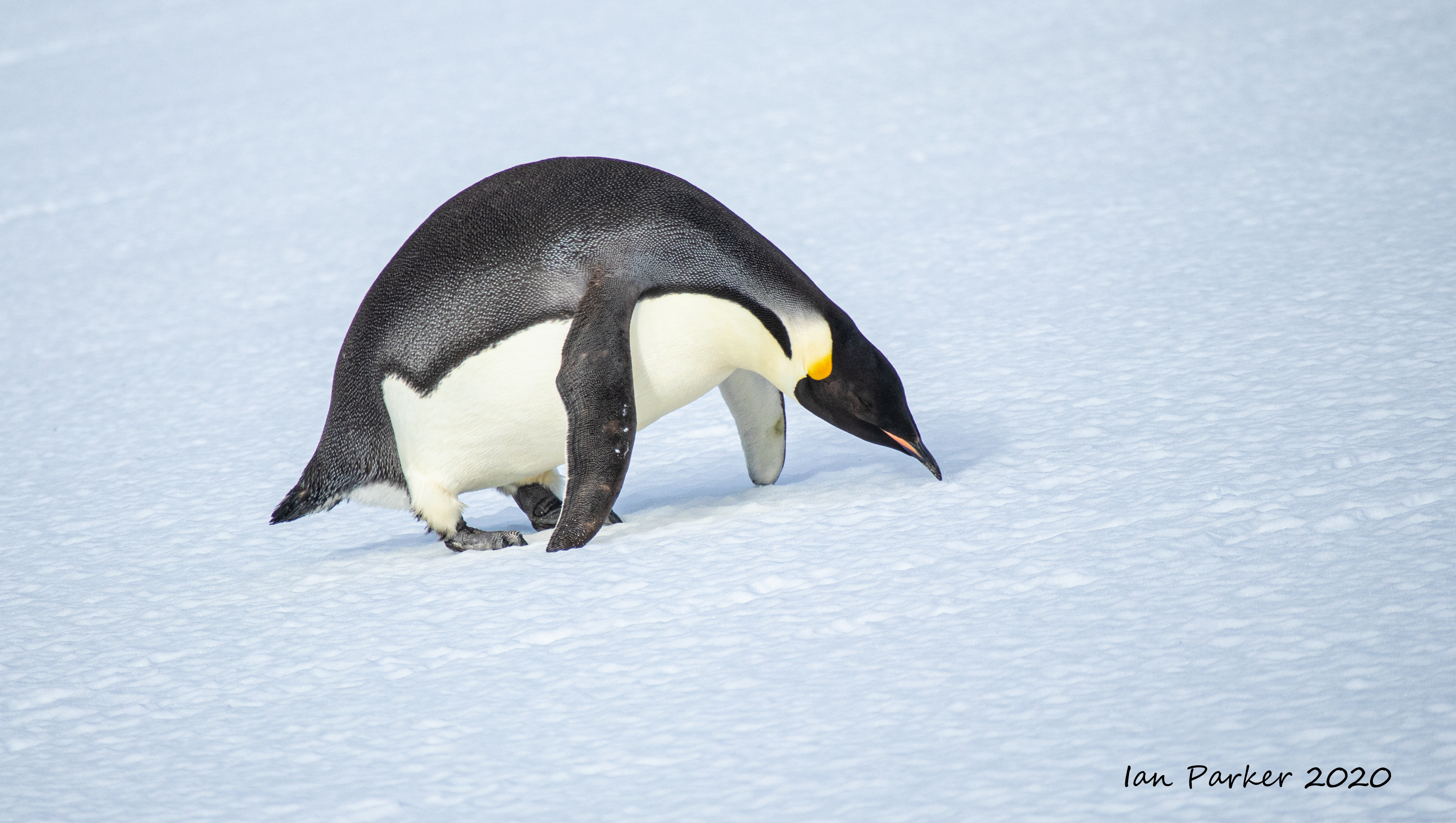
and peck my boots and tripod. My sole experience with an emperor penguin, on the other hand, suggests that they are not curious creatures, but stoically proceed in their own direction at their own steady pace, taking no notice of human visitors. My penguin here left the boulders and started heading up the snow slope along a direct path. I estimated where it might reach the crest, scampered ahead and sat down to wait. Luckily, I had guessed correctly, and experienced a wonderful close encounter with 'my' emperor.

The rule in Antarctica is never to approach closer than 15 feet to wildlife. But if you sit quietly, the wildlife are free to approach as close as they wish. King penguins are very inquisitive, and have often come up to investigate
and peck my boots and tripod. My sole experience with an emperor penguin on the other hand suggests that they are not curious creatures, but stoically proceed in their own direction at their own steady pace, taking no notice of human visitors. My penguin here left the boulders and started heading up the snow slope along a direct path. I estimated where it might reach the crest, scampered ahead and sat down to wait. Luckily, I had guessed correctly, and experienced a wonderful close encounter with 'my' emperor.


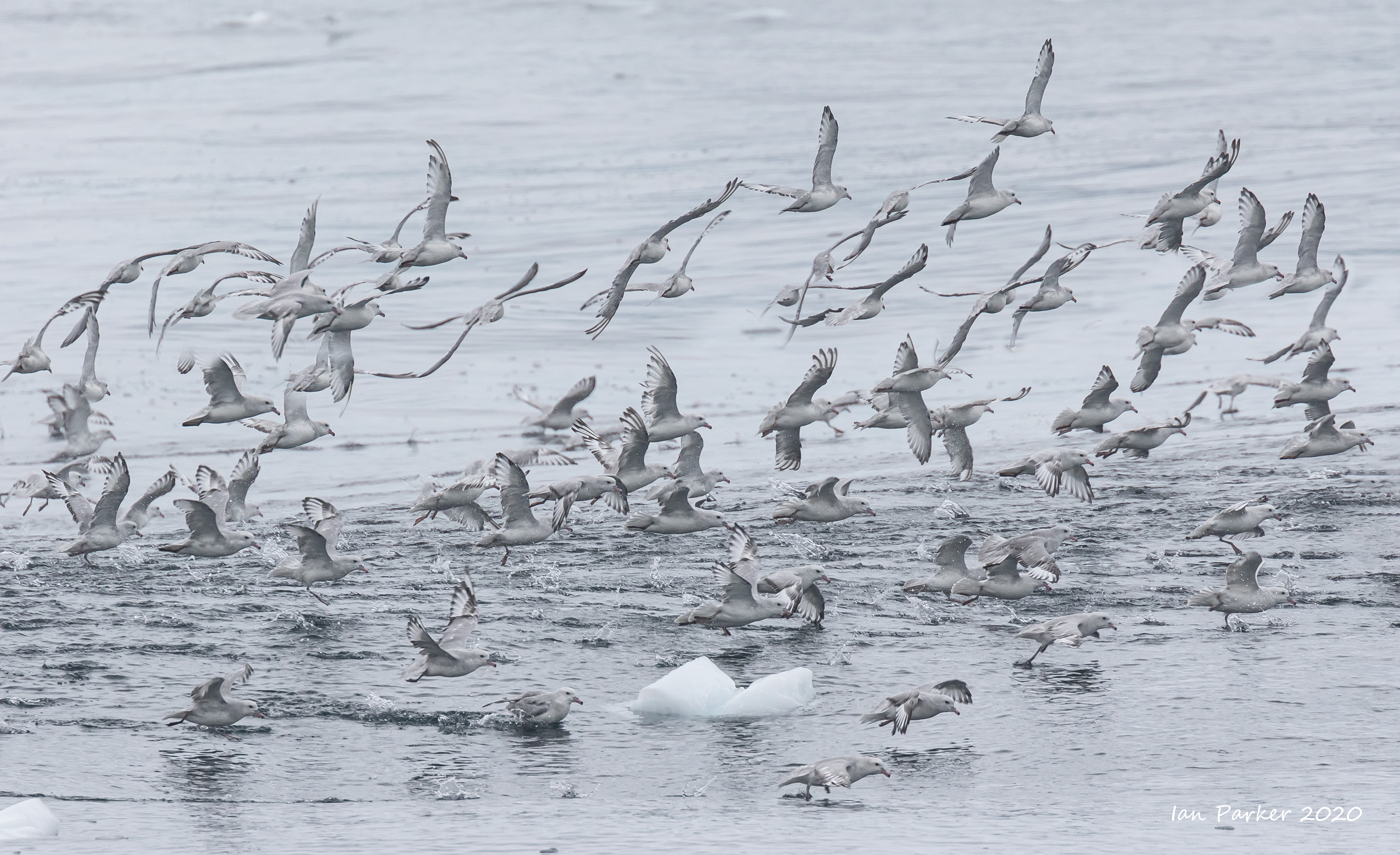
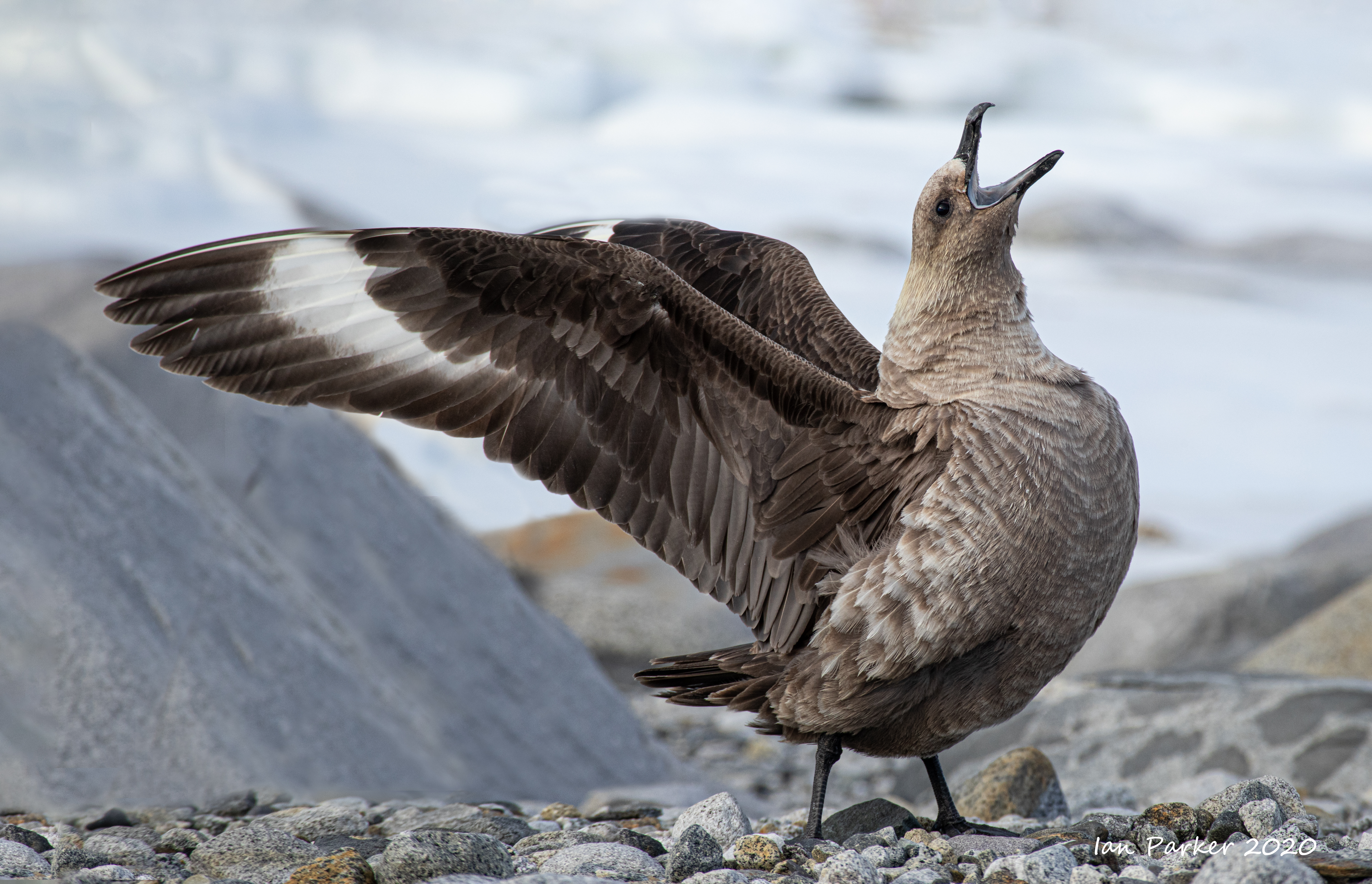
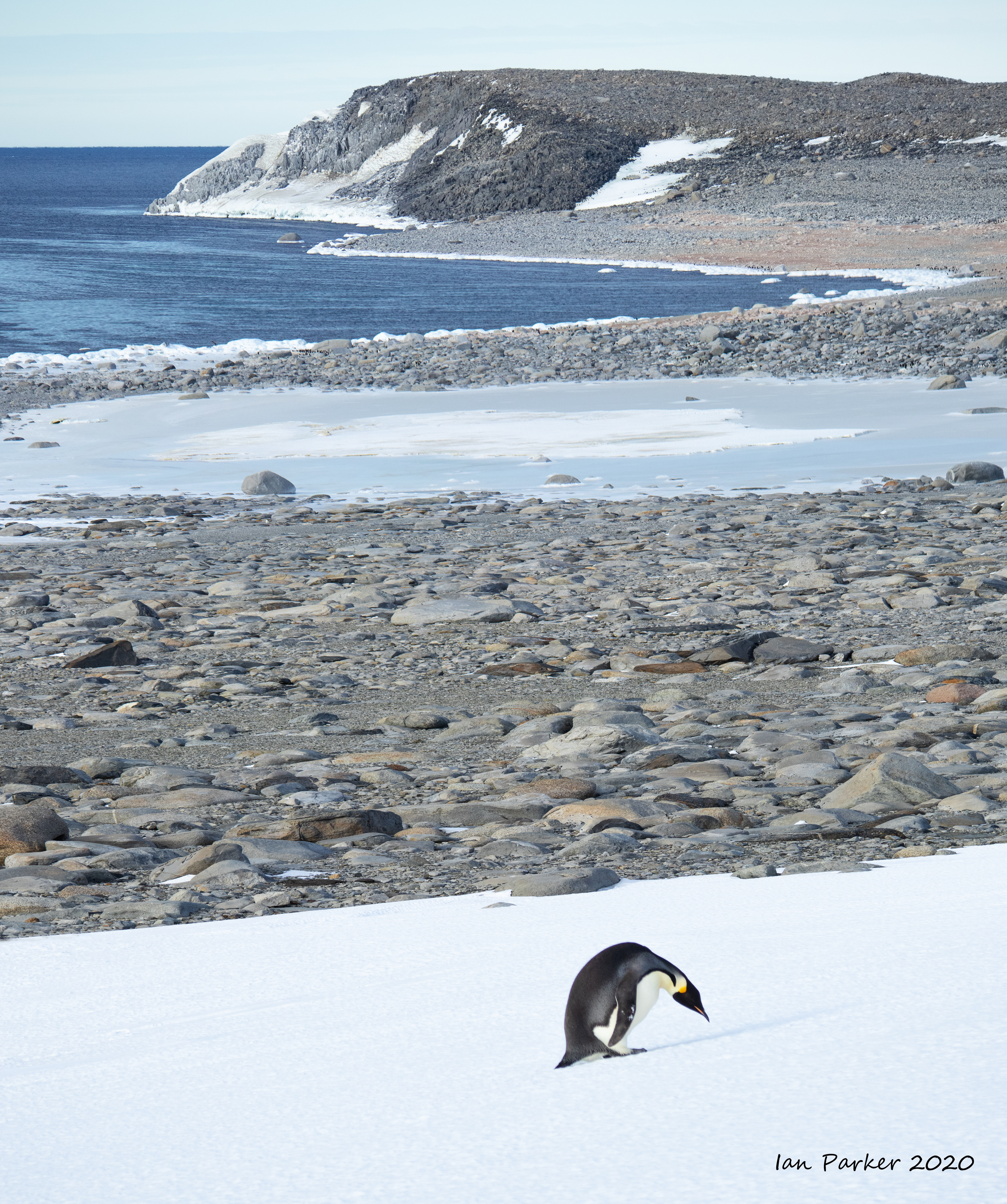
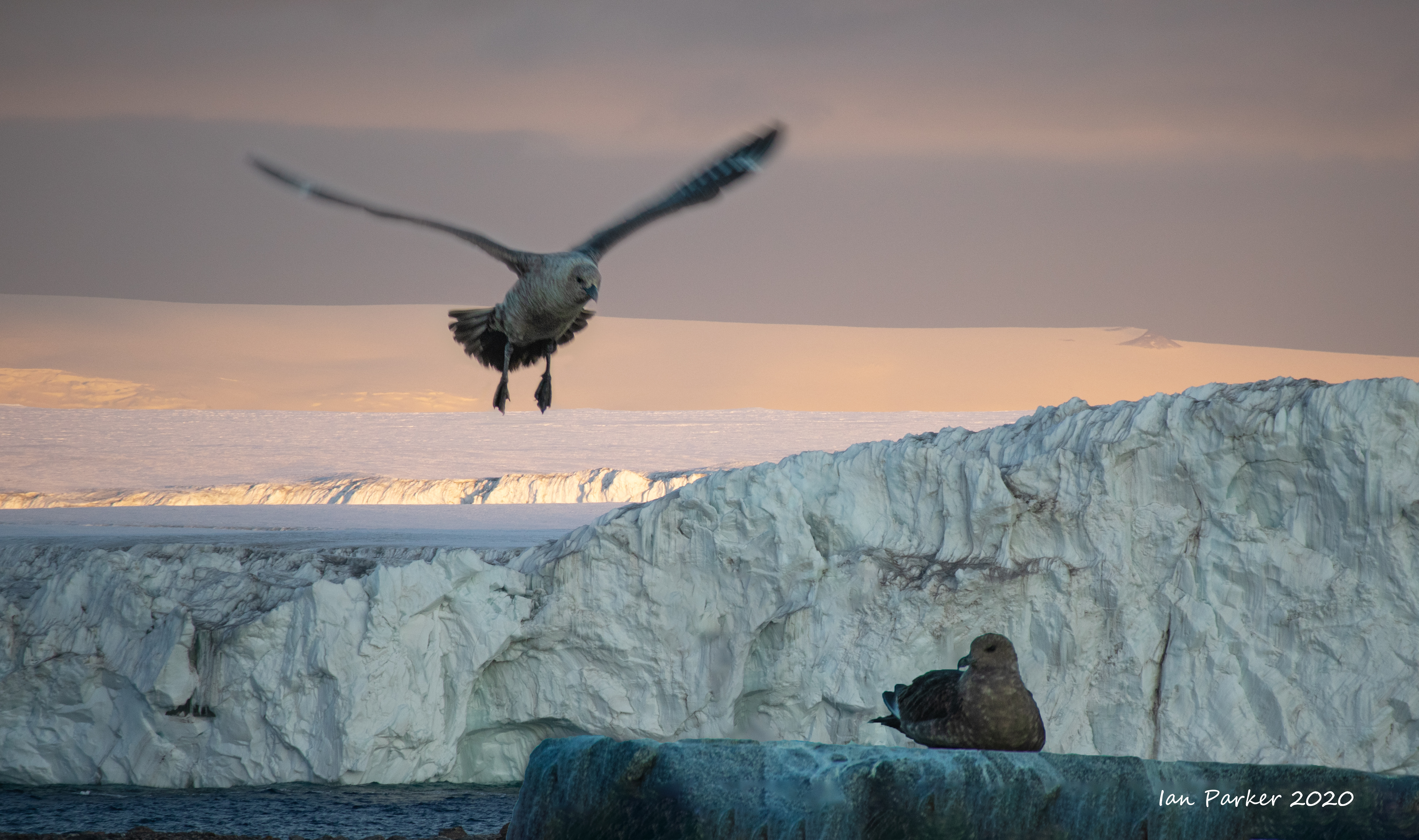
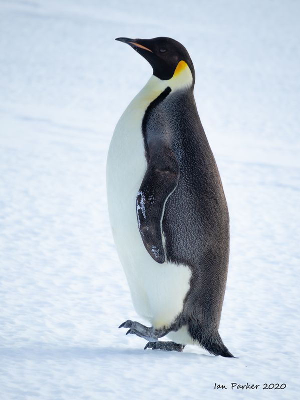
Feb 22 - Ross Ice Shelf and first Emperor Penguins
We spotted our first Emperor penguins as two very small black dots, far out on the Ross ice shelf. I went back to our cabin to get a teleconverter to try to make them look bigger, but by the time I got back up on deck they had disappeared into the sea. Anne was happy to have at least seen Emperors, but soon after we came upon another pair, quite close to the edge of the ice. Our captain carefully and slowly maneuvered the ship directly alongside without disturbing the penguins, getting us close enough to fill the frame with a telephoto lens.

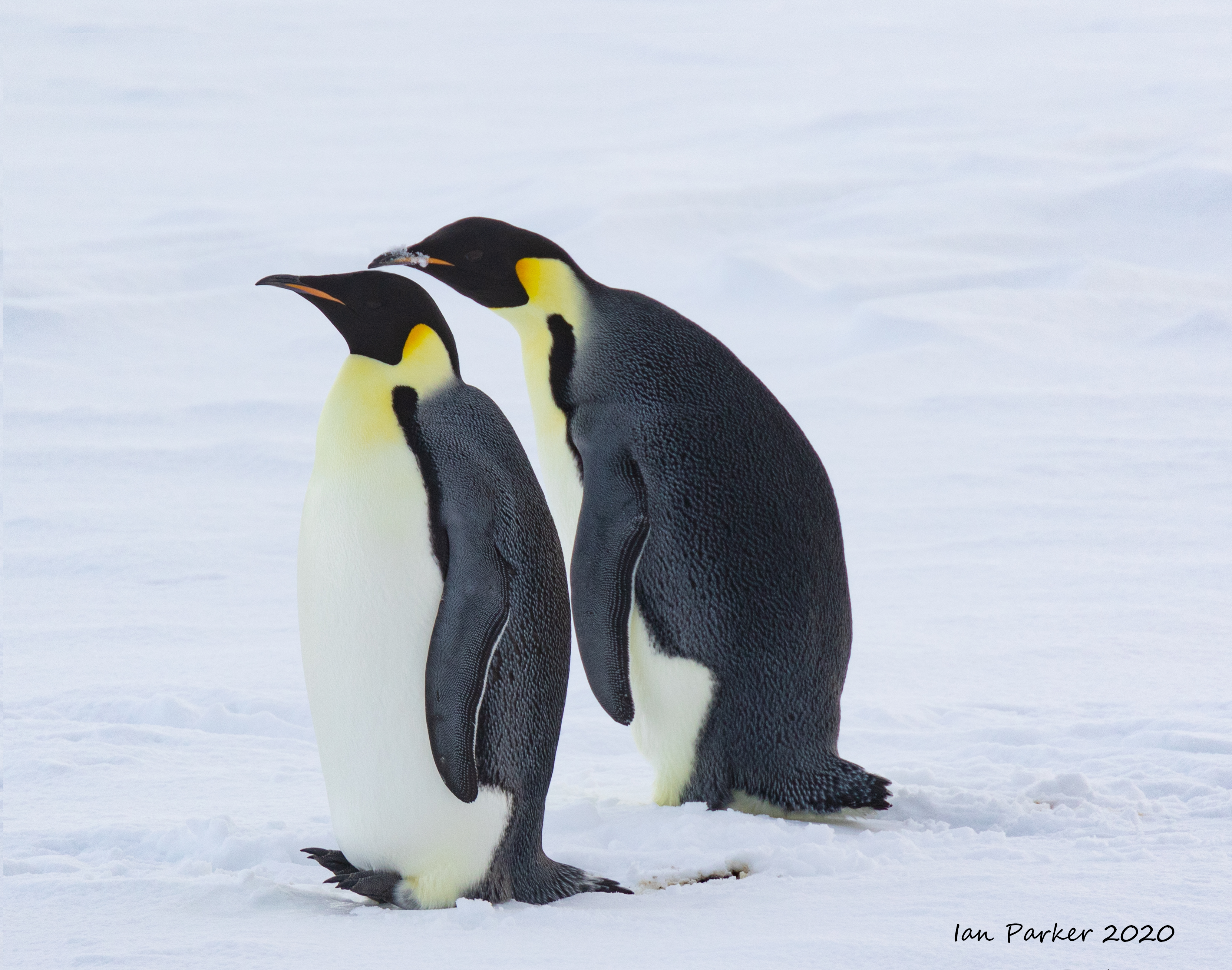
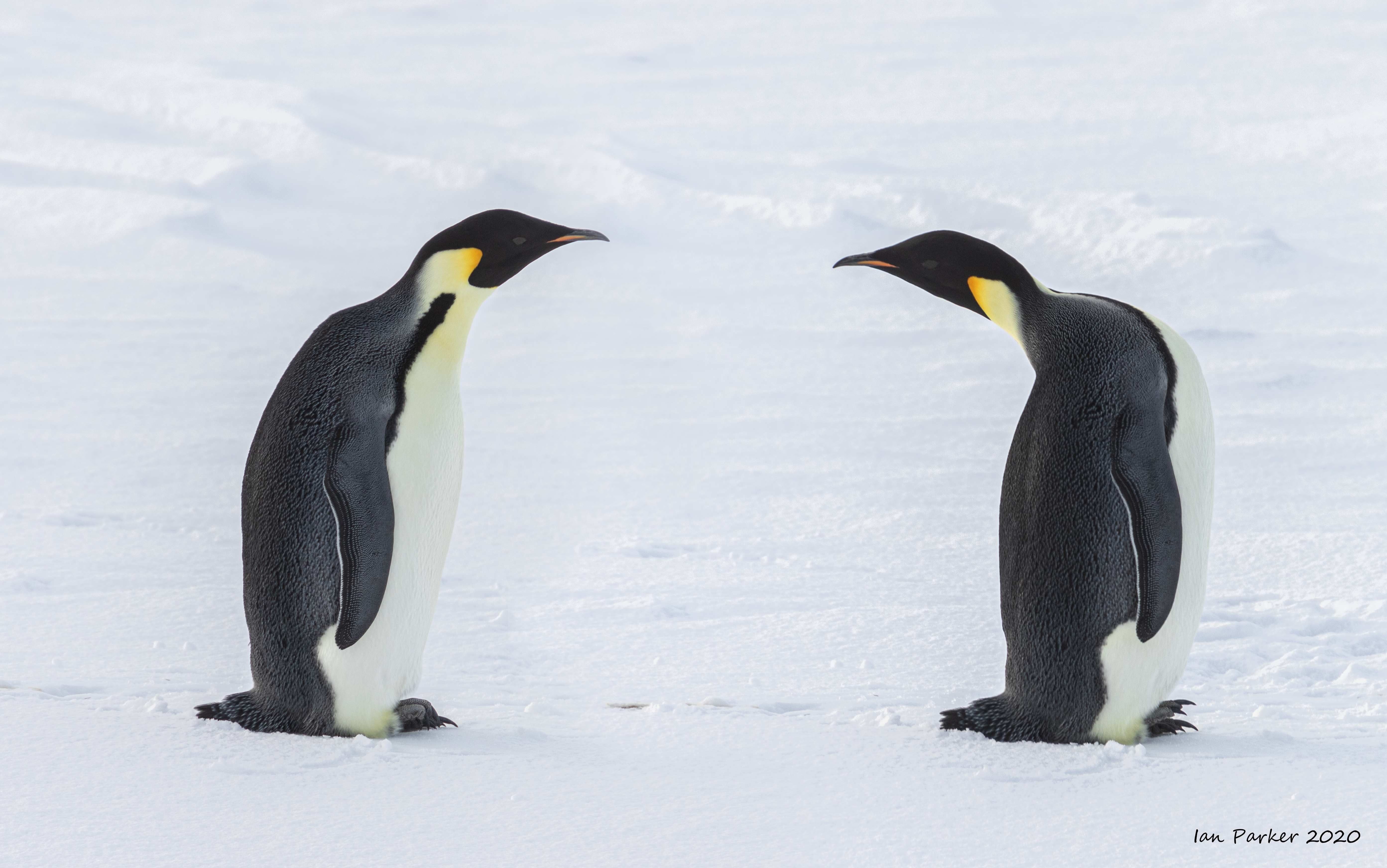
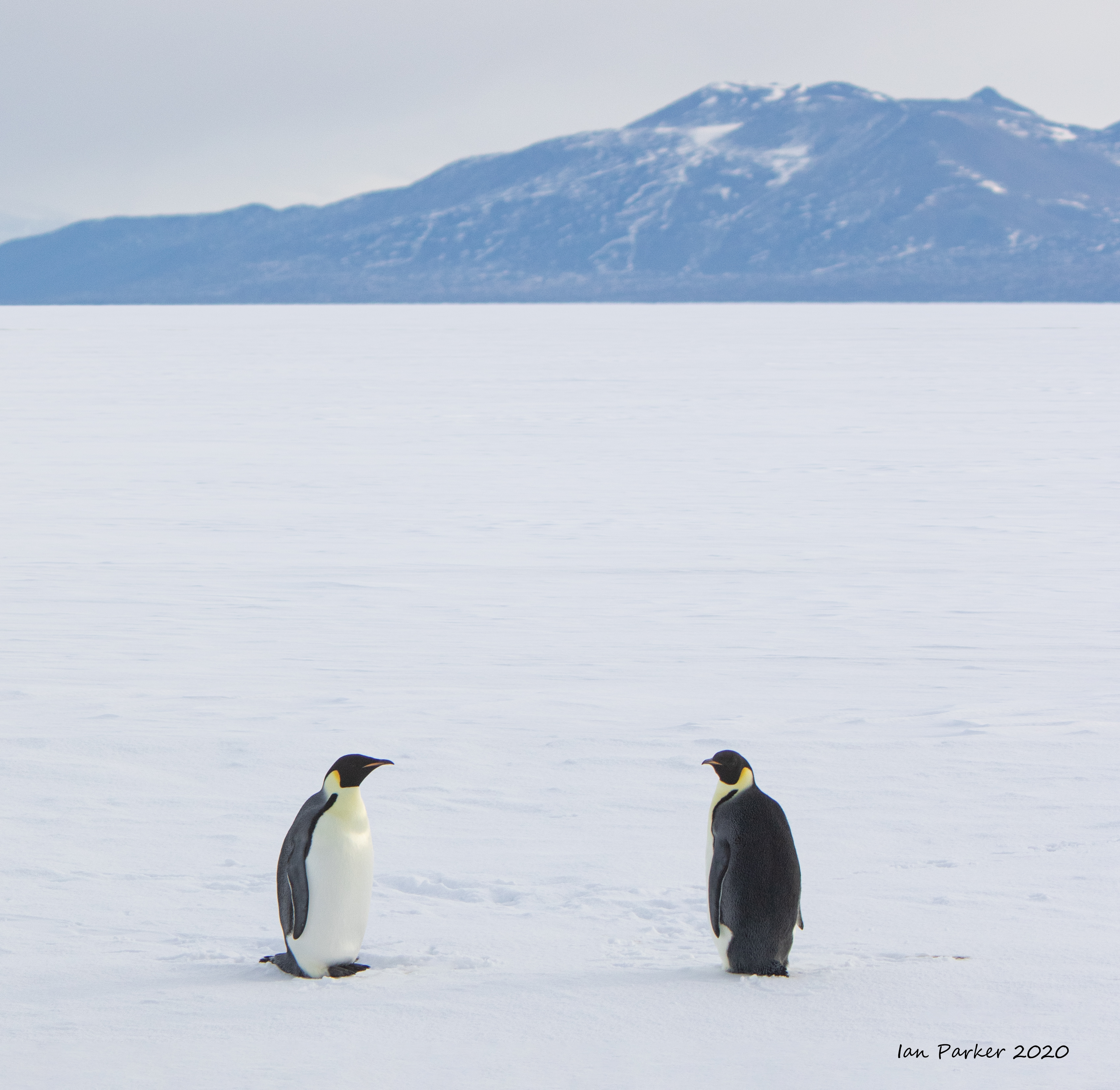

And later we found a larger group of Emperors on a drifting ice floe.
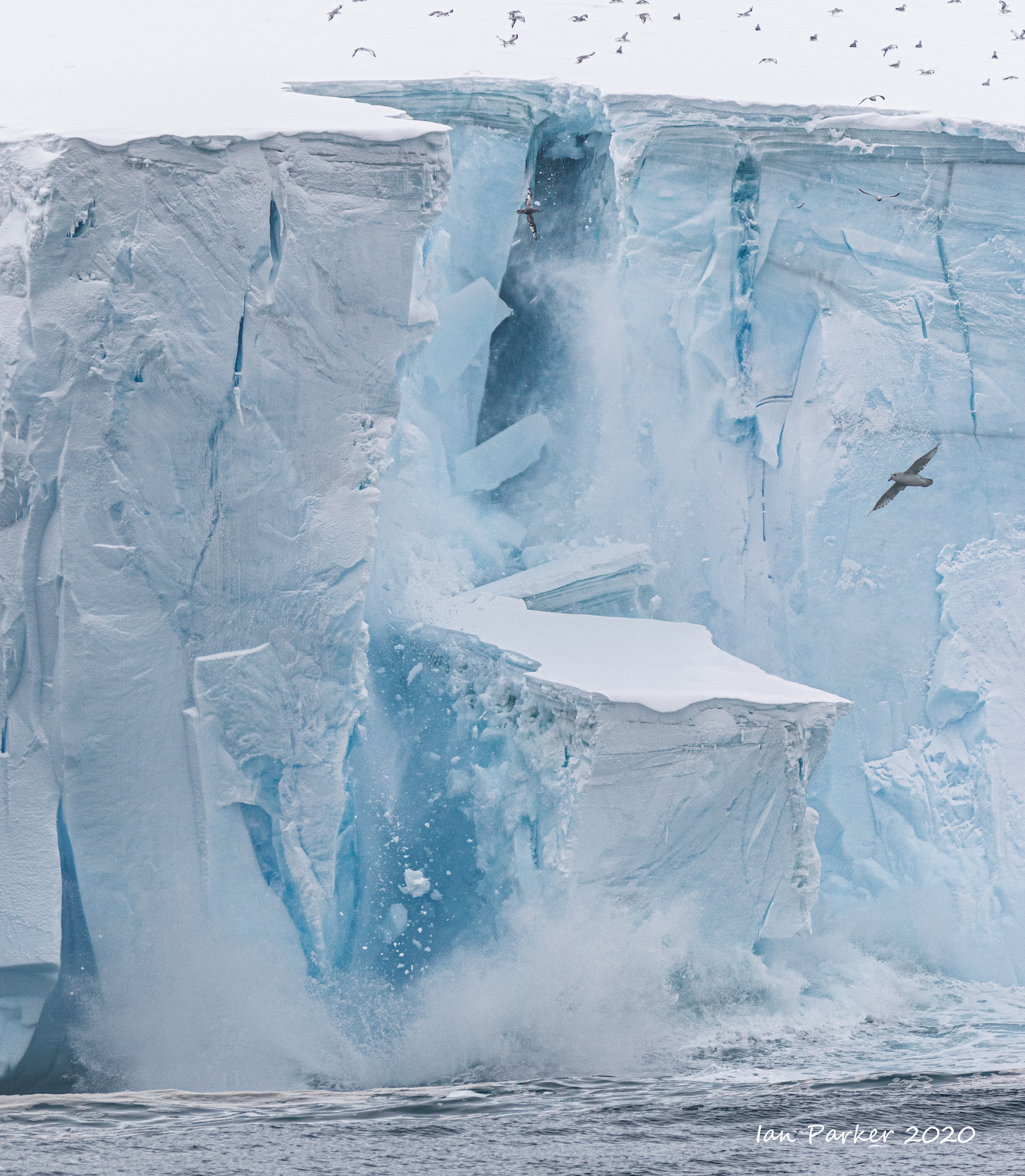
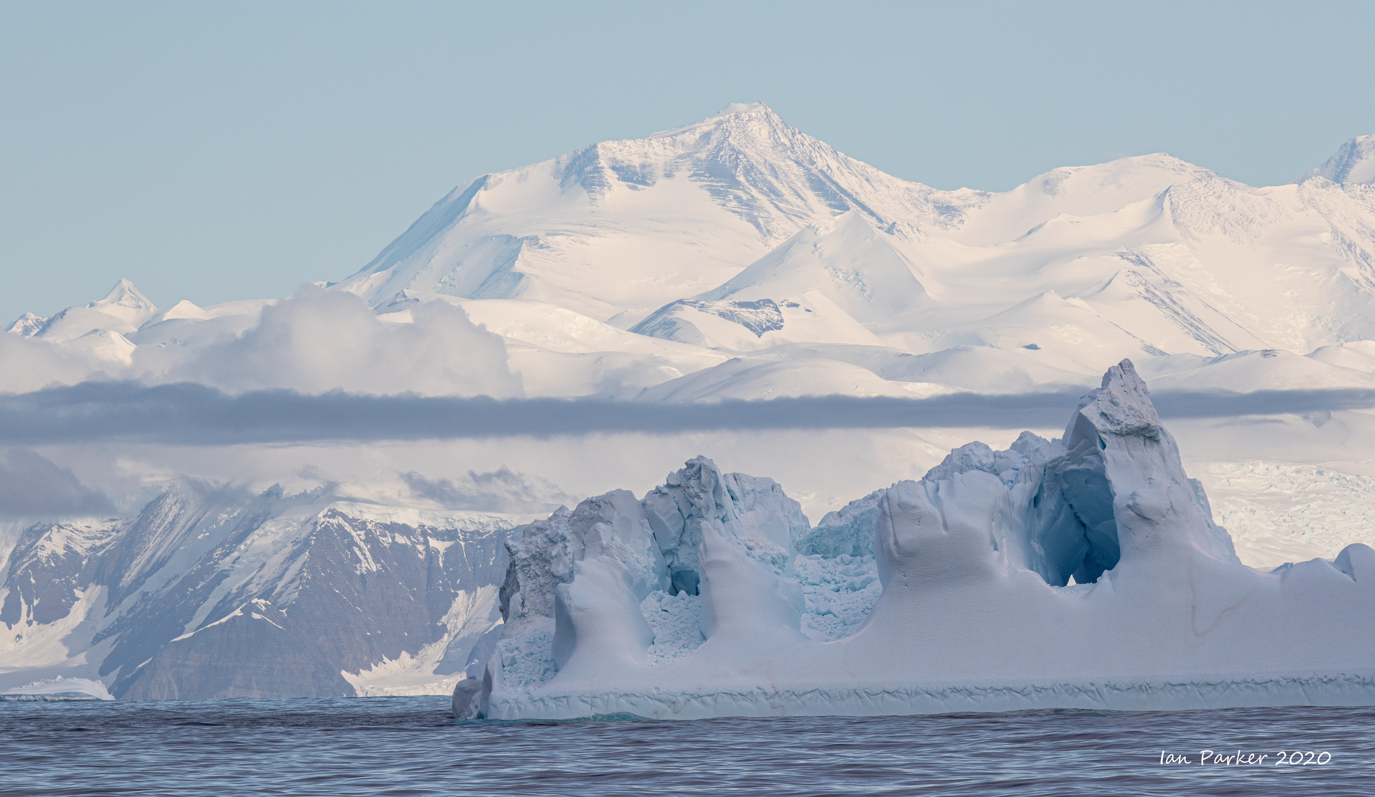
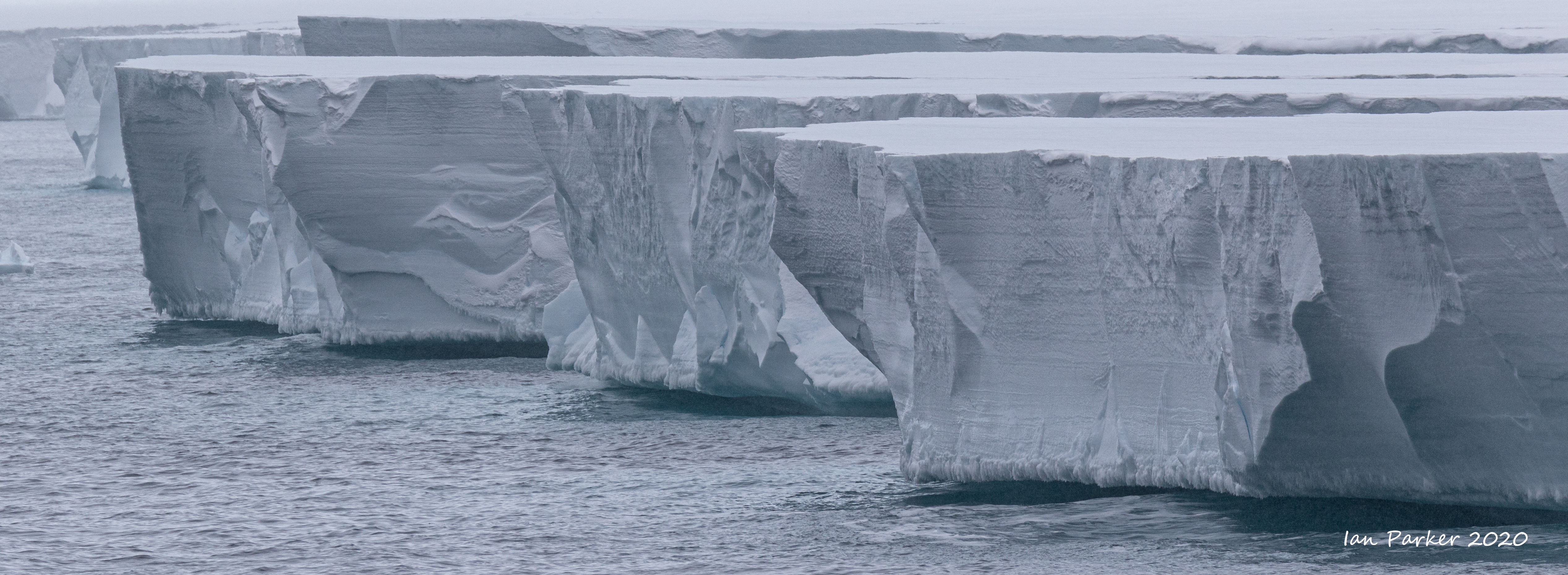
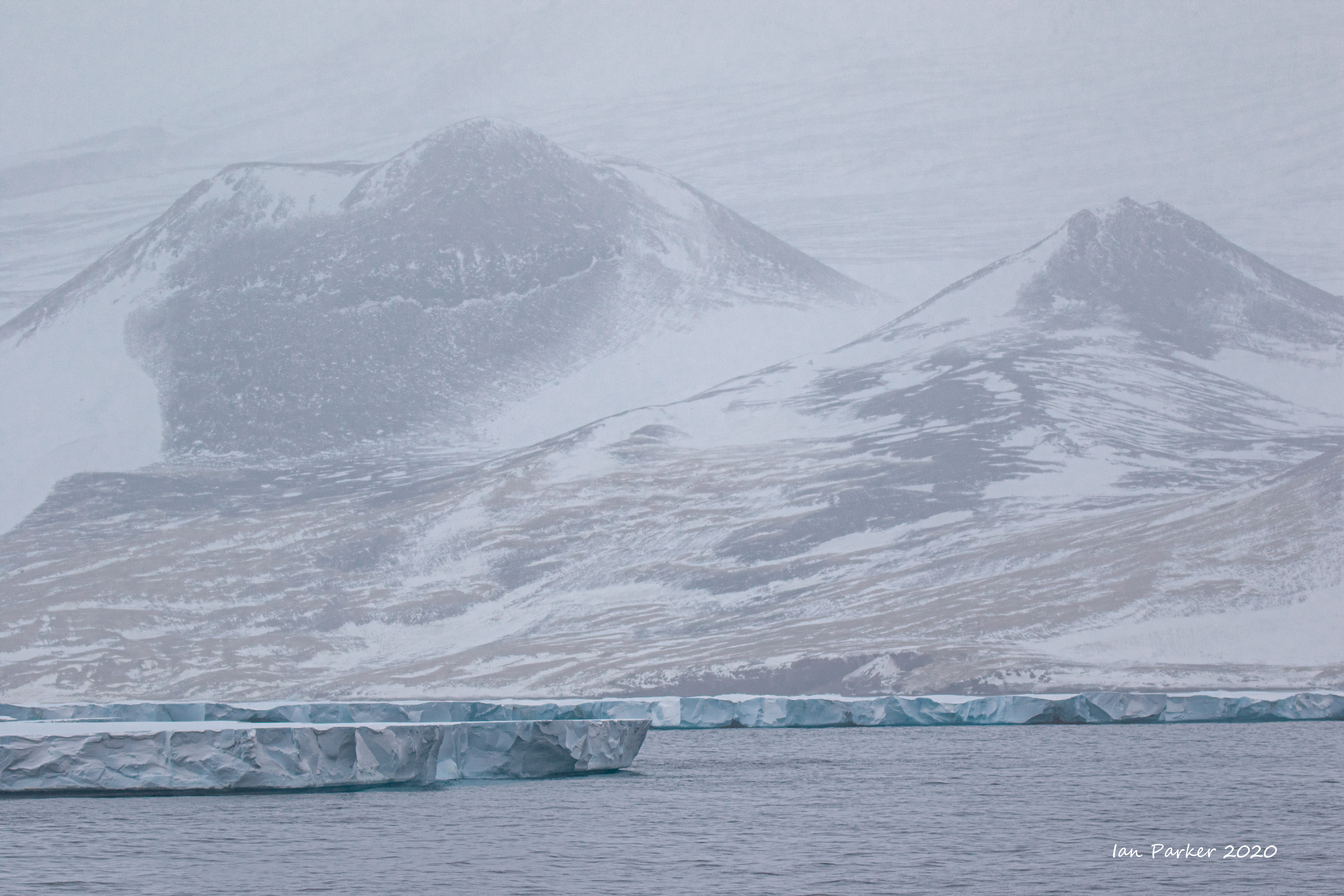
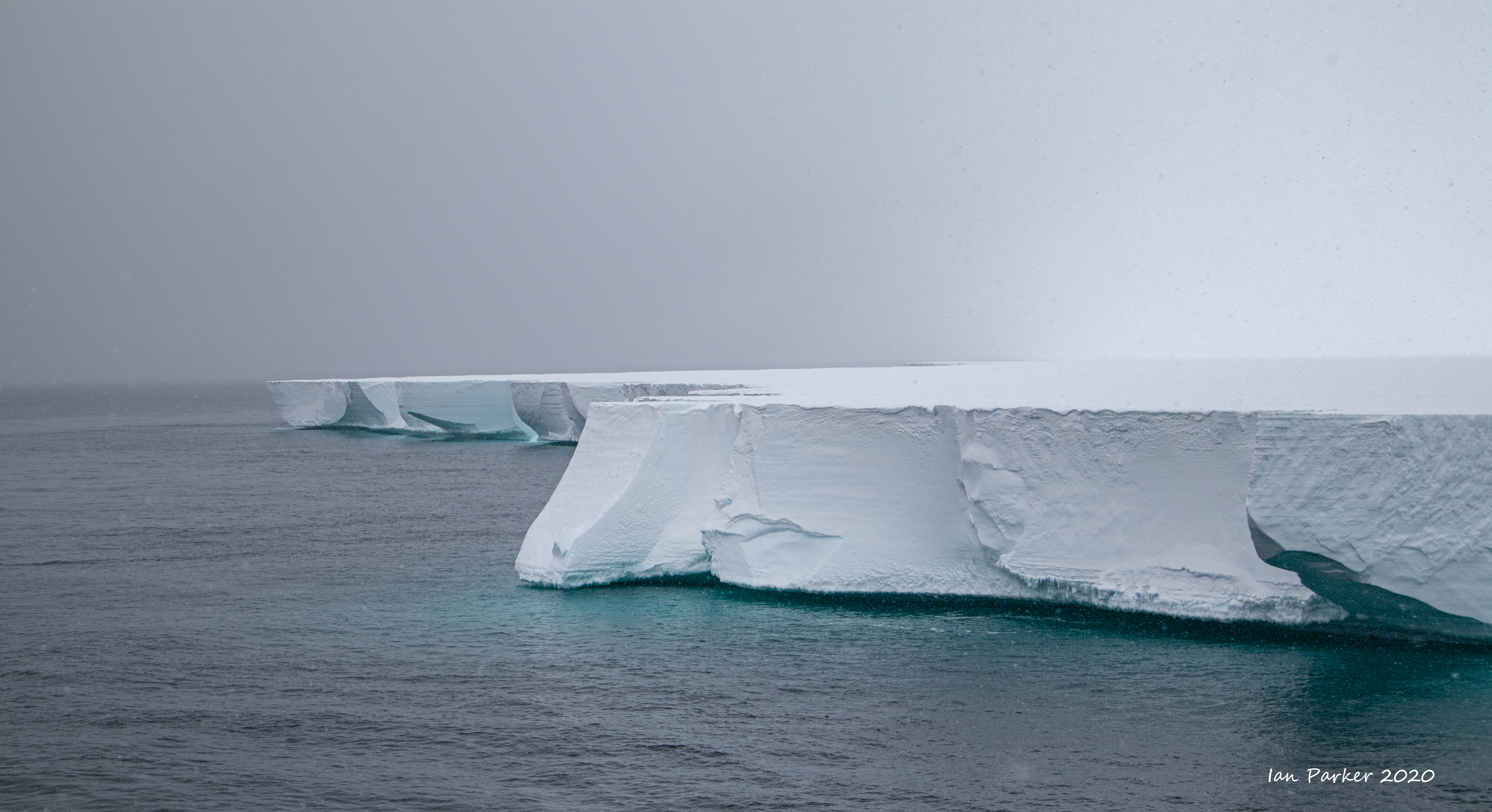
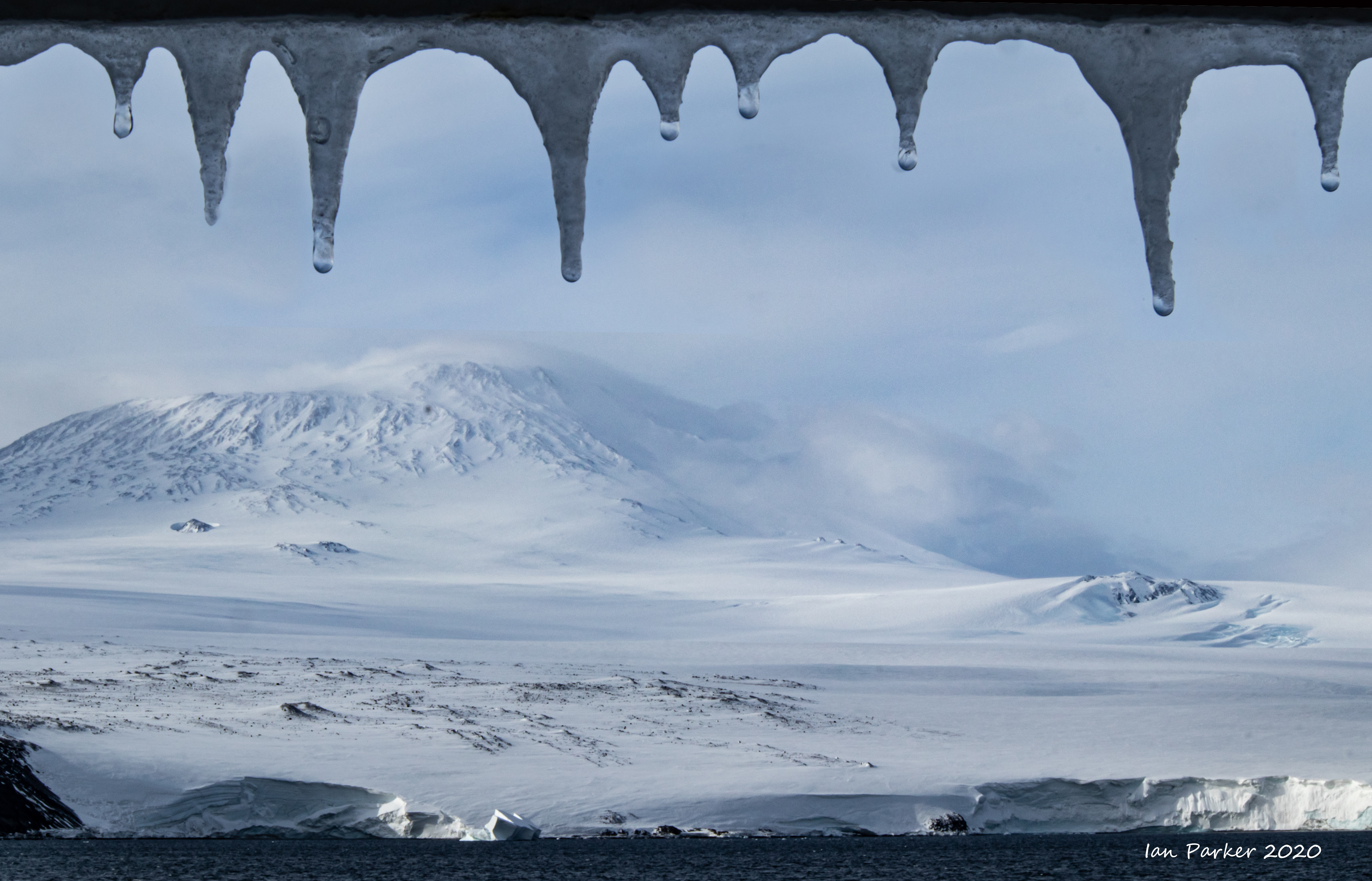
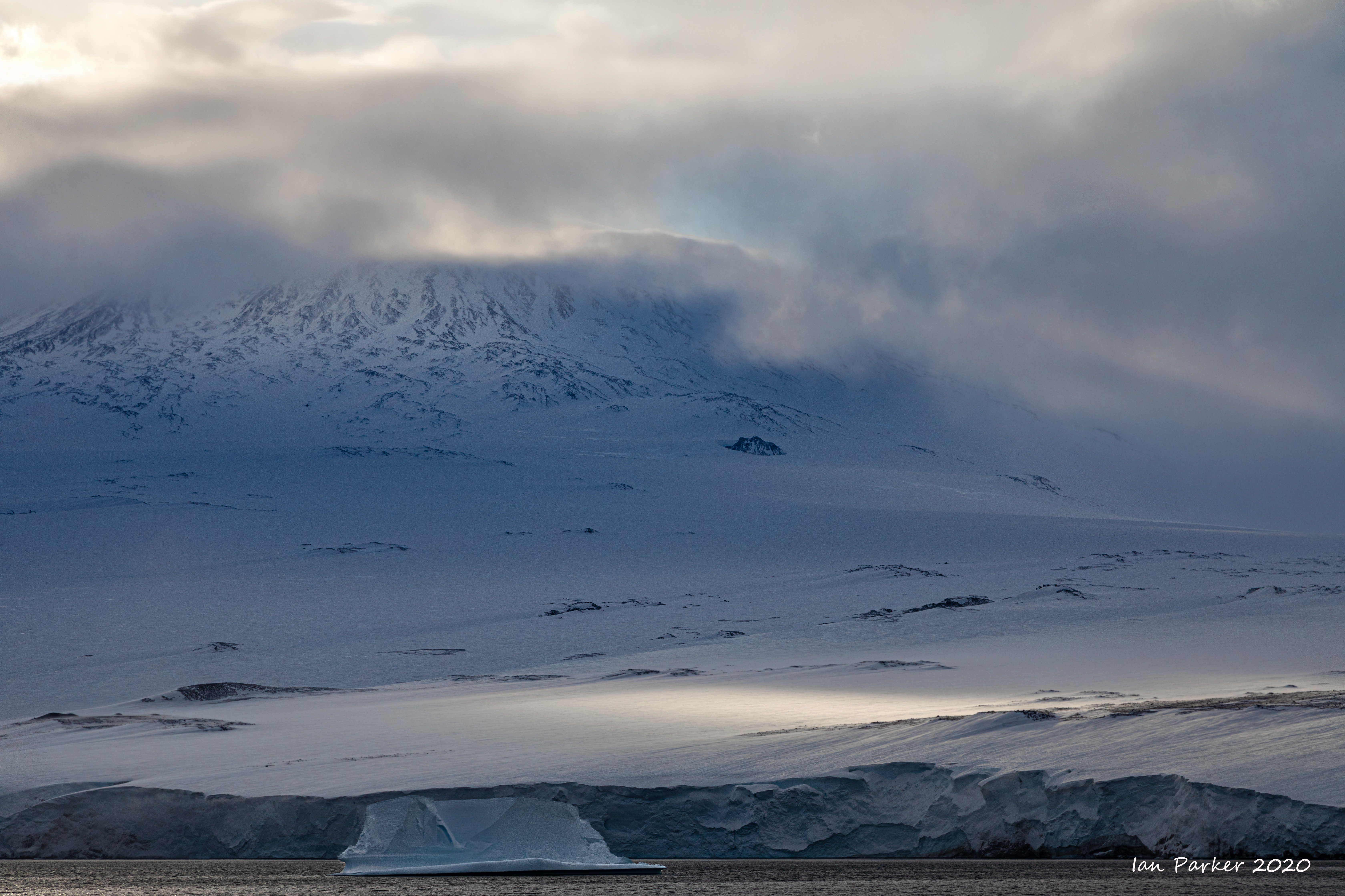
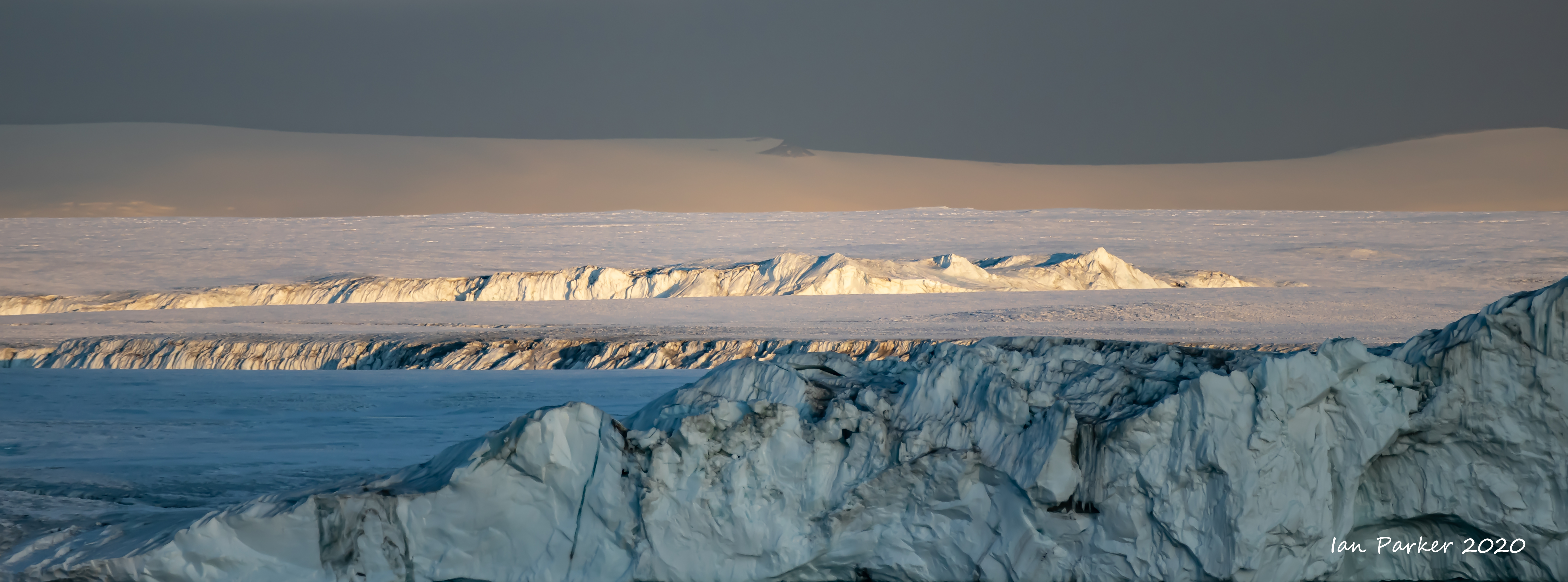
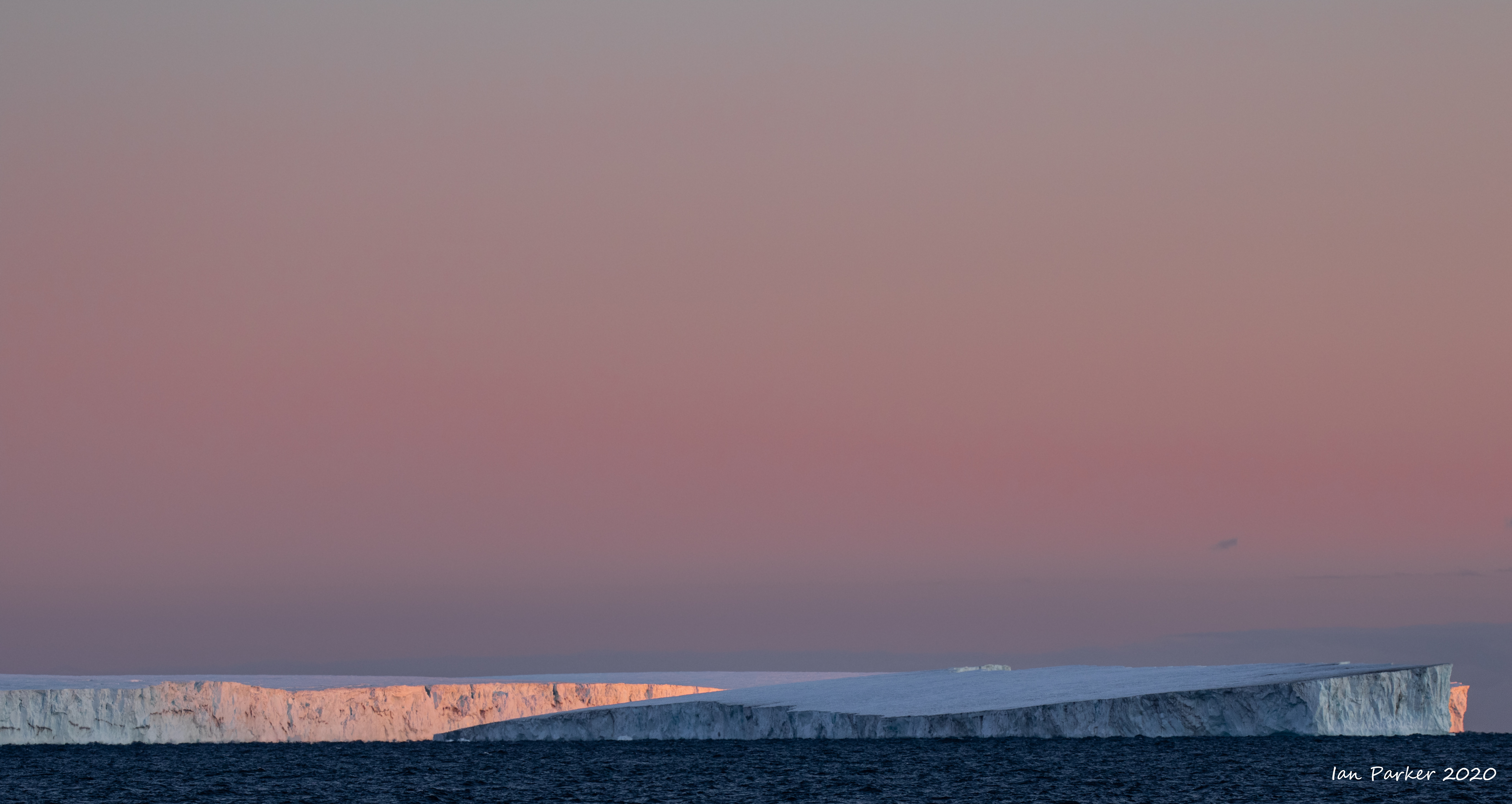
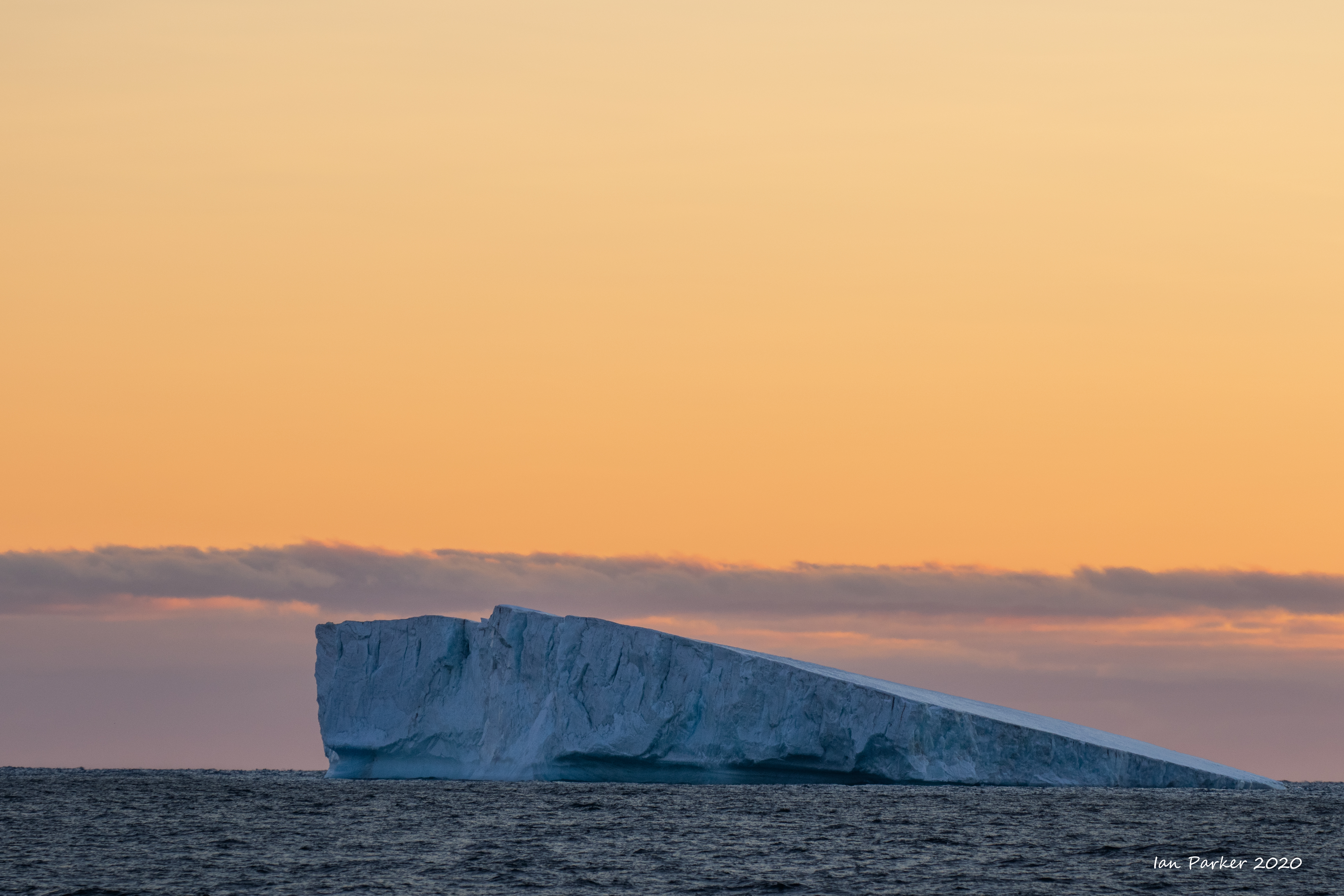
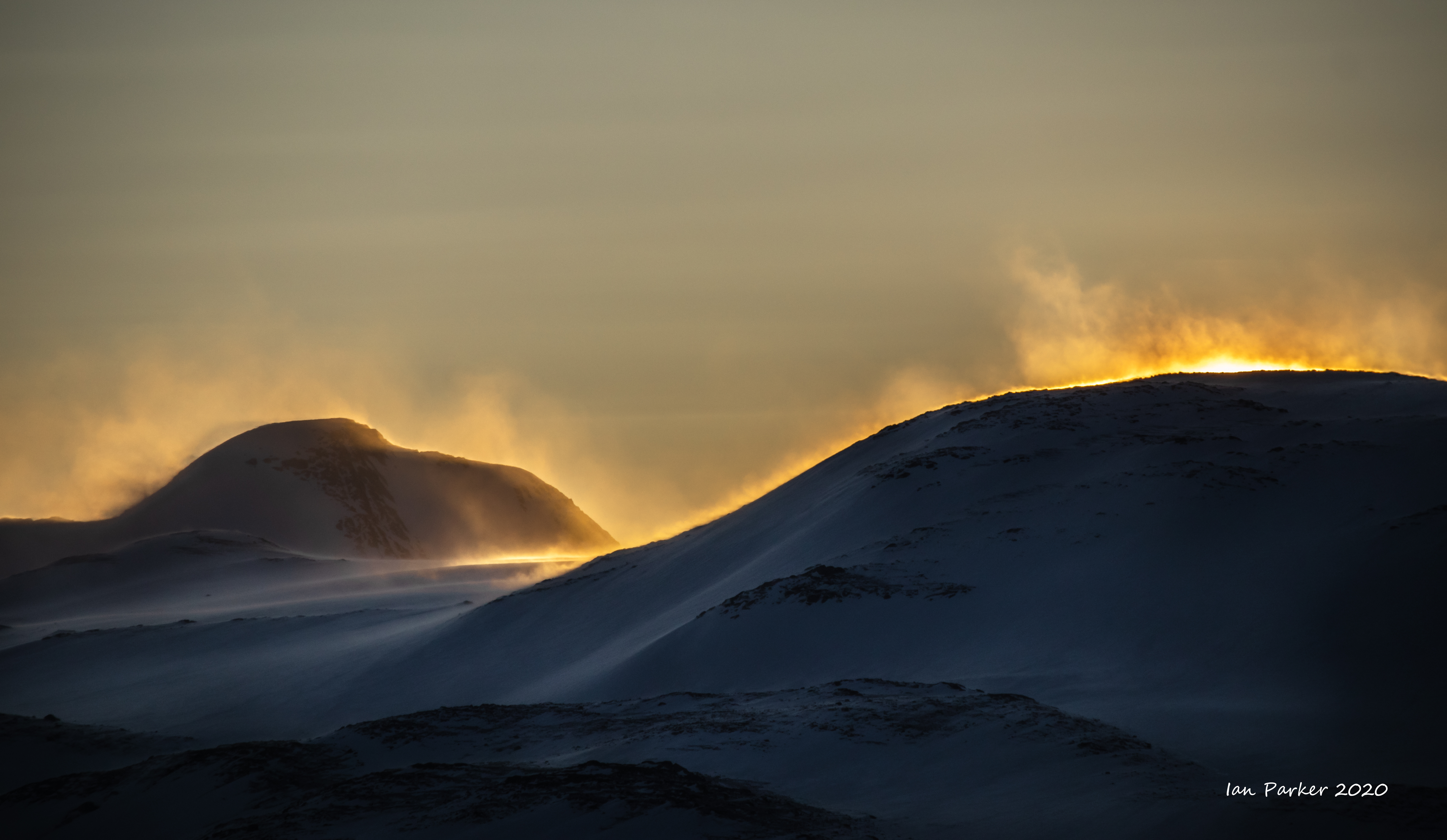
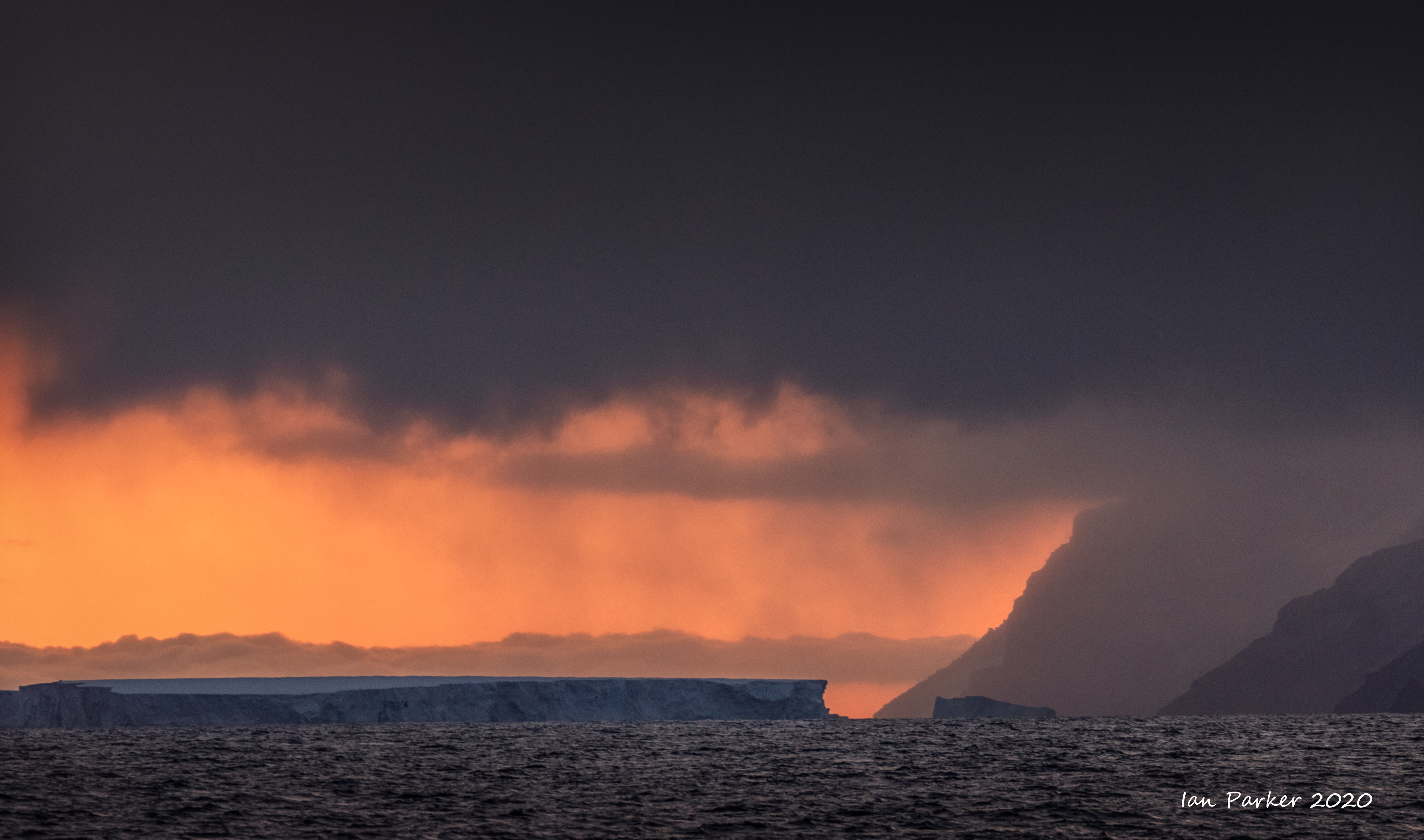
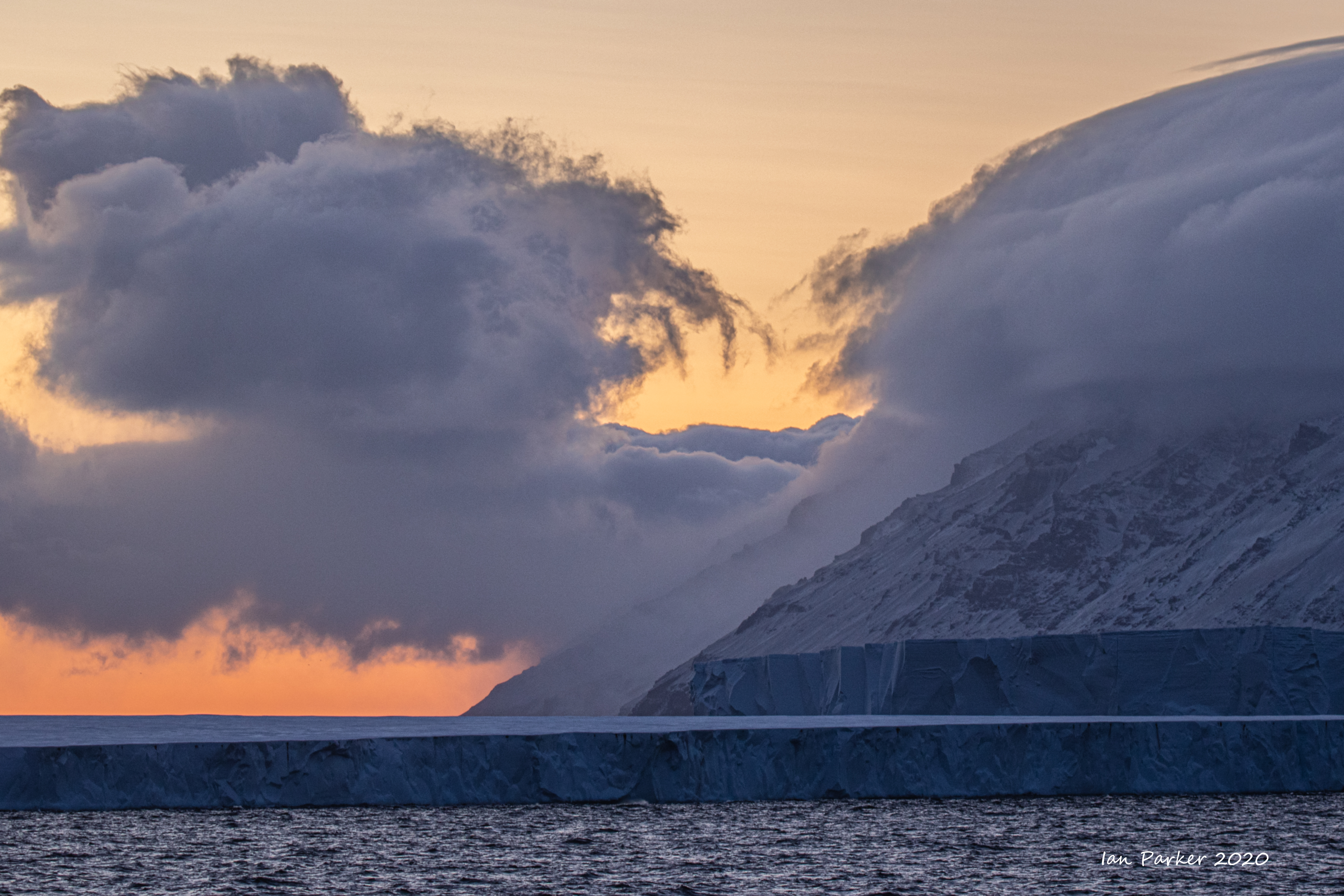
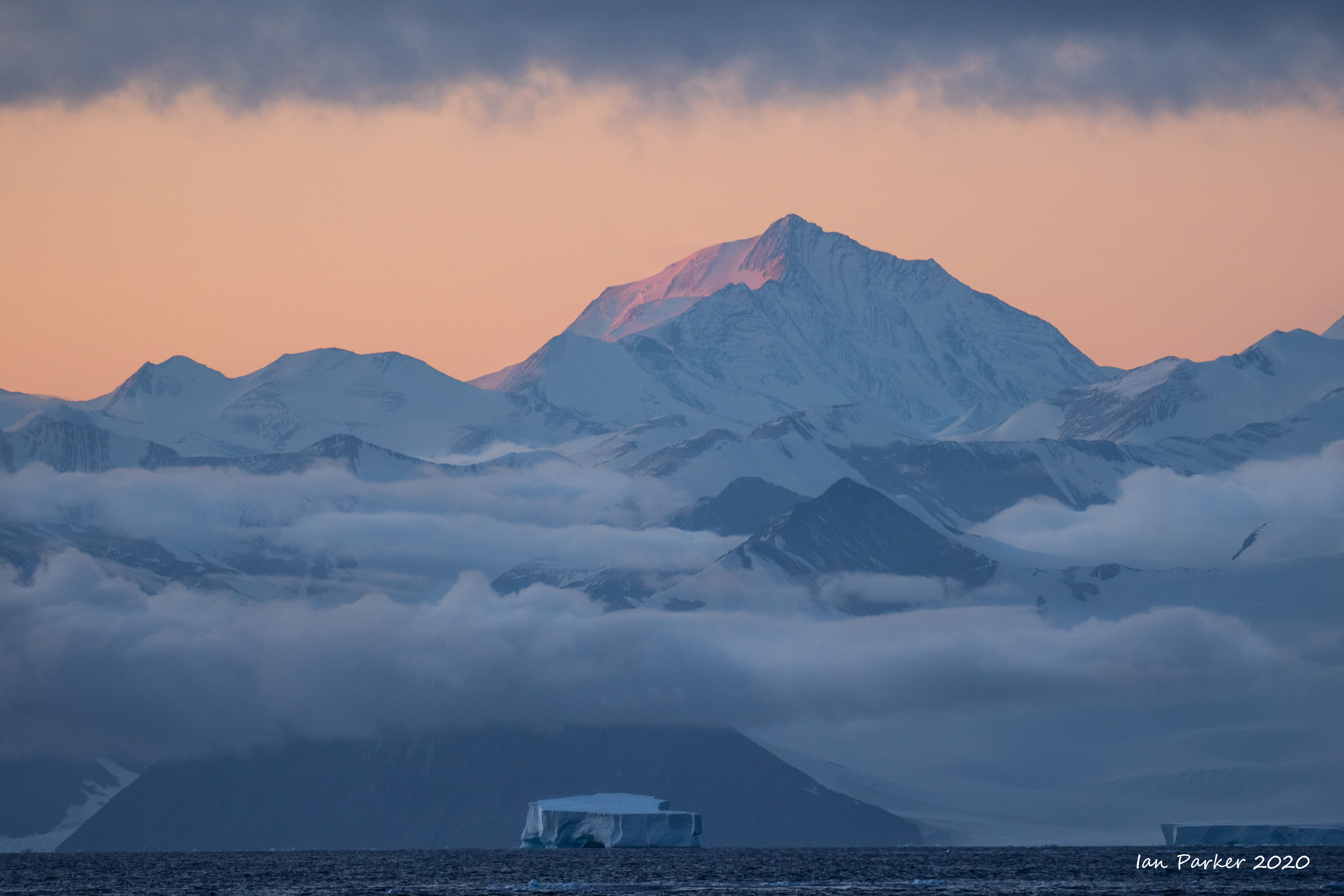
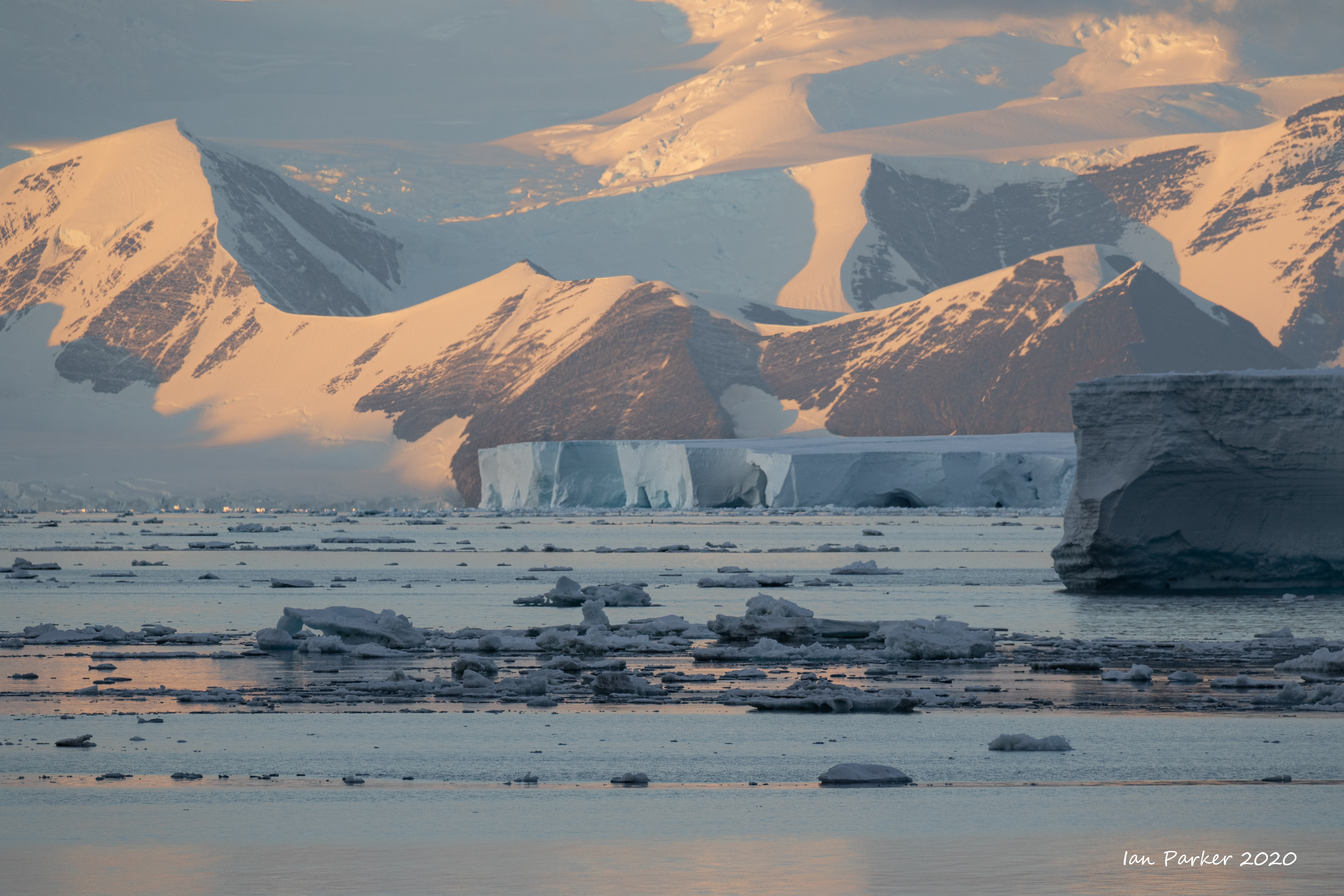
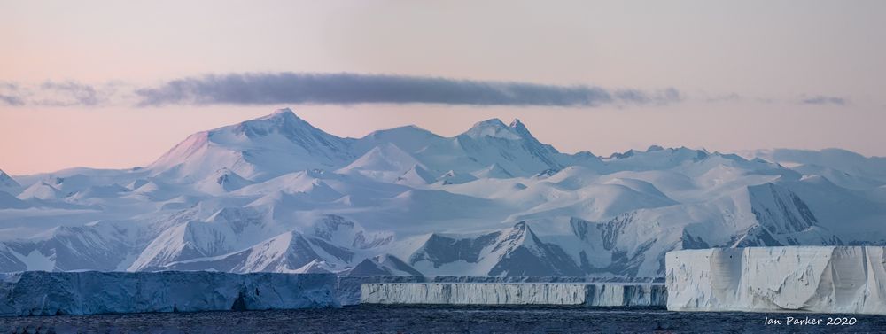
The next morning we sailed some way along the edge of the Ross Ice Shelf in overcast weather. This was discovered and named after Captain Sir James Clark Ross, who originally called it "The Barrier" and commented "Well, there's no more chance of sailing through that than through the cliffs of Dover". The Ice Shelf is enormous, covering an area about the size as France; it is obviously impossible to convey its size in a photograph. The ice edge extends for about 500 miles and is remarkably uniform. Although spectacular, sailing along the edge gets boring quite quickly!
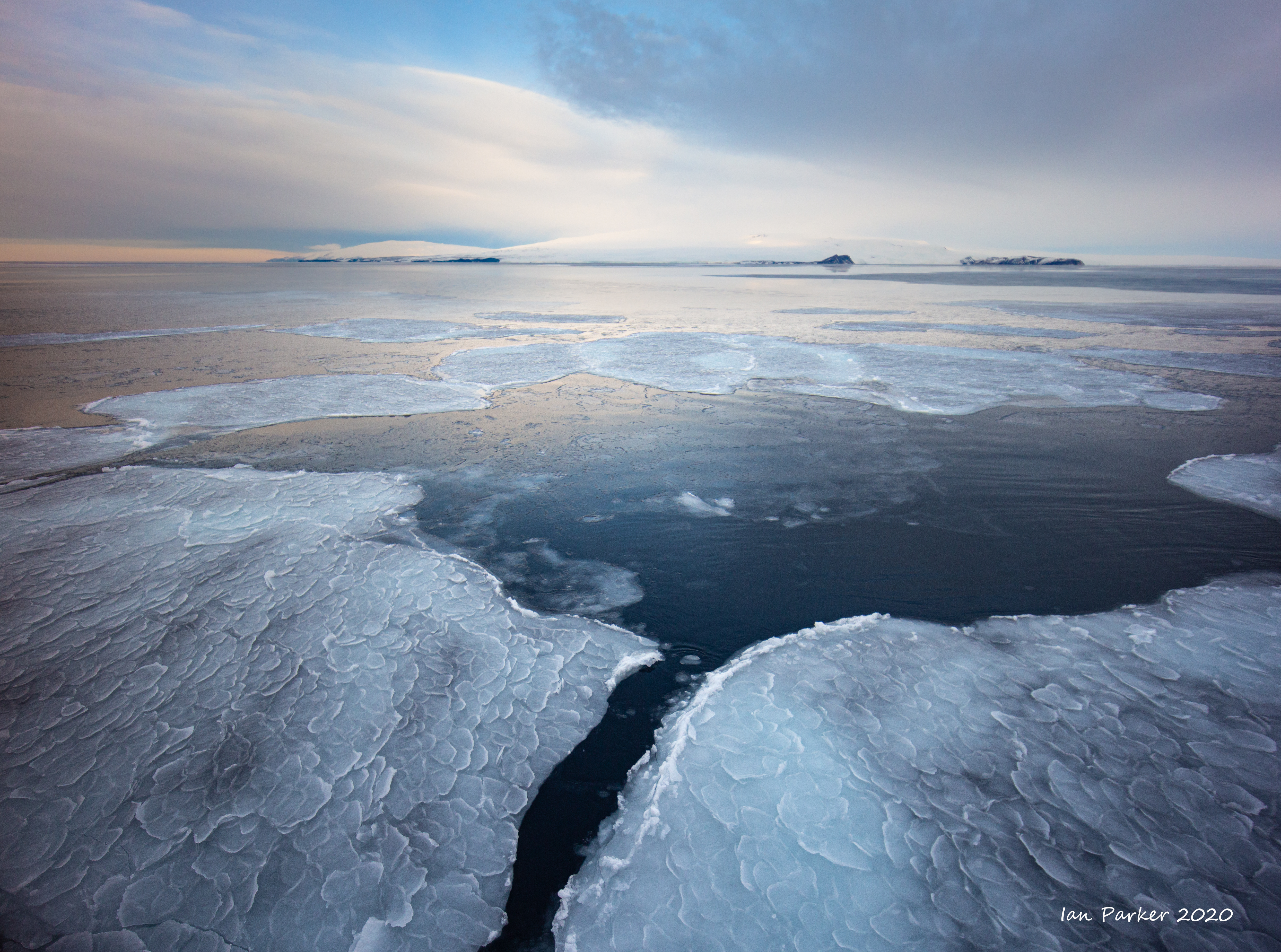

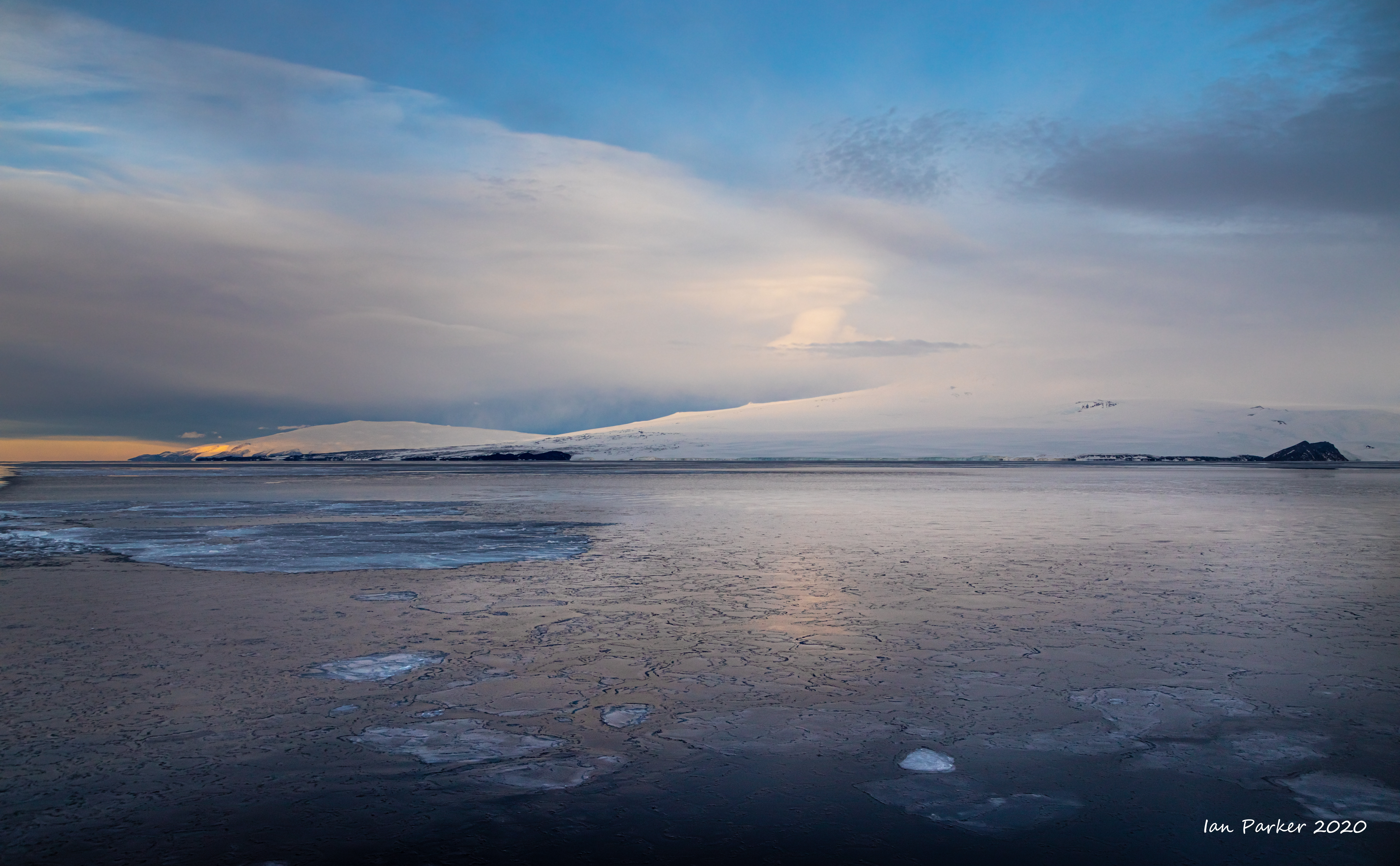
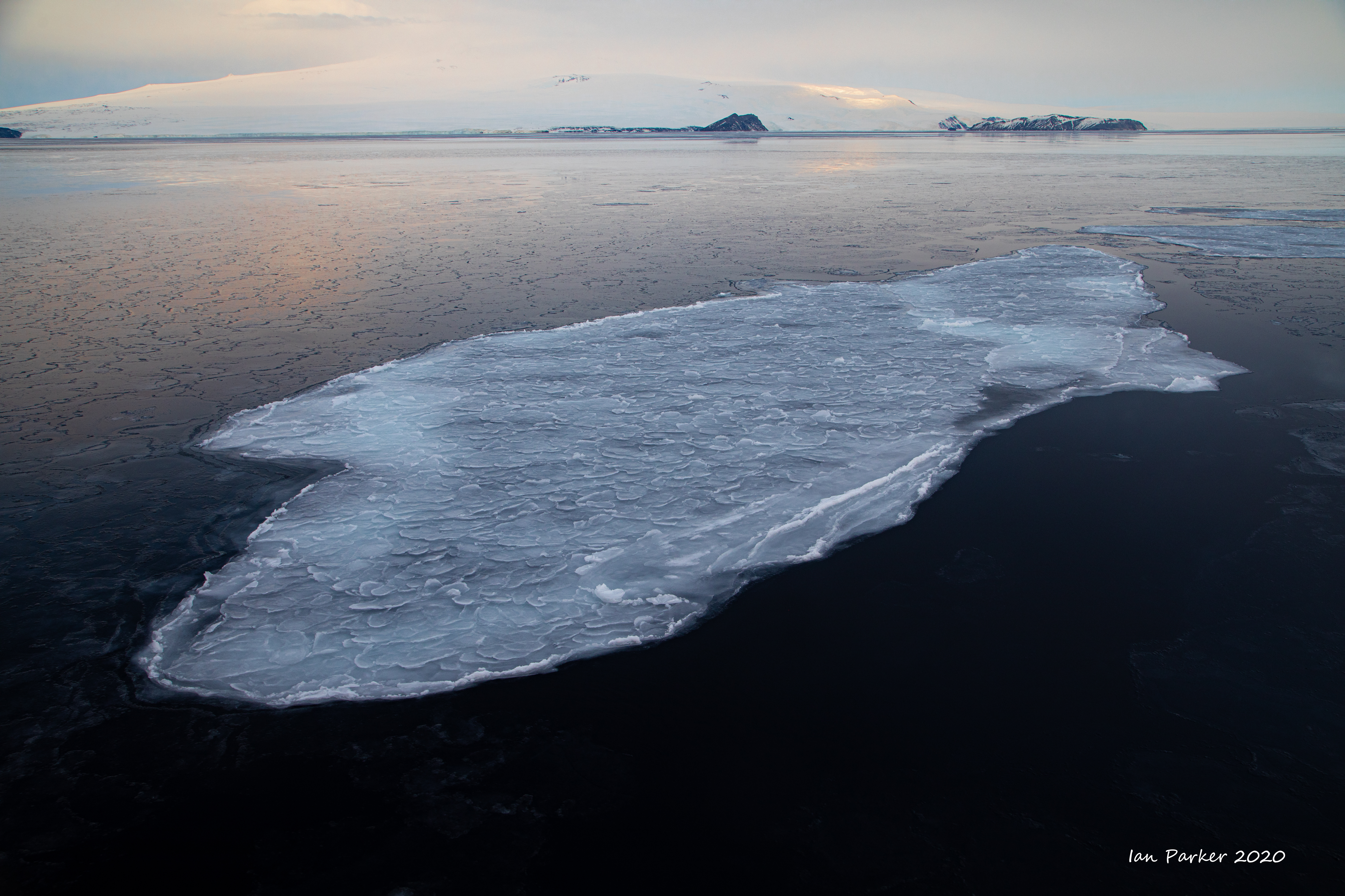
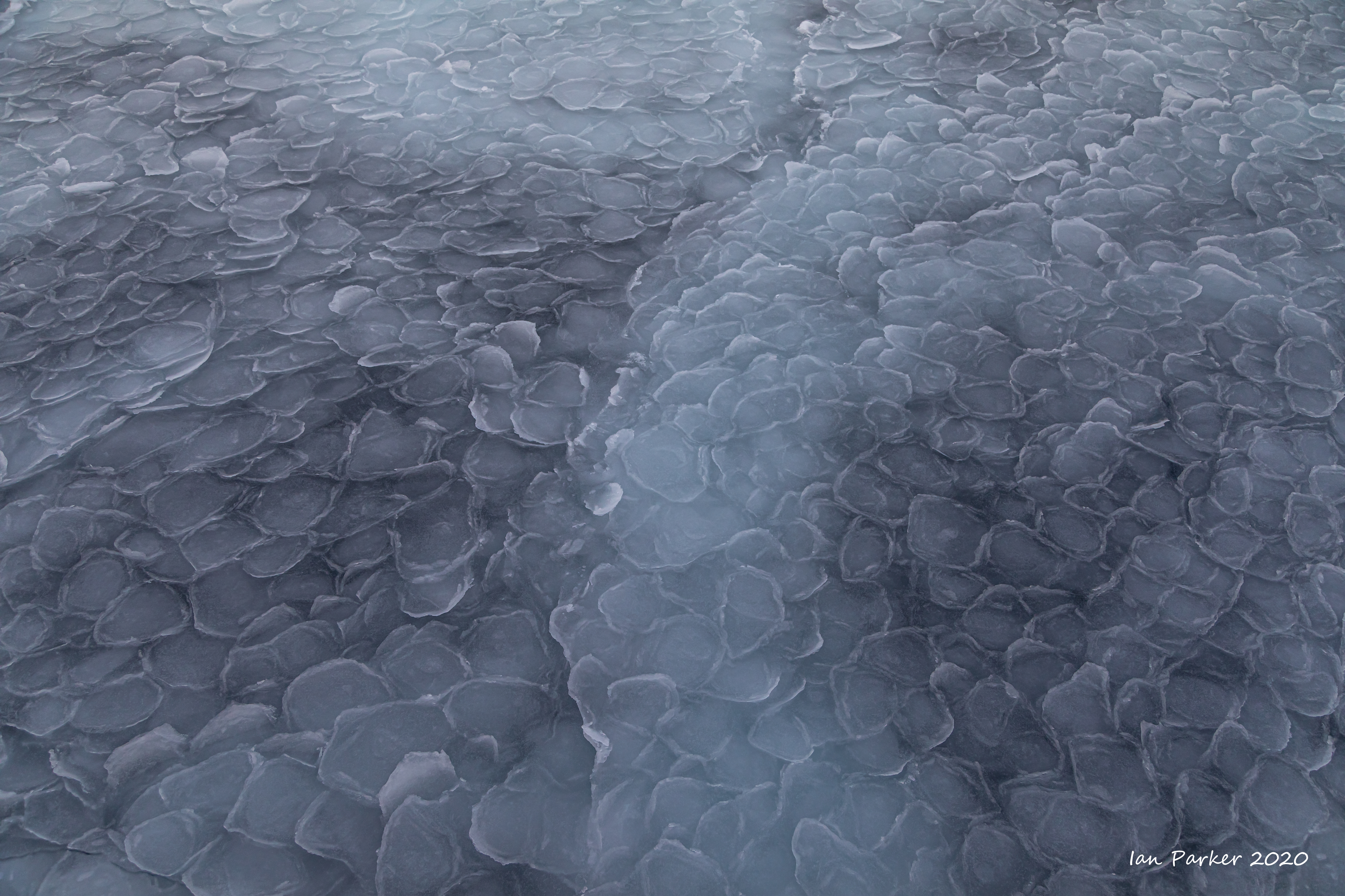
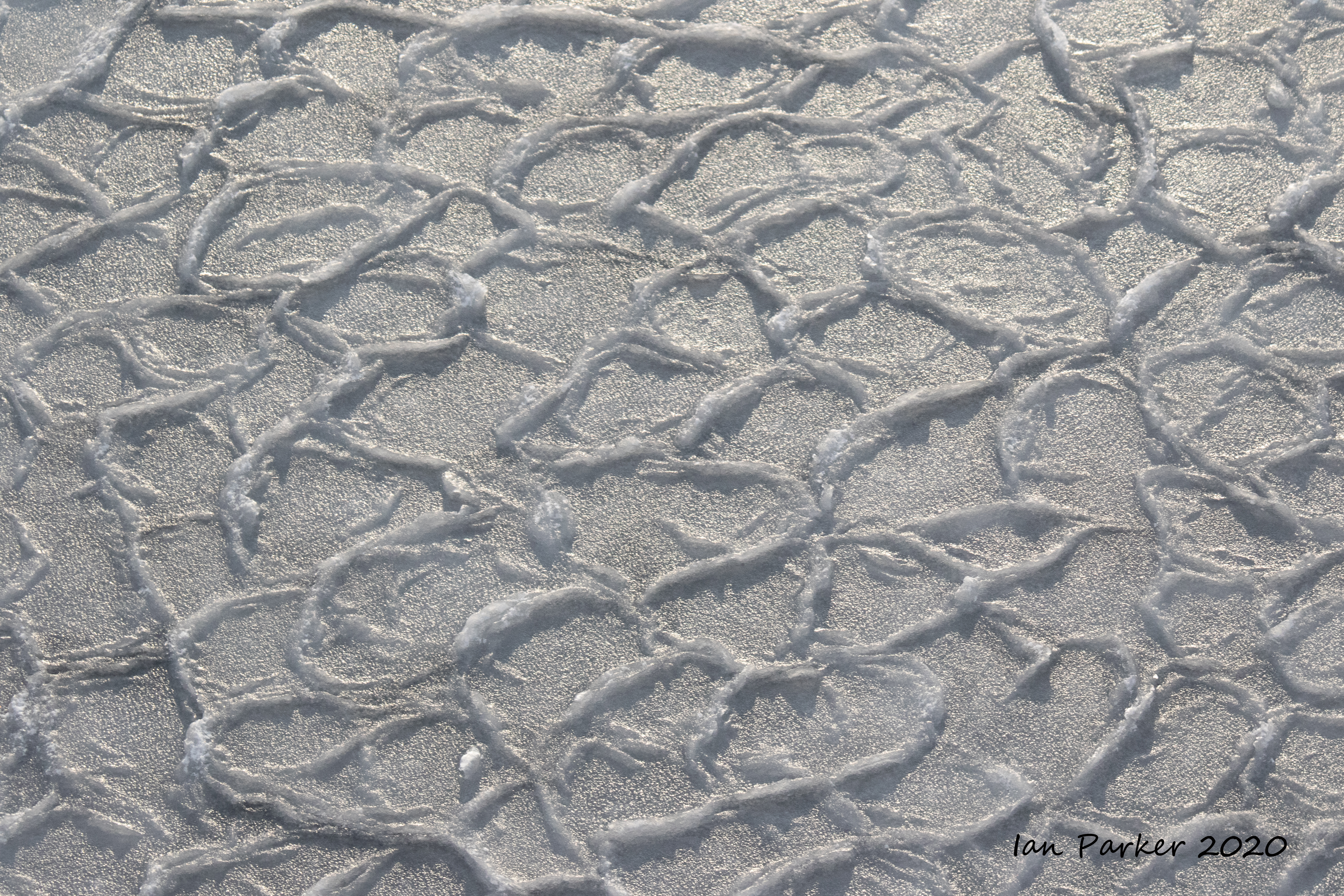
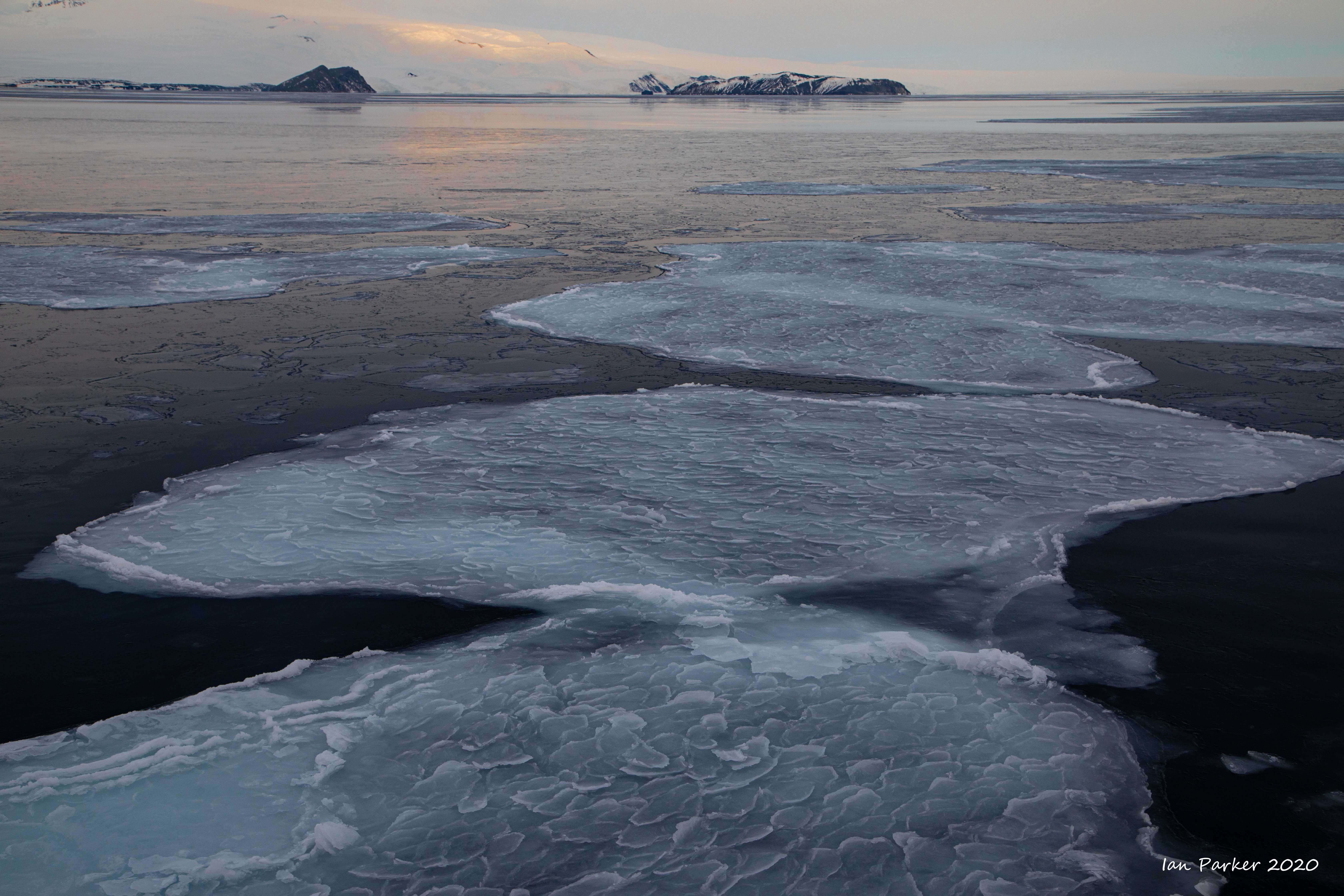
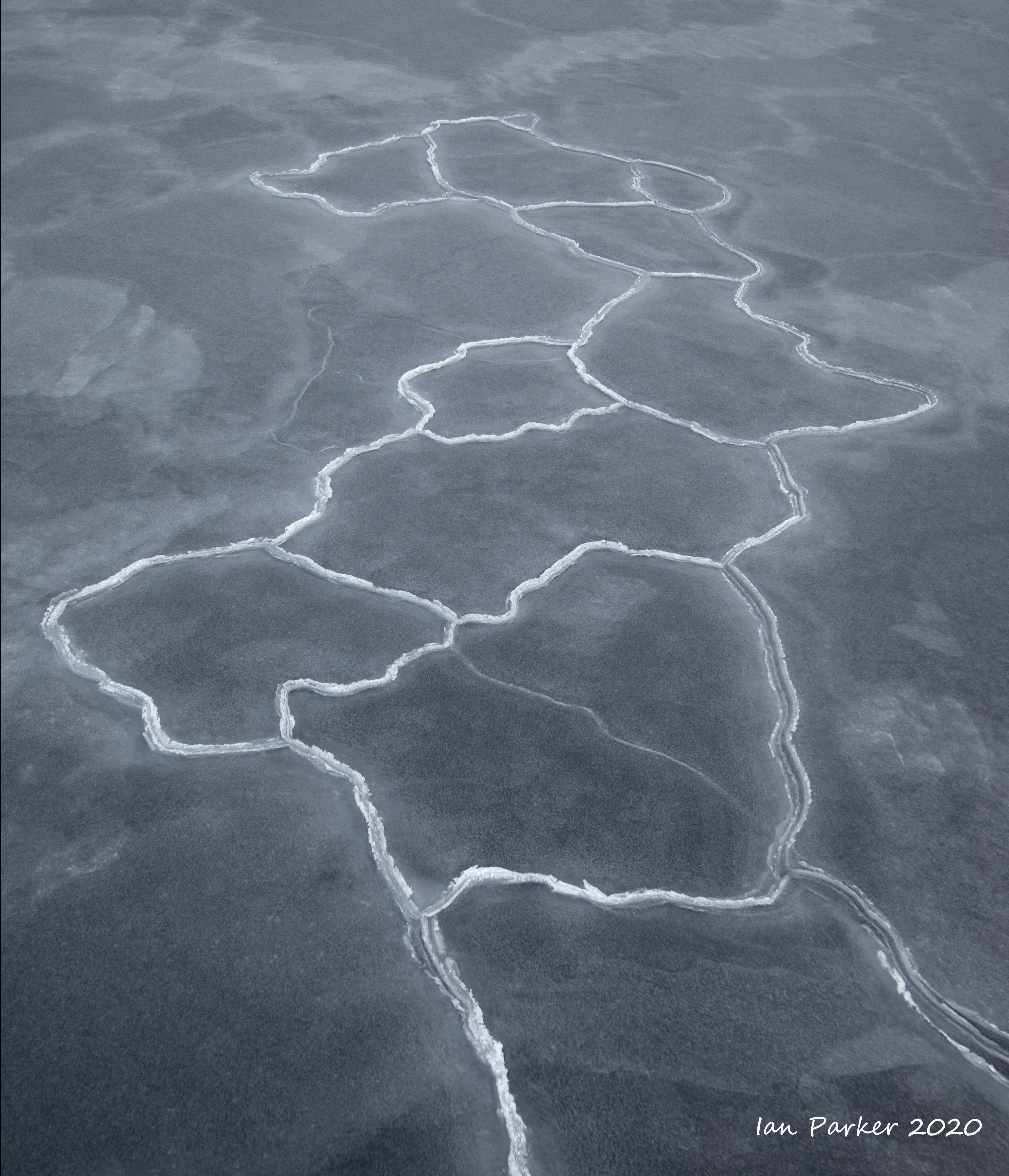
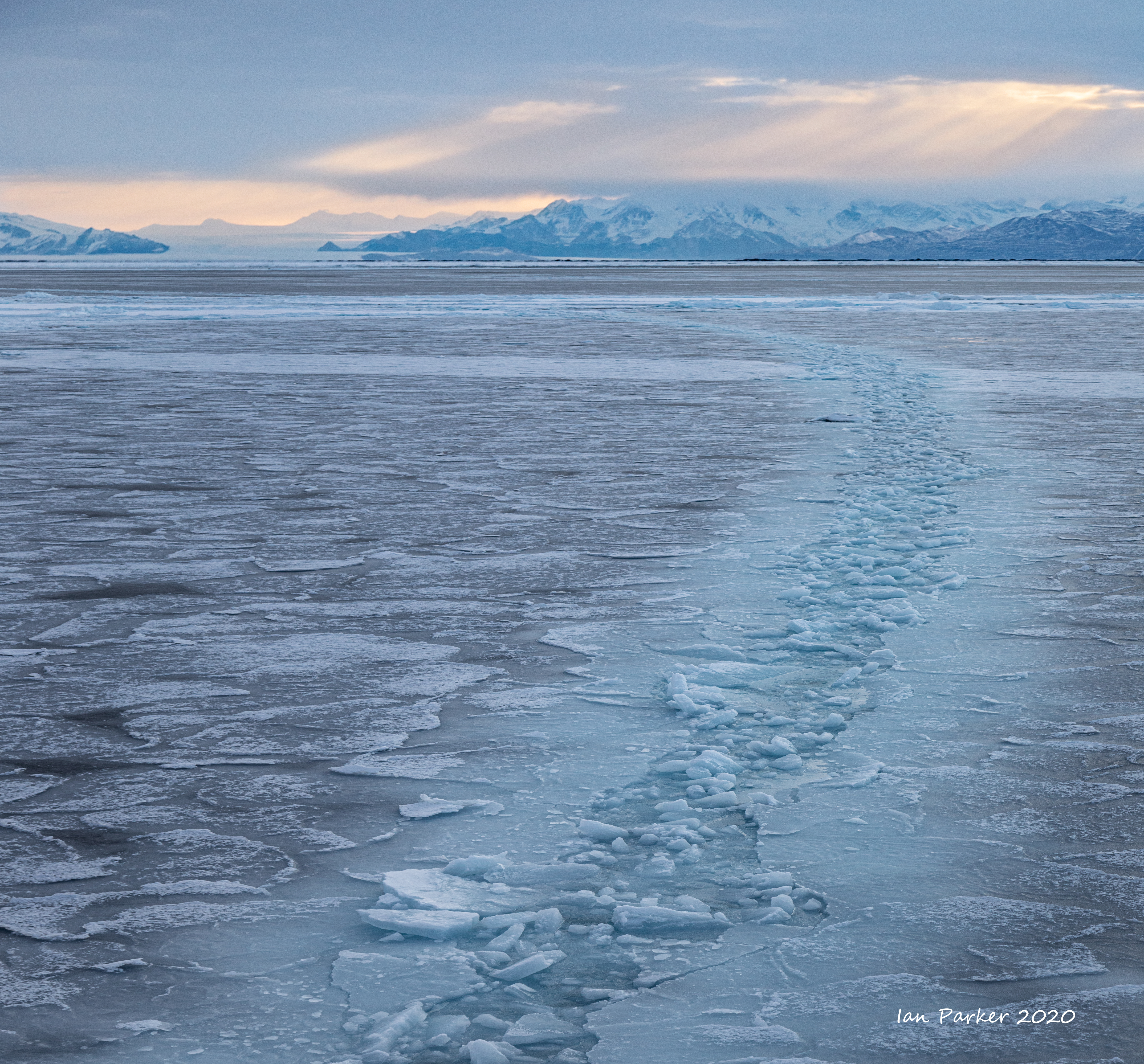
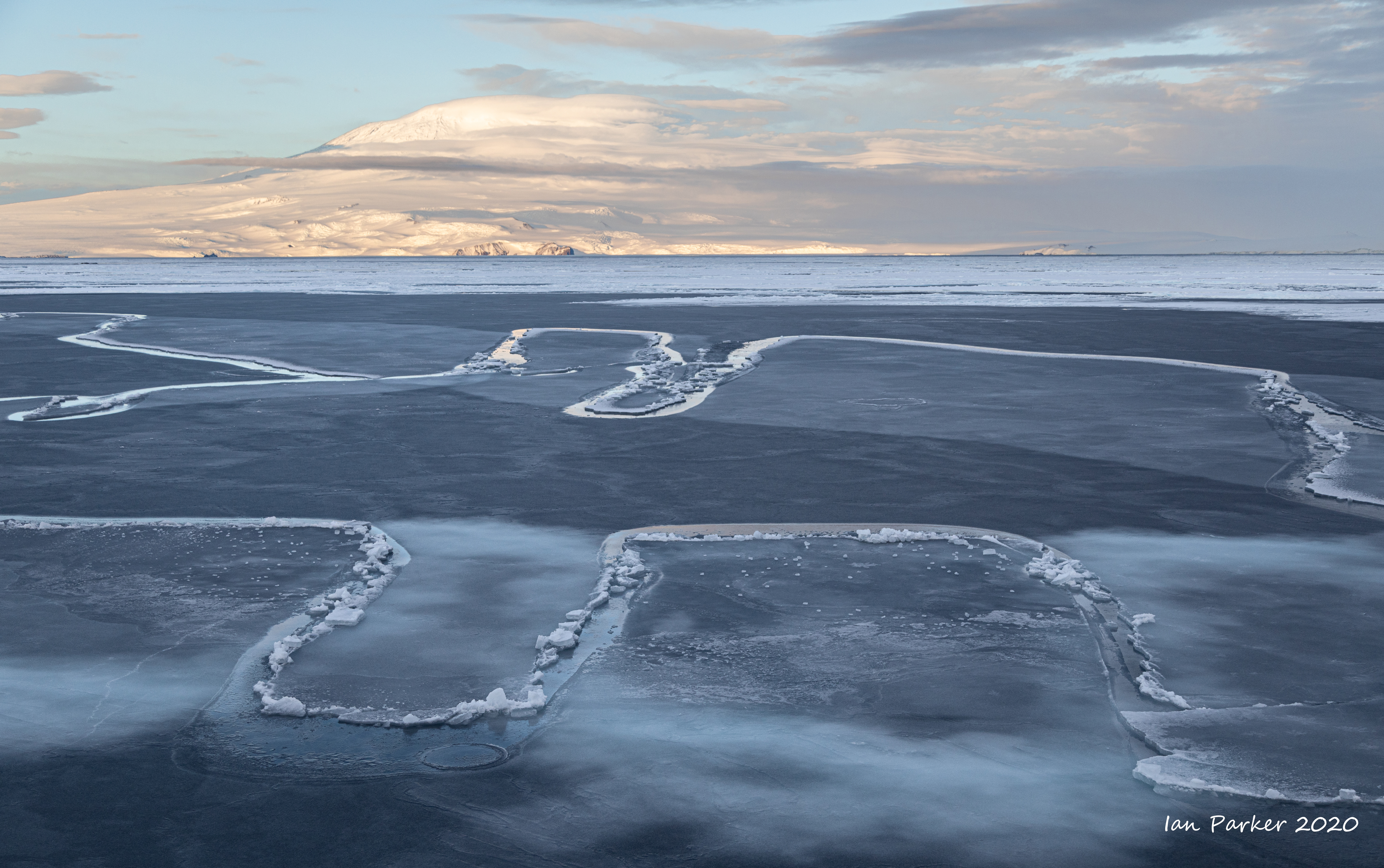
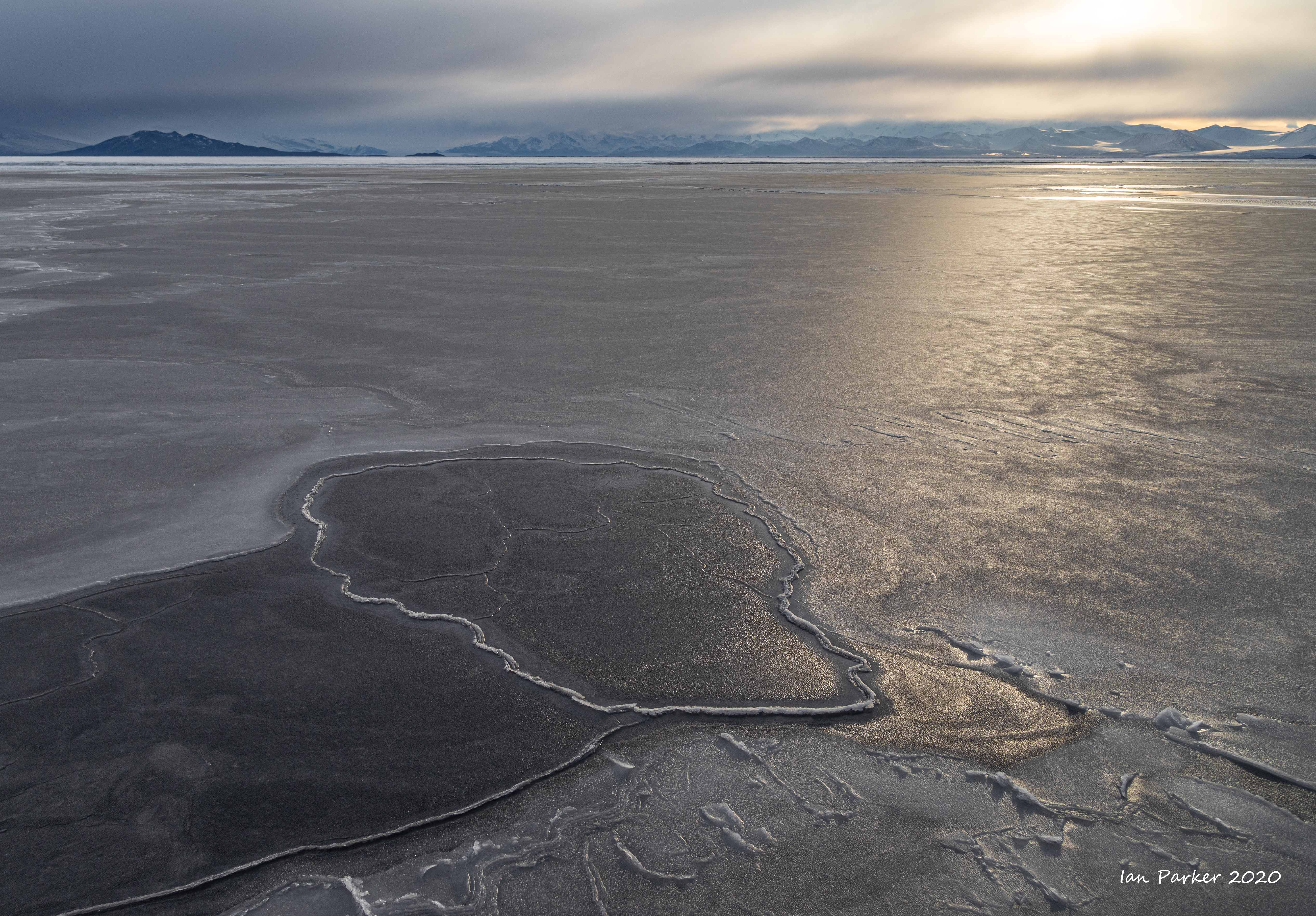
Feb 21 - When the sea freezes over
We reached our furthest south on Feb 21, next to the edge of the Ross ice shelf (the 'barrier'). That night the wind dropped and the sea began to freeze over in the still air. |
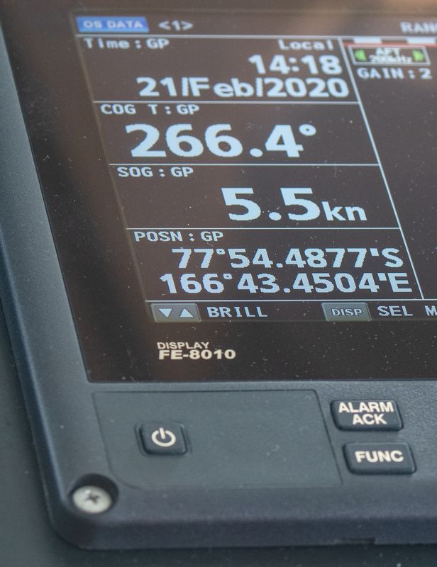 Farthest South - 77 54 48 |
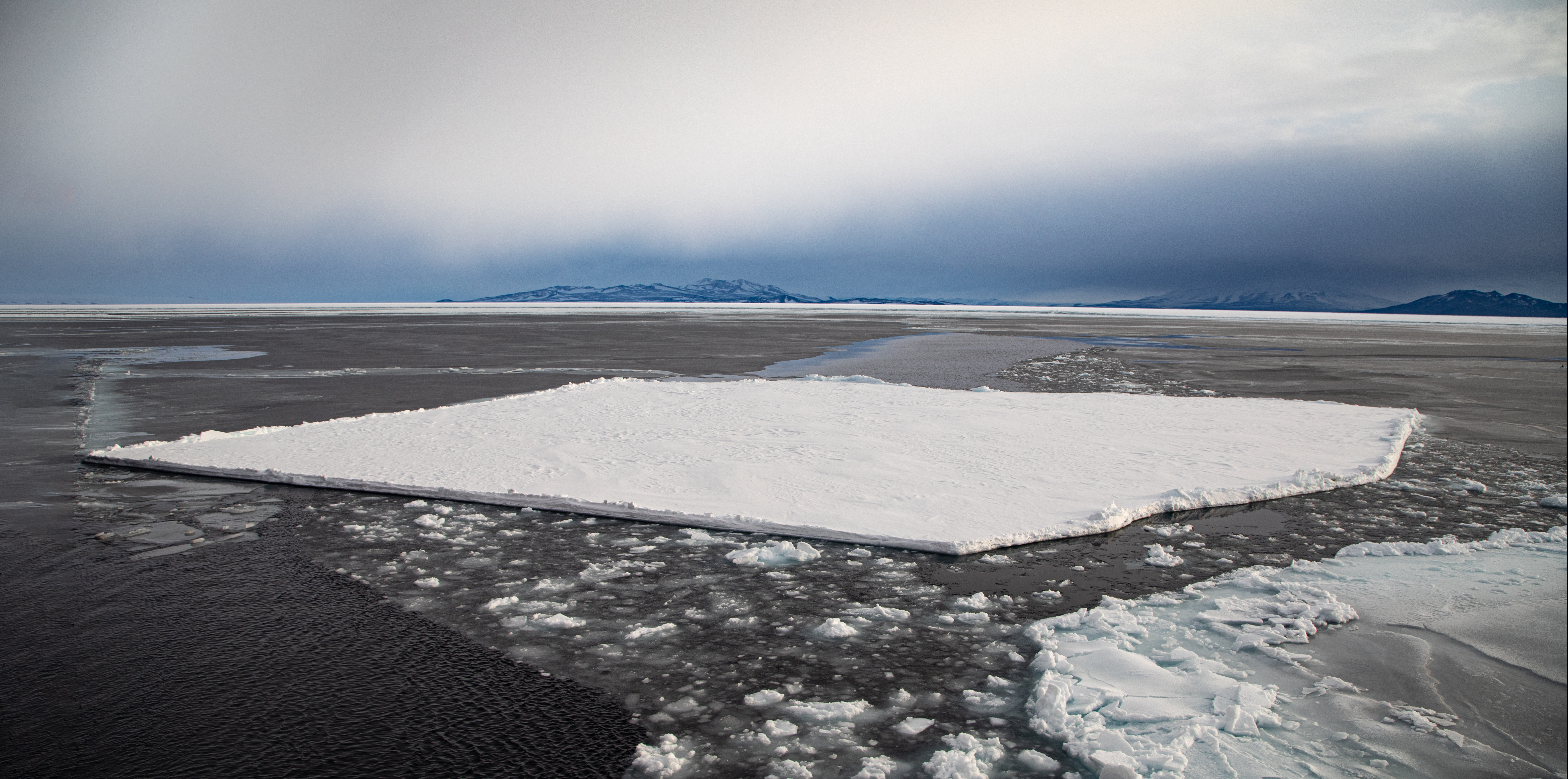
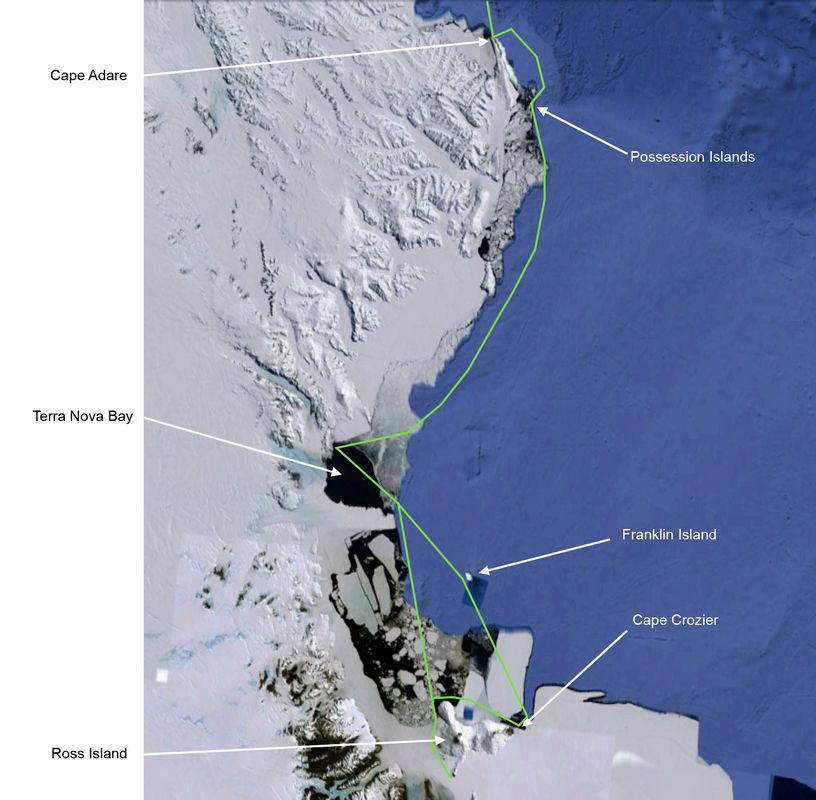
There is only a very short window of one or two months each year when ice conditions in the Ross sea enable access by ships other than icebreakers. The black circles in the satellite ice images below mark the Ross Sea, showing how rapidly the ice cover grows with the onset of winter.
By contrast, the Antarctic peninsula (green circle) remains accessible for a much longer time.
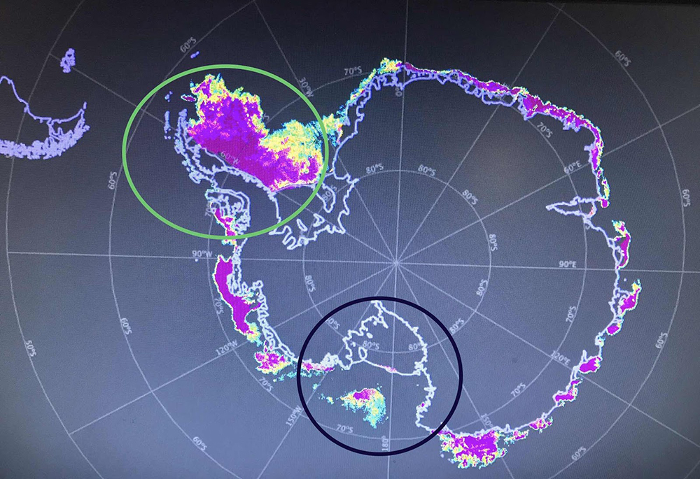 Sea ice extent Feb 22, 2020 |
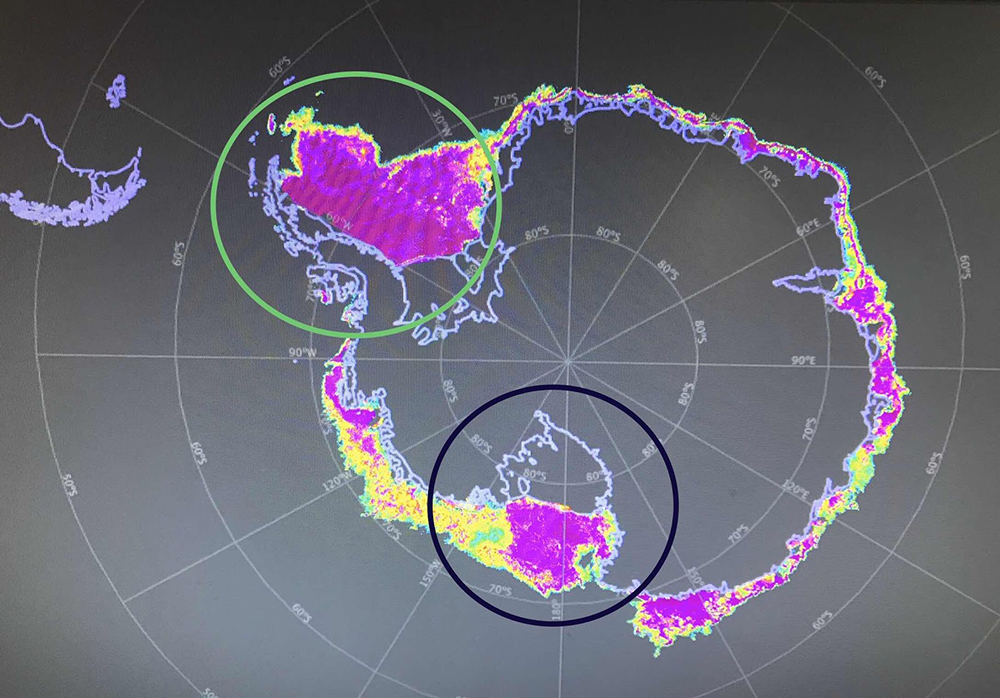 Sea ice extent March 22, 2020 |
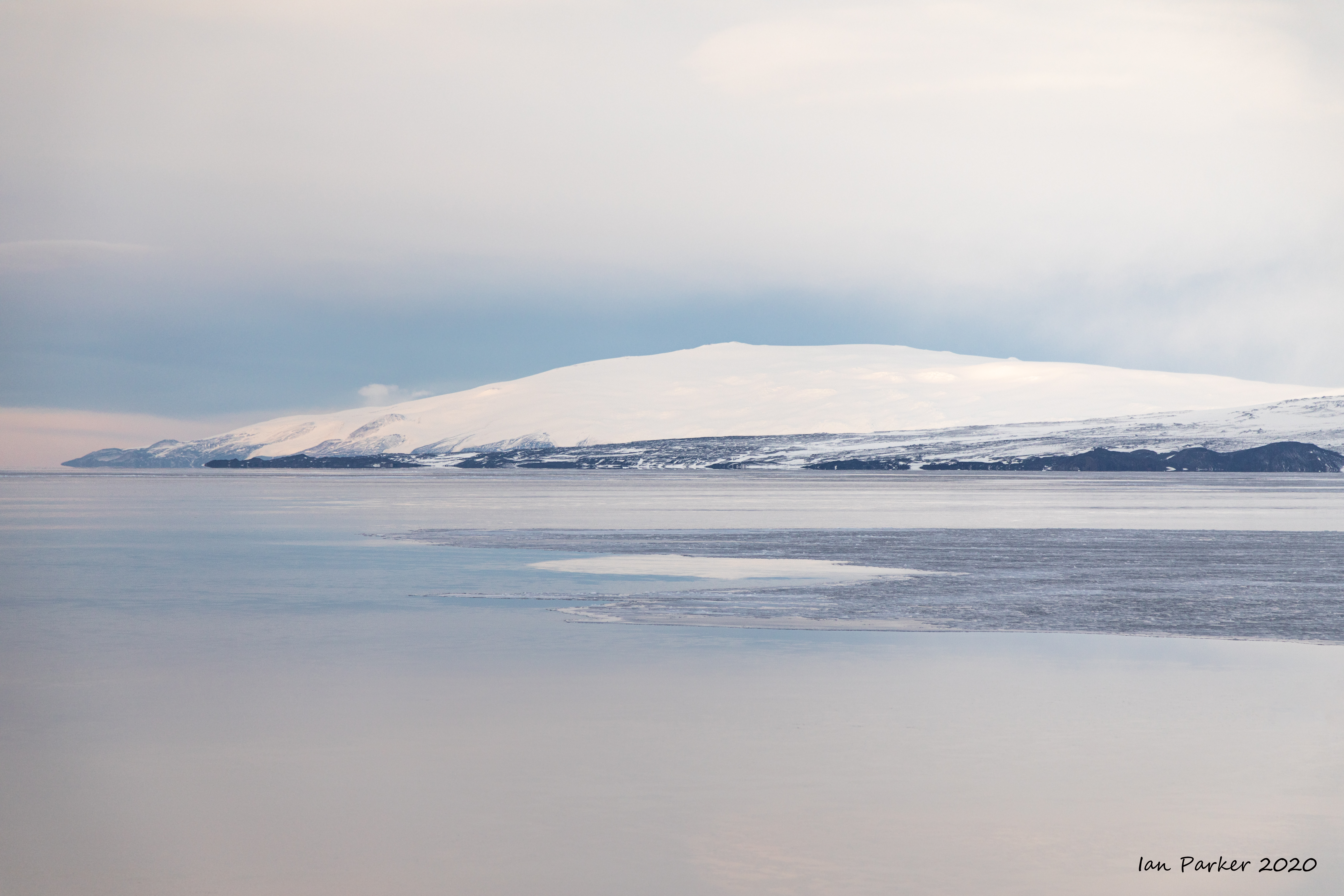


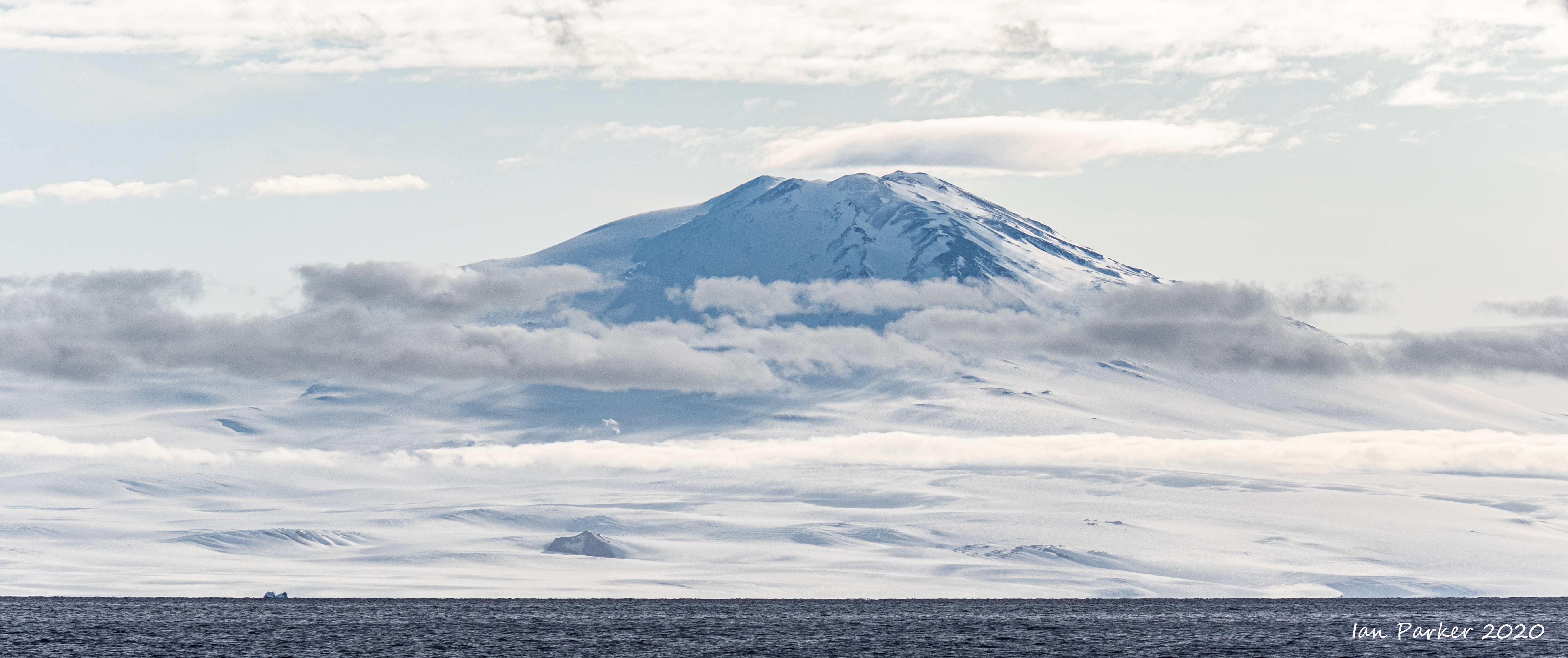
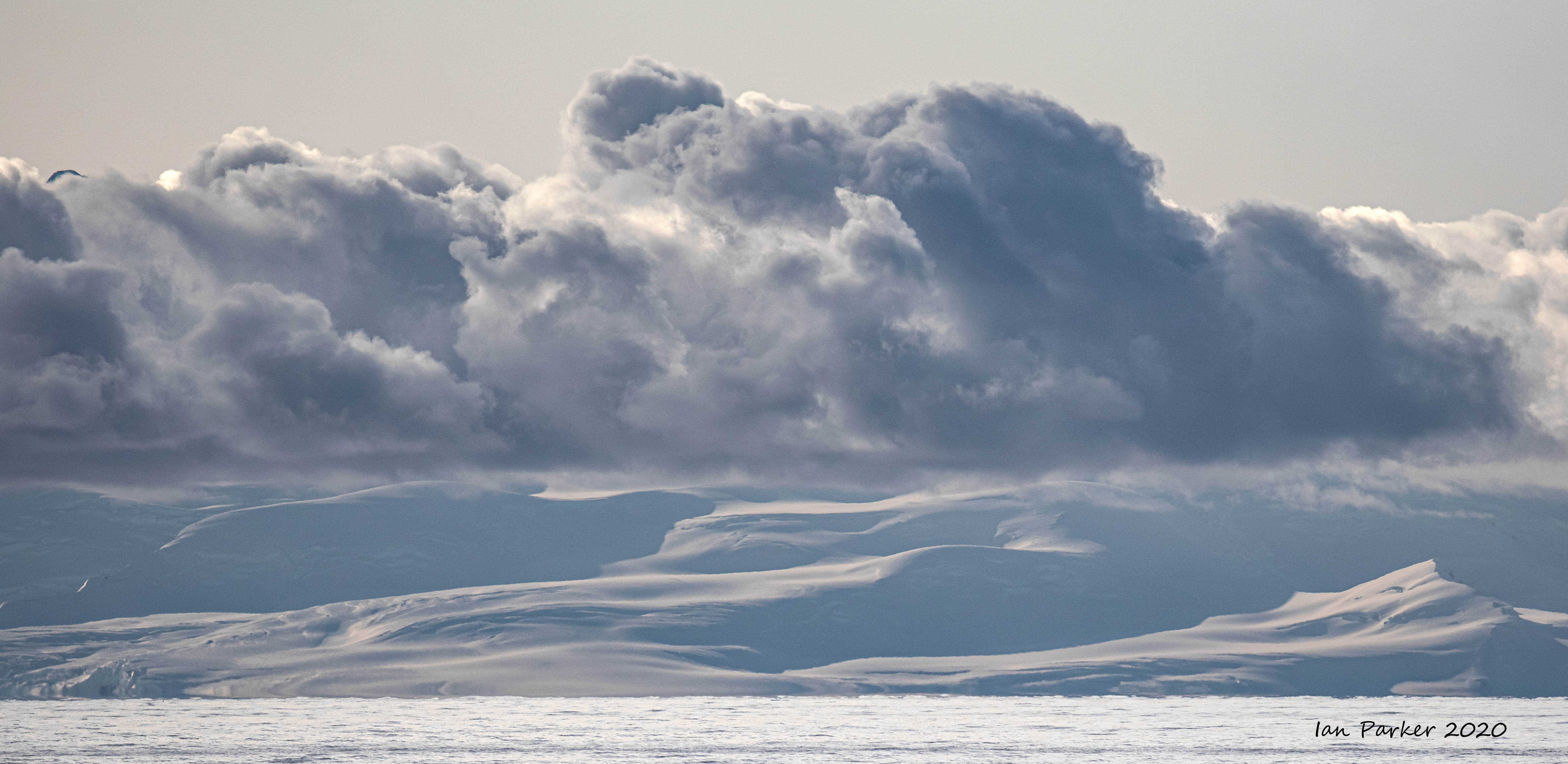
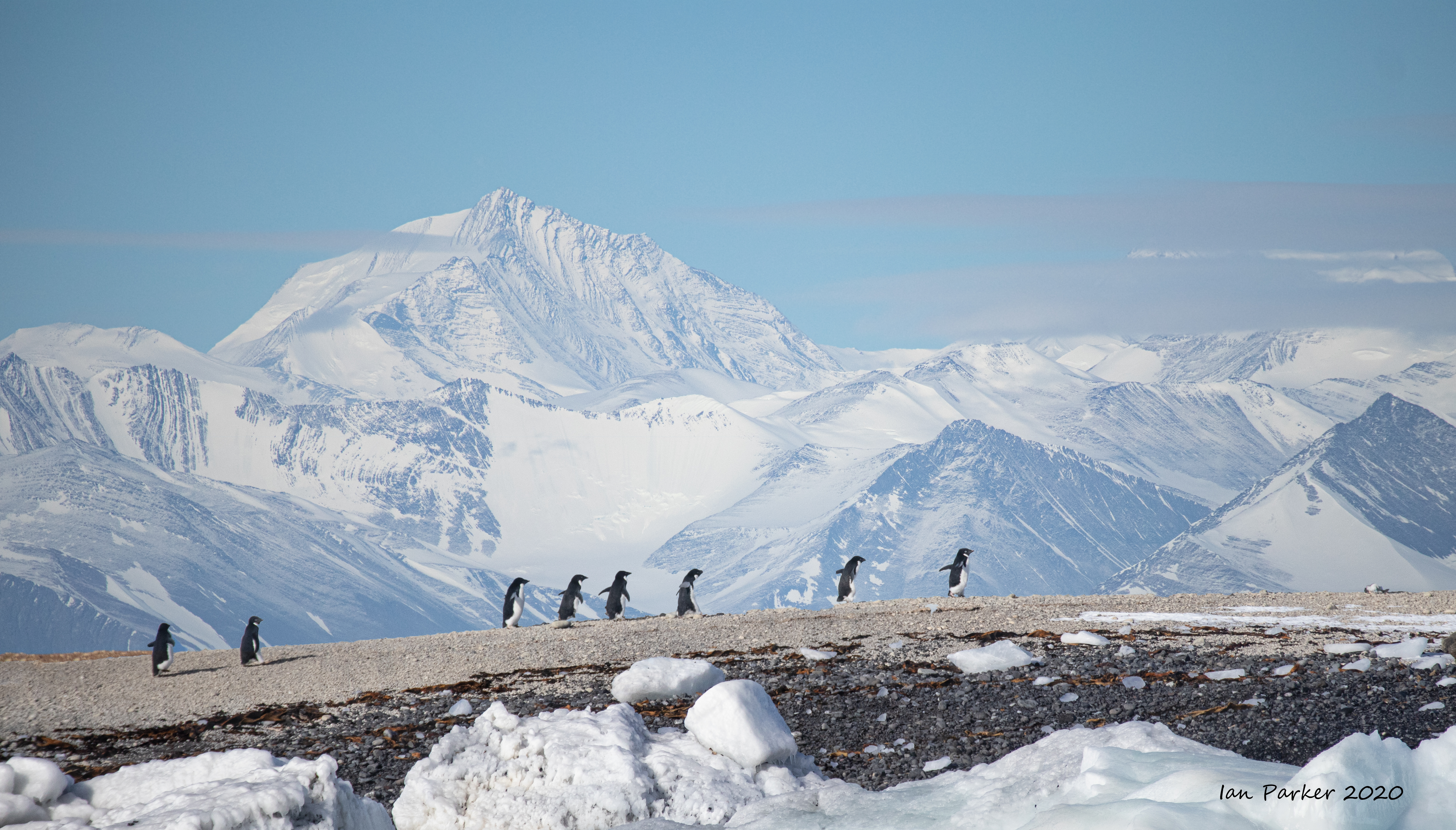
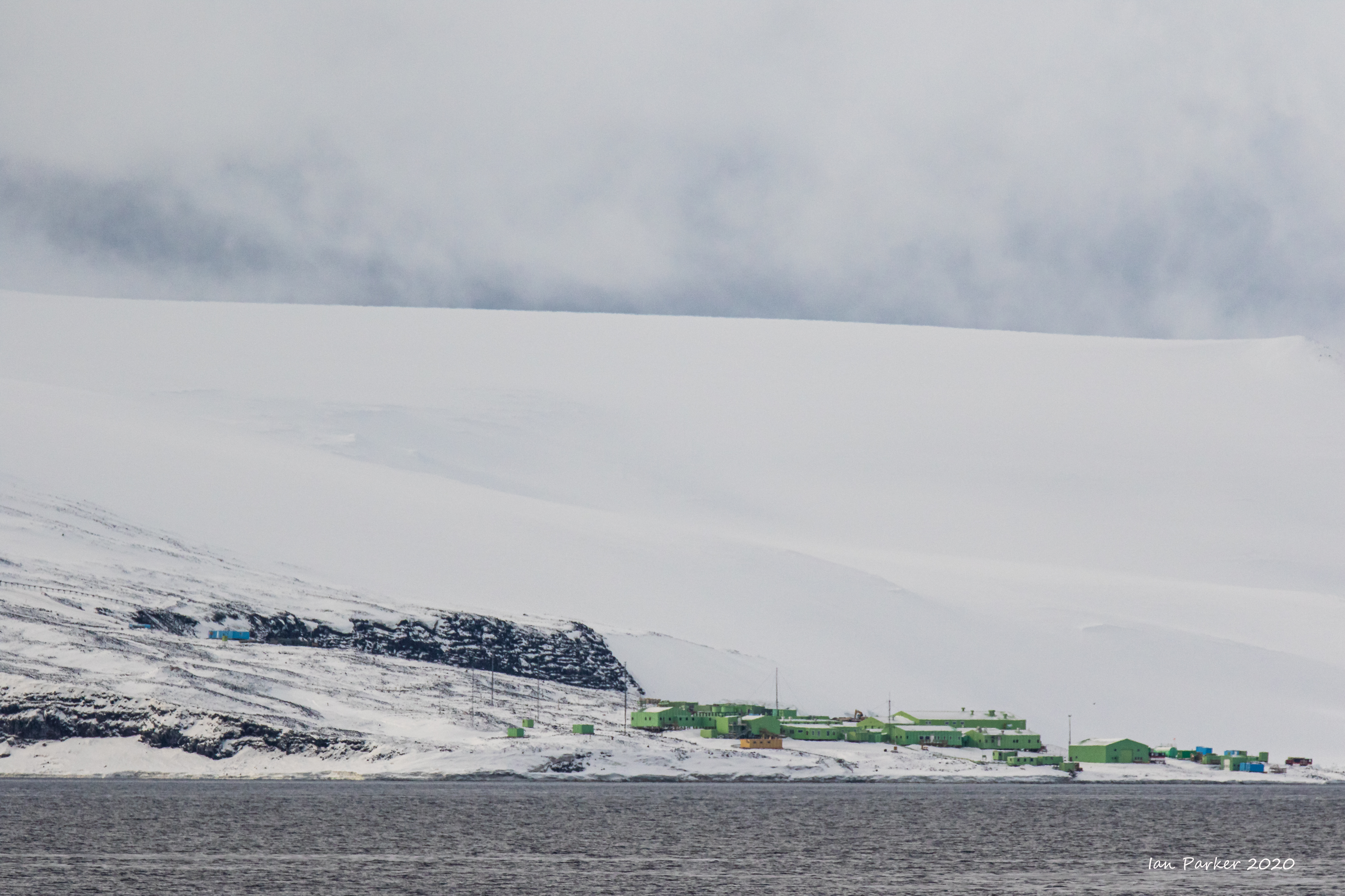
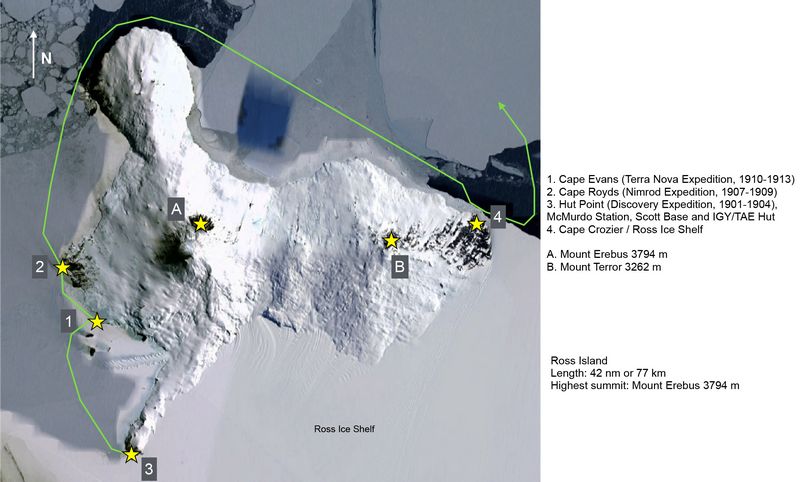
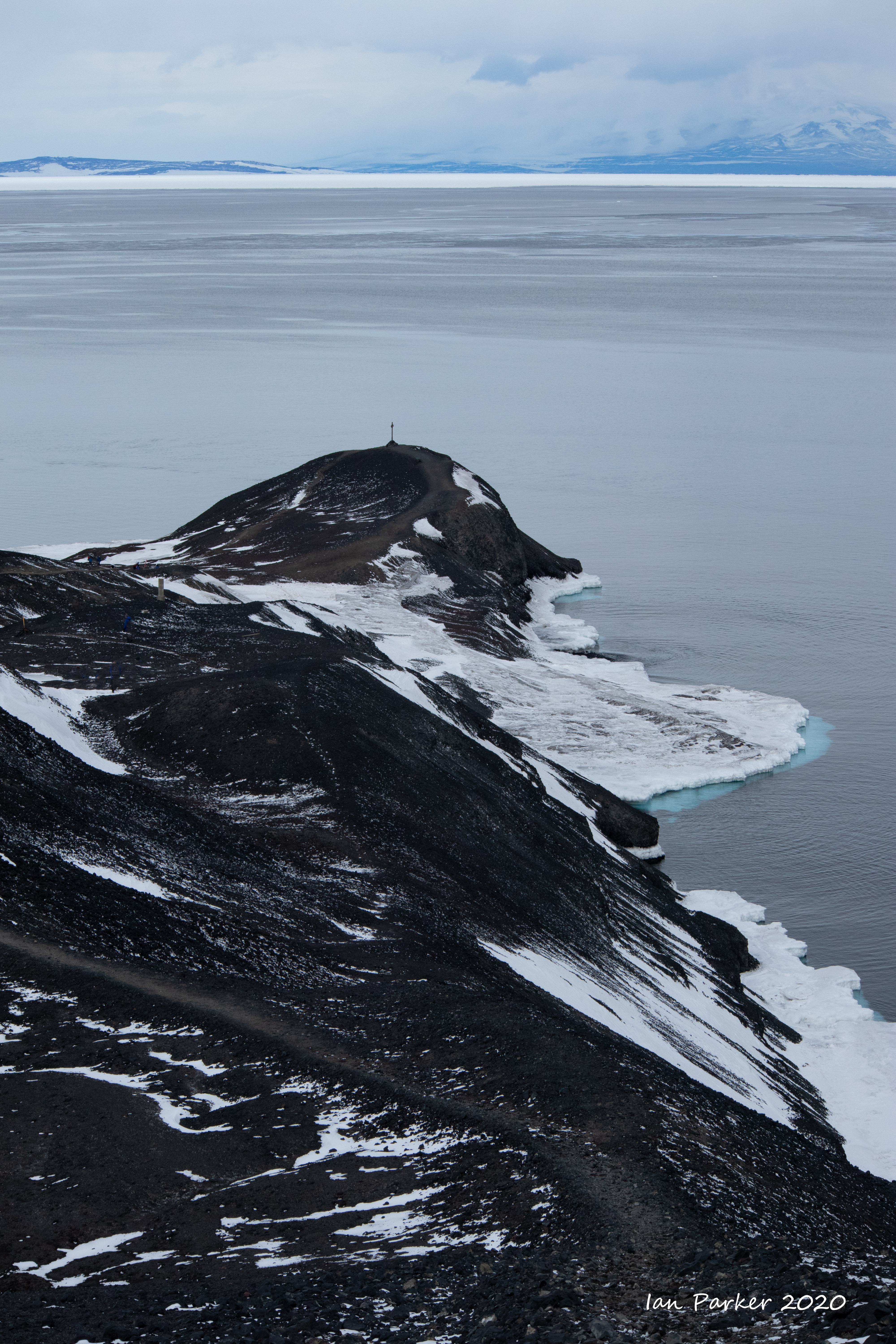
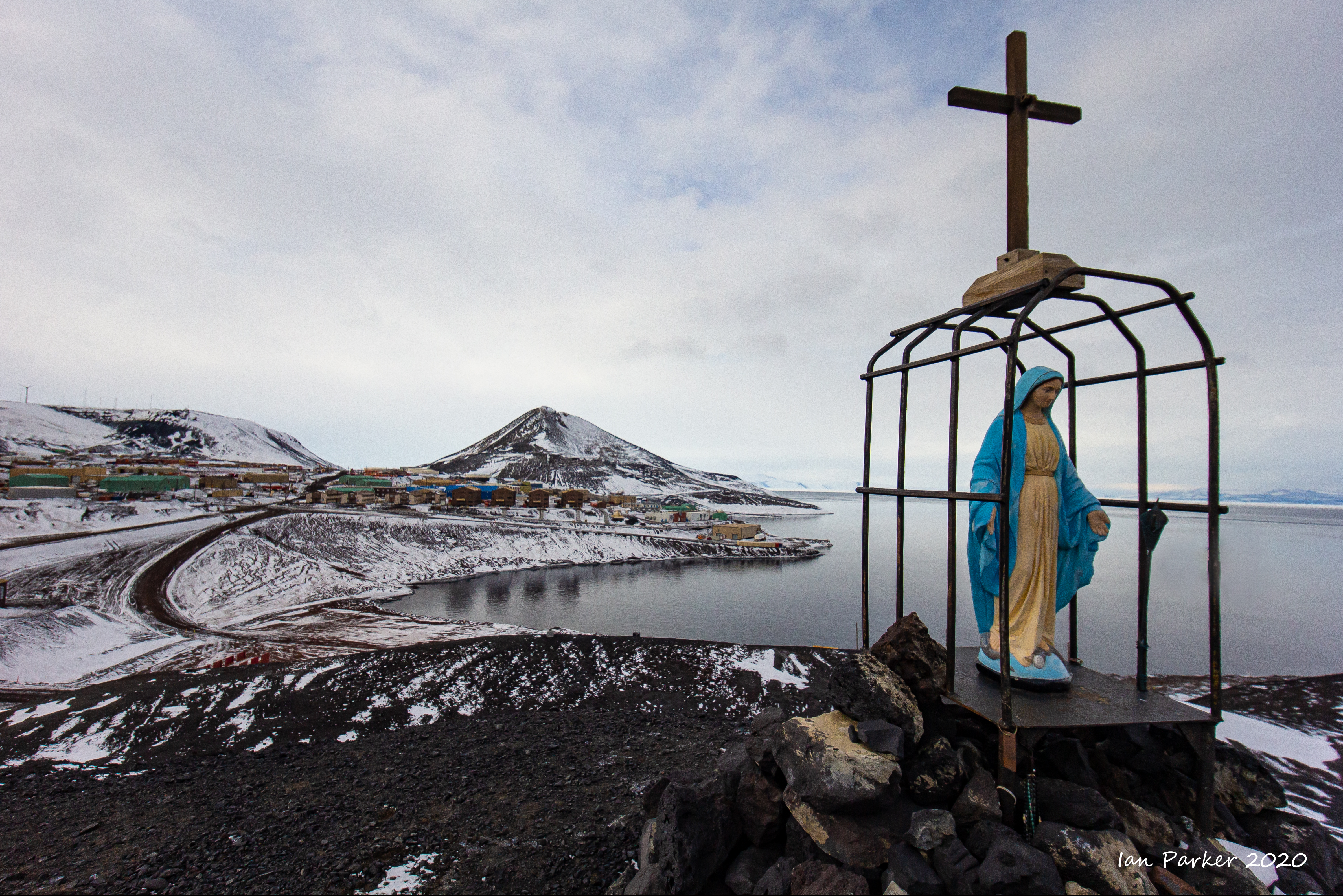
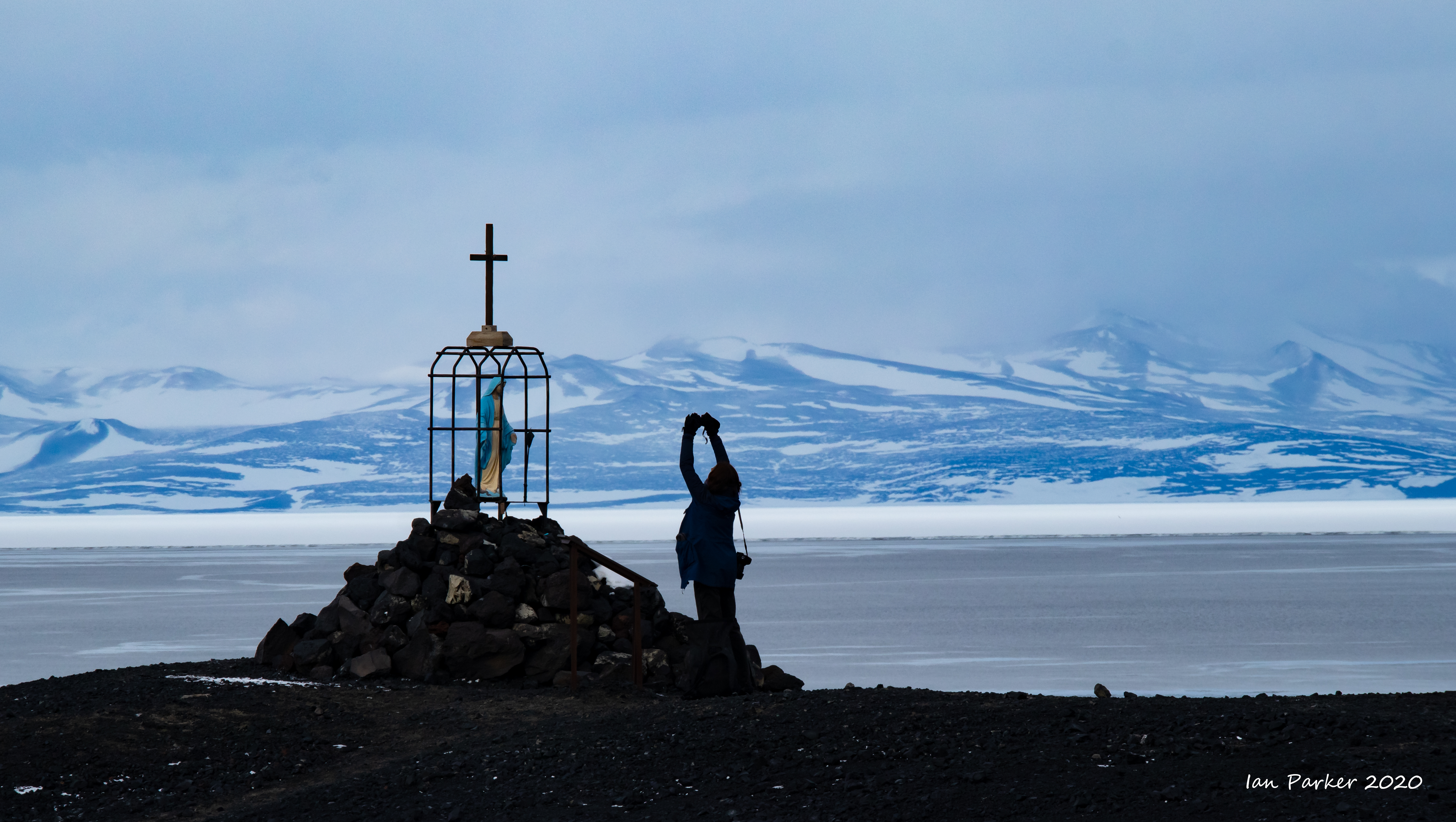
Feb 21 - A cruise around Ross Island
|

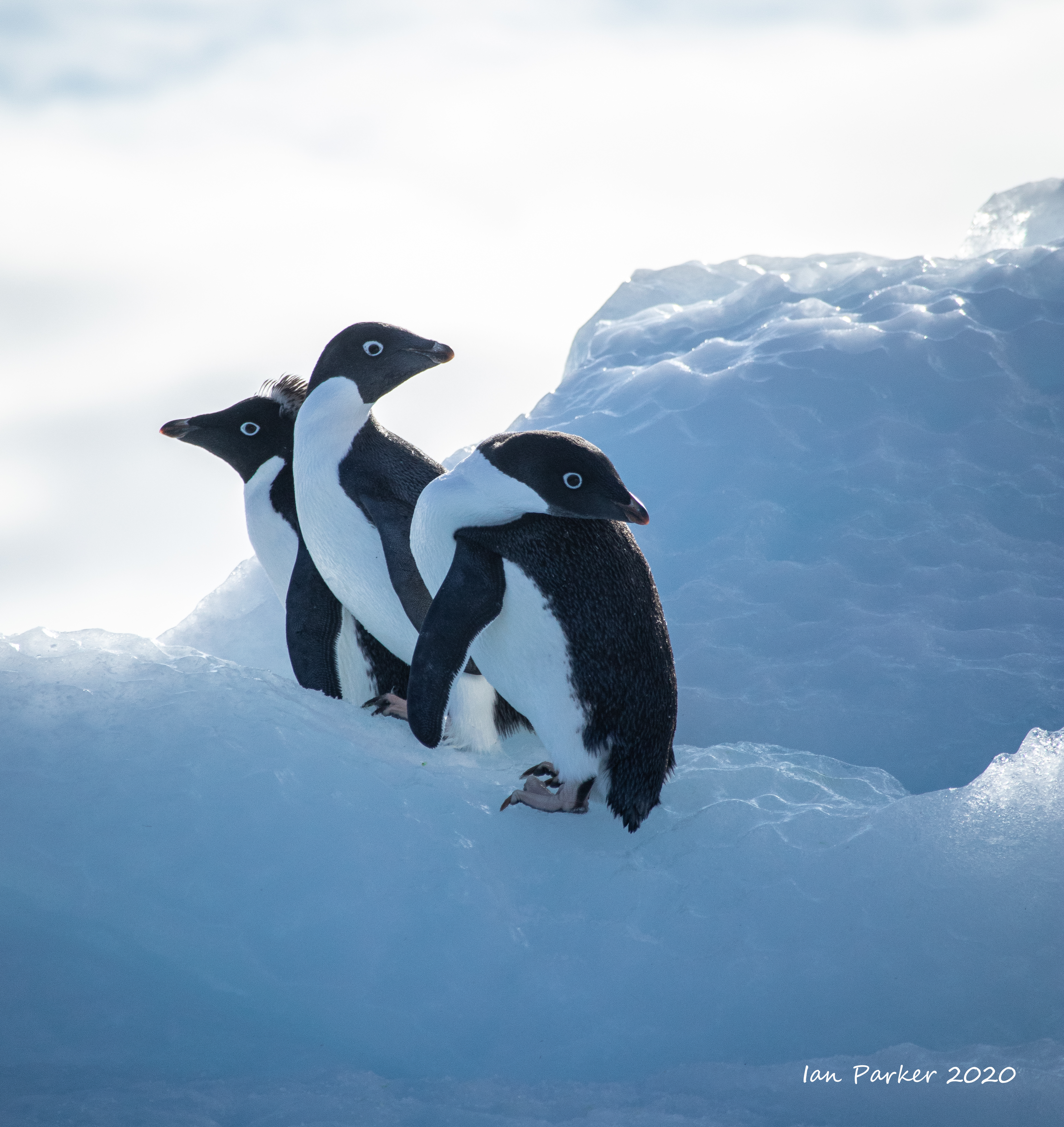
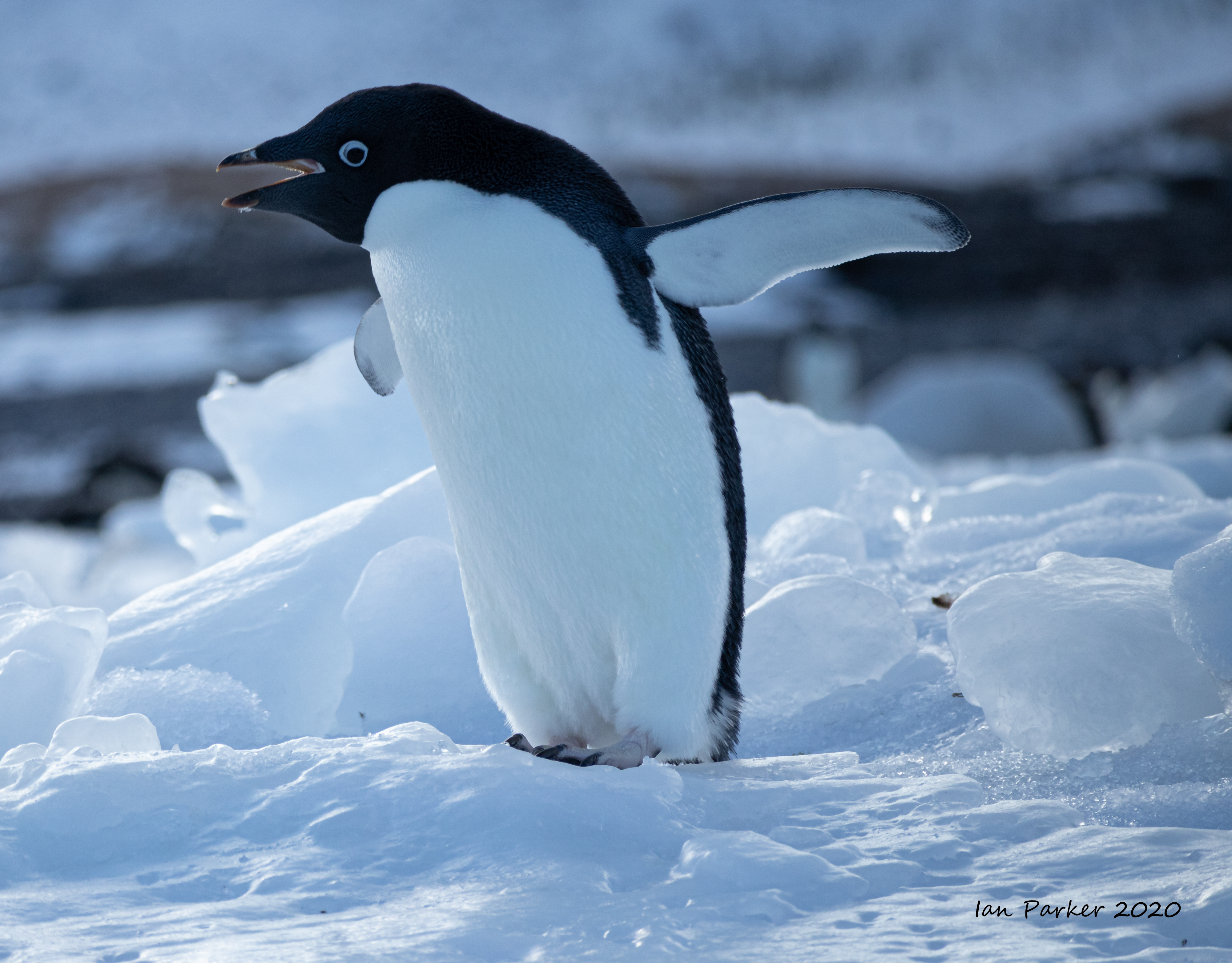
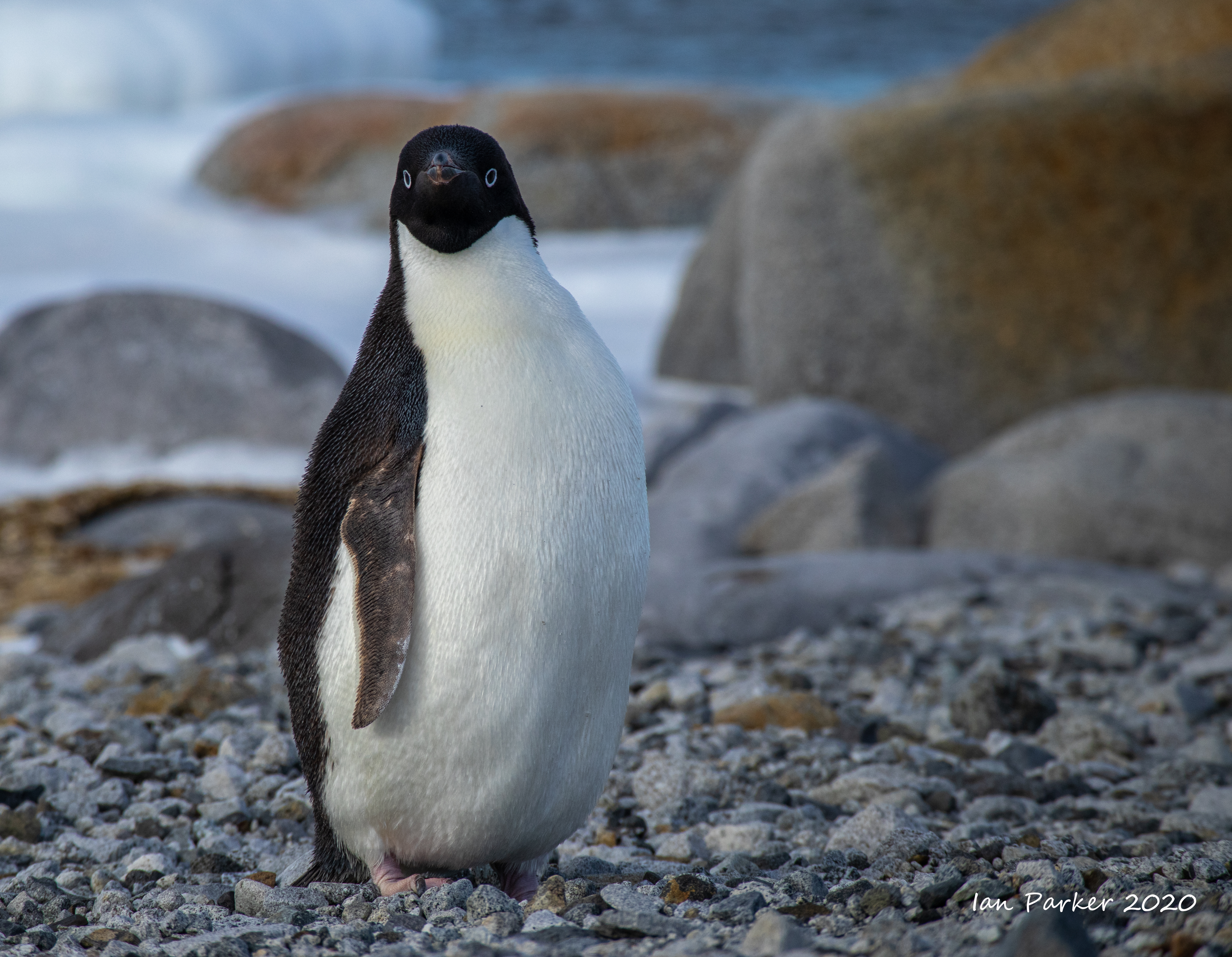
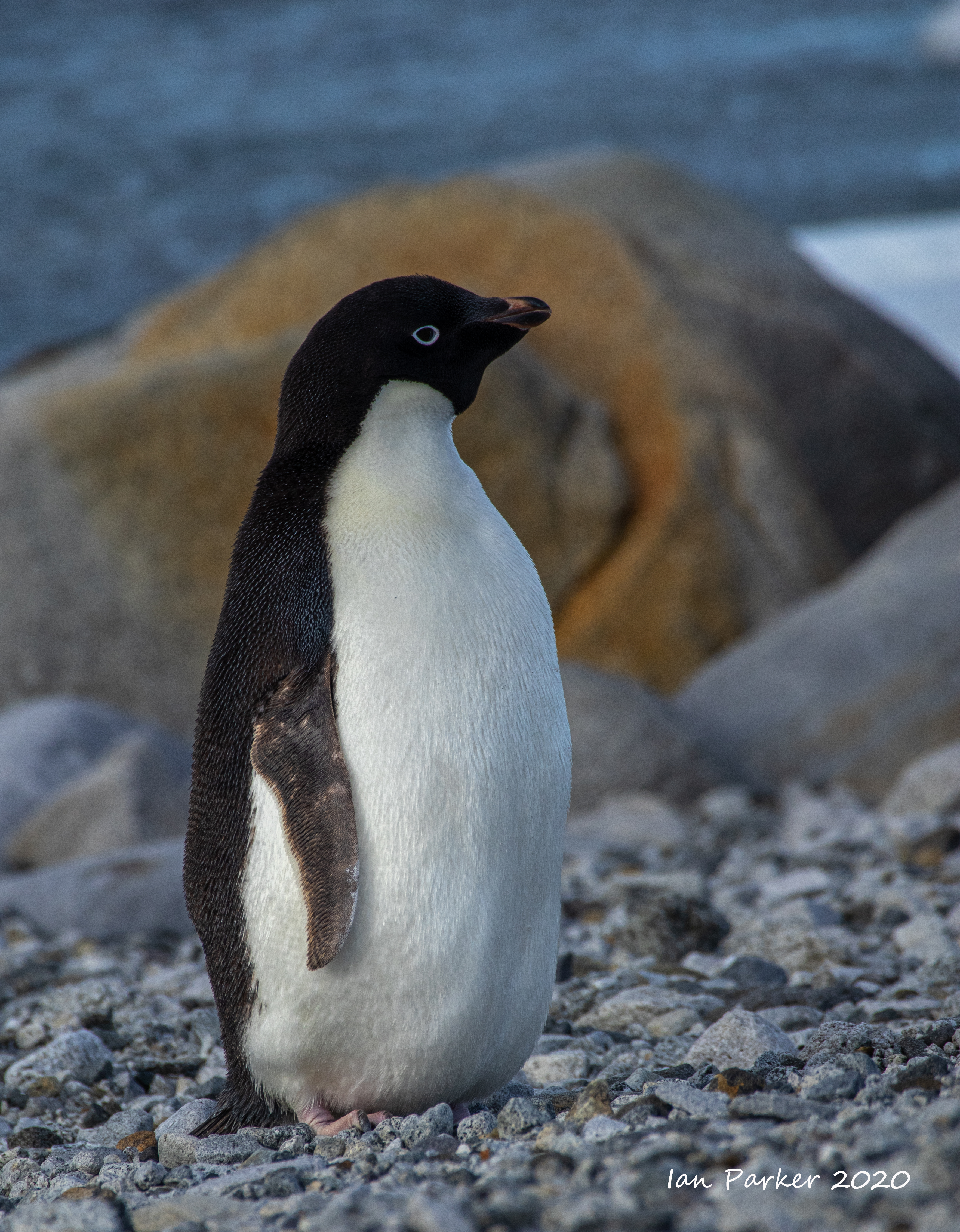
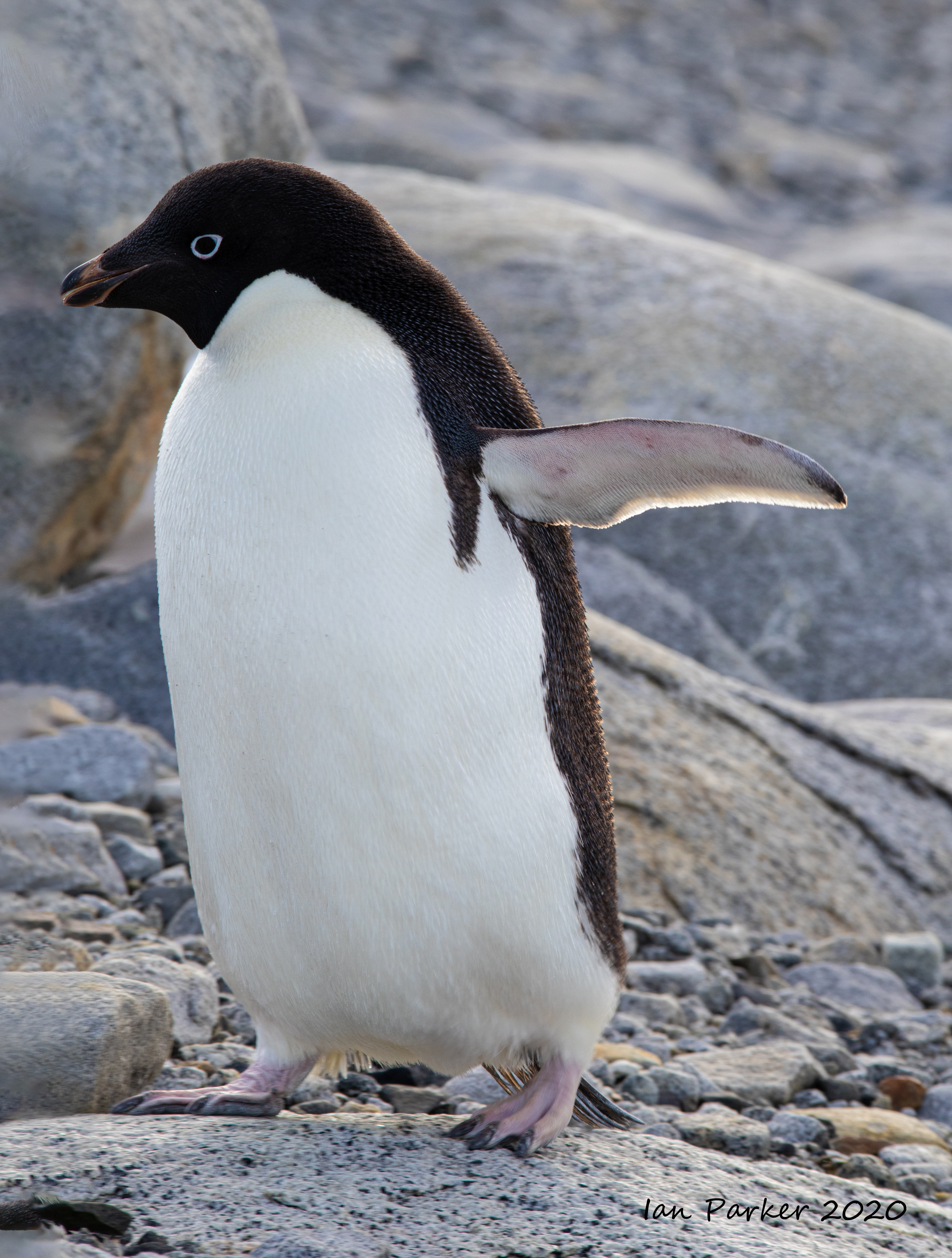
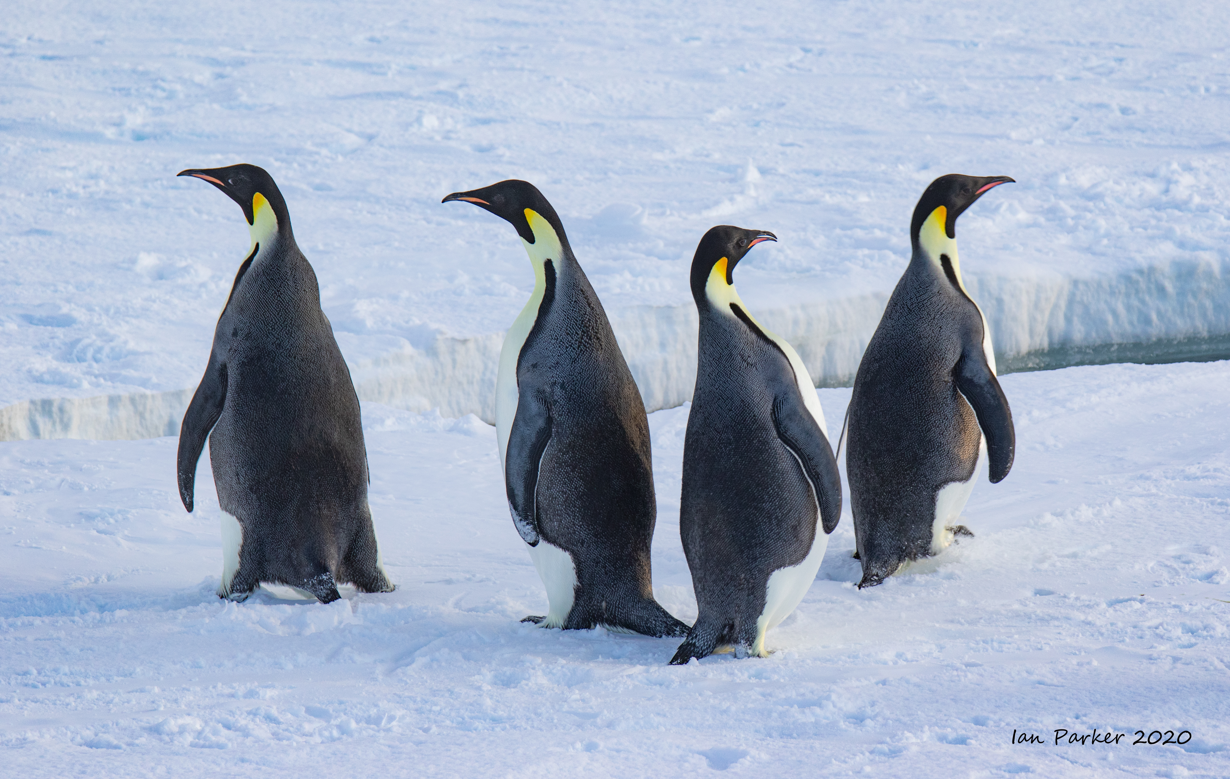
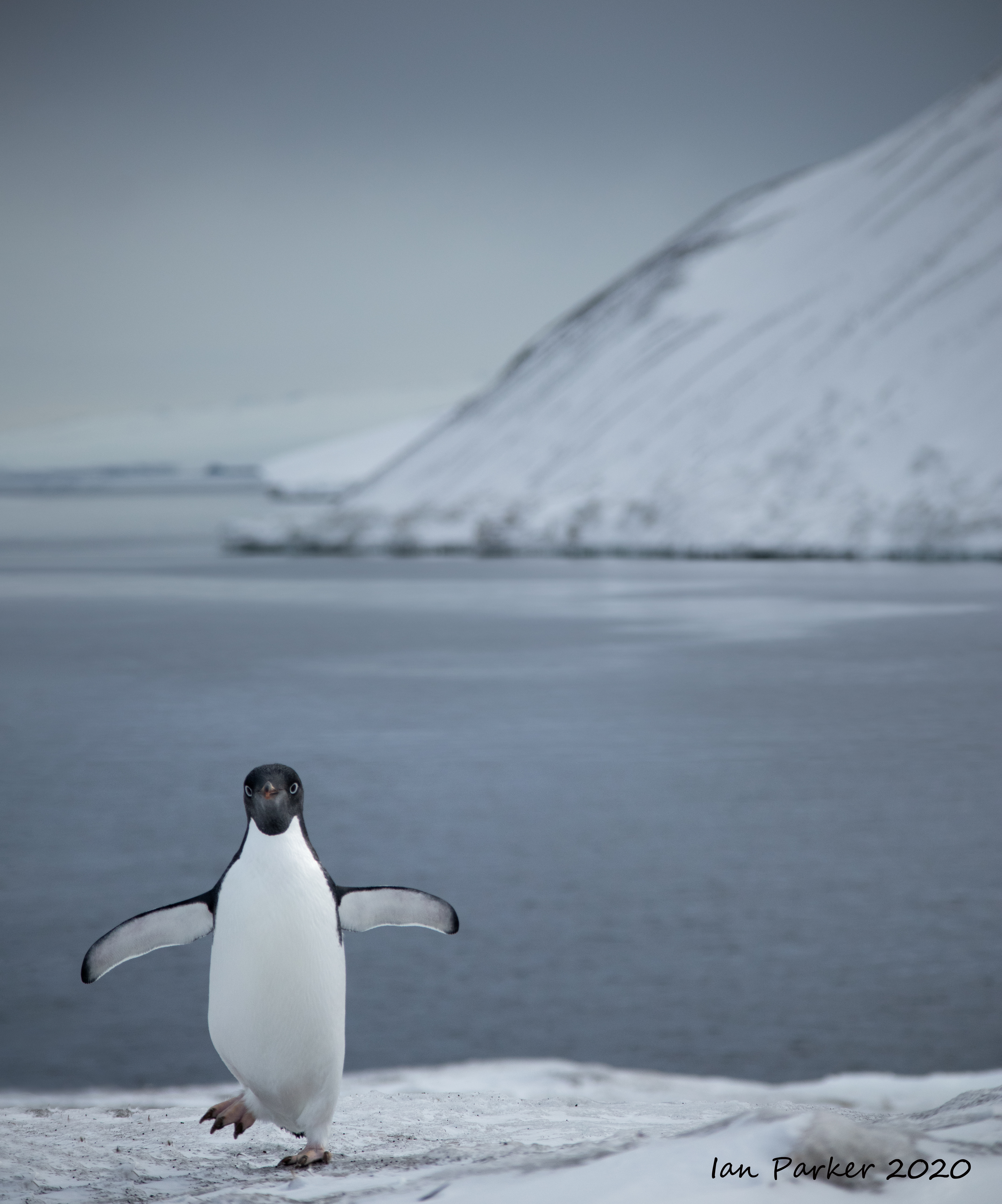
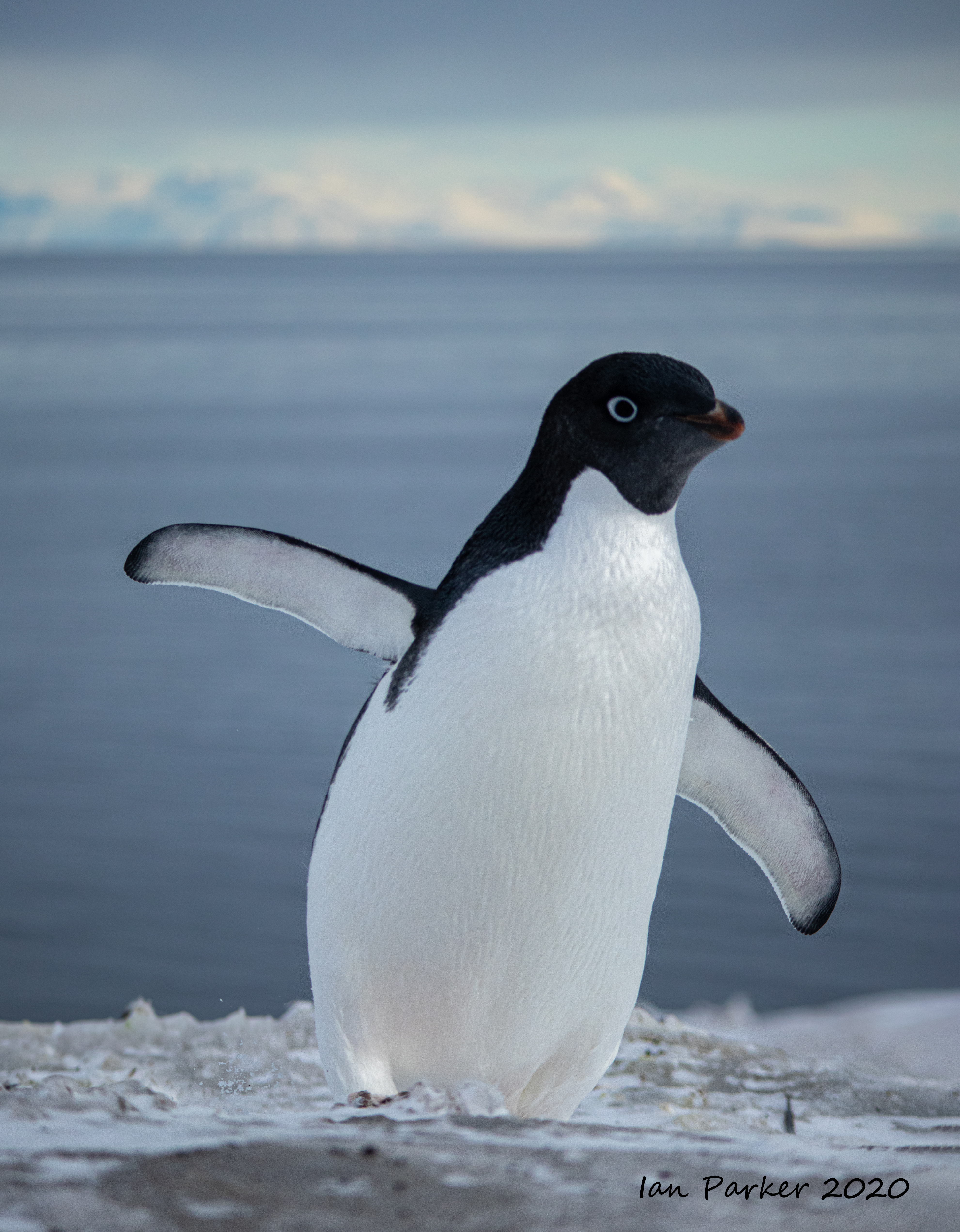
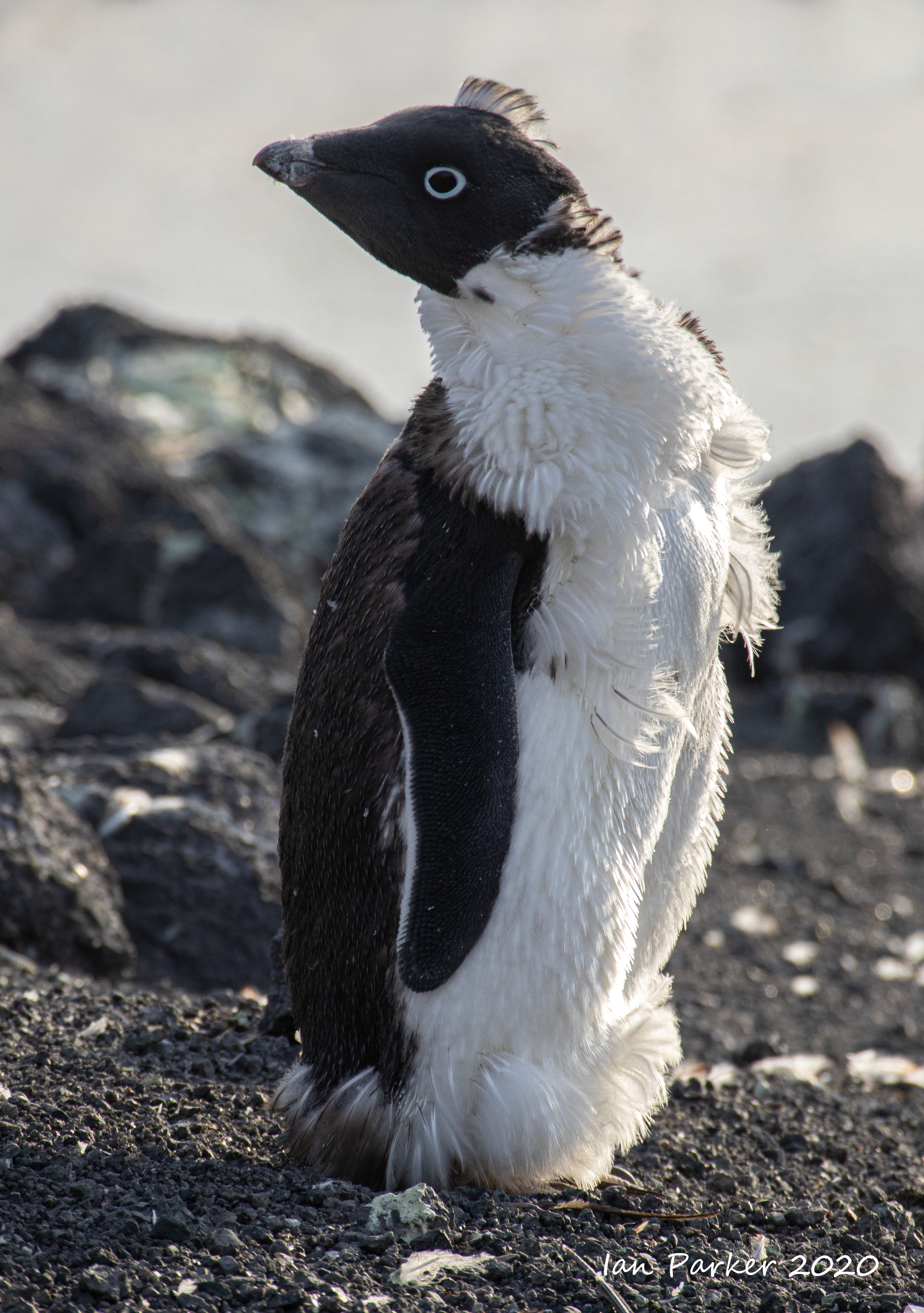
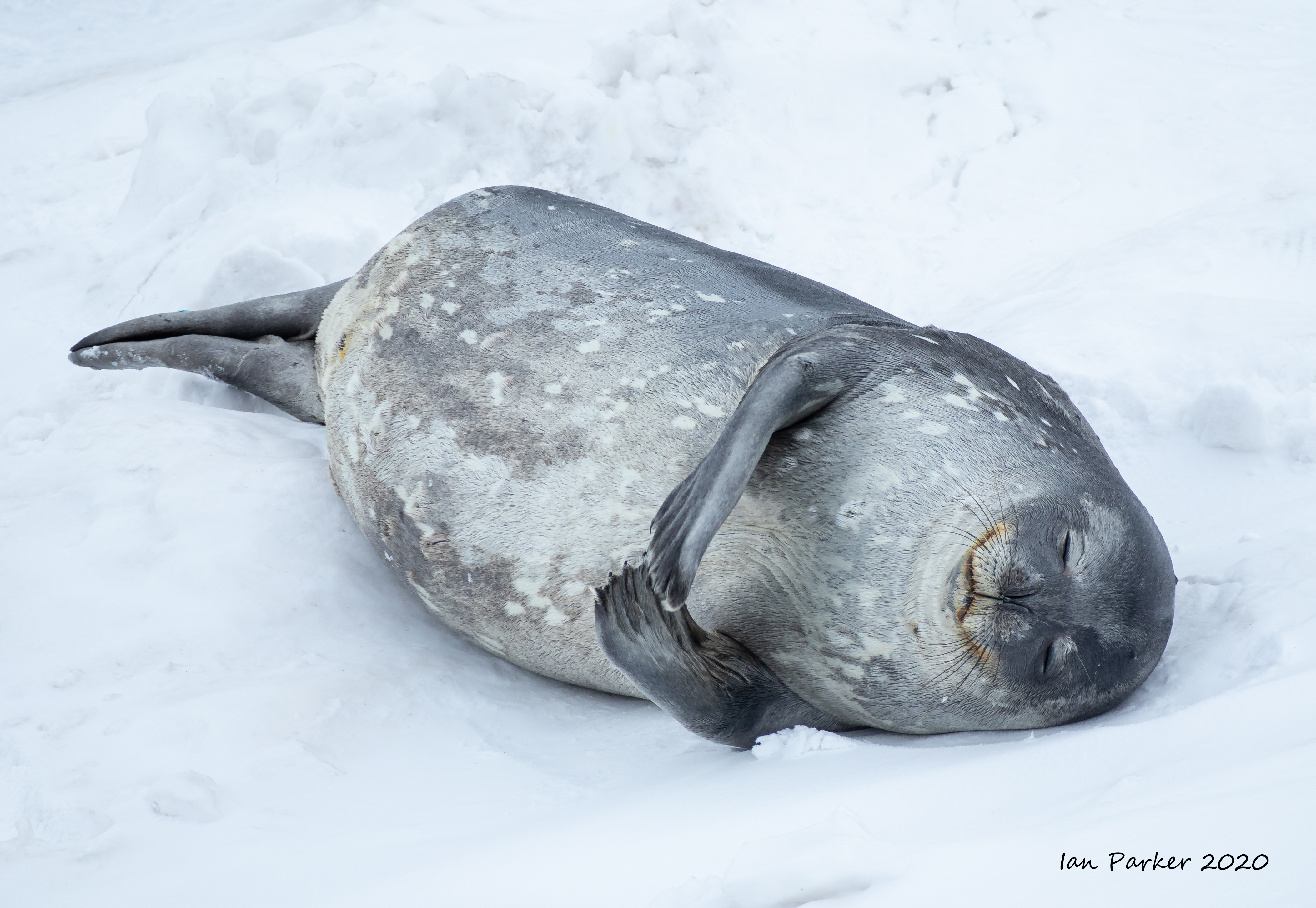
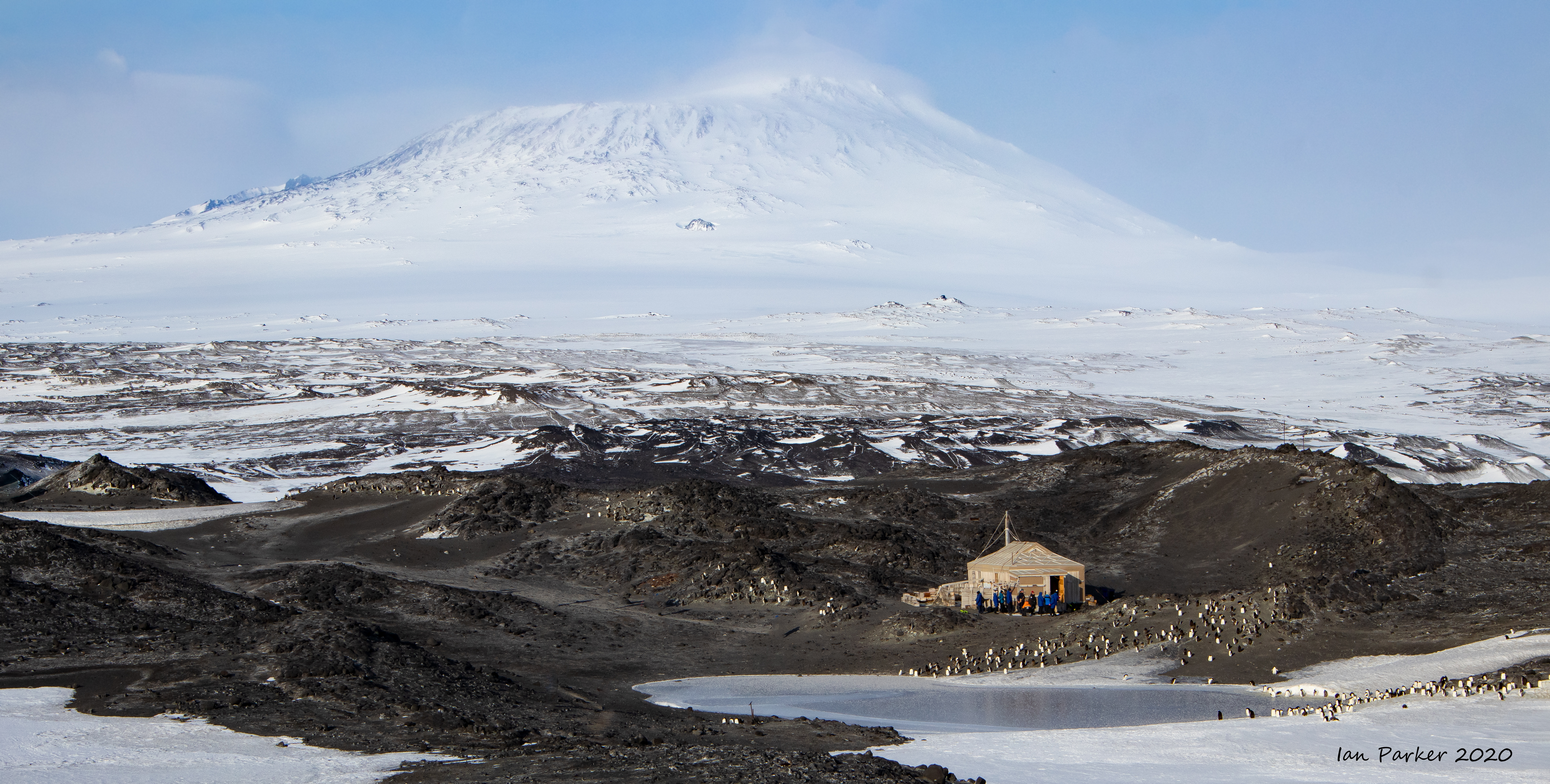
Feb 20, 21- Penguins and Seals on Ross Island

 Weddel seal flipper; Ross Island, Antarctica |


Feb 20, 21 - Historic Huts on Ross Island dating from the Heroic Age of Polar Exploration
Green line shows the path we took after leaving McMurdo Station (#3). Grey areas on the satellite photo are sea ice, which had melted and broken up at the time of our visit. |
 |
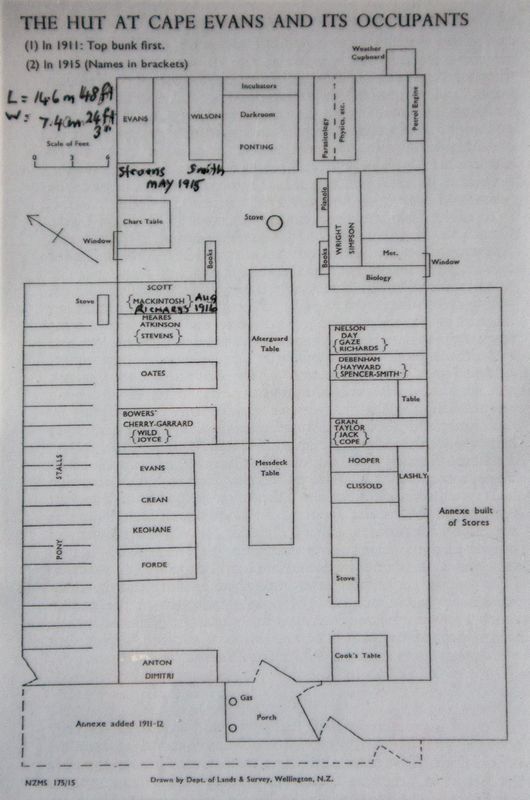
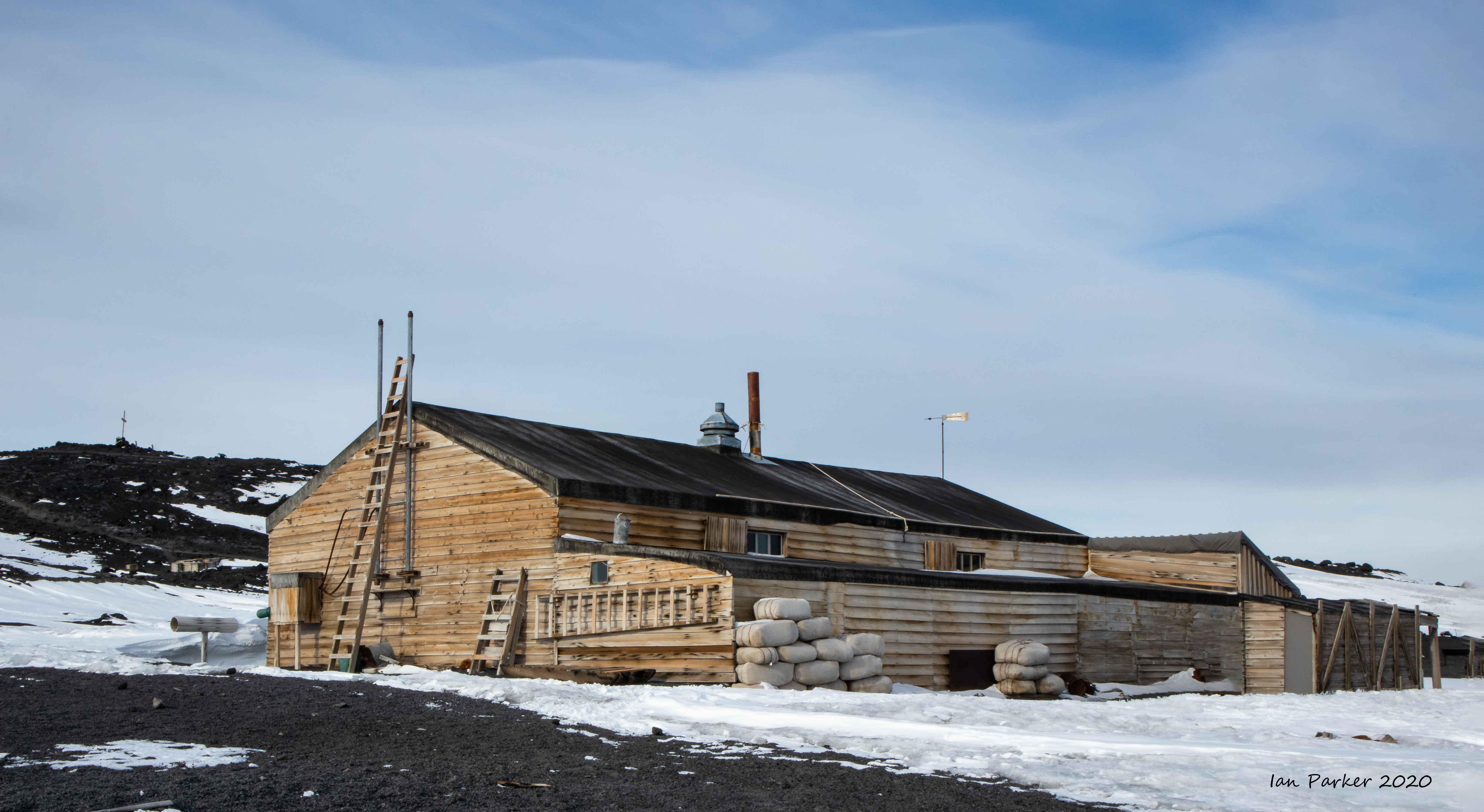
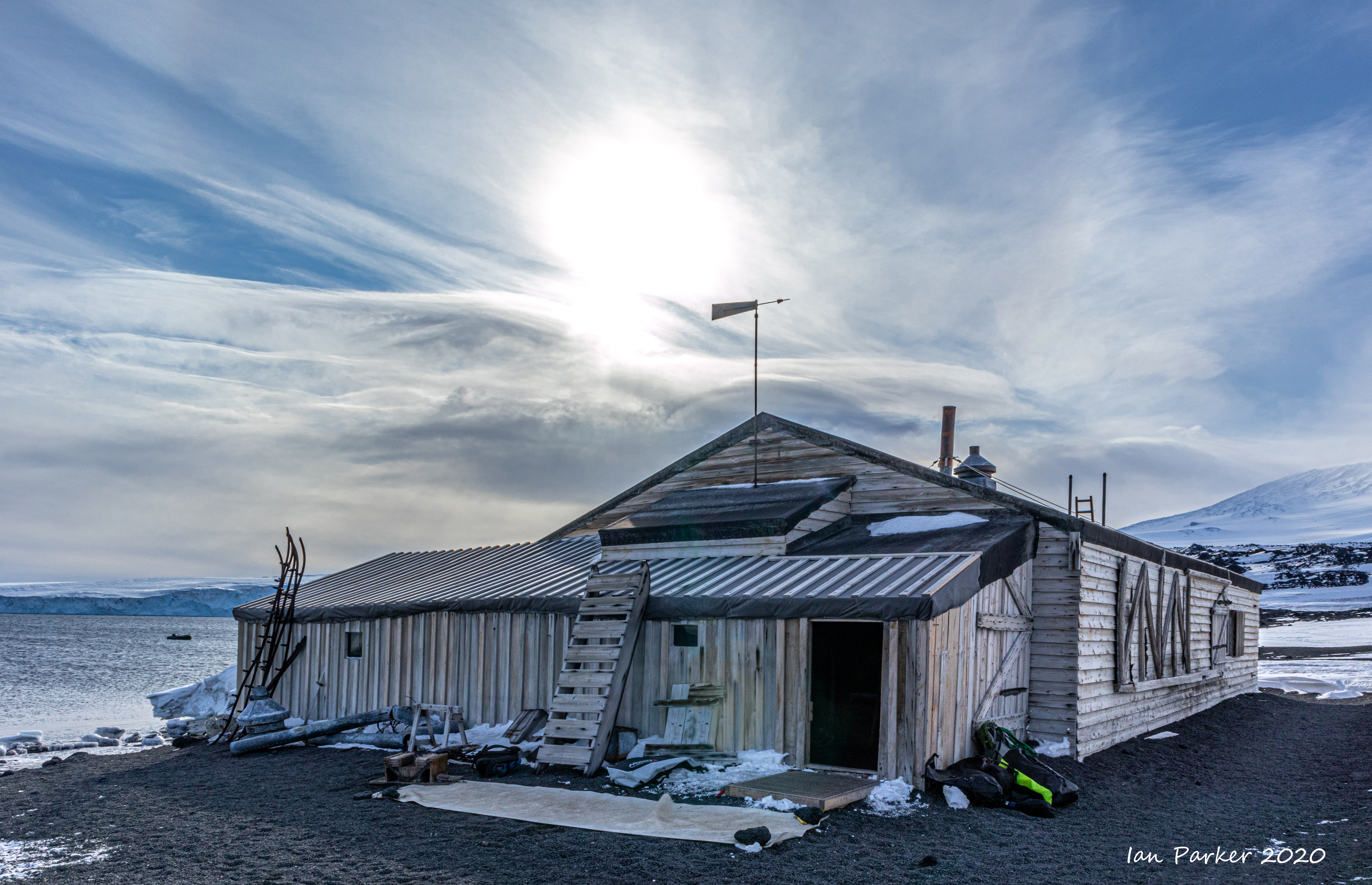
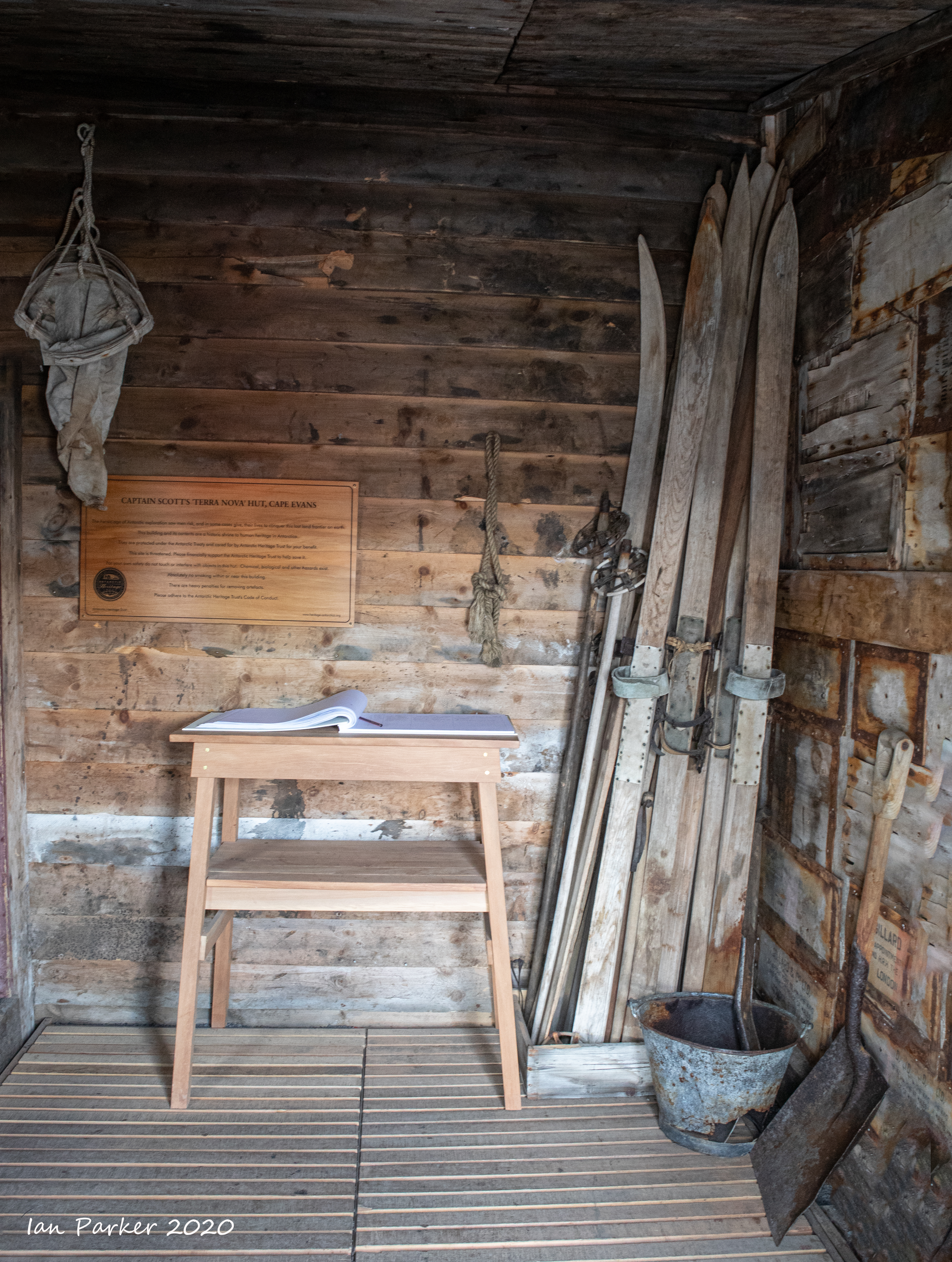
Scott's hut at Cape Evans
Captain's log
|
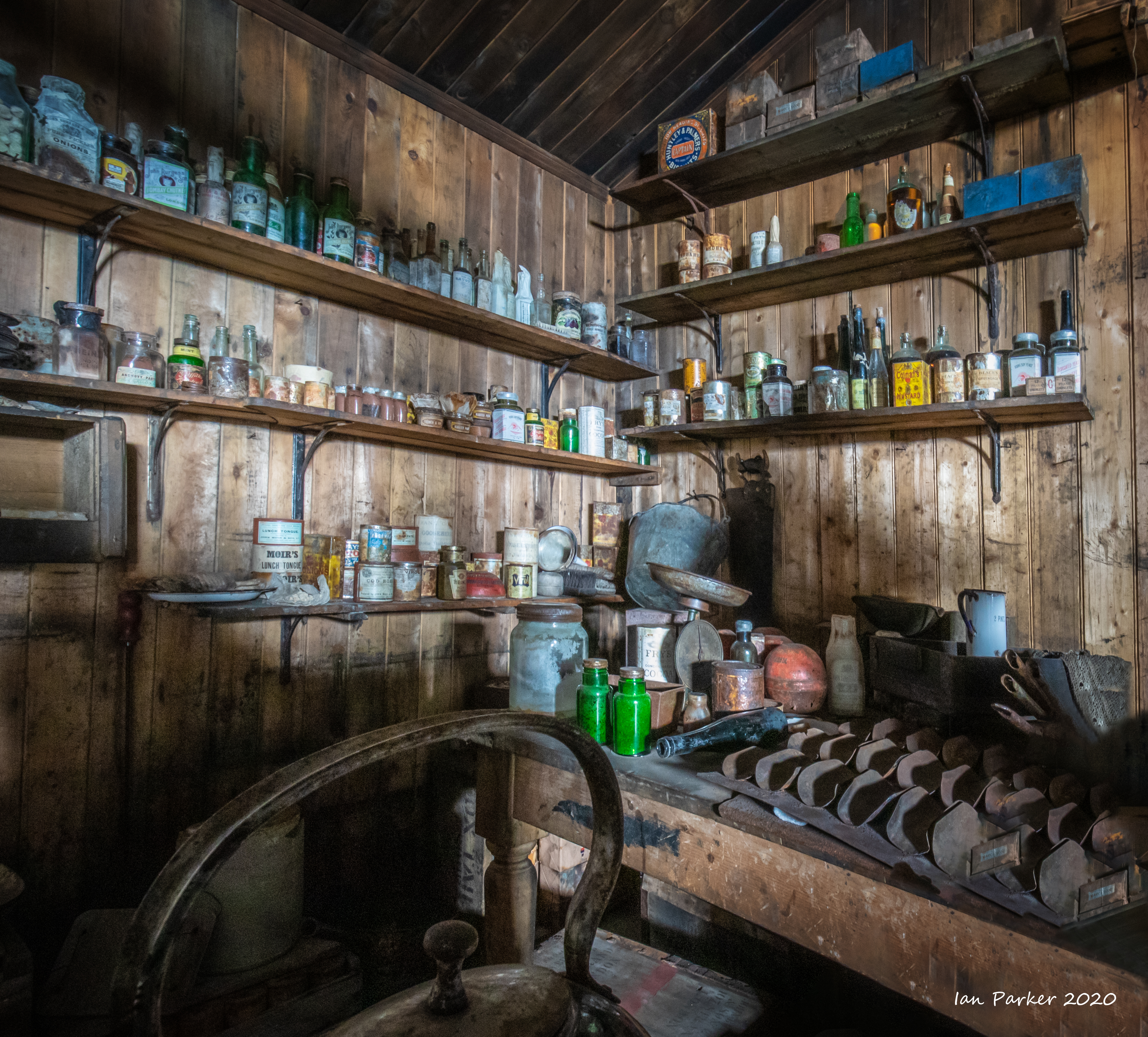
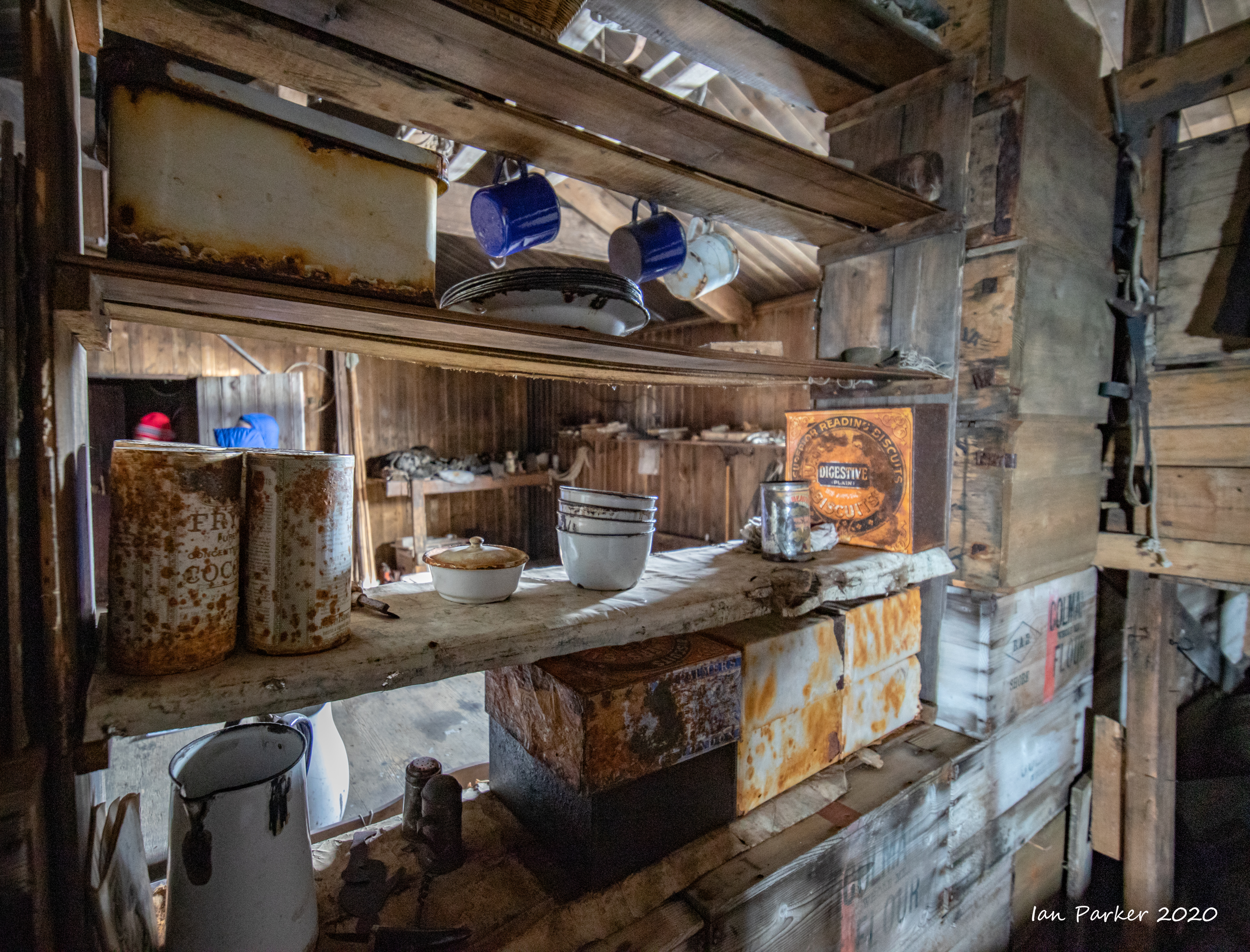
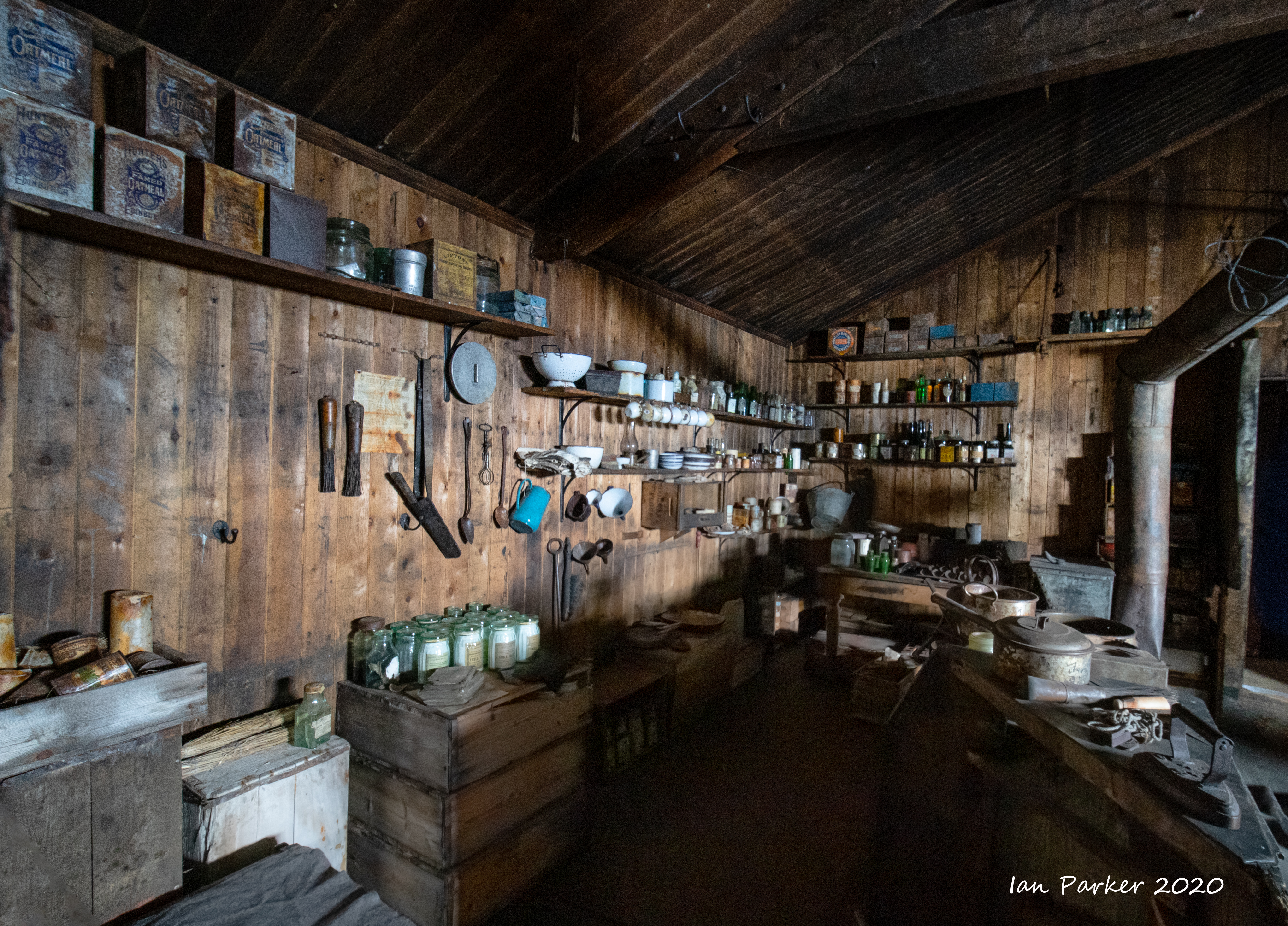
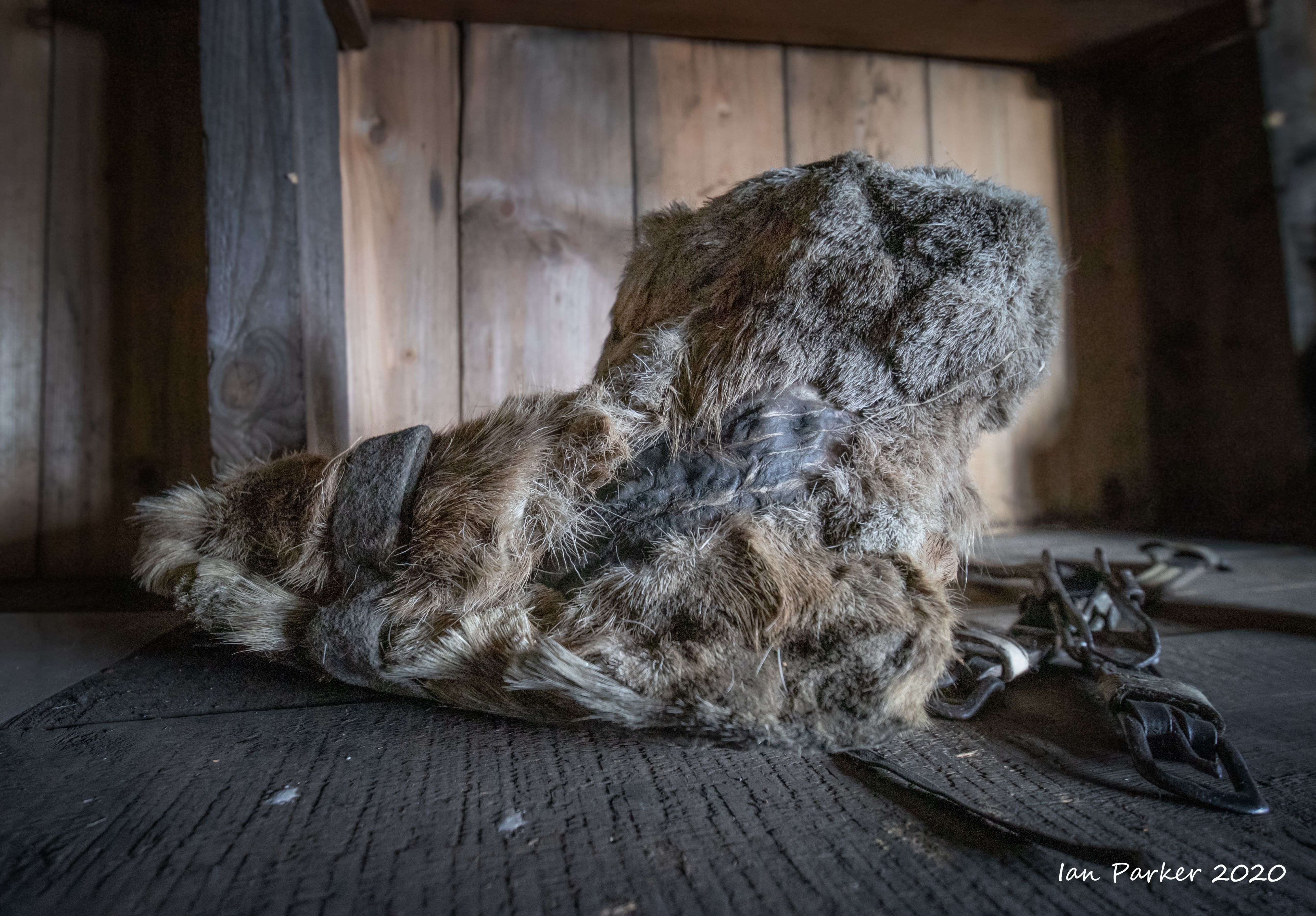
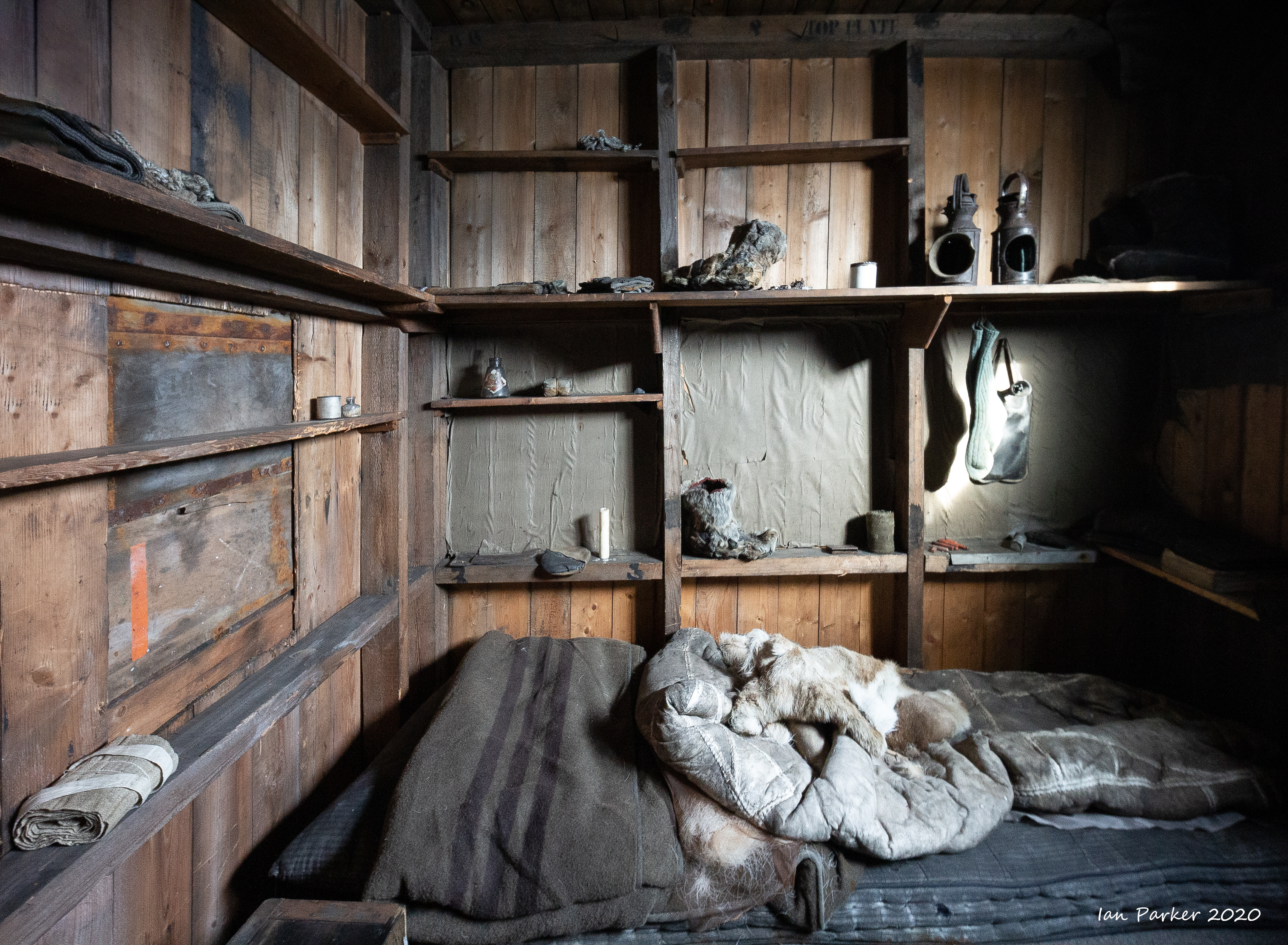
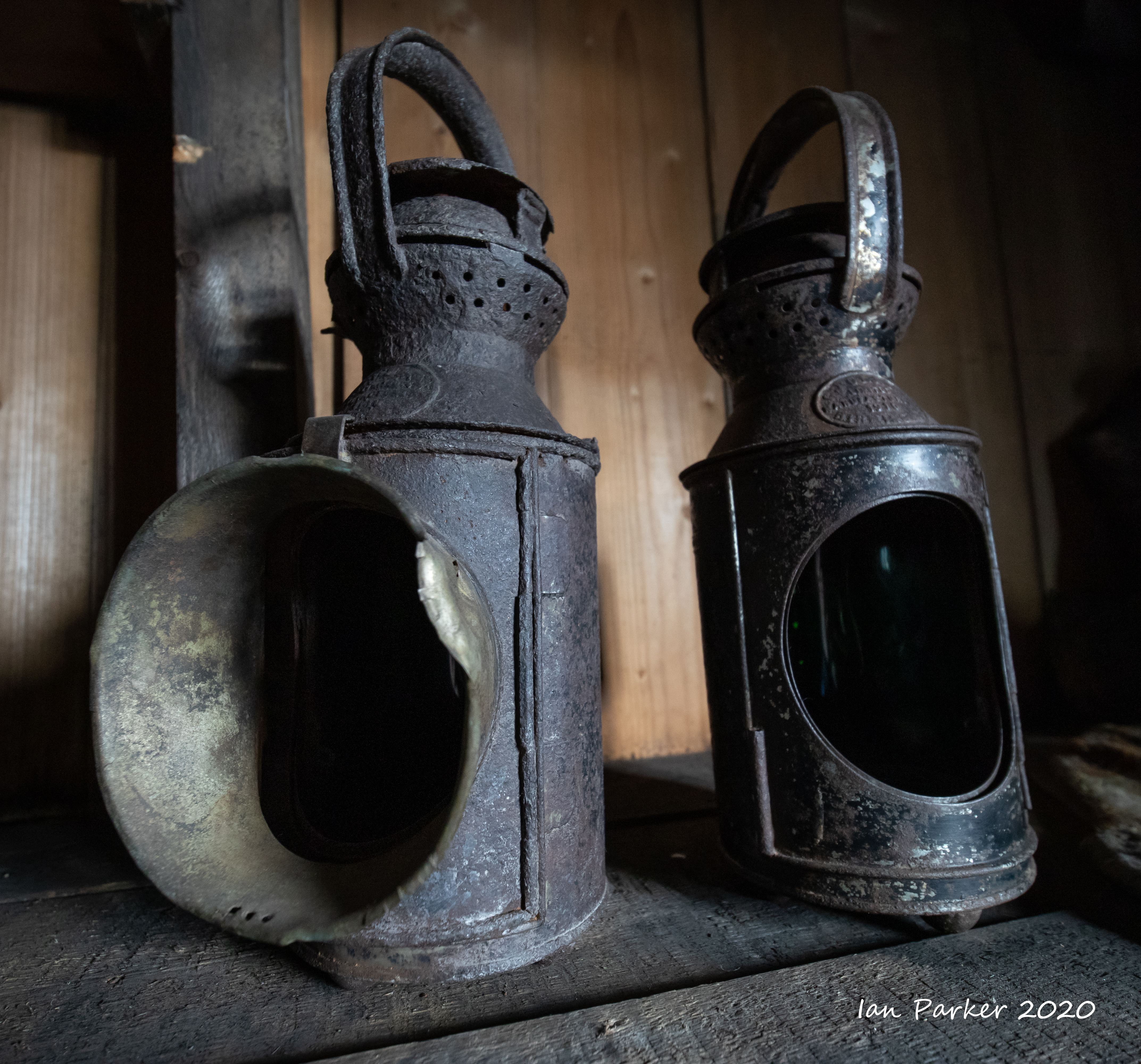
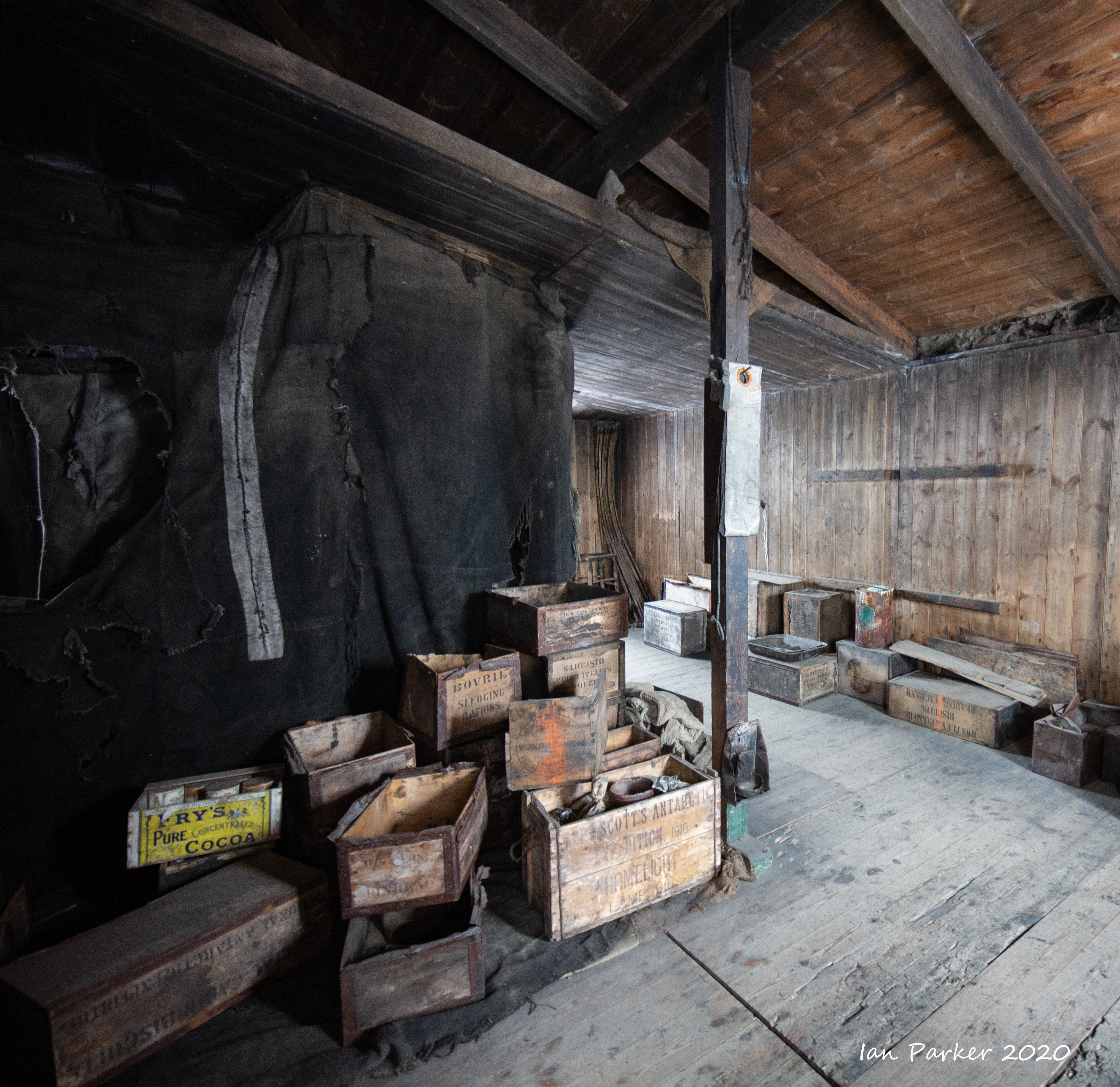
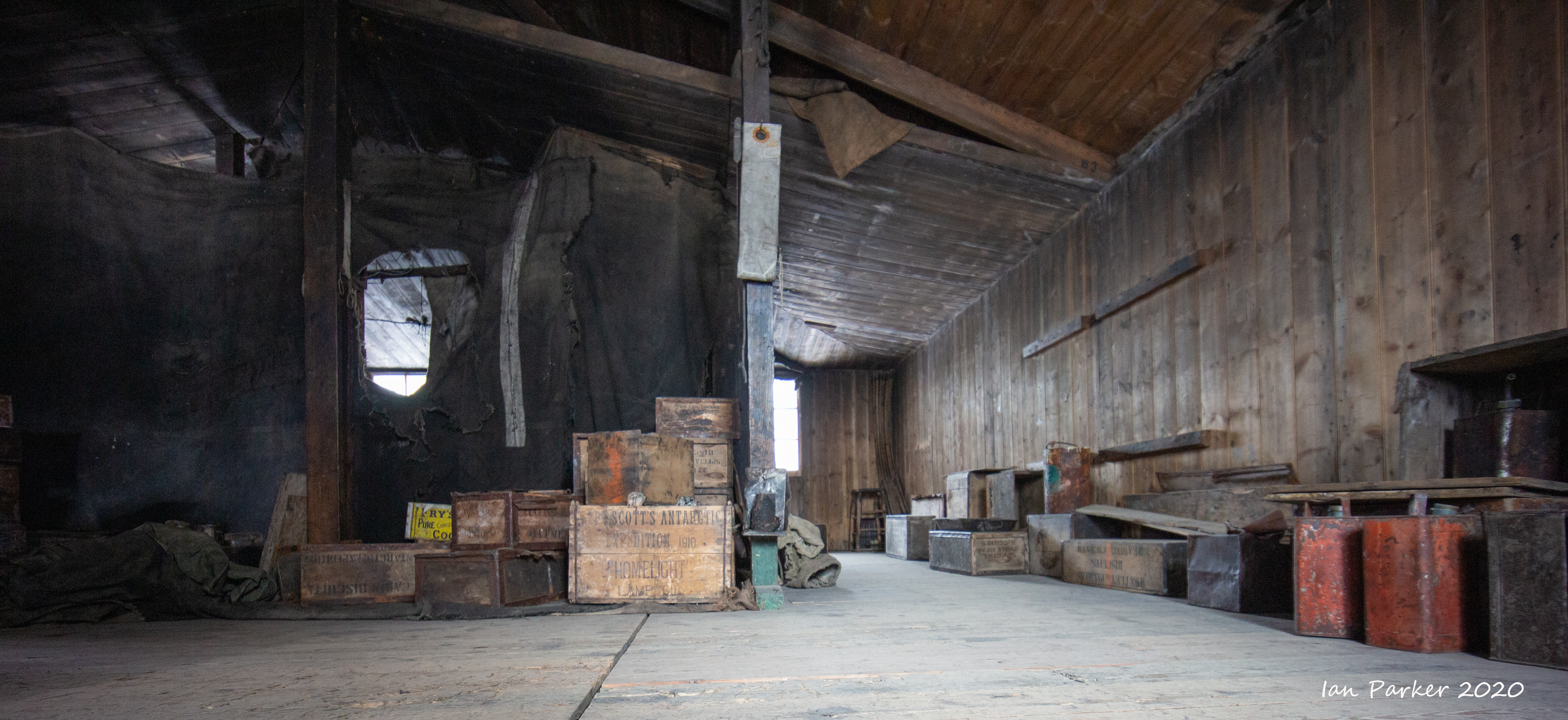
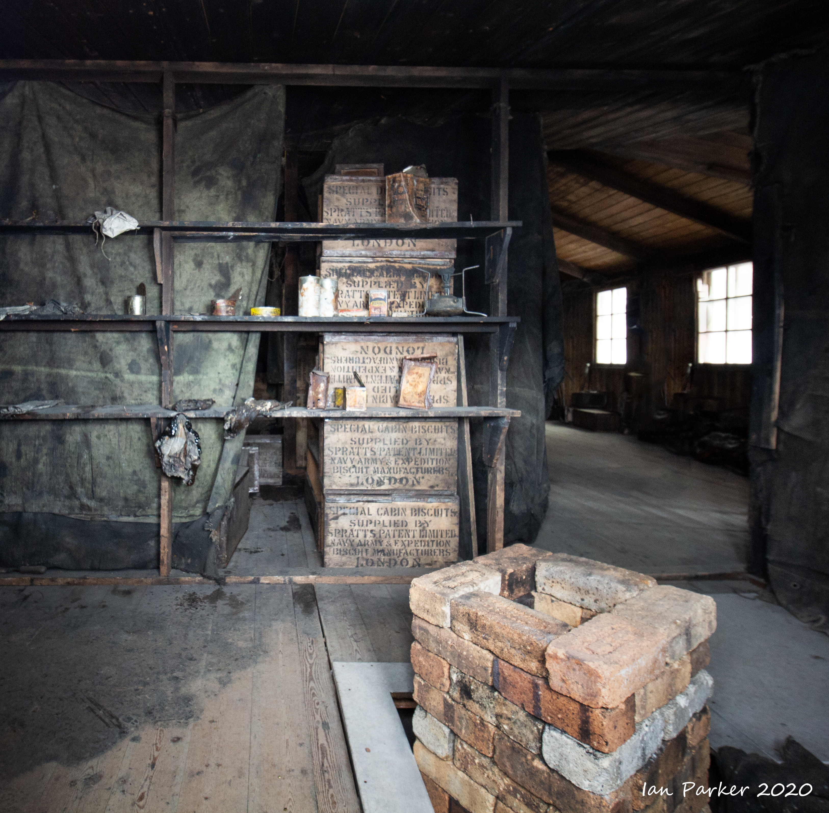
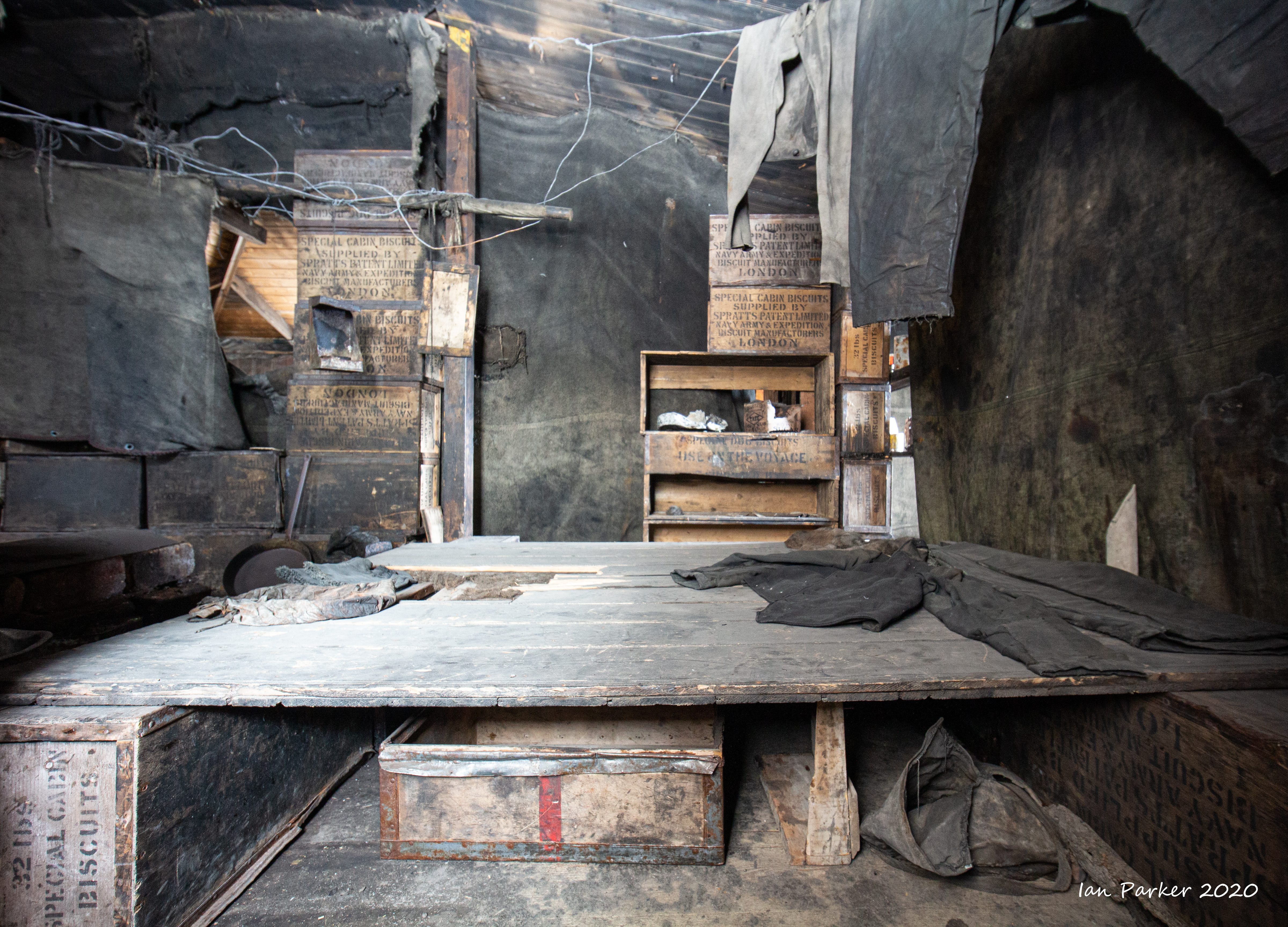
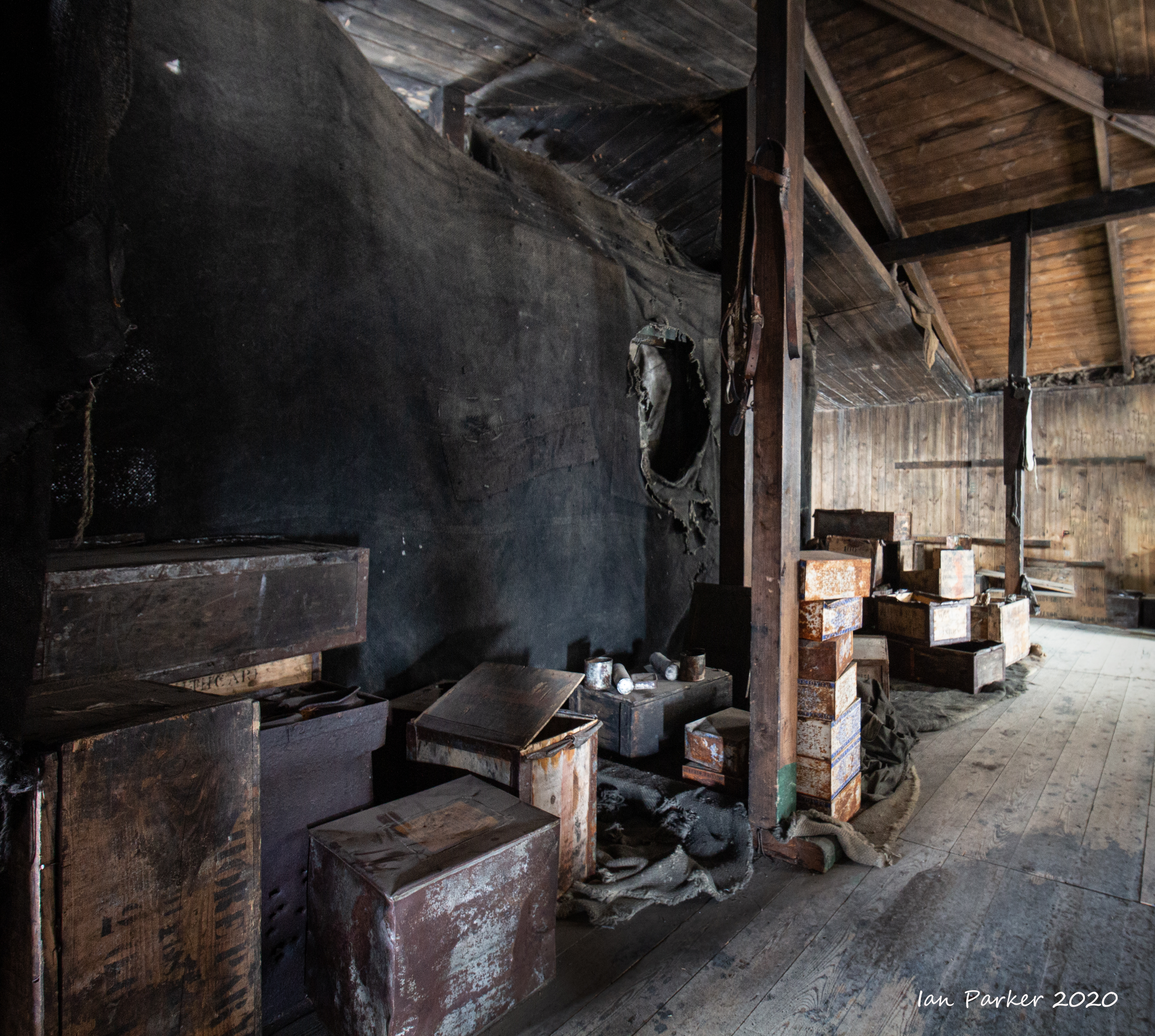
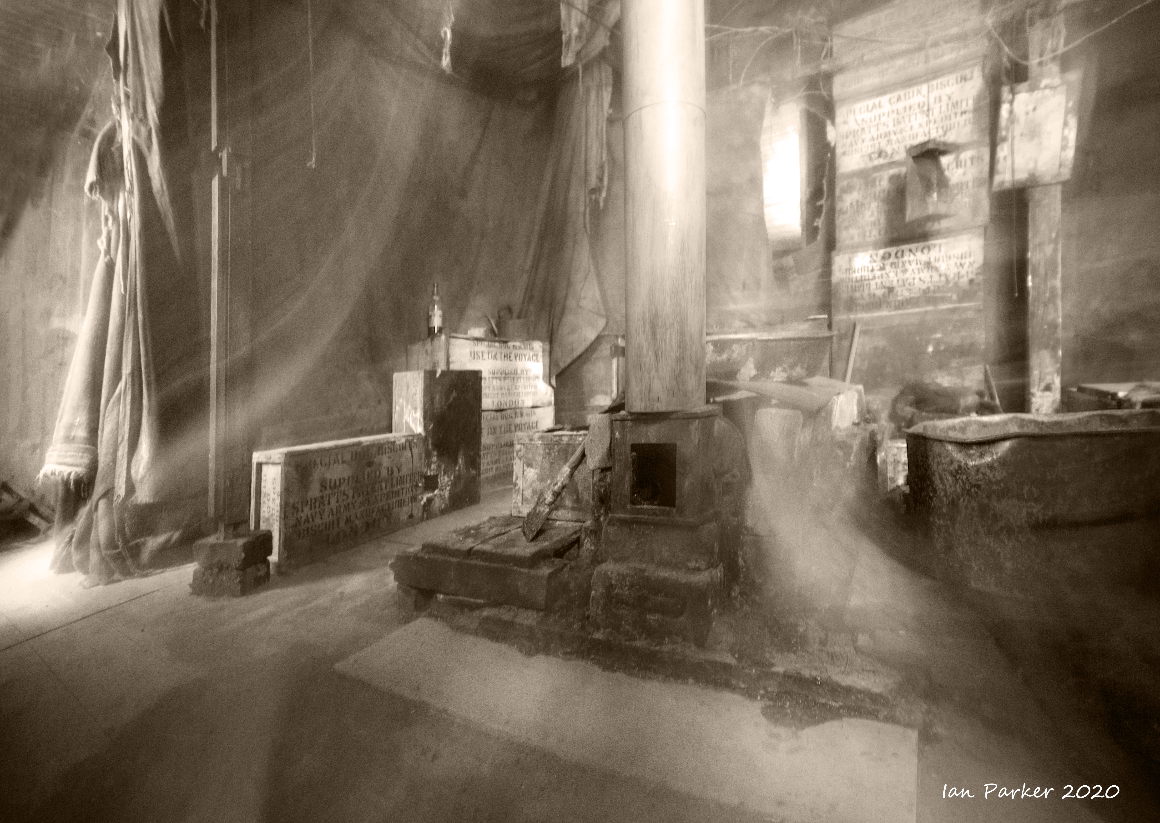
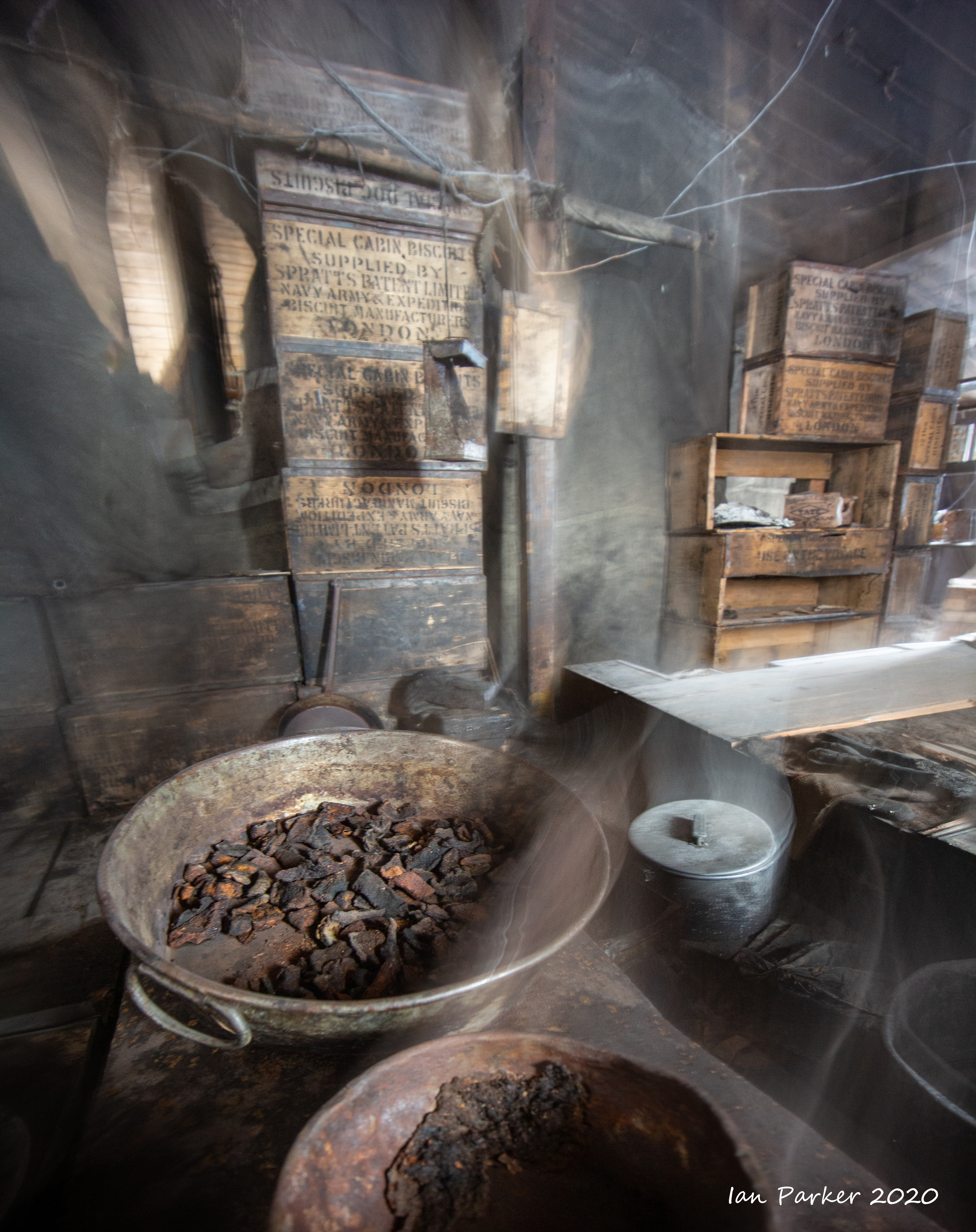
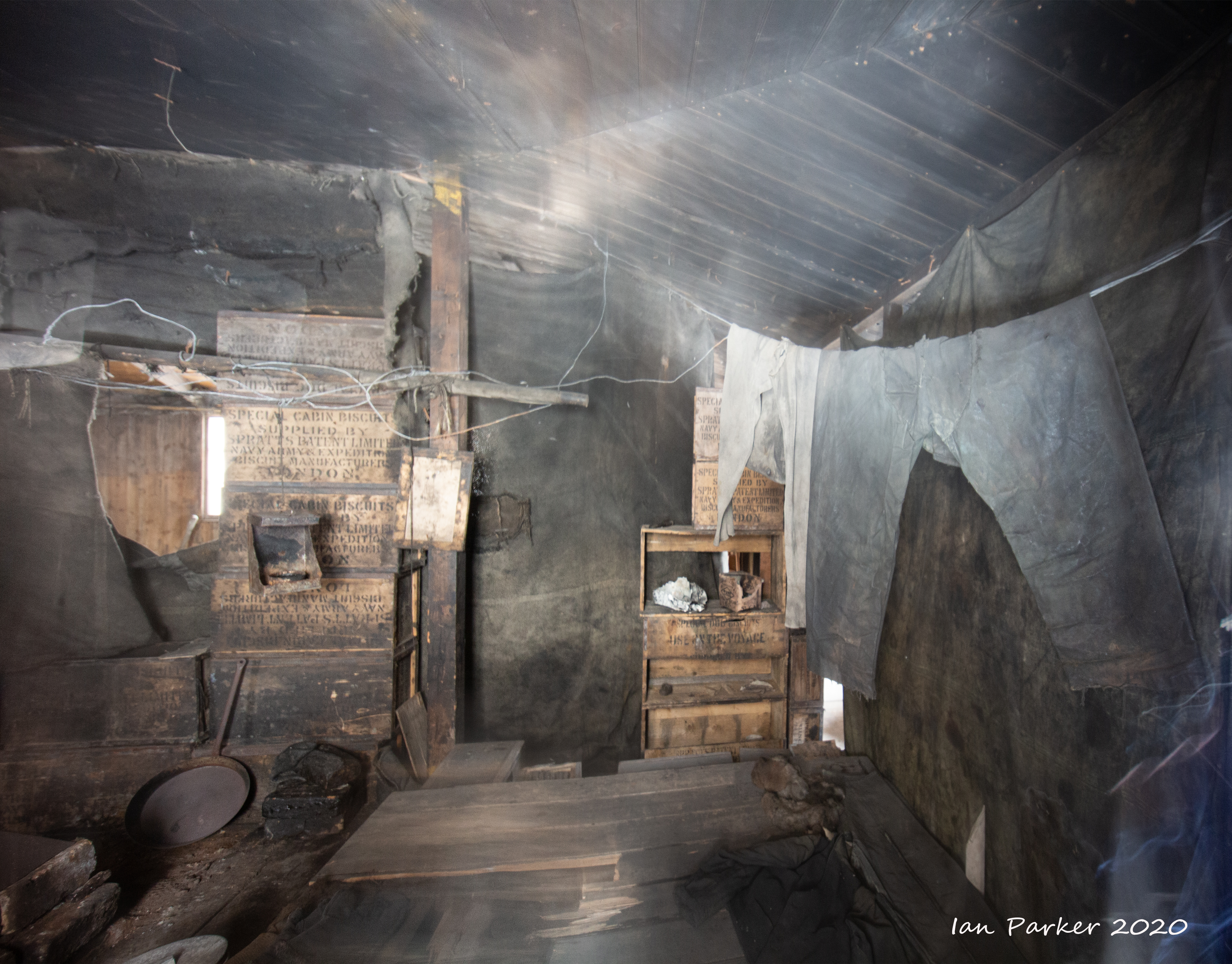
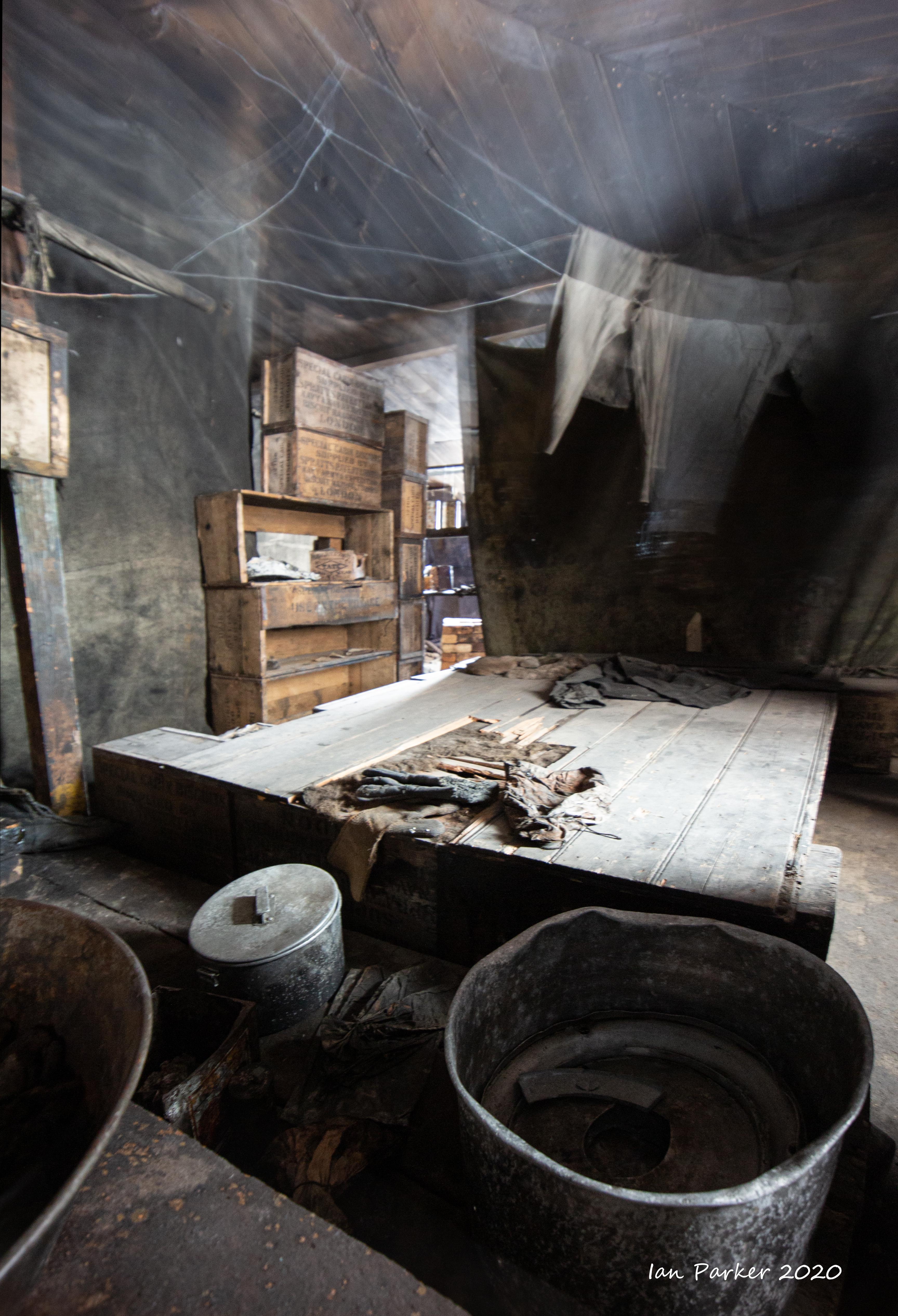
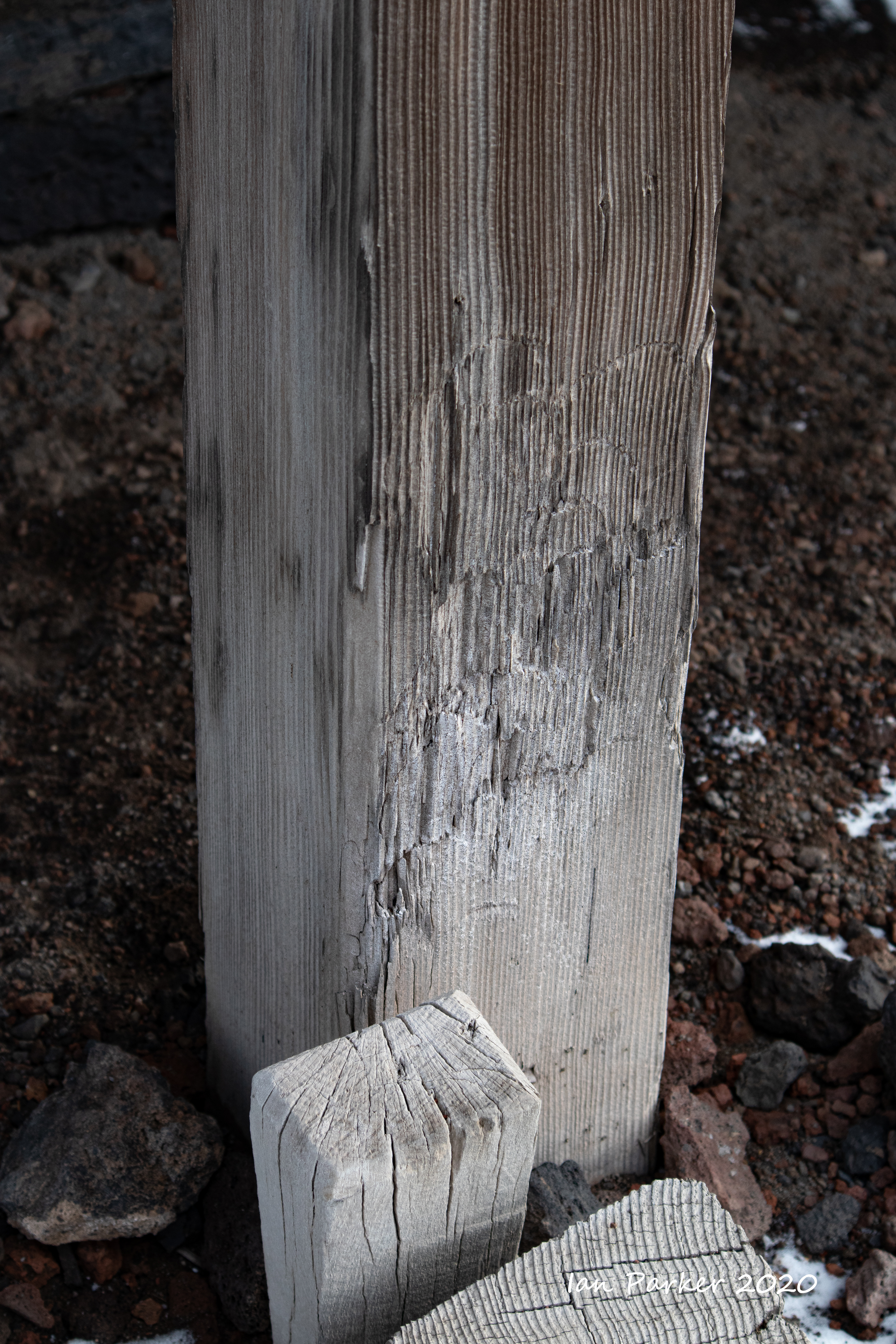
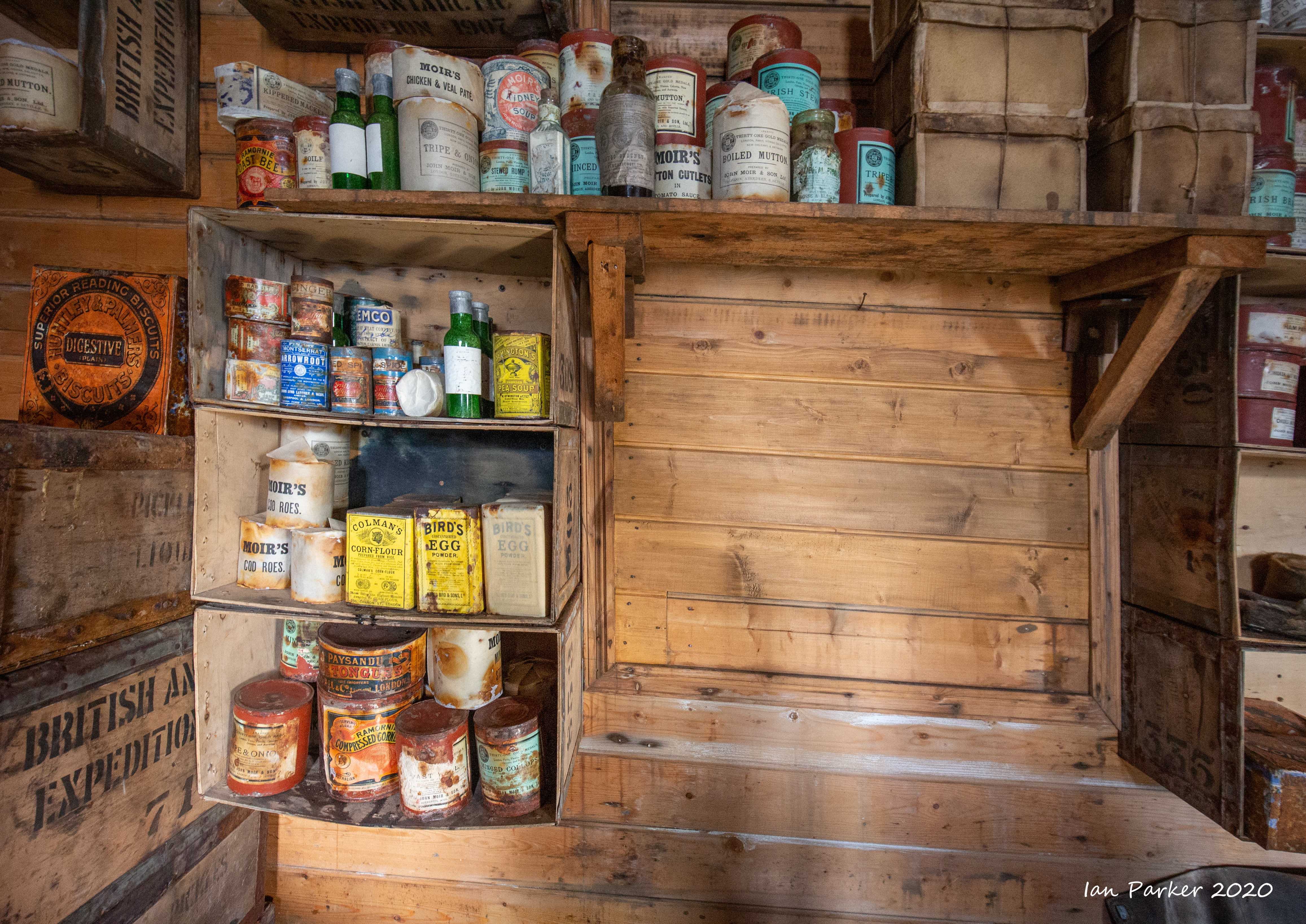
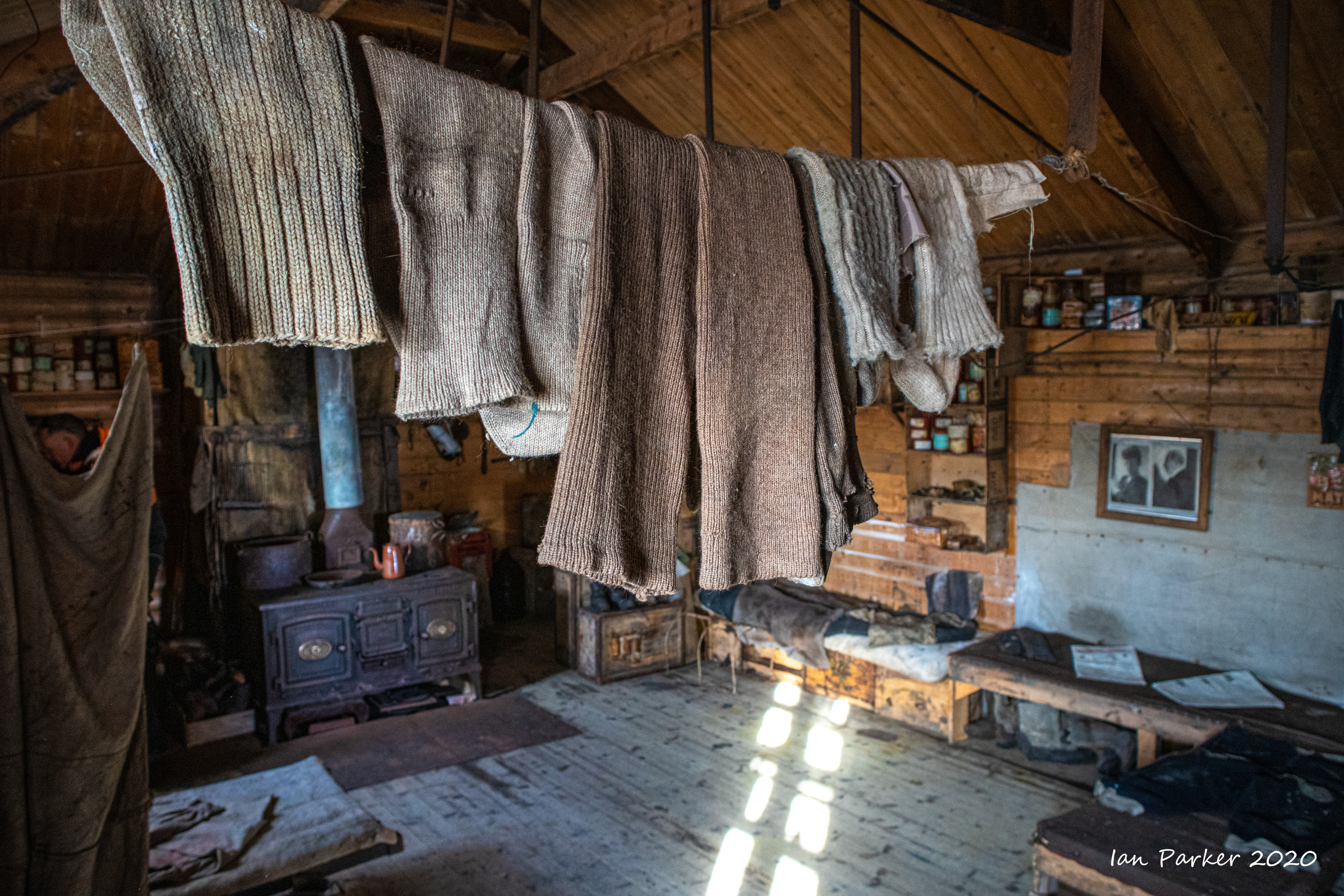
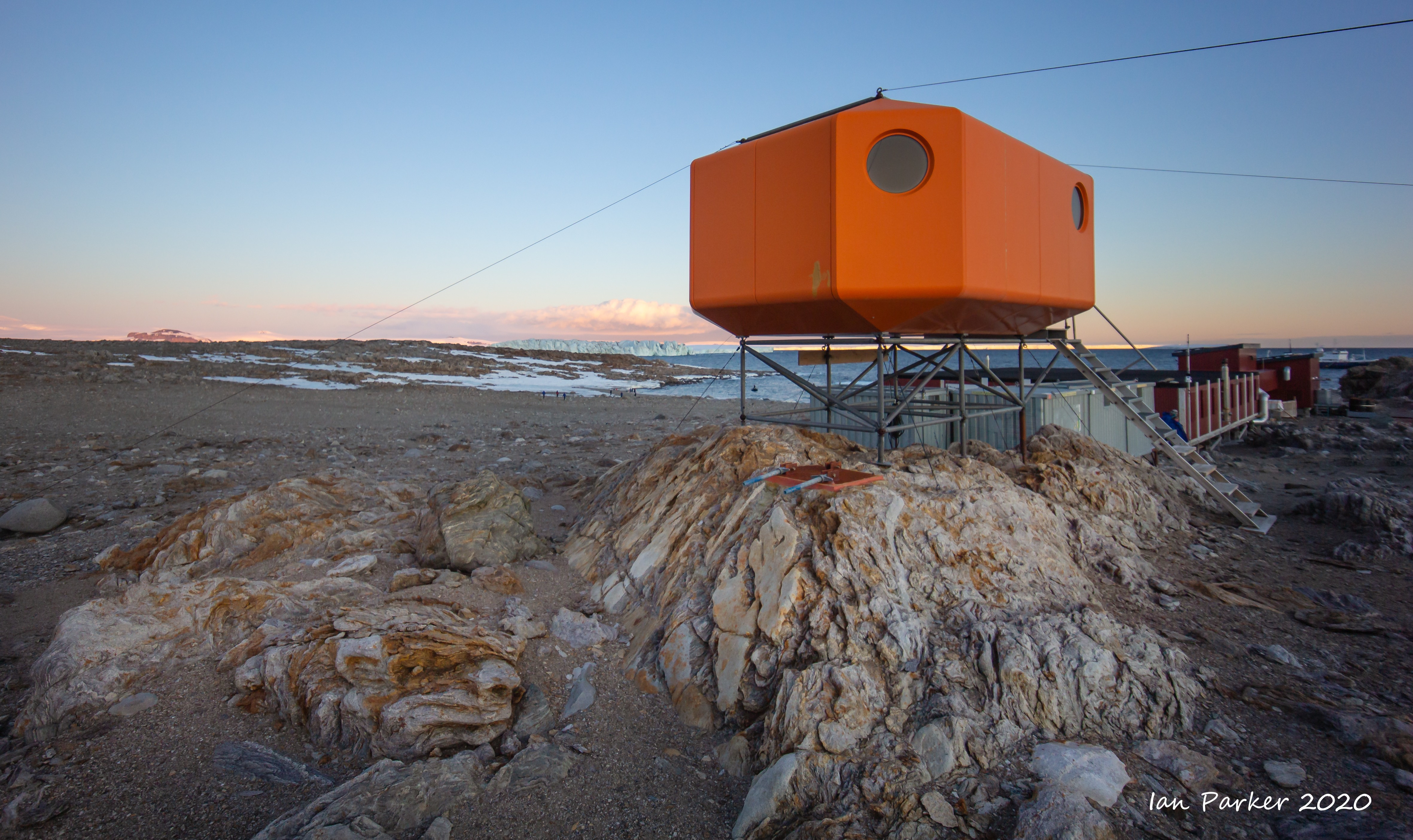
Scott’s hut at Cape Evans is the iconic base associated with Captain Robert Falcon Scott’s British Antarctic (Terra Nova) Expedition 1910–1913 and his second, and final, famed attempt for the Geographic South Pole. The expedition had two aims: to continue scientific research and secure the South Pole for the British Empire. In early January 1911, after stopping to resupply in New Zealand, the Terra Nova anchored at Cape Evans and the base was quickly established. On 1 November 1911 Captain Scott and his men set out to reach the South Pole. All members of the polar party perished on their return journey. This expedition gave rise to some of the most inspirational and harrowing stories associated with polar history. It was also instrumental in laying the foundations of modern science in Antarctica. Scott’s hut at Cape Evans is the largest of the historic huts in the Ross Sea region. Prefabricated in London, a trial erection took place in Lyttelton, New Zealand before being shipped to Antarctica. Construction took nine days, and the hut was home to 25 members of Scott’s Shore Party. Scott described the hut’s feeling of comfort: “The word hut is misleading. Our residence is really a house of considerable size, in every respect the finest that has ever been erected in the polar regions; 50ft long by 25 wide and 9ft to the eaves.” When the remaining members of Scott’s second expedition left Cape Evans in January 1913 the hut stood empty before being visited and later inhabited by Shackleton’s Ross Sea Party (1914-1917). |
 |

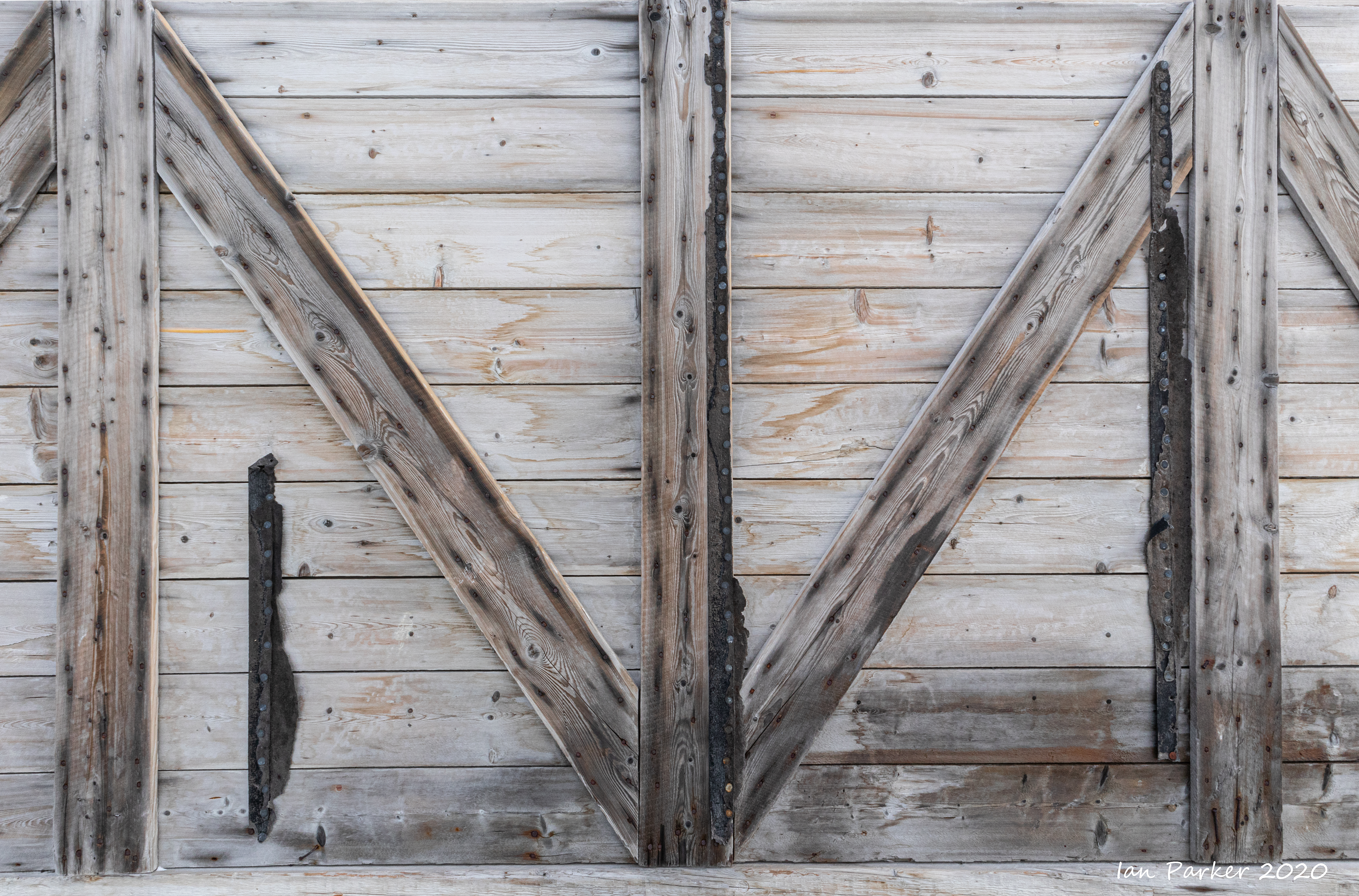
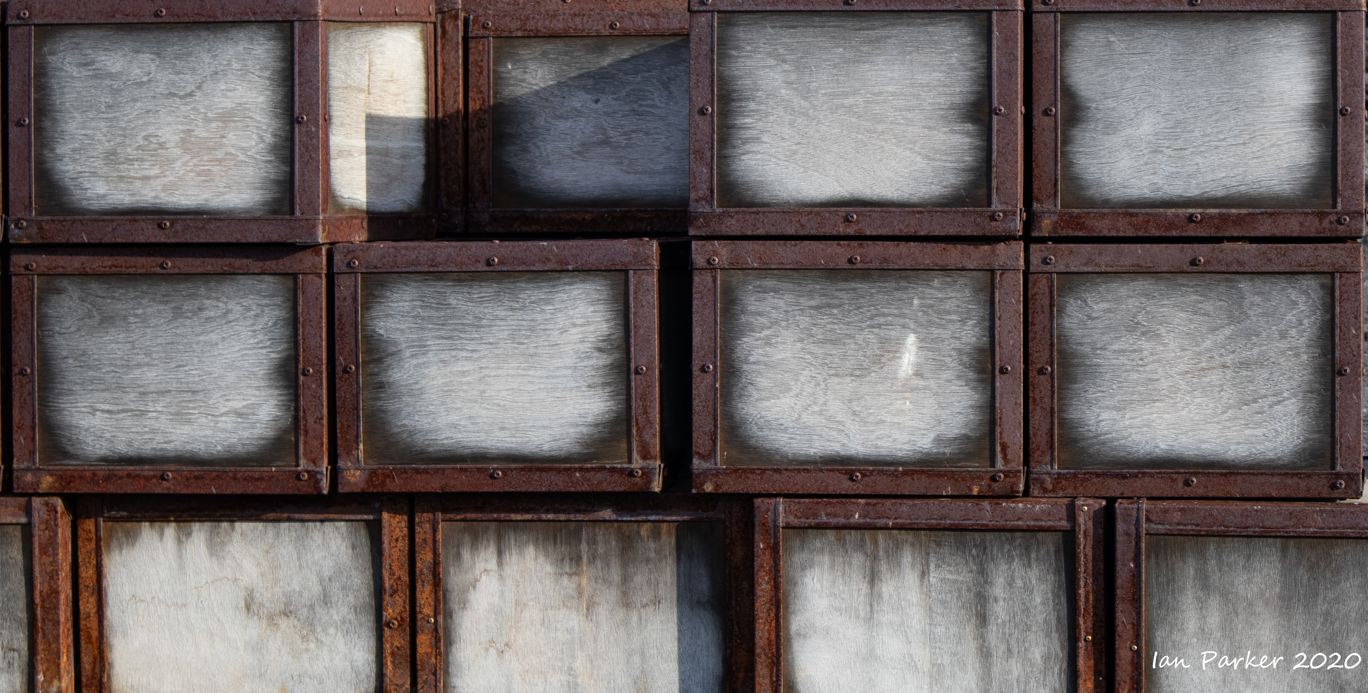
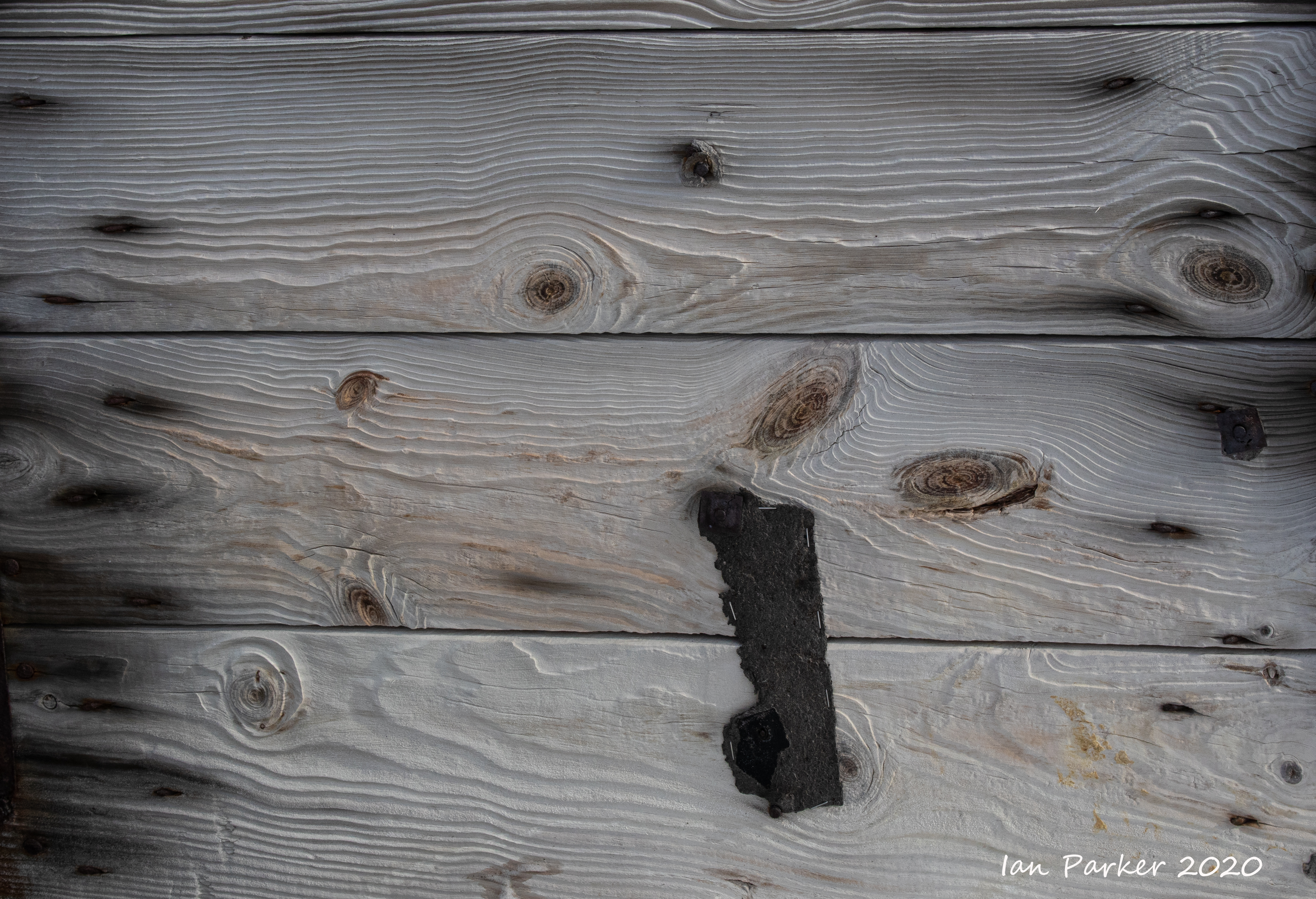 Wind-scoured wood; Scott's hut at Cape Evans |
 Interior corner with handle of kettle; Scott's hut at Cape Evans |


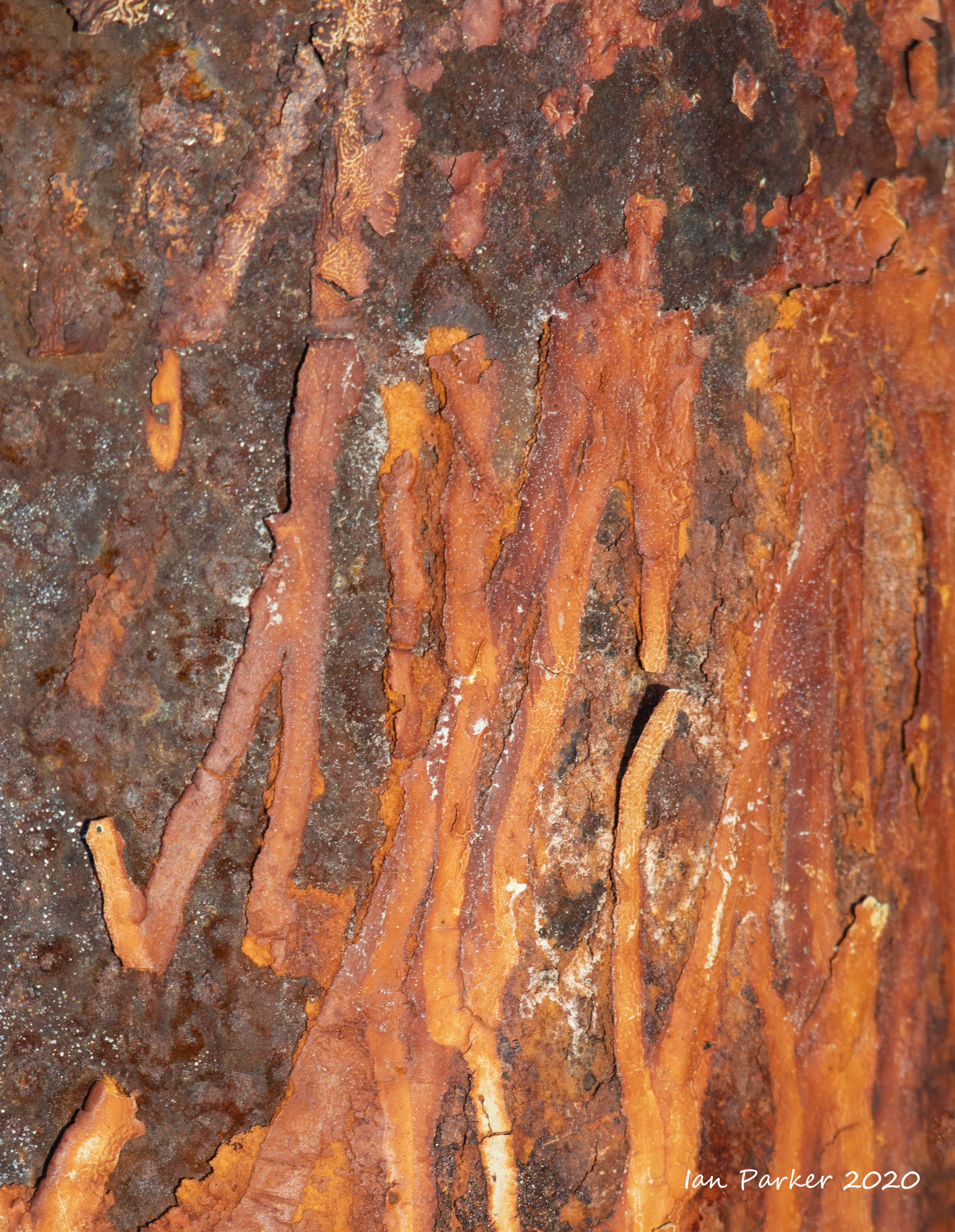
 Chemical analysis; Scott's hut at Cape Evans |


Scott's Discovery hut at Hut Point
Captain's log
This is the base associated with Commander Robert Falcon Scott’s National Antarctic (Discovery) Expedition 1901–1904. The expedition included a major programme of science and was a landmark in British Antarctic exploration, resulting in Scott returning to Britain as a hero. His base became an important staging post for every subsequent heroic-era expedition. Robert Falcon Scott’s National Antarctic Expedition 1901–04, a joint initiative between The Royal Geographical Society and The Royal Society, was the second expedition to winter over on the Antarctic continent, and the first to carry out significant exploration and serious scientific research. Three of the most famous men in Antarctic exploration – Scott, Shackleton and Wilson – achieved a furthest south sledging journey of 82º 16’ S in the summer of 1902–03. The hut proved too hard to heat and was described as being more like a summer house. Consequently, it was never used as a base and the 47 men lived on their ship, using the hut for scientific observations, drying equipment, repairs and as an entertainment house. The expedition base at Hut Point was later used by three other heroic-era expeditions, all of which left their mark on the hut and its contents. Today, Scott’s first expedition base at Hut Point remains a testament not only to scientific endeavour but also to the hardships endured by its later occupants, particularly Shackleton’s Ross Sea Party. |
 |
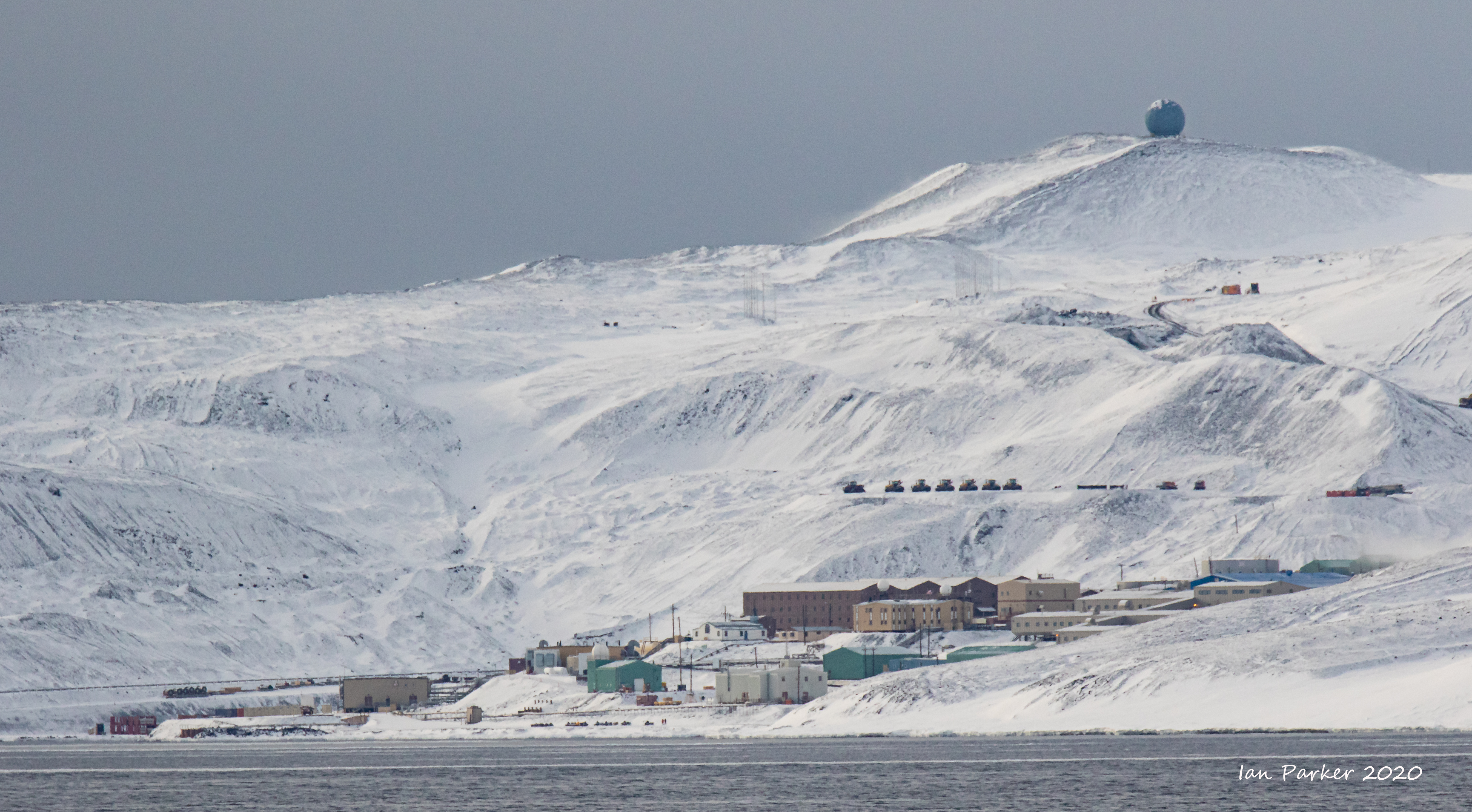
A more extensive history of the hut, abstracted from WikipediaVisitors to Antarctica, arriving at either the US Base at McMurdo or New Zealand's Scott Base are likely to encounter Discovery Hut as both are located on Hut Point. Discovery Hut is just 300m from McMurdo Base. The hut has been designated a Historic Site or Monument (HSM 18), following a proposal by New Zealand and the United Kingdom to the Antarctic Treaty Consultative Meeting. British National Antarctic Expedition 1901-1904The Discovery hut was a large strong building, but was so draughty and cold in comparison with the ship, which was moored one hundred yards away, that it was, during the first year, never used for living quarters. Its sole use was as a storehouse, and a large supply of rough stores, such as flour, cocoa, coffee, biscuit, and tinned meat, was left there in the event of its being used as a place of retreat should any disaster overtake the ship. During the second year occasional parties camped inside the hut, but no bunks or permanent sleeping quarters were ever erected. When the Discovery finally left McMurdo Sound, the hut was stripped of all gear, including the stove, but there was left behind a large depot of stores. British Antarctic Expedition 1907–09When Shackleton returned to McMurdo Sound in February 1908 he discovered that the door had been burst open, evidently by a southerly blizzard, and was jammed by snow outside and in. Entrance was made therefore through one of the lee windows. He used the hut in September and October 1908, as a storehouse for the large amount of equipment, food, and oil that they were to take while attempting to reach the pole. They built a sort of living-room out of the cases of provisions, and swept out the debris. The polar party elected to sleep there before the start, but the supporting party slept outside in the tents, as they considered it warmer. After reaching within 100 nautical miles (190 km) of the pole Shackleton's party barely made it back alive, arriving the night of 3 March 1909 having been absent on the march 128 days. One man needed medical attention urgently and so Shackleton tried to burn the nearby Magnetic Hut in the hope of attracting attention from the ship, but was not able to get it to light. He finally managed to light a flare of carbide, and the ship came down to them in a blizzard, and all were safely aboard at 1 a.m. on 4 March 1909. Before leaving the hut they jammed the window up with baulks of timber, to the best of their ability, in the storm and darkness. British Antarctic Expedition 1910-1913When members of the Terra Nova Expedition journeyed south from Scott's Hut at Cape Evans in 1911 they found Discovery Hut full of snow and ice, along with supplies left over from 1903. Discovery Hut was cleaned out and used during 1911 and 1912 as a staging and rendezvous point for Terra Nova expeditioners heading south towards the Pole from Scott's Hut at Cape Evans. An empty kerosene tin and some firebricks were made into an excellent little stove fuelled with seal blubber, which was connected to the old stove-pipe. The soldier fare of their mealswas either stewed or fried on this stove whilst the tea or cocoam was being prepared on a primus. Imperial Trans-Antarctic Expedition 1914-1917The hut was used again by the Ross Sea party of the Imperial Trans-Antarctic Expedition. The snow was cleared out and extra stores were placed in it. Depot-laying to 80° in January–March 1915 was beset by problems. All ten dogs taken on the journey perished during the return. By the time that all parties were reunited at Hut Point on 25 March 1915 the men themselves were exhausted and frostbitten, and there was a significant loss of confidence in Aeneas Mackintosh, the leader. The condition of the sea ice in McMurdo Sound made the journey back to Cape Evans impossible, so the party was stranded until 1 June 1915 in spartan conditions and relying on seals for fresh meat and blubber fuel. Several men were again stranded at Hut Point after the second depot-laying season. This began in September 1915 and by March 1916 Mackintosh, Spencer-Smith and Hayward had collapsed and were unable to walk. The three other men still on their feet, Richards, Joyce and Wild, were by now too weak to haul three invalids, so on 8 March 1916 Mackintosh volunteered to stay in the tent while the others attempted to take Spencer-Smith and Hayward to Hut Point. A day later Spencer-Smith died, utterly worn out by exhaustion and scurvy, and was buried in the ice. Joyce and Wild reached Hut Point with Hayward on 11 March and went back for Mackintosh. By 16 March the whole surviving party had reached the hut. The five survivors slowly recovered their strength with a diet of seal meat. The ice was too thin for them to risk the final trip to Cape Evans but the monotony of their diet and surroundings became wearisome. On 8 May Mackintosh and Hayward risked the ice and walked to Cape Evans. They were never seen again. Richards, Joyce and Wild waited until 15 July to make the trip to Cape Evans. The seal blubber used for heating during this expedition resulted in considerable staining of the interior walls and contents. After Shackleton left the hut in 1917 it remained untouched until 1956 when US expeditioners dug it out of the snow and ice. It was found to be in a remarkable state of preservation, and included many artifacts from the earlier expeditions |
|
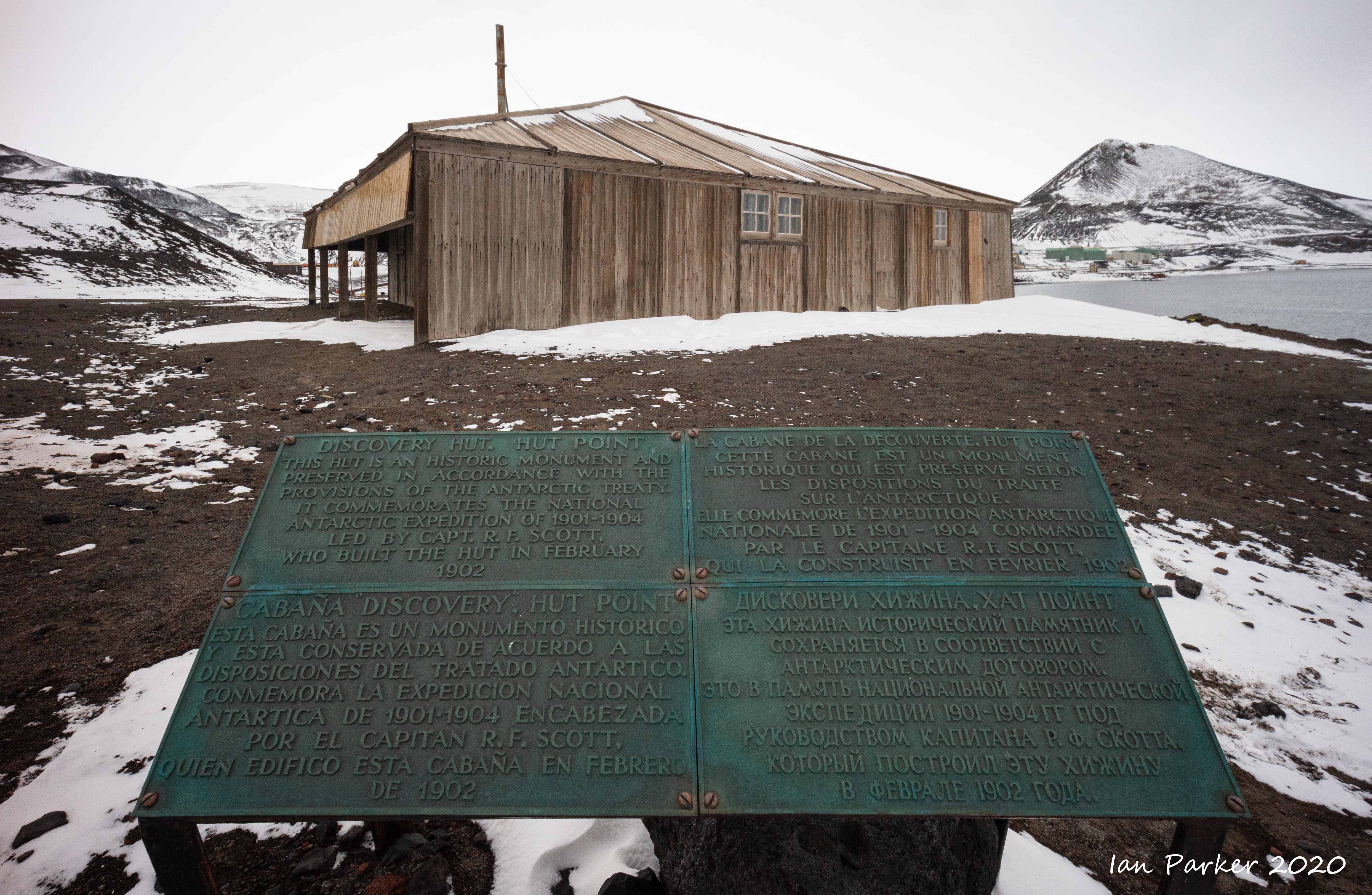


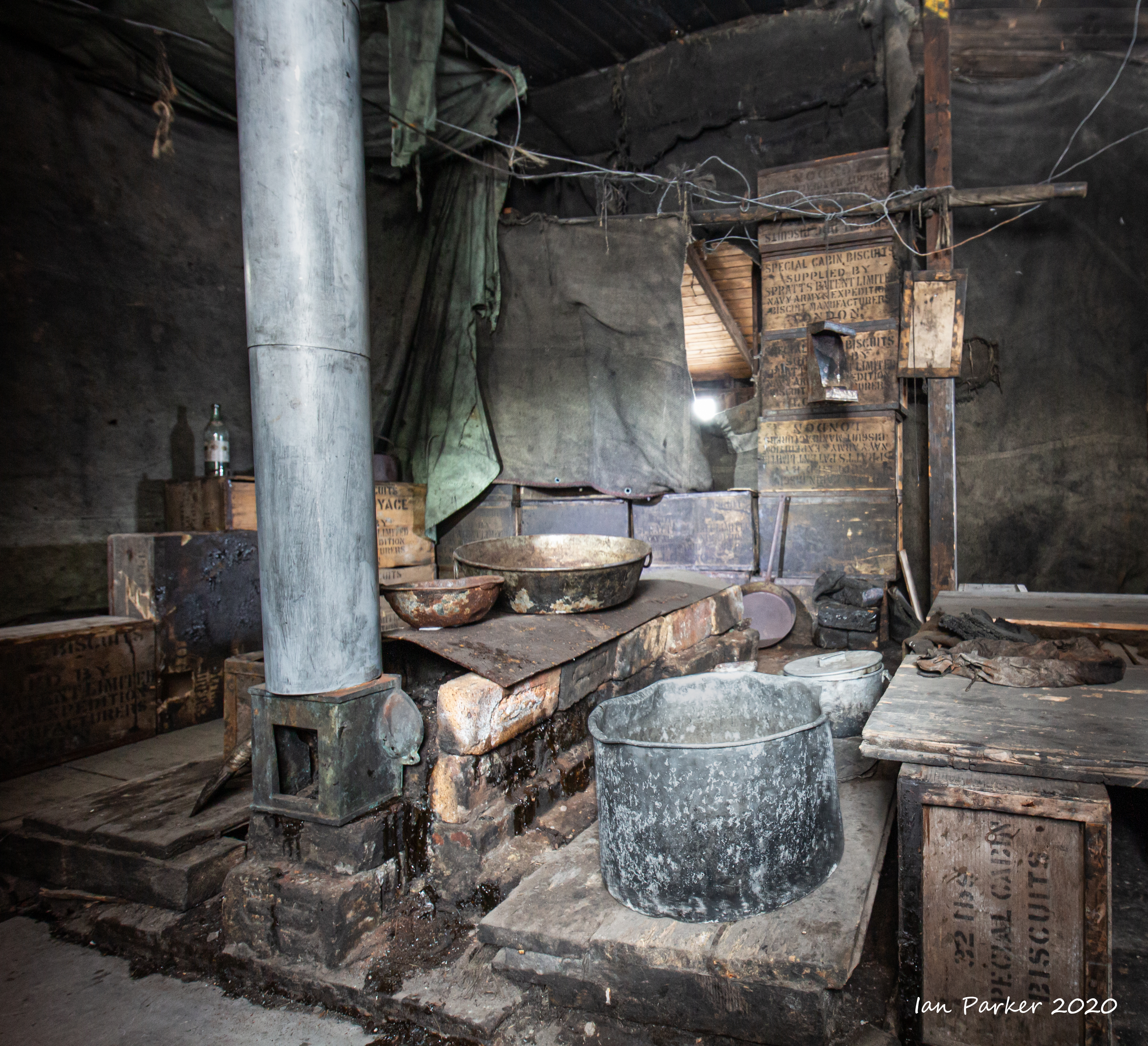

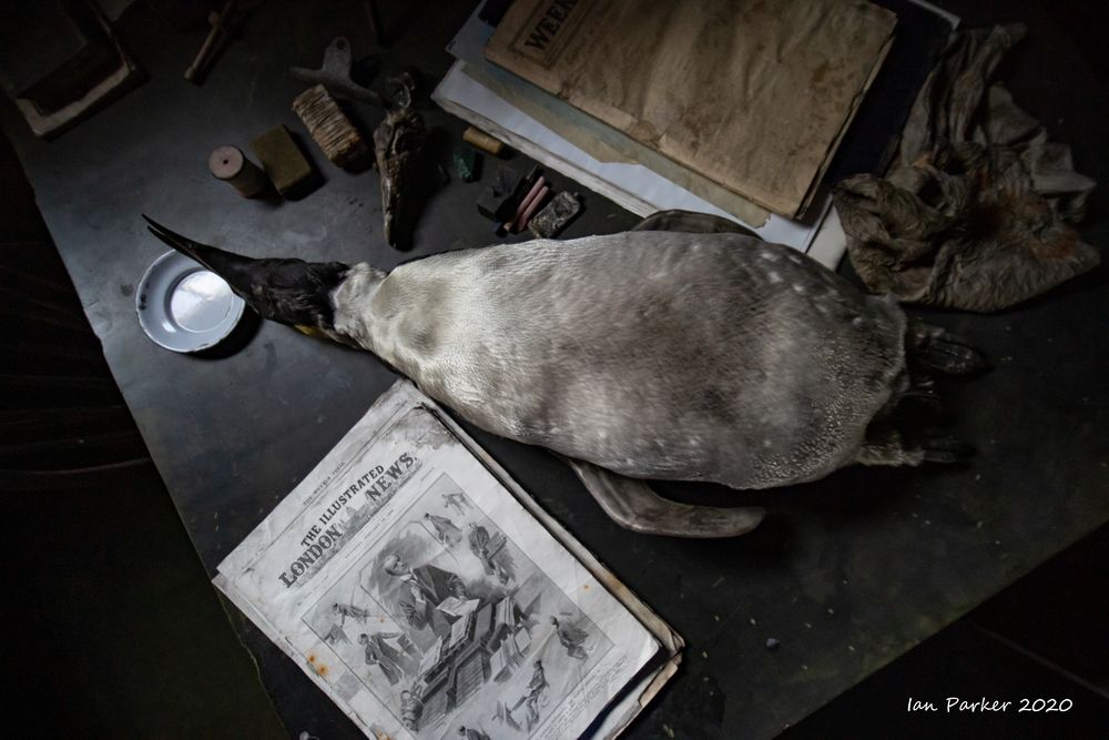
Unlike the other two huts from the historic age of British polar exploration, which seem quite warm and cheery, the Discovery hut has a powerful, desolate 'feel' to it. Inside, you can sense the suffering of the men from Shackleton's Ross Sea party who were trapped for months waiting for the sea ice to freeze over, with minimal provisions and heat and light provided only by burning seal blubber.
I tried to portrey some of theis atmosphere by blending sharp and motion-blurred photographs taken at the same time.


Outside the Discovery hut

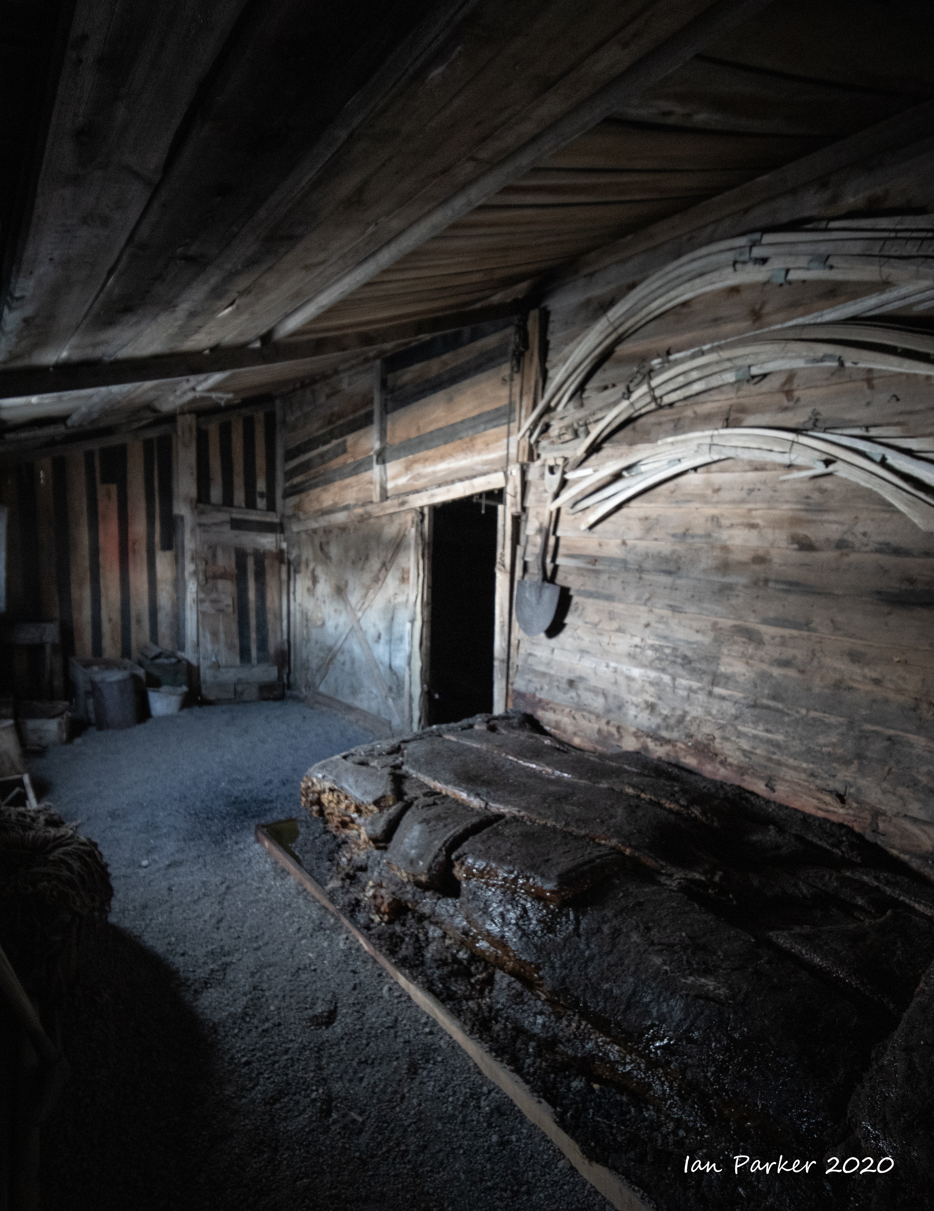
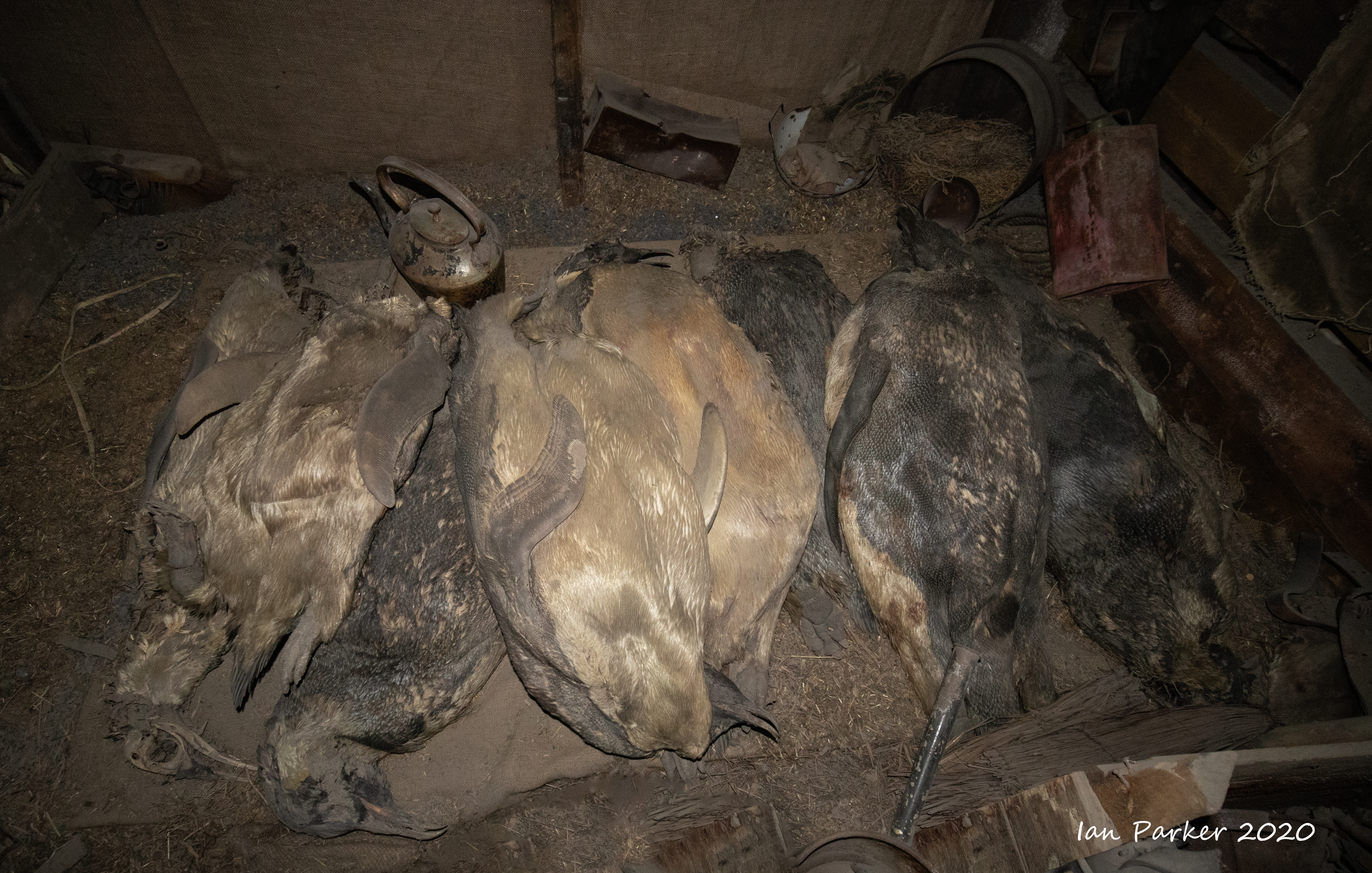
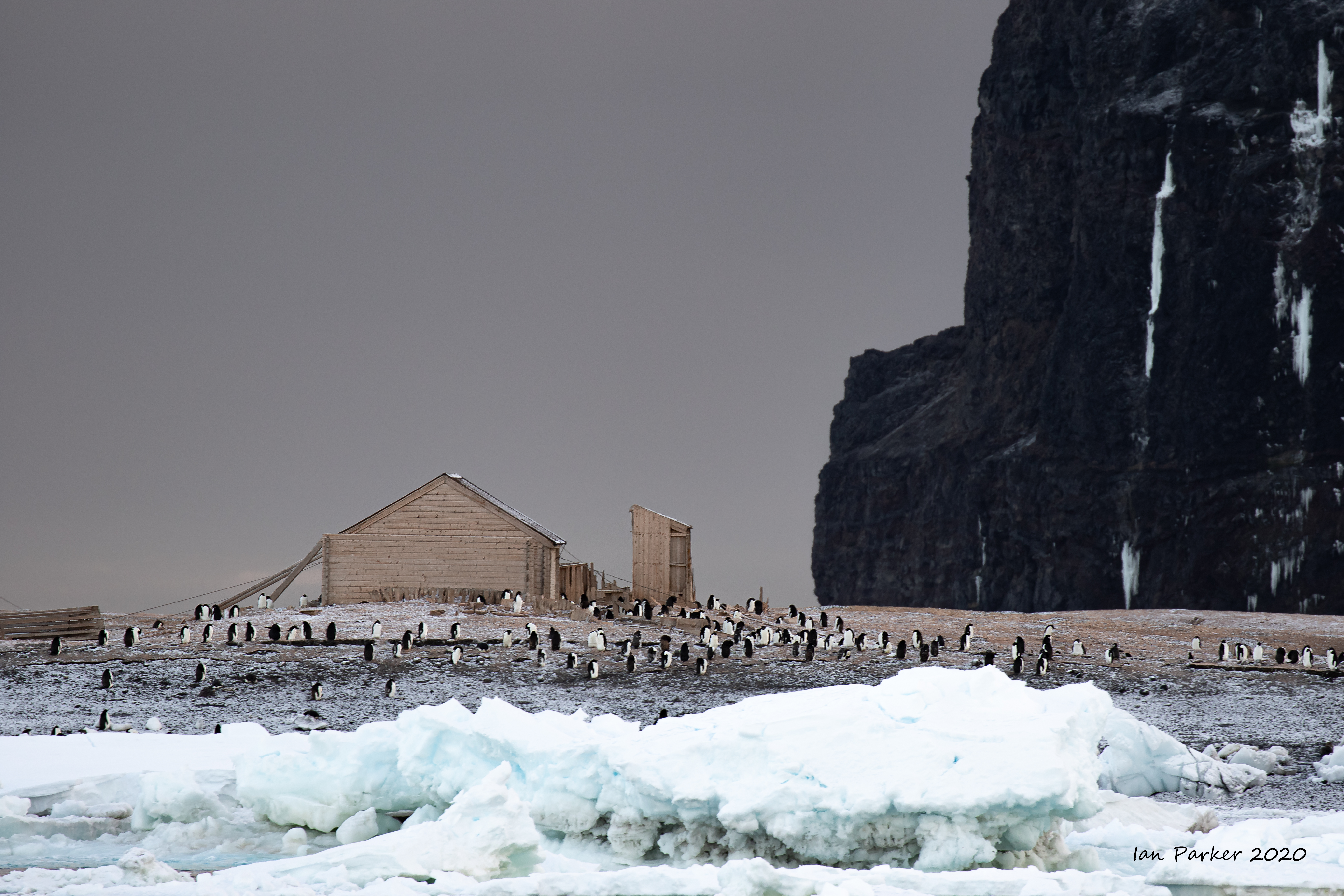
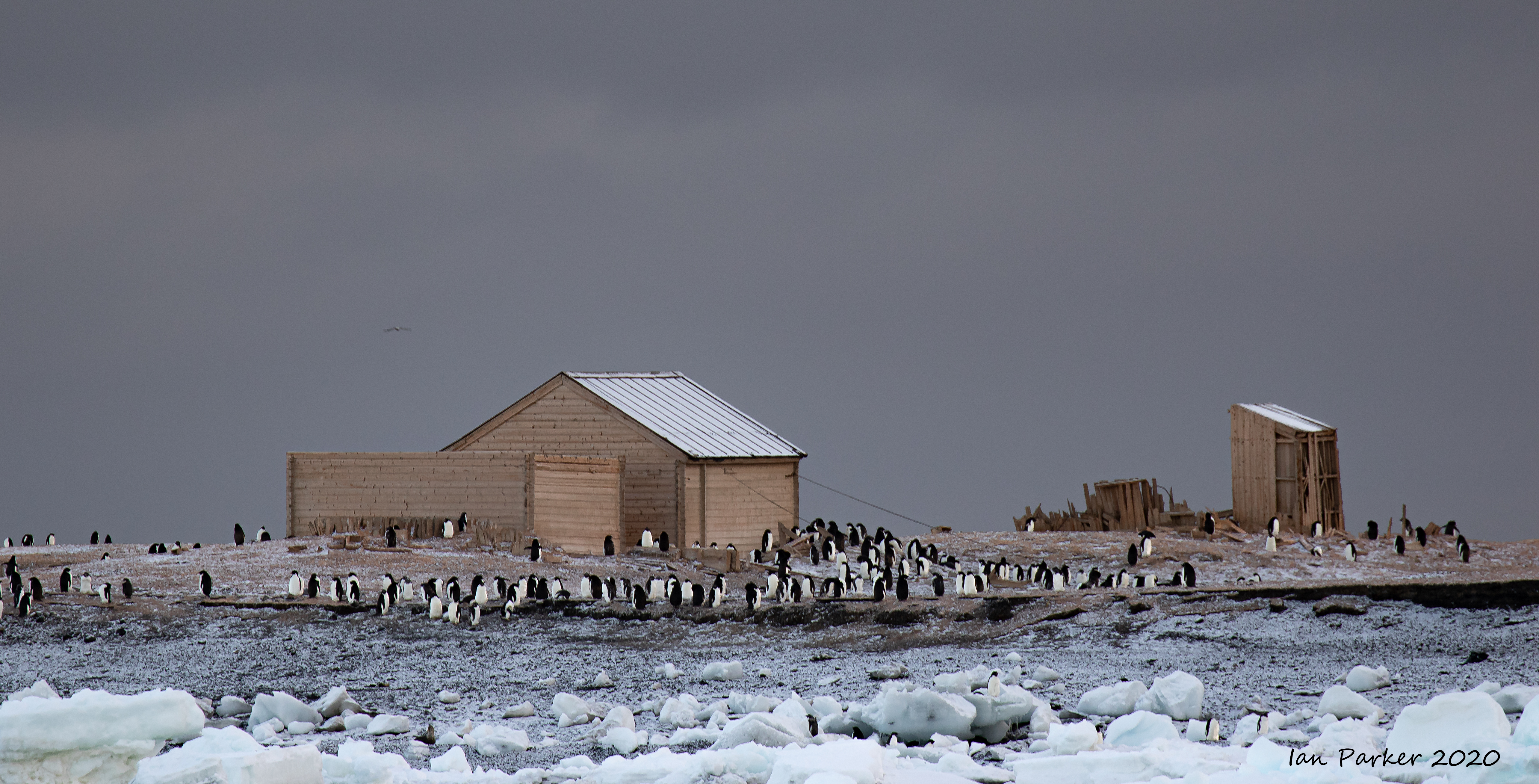
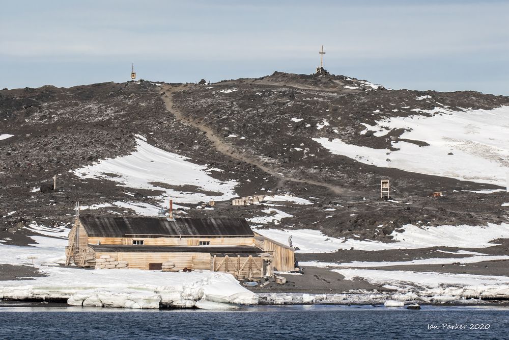
Ernest Shackleton’s Hut at Cape Royds
Captain's log
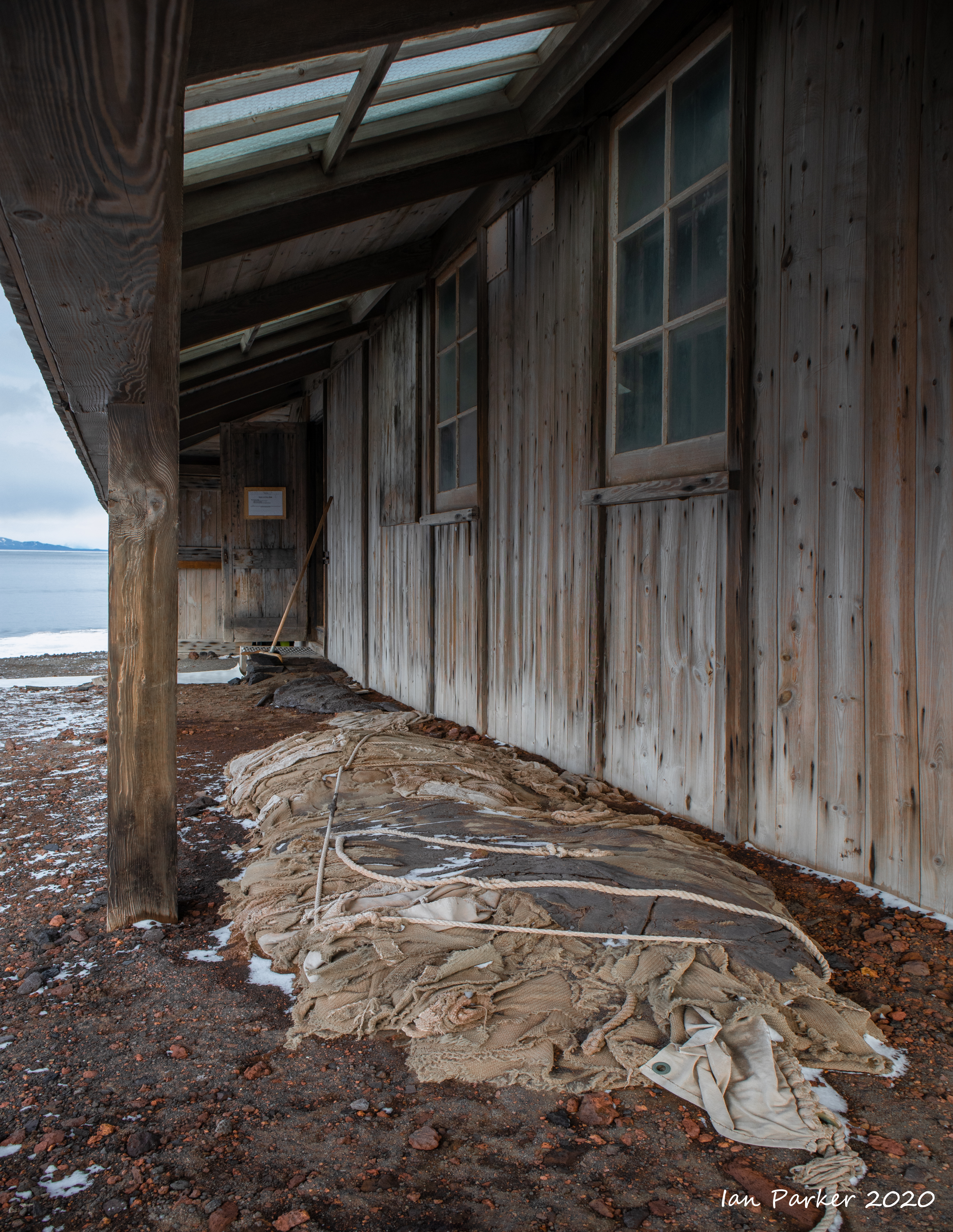
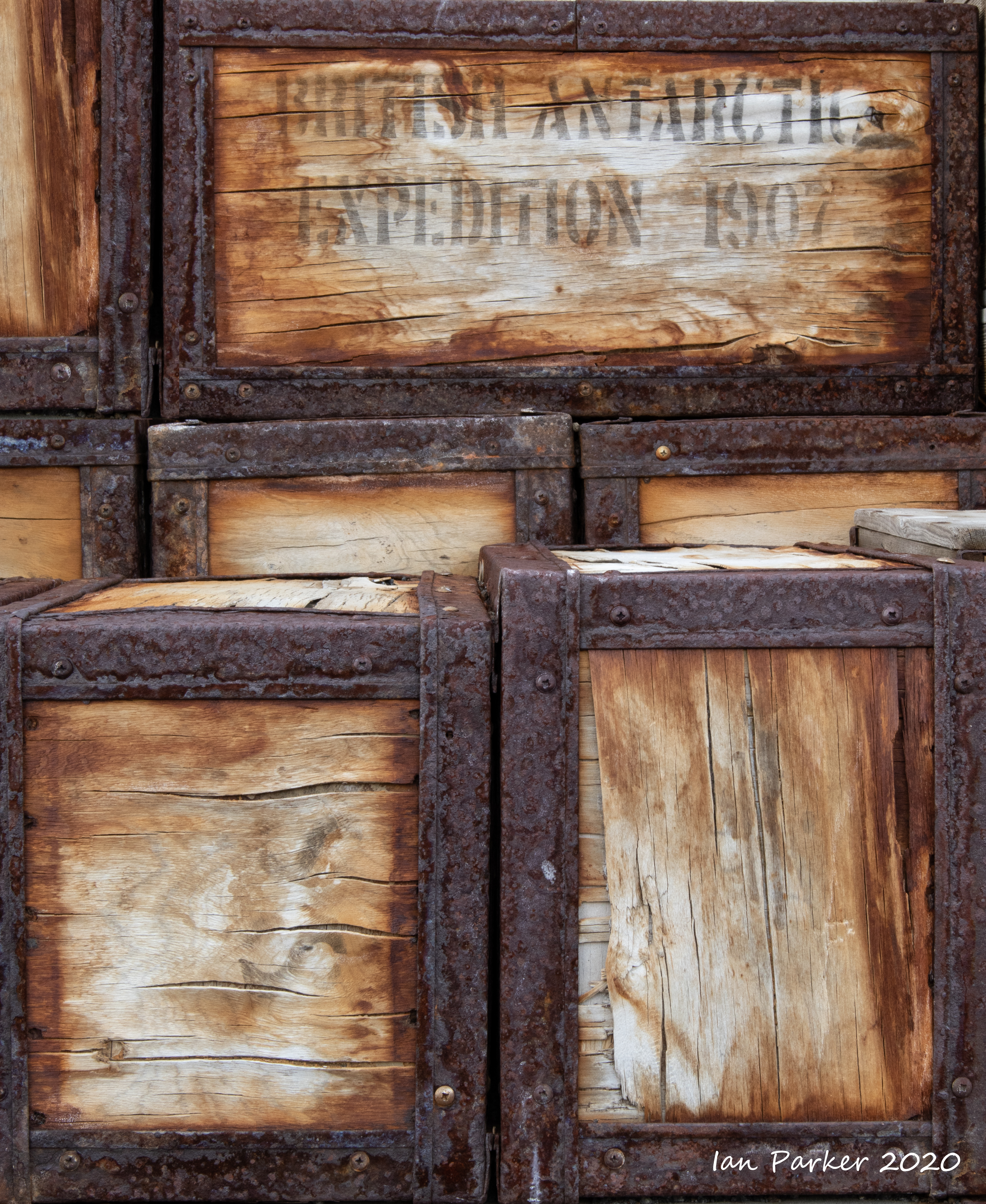
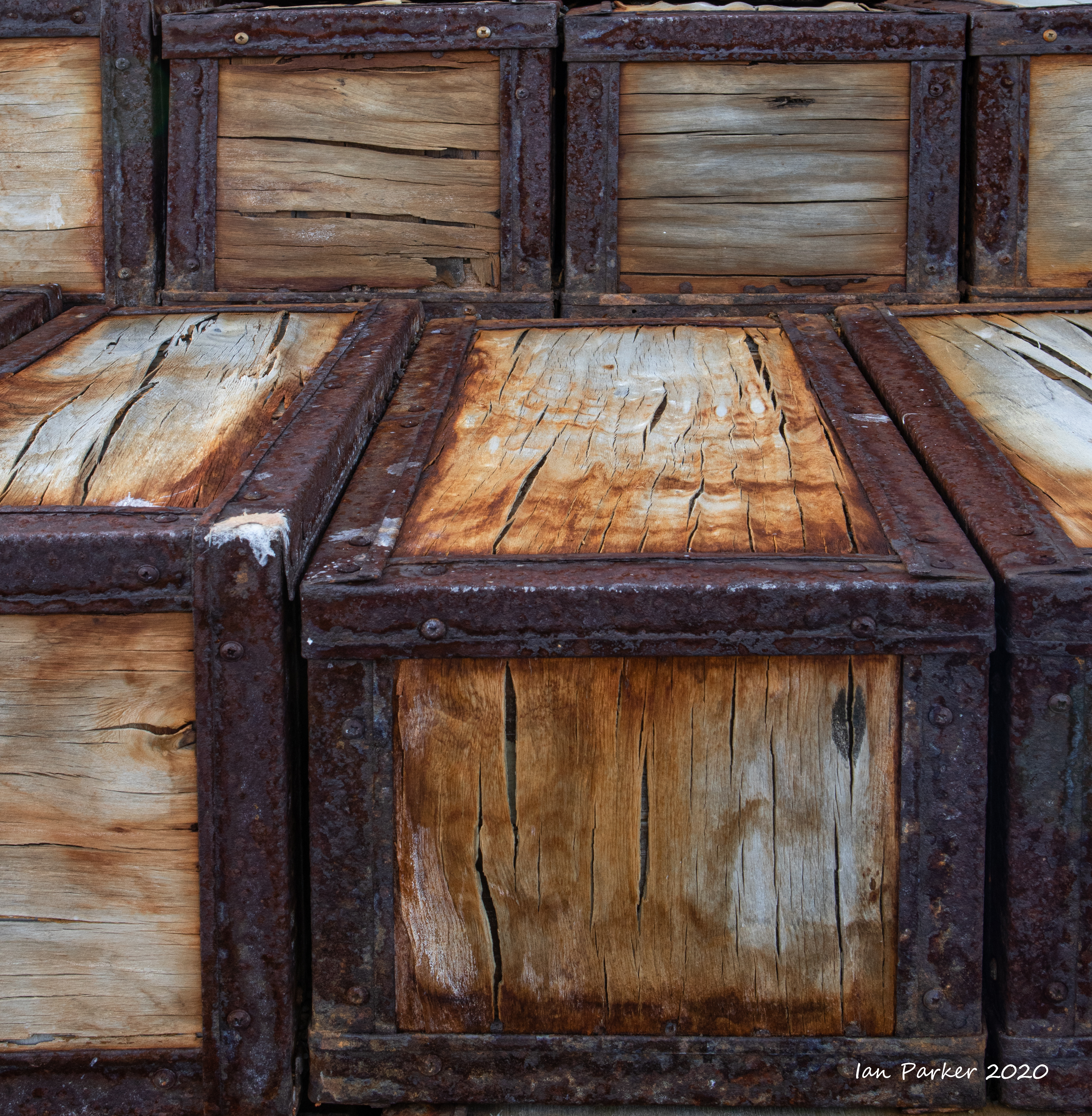
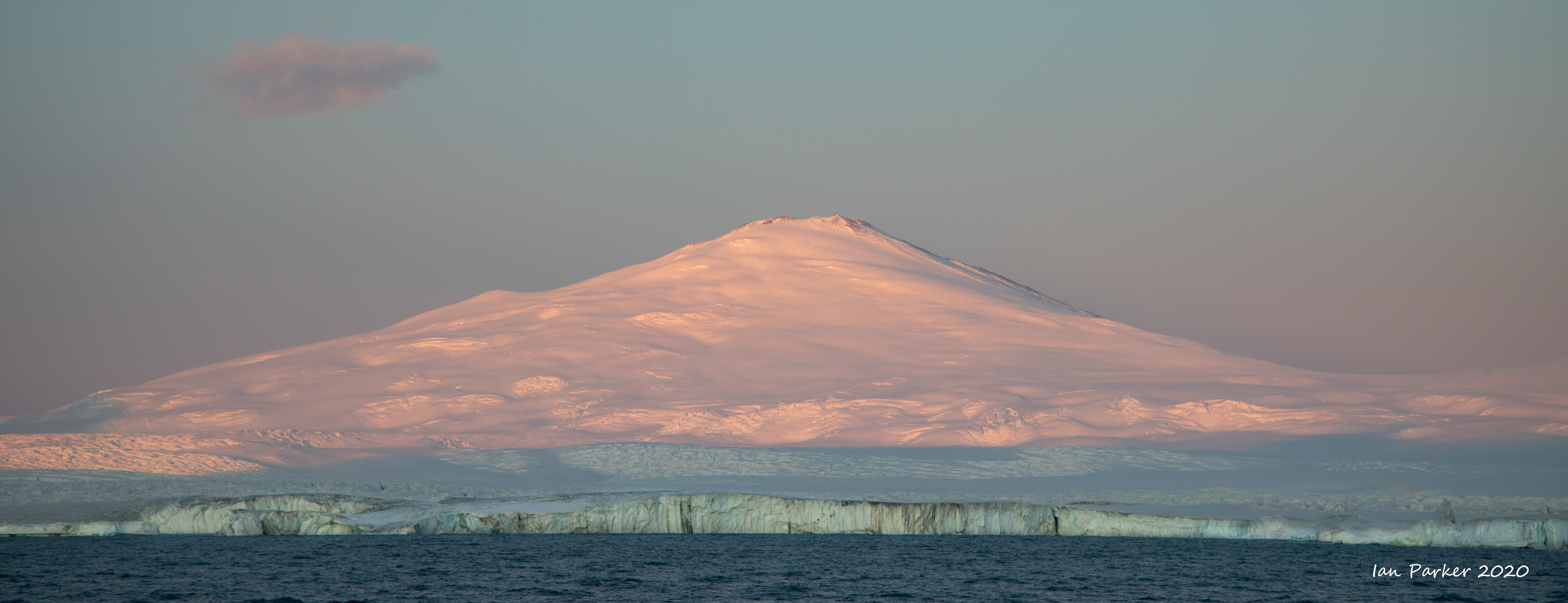
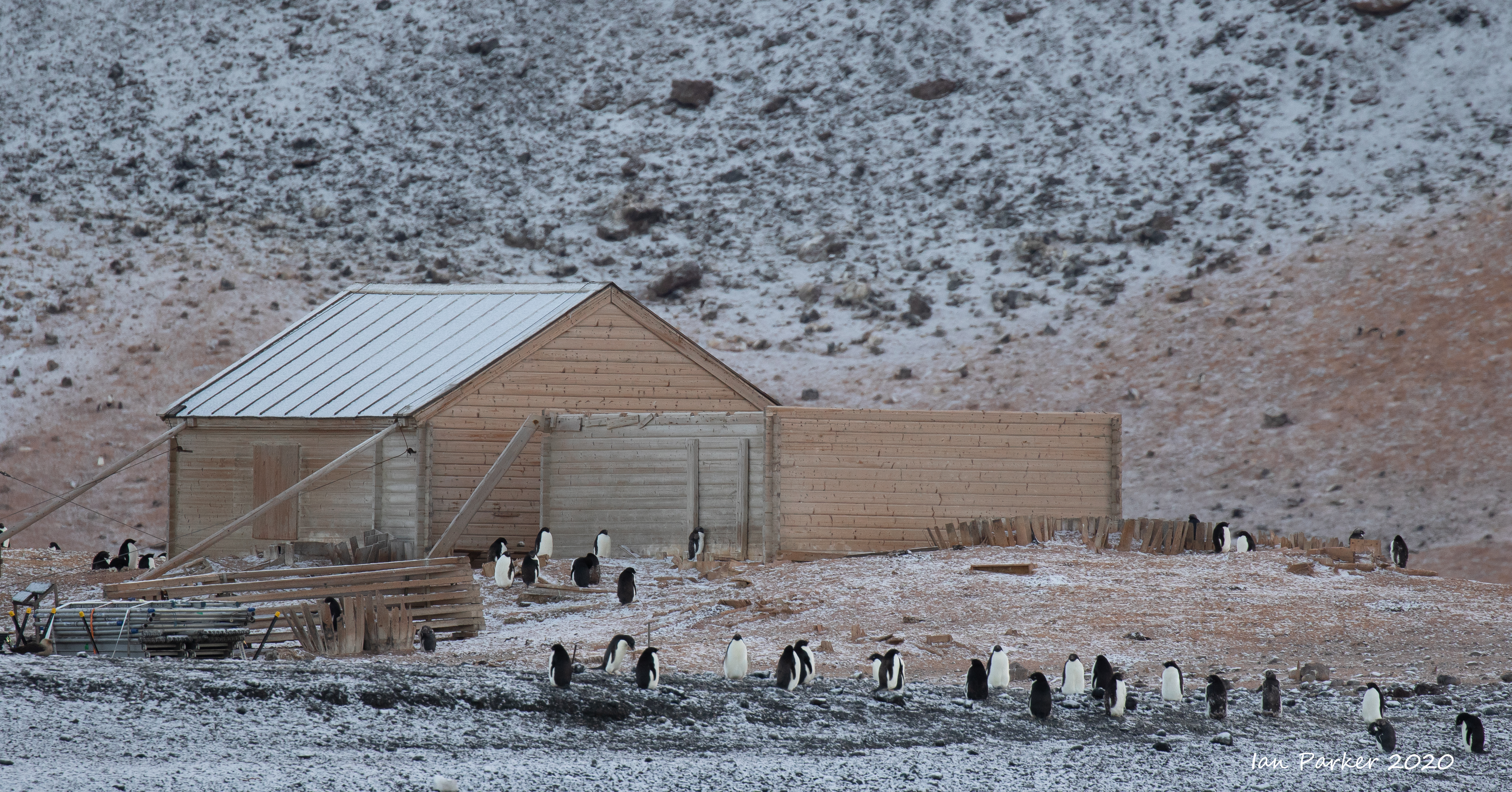
This is the base associated with Sir Ernest Shackleton’s British Antarctic (Nimrod) Expedition 1907–1909. Following his role in Scott’s Discovery expedition, Shackleton mounted his own in an attempt to be the first to reach the Geographic South Pole. Travelling with Shackleton on the 200 ton Nimrod, were a shore party of 14 men, a specially designed prefabricated hut, 15 Manchurian ponies, nine dogs and an air-cooled, four-cylinder 15 hp motorcar. Shackleton and his men built their hut to be as robust as possible – after all, it was their refuge from extreme Antarctic conditions for 14 months. The fact that the main part of the hut is still standing today is testament to their efforts and the skill of the designers. The hut is a timber structure prefabricated by Humphreys Limited of Knightsbridge in London in 1907. It was first assembled in London and the parts were marked for re-erection on site. His expedition achieved a number of firsts. In March 1908 a party of five was the first to climb Mt Erebus. In late 1908 Shackleton led a party of four in an attempt to be the first to reach the Geographic South Pole. After man-hauling for two and a half months, and less than 97 nautical miles from the Pole, he made a decision considered the finest in early polar history – to turn for home. |
 |
|


Numerous packing cases remain stacked outside the hut


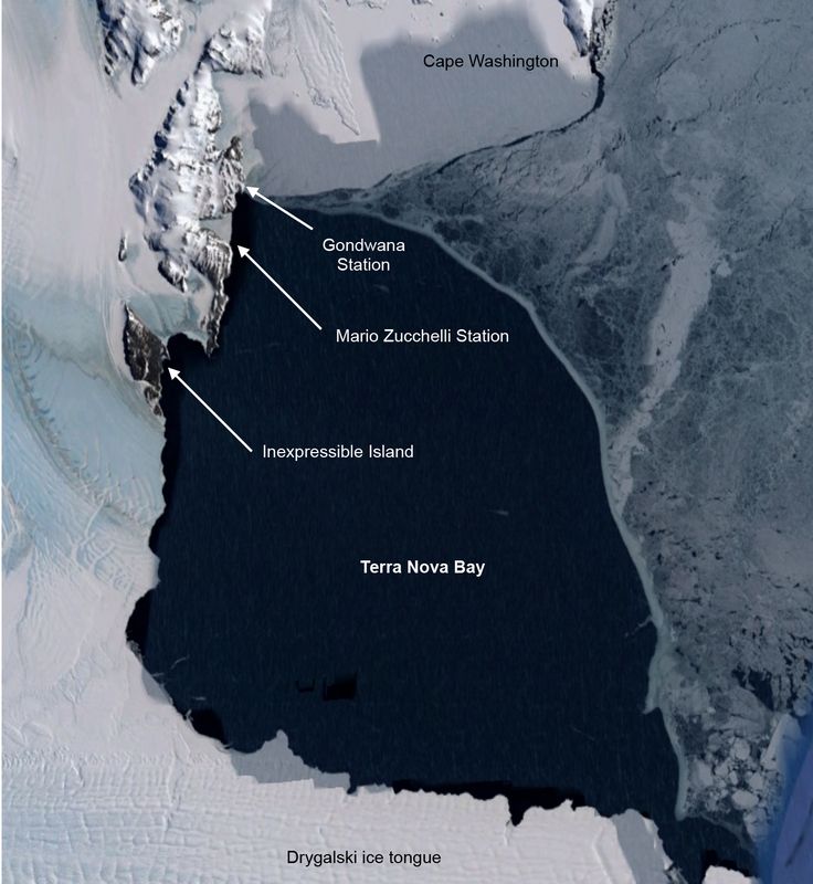
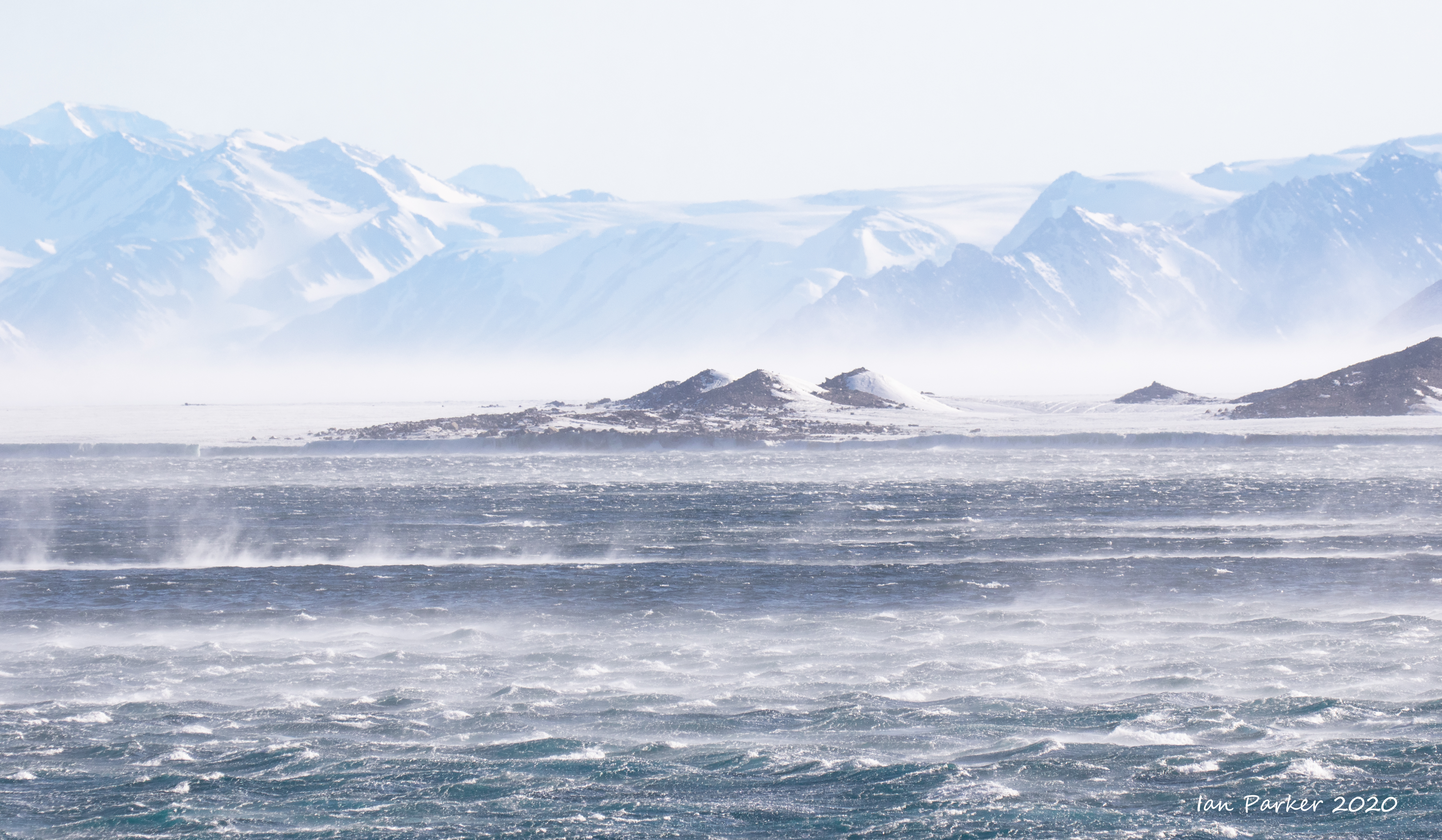
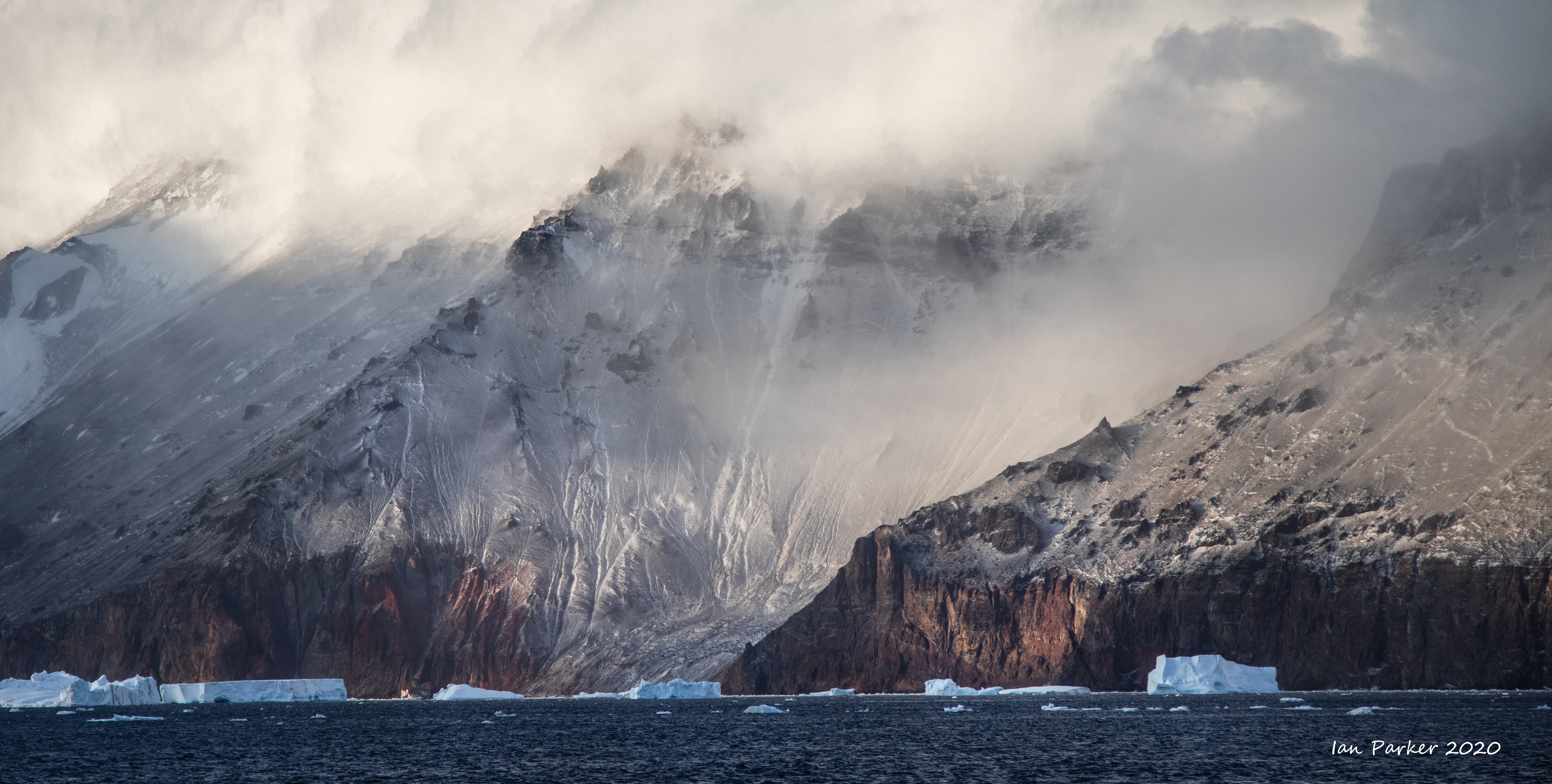
Feb 18 - Terra Nova Bay, first landing on the Antarctic continent
Captain's log
Two days sailing from Cape Adair through a rough Ross Sea brought us to Terra Nova Bay, discovered by Captain Scott on his first polar expedition and named by him after one of the relief ships on his expedition. The strong winds we had experienced began to fade in the evening, and we made a landing after dinner. This was the first time we set foot on land after leaving Campbell Island seven days ago. Looking at maps before our voyage I had not appreciated just how vast the Southern Ocean is. . |
 |
 |
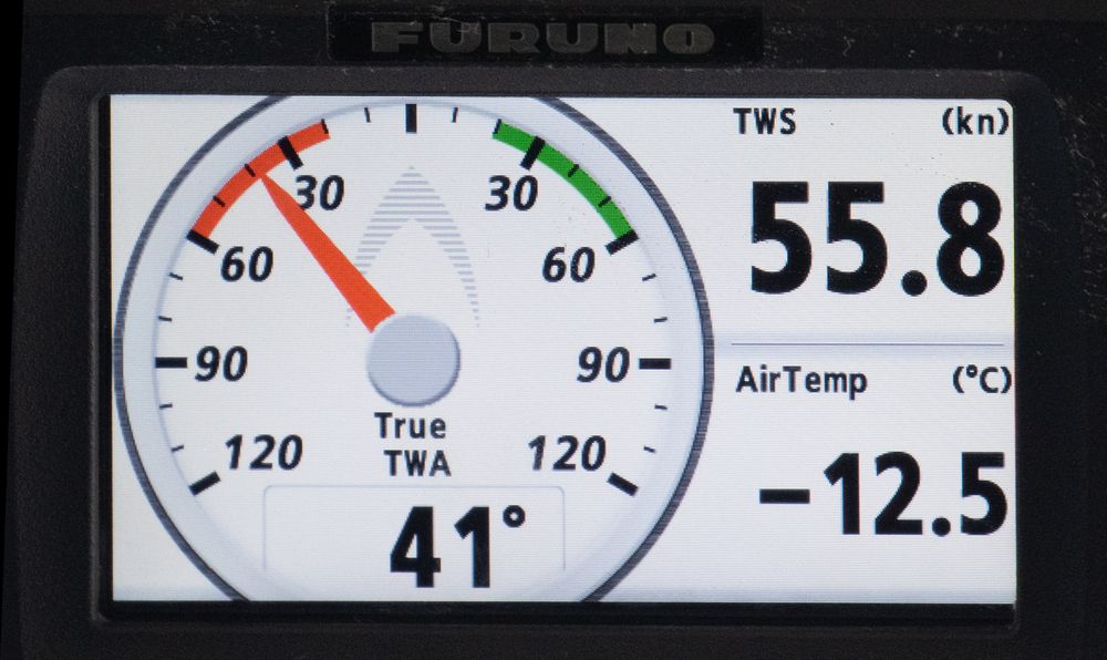 A wild, windy,cold day in the Ross Sea. |


Feb 17th - Cape Adare, first sight of the Antarctic Continent
After a long and rough five days sailing we woke very early in the morning to see Cape Adare, the tip of the Antarctic continent, and the vast panorama of the transantarctic mountains..
Captain James Ross discovered Cape Adare in January 1841 and named it after his friend the Viscount Adare (the title is derived from Adare, Ireland). In January 1895, Norwegian explorers Henrik Bull and Carsten Borchgrevink from the ship Antarctic landed at Cape Adare as the first documented landing on Antarctica, collecting geological specimens. Borchgrevink returned to the cape leading his own expedition in 1899 and erected two huts, the first human structures built in Antarctica. The expedition members overwintered and the survivors were picked up in January 1900. This was the first expedition party ever to winter over on the Antarctic continent. Zoologist Nicolai Hanson died during the winter and was buried at Cape Adare. [Wikipedia]
Borchgrevink built his hut amongst the largest Adélie penguin colony in Antarctica, though at the time of our visit most penguins had gone back out to sea. Dense ice around the beaches precluded a landing to visit the hut, but we had hopes this may have cleared when we passed by Cape Adare again on our way back north.
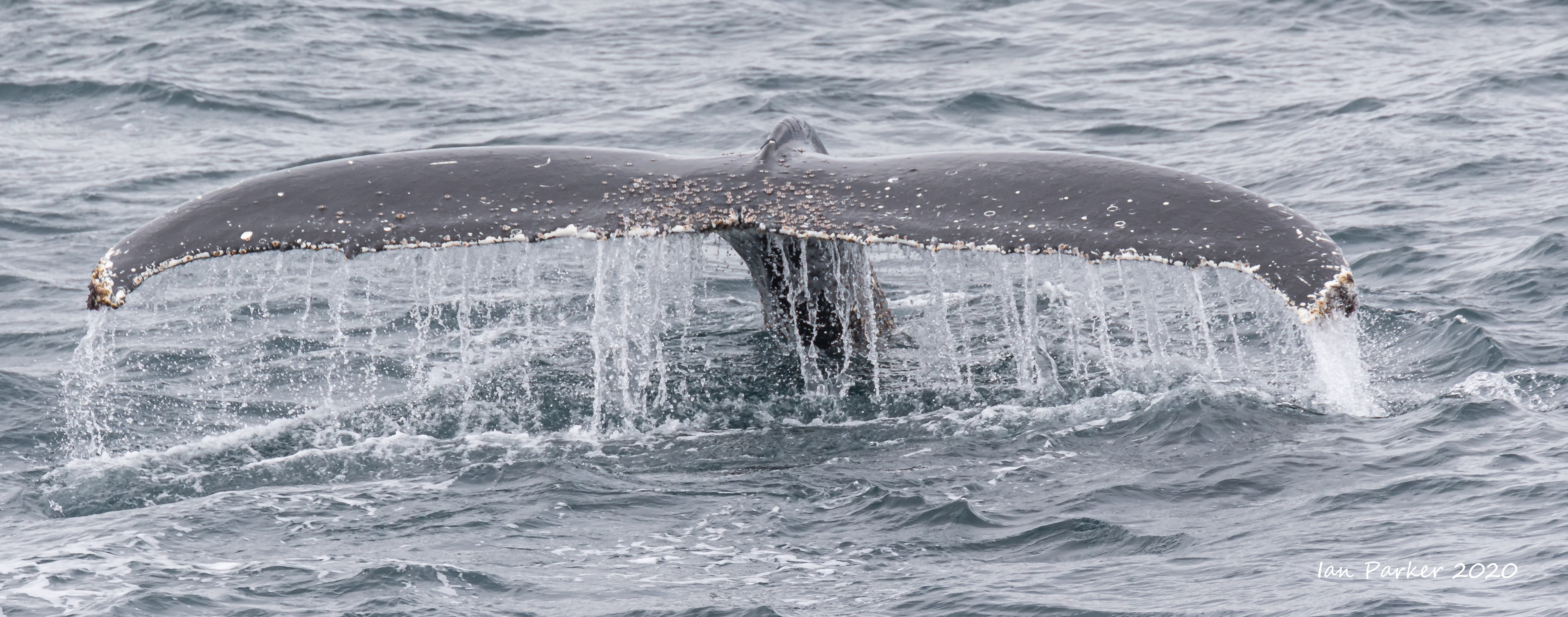
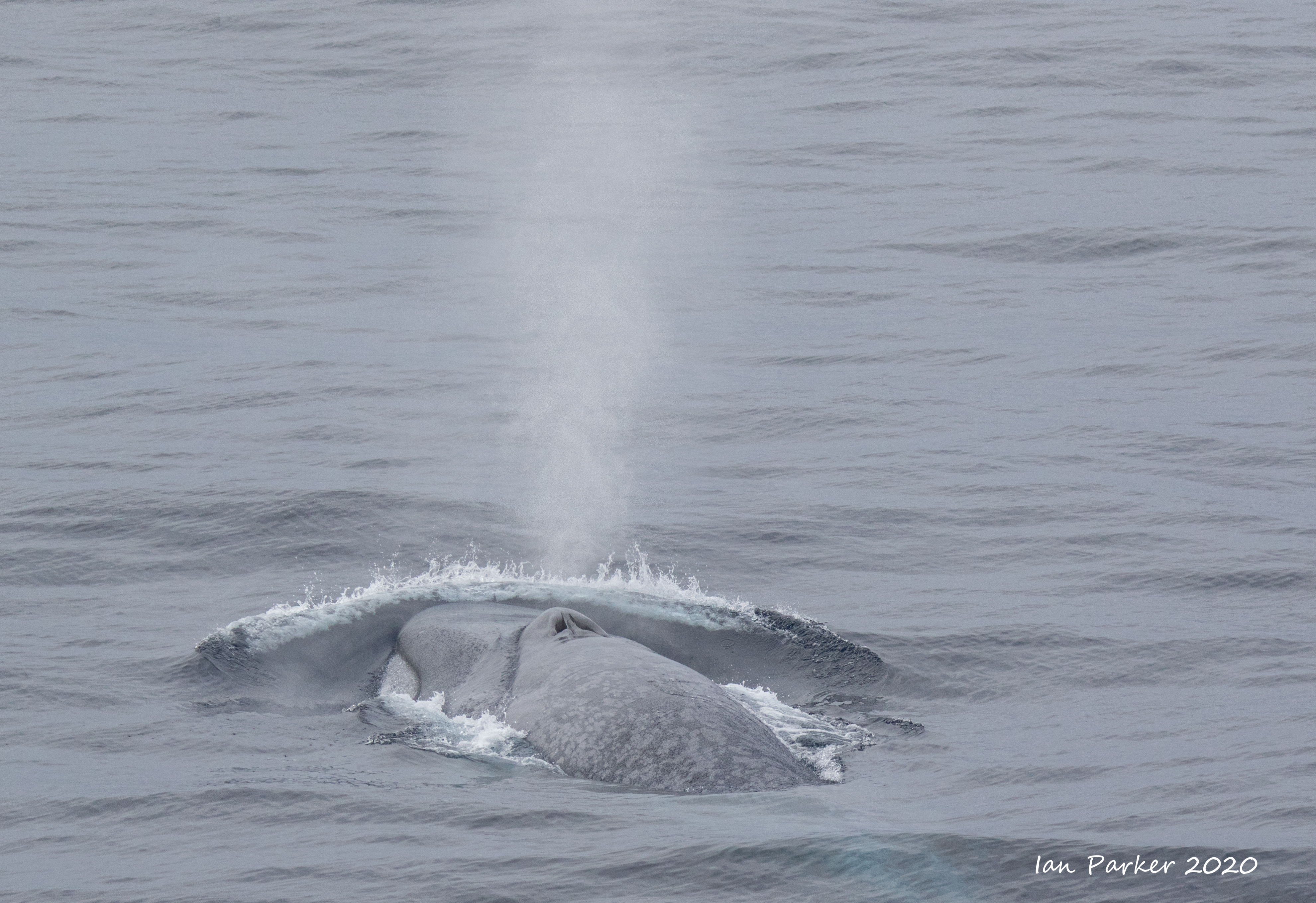
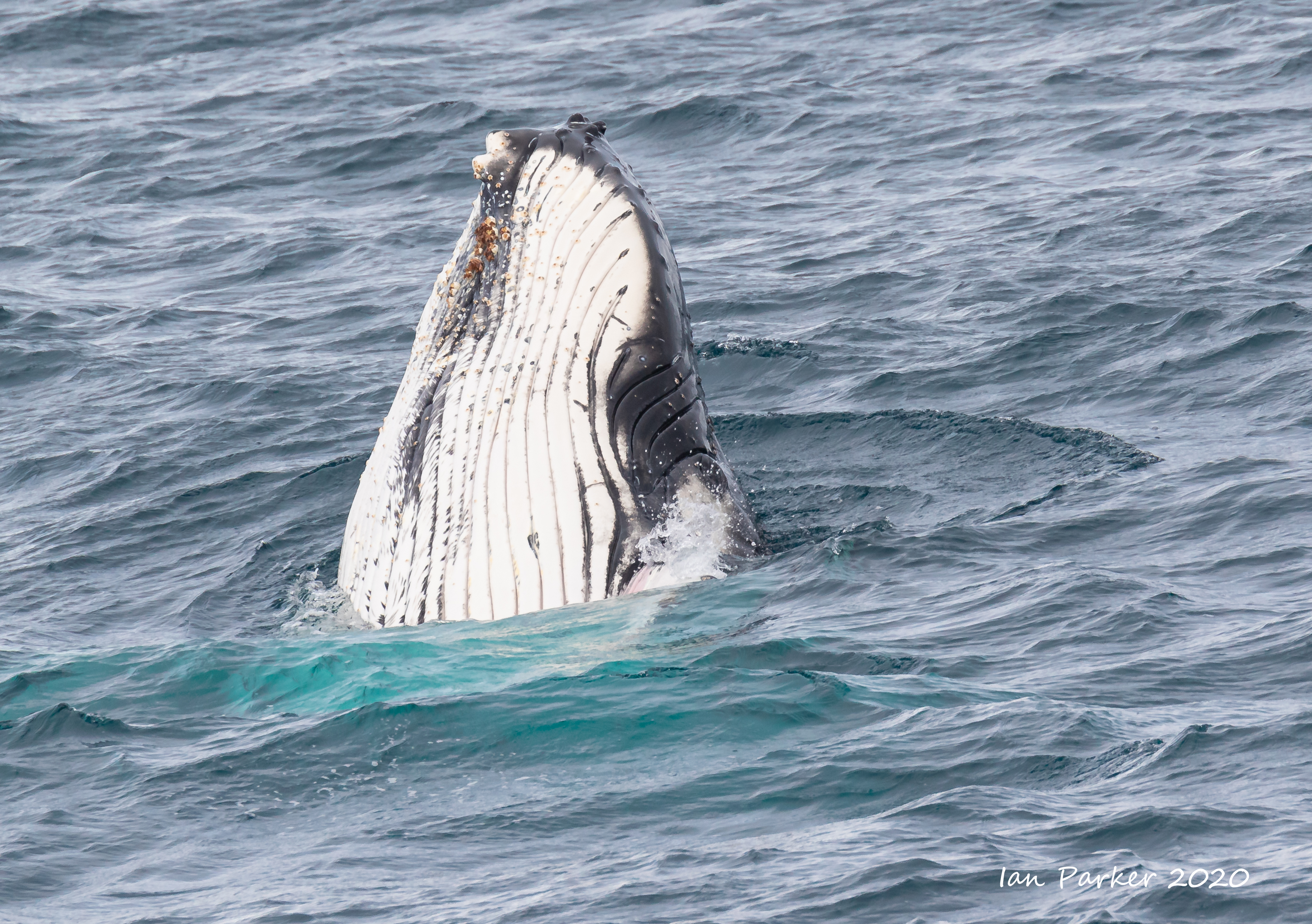
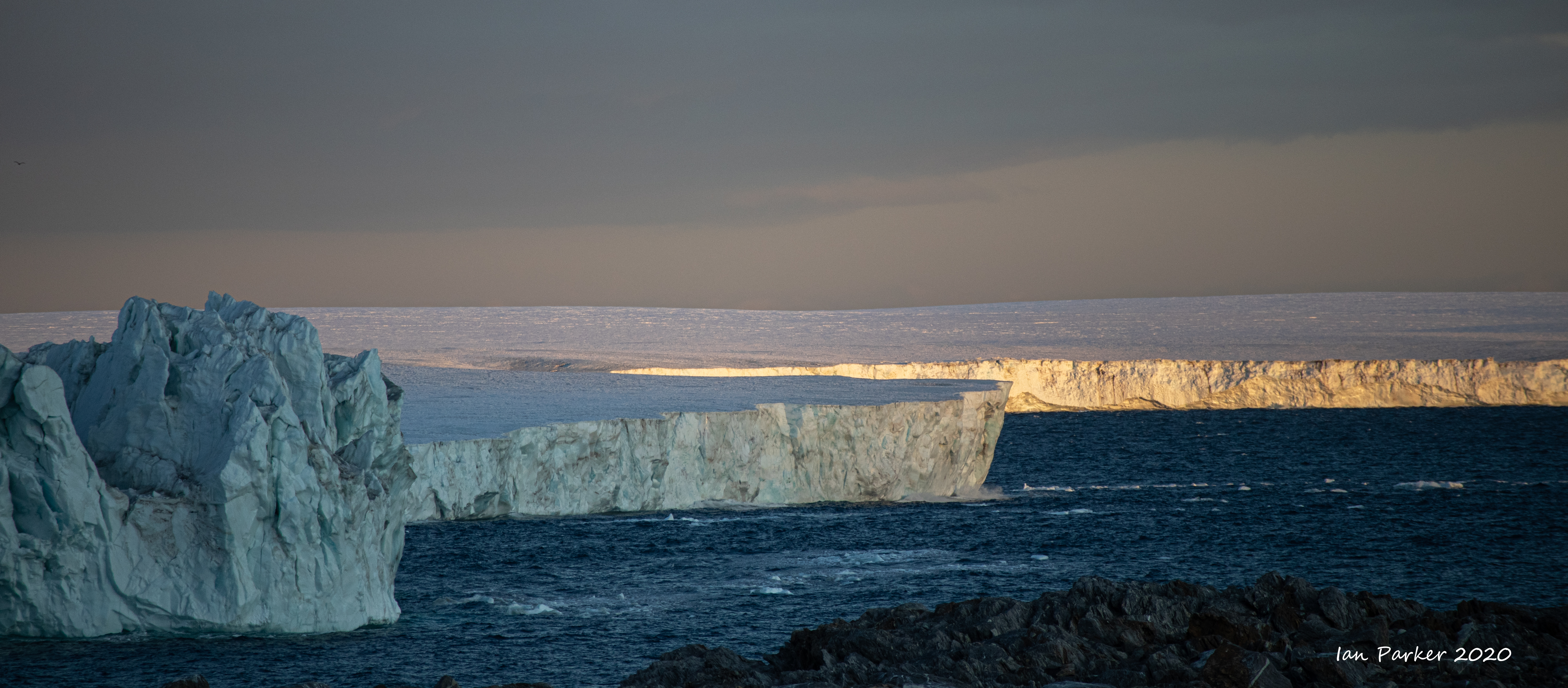
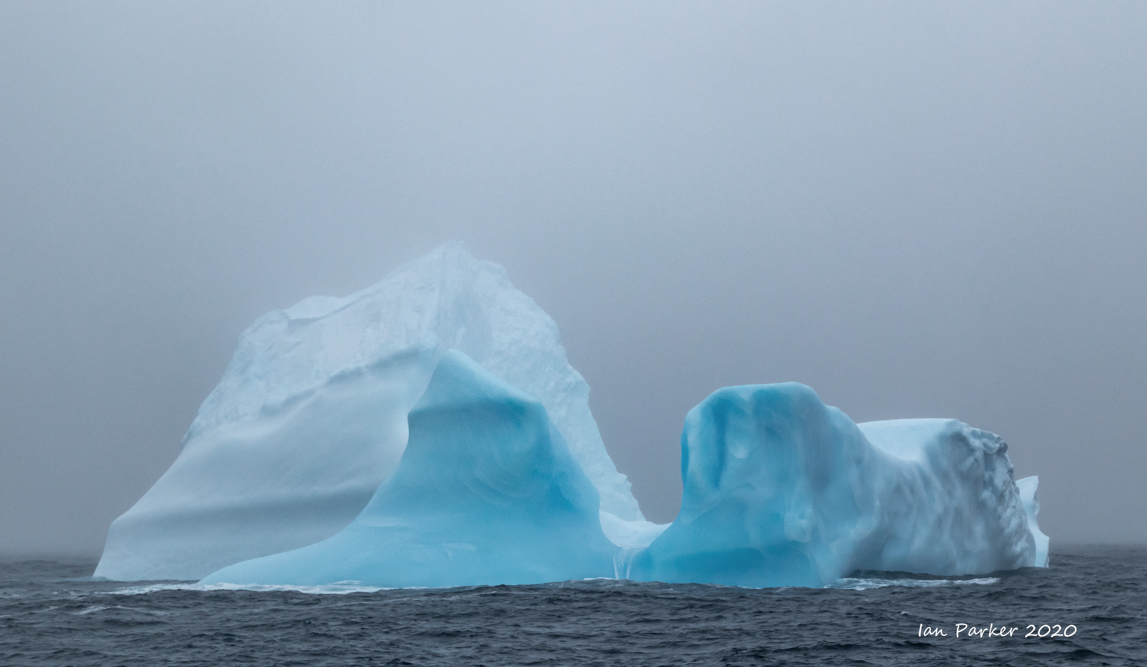
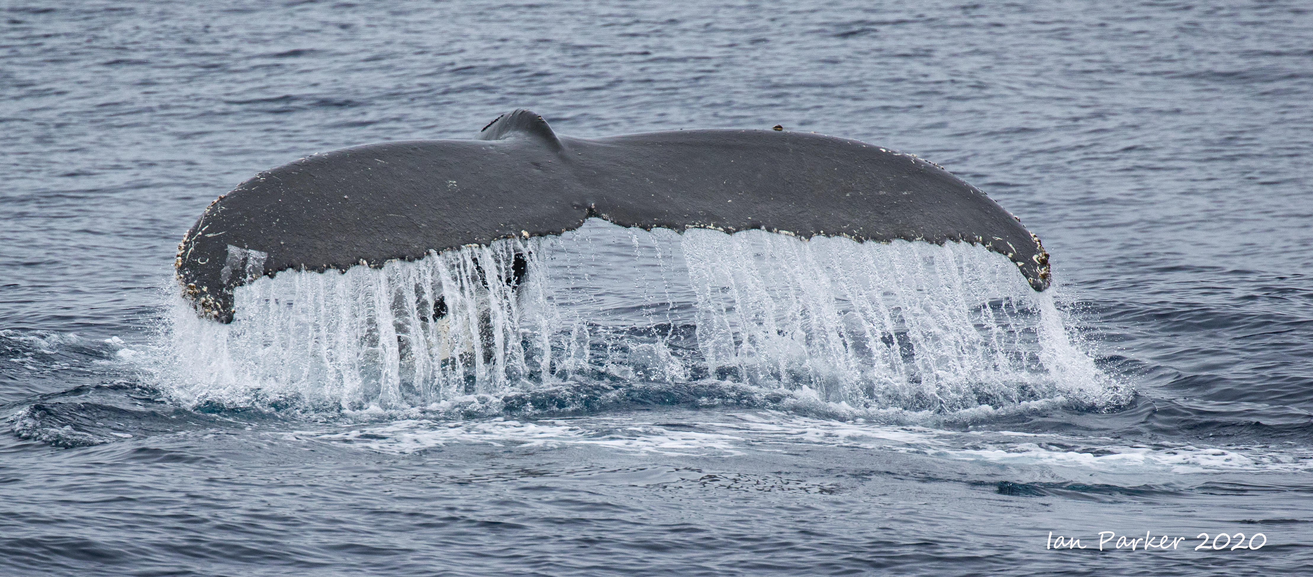
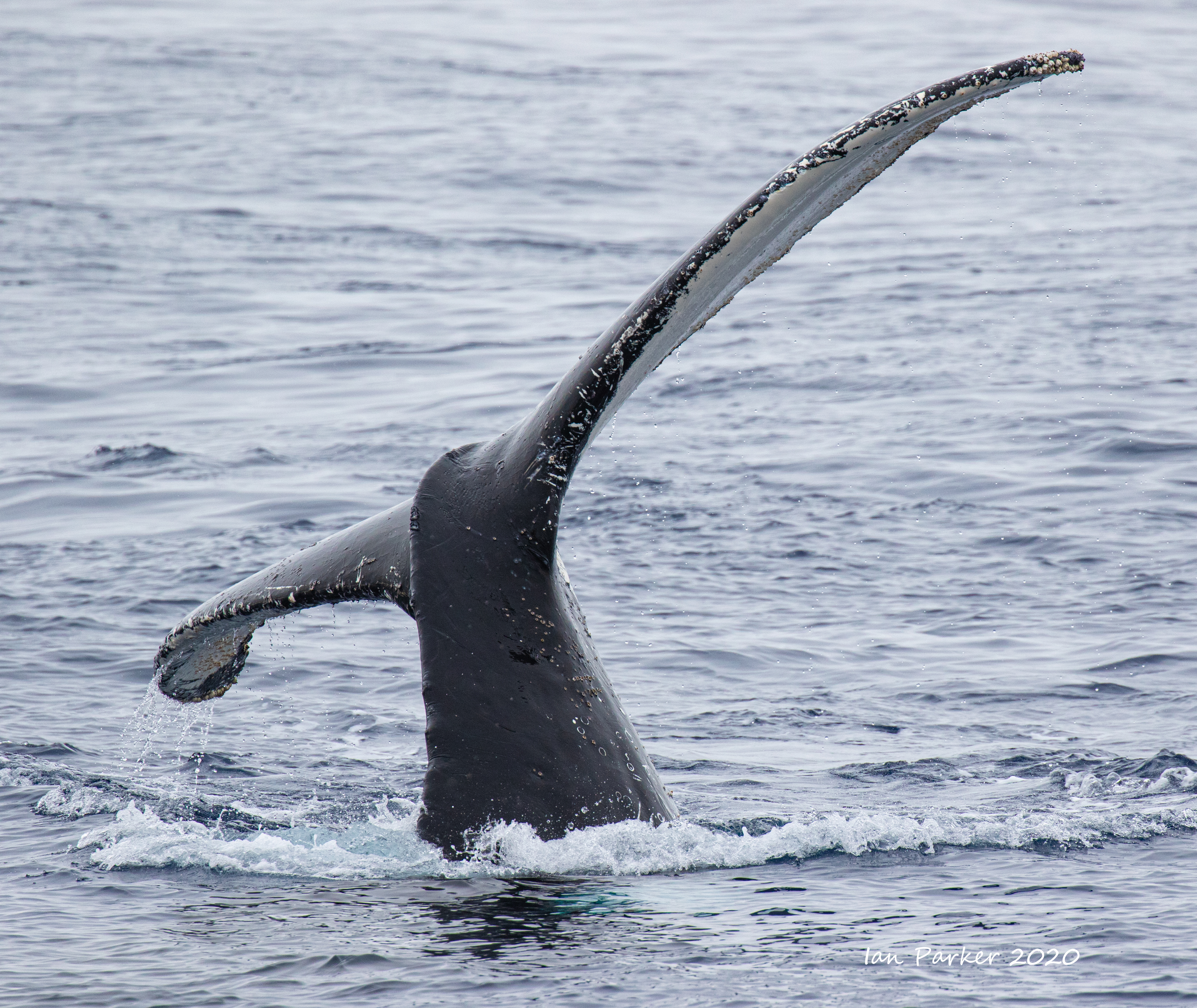
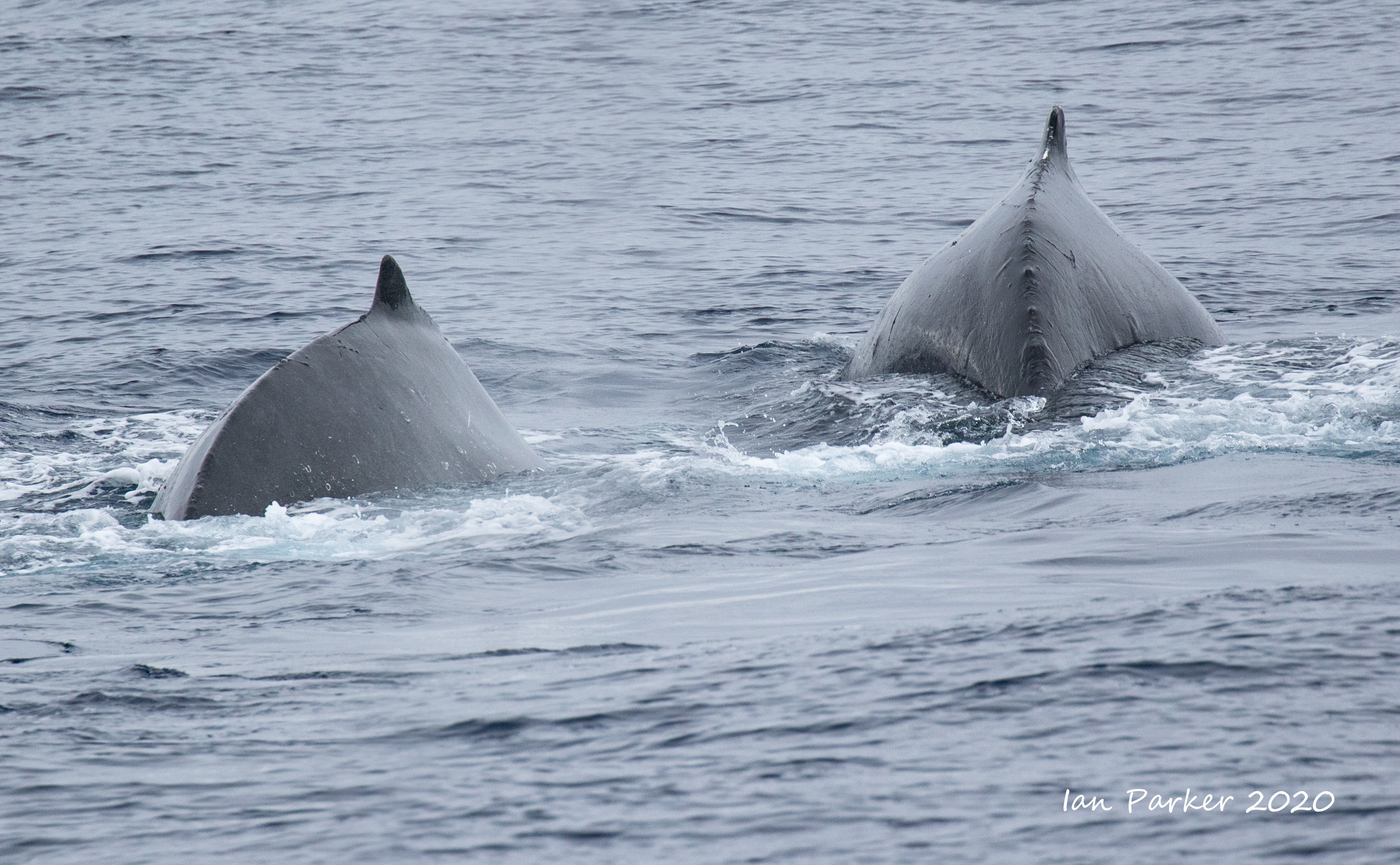
Feb 14th - First iceberg, crossing the Antarctic Circle, and humpback whales
Captain's log


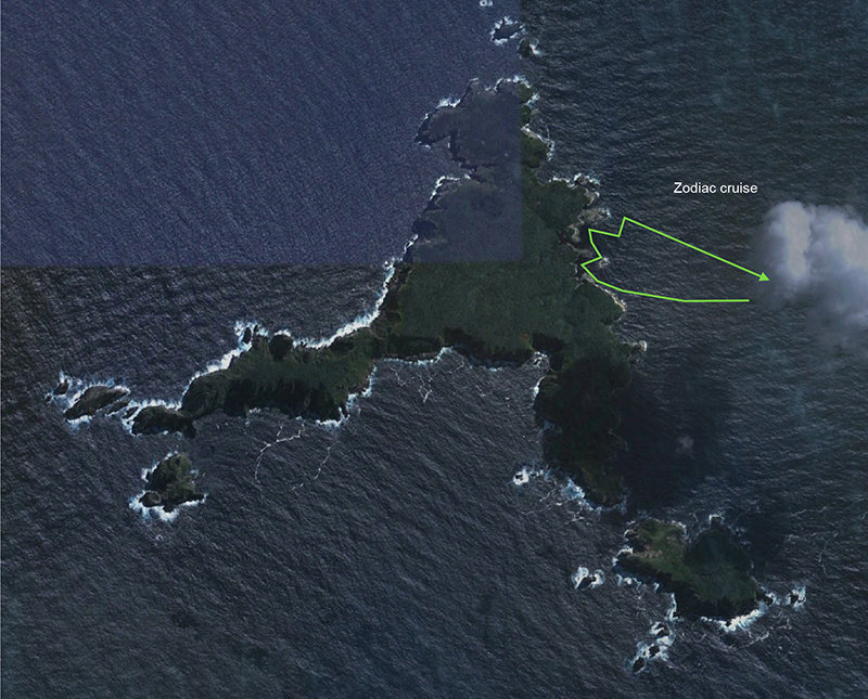
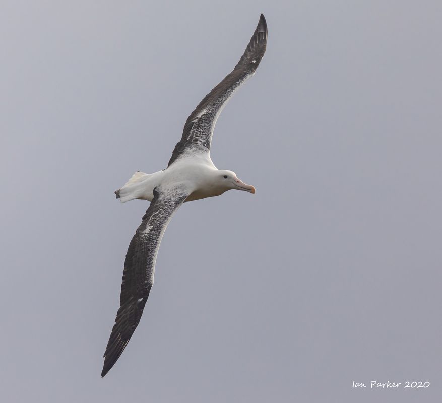
Feb 11th - An all-too-brief afternoon on Campbell Island
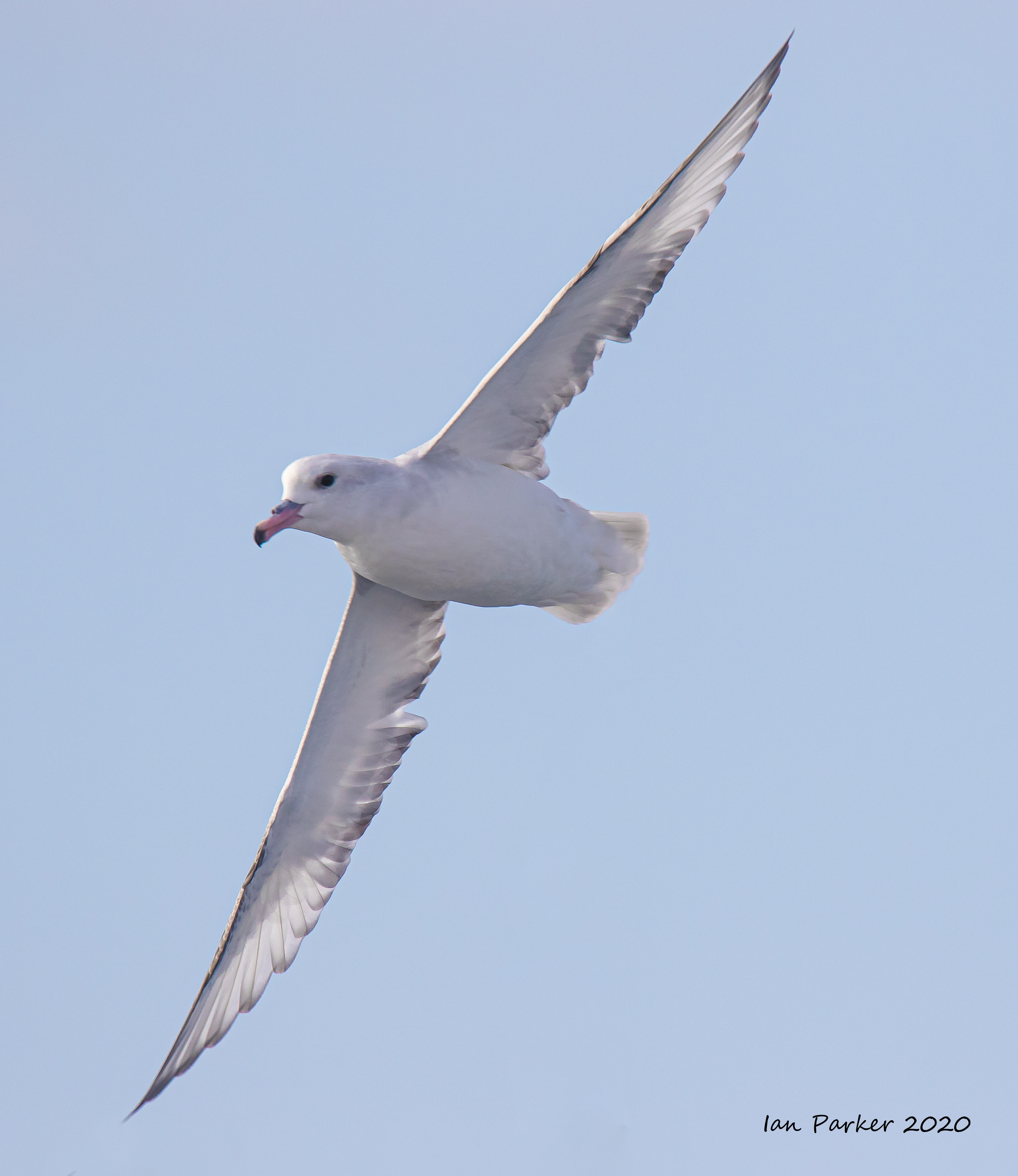
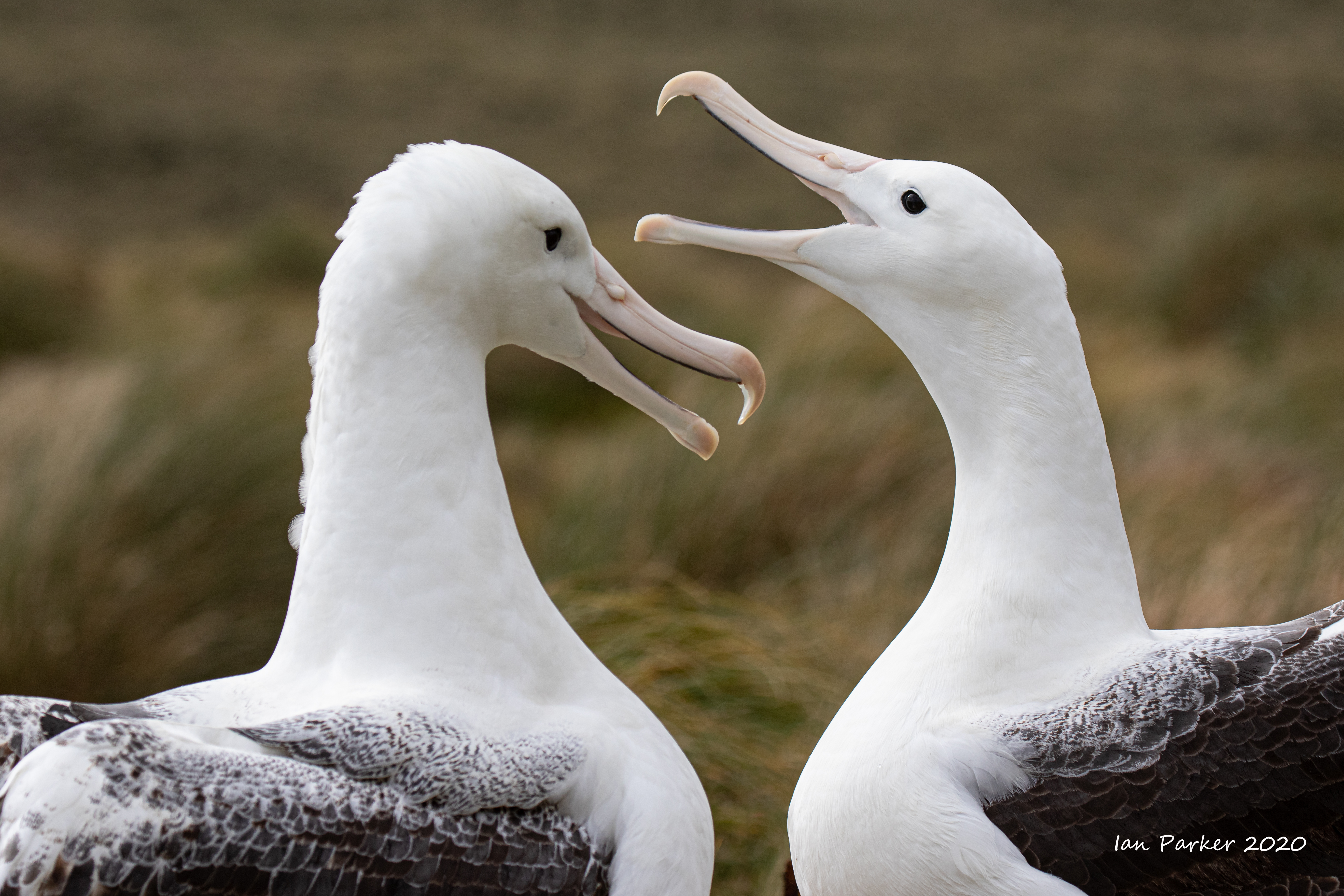
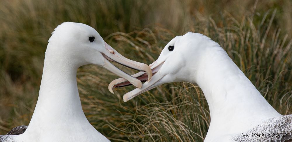
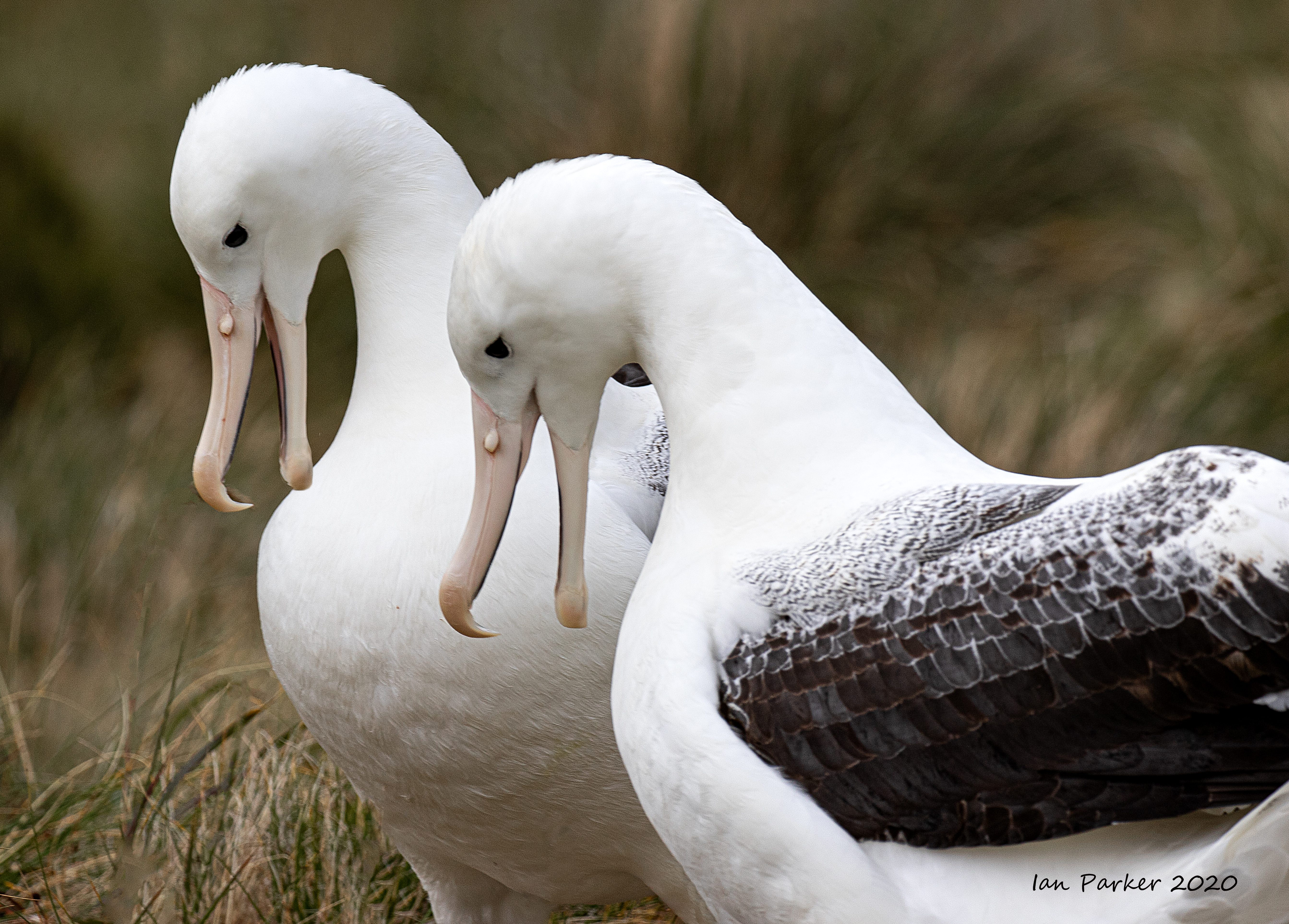
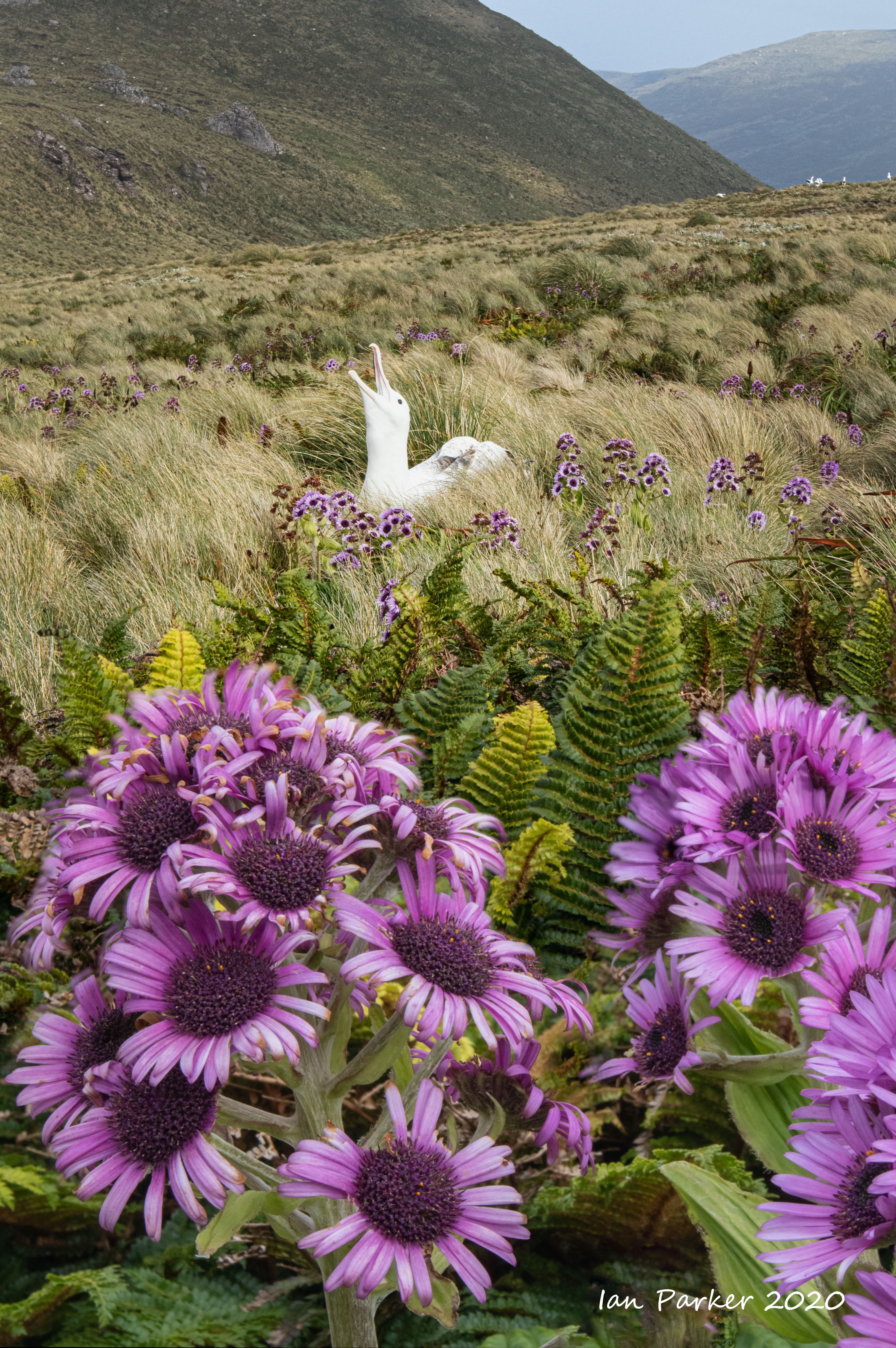
From the Captain's log: "Dropping anchor in the shelter of Campbell Island's Perseverance Harbour last night, Spirit of Enderby's In the Wake of Scott & Shackleton expeditioners woke this morning to enjoy a full day exploring this Subantarctic wonderland. Starting the day with a Zodiac cruise of the coastline we spotted Campbell Island Shag, Teal and Snipe, Arctic Terns, Light-mantled Sooty Albatross and Sea Lions as well as taking in the sights of the Loneliest Tree, Venus Cove and Terror Shoal. Following a hearty lunch back on board our expedition vessel, it was a short Zodiac ride over to the island's old weather station and start of the Col Lyall boardwalk where we were greeted by Hooker's/New Zealand Sea Lions. Making our way over the island we passed nesting Southern Royal Albatross and, further on, enjoyed spending time observing groups of young birds gamming it up during their intimate and rarely seen dance amid the purple/blue bloom of megaherbs Pleurophyllum speciosum." Our time on the island was rather short, and I decided to concentrate on photographing the southern royal albatross - a species I had not seen before and which is found in appreciable numbers only on Campbell Island. On the way up to the high land where the albatross nest the boardwalk threads a path through very distinct zones of unique vegetation. I would have liked to spend more time with the exotic megaherbs, but passed them by unseen in my hurry to get to the birds. But there would be more opportunities when we visited other subantarctic islands on our way back from the Ross Sea. |
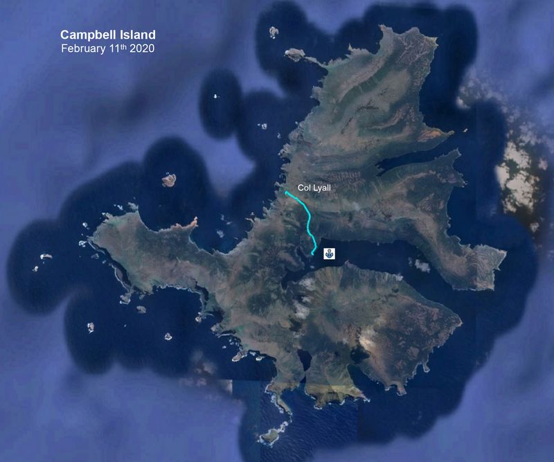 Boardwalk path on Campbell islands past the albatross nesting sites to a high viewpoint |


"Royal albatross are huge birds standing about 1 m tall and with a wingspan up to 3.5 m. Breeding colonies are spread over a large area of the uplands on Campbell Island, with nests every 20-50 m. Birds first return to colonies as pre-breeders aged 4-8 years where they find a mate, form a monogamous bond, and usually breed the following year. Pre-breeders fly into the colony in the late afternoon and advertise for a partner using a complex repertoire of signals and displays known as 'gaming'. Gaming includes aerial displays with birds continually landing, taking off and calling down to birds on the ground; return sky-calling by birds on the ground; bill yapping; bill clapping; head shakes and wing stretches. While gaming, the birds make loud whining calls and croaks that can be heard at a great distance. When an unattached female comes in to land there is a great deal of noise and respectful manoeuvering by the males to make a favourable impression." [Ian Wilson; Birdphotographersnet]


February 9th: Embark from Bluff Harbour and sail south toward Antarctica
As soon as the Spirit of Enderby left the shelter of Bluff harbour we had a taste of the rough seas in store for us for many days to come.
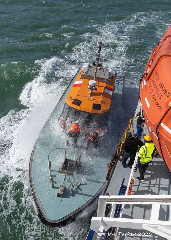 Drenched pilot returning to shore; Bluff, New Zealand Drenched pilot returning to shore; Bluff, New Zealand |
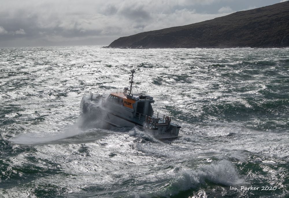 Pilot boat in rough seas off Bluff harbour, New Zealand |
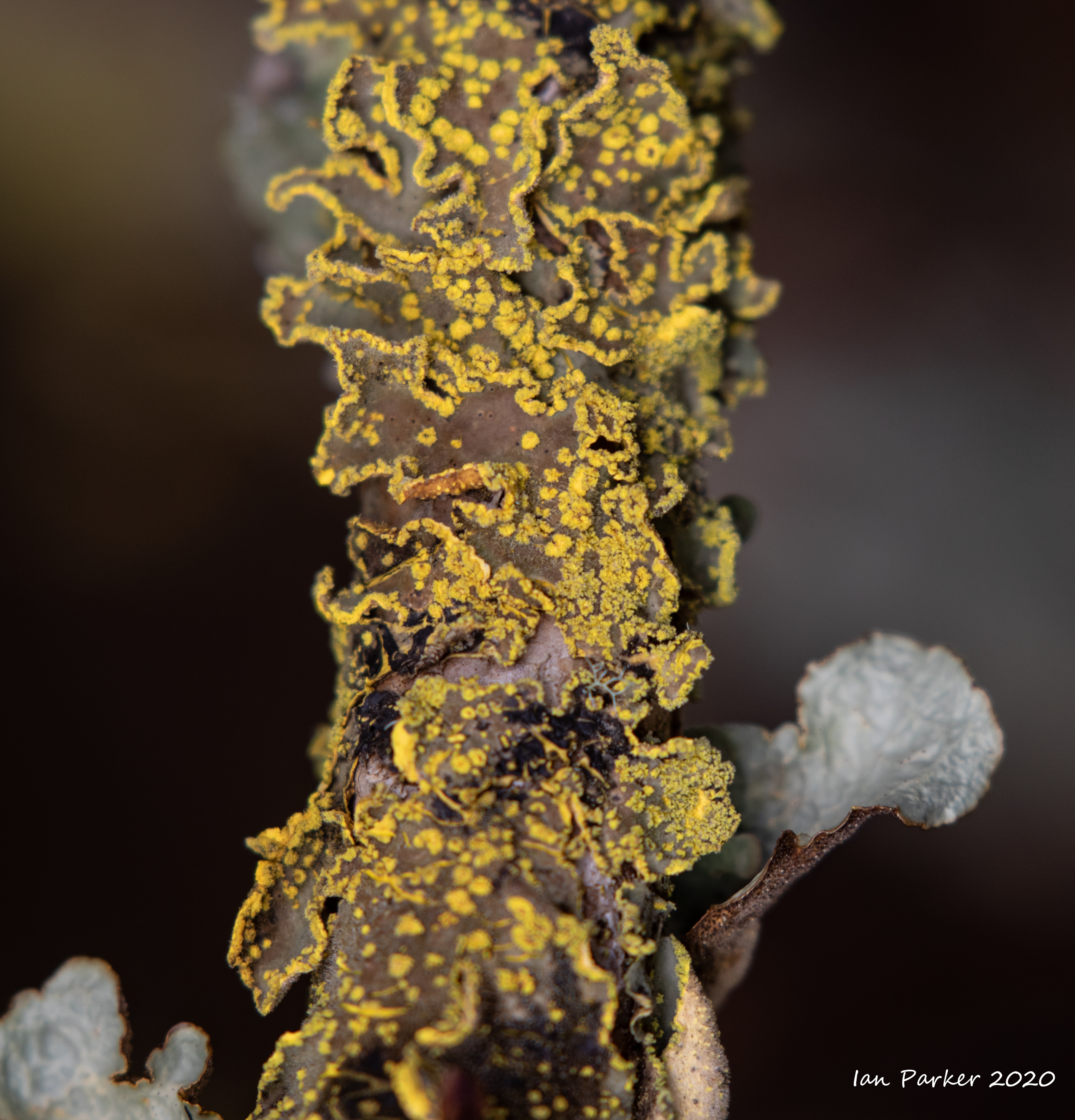
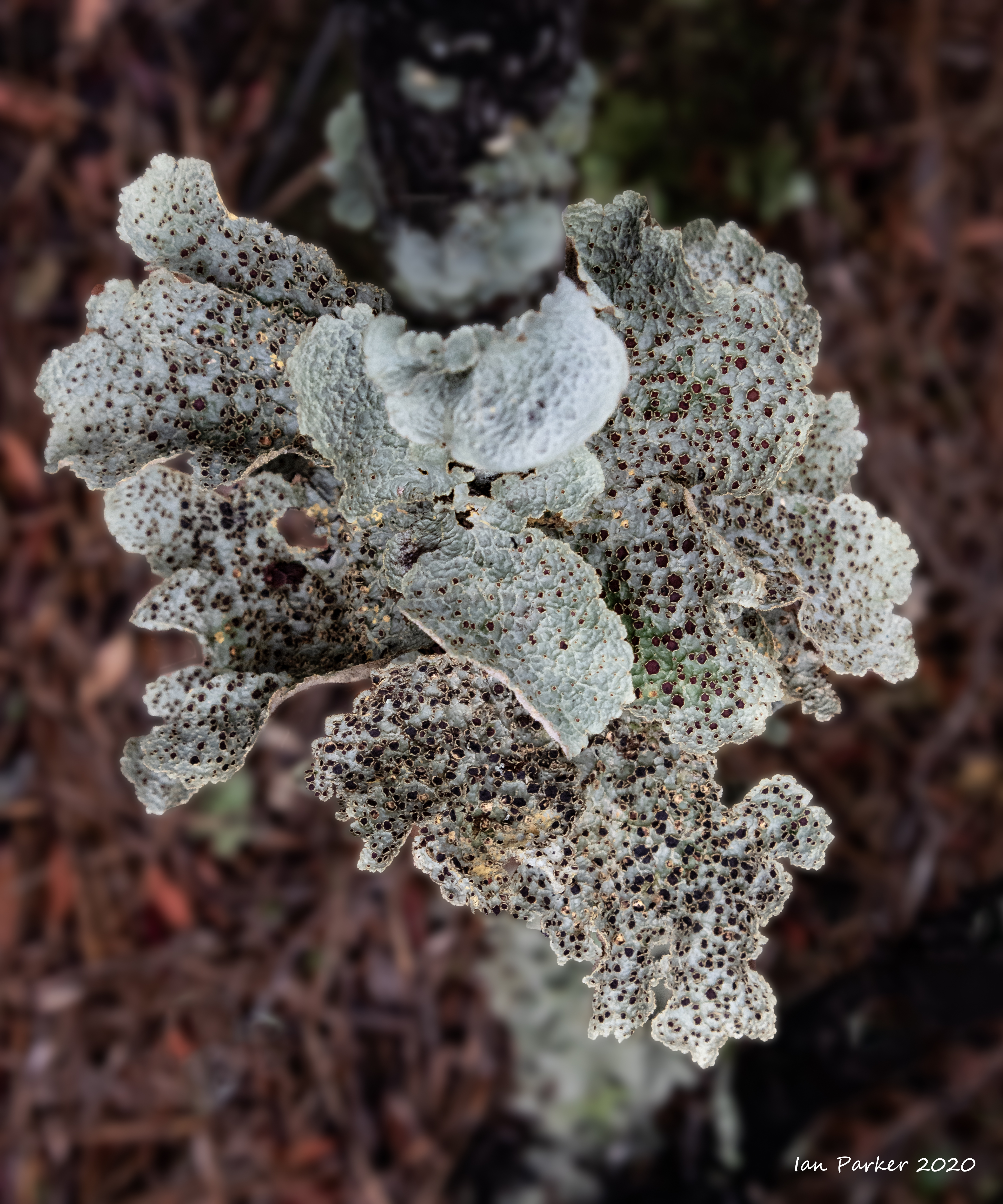
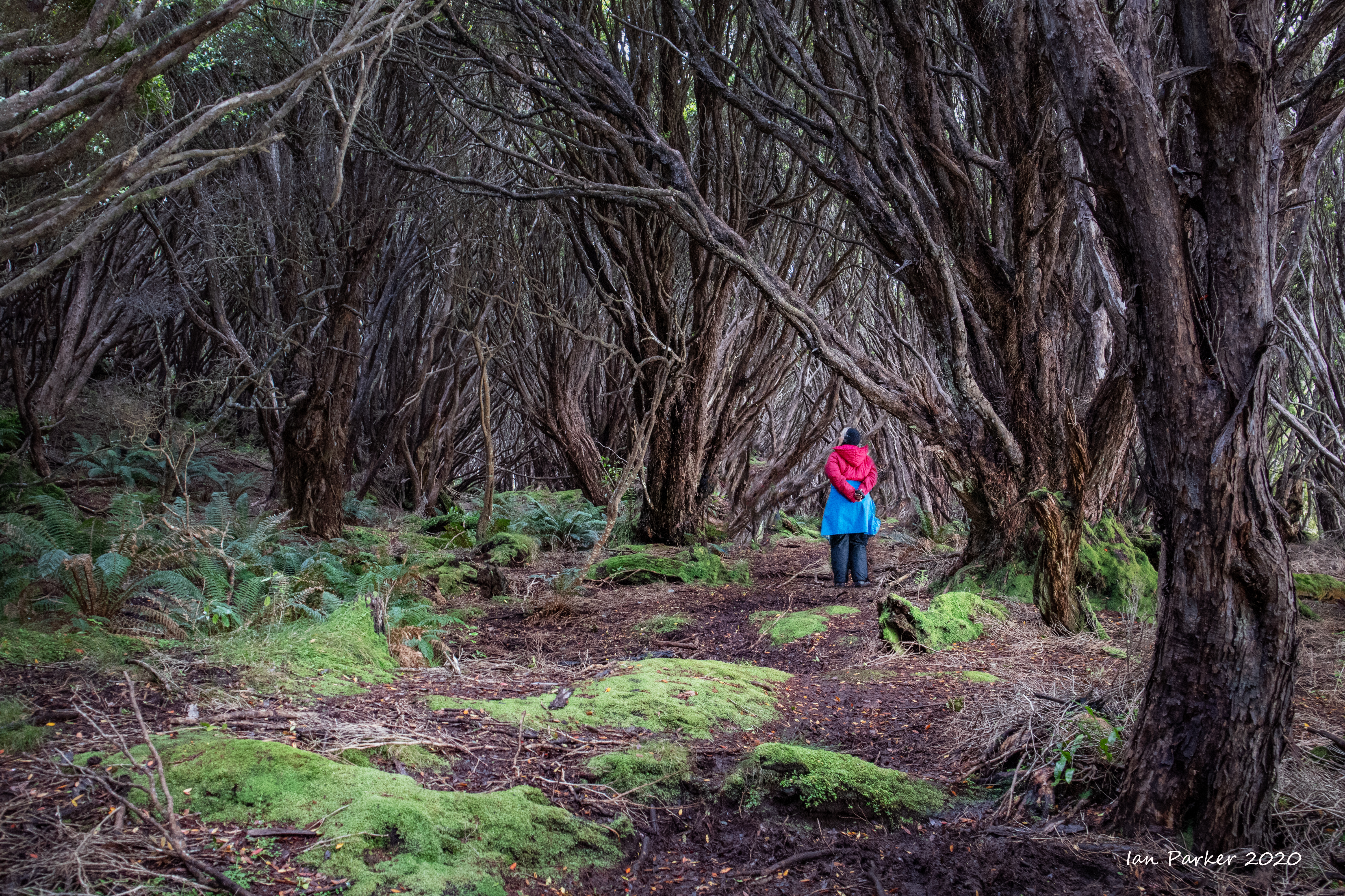
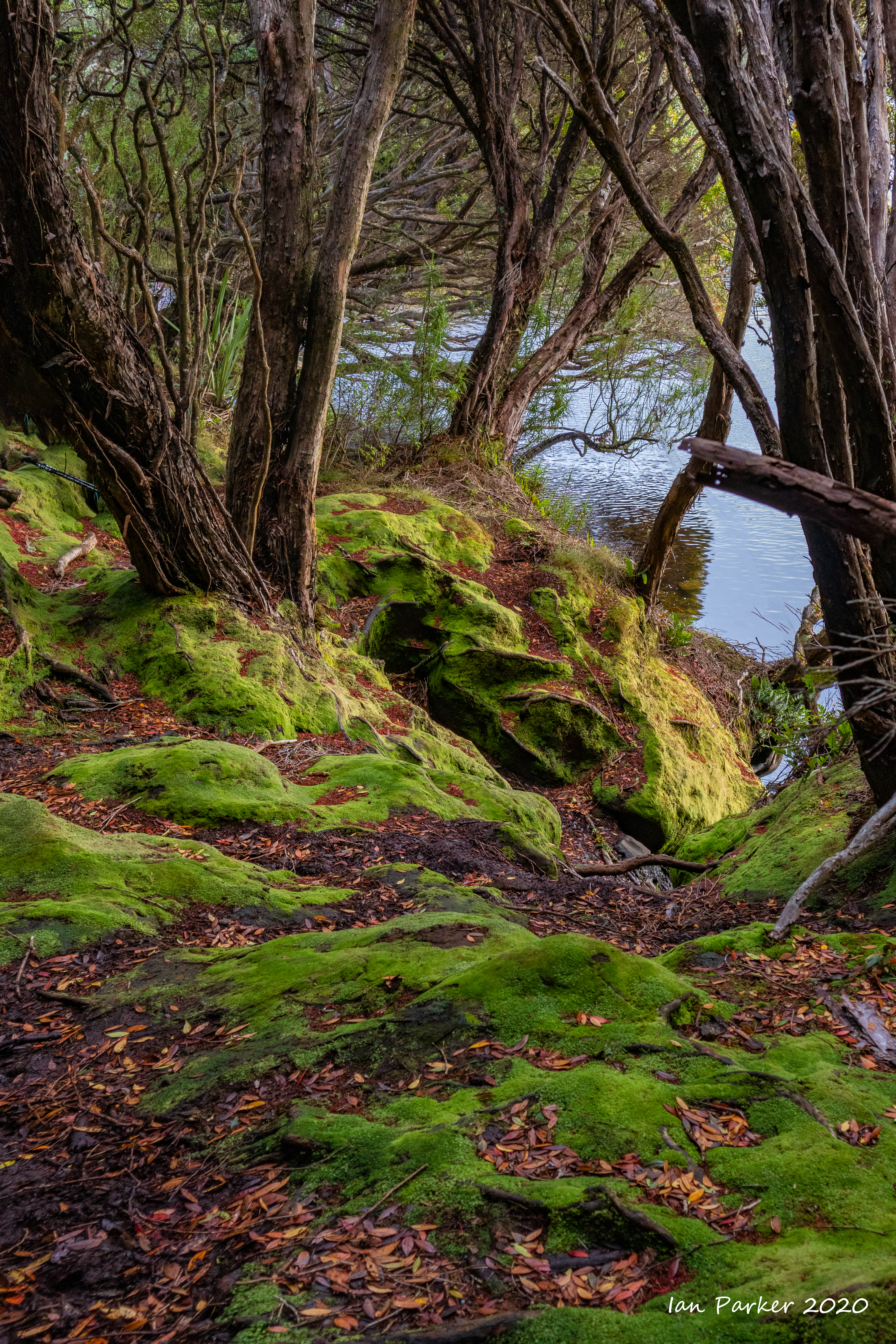
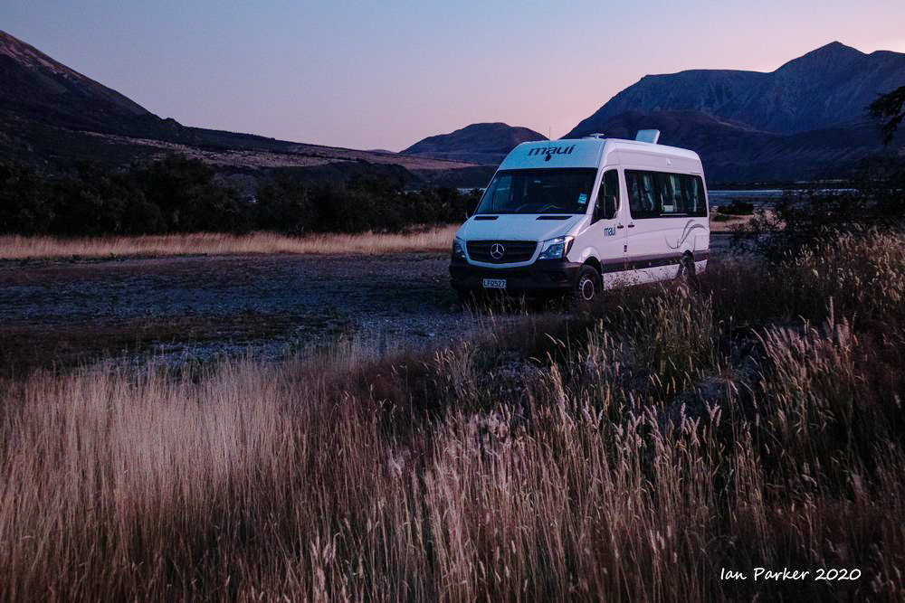
Jan 31-Feb 7th: Around New Zealand in a campervan
We rented a campervan from Maui Rentals, conveniently situated right nest to Christchurch airport. Our original plan was to drive a long loop, travelling over Arthur's Pass to the West Coast, continuing south along the coast road past the glaciers, and returning along the interior route by Lake Tekapo. However, when we reached the coast at Greymouth that seemed like too much driving, and instead we headed north along the less visited coastline to the end of the road at Karamea. That turned out to be a lucky decision, as torrential rainfall caused multiple landslides further south, blocking the road and potentially trapping us so we could not join our boat before it sailed. We used The NZ Frenzy South Island guidebook to point us to fascinating off-the-beaten-track locations. |
 |
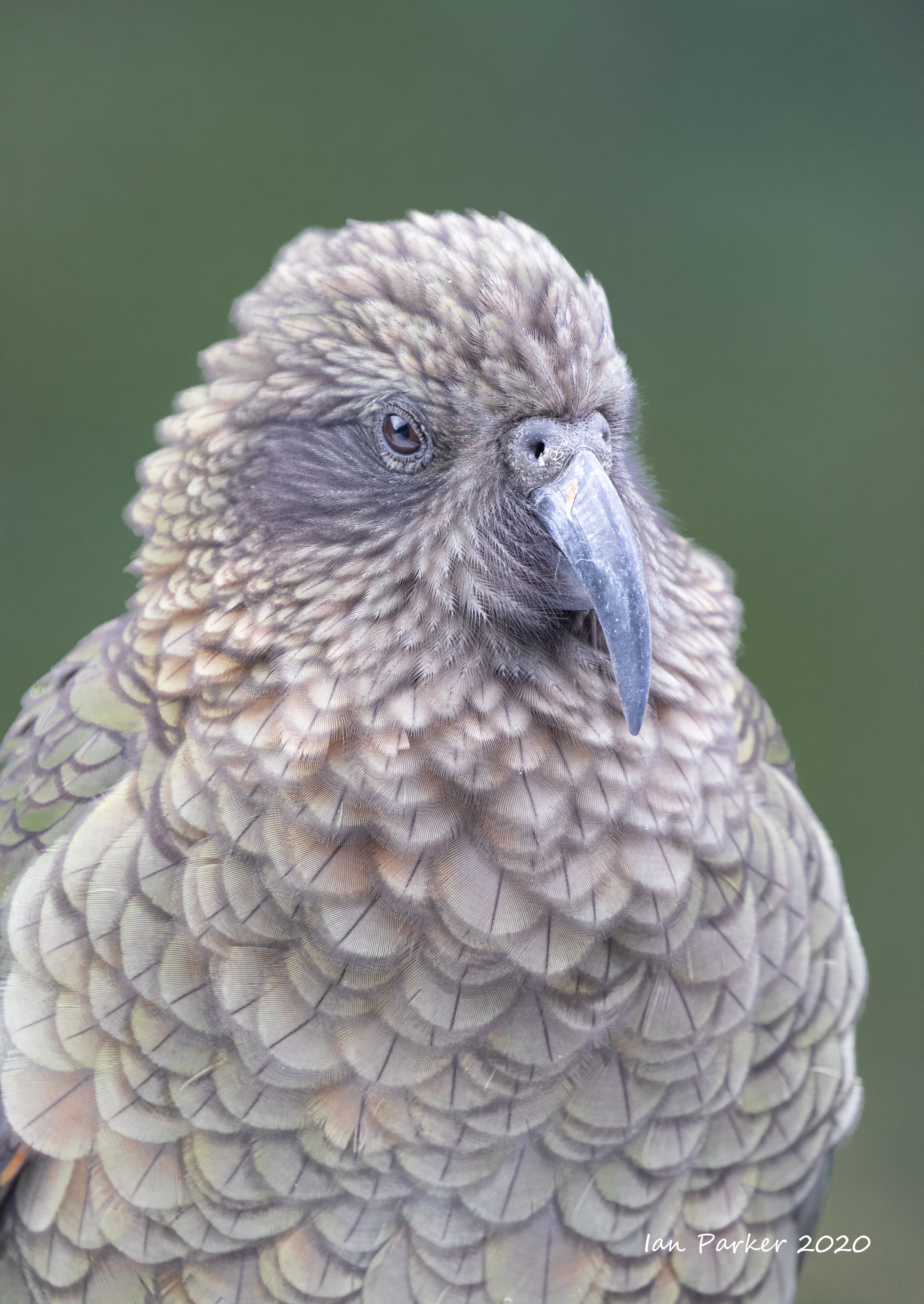
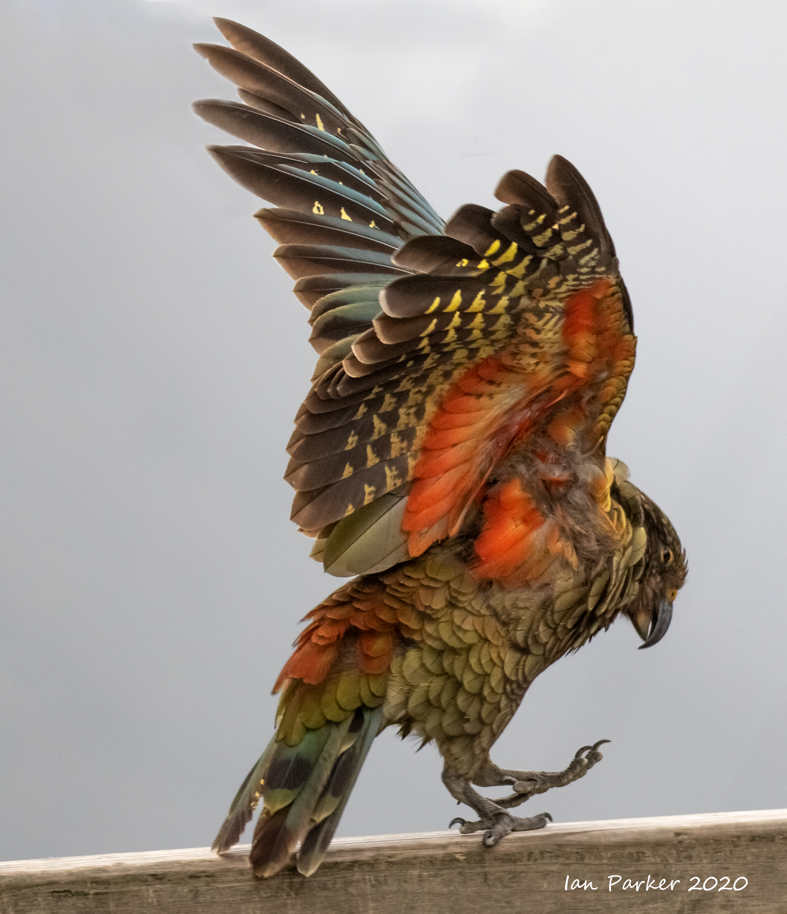
Two iconic birds of New Zealand


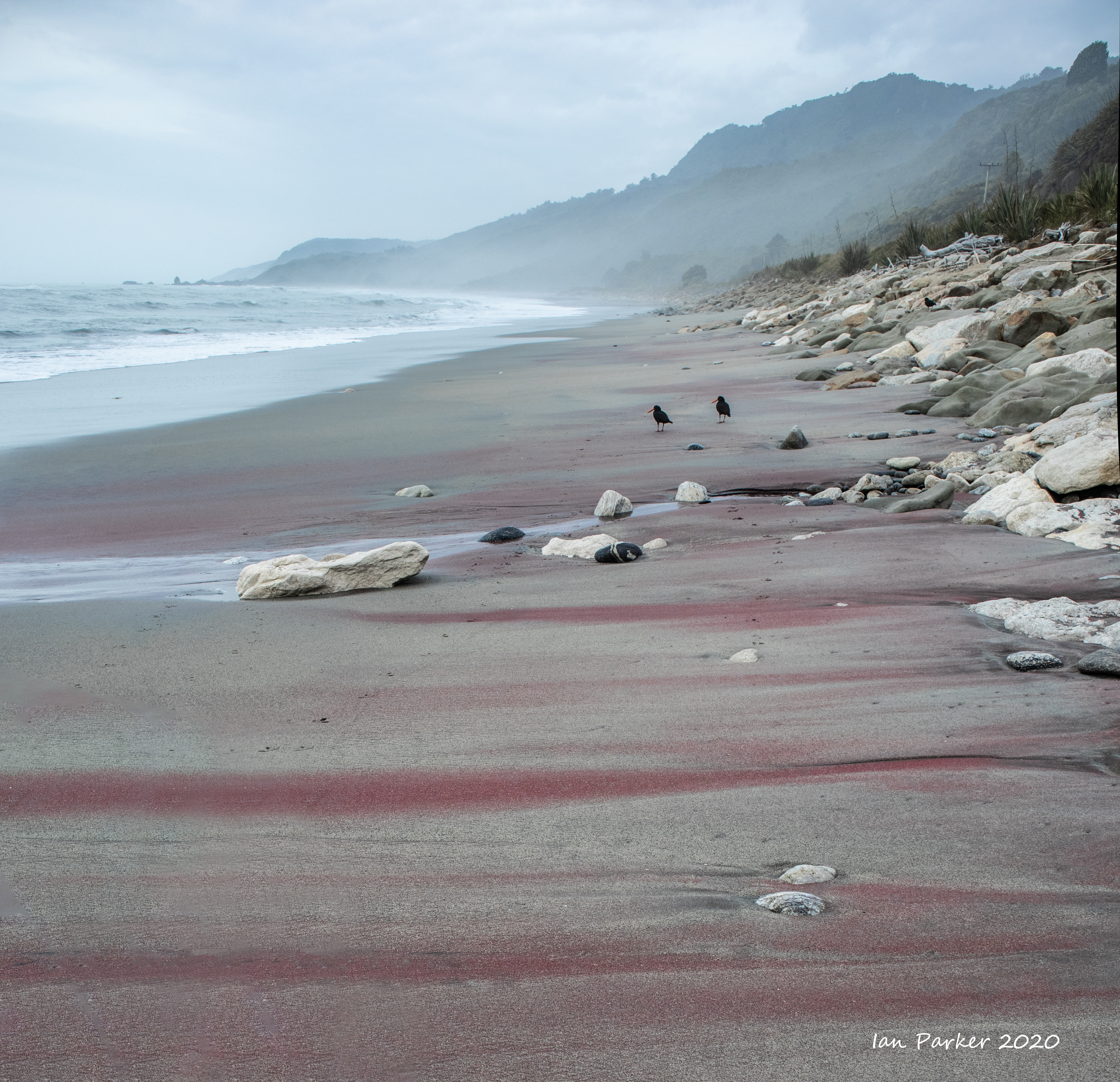
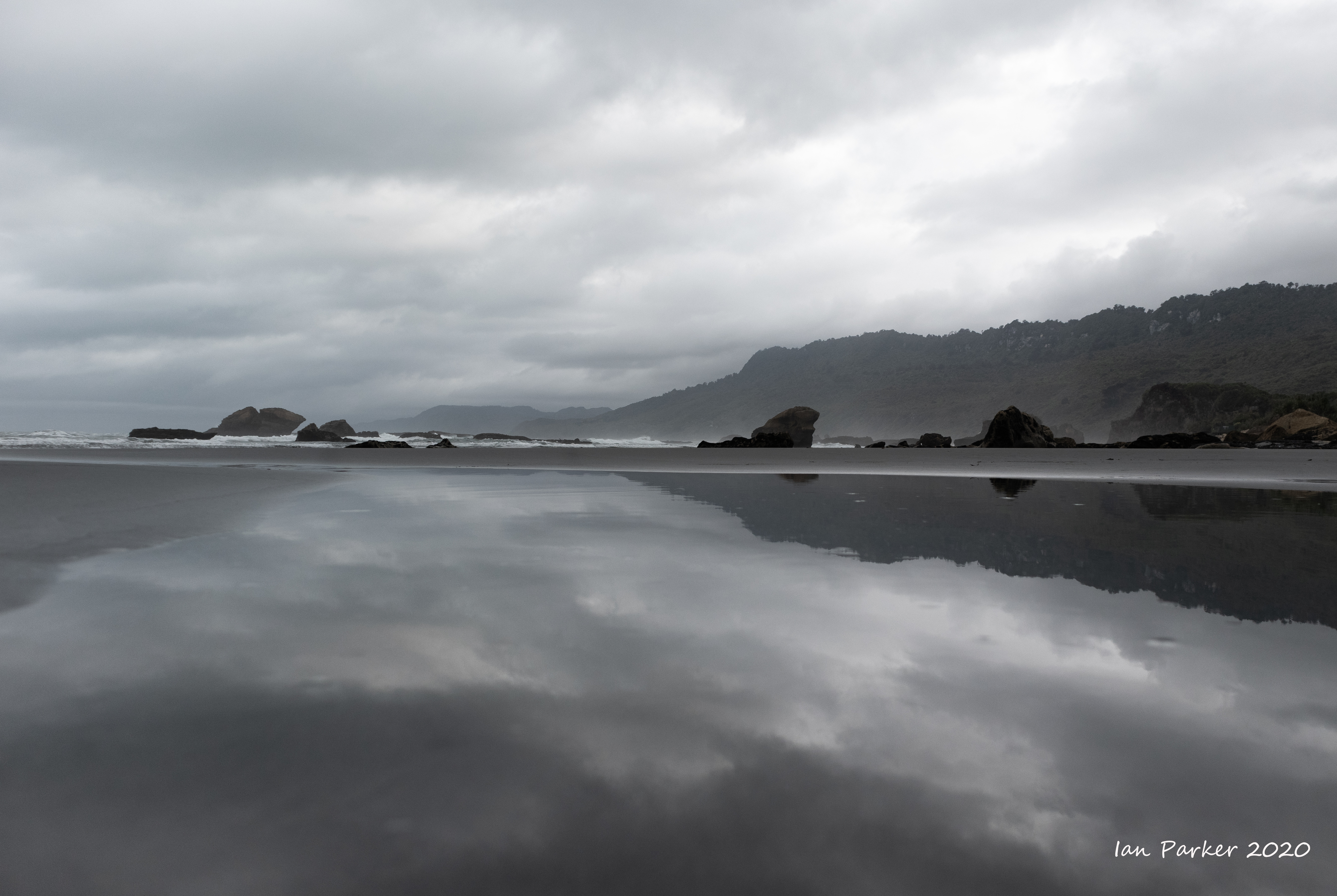
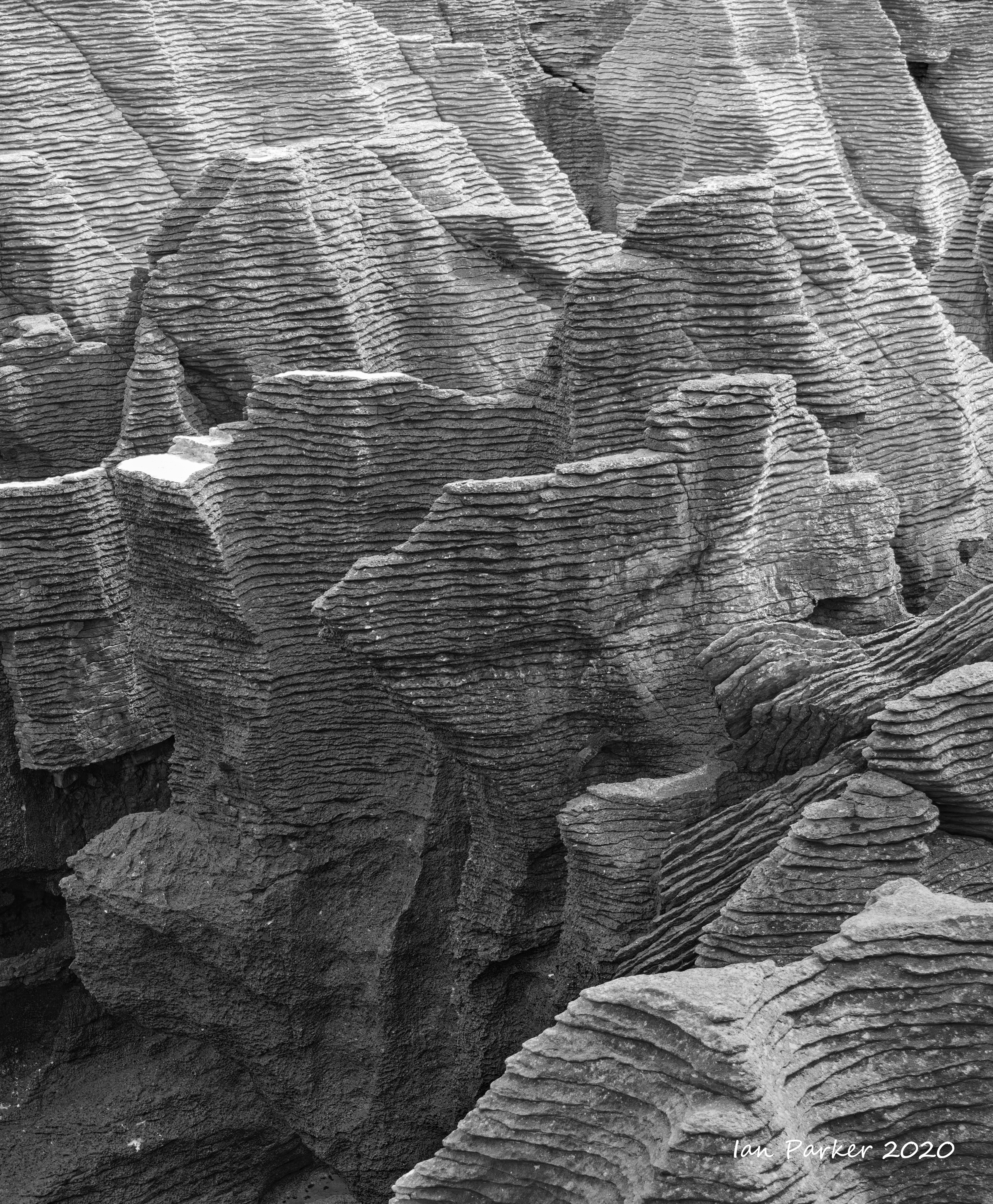
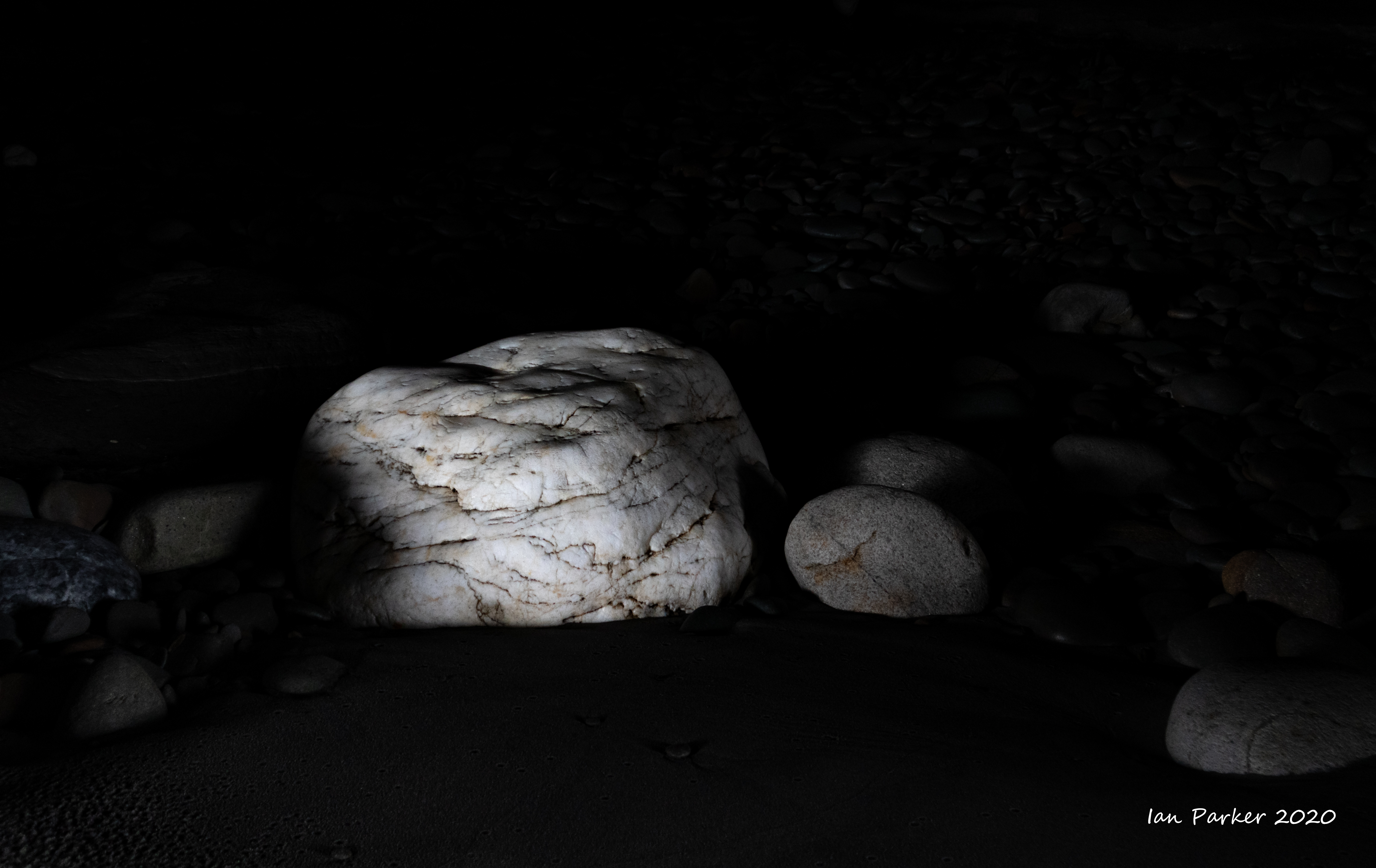
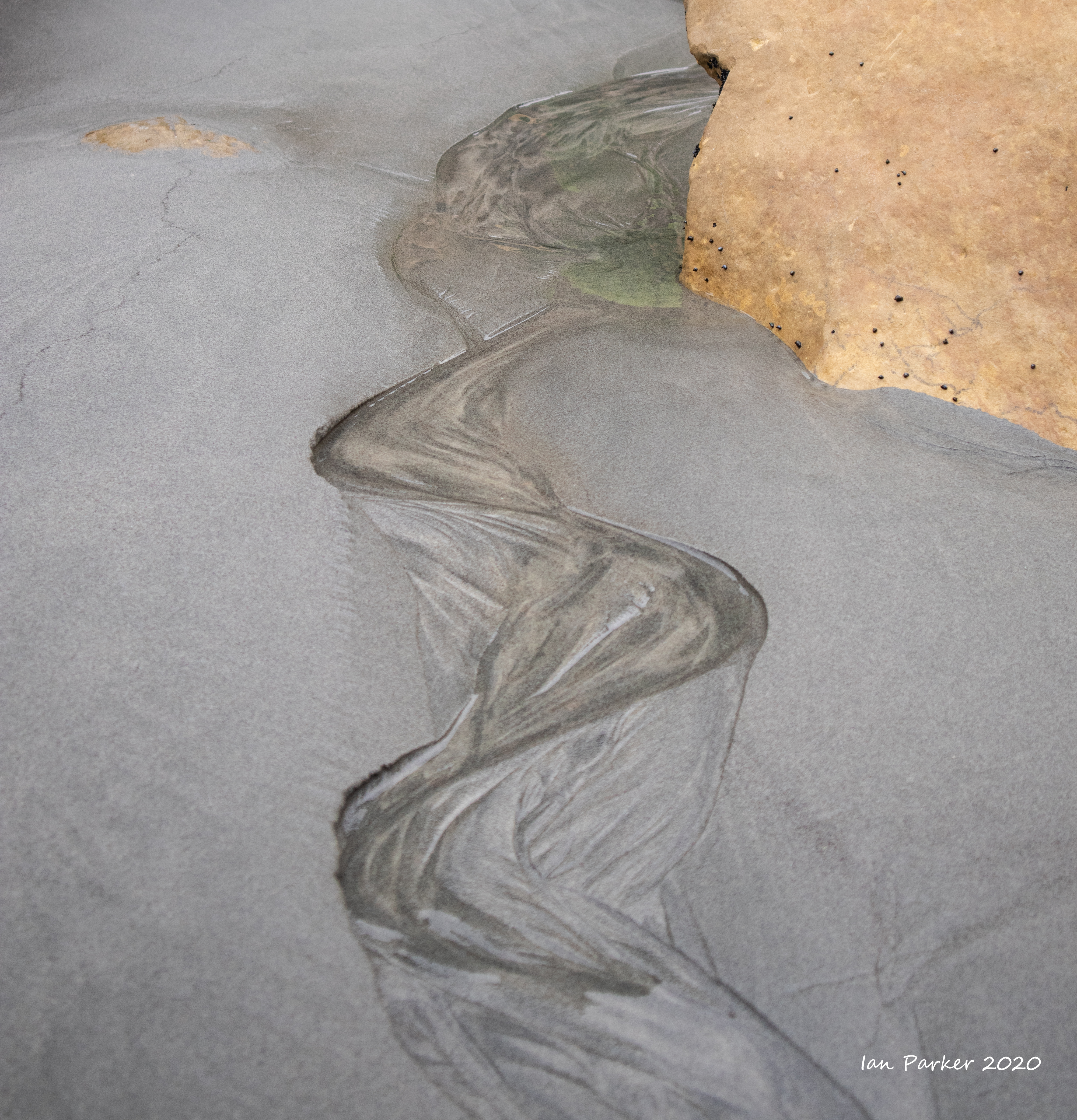
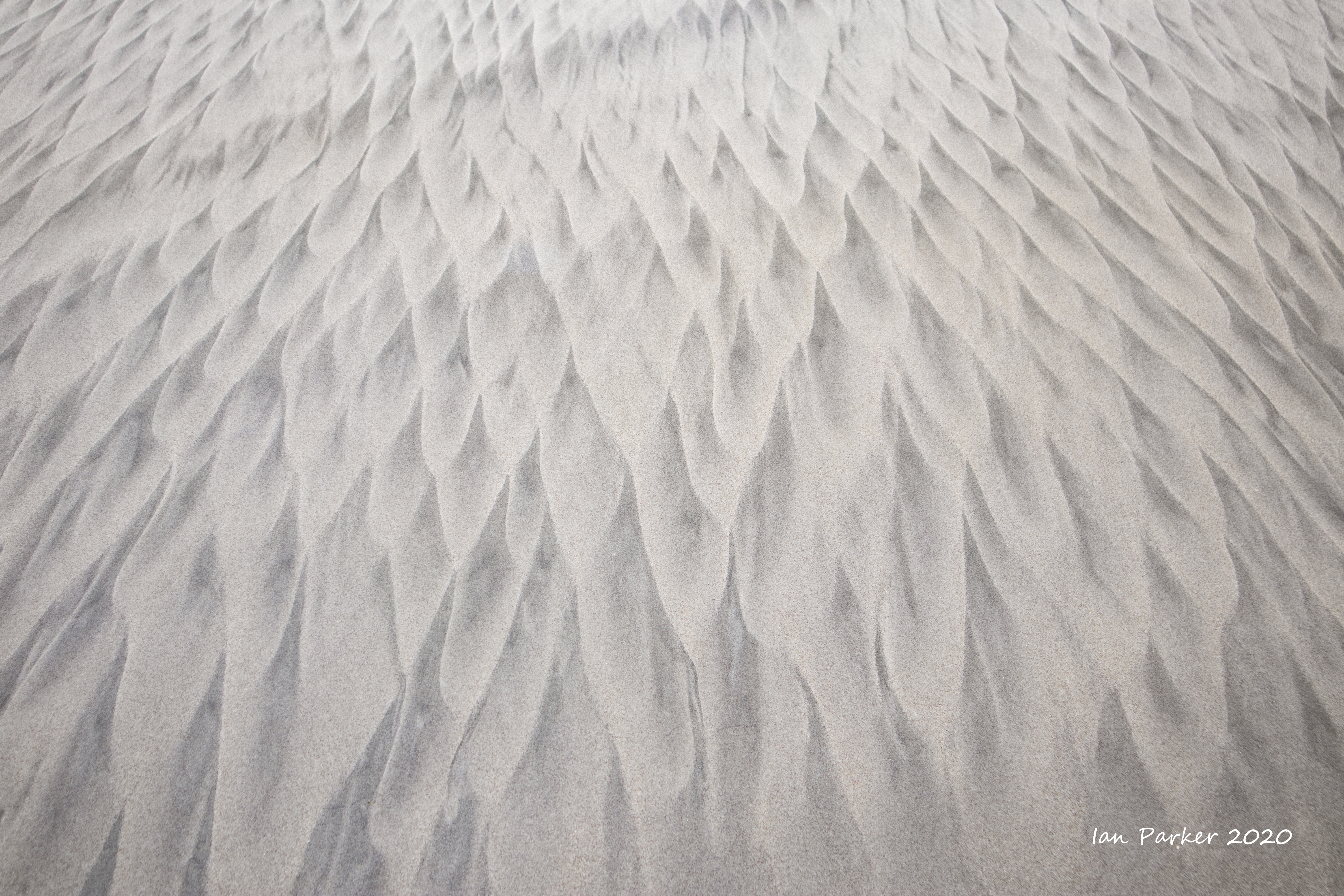
Photos from the northern west coast, South Island, New Zealand
Lookin back on photos I took during a previous visit to New Zealand I see that many shots are of wide landscapes in good light. Although we were now back in summer, rather than in the middle of winter as previously, the weather gave uniformly overcast skies, if not rain. Perhaps for that reason I found myself concentrating 'small thing', often abstract subjects. Or perhaps it marks a change in my photographic sensibilities over the intervening 10 years.


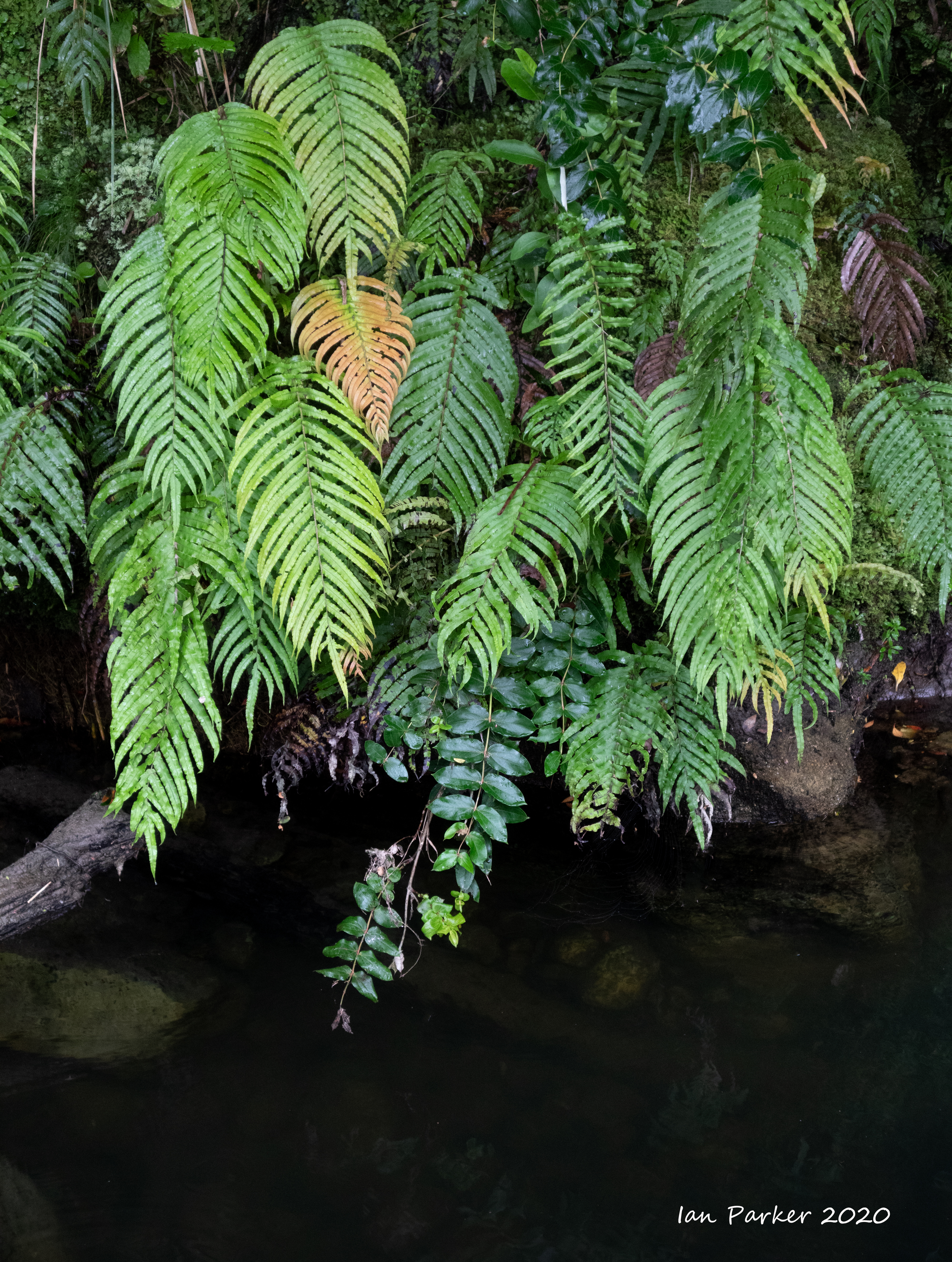
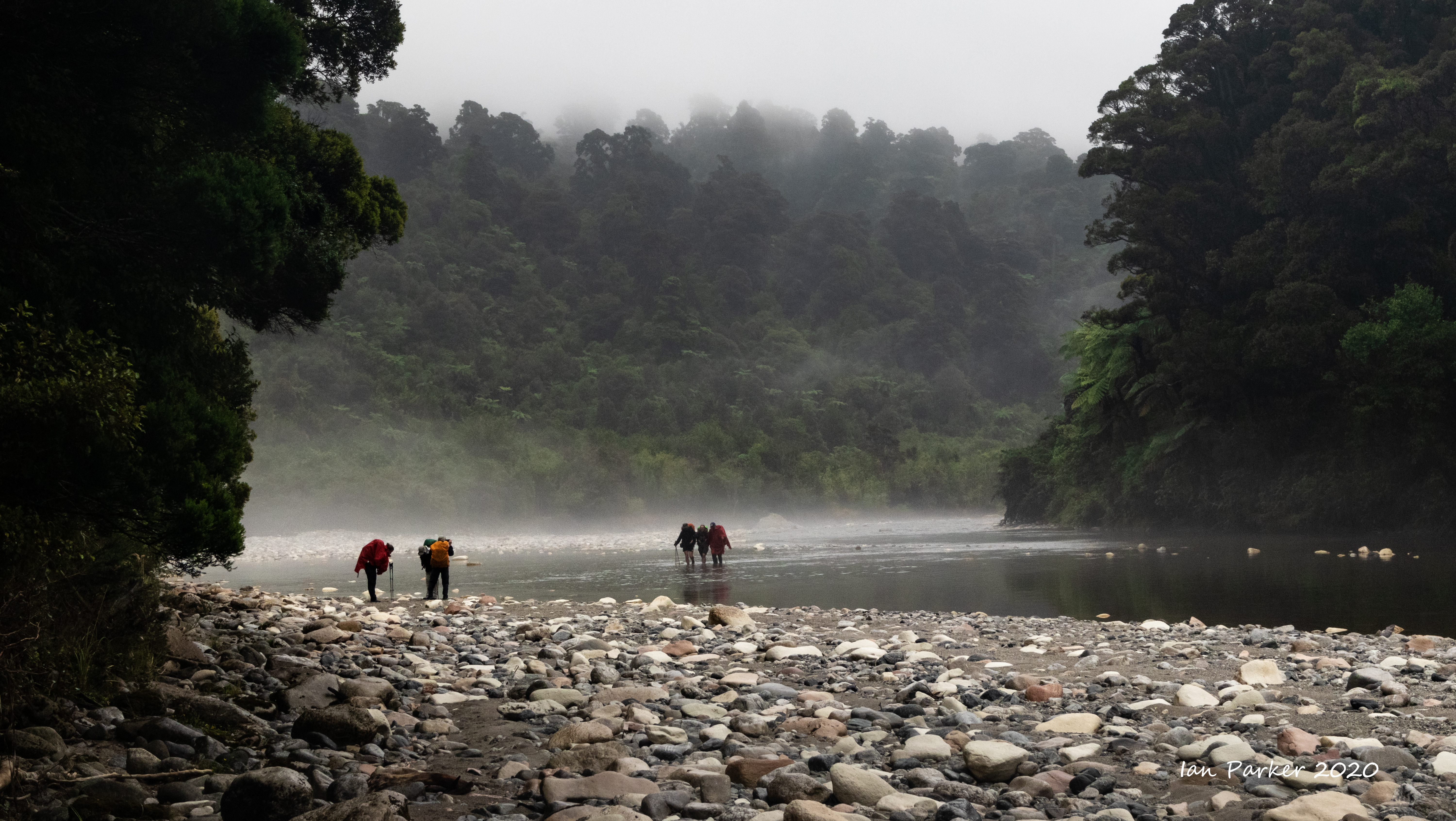
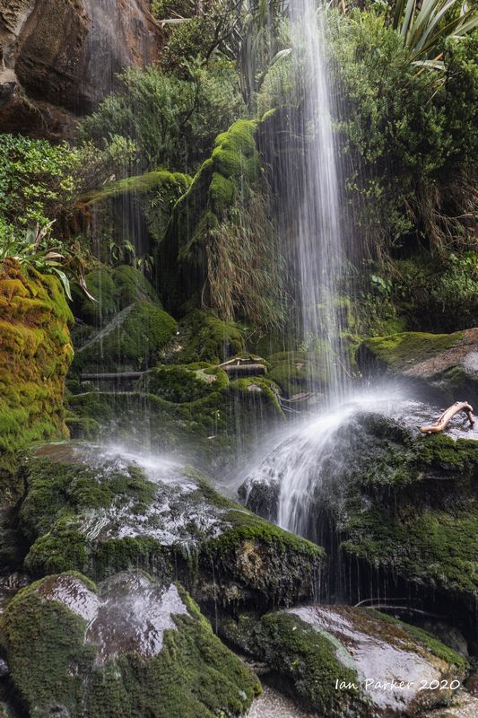
Across Arthur's Pass and into West Coast rainforests


A couple of photos from Bolsa Chica


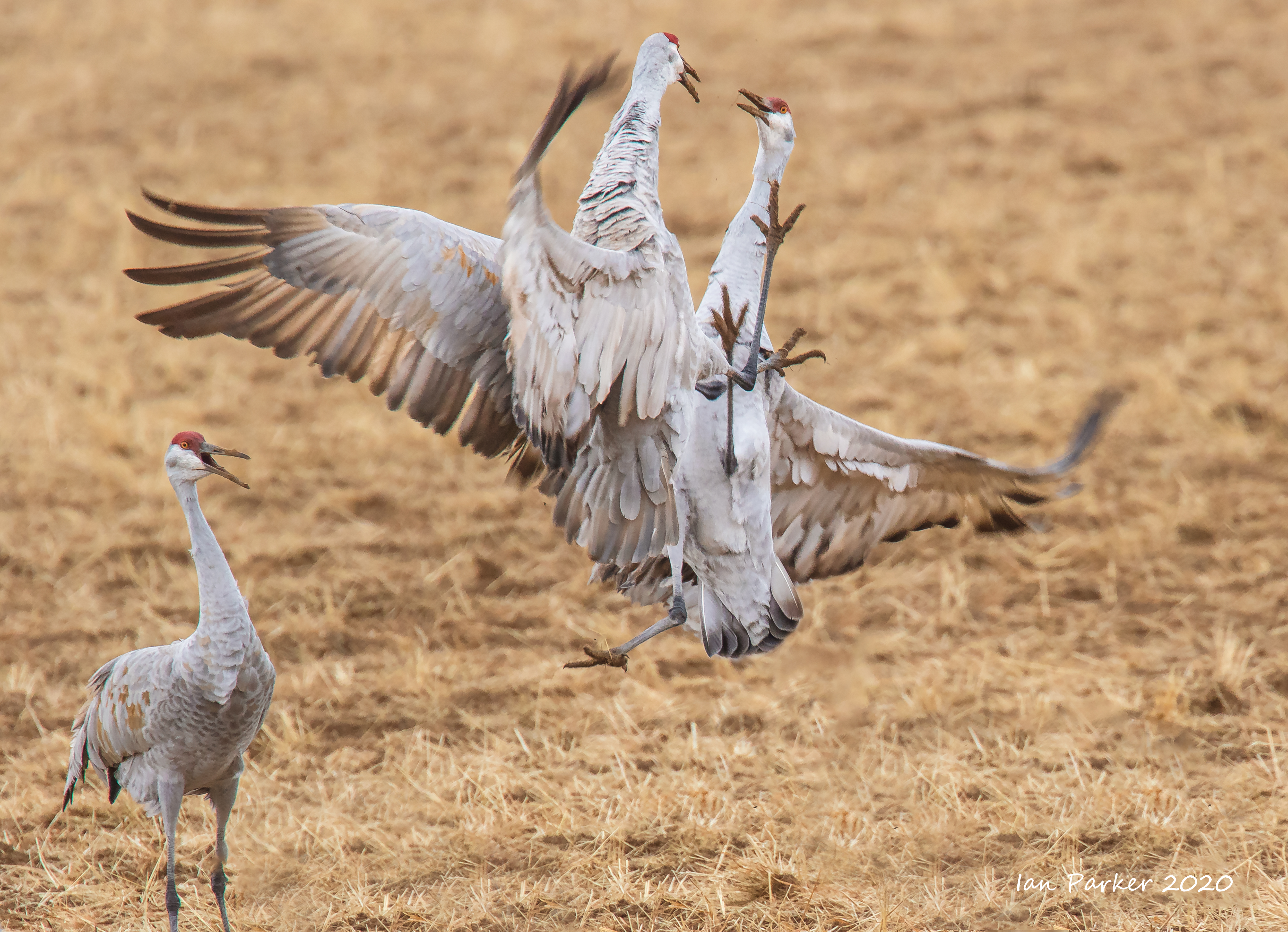
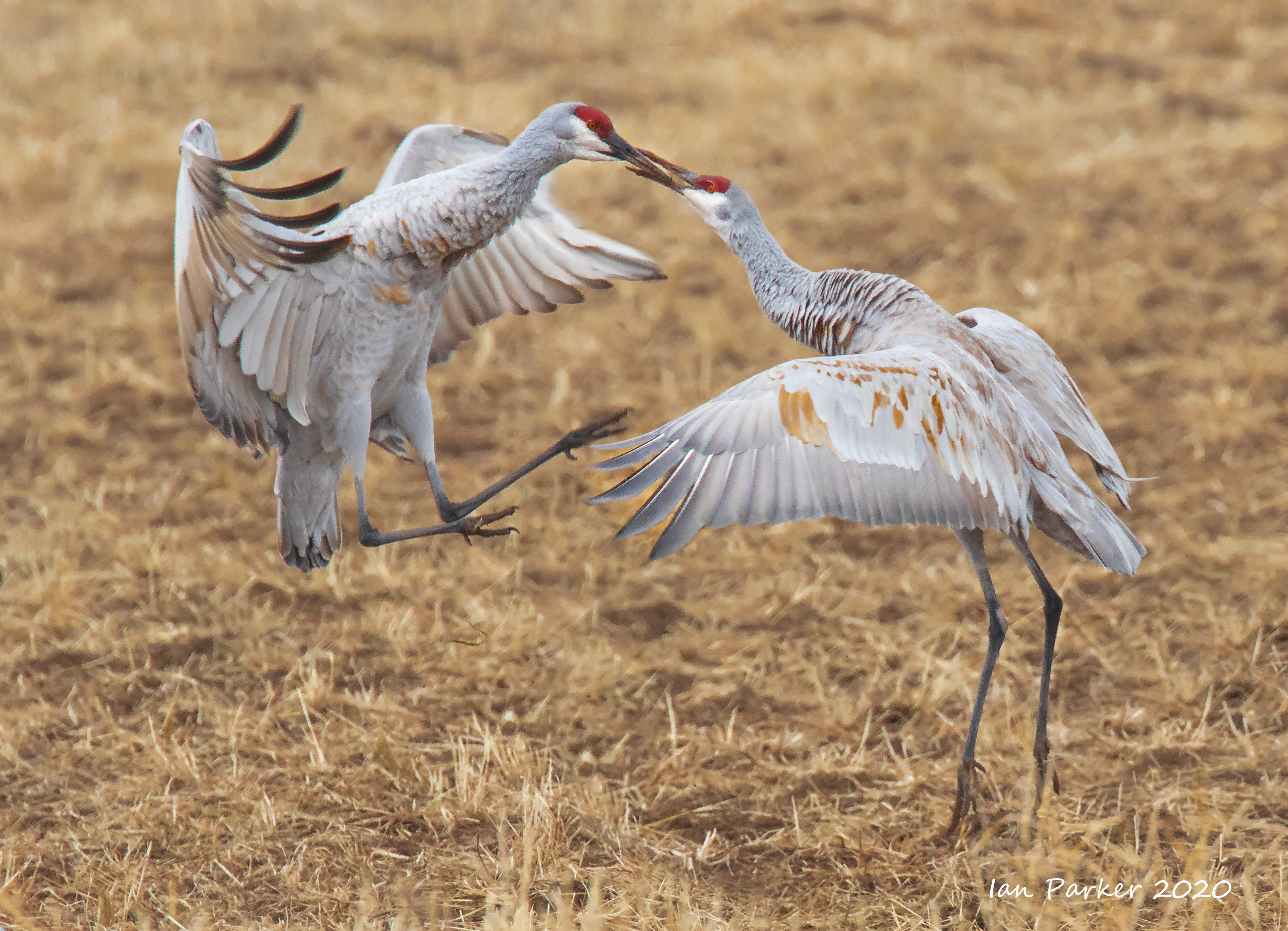
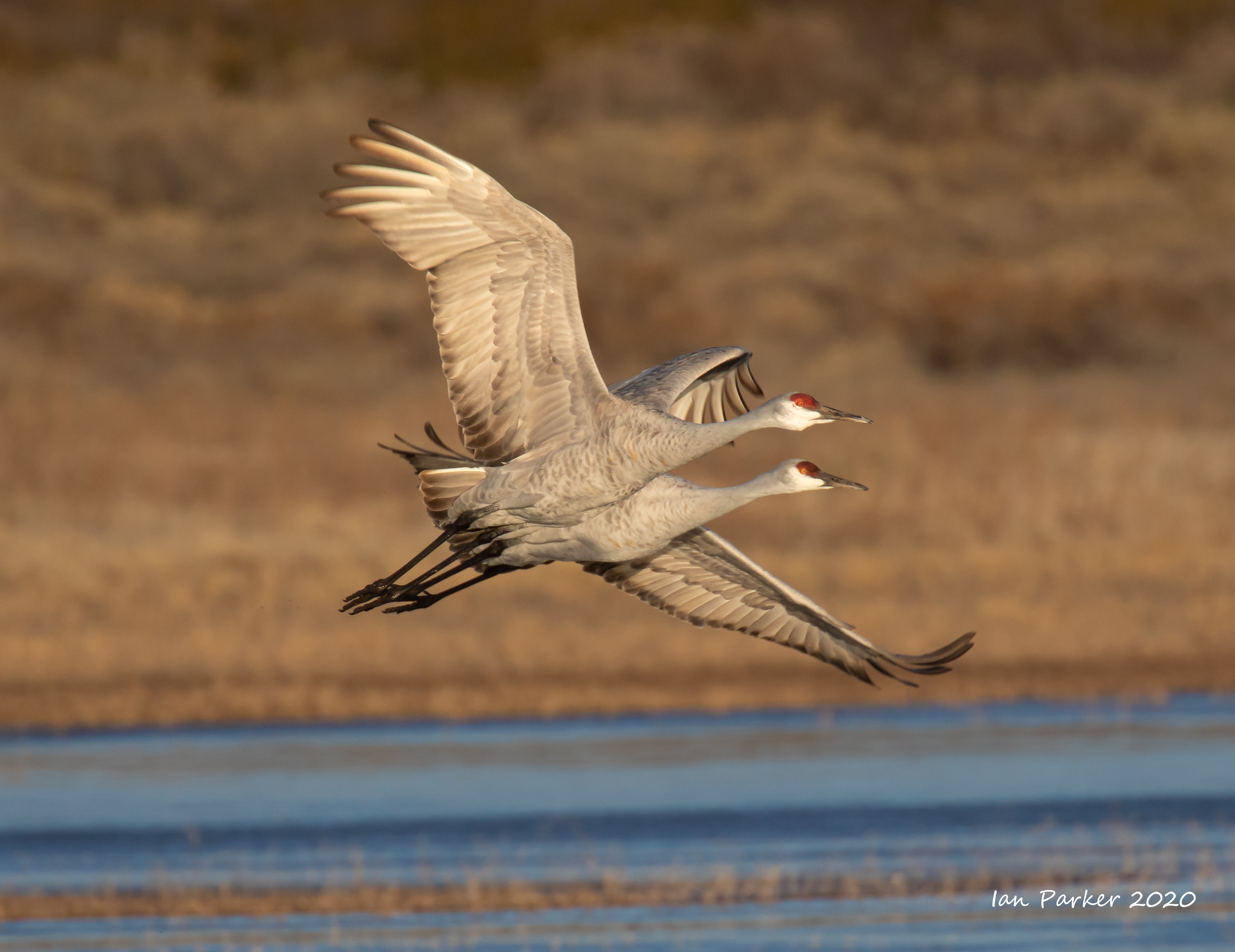
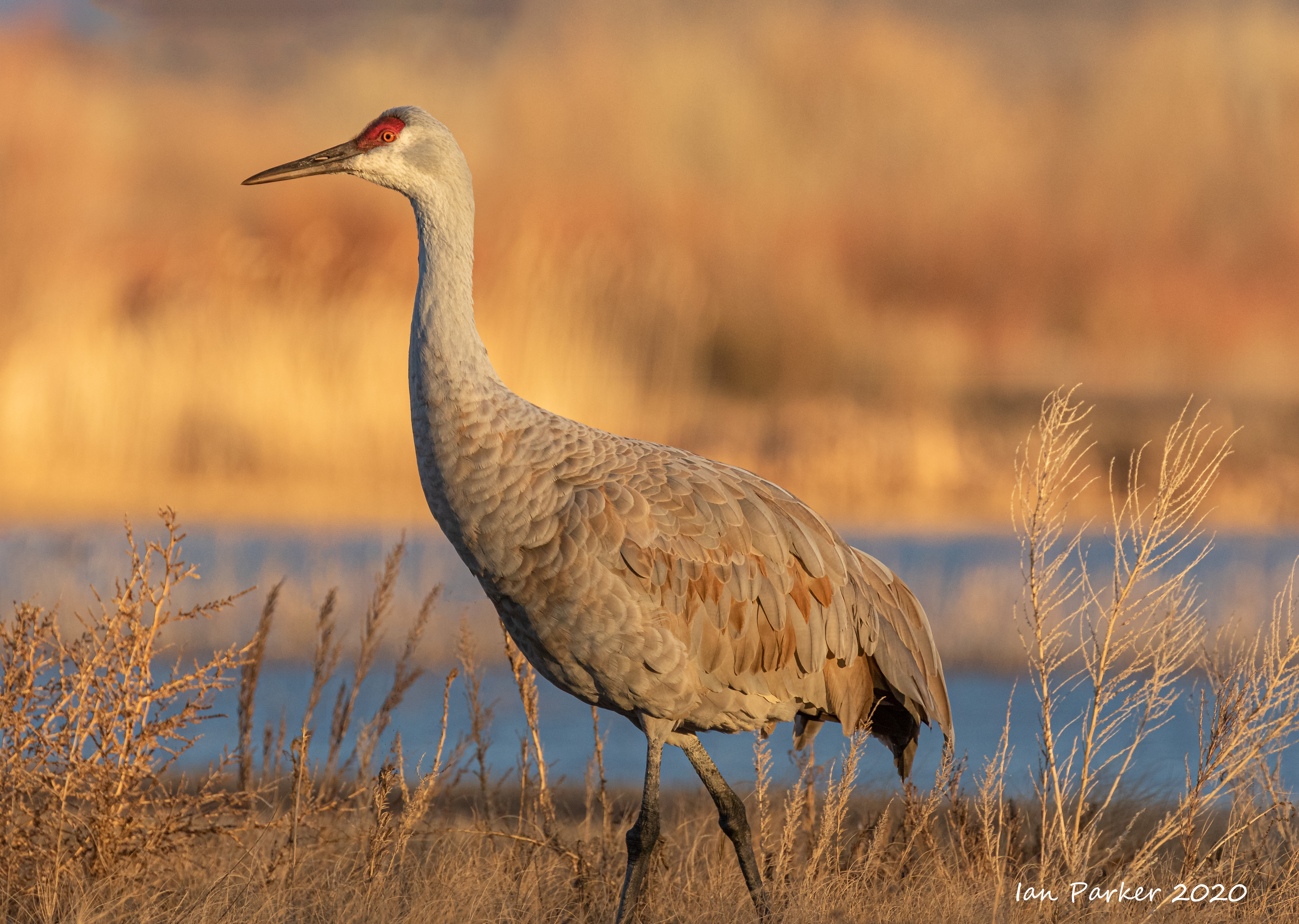
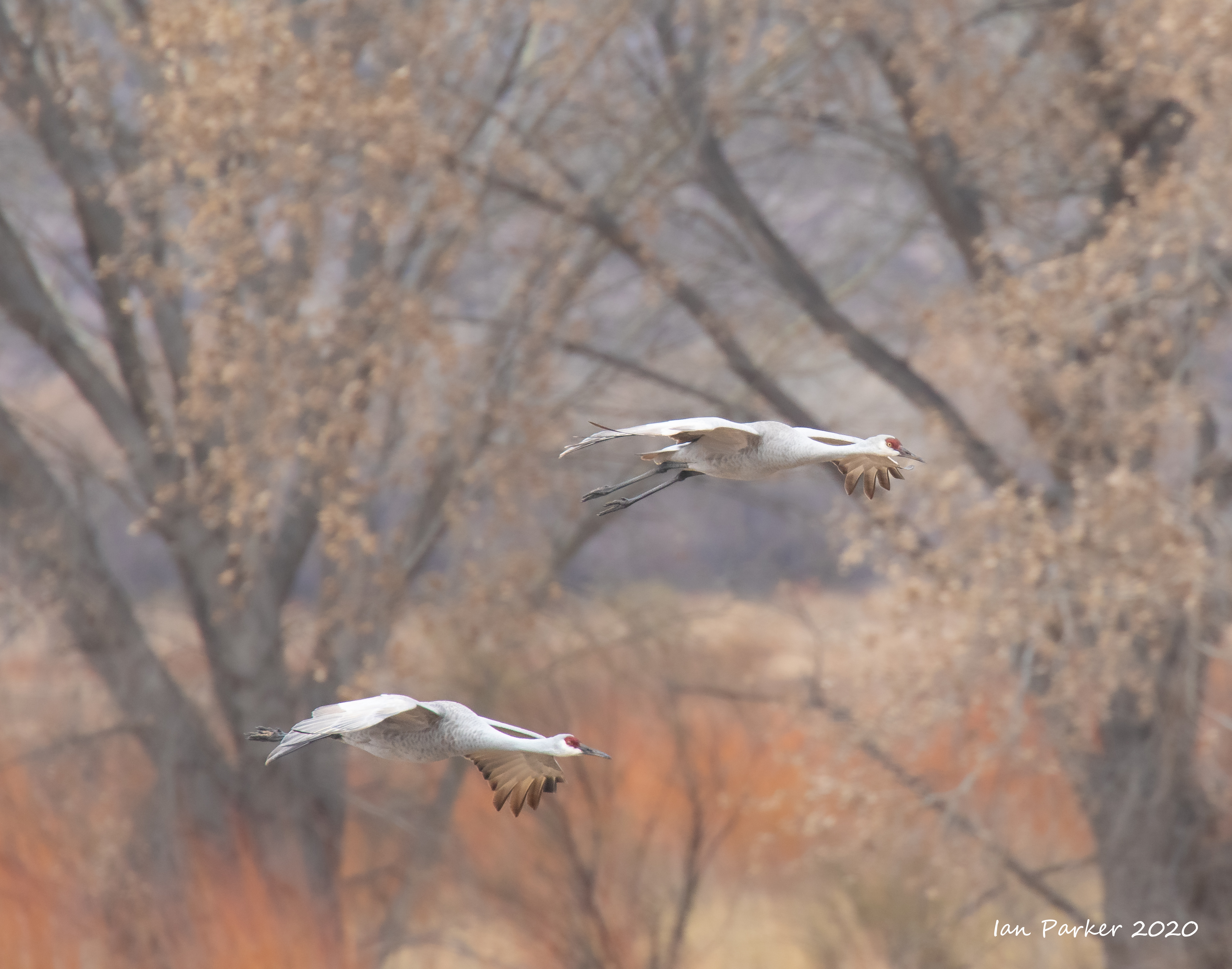
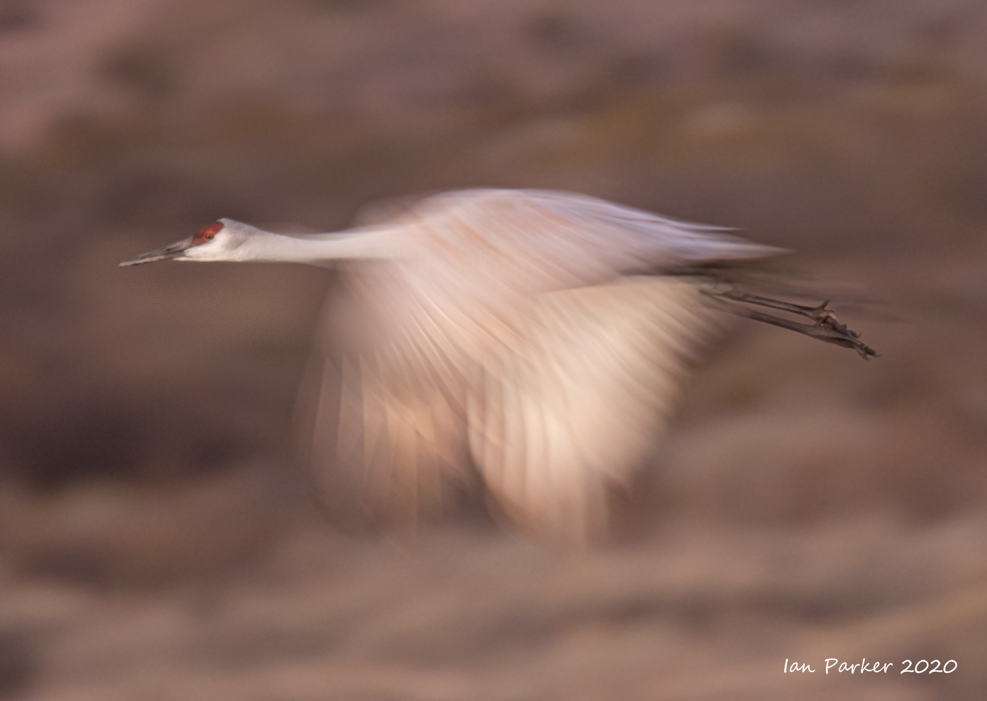
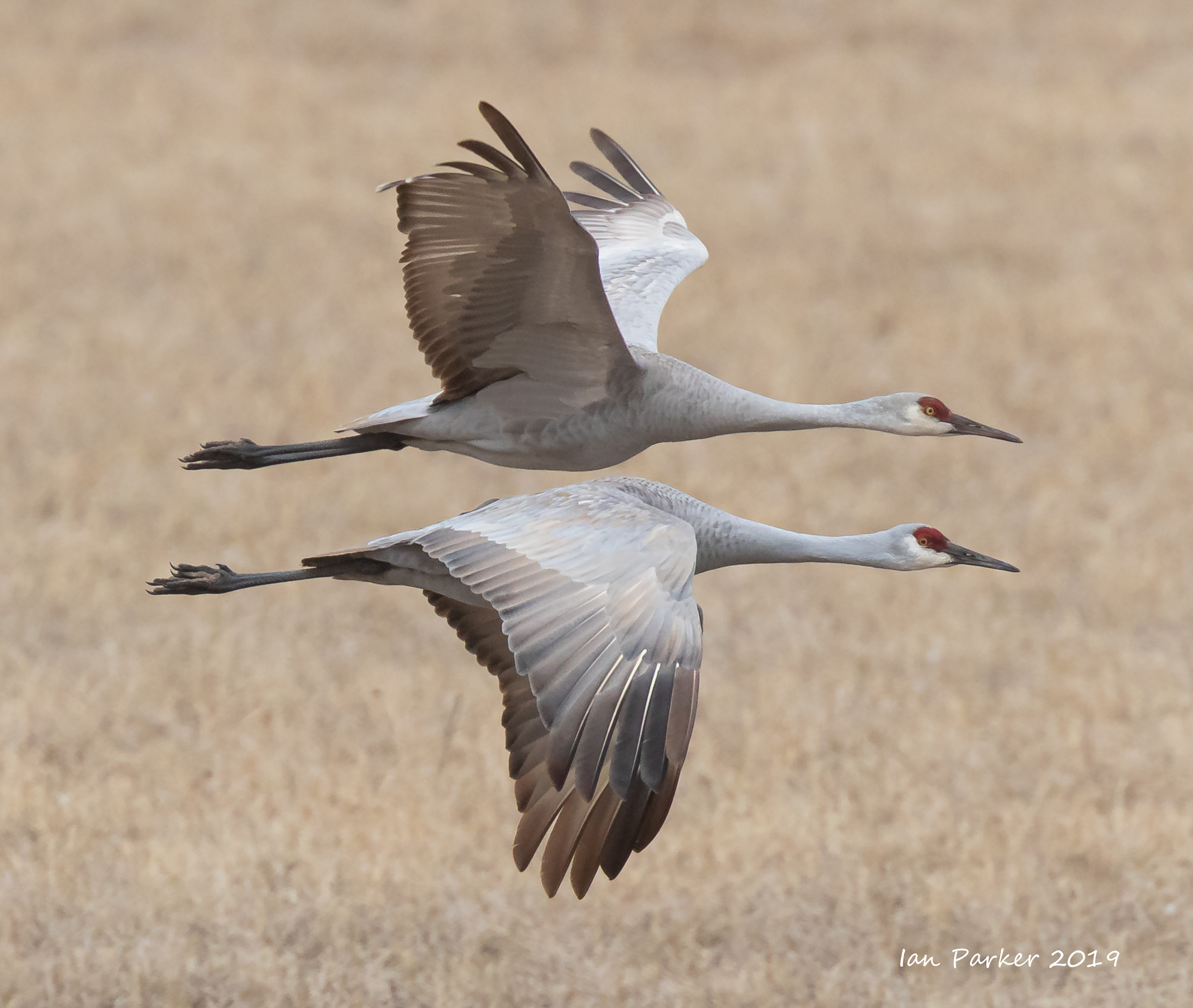
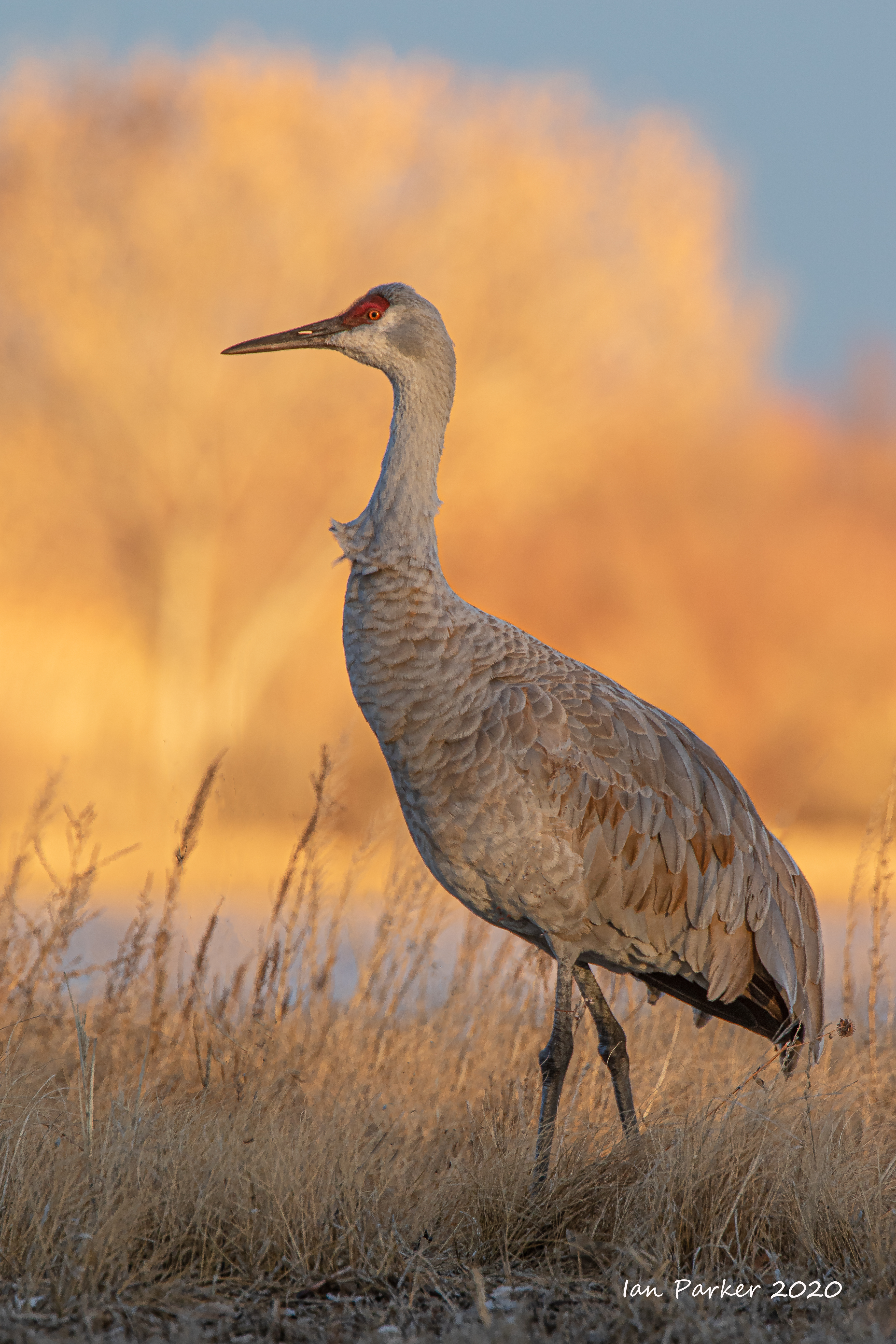
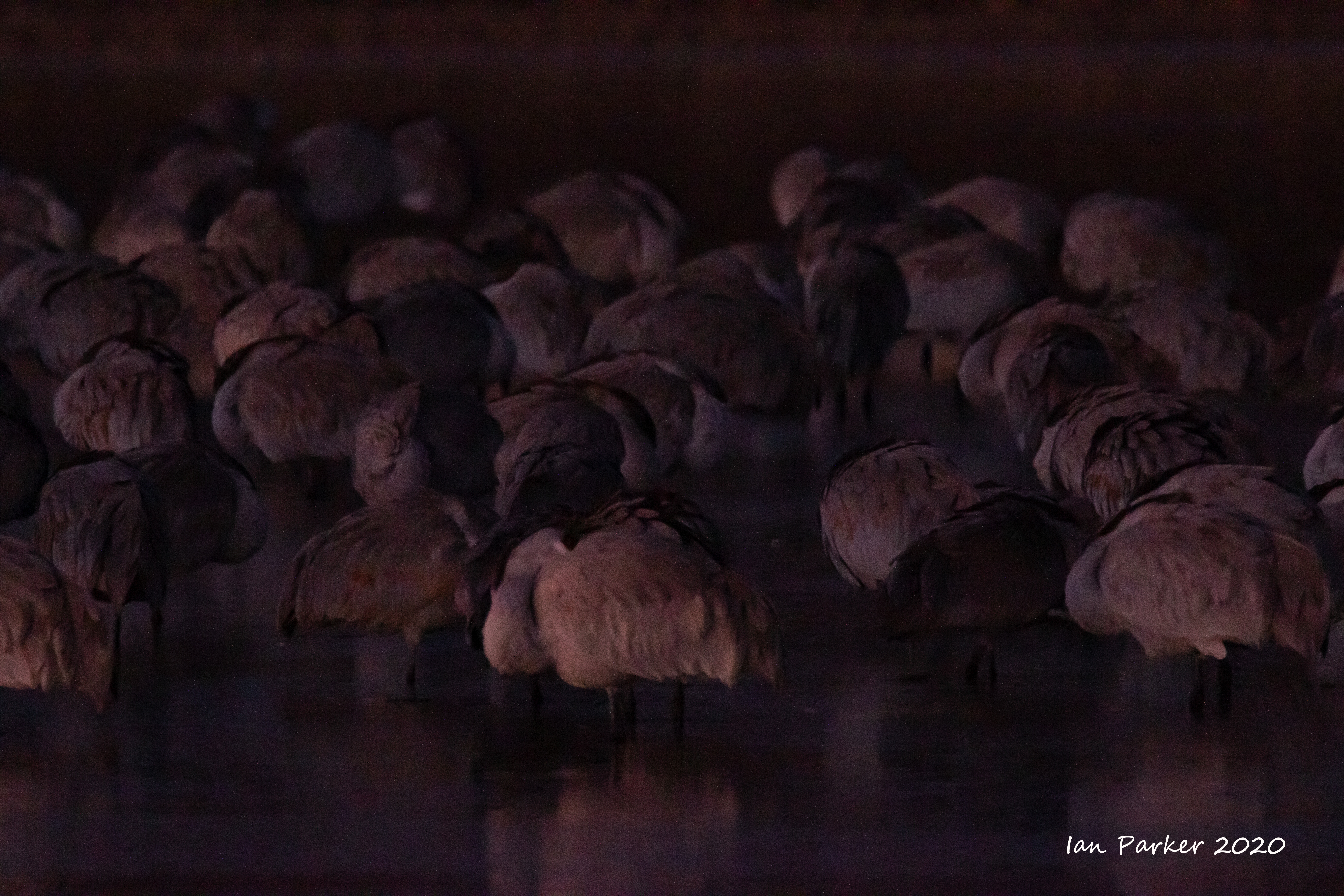
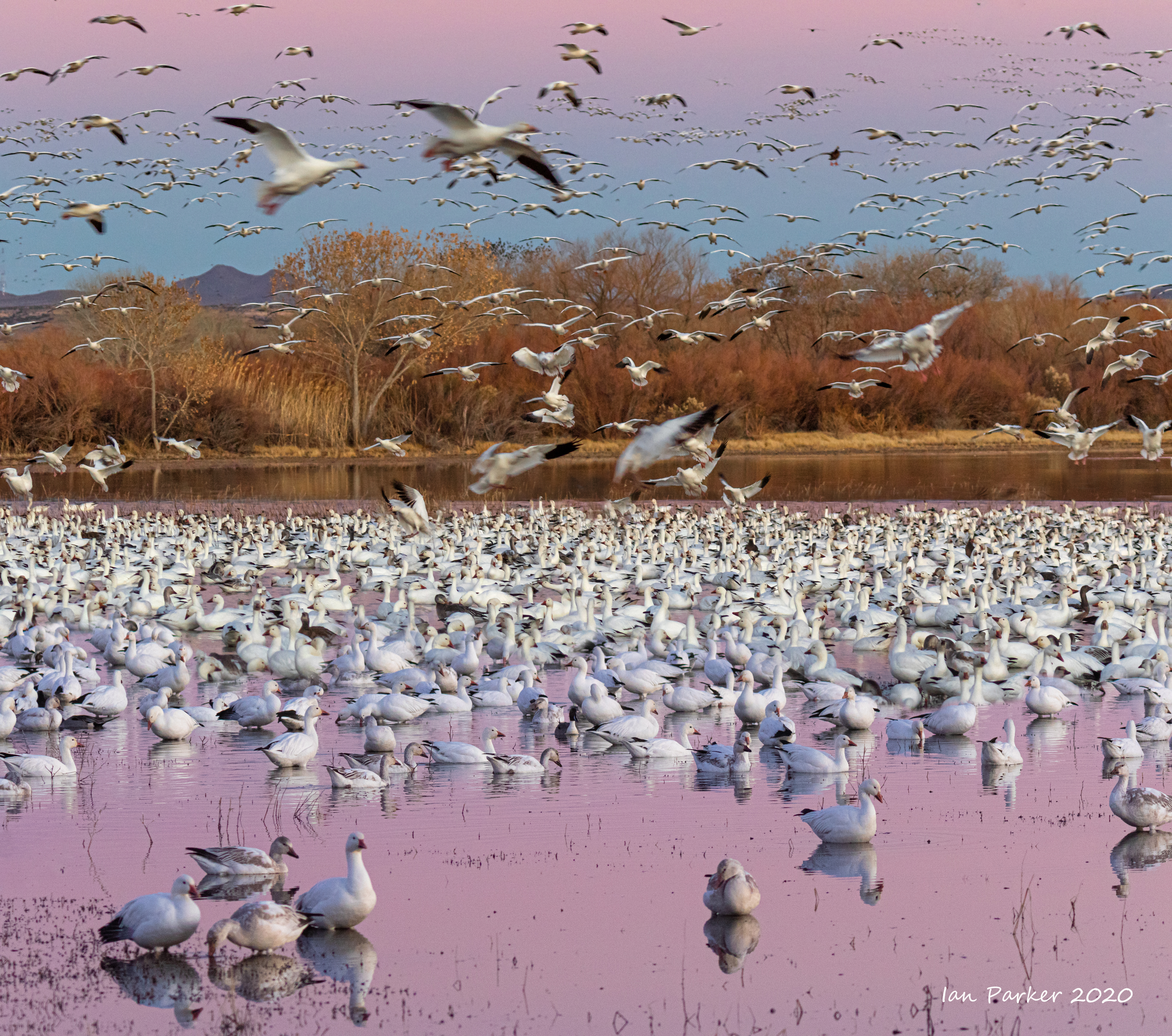
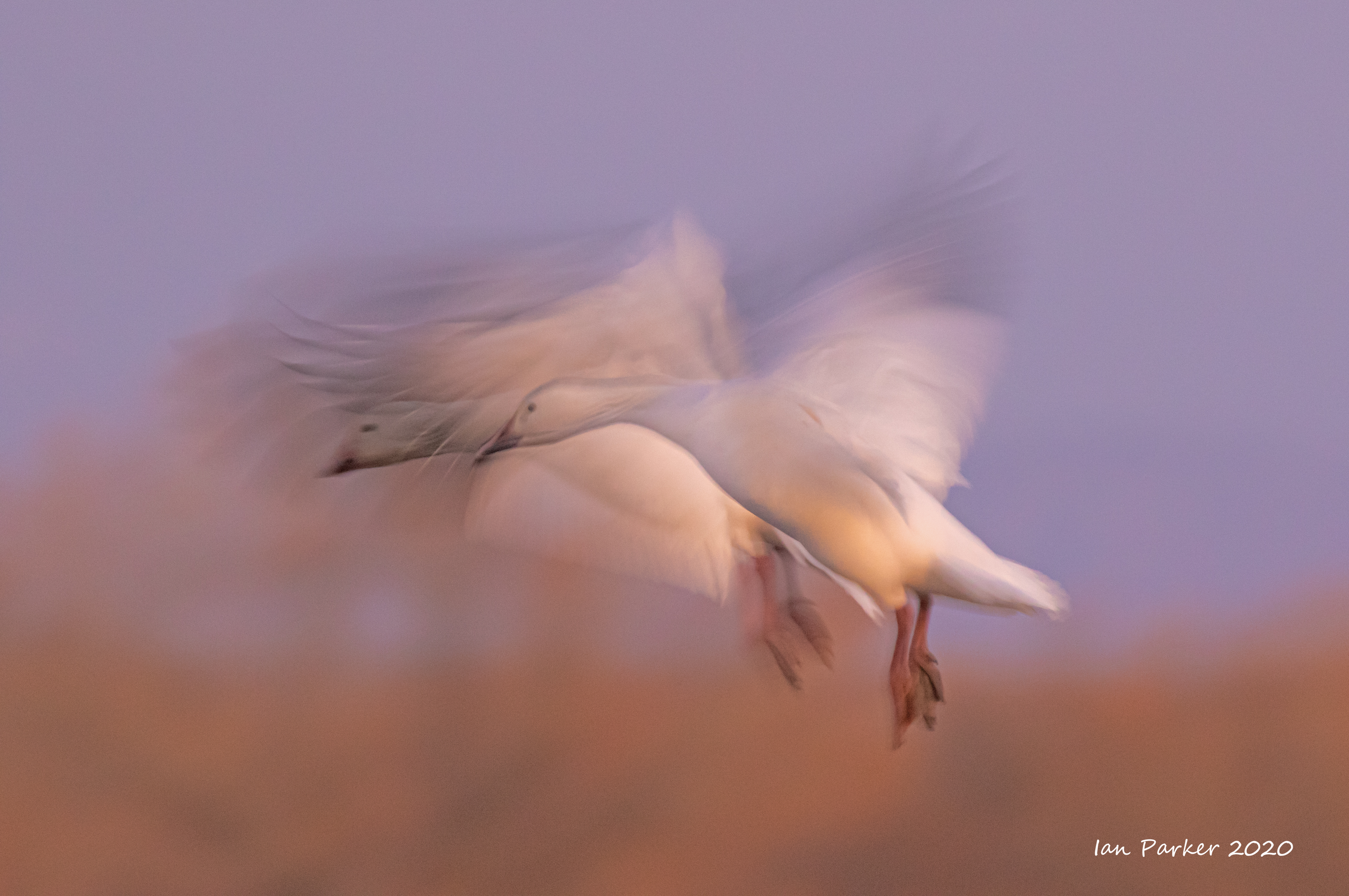
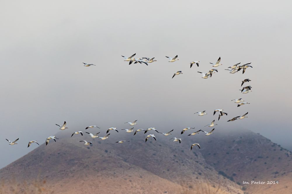
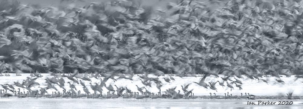
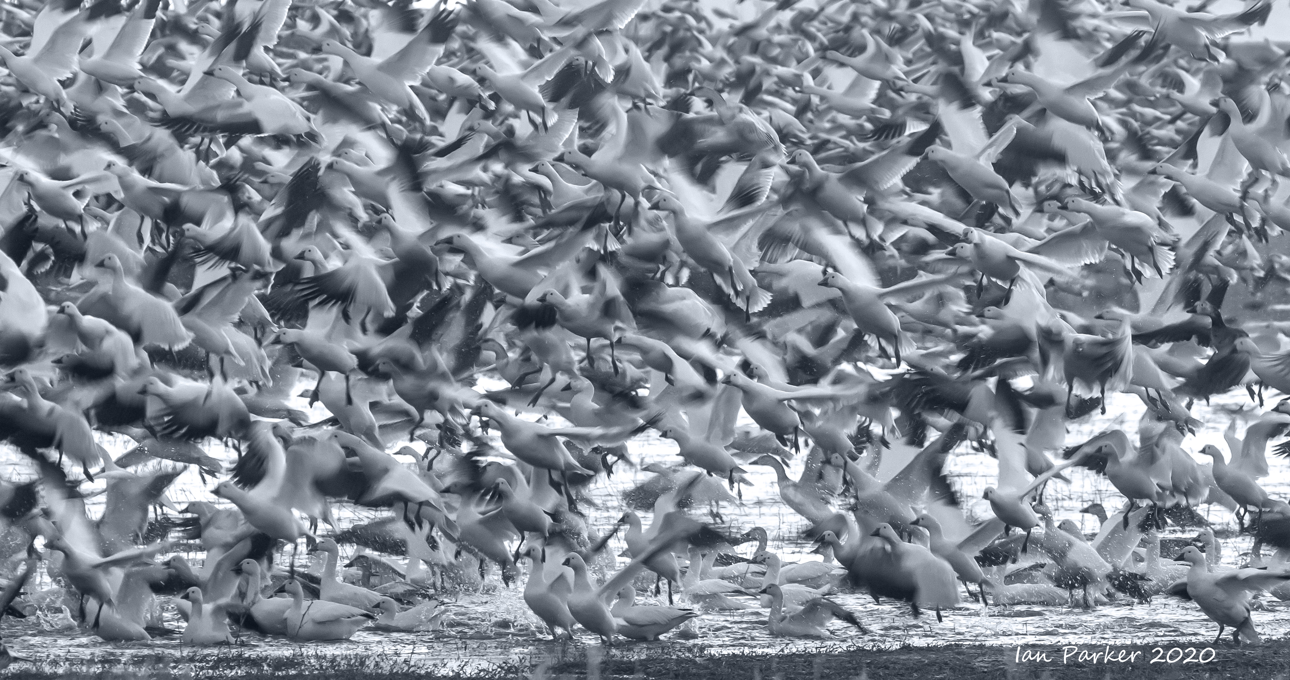
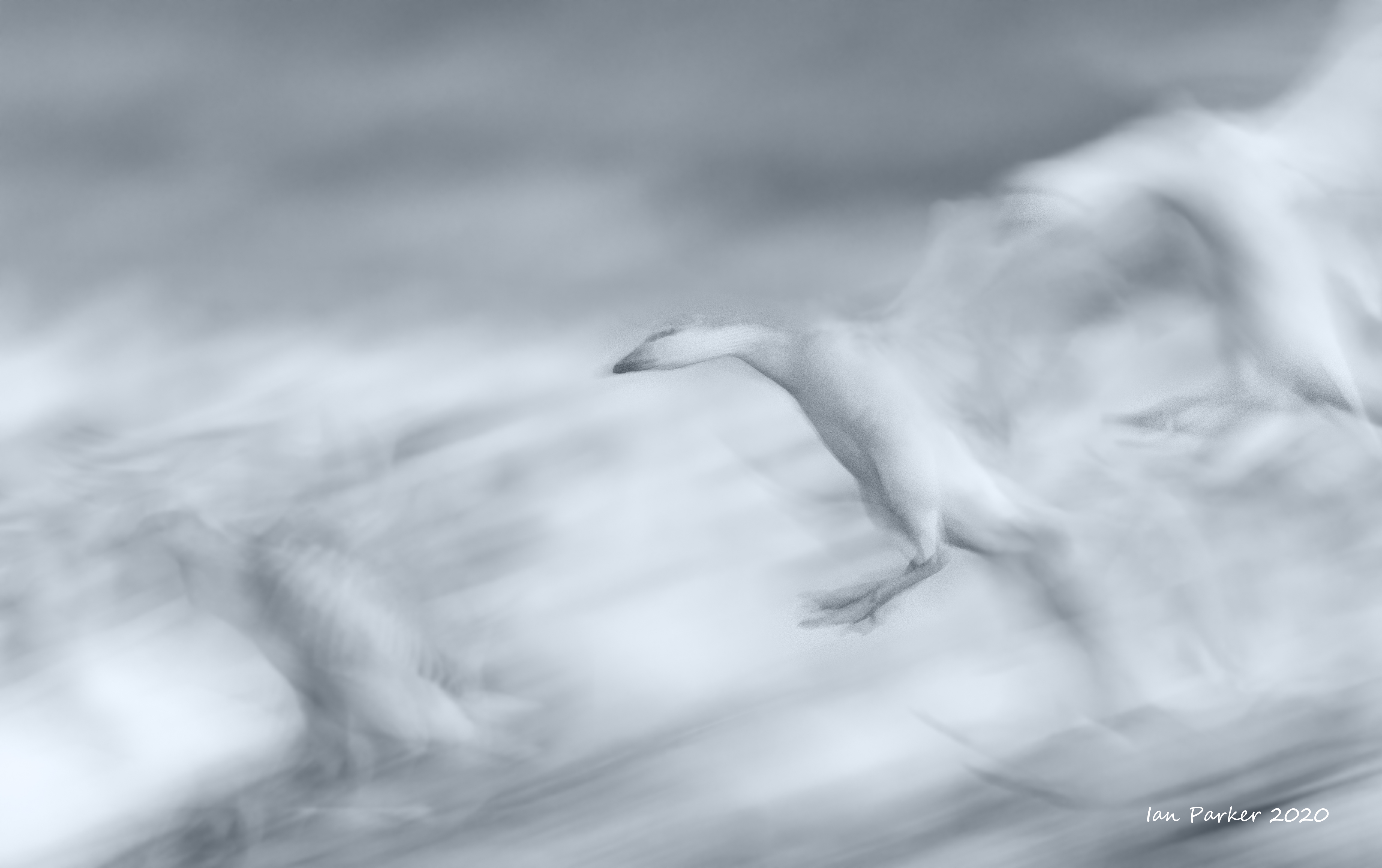
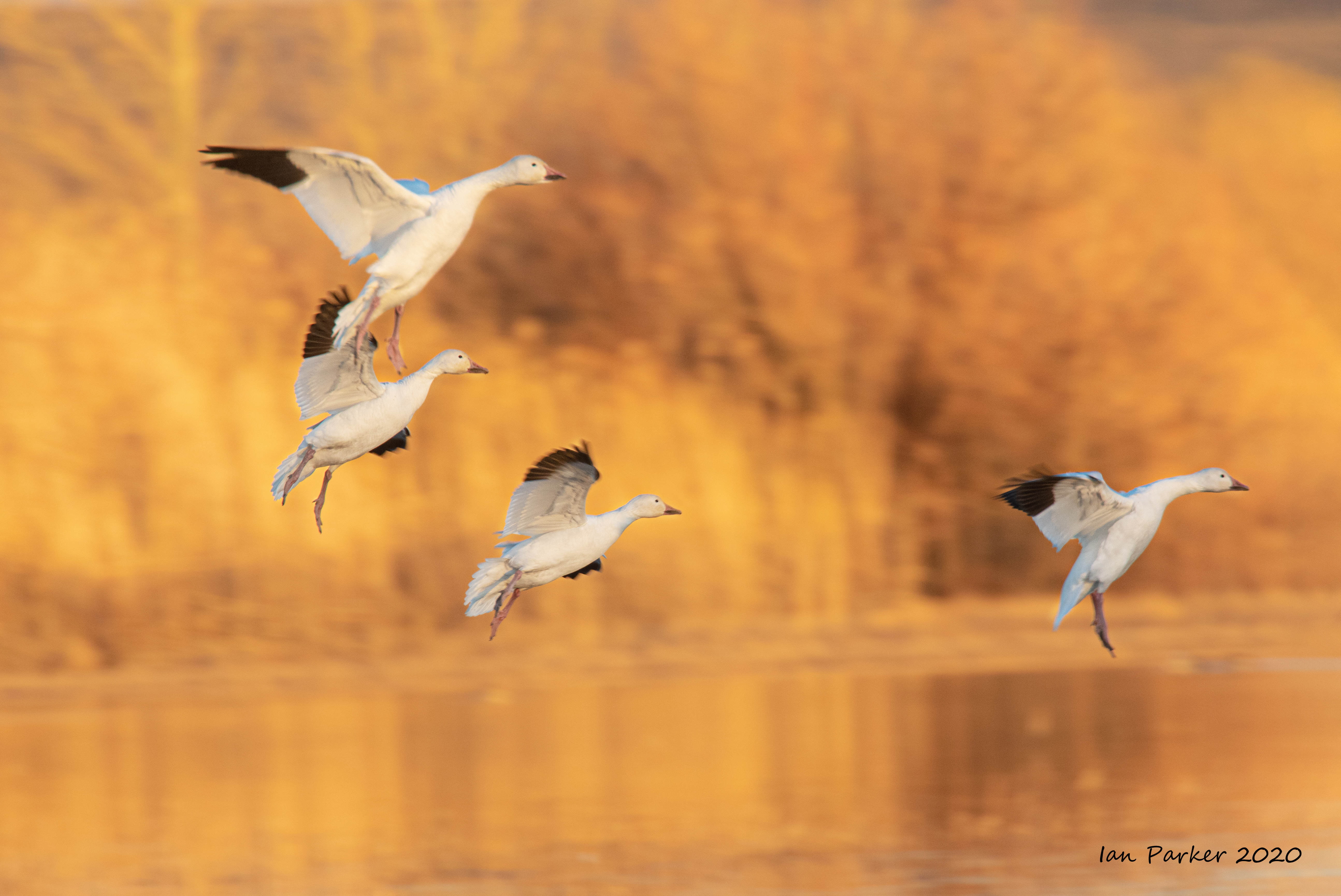
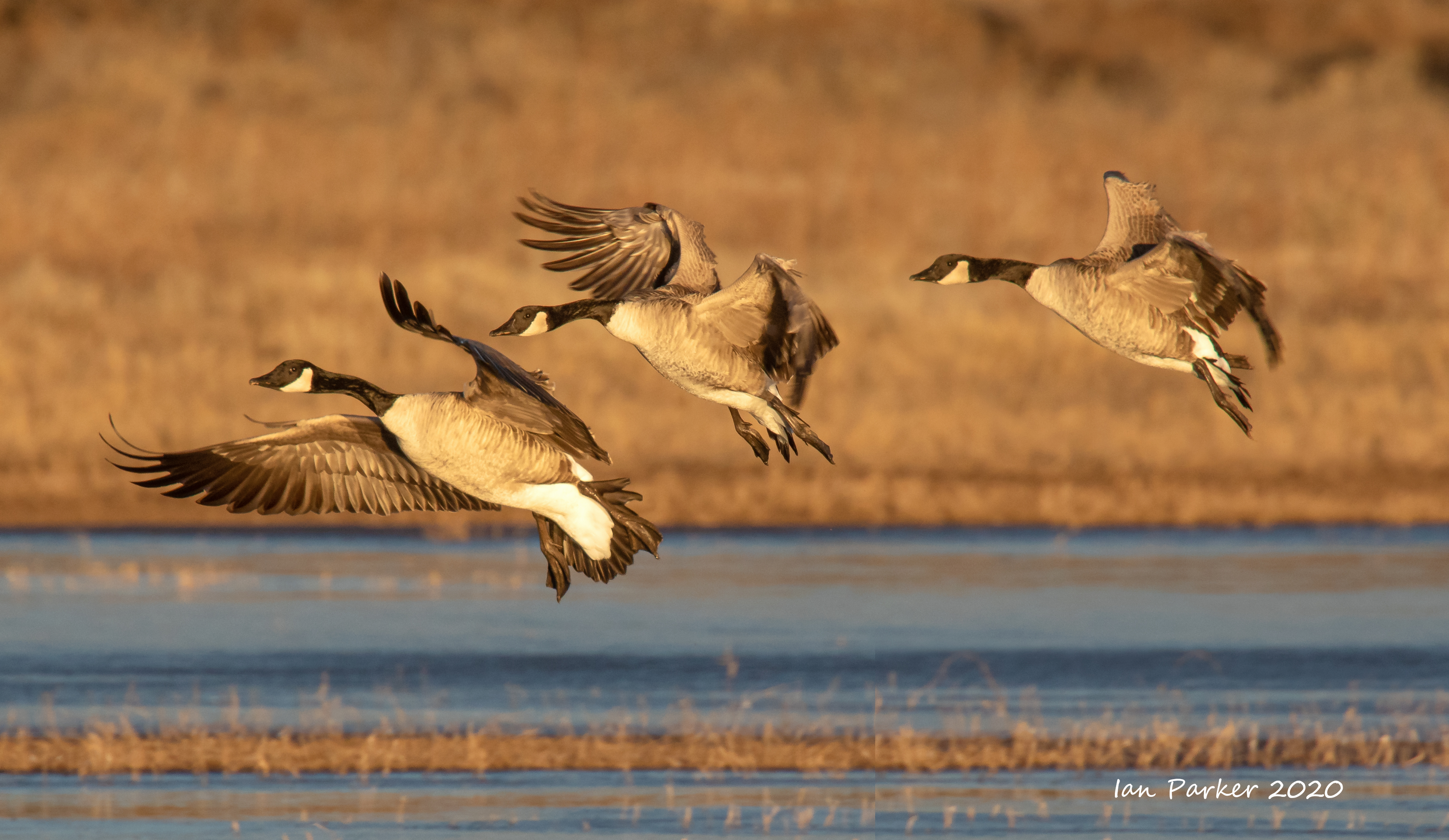
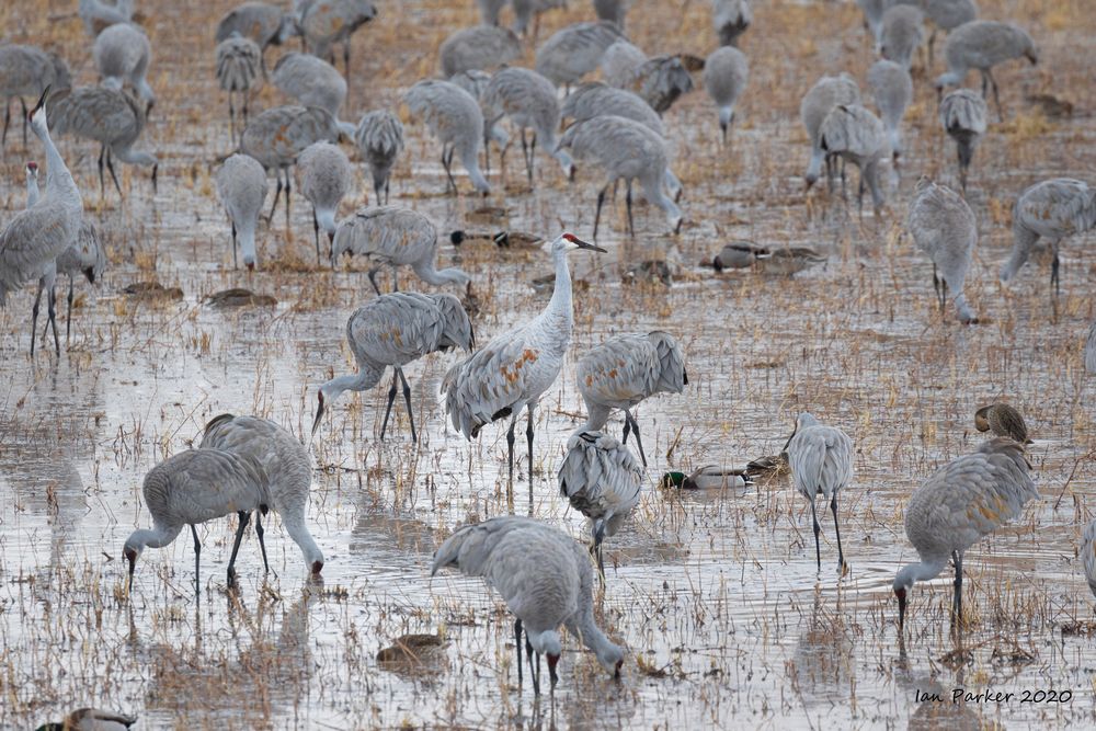
A long road trip over New Year to New Mexico to photograph the birds at Bosque del Apache National Wildlife Refuge
Sandhill Cranes


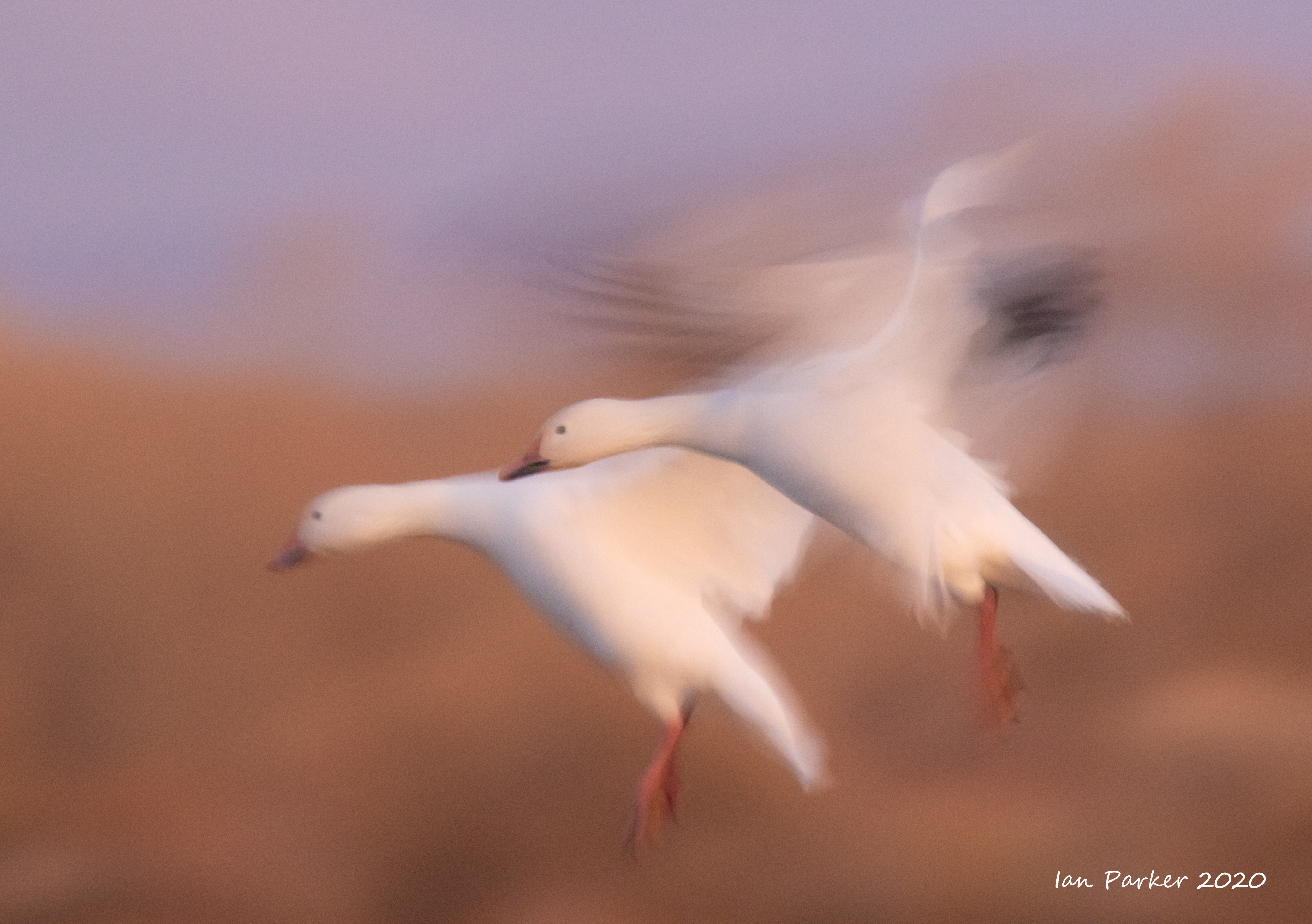


Geese


Earlier photos from 2019 are HERE
Created 01/15/2020
| IanParker 1146 McGaugh Hall University of California, Irvine, CA 92697 |
Please send enquiries to |
BACK TO > |