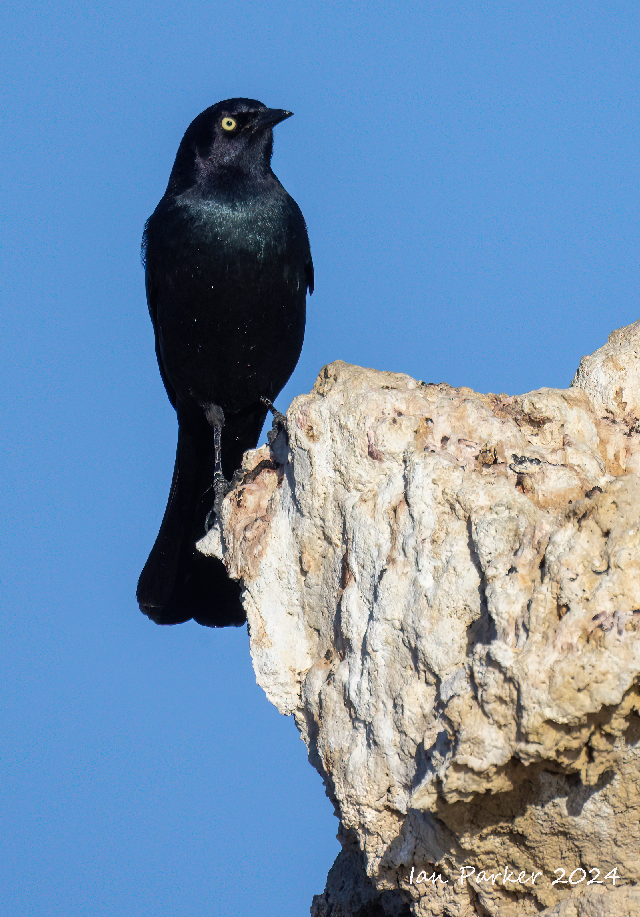
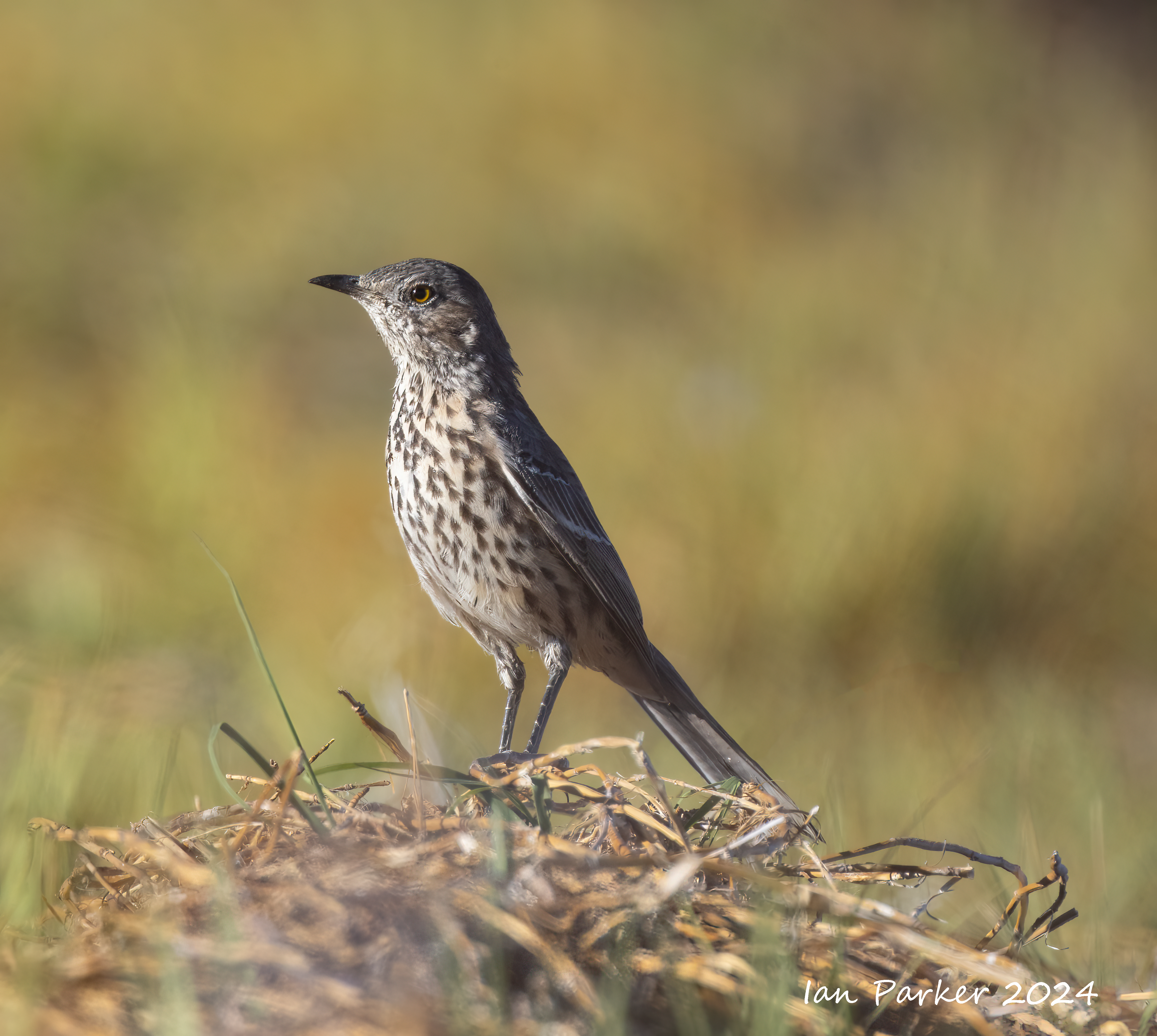
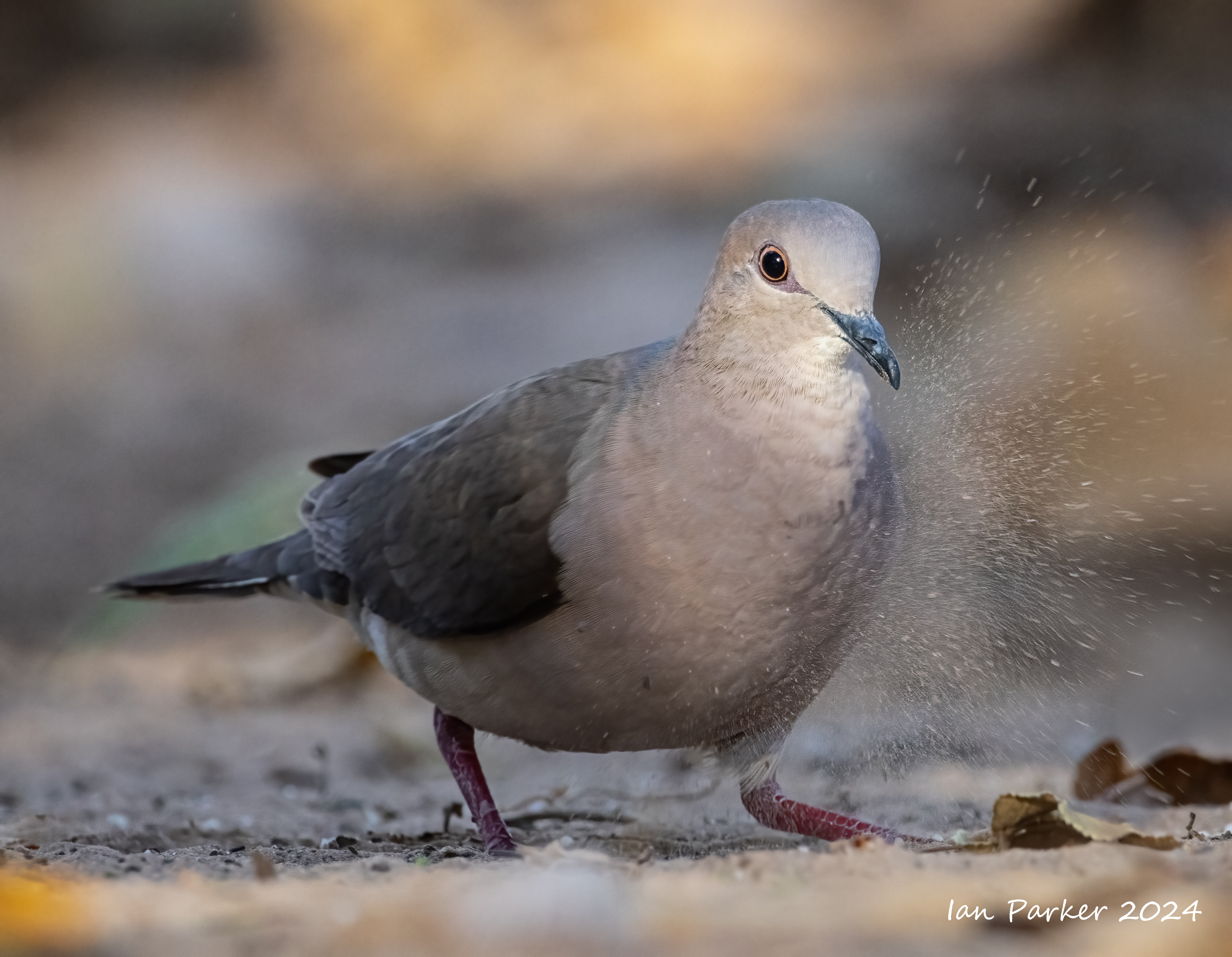
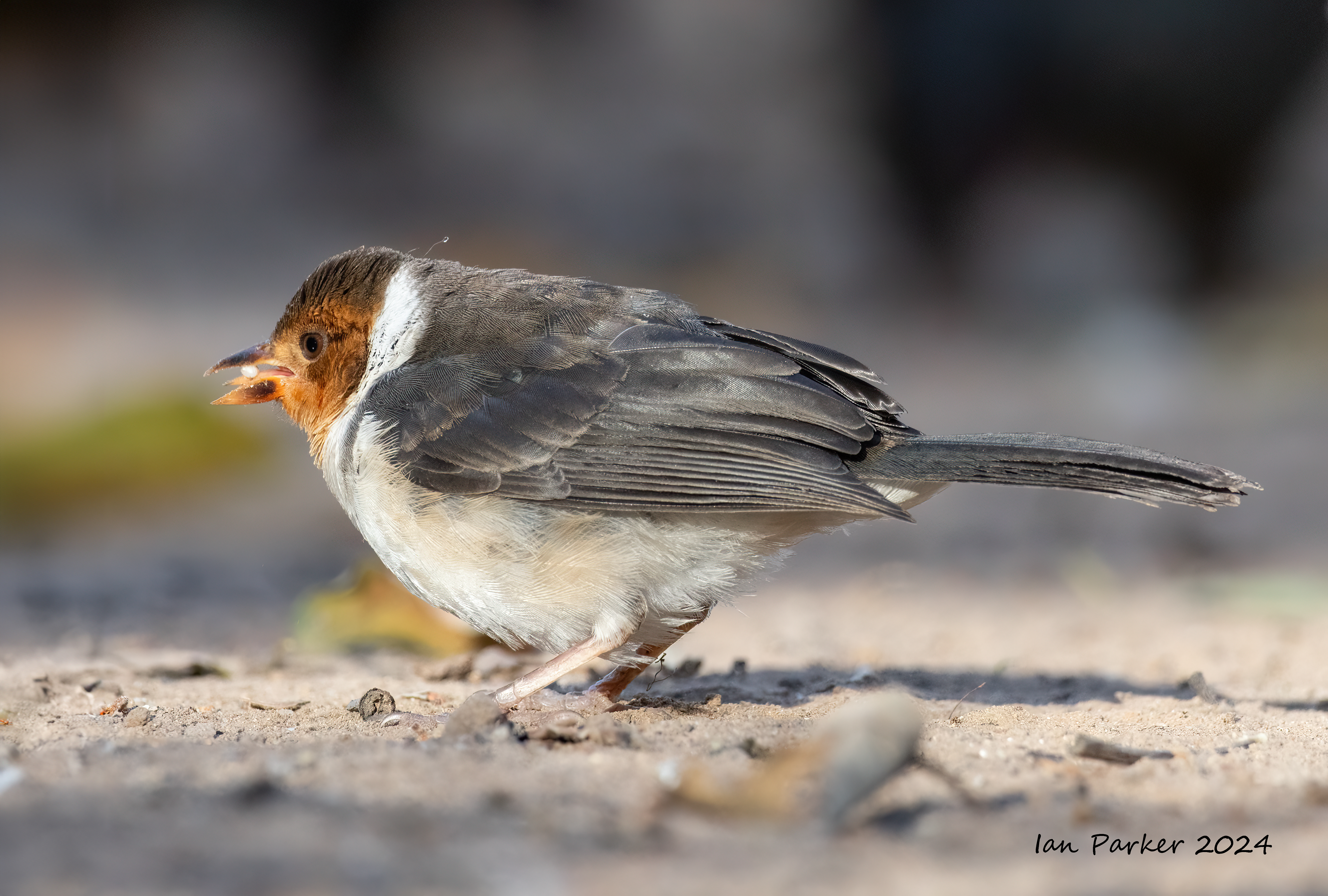
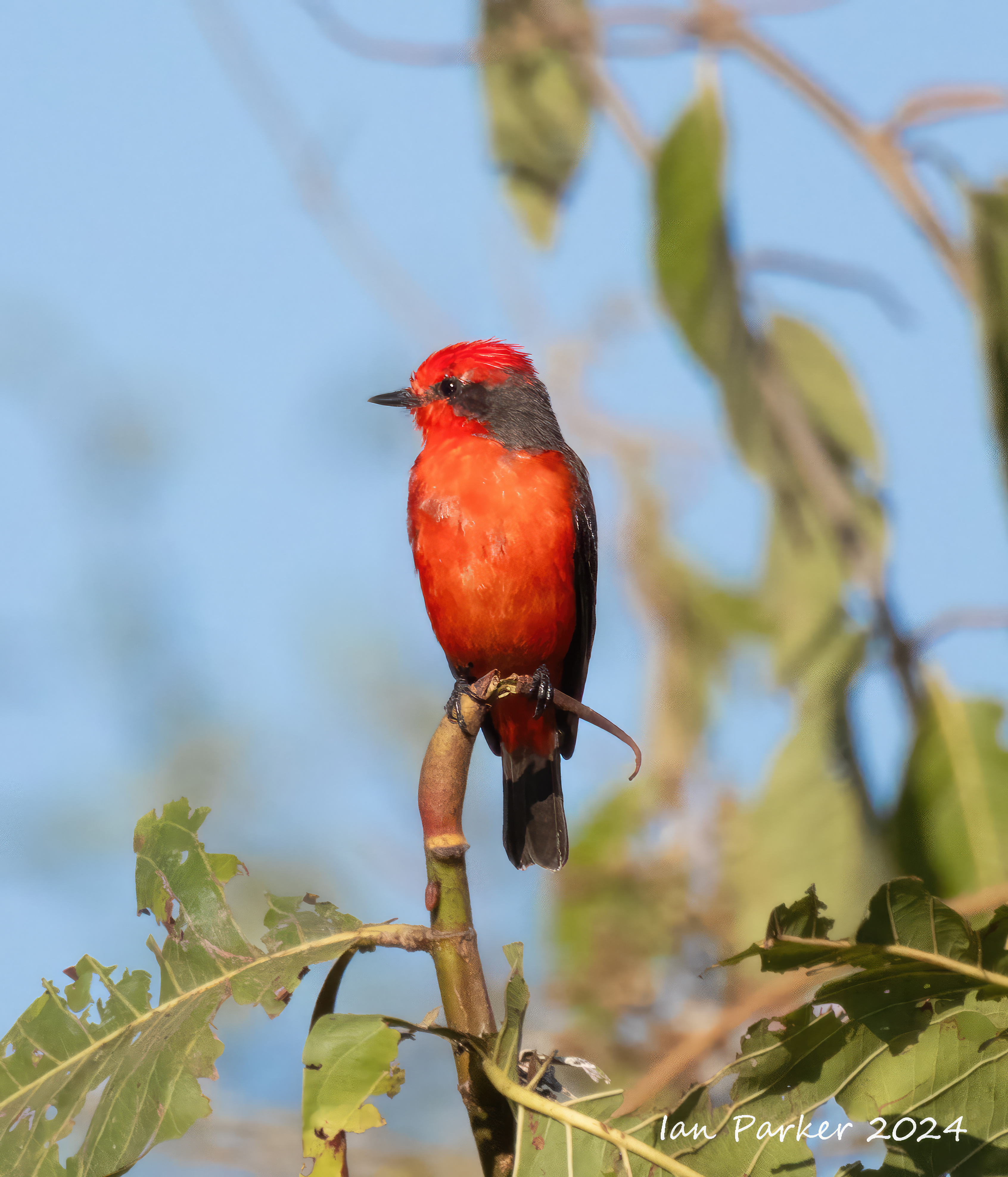
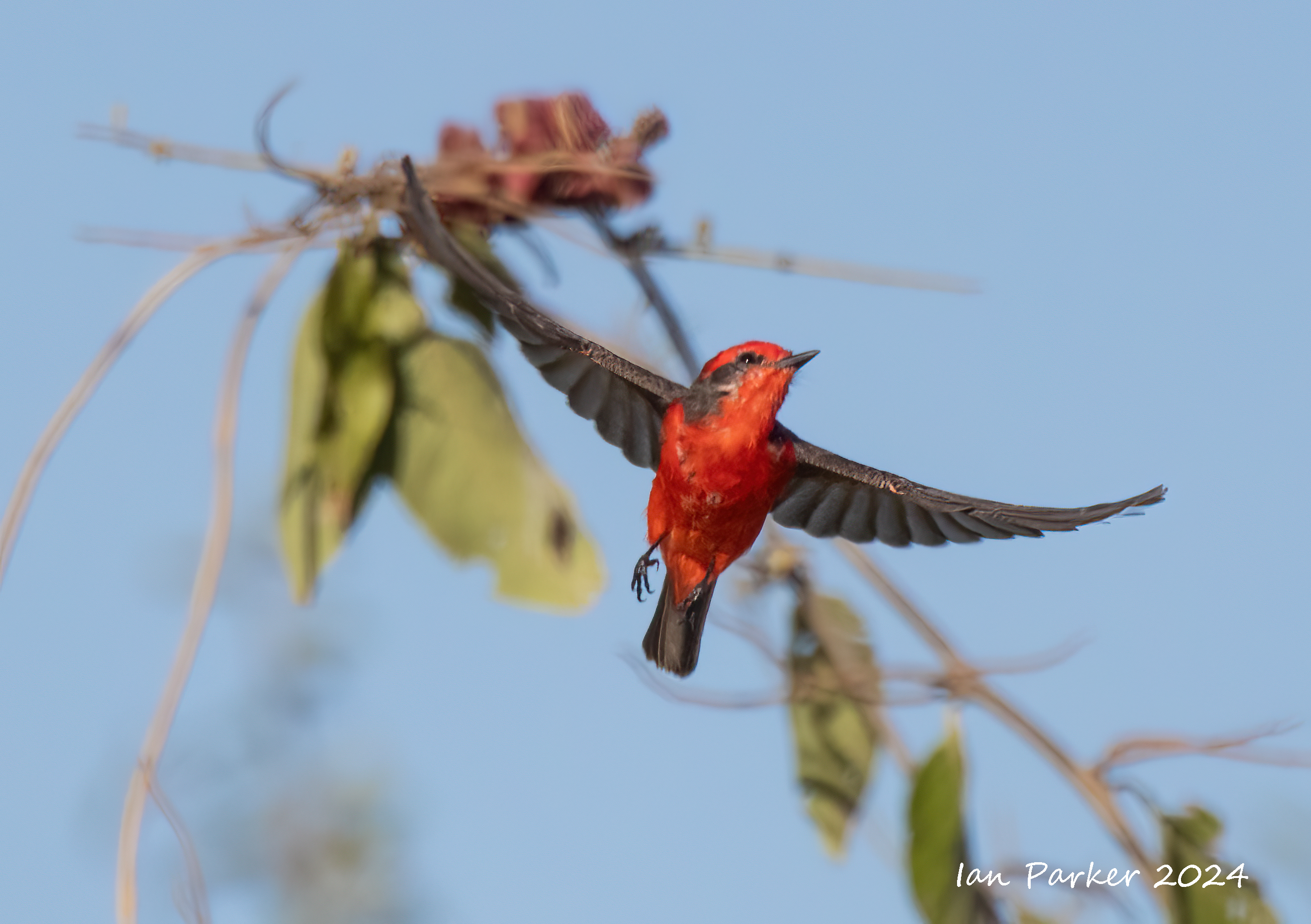
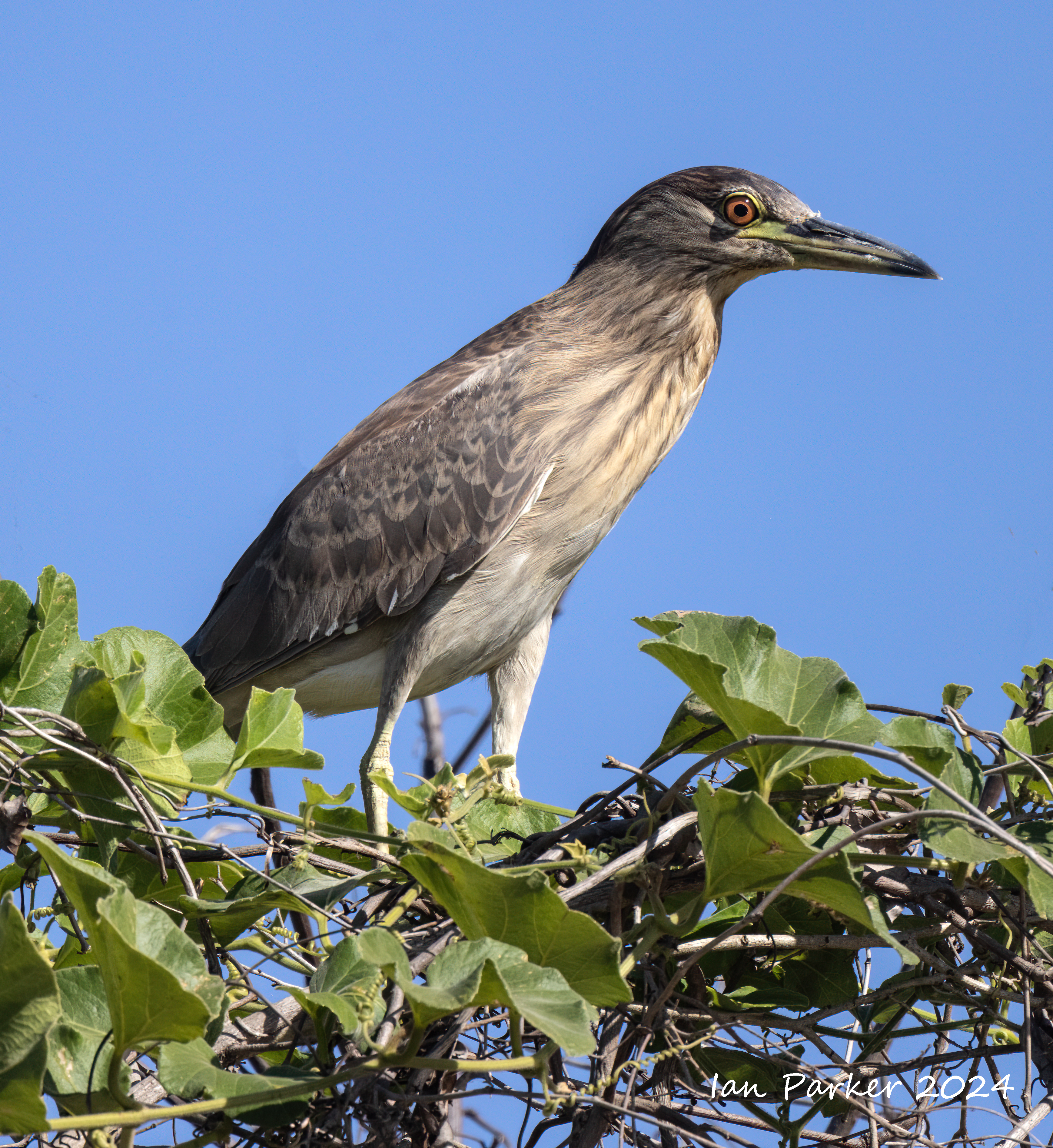
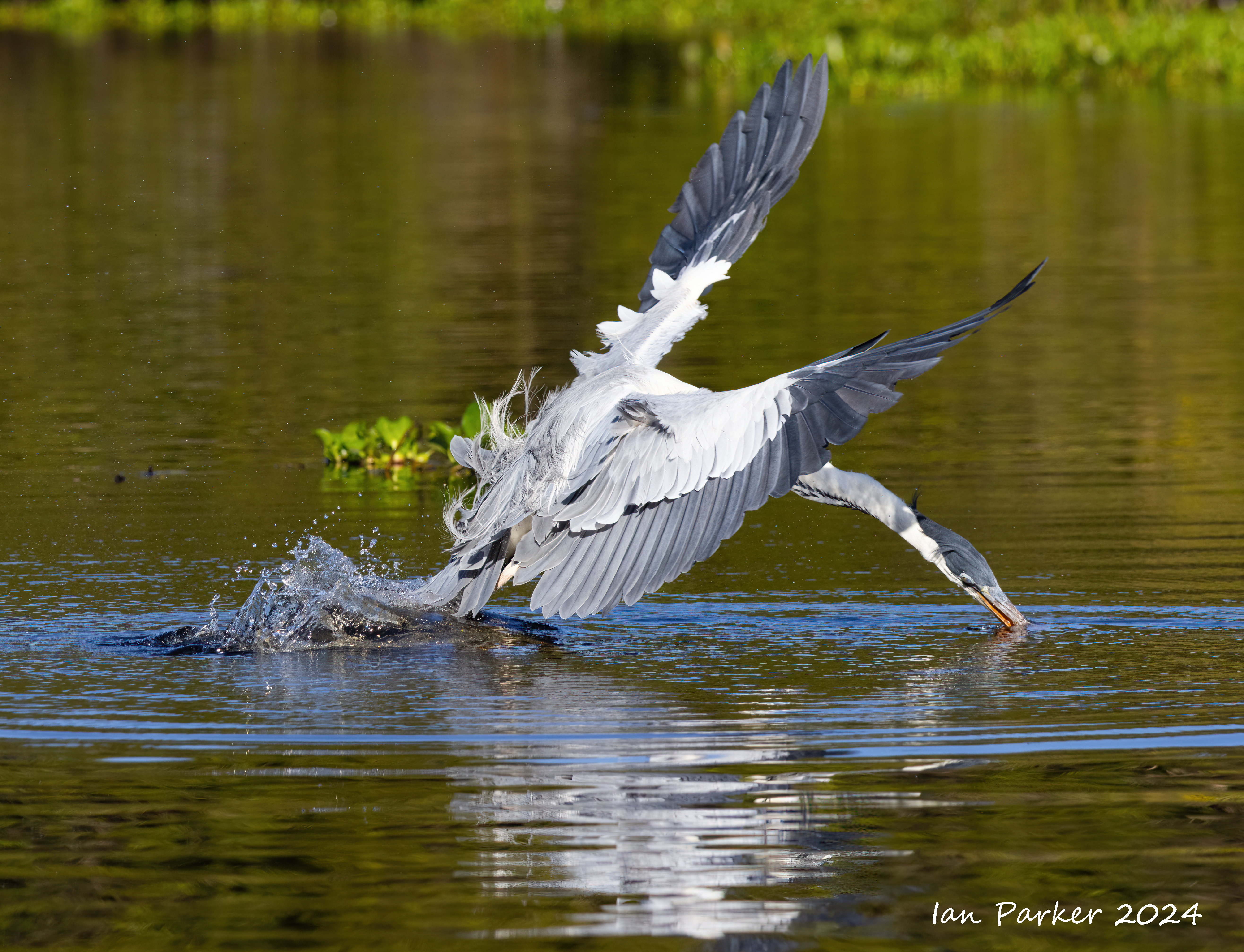
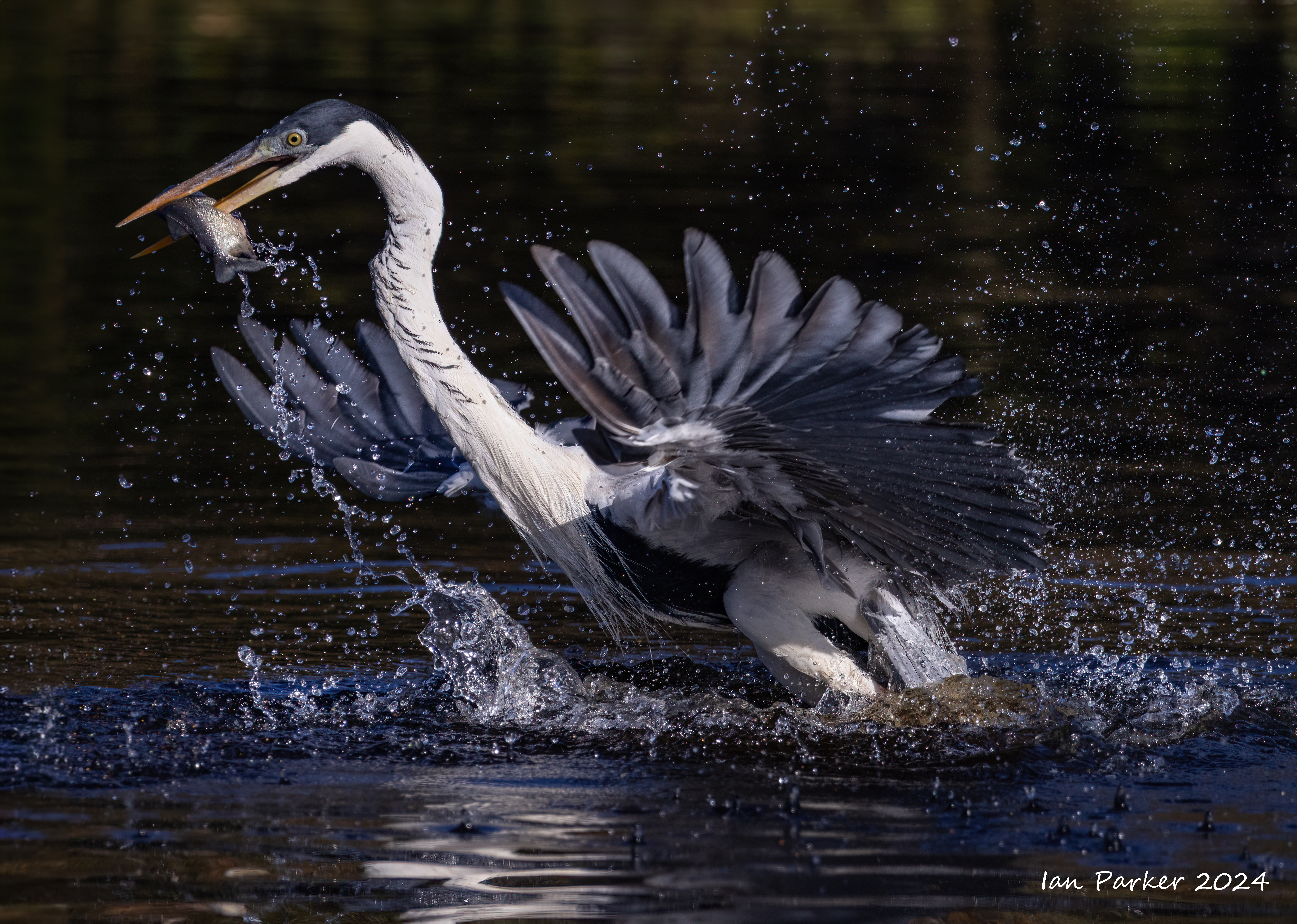
December 8-10: Morro BaySea otters in the nursery by the harbor Long-billed curlews - regulars on Morro Strand beach Night herons in the tree opposite the power station
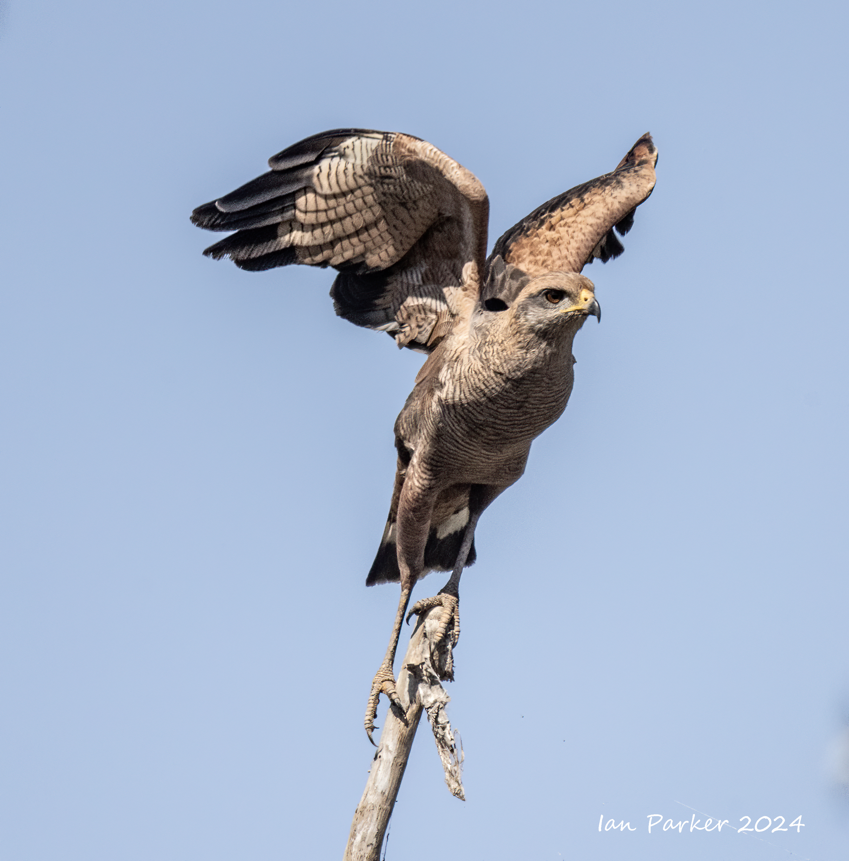
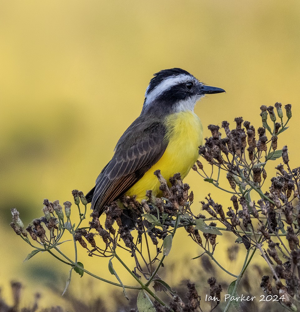
Other birds
Our visit to Morro Bay was planned for bird photography, but happened to coincide with the World Surfing League
November 17-24; John C. Campbell Folk SchoolWe returned for our usual, twice a year visit to the Folk School. I attended a one week class in portrait photography, and a weekend class on making kalaidoscopes.
Miscellaneous subjects that caught my eye wandering around the Folk School
We were too late in the year for fall colors, but mist and sunrise light made for some nice images during early morning walks around the school grounds. The balcony ourtside our room had a good view across to Orchard House, the photography studio. I took photos on several mornings under different conditions of mist, cloud and time of sunrise. Morning scenes around the School grounds
November 5th-7th: Bosque del Apache, New MexicoOur annual visit to Bosque del Apache was earlier in the season this year. And, the sandhill cranes have been arriving progressively later over the past several years: the aunual Festival of the Cranes used to be held around late November, now it is inthe middle of January. Hence we found that birds were relatively sparce. The Crane Pond next to the highway that was usually a reliable place to find numerous roosting cranes and geese was almost deserted. But, we did have some nice opportunities at sunrise and sunset with the few cranes that settled in the Flight Deck pond (photos coming shortly), and excellent light for landscape photography while the trees were still showing fall colors.
|


Bosque Landscapes


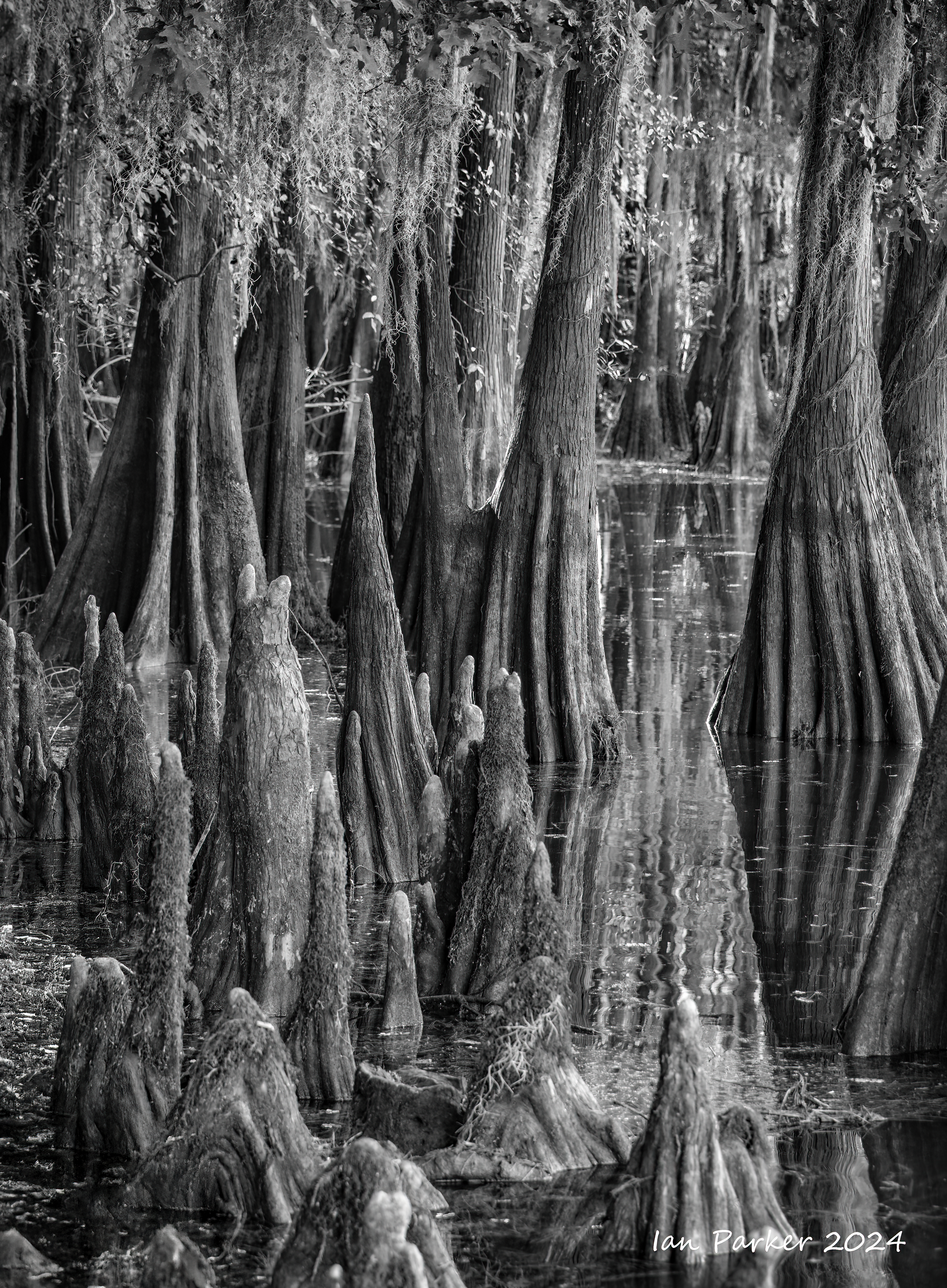
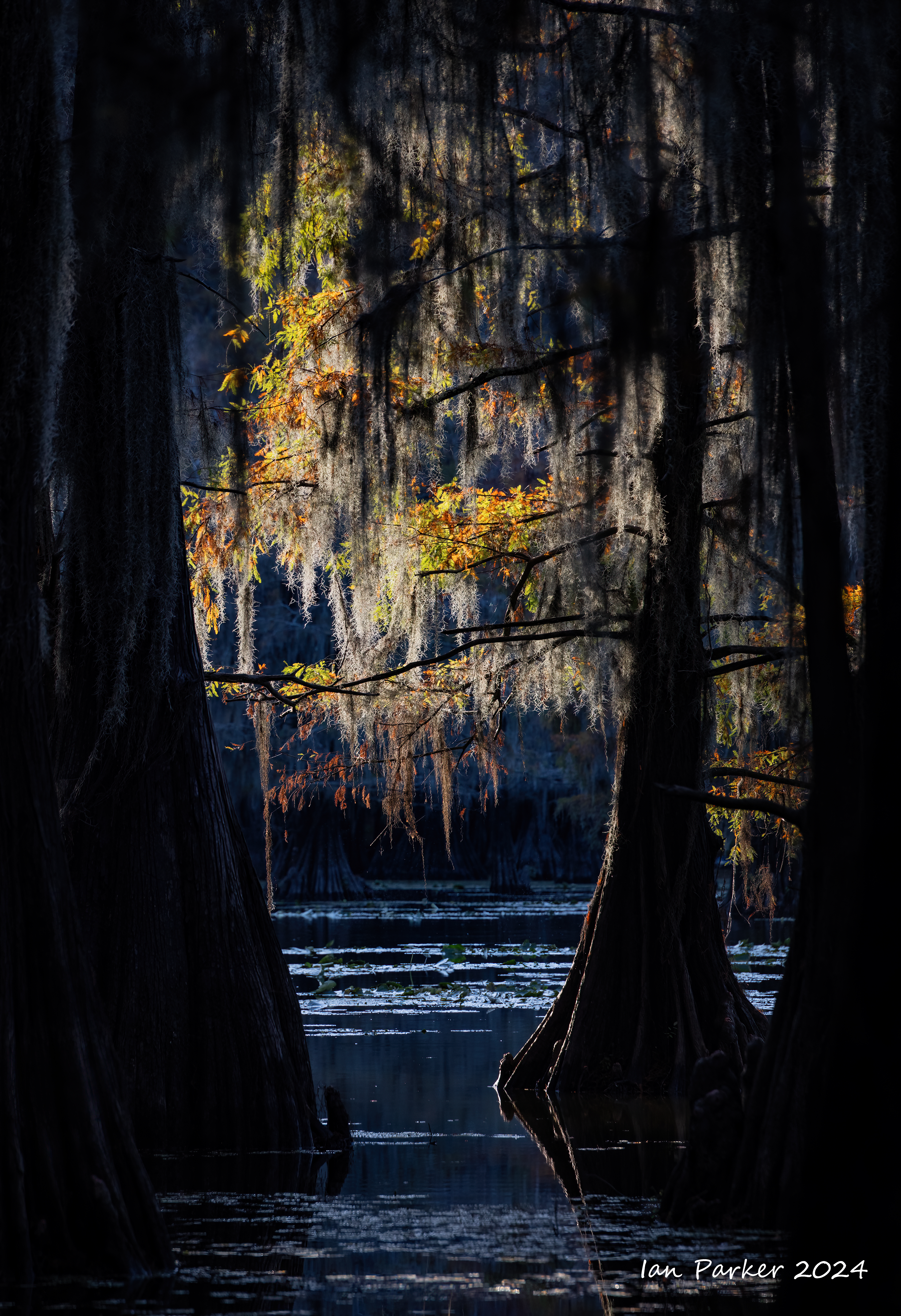
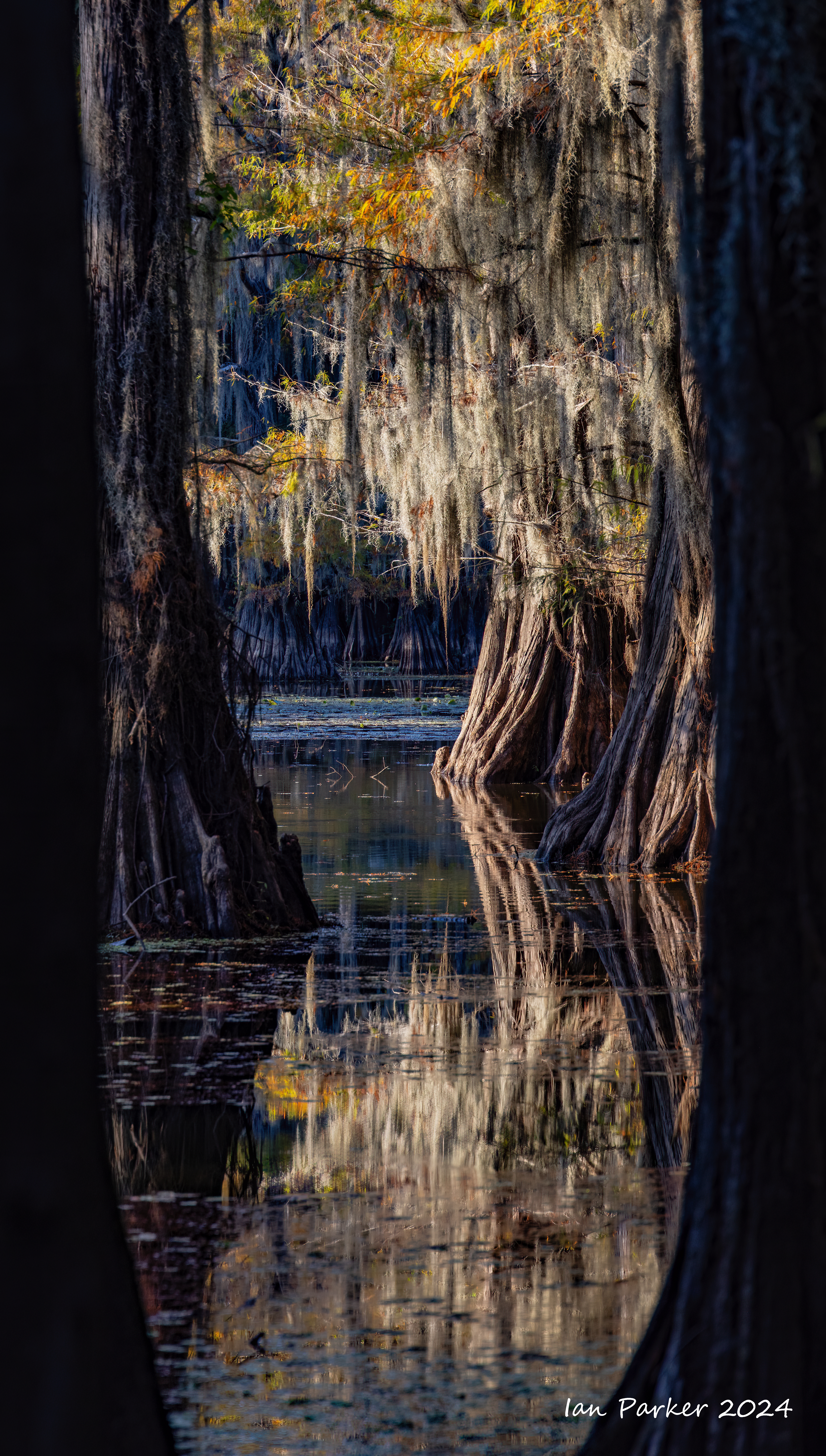
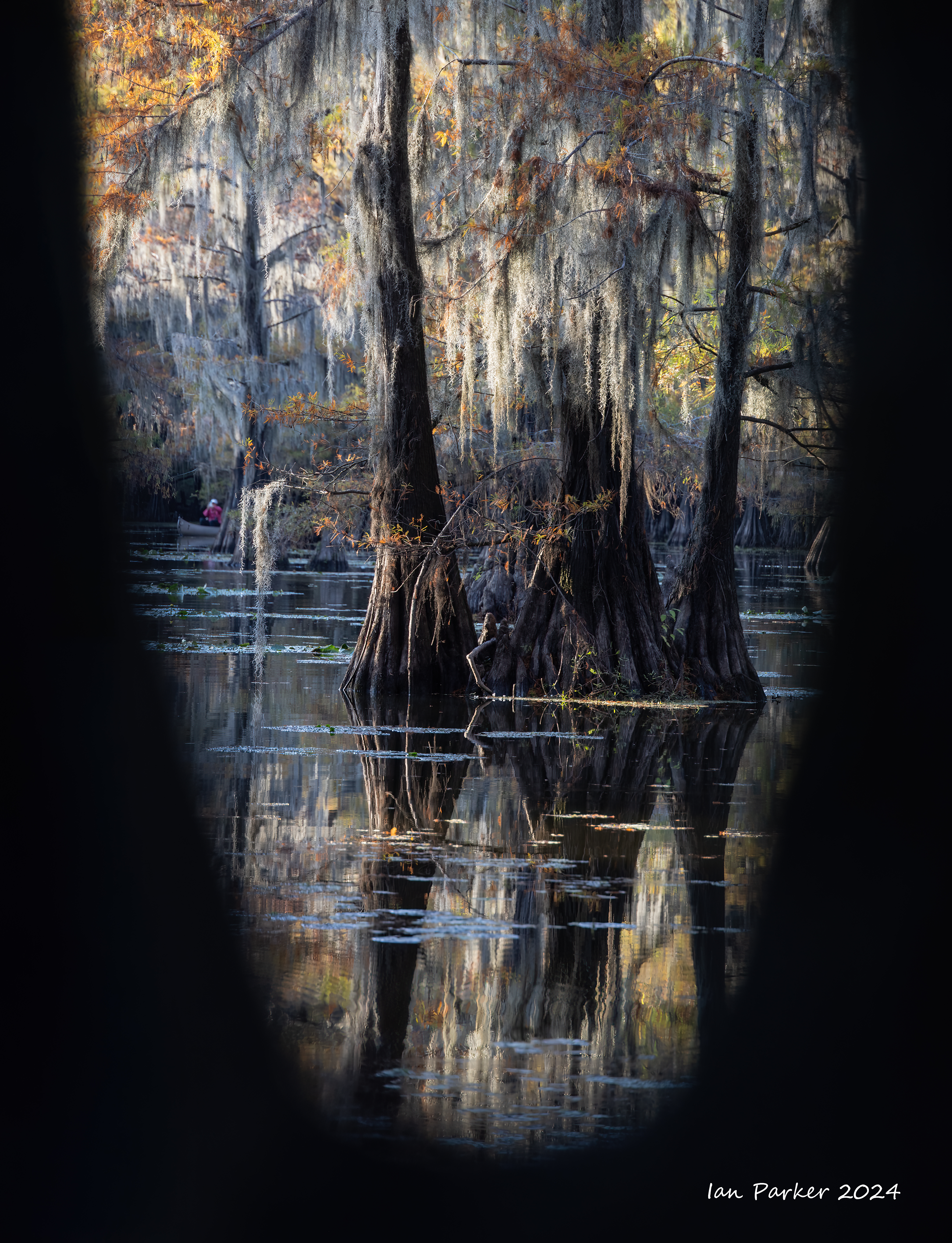
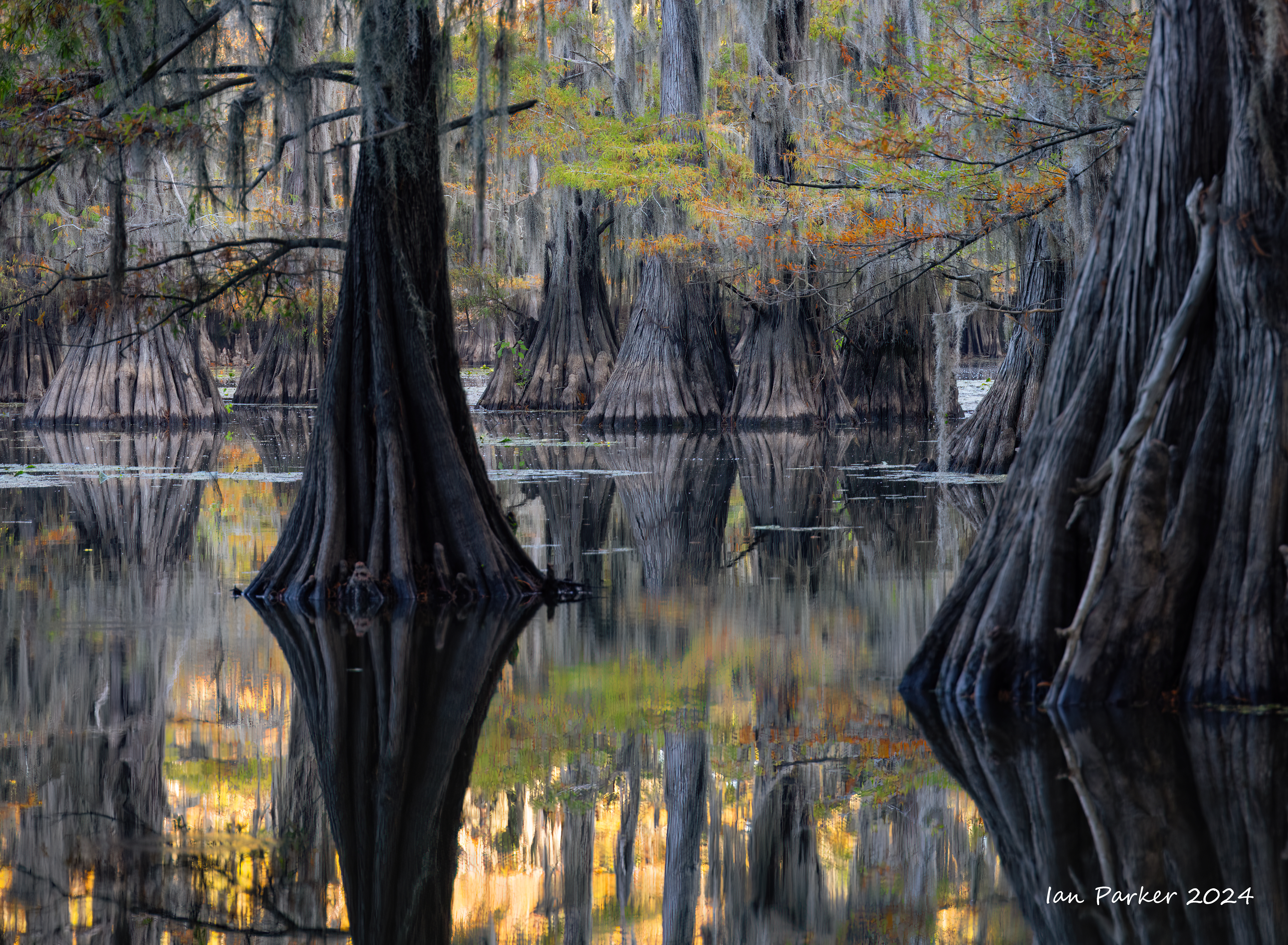
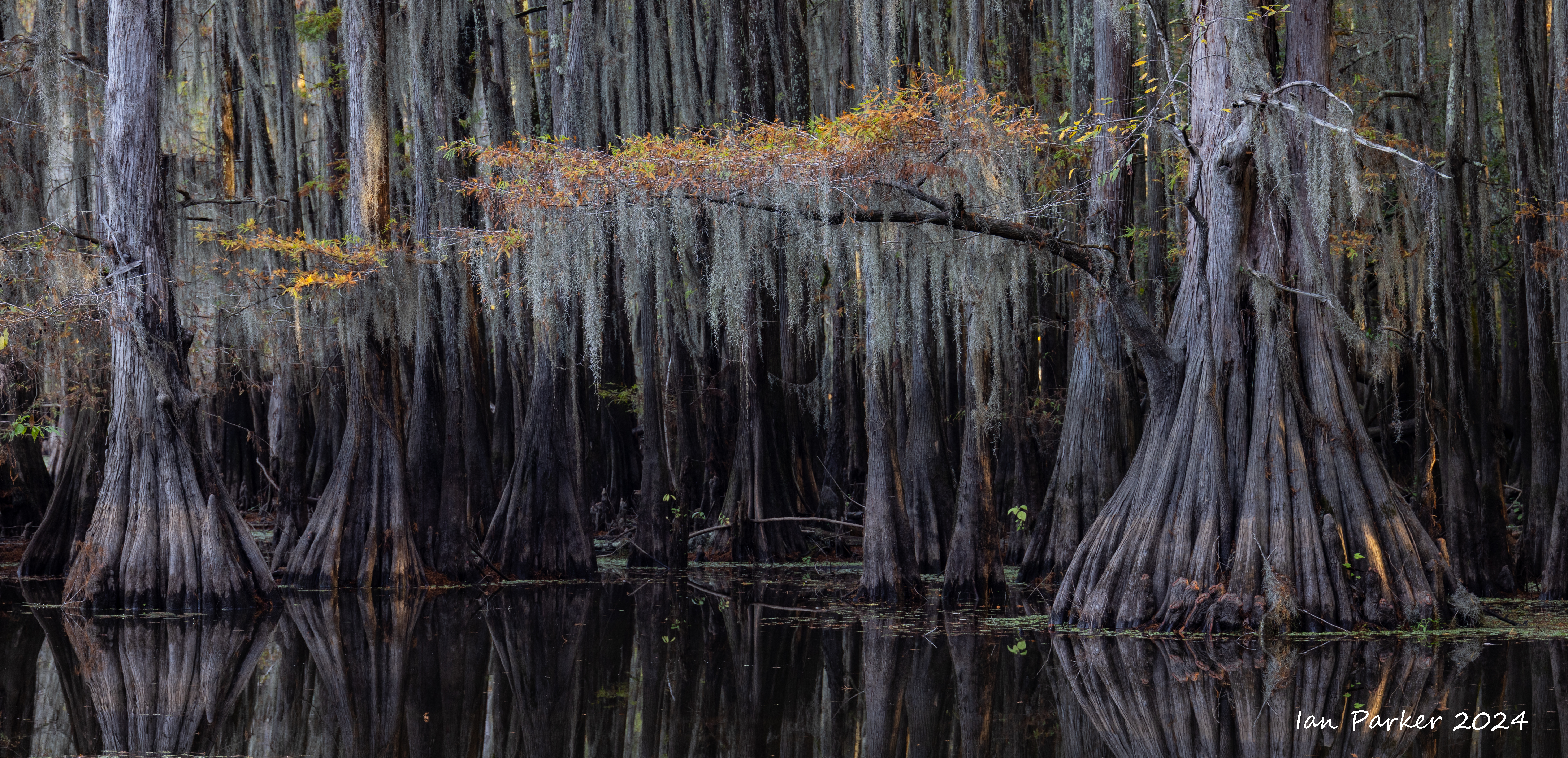
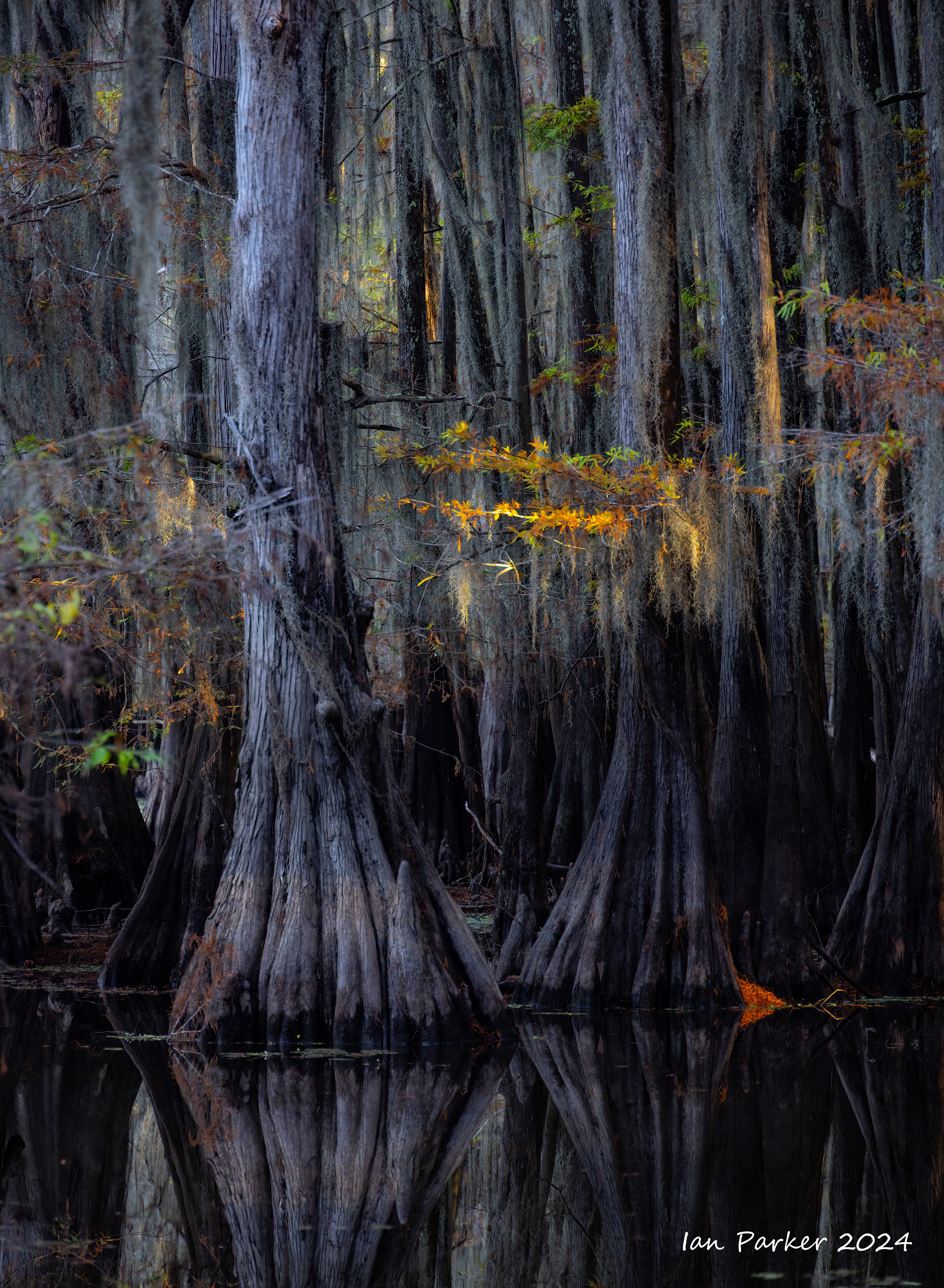
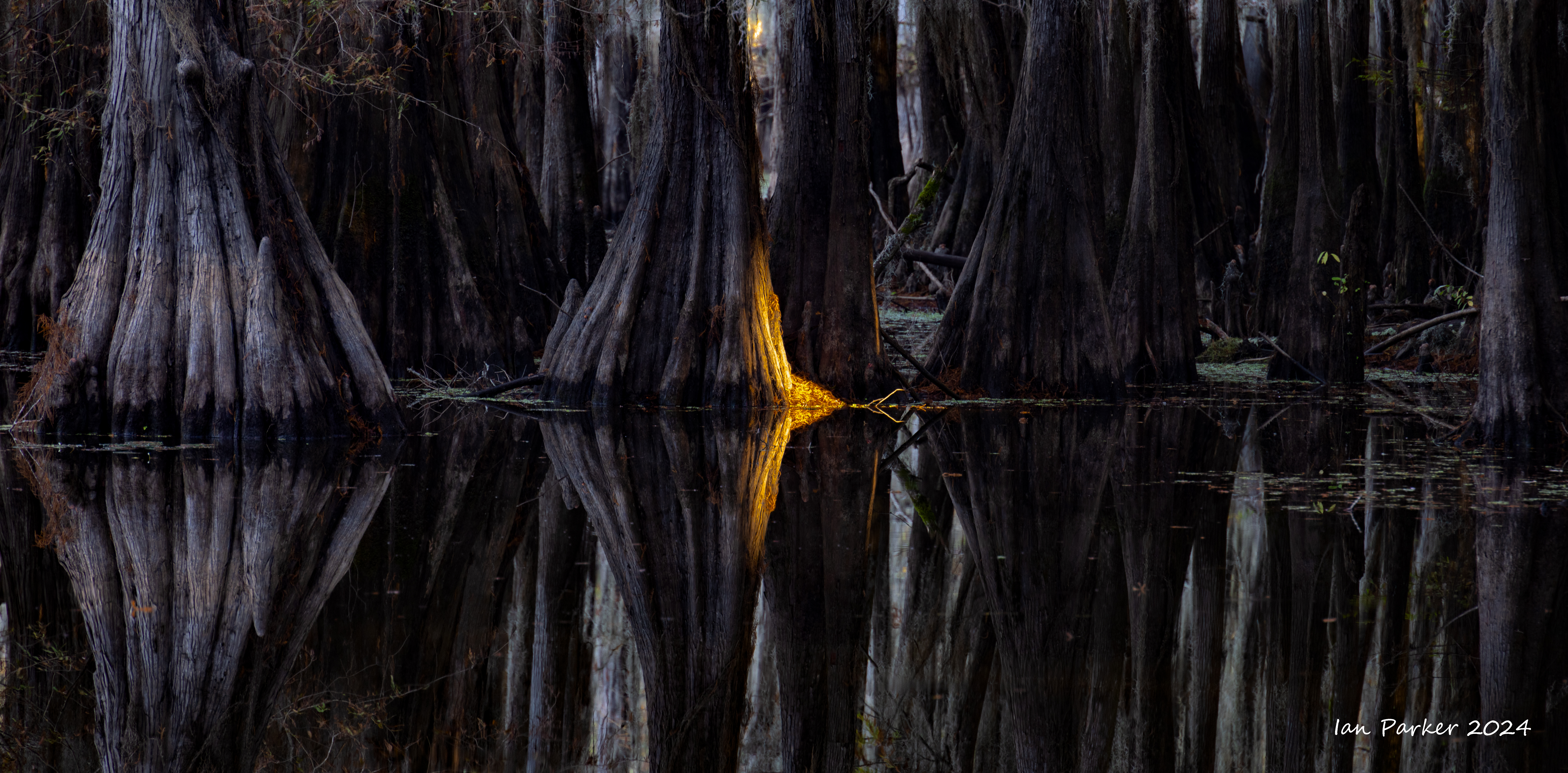
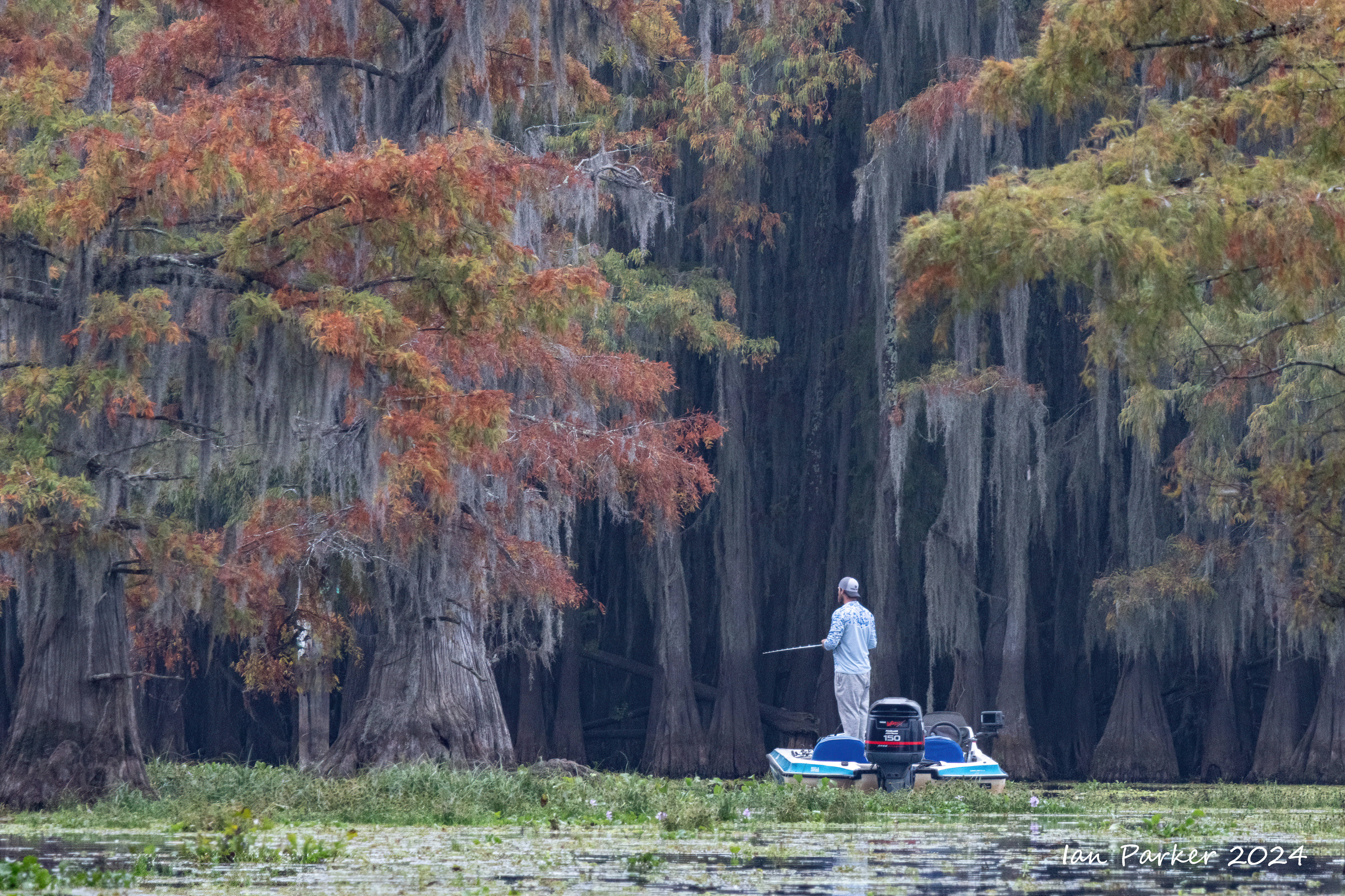
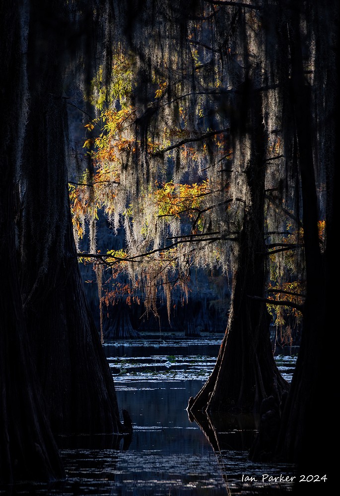
November 1st - 4th: Caddo Lake, Texas
We returned again to Caddo Lake in early November, timed for Fall colors.
On foot around Saw Mill Pond at Caddo Lake State Park.
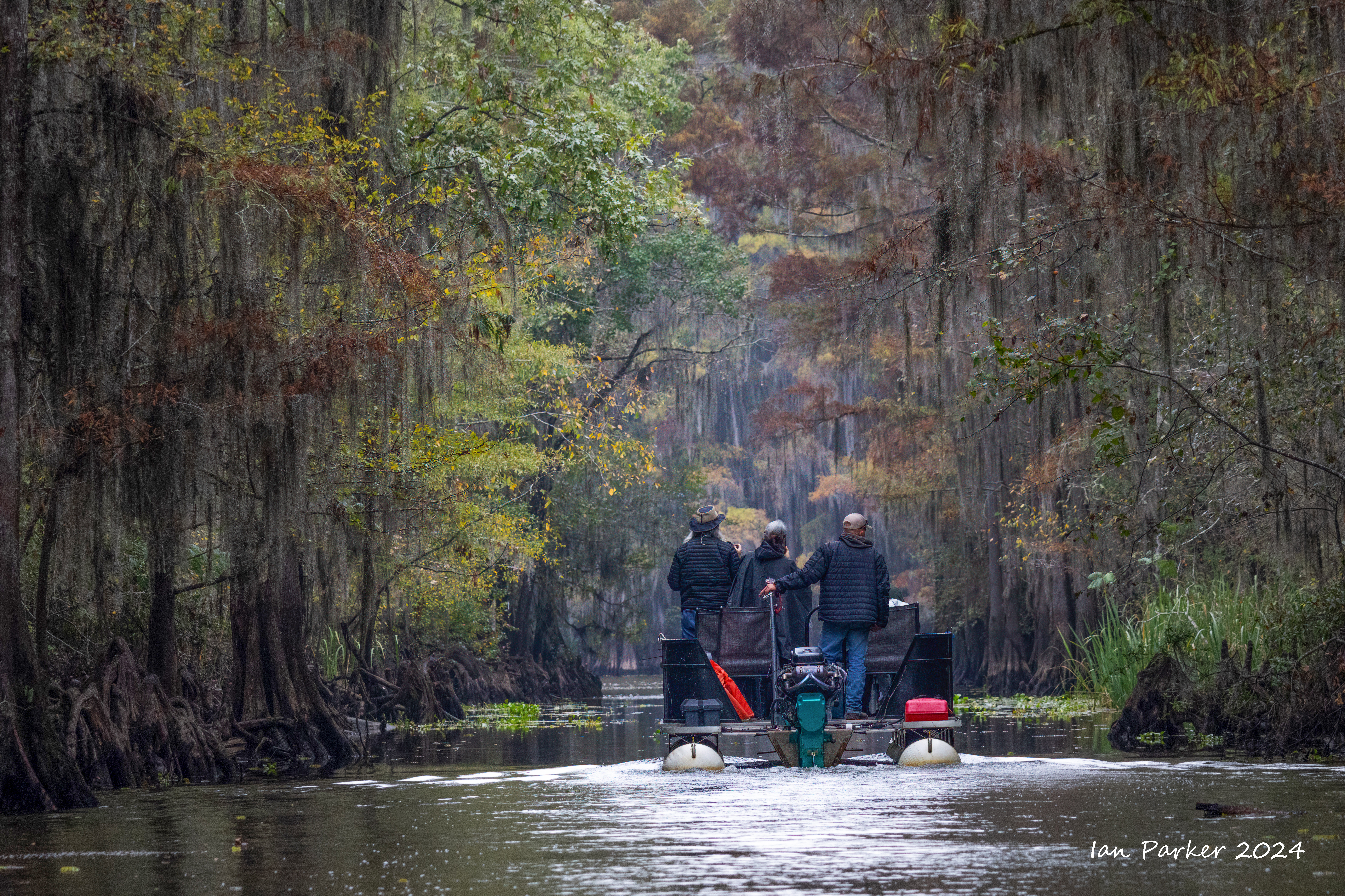
Access to the shoreline at Caddo Lake itself is difficult, as this is almost entirely private property. To photograph the lake thus requires venturing out afloat, by kayak or boat. I had booked morning and evening excursions with Paul Keith on his small speedboad. He would quickly motor out to promising areas on the lake, then shut down the outboard motor and use an electric trolling motor to slowly and silently maneuver around. As he is an expert photographer I generally just followed his lead in finding good compositions. Nevertheless, I did miss the ability to wander arouud on foot to carefully select my own subjects and camera angles.
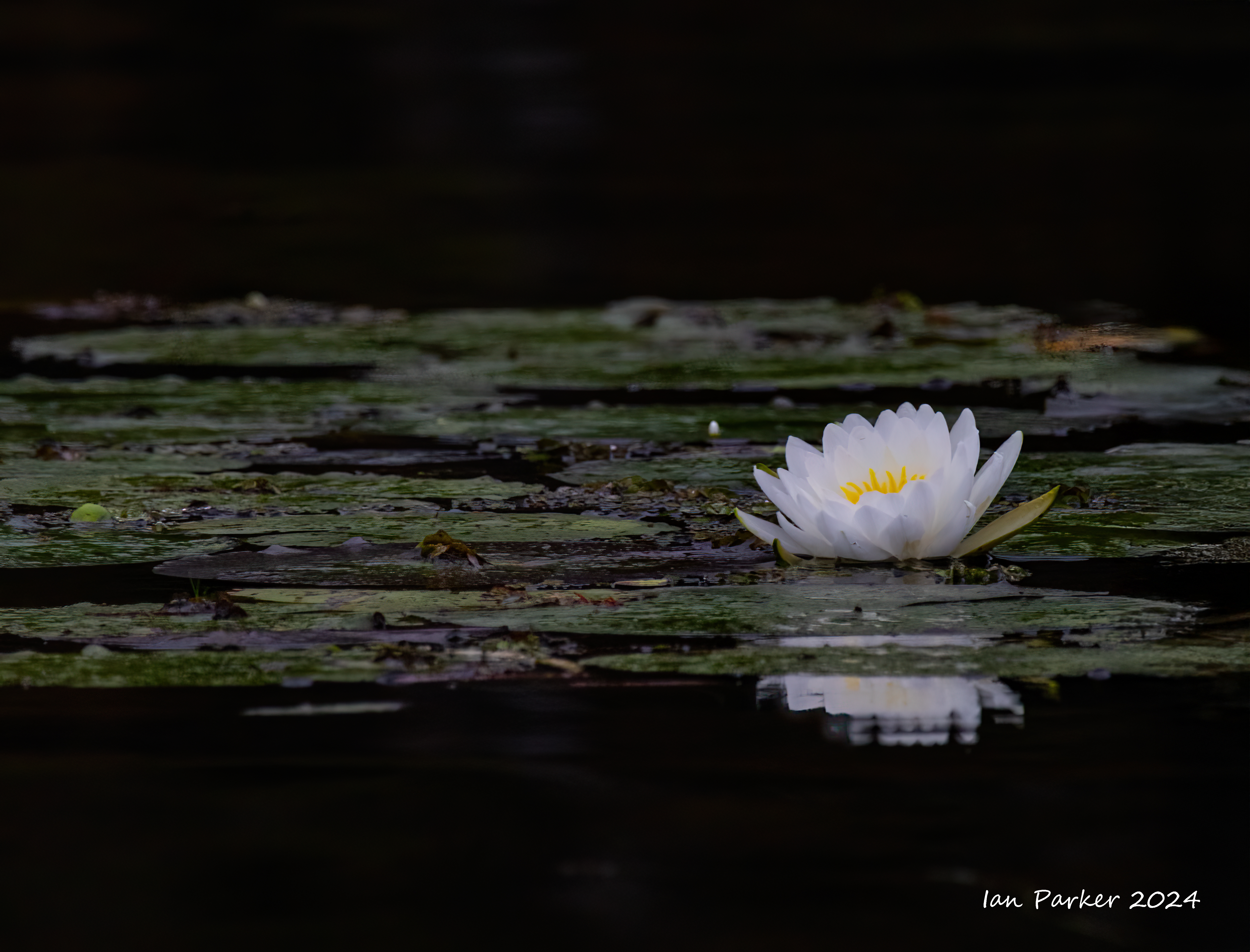
A visit to Caddo Lake State Park provided this opportunity. Despite its name, he State Park does not actually encompass Caddo Lake, but is set around Saw Mill Pond; a miniature version of Caddo Lake. The shoreline of the pondis is readily accessible, if swampy, and wraps around a dense forest of cypress trees. Sunset gave good lighting, by trees on slopes to the east largely blocked sunrise light.
Out on Caddo Lake in Paul Keith's boat
A nighttime interlude of fluorescent photography at Caddo Lake
After my wife gave me a UV flashlight I have been looking for things that might fluoresce and make interesting pictures. Nighttime wanderings with the flashlight revealed that some lichens and plants fluoresced nicely. I was thus curious to see if the Spanish moss draping the bald cypress trees at Caddo Lake might glow in the dark. . On our first evening I made a preliminary reconnaissance to explore the photographic potential from the pier opposite the cottage where we stayed. A single, pole-mounted light bulb at the end of the pier cast an orange light onto trees out in the lake, but was dim enough to see that my UV flashlight evoked a clear blue fluorescence from the bark of nearby trees and the moss hanging from them. However, I was surprised to find that shining the flashlight onto the lake produced a more strikingr, cerulean blue glow from the water. I don’t know why this is so. Pure water does not fluoresce, so I presume the glow must arise from some tiny plants or organisms suspended in the murky lake. Moreover, the blue was a true fluorescence, as the well-filtered 365nm UV light from the flashliight is invisible to the eye, and is not captured by regular cameras.
The photo below was my first atempt to image the fluorescent lake. I had not brought a tripod with me, and in order to get a long enough exposure3 (30s) to capture the blue light I stabilized my camera on a wooden railing at the edge of the pier while scanning the UV flashlight across the surface of the water. Looking at the camera screen I could see the surrounding trees, and vegetation on the lake lit up in orange by the light on the pier, whereas in shadowed areas cast by the railings and my body the water glowed blue.
The next evening, I returned to the pier equipped with a tripod to make more deliberately composed images. The end of the pier lacked any railings, and from there I could set up my tripod to frame compositions where the pier light uniformly illuminated the surrounding trees and lake without casting any shadows. The two photos below were aquired with a shutter opening of 30 seconds (at f2.8 and ISO 1600) that gave a good exposure for the trees. However, my flashlight was not powerful enough to fully illuminate the lake surface in this time so these images are thus composites of three or four sequential exposures, successively scanning the UV light across more distant parts of the lake.
The weather during our first days at the lake was gloomy and overcast. Unlike the brightly glowing red cedar trees we observed the previous year this prompted a mental shift to focus on muted, tranquil images of the moss-draped trees.


Fisherman, photographers and a heron


October 6th - 10th: Fall Colors in the Eastern Sierras

Drone Photos


Camera Photos


 Extended diagonal reflections' E. Sierras Fall Colors 2024 |


More Fall Colors to come shortly ....
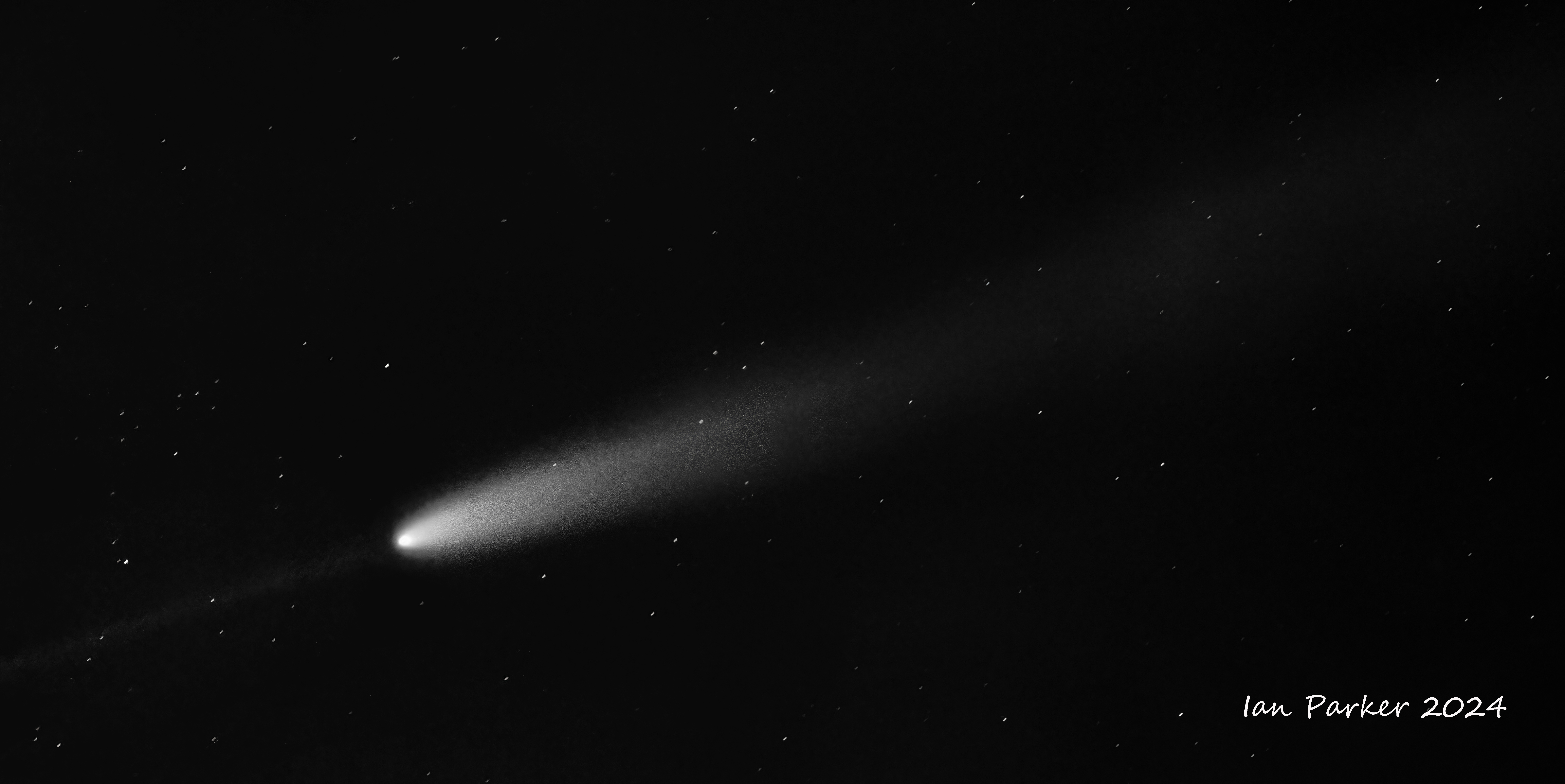
October 14th - Comet Tsuchinshan-ATLAS after its trip around the sun
Photographed from the Ecological Preserve on the UCI campus.
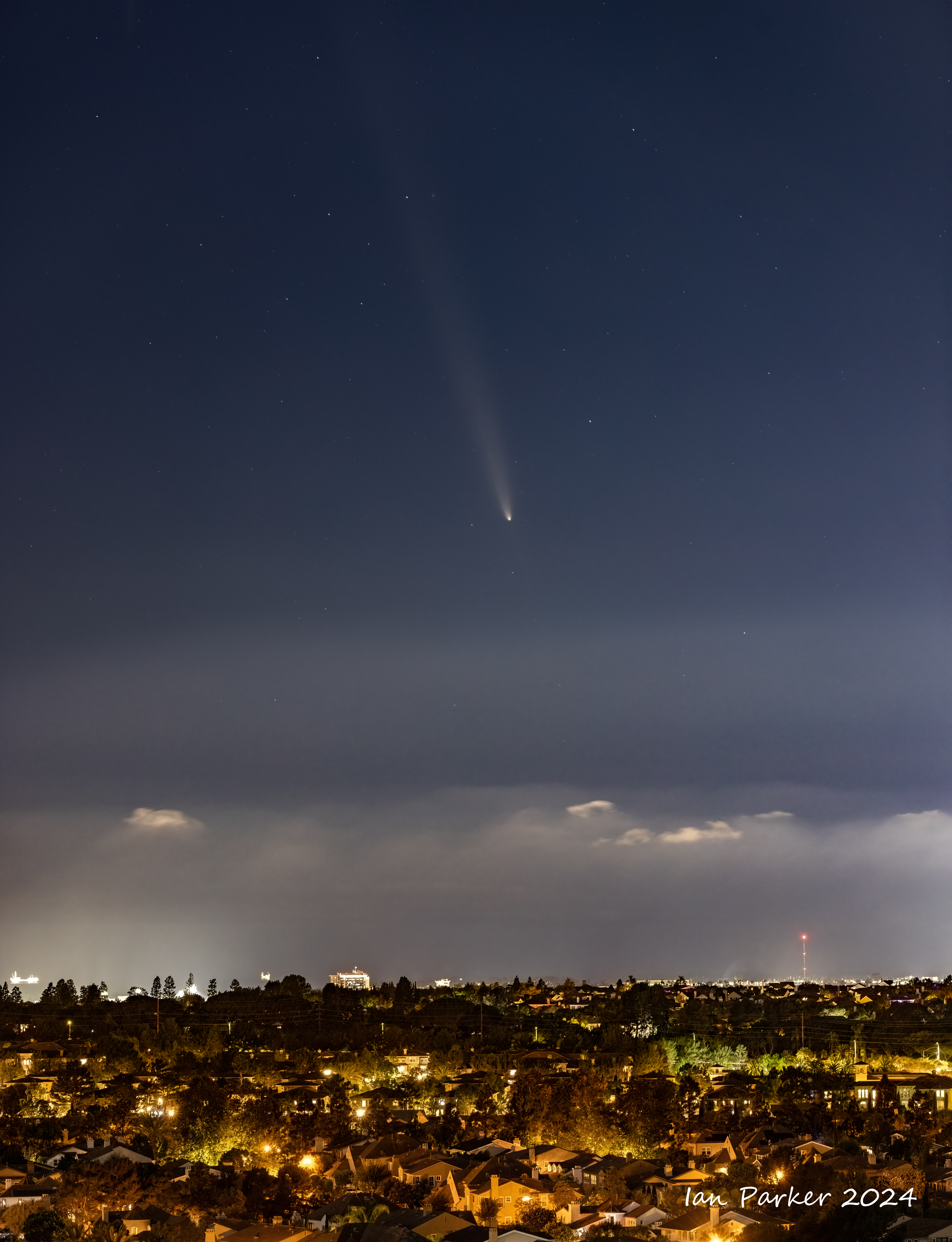
After looping around the sun the comet displayed an anti-tail, made from dust that has recently been left behind by the comet in its orbital plane around the sun. When the Earth passed through this plane on October 14 this residual debris was illuminated by the sun and reflected back to Earth, giving the impression of a second, fainer tail.
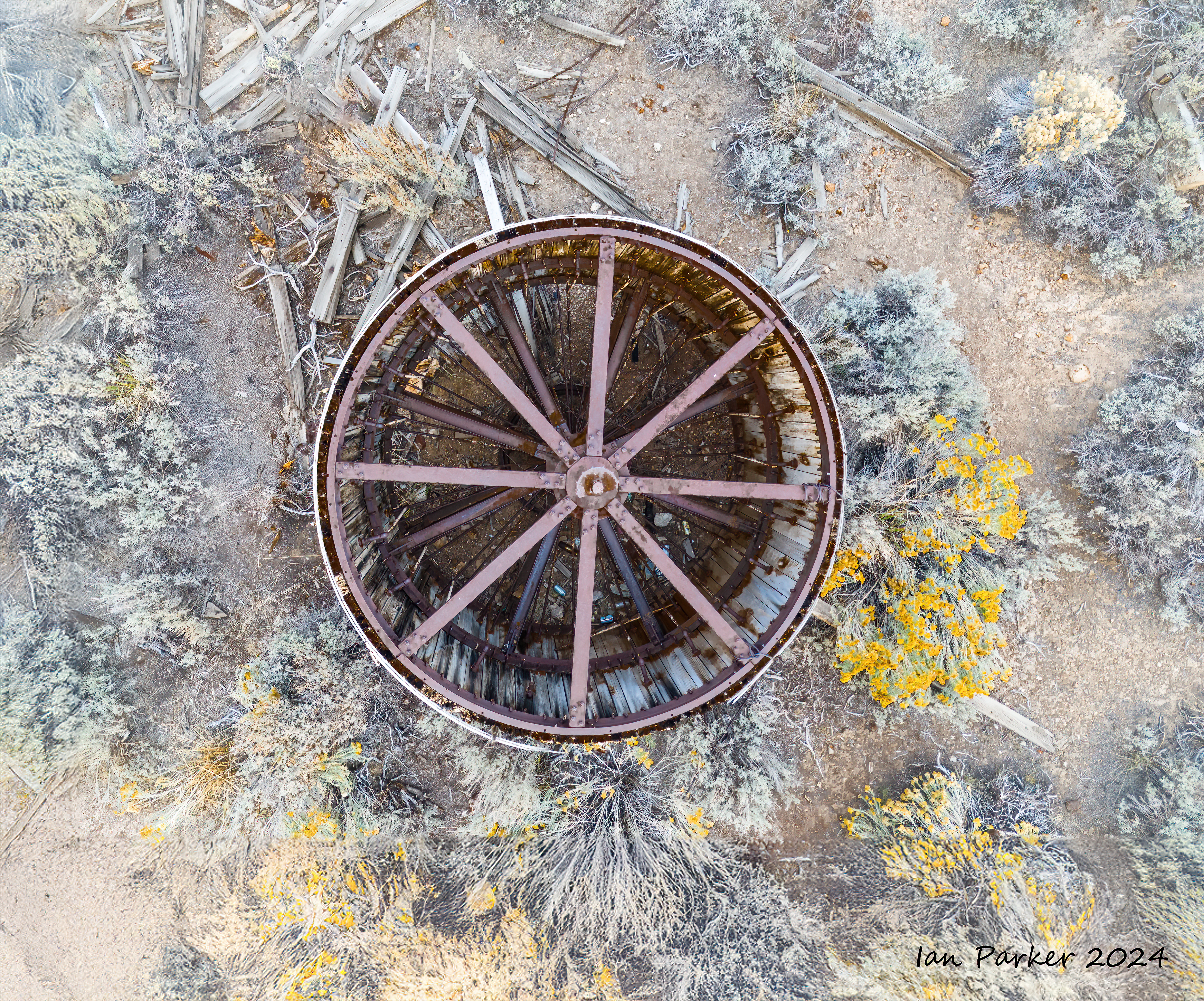
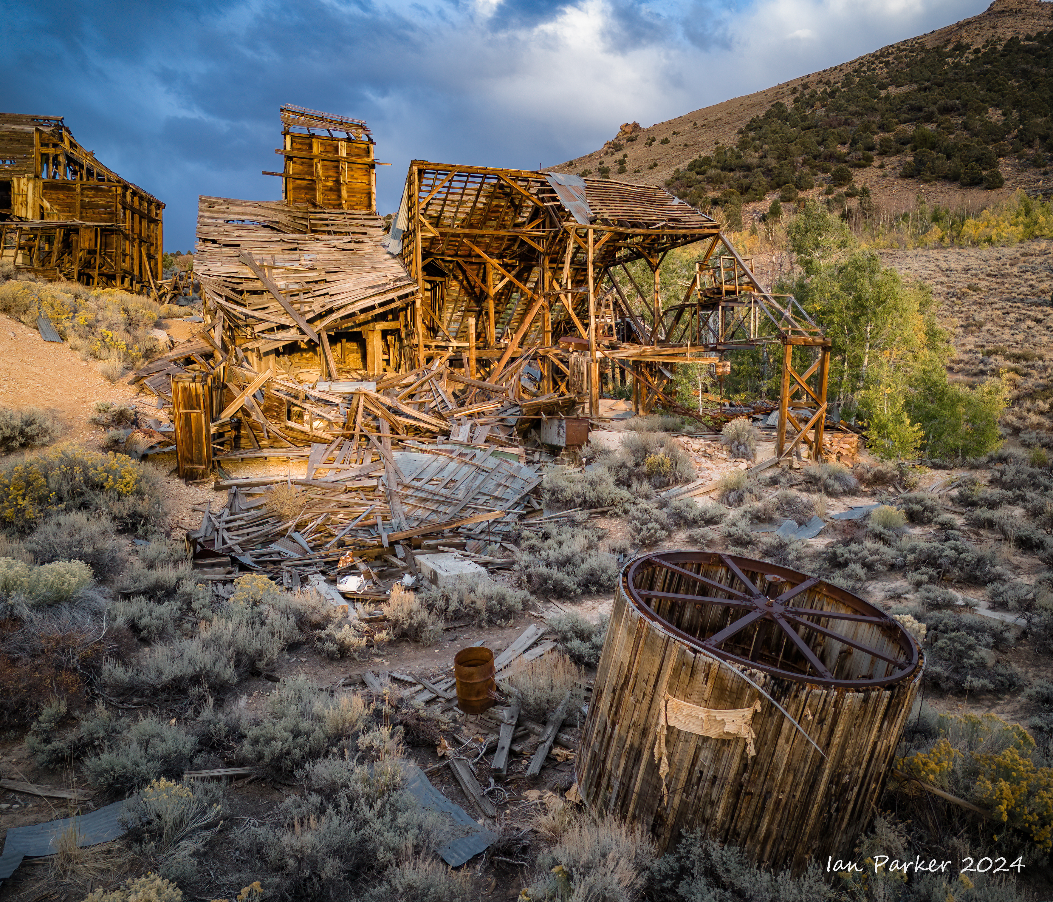
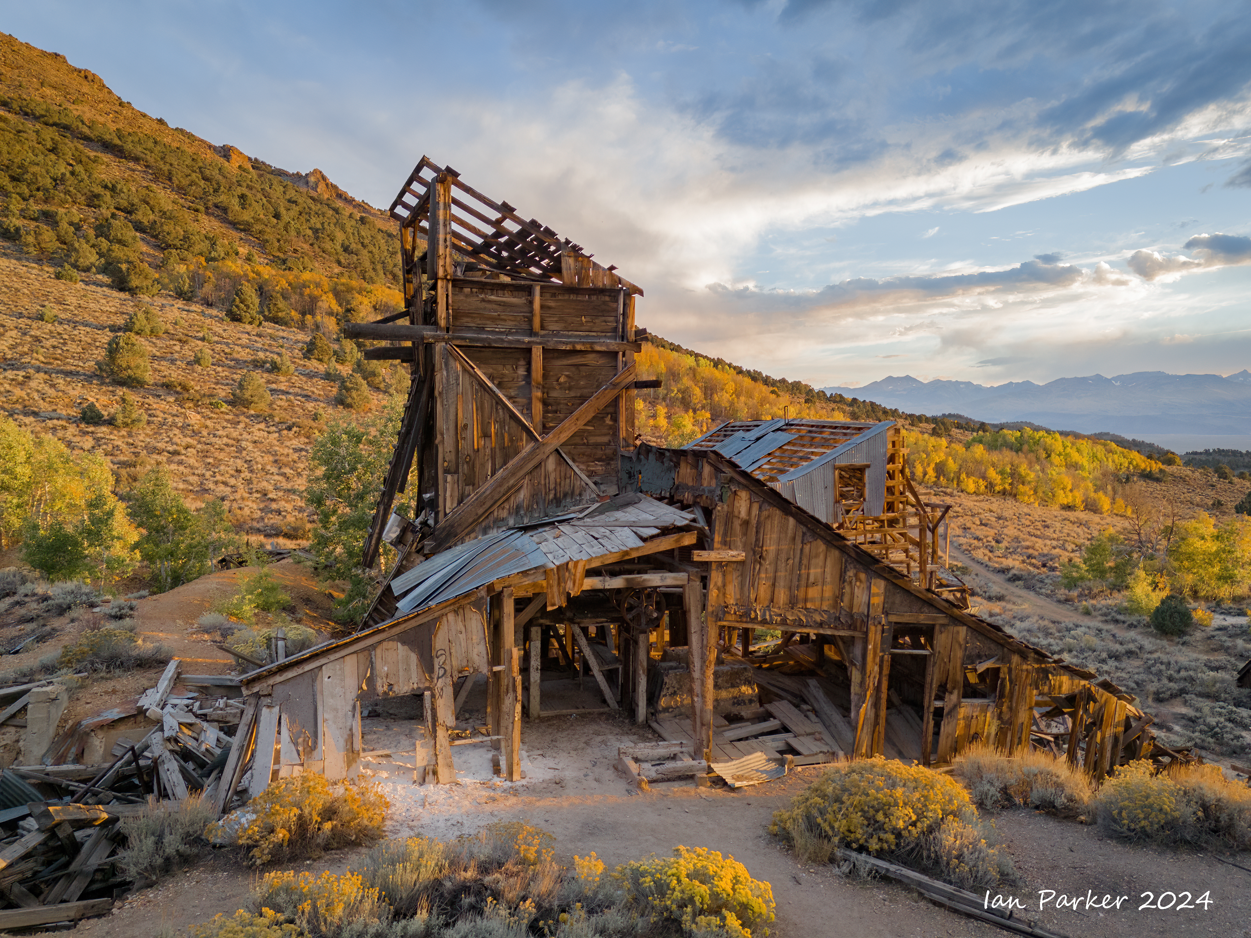
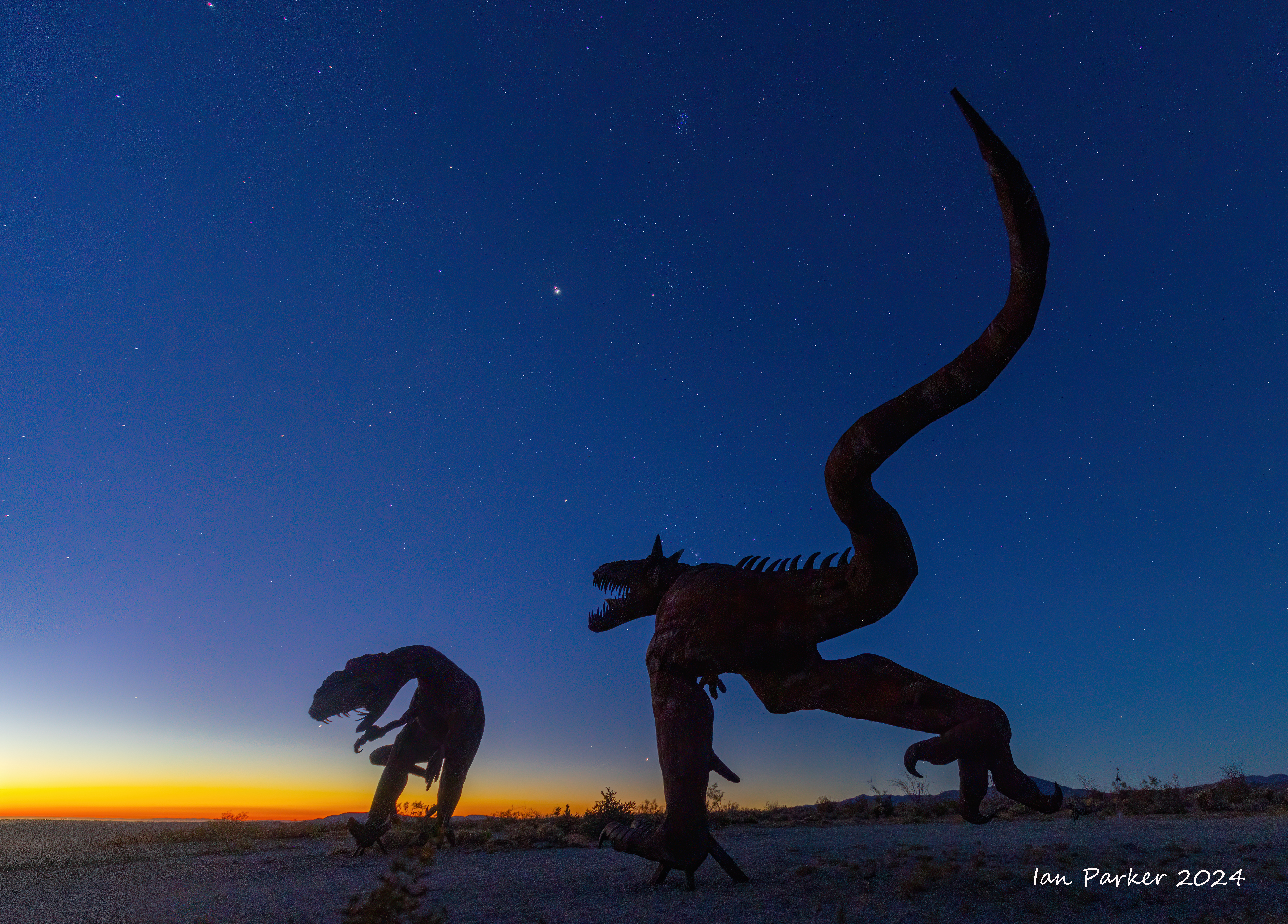
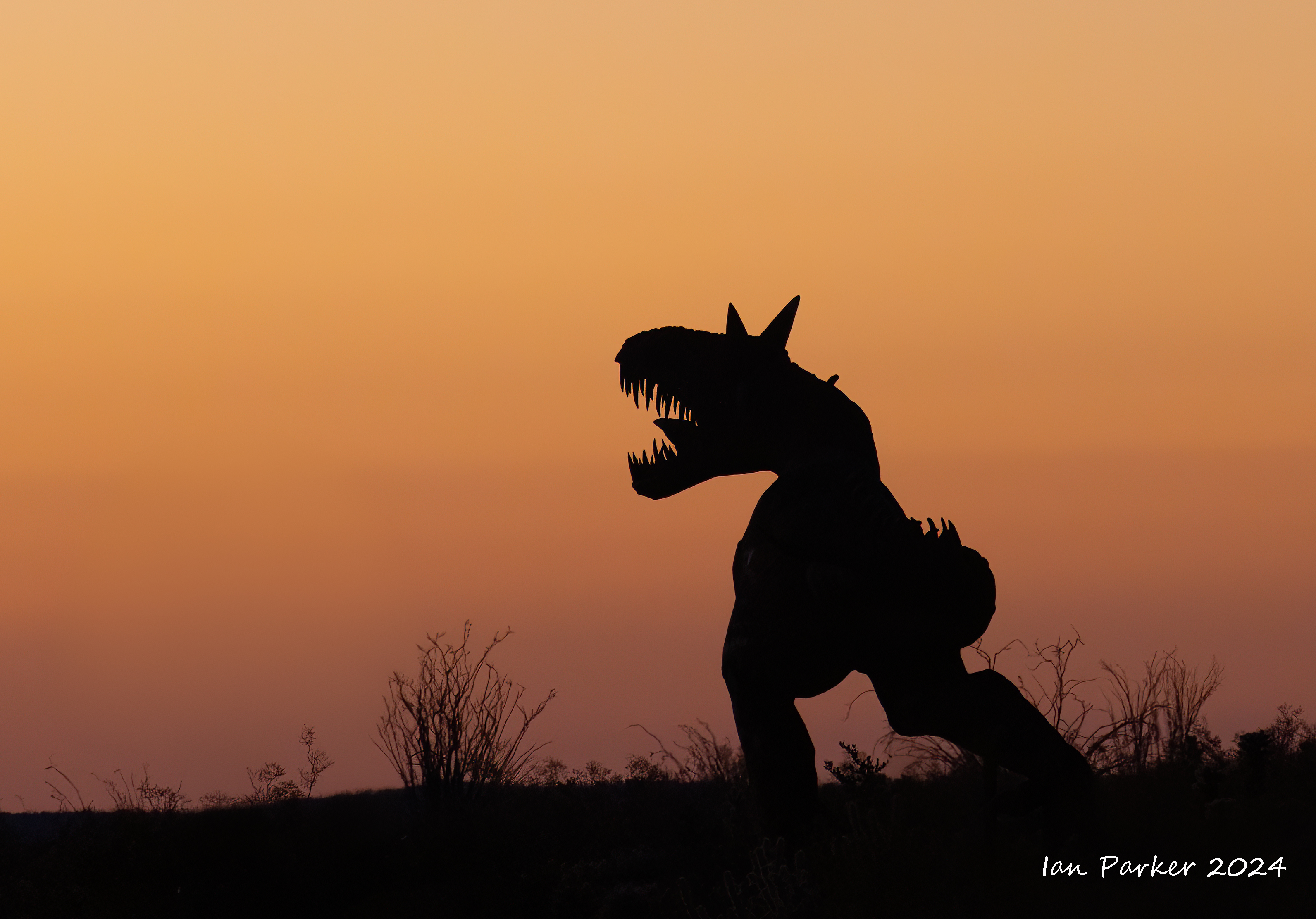
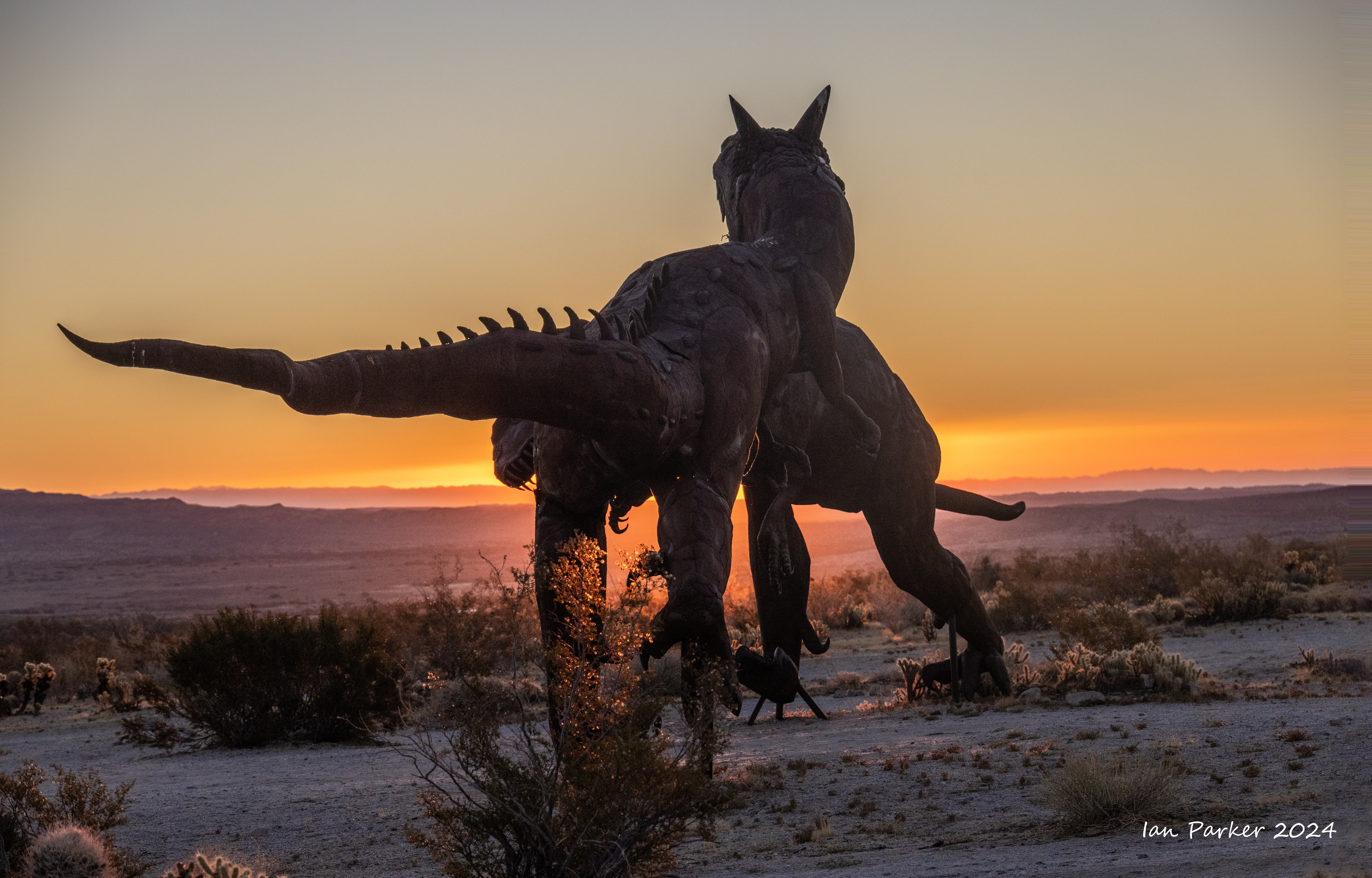
October 7th - Chemung Mine
An evening visit to an abandoned early 20th-century gold mine in a spectacular setting overlooking Bridgeport Valley and the Sierra Nevada.
Located near the ghost town of Masonic, CA, the Chemung Mine was founded in 1909 to produce gold and silver ore. It was reputedly a good producer of gold (although the area was consistently overshadowed by the mining operations in nearby Bodie), but legal issues were a constant problem. Torn down and rebuilt three times, the structures were eventually abandoned in 1938, and the 10 or so men remaining at work there lost their jobs. By the 1950s the nearby town of Masonic was abandoned also, leaving Chemung to fade quietly into the dust.
Reports tell of a “poltergeist,” active only on Saturday nights, who is said to be the ghost of a mine owner who fell—or was pushed—down a shaft. Fortunately, we visited on a Monday,and encountered no supernatural apperitions. But we did have some lovely warm light on the ruins as the sun set below clouds over the Sierras. The photos below are a mixture of those captured walking around with my camera, and those taken with my drone.
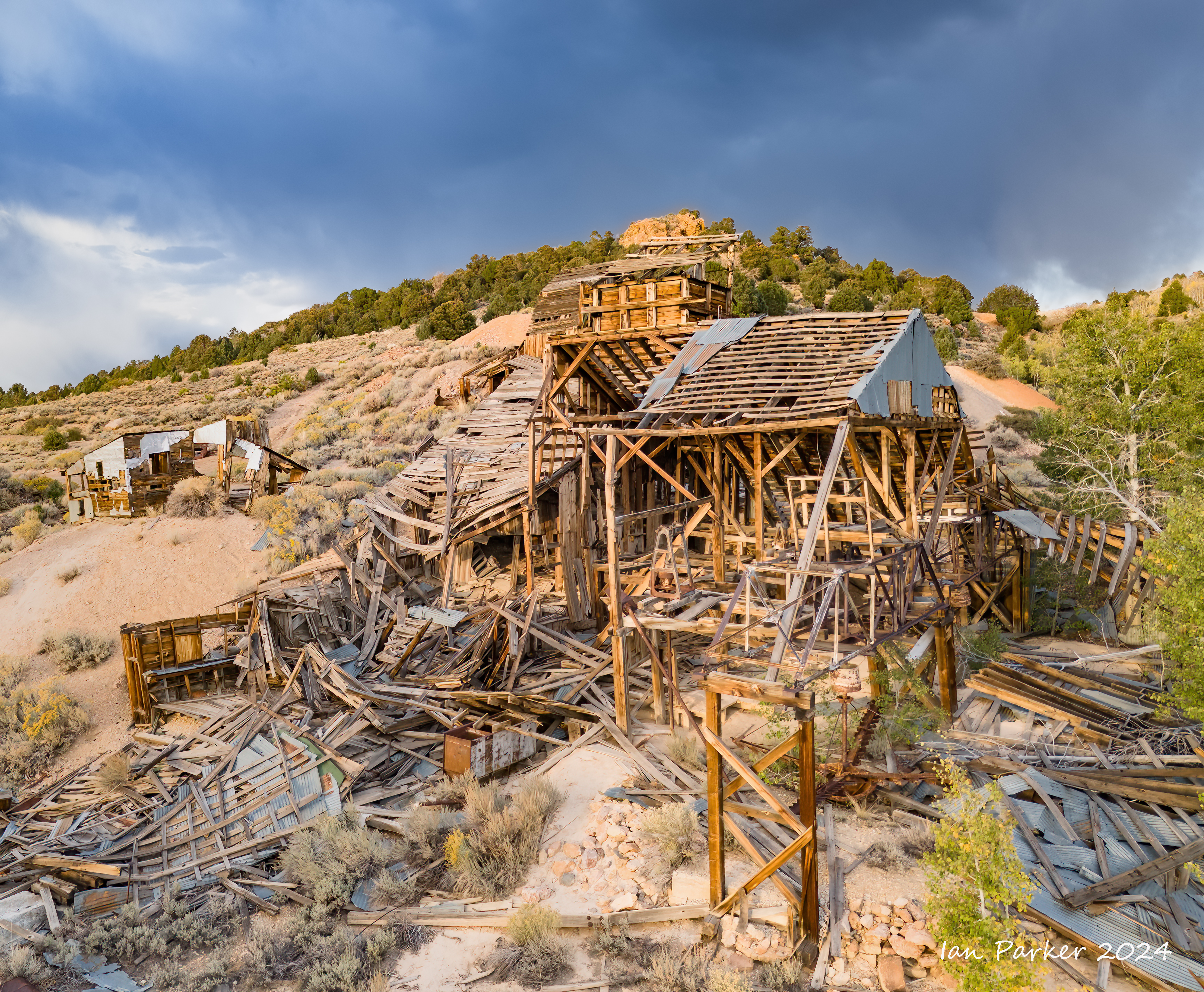
Chemung processed ore using flotation. Crushed ore was added to tanks containing pine and other oils. Air was bubbled from below and created a froth to which the gold stuck. Canvas-covered drums rotated which collected and dried the gold bubbles.
The drum picturedbelow has lost all but a tiny scrap of its canvas covering.
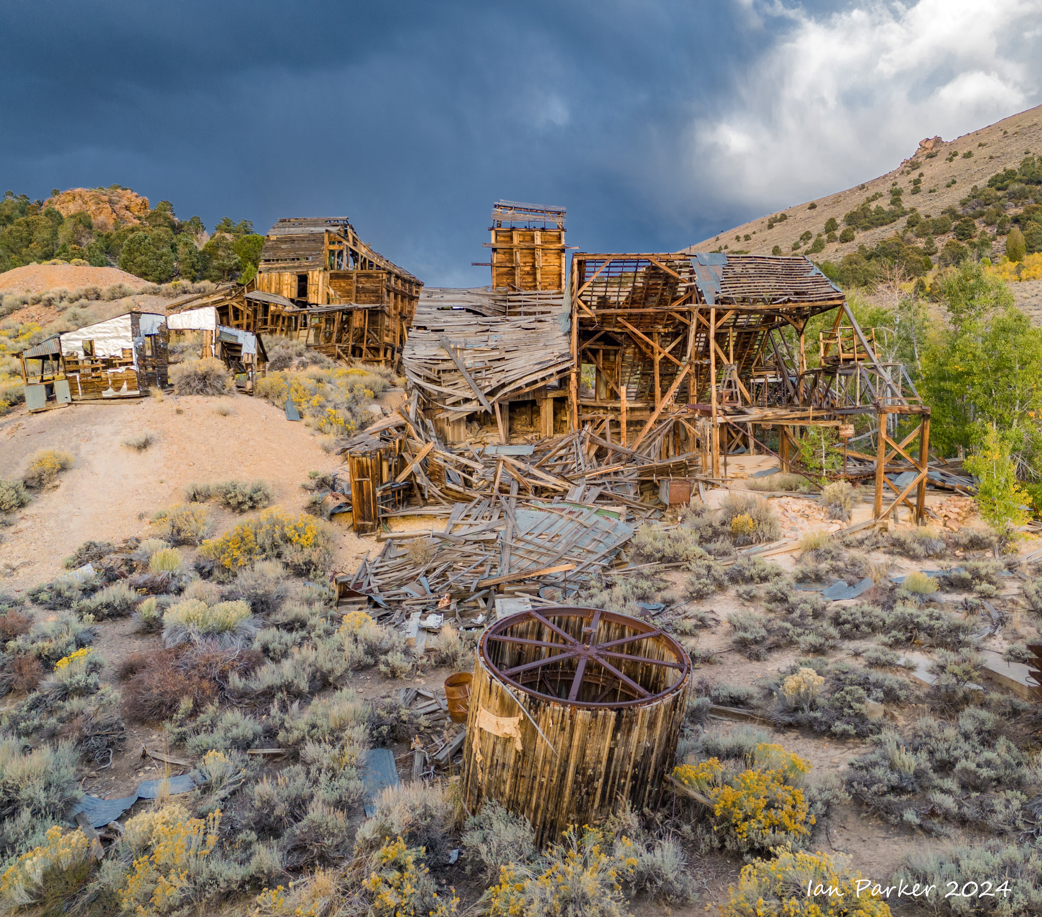
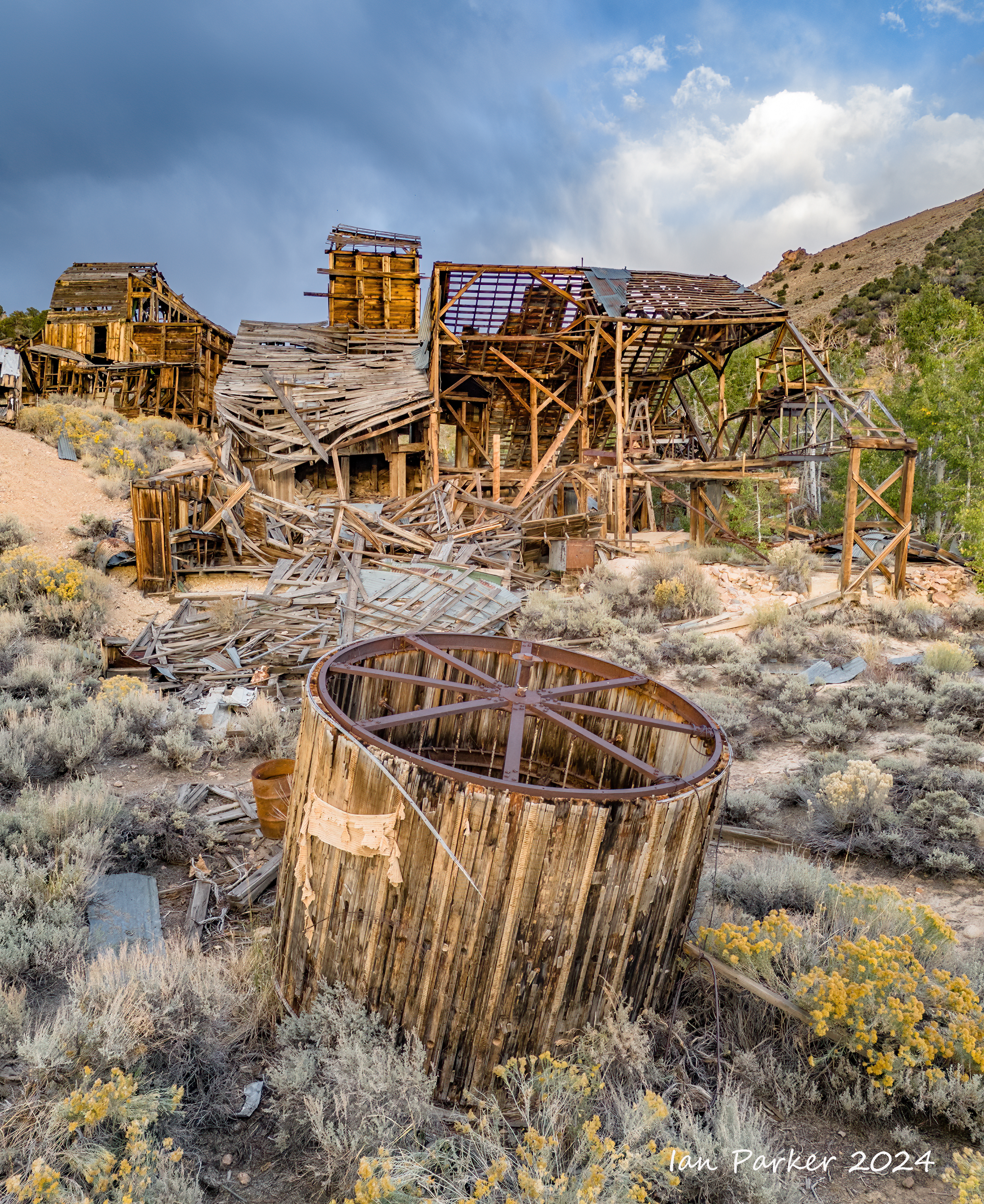
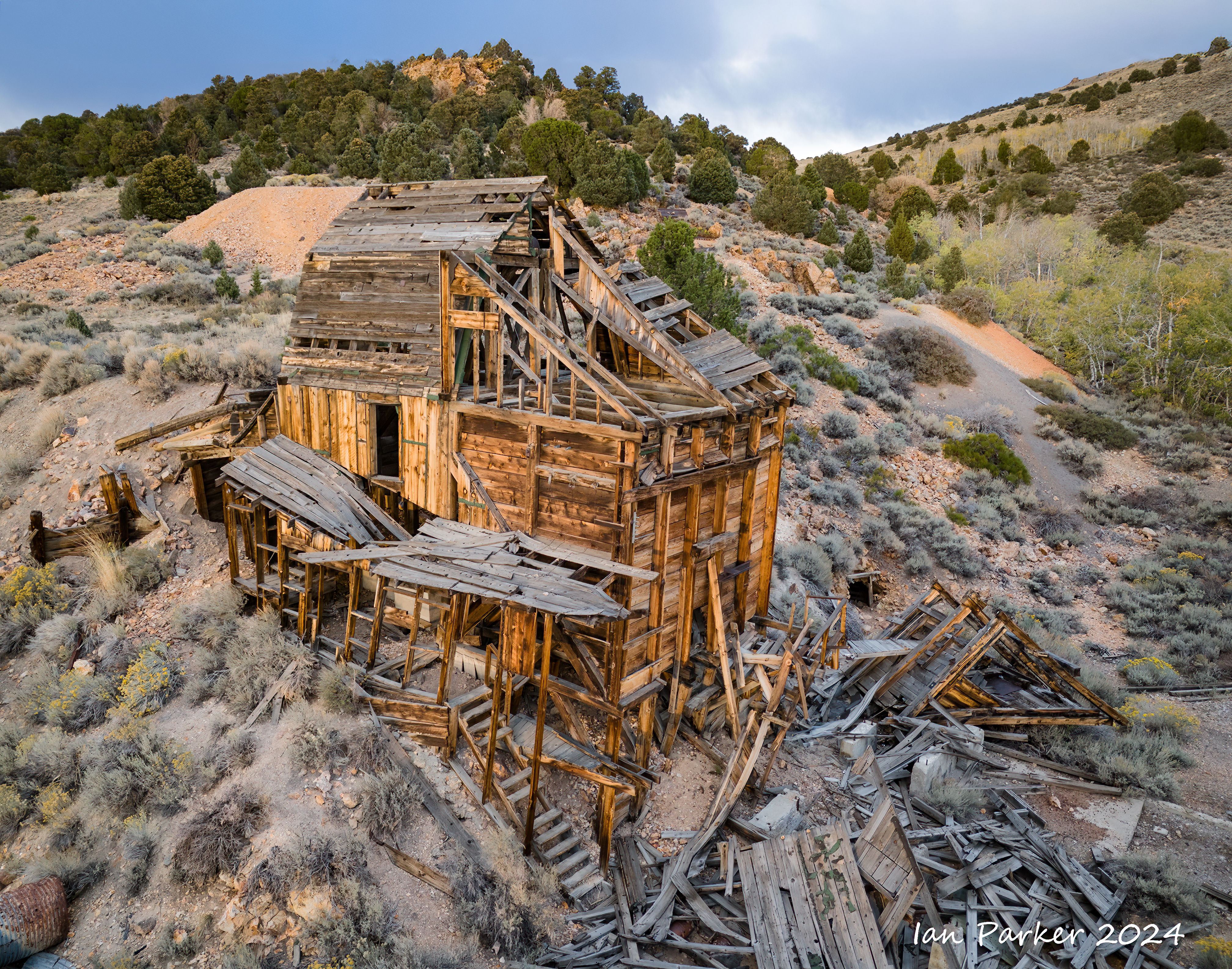
The light bacame increasingly dramatic as the sun dipped below clouds to touch the Sierra crest.
Links to some further reading on Chemung Mine
-
Abandoned America: Chemung Mine
-
Abandoned Spaces: Haunted and Abandoned: Chemung Mine, California
-
Destination 4×4: Chemung Mine
-
Ghost Towns: Chemung Mill
-
Gold Explorers: Chemung Mill
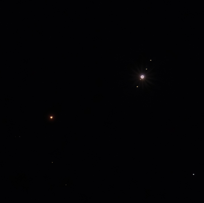
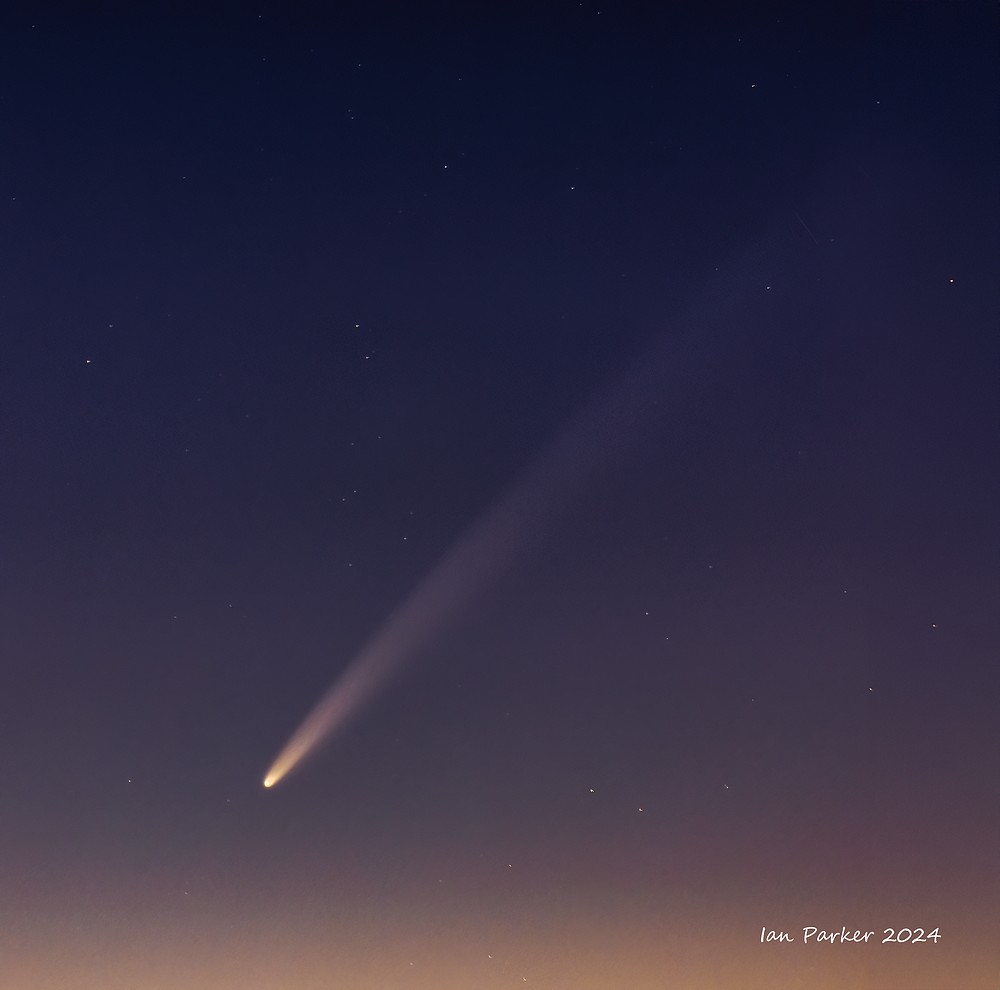
September 30th - Comet Tsuchinshan-ATLAS
Comet Tsuchinshan-ATLAS has been visible in the pre-dawn sky for the last view days. At home we have been socked in under thick marine layer cloud in the morning, so today we made a 4:00am drive out to a viewpoint in the hills overlookig lake Elsinor where clear skies were forecast. Looking to the east the comet was not visible by eye, or even through small binoculas, but it showed up well in long exposure photographs. I had only a 20 minute window to photograph between when the head of the comet rose above the mountains to when it became swamped bylight from the rising sun.
More opportunities to photograph the comet come in October after it has swung around the sun and is expected to get much brighter. The comet's tail already subtends an angle of about 3 degrees, and is predicted to grow as long as 20 degrees.
100mm f2.8, 6 x 2s exposures, ISO 800 |
400mm f4, 8 x 1.5s exposures (unguided), ISO 800 |
The comet rose well below and to the south of the waning moon - too far to include in a single image, but pasted in here to provide scale. |
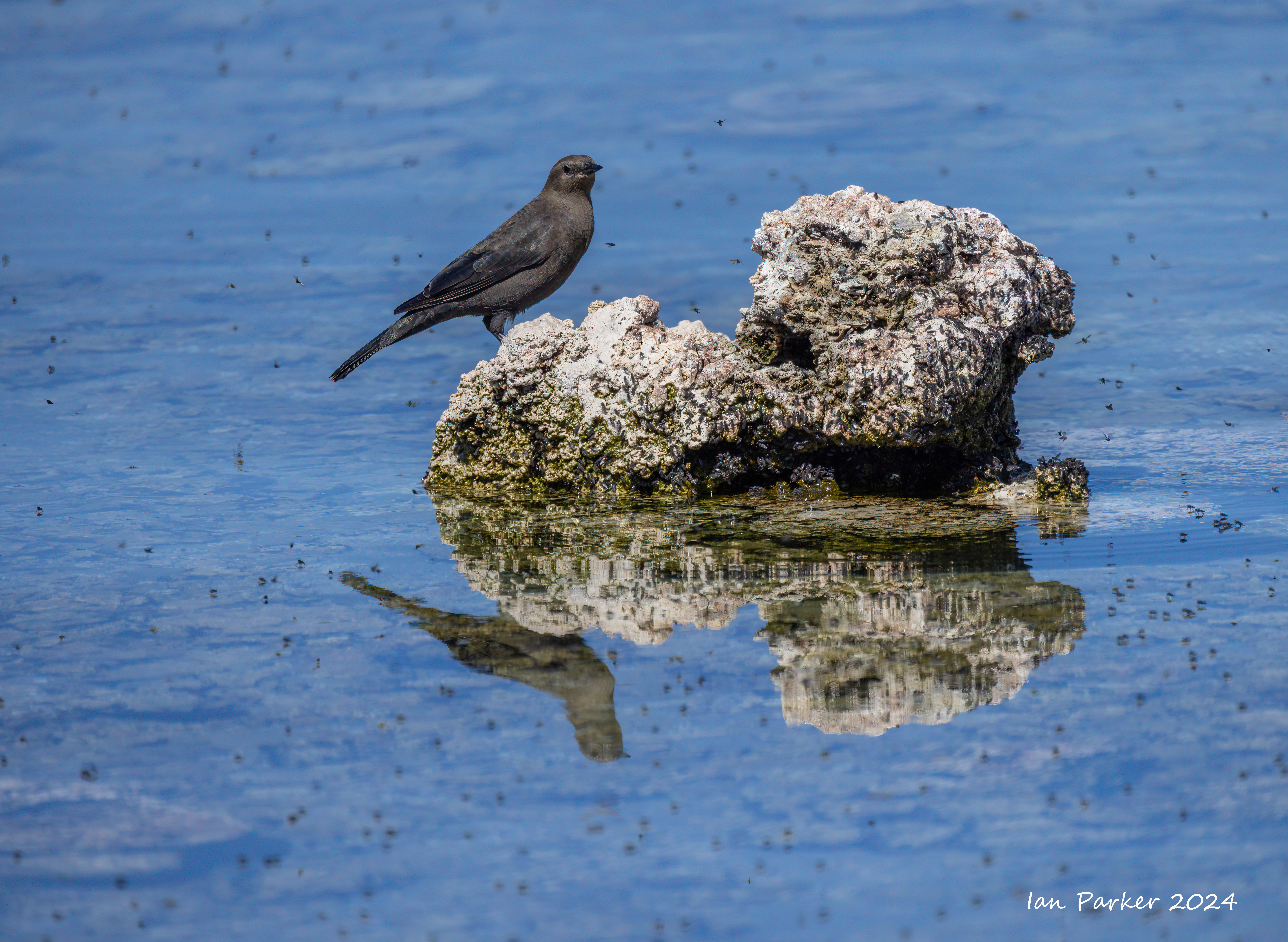
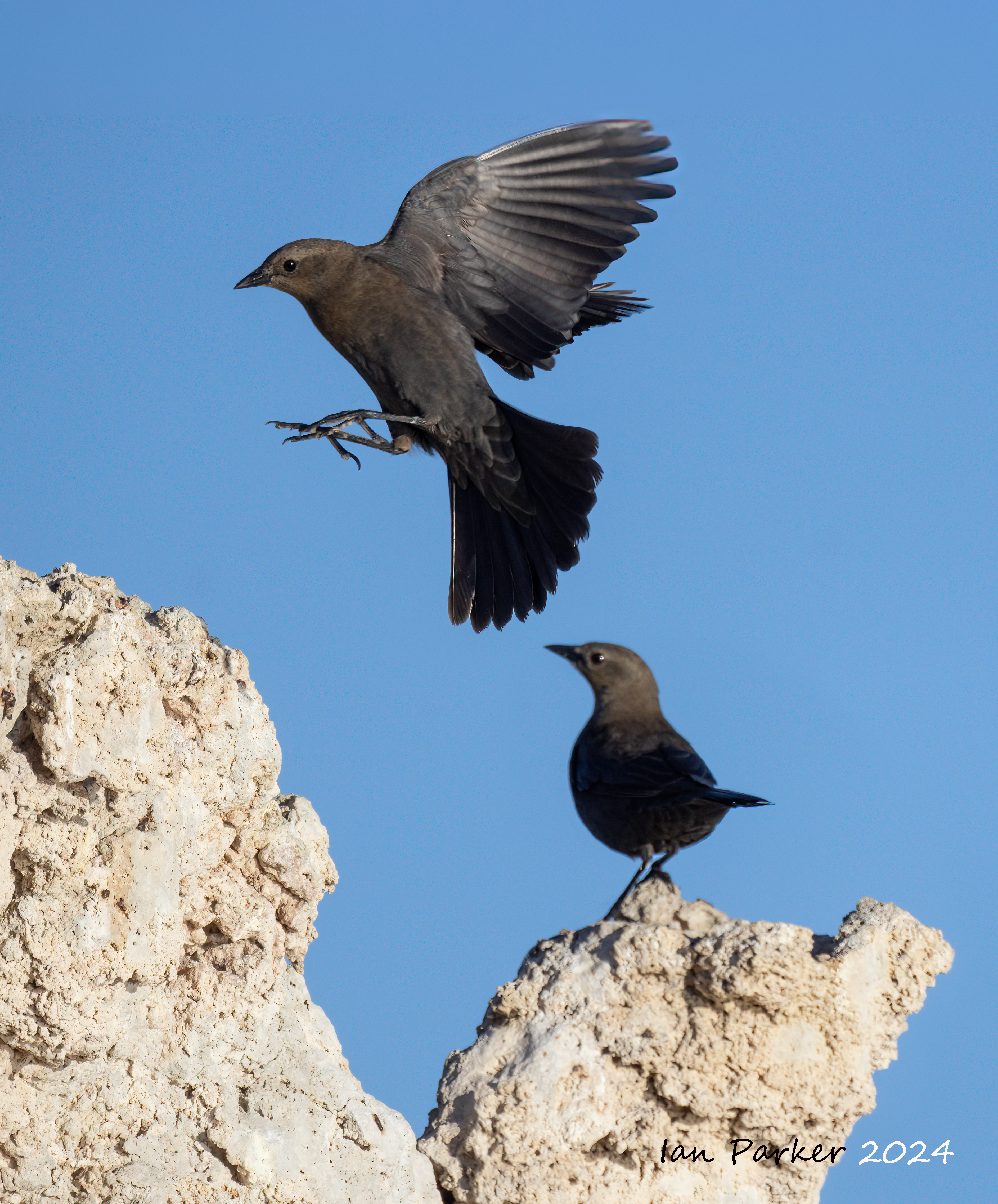
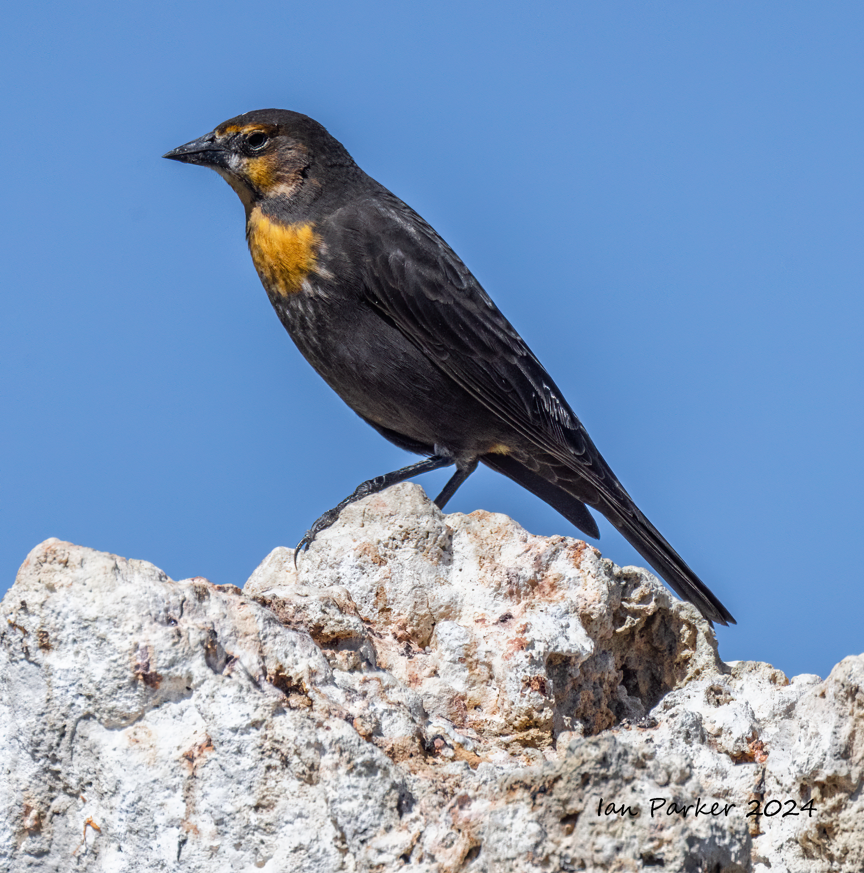
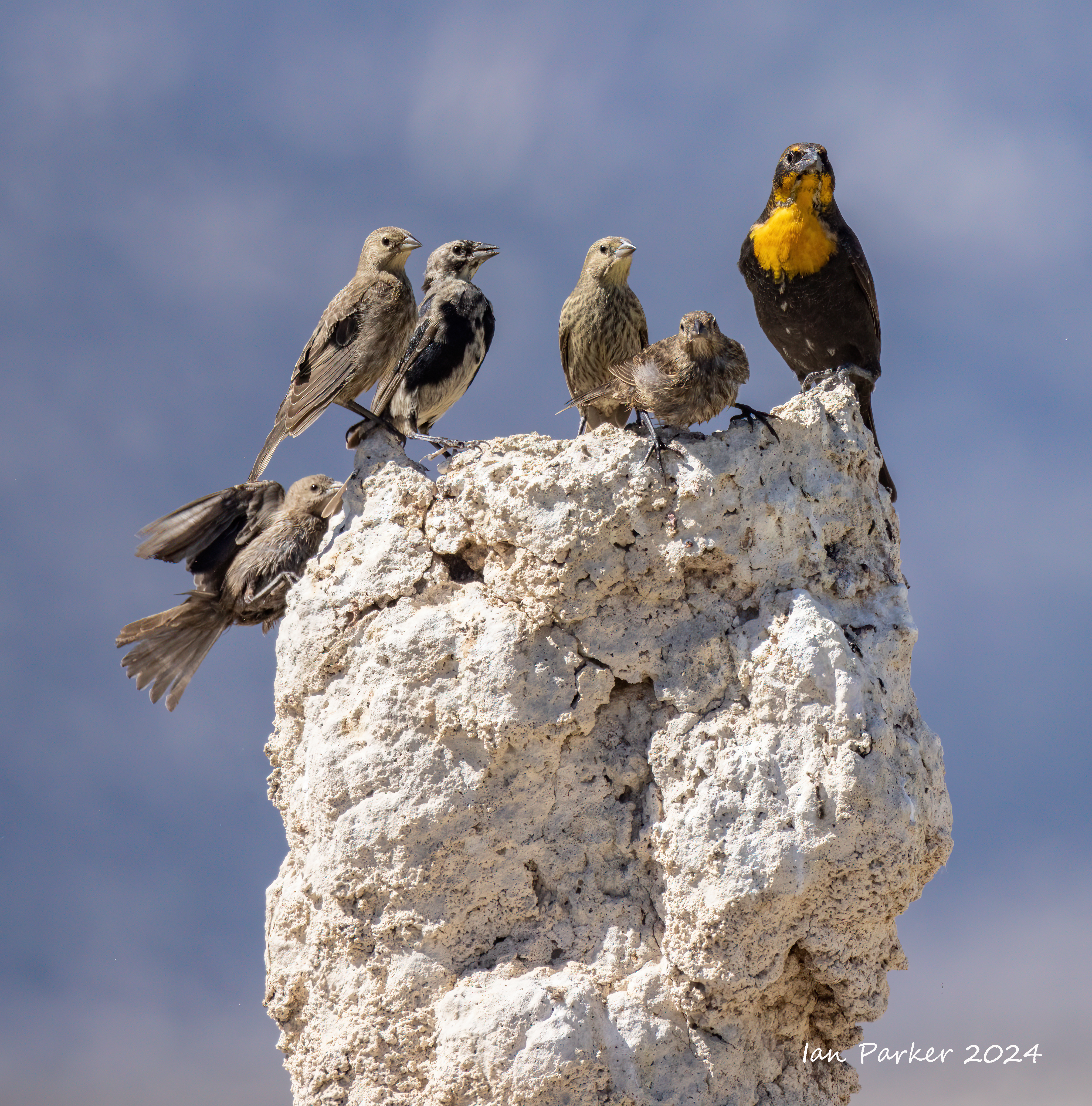
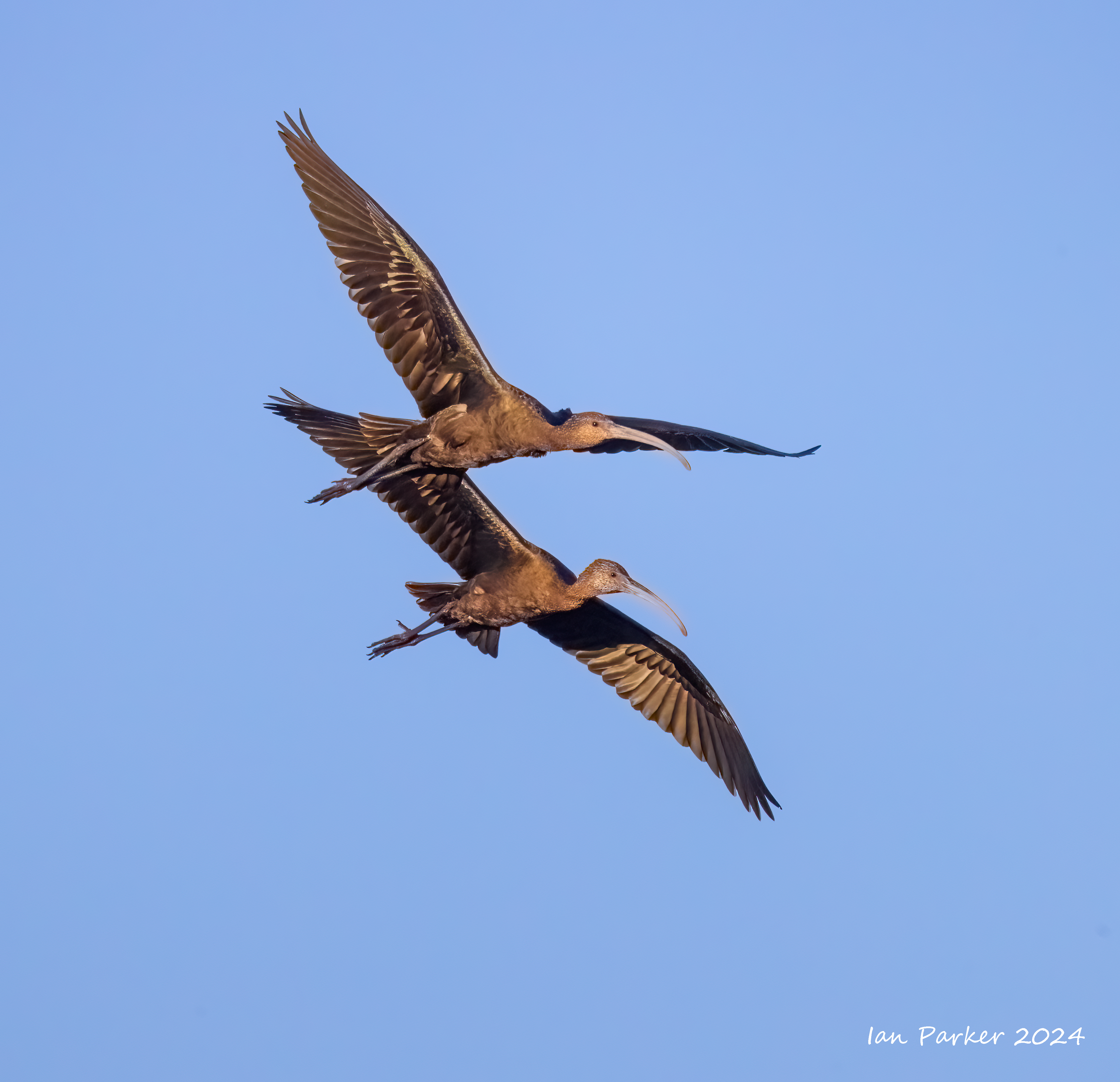
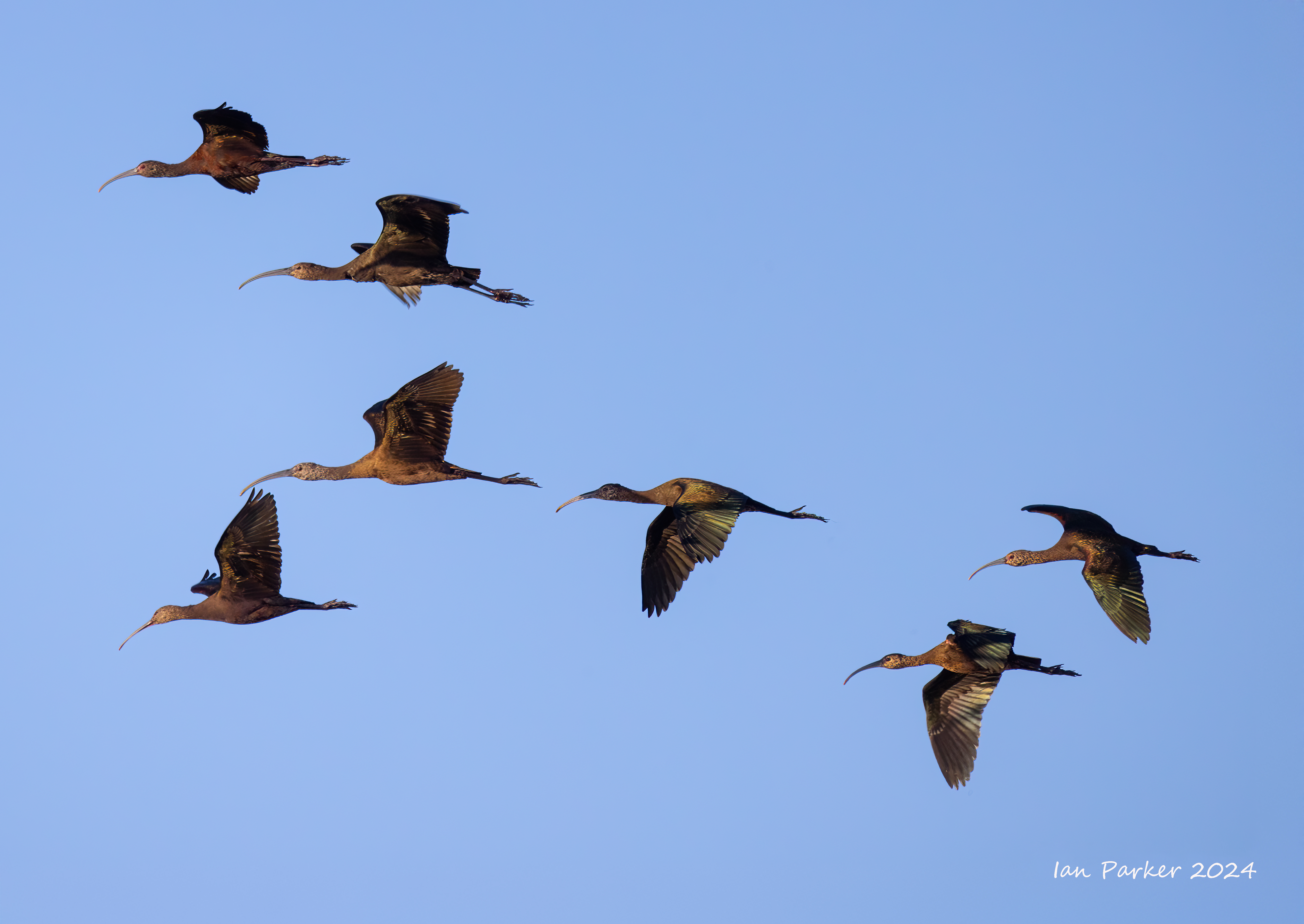
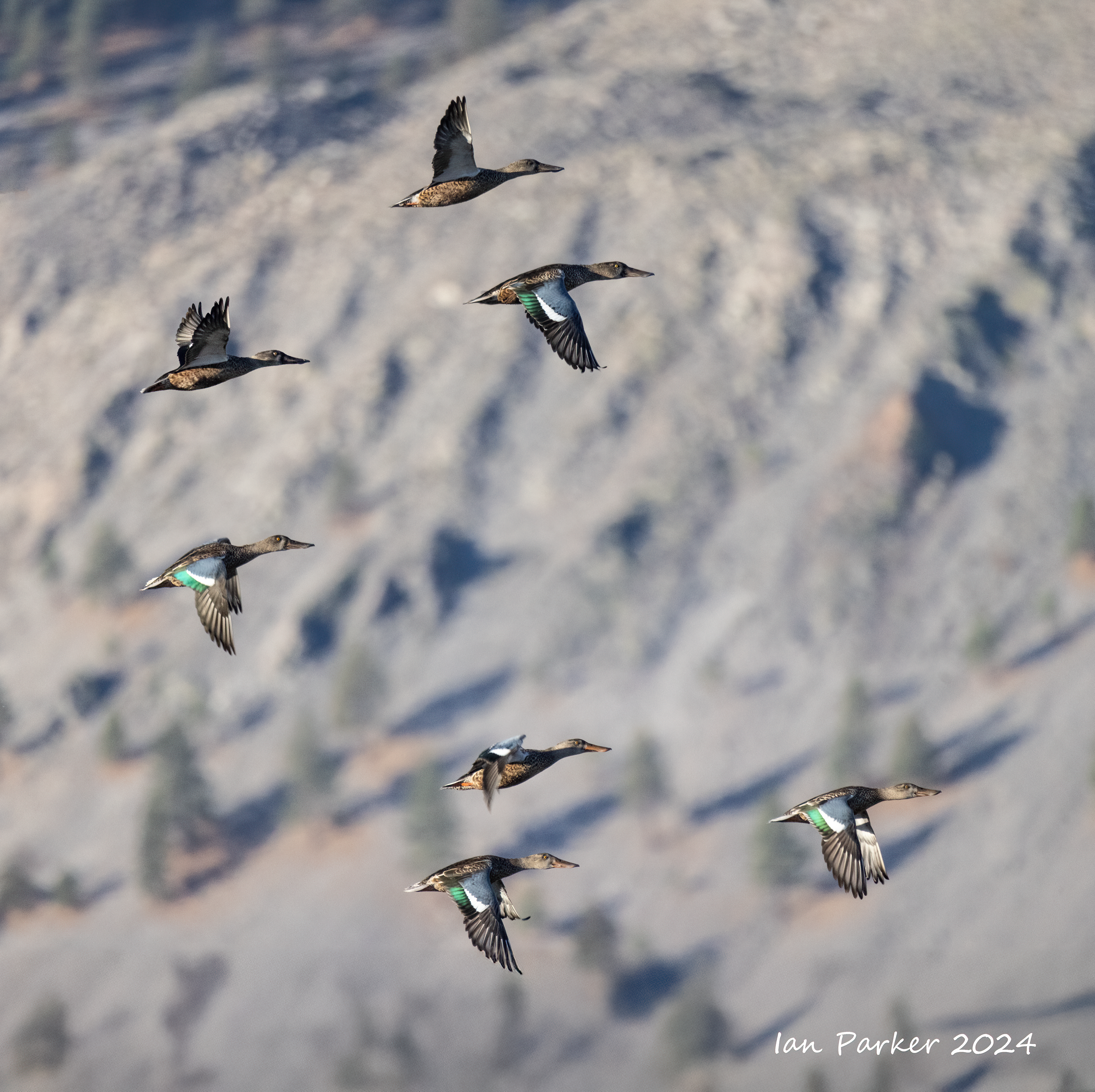
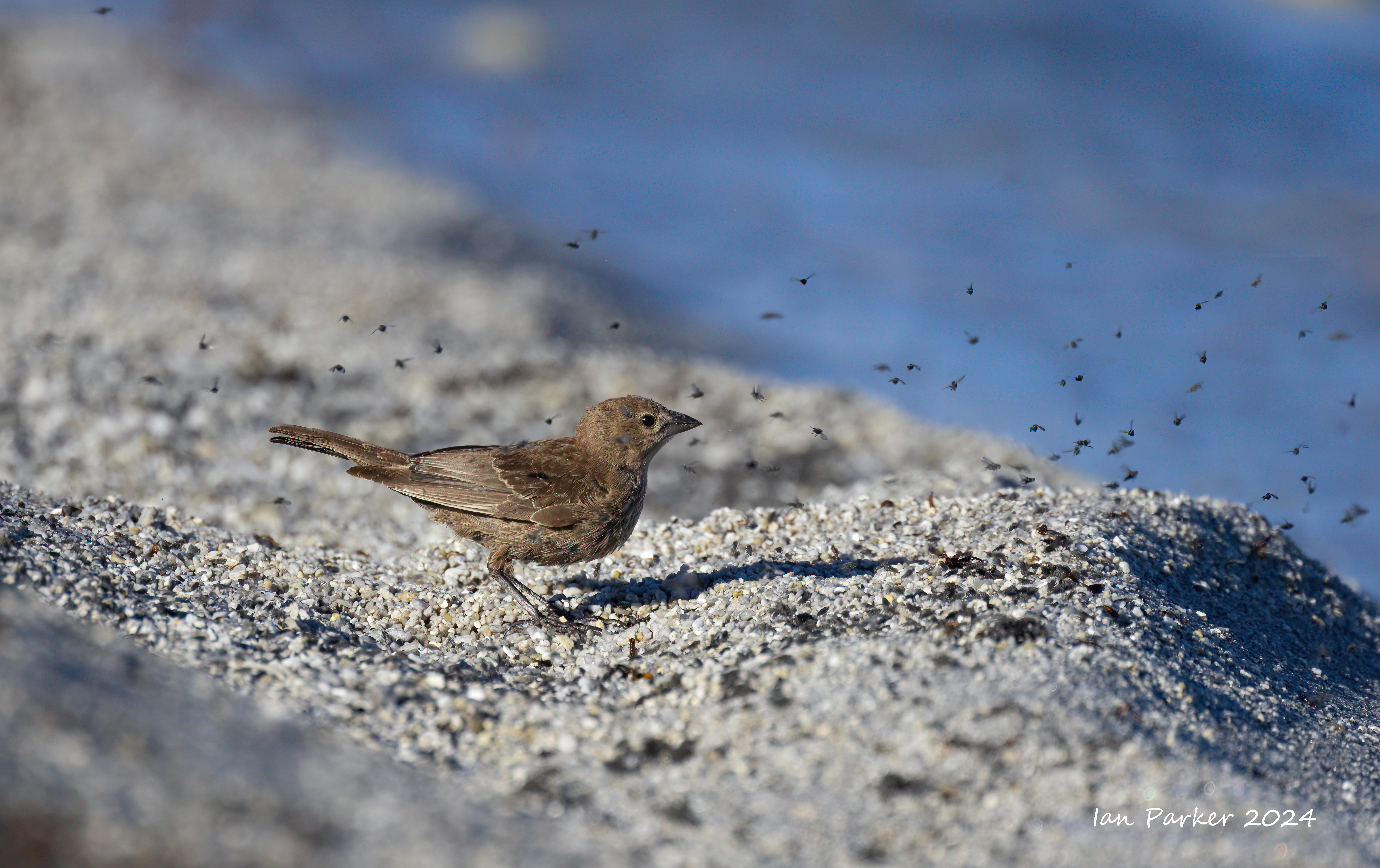
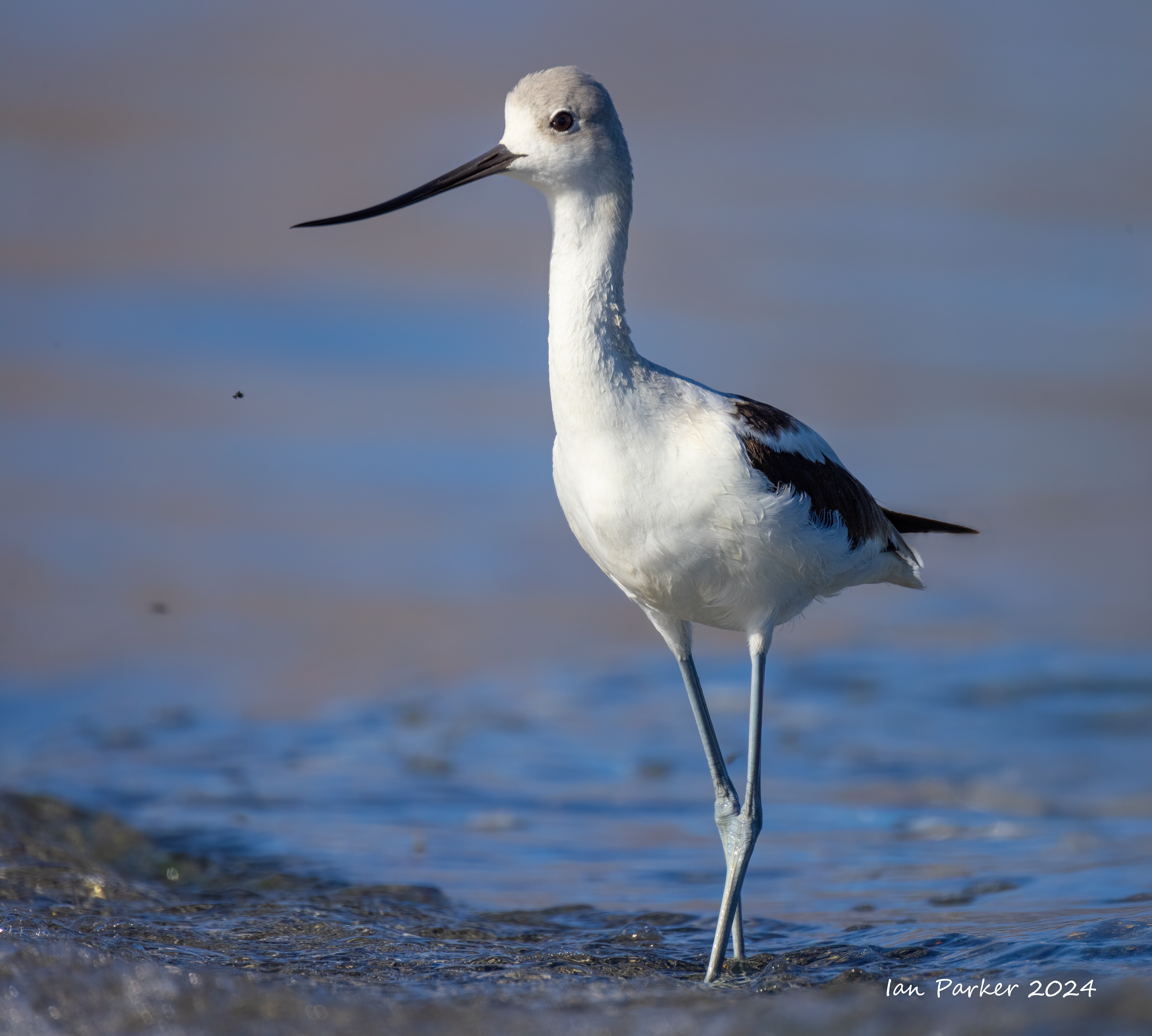
September 11-15 Mono Lake
Mono Lake Birds
 Brine flies - food food for the birds at Mono Lake |
Rare aurora over Mono Lake
A coronal mass ejection evoked a geomagnetic storm on the night of September 12 while we were camped by Mono Lake. Not as powerful as the space weather storm on May 10 (which I missed), but enough to produce a faint aurora as far south as California. This was not visible by eye, but showed up nicely in long exposure photos. I captured the images below using aan 11mm f4 lens with 90s exposure at ISO 1600.
 |
SpaceWeatherLive |
Grasses
 Burnt bush and reeds in the headlights; Mono Lake |
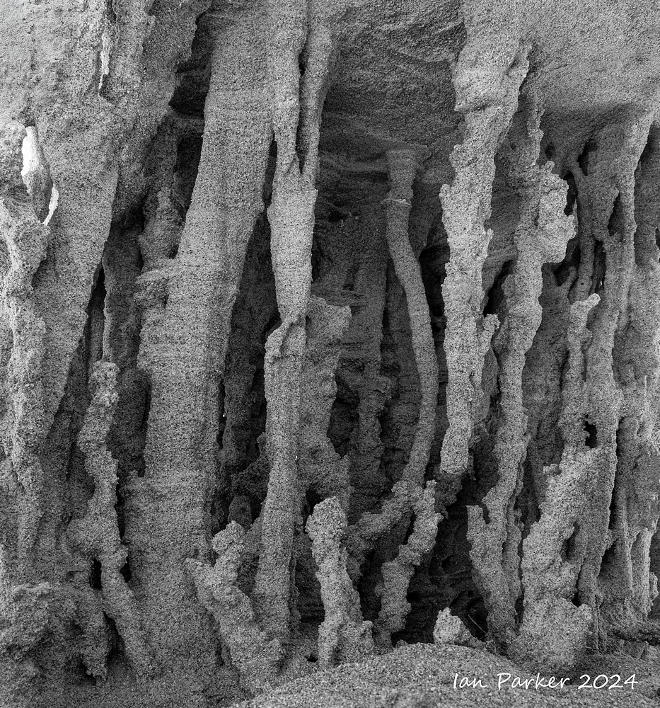
Sand Tufa Details
 Sunrise on the mountains through sand tufa tunnel; Mono Lake |
A detour to Lake Crowley on the way from Nevada to Mono Lake
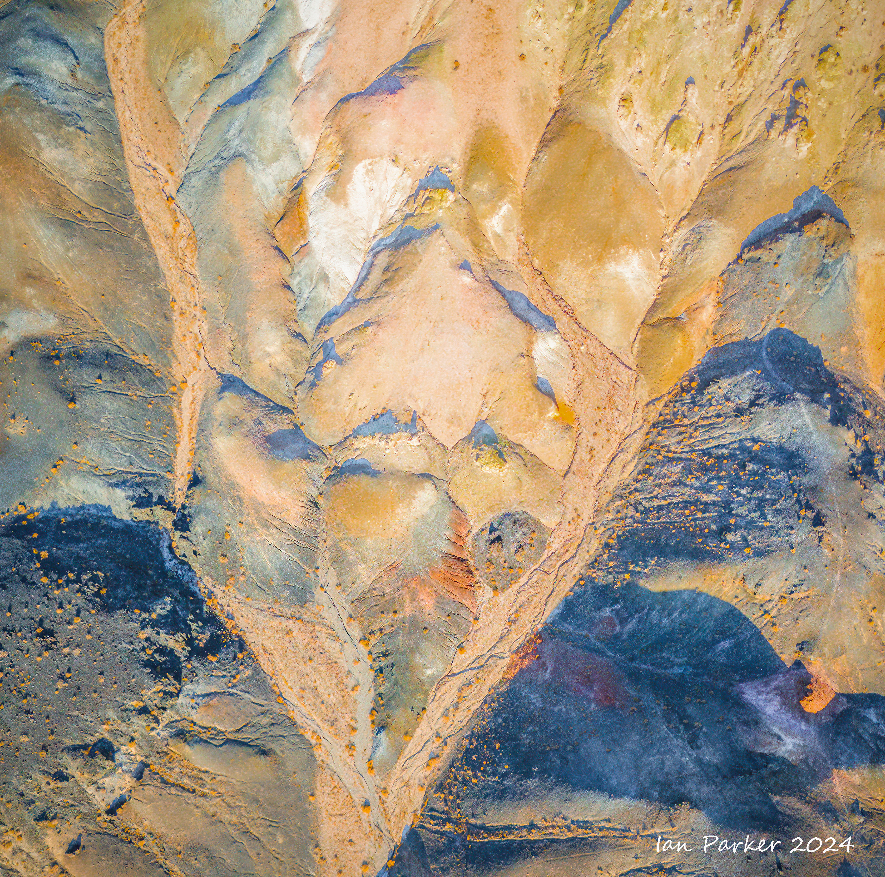
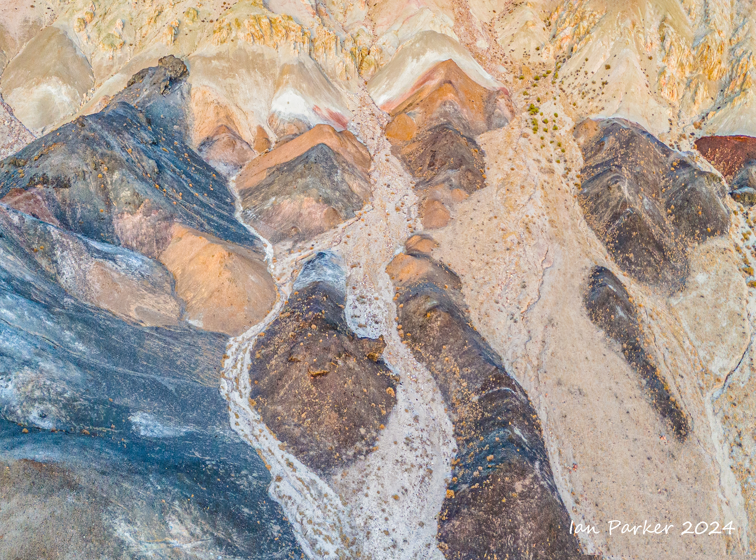
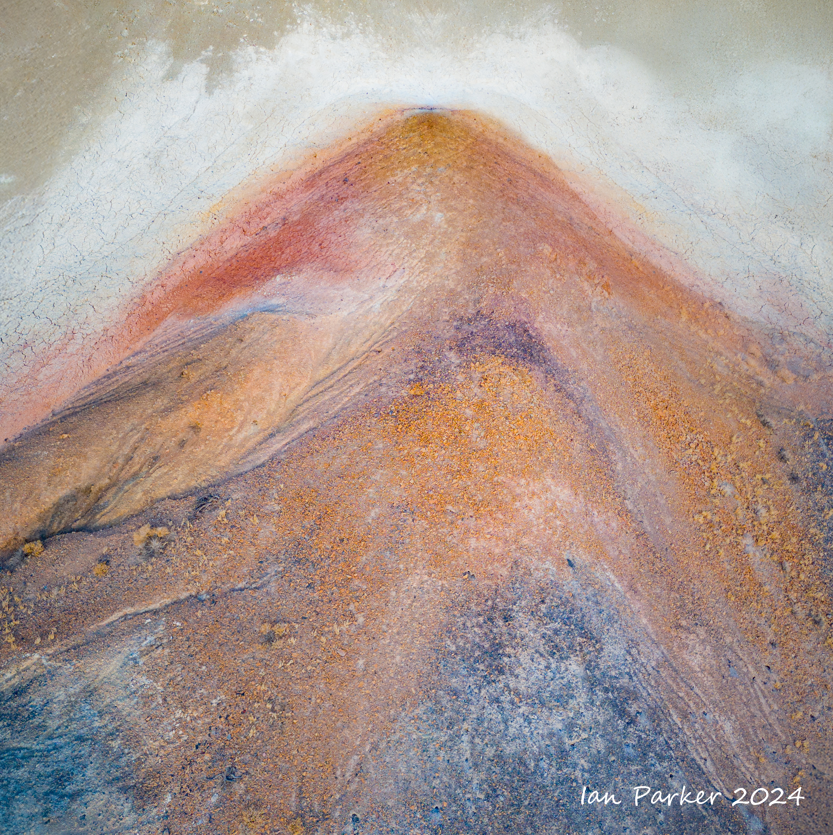
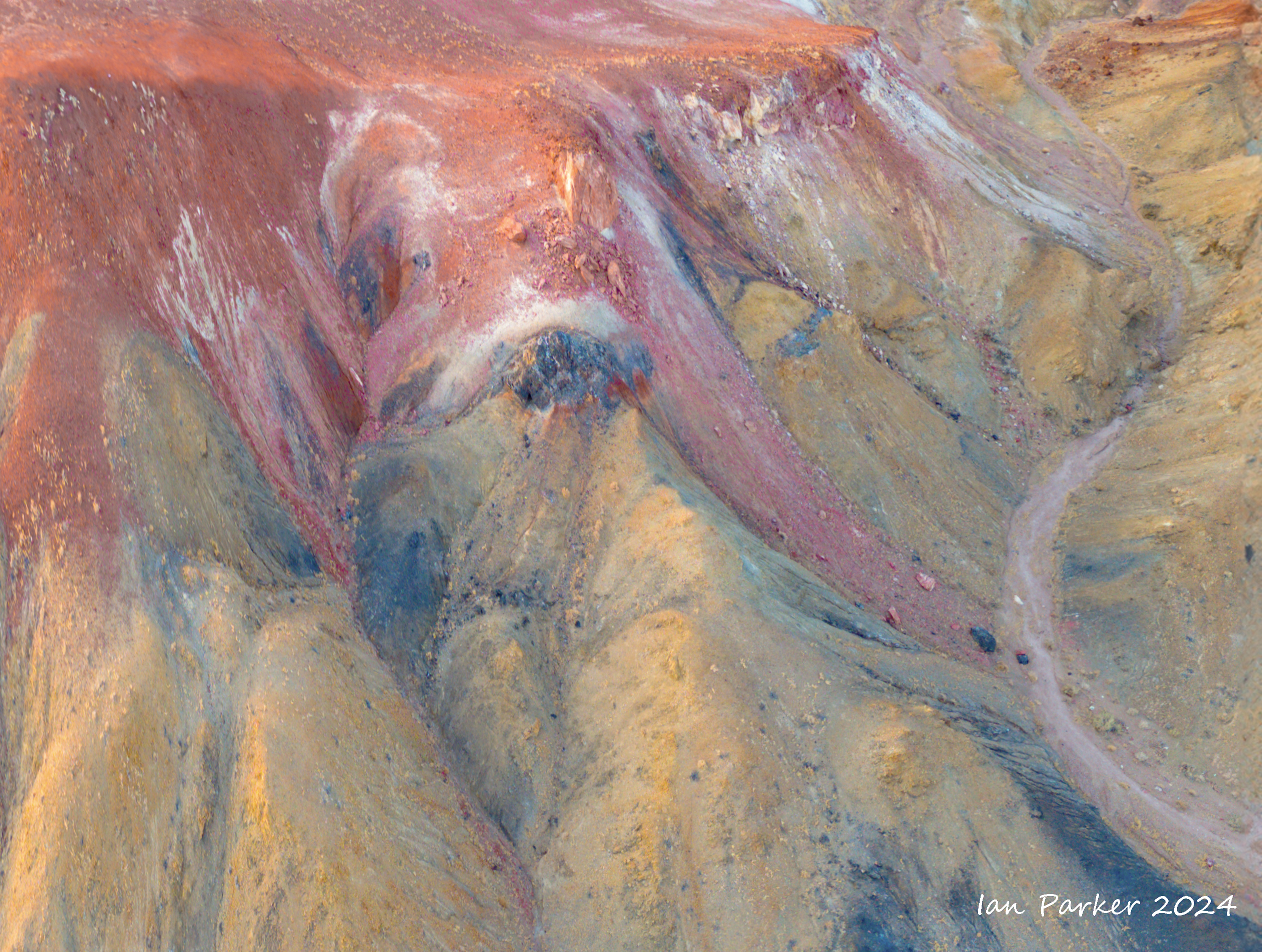
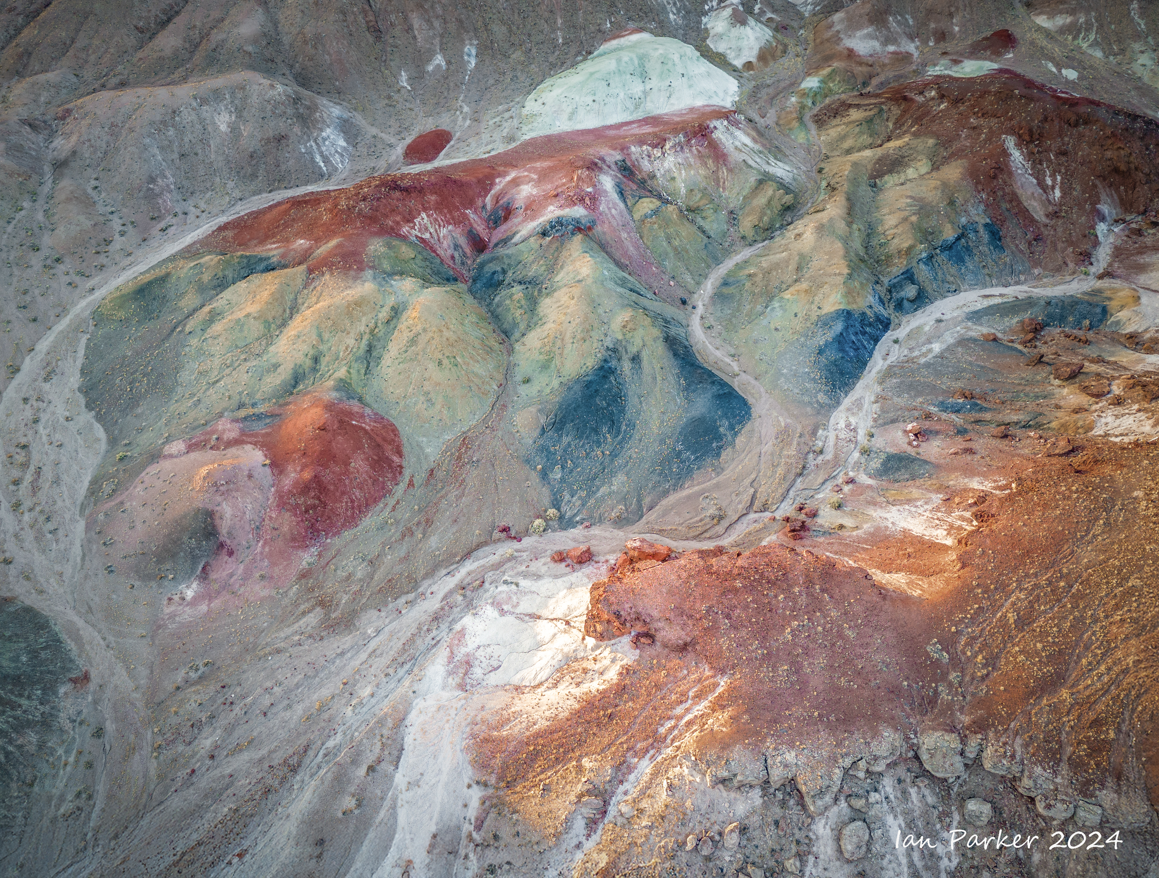
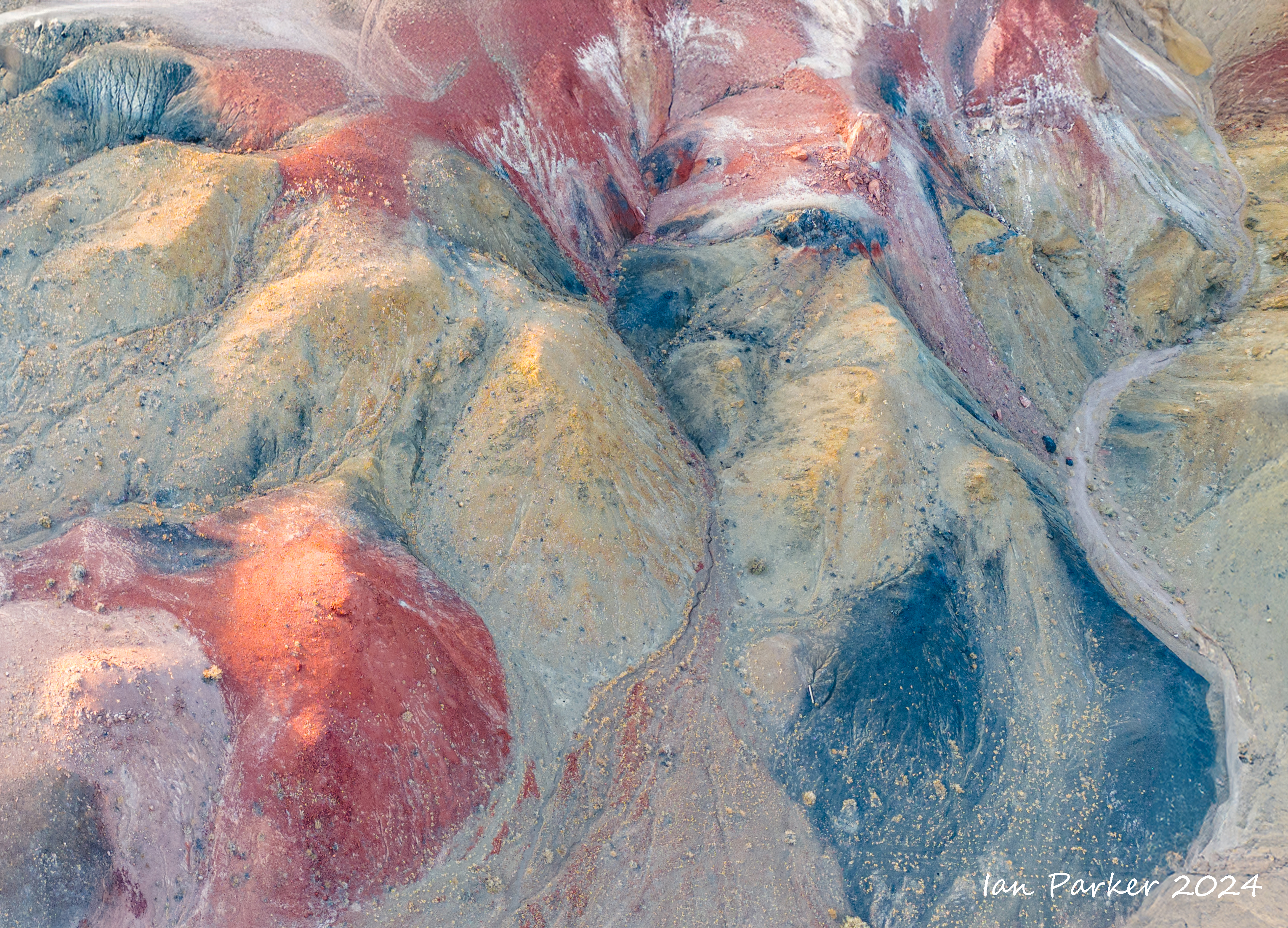
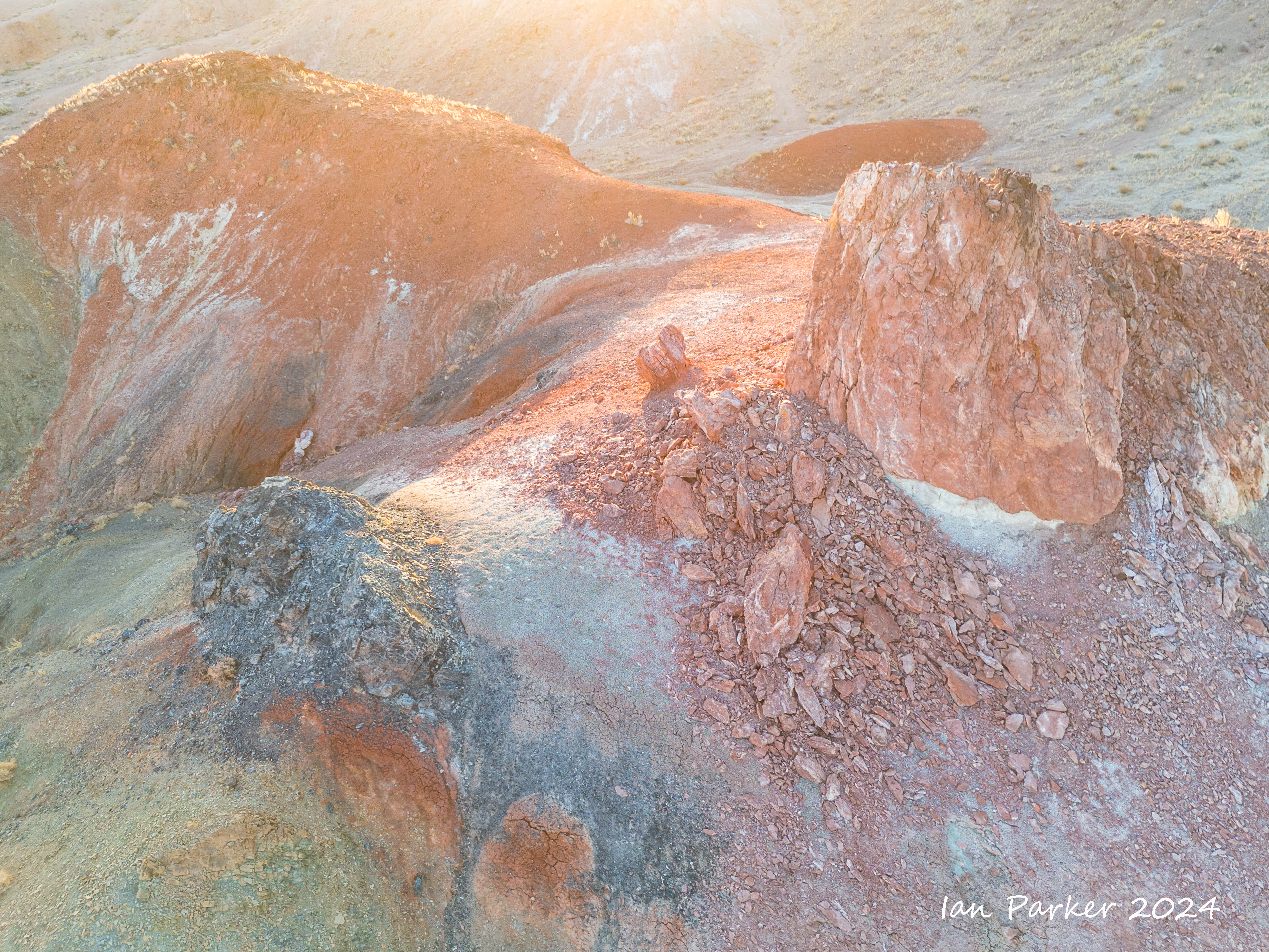
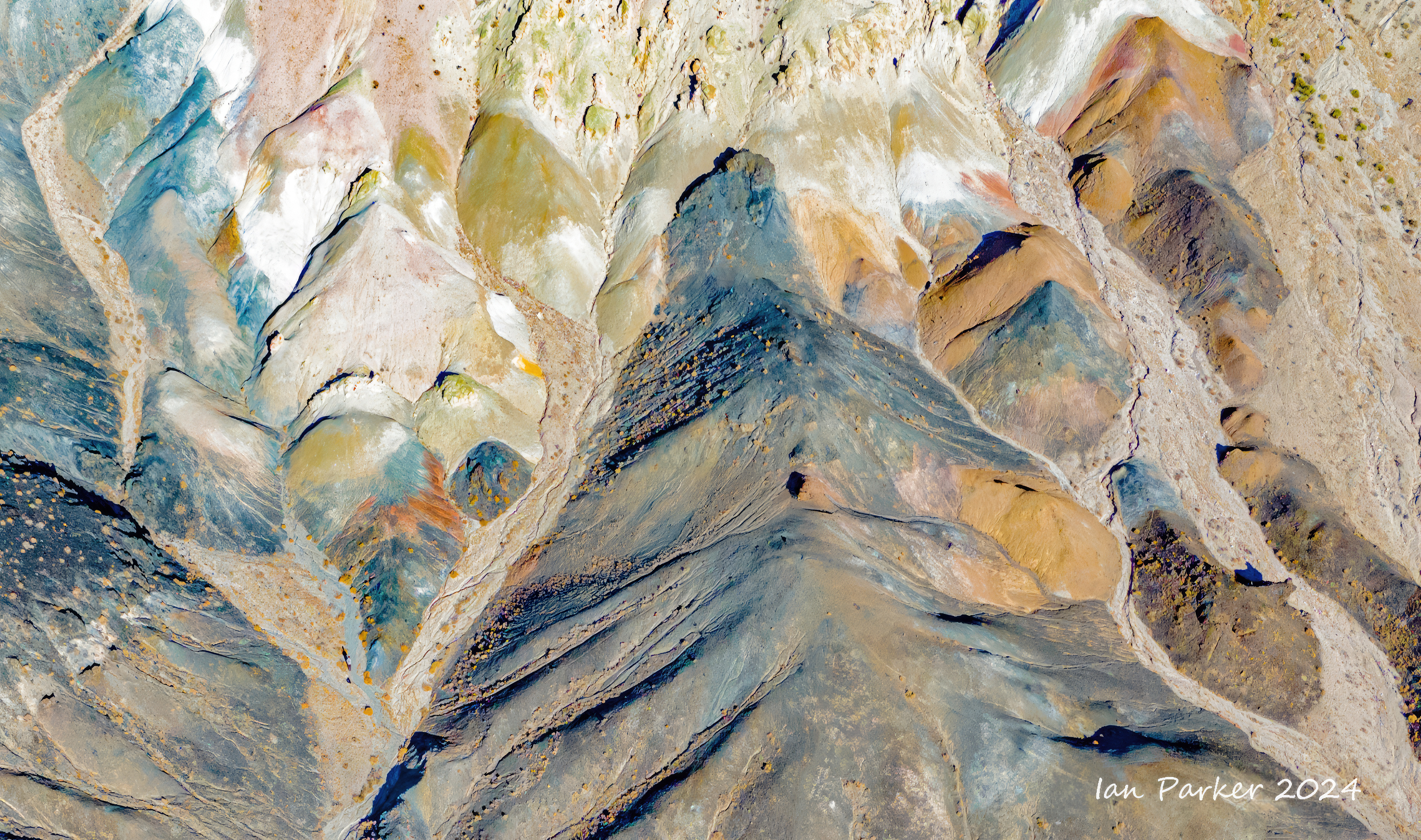
September 14,15 - Gap Spring, Nevada

Abstract drone photography around Gap SpringsWith a recently acquired drone I wondered whether aerial landscapes might lend themselves to abstract techniques. A visit to the colorful eroded hills in a remote part of Nevada around Gap Spring made for a good opportunity to explore this idea. We camped for a night in a secluded canyon by the spring, so I was able to fly and photograph both around sunset and sunrise as well as in full daylight. Drone photography is still a learning experience for me, so I was happy to be able to capture images under different lighting conditions and see what worked best after the fact. Also, because I found it difficult to judge compositions on the screen of the remote control, I took many shots at different viewpoints and angles, with the camera variously horizontal, angled down and pointed directly down. |
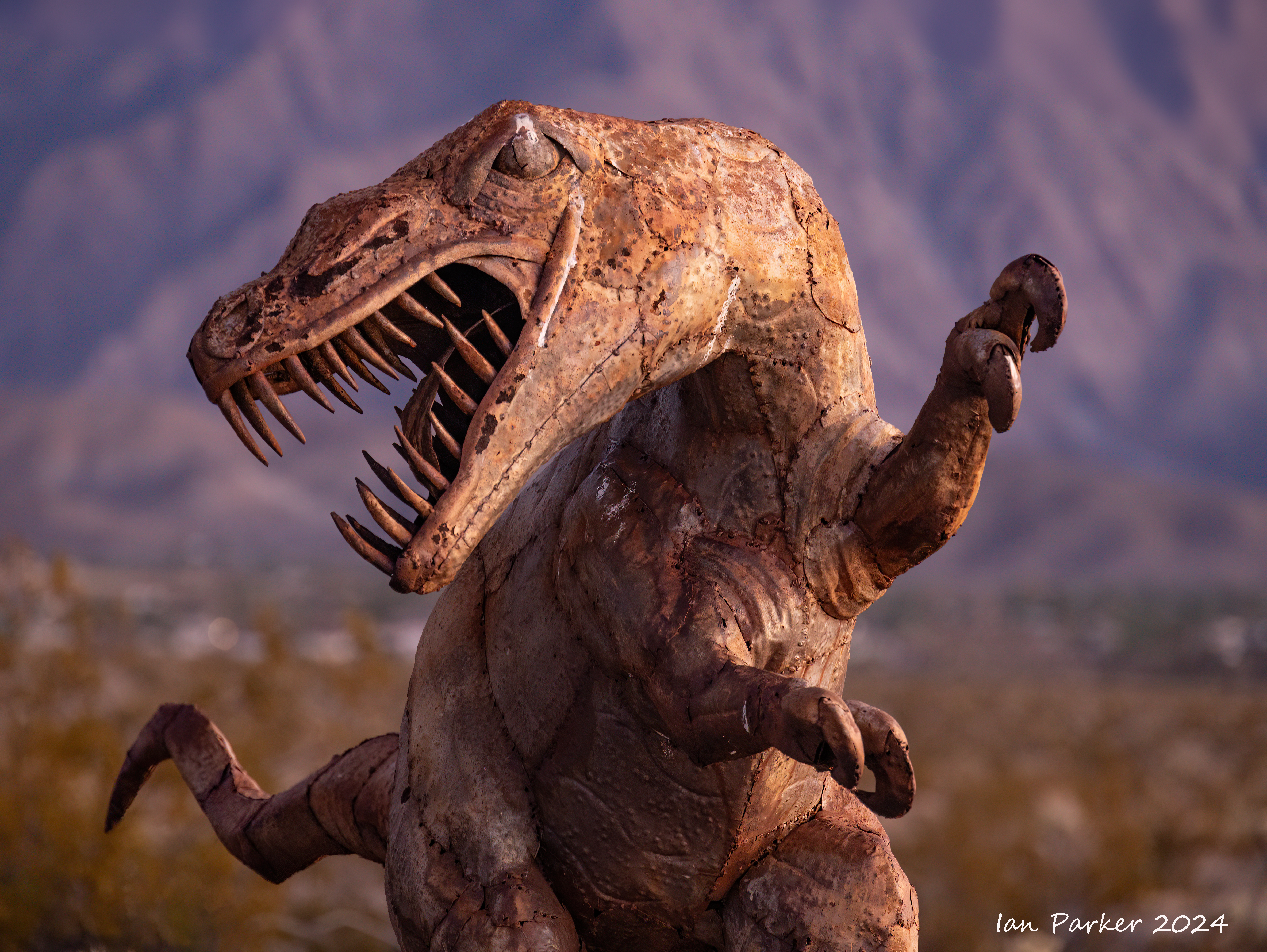
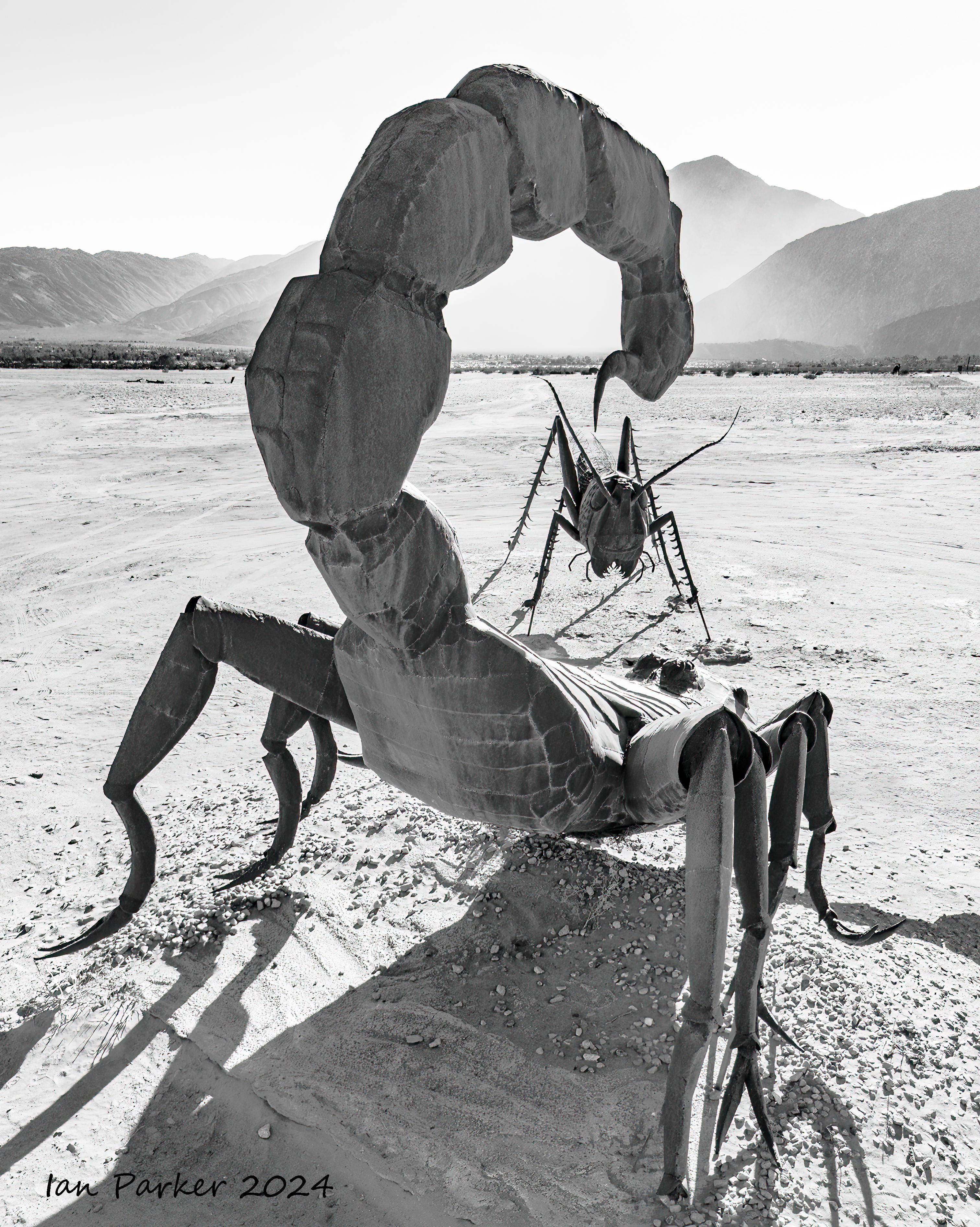
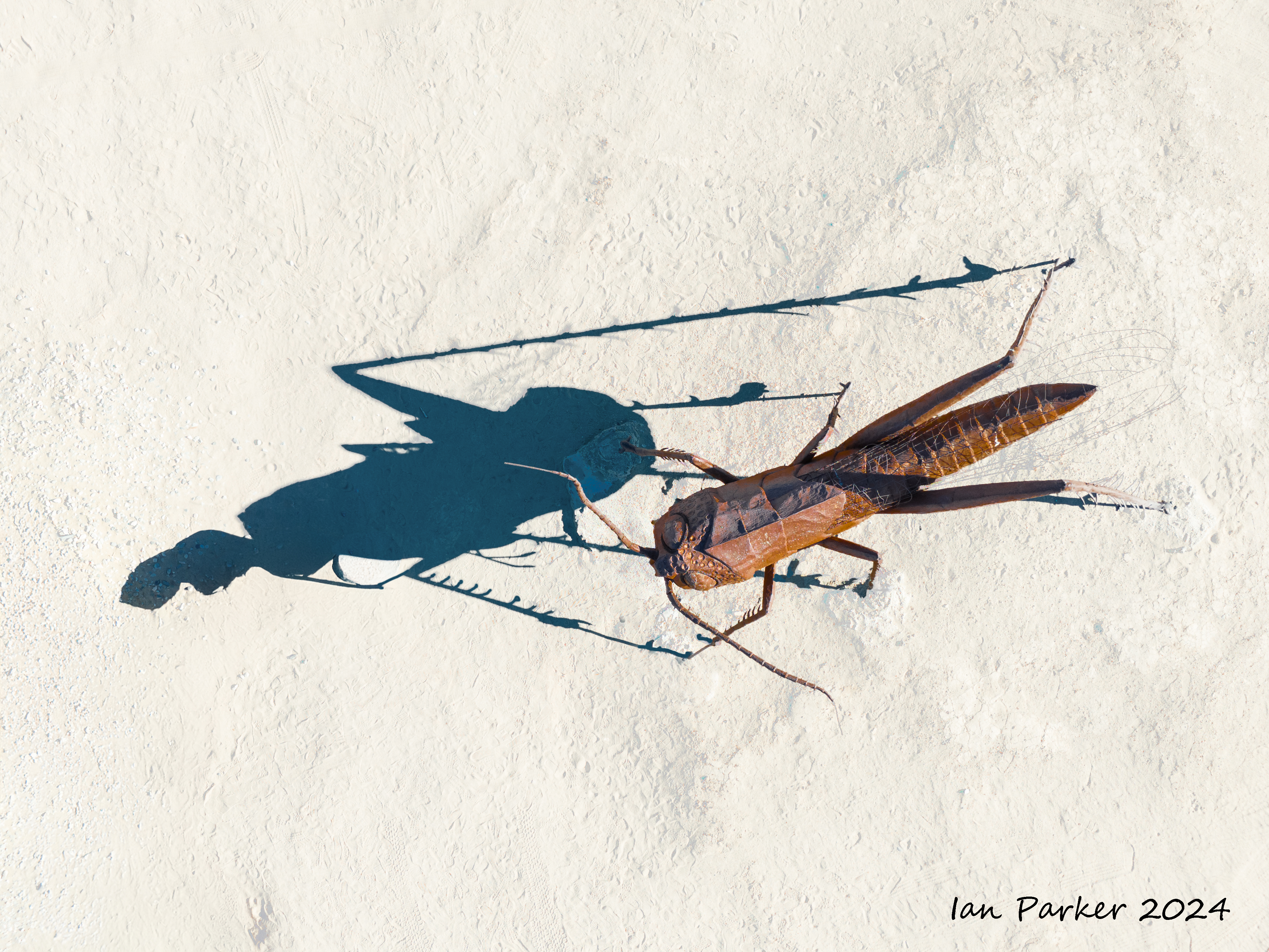
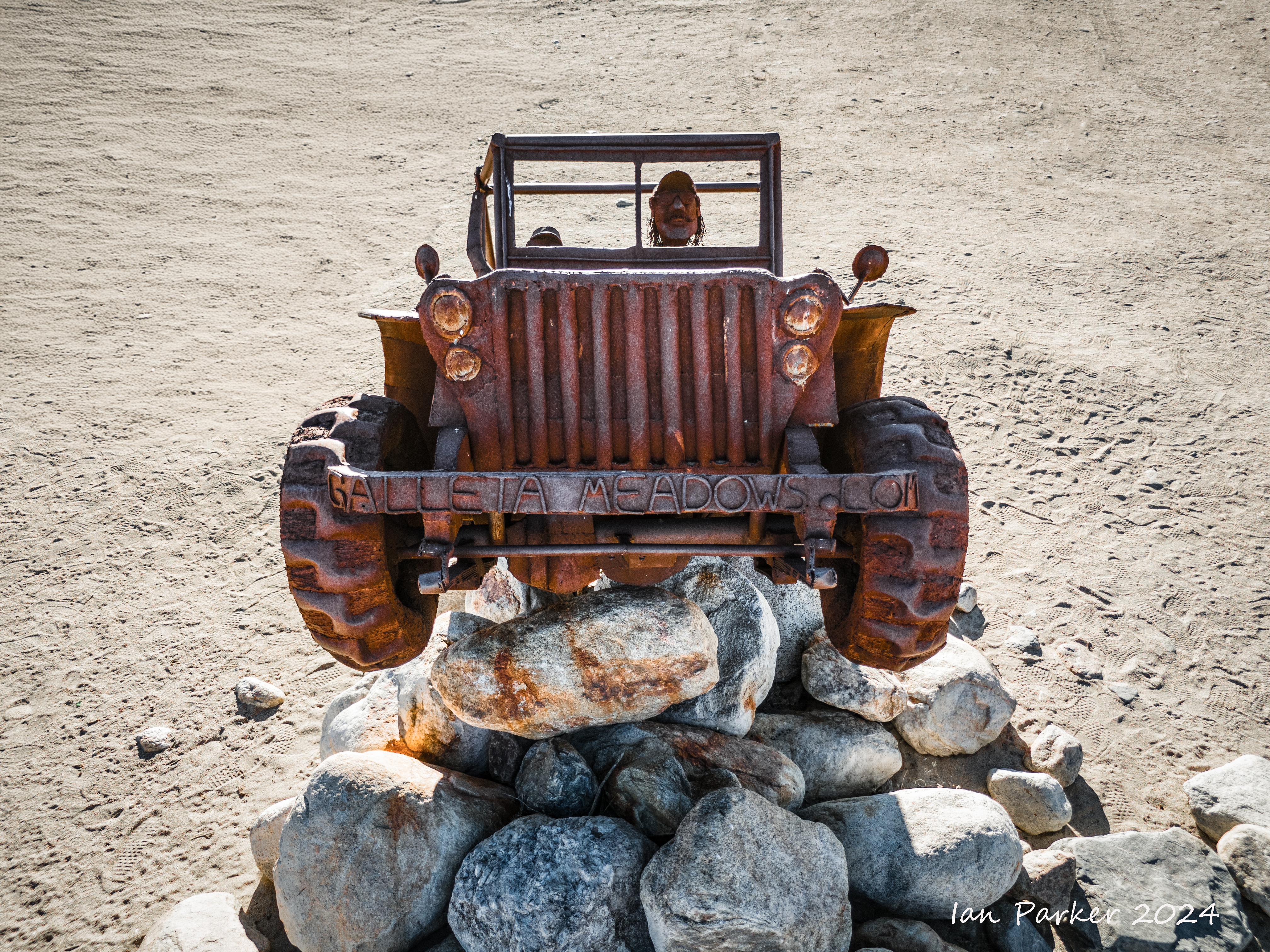
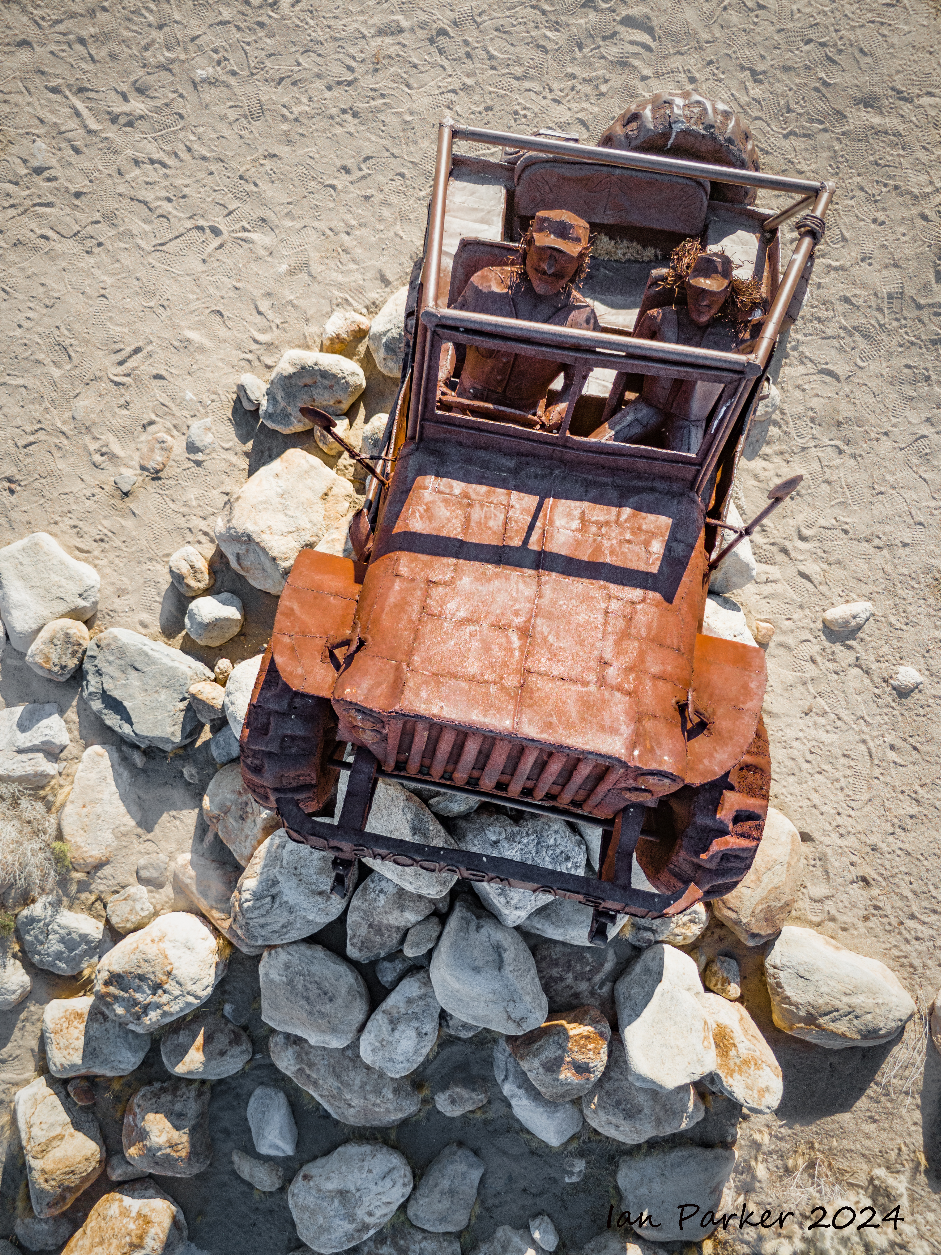
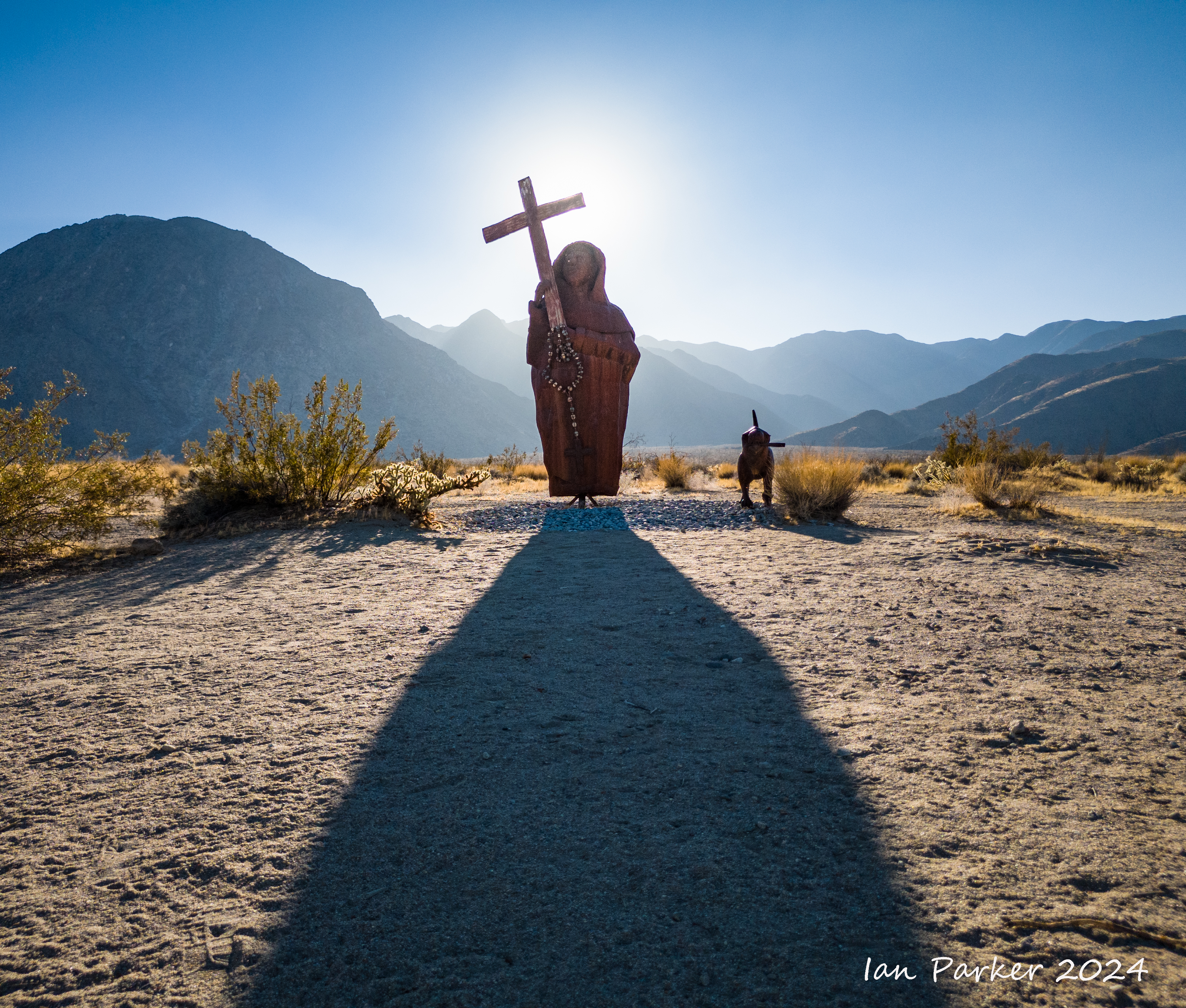
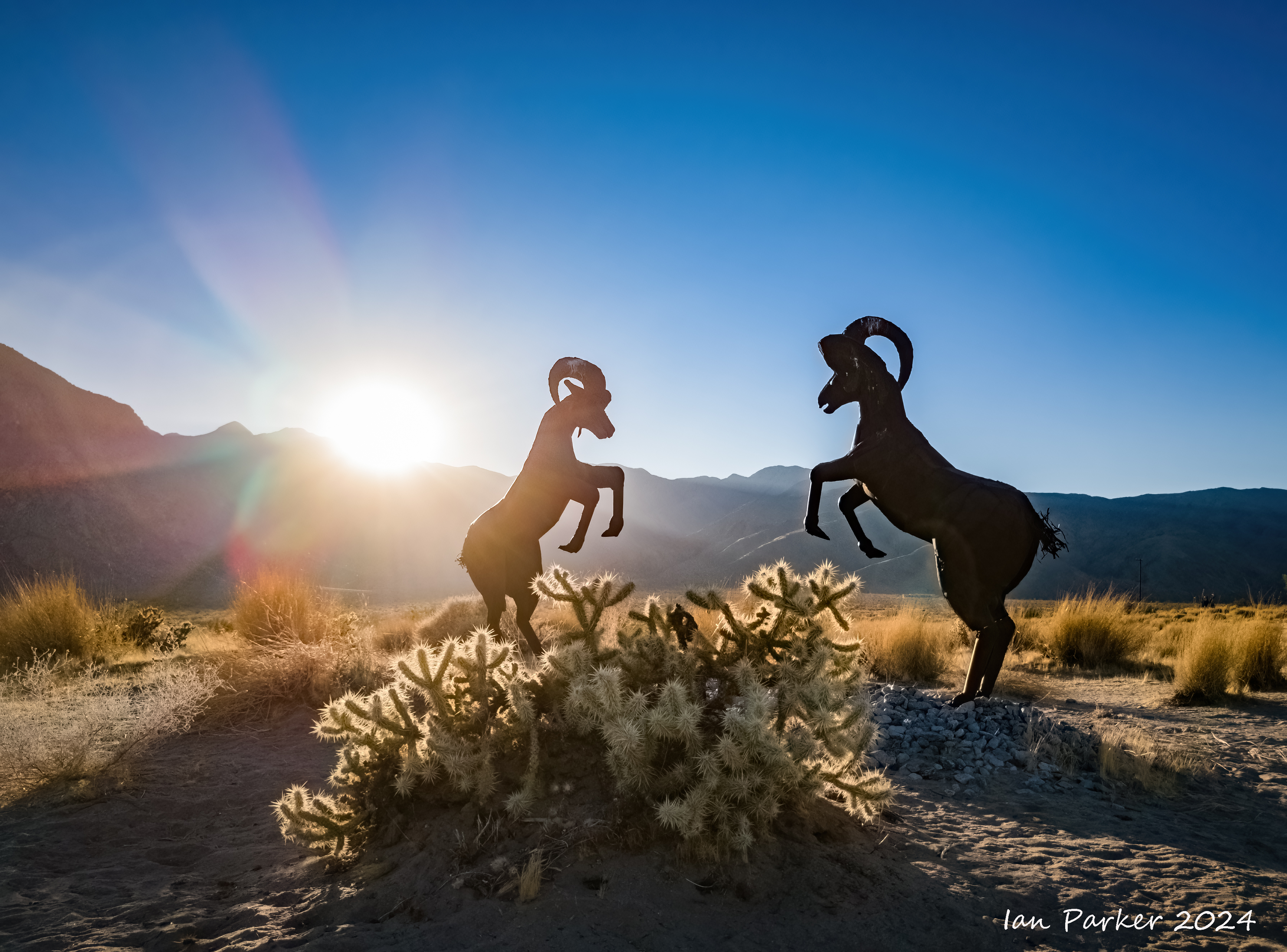
August 13,14 - Borrego Springs
A trip to the dark desert skies at Anza Borrego for the Perseid meteor shower. But maybe a few days after the peak, as I had little success capturing meteors.
starcircle.jpg)
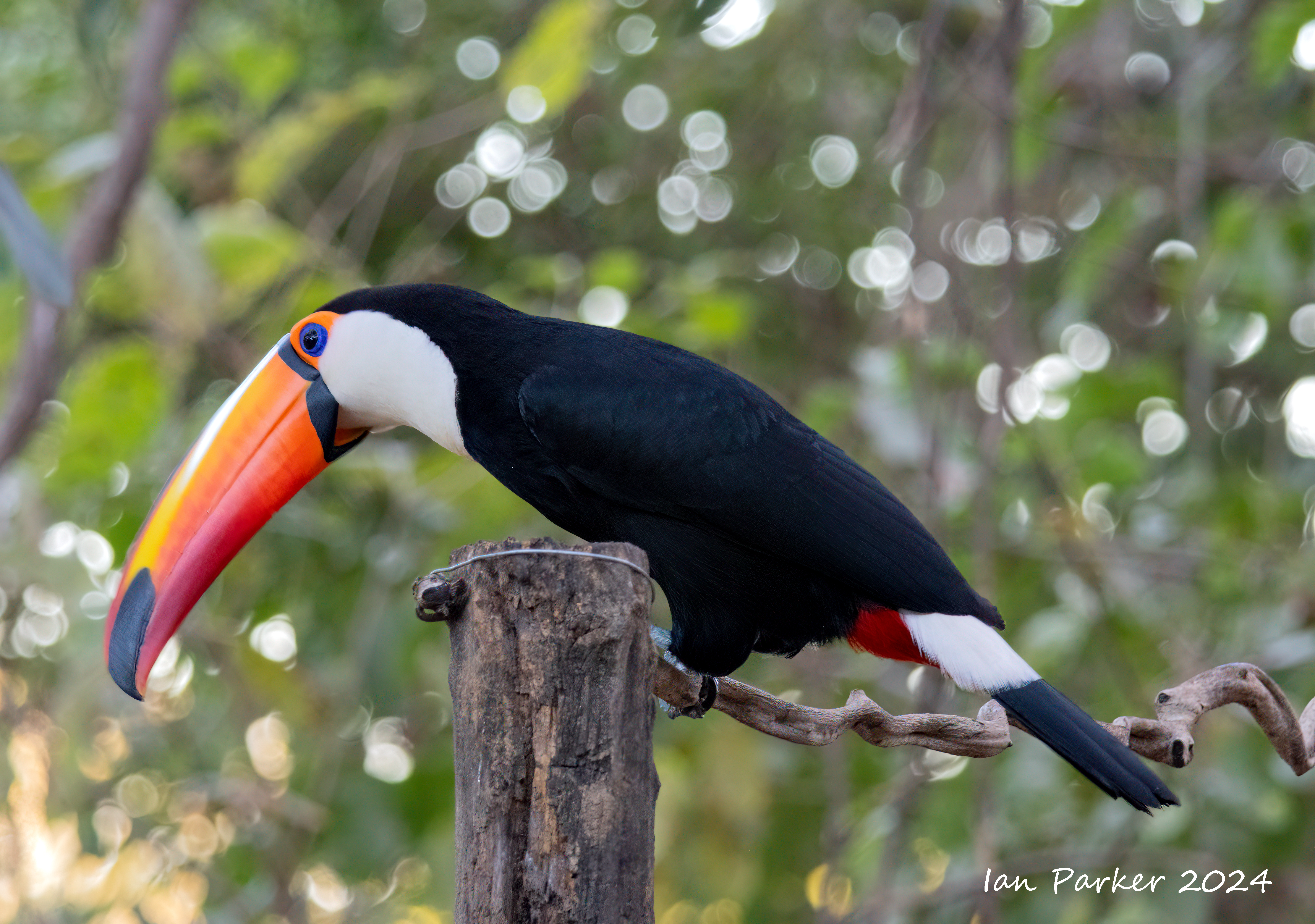
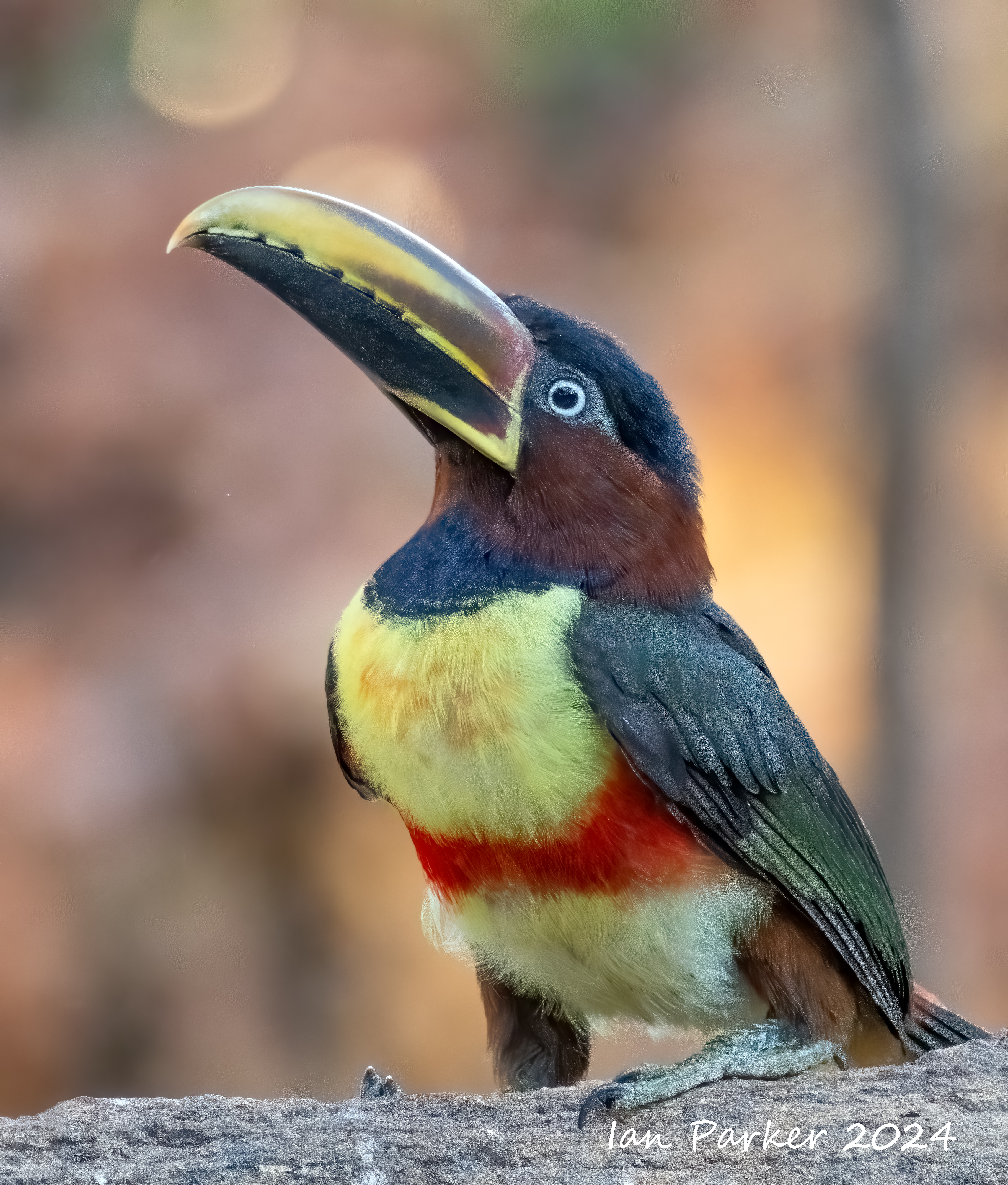
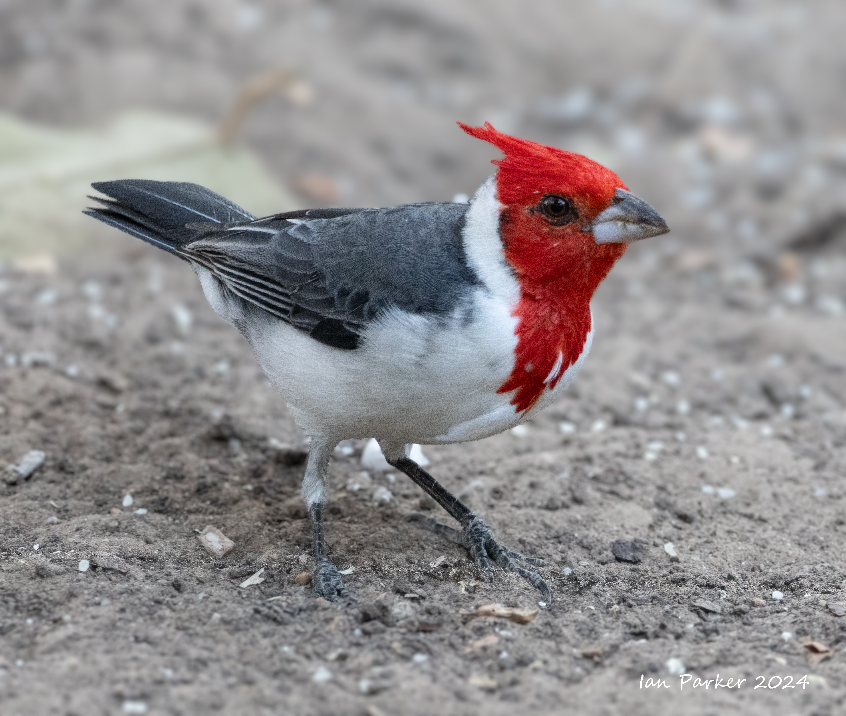
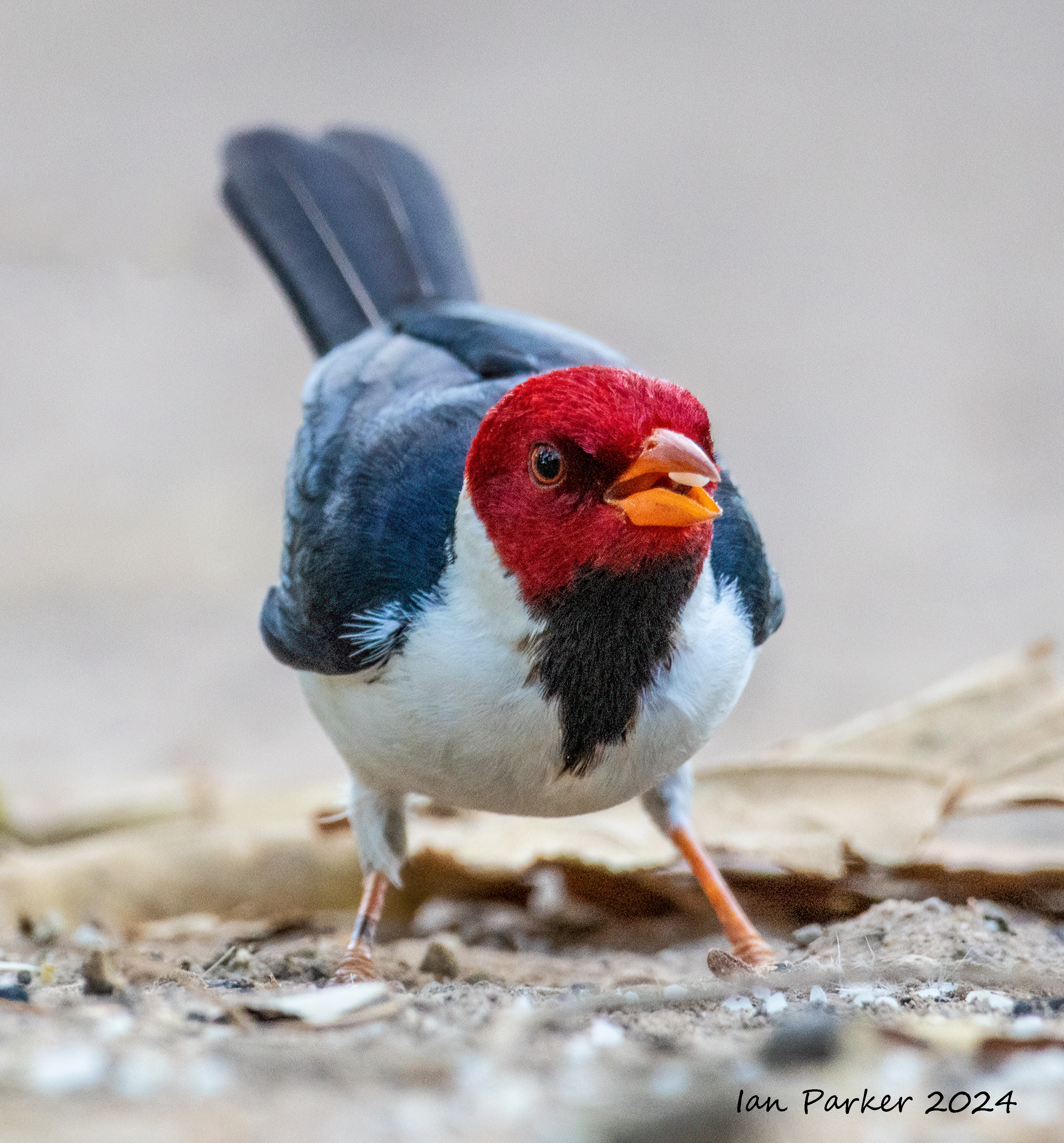
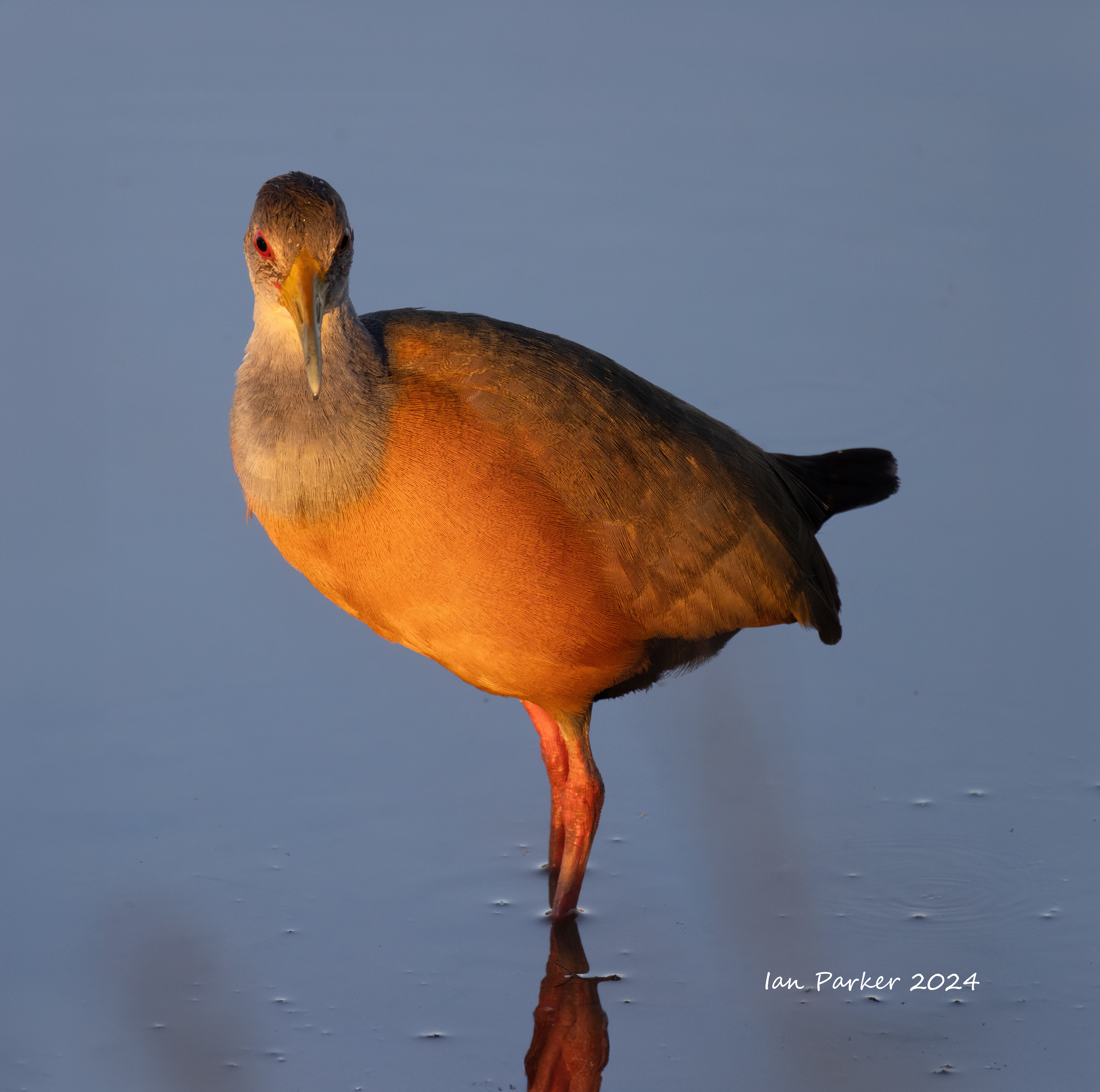
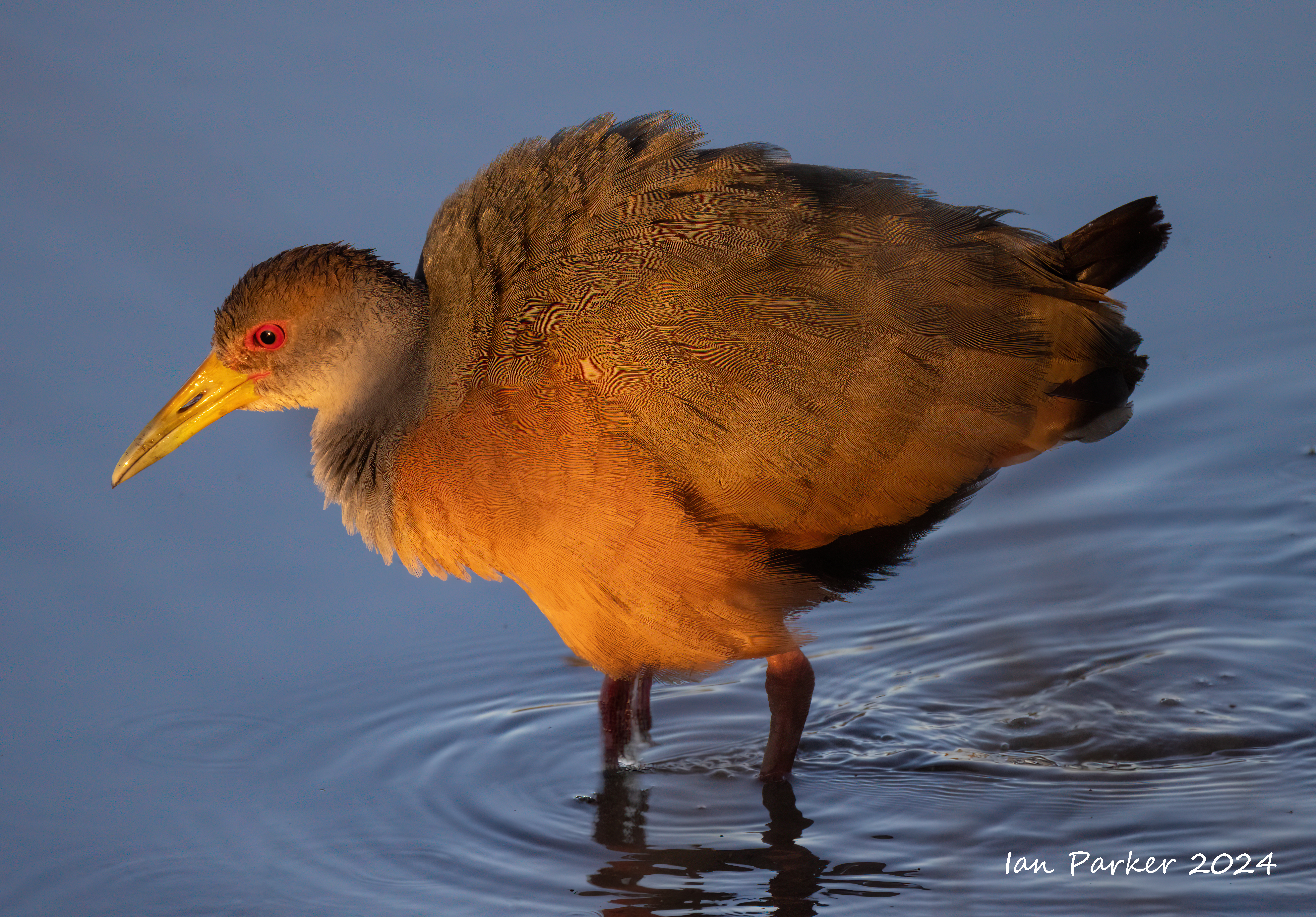
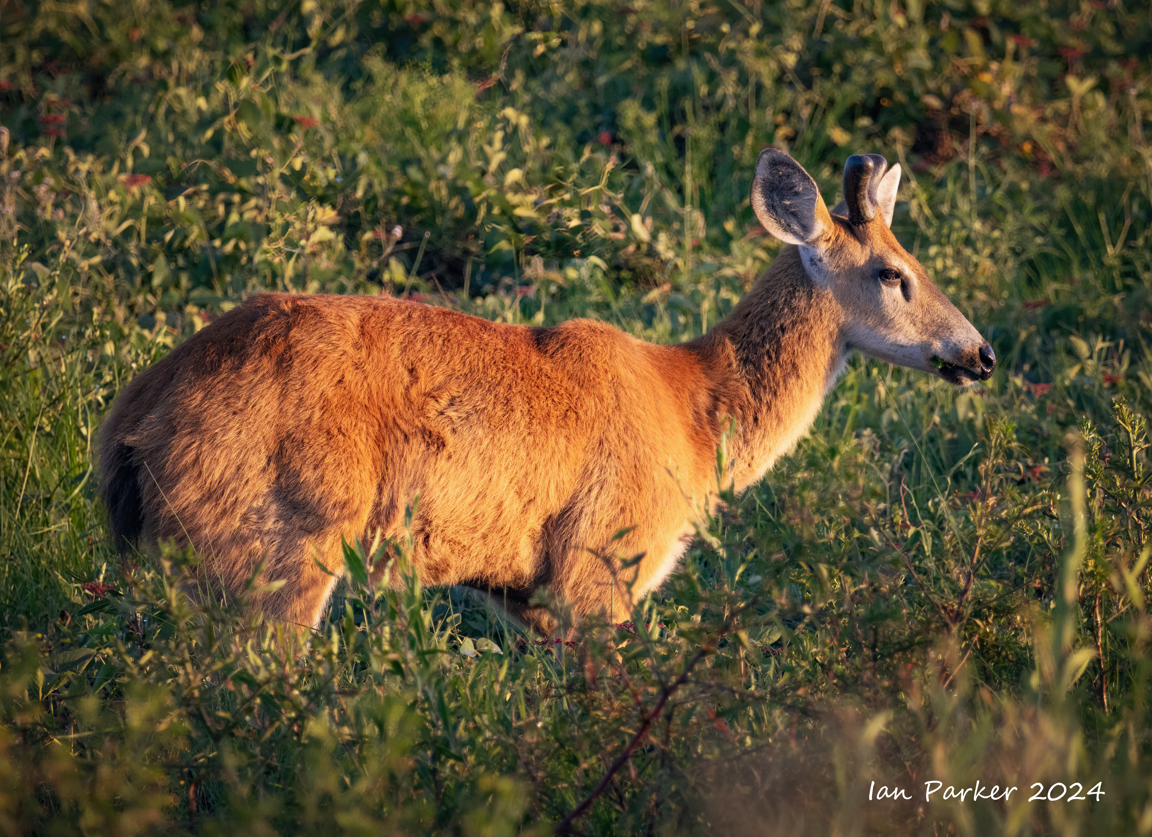
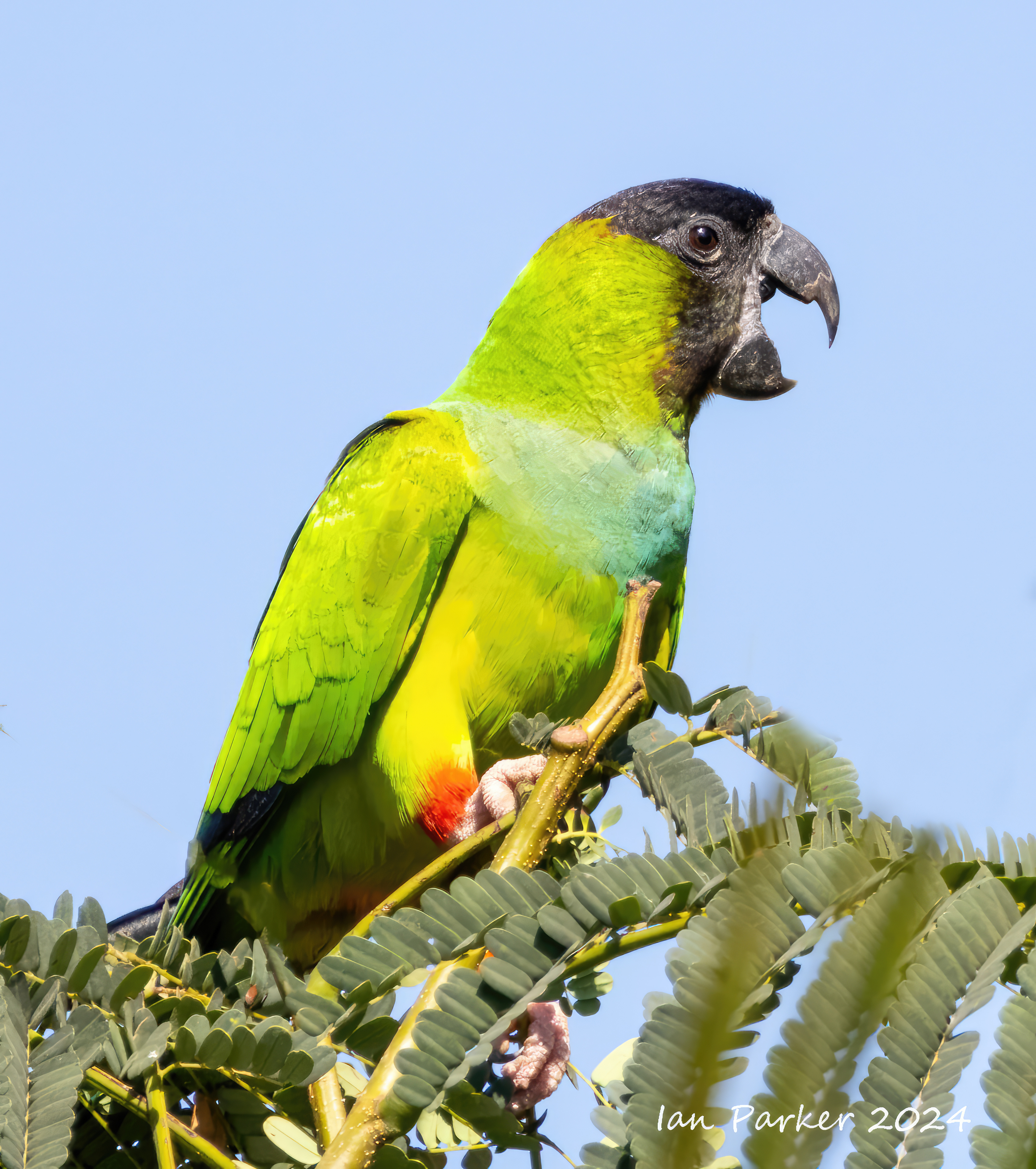
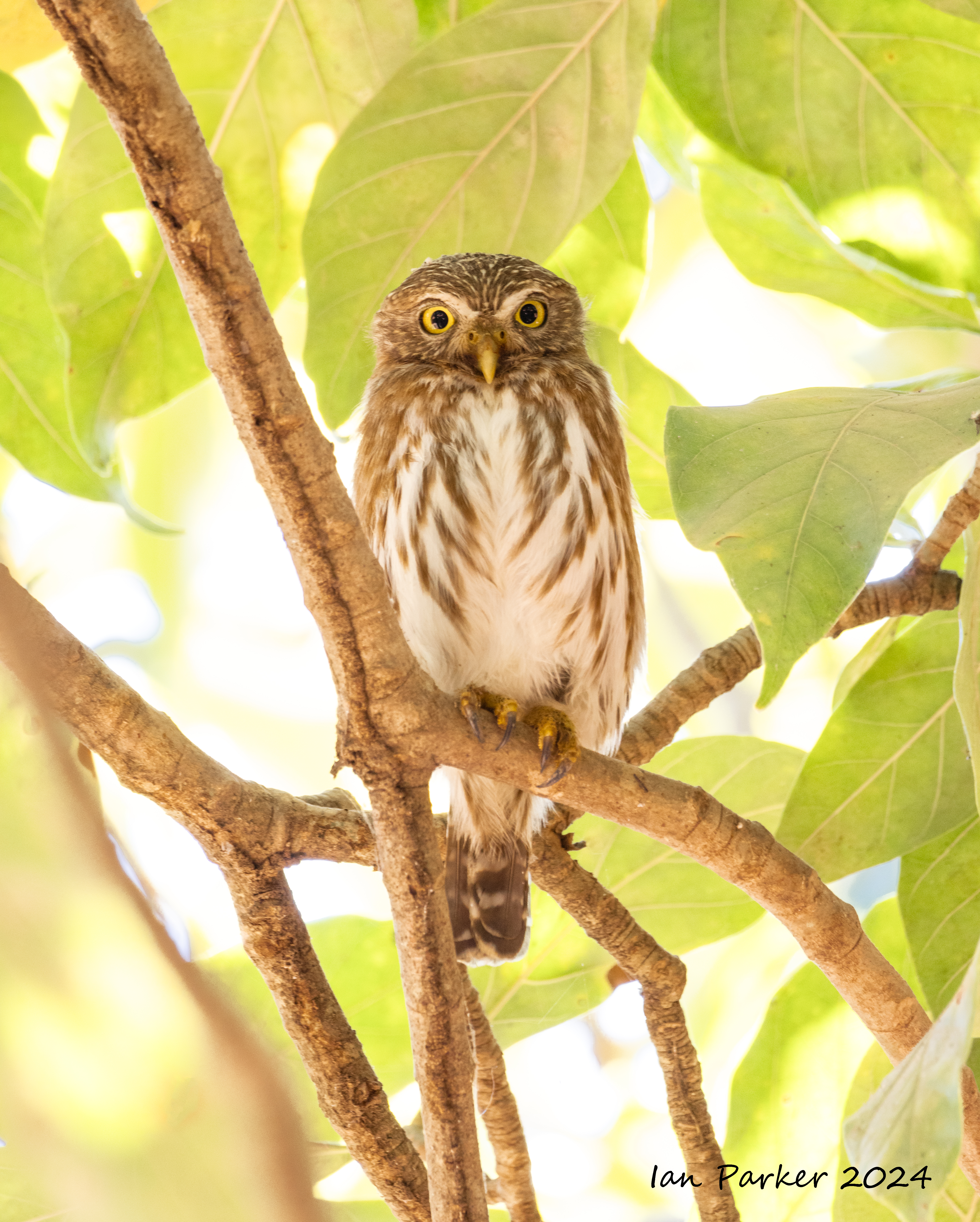
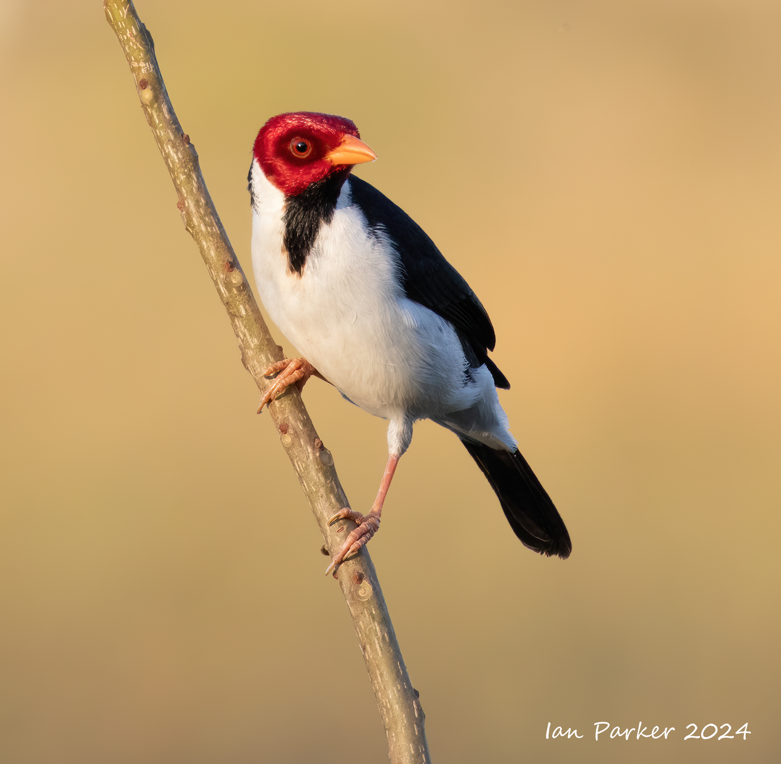
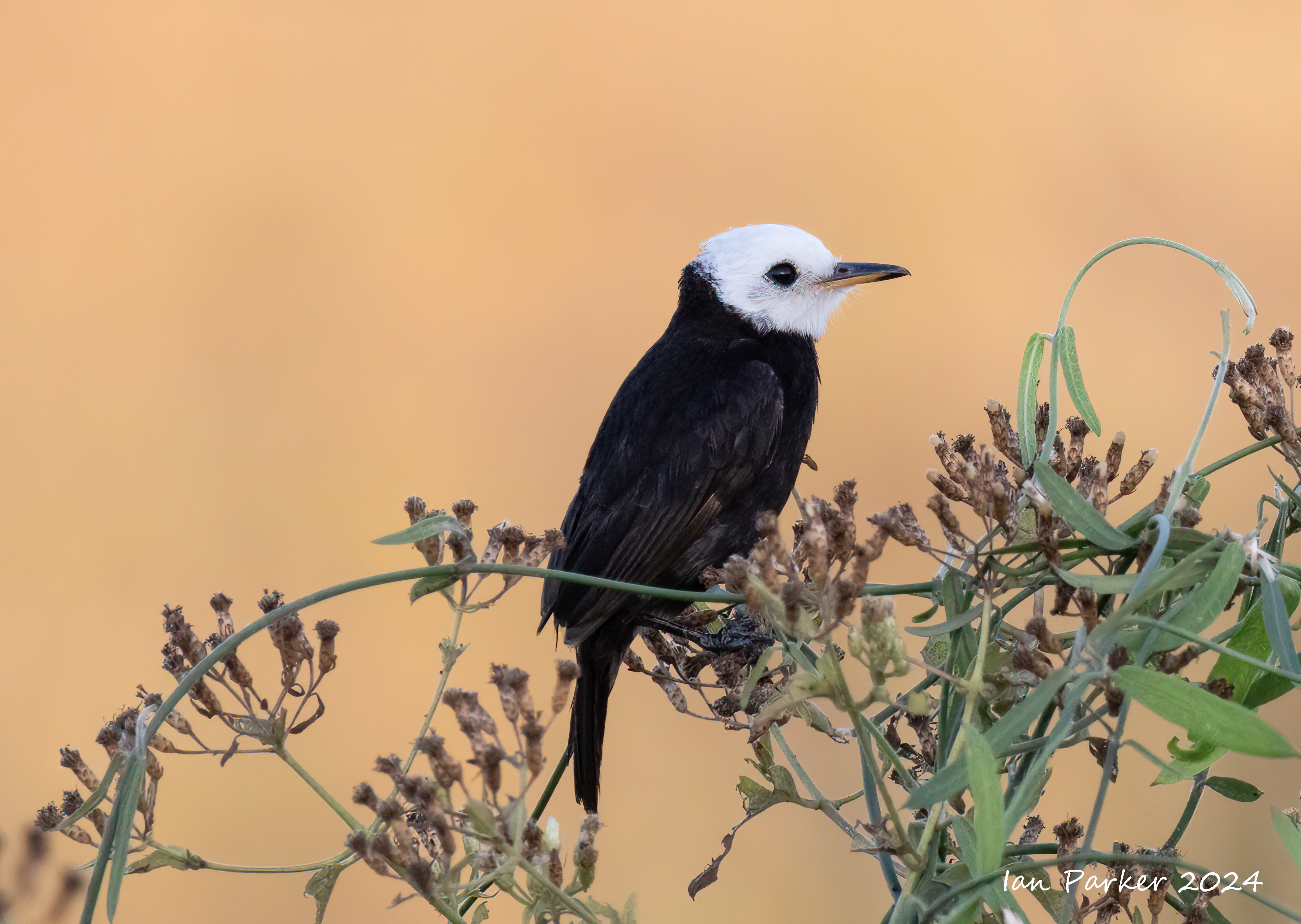
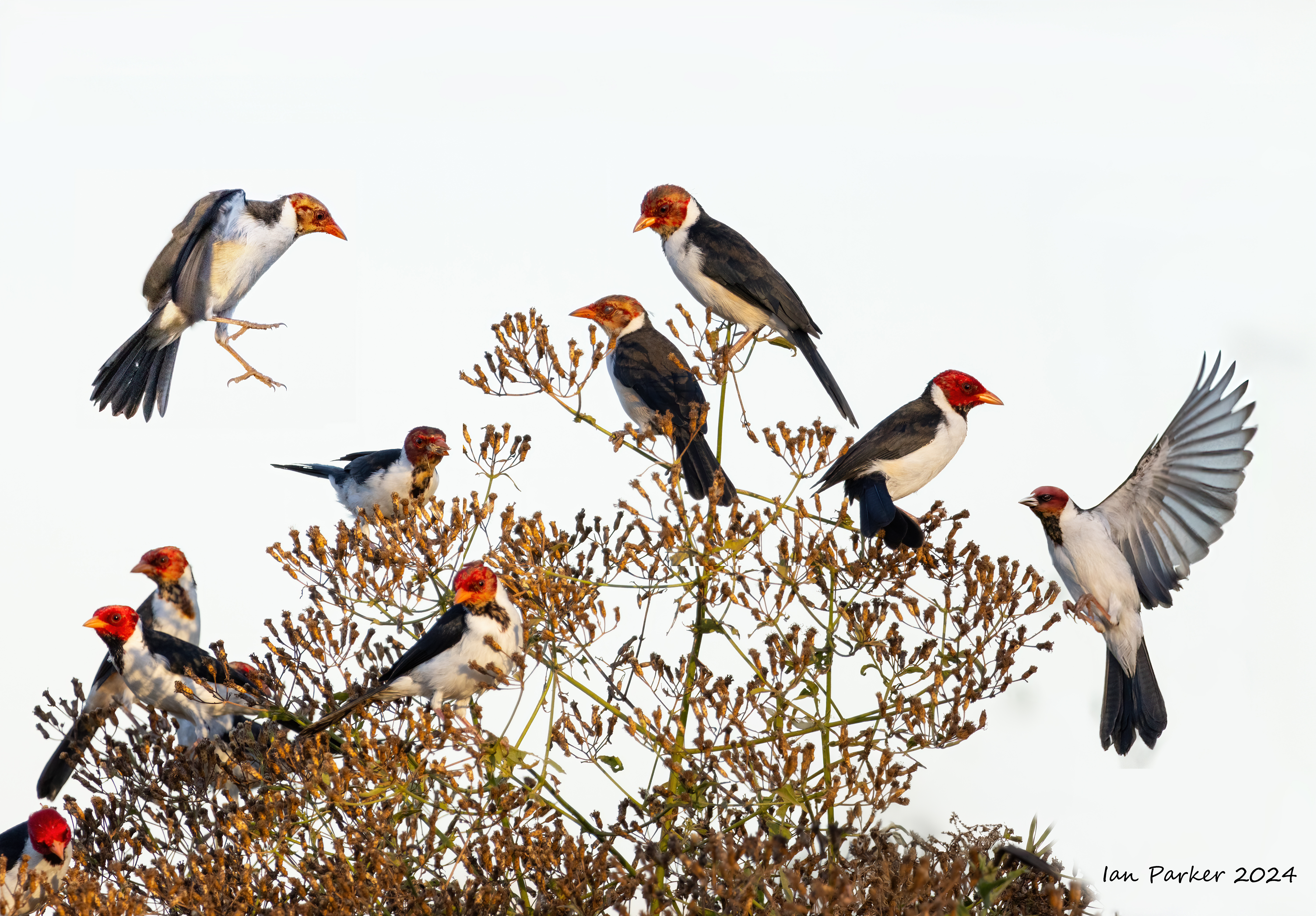
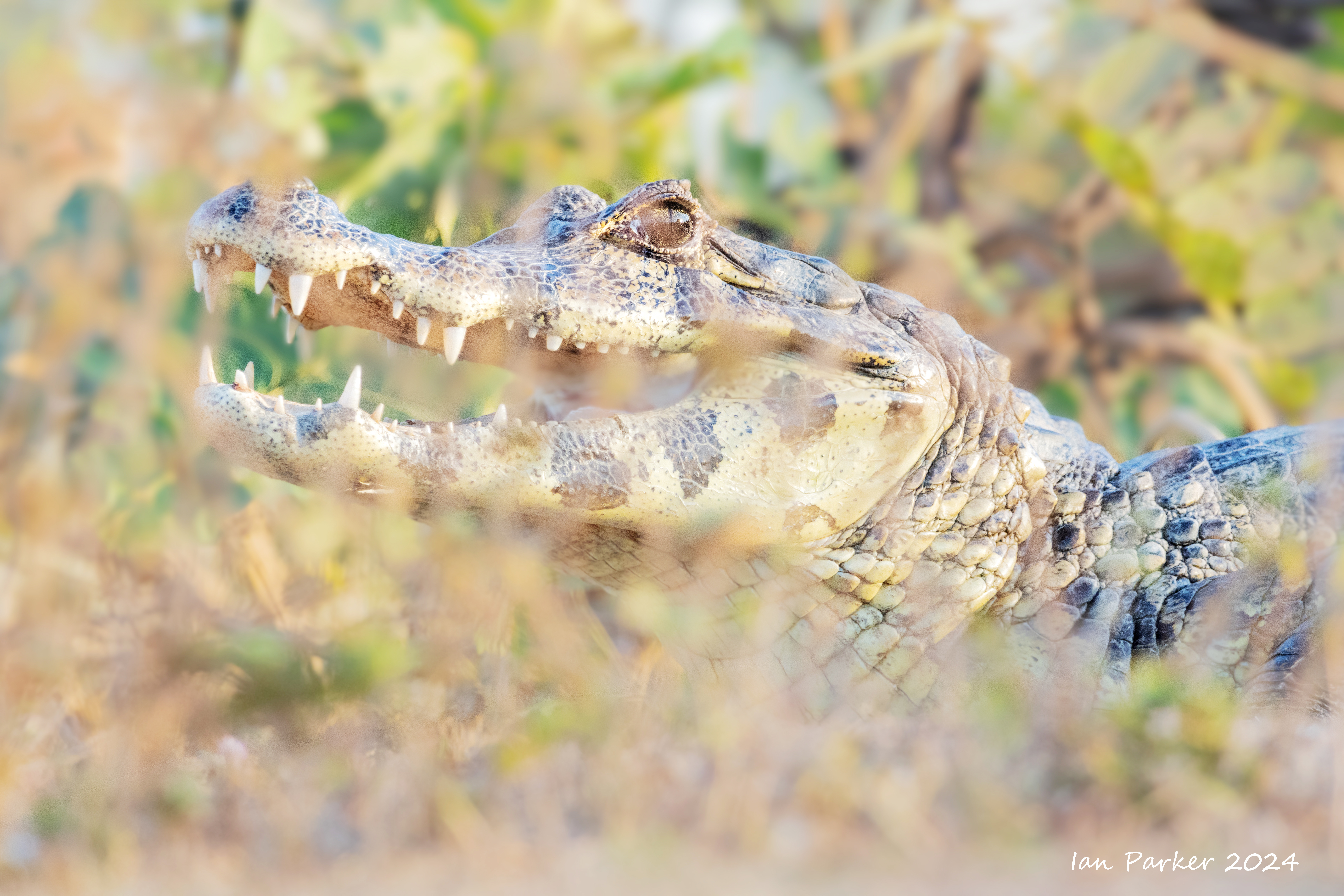
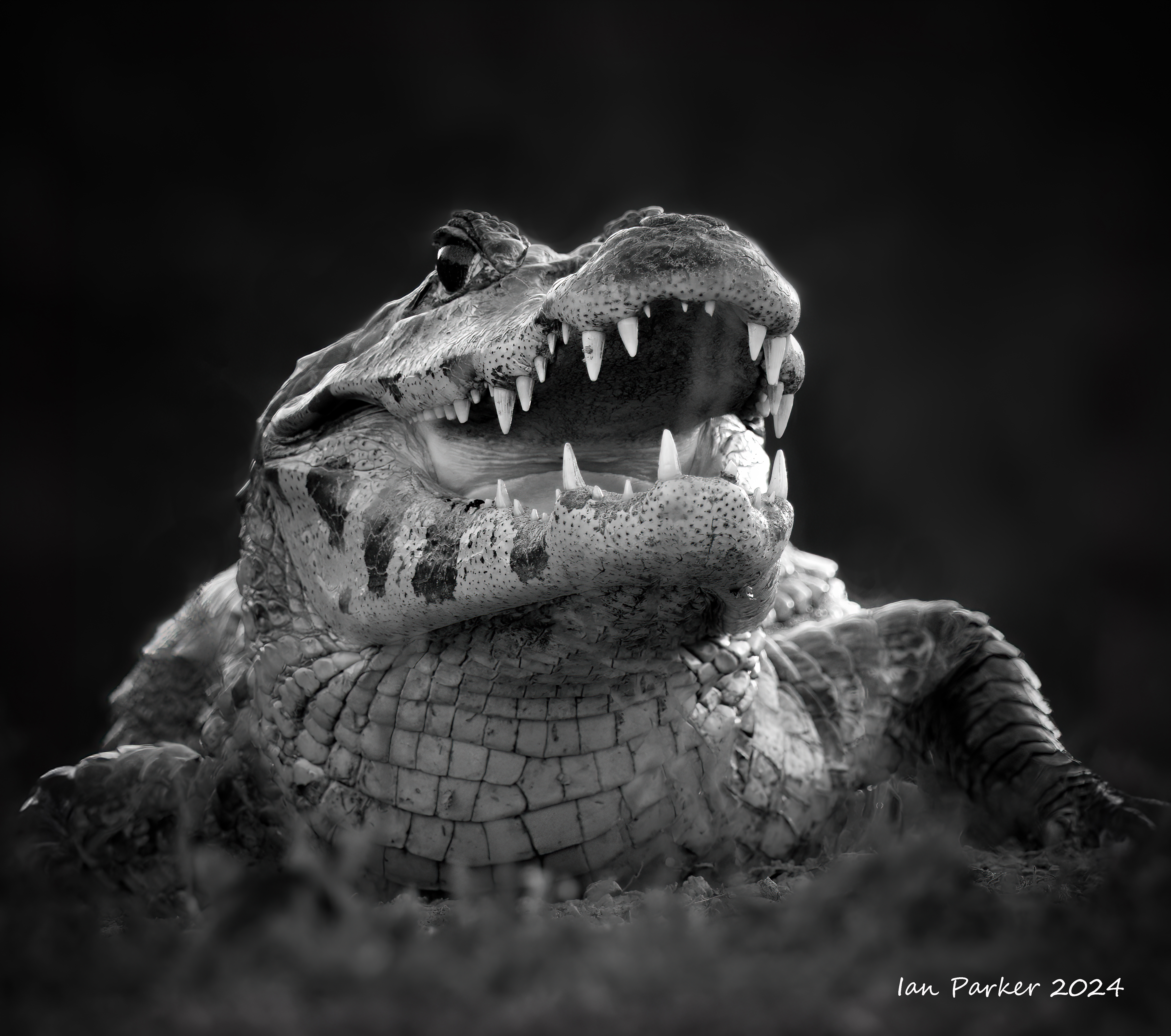
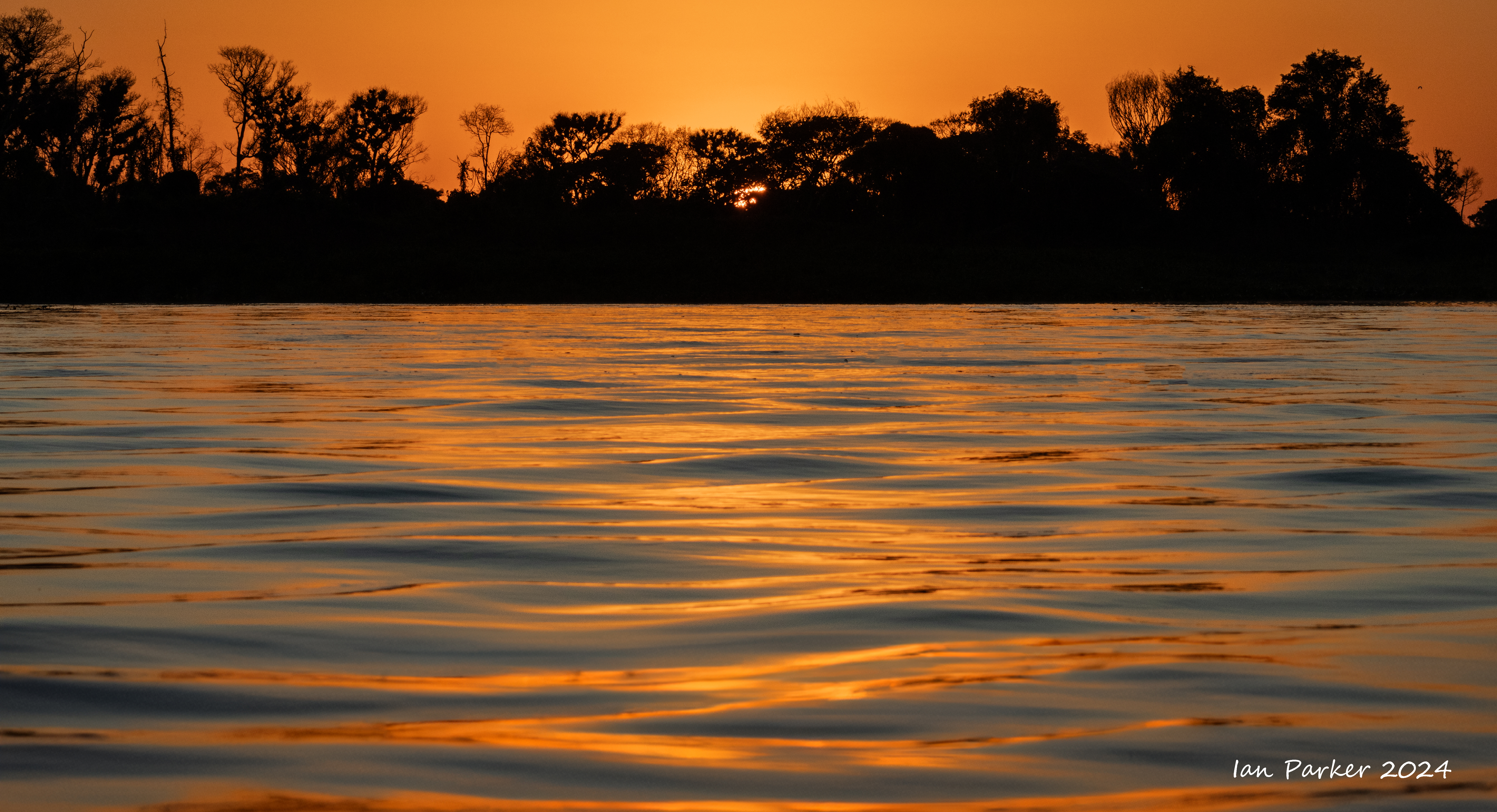
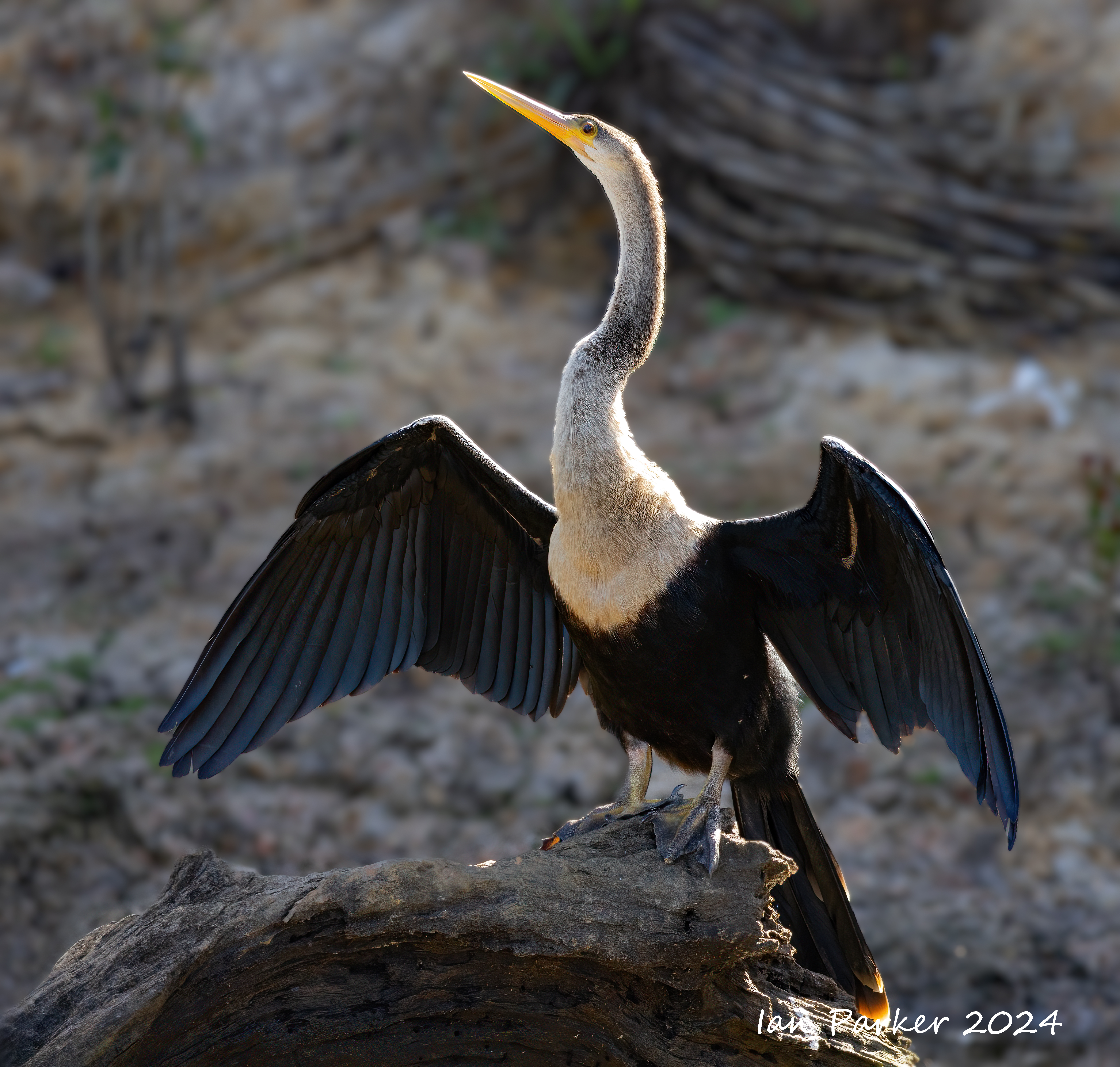
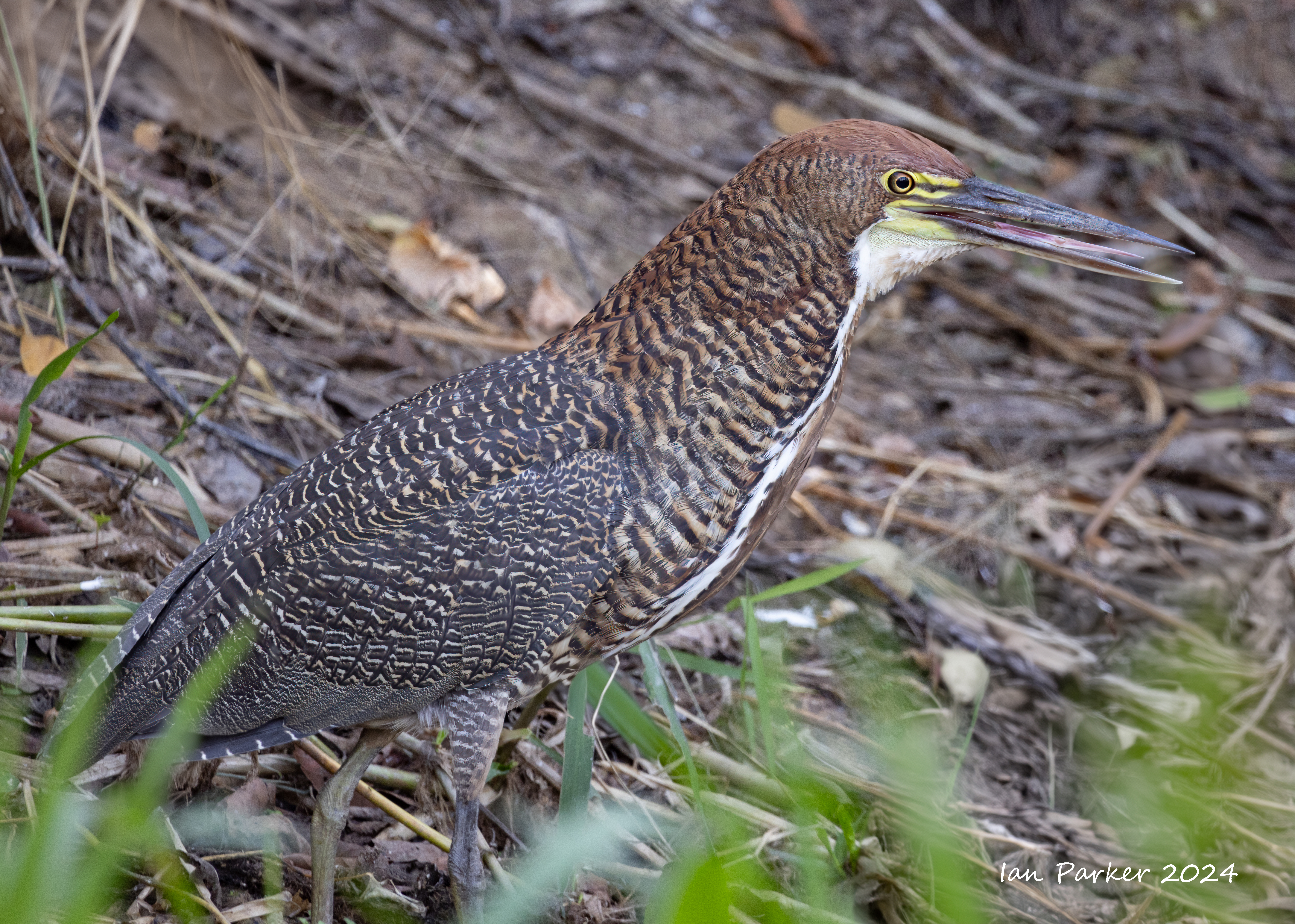
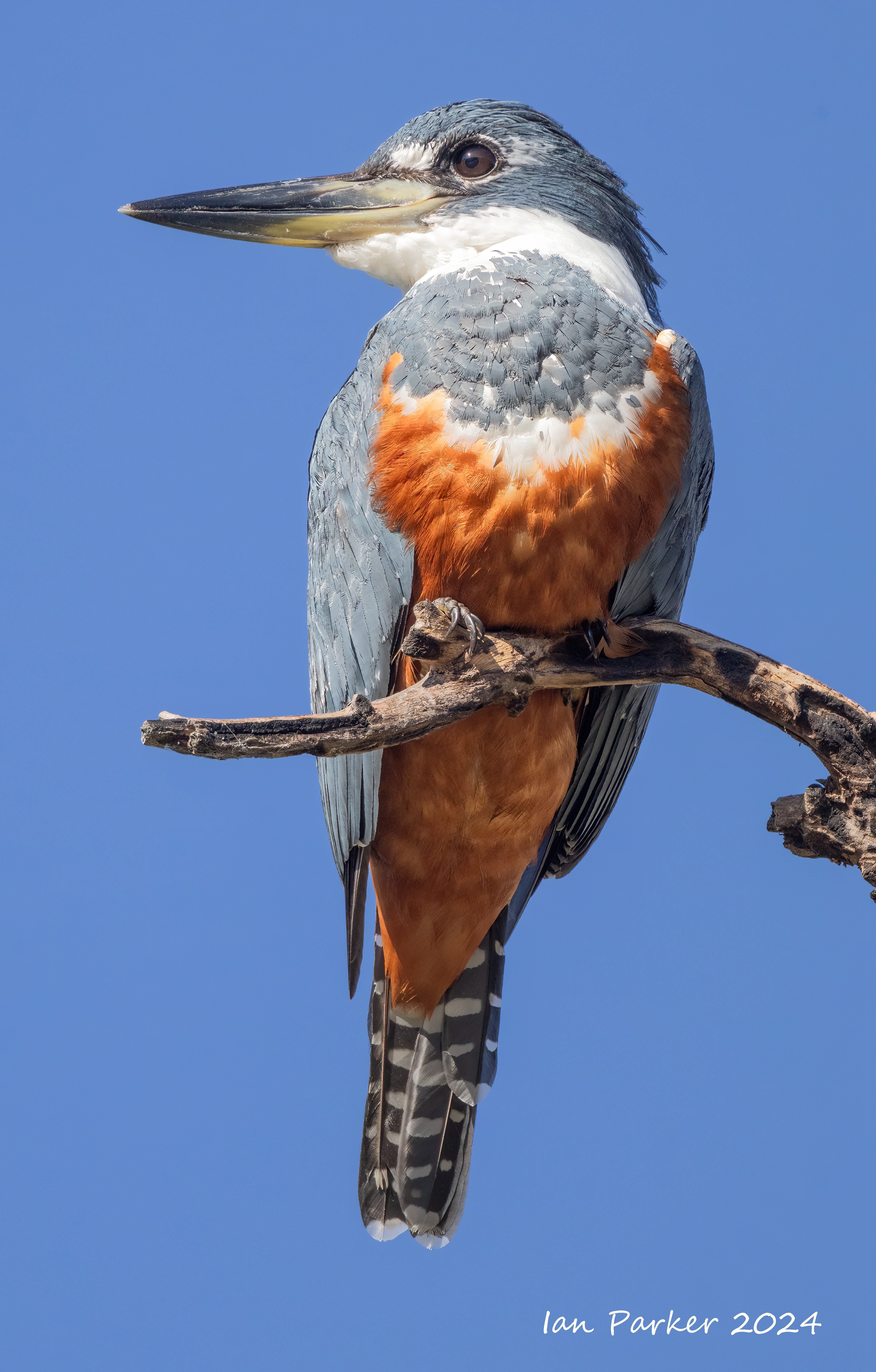
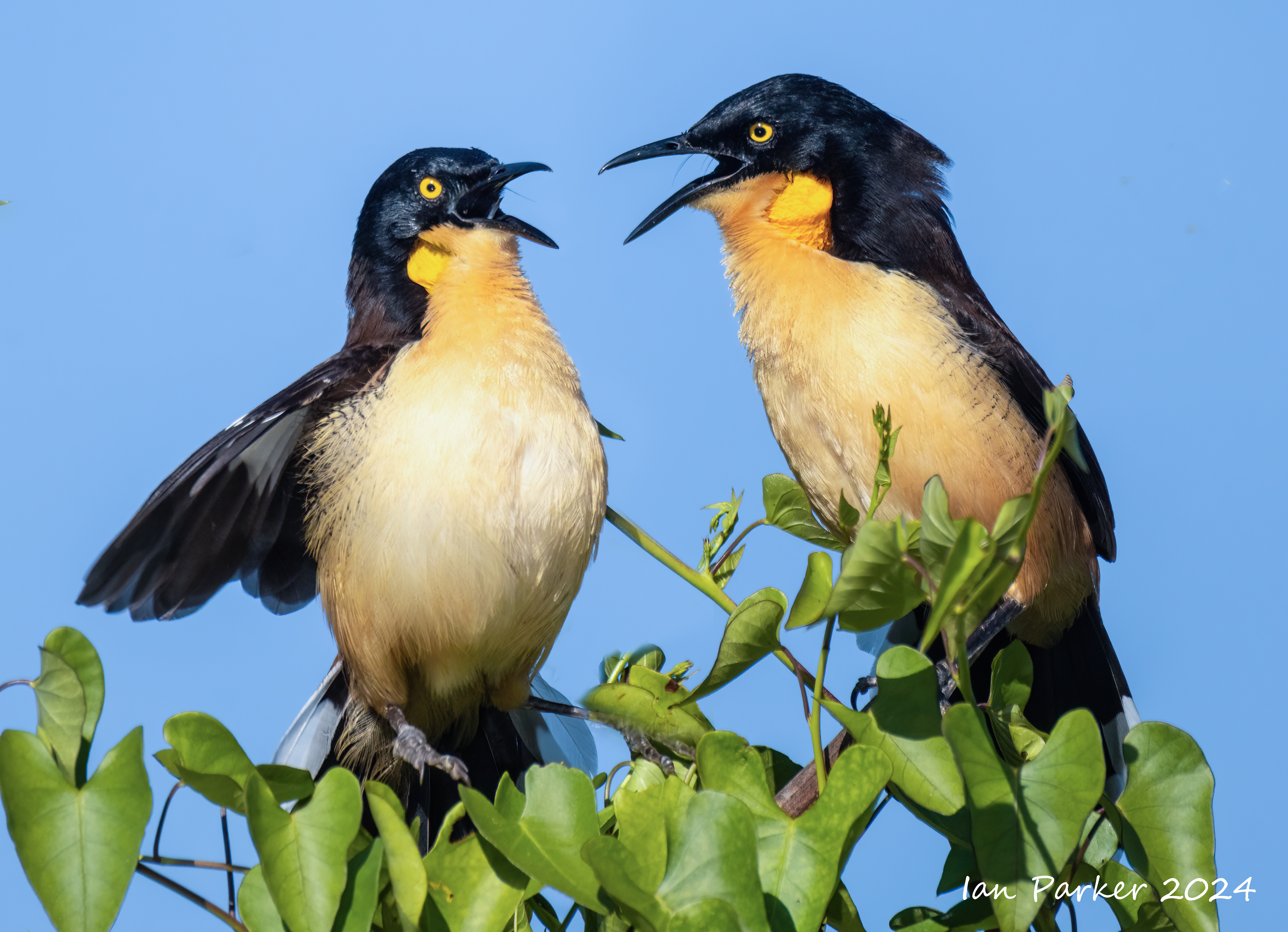
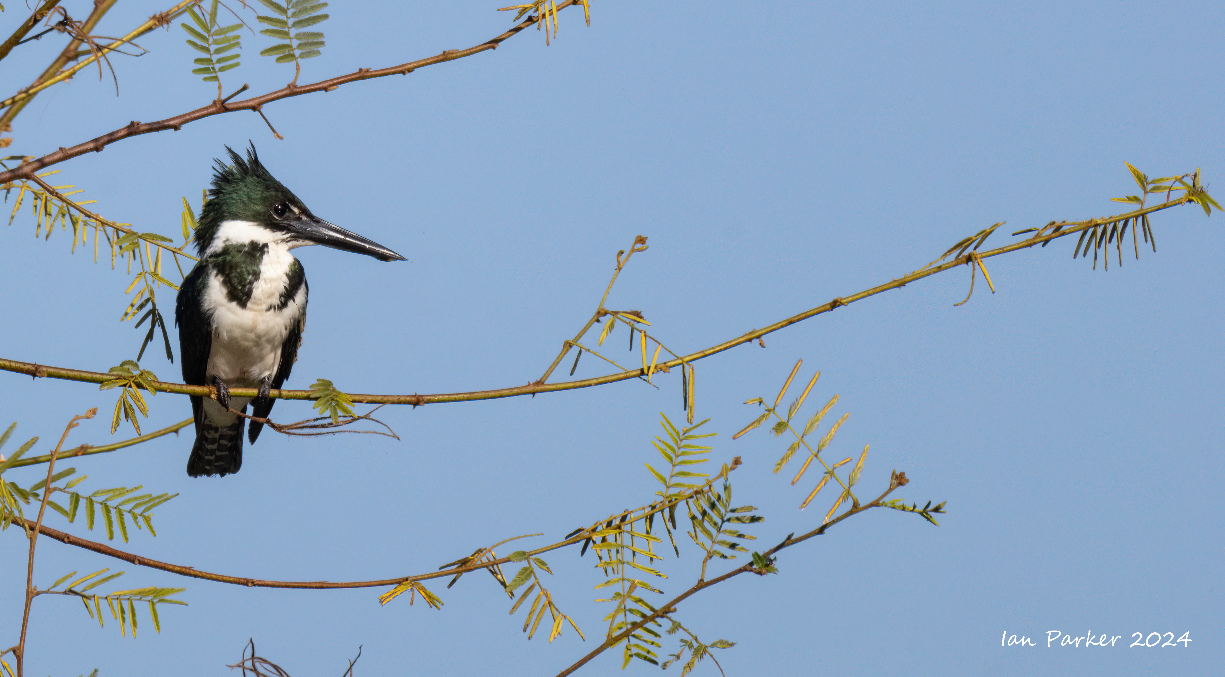
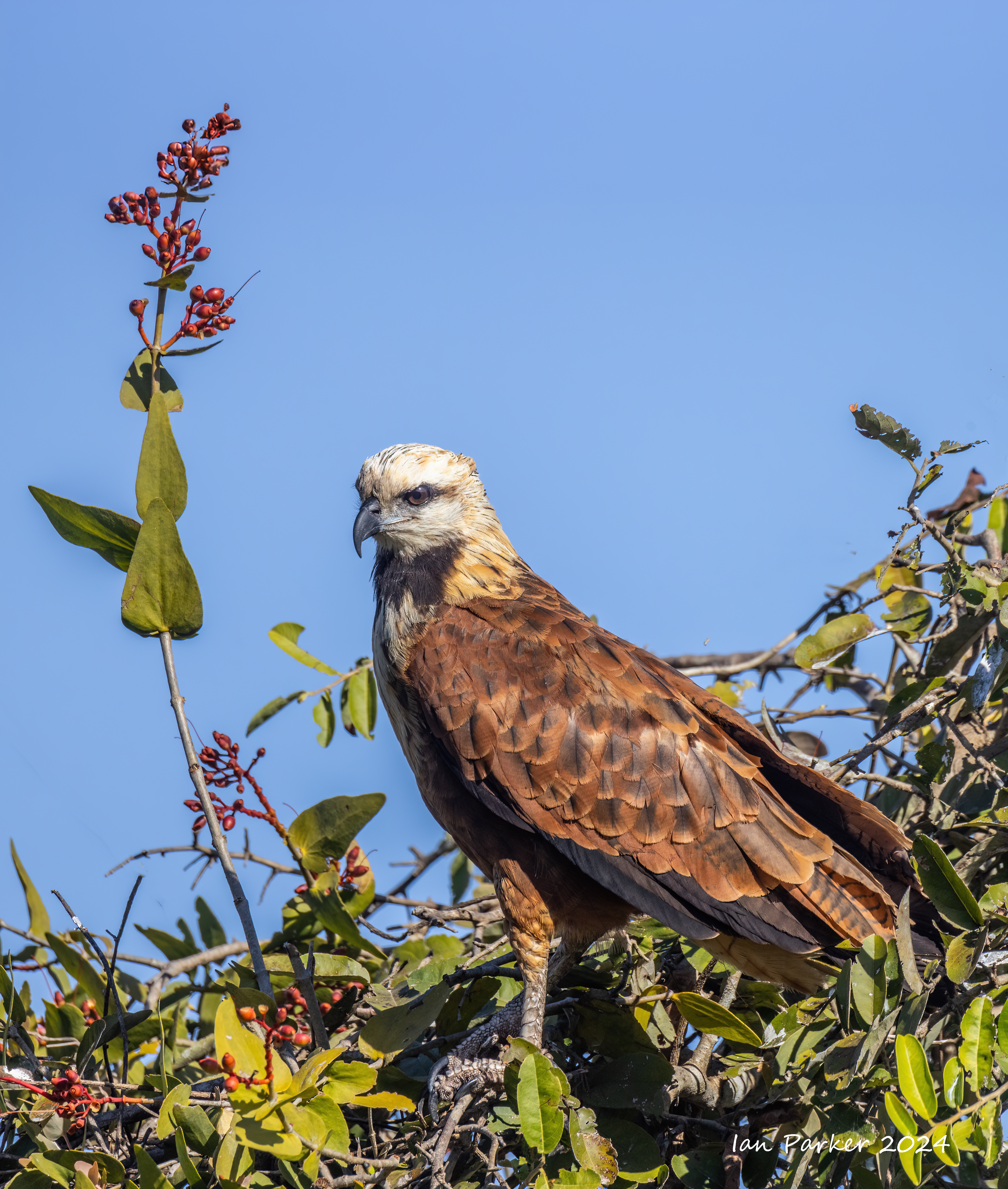
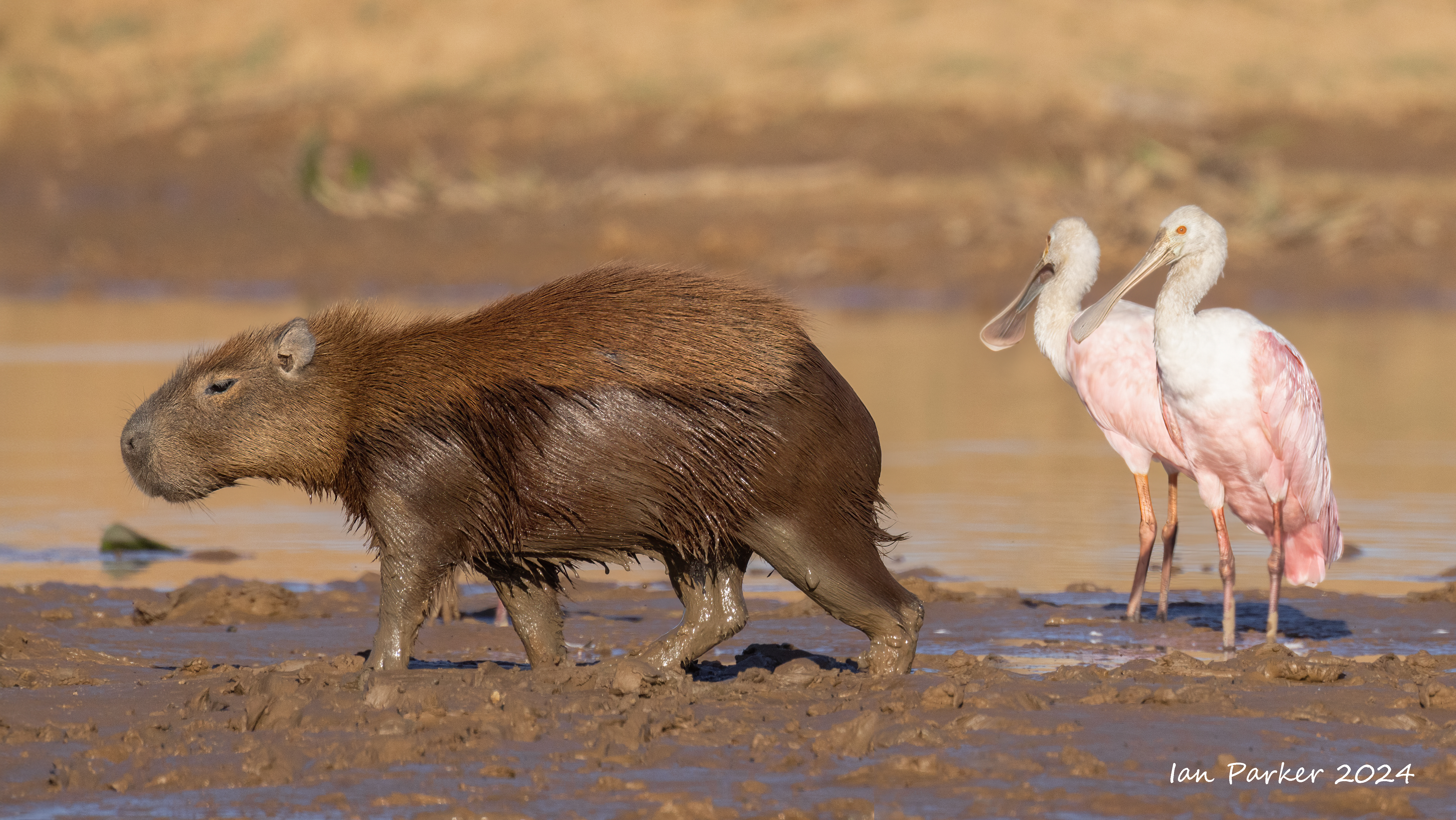
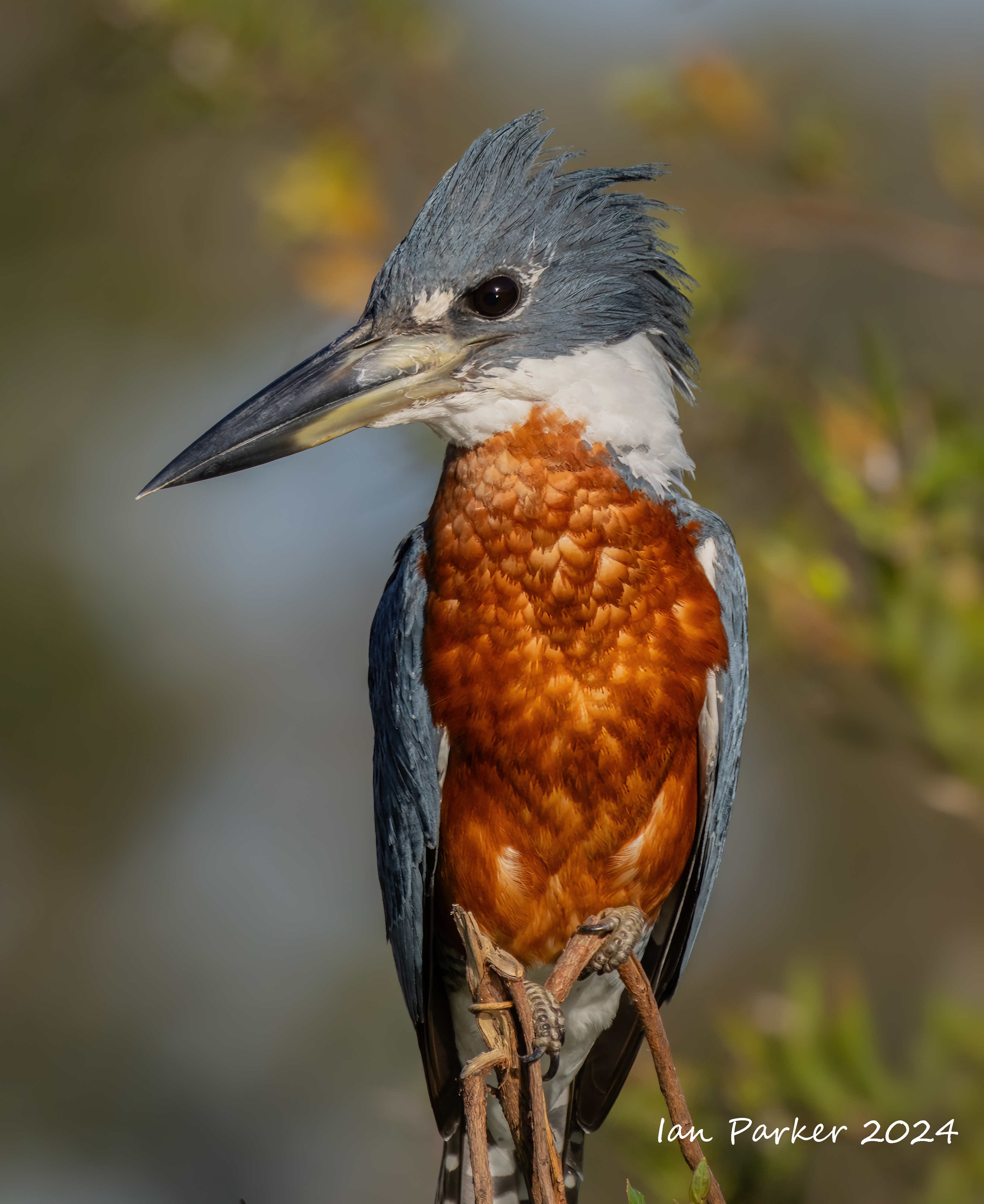
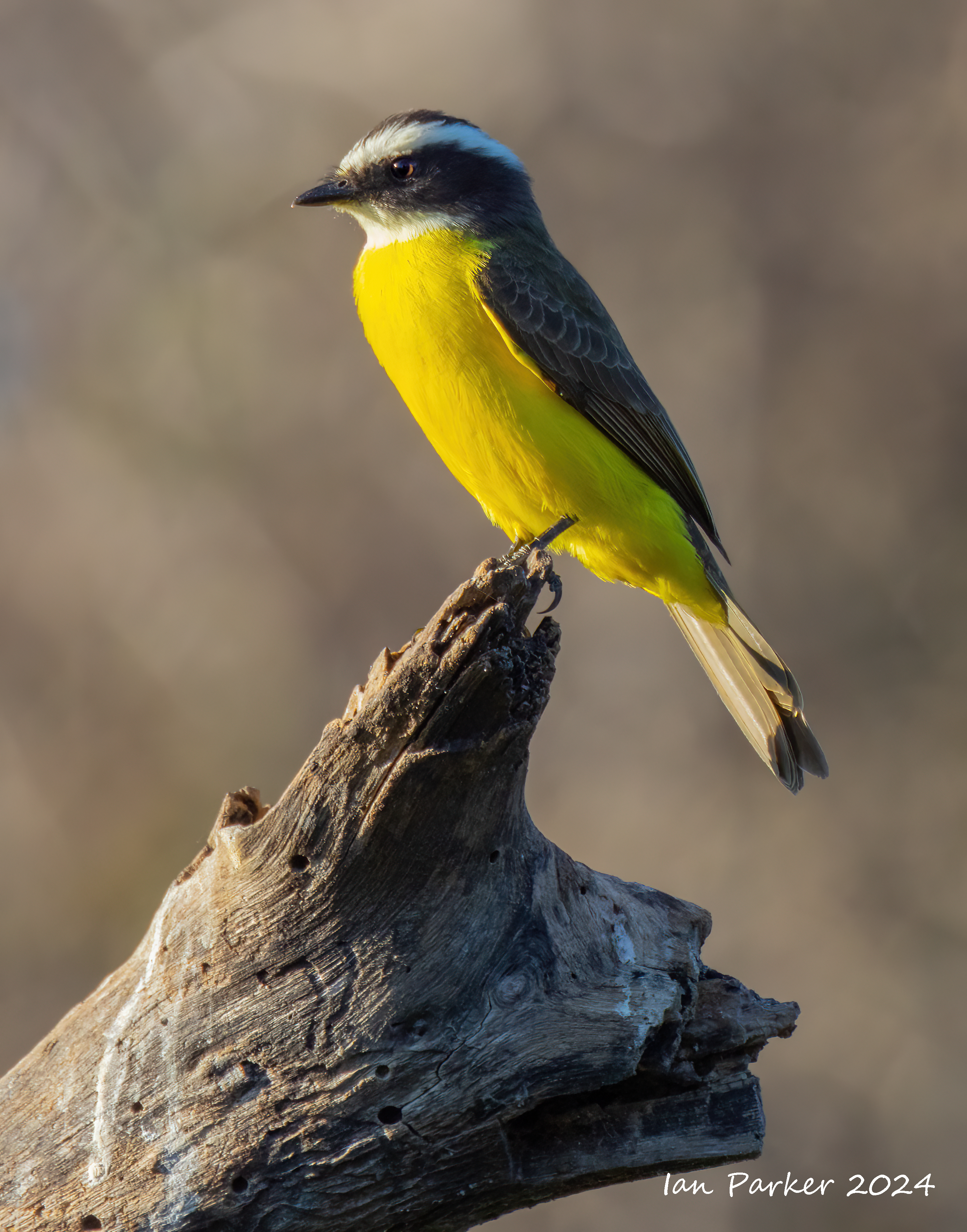
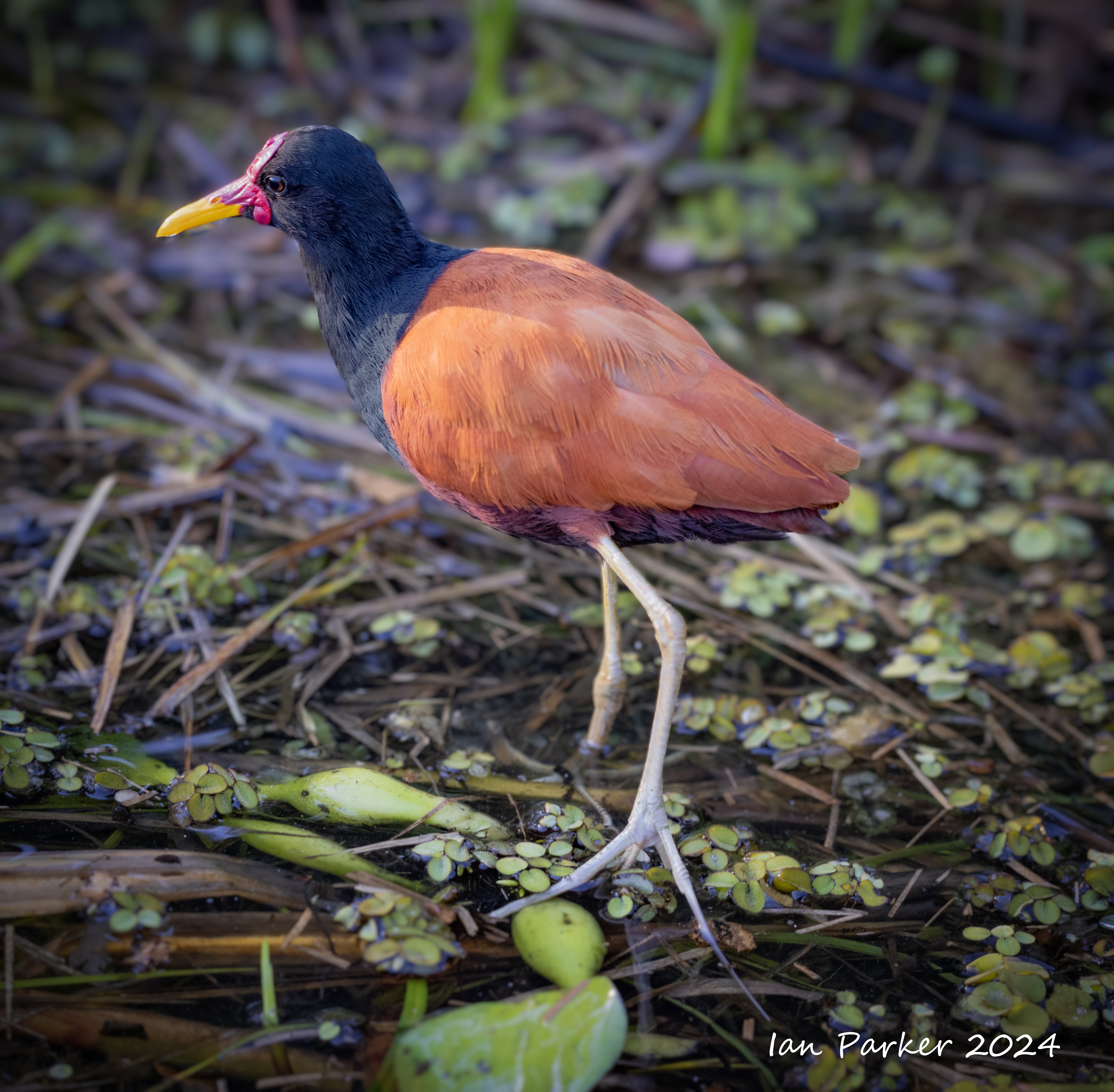
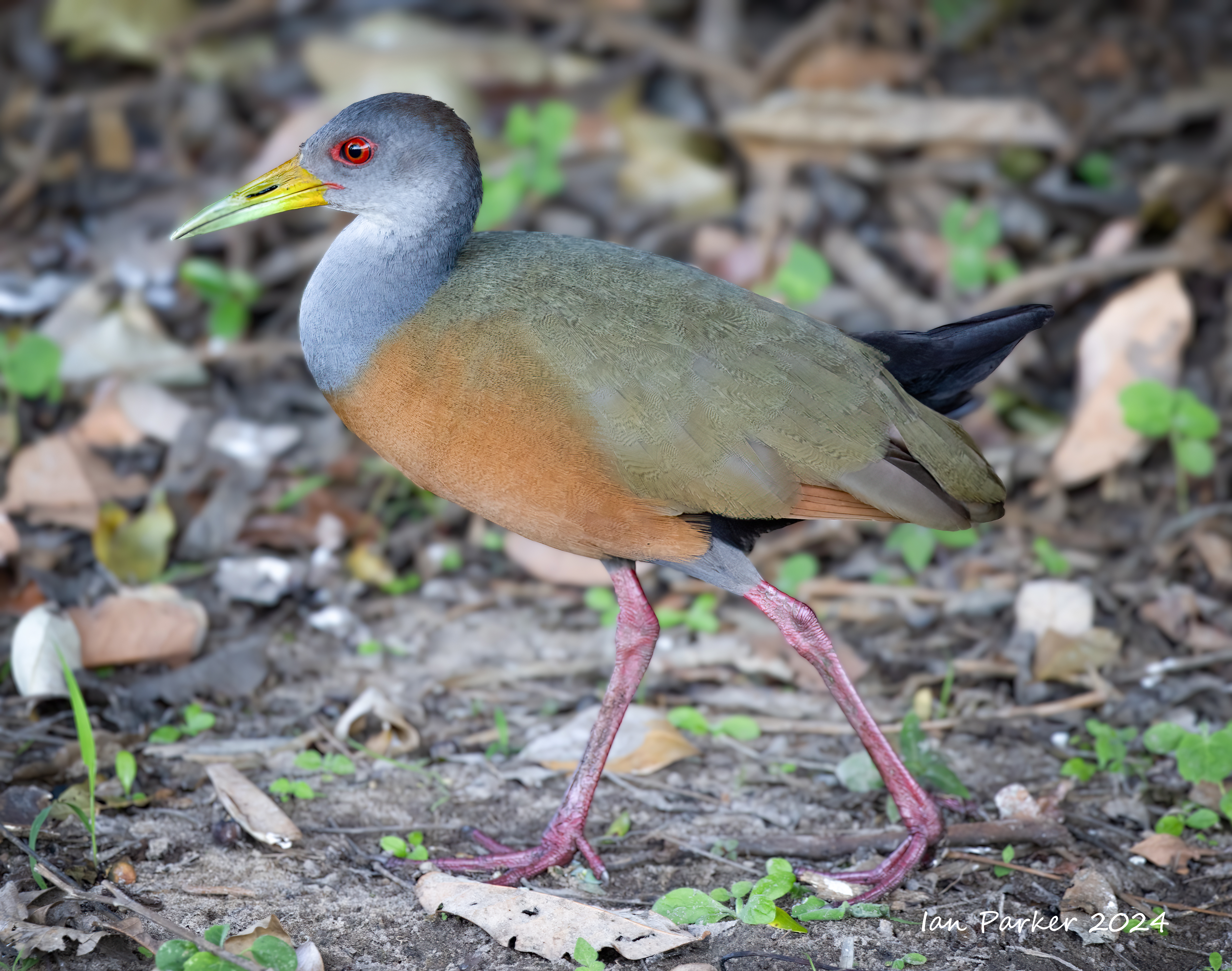
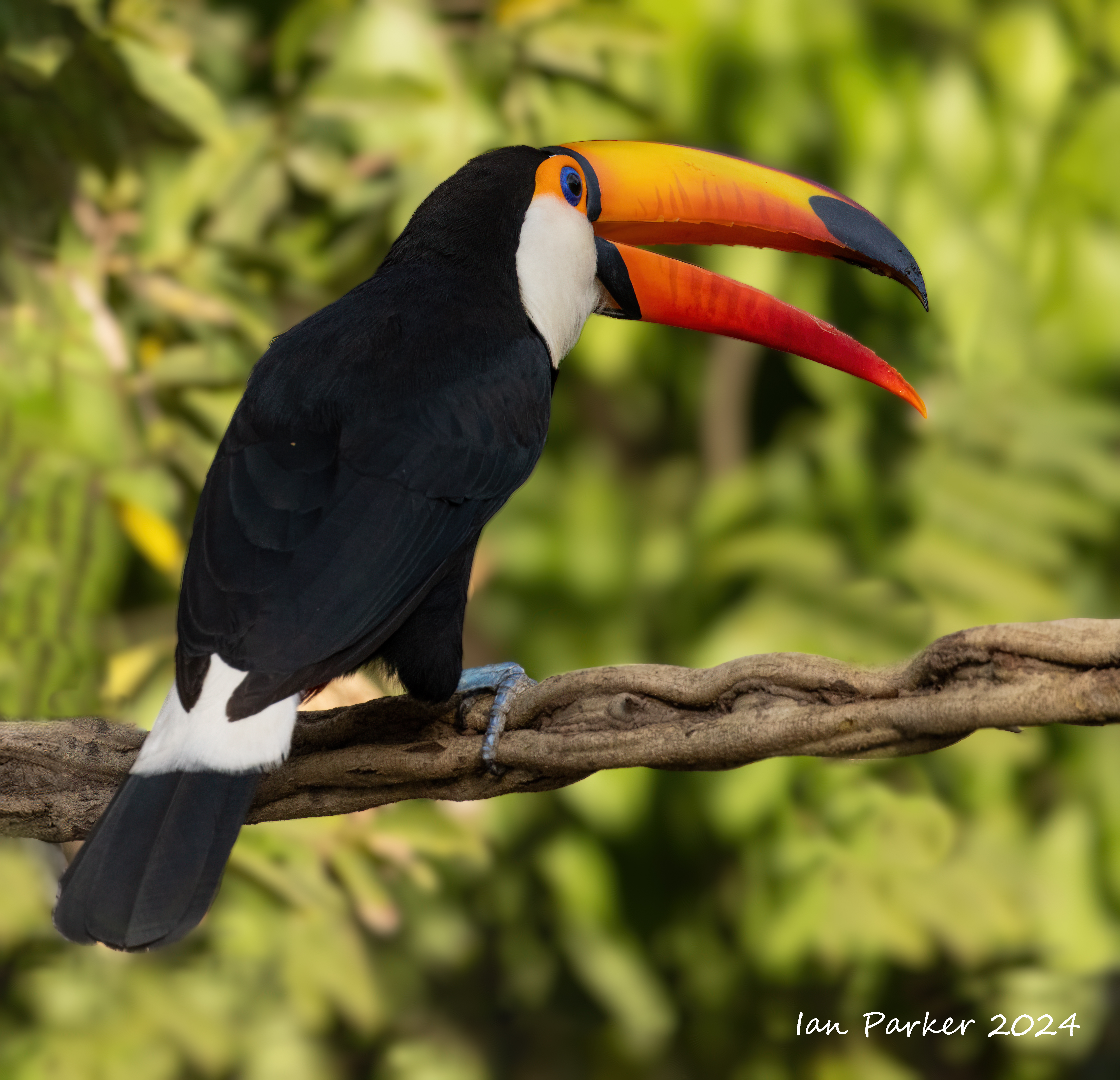
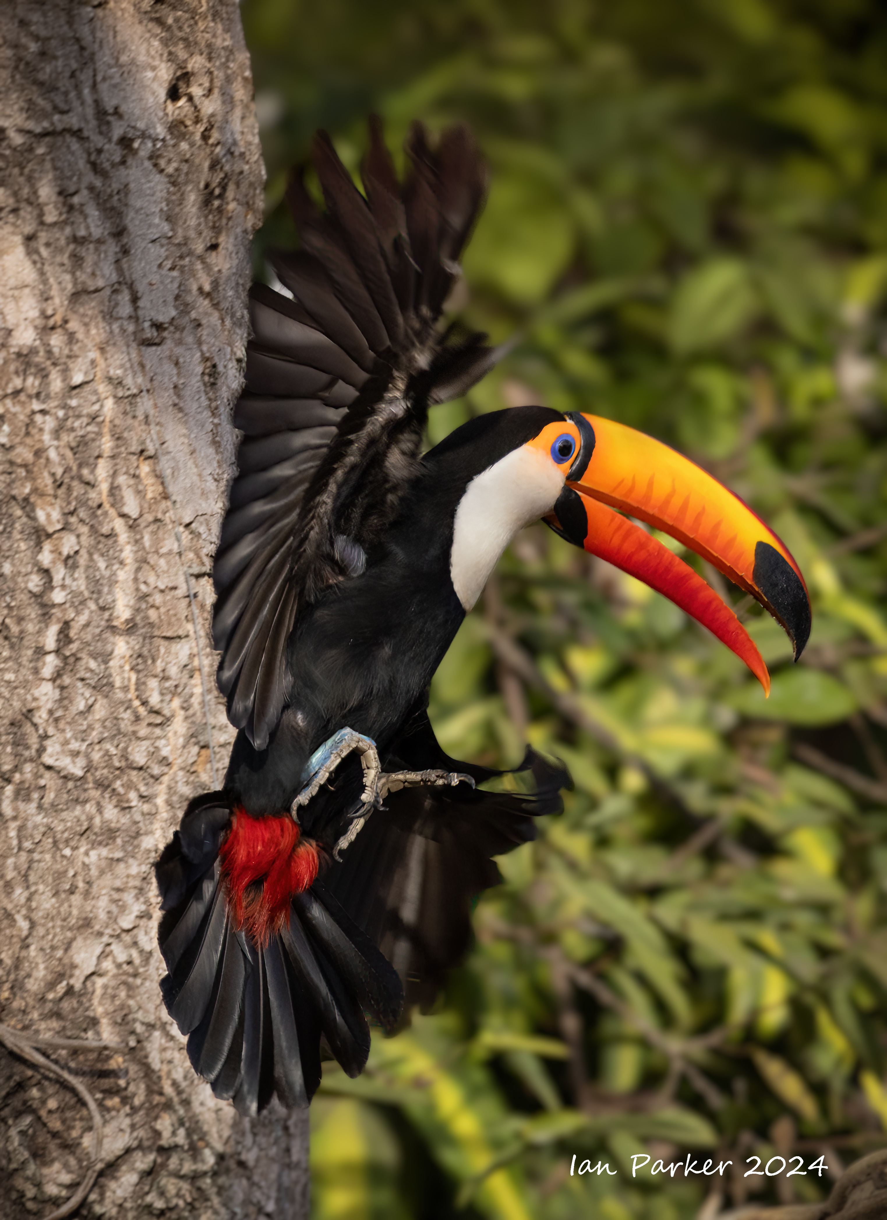
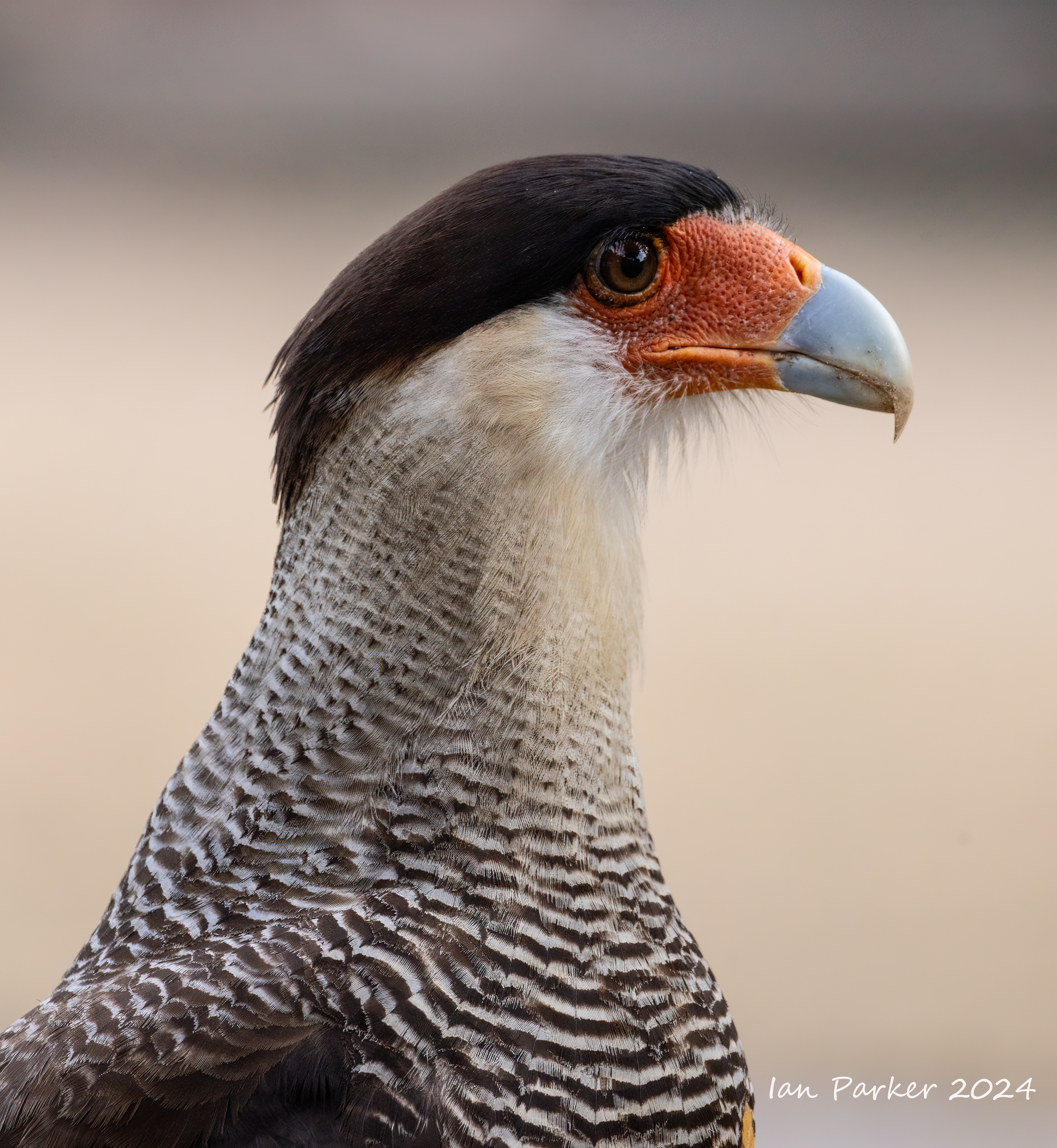
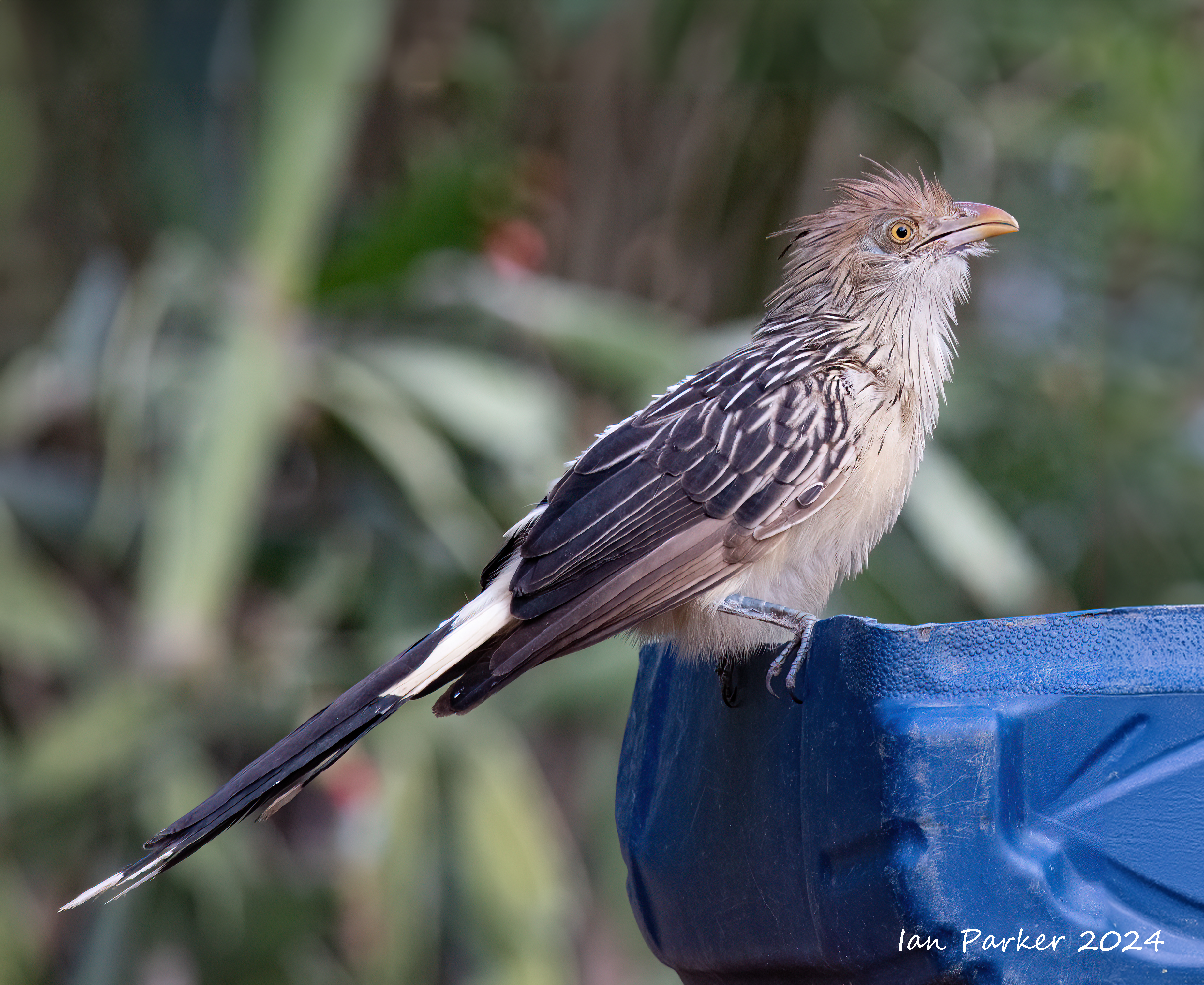
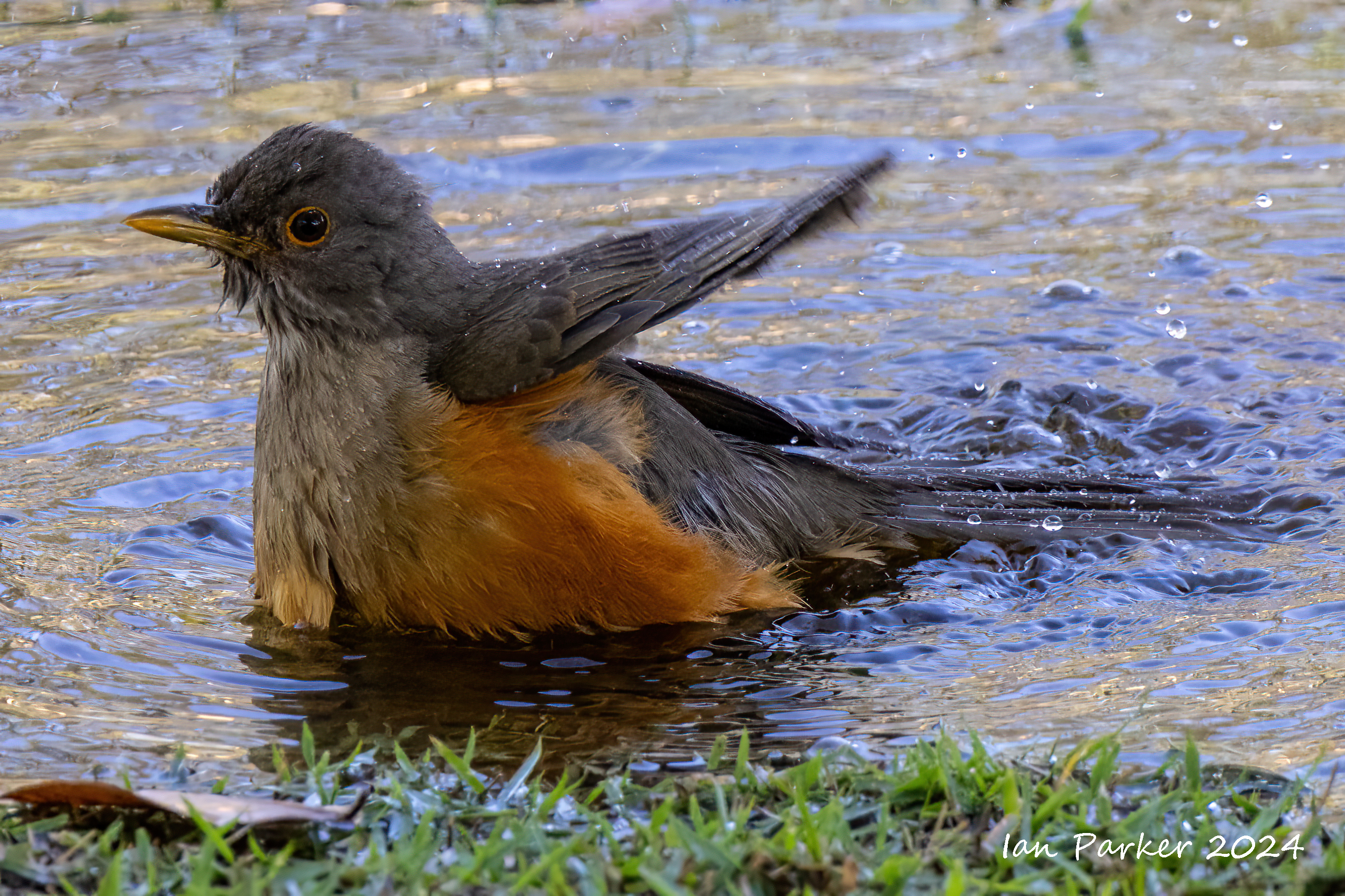
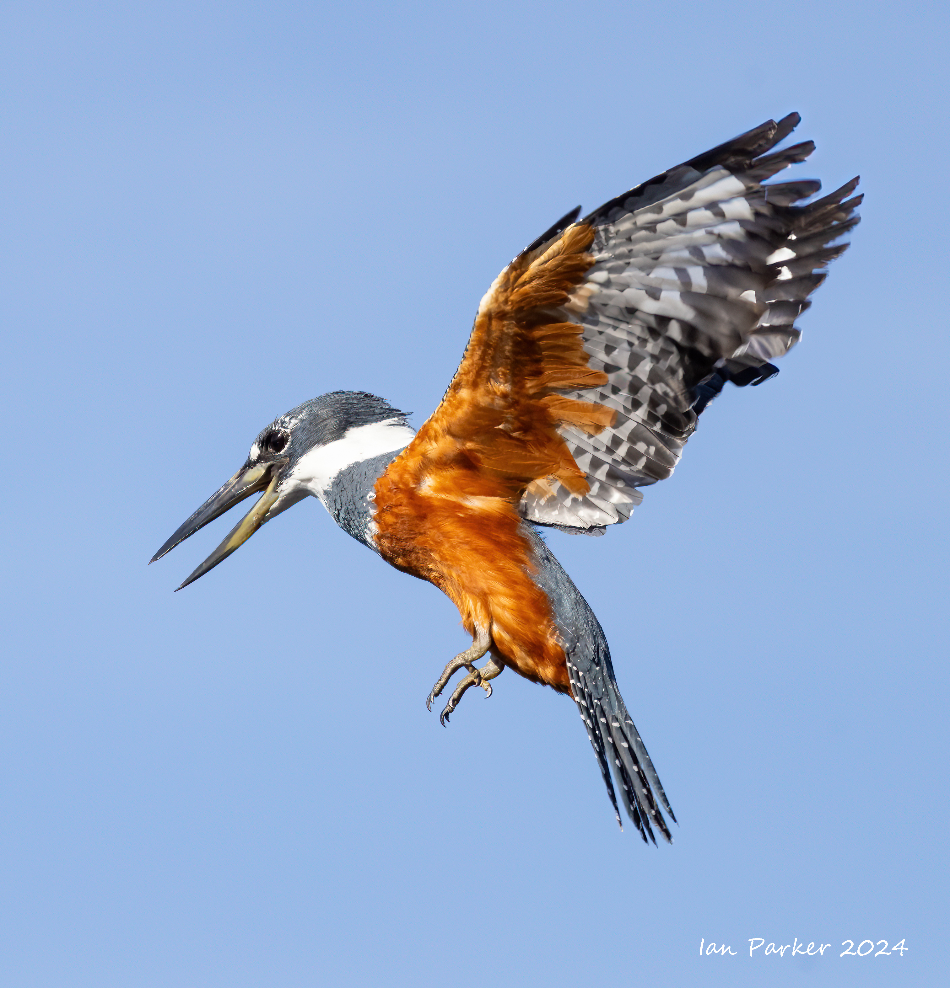
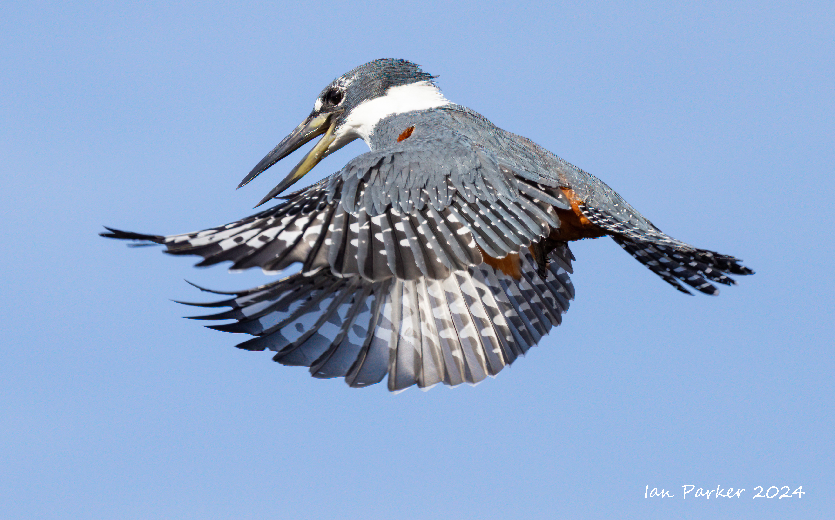
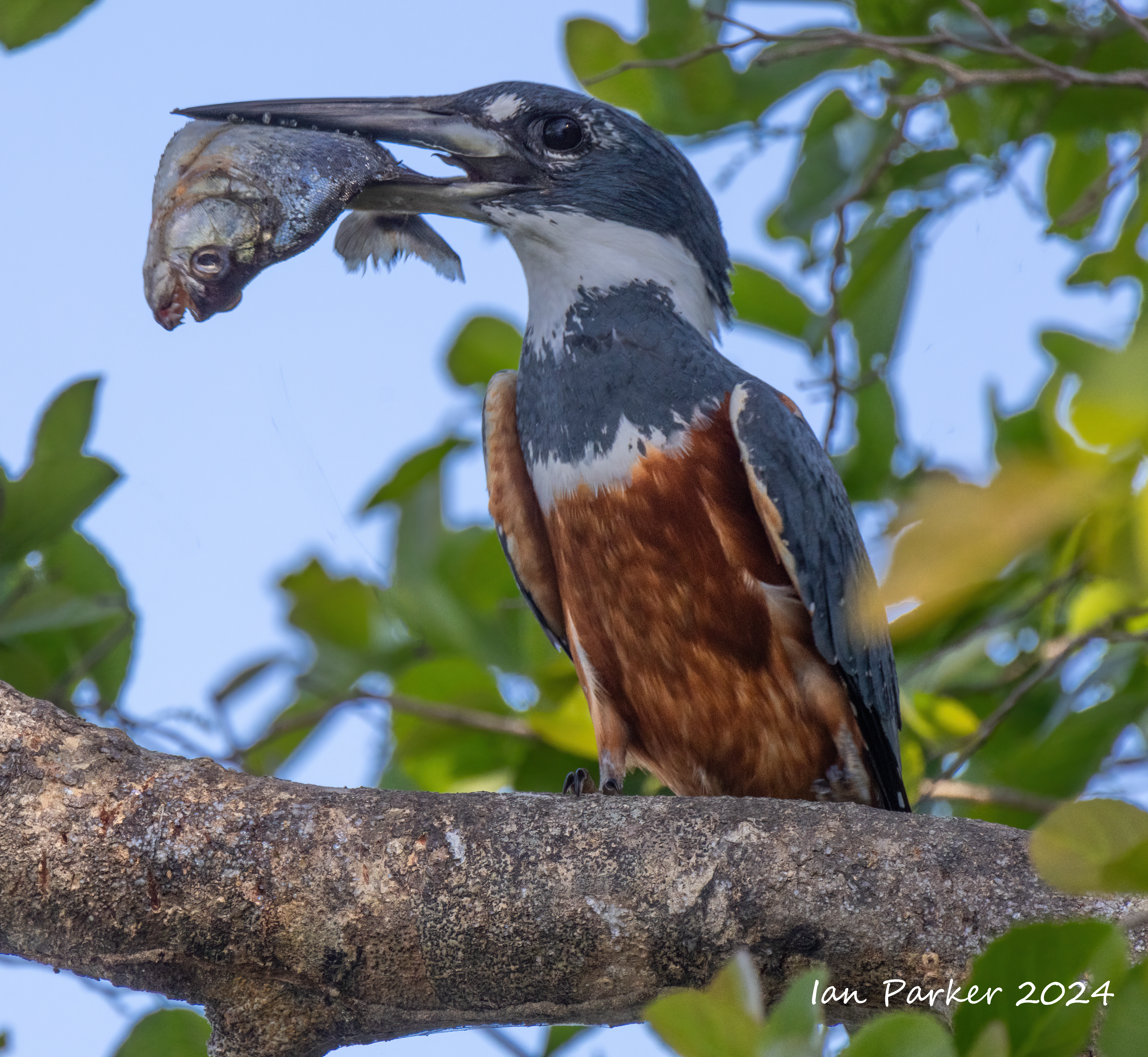
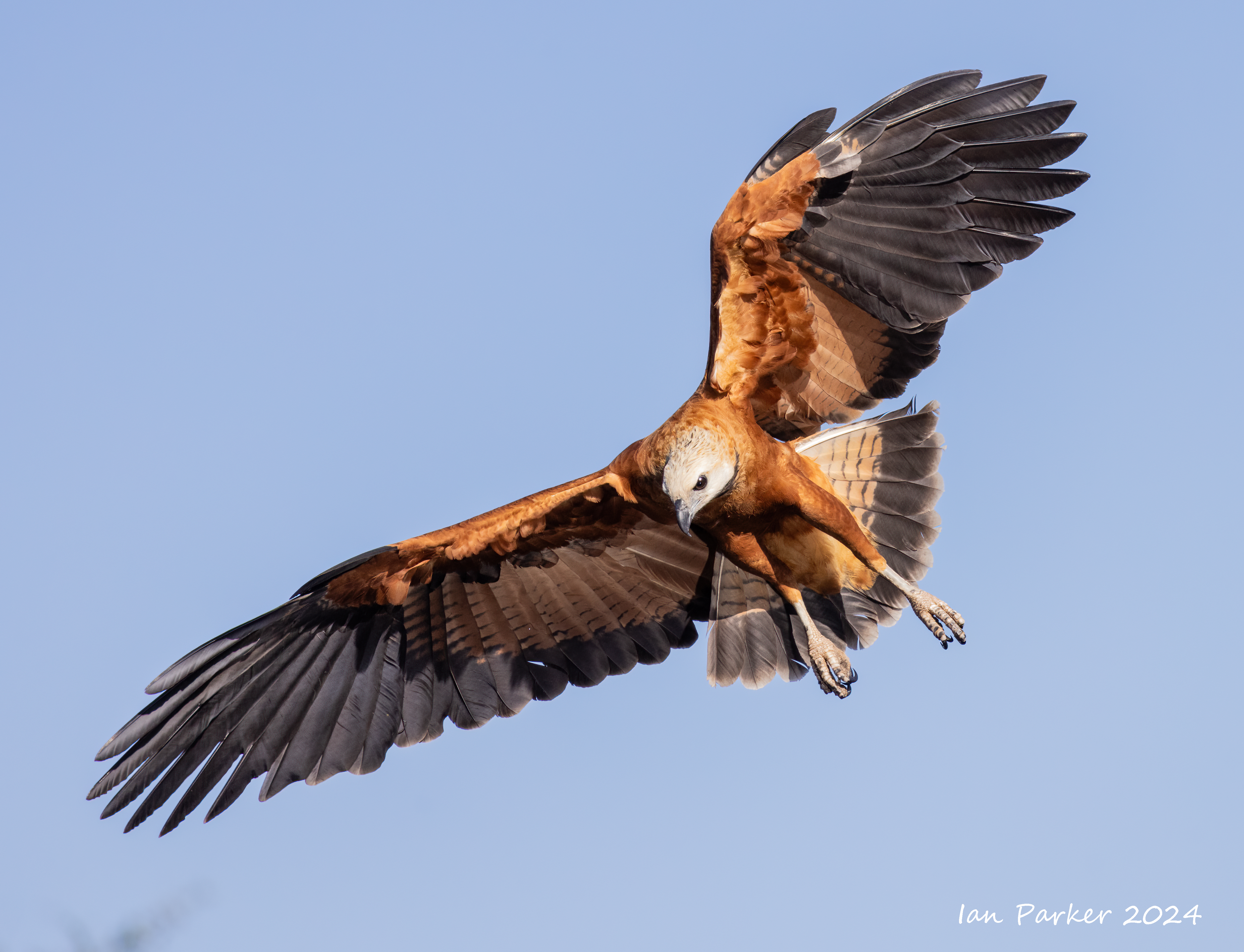
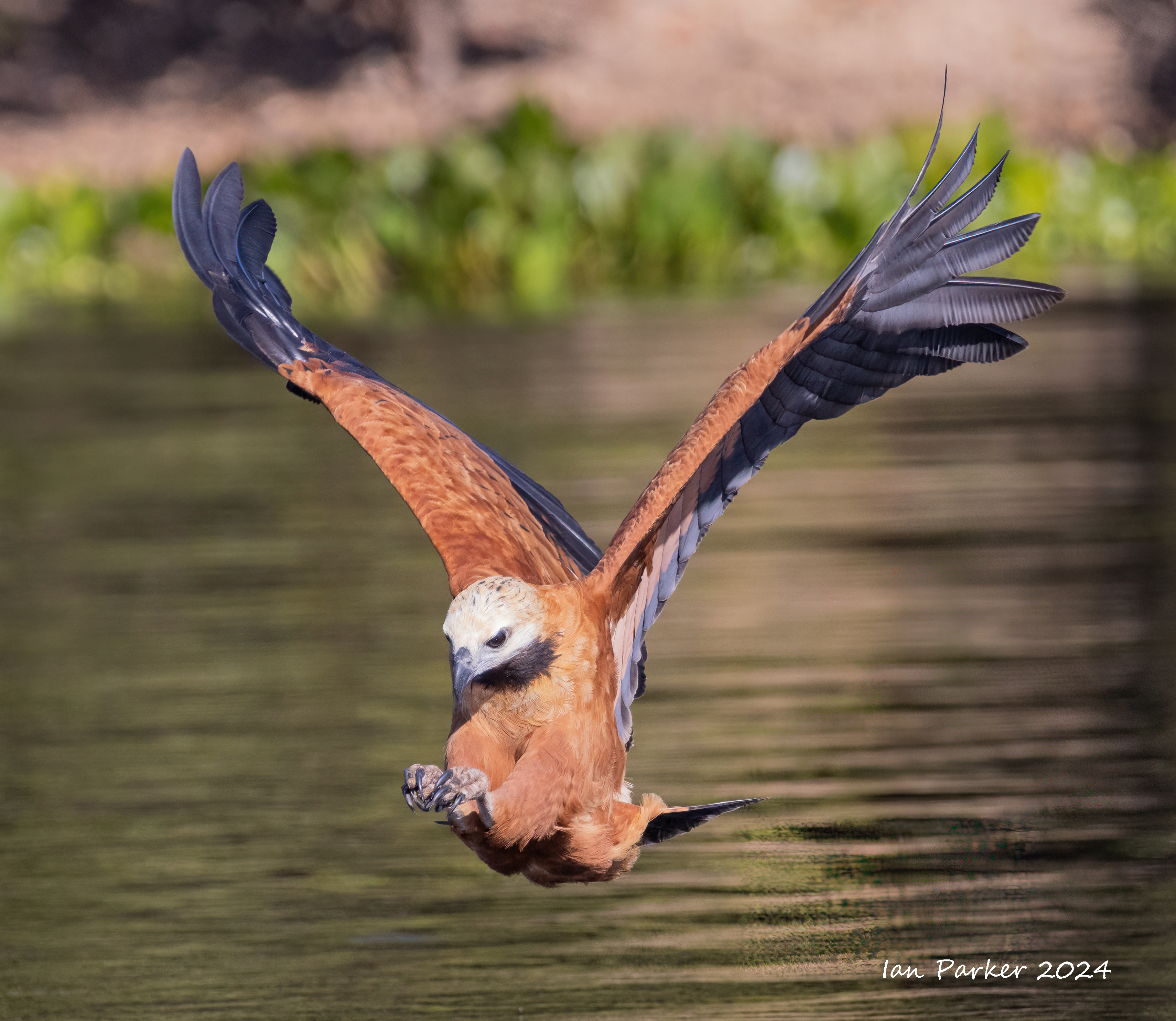
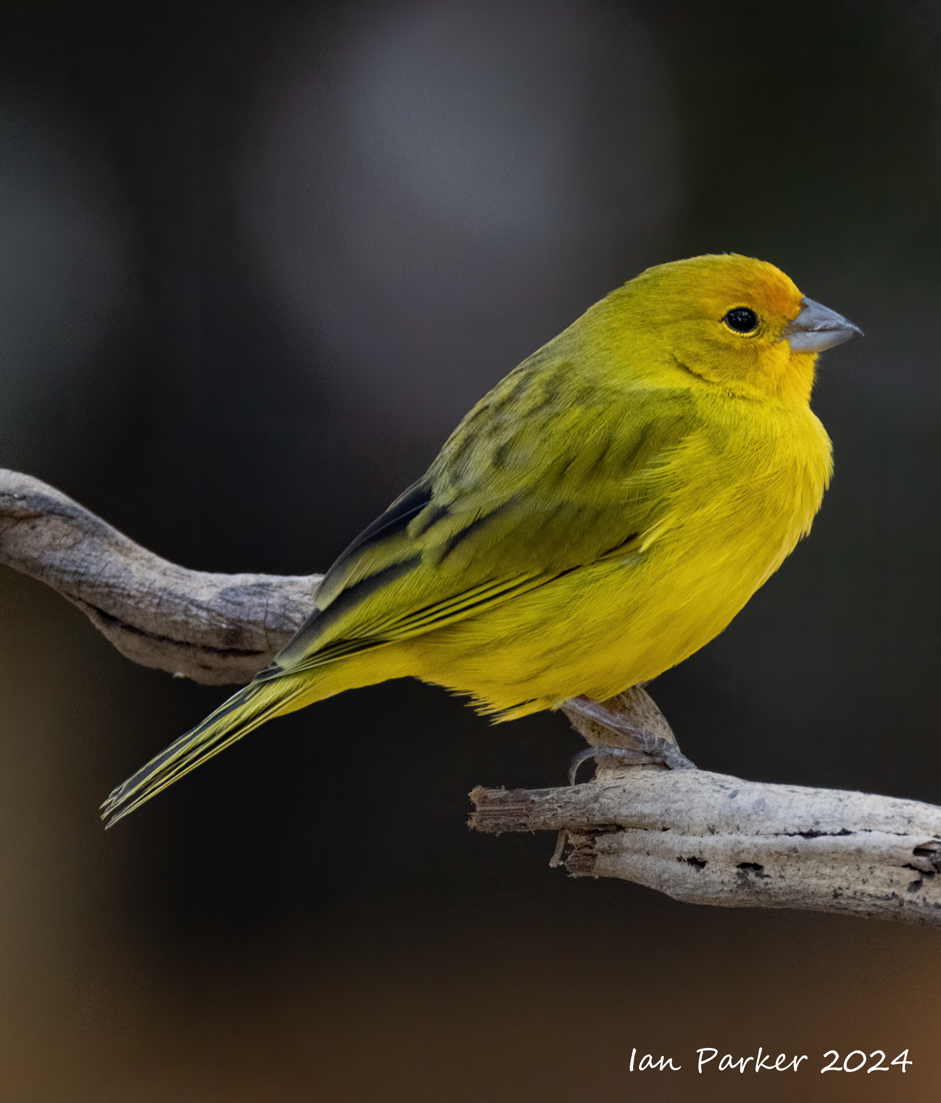
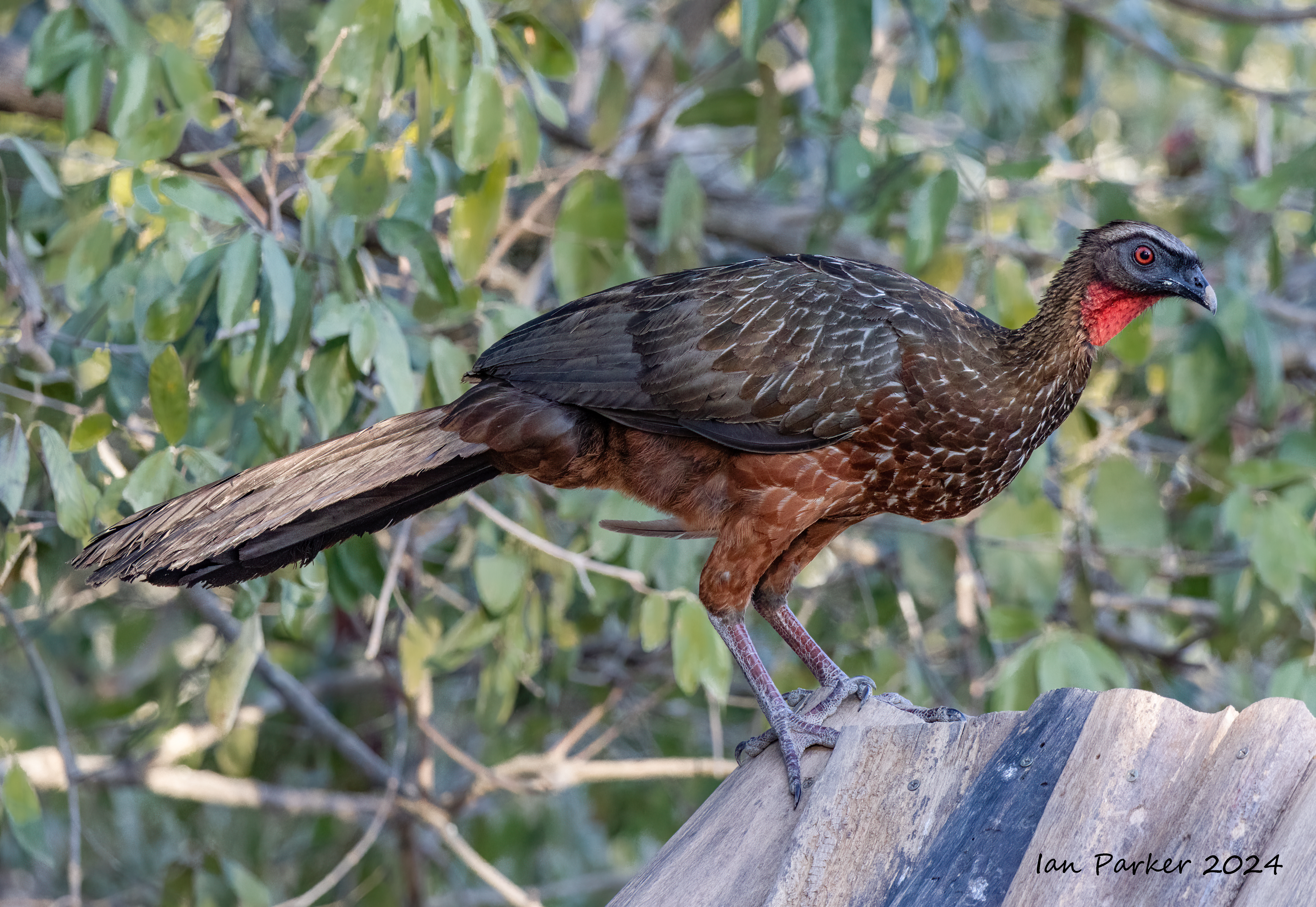
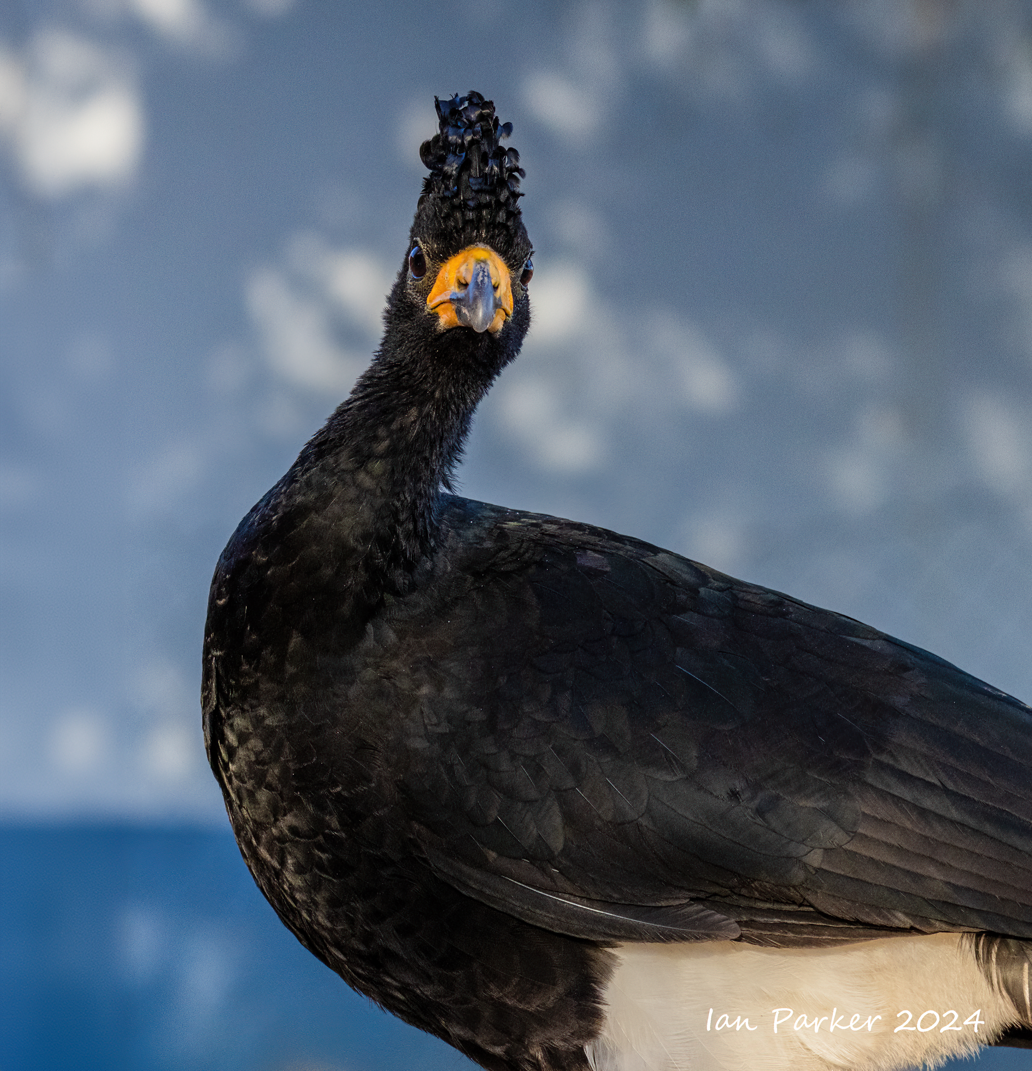
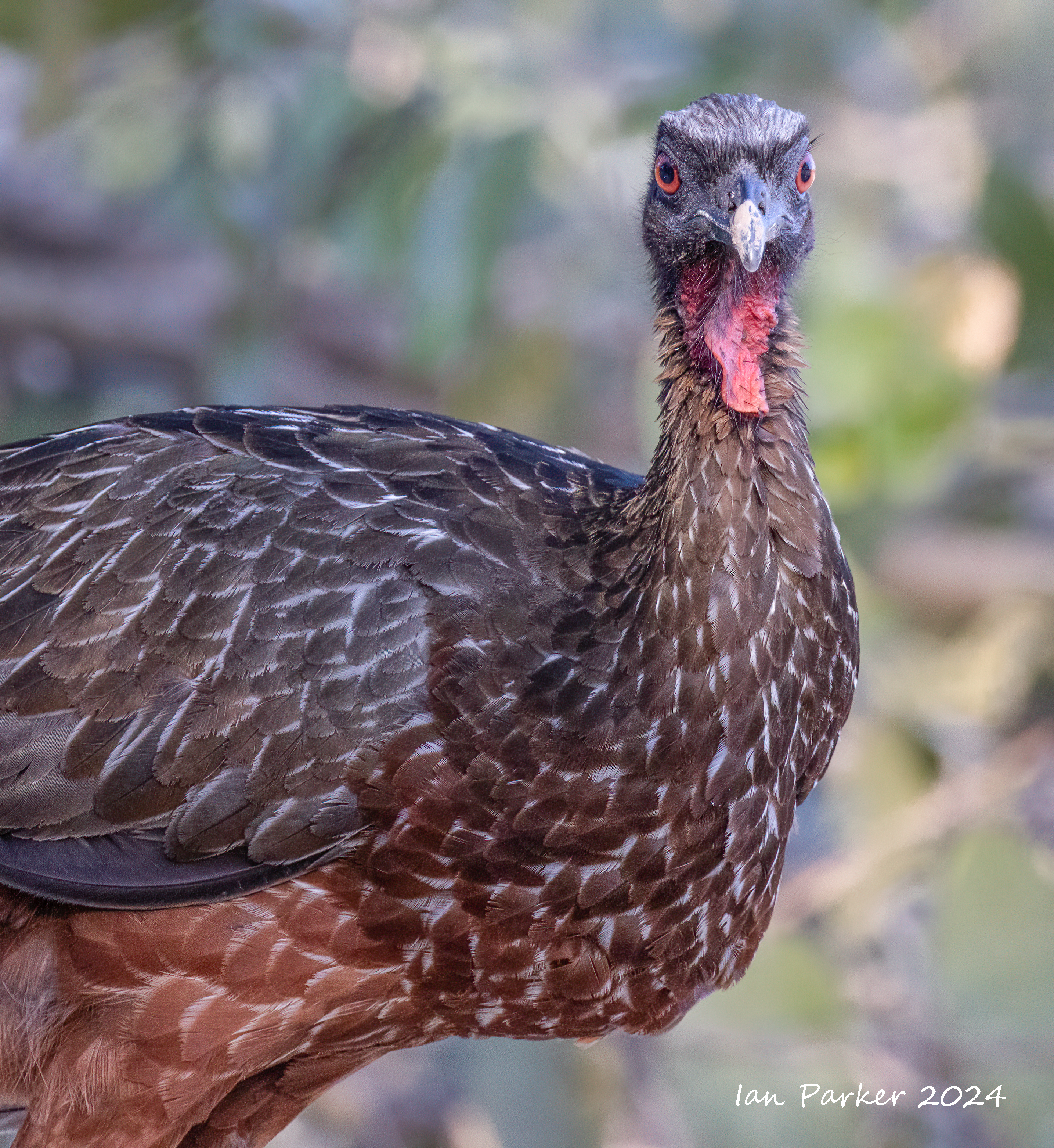
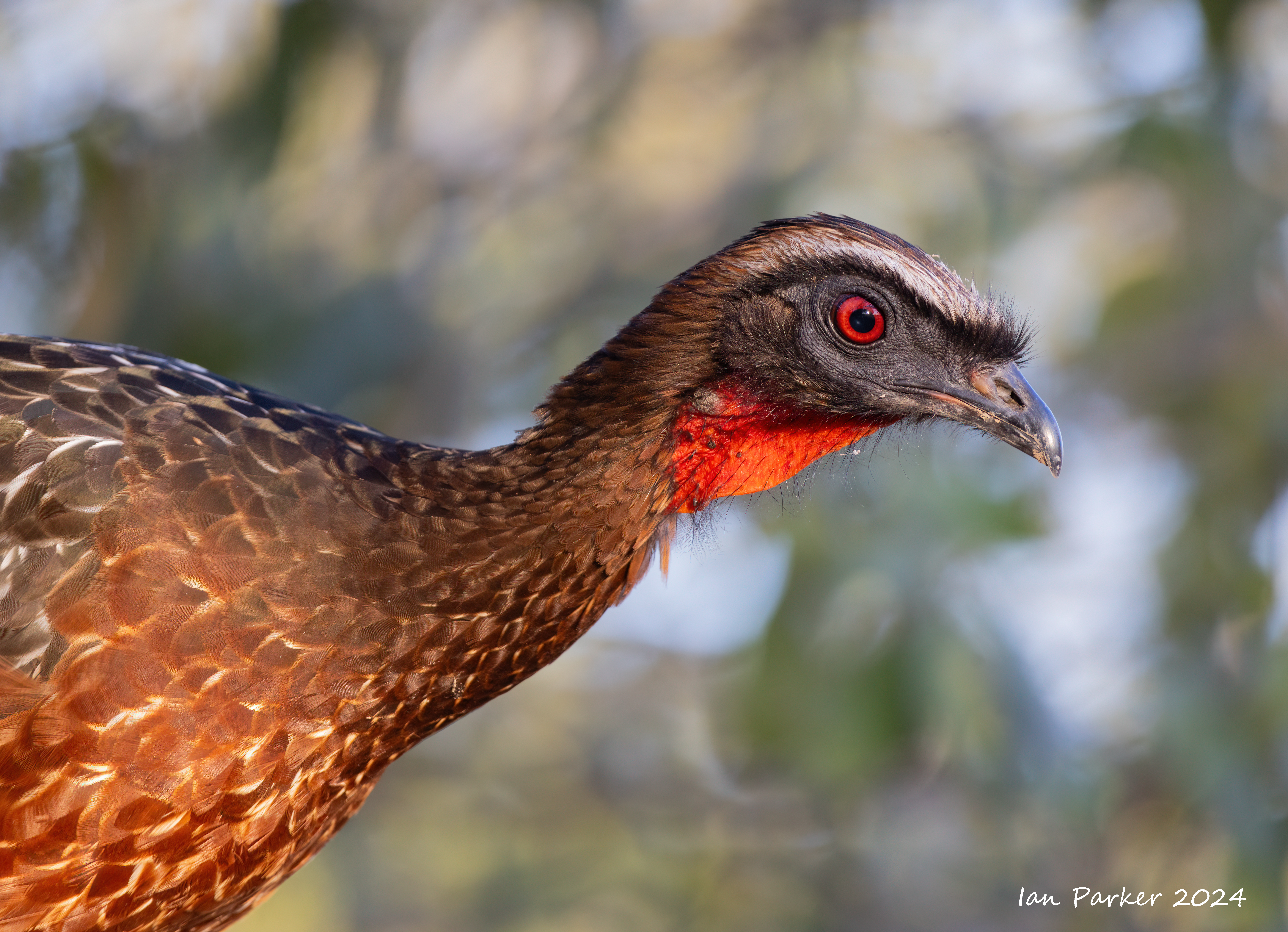
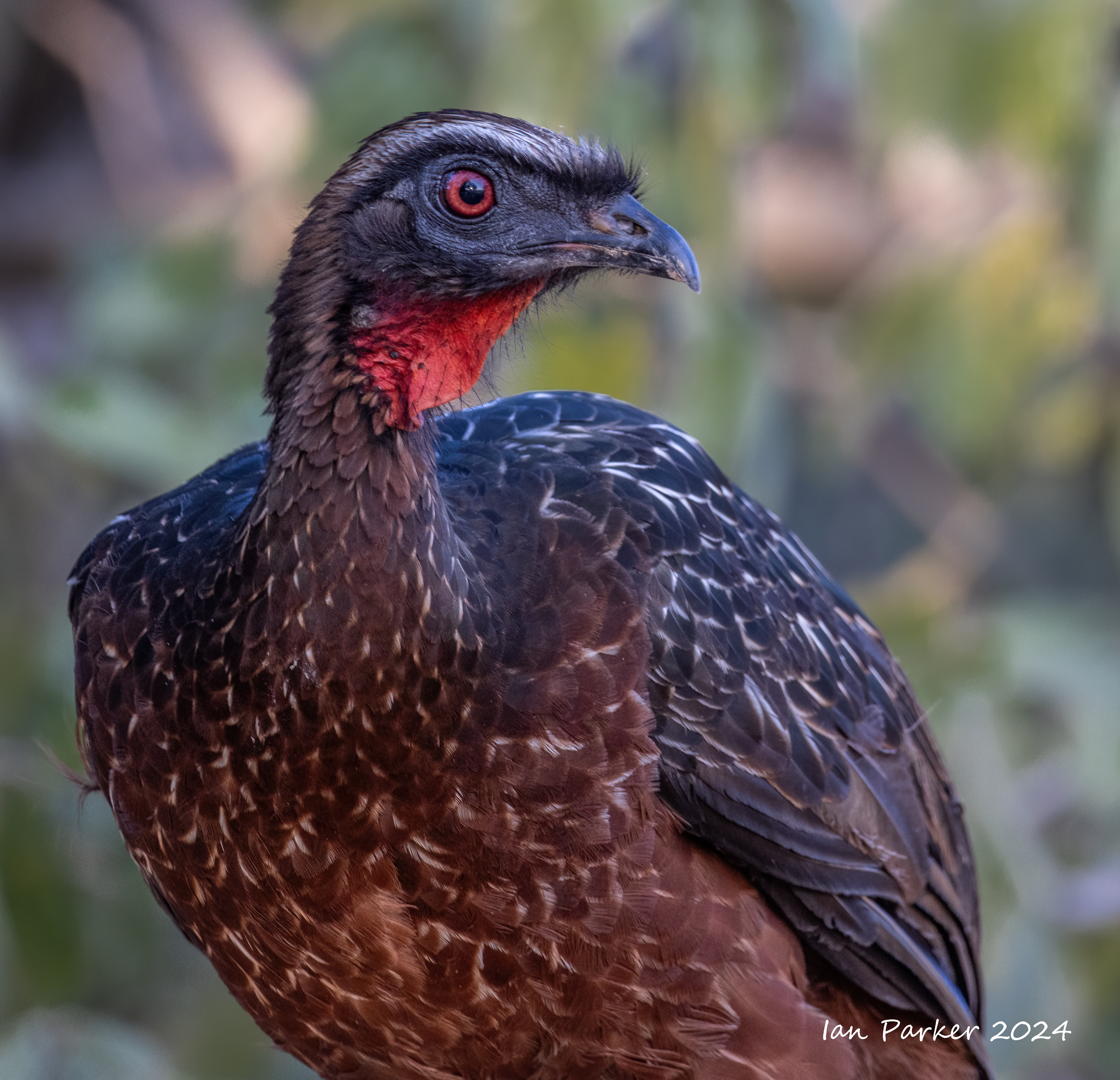
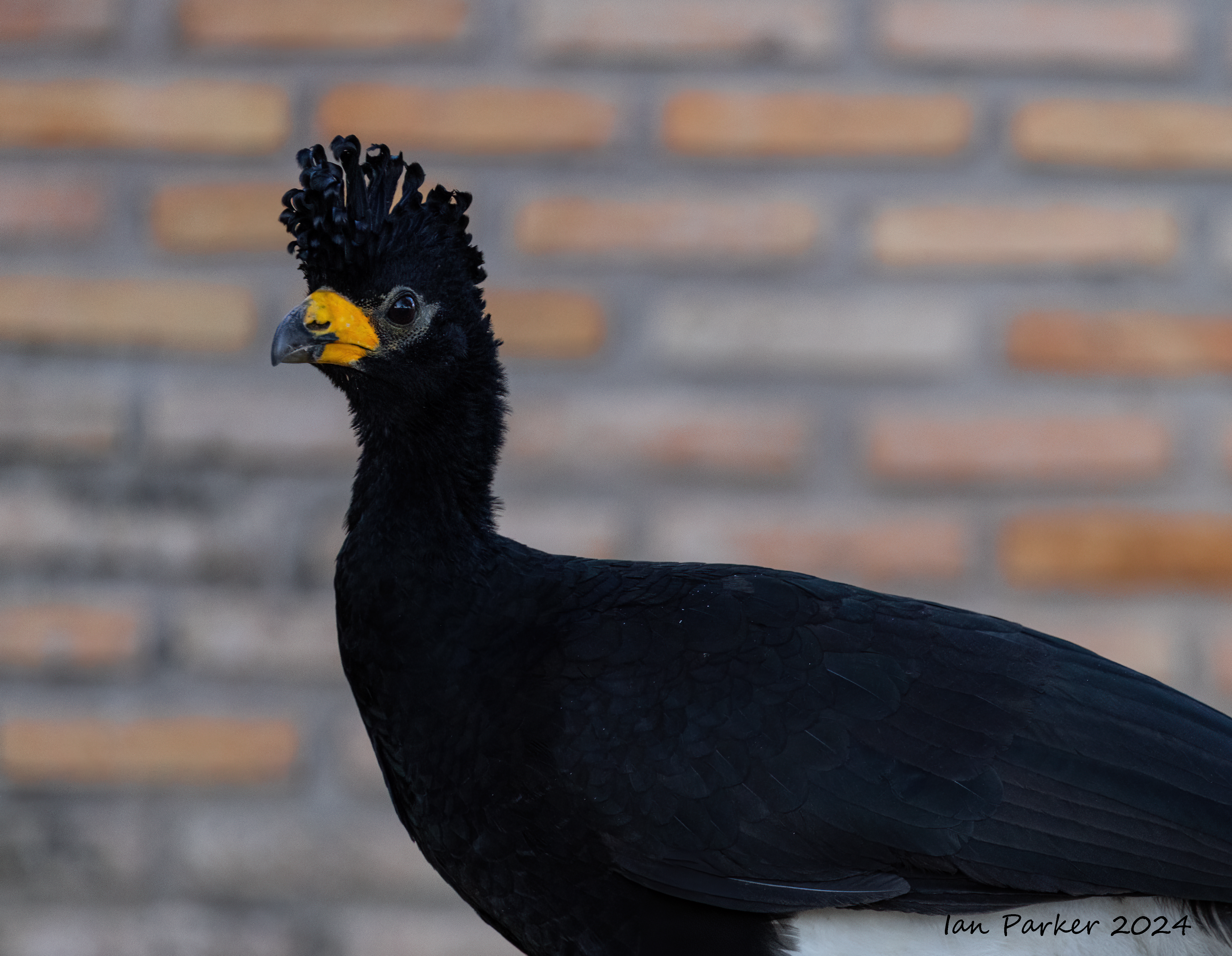
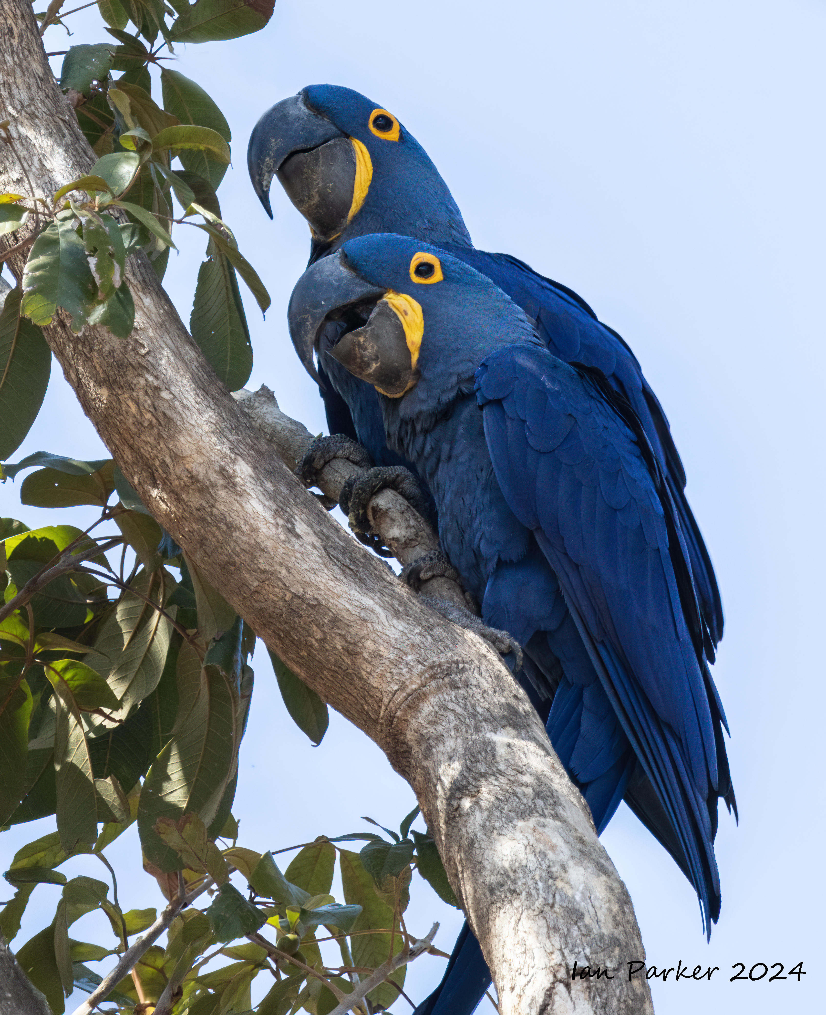
July 13 - 25: The Pantanal, Brazil
 |
The Brazilian lowlands known as the Pantanal form an enormous wilderness in the heart of South America. This flat rain-fed region, laced with waterways and submerged beneath silvery sheets of floodwater for half the year, is one of the most photographically productive wildlife habitats on the entire continent. We embarked on a two week tour of the Pantanal organized by Joe van Os Photosafaris.
Some links;
Wildlife Diaries - an excellent account ot eh Pantanal and ite wildlife
Trip report (2023) by our leader, Mark Thomas
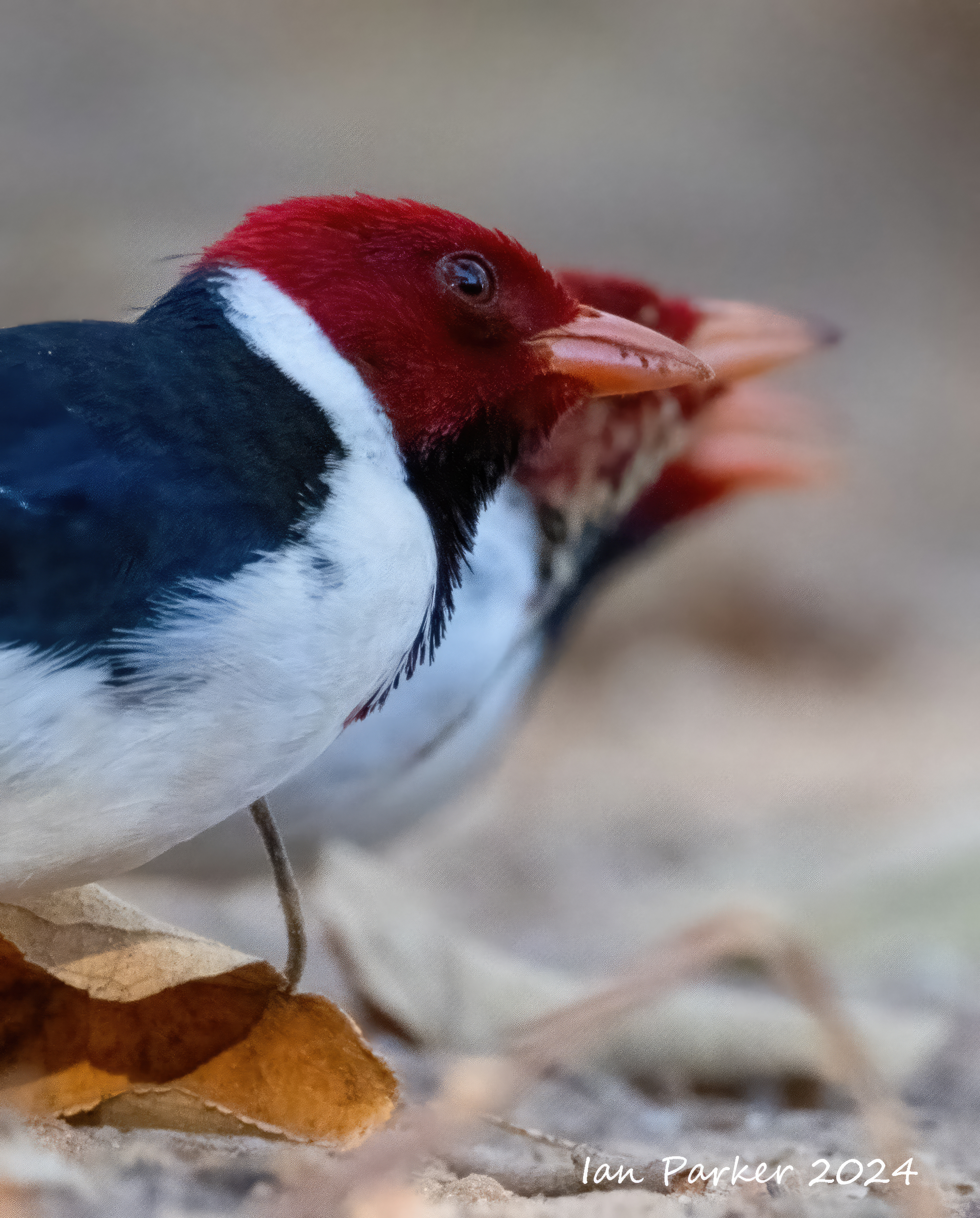
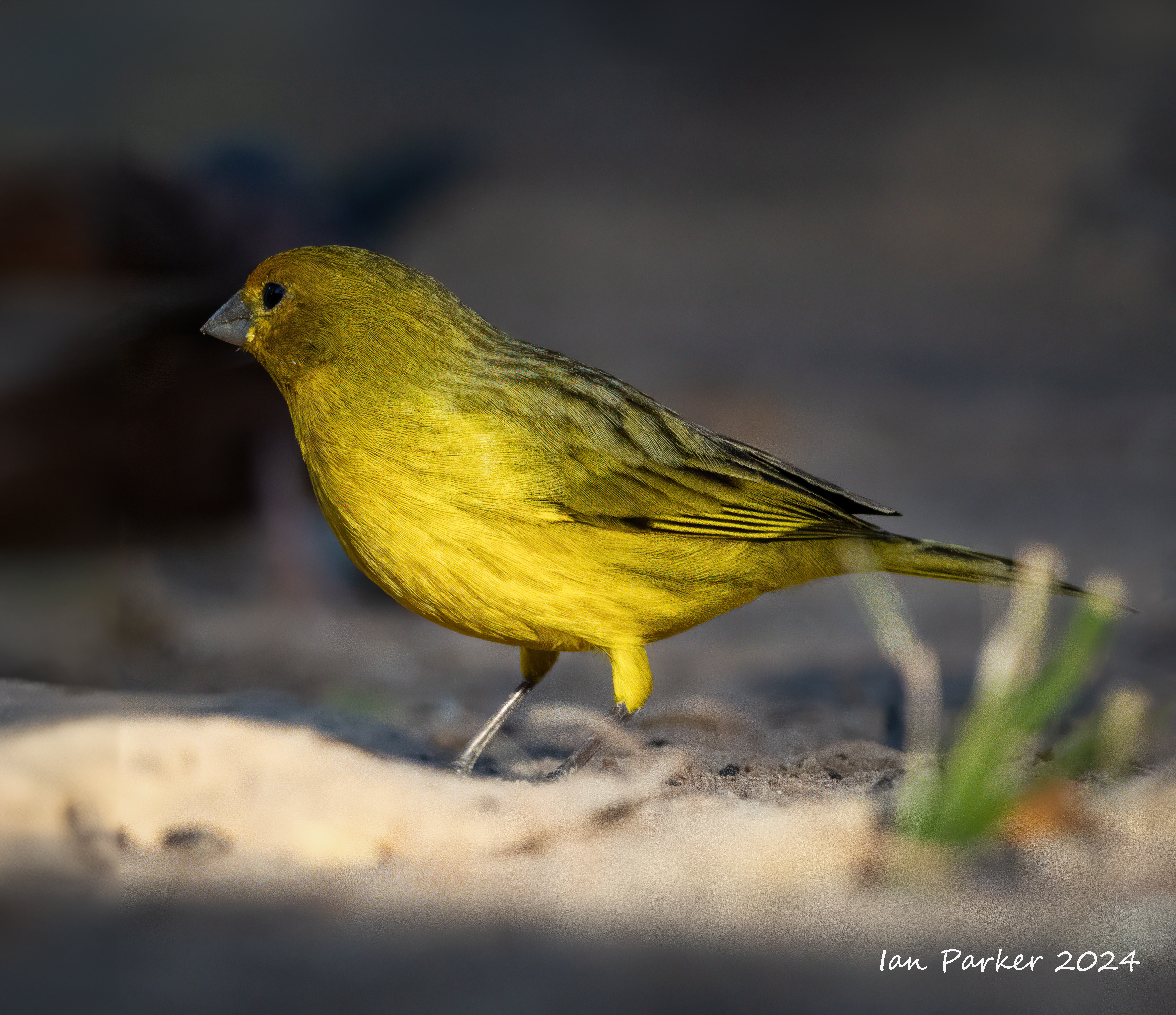
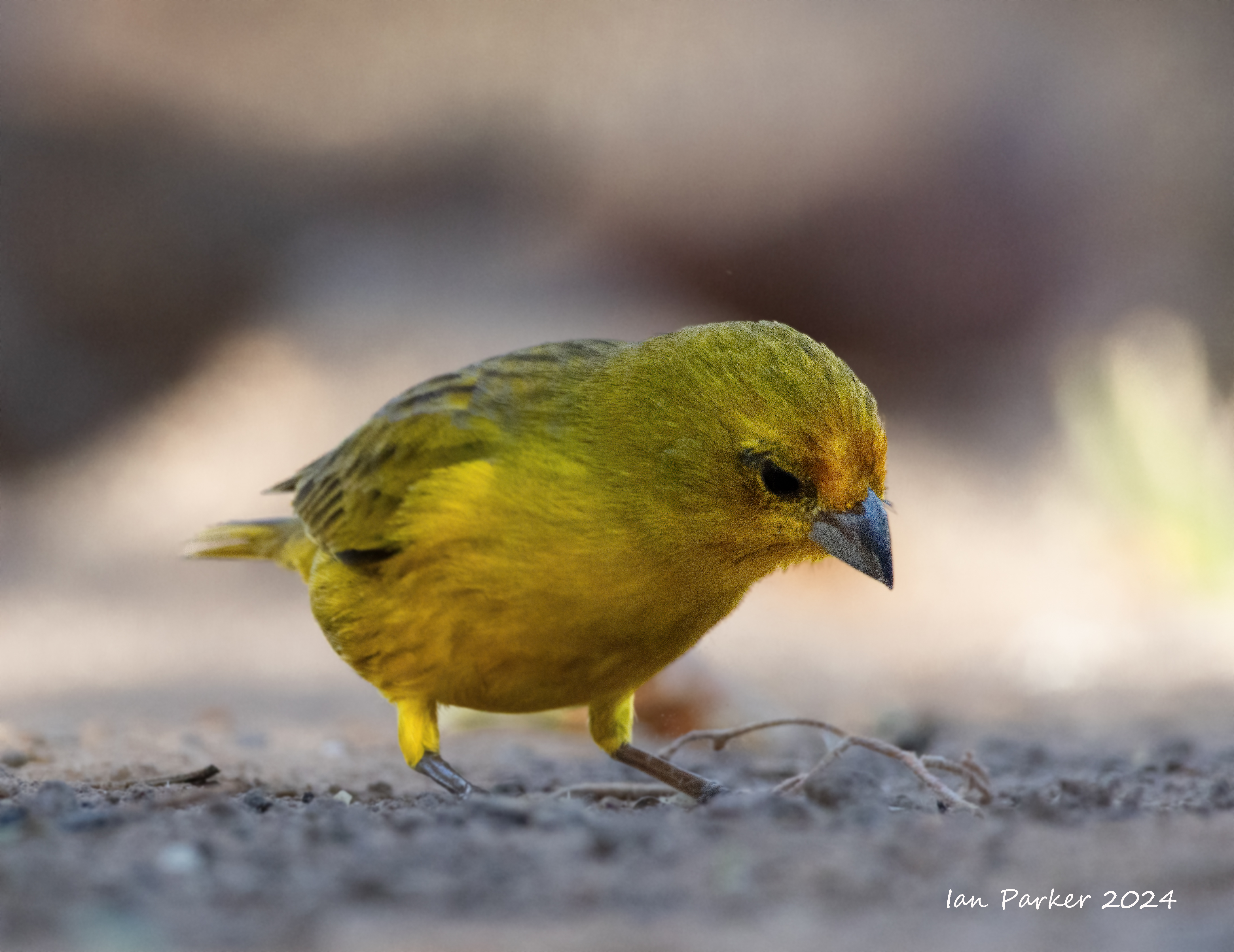
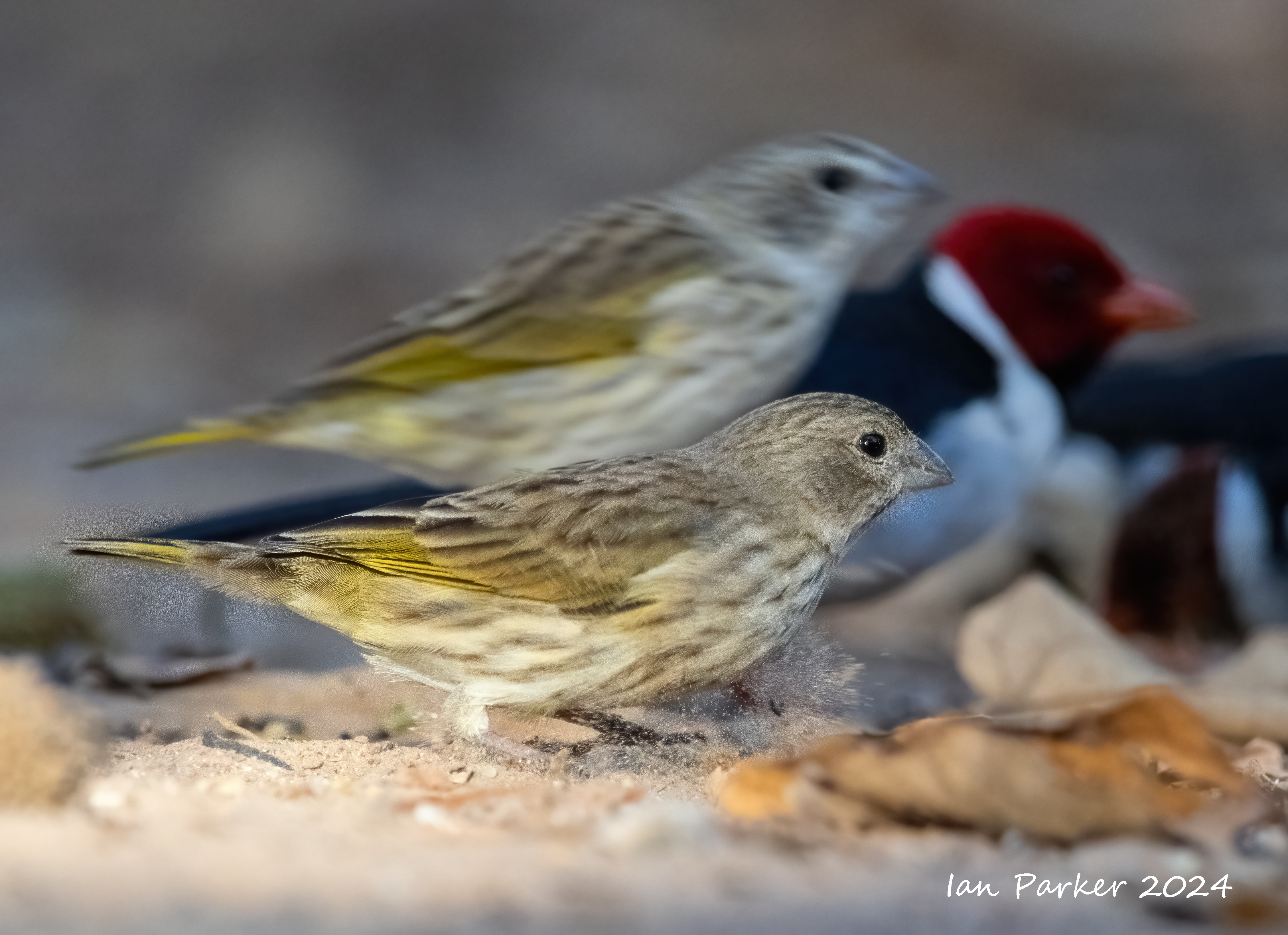
Day 11 - Pouso Allegro Lodge. A few last photos at the bird feeder before getting on the bus to the airport.+

Day 10 - Pouso Allegro Lodge
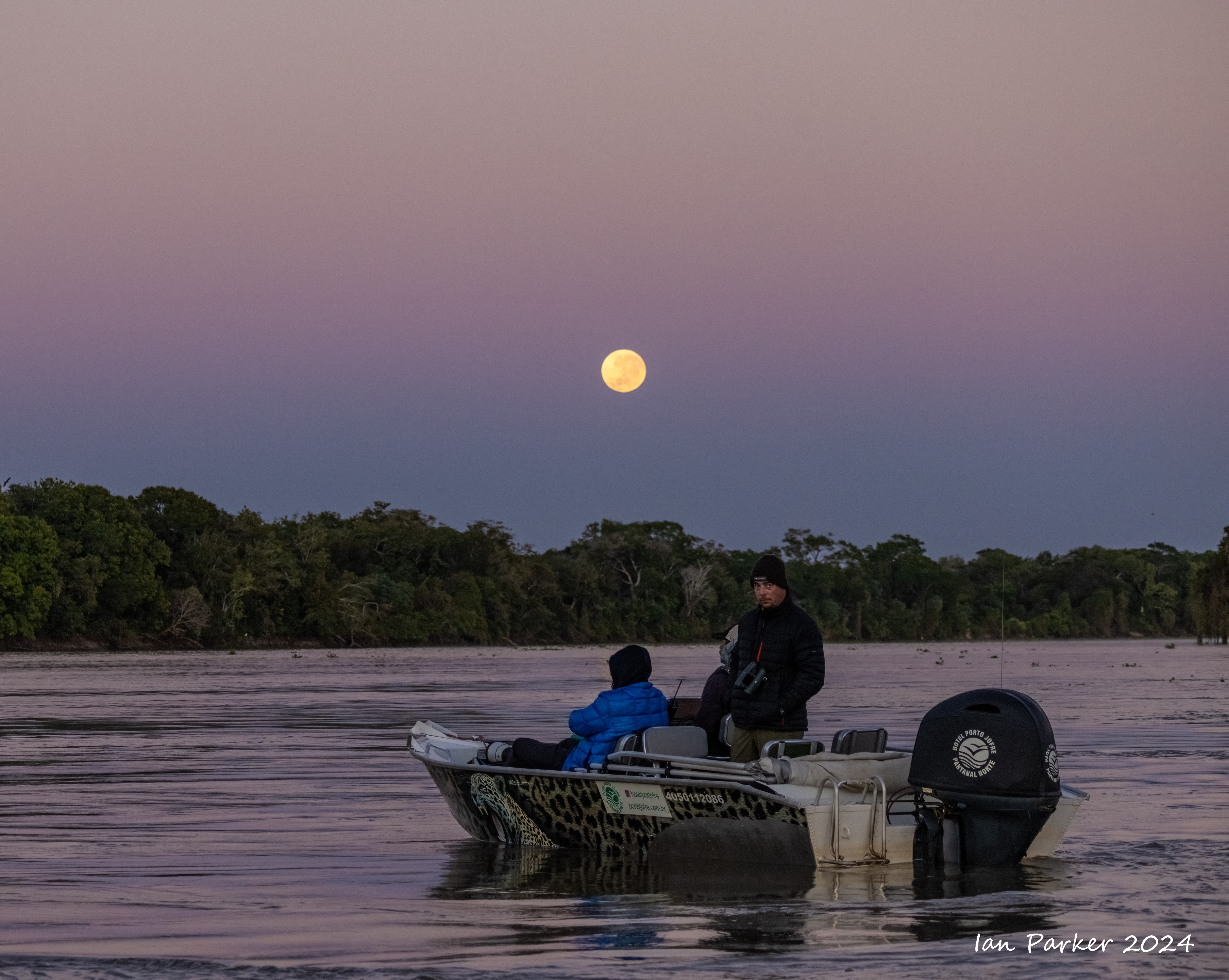
Day 9 - Along the Transpantanal from Porto Joffre to Pouso Alegre lodge.
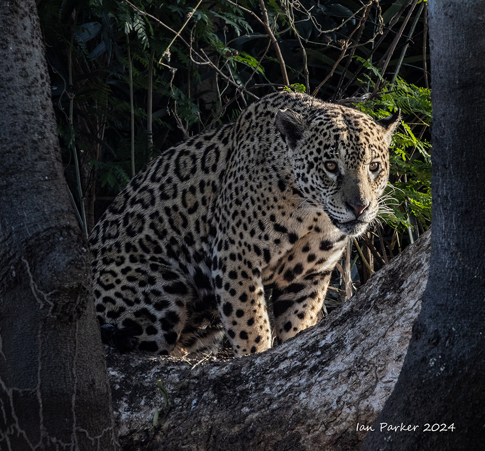
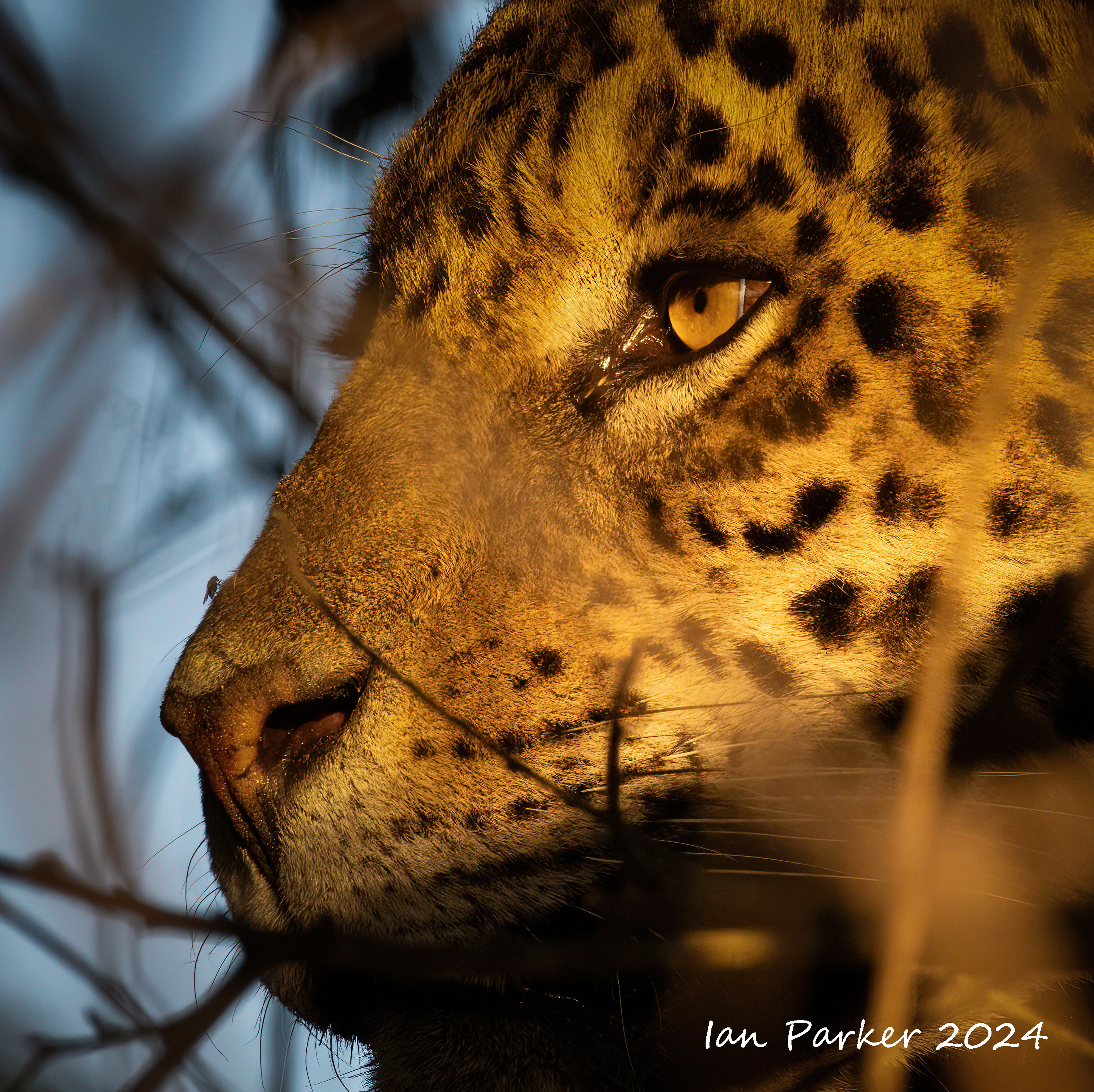
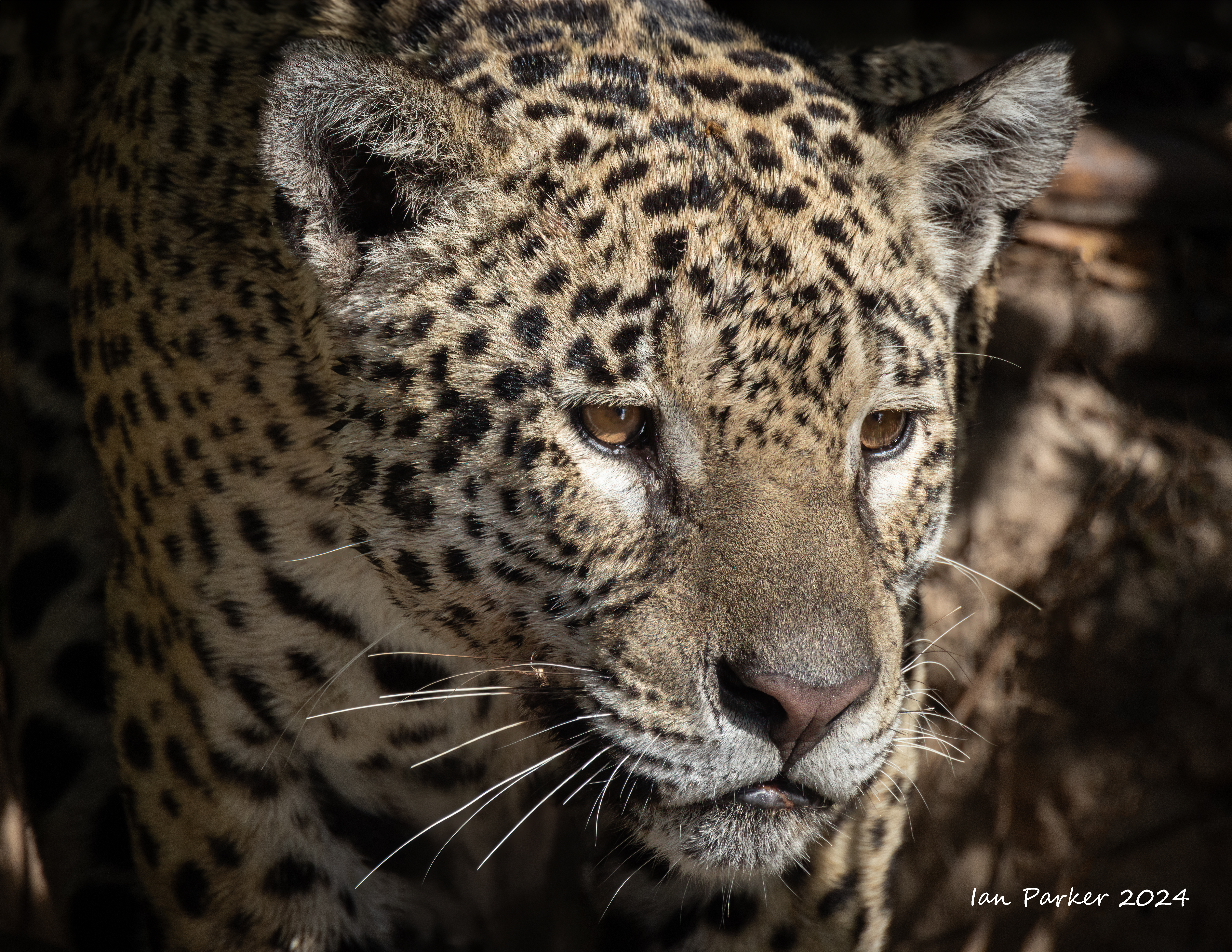
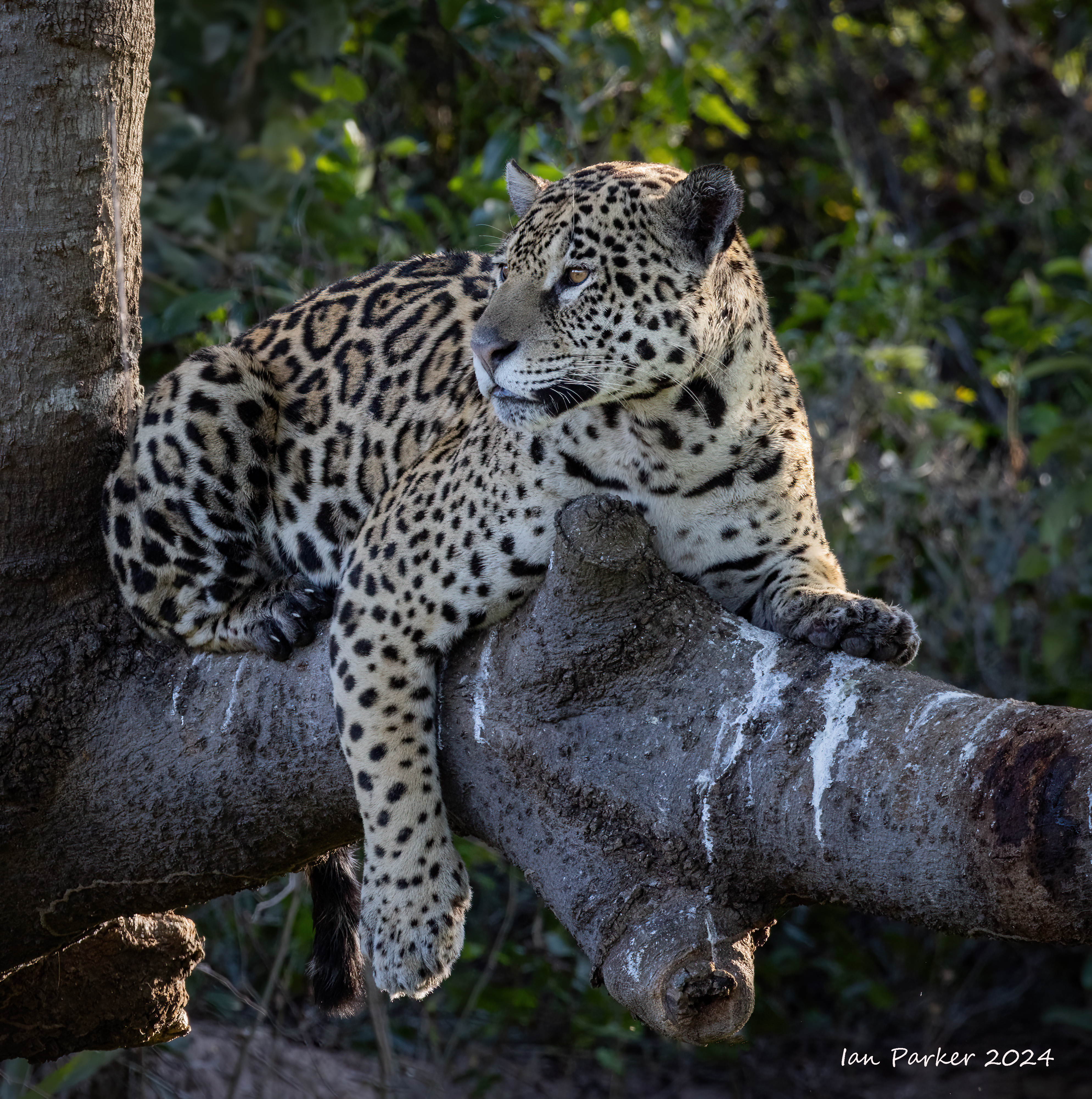
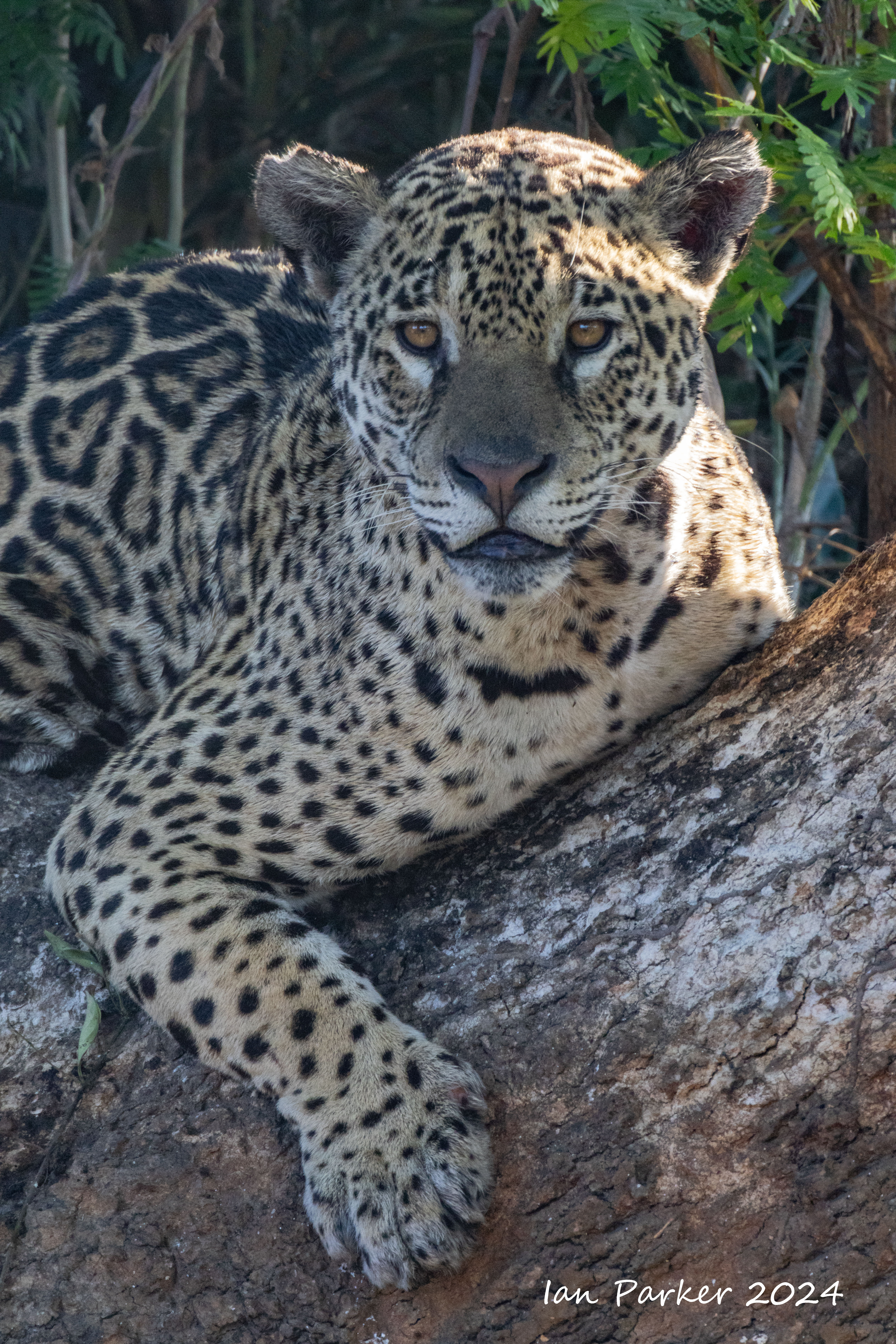
Day 8 - last day at Porto Joffre

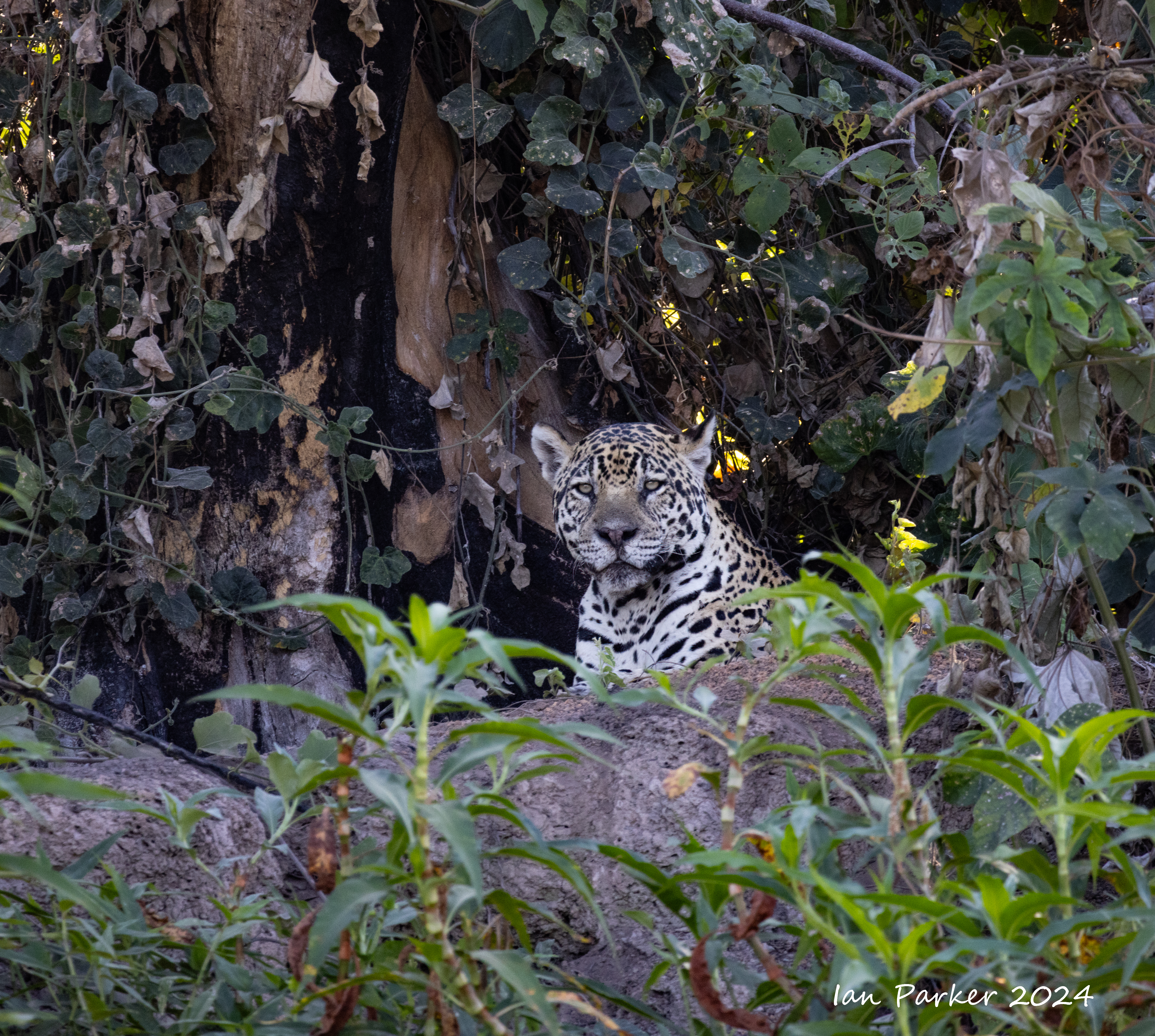
Our last jaguar - hidden deep in the brush, but nicely illuminated just before sunset.
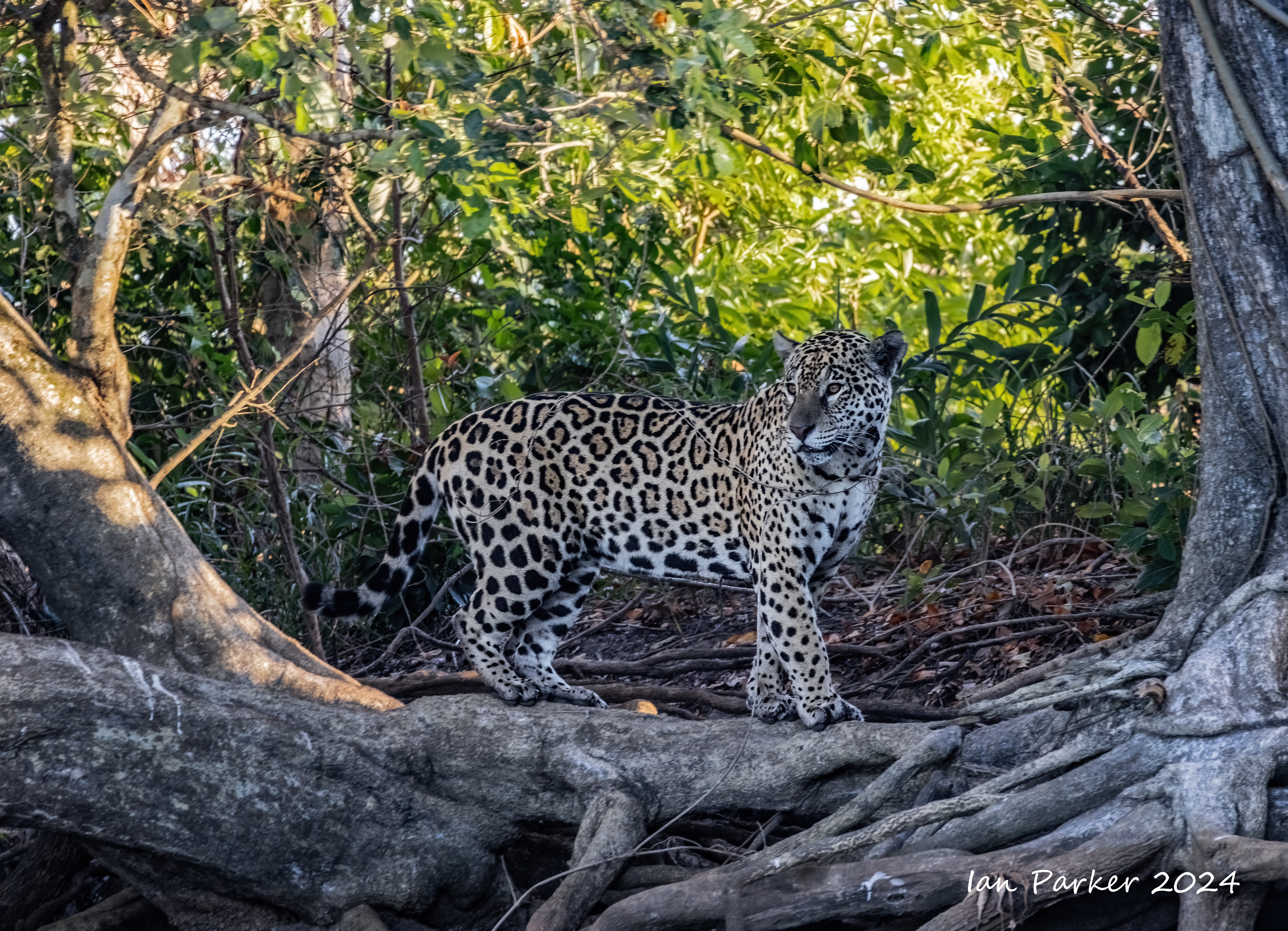
Day 7 - Out on the river again from Porto Joffre.
Mostly birds. Only a single, not very photogenic, jaguar sighting.
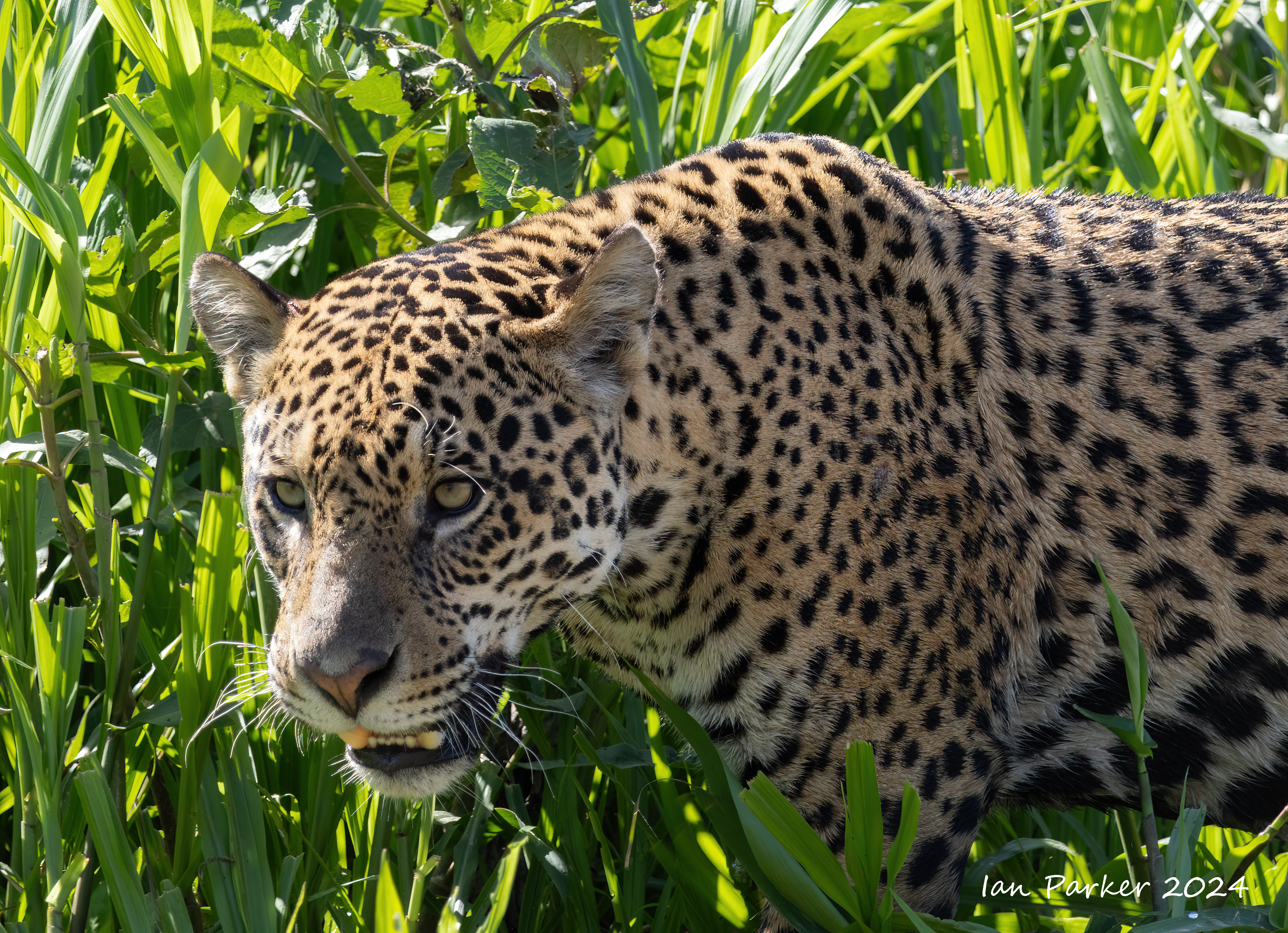
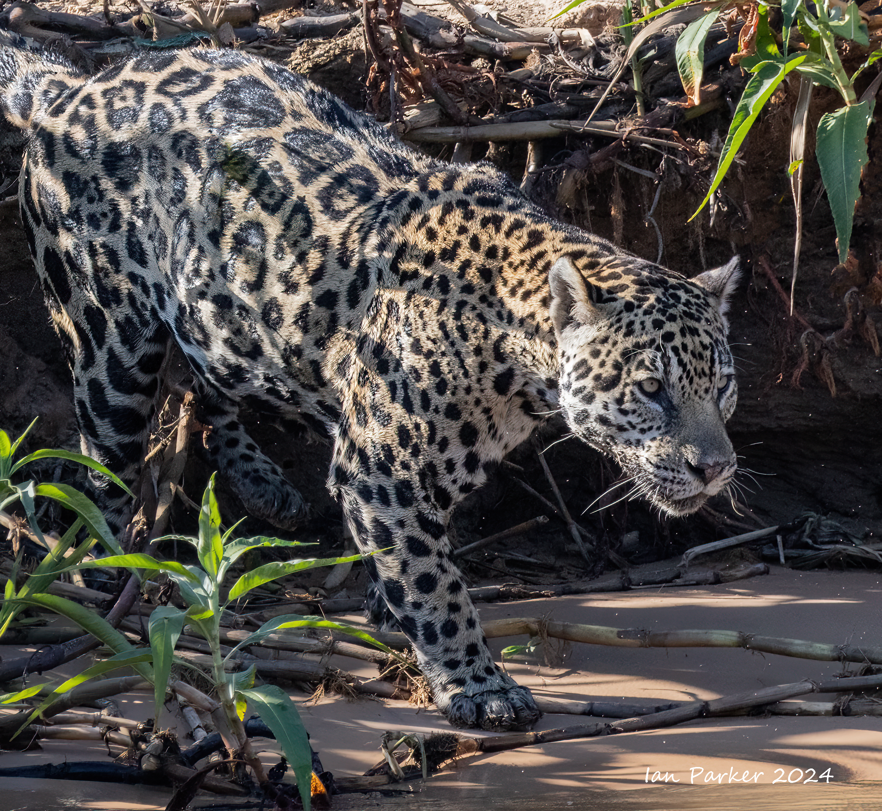
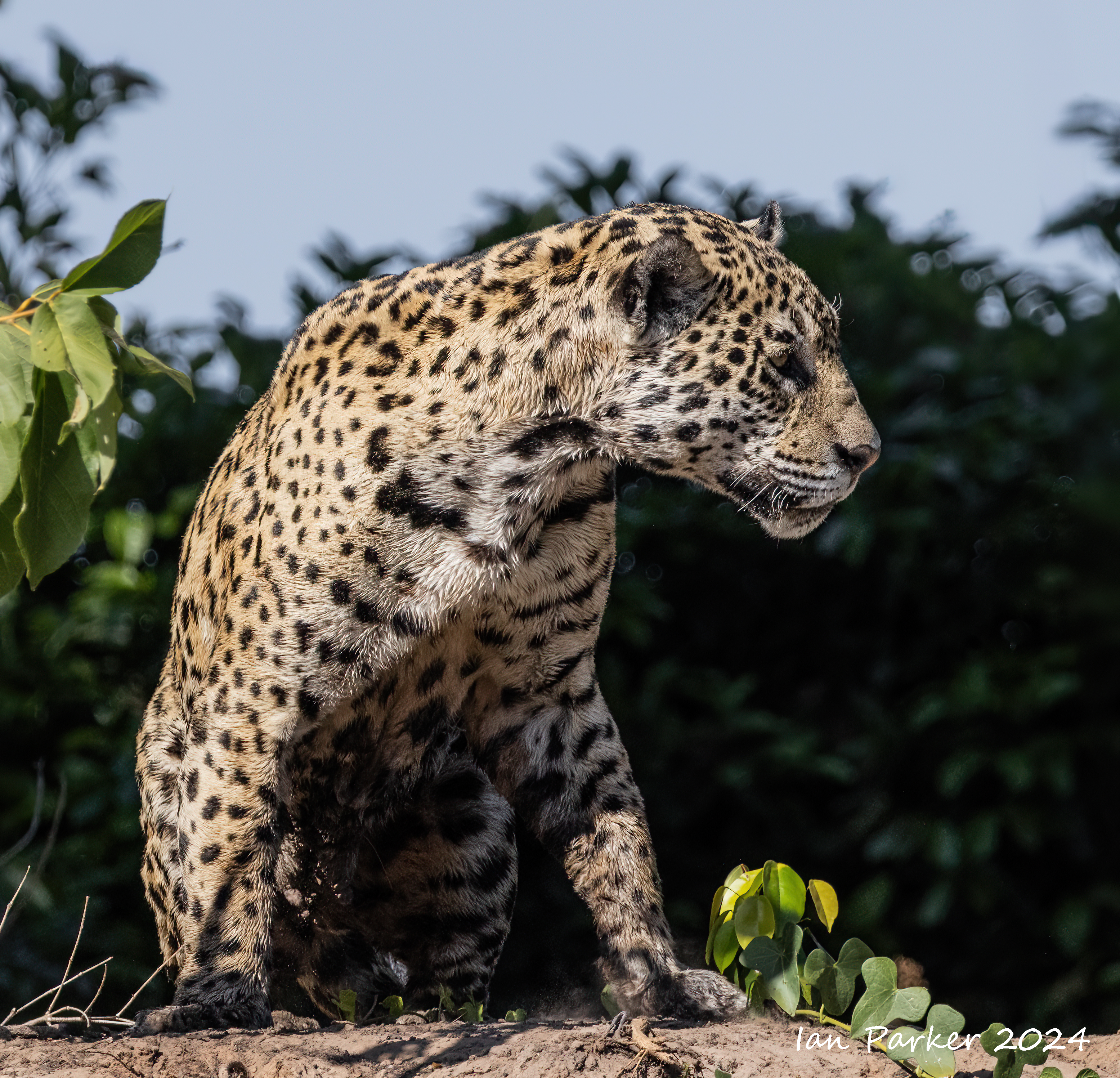
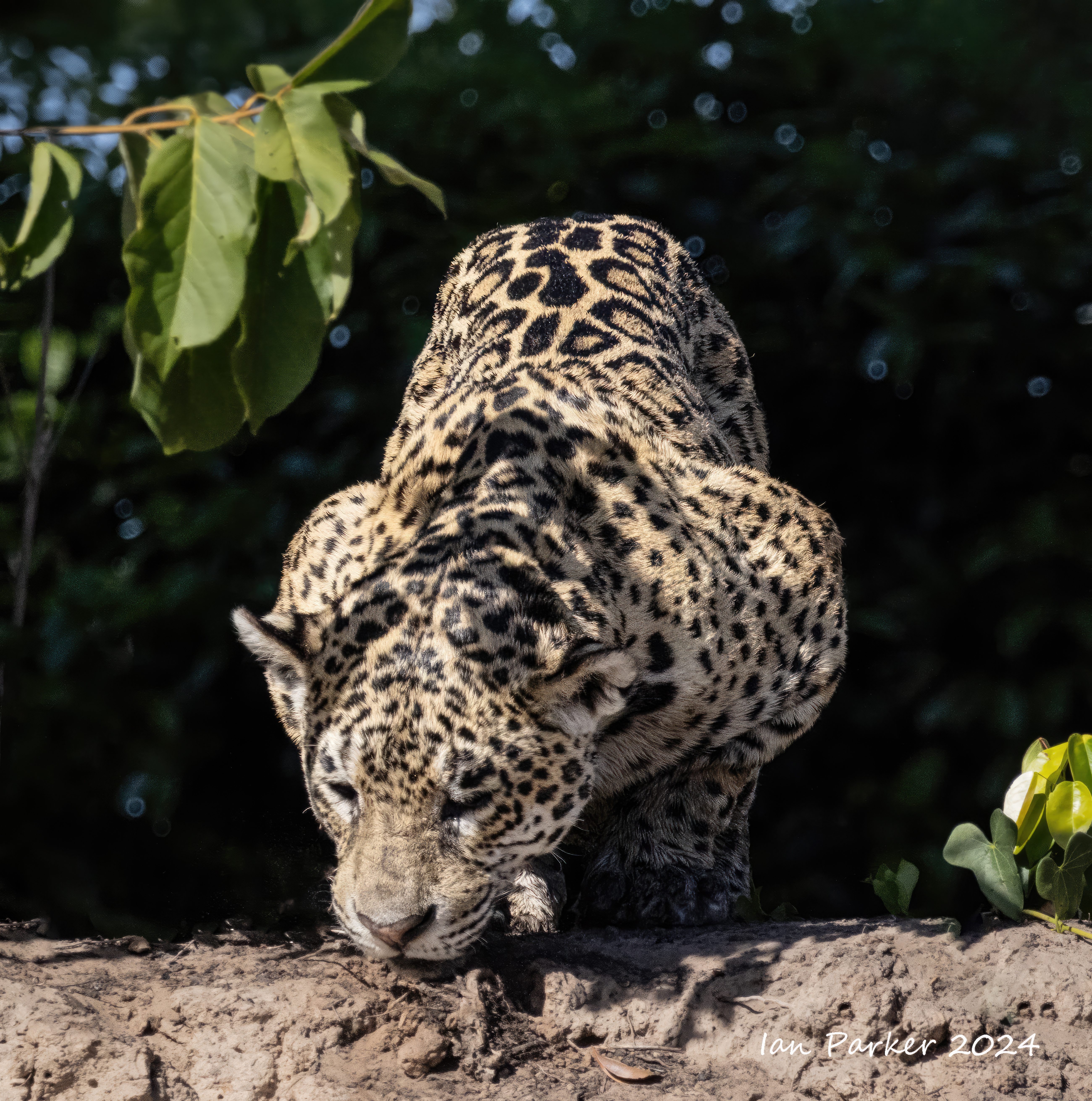
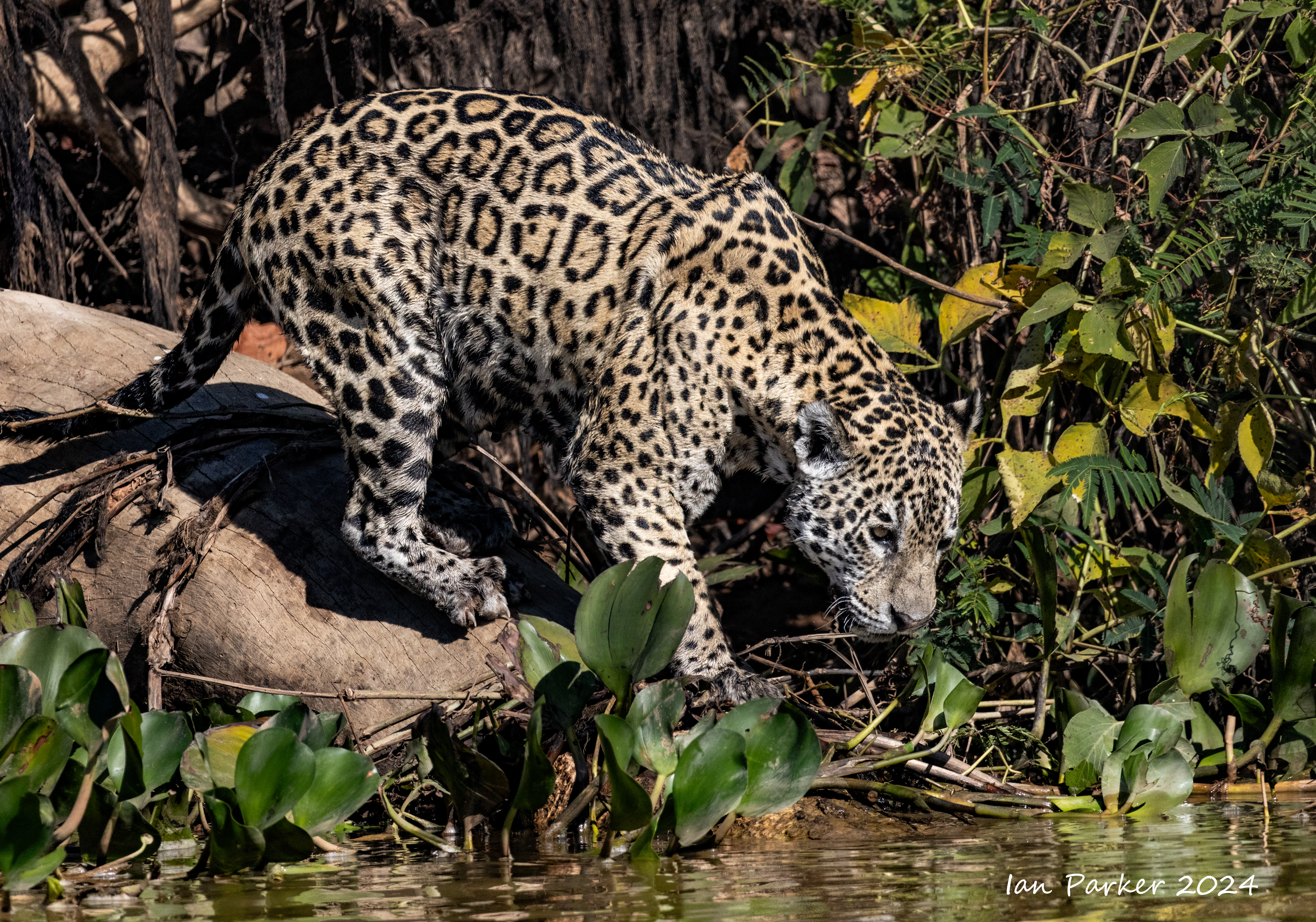
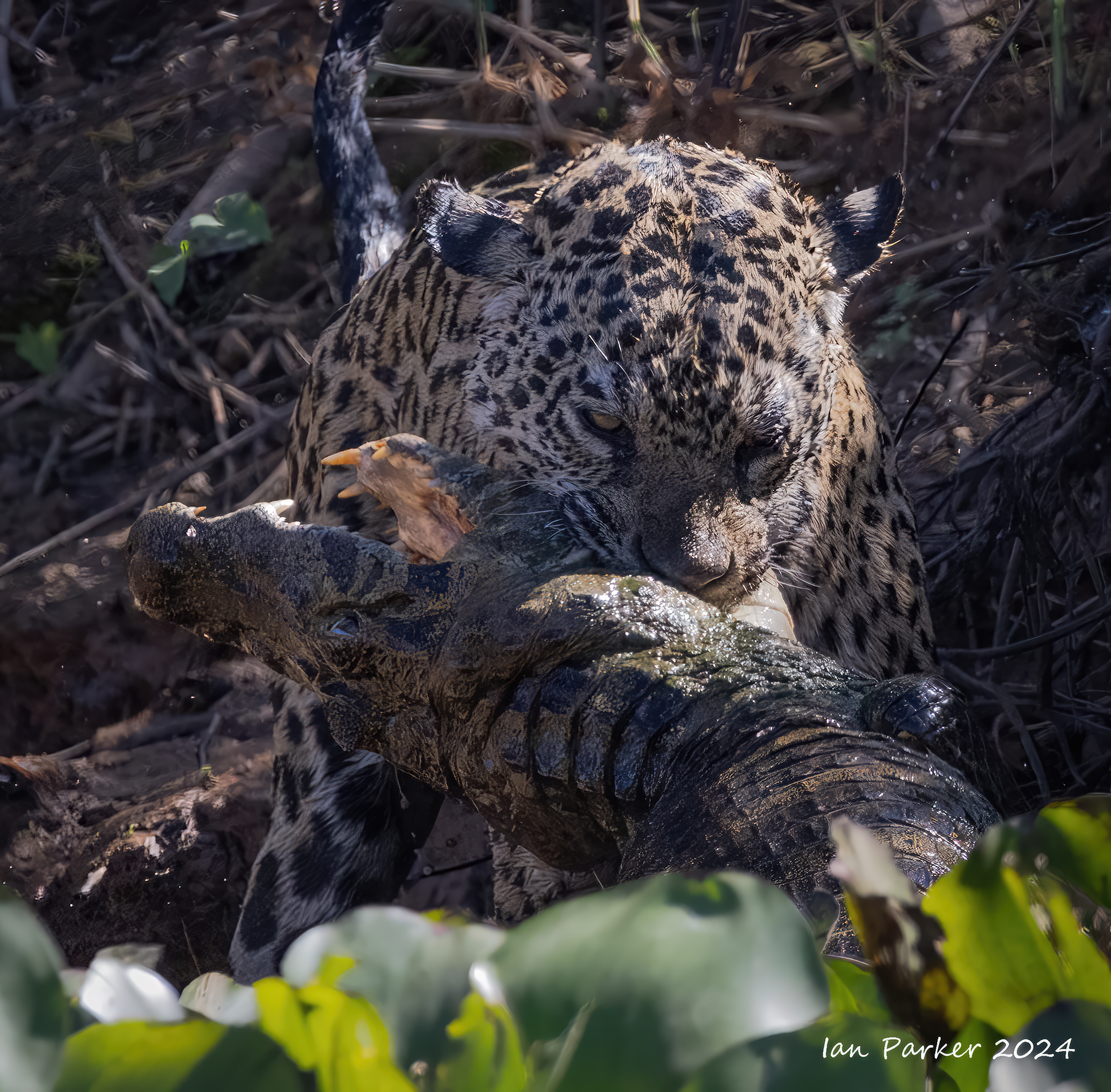
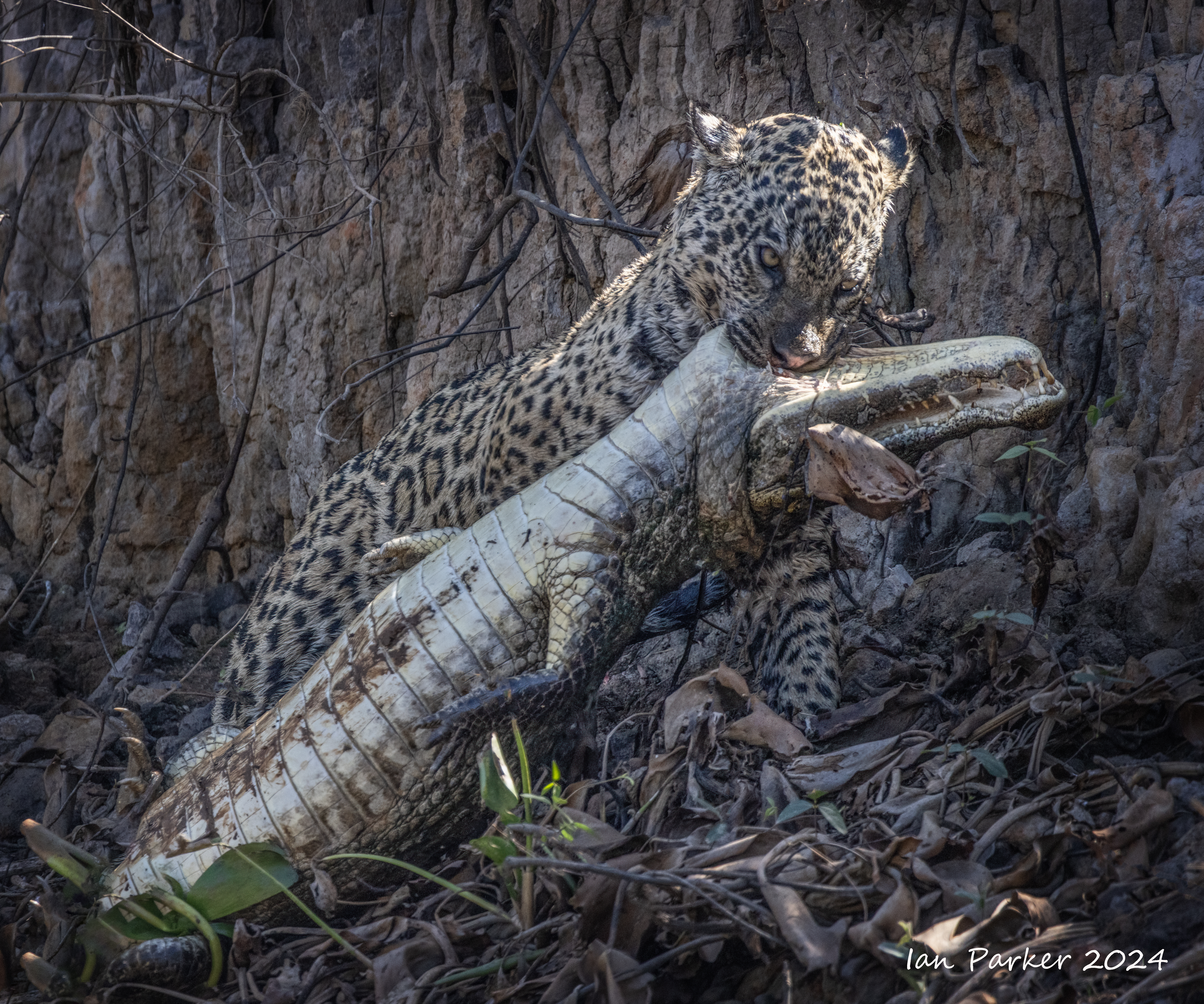
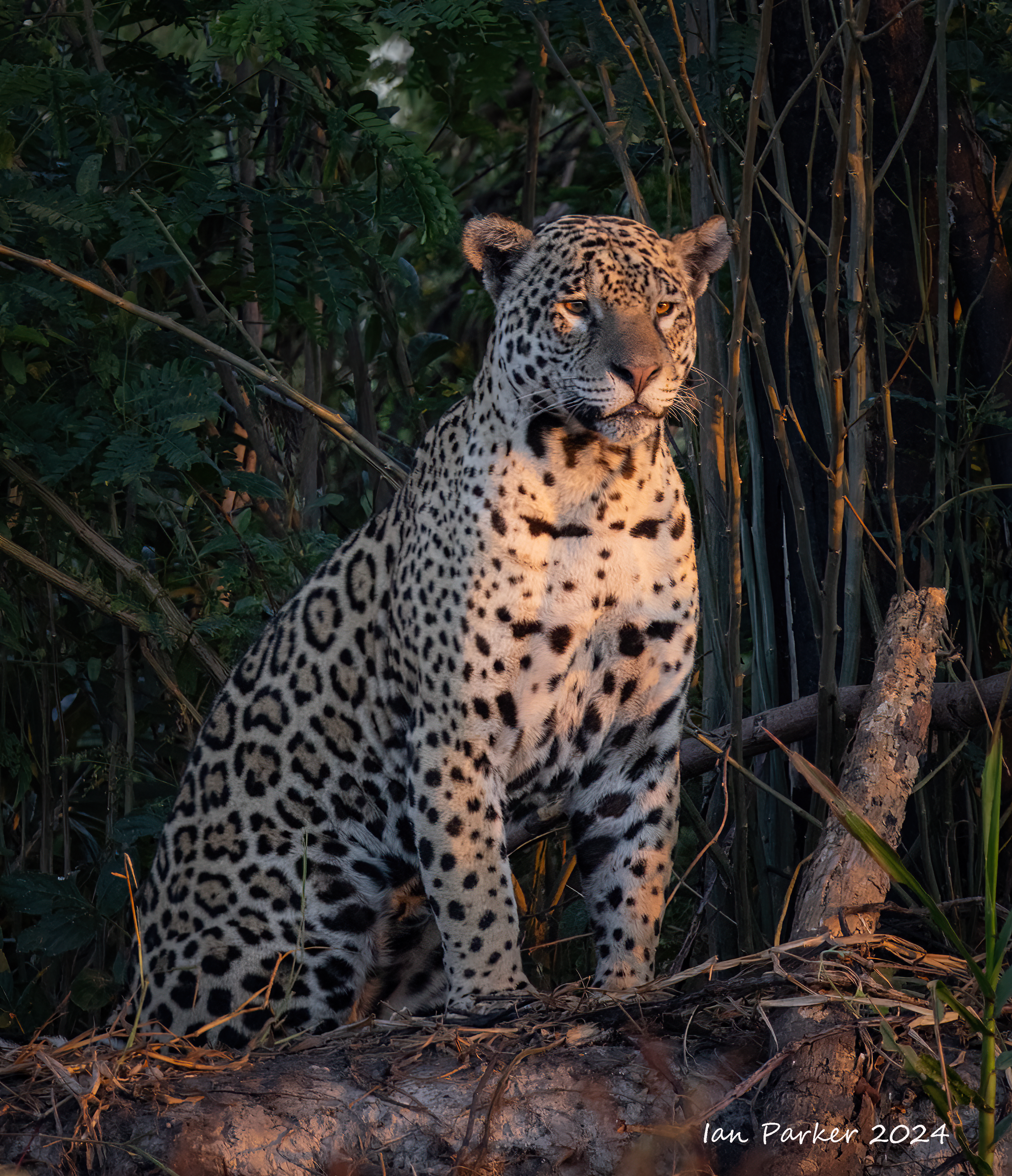
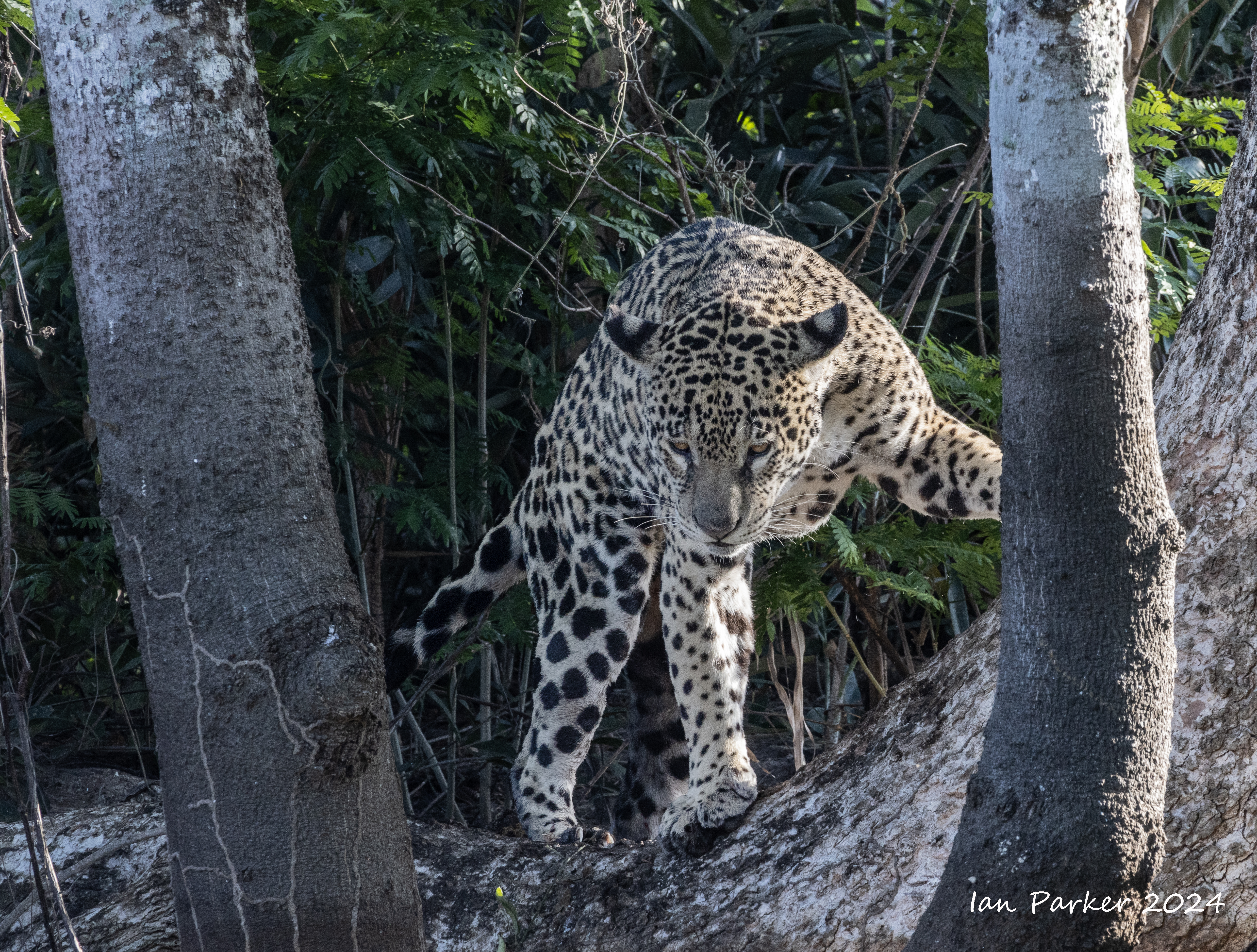
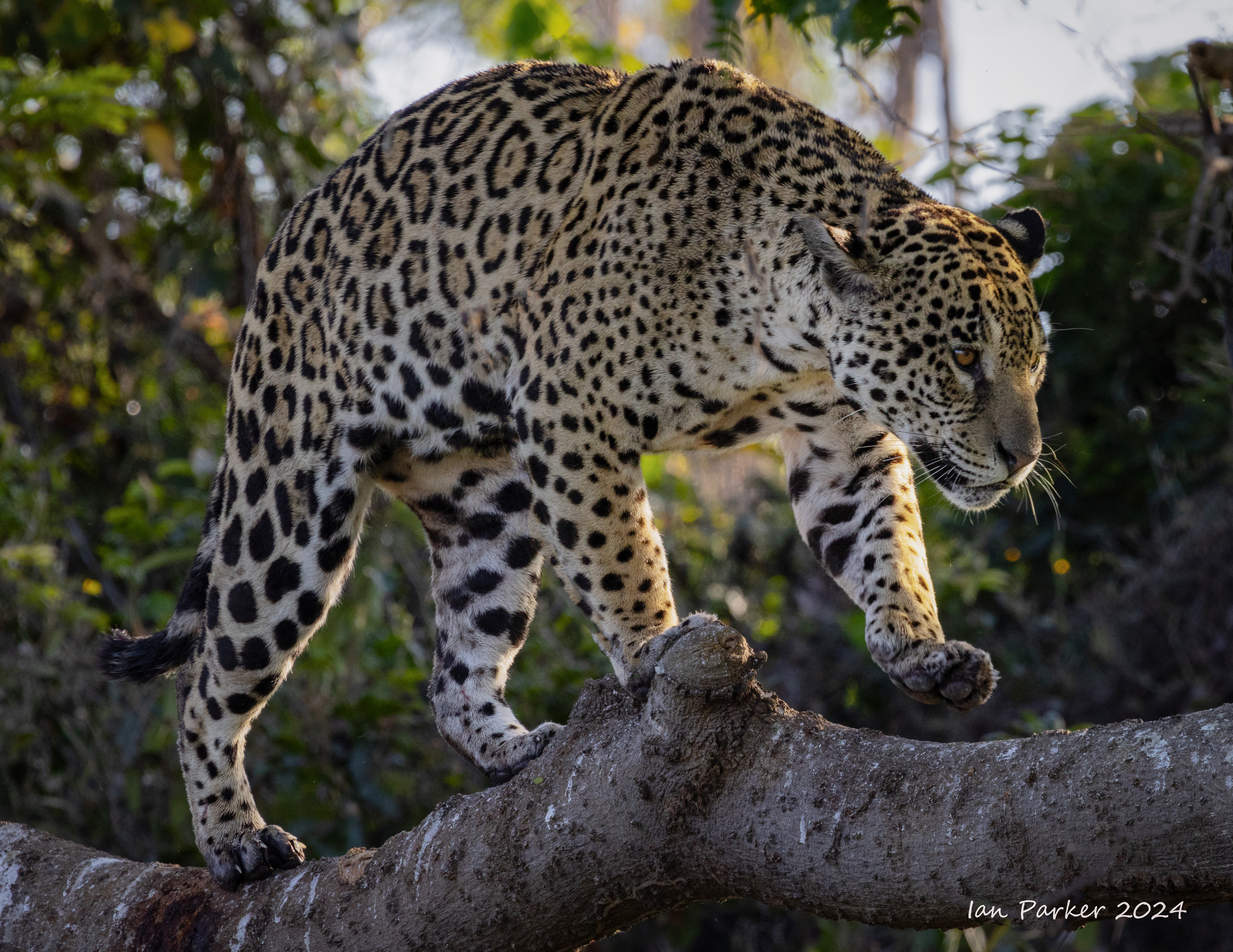
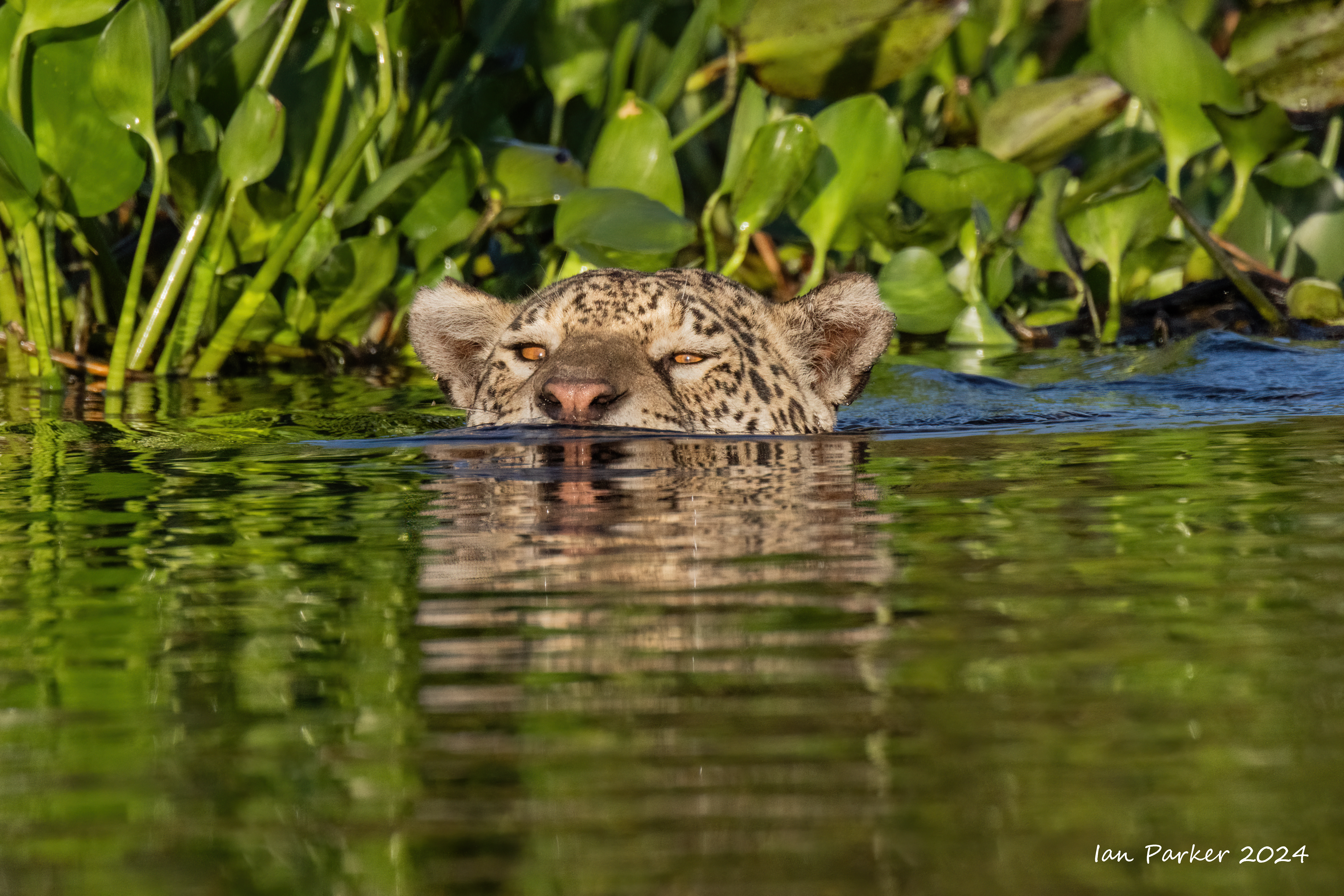
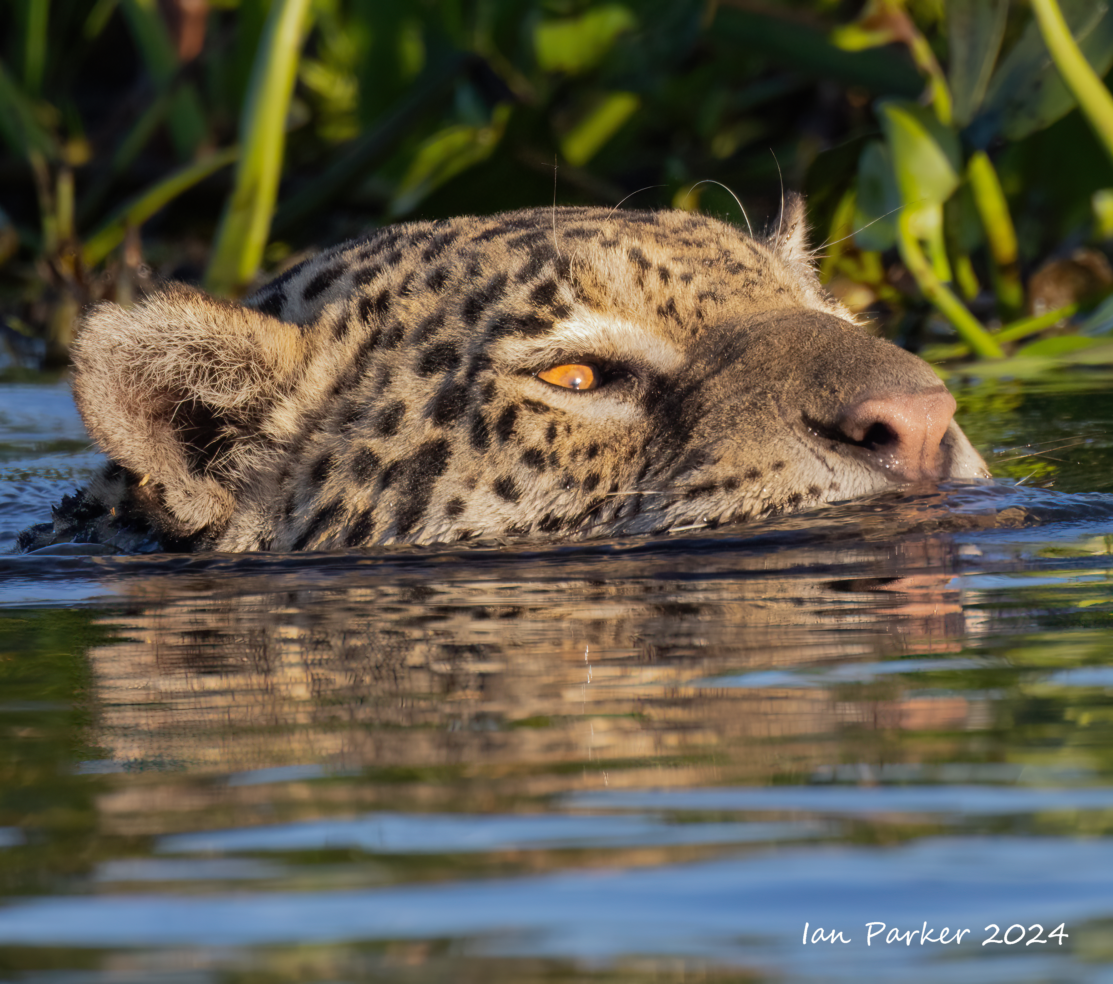
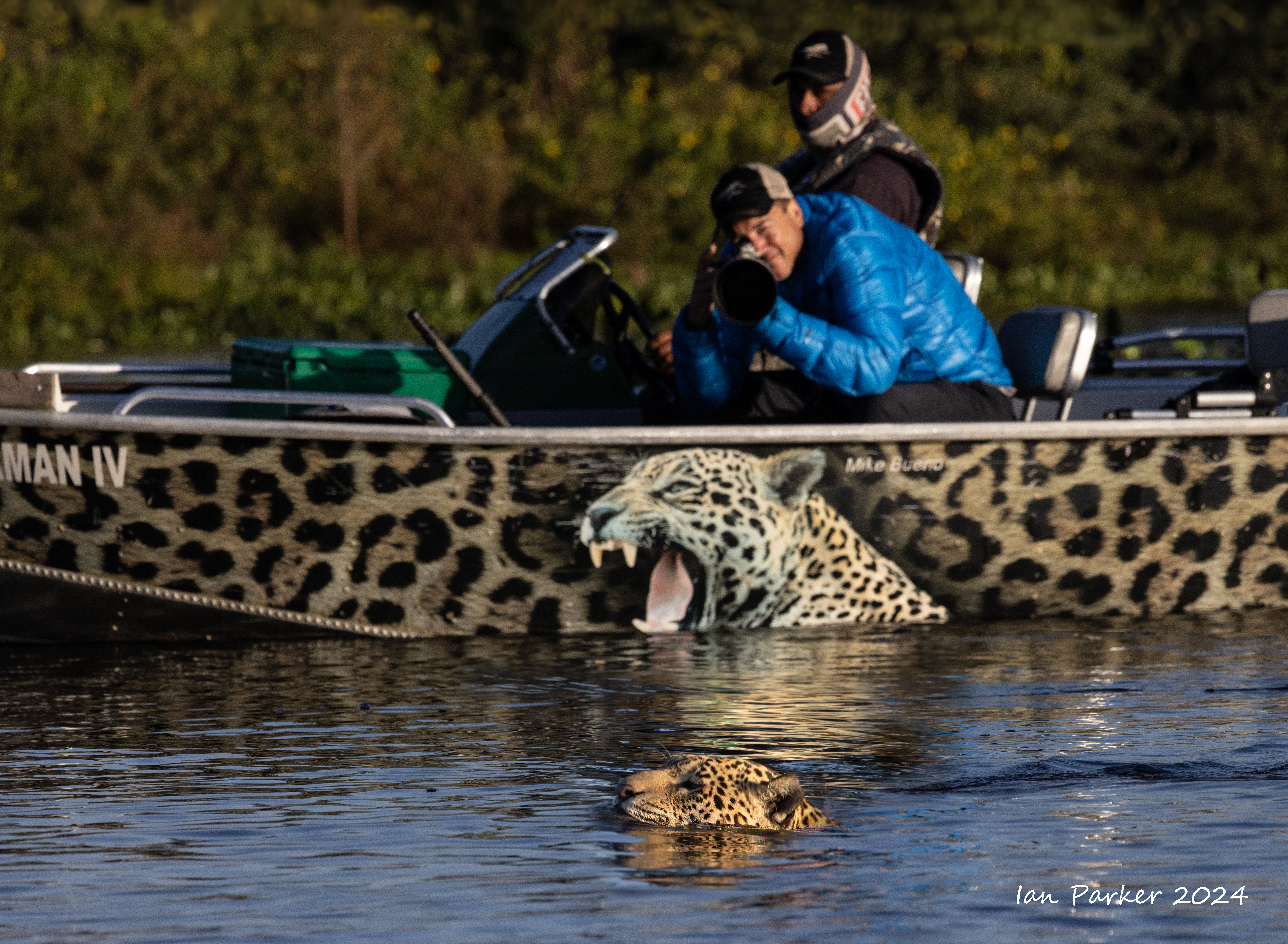
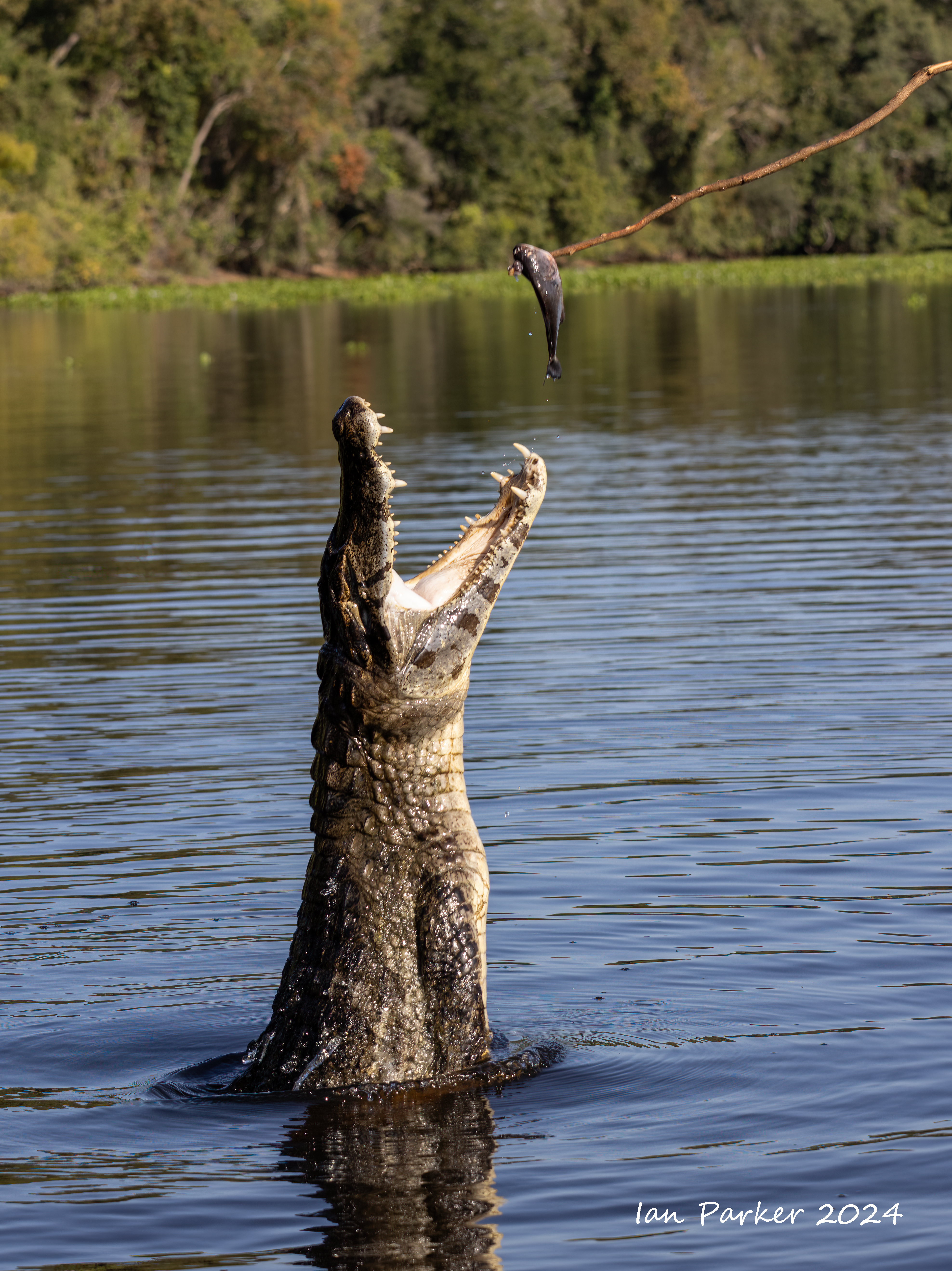
Day 6 - Morning and afternoon jaguar boat excursions
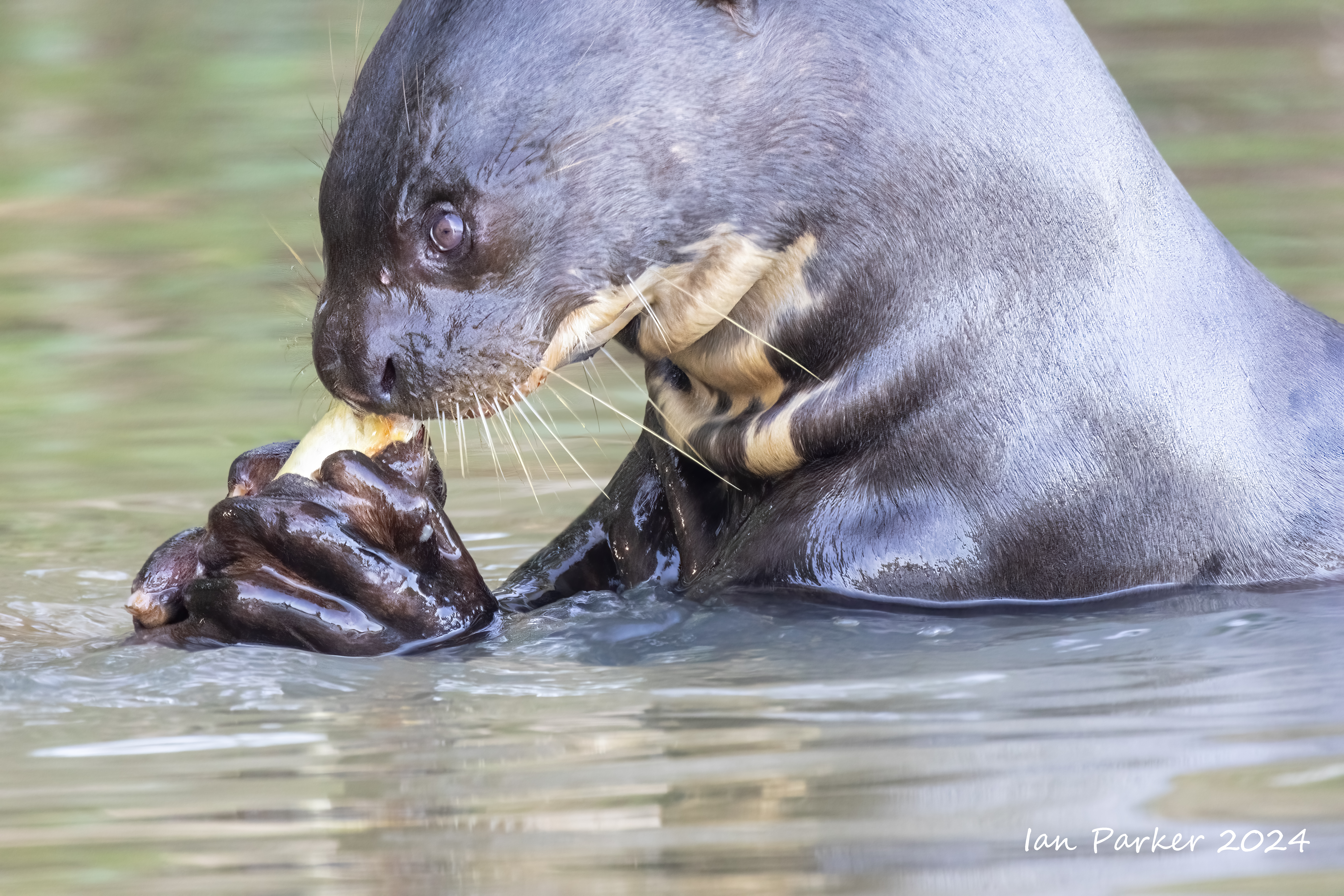
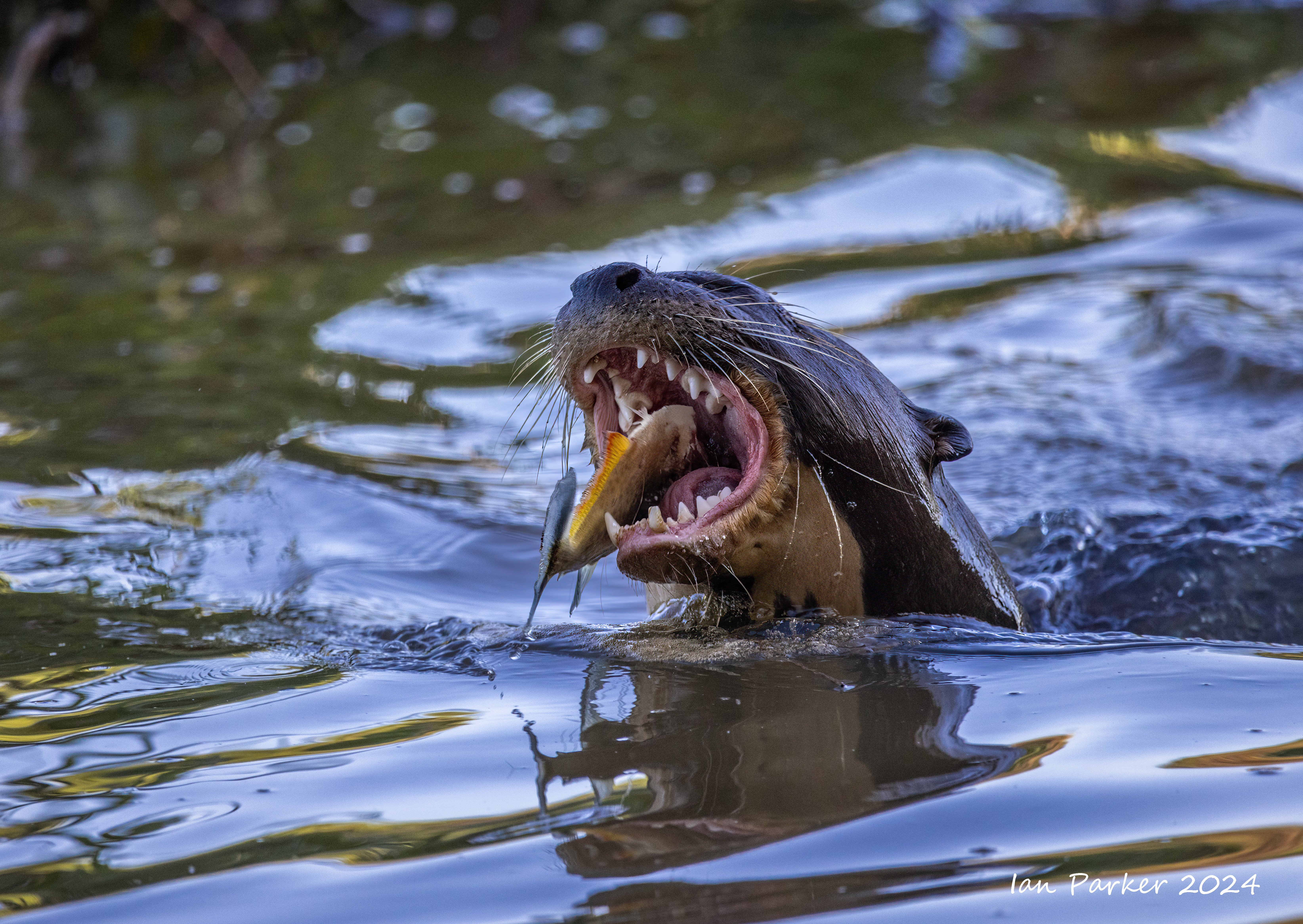
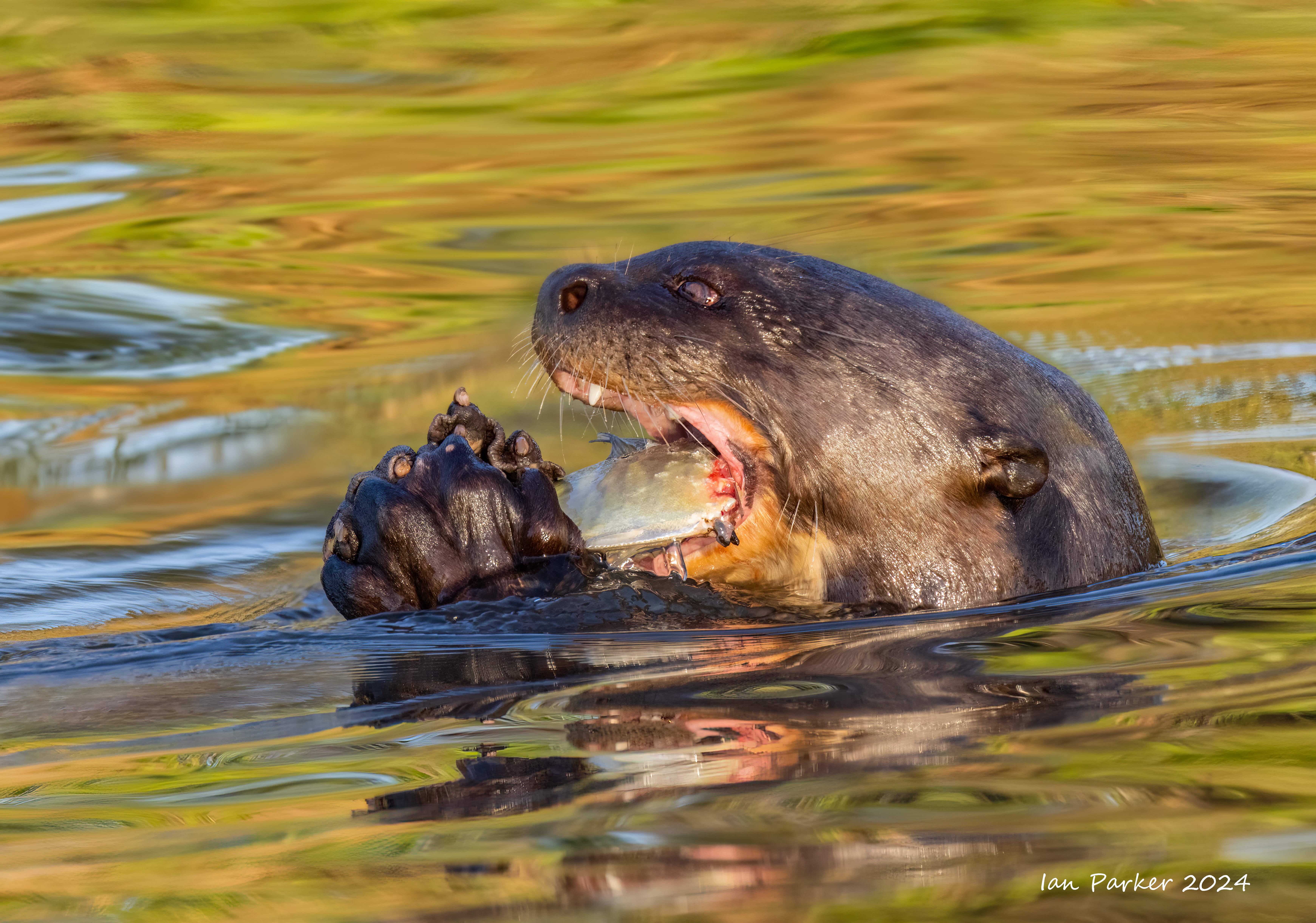
A jaguar kill and giant river otters
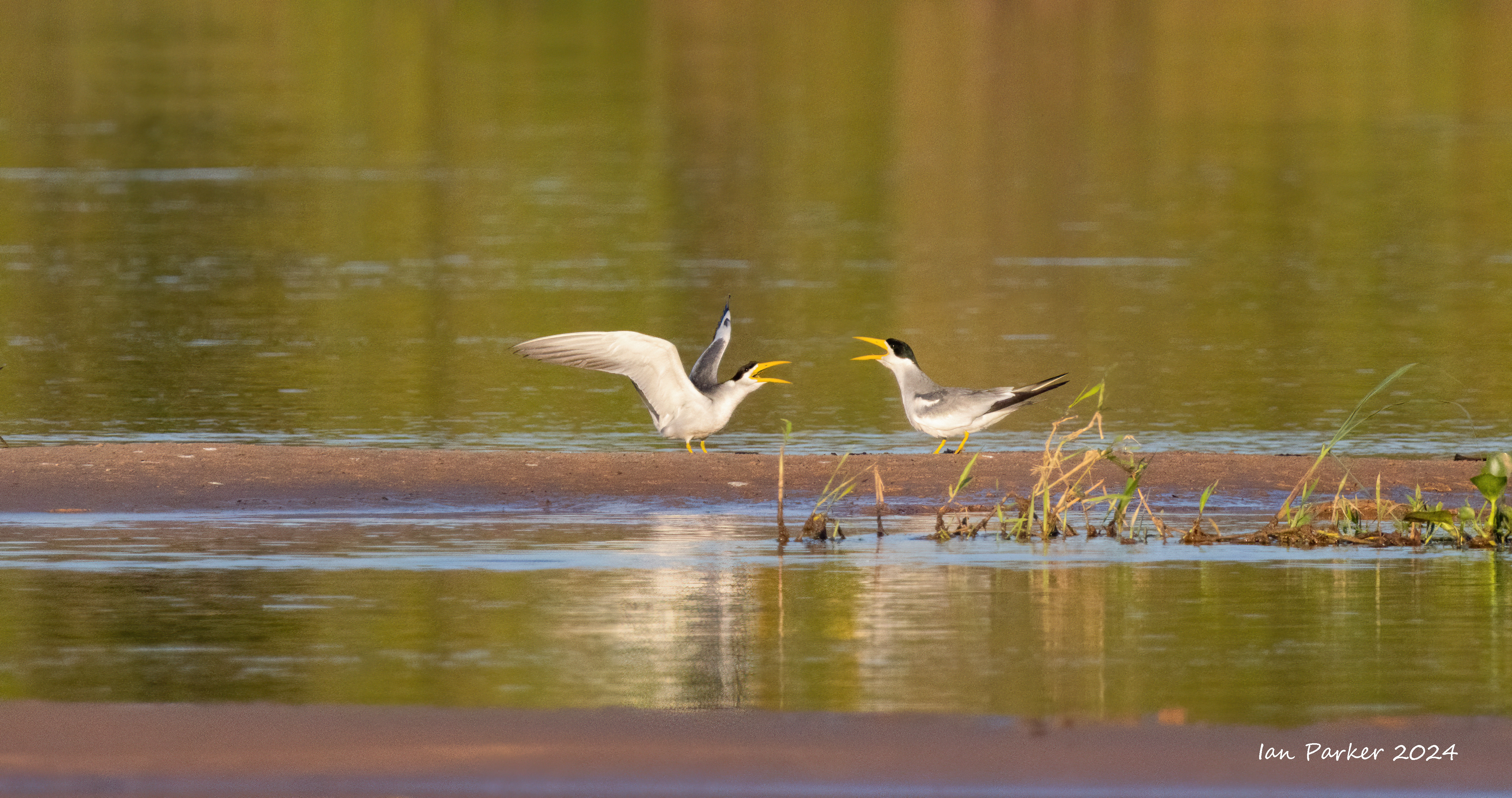
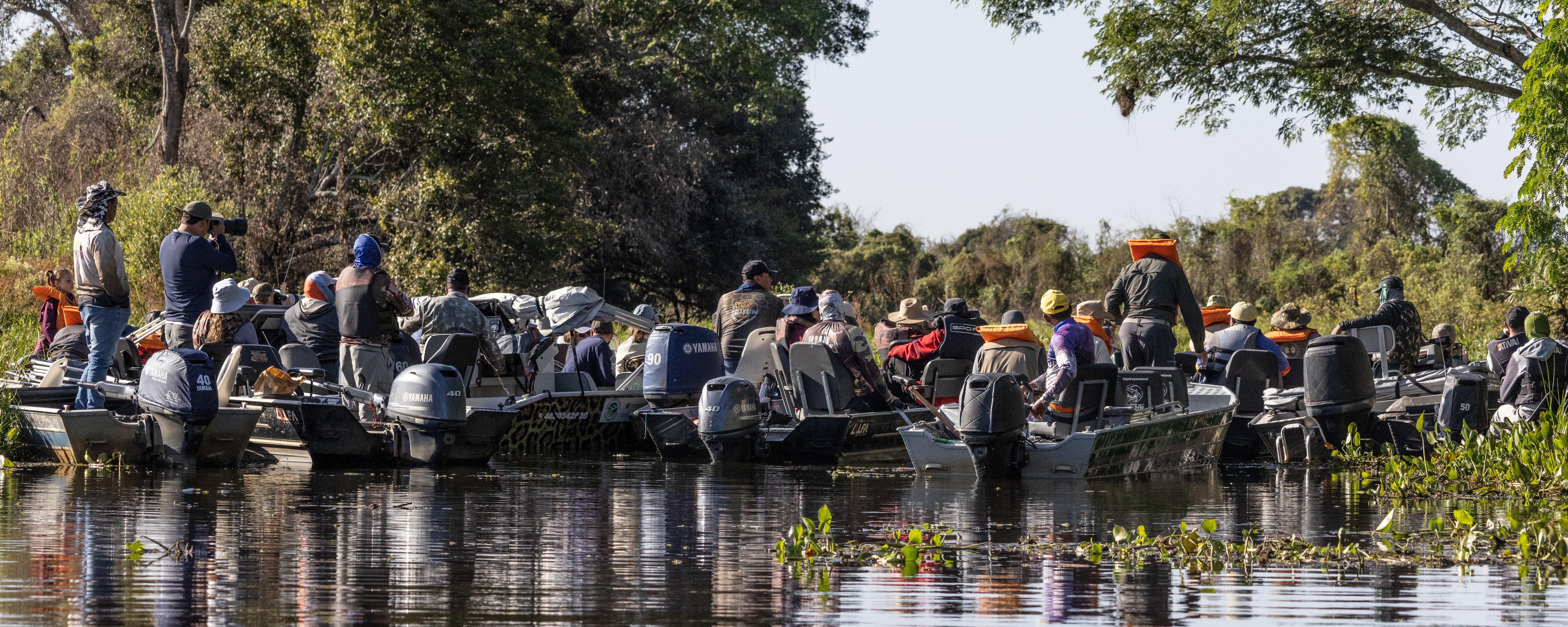
Jaguar sighting.
The local guides communicate by radio. When a report of a sighting goes out as many as 20 or more boats speed toward the jaguar. This time we were late arriving... The jaguars have become habituated to all this activity over the years that tourism has developed in the Pantanal, and appear completely oblivious to the commotion around the.
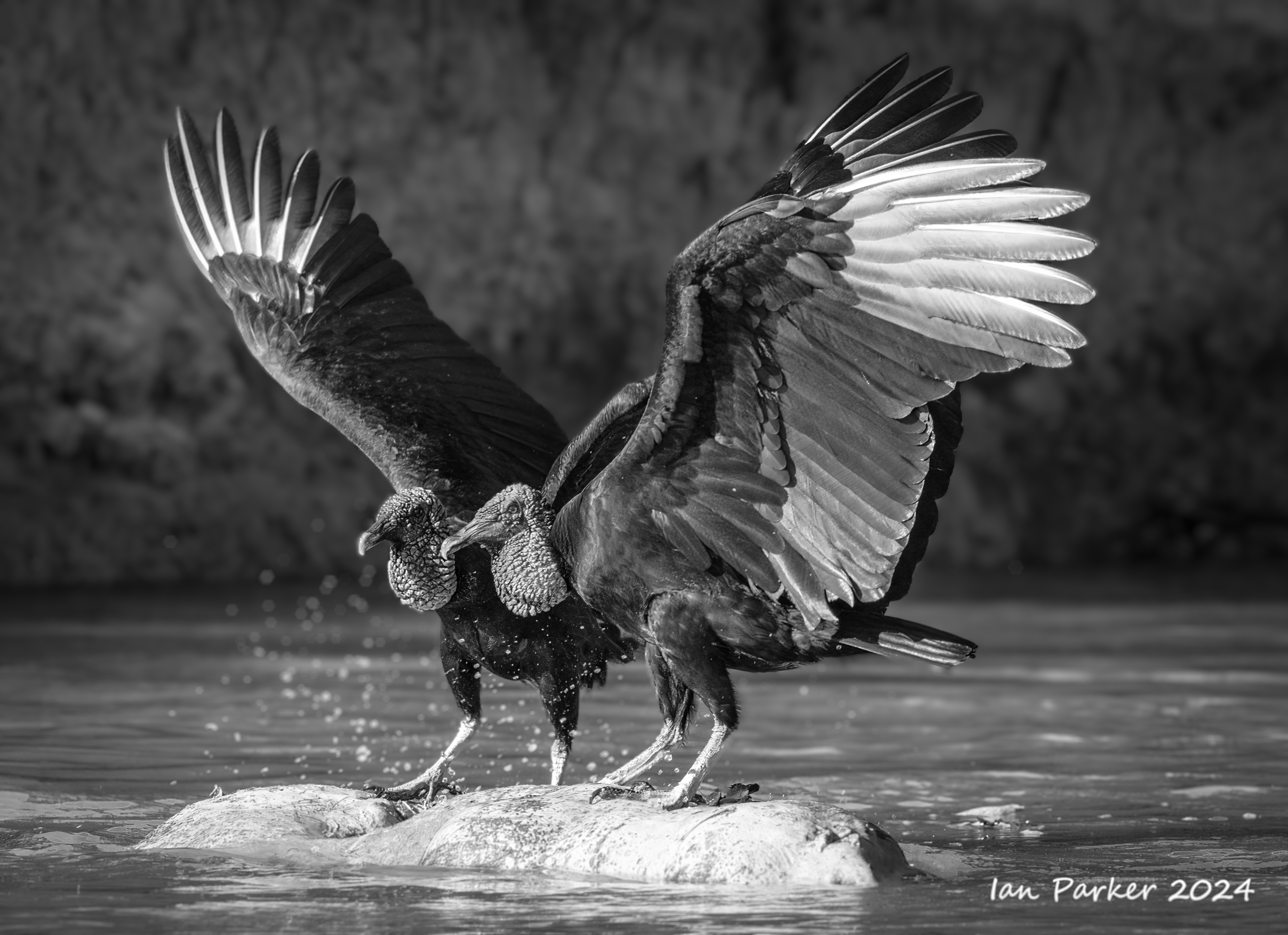
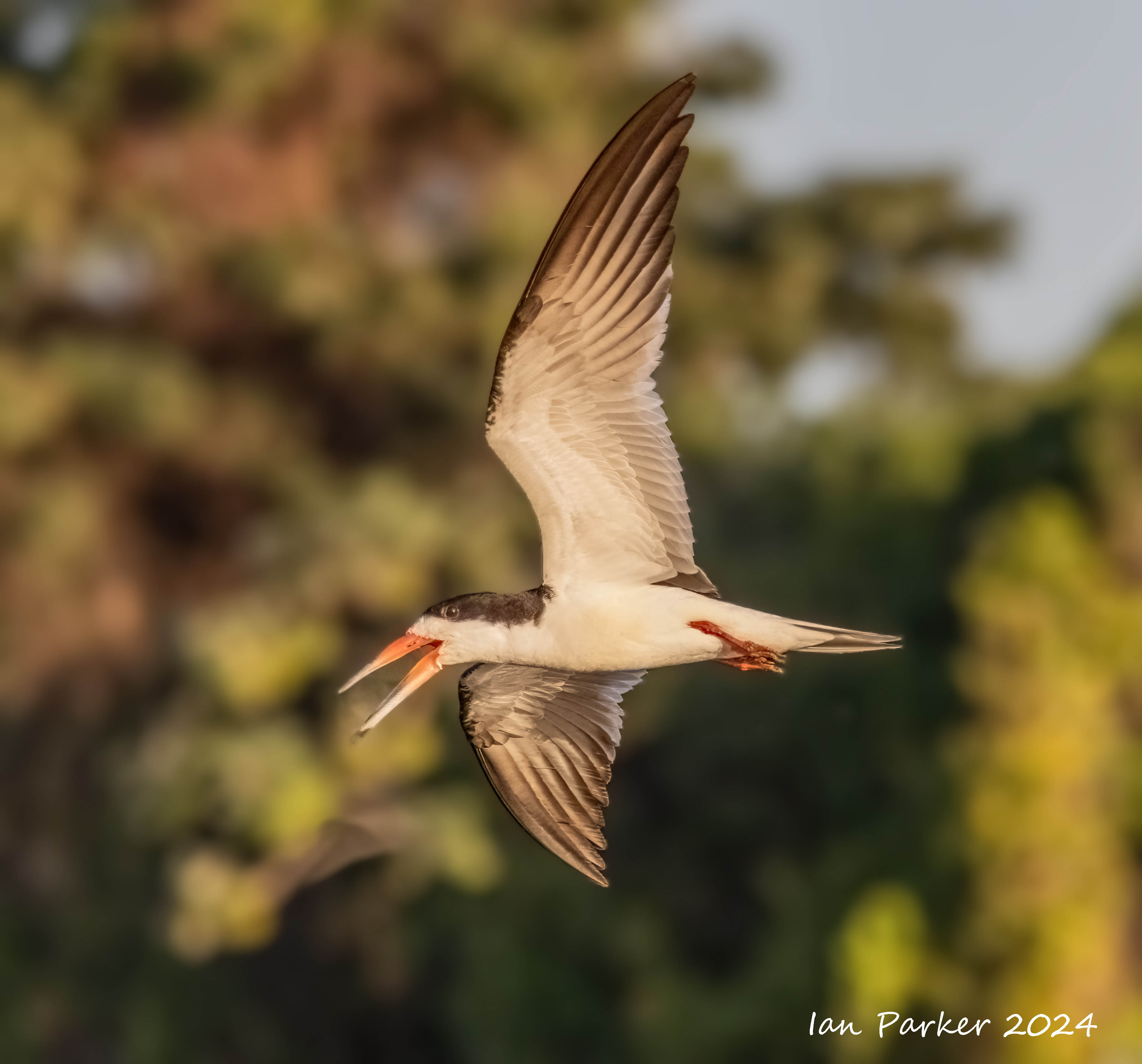
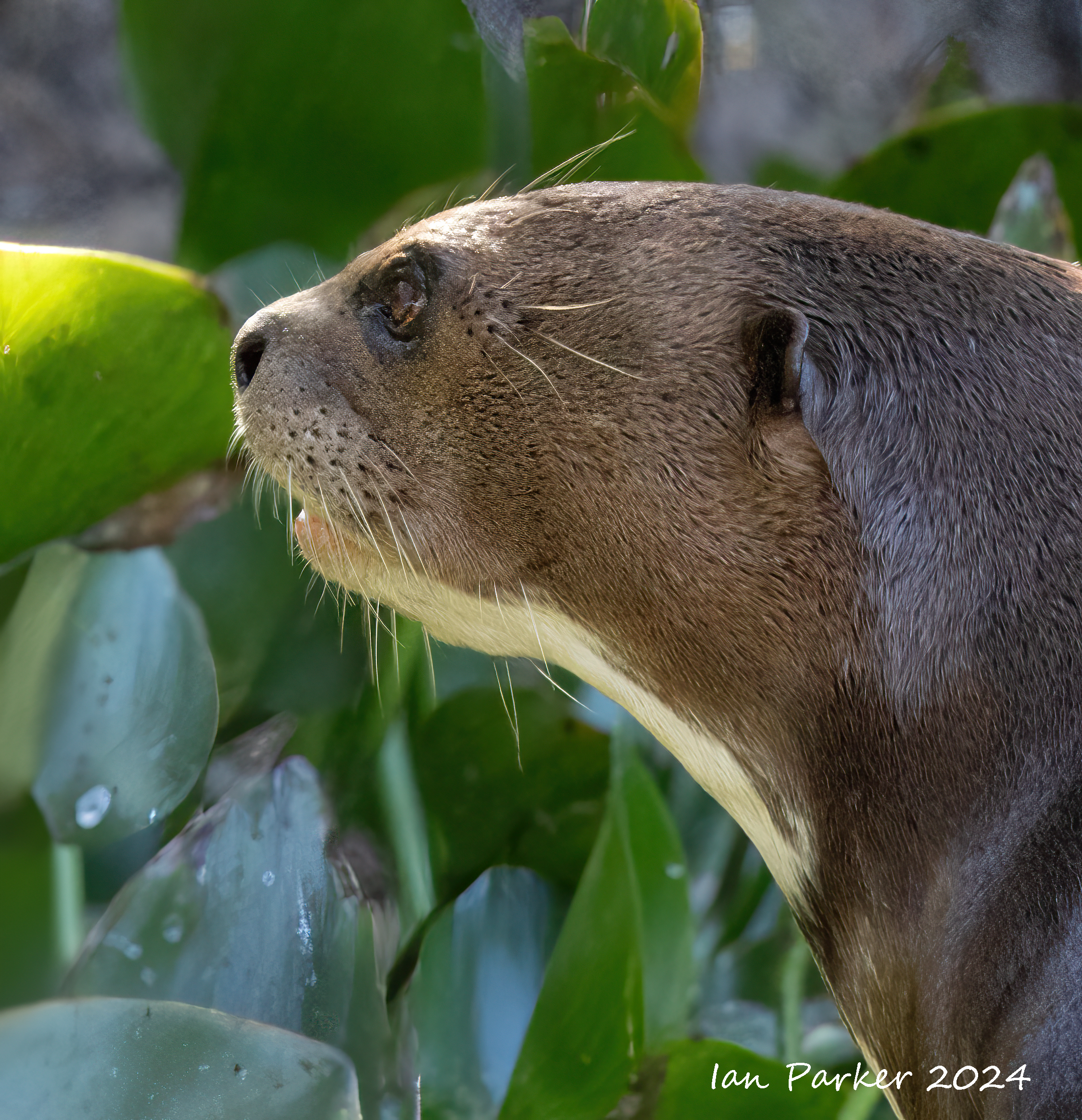
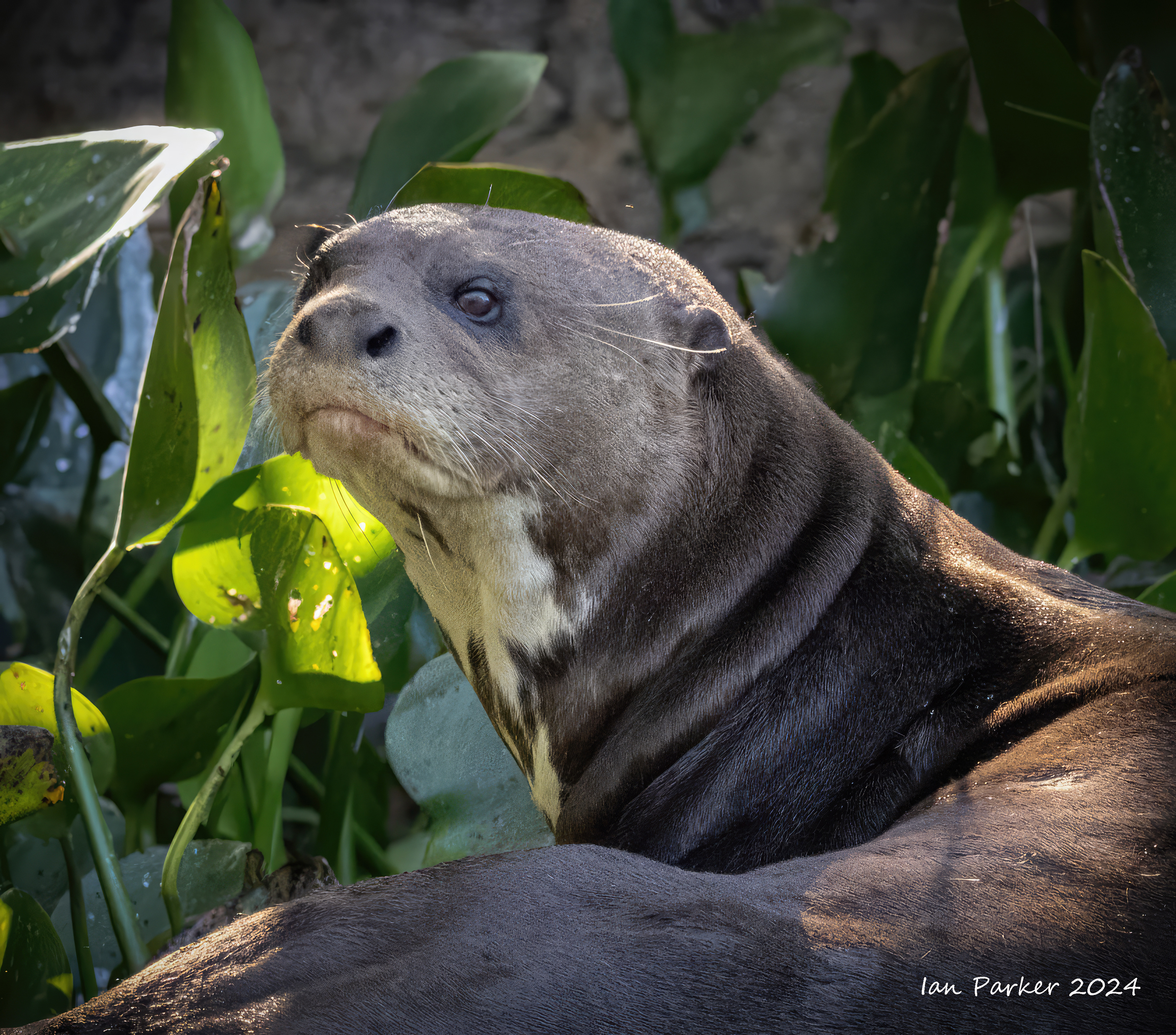
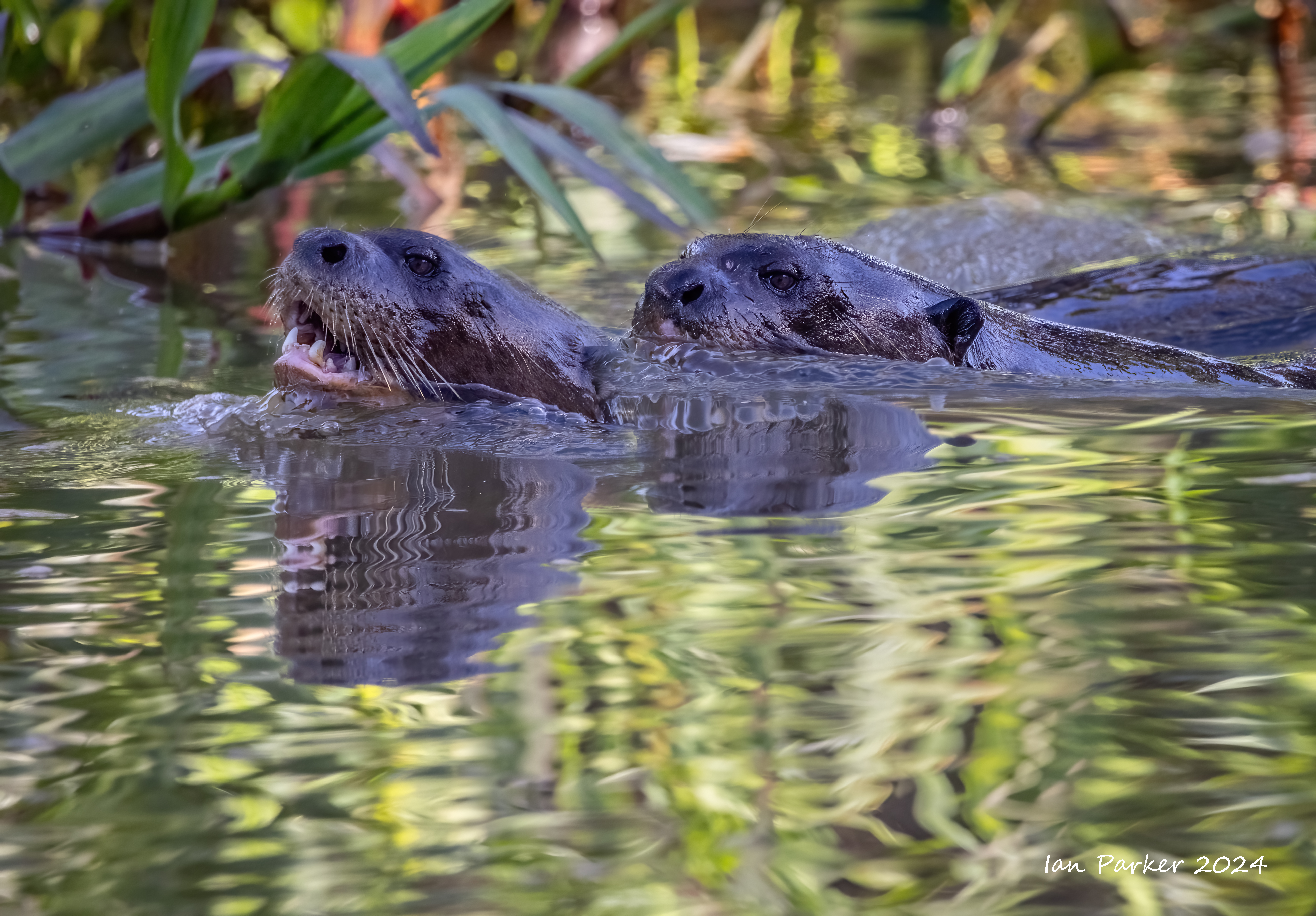
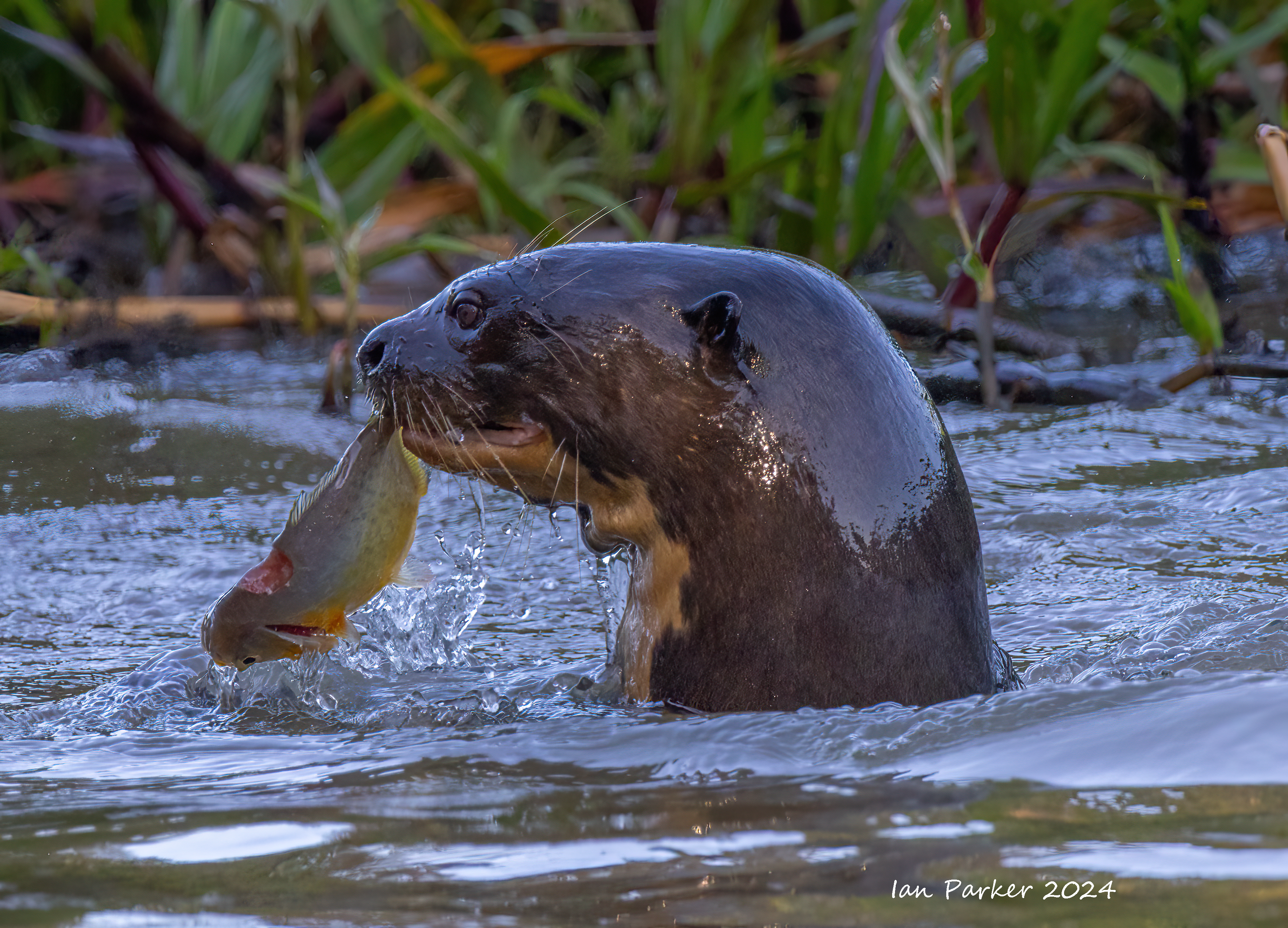
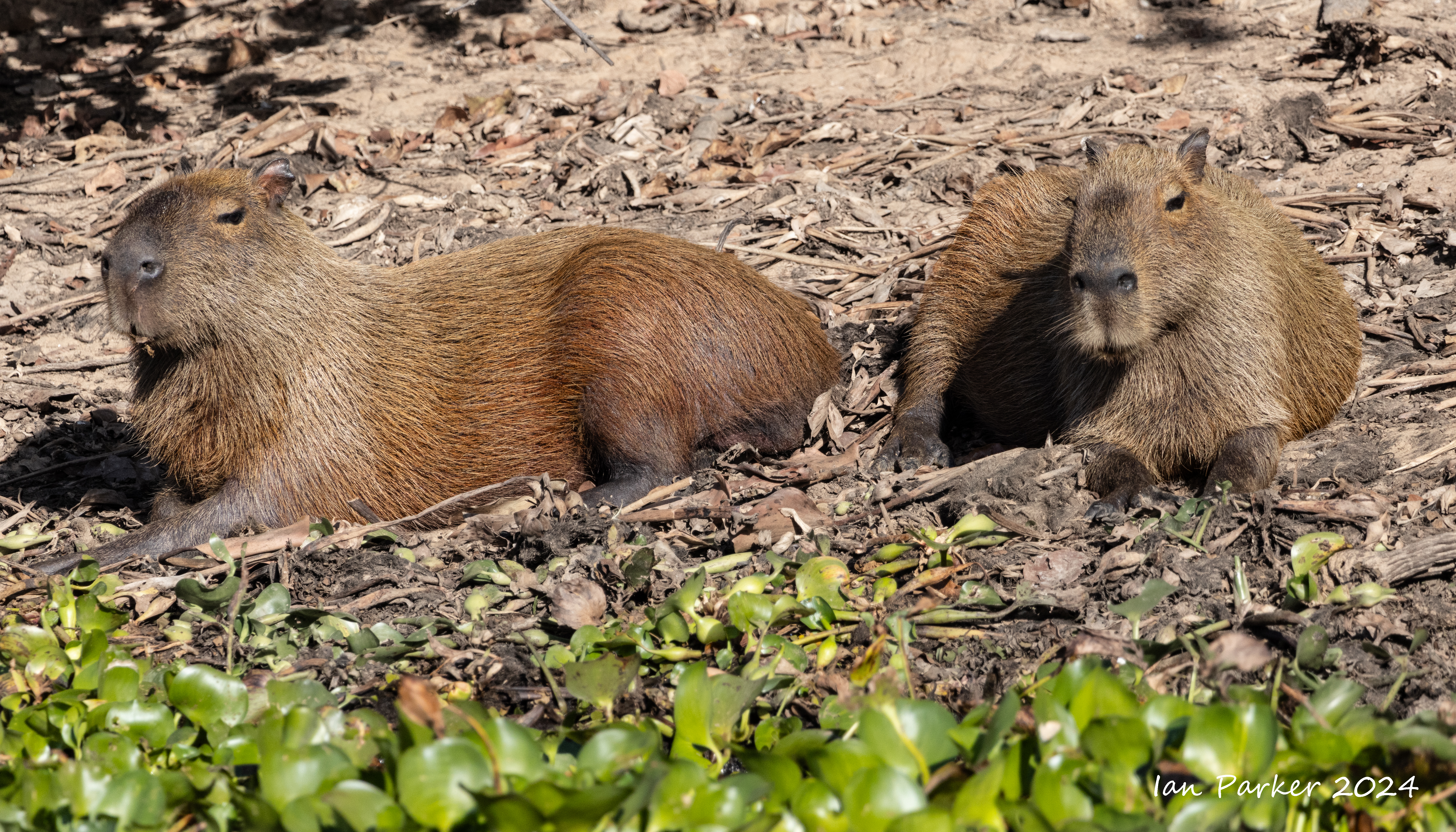
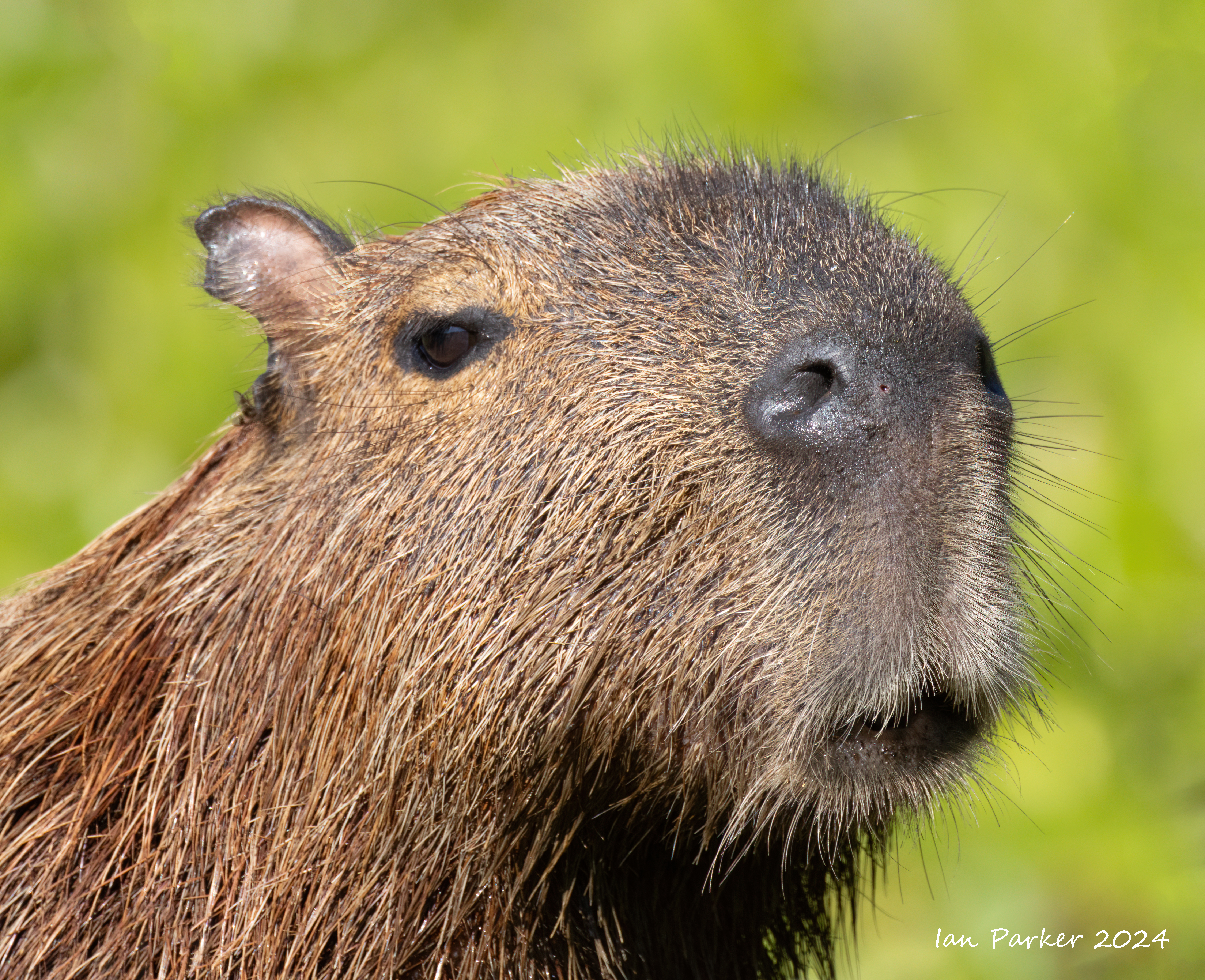
The river is not all about jaguars. The Pantanal is one of the last remaining strongholds of endangered Giant otters, which seem to be contantly in motion catching and eating fish.
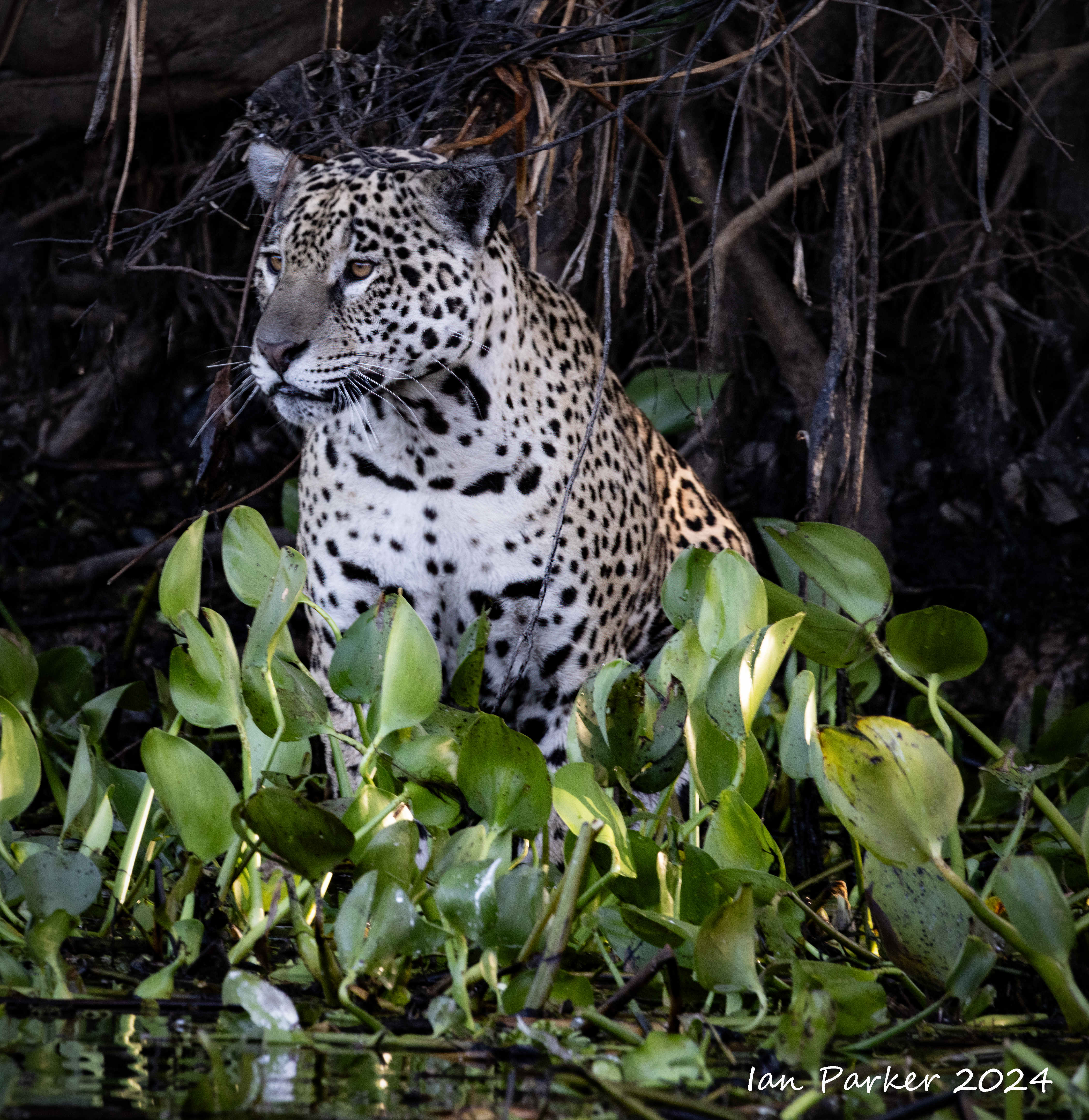
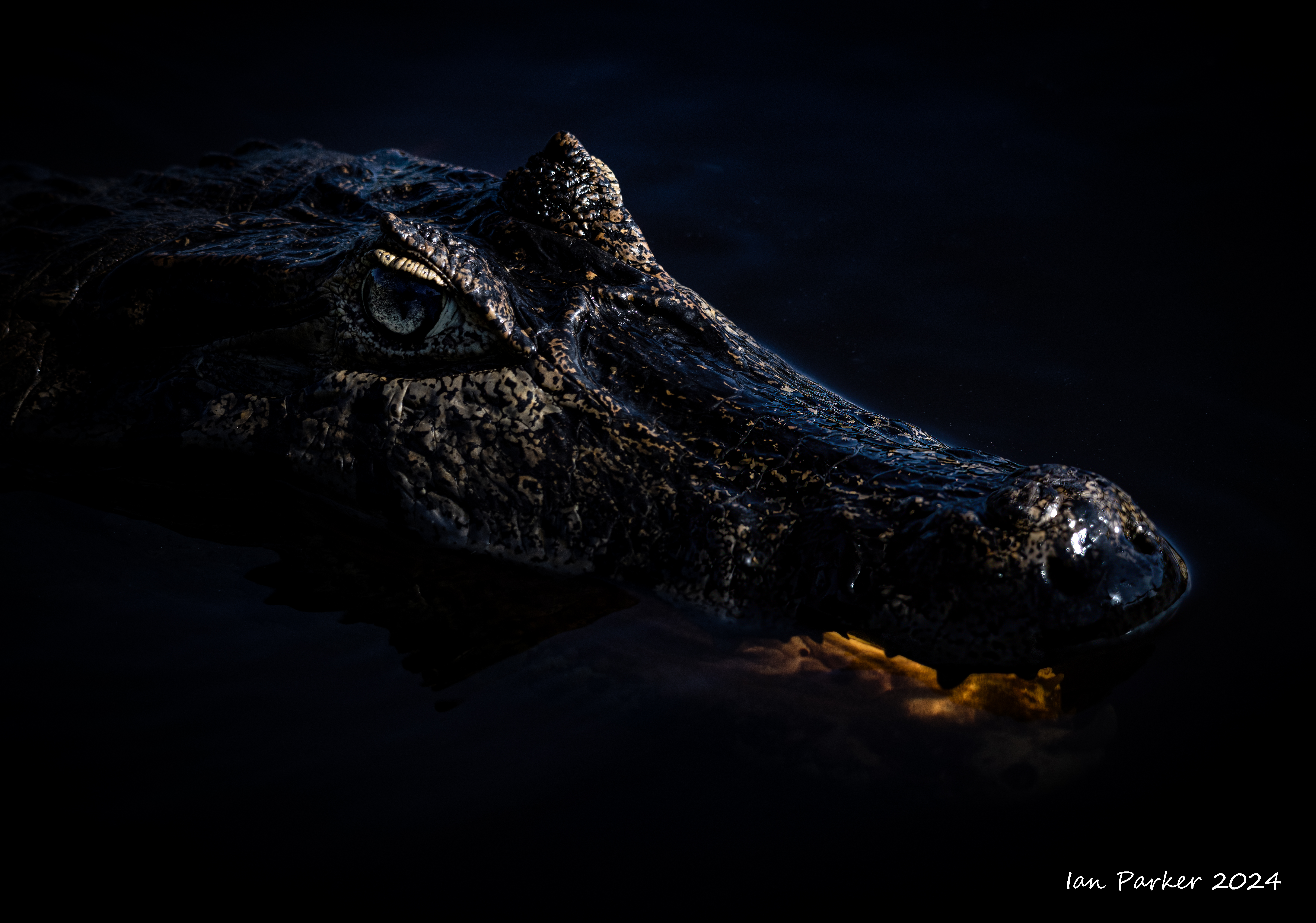
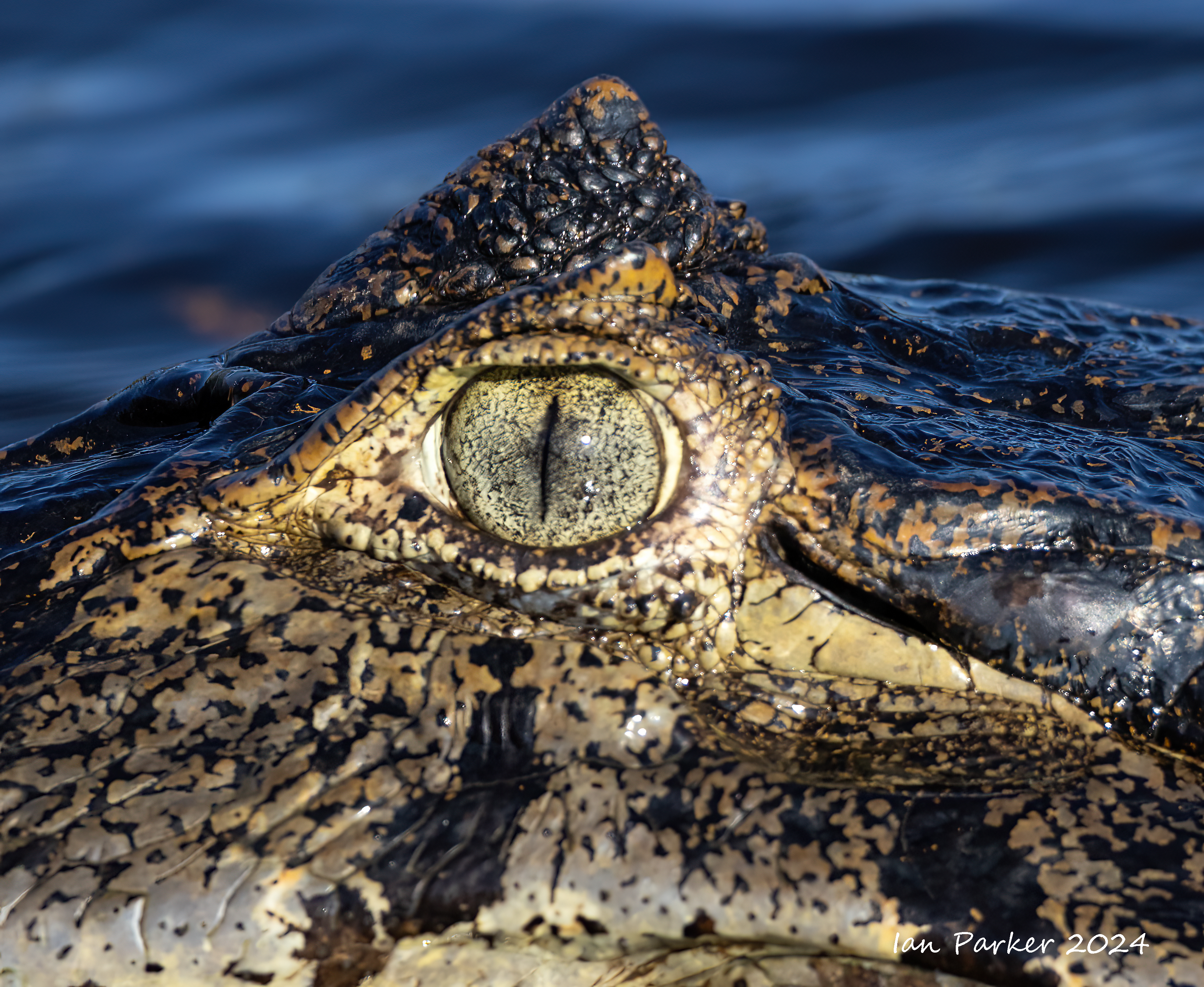
Days 4 & 5 - Out on the river at Potro Joffre
 |
An unwelcome covid test result explained why I had been feeling unwell the previous day. I thought it best to stay in bed during our first full day at Porto Joffre, while Anne went out for the morning boat ride. I regretted my decision when Anne said her boat had a 20 minute encounter with a jaguar on a sandy beach, and thought I really should get out for the afternoon - wearing a mask and sitting down-wind at the back of the open boat. The afternoon outing was not very productive - with only the sighting of the rear end of a juguar through the vegetation - but we encountered several jaguars the next day. |
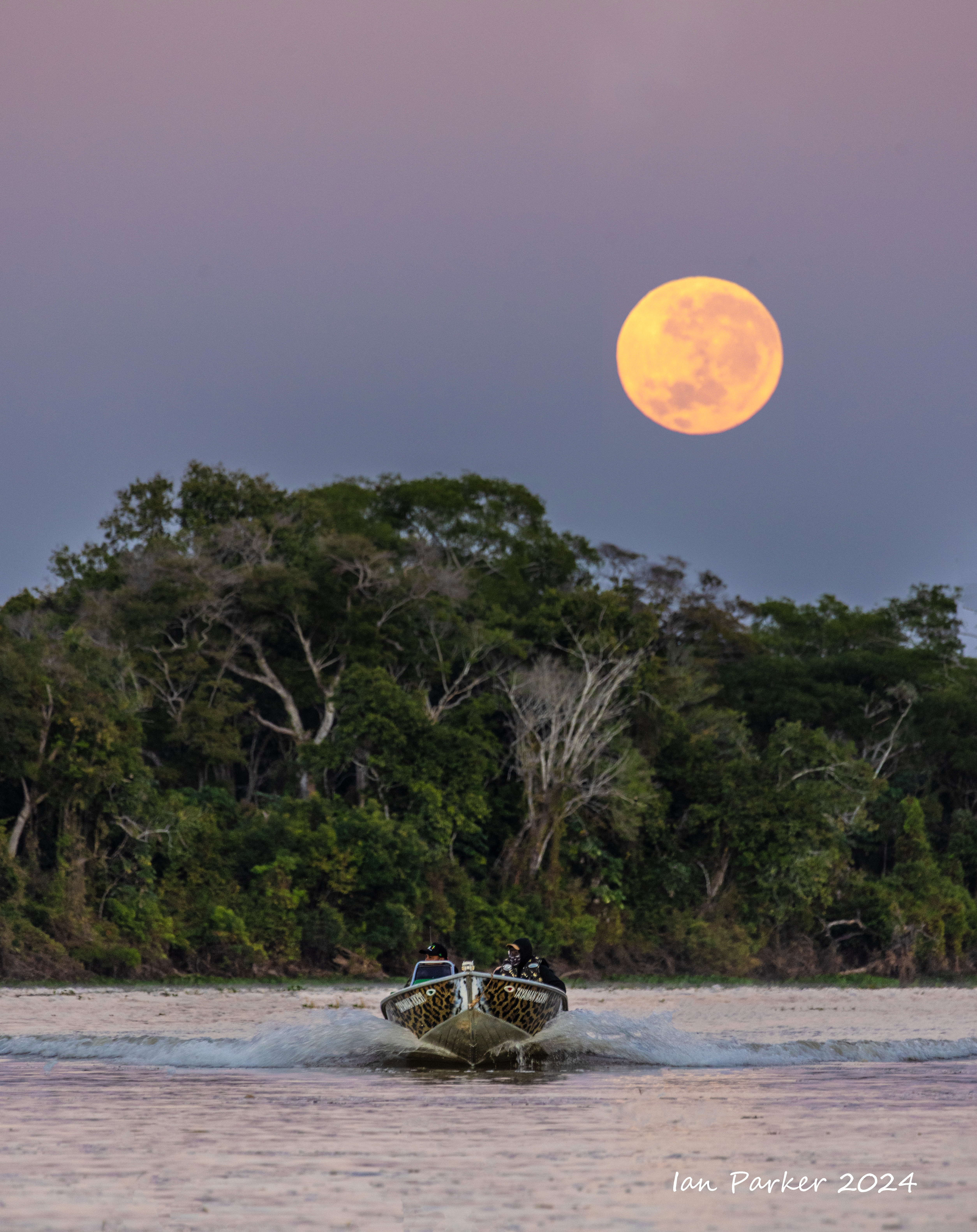
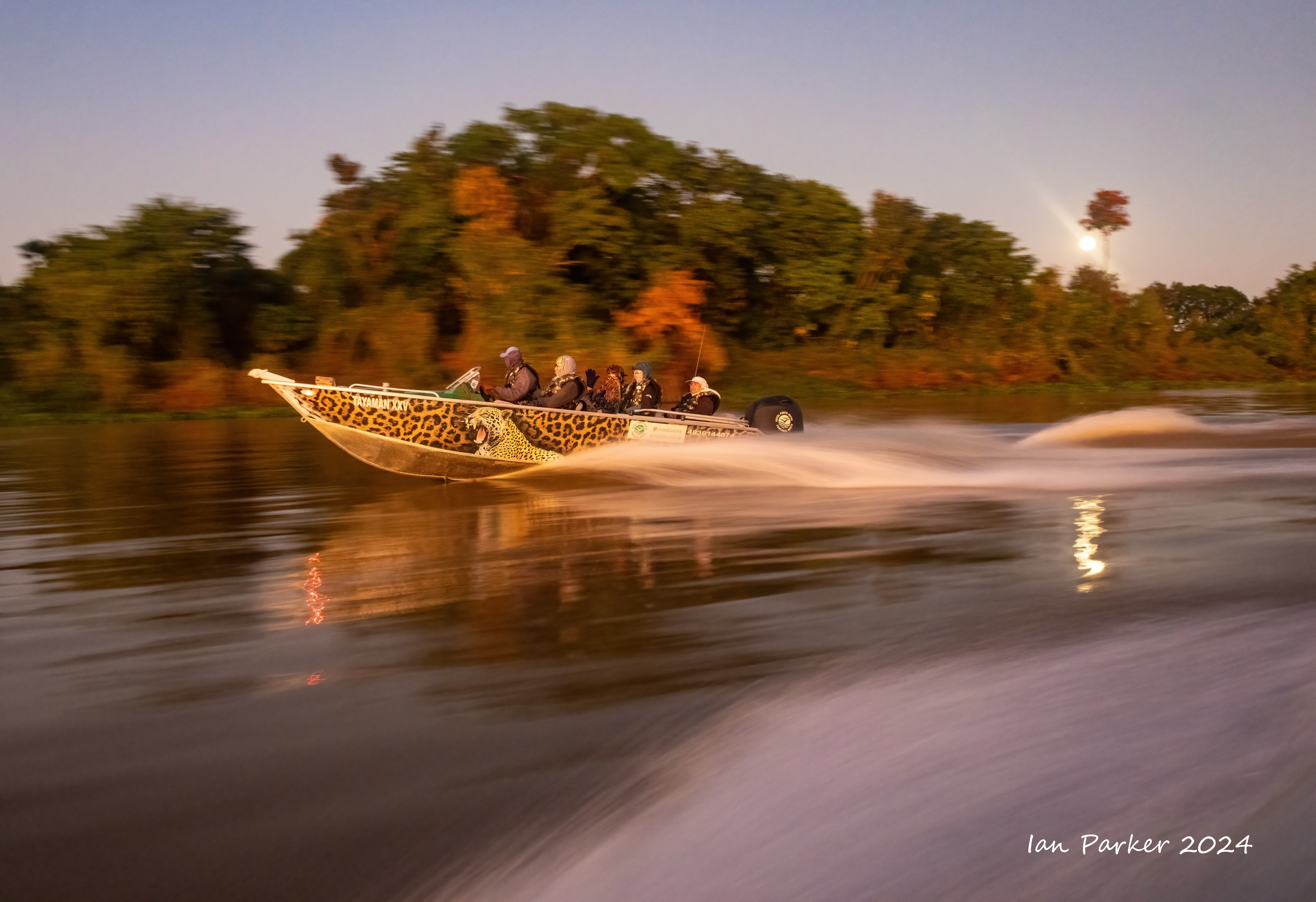
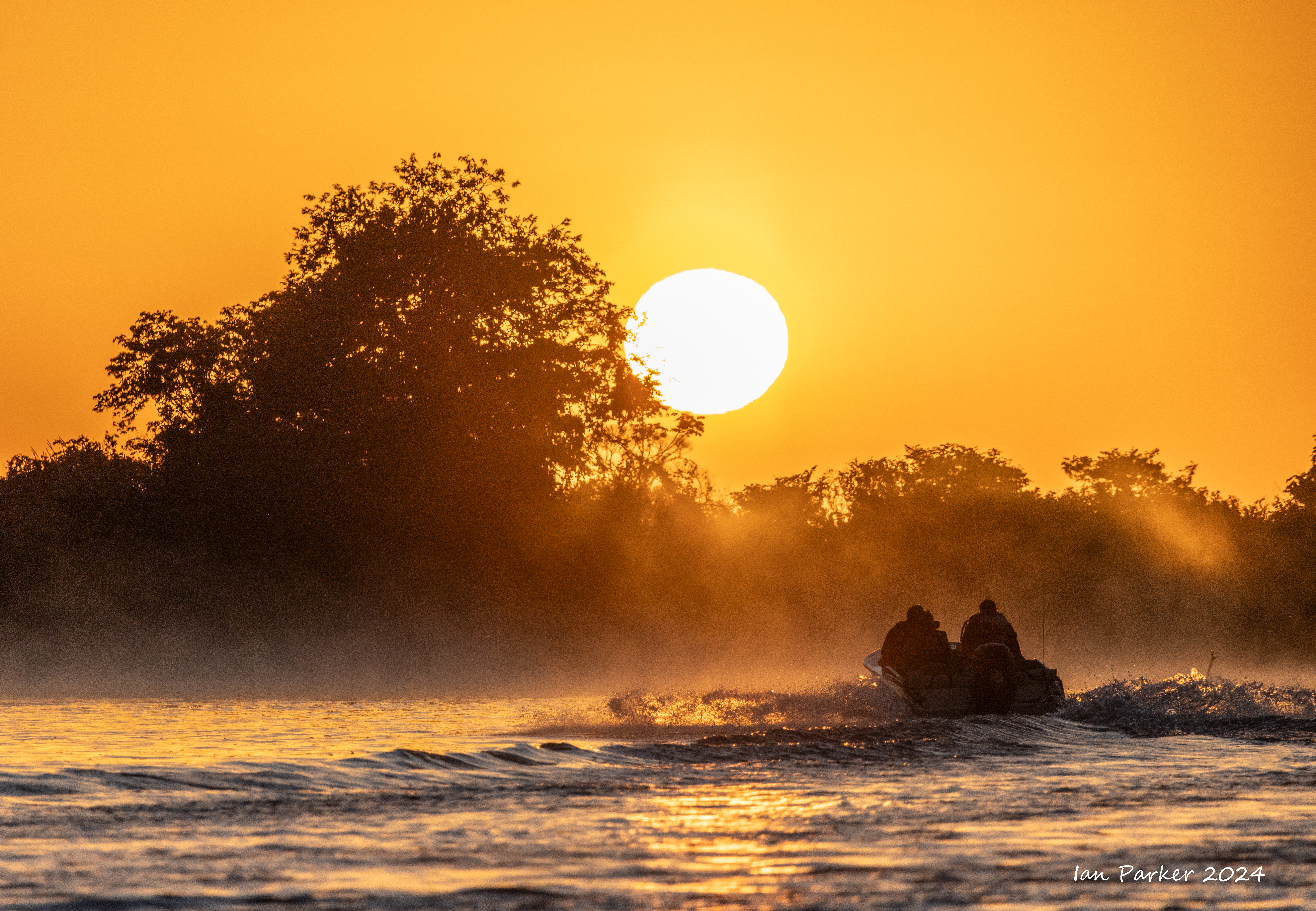
Morning outings began at 5:30am with a high-speed drive upriver to get to prime jaguar locations by sunrise.
An interlude between jaguar sightings...
More jaguars...

Day 3 - Rio Claro to the end of the Transpantaneira at Porto Joffre
 Hyacinth macaw; Porto Joffre, Pantanal |
Day 2 - Rio Claro Lodge
On our second day at the lodge we had boat trips on the lake both morning and aternoon, The ide wa that our excursion the previous afternoon would have been a practice session to hone hone our skills in photographng birds as they flew in to catch fish thrown into the water. However, that was not working for me, and I was getting annoyed with myself at having less success than the previous day. In retrospect I might have realized that a first sign that I am getting ill is a general feeling of fustration and grumpiness, and that this signalled the onset of covid, which became apparent the next day.
But, I did get some photos...
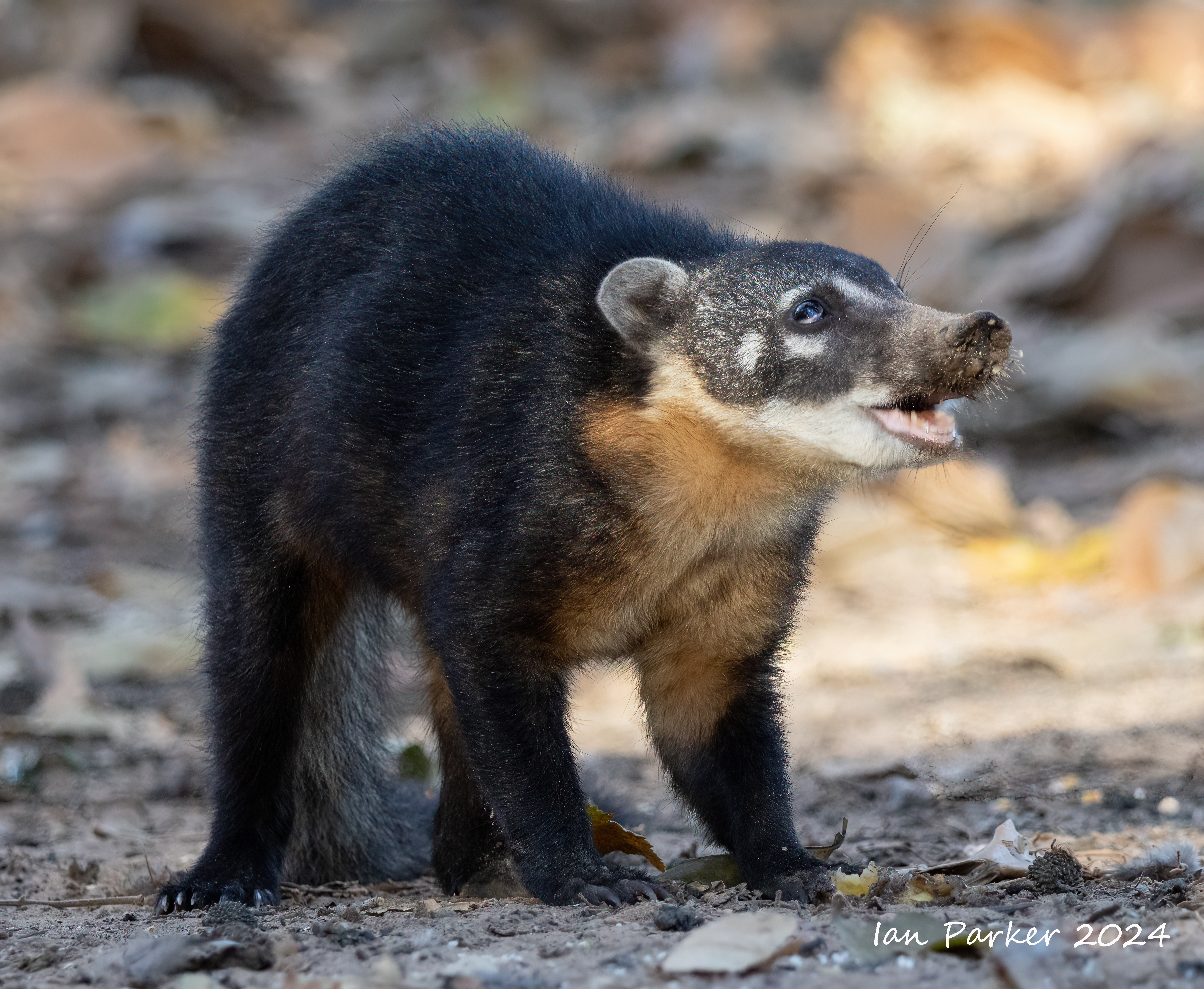
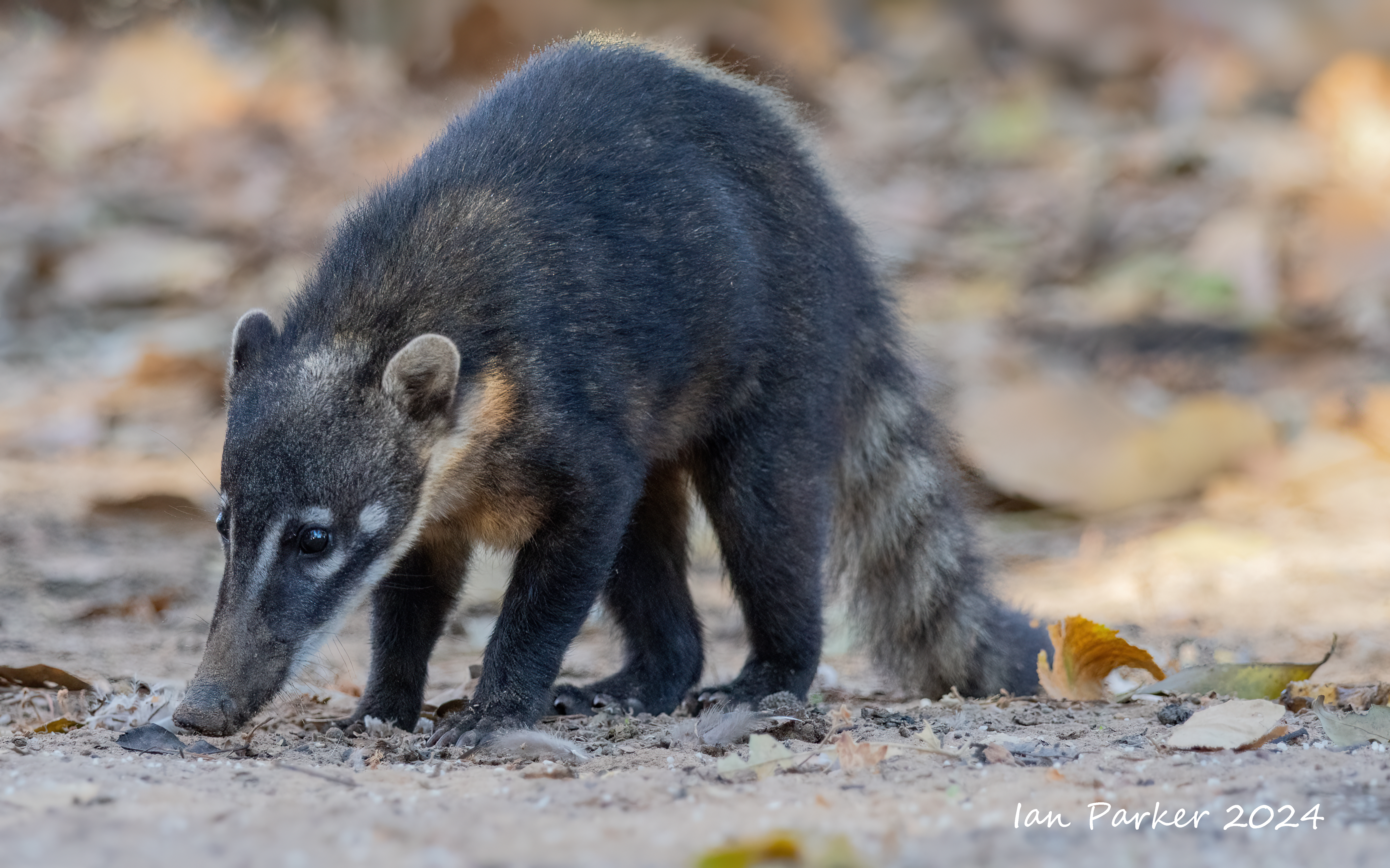
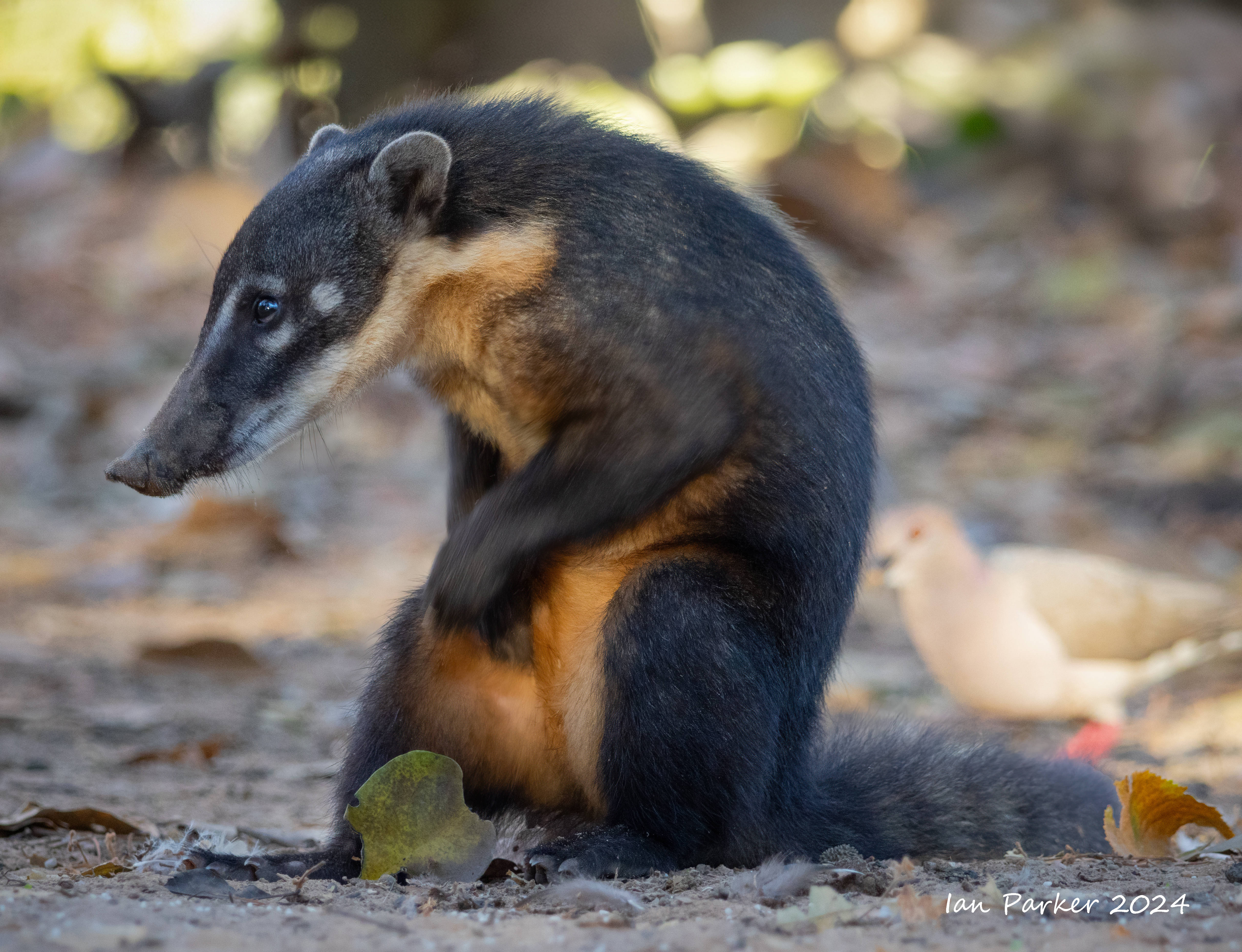
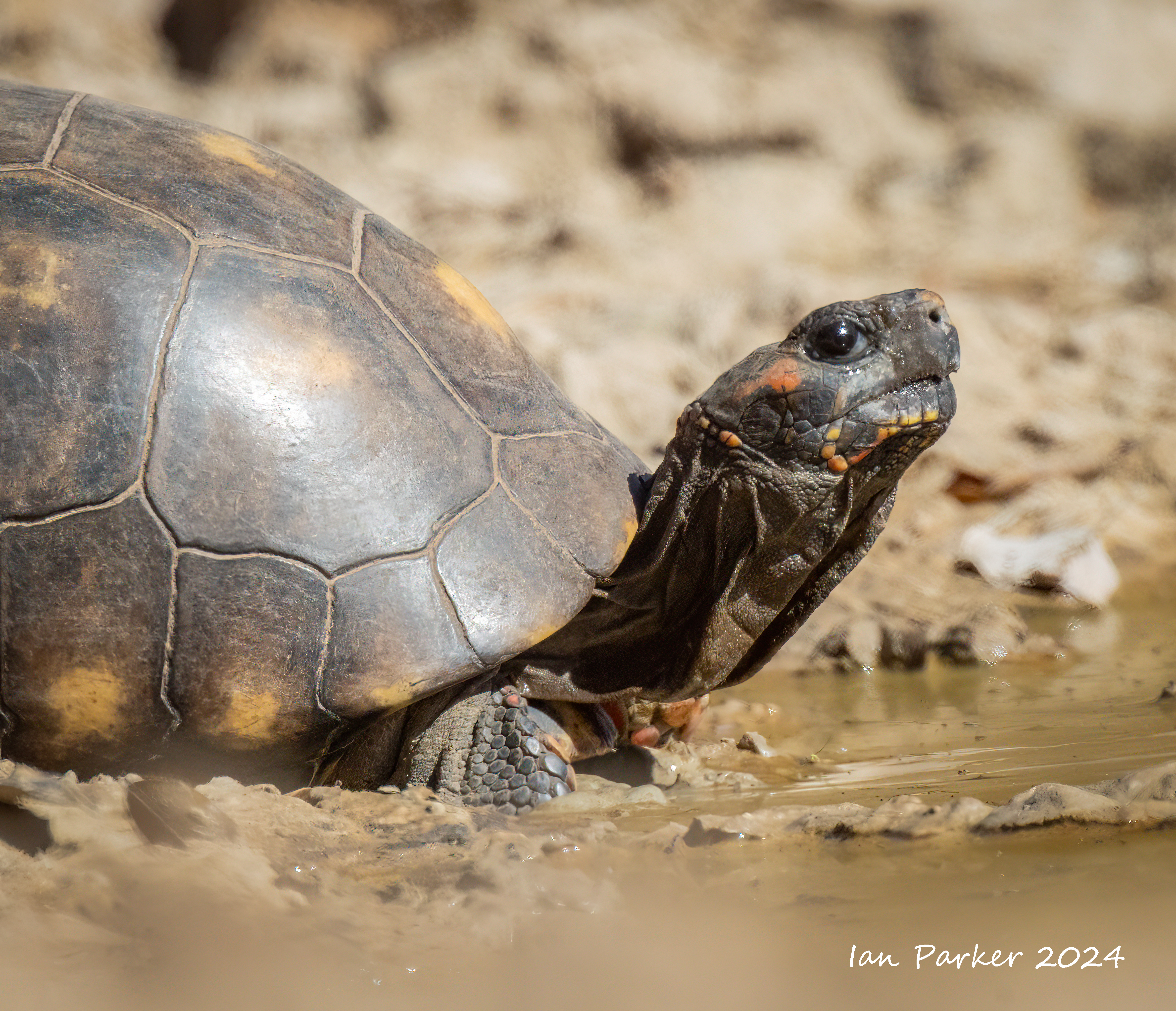
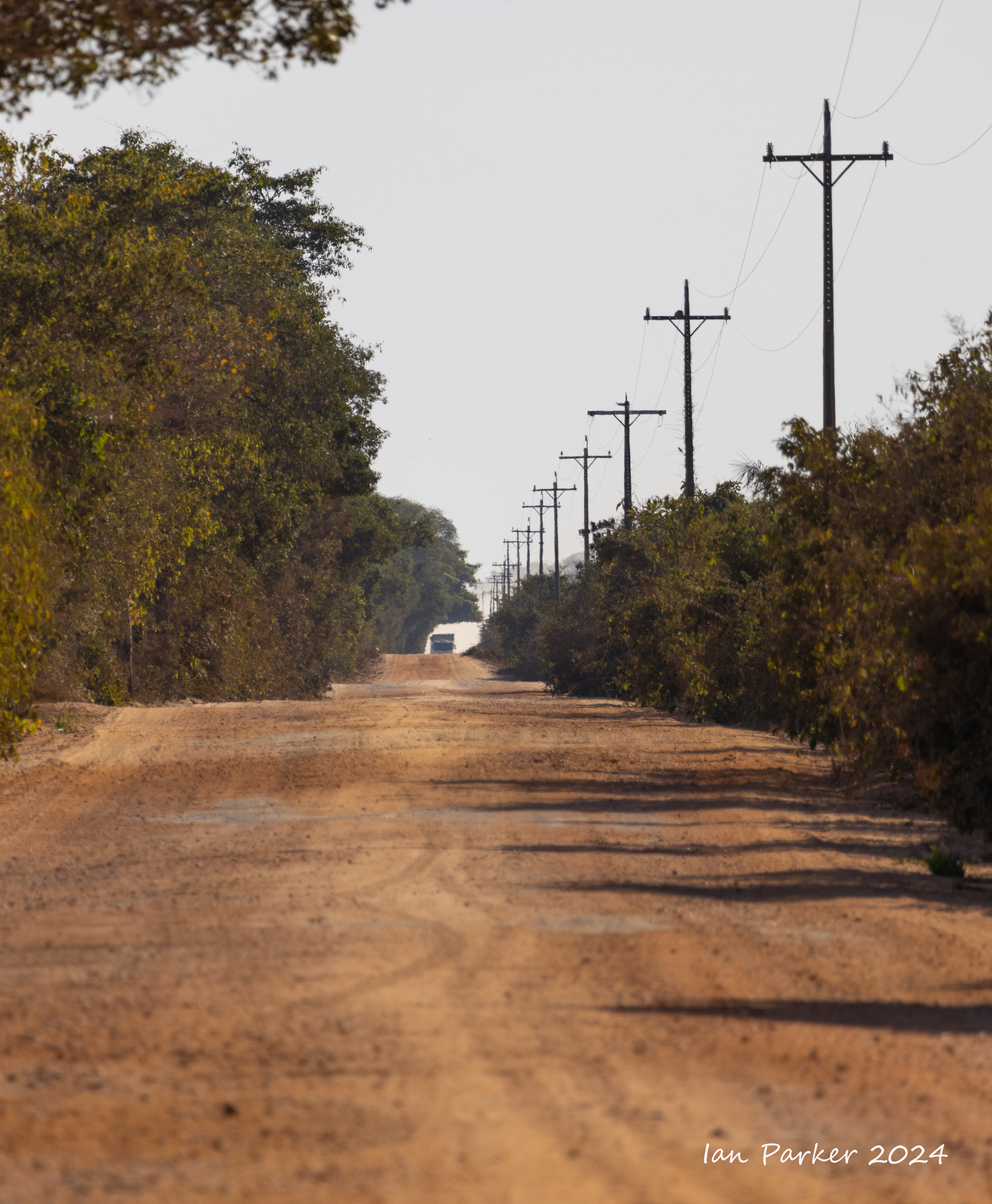
Day 1- Along the Transpantaneira Highway to Rio Claro Lodge
 |
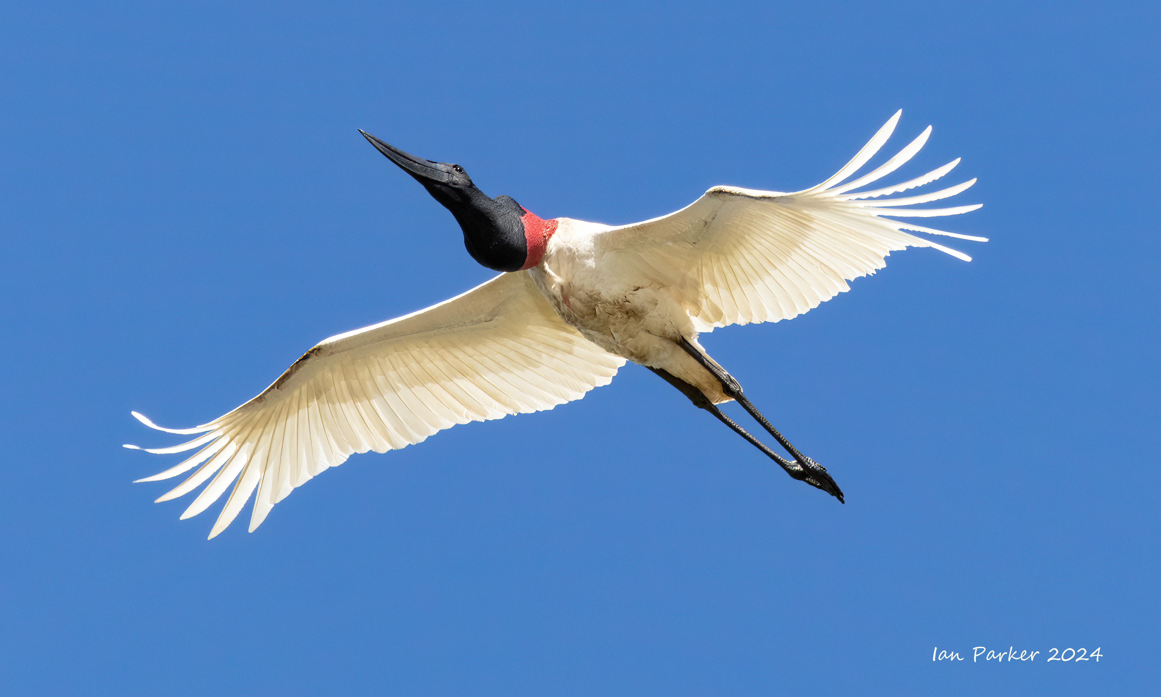
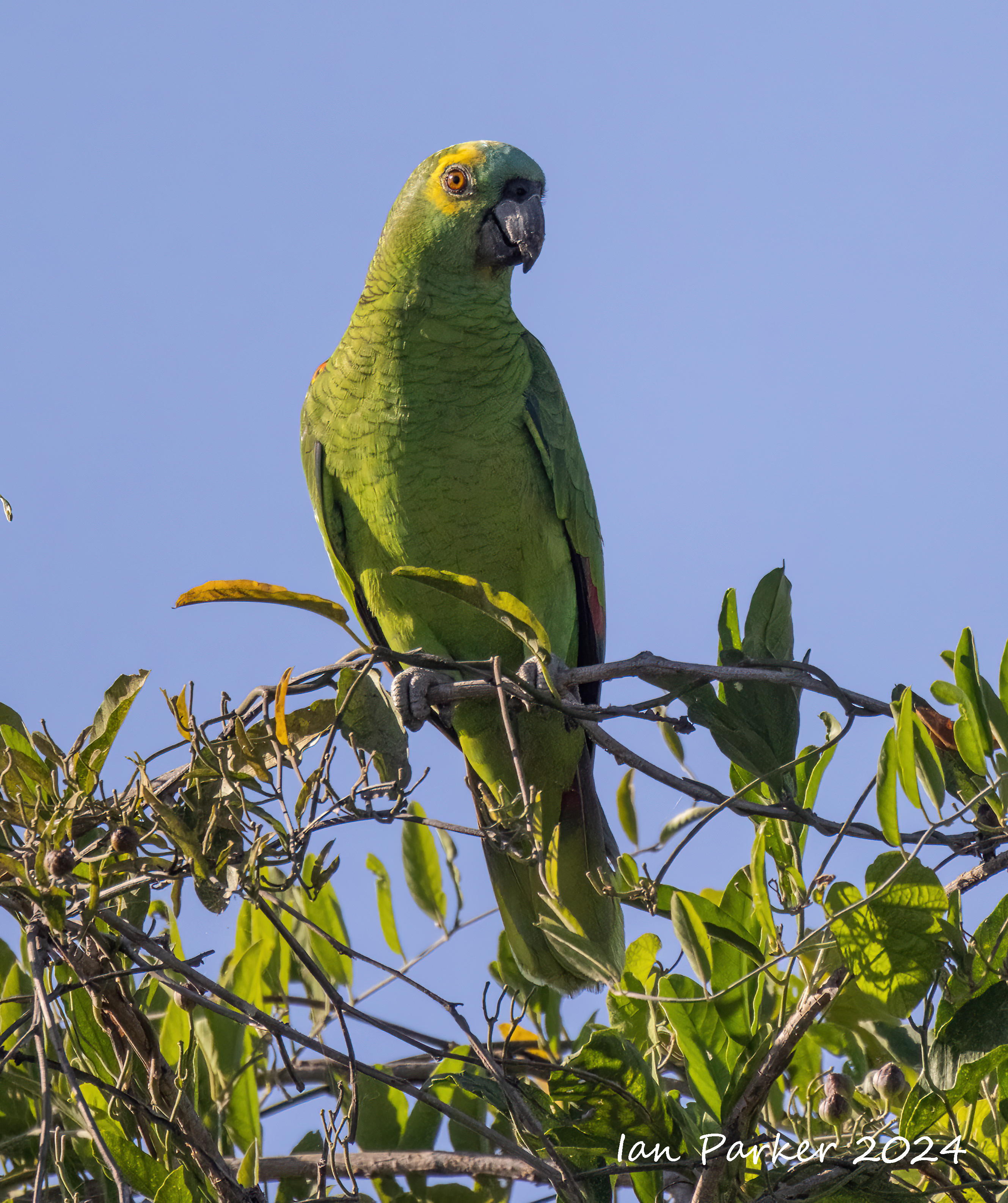
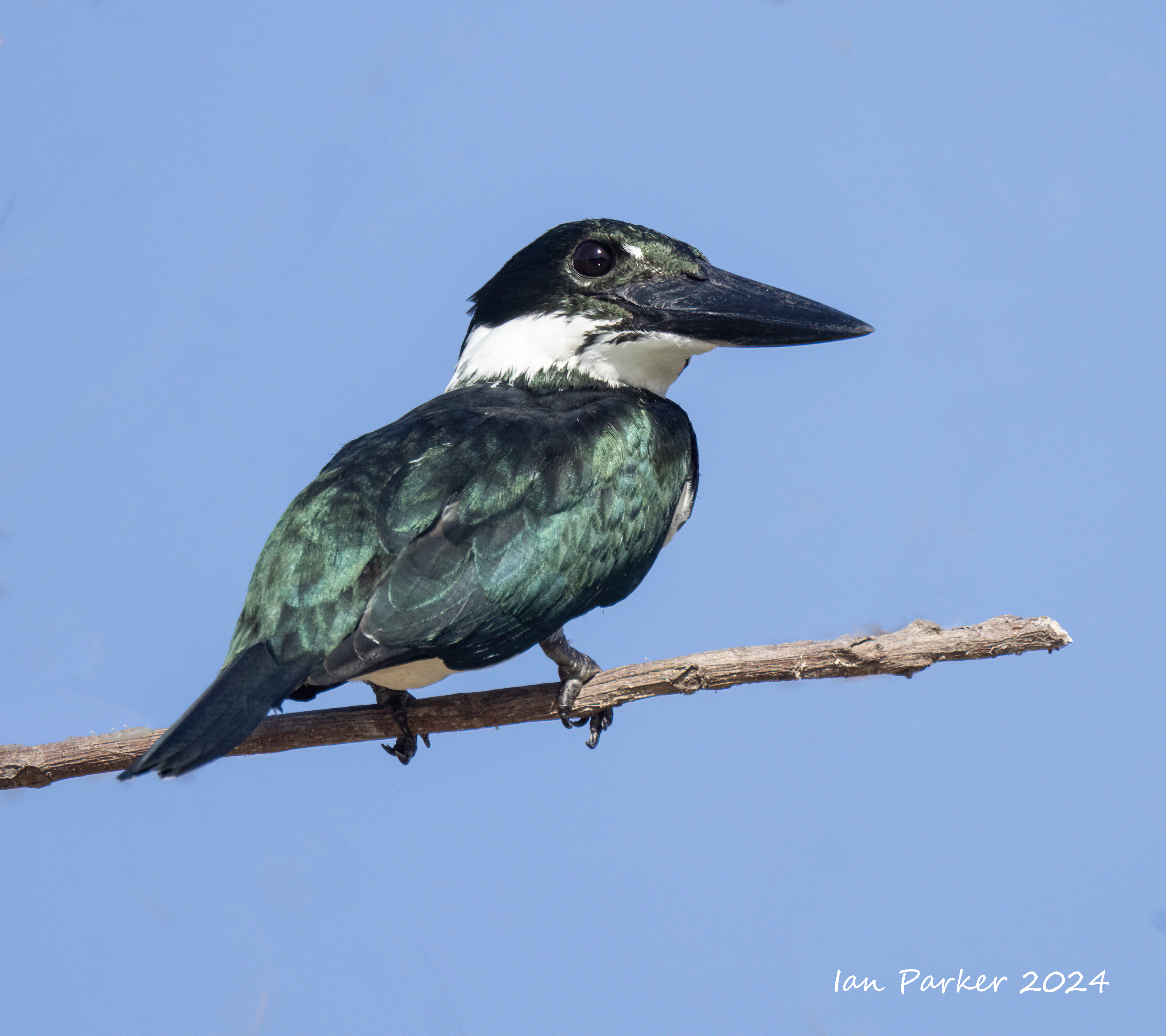
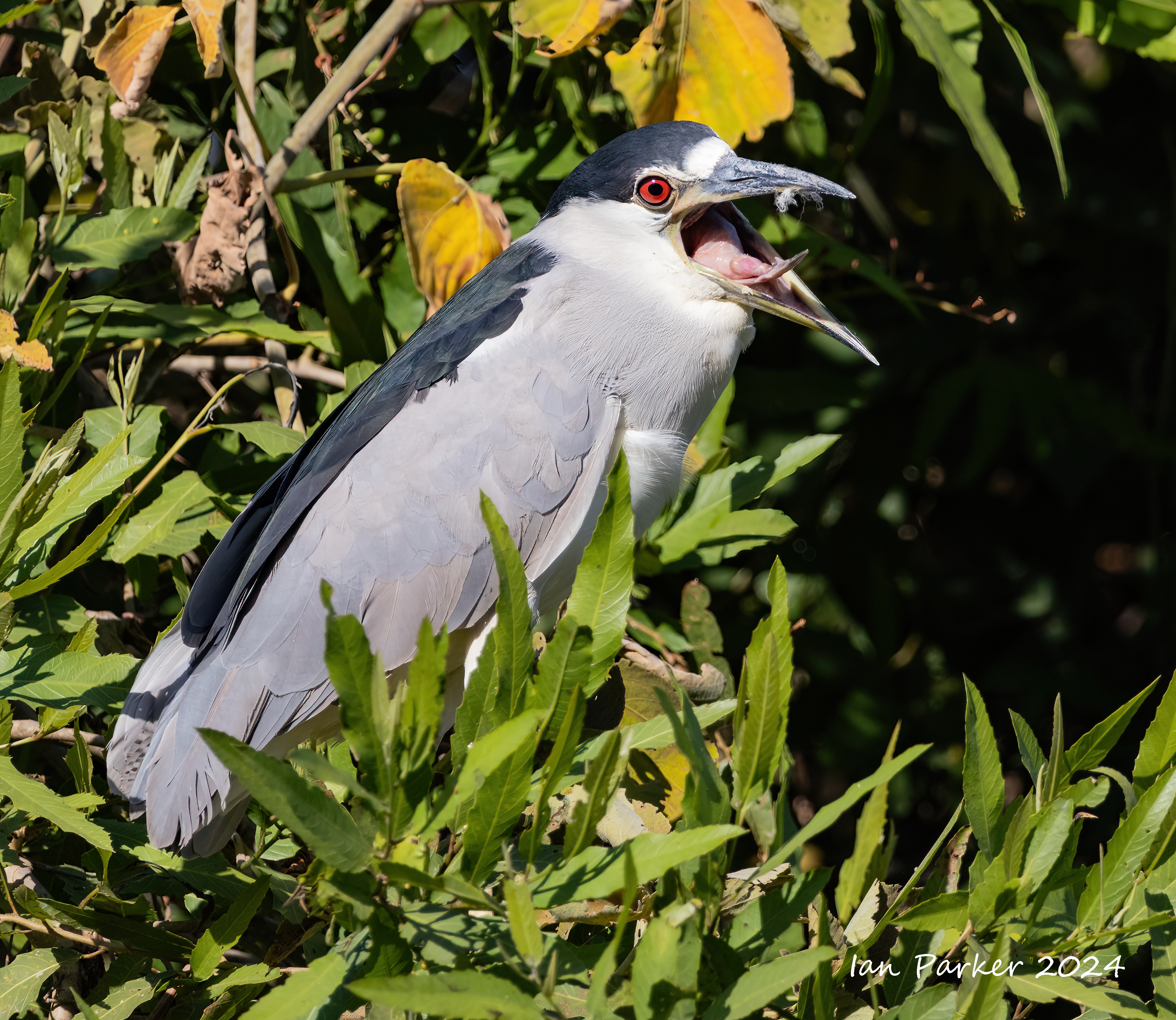
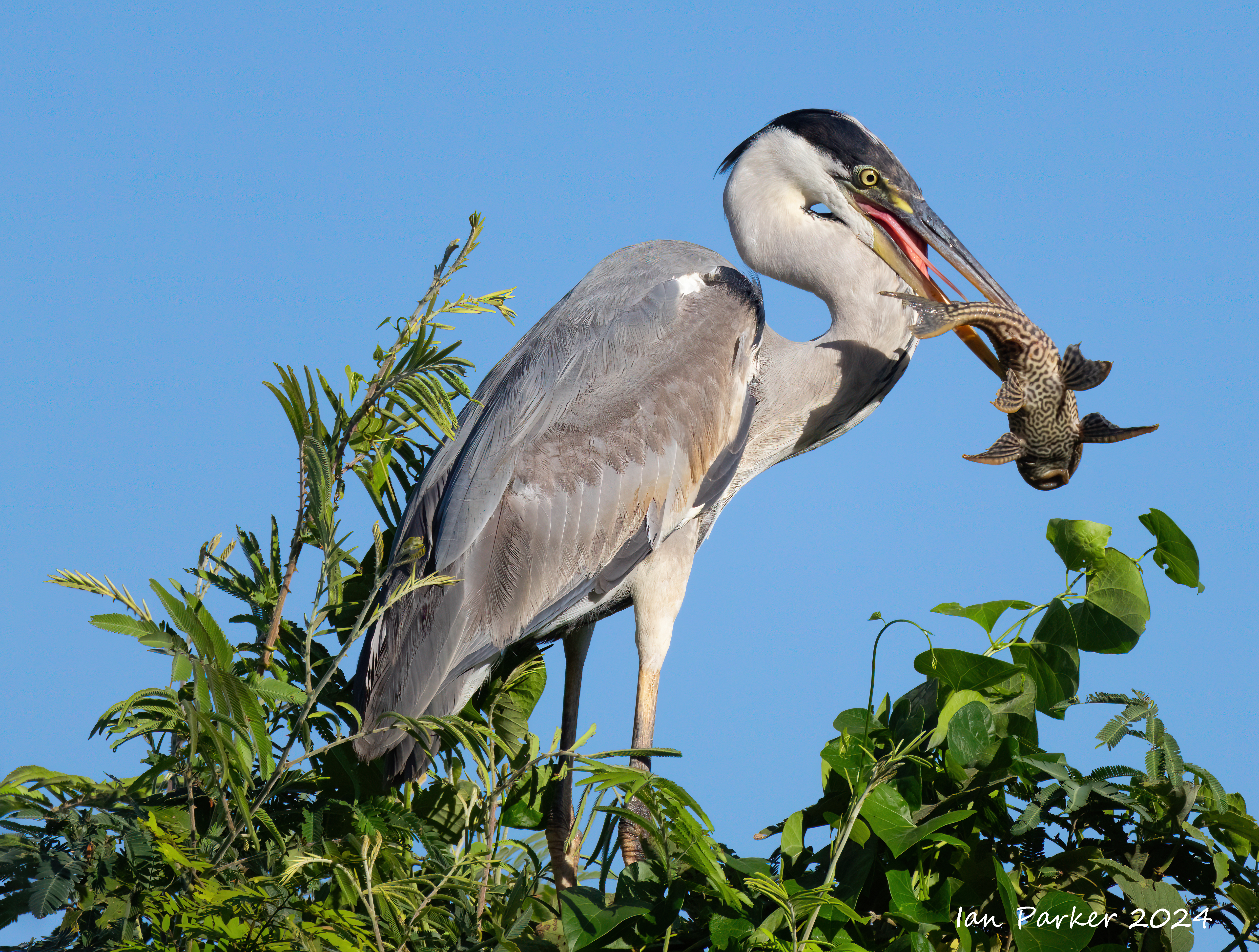
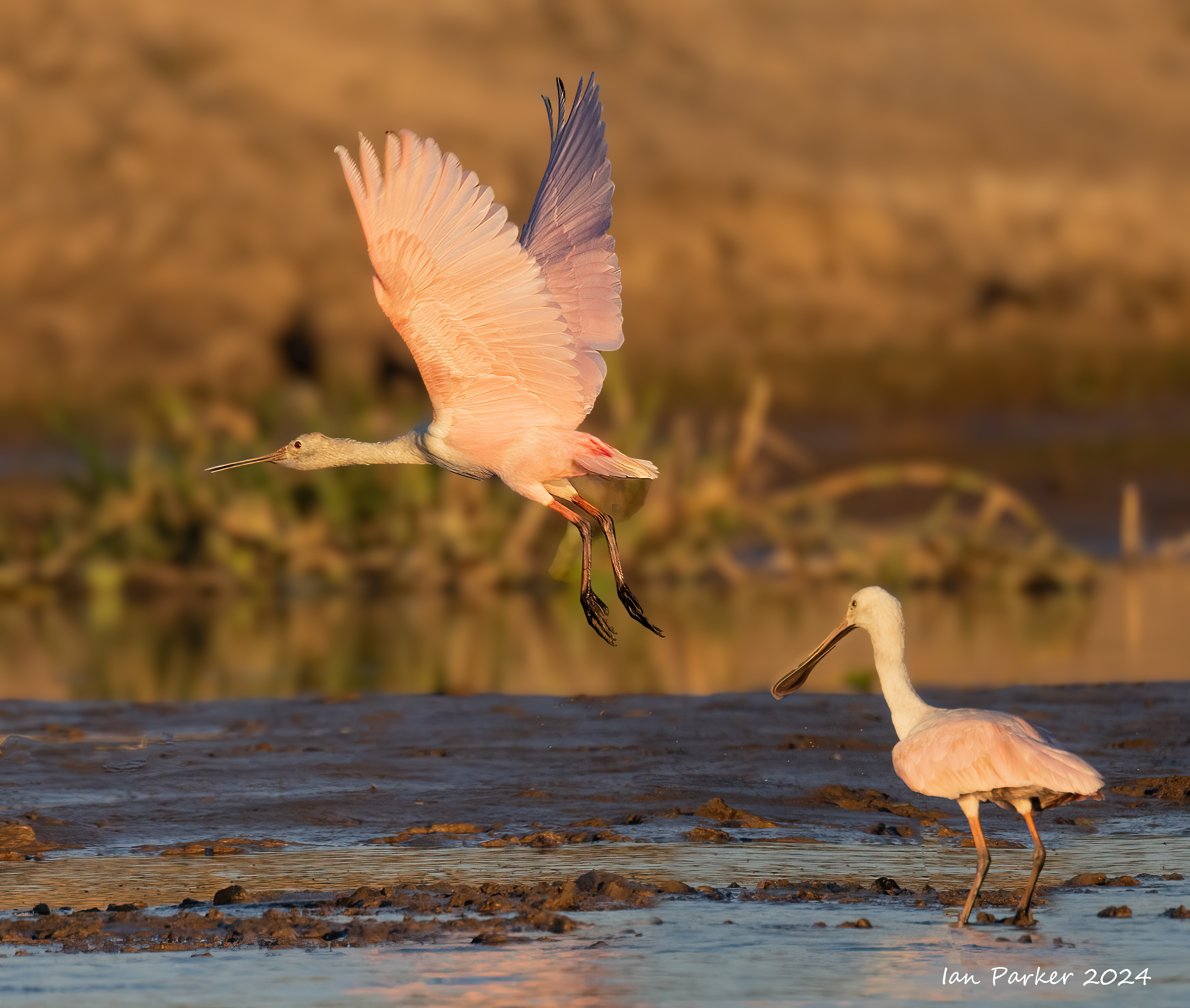
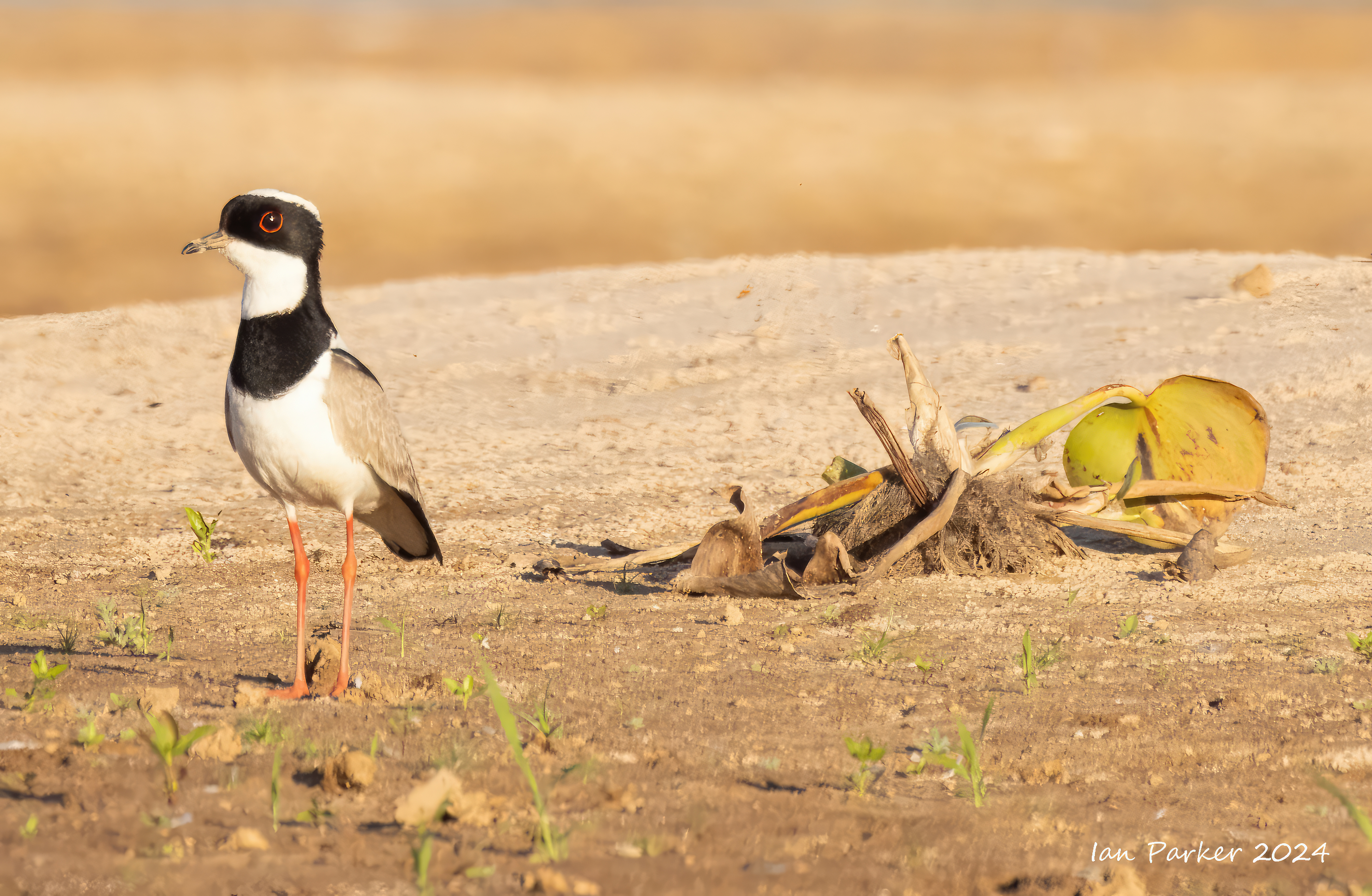
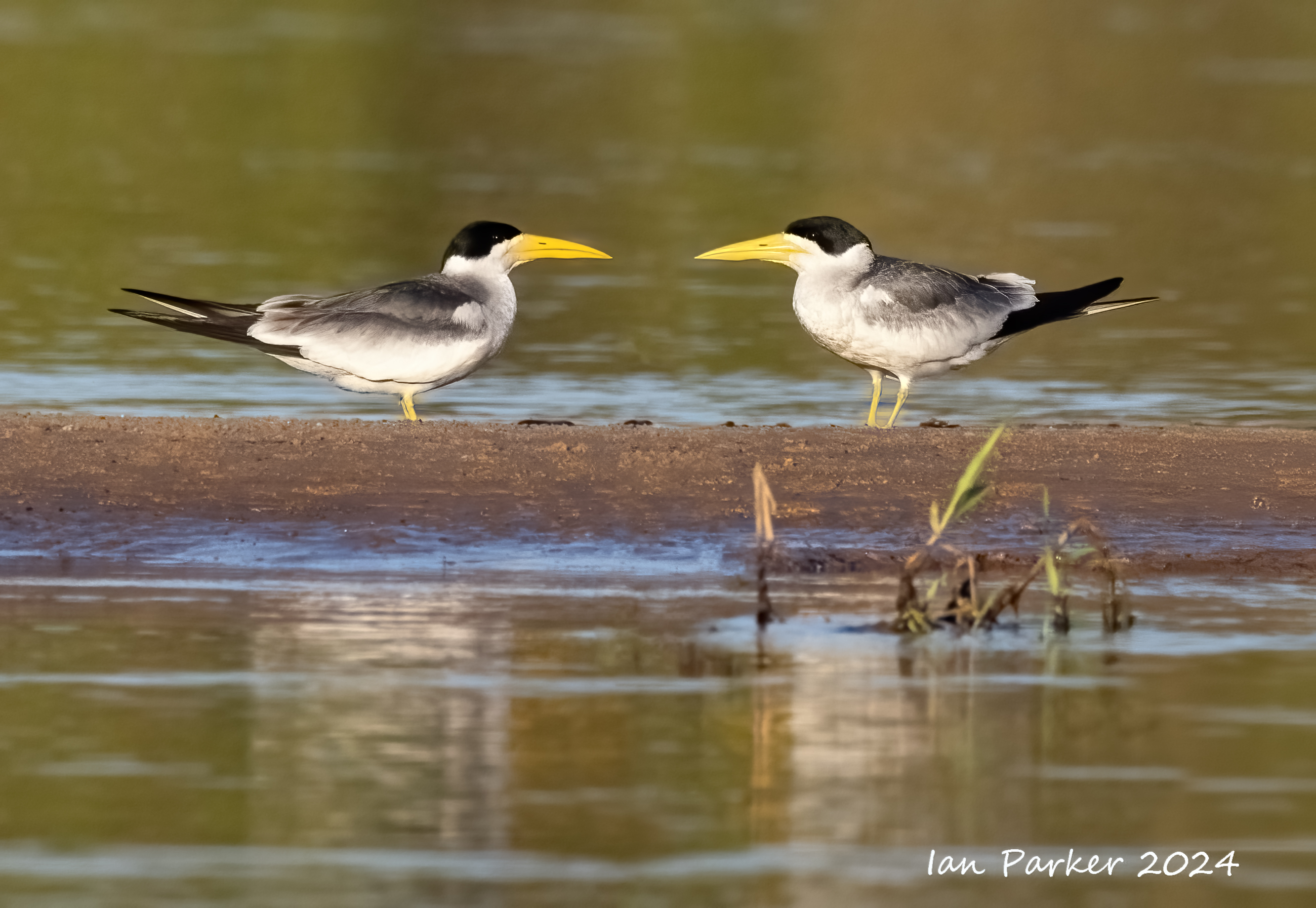
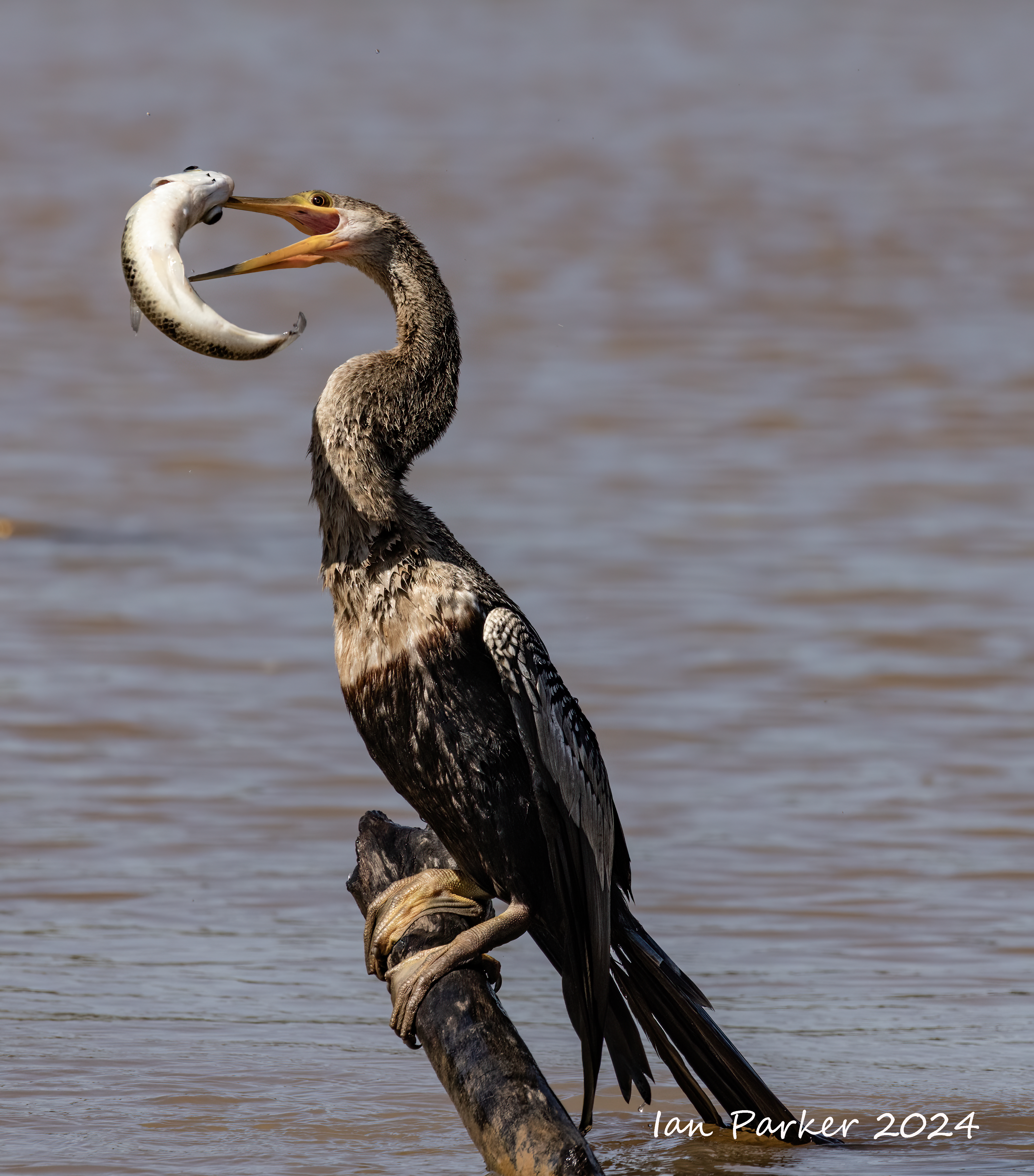
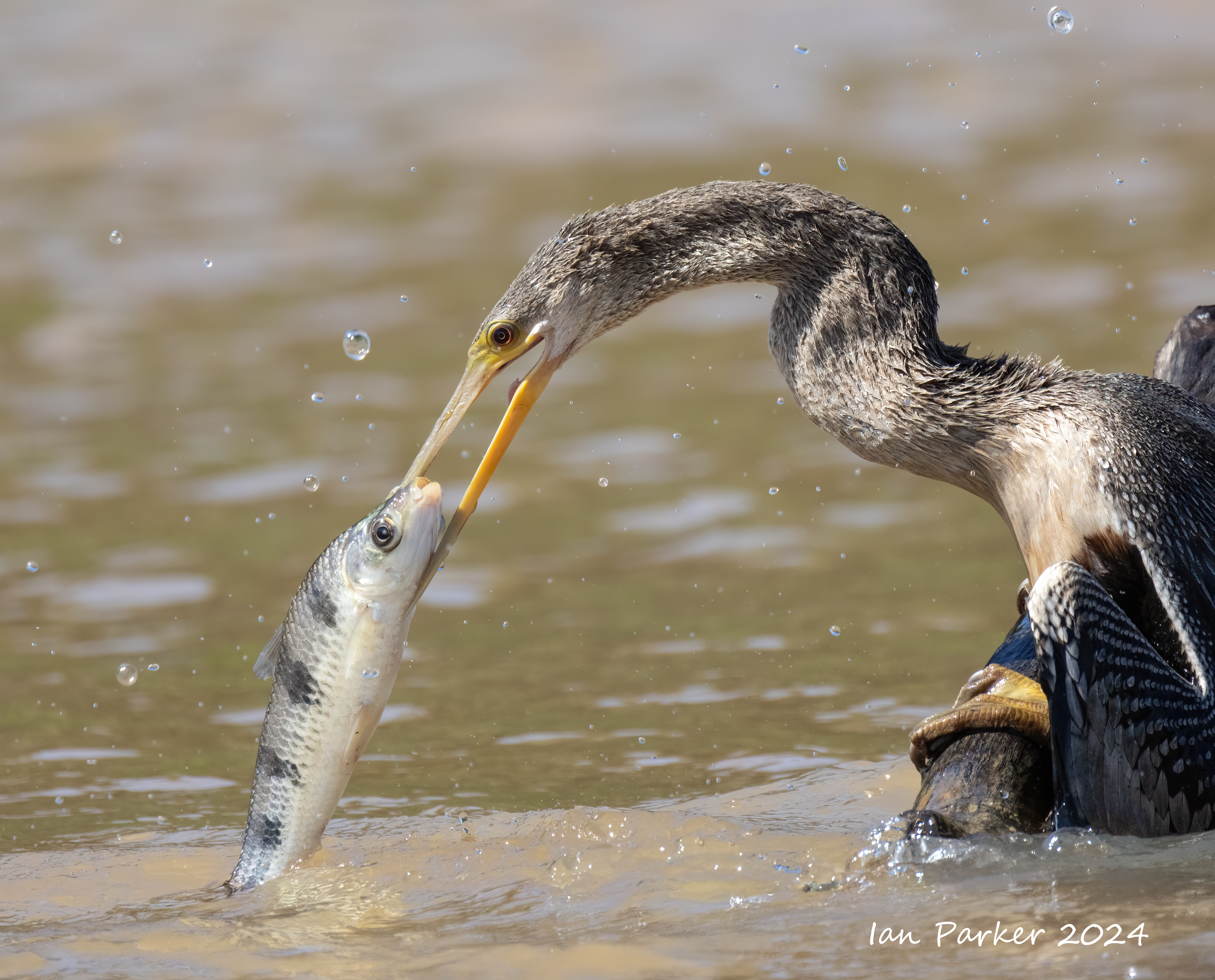
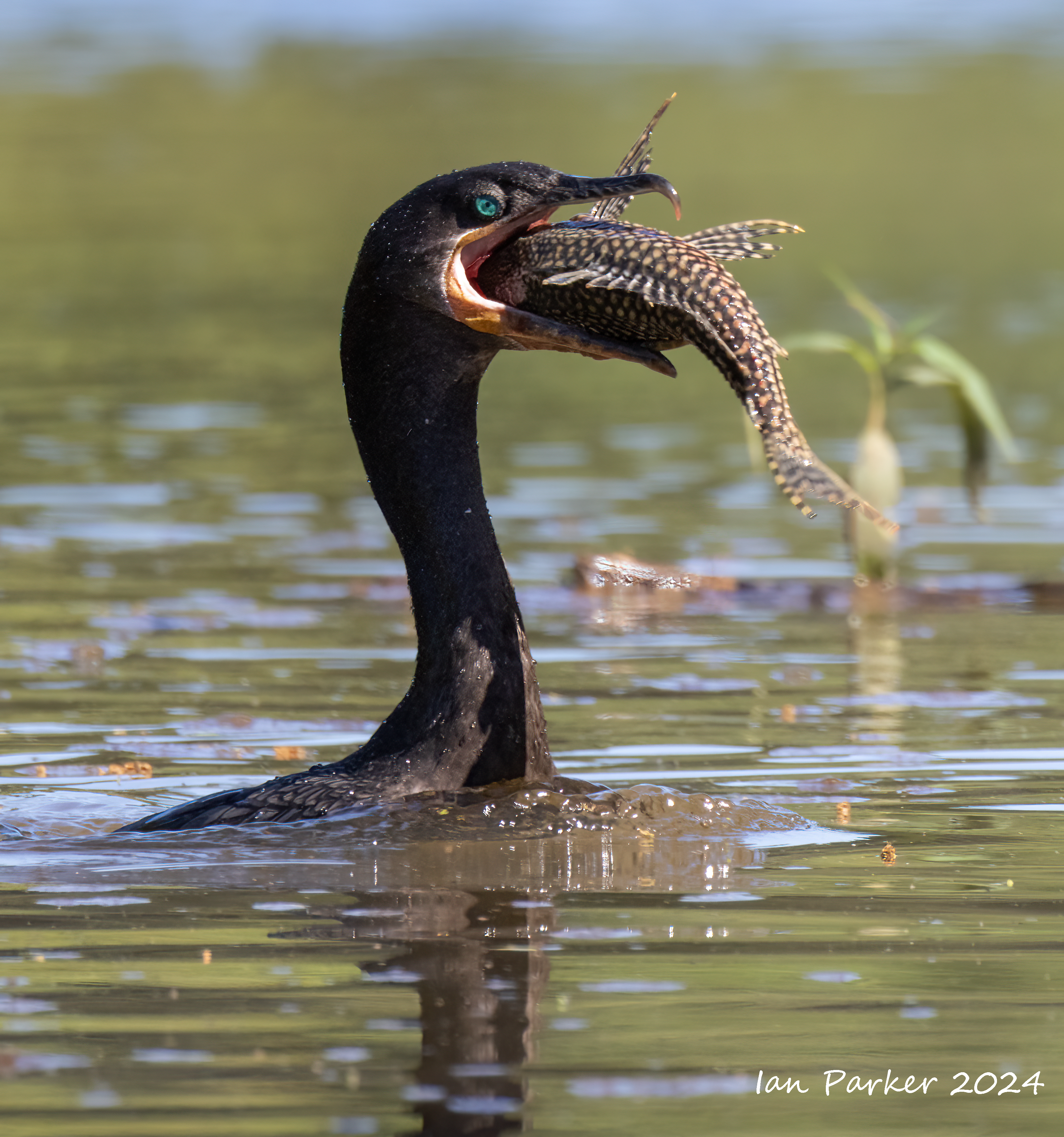
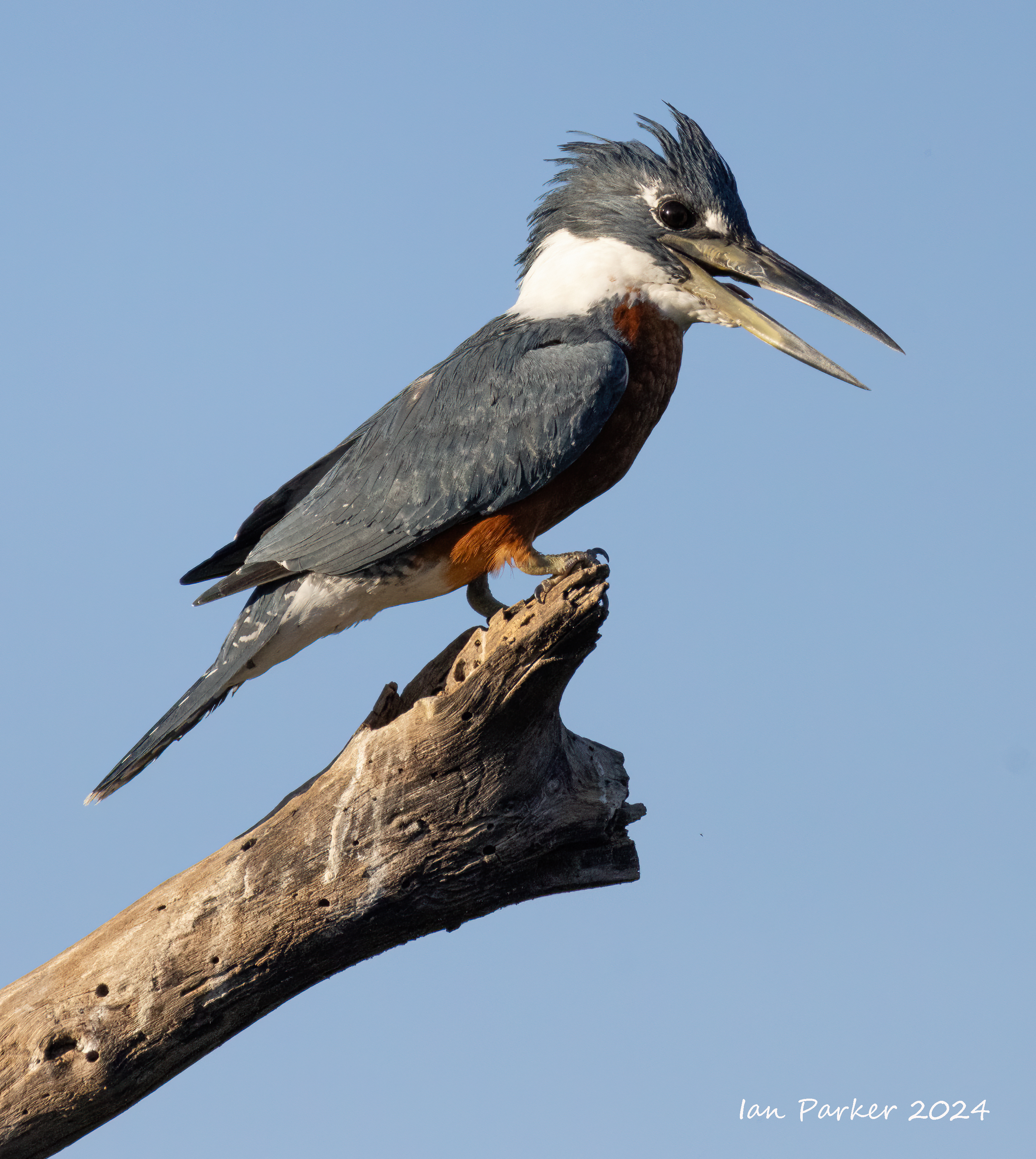
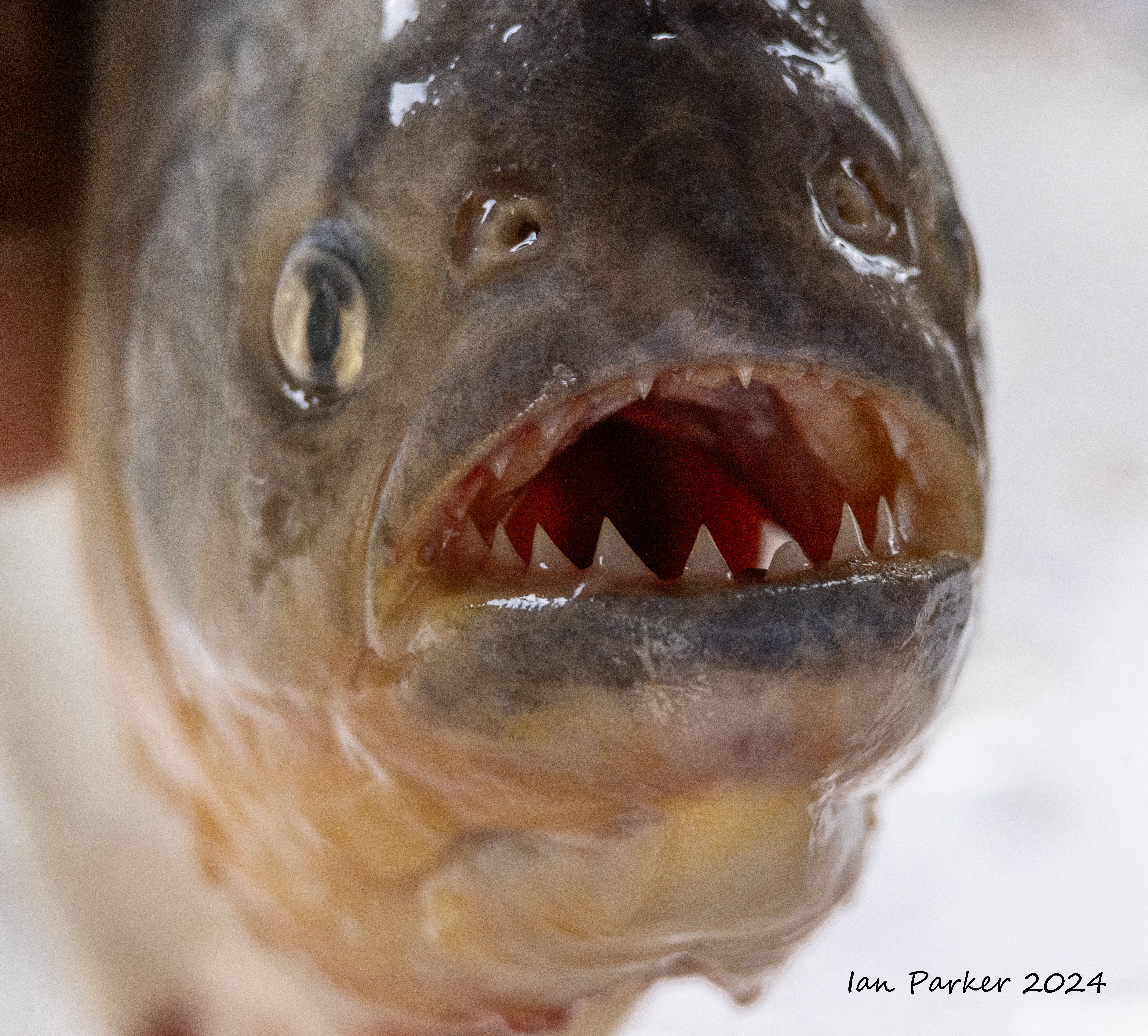
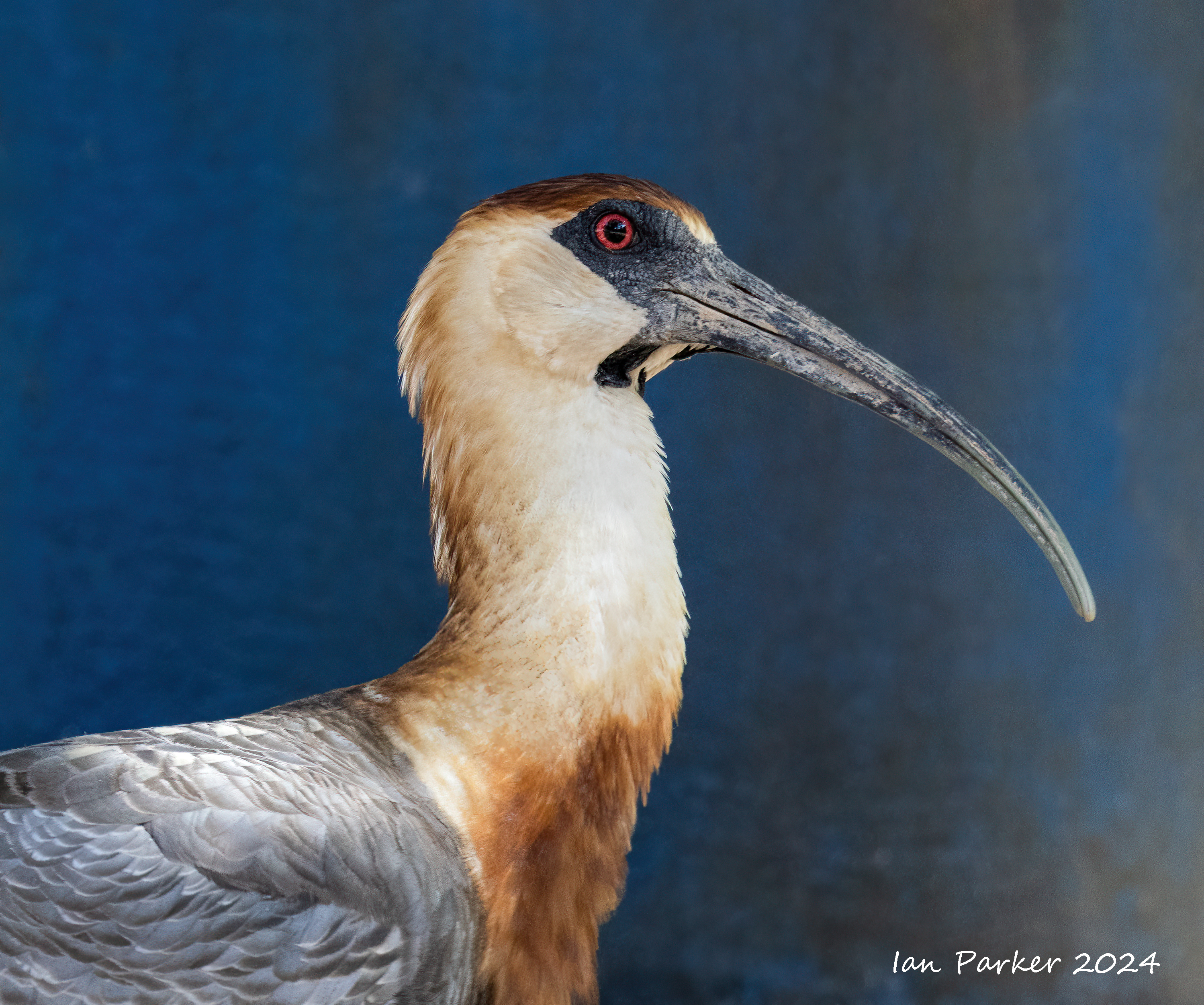
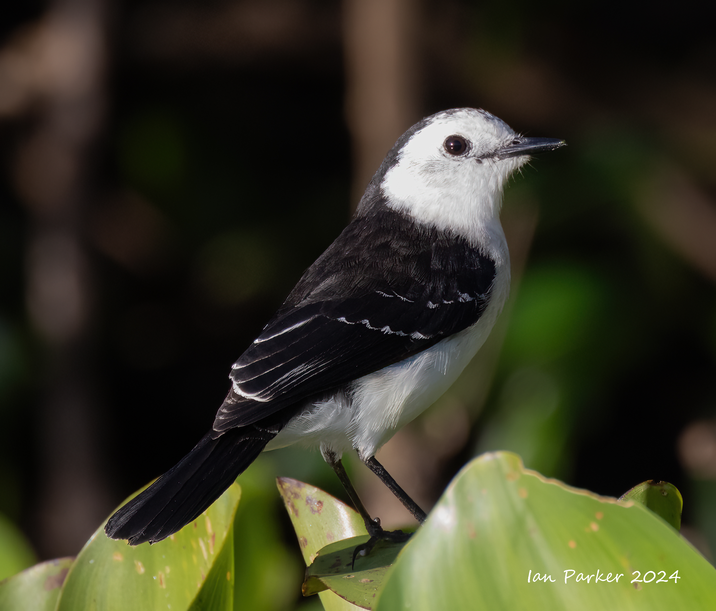
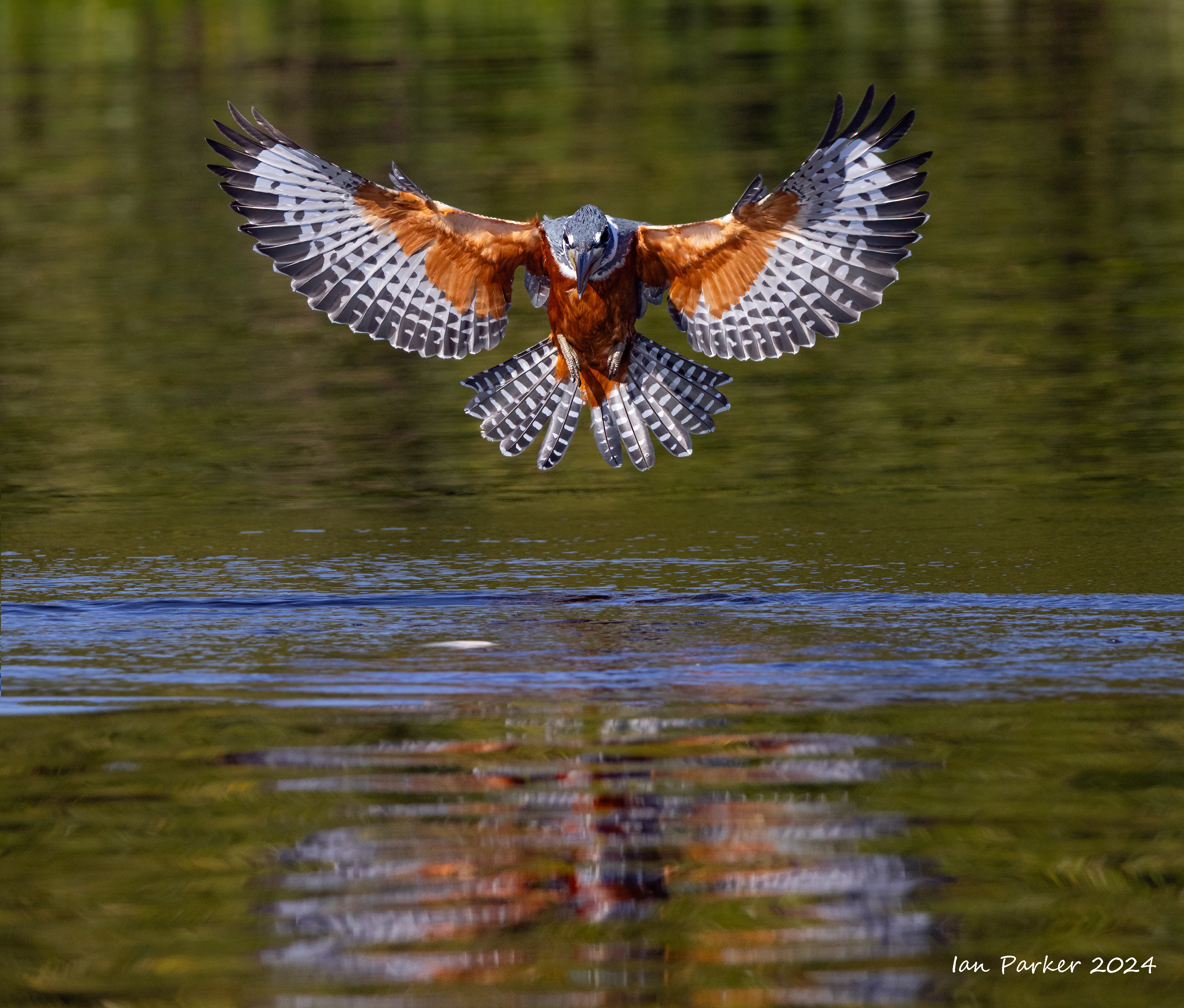
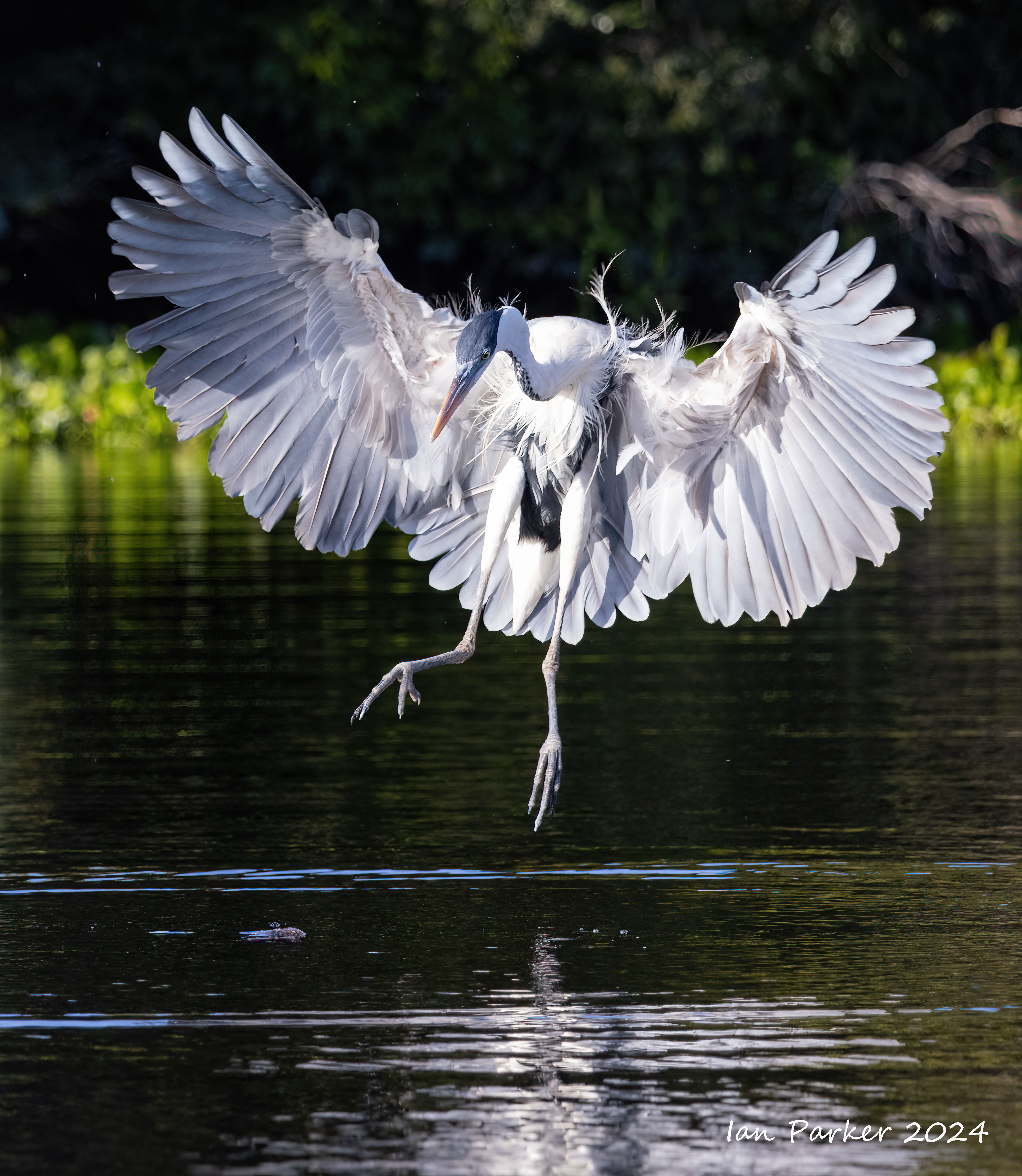
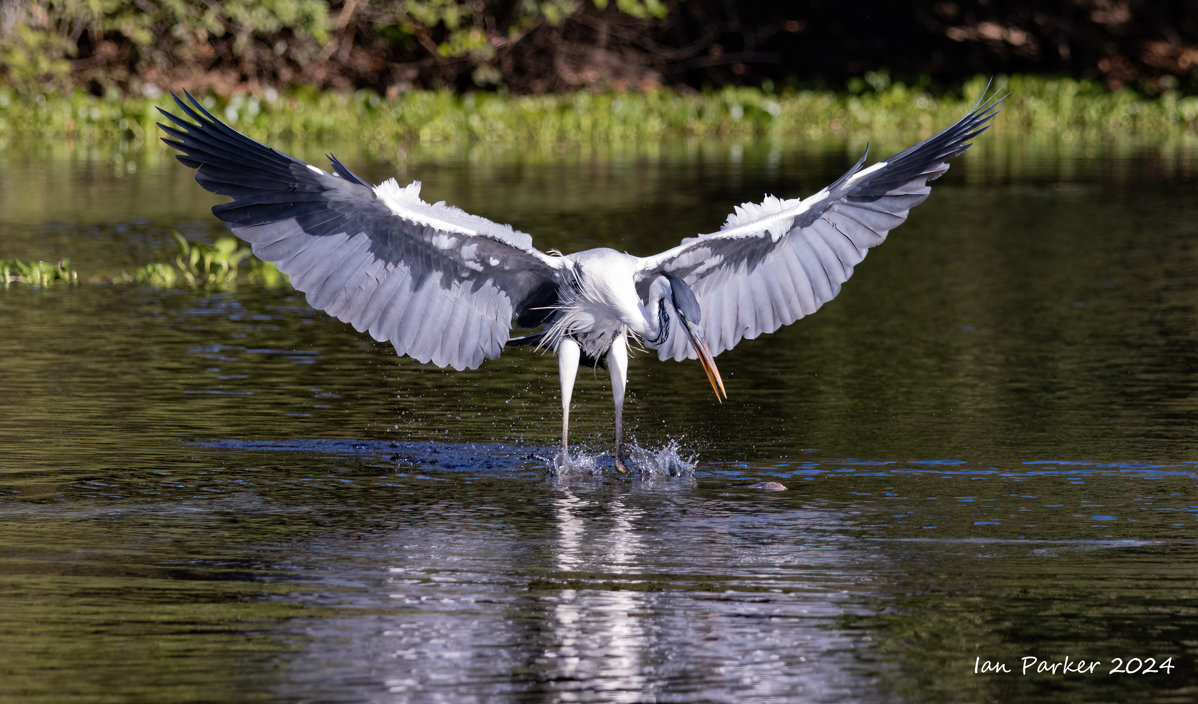
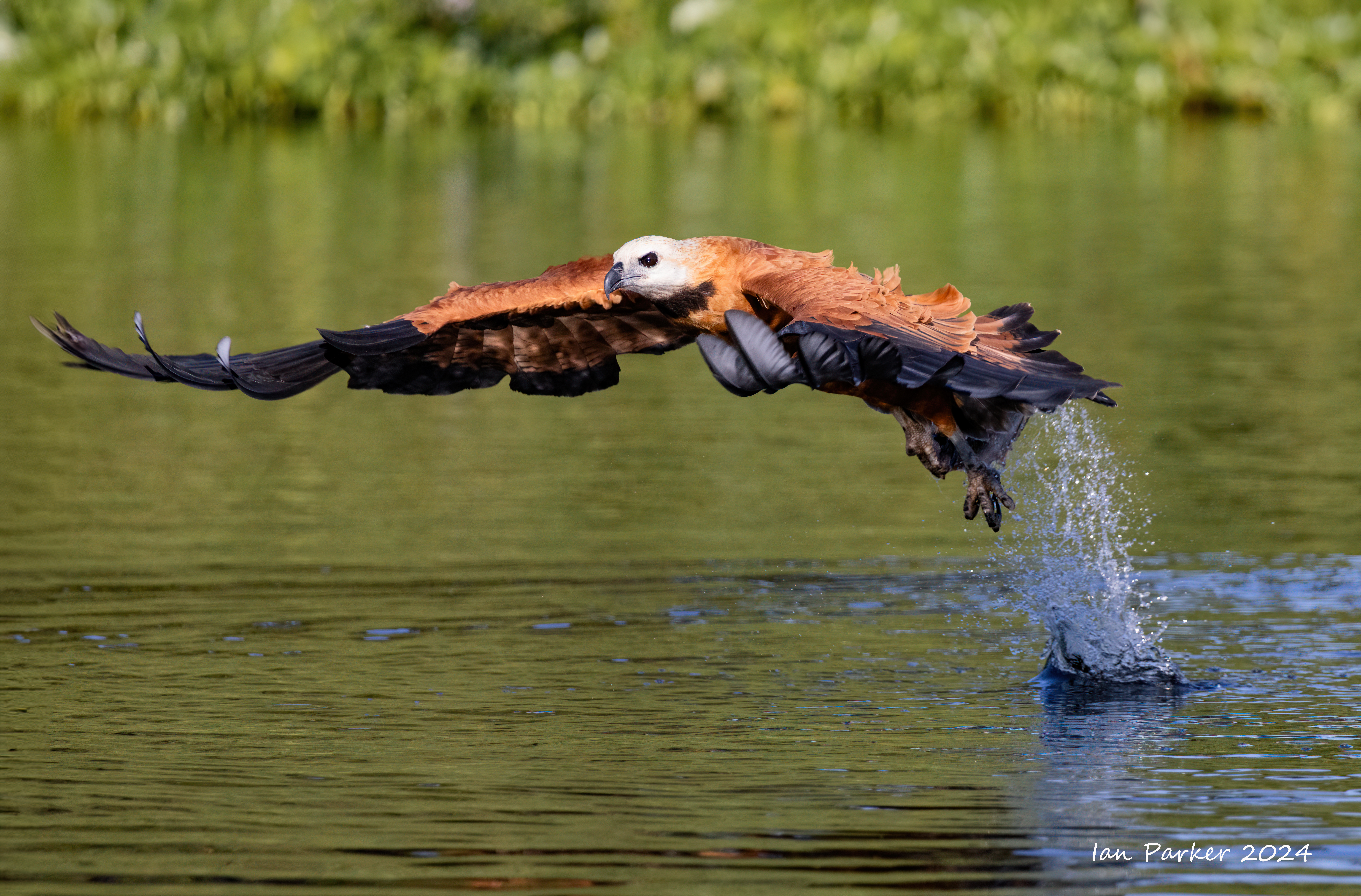
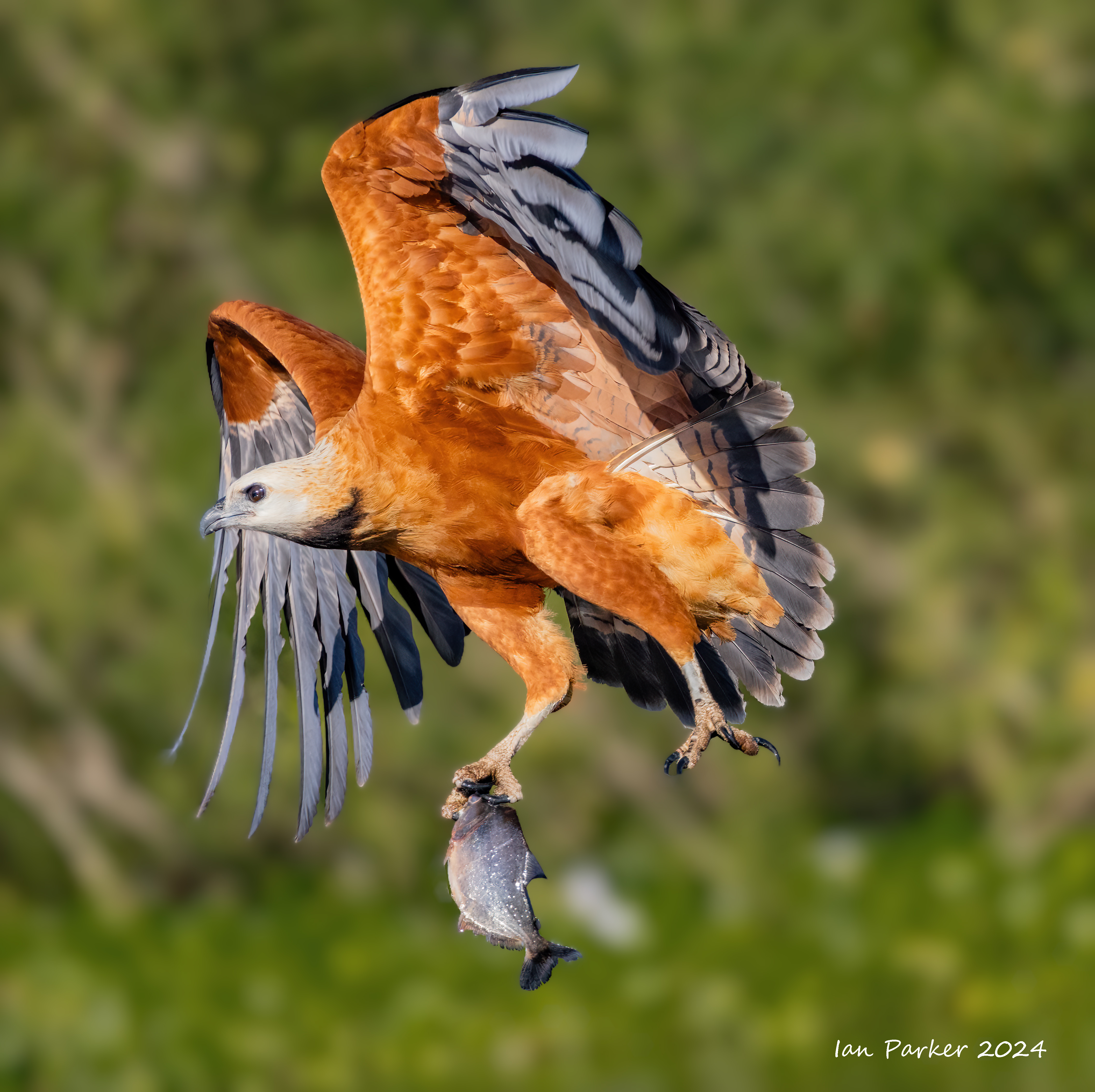
After two hotel nights in the city of Cuiaba we set out early in the morning for the Transpantaneira Highway, the main artery through the floodplain, looking along the way for the unusual mammals and some of the more than 360 species of birds found in the Pantanal. The area is especially good for wading bird photos—thousands of jabiru, American wood storks and great egrets congregate in huge flocks. We arrived at our first Pantanal lodge, Rio Claro, in time for lunch. Our group divided into three small boats and headed out onto a large oxbow lake to photograph a variety of birds in flight as they dive for fish.
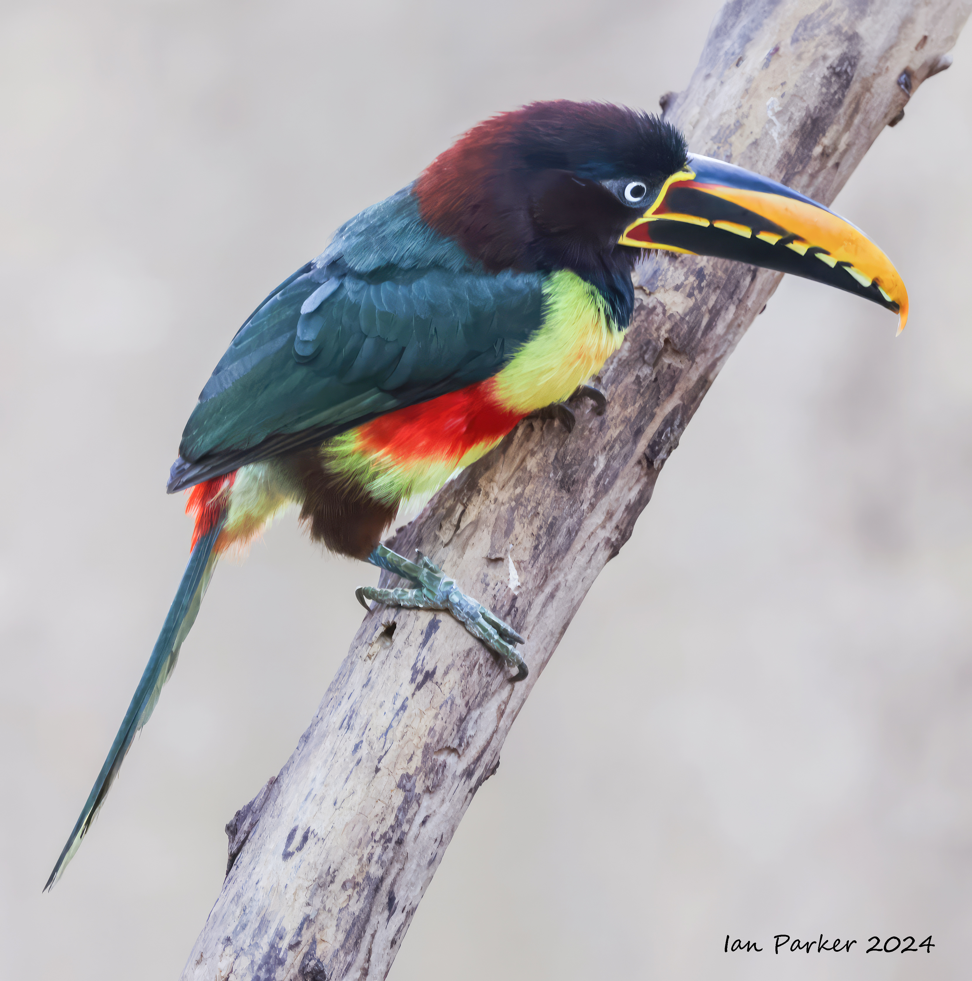
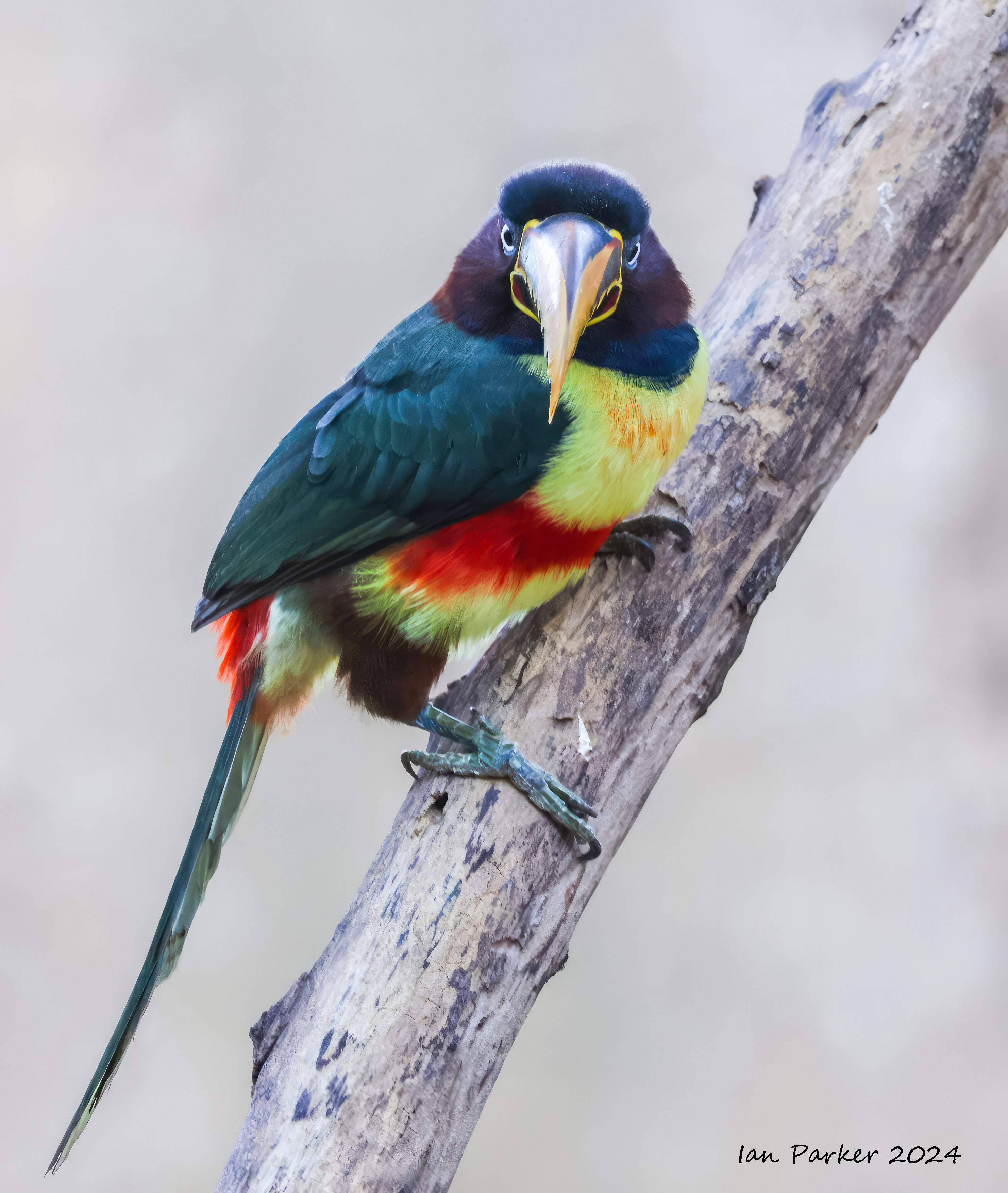
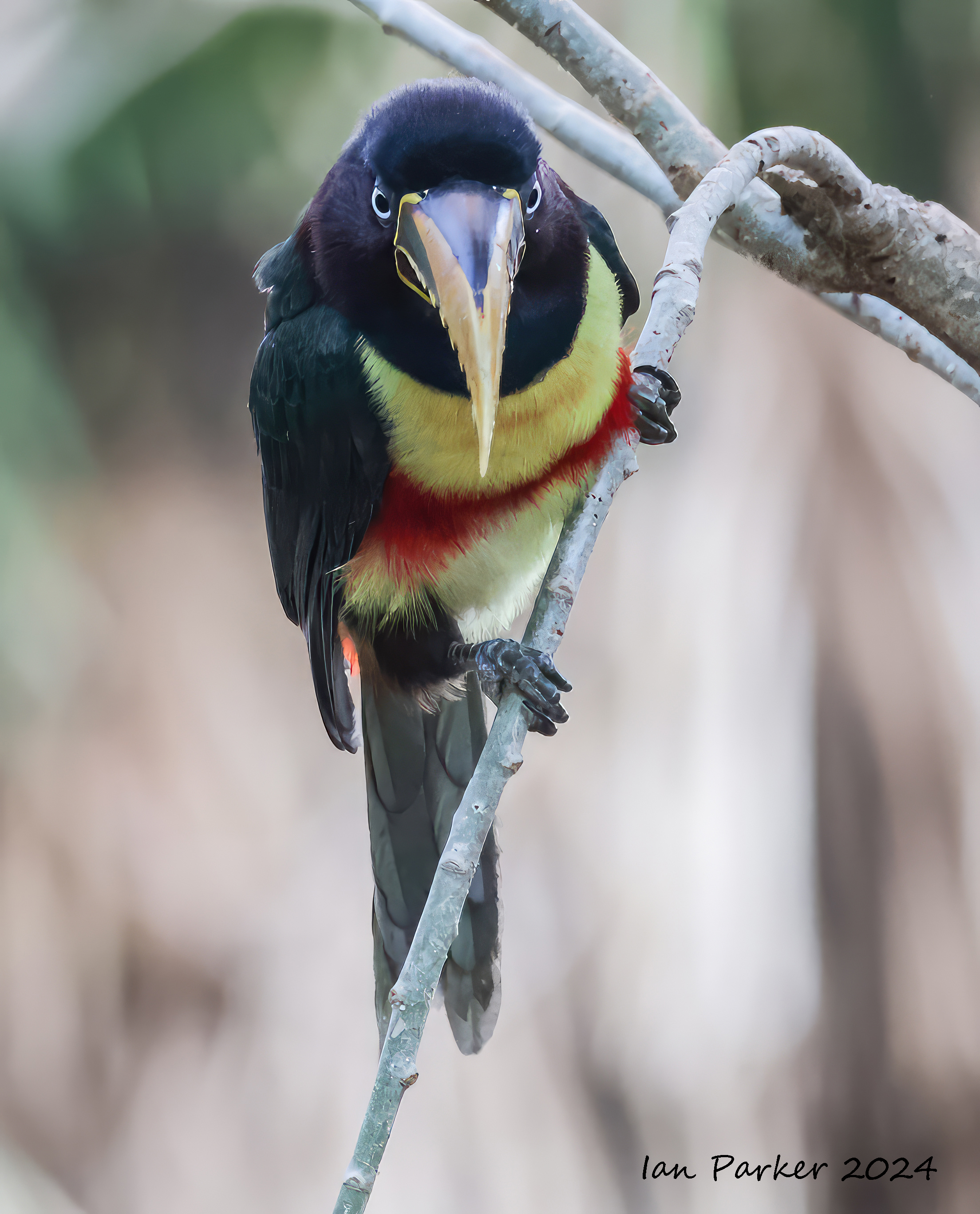
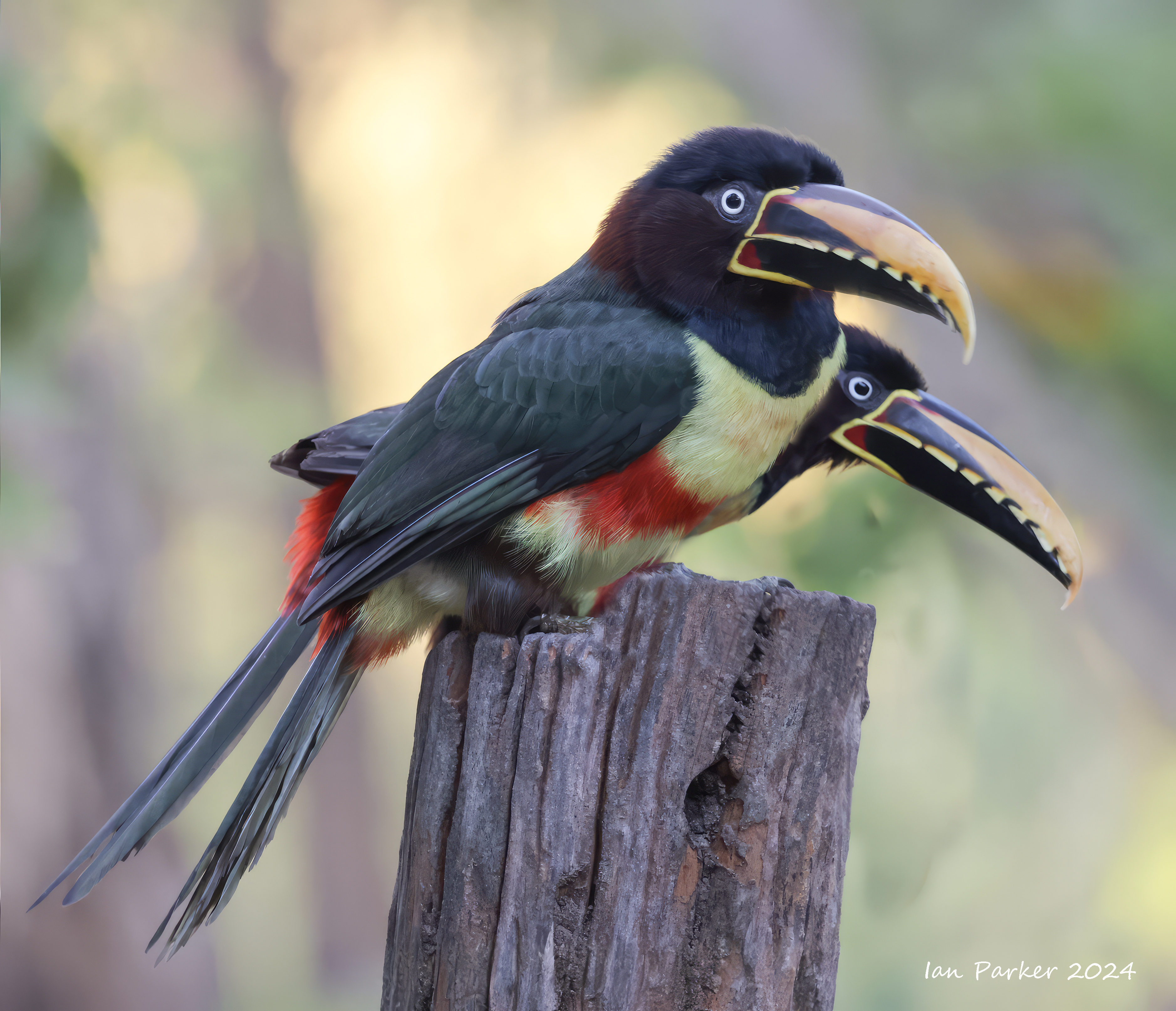
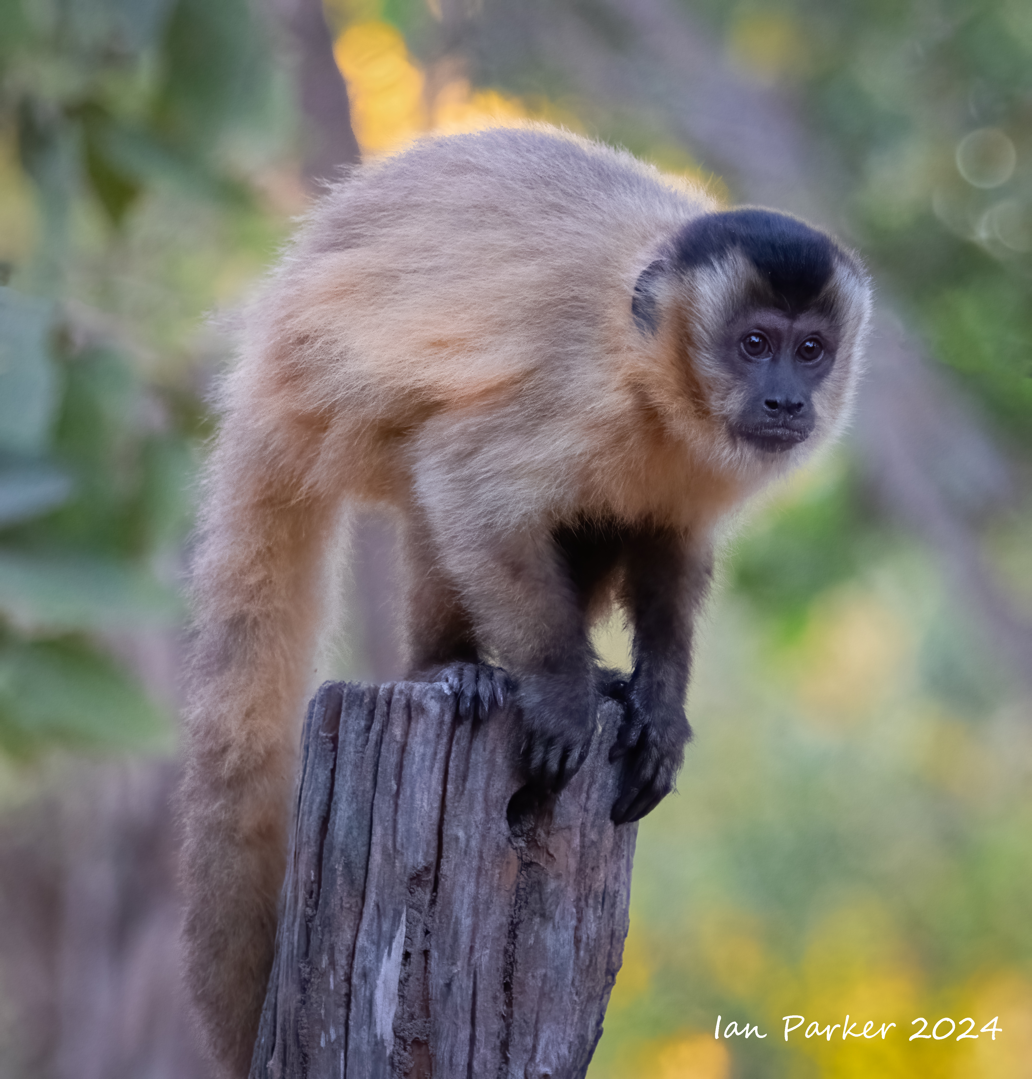
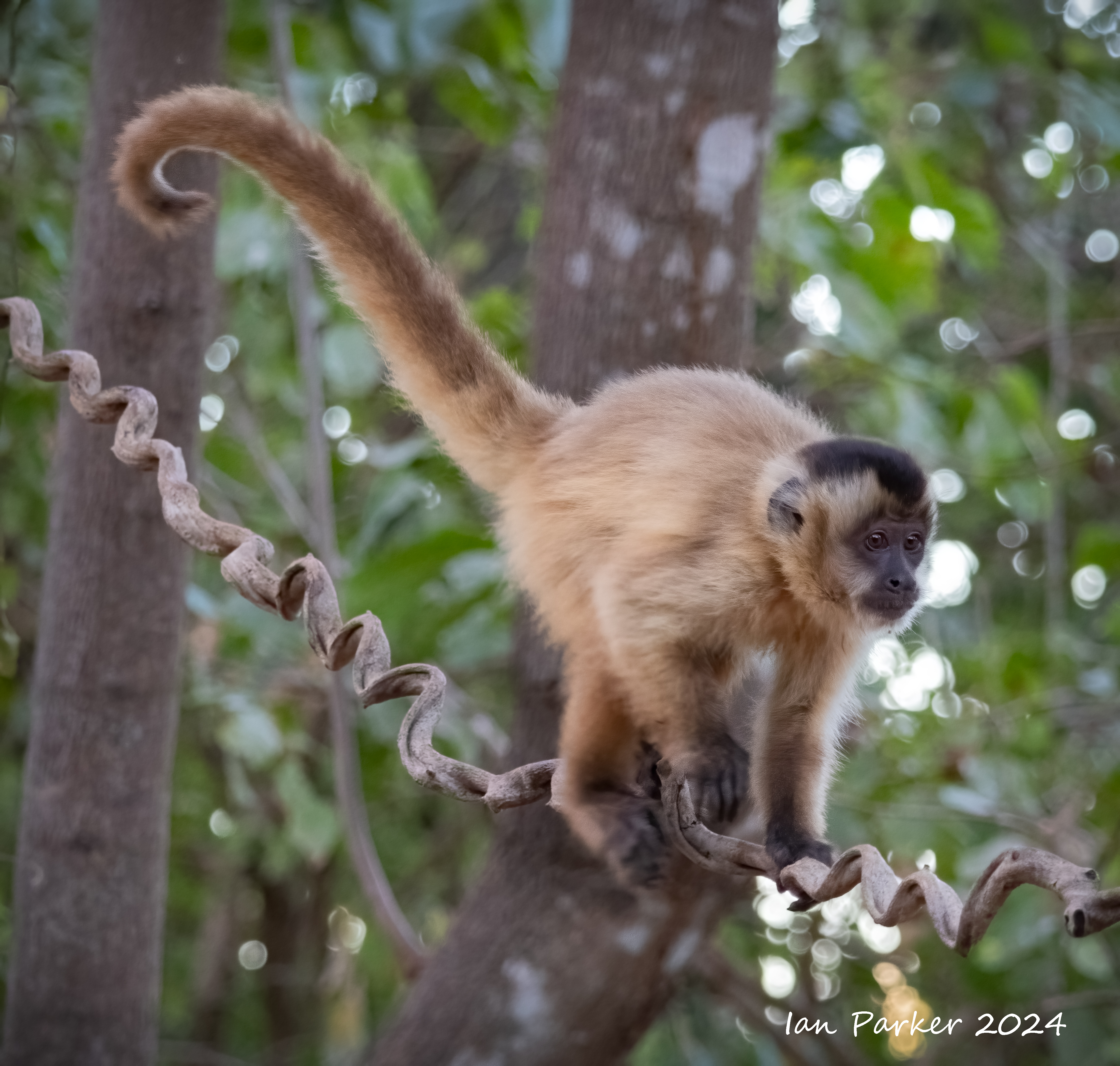
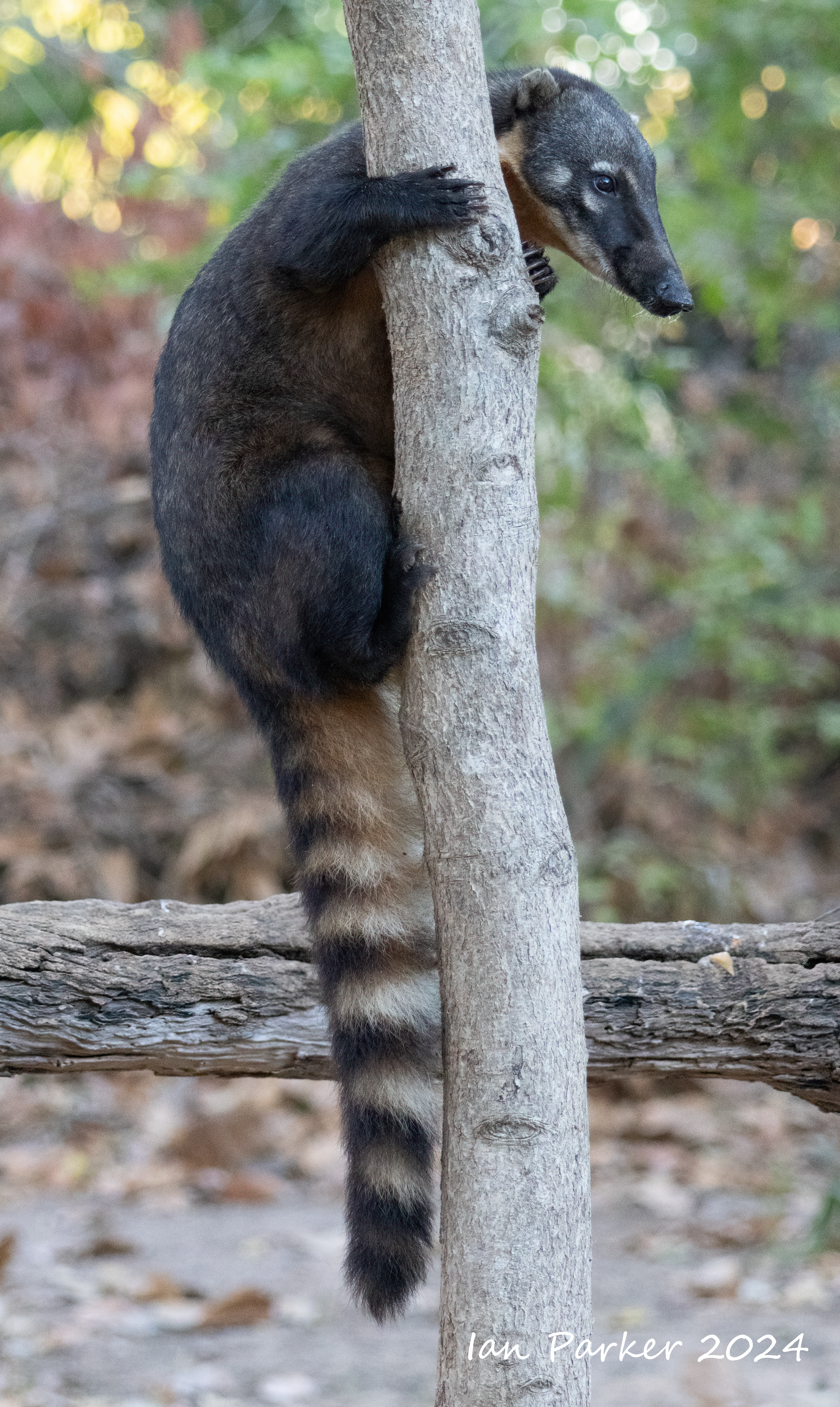
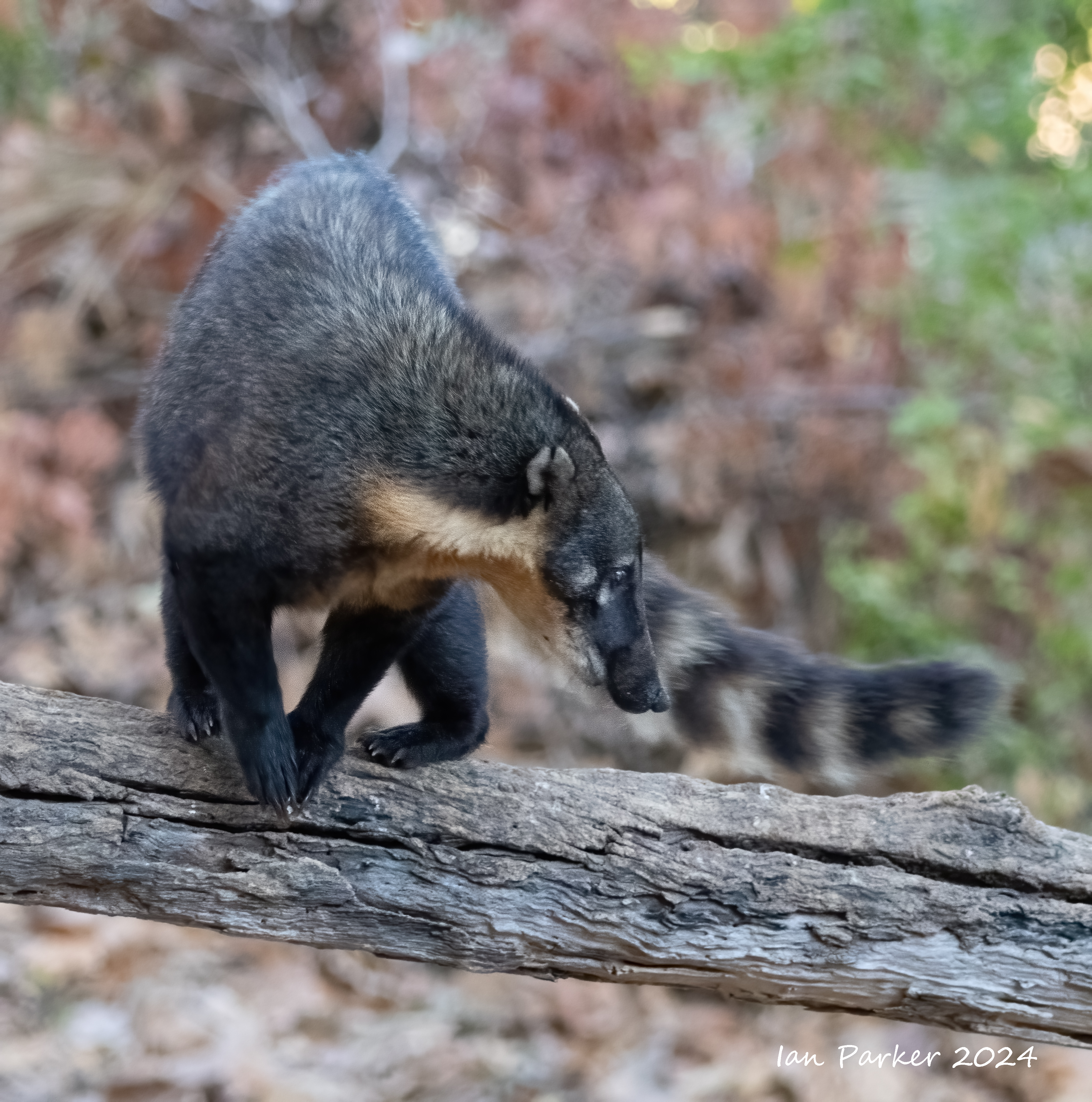
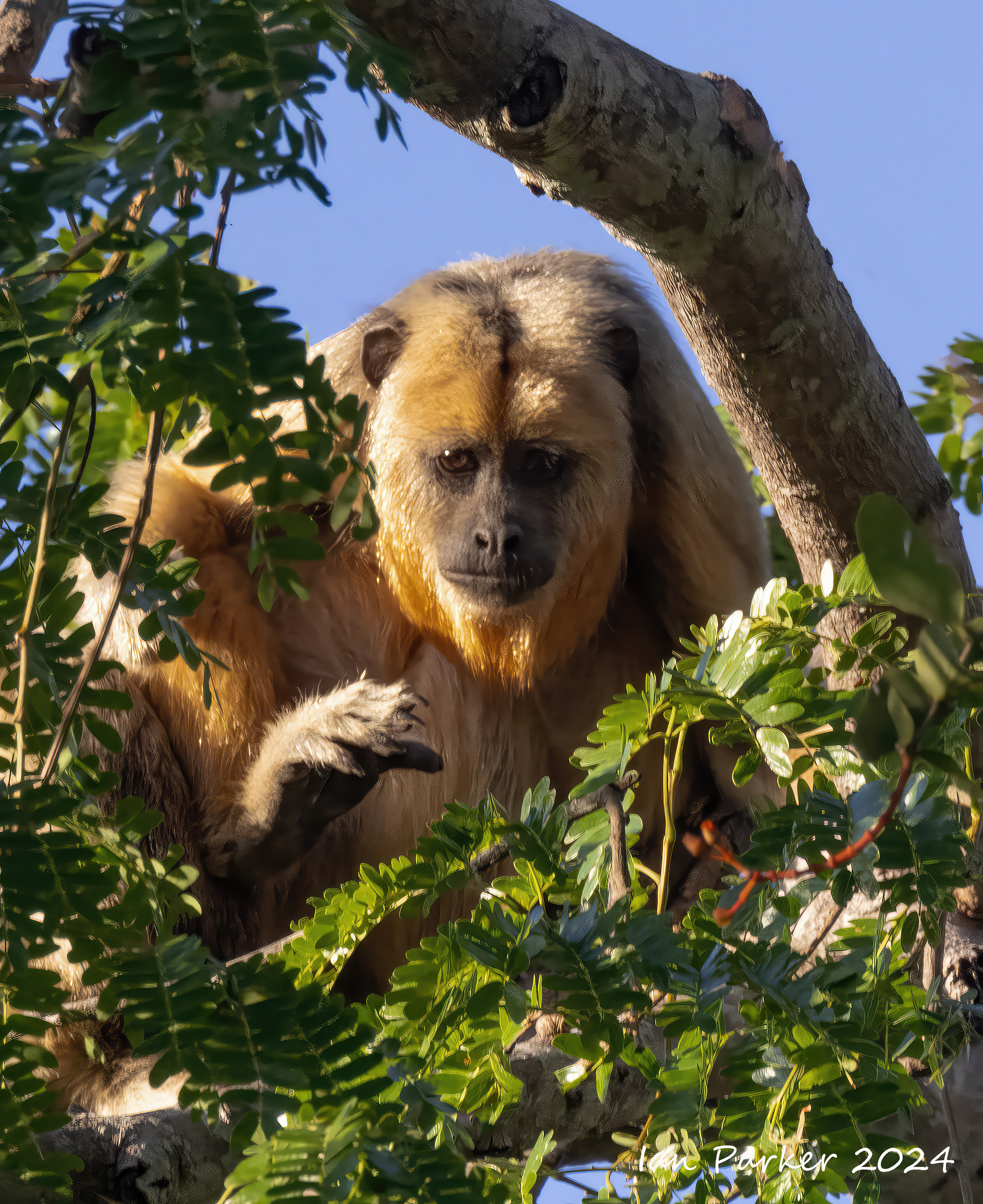
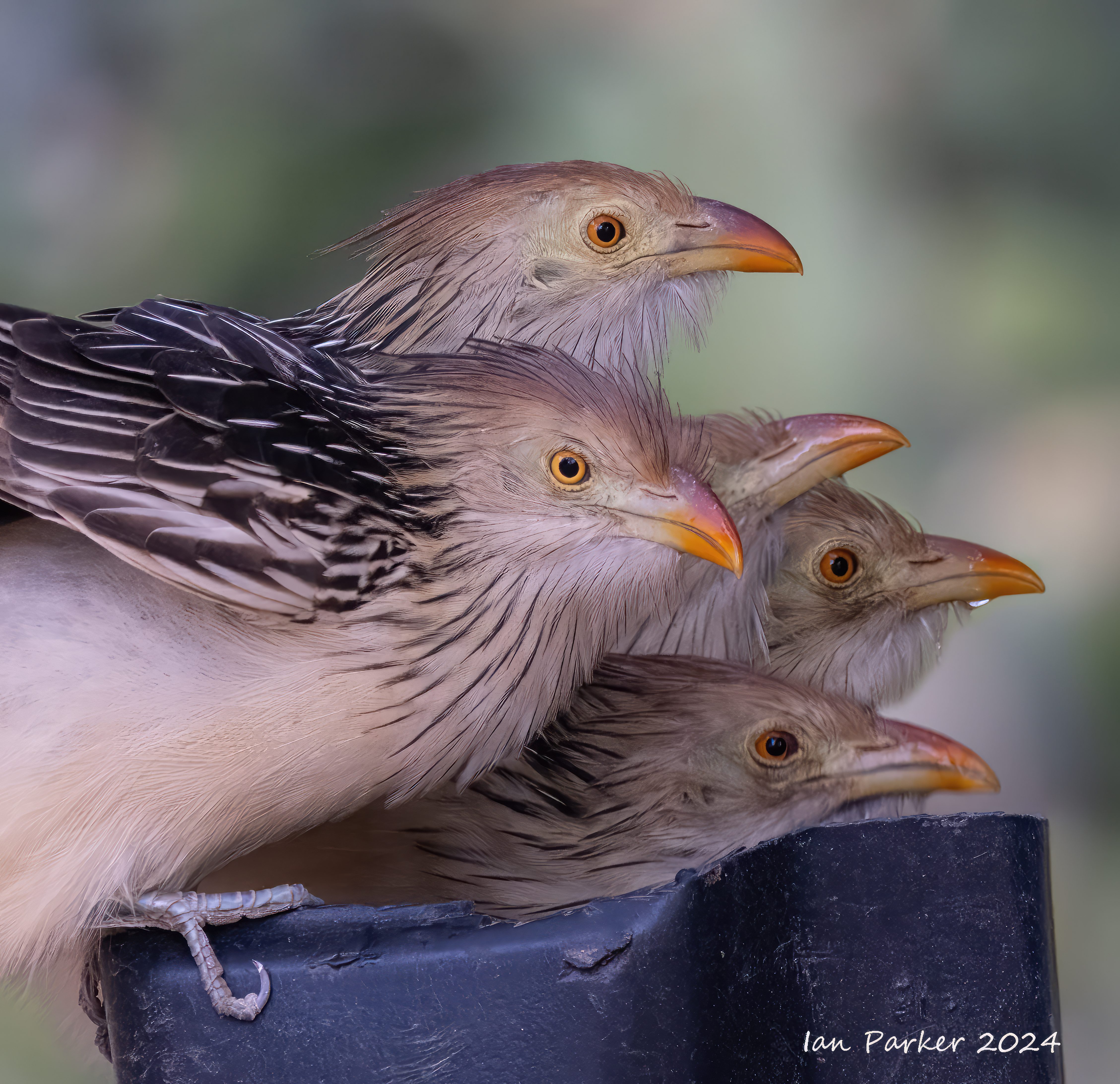
Birds and monkeys at Rio Claeo lodge around the feeder
Out on the lake
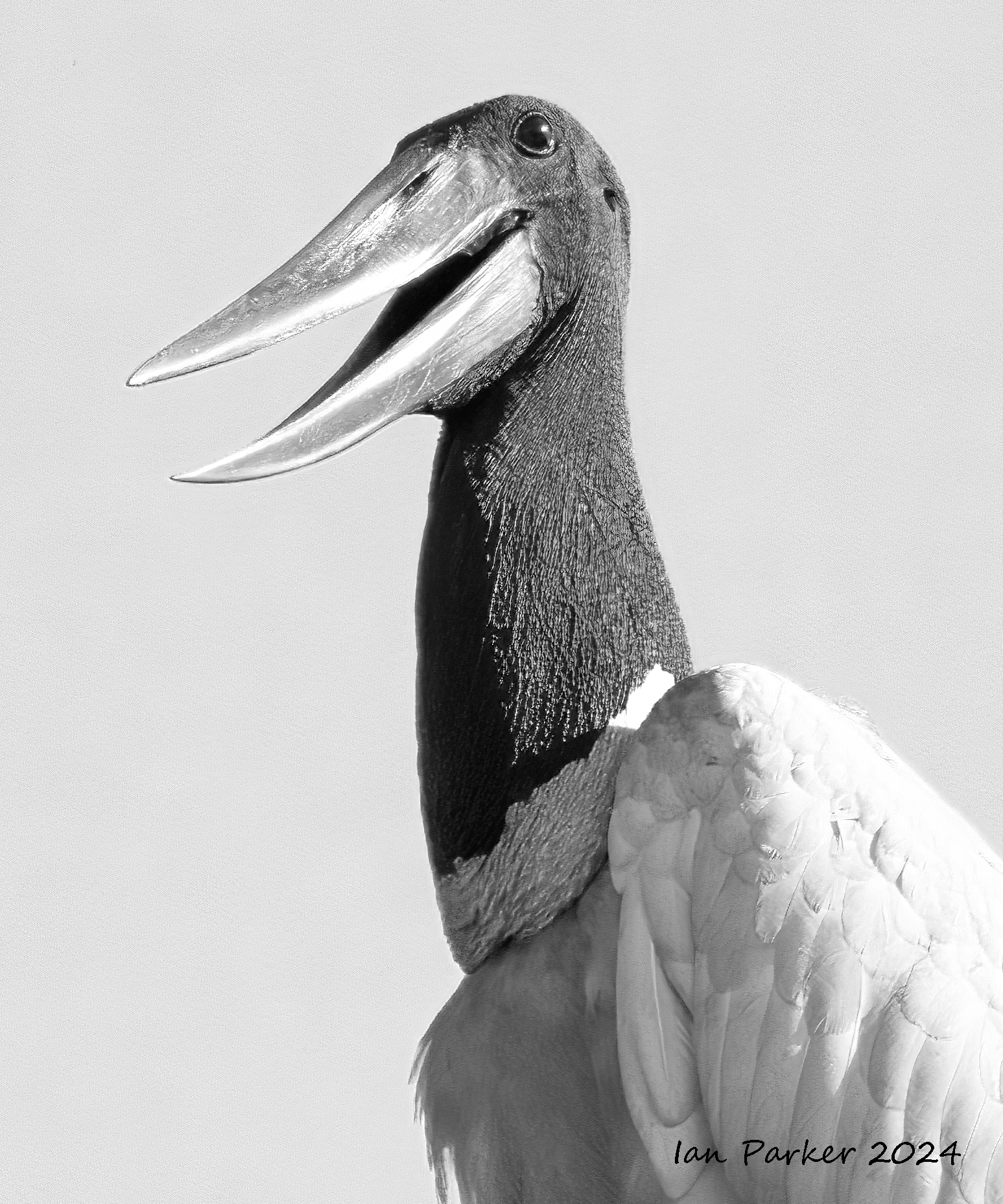
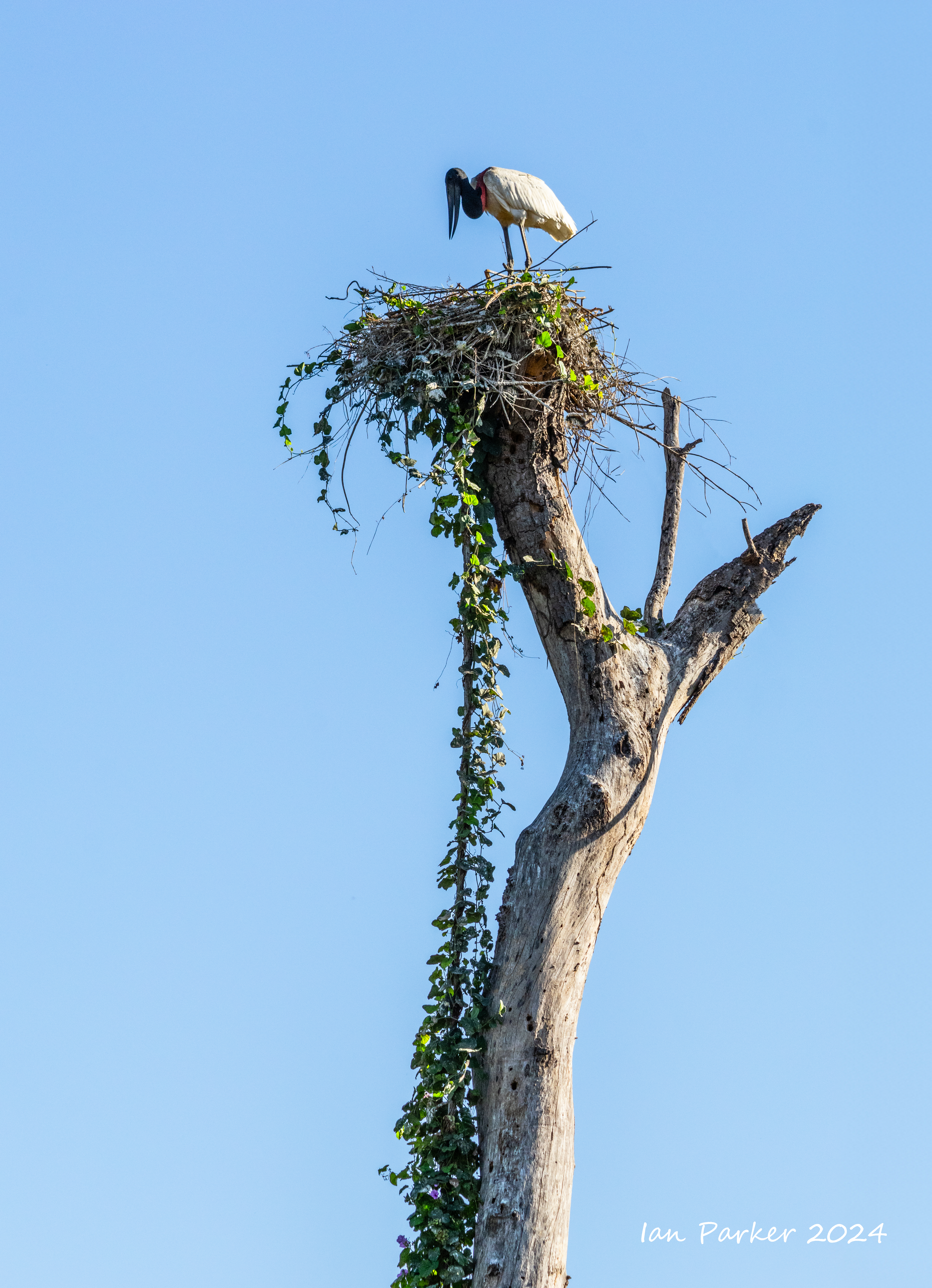
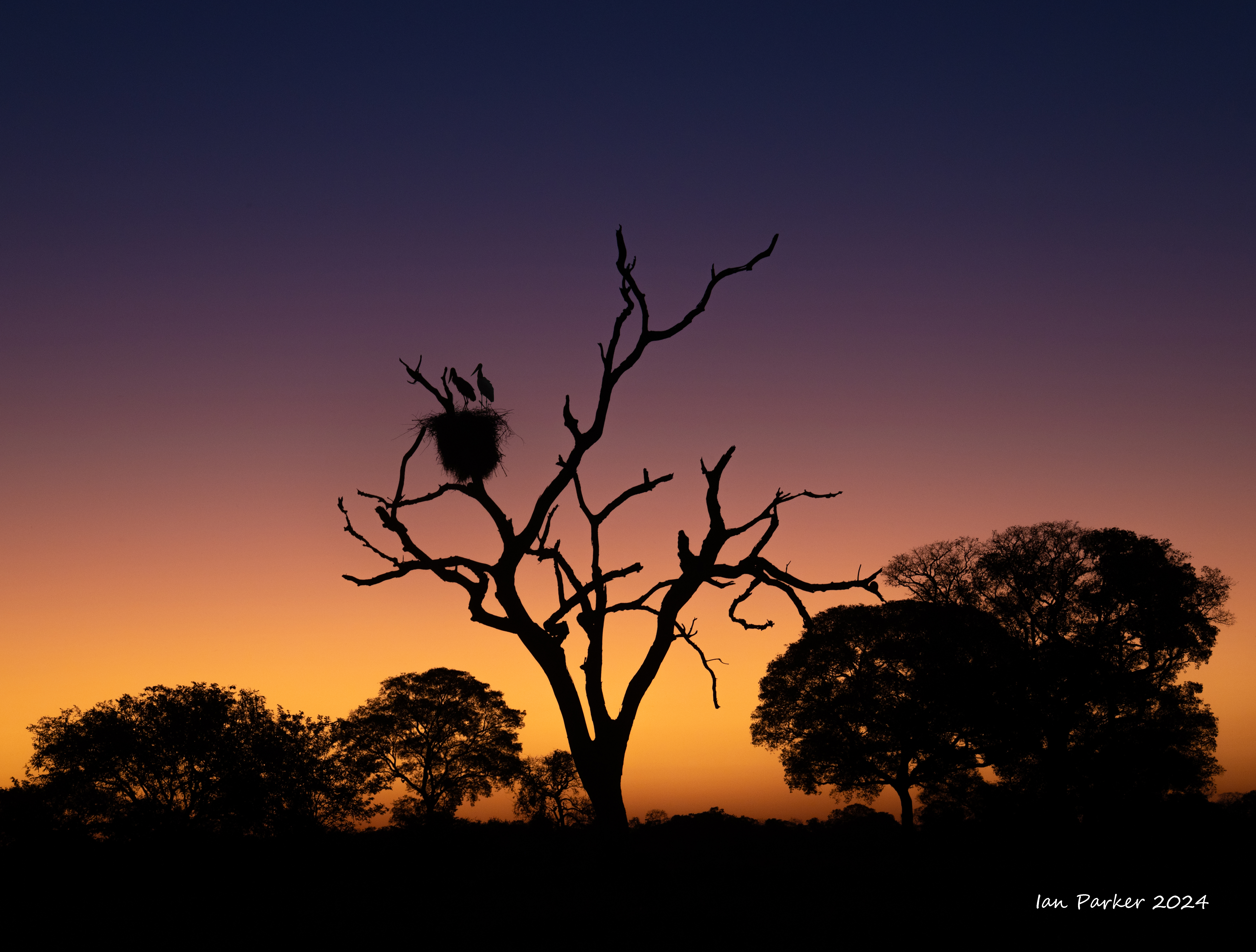
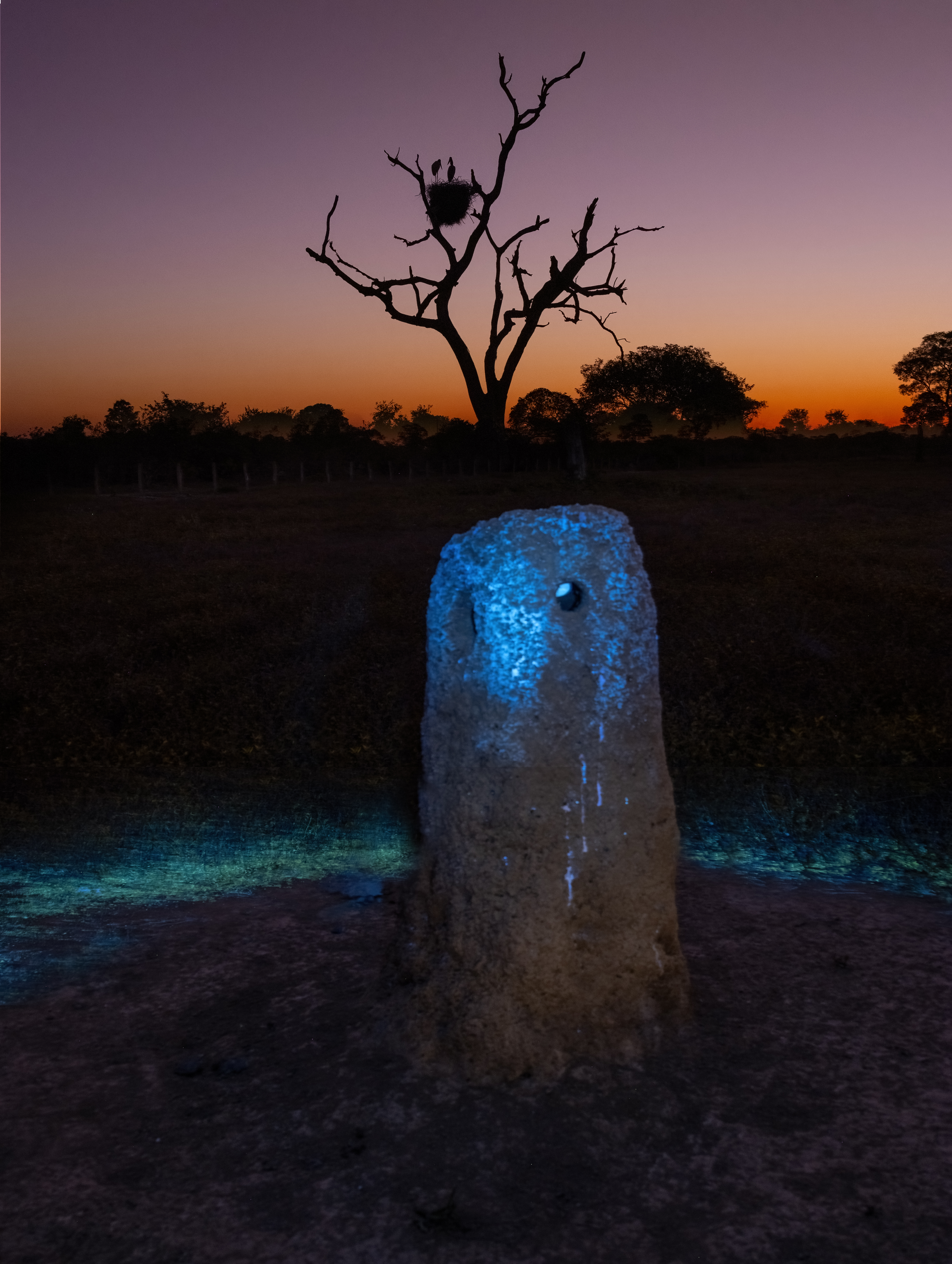
Jabiru stork nest in tree outside the lodge
| IanParker 1146 McGaugh Hall University of California, Irvine, CA 92697 |
Please send enquiries to |
BACK TO > |