<%@LANGUAGE="JAVASCRIPT" CODEPAGE="1252"%> Evanescent Light : Badwater


evanescent
: fleeting, transitory
evanescent wave: a nearfield standing wave, employed for total internal reflection microscopy

For faster browsing, click on the underlined text legend below any of the thumbnail images in the galleries. Use your browser BACK button to return you to the gallery. If you find a picture you like, you can download the image at full original resolution (usually between 10-30 Mpixels; with some panoramas >100 Mpix) by clicking on the thumbnail itself. To save a downloaded image, right click on it and scroll to 'save picture as...'. To use an image as your desktop background, right click and scroll to 'set as background...'.
Visitors are welcome to download images for personal use (e.g. as computer desktop wallpaper). Click HERE to order prints online. Please contact Ian Parker at evanescentlightphotography@gmail.com regarding possible commercial use. Details of copyright, image use and licensing are HERE.

Back to Evanescent Light Homepage

 
CALIFORNIA
Alabama Hills
Anza Borrego
Badwater 135
Big Sur
Bodie
Bristlecone Pines
Bolsa Chica
Bombay Beach
Carrizo Plain
California coast
Death Valley
D.V. Superbloom
Eureka Dunes
High Sierra
Imperial Dunes
Joshua Tree
King's Canyon
Lassen N.P.
Log Cabin mine
Mojave Desert
Mono Lake
Northern CA
Owens Valley
Pacific Redwoods
Point Lobos
Racetrack valley
Saline valley
Salton Sea
Salton Sea Ultra
San Joaquin marsh
Trona Pinnacles
UCI & The OC
Yosemite
508 bike race
 
USA
Anasazi Ruins
Antelope Canyon
Arches Natl. Park
Bisti Badlands
Bosque d'Apache
Bryce
Buffington Pks
Canyn. de Chelly
Canyonlands
Capitol Reef
Cedar Breaks
Chaco Canyon
Comb Ridge
Coyote Buttes S.
Crater Lake
Escalante
Folk School
GAP Trail
Glen Canyon / Lake Powell
Grafton ghost town
Grand Canyon
Hanksville
Kodachrome Basin
KOFA N.W.R.
Little Finland
Maine & Acadia
Monument Valley
Natural Bridges
Nevada
New Mexico
Other Places in S.W. U.S.A.
Oregon Cascades
Oregon Coast
Oregon, Columbia River Gorge
Oregon, Painted Hills
Parashant N.M.
Paria River
Petroglyphs
Pittsburgh
Saguaro N.P.
The Sand Hills
San Raphael Swall
The Wave
Valley of Fire
Valley of the Gods
White Pocket
Yant Flat
Yellowstone
Zion
 
ICELAND
Aurora
Ice
Water
Sea
Land
Sky
Flora & Fauna
Man
 
South & Central America
Belize
Easter Island
Bolivia/Chile, Landscapes
Bolivia/Chile, Wildlife
Bolivia, Salar de Uyuni

Bolivia/Chile, Works of Man

Carretera Austral
Patagonia
Tierra del Fuego
 
EUROPE
England - Canals
England - North
Faroe Islands
France
Lofoten Islands
Scotland - Aberdeenshire
Scotland- Western Isles
Tuscany
 
ASIA
Burma-Lake & River
Burma-Monks
Burma-Pagodas
Burma-Rural
Cambodia
India -Delhi
India -Kumbh Mela
India - Rann of Kutch
India - Varanasi
Laos
Singapore
Vietnam
Hong Kong
 

JAPAN

Red-crowned cranes
Whooper swans
Sea Eagles
Snow Monkeys
Hokkaido Landscapes
Hokkaido wildlife
 
AUSTRALIA
Animals & birds
Uluru
Landscapes & cityscapes
 
NEW ZEALAND
NZ Coast
NZ Mountains
NZ Wildlife
 
SUBANTARCTIC ISLANDS
Campbell Island
Snares Island
Macquarie Island
Auckland Islands
Bounty Islands
Antipodes Islands
Chatham Islands
Pyramid Rock
 
AFRICA
Cape Town
Sossusvlei
Wildlife
Flora
Morocco
Namibia landscapes
Namibia guide
 
FALKLANDS
Bird Island
Carcass Island
Grand Jason
Grave Cove
New Island
Pebble Island
Saunders Island
Sea Lion Island
Steeple Jason
Volunteer Point
West Point Island
 
Sth. GEORGIA
Cape Disappointment
Cooper Bay
Elsehul
Godthull
Gold Harbour
Grytviken
Hercules Bay
Jason Harbour
Larson Harbour
Nordenskold Glacier
Ocean Harbour
Prince Olav Hbr. /Fortuna Bay
Prion Island
Right Whale Bay
Salisbury Plain
St. Andrews Bay
Southern Ocean birds
Skyscapes
Stromness
Twitcher Glacier
 
ARCTIC
Svalbard Birds
Svalbard Flora
Svalbard Land
Svalbard Longyearbyen
Svalbard Polar Bears
Svalbard Wildlife
Greenland - ice
Greenland - land
 
ANTARCTIC PENINSULA
Ice
Land & sky
Wildlife
 
ROSS SEA
Land, sky, ice
Historic Huts
Wildlife
Balleny Islands
 
PANORAMAS
 
THEMATIC
Abstract
Arches & Bridges
Birds
Doorways
Fall Colors
Flowers
Gastronomy
Hoodoos
Ice
Jellyfish
Nightscapes
Other...
Penguins & puffins
Reflections
Roads
Skyscapes
Slot Canyons
Superblooms
Trees
Waterfalls
Wildlife
 
SCREENSAVER DOWNLOADS
 
Parker Lab at UCI
 
Visitors since 2006
EditRegion3
 

Badwater 135 Ultramarathon - 2014
The "World's toughest footrace"


Death Valley to Mount Whitney


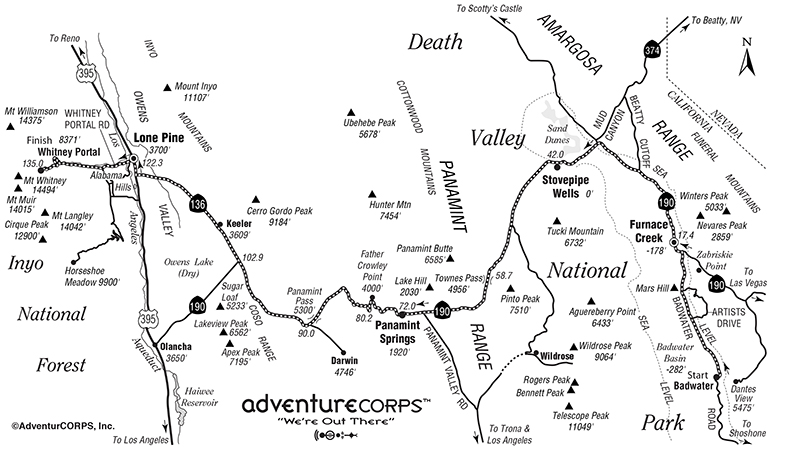
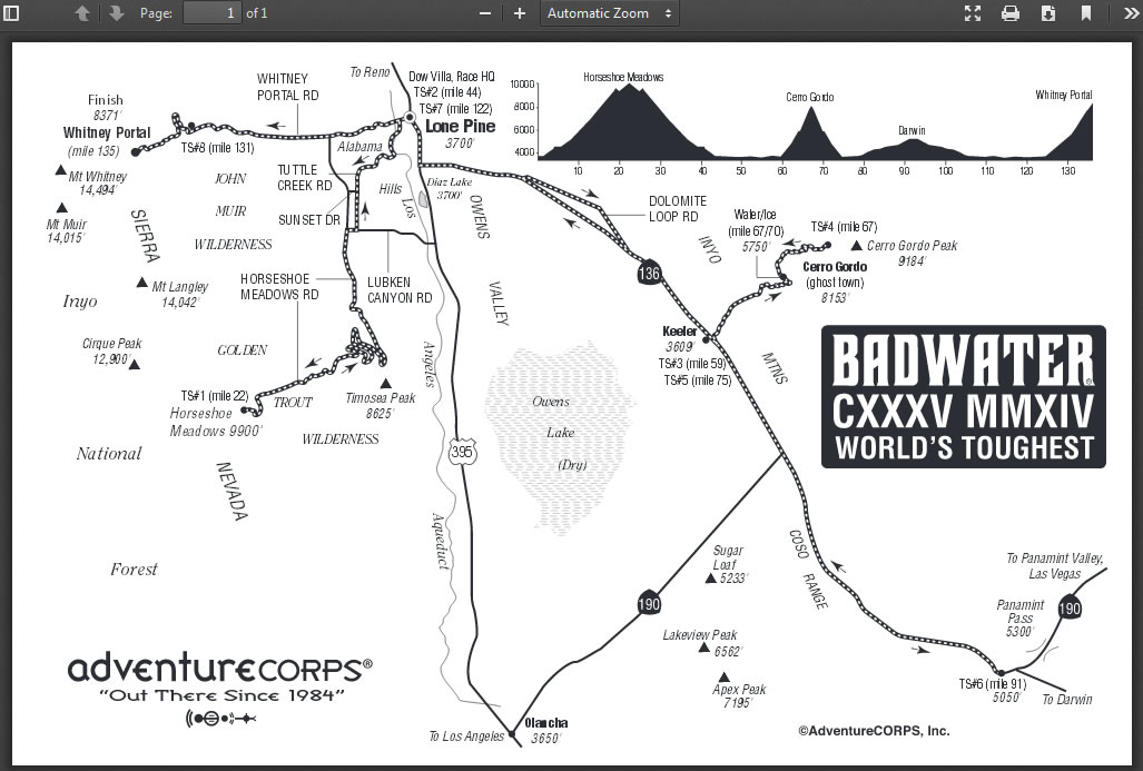
Covering 135 miles (217km) non-stop from Death Valley to Mt. Whitney, CA, the Badwater® 135 is the most demanding and extreme running race offered anywhere on the planet. The start line is at Badwater Basin, Death Valley, which marks the lowest elevation in North America at 280’ (85m) below sea level. The race finishes at Whitney Portal at 8,300’ (2530m), which is the trailhead to the Mt. Whitney summit, the highest point in the contiguous United States.

I had previously completed the race 9 times in 2002 through 2011, and returned several times later not as a runner but as race staff photographer. Over those years the race changed considerably. The cutoff time for official completion was reduced from 60 to 48 hours in 2011; in 2014 the Death Valley National Park imposed a moraorium on sporting events so the course was re-routed to include climbs to Horseshoe Meadow and Cerro Gordo; and from 2015 onward the race has started in the evening rather than the morning, so runners are no lnger exposed to the fyll daytime heat of the hottest place on earth.

Click HERE for the Badwater 135 website.

Click on the links below for photos from other annual editions of the Badwater, and for the years (2002-2012) when I was runnng Badwater.

Badwater 2022    
Badwater 2021 Badwater 2019 Badwater 2015
Badwater 2014 Badwater 2013 Badwater 2002-12


Return to Badwater home page


BADWATER 2014

July 20-23rd:   Badwater 135 Ultramarathon

I completed the Badwater Ultramarathon nine times between 2002-2011, and for the last two years returned in the easier role of staff photographer. Historically the race has run between Badwater Basin in Death Valley (the lowest point in the Western hemisphere) and the portal to Mt. Whitney (the highest point in the contiguous 48 states). This year, however, the National Park authorities placed a moratorium on athletic events in Death Valley (see HERE), necessitating a change of route. The 2014 edition of Badwater thus included only about one half of the original route, retaining the finish at Whitnel Portal, but substituting  two new extreme climbs up to Horseshoe Meadow and Cerro Gordo ghost town in place of the extreme heat experienced through the 42 miles below sea level in the bottom of Death Valley. Photographically, this eliminated the spectacular arid desert scenery of Death Valley, but in compensation provided sweeping vistas of the Sierras and Owen's Valley, together with the historic relics of Cerro Gordo.

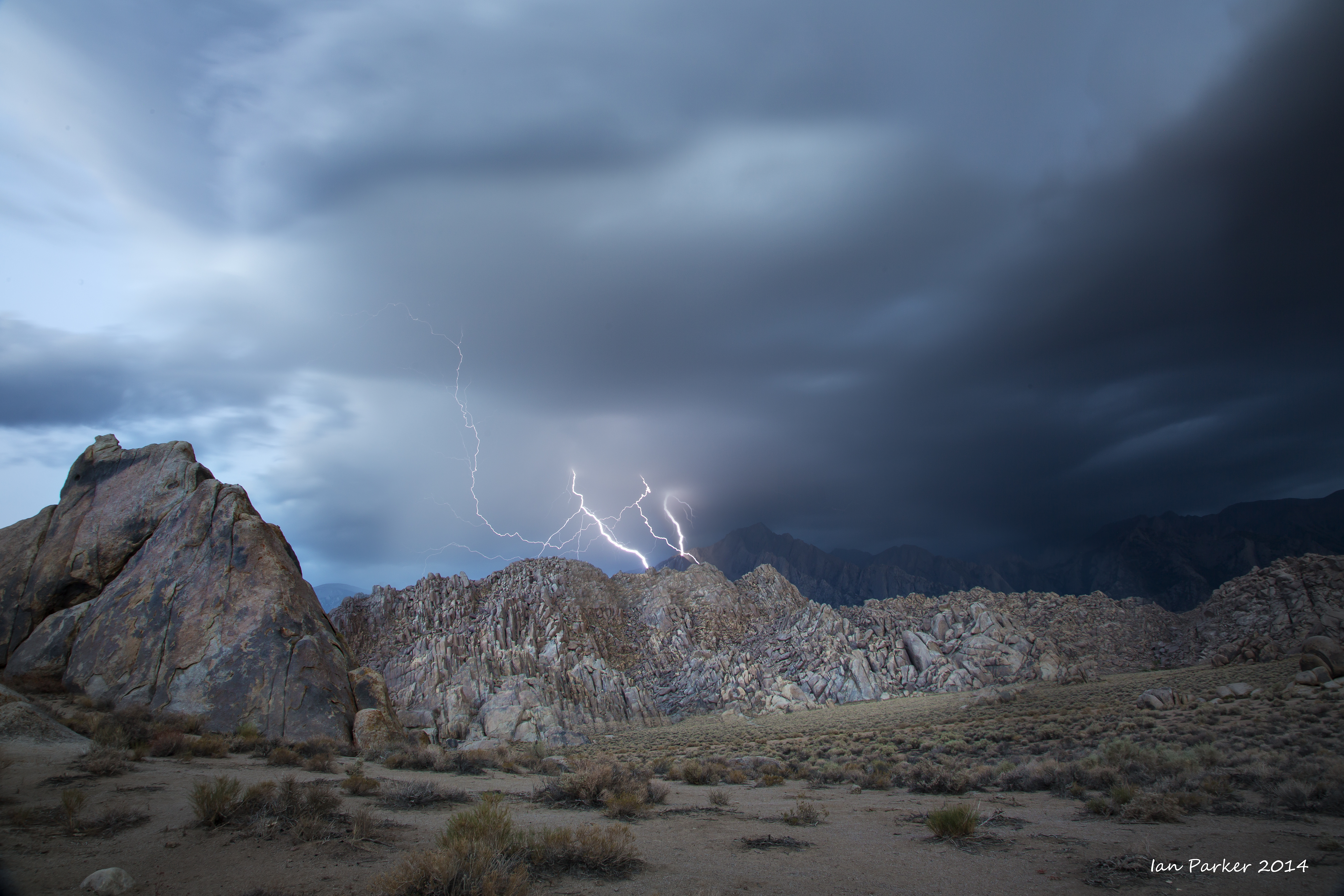
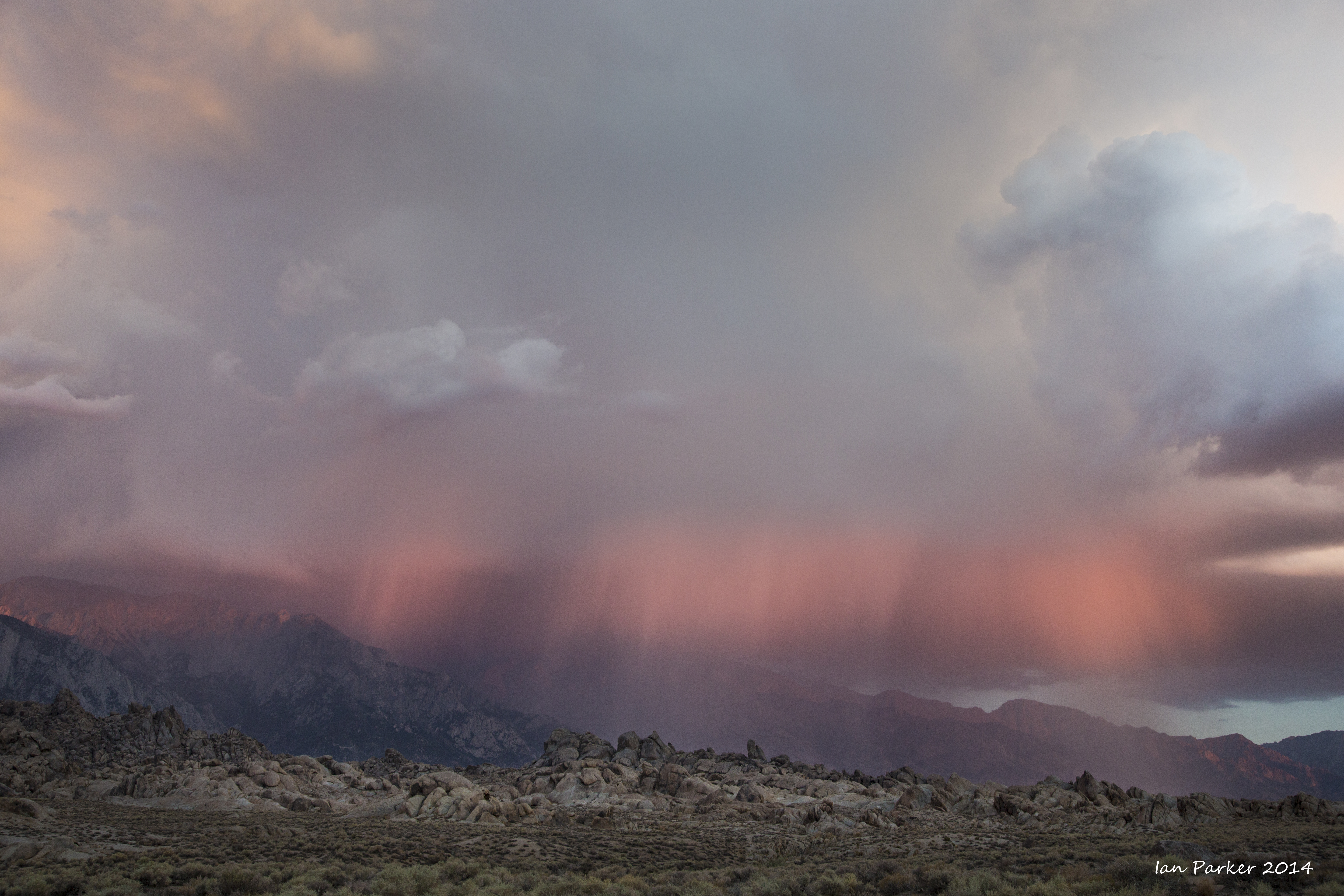
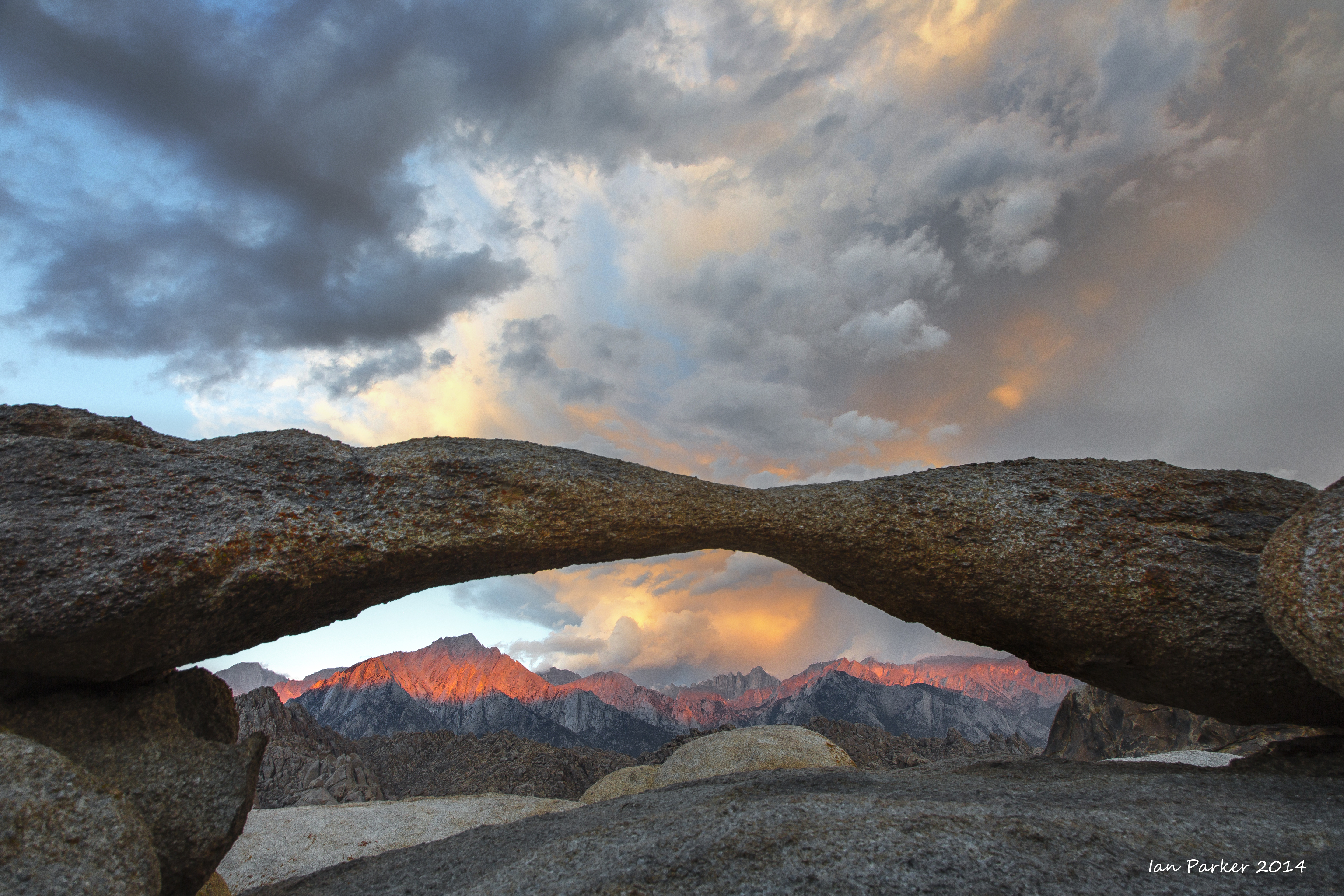
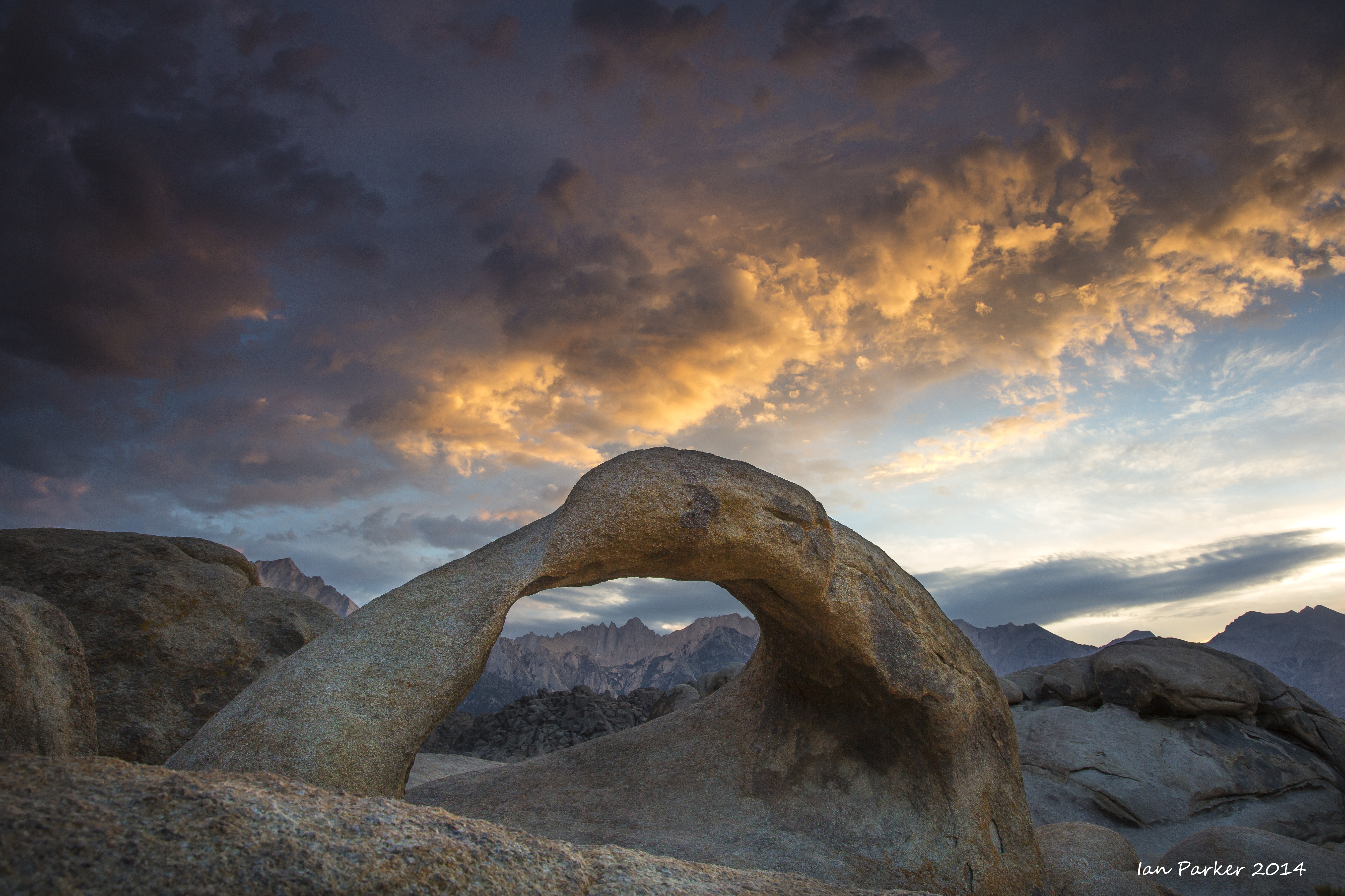
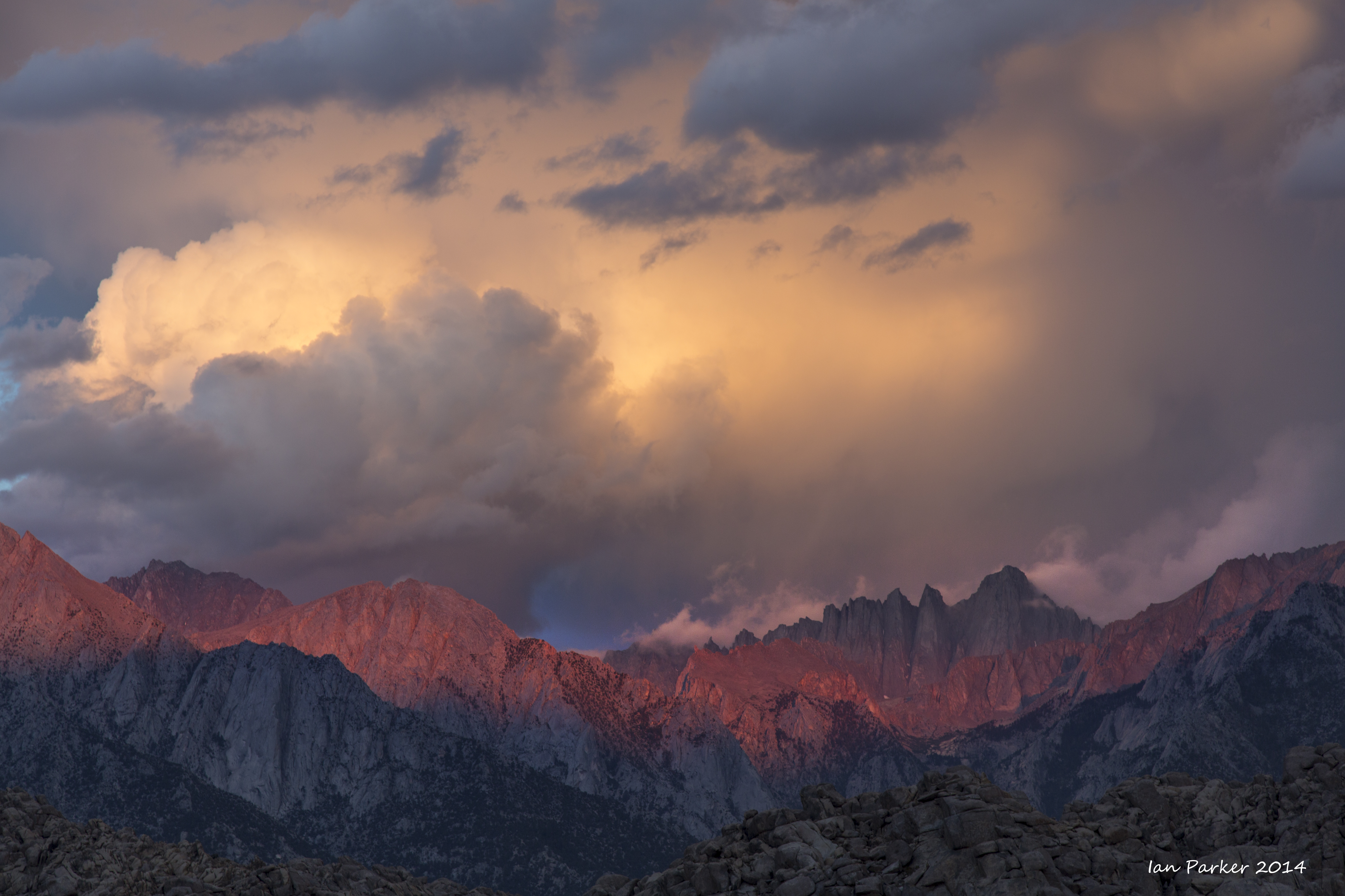
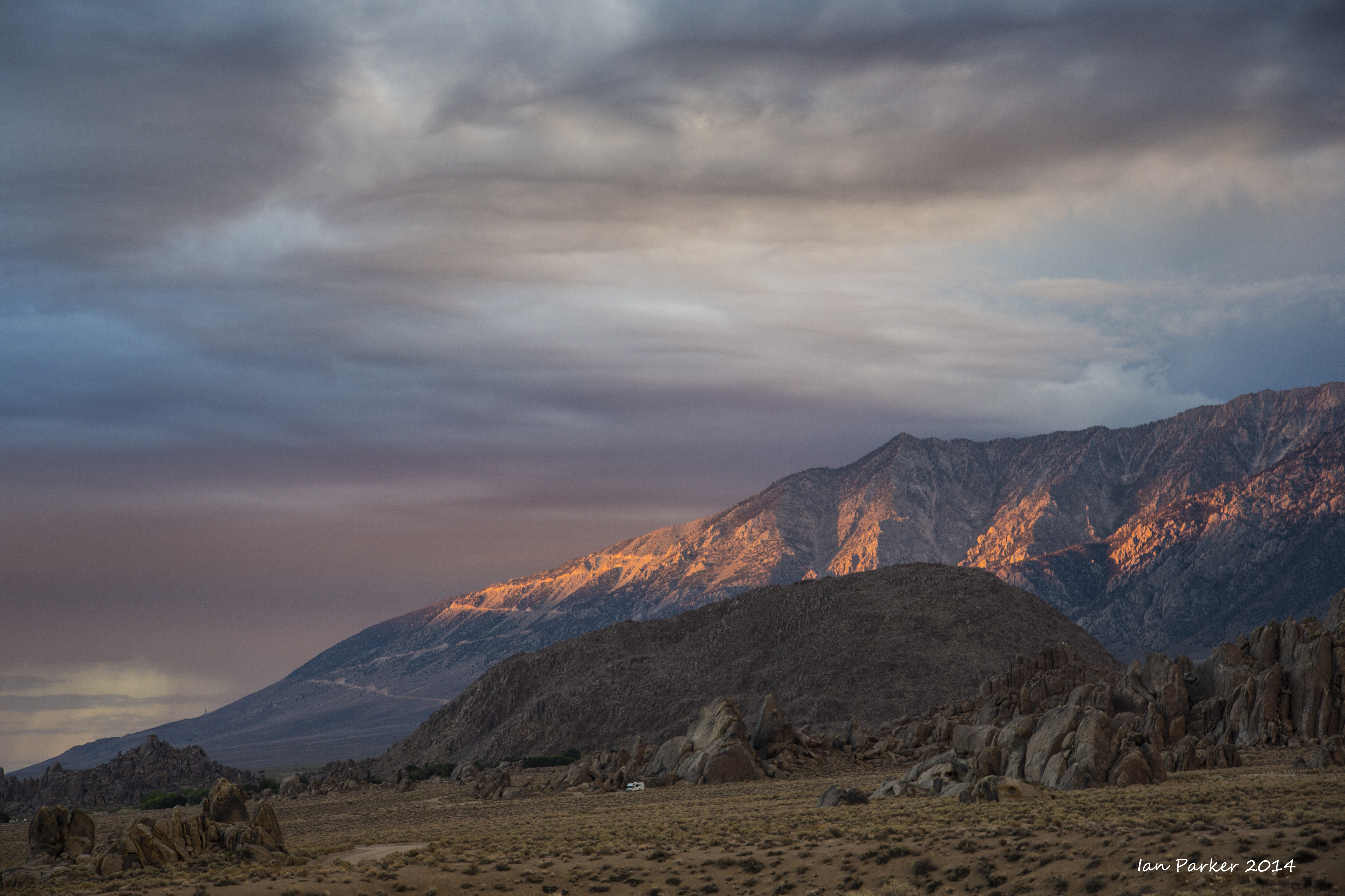
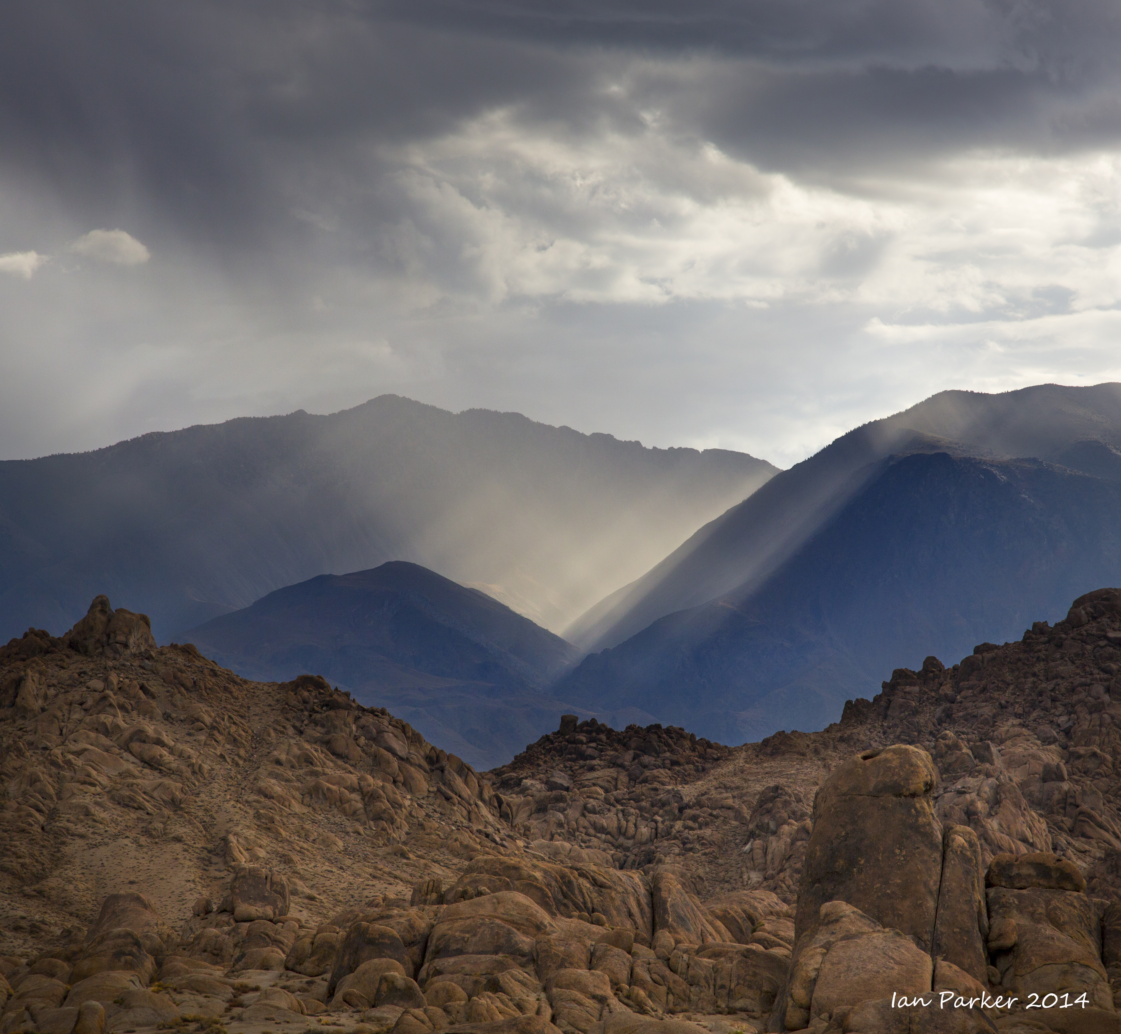
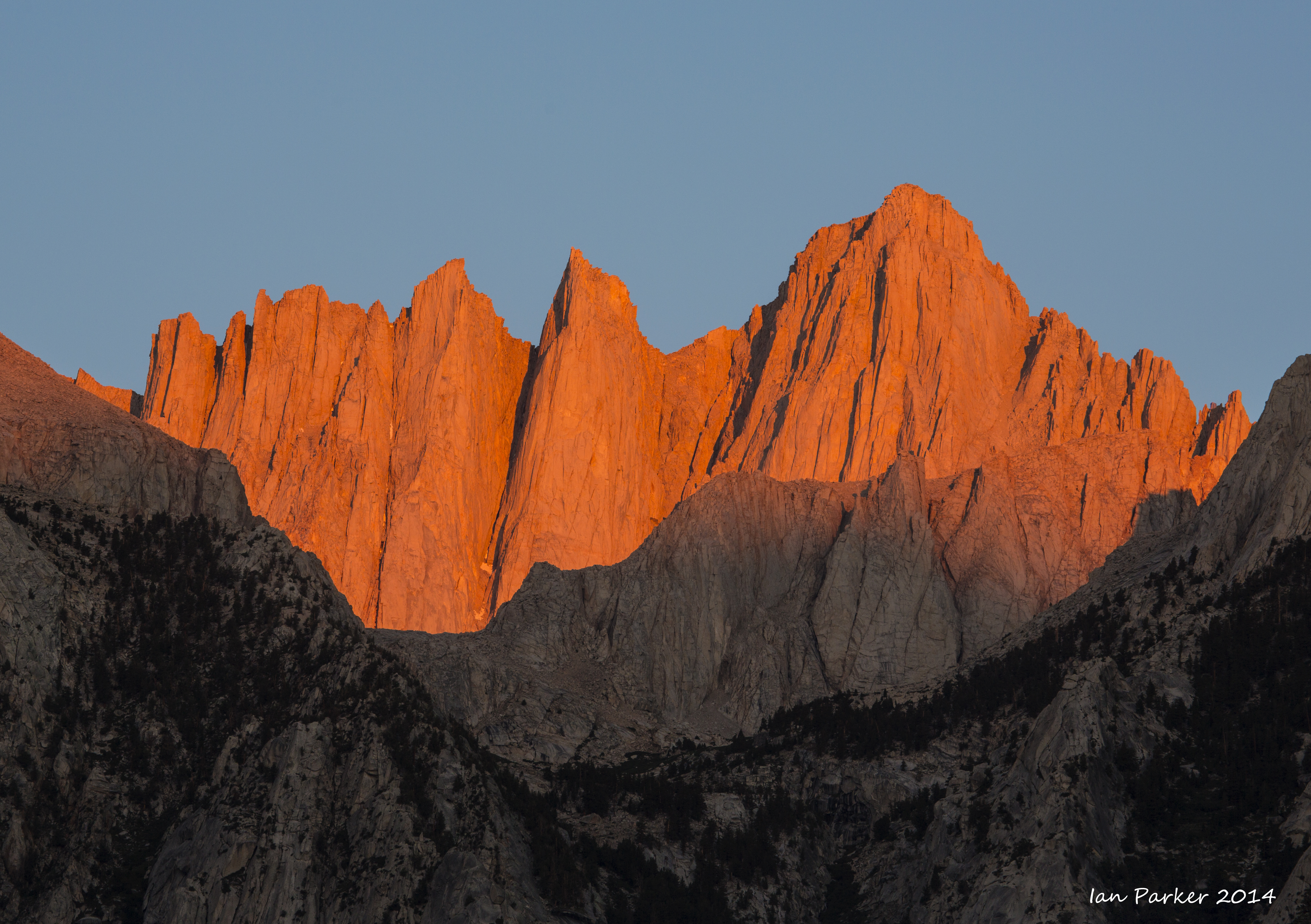
Dawn on the Sunday morning, before the runner check-in, brought thunderstorms over the Sierras and some beautiful light above the Alabama Hills. As a photographer I hoped these conditions would continue throughout the race, but likely to the relief of the runners the storm dissipated by mid-morning and the skies remained largely clear for the following days. 


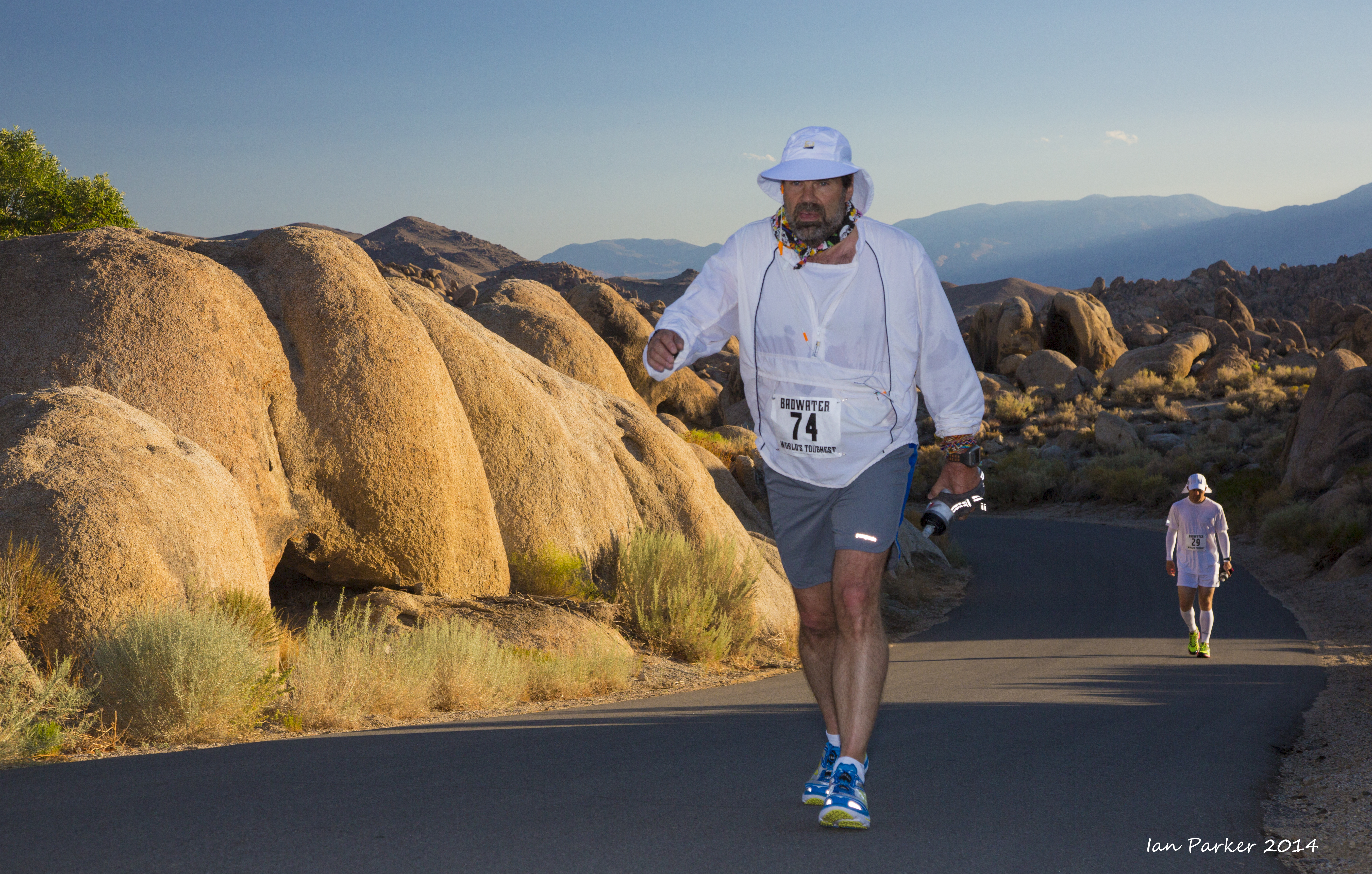
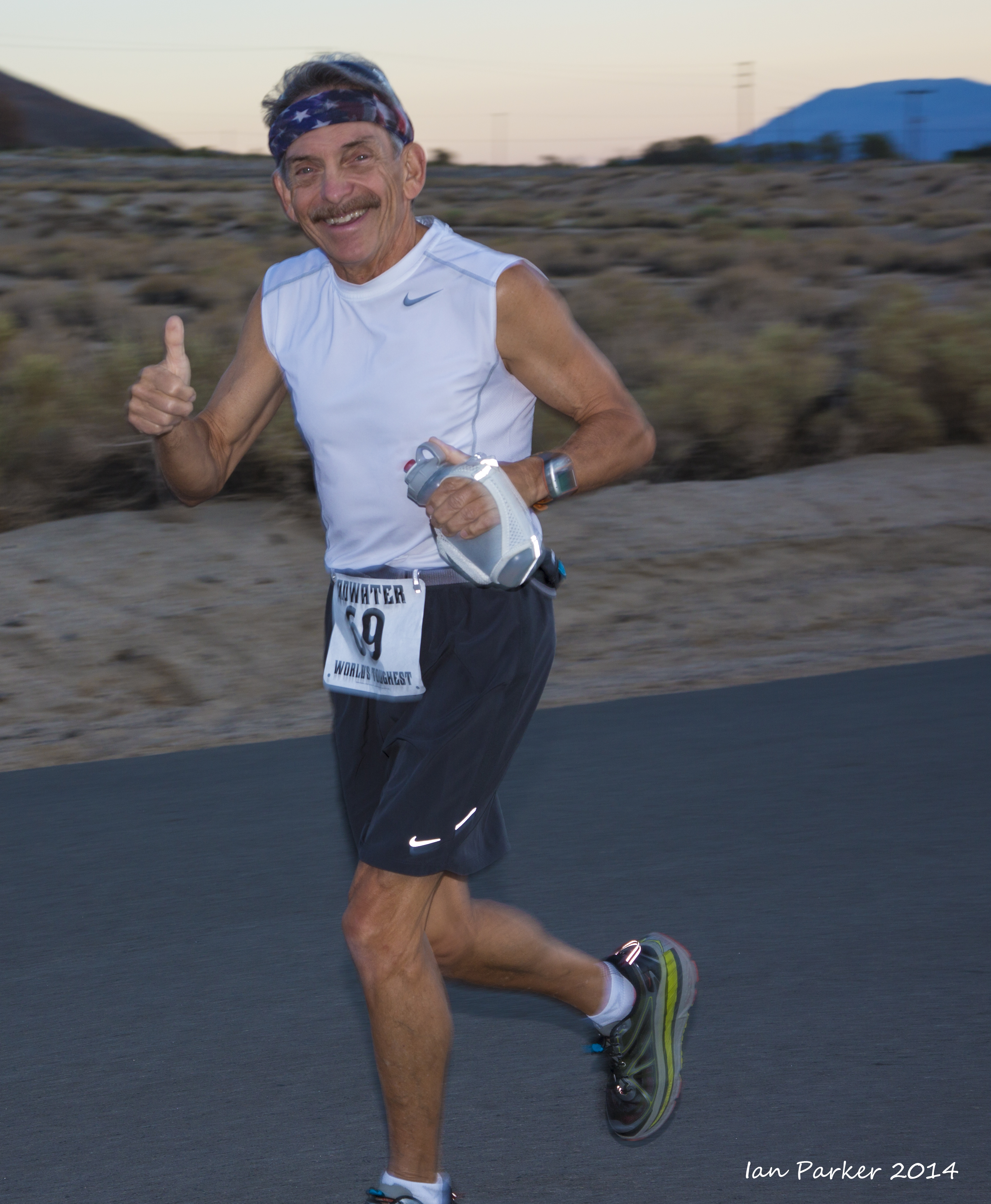
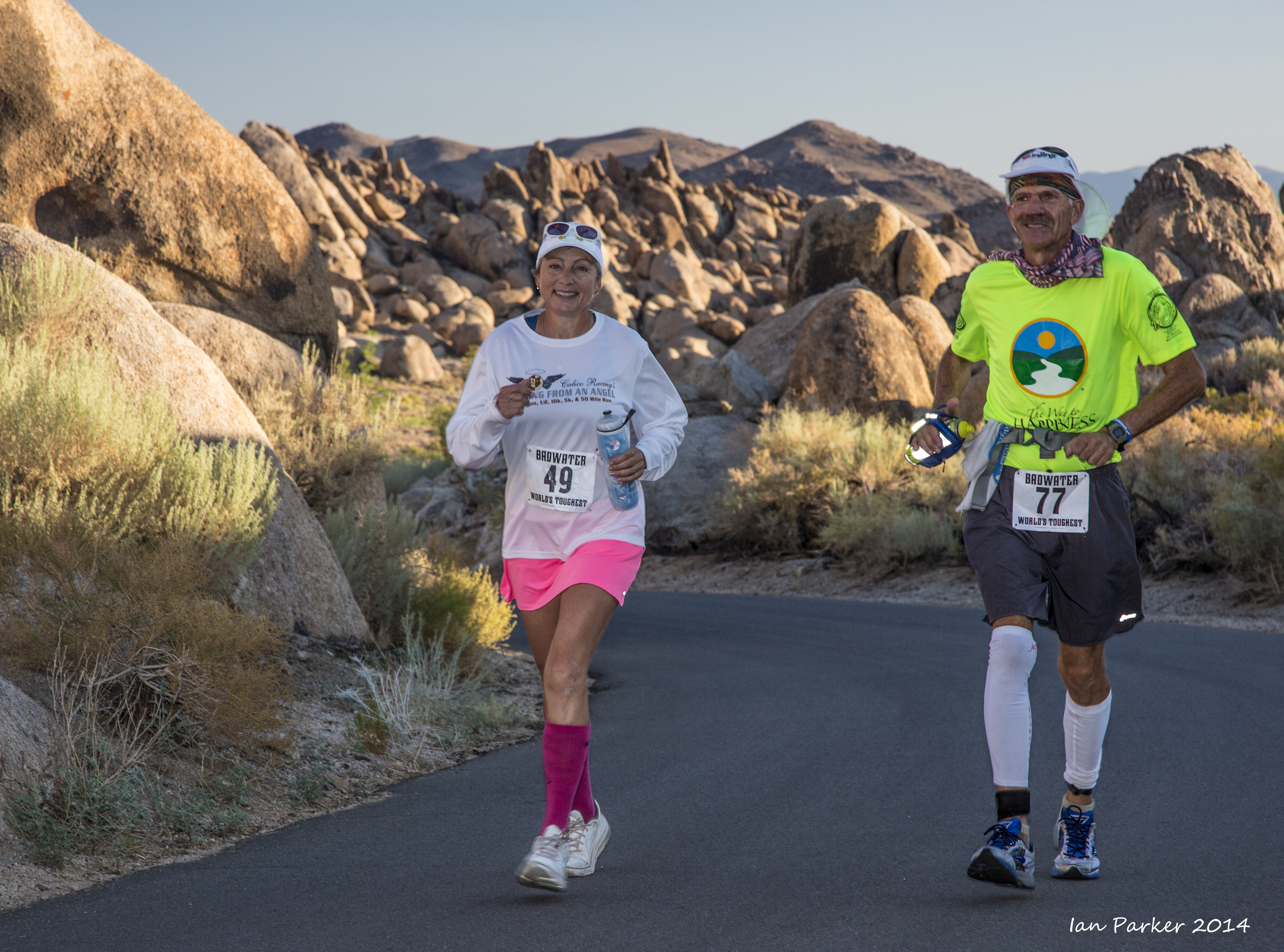
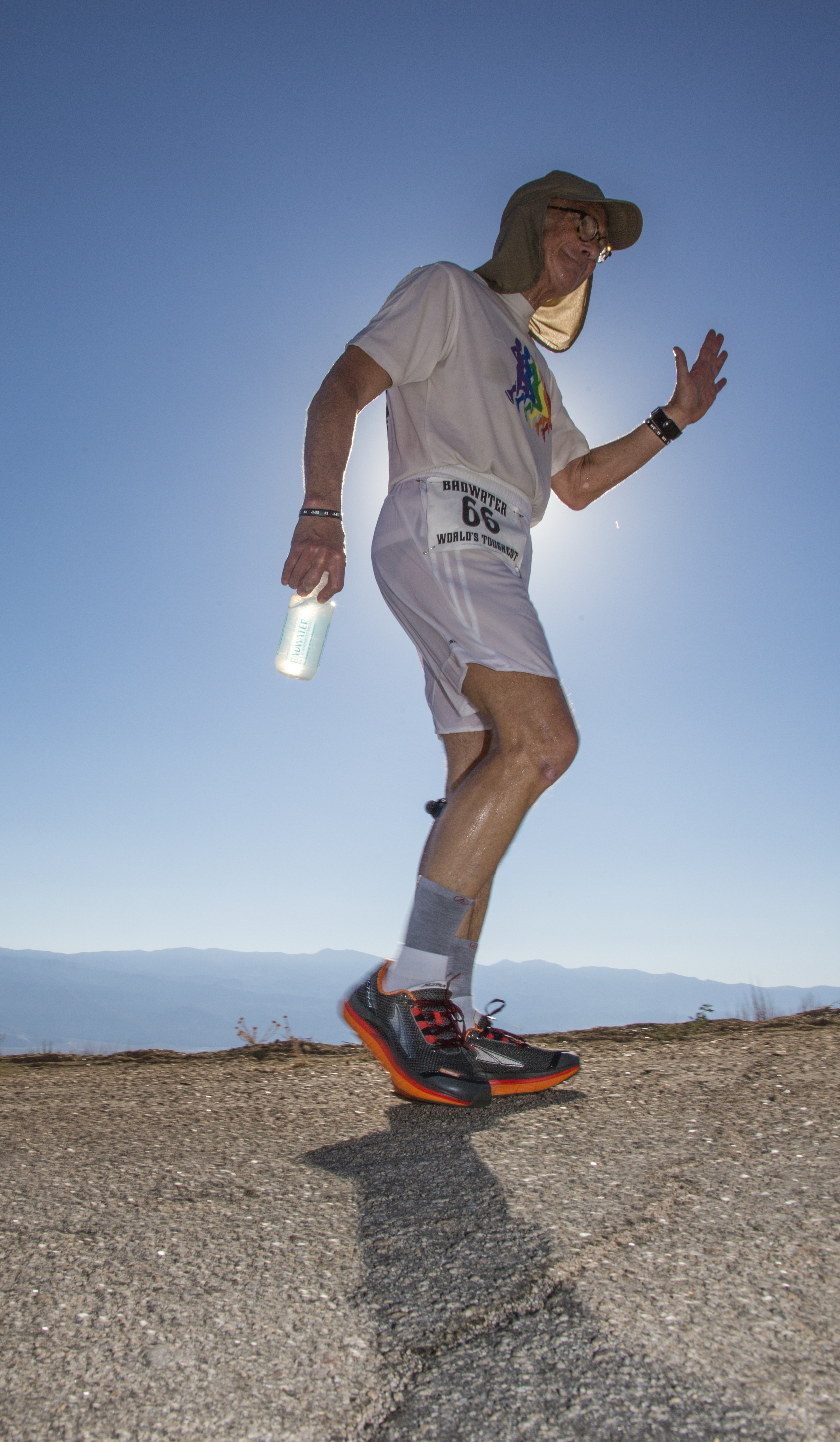
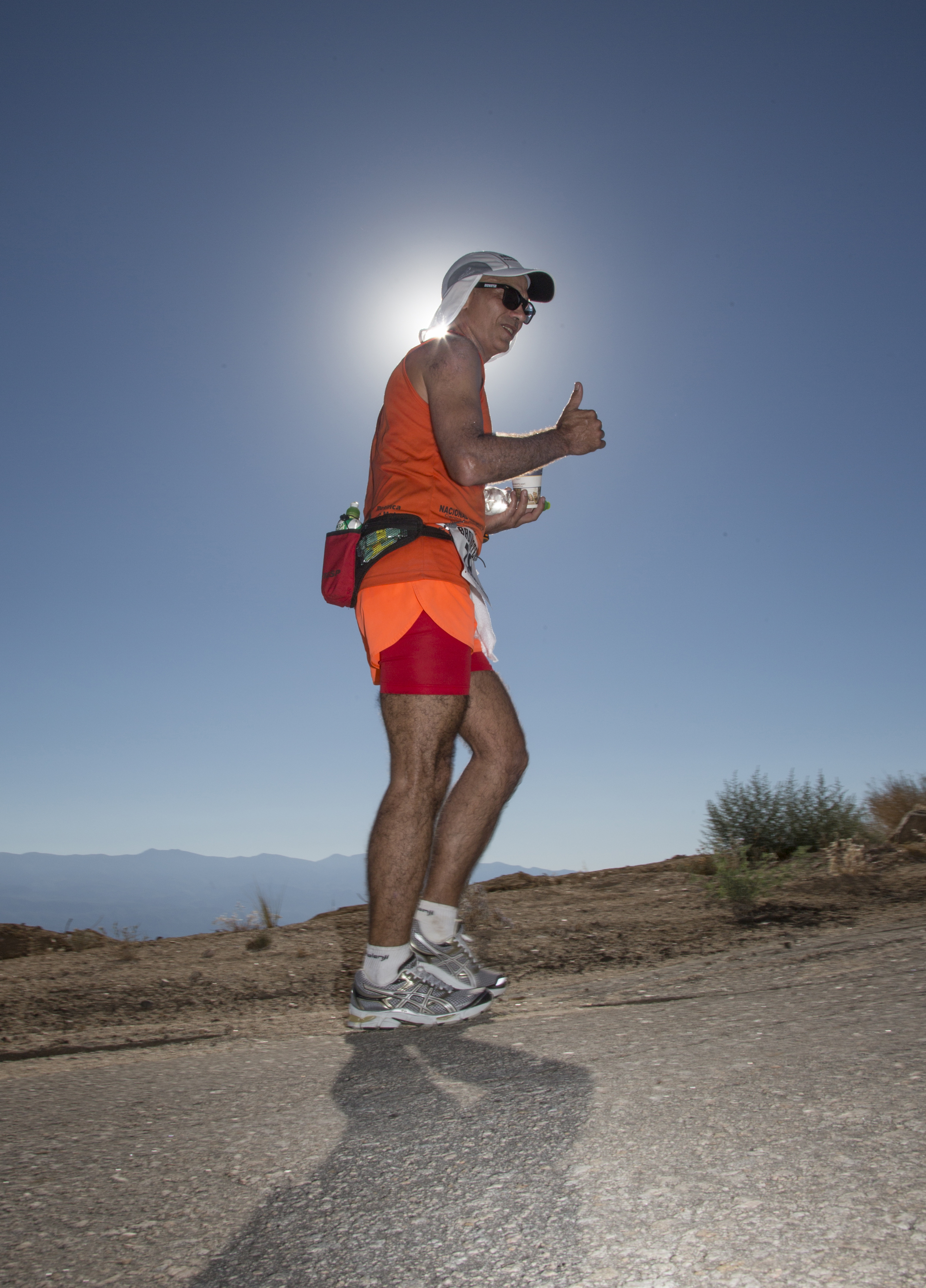
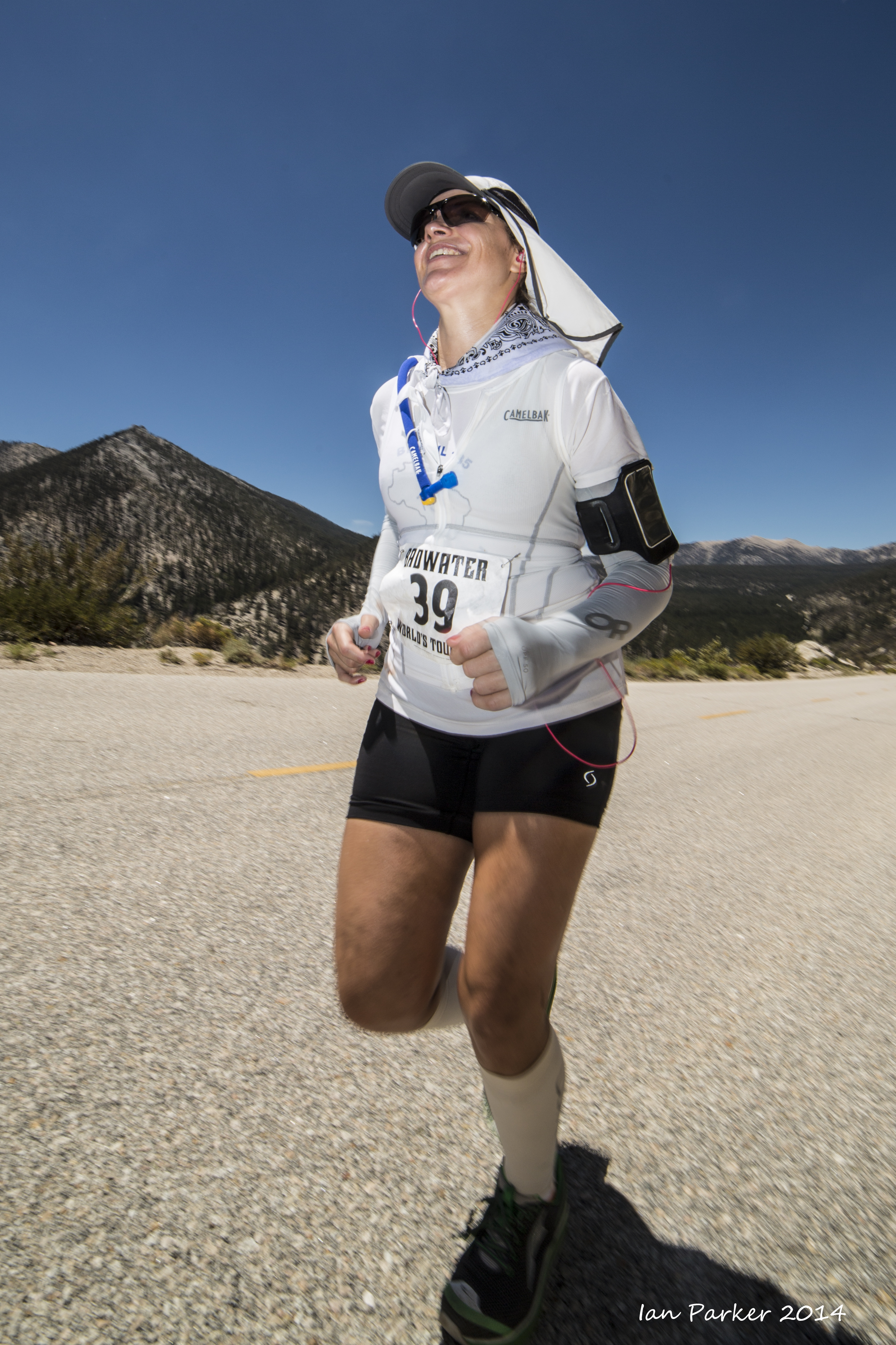
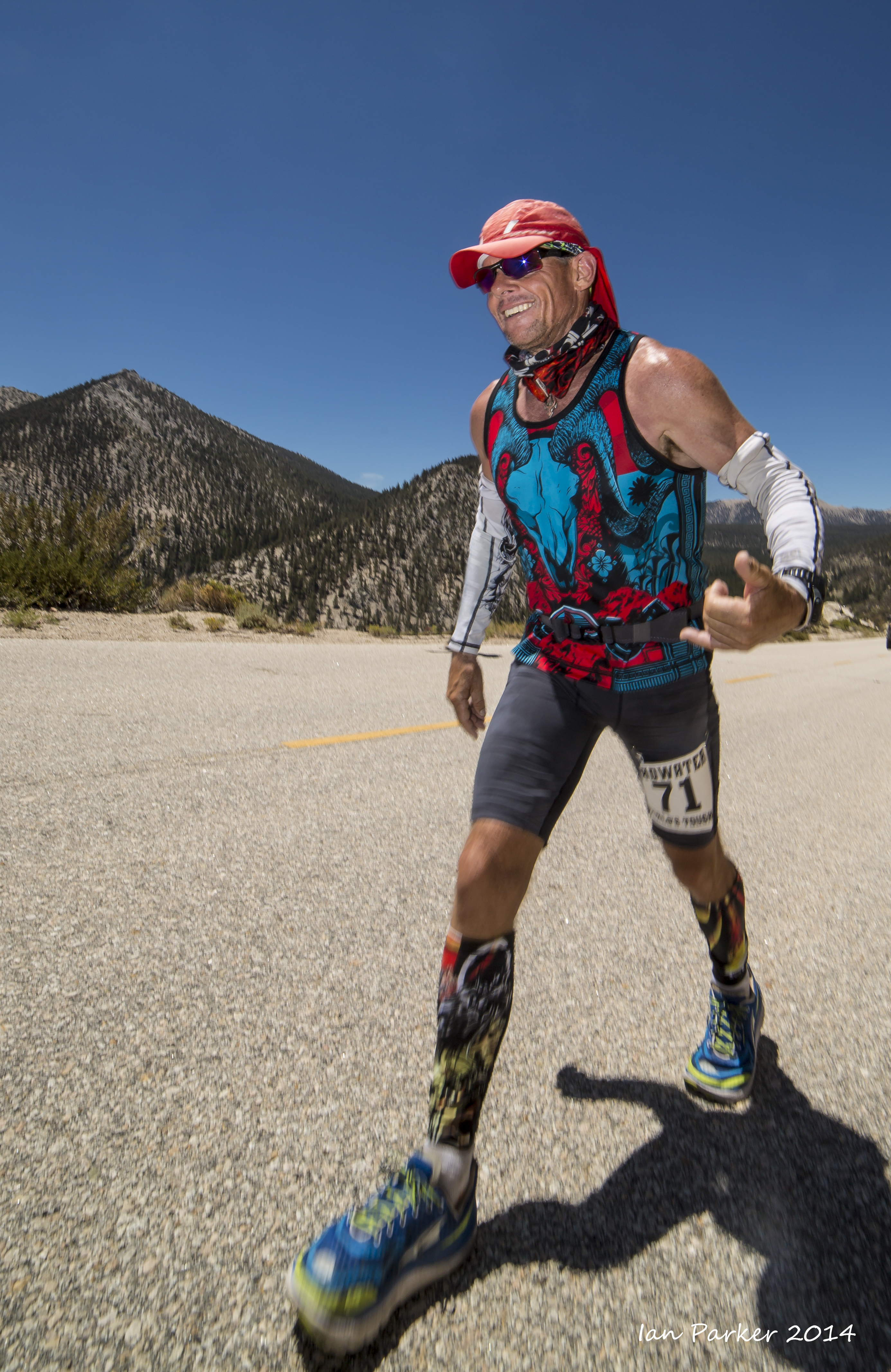
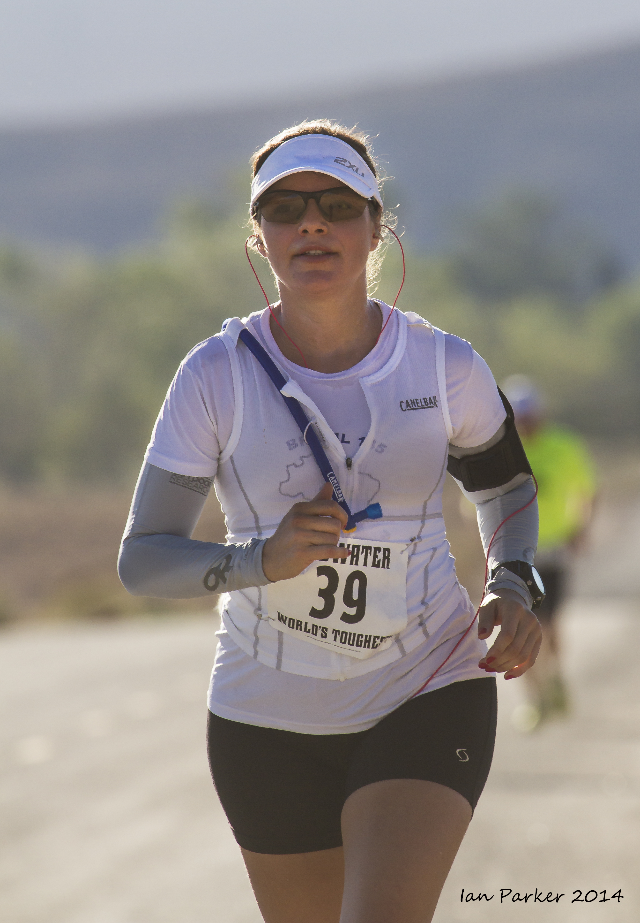
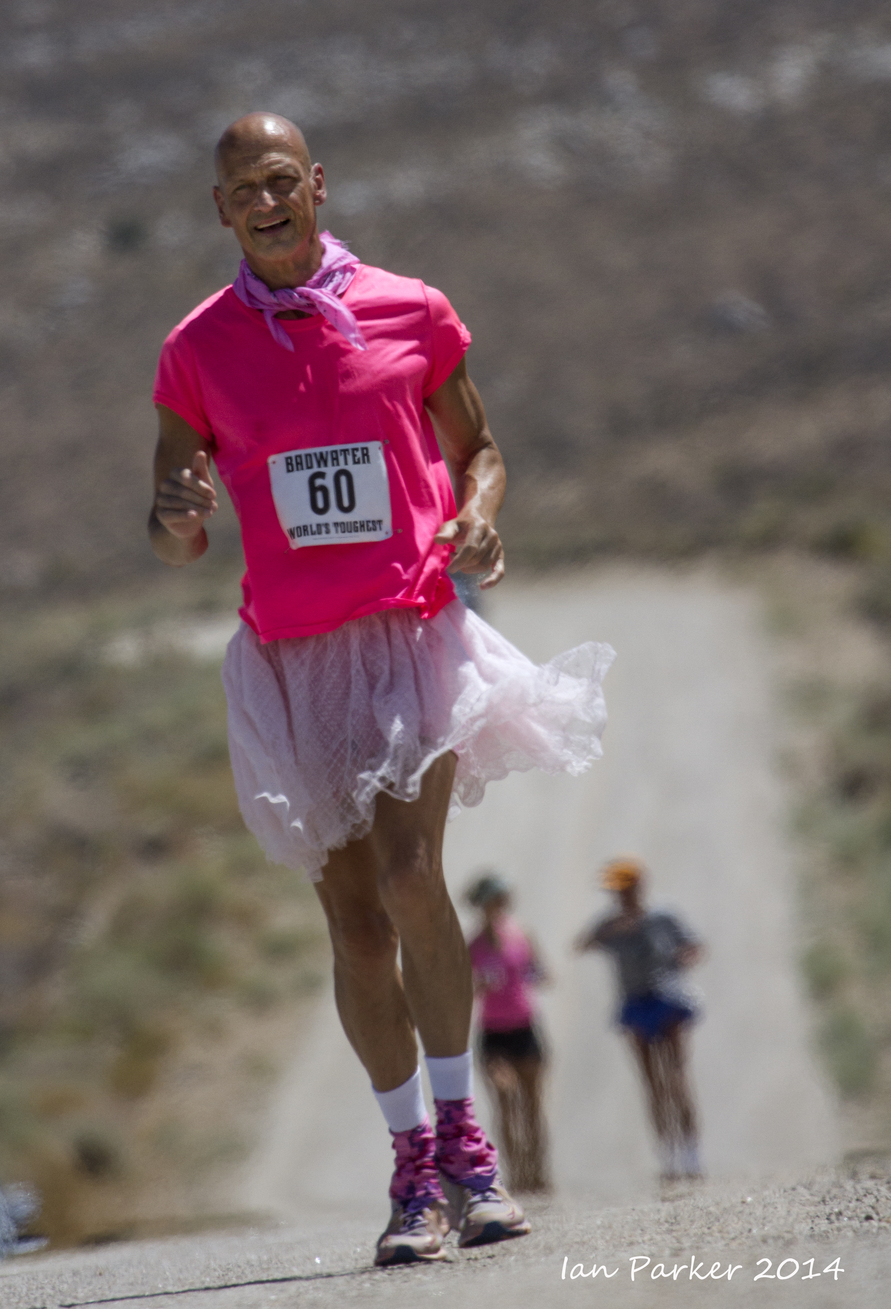
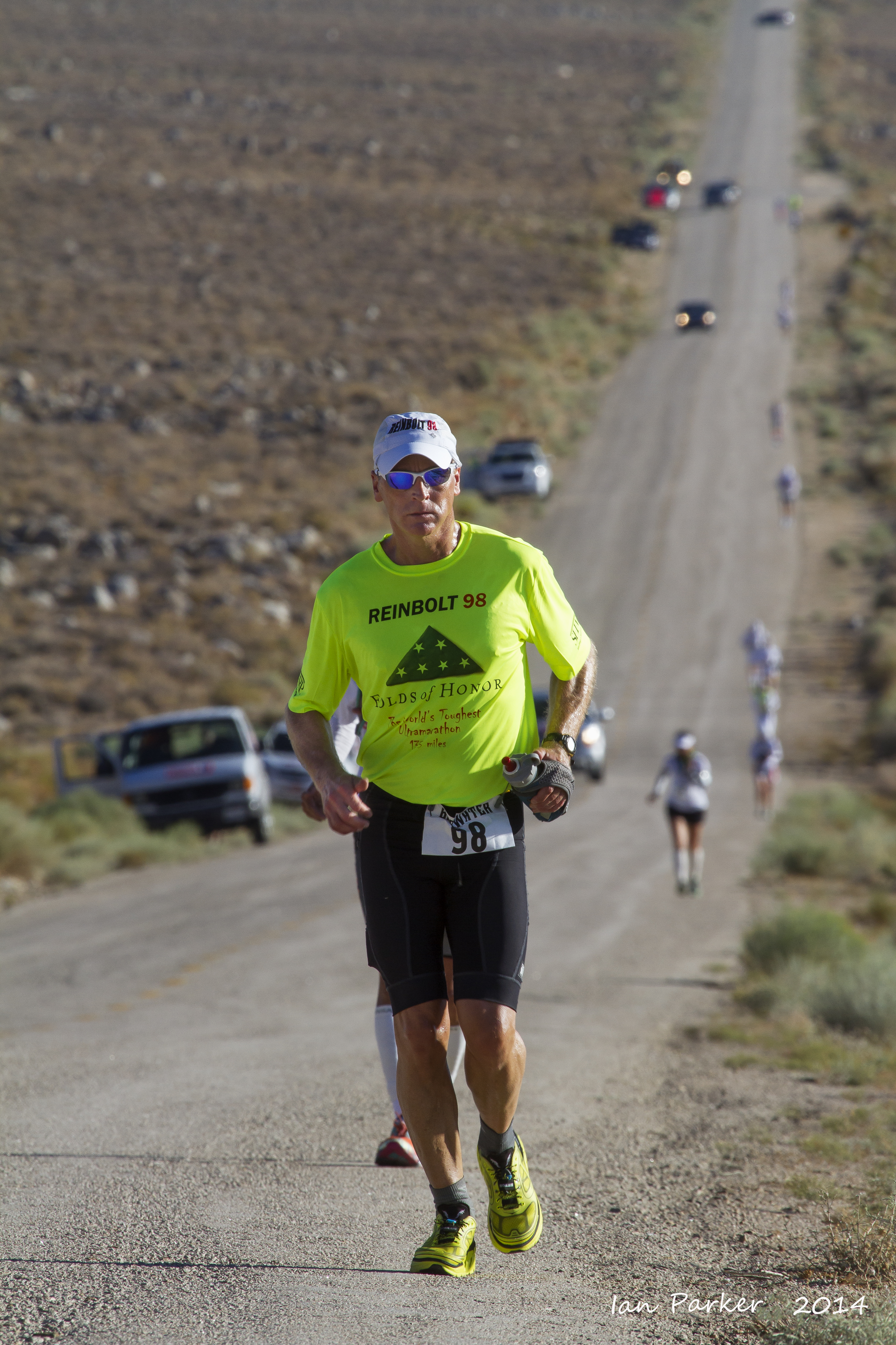
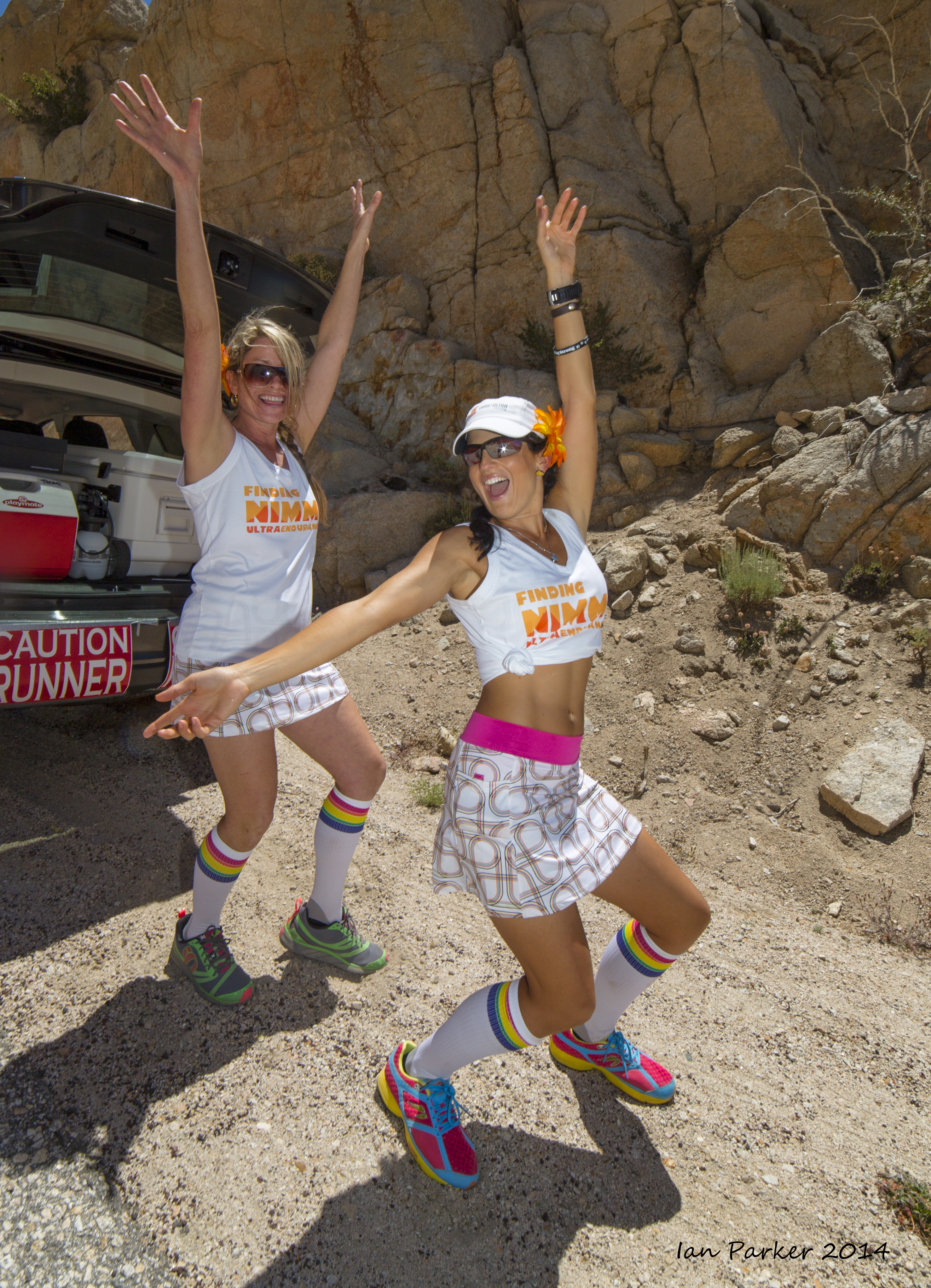
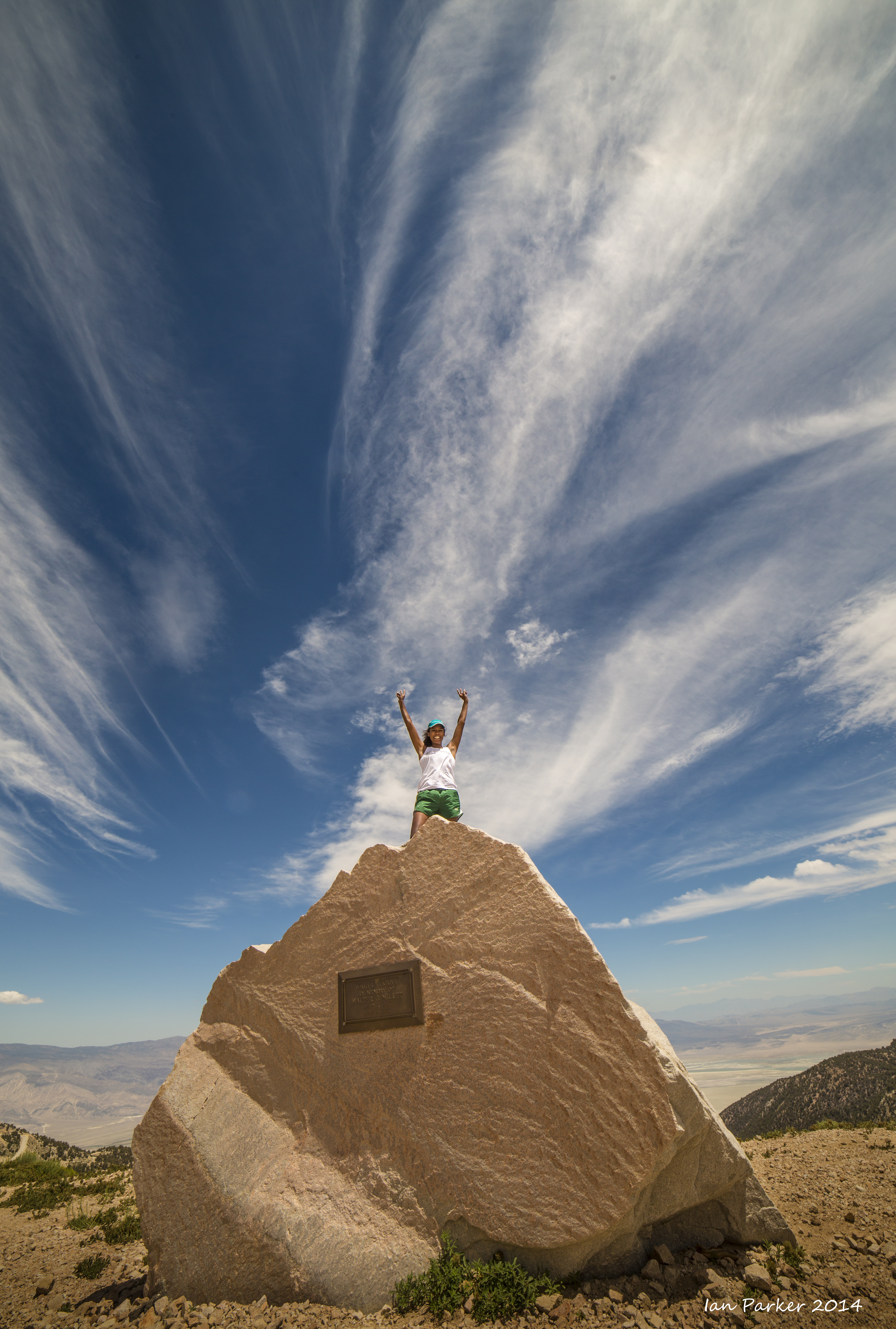
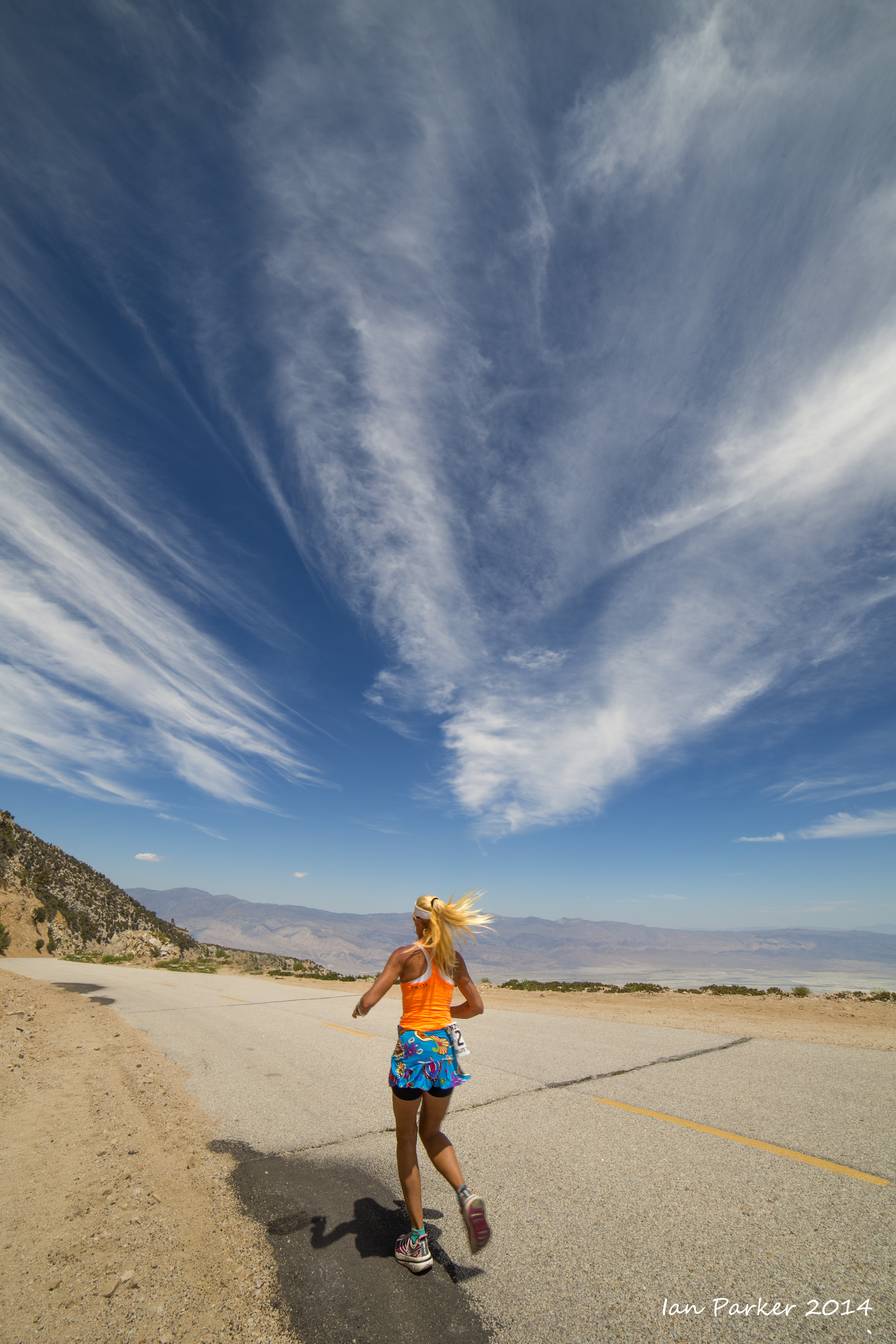
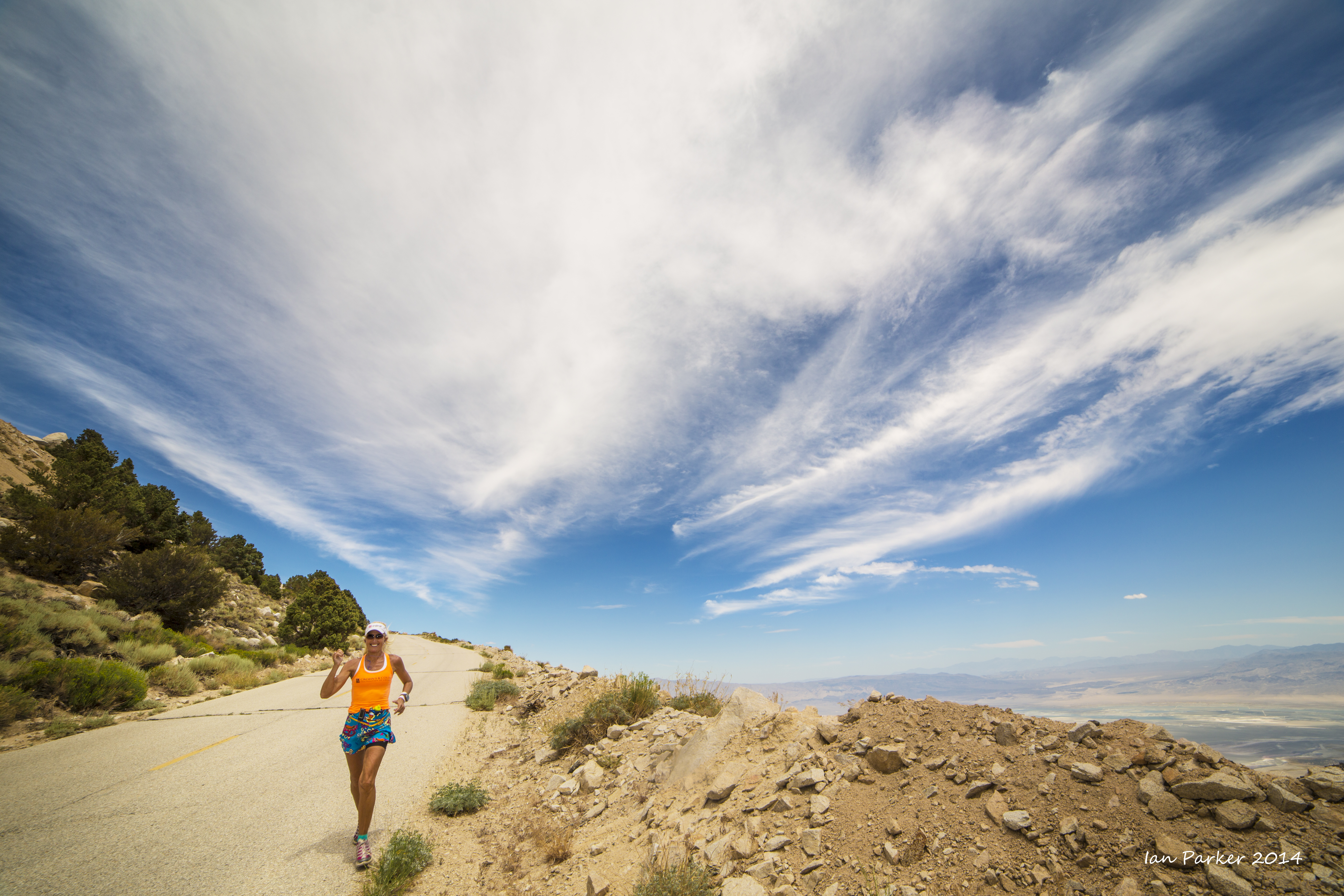
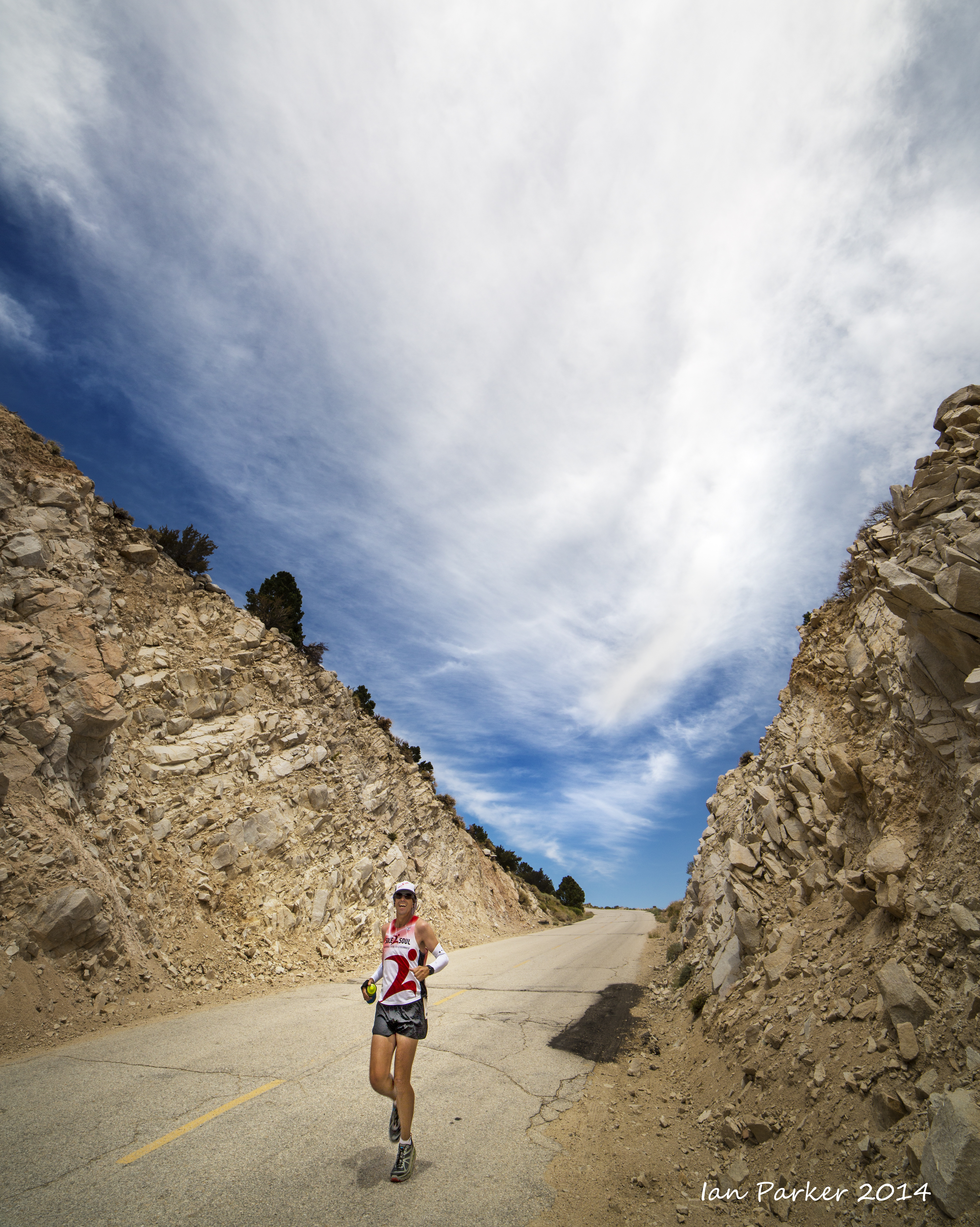
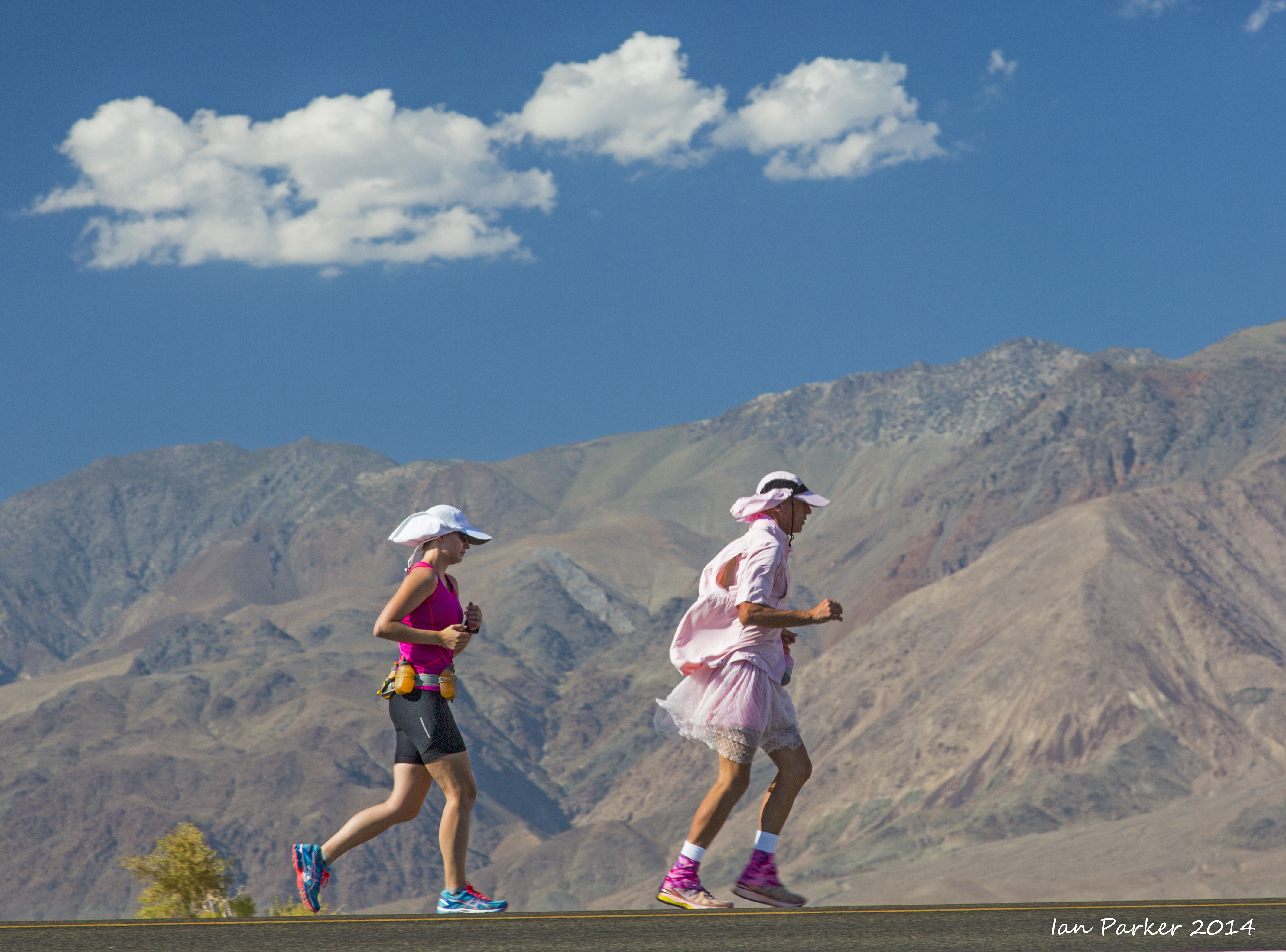
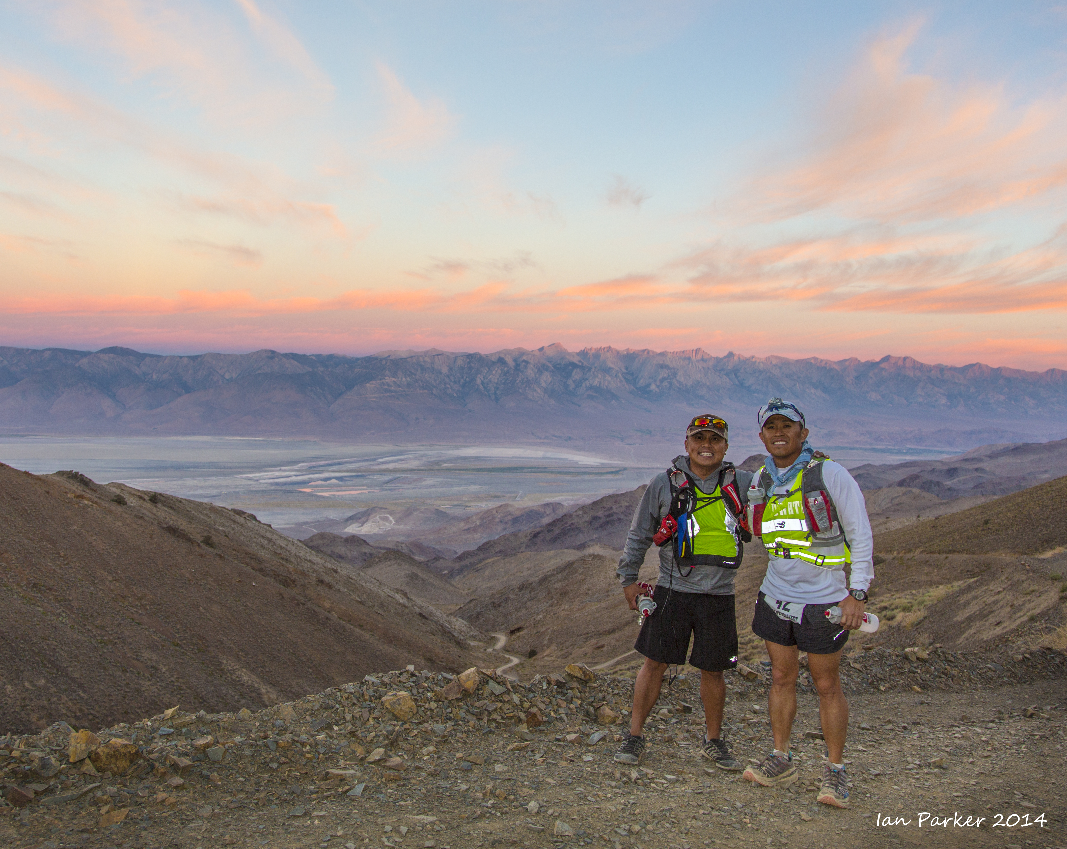
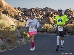
Portraits of runners and support crews during the ascent to Horseshoe Meadows


Karla Kent and John Radich

Wide-angle shots

and telephotos

Phil Nimmo was supported by the most energetic and extrovert crew...


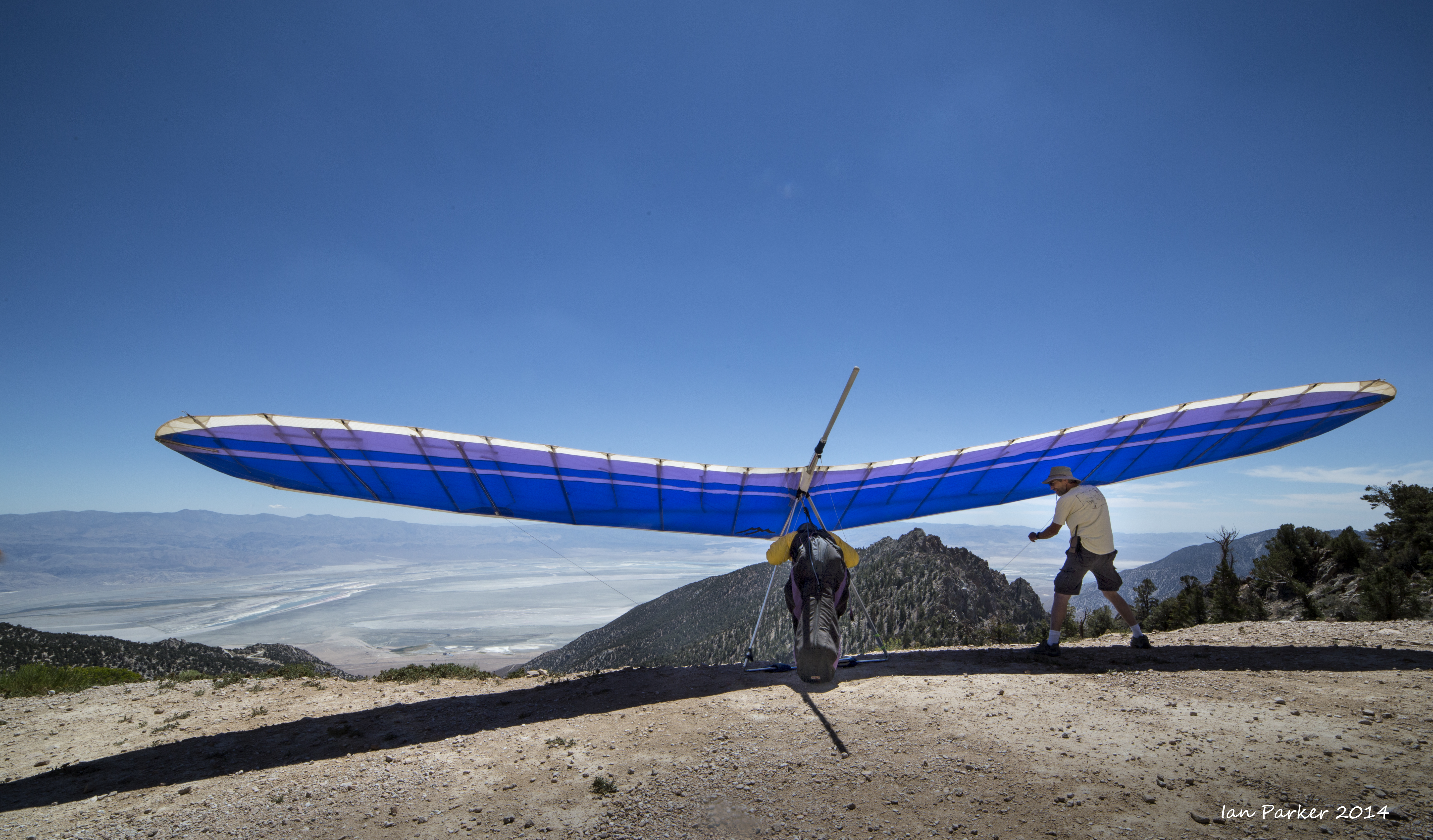
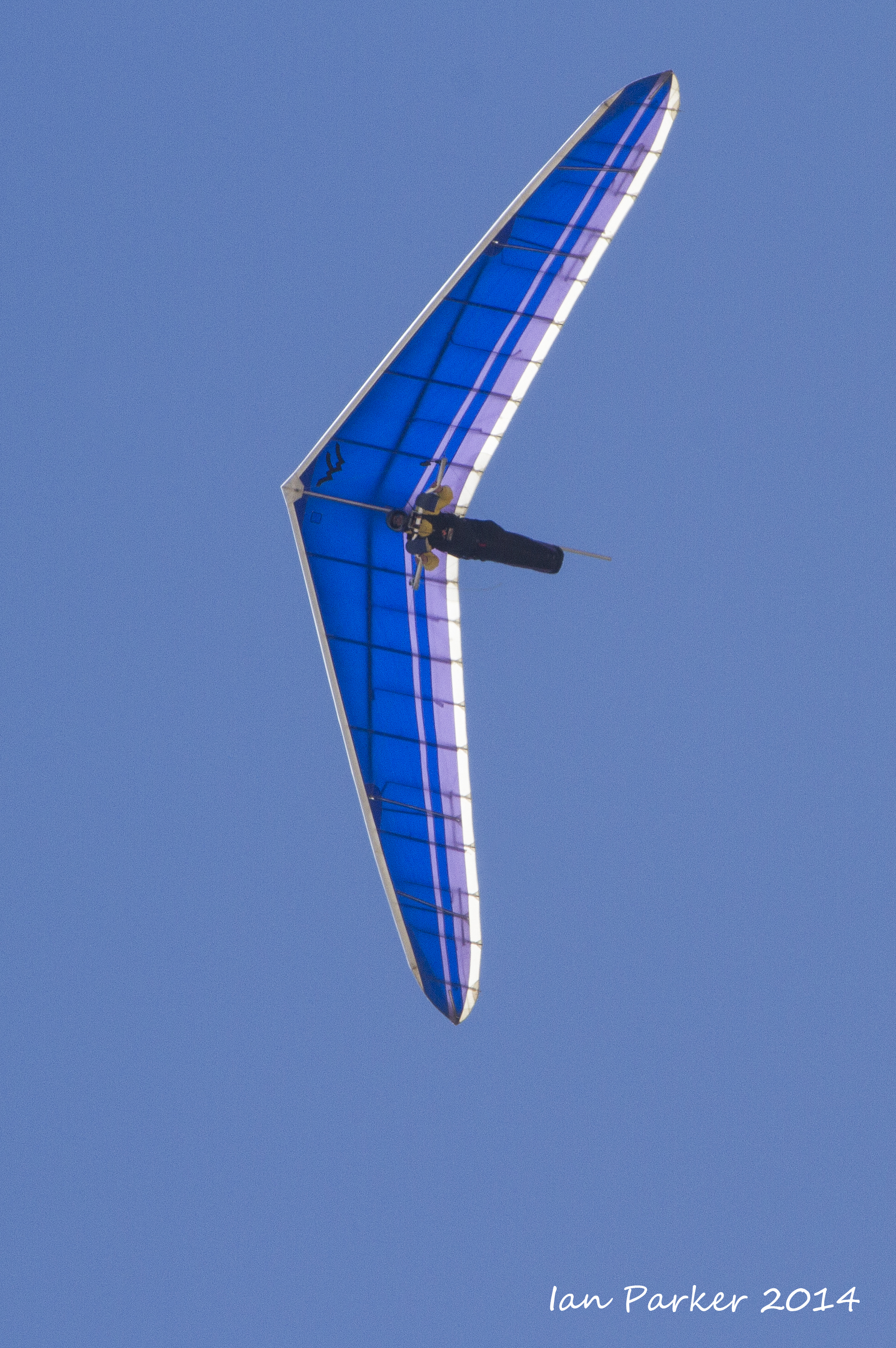
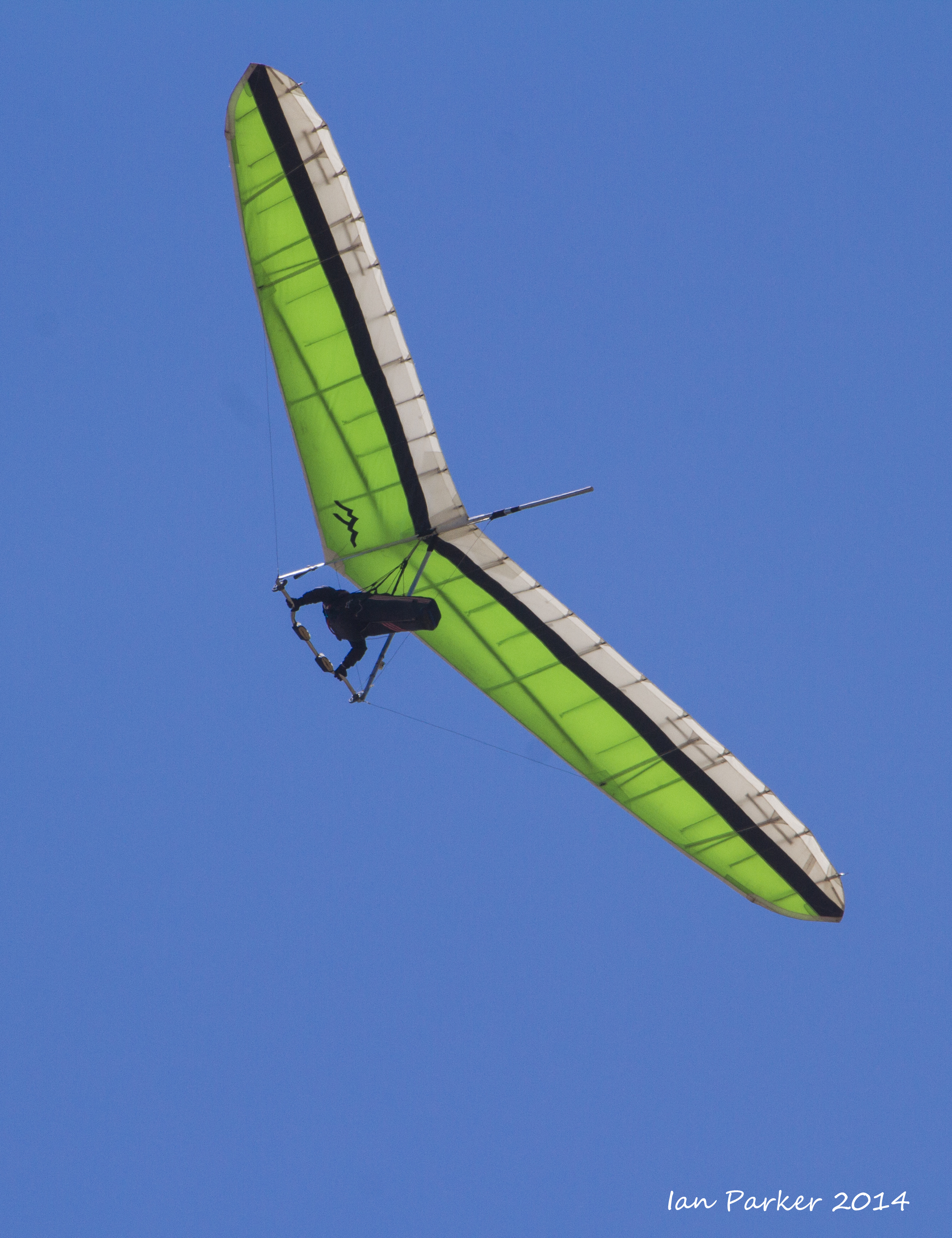
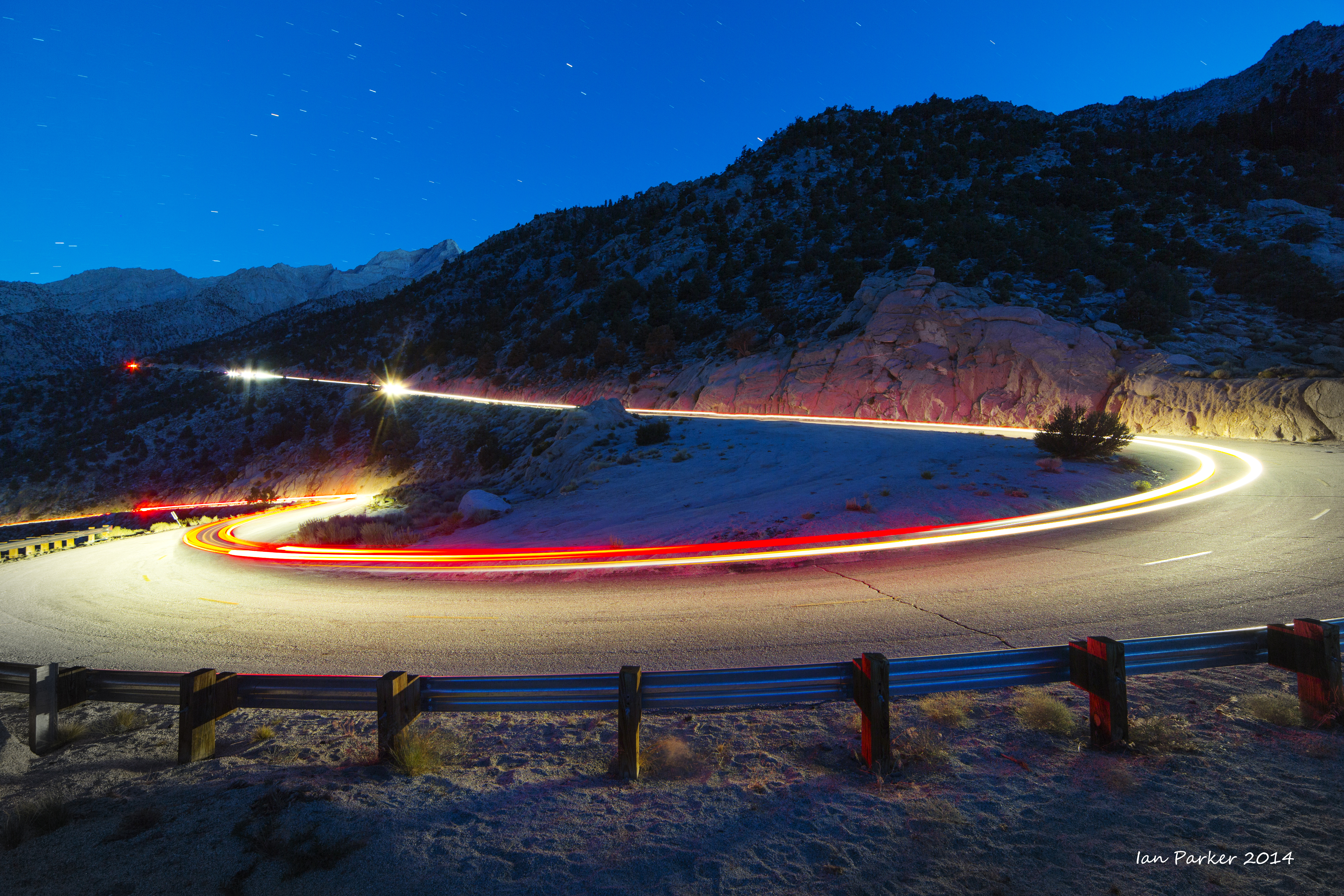
Walt's Point at about 9,000ft elevation up the Horseshoe Meadows road is a 'mega-classic jump off point' for epic cross-country hanglider and para-glider flights. Several hang-gliders were lined up and took off as the runners passed by.


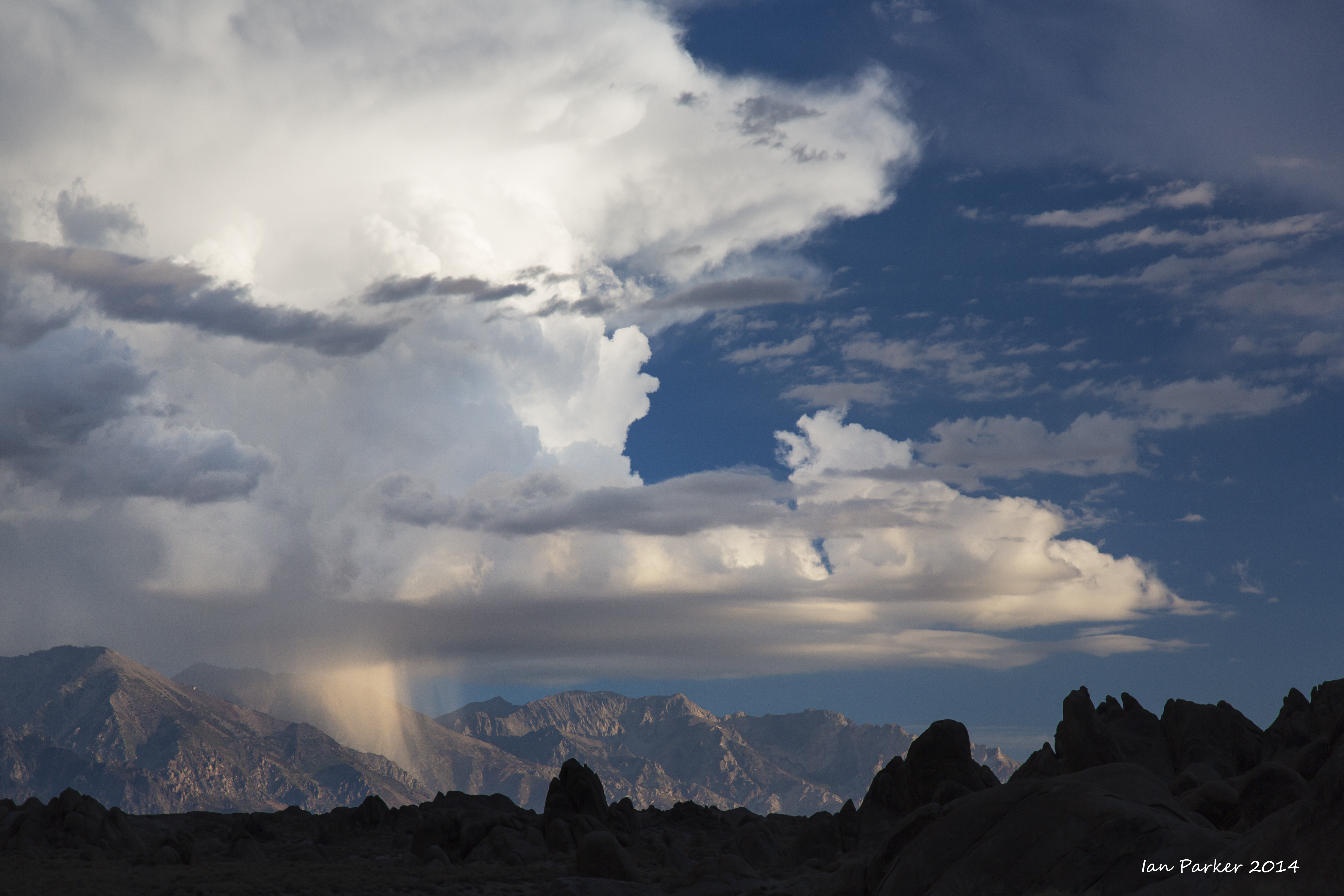
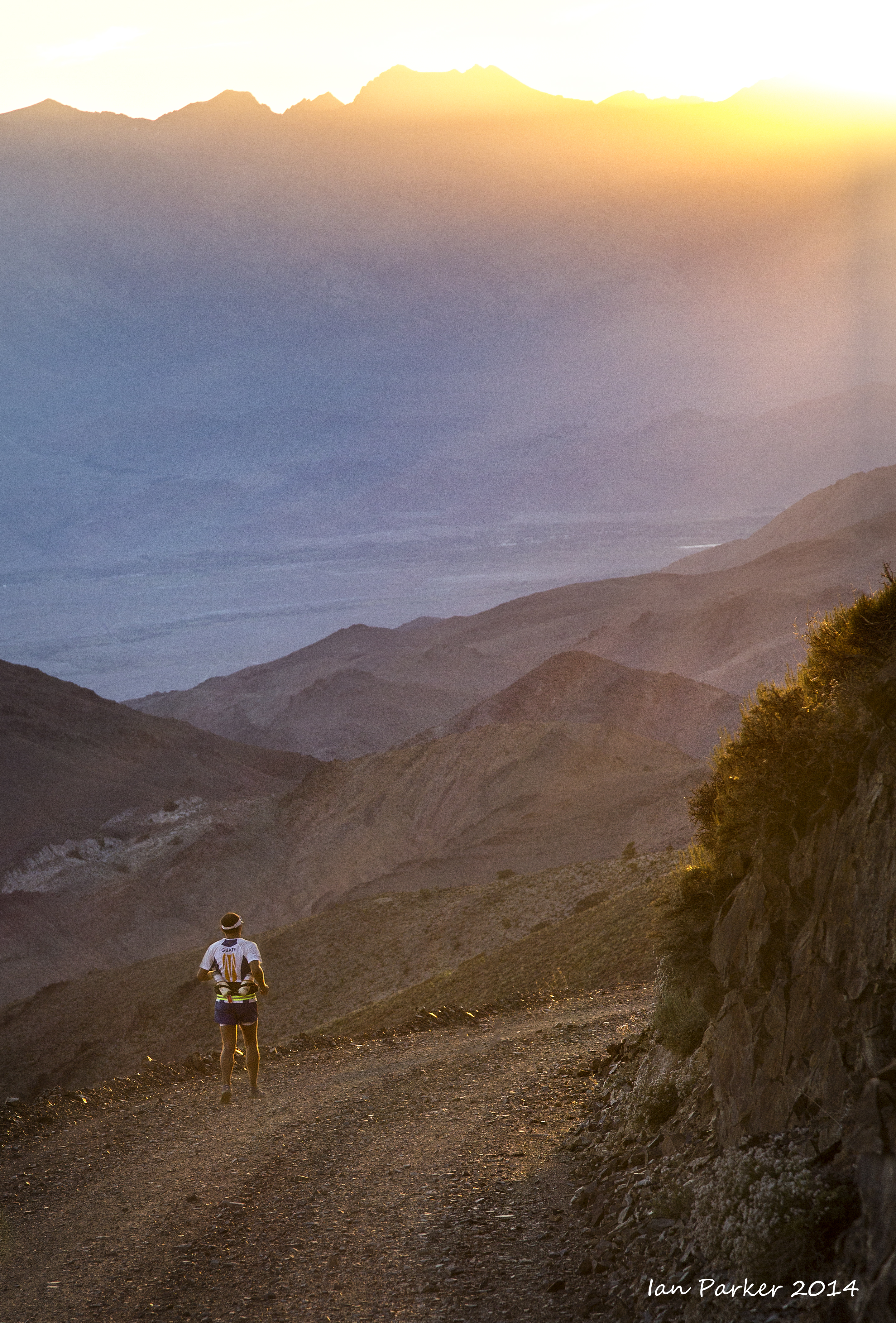
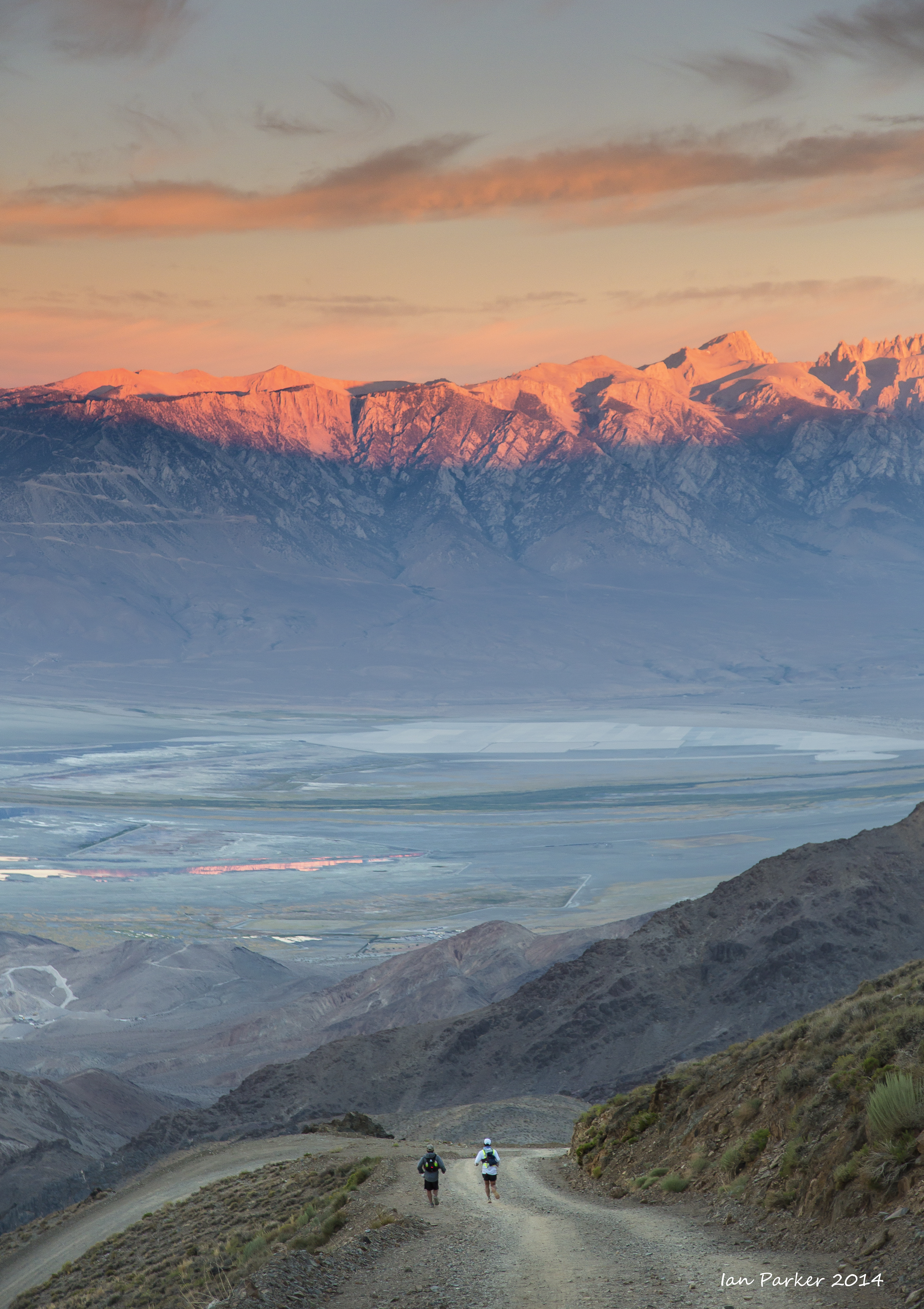
Some nice clouds developed as the runners were descending back down to Lone Pine

After the 
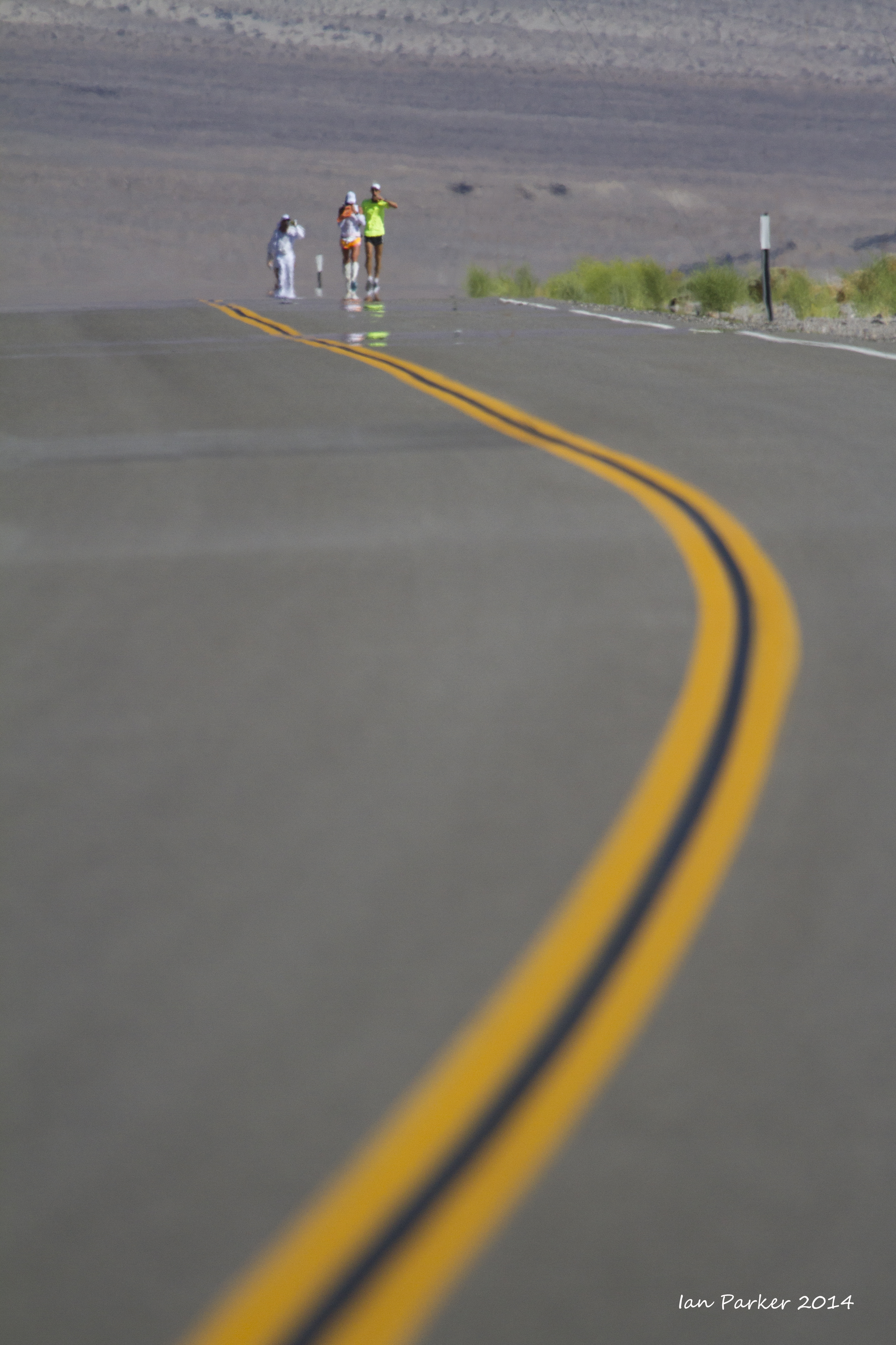
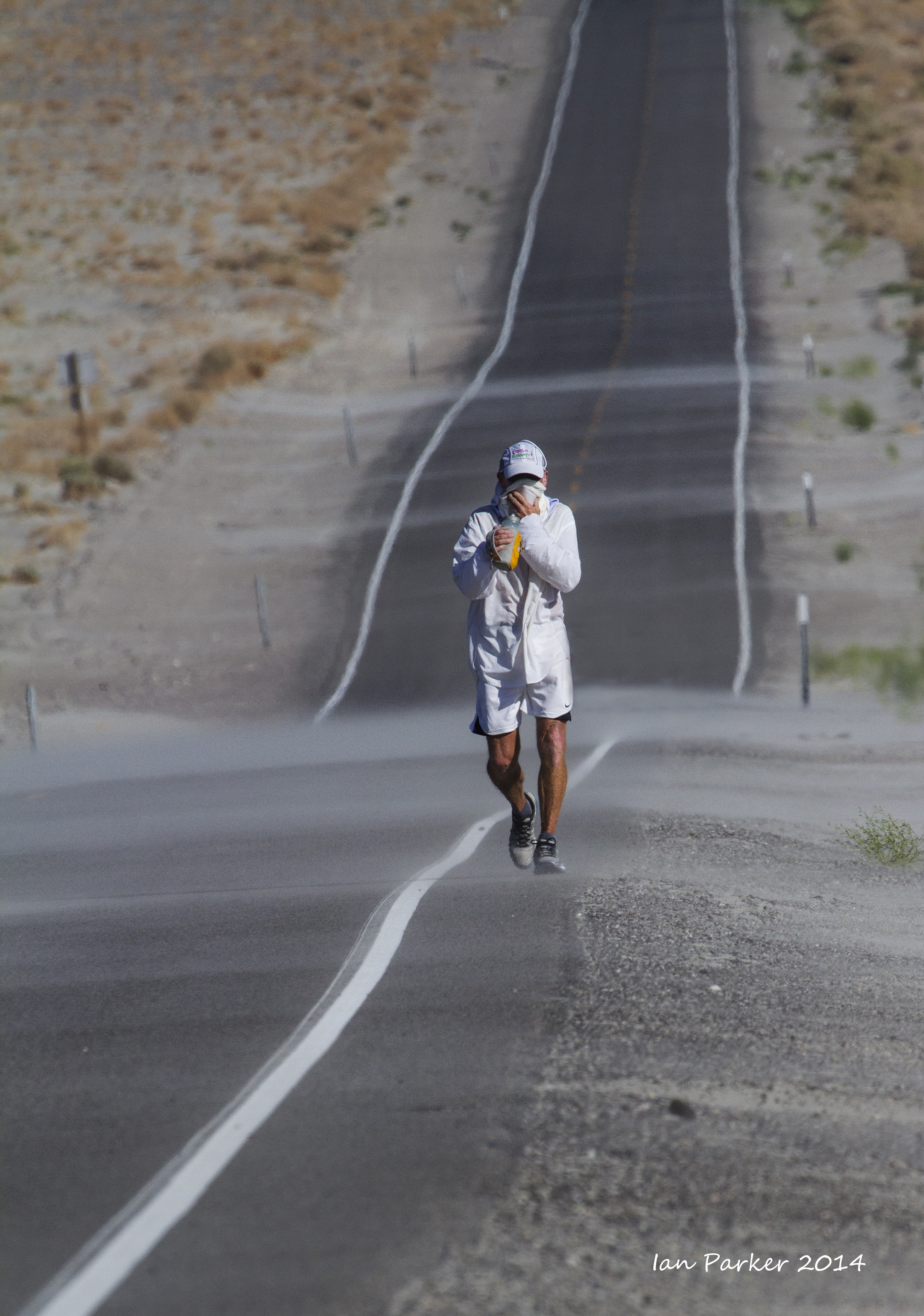
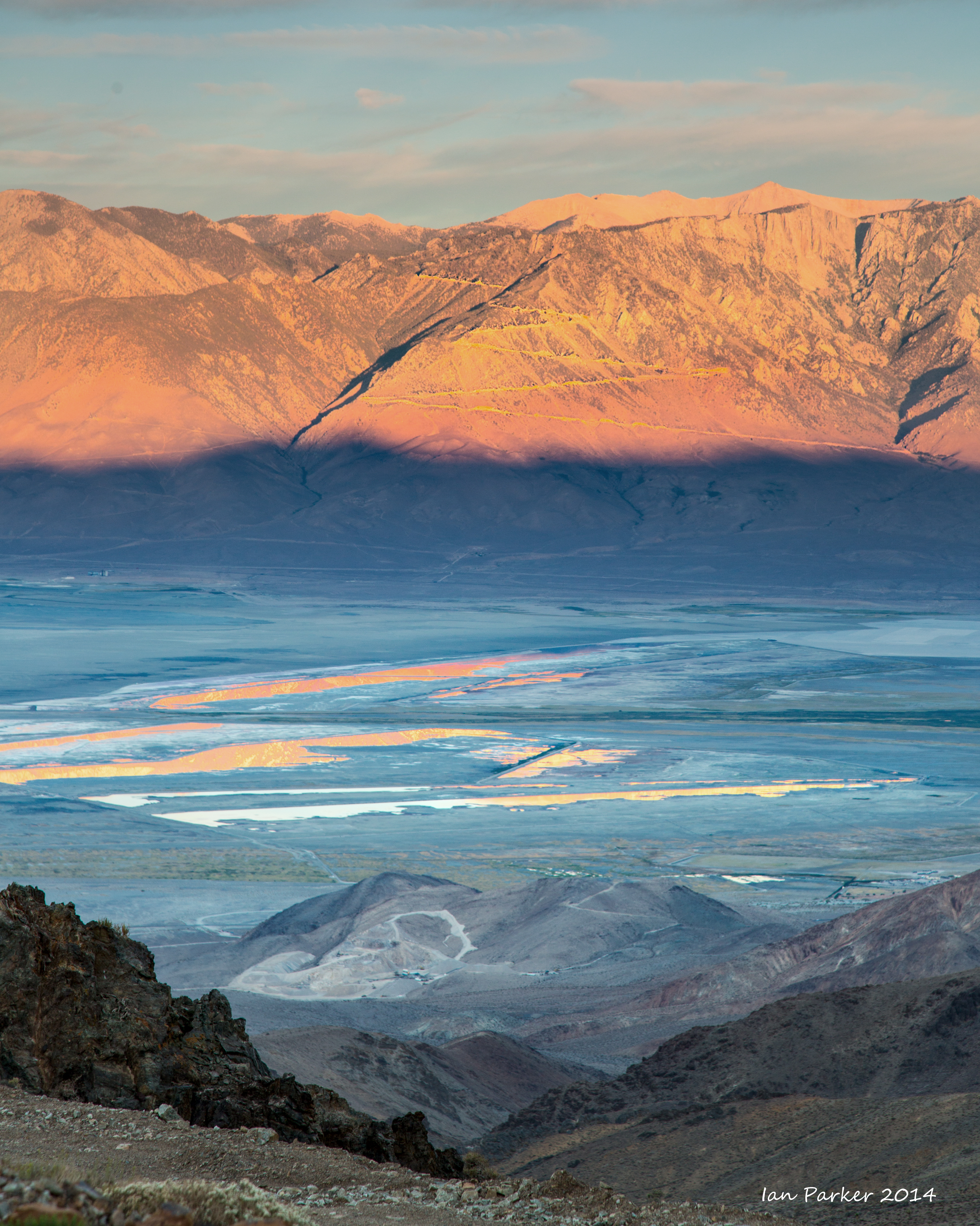
6,000 ft elevation change to Horseshoe Meadows the route alongside Owen's Lake offered level running, but also increased heat and blowing dust.

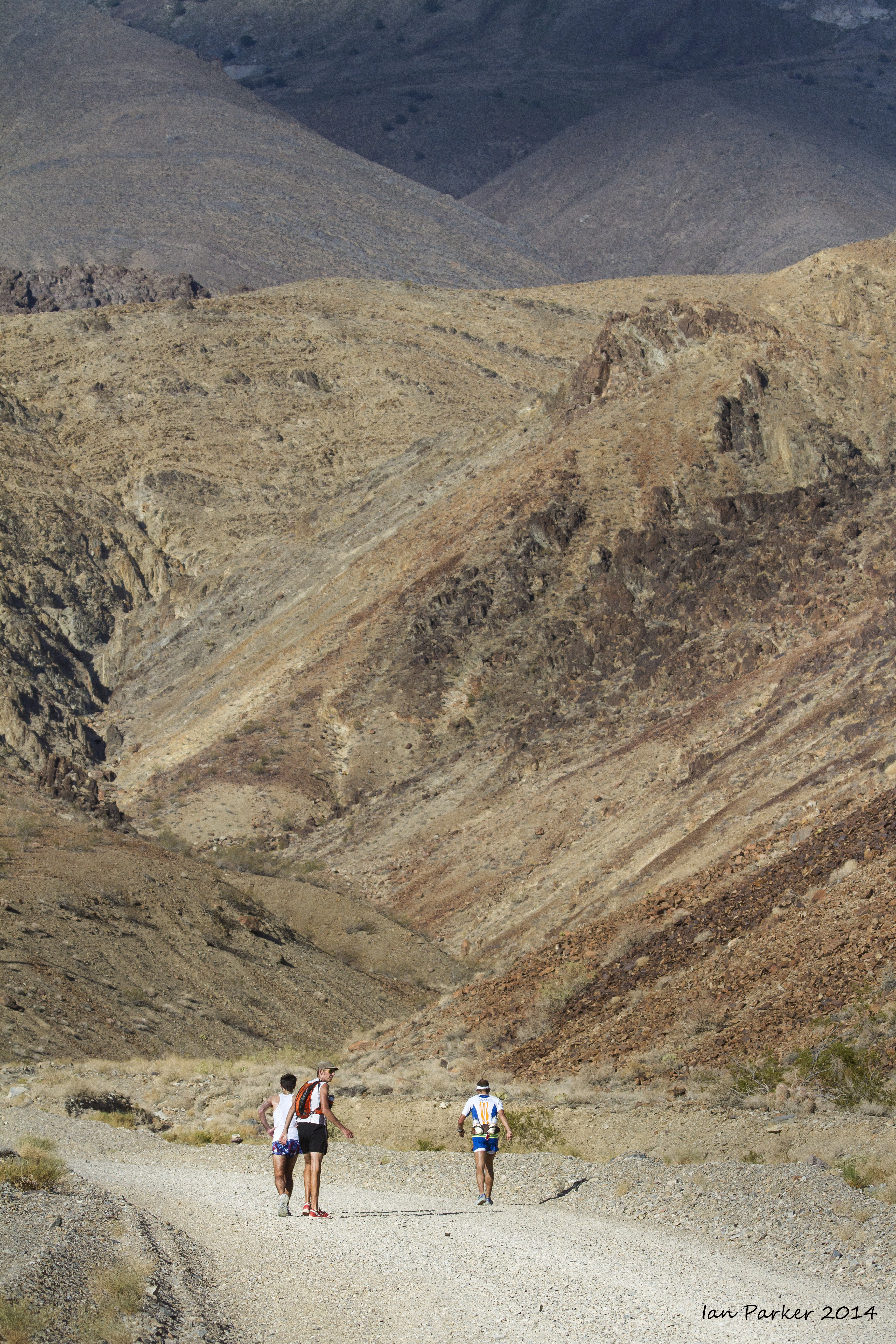
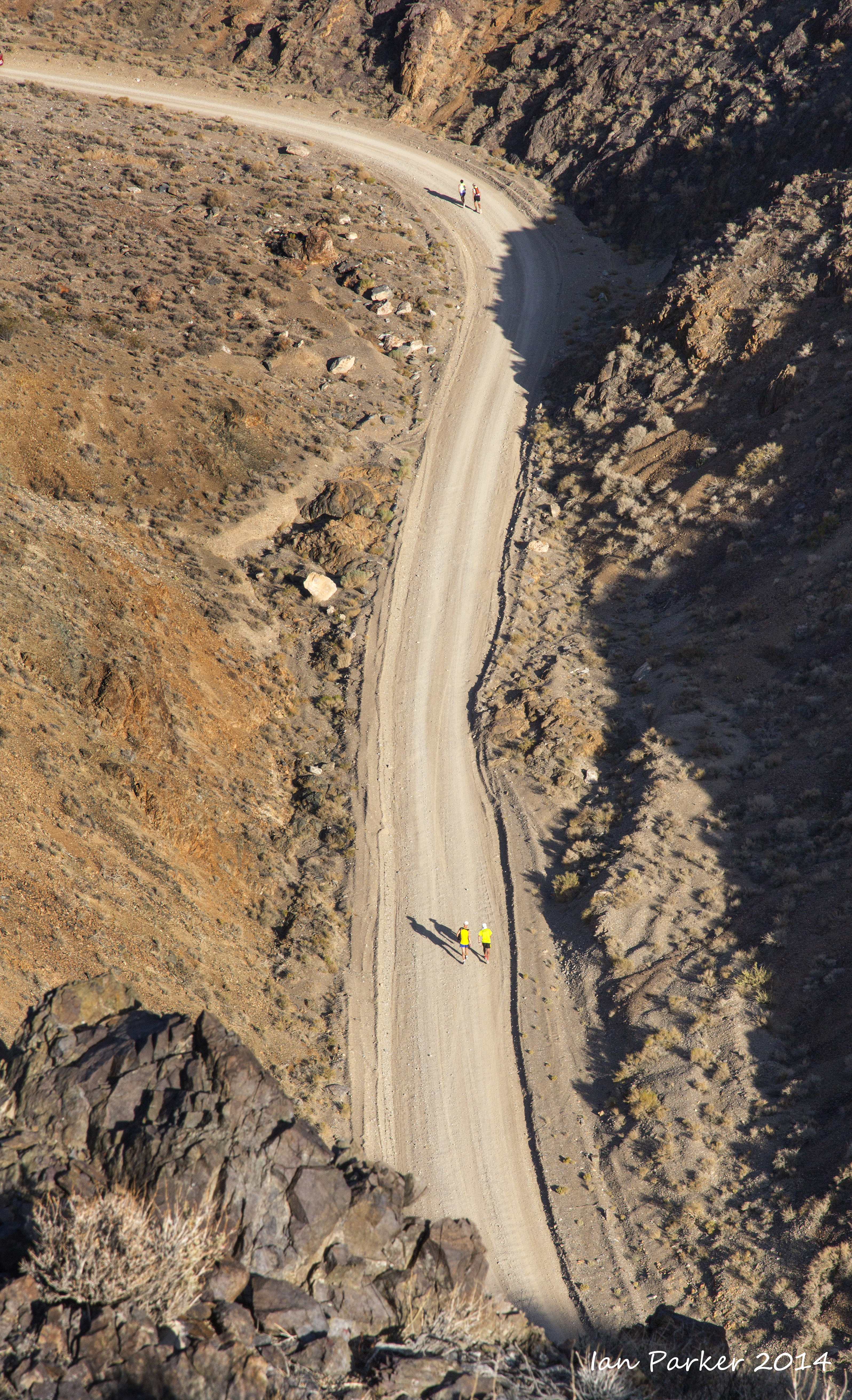
At mile 59 the runners detoured from the highway 
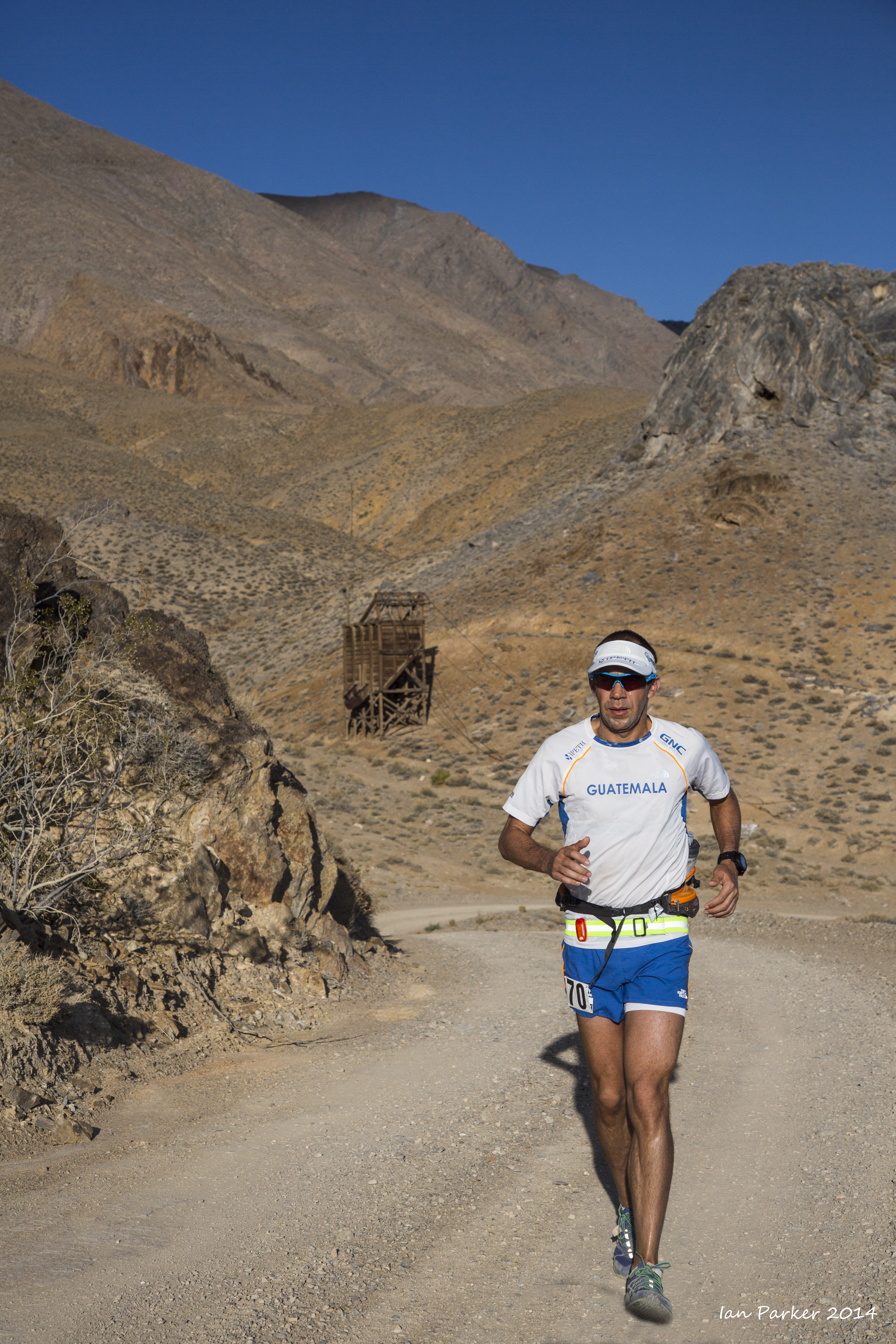
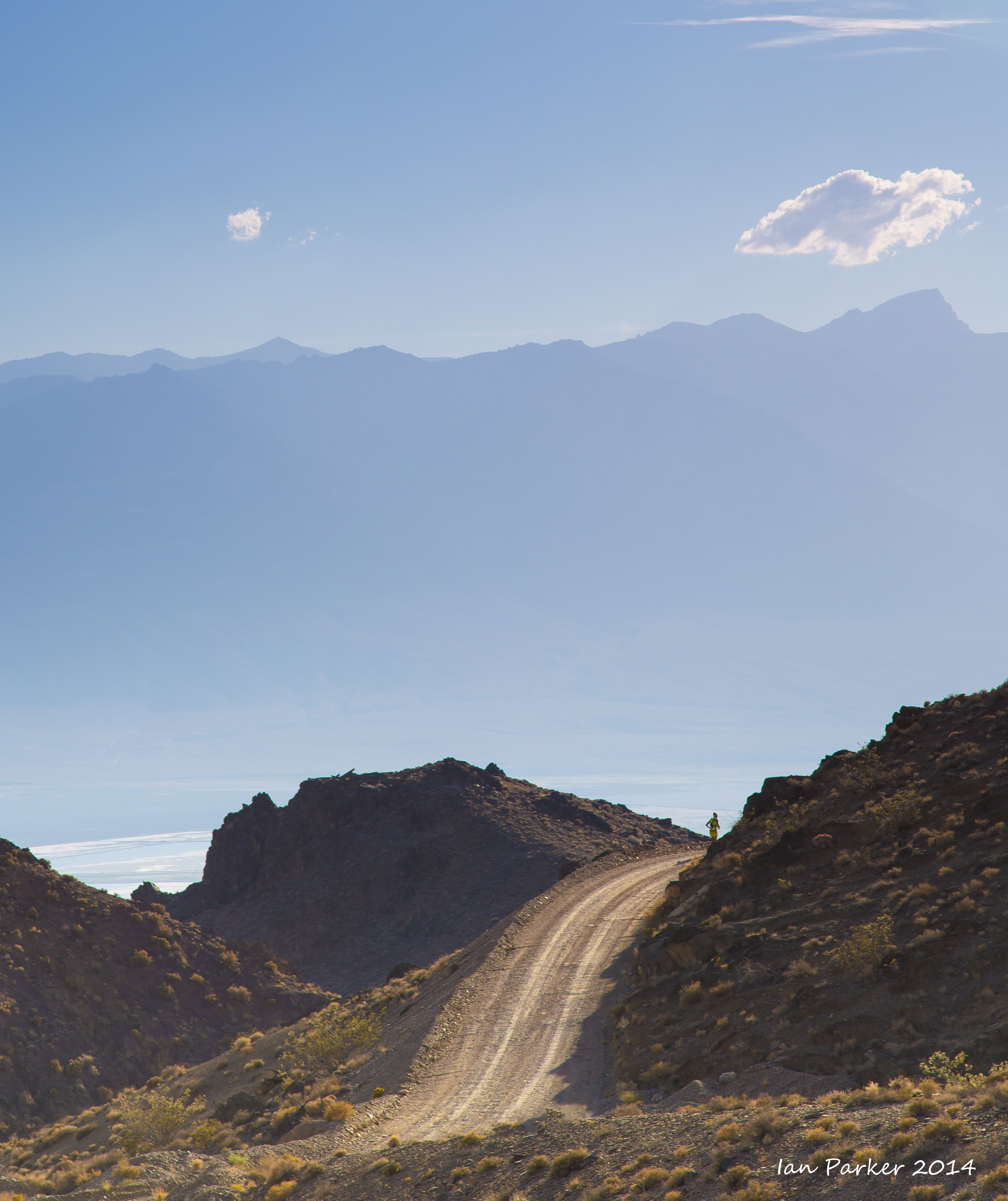
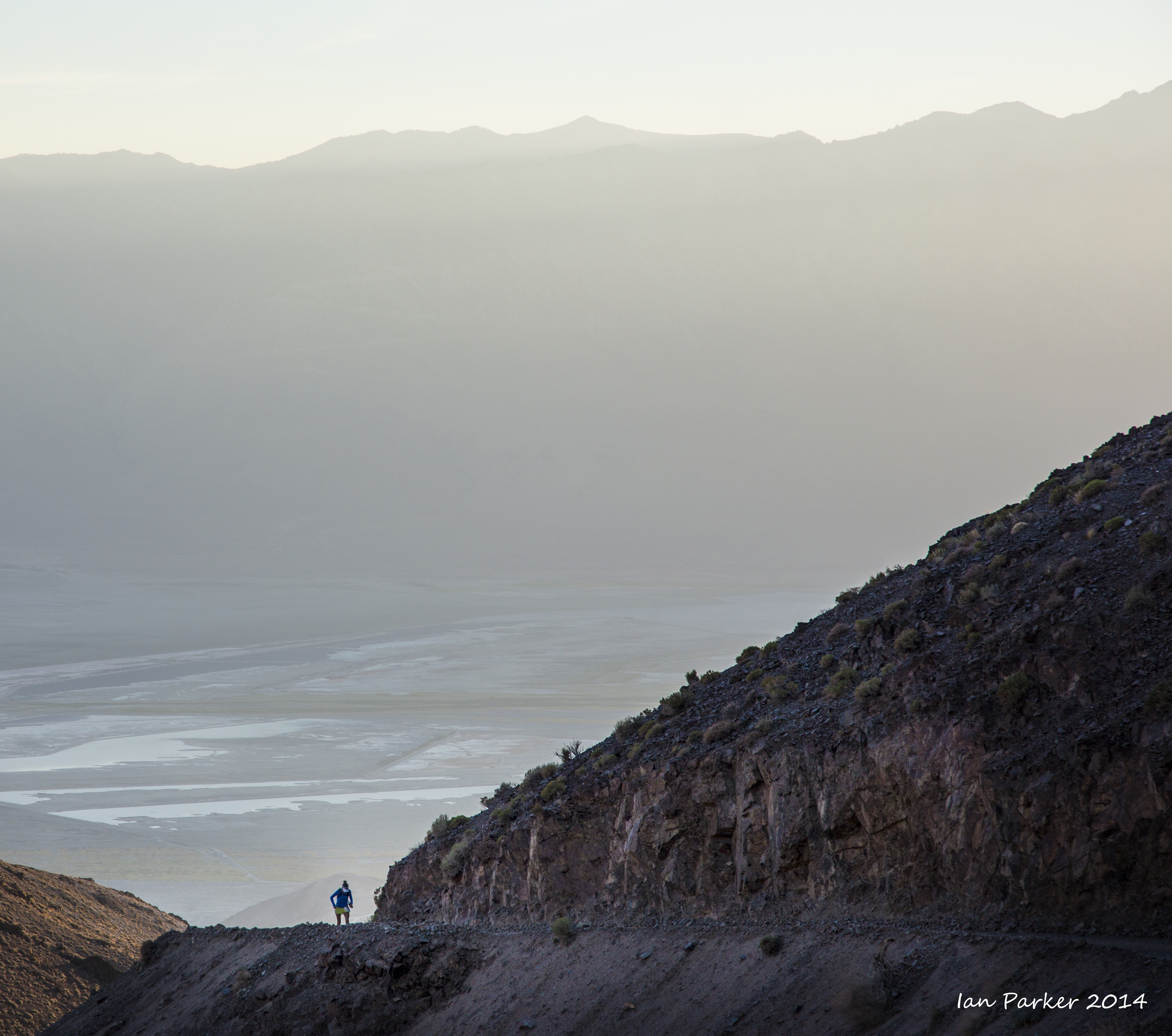
to ascend the steep and rugged Yellow Grade Road to a turnaround at Cerro Gordo ghost town.


Beyond the water station at mile 67 the road exits the canyon, opening up wide vistas across the valley to the Sierras. But only the lead runners reached here before sunset.

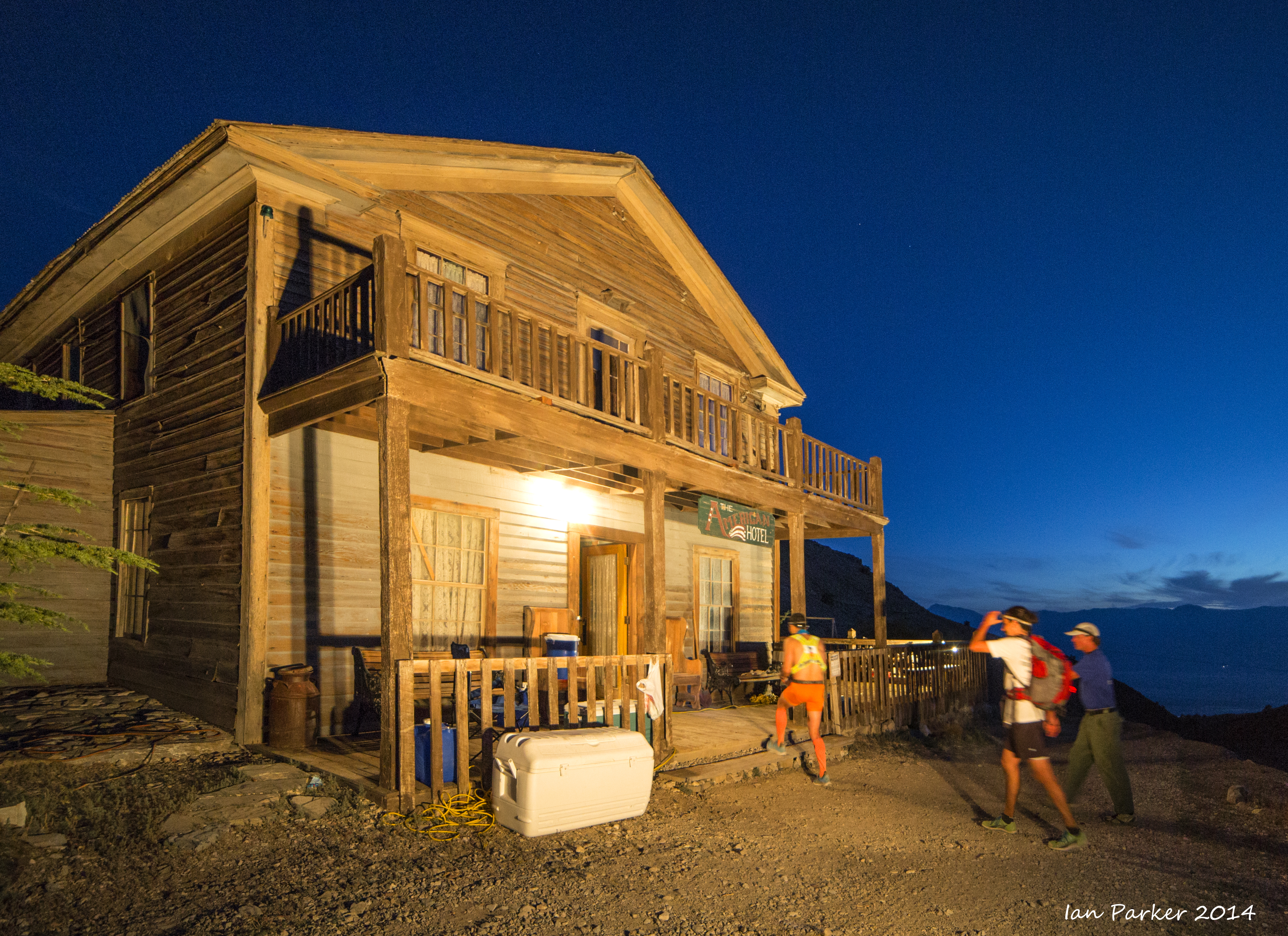
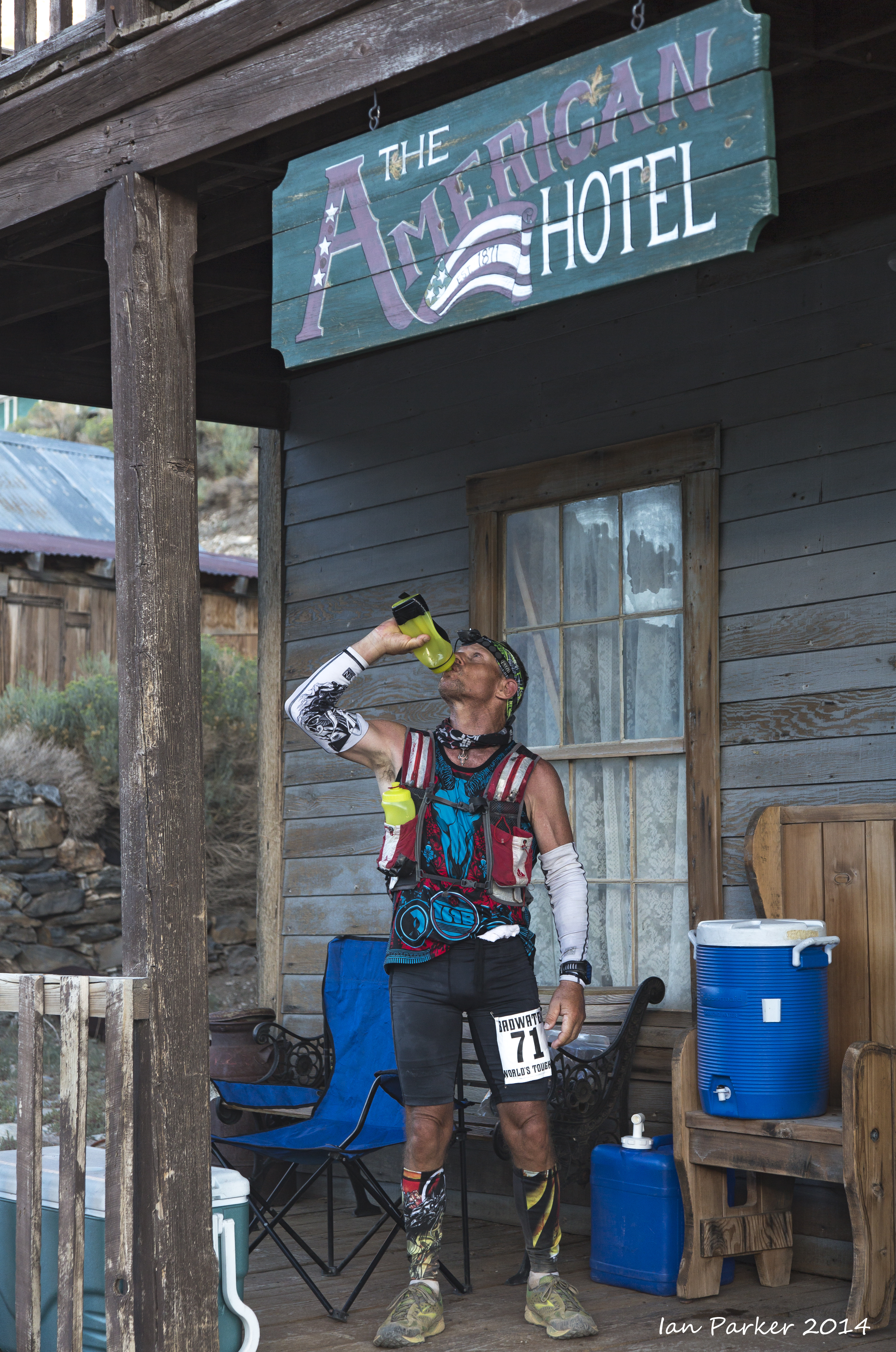
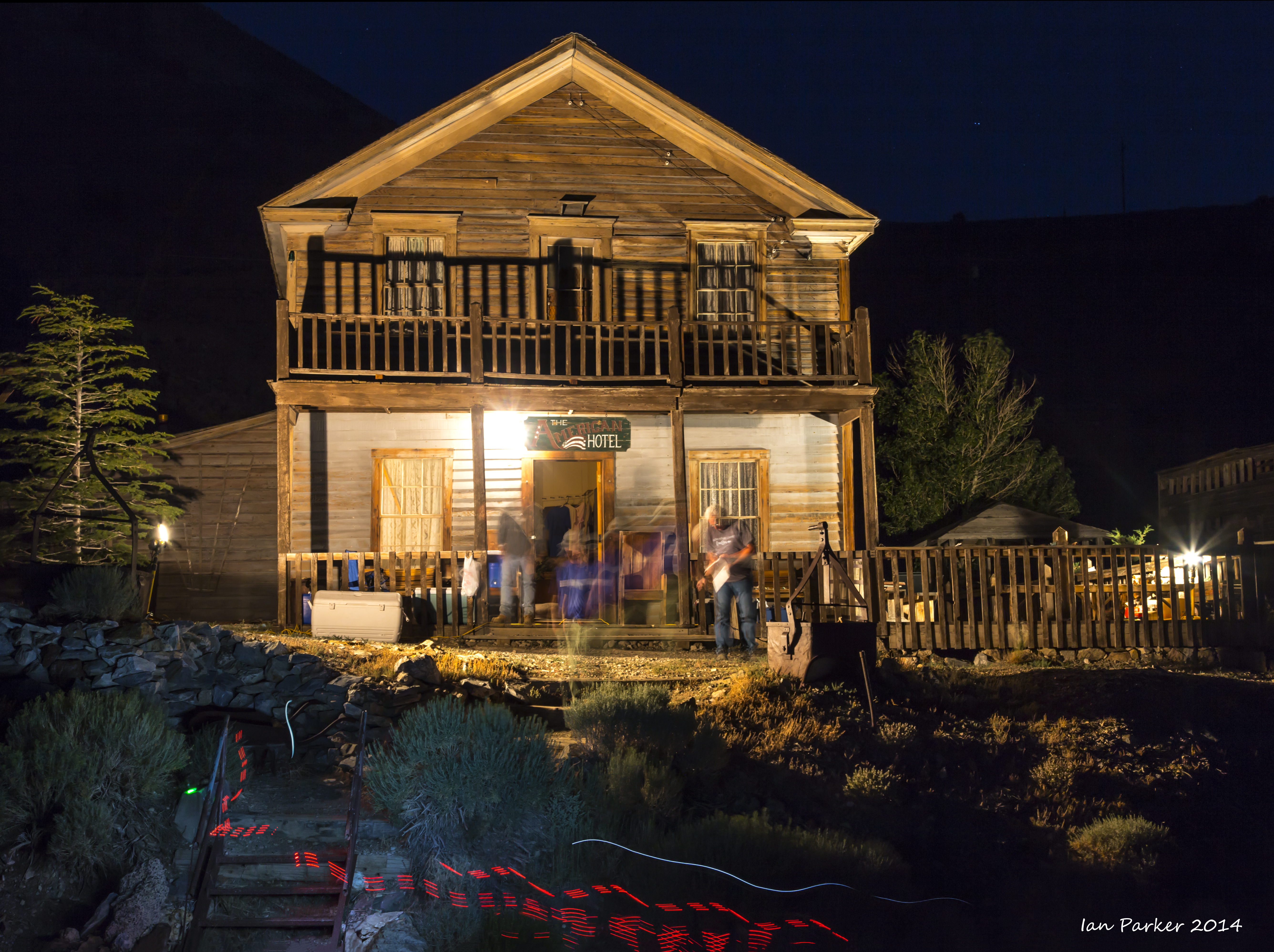
The historic American Hotel in Cerro Gordo served as a time station and turnaround point. Most runners arrived here during the night and saw little of the ghost town, but the floodlit hotel must have been a welcome sight during the final, steep ascent.

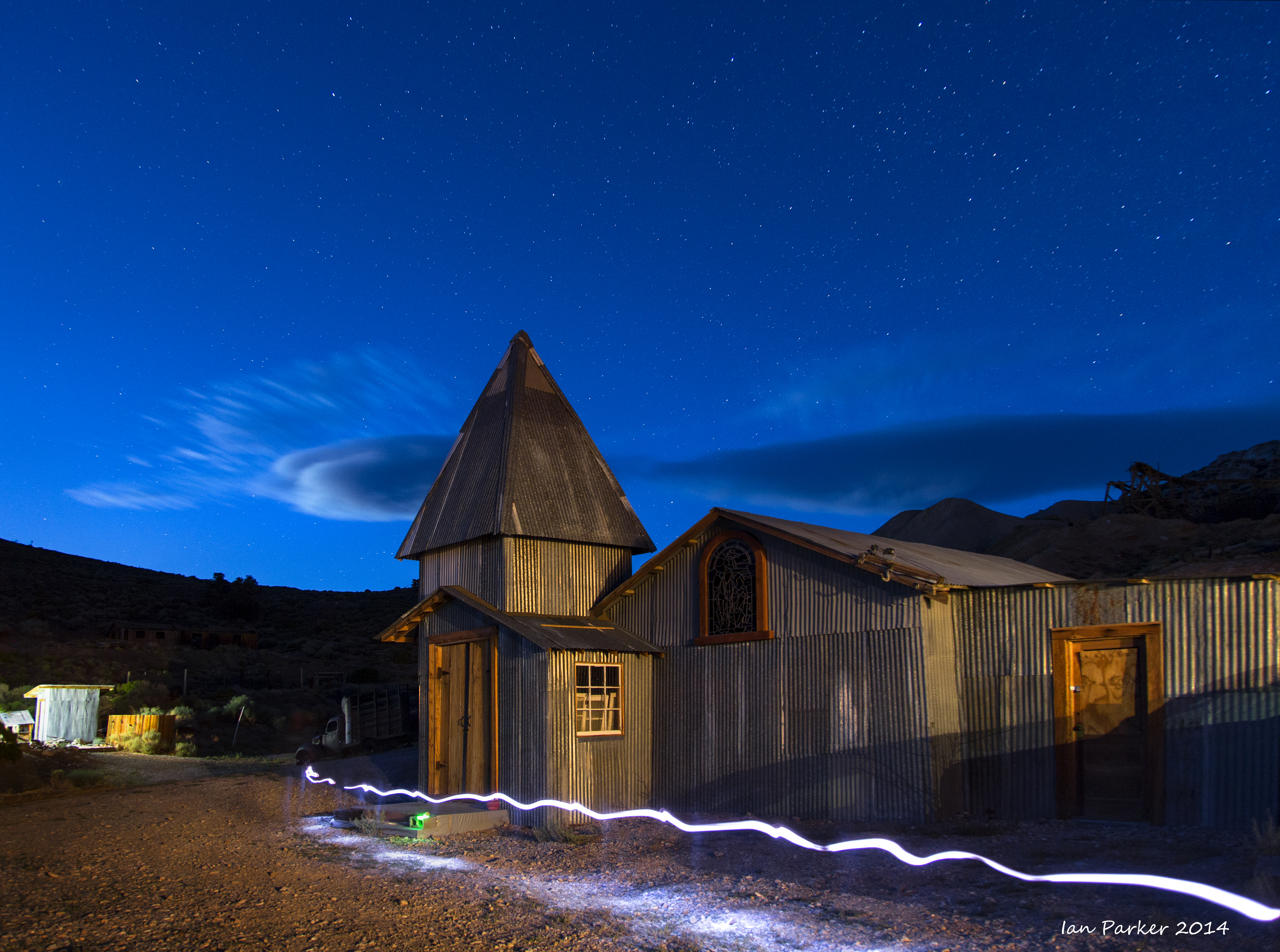
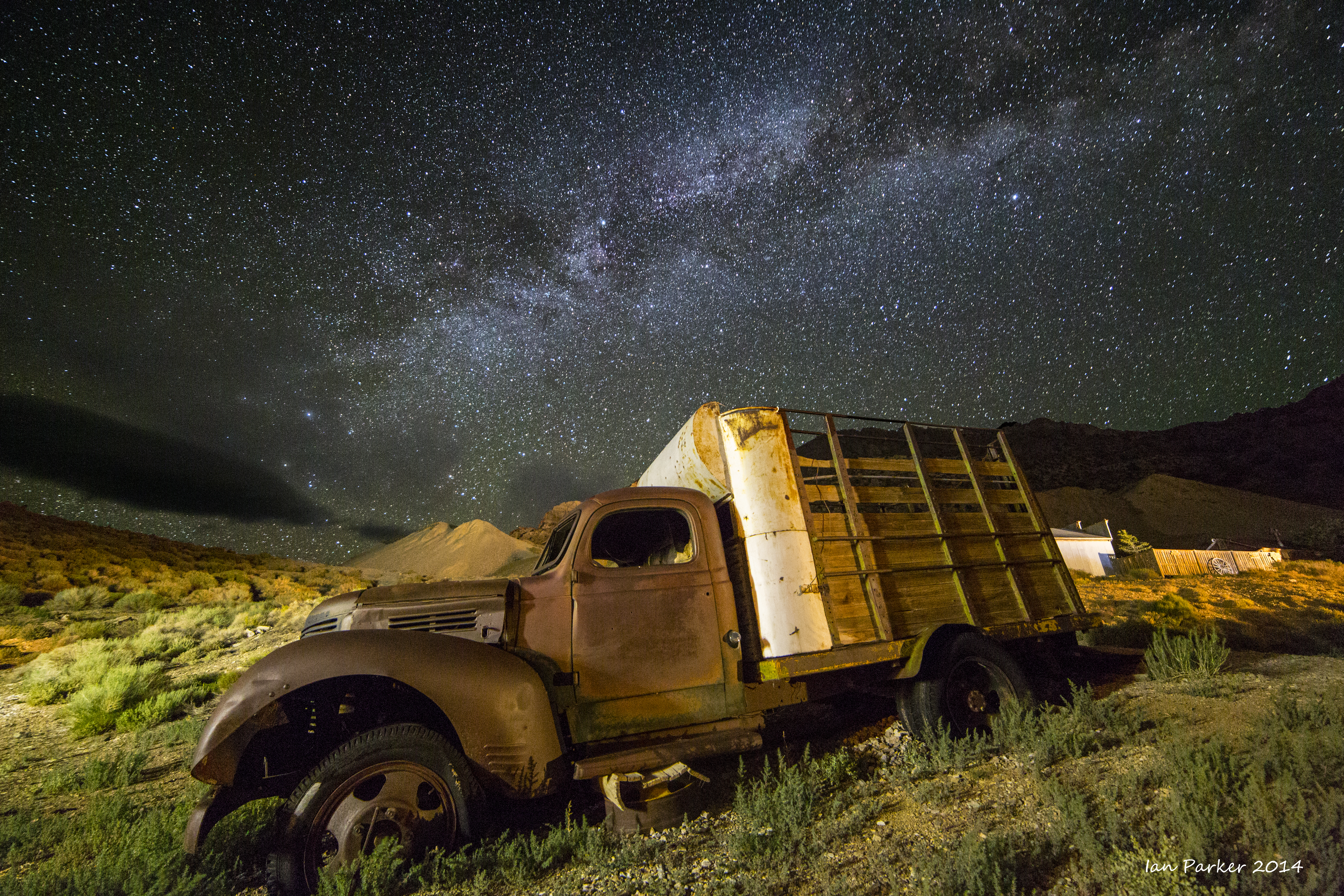
Stray light from the floodlit American Hotel gave an opportunity for long-exposure shots of abandoned buildings and machinery in Cerro Gordo, balancing as the the blue light of twilight faded to allow the Milky Way to shine through.


The last runners reached Cerro Gordo at dawn after about 24 hrs of continuous running and walking: only half-way to the finish line yet the lead runner had already finished.


IanParker
1146 McGaugh Hall
University of California,
Irvine, CA 92697

Please send enquiries to evanescentlightphotography@gmail.com

BACK TO >
Parkerlab >
Evanescent Light Galleries Home Page