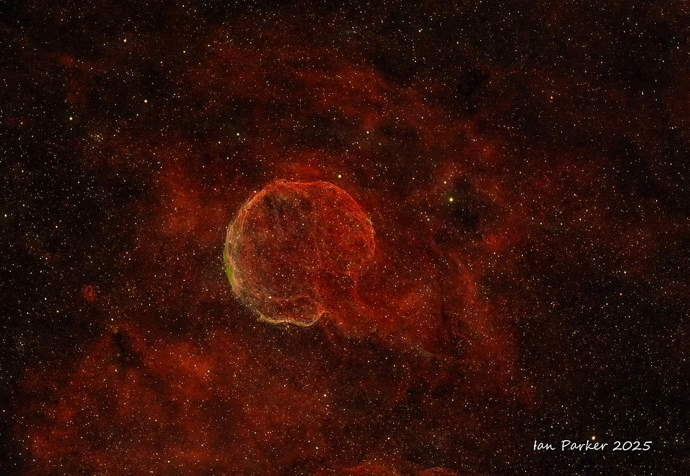
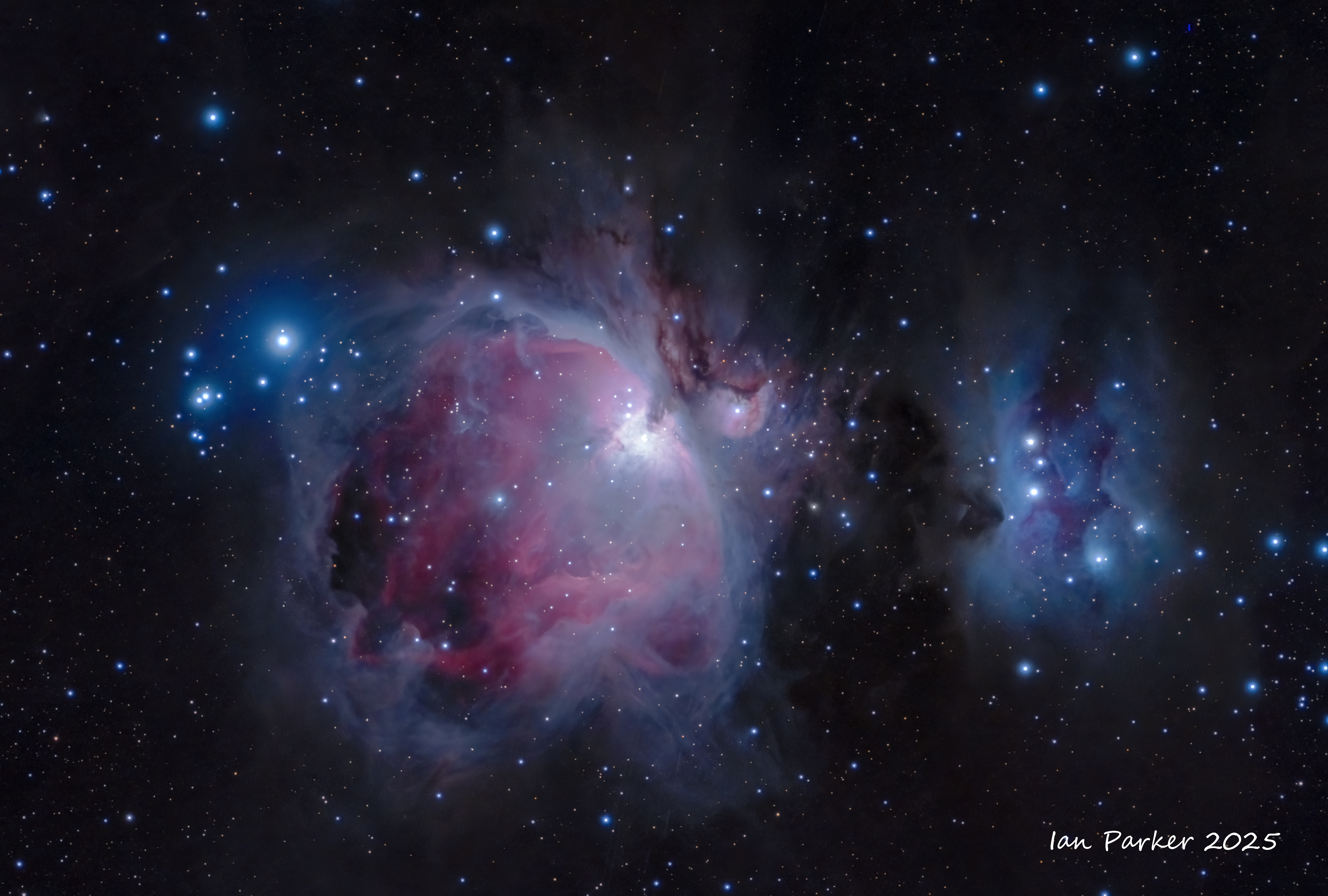
Featured Image

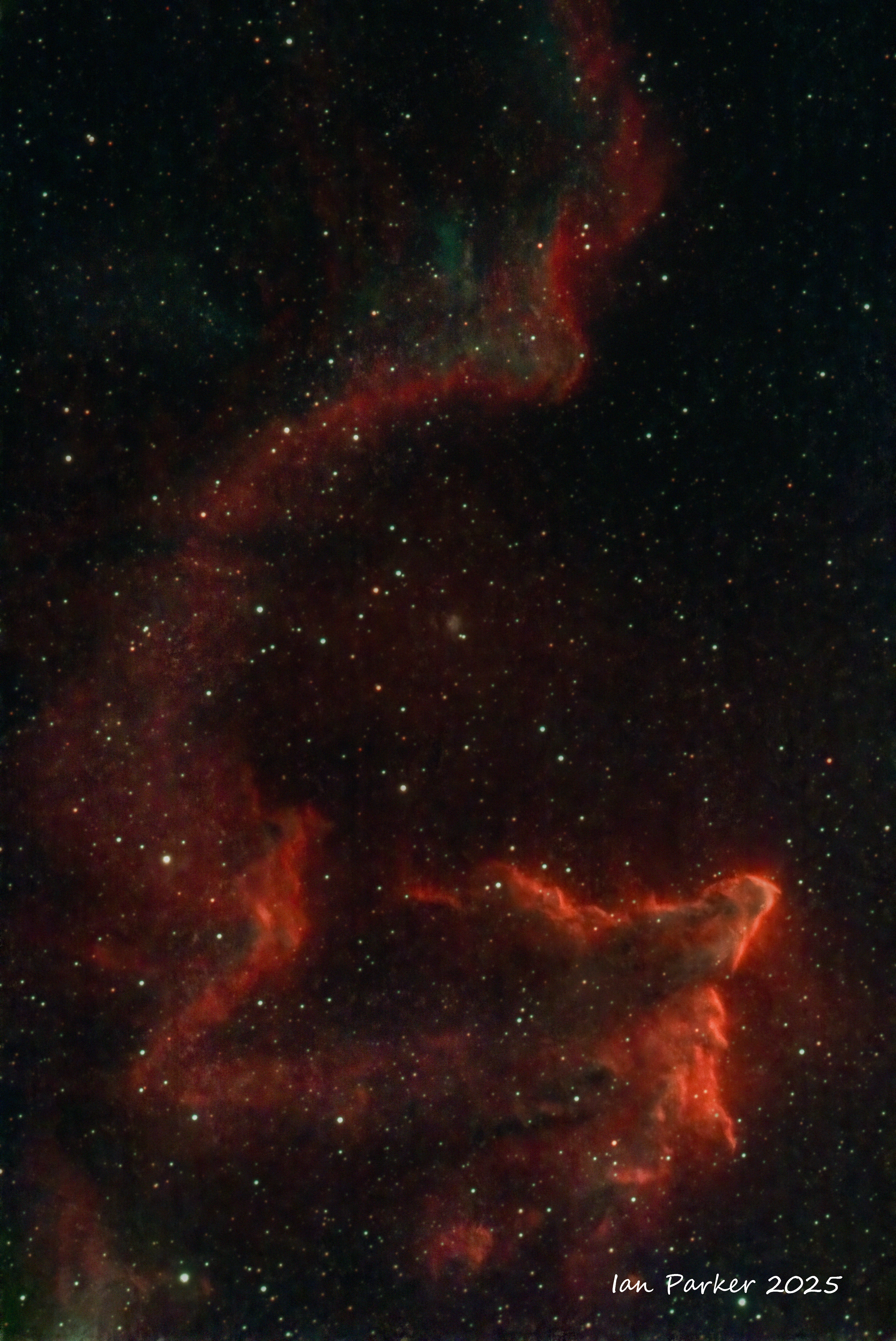
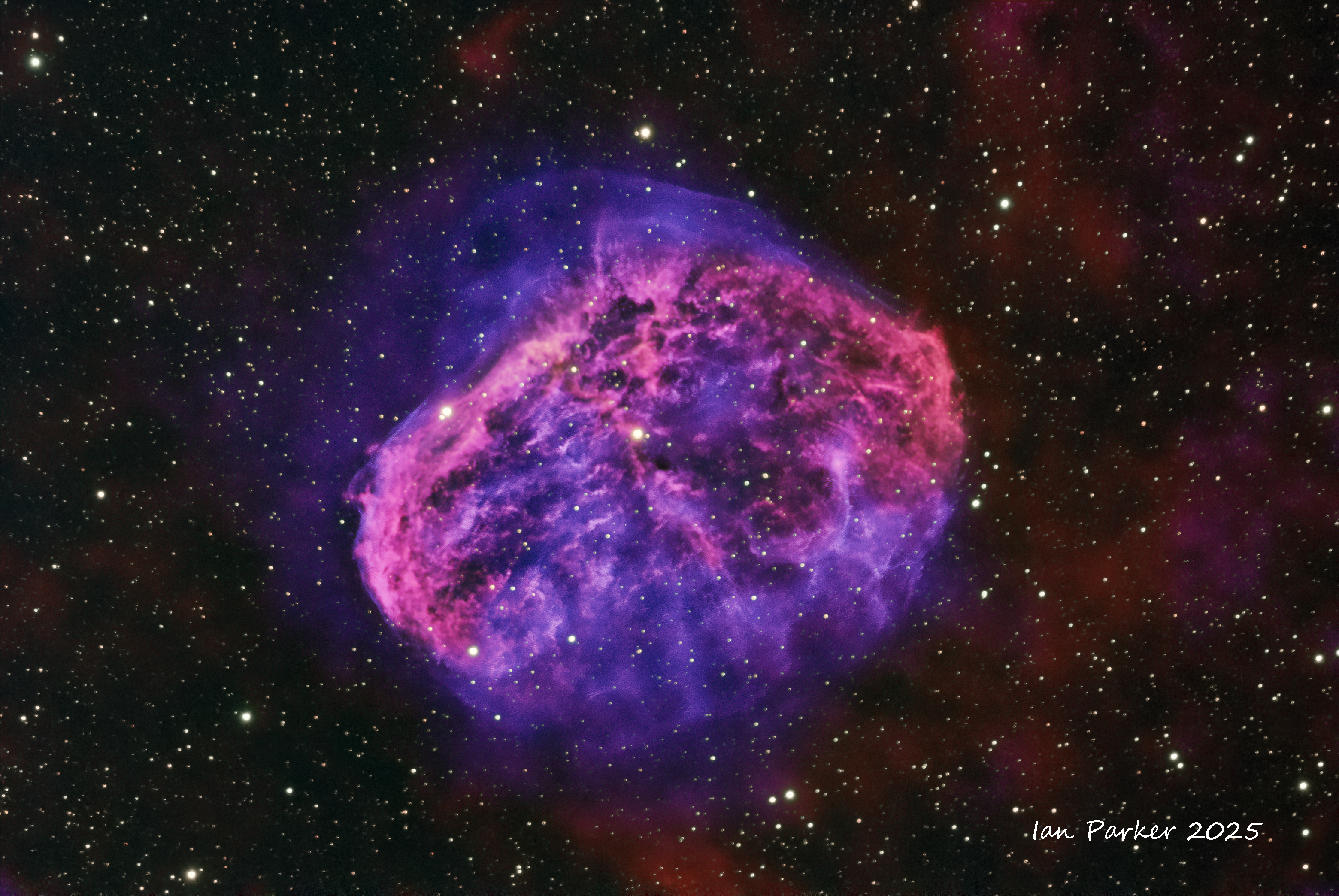
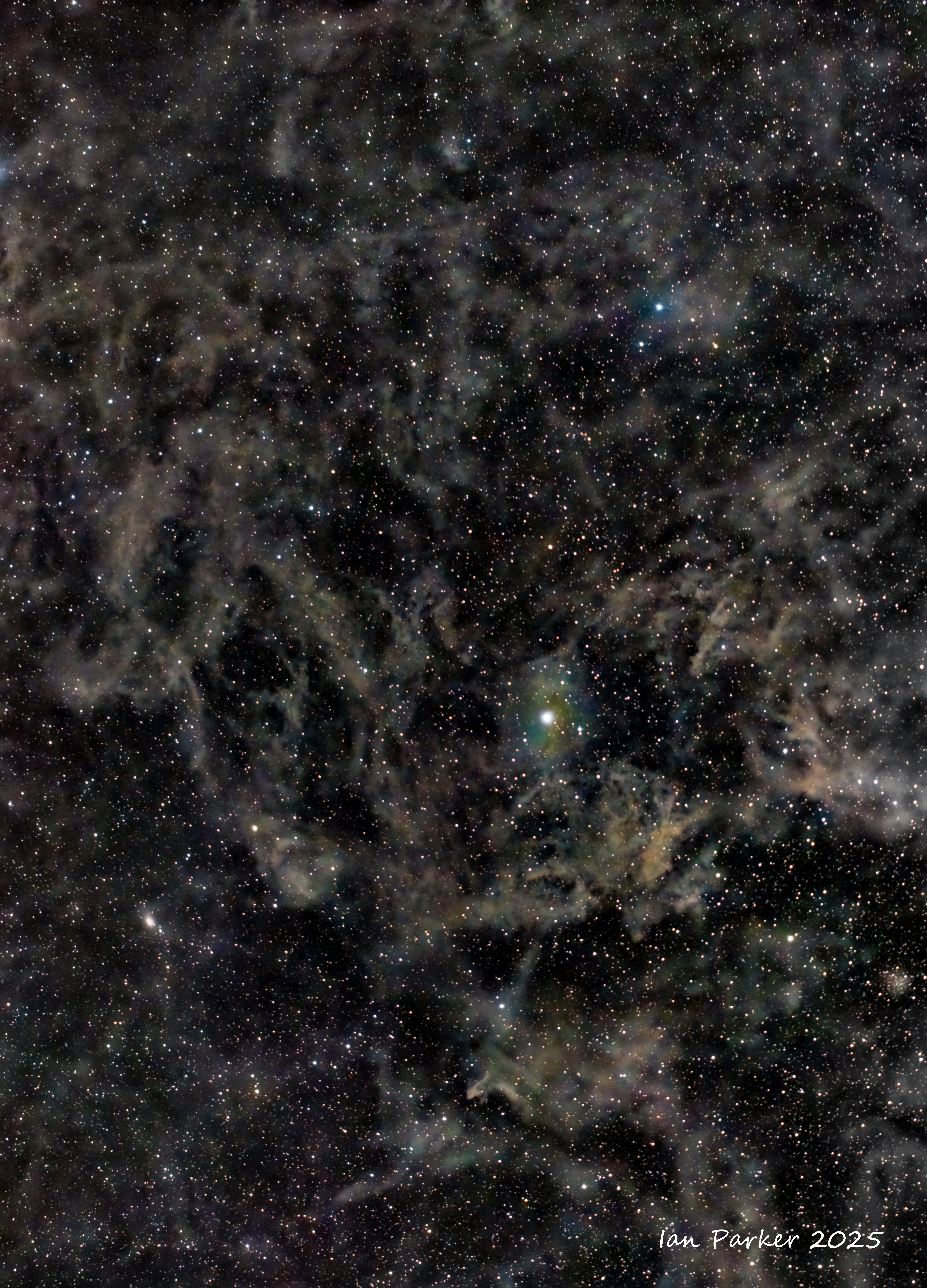
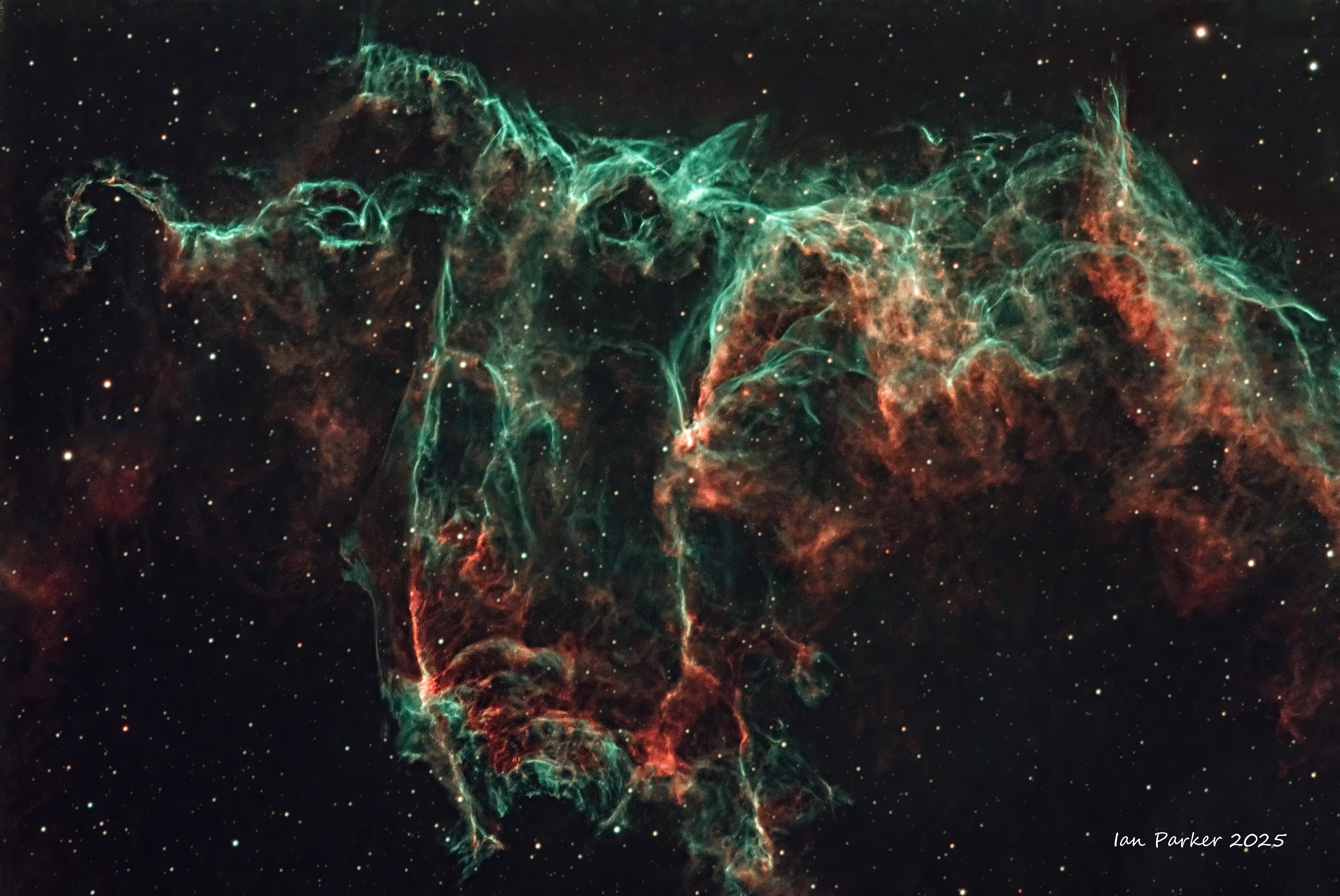
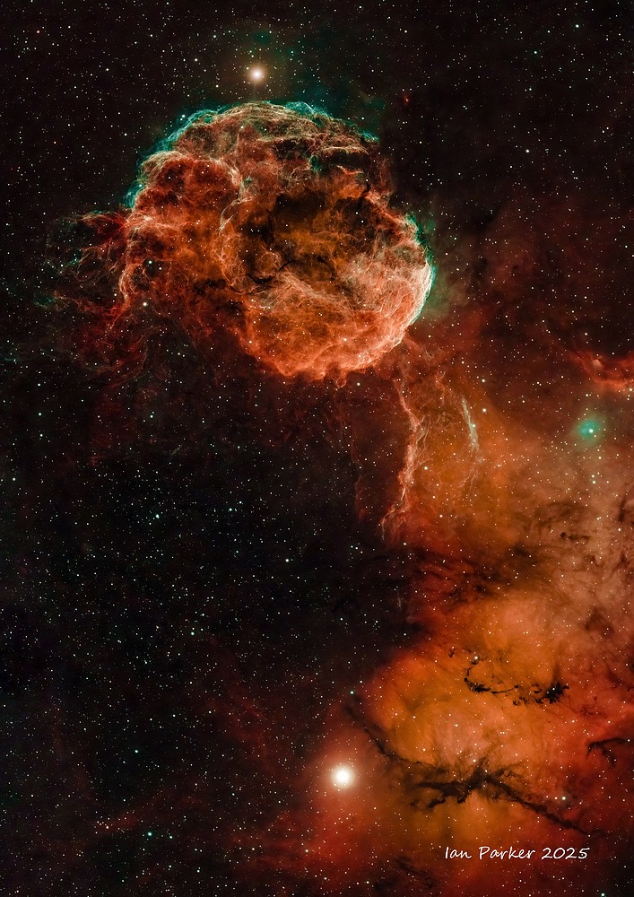
Sh2-240 The Spaghetti Nebula
[RedCat 51; AM3; ASI air, EAF, OAG; 159 x 300s subs, Optolong Extreme Ha/OIII filter]
Supernova remnants (SNRs) are my favorite and most aesthetically interesting cosmic targets to image. As the name indicates, they are what is left over after a supernova; the expanding, glowing cloud of gas and dust left behind after a massive star explodes. There are two common routes to a supernova: either a massive star may run out of fuel, neutron starceasing to generate fusion energy in its core, and collapsing inward under the force of its own gravity to form a or a black hole; or a white dwarf star may accrete material from a companion star until it reaches a critical mass and undergoes a carbon detonation. In either case, the resulting supernova explosion expels much or all of the stellar material with velocities as much as 10% the speed of light ~ 30,000 km/s) and a strong shock wave forms ahead of the ejecta. That heats the upstream plasma up to temperatures well above millions of K. The shock continuously slows down over time as it sweeps up the ambient medium, but it can expand over hundreds or thousands of years. On a cosmic timescale SNRs are thus very brief events and may show visible changes even on a human timescale. For example, the Crab Nebula results from a supernova observed by Japanese and Arab stargazers in 1054, and images of the Crab Nebula SNR taken only 15 years apart show its continuing expansion.
A supernova remnant is bounded by an expanding shock wave, and consists of ejected material expanding from the explosion, and the interstellar material it sweeps up and shocks along the way. The roughly symmetrical expansion results in SNRs appearing roughly circular in outline, with intricate filaments and loops generated by the shock fronts. The light that is emitted originates primarily from ionized hydrogen (red) and oxygen (blue/green) gases, which is an advantage for imaging as these specific wavelengths can be isolated by narrowband filters to largely block contaminating moonlight and light pollution.
Perhaps the easiest SNR for an amateur astrophotographer to image is the Cygnus Loop (Veil nebula). This is a large, relatively bright nebula, which I had photographed last summer when it rises high in the sky. Next on my list was the Spaghetti nebula (Sh2-240), an aptly named tangle of filamentous loops reminiscent of the Cygnus Loop in terms of distance and age. It's a bit farther away, a bit older, and a bit larger physically than the Cygnus Loop, but the biggest difference is the much lower surface brightness. I was able to image the Cygnus Loop through the light pollution at our home near Los Angeles, but for the Spaghetti nebula I had to wait until I could get out to dark skies in the desert during a winter new moon when it would be rising high. As well as being faint, another challenge was the apparent size of the remnant, covering a full three degrees of the sky, equivalent to the width of six full moons. Neither of my telescopes would fit all of this in a single frame, and assembling a mosaic of individual exposure panels would be a daunting task.
A more fun alternative was to succumb to the temptation to buy a new telescope! So, my photo above is first light with my Christmas present, a RedCat51 telescope, a small, elegant example of optical engineering with a focal length of 250mm that (just) encompasses the Spaghetti nebula. I captured the photons to generate the image over two nights camped out in Anza Borrego State Park, a dark sky location with pleasant nighttime temperatures in winter and the advantage of good pizza and ice cream in the nearby town of Borrego Springs.
|
|
RECENT ADDITIONS
Images added 03/30/2026. We are into galaxy season, so for the March new moon I took my Celestron EDGE8 HD out to dark desert skies,
Images added 03/15/2026
Two small planetary nebulae and a very big emission nebula. Acessible targets from home under Bortle 8/9 skies now that the best narrowband targets are sinking in the wext.
|
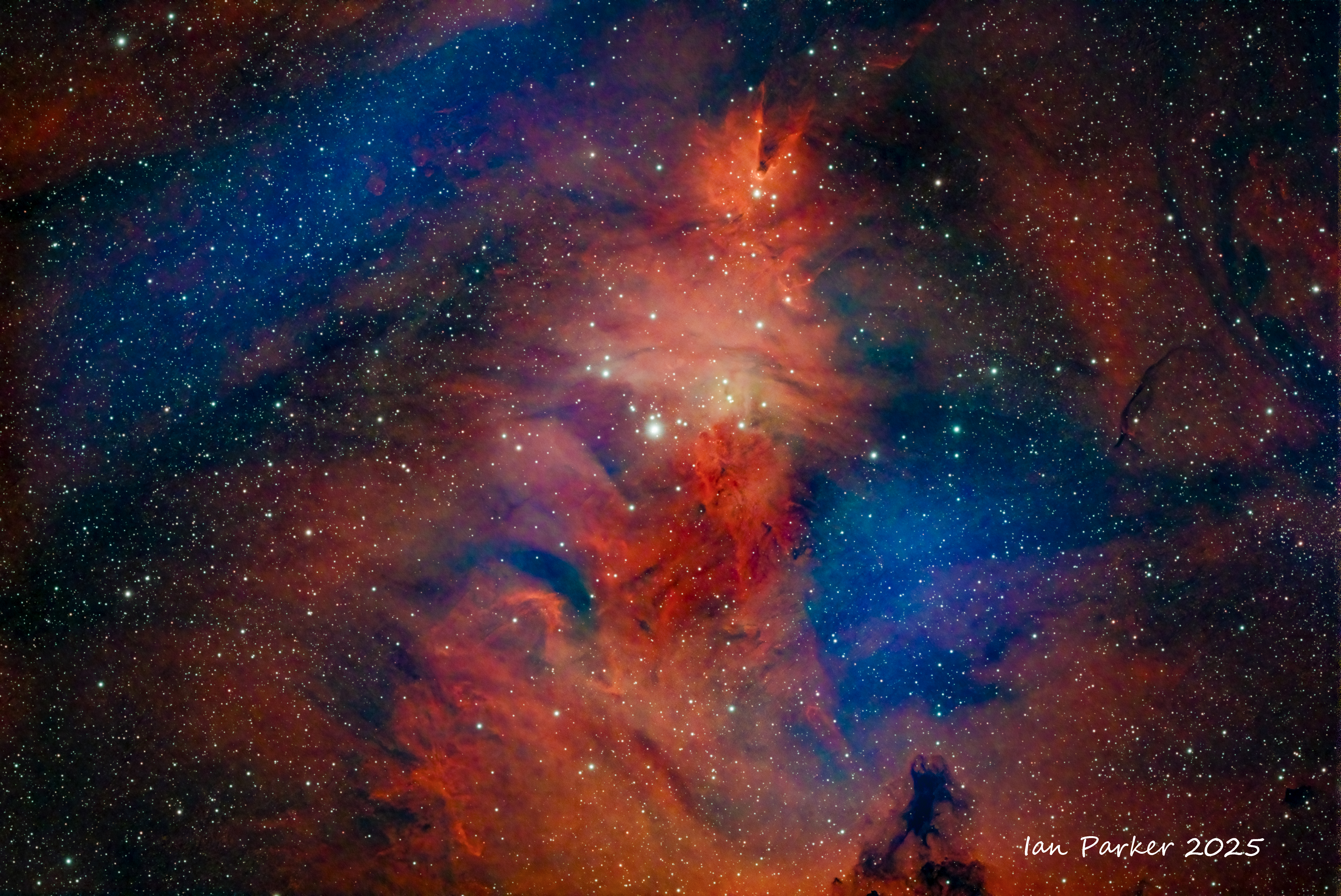
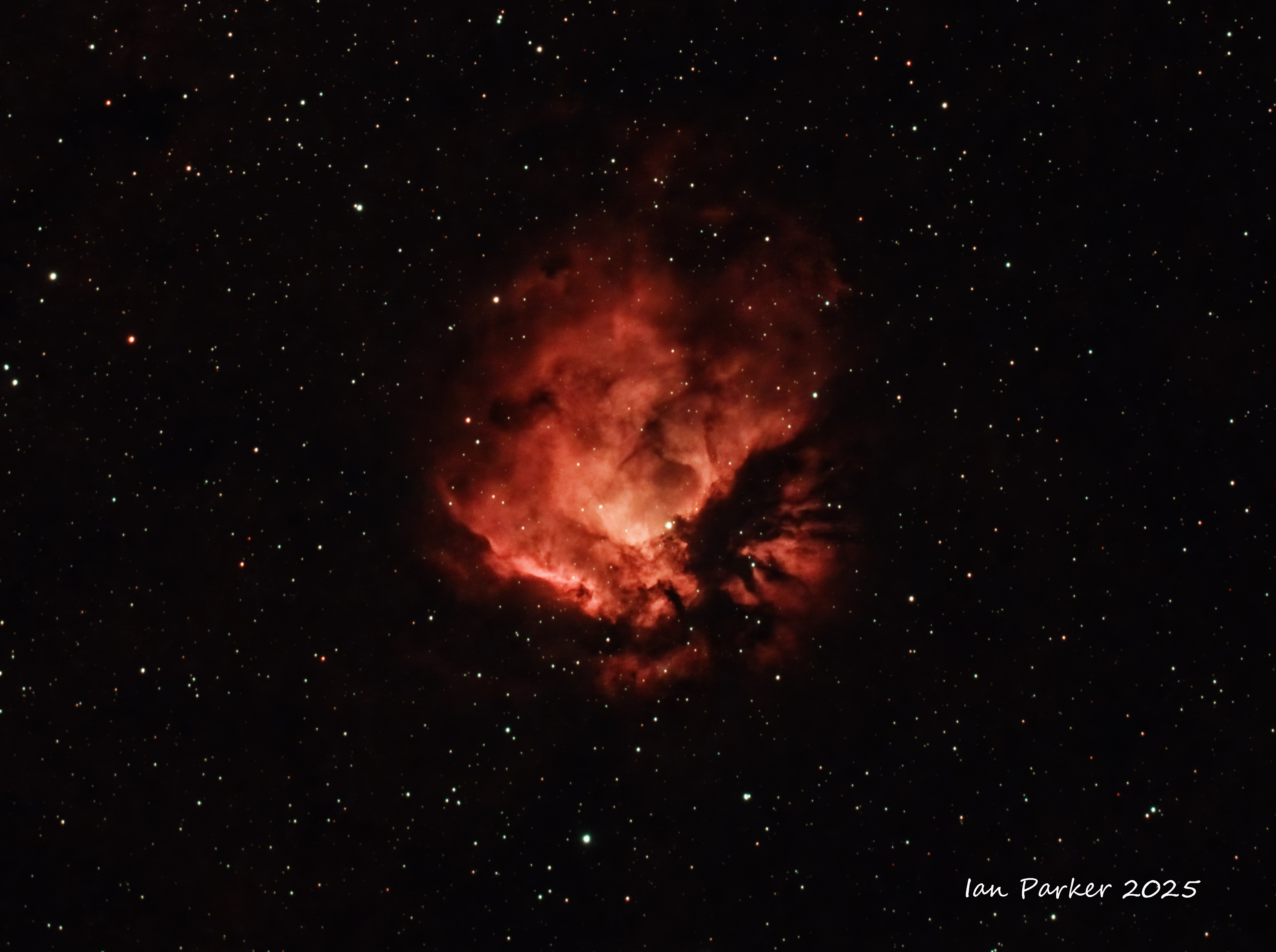
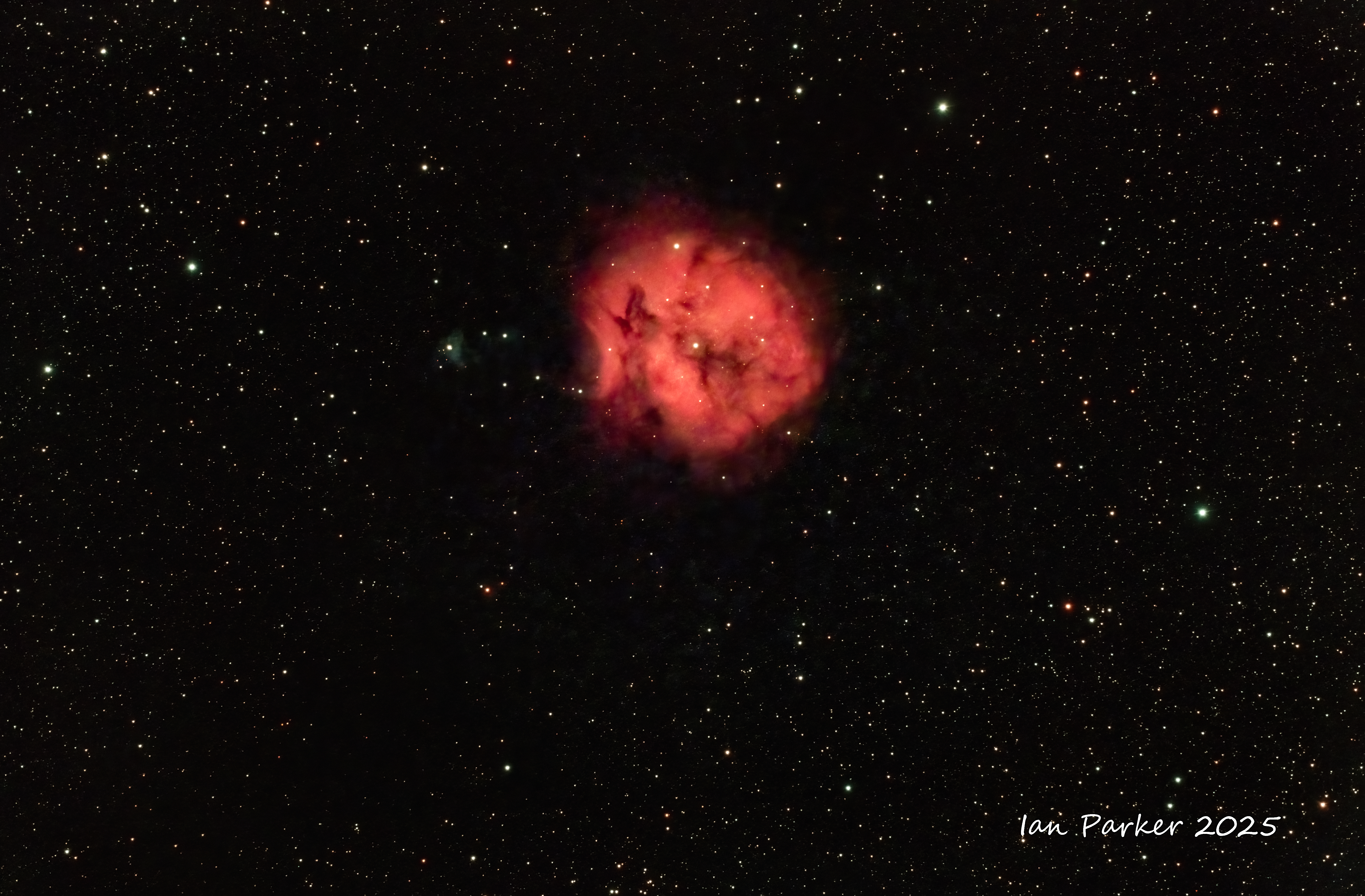
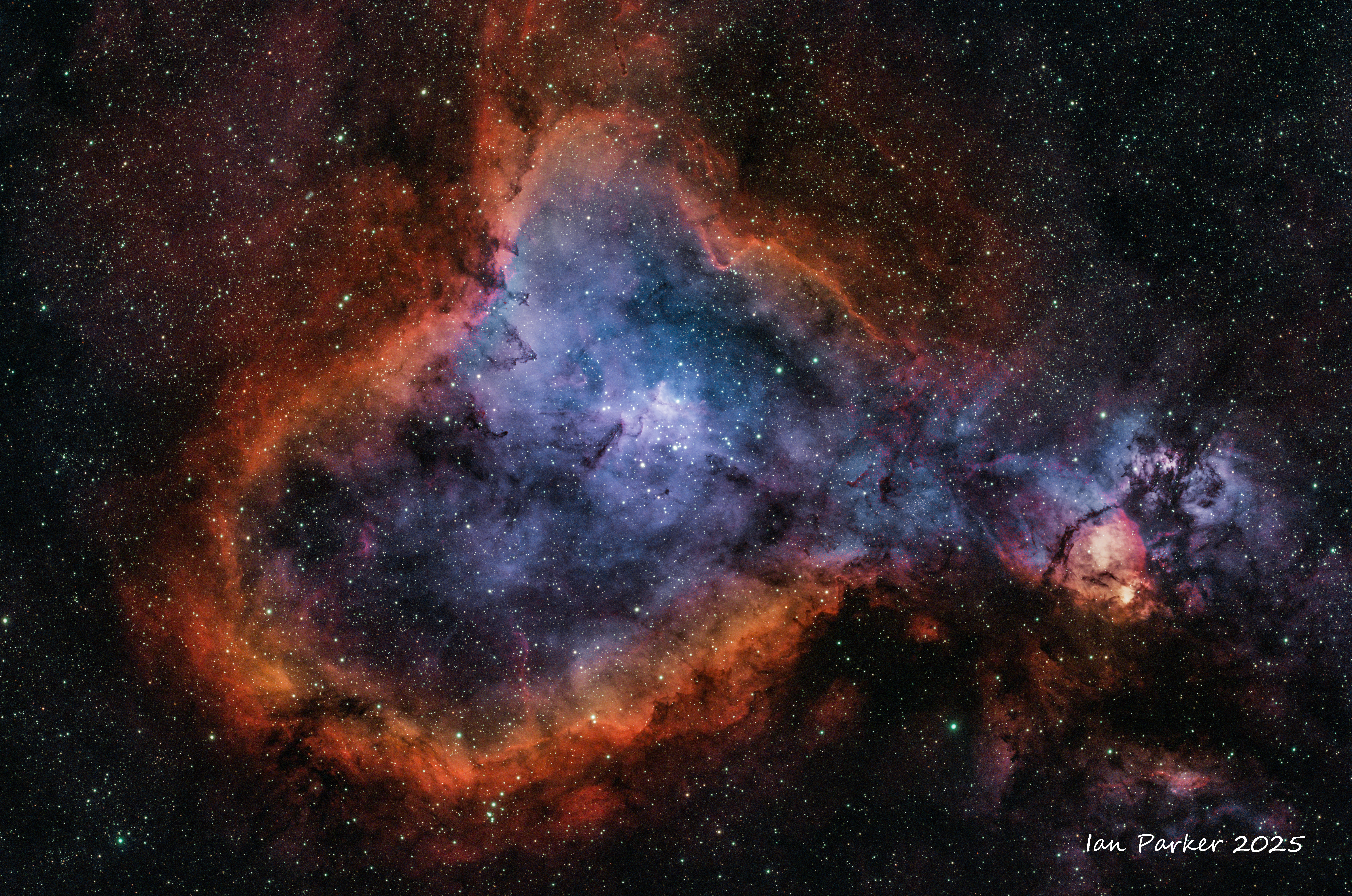
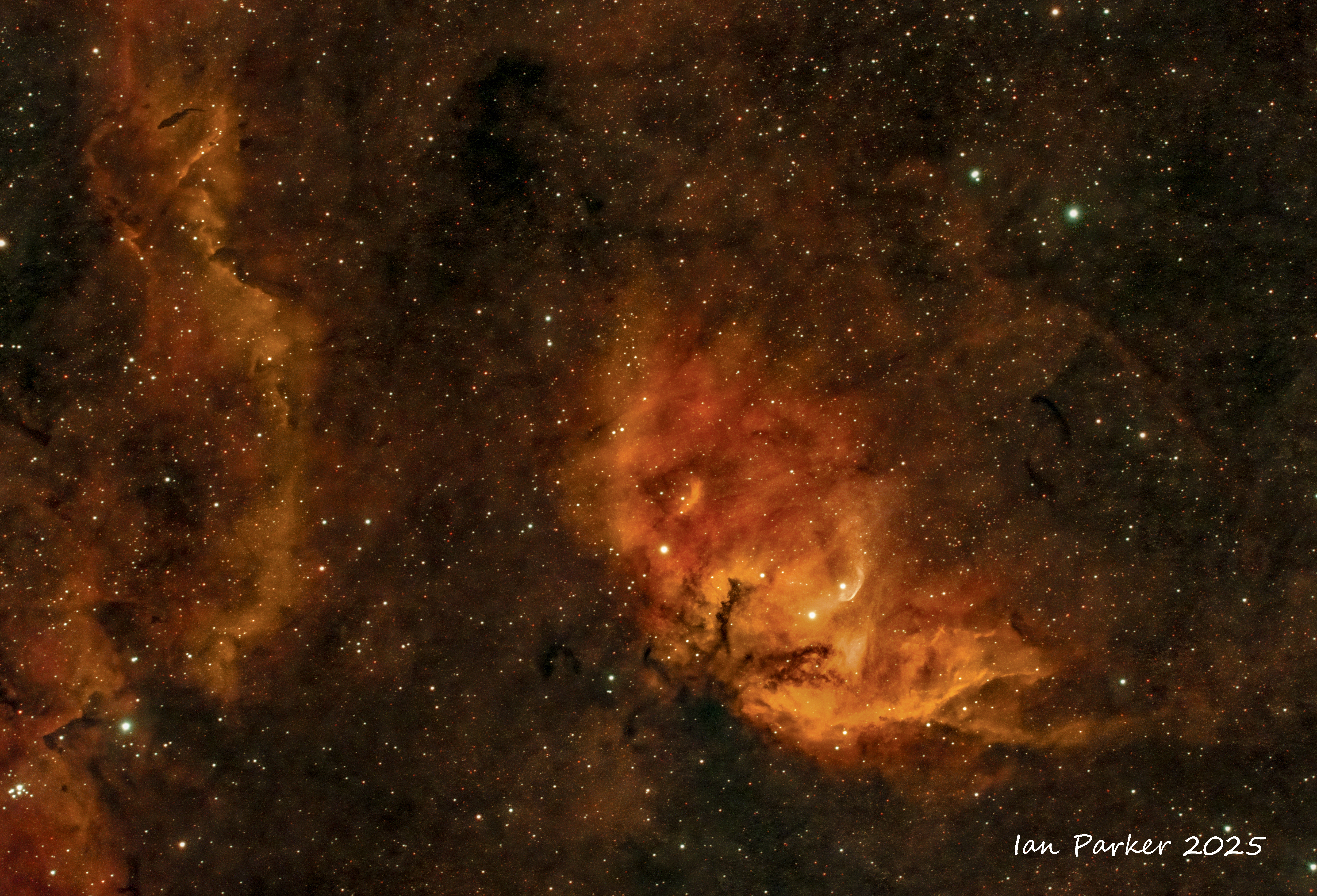
 Sh-2 264 The Angel Fish Nebula
 |
|
Click on any of the images below to downoad the full-resolution image file
EMISSION NEBULAE
| |
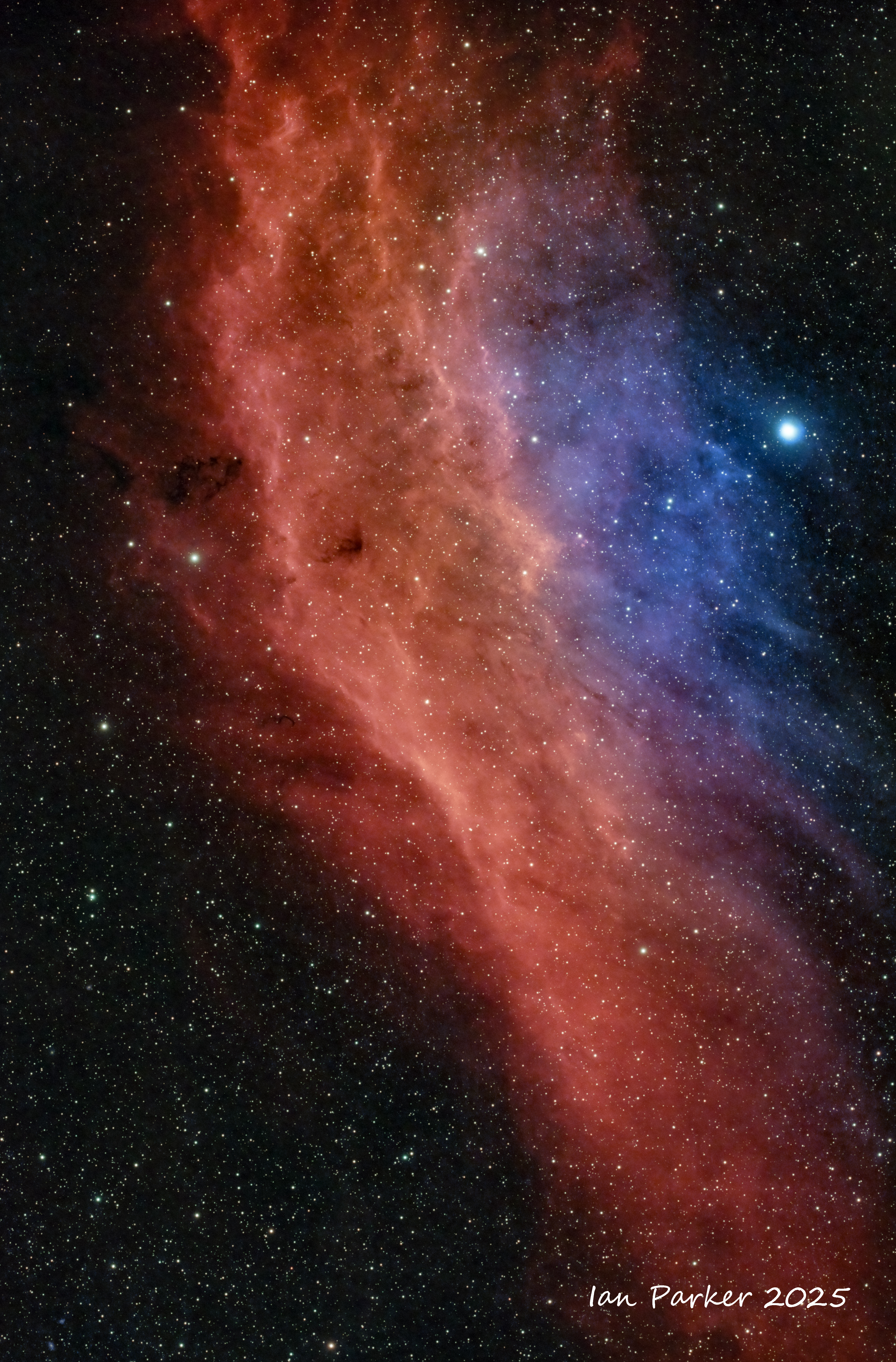
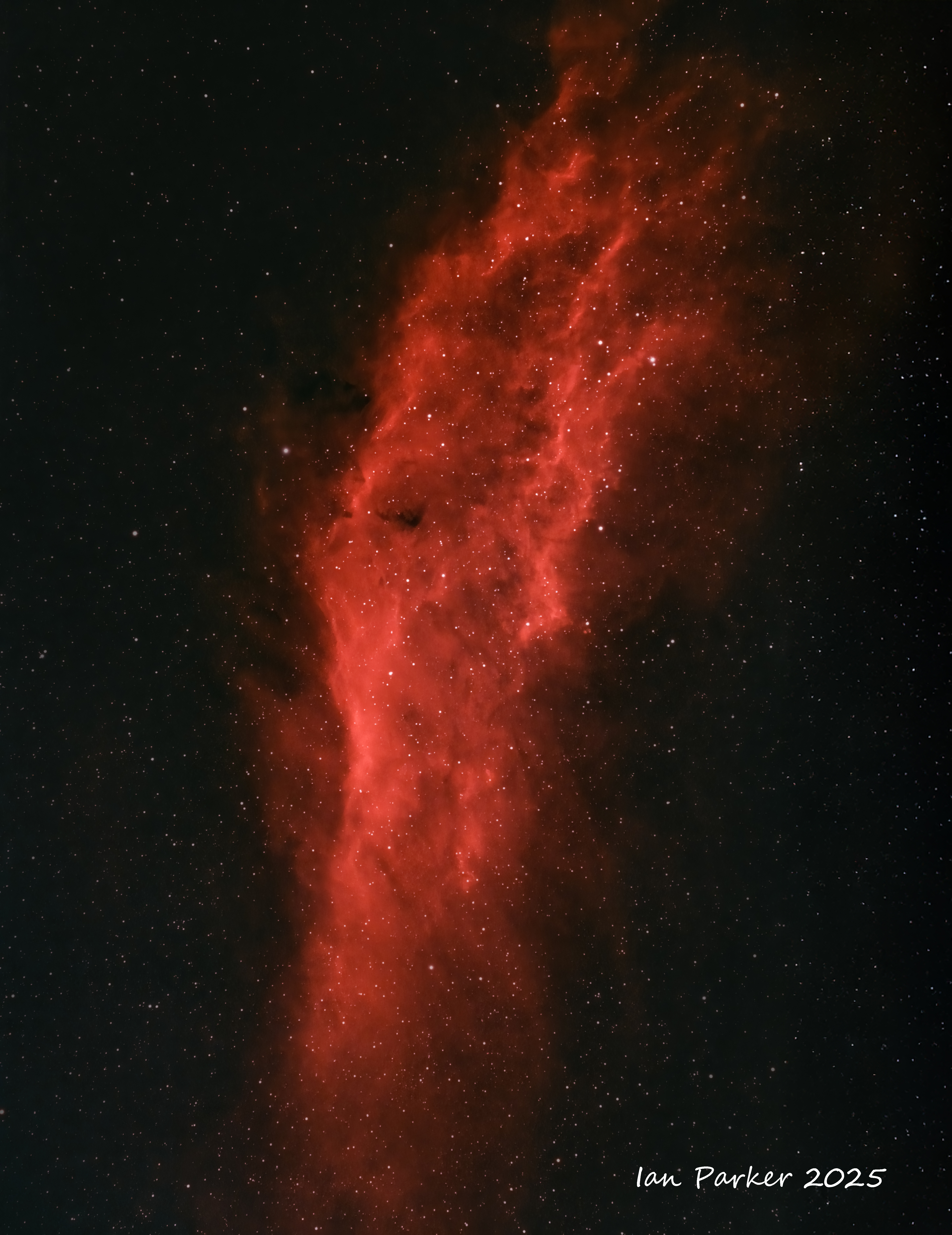
 NGC 1499 California Nebula
FF80 (at 600mm), Optolong L Ultimate Ha/OII, ASI 2600MC, ZWO AM3, ASI 220mm OAG ; Backyard in Redding Ca, Bortle 4 |
|
| |
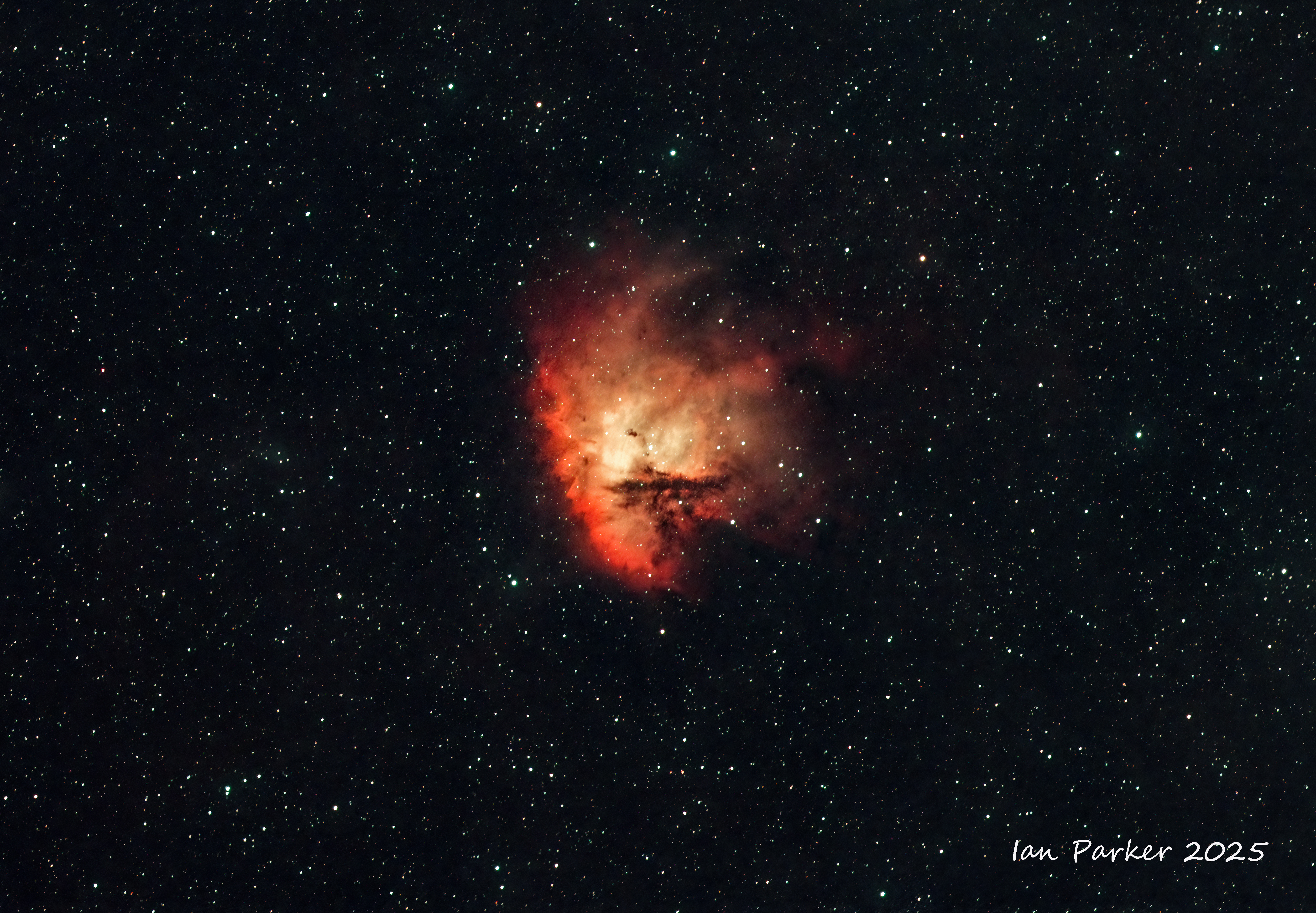
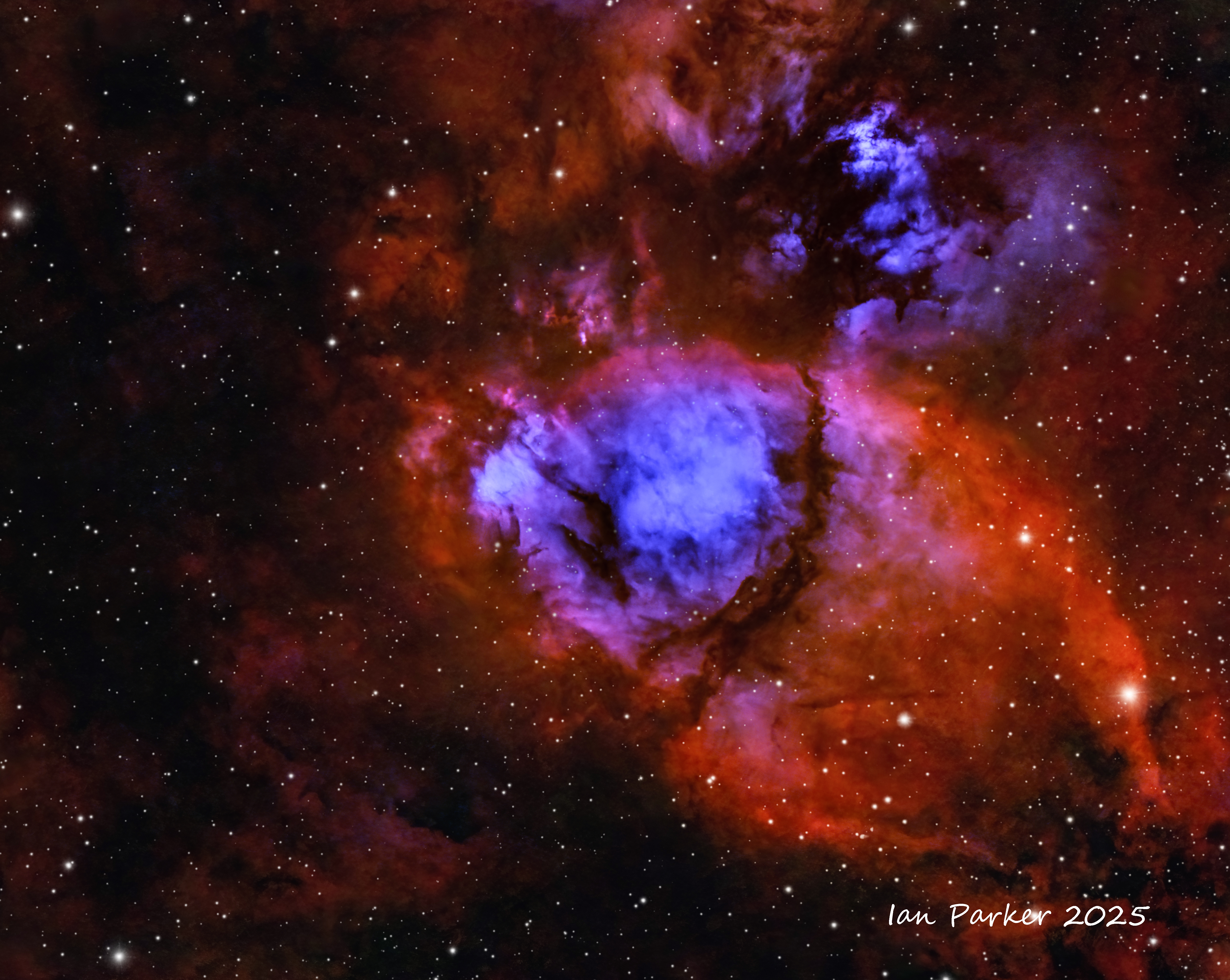
 Sh2-224 Rice Hat Nebula
FF80 with 0.7X reducer, Optolong L Ultimate Ha/OII, ASI 2600MC, ZWO AM3, ASI 220mm OAG; Backyard in Redding Ca, Bortle 4
Sh2-224 Rice Hat Nebula
FF80 with 0.7X reducer, Optolong L Ultimate Ha/OII, ASI 2600MC, ZWO AM3, ASI 220mm OAG; Backyard in Redding Ca, Bortle 4 |
|

IC405 Flaming Star Nebula
FF80, 0.7 reducer, ASI2600MC Pro, Optolong Ultimate Ha/OII (48 x 300s), Askar D2 SII (48 x 300s), UV/IR (15 x 300s) Bortle 4
|
|
Celestron Edge8 with 0.7 reducer,
50x300s subs; Dual narrowband Ha/OII Optolong Ultimate filter, |
| |
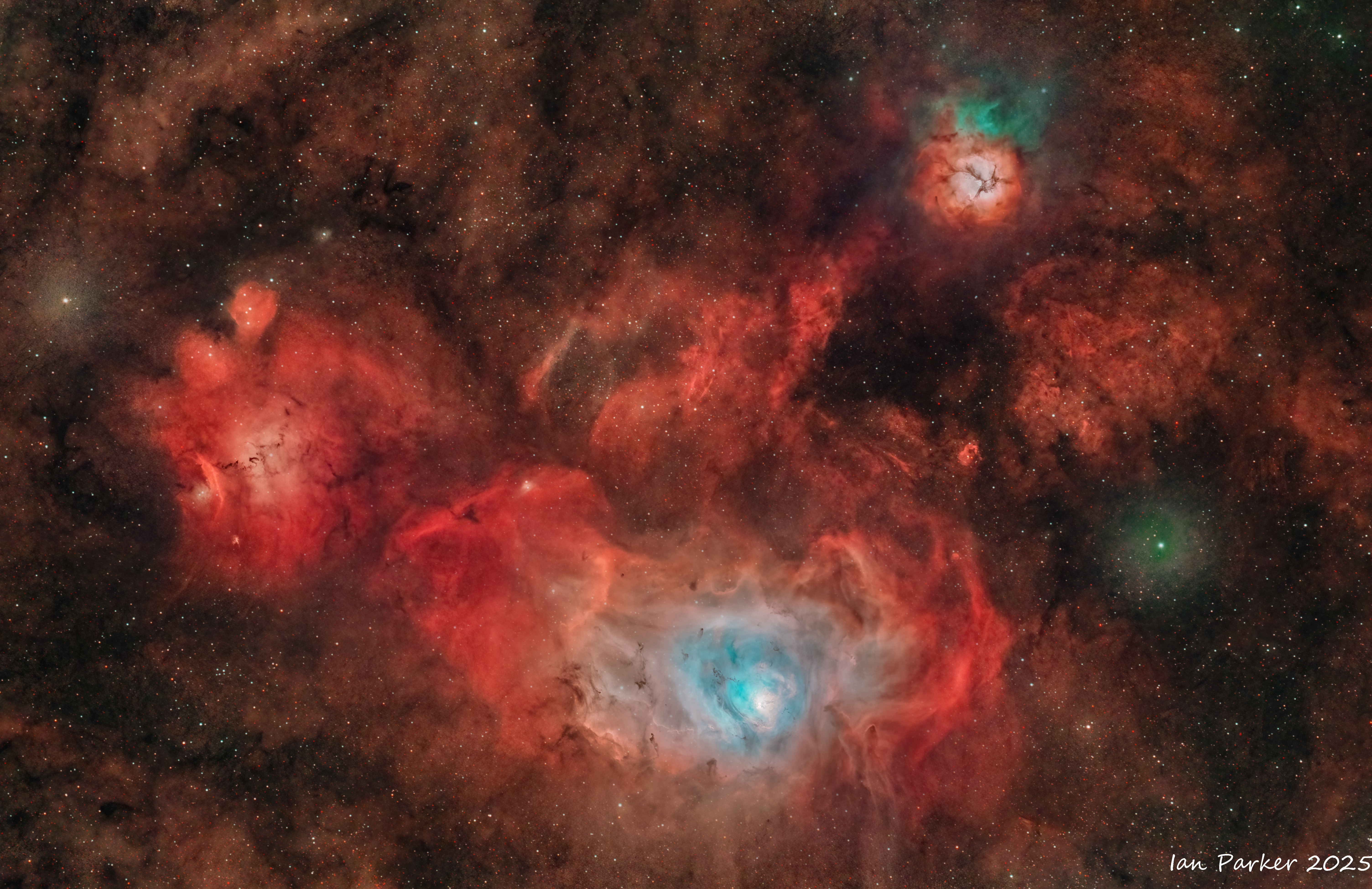
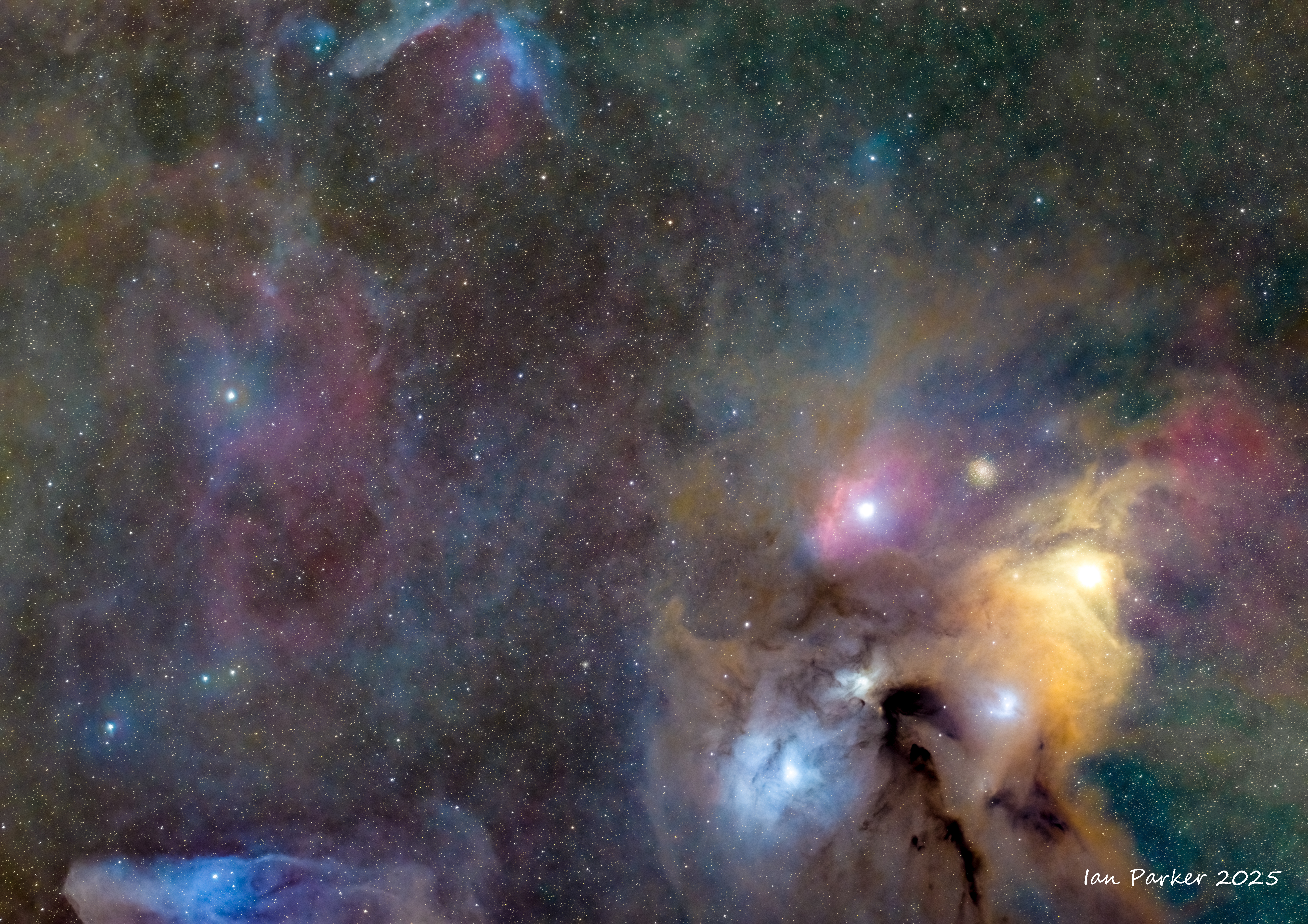
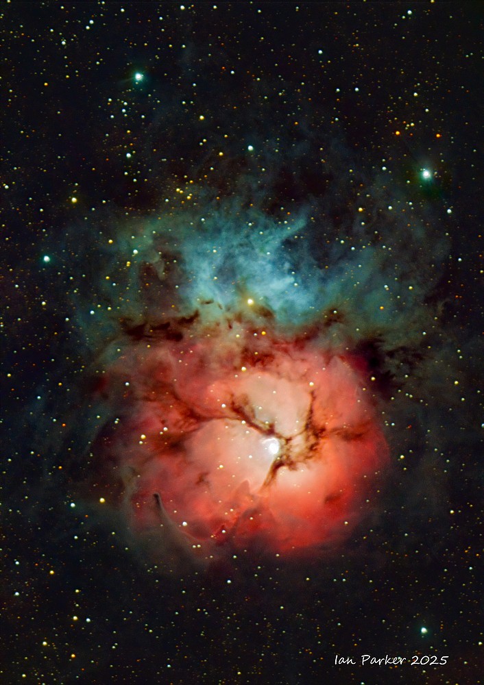 M 20 Trifid nebula
A combined reflection and emission nebula
Celestron EDGE 8 - broadband OSC and dual narrowband Ha/OIII |
|

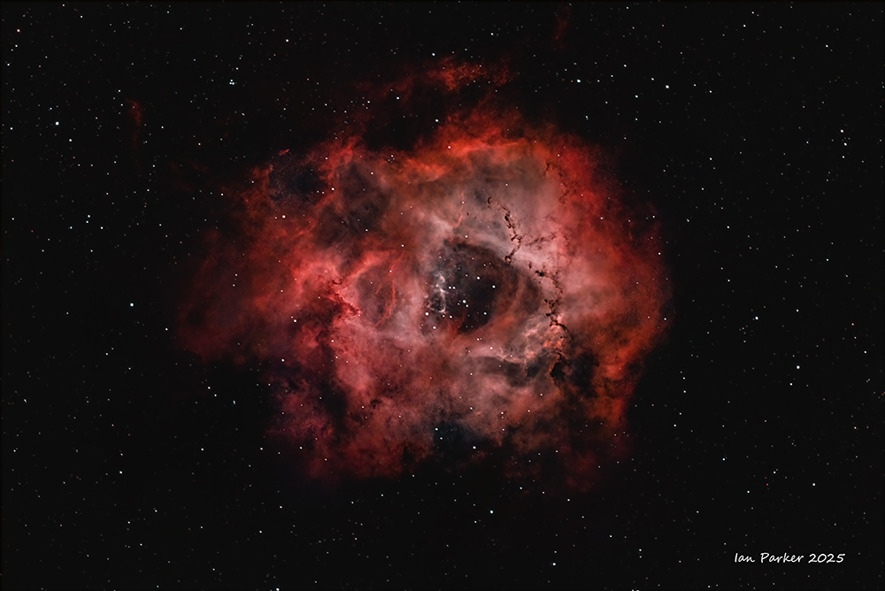
NGC2237 Rosette Nebula - Widefield in Ha/OIII
RedCat51, ASI2600MC Pro, Optolong Ultimate Ha.OIII filter, 86x300s subs, backyard Bortle 8/9,
|
| |
 IC1848 The Soul Nebula IC1848 The Soul Nebula
ZWO FF80 with 0.7 reducer, Dual narrowband Ha/OII Optolong Ultimate filter, About 4.5 hr under Bortle 7/8 sky at our driveway
|
|
| |
 NGC2174 The Monkey Head Nebula
ZWO FF80 with 0.7 reducer,. Dual narrowband Ha/OII Optolong Ultimate filter, Home driveway Bortle 7/8 sky. About 4.5hr interrgation after midnight
|
|
| |
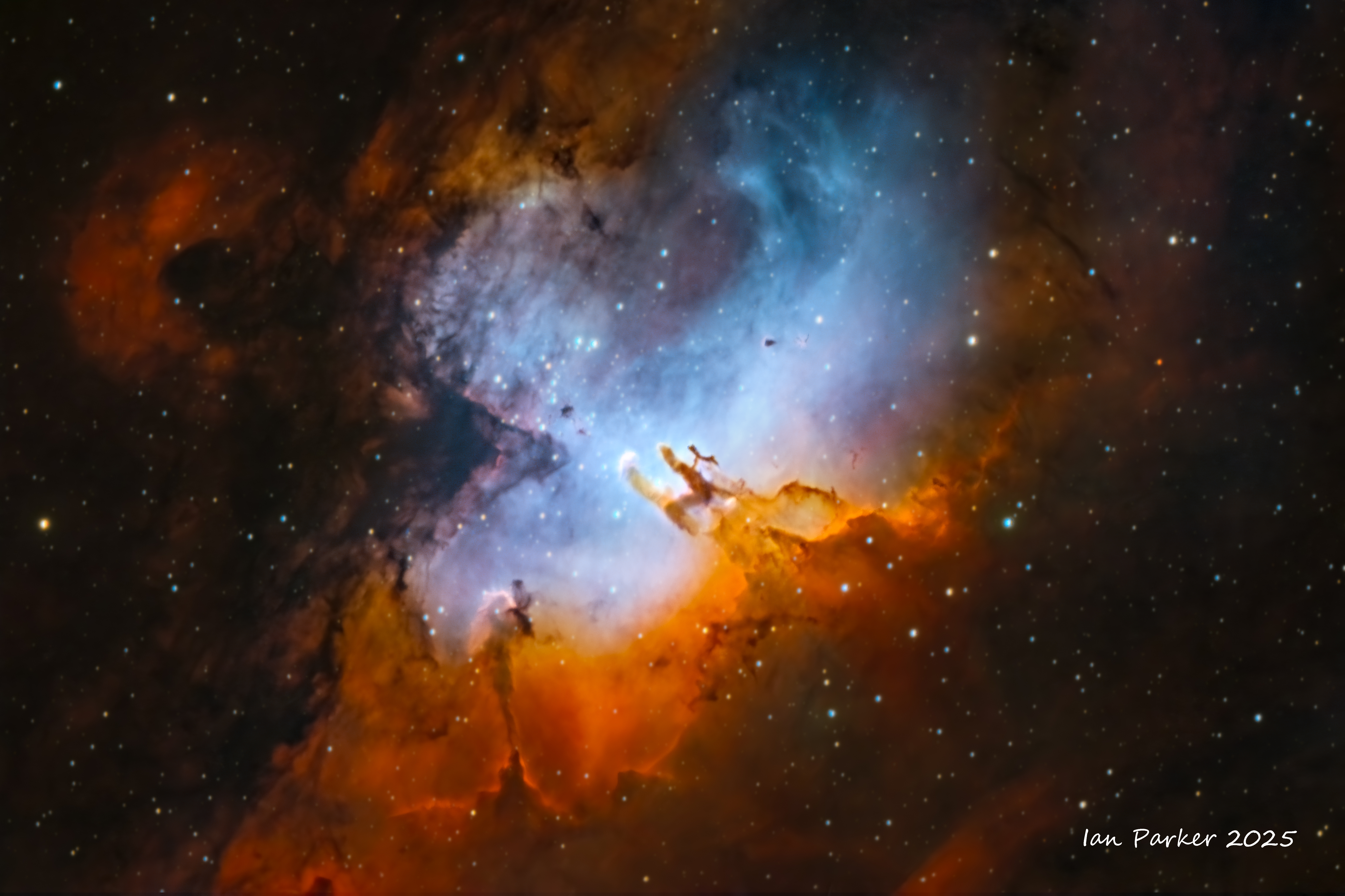
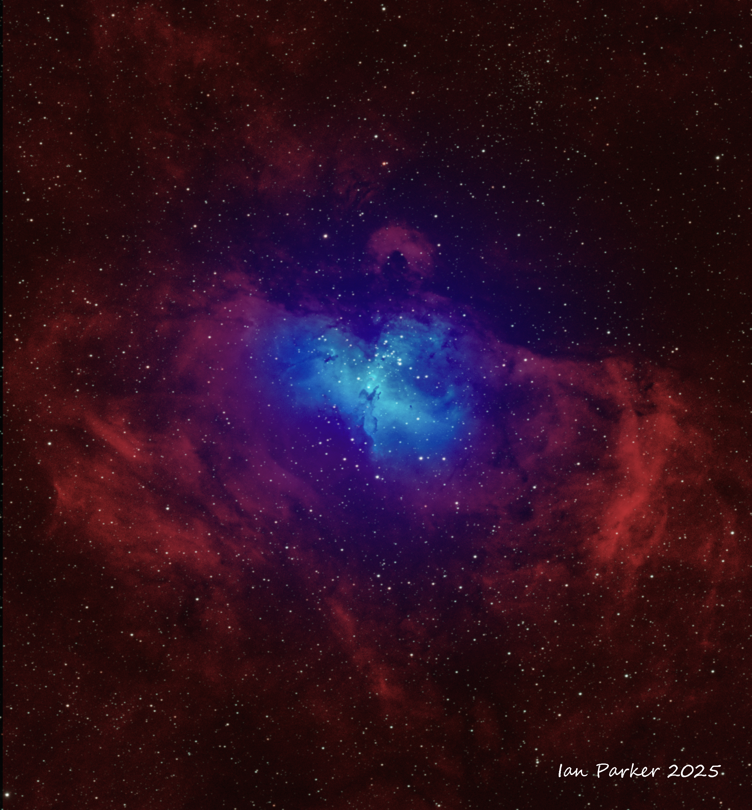
 M 16 Eagle Nebula
Canon 400mm f4 DO lens,
Ha/OIII narrowband filter
(OIII signal in blue enhanced)
M 16 Eagle Nebula
Canon 400mm f4 DO lens,
Ha/OIII narrowband filter
(OIII signal in blue enhanced) |
|
REFLECTION NEBULAE
|
|
| |
M 20 Trifid nebula
A combined reflection and emission nebula
Celestron EDGE 8 - broadband OSC and dual narrowband Ha/OIII
|
|
DARK NEBULAE / INTEGRATED FLUX NEBULAE
| |

Integrated flux nebula around Polaris
Canon 100mm macro lens, f2.8; 7hr integration
The Polaris Nebula is a very faint section of nebulosity in the apparent direction of Polaris, the North Star. The nebula is an example of an Integrated Flux Nebula. These type of nebulae lie in the outer regions of our galaxy and consist of fine dust particles illuminated by reflecting light from the entire Milky Way Galaxy. These clouds are very subtle and present quite challenging targets to photograph.
|
|
PLANETARY NEBULAE & SUPERNOVA REMNANTS
| |
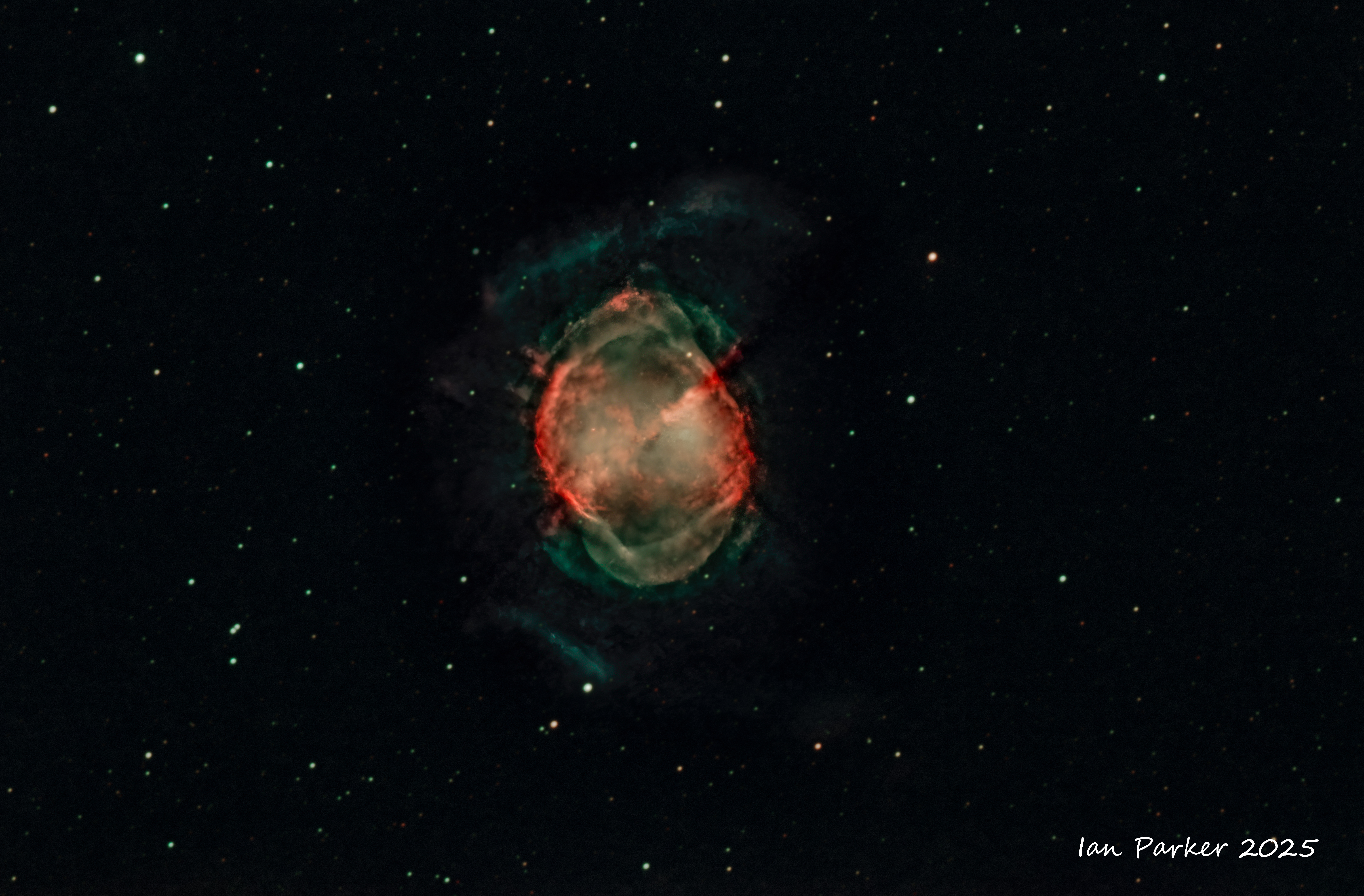
 M97 the Owl Nebula
Edge8 with 0.7 reducer, ASI 2600MC Pro, AM3, Optolong ultimate Ha/OIII, 80 x 300s subs, backyard, Bortle 8
M97 the Owl Nebula
Edge8 with 0.7 reducer, ASI 2600MC Pro, AM3, Optolong ultimate Ha/OIII, 80 x 300s subs, backyard, Bortle 8 |
|
| |
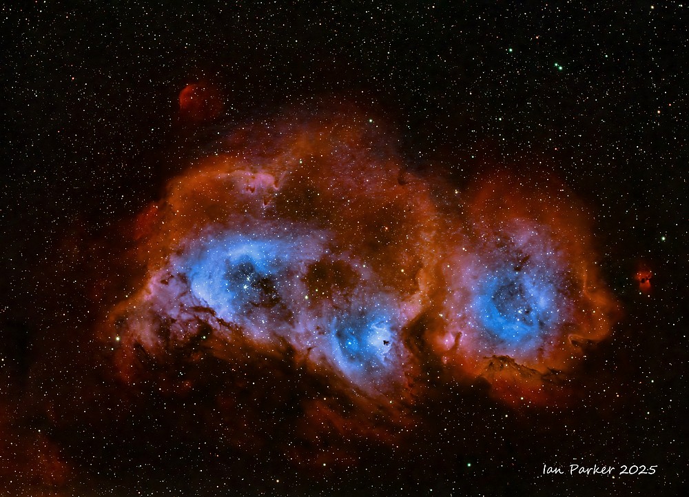
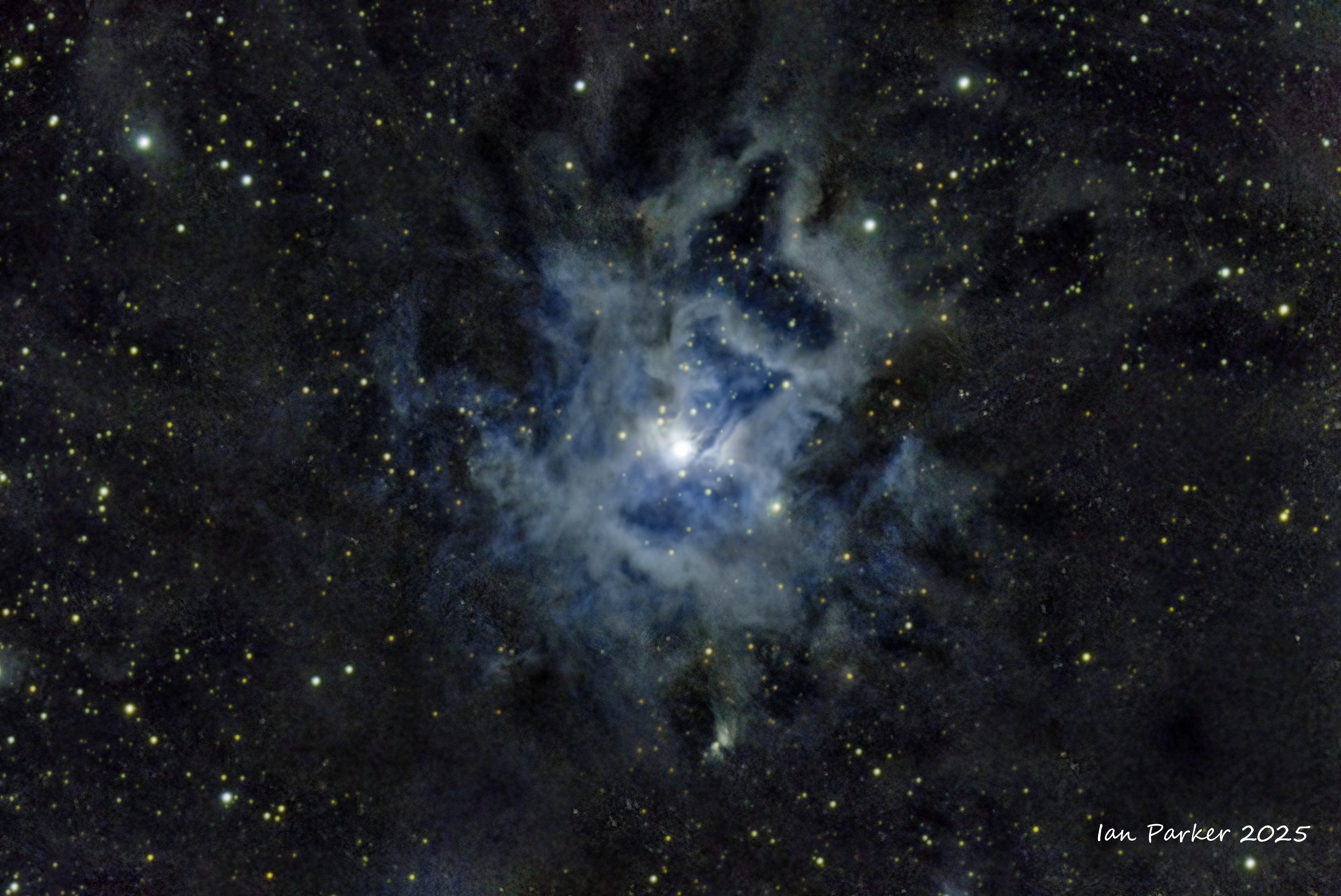
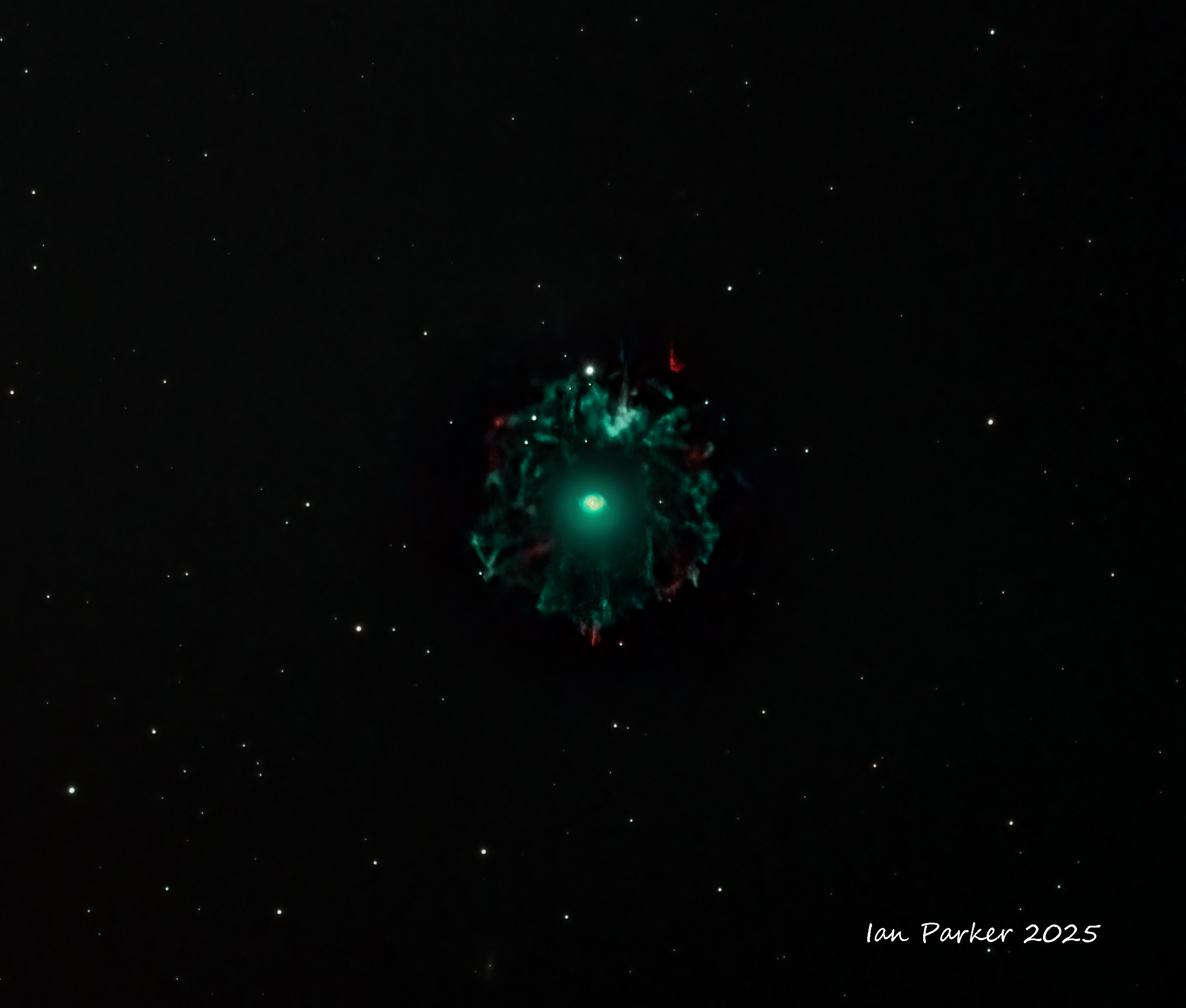
 Jones-Emberson 1 The Headphones Nebula
Edge8 with 0.7 reducer, ASI 2600MC Pro, AM3, Optolong ultimate Ha/OIII, 80 x 300s subs, backyard, Bortle 8
A rewarding but very faint target _ hope to get more time on it
Jones-Emberson 1 The Headphones Nebula
Edge8 with 0.7 reducer, ASI 2600MC Pro, AM3, Optolong ultimate Ha/OIII, 80 x 300s subs, backyard, Bortle 8
A rewarding but very faint target _ hope to get more time on it |
|
| |
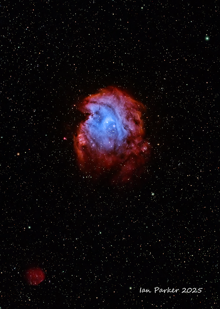
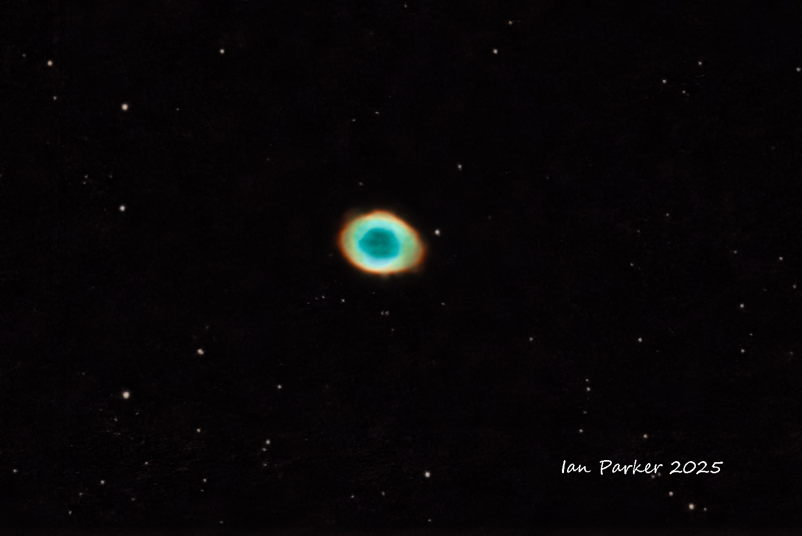
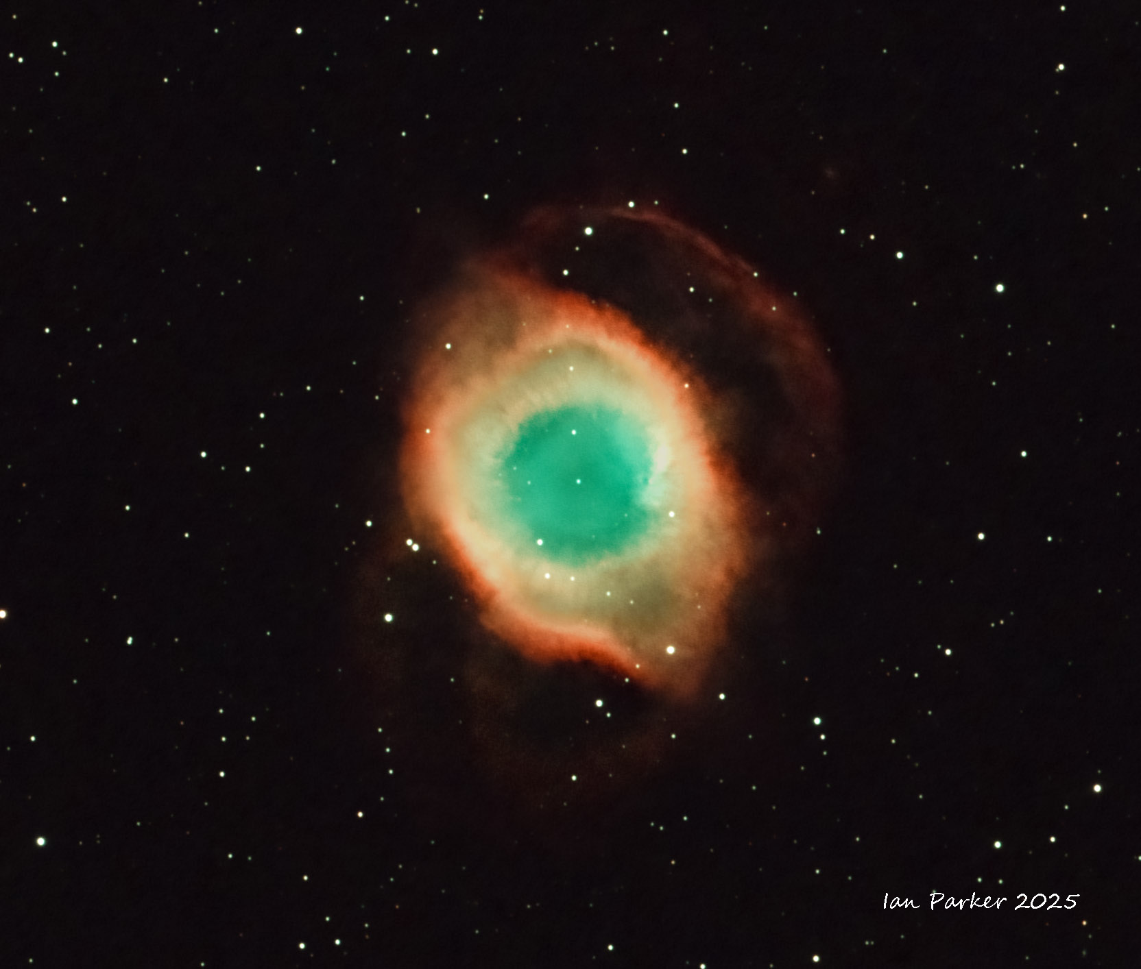
 Helix Nebula NGC 7293
Celestron C8 EDGE, Ha/OIII Optolong Ultimate narrowband filter 3 hrs integration under Bortle 3 skies.
Helix Nebula NGC 7293
Celestron C8 EDGE, Ha/OIII Optolong Ultimate narrowband filter 3 hrs integration under Bortle 3 skies. |
|
| |
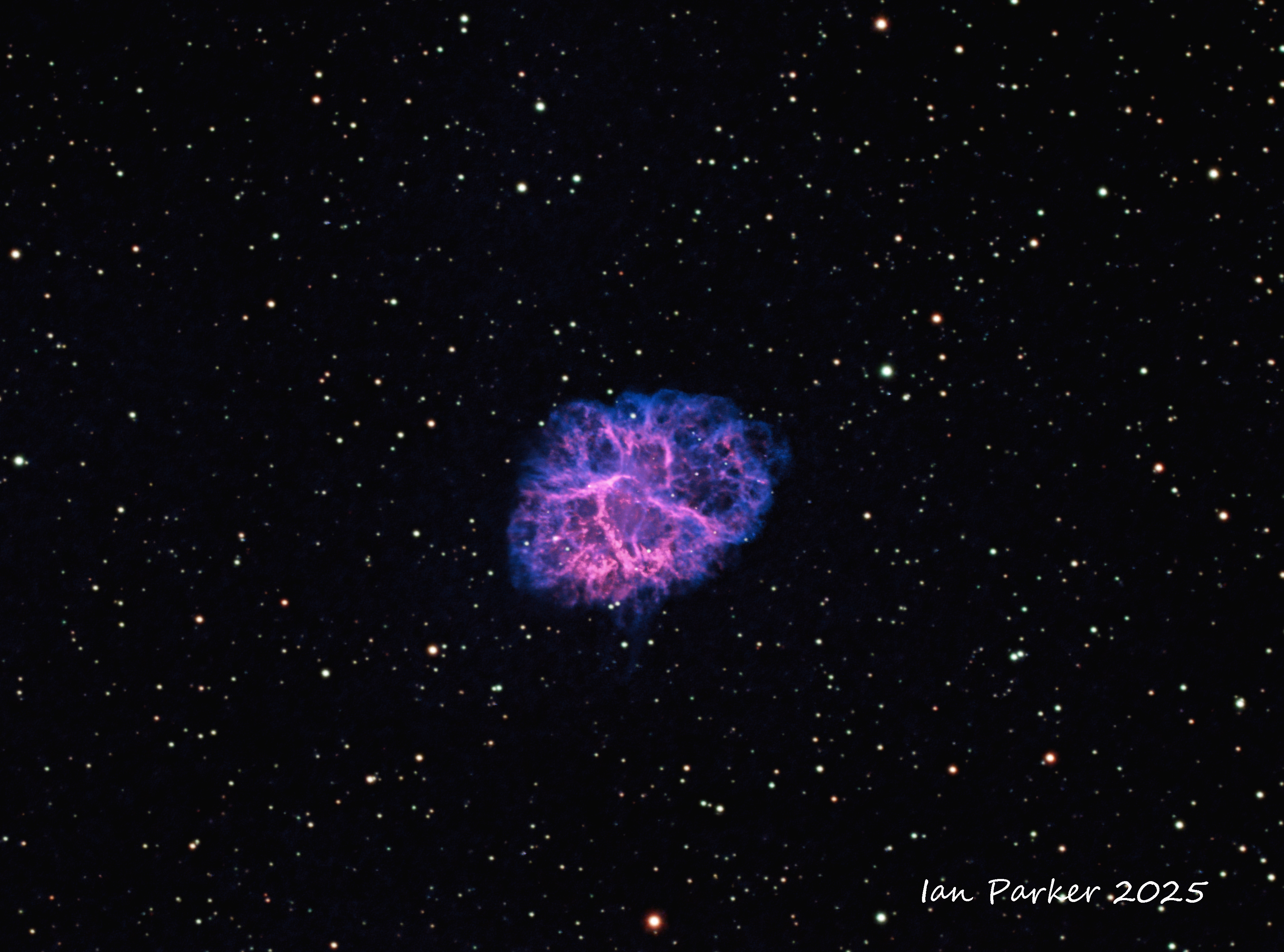
 M1 Crab Nebula
Celestron EDGE8 with 0.7 reducer, 80x300s subs, Optolong L Extreme Ha/OIII filter; backyard Bortle 8/9
M1 Crab Nebula
Celestron EDGE8 with 0.7 reducer, 80x300s subs, Optolong L Extreme Ha/OIII filter; backyard Bortle 8/9
|
|
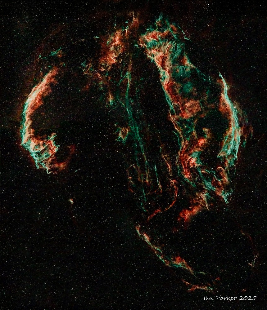
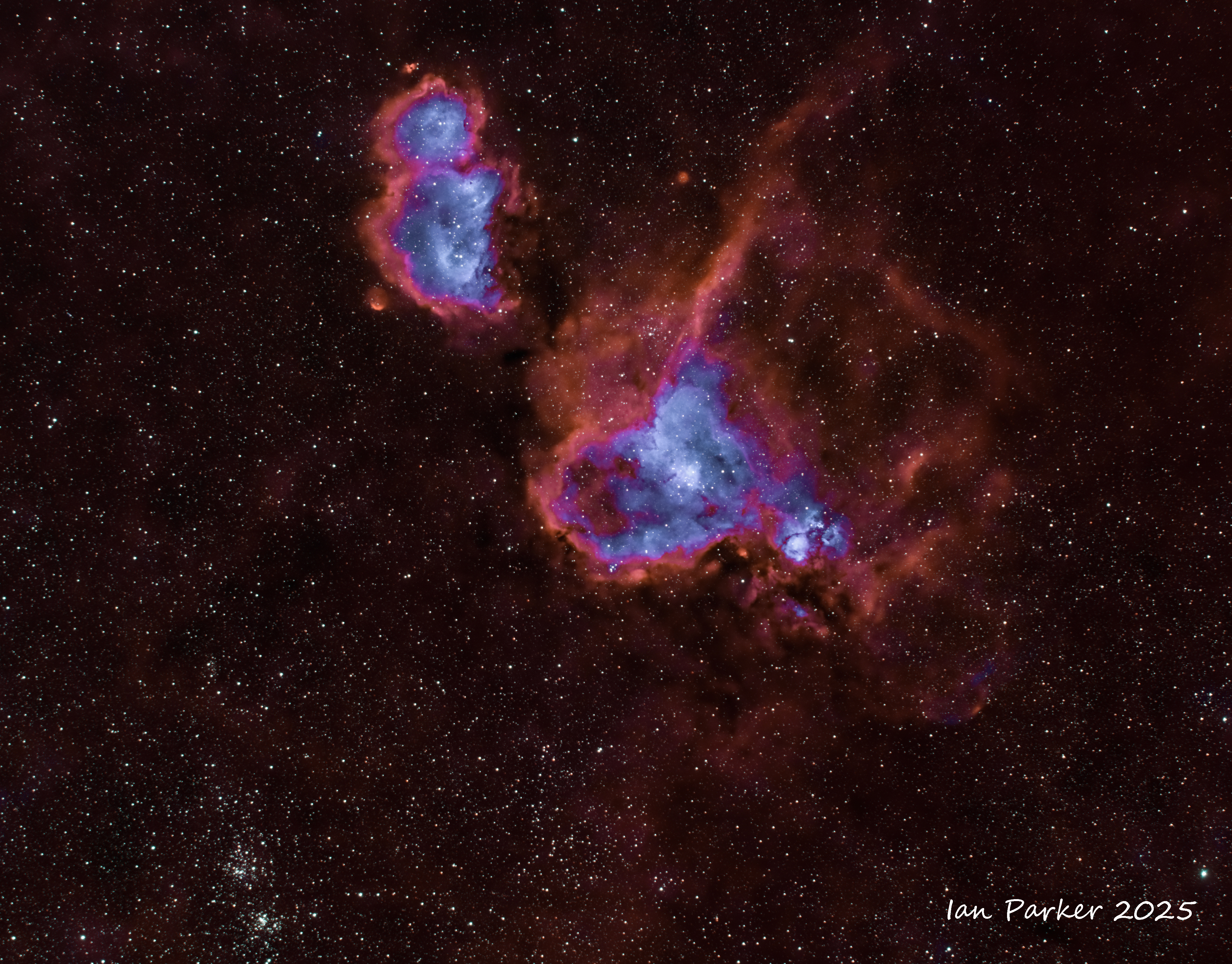
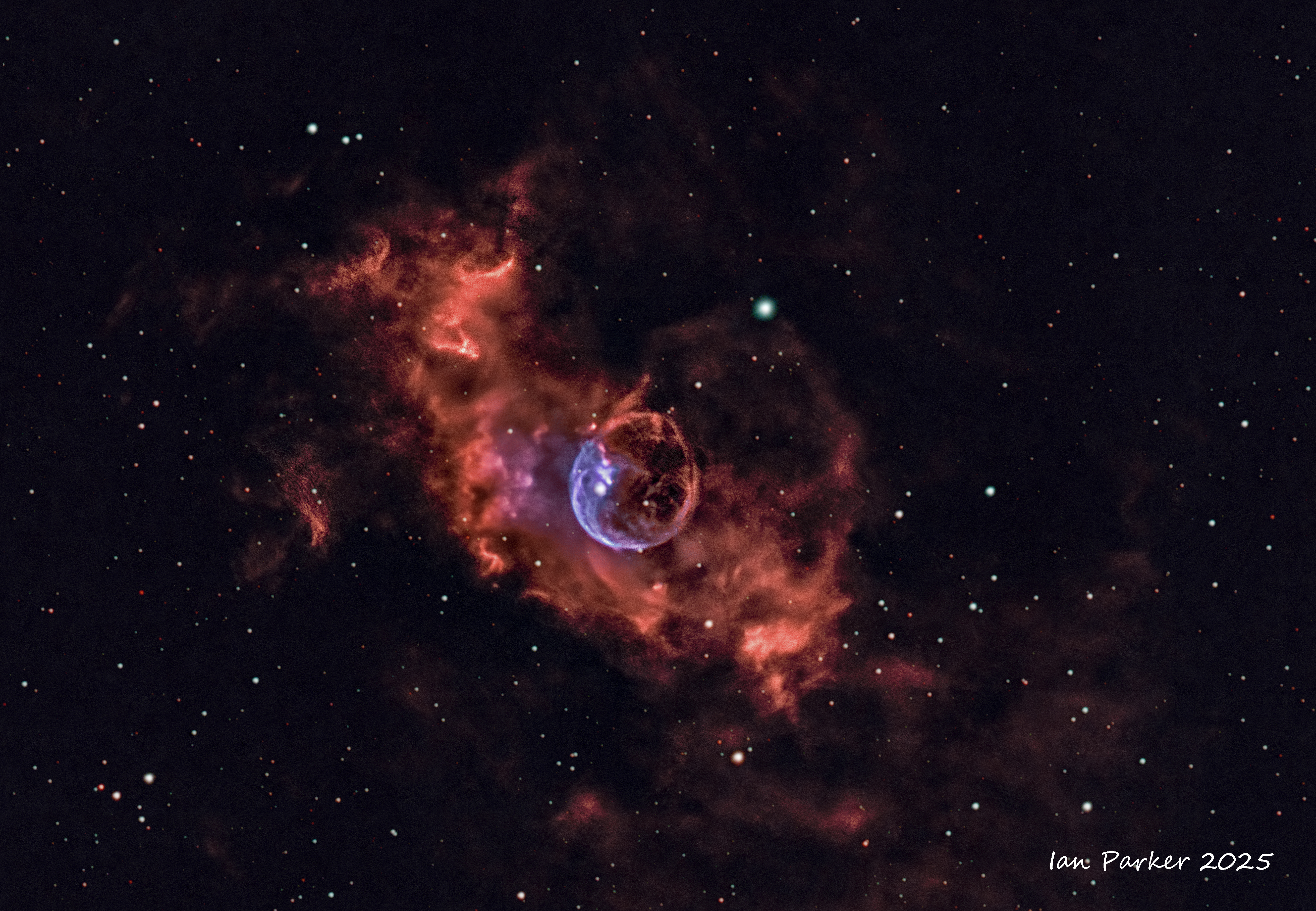
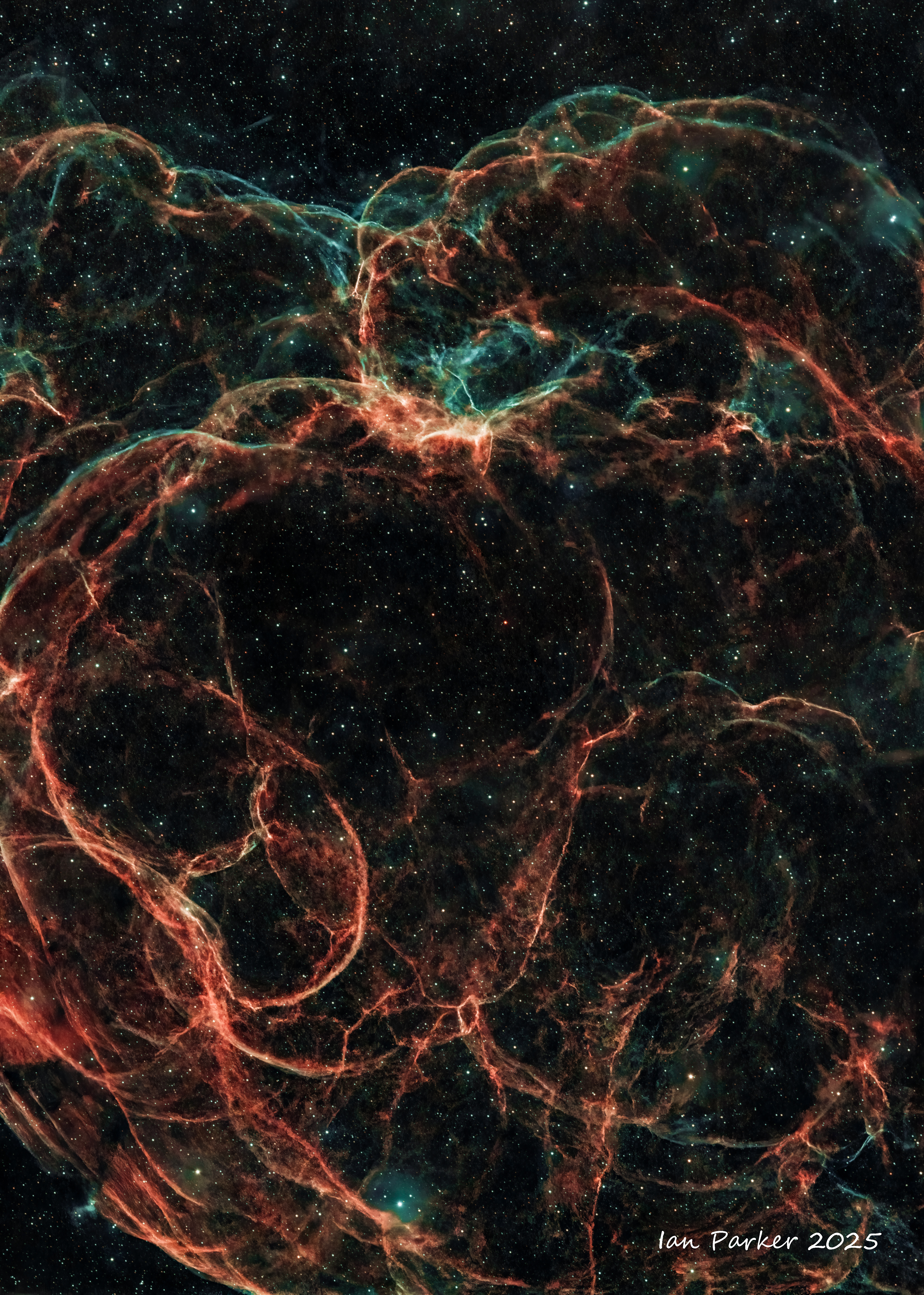
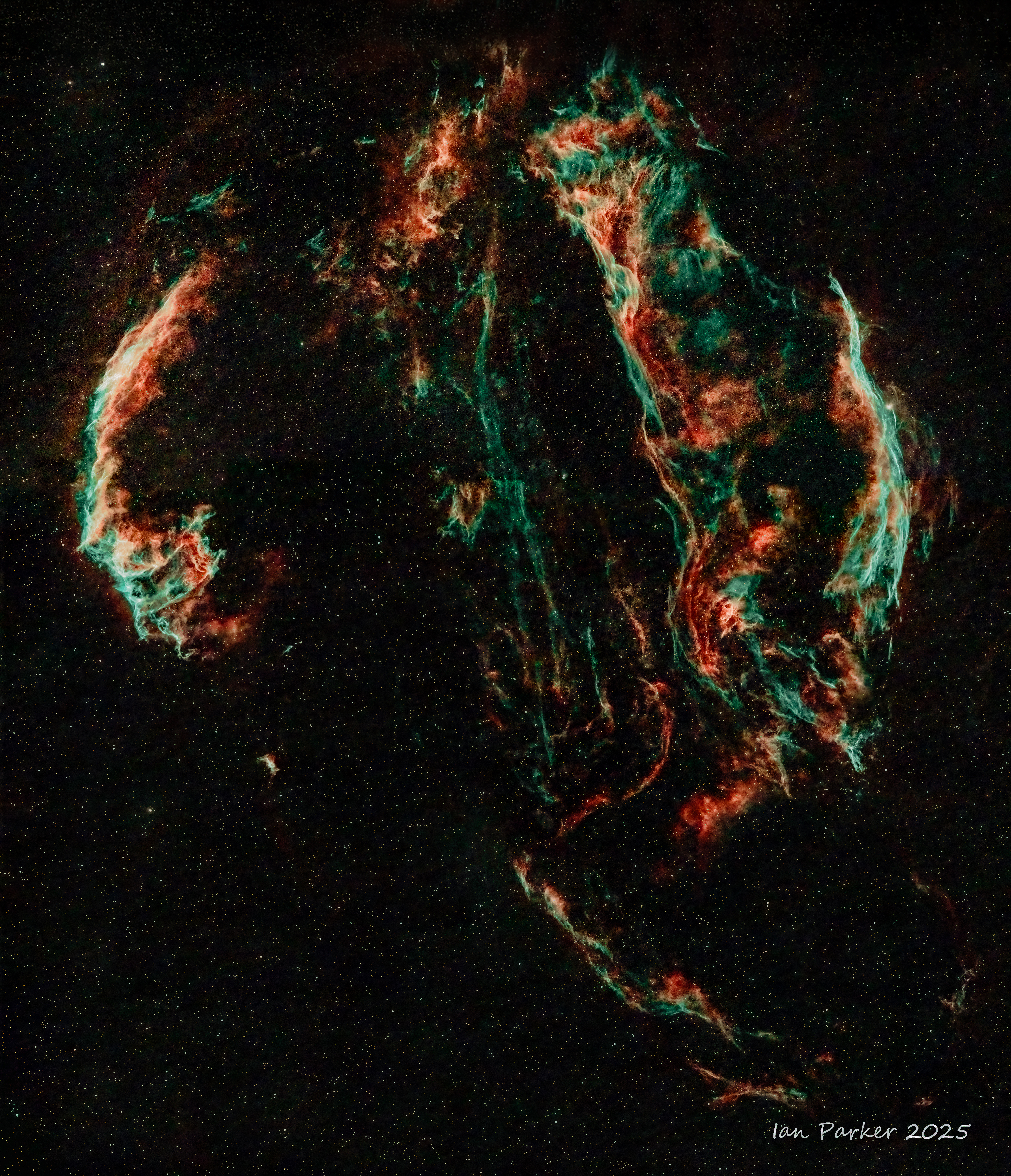
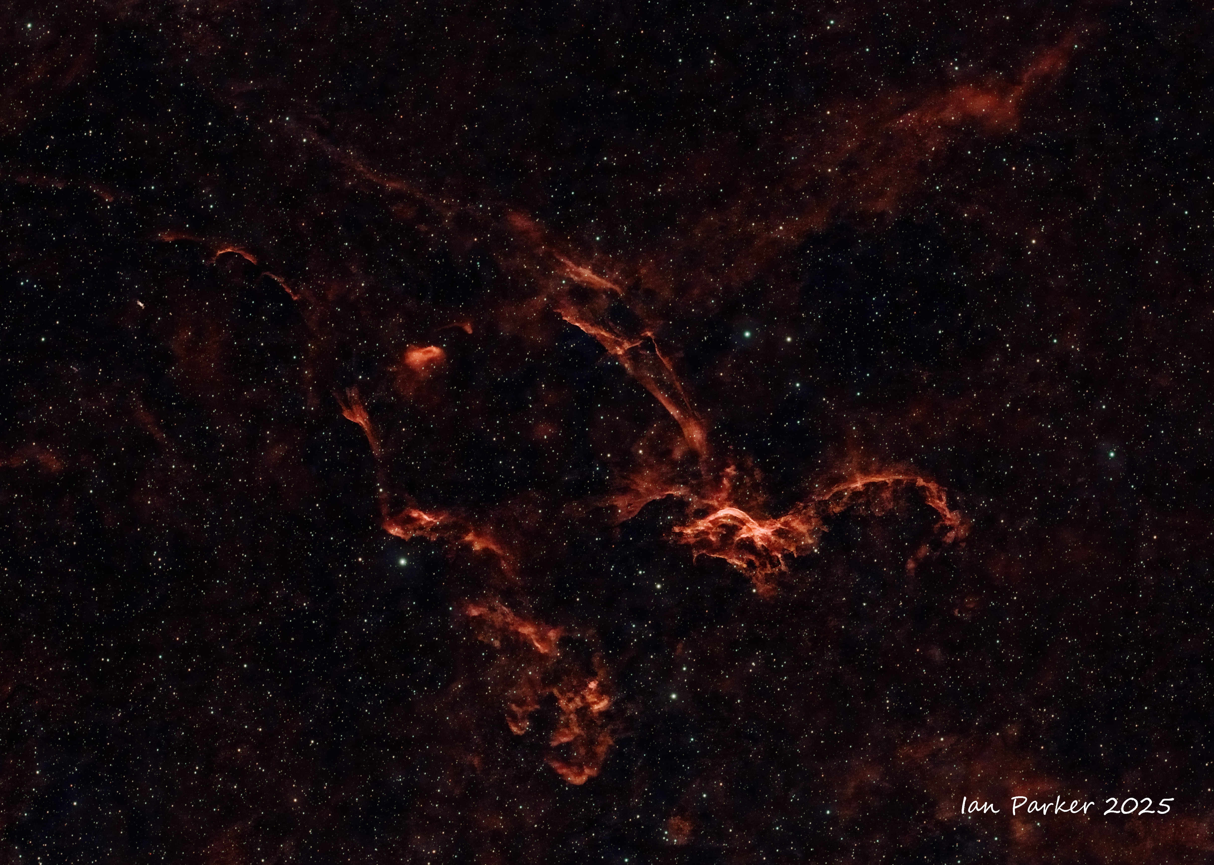
The Veil Nebula (Cygnus Loop) complex and its components
| |
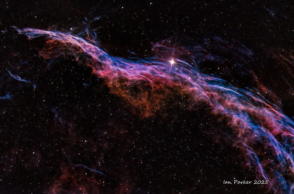
Witches Broom (Western Veil)
Celestron EDGE 8 with 0.7 reducer, dual narrowband Ha/OIII filter 70 x 300s, SII/OII filter 57 x 300s, Bortle 8-9
|
|
| |
 Fleming's Triangular Whisp
Celestron EDGE 8 with 0.7 reducer, dual narrowband Ha/OIII filter 103 x 300s, SII/OII filter 75 x 300s, Bortle 8-9
|
|
| |
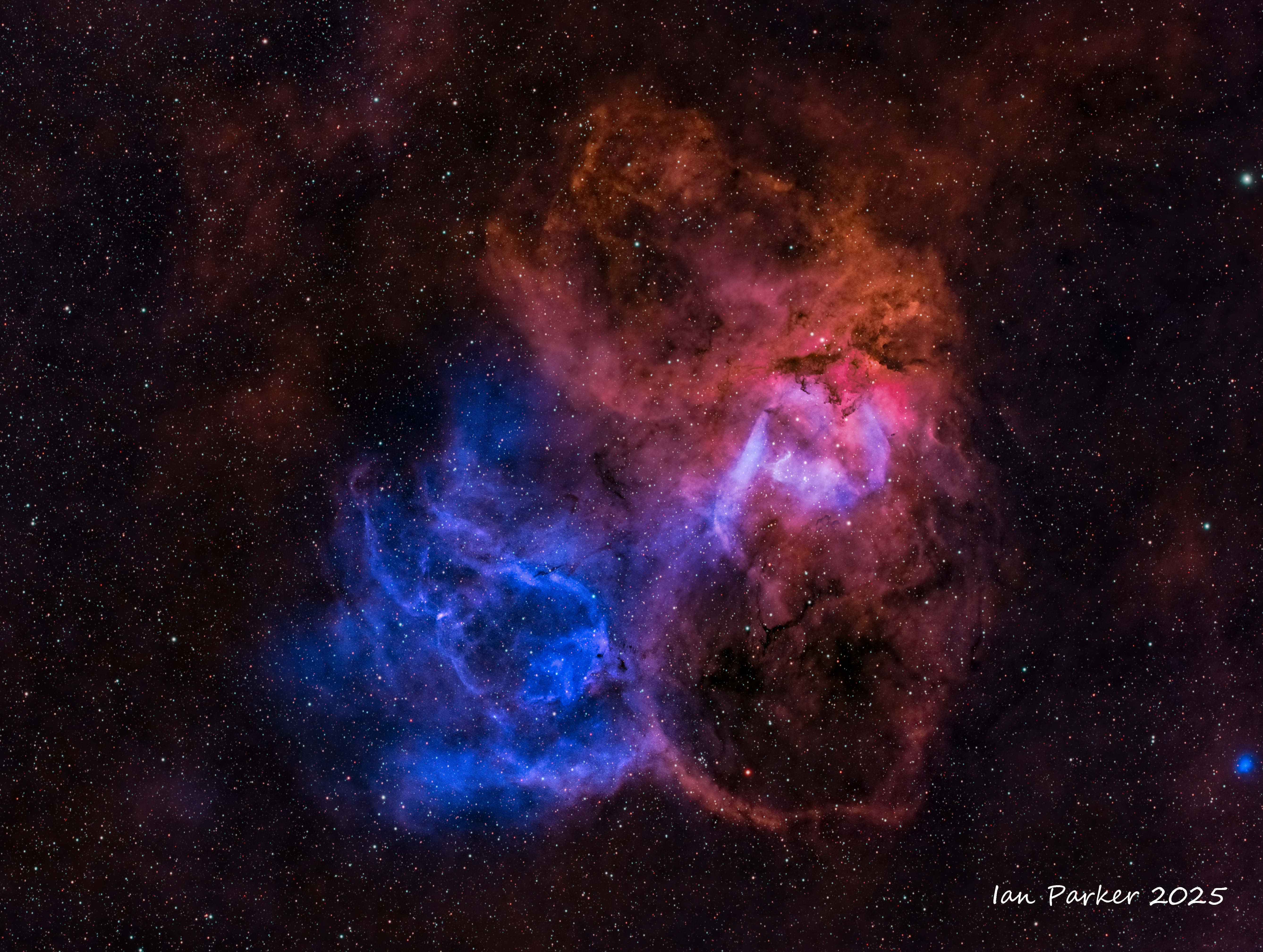
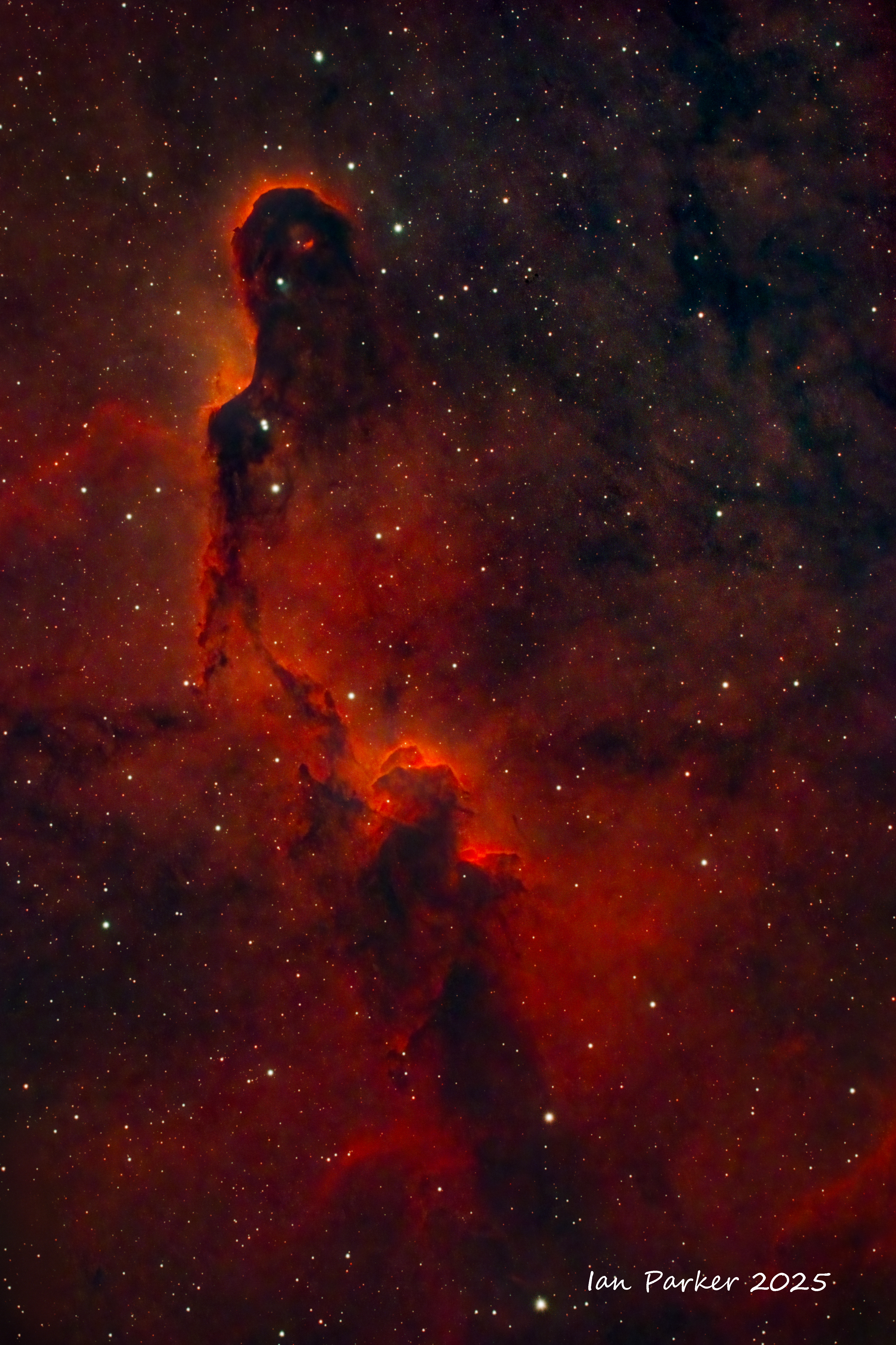
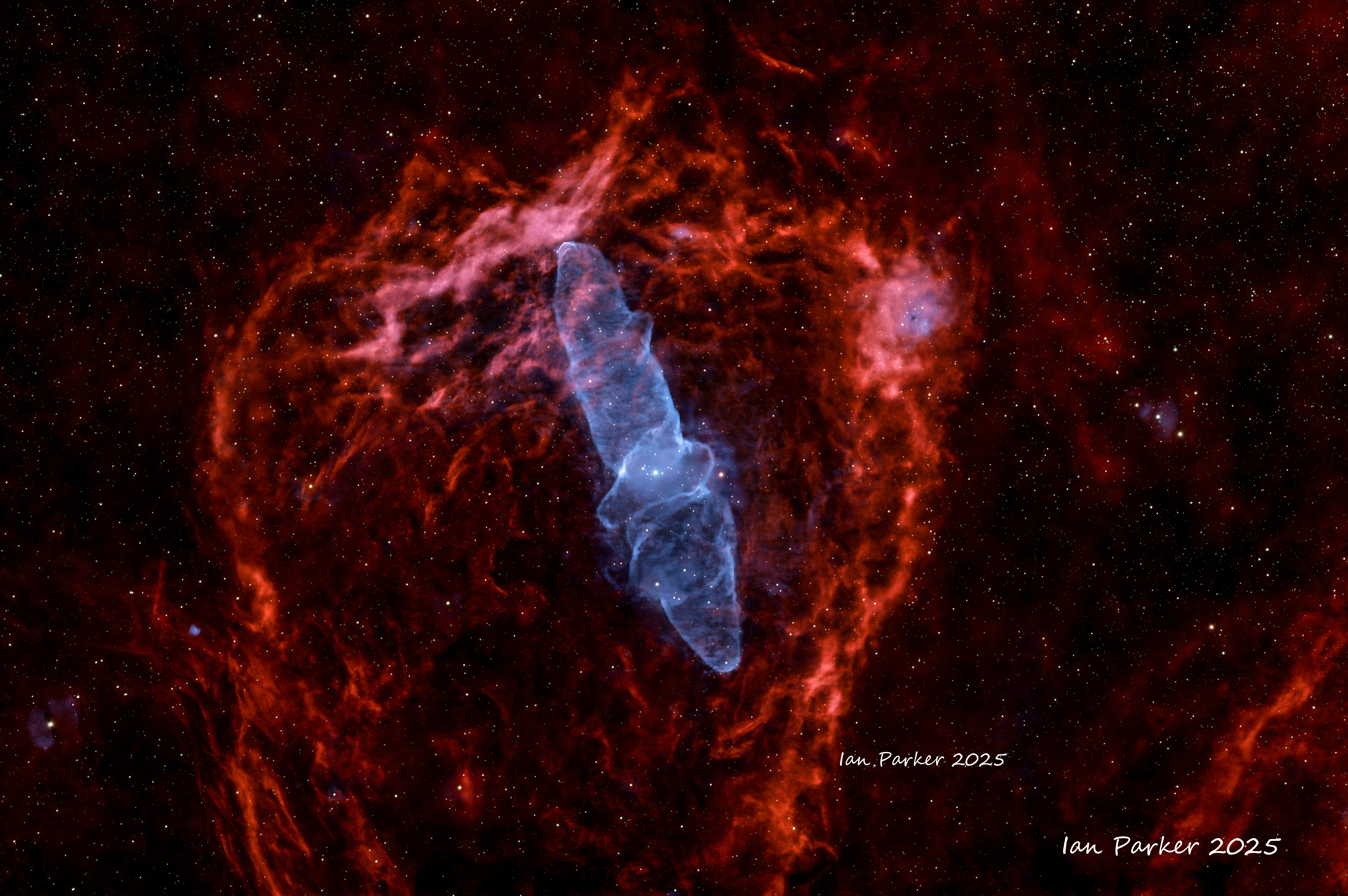
 LBN576/CTB1 The Medulla Nebula
ZWO FF80 with 0.7 reducer,. Dual narrowband Ha/OII Optolong Ultimate filter, Bortle 2 sky
.
Another very faint target. I had intended to get a full night (10hrs) imaging, but the sequence stopped short after about 3 hrs for unknown reason. I was surprised at how well the image came out after such a short integration time..
|
|
GALAXIES
| |

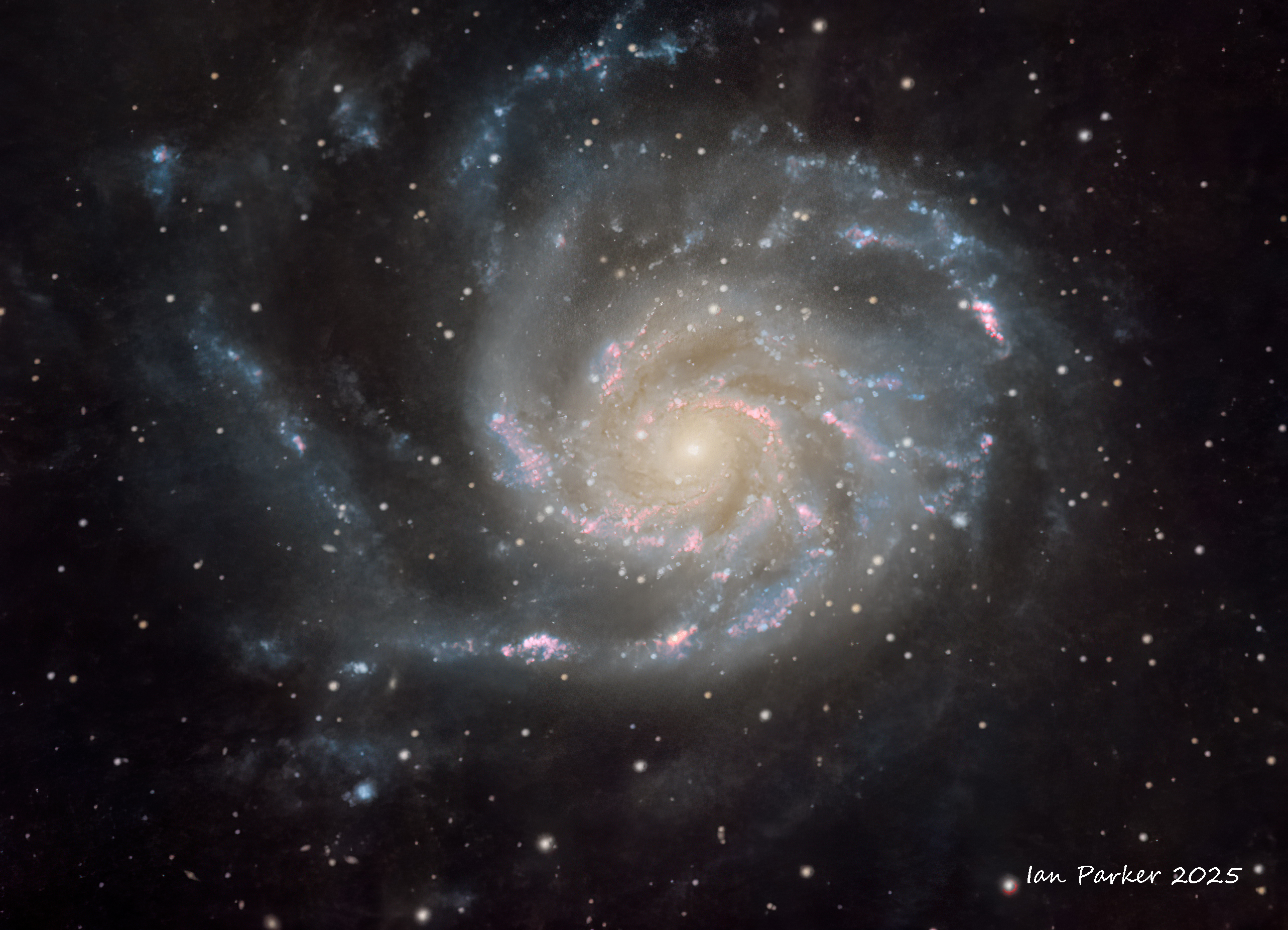
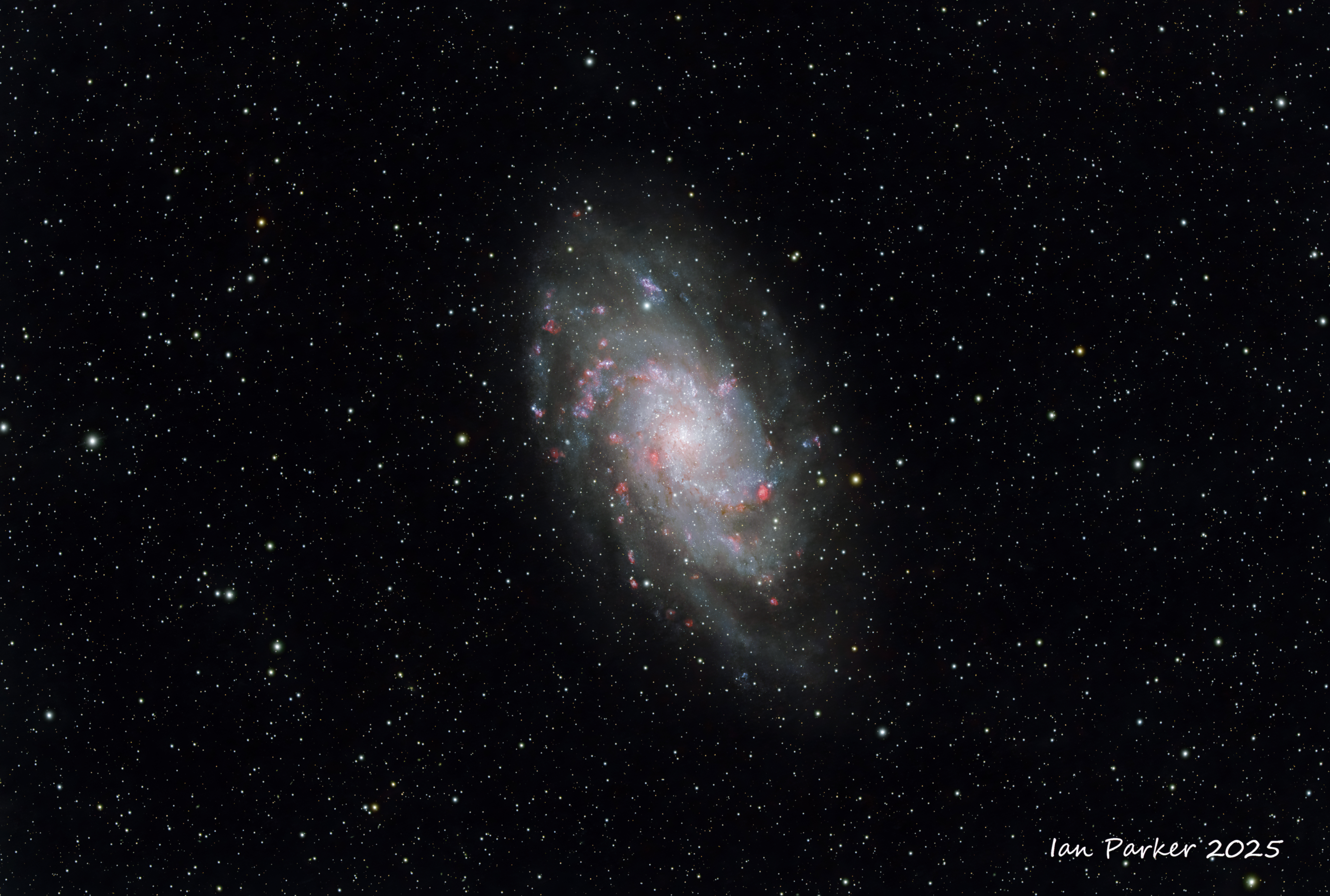
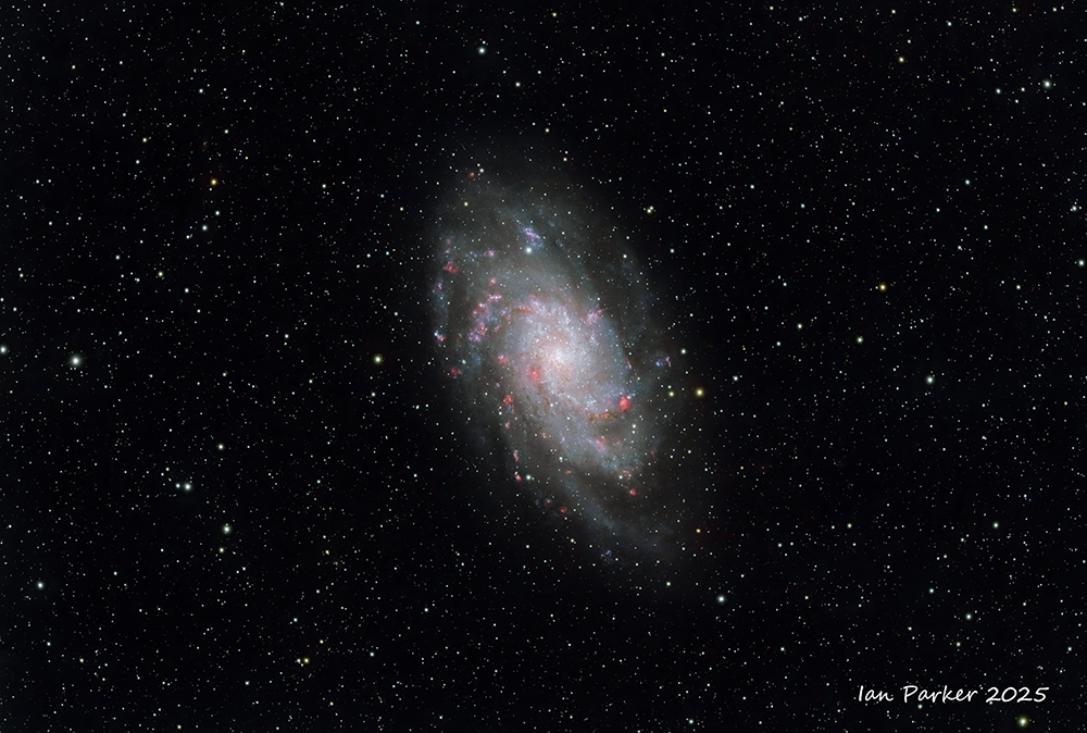
Pinwheel galaxy with added Ha
OSC no filter 6hrs at Bortle 2 site in Mojave Desert with added Ha using dual narrowband (7 nm Ha) filiter, 3 hrs in our driveway (Bortle 9).
|
|
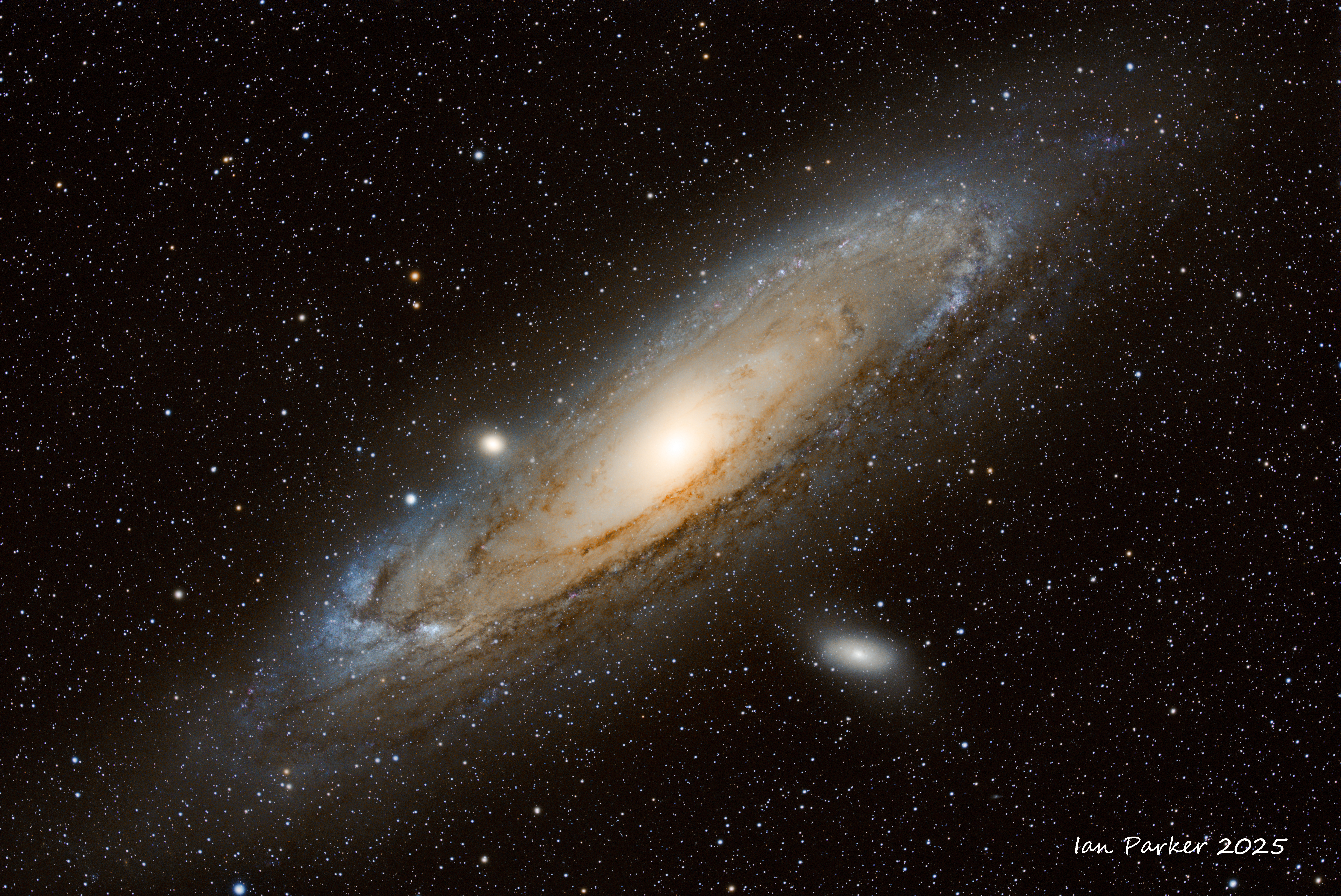
 Bodes (M81) and ciga (M82) galaxies
EDGE8 HD, ASI2600MC PRO, ZWO AM5, ZWO OAG, ASI220MM mini, ZWO EAF, UV/IR cut and Oplolong Ultimate Ha/OIII filters: 30x300s Ha subs, 63 x 300s broadband subs, , Bortle 2
Bodes (M81) and ciga (M82) galaxies
EDGE8 HD, ASI2600MC PRO, ZWO AM5, ZWO OAG, ASI220MM mini, ZWO EAF, UV/IR cut and Oplolong Ultimate Ha/OIII filters: 30x300s Ha subs, 63 x 300s broadband subs, , Bortle 2 |
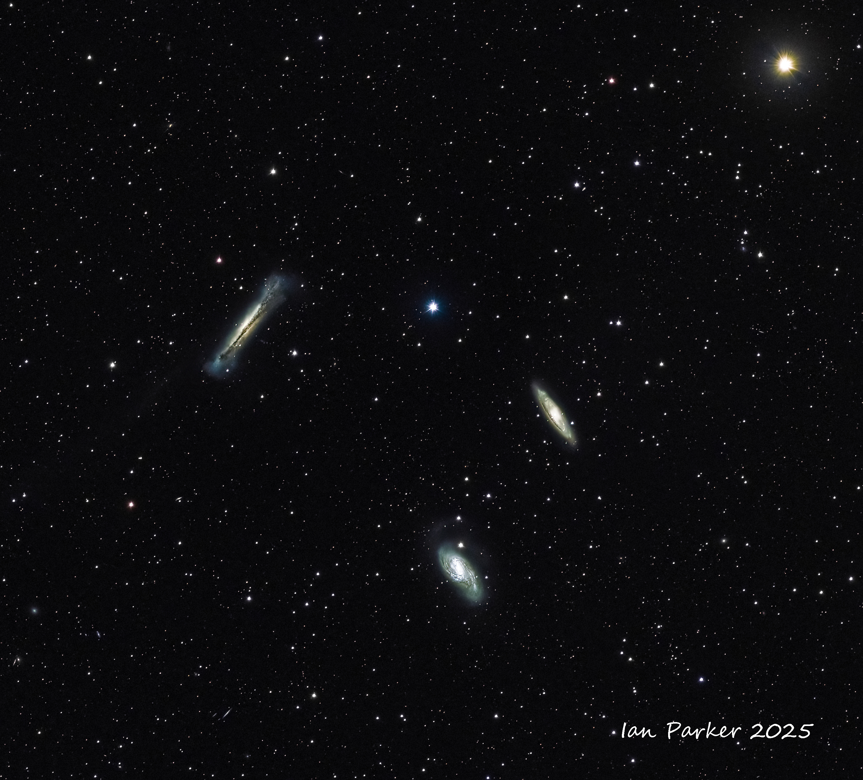
 Antenna galaxies (NGC4038)
EDGE8 HD, ASI2600MC PRO, ZWO AM5, ZWO OAG, ASI220MM mini, ZWO EAF, UV/IR cut filter: 67x300s subs, Bortle 4 |
 M106
EDGE8 HD, ASI2600MC PRO, ZWO AM5, ZWO OAG, ASI220MM mini, ZWO EAF, UV/IR cut and Optolong Ultimate Ha/OIII filters: 25x300s Ha subs, 45 x 300s broadband subs: Bortle 2
M106
EDGE8 HD, ASI2600MC PRO, ZWO AM5, ZWO OAG, ASI220MM mini, ZWO EAF, UV/IR cut and Optolong Ultimate Ha/OIII filters: 25x300s Ha subs, 45 x 300s broadband subs: Bortle 2 |
| |
 Leo
triplet - spiral galaxies M65, M66, and NGC 3628 ("Hamburger galaxy")
Leo
triplet - spiral galaxies M65, M66, and NGC 3628 ("Hamburger galaxy")
Canon 400mm f4 DO lens, no filter |
|
METEOR SHOWERS
COMETS
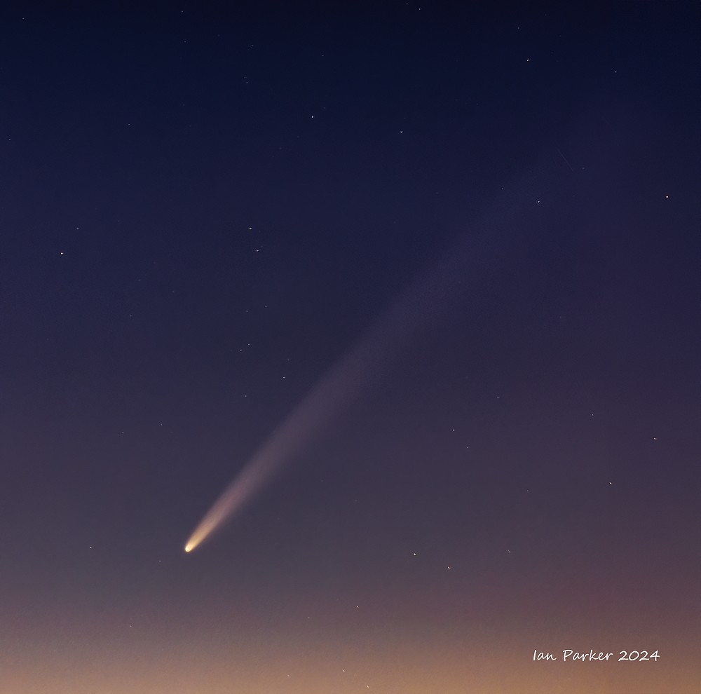
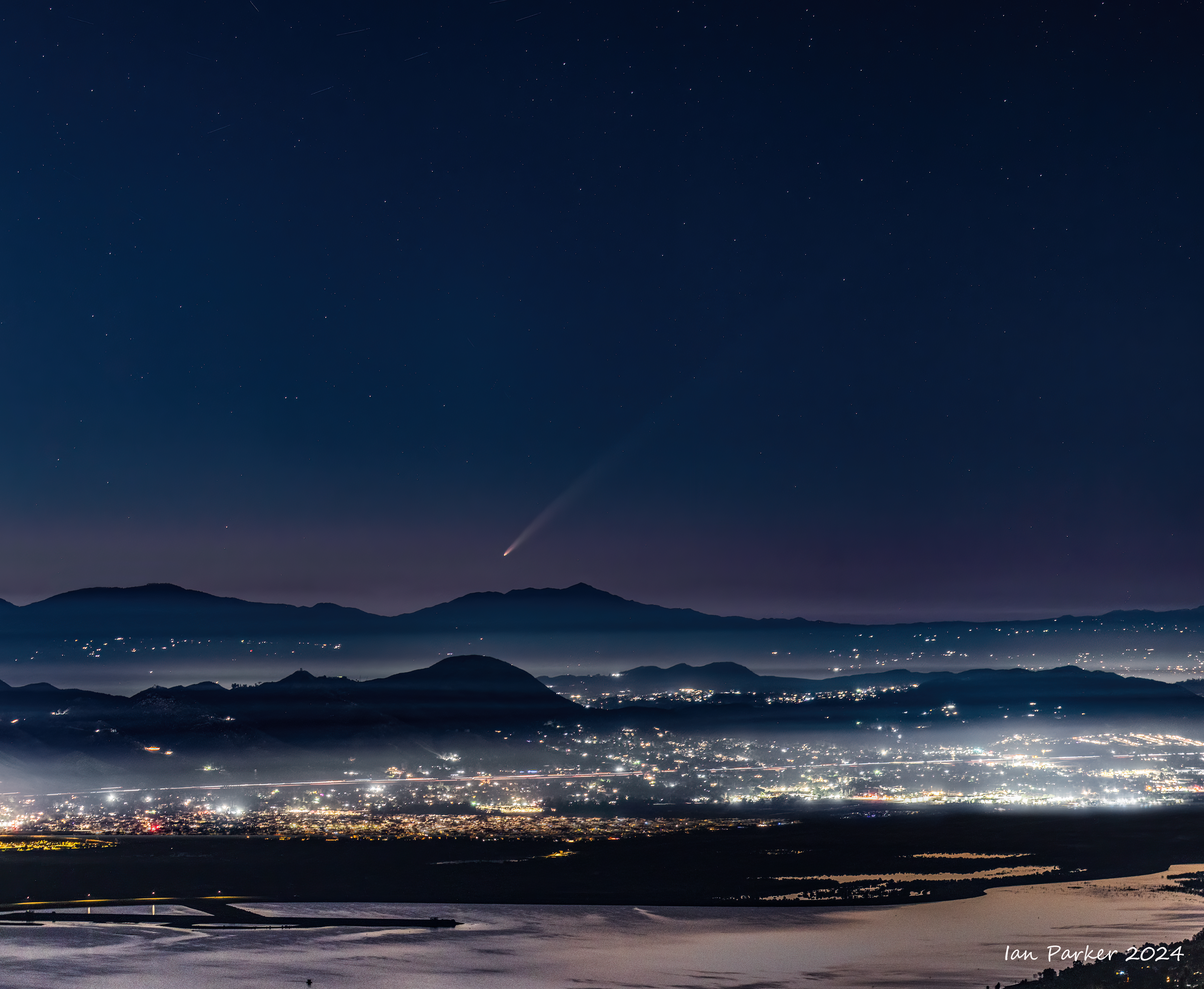
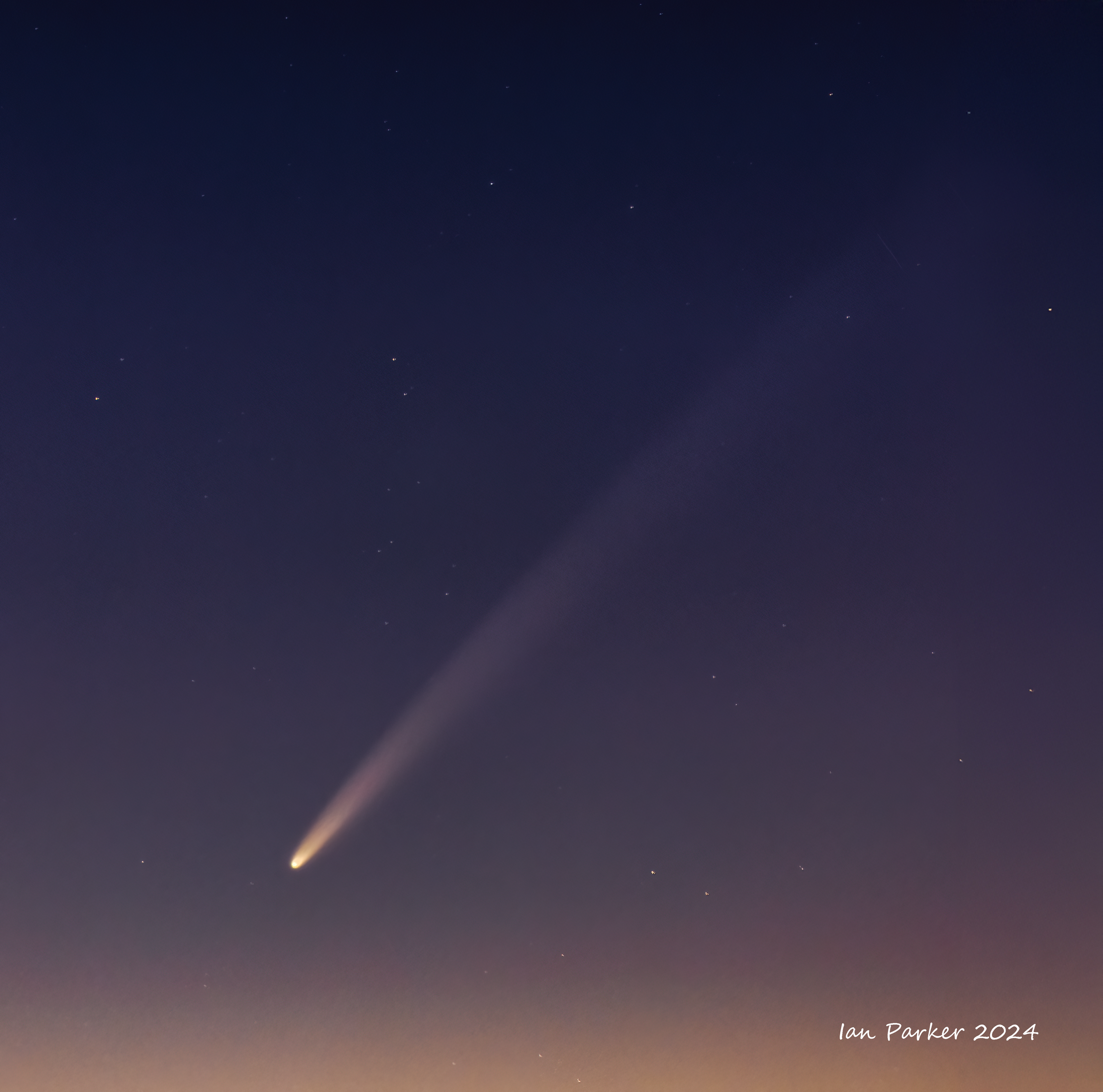
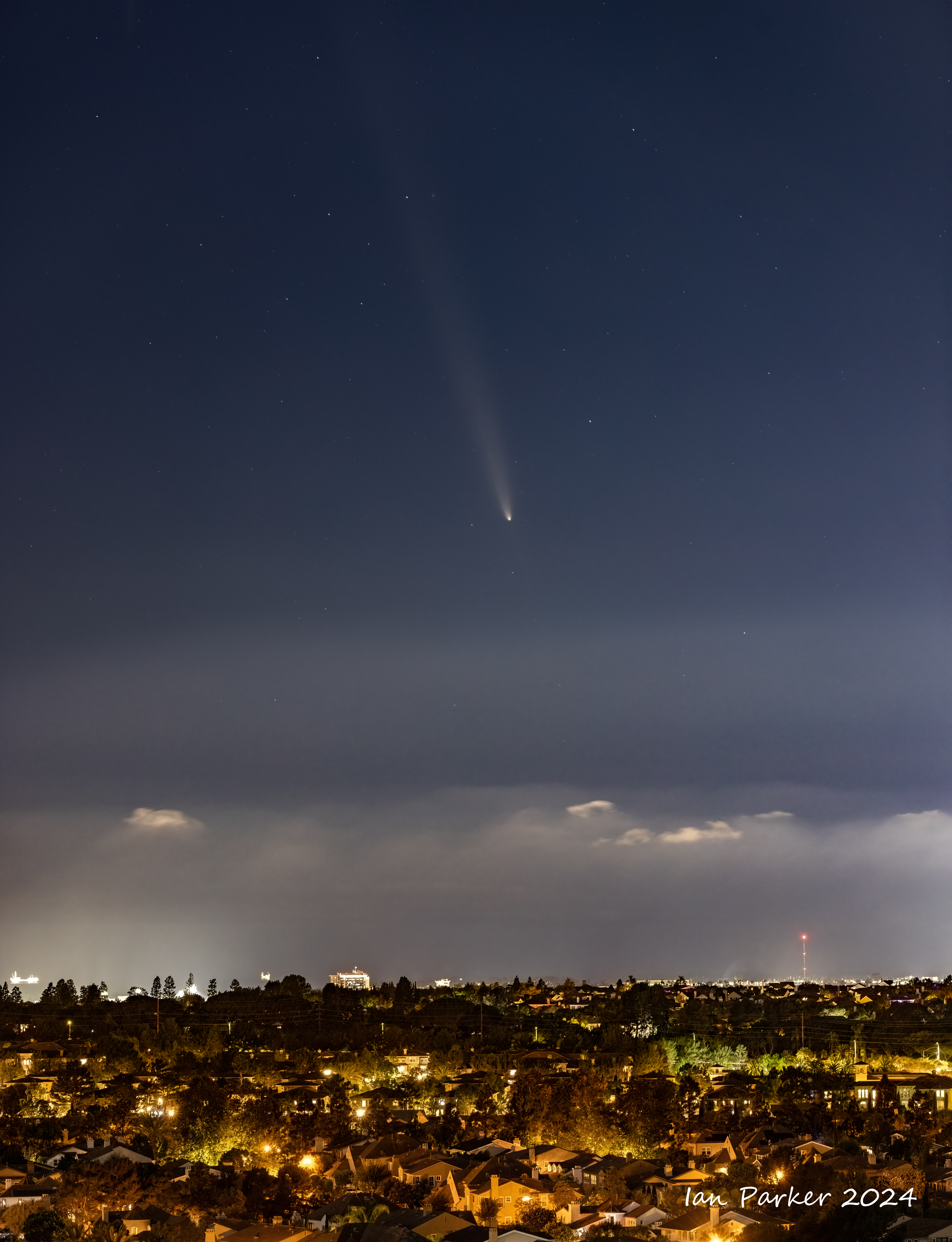
October 14th 2024 - Comet Tsuchinshan-ATLAS after its trip around the sun
Photographed from the Ecological Preserve on the UCI campus.
After looping around the sun the comet displayed an anti-tail, made from dust that has recently been left behind by the comet in its orbital plane around the sun. When the Earth passed through this plane on October 14 this residual debris was illuminated by the sun and reflected back to Earth, giving the impression of a second, fainer tail.
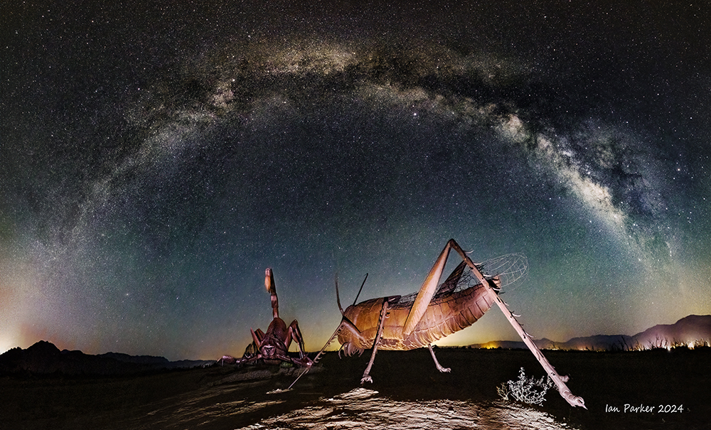
TERRESTRIAL ASTRO
[See also HERE for many more terrestrial Nightscapes}
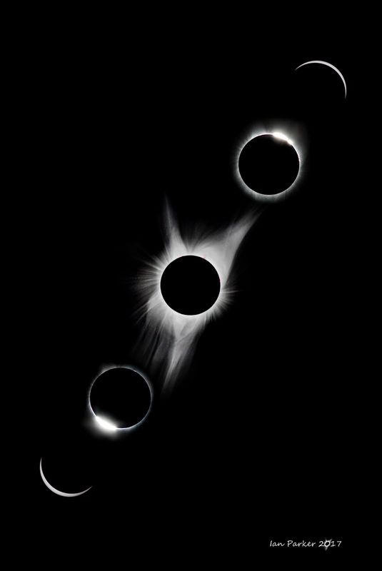
SOLAR / LUNAR / ECLIPSES
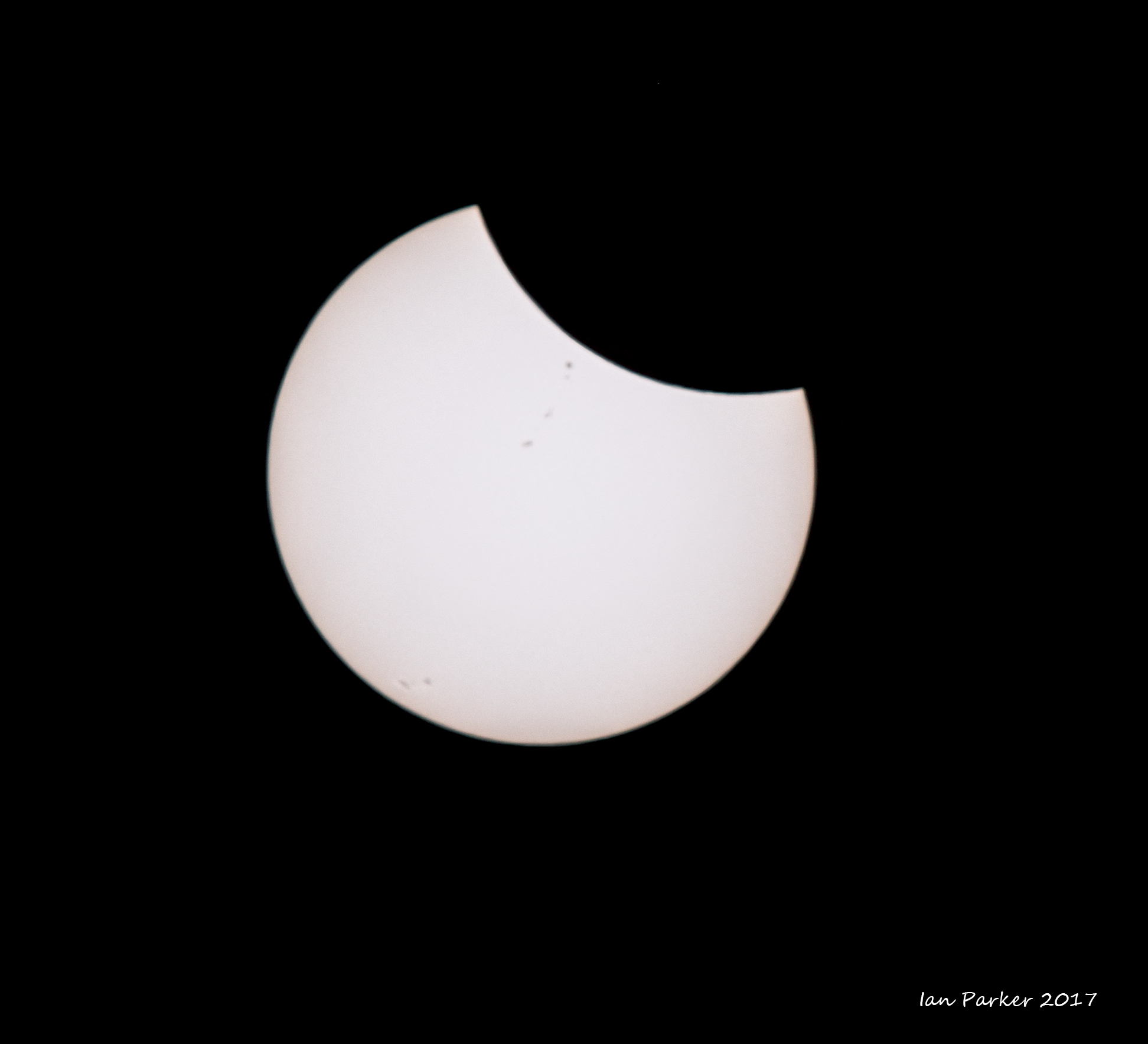
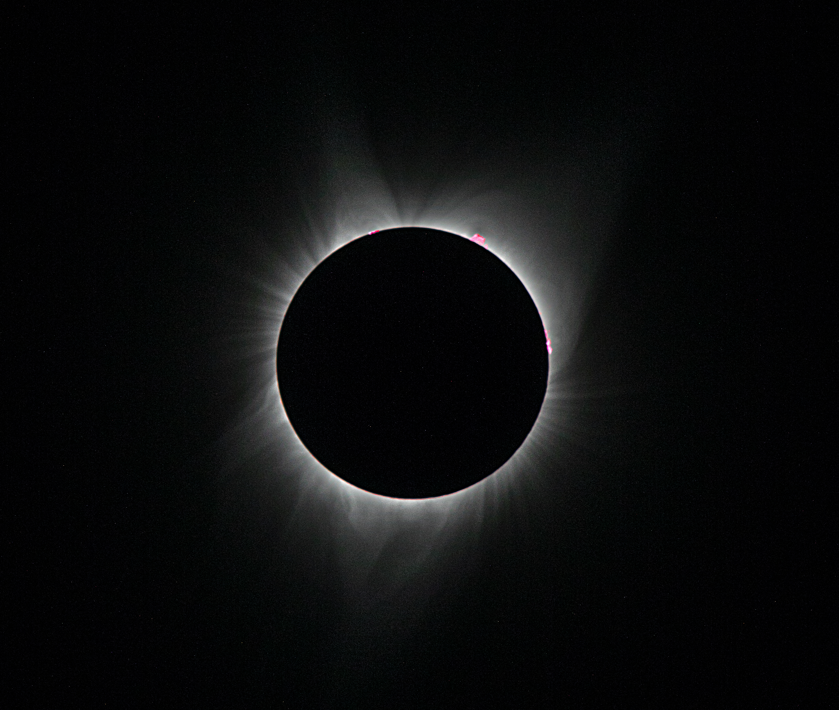
Total solar eclipse of August 21st 2017, viewed from Oregon
Annular solar eclipse of October 14, 2023 from northern Nevada
An interesting aspect of an annular eclipse is the appearance of Baily’s beads. These are beads of sunlight either disappearing or reappearing through deep lunar valleys along the limb of the Moon. Although Baily’s beads can be seen at the centerline of the eclipse path, they appear for only for a few seconds. In contrast, at the edge of the path is it possible to see the beads speed up and slow down for a few minutes before and after peak obscuration. This is the so-called “grazing zone”. Whereas eclipse maps show straight lines representing the edges of a path, it is actually an irregular shape defined by the Moon's bumpy terrain. High-resolution data from NASA’s Lunar Reconnaissance Orbiter (LRO) now make it possible to plot the “grazing zone” on Earth, a region roughly 3 km wide. I used Xavier Jubier’s wonderful interactive Google eclipse maps to select a location in the Black Rock desert about 3 miles north of Fly Gyser,. a site I had long wanted to photograph and which was conveniently accessible later on the same day through a tour organized by the Friends of the Black Rock Desert. The eclipse would peak at 9.31 am, but the prospects of seeing it seemed poor when we crawled out from our tent at dawn to find the sky completely overcast with dark clouds. Over a few hours, however, the clouds started to thin. With only ten minutes to go we began to make out the largely eclipsed sun through the cloud, and a patch of blue sky drifted in the right direction to give a clear view at exactly the right time.
Transit of Venus : June 6, 2012
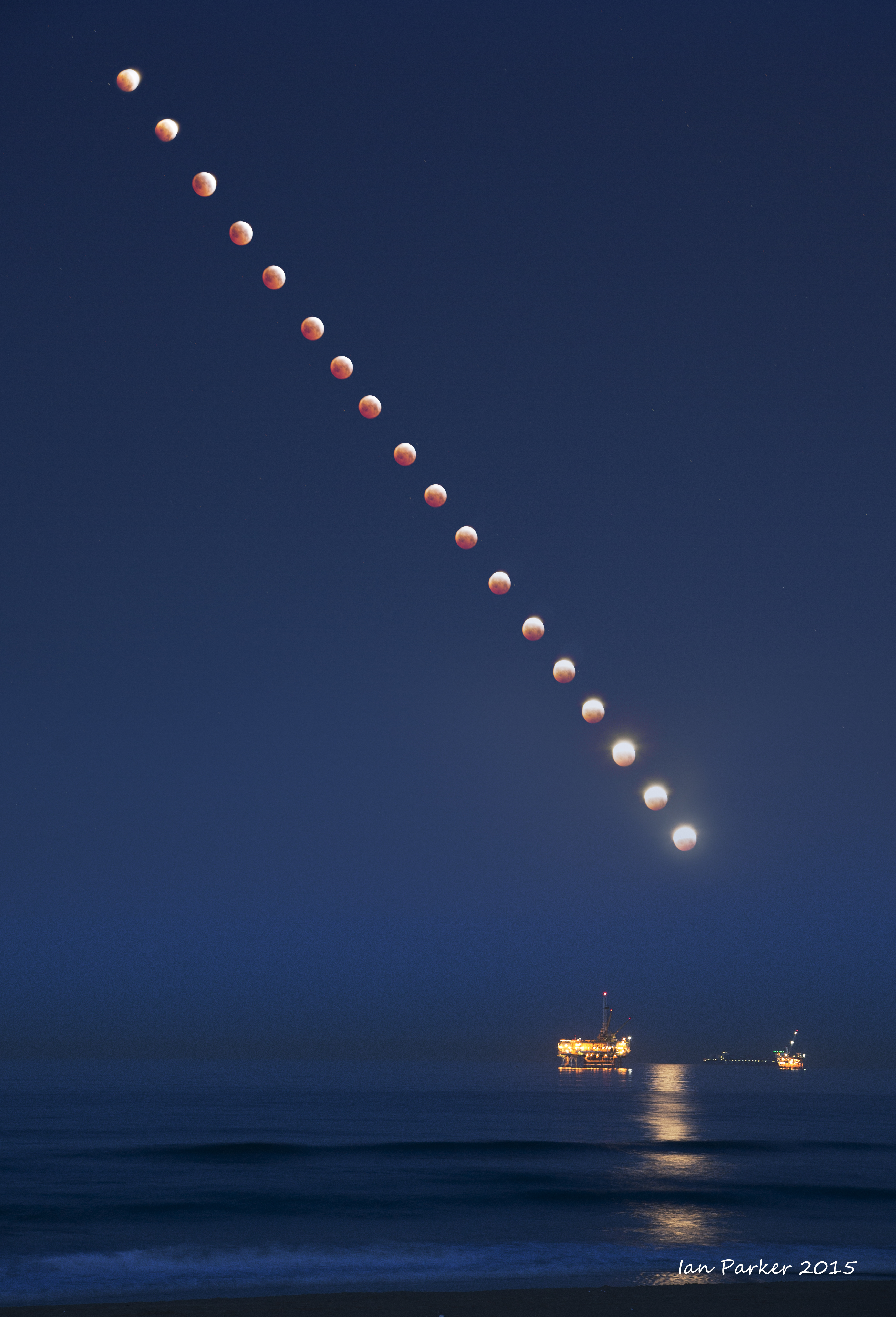
Lunar Eclipses
ARCHIVE
Images from when I was beginning astrophotography - now replaced by more recent captures.
Archived here mostly so I can see that I am making progress in this hobby...
| |
NGC 2237 Rosette Nebula
Ha narroband; 90 min integration; ZWO FF80 with reducer; taken from outside our front door.
|
|
GEAR
| |
My first astrophotography rig
|
|
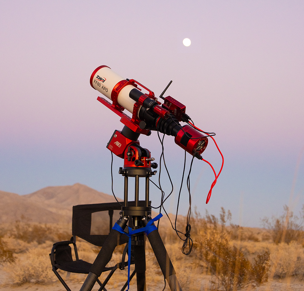
Astro Gear (as of Feb. 2026)
ZWO EAF
ZWO off-axis guider and helical focuser
Optolong L-Extreme and Ultimate dual band Ha/OIII filters
Askar D2 dual narrowband SII/OIII filter
ZWO 7 position 2inch filter wheel
EcoFlow RIVER 2 Pro Portable Power Station
|


 Soul nebula (IC 1848) with Halpha flter - stars removed
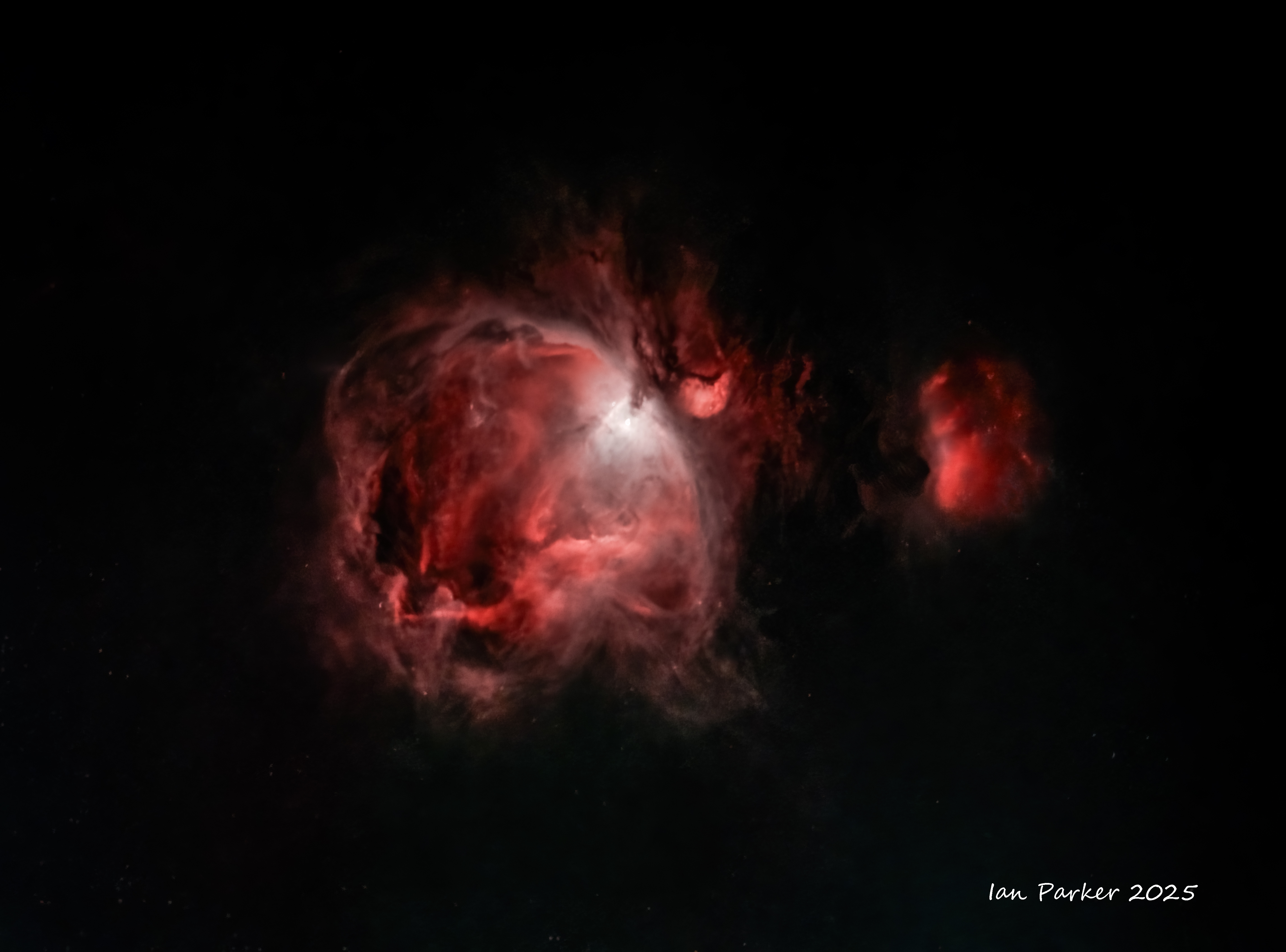