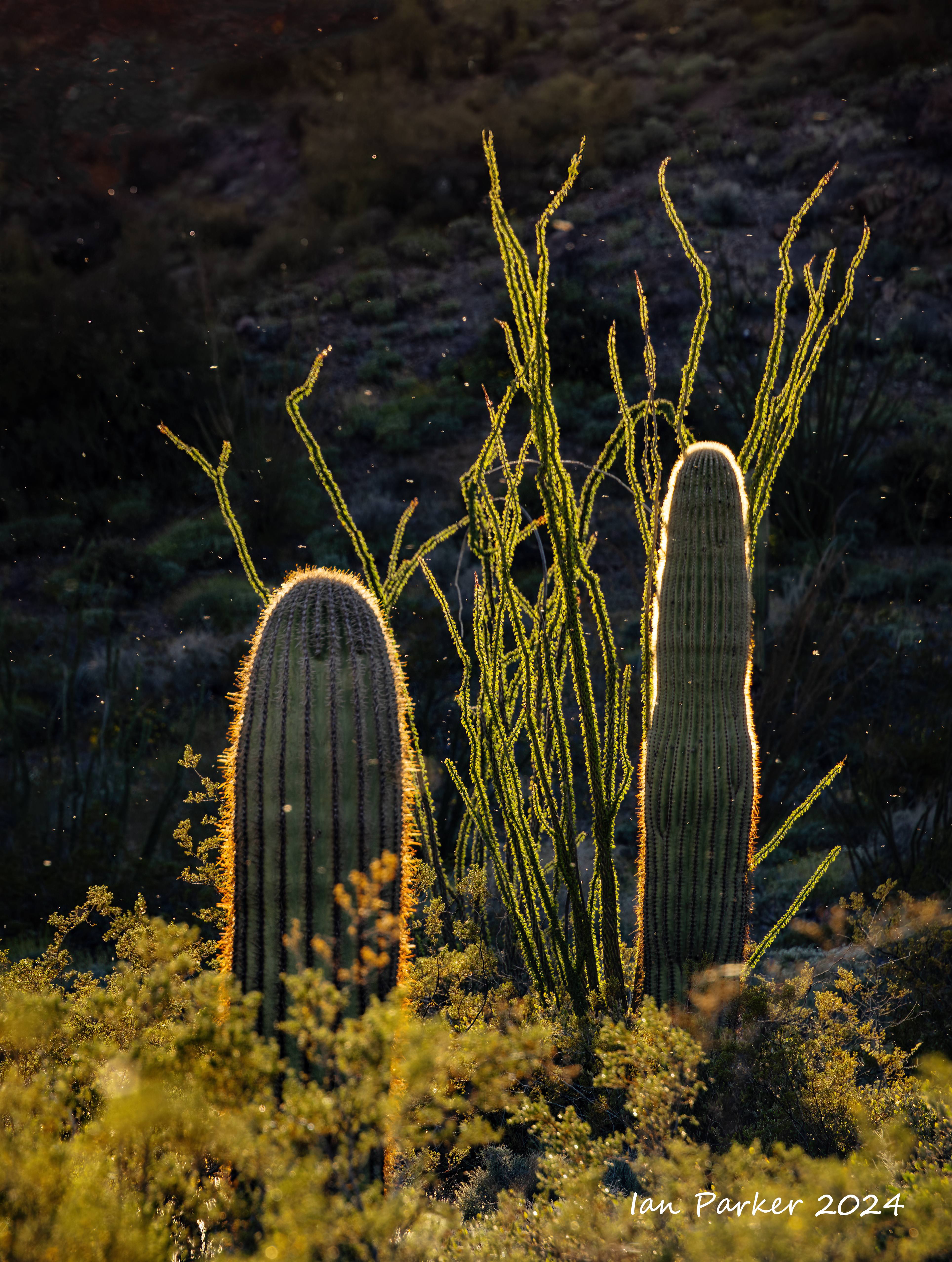
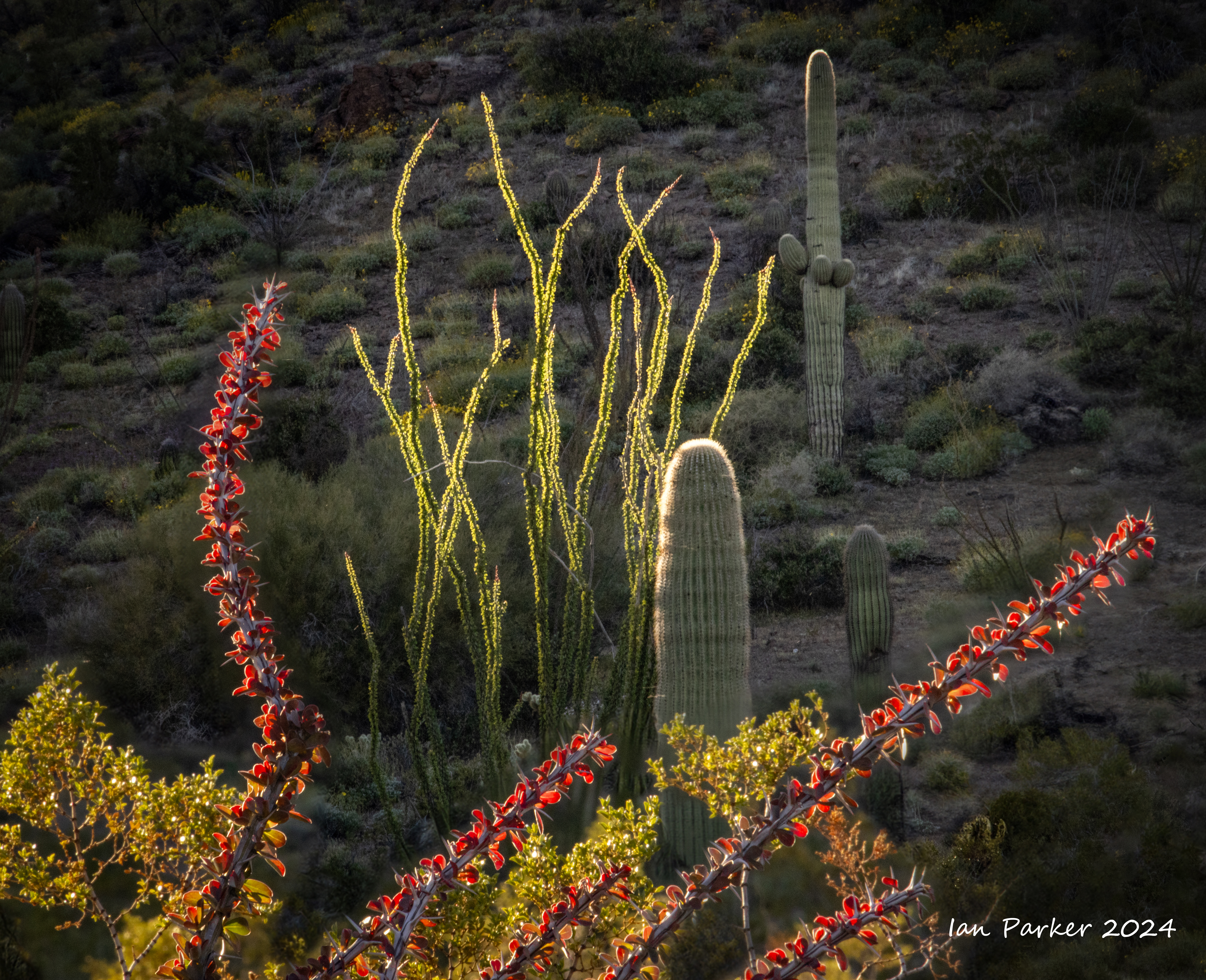
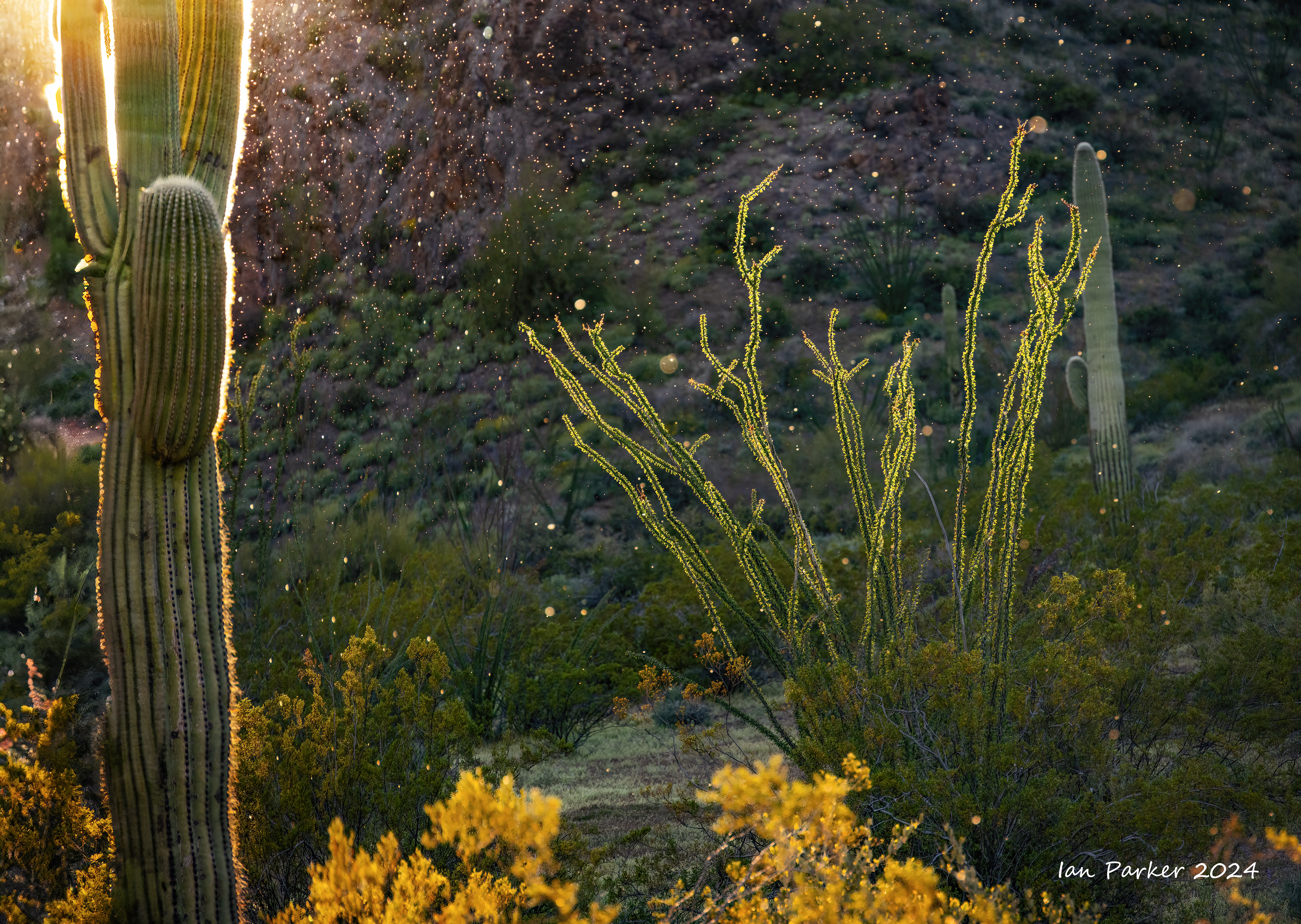
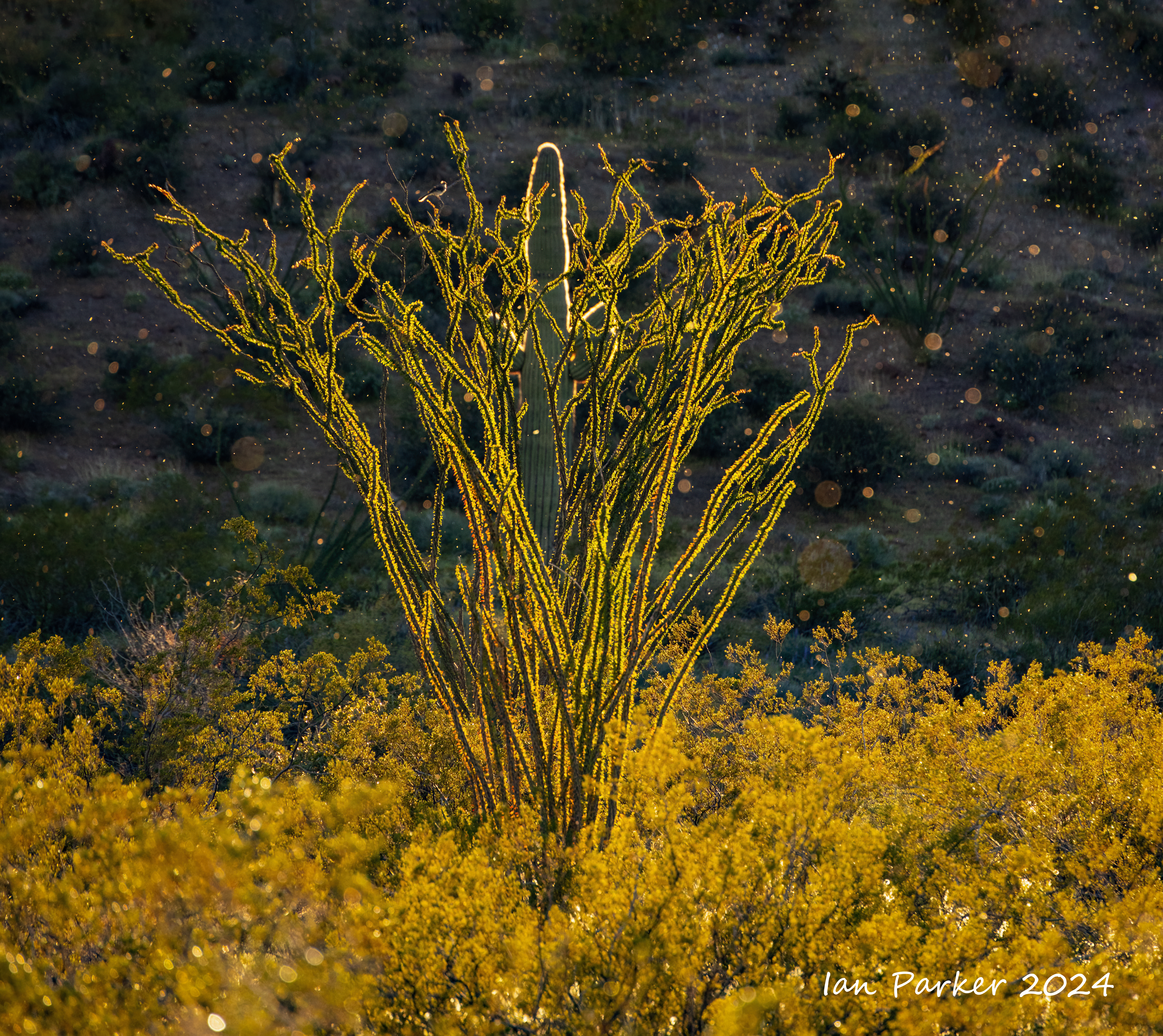
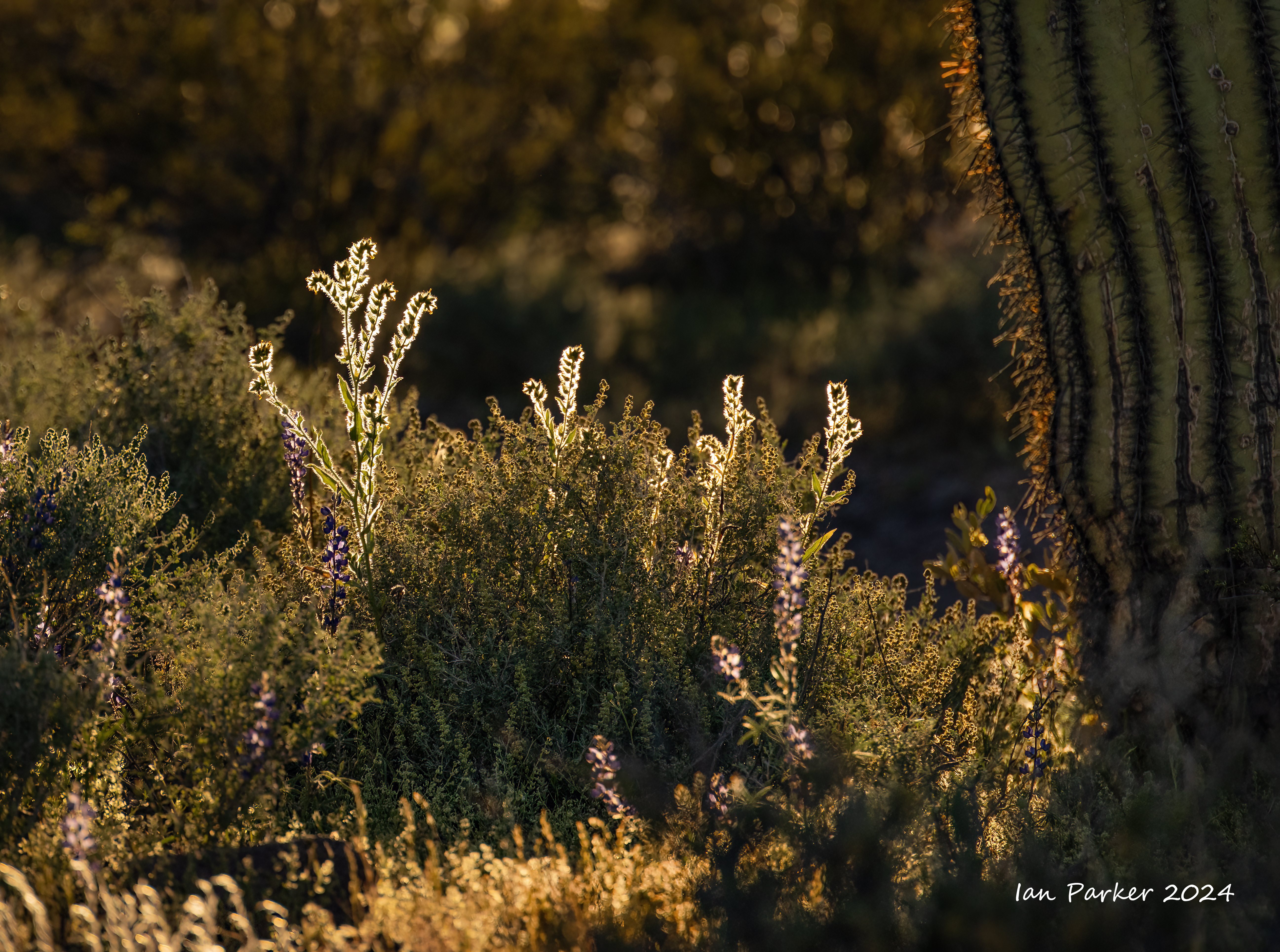
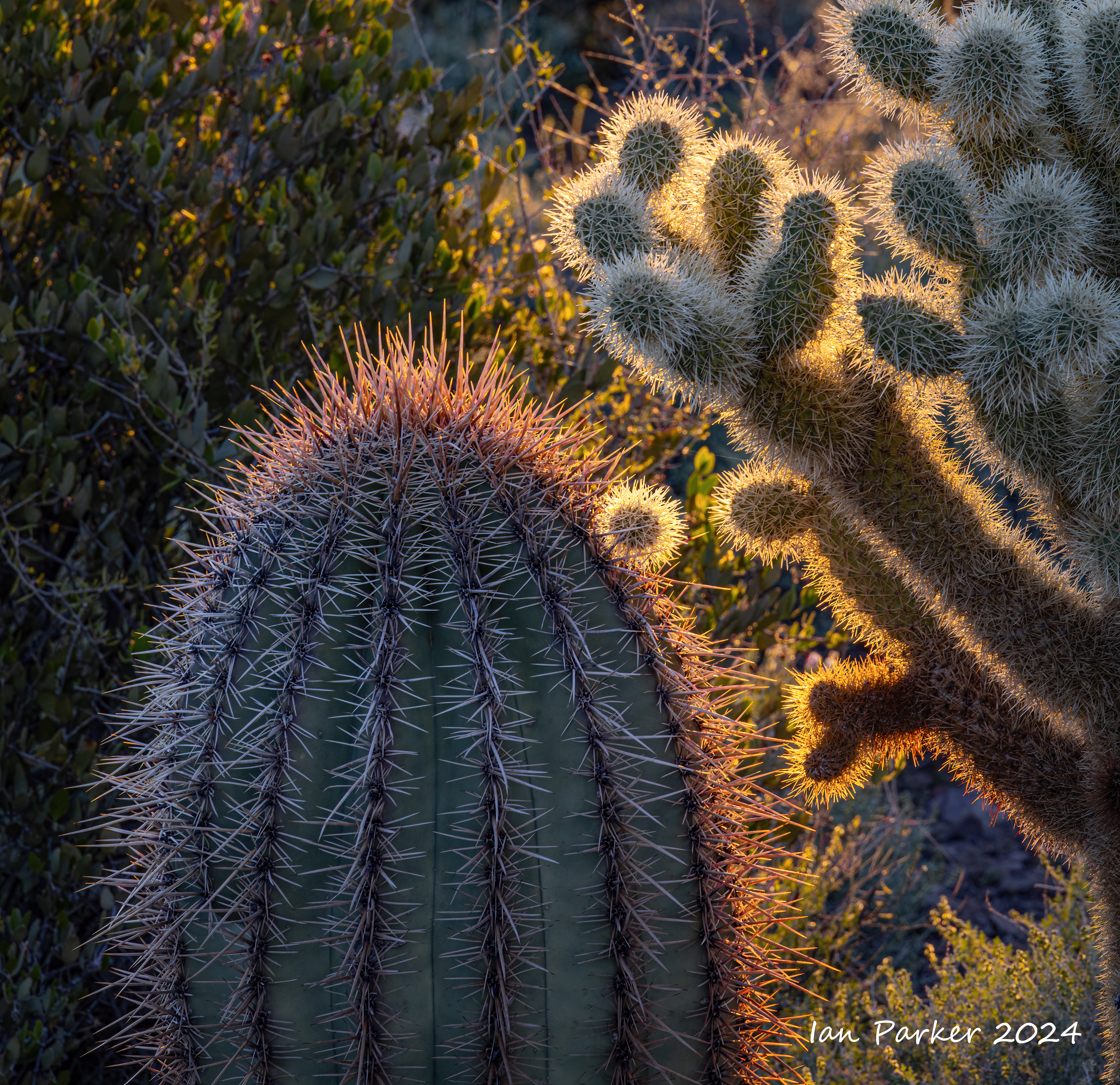
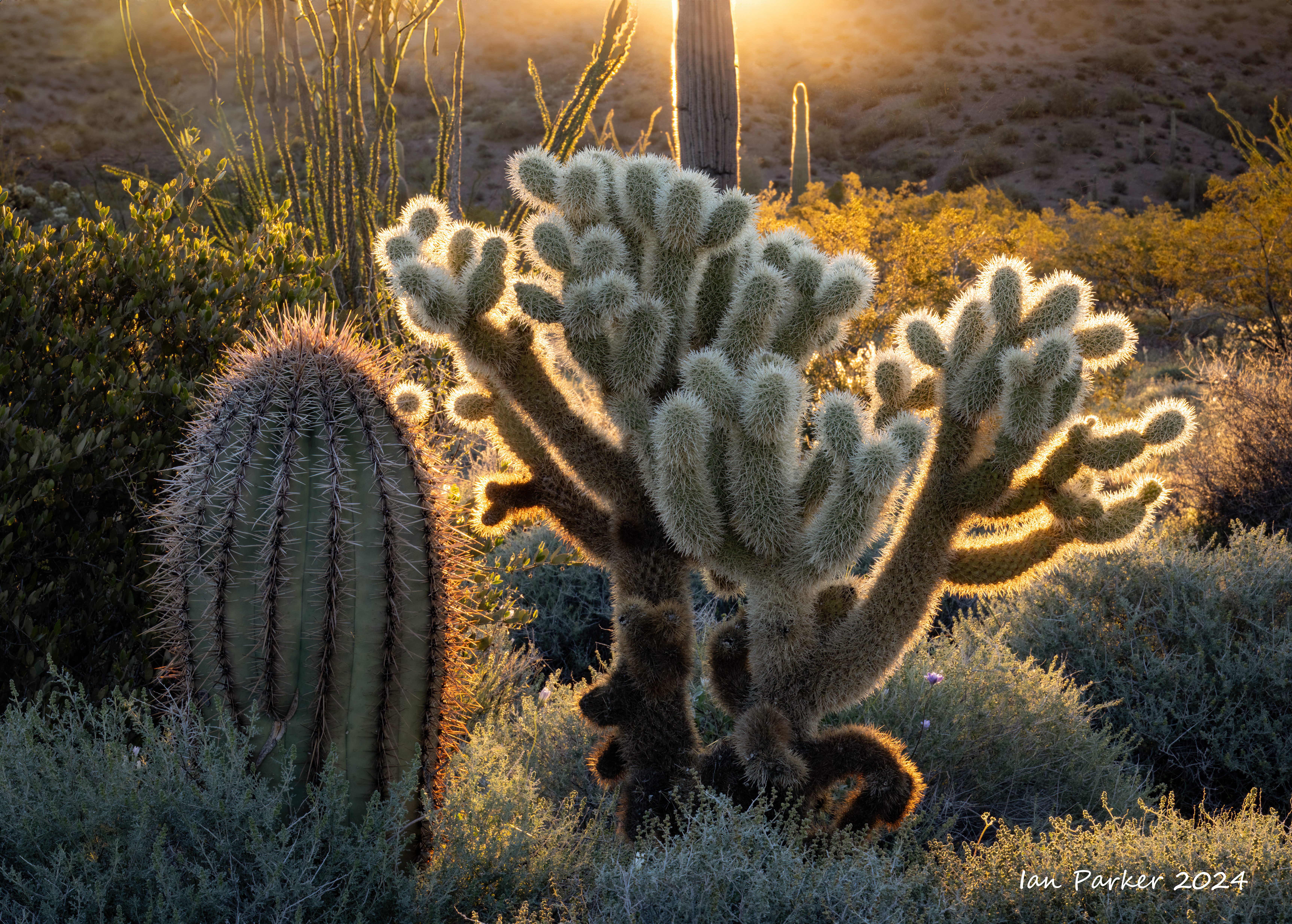
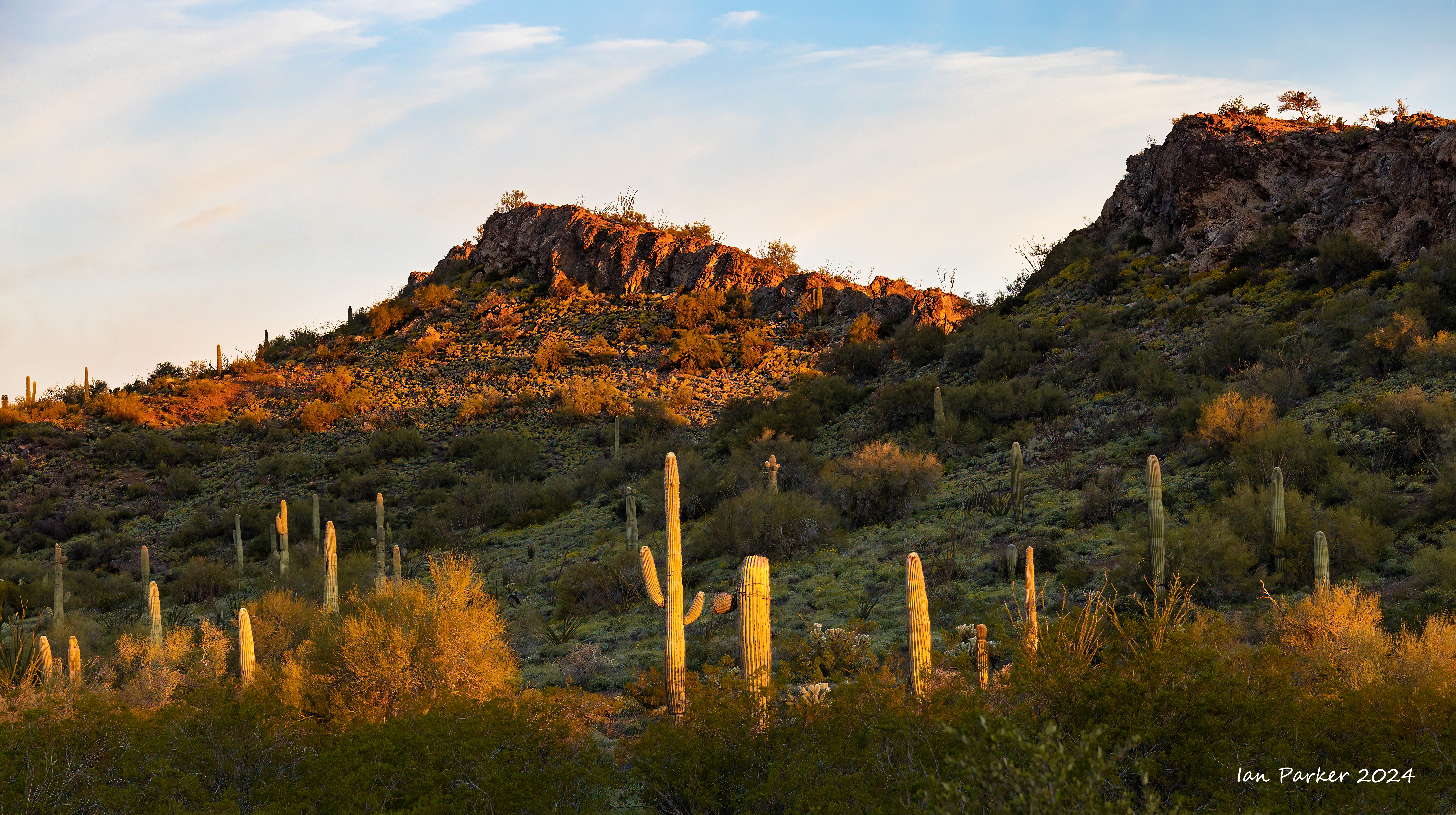
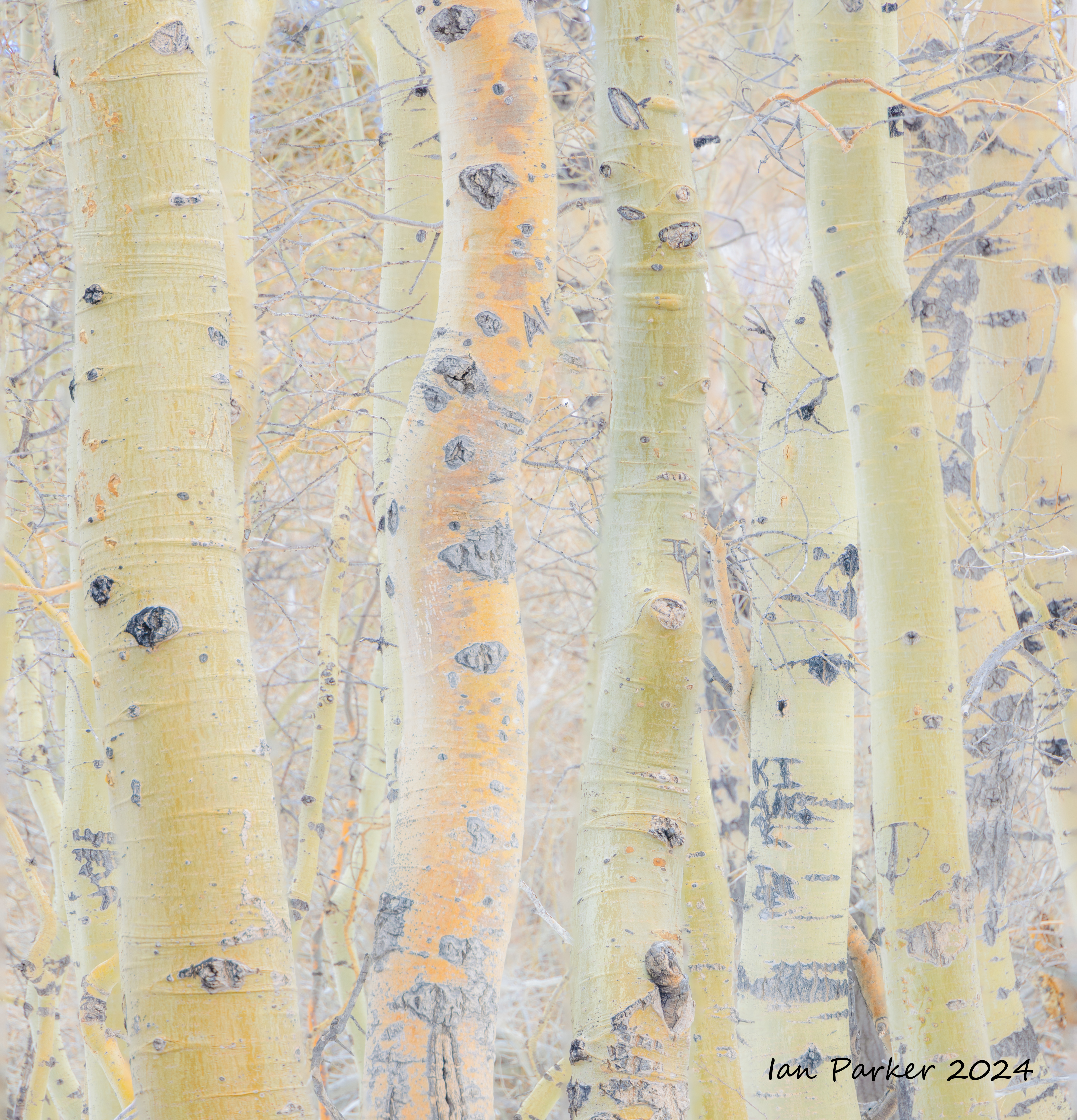
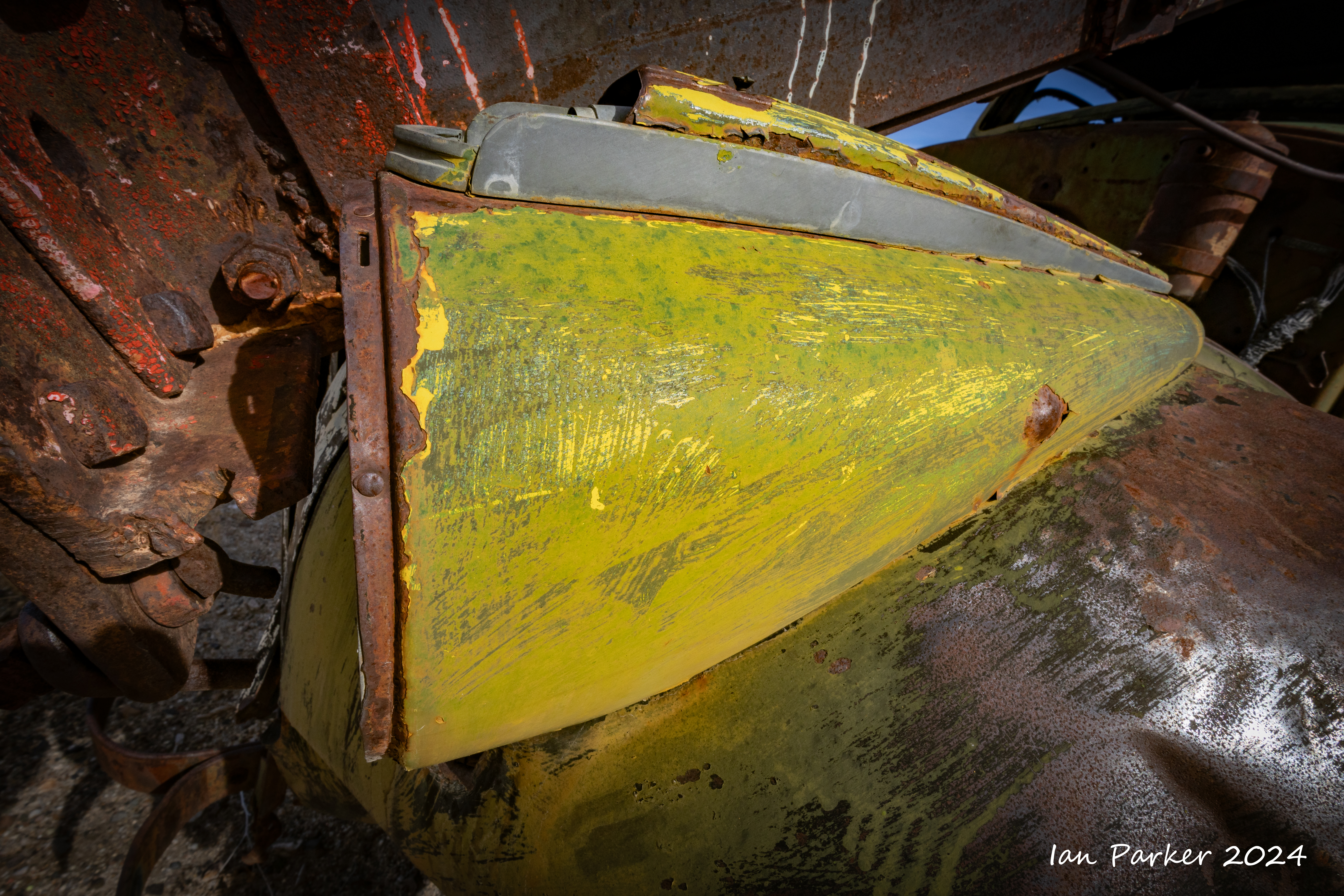
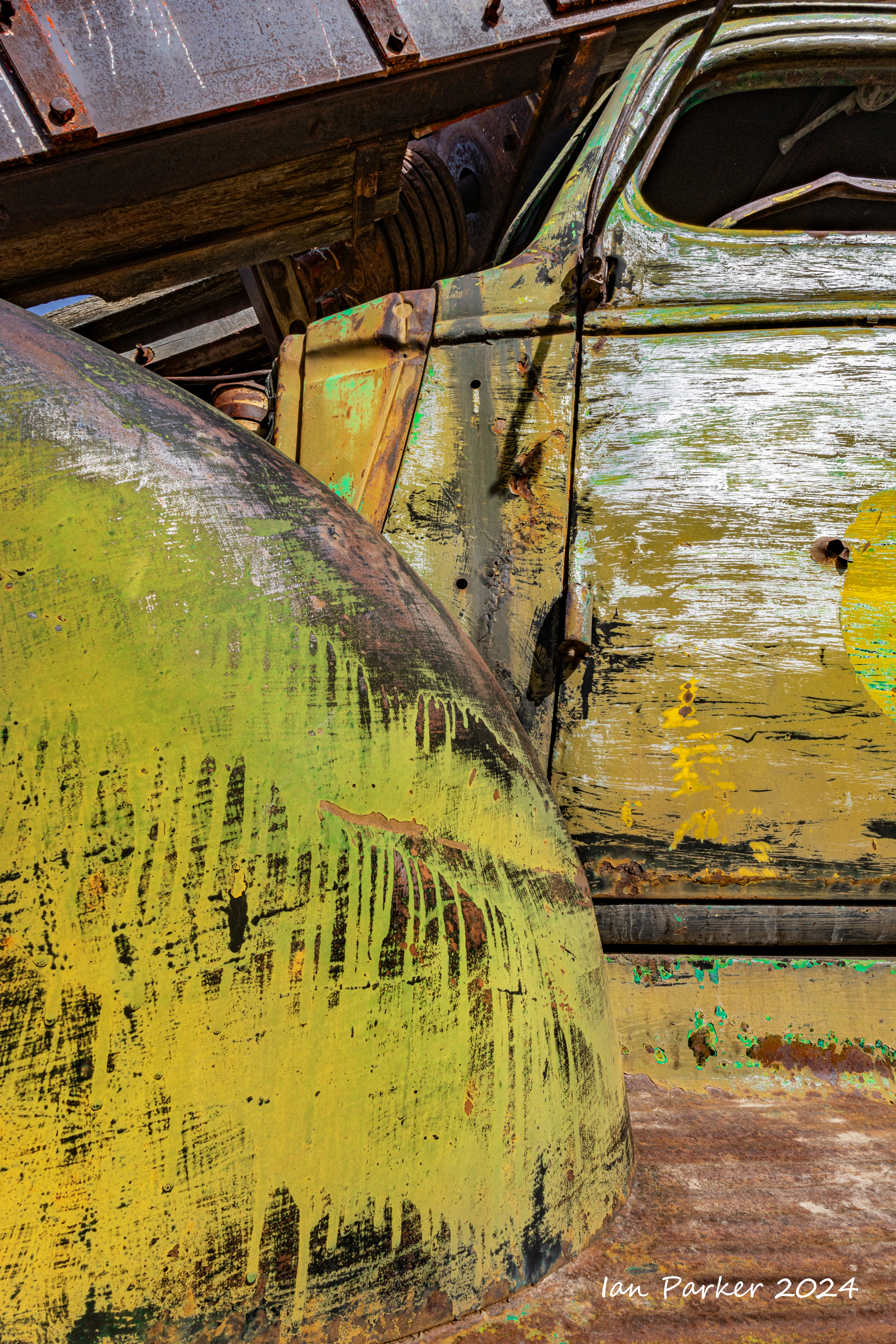
KOFA landscapes and cacti
A California road trip - Anza Borrego to Mono Lake via Death Valley.
|


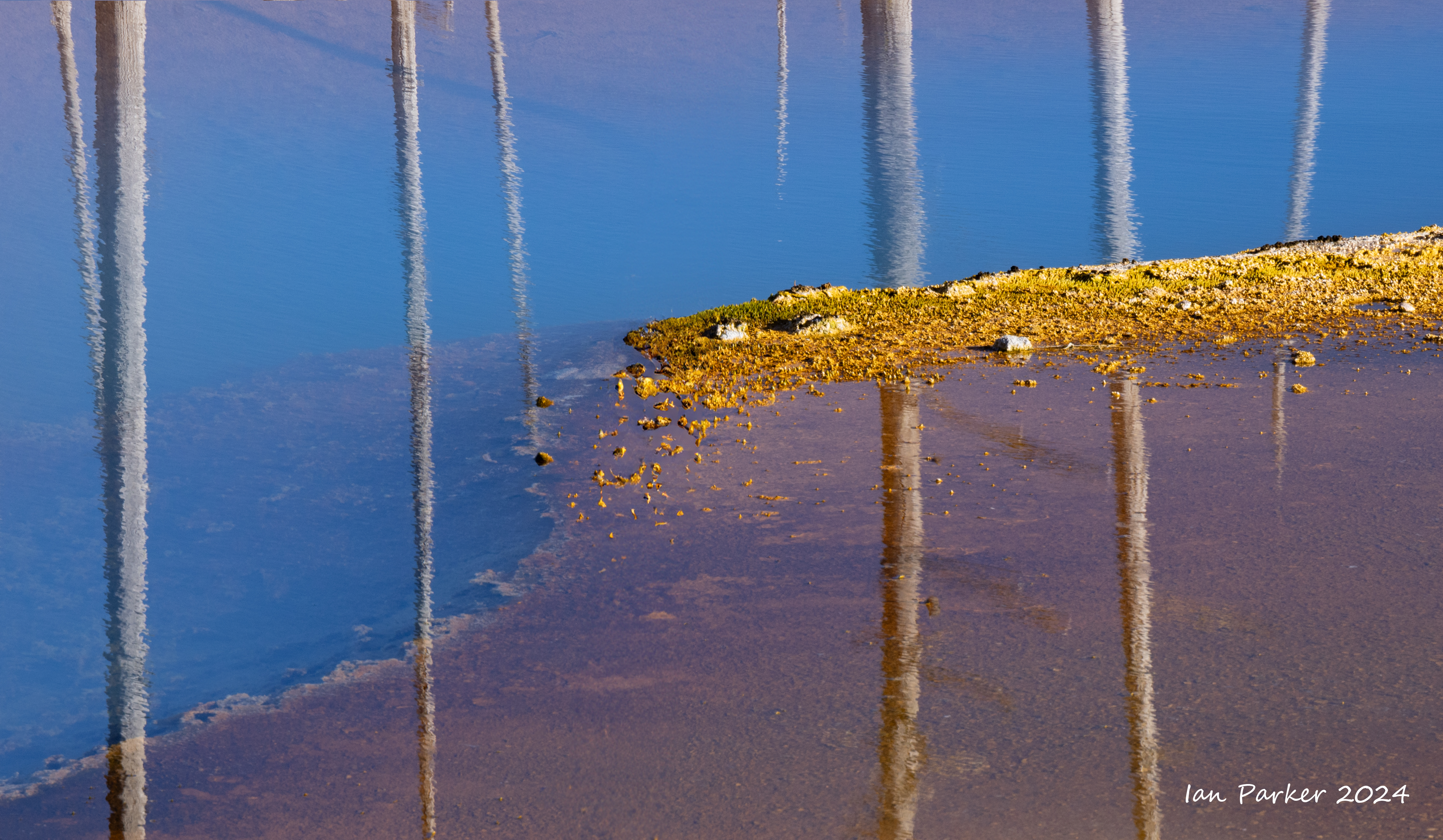
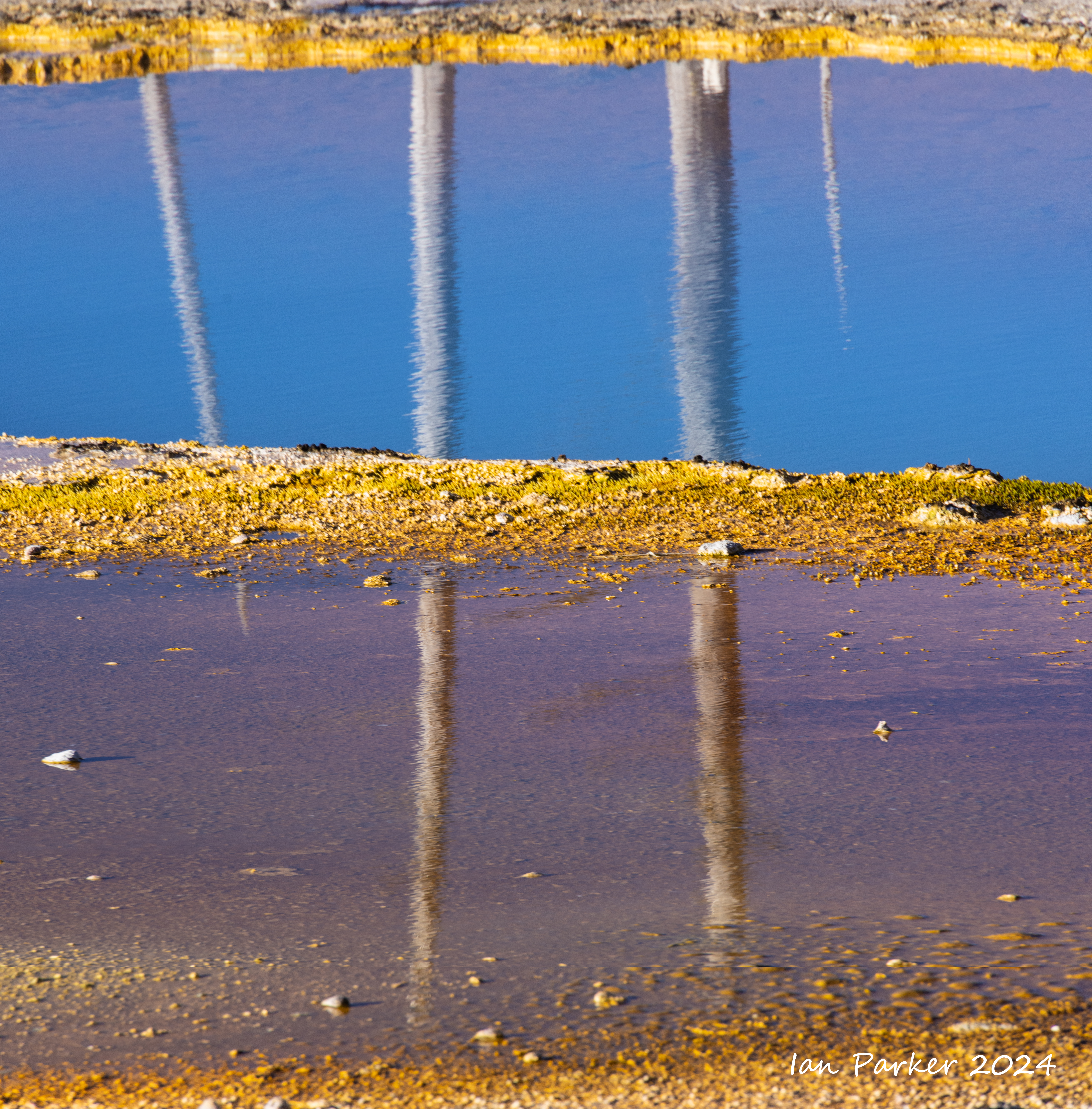
Mono Lake
I had hoped there might be snow around the tufa towers, but although it was snowing heavily at our cabin in June Lake village, the skies cleared and the temperature rose as we dropped 1000ft in altitude driving down to Mono Lake basin.


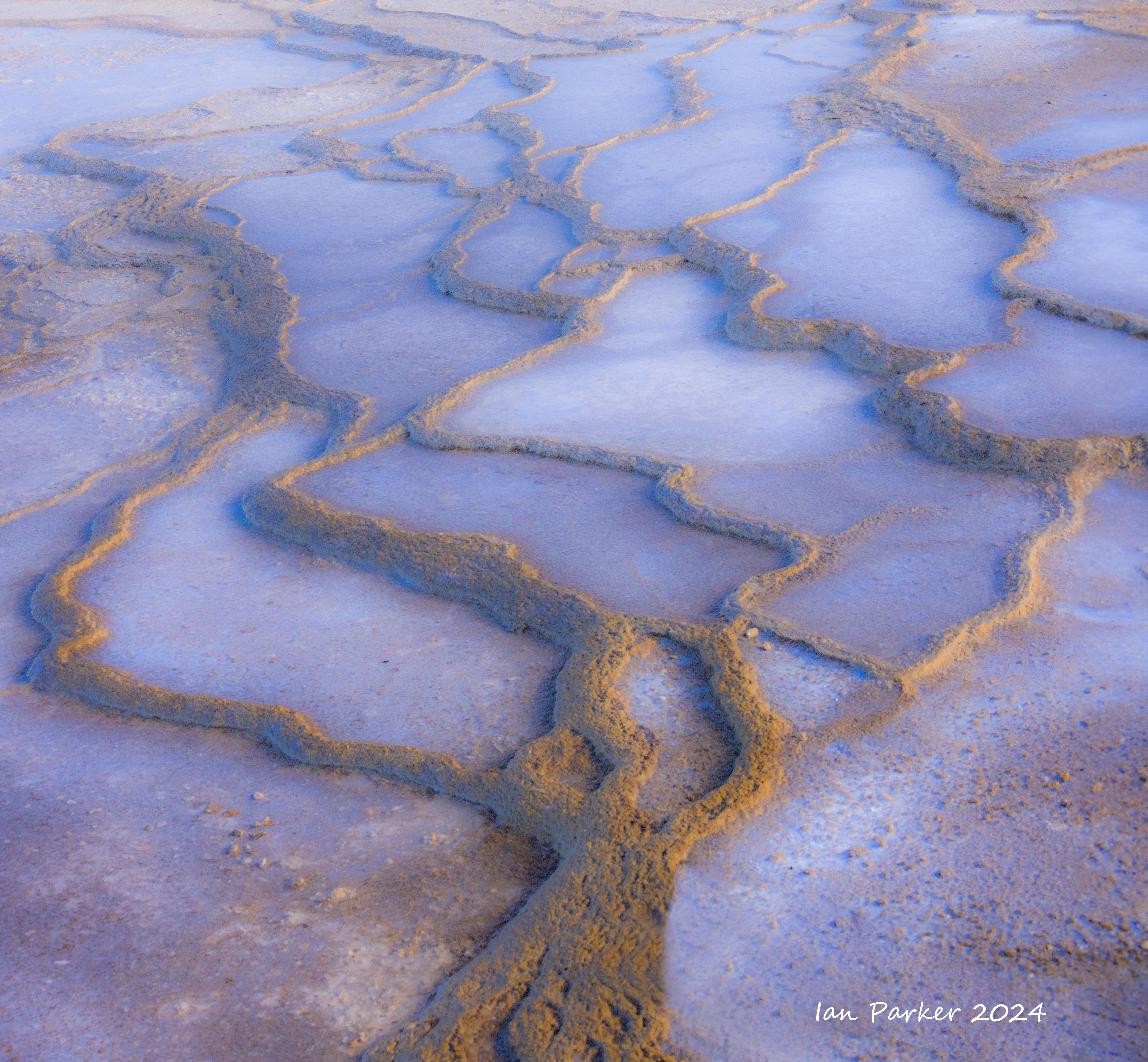
The shoreline of Mono Lake is constantly changing as the lake level rises and falls. In the face of contiued stream diversions to quench the thirst of Los Angeles here has been little systematic increase over the last 50 years toward the level mandated to acieve ecological sustainability. However, following two wet winters the level is now within about 1ft of the highest level since the 1970's, and water is starting to lap in places over the trail along the South Tufa.


A brief excursion to Eastern Sierra Lakes
Around the top of Death Valley to Eureka Dunes


Driving back through Death Valley - a last chance to see Lake Manly again before it evaporated.

Photos from a drive through Joshua Tree National Park en route from Anza Borrego to Death Valley
 Arizona lupine; Joshua Tree National Park |
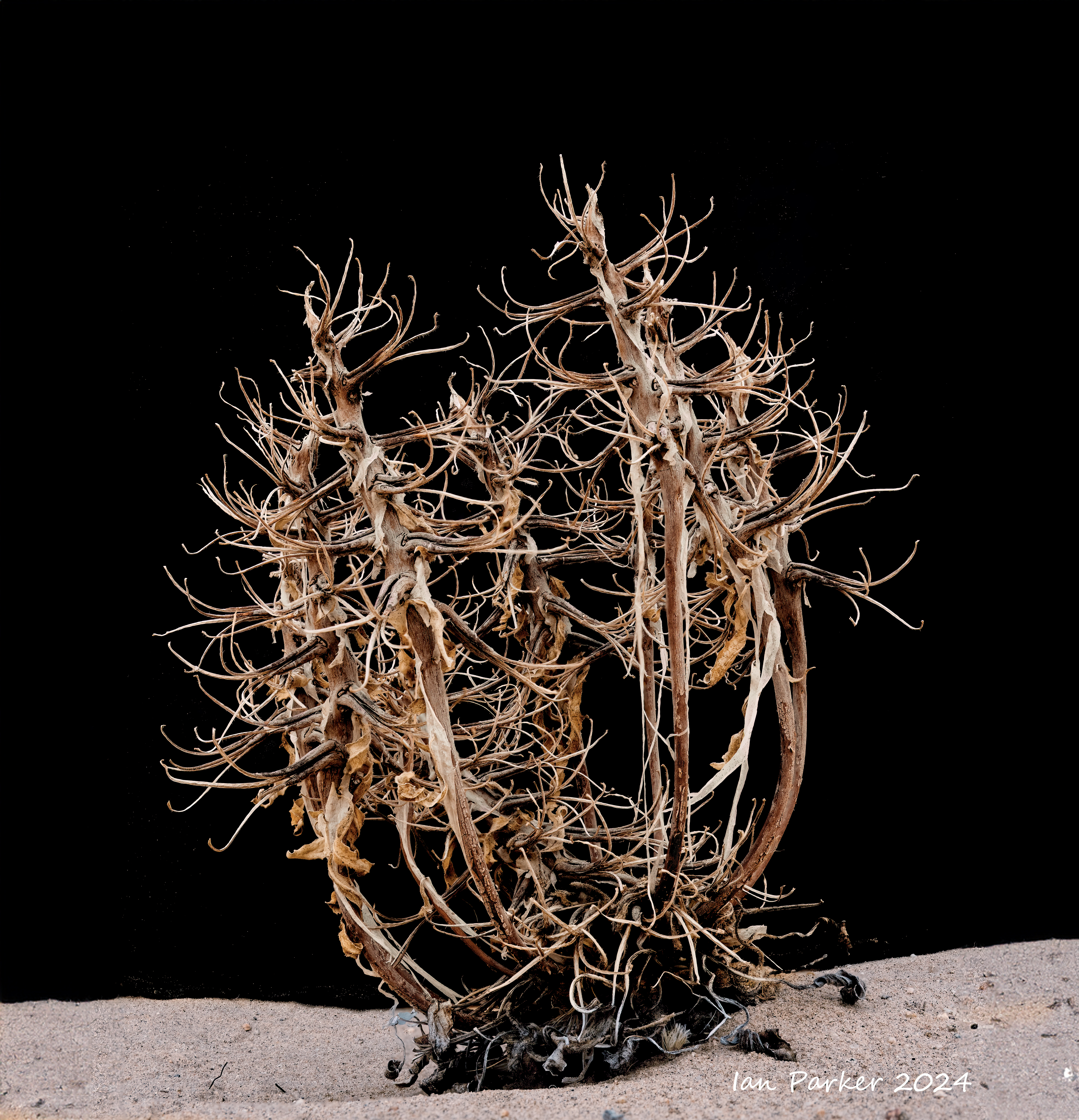
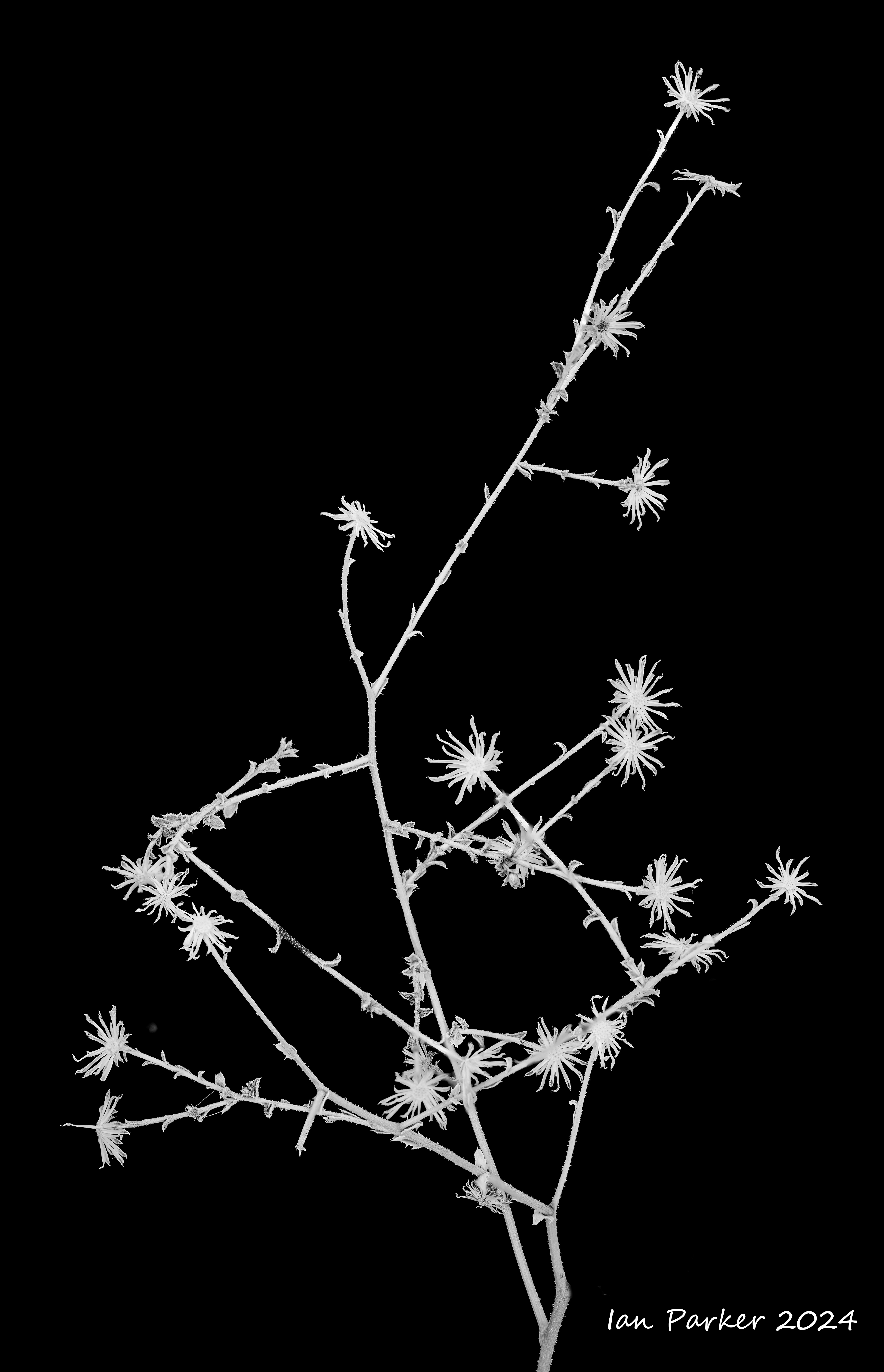
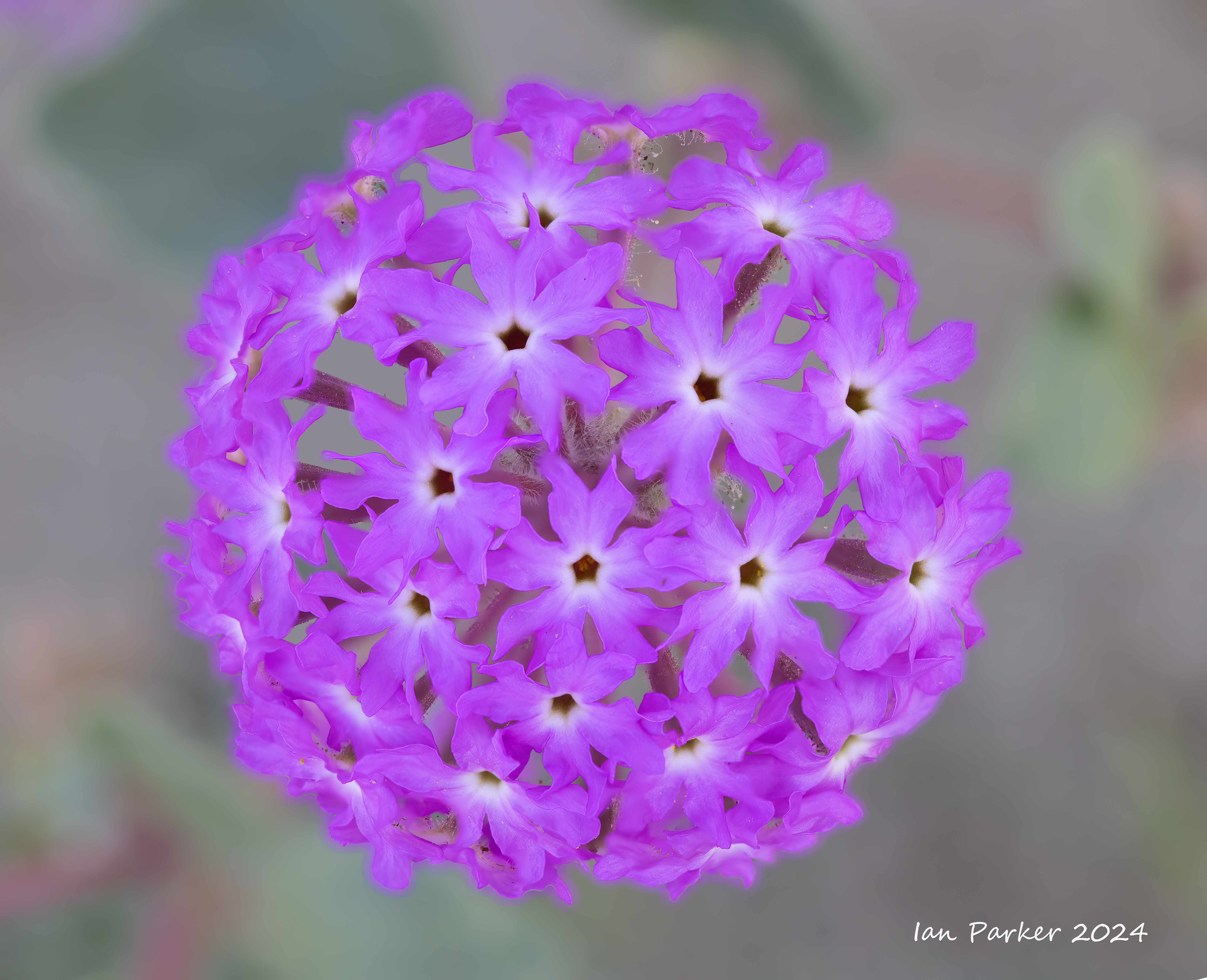
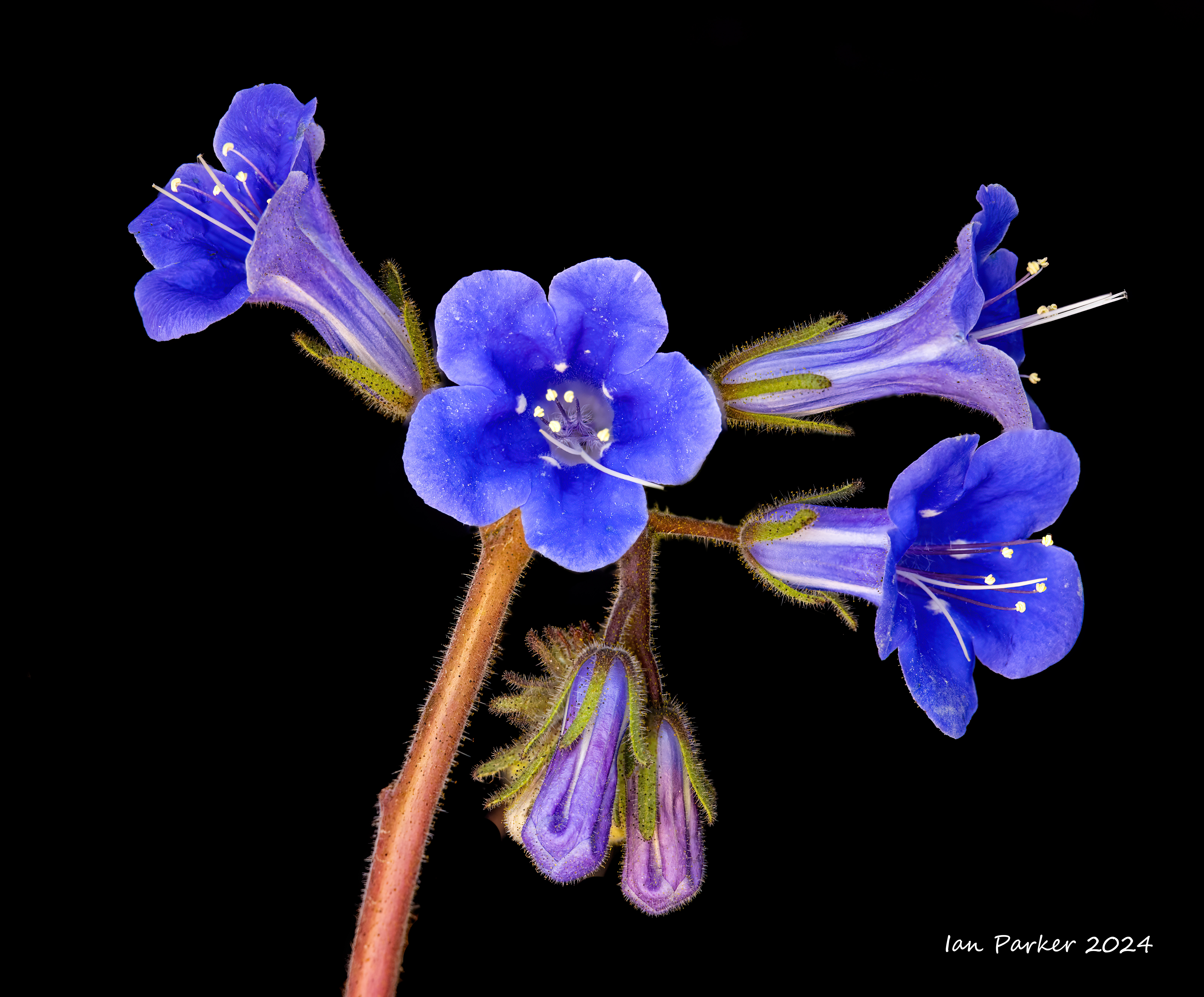
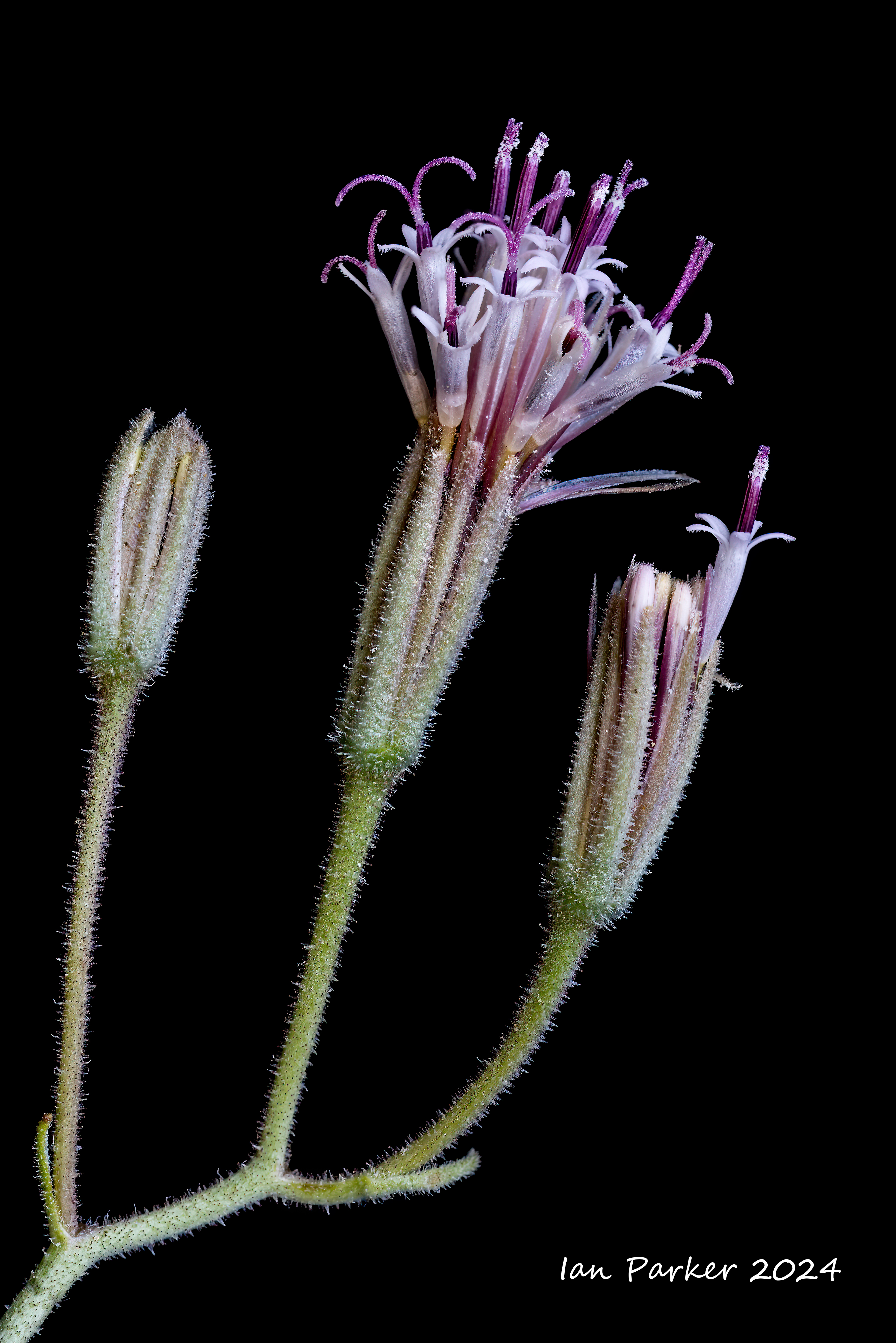
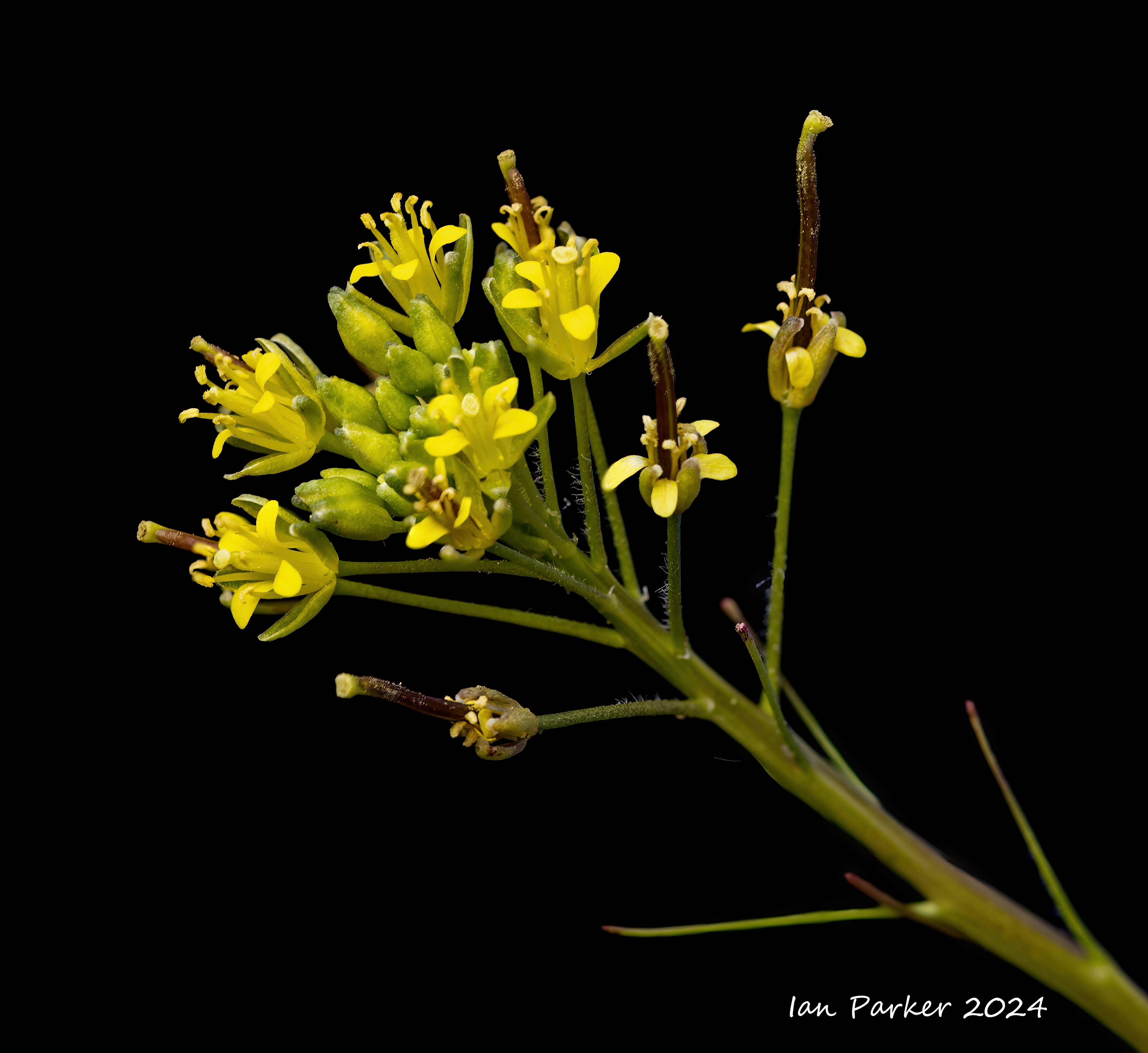
Anza Borrego - Desert flower macros on black
Photographed with a macro lens, tiny desert floor flowers reveal intricate, hairy detail. These photos were taken as focus stacks in shaded daylight, with a black cloth positioned as a backdrop. Using the black level and shadows sliders in Photoshop I could then render the background as a perfect black, without affecting the exposure for the plants.


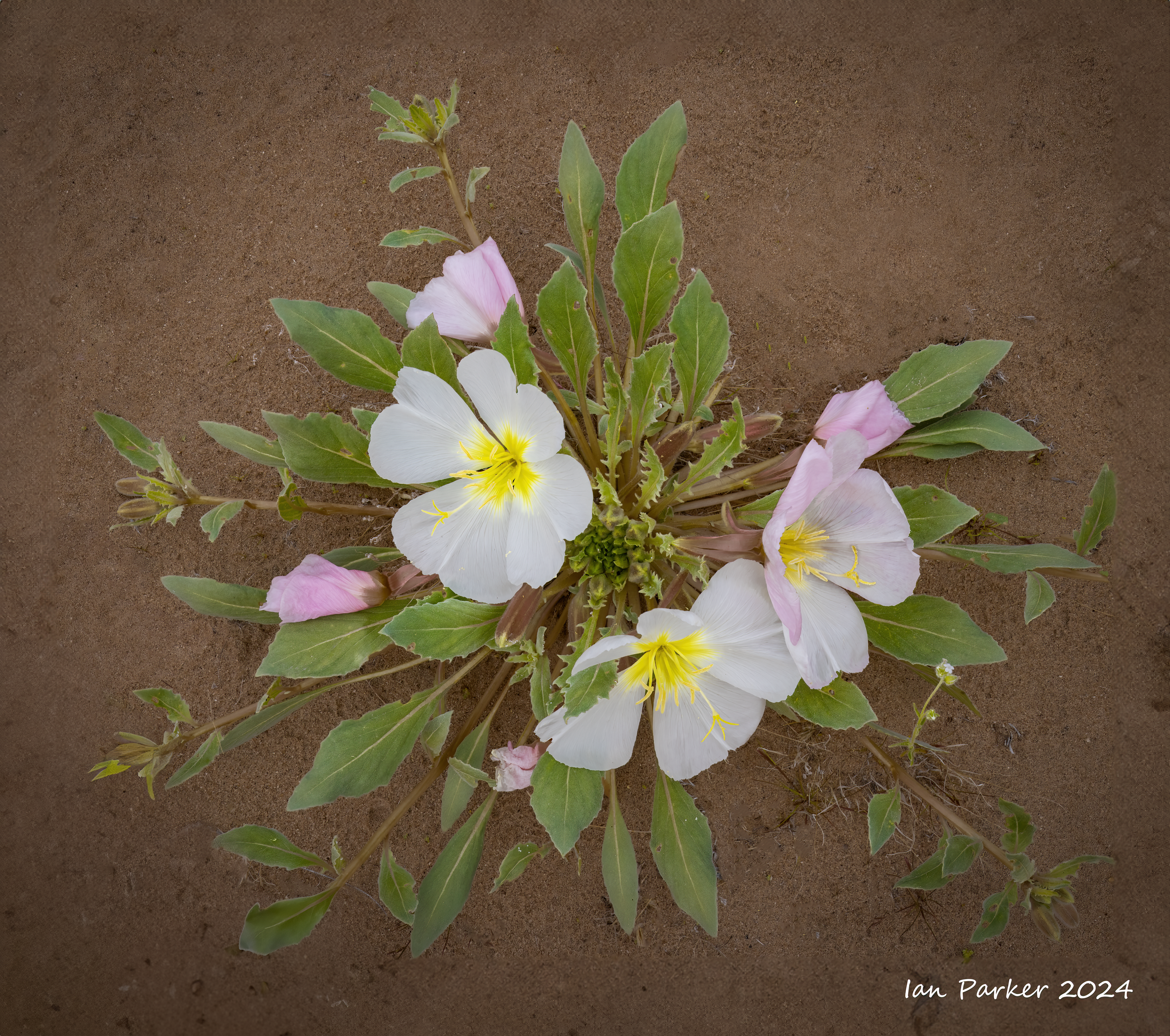
Anza Borrego - Desert flowers along Henderson Canyon Road,
photographed before they all got eaten by the caterpillars...
| \ |

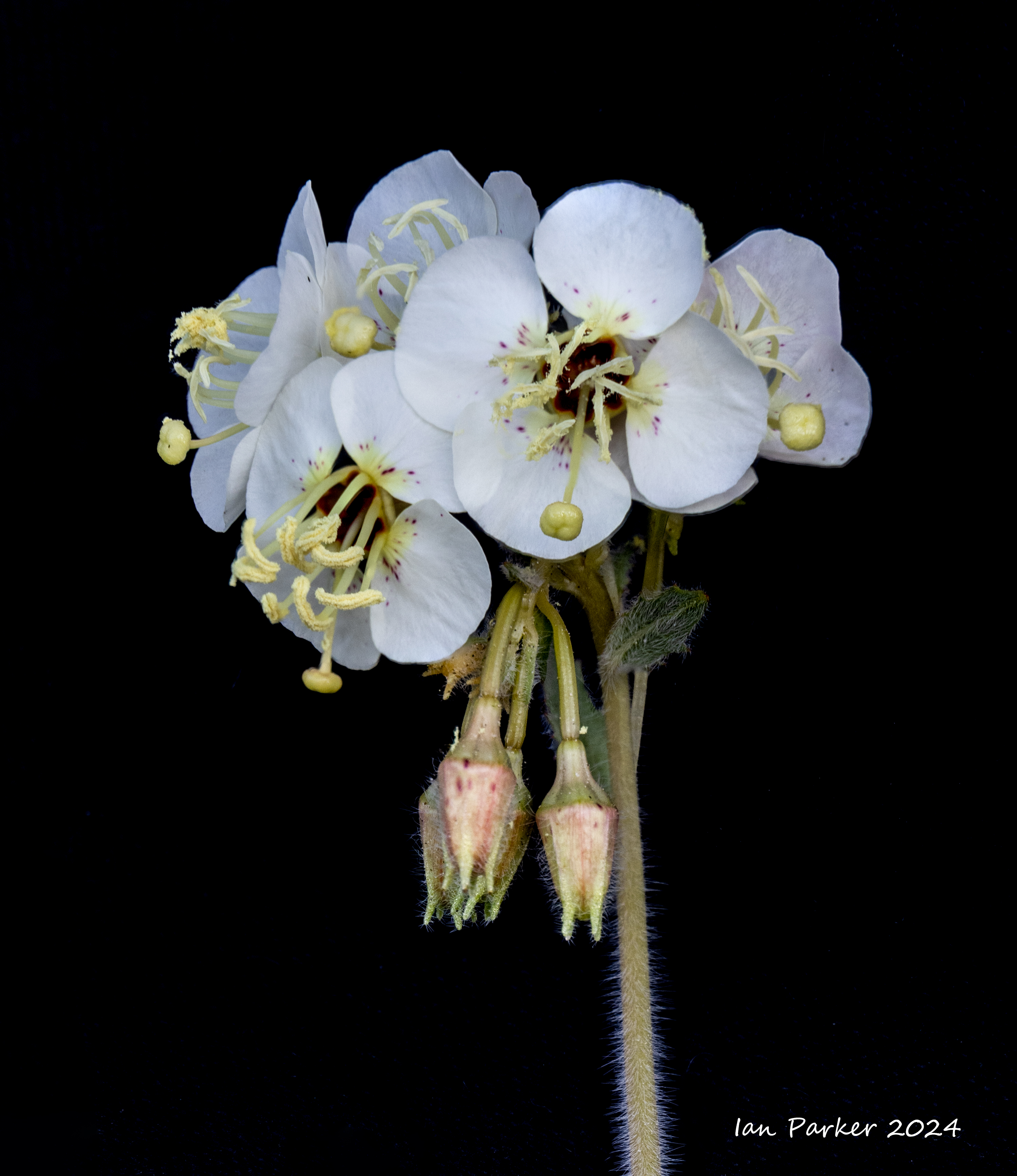
AnzaBorrego - Desert lilies
"The Desert Lily, also known as the Ajo Lily or Hesperocallis undulata, is a beautiful wildflower that is native to the southwestern region of North America and can be found in the Anza Borrego Desert. This perennial plant grows from a bulb and can reach up to two feet in height. It produces long, narrow leaves and beautiful, fragrant flowers that bloom in the spring. The flowers are usually white, but can sometimes have a pink or yellow tint. Each flower has six petals and a yellow center, and can measure up to three inches in diameter." [Anza Borrego State Park]
Following a wet winter, desert lillies were plentiful in the Borrogo Badlande, with numerous plants blooming around our usual camping spot near Font's Point. That made it easy to do some night photography, eating dinner as the sun set and then wandering out with a LED light panel to photograph the flowers isolated against a dark sky background. The images below were generated using focus stacking to achieve a sufficient depth of focus.


Desert lilies with ocotillo.
Images created by combining separate exposures for foreground and background.


A desert lilly juxtaposed with one of Ricardo Breceda's metal sculptures.

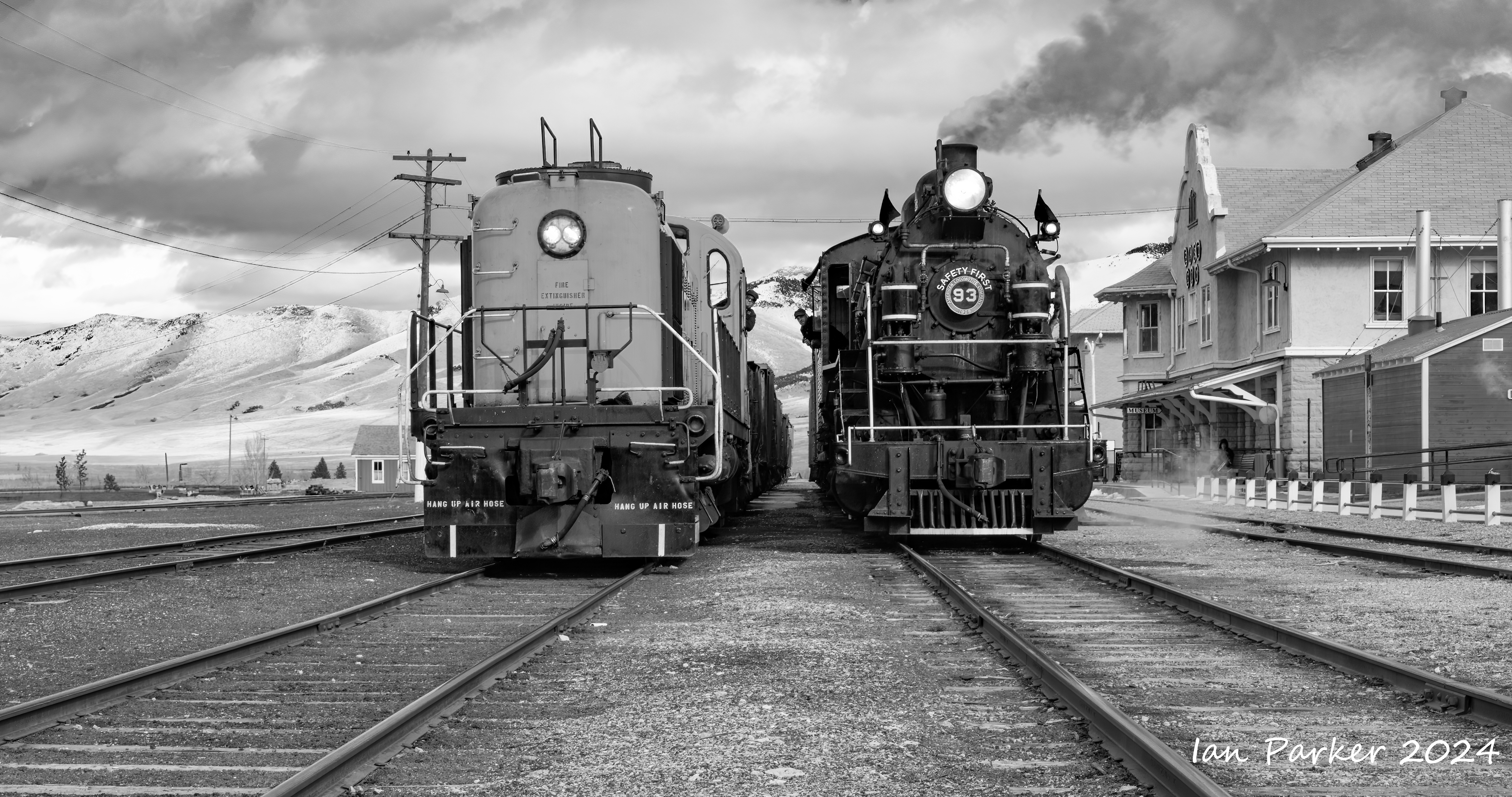
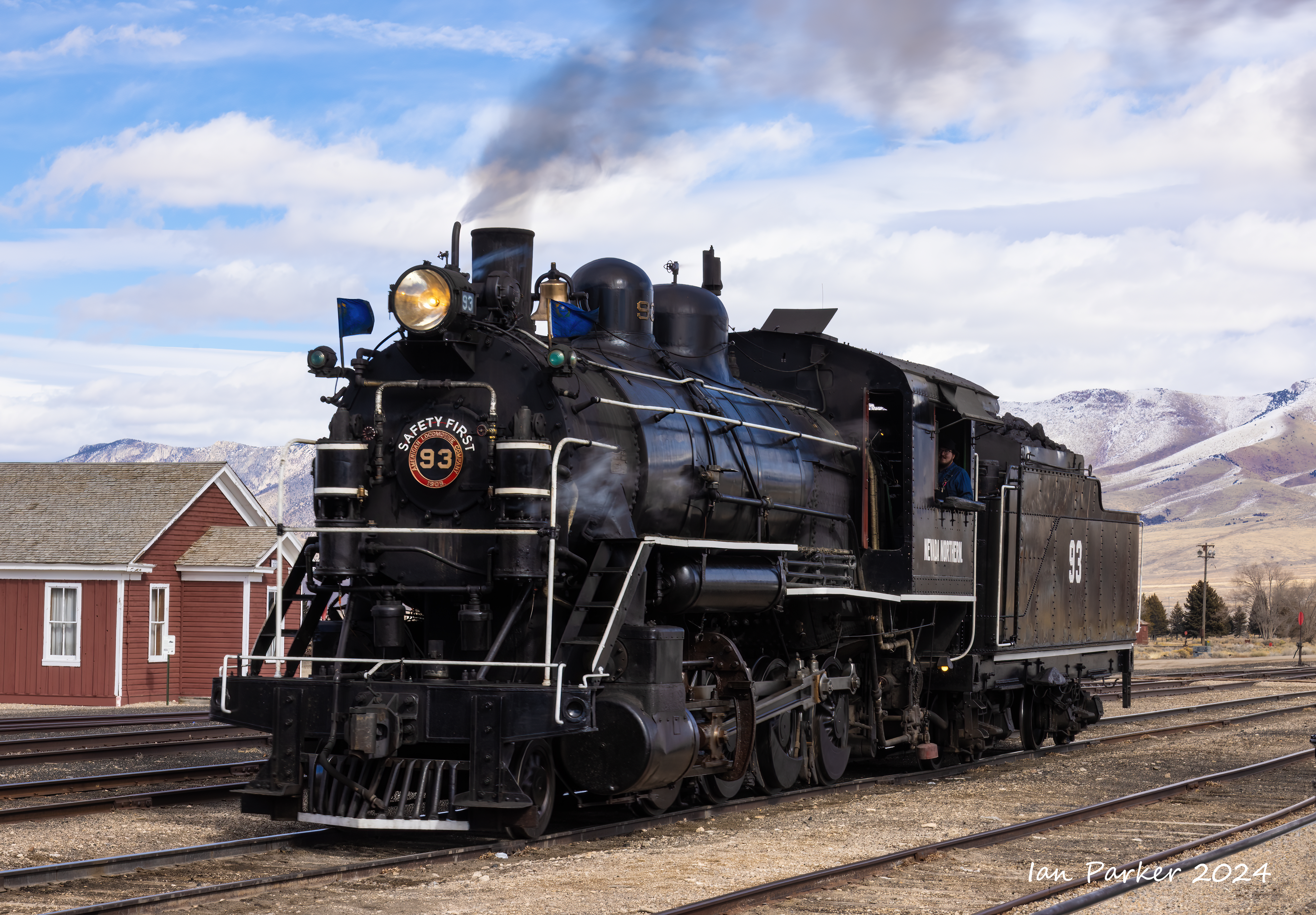
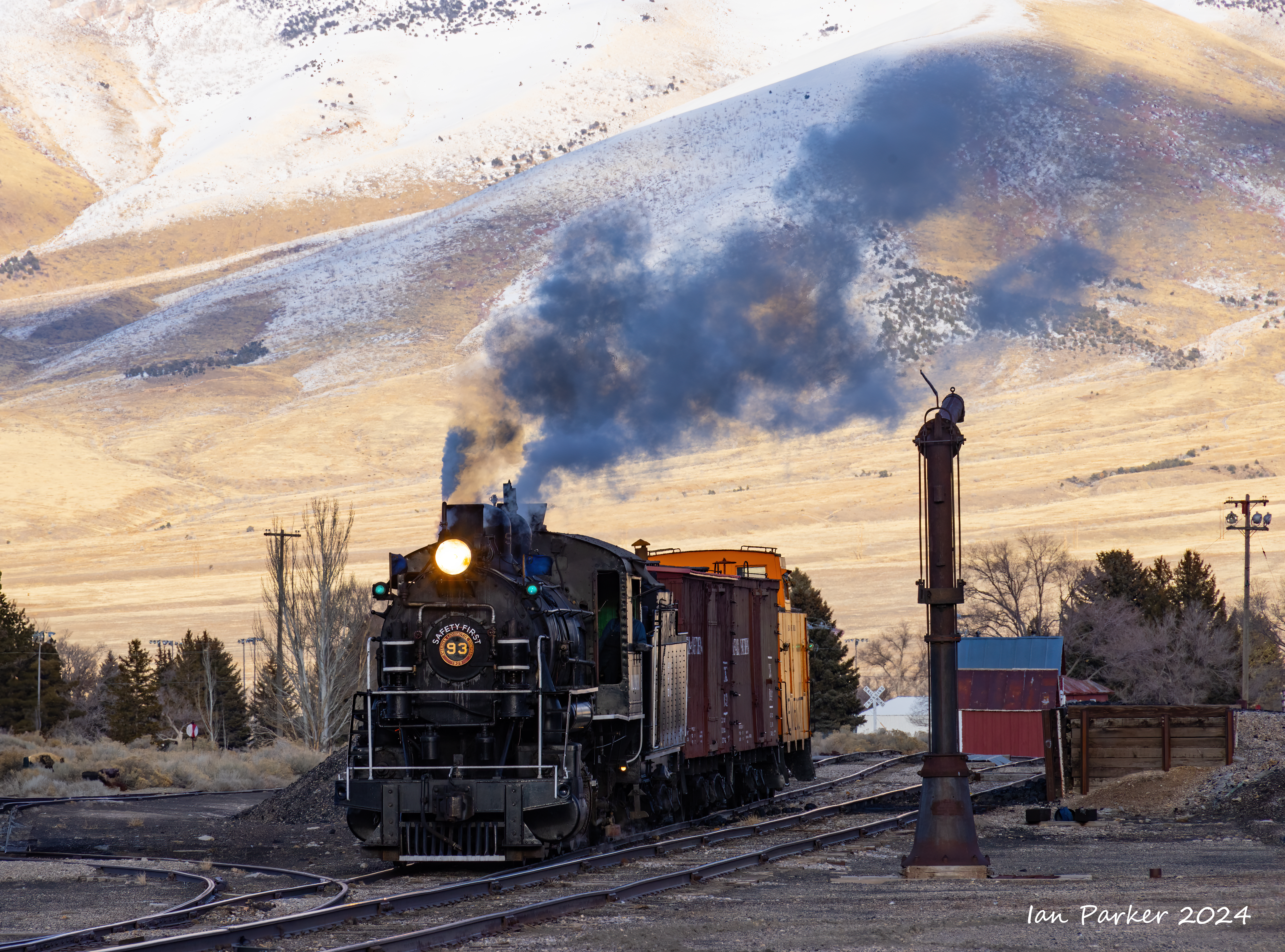
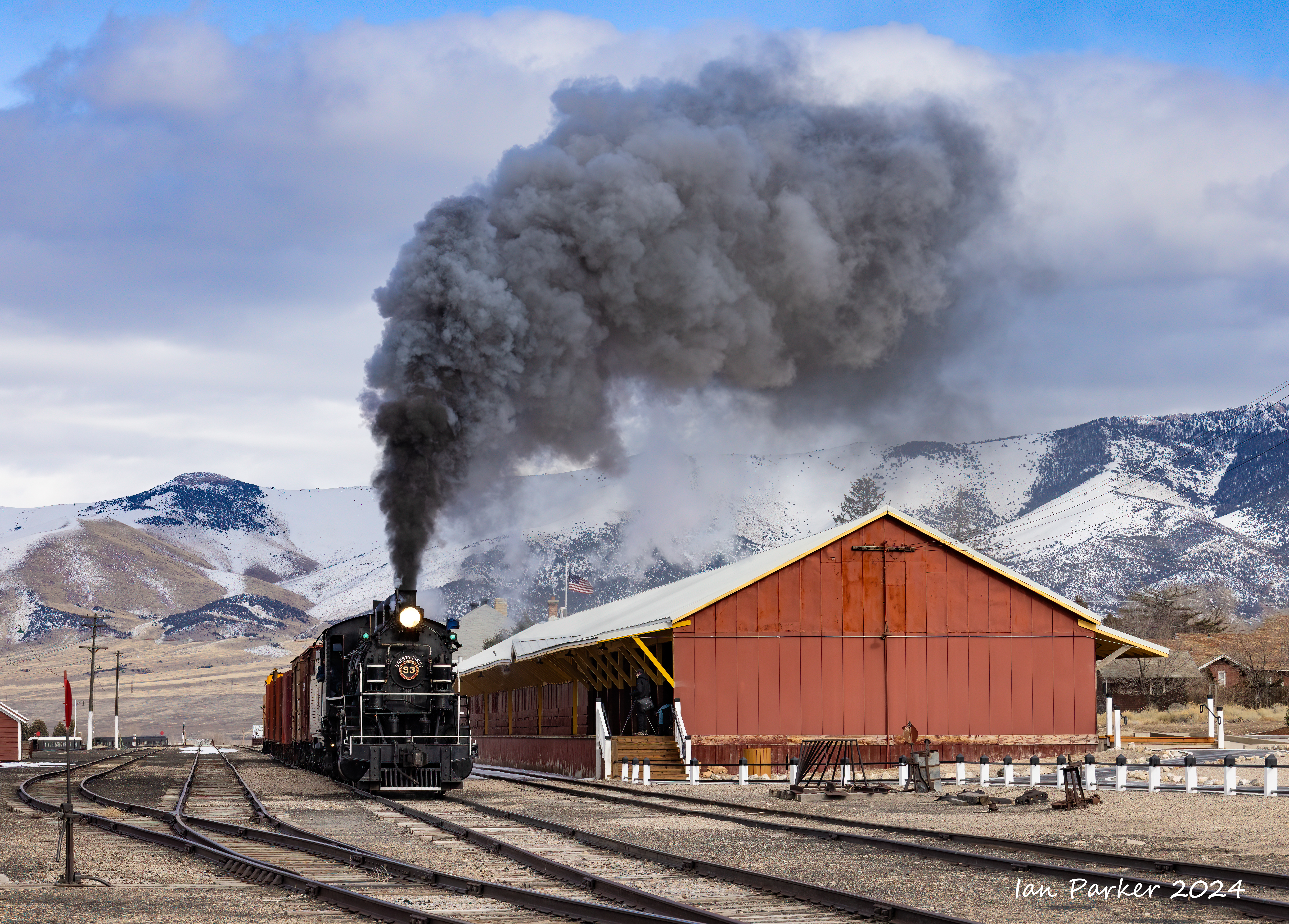
Northern Nevada Railroad, Ely, NV
Winter steam photoshoot: Feb 16
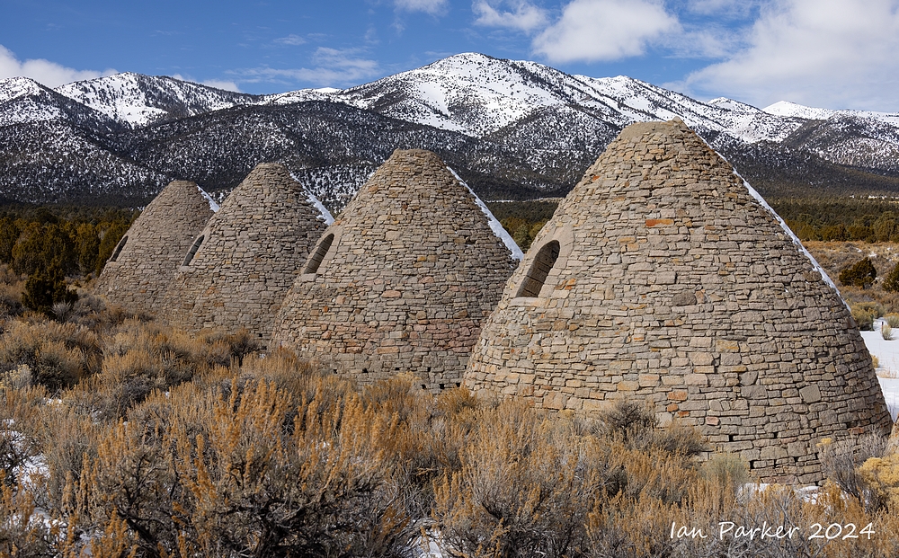
The Nevada Northern Railway wasconstructed in 1905–06 to reach a major copper producing area in White Pine County, Nevada. Faced with declining ore reserves and low copper prices, the operator, Kennecott, closed its Ruth-area mines in May 1978, thus ending the ore trains between Ruth and the McGill smelter. The smelter closed on June 20, 1983, and the Nevada Northern suspended all operations immediately thereafter. In a series of donations beginning in 1986, Kennecott transferred the entire Ore Line, as well as the railroad's yard and shop facilities in East Ely, to the White Pine Historical Railroad Foundation, a non-profit organization that today operates the property as the Nevada Northern Railway Museum which operates a heritage railroad. [Wikepedia]
A black/white portfolio
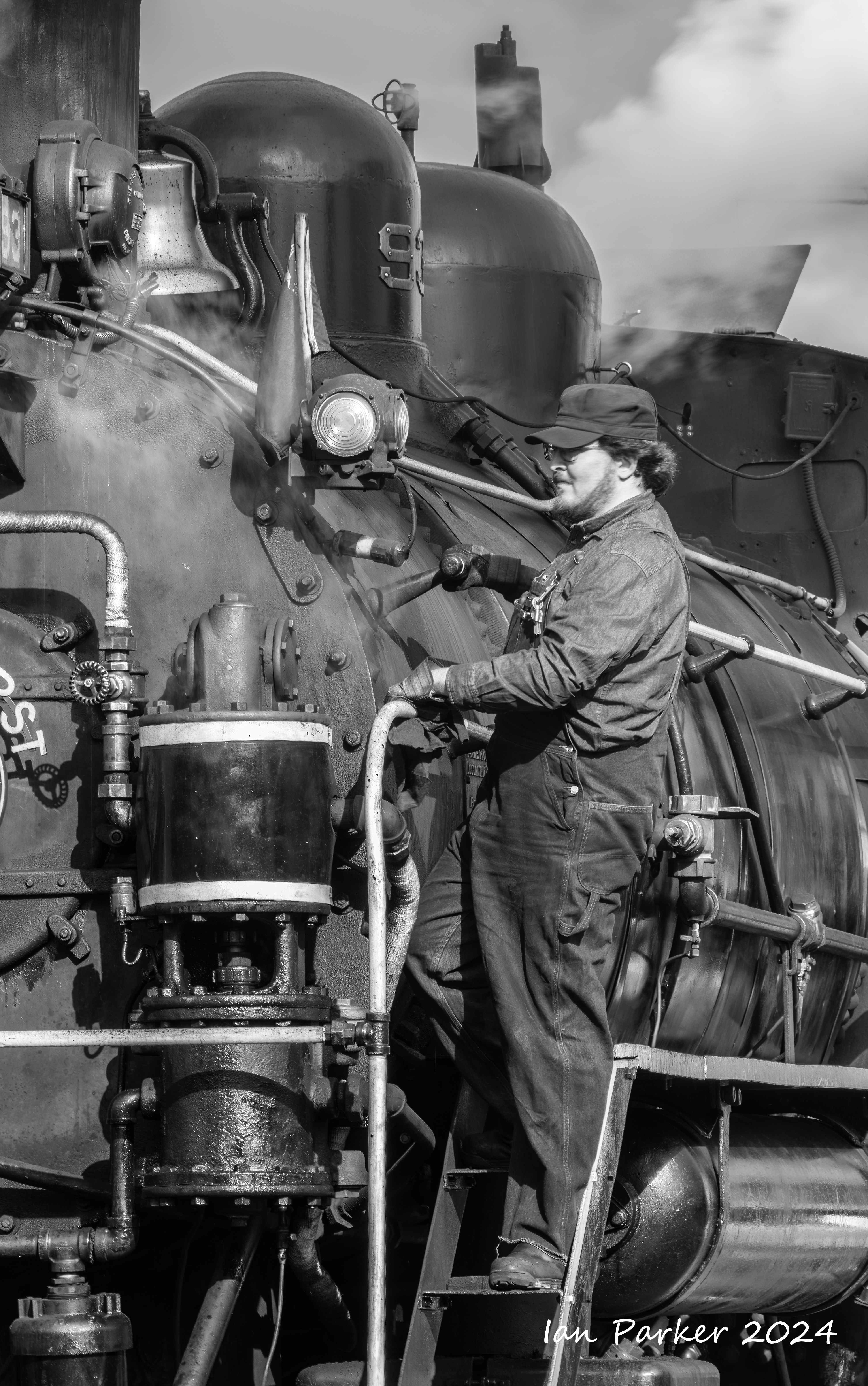
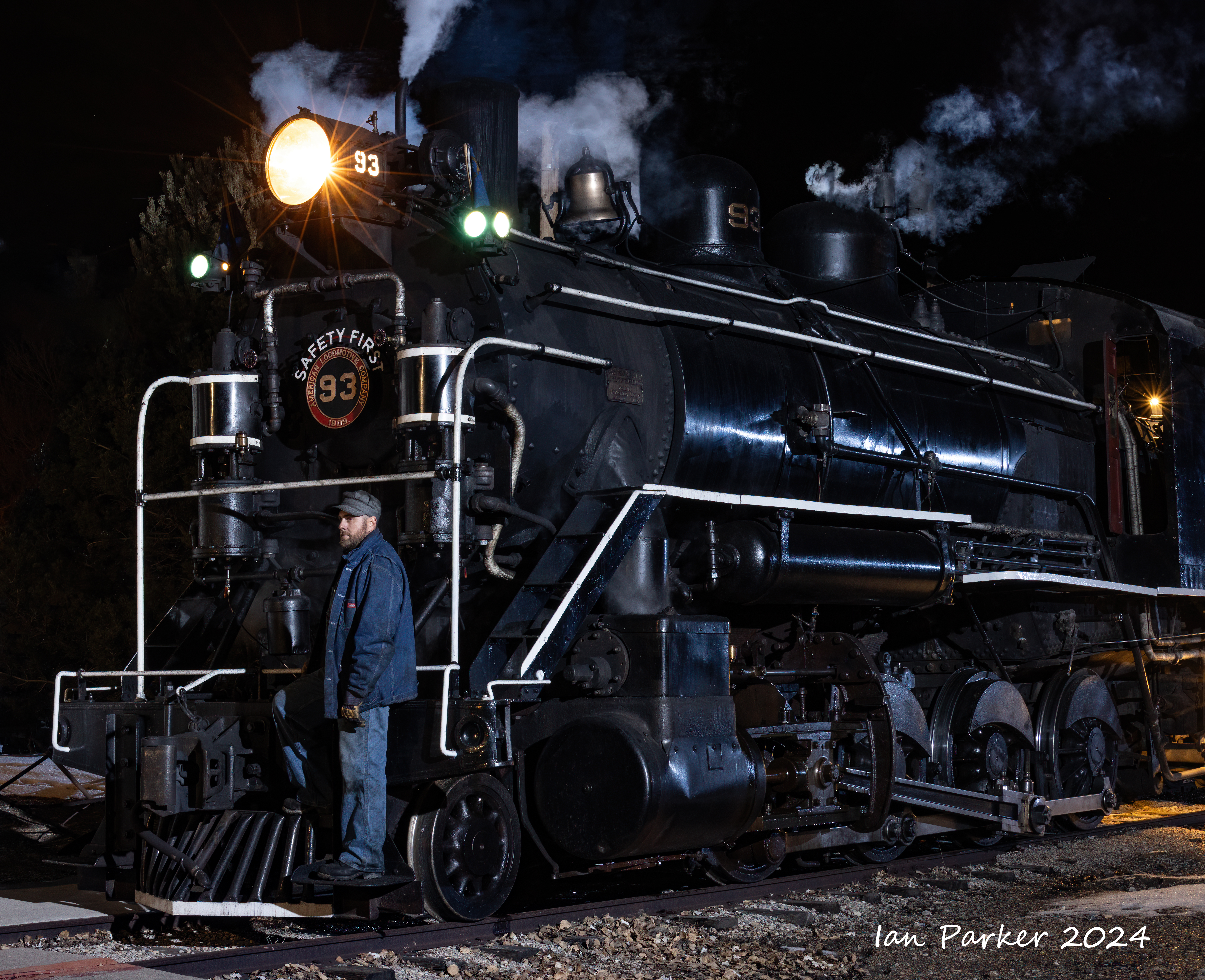
My photos of the railroad were, of course, photographed in color (there are very few monochrome digital cameras available!). But here is a selection of monochrome images, converted from my color photos. For this subject, I think this treatment is very effective nd gives a 'period' feel to the images. Locomotive 93 was built in 1906 - long before color photography was developed. Also, the tonal range in B/W can be pushed further to create a more dramatic look, whereas the same manipulations would appear unnatural in a color photograph.

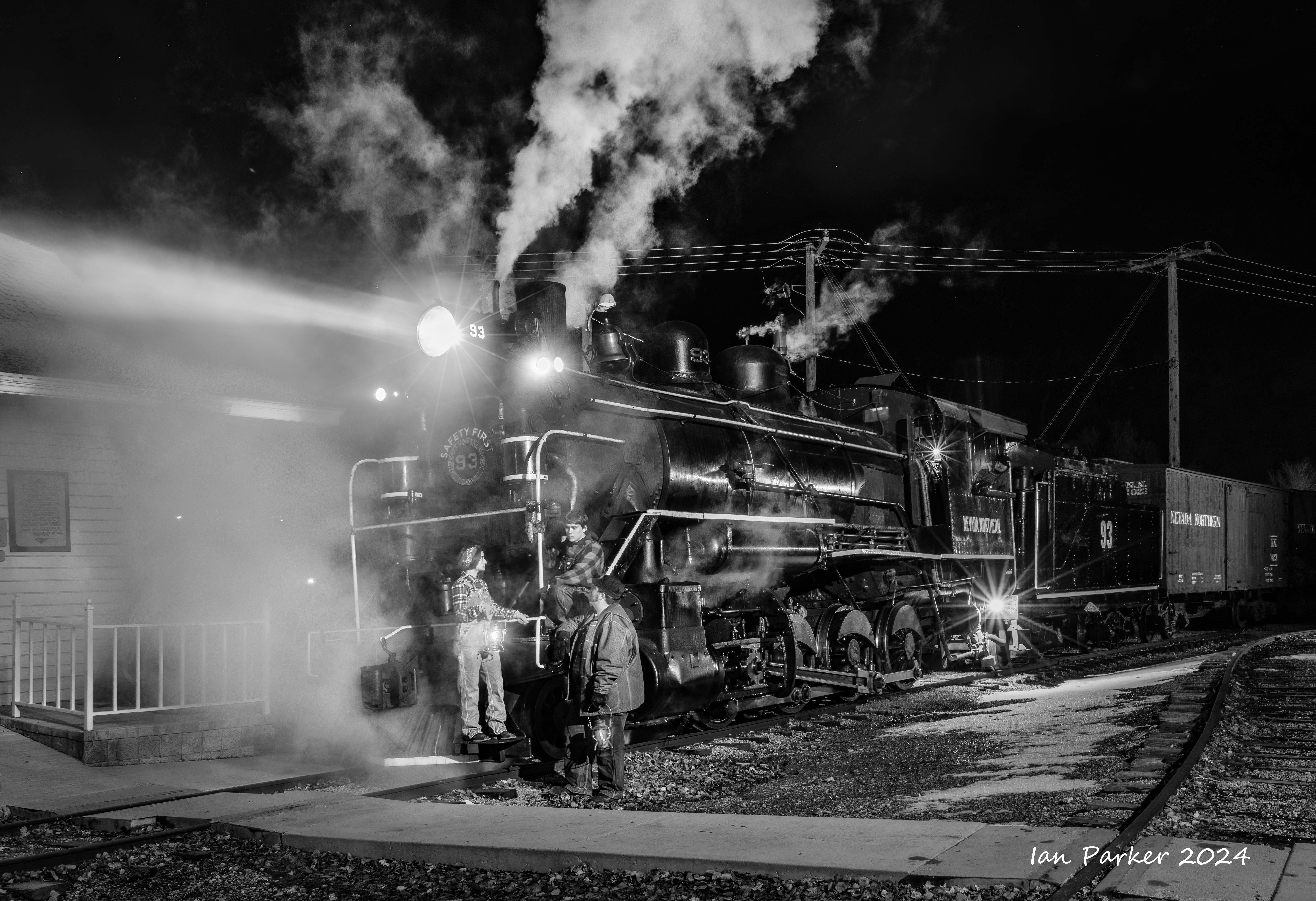
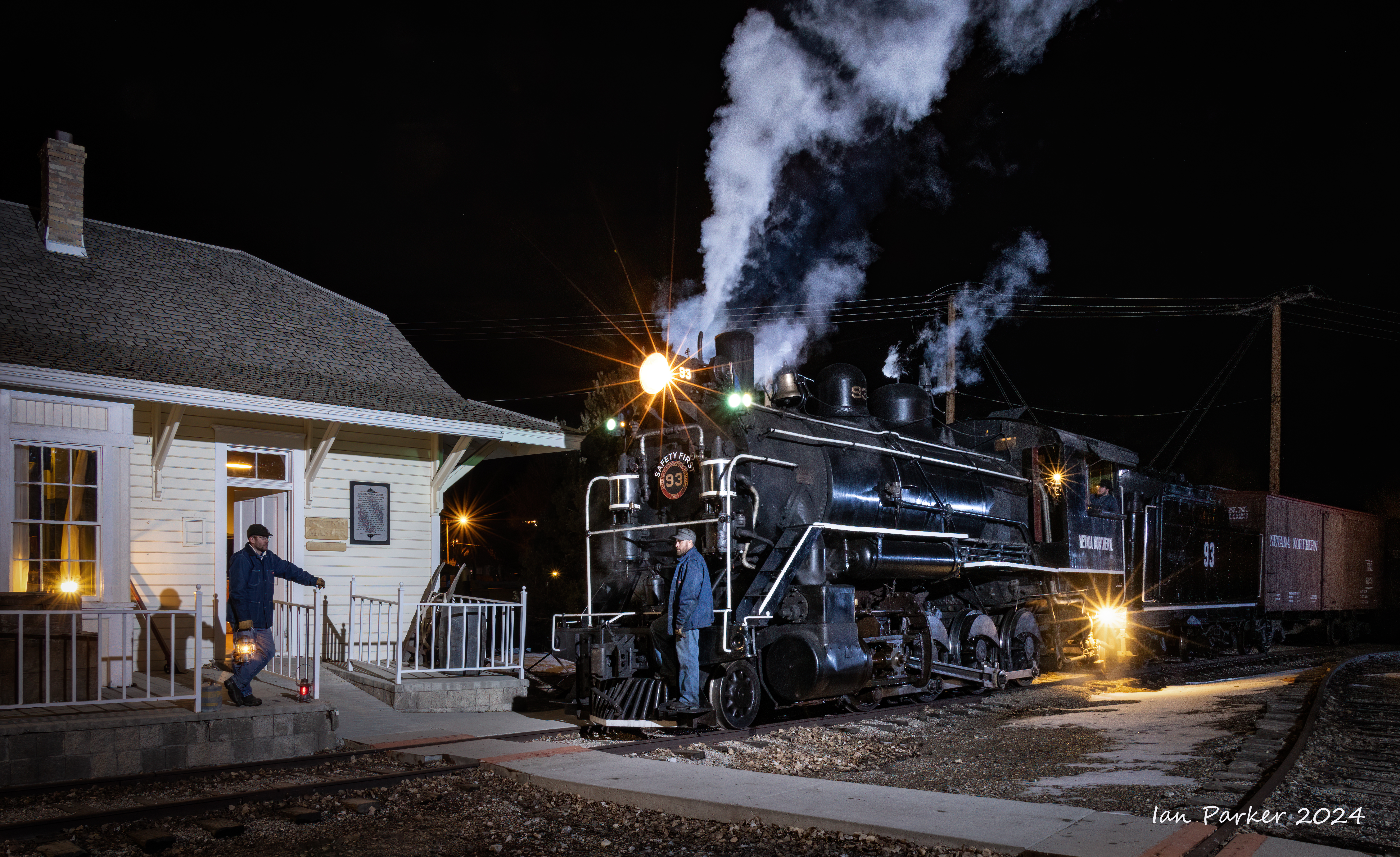
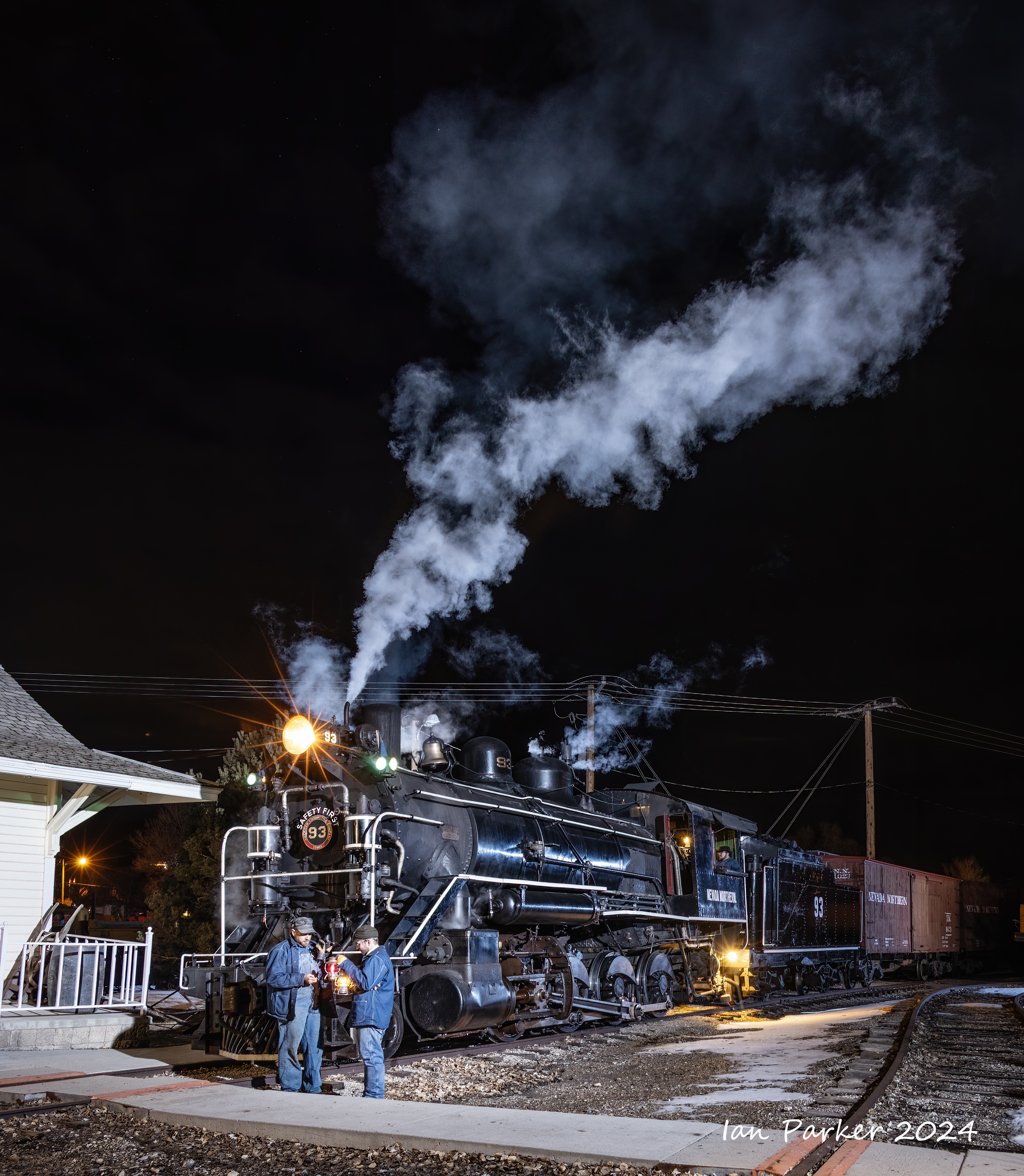
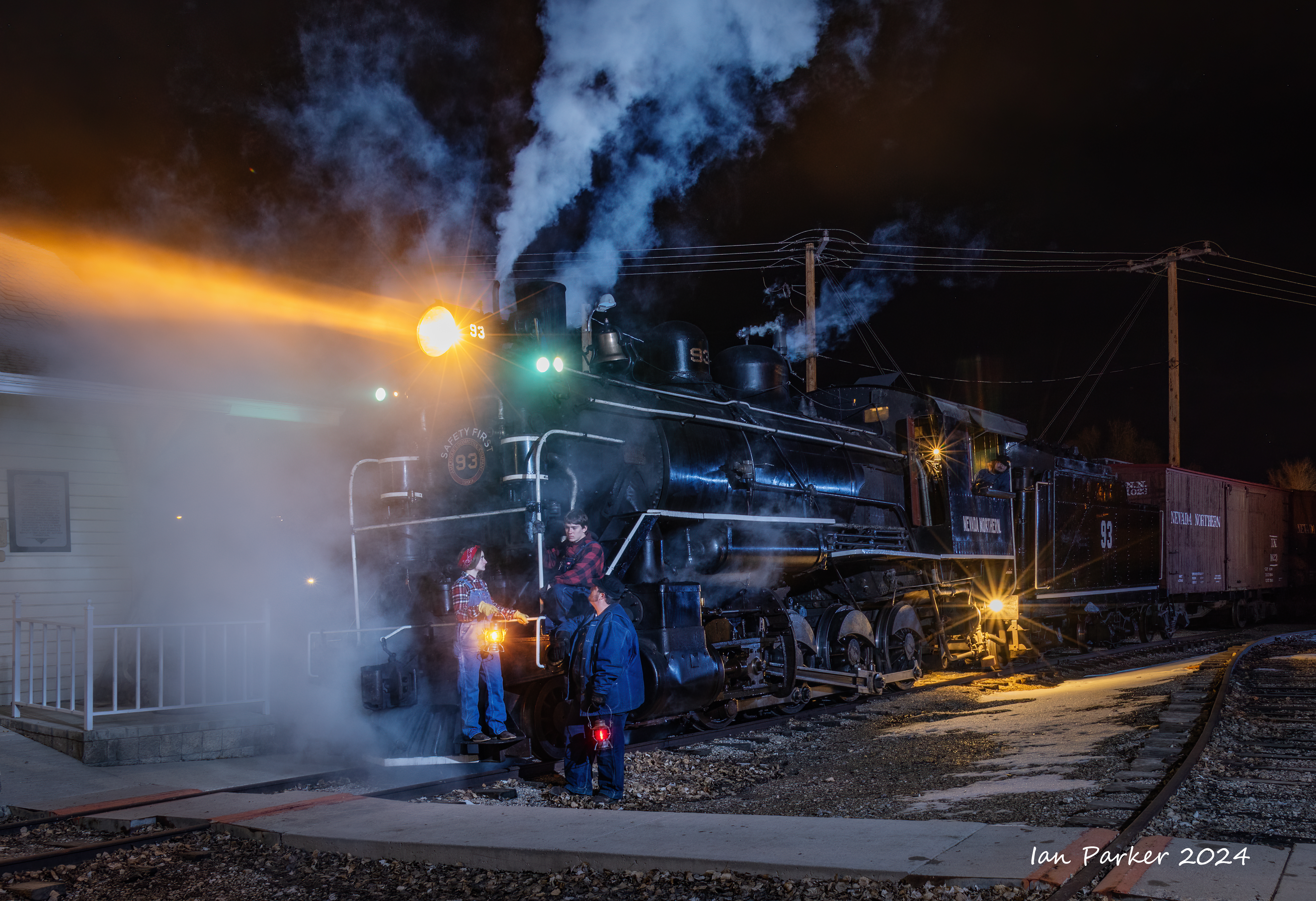
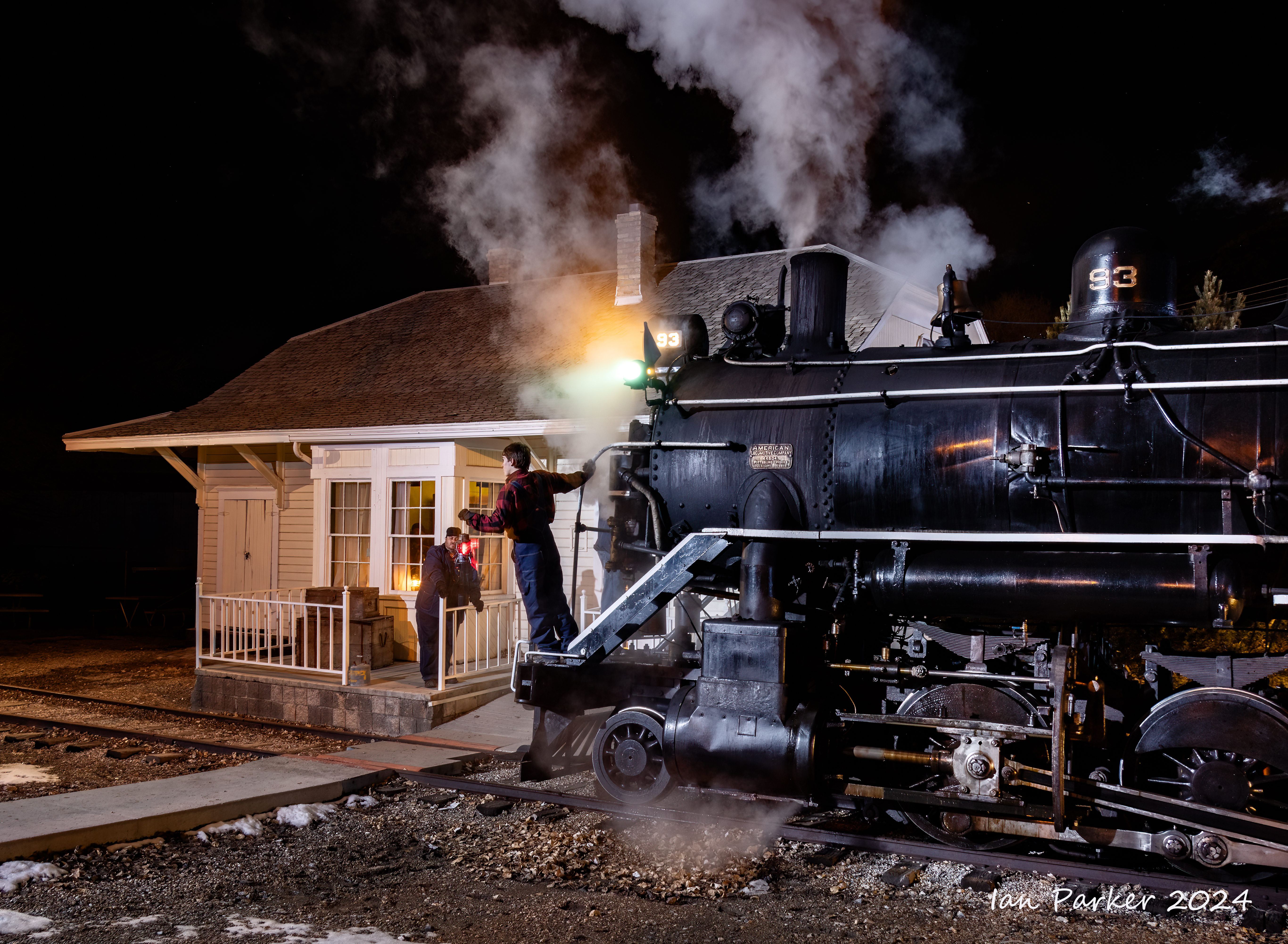
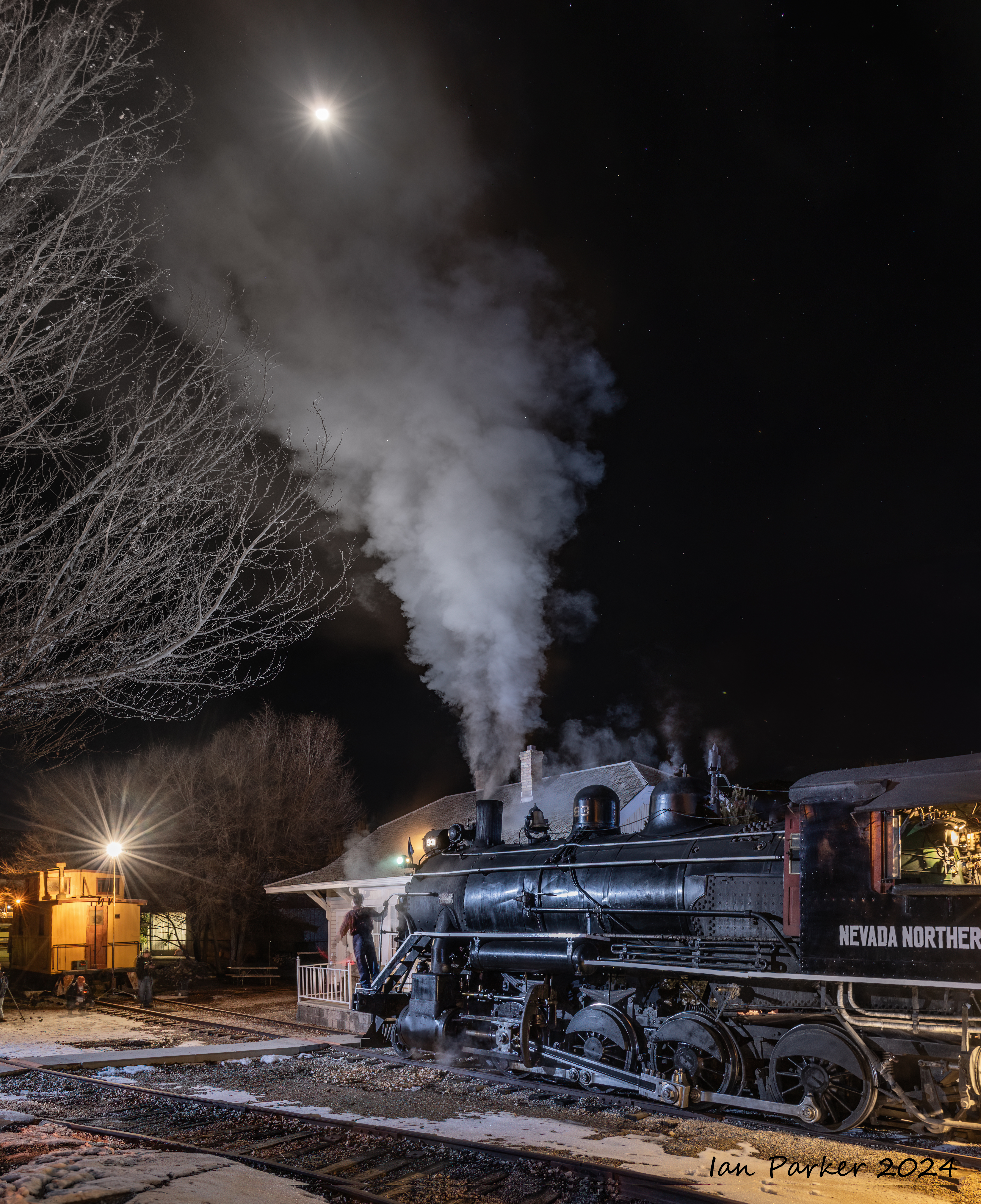
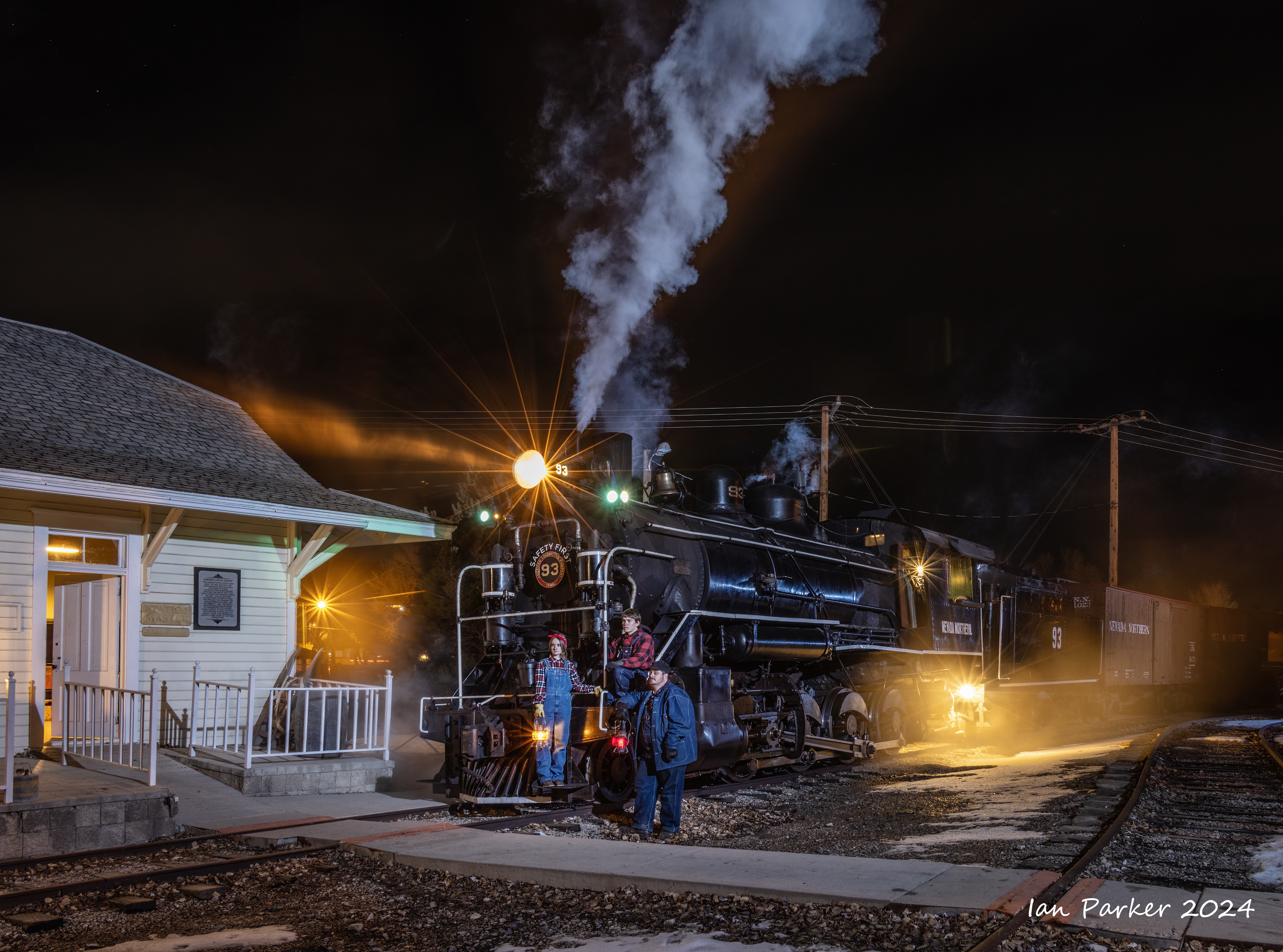
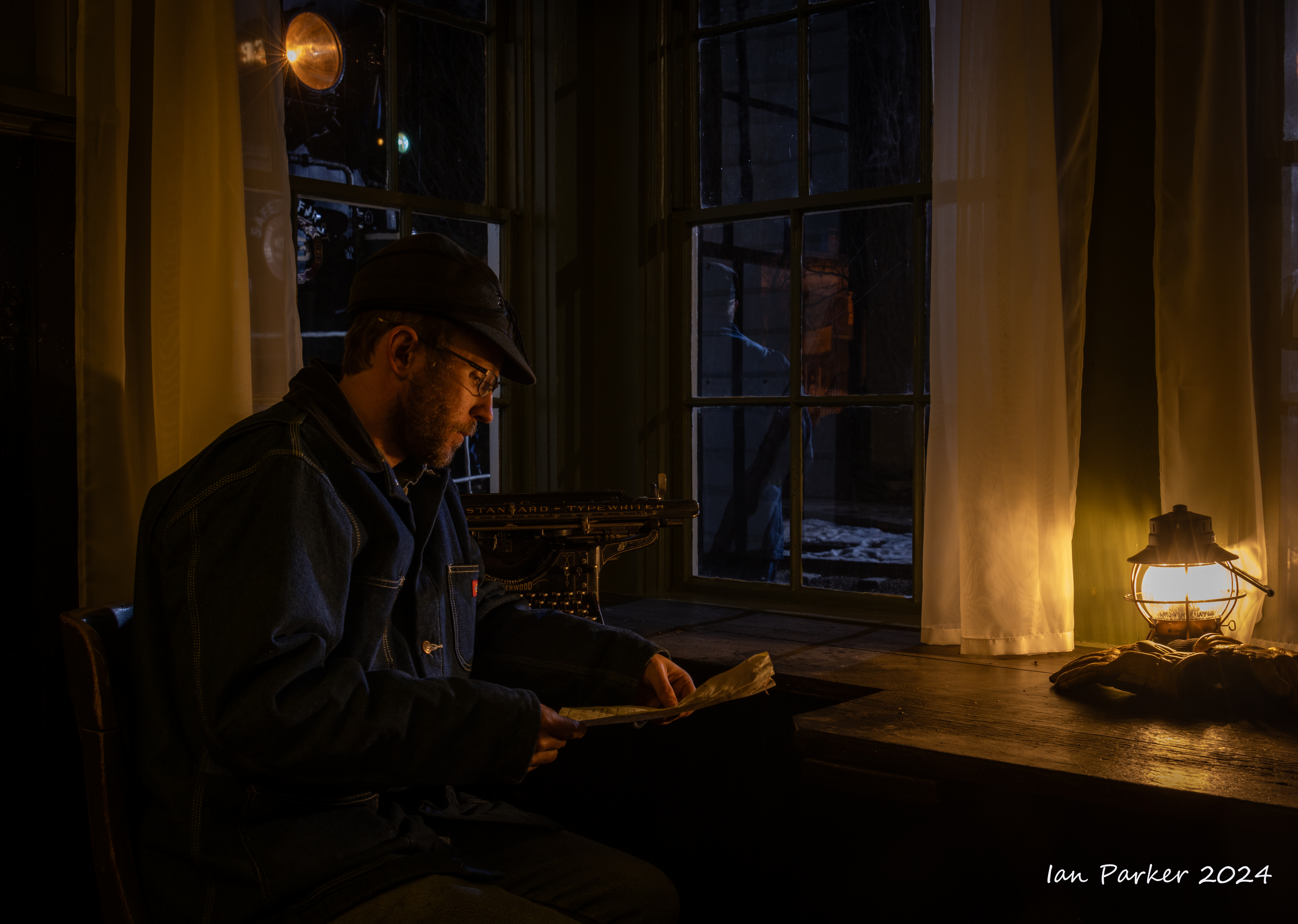
Locomotove nightscapes
Nevada Northern 93 posed next to the Cherry Creek depot, located west of the East Ely Yard for a night photoshoot. This was the first time the Nevada Northern has held the night photo session at the Cherry Creek Depot. The railroad staff set up strobe lights and gave a countdown for when they would next be triggered. Photography was thus just a matter of composing with the camera on a tripod, manually focussing and opening the shutter before the next flash. I experimented with holding the shutter open for different times before each flash to vary the ratio between the strobe illumination and the dim ambient lighting.
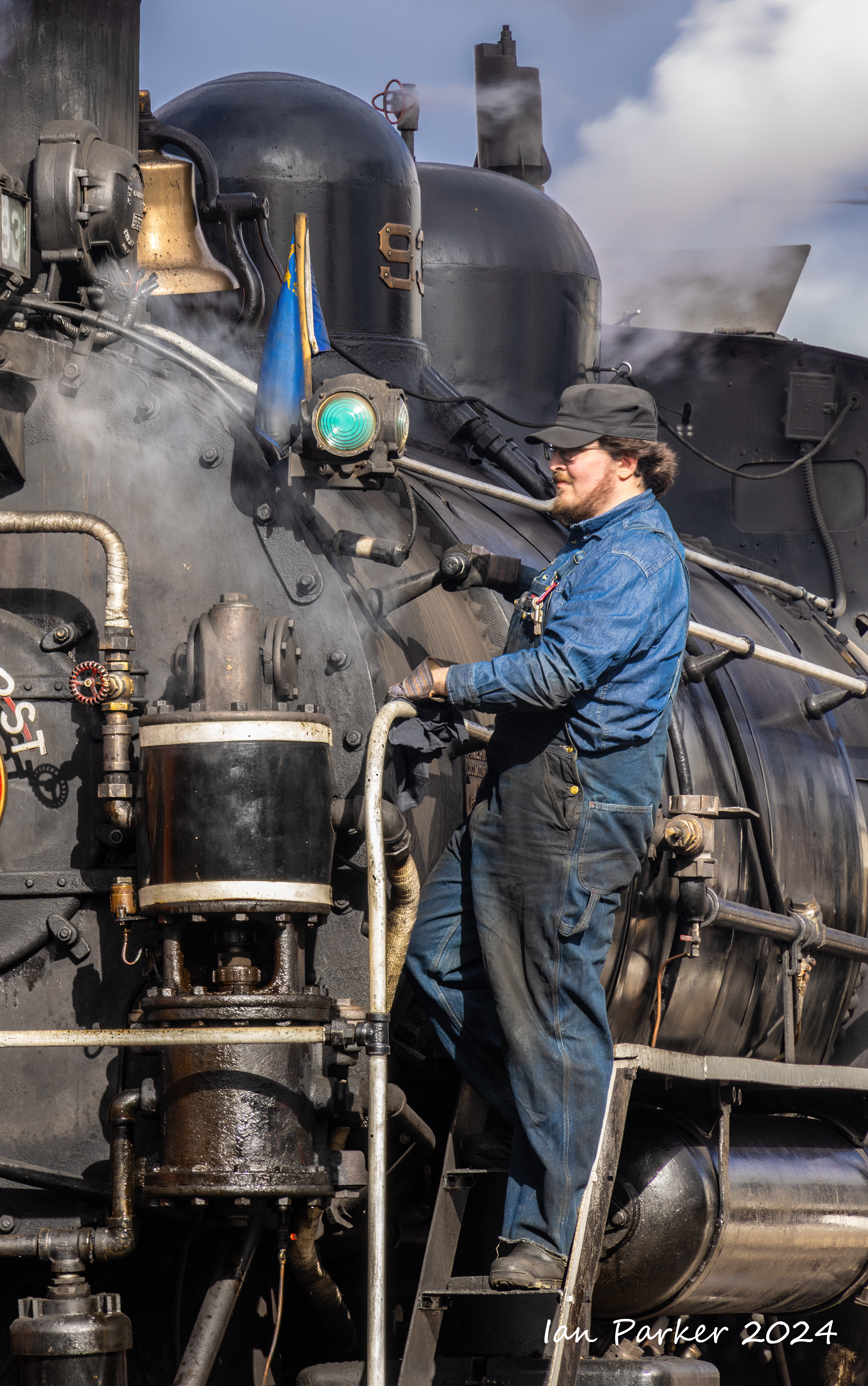
Daytime photos around the Ely Depot
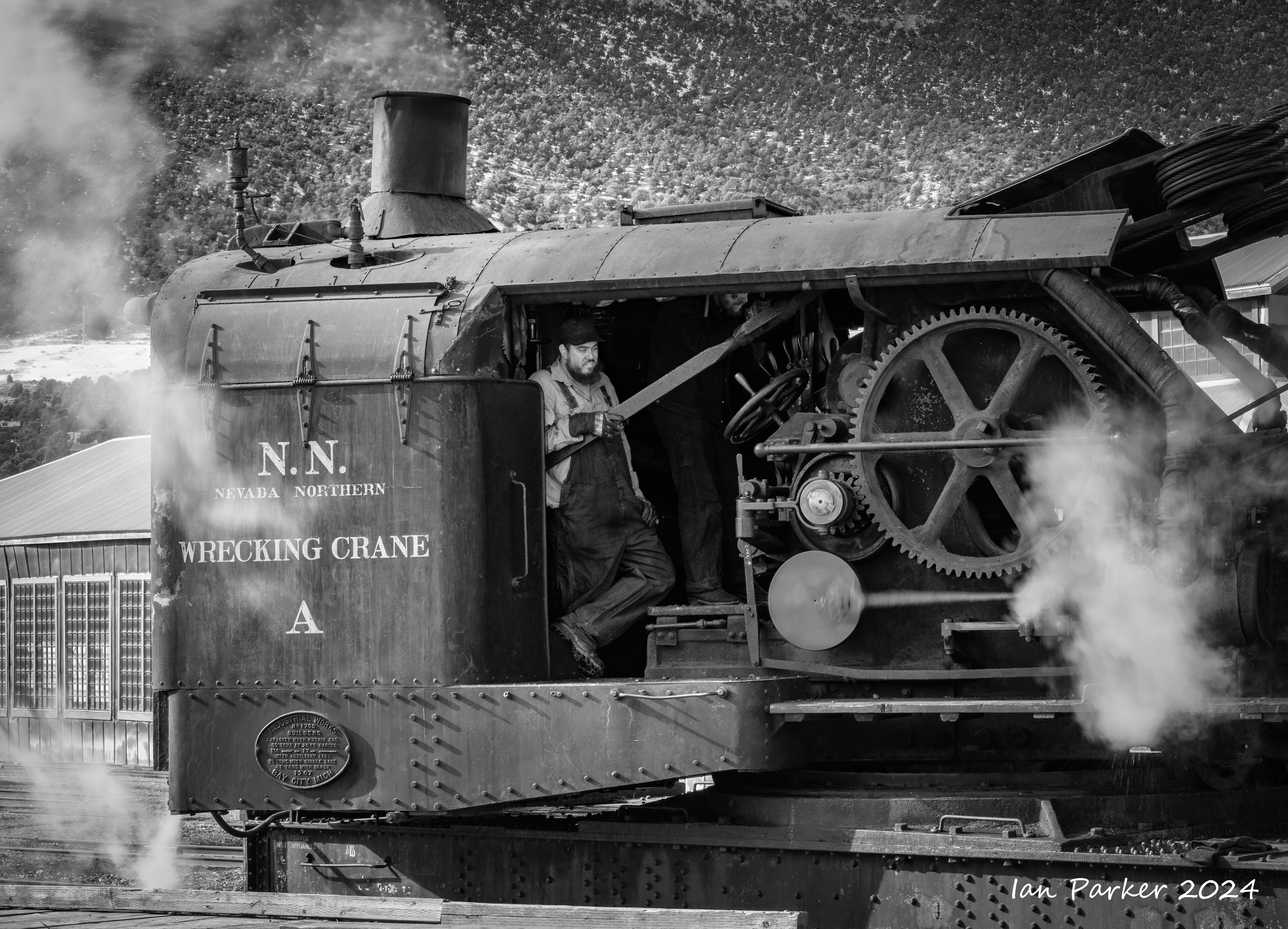
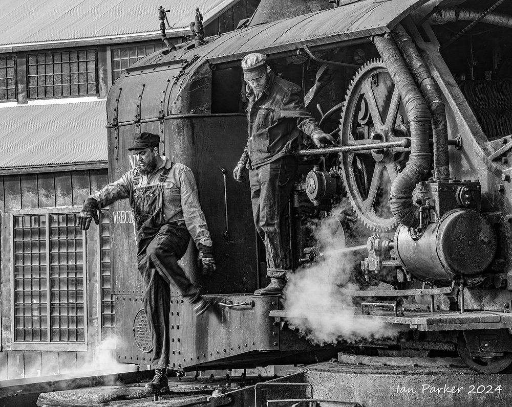
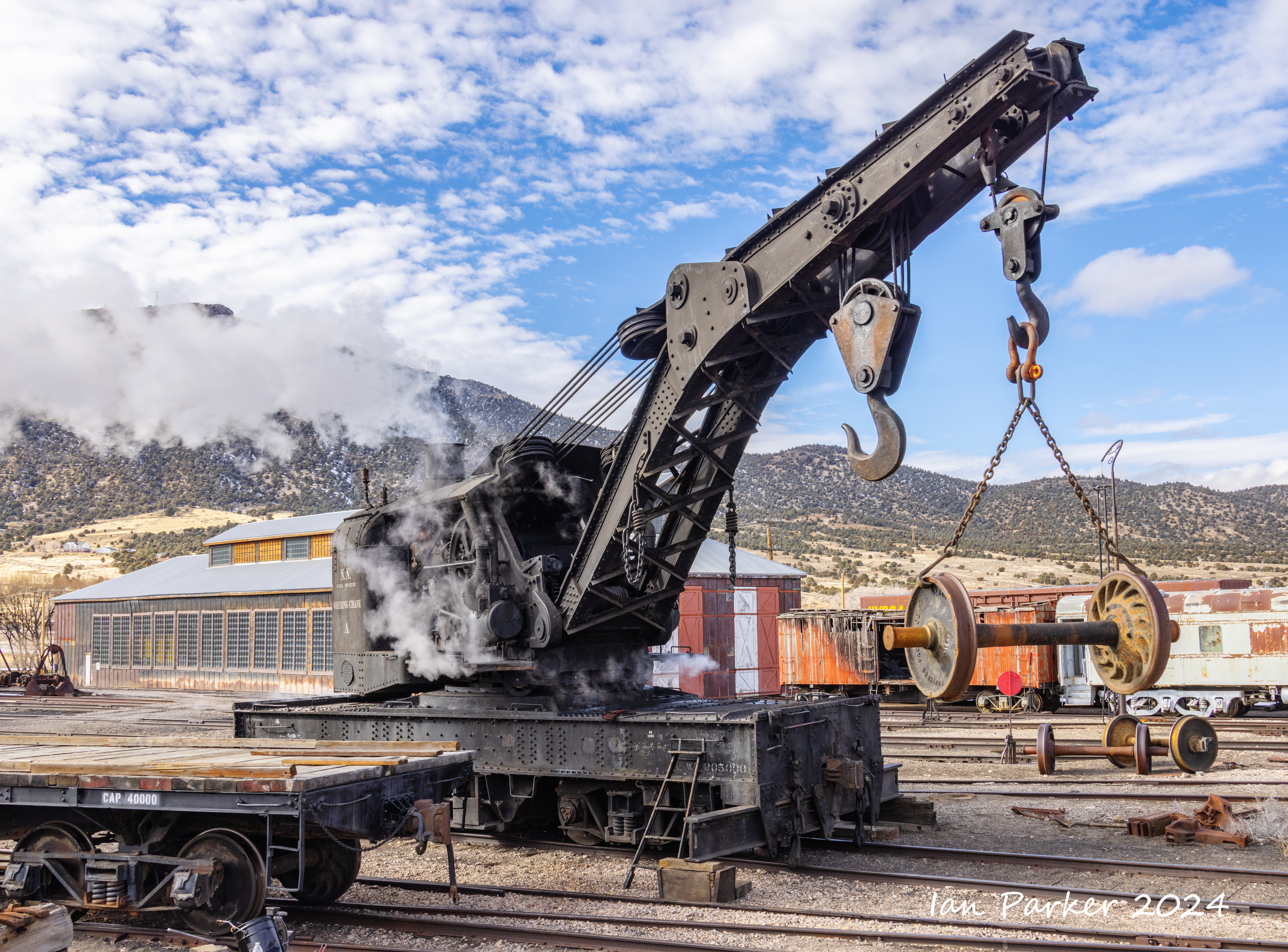
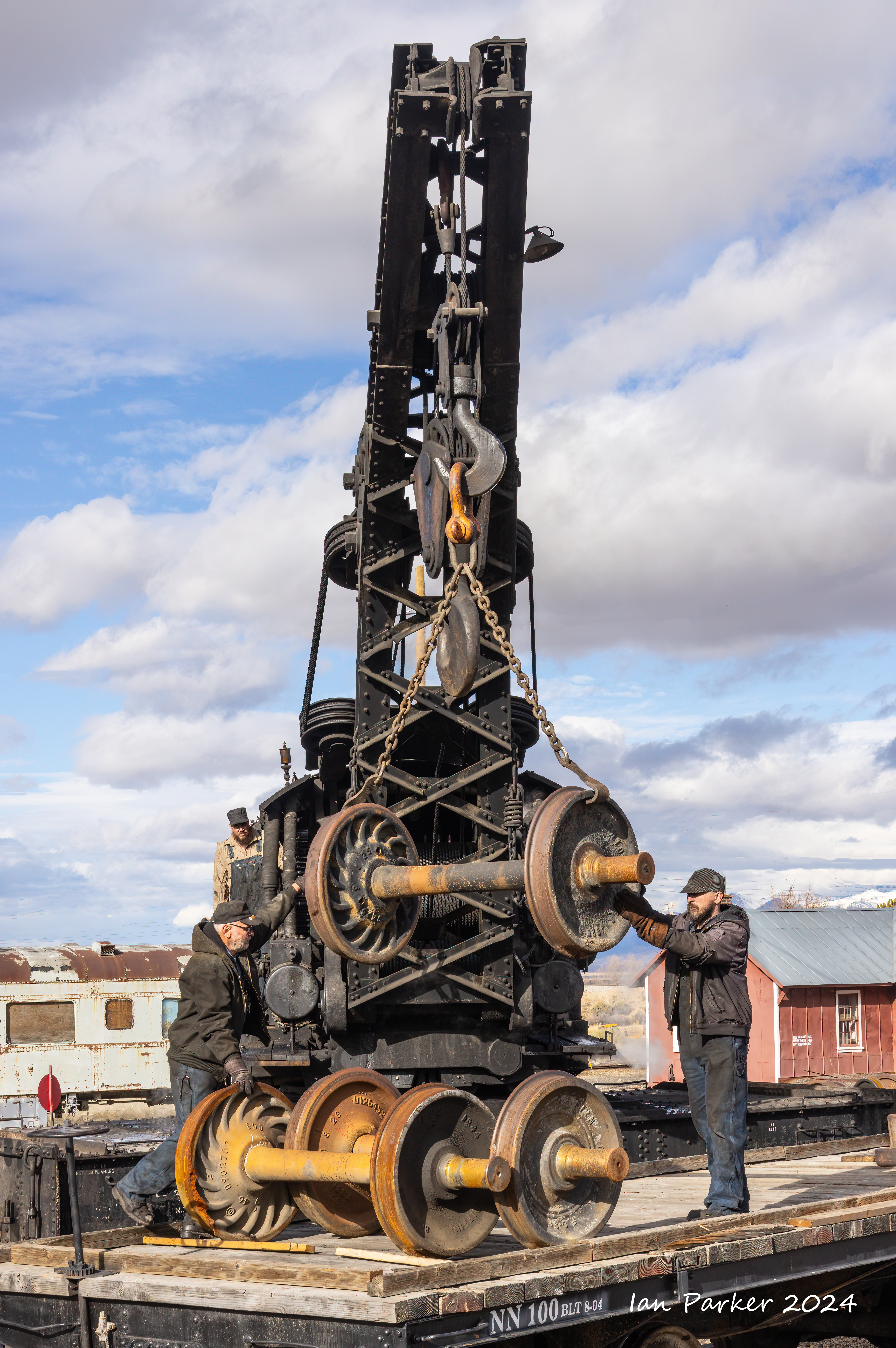
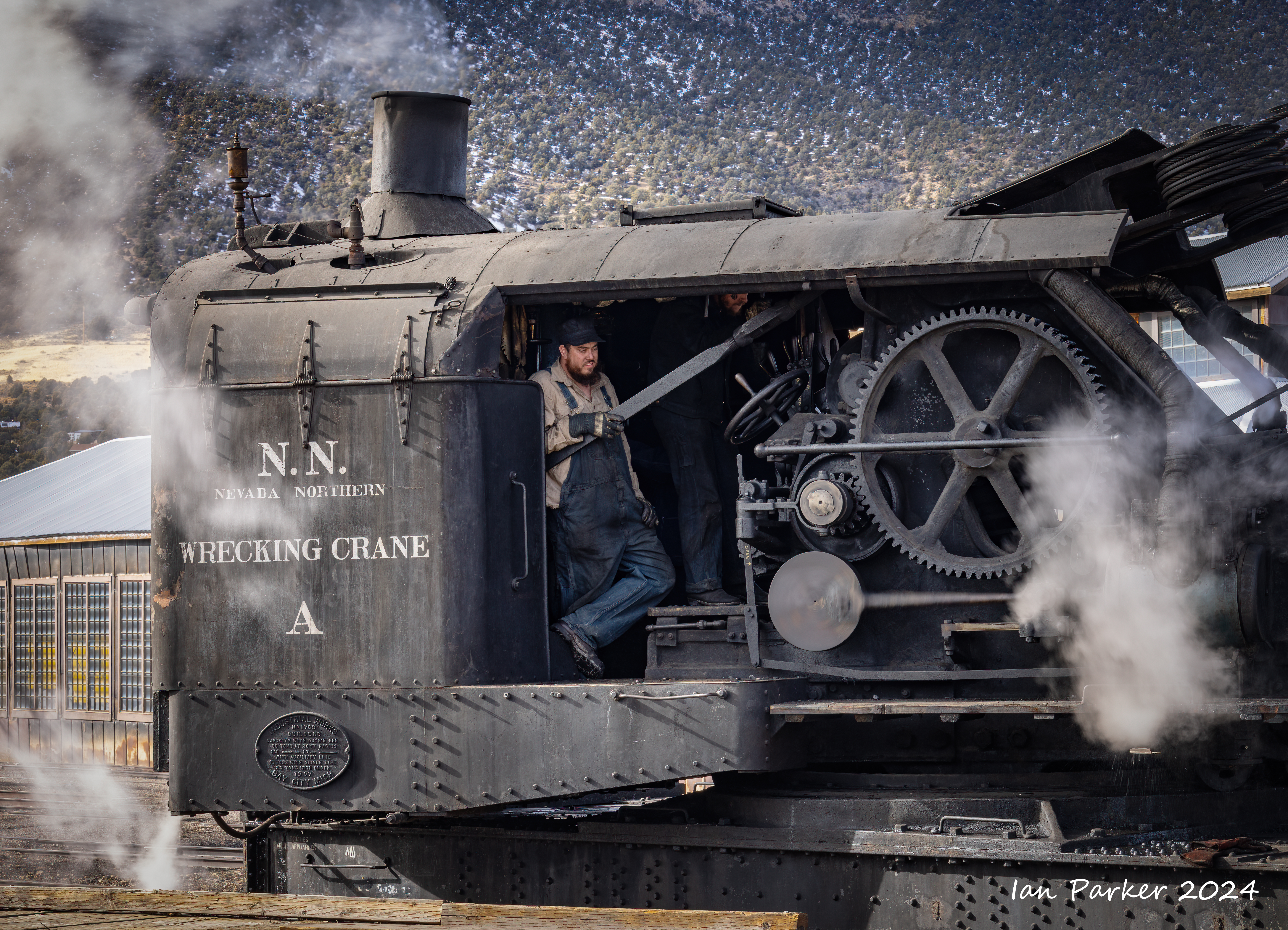
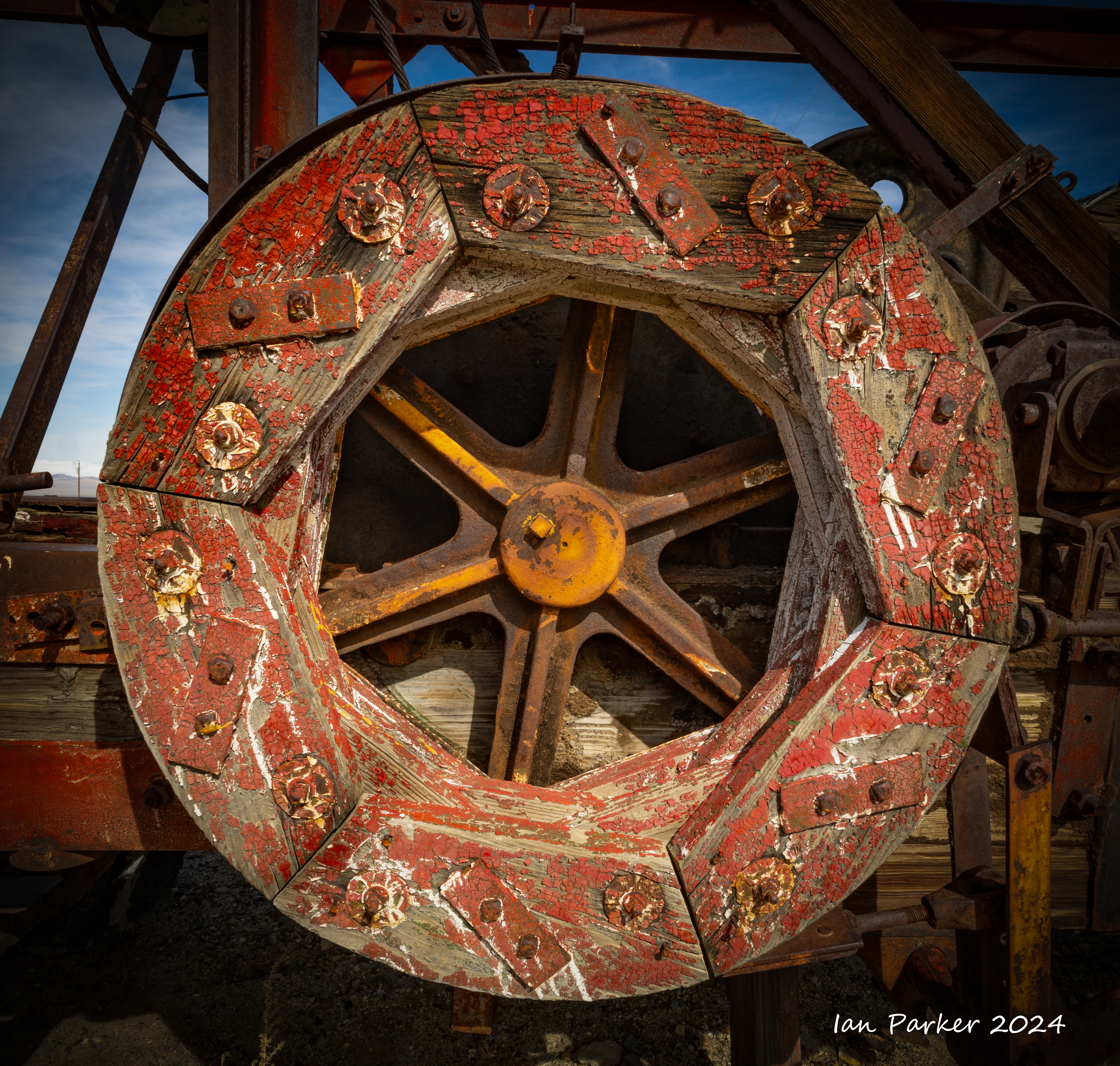
Steam wrecking crane A,
100 ton capacity, built by Industrial Works in 1907. The only functional, steam-powered wrecking crane in the USA.
Around the depot
Locomotive #93
Locomotive #93. 2-8-0. Freight locomotive, built in 1909 by the American Locomotive Company in Pittsburgh. Originally retired in 1961. Last steam locomotive on the railroad to retire from revenue service. Restored in 1993. Heavily damaged in a collision with runaway railcars in 1995. Participated in 2002 Winter Olympics on the Heber Valley Railroad following repairs from collision. Beginning in 1993, used for the railway's excursion trains.

Locomotive #109
Diesel electric Alco RS-3, built in 1950. Bought new by Kennecott in 1950 but was never delivered to them. It was sent to Kennecott Copper Corp and was later sold to LA Department of Water and Power.
Caboose #6
International Car Co, 1972. Steel frame and body, 8 wheel, wide vision, used in regular service.
[More railroad photos to come...]
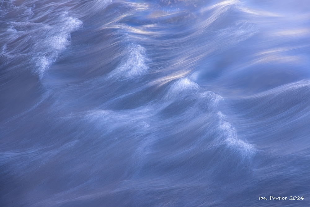
An excursion to the Basin and Range of Nevada
Landscape photos: Feb. 14-18
A detour through Death Valley to view Lake Manly on the way to and from Nevada.
In normal years, people see miles of salt flats at Badwater Basin. In some areas, the salt is fractured and uplifted into photogenic polygon shapes. However, every few years there is enough rain to cover the salt flat and create a temporary lake, informally known as Lake Manly. Usually, it is only a couple inches deep. Lake Manly returned after the remnants of Hurricane Hilary brought 2.2 inches of rain in August. The lake slowly shrunk until an atmospheric river brought another 1.5 inches in early February. For almost a month, people had a rare opportunity to kayak on Lake Manly, which was six miles long, three miles wide, and one foot deep.


The Ward Charcoal Ovens near Ely


A short detour from highway 6 to visit Lunar Crater

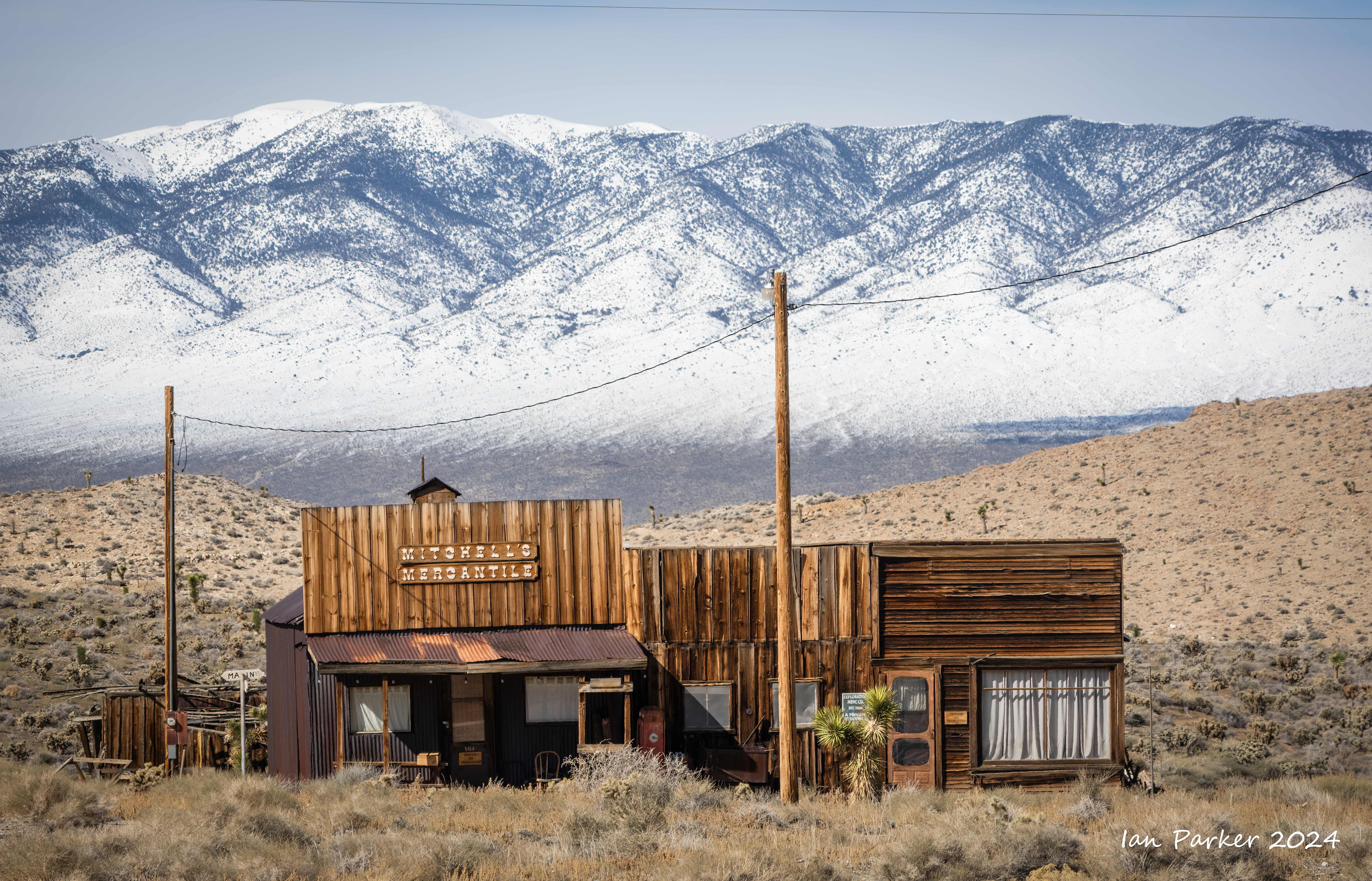
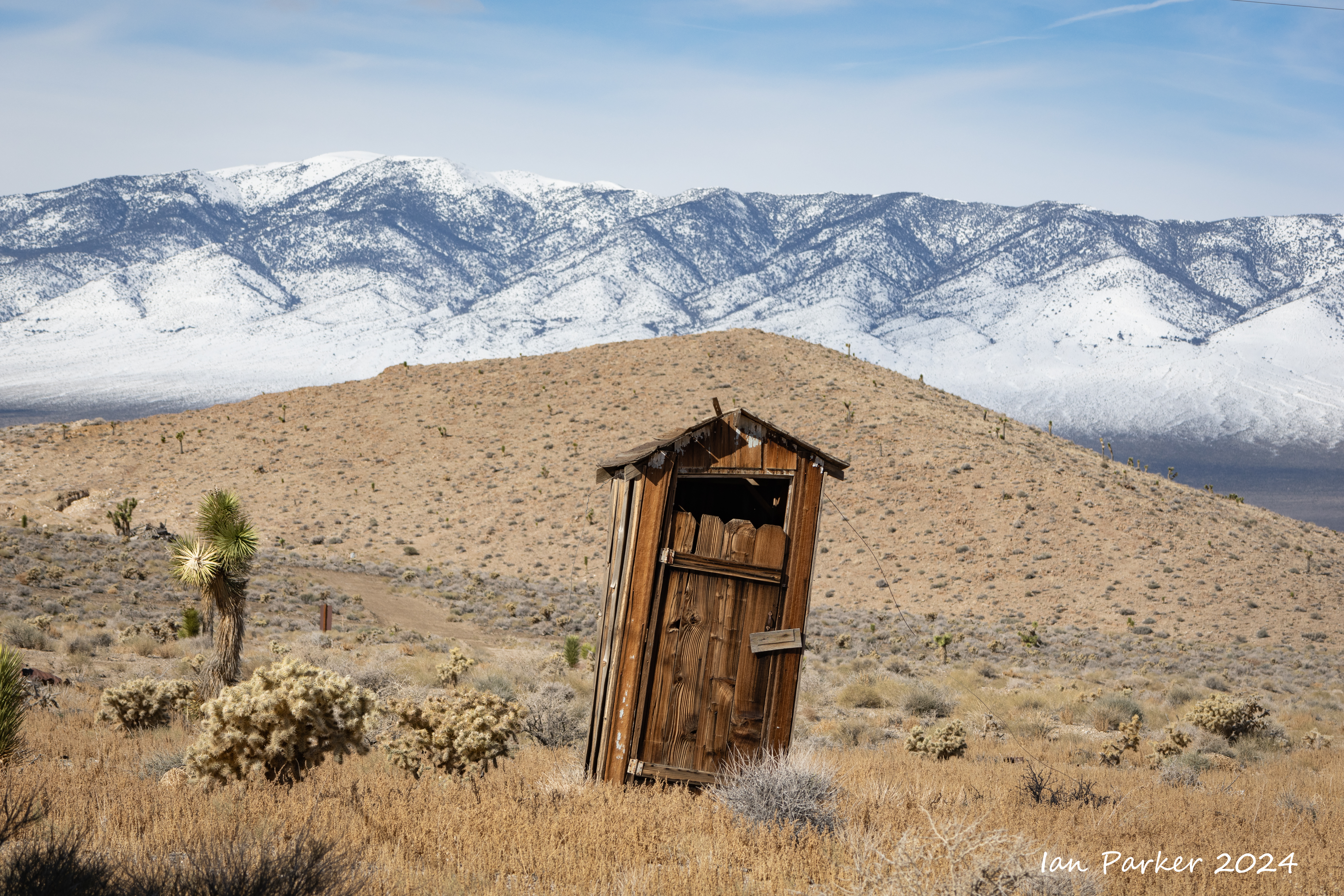
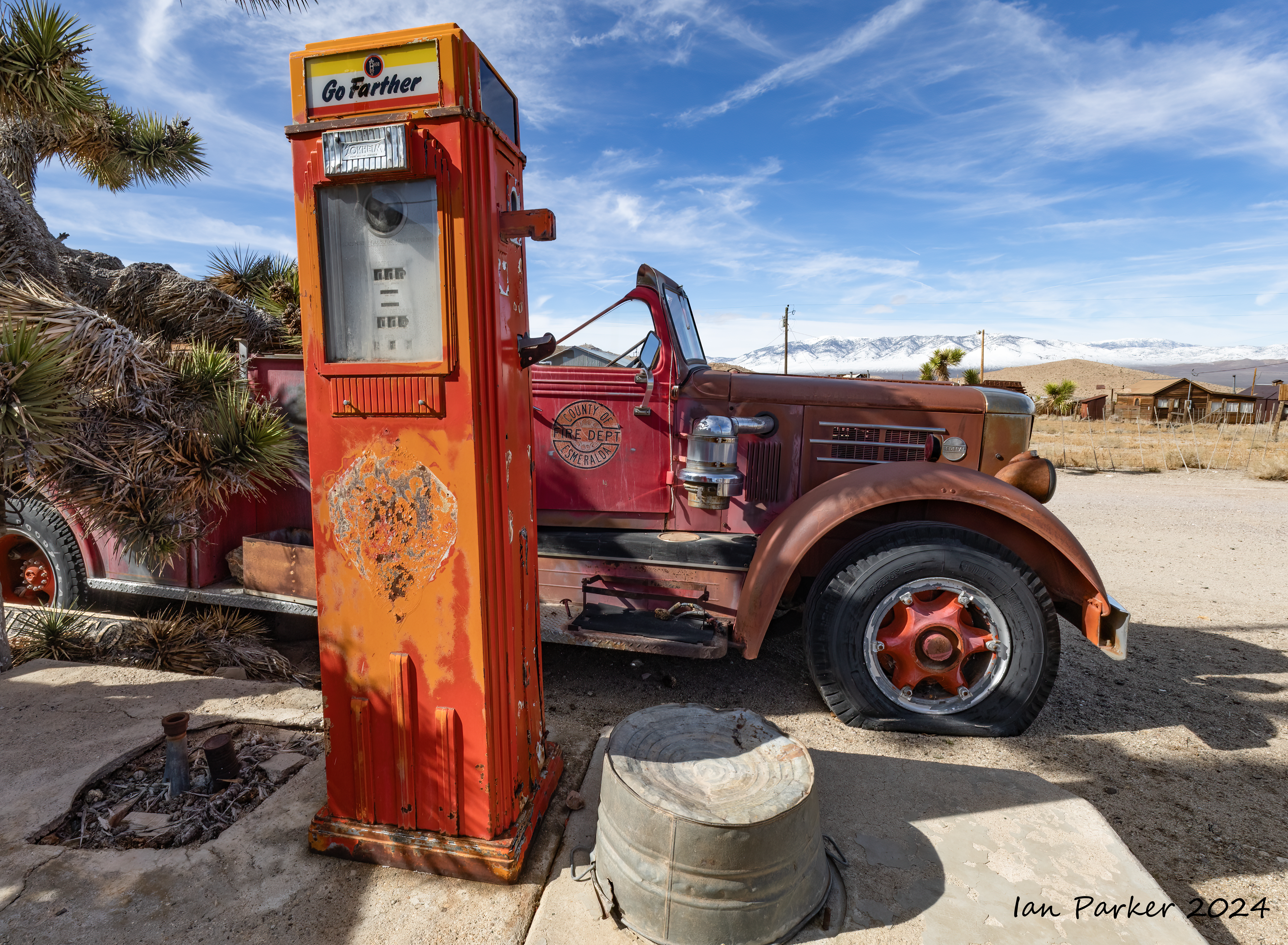
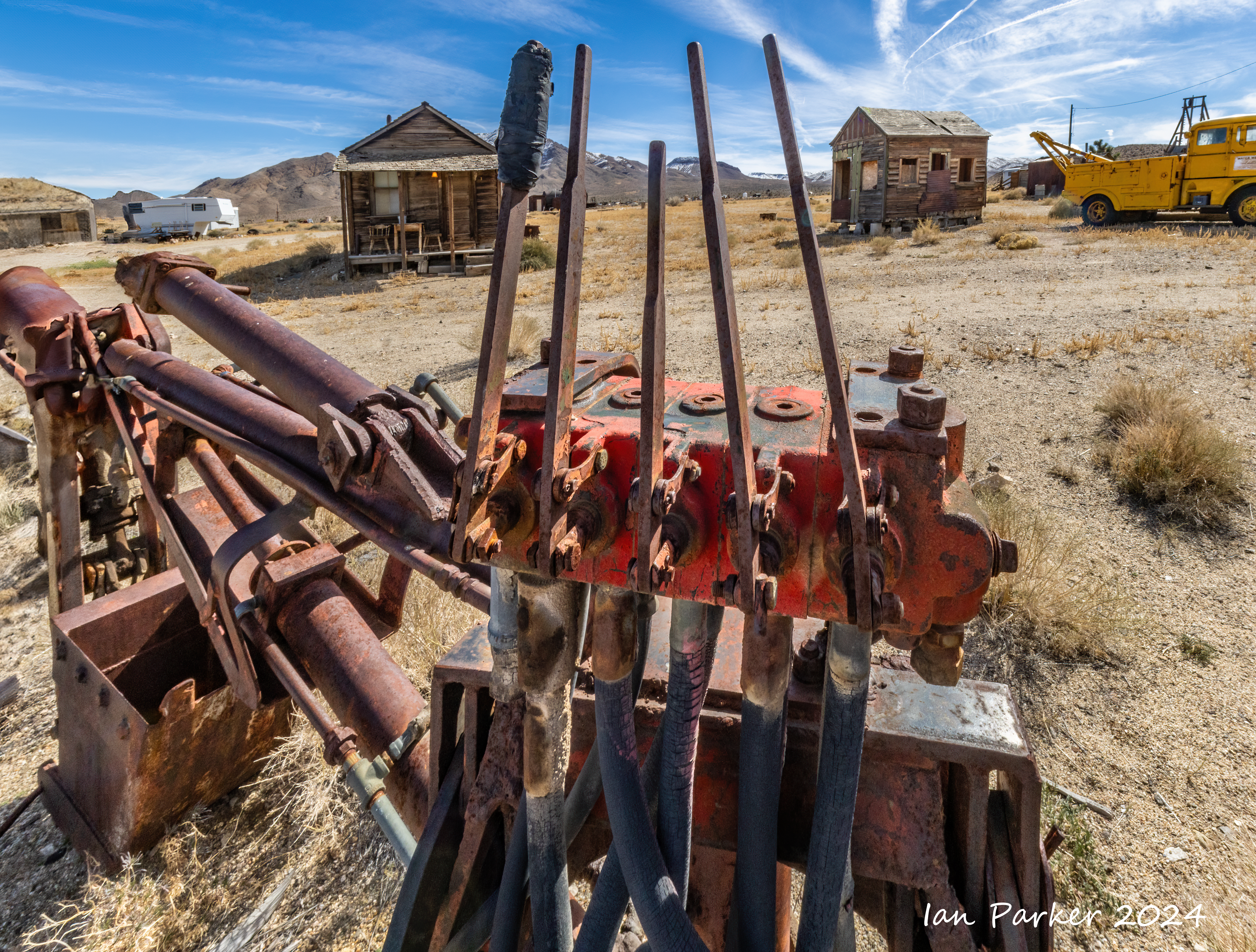
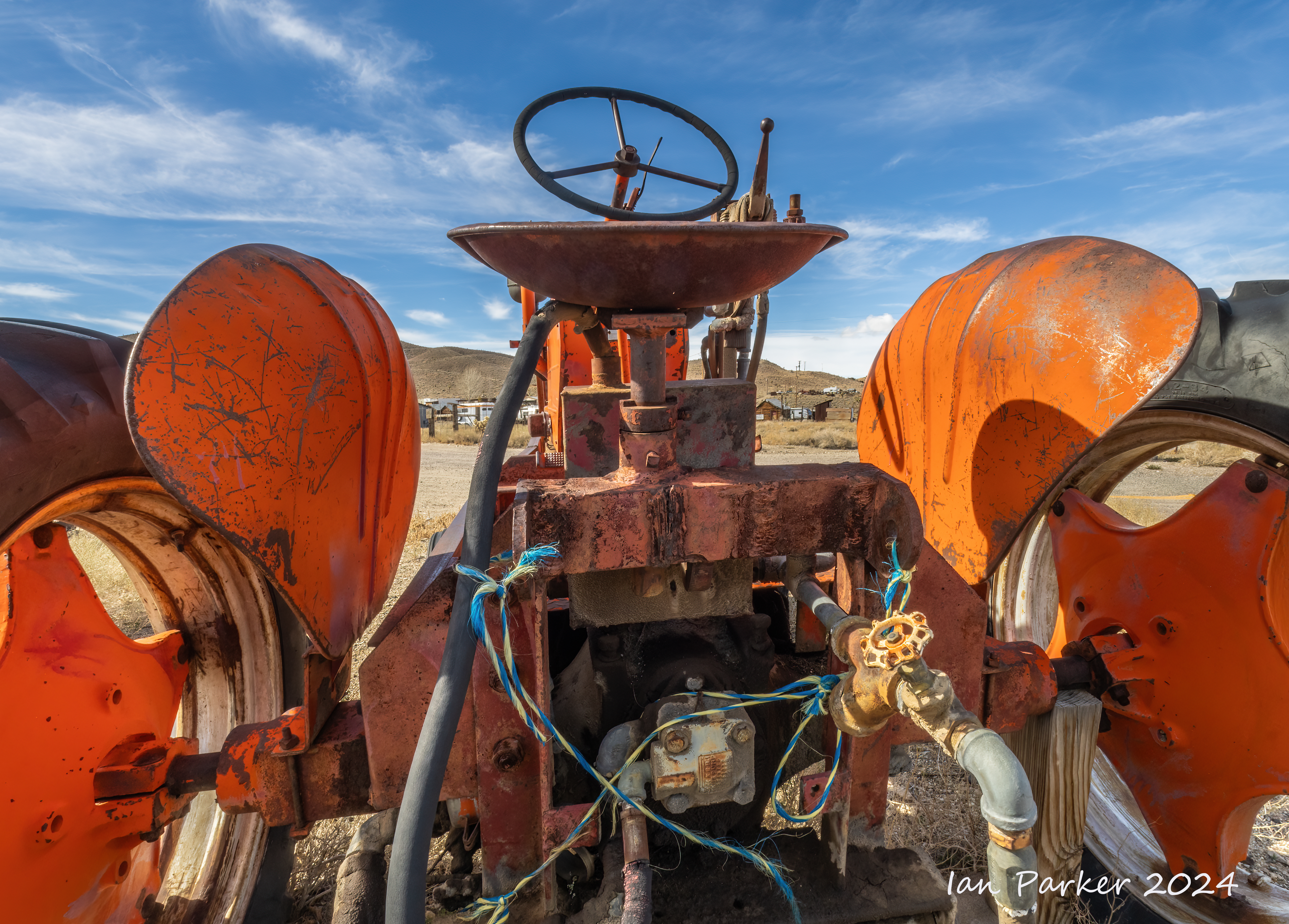
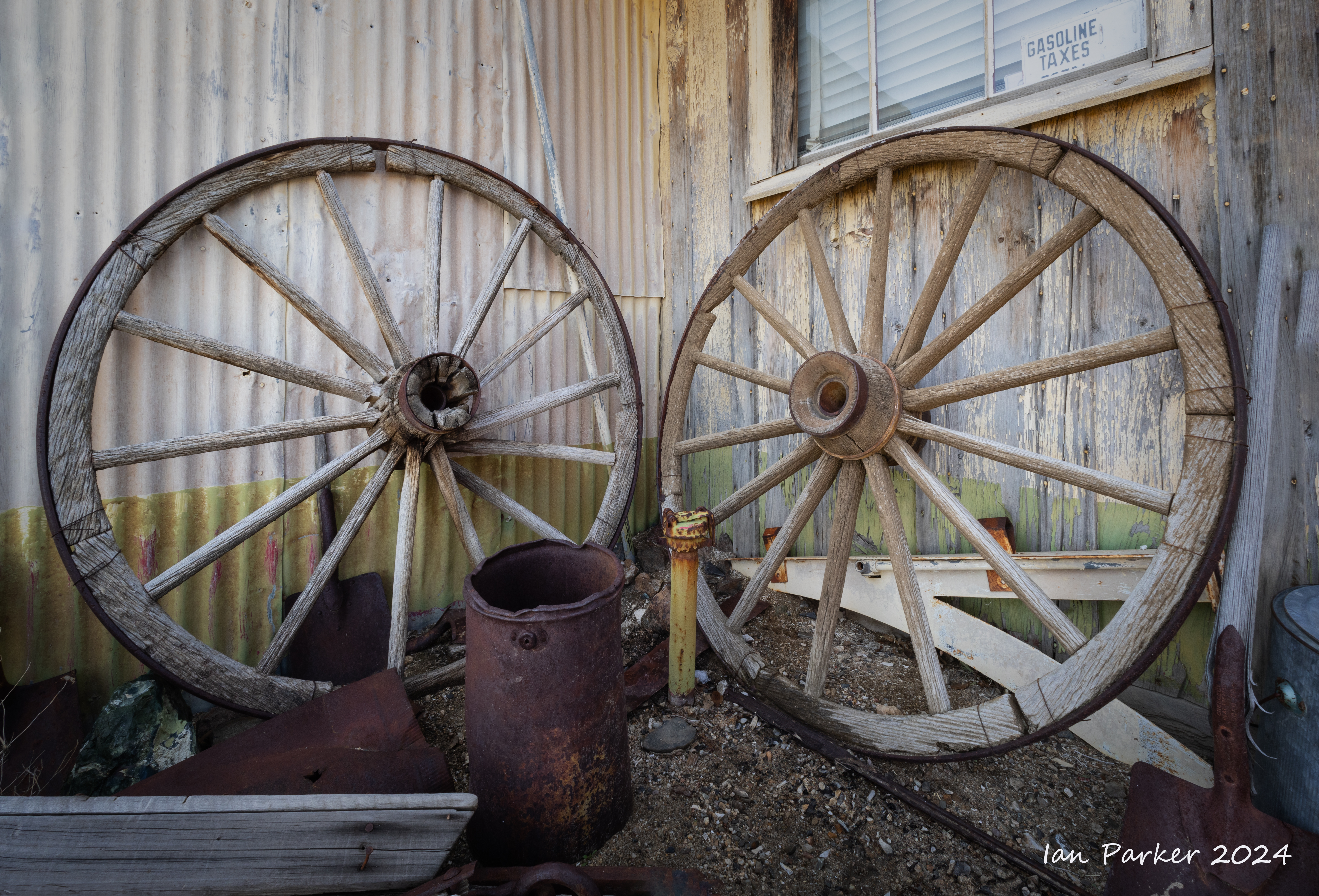
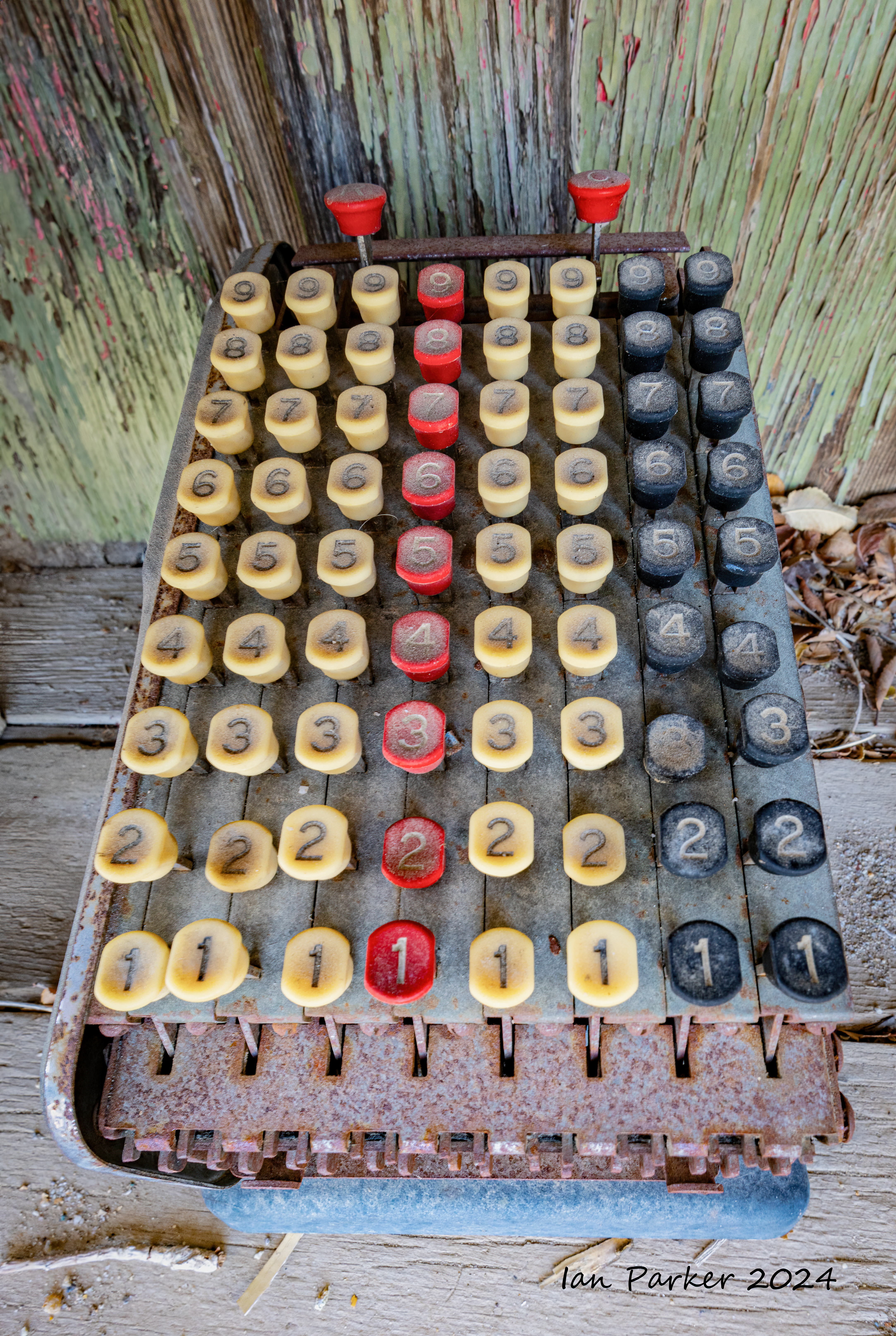
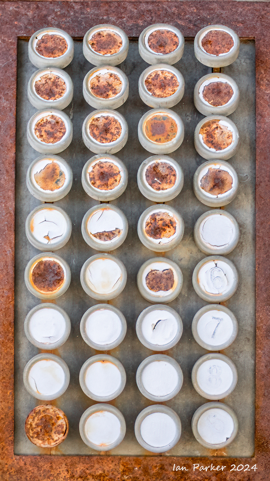
Gold Point - A living ghost town


Yellowstone in Winter
Jan. 27- Feb, 3
We traveled on a tour organized by Joe van Os Photosafaris. For the first three days we were based in West Yellowstone village, and ventured into the National Park on snow coaches - 13 passenger Ford coaches equipped with enormous tyres for over-snow travel. They were never put to the test during our visit, as temperatures were unusually warm and the snow coverage remarkably thin. Indeed, snowmobiles were banned from the park For want of snow! For the next two days we were based at Old Faithful Snow Lodge, exploring the adjacent thermal features and geysers on foot. Finally, we traveled to the northo f the park for two nights at Mammoth Terraces. |
 |
Photos below are presented in reverse chronological order. For a more coherent layout by subject/place see HERE
Our final two nights at Yellowstone were based at Mammoth Hot Springs, with a visit to the Terraces, and excursions searching for (rather sparse) wildlife in the north of the Park.
Mammoth Terraces
Yellowstone3_NEWselect/_5R_7241_tweak2.jpg)
Yellowstone3_NEWselect/_5R_7224_tweak.jpg)
A few wildlife sightings in North Yellowstone
Yellowstone3_NEWselect/BIG/tn__5R_7154_tweak.jpg) Two elk; Yellowstone National Park |

Yellowstone3_NEWselect/_5R_7512_tweak.jpg)
Yellowstone3_NEWselect/IMGC1713_tweak2.jpg)
Yellowstone3_NEWselect/IMGC1778_tweak.jpg)
We stayed for two nights at the Old Faithful Snow Lodge, from where we could walk to explore the landscape and thermal features.
Sunrise photos around Old Faithful
Yellowstone3_NEWselect/_5R_5781_tweak.jpg)
Yellowstone3_NEWselect/_5R_6503_tweak.jpg)
| |
Yellowstone3_NEWselect/_5R_6517_tweak.jpg)
Yellowstone3_NEWselect/_5R_6518_tweak.jpg)
Eruptions!


Geyser eruptions are all white - so a monochrome conversion sacrifices little color information and allows greater contrast by darkening the sky to an extent that would appear unnatural if it remained rendered in blue.


On a cold winter day the clouds of condensing steam before and during an eruption tend to mask the actual column of erupted water. Here, I took advantage of the maleability of b/w images to more clearly deliniate eruptions with side- and back-lighting.
Yellowstone3_NEWselect/_5R_6746_tweak.jpg)

Details and abstracts


Geothermal features


A pink, frosty dawn.


Waterfalls visited on snowcoach excursions

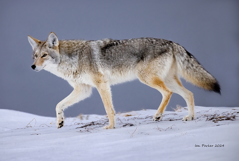
During our first days we journeyed through the park on the lookout for wildlife. Sightings were less frequent than I had anticipated - and the animals tended to be a long way away... But we did have some good encounters.
Coyotes - we see plenty of these around our home, but they look more elegant in a wild setting among snow.


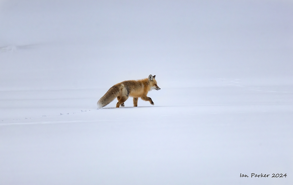
A red fox that we encountered right next to the road
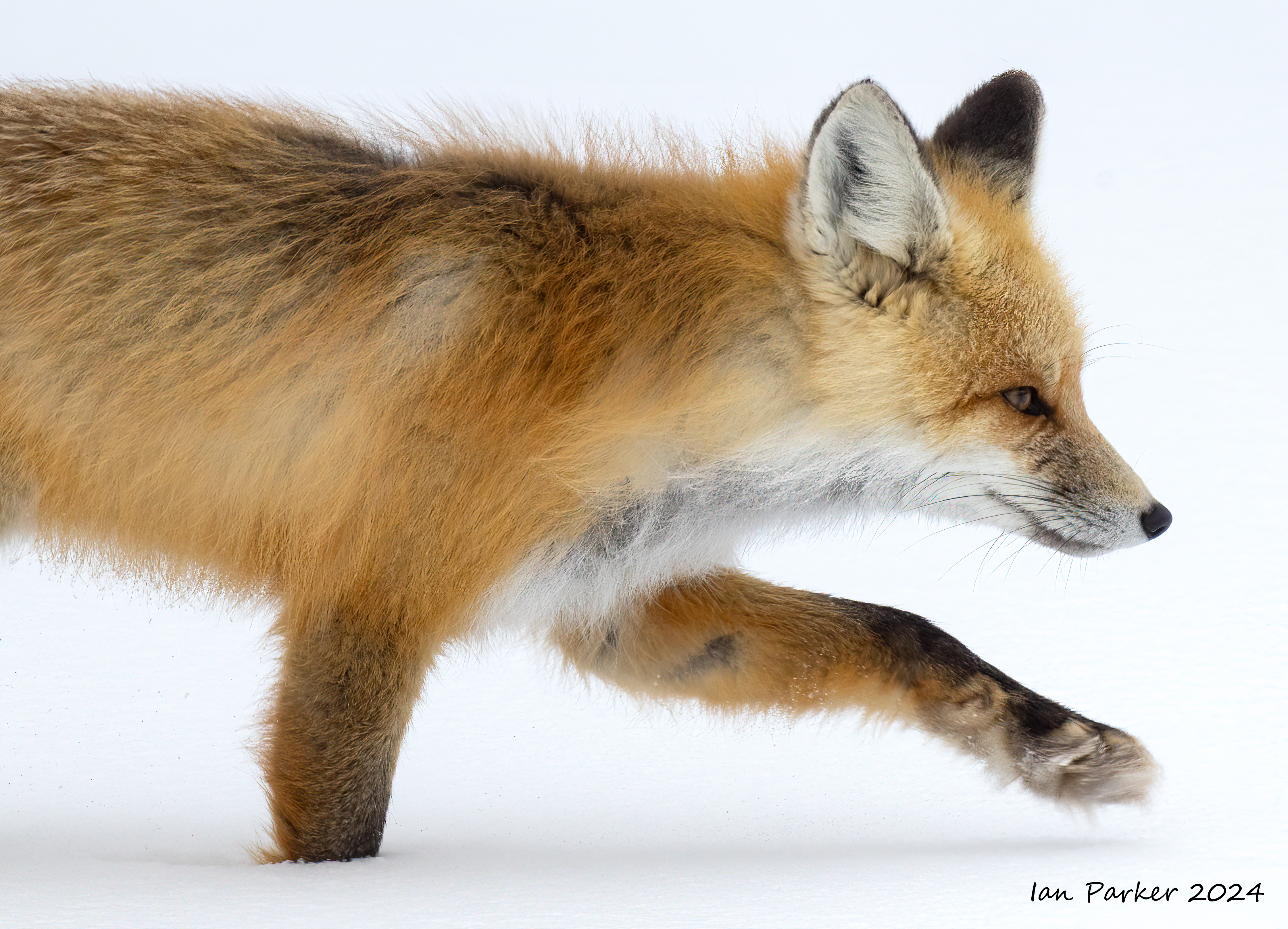
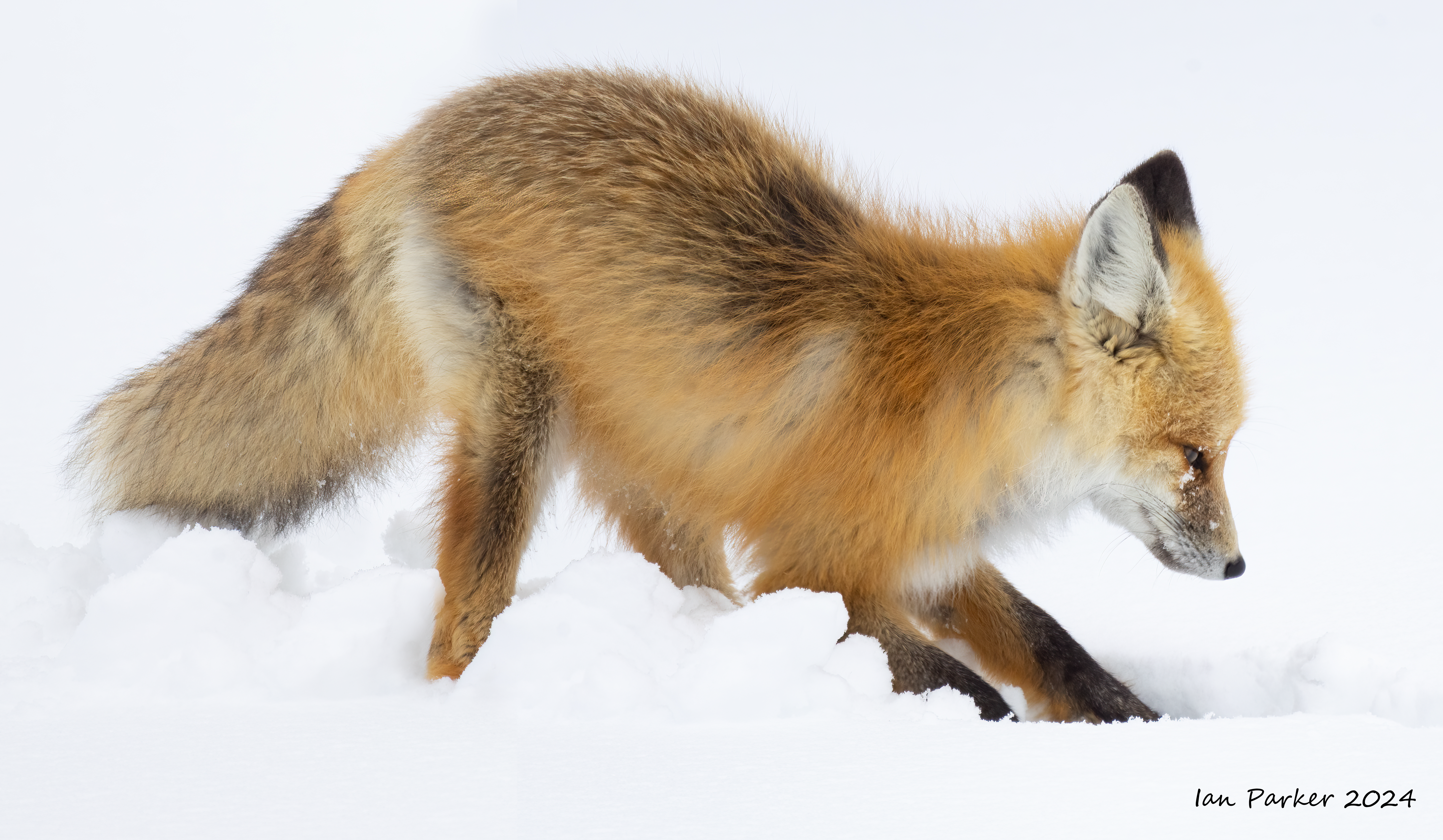
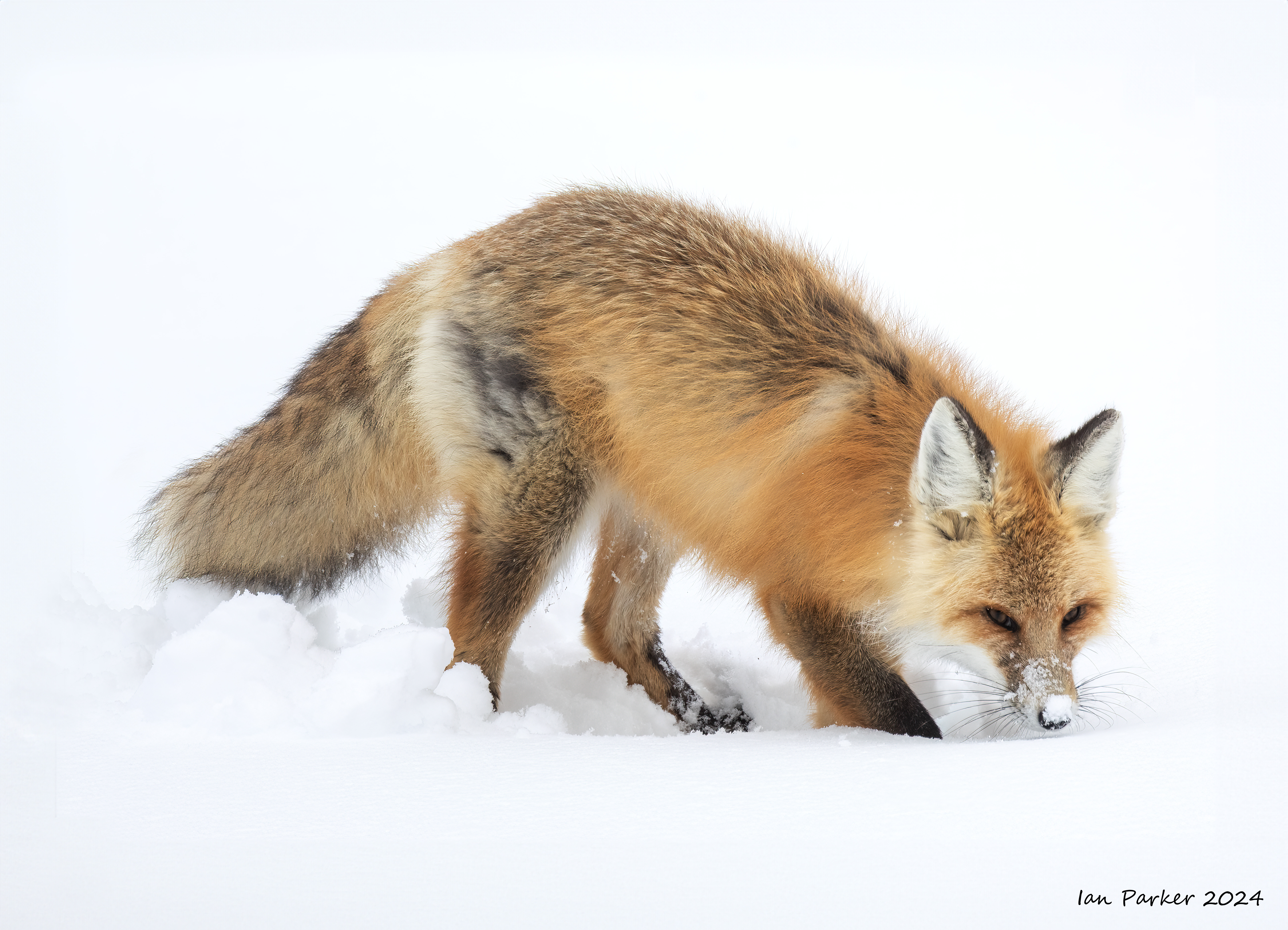
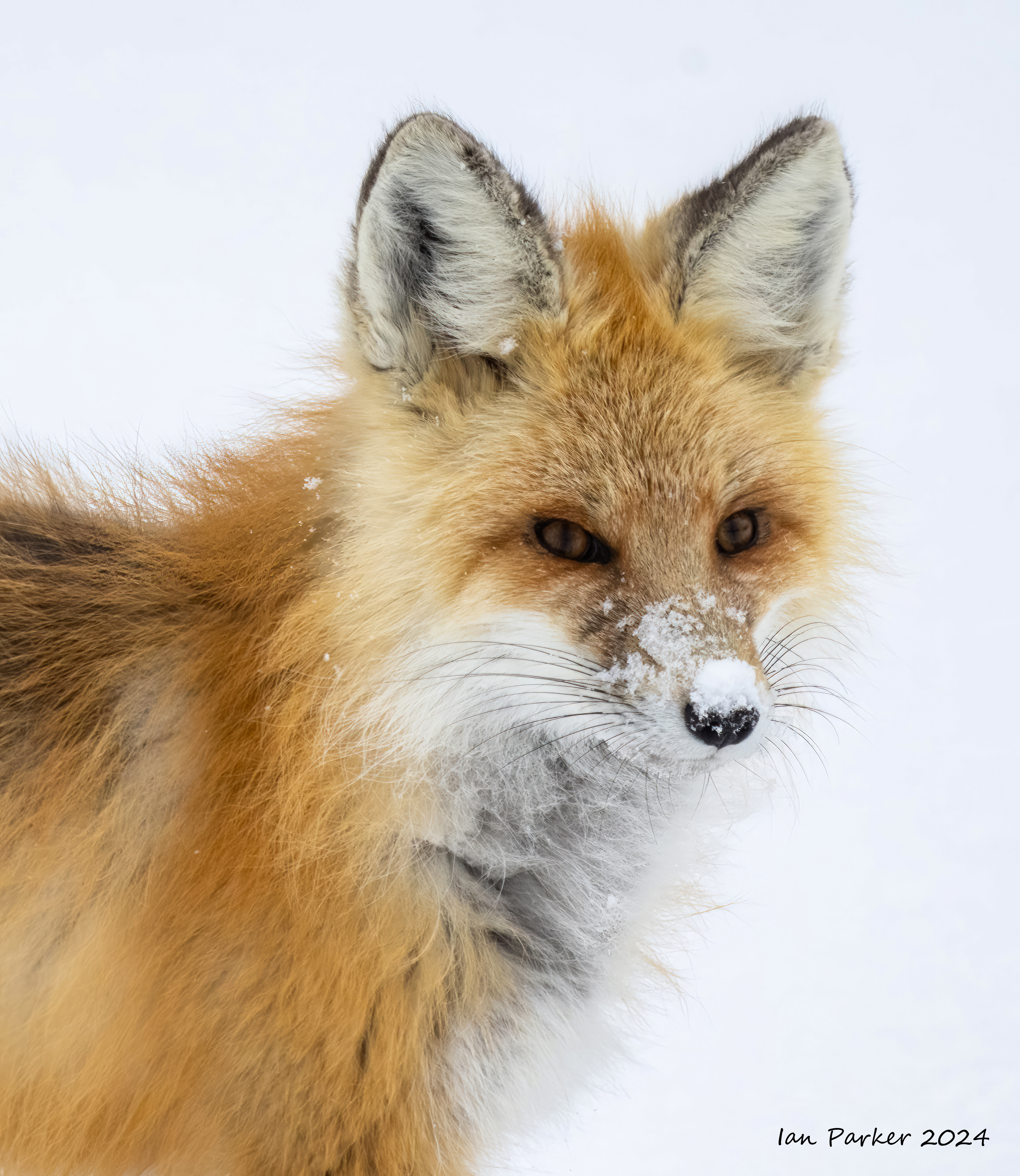
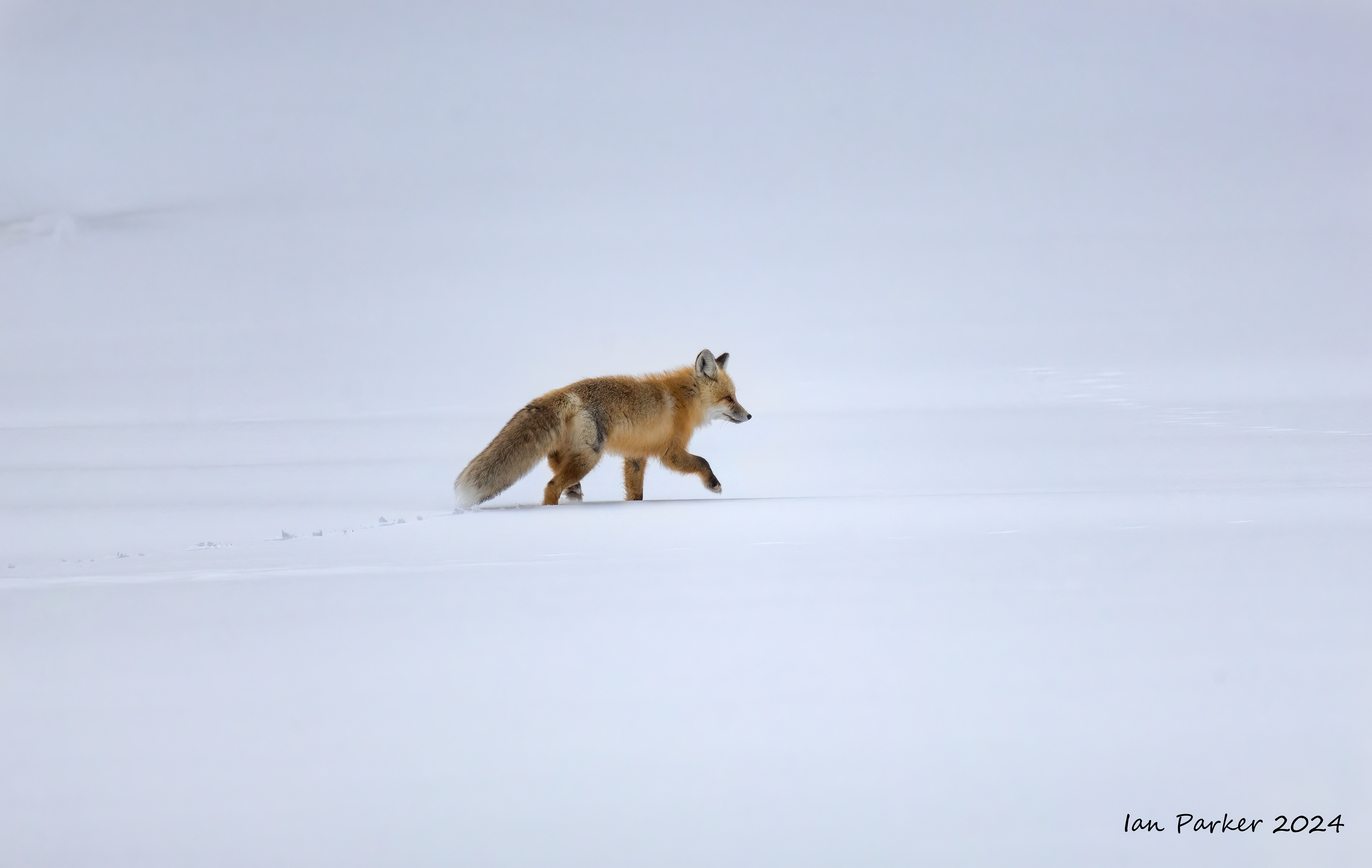


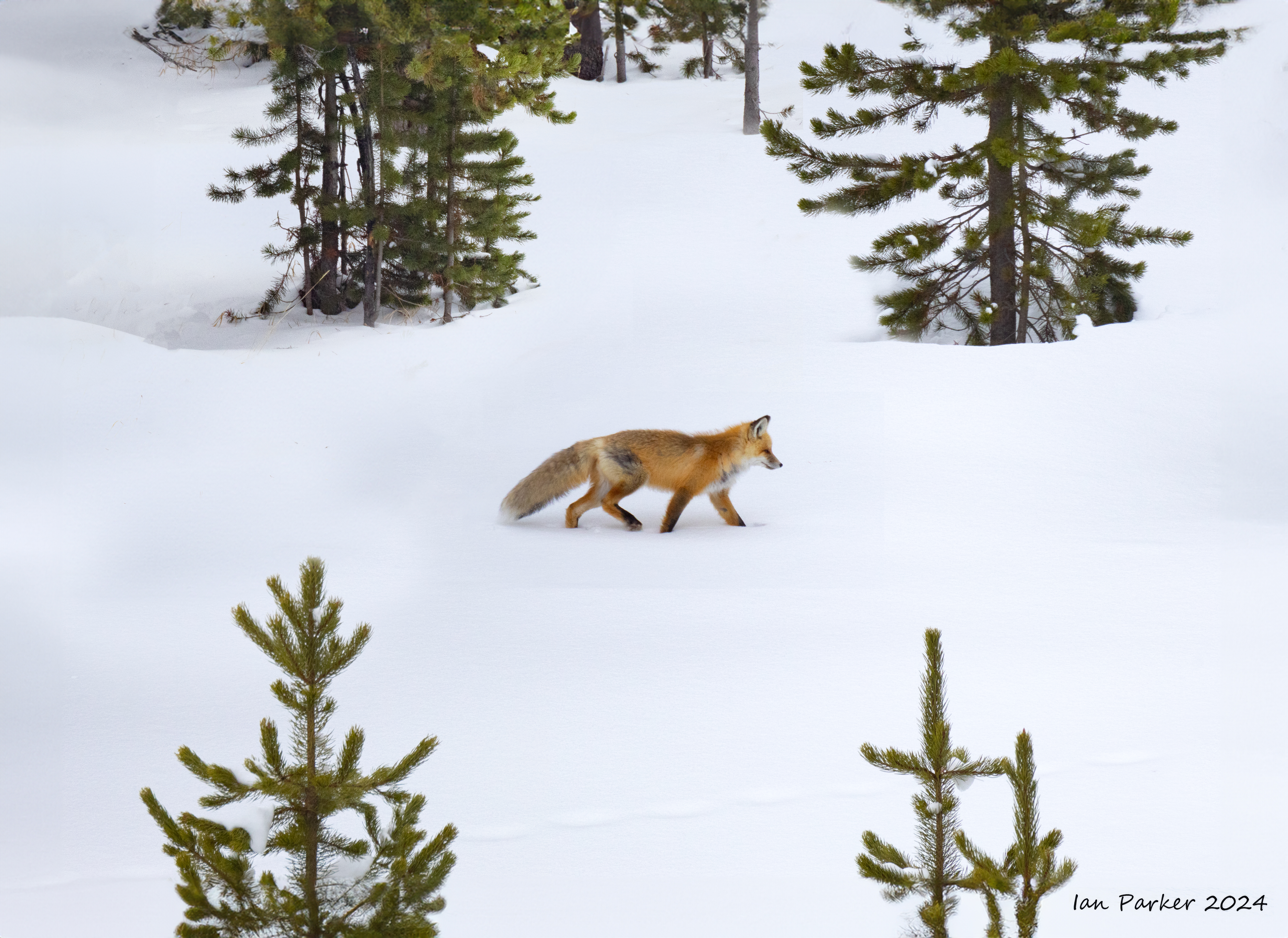
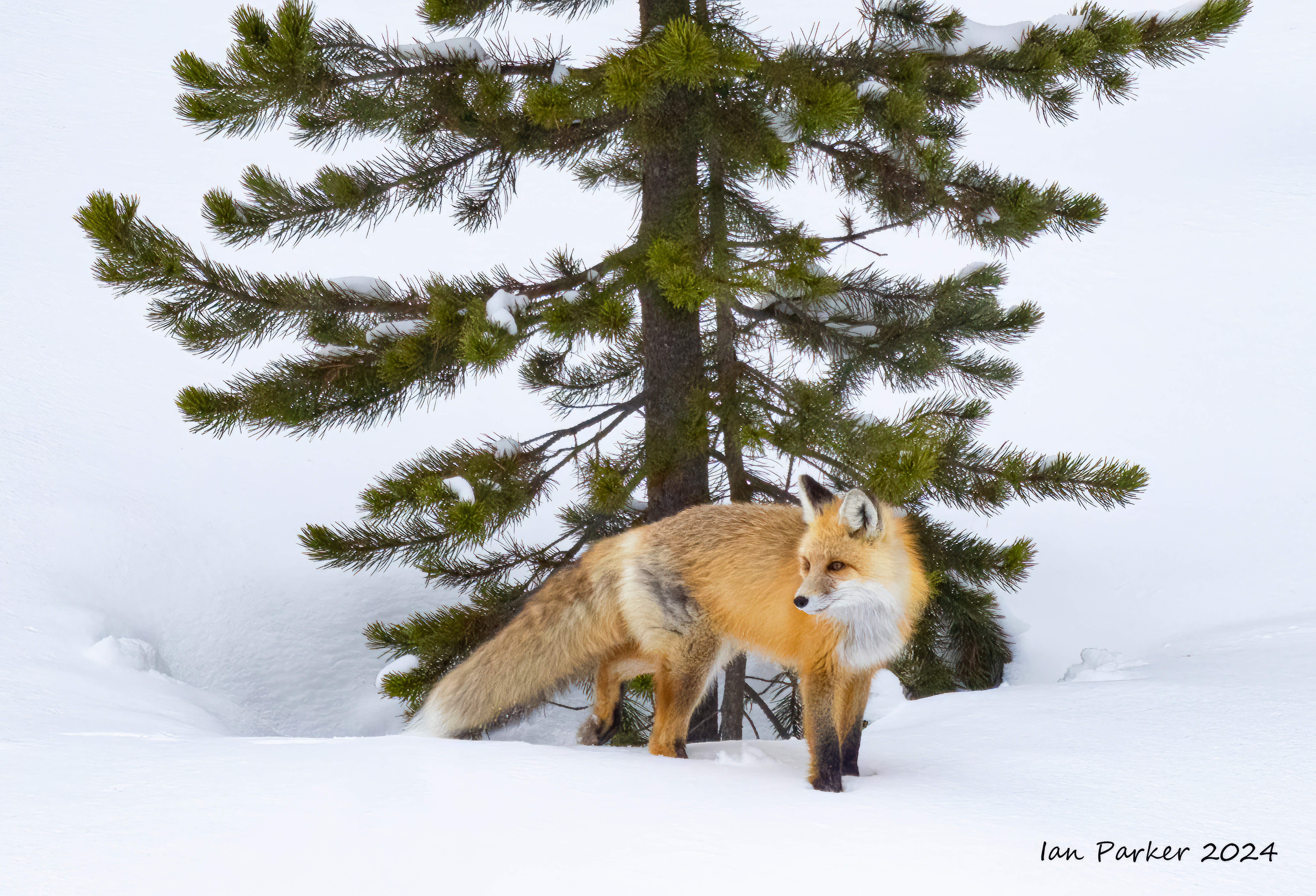 Red fox at base of tree: Yellowstone N.P. |
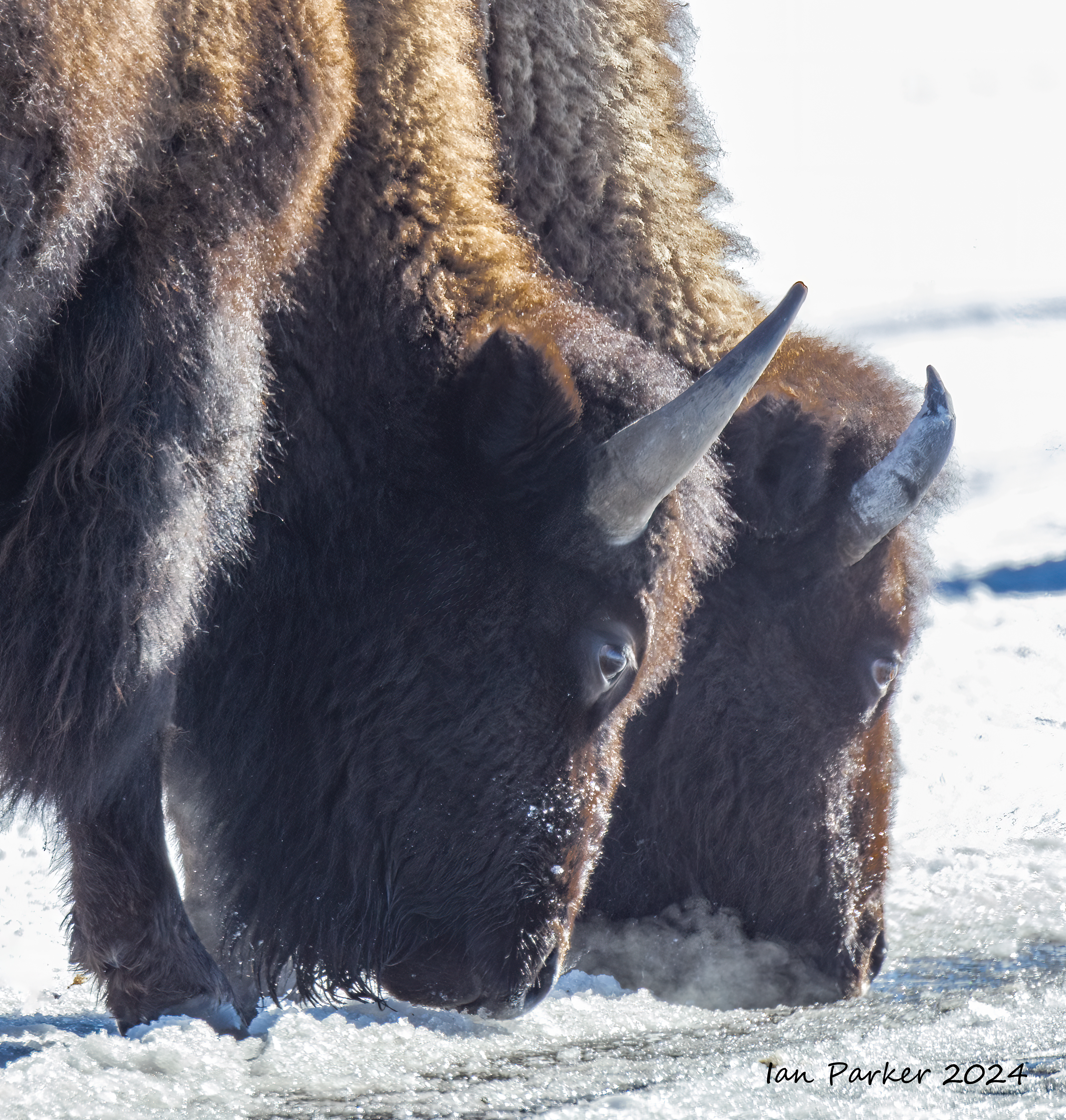
Bison - the iconic species of Yellowstone.
I had hoped to shoot photos of snow-covered bison in blizzard conditions, but with the unseasonably warm conditions we had the best I got was snow-covered noses!


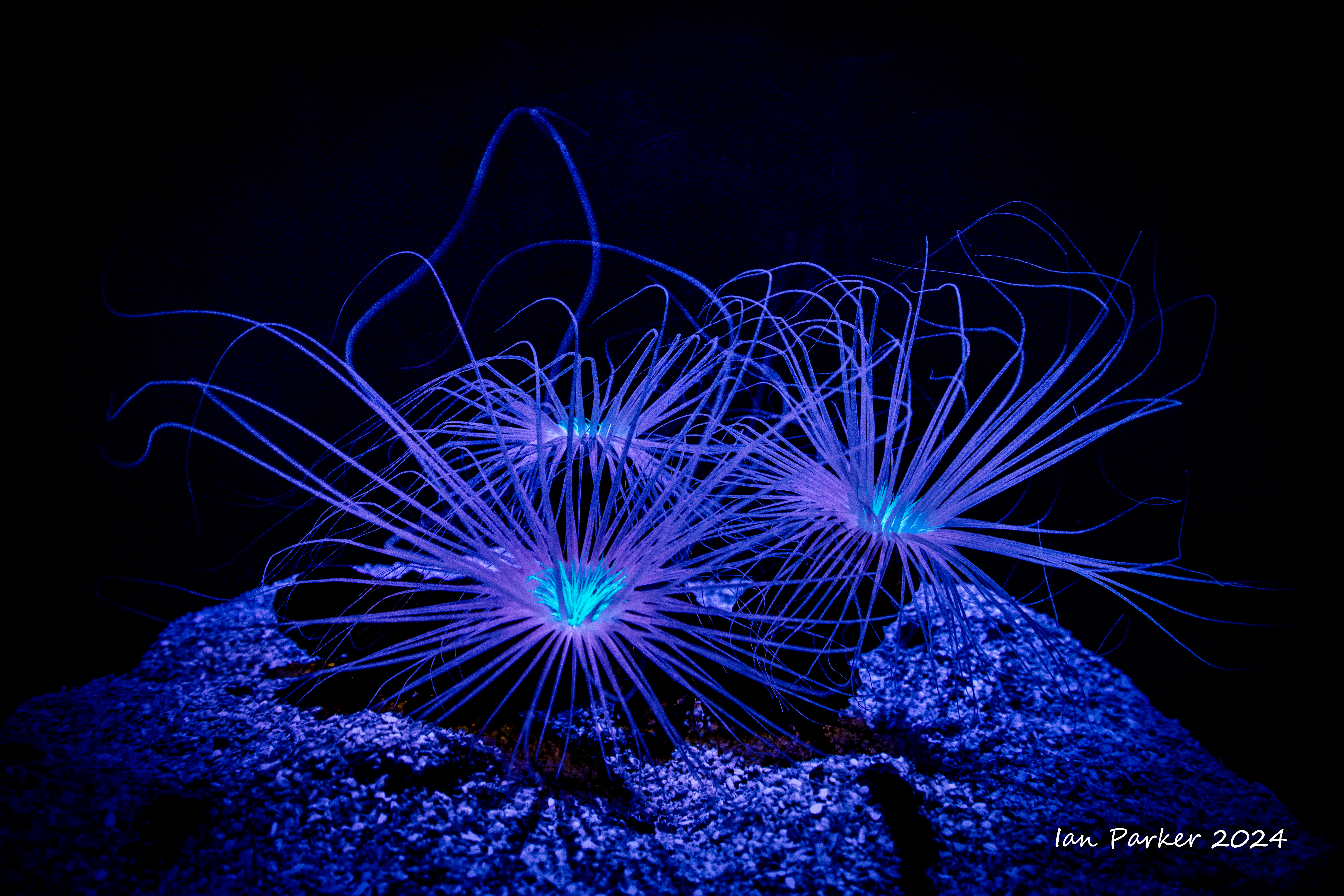
January 5th : A visit to Long Beach Aquarium


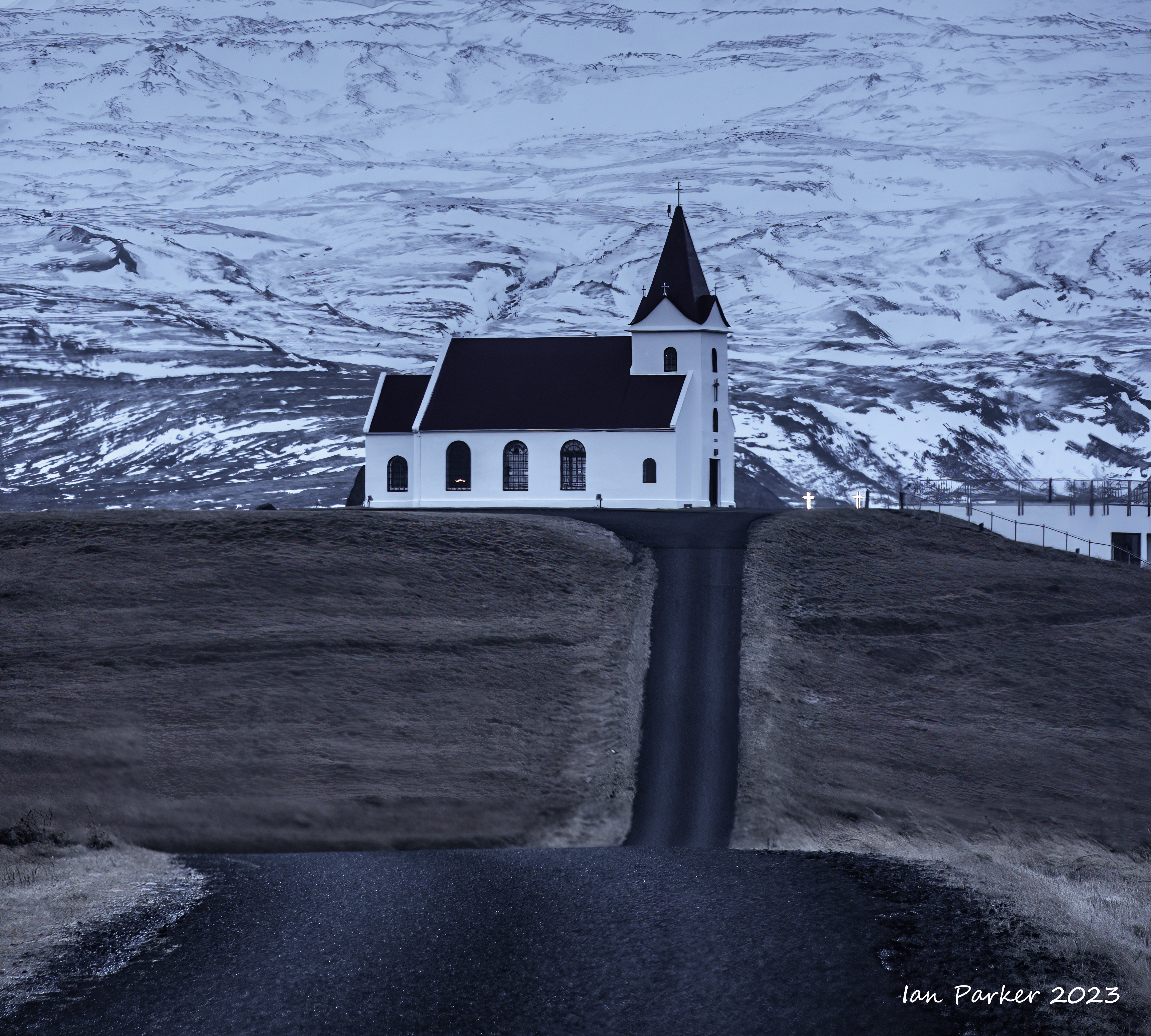
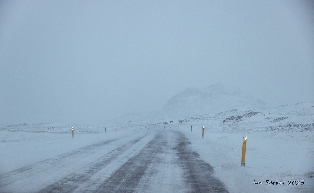
December 7-16 : Iceland
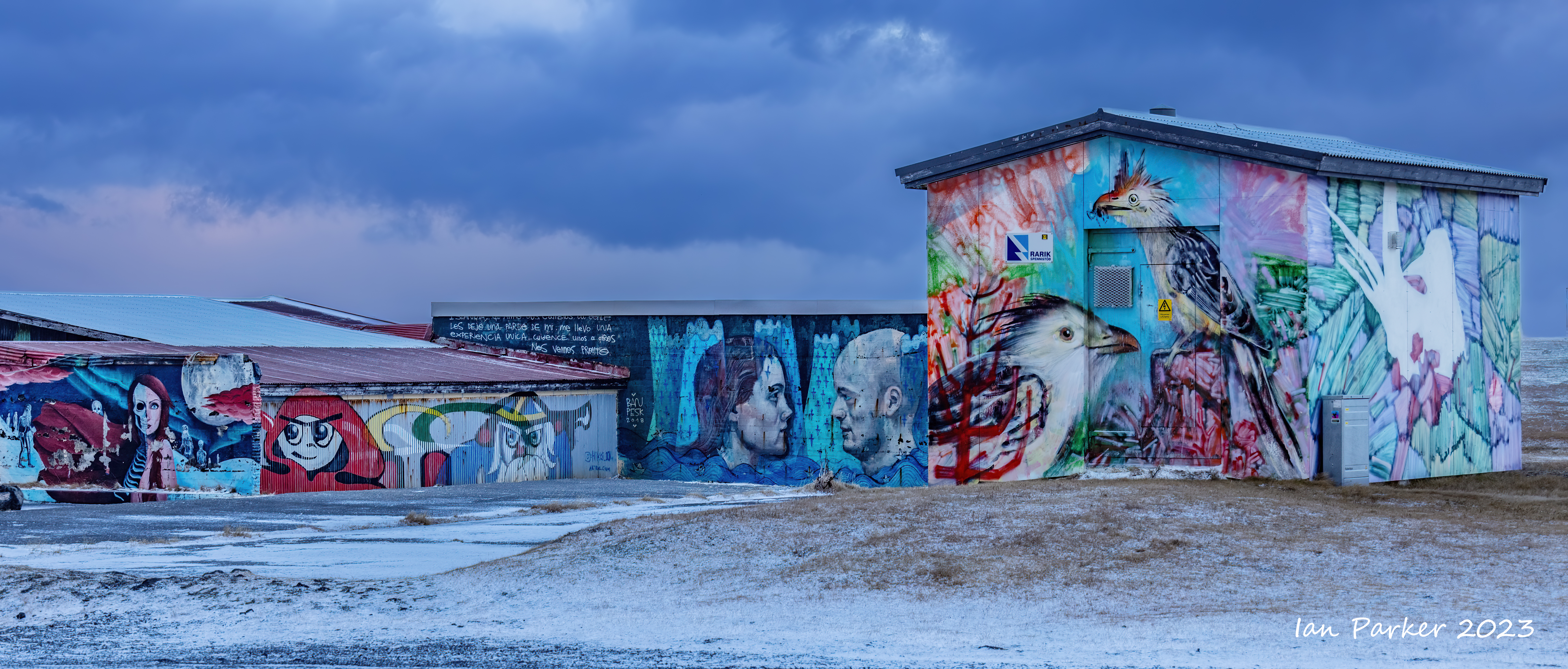
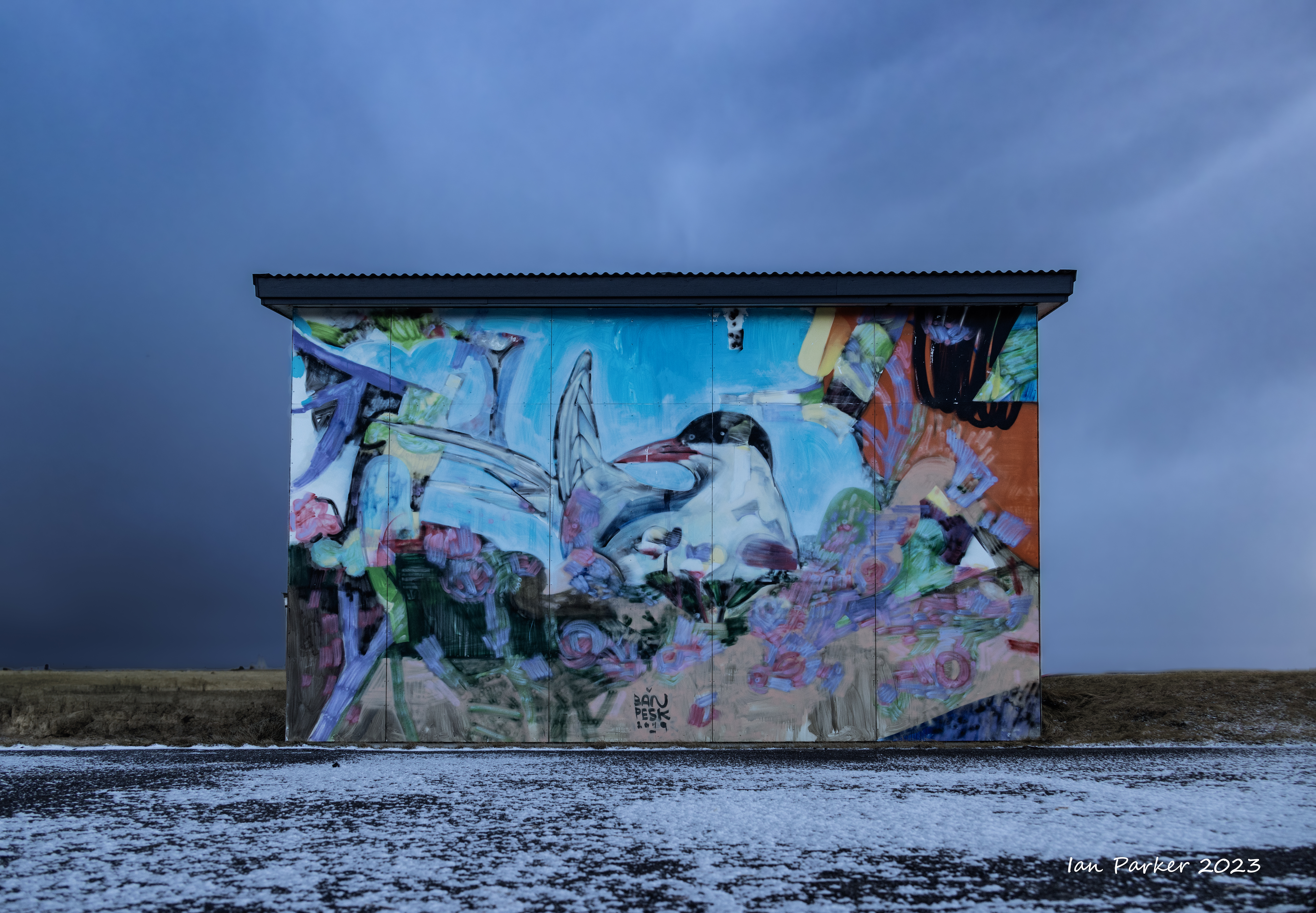
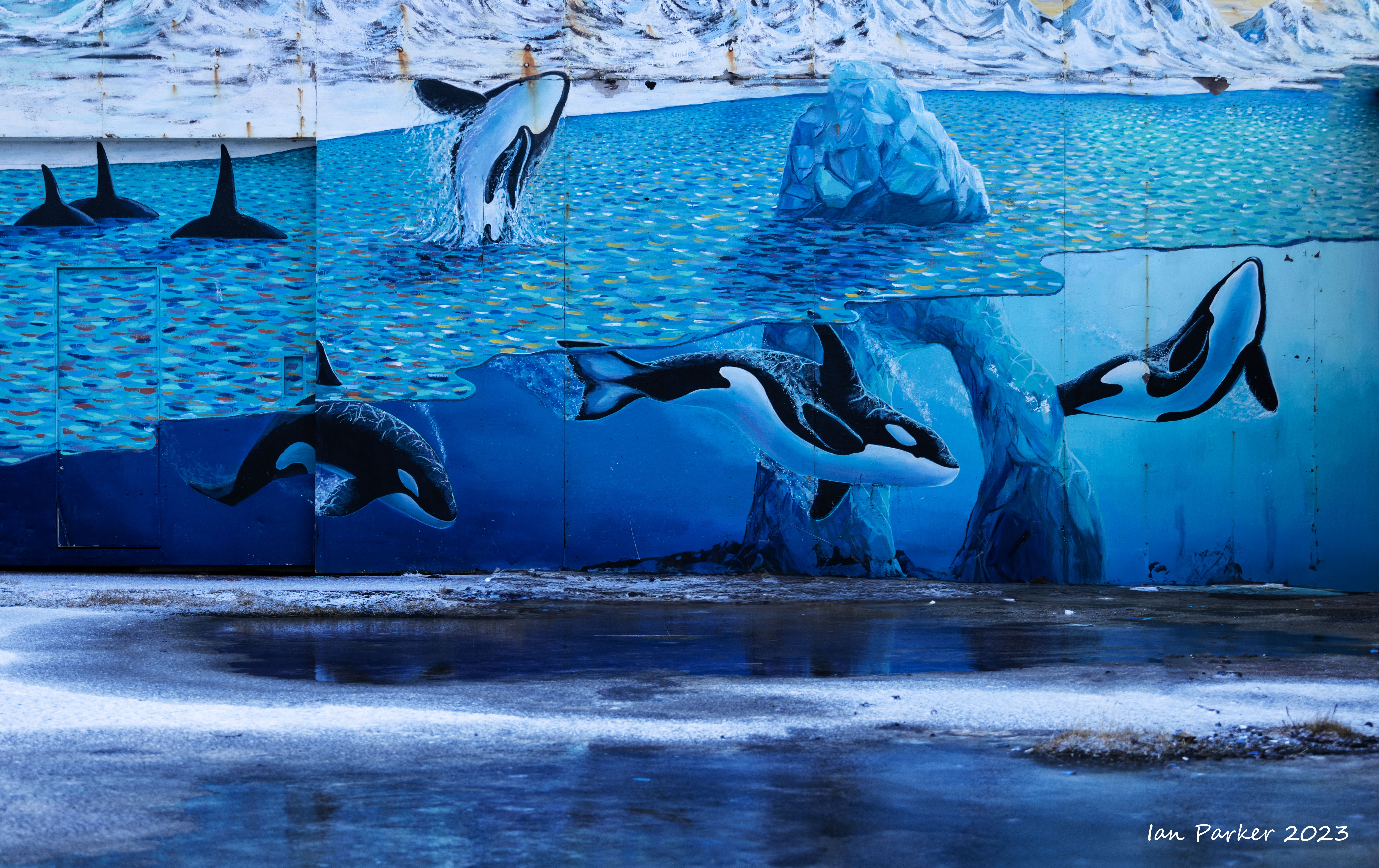
Wild weather while driving arond the tip of the Snaefellsnes peninsula


Near the western tip of the Snaefellsnes peninsula the tiny village of Hellissandur has gained a reputation as the street art capital of Iceland.
In the summer of 2018, a team of international artists including Camilo Arias, Ban Pesk, and Luis Rincon were summoned to Hellissandur by Kári Viðarsson, creator of “The Freezer,” to transform an abandoned fish factory and several unadorned buildings around town into 30 large works of art. [Atlas Obscura]


Two nights on the Snaefellsnes peninsula at Hotel Búðir. Wild weather, with strong winds and a lot of rain turning to snow overnight.


After a magnificent Christmas buffet at Hotel Geysir we made a midnight excursion to the geothermal area n hope of photographing an eruption of Strokkur against an aurora. However, there were only brief breaks in the overcast sky, and auroral activity was low. Thiswas the only decent photo I managed to get; streaks of green above trees at Hotel Geyser.

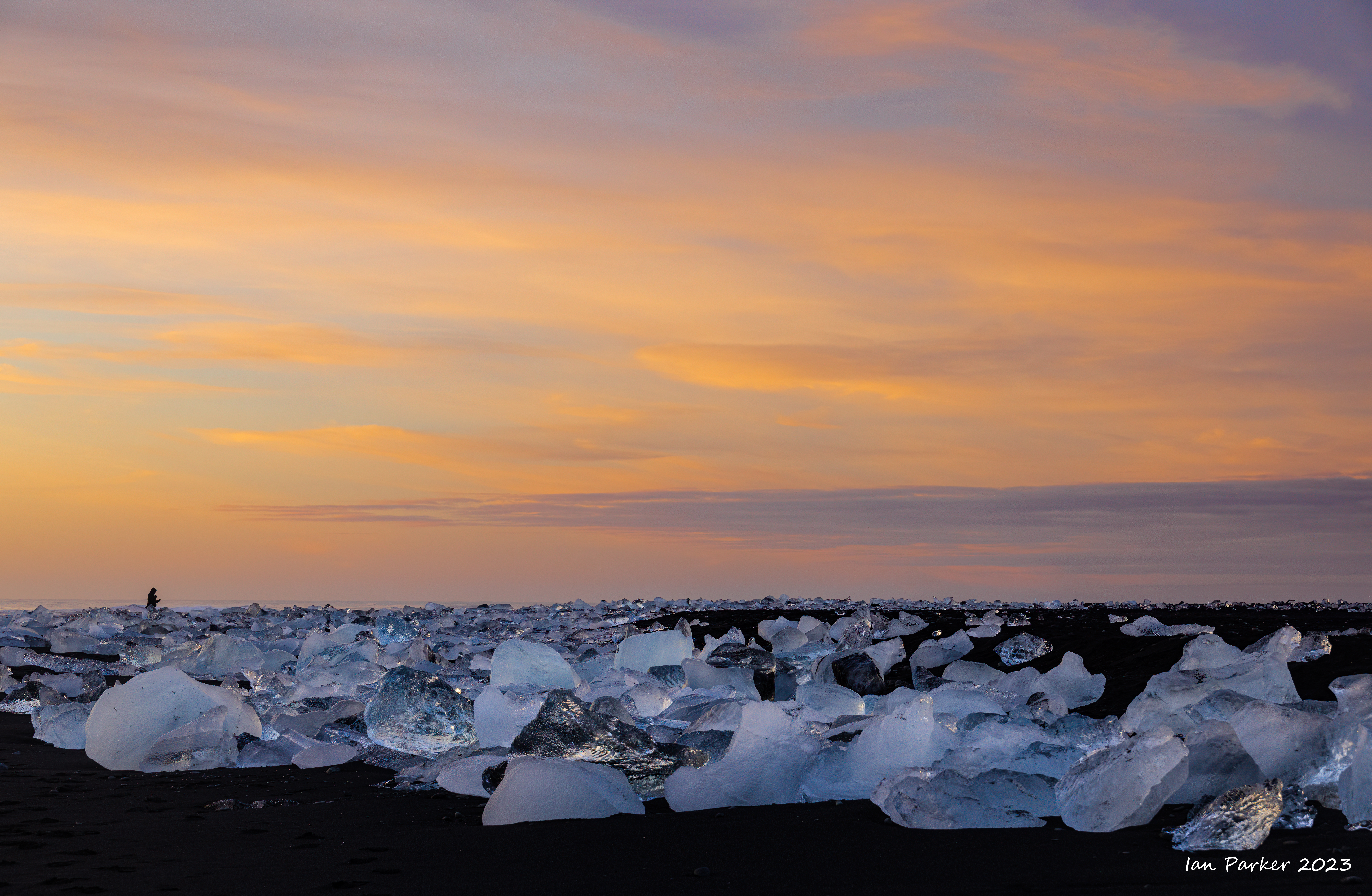
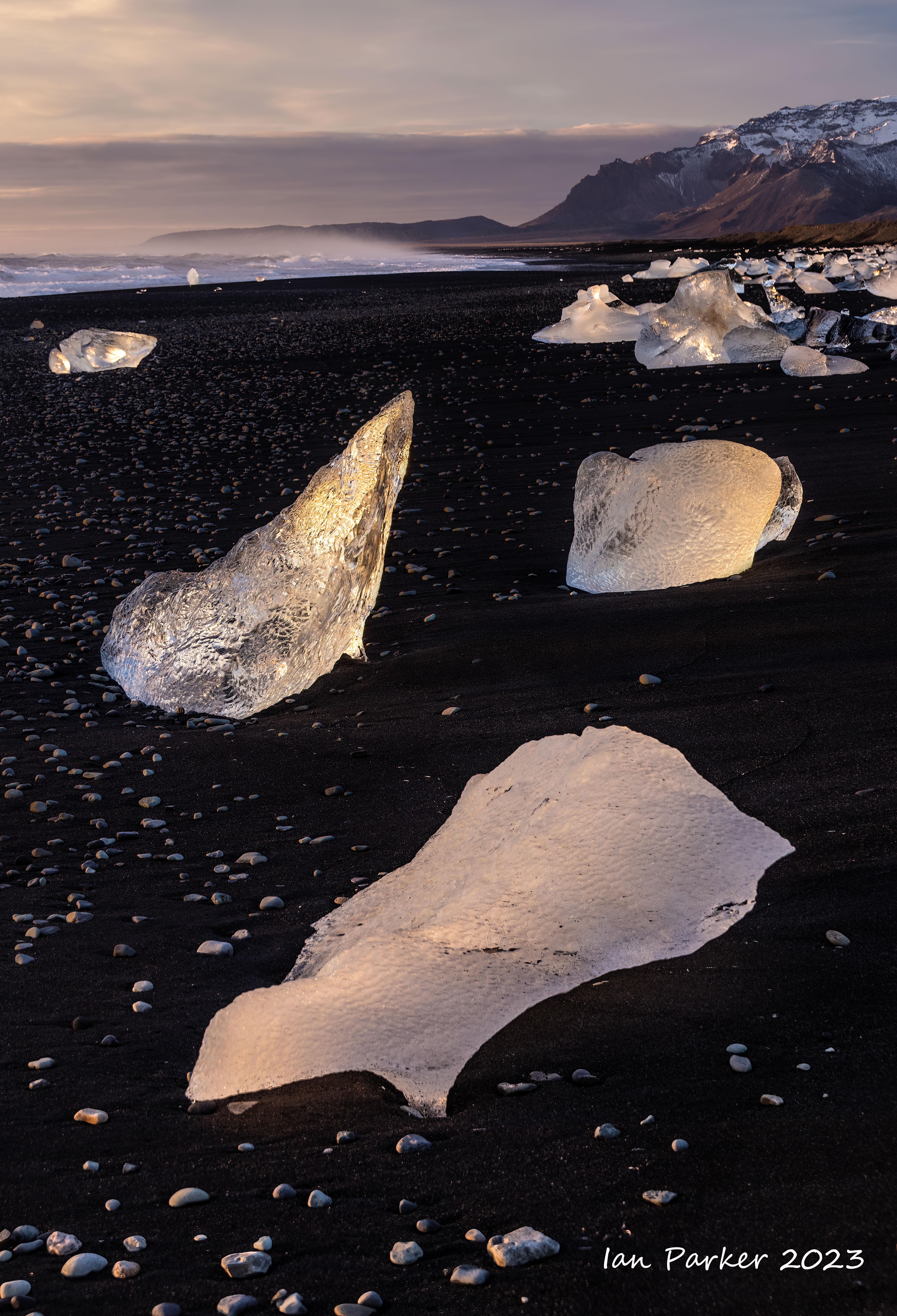
A second day at Jokulsarlon, staying in a cozy cabin about a 15 min drive from the lagoon.

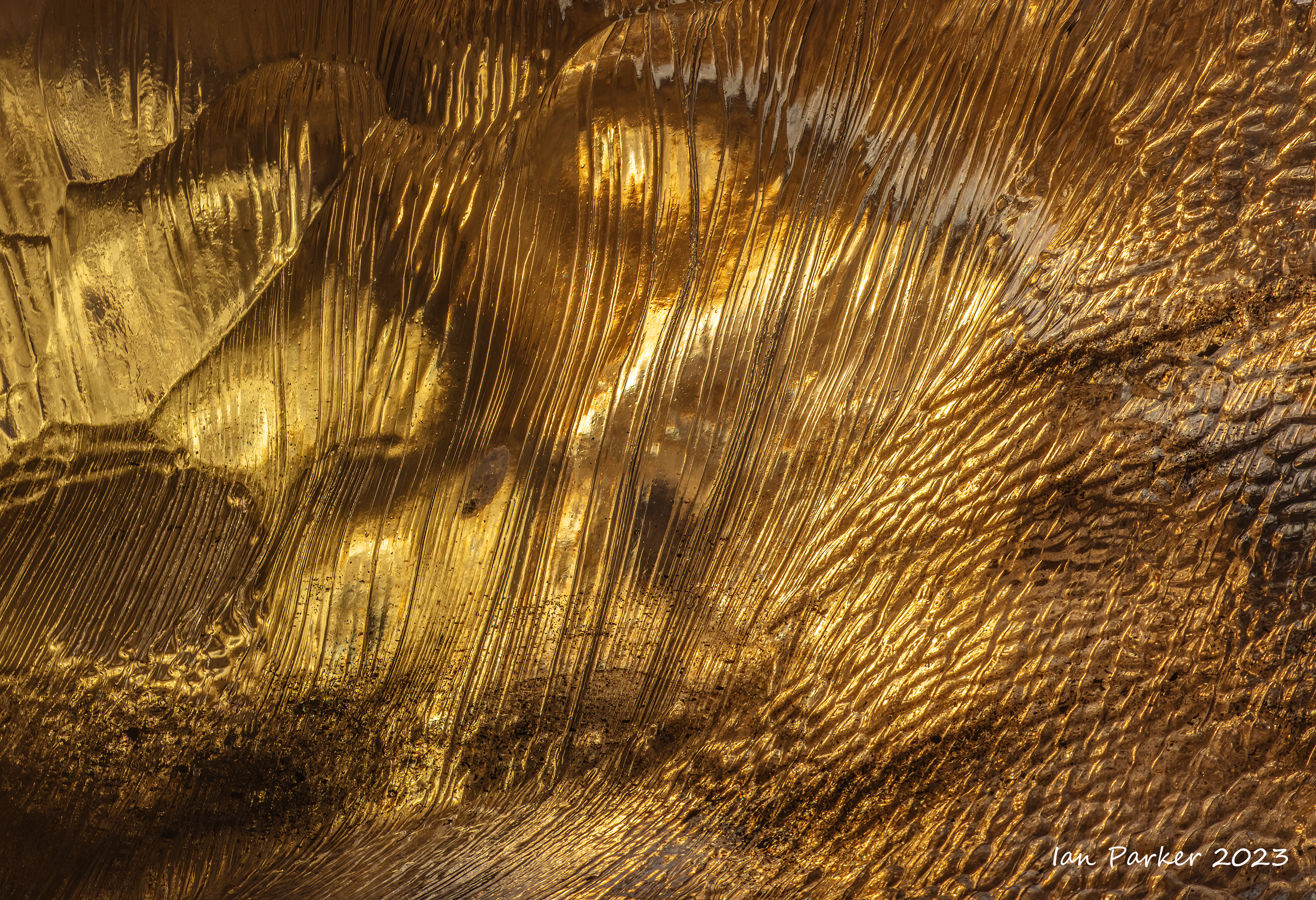
After photographing the lagoon at sunrise I went down to the western side of Diamond Beach while the light was still good.


Sunrise at Jokulsarlon Lagoon
With a perfectly clear sky overnight, and a new moon, I had hoped to do some aurora photography. But the solar activity did not cooperate and only a very faint aurora was visible. No worthwile photos to show!
The sky was still clear in the morning, and absenc of any wind made for nice reflections in the lagoon. The sequence of photos below illustrate the changing light around sunrise.


A first day at Jokulsarlon
A moody, overcast day at Breiðamerkursandur (the "Diamond Beach")


Driving along the south coast from Hotel Ranga to Jokulsarlon


 A desolate sunset on the Skeiðarársandur; South Iceland |
Once the longest bridge in Iceland (single lane with passing places), glacial retreat changed the coures of the Skeiðará river so the bridge now crosses only dry sand. The road now parallels the bridge on a raised causeway. |

This is the remains of the original bridge, which was washed away in a glacial flood. It was replaced by the bridge in the photo above. |
The braided river patterns over the glacial outwach sandurs in Iceland make great subjects for arial drone photography. I will be getting a dron for my birthday, but did not have one on this trip. So, I thought I would see what I could do taking images from Google Earth as a starting point. The colors in the images below are all present in the original Google Earth photographs - just very muted.
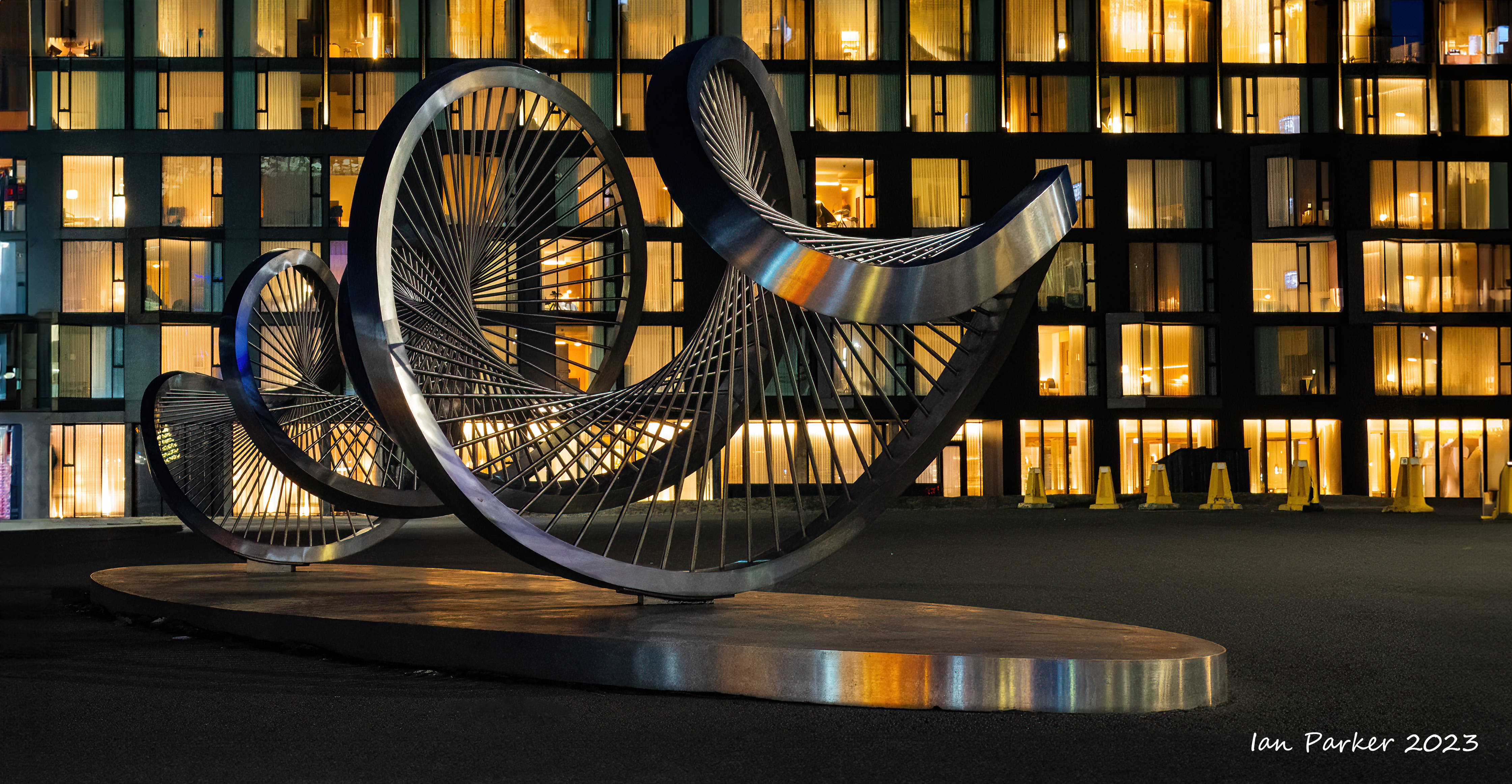
A few quick photo stops en route from Reykjavik to a 13-course Icelandic Christmas dinner at Hotel Ranga.


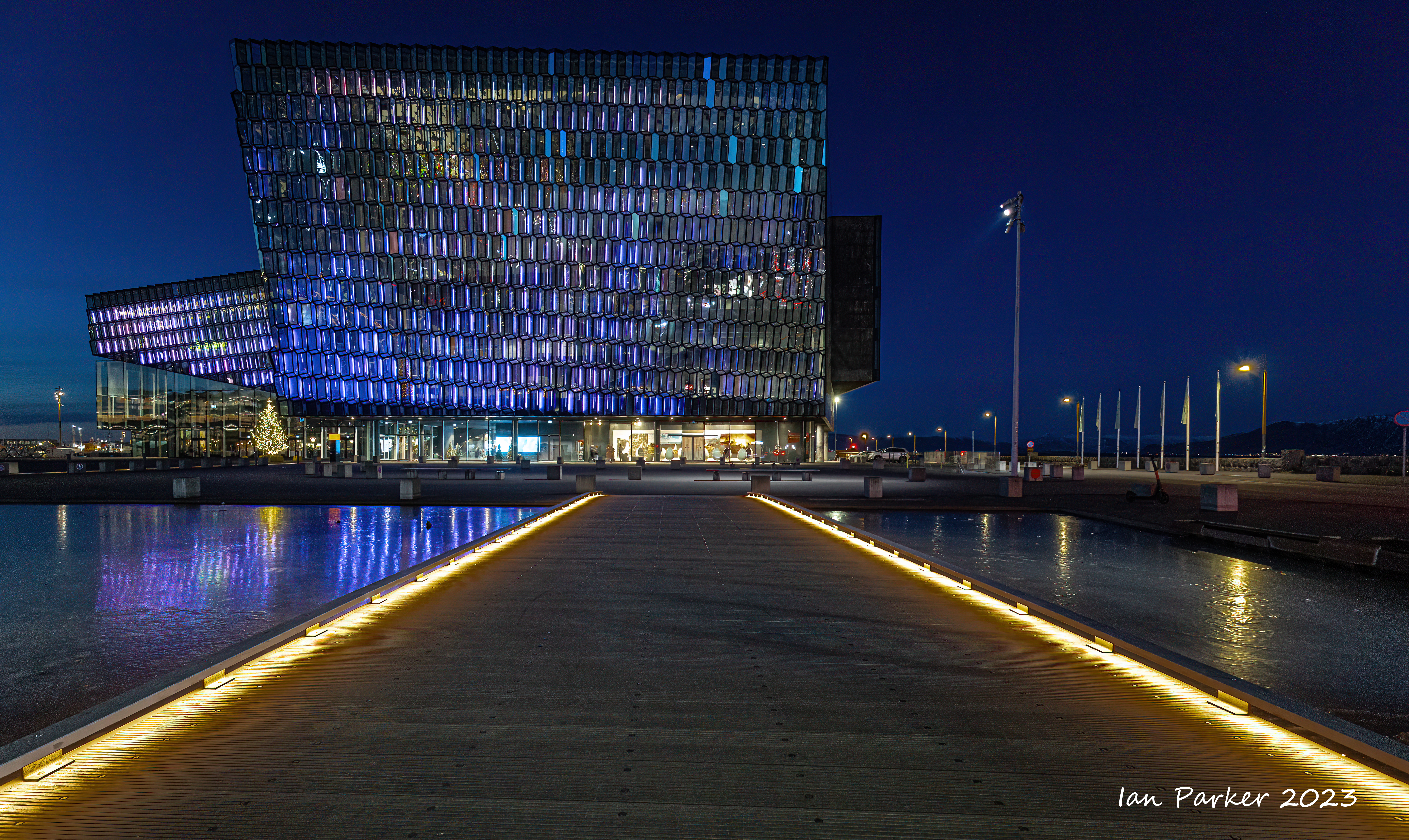
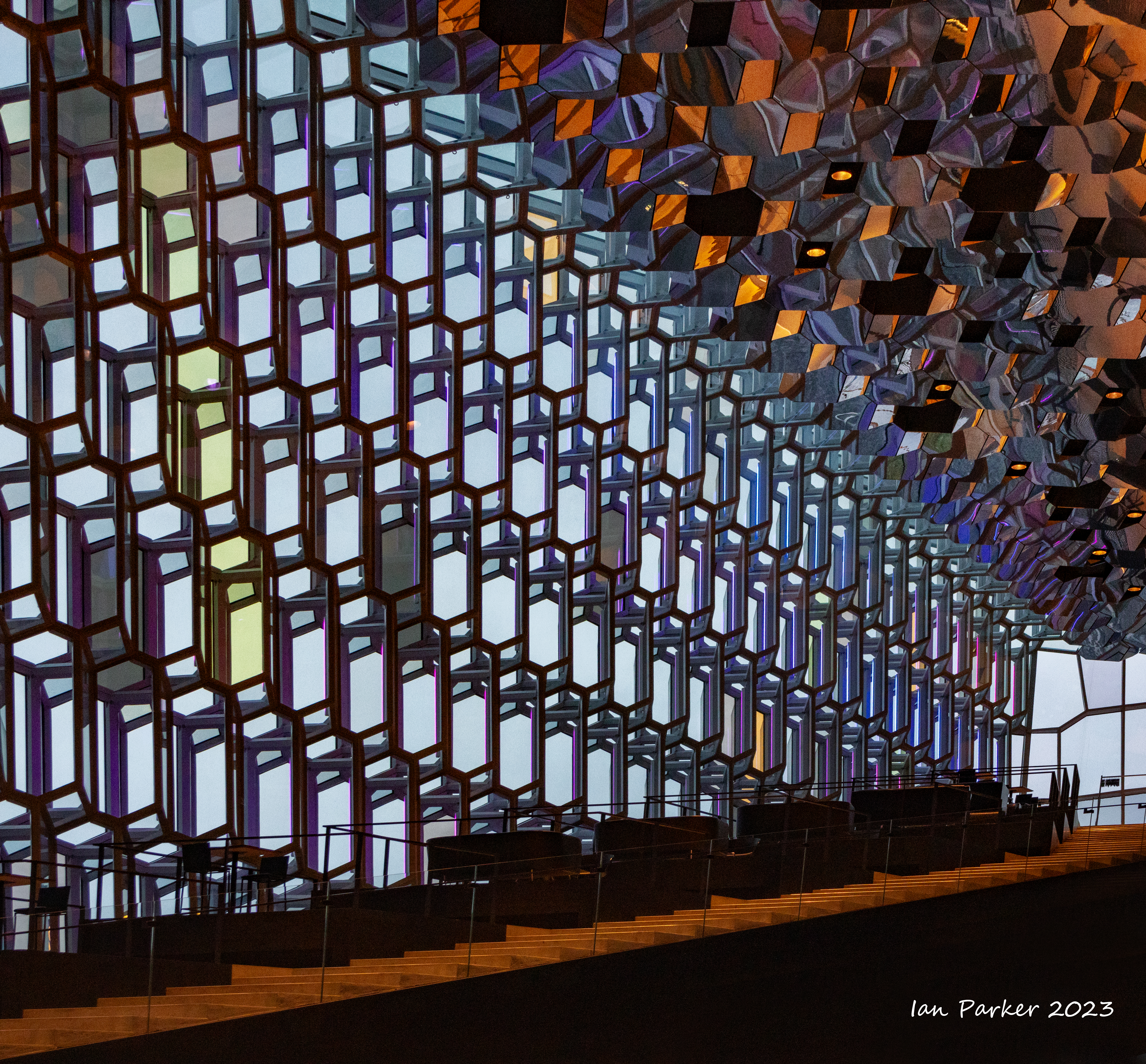
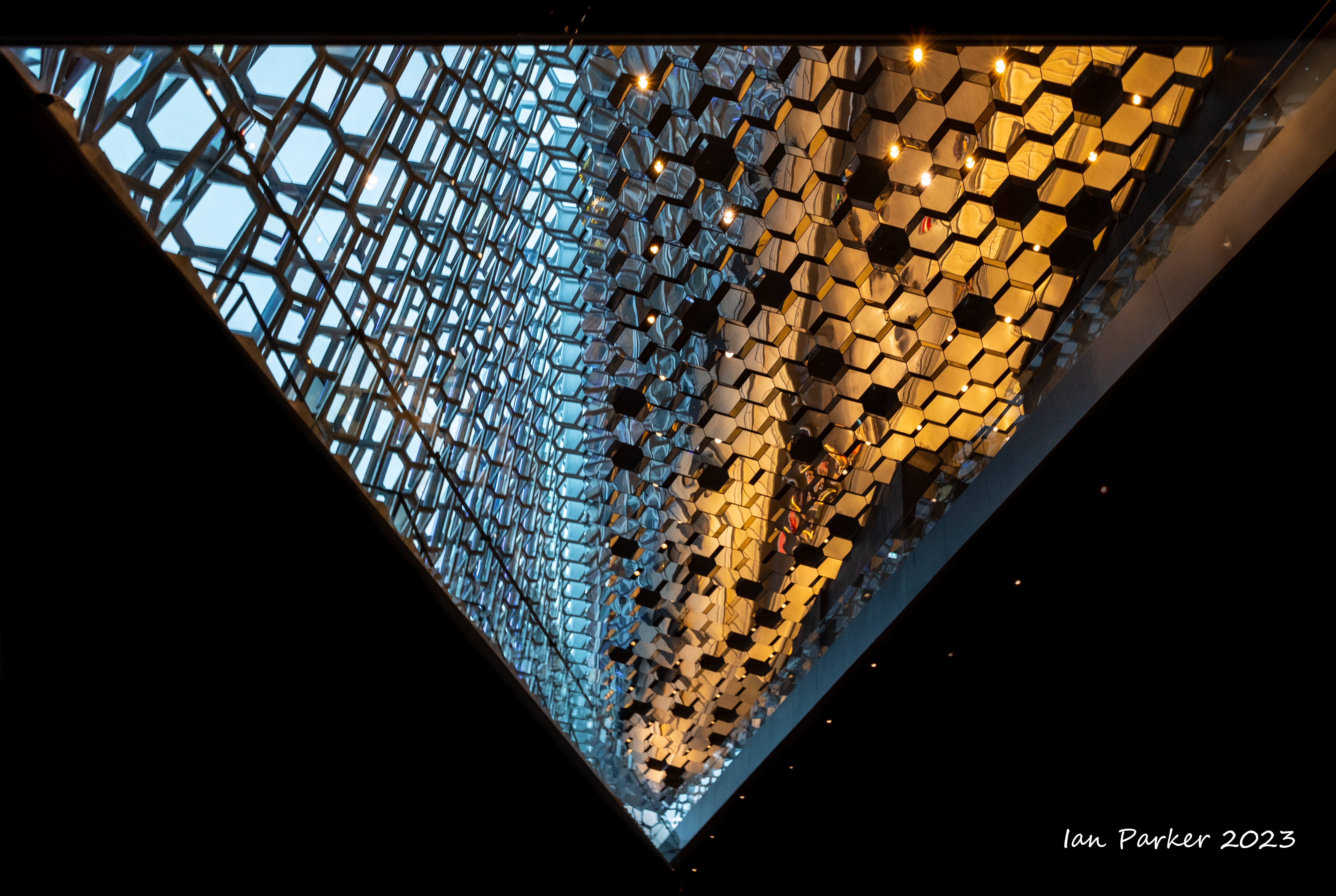
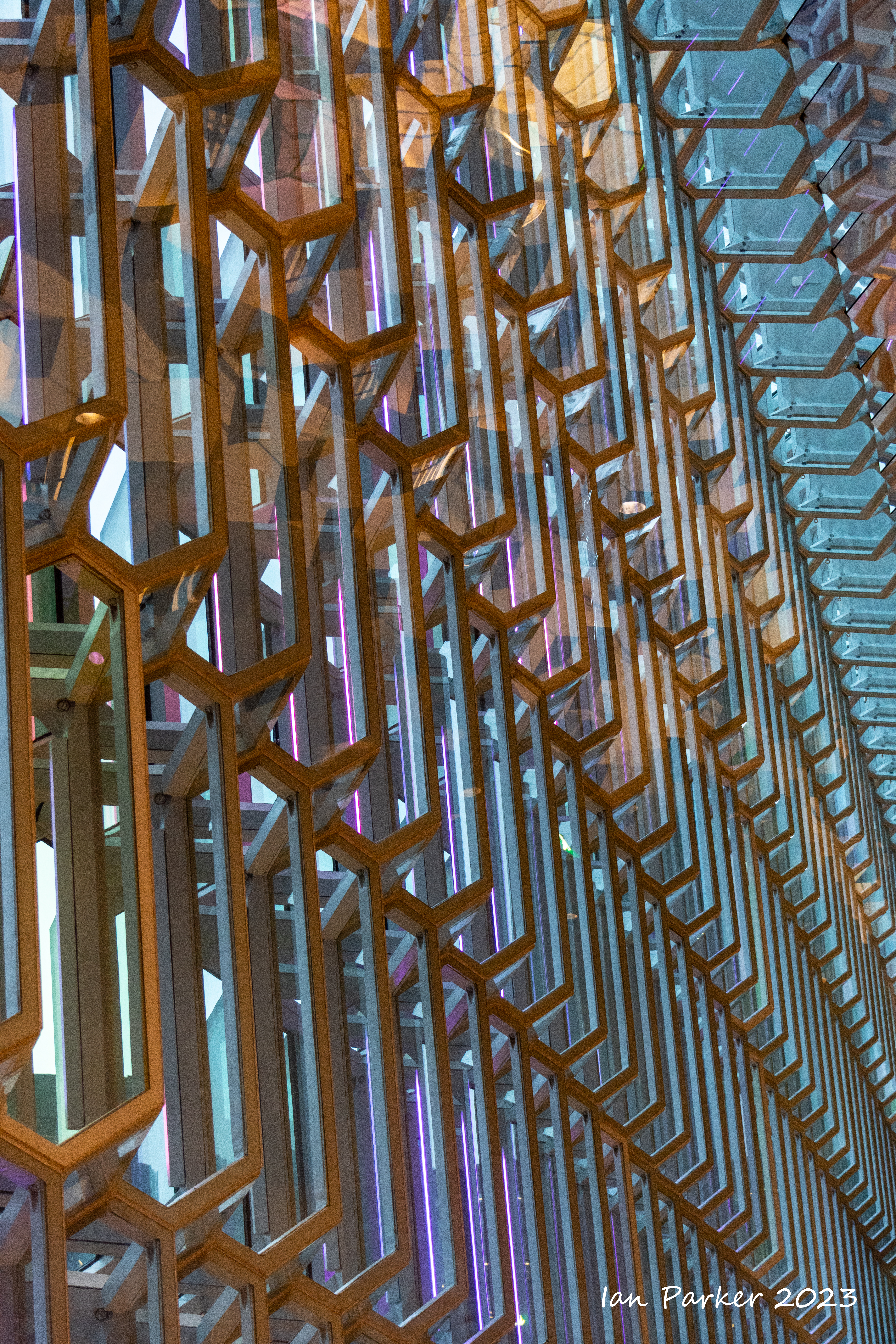
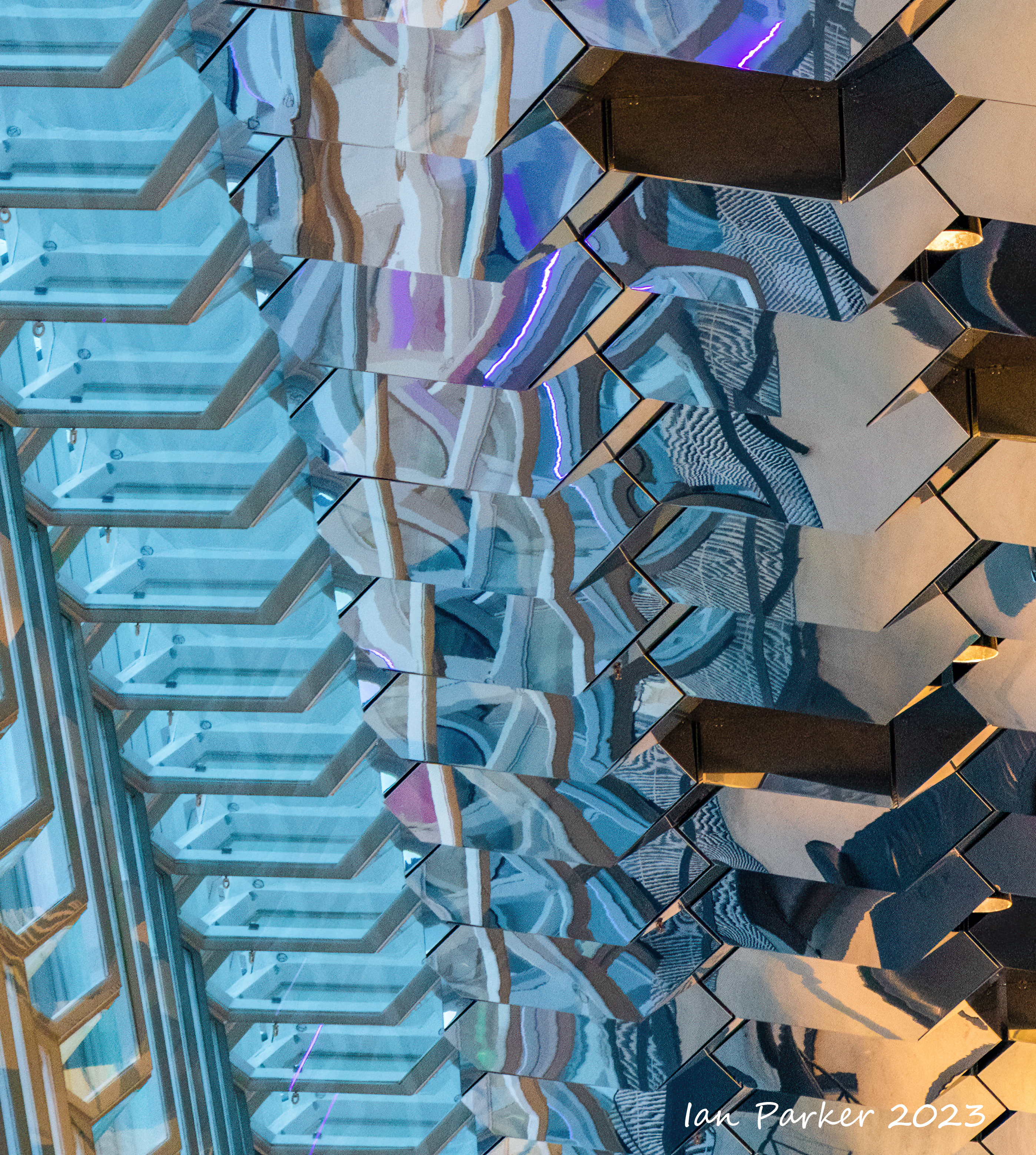
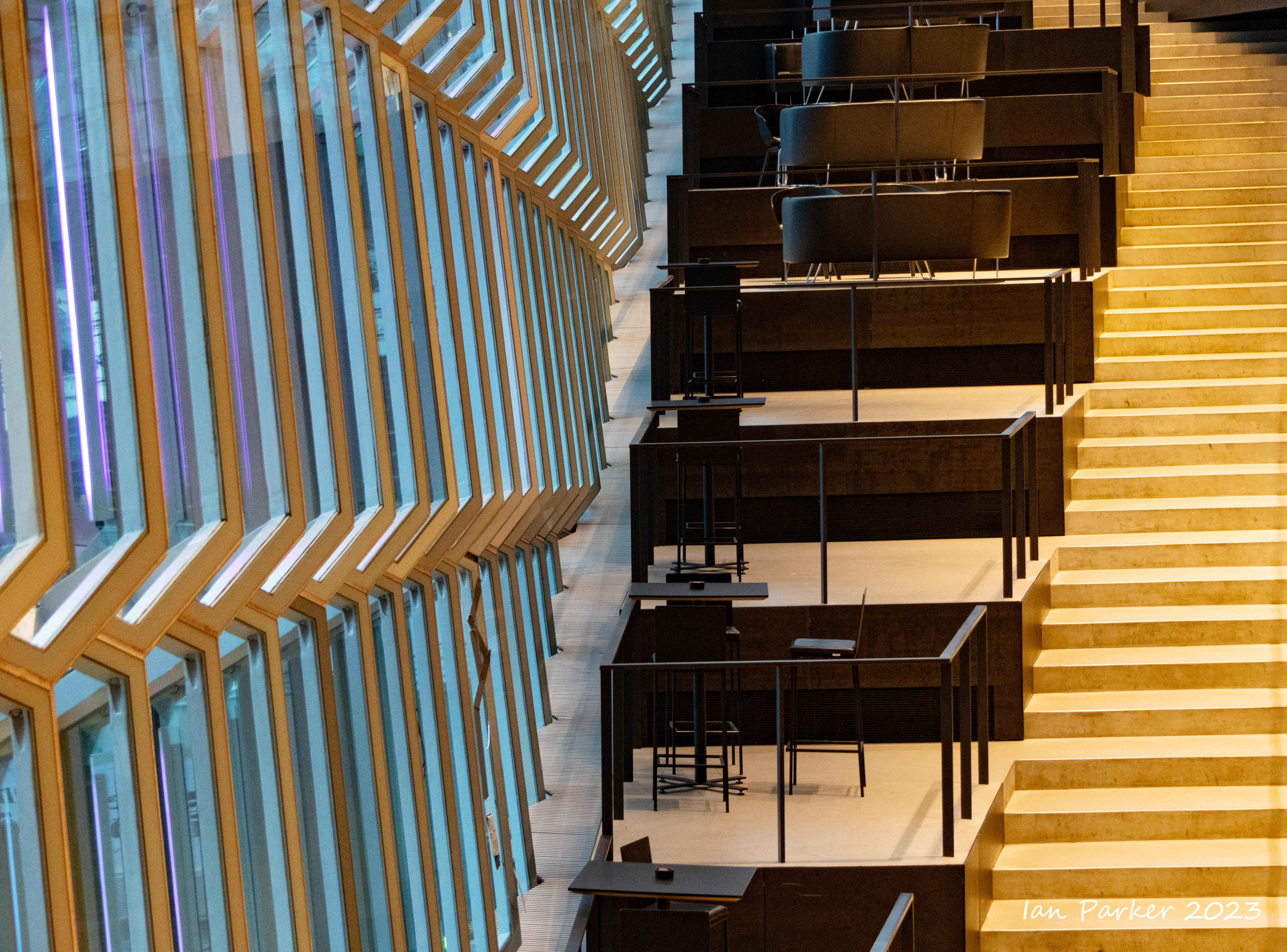
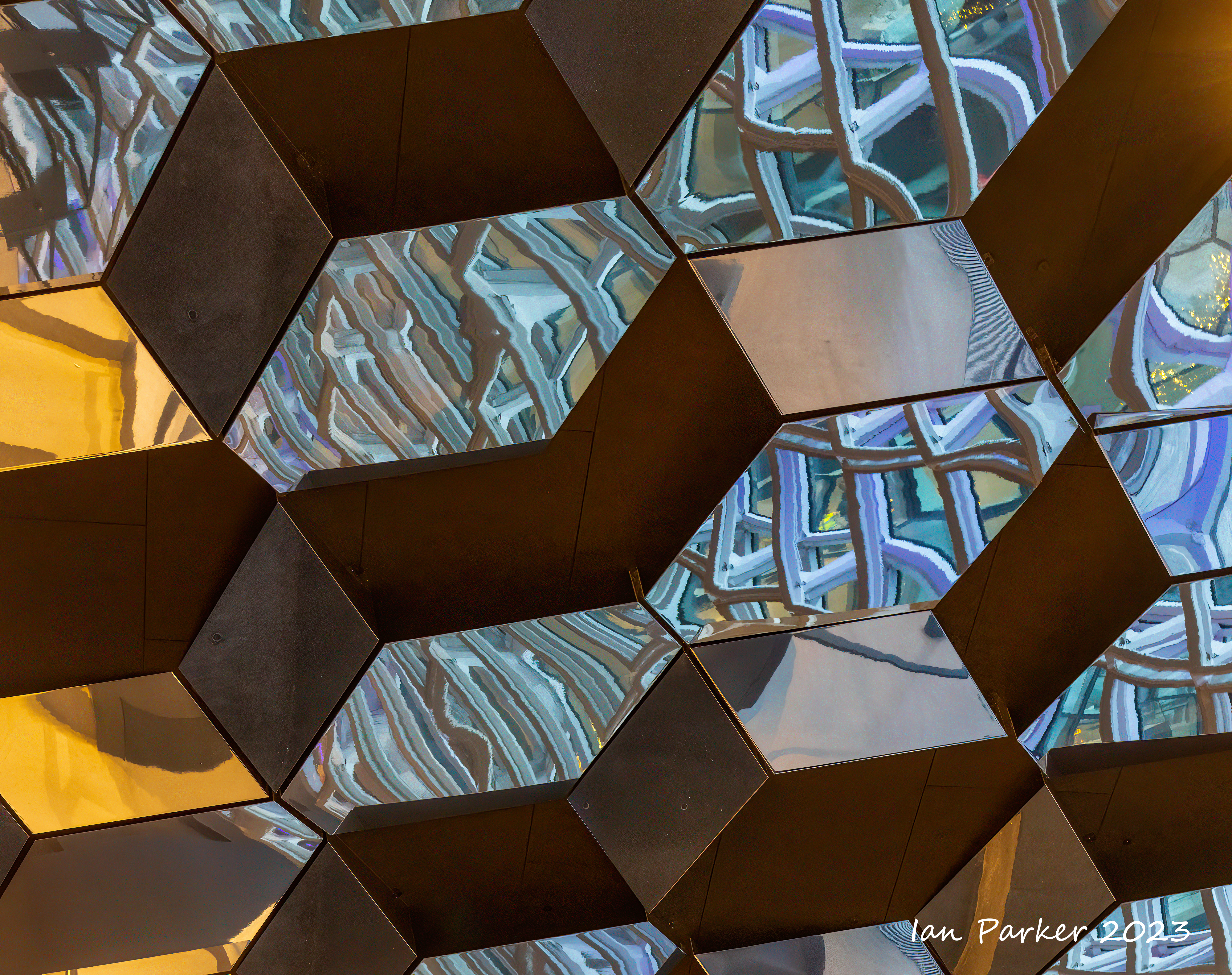
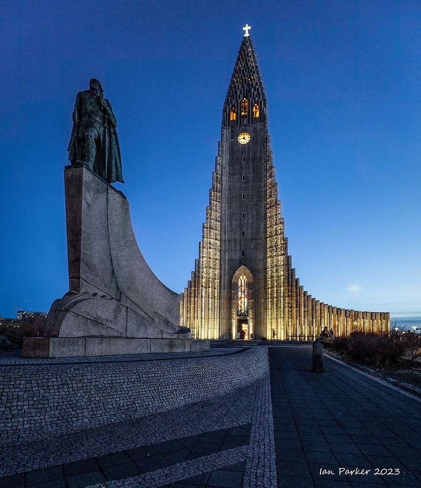
Reykjavik - Two architectural icons. Two very different interpretations, each inspired by the hexagonal basalt columns of the Iceland landscape.
Hallgrimskirkja

The rainbow street leading down from the church
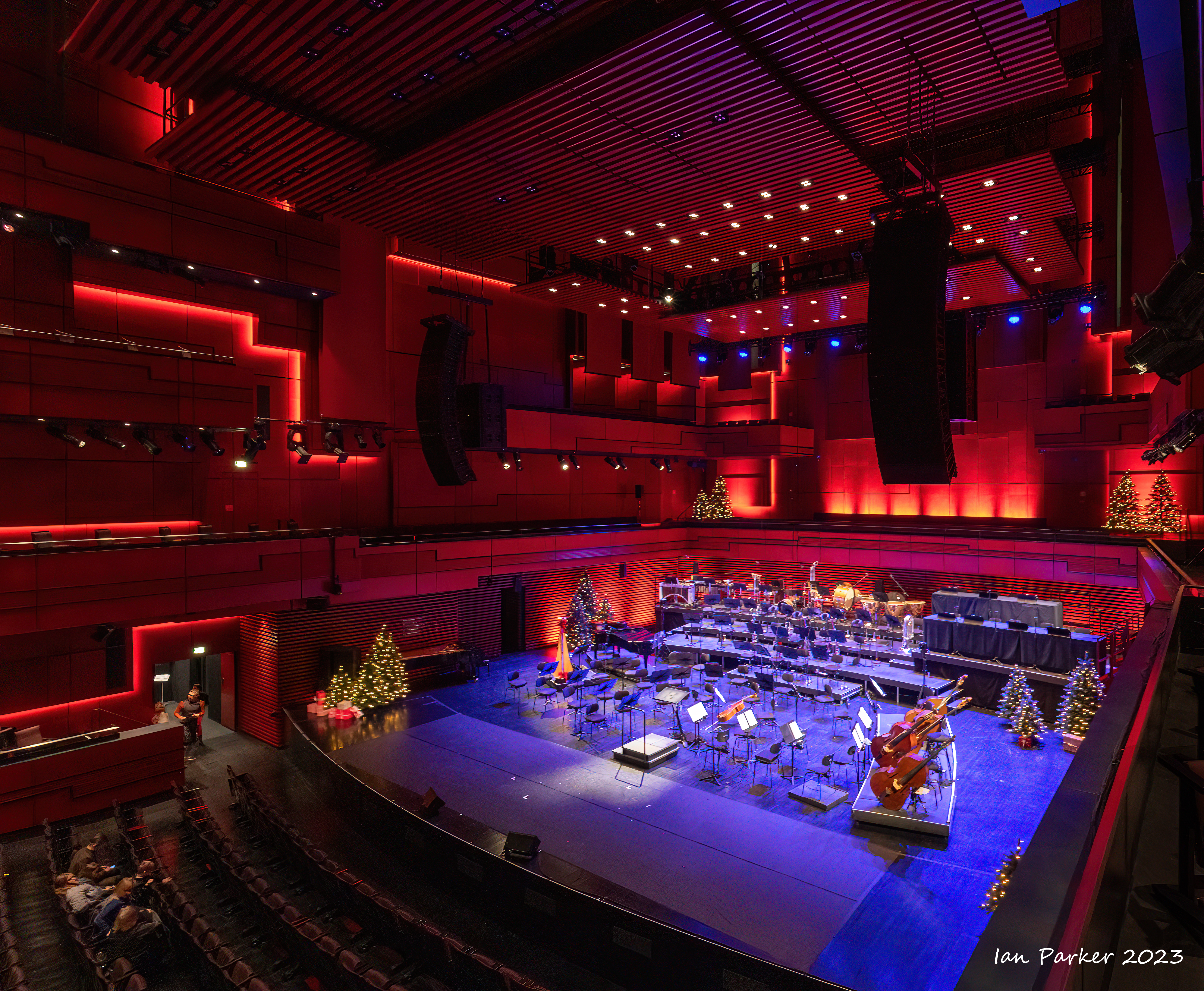
The Harpa Concert Hall


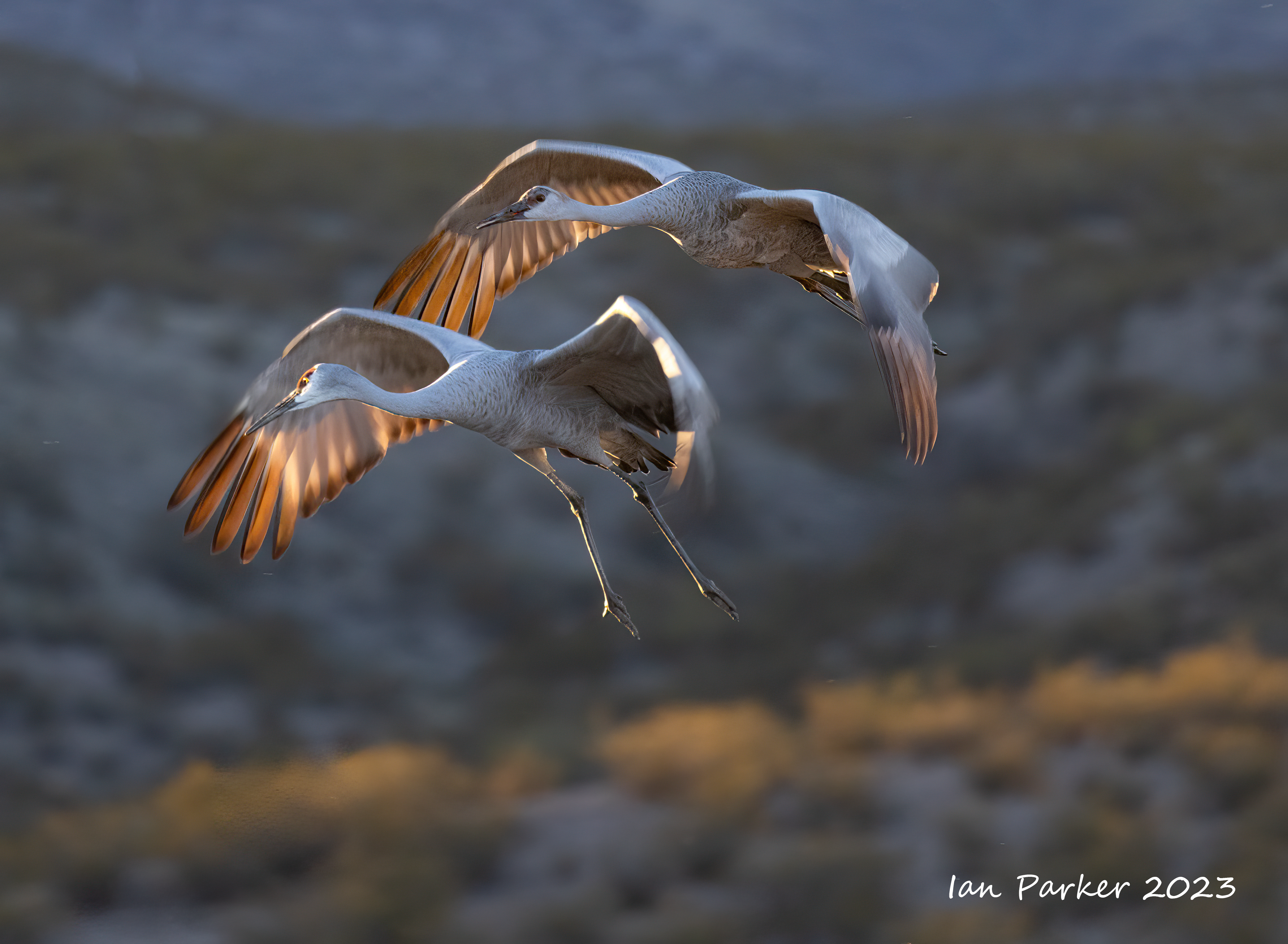
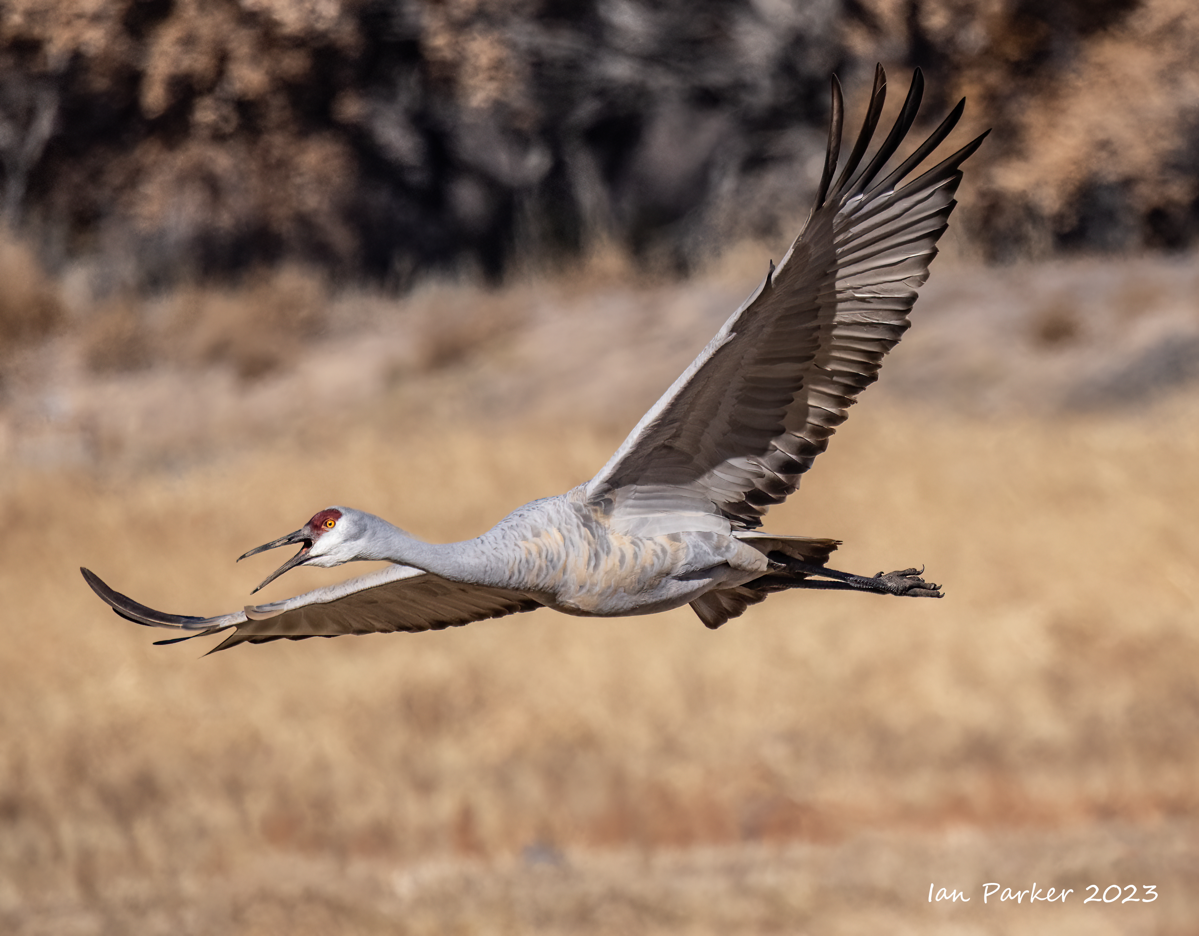
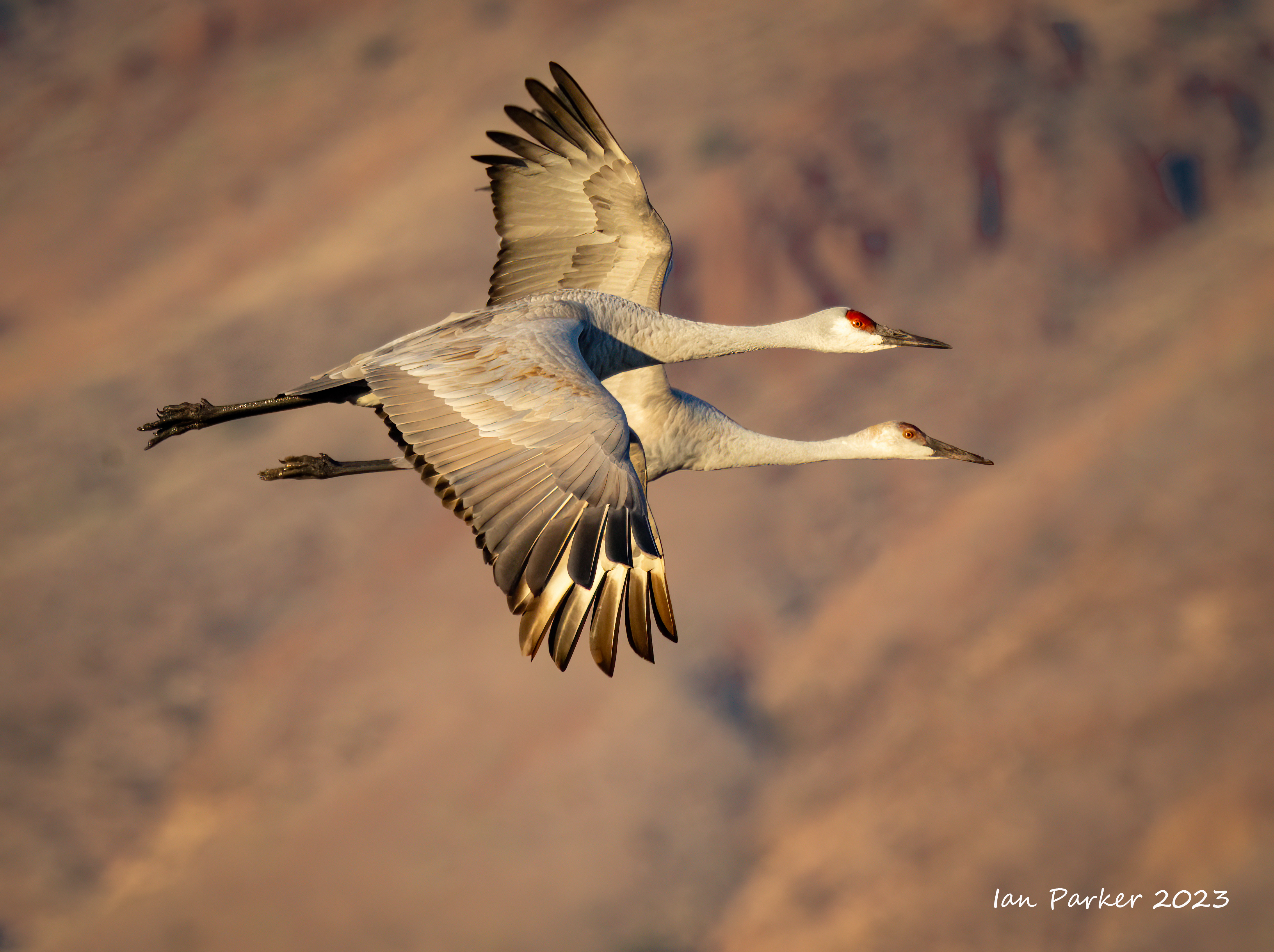
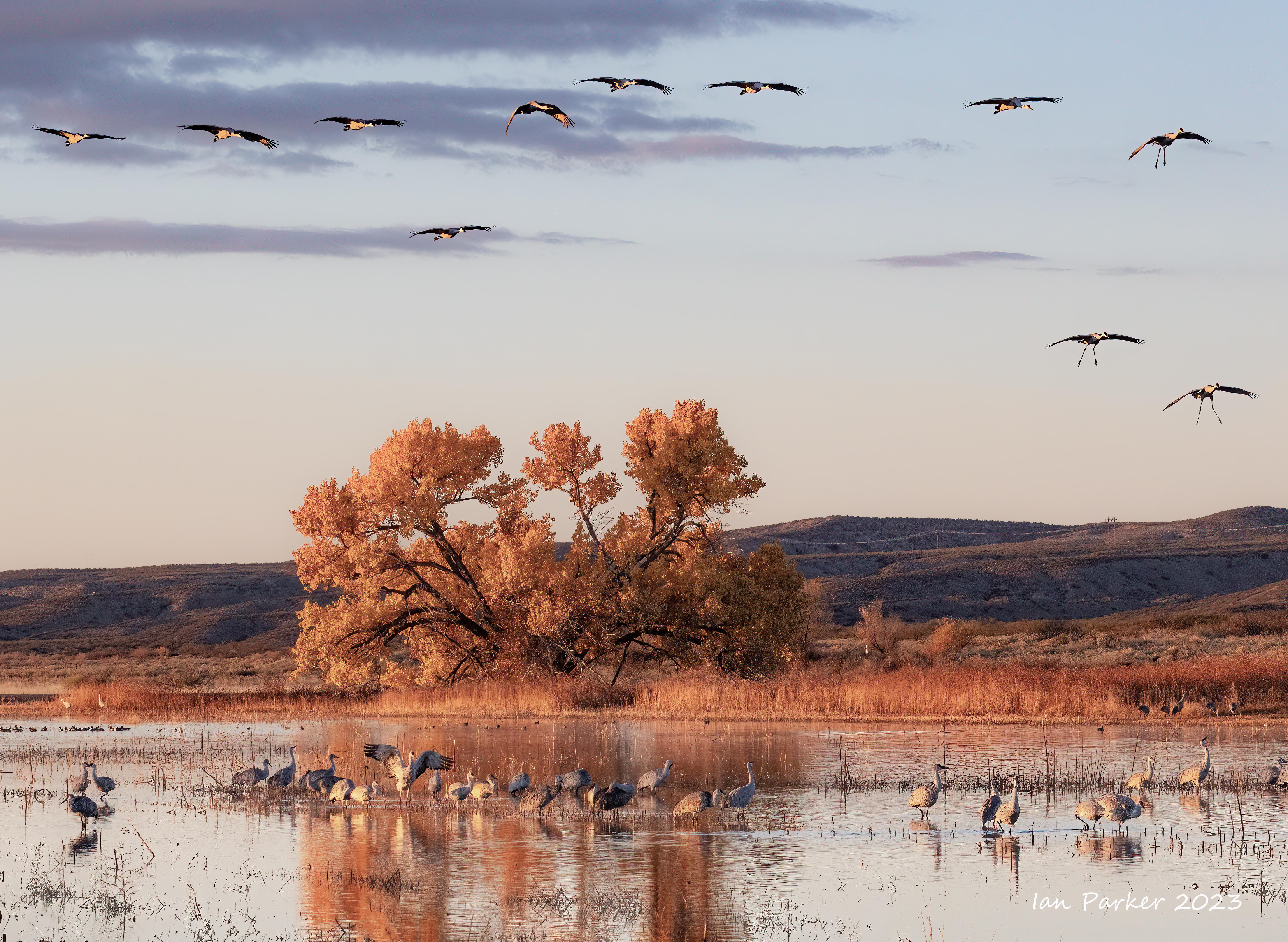
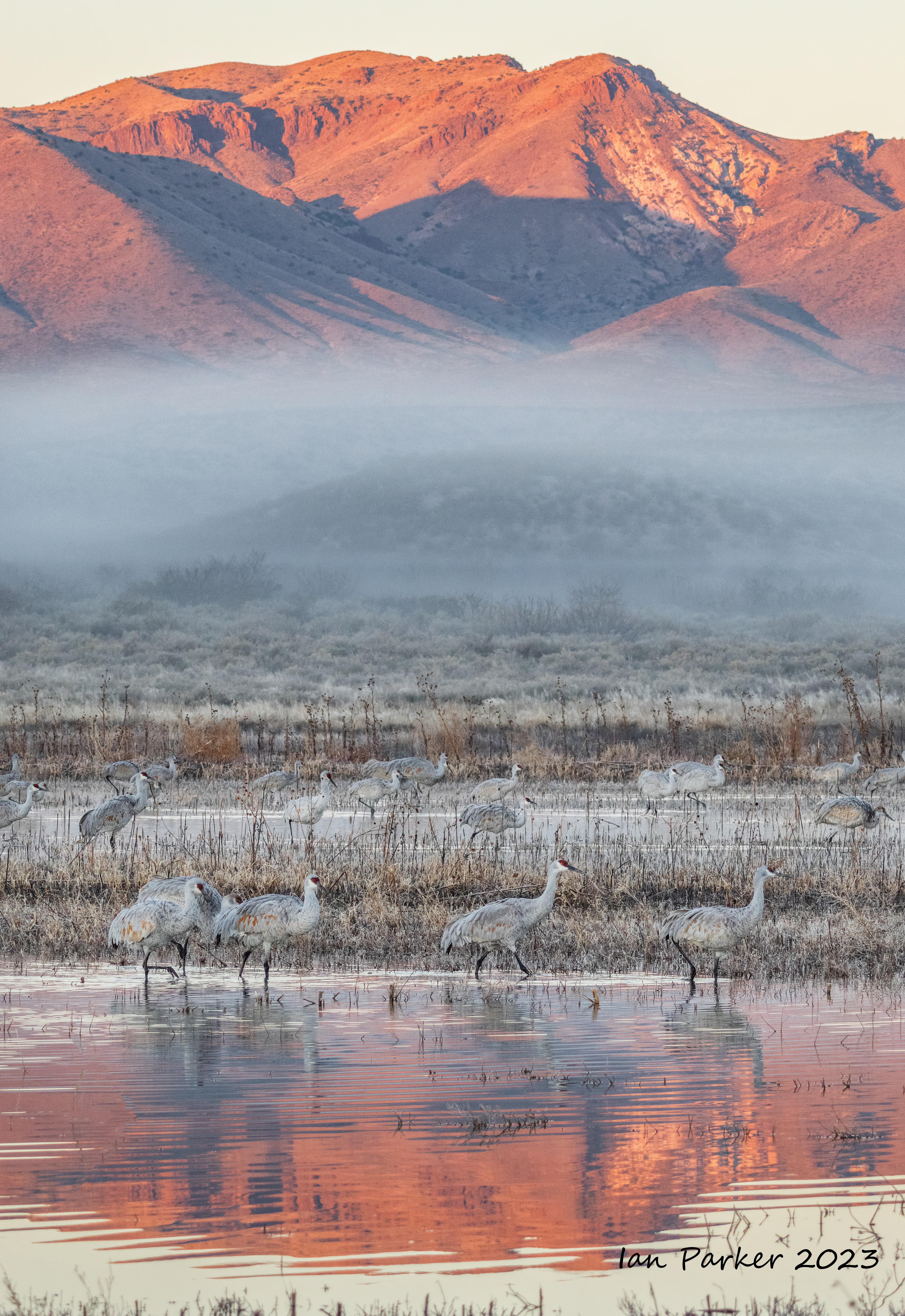
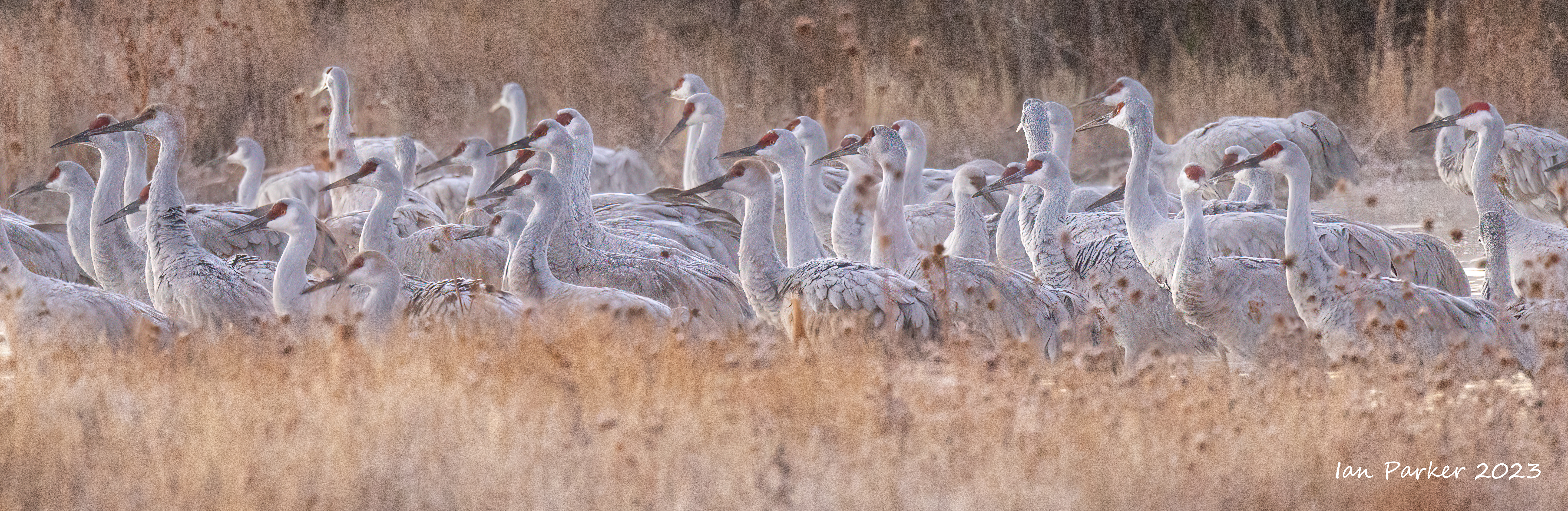
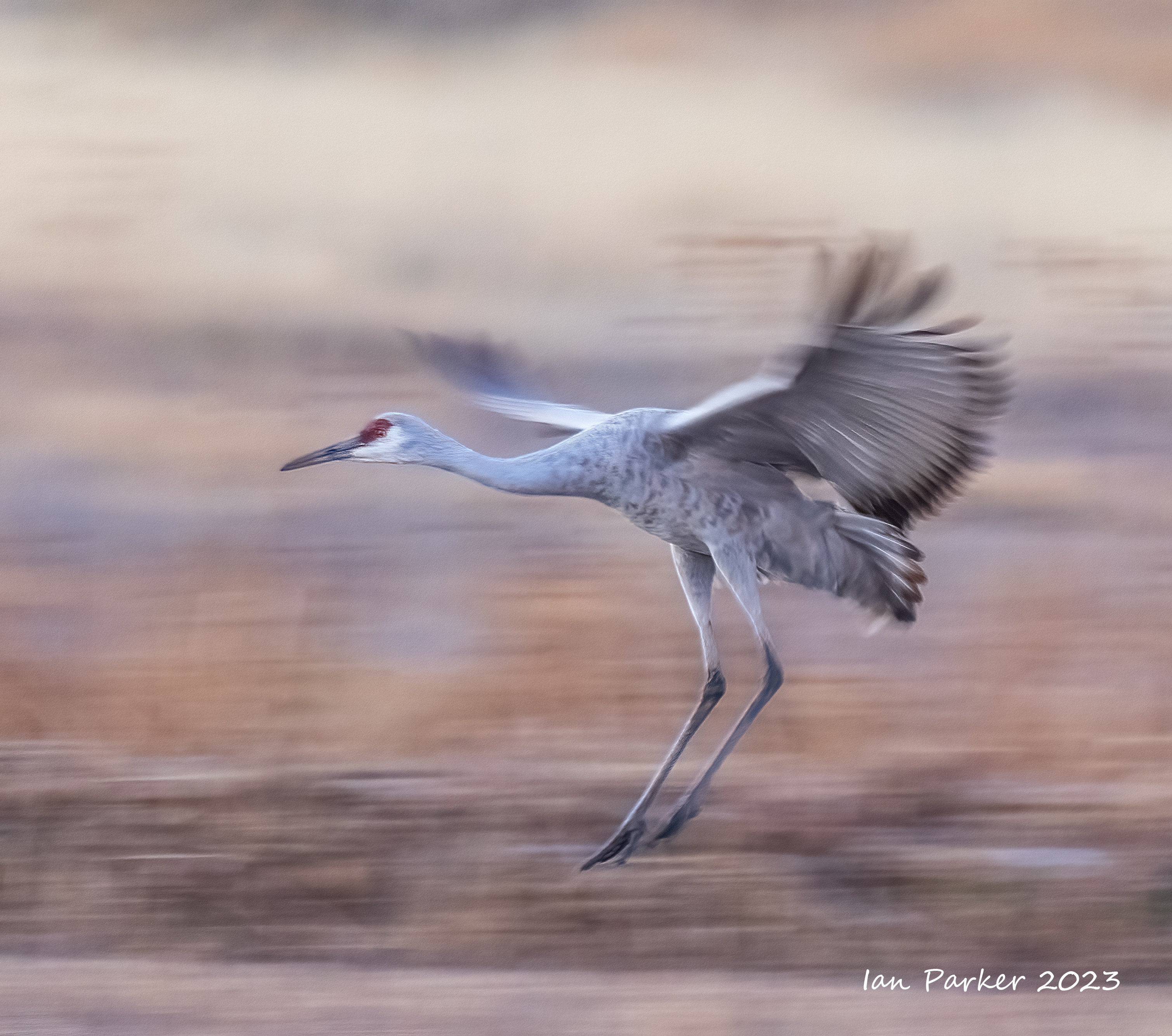
Bosque del Apache Wildlife Refuge
Nov. 20-22, 2023.


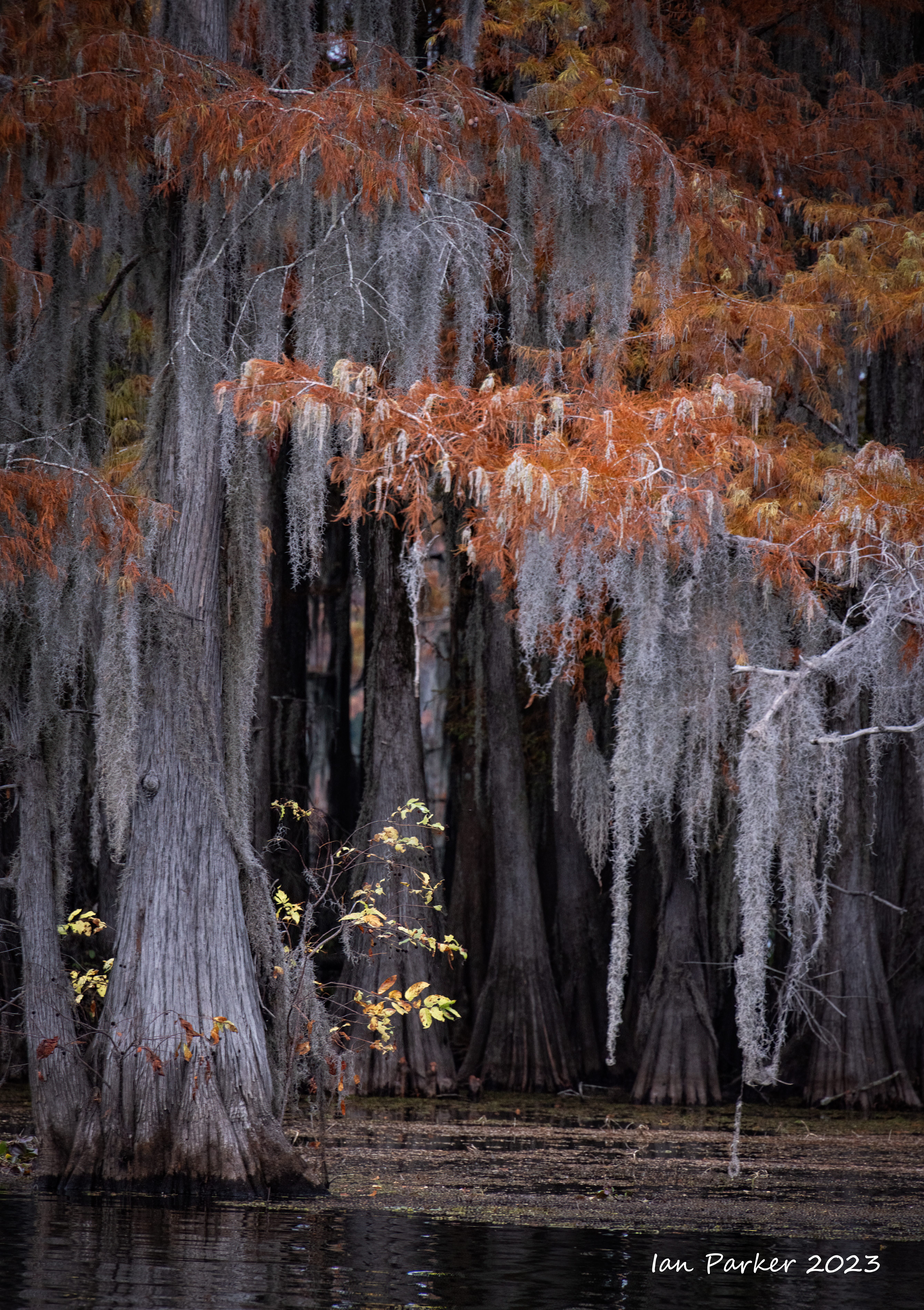
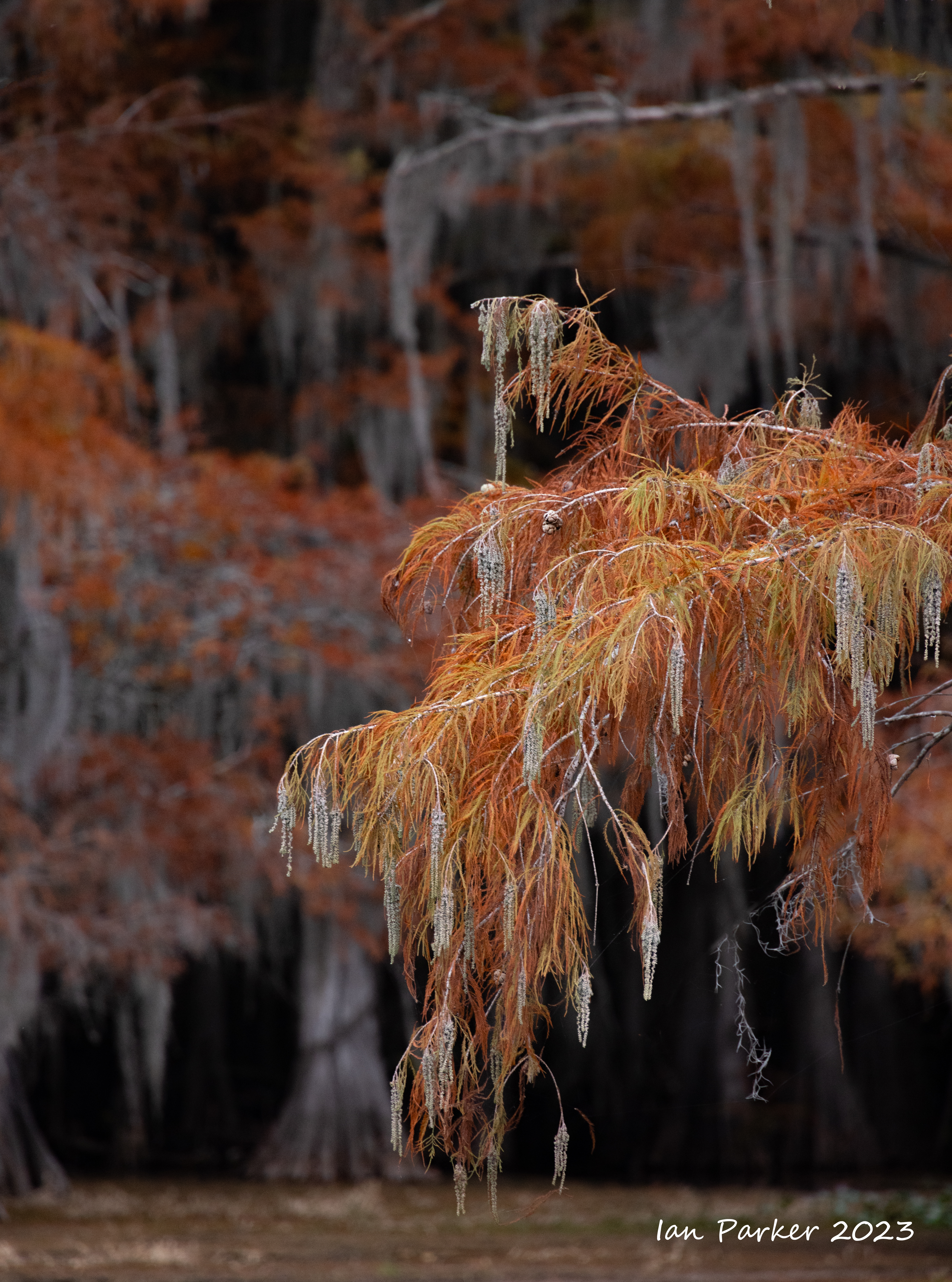
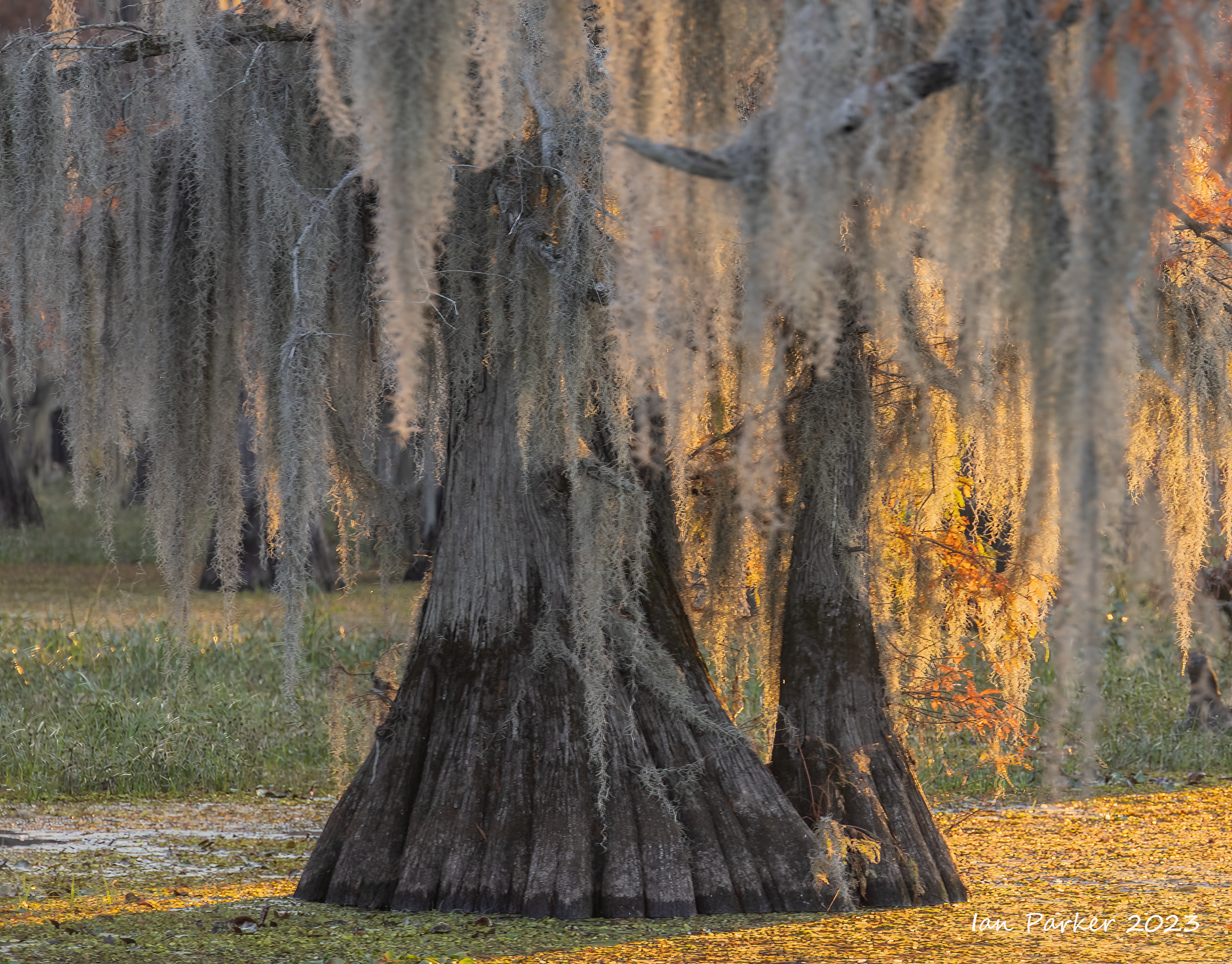
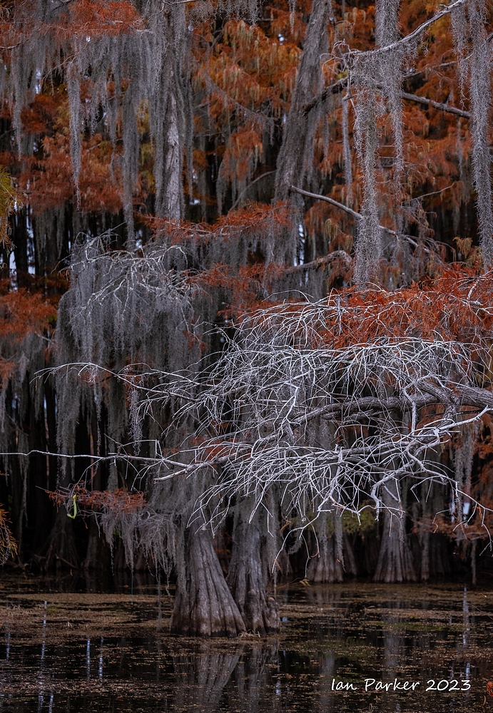
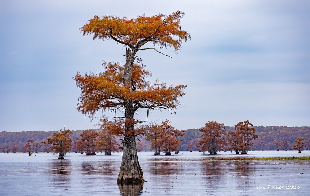
November 17-19 - Caddo Lake
A 3000+ mile round trip to visit the largest cypress forest (swamp) in the world; a magical, mystical hideaway that in November provides some of the most beautiful fall colors the south has to offer.
We stayed at Hodgepodge Cottages in Uncertain Texas, immediately across from the lake, and I went out onto the lake for morning and evening shootingexcursions with local guide and photographer Paul Keith.
Cypress trees in the spotlight


Mostly about Spanish moss


 Bare branch; Caddo Lake |

|
Cypress trees in isolation


Details

Sunset and sunrise light

Birds

Treescapes and Waterscapes


Whimsical Art Installations on Taylor Island
The whimsical, creative spirit of Dottie Carter is found in art projects around her Spatterdock Guest houses on Taylor Island. Dottie Carter and her pal, Patty Lovelace, with their creative and whimsical spirits, create mosaic pieces, large and small. Most of the friends' work are on Taylor Island, where all but one of the Spatterdock Guest Houses are located. VWs can be seen near the road at Frog Trot (Super Heroes), Barnstormer (Volksfroggin) and Spatterdock (Baby Buddha and the Teapots).(Wanda Warmouth) is across the road


| IanParker 1146 McGaugh Hall University of California, Irvine, CA 92697 |
Please send enquiries to |
BACK TO > |