December 30, 2013
A long morning (3:00am-noon) in the desert around Borrego Springs photographing the metal sculptures by Ricardo Breceda.
November, 2013 : A voyage to the south of the world
I returned at the beginning of December from a month-long trip to theFalkland Islands, South Georgia and Antarctica with Jo van Os Photo Safaris, having accumulated about 250 GB of photos. These are posted here in chronological order of our voyage. Accompanying text in italics is excerpted from the Ultimate Antarctica logbook written by Jo and the other trip leaders.
November 20-25 : Antarctica
Antarctic Peninsula - Landscapes, skyscapes and seascapes
Antarctic Peninsula - Wildlife
Nov. 20. Brown Bluff. Jumping penguins
Nov. 22. At our anchorage in Paradise Harbor (a.k.a. Paradise Bay) the air temperature was just a degree above freezing and the water temperature was even colder, so the feminine duo cheerily recommended cancelling all “our” swimming plans for the day. The scheduled landing for the morning was to be at Almirante Brown Station, a small abandoned Argentine scientific base located on a spit of land with steep seacliffs at least 300 feet high on one side and the precipitous face of a sizeable tidewater glacier on the other. Deep snow covered the landing site and prevented us from making landfall so instead we had a 1½-hour Zodiac cruise in the picturesque waters of the surrounding bay. As we cruised along the shoreline we saw several dozen gentoo penguins nesting around the deserted buildings while a few snowy sheathbills paraded about searching for scraps of spilled food. Farther along the shoreline a small colony of antarctic shags was nesting on the lichen-splattered cliffs. As we watched, the shags were busy flying in with nesting material, courting and mating. A highlight of the morning was the sighting of a pair of Weddell seals resting on a shelf of shorefast ice near the station. Weddell seals are the largest of the antarctic seals (excluding the occasional southern elephant seal) and hefty females weigh up to 1,300 pounds (600 kg). The photogenic seals with their attractive round faces and patterned, brownish coats are the deep-diving specialists of the peninsula, sometimes reaching depths of almost 2,500 feet (750 meters) and staying submerged for over an hour.
Nov. 23. We landed just south of the Lemaire channel on Petermann Island near the historic 1909 overwintering anchorage of Jean-Baptiste Charcot named Port Circumcision. Yes, the sailors of the last century held strange notions of what constituted entertainment on long winter nights back in those days!
Nov. 24. Port Lockroy.
This morning the few passengers on deck were greeted with perfect light and the calmest silky waters we had seen on the entire trip. Ushuaia repositioned through the southern end of the Neumayer Channel and arrived at Port Lockroy at 0715. Resident Helen Annan gave us a quick introductory talk about Base A on Goudier Island and we landed by 0900. The light started to deteriorate due to a snowstorm but the photogenic gentoo penguins and sheathbills continued to entertain.

Gentoo penguins around union jack: Port Lockroy, Antarctic Peninsula |
|
|
Nov. 24. By the time we reached Ronge Island and the Orne Islands the skies had cleared. Our last landing in Antarctica was made perfect by the braying chinstrap penguins surrounded by the pristine snow on these small islands.
Antarctic Peninsula - Ice
TABULAR BERGS
BRASH ICE
BERGS in the LANDSCAPE
BLUE BERGS
SCULPTED BERGS
Castellated berg in the Errera Channel. Along the way we came across a fantastic grounded iceberg that truly looked like a castle with many spires at the top and tunnels carved into the base from wave action. The interesting fact about this particular iceberg was that Monika and the Ushuaia had first run across it two years ago (so this was the third year photographing the iceberg). It was first found much farther to the south, and it had migrated north over the course of the last few years and dwindled in size. We circled the iceberg, photographing from every angle.
November 10-16 : South Georgia

South Georgia - Landscapes
South Georgia - Skyscapes
South Georgia - Wildlife
Cooper Bay
The weather was gorgeous, the visibility excellent and the sea conditions mild for our planned expedition to view the macaroni penguins in Cooper Bay. The Special Protected Area of Cooper Island lay to the east. After breakfast, the first group was away shortly before 0900 (we worked in two groups to allow more room in the Zodiacs to photograph). The macaroni penguins are normally abundant on the rocks adjacent to the colony, but for some reason—probably due to the low tide—the numbers were sparse. However, everyone had the opportunity to view them, along with a selection of pintail ducks, sheathbills and overflying light-mantled sooty albatrosses, in the wonderful morning light.
Prion Island
The landing beachat Prion Island had a little bit of everything going on—gentoos arriving and walking to their rookeries at the top of the hills, fur seals, very loud elephant seal cows, and an insistent, but rather inept, bull. Scattered among this mix were South Georgia pipits (the world’s most southerly songbird), feeding on the beach and singing in the tussock from the bottom of the hill to the top, and South Georgia pintail ducks waddling in the muddy channels among the tussock. Overhead white-chinned petrels and giant petrels flew past and, further up the hill, adult wandering albatrosses circled and landed to feed chicks. A boardwalk had been built above an eroded stone path with tussock on either side. A few fur seals growled as we passed but the expedition today was to see and capture images of the increasingly rare wandering albatrosses, one of the world’s largest seabirds. At least ten, 9 to 10-month-old near fledging chicks were seen on their nests from the boardwalk and platforms. Most of the time they just sat, but occasionally they stretched those massive jointed wings to tone up the flight muscles. The images of the wandering albatrosses over land really does bring home how large these birds are, and even with the wind blowing persistently from the northwest, we could hear the “swoosh” as they soared over our heads. Giant petrels with large flappy feet were also in the air and dropping into their nests in the tussock. They looked small in comparison to the wanderers.
Salisbury Plain
Our Salisbury Plain landing began at 0700 onto a steep and stony beach with lots of male fur seals—each bull defending their chosen position in grumpy readiness for the arrival of the cows in about two weeks’ time. Over 35 groups of elephant seal families could be seen along the foreshore in groups of 2 to 35 cows, each with a variety of fat black-coated pups and one dominant alpha male bull. Scattered around each elephant seal group were other males who were ostensibly asleep but also waiting for an opportunity to mate. Weaving paths among this mix were king penguins in the many thousands—surf in, walk back and forth, dive in, wash, and provide tasteful beauty to an otherwise drab gray and green landscape. The weather was never the same from one moment to the next. So many seasons and conditions were experienced in so few hours that we lost count—dry, sun, rain, rainbows, sleet, snow, hail, freezing, cold, warm, wind and more wind! The light, at times, was spectacular and we found many shots that summed up a truly memorable and spectacular site with its 100,000 pairs of breeding king penguins.
Saint Andrews Bay
[Nov. 14. Our best day on South Georgia.]
At 0300, Monika and Joe Van Os had scoped out the early morning weather situation. The sky was filled with broken clouds, a photogenic sunrise looked possible, the wind was favorable for a landing, and wave swell was moderate. Our landing was a “go.” By 0400 we commenced the landing on the legendary beach at St. Andrews Bay. Just prior to our departure, “bio-secure” breakfast sandwiches and snacks were available in the ship’s lounge to eat on board or to take ashore.
By 0430 the 50 participants who opted for the early morning landing were ashore and experiencing the spectacle of St. Andrews—the largest king penguin colony on South Georgia and the island’s largest and most populated elephant seal beach. Safety instructions were given as well as rules for the engagement of wildlife on this sweeping 1.8-mile (3 km) long beach. Clouds forming on the low horizon precluded a dramatic sunrise. People fanned out in all directions, some heading to the far distance to visit the king penguins, others working the shoreline where penguins were heading out to sea for their morning foraging expeditions, while several photographers concentrated on fighting and mating elephant seals. By 0600 the wind had picked up strongly with hints of katabatic gusts blowing bursts of dry sand across the beach. This barely dampened the spirits of our photographers and most kept on shooting—unfazed.
By 0700 the beach and the bay were experiencing a full-blown gale. Strong westerly winds and 60-70 mph katabatic gusts created blasting sandstorms across the beach and our safety became more of a concern as Joe Van Os, on shore, and Monika, aboard the Ushuaia, monitored the situation. The 0800 landing for our remaining passengers who had stayed onboard for breakfast was postponed due to the hazard of mounting sea swell on the ship’s gangway and the possibility of drenching waves during the Zodiac operation. Despite the blowing sand, photography on shore continued and unique images of South Georgia wildlife emerging from a fog of blowing sand were undoubtedly created. It is a testament to the quality of today’s camera equipment, that little damage to cameras and lenses by the blowing sand was reported.
By 0900 it was obvious that, despite inviting blue skies and sunshine, the persistent strongly gusting wind presented a safety issue and the entire shore party was collected and gathered together for an orderly departure from the beach. With a potential threat of a Zodiac flipping by the off-shore wind, several staff or seamen remained in the Zodiac as human ballast for the return trip from ship to shore after passengers were offloaded. By 1000 all passengers and staff were back on board Ushuaia.
Godthul
The morning of Nov.13 was spent at Grytviken, and after lunch we cruised south to our afternoon landing at Godthul (Norwegian for “good harbor”). The site is noteworthy for the abundance of whale bones littering the beach, the scenically-situated gentoo colonies on the upper slopes, and the herds of reindeer that graze the lush grasses. [The beach was narrow, and densely occupied by fur seals, so I did not explore far and occupied myself with gentoo penguins on the beach.]
Jason Harbour
Jason Harbor is the site of a hut that was built in 1911 and used for depositing mail. On the way the seas were rough, but the birds were flying behind the ship and several people braved the conditions to photograph. The afternoon was great with sun and light winds. The beach was full of elephant seals—we counted at least five big groups along the expanse of sand. We captured great wildlife behaviors, including mating, mothers and calves nuzzling and nursing, bulls challenging each other, and several bulls swimming along the edge. Fur seals and weaner elephant seals were up among the tussock grass. A few king and gentoo penguins showed up on the beach. Some of the participants also walked over to a small lagoon behind the main beach.
Stromness - penguin highways
I spent more time photographing landscapes than wildlife at Stromness Bay, but found an intriguing feature in the 'highways' the gentoo penguins had carved across a marshy area between the beach and the steep, tussoky hillside leading to their colonies safely above the fur seals.
Right Whale Bay
Significant snow squalls made the weather interesting and our first glimpses of the mountains of South Georgia were of tantalizing jagged gray shapes far in the distance. Snow continued, off and on, throughout the morning almost until the time we finally made our first landing at Right Whale Bay. The seas were relatively calm as we landed on the sheltered, half-moon bay surrounded by steep hillsides now freshly blanketed by a light snow. Southern elephant eals and southern fur seals lay scattered on the tide line, but apparently the breeding season had barely started as their numbers were still relatively few, and they were not particularly aggressive. Joe Van Os was following Anna, who carried a long wooden oar as a deterrent, when one seal did charge across the beach at him—which he stopped by sticking his tripod‘s legs near the seal’s face and quickly backpeddling. They are feisty devils—the seals, that is!
King penguins waddled ashore in small numbers, some so full of fish that their bellies bulged and their gait was labored. One was so fat that it tried belly surfing across the sand and pebble beach, laboriously pushing with its front flippers and shoving with its feet, a movement so inefficient it was first thought that the penguin was simply sick. Fat, brown-feathered juveniles clustered together at the far end of the beach and, on the distant hills, we could see several small colonies.
Although the height of the elephant seal breeding season had almost passed, the aftermath was still visible as a few bulls were lying about clearly showing the wounds from earlier fights. One male snored and snorted through a snout now ripped clearly in two, with most of the right half missing. Another dripped a drool of blood in several grotesque long streams, which attracted a skua that cautiously moved in to snatch a mouthful. The seal was clearly annoyed and would rise periodically, bellowing its gurgling roar in annoyance.
By 1800 the light had dropped and nearly horizontal tiny hard icy pellets of windswept rain or hail periodically lashed our cheeks. The last hour was cold, although another elephant seal with a tiny, quite young pup nearby, finally awoke and periodically rose, yawned and photogenically roared.
South Georgia Whaling Stations - Stromness and Grytviken
Stromness Harbor is situated in the central arm of Stromness Bay; Leith Harbor and Husvik are the other two arms. Whaling stations were located at all three, but Stromness is best known for another event. It was at the Stromness station where Ernest Shackleton finished his epic journey from Elephant Island to South Georgia. As a whaling station, Stromness operated from 1907 until 1931, and then continued as a ship repair yard until 1961. The derelict station is now off limits to visitors, due to dangers from both blowing sheet metal debris and asbestos. In the protection of the harbor, the seas were calm and gave us the opportunity to cruise along the abandoned station by Zodiac. This was the first time for any Photo Safaris trip to have this opportunity. Many seals, both fur and elephant, now occupy both the old buildings and the beach immediately in front of the station.
After lunch we returned to Stromness, but this time we landed north of the station, near the collection of whale catcher propellers. These were just outside the boundary markers for the visitation exclusion zone and circled the entire station site. We were allowed to explore the entire valley floor, which is quite flat with a patchwork of wet, swampy spots.
Grytviken (Norwegian for “pot cove”) is named after sealers’ trypots found on the site. Grytviken was a landing with many attractions. It’s the historic seat of government for South Georgia and the South Sandwich Islands, the location of the famous South Georgia Museum, a research station for the British Antarctic Survey, and the gravesite of the legendary polar explorer Sir Ernest Shackleton. We had three sunny hours to explore and photograph the area before the group met at Shackleton’s grave where we joined Chris Edwards. He toasted “the boss” with a shot of rum, gave some historical background, and added a memorable quote about Shackleton by Sir Raymond Priestley of the Nimrod expedition, “Incomparable in adversity, he was the miracle worker who could save your life against all the odds and long after your number was up. The greatest leader that ever came on God’s earth, bar none.”

Shadow on rusted tank: Grytviken, South Georgia
|
|
|
November 6-7 : Falkland Islands
Falkland Islands - Saunders Island
Our landing the next morning was on the Neck of Saunders Island, which lies only about 10 miles northeast of Carcass Island. It is one of the most northwestern islands of the Falkland Island archipelago. The island is owned by David Pole-Evans and his family who farm it with the local Corriedale-cross sheep, a Merino type famed for its good fleece and ability to cope with the poor grazing afforded by the Falkland grasses. The Neck is a narrow stretch of coast, technically a tombolo, composed of two opposing beaches of white sand joining the upland areas of Saunders Island. There is a small hut above the beach, fabricated out of a shipping container with extensions, which is popular for holiday “lets” (that’s rentals in Americanese). By the time the first Zodiacs were landing on the southwest beach of The Neck, the rain was making things quite unpleasant. most participants headed over the rise to the broad sandy beach where thundering waves could be heard in the distance. Needless to say, the few king penguins and the five brown woolly chicks proved a hit with some photographers. [Including me, as I failed to relaize we would be encountering hundreds of thousands of king penguins in days to come.] Everyone was getting soaked in the rain and started drifting back to the landing site. [The humidity caused my 7D camera to lock-up, despite it being sheltered from direct rain in a cover. Subsequent warming with a hair dryer and a few days in our warm cabin subsequently effected a complete cure]. Eventually the decision to abort the landing was made and we returned to the ship for lunch. With little evidence of a change in the conditions, the ship hauled anchor and we headed westward in a wide arc to avoid reefs and then eastward bound for South Georgia.
Falkland Islands - Carcass Island
After leaving New Island, we sailed for three hours through the “Woolly Gut” between West Point Island and West Falkland to Carcass Island.
Carcass Island is named after a ship, HMS Carcass, which surveyed the island in 1766. Our landing was on a shallow sandy beach among rocky reefs with a large mix of birds to photograph. So much to see and shoot—so hard to choose what to look at next! Sitting still and waiting for wildlife to come to you was rewarded by tussock birds (blackish cinclodes) inspecting our boots, and the squadron of striated caracaras flying past and positioning themselves strategically for a quick grab at anything and everything interesting! Kelp geese, two types of oystercatchers, the rather beautiful Patagonian crested ducks, and the ubiquitous upland geese rewarded us with a multitude of memorable images.
Many were tempted by the sumptuous array of cakes along with coffee and tea offered by our hosts, Rob and Lorraine McGill. We were invited inside their home to talk with them about the bucolic (and isolated) life they lead on this remote outpost.
Falkland Islands -New Island
At 0530 a wake-up call summoned us for breakfast at 0600 followed by an early landing on New Island in the West Falkland Islands. The day started out foggy and dull but brightened into a blue-sky day with swiftly moving clouds. Our landing was on a small sandy beach. We then walked up a steep slope to a track that led us past Magellanic penguins and their burrows, grazing upland geese, and several small birds feeding on the ground. Dark-faced ground tyrants posed briefly on old fence posts, Falkland thrushes bustled in the grasses and ferns. Turkey vultures and striated caracaras flew over our heads, inspecting our presence for any potential food our walking might stir up.
The black-browed albatross colony could be first smelled and then heard long before the many hundreds of birds were seen. The albatrosses were preening and incubating their one white egg. Intermixed were rockhopper penguins warming their two eggs and a smattering of imperial shags—all variously exhibiting the behavior of birds at the beginning of their breeding season. No chicks had hatched, but there was plenty of bonding behavior, and defense of nest territories from neighbors and aerial predators like caracaras, skuas and gulls. Some were still actively mating, while others turned eggs as shags with beaks full of nest material flew into the colony. The nesting cliffs, hundreds of feet above the sea, are both steep and impressive angular shelves with birds nesting on the top levels. Rockhoppers climb these cliffs on a daily basis—they surf in on the swells and then climb to the safety of the upper levels in amongst the other seabirds. Up the hill from this noisy, smelly mix of birds there was a busy gentoo penguin colony, again with birds on eggs, their attendant predators, and each pile of stone nest site defended just outside pecking distance from the neighbors.
We returned to the beach where Monika, fortunately, had been busy repositioning some of our bags as the tide rose. Last Zodiac was at 1200 and during lunch we sailed for three hours through the “Woolly Gut” between West Point Island and West Falkland to Carcass Island.
November 5-6, 2013: on board MV Ushuaia - Birds of the Southern Ocean
By 1800 we set sail and slowly watched Ushuaia disappear into the distance. Following our safety/lifeboat drill, a number of soon-to-be-familiar birds started following the ship, including black-browed albatrosses, kelp gulls and an occasional southern giant petrel. The next day we awoke to reasonably nice weather and a relatively calm sea. We had made good time as the wind to our back propelled us quickly toward our first planned landing at New Island tomorrow morning. Many seabirds were following the ship and there was a relatively big “firing squad” of photographers on the back decks shooting black-browed albatrosses, Cape (pintado) petrels and a few gulls. But the cooperative stars of the show were the squadron of southern giant petrels that came in close to the ship. Their large size makade them easy flight targets and provided good practice for the smaller birds that became more numerous as we voyaged farther south.
November 3-5, 2013: Ushuaia and Tierra del Fuego
Our voyage to Antarctica began from Ushuaia, the southernmost city in the world. We had planned to arrive two days early, in part to allow buffer time in the event of delays in our connecting flight from Buenos Aires on Aerolinas Argentinas. As it happened, departure from Buenos Aires was indeed delayed many hours, eventually arriving in Ushuaia around midnight, but still giving us two full days to visit Tierra del Fuego National Park.
On November 4th, participants coming from nine different nations assembled in Ushuaia in preparation for our departure down the Beagle Channel to our first stop in the Falkland Islands. Our airline-checked baggage was placed in a huge pile in the hotel lobby and delivered to our ship by early afternoon. It was estimated the huge heap weighed in excess of three tons—without photo gear! Following lunch and the collection of our photo gear from the Albatros Hotel, we boarded several busses and were escorted through the security check on the dock to the ship’s gangway.
|

'End-of-the-world railway : Tierra del Fuego |
|
October 19th, 2013
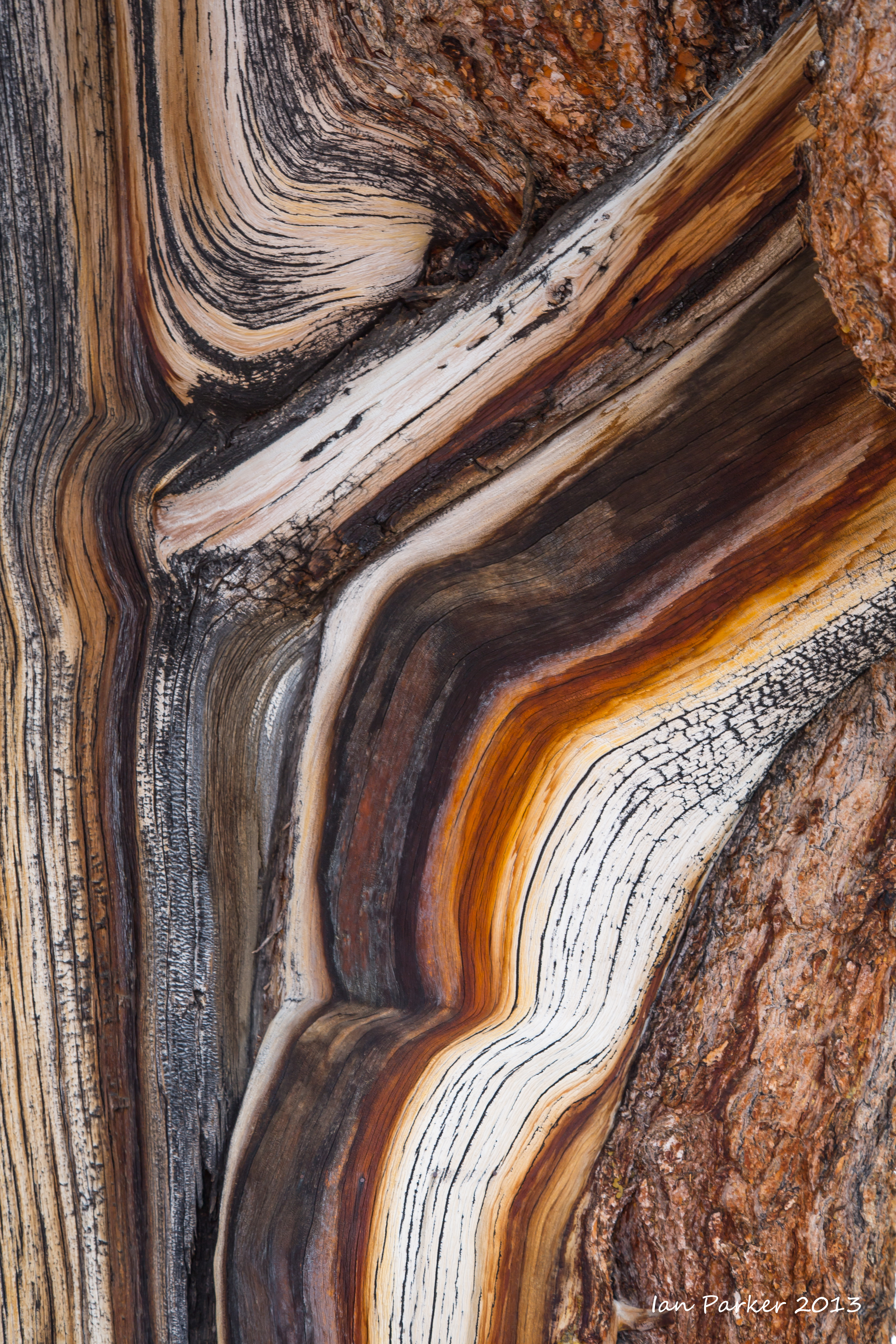
Photos from a long weekend trip up Owens Valley to view the fall colors in the Eastern Sierra, with a detour for a cold morning among the Patriarch Grove bristlecone pines up at 11,500ft in the White Mountains.
October 6th, 2013
Another nice morning at Bolsa Chica - Pelicans, and a Forster's tern
September 29th, 2013
More birds (and the oil rig). Bolsa Chica on a glorious sunny morning.
September 15th, 2013
The fog was in again at Bolsa Chica this morning, so I turned around and went inland to the San Joaquin reserve in search of birds. Patchy fog began to break up as the sun rose, giving some nice diffuse light before burning off.
September 7th, 2013
The first morning for what seems like months when it has not been foggy at Bolsa Chica. Some nice light, but the birds were rather scarce. However, one egret put on a good show for over an hour.
August 8-11, 2013
A departmental faculty retreat in Palm Springs gave me an excuse to drive on to Utah for a long weekend in the Zion region.
Sunday - A sunset over Cedar Breaks National Monument with thunder clouds and lightning.
Sunday morning - A hike and wade through the less-frequented canyon of Kanarra Creek
Saturday - A wade up through the Virgin Narrows
Friday - A detour via Hoover Dam; my first visit since the construction of the new bridge. I was disappointed to find that the walkway over the bridge closes at dusk, but found good vantages for some night shots along the old road leading across the top of the dam.
Driving along Interstate 10 brought me close to the giant Silver wildfire, burning for miles along the lower slopes of Mt. San Jacinto
July 24, 2013
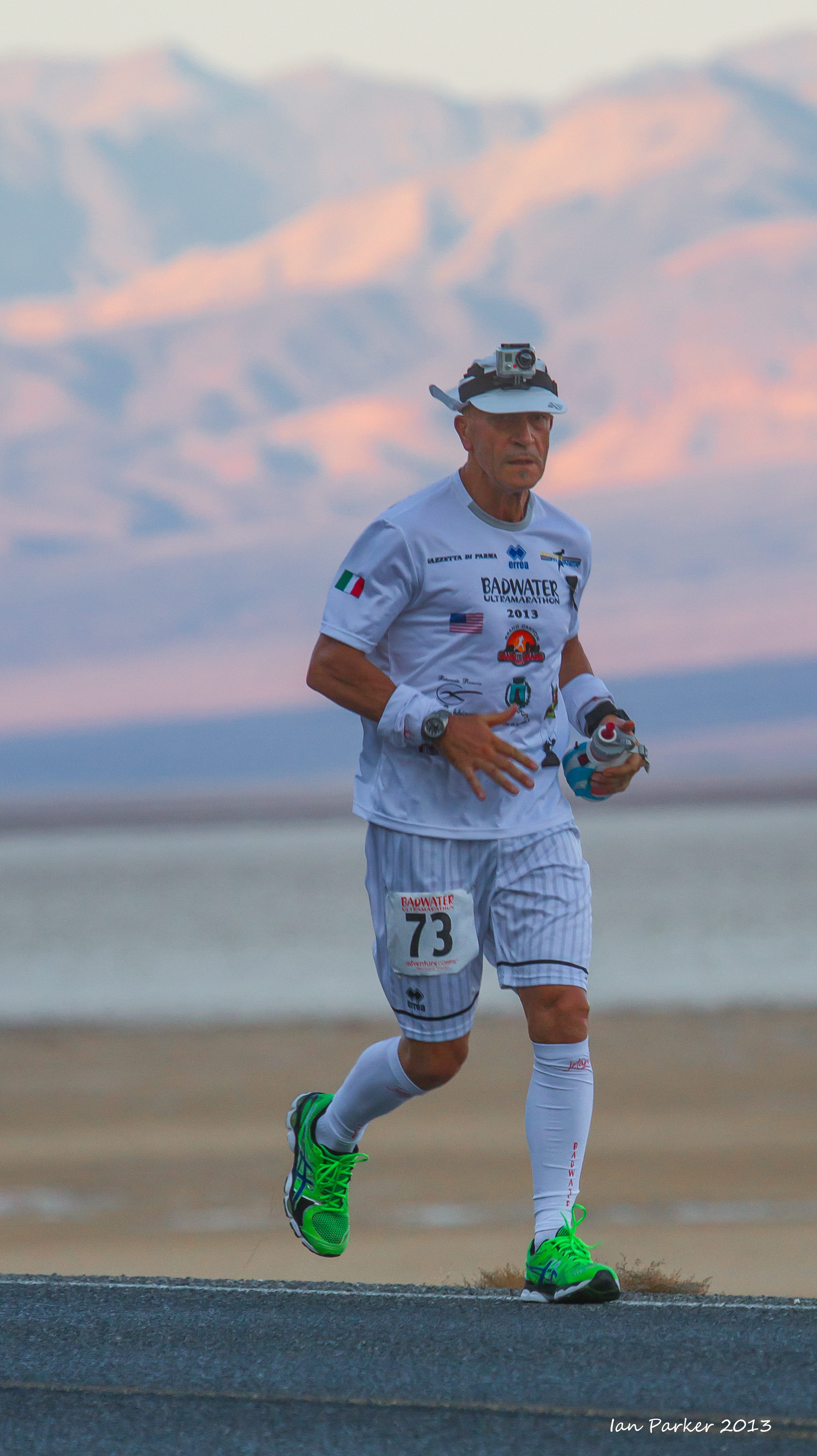
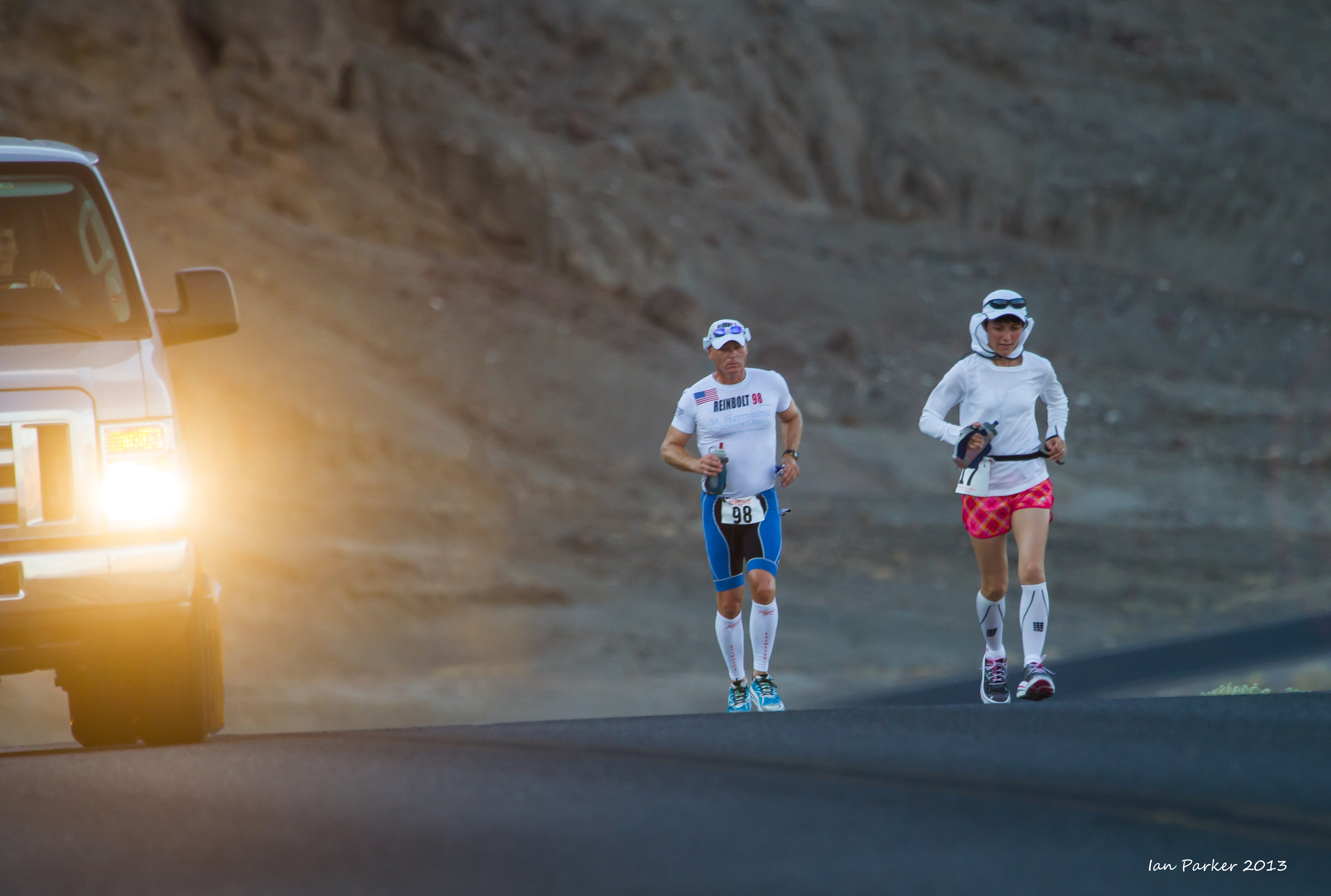
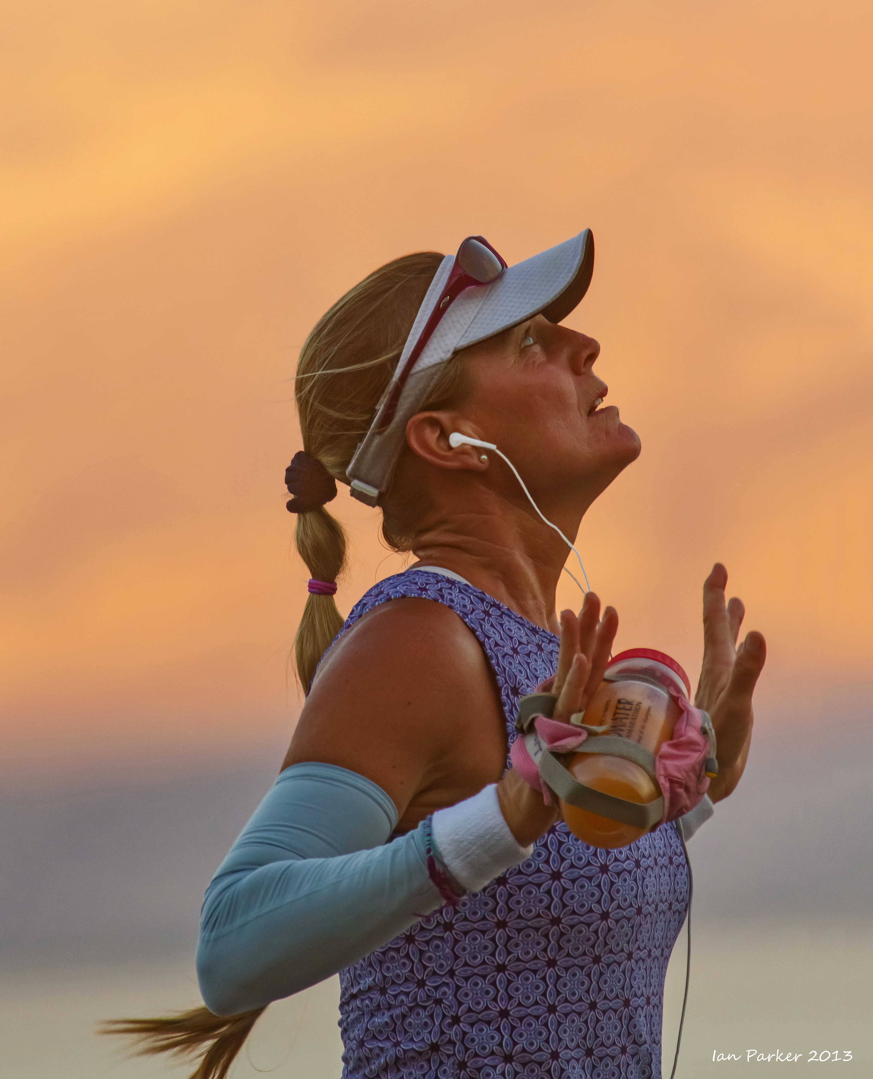
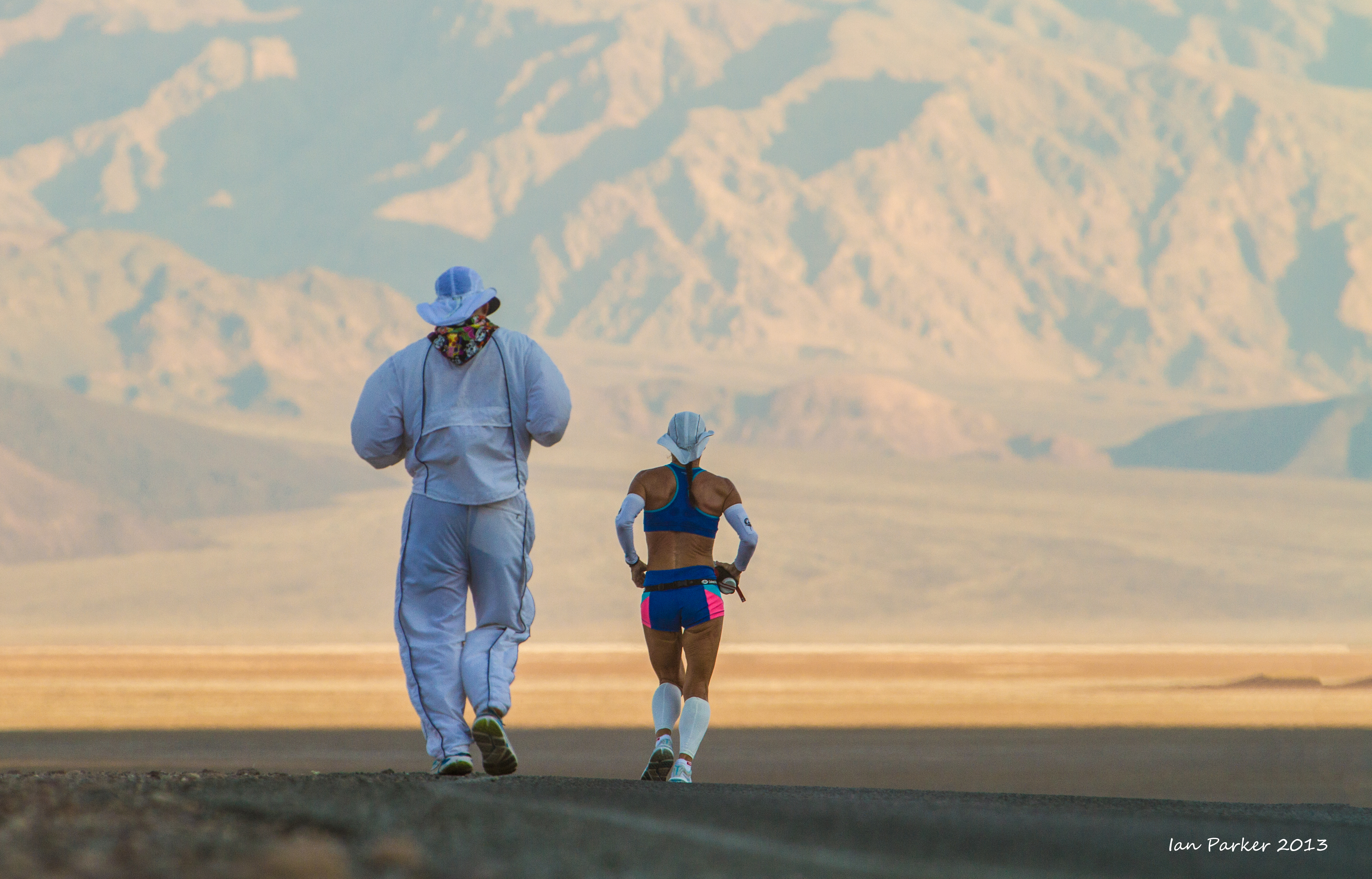
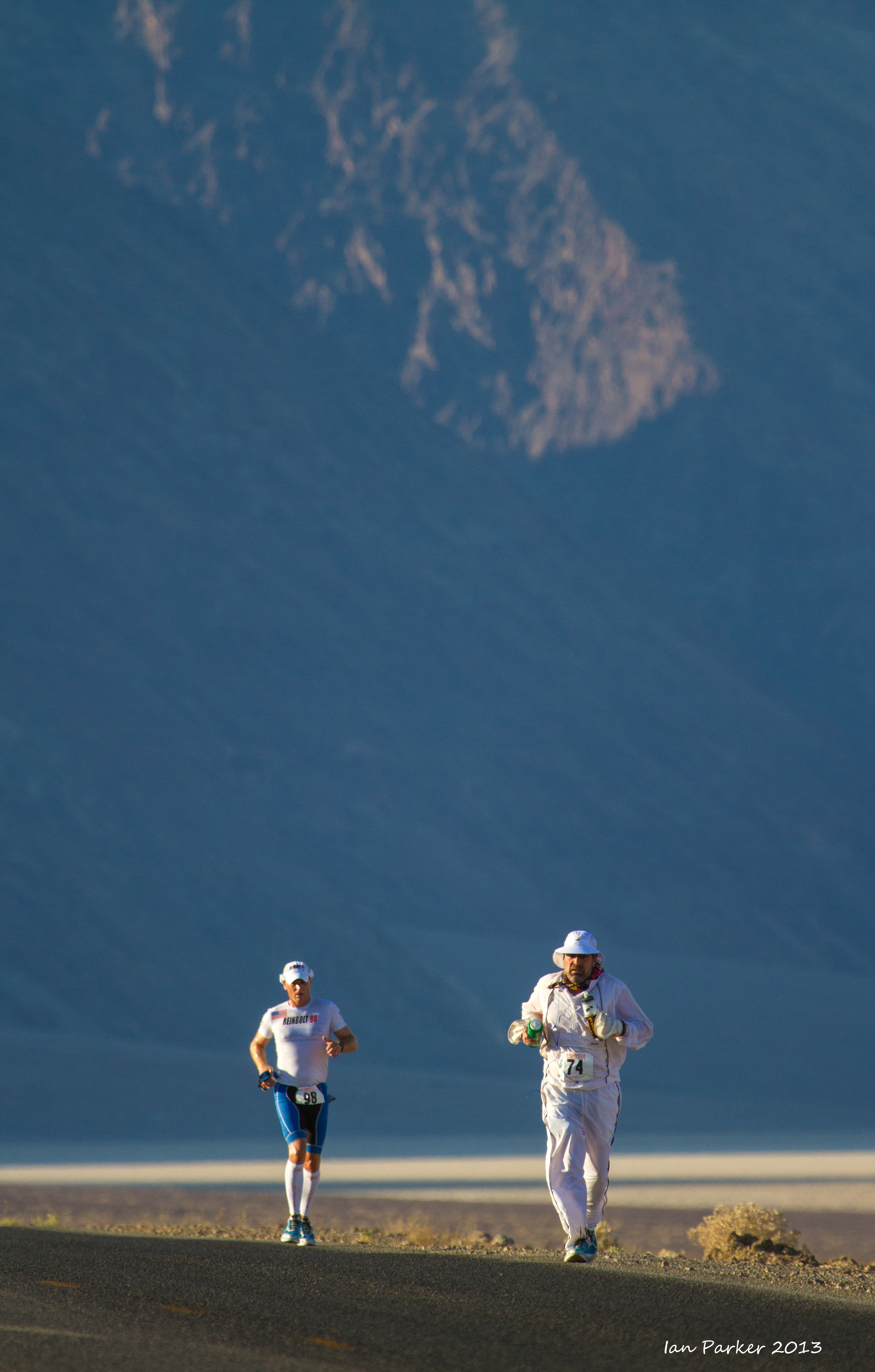
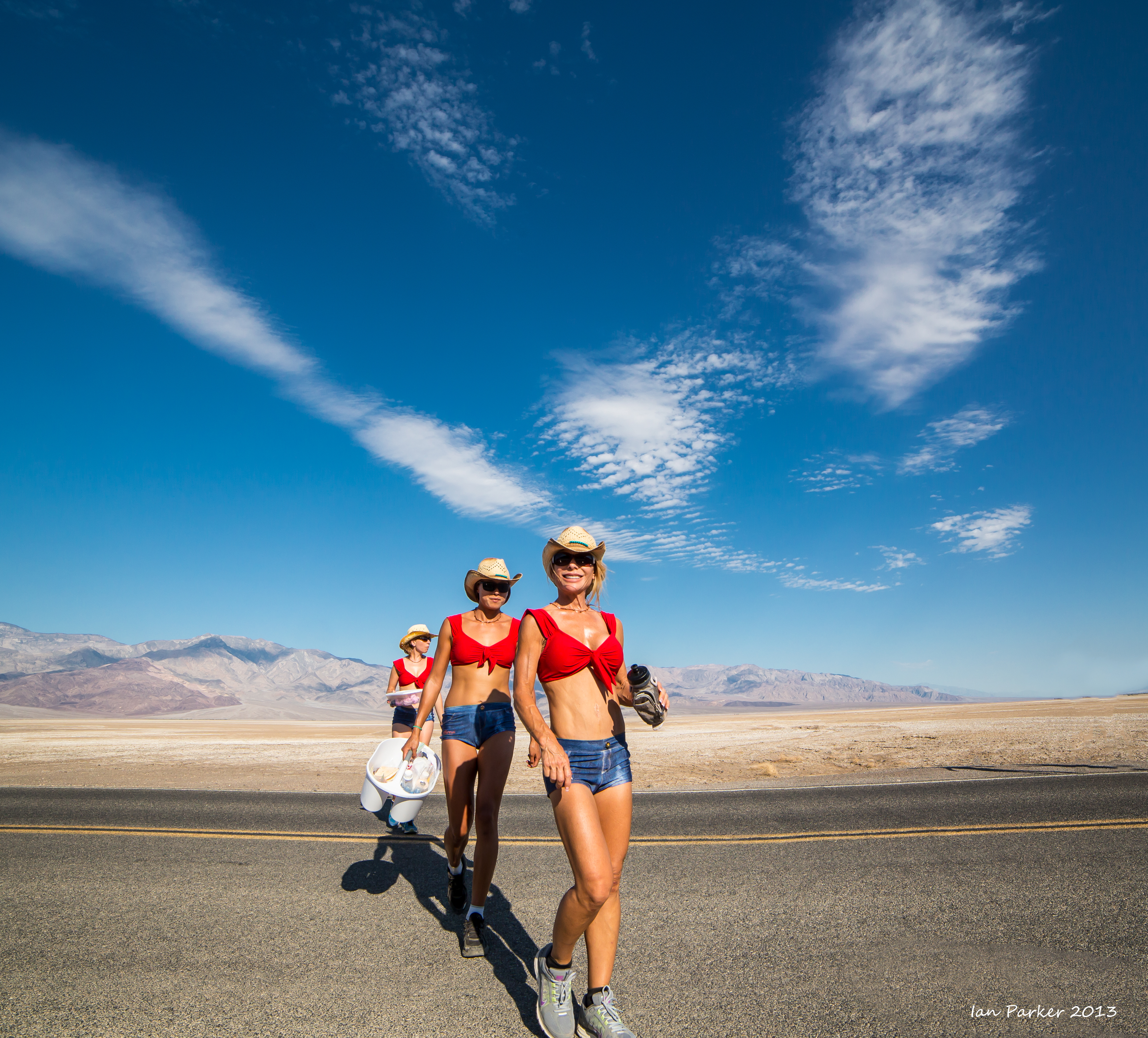
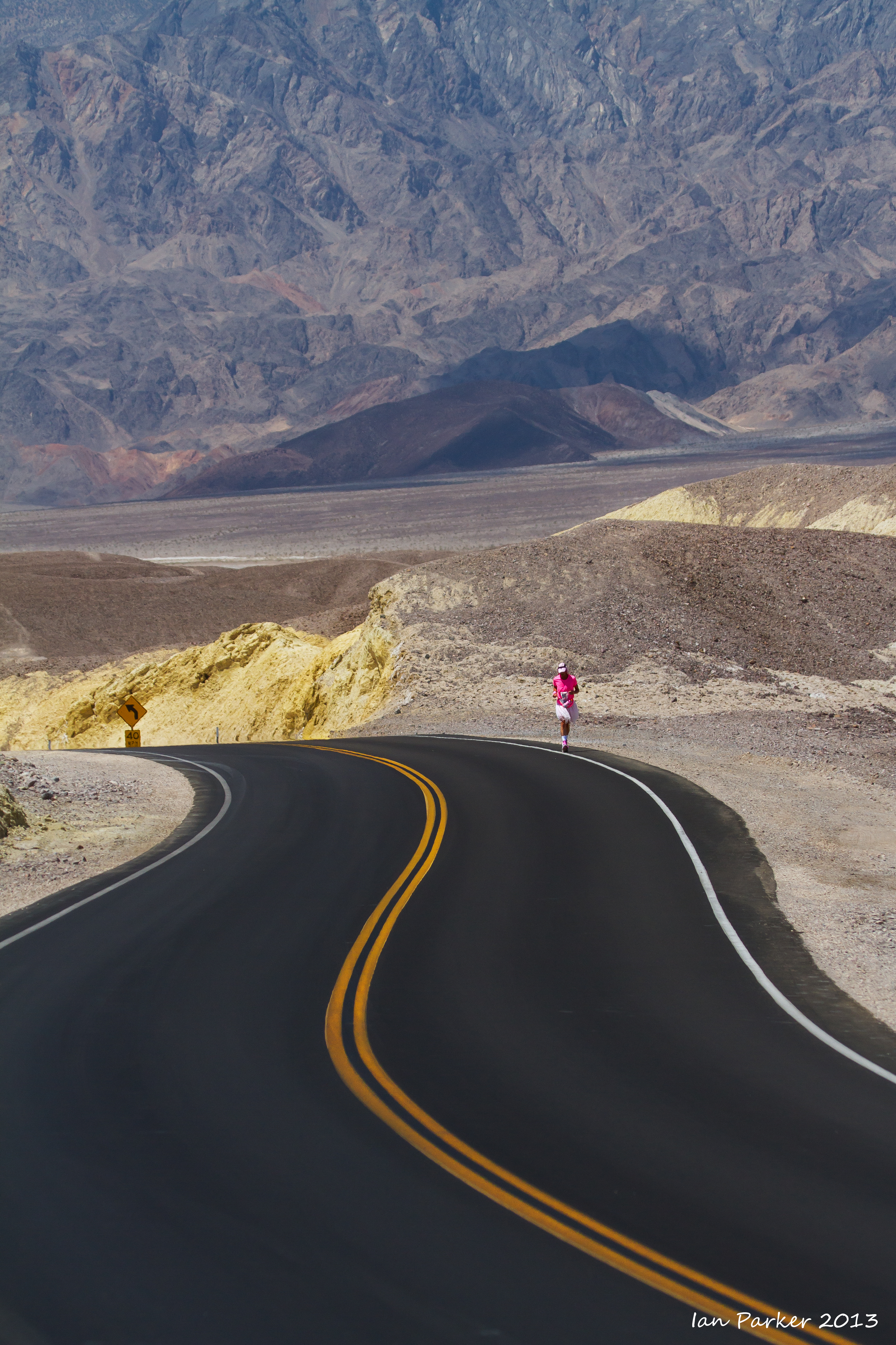
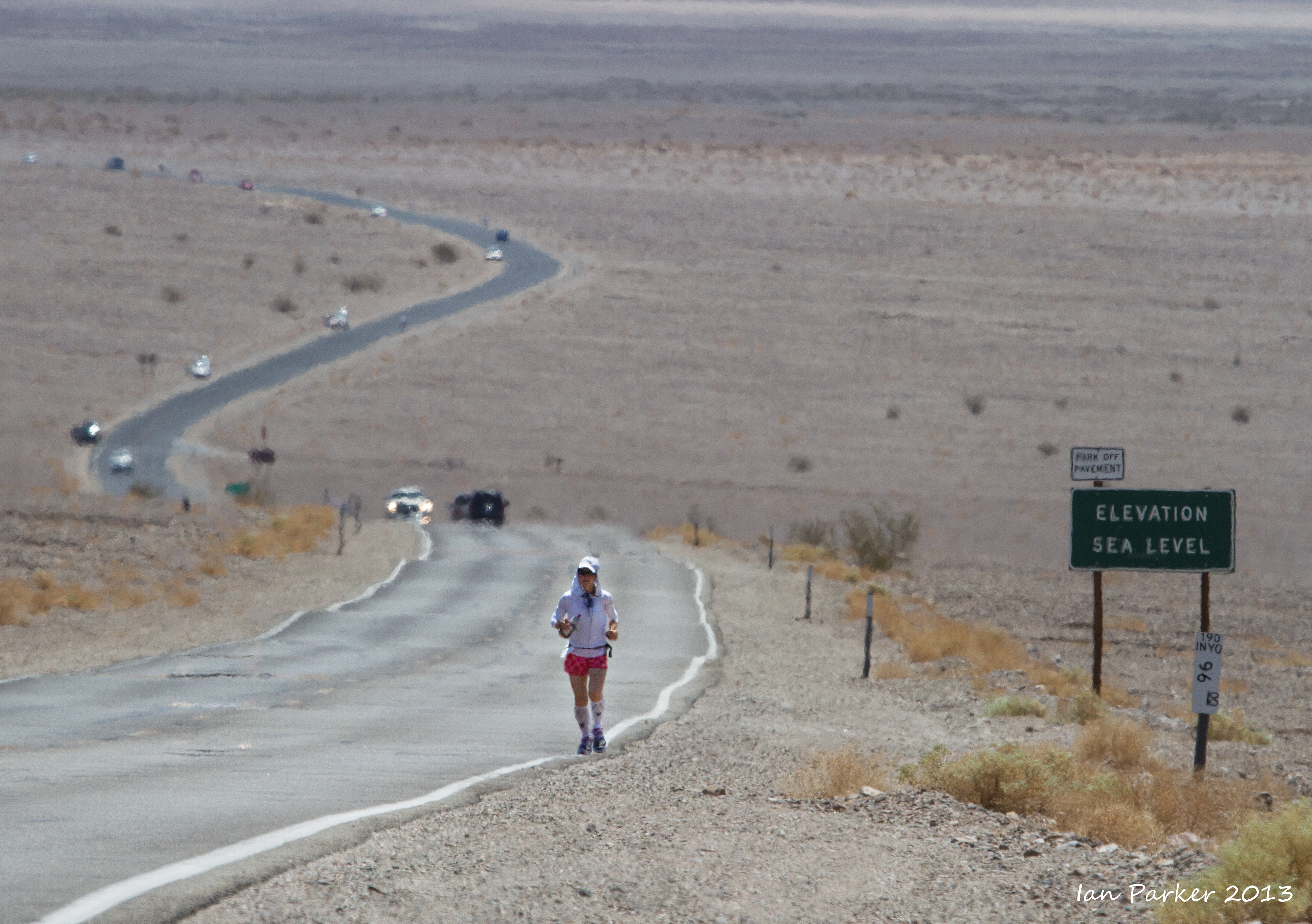
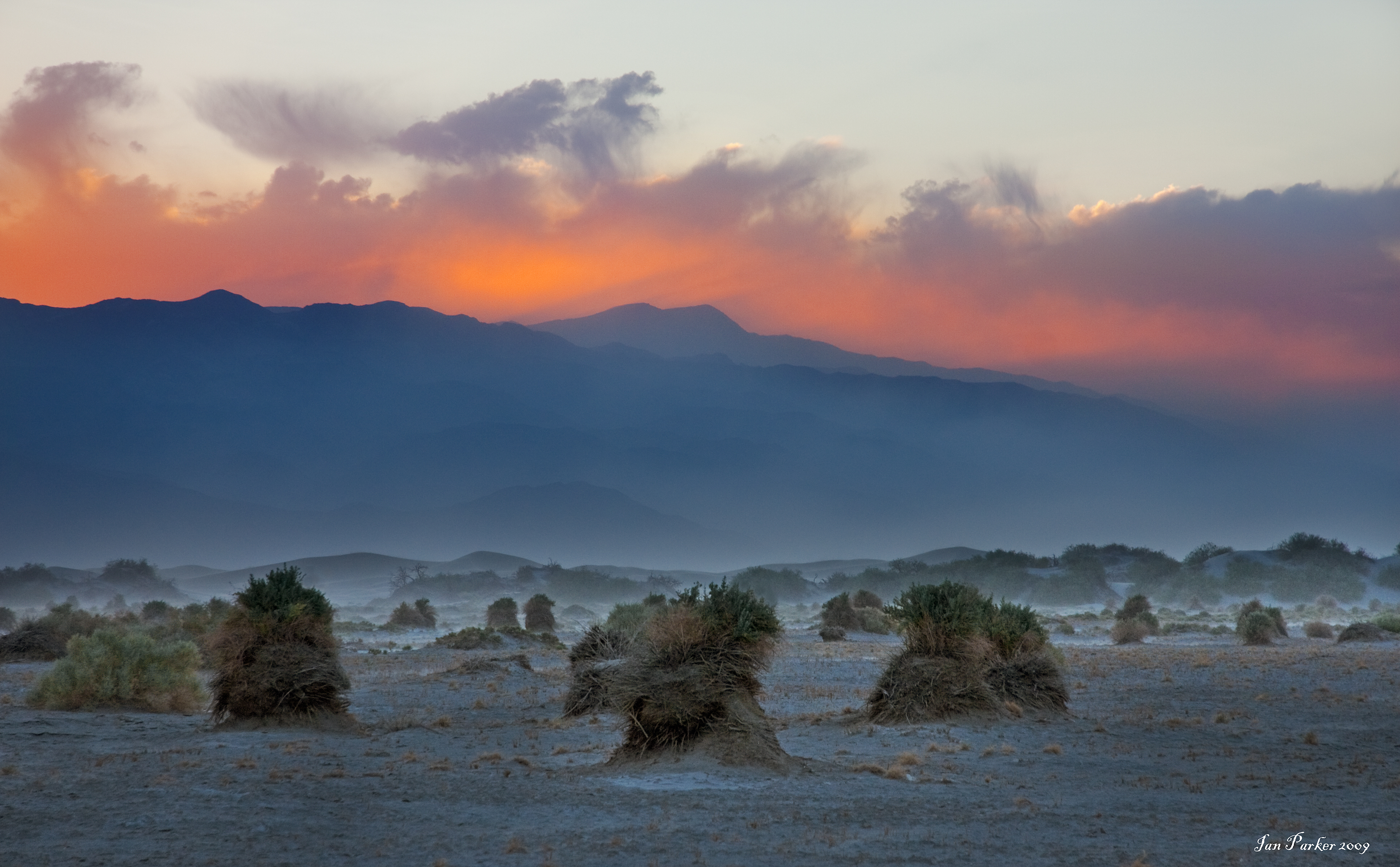
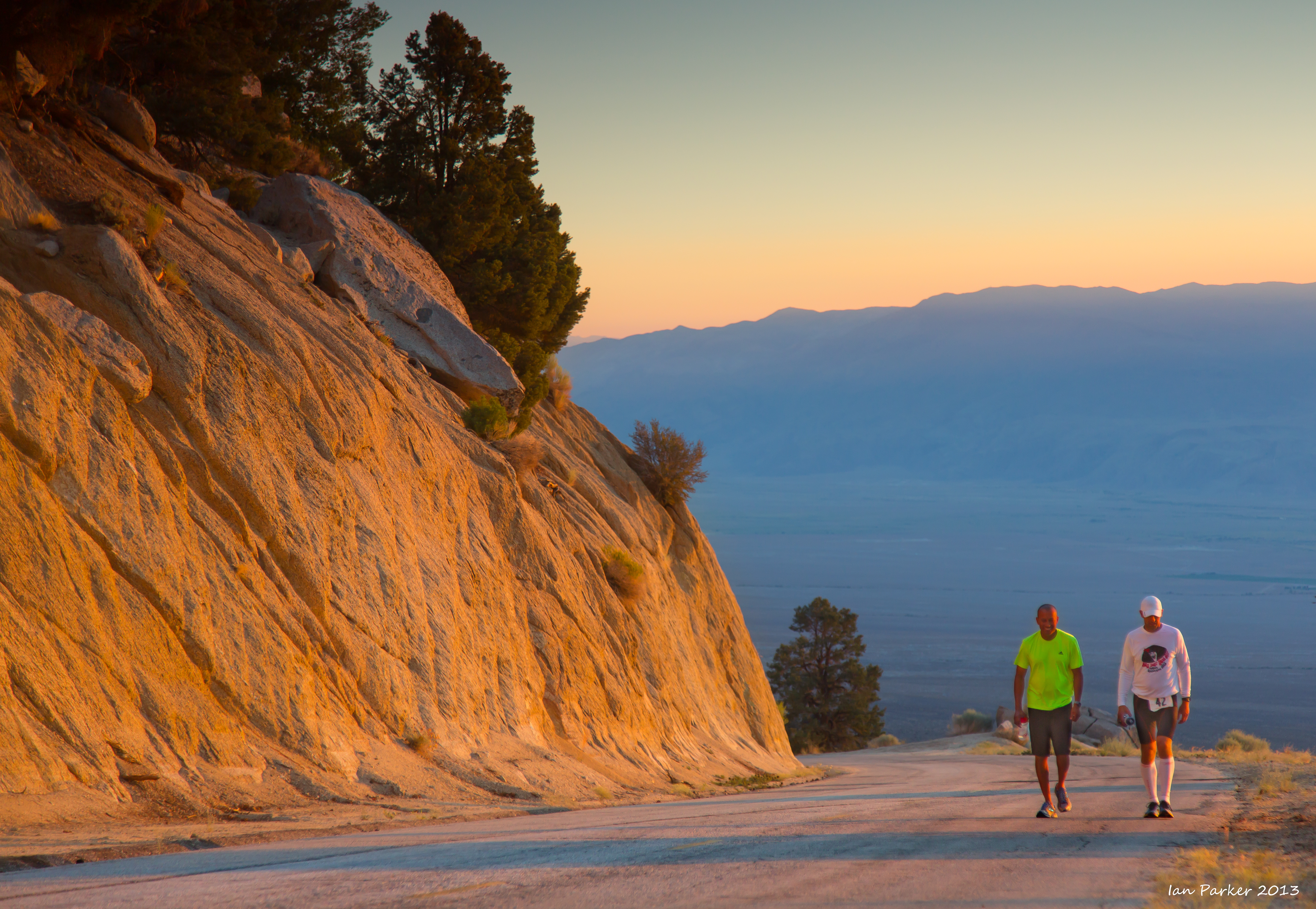
Photographs taken during the running of the Badwater 135 Ultramarathon - a gruelling treck of 135 miles from the bottom of Death Valley to Mt. Whitney portal that is reckoned to be "the World's toughest footrace". Runners this year had to contend with temperatures up to 124F, together with strong, gusting winds and sandstorms. I had completed this race nine times over previous years, and it was a strange experience to be back again, but on the other side of the road with camera gear.
July 21, 2013
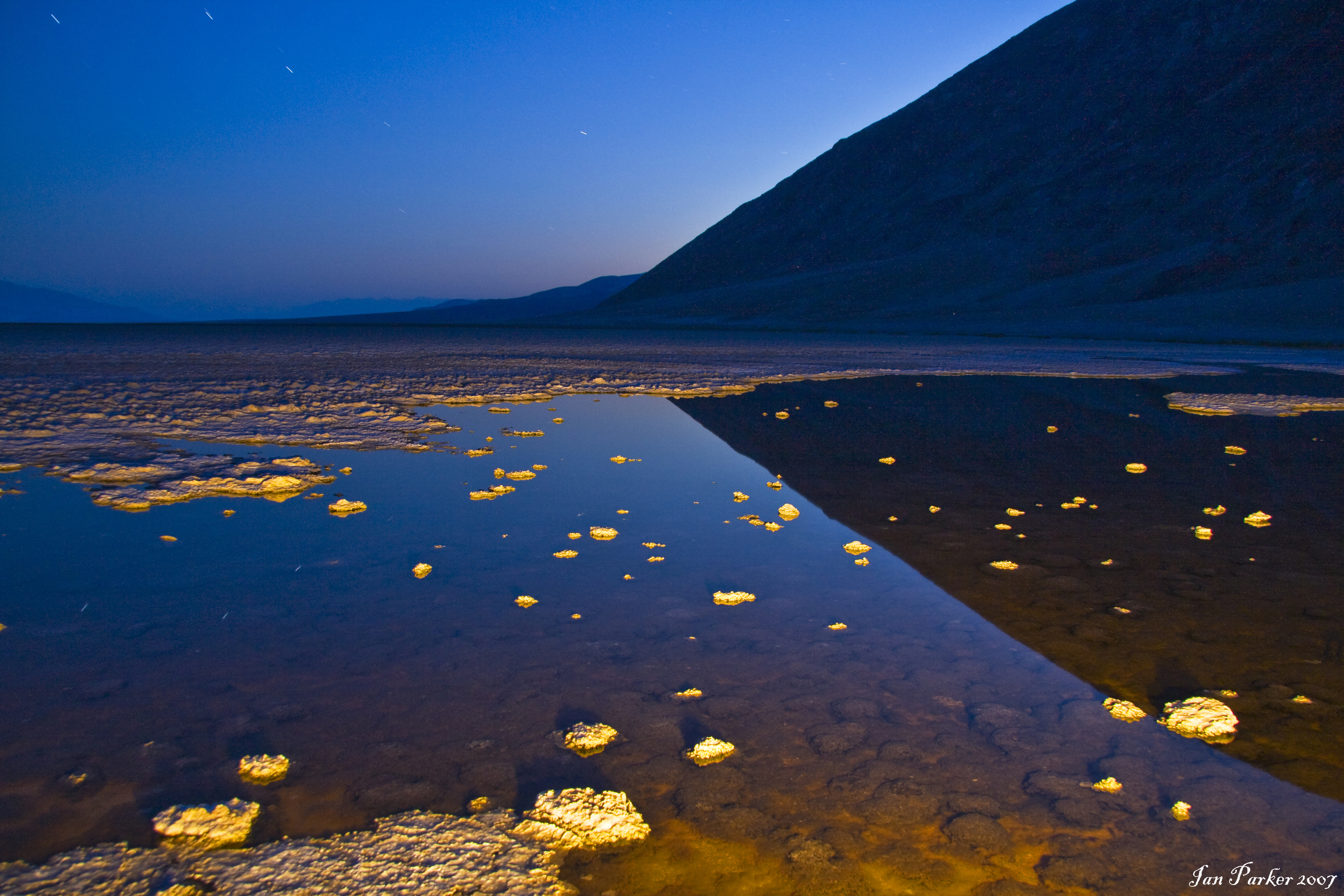
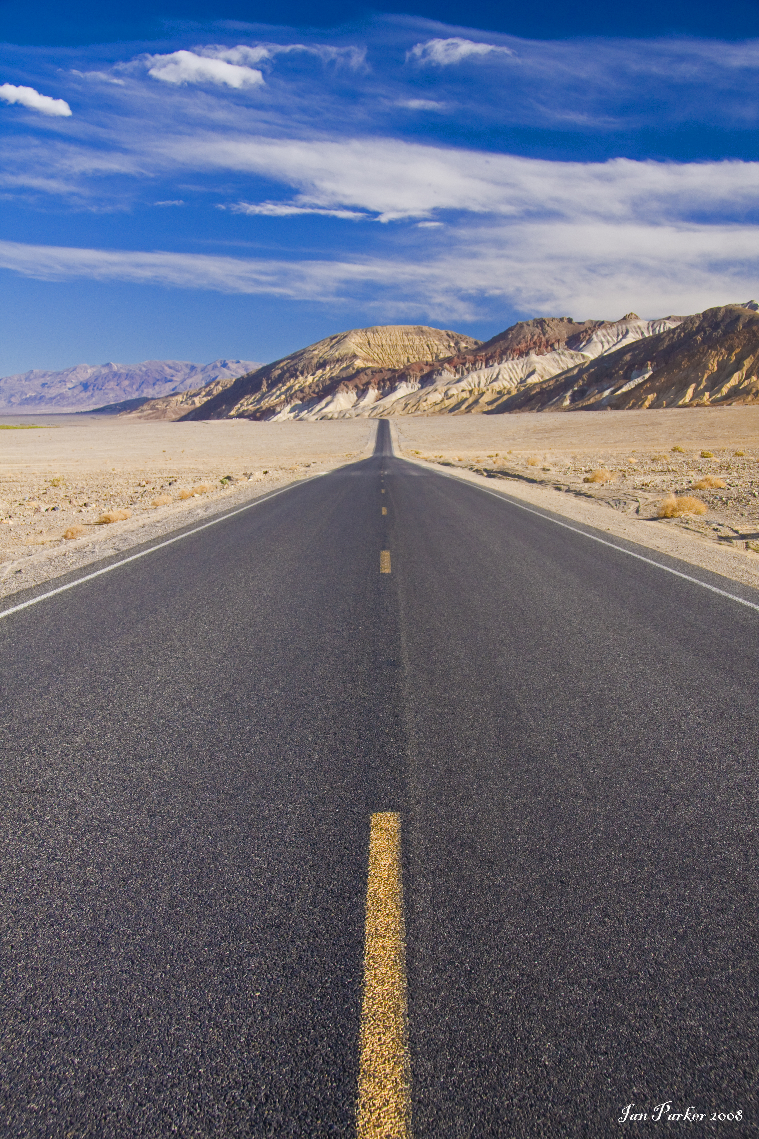
Some images captured on the way to and from Death Valley, to photograph the Badwater Ultramarathon.

Trona Pinnacles Panorama |
July 06, 2013
Returned from European travels; first a week in Tuscany attending a Gordon research Conference on Calcium Signaling, and then a week in the Lofoten Islands in Arctic Norway.
Lofoten Islands
Reine panorama with golden light on mountain tops: Lofoten Islands, Arctic Norway
Tuscany
The conference was based at the Il Ciocco resort, situated high on a hill overlooking the Serchio valley in Garafagnana, and close to the mediaevial town of Barga. Most of these photos were taken on early morning excursions, soon after dawn when the light was good and the streets cool and deserted.
Jun 06, 2013
Photos from an extended Memorial day weekend trip up highway 395 through Owens Valley.
I spent my last night camped by the Sky Rock petroglyph in the volcanic tablelands north of Bishop. Please do not ask me for the location of this site. It seems best to try to keep it a 'secret', particularly since the theft and vandalism of petroglyphs in the same general area. See HERE for a long forum discussion on the issue of publicising the location of sensitive and vulnerable sites.
A nice 4WD drive up Silver Canyon to Patriarch Grove in the Ancient Bristlecone Pine Forest for a cold night at 11,500 ft elevation.
Photography at Mono Lake is a dawn and dusk affair - which leaves the problem of what to do during the day. The ghost town at Bodie is an interesting daytime subject, but it is quite a long drive, overrun with visitors, and a little too 'sanitized' for my liking. I was thus happy to 'discover' another nearby location for photographing industrial archeology: the Log Cabin mine and mill. The site is located up a dirt road just a few miles (but several thousand feet of elevation) from the bottom of the Tioga Pass road. The Log Cabin Mine was once the largest gold-producing mine in, California. It was state-of-the-art and could both extract and process the gold from the quartz ore far beneath the surface. It opened in 1910, and over the next 30 years became famous for the amount of gold it produced and for the harsh winters the miners endured. The mine was closed by Presidential order at the beginning of WW2, remained mothballed for the next 20 years in hopes of a rise in gold prices that would again make operation profitable, and finally closed permanently in 1956. Now, all that remains of the once bountiful mine are decaying buildings, equipment ravaged by time and vandals, and memories. |
Getting good images of Mono Lake depends critically on the lighting. Driving up 395 I was thus much encouraged as a classical 'Sierra wave' cloud began to build over Owens valley. The sequence of photos below were taken from late afternoon until after sunset, and feature the South Tufa formations under the lenticular cloud formations as the lighting became ever more colorful.
May 13, 2013
Testing the new firmware update for my Canon 5D Mkiii allowing auotofocus with f8 aperture after adding a teleconvertor to a telephoto lens. Photos were taken with the Canon 100-400L zoom and 1.4x convertor. They are ~5 Mpixel crops from full frame. Image quality looks quite good. The main problem I found was that the area covered by the center focus point is small, making it difficult to track birds in flight. Indeed, the only good shots I captured were of a stationary heron.
April 28, 2013
A visit to the Saline Valley Salt Tram
April 21, 2013
Courting terns at Bolsa Chica
April 12, 2013
Photos from a visit to southern Utah and northern Arizona over spring break.
Around Hanksville
White Pocket, Vermillion Cliffs National Monument.
Pink and magenta swirls and stripes under even lighting before sunrise and after sunset.
Grand Staircase/Escalante National Monument
Trees
Spring had not yet arrived in Utah at the time of my visit. The cottonwoods were bare, and there was yet no bloom in the orchards at Fruita. Instead, the bare branches made for nice compositions against the redrock canyon walls, especially when caught by backlighting or reflected light.
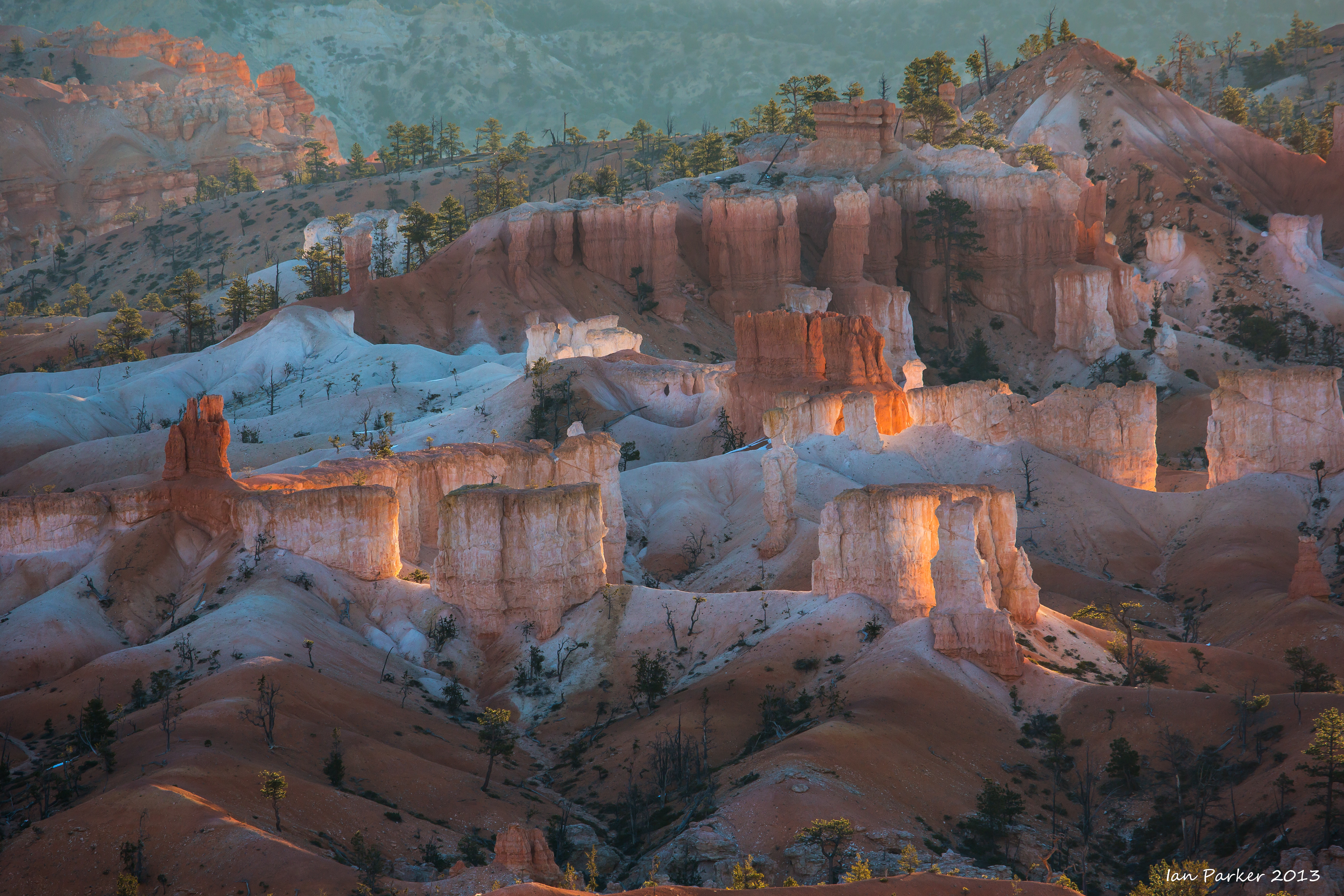
Bryce Canyon
Bryce must be one of the World's most photographed locations, so it is difficult to come up with anything new. But, it is a beautiful place, and a convenient overnight stop on my travels to and from Utah. I enjoy using a long telephoto lens to abstract detailsn of distant formations as they first catch the sunrise light. Haze in the air (and dust inside my 'pumper' zoom lens!) strongly reduces the contrast, but that can be rectified in post-processing.
Yant Flat - a 'newly discovered' area near St. George Utah. Surprisingly remote considering its proximity to the city, and containing acres of 'candy-striped' sandstone equalling better known locations such as White Pocket.
13th March 2013.
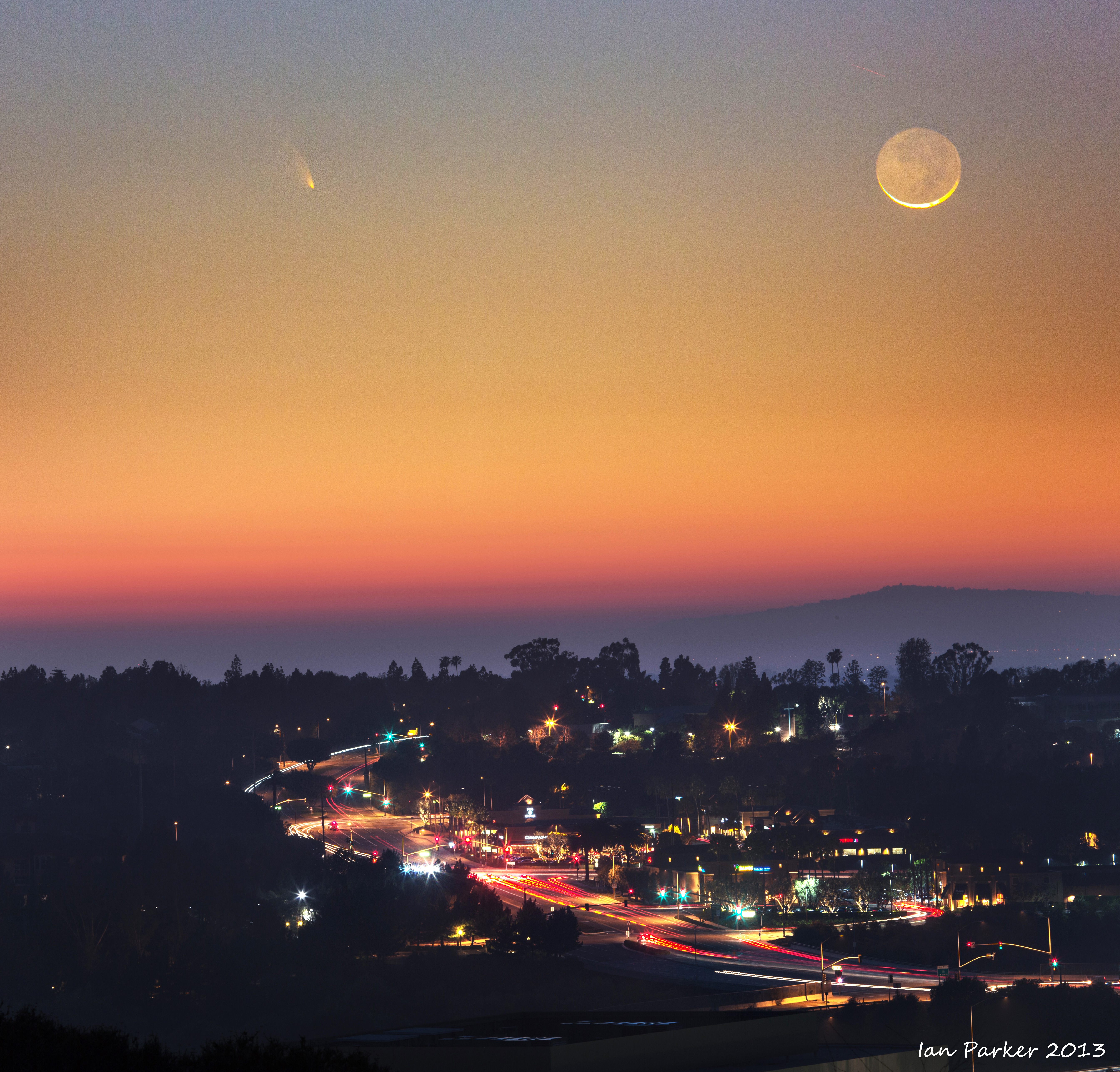
Comet PanSTARRS above Newport Beach, photographed from the top of Newport Coast road.

12th March 2013. Comet PanSTARRS and crescent moon, photographed from the hill at the top of the UCI campus.

February 20th, 2013
A weekend trip to Yosemite, timed to catch the Horsetail Fall 'firefall'. Somewhat disappointing this year. The light cooperated well, with thin overcast clouds clearing an hour before sunset. But, there was very little water in the fall, and my photos ended up as more red wet rock than waterfall. Also, the crowds were more dense than in earlier years. The Park service had designated the left lanes of the one-way North and South drives for 'special event' parking, and there were tight clusters of people and tripods crammed into the few spaces that provided a clear view of the fall between the trees. Apart from Horsetail, I had most success in photographing reflections in the still waters of the Merced river, capturing the transition between light and dark as the shodoes of the cliffs moved across the valley. Grand landscapes of the Valley's iconic features really need some spectacular clouds, mist or recent snowfall to create anything interesting, whereas the weather was much too boringly nice that weekend.
January 27th, 2013
Images from a drive up PCH to Big Sur
over the MLK weekend.

Twilight reflections in wet sand; Pfeiffer Beach, Big Sur, California
|
|
|
First photos taken in 2013
Birds in the San Joaquin Wildlife Preserve
6th Jan, 2013
A camping trip with the family and three dogs through Owens, Eureka and Saline Valleys. Photos were taken during the last few days of 2012, but I am including amongthose for 2013 as the images were not processed until the new year.
last updated 01/09/2014
|


.jpg)


.jpg)